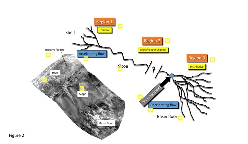
An Overview of Deep-water Turbidite Deposition
Henry W. Posamentier, Venkatarathnam Kolla, LIU HuaQing
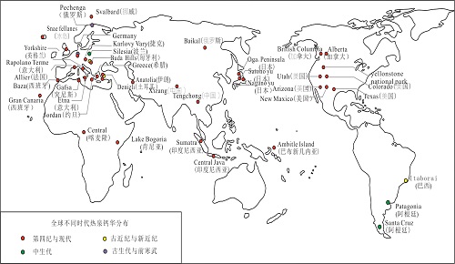
Advances and Prospects of Terrestrial Thermal Spring Travertine Research
WEN HuaGuo, LUO LianChao, LUO XiaoTong, YOU YaXian, DU Lei
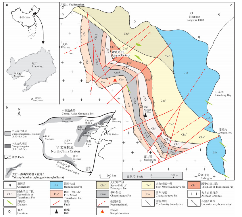
Microbially Induced Sedimentary Structures (MISS) in Mesoproterozoic Changzhougou Formation Sandstone, Xingcheng Area, Liaoning Province, China
XiaoBo LI, YiNi WANG, Han WANG
Unconventional Petroleum Sedimentology: Connotation and prospect
QIU Zhen, ZOU CaiNeng
Sedimentary Characteristics of Ephemeral and Intermittent Channels: A case study of the Baiyanghe fan, Xinjiang, China
ChangMin ZHANG, XuLong WANG, Zhe CHEN, Tao WU, XiangHui ZHANG, Kang ZHAO, YuanGuang HUANG, Tan ZHANG, WenJie FENG, Rui YUAN
Abstract:[Objective] The Upper Permian Changhsing Formation in the Mianyang–Guang'an Trough, Sichuan Basin, is characterized by deeply buried limestone reservoirs. Clarifying the depositional and diagenetic evolution processes can provide new geological insights for deep carbonate exploration in the Sichuan Basin. [Methods] Based on core and drilling data, petrological and geochemical investigations were conducted on the reef- and shoal-bearing limestone reservoirs within Member 2 of the Changhsing Formation in the Mianyang–Guang'an Trough. [Results] Reservoirs in the study area are developed in the 2nd Member of the Changhsing Formation. The lithofacies, including sponge framestone, sponge dolomitic framesone, sponge doloframestone, foraminifer/crinoid bioclastic grainstone, packstone and wackestone, indicate sedimentary environments of reef, bioclast shoal, and inter-shoal settings. Fabric-selective dissolution along fusulinid foraminifer shells is the dominant mechanism for porosity formation, which occurred under meteoric leaching conditions associated with short-term subaerial exposure. In terms of δ13C compositions, calcites from various lithofacies show values consistent with coeval seawater, reflecting formation in an early seawater-dominated diagenetic environment. In contrast, the relationships between δ18O values in calcite and dolomite contents, and between stratigraphic distribution of dolomite and sea-level variations, suggest penecontemporaneous dolomitization, which occurred under intensified evaporative conditions during sea-level lowstands. These limestone reservoirs evolved into relatively closed diagenetic systems during the Induan. Based on the integration of sedimentary and diagenetic processes, three sedimentary-diagenetic facies associations (FA1, FA2, and FA3) can be identified, with FA2 being the best limestone reservoir type. [Conclusions] The formation of effective limestone reservoirs with a deeply burial depth can be attributed to the interplay between deposition and penecontemporaneous diagenesis, which are controlled by sea-level fluctuations. Therefore, “sedimentary-diagenetic facies associations” are of importance with aspects of finding deeply buried limestone reservoirs.
[Objective] Girvanella, a cyanobacterial fossil commonly found in Cambrian carbonates, plays a crucial role in the formation of many microbialites. Despite considerable advancements in elucidating calcifying Girvanella and its biomineralization mechanisms, the understanding of iron-mineralized Girvanella and its iron-mineralization mechanism is still relatively vague. [Methods]This paper explores the structural characteristics of Girvanella and its iron mineralization in ferruginous microbialites from the Mantou Formation Member Ⅲ (Cambrian Miaolingian Series) of Weihui area, northern Henan through an integrated analysis of sedimentology, mineralogy and geochemistry. [Results]The results indicate that the lamina or clots of ferruginous microbialites in study area are dominated by densely distributed Girvanella. The tube core of Girvanella is primarily composed of crystalline calcite crystals, whereas the tube wall of Girvanella is composed of a large number of sheet-like hematite crystals with diameter of 0.1-0.5 μm and random distribution. [Conclusions]Through CO2-concentrating mechanism, Girvanella generates a large number of anions in its surroundings,which adsorb Fe3? cations along with Al、Ca 、Mg and Si, facilitating nucleation on Girvanella EPS, leading to the formation of cryptocrystalline hematites. This kind of microbially induced hematite is significantly much complex in mineral morphology and elemental composition than chemically precipitated hematite. The co-occurrence of cryptocrystalline hematite minerals formed by the iron mineralization of Girvanella and idiomorphic chamosite crystals formed by chemical precipitation within ferruginous microbialites indicate that there are fluctuating changes in the redox gradient and iron mineral phase, as well as involving the coexistence of ferric and ferrous minerals within the cyanobacterial microbial mat(film).
[Objective]The Hechuan-Tongnan block in the central Sichuan Basin has drilled multiple high-yield wells in the second member of the Permian Maokou Formation dolostones, revealing significant exploration prospects. However, the characteristics and genesis of dolomite reservoirs remain unclear, hindering the prediction of favorable reservoir distribution. [Methods]Based on observations of cores and thin sections, combined with geochemical methods such as carbon-oxygen isotopes, rare earth elements, and carbonate U-Pb dating, a systematic study was conducted on the genesis and controlling factors of the second member of the Maokou dolomite reservoir. [Results]bioclastic-bearing micrite limestone, micrite bioclastic limestone, dolomitic limestone, and grain-bearing dolomite. Among these, grain-bearing dolomite is the primary reservoir rock type. There are three types of reservoir spaces: intergranular dissolution pores, dissolution pores, and dissolution fractures, with dissolution pores being the most developed. The formation of dolomite occurred during the quasi-syngenetic shallow burial period, with early matrix dolomite and late saddle dolomite formed at 262 ± 16 Ma and 259.1 ± 4.7 Ma, when high Mg/Ca ratio seawater infiltrated and flowed back into the porous beach sediments in the confined environment between the shoals, leading to dolomitization.[Conclusions]The reservoir is controlled by sedimentary facies, early dolomitization, and burial hydrothermal dissolution related to structural fractures. The high-energy particle beach facies in the elevated areas of paloe-morphology provide the basis for reservoir development. Dolomitization during the quasi-syngenetic shallow burial period created conditions for the preservation of early pores and their transformation during the mid-deep burial period. The hydrothermal dissolution process related to the Emei taphrogenesis leads to the heterogeneous development of dissolution pores, which is key to reservoir development.
[Objective] The sedimentary environment evolution and organic matter enrichment mechanisms of the Datangpo Formation in northeastern Guizhou lack systematic investigation. This study aims to reconstruct the paleoenvironmental evolution sequence and clarify the main controlling factors of organic matter enrichment through high-resolution geochemical analysis. [Methods] A total of 43 core samples from the Datangpo Formation in Well KZ8 in northeastern Guizhou were systematically analyzed for total organic carbon (TOC) and major and trace element geochemistry. The samples cover Member I (manganese carbonate rocks and manganese-bearing shales), Member II (black shales), and Member III (grey shales). [Results] The study reveals that Member I of the Datangpo Formation was deposited under a background of limited post-glacial climatic warming, within a moderately to strongly restricted basin. This interval is characterized by high-frequency alternations between ferruginous and sulfidic reducing conditions, accompanied by significant hydrothermal activity and intermittent marine incursions. The relatively high TOC content in the manganese carbonate sub-member was primarily controlled by high productivity driven by hydrothermal and seawater-derived nutrient inputs. In contrast, productivity in the manganese-bearing shales sub-member declined due to limited nutrient supply, yet its TOC content did not decrease significantly owing to effective preservation under sulfidic conditions. Additionally, some organic matter in Member I was consumed during manganese mineralization. Member II was deposited in a strongly restricted environment under warm climatic conditions, featuring persistent sulfidic reduction and high terrigenous input. The efficient coupling between productivity sustained by enhanced terrigenous nutrients and superior preservation conditions within the strongly restricted sulfidic water column led to peak TOC content. Member III, however, exhibits very low TOC content due to collapsed productivity and completely oxic water conditions. [Conclusion] This study clarifies the pattern of organic matter enrichment mechanisms co-controlled by “productivity-preservation conditions” and their evolution alongside environmental changes in the study area, providing direct insights for regional shale gas exploration. These findings are based on data from a single well; thus, their regional representativeness requires further verification through additional drilling. Moreover, the quantitative contributions of various environmental factors to TOC have not been precisely determined. Future work should focus on establishing a more universal enrichment model.
Fine-grained sedimentation differs fundamentally from conventional coarse-grained sedimentation in terms of its dynamic mechanisms. It is therefore necessary to move beyond qualitative descriptions and establish quantitative dynamic models specifically for fine-grained materials. Based on the authors’ simulation results, this paper systematically reviews process modelling of fine-grained sediment across three hierarchical levels: (1) The grain scale represented by the floc mean-size model. The Winterwerp flocculation dynamics equation and the influence of fractal dimension are elucidated, revealing the evolution of floc size under the equilibrium of collision–flocculation–breakup processes; (2) The depositional-body scale, represented by Delft3D. Cohesive and noncohesive sediments are differentiated explicitly. It employs the Partheniades–Krone erosion–deposition formulation and salinity-controlled settling velocity, and effectively reproduces the impact of flocculation on deltaic depositional patterns; and (3) The basin scale, represented by Dionisos (Diffusion), Badlands (Stream Power), and Lecode (Marker-in-Cell). They are evaluated in terms of their applicability to fine-grained sediment simulation, parameterization strategies distinguishing fine- and coarse-grained sediments, and their ability to reproduce spatial patterns of various fine-grained depositional processes such as suspended settling, turbidity currents, debris flows, hillslope processes, and fluvial transport. This study deepens the understanding of the intrinsic dynamics of fine-grained sedimentation and provides perspectives for improving the adaptability of numerical models in fine-grained sediment research.
Abstract: [Objective] Glycerol dialkyl glycerol tetraethers (GDGTs) are chemically stable and can be preserved for long periods under natural conditions. Their composition and distribution show systematic responses to environmental conditions and have therefore been widely applied in recent years to paleoenviron-mental and paleoelevation reconstructions. The southeastern margin of the Tibetan Plateau is characterized by complex topography and highly variable climate, and the applicability of temperature and pH calibration equations developed from a single basin remains highly uncertain at the regional scale. Consequently, it is necessary to investigate the distribution patterns of branched GDGTs (brGDGTs) and their responses to temperature and pH across multiple basins in this region, to establish robust regional calibration equations that provide modern-process constraints for accurate quantitative reconstructions of regional paleotemperature and paleoelevation using sedimentary brGDGTs.[Methods] A total of 56 surface soil samples were collected from nine basins (Maqu, Gannan, Zoigê, Songpan, Nangqên, Leiwuqi, Gongjue, Mangkang, and Daocheng) on the southeastern margin of the Tibetan Plateau. brGDGTs were systematically analyzed and combined with instrumentally measured mean annual air temperature (MAAT) and mean annual precipitation (MAP) from meteorological stations, as well as measured soil pH data. Pearson correlation analysis was used to compare and evaluate published proxy indices, and stepwise regression was applied to develop regional calibration equations for temperature and pH.[Results] brGDGTs in surface soils of the study area are dominated by Ia, IIa, and IIIa, with 5-methyl brGDGTs accounting for the highest proportion. The regional MAAT calibration model established via stepwise regression shows high reconstruction accuracy within the low-temperature range (approximately ?4°C to 4°C). Among indices based on Tibetan Plateau surface soils, CBT'' exhibits the strongest correlation with measured pH.[Conclusions] The composition and distribution of surface-soil brGDGTs on the southeastern margin of the Tibetan Plateau are jointly controlled by temperature and pH, and global- or regional-scale calibration equations cannot be directly applied to this environment. The newly developed regional temperature and pH calibration equations show better applicability in high-altitude, cold environments. These results provide critical scientific constraints for developing and applying sedimentary brGDGTs to quantitatively reconstruct the evolutionary history of paleotemperature and paleoelevation on the Tibetan Plateau.
In order to deeply study the development process and sedimentary model of the distal shallow-water braided river delta, based on the modern sedimentary hydrodynamic conditions, the initial model and boundary conditions of the hydrodynamic depositional numerical simulation were designed. The sedimentary process of the distal shallow-water braided river delta was numerically simulated. The characteristics of the sedimentary thickness and flow velocity were analyzed. The results of the hydrodynamic depositional numerical simulation and the modern sedimentary examples were compared and analyzed. The controlling effect of distributary channels of different levels on the proliferation of shallow-water braided river delta. The sedimentary model based on the classification of distributary channel were summarized. The results show that: 1) in a complete flood-interflood
Abstract:[Objective]The northern foothills of the Qinling Mountains lie in the transitional zone between China's northern and southern geomorphological units, serving as a critical link between the Loess Plateau and the Qinling orogenic belt. Conducting research on magnetic characteristics of river sediments in this region holds significant scientific value and theoretical implications for understanding regional environmental evolution processes, sedimentary response mechanisms, and exploring basin-wide environmental change patterns. [Methods]This study focused on the floodplain sediment profile of the lower Ba Wang River in the northern Qinling foothills. Through systematic environmental magnetism analysis combined with principal component analysis (PCA), we investigated magnetic characteristics and dominant mechanisms across different sedimentary stages. [Results]The sedimentary profile exhibited distinct differentiation at the 124cm depth marker, with generally weak magnetic properties. In the lower section of Stage I (308-124 cm), the sediments exhibit relatively weak magnetism, with magnetic minerals primarily consisting of hematite and siderite, along with minor magnetite, with magnetic particle sizes gradually coarsening into multi-domain (MD) particles. Stage Ⅱ (124-24cm) sediments showed significantly enhanced magnetism, primarily consisting of small sized pseudo-single domain (PSD) magnetite and magnetite, alongside minor hematite content. PCA results further confirmed stratification features: the cumulative contribution rate of two principal components ferromagnetic mineral content and magnetic particle size reached 89%. Variations in magnetite content within ferromagnetic minerals were the dominant factor explaining magnetic differences across sedimentary stages. [Conclusion]Stage I sediments remained submerged in a reducing environment for prolonged periods, leading to dissolution of magnetite under early diagenetic processes. Stage Ⅱ sediments, exposed to an oxidizing environment, exhibited magnetic characteristics shaped by hydrodynamic sorting and weak soil-forming processes. This study enhances our understanding of factors influencing sediment diagenesis, providing crucial reference materials for analyzing the characteristics of sedimentary environment changes and climatic environmental variations in the Wei River Basin.
[Objective] Braided river deltas are one of the most important types of hydrocarbon reservoirs. Extensive studies have been conducted on their depositional processes, evolutionary characteristics, and controlling factors. However, how key boundary conditions quantitatively control the growth, evolution, and genetic sandbody characteristics of lacustrine braided river deltas still requires further investigation.[Methods] UThe Delft3D sedimentary numerical simulation software was employed to design a series of single-factor comparative experiments involving five key boundary conditions, including lake-inflow discharge, basin slope, total sediment concentration, sand–mud ratio, and lake-level variation. By quantitatively extracting relevant indicators, the differences in depositional characteristics under different parameter settings were systematically analyzed. [Results](1) Lake-inflow discharge shows a significant positive correlation with delta area and sandbody scale. As discharge increases, distributary bifurcation becomes more active, the number of distributary mouth bars increases, and chute channels on bar tops become more developed.(2) Basin slope mainly controls the lateral and vertical distribution of sediments. With increasing slope, the delta changes from a broad and gentle morphology to a narrow and thick one, lateral bifurcation is suppressed, and distributary mouth bars become fewer but thicker.(3) An increase in total sediment concentration accelerates the rapid progradation of the delta front during the middle to late stages of simulated evolution. However, under higher concentration conditions, accelerated frontal deposition tends to promote channel siltation and abandonment, thereby reducing both the frequency and number of channel bifurcations.(4) A lower sand–mud ratio promotes the distal transport of fine-grained sediments, resulting in greater elongation in the source-to-sink direction and a more divergent channel pattern.(5) Lake-level fall triggers rapid progradation, forming depositional bodies with larger areal extent, deeper channel incision, and better-developed chute channels, whereas lake-level rise leads to enhanced vertical aggradation and planar shrinkage. [Conclusions] Strong hydrodynamic conditions and lake-level fall are favorable for the development of dominant sandbodies interconnected by chute channels. Steeper slopes and higher sediment-concentration settings tend to form thicker sandbodies with better extension in the sourceward direction. These experimental results provide a theoretical basis for reservoir prediction of braided river deltas in continental basins.
Abstract: [Objective] Tight gas sandstone within the Shanxi Formation is a significant gas-producing zone in the northern Ordos Basin. However, the variations in the vertical stacking patterns and lateral distribution of sandbodies across different intervals of the Shanxi Formation pose challenges for development well placement and gas production area selection. [Methods] This study establishes a three-dimensional digital outcrop model of the Shanxi Formation through measured stratigraphic sections and drone oblique photography modeling. Based on lithofacies classification and hierarchical bounding surface identification, sandbody architecture analysis was conducted. [Results]The results demonstrate that:①The Shanxi Formation represents a delta plain depositional environment, where sandbodies primarily correspond to the braided distributary channel microfacies. Under warm and humid climatic conditions, well-developed vegetation restricted crevasse formation, with overbank flooding (splay deposition) being the dominant process instead.②Four main types of sandbody architecture are identified: longitudinal bar, transverse bar, incised channel, and laminated sandstone.③The vertical succession of sandbody architectures within the Shanxi Formation, from base to top, is characterized by: composite longitudinal bars and laminated sandstones in the lower part, transverse bars in the middle part, and incised channels in the upper part. [Conclusions]The systematic variation in fluvial channel sandbody architecture within the study area records the gradual closure of the northern Solon Ocean and coeval tectonic uplift in the Ordos Basin's north. This uplift drove the evolution of distributary channels from an initial wide and shallow form, through a wide and deep intermediate stage, to a final narrow and deep, incised morphology. Our study elucidates the response mechanism linking channel evolution, architectural differentiation, and reservoir heterogeneity under coupled tectonic-climatic controls, offering a novel perspective for research on the Shanxi Formation reservoirs in the northeastern Ordos Basin.
[Significance] Foamy dolostone is widely distributed in China’s two major oil and gas basins and is closely associated with microbialites. It represents one of the key reservoir rock types and holds significant importance for sedimentological research and carbonate hydrocarbon exploration. [Progress] Previous studies on foamy dolostone have mainly focused on its petrographic and mineralogical characteristics. However, its formation mechanisms and controlling factors remain insufficiently understood and lack systematic investigation. Based on an extensive review of domestic and international literature, combined with the research team’s previous findings, this study systematically summarizes the developmental characteristics and lithological assemblages of foamy dolostone. Comparative analyses of geochemical and reservoir properties from different stratigraphic units in two regions were conducted to elucidate their genetic mechanisms. [Prospects] On this basis, the study identifies existing scientific challenges and outlines future research directions for foamy dolostone. These insights provide new perspectives for advancing the understanding of ancient marine environments and offer theoretical guidance for hydrocarbon exploration in carbonate reservoirs.
[Objectives] The End-Triassic Mass Extinction (~201.5 Ma) is one of the “Big Five” mass extinction events of the Phanerozoic and is characterized by a two-pulsed extinction pattern in marine ecosystems. While widespread volcanism associated with the Central Atlantic Magmatic Province (CAMP) and subsequent massive carbon emissions are widely regarded as the principal driving mechanism, the precise spatiotemporal relationship between specific CAMP magmatic phases and the two discrete extinction pulses remains a subject of intense debate. This study aims to clarify whether these pulses were driven by immediate volcanic toxicity or delayed environmental feedbacks triggered by sustained igneous activity. [Methods] To address this, we present high-resolution sedimentary mercury (Hg) records from Dove’s Nest drilling cores, located in the Cleveland Basin (UK). Mercury is utilized here as a sensitive proxy for large-scale volcanic outgassing. To move beyond qualitative descriptions, we employed a coupled mercury?carbon emission model to quantitatively evaluate the degassing processes and the scale of CAMP activity. Furthermore, we utilized potassium/aluminum (K/Al) ratios as a robust proxy for continental weathering intensity. By integrating these geochemical datasets with previous high-resolution biostratigraphy and paleontological records, we investigated the dynamic coupling between volcanic pulses, continental weathering rates, and the staged collapses of marine biodiversity. [Results] Our analysis identifies two distinct phases of Hg enrichment within the Dove’s Nest drilling core. The first enrichment phase occurs at the base of the Cotham Member in the Rhaetian; however, its occurrence is restricted to specific local profiles, suggesting it represents a regional signal rather than a global volcanic event. In contrast, the second Hg enrichment phase spans from the top of the Cotham Member to the Langport Member. This latter phase is characterized by a significant, sustained increase in Hg concentrations that coincides precisely with the first marine extinction pulse and slightly predates the onset of the second pulse. Crucially, this second Hg anomaly is globally correlative, appearing in both marine and terrestrial sections across different paleolatitudes, which confirms its origin from large-scale CAMP activity. [Conclusions] The widespread distribution of sedimentary Hg enrichment across global marine and terrestrial profiles during the late Rhaetian provides strong evidence for massive, episodic CAMP activity. We propose a staggered casual mechanism for the ETME: the initial phase of volcanism triggered the first extinction pulse through direct, short-term mechanisms. These likely included rapid sea-surface temperature spikes and the fallout of toxic substances (e.g., Hg and SO?), leading to an immediate decline in regional and global biodiversity. Subsequently, the sustained and cumulative release of CO? drove prolonged global warming and a significant intensification of the hydrological cycle, as evidenced by elevated K/Al ratios. This intensified continental weathering accelerated the flux of terrestrial nutrients (such as phosphorus) into the oceans, fueling primary productivity and causing the expansion and intensification of marine anoxia, indirectly triggering the second extinction pulse. This study highlights the staged nature of environmental collapse and biological extinction driven by large igneous provinces in deep time, providing an important deep-time analogue for understanding the complex responses of marine ecosystems to ongoing global warming.
Abstract:[Objective] The primary controls on high-quality deep clastic reservoirs in the Huangliu Formation (Ledong area, Yinggehai Basin) remain poorly constrained, limiting deep gas exploration. [Methods] We integrate core description, blue-epoxy petrography, SEM, cathodoluminescence, fluid-inclusion homogenization temperatures, PVTx- and equation-based paleo-pressure reconstructions, and compaction simulation to characterize lithology, diagenesis, pore systems, and formation pressure, and to establish a genetic model. [Results and Discussions] Reservoirs are dominated by feldspathic quartz sandstones. Diagenesis is marked by moderate–strong compaction, weak dissolution (local leaching of feldspar grains and bioclasts), and predominantly calcite cementation with subordinate silica. Pore systems are chiefly primary intergranular pores with minor feldspar-dissolution pores. Lithofacies set the baseline porosity and compaction resistance, whereas diagenesis drives petrophysical differentiation: compaction and cementation govern tightness, while dissolution mainly modulates pore type and connectivity with limited net porosity gain. Since ~6 Ma, medium–strong overpressure—generated by undercompaction and hydrocarbon generation and transmitted upward from ~2300 m—suppressed compaction and cementation, preserving early primary porosity. Porosity declines with burial but the rate diminishes below ~3300 m; even at >4000 m, sandstones remain primary-pore dominated, indicating substantial deep-reservoir potential. [Conclusions] We propose a “facies foundation–diagenetic differentiation–overpressure preservation” model, identifying overpressure conditions, medium- to coarse-grained lithofacies, and moderate compaction/cementation as the principal controls. These findings provide a basis for predicting high-quality deep gas reservoirs and support efficient exploration in the deep-water South China Sea. Keywords: Yinggehai Basin; Huangliu Formation; deep reservoirs; reservoir quality; lithofacies; diagenesis; overpressure
Abstract: [Significance] The genetic mechanism of river-dominated subaqueous distributary channels in lacustrine deltas has long been controversial, as traditional fluvial sediment dynamics fail to adequately explain their formation and distribution patterns. Based on recent advances in global research, this study systematically investigates the formation mechanism of subaqueous distributary channels in lacustrine deltas and explores new insights from hyperpycnal flow depositional theory regarding deltaic depositional processes and sandbody distribution patterns. [Progress] Hyperpycnal flows originate from the delta-front river mouth zone, transporting terrigenous sediments through the prodelta and shallow lake into deep-water depositional environments. While significant breakthroughs have been made in deep-water hyperpycnal flow deposition, descriptions and interpretations of hyperpycnal flow deposits in delta-shallow lake systems remain limited. The new concept of hyperpycnal deltas integrates river mouth deposition with gravity-driven processes, revealing that hyperpycnal channels serve as critical links between deltas and deep-water deposits. Modern and ancient hyperpycnal flow deposits demonstrate the development of hyperpycnal channels in delta-front to shallow lake or marine environments, suggesting that hyperpycnal flows could be the key dynamic force behind subaqueous distributary channel formation. The erosional mechanisms of these channels are closely associated with supercritical hyperpycnal flows (density Froude exceed the critical value). [Conclusions and Prospects] Subaqueous distributary channels are likely formed by episodic hyperpycnal flows rather than being mere underwater extensions of delta plain distributaries. The finding challenges classical delta theories and highlights flood-generated high-density hyperpycnal flows as a dominant geological force controlling deltaic depositional process. Revising existing models based on hyperpycnal flow dynamics provides a novel theoretical framework for studying delta-front depositional patterns. Future research should integrate quantitative sediment physical simulations with analyses of ancient delta-front deposits to advance hyperpycnal flow dynamics in deltaic systems, offering new theoretical foundations for lacustrine sedimentology.
[Objective] Europium (Eu), a redox-sensitive rare earth element (REE), serves as a proxy for paleo-ocean reconstruction. The Middle Permian Maokou Formation, Member 1 (hereafter Mao-1 Member) in the Sichuan Basin exhibits a characteristic Eu negative anomaly, yet its genesis remains unclear. [Methods] Utilizing integrated approaches including field section measurement, core observation, thin-section petrography, major element, trace element, in-situ micro-scale carbon-oxygen isotope, and rare earth element analyses, the rock types within the Mao-1 Member were classified. The characteristics of the Eu negative anomaly across different lithologies were summarized. Combined with the mechanisms governing REE occurrence and fractionation, a genetic model for the Eu negative anomaly in the sepiolite-containing successions of the Mao-1 Member was established. [Results] The Mao-1 Member primarily consists of rhythmic alternations of mudstone, argillaceous limestone, and limestone. Laminated and lenticular sepiolite predominantly occurs in mudstones and argillaceous limestones, while sporadic sepiolite is common in limestones. All three rock types exhibit REE distribution patterns with Eu negative anomalies, with the anomaly intensity decreasing in the order: mudstone > argillaceous limestone > limestone. Within the cool-water realm, the Eu negative anomaly intensifies with increasing temperature. Vertically, trends in paleoenvironmental proxies (Sr/Cu, ??Sr/??Sr, δ13C, δ1?O) show good synchronicity with δEu. Based on the modes of occurrence and fractionation characteristics, a genetic model for the Eu negative anomaly is proposed. The sepiolite-containing successions of the Mao-1 Member were deposited in a cool-water environment, with paleo-seawater temperatures ranging from 5 to 15°C. In seawater, Eu primarily existed as the carbonate complex [Eu(CO?)]- 2 releasing free Eu3? ions capable of substituting for Ca2? and being adsorbed by both sepiolite and organic matter. [Conclusions] During the limestone depositional stage, with paleo-seawater temperatures ranging from 7.47 to 11.08°C, the low abundance of Eu3? and its low partition coefficient hindered its incorporation into the aragonite lattice, resulting in a Eu negative anomaly. During the argillaceous limestone depositional stage, with paleo-seawater temperatures ranging from 8.37 to 12.62°C, sepiolite precipitated extensively, selectively adsorbing Sm3?/Eu3? to form unstable outer-sphere complexes, while Tb3? was adsorbed to form stable inner-sphere complexes. Furthermore, the quantity of REEs adsorbed by sepiolite far exceeded that incorporated into the carbonate lattice, significantly exacerbating the relative depletion of Eu. During the mudstone depositional stage, with paleo-seawater temperatures ranging from 8.15 to 14.25°C, sepiolite synergistically adsorbed Tb3? with organic matter, further intensifying the Eu negative anomaly. During the diagenetic stage, the stability of the complexes increased, preserving the Eu negative anomaly. Therefore, the Eu negative anomaly in the Mao-1 Member was formed by the differential complexation of REEs by sepiolite within a cool-water environment and was preserved from the depositional stage through the diagenetic stage.
[Objectives] The middle to late Early Carboniferous witnessed profound reorganization of Earth’s tectonic paleogeography, climate systems, marine environments, and ecosystems. To refine the initiation timing of the main-phase of the Late Paleozoic Ice Age (LPIA), [Methods] this study integrates high-resolution sedimentary facies and their stacking patterns analyses of the Du’an Formation in the Shuidong Section, Youjiang Basin, South China. A robust transgressive–regressive (T-R) sequence framework was established, enabling quantitative reconstruction of relative sea-level history for the basin during the middle-late Early Carboniferous. [Results] Twelve microfacies were identified across the section, spanning the middle Visean to upper Serpukhovian. These are grouped into four distinct facies associations: restricted platform, open platform, platform-margin shoal, and upper slope. Seven third-order sequences and at least twenty-six fourth-order T-R cycles were resolved within the upper Visean and Serpukhovian. [Conclusions] The onset of high-frequency, high-amplitude relative sea-level fluctuations in the Youjiang Basin coincides with the Aleksinian-Mikhailovian boundary. This is independently corroborated by other low-latitude far-field proxies, thereby providing robust stratigraphic evidence that the main-phase of the LPIA initiated during this interval.
[Objective] The Late Ordovician to Early Silurian represents a critical transition in Earth's history, characterized by the Hirnantian glaciation and the end-Ordovician mass extinction event. However, significant uncertainties persist in the chronostratigraphic framework for this interval, limiting our understanding of the mechanisms driving biotic extinction and climatic evolution. This study aims to establish a high-resolution absolute astronomical time scale for the Late Ordovician-Early Silurian through the integration of cyclostratigraphy and isotopic geochronology, providing robust temporal constraints for major geological events. [Methods] Three sections (Shuanghe in Changning, Sichuan; Anwen in Qijiang, Chongqing; and Wangjiawan in Yichang, Hubei) were selected as study sites. High-resolution elemental data (Si, Fe, Ca, Al, Rb/Sr, etc.) were analyzed using AnalySeries and Acycle software to identify Milankovitch cycle signals. Sedimentation rates were estimated using the COCO/eCOCO and TimeOpt methods to construct floating astronomical time scales. CA-ID-TIMS zircon U-Pb dating was conducted on volcanic ash beds to obtain absolute age anchors, enabling precise conversion from the depth domain to the time domain. [Results] ① Stable sedimentary cycles corresponding to 405-kyr and ~100-kyr long and short eccentricity cycles were identified in the XRF elemental series. Floating astronomical time scales of 12.2 Myr, 10.3 Myr, and 2.75 Myr were established for the Shuanghe, Anwen, and Wangjiawan sections, respectively. ② Combined with U-Pb ages of volcanic ash beds (Shuanghe: 438.47±0.17 Ma, Anwen: 439.32±0.13 Ma), the Ordovician-Silurian boundary was recalibrated to 442.34-442.65 Ma, approximately 0.42-0.73 Myr younger than the GTS2020. ③ The duration of the Hirnantian Stage at the Wangjiawan Section was estimated at ~411 kyr, with the two pulses of the end-Ordovician mass extinction lasting 379 kyr and 89.5 kyr, respectively. ④ Paleoclimatic proxies and sea-level changes exhibited long-period fluctuations of 1.2 Myr and 2.4 Myr. [Conclusions] The high-precision astronomical time scale established in this study significantly improves the accuracy of the chronostratigraphic framework for the Late Ordovician-Early Silurian, revealing the rapid onset of the end-Ordovician mass extinction. Astronomical cycles played a significant role in driving climate-environmental evolution during this interval, providing key temporal constraints for understanding the triggering mechanisms of the end-Ordovician mass extinction.
[Objective]Studying lake-level changes is an important approach to understanding regional tectonic and climatic evolution, while how to accurately interpret or quantitatively reconstruct lake-level changes has always been a subject of ongoing exploration. [Methods]In this study, by utilizing environmental proxies and integrating traditional sedimentary environment analysis, observations and measurements of environmental indicators (chroma, magnetic susceptibility, CaCO3 content, and total organic carbon (TOC) content) were conducted on the approximately 10-meter-thick lacustrine sediments in the lower part of the Liwasxia Formation of the Liupanshan Group, where the tectonic setting of the Liupanshan Basin is relatively stable.This research investigated the lake-level changes recorded by these sediments and analyzed the applicability of environmental proxies. [Results]This research investigated the lake-level changes recorded by these sediments and analyzed the applicability of environmental proxies. The results indicate that from the lower to the upper part of the sedimentary sequence, the sedimentary subfacies develop in the order of shallow-water delta plain, shore-shallow lake, semi-deep lake, shore-shallow lake, semi-deep lake, and shore-shallow lake, forming two lake-level change processes characterized by a transition from shallow to deep water. Environmental proxies exhibit significant variations across different sedimentary subfacies: chroma parameters show the largest fluctuations in the shallow-water delta plain facies and gradually become stable upward; magnetic susceptibility demonstrates a gradual decrease from the bottom to the top of the sequence; CaCO3 and TOC contents fluctuate considerably but generally show an increasing trend. Specifically, in the microfacies dominated by argillaceous sediments within the shore-shallow lake facies, the a* value and TOC content can serve as indicators for determining the lake-level elevation, while the CaCO3 content can be used to identify the driving mechanisms of lake-level changes during this period. In contrast, in the microfacies dominated by marl-limestone sedimentary assemblages, the CaCO3 content and TOC value can indicate the lake-level elevation.[Conclusion]Based on the sedimentary facies and indicator results, it can be concluded that the aforementioned indicators are relatively sensitive to feedback on lake-level changes. However, a single indicator cannot be directly used as a basis for characterizing lake-level changes and their driving mechanisms; instead, a comprehensive discussion should be conducted in combination with sedimentary facies and lithological associations.
[Objectives] The lower Cambrian Qiongzhusi Formation in the western Yangtze Block is a good reservoir for shale gas, and it has been well targeted for shale gas exploration in the Sichuan Basin. On the contrary, the shale gas exploration in the central Yunnan is underestimated. To provide geological supports for shale gas exploration in the central Yunnan, this study focuses on siliciclastic rocks of the Lower Cambrian Qiongzhusi Formation, and investigates its sedimentary and diagenetic environment, source rocks, nature of weathering and paleo-climate, tectonic setting of source regions. [Methods] Targeted on the Yinmachi section of the Liangwangshan area, it conducts stratigraphic logging of the section, microscopic petrography and whole-rock geochemistry works on the Qiongzhusi Formation. [Results] The Qiongzhusi siliciclastic samples are mainly siltstones with low compositional maturity. All analysed siltstone samples yield U/Th ratios of 0.23-0.81, V/Cr ratios of 1.38-3.56, V/Sc ratios of 7.36-18.9, Ni/Co ratios of 2.34-4.85, Ba/Sr ratios of 9.04-16.2, La/Ce ratios of 0.48-0.57, (La/Yb)n ratios of 0.54-1.25 and δEu values of 0.62-0.67. [Conclusions] Integrated with published data of the Qiongzhusi siltstone and mudstone samples in central Yunnan, it concludes that the Qiongzhusi Formation in the central Yunnan was predominantly sourced from felsic magmatic rocks and siliceous sedimentary rocks, with minor mafic components. After chemical weathering and transportation, the detritus were deposited on an oxic shallow marine continental shelf, and were influenced by hydrothermal fluids during its sedimentation and diagenesis processes. Source regions of the Qiongzhusi detritus possibly include local Kangdian oldland and exotic Gondwana continents. During the early Cambrian, source regions (include the western Yangtze) were likely sitting on an active continental margin with a warm and humid weather condition.
[Objective] The Qinling Mountains serve as a crucial north-south geographical boundary in eastern China, characterized by diverse vegetation types that respond sensitively to climate change. However, systematic analyses of vegetation response mechanisms to natural and anthropogenic factors in this region are still limited, hindering a comprehensive understanding of ecological changes and human-environment interactions in the Qinling area. [Methods] This study is based on the sediment core from Daye Lake, an alpine lake on the Mount Taibai which is the highest mountains in the Qinling Mountain range. Using high-resolution pollen and charcoal records, we quantitatively reconstructed vegetation dynamics since the Last Glacial Maximum (LGM) through Biomisation and diversity indices, and extracted fire frequency and fire intensity sequences using the CharAnalysis software. We combined reliable climate and human activity records with fire activity sequences reconstructed from charcoal, this study systematically examined vegetation response mechanisms to climate change and human activities. Furthermore, statistical methods including redundancy analysis and correlation analysis reveal the contributions of various drivers to vegetation evolution across different time scales. [Results] Findings indicate that vegetation landscape in the Qinling region evolved from a coniferous forest dominated by Picea and Pinus during the LGM to a mixed coniferous-broadleaf forest during the Last Deglaciation, accompanied by pronounced fluctuations in vegetation diversity. During the Holocene, the vegetation transitioned to temperate deciduous broadleaf forests dominated by Corylus/Carpinus and Quercus, accompanied by a marked increase in vegetation diversity. The expansion of herbaceous plants such as Artemisia and Poaceae, along with land openness, occurred in the Late Holocene, while vegetation diversity showed a declining trend. Fire activity exhibited high frequency both in the Last Deglaciation and the Late Holocene, driven respectively by cold-dry climate and human activities. [Conclusion] Since the LGM, vegetation in the Qinling Mountains has shown a significant response to climate change. From the LGM to the Last Deglaciation, both broadleaf and coniferous forests showed significant correlation with temperature. Redundancy analysis confirmed temperature was the dominant factor, while fire activity promoted vegetation diversity by altering interspecific competition patterns and niche availability. However, precipitation strongly correlated with temperate deciduous broadleaf forests during the Holocene, and precipitation became a key controlling factor in vegetation succession with the intensification of the East Asian summer monsoon. Since the Middle Holocene, human activities have emerged as a third significant driving factor, with their influence steadily increasing over time. This study systematically reveals the response patterns of Qinling vegetation to climate change and the process of human intervention, providing a crucial case study for understanding the long-term interaction mechanisms among vegetation, climate, fire, and human activities in alpine regions.
【Objective】 Thick layers (8~30 m) of calcareous cement developed in deep sandstones (current burial depth 5500~6000 m) below the unconformity in the Yongjin area of the Junggar Basin show a significant spatial correlation with hydrocarbon distribution. However, their formation mechanisms and distribution patterns remain unclear, particularly lacking systematic understanding of the contribution of eogenetic diagenesis to calcareous cementation below the unconformity.【Methods】 Utilizing integrated analytical techniques including reservoir cast thin sections, fluid inclusion analysis, and cathodoluminescence microscopy, the stages of calcareous cementation were systematically classified. Physical simulation experiments were designed to analyze the genetic mechanisms and distribution patterns of eogenetic calcareous cements.【Results】 Three types of calcareous cement are developed within the Qigu Formation: Cement Type I: Dominated by poikilotopic cement of silt-sized calcite aggregates, exhibiting orange-red cathodoluminescence color. This CL color is consistent with that of micritic calcite within calcareous nodules in the paleosol layers of the Qigu Formation. Cement Type II: Primarily composed of pore-filling calcite, with fluid inclusion homogenization temperatures of 80~100°C. Cement Type III: Consists mainly of granular dolomite, incompletely filling pores, with fluid inclusion homogenization temperatures generally >100°C, formed subsequent to large-scale hydrocarbon charging. Cast thin section and X-ray diffraction analyses indicate that Calcareous Cements Type I and Type II are predominantly developed in the down-dip structural direction and in the middle-lower parts of sand bodies, exerting a significant impact on reservoir quality. Calcareous Cement Type III is developed in various locations but exhibits generally low abundance, exerting a weak impact on reservoir quality. The total calcareous cement content is low proximal to the denudation front and high distal to it. Physical simulation experiments demonstrate that eogenetic calcareous cement is generally located in the lower parts of sand bodies and in the down-dip direction of dipping strata. Concurrently, low-permeability fine-grained beds inhibit calcareous cement precipitation in underlying coarse-grained sand layers, consistent with observations in the study area.【Conclusion】 Thick calcareous cement layers primarily develop distal to the denudation front (down-dip), while calcareous cement content is low proximal to the denudation front. Their formation is primarily controlled by the superimposition of eogenetic calcareous cement (Type I) and Type II calcareous cement, influenced by dipping strata. The actual development of calcareous cement is also influenced by reservoir heterogeneity; calcareous cement is more prone to develop within fine-grained reservoir intervals and at interfaces between coarse- and fine-grained reservoir facies.
[Objective]The reconstruction of atmospheric carbon dioxide concentrations (pCO2) during the Cenomanian-Turonian (C-T) has been previously limited to stage-scale temporal resolutions, which has greatly constrained its effectiveness in unveiling the extreme greenhouse climate of the C-T period and perturbations in the global carbon cycle. [Methods]To enhance our understanding of pCO2 fluctuations and the paleoclimatic response during the C-T "greenhouse climate," this study reconstructed high-resolution atmospheric pCO2 and mean annual precipitation (MAP) during the C-T period by analyzing the stable carbon and oxygen isotopes of calcareous nodules from the Upper Cretaceous Nanxin Formation in the Qamdo Basin, southeastern Tibet. [Results and Discussions]Our results reveal a gradual decline in pCO2 during the early Cenomanian period, followed by an increase in the middle and late Cenomanian stages. Moreover, we observed significant fluctuations in pCO2 during the early and middle Turonian stage. These findings align with the variations in pCO2 throughout the C-T period that have been estimated using the stomata ratio method of plant fossils and the geochemical models. In addition to the long-term pCO2 fluctuations, the paleosoils of the Nanxin Formation also documented two crucial carbon cycle perturbations during the Cenomanian period: Oceanic Anoxia Event 2 (OAE2) and Mid-Cenomanian Event (MCE). The atmospheric pCO2 rose by 309 ppmV and followed by a rapid decline of 520 ppmV across the initiation of MCE, accompanied by a positive shift of 1.25‰ in organic carbon isotopes (13Corg). During OAE2, there were two distinct CO2 pulses, with the maximum pCO2 concentration coeval with the lowest 13Corg. The pCO2 increased up to approximately 1300 ppmV at the OAE2 boundary, followed by a remarkably reduction of around 17% due to substantial organic carbon burial during OAE2. The increased concentration of CO2 throughout the mid-late Cenomanian intensified the greenhouse effect and elevated atmospheric humidity, resulting in significant negative shifts in 13Corg that were decoupled with inorganic carbon isotopes. Our conclusion further suggests that there would be an increase of 511 mm/yr in MAP as the atmospheric pCO2 elevated from 500 ppmV to 1000 ppmV during the C-T period. [Conclusions]We assumed that the elevated atmospheric pCO2 and climatic sensitivity during the mid-Cretaceous considerably intensified the hydrological cycle, contributing to an extreme greenhouse climate period.
[Objective] The origin of concretions in sedimentary rocks can not only reveal the depositional environment but also serve as key evidence for studying diagenetic evolution, holding significant importance for research on pore evolution in sedimentary rocks. [Methods] This study focuses on the Devonian Jinbaoshi Formation in the Gediba section of northwestern Sichuan Basin. Through detailed analysis of rock thin sections, scanning electron microscopy (SEM), and energy dispersive spectroscopy (EDS), the characteristics of concretions in the Jinbaoshi Formation were examined, and their genetic mechanisms were explored. [Results] The quartz sandstone in the Jinbaoshi Formation of the Gediba section exhibits high maturity and well-developed pores, with numerous ellipsoidal to sub-spherical concretions distributed along the bedding planes, displaying brown to dark brown surfaces. Microscopic analysis reveals that the quartz grains within the concretions are consistent with the surrounding sandstone in terms of morphology, size, sorting, roundness, and texture. Compared to the quartz sandstone, the quartz grains within the concretions are sparsely arranged, primarily in point contact, and are predominantly cemented by silica, followed by iron and clay minerals. Residual pores locally filled with crude oil were observed. The concretion-bearing intervals exhibit small-scale dome structures and bioturbation, with filamentous microbial remnants and silicified bacterial colonies identified under SEM. [Conclusion] Comprehensive analysis suggests that the formation of concretions in the Jinbaoshi Formation of the Gediba section is closely related to microbial mats. Gases produced by the decomposition of organic matter migrated upward, forming dome structures on the sediment surface. When the microbial mats were too thin to produce sufficient gas for upward migration, localized sparse distribution of detrital grains occurred, accompanied by early siliceous and ferruginous cementation. These concretions resisted compaction during subsequent burial processes, maintaining their spherical morphology, and turned brown due to oxidation after being uplifted to the surface. This study establishes a genetic evolution model of the concretions, which can provide insights into the diagenetic evolution and pore structure adjustment of the quartz sandstone in the Jinbaoshi Formation, offering important geological significance for hydrocarbon exploration.
Abstract: [Objective] The geochemical significance of phenanthrene series compounds within tricyclic aromatic hydrocarbons (TAHs) remains debated, particularly regarding the relative control of thermal maturity and depositional environment. This study focuses on variations in phenanthrene series parameters during thermal evolution and their controlling mechanisms.[Methods] Lacustrine shale samples from the Shahejie Formation (Es?) of Well X in the Bohai Bay Basin were subjected to closed-system pyrolysis using a DK-III thermal simulation apparatus at seven temperature points (275–450 °C) for 48 h. Aromatic fractions of expelled oil were analyzed via GC–MS to determine the distribution and evolution of polycyclic aromatic hydrocarbons (PAHs).[Results] The original shale extract was dominated by aromatic steroids, followed by tricyclic aromatics. With increasing simulation temperature, bicyclic aromatics first increased then decreased, tricyclic and heteroaromatic hydrocarbons remained relatively stable, and tetracyclic and pentacyclic aromatics increased, while aromatic steroids decreased sharply. In the phenanthrene series, methylphenanthrenes (MPs) were dominant at low temperatures, gradually replaced by dimethylphenanthrenes (DMPs) at 300–400 °C, and phenanthrene (P) became dominant above 400 °C. Anthracene series abundance increased with temperature up to 400 °C, then declined. Bicyclic aromatics showed higher thermal stability below 375 °C, while aromatic steroids transformed into tri- and tetracyclic aromatics between 300–400 °C. Two new maturity parameters, DPR-3 (2,7-DMP/1,2-DMP) and DPR-4 [2,7-DMP/(2,10+1,3+3,10+3,9-DMP)], exhibited strong positive correlation with maturity, supplementing existing F1, F2, DPR-1, and DPR-2 indices.[Conclusions] Methylphenanthrene distributions are suitable for depositional environment assessment in low-maturity samples but are more reliable maturity indicators at mature to overmature stages. Aromatic steroids and bicyclic aromatics are sensitive to early-stage thermal evolution, whereas phenanthrene and anthracene series compounds are better indicators for high maturity. The newly proposed DPR-3 and DPR-4 parameters improve the accuracy and applicability of maturity evaluation, especially in high- to overmature stages. This work refines the understanding of phenanthrene series geochemical significance and provides a robust aromatic hydrocarbon framework for deep hydrocarbon resource assessment and thermal maturity classification.
[Objective] Shallow-water deltas are common sedimentary systems widely recorded in petroliferous basins and host abundant hydrocarbon resources. Based on differences in sediment types and contents supplied by rivers, they can be classified into three categories: sand-rich, sandy-muddy, and mud-rich deltas, which exhibit significant variations in geomorphology, sedimentary characteristics, sedimentary architecture, and sediment heterogeneity. [Methods] To clarify the sedimentary dynamics, sedimentary architecture patterns, and heterogeneity characteristics of these three delta types, this study employed sedimentary numerical simulations to reproduce their depositional evolution processes. Geomorphic and grain-size data were extracted to reconstruct 3D digital models of delta architecture and sediment grain-size distribution. Through detailed analysis of depositional evolution, sedimentary architecture patterns of shallow-water deltas were established, and heterogeneity characteristics within architectural frameworks were elucidated. [Conclusions and Discussion] The results indicate: (1) Variations in sediment types and contents supplied by rivers determine deltaic sediment composition, influence levee construction capacity and anti-scouring strength of distributary channels, and thereby control channel formation, evolution, filling characteristics, sedimentary architecture, and heterogeneity. (2) As the sand-to-mud ratio decreases, distributary channels exhibit reduced quantity, hierarchical complexity, and areal proportion, alongside increased sinuosity, enhanced stability, diminished lateral migration capacity, and a transition from lateral migration-dominated filling to abandonment-dominated filling. (3) Sand-rich deltas typically display lobate or triangular morphologies with extensively developed multi-stage radial distributary channels. Lateral migration dominates, forming broadly connected high-quality reservoirs in delta plains-to-fronts through complex stacking and incision, containing frequent fine-grained interbeds. Sandy-muddy deltas exhibit multi-finger branching patterns with fewer channels dominated by trunk distributaries that bifurcate terminally, forming laterally amalgamated finger-shaped bar complexes. These complexes create irregular broad-banded connected sand bodies with frequent muddy interbeds. Mud-rich deltas feature sparse, sinuous ribbon-like trunk channels lacking lateral accretion. Channels are predominantly filled with muddy sediments after abandonment, while bar complexes form bead-like discontinuous high-quality reservoirs along channel margins, laterally isolated by mud-filled channels. (4) Sand-rich deltas show near-continuous sand distribution with downstream fining. Coarsest grains occur in trunk channels, followed by mouth bars, yielding weak planar heterogeneity but strong vertical heterogeneity due to multi-stage lateral/progradational fine-grained interbeds. Sandy-muddy deltas exhibit broad-banded sand bodies with coarse-grained reservoirs in trunk channels and mouth bars, weak planar heterogeneity, and strong vertical heterogeneity from muddy interbeds. Mud-rich deltas display strong planar heterogeneity as reservoirs are restricted to mouth bar cores, laterally isolated by muddy channels, with weak vertical heterogeneity from multi-stage muddy interbeds.
Geochemical proxies such as the Chemical Index of Alteration (CIA) are essential for reconstructing paleoweathering intensity and climate regimes. However, their reliability is fundamentally constrained by conventional analytical methods due to their inability to distinguish mineral phases with identical chemical compositions yet possessing distinct genetic origins—such as detrital mica and diagenetic illite—often leading to significant misinterpretations of continental weathering and paleoclimatic conditions. To address this persistent challenge, this study applied the advanced SEM-EDS-Nanomin system, which integrates high-resolution field-emission scanning electron microscopy with energy-dispersive X-ray spectroscopy (SEM-EDS) and an innovative mixed pixel deconvolution (Mixel) algorithm. This cutting-edge technology achieves nanoscale (<0.5 μm) mineral mapping and automatically correlates resolved compositional data with critical morphological characteristics (e.g., particle orientation, boundary sharpness, spatial relationships) to objectively classify clay minerals into detrital, authigenic, or diagenetic categories with high accuracy. The elevated bulk CIA values of the organic-rich shales from the Late Neoproterozoic intervals in South China (Cryogenian interglacial Datangpo Formation and Ediacaran Doushantuo Formation) and the Mesoproterozoic Velkerri Formation in northern Australia reflected intense chemical weathering under warm and humid climatic condition. However, the new generation of the SEM-EDS coupled with the Nanomin system in contrast revealed that these seemingly apparent chemical weathering signatures were substantially overprinted by the dominant contribution of diagenetic clay minerals to key element budgets. Specifically, aluminum-rich phases previously assumed to reflect pedogenic processes were identified as diagenetic products, especially illite and kaolinite formed via pseudomorphic replacement of precursor feldspar or mica grains during burial and diagenesis. After systematically excluding these secondary phases identified through Nanomin genetic discrimination and recalculating CIA based on primary mineral assemblages, the data in fact indicated physically dominated weathering operating under colder, more arid climatic conditions. This critical revision resolved long-standing paradoxes where high bulk CIA values conflicted with independent sedimentological, mineralogical, and isotopic evidence. Furthermore, beyond CIA correction, the technique demonstrated exceptional capability in identifying authigenic minerals such as saponite formed in restricted marine evaporitic settings during the Ediacaran biotic emergence. By providing essential mineralogical context, the SEM-EDS-Nanomin methodology fundamentally enhances the reliability of diverse geochemical proxies and analytical techniques including accurate neodymium isotope(εNd) analysis and high-precision Rb-Sr geochronology based on unaltered minerals (e.g., glauconite). By establishing the unambiguous determination of clay mineral origin as an indispensable prerequisite for robust paleoenvironmental interpretation, this SEM-EDS-Nanomin approach—through its unique synergy of high-resolution imaging, spectral deconvolution, and automated morphological correlation—provides a revolutionary framework for deciphering Earth's environmental dynamics during critical transitional periods marked by extreme climate shifts, tectonic reorganizations, and biological innovations. Its capacity to bridge nano-scale mineralogical observations with macro-scale geochemical signals represents a paradigm shift in reconstructing deep-time Earth system processes.
[Objective]The characteristics and types of stromatolites are of great significance for revealing the co-evolution of early life and the geological environment on Earth. The Neoproterozoic Wangshan Formation in the Xuhuai area on the southeastern margin of the North China Craton is widely developed with stromatolites, but the macroscopic and microscopic characteristics of the stromatolites and their response mechanisms to the sedimentary environment and paleoclimate significance remain unclear. [Methods]This study takes the stromatolites of the Wangshan Formation as the research object. Through the analysis of the macroscopic and microscopic characteristics of the stromatolites, combined with the analysis of major elements and carbon-oxygen isotopes, the sedimentary facies zones of the stromatolites in the Wangshan Formation are systematically divided, the main controlling factors of stromatolite growth are discussed, and the co-evolution relationship between stromatolites and the paleoenvironment is reconstructed.[Conclusions]The research results show that the Wangshan Formation mainly contains three types of stromatolites: columnar, wavy, and laminated. Columnar and wavy stromatolites are concentrated in high-energy intertidal zones, while laminated stromatolites are stably distributed in low-energy supratidal zones. During the sedimentary period of the Wangshan Formation, the climate changed frequently, and the sea level experienced three complete transgression-regression cycles, showing a general trend of gradual shallowing. The prosperous period of stromatolites is coupled with the shallow water environment under the background of an arid climate. By comparing the stromatolites in this study area with modern stromatolites, it is found that there may be multiple microorganisms on the microbial mats of the stromatolites in the Wangshan Formation, and their metabolic activities and interactions to some extent restrict the microscopic morphology of stromatolites. The intensity of terrigenous clastic input and storm events to some extent regulate the microbial ecological succession; accommodation space, light intensity and hydrodynamic environmental factors affect the macroscopic morphology of stromatolites. This study can provide new evidence for the co-evolution of life and environment in the Neoproterozoic.
[Objective] The Songliao Basin is a major hydrocarbon-producing region in China. After more than 60 years of exploration, conventional oil and gas development has entered a phase characterized by high cost and high technical difficulty, and the basin has now fully transitioned into the stage of unconventional hydrocarbon exploration. During the deposition of the Upper Cretaceous Qingshankou and Nenjiang formations, two large-scale lacustrine transgressions occurred, creating vast potential resources for shale oil. The first and second members of the Nenjiang Formation host thick intervals of dark, organic-rich fine-grained sedimentary rocks deposited in deep to semi-deep lacustrine environments. However, current understanding of these deposits remains limited, necessitating a systematic characterization of their lithofacies and organic matter enrichment mechanisms. [Methods] Based on core data from Well A34, centimeter-scale high-resolution core descriptions were conducted for the first and second members of the Upper Cretaceous Nenjiang Formation in the Songliao Basin. Microscopic petrographic analysis, total organic carbon (TOC) content measurements, and elemental line and area scanning techniques were applied to further refine the classification of the structures and fabrics of fine-grained sedimentary rocks. [Results and Discussions] A total of 16 lithofacies and 6 facies assemblages of fine-grained sedimentary rocks were identified in the first and second members of the Nenjiang Formation. Based on sedimentological characteristics and elemental geochemistry, a clear distinction was observed between organic-rich intervals (TOC>6%) and those with lower organic content. Organic-rich intervals are predominantly composed of medium- to fine-grained dark mudstones with continuous lamination. The most favorable conditions for organic matter accumulation and lamina development occur at the base of the second member of the Nenjiang Formation. [Conclusions] Synthesizing previously published stable isotope data, it is proposed that a humid climate and nutrient influx from sediment sources were key factors in creating the high biological productivity and strongly reducing conditions in the Songliao Basin during the deposition of the first and second members of the Nenjiang Formation. These environmental conditions promoted the development of high TOC values and well lamination, leading to the widespread formation of organic-rich fine-grained sedimentary rocks.
Abstract: [Objective] Carbonate outcrops are often affected by tectonic fragmentation, weathering, and vegetation cover, making it difficult to obtain complete and precise sedimentary and reservoir characteristics by traditional field survey methods. This study introduces terrestrial laser scanning (TLS) to address the challenges in high-resolution characterization of carbonate outcrops, improve lithofacies recognition accuracy, and explore its applicability in sedimentology and reservoir studies. [Methods] Taking the Gaojiashan section of the Dengying Formation in Ningqiang, Shaanxi as an example, high-precision point cloud data were acquired using TLS, and laser intensity information was analyzed quantitatively and qualitatively. Three-dimensional digital outcrop models were constructed through point cloud modeling and texture mapping. Combined with thin-section petrography, rock physical property tests, and field sedimentological investigations, lithofacies recognition, sedimentary facies classification, and depositional model reconstruction were carried out. [Results and Discussions] (1) A high-resolution digital outcrop model was established, which enables full-coverage 3D visualization and interactive analysis of the outcrop, allowing geological features such as lithology and stratigraphic geometry to be accurately preserved and studied. (2) A lithology recognition atlas based on laser intensity was established, clarifying the intensity features and thickness proportions of different lithologies within the profile. Dolostone facies such as algal dolostone and crystalline dolostone correspond to high laser intensity and relatively high porosity–permeability values, while micritic dolostone and argillaceous dolostone correspond to low intensity and poor reservoir quality, indicating a good correlation between laser intensity and reservoir properties. (3) Using the upper sub-member of the second member of the Dengying Formation as an example, sub-layer division was refined based on laser intensity, and the geometric characteristics of the 14th sub-layer were deeply characterized. Analysis of depositional patterns indicated that variations in laser intensity are closely related to sea-level fluctuations, revealing cyclic depositional evolution. [Conclusions] The integration of TLS with traditional geological methods provides a more intuitive representation of carbonate outcrop features and effectively preserves primary field data. The digital outcrop model established in this study offers valuable data support for hydrocarbon exploration and reservoir evaluation, demonstrating the broad prospects and significant potential of TLS applications in geological research.
[Objective] This study aims to establish a quantitative model of downstream grain size diminution in large-scale Distributive Fluvial Systems(fluvial fans) to provide a knowledge base for predicting the distribution of sedimentary systems in intelligent oil and gas exploration and development. [Methods] The study conducted detailed descriptions of channel morphology and sediment grain size in the Dagle fluvial fan of the Qaidam Basin, Qinghai. with using geographic information software such as Google Earth , 91 Wei Tu and ImageJ combined with field investigations. Appropriate methods were selected to fit the grain size variation curves, and the longitudinal changes in gravel size were summarized. [Results] The findings are as follows: The sediments grain size of the Dagle Fluvial Fan are generally coarse, dominated by gravels, with the maximum clast size reaching 90 cm at the apex,showing a clear diminishing trend from the apex to the distal end. Exponential functions better fit the trend of gravel size diminution in the fluvial fan. The fitting function for maximum clast size vs. distance is Dmax= 90e-0.264x, and for average clast size vs. distance is D ?= 7.04 e-0.11x. By comparing the exponential models of maximum and average clast sizes, the critical role of hydraulic sorting in grain size diminution is highlighted. The longitudinal decay model of maximum clast size is deemed effective in reflecting the grain size variation trends of the entire distributive fluvial system (within the studied area), leading to the establishment of a sediment diminution model for the Dagle Distributive Fluvial System.[Conclusions] Sediment grain size variations are close related to the source , the sediment supply, the hydrodynamic conditions, and the depositional environments etc. This study provides a knowledge base for quantitatively sedimentary facies prediction and depositional system scale estimation of large-scale Distributive Fluvial Systems.
[Objective] The Early Cambrian Longmenshan tectonic belt hosts a series of sedimentary manganese deposits; however, their material sources, sedimentary environment, and precipitation mechanisms remain controversial. This study takes the Magong manganese deposit as an example, aiming to provide an in-depth discussion on the metallogenic model and precipitation mechanisms of this ore district, thereby offering a theoretical basis for research on sedimentary manganese deposits within this tectonic belt. [Methods] Electron microscopy and electron probe microanalysis were employed to analyze the characteristics of mineral assemblages and the particle size distribution of framboidal pyrite. Inductively coupled plasma optical emission spectrometry (ICP-OES) and inductively coupled plasma mass spectrometry (ICP-MS) were used to determine the whole-rock major and trace element contents. Based on these analyses, the material sources, sedimentary environment, manganese precipitation mechanisms, and metallogenic processes of the Early Cambrian Magong manganese deposit on the northern margin of the Longmenshan tectonic belt were systematically investigated. [Result] Petrographic and mineralogical studies reveal that the manganese carbonate ore layers, pyrite layers, and siliceous rocks in the Magong manganese deposit are rhythmically interbedded. The primary manganese-bearing minerals include kutnohorite with microbial textures and alabandite, followed by psilomelane and pyrolusite. The gangue minerals consist of framboidal pyrite, organic matter, quartz, and dolomite. Major and trace element analyses show no significant positive correlation between MnO and Al2O3. Samples fall into the hydrothermal end-member in discrimination diagrams such as SiO2-Al2O3, (Co+Cu+Ni)×10-Fe-Mn, and (Zr+Y+Ce)×100-(Cu+Ni)×15-(Fe+Mn)/4. Most samples exhibit Fe/Ti>20 and Al/(Al+Fe+Mn)<0.35, further indicating that the ore-forming materials were primarily derived from submarine hydrothermal activity. Enriched EFU and EFMo values, along with EFMo/EFU>1, suggest a weakly restricted to restricted paleo-hydrodynamic environment. The stringent conditions required for the formation of alabandite, the presence of synsedimentary framboidal pyrite (<6 μm), and multiple geochemical indicators (such as V/Mo-Mo, V/Cr, Ni/Co, and V/(V+Ni)) collectively reflect that the Magong Manganese Deposit was formed in a relatively dynamic dysoxic-suboxic-euxinic environment. Euhedral to subhedral organic matter and extremely high EFMo, EFP, and EFCd values indicate high paleoproductivity conditions. [Conclusion] The geochemical characteristics suggest that the ore-forming materials of the Magong manganese deposit were mainly derived from submarine hydrothermal activity. The manganese carbonate ores were enriched in a relatively dynamic shelf-slope environment under dysoxic-suboxic-euxinic conditions. High paleoproductivity provided the material basis for the mineralization through water column stratification under the "sulfide wedge" model. The presence of microbial-textured kutnohorite, abundant organic matter, and framboidal pyrite indicates that the manganese precipitation process was significantly influenced by bacterial sulfate reduction (BSR) and extracellular polymeric substances (EPS): the BSR process provided HCO3- for the formation of manganese carbonates and H?S for the generation of pyrite and alabandite; the EPS secreted by bacteria provided adsorption sites for Mn2+, Mg2+, and Ca2+, promoting the precipitation of kutnohorite. During the mineralization process, iron and manganese were separated due to differences in their geochemical behaviors. This study provides new evidence for understanding the genesis of sedimentary manganese deposits in the Longmenshan tectonic belt and further refines the precipitation mechanism of sedimentary manganese ores within this metallogenic belt.
[Purpose]As a new type of unconventional natural gas, coal and rock gas has made a major breakthrough in the exploration of the central and western basins in recent years. At present, the research on coal and rock gas mainly focuses on the gas generation capacity and gas accumulation capacity of coal and rock, but the formation mechanism and distribution law of thick coal seams, the carrier of coal and rock gas, are obviously insufficient, which leads to the optimization of favorable coal and rock gas zones, especially the optimization of drilling intervals in thick coal seams of medium and low coal rank in the western basin.[Methods]Based on the description of the coring and macroscopic characteristics of underground coal and rock in the Tuha Basin, the microscopic component identification, major and trace element analysis and rock pyrolysis analysis of coal and rock samples of Xishanyao Formation were systematically carried out, and on this basis, the sedimentary environment, coal facies characteristics and characteristics of coal and rock gas sweet spot sections in thick coal seams were compared.[Results]The analysis of coal and rock microscopic components shows that there are not only various types of coal facies in the Xishanyao Formation in the Tuha Basin, but also various types of coal facies superimposed in the thick coal seam at the same location. The comparative analysis of the main and trace elements in coal and rock shows that there are multi-stage water inflow and water retreat cyclic characteristics in thick coal seams.[Conclusions]The results show that the coal-forming environment is different at different stages in the process of water inflow and retreat, resulting in the difference in the quality of coal and rock between different coal phases, and the cause of the thick coal seam is the longitudinal superposition of coal and rock of different types of coal facies caused by the rise and fall of water bodies in multiple stages. During the Jurassic period, the Tuha Basin was an intermountain continental basin, and different sedimentary facies zones were affected by the depth of the water body, and the ratio of peat production rate to the growth rate of the accommodating space was obviously different, resulting in the difference in the development and distribution of coal seams. In the thick coal seams in this area, the flooded interface and the tolerable spatial transition surface in the process of water retreat can be identified, among which the water degradation transition surface is the layer with the highest organic matter content in coal and rock, and it is also the sweet spot section of coal and rock gas exploration.
Abstract: [Objective] Accurate identification of carbonate sedimentary facies forms the basis for lithofacies paleogeographic reconstruction. However, challenges arise from the ambiguity of facies characteristics and the subjectivity of manual interpretation, while traditional well-log facies interpretation methods suffer from inefficiency and experience-dependent limitations. This study aims to construct a reusable intelligent interpretation model using machine learning algorithms to overcome the limitations in well-log facies interpretation and enhance the accuracy and efficiency of carbonate facies identification. [Methods] Five boreholes from the reef-shoal facies belt of the Changxing Formation in the Yuanba area of northeastern Sichuan Basin were selected as the study objects. Feature parameters, including acoustic log, gamma-ray well log , and other well-log curves, were used to establish a random forest algorithm-based model for carbonate well-log facies identification. To address class imbalance, the SMOTE-Nearmiss-1 resampling algorithm was implemented, while optimal hyperparameters were determined through grid search coupled with K-fold cross-validation. [Results] The improved model demonstrated significantly enhanced recognition capability for minority classes, achieving an accuracy of 0.87 in single well testing. This case highlights the significant potential of machine learning models in accurately identifying carbonate sedimentary facies.
[Objective]Contourites well developed along southern and western margin of Ordos Basin, where sedimentary characteristics very abundant. It is ideal area of research contourites. The mounded contourite, a special type of contourite formed in Kelimoli formation of Ordovician in western margin of Ordos Basin. [Methods] Using outcrop, thin section, and paleacurrent, mechanism of mounded contourites had been researched. [Results] (1) Micrite-, calcisiltite-, and muddy contourites are well favour in the study area. The lithology is mainly dark grey motted thin micrtici and calsisiltitic limestone with wavy boundary. They are lenticular-shape with unstabe along layer. Horizontal-, wavy- bedding, erosive surfaces are usually founded. Bioclastic fragments are relative rich. Bioturbation and burrow are well developed. And the paleocurrent direction is northeast, paralleling to slope. (2) Mounded contourites are mounded shape, and NW-SE orientation, about parallel to slope. (3) Contourites dunes developed in mounded contourites showing mounded shape are micrite and calcisiltite, some muddy limestone interbedded very thin mudstone in lower and upper parts. The thickness of mounded contourites being fine-coarse-fine cycle, is 152 cm, can be divided into 11 units. 4 small mounded contourites developed with a series progradation. Bioturbation and burrows are usually formed. (4) The mounded contourite can be divided into early initial, middle formative and late decline stages. They were resulting from secondary flow showing helical feature when high energy contour current moved northeastward. Helical flow can lead to erosion and deposition and form moat. Anticlockwise secondary flow also can transport sediment, and develop mounded contourite on the side of moat facing to deep sea basin. [Conclusion] This study demonstrate characteristics, processes, and depositional model of mounded contourite, not only add one example of mounded contourites, but also help to reconstruct contour current circulation and recover the palaeoenvironment.
The rapid advancement of information, intelligence, and automation technologies has significantly expanded the use of Unmanned Aerial Vehicle (UAV)-based oblique photogrammetry in geology. In recent years, its applications in field geology have advanced swiftly. This paper reviews the principles and developments of UAV-based photogrammetry, the associated primary products and modeling technologies, and its applications in sedimentology, stratigraphy, and reservoir geology. Key advancements include digital outcrop dataset collection paradigms, visual representation and digital twin technologies, sequence stratigraphy and modern sedimentary source-sink analyses, quantitative reservoir sedimentology, and 3D geological modeling. Based on a comprehensive literature review and current technological trends, future developments are expected to focus on intelligent identification and modeling of sedimentary geological features, enhancements to digital twin systems and visualization, deeper exploration of reservoir genesis and prototype modeling, multi-scale data calibration and integration, and the expansion of geological research directions.
Abstract: [Objective] To study a large number of Rhizocorallium in Guanling Formation in Xingyi area, and analyze the morphological and structural characteristics of its burrows, so as to reveal the behavioral habits of trace-making organisms and their indicative significance to the ancient sedimentary environment. [Methods] The cross-sectional diameter of the relict tube and the distance between the two wing tubes of Rhizocorallium U-shaped burrows were measured. The correlation of parameters was analyzed by linear regression, and the morphological structure and trace-making process were analyzed. The disturbance intensity was evaluated by bioturbation index (BI), and the sedimentary environment was revealed by combining lithology and other characteristics. [Results](1) The basic structure of Rhizocorallium is composed of U-shaped and linear burrows, and its formation mechanism is the mutual transformation of foraging-crawling behavior of trace-making organisms. (2) The cross-sectional diameter (0.1~2.6 cm) of the U-shaped trace tube was highly positively correlated with the distance between the two wing tubes (0.5~11.9 cm) (R2=0.92688), indicating that the behavior patterns of trace-building organisms from larvae to adults were highly consistent, which was consistent with the survival strategy characteristics of opportunistic species (r-selected).The bioclastic limestone and micritic limestone in the lower Guanling Formation are characterized by high-density Rhizocorallium ( BI = 3 ~ 5 ), mainly distributed in low-energy open platforms. The bioclastic limestone in the upper section of the is characterized by sparse Rhizocorallium ( BI = 1 ~ 3 ), which is mainly distributed in the high-energy intertidal zone. [ Conclusion ] In this study, the morphological identification and identification of Rhizocorallium revealed the characteristics and formation mechanism of its burrow structure, and further confirmed the consistency of behavior and its r-selection strategy in the process of individual development. More importantly, the study clarified the behavioral response and adaptive characteristics of Rhizocorallium to different sedimentary environments. These findings together indicate that Rhizocorallium can be used as a reliable ichnological marker for the reconstruction of paleoecology and paleosedimentary environment.
The Late Ordovician - Early Silurian witness changes in climate, however, the triggering mechanism are still under debate. In this study, the Longmaxi Formation in the Wanhe section, located in southwestern Sichuan Province, are selected to analyze the depositional and diagenetic processes using sedimentology, mineralogy and geochemistry. Furthermore, this study evaluates the formation mechanism of pyrite in the Longmaxi Formation/carbonate lenticle, and reveals the influences of early diagenesis on the changes in climate. The results show that the black shales in Longmaxi Formation are mainly deposited under euxinic anoxic water conditions, considering the high Corg/P ratios, high UEF and VEF values. The organic matter in the sediments is anaerobically oxidized by the microbial sulfate reduction (MSR) process due to anoxia of waters above the water?rock interface. In addition, the sulfate-driven anaerobic oxidation of methane (SD-AOM) resulted in the precipitation of euhedral pyrite with high Co contents and δ34Spyr values (>10‰) and low V contents. Of course, the influences of TSR in late diagenesis on the formation of pyrite in studied areas need more work in the future. Given that methane is a greenhouse gas, this study suggested that the release of methane formed in early diagenesis has the potential to influence the hydrochemical conditions in seawater or warming climate in early Silurian.
Abstract: [Objective] The Wangka section in the Changdu area, North Qiangtang terrane, records a critical lithological transition from limestone to clastic rocks in the Lower-Middle Permian Jiaoga Formation. The timing of this transition may hold significant implications for understanding the driving mechanisms of the Permian P3 glaciation. [Methods] We conducted an integrated study of the Jiaoga Formation tuffs, including petrography, zircon U-Pb geochronology, zircon trace element analysis, and whole-rock major/trace element geochemistry, to constrain their emplacement age and provenance. [Results] Zircon U-Pb dating yielded a weighted mean age of 268.2 ± 1.9 Ma for the tuffs. Zircon trace elements exhibit light rare earth element (LREE) depletion and heavy REE (HREE) enrichment. Whole-rock geochemistry shows High Al?O?/TiO?, Zr/TiO?, and Th/Sc ratios. Primitive mantle-normalized patterns with Nb-Ta-Ti depletion and Th-U enrichment. [Conclusions] The age of the Jiaoga Formation tuffs overlaps with the onset of the Permian P3 glaciation within analytical uncertainty. Their geochemical signatures suggest derivation from a volcanic island arc spanning the North Qiangtang-Simao terranes. Intensive weathering of this arc system may have triggered or amplified the P3 glaciation.
In order to break through the bottleneck of high cost of oil and gas exploration due to the difficulty of accurate prediction of sedimentary system, the study is based on the theory of distributive fluvial system, and takes the Jurassic Shaximiao Formation in Northwest Sichuan Basin as the sample, synthesizes the data of field outcrops, cores, and logging-recording wells, etc., and utilizes the research methods combining the analysis of the ground surface and the subsurface, and the analysis of the quantitative and qualitative analyses, so as to achieve the quantitative characterization of the sedimentary system of the Shaximiao Formation in the Northwest Sichuan Basin. The results of the study showed that: (1) The Shaximiao Formation in the central and northwest Sichuan basin has developed three types of sedimentary systems: distributive fluvial system, delta system, and lacustrine system. The distributive fluvial system of Shaximiao Formation in the study area can be divided into 3 subfacies and 6 microfacies types, the delta system can be divided into 2 subfacies and 4 microfacies types, and the lacustrine system can be further divided into shore-shallow lake beach-bar deposits. (2) The ratio of subfacies net-to-gross ratio is 50%-70% in the proximal, and the sand bodies are superimposed with thick layers. The medial subfacies net-to-gross ratio is between 30%-50%, and the sand body is distributed in thick layers. The distal subfacies net-to-gross ratio is 20%-30%, and the sand body is isolated. The delta and lacustrine facies systems are distributed in the middle Sichuan basin, and the net-to-gross ratio change is generally less than 15%. The sand bodies are also distributed in continuous sheets, but the maximum thickness of single sand bodies is thinner than that of the medial facies belt. (3) The Shaximiao Formation in the study area is mainly influenced by fluvial action, with the Sha 1 Member showing the distributive fluvial system terminating in a larger range of lacustrine deposits, and the Sha 2 Member showing the distributive fluvial system terminating in some small temporary lakes. (4) According to the modern sedimentary reference, in addition to the development of large high-quality reservoirs in the delta system, the medial and distal facies of the distributive fluvial system can also form continuous channel sand reservoirs. The results of the research are of great significance in characterizing the development scale and overlay style of different sand bodies, and also provide a reference basis for the study of the distribution of sedimentary systems in the context of similar fluvial deposits.
[Objective] The carbonate content is high in the source rocks of the Permian Pusige Formation in the southwestern depression of Tarim Basin, and the relationship between carbonate and organic matter remains unclear. This has hindered the evaluation of their potential for hydrocarbon generation.[Methods] Through analysis using techniques such as core examination, thin section analysis, scanning electron microscopy (SEM), whole-rock X-ray diffraction (XRD), and geochemical studies, this research investigates the storage state and origin of carbonate, the distribution patterns of organic matter, and the relationship between carbonate and organic matter in the source rocks of the Permian Pusige Formation located at the peripheral areas of Kekeya in the southwestern depression of Tarim Basin. [Results] The source rocks of Permian Pusige Formation primarily exhibit three lithofacies associations: sand-mud, gray-mud, and sand-gray-mud. Calcite in the source rock mainly exists as cement and particles, displaying a multi-scale cycloidal feature of increasing and then decreasing from bottom to top within each “sand-gray-mud” cycle. The sources of carbonate include: 1) detrital particles derived from ancient continental sediments; 2) intra-depositional detritus or carbonate laminae; and 3) cementation or replacement products formed during the diagenetic phase. By conducting detailed analysis of the multi-scale cyclothem sequences, it was observed that organic matter tends to accumulate at the tops of these sequences. The main hydrocarbon-bearing intervals could be the laminites at the top of each cyclothem. Geochemical analysis revealed a strong negative correlation between carbonate minerals like calcite and Rock-Eval parameters such as TOC (Total Organic Carbon), PG (Pyrolytic Hydrocarbon Generation Potential), and HI (Hydrogen Index), reflecting a pattern of high calcium and low Rock-Eval parameters. The underlying cause is that calcium primarily resides in sandstone and calcitic layers at the cycle's base and middle sections, where stronger hydrodynamic conditions during deposition were unfavorable for organic accumulation and preservation. [Conclusion] The high-calcium source rocks within multi-scale "sand-gray-mud" cycles may possess unique characteristics pertaining to hydrocarbon generation conditions, expulsion efficiency, and oil/gas migration processes, indicating a substantial potential for hydrocarbon generation in the source rocks of Permian Pusige Formation in the Kekeya.
Abstract: In order to study the characteristics of hydrocarbon enrichment at oil source faults above mudstone caprocks in petroliferous basins with developed lower source rocks, based on the research on the mechanism and degree of weakening of hydrocarbon transport capacity of oil source faults by mudstone caprocks, we use the paleo-fault throw, dip angle, paleo-normal pressure generated by the weight of overlying sedimentary load, paleo-formation pore fluid pressure difference of source rocks, and hydrocarbon supply capacity index within the mudstone caprock to calculate the hydrocarbon transport capacity index of oil source faults that do not penetrate the mudstone caprock. Then, we divide this value by the paleo-connection thickness of the mudstone caprock to obtain the hydrocarbon transport capacity index of oil source faults that penetrate the mudstone caprock. According to the relative magnitudes of the two indices, we establish a method for assessing the degree of weakening of hydrocarbon transport capacity of oil source faults by mudstone caprocks. We apply this method to study the degree of weakening of hydrocarbon transport capacity from the Gangdong fault to the third member of the Dongying Formation (Ed3) by the mudstone caprock of the middle part of the first member of Shahejie Formation (Es1m) in the Qikou Sag of the Bohai Bay Basin. The results indicate that the degree of weakening of hydrocarbon transport capacity from the mudstone caprock of Es1m affecting the Gangdong fault to Ed3 is zero at measurement points 4-10, 100% at measurement points 1-3 and 11-12, and between 0% and 100% at measurement points 3-4 and 10-11. The measurement points 4-10, where the degree of weakening of the hydrocarbon transport capacity from the Es1m mudstone caprock to the Gangdong Fault for transporting hydrocarbons to Ed3 is relatively small, are favorable locations for the accumulation and reservoir formation of hydrocarbons supplied by the underlying third member of the Shahejie Formation (Es3) source rock in Ed3. This is consistent with the current distribution of hydrocarbons discovered in Ed3 at the Gangdong Fault, which are mainly concentrated at measurement points 6-10, indicating that the method is feasible for studying the degree of weakening of the hydrocarbon transport capacity of oil - source faults by mudstone caprocks.
The Late Triassic period in the Western Sichuan Foreland Basin represents a critical phase of the Indosinian orogeny. The sedimentary strata formed during this period not only preserve the geological records of the basin's tectonic evolution but also contain key information about volcanic activities during that time. Analyzing the material sources of tuff in the strata can provide important evidence for revealing the tectonic-magmatic activity patterns of the surrounding orogenic belts during the Indosinian Orogeny. This study selected the tuff of the Xujia Formation in the Jiguan Mountain section of the Western Sichuan Foreland Basin as the research object. Through a combination of petrological analysis, geochemical characteristic analysis, and zircon U-Pb isotopic dating techniques, the sedimentary age of this tuff layer and the source of its magma were revealed. Zircon U-Pb dating yielded ages of 213.5 Ma and 208.5 Ma, corresponding to the Late Triassic Norian-Rhaetian stage. The rare earth element (REE) patterns of the tuffaceous rocks exhibit a right-leaning distribution characterized by enriched light rare earth elements (LREEs) and relatively flat heavy rare earth elements (HREEs), with pronounced negative Eu anomalies. Primitive mantle-normalized trace element spider diagrams show enrichment in large-ion lithophile elements (LILEs, e.g., Rb, Ba) and depletion in high-field-strength elements (HFSEs, e.g., Ta), consistent with geochemical signatures of continental lower crust. Zircon Hf isotopic data indicate that the magmas originated from a mixture of crustal contamination and depleted mantle sources. Building upon this foundation, and in consideration of the regional distribution and formation age of Late Triassic igneous rocks in the periphery of the western Sichuan foreland basin, integrated with geochemical characteristics of magmatic rocks, it is concluded that the volcanic material of tuff shares a common magmatic origin with the Late Triassic andesite of the Songpan-Ganzi terrane. This magmatic activity is closely associated with the melting of continental crust under the context of bidirectional plate subduction.
[Objective] The successful breakthrough in the Jurassic of Well Fusha 8 in the piedmont area of the southwest Tarim Basin marks the emergence of a new oil-bearing series, demonstrating promising prospects for oil and gas exploration. Currently, the insufficient understanding of the provenance characteristics and sedimentary evolution of the Jurassic system has become a critical issue constraining oil and gas exploration. [Methods] Taking the Jurassic in the piedmont area of the southwest Tarim Basin as the research object, this study investigates the provenance systems, sedimentary facies types, and sedimentary evolution processes based on field outcrops, drilling data, and other relevant materials. [Results] The Jurassic were primarily sourced from the West Kunlun Mountains and the West Tianshan Mountains, with weaker contributions from the slope area. Both the Fusha and Aketao Fault Depressions developed two major provenance systems: the southern (West Kunlun Mountains) and the northern (slope area). In contrast, the Kuzigongsu Fault Depression was mainly sourced from the West Tianshan Mountains. Fourteen lithofacies and fourteen lithofacies associations were found in the Jurassic, and seven sedimentary facies types were determined. The Fusha and Aketao Fault depressions in the piedmont area of the West Kunlun Mountains underwent a evolution during the Early to Middle Jurassic, progressing from the initial rifting stage to the intense rifting stage and finally to the rift-sag transition stage. The steep slope zone in the south primarily developed alluvial fan-fan delta sedimentary systems, while the gentle slope zone in the north developed small-scale braided river deltas and fan deltas. In the Kuzigongsu Fault Depression in front of the West Tianshan Mountains, the boundary faults remained active during the Early to Middle Jurassic. The main sub-depression developed an alluvial fan-fan delta sedimentary system, while the secondary sub-depression was initially filled and leveled by alluvial fan conglomerates. In the later stage, the rifting activity expanded westward, predominantly forming braided river-meandering river deposits. During the Late Jurassic, compression and regional aridification triggered basin basement uplift and enhanced sediment supply, resulting in widespread development of alluvial fan deposits across the study area, marking the terminal stage of rifted lake basin evolution. [Conclusions] Overall, the Jurassic strata in the piedmont area of the southwestern Tarim Basin experienced a transgression during the Early to Middle Jurassic and a regression during the Middle to Late Jurassic, reflecting a multi-stage sedimentary evolution. This study not only reconstructs the filling and evolution process of the Jurassic in the southwestern Tarim Basin but also provides valuable insights for the paleogeographic reconstruction of sedimentary areas in residual basins.
[Objective] Pore-laminar fracture system is an important reservoir space and seepage channel of shale oil, which controls the distribution of shale oil. Due to the internal relationship between pores and lamellar fractures in genesis, this paper will take the pore-laminar fracture system as a whole to be researched. [Methods] The shale of the Es3x-Es4s of the Paleogene in Jiyang Depression is selected as an example. Taking the lamina as a unit, a series of experiments were carried out on the two typical lithofacies of organic-rich laminated limestone and organic-rich laminated mudstone by means of microscope observation, scanning electron microscope and SEM-EDS-AMICS analysis technology, and the development distribution mode and control factors of pore-lamellar fracture system were discussed. [Results and Discussions] The results show that the organic-rich laminated limestone mainly developed calcite-associated pores (intercrystalline pores, intergranular pores and dissolved pores), accounting for 32.48% of the total surface pore rate. The boundary between the two laminae is clear and the laminar fractures are well developed. The organic-rich laminated mudstone is most developed with clay mineral-associated pores (intercrystalline pores and intergranular pores), accounting for 37.51 % of the total surface pore rate, and there is also a good development of laminar fractures. [Conclusions] The pore-laminate fracture system of organic-rich laminated limestone is mainly composed of calcite intercrystalline pores, clay mineral intercrystalline pores and laminar fractures. The organic-rich laminated mudstone is mainly composed of clay mineral intercrystalline pores, organic pores and laminar fractures. The development of different pore-laminar fracture system in the two lithofacies is controlled by sedimentation and diagenesis. The depositional environments control the types of laminae and their combinatorial methods. In the process of diagenesis, the organic-rich laminated limestone is mainly affected by calcite recrystallization and dissolution, and the organic-rich laminated mudstone is dominated by clay mineral transformation and thermal evolution of organic matter. It is of great significance to clarify the distribution pattern and development control factors of pore-laminar fracture system for guiding the exploration and development of shale oil in Jiyang Depression.
[Objective] The Permian represents a critical period of tectonic-sedimentary transition in the northern Ordos Basin. A detailed characterization of its complex source-to-sink processes is essential for revealing multi-provenance differential supply patterns and paleogeographic evolution.[Methods] This study systematically analyzes provenance signals and sedimentary filling processes in the northern Ordos Basin through outcrop observations, well-logging data, and detrital zircon U-Pb geochronology, aiming to clarify the paleogeographic framework constrained by source-to-sink systems and its implications for the closure of the Paleo-Asian Ocean. [Results](1) Detrital zircon U-Pb ages reveal that the Alxa Block, Xing-Meng Orogenic Belt, and North China Craton contributed differentially during the Permian, with marked east-west variations. Multidimensional scaling (MDS) analysis divides the northern basin into three provenance zones: Alxa, western Yinshan, and eastern Yinshan. (2) The Permian depositional systems evolved from tide-dominated deltas to braided-river deltas, with sediment thickness and sandbody distribution showing a "thicker in the west and stronger in the north" pattern. Provenance supply intensity closely correlated with environmental changes. Enhanced lateral continuity of sandbodies in the Shanxi and Shihezi Formations reflects braided channel development under strong sediment supply.(3) Source-to-sink analysis indicates:Taiyuan Stage: Dominated by proximal weak supply.Shanxi Stage: Increased provenance mixing formed an east-west differentiated depositional pattern.Shihezi Stage: Significant uplift of the North China Craton basement led to dominant distal supply, with maximum sandbody thickness and spatial extent. [Conclusions]The inhomogeneity of the subduction/closure of the Paleo-Asian Ocean drove the differential uplift characterized by "strong in the west and weak in the east" in the Xing'an-Mongolian Orogenic Belt and "strong in the east and weak in the west" in the basement of the North China Craton. This controlled the east-west differentiation pattern and evolution of the provenance in the northern part of the basin, which showed "mixed provenance in the west and cratonic basement in the east". The sedimentary system transformed from a tide-dominated delta in the marine-continental transitional environment to a continental braided river delta from the Taiyuan Stage to the Shihezi Stage. [Significance] The established paleogeographic evolution model, based on source-to-sink processes, provides a dynamic coupling framework for understanding multi-provenance-sedimentation responses and hydrocarbon exploration in large cratonic basins.
Abstract: [Objective] The Oceanic Anoxic Event 1d (OAE 1d), took place during the late Albian of the Early Cretaceous, represents a significant perturbation in the global carbon cycle associated with a greenhouse climate. Although extensive research has been conducted on the characteristics and origin of OAE 1d in the western Tethys and North Atlantic regions, the paleoenvironmental response to this event in the eastern Tethys remains poorly understood. [Methods] This study focuses on the Lower Cretaceous Lengqingre Formation at the Youxia section in Dingri (southern Tibet) within the eastern Tethyan domain. Here, an integrated approach of mineralogical, petrological, sedimentological, isotopic, and elemental geochemical analyses, was employed to evaluated the paleoenvironmental response to OAE 1d and its distinction from coeval global patterns compared to contemporaneous global records. [Results] (1) Both bulk carbonate and organic carbon isotope data confirm that the Youxia section records the OAE 1d excursion, supporting the global signal of this phenomenon. (2) Thin-section observations and terrigenous input proxies (e.g., Si/Al and Ti/Al ratios) indicate enhanced input of siliciclastic materials during OAE 1d, likely linked to accelerated hydrological cycling and intensified continental weathering related to coeval volcanic activity. (3) Corg/P ratios and framboidal pyrite characteristics reveal that the Youxia section was deposited under oxic to suboxic bottom-water conditions during OAE 1d, markedly different from the anoxic conditions observed in the western Tethys. This highlights the spatial heterogeneity in marine redox conditions during this event. (4) The absence of organic carbon-rich sediments at Youxia is attributed to a combination of oxic environmental conditions, intense terrigenous input, and dilution effects induced by rapid sedimentation rates. This suggests that organic carbon burial was suppressed by regional environmental controls in the Dingri region during OAE 1d. [Conclusion] The oxic-suboxic conditions and lack of organic-rich sediments in the eastern Tethys during OAE 1d underscore the regional heterogeneity in sedimentary and oceanographic responses to global Oceanic Anoxic Events. These findings provide critical insights into complexity of paleoenvironmental feedbacks during global Oceanic Anoxic Events.
The tight sandstone interlayer of the Chang 71-2 sub-member of the Yanchang Formation in the Qingcheng Oilfield is a typical sublacustrine fan deposit. However, the research on the difference of sandstone reservoir performance on the sedimentary microfacies scale is insufficient, which restricts the screening of high-yield blocks and the difference analysis of horizontal well production effects. Based on core, logging and seismic data, using thin section identification, scanning electron microscopy, micro-CT, nuclear magnetic resonance, high-pressure mercury injection and constant-rate mercury injection tests, combined with oil test and production test data, the differences in tight sandstone rock and ore, microscopic pore structure, oil content and mobility, and oil test in different sedimentary microfacies are analyzed. The results show that under the control of multi-stage slope break zones, multi-stage sublacustrine fan sand bodies accumulate in the relatively gentle semi-deep lake-deep lake slope toe zone, and frequently interact with organic-rich shale to form a large area of ' sandwich ' source-reservoir symbiosis, which constitutes the main geological dessert of interlayer shale oil in Qingcheng Oilfield. The sandstone interlayer can be divided into four sedimentary microfacies : channel, lobe, lobe side edge and slump body. The sandstone superimposed thickness of channel, lobe and lobe side edge is relatively large, and the logging interpretation is generally oil layer, which is the main target of horizontal well development. The reservoir space of channel, lobe body and lobe lateral margin is dominated by dissolution pores and intergranular pores. The cements are mainly ferrodolomite, ferrocalcite and quartz. The channel and lobe body have the characteristics of low content of interstitial materials and cements, high surface porosity, good physical properties and microscopic pore structure, high proportion of connected pore volume, large pore throat radius, and relatively high movable fluid saturation and oiliness. The saturation of movable fluid is closely related to the pore structure. Controlled by the microscopic pore structure, the channel has better microscopic pore throat parameters than the lobe, which is more conducive to the filling and seepage of oil and gas. Under the same thickness scale, the channel is easier to obtain high-yield industrial oil flow than the lobed body vertical well test, and the vertical superposition of the channel and the lobed body is a high-yield sedimentary combination box ; fine sublacustrine fan tight sandstone sedimentary microfacies characterization, optimizing the orientation and length of horizontal wells, and optimizing favorable microfacies combinations for development are the key to improving the drilling rate and development effect of horizontal well reservoirs.
[Significance] As a kind of autogenous clay mineral with a unique fibrous crystal structure,sepiolite plays an important role in the geological field with its excellent high adsorption and thermal stability.[Progress]The formation mechanism of sepiolite is complex and diverse, including direct precipitation,terrigene transport and sedimentation-diagenesis.This process is not only significantly affected by geological environment and climate conditions,but also intertwined with multiple factors such as element concentration and pH,which jointly shape the unique distribution pattern of sepiolite in nature.Sepiolite is mainly formed in the alkaline reduction environment rich in magnesium and silicon and poor in aluminum,and with the passage of time and the dynamic change of temperature and pressure,phase transition occurs and transforms into talc or montmorillonite and other minerals, thus forming a rich and diverse sedimentary-diagenetic evolution model.In terms of geological applications, sepiolite can efficiently adsorb a large amount of organic matter with its excellent adsorption properties,providing a material basis for the formation of unconventional oil and gas reservoirs, and significantly improving the quality of source rocks and hydrocarbon generation potential.In addition,sepiolite can also promote the dolomitization of high limestone,and then transform into high-quality dolomite reservoir,and breed two novel hydrocarbon accumulation modes:natural self-storage and lower and upper storage.By studying the thickness and distribution of sepiolite strata,we can infer the fluctuation characteristics of palaeogeomorphology, and then predict the favorable distribution area of oil and gas reservoirs,which provides important geological basis for oil and gas exploration.At the same time, the formation and distribution of sepiolite can also reflect various paleoenvironmental information such as evaporation system,water level change,climatic conditions and anoxic environment,and reveal major geological events.[Conclusion and progress]Therefore, sepiolite shows important research value in oil and gas exploration, paleogeomorphology reconstruction and paleoenvironment restoration.The future development trend of sepiolite will be to use sepiolite to obtain ancient environmental conditions,improve the ability to analyze seismic data of the thickness of sepiolite layer,and develop the exploration of oil and gas in sepiolite layer.
[Objective] The Wuotuo village in Zongdi Town, Ziyun County, Southern Guizhou Province, developed an early Permian coral reef that is exposed with a thickness of approximately 45 meters and a lateral exposure of nearly 100 meters. The reef displays a positive relief. [Methods] The methods of paleontology and sedimentary petrology were systematically used to study the Gaozhai coral reef in Zongdi Town, Ziyun County, Guizhou Province. [Results] The fusulinids collected from the reef indicate an Early Asselian age. The primary reef-building organism is identified as the fasciculate colonial coral Fomichevella, while biotic compositions of the coral reef include foraminifers, brachiopods, gastropods, and calcareous algae. The Wotuo coral reef and its underlying and overlying strata contain a broad variety of microfacies types, including bioclastic wackestone-packstone, coral bafflestone, bioclastic packstone, bioclastic grainstone, phylloid algae-cement framestone, fasciculate coral framestone, bioclastic wackestone and foraminifer-fusulinid grainstone. [Conclusion] During the Early Permian, glacial-interglacial cycles were the primary factors influencing the variations in palaeoocean temperature and global sea levels. The vertical microfacies succession in this study provides a record of relative sea-level change. The decline of late Paleozoic glaciation, which resulted in the global warming and a relative rise in sea level, played a pivotal role in the development and flourishing of the coral reefs in southern Guizhou Province.
Abstract: In order to deeply understand the source properties of Quaternary mudstones in Sebei area of the Sanhu Depression in the Qaidam Basin, this paper focuses on sedimentary geochemistry and conducts analysis and testing of major, trace, and rare earth elements on core samples from different depths of the Quaternary in the Sebei area's Setan 1 and Setan2 wells (ST1 and ST2 wells). In general, the samples has low silicon (SiO2=48.17%), high aluminum (Al2O3=15.23%, aluminum index A / NK=2.54, aluminum saturation index A / NK = 1.59), rich magnesium and calcium (MgO=3.81%, CaO=7.91%), relatively rich iron (Fe2O3=4.99), low total alkali content (K2O + Na2O=5.94%), significant enrichment of Ba and Cu compared to UCC, Nb depletion, and other trace and rare earth elements comparable to the upper crust. Quaternary mudstones in Sebu area are less affected by sedimentary sorting, rewinding, weathering and diagenesis and its elemental features can effectively indicate the source and tectonic background. The results show that the characteristics of the two well samples are relatively consistent. The F1-F2, Co / Th-La / Sc, La / Th-Hf, La / Yb-Σ REE discrimination diagrams, rare earth right-dip flat distribution pattern and related parameters all show that the sedimentary source of Quaternary mudstones in the study area is mainly derived from the upper crust felsic sedimentary rocks and igneous rock sources. (SiO2/ Al2O3) - (K2O / Na2O), (K2O / Na2O) -SiO2, [K2O / (Na2O + CaO)] - (SiO2 / Al2O3), Ti / Zr-La / Sc, La-Th-Sc, Th-Co-Zr / 10 and Th-Zr / 10 ternary phase diagrams and related parameters determine that the source area is an active continental margin and continental island arc environment. The potential source areas of Quaternary sediments in the Sebei area of Sanhu Depression mainly include the eastern Kunlun orogenic belt on the south side of the depression and the south Qilian orogenic belt on the north side of the depression.
[Significance] Mires not only serve as the fundamental environment for coal deposition throughout geological history, offering invaluable insights into Earth’s history, paleoclimate, and environmental evolution, but also hold significant importance in the global carbon cycle. Numerous geological scholars have conducted a wealth of research on mires. Understanding the research fronts and trends in mire-related studies within coal geology can guide future research. When writing research papers and using professional terminology, scholars may confuse or misuse terminology due to the diverse concepts and English expressions of mires, thus making it particularly crucial to clarify and accurately apply mire-related terminology. [Progress] Based on the data from “Web of Science”, using common English terminology related to “mire” as search keywords. PRISMA flowchart was utilized to screen out 7,479 relevant articles, conducting an investigation on the temporal evolution and international distribution of mire research in the field of geology. Employing VOSviewer 1.6.20 to conduct keyword co-occurrence analysis on 726 research papers focused on mires in coal geology (selected from 7,479 articles), a deep exploration was further carried out on the research fronts of mires in coal geology. Subsequently, by integrating English definitions of mire-related terminology with research fronts on mires in coal geology, suggestions were offered for simplifying the application of mire-related terminology. The following conclusions have been made: (1) From 1943 to 2023, a total of 123 countries and regions worldwide have participated in mire research, with the 2000 marking a significant turning point when mire studies gained momentum and became a hot topic. Since then, the number of research publications on mires in geology has generally exhibited an upward trend, with scholars from leading research countries engaging in frequent exchanges and academic discussions. Usage frequencies of English mire-related terminology vary across countries, reflecting distinct research emphases on different mire types. (2) By integrating meta-analysis, bibliometrics, and visualization techniques, the research fronts on mires in the field of coal geology are systematically reviewed and summarized. Research themes linked to mire in coal geology include coal depositional environments and their evolution, paleo-wildfire, atmospheric deposition, carbon accumulation, paleoclimate, and paleoecology. (3) “Mire” should be considered as a general terminology for mire-related concepts. When there is a need to emphasize the spatial distribution of mires, “fen” is an appropriate terminology for low-lying mire, and “bog” should be used instead of “mire” for raised mire. When the ecological or vegetative characteristics of mires need to be highlighted in research, it is recommended to use “swamp” or “marsh”. [Conclusions and Prospects] The results offer valuable insights for understanding the developmental trajectory of international mire research, identifying research fronts of mires in coal geology, and standardizing the application of mire-related terminology in English. Future research on mires in the field of coal geology should actively and effectively leverage big data or machine learning techniques including simulation modeling, database construction, statistical data analysis, and image recognition classification. Additionally, a multidisciplinary approach integrating geochemical, organic petrological, coal petrological, and mineralogical methods should be systematically employed throughout the research process to ensure comprehensive insights.
[Objective] In the Yangtze Block, South China, many places have been found with well preserved sedimentary records of Neoproterozoic “Snowball Earth” (Cryogenian), including the sediments from Sturtian glaciation (ca. 720 ~ 660 Ma, equivalent to Chang'an glaciation and Gucheng glaciation, Nanhuan Period), nonglacial interlude (ca. 660 ~ 649 Ma, Datangpo Age ), and Marinoan glaciation (ca. 649 ~ 635 Ma, Nantuo glaciation). The Neoproterozoic glacial deposits in Gangchang-Yuanba section, Hanzhong area, north margin of the Yangtze Block, previously called “Nantuo tillite”, were formed above the Tonian Liantuo red coarse clastic rocks, and below the Ediacaran Dushanshituo dolomite. In order to clarify the tillite age, how they formed and filled in the small rift basin between the north margin of Yangtze Block and the south margin of Qinling Orogens. [Methods]The field observation and measurement were carried out in the section. Based on it, zircons selected from the bottom tuff layer and upper sandstones were conducted U-Pb dating analysis (LA-ICP-MS).The detailed features of the sedimentary rocks and their regional correlation were also discussed in this paper. [Results and Discussion] Two sets of tillites were first identified within the Neoproterozoic glacial sedimentary rocks in this region, and both were formed from continental glacier. Several layers of sandstones and siltstones were filled between them and above. Zircons from the bottom tuff yield a youngest mean concordant age of 719 ± 11Ma, indicating the beginning of glaciation in this area. Considering with the lithological succession and sedimentary structures, these Cryogenian deposits are thought to be formed in the Sturtian glaciation, corresponding respectively to the Chang'an glaciation and the Gucheng glaciation. The timing of this glaciation event and the sedimentary associations are not only consistent with the contemporaneous sediments in adjacent Zhenba and Chengkou areas, but also show similarities to the Sturtian sediments widely distributed in other parts of South China.
[Objective] The uplift of the Tibetan Plateau is a direct expression of the geodynamic processes within Earth's interior caused by the collision of the India-Eurasian plates, significantly impacting the earth's critical zone. Investigating the uplift history of the plateau is essential for elucidating the deformation mechanisms of the continental lithosphere and remains a central scientific issue in deciphering Earth's multiple spheres interactions. Despite extensive studies, there remains intense debate regarding the uplift and expansion of the plateau. The timing of the uplift in the northern Tibetan Plateau is considered pivotal for resolving these controversies. The Eastern Kunlun Mountains, as a crucial geomorphic boundary in northern Tibet Plateau, form the southern margin of the northern plateau and serve as a critical conduit for the northward propagation of collision-related stress. Thus, the Eastern Kunlun Mountains is an ideal area to study the uplift processes of northern Tibetan Plateau. However, the timing of the initial uplift of the Eastern Kunlun Mountains remains highly debated. [Methods] A comprehensive low-temperature thermochronological analysis of the bedrock in the Eastern Kunlun Mountains to constrain its Cenozoic uplift history. To this end, results from 37 low-temperature thermochronology studies in the region were integrated, including 203 apatite fission track data points and 142 apatite (U-Th)/He data points. During the dataset compilation stage, the sample selection criteria of low-temperature thermochronology were strictly followed, and a series of rigorous data screening strategies were established to minimize disturbances from experimental errors, sample characteristics, and complex thermal histories, thereby enhancing the accuracy and reliability of the dataset. The analysis involved several steps: first, the low-temperature thermochronological age distribution were visualized; second, the relationship between mean track length and age was established; and third, thermal history modeling results were compiled. By integrating these methods, one can construct a detailed and comprehensive low-temperature thermochronology framework that serves as the basis for assessing the Cenozoic uplift history of the Eastern Kunlun Mountains. [Results and Conclusions] Since the Late Cretaceous, the surface rocks of the Eastern Kunlun Mountains have generally remained in a relatively stable or slowly cooling state, within the apatite fission track partial annealing zone and the apatite (U-Th)/He partial retention zone. During the Paleogene, the Eastern Kunlun Mountains did not form a significant topographic barrier, and the drainage systems between adjacent basins were likely interconnected. Although, the possibility that sporadic highlands in localized areas of the Eastern Kunlun Mountains provided sediment sources for adjacent basins cannot be entirely excluded, the data indicate that initial widespread uplift of the Eastern Kunlun Mountains did not occur until approximately 20 Ma. At this time, a rapid uplift event took place, with the displacement of rocks relative to the surface estimated to be no less than the length of the rock column recording early Miocene apatite (U-Th)/He (22~17 Ma) and apatite fission track (23~15 Ma) age components, approximately 2 km. This finding provides new evidence for understanding the disintegration timing of the Paleo-Qaidam Basin, the paleoelevation history of the northern Tibetan Plateau during the early Miocene, as well as the uplift processes and dynamics mechanisms involved.
Abstract: [Objective] Discharge regulates the sedimentary evolution and morphological scale of braided rivers; however, the degree of its influence on braided channels, bars, and internal architecture has not been systematically analyzed.[Methods] Five groups of three-dimensional sedimentary numerical simulation experiments with different flow rates were carried out using Delft3D software to explore the evolution, morphological patterns, and scale differences of braided channels and bars under various flow rates, reproduce the internal architecture patterns of multi-type bars in braided rivers with different flow rates, and summarize the sedimentary characteristics and evolution of sandy braided rivers.[Results and Discussions] (1) The evolution rate of sandy braided rivers positively correlates with discharge, which also influences the co-evolutionary process of braided channels and bars. In low-discharge braided rivers, bars primarily accumulate downstream and overlap as they migrate downward. This pattern makes it difficult for the bars to be divided or re-merged by the channel. In contrast, high-discharge braided rivers typically exhibit lateral accumulation, leading to complex stacking. This results in a more frequent dynamic equilibrium process of bar merging and fragmentation. (2)Discharge control braided channel plane style and channel depth. As discharge increases, the braided channel becomes wider and deeper, which results in a reduced overall number of channels. However, the chute of the channel bars becomes more developed. In contrast, lower-discharge braided channels are shallower and primarily consist of narrow, numerous, and relatively fixed interwoven river networks. (3) The discharge affects the shape, architecture, and scale of channel bars. As discharge increases, a larger portion of the channel area becomes active, resulting in a greater hydrodynamic force on the bars due to the transformation of water flow. Consequently, there is a smaller proportion of preserved bars. With higher flow rates, the degree of transformation also increases, leading to collisions among multiple unit bars and compound bars, which creates more complex overlap relationships. Large-scale compound complex bars and sidebars can develop extensively, especially at the contact points where chutes form between the bars.(4) By comparing the effects of high and low hydrodynamic forces on the internal growth of braided rivers, we find similarities and differences in how channel bars form. Both types of bars have a lobate shape and consist of multiple layers of sediment accretion. These layers include downstream accretions at the core, aggradational accretions that are layered above and extend over a long-range, which are thin and have a small dip angle, as well as lateral accretions deposited on the sides or chutes. The lateral accretions are characterized by high inclination, greater thickness, and smaller scale.The key difference is that as discharge increases, the proportion of downstream accretions within the bar decreases, while the proportion of lateral accretions increases.(5) The flow rate positively correlates with the inclination angle, length, width, and thickness of the accretions, but negatively correlates with the length-to-width ratio and width-to-thickness ratio. [Conclusions] It is proposed that the flow rate is directly proportional to the size of the accretions within the channel bars of sandy braided rivers. This relationship clarifies the sedimentary characteristics and scale differences of sandy braided rivers influenced by flow rate, providing an essential basis for understanding the architecture of complex underground reservoirs.
Abstract: [Objective] The main controlling factors and exploration potential of different types of shale oil enrichment in the Chang 7 member of the Ordos Basin are discussed, and the next exploration direction is identified. [Methods] In this study, the formation conditions and exploration potential of shale oil such as petrology, geochemical characteristics and reservoir capacity of the Chang 7 shale were comprehensively studied using organic geochemistry, whole rock X-ray diffraction (XRD), field emission scanning electron microscopy, and rock pyrolysis experiments. [Results] The results show that: (1) The Chang 73 shale has high organic matter abundance, the best type, the highest maturity, and the greatest hydrocarbon generation potential. (2) The Chang 7 shale is dominated by inorganic pores and fractures, with the largest proportion of micropores, and the shale reservoir capacity is stronger than that of mudstone. (3) The enrichment of shale oil in the Chang 7 member is controlled by five factors : high-quality source rock, lithologic combination, fracture, mobility, and fracability. The distribution of high-quality source rocks controls the distribution range of shale oil, and the lithology combination controls the hydrocarbon expulsion efficiency and the enrichment type of shale oil. The hydrocarbon expulsion efficiency of the source-reservoir interbedded type is the highest, which is conducive to the enrichment of sand bodies; the hydrocarbon expulsion efficiency of the thick source-thin reservoir type is the lowest, which is conducive to the in-situ retention and enrichment of shale oil. The two-sidedness of fractures controls the enrichment degree of shale oil. The development of fractures is conducive to the enrichment of sandstone interlayer shale oil, and the underdevelopment of fractures is conducive to the retention and enrichment of pure shale-type shale oil. The mobility and fracability of crude oil control the high yield of shale, and the mobility and brittleness index of shale crude oil are better than those of mudstone. [Conclusion] The Chang 73 sub-member in the Jiyuan area is a favorable exploration block for pure shale-type shale oil. The Zhengning and Northern Shaanxi areas are favorable exploration blocks for sandstone-intercalated shale oil in the Chang 71 and Chang 72 sub-members. The Huachi area in Longdong is a favorable area for the exploration of both sandstone-intercalated and pure shale-type shale oil.
[Objective] The second member of the Lucaogou Formation (Lu2) of the Middle Permian in the Malang depression is the main source of lacustrine carbonate shale oil in the Santanghu Basin, however, the study on the coupling relationship between carbon-oxygen isotope composition and paleoenvironmental characteristics and organic matter enrichment is relatively weak. [Methods] In order to clarify the paleoenvironmental characteristics and the enrichment mechanism of organic matter, total organic carbon content, carbon-oxygen isotope and micronutrient of carbonate samples were analyzed in this study. [Results and Discussions] The results show that:①the carbon isotopes of the carbonate rocks in the second member of Lu Formation are all positive, and the oxygen isotopes are all negative, from bottom to top, the carbon-oxygen isotopes of Lu2 member show the characteristics of high-low-high, and have obvious response relationship with sedimentary cycle, paleoenvironment and paleoproductivity.②The lower part of the middle dessert is a deep water environment with drought, brackish water and strong reduction, and the paleoproductivity is low. The upper part is a deep water environment with semi-arid, brackish water and weak reduction, the paleoproductivity is high in arid, salt water, weak reduction-weak oxidation semi-deep water environment. [Conclusions] Based on the analysis of total organic carbon content and paleoenvironmental conditions, it is considered that the accumulation of organic matter is mainly controlled by paleoproductivity, and the reduction environment with high salinity contributes to the preservation of organic matter, the high-quality source rocks are developed in the upper and upper cycles of the middle sweet spot, while the lower cycles of the middle sweet spot are relatively poor.
[Objective] Xinying Bay, Hainan Province, retains a relatively complete sedimentary record of marine stratigraphy since the Pleistocene. Due to its closure and stability, it serves as a good window to reflect the paleoenvironmental changes since the Pleistocene in the Northern South China Sea. [Methods] Based on the analysis of whole rock major elements and Sr-Nd isotopes, the source of sediment material and the evolution of paleoclimate and paleoclimate in this area since Pleistocene were reconstructed, and the driving mechanism was discussed. [Results and Discussions] The borehole has three relatively obvious sections from bottom to top. The bottom U1 section has a relatively low εNd(0) value and a relatively high 86Sr/87Sr value. The middle U2 section has relatively high ratios of Al/Ti, K/Ti, Fe/Ti, and Mg/Ti. The results of provenance analysis show that the sediments of the borehole come from the intermediate source area, and the U1 section contains more older sedimentary materials, and the Sr-Nd isotope ratio is similar to that of the Red river sediments, while the U2 and U3 sections are similar to the Cretaceous-Permian feldspar granite in Hainan Island. The paleoenvironmental analysis shows that this region has experienced changes from dry cold to warm wet, and then to dry cold since the Pleistocene. [Conclusions] The sedimentary period of section U1 corresponds to the coldest MIS16 period in the Northern Hemisphere, which combined with previous chronological studies, and the dry and cold climate and relatively low sea level enable the clastic sediments of the Indochina continent to be transported to Xinying Bay. Then the East Asian summer monsoon strengthened, and the climate changed from cold and dry to warm and humid. As a result, the source area of U2 section was dominated by granitic rocks in Hainan Island because the sea level raised. The U3 section has undergone regional tectonic uplift, and the sedimentary source area is dominated by granite in the island.
[Objective] Manganese (Mn), as a typical redox-sensitive metal element, shows a strong correlation between its enrichment in sediments and the redox conditions of the bottom water in basin. The western Hunan region hosts extensive Neoproterozoic marine sedimentary manganese deposits. A detailed study of the sedimentary redox conditions of these manganese deposits aids in elucidating their metallogenic mechanisms, constraining the marine manganese cycling during the mineralization period, and providing theoretical support for regional mineralization potential assessments. [Methods] This study involved mineralogical, geochemical, and inorganic carbon isotope analyses of 16 manganese ore samples of varying grades from the Datangpo Formation of the the Nanhua System from the Minle area in western Hunan. [Results] Mineralogical and carbon isotope analyses reveal that high-grade (MnO>20%) and medium-grade (10
【Objective】The trace element records of modern and ancient dunes in the southern part of the Mu Us Desert provide environmental information on their weathering, transportation and deposition processes. The aim of this study is to gain a deeper understanding of the sediment sources and climate environment in this area.【Methods】 Samples of modern and ancient dunes in the southern Mu Us Desert were collected, and the content characteristics and correlations of 14 trace elements including phosphorus (P), lead (Pb), and rubidium (Rb) were analyzed to explore the differences in trace element contents and spatial distribution characteristics among different types of dunes.【Results】 (1) The trace elements in modern and ancient dunes are mainly barium (Ba), strontium (Sr), and phosphorus (P), while the contents of arsenic (As), niobium (Nb), and copper (Cu) are relatively low.Their distribution patterns show certain regional characteristics. (2) The trace element contents in fixed dunes are significantly higher than those in mobile dunes, mainly due to the nature of the dunes and vegetation coverage; while the trace element contents in ancient dunes are higher than those in modern dunes, mainly influenced by sedimentary history, climate change, and special geomorphic positions. (3) The ratios of Sr/Cu, Rb/Sr, and Sr/Ba in modern and ancient dunes are comparable, indicating that they were formed in similar sedimentary environments.【Conclusion】 There are certain similarities and differences in the trace element contents of modern and ancient dunes and different types of dunes. The changes in trace element contents in ancient dunes can provide clues to the sources of modern dunes to a certain extent. The ratios of trace elements in modern and ancient dunes have certain implications for climate and environmental conditions.
Abstract: [ Objective ] The Upper Paleozoic Yanghugou Formation to Taiyuan Formation in the northwestern margin of the Ordos Basin has a good prospect for oil and gas exploration. The strata are completely developed and continuous, with large thickness changes and various types of sedimentary facies. Defining the distribution characteristics of sand bodies and clarifying the law of sedimentary evolution directly affect the selection of preferred exploration zones for oil and gas. [ Method ] This paper takes the Yanghugou Formation to Taiyuan Formation in the northwestern margin of Ordos Basin as the target horizon. On the basis of previous studies, through typical field profile measurement, drilling core observation, paleocurrent direction analysis, logging data and test data analysis, the sedimentary environment and sedimentary facies type characteristics, sedimentary evolution and sedimentary model of the study area are studied.[ Result and conclusion ] The research shows that there are 19 lithofacies types and two sedimentary systems in the study area, including 4 sedimentary facies types, and 13 sedimentary microfacies are further divided. The Yanghugou Formation-Taiyuan Formation in the study area is mainly supplied by the two provenance systems of the Alxa ancient land in the northwest of the basin and the Yinshan ancient land in the northeast. The Dickinson triangle plot reveals that the tectonic background of the provenance area is dominated by the recycled orogenic belt. The characteristics of heavy mineral assemblages are clear. The northwestern margin of the basin has obvious affinity with the Alashan Group ( Ar3-Pt1 ), the Archean Jining Group ( Ar3 ), and the Wulashan Group ( Ar1-2 ). The ZTR index shows that the unstable minerals gradually decrease from north to south ; the analysis of paleocurrent direction also reflects the material sources from northwest to southeast and from northeast to southwest.On the basis of the above provenance analysis, paleo-sedimentary environment evolution and sedimentary facies type characteristics, it is clear that the main body of Yanghugou Formation-Taiyuan Formation in the study area is the coexistence stage of sea and land. During the sedimentary period of Yanghugou Formation, under the background of the revival of Helan aulacogen and the backlog of north-south tectonics, the sea water enters rapidly. The whole study area is controlled by the delta-clastic coastal sedimentary system. The northern source supply is sufficient, resulting in the development of tidal-controlled delta deposits in the north. Affected by tides and waves, tidal flat-barrier island-Desalination of lagoons-shelf sedimentary microfacies are developed in the south. During the deposition period of the Taiyuan Formation, the crust continued to sink and seawater invaded. During this period, the basin became the most widely distributed period of the sea area. The sedimentary environment was basically similar to that of the Yanghugou Formation. The overall performance was the coexistence of tidal-controlled delta, tidal flat, Desalination of lagoons-barrier island sedimentary environment, and the erosion range in the northern region was relatively reduced, the source supply continued to increase, and the tidal-controlled delta range extended wider to the south.
Abstract:[Significance] The study of the provenance of fine-grained sedimentary rocks is a crucial first step in the "source-to-sink" system theory of fine-grained sedimentary rocks. It is of great importance for restoring the ancient environment, understanding the formation mechanism of fine-grained sedimentary rocks, and predicting the distribution of unconventional oil and gas resources. Fine-grained sedimentary rocks are characterized by small particle size, complex composition, and difficulty in observation and research, with different material components corresponding to a variety of sources and origins. A review of the existing research results at home and abroad shows that there is currently a lack of systematic organization and summary of research outcomes regarding the provenance and origins of fine-grained sedimentary materials.[Progress] This paper synthesizes current research findings and categorizes the sources of fine-grained sedimentary rocks into three major types: terrigenous, endogenic, and volcanic-hydrothermal. It provides an in-depth summary and conclusion on the common sources and origins of fine-grained sediments, pointing out: (1) Clay minerals are of terrigenous origin, authigenic transformation from other minerals, transformation between clay minerals, hydrolysis of submarine volcanic materials, and biogenic mediation by extracellular polymeric substances; (2) Quartz mainly originates from the weathering of terrigenous materials, intra-basin biological activity, devitrification of volcanic ash materials, and authigenic formation; (3) Feldspar originates from the weathering of terrigenous detritus, input from volcanic-hydrothermal activity, and recent studies have also indicated that feldspar can be formed through microbial chemical processes; (4) Carbonate minerals are primarily endogenic, formed through chemical, bio-chemical, biological, and transport-deposition processes within the basin, and the input of terrigenous and volcanic-hydrothermal materials not only directly provides carbonate minerals for fine-grained sedimentary rocks but also promotes the formation of carbonate minerals within the basin; (5) Pyrite is mainly formed by the two ore-forming elements, iron and sulfur, through dissimilatory iron reduction and iron shuttling mechanisms, microbial reduction, and thermogenic reduction of sulfate within the basin; (6) Organic matter can be divided into terrigenous vitrinite, inertinite, and some liptinite, as well as endogenic liptinite, zooclastic organic debris, and secondary organic matter. Future research on the provenance and origins of fine-grained sedimentary rocks will develop in a multidisciplinary and high-precision direction, and there is still an urgent need for a systematic approach suitable for the study of the provenance of fine-grained sedimentary rocks.[Conclusion] This paper aims to clarify the provenance and origins of fine-grained sedimentary rocks, enhance the understanding of the sources and formation mechanisms of fine-grained sediments, and thus promote the development of fine-grained sedimentology theory. It provides a solid theoretical foundation and scientific basis for identifying the distribution characteristics of fine-grained sedimentary strata and predicting the distribution of unconventional oil and gas resources.
[Objective] To understand the distribution patterns of Cretaceous sand bodies in the eastern depression of the Doseo Basin, this study employs physical sedimentation simulation techniques. An experimental setup with a movable baseboard was designed to investigate the evolution mechanisms of the channel-lobe system in the study area and to develop an effective regional sedimentary model, providing theoretical support for future favorable zone predictions. [Methods] Building on previous research on lobe development and evolution and channel classification [17], this study introduces a new classification method for lobes. Lobes are categorized into four types: agglomerative, superimposed, erosional, and amalgamated. Additionally, to accurately describe the development features and evolution of each lobe type, the study further analyzes the internal structures of lobes and identifies various constituent units. [Results and Discussions] (1) A consistent overlapping relationship exists between channels and lobes, where the migration, evolution, or disappearance of channels leads to the formation of new lobes. (2) Within the channel-lobe system, three main evolution mechanisms are driven by hydrodynamic strength: erosion of existing lobes, formation of lobes dominated by sandy deposition, and formation of mud layers dominated by fine-grained deposition. (3) The characteristics of channels determine the type of lobe development, while lobe morphology is influenced by factors such as sedimentary slope, tectonic activity, base level, and sediment source conditions. (4) The connectivity of sand bodies is affected by the constituent units of lobes, their contact relationships, lobe properties, and the types of lobe complexes. Later channel evolution can improve sand body connectivity to some extent. (5) The eastern depression of the Doseo Basin exhibits two sedimentary models: deep-water and shallow-water delta systems. In the deep-water delta model, the channel evolution area is larger, and connectivity improvements are more pronounced. In contrast, the shallow-water delta model features larger lobe deposition areas and wider planar distribution of lobes. [Conclusion] The new lobe classification method and the channel-lobe system evolution mechanism are applicable to the study of sand body connectivity and sedimentary models in the study area, and they are expected to be widely used in future delta sedimentary simulation research.
[Objective] The Taiyuan Formation of Permian system in Ordos Basin has the characteristics of large thickness, wide distribution and rich types of oil and gas resources, showing great exploration potential. At present, the study of this formation is mainly concentrated in the eastern part of the basin, while the exploration and study of Taiyuan Formation in the western part of the basin need to be further discussed due to the complex and variable tectonic pattern and sedimentary evolution.[Methods] The detrital material source, tectonic setting and paleogeographic evolution of Taiyuan Formation in western Ordos Basin are systematically studied by means of outcrop observation, drilling sample collection, detrital zircon U-Pb dating and paleo-flow analysis. [Results] The sediments in the northeastern part of the study area (Group A) are mainly from the Yinshan orogenic belt under the collision-compressional tectonic background, with strong provenances. The delta plain, delta front, tidal sand ridge and tidal sand bar are successively developed in the middle of the basin. The sediments in the northwest (Group B) are derived from the Alxa block under the collisional compression and convergent orogenic tectonic background, and the delta plain, delta front and lagoon-tidal flat develop successively towards the middle of the basin. The sediments in the southern (Group D) area came from the North Qilian and North Qinling tectonic belts under the extension-subduction-collision tectonic environment of the Paleo-Tethyan Ocean. The central paleo-uplift of the Taiyuan Period was slow, the provenance-supply was weak, and the mainly developed barrier island-barrier tidal flat deposits. [Conclusions] The northern part of the study area is characterized by high uplift and strong provenance supply in the context of collision and convergence orogenic structures, and large tide-delta complex system, while the southern part is characterized by weak provenance supply in the context of tensile extension structures, and is dominated by tidal flat and lagoon. This study not only deepens the understanding of the sedimentary system and provenance supply mechanism in the western Ordos Basin, but also provides a new perspective and reference for the reconstruction of the tectono-sedimentary evolution process and paleogeographic pattern in the western Ordos Basin.
Abstract: [Objective] The Luojiawopeng Formation is a set of purplish red sand and gravel accumulation strata in the Lower Pleistocene Series in the southeastern margin of Songnen Plain. The clay mineral analysis of this formation is conducive to understanding the paleoclimate characteristics in this region and defining its stratigraphic age. [Methods] Whole rock geochemistry, XRD, SEM and HRTEM analysis of clay minerals in Luojiawopeng Formation were carried out to reveal the composition and transformation characteristics of clay minerals in this formation. Comparation were taken on the aspect of clay mineral composition, between the red clay in the Chinese Loess Plateau and Luojiawopeng Formation. [Results] The clay mineral composition of Luojiawopeng Formation is dominated by kaolinite (content of 57%~73%), followed by illite (ranging from 25% ~ 41%) and the content of biotite /vermiculite mixed layer minerals is the least (average 1%). Kaolinite shows pseudo hexagonal morphology, and high degree of euhedral and crystallinity indicate its authigenic origin, together with high illite crystallinity (average 0.55) and illite chemical index (average 0.50), together with high clay/quartz ratio all indicate intense weathering characteristic. The transformation process of clay minerals is illite → kaolinite and biotite → biotite /vermiculite mixed layer minerals → kaolinite, which is consistent with the significant kaolinization trend of constant element 4Si-M+-R2+ ternary diagram, combined with the high CIA value and hematite/goethite ratio of the formation, all indicates that this formation formed in a humid and hot climate environment with increasingly strong weathering. [Conclusions] It is speculated that the Luojiawopeng formation was formed in the humid and hot climate background, rahter than the moraine accumulation as previously reported, and the stratigraphic chronology of the formation may be in the humid and hot period when the East Asian summer monsoon prevailed before the early Pleistocene.
[Objective] The shale gas of the Cambrian Qiongzhusi Formation in the Sichuan Basin has good prospects for exploration and development. It is of great significance to reveal the characteristics of its sedimentary environment for the evaluation of shale gas resources in the Qiongzhusi Formation. [Methods] Taking the shale series of Qiongzhusi Formation in Chengjiaba section of northern Sichuan as the research object, based on detailed field geological survey, the whole rock X-ray diffraction and geochemical analysis were carried out, and the characteristic elements and ratio parameters were optimized to reveal the sedimentary paleoenvironment and conditions of organic-rich shale in Qiongzhusi Formation in northern Sichuan. [Results] (1) The first and second members of Qiongzhusi Formation are mainly gray-black or black mudstone and silty mudstone, with siliceous rock facies and siliceous shale facies, with horizontal bedding, which is a deep-water shelf facies. (2) The shale TOC content of Qiongzhusi Formation is relatively high, ranging from 0.22 % to 4.34 %, with an average of 2.68 %. (3) The geochemical characteristics of the elements show that the climate was warm and humid during the deposition of the black shale of the Qiongzhusi Formation, the paleoproductivity and deposition rate were high, and the water body was anoxic and highly retained. [Conclusions] It is considered that the formation of organic-rich shale in Qiongzhusi Formation is controlled by redox conditions, paleoproductivity, paleoclimate and deposition rate.
Gulong shale oil is an important replacement resource in the Songliao Basin, with an estimated resource amount of 15.1 billion tons. From the perspective of sedimentary and petrological characteristics, the most prominent feature of Gulong Qingshankou Formation shale is the extensive development of sand dikes, which is not found in shale oil reservoirs in other basins. Therefore, this is also an important information to explore the formation environment of Gulong Qingshankou Formation shale. The most peculiar thing is that in addition to sand dikes, there are two other special dikes in Gulong Qingshankou shale: pyrite dikes and cementite dikes. Pyrite dikes and cementite dikes are generally small in scale, with widths of 1-2 mm. Visible length several centimeters; Mostly curved like intestine, a few slightly curved. Multi-tilt output, tilt direction has a certain rule, 180° symmetry. The pyrite dikes in the shale oil reservoir of Qingshankou Formation in Gulong are formed by late pyritization of sand dikes. The cementation dikes are formed by gravity subsidence caused by density inversion and the formation kinetics of pyrite and tuff dike are also studied. The study of pyrite dikes and puffite dikes in the Gulong shale oil reservoir has three significances: first, the formation time, sedimentary environment, sedimentary process and sediment state of pyrite dikes and tuff dikes can be known; Second, the diagenetic compaction rate of shale can be known. Third, it can assist reservoir evaluation.
[Objective] Shallowing-upward sequences are extensively developed in shallow-water carbonate environments, and the identification of shallowing-upward sequences in deep-water carbonate rocks holds a unique advantage for analyzing the evolution of shallow-water carbonate sedimentary environments. [Method] This study focuses on the Late Cambrian Xixiangchi Formation in Xiuqi Town, Chengkou County, on the northern margin of the Yangtze Platform. Through detailed field sedimentological analysis and laboratory microfacies analysis, shallowing-upward sequences in carbonate rocks were identified. The compositional characteristics and vertical stacking relationships were analyzed, thereby exploring the Late Cambrian sedimentary environment evolution in the upper Yangtze region. [Results and Discussions] In the Xixiangchi Formation, 14 sedimentary microfacies have been identified, including MF0 argillaceous shale, MF1 micrite, MF2 bright crystal gravel limestone, MF3 bright crystal sand limestone, MF4 muddy siltstone, MF5 dolomitic microcrystalline limestone, MF6 gravel dolomite, MF7 bright crystal sand dolomite, MF8 sandy gravel grain dolomite, MF9 sandy sandy lithic grain dolomite, MF10 sandy dolomite, MF11 laminated dolomite, MF12 bamboo leaf-like gravel dolomite, and MF13 grain dolomite with dissolution pores. Based on the microfacies associations, six decimeter-scale upward-shallowing tidal sub-environments (C1-1 to C1-6) have been recognized within the Xixiangchi Formation, representing subtidal deposition. Additionally, six decimeter-scale upward-shallowing tidal-subtidal transition sub-environments (C2-1 to C2-6) and two decimeter-scale upward-shallowing intertidal-subtidal transition sub-environments (C3-1 and C3-2) have been identified. These decimeter-scale upward-shallowing cycles constitute three secondary sea-level cycles. These three secondary cycles, from bottom to top, combine to form one upward-shallowing sedimentary cycle within the Xixiangchi Formation, representing a rapid transgression followed by gradual regression. [Conclusions] Based on the identification of shallowing-upward sedimentary sequences and the analysis of their compositional characteristics and vertical stacking relationships, it is believed that the Late Cambrian Xixiangchi Formation was significantly influenced by high-frequency sea-level changes. It as a whole underwent an early rapid marine transgression, followed by a late slow regression, and experienced multiple episodes of secondary sea-level fluctuations. This resulted in a restricted carbonate platform sedimentary model characterized by mixed intertidal subfacies, chalky lagoon subfacies, and inner-shelf grainy shoal subfacies. This study further confirms a global late Cambrian sea-level regression event.
The formation and evolution of the Earth's crust is an important aspect of studying the early evolution of the Earth towards livable planets. The successive discovery of early basement rocks and their zircon age information in the Dabie region has made it an important place to study the early Earth. Compared with the limited exposure of basement rocks, the detrital zircons in river sediments can comprehensively reflect the geological evolution information of the source area, and are an effective means to explore the growth and evolution of continental crust. This article conducts U-Pb Hf isotope analysis of zircons in detrital sediments from three different rivers in the Dabie region. The U-Pb zircon age peaks obtained can be divided into four groups: 2676-2424 Ma, 2035-1812 Ma, 890-748 Ma, and 140-120 Ma. Based on the data in this article and previous research results, the following conclusions can be drawn: (1) The magmatic activity records in the Dabie region can be roughly divided into 10 stages and 5 cycles. The quiet periods are 3.0-2.9Ga, 2.4-2.1Ga, 1.8-0.9Ga, 0.70-0.14Ga, and the explosive periods are 4.0-3.0Ga, 2.9-2.4Ga, 2.1-1.8Ga, 0.9-0.7Ga, 0.14-0.12Ga, respectively. (2) The Dabie region mainly experienced four stages of metamorphic events, which occurred in the late Neoarchean (~2.5Ga), middle Paleoproterozoic (~2.0Ga), Triassic (0.24-0.20Ga), and Cretaceous (0.14-0.12Ga). (3) The Dabie region mainly experienced four stages of crustal growth events: initial crustal growth during the Mesozoic era, and massive crustal growth at 4.4-4.1Ga; The crustal growth at 4.1~3.9Ga is relatively slow, with no significant crustal growth; 3.9~2.8Ga sustained crustal growth; The crustal growth rate is relatively slow at 2.8~1.0Ga. (4) Compared to the magmatic, metamorphic, and crustal growth events in the Dabie and Huangling regions, there is a significant difference between the two before~2.0Ga, suggesting that the two were more likely independent micro landmasses before this time.
[Objective]The limestone-marlstone alterations (LMAs) are the important archives of climatic, hydrological, and geological events for geologists. But as a typical endmember of the LMAs, the knowledge about the genesis of the LMAs with eyelid-eyeball structure of the Member I of the Maokou Formation in the Sichuan Basin has not come to agreement widely. This not only seriously affects environmental researching of the LMAs with eyelid-eyeball structure, but also affects the efficiency of its exploration. Dolomitization is developed in the LMAs with eyelid-eyeball structure (mainly in the eyelids) of the Member I of the Maokou Formation of the DB1 well during the penecontemporaneous and early diagenetic phase can be used to constrain the depositional environments of carbonate rocks. [Methods] In this paper, petrological and geochemical analyses have been carried out in detailed, the process and the fluid properties of dolomitization has been discussed to constrain the process of LMAs with eyelid-eyeball structure. [Results and Discussions]Three types of dolomitization are developed in the Member I of the Maokou Formation, which are muddy dolomitic (EDM-I); limy dolomitic (EDM-II) and dolomitic marlstone(EDL). EDM-I has the highest degree of dolomitization, distinct bands of cathodoluminescence, a flat rare earth partitioning pattern, higher δ13C and δ18O values but lower Y/Ho values relative to seawater, it was dolomitized by penecontemporaneous seawater mixed with a small amount of meteoric freshwater during the penecontemporaneous phase. EDM-II has the middle degree of dolomitization, a left leaning rare earth partitioning pattern and values of δ13C, δ18O, 87Sr/86Sr, and Y/Ho similar to seawater, it was dolomitized by seawater with high Mg/Ca, which was induced by frequent sea-level rise and fall changes during the syn-sedimentary and penecontemporaneous phase. EDL has the lowest degree of dolomitization, a left leaning rare earth partitioning pattern, higher δ13C and δ18O values relative to EDM-II, and seawater-like Y/Ho values. EDL was dolomitized by the sealed seawater of the syn-sedimentary phase which has been alterated with the wall rocks in the early diagenetic stage. [Conclusions] The dolomitization of the LMAs with eyelid-eyeball structure by weakly evaporating seawater and seawater mixed with freshwater during the penecontemporaneous and early diagenetic phase requires that the LMAs deposited in a shallower water. The high mud content, high strontium isotope and rare earth element values, low carbon and oxygen isotope values and Y/Ho values of the eyelid-like marlstone relative to the eyeball-like limestone indicate that the depth of water for the eyelid-like marlstone is shallower than that of the eyeball-like limestone during they deposited. Therefore, it is inferred that the LMAs in the Member I of the Maokou Formation were produced under cyclic oscillation in the depositional environment, and their genesis may have been mainly influenced by sedimentary process.
The saturated hydrocarbons of 26 coal measure source rock samples in the Upper Paleozoic of Ordos Basin were analyzed by gas chromatography and chromatography-mass spectrometry. According to the distribution characteristics of tricyclic terpanes (TT), the source rock samples in the study area were divided into three different types of distribution patterns. The C19TT is the main peak of the type I source rock, and the content of C19TT, C20TT and C21TT gradually decreases. At the same time, the Pr/Ph ratio is high and the content of C24 tetracyclic terpane is also rich in this type of sample. This kind of samples are mainly humic coal and carbonaceous mudstone, revealing the characteristics of lacustrine facies sedimentary environment. On the contrary, the tricyclic terpanes of type II source rocks are dominated by C23TT, and the contents of C19TT, C20TT and C21TT are gradually increasing, while the Pr/Ph ratio is low, and the content of C24 tetracyclic terpane is not abundant. In addition to coal-bearing mudstone, there are also humic coal and carbonaceous mudstone in these samples, and their sedimentary environment is quite different from that of type I source rocks. The distribution of tricyclic terpanes in type III source rocks is between type I and type II source rocks. On the one hand, the main peak carbon of tricyclic terpane is C23TT, on the other hand, the relative content of C19TT, C20TT and C21TT decreases in turn and shows the characteristics of stepwise distribution. In addition, the Pr/Ph ratio and the content of C24 tetracyclic terpane are between type I and type II source rocks. The results also reveal that with the increase of the thermal evolution degree of source rocks, the total amount of tricyclic terpanes shows an gradually increasing trend, but the distribution patterns of tricyclic terpanes in different types of source rocks have not changed significantly, in other words, the different distribution patterns of tricyclic terpanes in coal-bearing source rocks in the study area are less affected by the thermal evolution degree of organic matter, but mainly controlled by sedimentary environment and parent material type.
Significance The study of fine-grained sediment transport mechanisms is an important part of the “source-to-sink” system theory of fine-grained sediments, and it is significant for the restoration of sedimentary environments, understanding the distribution of fine-grained sediments and predicting the distribution of unconventional oil and gas resources. Due to the fine grain size, which makes them difficult to observe, and the diversity of transport modes, each transport mode corresponds to particular sedimentary structures. Therefore, research on the transport mechanisms of fine-grained sediments has progressed slowly. From a review of the existing research reported in China and elsewhere, it is evident that there is still a lack of sorting and summarizing research findings regarding the transport mechanisms of fine-grained sediments. Progress This study synthesizes current research, systematically sorts the transport modes and sedimentary characteristics of fine-grained sediments and classifies the transport modes of fine-grained sediments into three major categories: physical transport, chemical transport, and biological transport. Physical transport includes river water, atmosphere, bottom current, density underflow, and six types of gravity-flow transport. River water and atmospheric transport rely on the forces exerted by water flow and/or wind to overcome the gravitational force on fine-grained materials. These are mainly traction force and load force. Bottom current, density underflow, and gravity flow transport are triggered by tides, wind, earthquakes, floods, storms, volcanic eruptions and other means, with gravity being the main driving force. Clay minerals, dissolved organic carbon, carbonate minerals, iron minerals and others are transported as colloids or as true solutions. Dissolved substances are affected by environmental factors such as pH, Eh, temperature, pressure, and ion concentration or charge, and are transported by chemical means. Biological absorption and enrichment, environmental changes caused by biological activities and bioturbation all affect the formation and transport of fine-grained materials. [Conclusion and Prospect] Physical transport has diverse modes. With driving forces such as traction force, carrying capacity, and gravity, it can form a rich variety of sedimentary structures. Chemical transport mainly involves dissolved substances and is affected by environmental factors such as pH values and temperature. Biological transport influences the transport of fine-grained substances through absorption and enrichment, alteration of the environment, and bioturbation. In the future, attention should be focused on the interactions among the transport mechanisms of fine-grained sediments, the accuracy of identifying sedimentary structures should be improved, importance should be attached to simulation experiment research, and the quantitative analysis of chemical and biological effects should be strengthened, so as to enhance the understanding of the transport processes of fine-grained sediments and promote the development of the theory of fine-grained sedimentology.
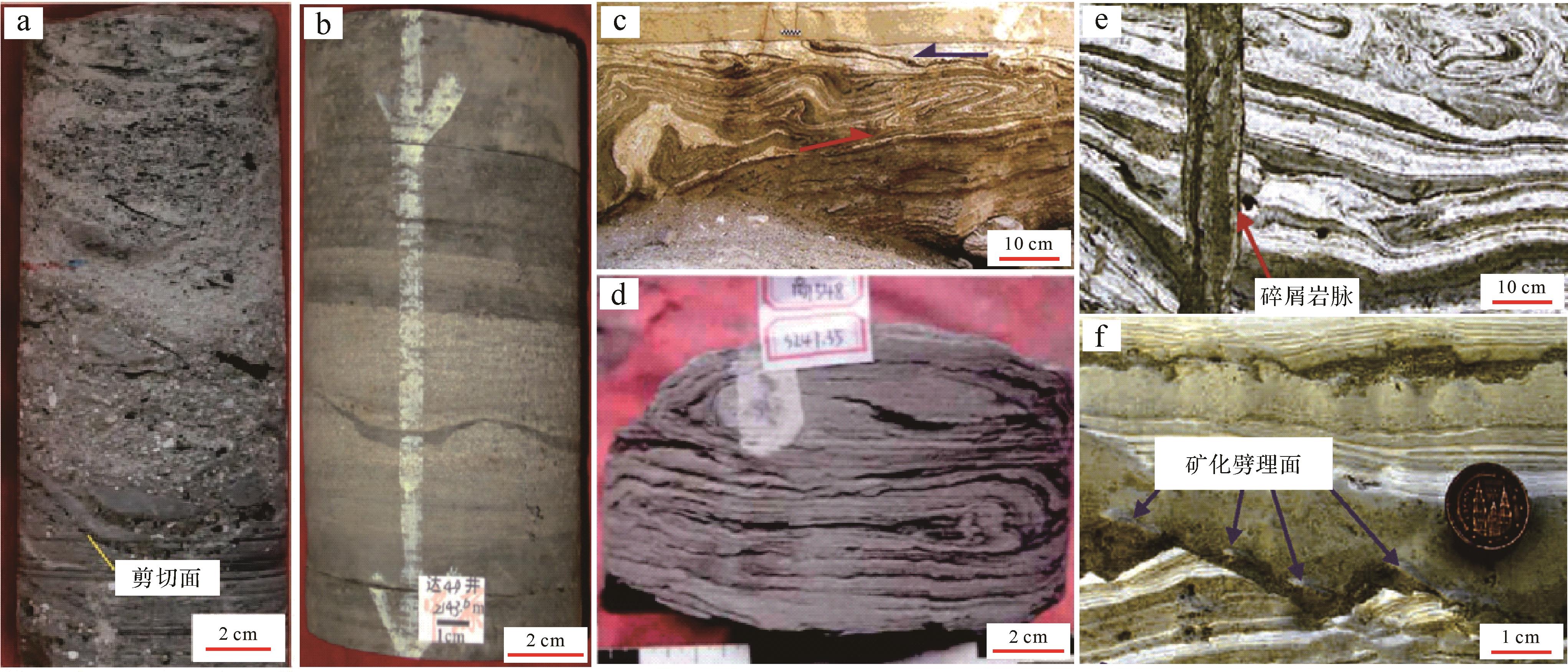
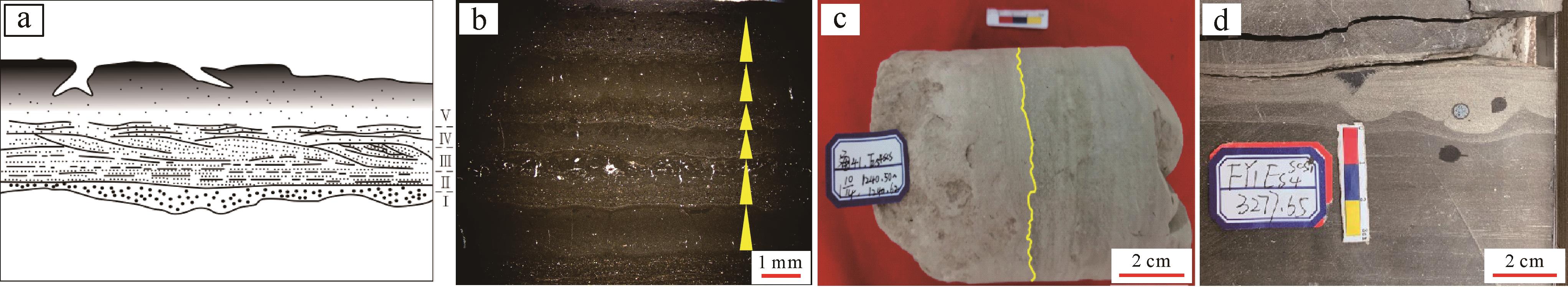
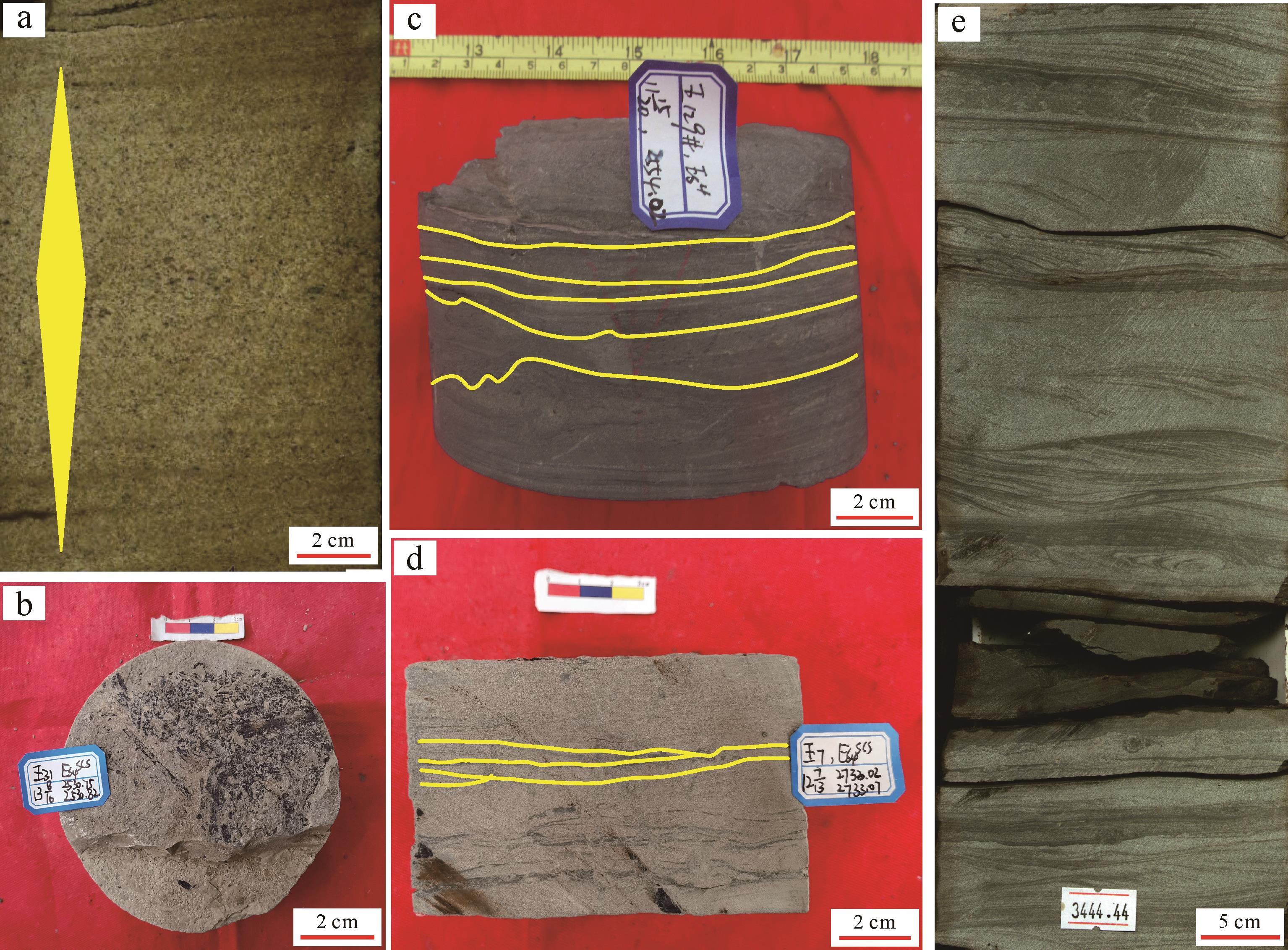
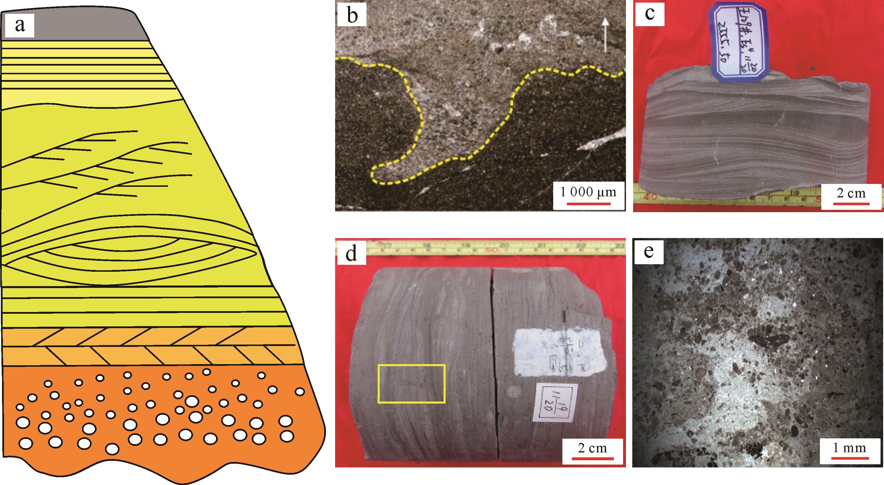
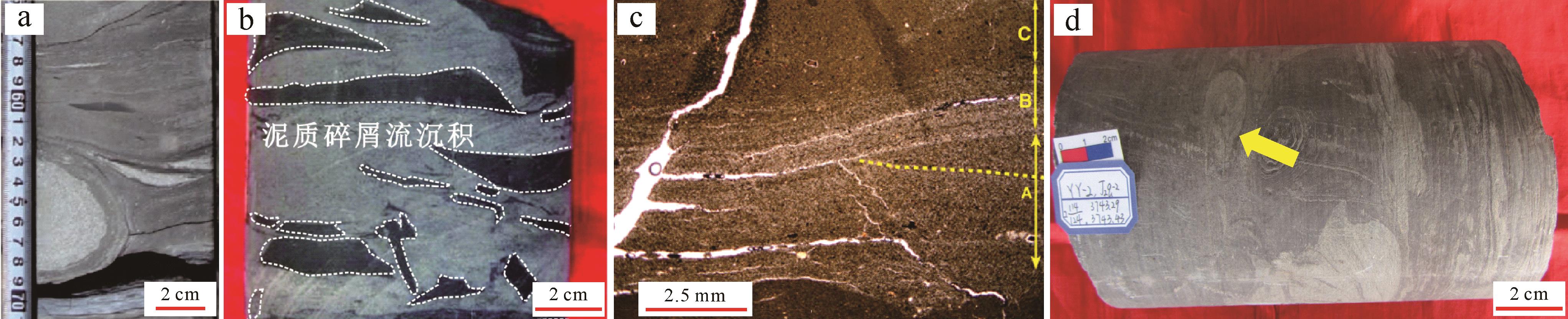
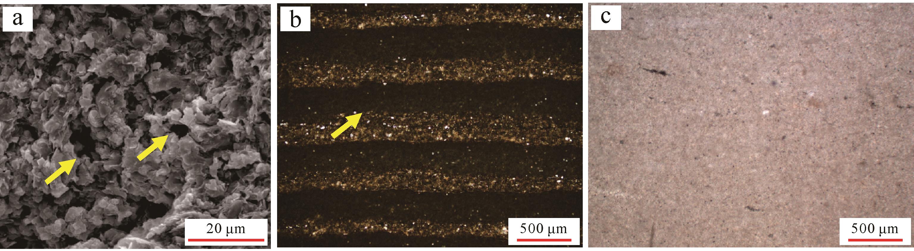
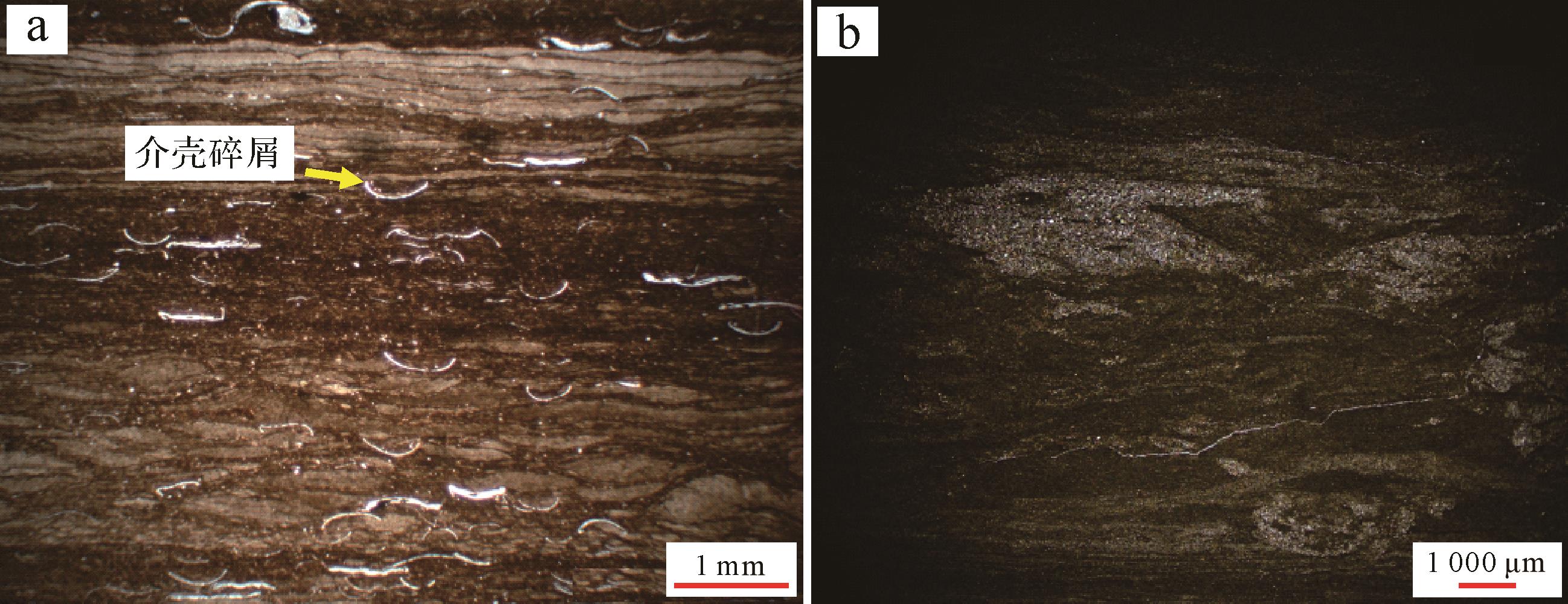
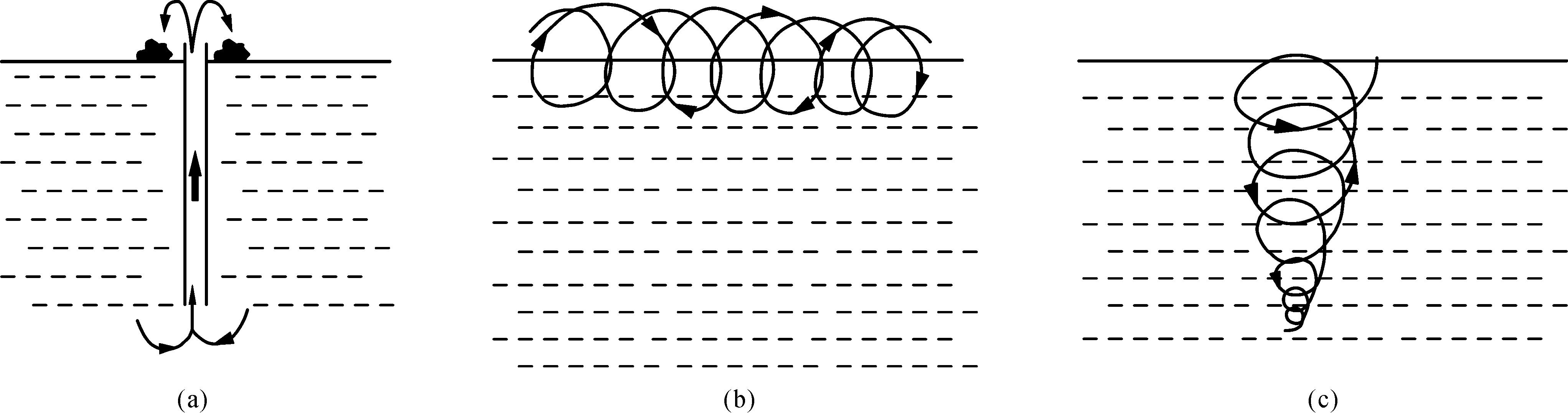
Objective Tidal forces influence the form and scale of marine shelf deltas and the development and evolution of branch channels. The quantitative control mechanism of different amplitude tidal ranges on the dam body and branch channels of continental shelf deltas has garnered significant scientific interest. Methods In this study, a single factor control method was used to analyze the evolution of the key geologic bodies in the continental shelf delta under different tidal ranges using Delft3D hydrodynamic simulation software to establish four control groups: no, small, medium, and spring difference. Results The experimental results show that the down-cut depth and width of the branch channel decrease with the increase of the flow distance when there is no tidal effect. When tidal action is added, the number of distributary channels decreases with the increase of tidal range, but the down-cut degree and width of the distributary channels increase. The width-to-depth ratio of the branch channel ranges from 2-10 when there is no tidal action, and decreases to zero when there is a low tidal range. Under the influence of middle and spring tidal ranges, the width-to-depth ratio of the branch channel corresponds to 0-3 and 2-4, respectively. Conclusions The results show that tidal action is beneficial for increasing the broad-to-thickness ratio of sand bodies, and the delta morphology changes become more stable with the increase of tidal range. The number of branch channels in the delta under the influence of tides decreases significantly owing to the periodic influx and retreat of tides in the lateral direction. This promotes the formation of lateral channels and tidal channels. Under the influence of middle-spring difference, the lateral migration distance of the branch channel is shorter, the branch channel is more stable, and the dam body is more isolated, providing an important reference for reservoir configuration analysis of similar underground sediments.
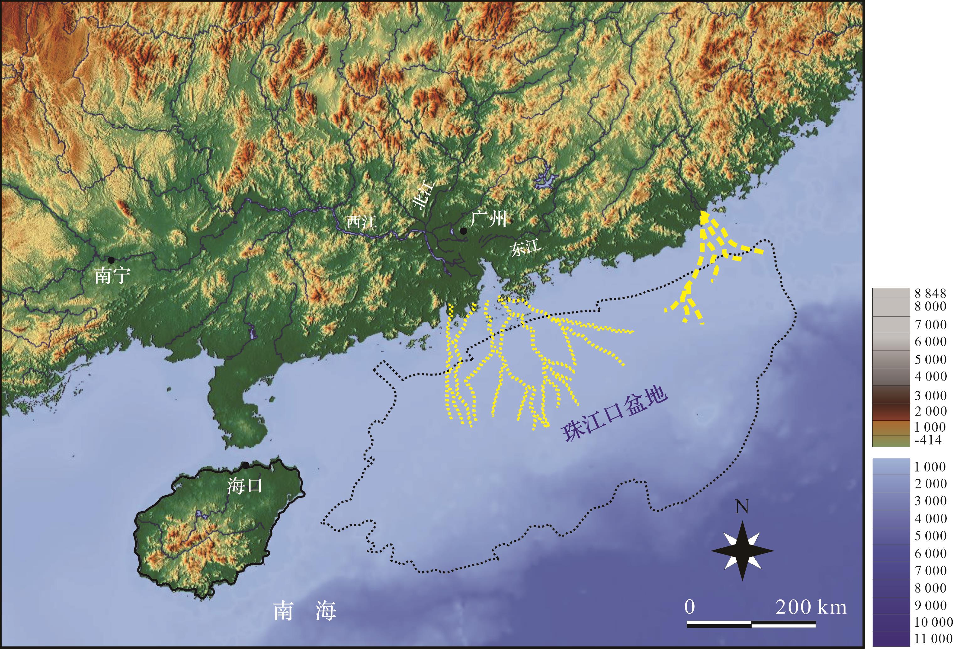
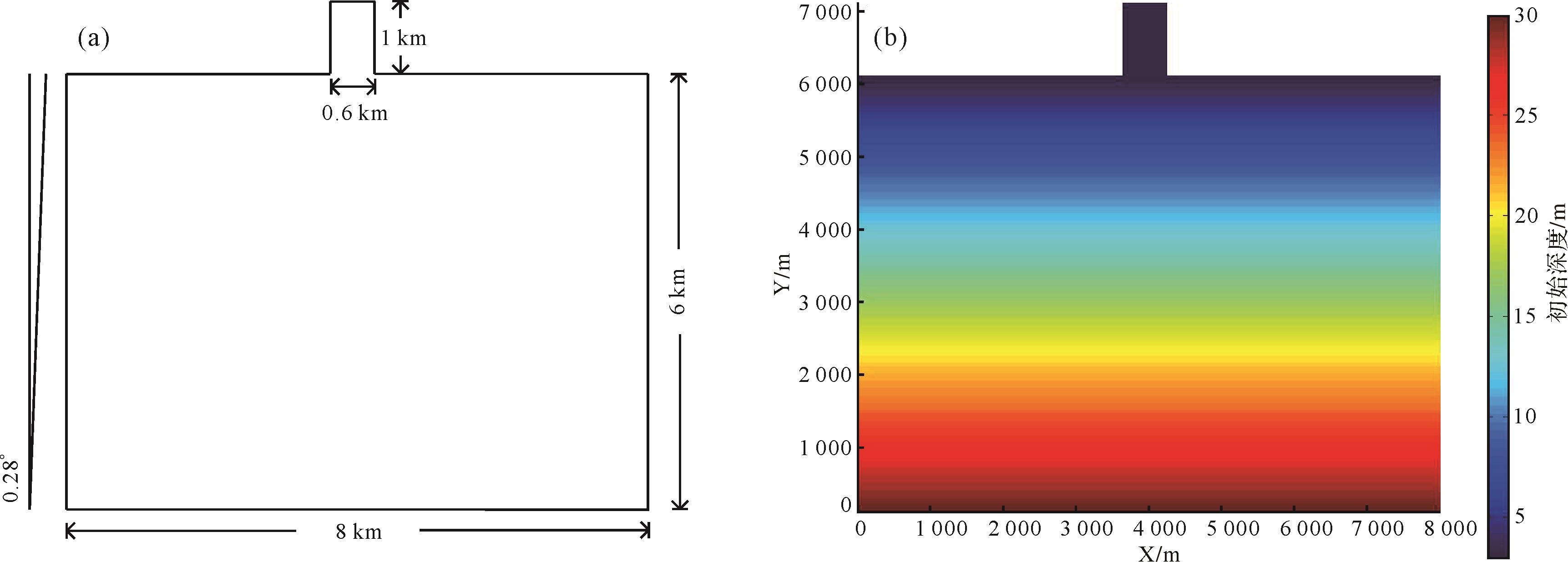
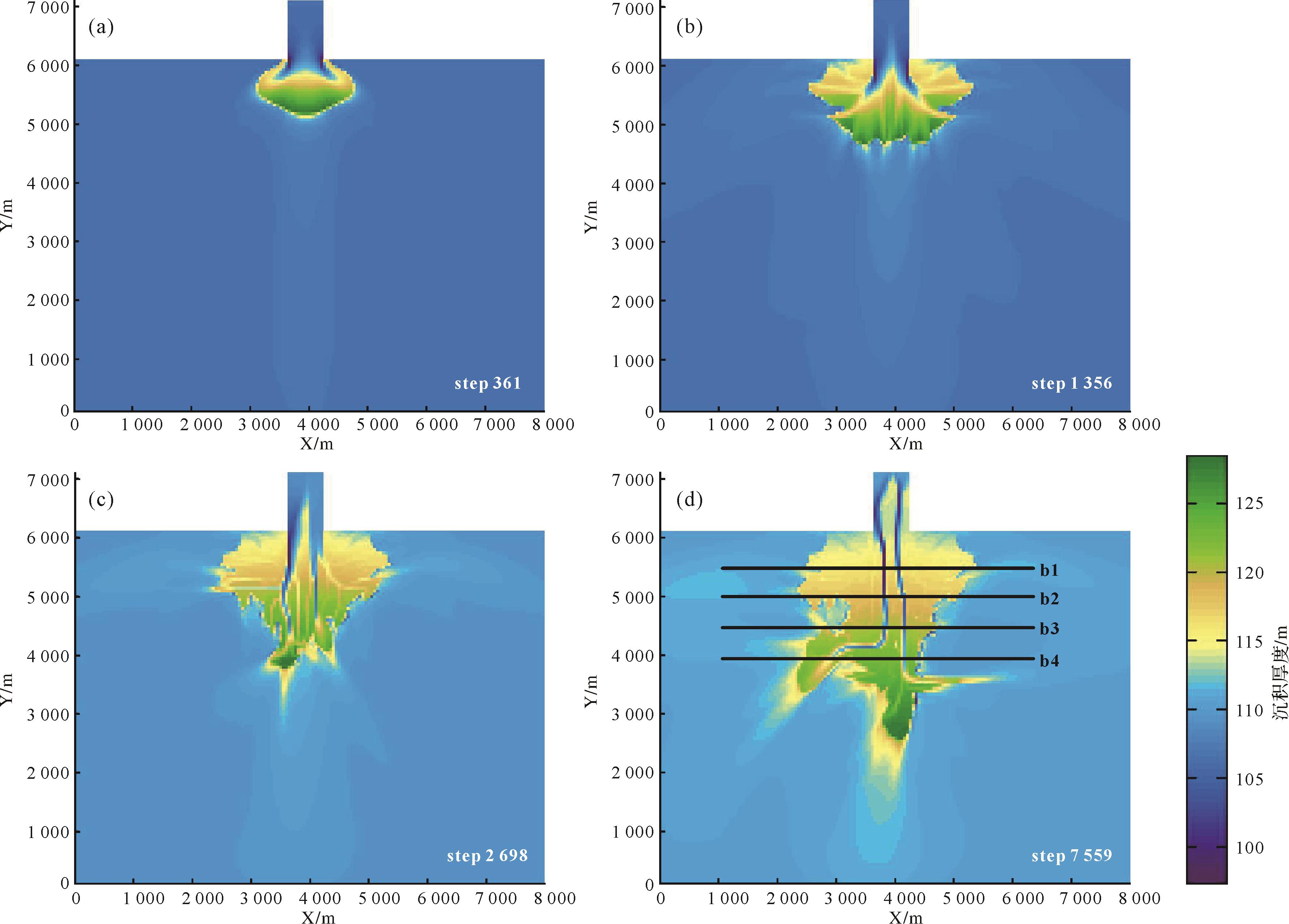
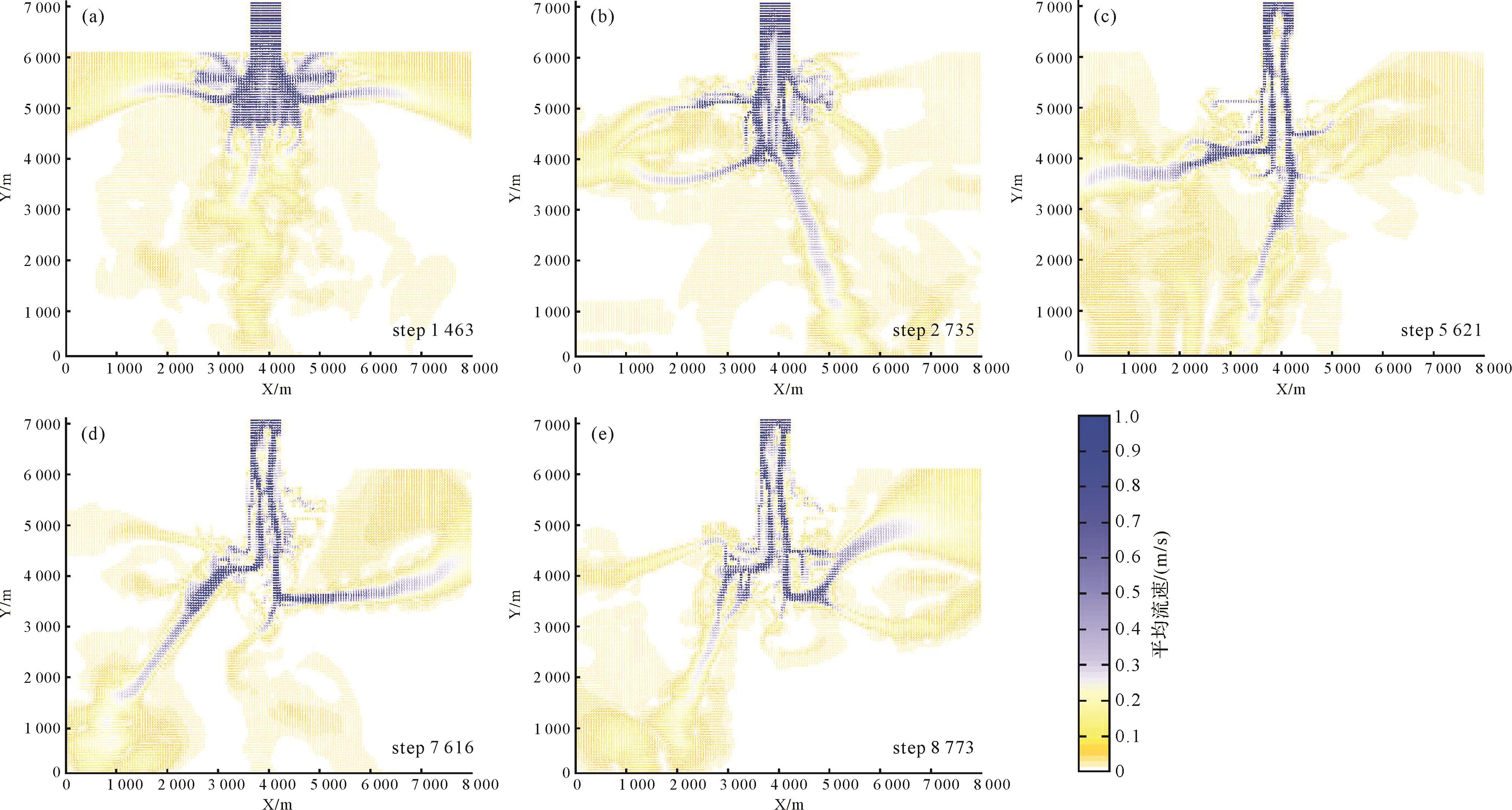
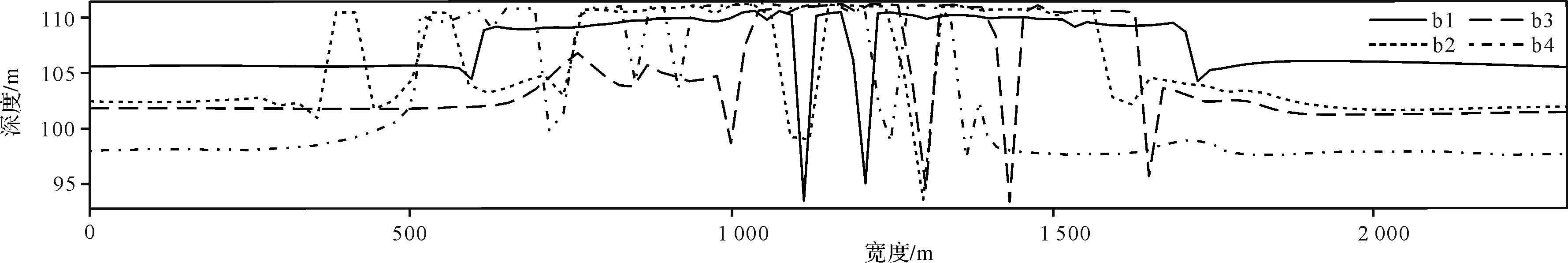
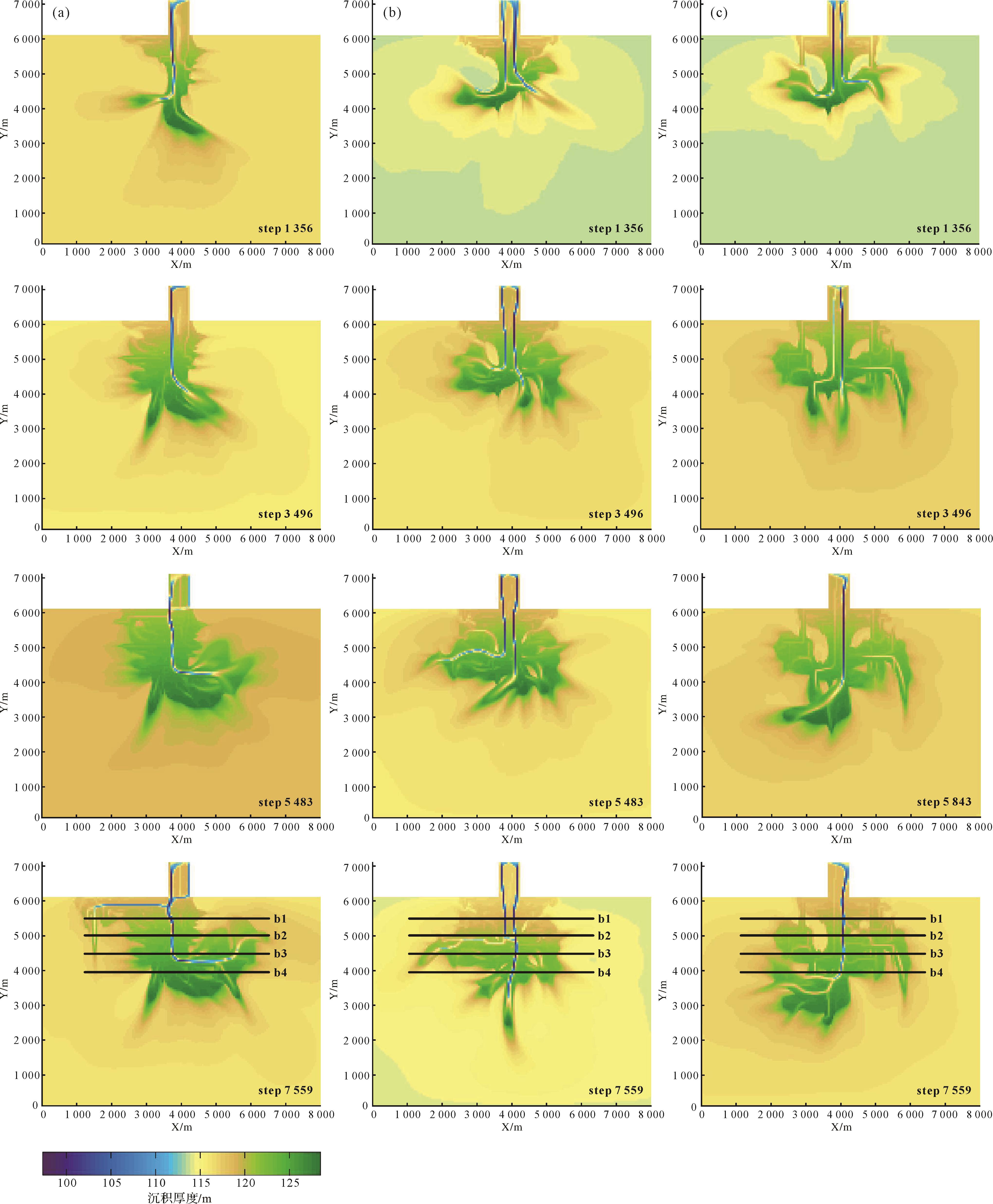
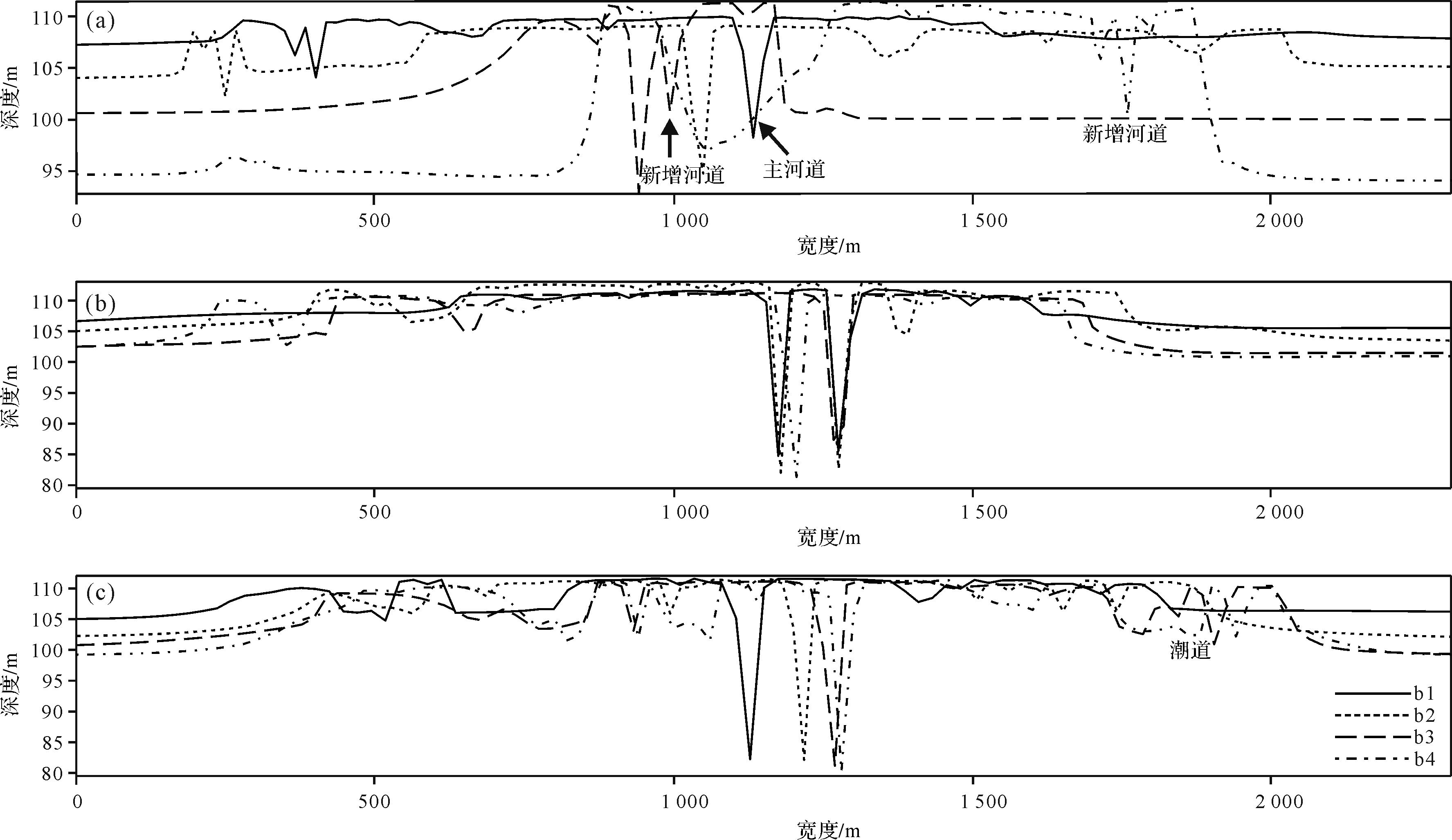
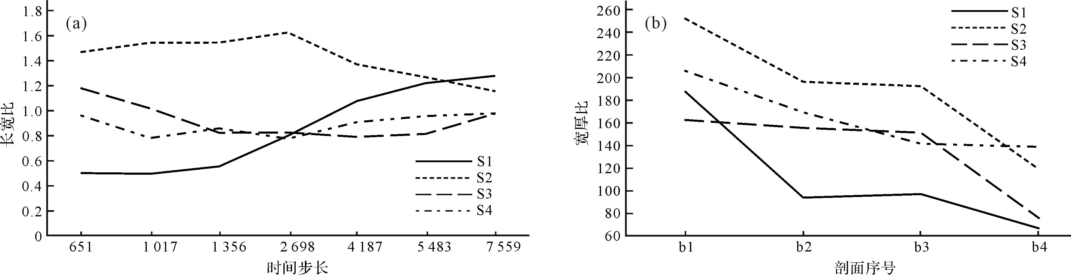
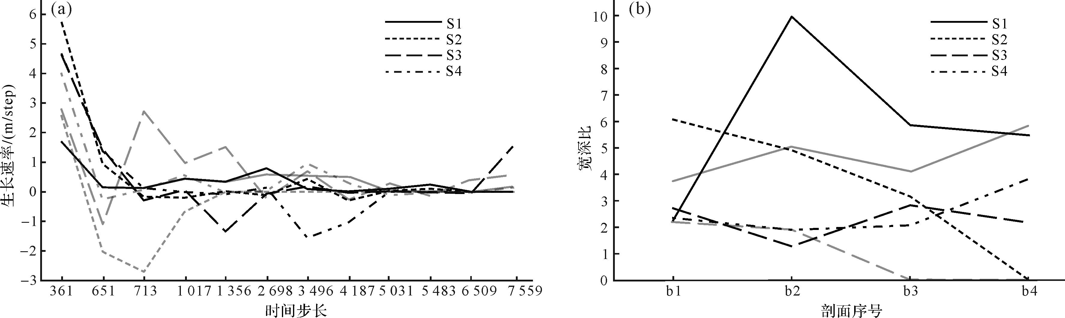
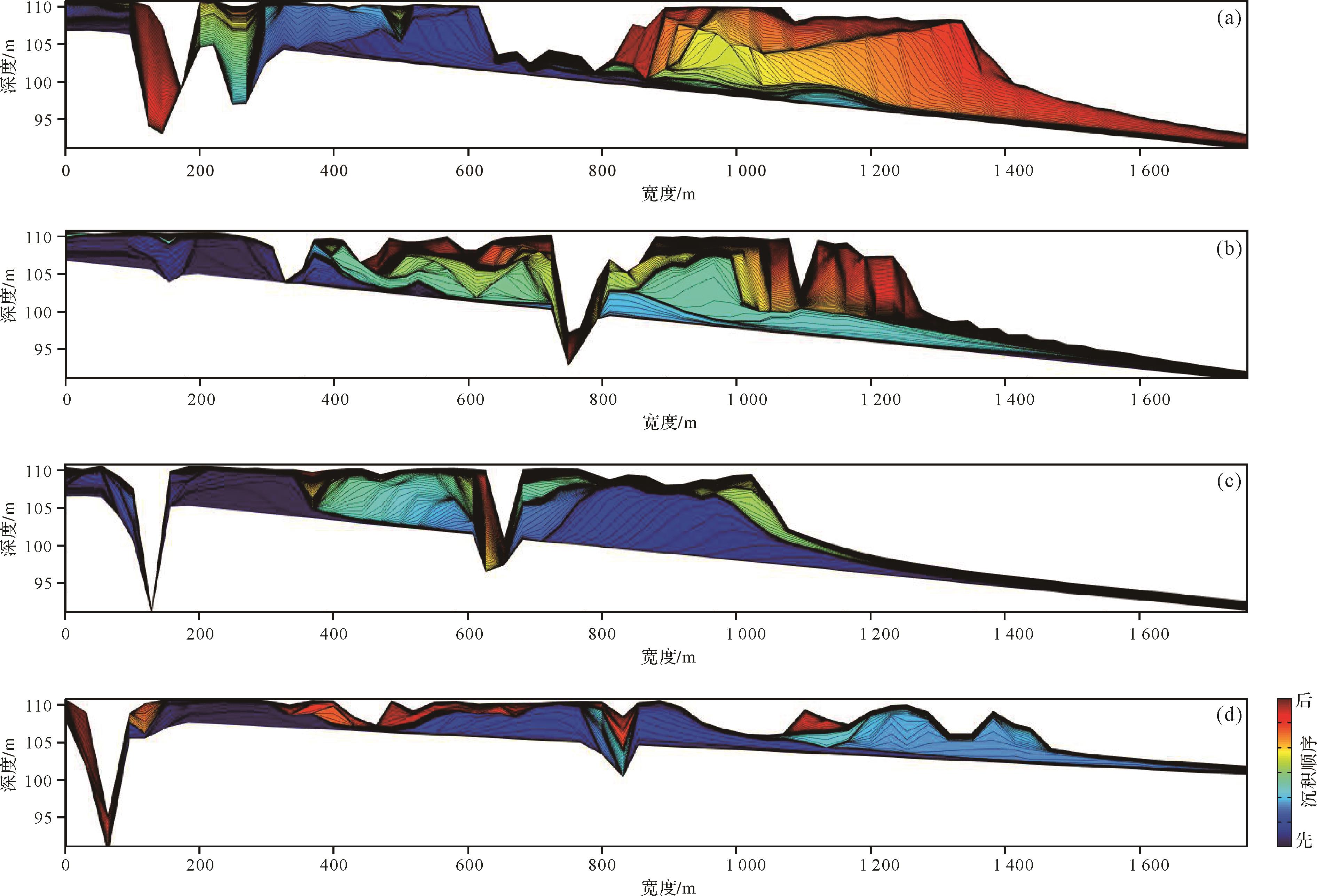
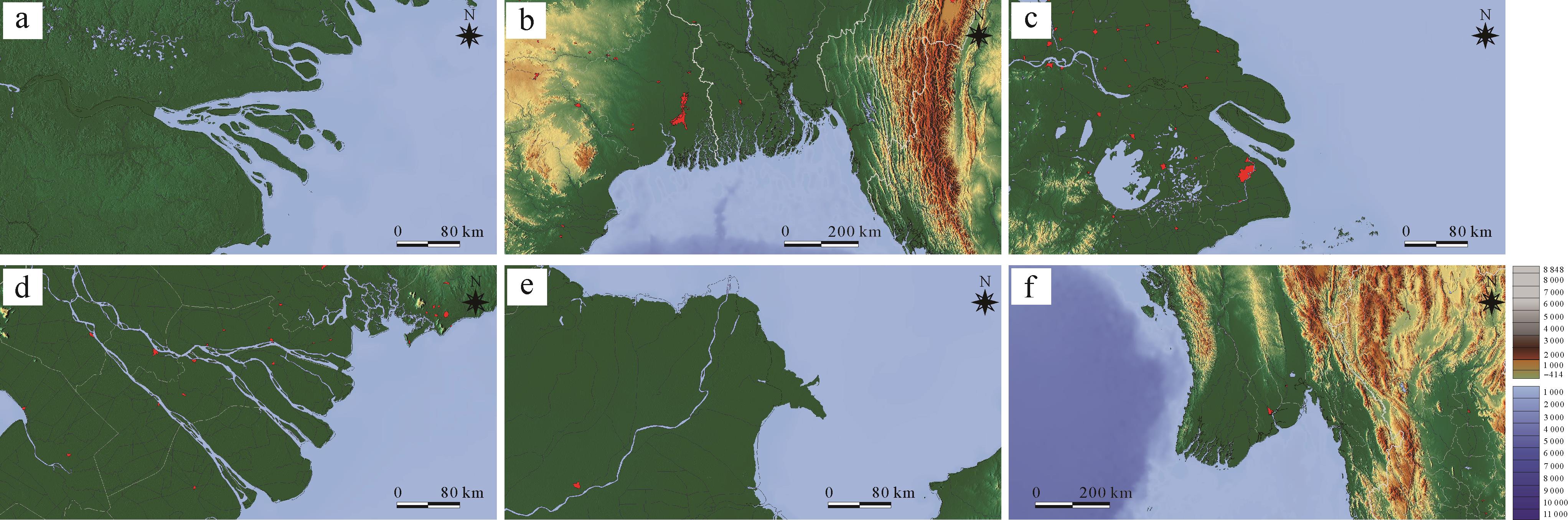
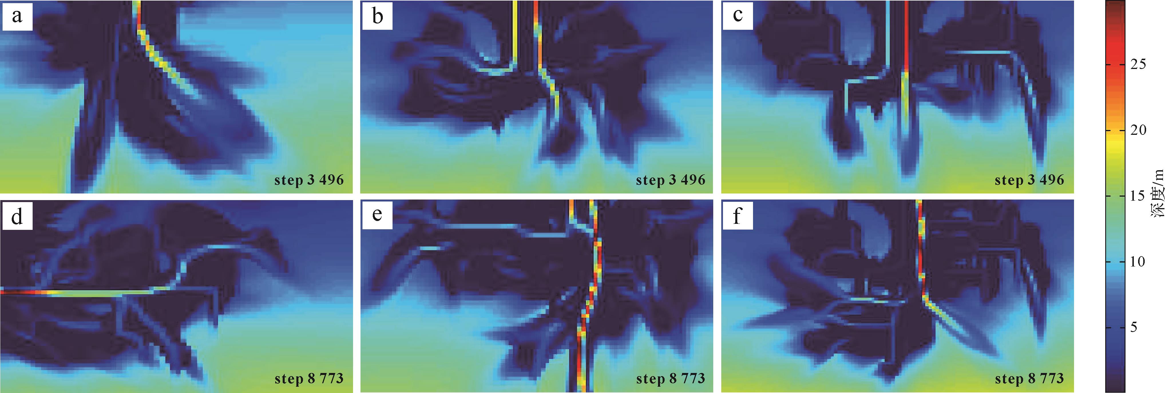
Objective Significant advancements have been made in the research of sandy braided river deltas, but the sedimentary characteristics and evolution laws of sandy braided river deltas require further study, particularly the understanding of mouth bars and distributary sand bars. Methods Based on the underground reservoir data, this study used the Delft3D software to show the growth and evolution of a sandy braided river delta into a lake, summarizing its sedimentary characteristics and evolution laws. Results The evolution of a sandy braided river delta has three stages. In the early stage, the delta grows fastest, and the average diameter growth rate was greater than 6 m/step. Sediments are carried into the lake and quickly unloaded, forming a large flower-shaped mouth bar under the water. In the middle stage, the delta plain continues growing, and the delta front remains large, accounting for more than 50% of the delta area. Contiguous sand bodies are built. In the late stage, the delta grows slowly, the average diameter growth rate is maintained at 1m/step. The front area is small, less than 20% of the overall area. The delta plain has many distributary channels and ditches, leading to multiple paths for transforming the distributary sand bars. The delta front sand bars have different degrees of superposition and rhythm combination characteristics, and the distributary sand bars are built on the residual mouth bar. Conclusions A sedimentary model of a sandy braided river delta was established, providing reference for the genetic identification of distributary sand bar and mouth bar, and laying the foudation for advancing underground reservoir architecture research.
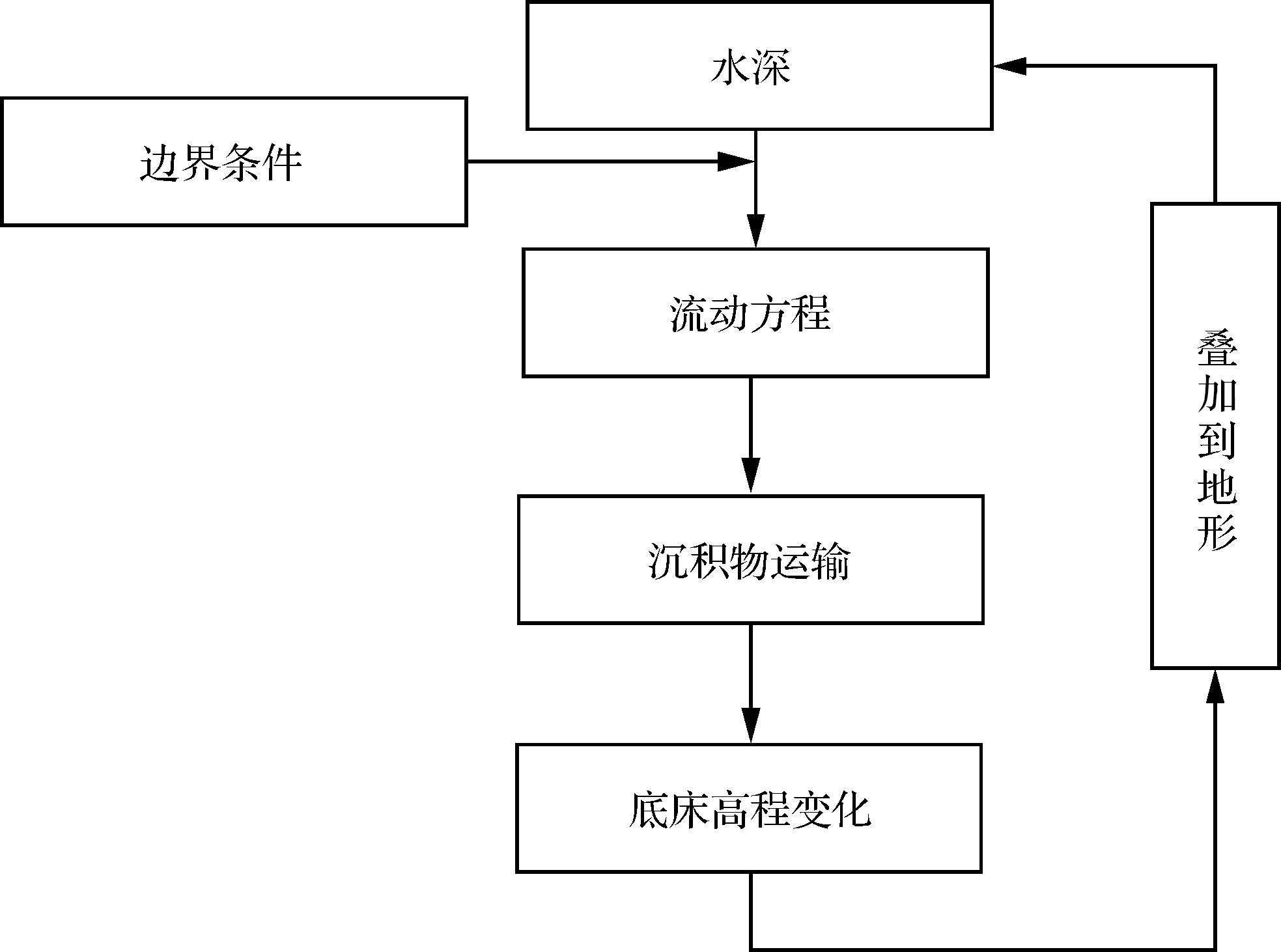
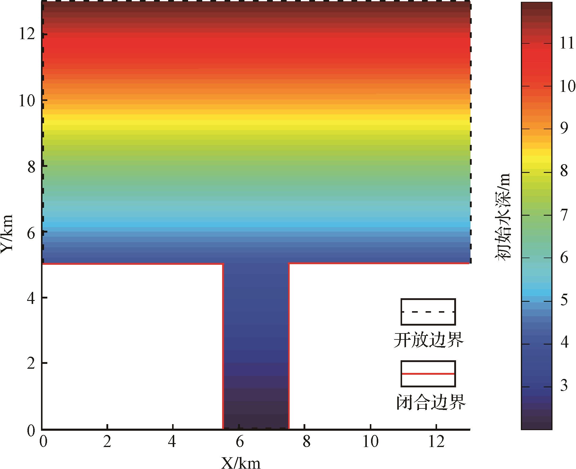
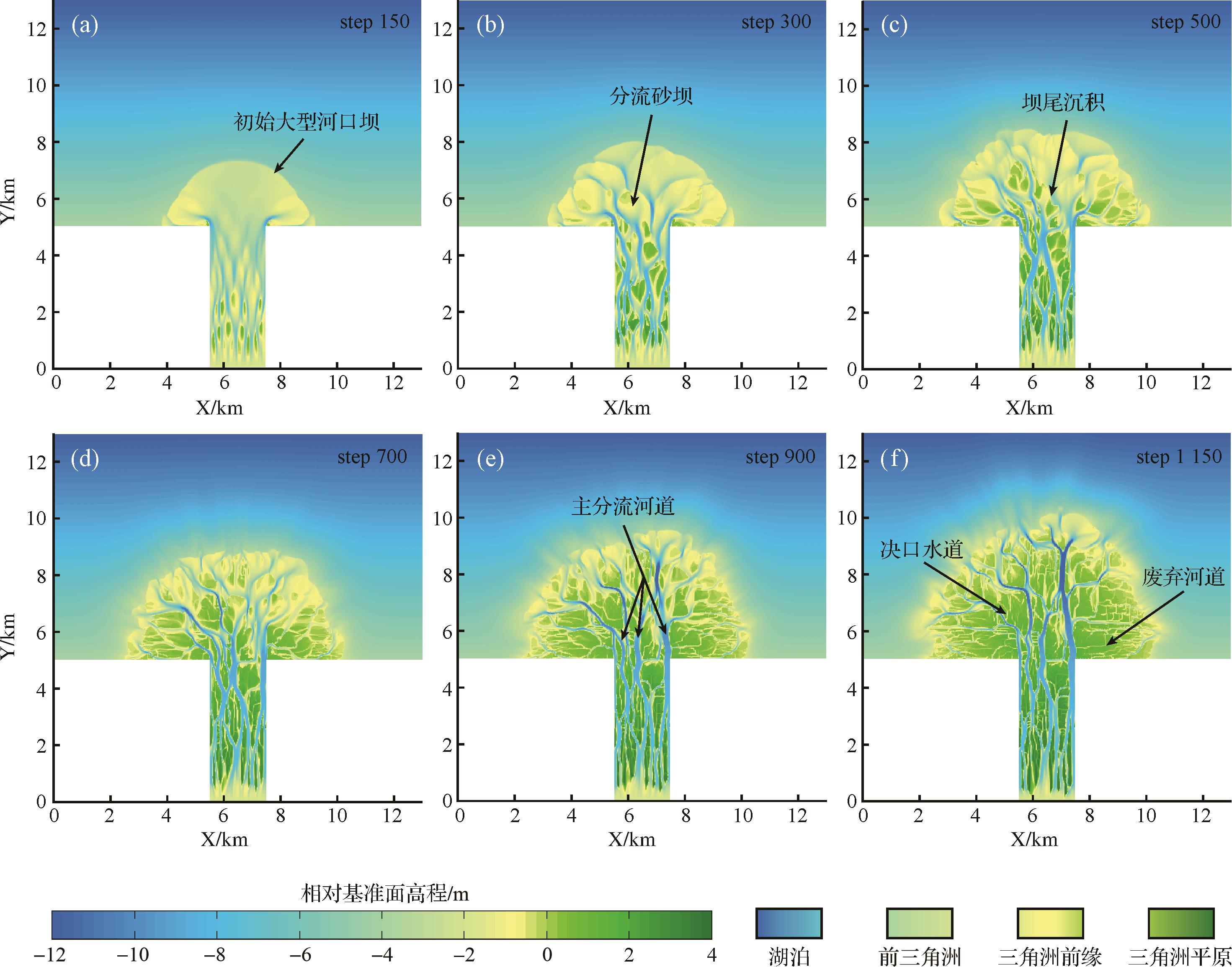
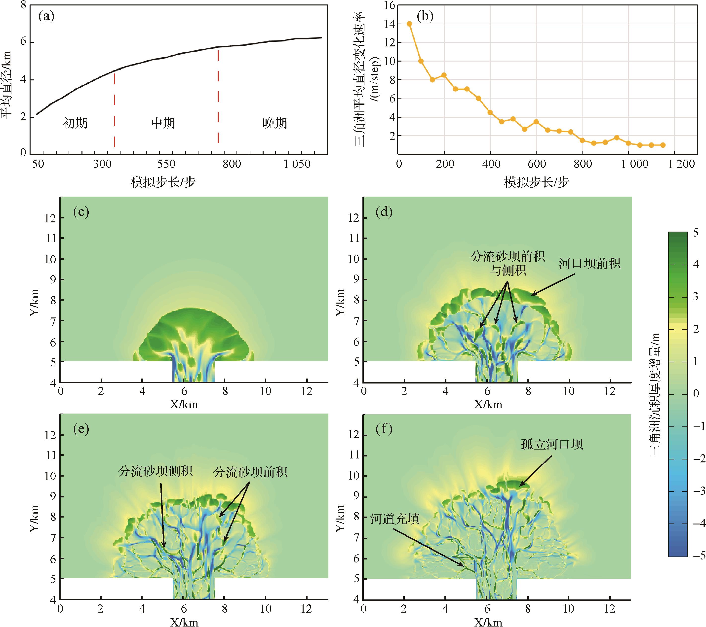
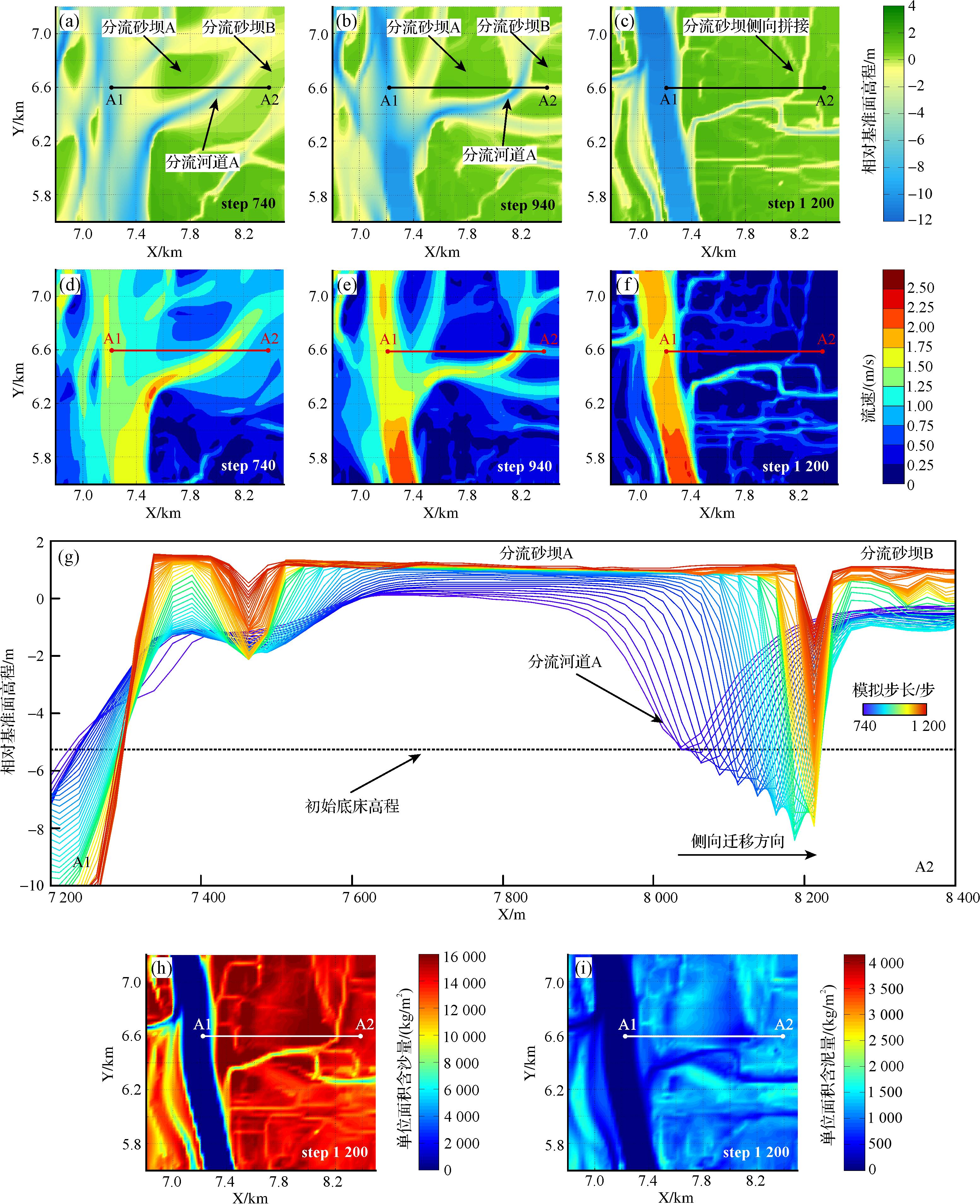
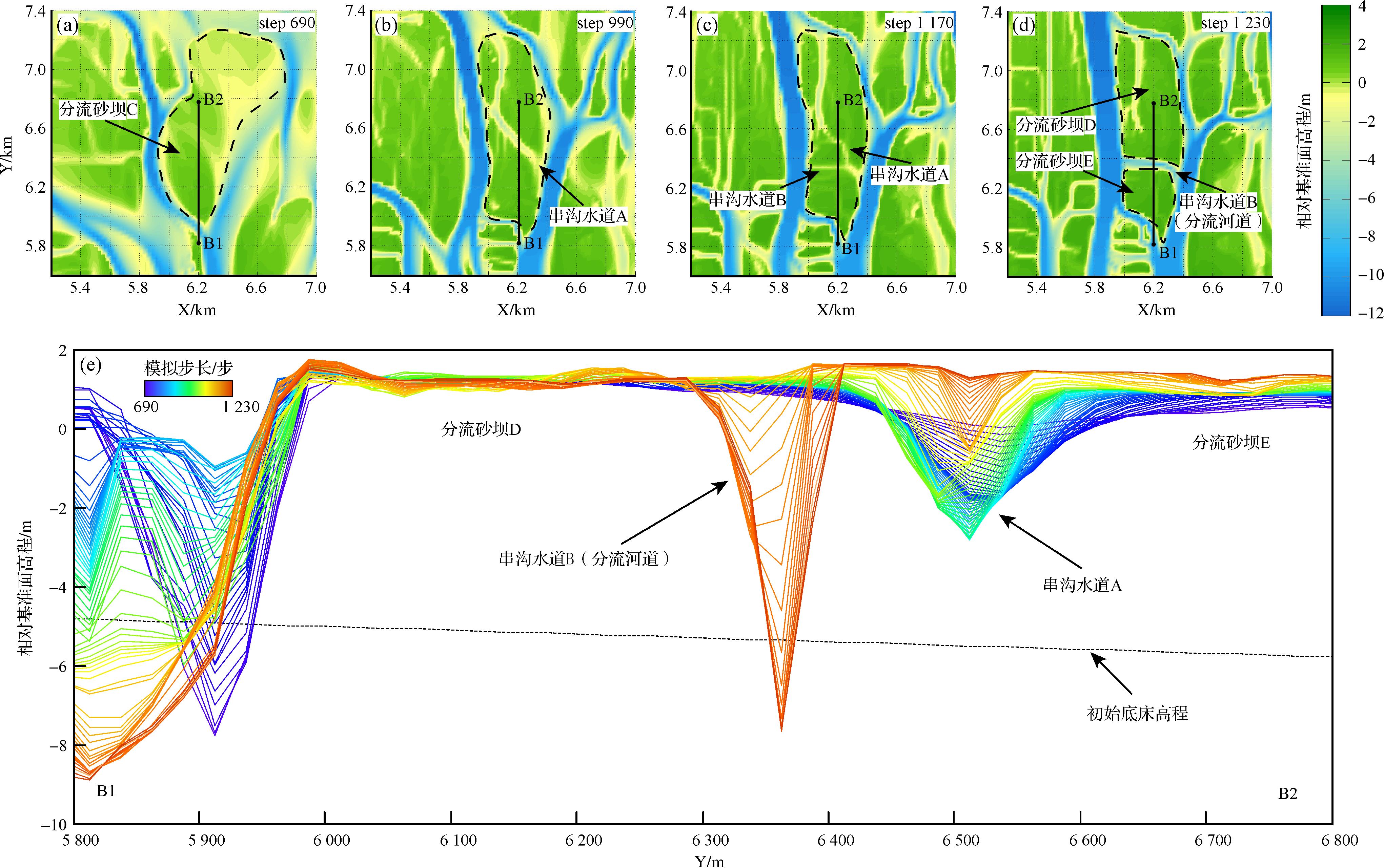
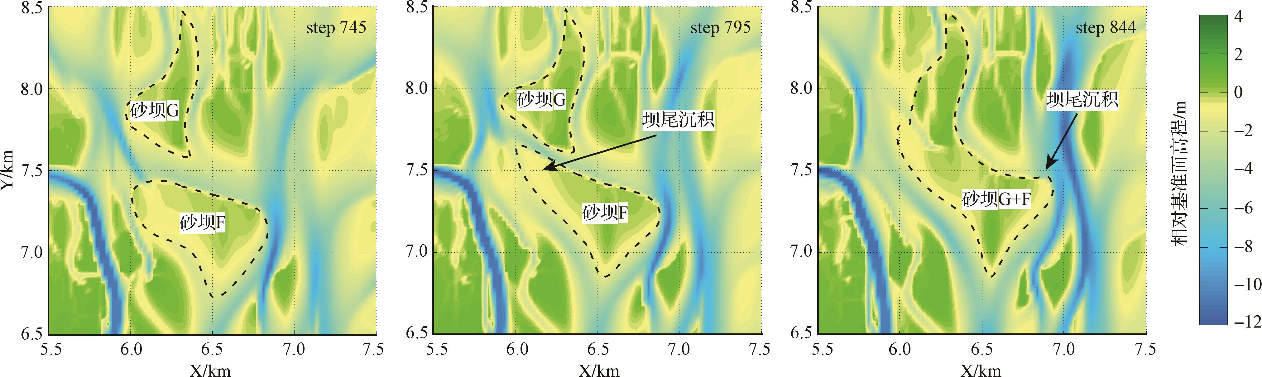
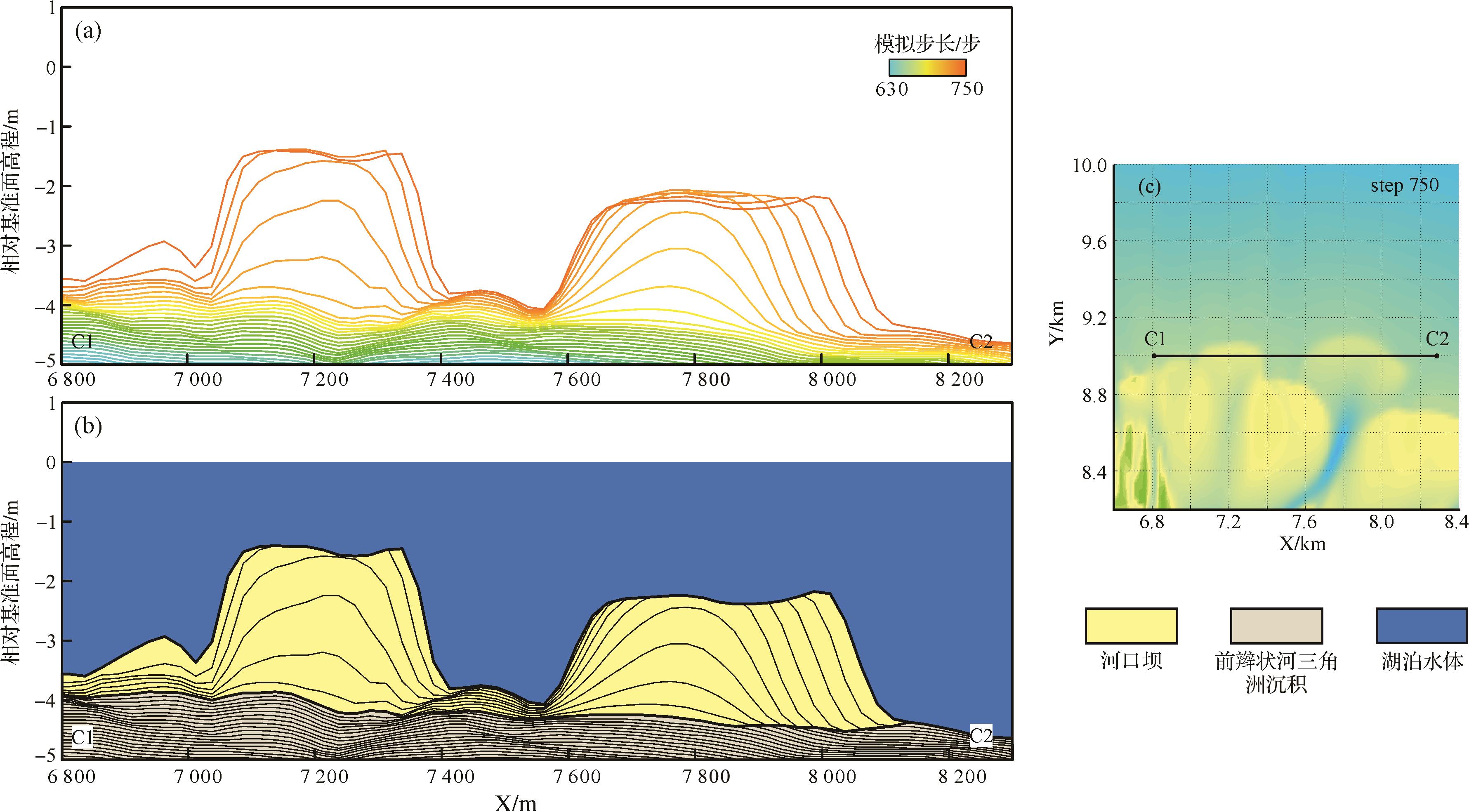
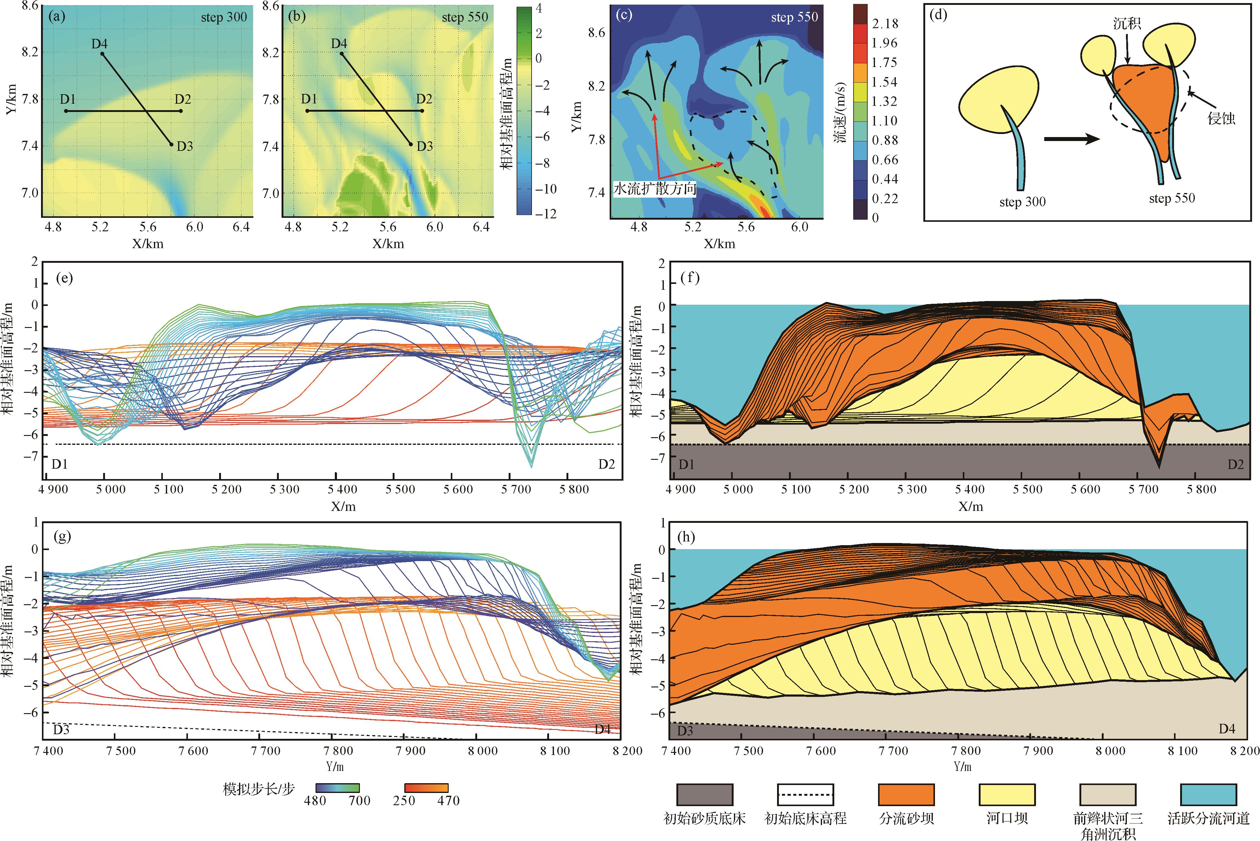
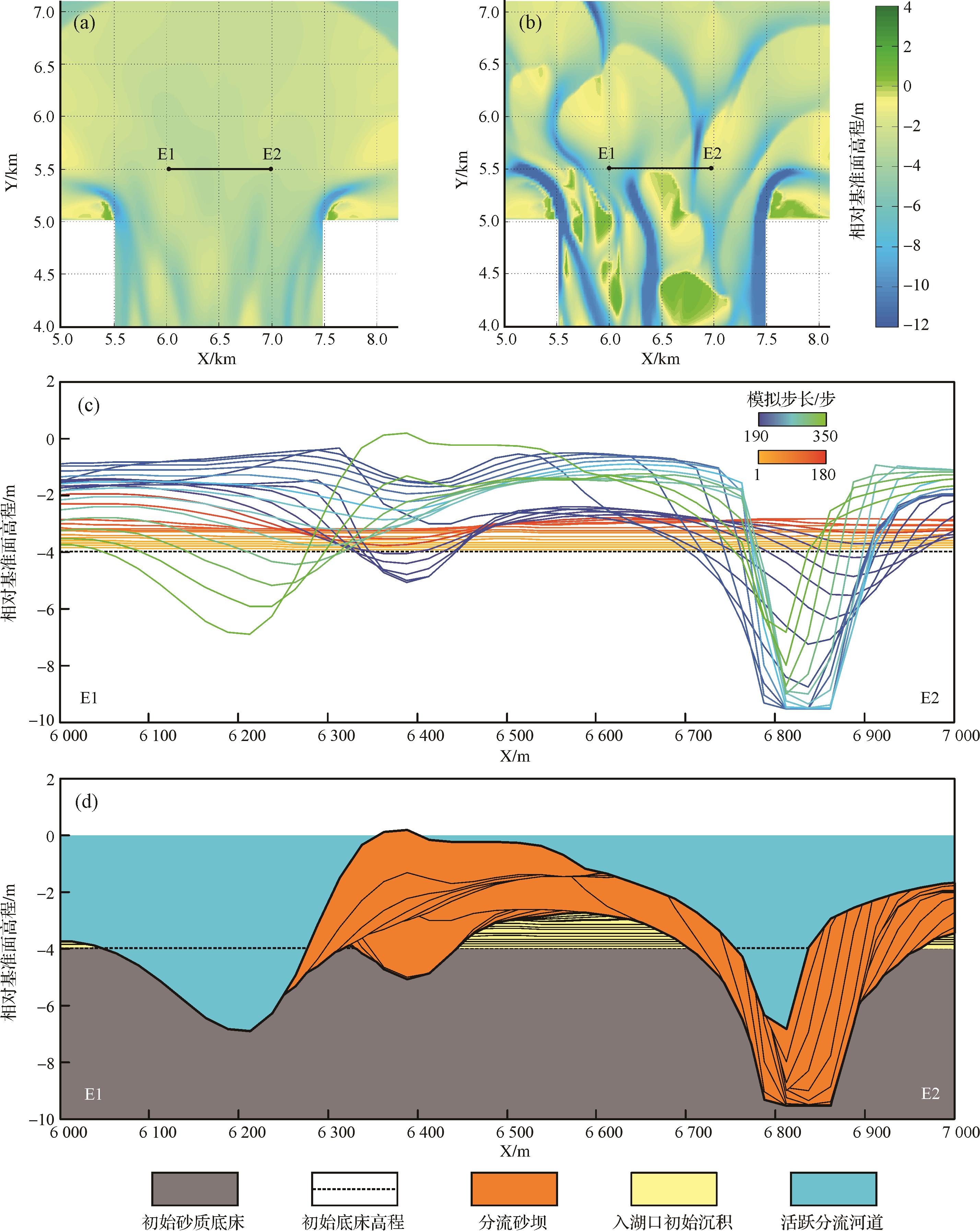
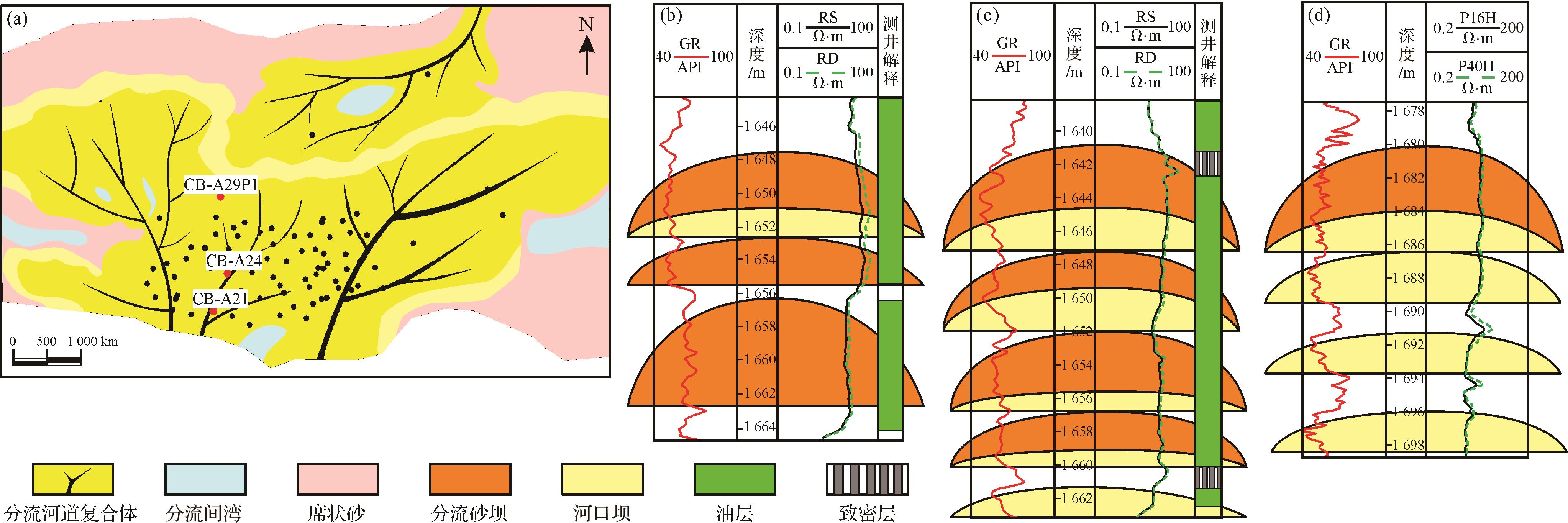
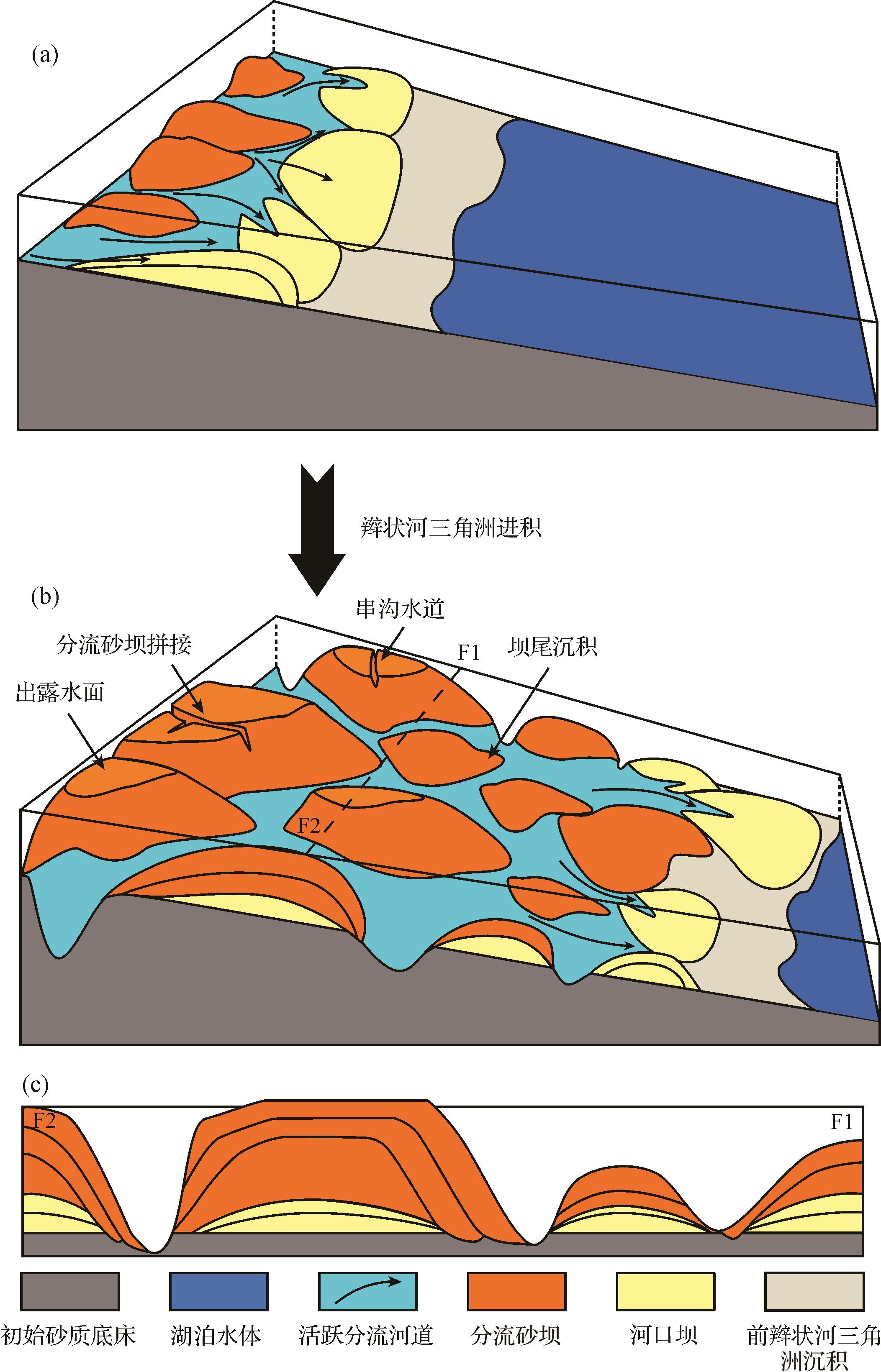
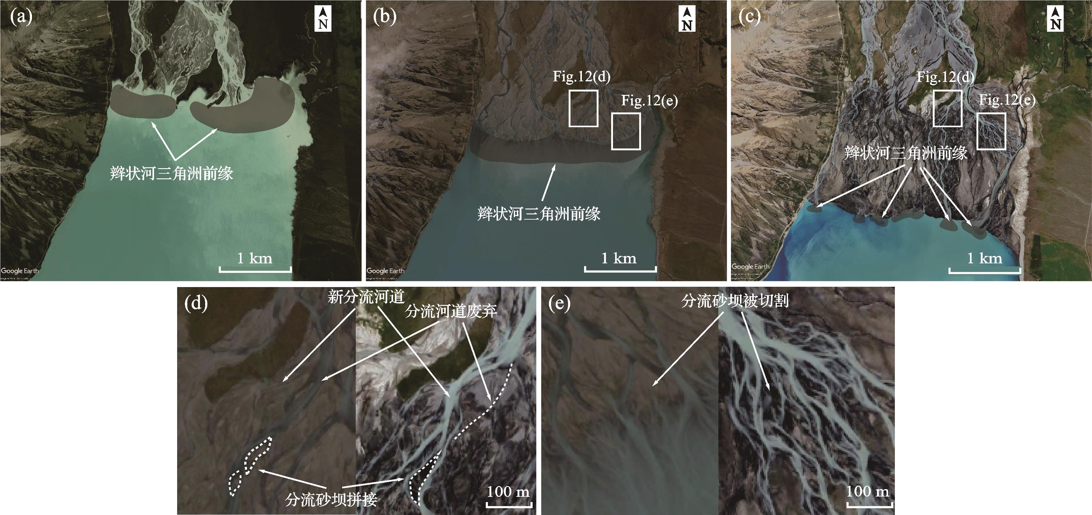
Objective Distributive fluvial systems (DFS) are widely developed in modern and ancient sedimentary strata and they are important hydrocarbon reservoirs. Multiple interacting DFS and evolving axial rivers may be developed in a narrow, shallow lacustrine basin with low accommodation. Methods Reproducing the deposition process through flume simulation experiments, this study used a high-precision three-dimensional (3D) scanner with a self-developed program to visual analyze the deposition area and clarify the stage-by-stage evolution characteristics of the DFS. Results ( 1) With the expansion of the DFS scale, the water flow on its surface gradually aggregates; the initial flow pattern is sheet flow, which then evolves into unrestricted and restricted flow; (2) as the basin can accommodate less space, the axial water flow in the basin gradually aggregates into an axial river, which has a destructive effect on the two sides of the DFS and constantly breaks, forming a large-scale fluvial deposition; (3) when multiple DFS are developed in a narrow, shallow lacustrine basin, the sedimentary sands are concentrated at the DFS near the source and downstream of the axial river, and the longer basin development time indicates a larger scale of fluvial deposition. Conclusions This study describes the developmental processes and sand body spreading patterns of multiple DFS and axial rivers developed in a narrow, shallow lacustrine basin with low accommodation and sufficient supply of material sources at the basin scale, providing theoretical support for oil and gas exploration and the study of distributive fluvial systems.
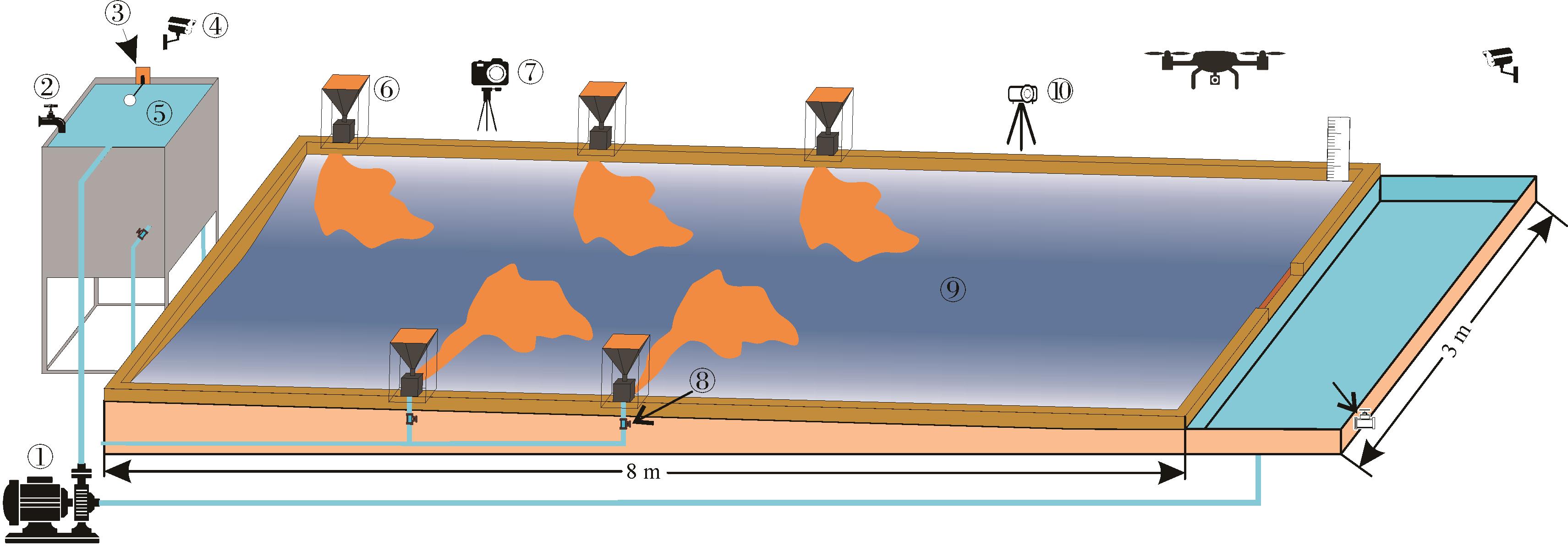
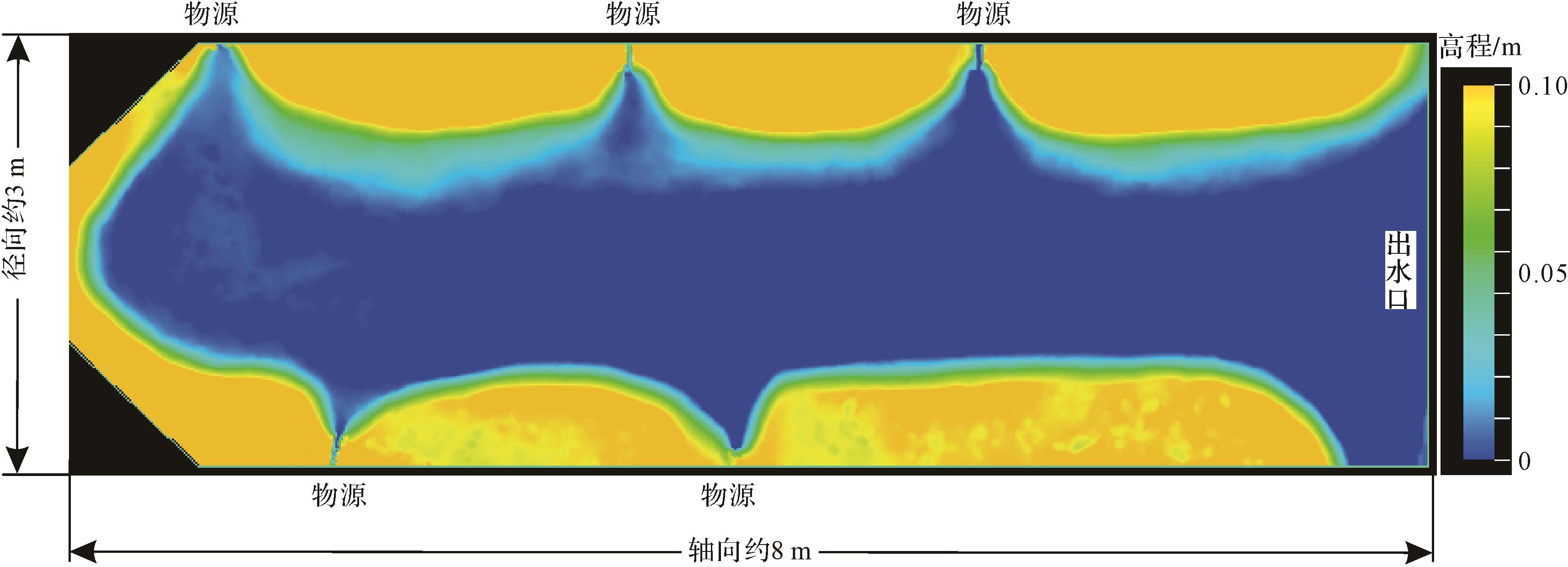
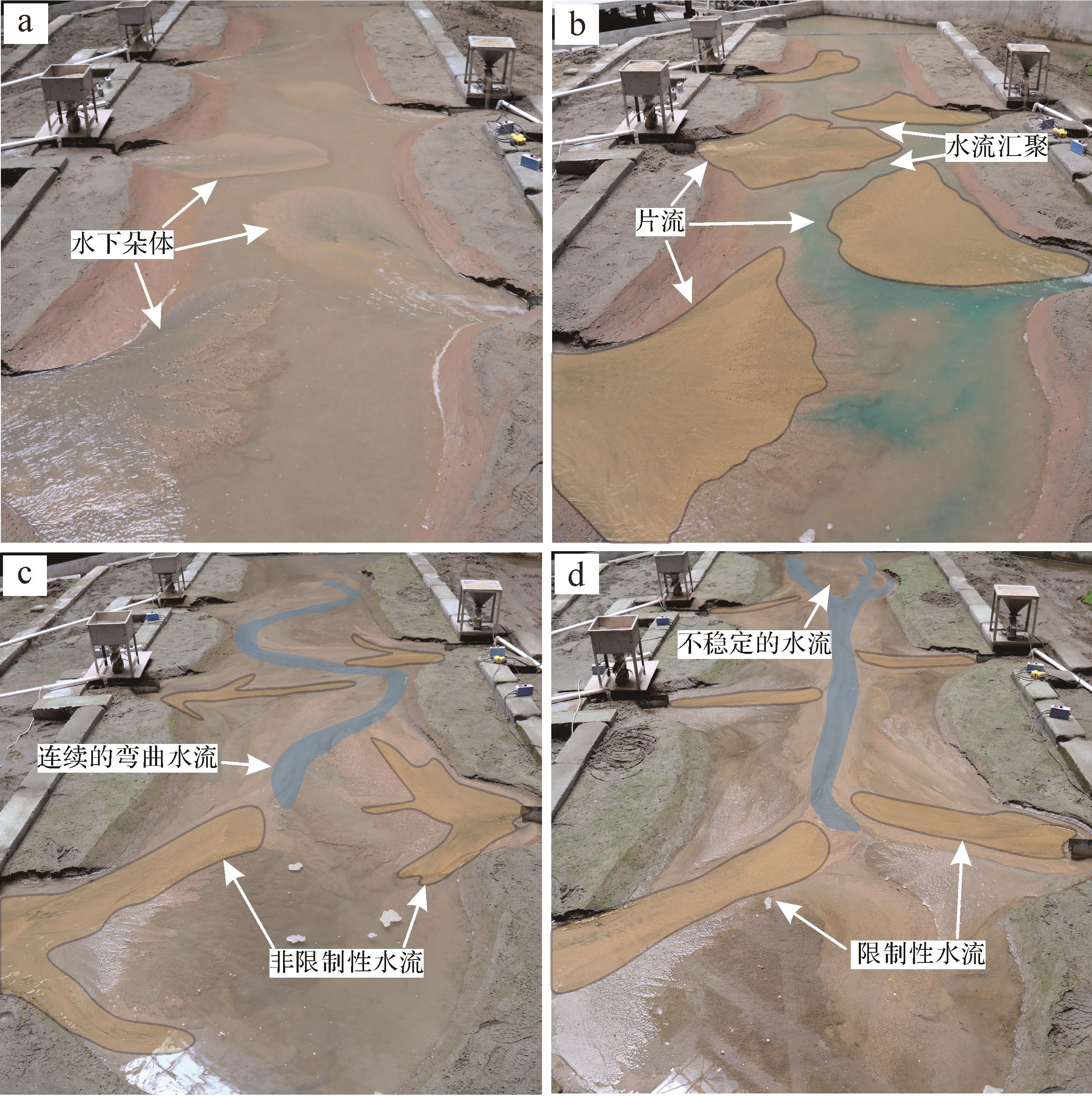
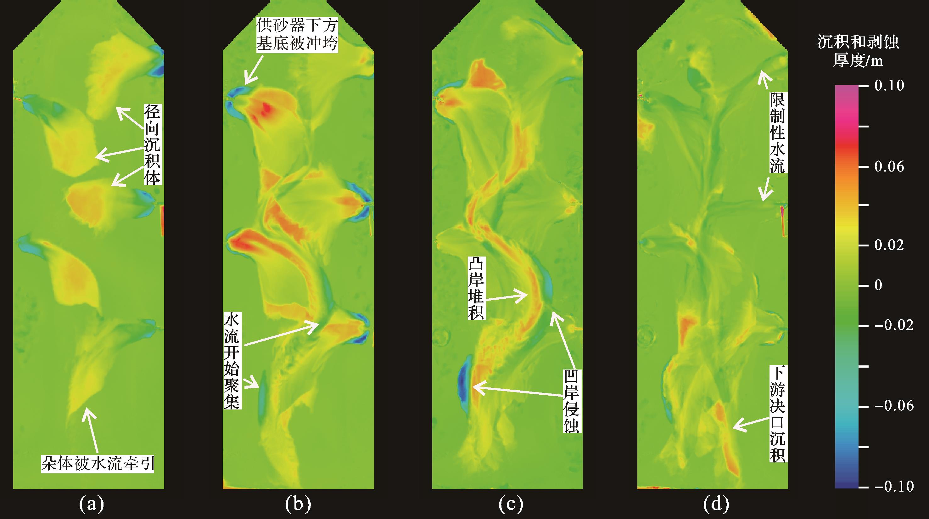
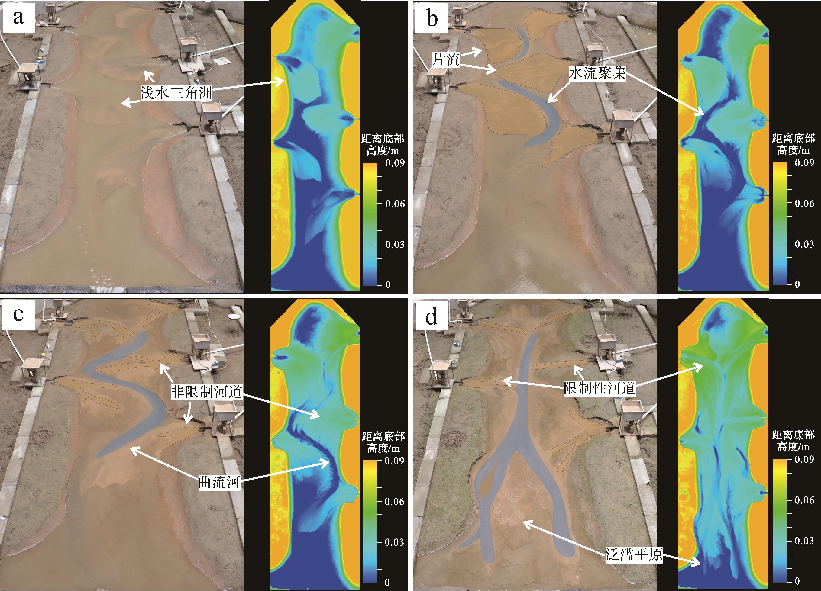
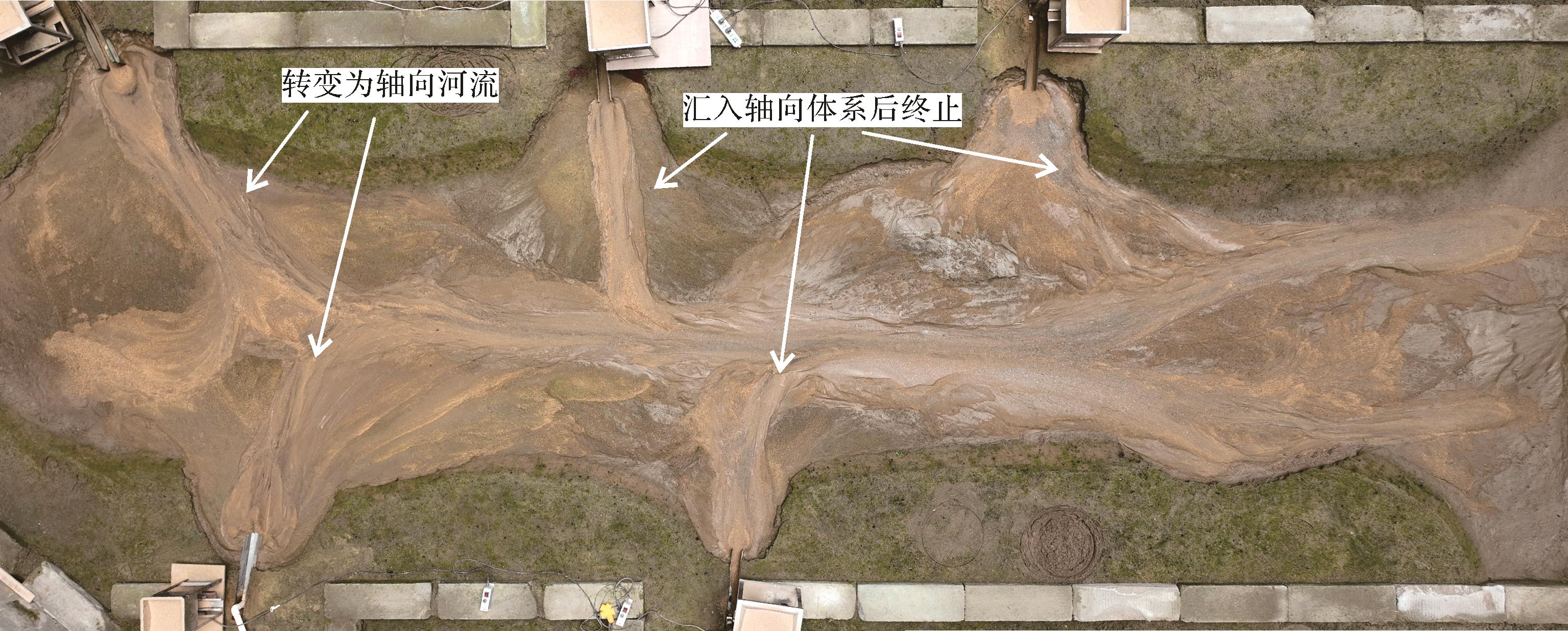
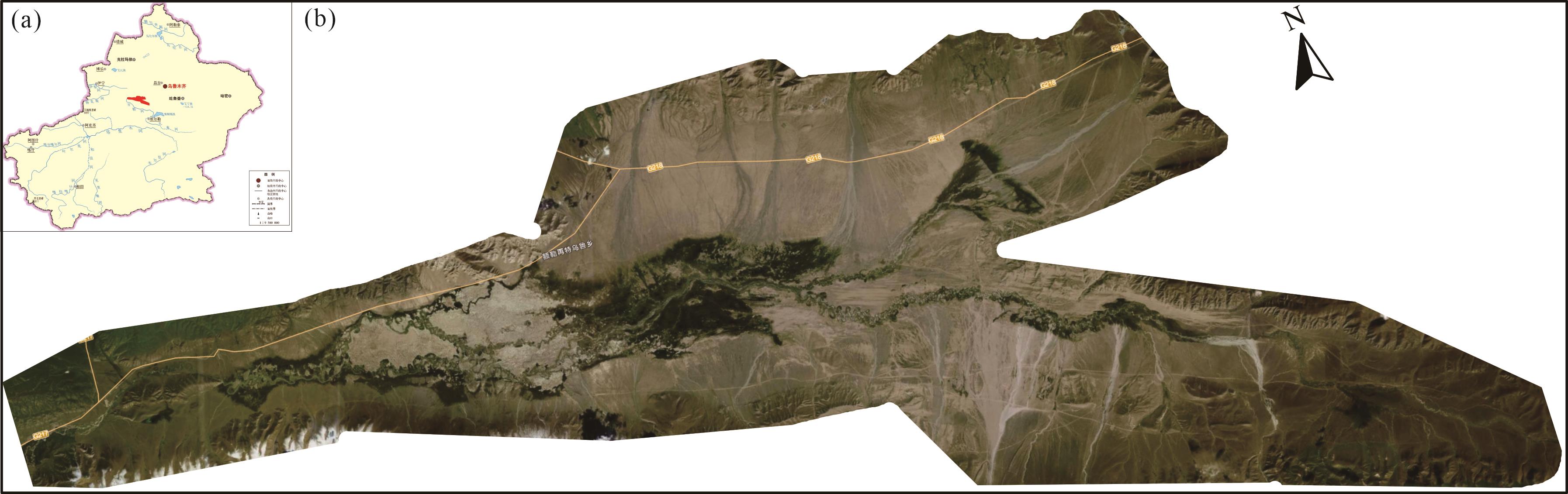
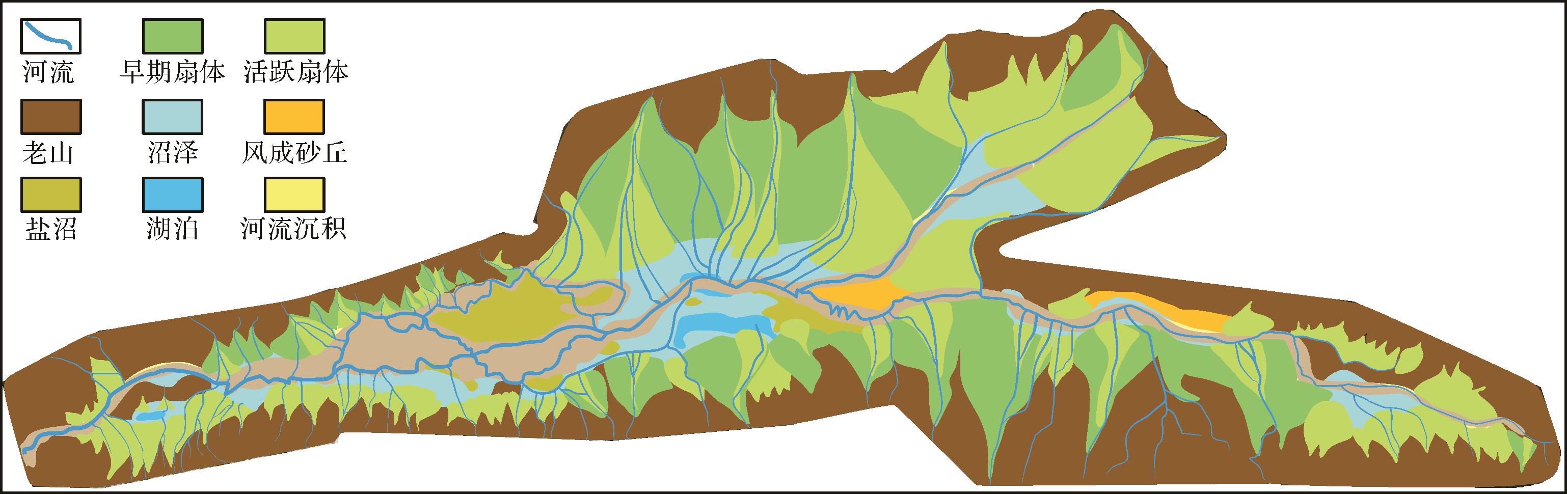
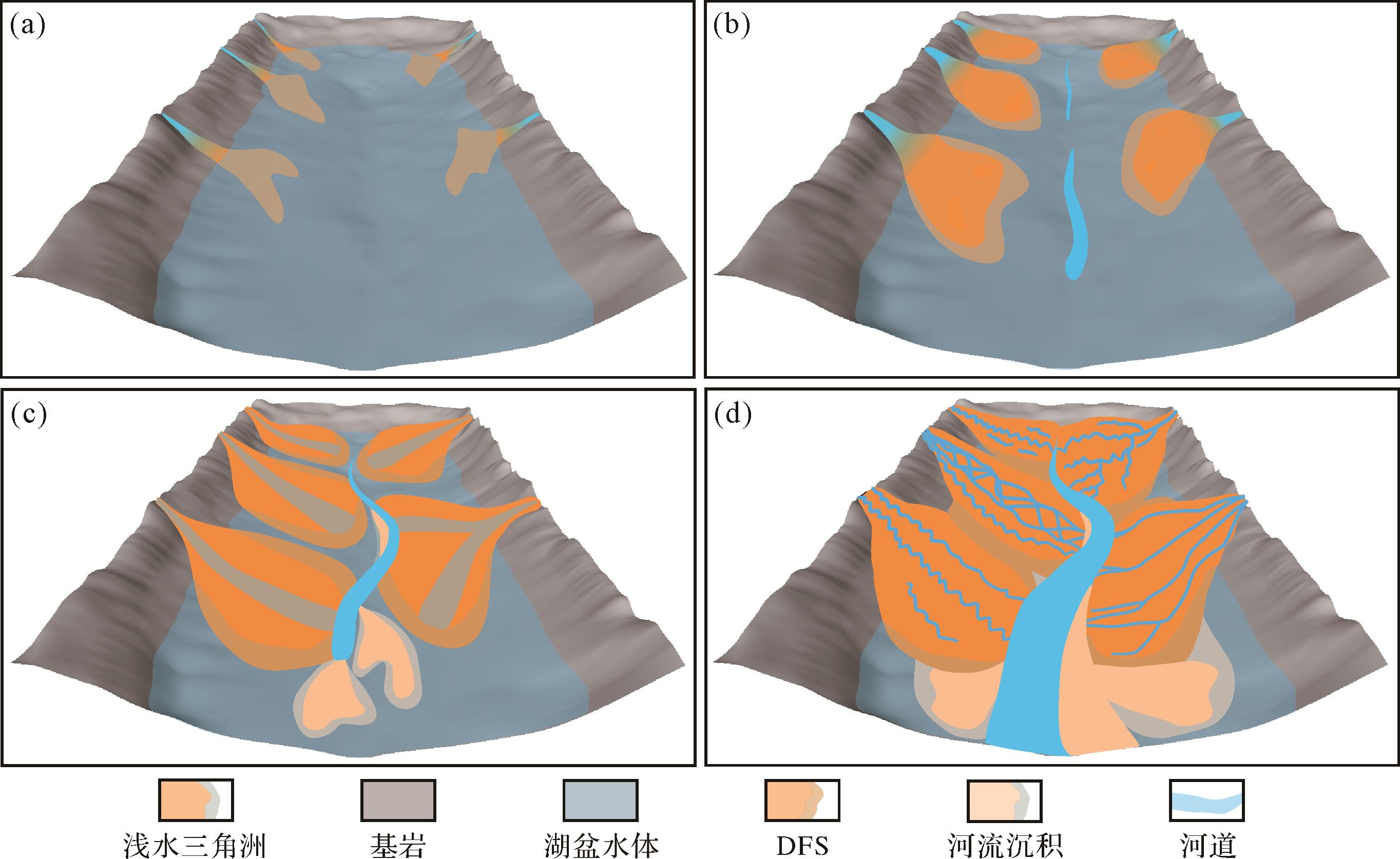
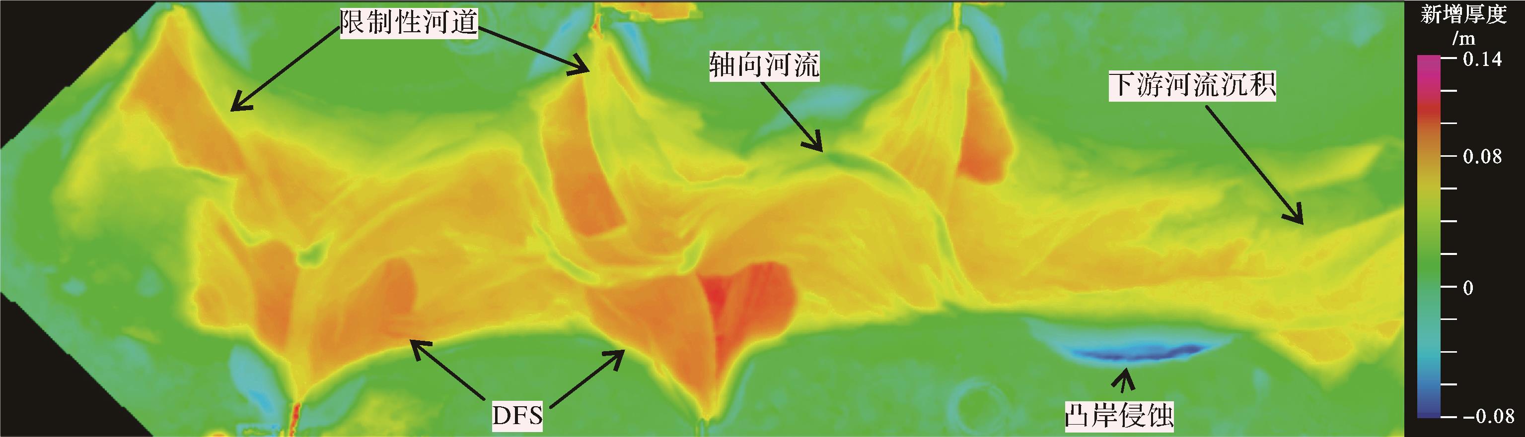
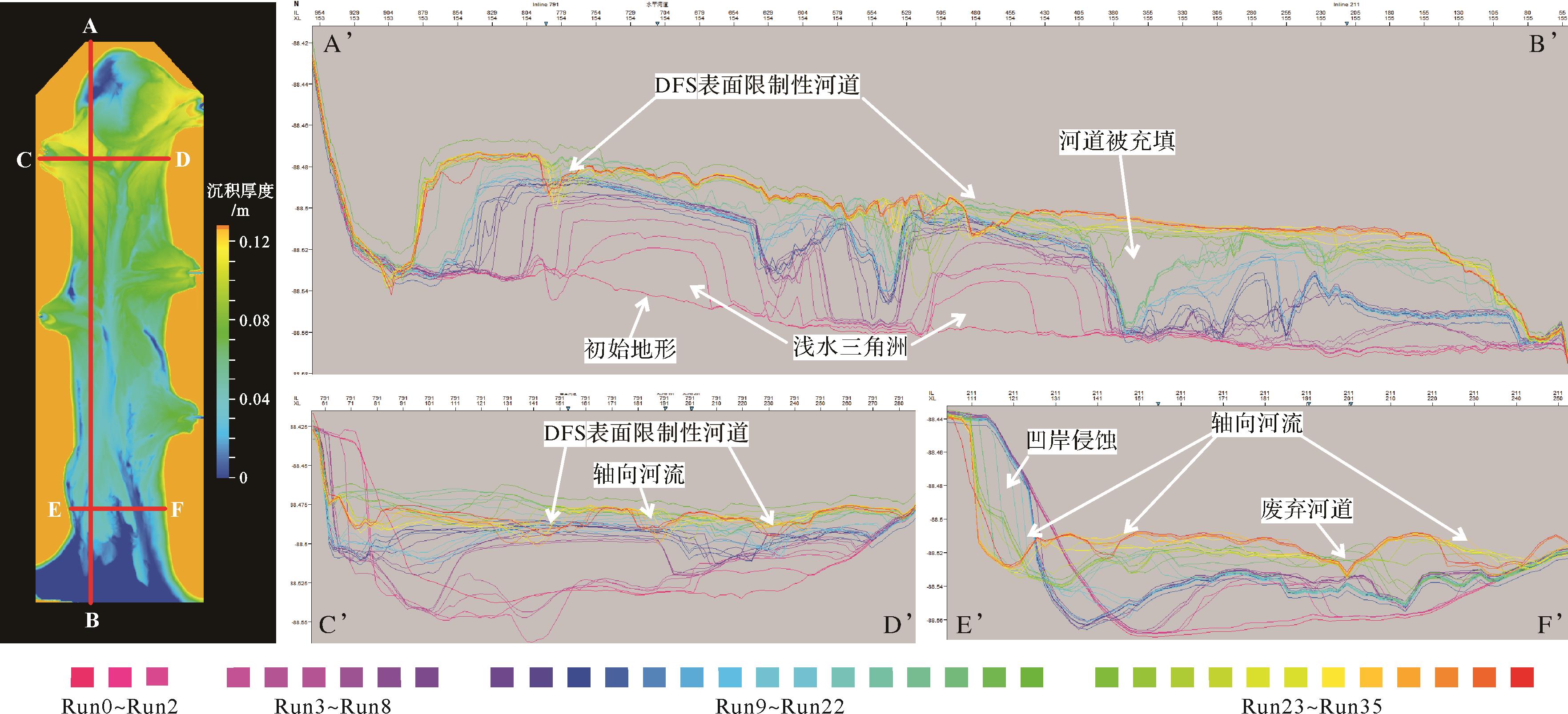
Objective Abundant ichnofossils present in the Eocene Pinghu Formation and Baoshi Formation in the Pingbei area, Xihu Sag. It is of practical significance for the division of sedimentary systems in the Xihu Sag to study the characteristics and distribution of its ichnofabrics and their indication of sedimentary environment. Methods Using core observations, the study identified ichnofossils and ichnofabrics in the Pingbei area. The IDIPA technique was employed to objectively quantify ichnofossil abundance and accurately determine both the bioturbation index and the ichnofabric index. By integrating these findings with ichnological indices, this study summarizes the characteristics of the planar distribution and vertical evolution of ichnofabric in the study area. Results (1) The study identified six ichnogenera of ichnofossils and divided them into four types of ichnofabrics: Planolites ichnofabric, Thalassinoides ichnofabric, Teichichnus ichnofabric and Beaconites ichnofabric. (2) The study area features a high landform in the northwest and a low landform in the southeast. Seawater invades from south to north, and the sedimentary environment transitions from a subtidal zone to an intertidal zone, and finally to a supratidal zone in the northwest where the highest terrain is located. The evolution pattern of the corresponding ichnofabrics follows the sequence Thalassinoides → Teichichnus → Planolites → Beaconites, consistent with regional sedimentary zoning and paleoclimate analysis. (3) From the Pinghu Formation to the Baoshi Formation in the study area, the study found an increase in the size, diversity and abundance of ichnofossils. The tiering transitioned from simple and shallow to complex and deep. The variety of organisms and the degree of bioturbation increased, and the biological habits evolved continuously, indicating that the sedimentary environment changed from anoxic to oxic. Conclusions Based on the characteristics of ichnofossils, ichnofabrics and sedimentary structures, the response relationship between the ichnofabrics and the sedimentary environment was established in the Pinghu Formation⁃Baoshi Formation in the Pingbei area. These findings provide new evidence for the changes in sedimentary environment from the perspective of ichnology in the Xihu Sag during the Eocene.
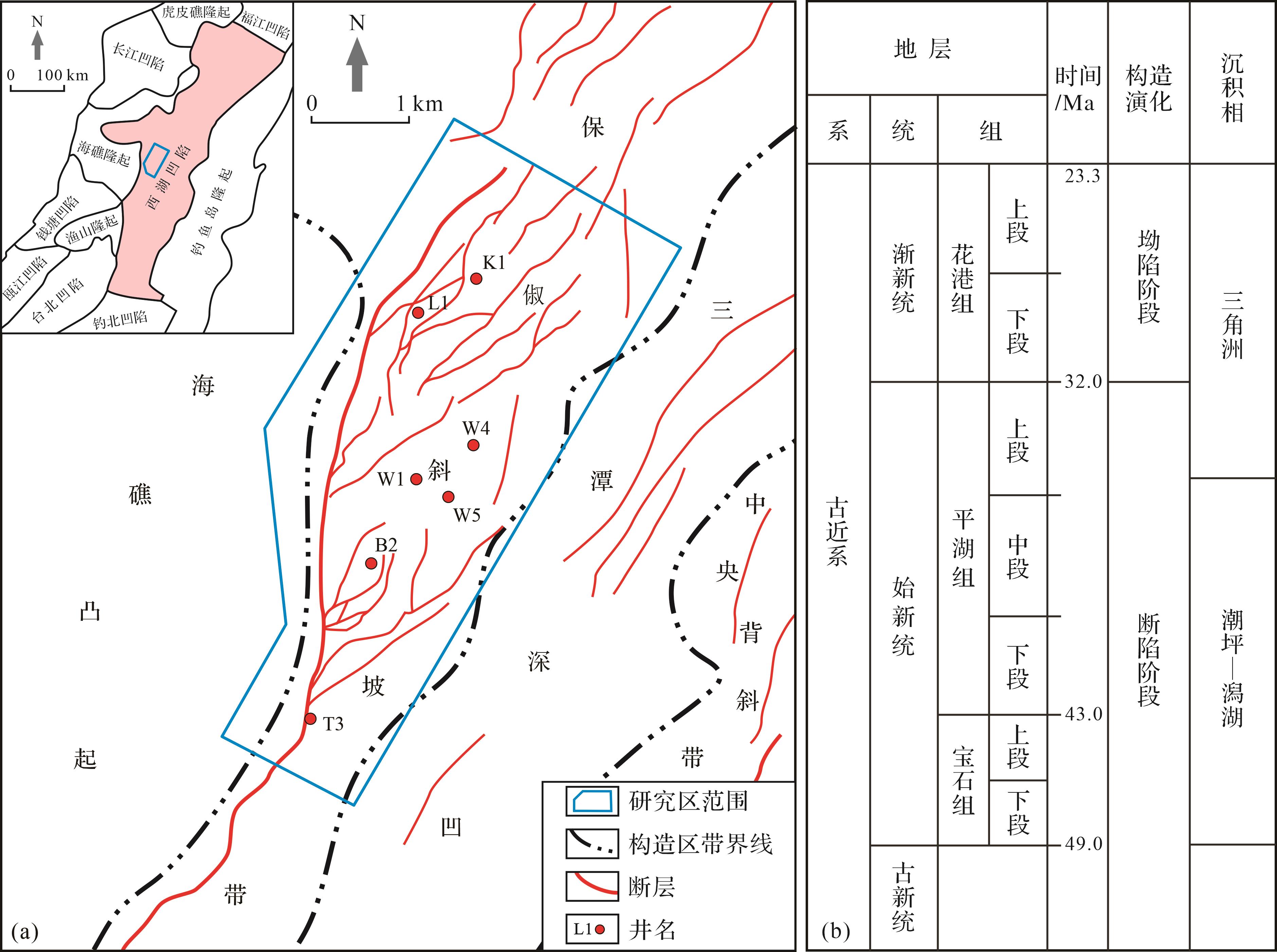
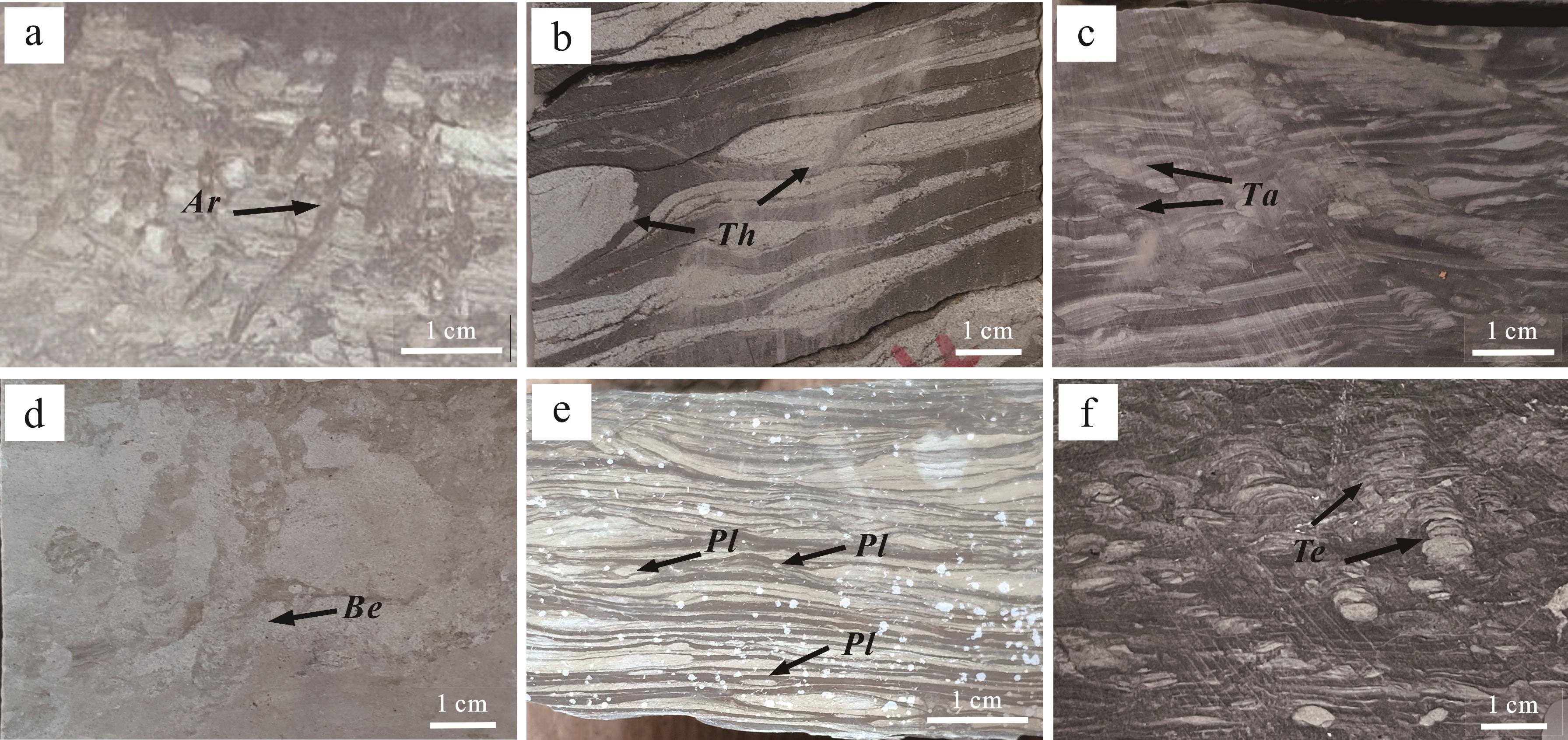
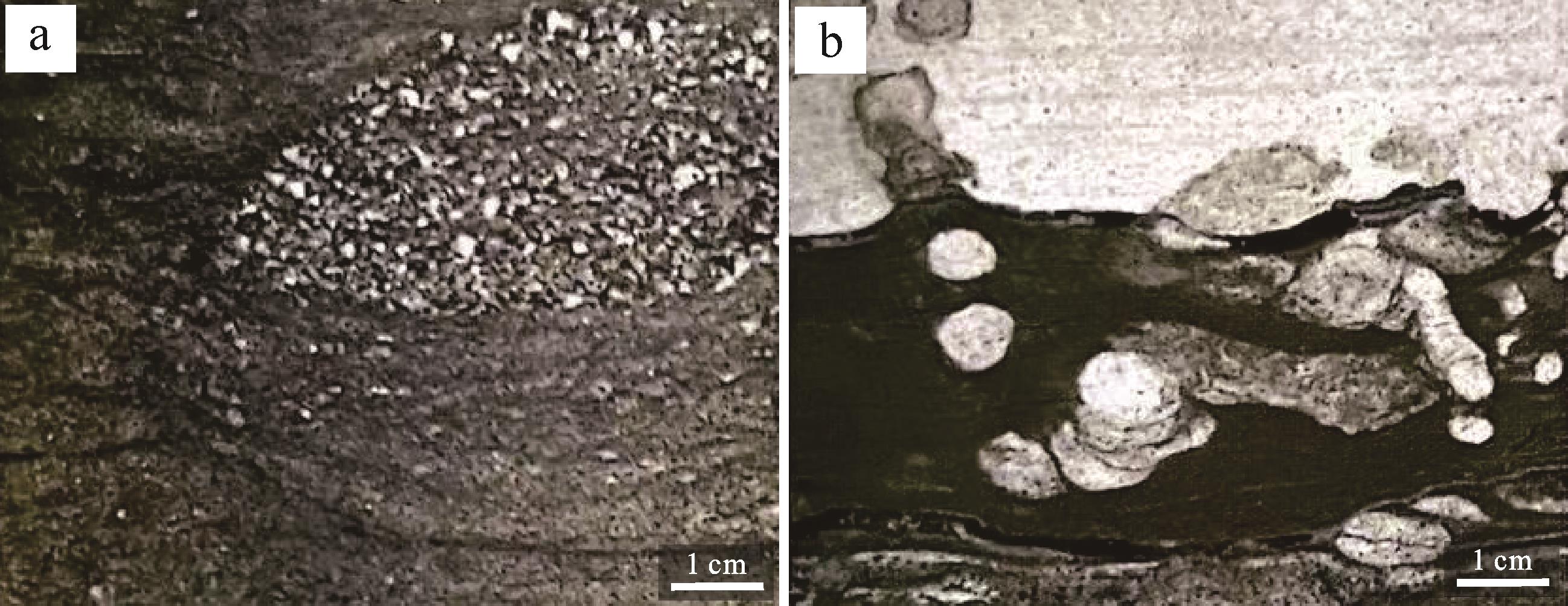
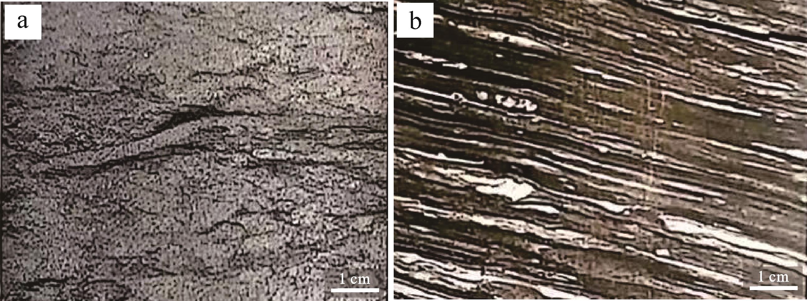
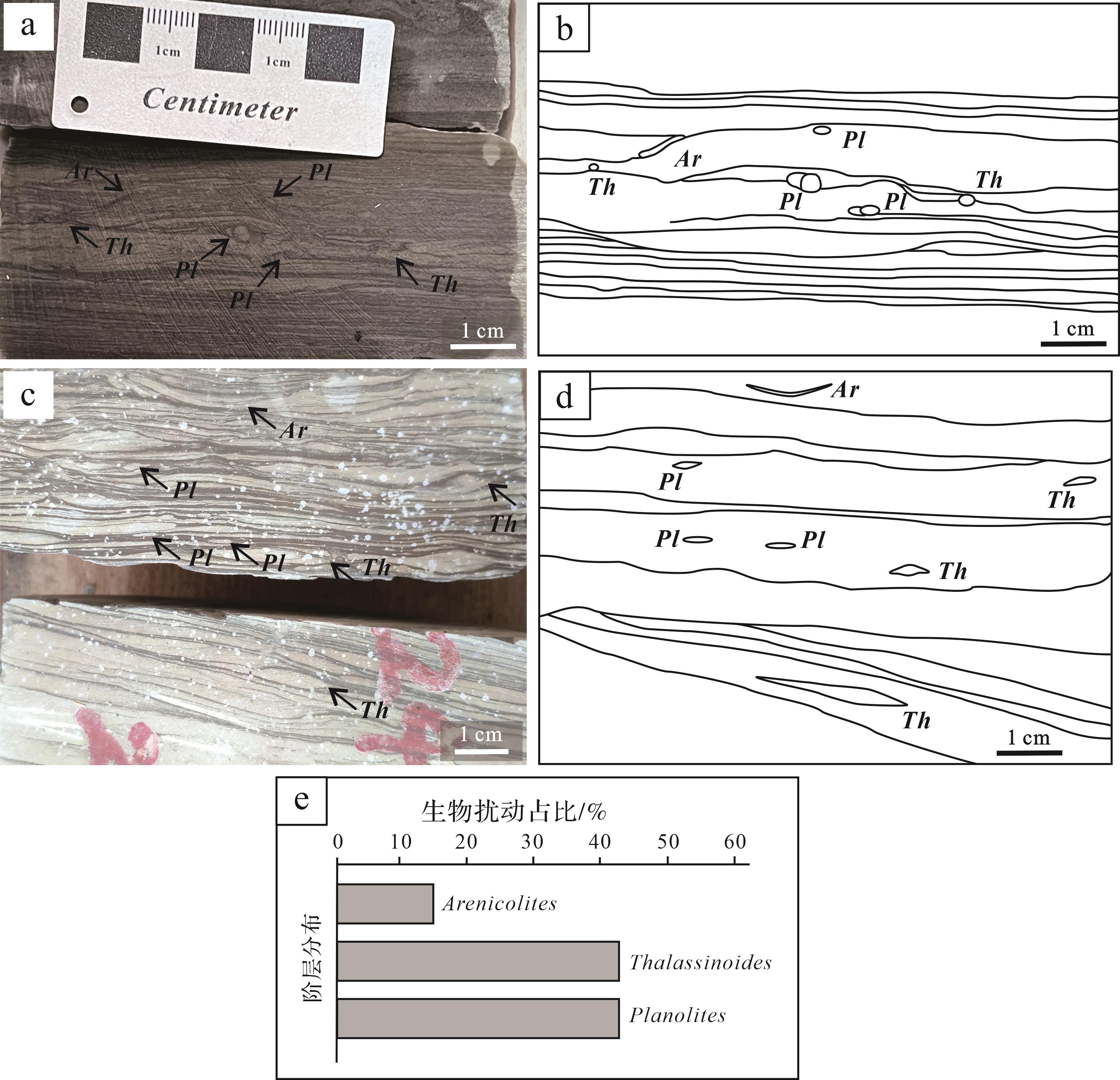
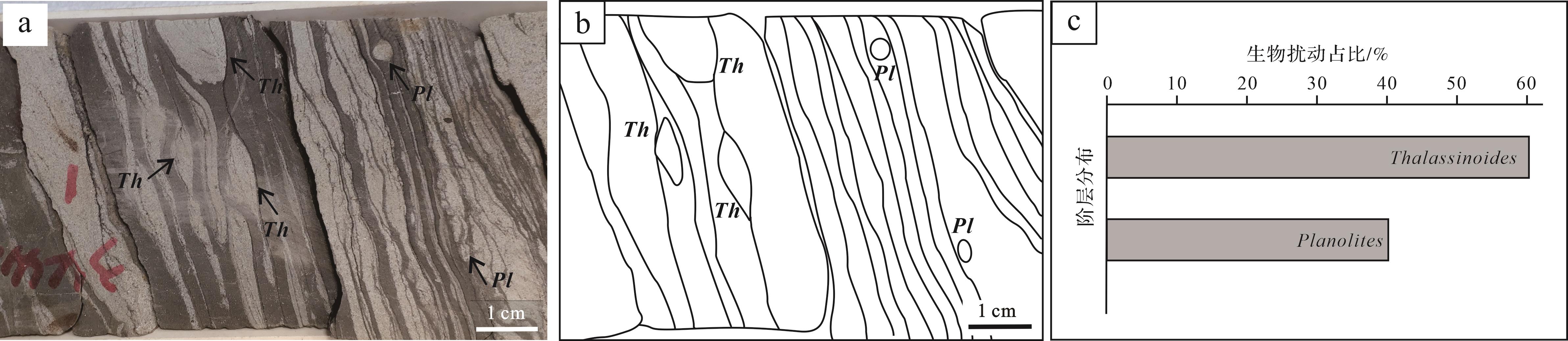
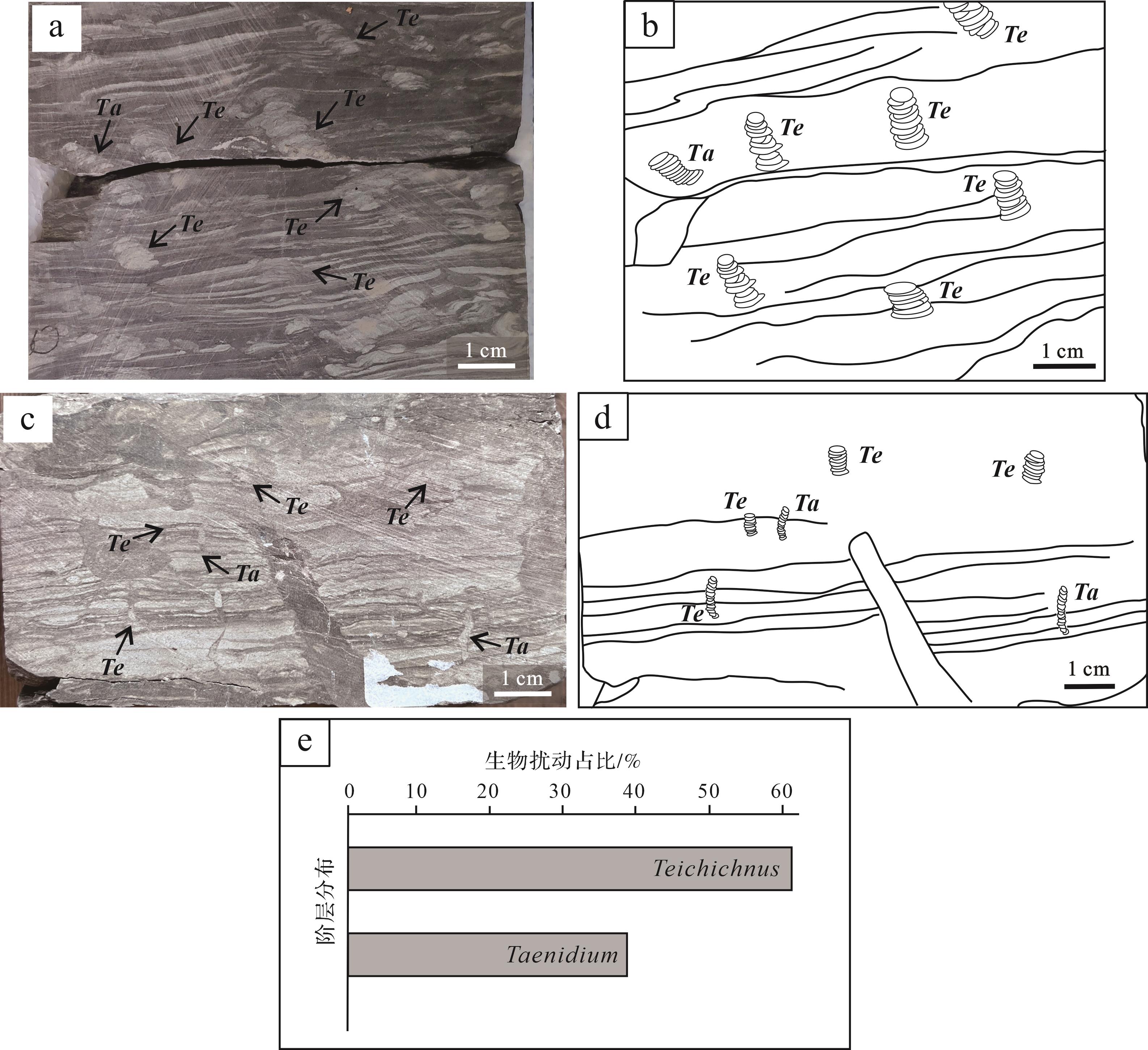
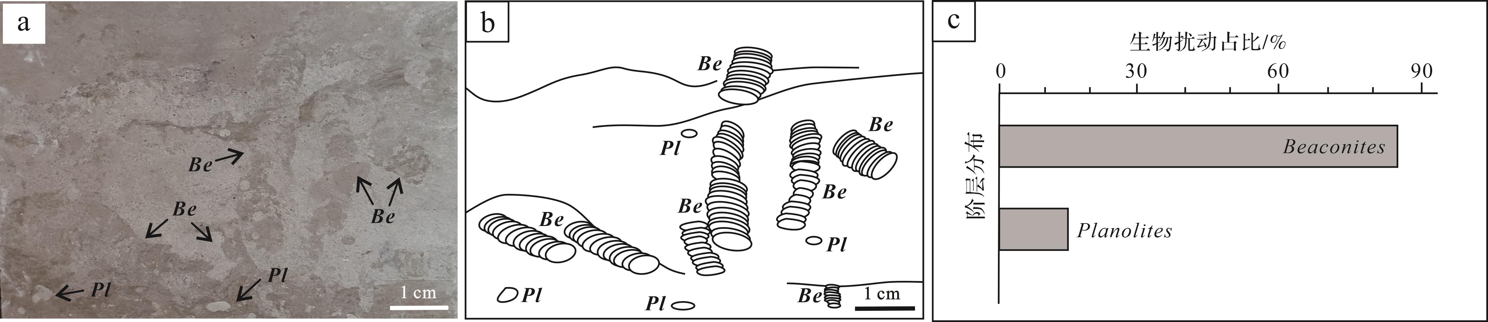
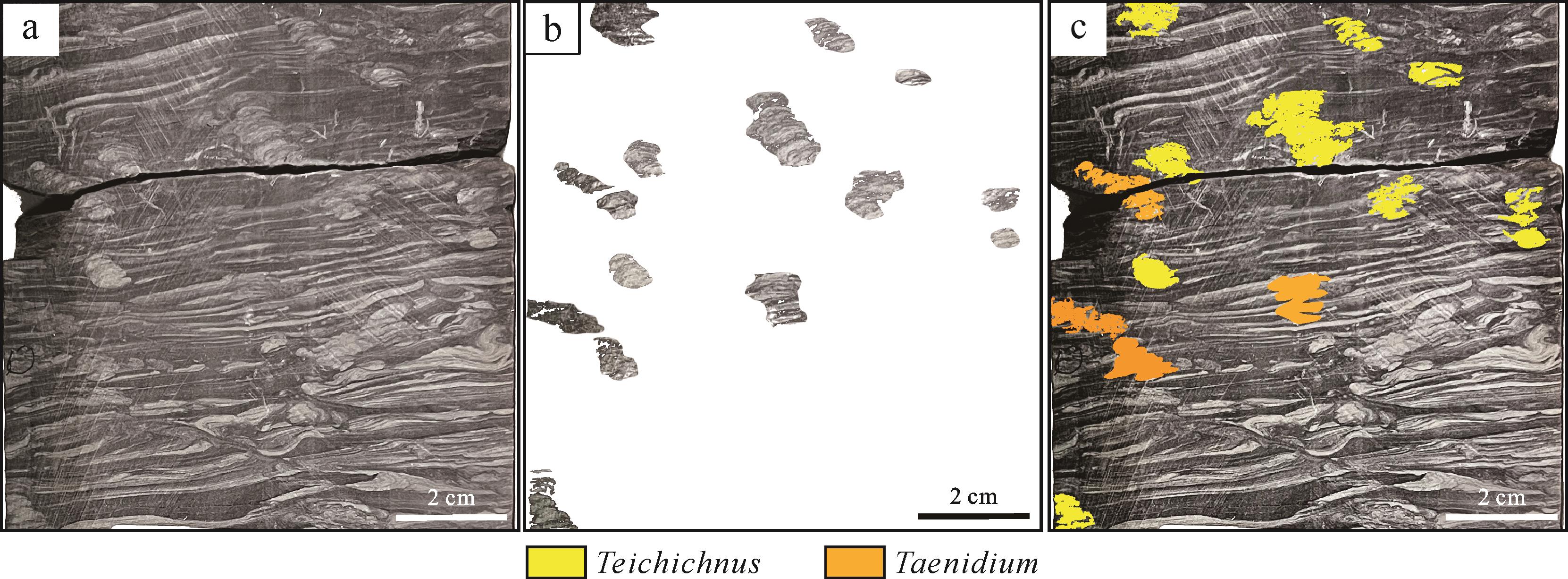
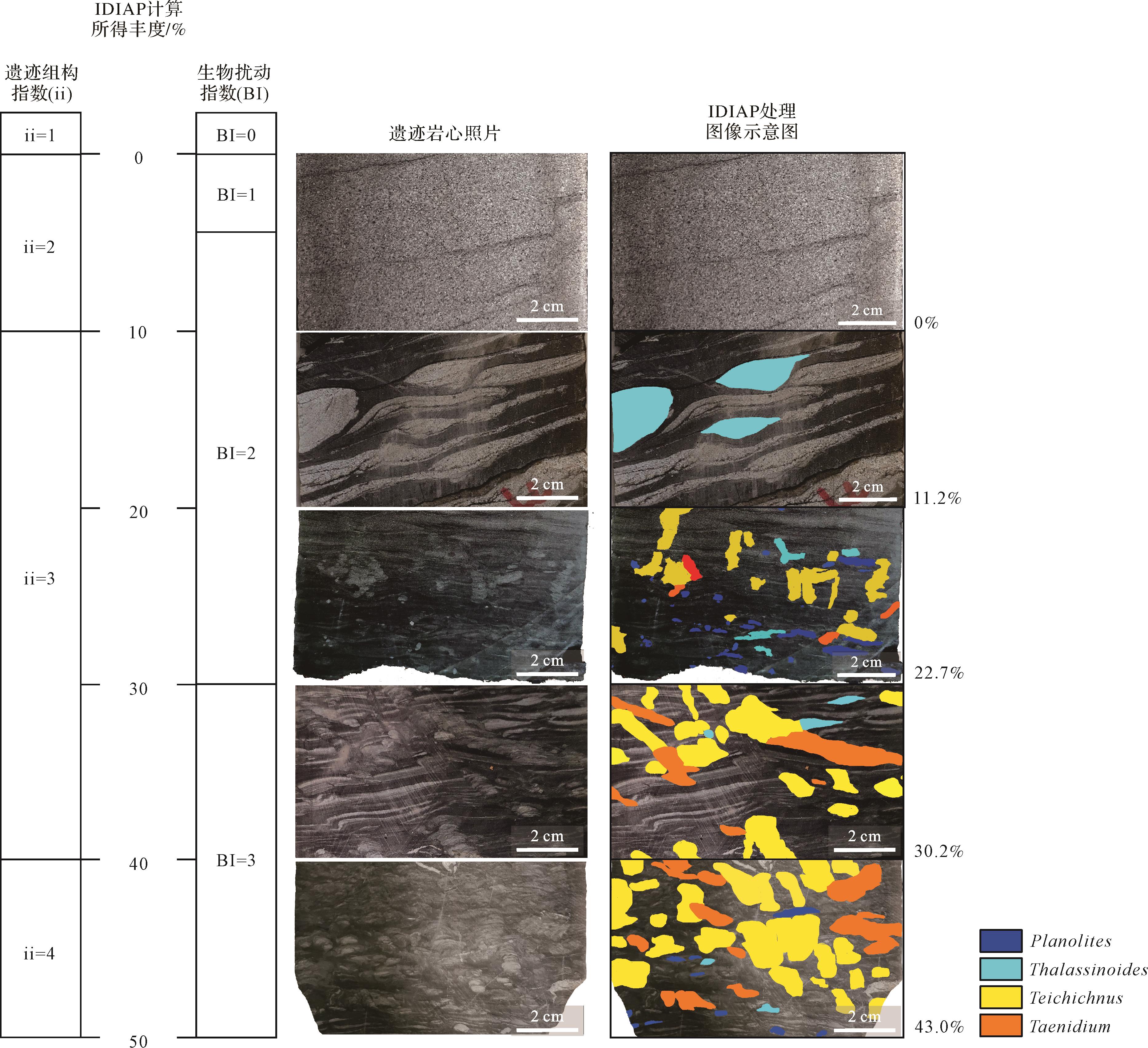
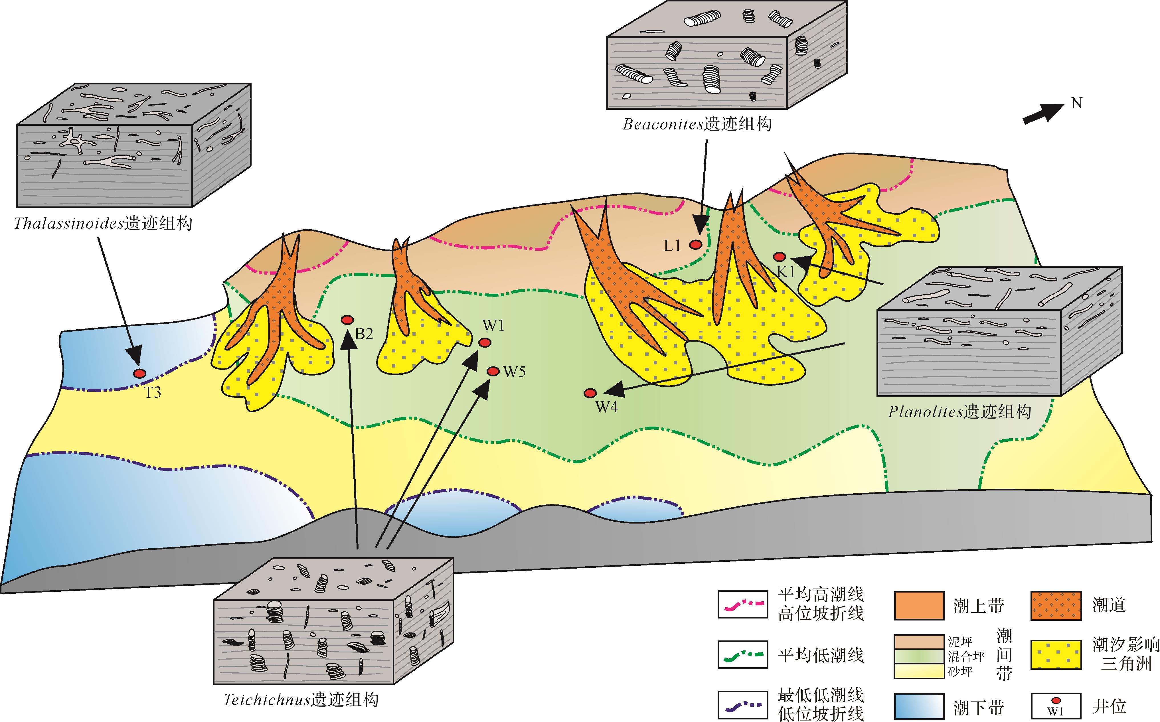
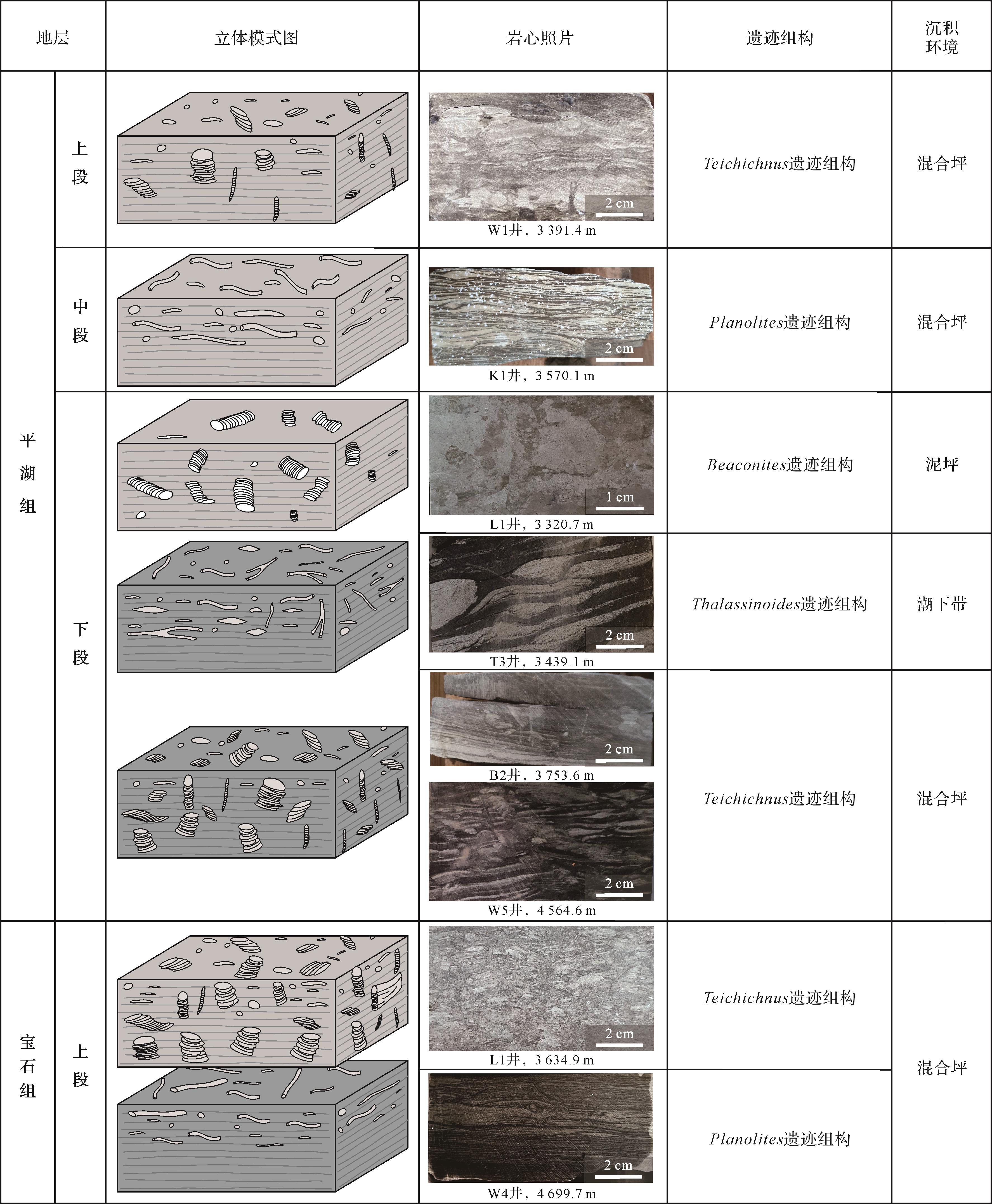
Significance Peat bogs play an important role in the global carbon cycle as a depositional carrier of paleo-wildfire events and paleoclimate information. By systematically sorting wildfires types in peat bogs and clarifying the academic terminology related to wildfire products such as charcoal, the carbon source and sink effects of wildfires in peat bogs were discussed. This information is useful for the study of the carbon cycle in deep time. Progress Wildfire product charcoal, approximately equivalent to the inertinite in coal, is a relatively stable carbon store of plant-incomplete combustion residues, which can provide a record of wildfire activities in geological history, from millennia to billions of years. Changes in charcoal material composition (e.g., polysaccharides and lignin) and microstructure (e.g., cell wall homogenization) can reflect the temperature range of paleo-wildfires. Wildfire types can be recovered and atmospheric oxygen content can be constrained using inertinite reflectance and content. The impacts of wildfires on the global carbon cycle include both short-term carbon source and long-term carbon sink effects. Wildfires lead to direct large carbon emissions and carbon release from deep peat burning. However, wildfire-driven persistent changes in soil microorganisms, aggregates, and organic matter can directly offset certain carbon losses, and charcoal provides a stable carbon store. Conclusions and Prospects Based on the carbon cycle model of peatland under normal burial conditions, the influence factors of wildfire, soil aggregates, fungi, and bacteria were introduced to propose a post-fire peatland carbon cycle model. Using the inertinite wildfire genesis and greenhouse gas emission models, and taking the carbon emission and carbon storage of wildfires in Early Cretaceous peat (coal-forming) bogs in Northeast China as an example, the results show that the long-term (million-year time scale) carbon sinks of forest vegetation growth and peatland are fully capable of neutralizing the short-term (year time scale) carbon source effect brought by wildfires. In the future, when evaluating the deep-time carbon cycle response to wildfires, it is necessary to consider the length of the time period and wildfire intensity, improving our understanding of climate change and environmental evolution caused by wildfire to promote the in-depth integration of deep-time and present-day climate change and carbon cycle research.
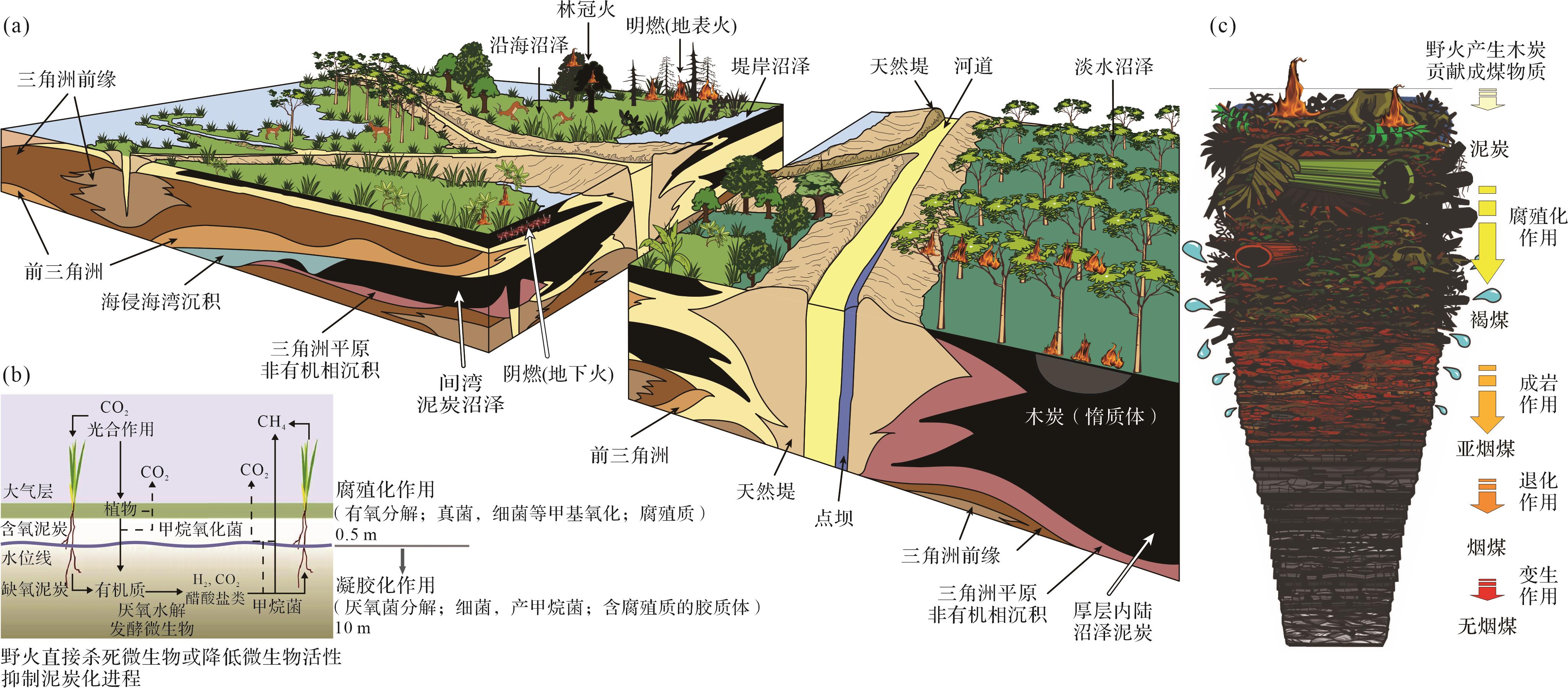
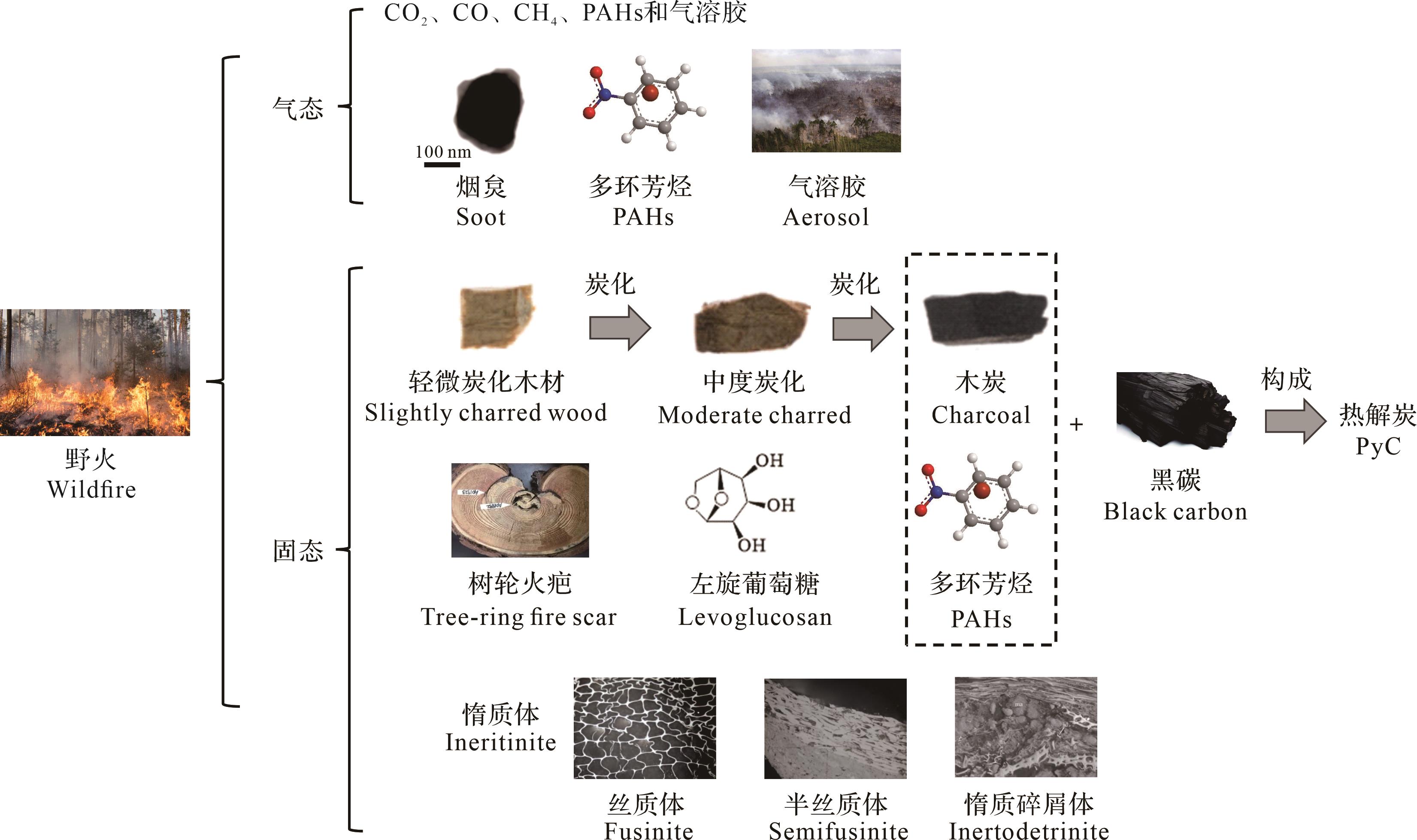
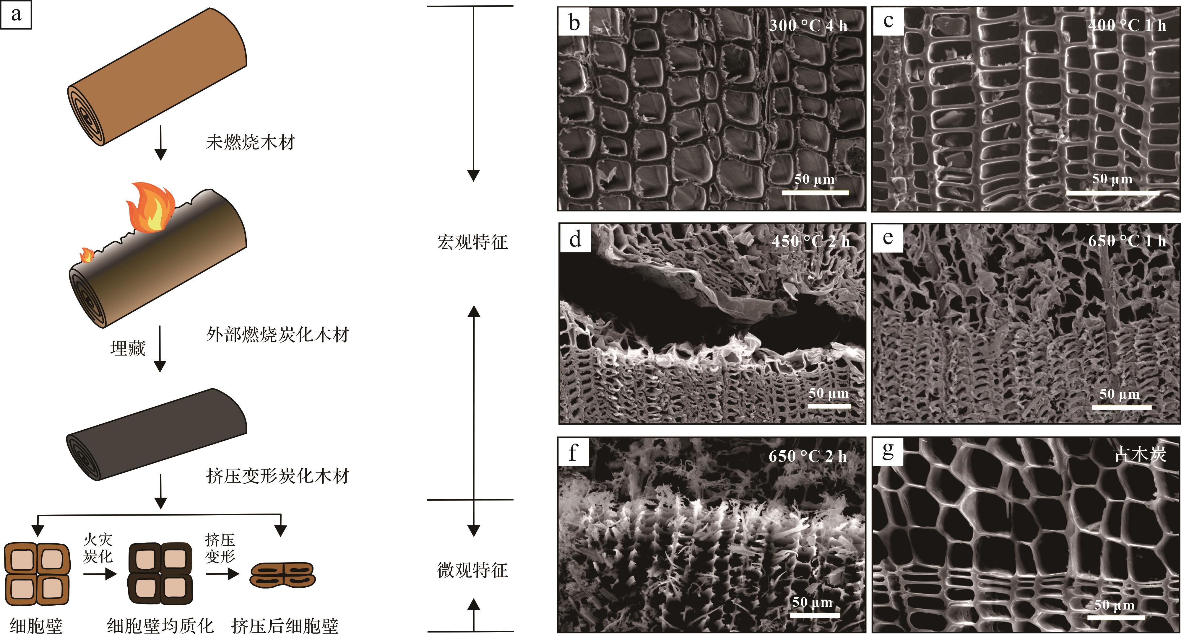
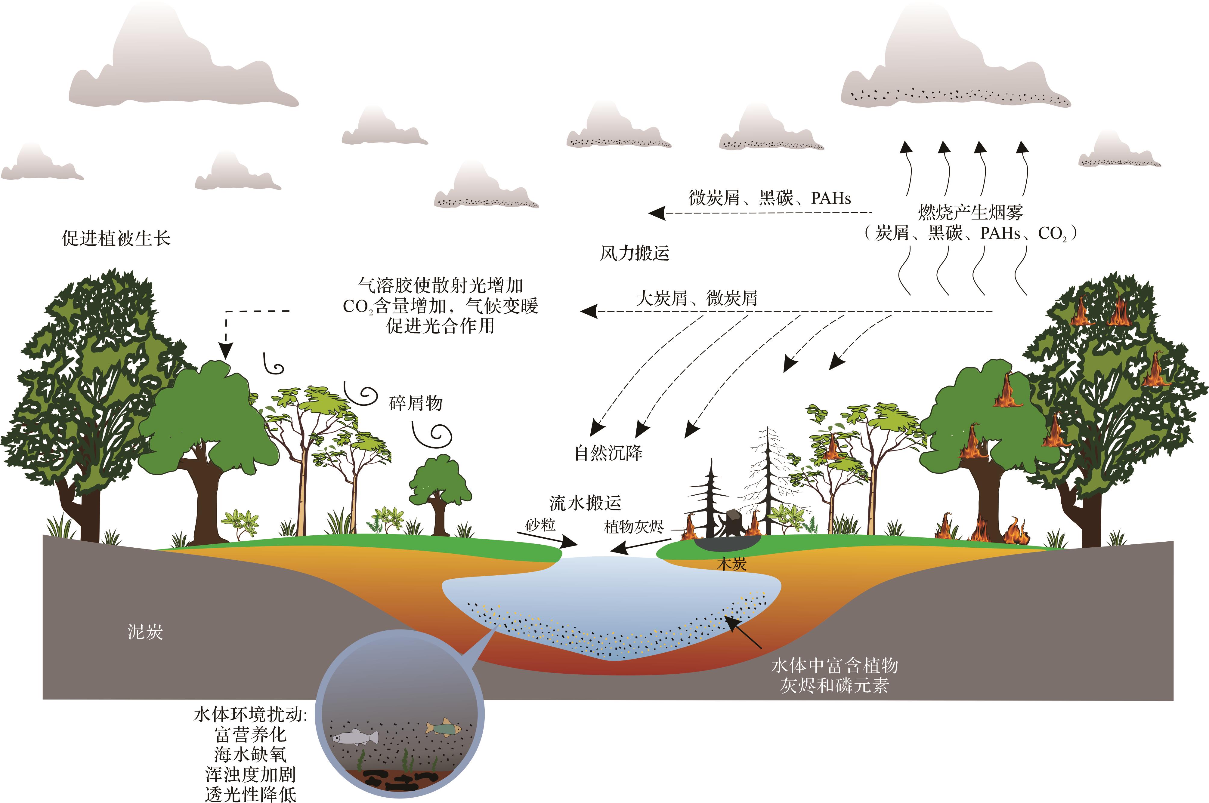
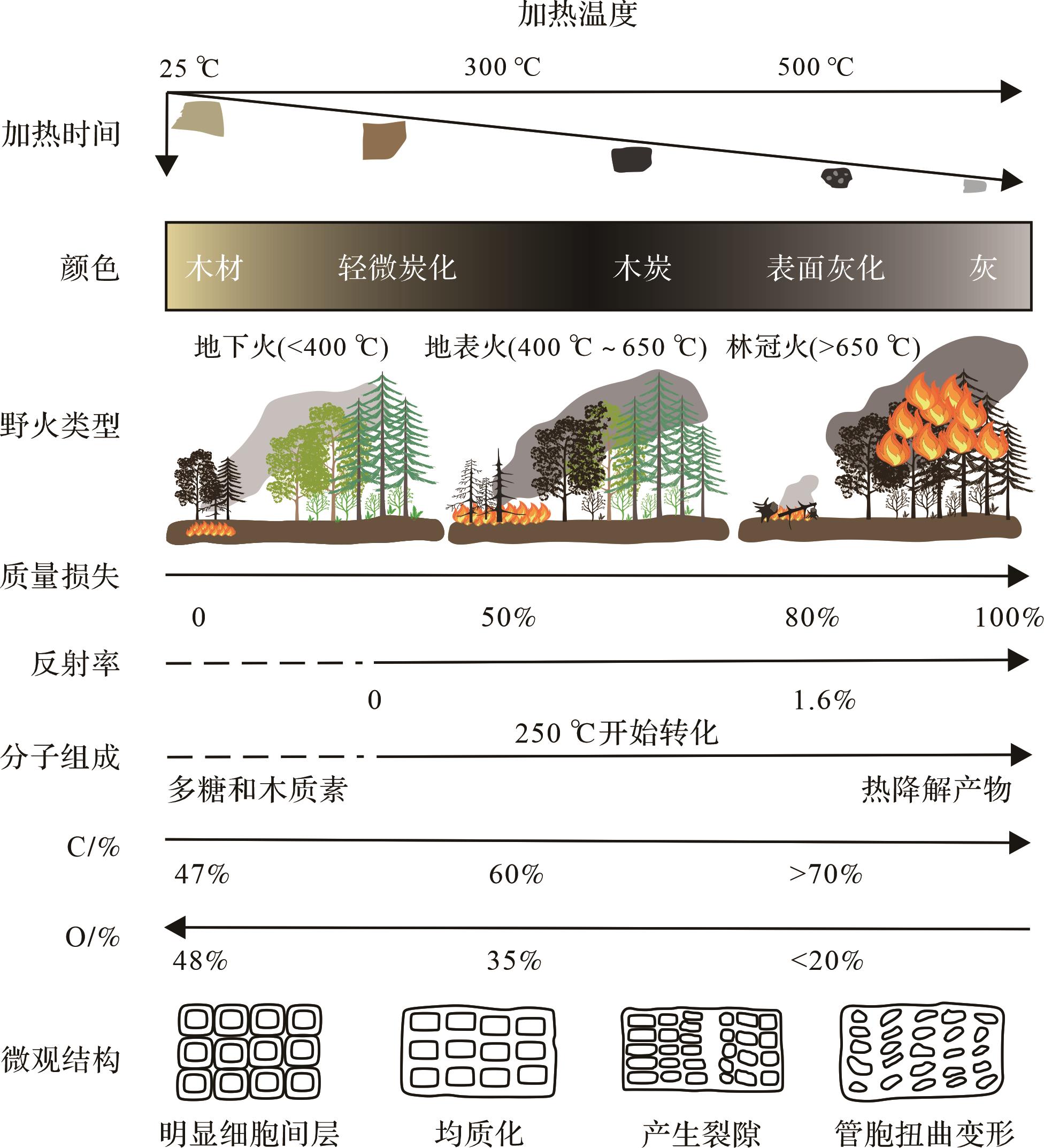
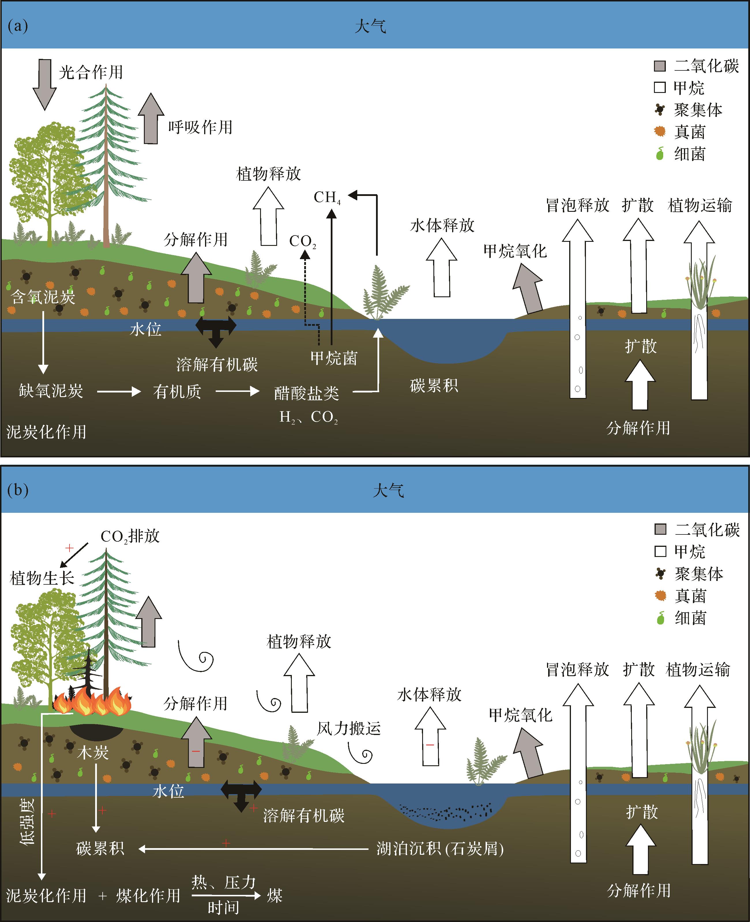
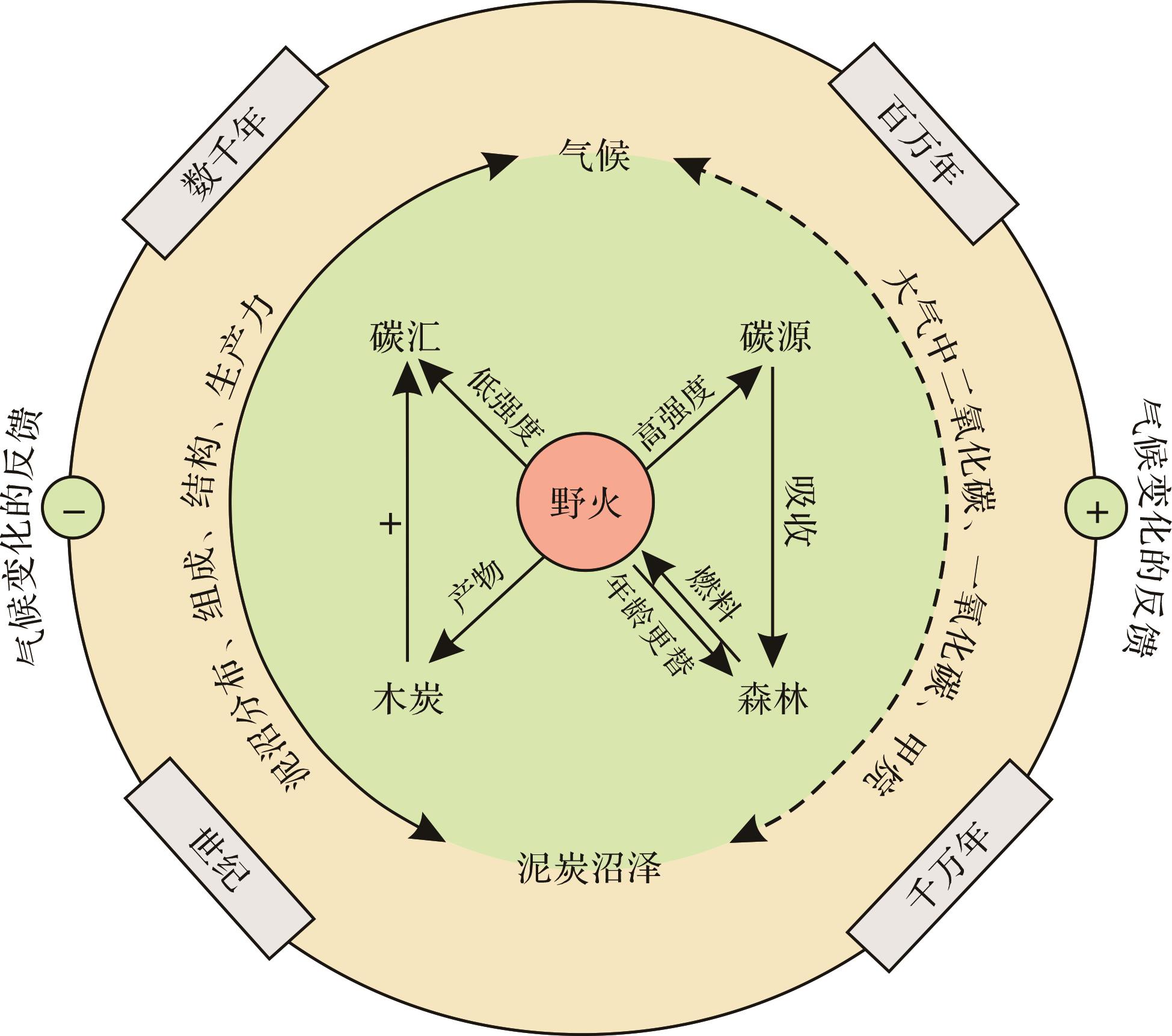
Objective The widespread siderites in the marine strata of the Toarcian Oceanic Anoxic Event (T-OAE) are believed to have resulted from a low sulfate concentration and increased terrestrial iron supply. Similar large amounts of siderite have also been reported in paleolakes in the same period. However, the mechanism of lacustrine siderite development and its connection with the T-OAE remain unexplored, but is crucial to a better comprehension of lacustrine biogeochemical cycling in the early Toarcian. Methods Mineralogical and carbon isotope geochemical analyses were performed on siderite samples from the lacustrine Anya section of the Ordos paleolake. The sources of iron and carbon, as well as the sedimentary environment, were investigated by integrating major and trace element data, which allowed exploration of the formation mechanism of siderites during the T-OAE period of climatic change. Results The coexistence of pyrites and siderites was observed by scanning electron microscopy (SEM). The value of inorganic carbon isotopes (δ13Ccarb) varies from -11.25‰ to +16.32‰, and the organic carbon isotope (δ13Corg) value ranges between -32.03‰ and +14.33‰. Light rare earth elements (REEs) are enriched and heavy REEs are depleted, with Eu anomalies ranging from 0.69 to 0.85. Conclusions The iron in the Anya siderites is derived from terrestrial inputs; the carbon included HCO3– produced by methanogenesis, as well as carbon released by organic matter decomposition and aerobic methane oxidation, either bacterially in the suboxic zone or archaeally below the oxic-anoxic interface immediately after methane production. The pore fluids during siderite formation were a suboxic to anoxic environment. During the T-OAE, intensified continental weathering and increased surface runoff transported abundant Fe2+ ions into basin lakes whose widespread anoxia, abundant organic matter and low sulfate concentrations created favorable conditions for extensive siderite deposition.
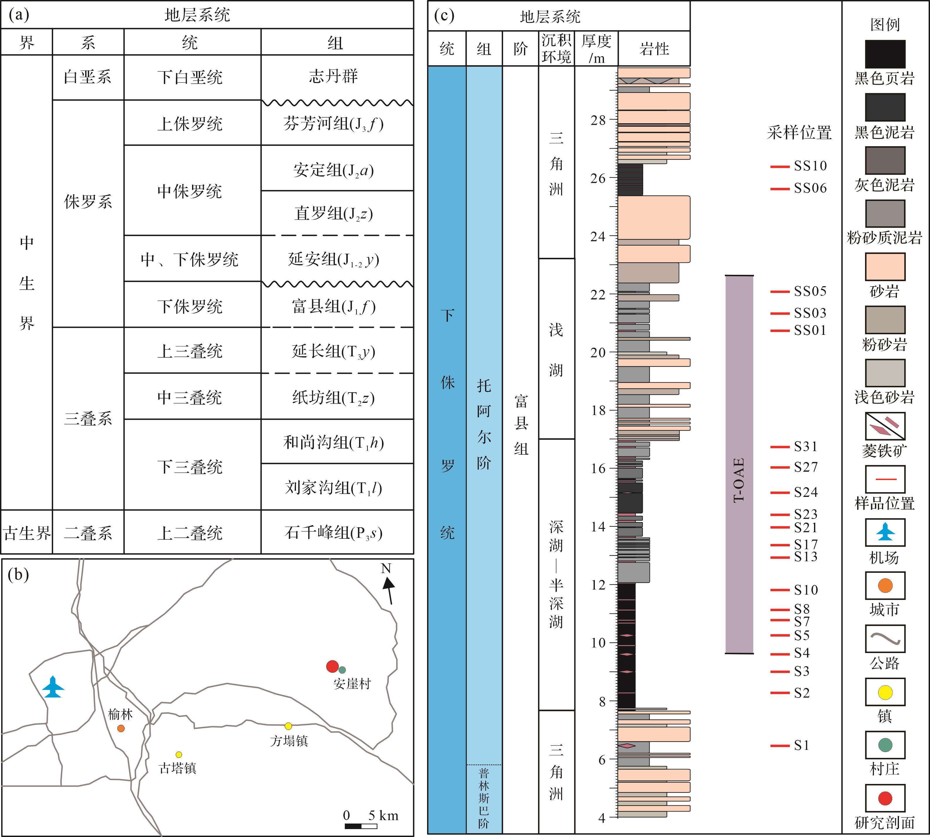
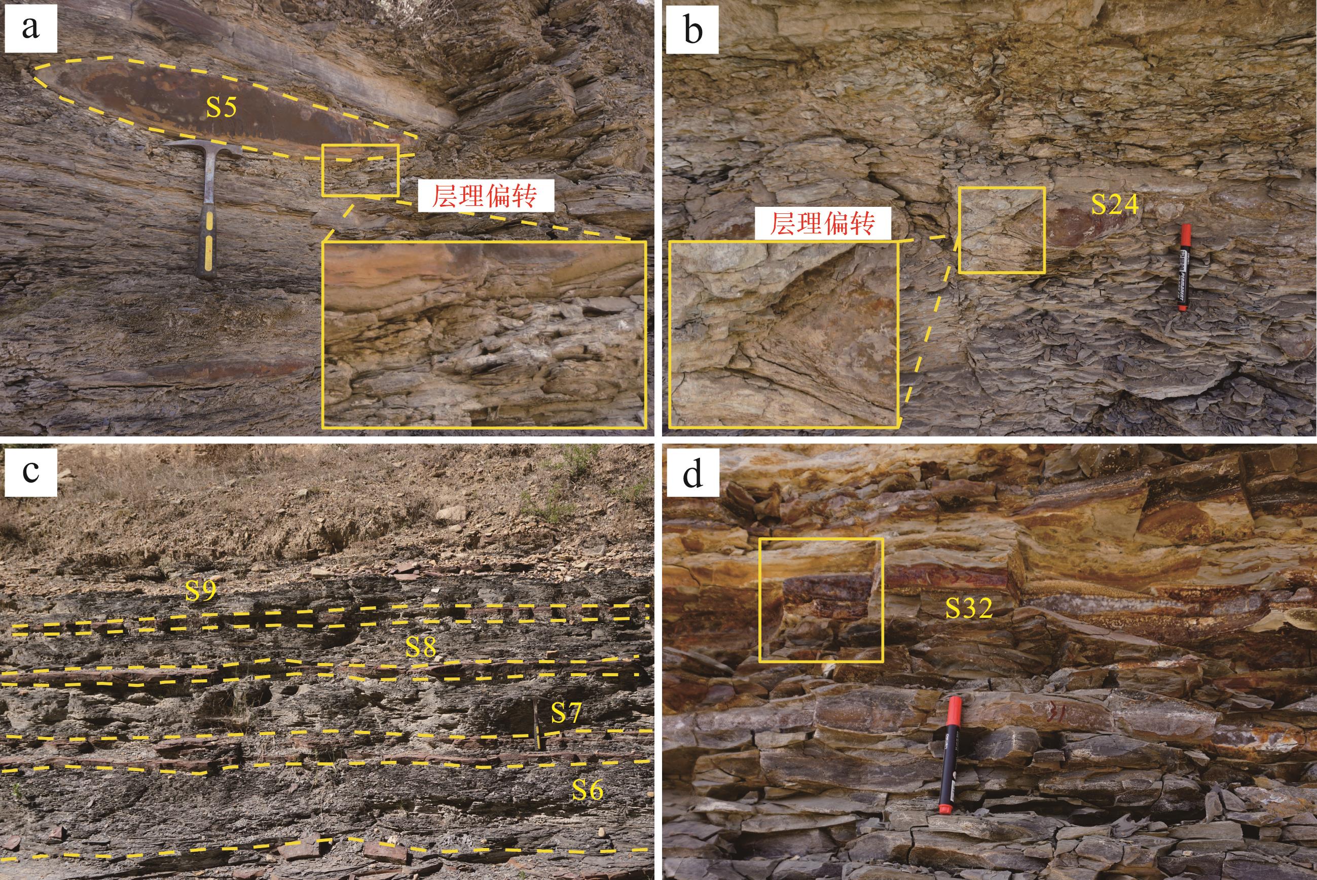
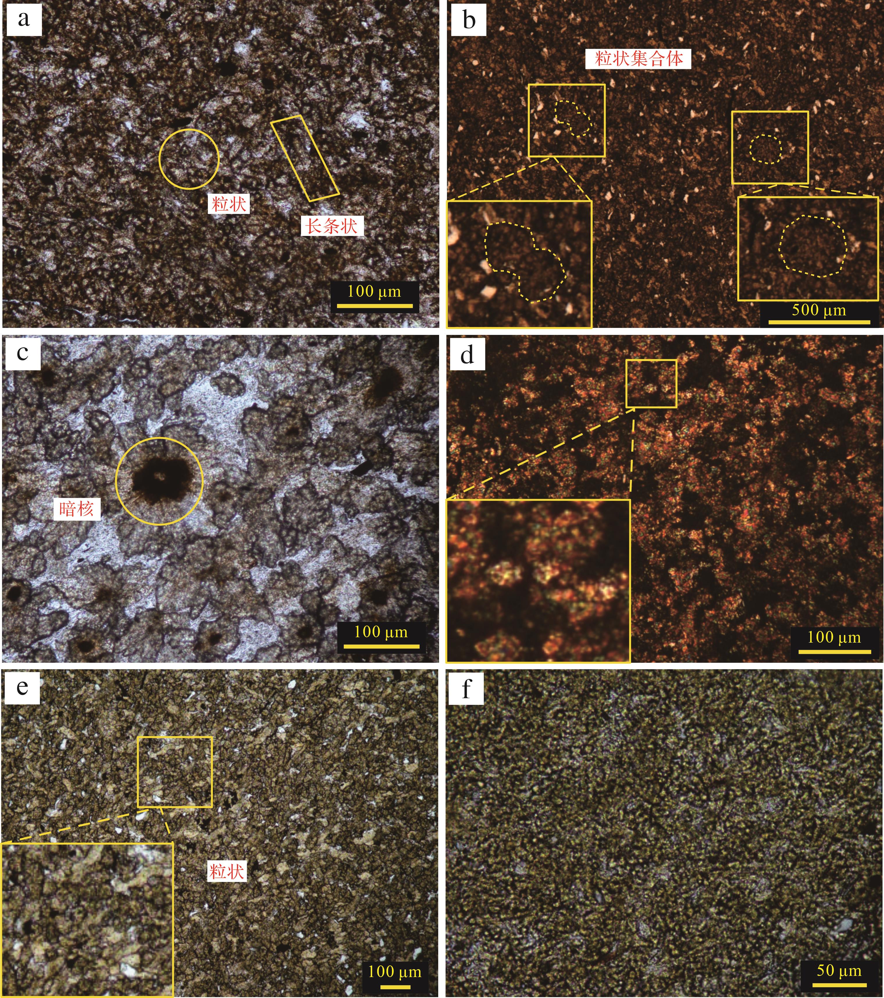
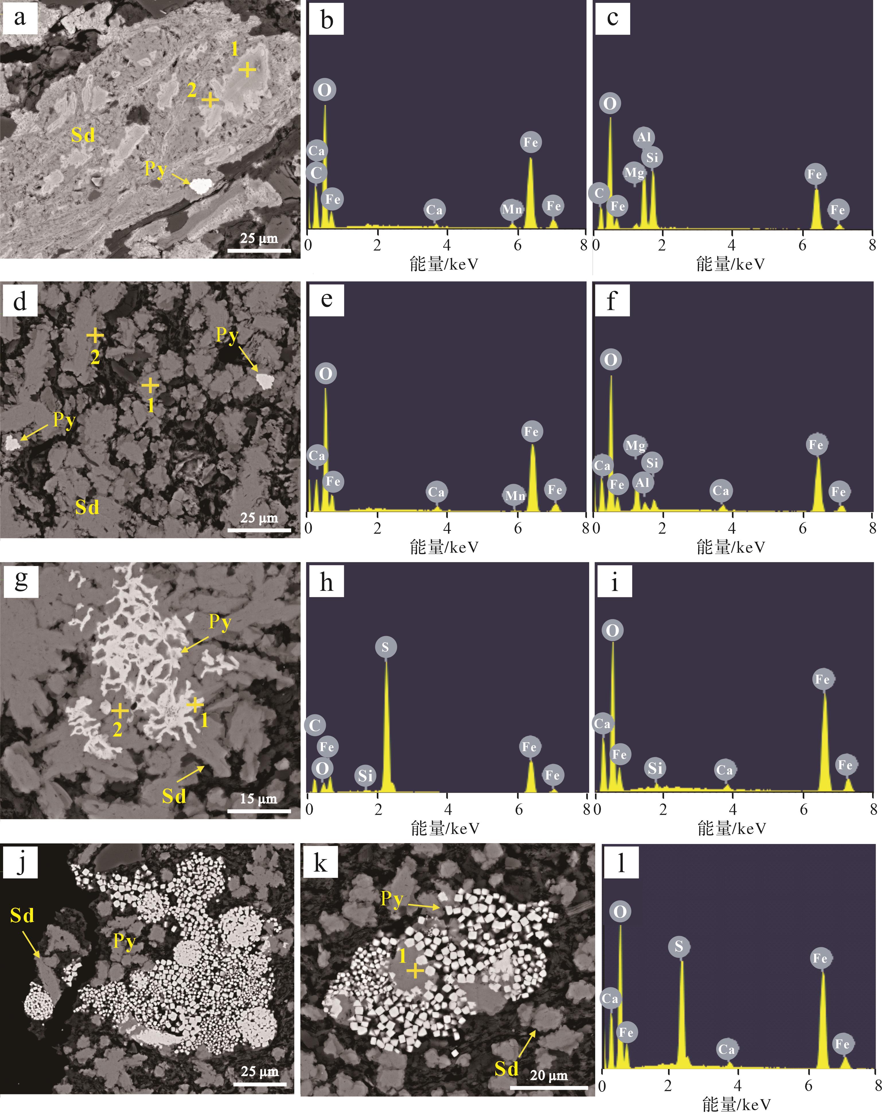
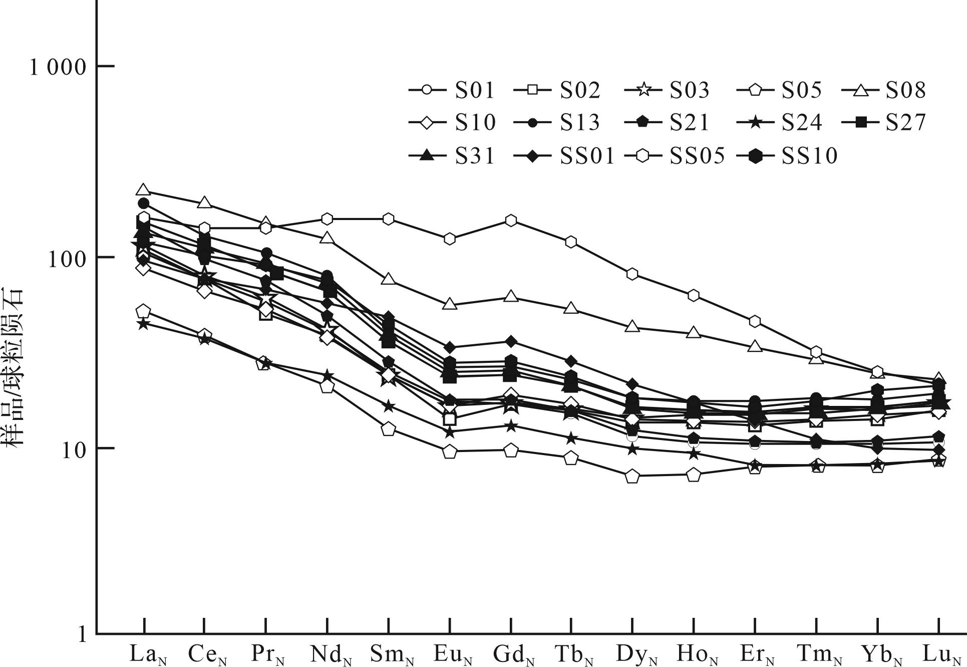
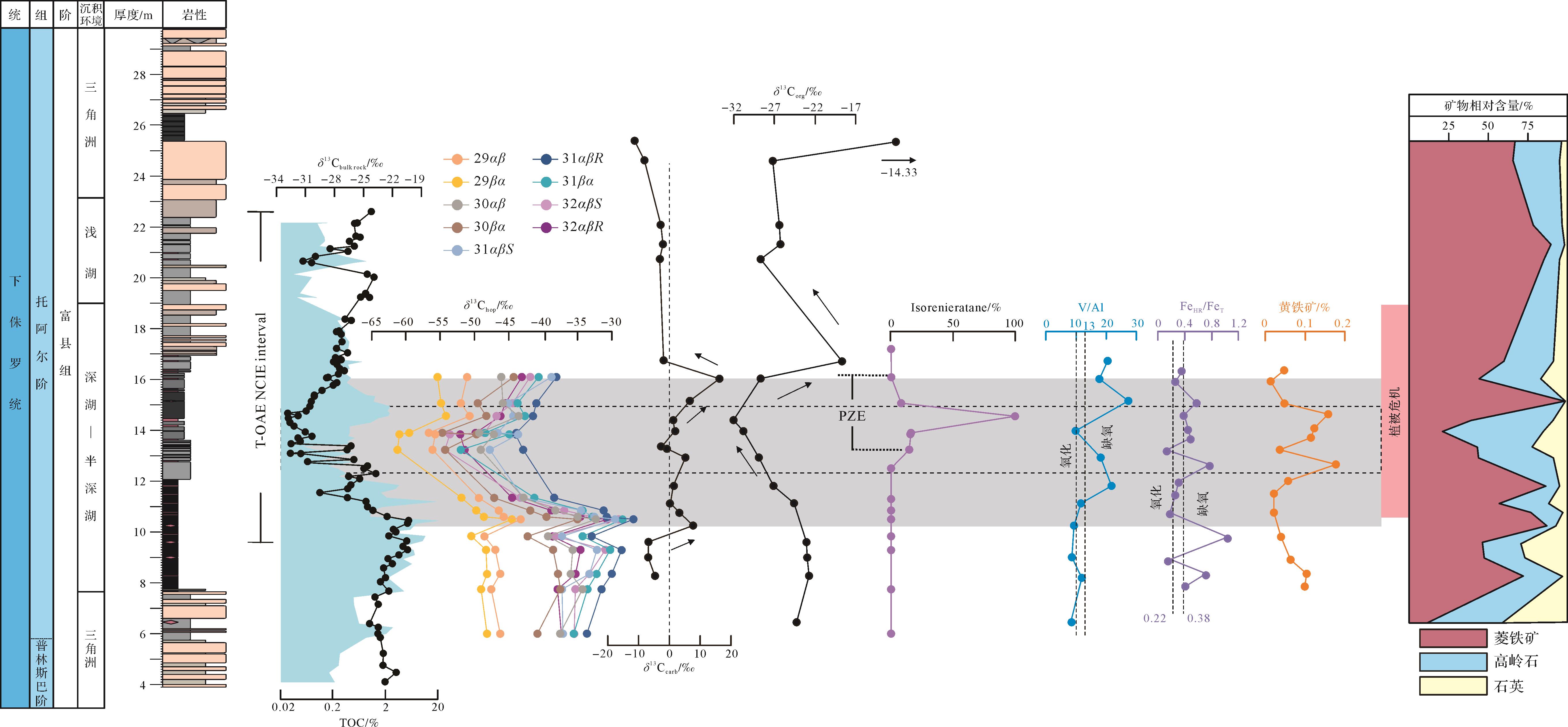
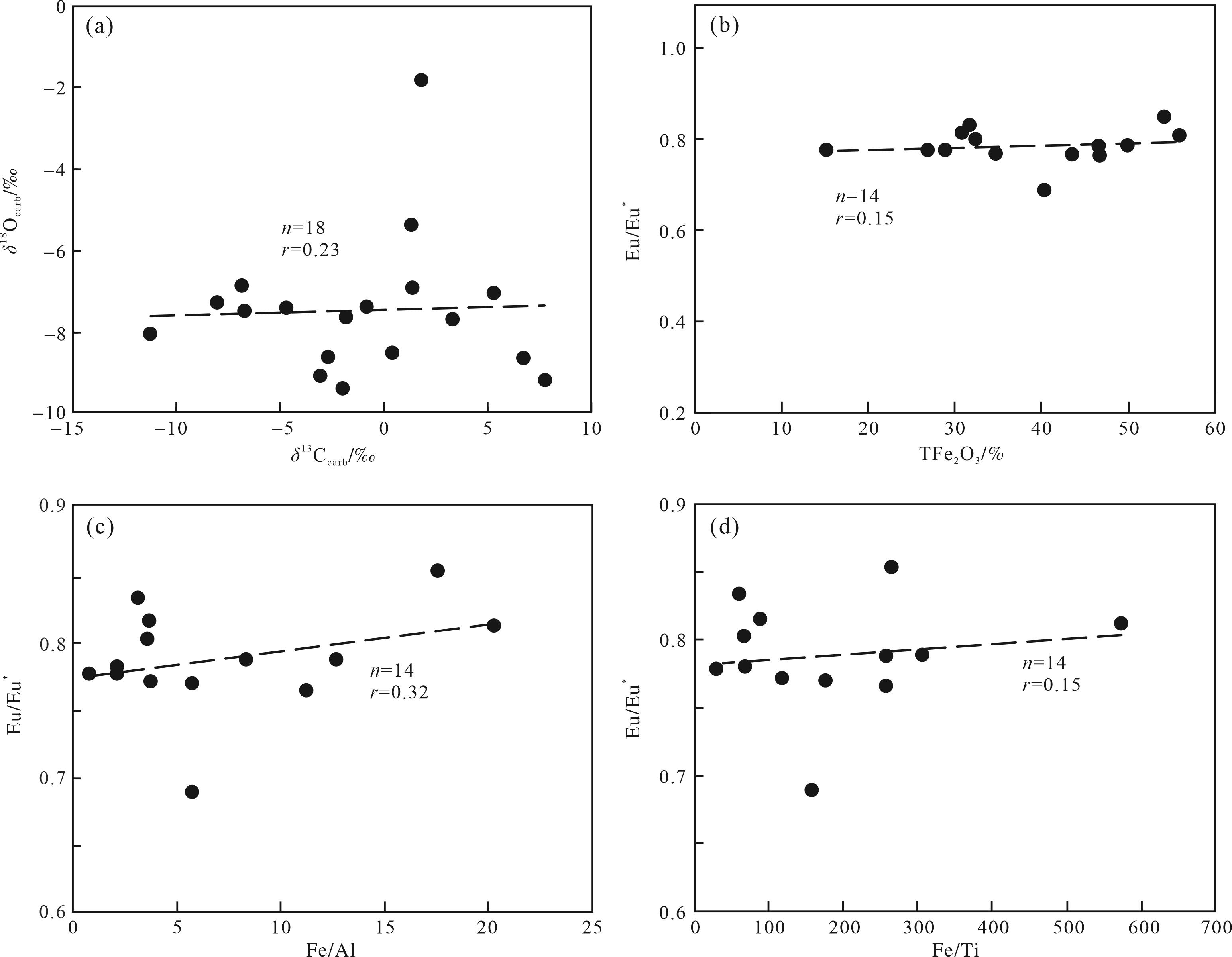
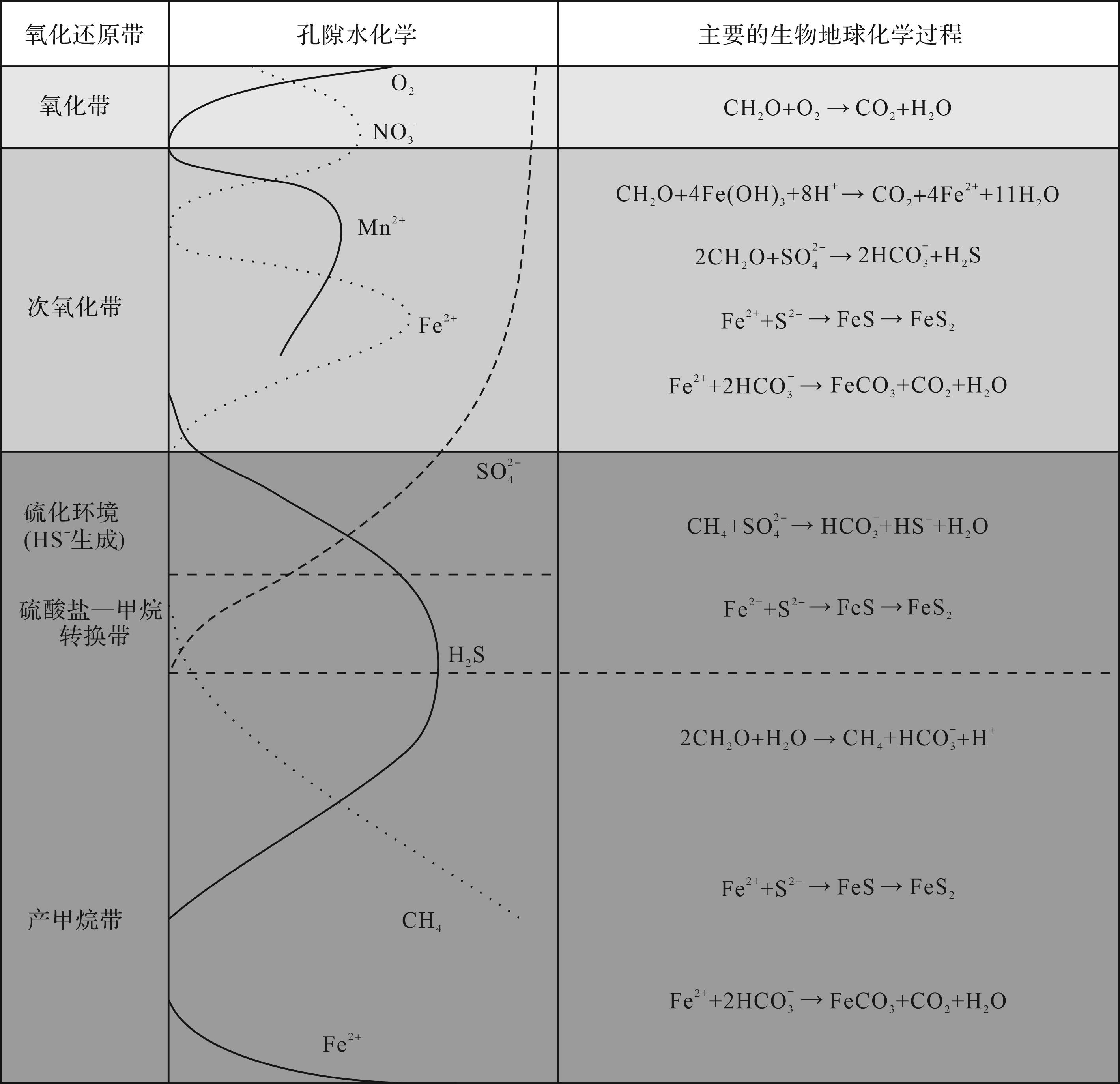
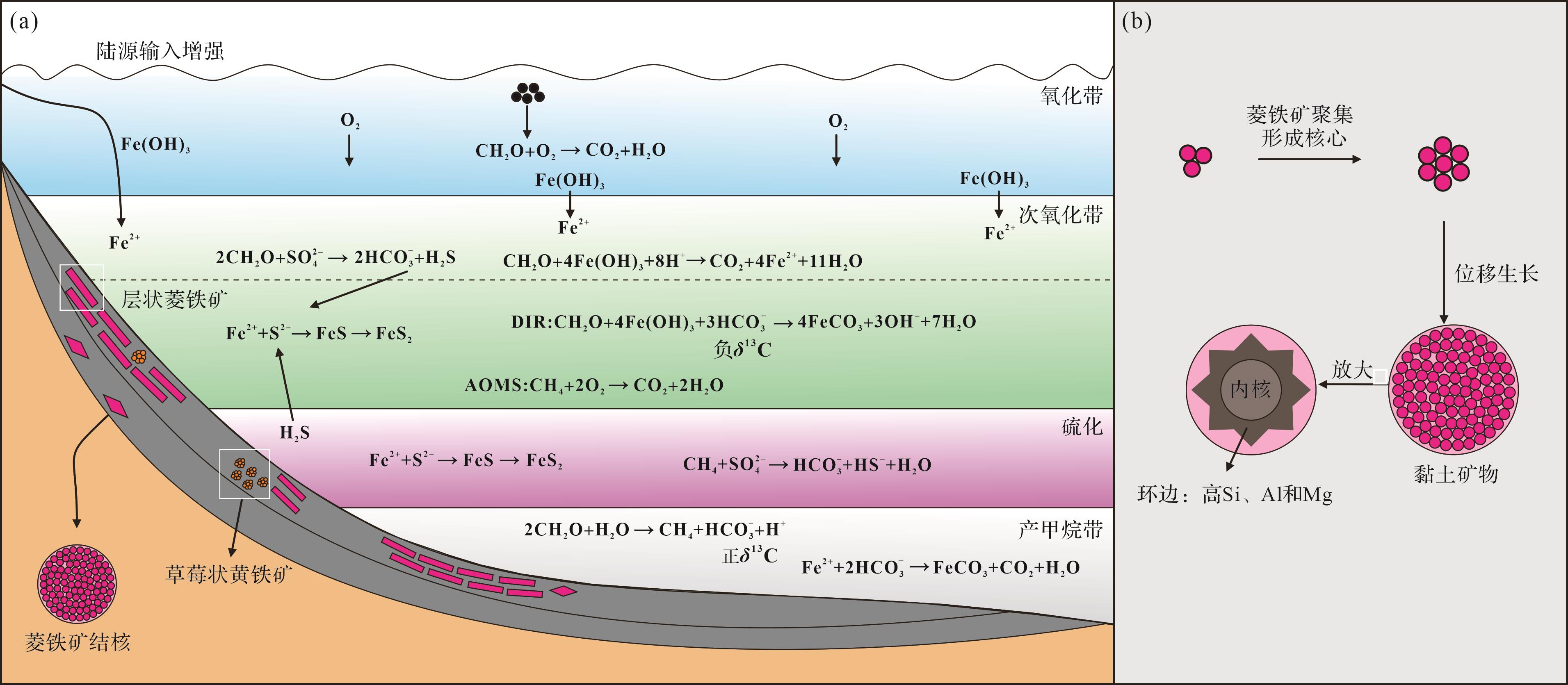
Objective The climate signals of the Danxia strata, a representative of Cretaceous continental red beds, offers key insights into red-bed sedimentation and Cretaceous geological events. Methods This study examined fine-grained clastic rocks in the Upper Cretaceous Danxia Basin, specifically the Second member and Fourth member of the Changba Formation and the Jinshiyan member of the Danxia Formation. Sedimentology, elemental and isotopic geochemistry were used to investigate the sedimentary environment and paleoclimate significance during key Upper Cretaceous stages (Cenomanian, Turonian, Campanian). Results It was found that the fine-grained clastic rocks of these formations were deposited during a warm and humid climate phase, with suboxic to oxic water conditions. The water bodies were predominantly brackish, while localized high-salinity brackish and low-oxygen environments (e.g., the Fourth member of the Changba Formation) were associated with lake shrinkage and climatic aridification. Water depth variations exhibit trends of initial contraction followed by expansion, gradual contraction, then initial expansion followed by contraction, which align with the changes in sedimentary facies and environment. Conclusions The Upper Cretaceous terrestrial sedimentary records of the Danxia Basin illustrate the climatic evolution of intermontane basins, shaped by global climate patterns of the Upper Cretaceous, as well as by significant influences from local topographic and geomorphic features.
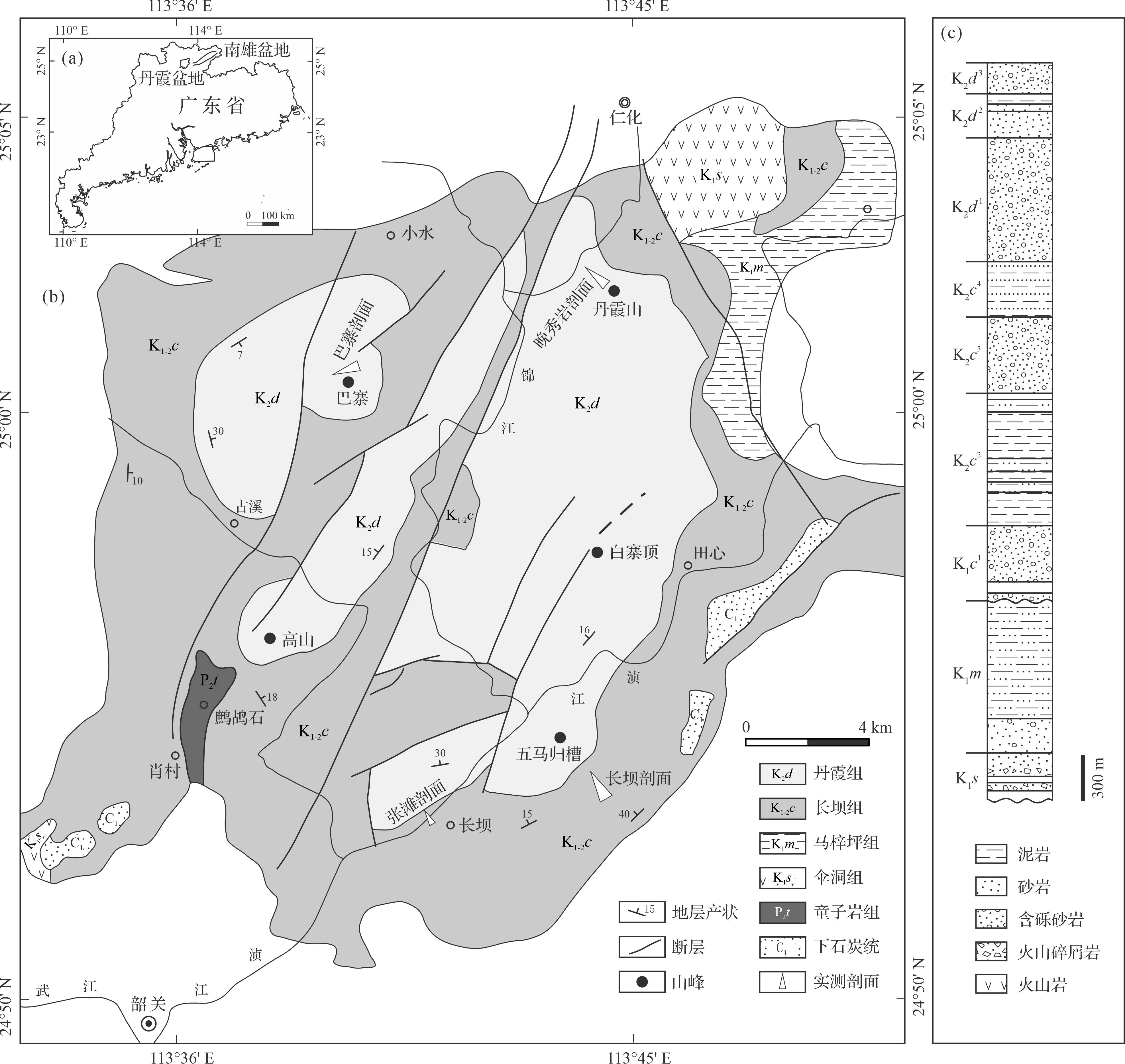
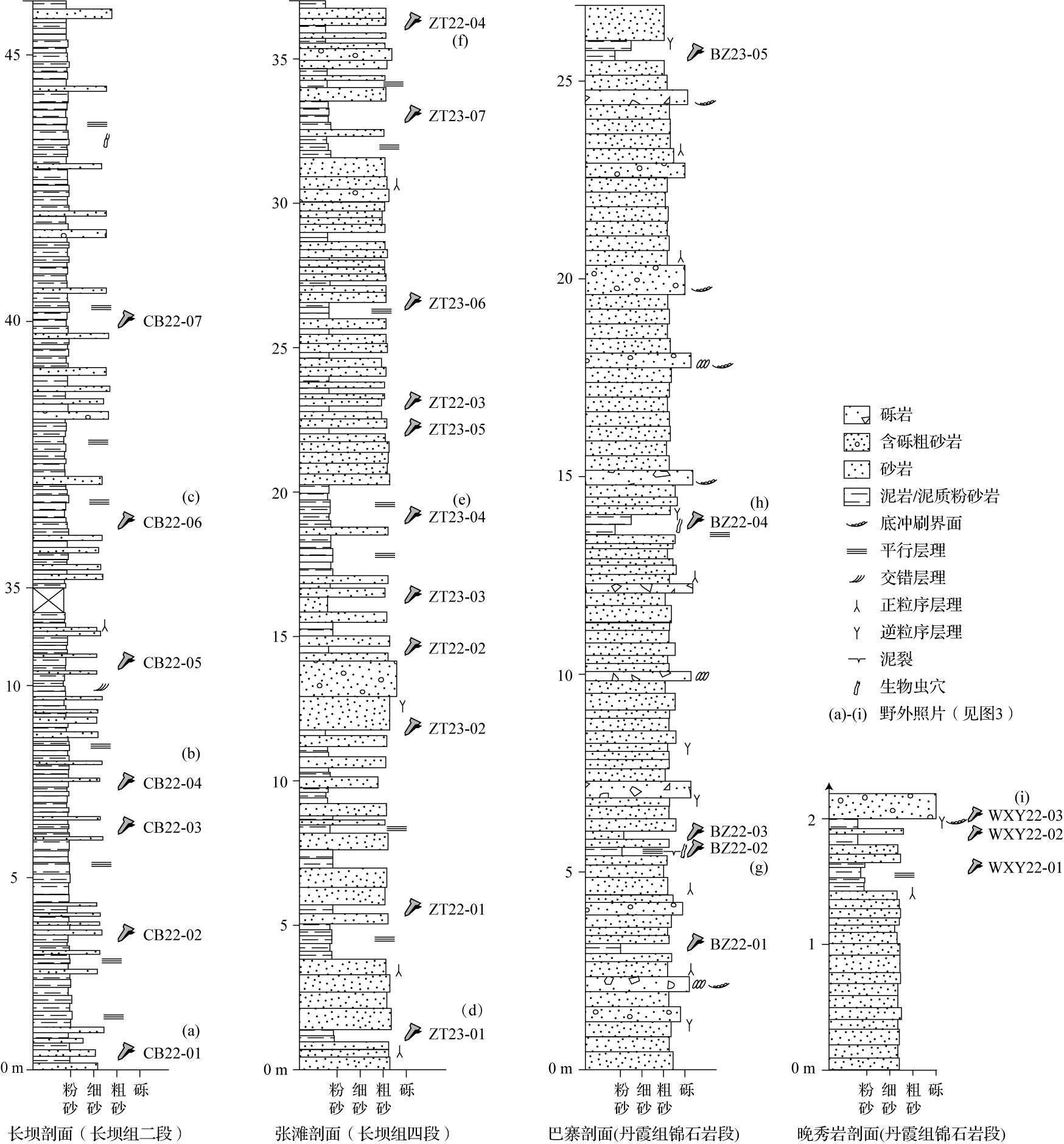
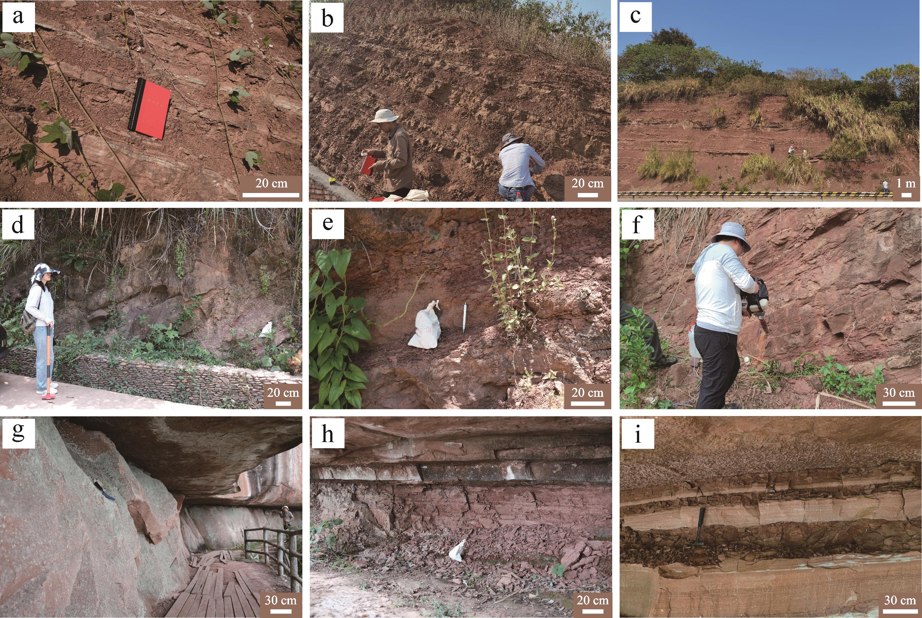
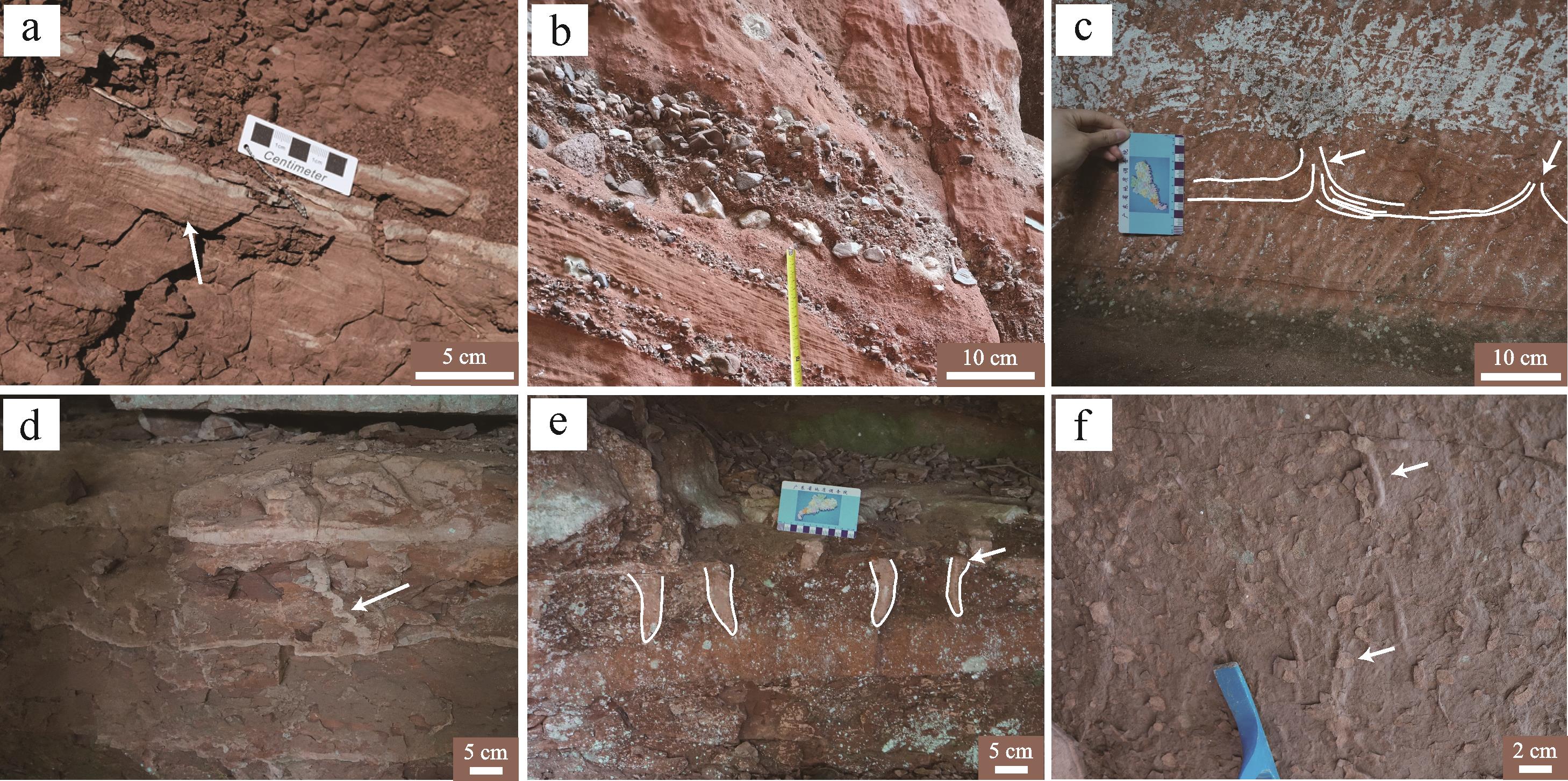
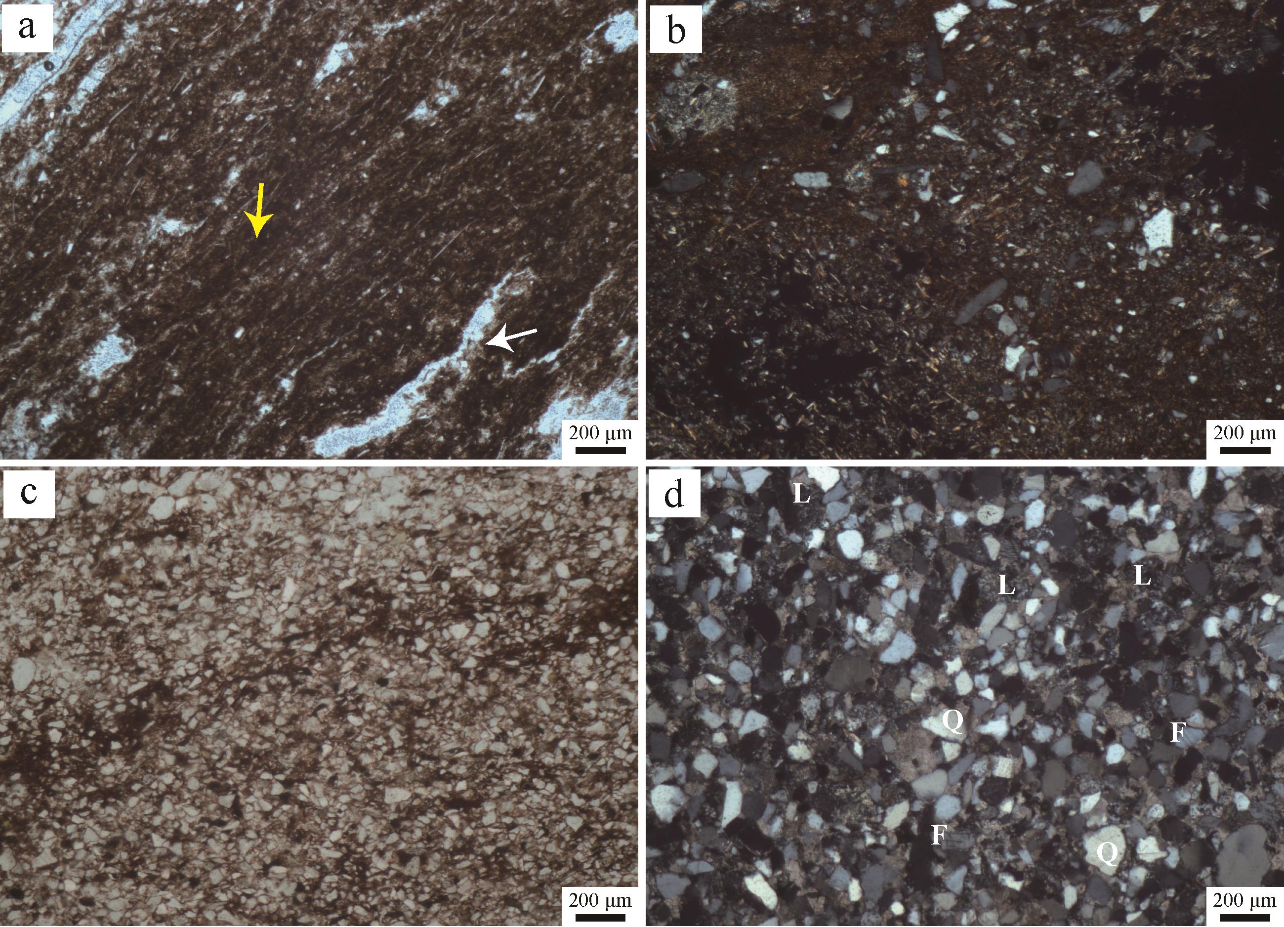
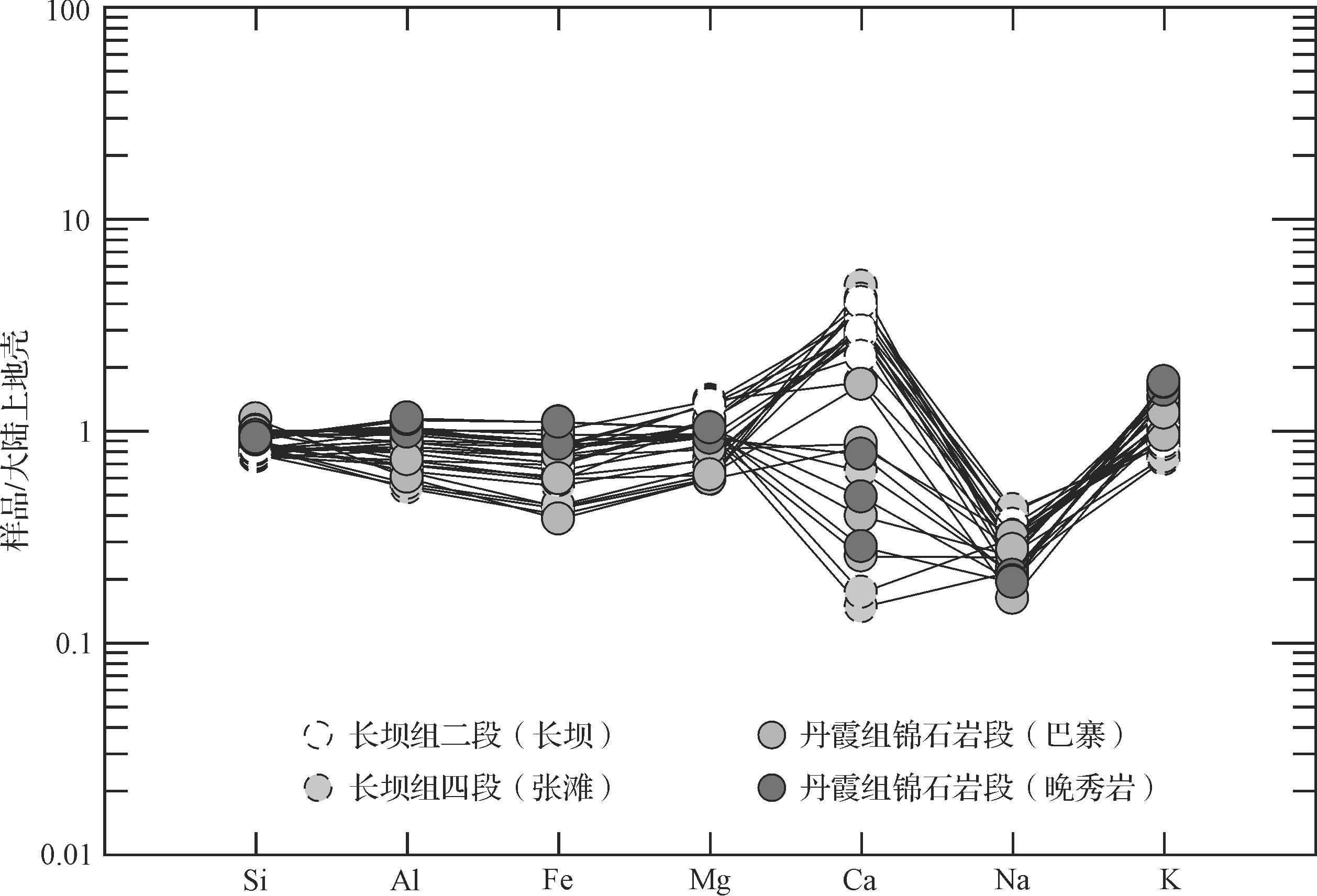
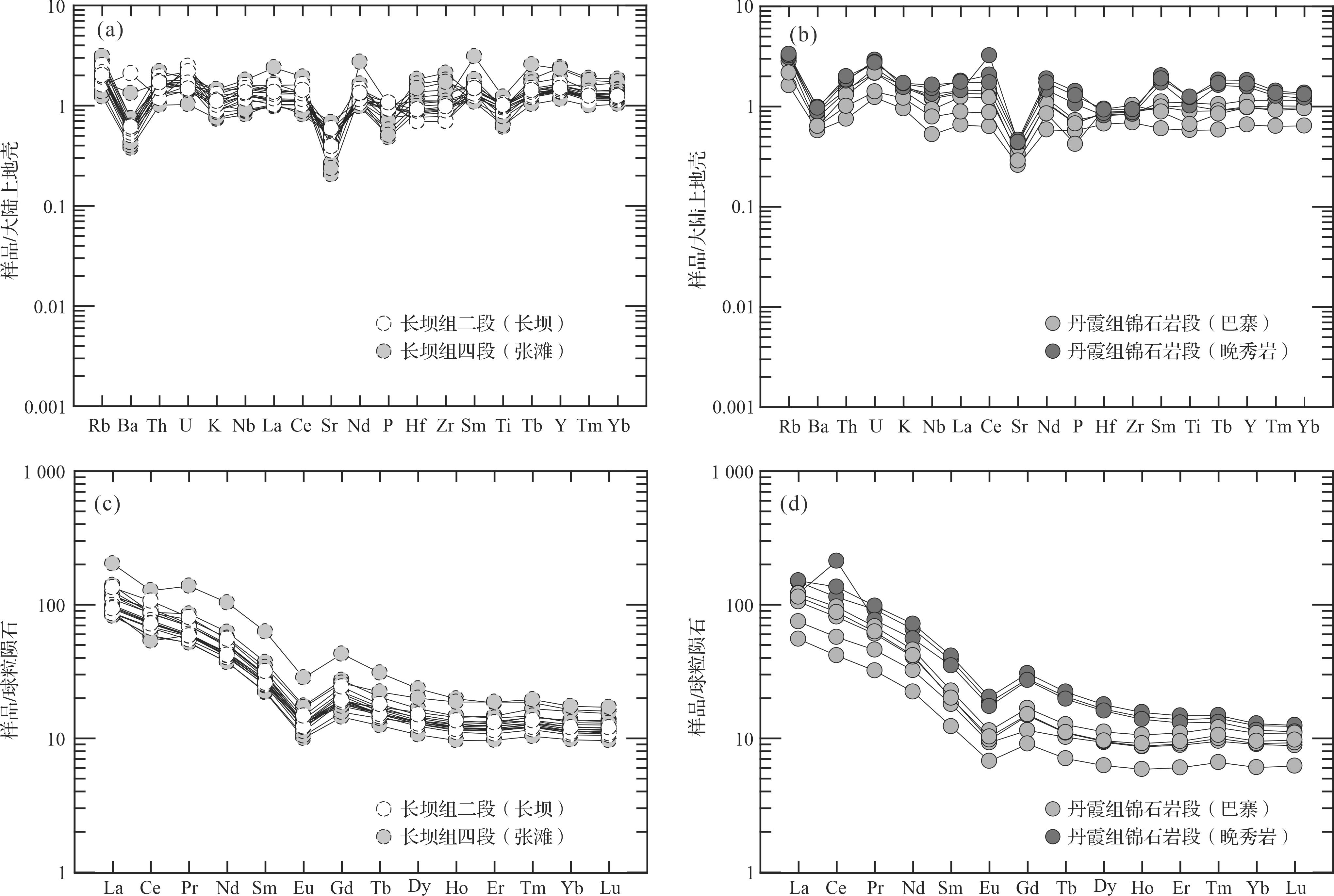
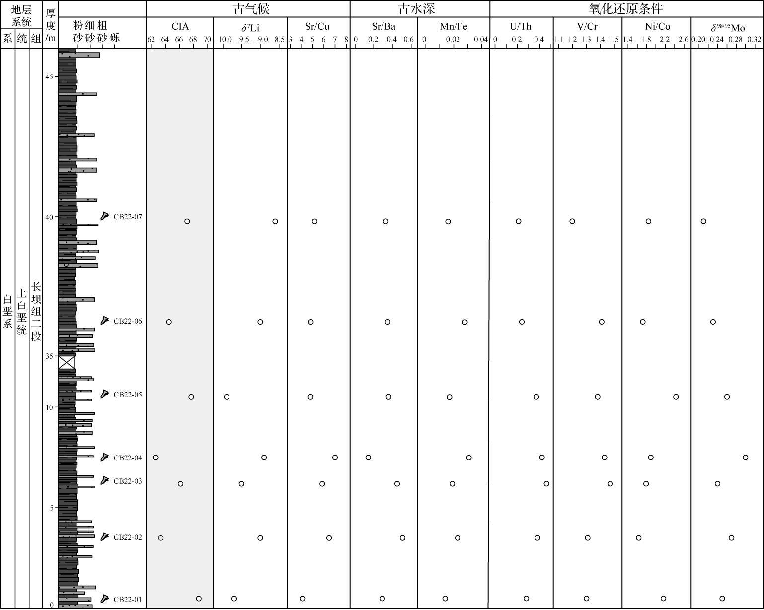
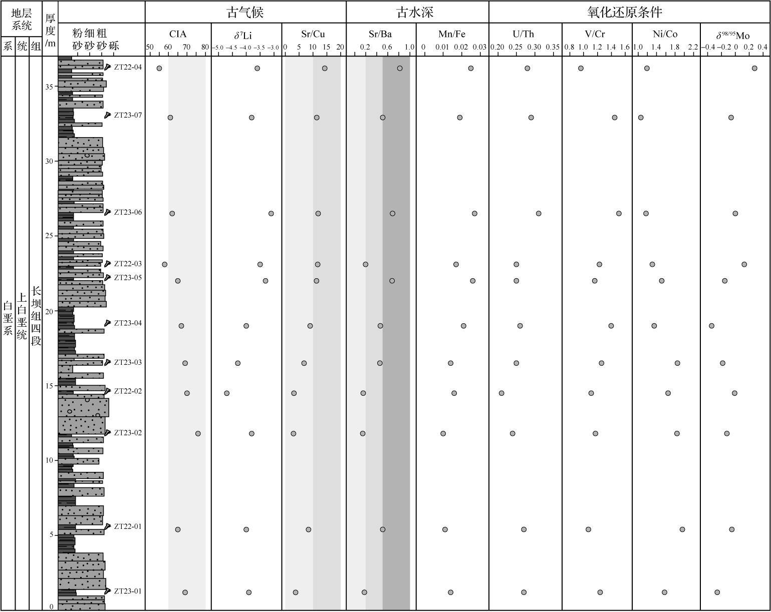
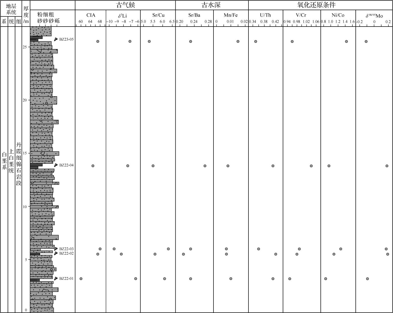
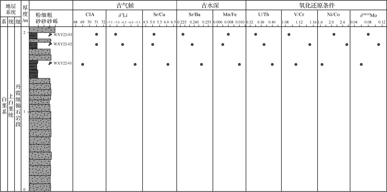
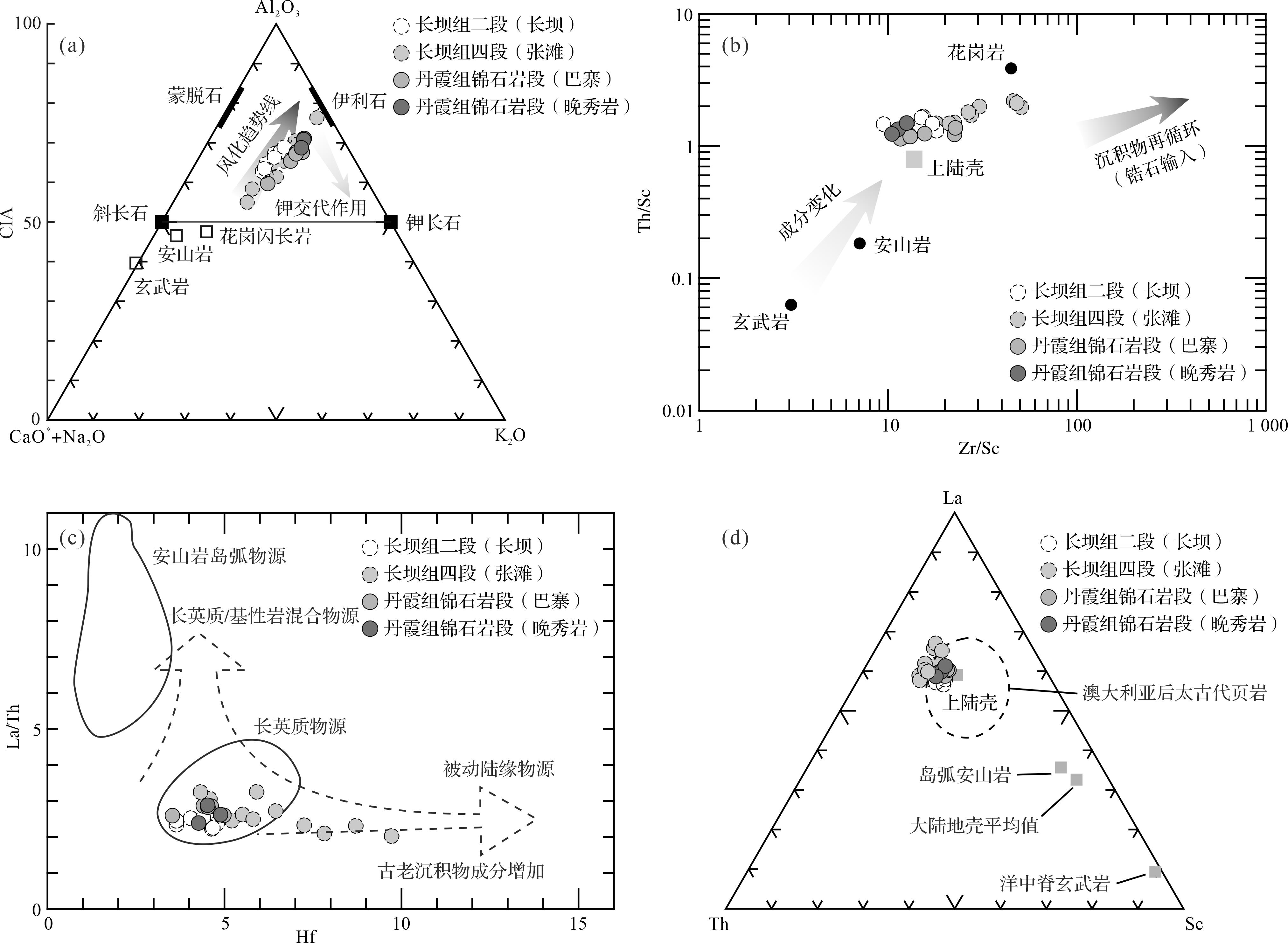
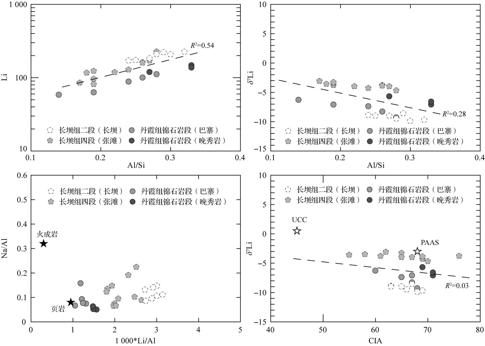
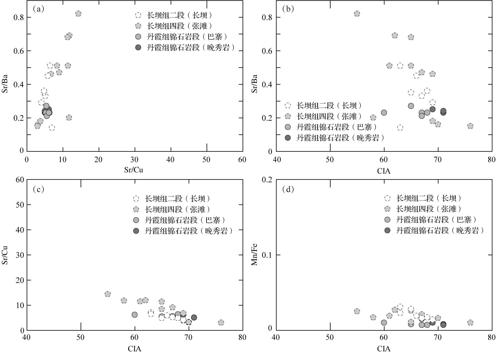
Objective Research on the weathering process of the aggradation red earth in subtropical China has long been crucial for understanding the evolution of the Quaternary environment. However, a comprehensive know-ledge of the weathering environment of the aggradation red earth is hampered by the infrequent reporting of research on the weathering characteristics of the aggradation red earth at the spatial scale. Methods Based on a systematic analysis of the weathering characteristics of the aggradational red earth sections in southern China, this study focused on the Jinqu Basin, where non-zonal factors have a significant impact. The research primarily explored the chemical weathering characteristics and formation mechanisms of red earth within the basin, to deepen our understanding of the weathering features of aggradational red earth. Results (1) On a large scale, the weathering intensity of aggradational red earth in southern China is strongly correlated with hydrothermal conditions, with weathering intensifying as latitude decreases. However, the chemical weathering of red earth in certain locations or specific sections does not entirely conform to the latitudinal zonality in the mid-subtropical region between 25° N and 31° N, where aggradational red earth is widely spread. (2) The geochemical composition of aggradational red earth in the Jinqu Basin exhibits good consistency, with minimal differences in element enrichment or depletion among samples. However, there is regional variability in the degree of chemical weathering in the developmental stages of vermicular and typical red earth following the stagnation of vermicularization in the Jinqu Basin, compared with the chemical weathering characteristics of other aggradational red earth sections at the same latitude. (3) Influenced by a combination of factors such as provenance, topography, and local climate, the weathering characteristics of the aggradational red earth in the Jinqu Basin exhibit certain non-latitudinal zonal features. Conclusions The weathering characteristics of the aggradational red earth in southern China primarily follow a latitudinal zonal pattern under the large-scale monsoon evolution pattern. However, owing to the influence of non-zonal factors including topography, water, and differences in the geographic features of potential provenance, the chemical weathering of aggradational red earth also exhibits certain non-zonal characteristics within the mid-subtropical region between 25° N and 31° N. The relatively small and enclosed basin terrain of the Jinqu Basin, along with local microclimate conditions and contribution of bedrock weathering products to the red earth provenance, plays a significant role in interpreting the chemical weathering information of the red earth. Therefore, it is crucial to consider regional impacts while discussing the chemical weathering characteristics in different areas.
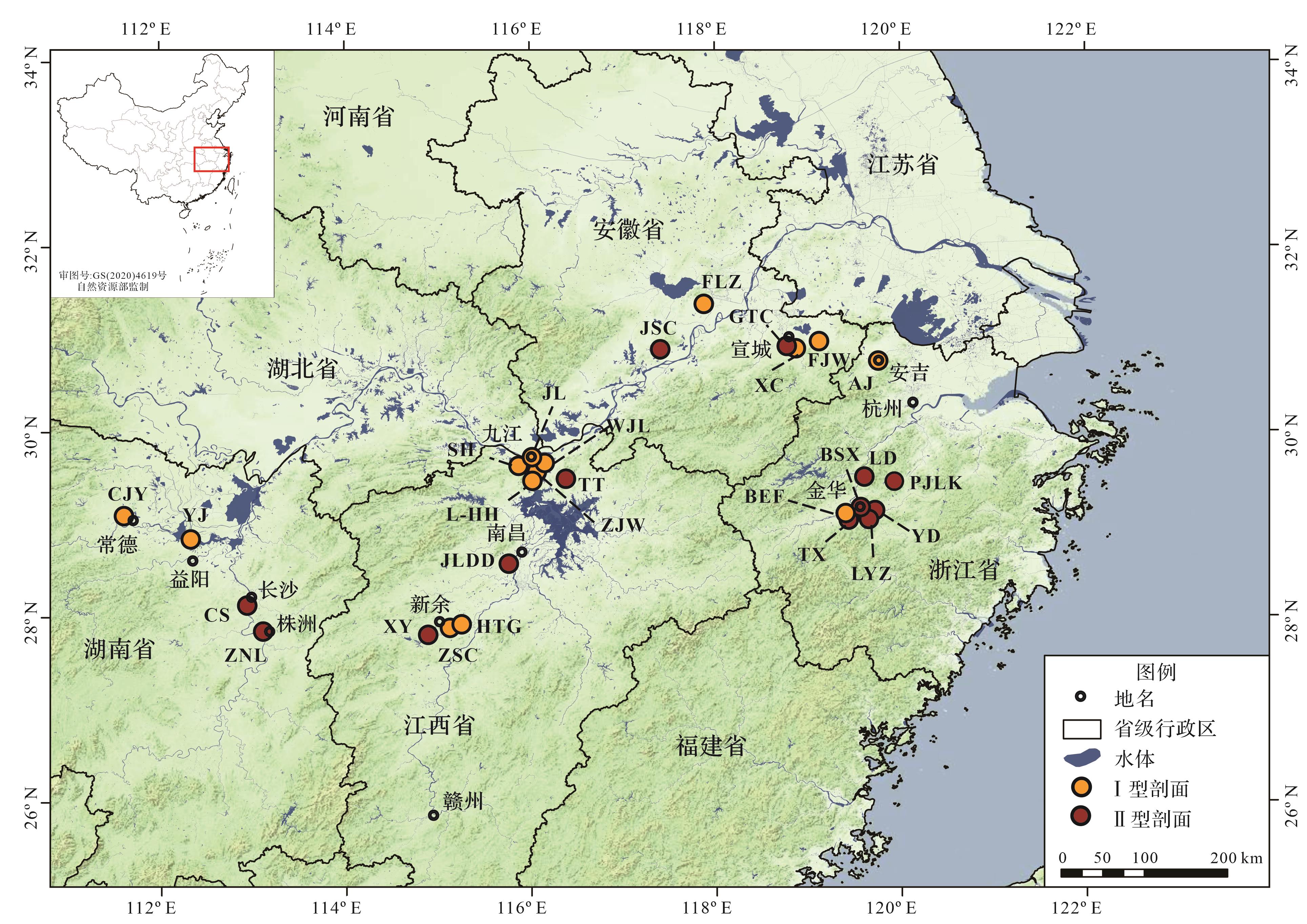
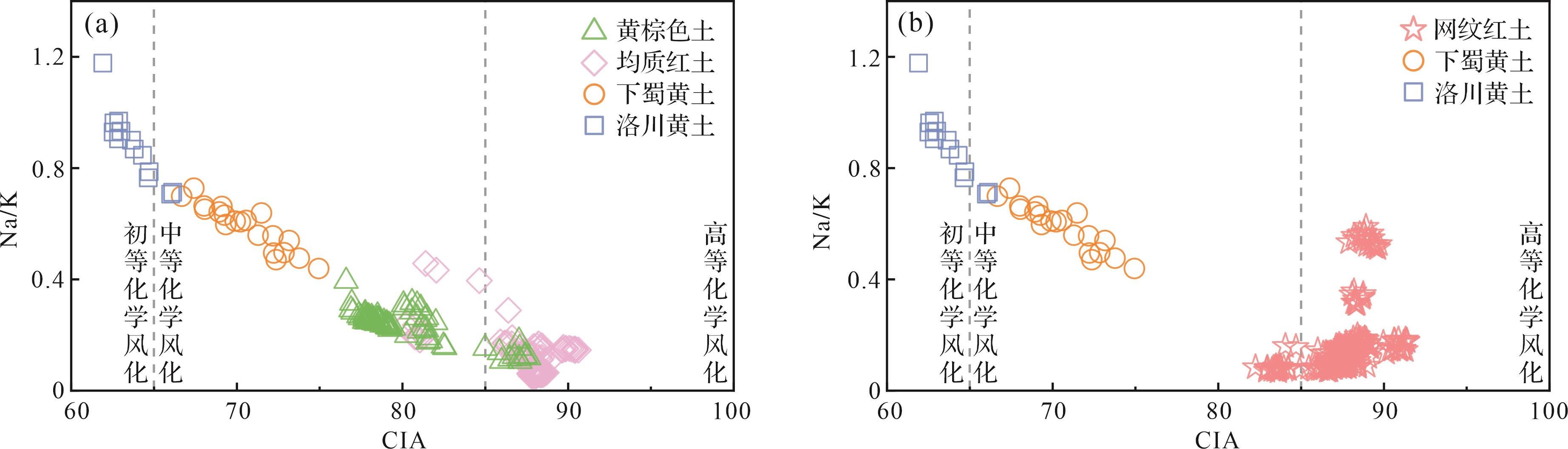

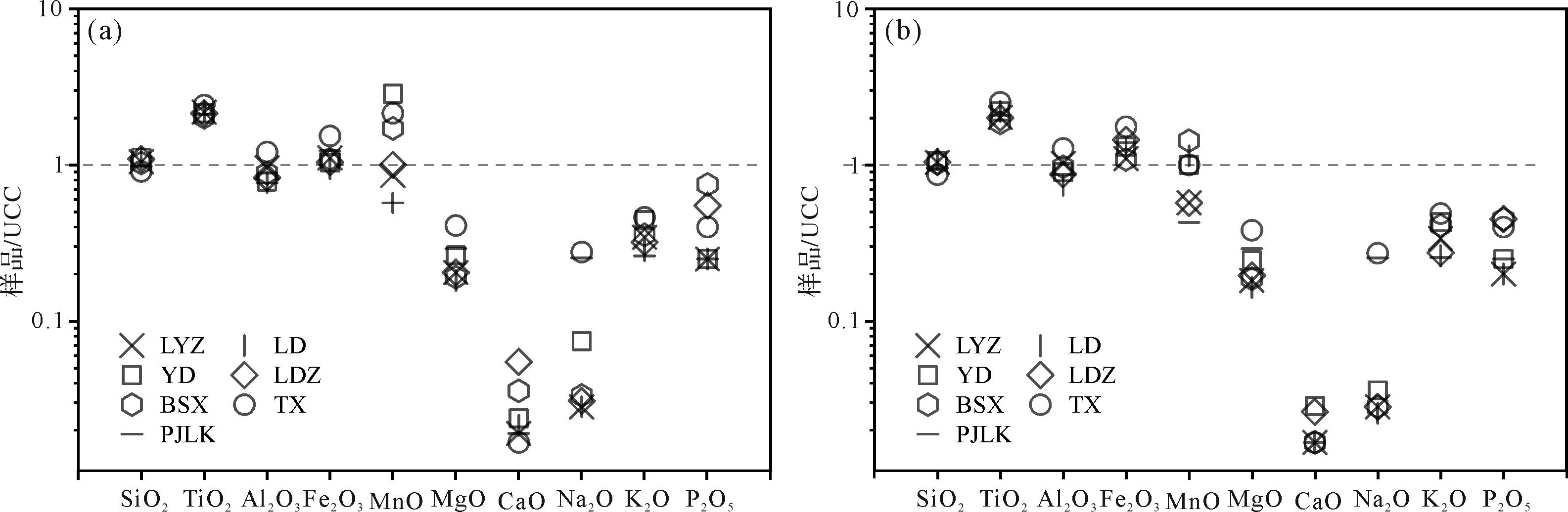
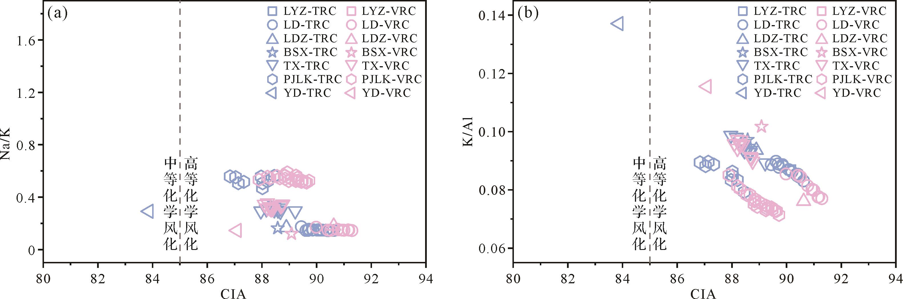
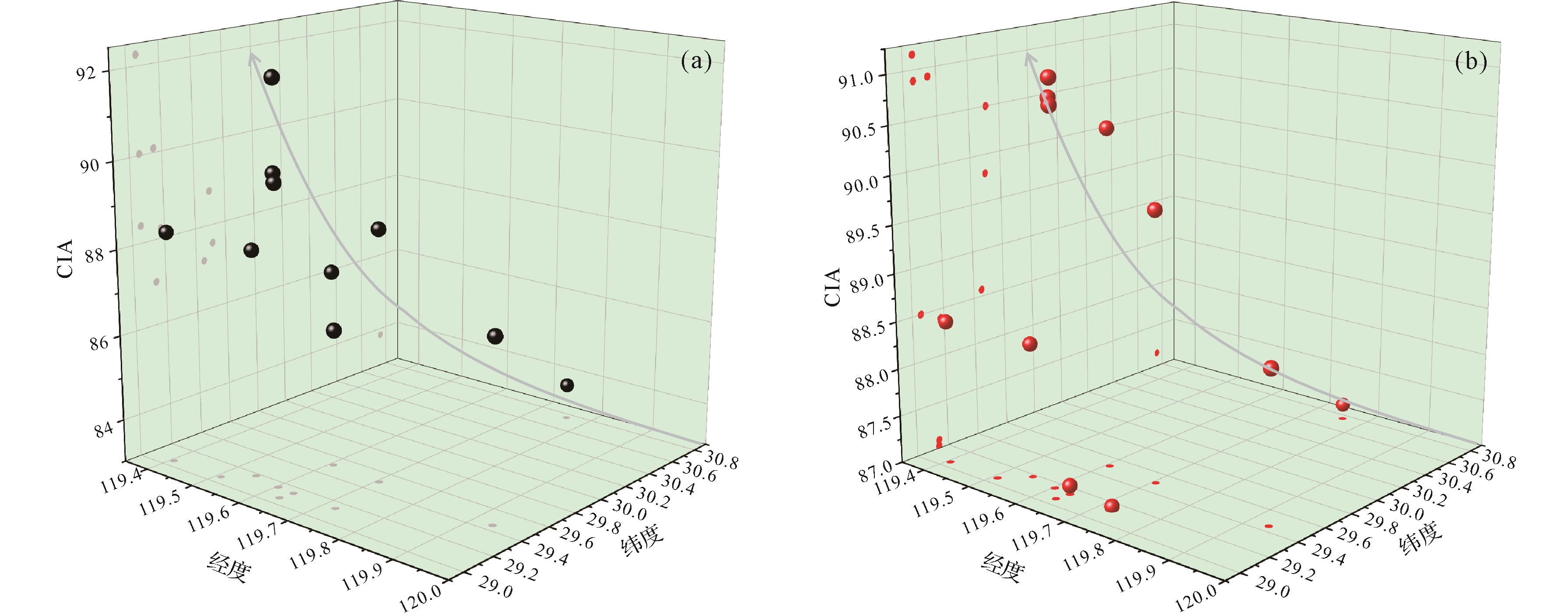
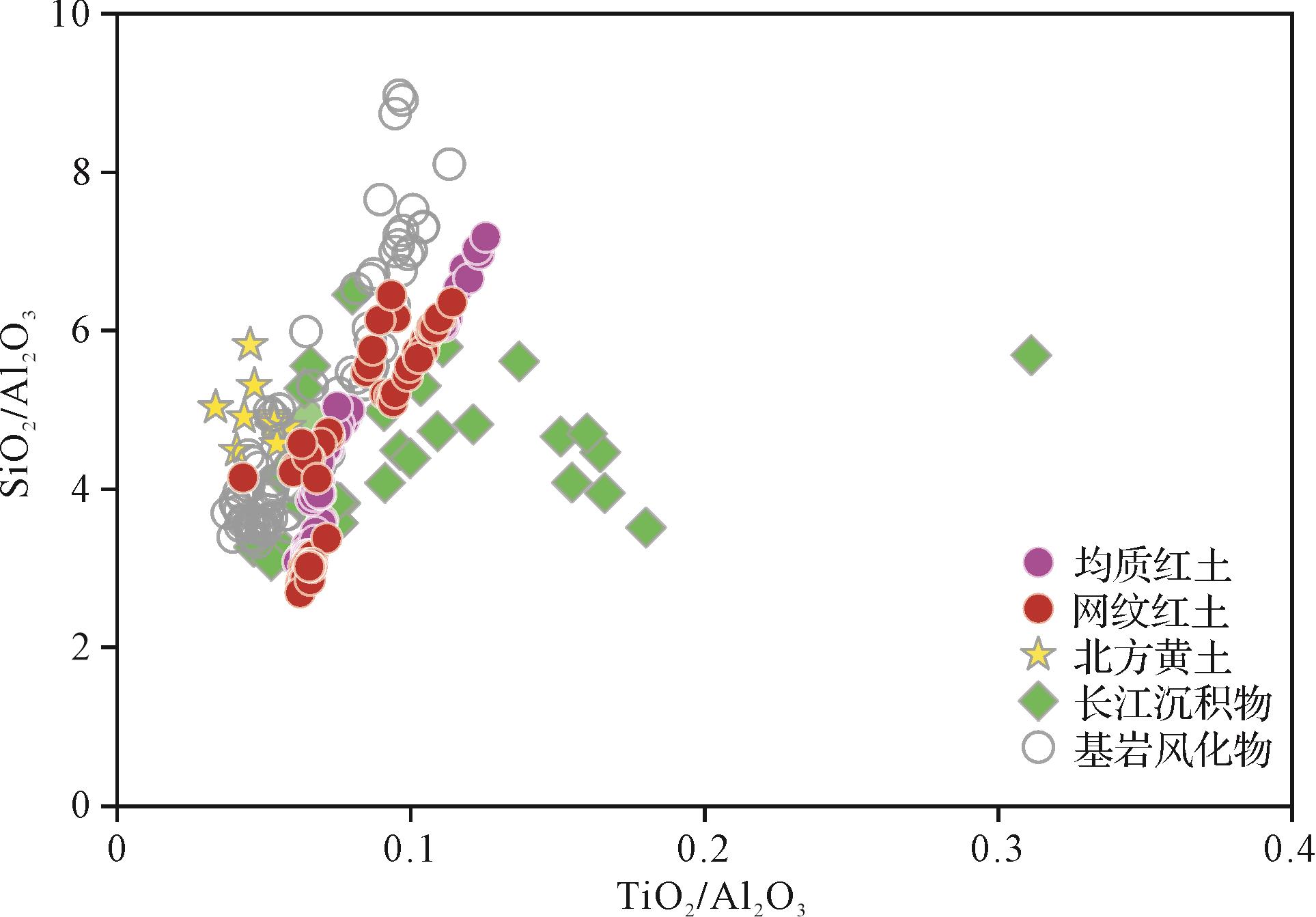
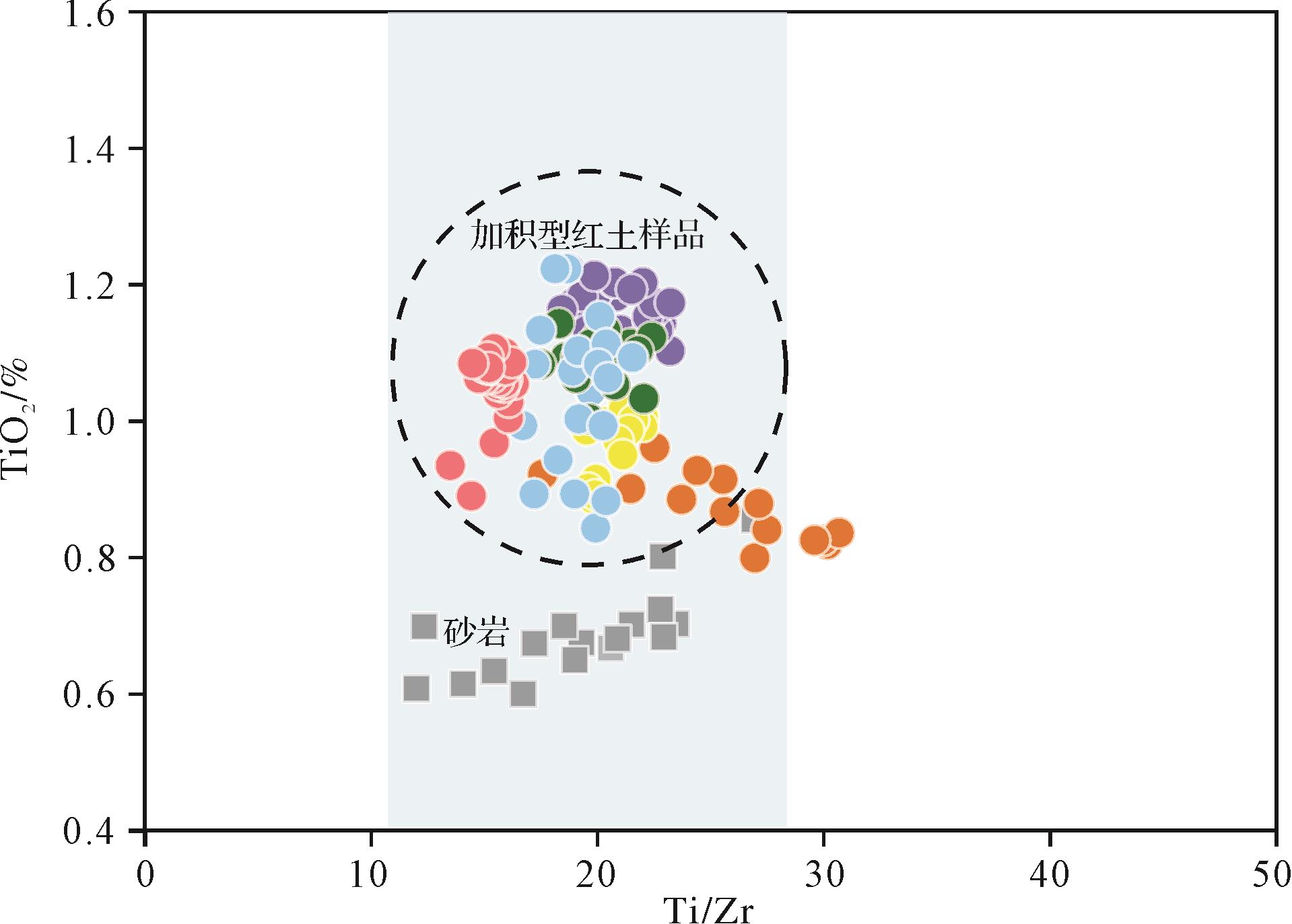
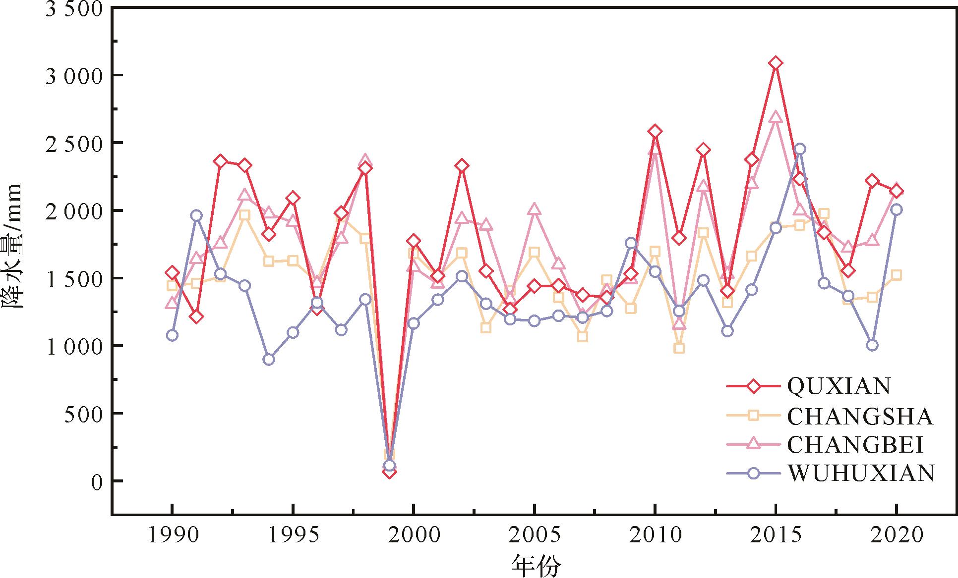
Objective The formation of sedimentary systems within straits is intricately linked to the unique topographical constraints that influence both facies characteristics and sediment distribution patterns. Although current research mainly focuses on narrow straits (less than 50 km wide) , where sedimentation is dominated by tidal processes, wider straits introduce more complex hydrodynamic dynamics, leaving many aspects of the sedimentation processes yet to be fully understood. Methods This study focuses on the Bohai Strait (a shallow strait with a width of 106 km) and is based on an extensive dataset of surface sediment grain sizes, combined with four shallow seismic profiles, to characterize the sedimentary environment within the Bohai Strait. Additionally, a regional ocean modeling system (ROMS) simulation was employed for winter (December 2020⁃February 2021) to better understand the hydrodynamic processes influencing sediment dynamics and control over sediment distribution within and surrounding the Bohai Strait. Results Our results reveal significant differences in sediment dynamics between the northern and southern parts of the strait. The northern region exhibits a high-energy environment dominated by erosion, whereas the southern region displays a lower-energy environment conducive to deposition. Surface sediment types vary spatially, with coarser grains predominating in the north and narrow regions, with finer grains observed on both sides (east⁃west) and in the south. A large-scale, sandy flood-tidal delta appears around the Laotieshan Channel in the north. The asymmetric tidal currents flowing in and out of the channel are likely responsible for this feature, and ebb-tidal delta is not prominent. In contrast, the southern part of the strait exhibits two distinct sedimentary systems:(1) Shandong mud wedge: This system lies along the coast of the Shandong Peninsula, shaped by the substantial sediment supply from the Yellow River and the influence of coastal currents. (2) Scour troughs and sandy tidal deltas: These smaller features are attributed to the protective effect of islands present in the southern strait, combined with the abundant supply of fine-grained sediments. Conclusions This study highlights the critical role of the complex topography of the strait in the confinement in shaping regional sediment transport dynamics and the resulting distribution of sedimentary systems.
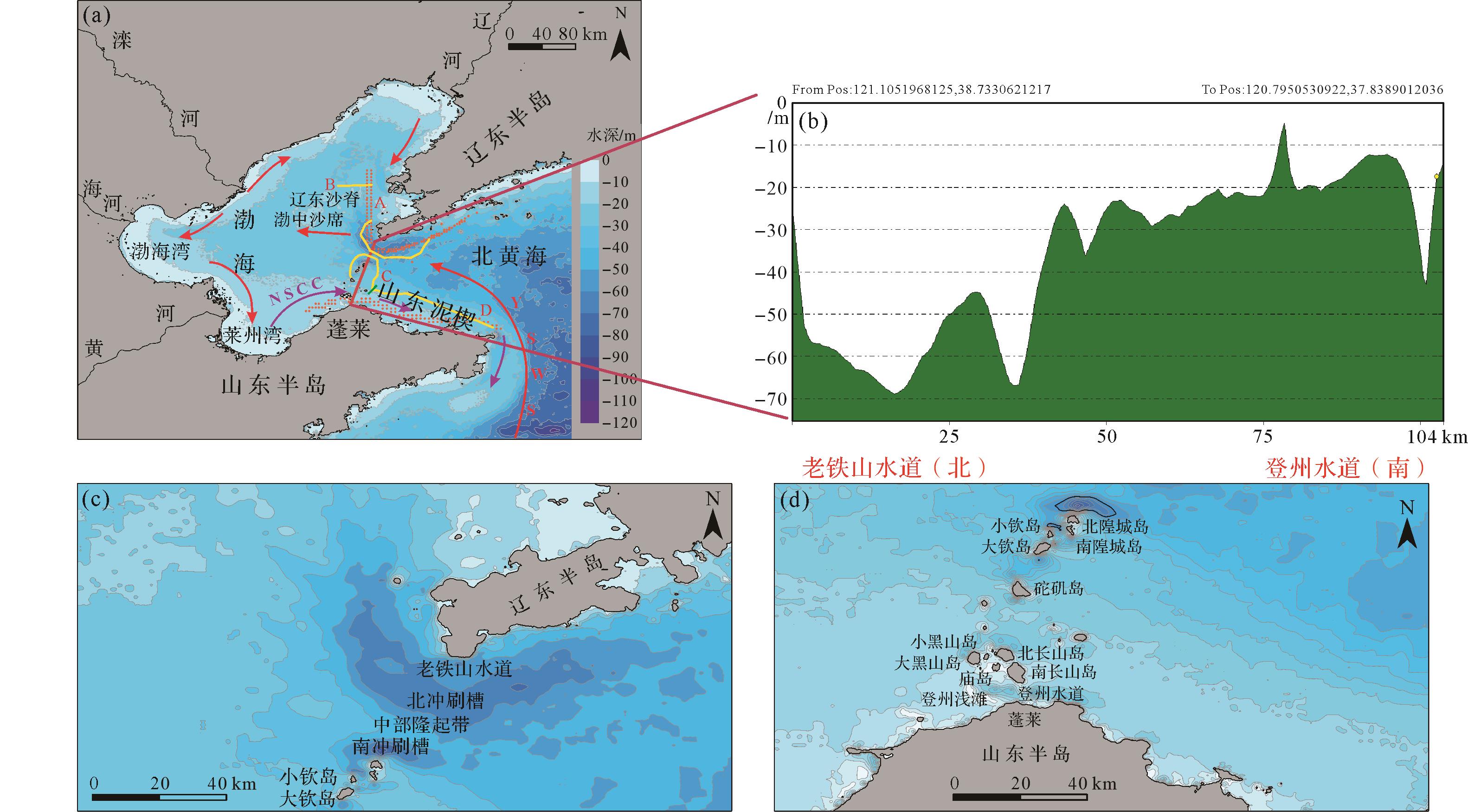
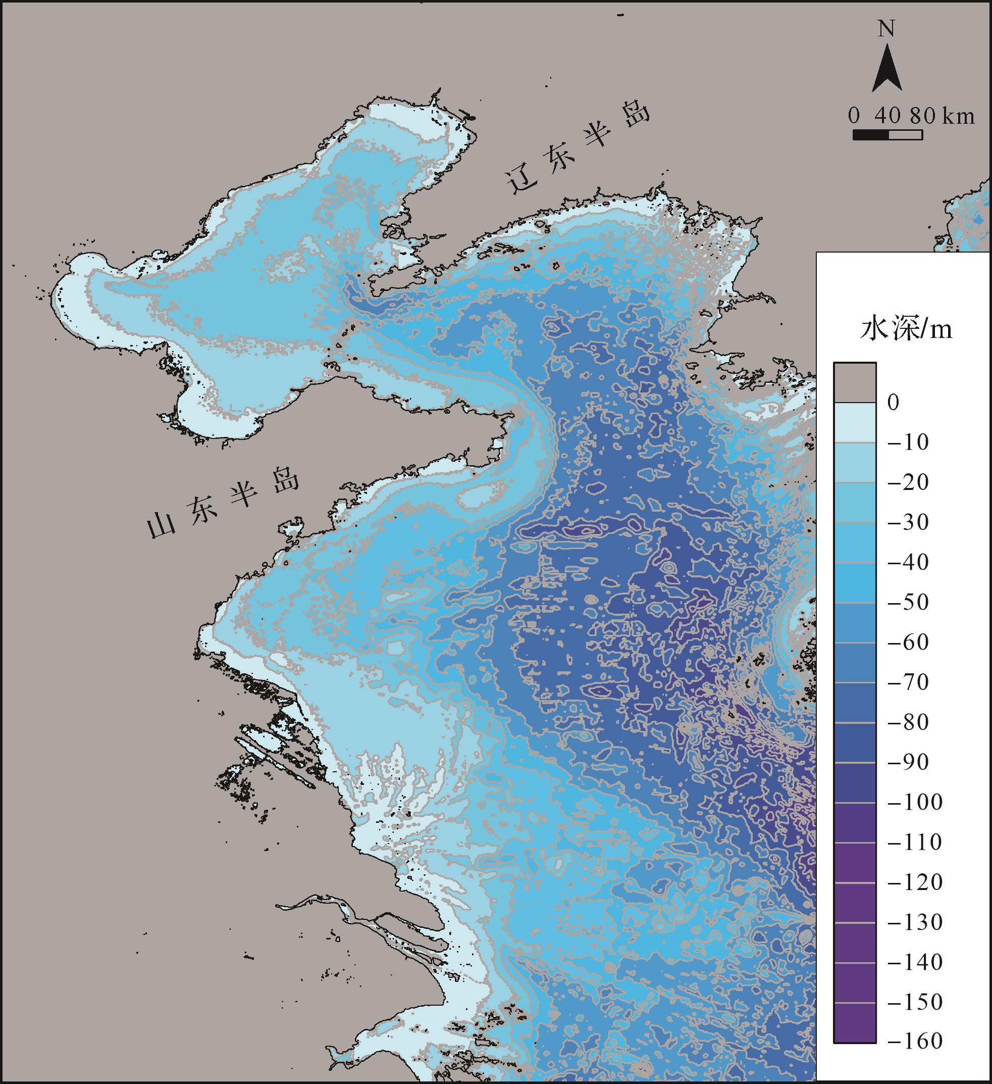
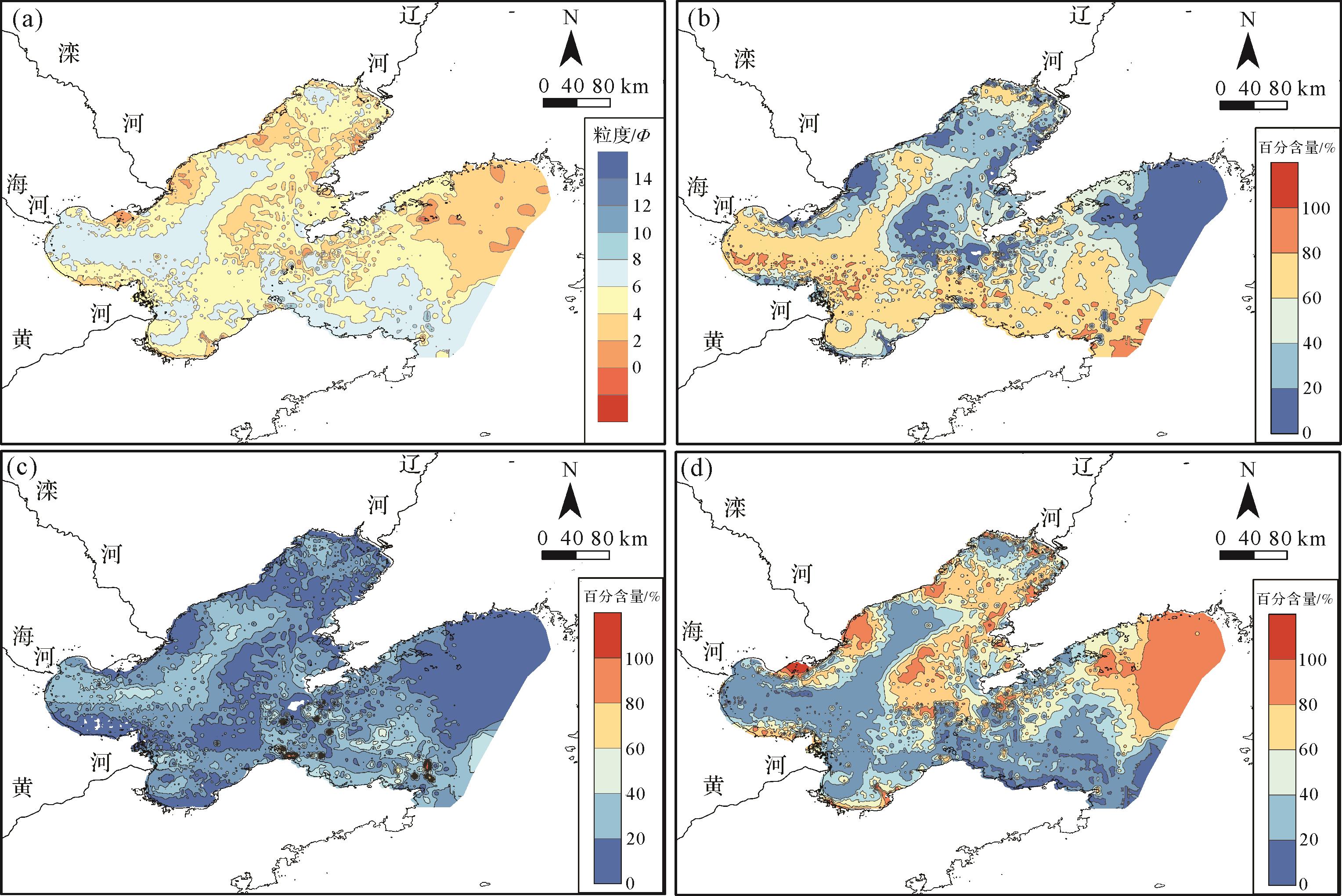
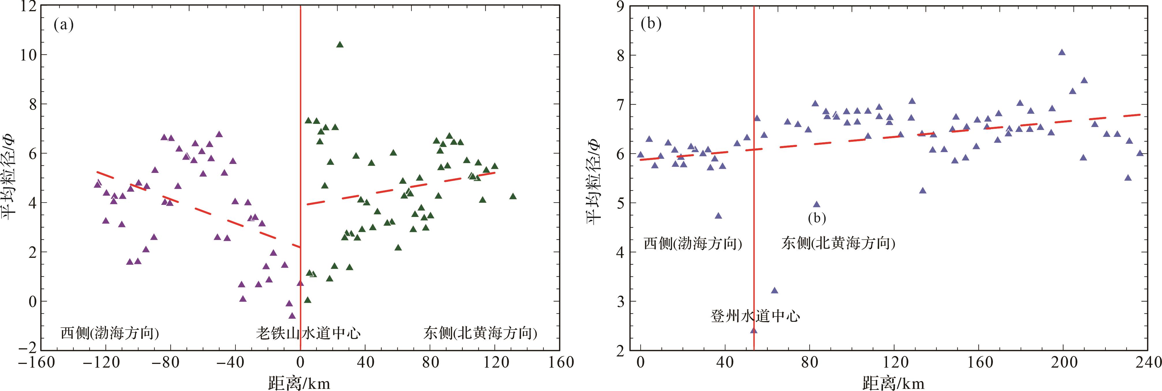
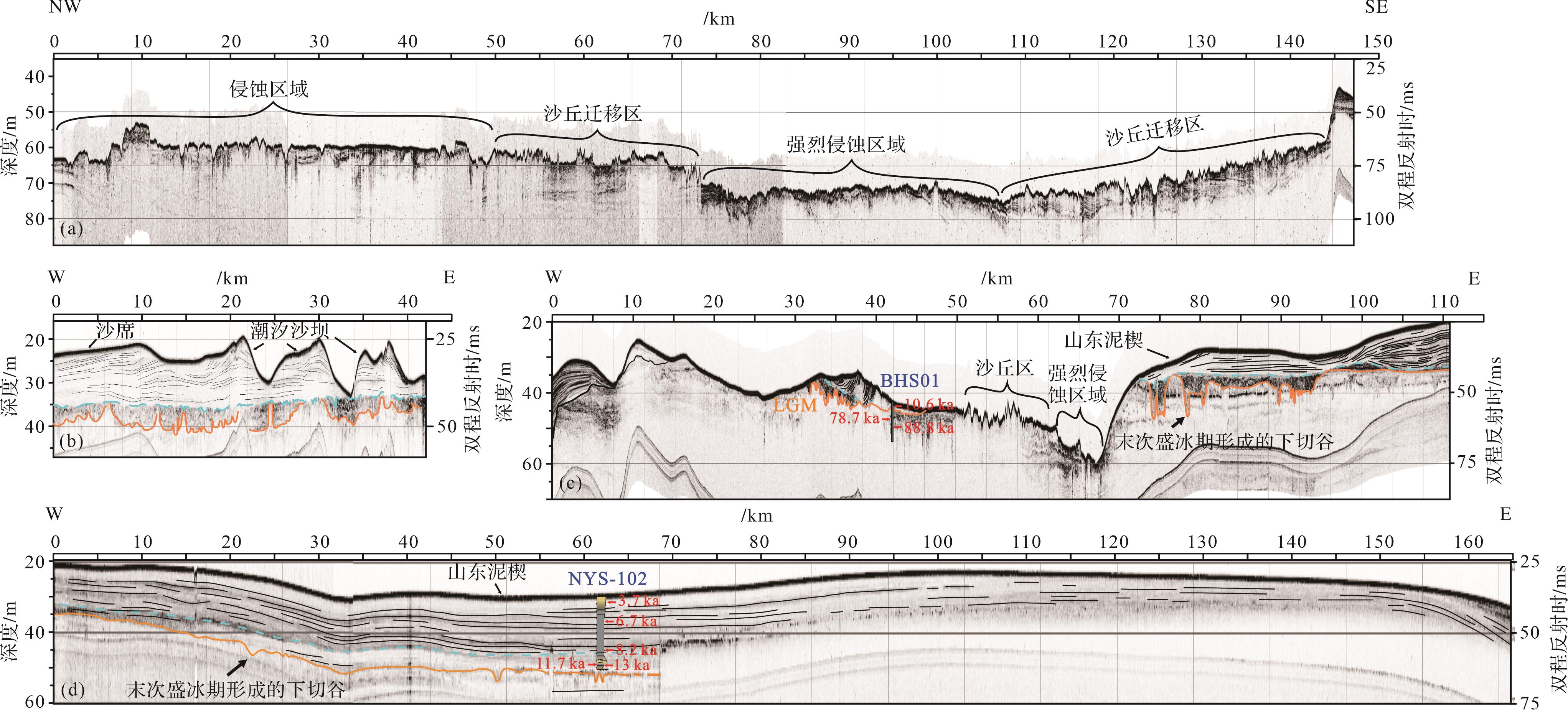
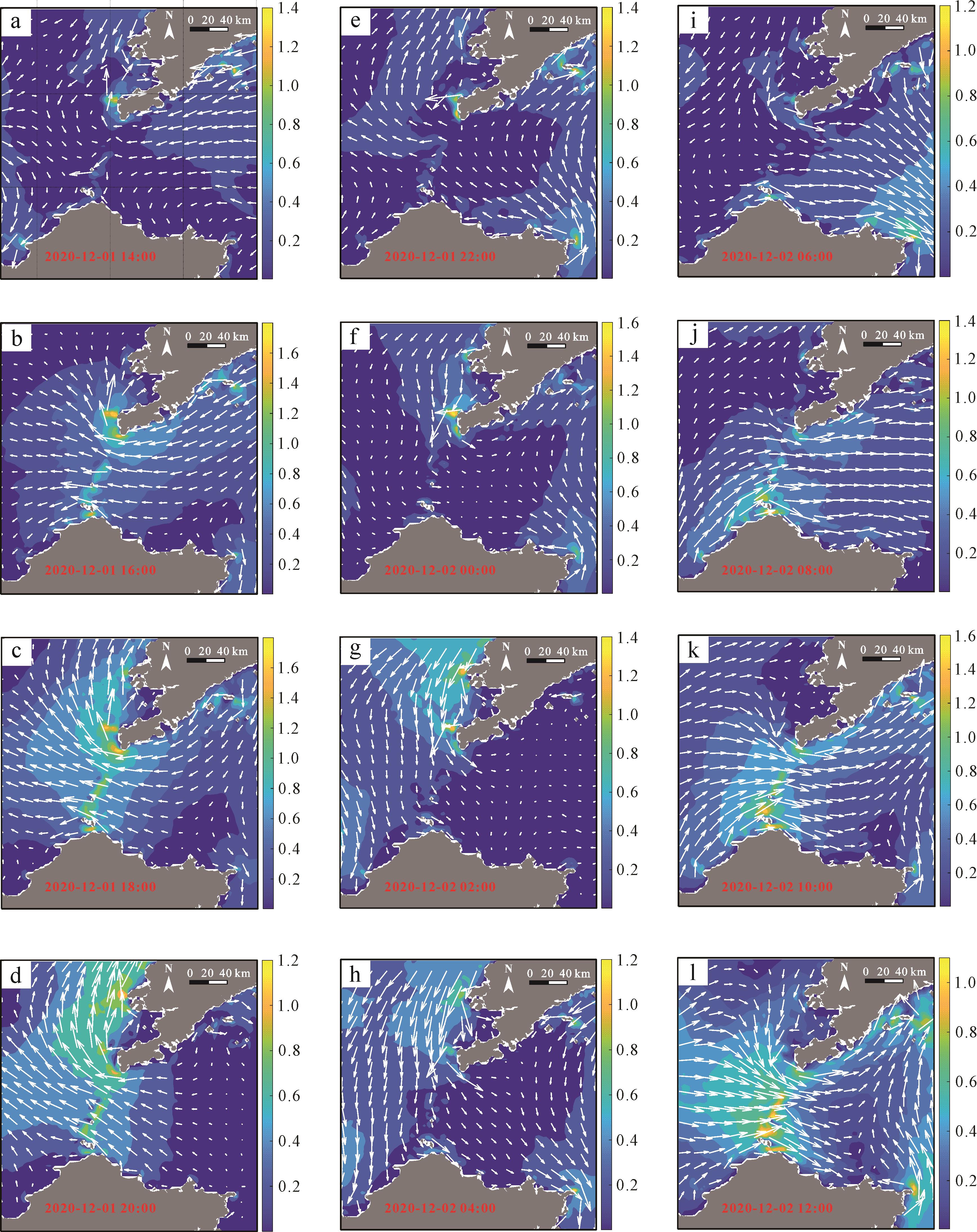
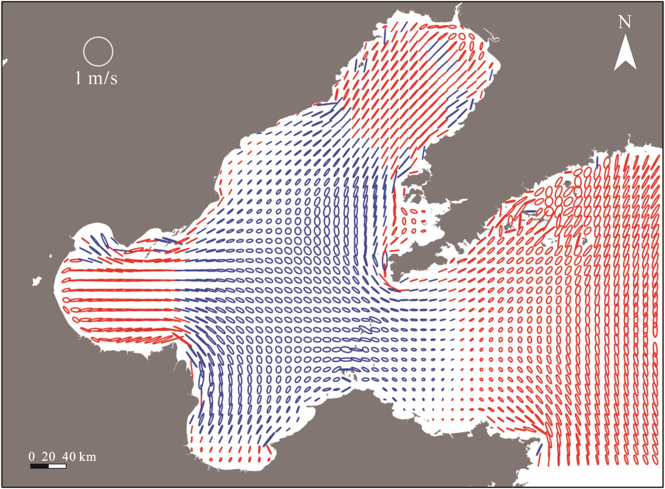
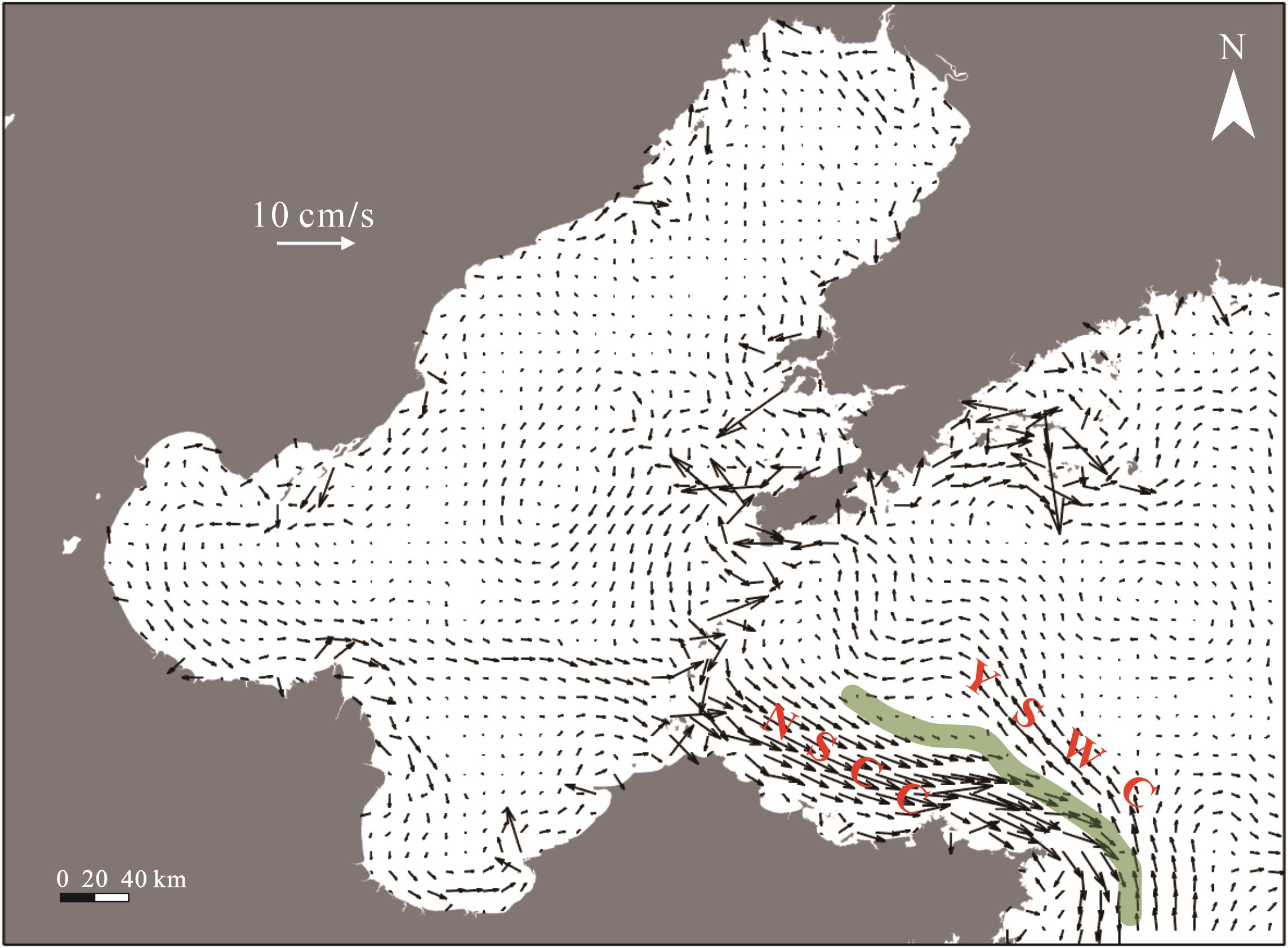
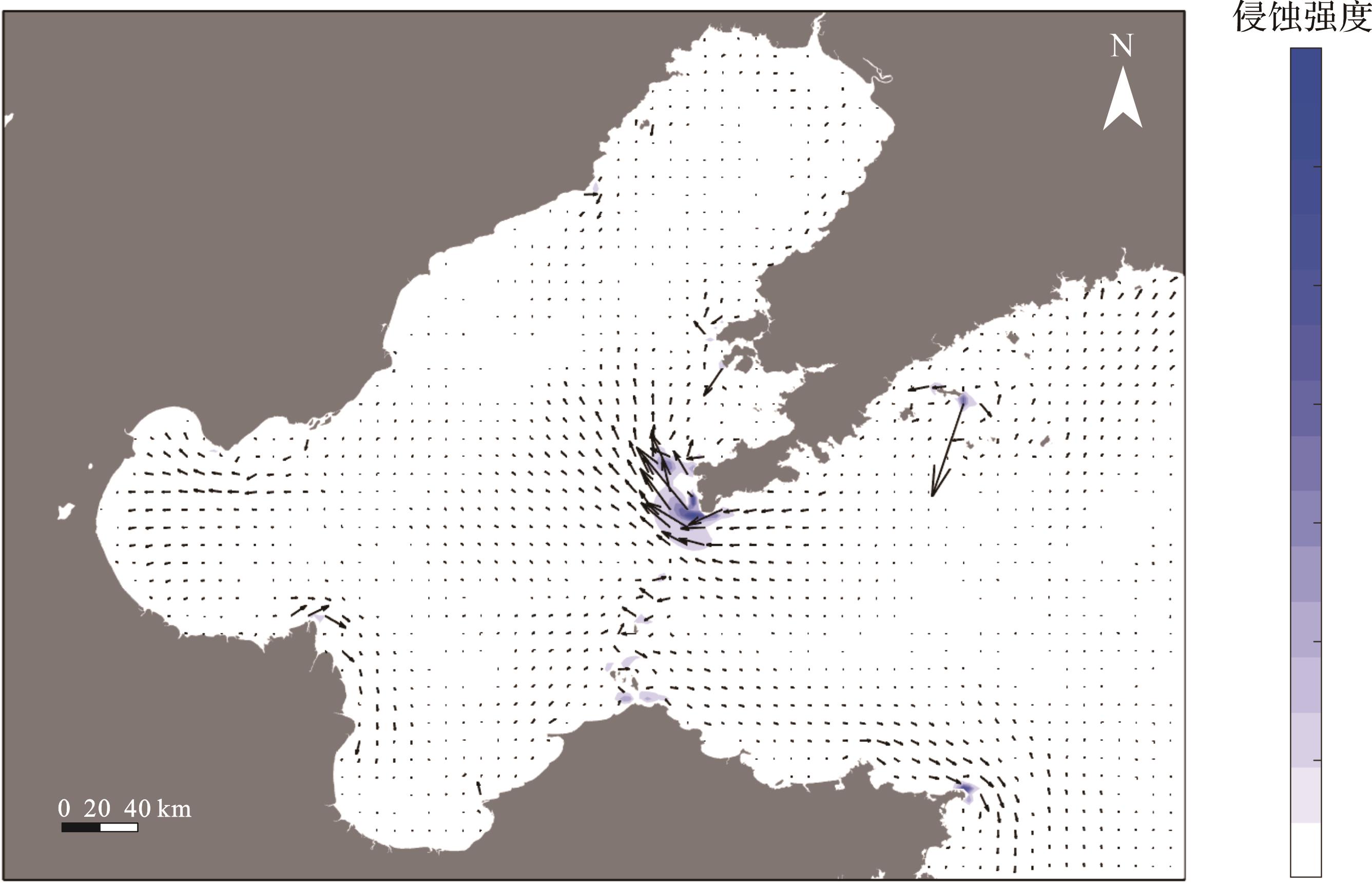
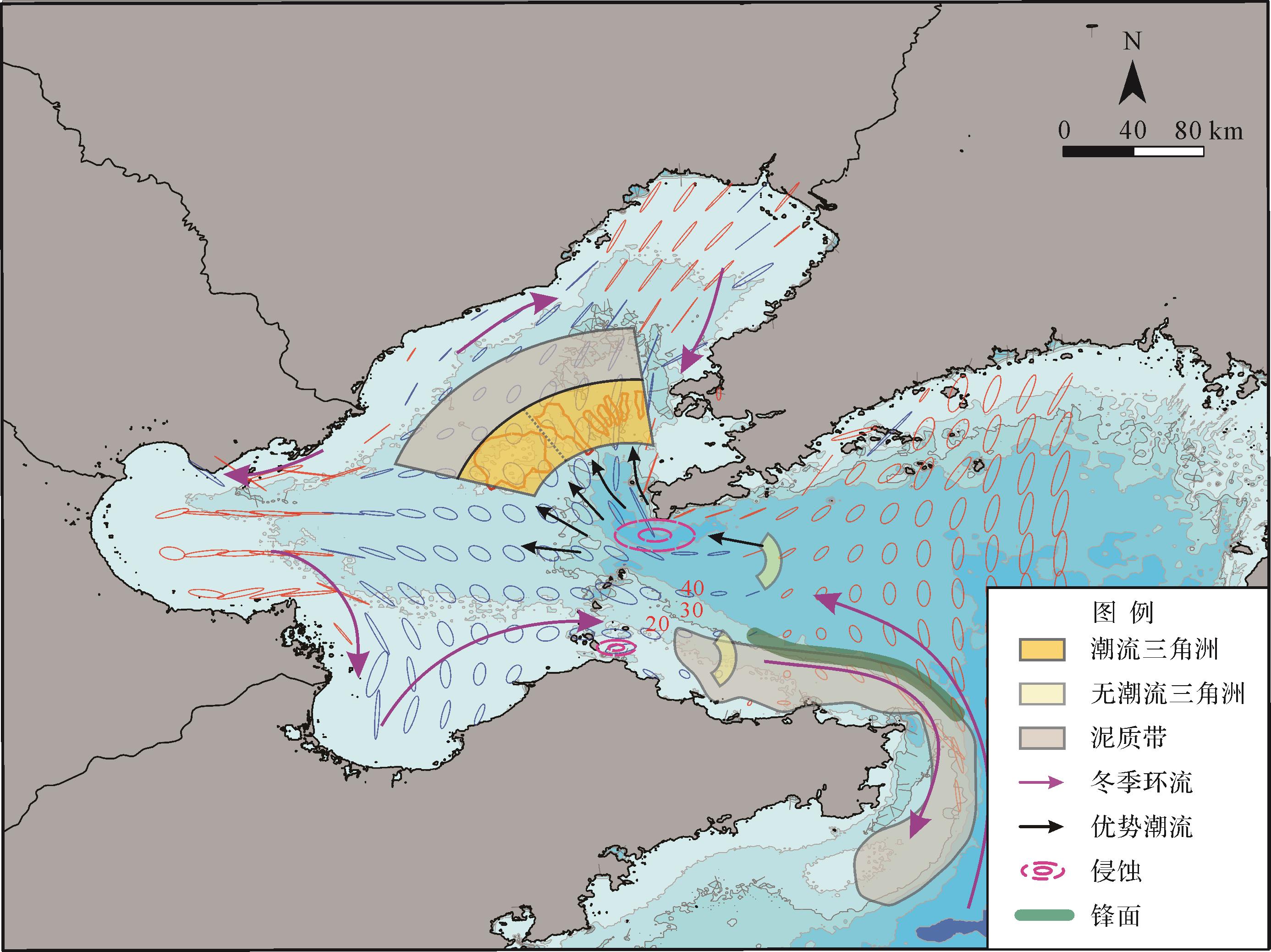
Objective The catastrophic failure of large submarine landslides can result in the deformation and destruction of thousands of square kilometers of seafloor, transporting hundreds to thousands of cubic kilometers of submarine sediments. This process dramatically reconstructs the seafloor topography of the continental shelf-slope region and has a profound impact on subsequent submarine sedimentation processes. Methods The topographic features of different large submarine landslides were qualitatively described using multibeam bathymetric and seismic reflection data, and the key geometric parameters of the submarine landslide top surface, such as area and volume, were quantitatively characterized. Based on the scale, morphological features, and formation mechanisms of the associated reliefs on the submarine landslide top surface, these landslides were separated into three categories: head evacuation zone, locally negative accommodation associated with internal fault systems, and locally negative accommodation associated with internal deformation blocks. The mechanisms of the three types of negative accommodation on the subsequent turbidity current system are then discussed separately. Results Firstly, the head evacuation zone is typically associated with hundreds to thousands of square kilometers of negative accommodation, which acts as a "funnel" during sediment transport along the continental margin, effectively capturing and concentrating subsequent turbidity currents while enhancing the transport efficiency of gravel and coarse sand and playing a crucial role in the accumulation of marine organic matter. Secondly, the striped negative accommodation associated with internal fault systems and the irregular negative accommodation associated with internal deformation blocks can regulate the sedimentation dynamics of subsequent turbidity currents, such as constraining flow direction, enhancing erosion intensity, and forcing channels to avulse. Finally, the negative accommodations associated with the submarine landslide top surface may produce synergistic effects, influencing the sediment filling and evolution of sedimentary basins and the distribution of sedimentary centers over millions of years. Conclusions The investigation of the morphological characteristics of submarine landslide top surfaces and their controlling effects on the subsequent turbidity currents sedimentary dynamic process can provide key geological information for clarifying the transport process of marginal sediments, identifying the distribution of sand-rich reservoirs in deep-sea sedimentary basins, and predicting the development range of catastrophic turbidity currents.
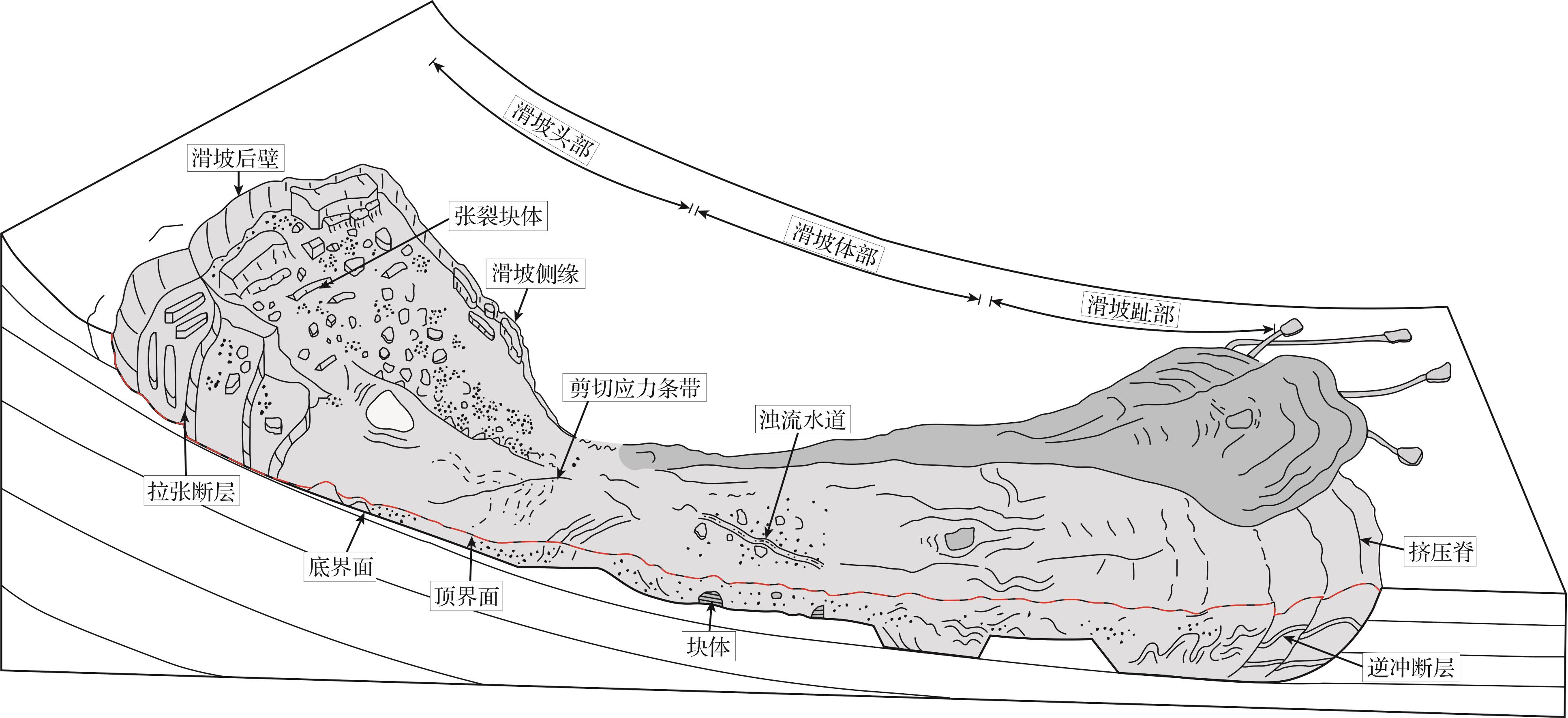
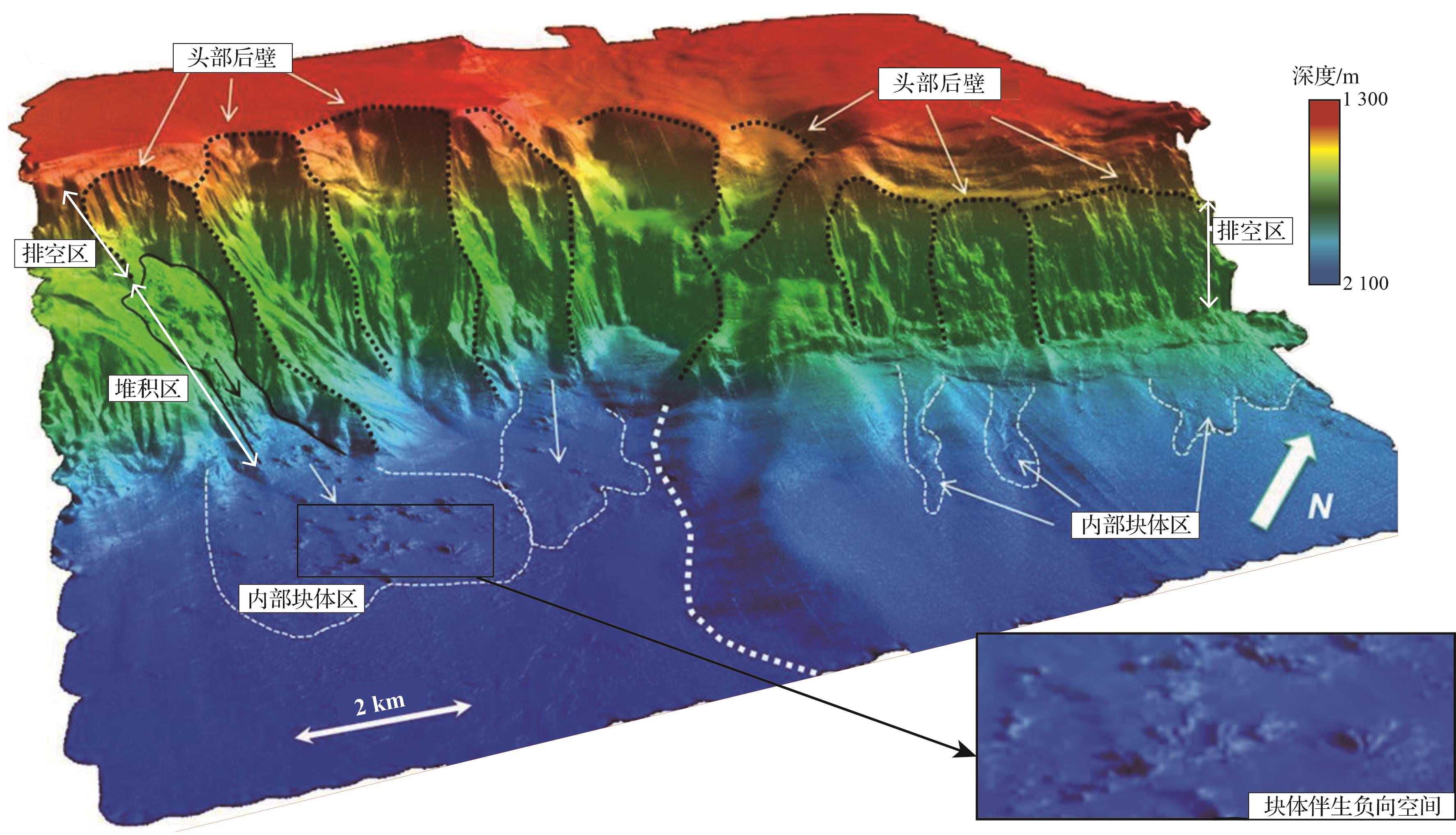
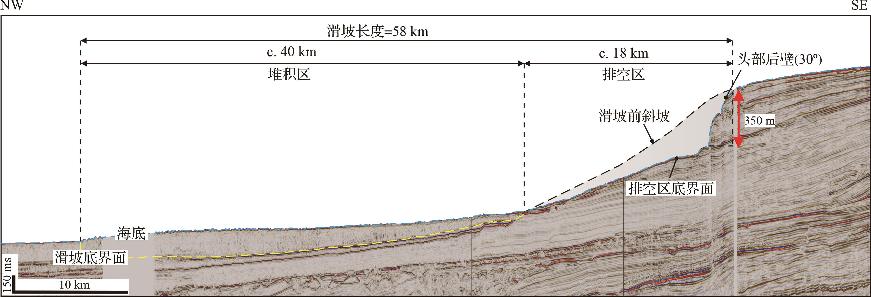
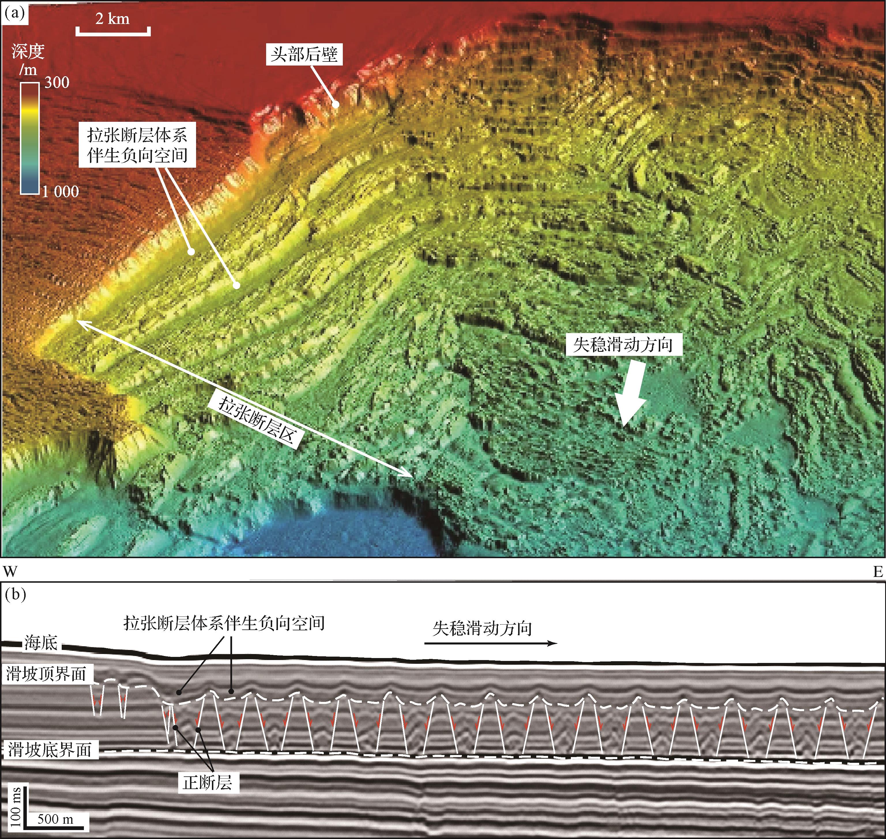
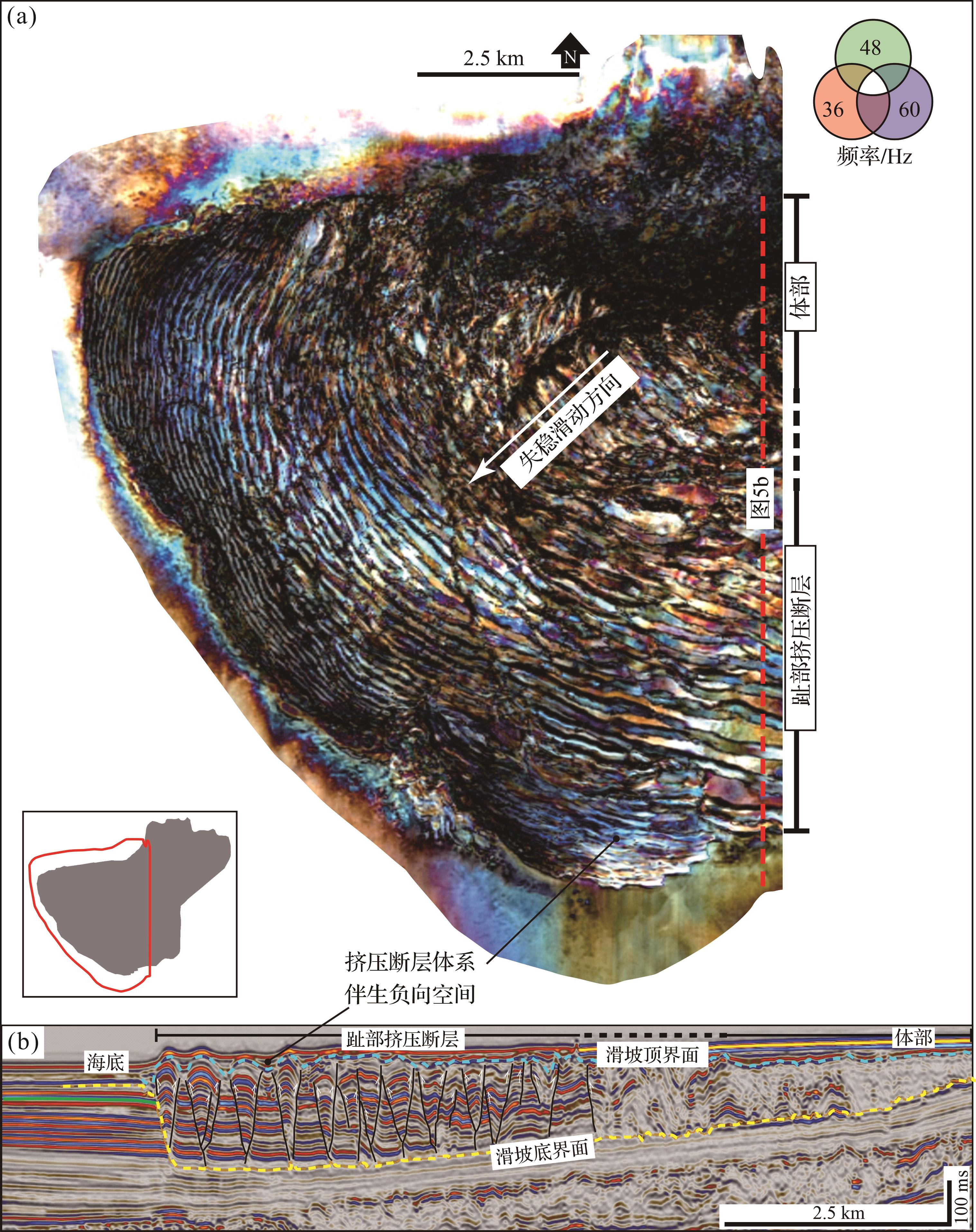
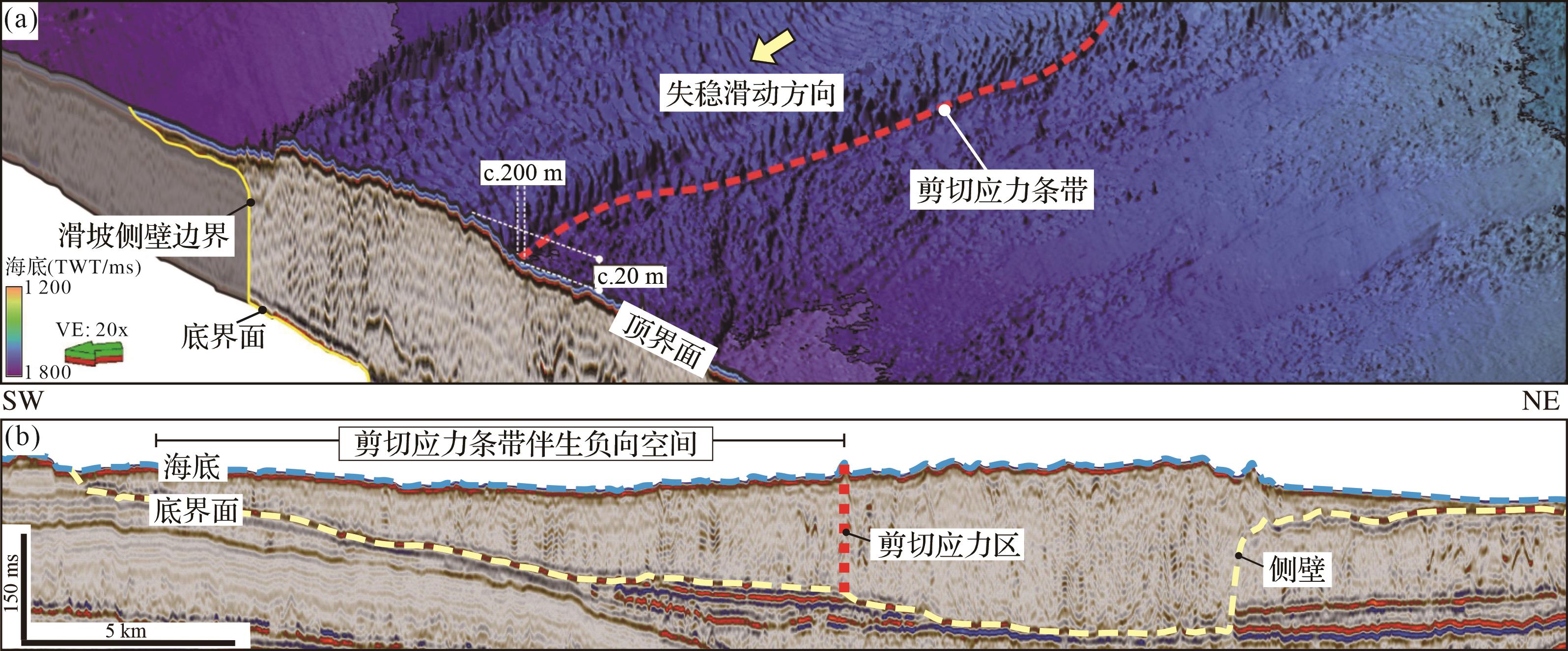
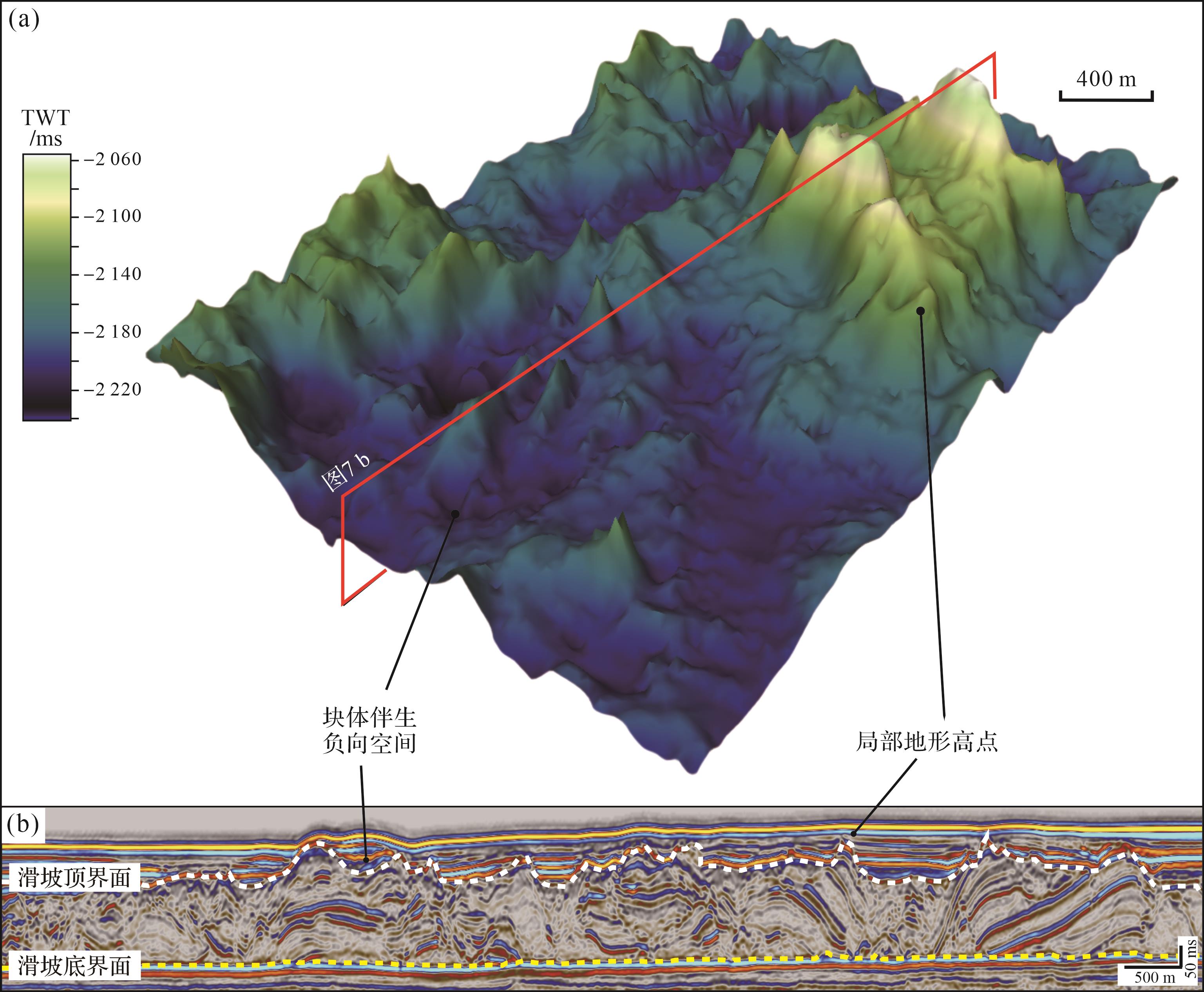
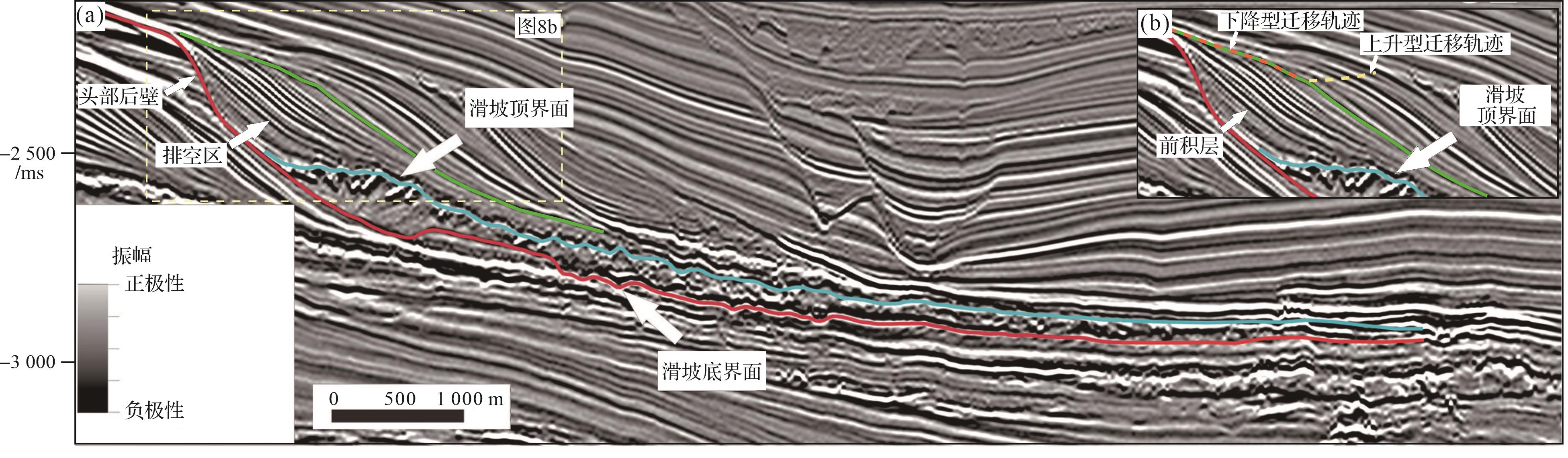
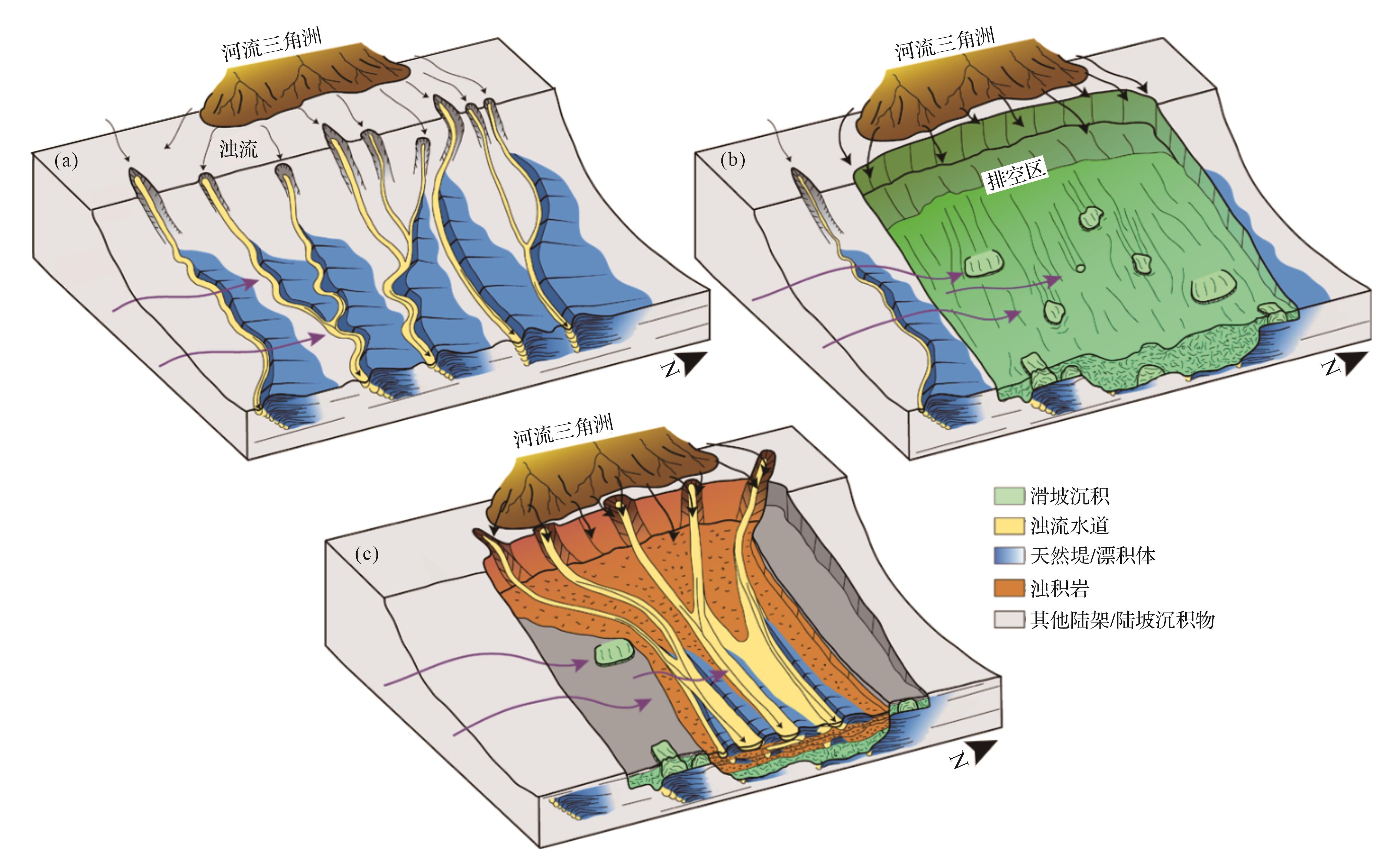
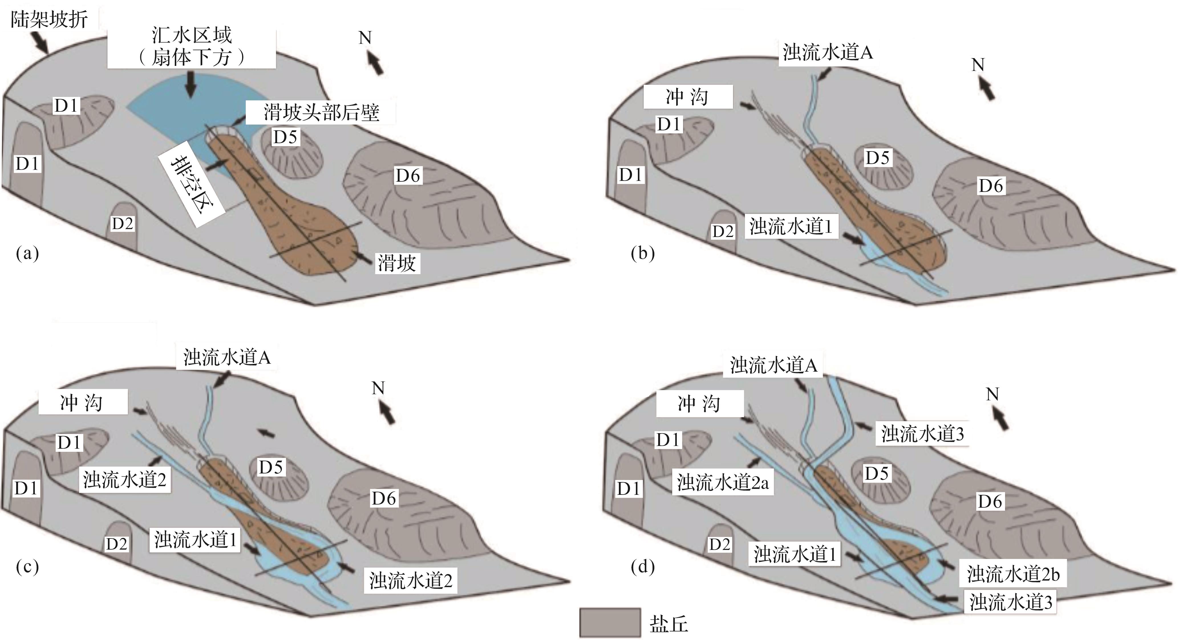
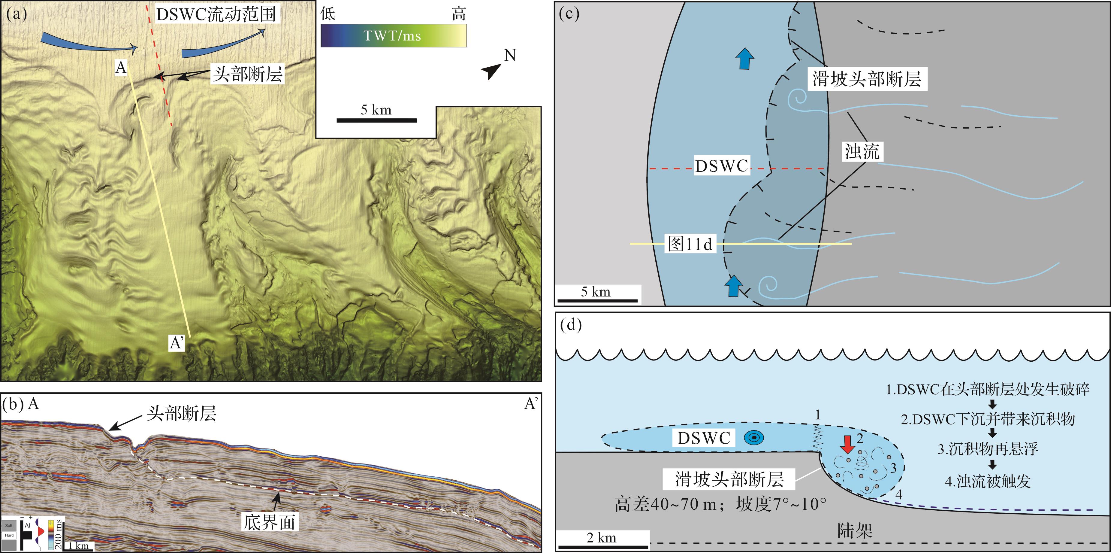
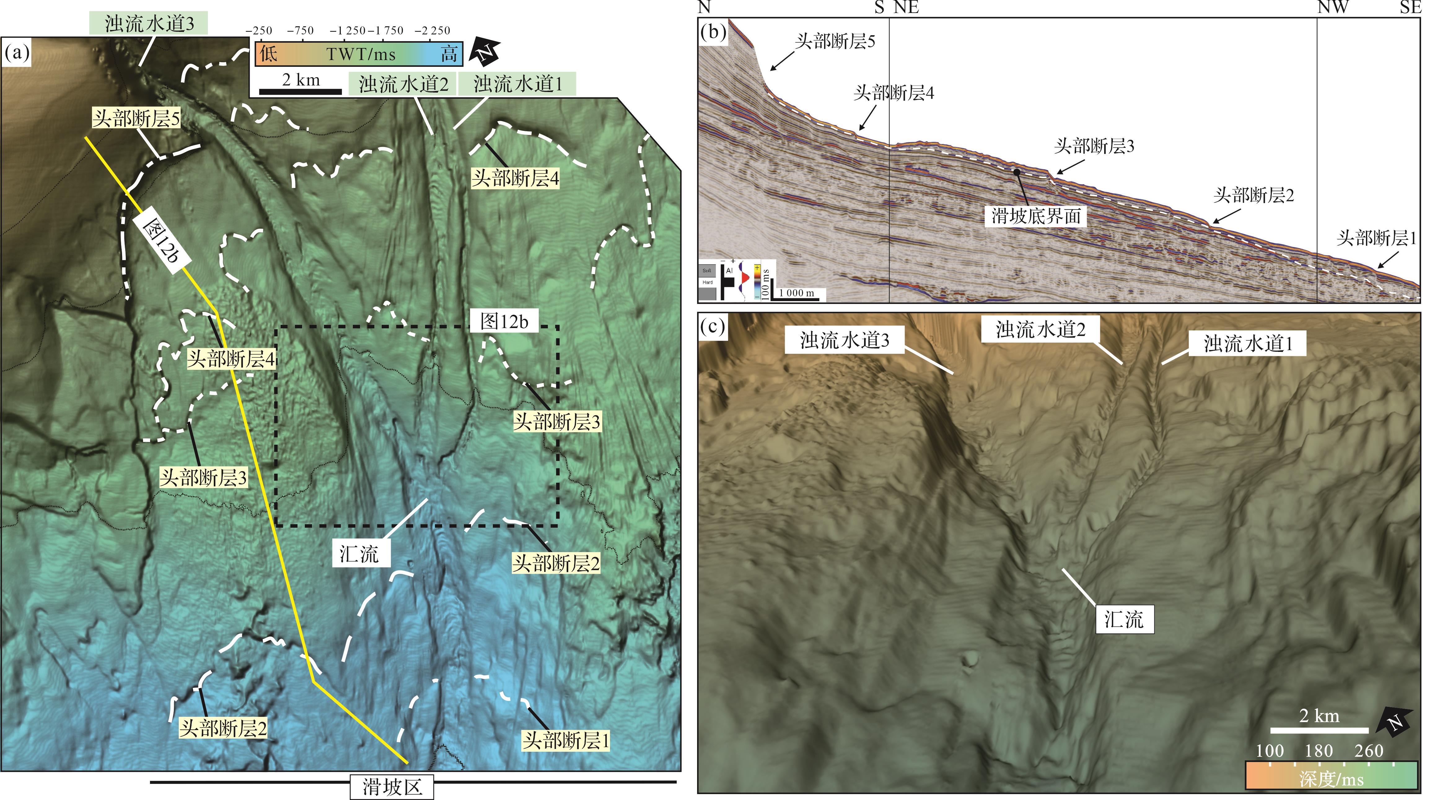
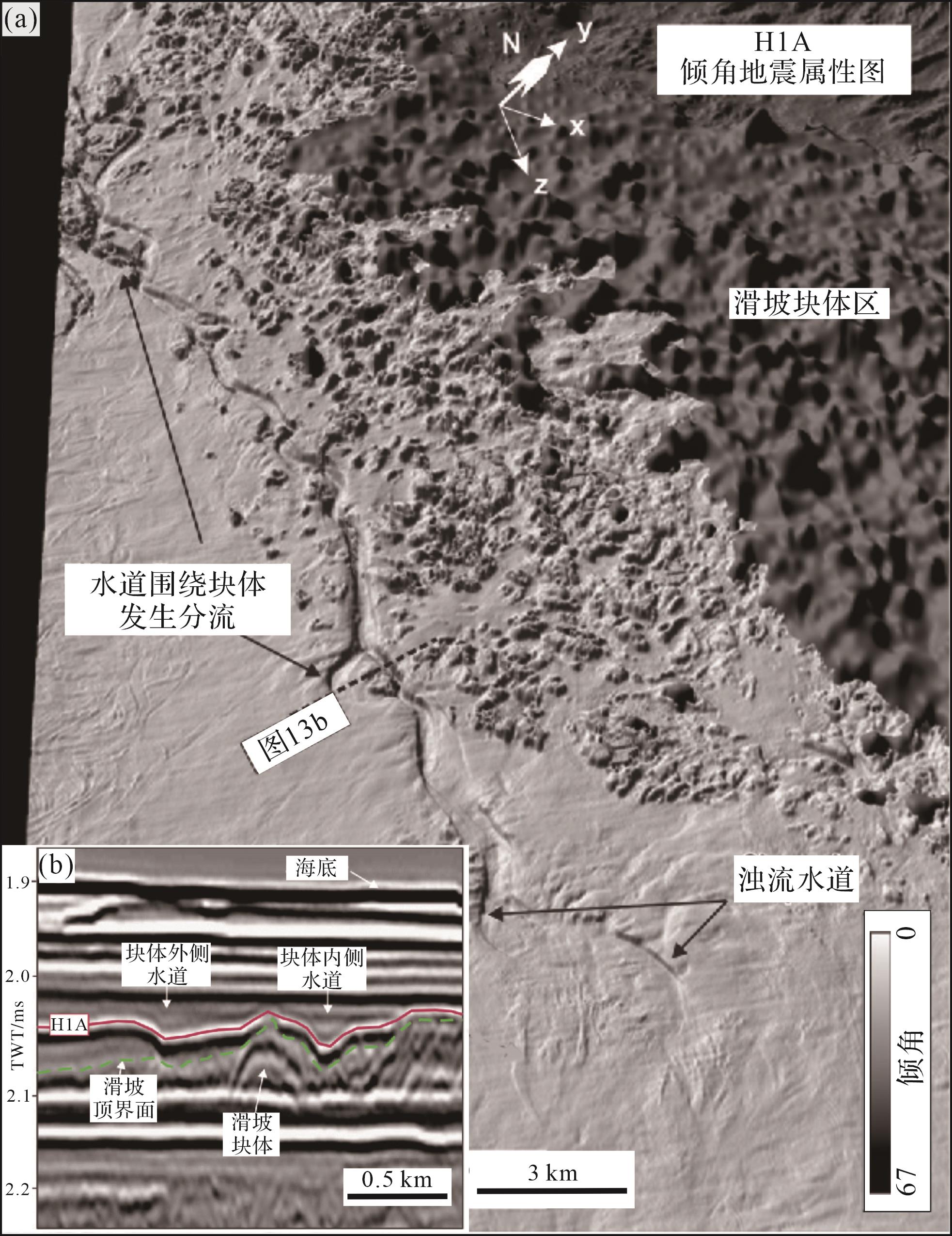
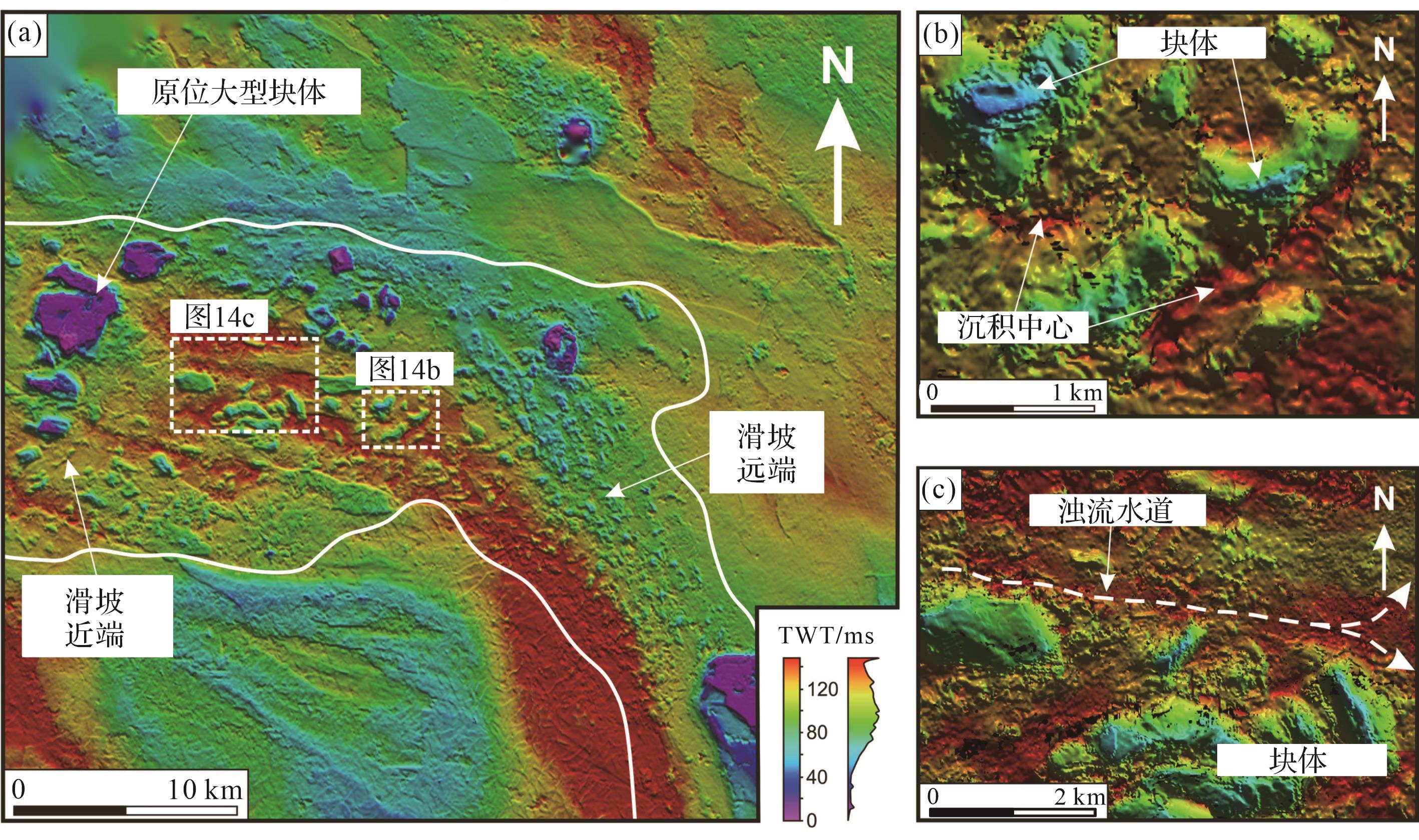
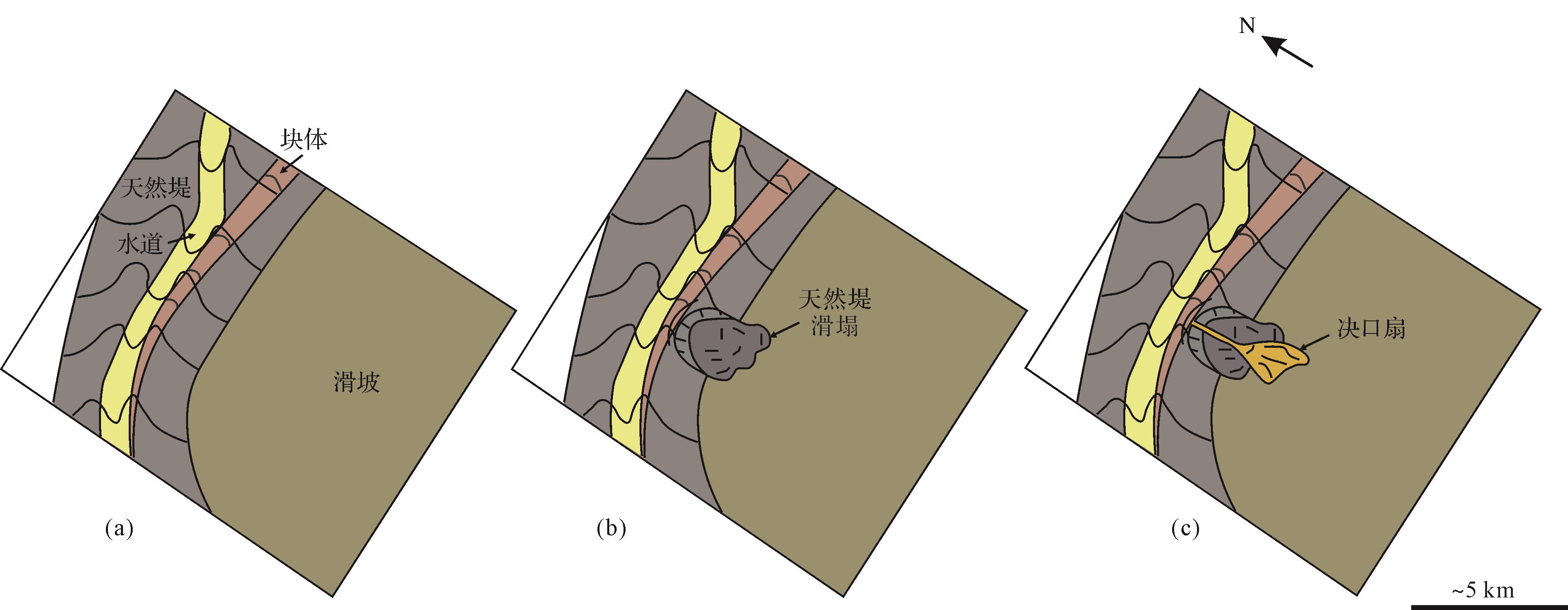
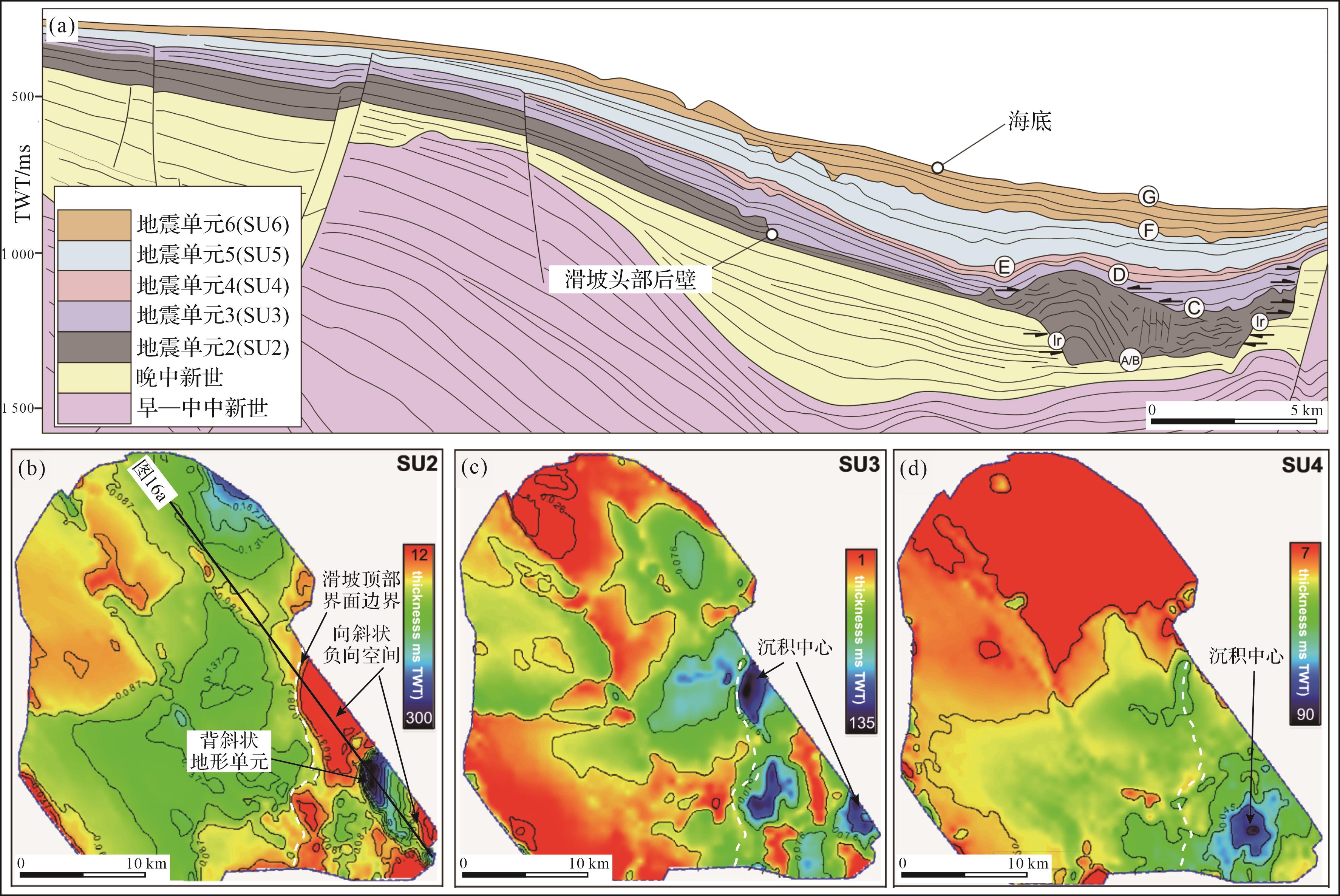
Objective A typical gravity-flow sedimentation set is present in the Ordovician Lashizhong Formation at the western margin of the Ordos Basin. This study investigated the formation process of gravity flows in the third member of the Lashizhong Formation with the aim of summarizing the sedimentary characteristics and evolutionary pattern, and to establish a sedimentary model. Methods Outcrop observation, thin-section examination, grain size analysis and paleocurrent measurement were used in the analysis. Results Eight kinds of lithofacies and six litho-facies associations were found in the study area: horizontal bedded shale (A1); lens-shaped massive bedded calcirudite (B1); lens-shaped parallel-bedded sandstone (B2); lens-shaped cross-bedded sandstone-siltstone (B3), wedges of cross-bedded sandstone-siltstone (C1), graded beds of sandstone-siltstone (D1), parallel-bedded siltstone (D2), and bedded pebbly sandstone (D3). These indicate channel axis deposition (B1), vertical aggradation channels (B2, C1, A1), distributary channels (B3, C1, A1), proximal lobes (D1, A1), distal lobes (D2, A1) and mass transport deposits (D3). Channel axis deposition, vertical aggradation channels, distributary channels, proximal lobes and distal lobes have been successively developed in the lowest part of the Third member of the Lashizhong Formation, which is divided into five stages. The middle and upper parts of the Third member of the Lashizhong Formation show the development of mass transport deposits, proximal lobes and distal lobes, and is divided into seven stages. Conclusions The evolution of these strata is closely related to the type and energy of gravity flow. At the initial stage, gravity flow was dominated by debris flow, then, as the debris flow energy weakened, turbidity current dominated. The vertical aggradation channels were developed during multi-stage periods of erosion and sedimentation. Distributary channels and lobes then developed with further weakening of the turbidity flow. Tectonic movement increased the sand content of sediment supply, leading to the initial development of massive transport deposition followed by large-scale lobes with higher sand content. The vertical evolution of gravity flow sedimentation was governed by a combination of factors, including sea-level fluctuations, sediment supply and its composition, as well as tectonic movement. An initial rise in sea level followed by a sub-sequent fall are suggested by a decrease and then increase in the scale of gravity flow development. Variations in sediment supply types gave rise to diverse sedimentary units, including channel-axis deposition composed mainly of calcirudite, as well as vertical aggradation channels, distributary channels, proximal lobes and distal lobes mainly comprising fine sandstone and siltstone. Moreover, the magnitude of sediment supply significantly impacted the morphological features, dimensions and sand-to-mud ratio of these sedimentary units. During the depositional period of the Lashizhong Formation, relatively subdued tectonic activity facilitated the formation of a channel-lobe system that is relatively modest in size compared to the scale typically encountered in exploration contexts. The interplay of the above factors ⁃ sea-level changes, sediment-supply dynamics, and tectonic setting ⁃ together shaped the architectural complexity and distribution patterns of the gravity flow deposits in the basin. Understanding these controls is crucial for accurate reservoir characterization and prediction in hydrocarbon exploration and production. This study helps in the understanding of gravity-flow evolution in the study area, and provides a theoretical reference for oil and gas exploration.
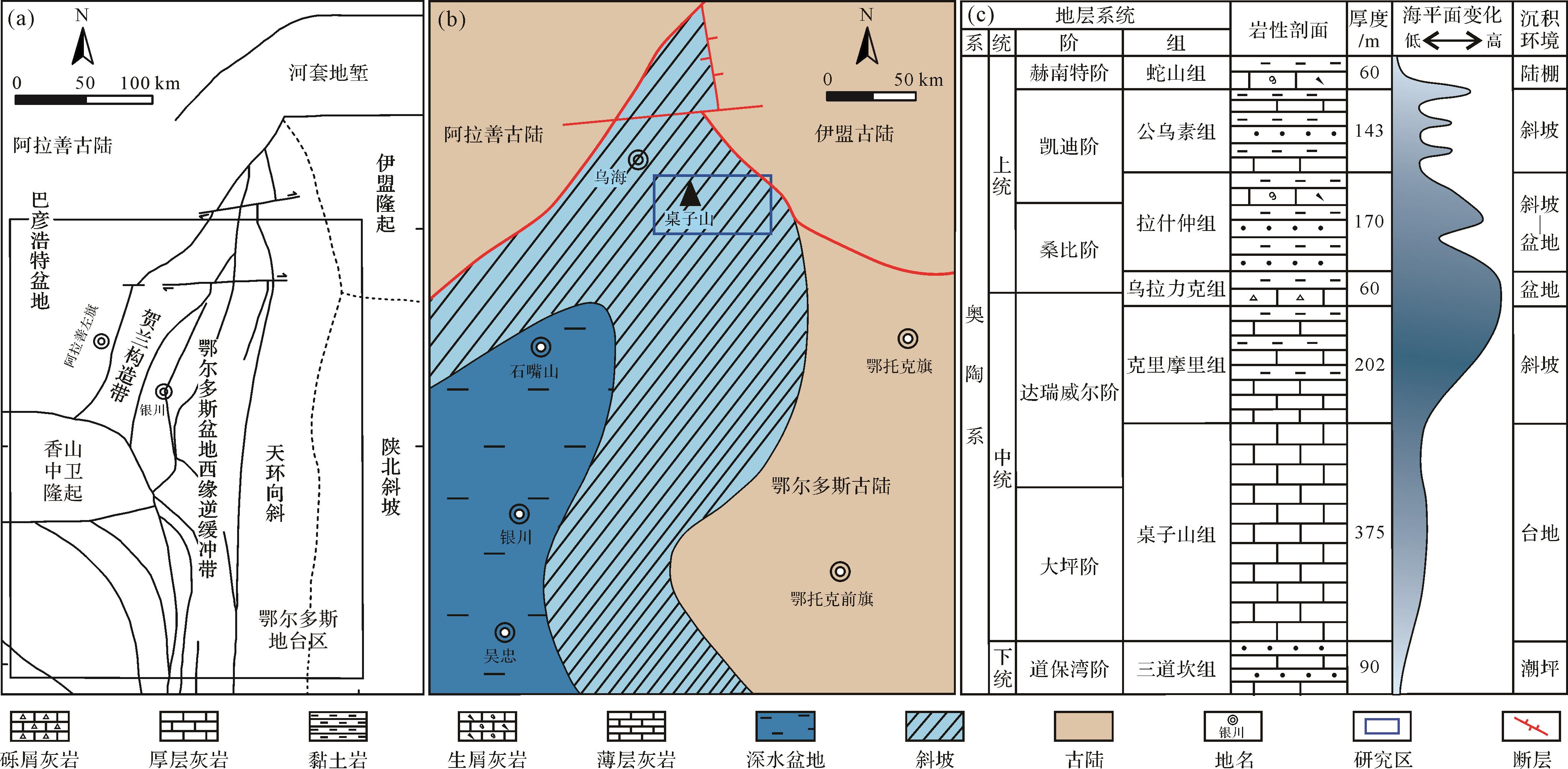
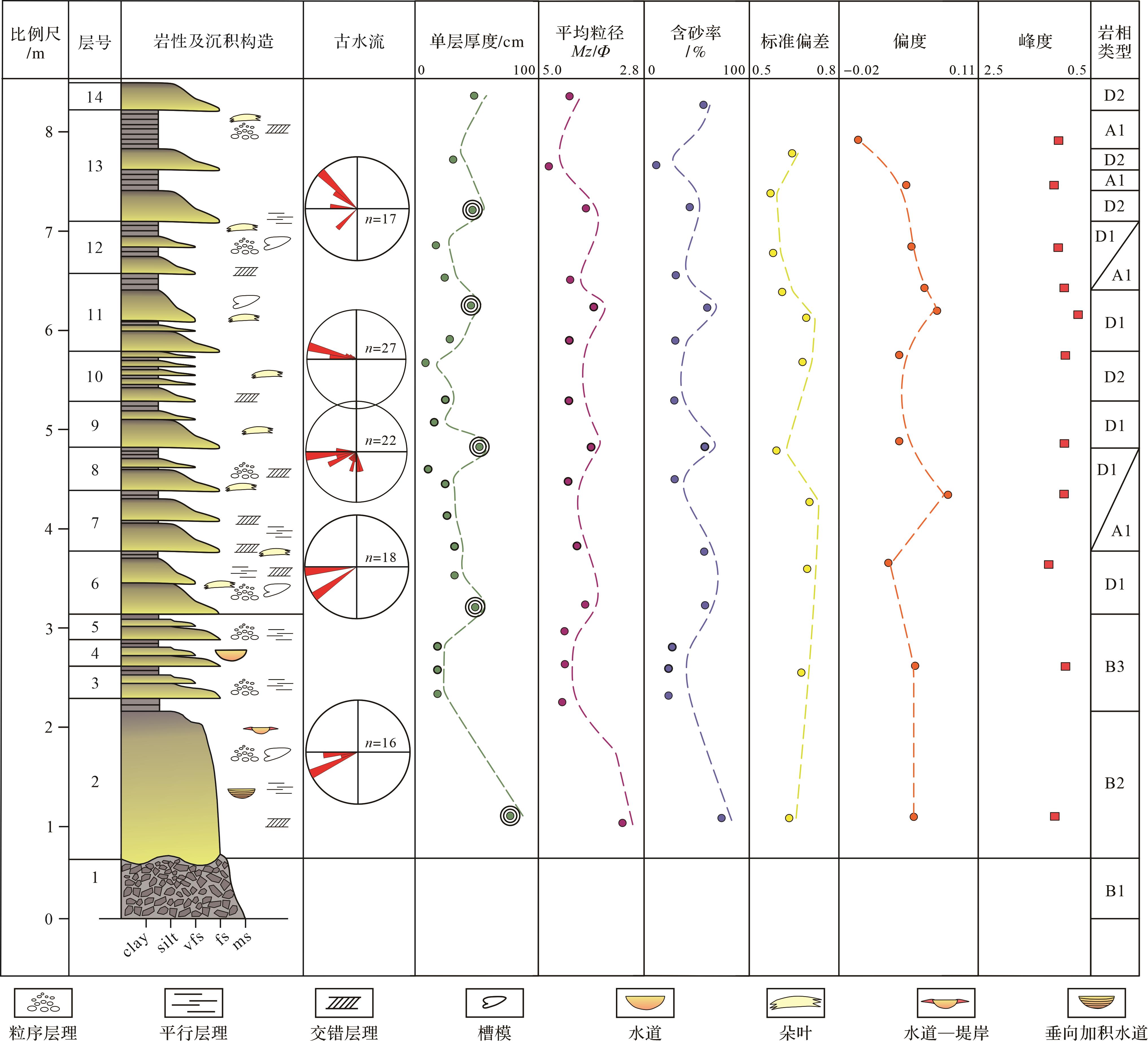
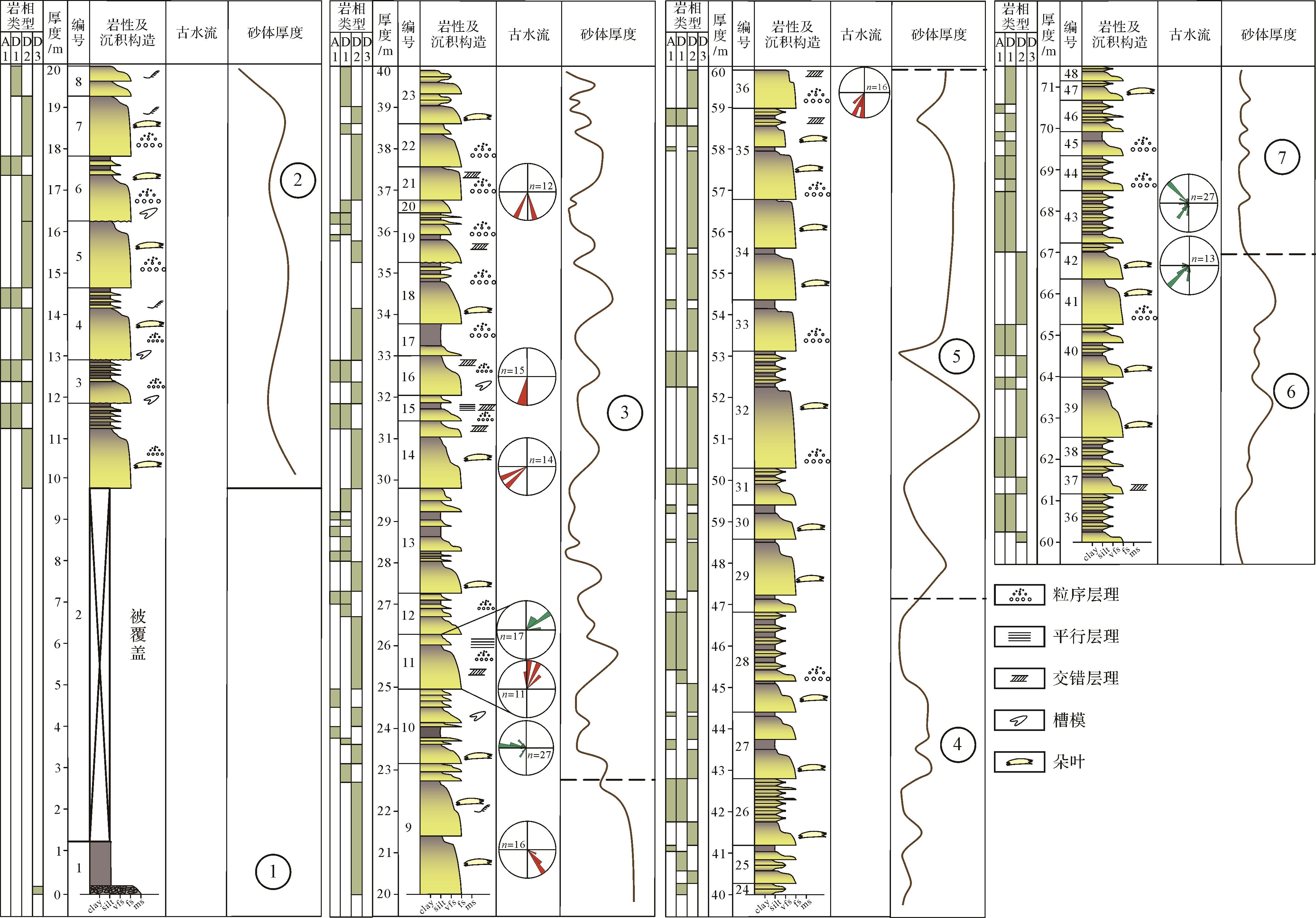
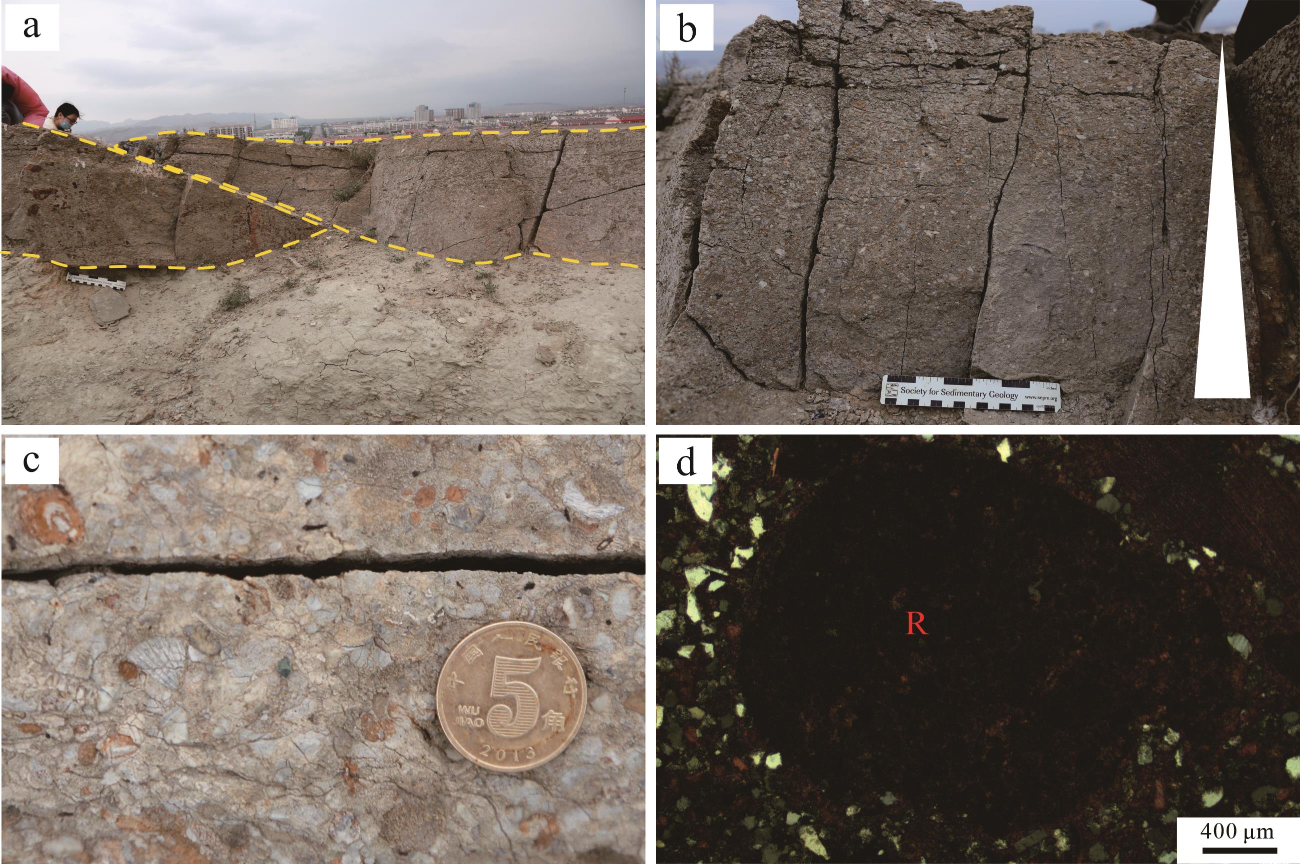
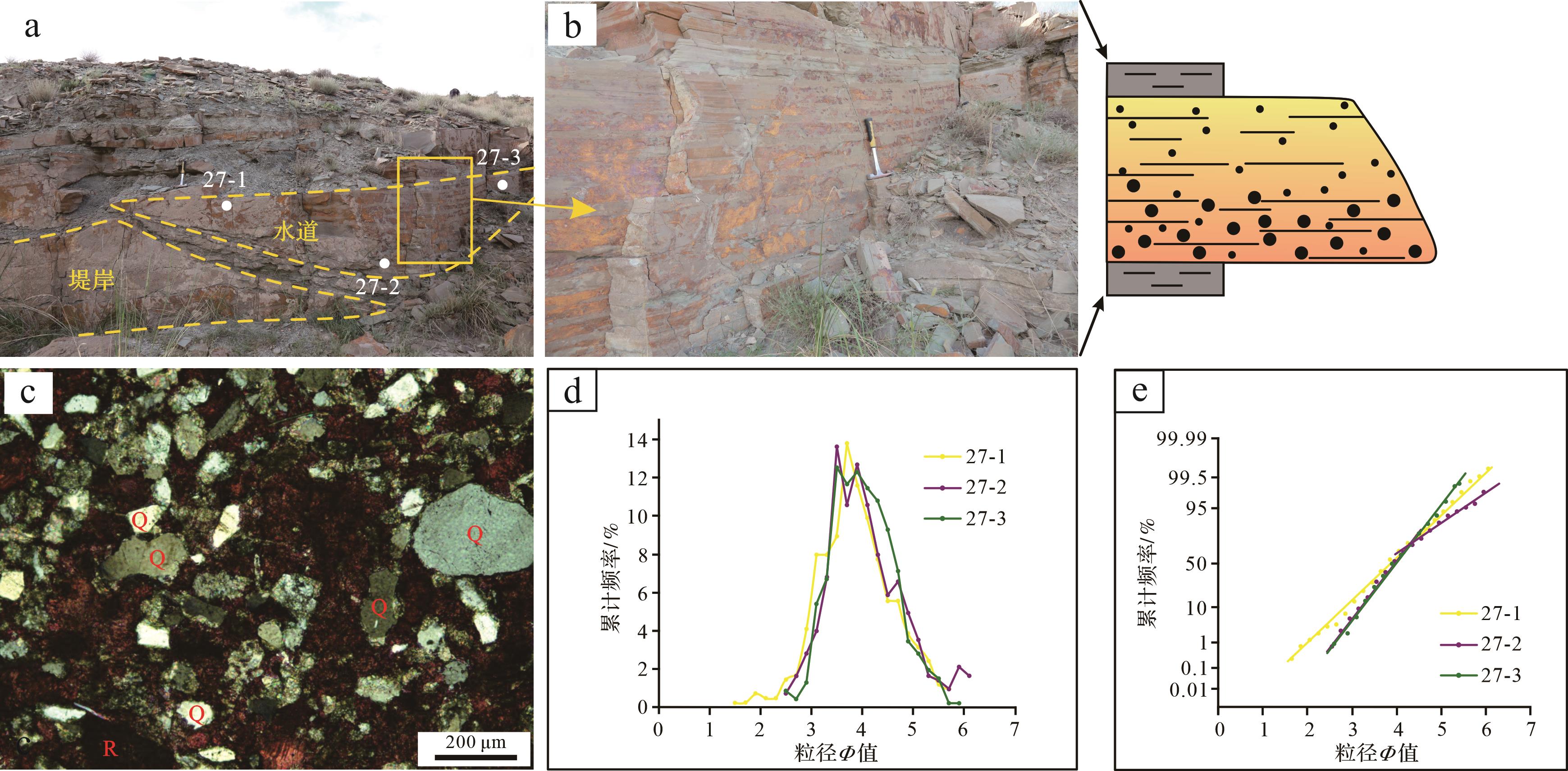
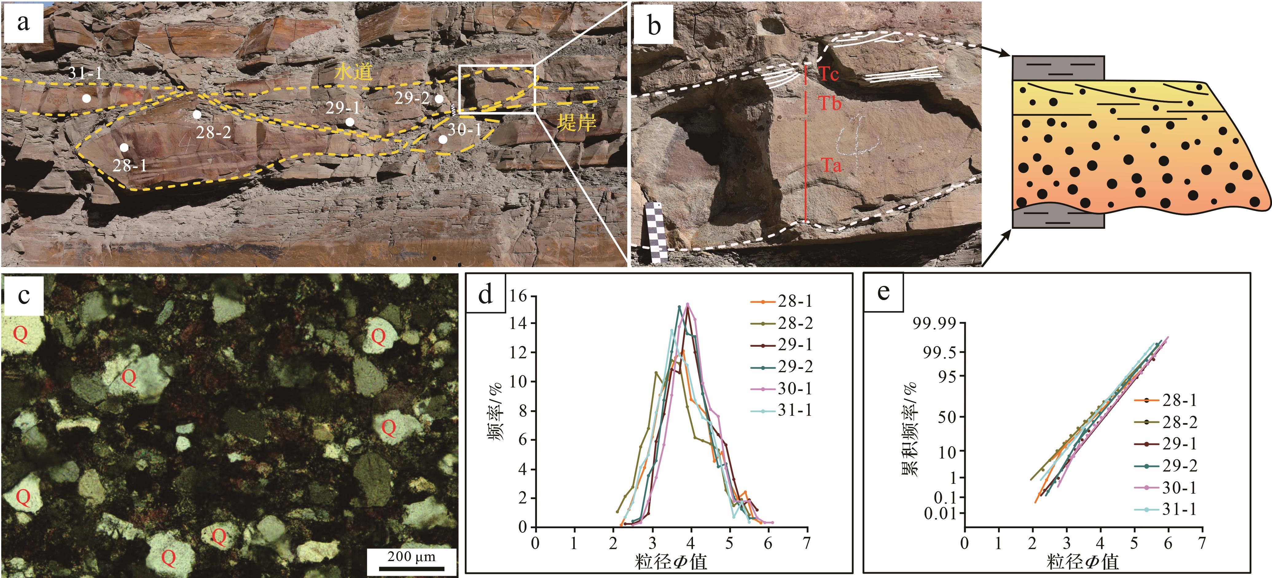
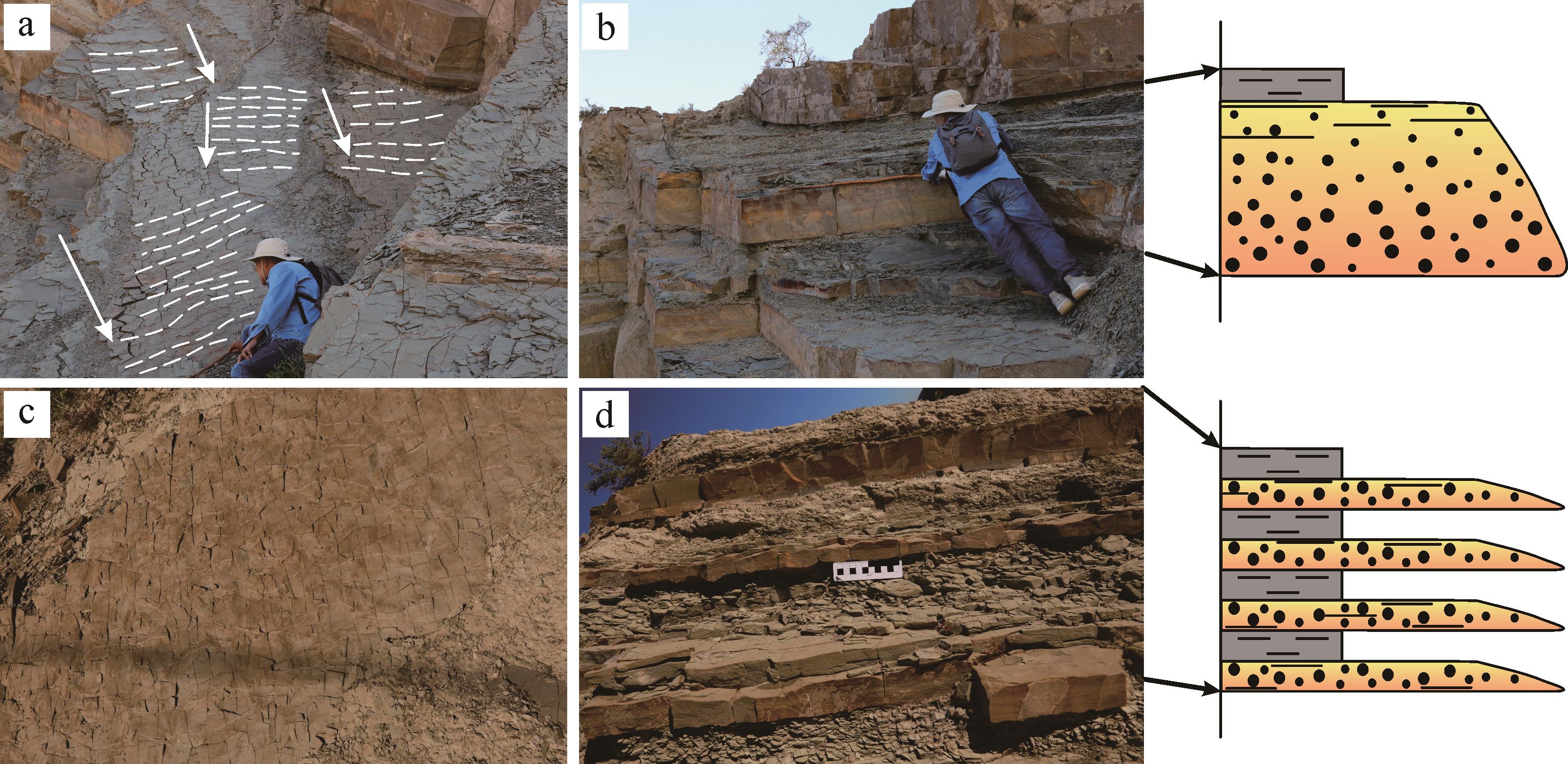
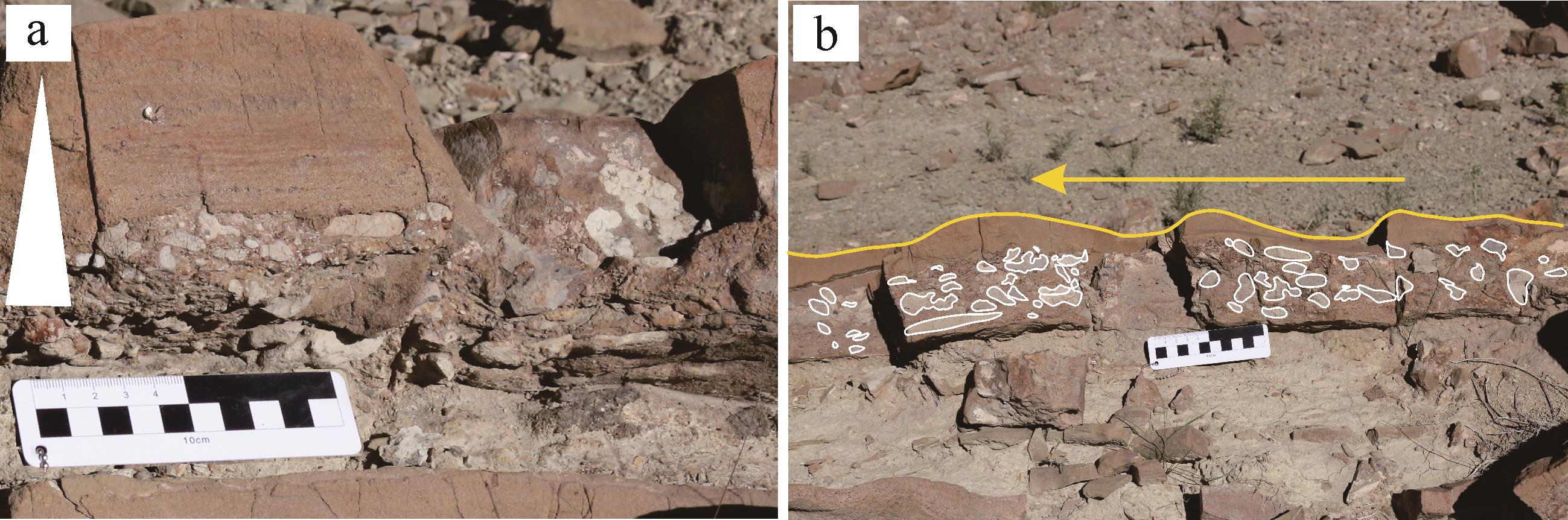
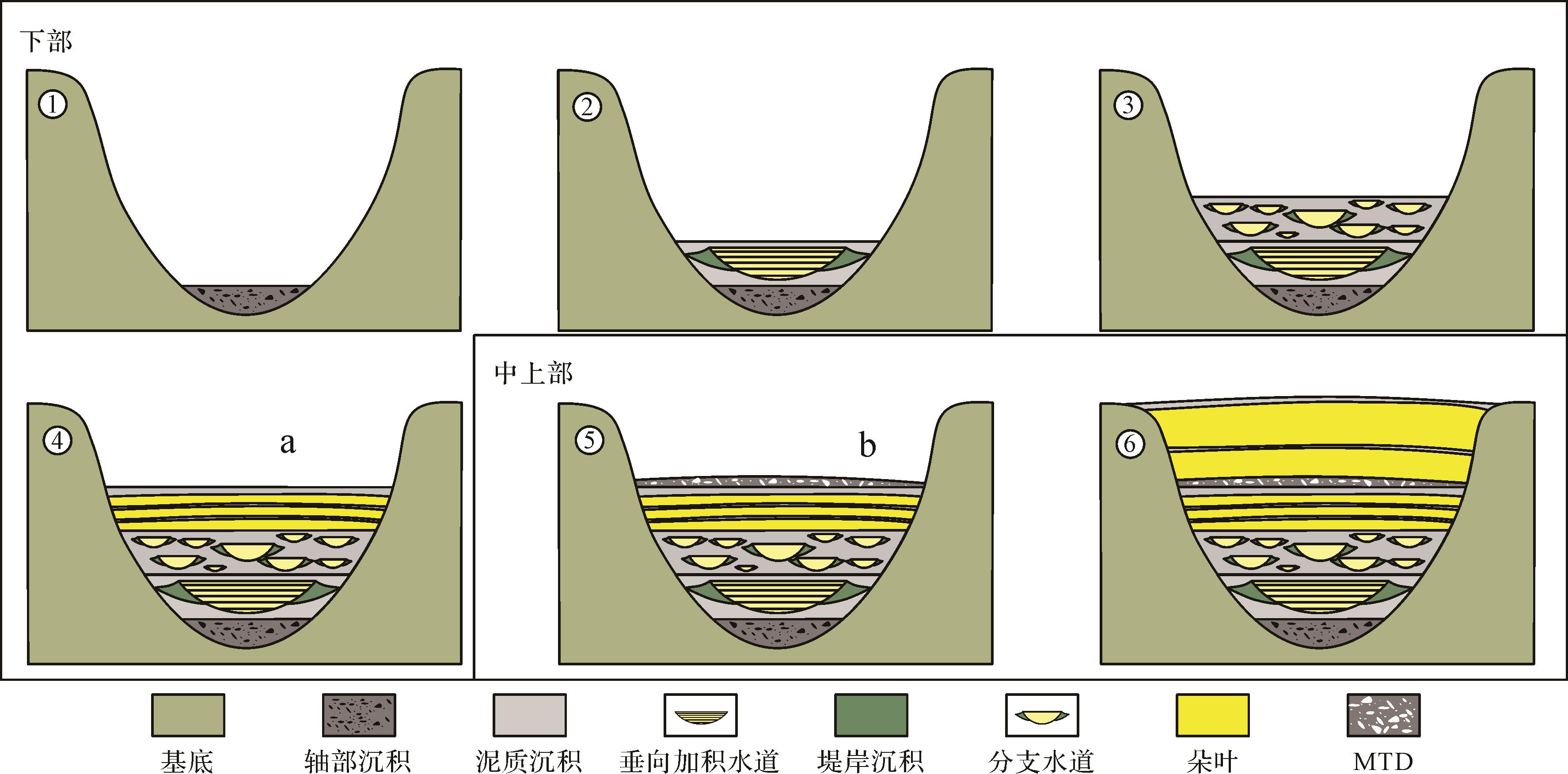
Objective Organisms are extremely responsive to the environments in which they live, and the traces they create are the result of interactions between organisms and their environment. To a certain extent, the traces reflect the properties of the depositional environment. Biological sedimentary structures are a powerful tool in understanding the ecology and depositional processes of modern coastal sedimentary environments. Methods The composition and distribution of modern biological traces in the tidal flat environments of the Pearl River Delta were studied by field observations and 3D reconstruction. Results The key understanding obtained by the study was that the distribution of organisms in the supratidal, intertidal and subtidal varies greatly, and the biological traces are mainly distributed in the intertidal zone. In the supratidal zone, mainly Ligia oceanica and Uca arcuata are present. The main traces are Uca arcuata level feeding traces, excretion traces, trackways, and intra-layer I-shaped dwelling burrows. Biological traces in the intertidal mud flat environment mainly include feeding, excretion, trackways and I-shaped dwelling burrows of Uca arcuata, crawling traces and Y-, U- and I-shaped dwelling burrows of Periophthalmus cantonensis, and trackways and I- and Y-shaped dwelling burrows of Orisarma dehaani. Biological traces in the mixed intertidal flat environment mainly include excretion traces and intra-layer I-, U-, and Y-shaped dwelling burrows of Perinereis aibuhitensis, Y-, U- and I-shaped dwelling burrows of Ligia oceanica, and crawling traces of Vittina coromandeliana and Neritina pulligera. Biological traces in the sandy intertidal environment include feeding and excretion traces of Ocypode cordimand and intra-layer I-shaped dwelling traces. The subtidal environment was not accessible for observation and no biological traces were found. Conclusions The study of modern intertidal biological traces in the Pearl River Delta supplements modern sedimentological data on tidal flat environments in the Pearl River Delta, and provides modern empirical evidence for palaeoichnology and palaeoenvironmental reconstruction.
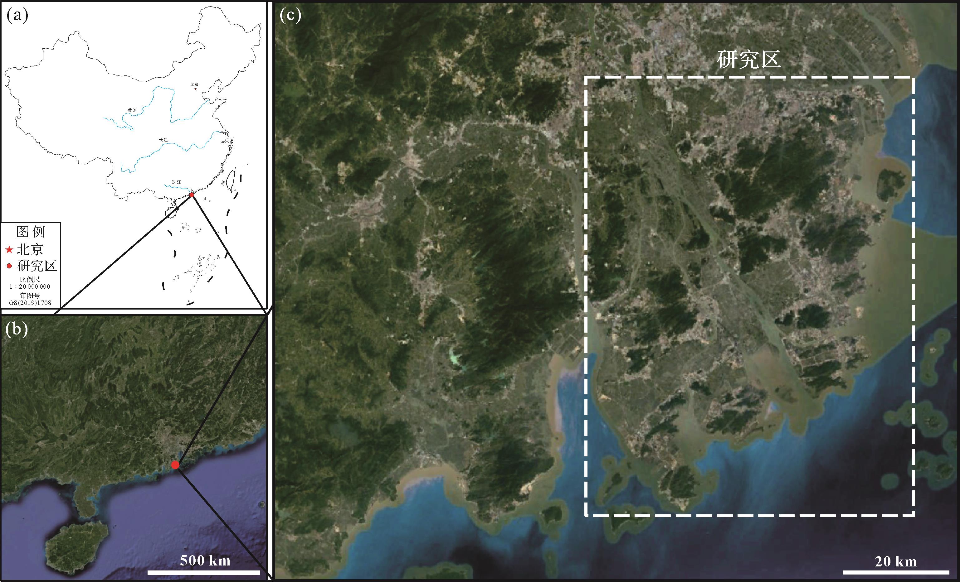
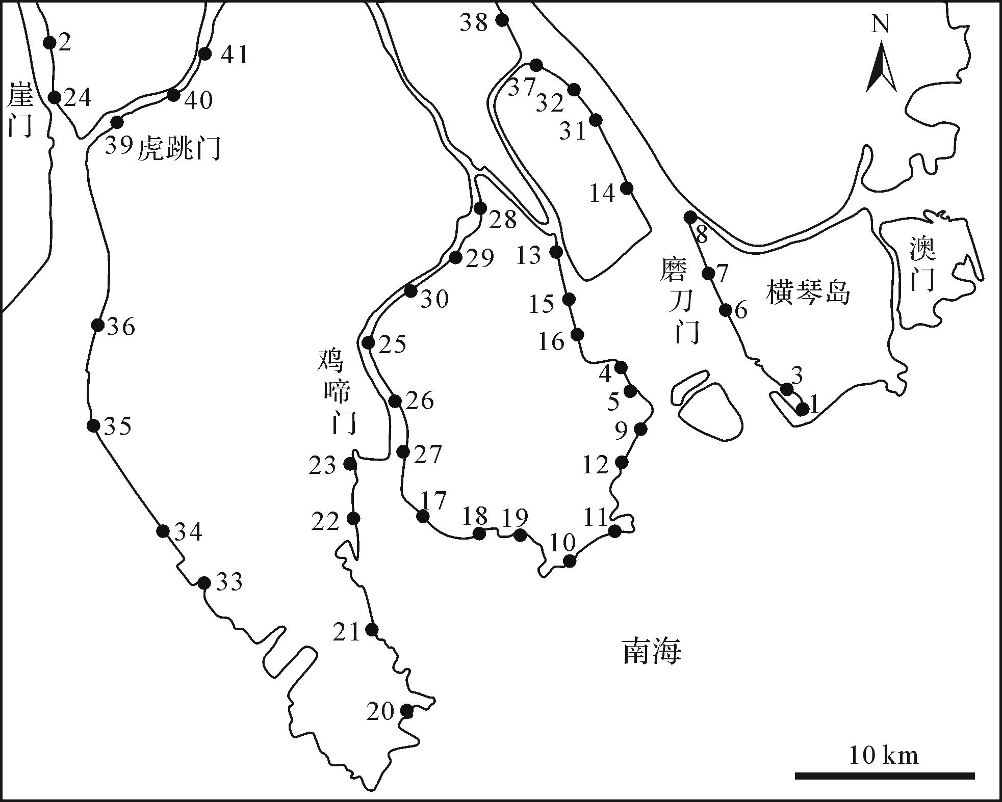
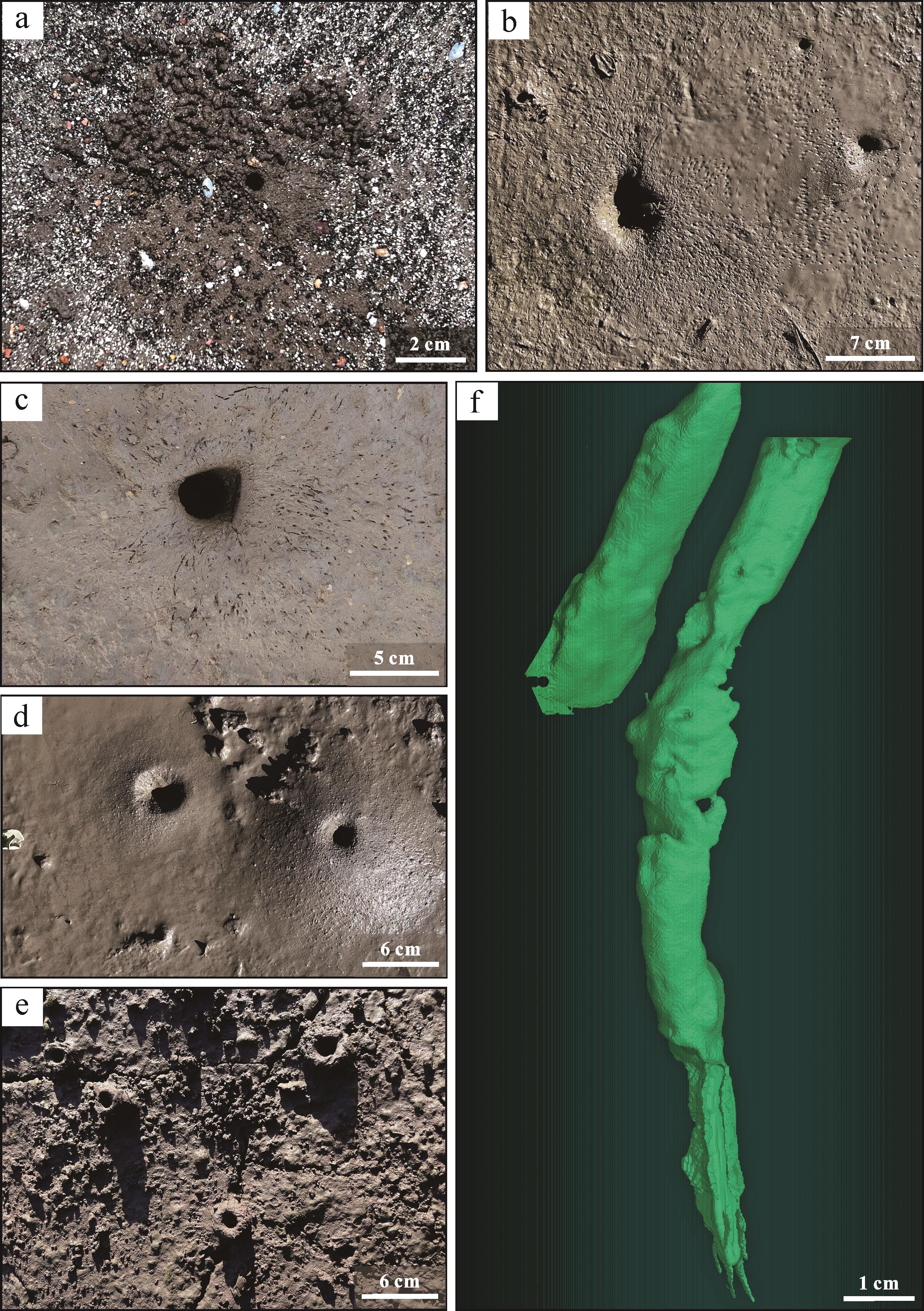
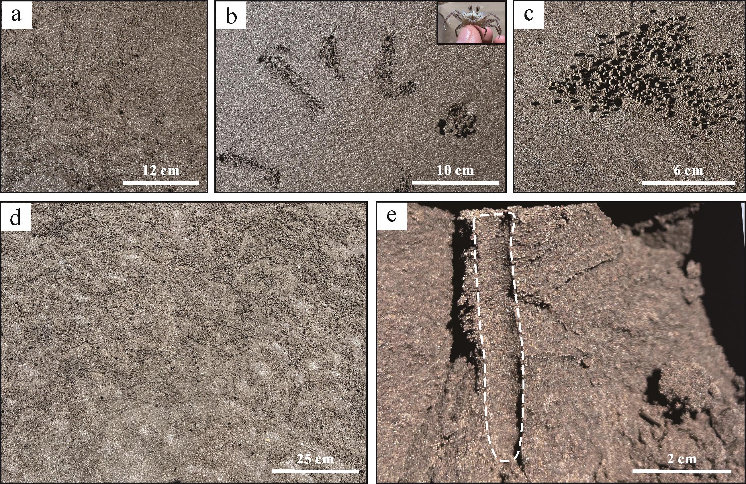
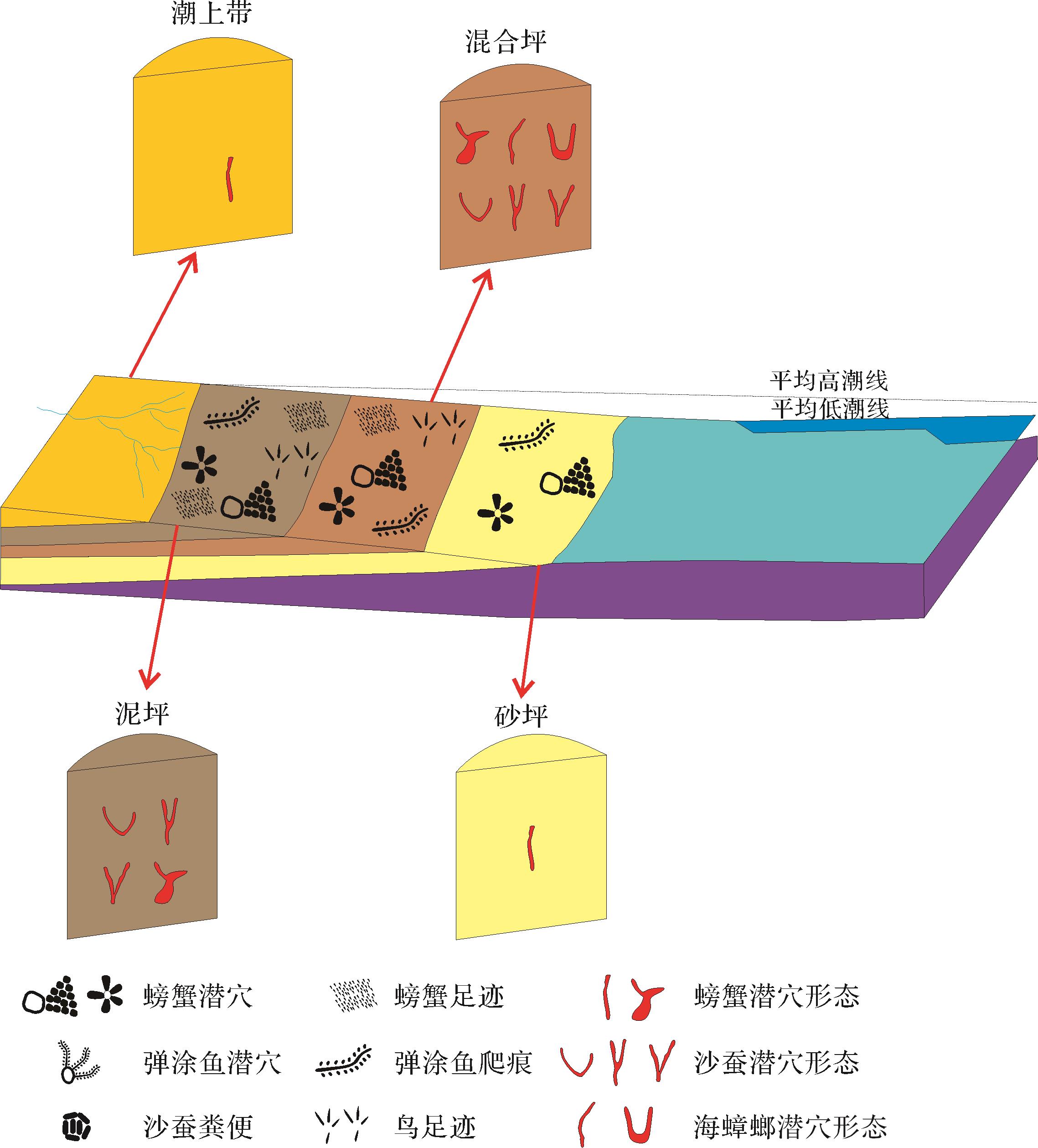
Objective A large number of Thalassinoides trace fossils developed in the Cambrian strata of Henan province. We studied the morphology and distribution characteristics of different ichnospecies and analyzed the sedimentary environment-controlling factors. Methods Based on lithology and ichnography, the morphology, size, disturbance depth, and disturbance intensity of Thalassinoides in this area were combined with sedimentary environment parameters. Results The dense network Thalassinoides suevicus features
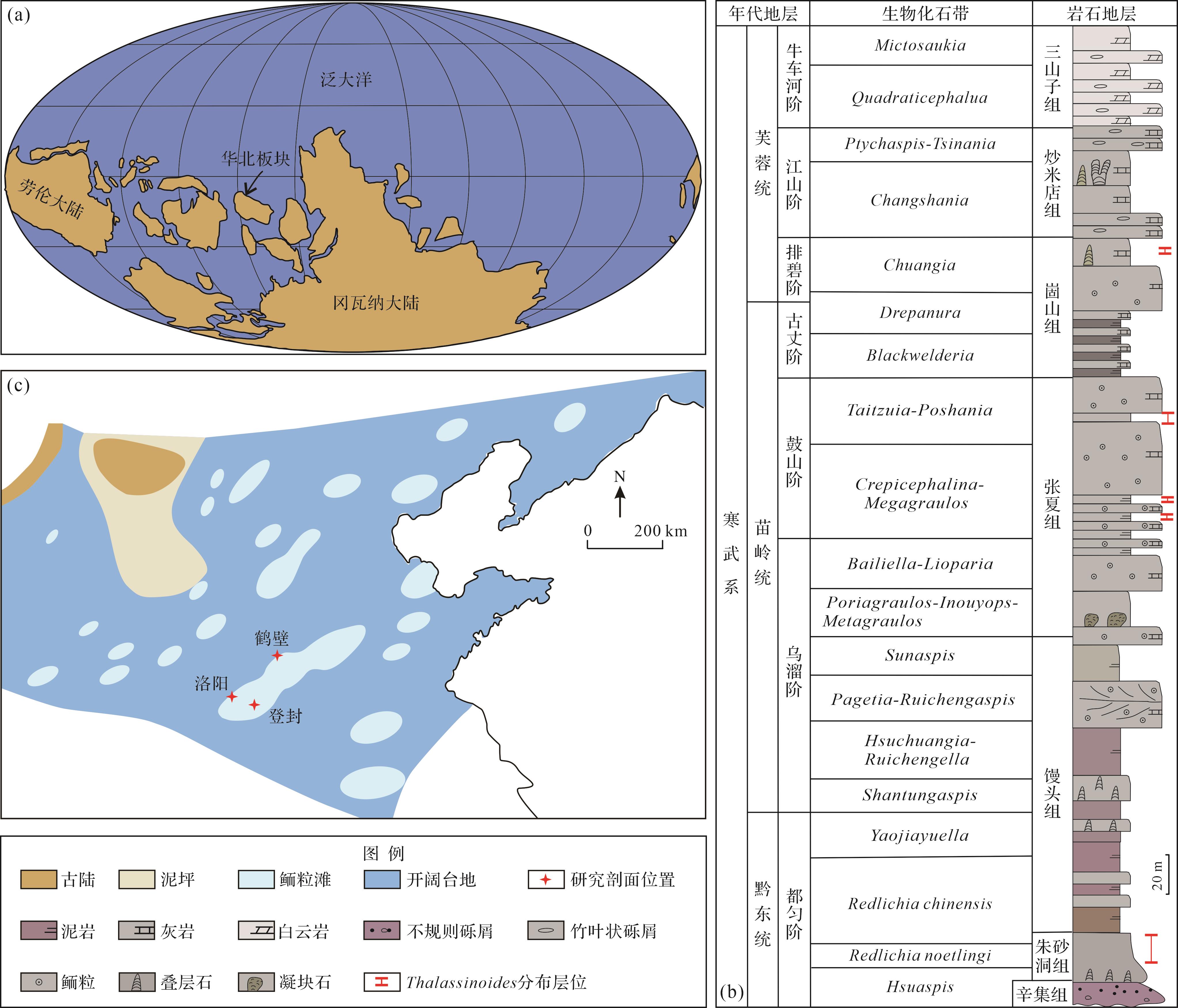
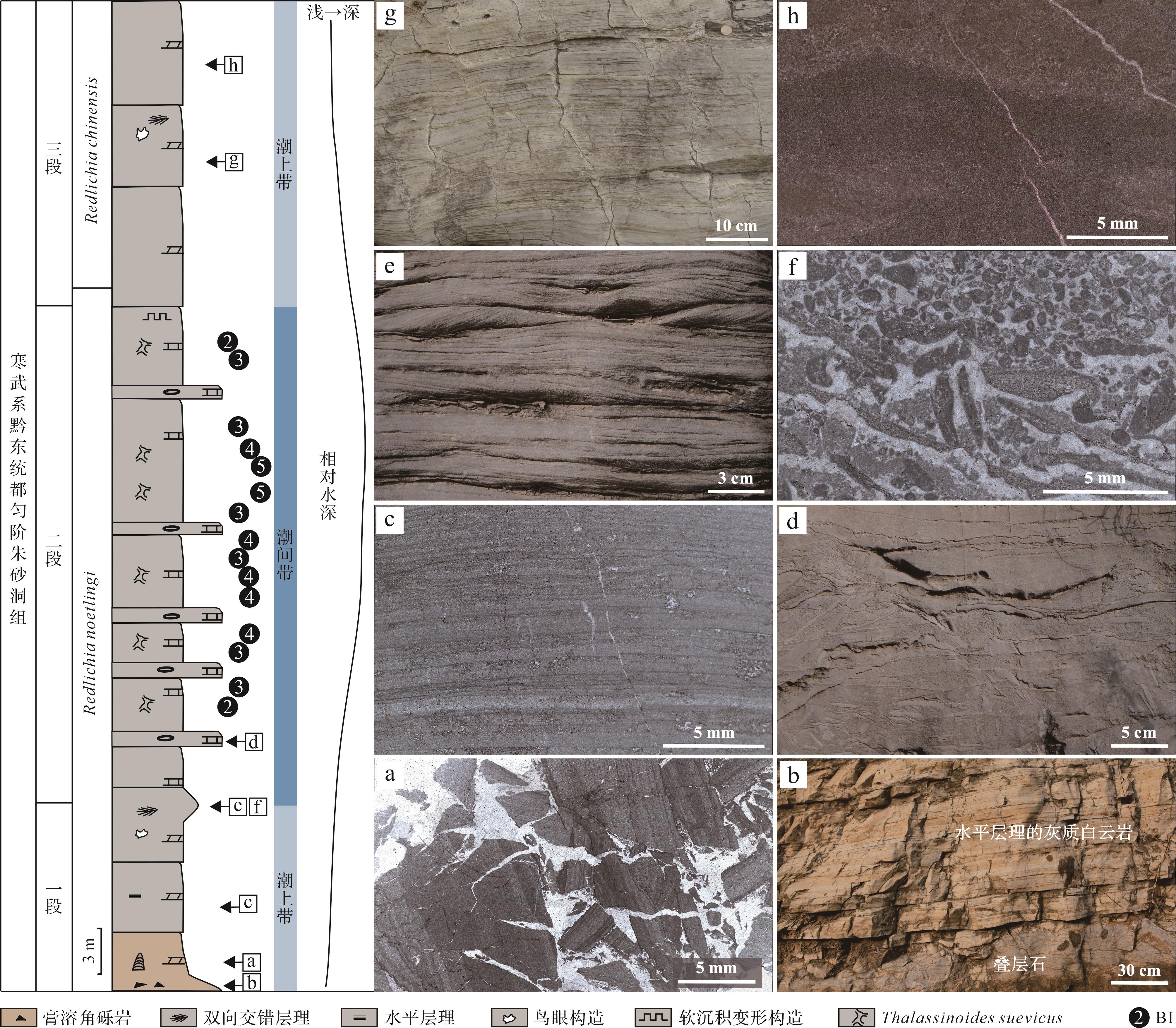
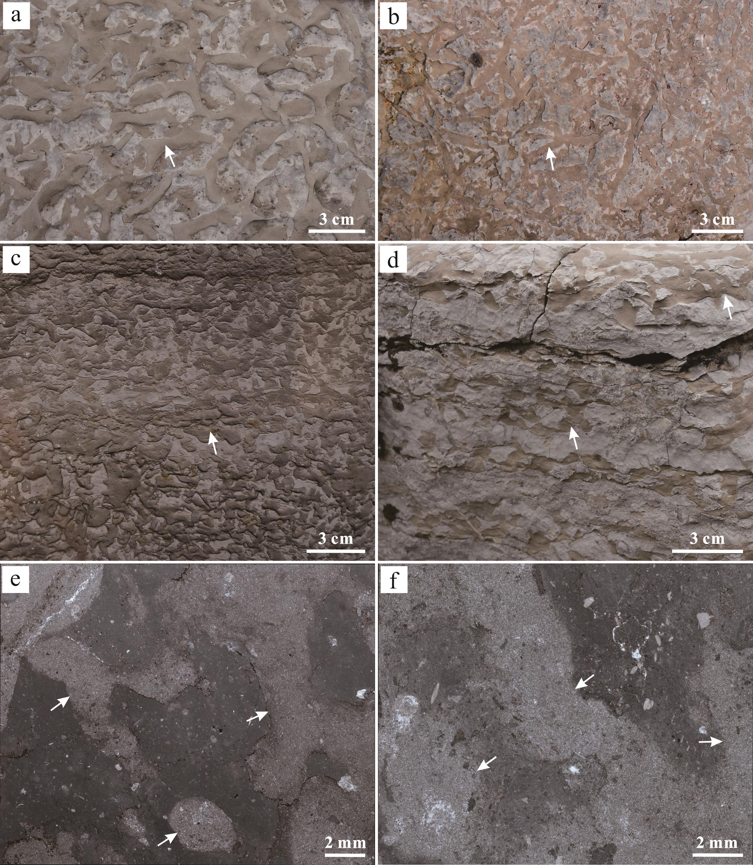
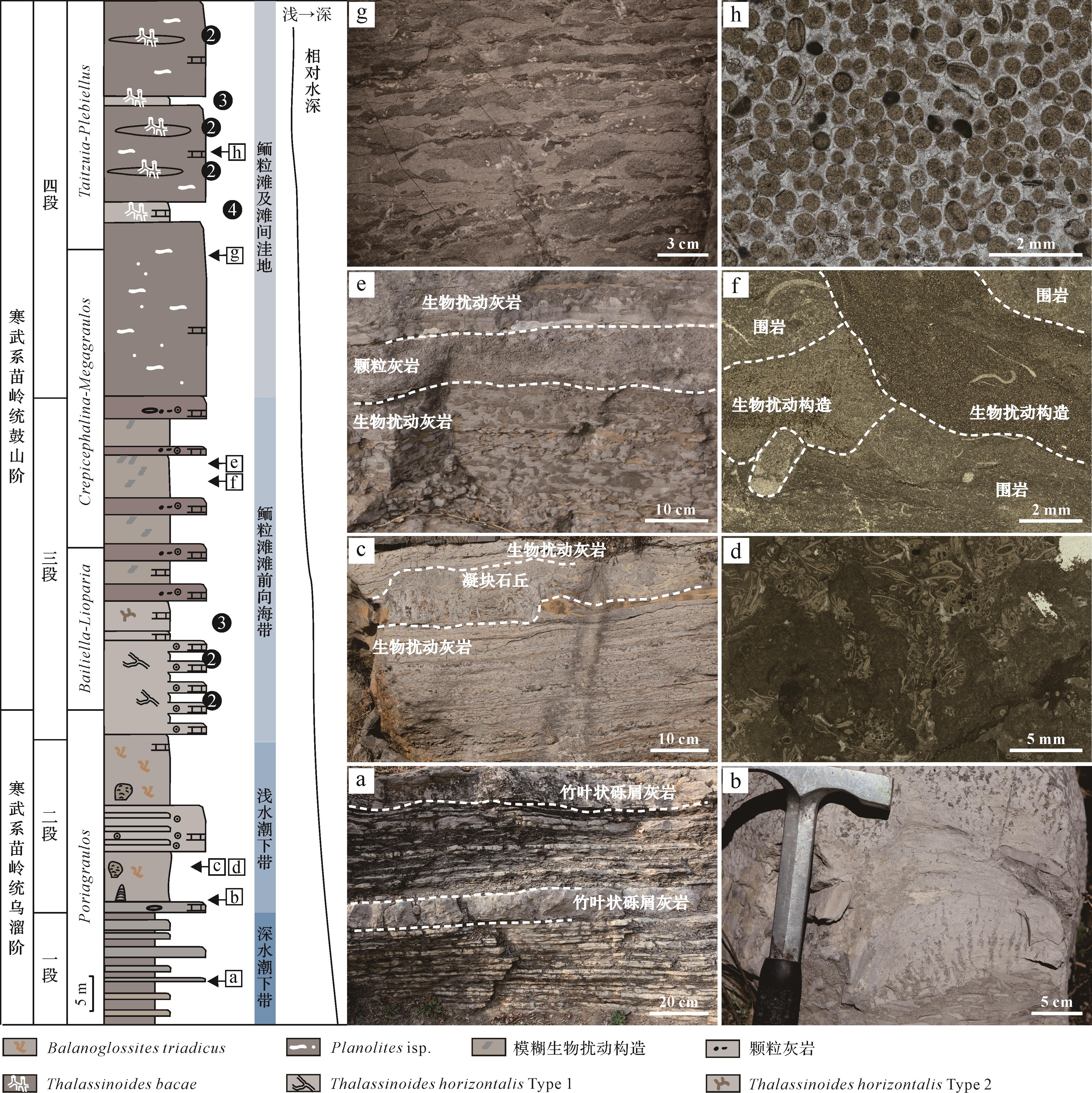

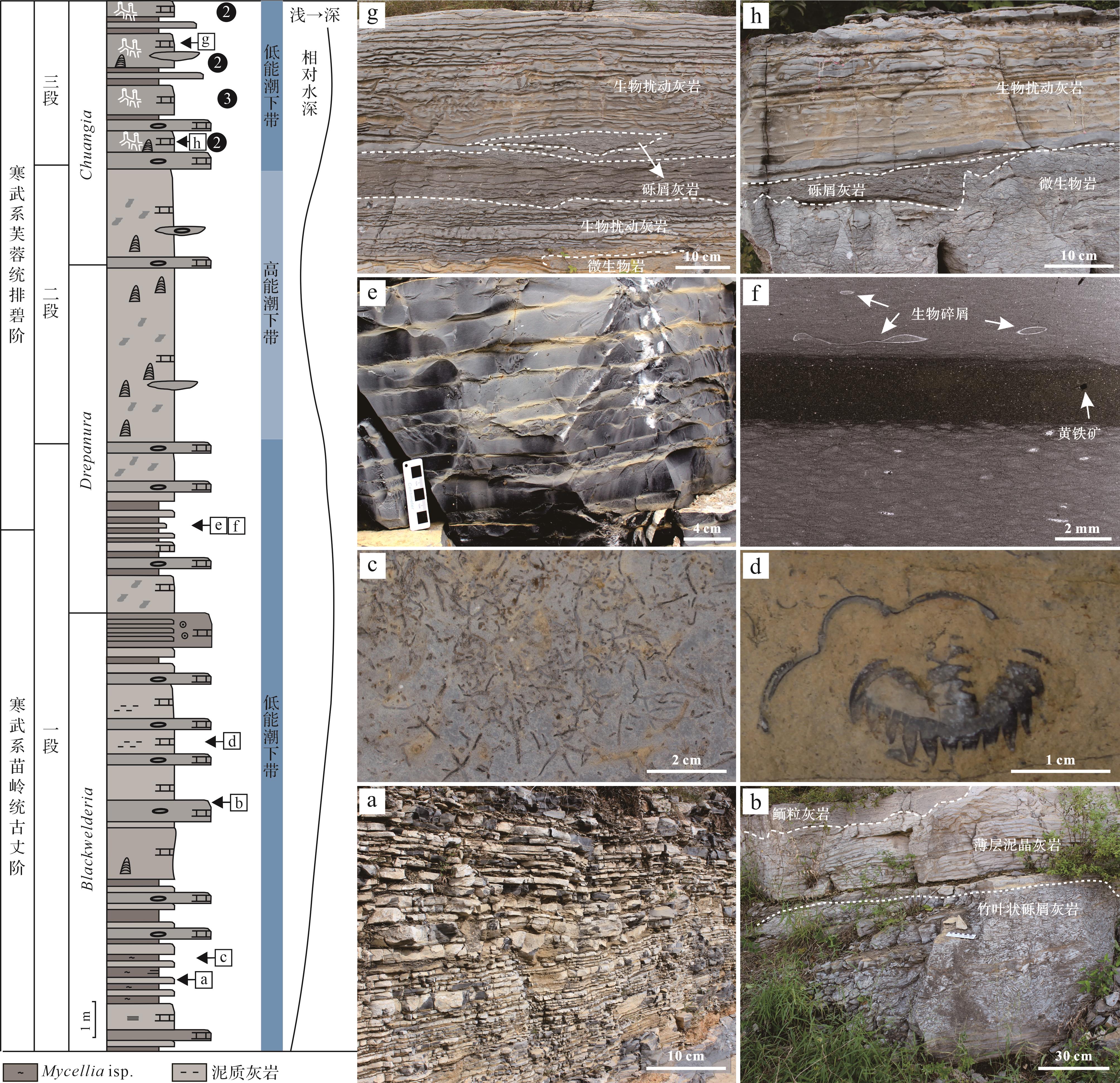
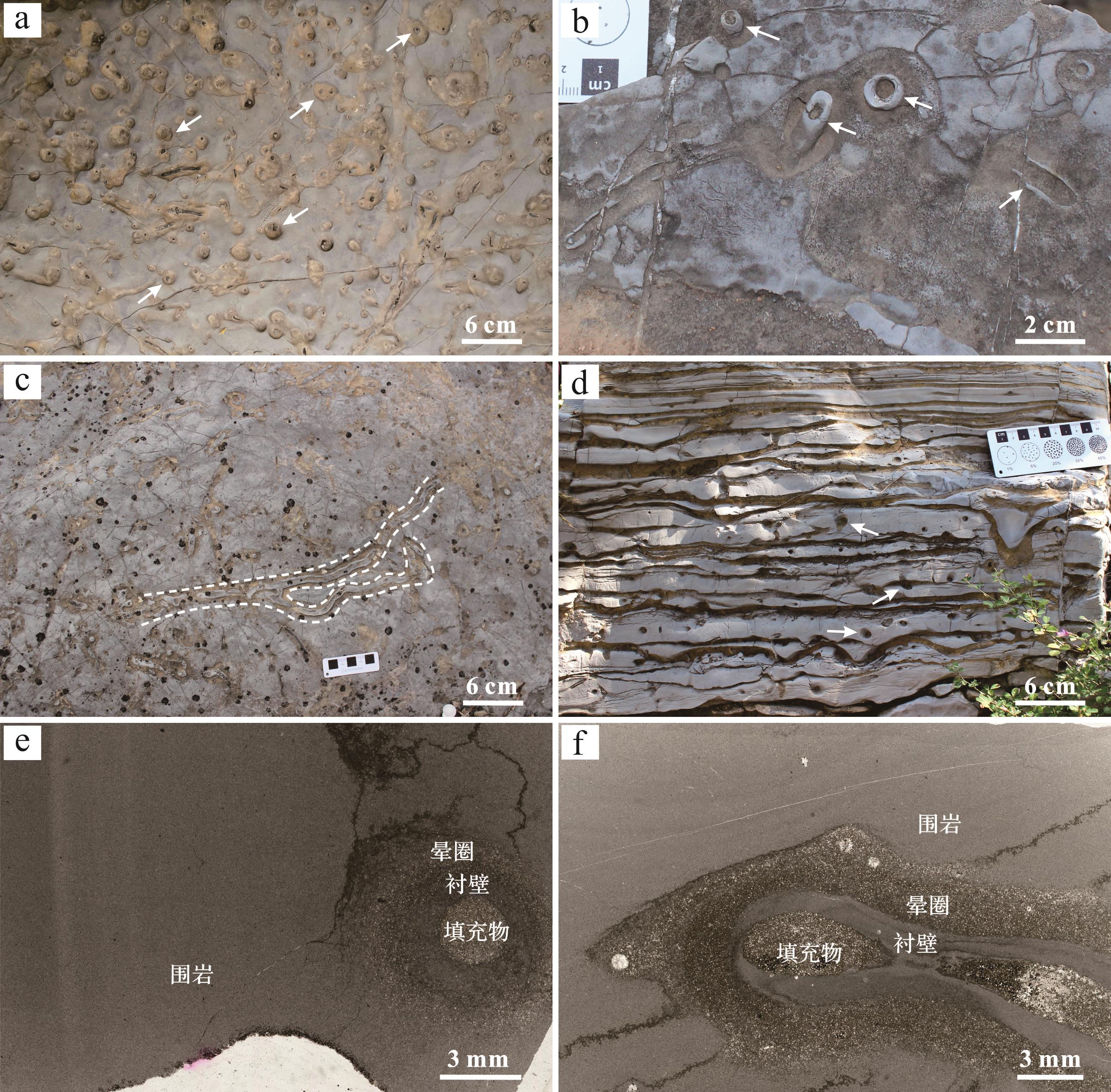
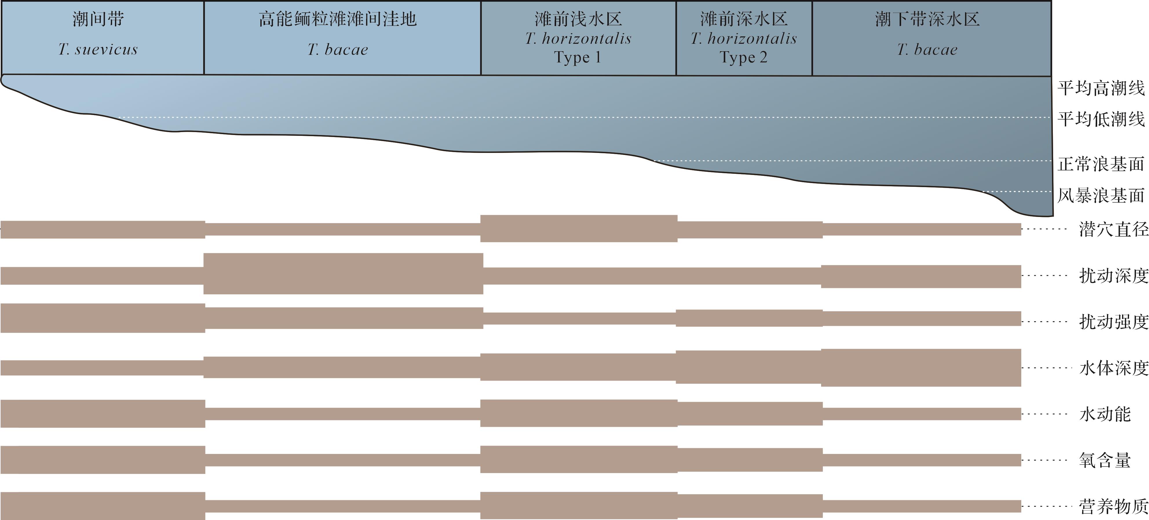
Objective Clarifying the provenance composition and evolution of the Lower Jurassic Badaowan Formation and Sangonghe Formation in the Dongdaohaizi Sag, Junggar Basin, has important guiding significance for studies of the sedimentary filling response in this region of the Lower Jurassic. Methods A detailed analysis was conducted on the source characteristics and evolutionary processes of the Badaowan Formation and Sangonghe Formation based on the composition of sandstone debris, the geochemical characteristics of whole-rock elements, and U-Pb ages of detrital zircons. Results It was found that the sandstone samples from the Lower Jurassic in the study area were mainly composed of feldspathic lithic sandstone, with an average content of 37.7% of tuff and basalt lithic debris in the thin sections, along with a small amount of metamorphic rock debris. After standardization of shale samples in North America, the Badaowan Formation samples showed no significant differentiation between light and heavy rare earth elements. The Sangonghe Formation exhibited slight enrichment of light rare earths and depletion of heavy rare earths. The age distribution of detrital zircons in the sandstone samples in the Badaowan Formation is mainly concentrated in three ranges: 280-330 Ma, 400-440 Ma and 490-520 Ma; the Sangonghe Formation is dominated by three peak age ranges: 280-350 Ma, 380-430 Ma and 460-520 Ma, with similar age compositions. Conclusions A comprehensive analysis of provenance characteristics indicated that the Badaowan Formation in the Dongdaohaizi Sag is mainly sourced from the Kela Meili provenance system in the eastern Junggar Basin, and the western Urho and Karamay provenance regions had little influence. During the depositional period of the Sangonghe Formation, the western region began to supply resources, but the eastern Kela Meili provenance system remained the main source of materials in the study area. In the Middle Jurassic, the influence of the western provenance increased, and the Che-Mo paleo-uplift was formed. The Donghaizi Sag was jointly influenced by two major provenance systems. The parent rocks in the Lower Jurassic provenance area of the Dongdaohaizi Sag are mainly intermediate acid magmatic rocks and basic magmatic rocks, and the provenance is mainly from the transitional and recirculating zones of the recycled orogenic belt. The tectonic setting is dominated by continental island arcs, which is consistent with the mixed-source background formed by oceanic continental subduction around the Junggar Basin, and following closure of the ocean basin. In the context of this tectonic setting, during the sedimentation period of the Badaowan Formation the Dongdaohaizi Sag was influenced by the East Kela Meili source, forming a shallow-water delta lake sedimentary system. Distributary channel sand bodies were extensively developed, but the physical properties were poor, with few favoring hydrocarbon accumulation. During the sedimentation period of the Sangonghe Formation, the Dongdaohaizi Sag was influenced by two major source systems, east and west, and a shallow-water delta lake system developed together with underwater distributary channel microfacies composed mainly of medium and fine sandstones, as well as a small amount of estuarine dam microfacies with physical properties favorable to hydrocarbon reservoir development.
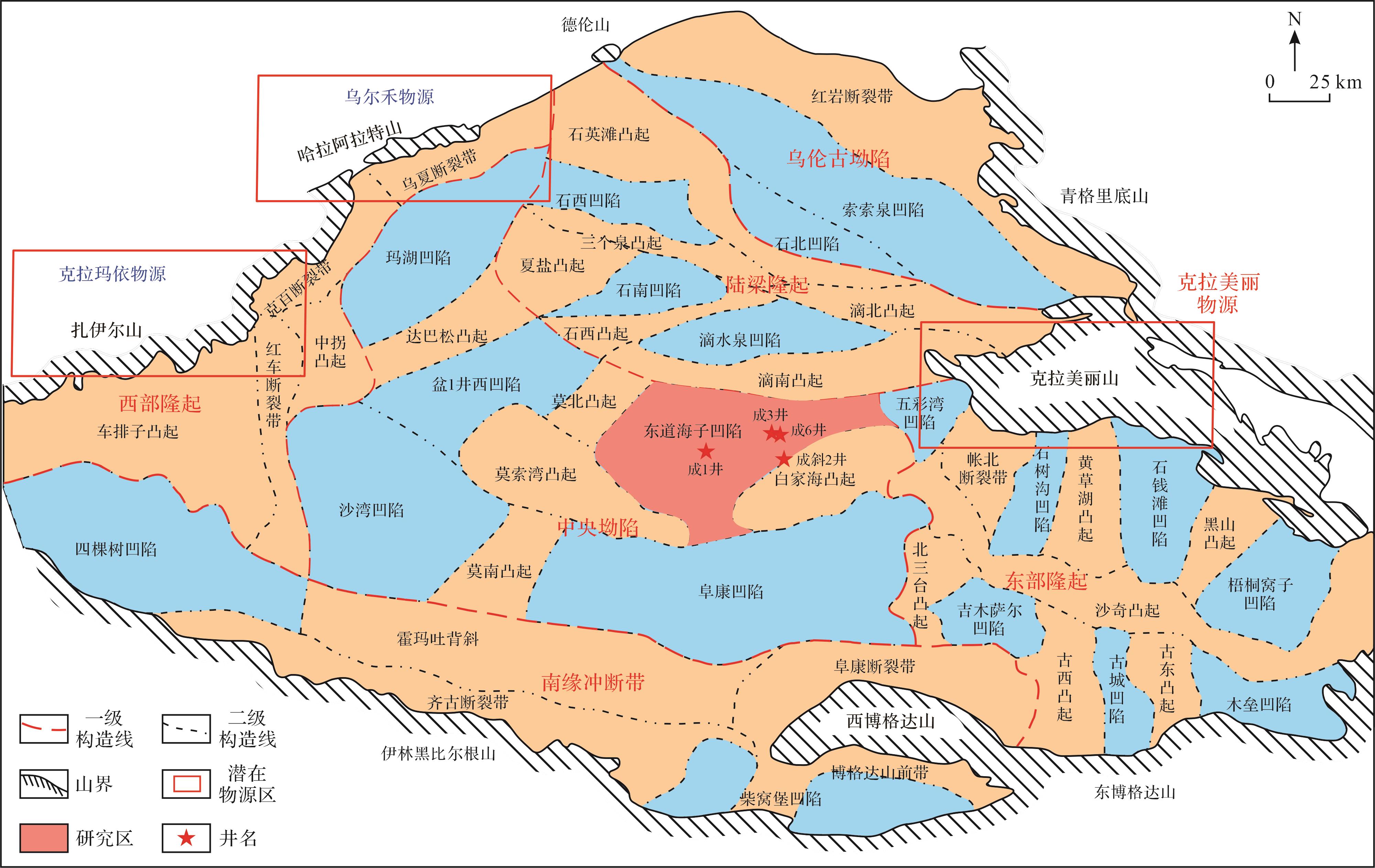
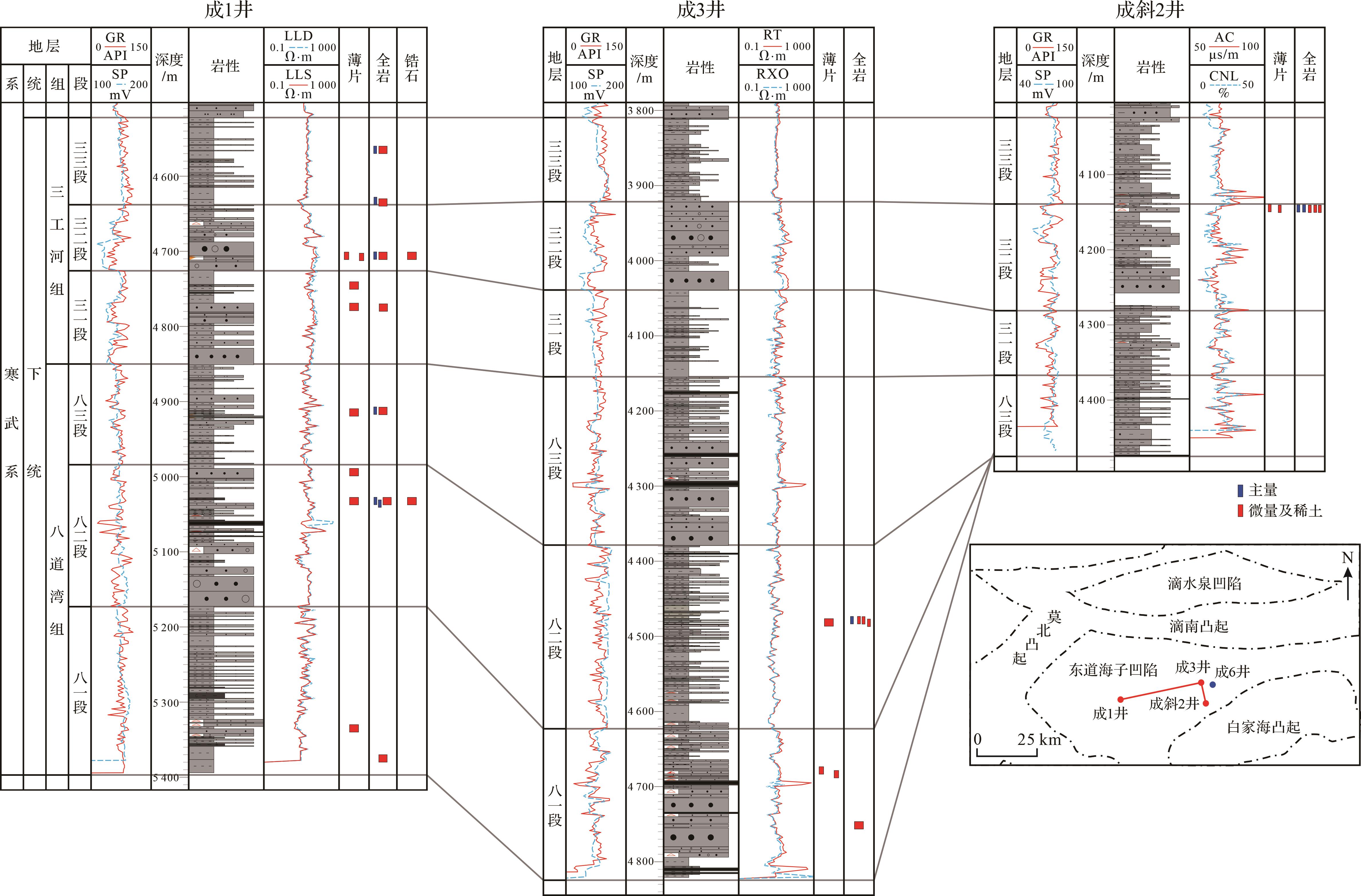
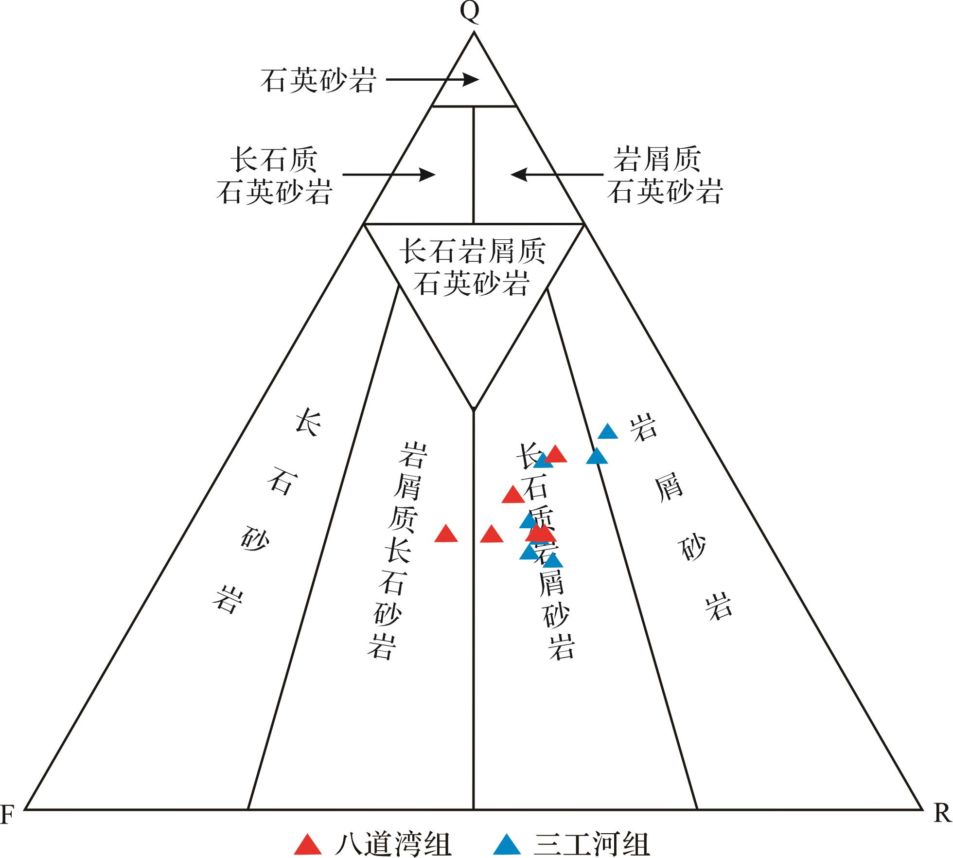
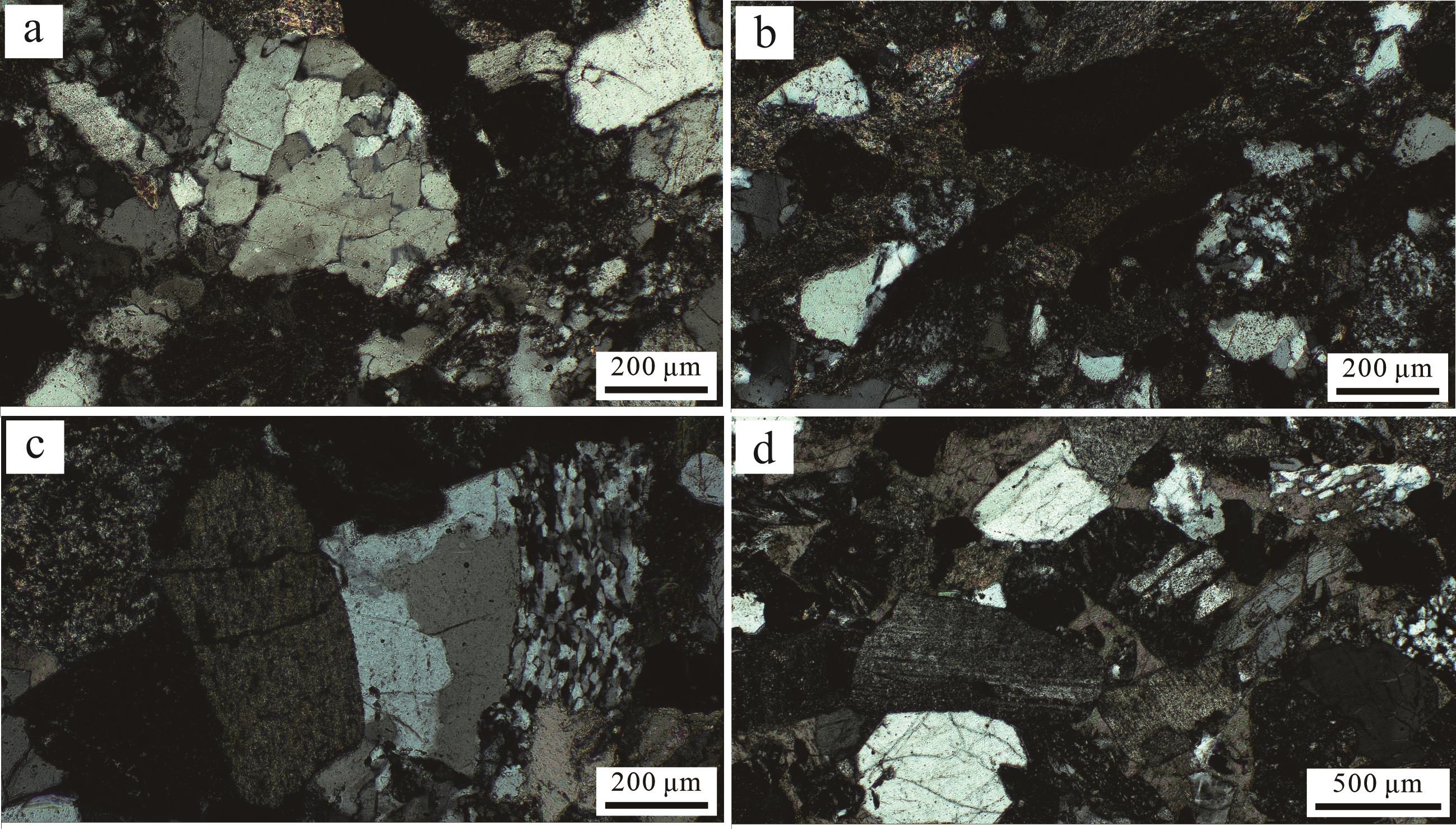
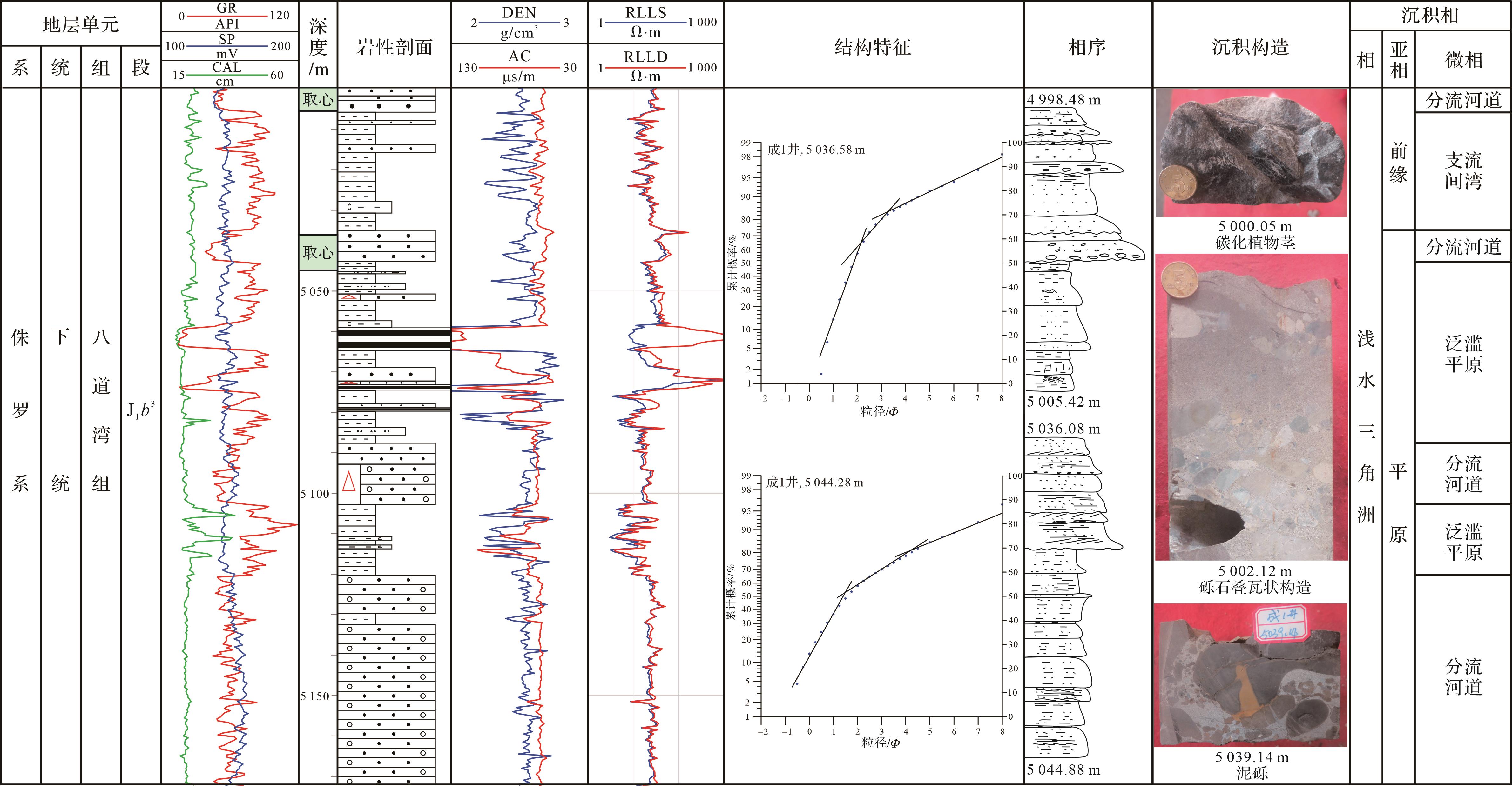
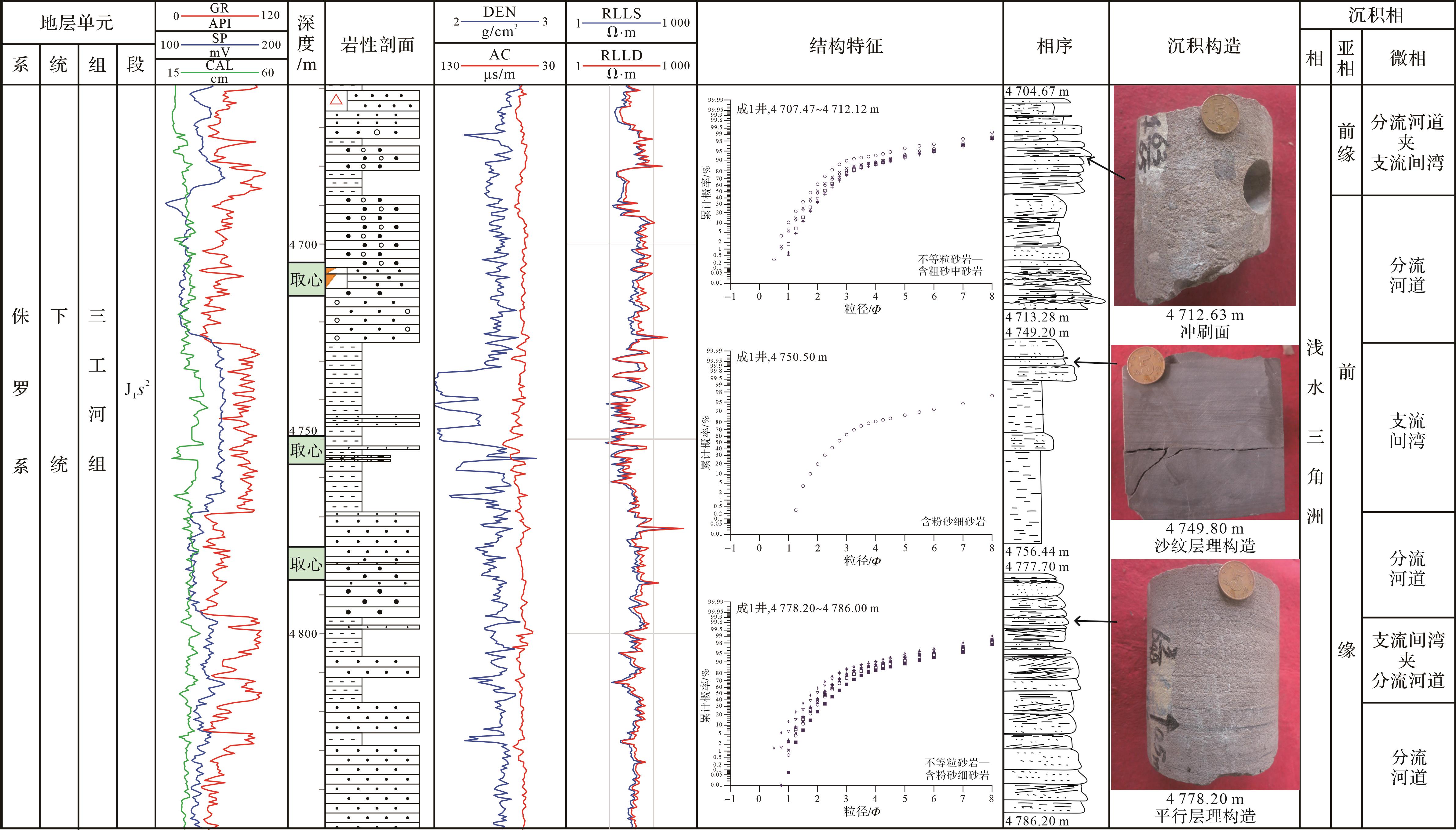
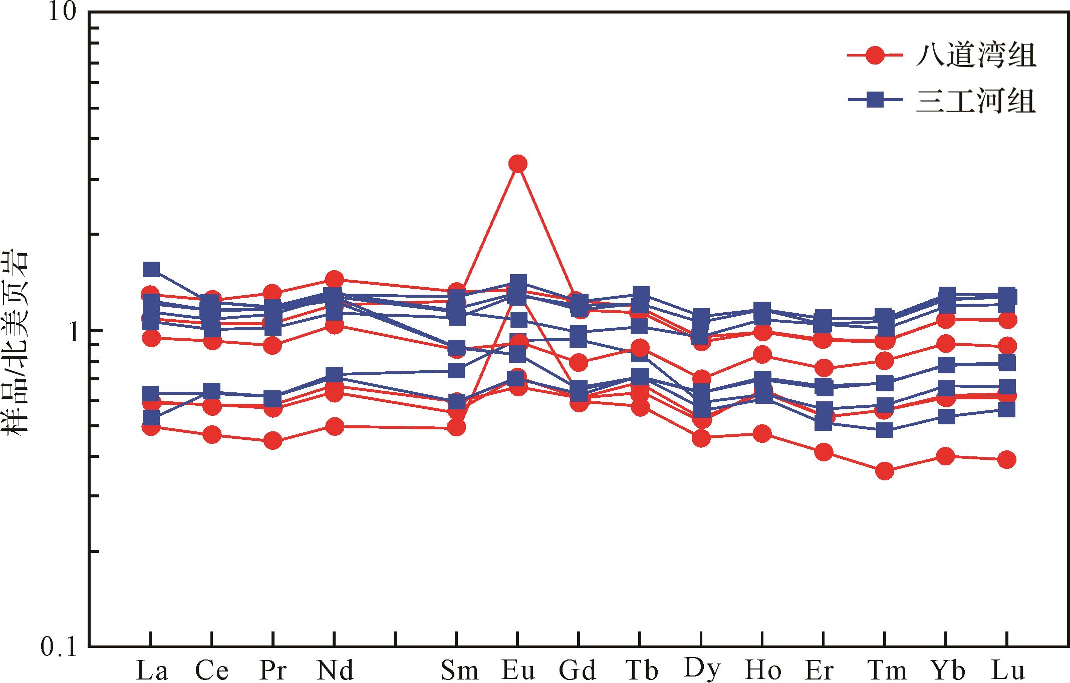
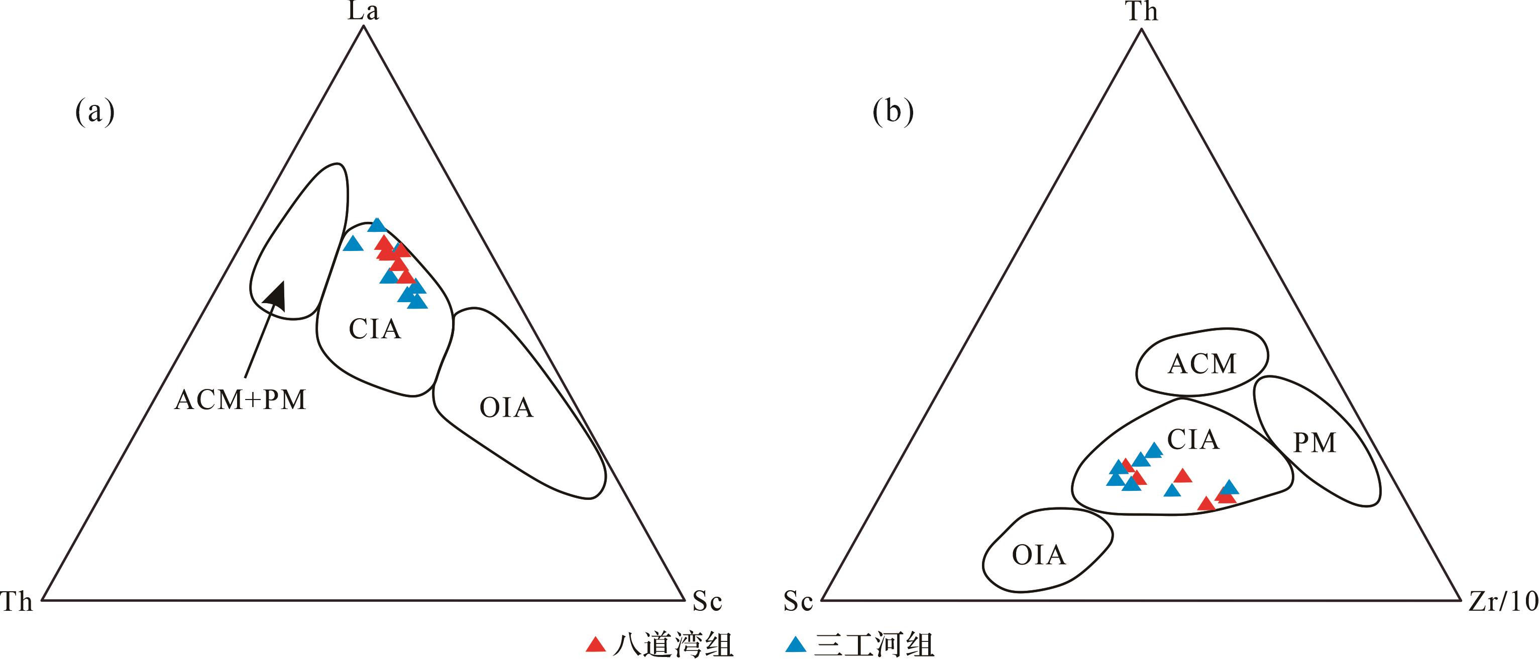
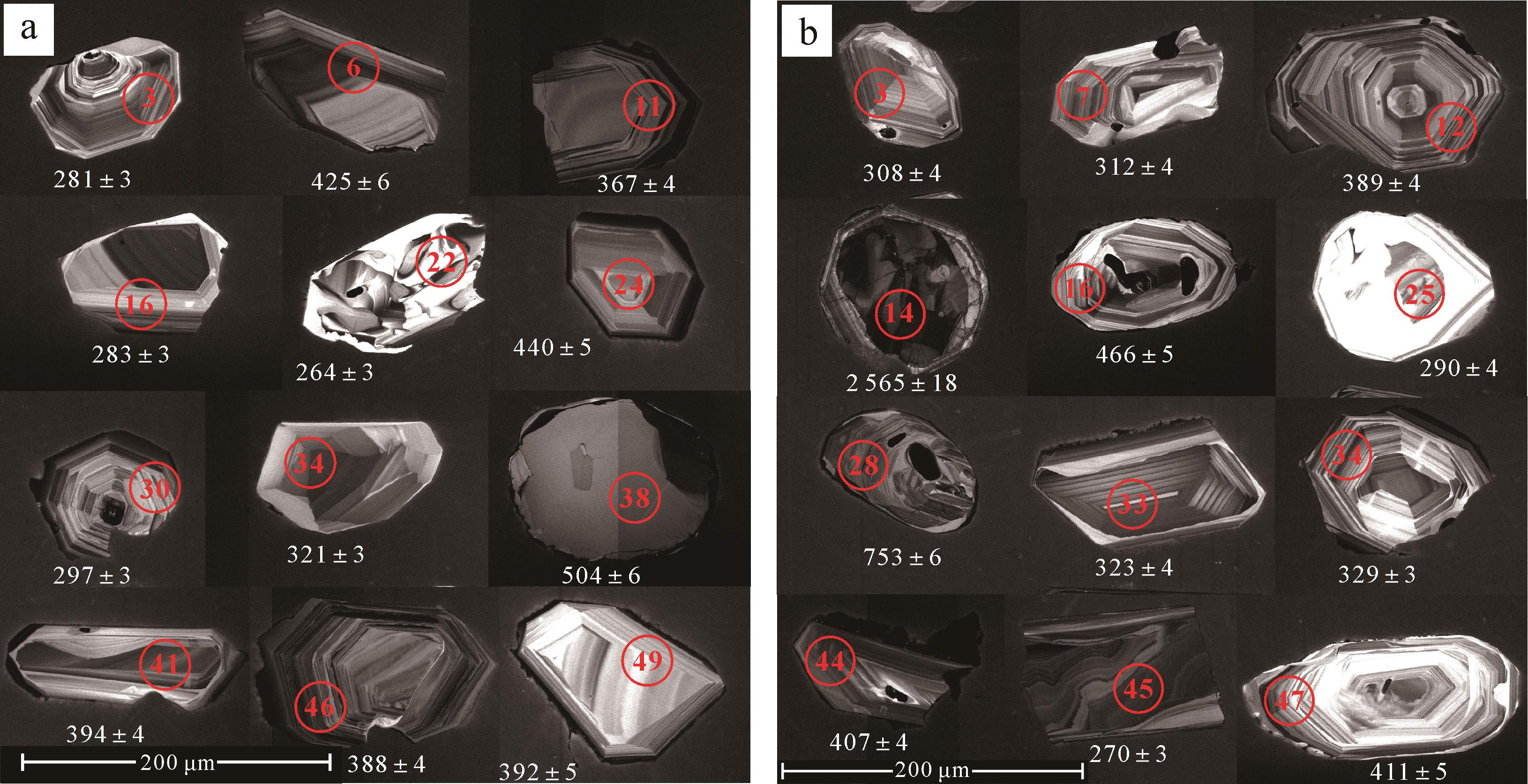
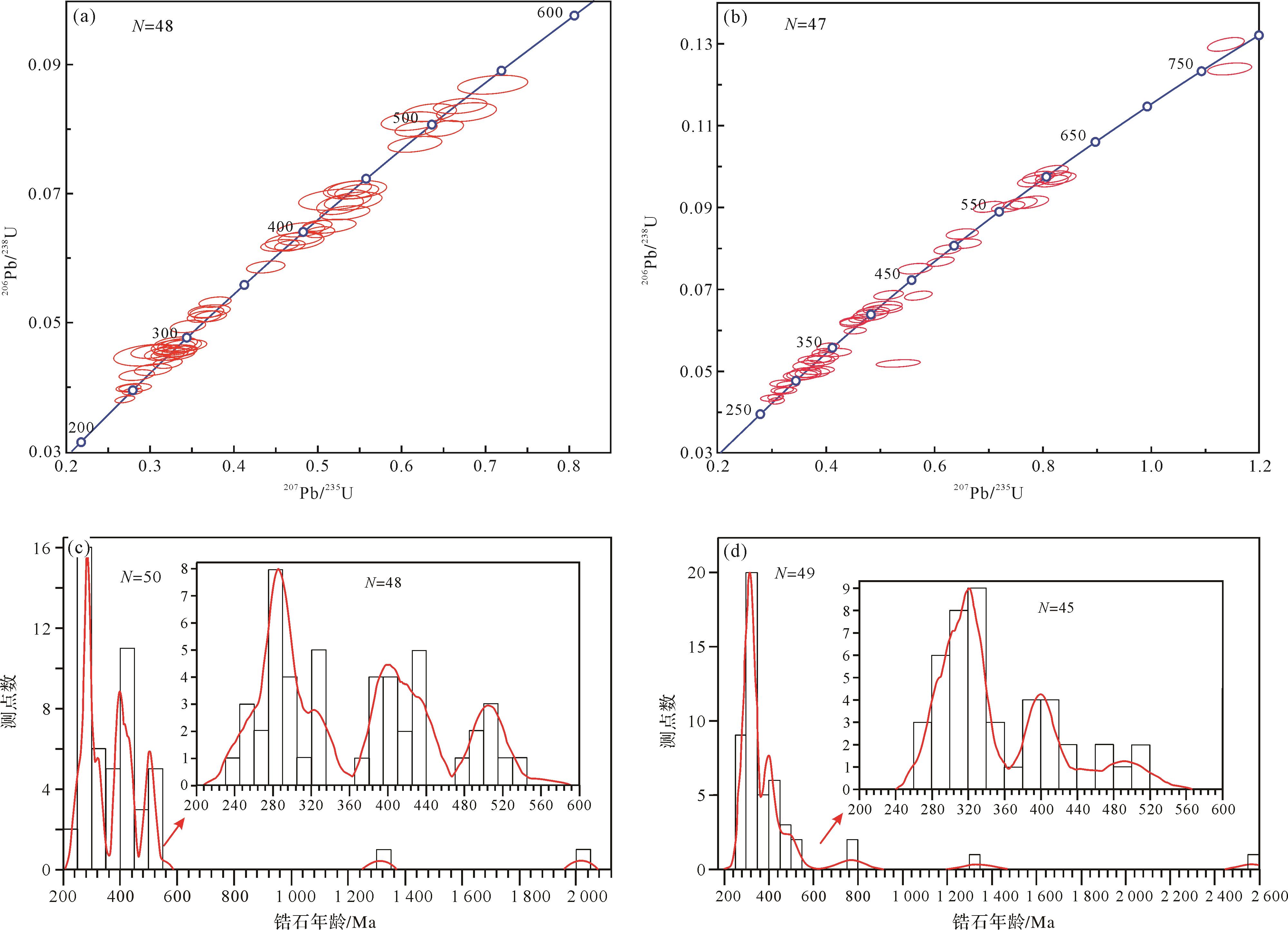
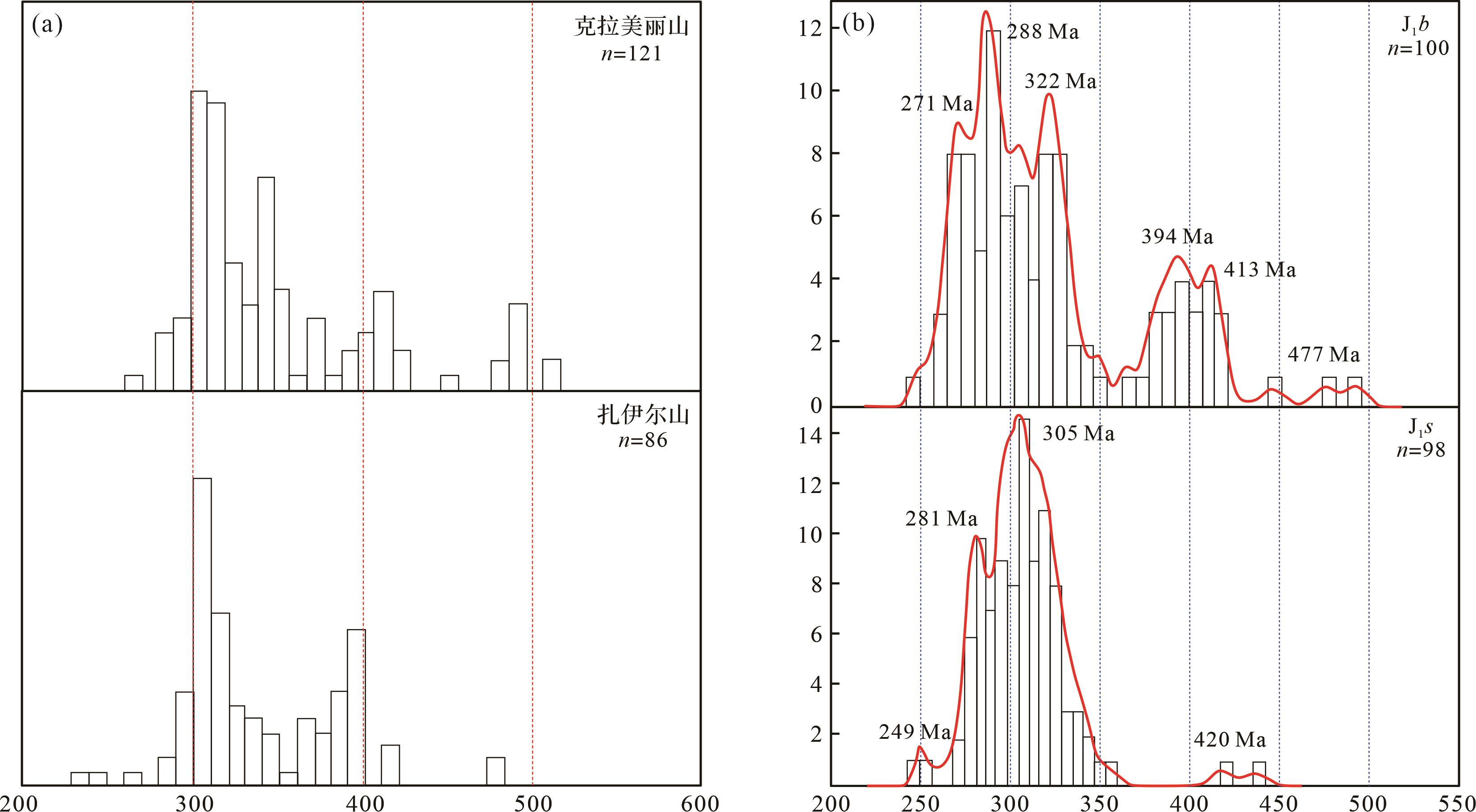
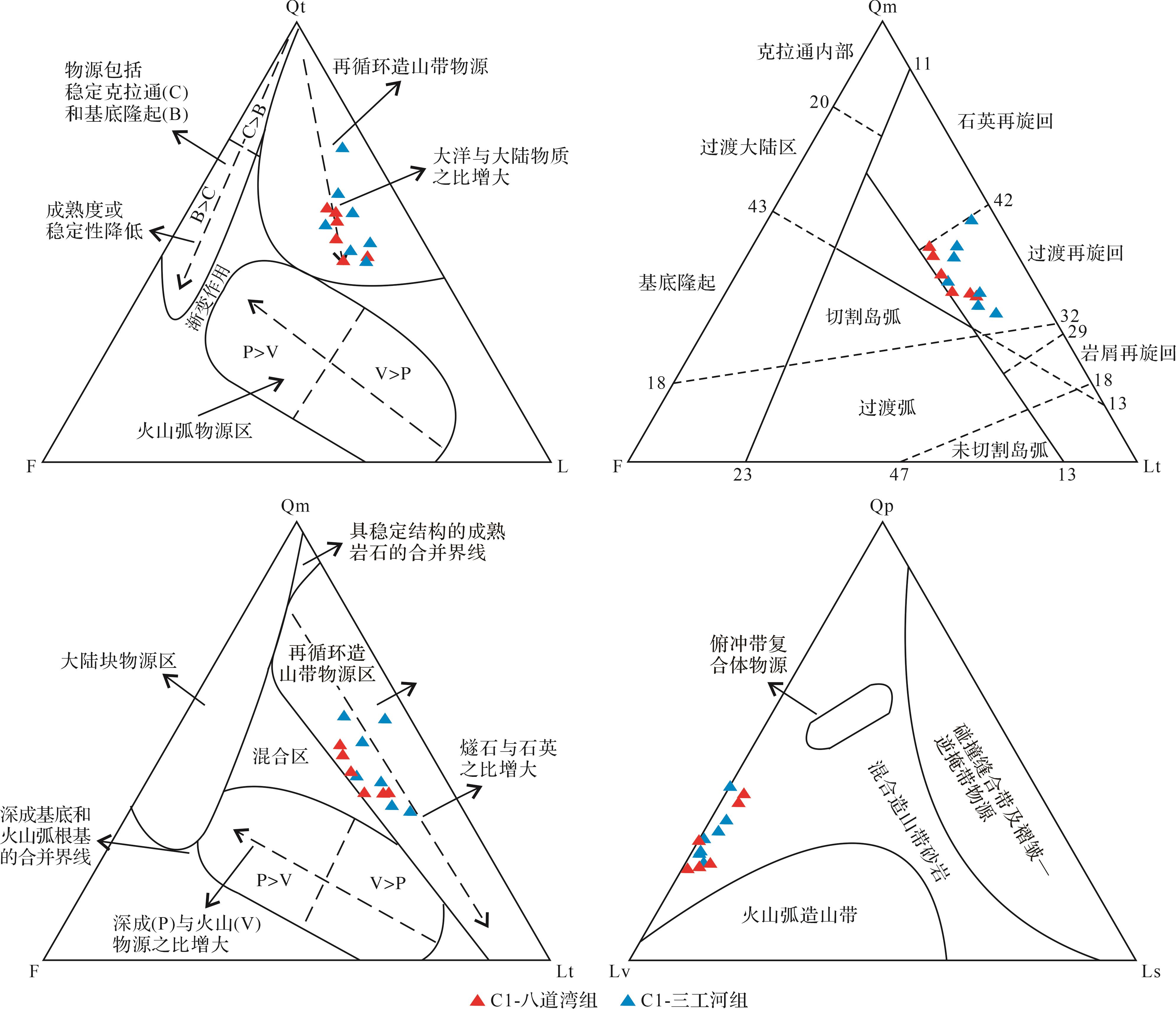
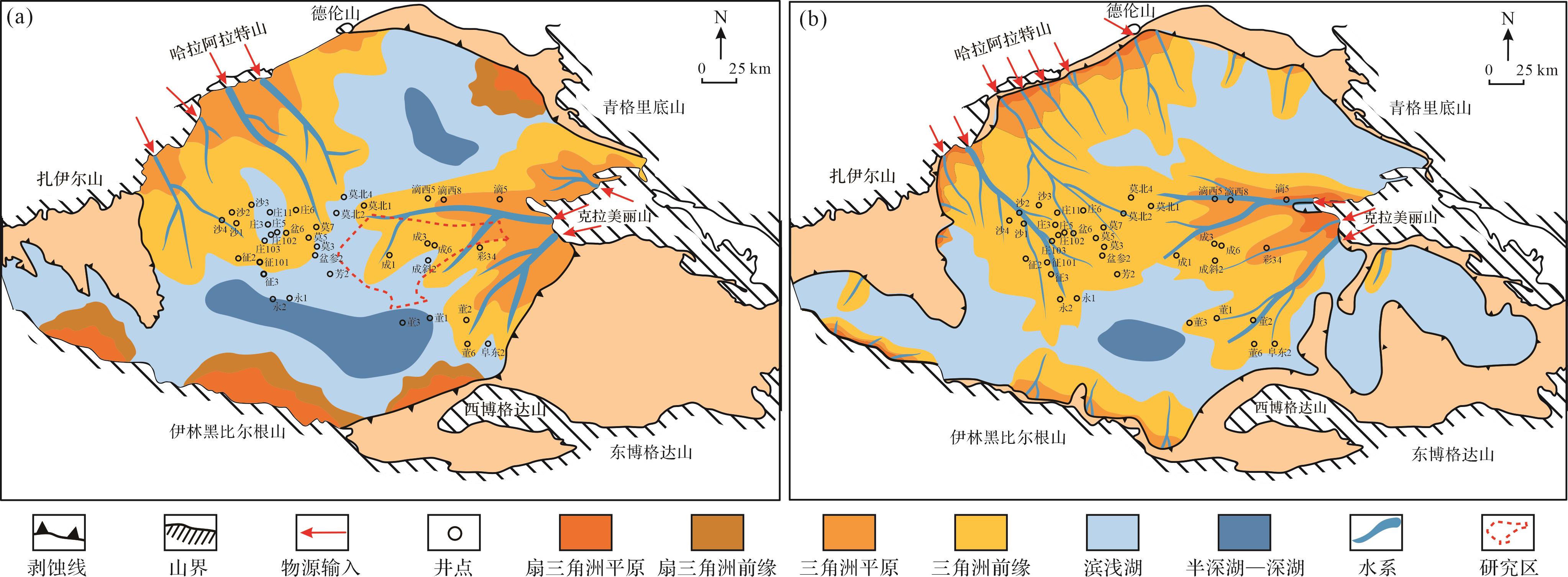
Objective To clarify whether the western edge of the Kaijiang-Liangping trough is connected to the eastern platform margin of the Pengxi-Wushengtai Depression in the north of the Late Permian Changxing-Early Triassic Feixianguan period in northwestern Sichuan Basin, and to determine the sedimentary facies distribution pattern of the Jiangyou-Jiange Formation in northwestern Sichuan Basin and the Changxing Formation-Feixianguan Formation in the periphery area, and to analyse the evolution process of sedimentary filling to indicate further oil and gas exploration work. Methods Based on the latest drilling, field outcrop, and seismic data, this study systematically analyzed the distribution of lithofacies and paleogeography during the deposition of the Changxing Formation-Feixianguan Formation in the Guangyuan-Jiangyou area, based on the stratigraphic and sedimentary facies division and comparison. Results The intersection area of the Changxing Formation-Feixianguan Formation can identify six sedimentary facies: shelf basin, slope, platform edge, open platform, restricted platform, and evaporative platform. Based on the sedimentary records of the front slope of the platform, the western edge of the Kaijiang-Liangping trough and eastern edge of the Pengxi-Wusheng intra-platform depression were clearly merged to form a unified platform edge belt in the Cilinbao-Shangsi area in northwestern Sichuan Basin. The platform edge belt and front slope show a northwest finger shaped interdistribution, rather than a simple smooth belt distribution. The intersection area of the two troughs in the Changxing Formation presents a sedimentary pattern of two troughs interlocking from southwest to northeast. The connecting area of the platform margin zone developed a northwestern fingered reef beach, developing bioclastic shoals in the 1st member and biological reefs and shoals in the 2nd member of the Changxing Formation at the platform edge zone. During the sedimentary period of the 1st and 2nd members of the Feixianguan Formation, the sedimentary pattern of Changxing depositional period was inherited; however, in the 1st member of Feixianguan Formation, only local platform edge oolitic beaches were formed owing to sea flooding. In the stage of the late 1st to 2nd member Feixianguan Formation, platform edge oolitic beaches gradually developed and expanded in scope with an overall eastward migration. The slope in front of the platform was prone to sliding and sedimentation. During the sedimentation period of the 3rd member of the Feixianguan Formation, the sea trough gradually filled, and the finger shaped platform edge zone disappeared, forming a unified restricted platform. Only the local development of oolitic beach. The research area was filled and flattened during the depositional period of the 4th member of the Feixianguan Formation, forming an evaporative platform facies. The platform margin zone in this region did not migrate northwestward along the finger shaped platform margin zone, but rather exhibited eastward migration characteristics. Conclusions The determination of the Changxing-Feixianguan connectivity and the definition of five sedimentary filling evolution stages in the Kaijiang-Liangping trough and Pengxi-Wusheng intra-platform depression supplements a new understanding of the sedimentary pattern and filling evolution process in the intersection area of the Changxing-Feixianguan trough. It also provides ideas and references for oil and gas exploration in this area.
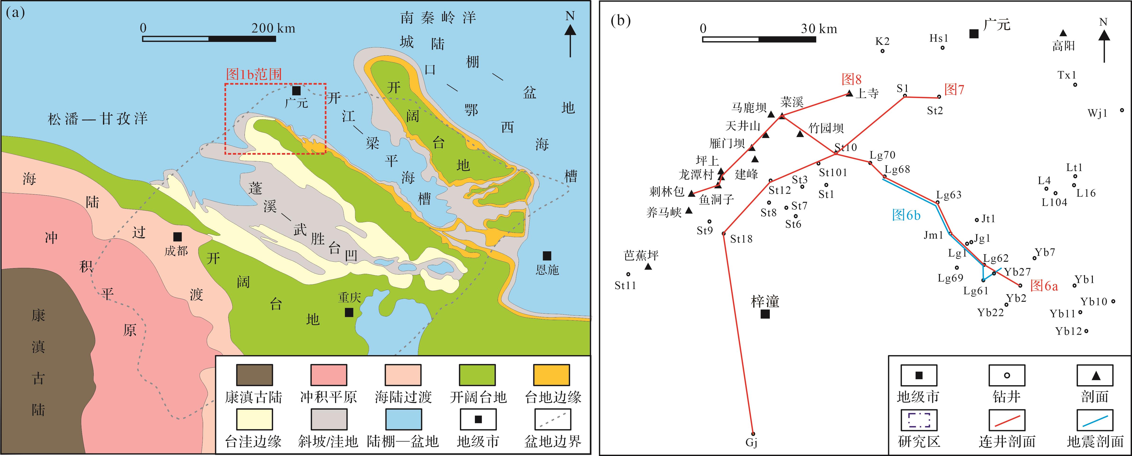
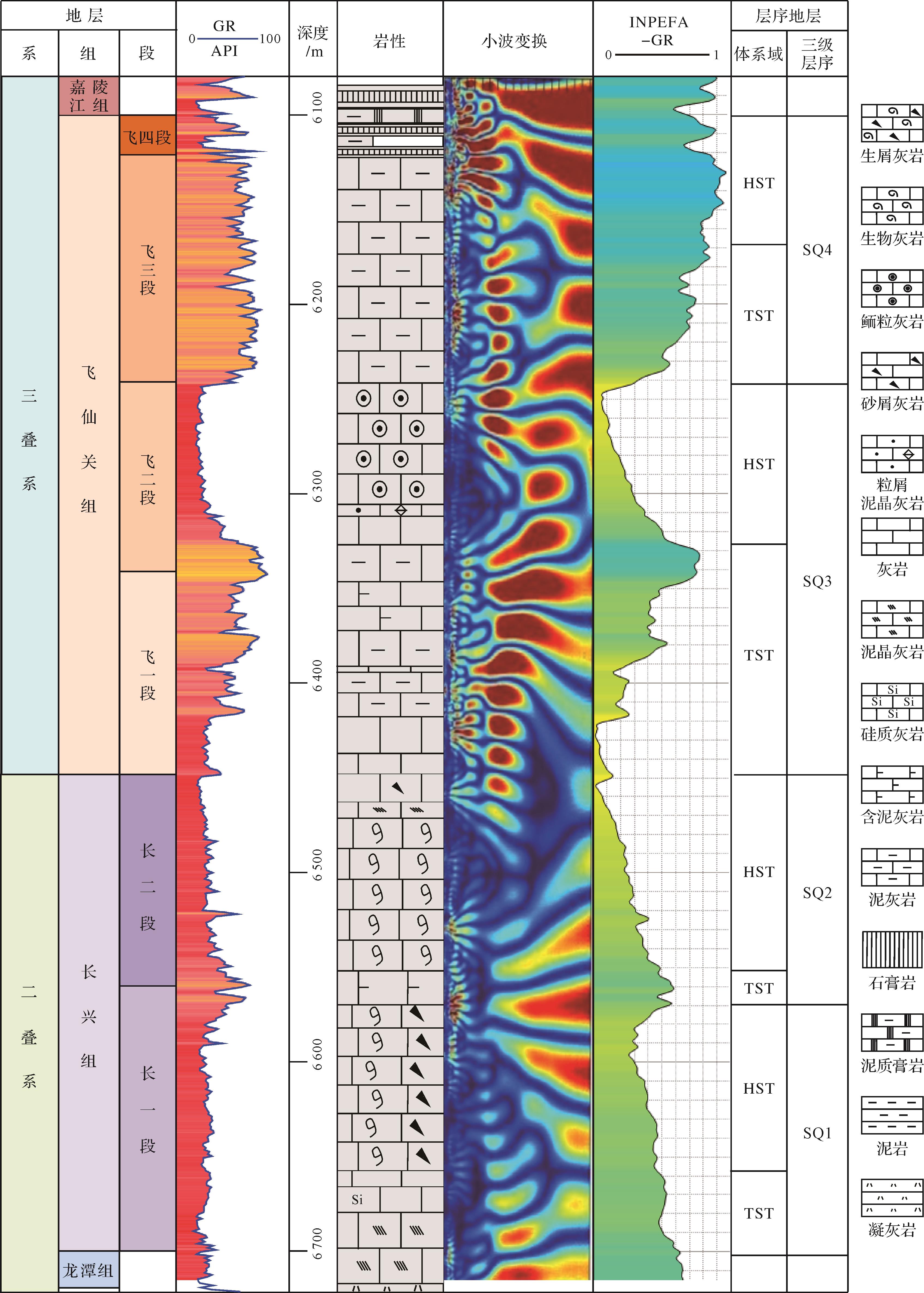
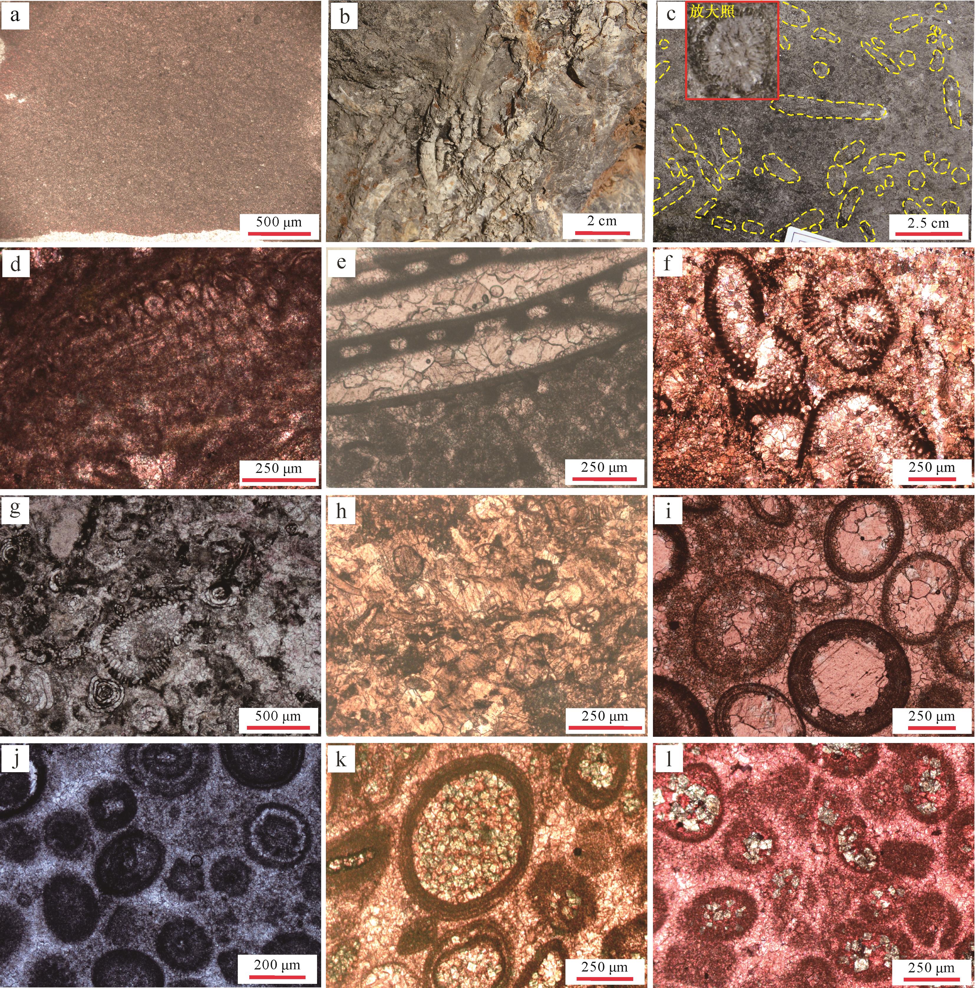
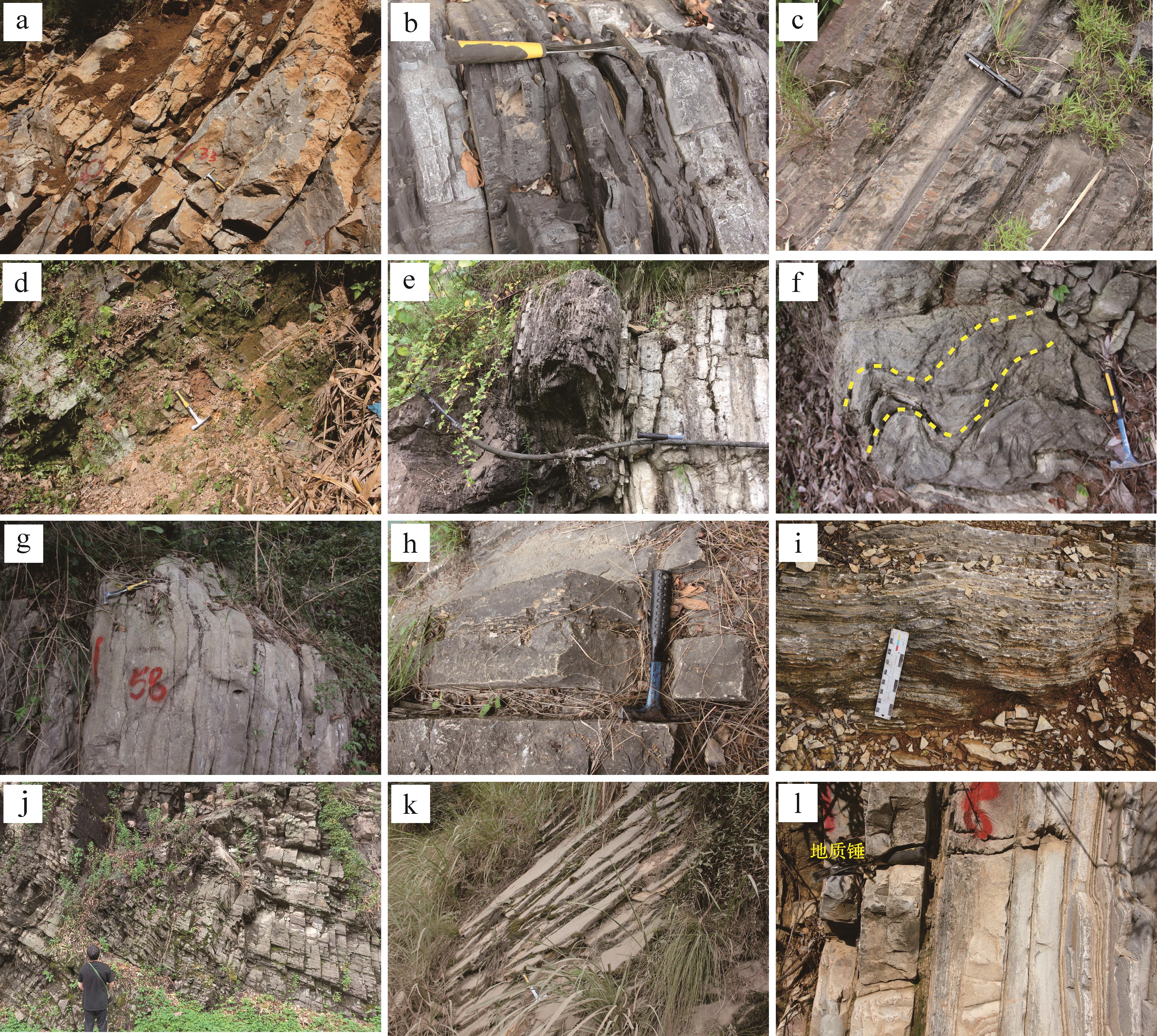
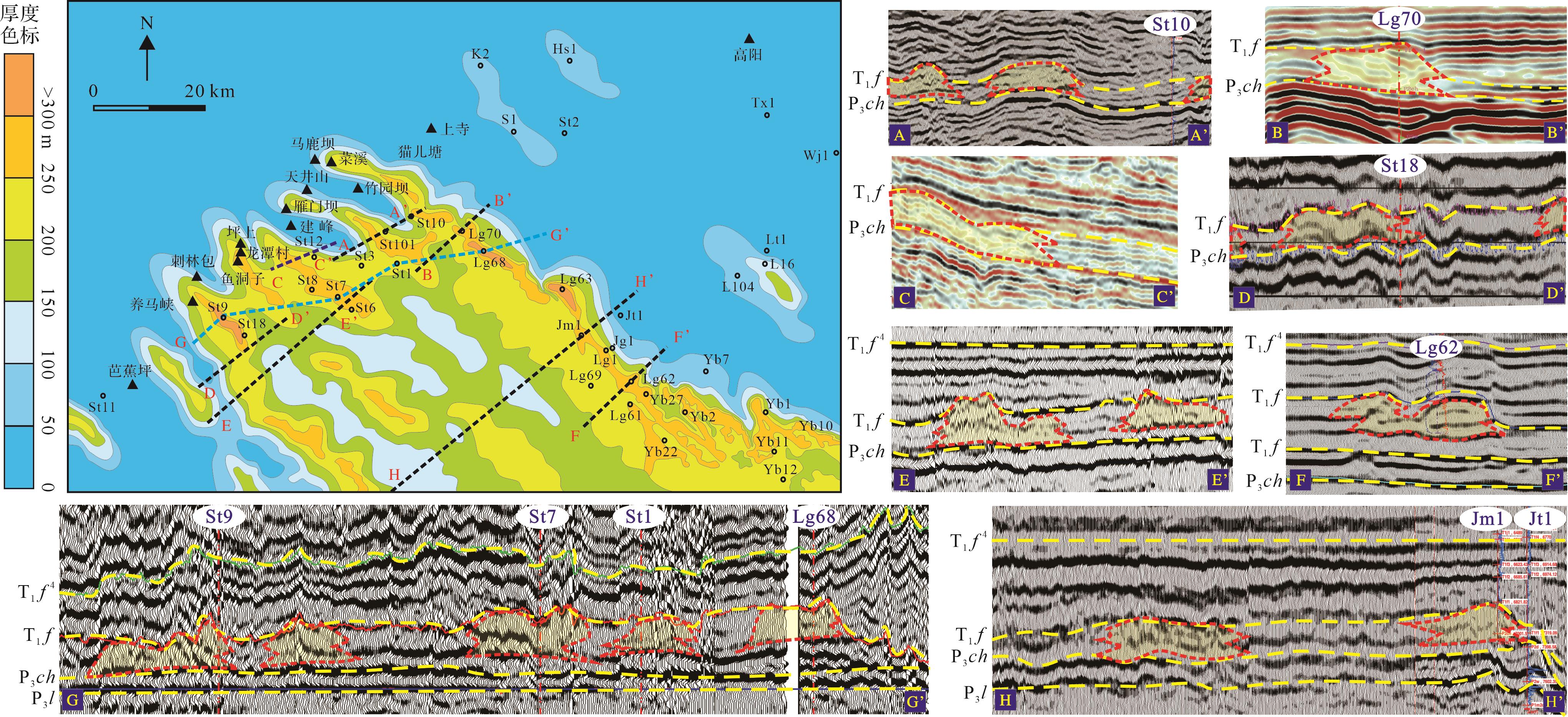
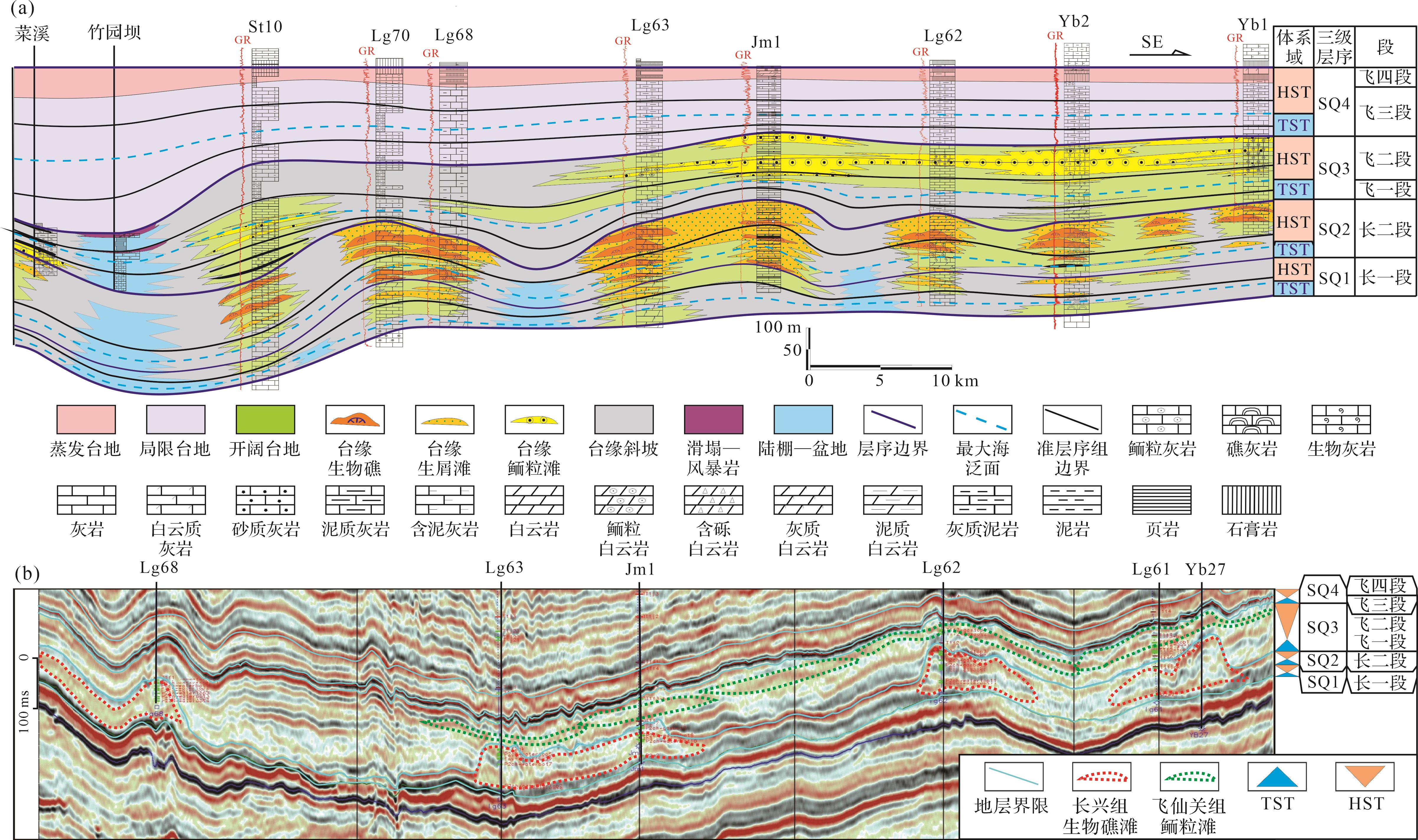
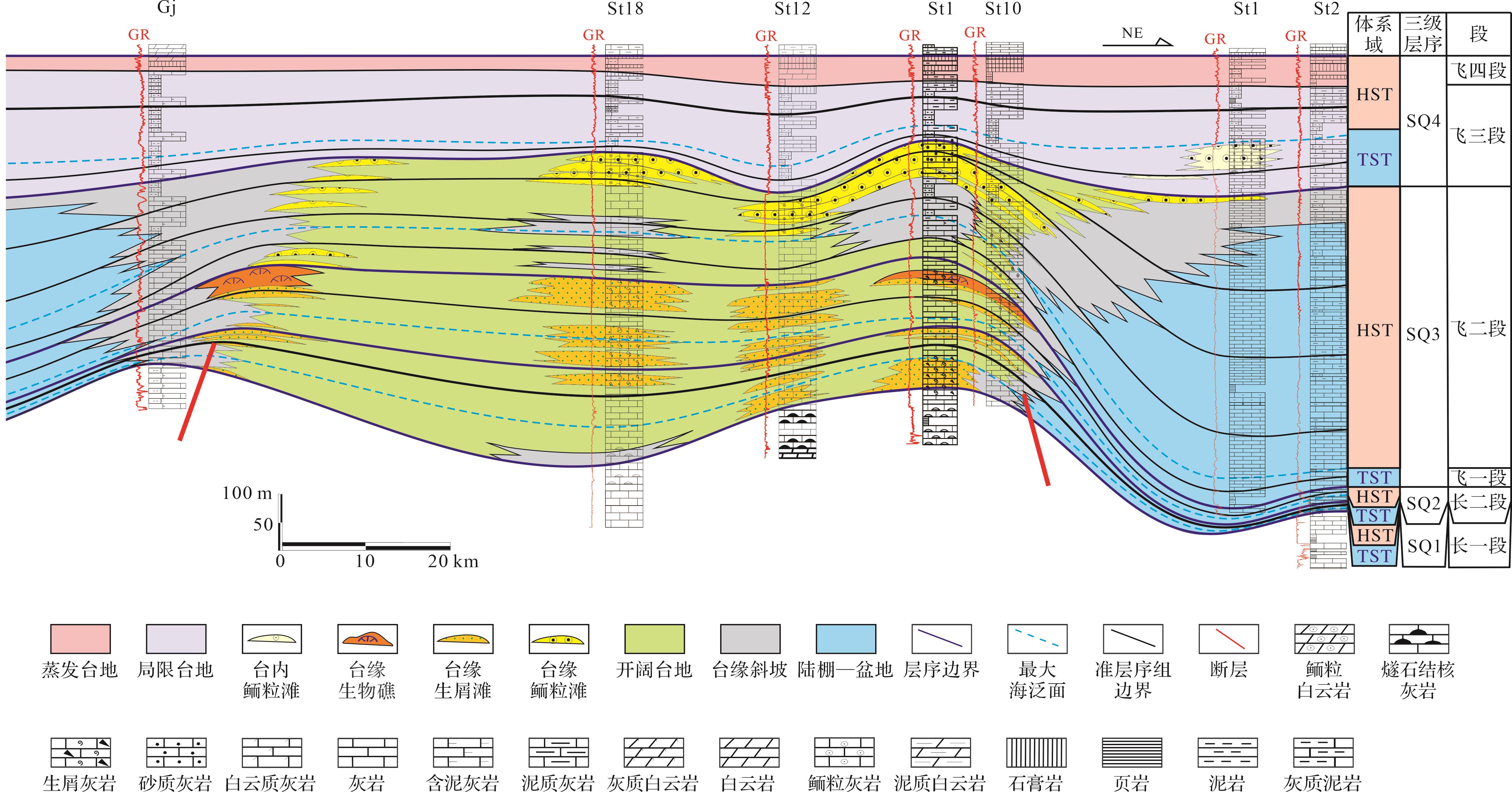
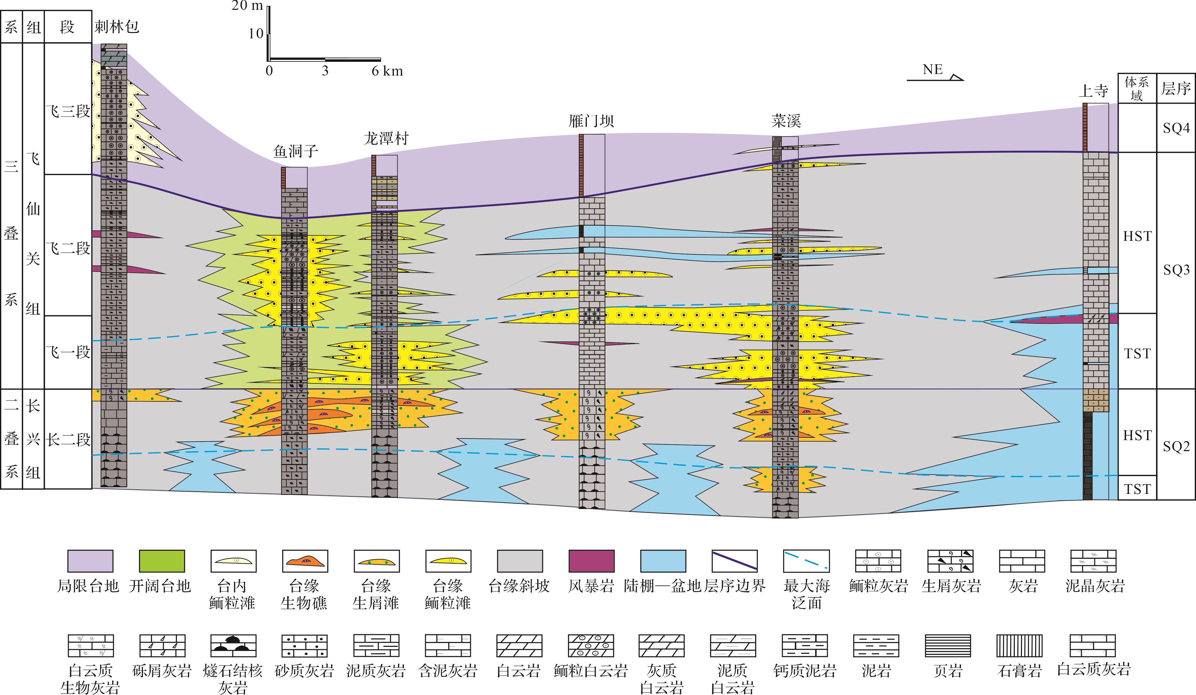
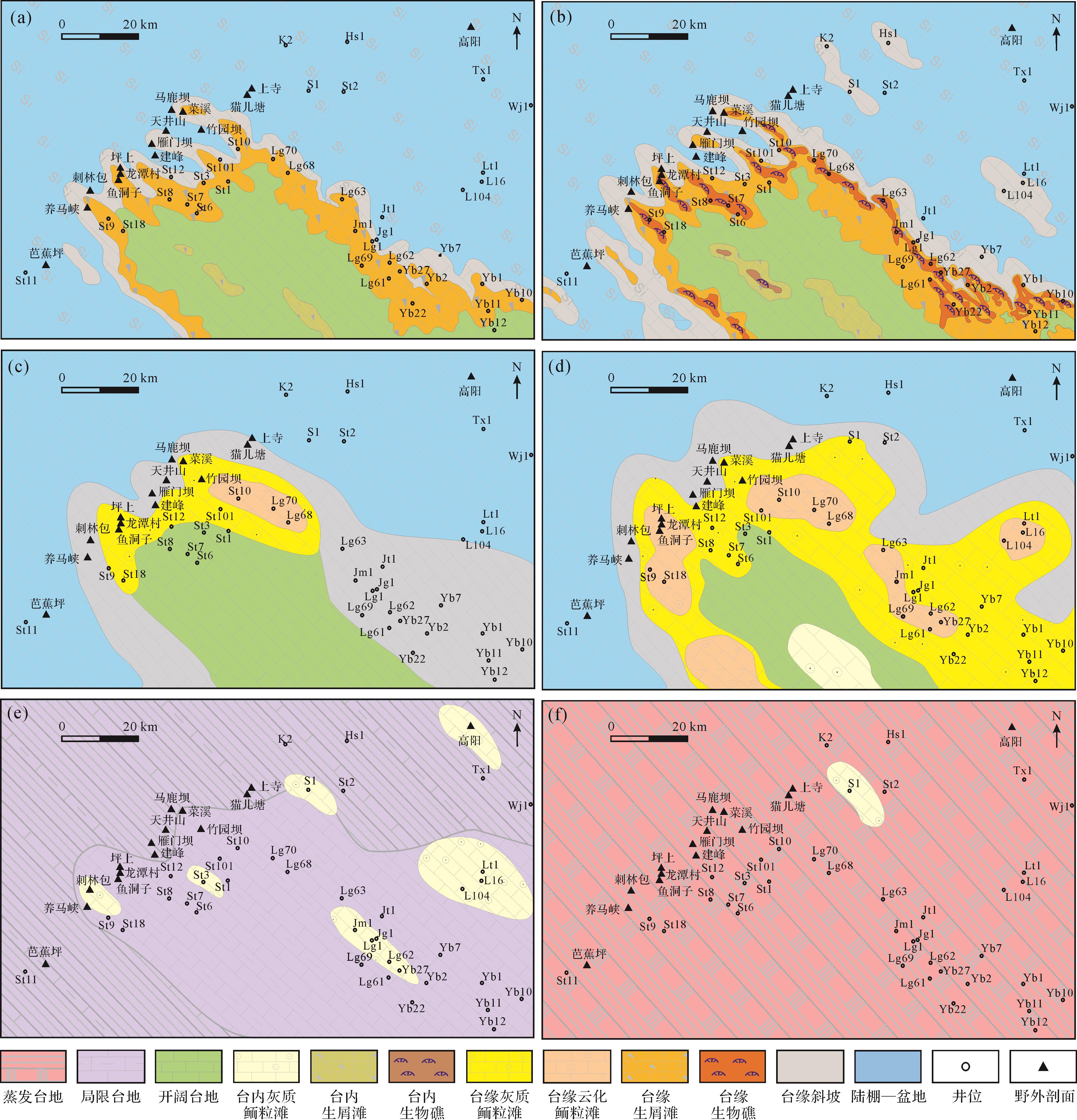
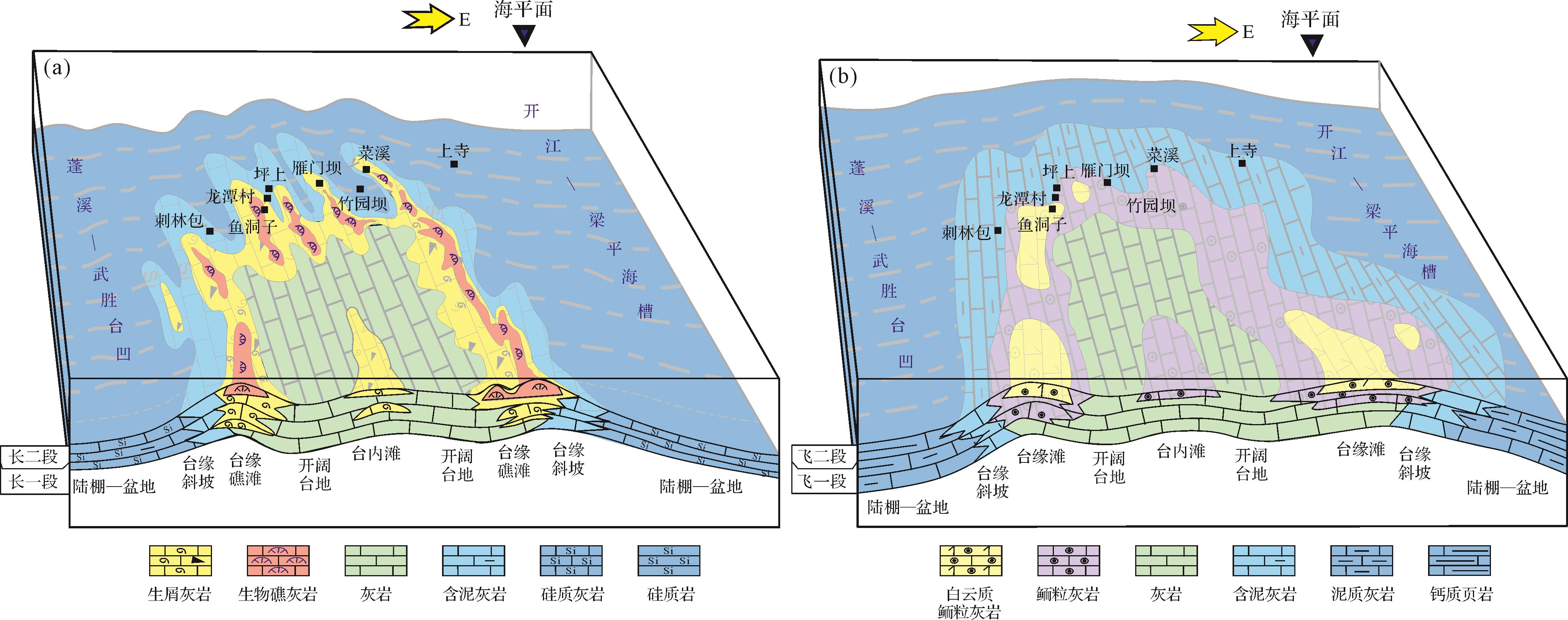
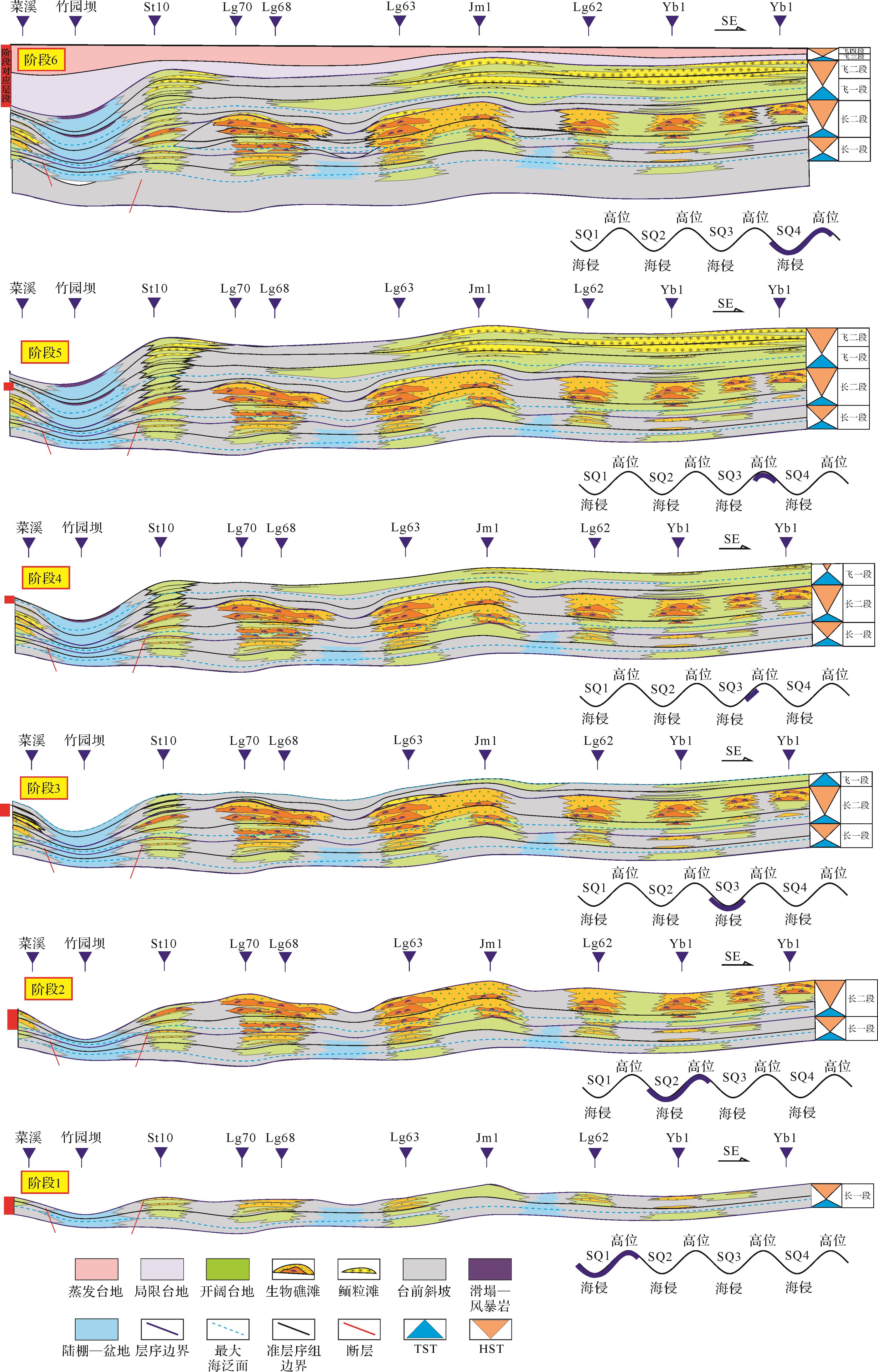
Objective The beach facies dolomite reservoir in the Middle Permian Qixia Formation, central Sichuan Basin, has significant potential for oil and gas exploration, but relatively little systematic study has been reported on its diagenetic sequence and pore evolution . Methods The petrology and pore genesis of the Qixia Formation were investigated by core observation, thin section analysis, cathodoluminescence examination and image recognition techniques, to delineate diagenetic variations and pore evolution in the different lithologies. Results In the Gaoshiti area, four types of rock are identified in the Qixia Formation: micrite limestone, micrite grain limestone, sparite grain limestone, and residual grain dolostone. Four types of reservoir space are observed: intergranular dissolved pores, intragranular dissolved pores, fractures and vugs. Each rock type has undergone distinctive diagenesis: the type and intensity of dissolution vary in the different lithologies. The two kinds of granular limestone are mainly dissolved by meteoric water, and the residual granular dolomite is more strongly dissolved by meteoric water. On this basis, dolomitization and burial period dissolution occur. Recrystallization is more pronounced in the residual grain dolomite, whereas compaction and pressure dissolution is more evident in micrite grain limestone. The key diagenesis and stages influencing pore development vary between the different rock types: the pores in the two types of granular limestone are mainly formed by quasi-syngenetic dissolution, then partially destroyed by compaction and cementation during the burial stage. The dissolution and dolomitization in the parasyngenetic stage result in the formation and preservation of the pores in the residual granular dolomites; dissolution and tectonic fracture at the burial stage are beneficial supplements, but cementation during the shallow burial stage destroys the pores. Conclusions The varied diagenesis has caused different pore evolution, forming four lithologies with a decreasing extent of pore development: residual grain dolostone (plane porosity: 2.10%), sparite grain limestone (plane porosity: 1.24%), micrite grain limestone (plane porosity: 0.41%) and micrite limestone (compact).
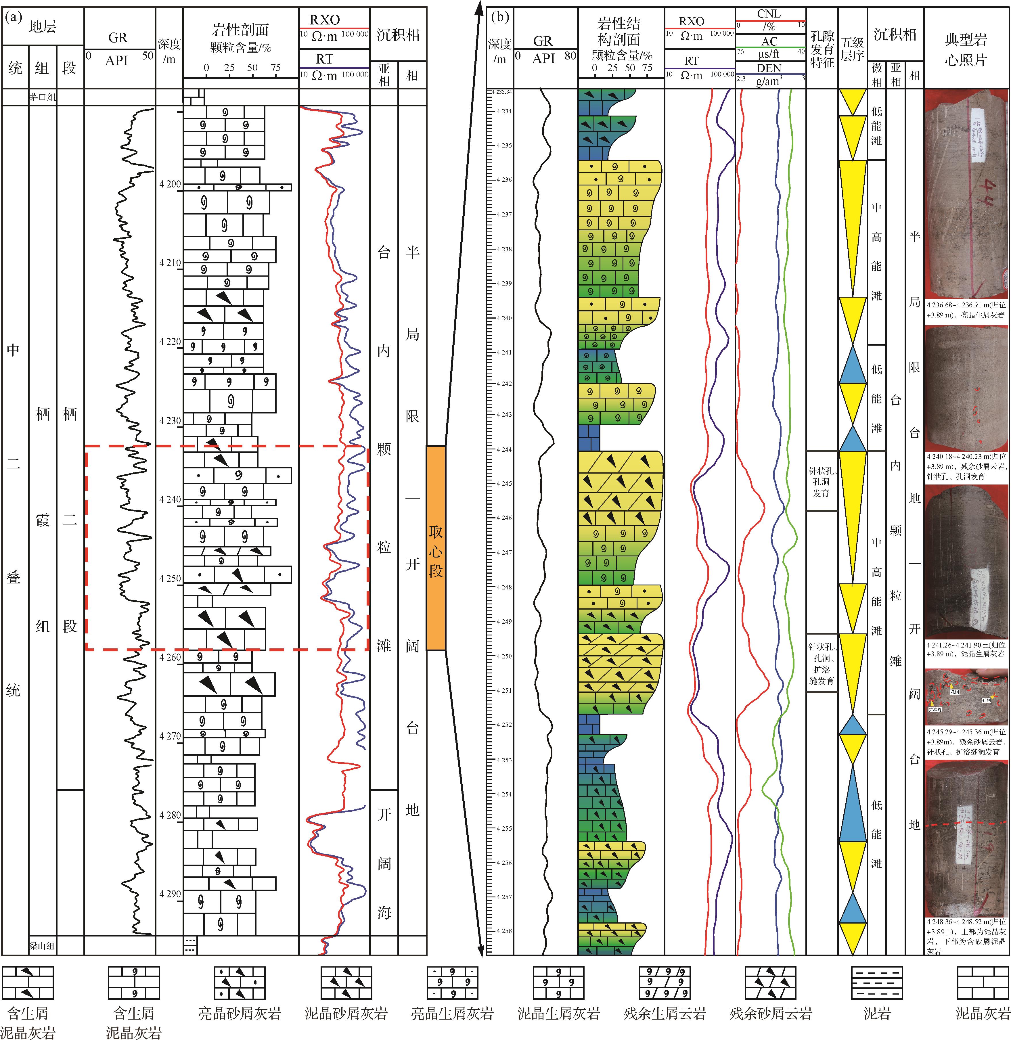
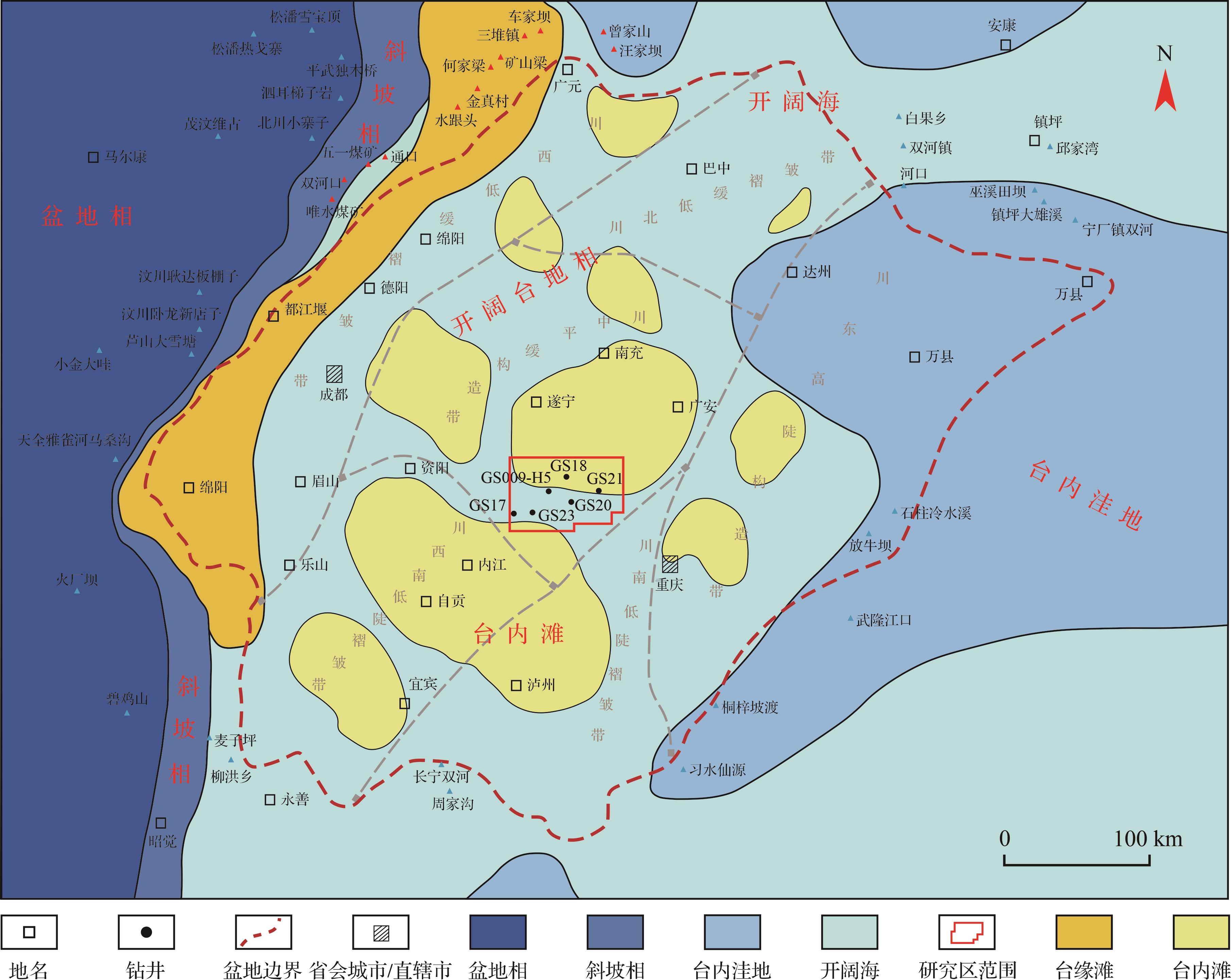
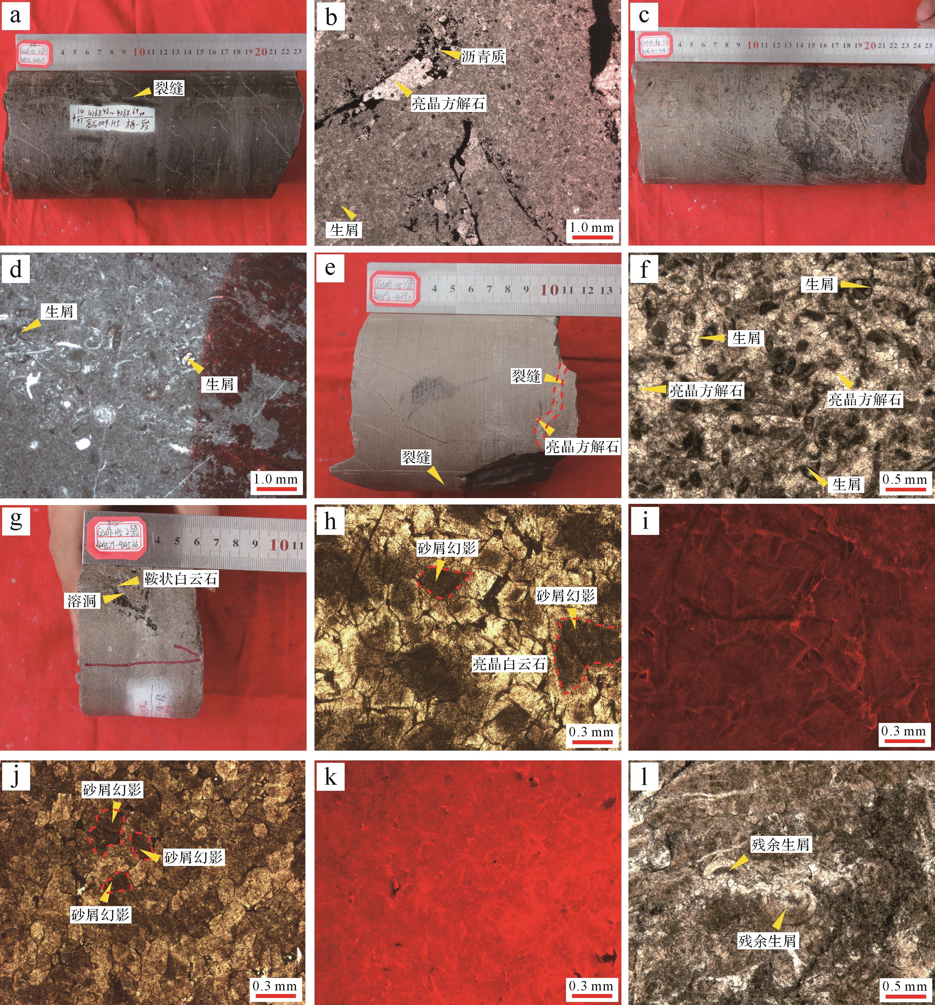
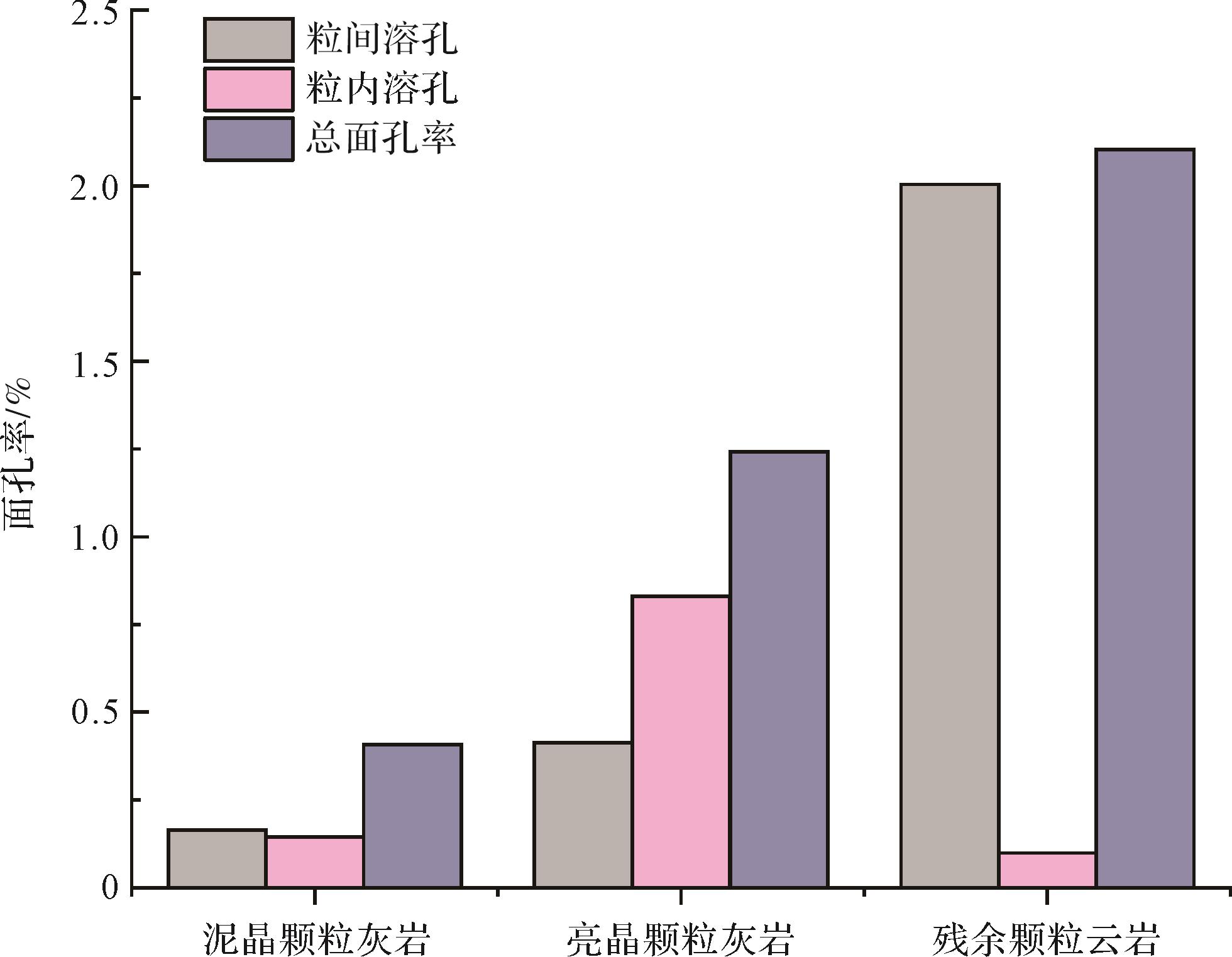
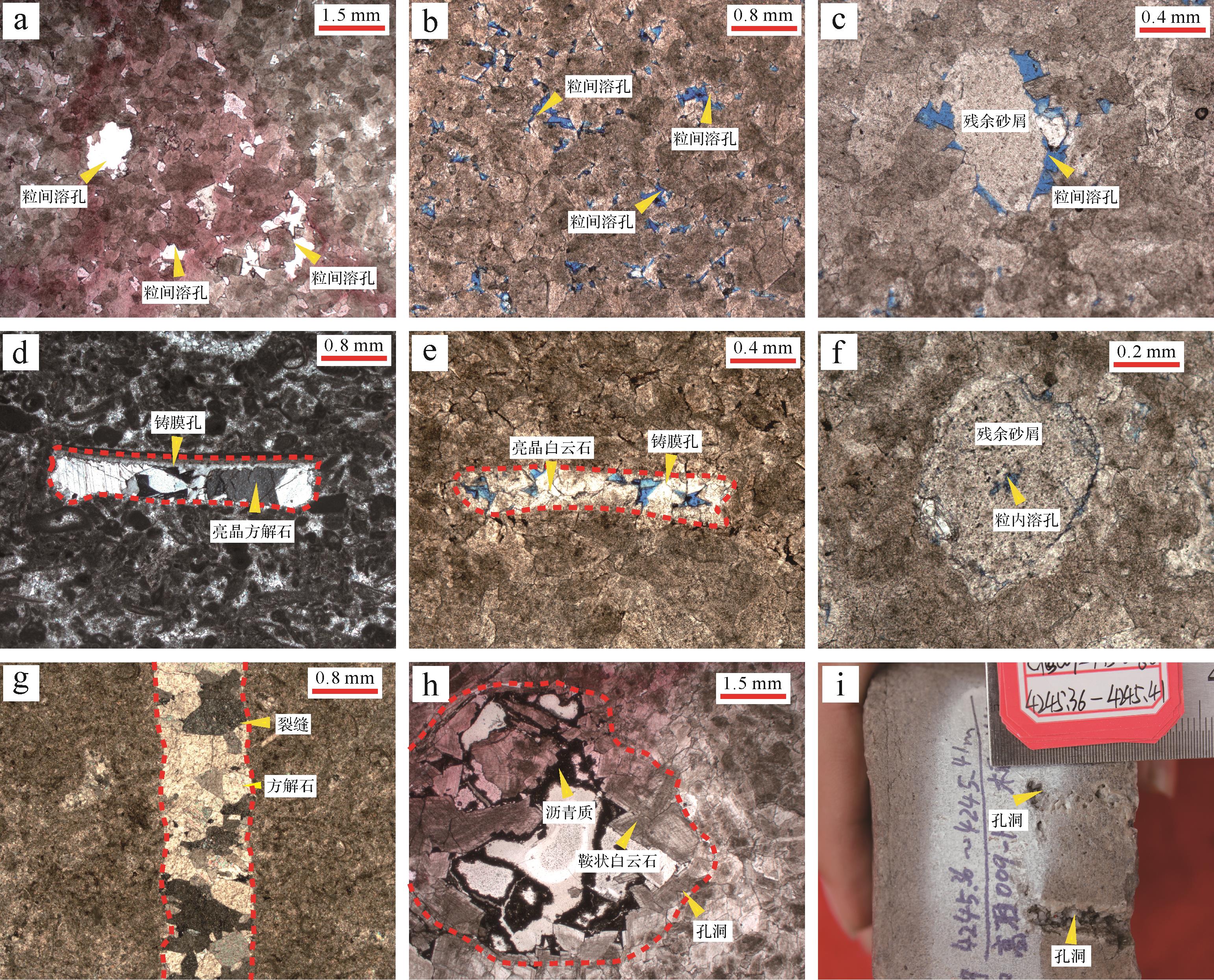
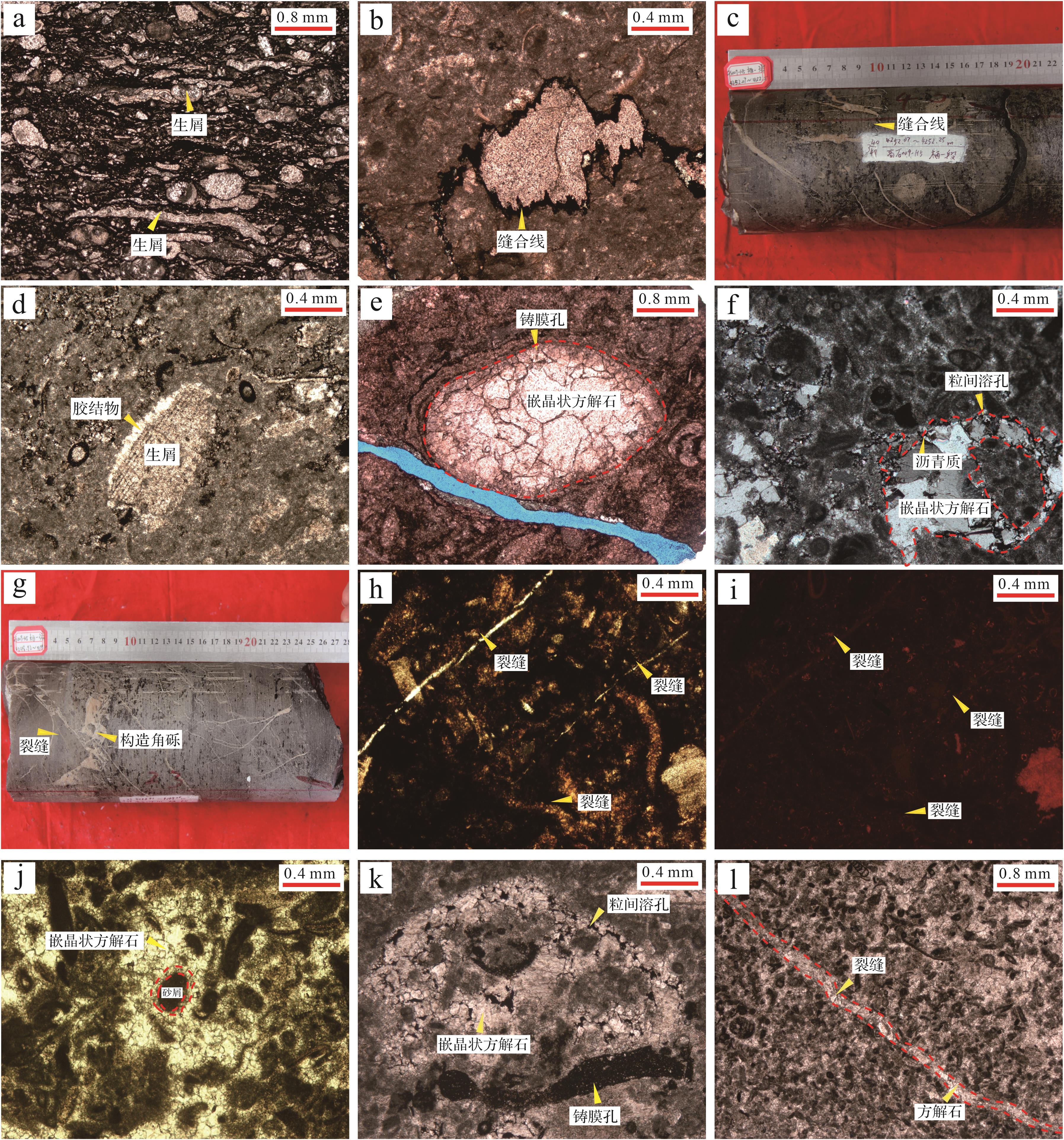
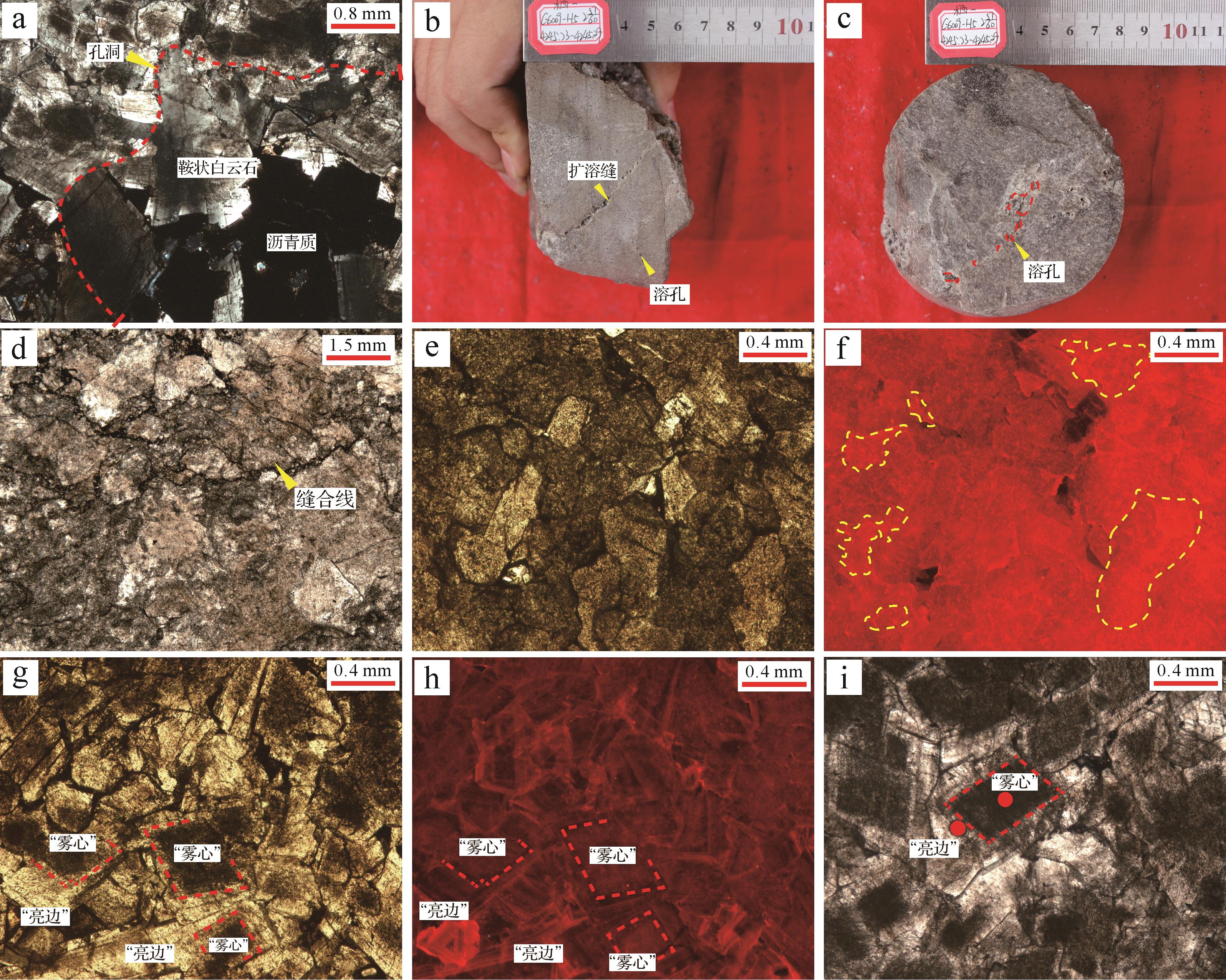
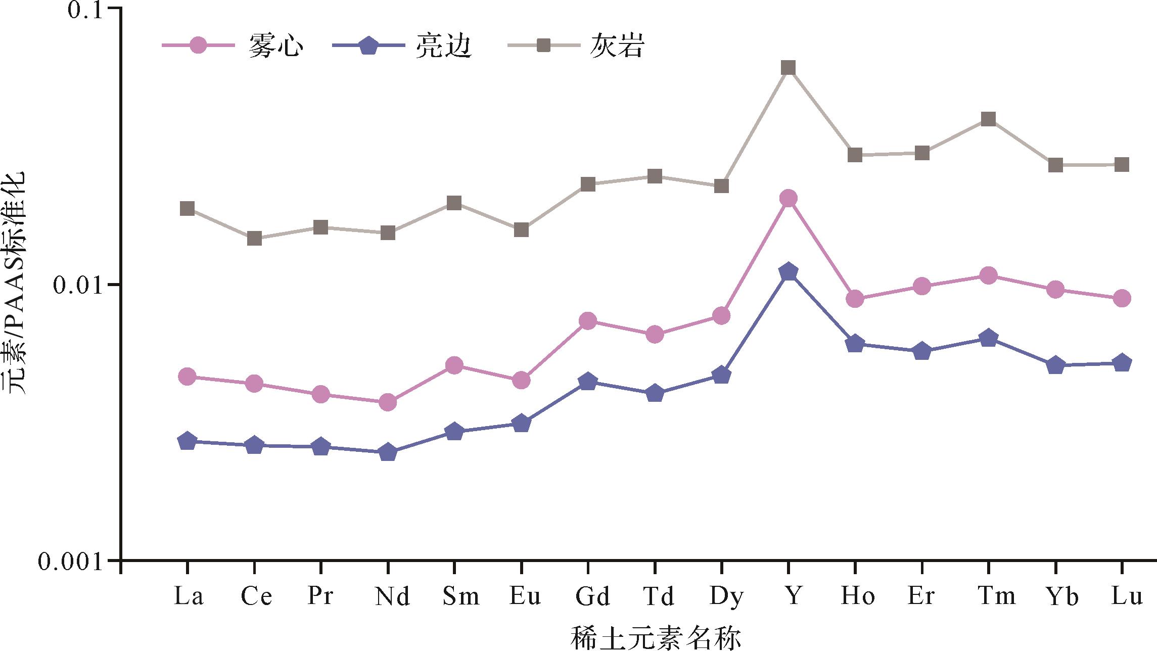
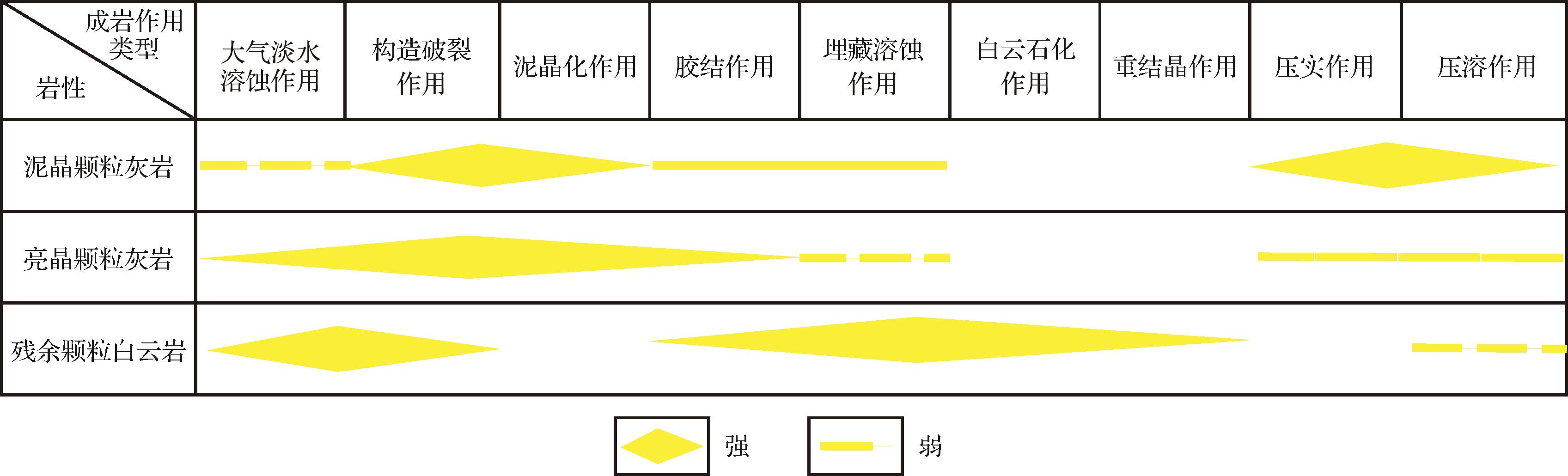
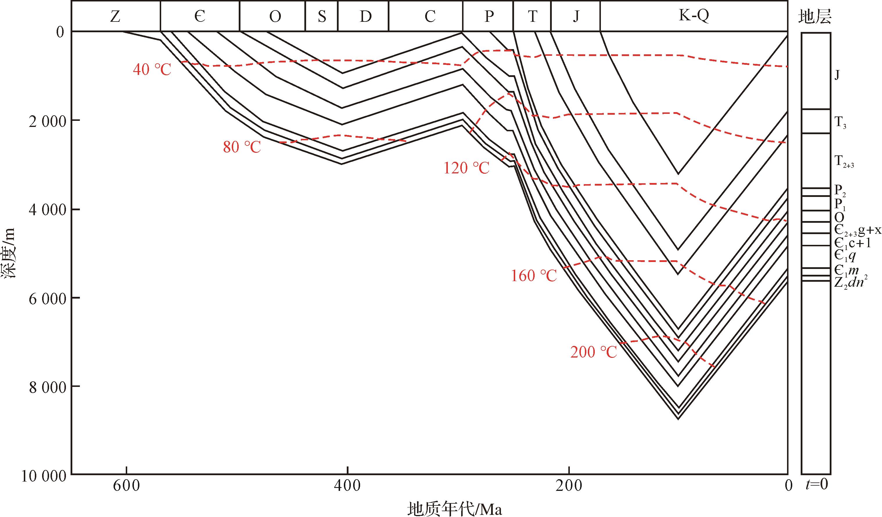
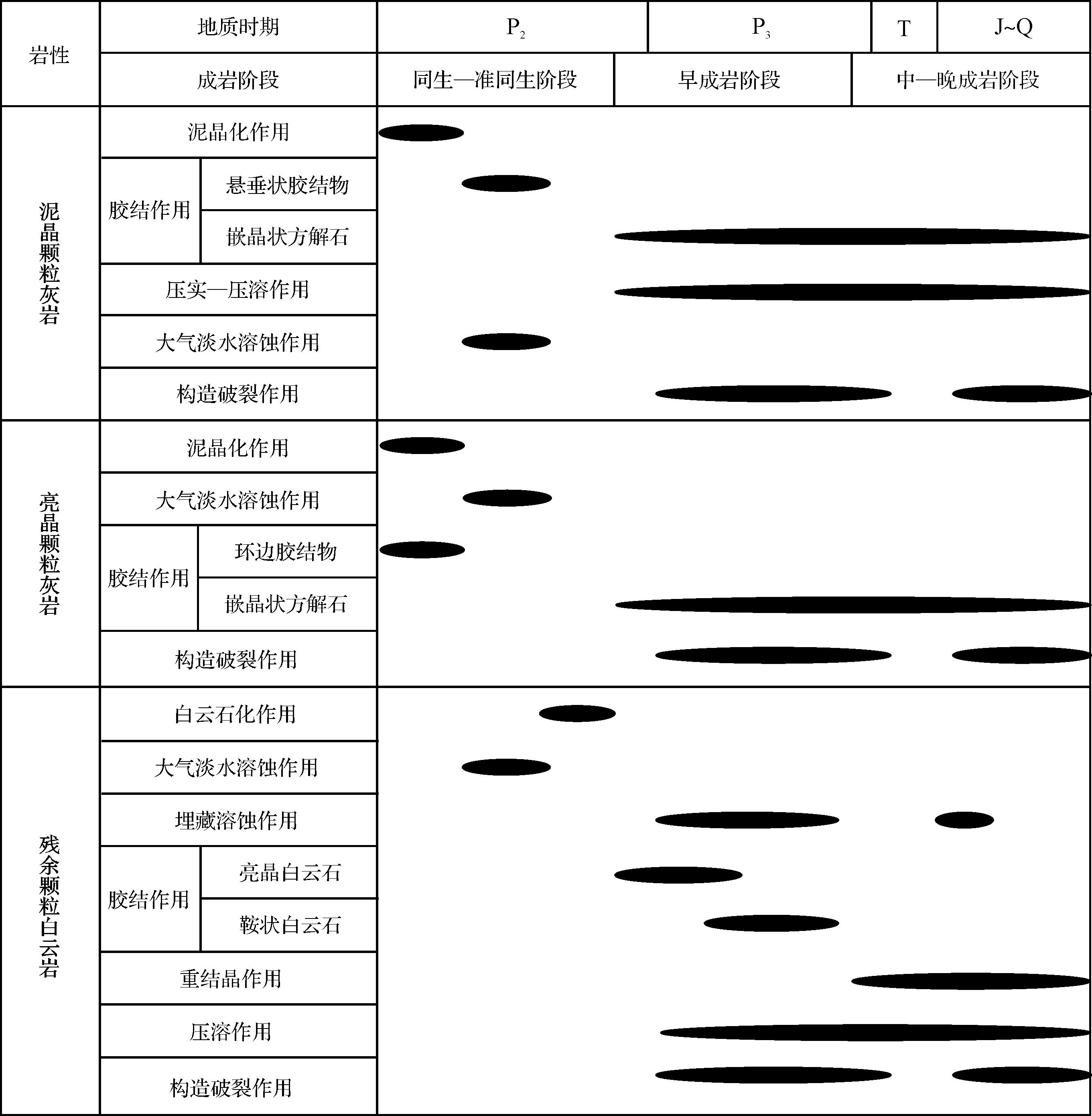
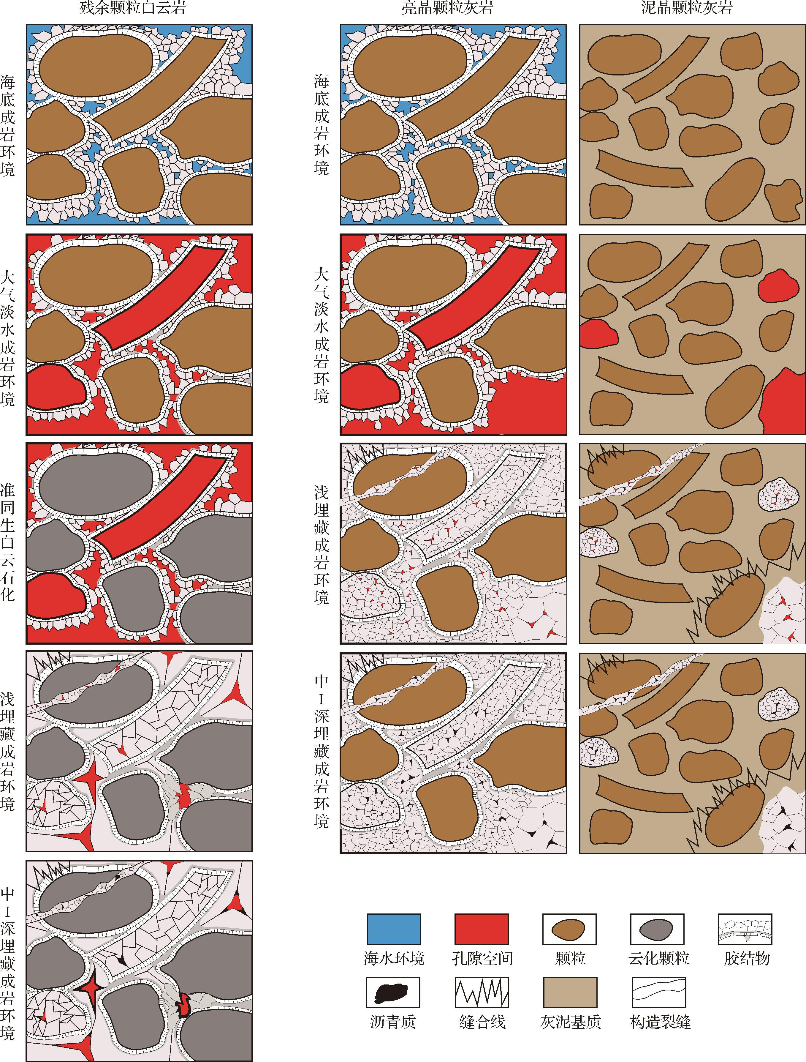
Objective Current domestic and international research on bauxite oil and gas reservoirs is limited in scope. The bauxite reservoir with high-yield industrial gas flow discovered in the Taiyuan Formation, Longdong area, southwestern Ordos Basin, represents a significant advance in the exploration for bauxite gas reservoirs, and the recent identification and production tests of bauxite rock series in the Benxi Formation in the Linxing area at the northeastern margin of the basin suggests promising exploration potential.Further natural gas exploration and development in the bauxite series in the Linxing area requires a comprehensive analysis of the fundamental geology of the sedimentary environment, including the mineral composition, reservoir pore properties and the structure of the bauxite series. In addition, it is essential to identify the factors that control the development of bauxite and which areas are most conducive to such activity. Methods A comprehensive analysis of the sedimentary environment, reservoir characteristics and sedimentary model of the Benxi Formation bauxite rock series in the Linxing area was conducted using logging, seismic data, X-ray diffraction, casting thin sections, scanning electron microscopy, major and trace elements, high-pressure mercury injection, N2 and CO2 adsorption and conventional physical properties, and other experimental methods. Results The bauxite rock series in the study area is characterized by a high concentration of diaspore and clay minerals, and has a distinctive three-stage vertical structure. The lower portion is rich in iron, the middle zone contains a higher aluminum content, and the upper section has a lower iron concentration. The pore types include predominantly dissolution pores typically ranging between 2 nm and 50 nm, along with intercrystalline pores, organic pores and microfractures. The sorting and connectivity of the pores are relatively good, with average porosity 3.64% and average permeability 7.24×10⁻³ μm2. Conclusions The thickness of a bauxite rock series depends upon the sedimentary environment and karst paleogeomorphology. A shallow-water sedimentary environment with high temperature and high humidity, low oxygen levels and alternating marine and terrestrial conditions is optimal for its formation and preservation. A slope, or buried pit, is a crucial area for exploration and development. This understanding provides a geological foundation for the exploration and development of natural gas in bauxite with comparable geological background in this region.
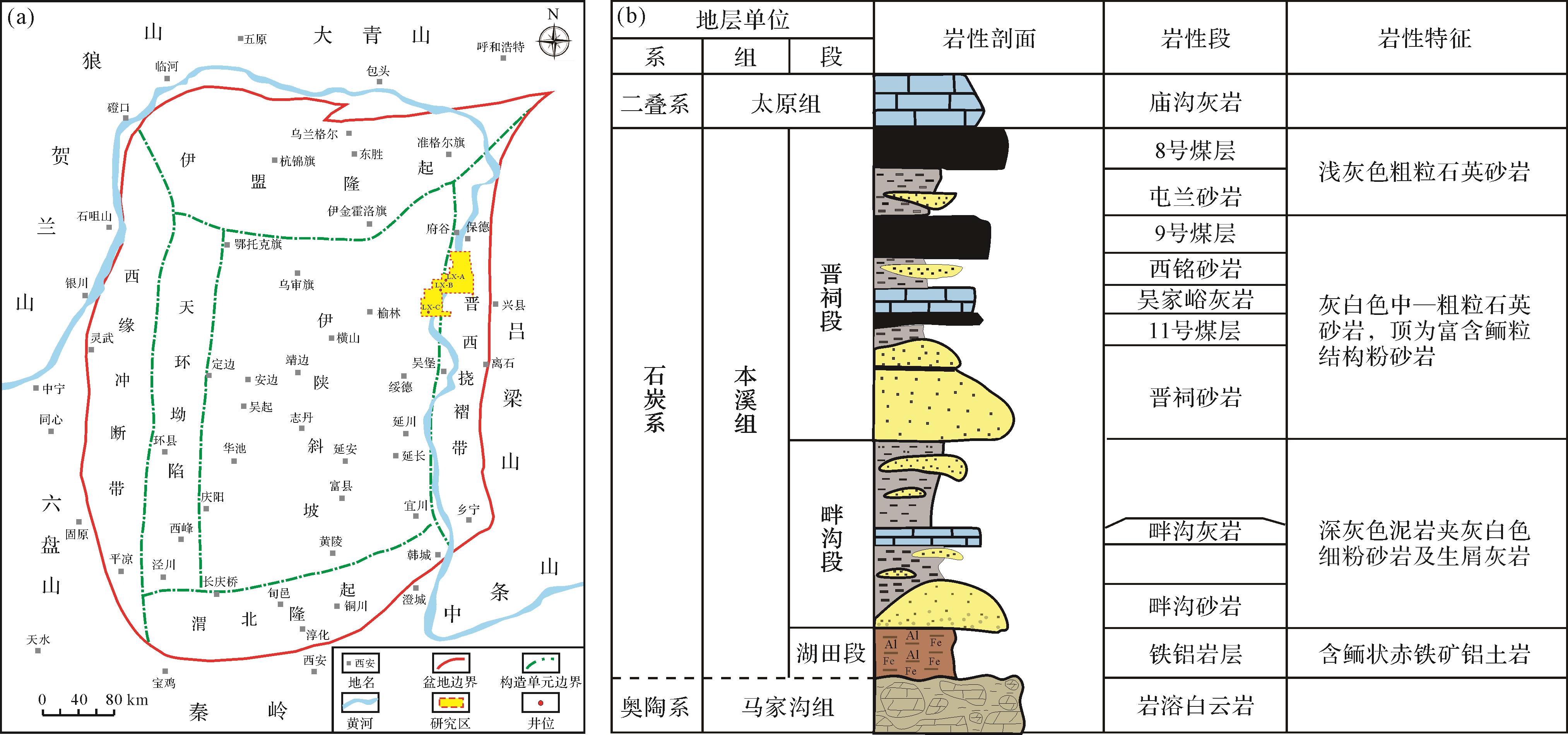
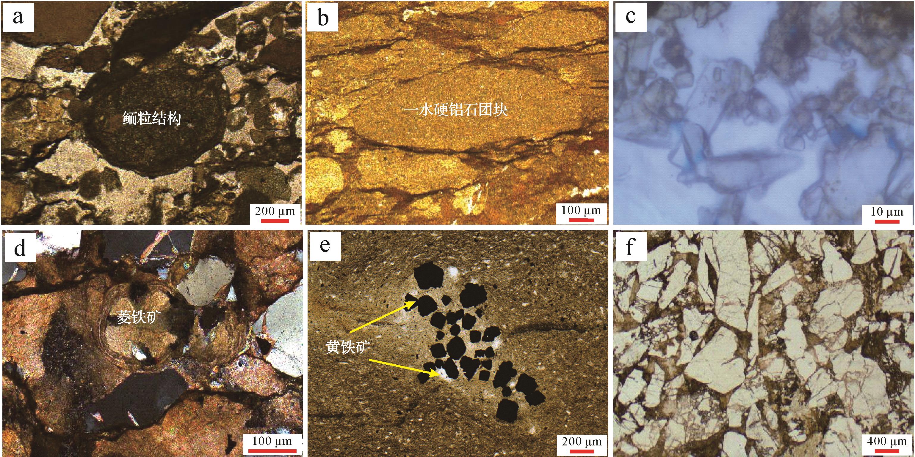
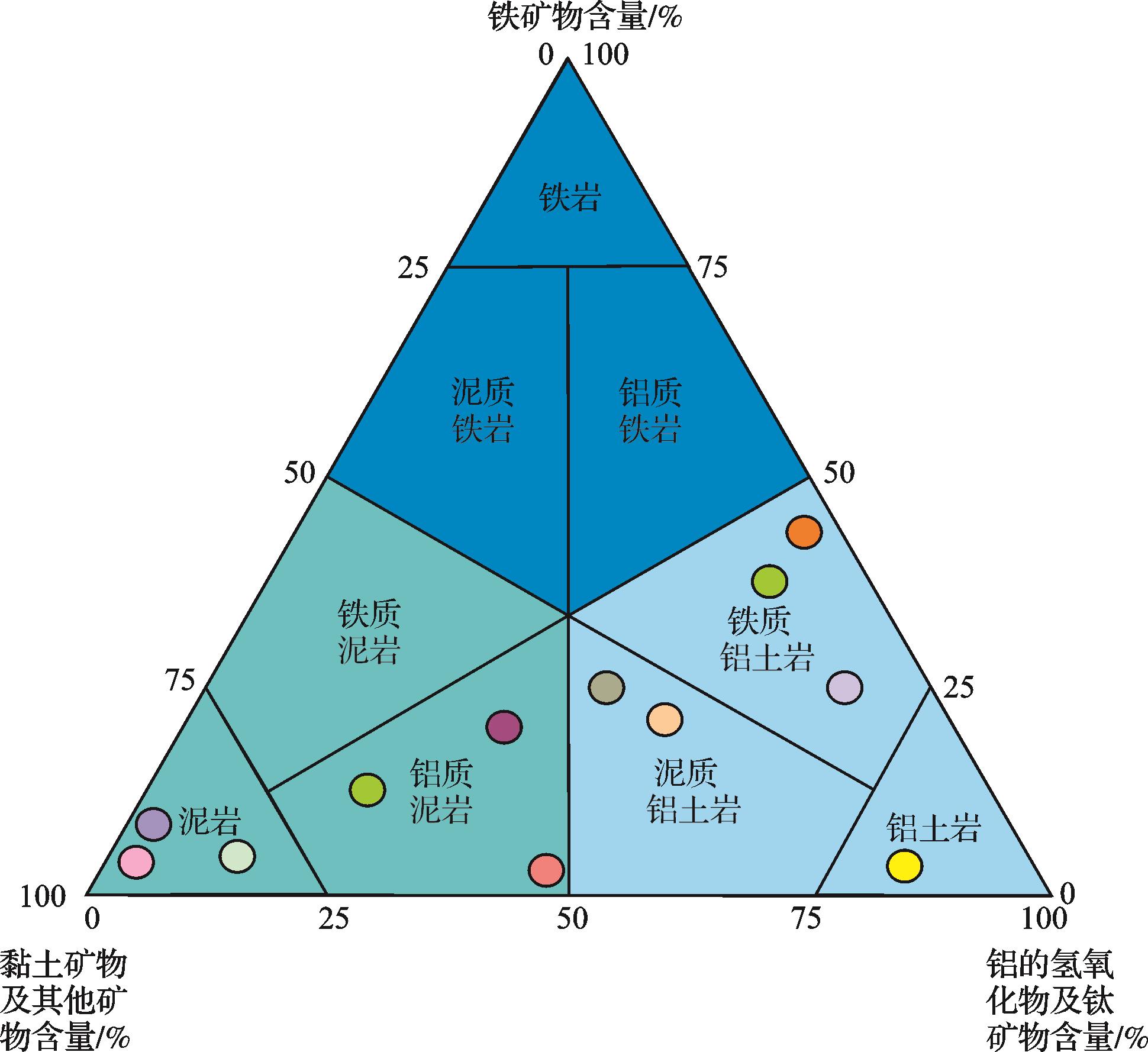
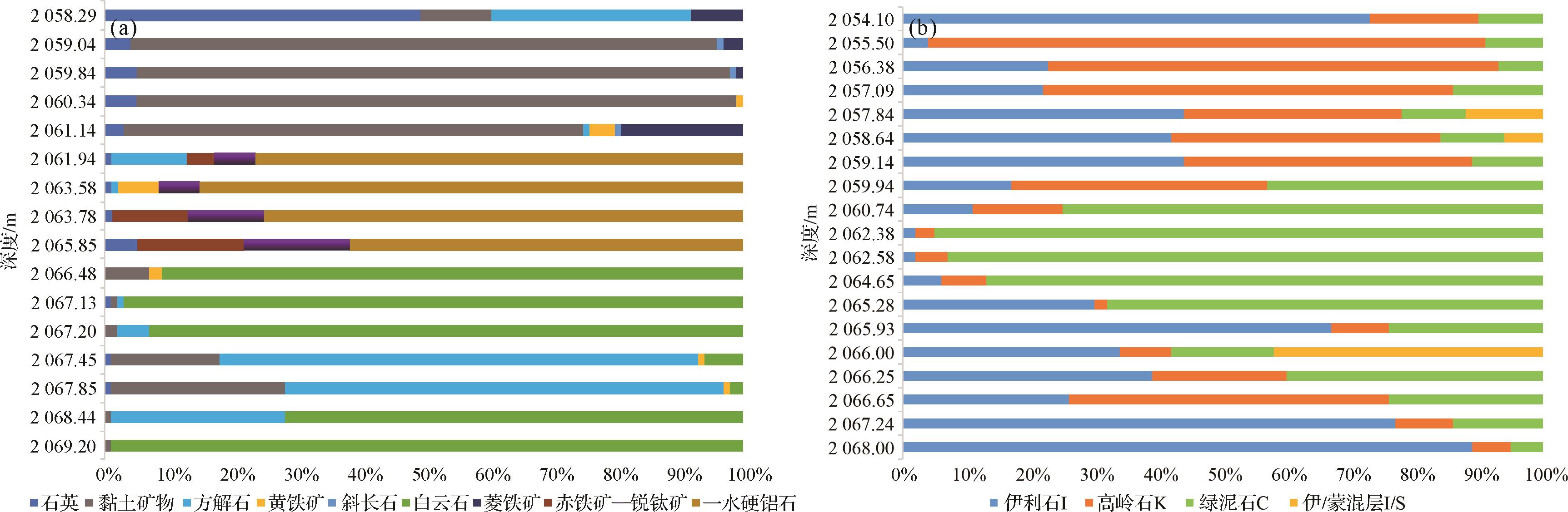
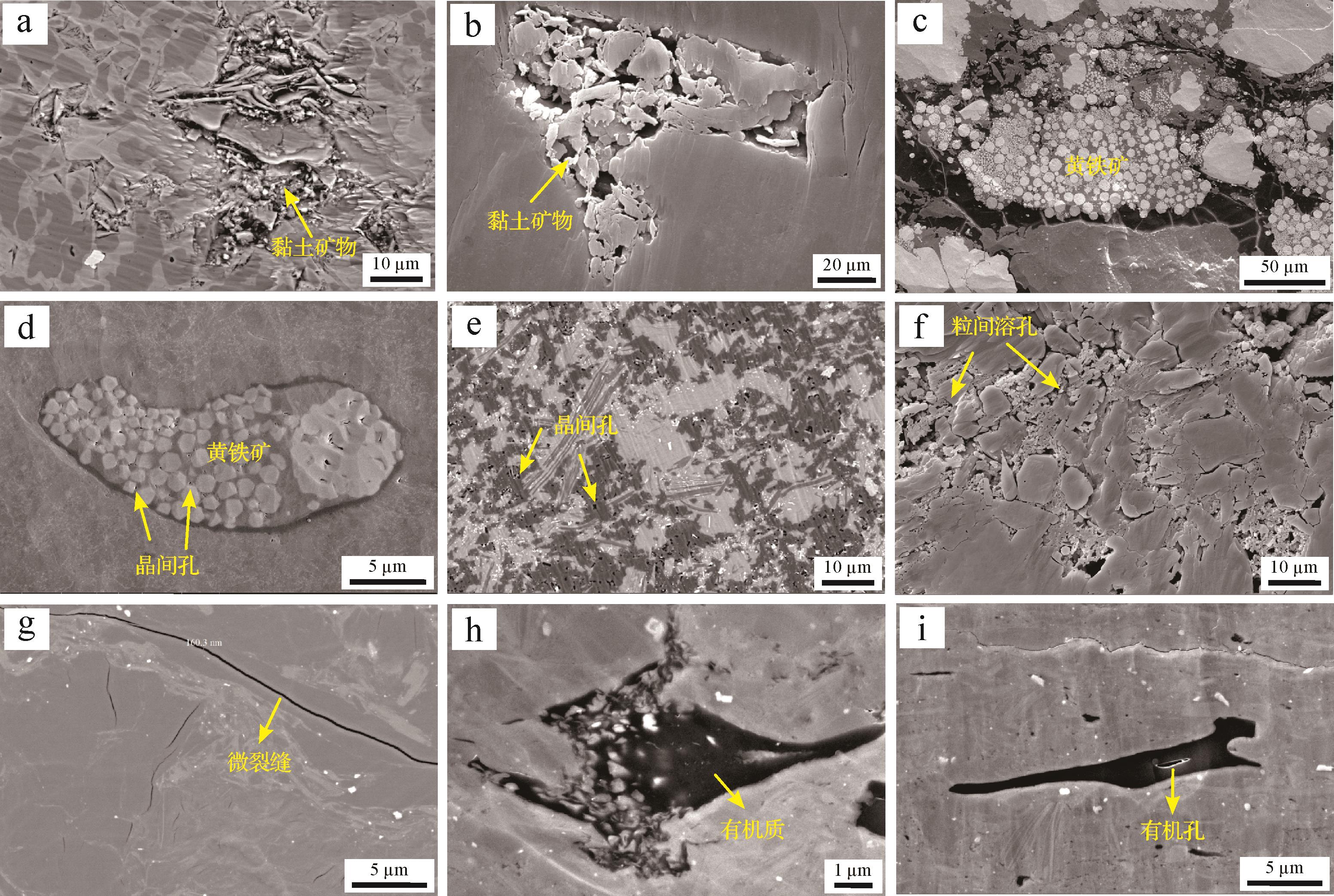
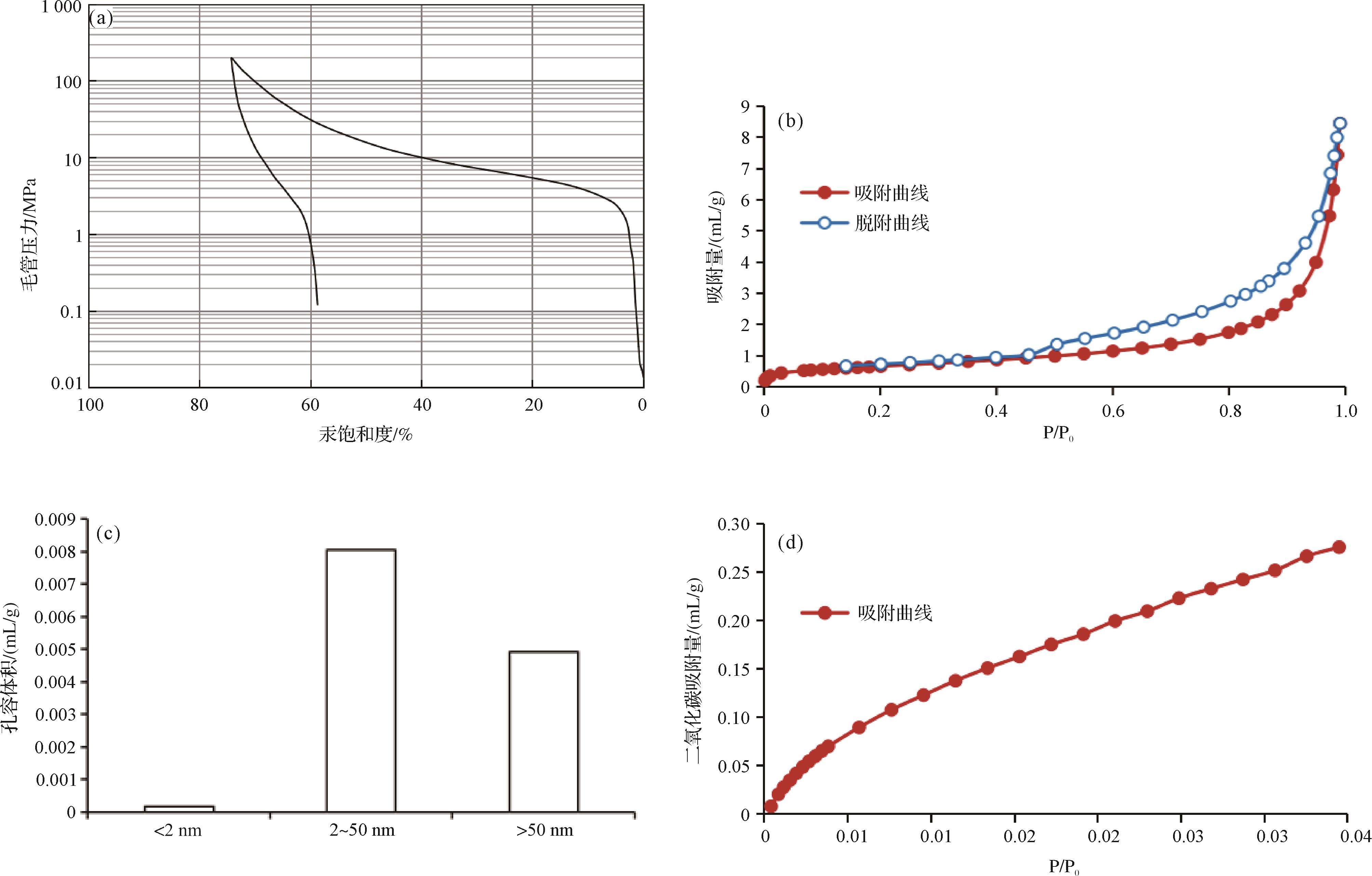
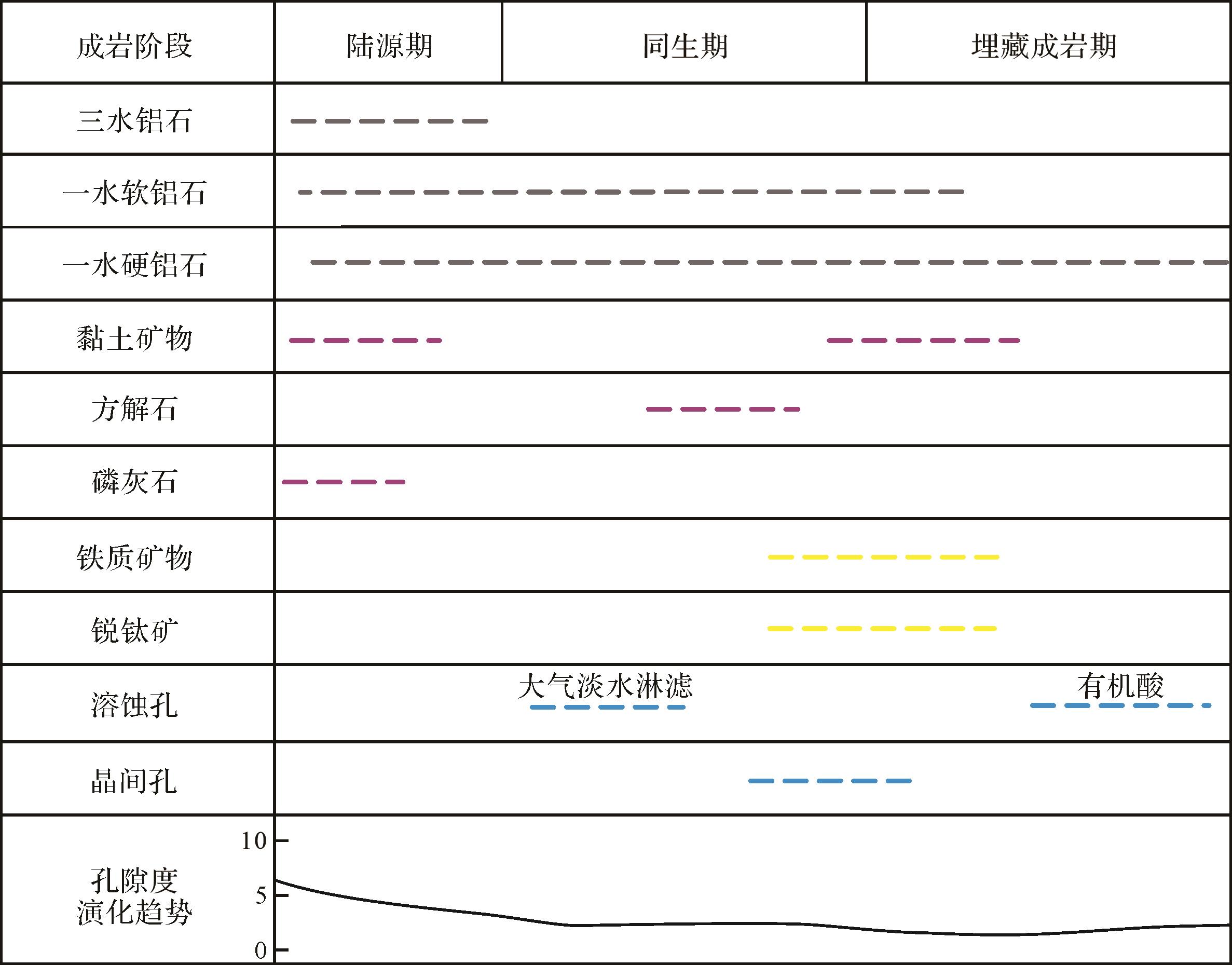
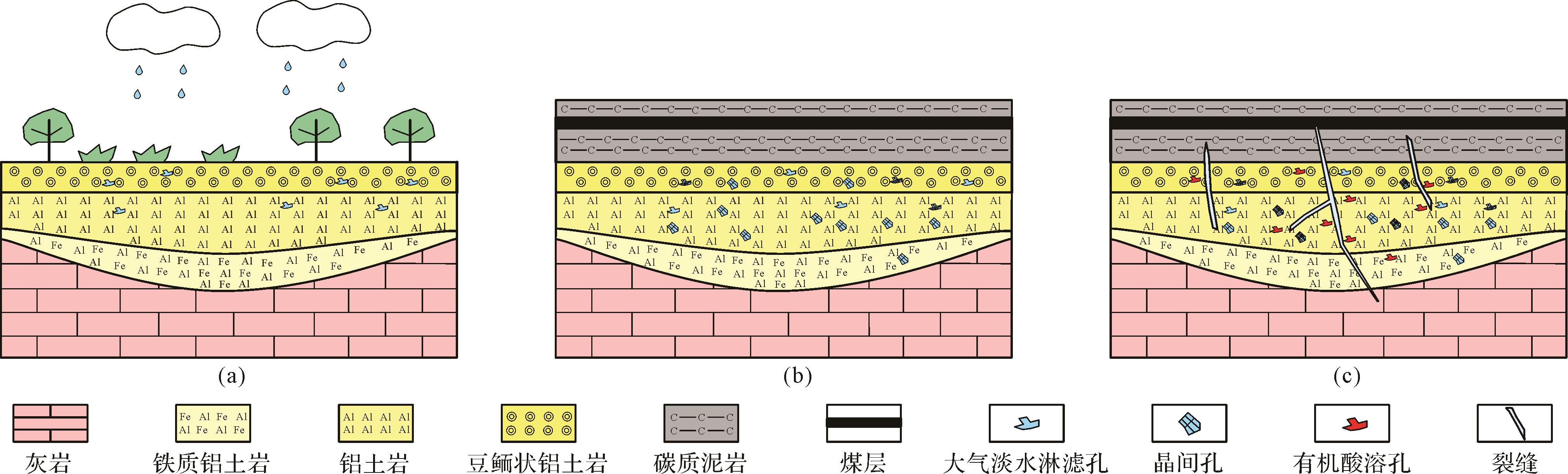
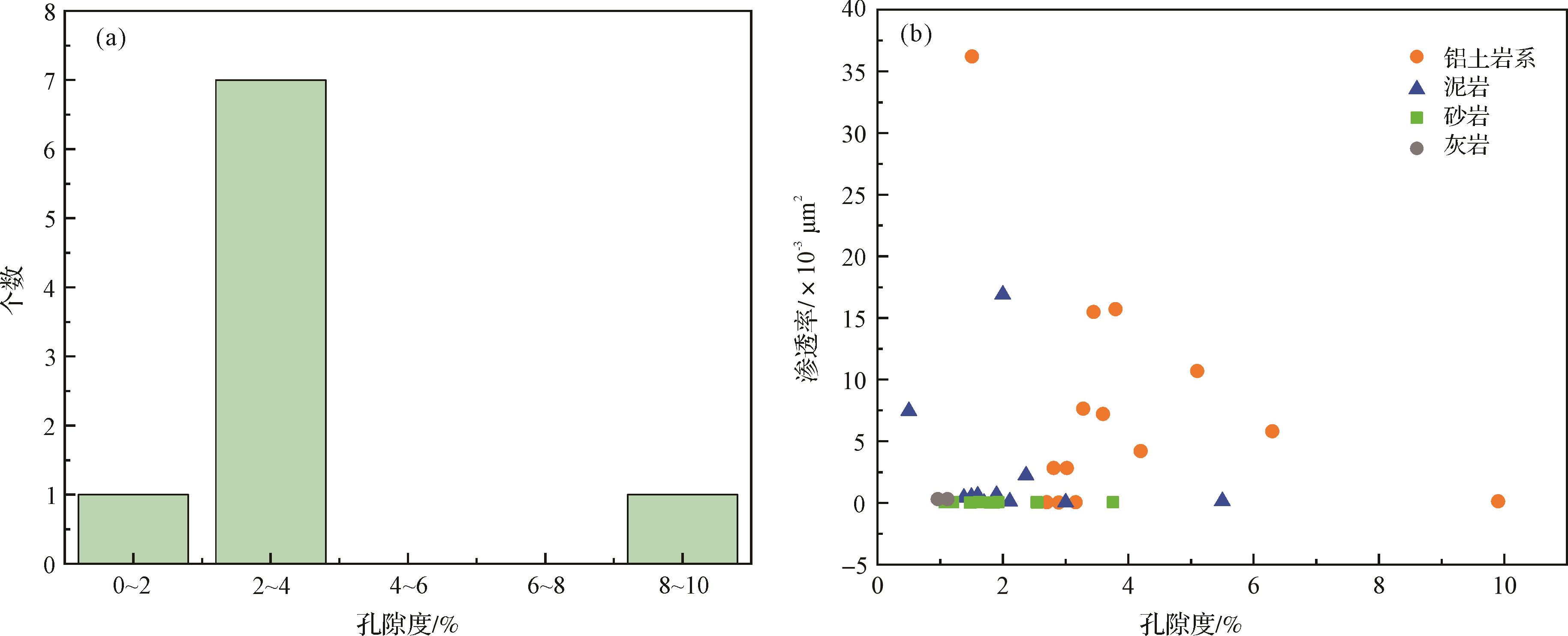
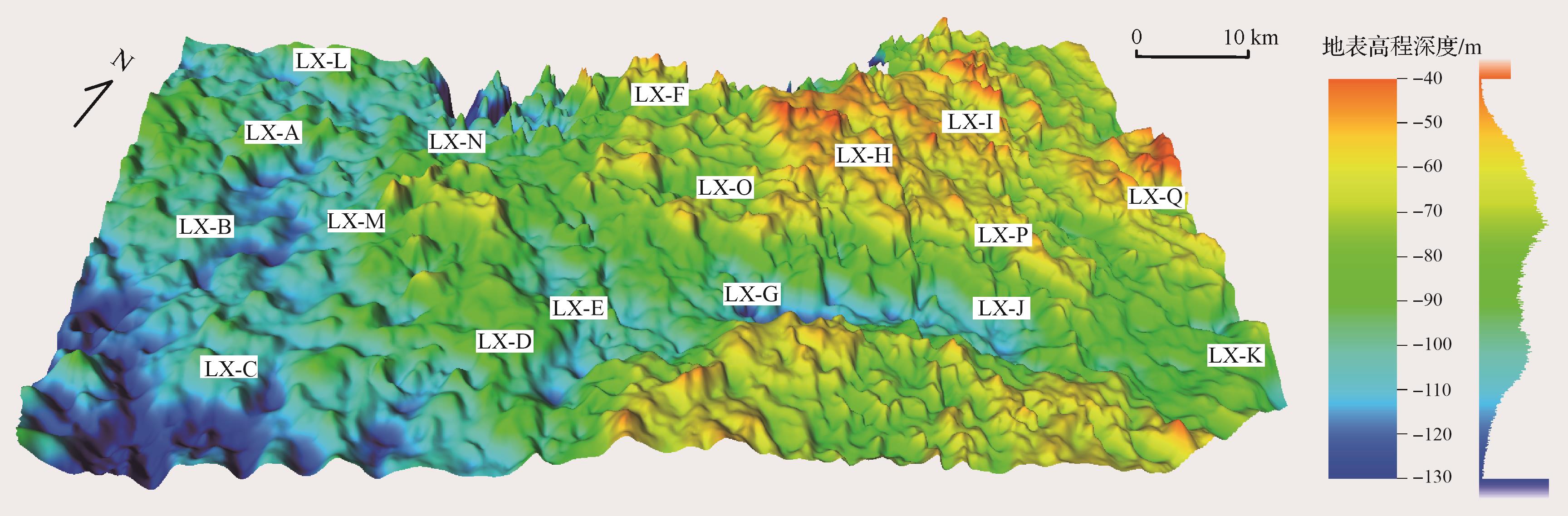
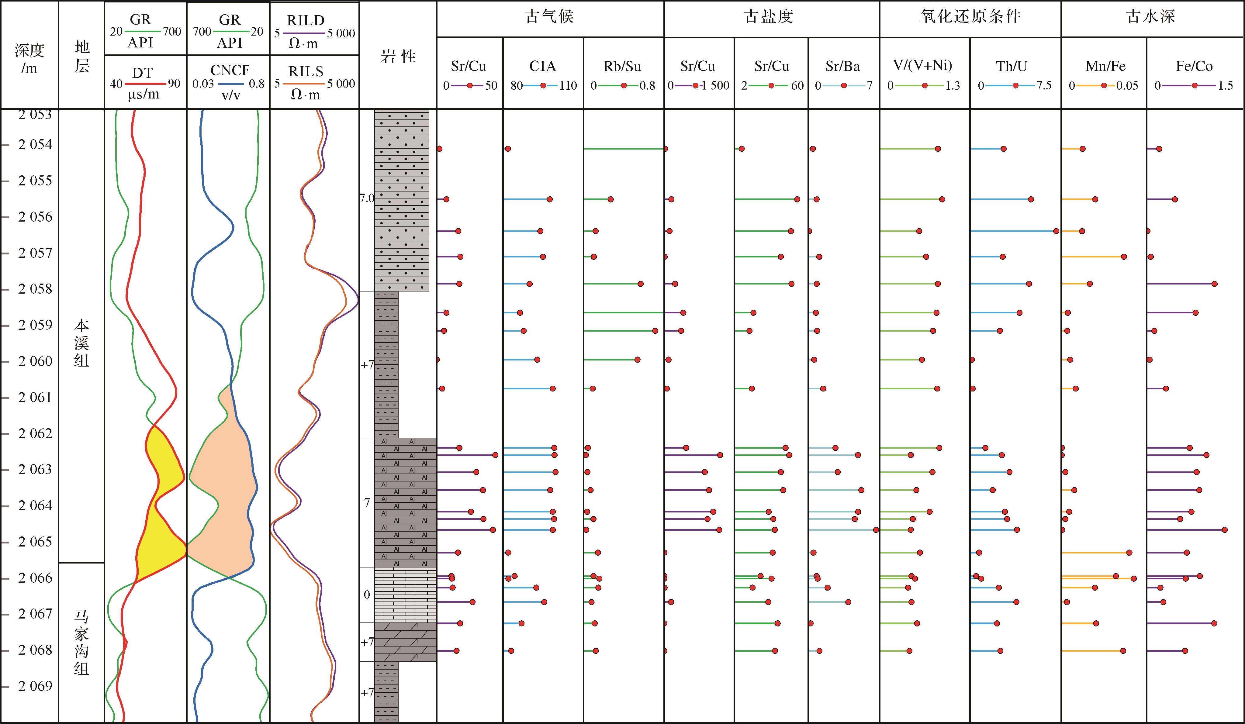
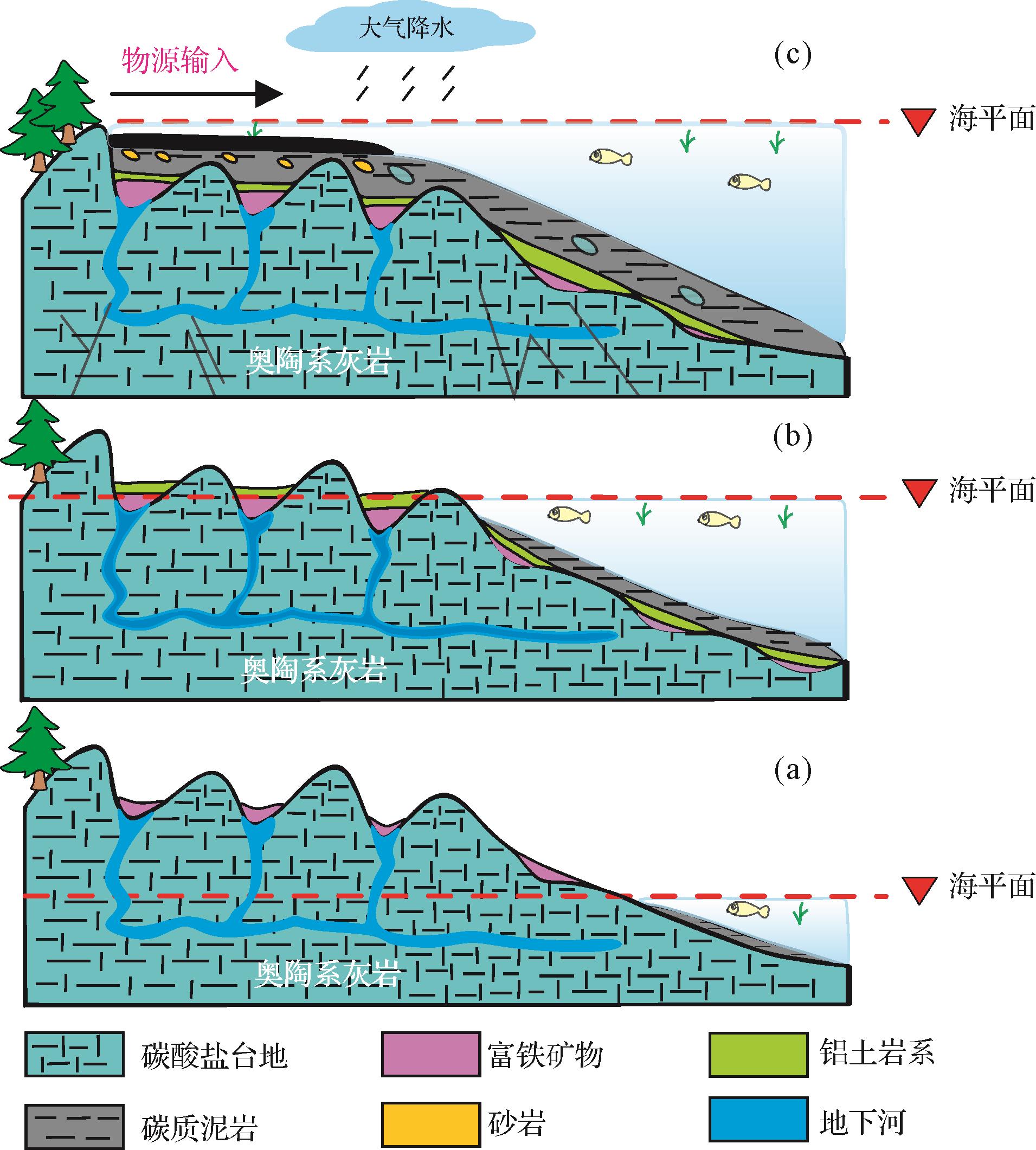
Objective The 5th member of the Ordovician Majiagou Formation in the southern Sulige gas field primarily consists of karst reservoirs, with proven reserves exceeding 100 billion cubic meters. However, during development, severe water production and complex gas-water relationships have been observed, and the distribution patterns and controlling factors of gas and water remain unclear, significantly constraining the release of the gas production potential of the region. Methods Based on formation water geochemical analysis, various chemical parameters (i.e., Na+/Cl-, desulfurization, Mg2+/Ca2+, Na+/Ca2+ and Na+ + Cl-/Mg2+ coefficients) were analyzed to determine the formation environment of the water. The distribution patterns of gas and water were then studied by identifying the water-bearing intervals in individual wells, and by cross-well gas reservoir profile comparisons and the planar distribution of different formation water types. Finally, the controlling factors of gas-water distribution were explored in relation to the hydrocarbon source rock, karst reservoir heterogeneity and structural features. Results The total salinity of formation water (total dissolved solids) in the 5th member of the southern Sulige gas field is relatively concentrated (mean 83 598.7 mg/L), with slightly acidic pH. The water type is predominantly CaCl2, and exhibits low chloride-sodium coefficients, low desulfurization coefficients, low magnesium-calcium coefficients, low sodium-calcium coefficients and high metamorphism coefficients, all indicating good formation sealing favorable for gas reservoir preservation. These parameters show similar characteristics over the area, controlled by the karst reservoirs. The formation water is classified into three types, based on genetic differences, spatial distribution and reservoir properties: Type I (structural low-position water), Type II (isolated lenticular water) and Type III (low-permeability trapped water). Type I is mainly developed in karst areas, controlled by karst residual hill units, with a unified gas-water interface, and is the primary region for high-efficiency wells. Type II is sporadically distributed and influenced by the planar distribution of karst depressions and troughs, with moderate reservoir properties, representing a potentially favorable exploitation zone. Type III indicates poor reservoir properties. Conclusions The distribution of formation water is controlled by three factors: hydrocarbon source rock, karst reservoir heterogeneity and local structures within individual karst units. Insufficient hydrocarbon supply from the source rock is the fundamental reason for the development of formation water. The heterogeneity of the karst reservoir dictates the gas-water distribution pattern, and local structures have resulted in gas-water differentiation, with a unified gas-water interface within the same karst unit.
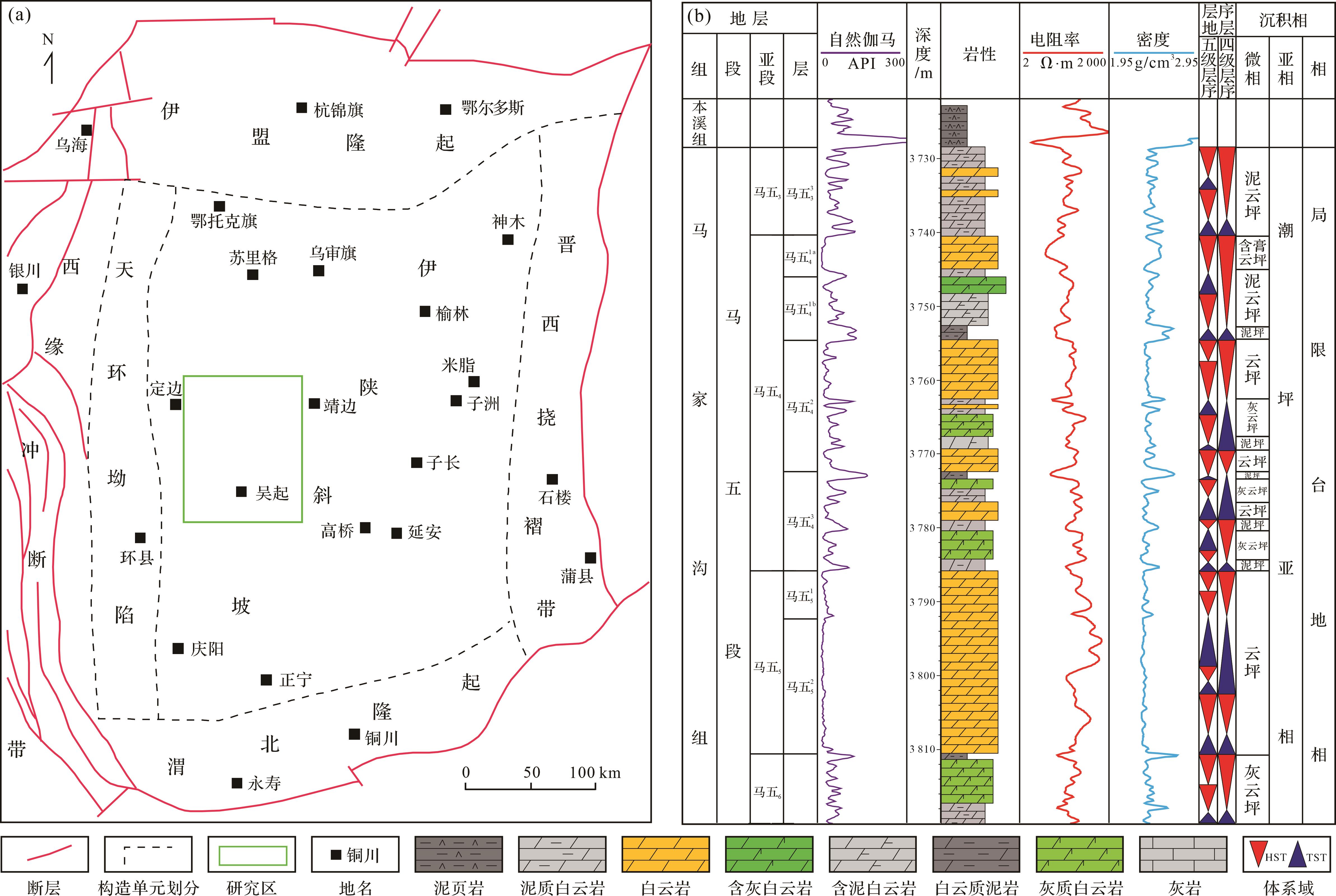
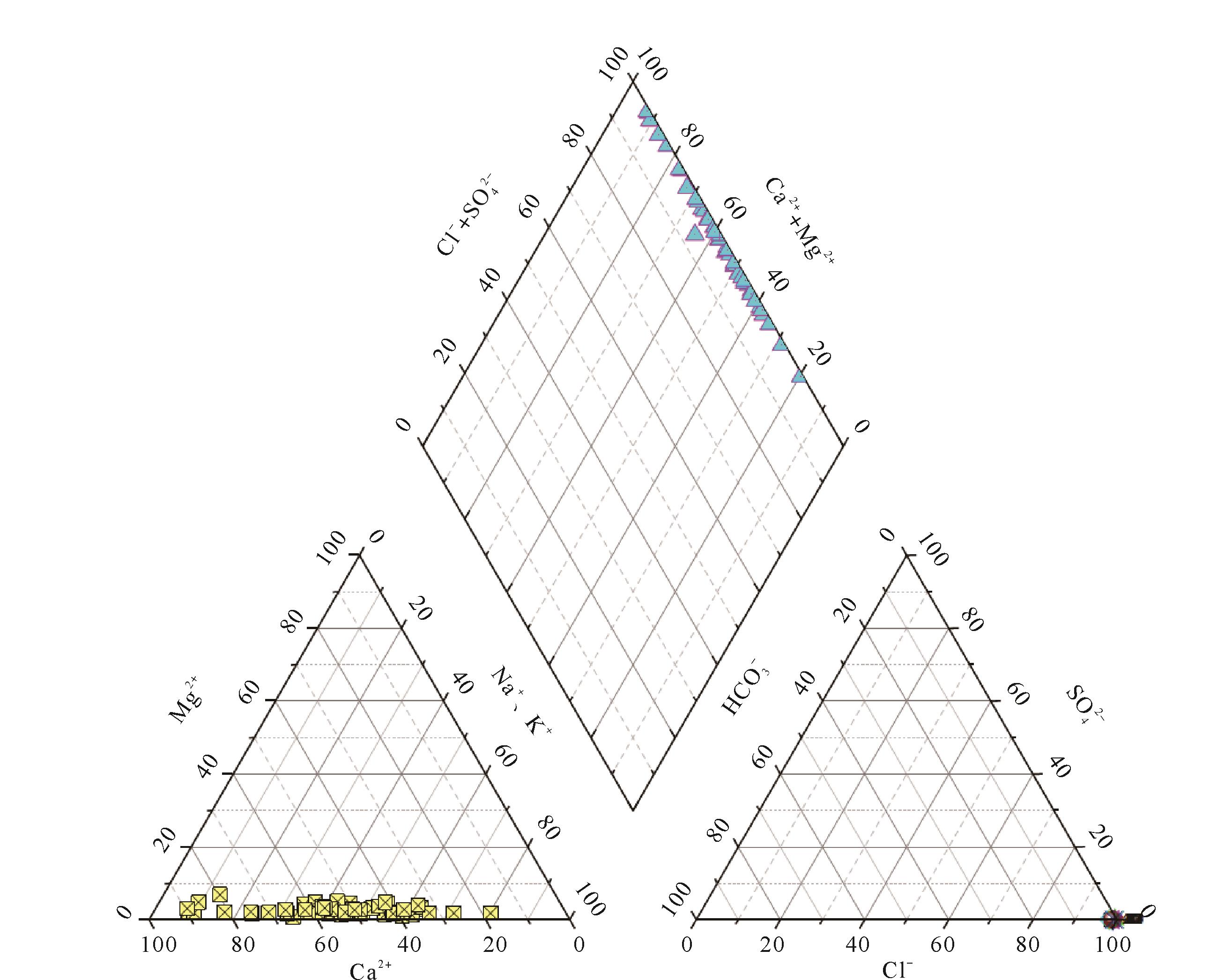
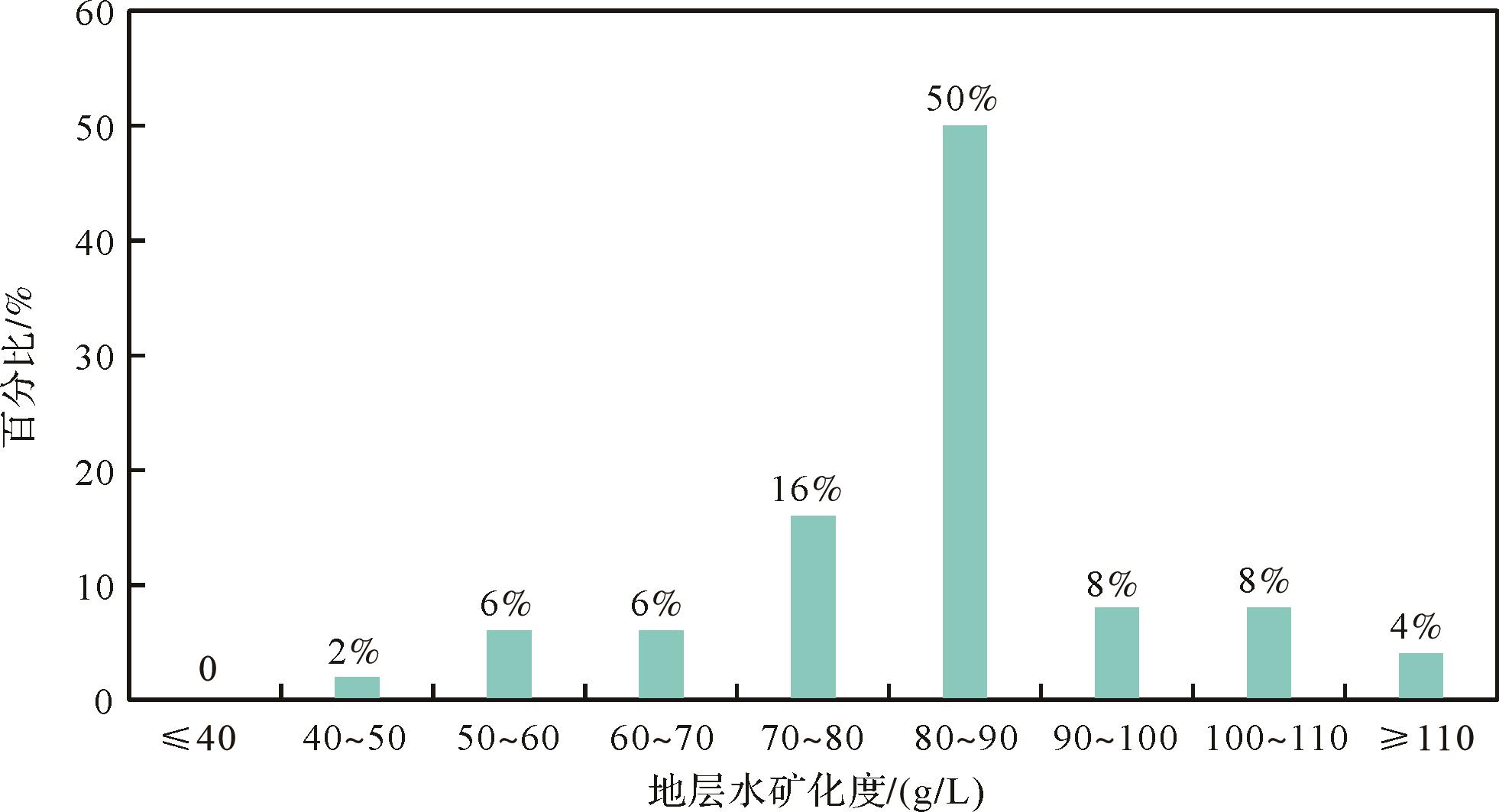
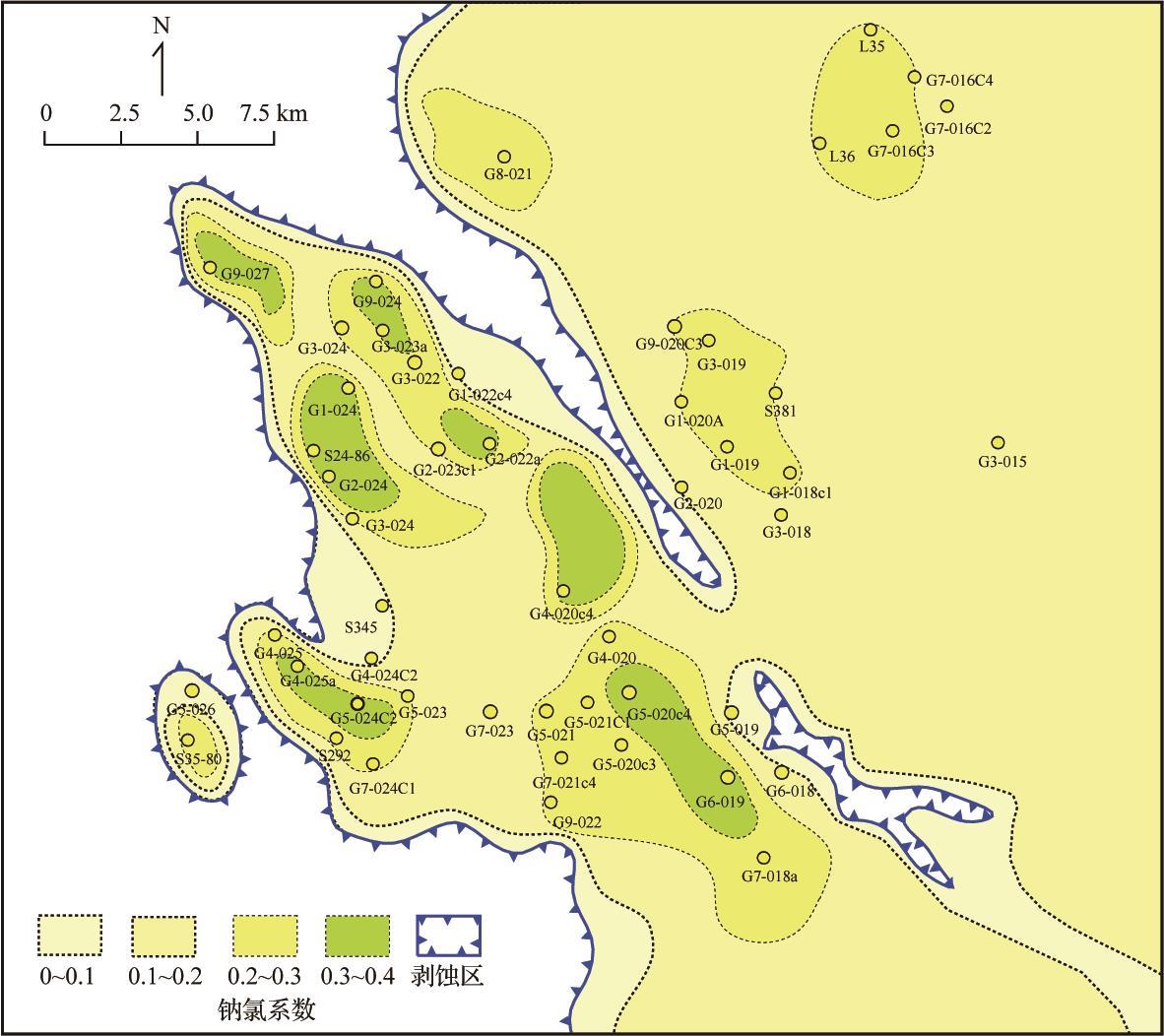
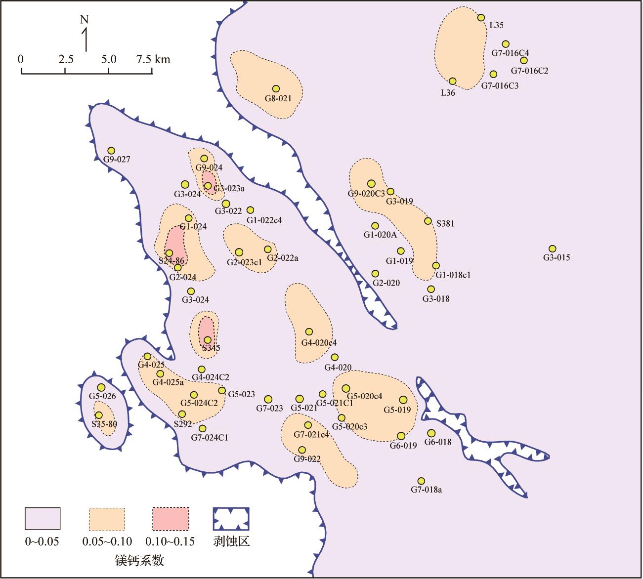
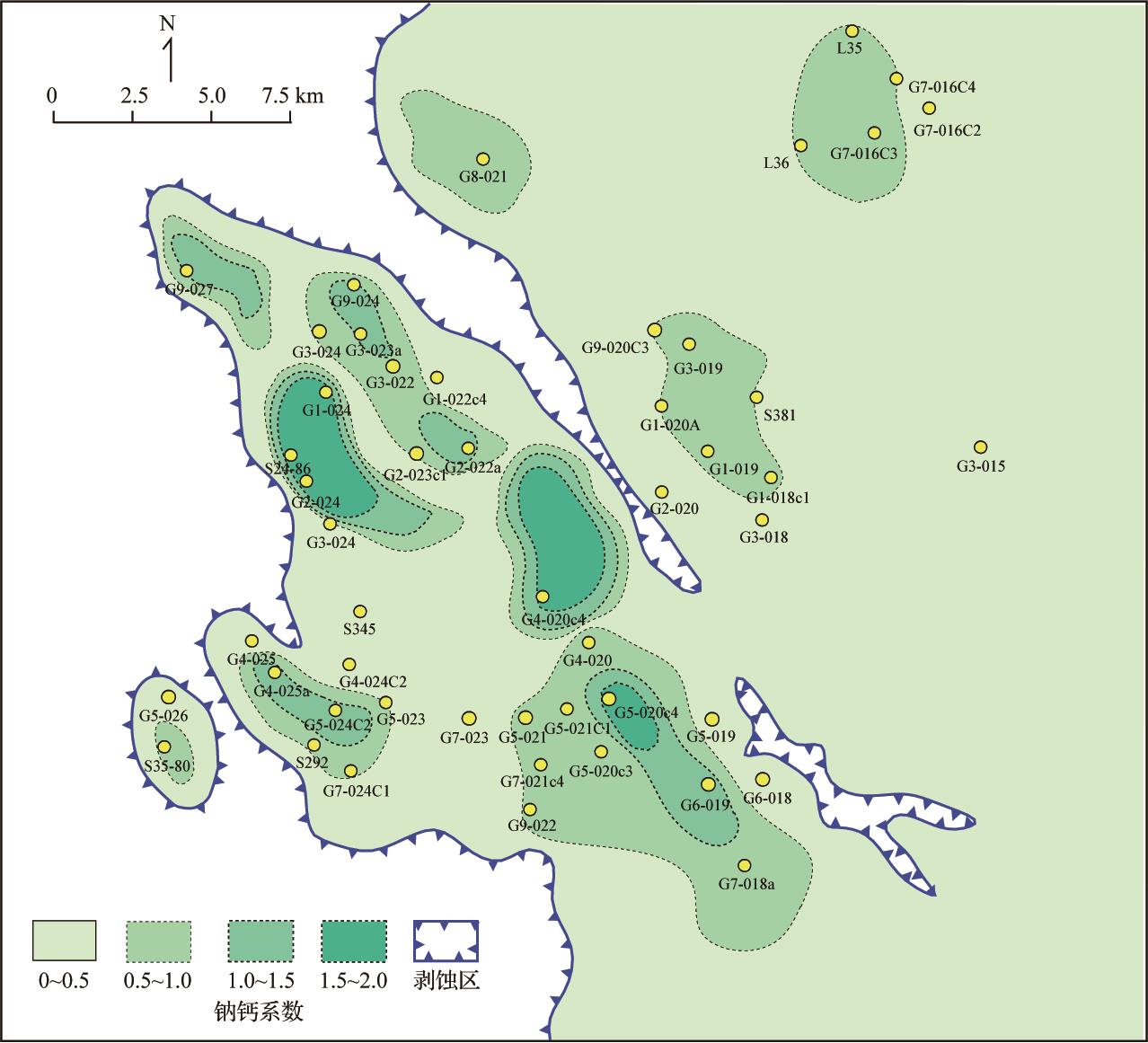
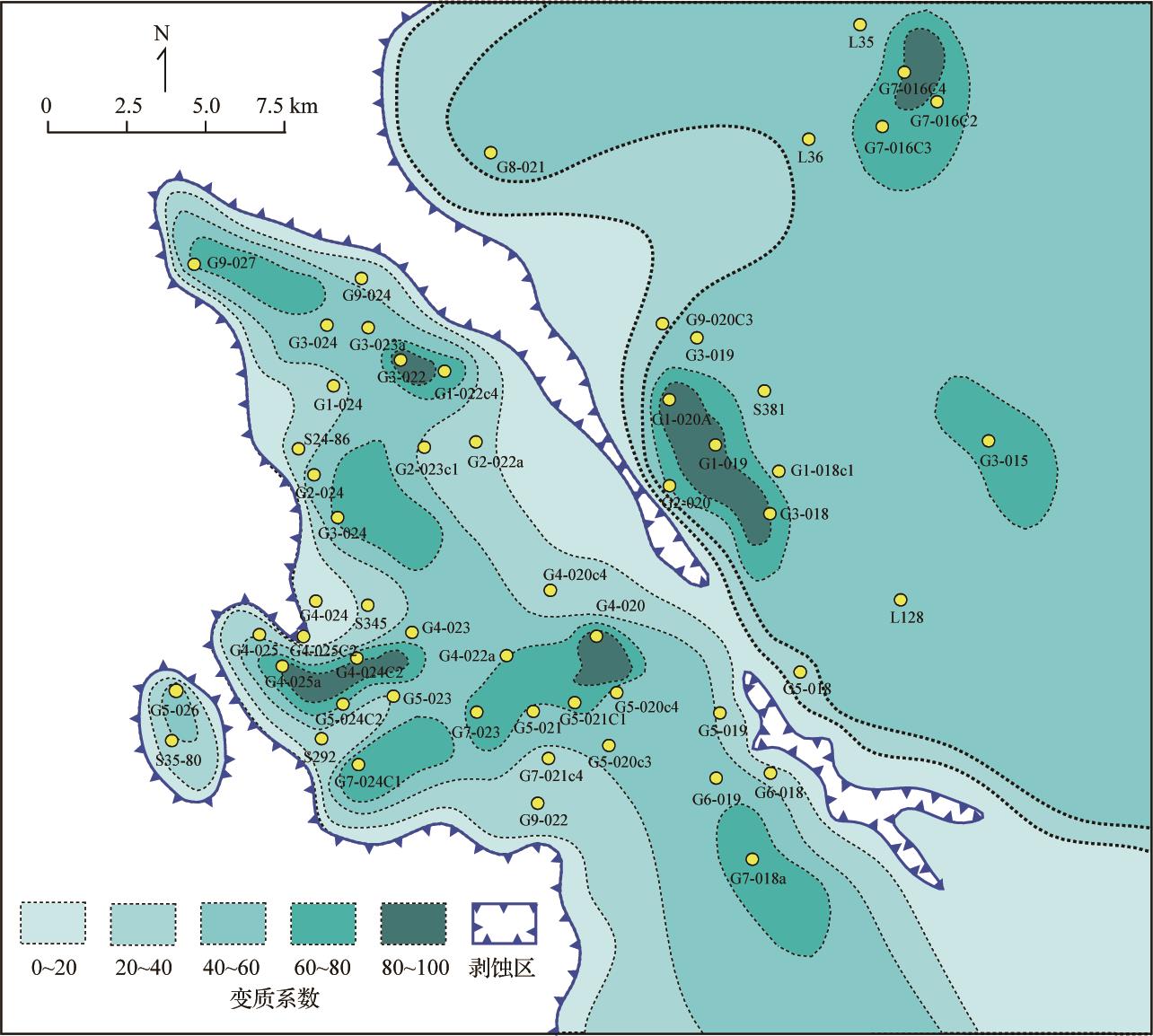
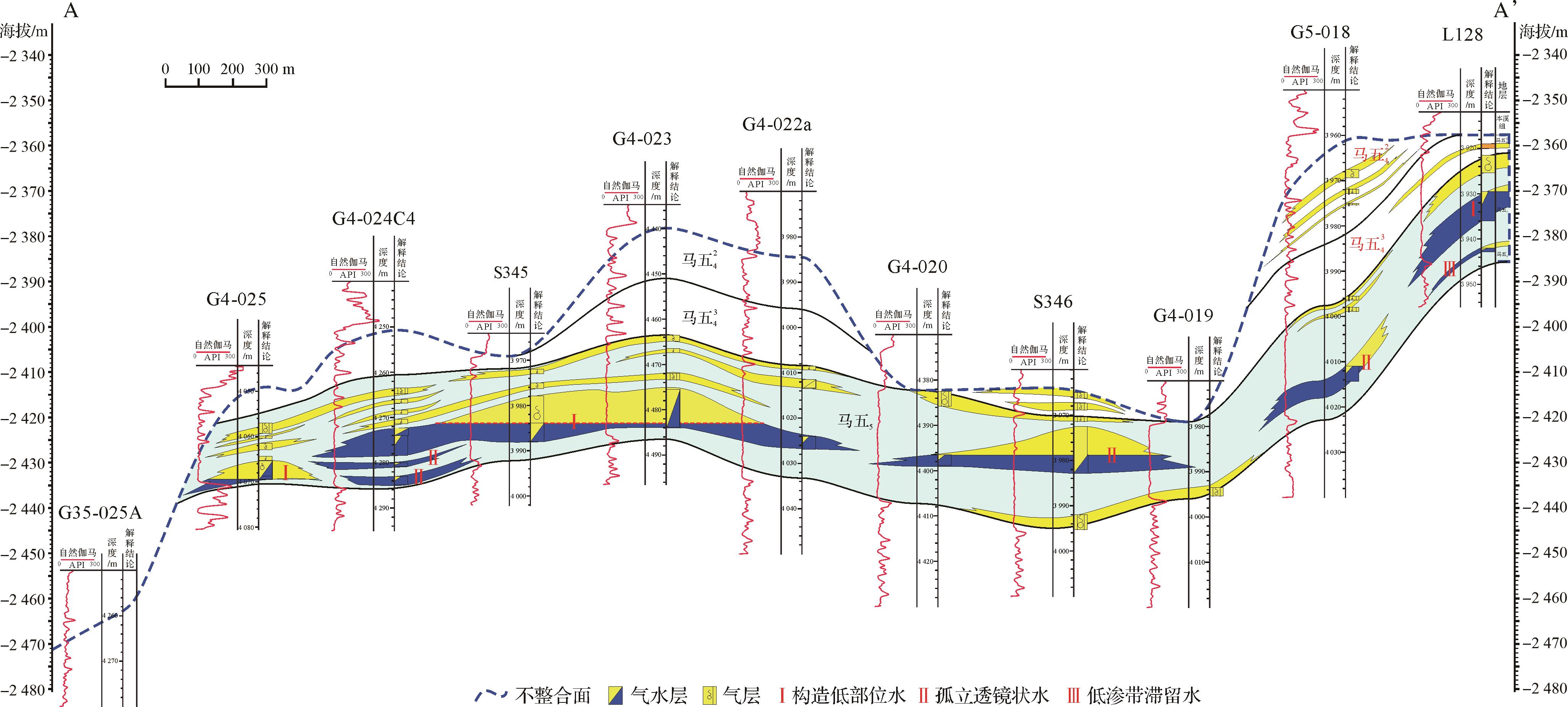
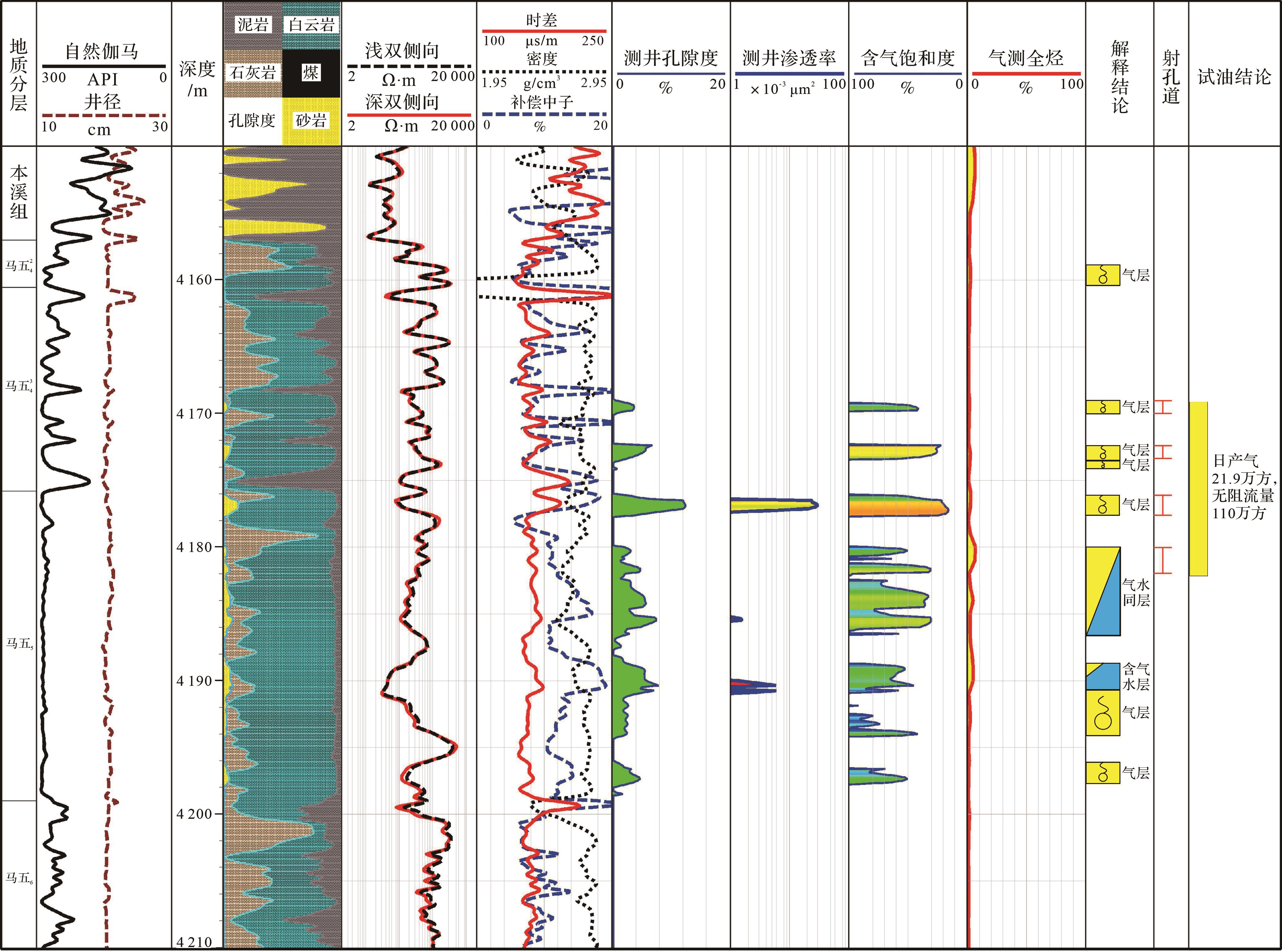
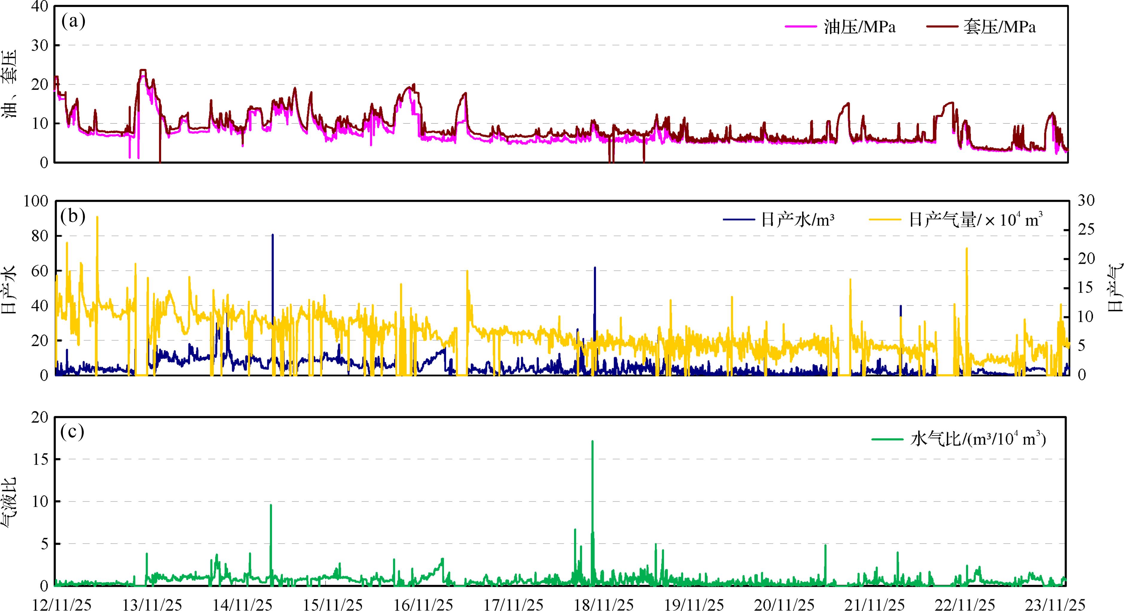
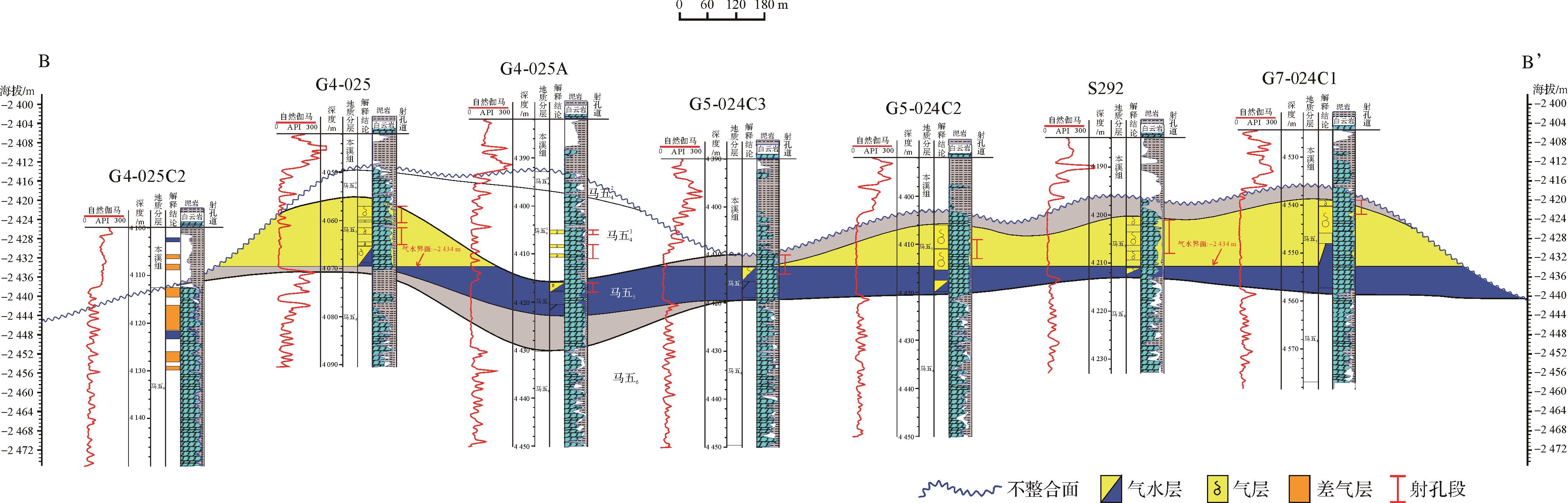
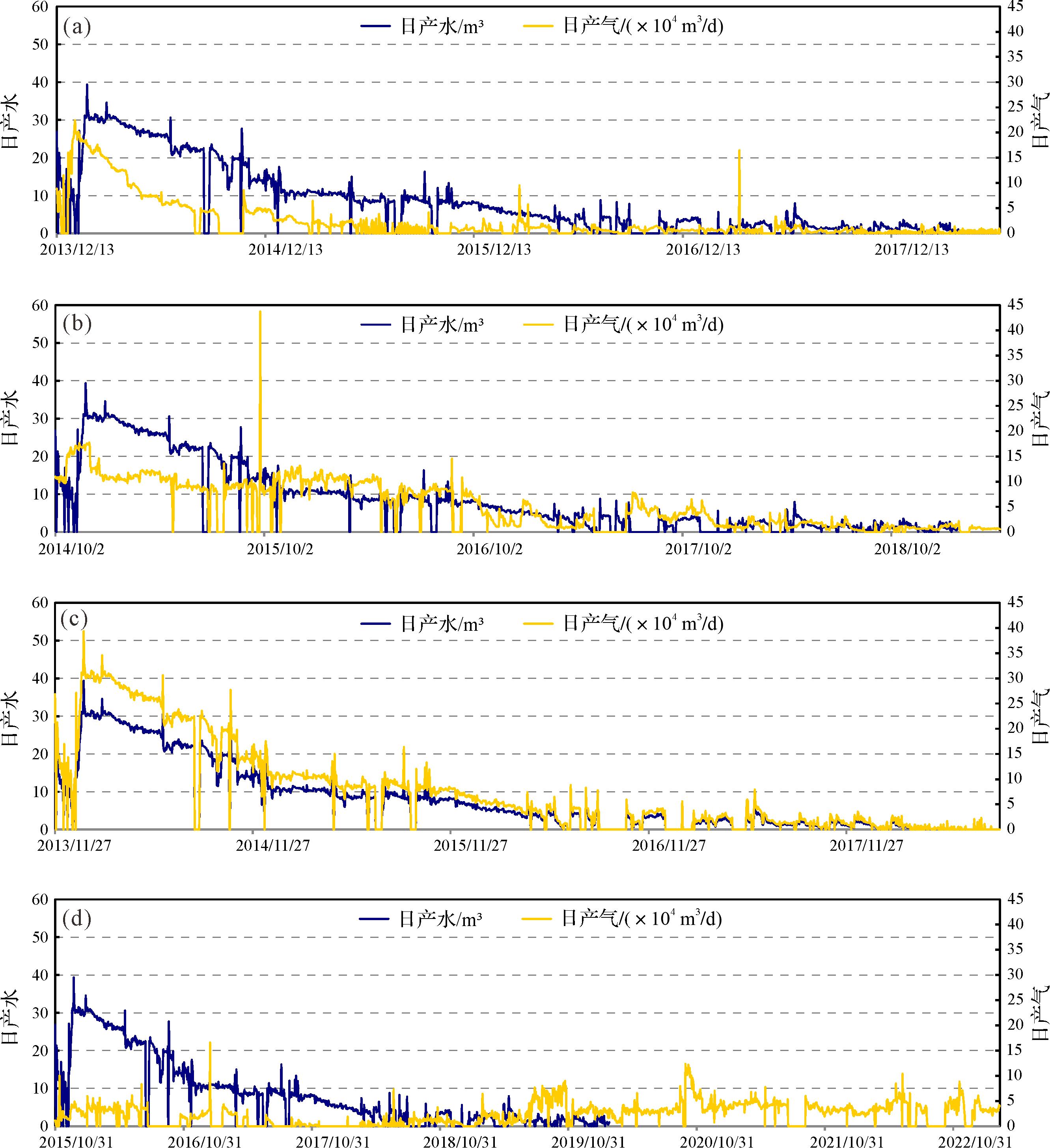
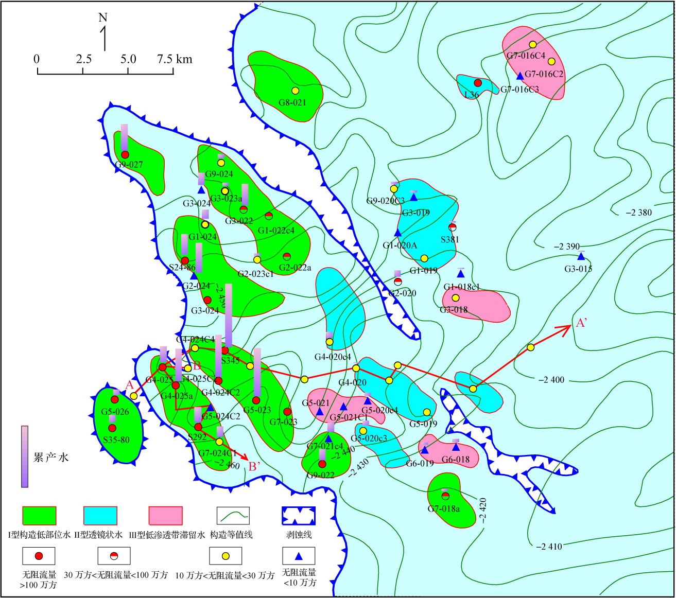
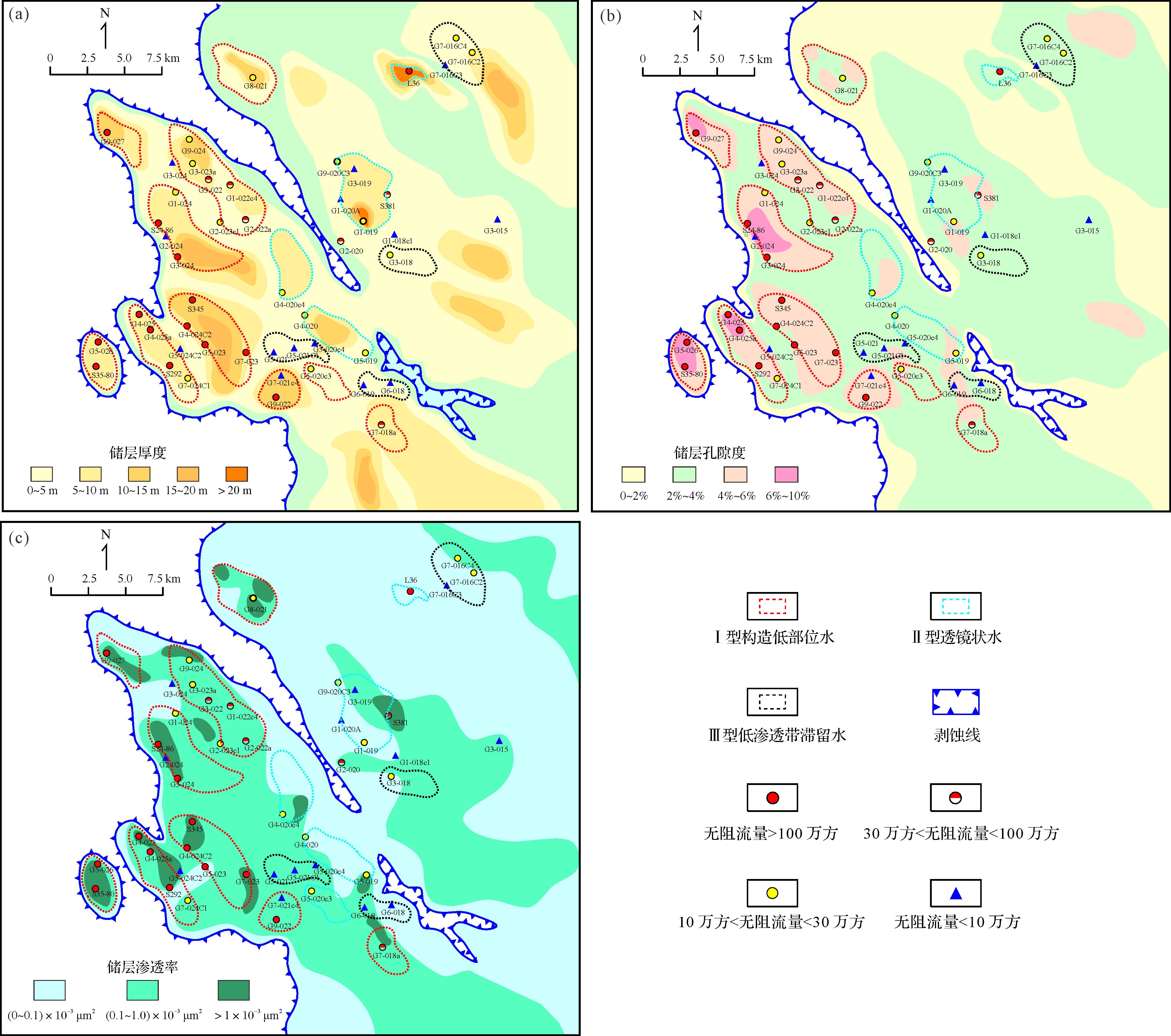
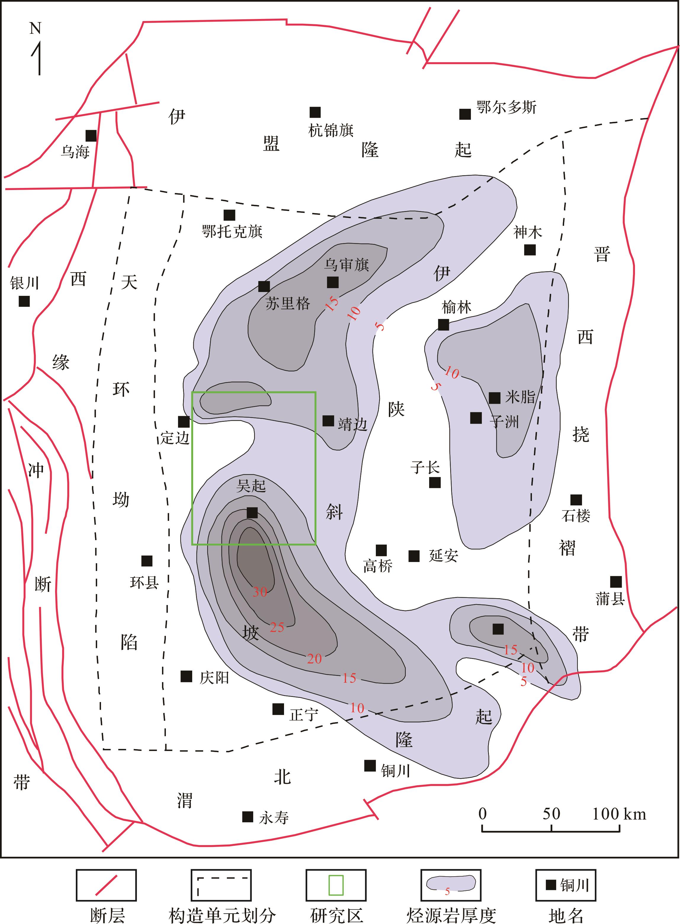
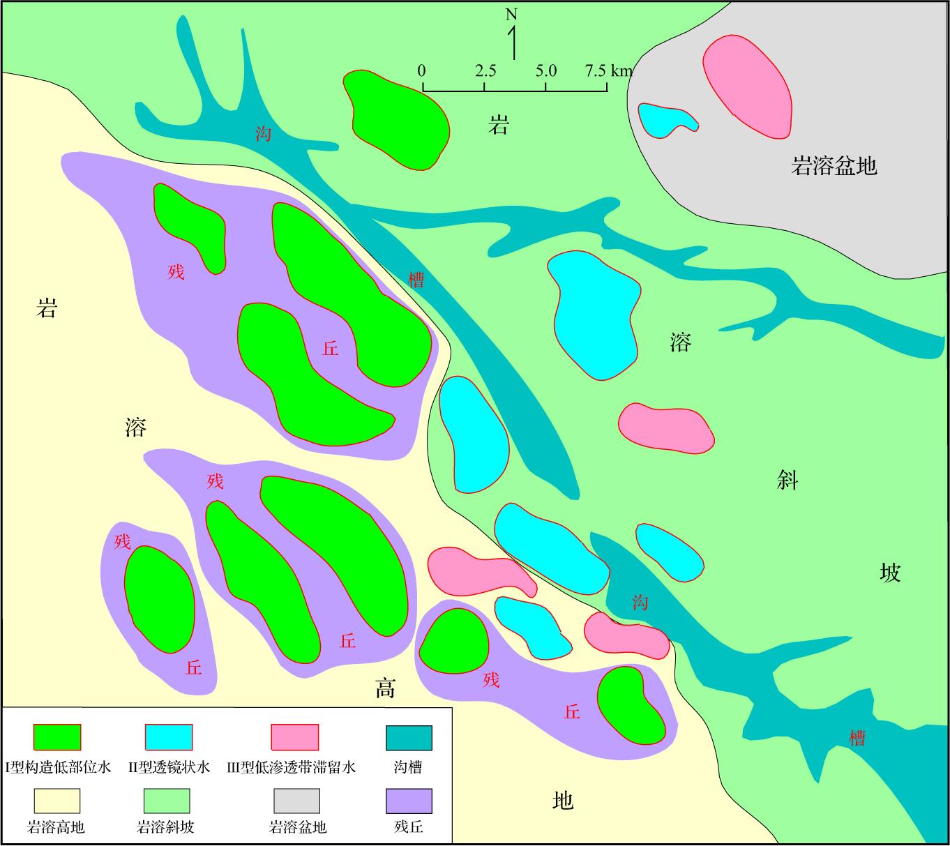
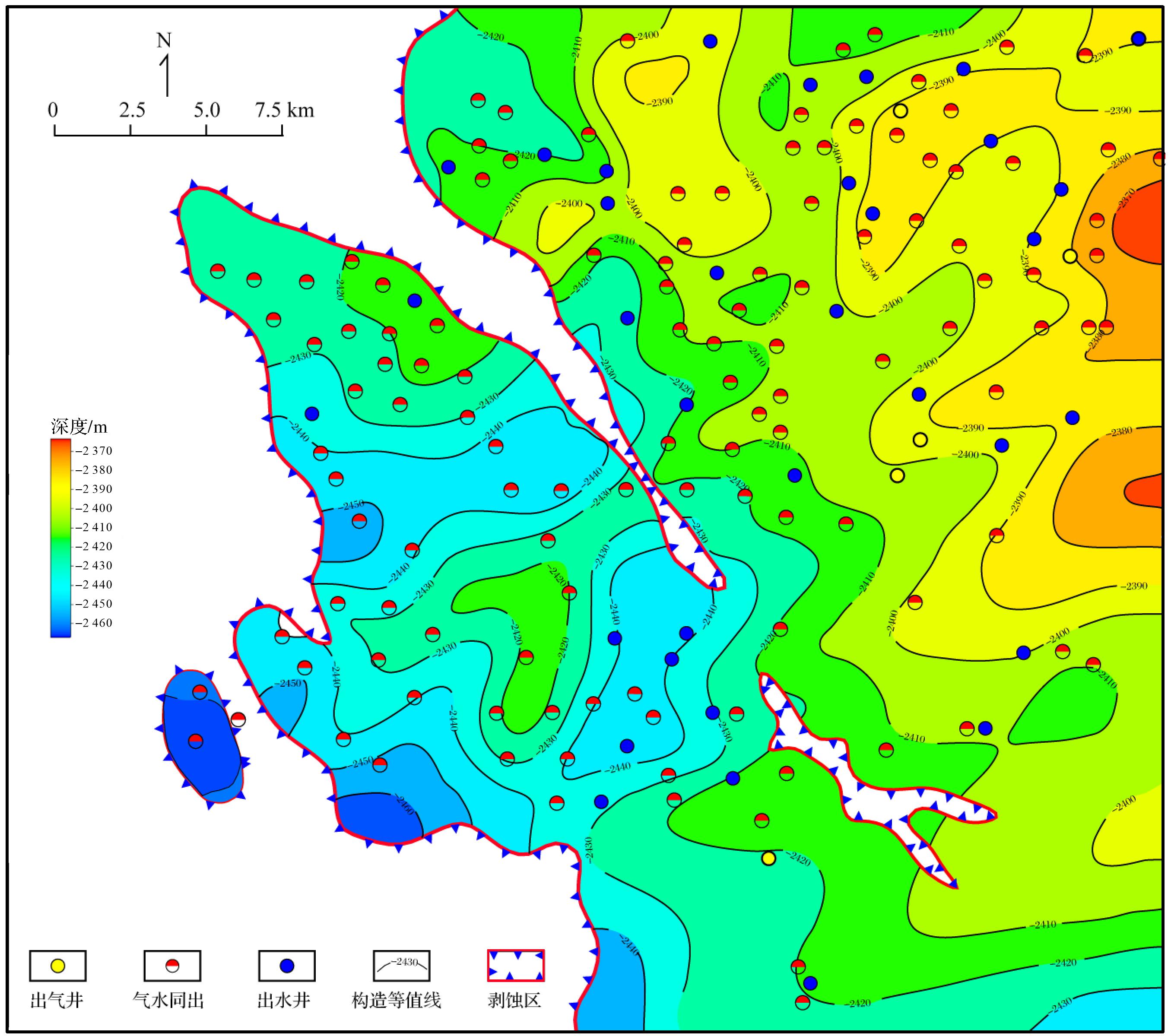
Objective The cathodoluminescence (CL) characteristics of carbonate minerals are closely related to their major/trace and rare earth element (REE) contents. Existing studies primarily focus on the effects of Mn and Fe on CL, often neglecting the role of REEs. This study aims to investigate the influence of major/trace and rare earth elements on the CL characteristics of carbonate minerals, thereby providing geological evidence for inferring mineral genesis, depositional environments, and diagenetic processes. Methods CL and laser ablation inductively coupled plasma mass spectrometry (LA-ICP-MS) were used to test carbonate rock samples from the Lower and Middle Ordovician on the southern margin of the Ordos Basin. Statistical methods and classification algorithms were applied to analyze the test data, and common REE indicators were used to evaluate the properties of diagenetic fluids. Results The study reveals that matrix dolomite exhibits weak to moderate red luminescence under CL, with both zoned and uniform luminescence. Dolomite cements, with high Mn and Fe contents, are often zoned or non-luminescent. Analysis of variance (ANOVA) and Tukey's Honestly Significant Difference (HSD) post-hoc tests indicate that Fe, Mn, La, Ce, Pr, Nd, Sm, Eu, Gd, and Tb contents, and the Fe/Mn value significantly influence the CL of carbonate minerals. Non-luminescent and strongly luminescent groups are relatively easy to distinguish: non-luminescent minerals have Fe contents greater than 10,000×10-6 or Mn contents less than 40×10-6 . Additionally, the non-luminescent group with Fe contents over 10,000×10-6 displays REE distribution patterns enriched in Middle Rare Earth Elements (MREE), whereas the strongly luminescent group shows Light Rare Earth Elements (LREE) depletion and low Fe/Mn values. Using comprehensive dimensionality-reduced parameters of major/trace elements and REEs, in conjunction with Mn content, effectively distinguishes the extremely weakly luminescent, weakly luminescent, and moderately luminescent groups. The nature of diagenetic fluids during diagenesis impacts carbonate sediment composition, mineral content, and major/trace element and REE variations, directly influencing carbonate mineral CL. Conclusions By combining in situ major/trace element testing with various data processing methods, this study provides a more quantitative understanding of the impact of major/trace element and REE contents on CL intensity. These findings offer valuable insights for scholars studying the factors affecting CL.
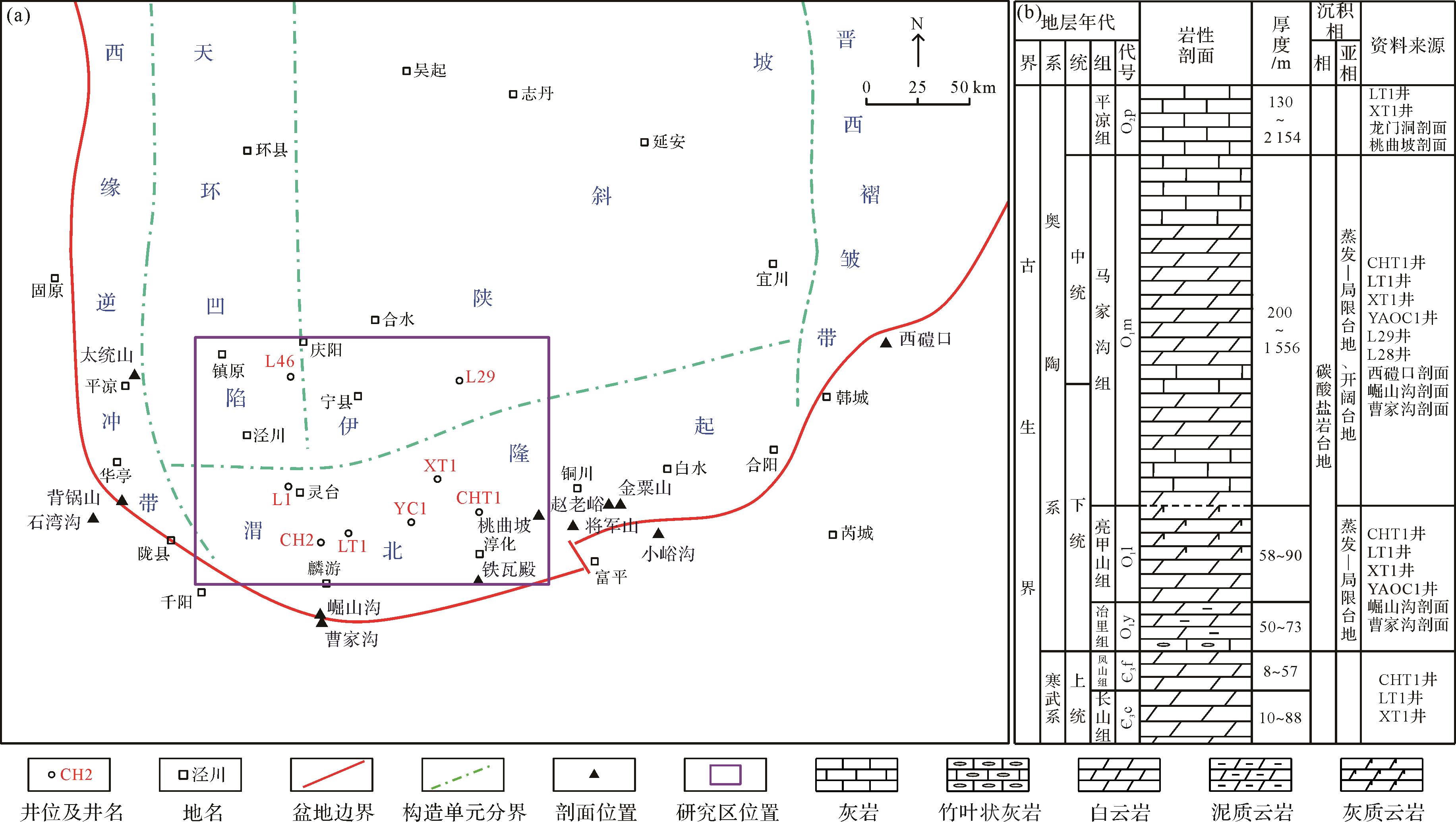
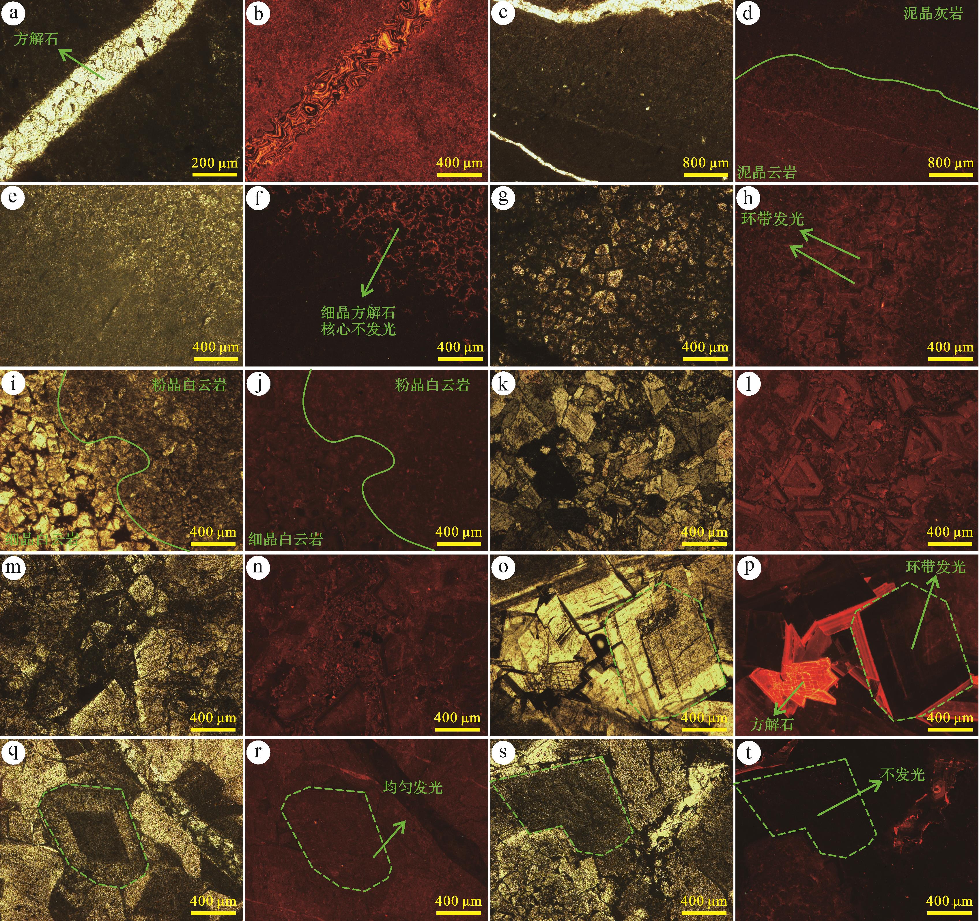
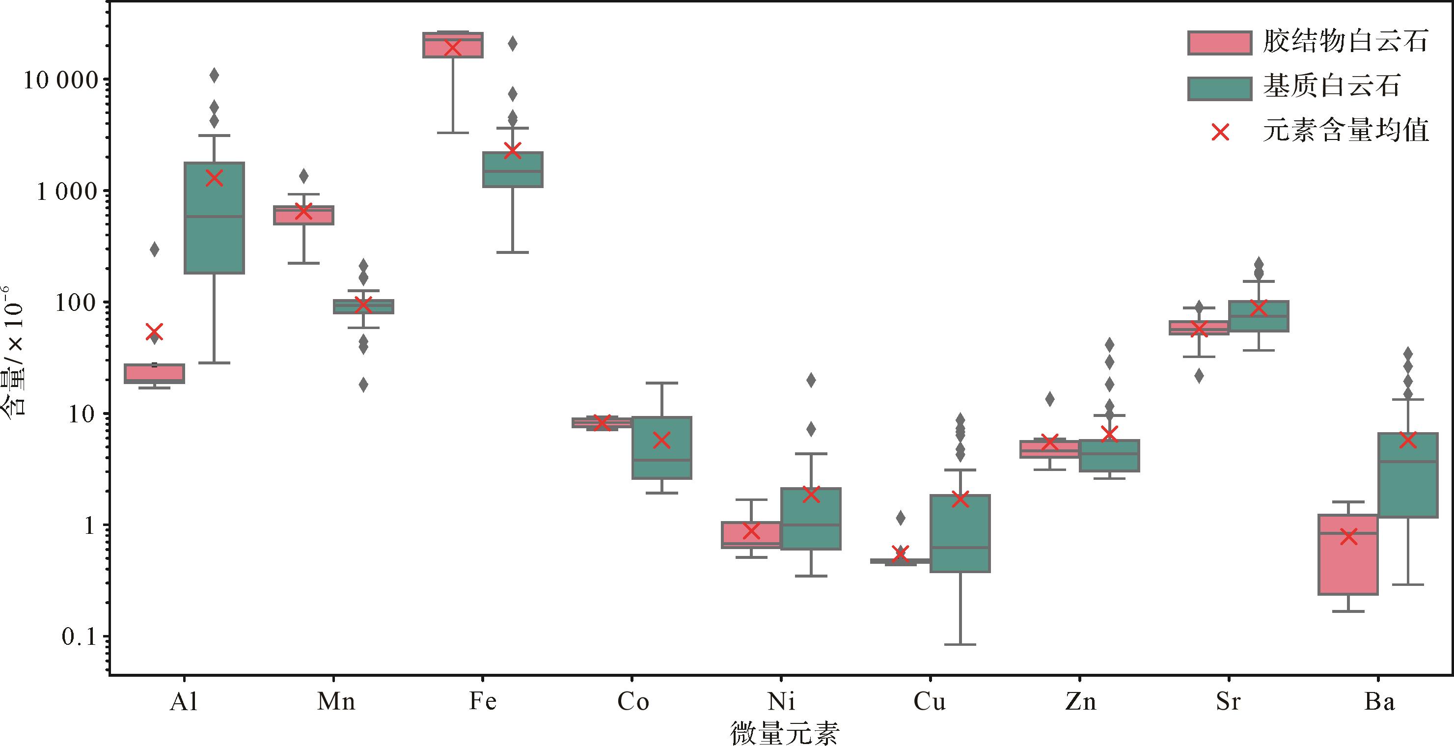
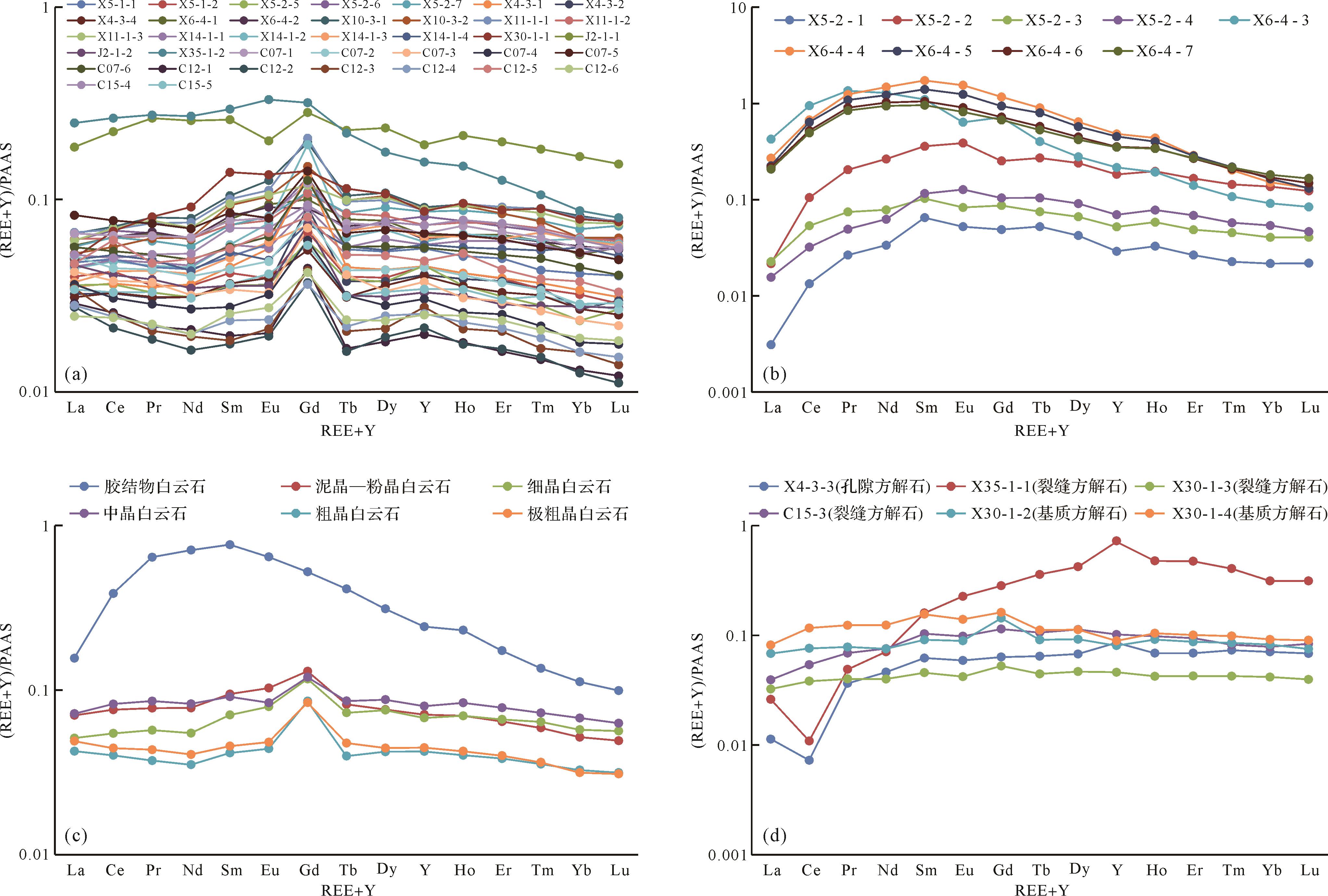
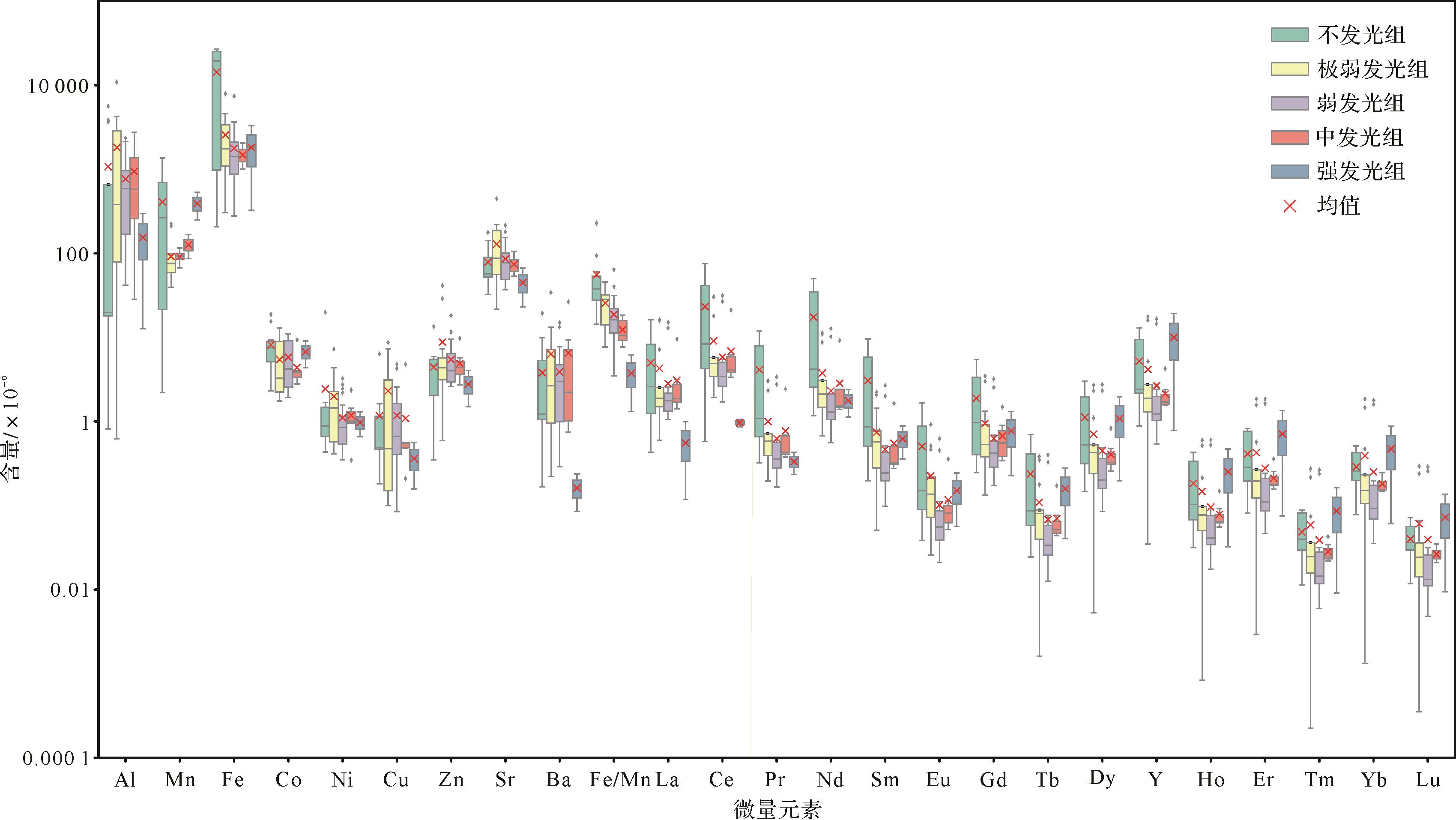
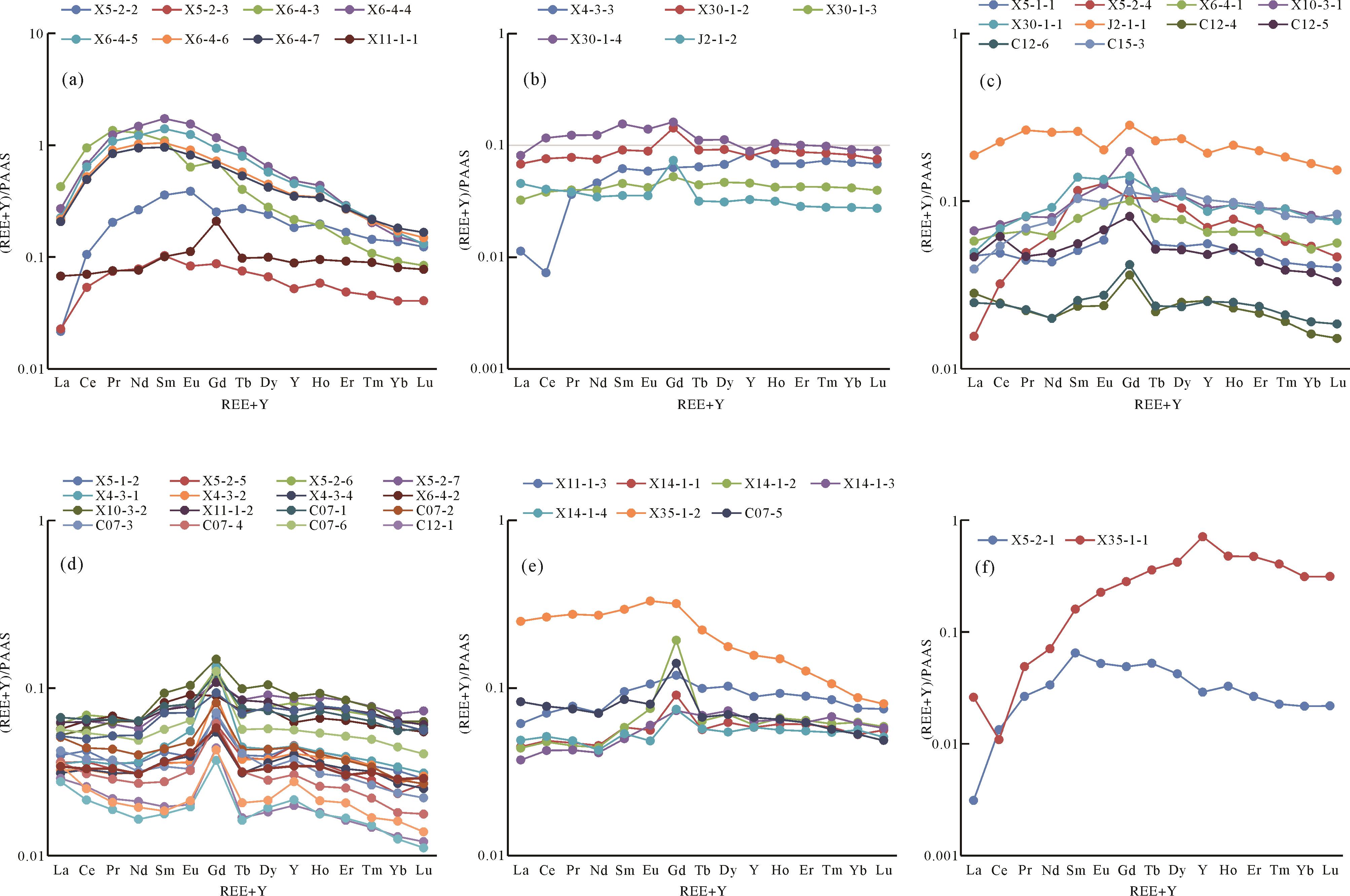
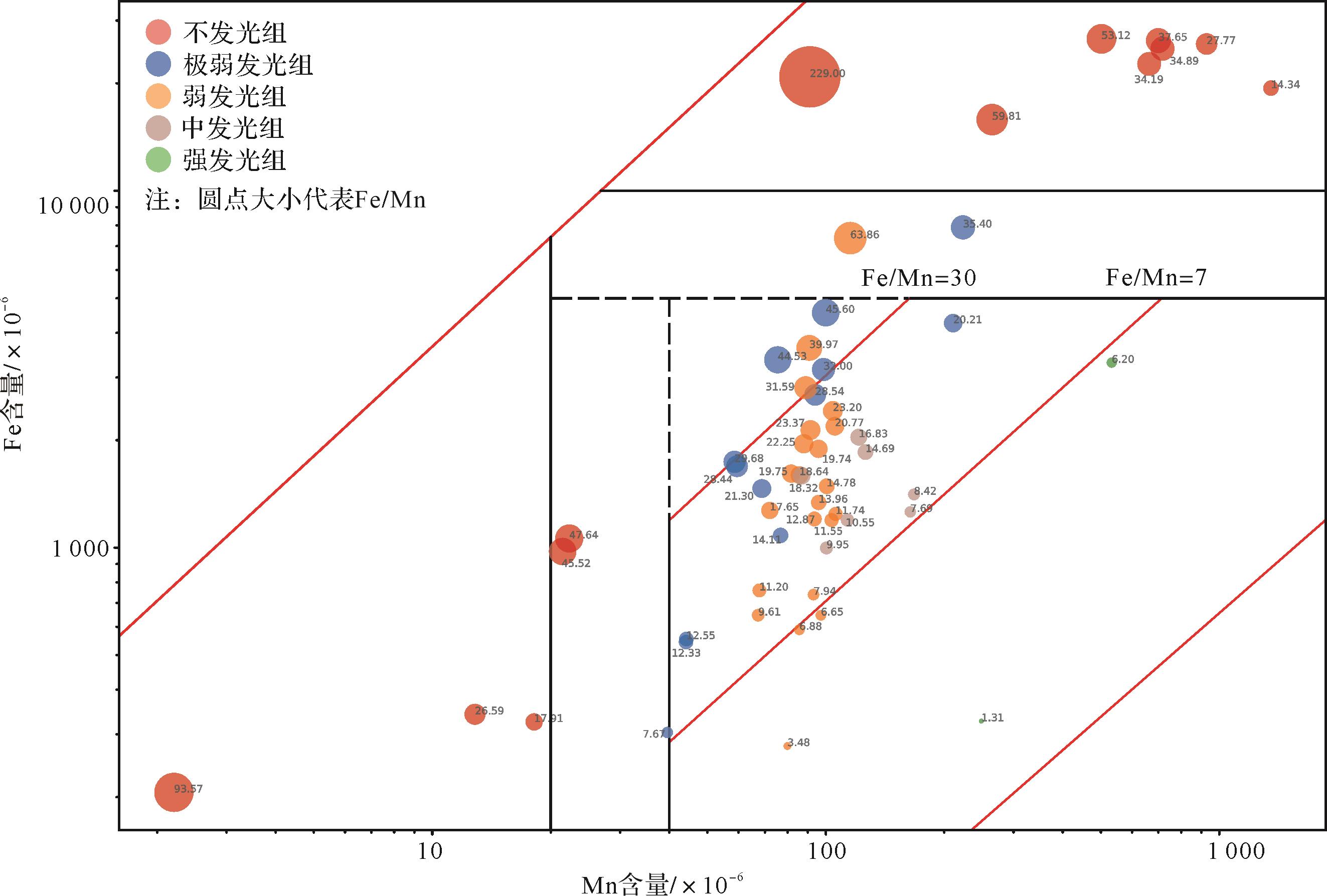
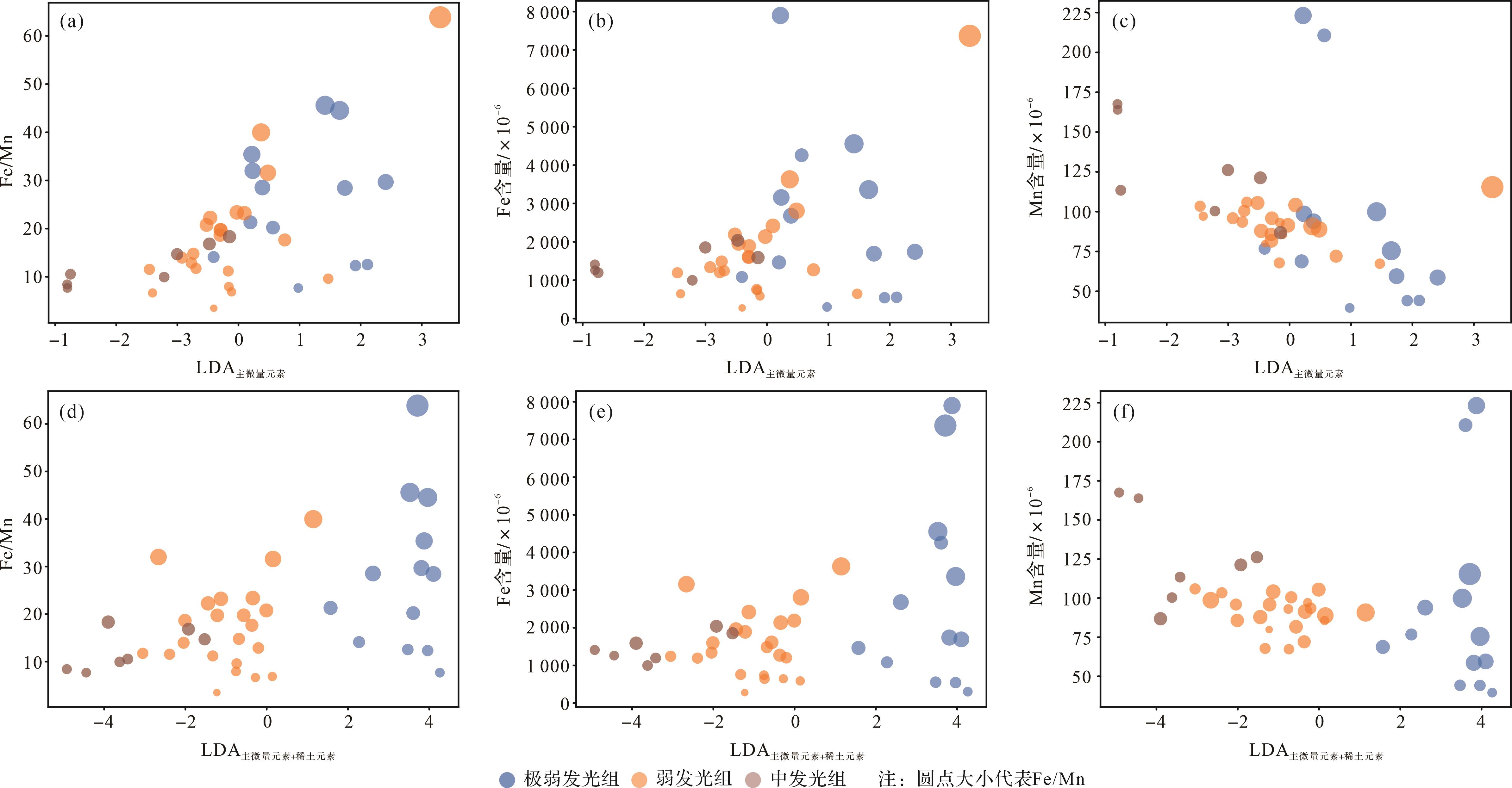
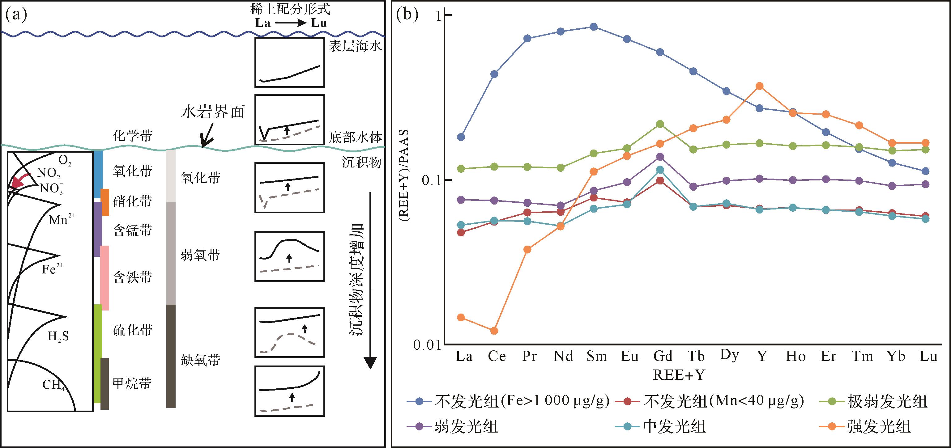
Objective During the Late Triassic depositional period of the Chang 7 member of the Yanchang Formation in the Ordos Basin, a set of continuously traceable shales was deposited, and the shale is currently the main stratigraphic strata for unconventional oil exploration and development. The laminated-type shale oil reservoir at the Chang 73 sub-member features fast lateral changing, which introduces problems such as unclear reservoir distribution, high exploration difficulty, and low drilling rate. Therefore, it is urgent to study and clarify the distribution pattern of laminated-type shale oil reservoirs. Methods First, through the latest three-dimensional (3D) seismic data, the stratigraphic dip flipping method was used to recover sedimentary paleogeomorphology. Then, we marked the seismic reflection of lacustrine mudstones, identified seismic stratigraphic comparison and division, and proposed four-stage progradational clinoforms and distribution patterns of shale oil reservoirs based on sedimentary paleogeomorphology. [Results and Conclusions] Combining seismic progradational sequences with palaeotopography of the lake basin, the distribution pattern of the Chang 73 sub-member shale oil reservoir and the genesis of shale oil gravity flow sedimentation have been clarified. The laminated-type shale oil reservoir in the Chang 73 sub-member is a gravity flow deposit developed on the lake paleo-uplift, located at the end of the progradational clinoforms, with poor connectivity and complex stacking relationships. In actual production, it should be explored as a "box body". The above perspective has assisted in the deployment of risky well locations and exploration discoveries for laminated-type shale oil reservoirs. It provides technical support for the scale and efficiency development of interbedded-type shale oil reservoirs.
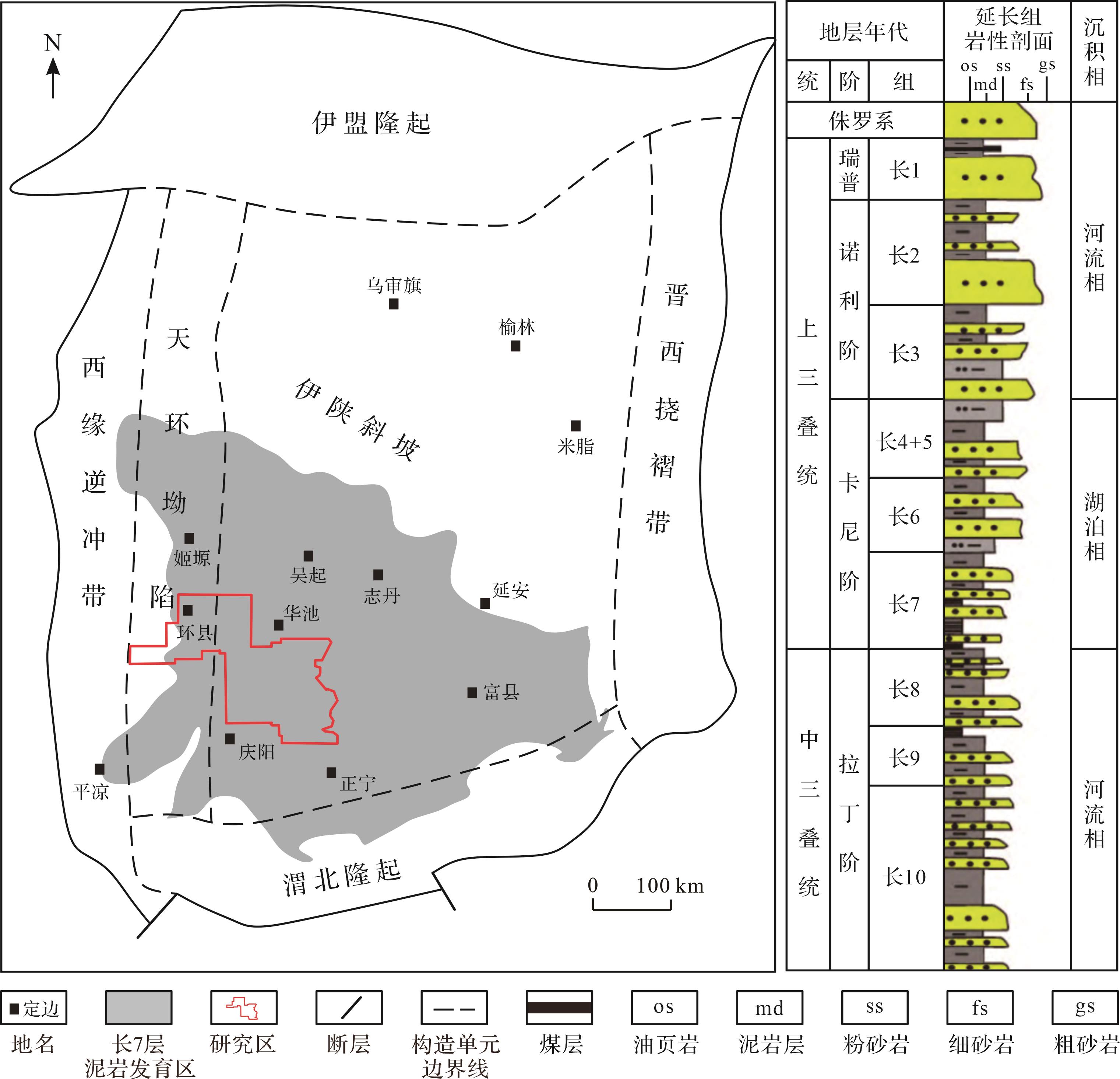
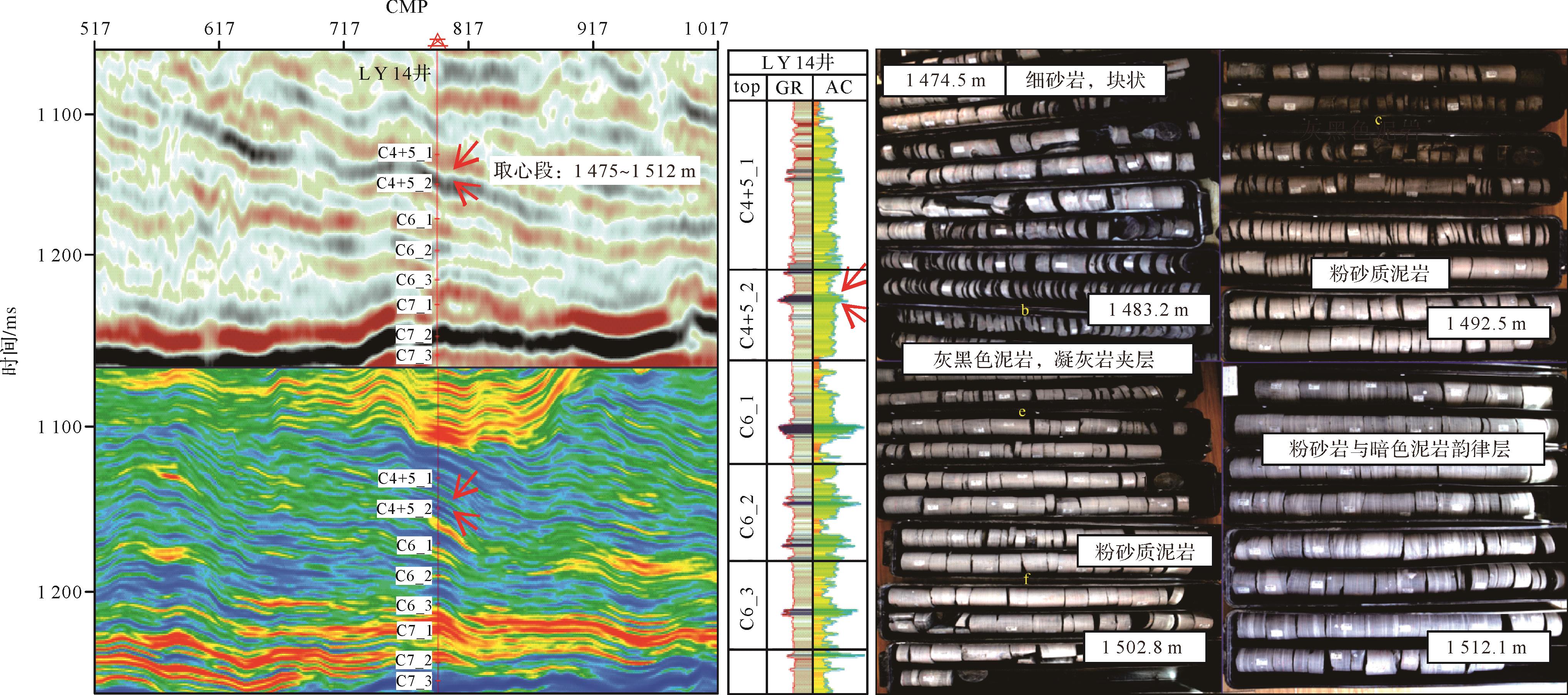
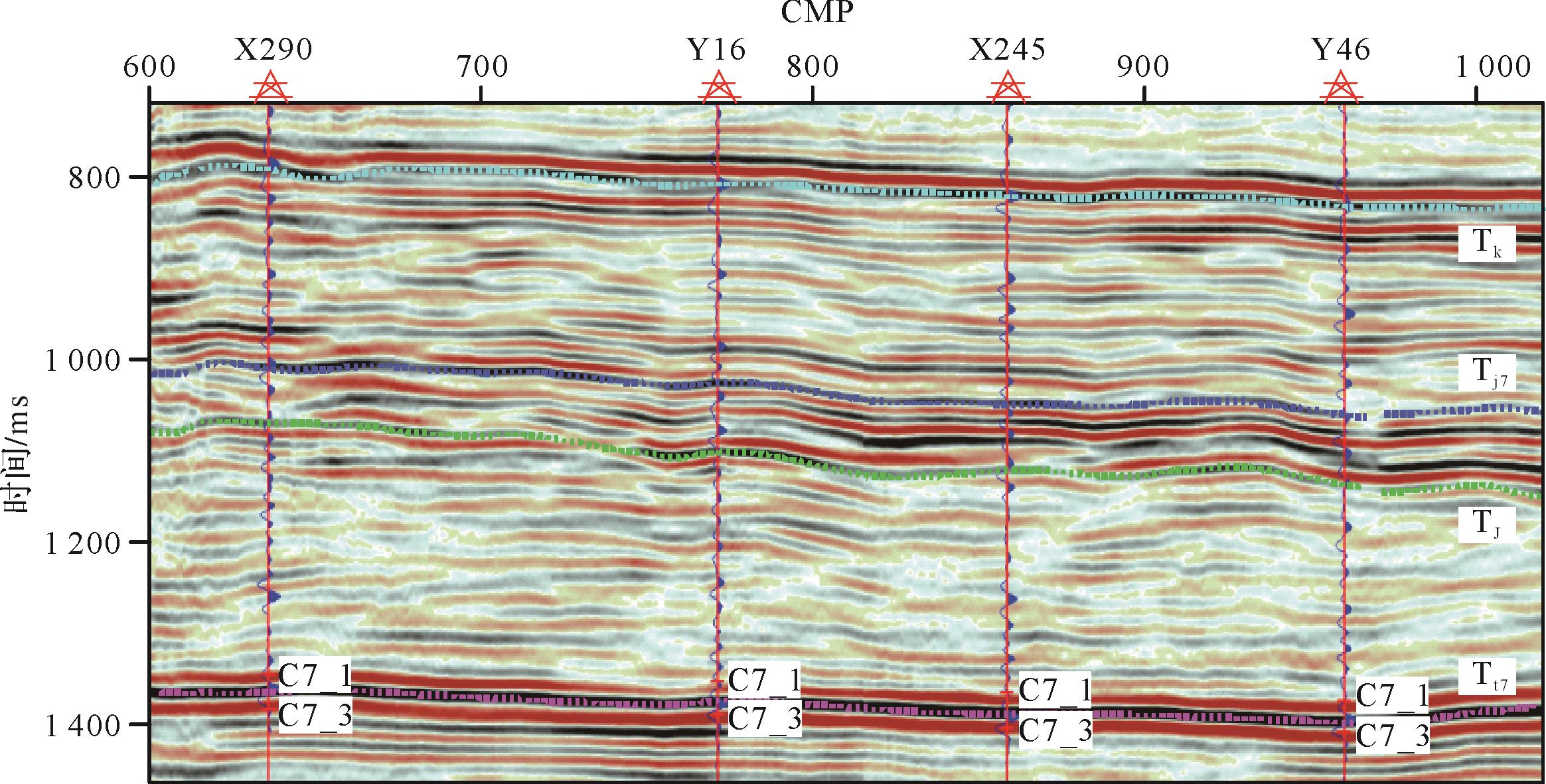
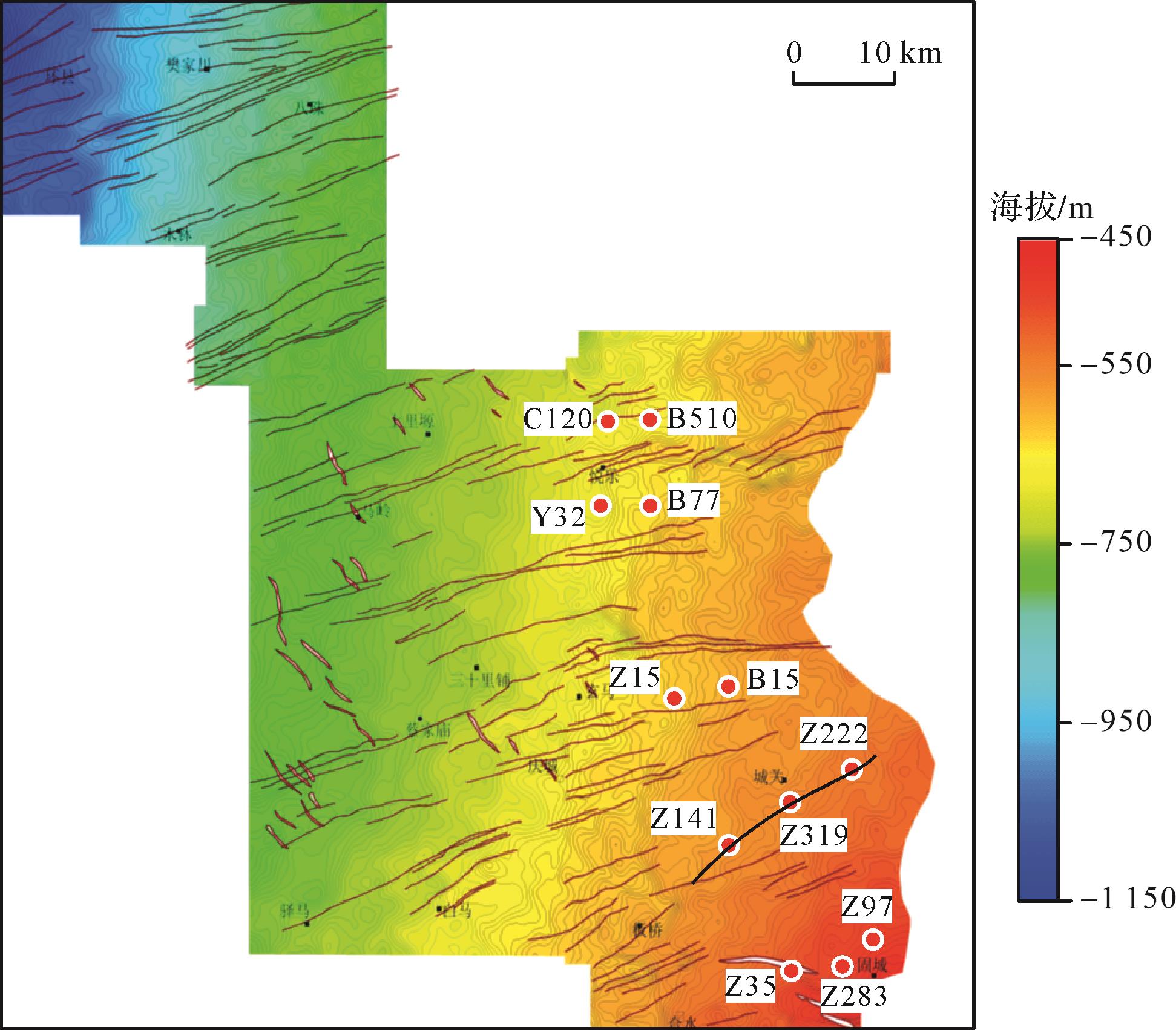
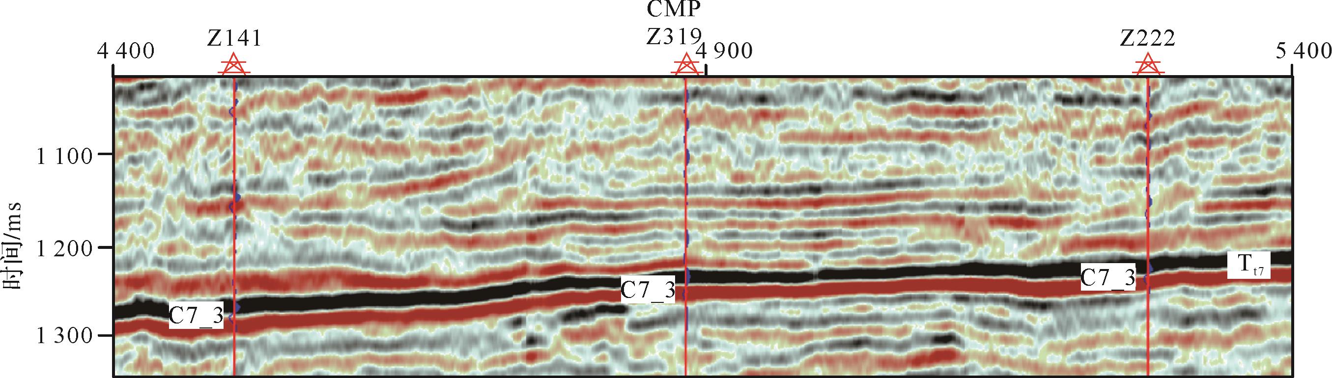
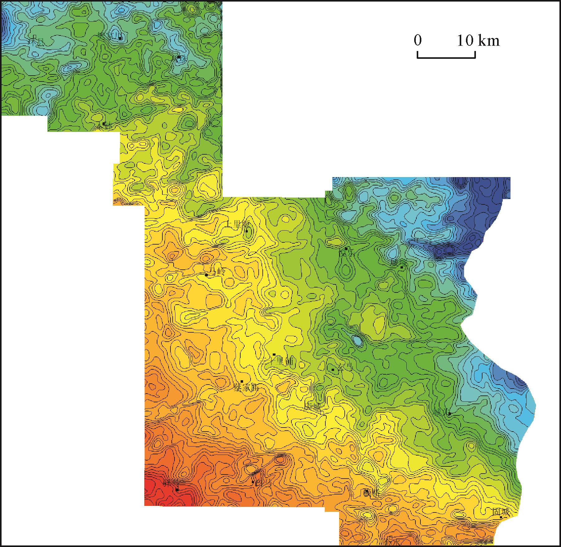
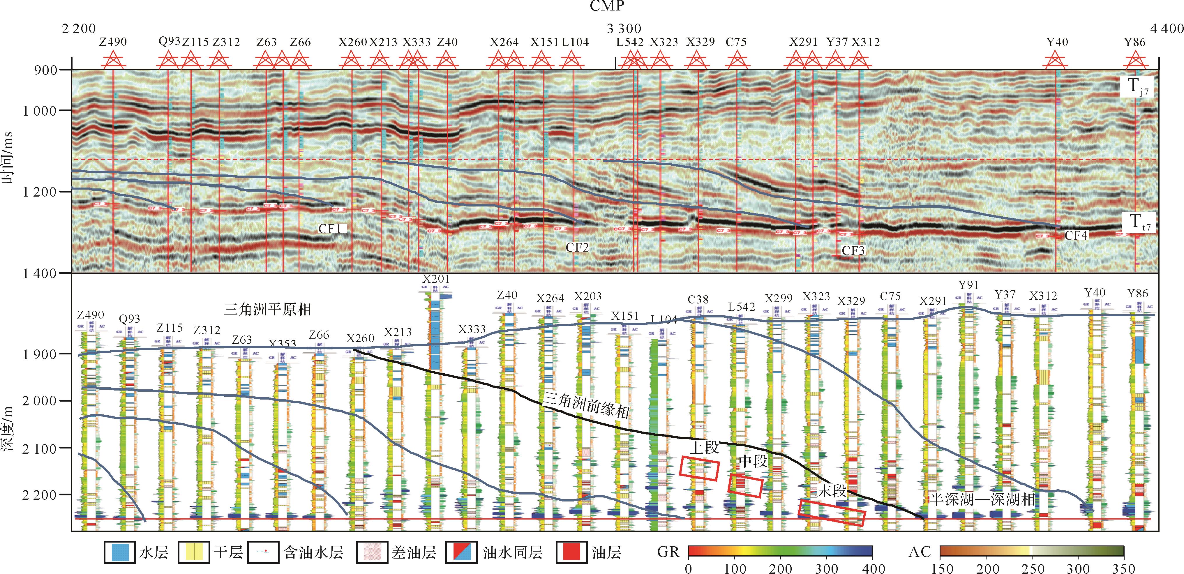
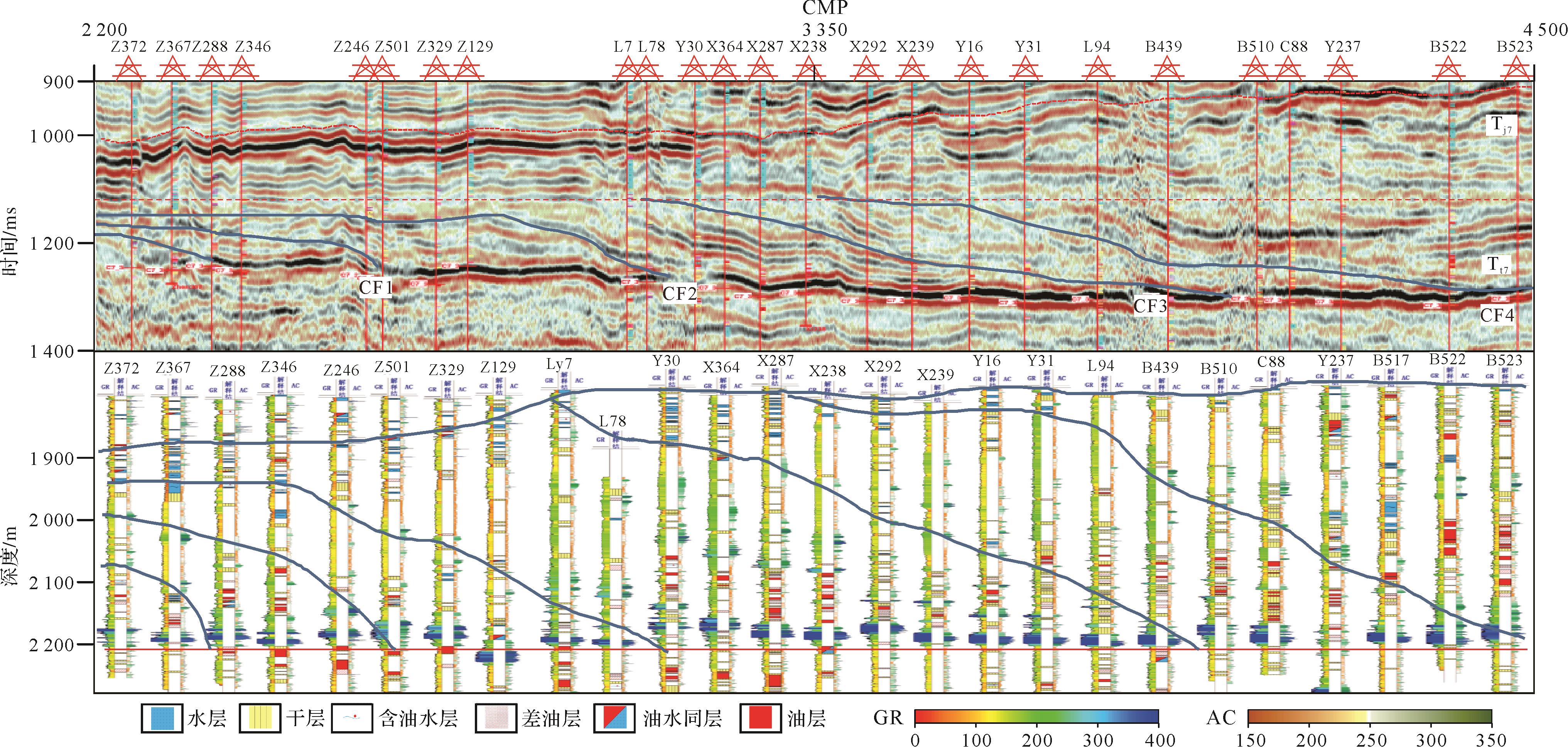
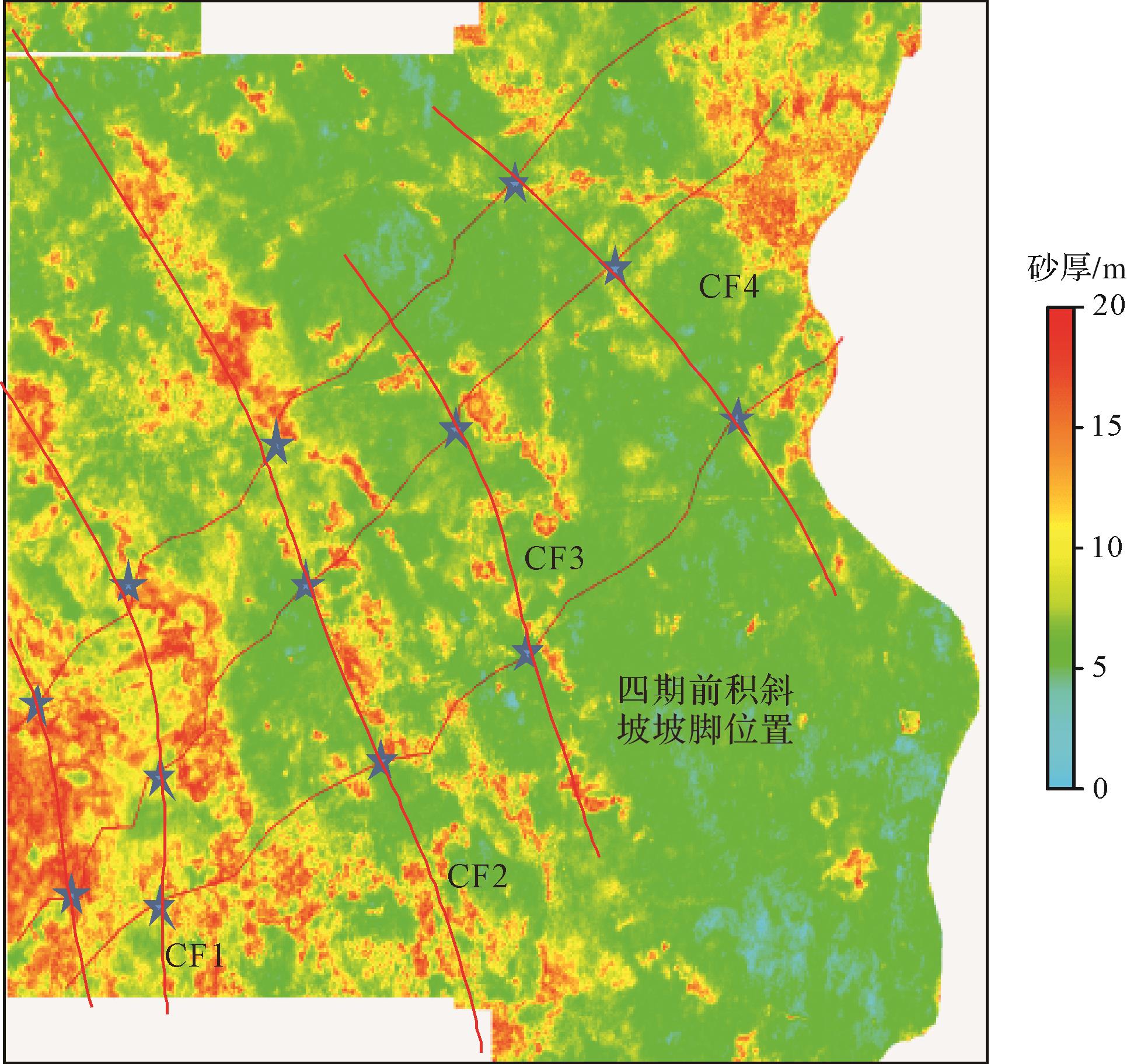
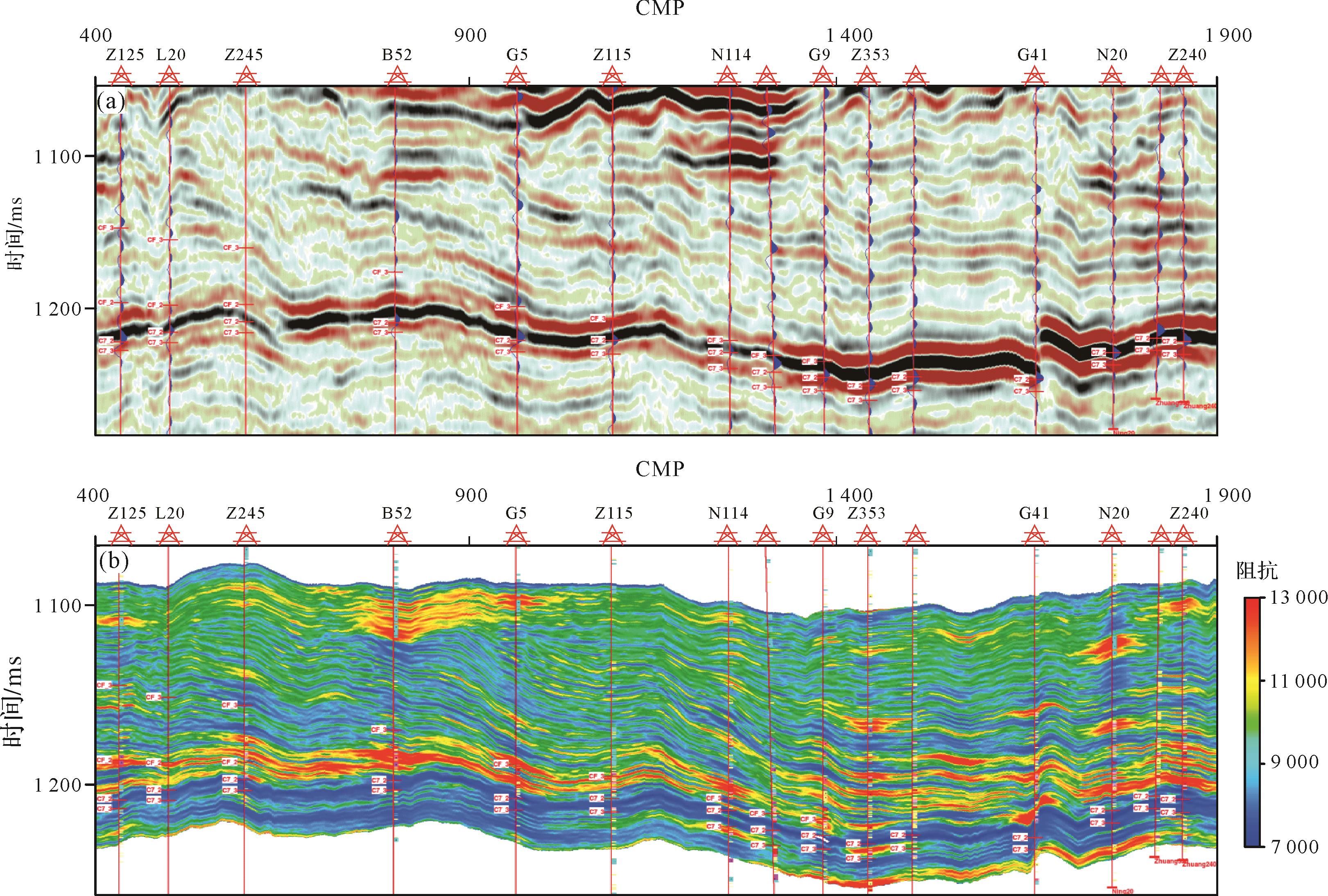
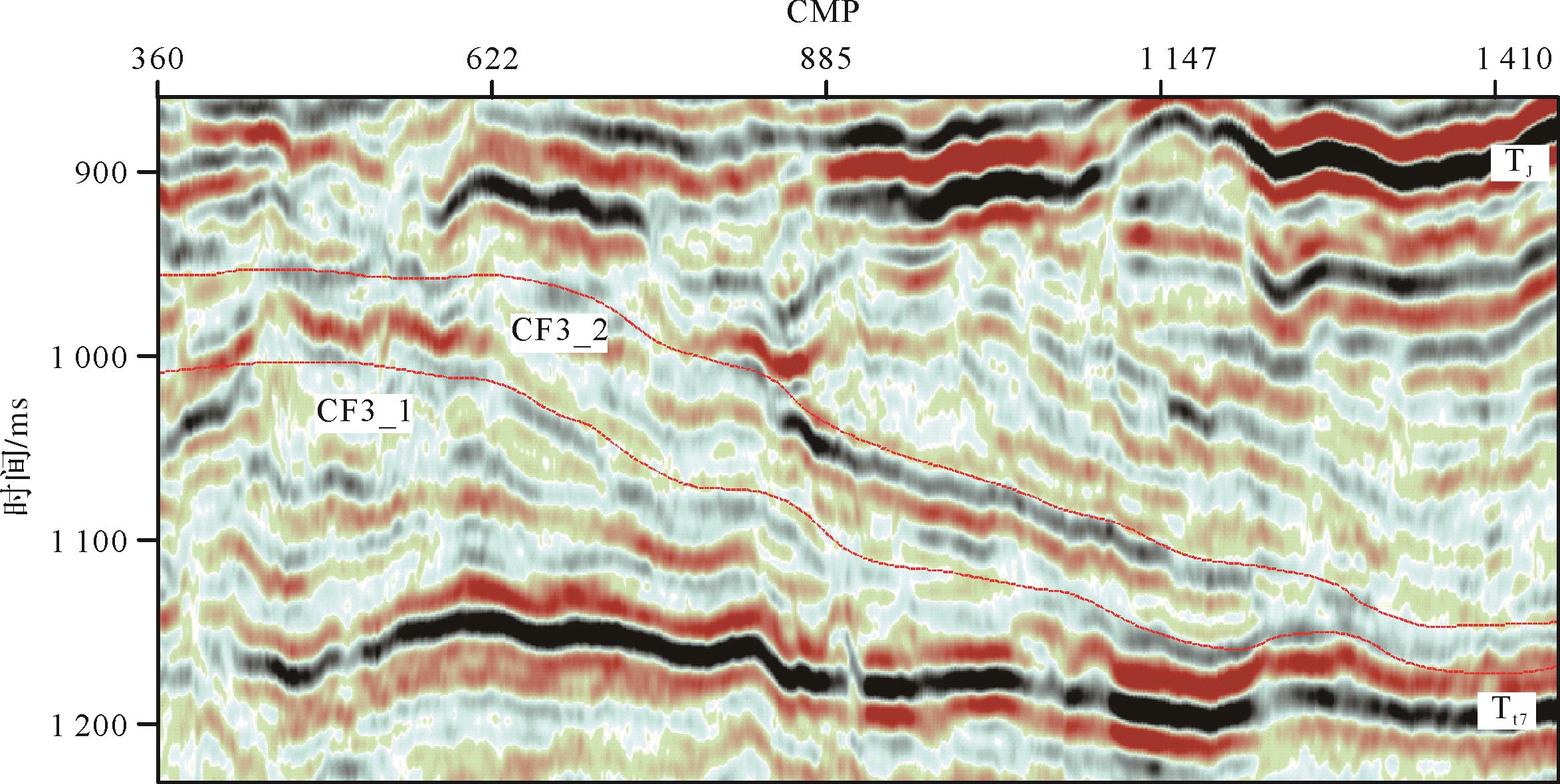
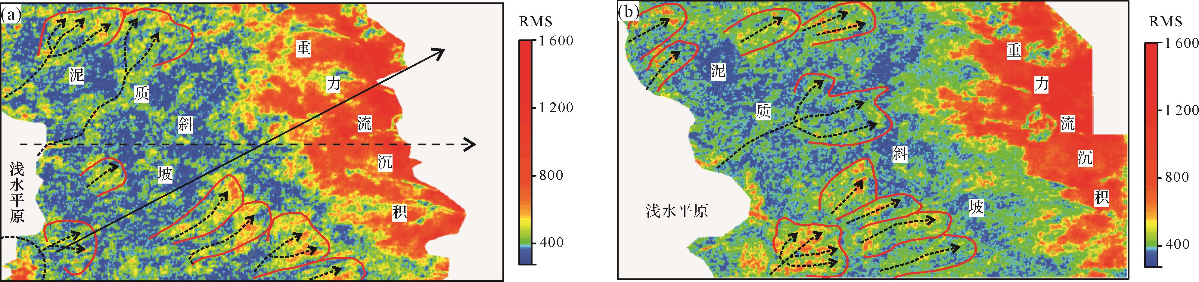
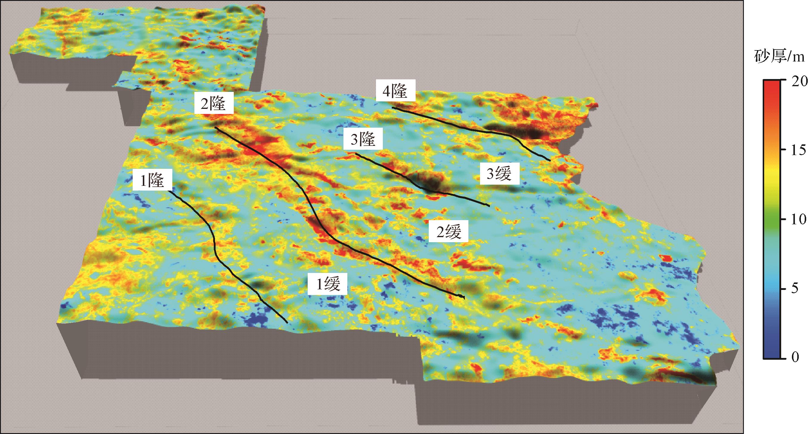
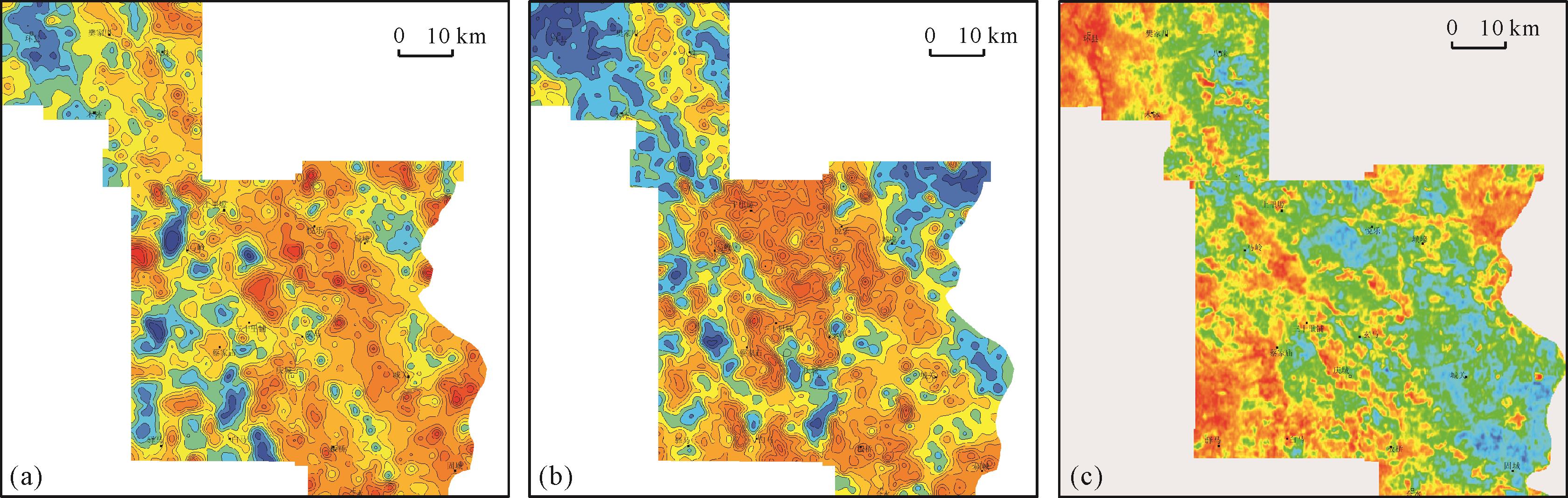
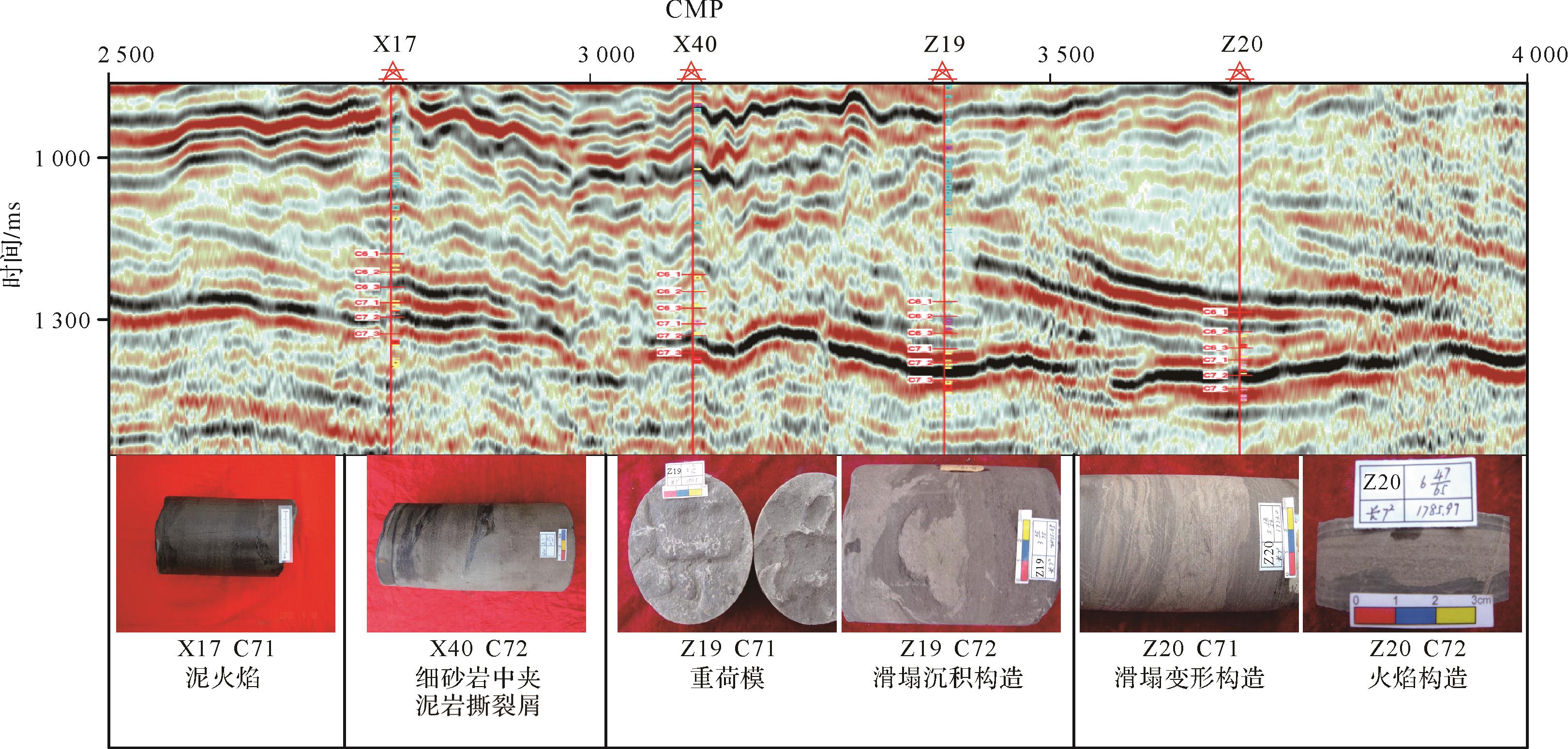
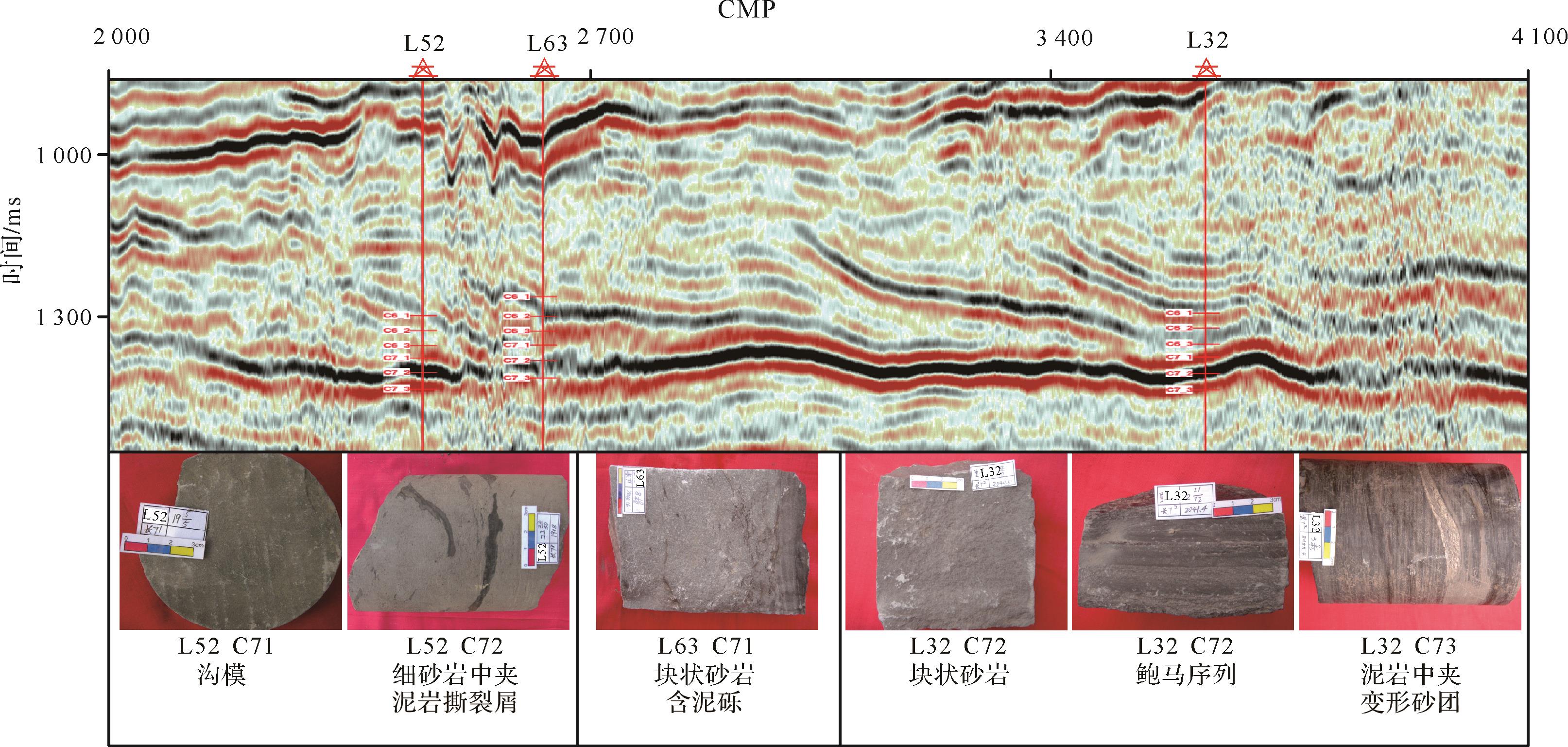
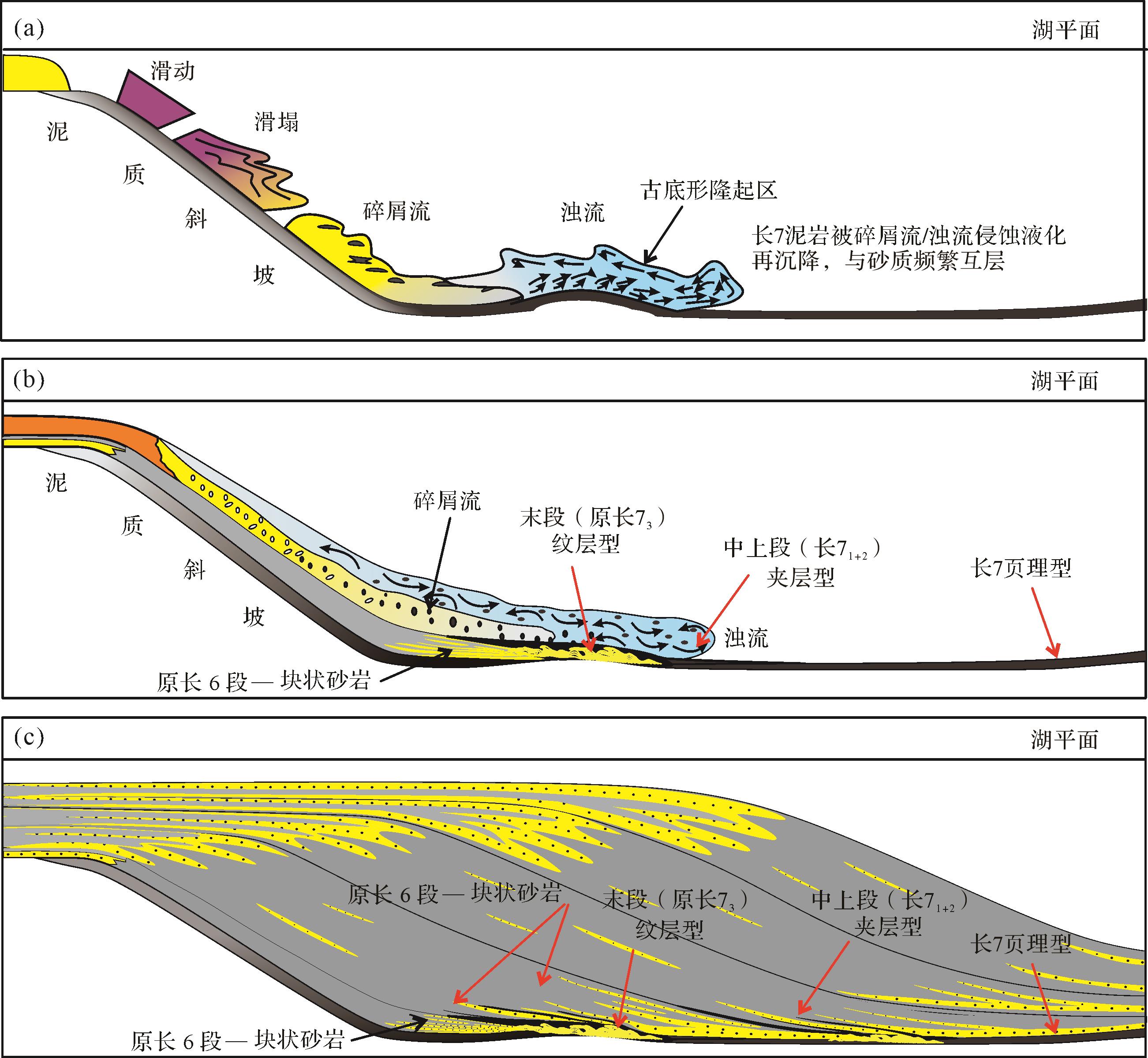
Objective The Lower Triassic Feixianguan Formation in the Sichuan Basin contains thick oolitic beach reservoirs, which is the key layer of present oil and gas exploration. As the reserve strategic replacement field of the Sichuan Basin, the sedimentary system, reservoir properties and favorable zones in the Tieshanpo and Qilibei areas of the Feixianguan Formation are not clear, which restricts the potential deployment of oil and gas exploration in this area. Methods This study adopted comprehensive analysis of core, thin section, logging and seismic data to determine sedimentary facies types and the evolution of favorable reservoir zones in the region. Results In the study area, the Feixianguan Formation is a rimmed platform structure comprising five sedimentary facies: restricted platform, open platform, platform margin, slope and basin facies. The platform margin largely consists of oolitic beach development with obvious aggradational⁃lateral accretionary characteristics. These are mainly superimposed in the ssq2 to ssq4 periods vertically, with the largest in ssq2. Horizontally, the beach body was unstable and tended to migrate into the basin. The reservoir rock types are mainly (residual) oolitic limestone, (residual) oolitic dolomite and powder-fine crystalline dolomite. Conclusions The platform margin oolitic beach microfacies favors reservoir development in the Feixianguan Formation, and the porosity and permeability conditions are promising. well Po 5-well Poxi 1-well Po 2-well Po 1 in the Tieshanpo area and well Qilibei 1-well Qibei 102 in the Qilibei area are potentially favorable reservoir development zones. The spatial and temporal distribution and migration behavior of the beach bodies in the fourth-order sequence framework and the predicted favorable reservoir zones provide a basis for deepening the exploration and development of oolitic beach reservoirs in this region.
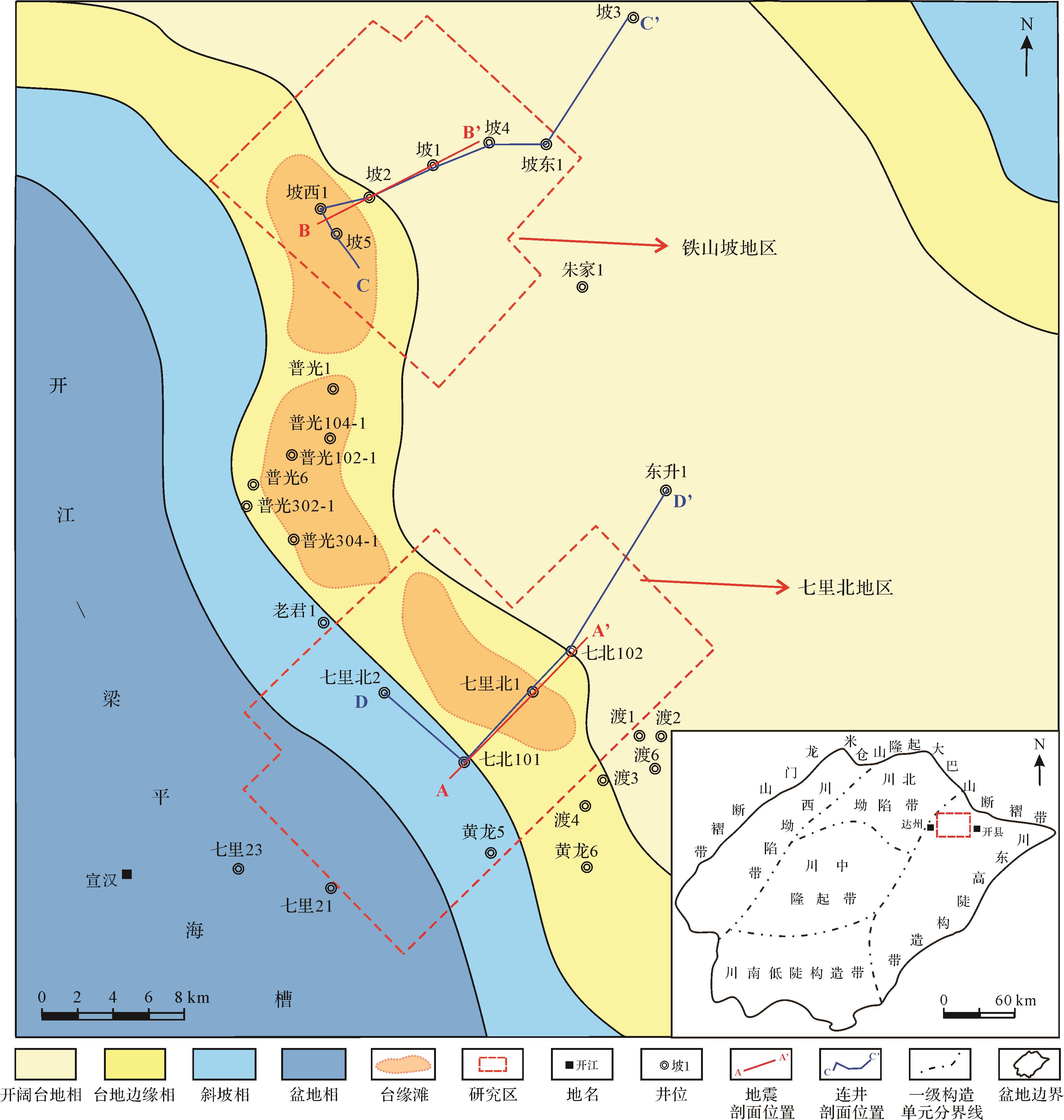
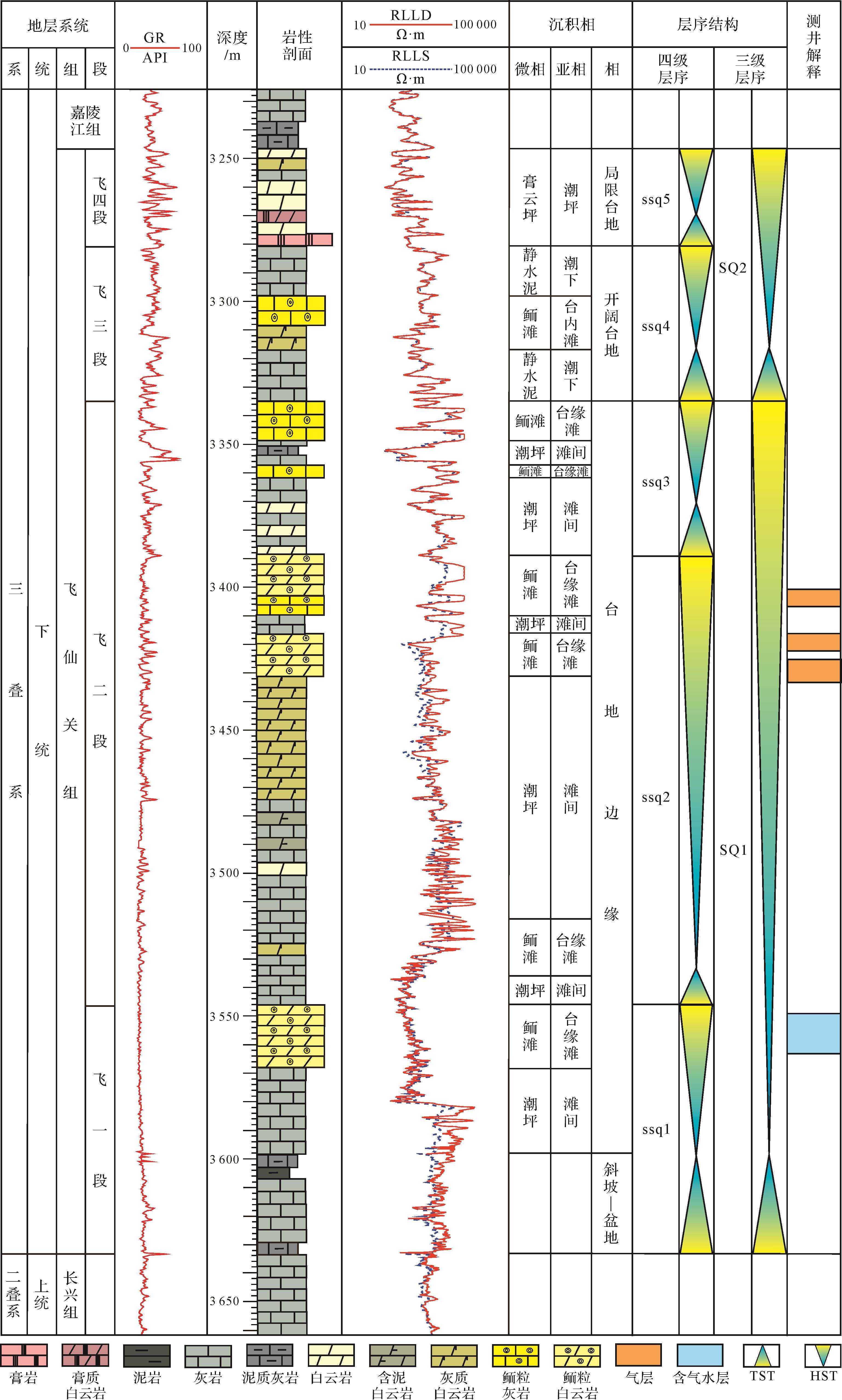
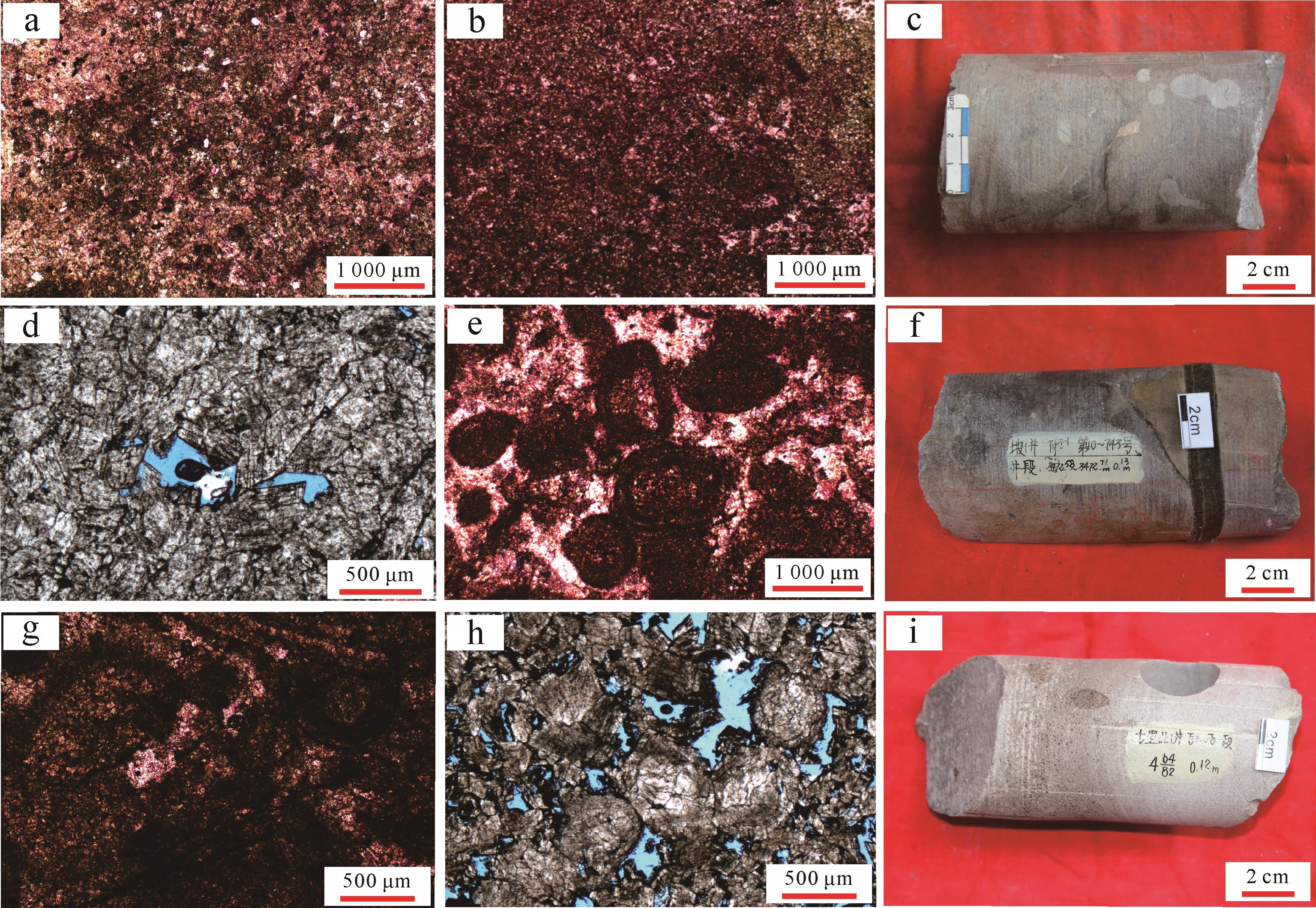
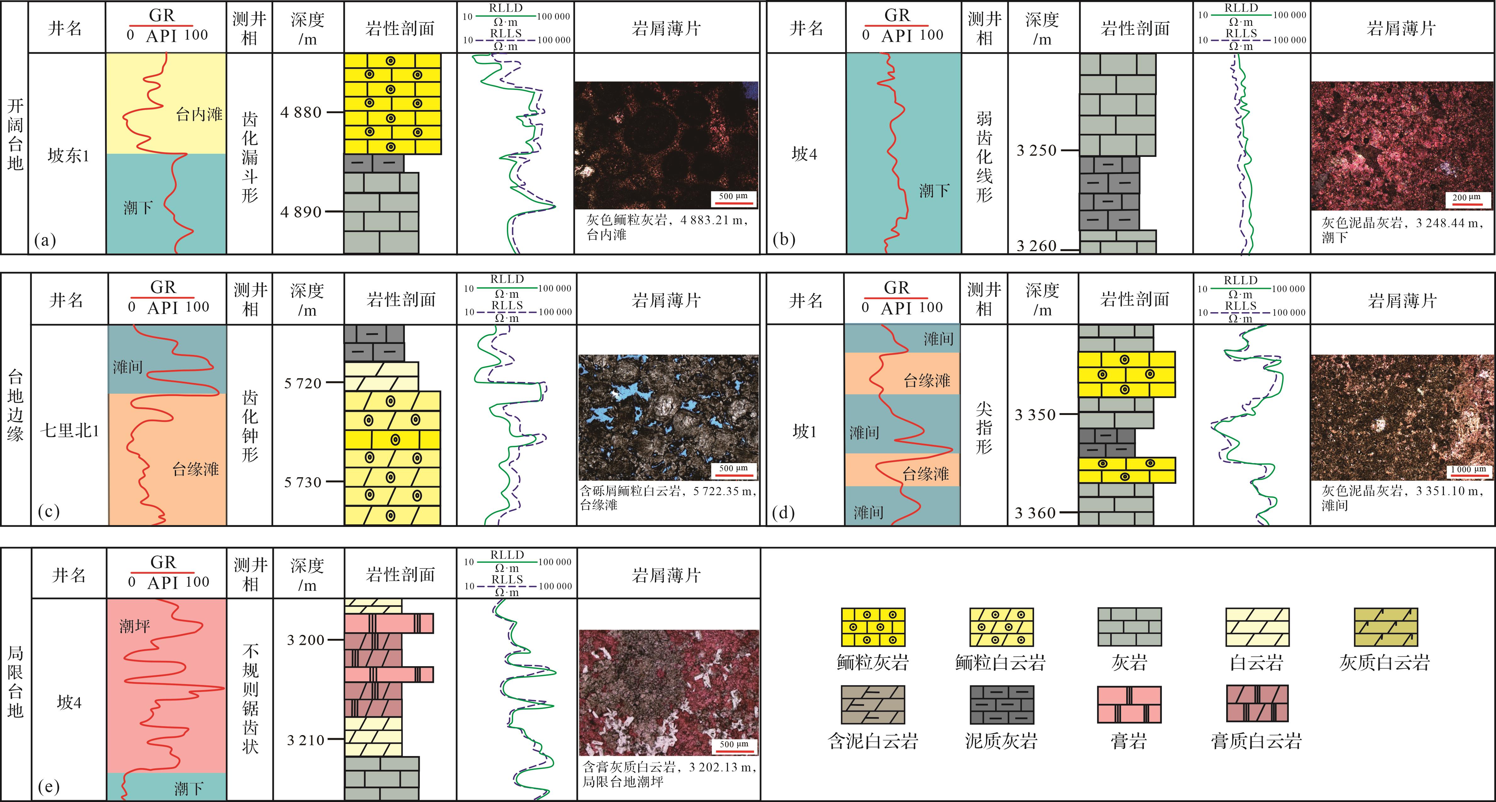
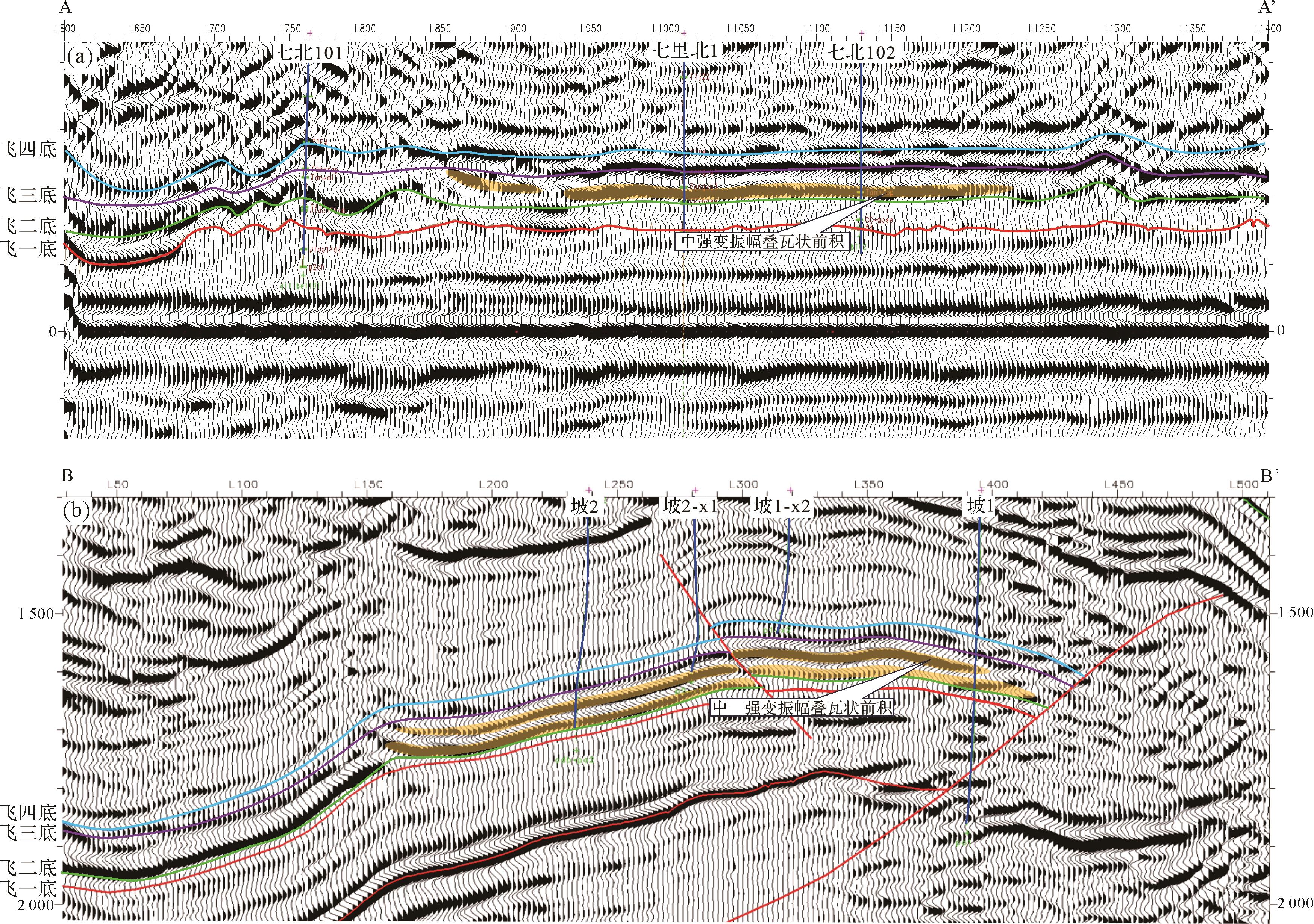
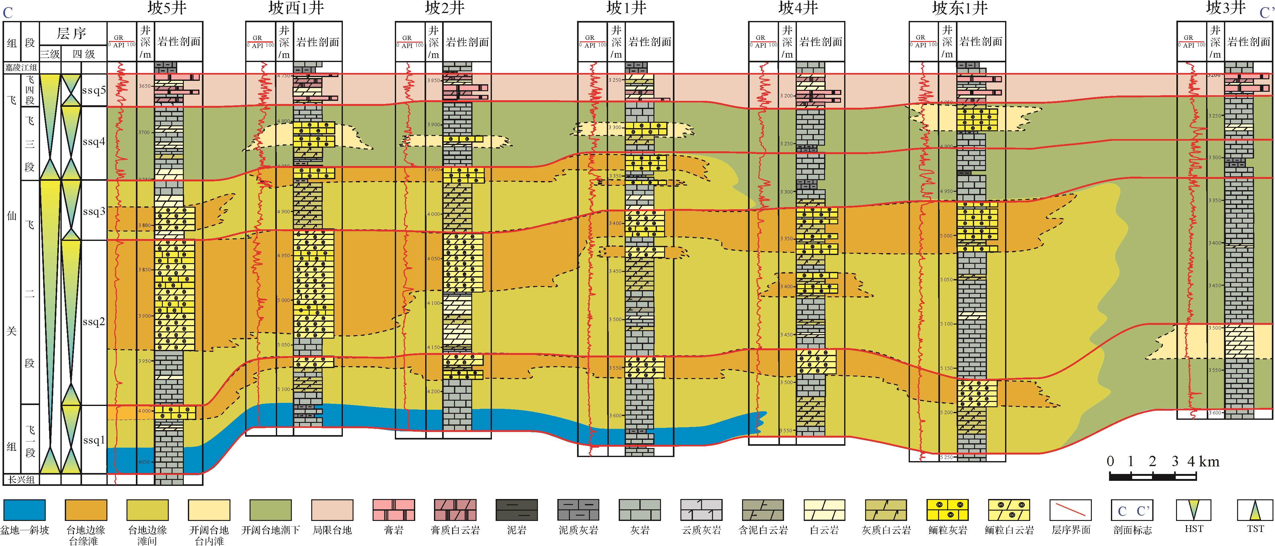
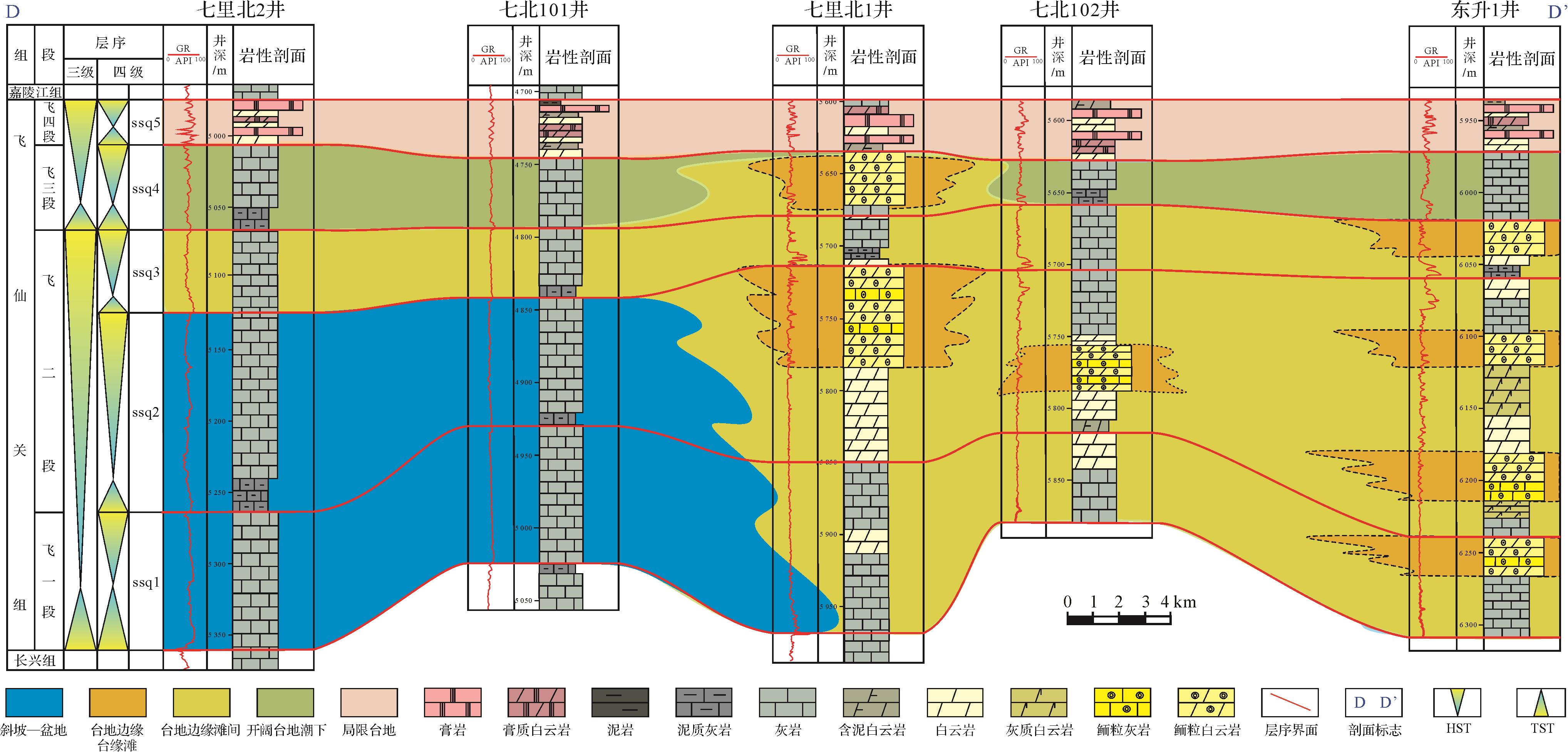
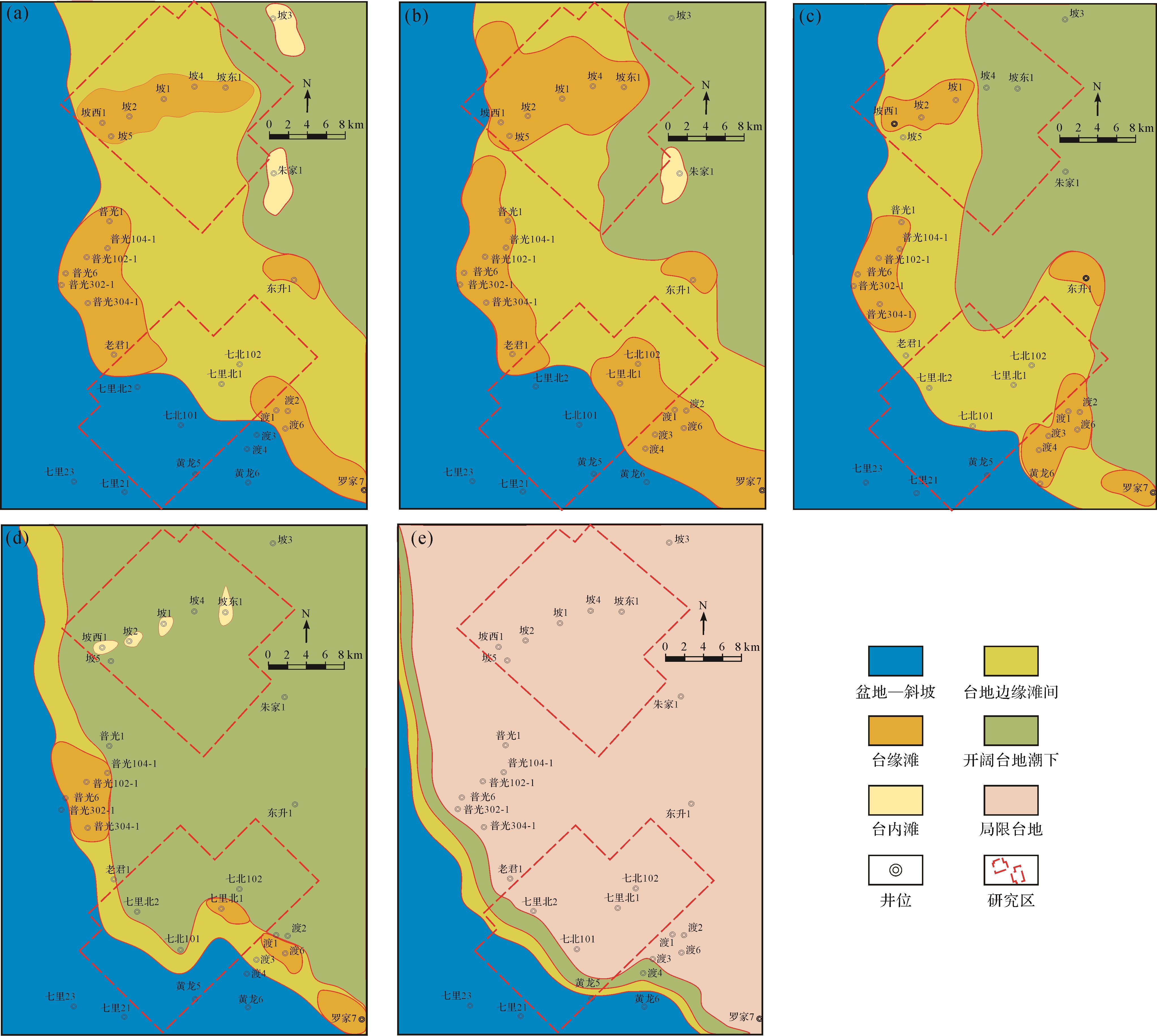
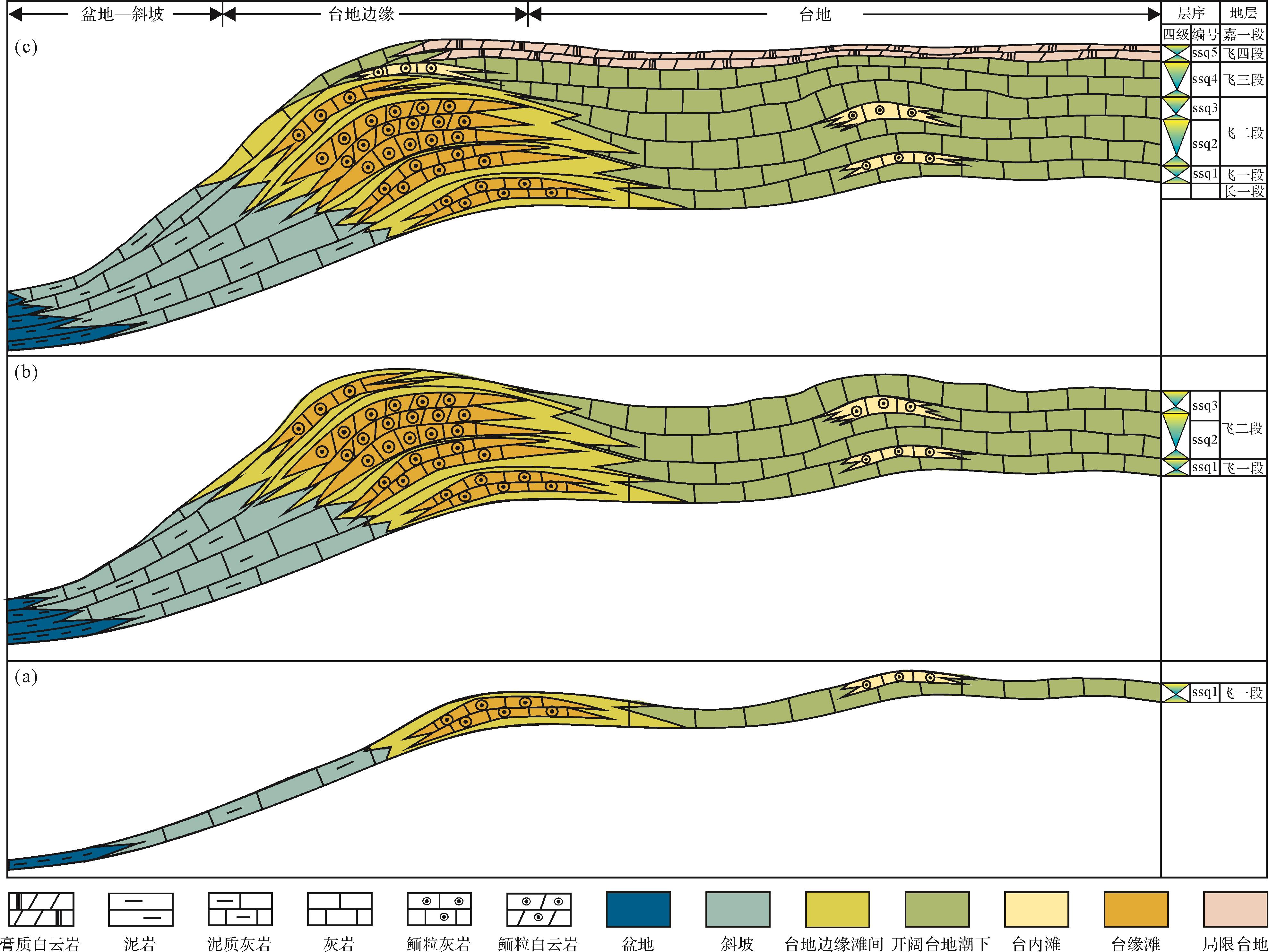
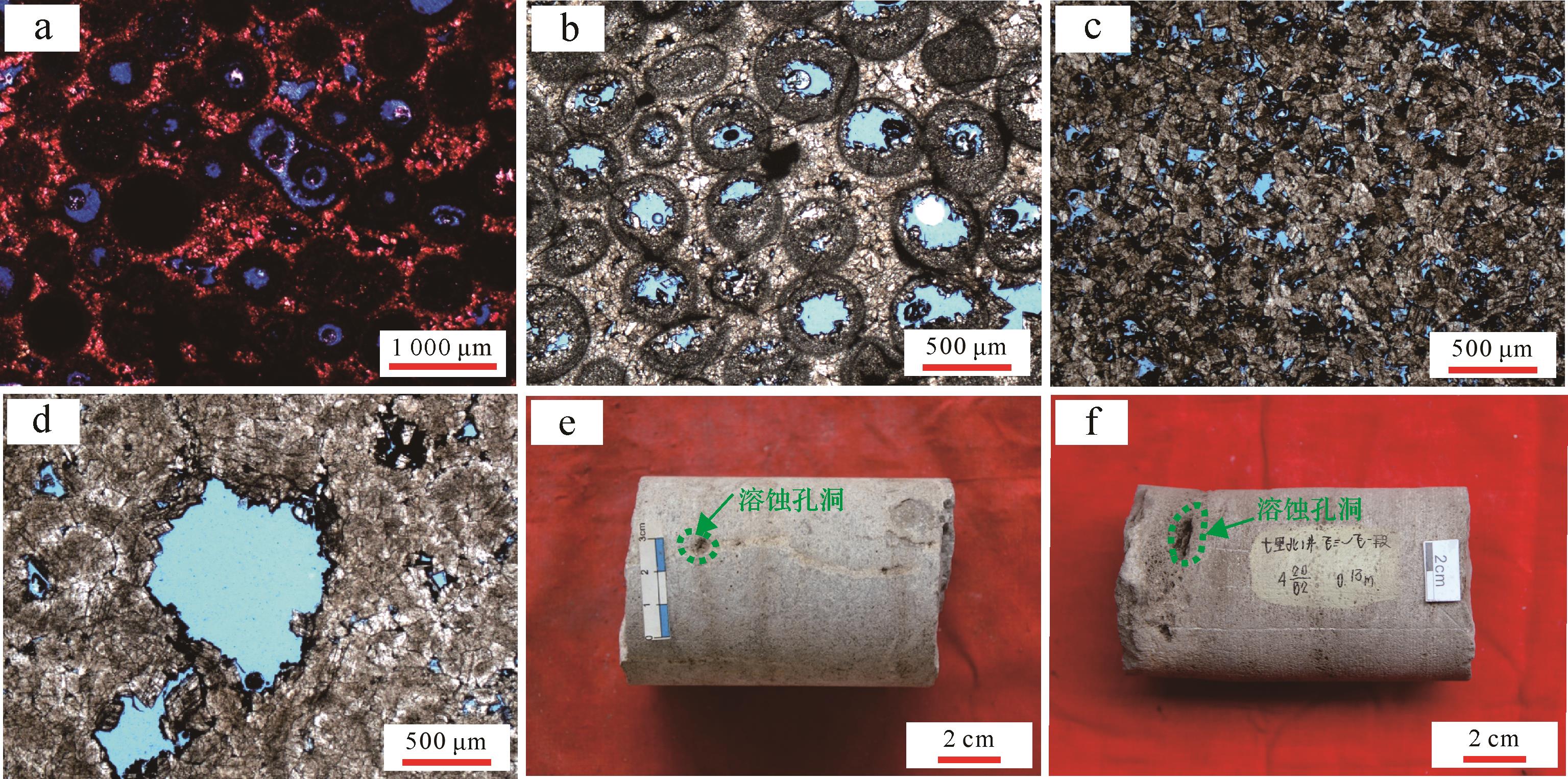
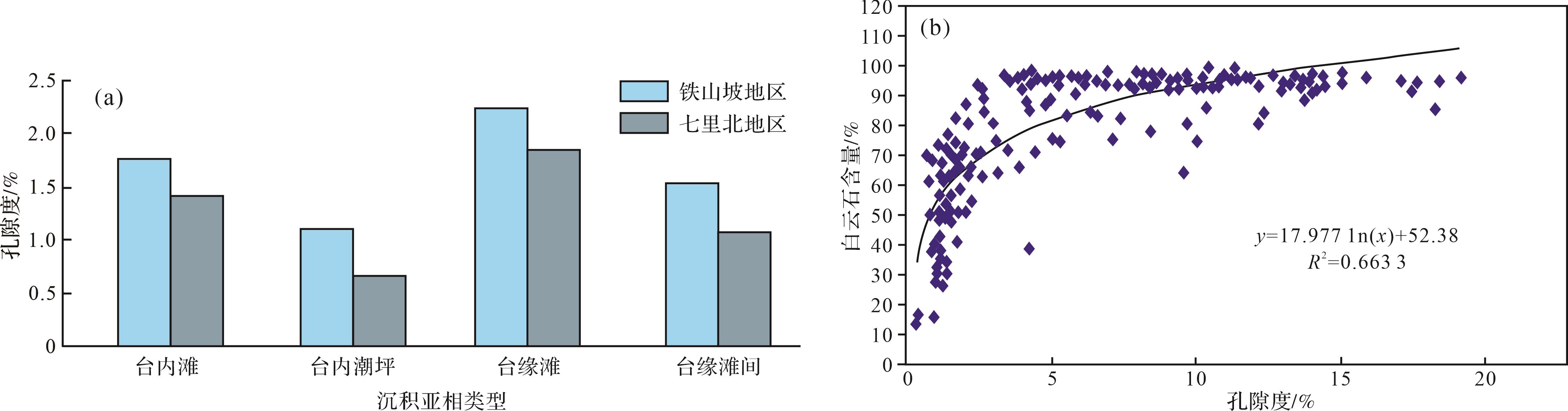
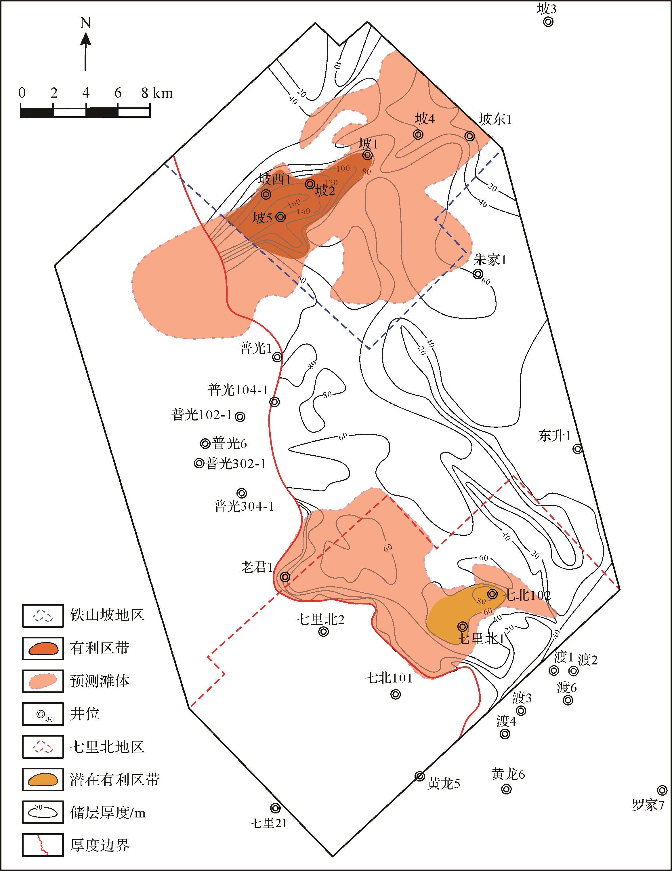
Objective Ordovician Kukersite oil shale is composed almost exclusively of Gloeocapsomorpha prisca (G. prisca) alginite. It is an important source rock from the Paleozoic, but it has only sporadically been detected and reported in the Tarim Basin in China. Therefore, rapid identification of G. prisca in source rocks is important geochemical work. Methods Here, kerogen from Estonian oil shale was analyzed using sequential stepwise pyrolysis at 50 °C intervals from 310 °C to 610 °C to investigate its chemical constitutions. Results We found that the pyrolyzed hydrocarbons formed by sequential stepwise pyrolysis were dominated by 5-n-alkyl-1,3-benzenediols. This probably reflects the major contribution of selectively preserved, highly resistant biomacromolecules from the outer cell walls of G. prisca. The kerogen was also characterized by a high content of short-chain alkanes, but abnormally high-carbon-number (>nC29) n-alkane/enes appeared at 560 °C. A consistent formation of alkyl benzenes, alkyl thiophenes, and alkyl ketones also appeared at the middle to high temperature points (460 °C-560 °C). All pyrolyzates had a lower carbon number and alkyl side chains with a distinct distribution of weak odd-over-even carbon numbers. The abundant and continuous generation of 5-n-alkyl-1,3-benzenediols and its homologues in the pyrolyzates can help to quickly identify whether source rocks contain G. Prisca. In addition, the composition characteristics, product changes, and product correlation of the pyrolyzates at different temperatures are helpful when investigating the structure of kerogen. The results of sequential stepwise pyrolysis suggested that the macromolecules of kerogen were formed mainly by the polymerization of 5-n-alkyl-1,3-benzenediols in G. prisca. The units in polymer macromolecules—including phenol rings, thiophene rings, and normal alkyl chains—are inter-molecularly connected by C-C and C-O bonds. Conclusions The distribution changes of different series of compounds obtained at different temperatures by sequential stepwise pyrolysis can be applied to other organic-rich oil shales. This approach can be used to reveal the details of algal evolution and determine the various sources of organic matter in kerogen.
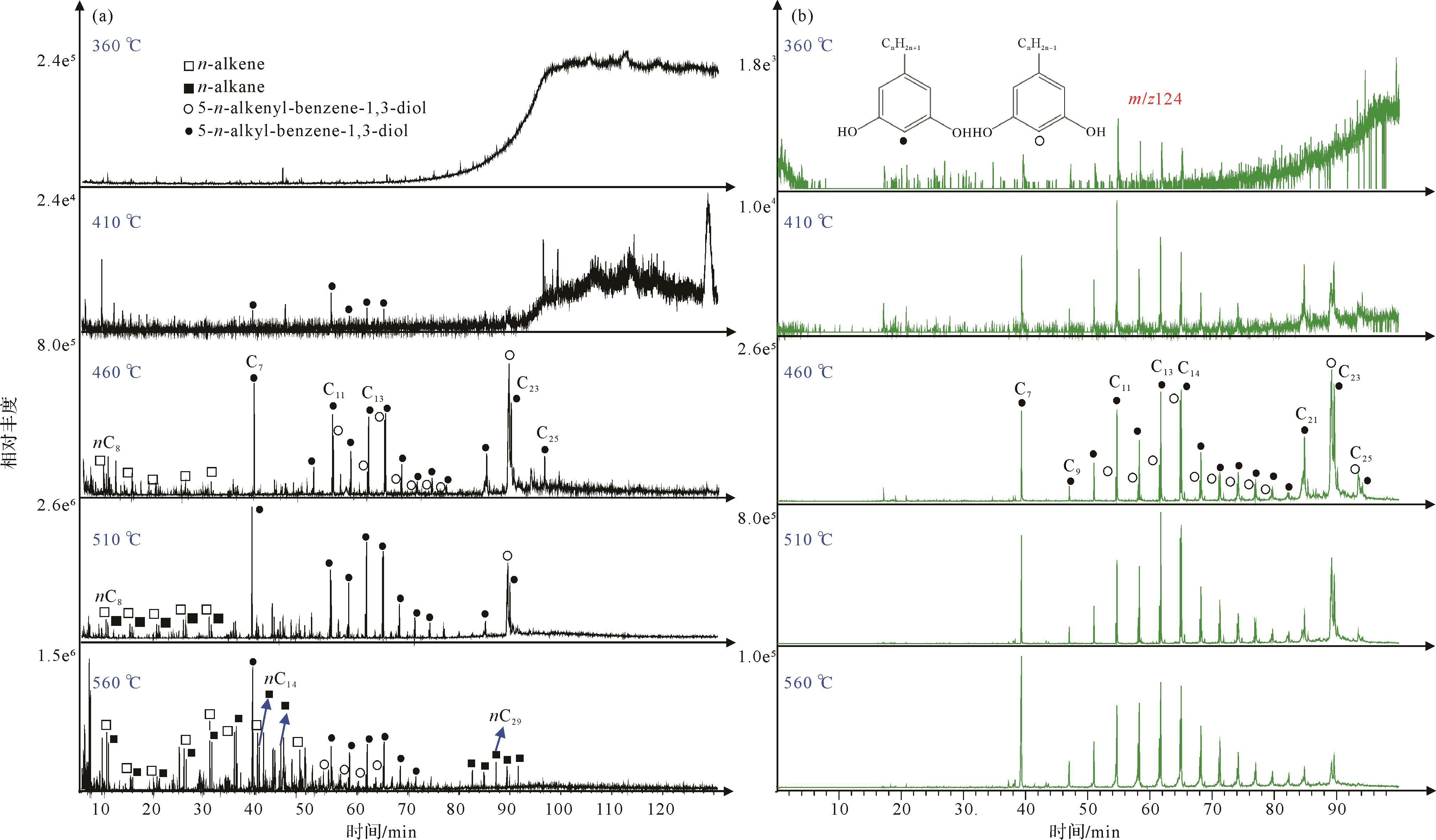
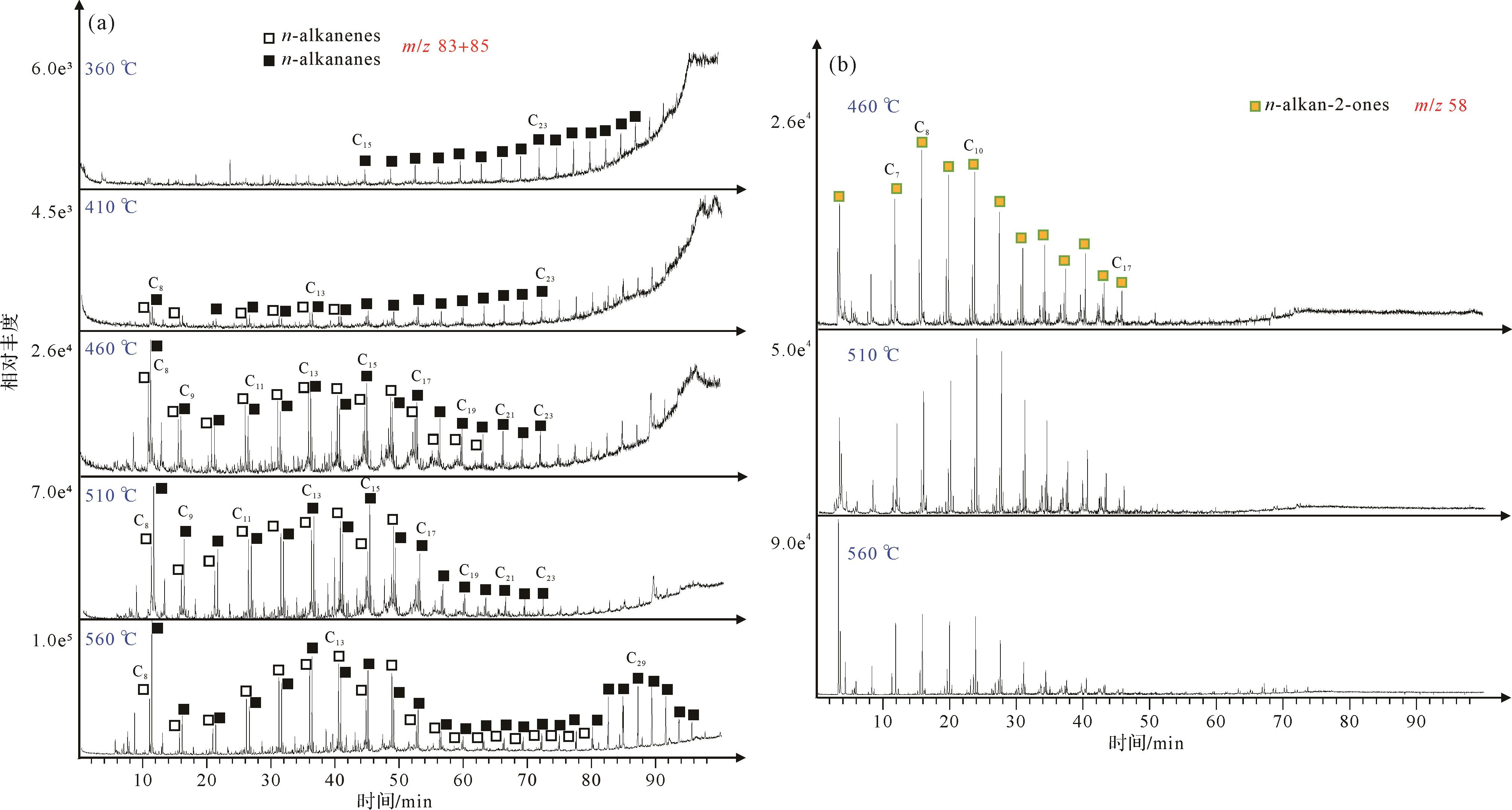
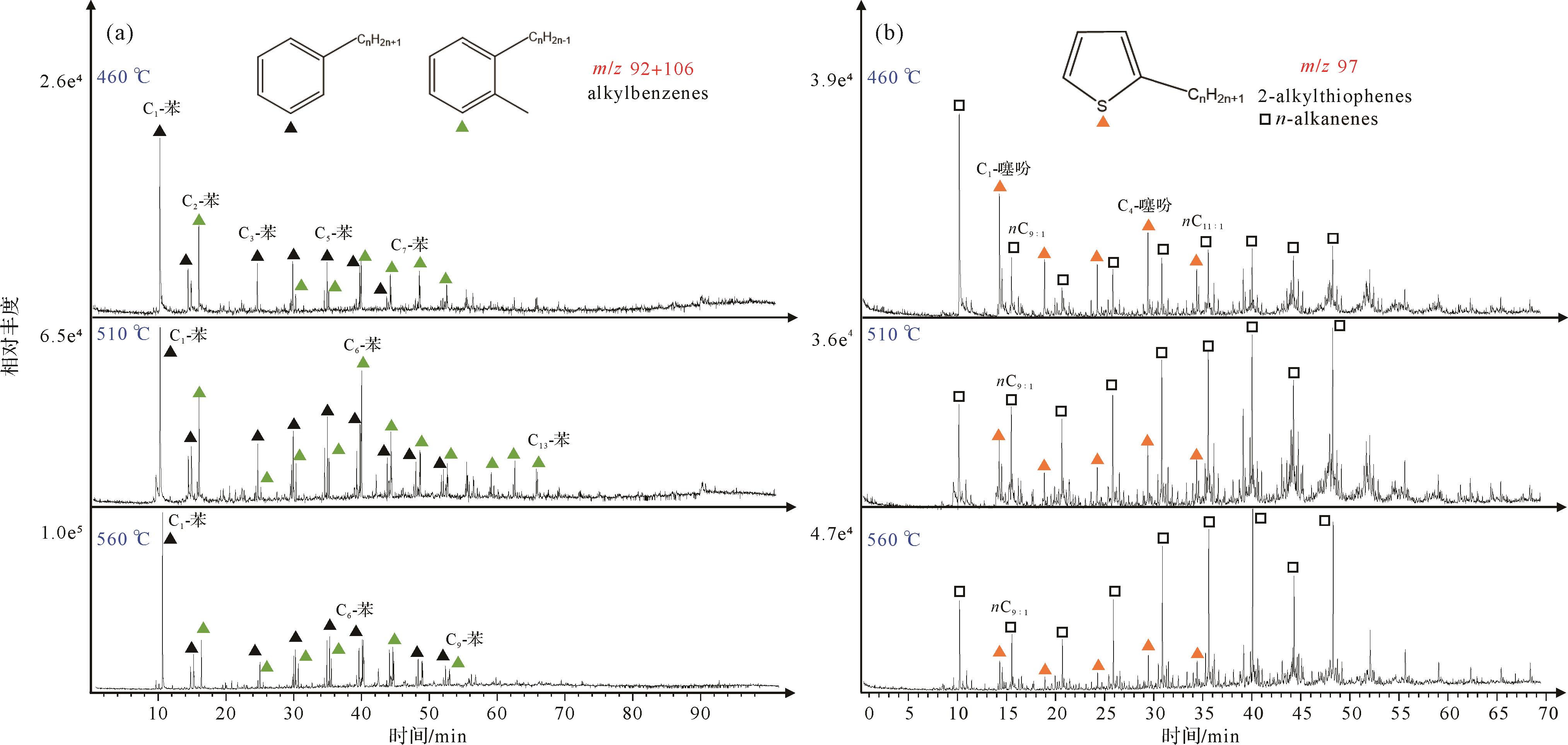
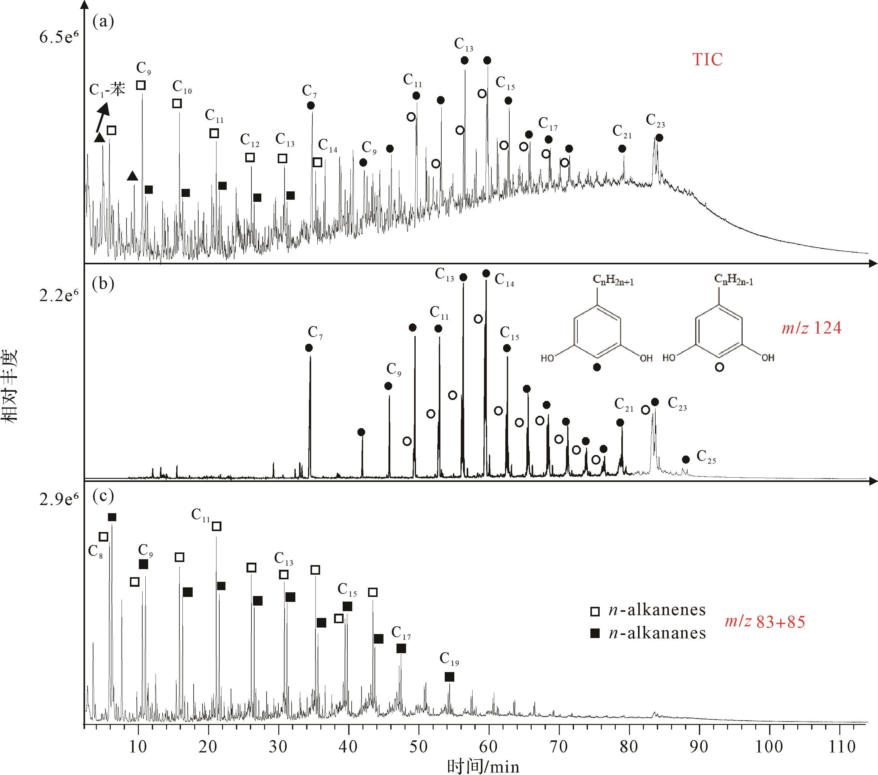
Objective Following the mass extinction at the end of the Permian, microbialites were widely distributed in southern China, indicating a microbial bloom in the Lower Triassic following the cataclysm. However, microbialites generally exhibit low paleo-productivity, which seems to contradict the microbial explosion. This study analyzed the microbialites at the base of the Triassic Tianwan section in the Luodian area of Guizhou province, focusing on the petrological characteristics of micritic pellets and their thermal metamorphic evolution and sources of organic matter. The study clarifies the respective influences of microbially derived and seawater-trapped organic matter on pellet formation, with the aim of providing empirical evidence for exploring carbon cycling mechanisms in post-extinction microbialite systems. Methods In situ micro-area analytical techniques (optical microscopy, fluorescence microscopy, scanning electron microscopy (SEM) with energy-dispersive spectroscopy (EDS), and laser Raman spectroscopy) were used to conduct a detailed analysis of various types of peloids within the microbialites from the Tianwan section. These reveal the distribution patterns and thermal metamorphic evolutionary characteristics of internal organic matter. Results Based on morphology and infill materials, the various peloids were classified into six types: type I (microbially-induced peloid, MIP); type II (recrystallized microbially-induced peloid, RMIP); type III (aggregated detrital peloid, ADP); type IV (intraskeletal peloid, ISP); type V (dolomitized peloid, DP); and type VI (aggregated microbially-induced peloid, AMIP). Raman spectroscopy-derived metamorphic roasting temperatures provide insights into the thermal history and transformation of these peloids. The organic matter in types I, II, IV and VI (MIP, RMIP, ISP and AMIP) shows thermal maturity similar to that found in primary cyanobacteria in microbialites and shell fragments, indicating a common diagenetic history and microbial origin. Of these, peloids I, II and VI exhibit low thermal maturation temperatures, with organic matter mainly derived from the photosynthetic and metabolic processes of primary cyanobacteria and other microorganisms within microbialite systems. Specifically, peloid VI formed when micritic particles wrapped around peloid I, linked to bioclastic micritization. peloid IV shows moderate thermal maturation temperatures, resulting from a mix of microbial micritization and siliceous clastic material. By contrast, peloids III and V (ADP and DP) evidenced significantly higher metamorphic temperatures, suggesting multiple thermal alteration events. Peloid III may have been formed by neomorphism; peloid V was primarily shaped by bioclastic micritization. Conclusions In summary, after the end-Permian mass extinction, microbial blooms, especially cyanobacterial photosynthesis, led to the generation of large amounts of dissolved organic carbon (DOC) in the oceans. Due to frequent fluctuations in seawater redox conditions and rapid temperature increases, the DOC was typically oxidized into CO2 and released into the atmosphere, with only a small fraction being preserved as particulate organic carbon (POC) and deposited on the seafloor. Raman geothermometric analysis shows that most of the organic matter in the microbialite peloids, particularly in those associated with bioclastic peloidal envelopes, originated from the metabolic activity of primary cyanobacteria, which was the original organic matter in the microbialite system. A small portion of the organic matter may have been sourced from long-stored terrestrial organic matter in seawater, which underwent multiple diagenetic thermal alterations and shows higher thermal maturation temperatures. The thermal maturation of organic matter and mineral recrystallization during diagenesis had a significant impact on the efficiency of organic matter preservation, ultimately resulting in a low total organic carbon (TOC) content in the microbialites.
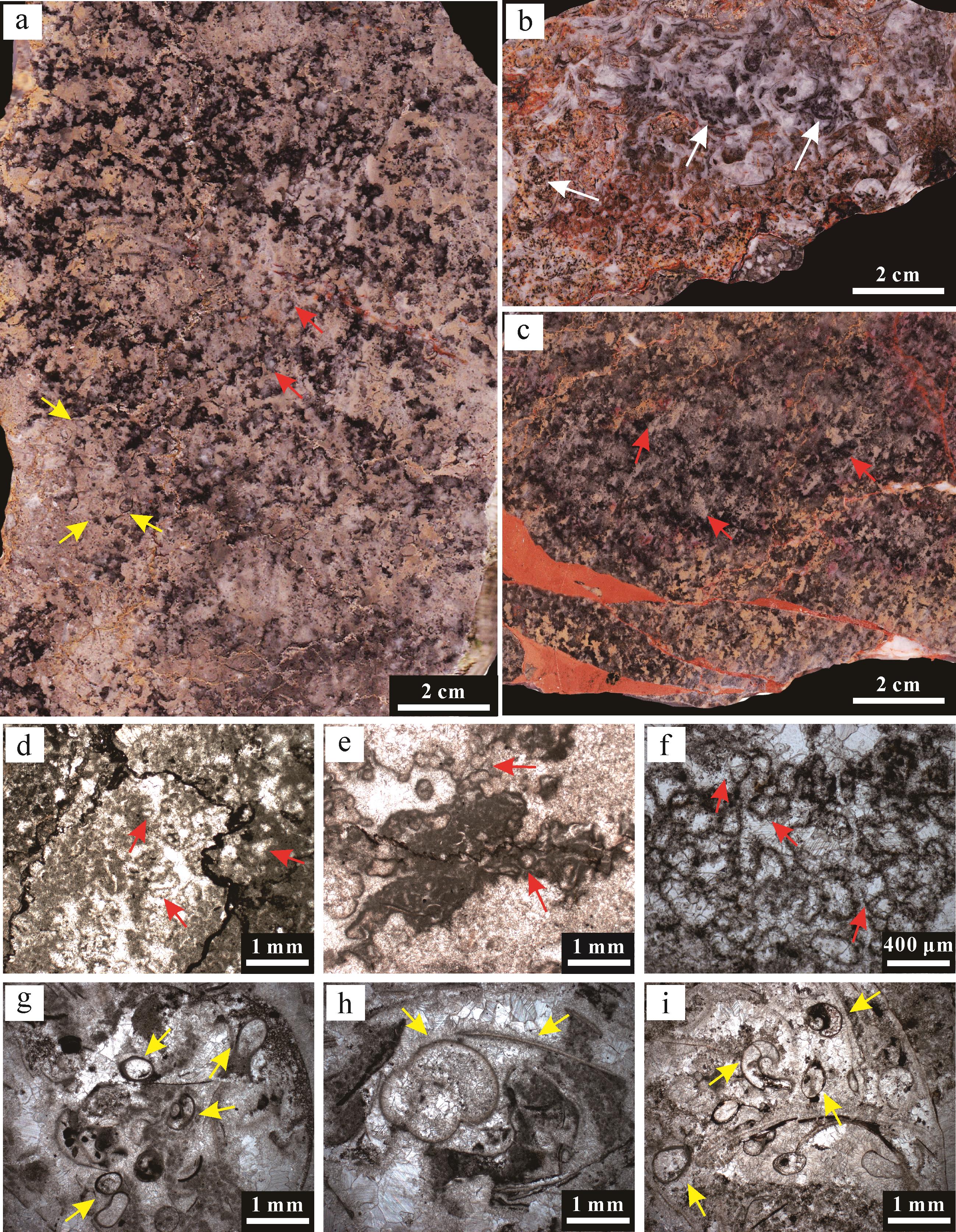
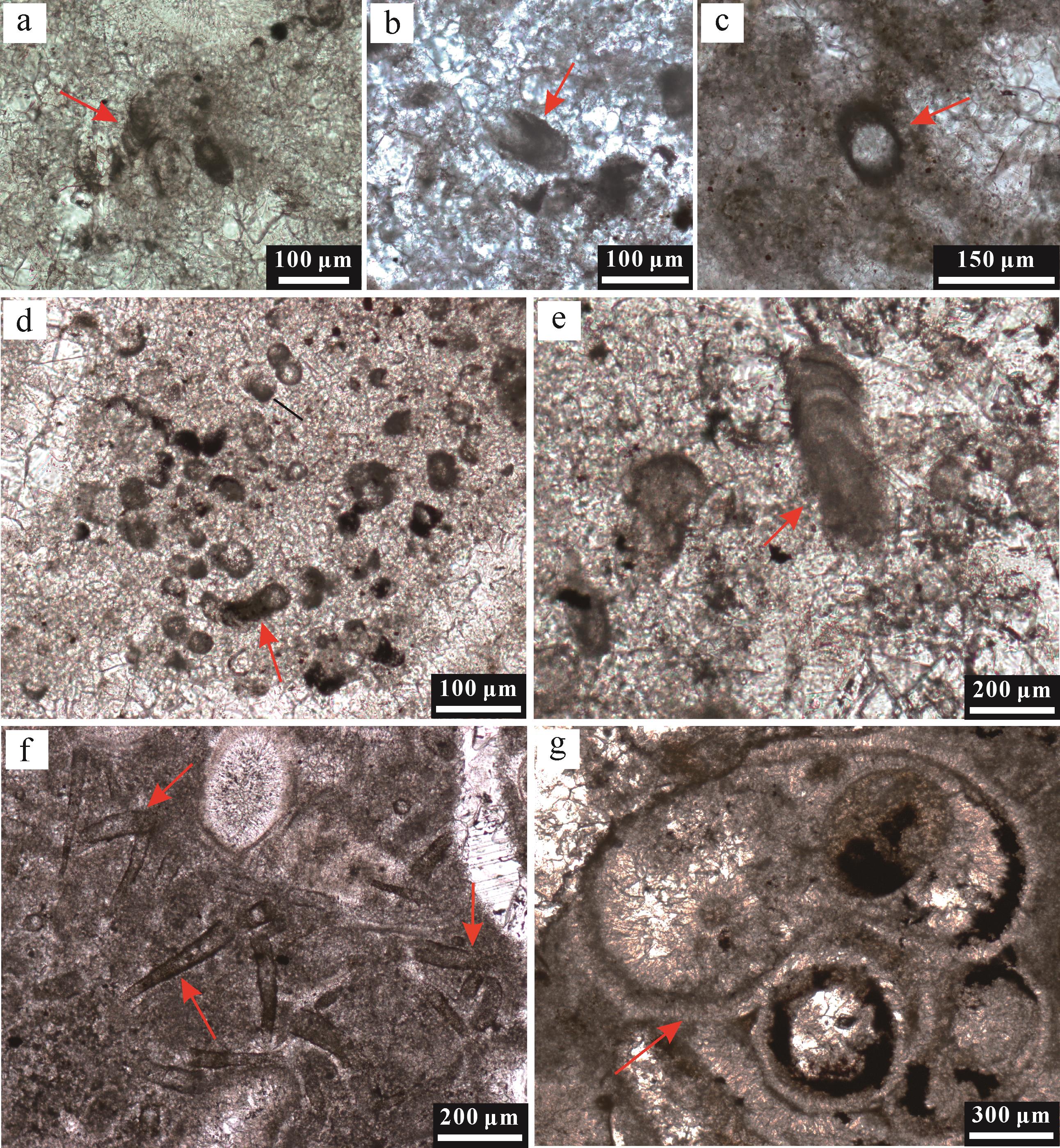
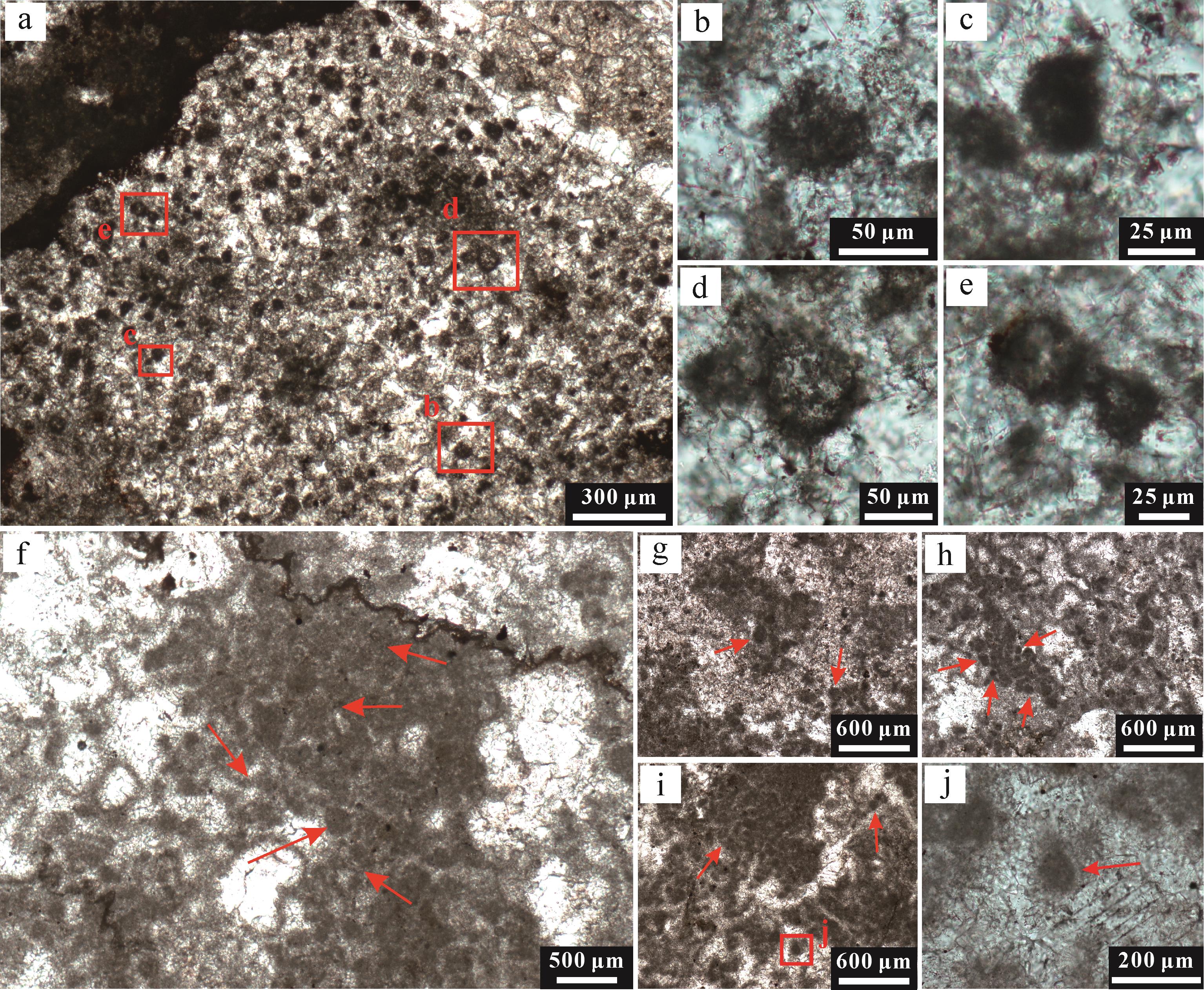
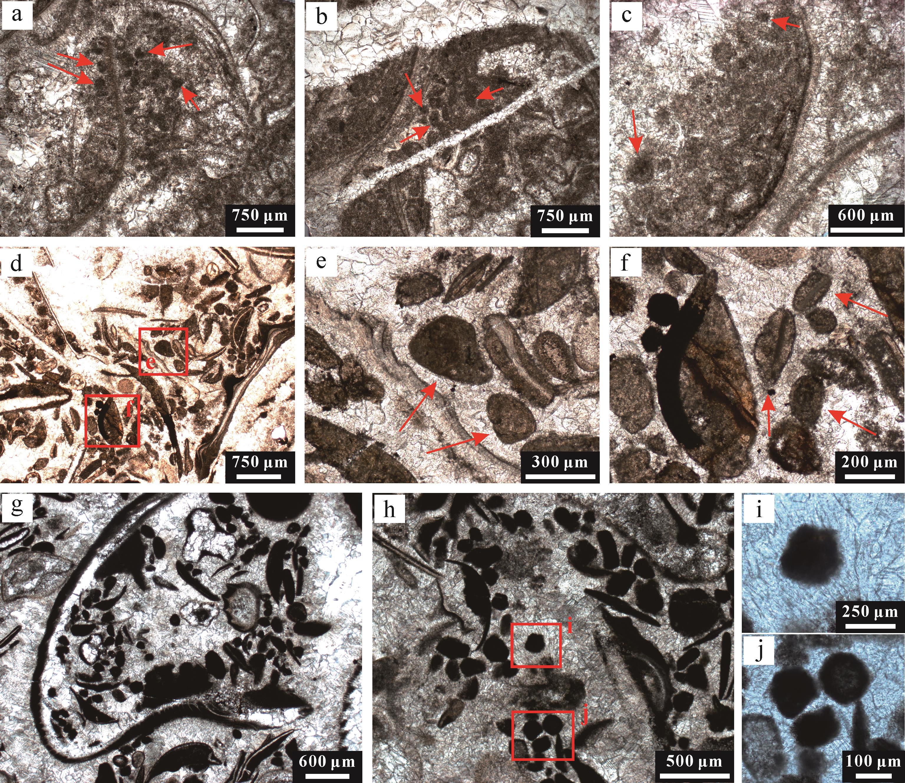
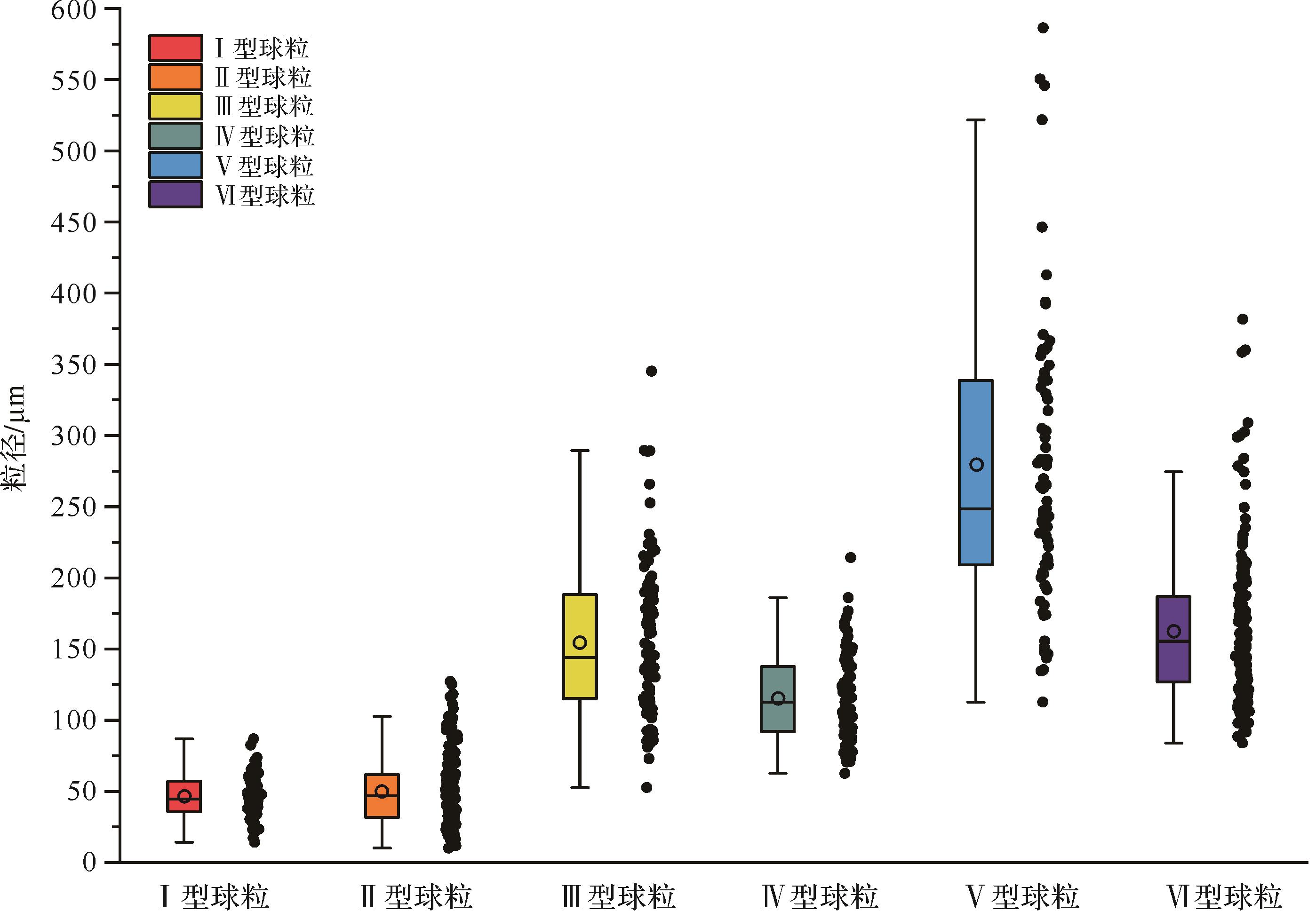
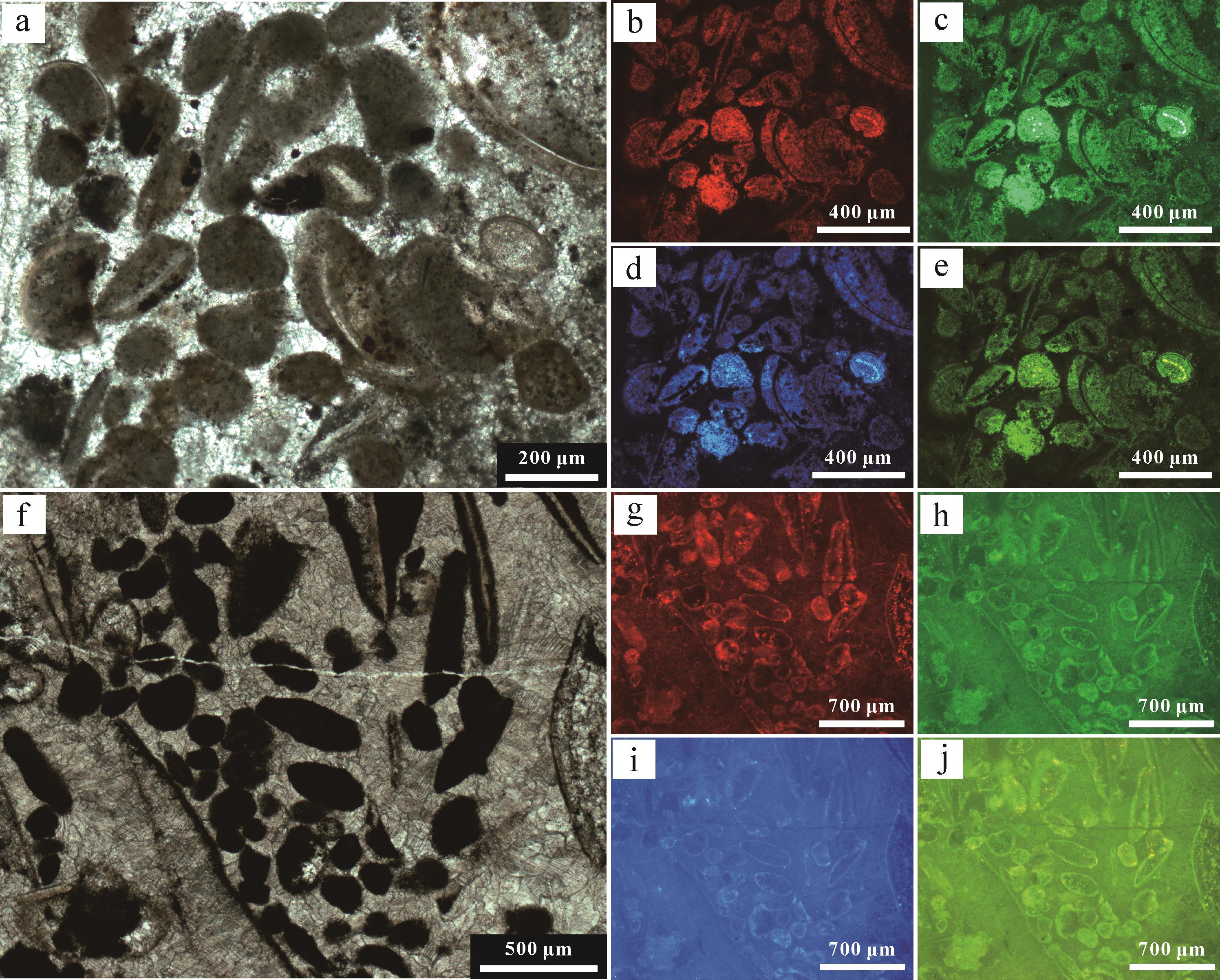
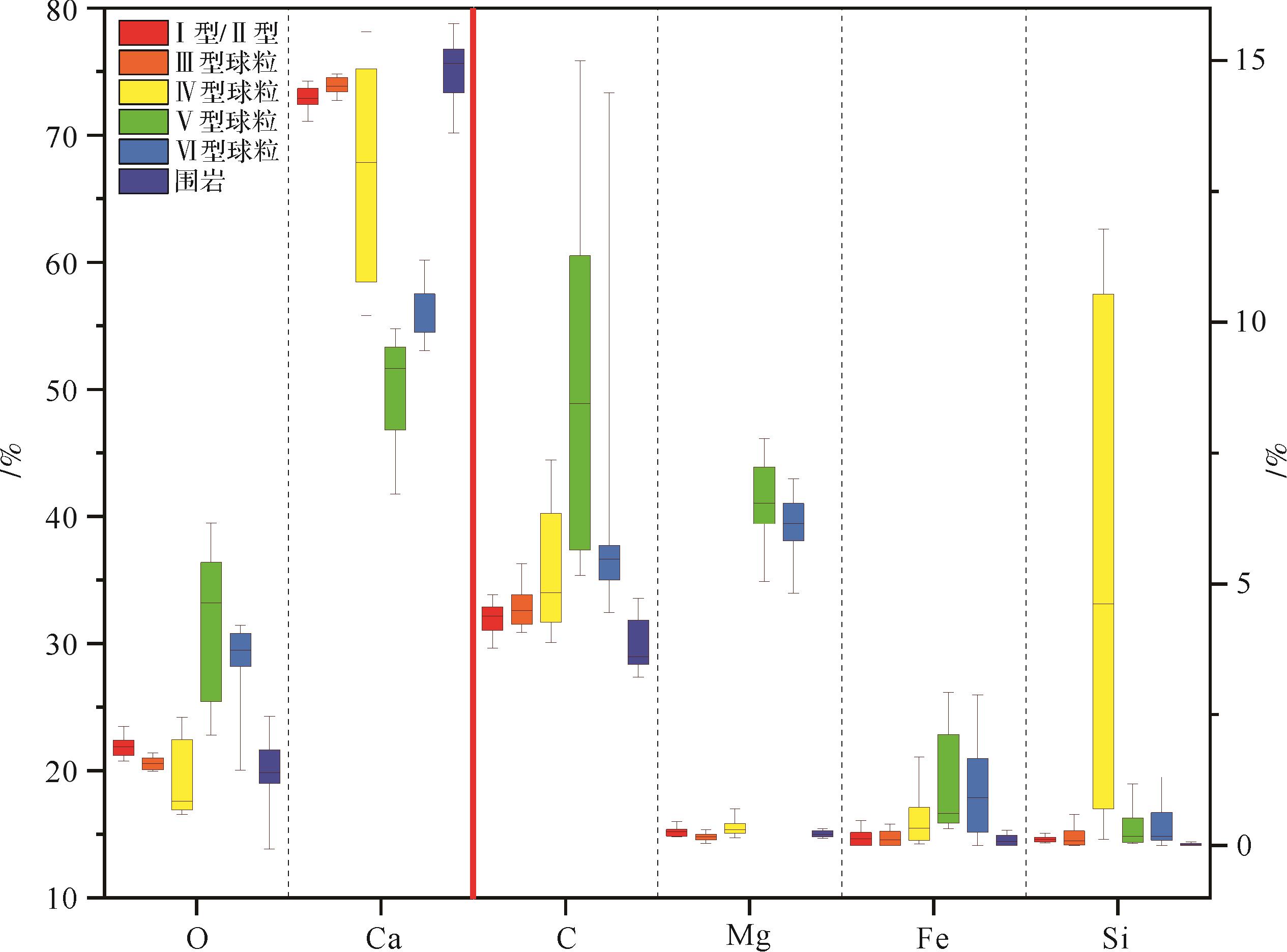
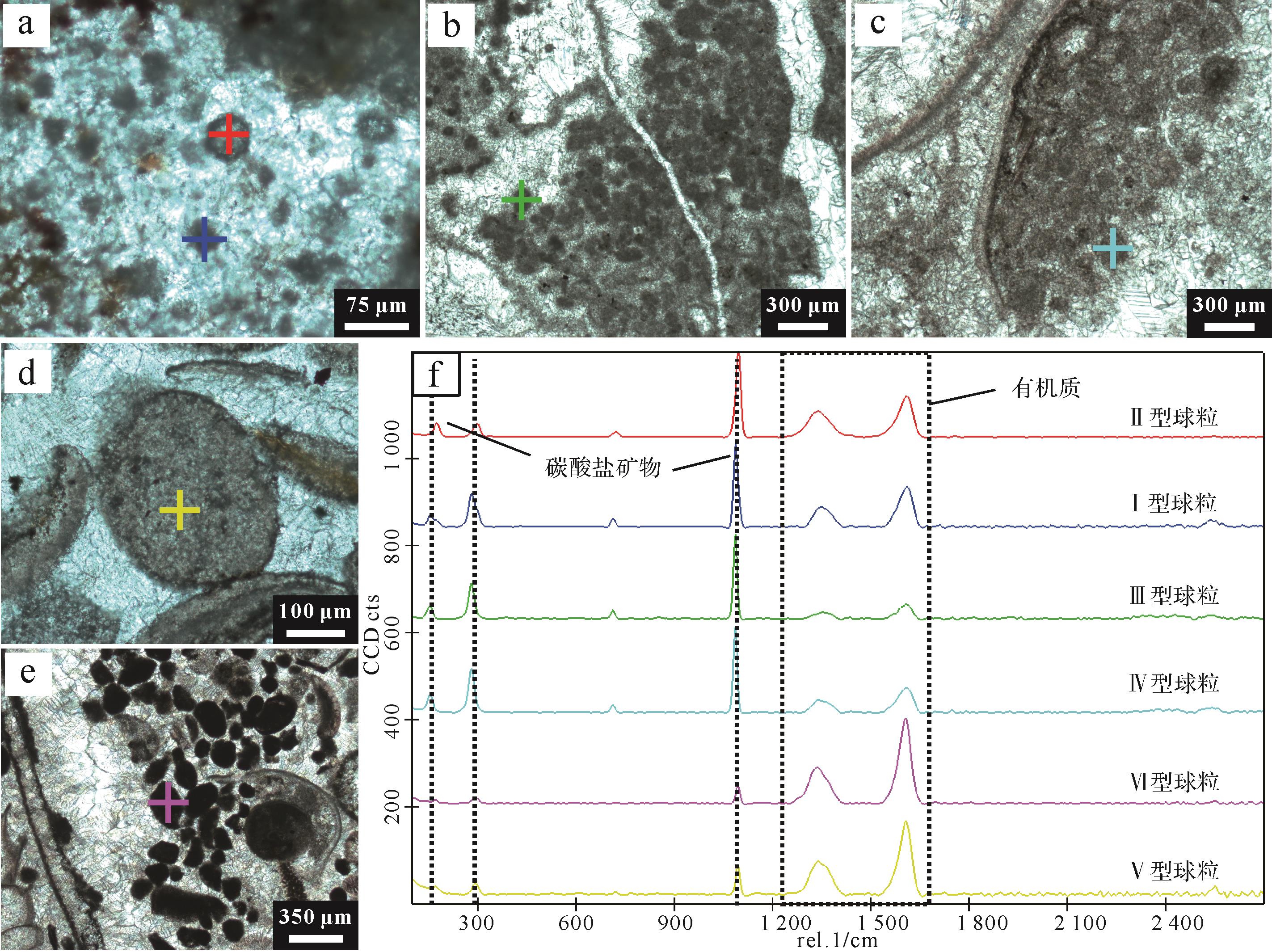
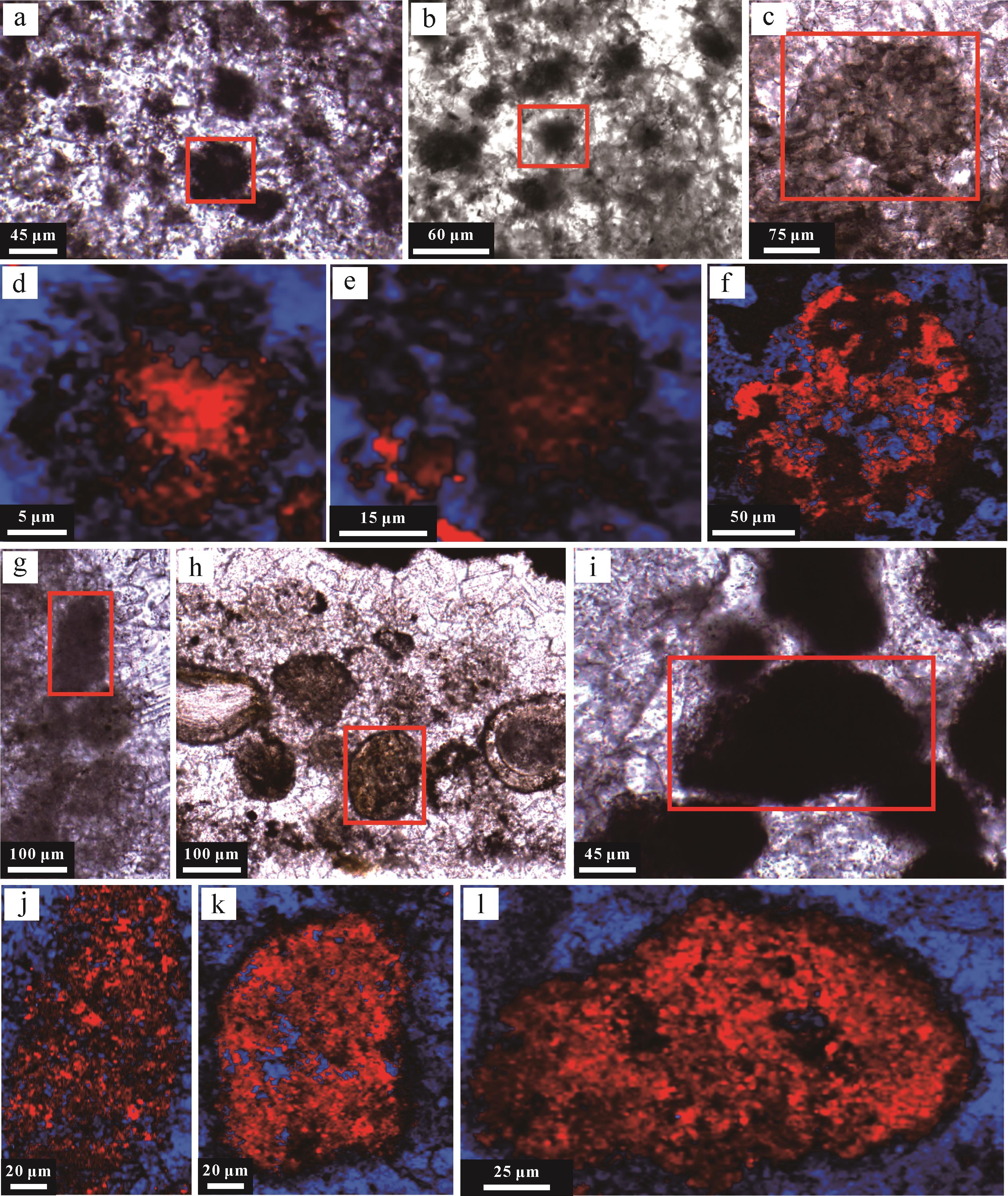
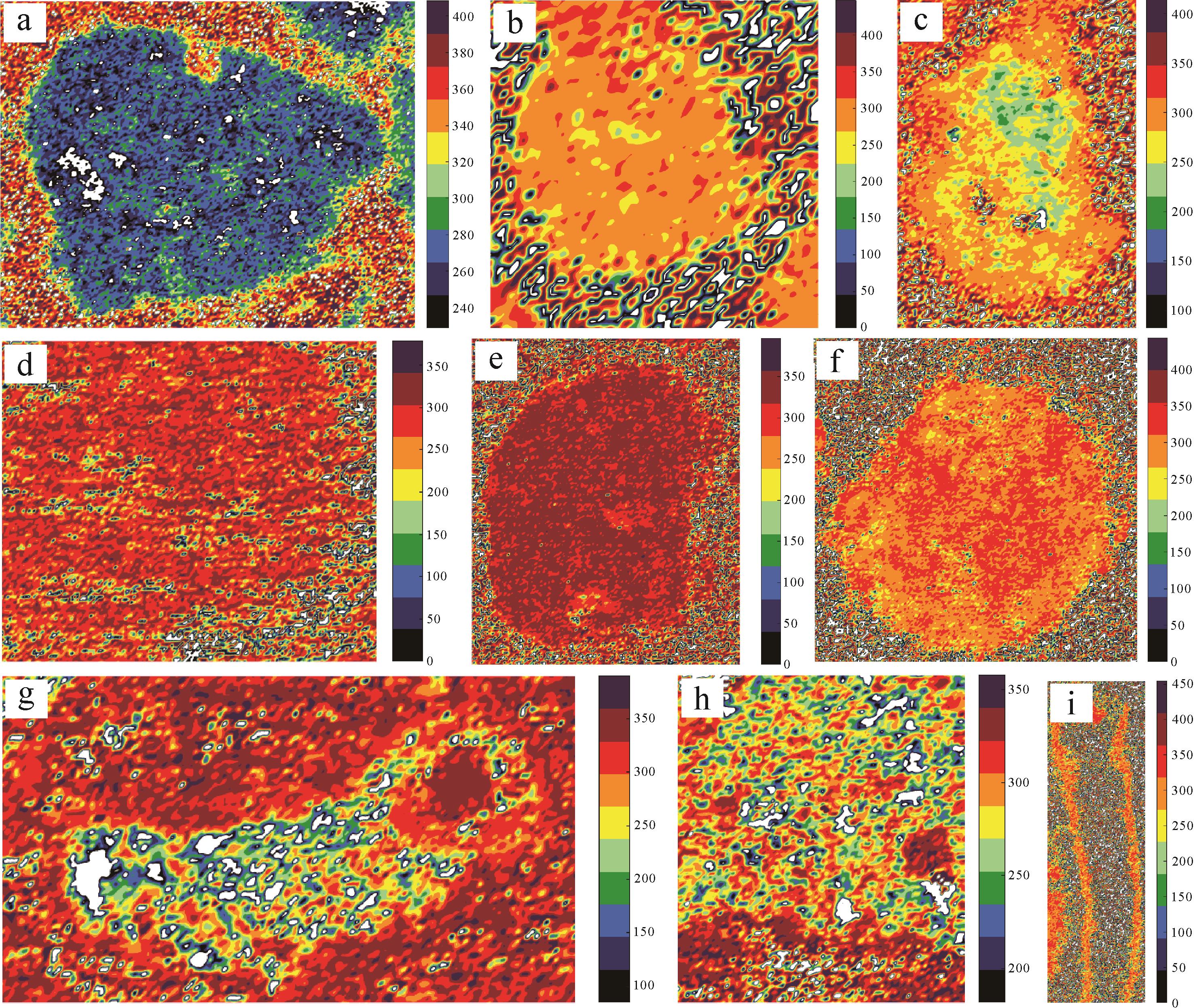
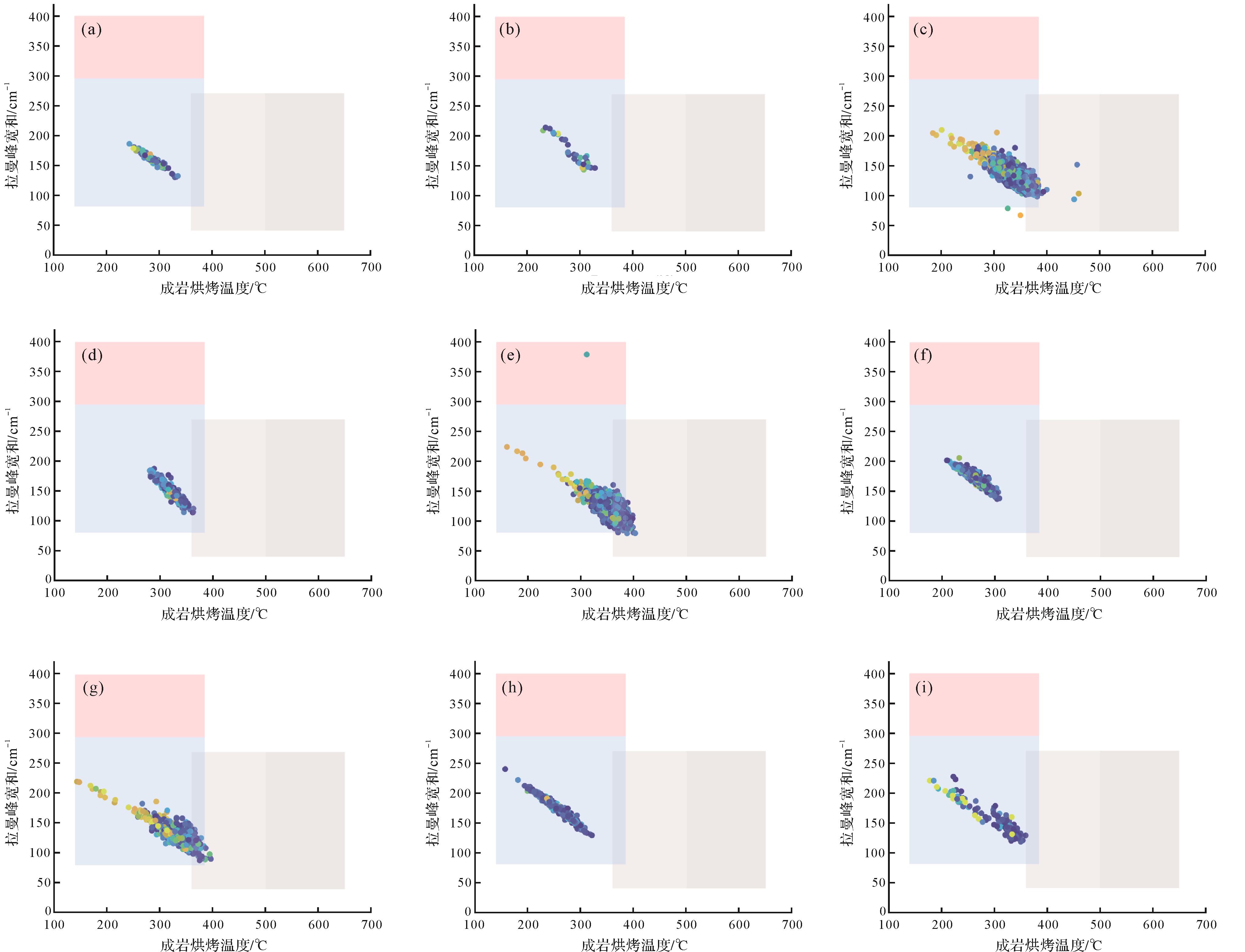
Objective With the continuous breakthroughs in oil and gas exploration and development technology, shale oil is expected to become an important replacement for traditional petroleum resources.It is of great significance for the exploration and development of shale oil laminae to clarify the development characteristics of shale laminae, quantitative characterization of pore structure, occurrence characteristics of shale oil and oil-bearing properties. Methods The organic-rich shale of the Chang 7 member of Yanchang Formation in the southeastern Ordos Basin was studied for its development characteristics, reservoir performance and the oiliness of different shale types. Thin section observation, scanning electron microscopy and high-pressure mercury intrusion and nitrogen adsorption were used to classify the types of shale laminae and clarify the diagnostic properties of oil-bearing shale. Results Laminae are developed in silty mudstone, argillaceous siltstone, siltstone, black shale and tuff in the study area. These were found to be macroscopically divided into three types: thick laminated shale (The thickness is between 1-10 cm), medium-thickness laminated shale (The thickness is between 1 mm~1 cm), and thin laminated shale (The thickness is less than 1 mm). Felsic minerals (27.7%-79.0%) and clay minerals (12.0%-63.0%) dominate the mineral composition of the Chang 7 shale laminae, with a small content of carbonate minerals (3.2%-27.0%). Microscopically, depending on the mineral composition, the shale occurs in four layer units (Silty, argillaceous, organic-rich and tuff laminae) and two layer combinations(Combination of highly siliceous laminae and high clay laminae.). Silty laminae have rich pore types, good reservoir physical properties, good pore connectivity, high oil saturation, accounting for 46% of the whole, and good oil-bearing properties; argillaceous and organic-rich laminae have medium physical properties and poor pore connectivity, oil saturation accounts for 32% and 22% of the whole, and the oil-bearing property is poor; The reservoir physical properties and oil-bearing properties of tuff laminae are the worst, and there are few pore structures with good reservoir properties in the study area. The high-clay laminae combination has more nanopores and micropores with small pore size, which have medium reservoir performance and poor oil-bearing properties. The highly siliceous laminae combination has a range of pore sizes and good reservoir performance, and would provide more reservoir space for oil migration and good oil-bearing. Conclusions The combination of silty laminae and highly siliceous laminae is significantly superior to the other laminae types in terms of reservoir space, reservoir performance and oil content. These findings provide an important reference for shale oil evaluation.
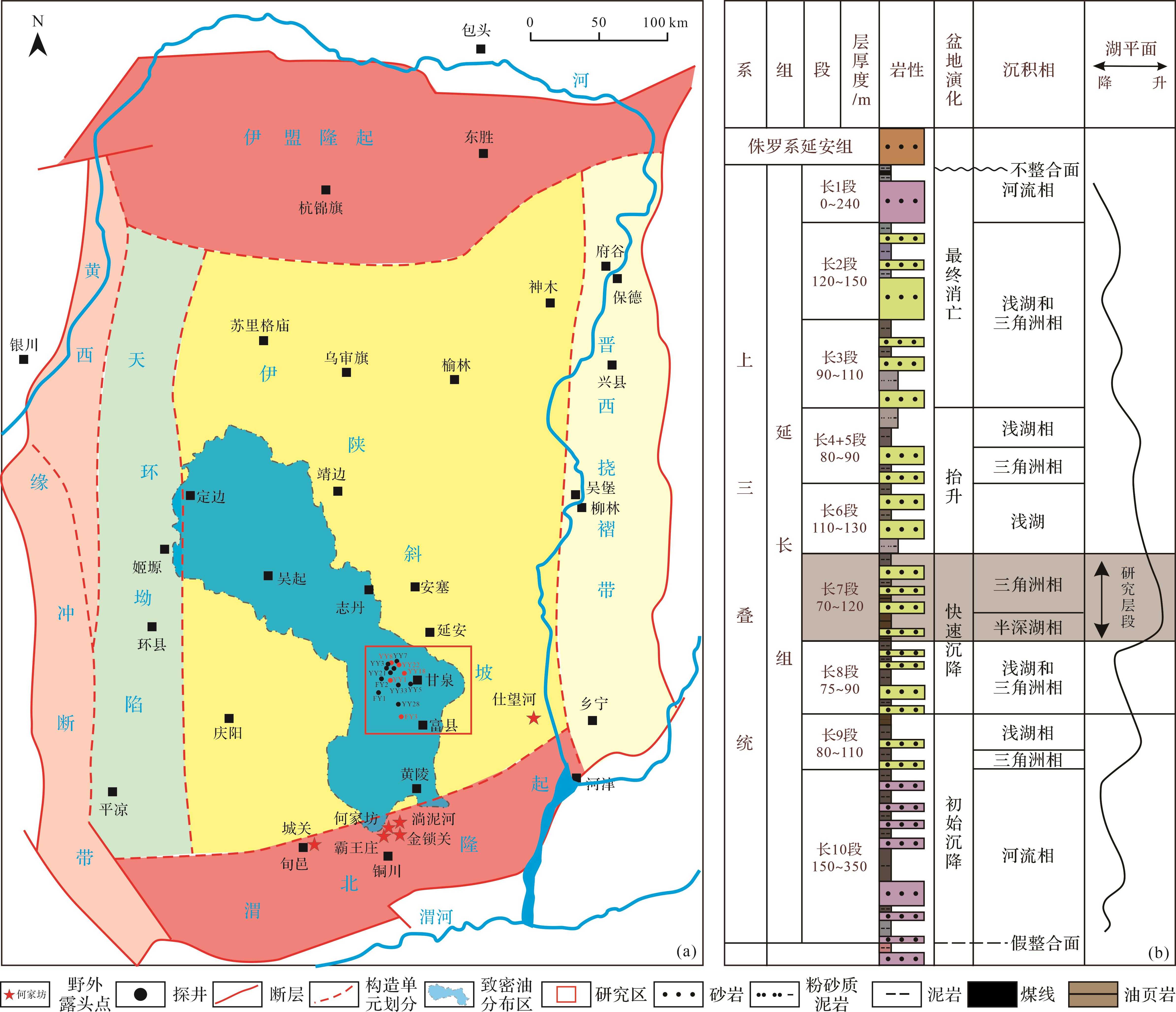
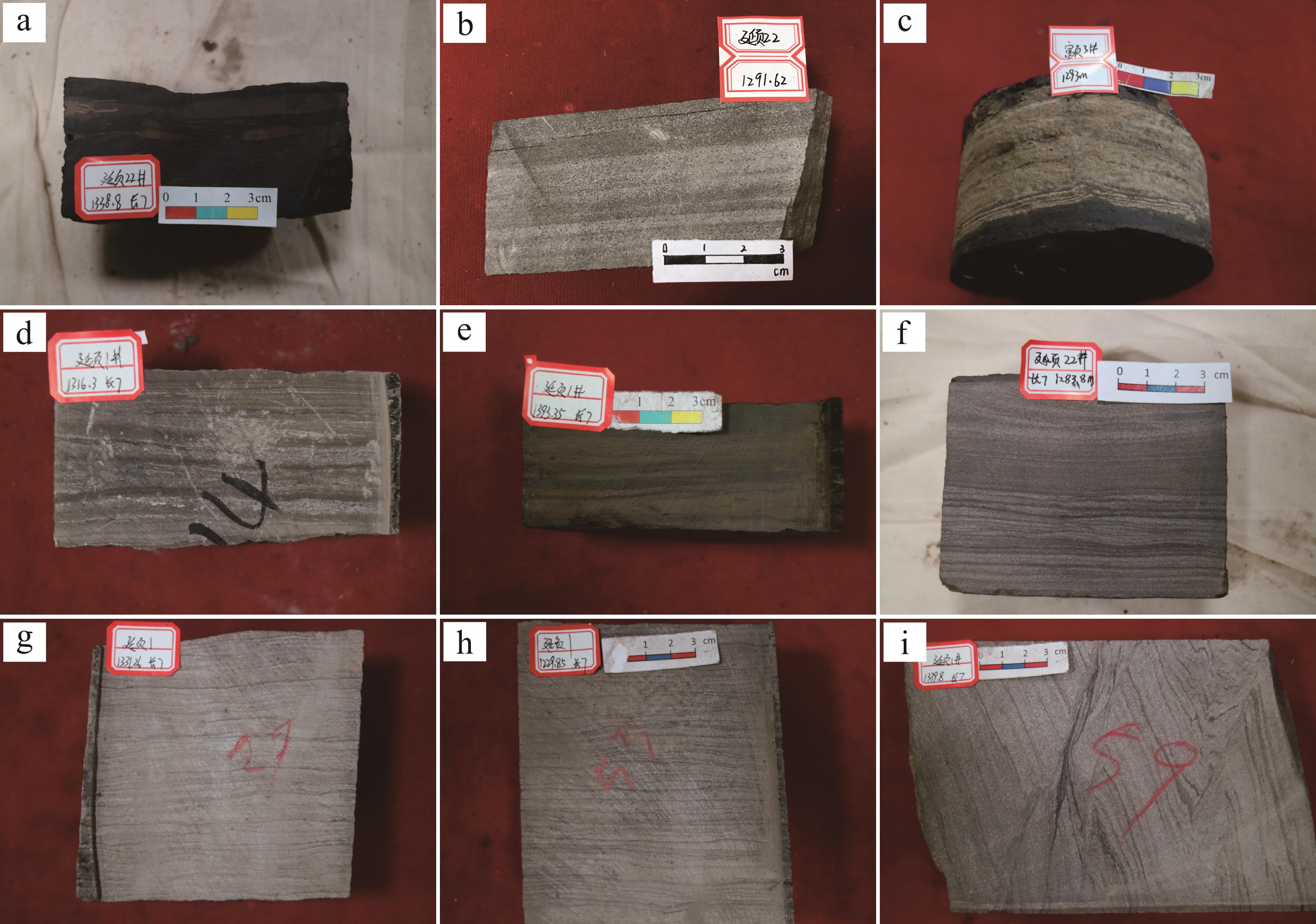
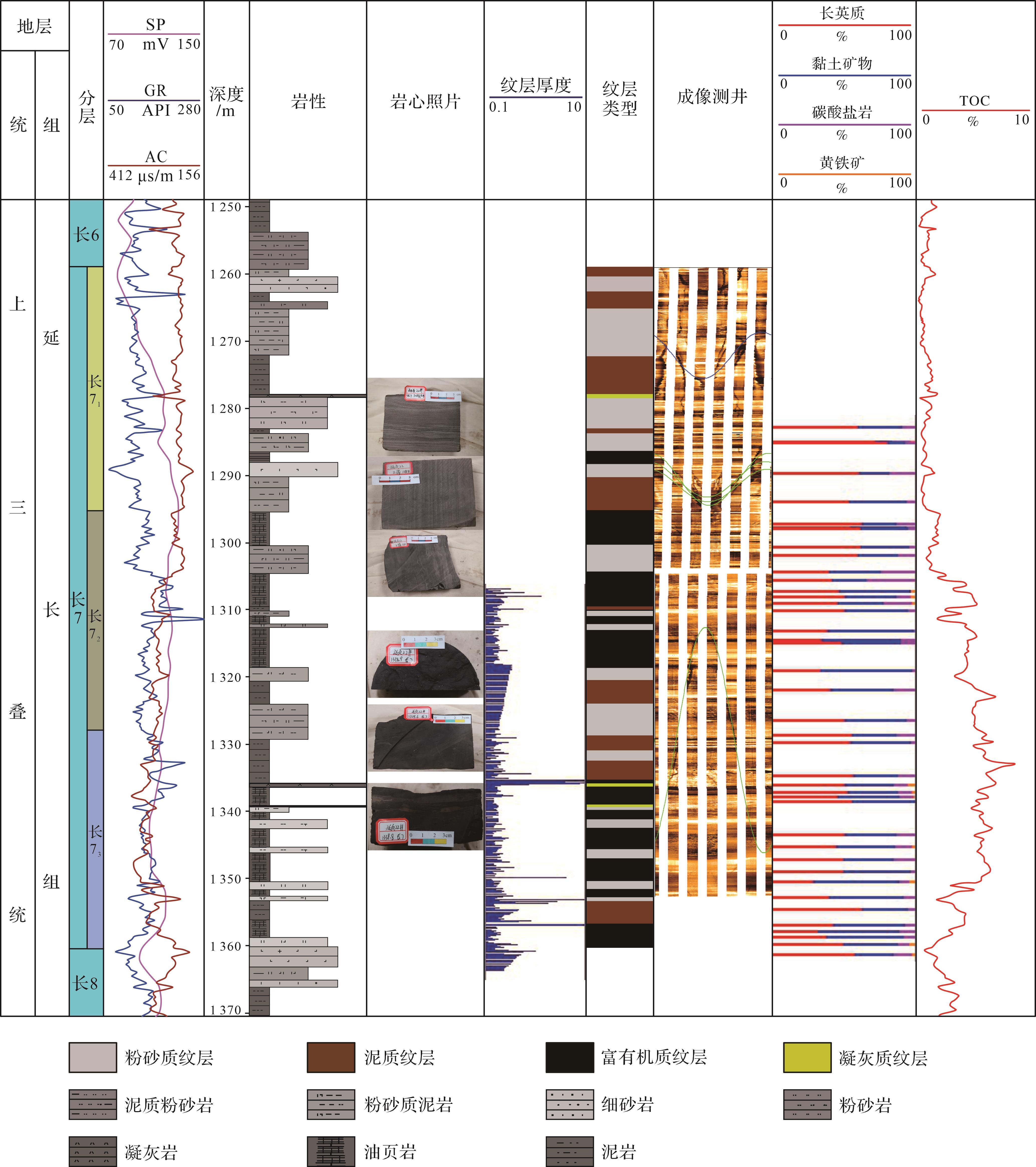
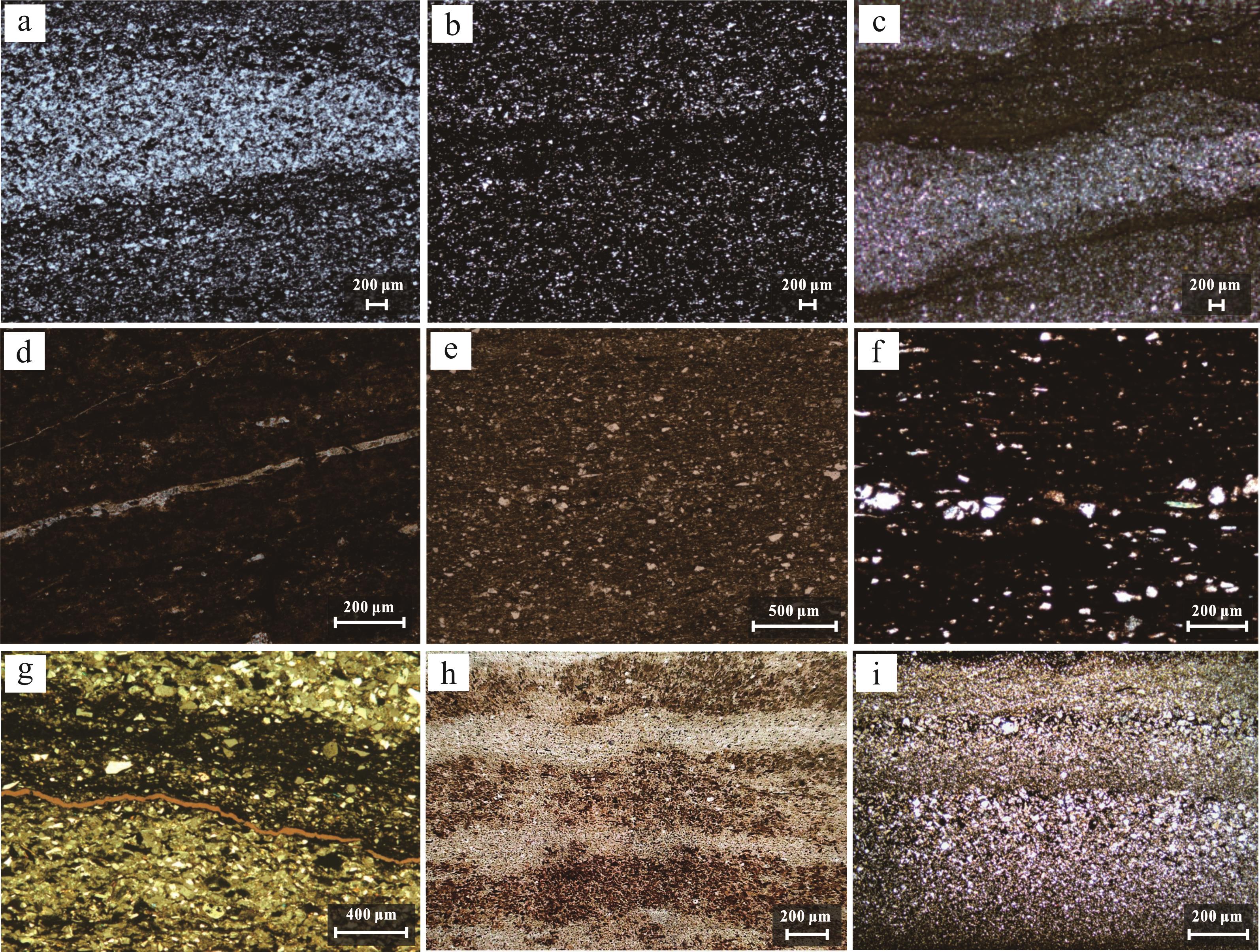
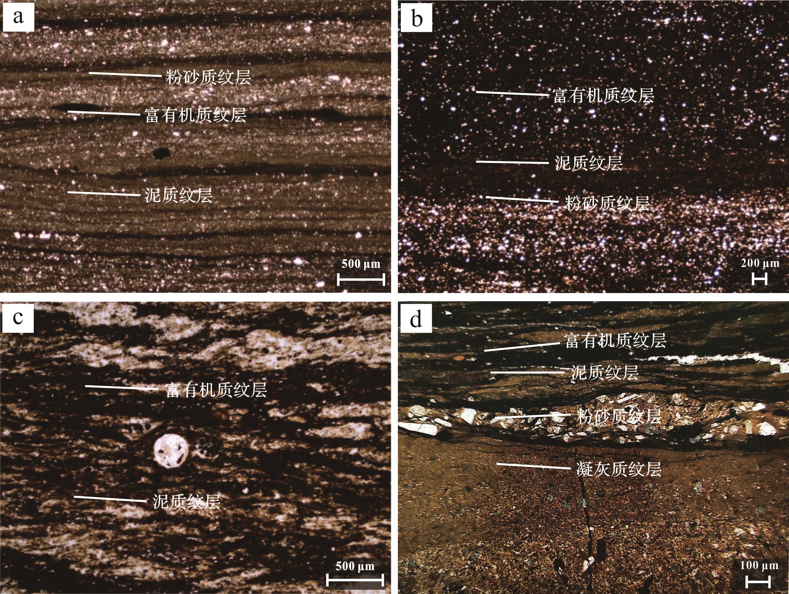
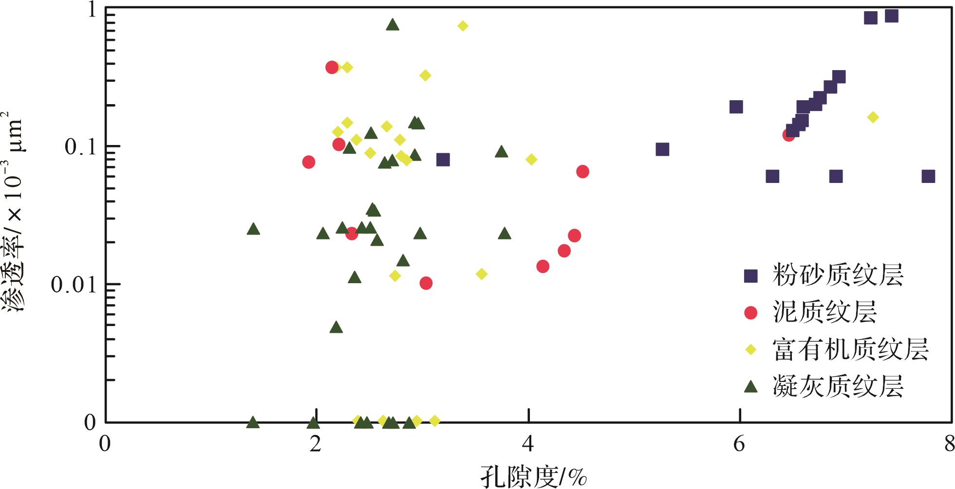
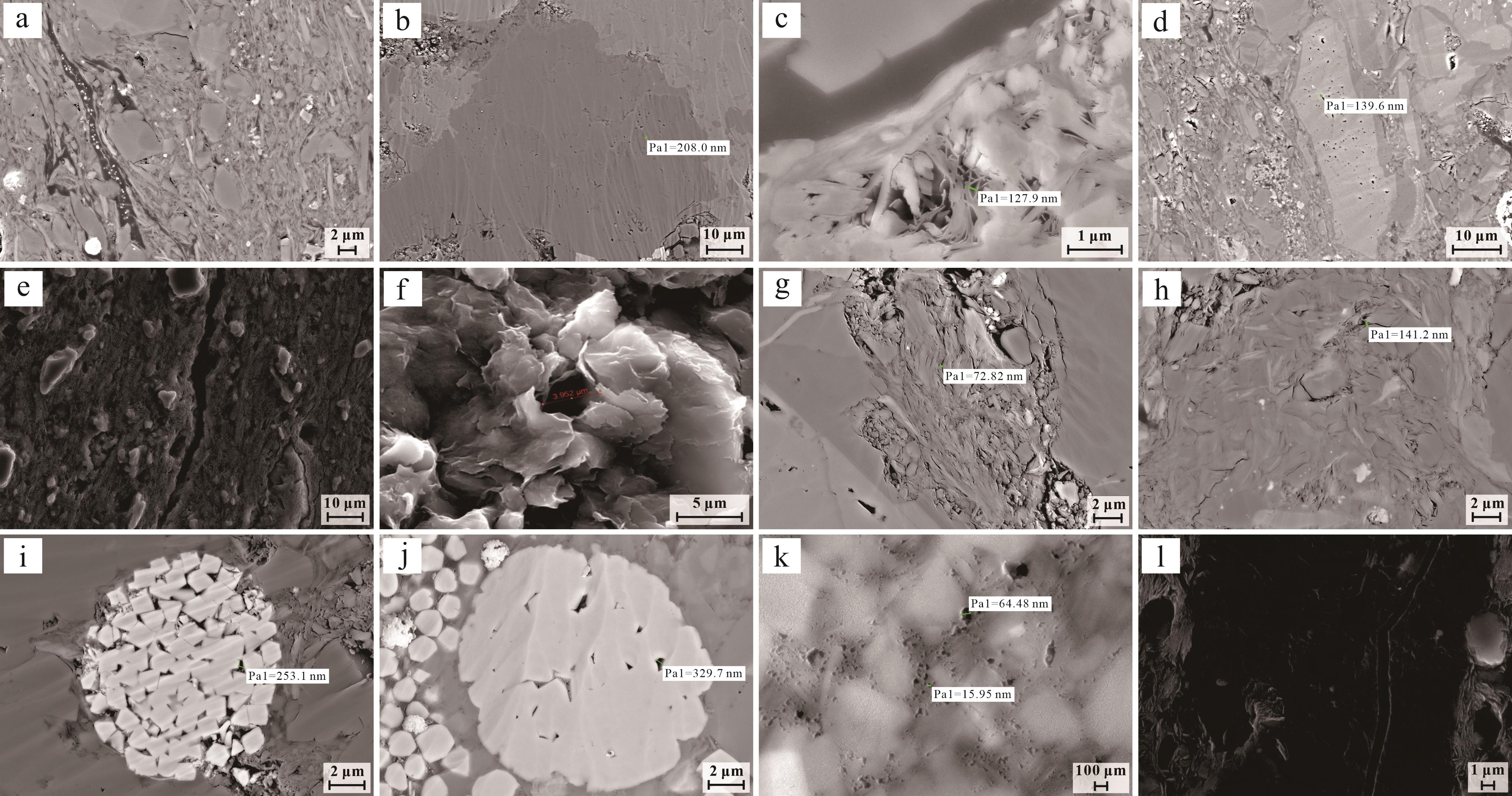
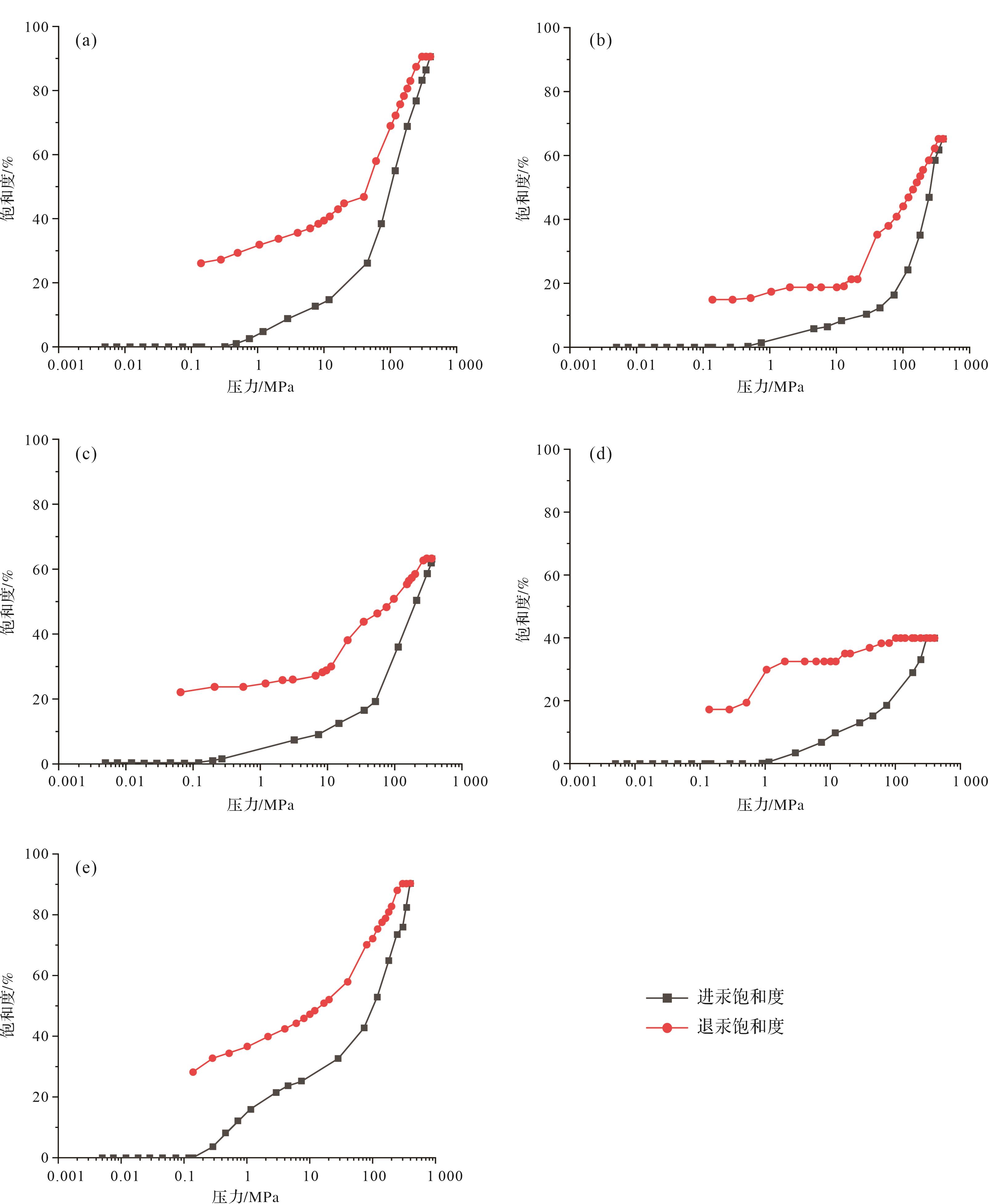
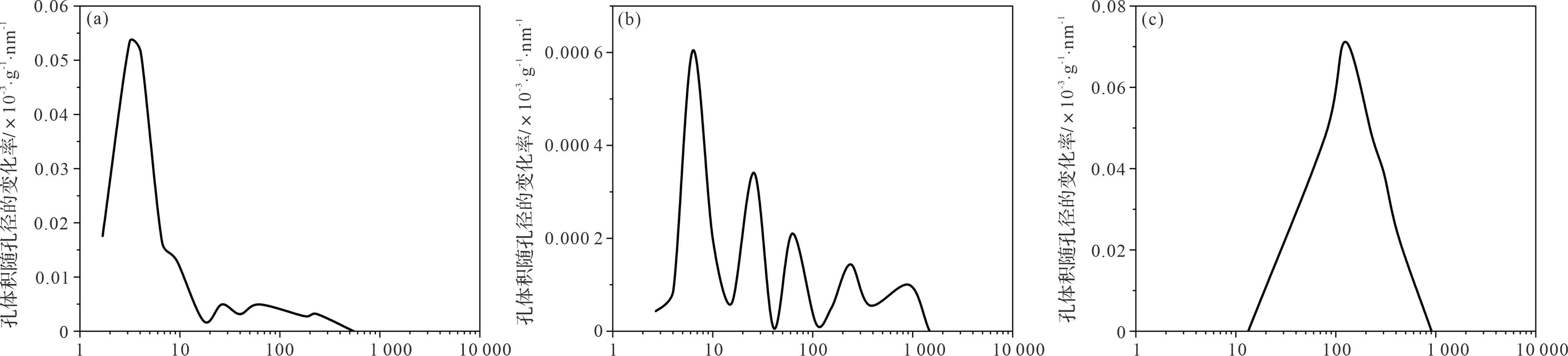
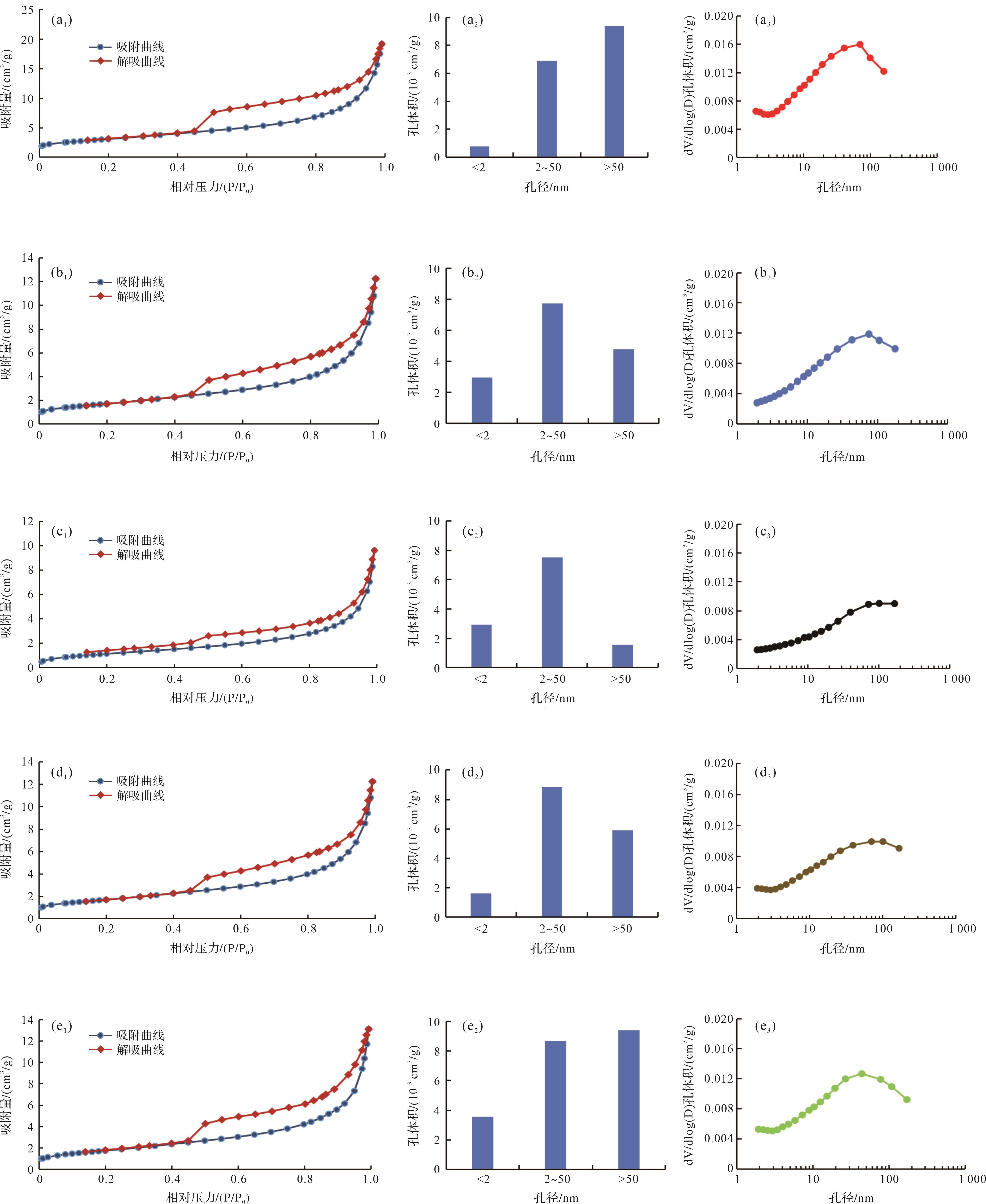
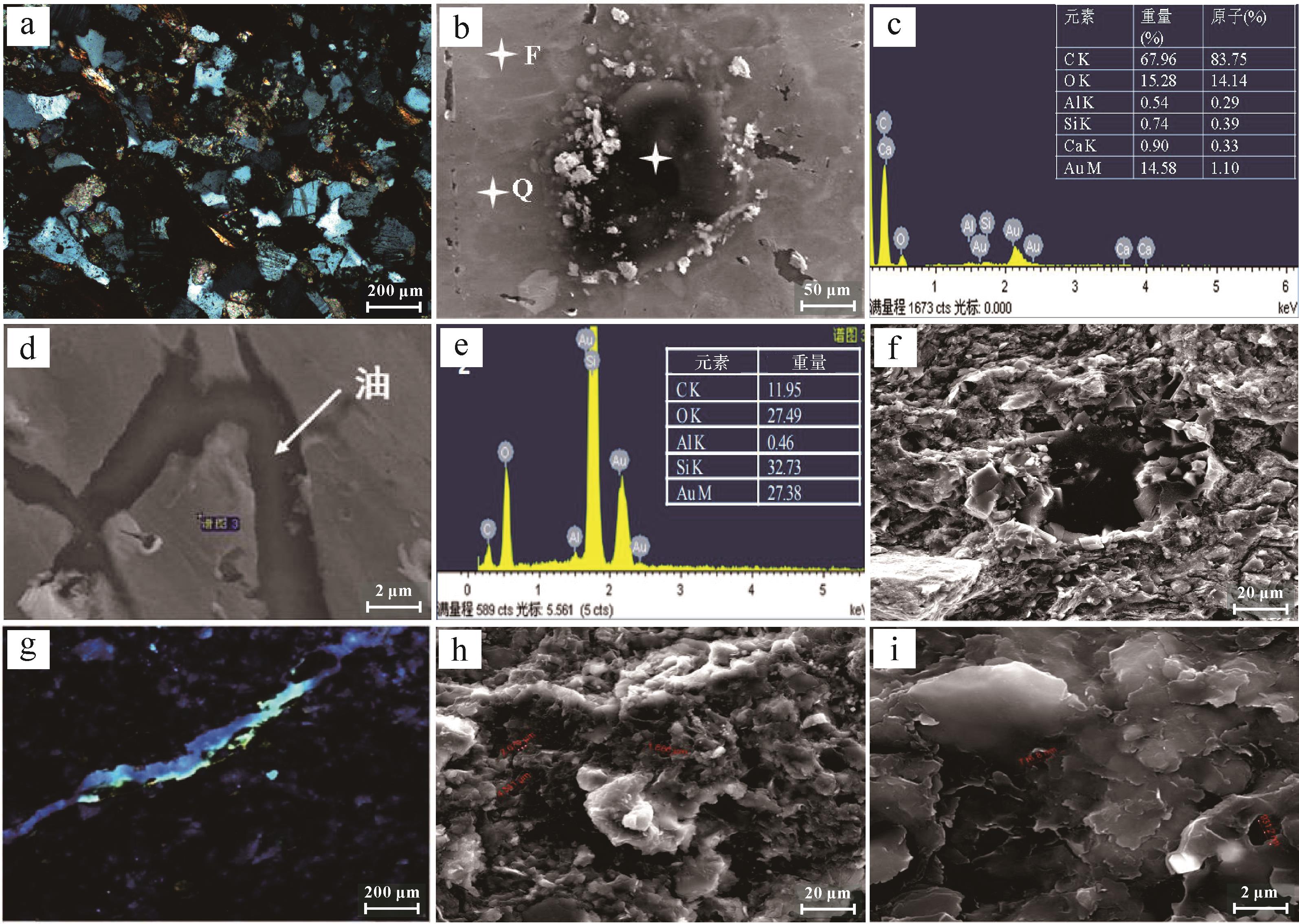
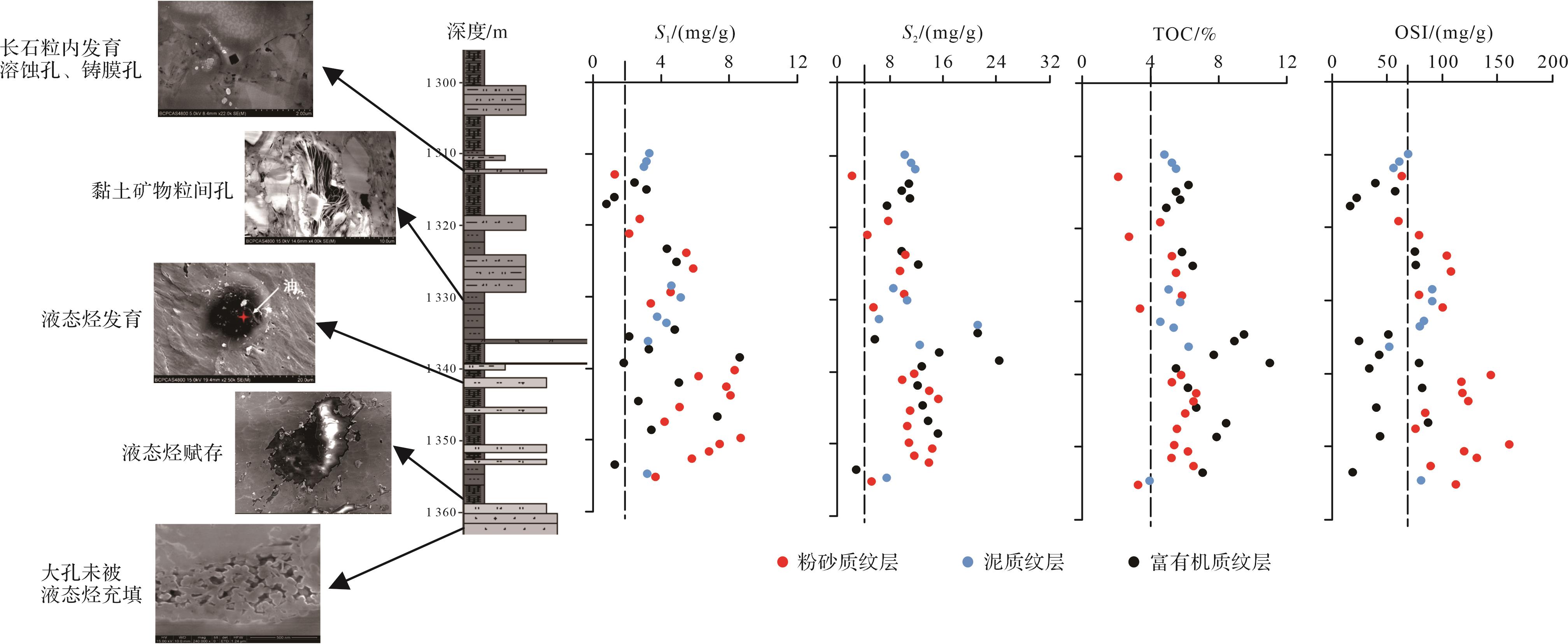
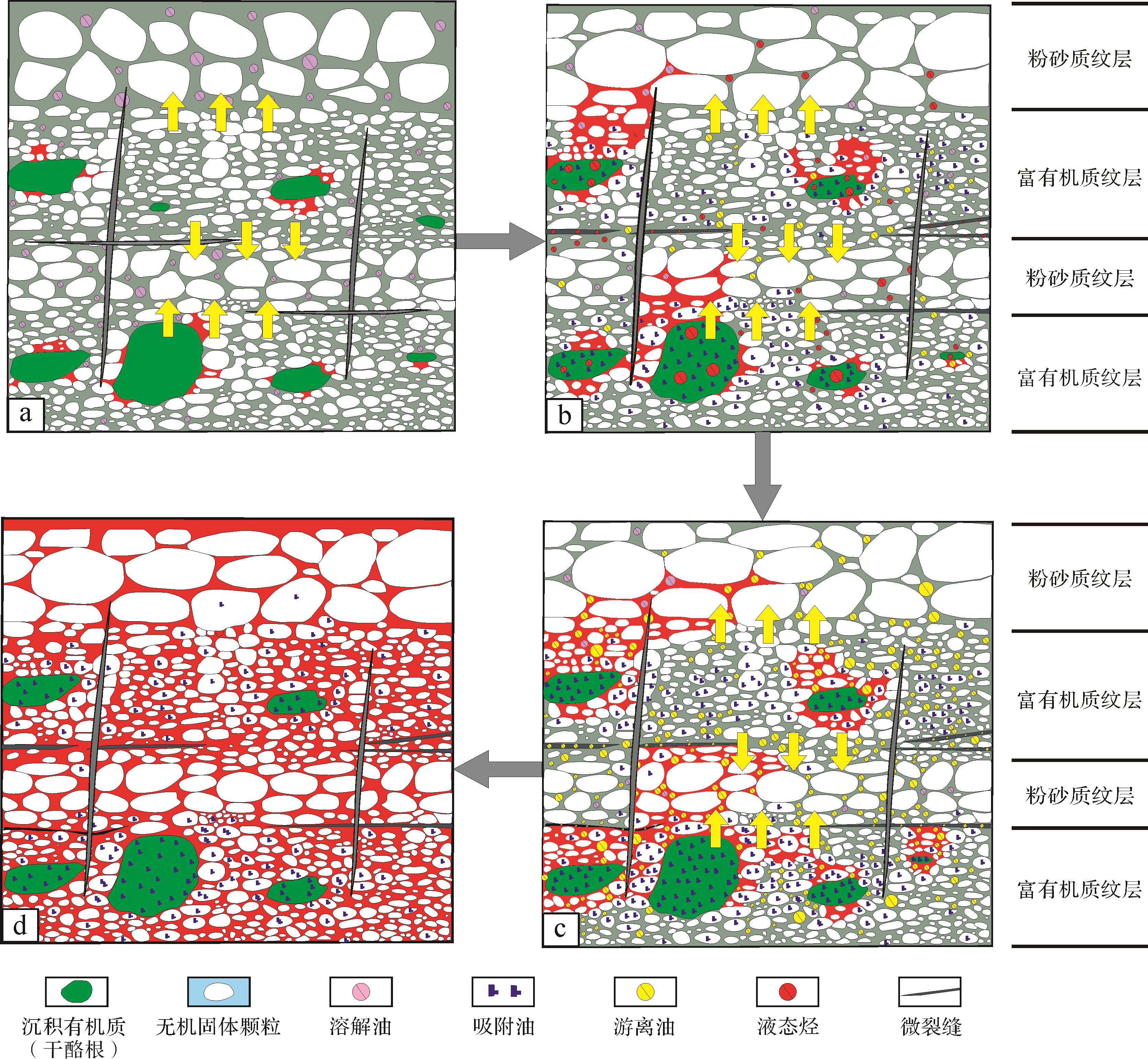

Since 1983 Bimonthly
Sponsor: Committee of Sedimentology, Chinese Society for Mineralogy, Petrology and Geochemistry
Commission on Sedimentary Geology, Geological Society of China
Northwest Institute of Eco-Environment and Resources, CAS
Editor-in-chief: Wang Chengshan
Research Trends
Sedimentologica Research Teammore
Sedimentologica Voicemore
- Asymmetry of extreme Cenozoic climate–carbon cycle events
- Towards understanding the origin of massive dolostones
- Zn isotopic evidence for paleoenvironmental evolution during the Cretaceous ocean anoxic event OAE2
- Coupling relationship between deep time long period climate change and chemical weathering of silicate rocks
- Microbially mediated organomineralization in the formation of ooids
Sedimentology Classmore
-
Sedimentology Class: Active Marine Carbon During Sturtian “Snowball Earth” Glaciation
-
Sedimentology Class: Source-to-Sink System Budget Analysis of Continental Fluvial-Lacustrine Sedimentary Association: A case study from the Middle Jurassic in the northern Qaidam Basin
-
Sedimentology Class: Research Processes on Deep-water Interaction Between Contour Current and Gravity Flow Deposits, 2000 to 2022
-
Sedimentology Class: Wildfire Records Across the Triassic-Jurassic Boundary in the Southern Margin of the Junggar Basin, and Global Correlations