2022 Vol. 40, No. 4
Display Method:
2022, 40(4): 861-870.
doi: 10.14027/j.issn.1000-0550.2021.103
Abstract:
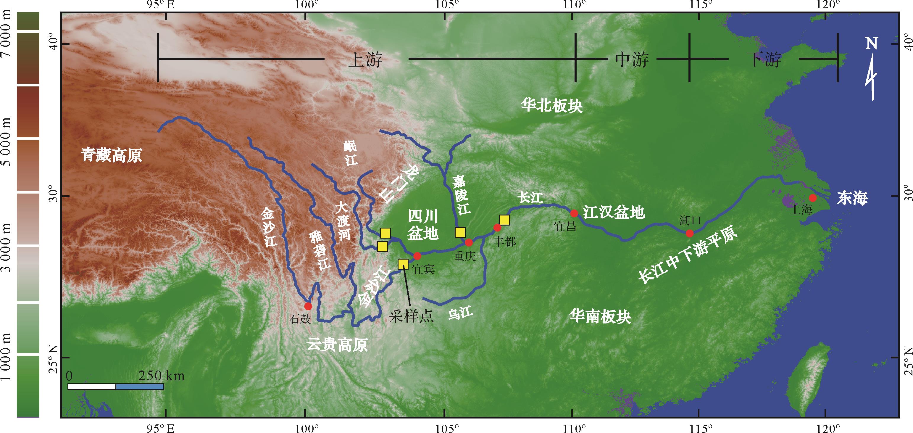
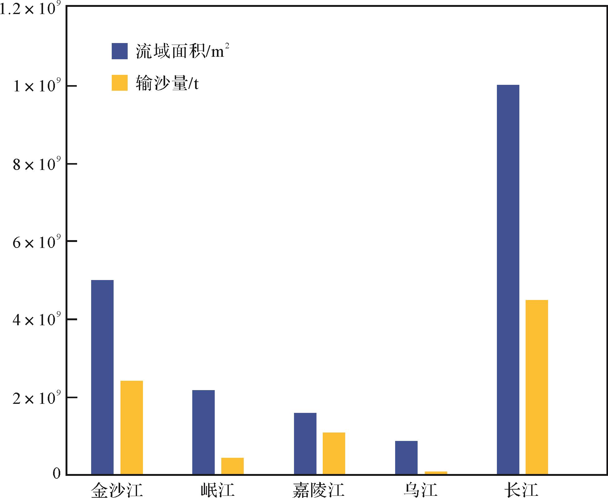
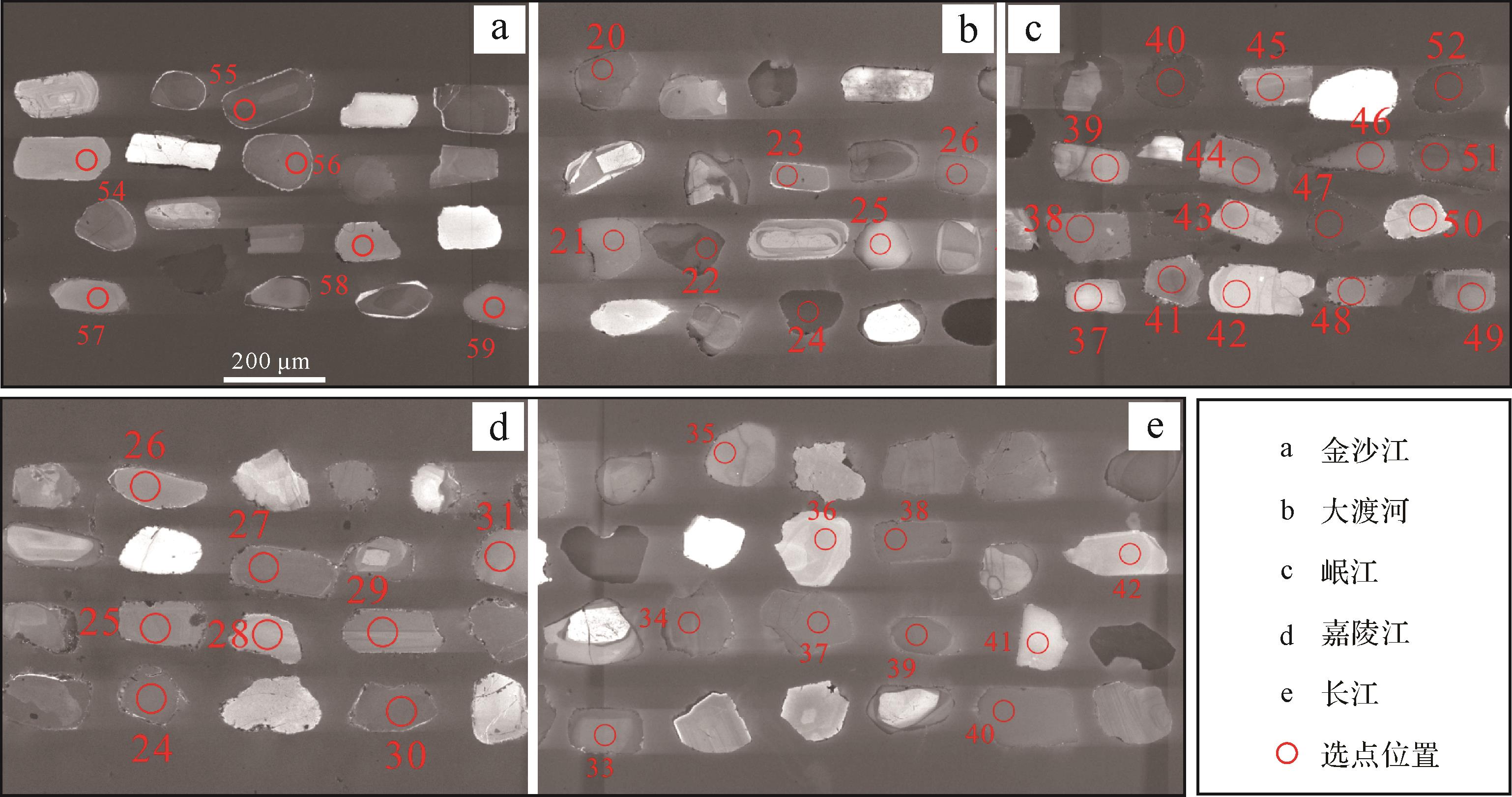
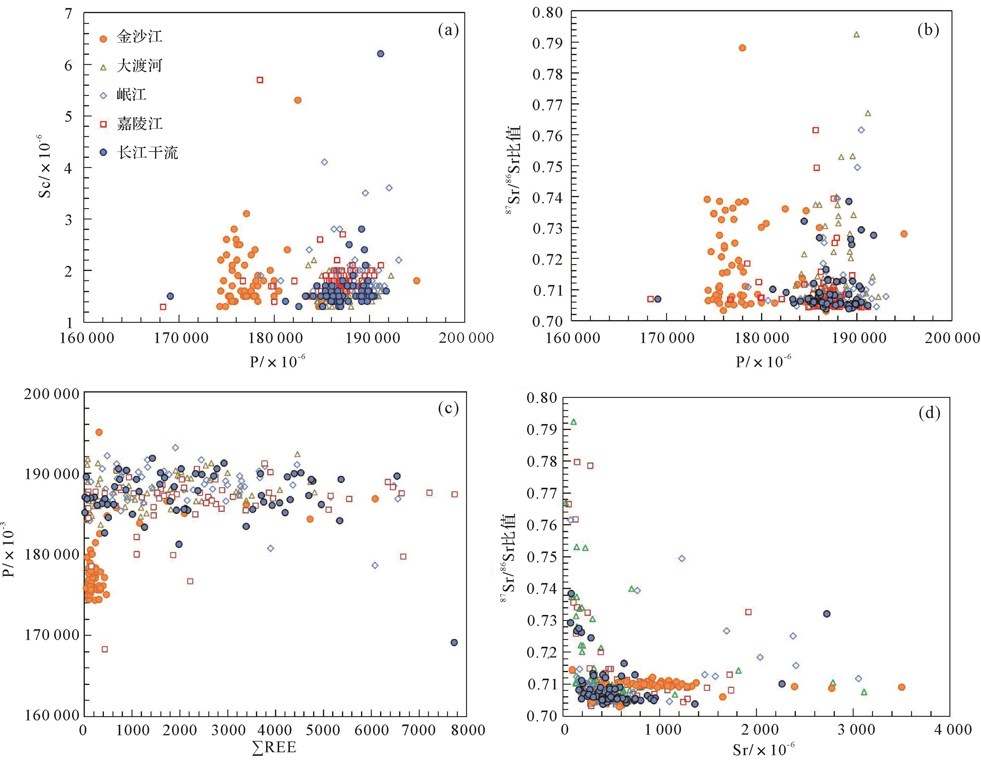
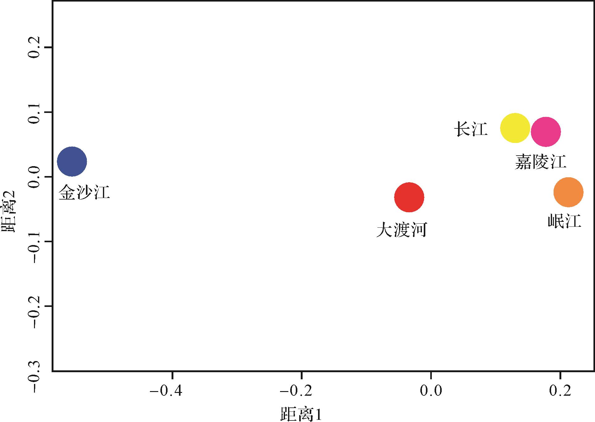
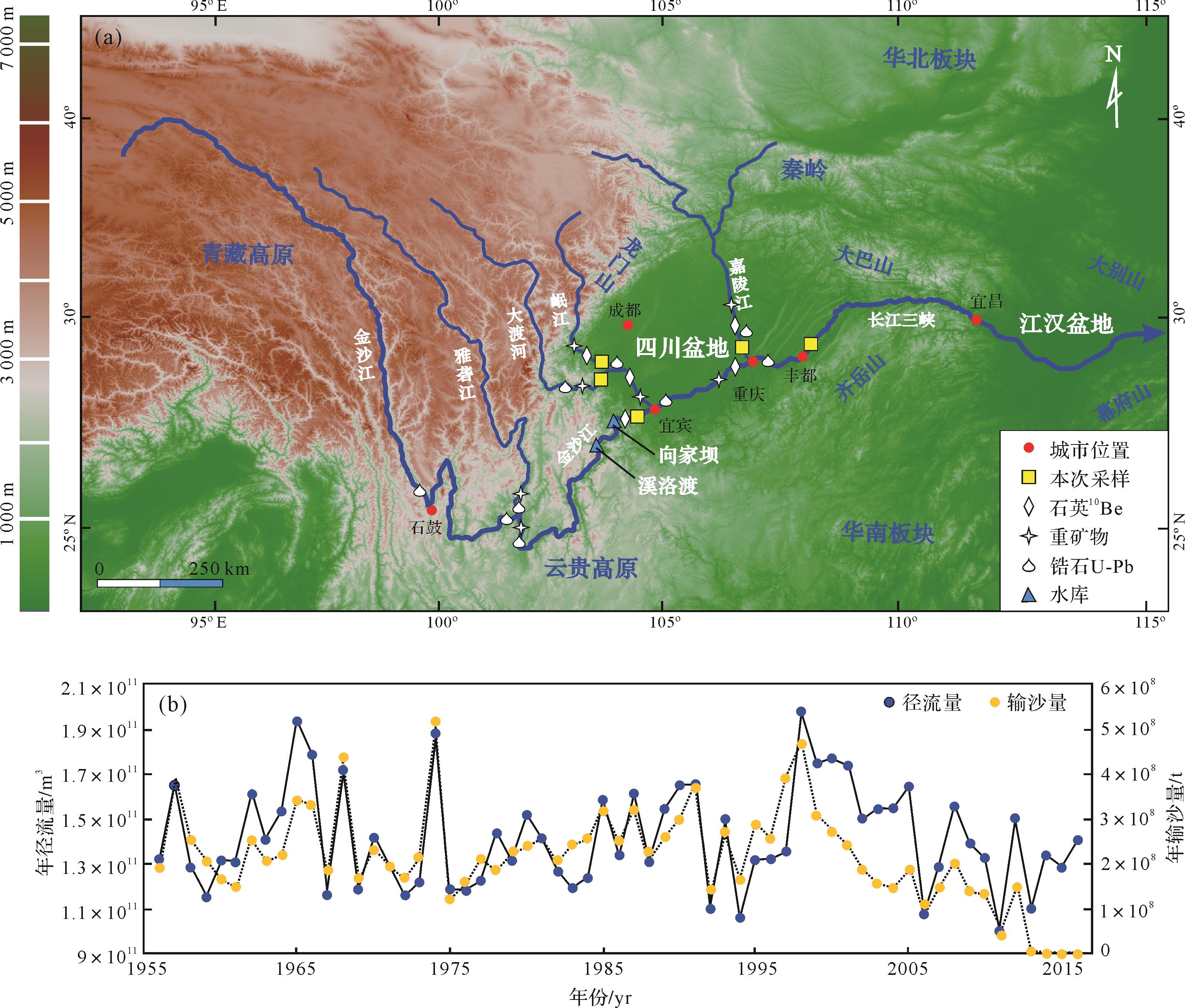
The Yangtze River is the largest river in East Asia, connecting the Tibetan Plateau and the western Pacific Ocean. The study of its source and sink process is of great scientific significance for understanding the processes of sediment denudation, transport and deposition. In situ analysis of trace elements and 87Sr/86Sr ratios in apatite commonly found in river sediments found from a two-dimensional scatter plot that the distribution area of the Jinsha River was significantly different from that of the Dadu, Minjiang and Jialing Rivers. The Yangtze River mainstream samples in the Fengdu section overlap with those from the Dadu, Minjiang and Jialing Rivers. When combined with the results from a multidimensional scaling (MDS) judgement chart, it was indicated that the material in the main stream of the Yangtze River in the Fengdu Section mainly comes from the Longmen Mountain. The in situ geochemical analysis of apatite effectively distinguished the materials originating from the Jinsha River in the southeastern Tibetan Plateau and from the Dadu, Minjiang and Jialing Rivers in the Longmen Mountain. This provides a better reference for future provenance-tracing studies of the whole Yangtze River Basin. However, due to the important influence of current construction of the Jinsha River cascade hydropower station on the composition of its downstream sediment, caution should be exercised when applying this method in such future studies.
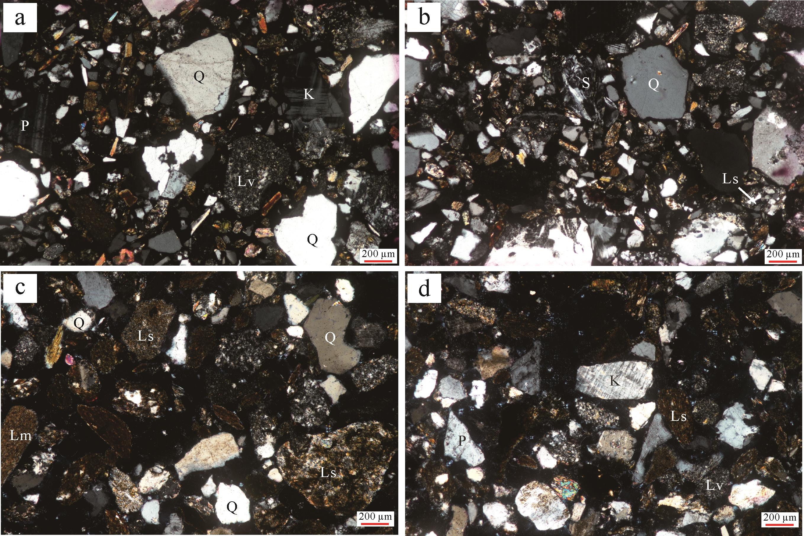
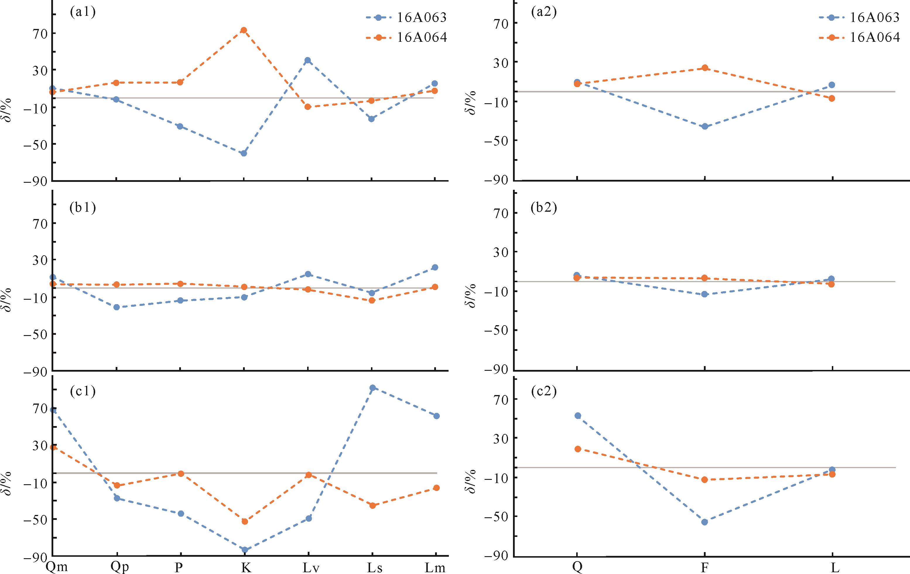
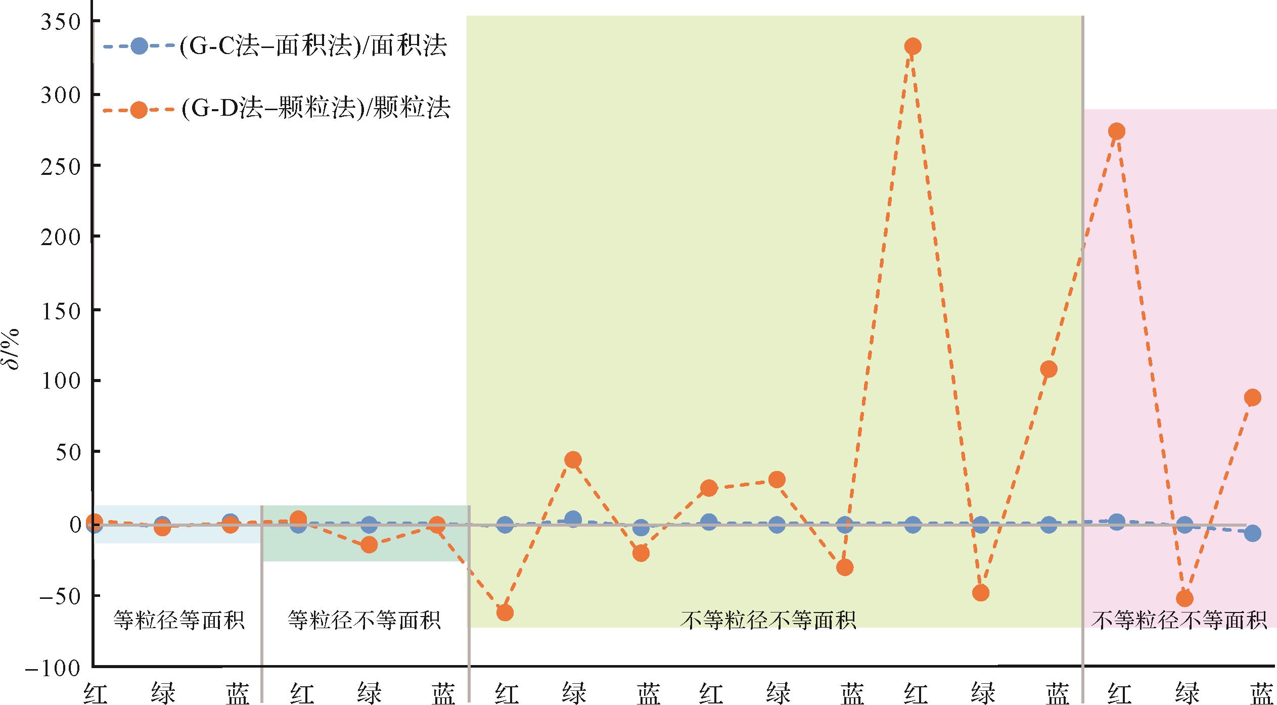
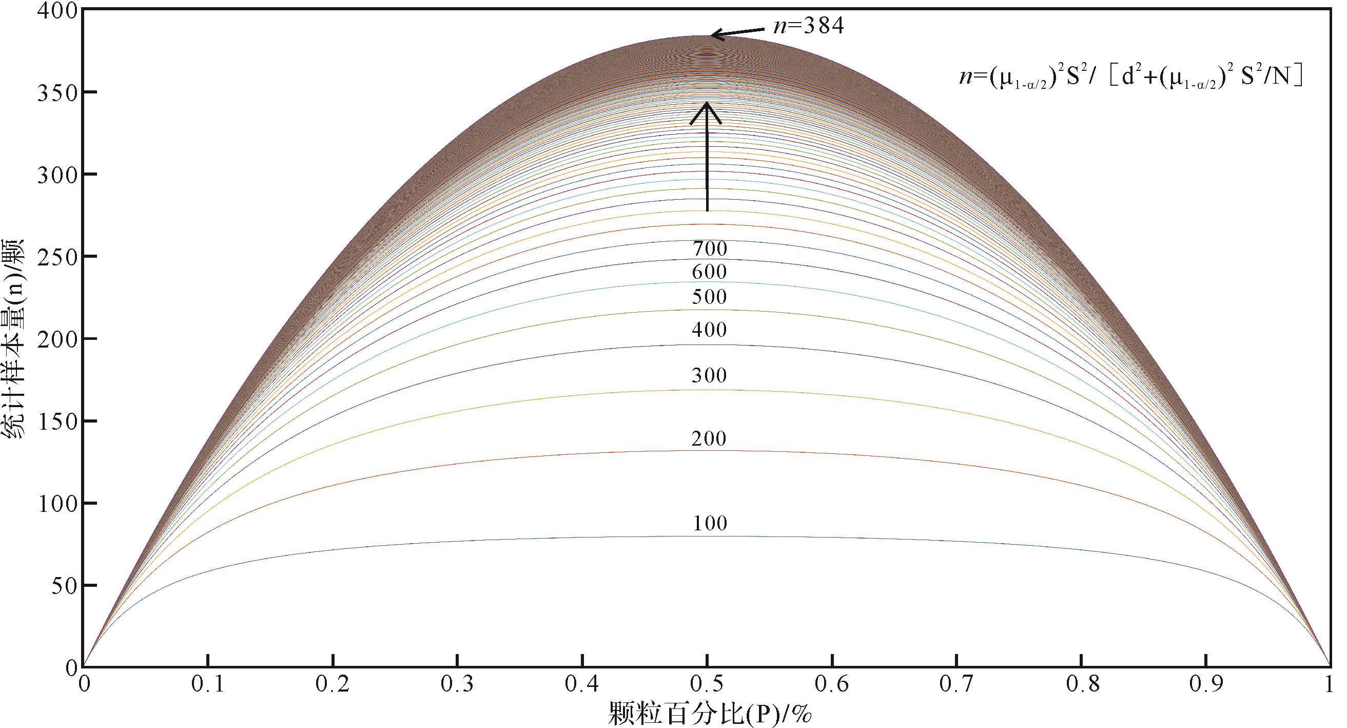
2022, 40(4): 871-882.
doi: 10.14027/j.issn.1000-0550.2021.099
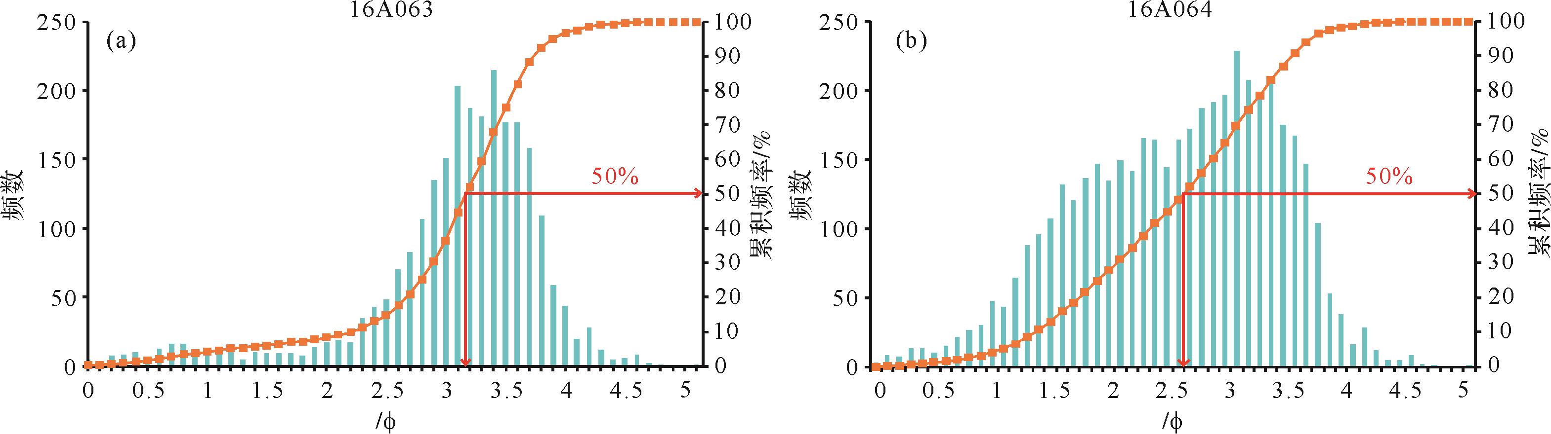
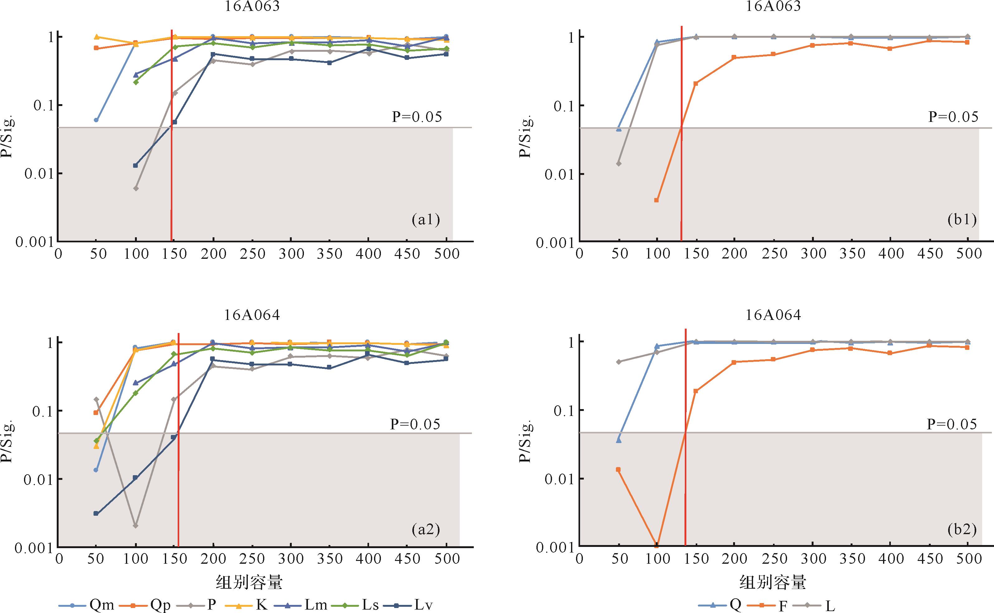
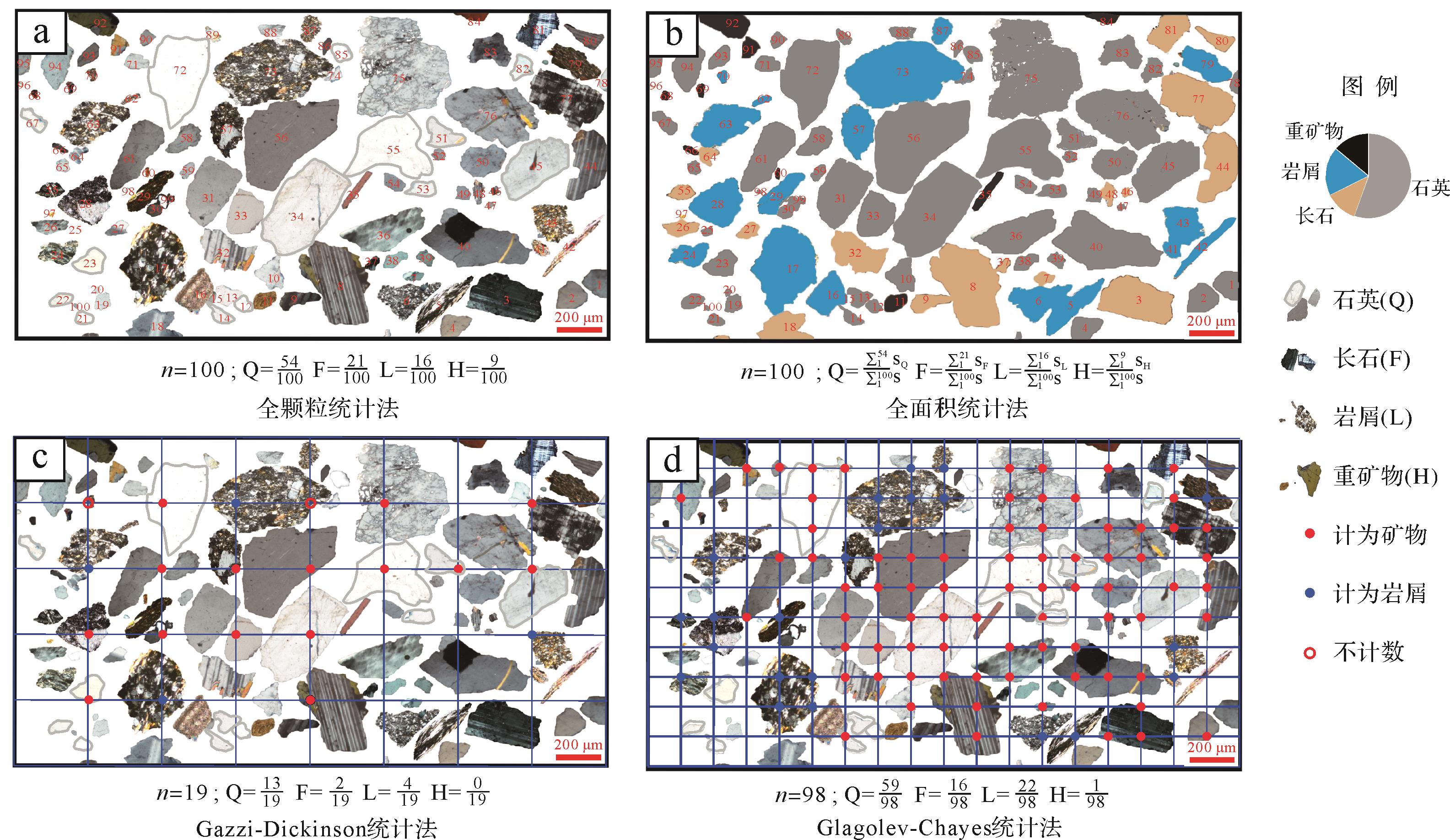
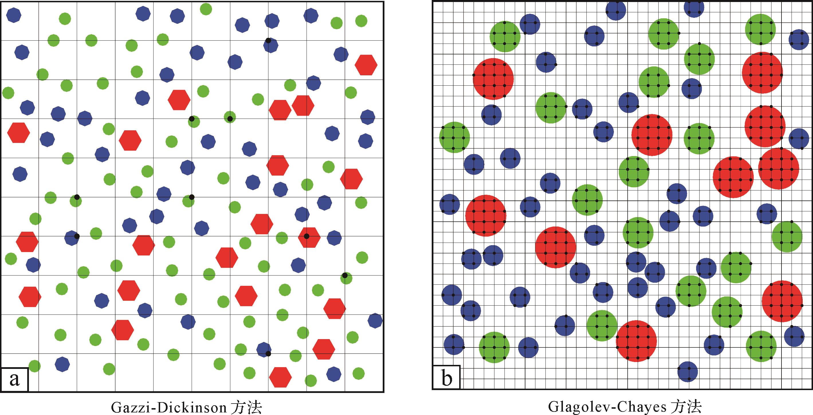
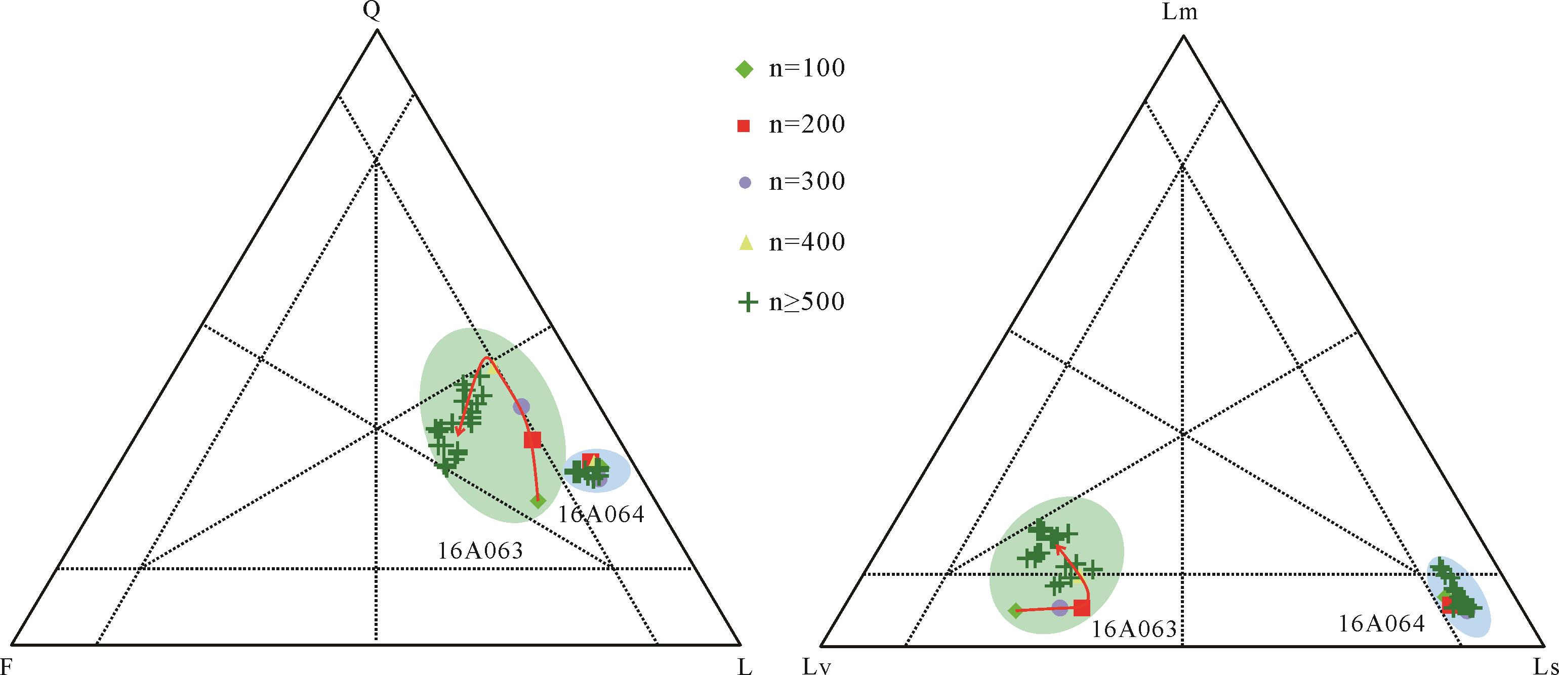
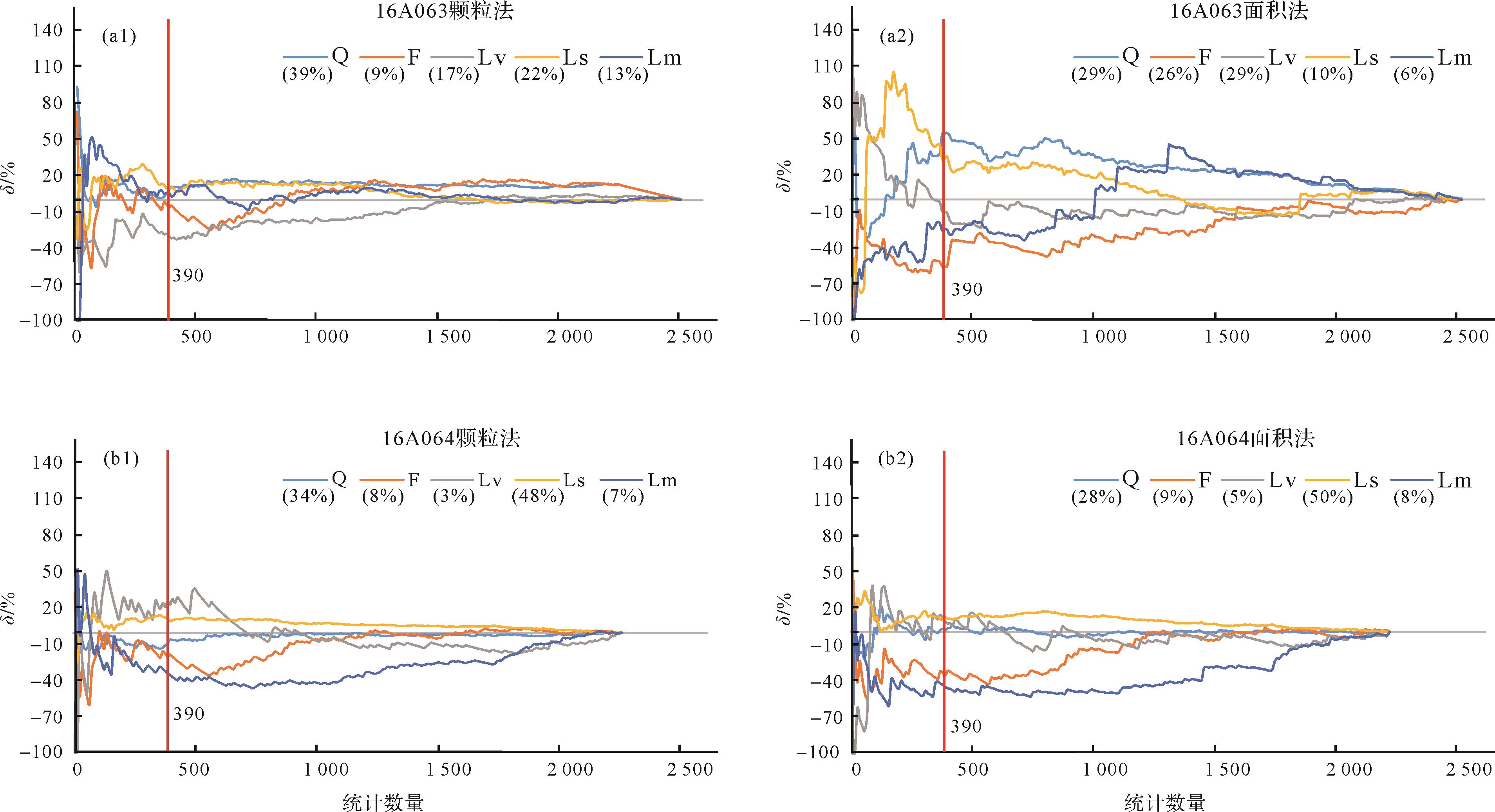
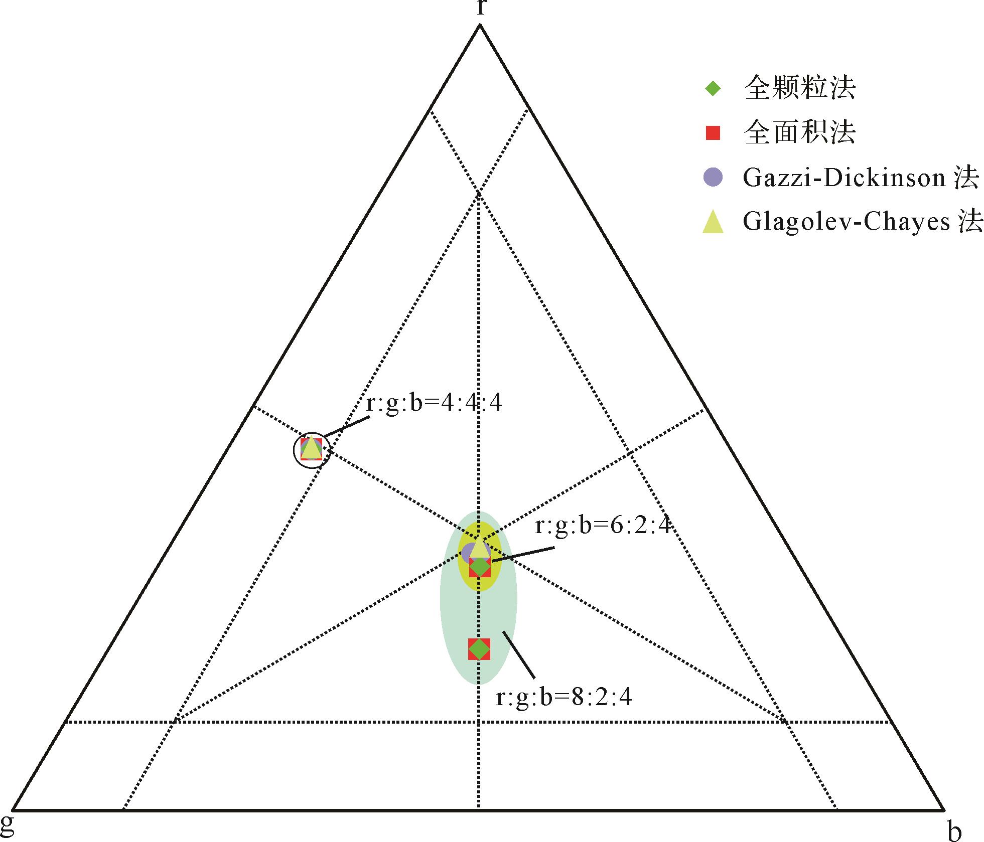
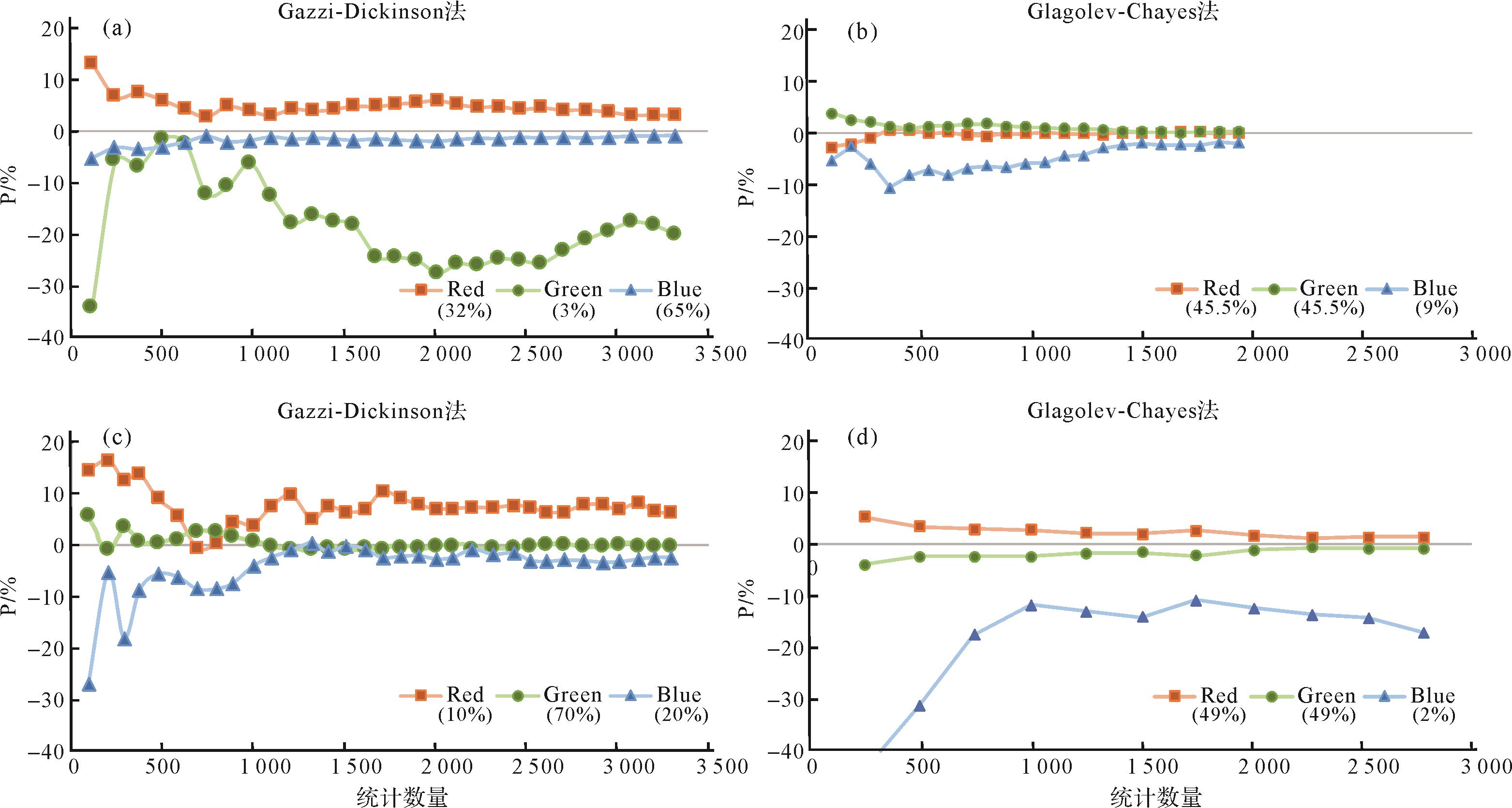
Abstract:
Statistical analysis is the most effective way of determining the component and content of sand or sandstone, and is widely applied in the analysis of terrigenous detritus. Methods include grain counting, the Glagolev-Chayes method, the Gazzi-Dickinson method and the area method. The number of grains to be taken into account in each of these approaches is controversial, and ranges between 300 and 500. The extent to which the statistical result is affected by the sorting degree and grain percentage has not previously been addressed. In this study, two modern river sand samples were collected from the main stream of the Yarlung Tsangpo River for statistical analysis using the four methods, in addition to Matlab simulation statistics. The area method was adopted as the standard which most closely represents the true composition of the sample. It was found that the Glagolev-Chayes method was the most similar to the area method, and the grain-counting method gave the greatest difference. Moreover, poorer sorting of the samples increased the discrepancy between the grain-counting method and the area method, leading to a statistical bias for the components comprising less than 10% of the sample, and the Lv/Lm/Ls diagram is not recommended in this case. The count number is no less than 384 to ensure 95% confidence. Either the area method or the Glagolev-Chayes method is highly recommended rather than the Gazzi-Dickinson method for detrital statistics when calculating river flux.
2022, 40(4): 883-893.
doi: 10.14027/j.issn.1000-0550.2021.123
Abstract:
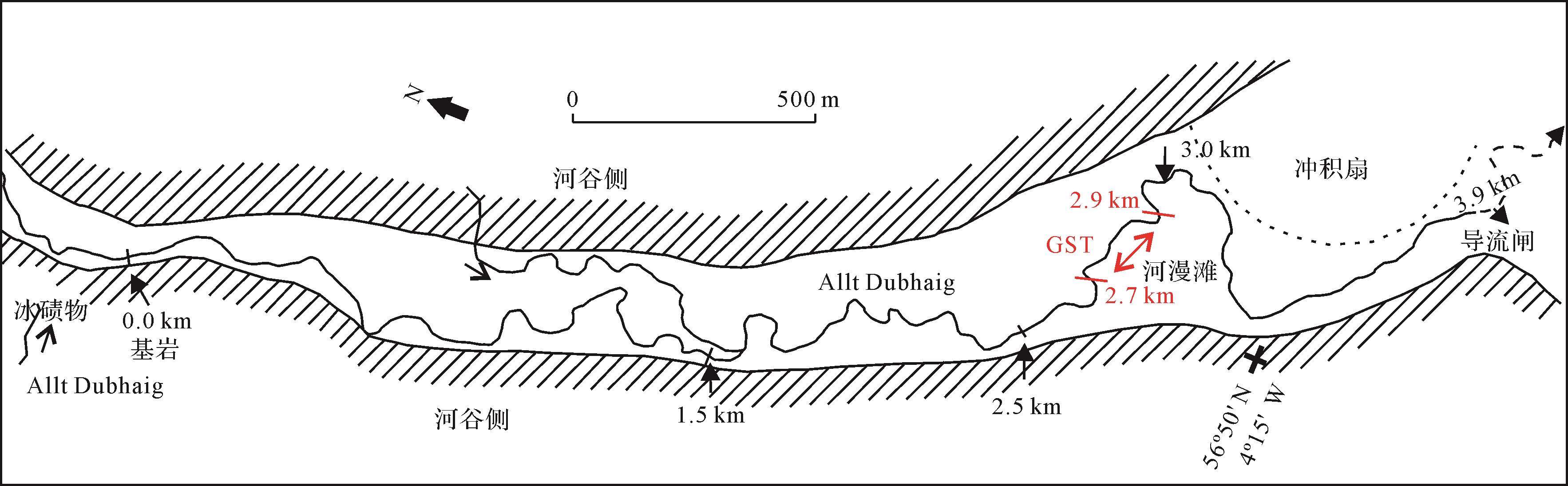
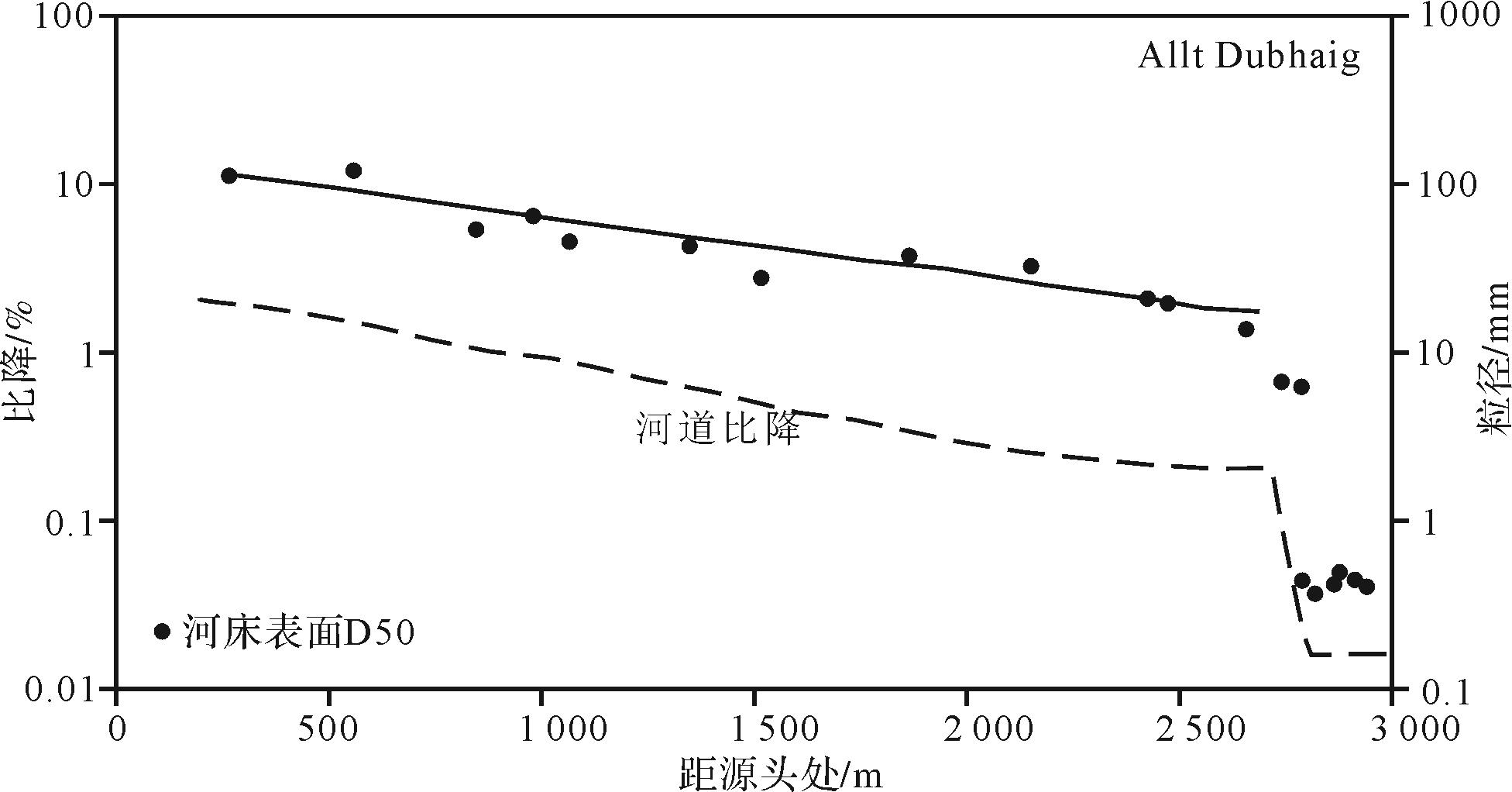
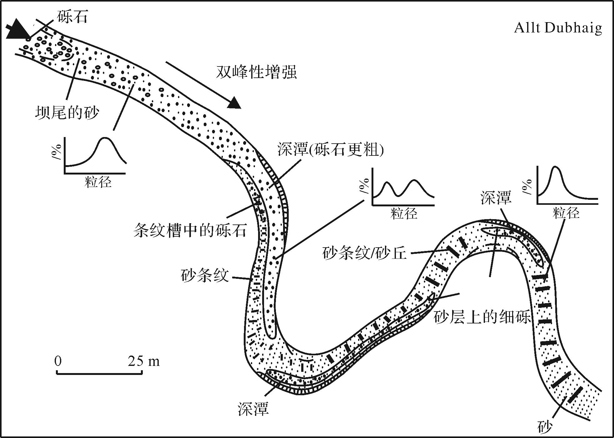
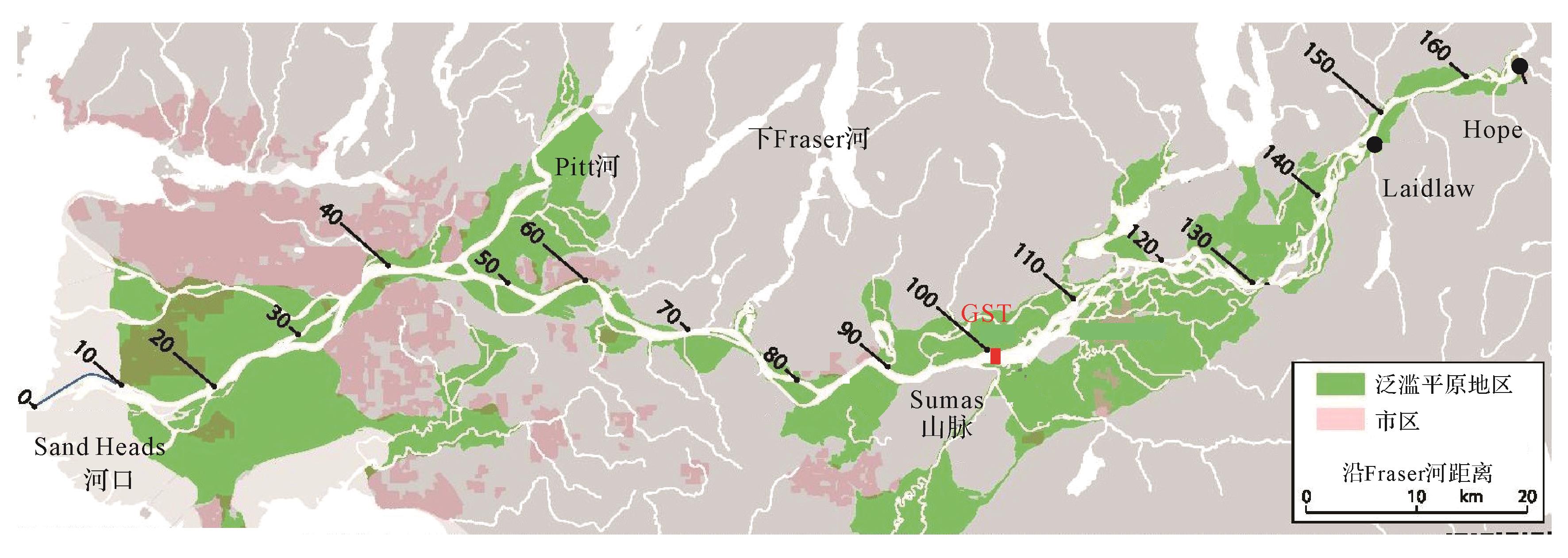
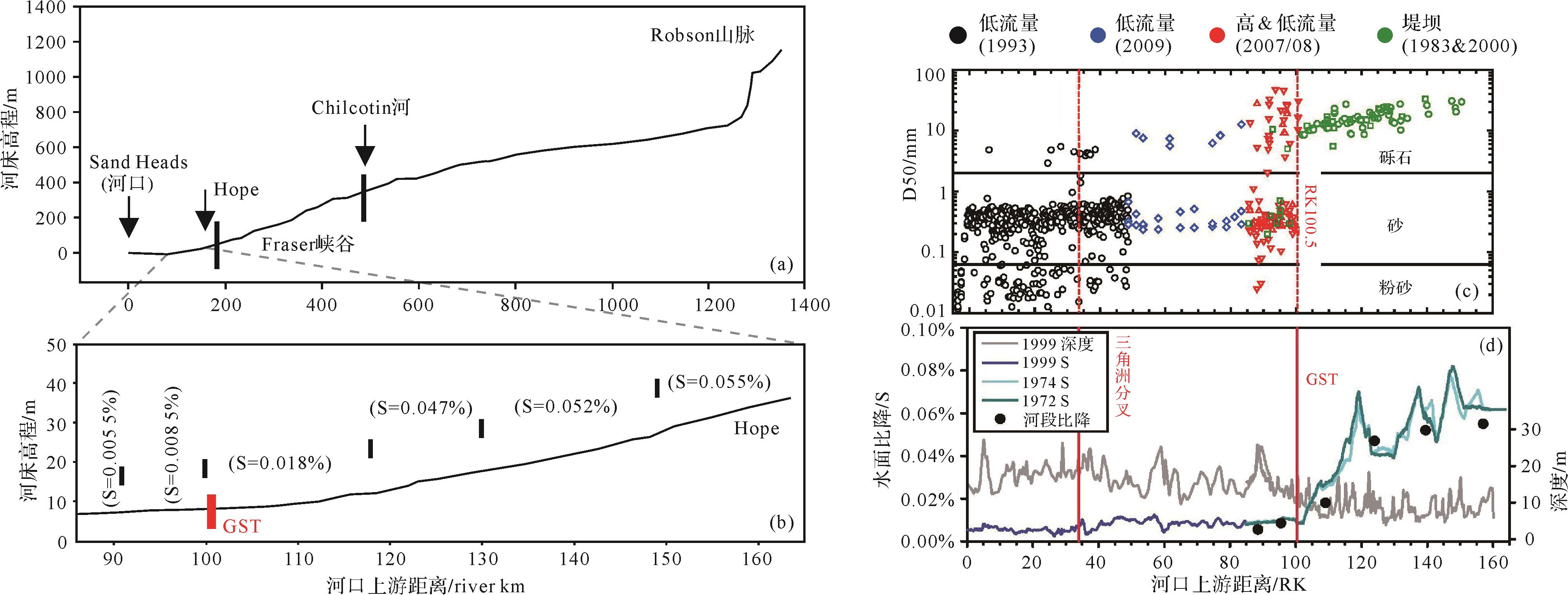
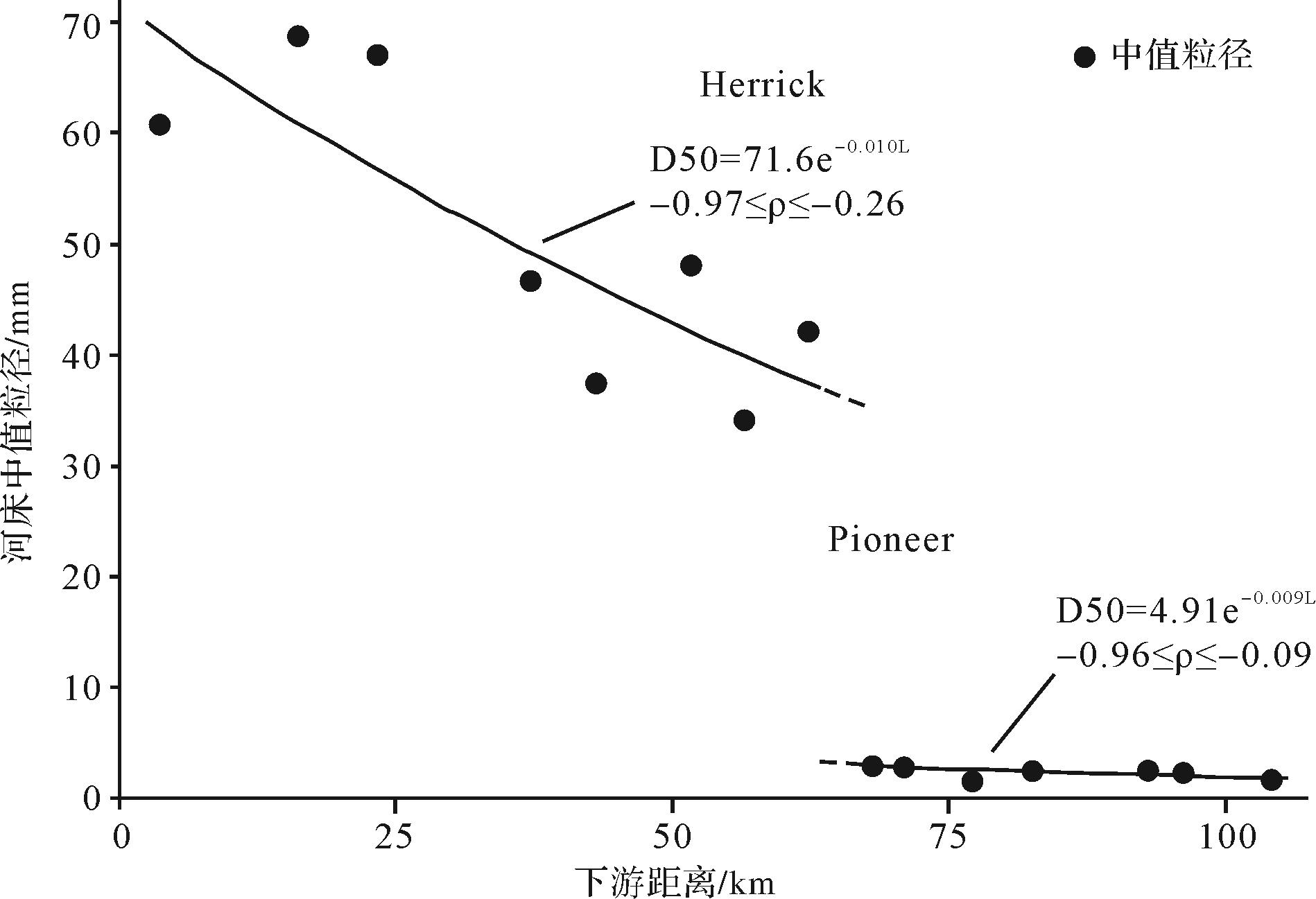
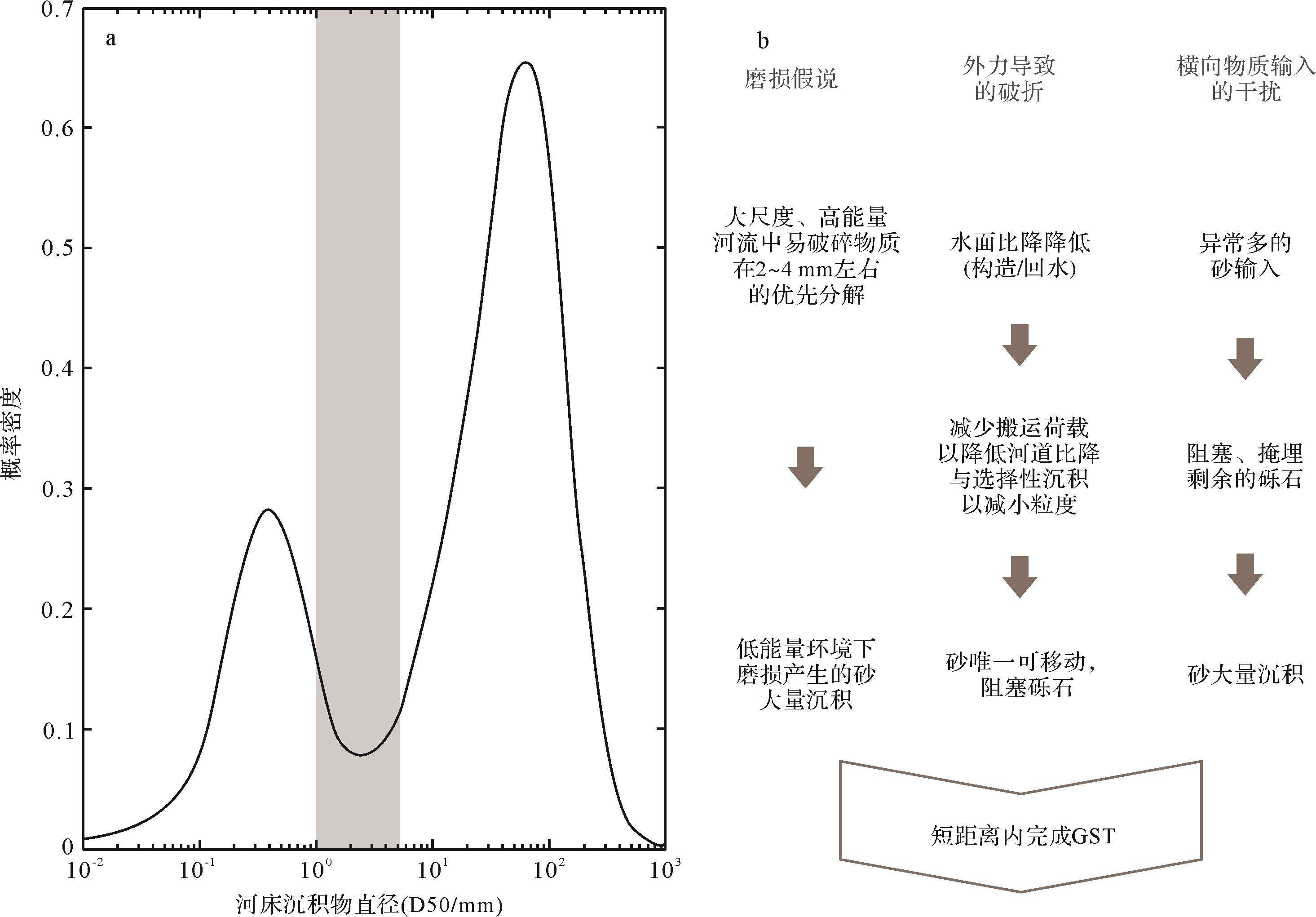
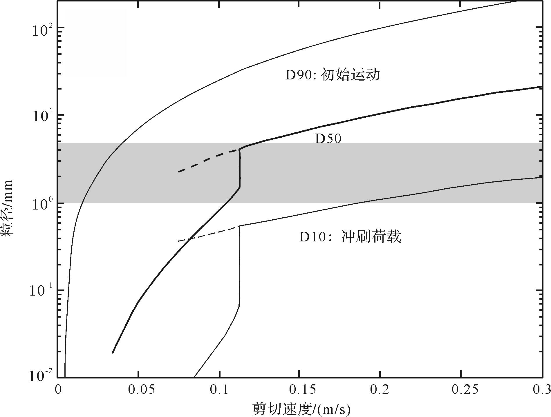
As rivers develop from upstream mountainous areas to a broad plain, the transported materials gradually become finer due to abrasion and sorting. However, once the particle size has been reduced to 10-20 mm (medium-coarse pebbles), it abruptly changes within a relatively short distance (a few channel widths) to the size of very coarse sand (1-2 mm); that is, little or no material is present in the 2-10 mm range. This phenomenon is known as gravel-sand transition (GST). The present study summarizes reported research on GST in rivers, and introduces its basic behavior for typical rivers. Three possible GST mechanisms are then analyzed: the external hypothesis of grain size change; the internal explanation of the 2-10 mm gap in grain size; and the processes that increase the mobility of gravel and sand in GST. It also introduces the spatial universality of GST and river variation before and after GST, as well as the stability of location of the phenomenon. The gravel-sand transition is highly significant in the contexts of river evolution, sediment transport, flood risk management and sedimentary provenance analysis.
2022, 40(4): 894-911.
doi: 10.14027/j.issn.1000-0550.2021.134
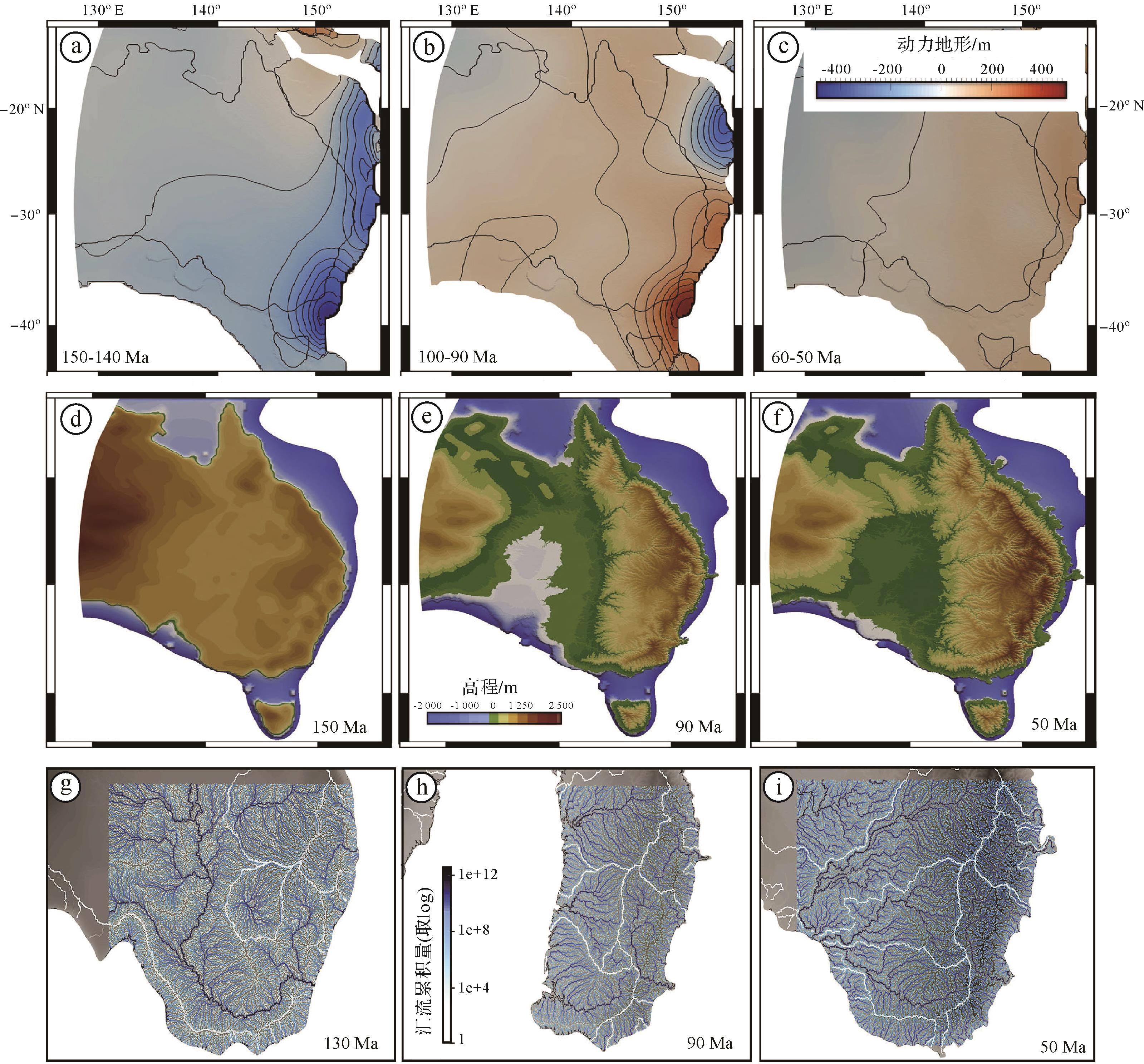
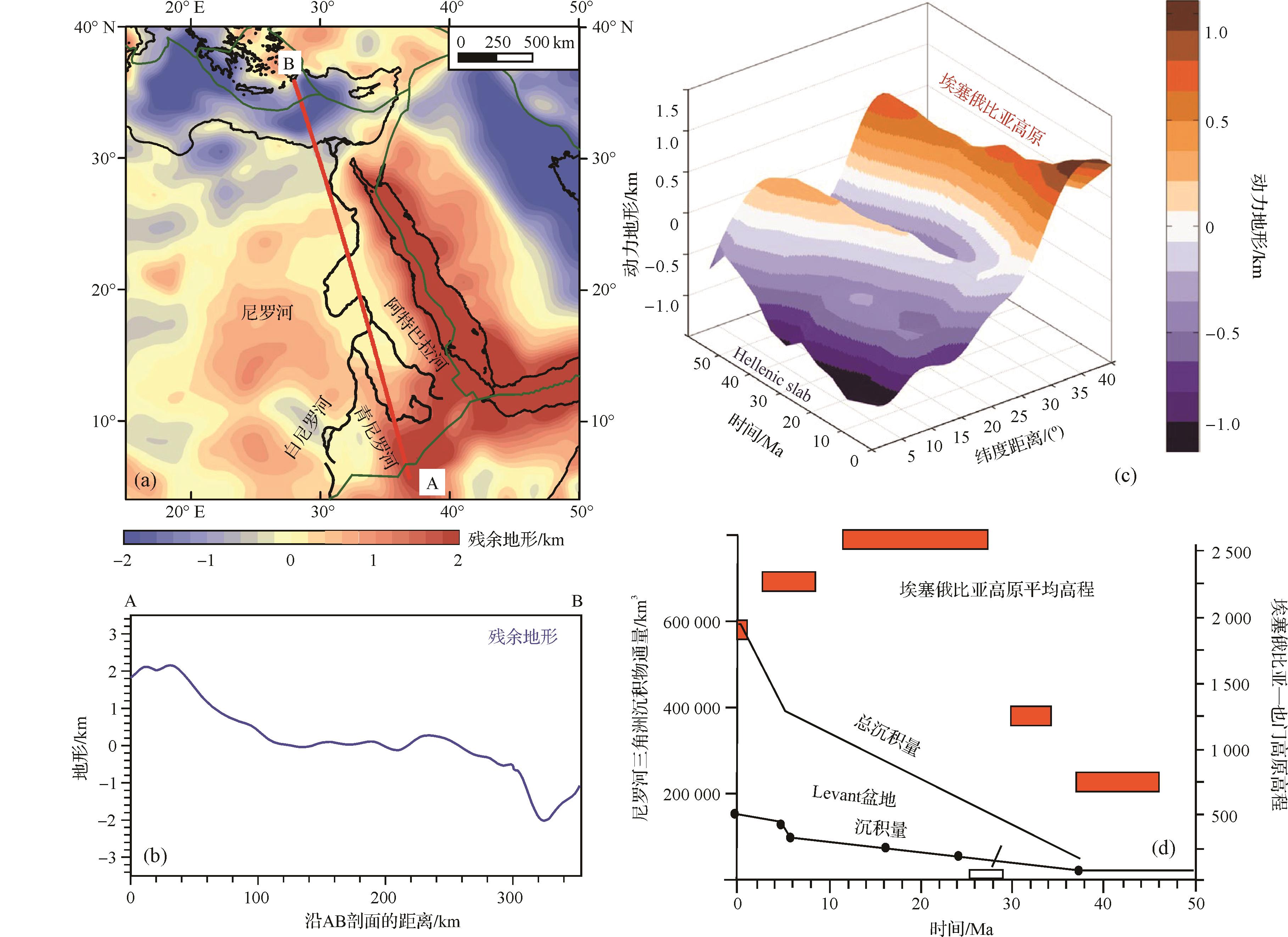
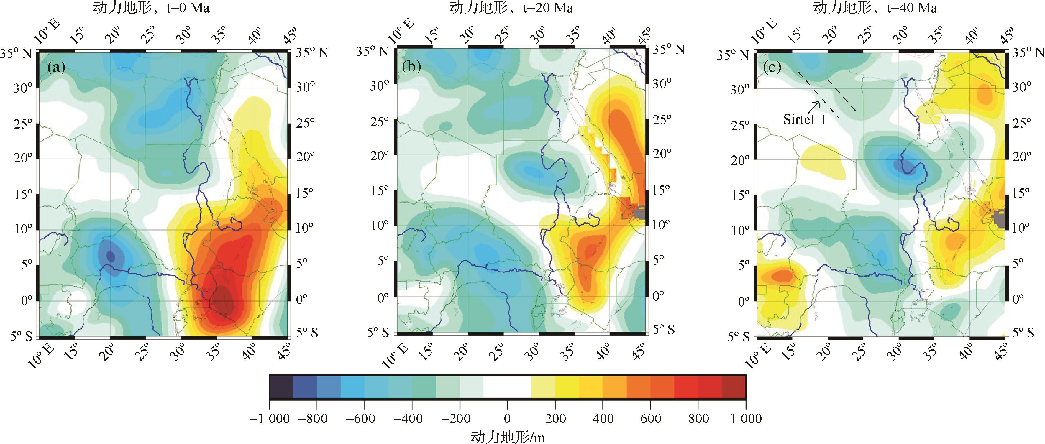
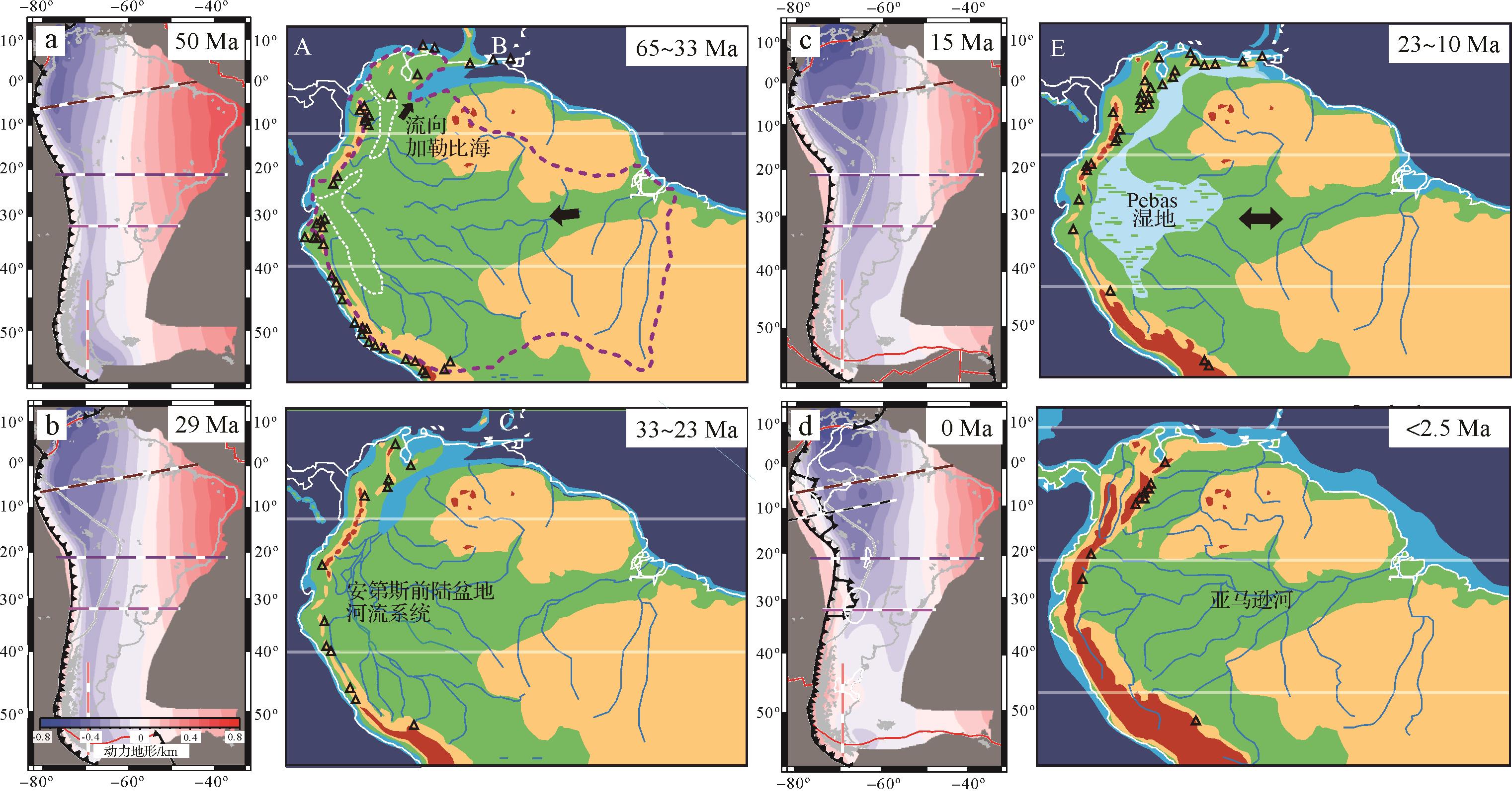
Abstract:
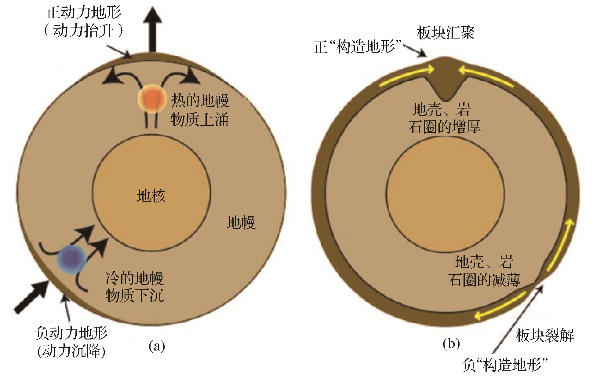
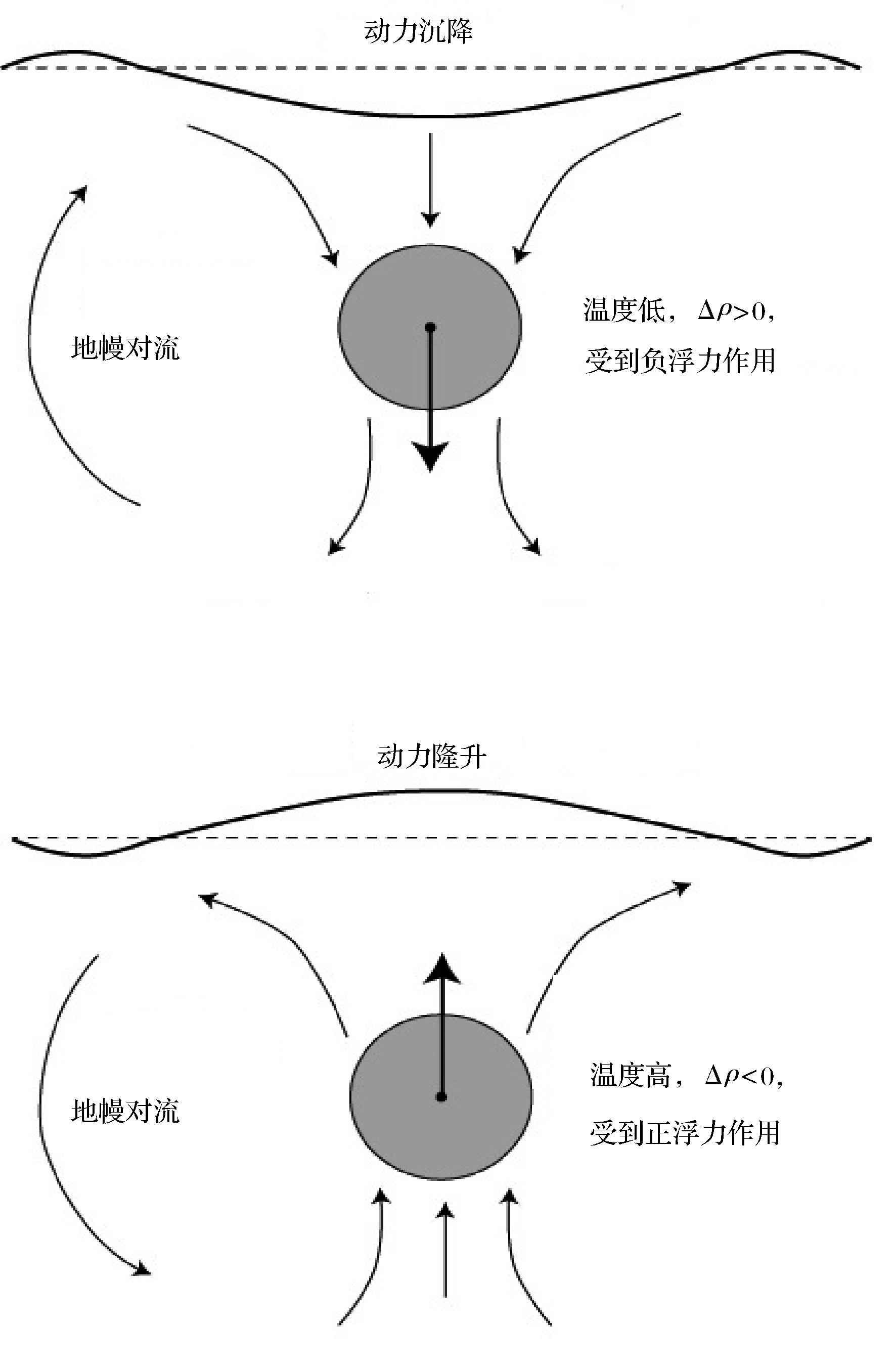
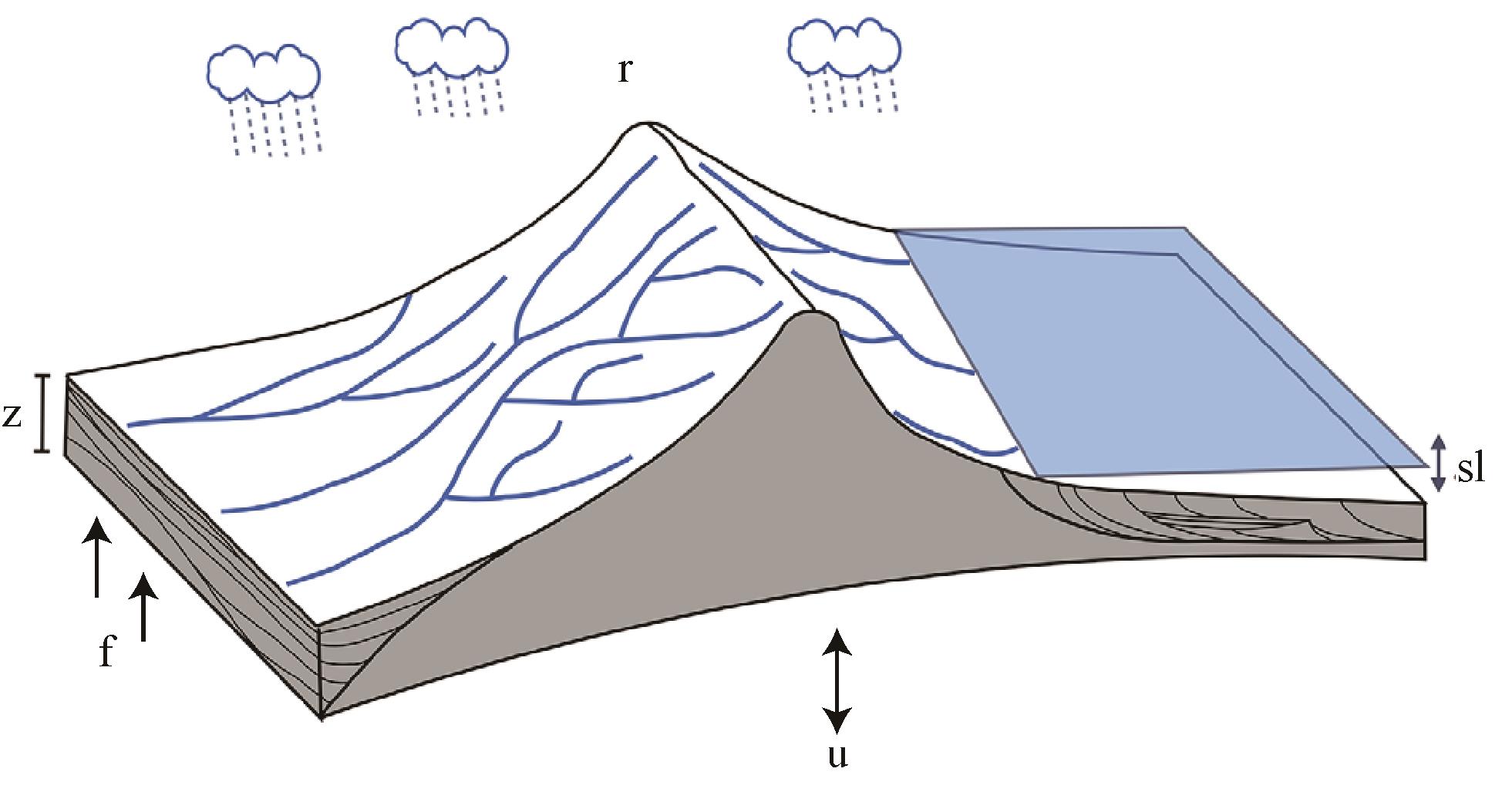
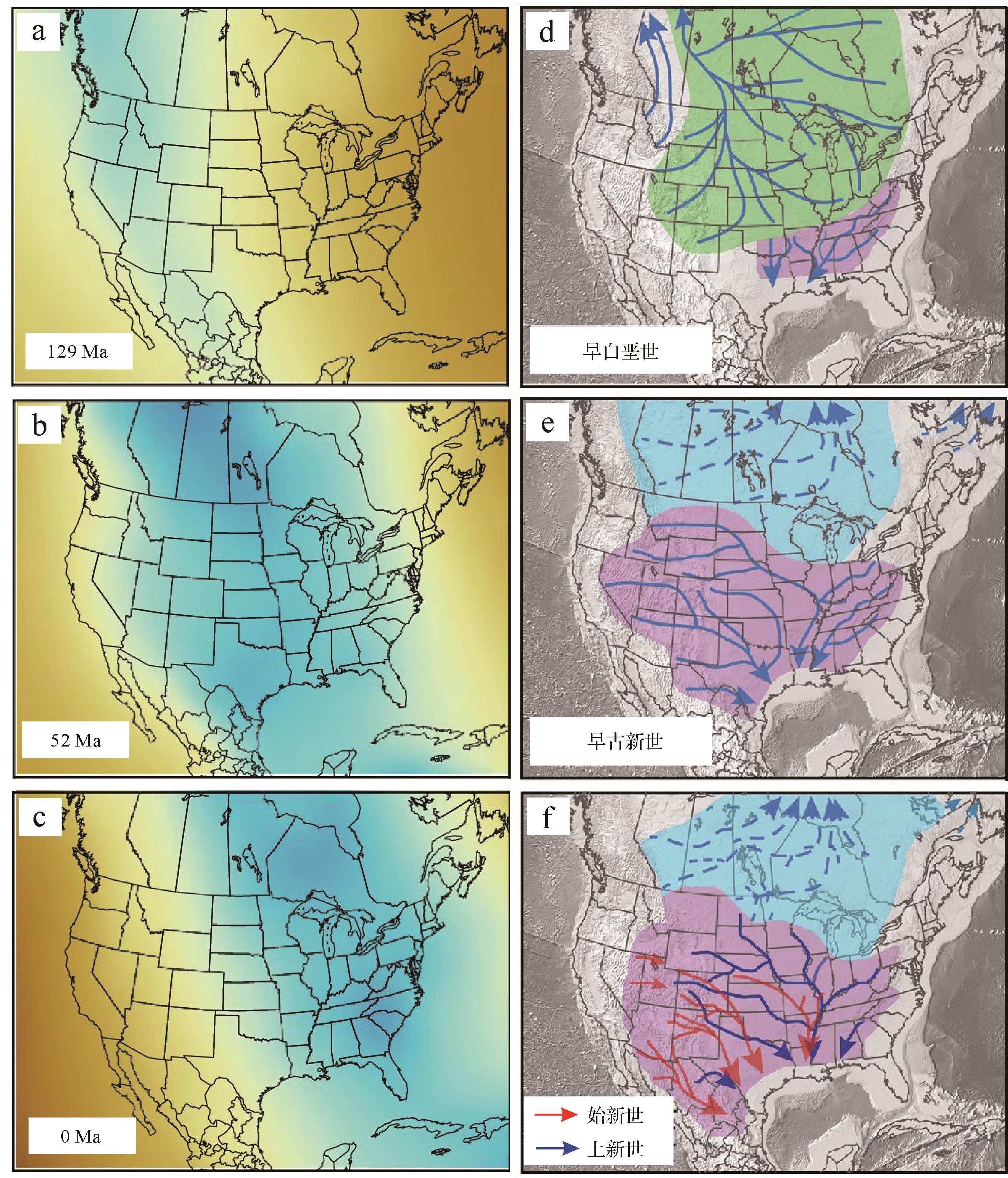
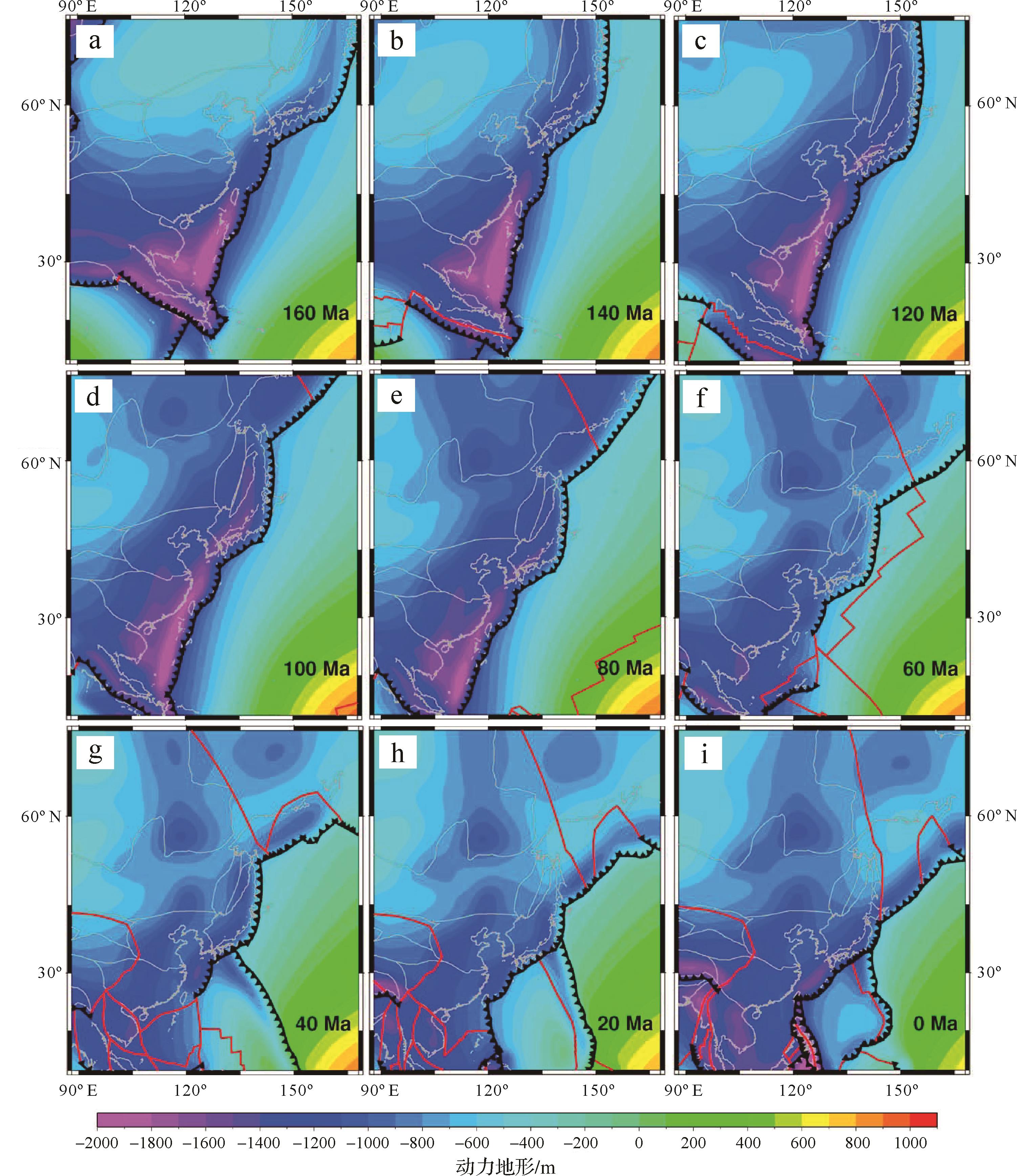
Large rivers are not only the birthplace of human civilization, but also the most important part of the landscape and the surface system of the earth. The decisive factor of the formation and evolution of large river drainage systems is the topography change caused by continental tectonic evolution. Traditionally, it is believed that the evolution of large river drainage systems is mainly influenced by plate tectonics, which is called “tectonic topography”. However, more and more evidence shows that the earth’s topography is not only shaped by horizontal plate movement, but also by the influence of “dynamic topography” caused by mantle convection. This paper introduces the concept, simulation calculation, and model verification of dynamic topography under the control of deep mantle convection and landscape evolution models. Taking large river drainage system evolutions in North America, Australia, South America, and Africa as examples, we conclude that there is a coupling relationship between the evolution of large river drainage systems and long-wavelength dynamic topography. Compared with the local influence of tectonic movement, the long-wavelength dynamic topography can influence and even change the evolution pattern of drainage systems on the continental scale. Finally, the tectonic setting and dynamic topography of Asia are briefly reviewed. Asia, especially East Asia, has been affected by multi-stage plate convergence and subduction since the Jurassic; therefore, the dynamic topography is complex. However, recent studies show that there is a corresponding relationship between the evolution of drainage systems in East Asia and the dynamic topography. This is of great significance for subsequent tectonic-sedimentary research in Asia.
2022, 40(4): 912-923.
doi: 10.14027/j.issn.1000-0550.2021.143
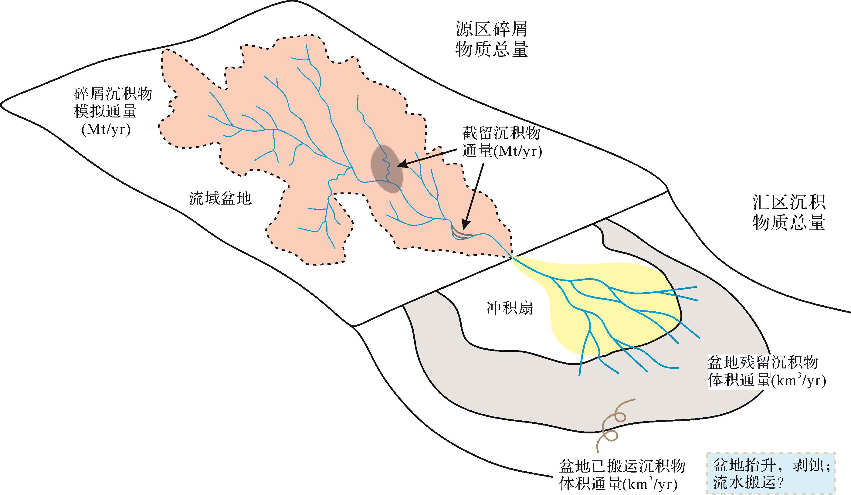
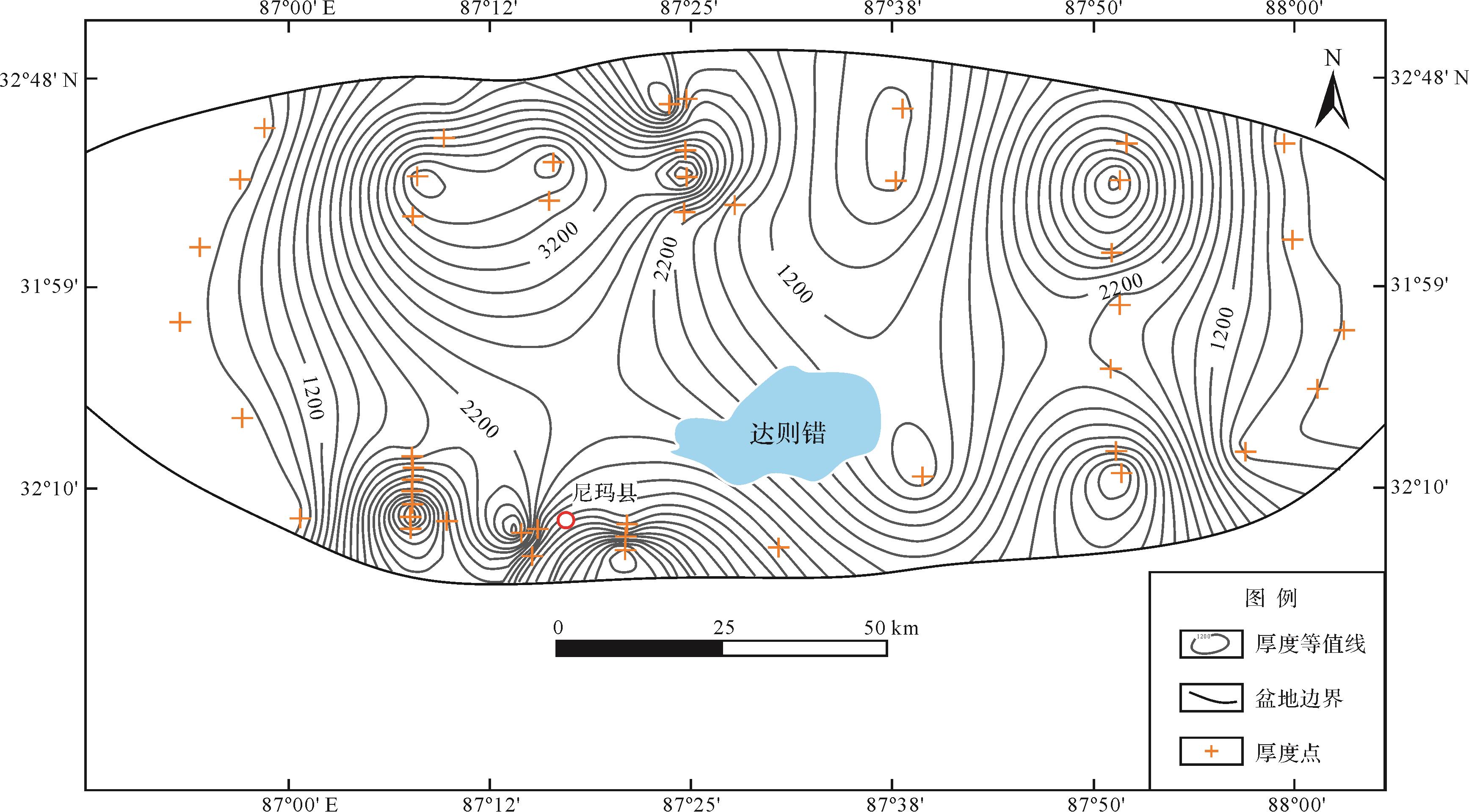
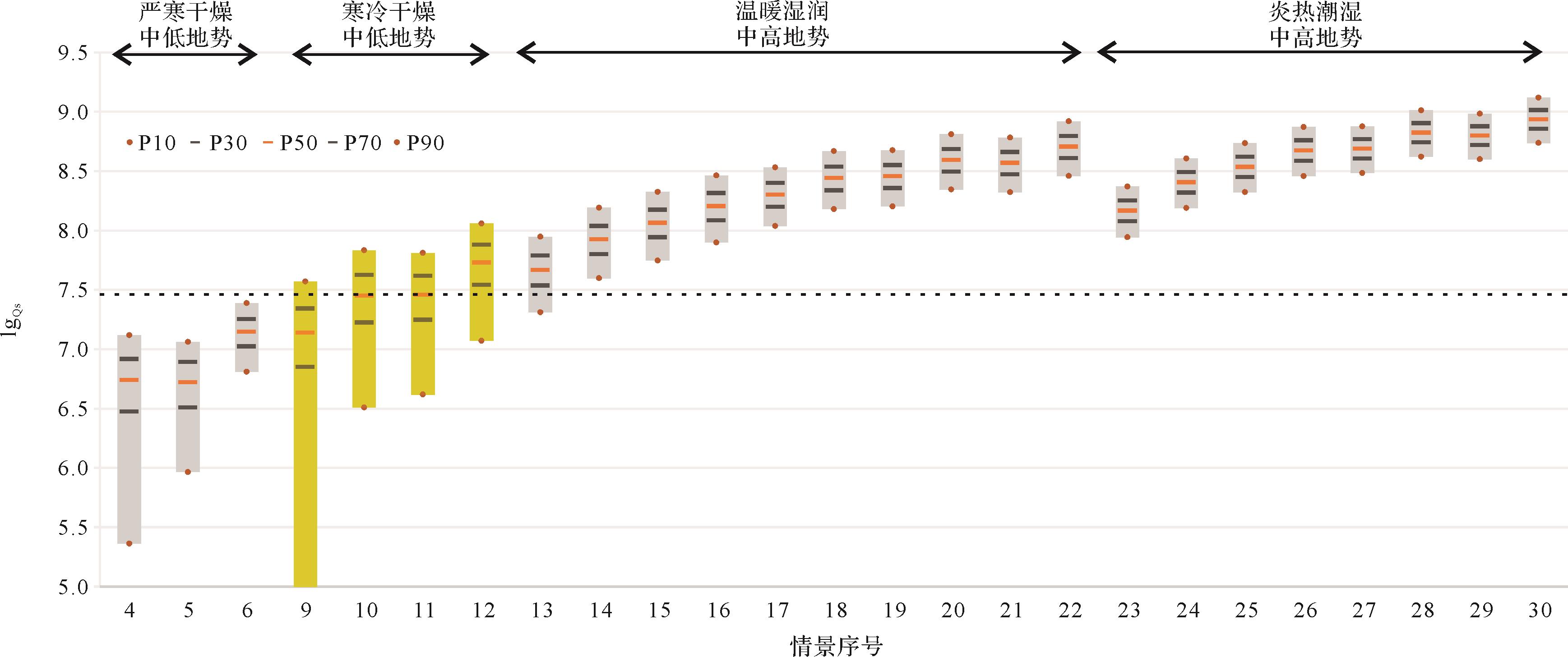
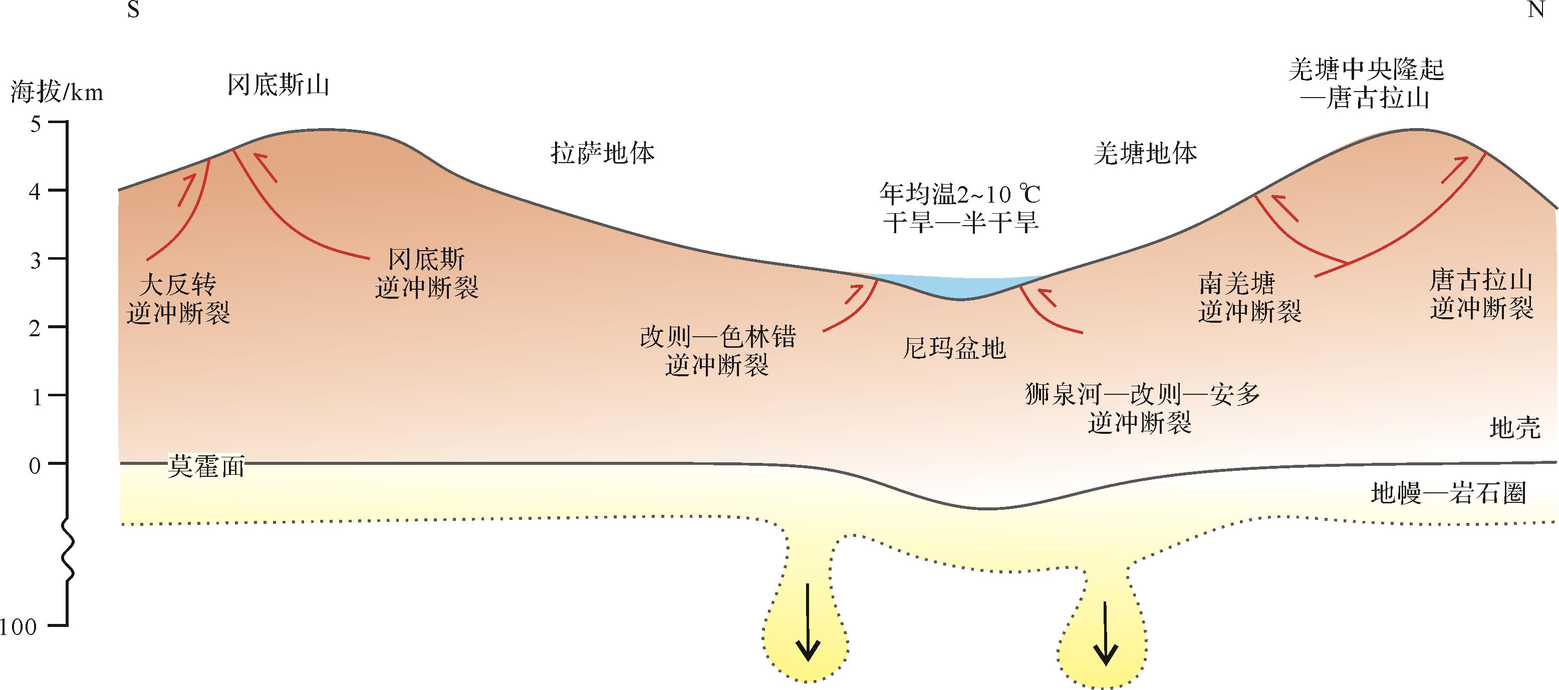
Abstract:
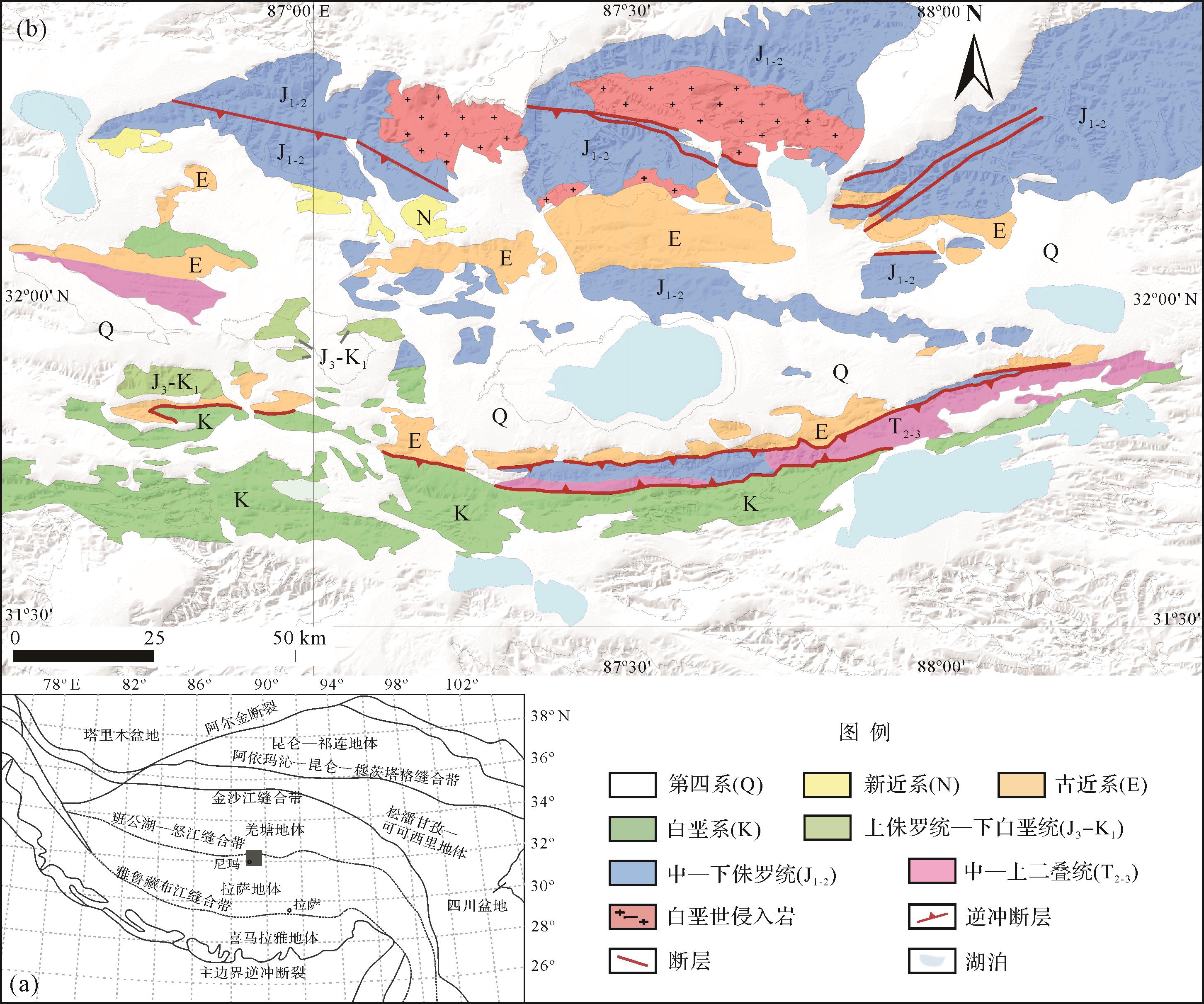
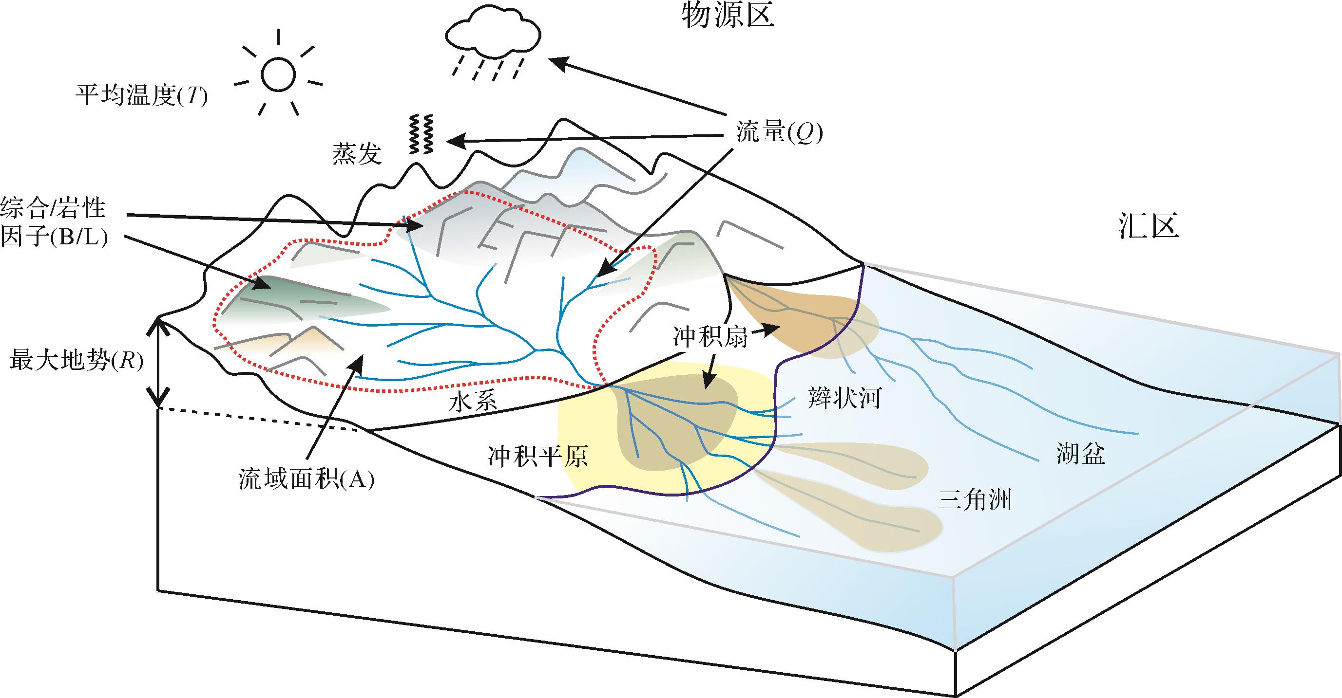
The Cenozoic paleogeomorphology of the central Qinghai-Tibetan Plateau has been controversial and has always been a major research area. The inner drainage system that existed in the central plateau, at least in the early Miocene, seems to provide a new perspective for solving the paleogeomorphological problems in the central plateau. In order to reconstruct the Cenozoic paleomorphic pattern of the central plateau, this study selected the terrestrial source-to-sink system in the Nima area as the research object using the sedimentary flux numerical simulation model (BQART-MCS) to test the views of previous studies. The simulation results indicate that the total amount of sediment produced in the source area equals the total amount of sediment in the sink area only in the case of an average annual temperature of 2 ℃⁃10 ℃, a maximum terrain elevation of 1⁃3 km, and arid to semi-arid climatic conditions. Sedimentological and geochemical considerations have tended to confirm that the geomorphology during the Oligocene⁃Pliocene period was typical of a cool, dry climate at an elevation of about 2⁃4 km and an annual temperature less than 10 ℃. This was the first application of the BQART-MCS model in the terrestrial source-to-sink system of the Tibetan Plateau, and effectively modeled the total amount of sedimentary material in the deep-time source-to-sink system. It suggests a new approach to the quantitative study of source-to-sink systems.
2022, 40(4): 924-930.
doi: 10.14027/j.issn.1000-0550.2022.007
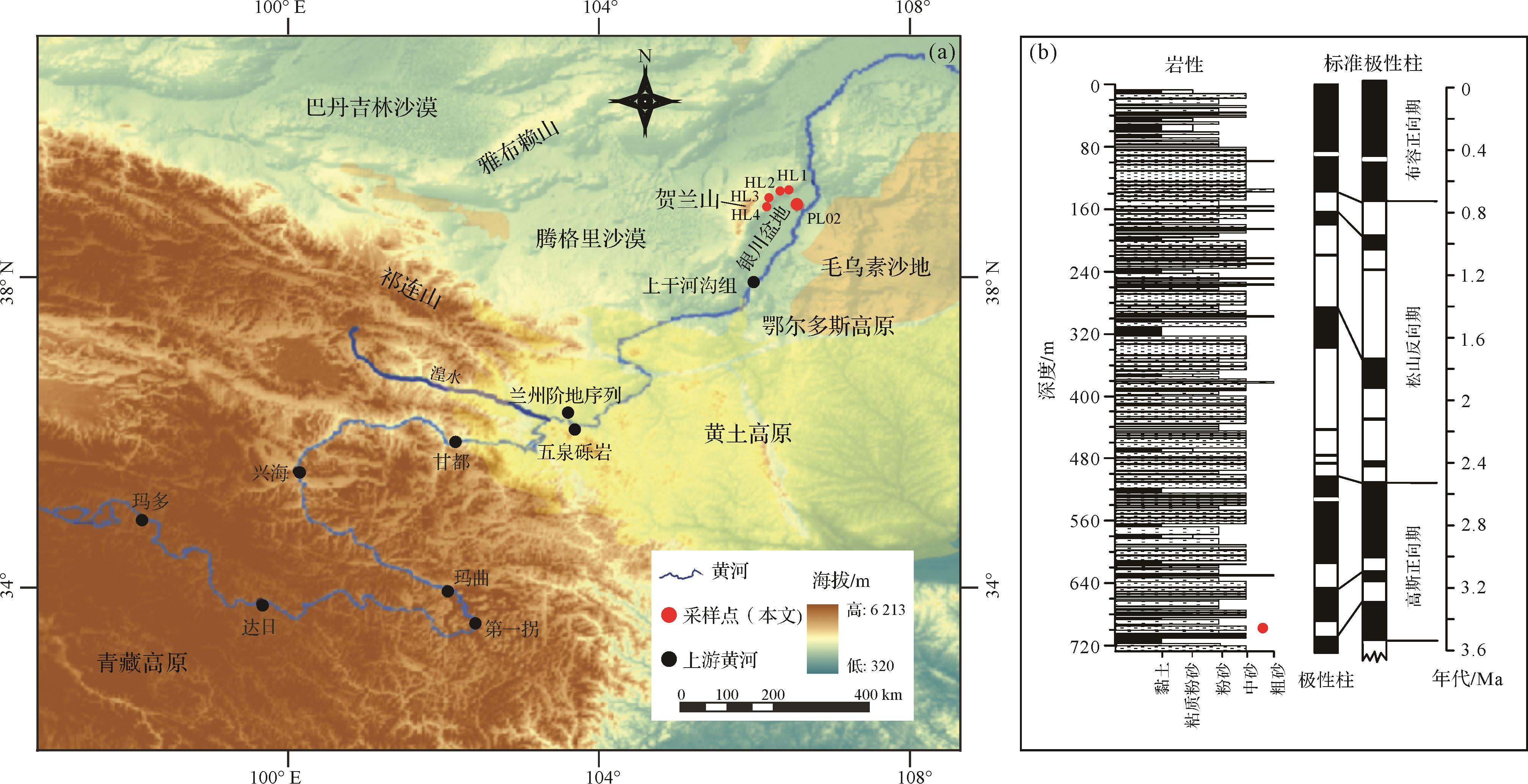
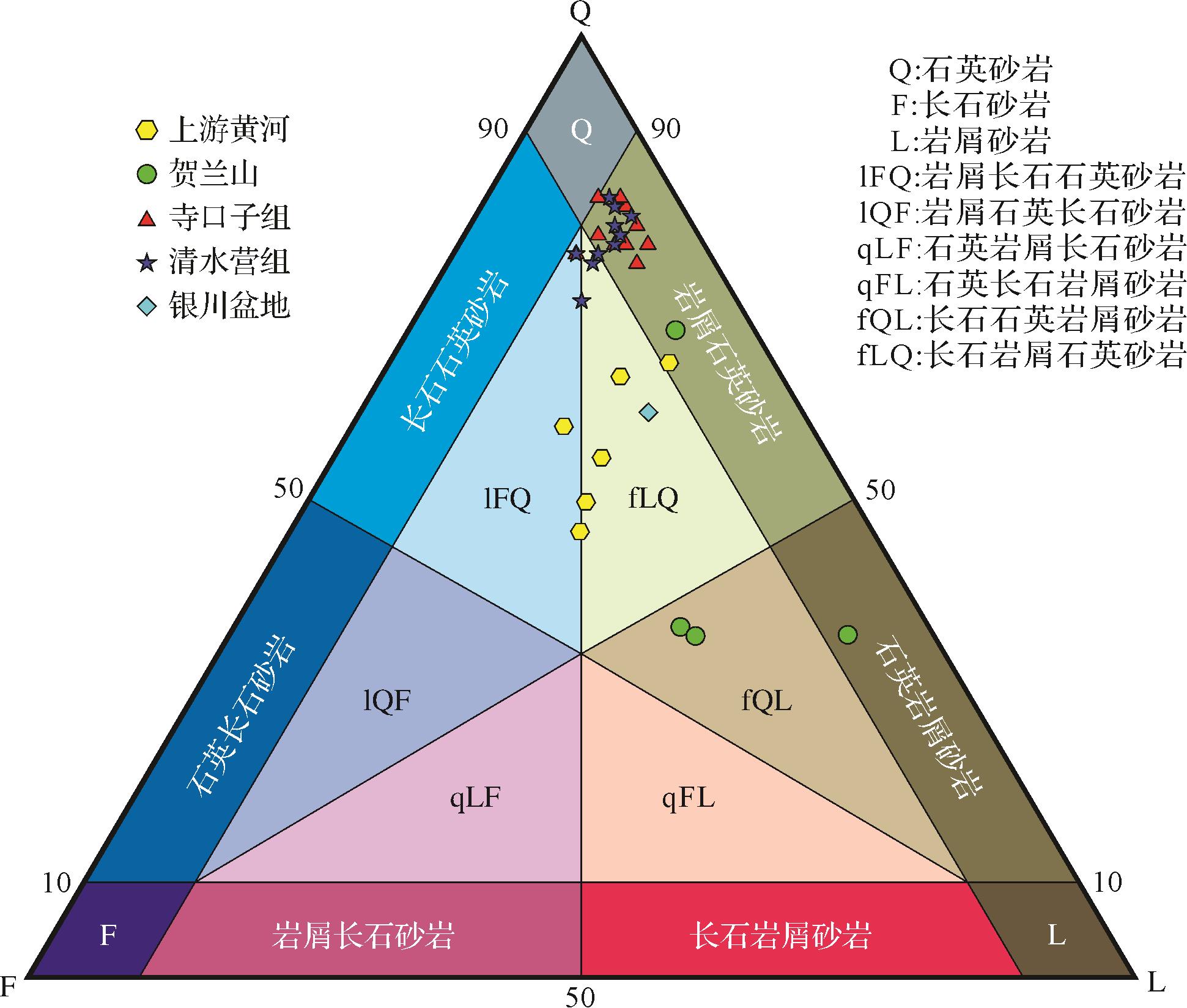
Abstract:
The formation age of the upper reaches of the Yellow River is still debated. The Yinchuan Basin is one of the main sedimentary areas in the upper reaches of the Yellow River, and its sedimentary sequence provides important clues to an understanding of the material source and formation age of the upper Yellow River. In this study, detrital zircon U-Pb age geochronological and petrographic composition data were determined for Late Pliocene sediments from the bottom of drill core PL02 in the Yinchuan Basin. This information was compared with other data for potential sources. The results show that the Helan Mountain and the western Ordos Plateau were not the source areas of Late Pliocene sediments in the Yinchuan Basin. Rather, the Yellow River transported material from the upper-reach areas to the Yinchuan Basin. This result further supports the view that the Lanzhou-to-Yinchuan portion of the upper Yellow River was formed in the Late Pliocene.


2022, 40(4): 931-943.
doi: 10.14027/j.issn.1000-0550.2022.023
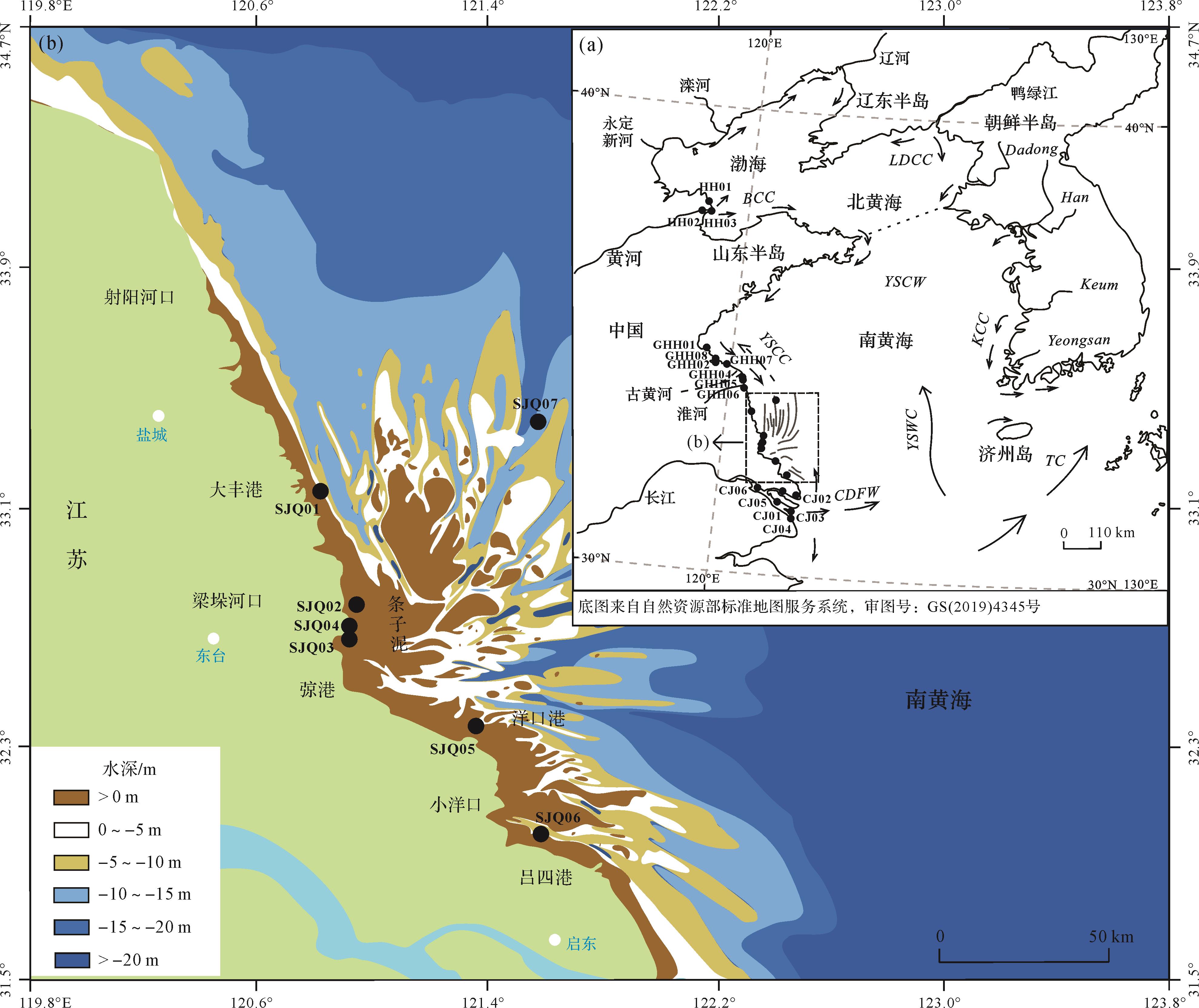
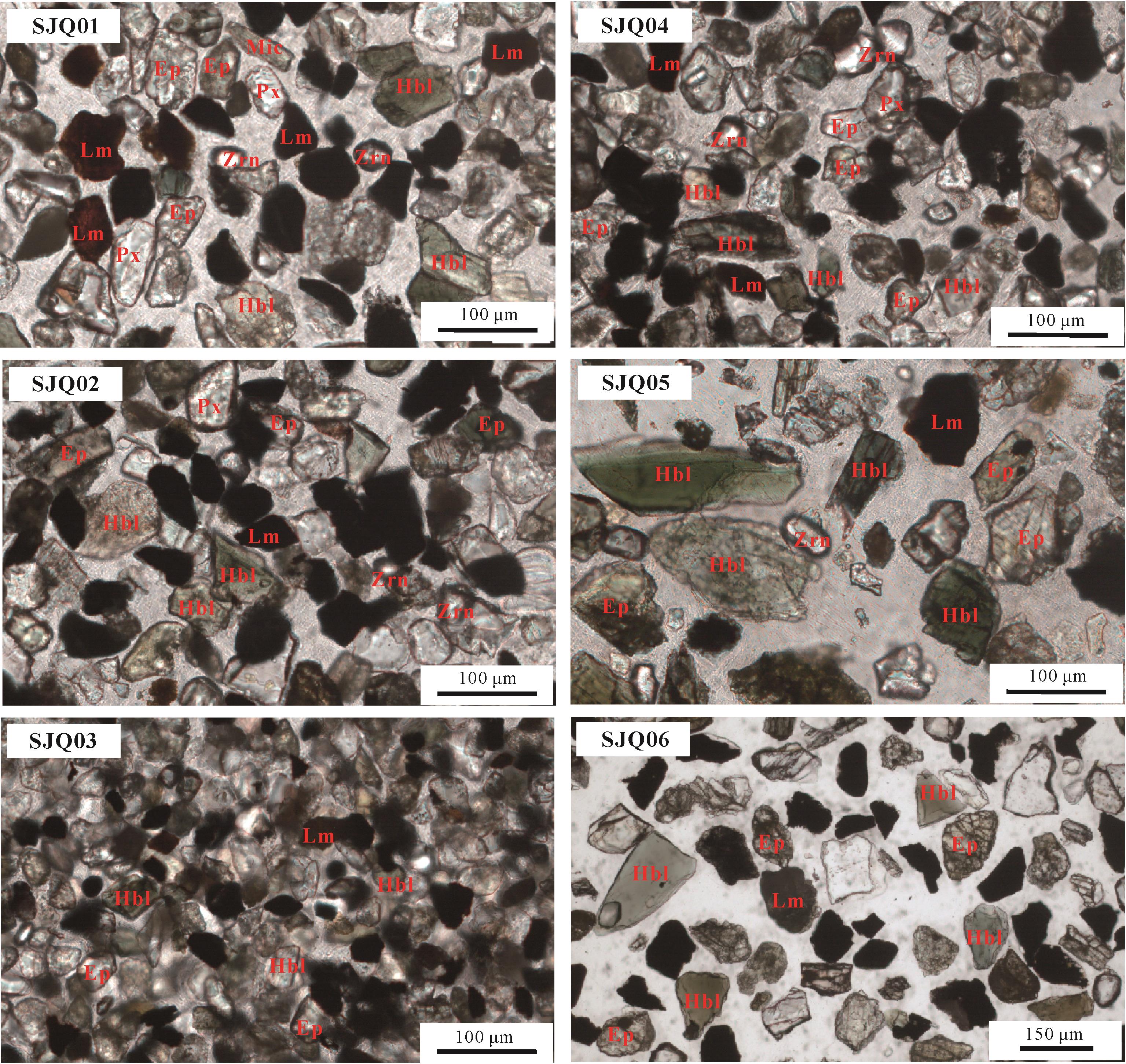
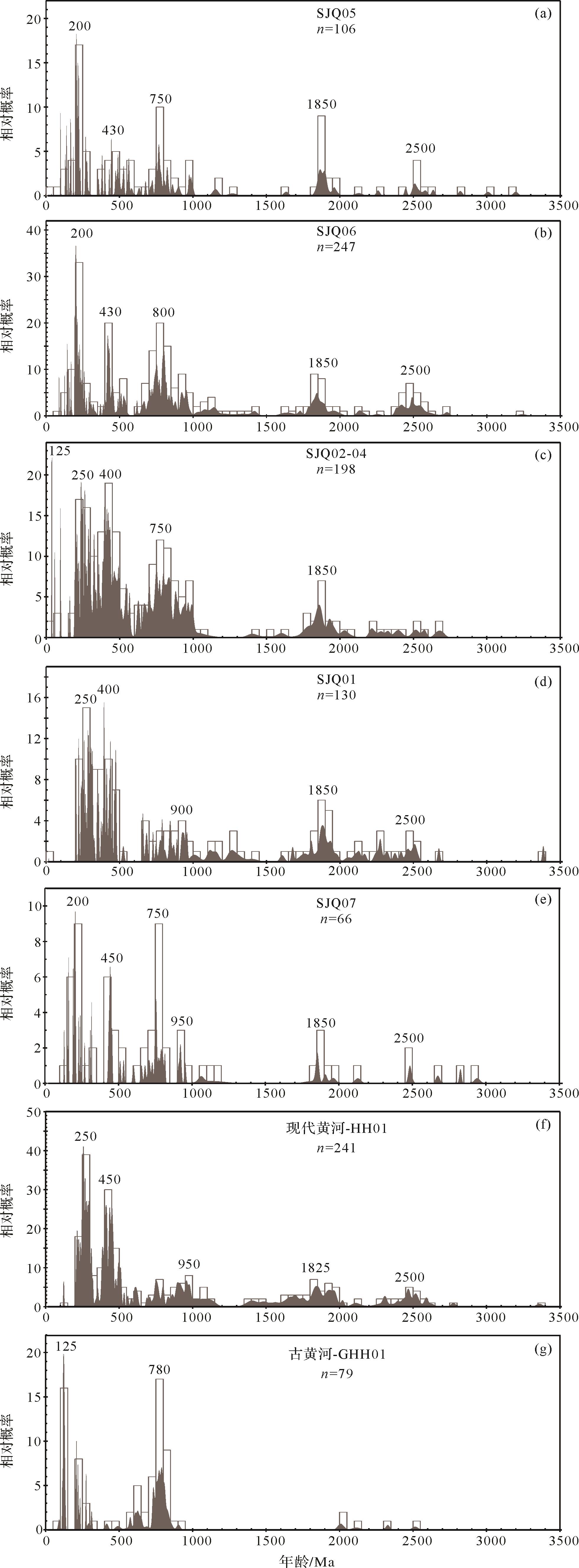
Abstract:
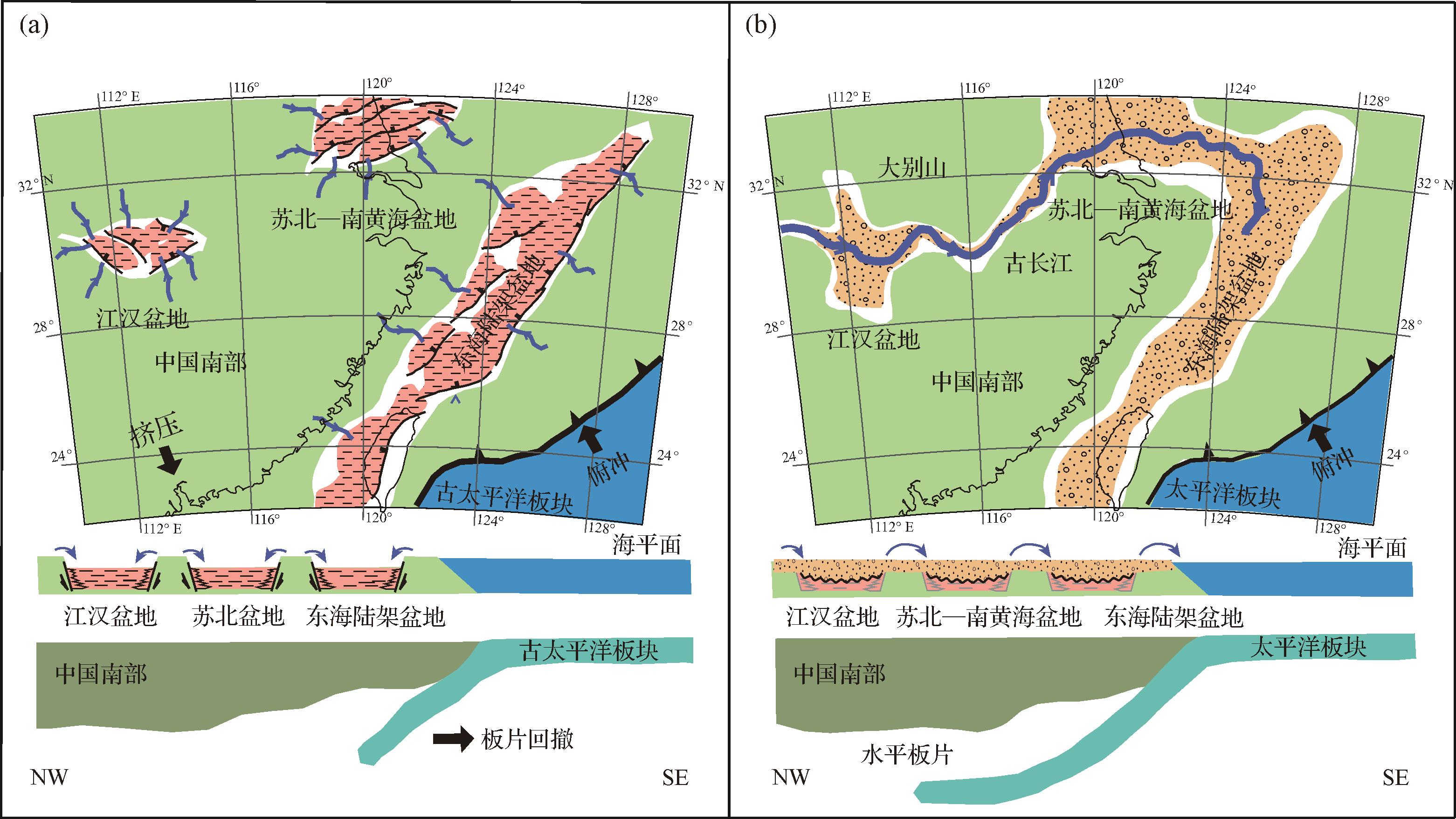
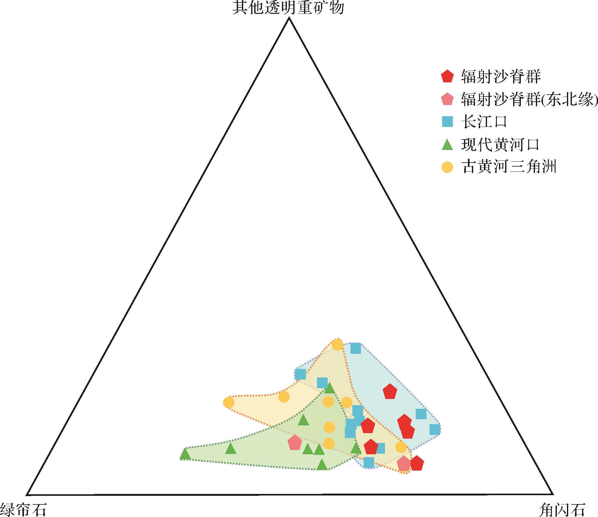
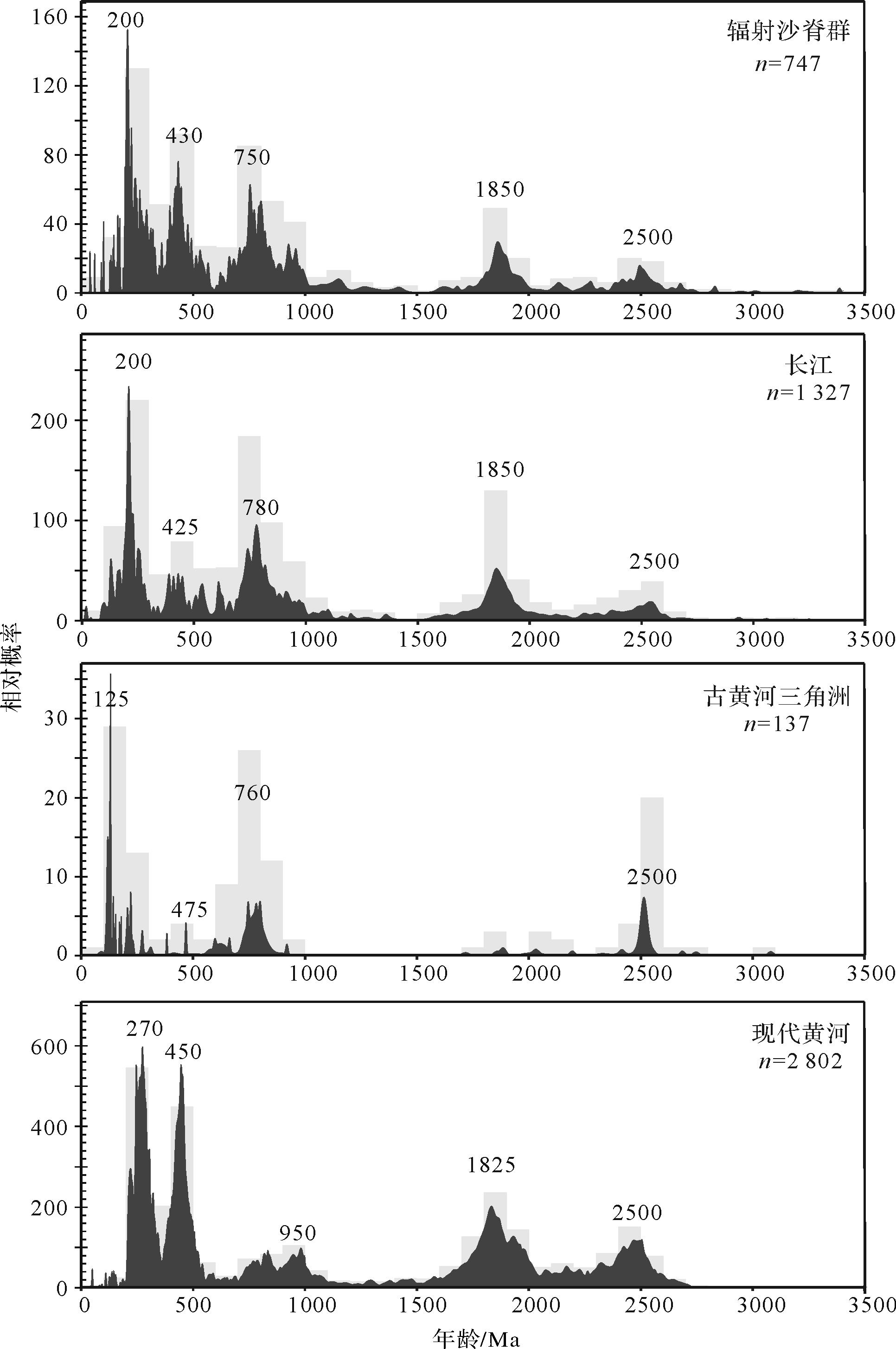
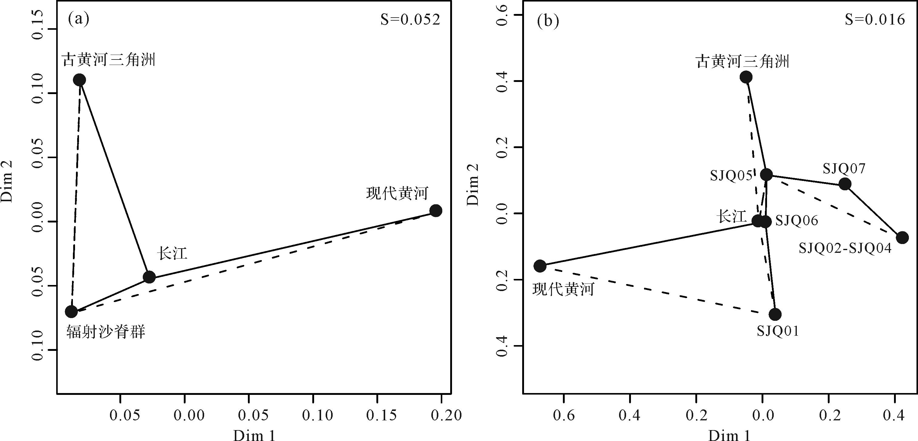
A special landform⁃radial sand ridges (RSRs) is distributed on the inland shelf of the shallow sea of south Yellow Sea along the Jiangsu coast. Its sedimentary provenance is a scientific issue worthy of attention. In this study, the provenance of the RSRs was analyzed by in-situ micro-area X-ray fluorescence spectroscopy, heavy mineral analysis and detrital zircon uranium-lead (U-Pb) geochronology. The results show that the heavy mineral combination of the RSRs is amphibole-epidote-iron oxide minerals, and the content of amphibole (55.06% in average) is much higher than that of epidote (20.71% in average), which is much similar to the Yangtze River (with the average content 46.05% of amphibole, and 24.69% of epidote). The detrital zircon U-Pb ages yield five significant age ranges: 160⁃330 Ma (22.89%, peaking at ~200 Ma), 350⁃550 Ma (18.61%, peaking at ~430 Ma), 650⁃1 200 Ma (29.32%, peaking at ~750⁃800 Ma), 1 700⁃2 000 Ma (10.58%, peaking at ~1 850 Ma), and 2 400⁃2 600 Ma (5.09%, peaking at ~2 500 Ma). Through comparison with the potential source area, we found a strong similarity of the heavy mineral combination and zircon U-Pb ages between the RSRs and Yangtze River, indicating the Yangtze River was their major source. In addition, the sediments of the ancient Yellow River delta could have limited impacts on the coast of northern Jiangsu, while the modern Yellow River possibly only influences the northern edge of the RSRs. The provenance result constraint from this study indicates the oceanic currents of south Yellow Sea has significant influence.
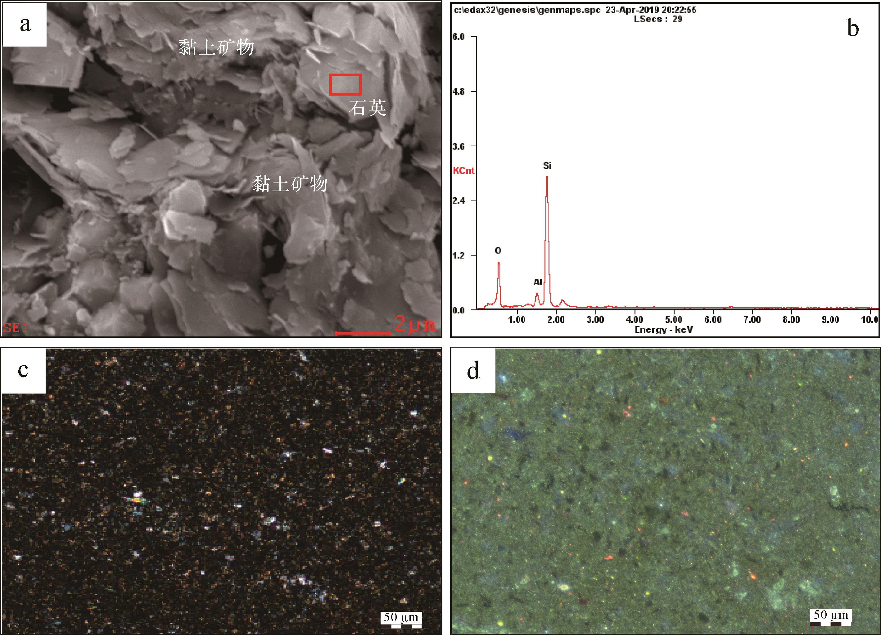
2022, 40(4): 944-956.
doi: 10.14027/j.issn.1000-0550.2022.021
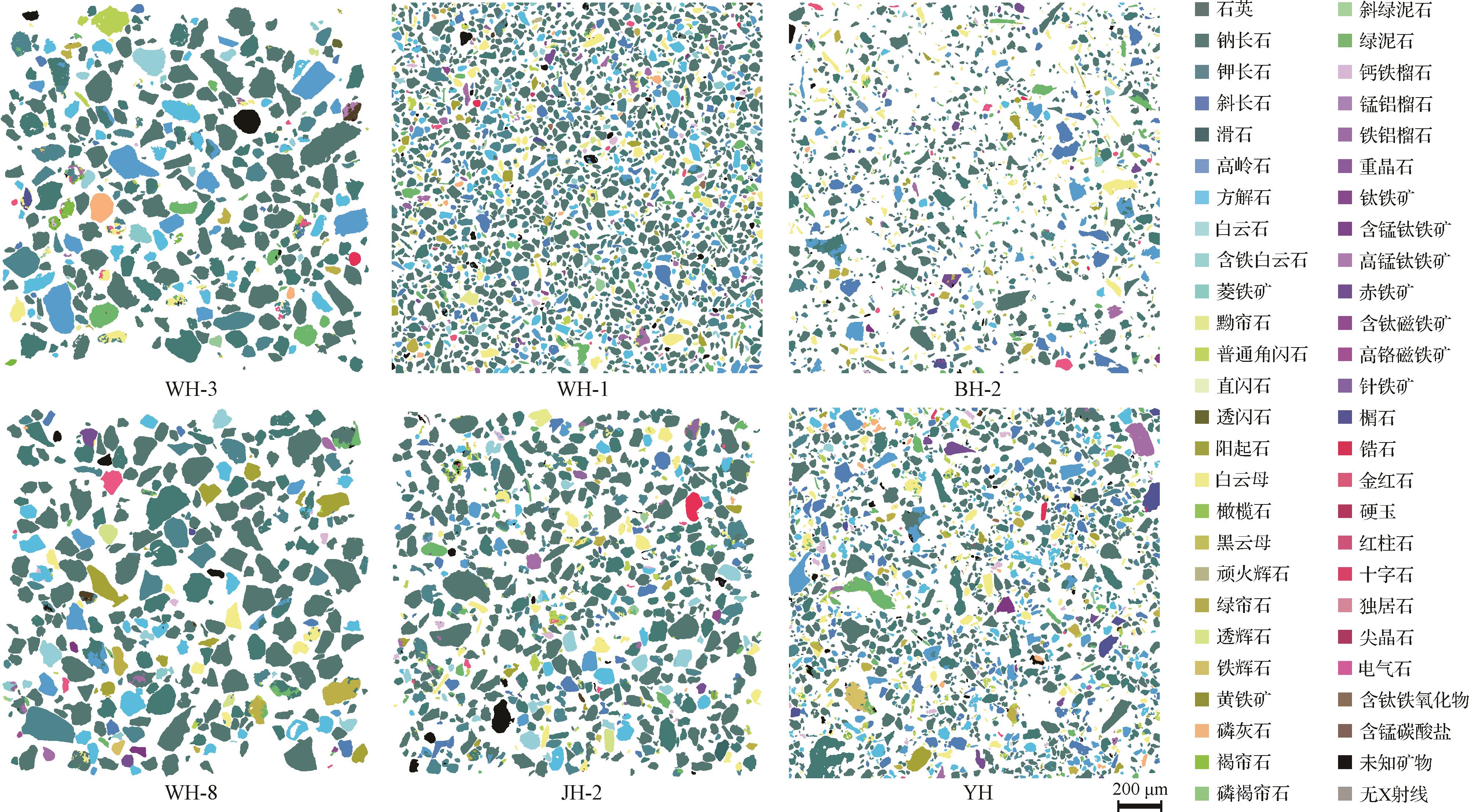
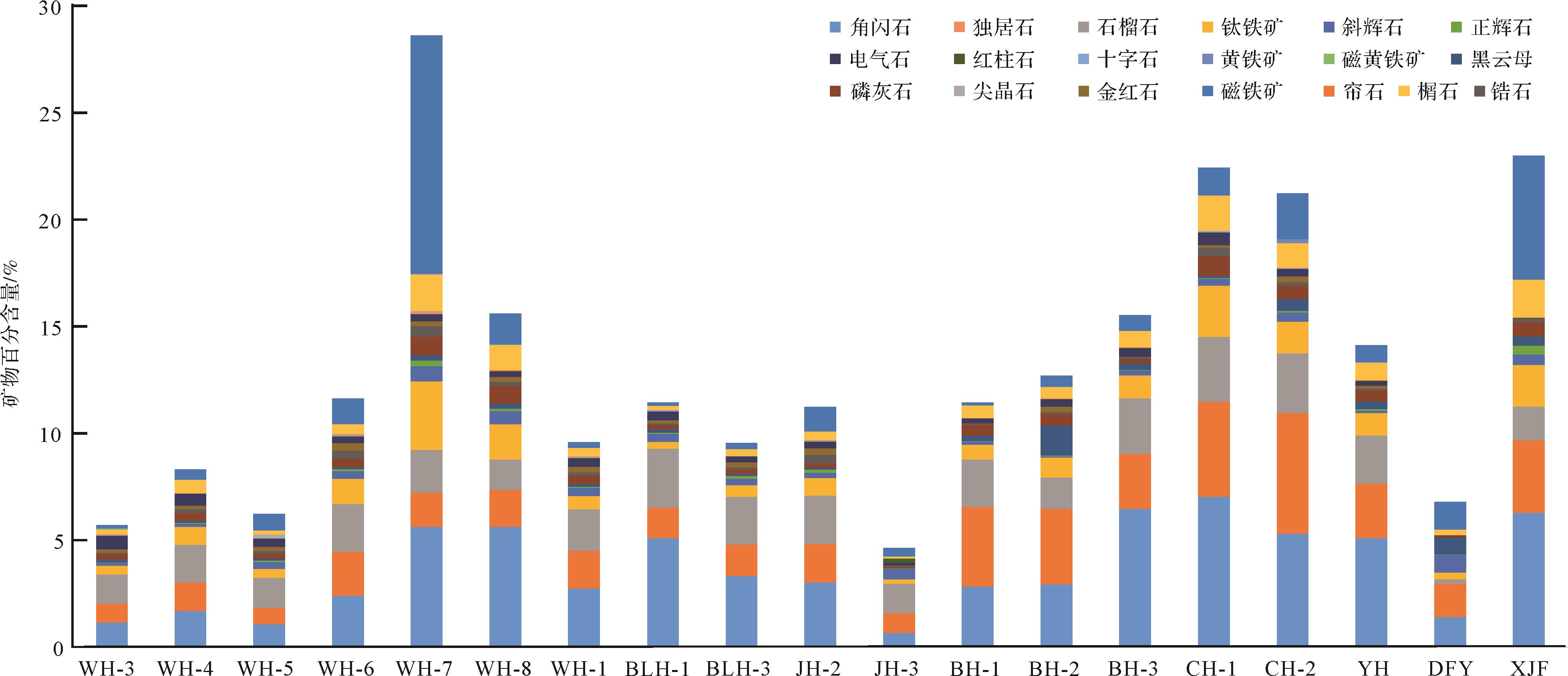
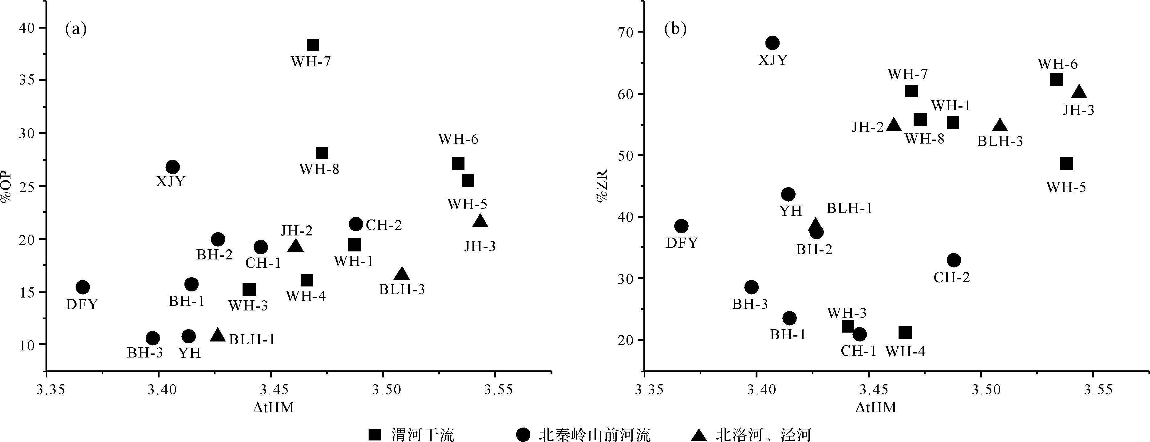
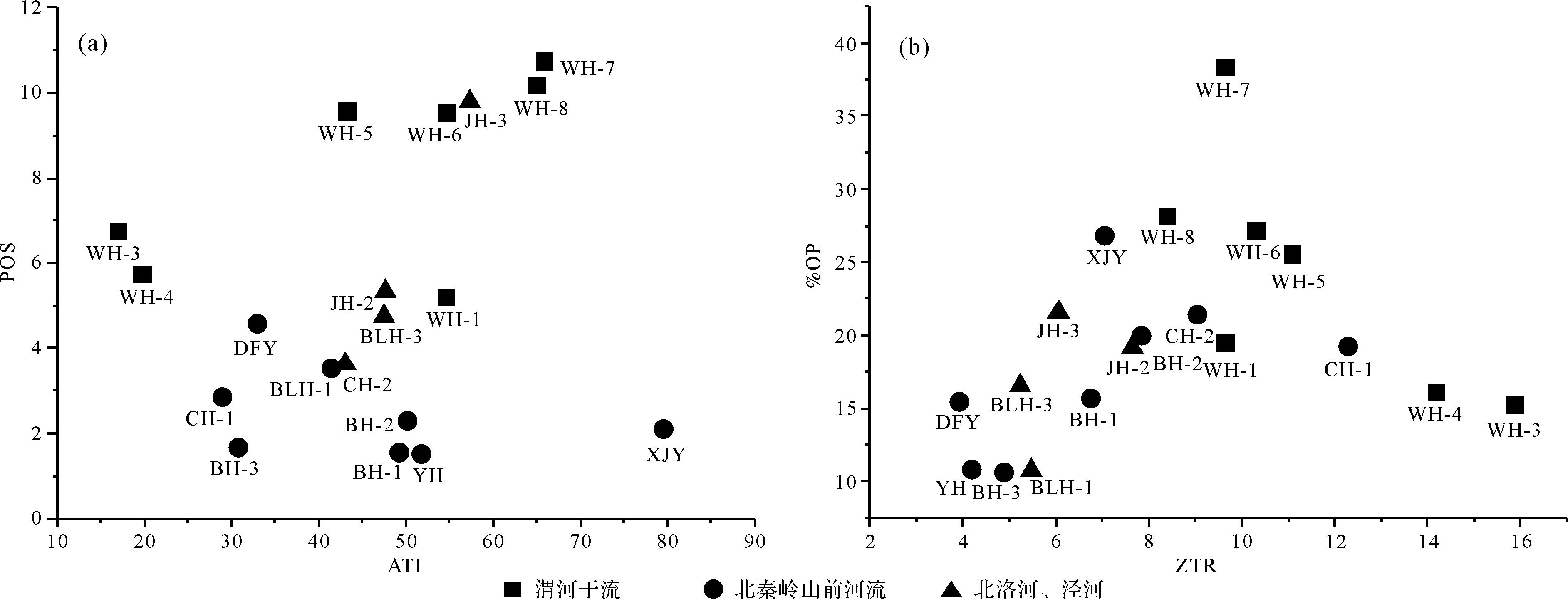
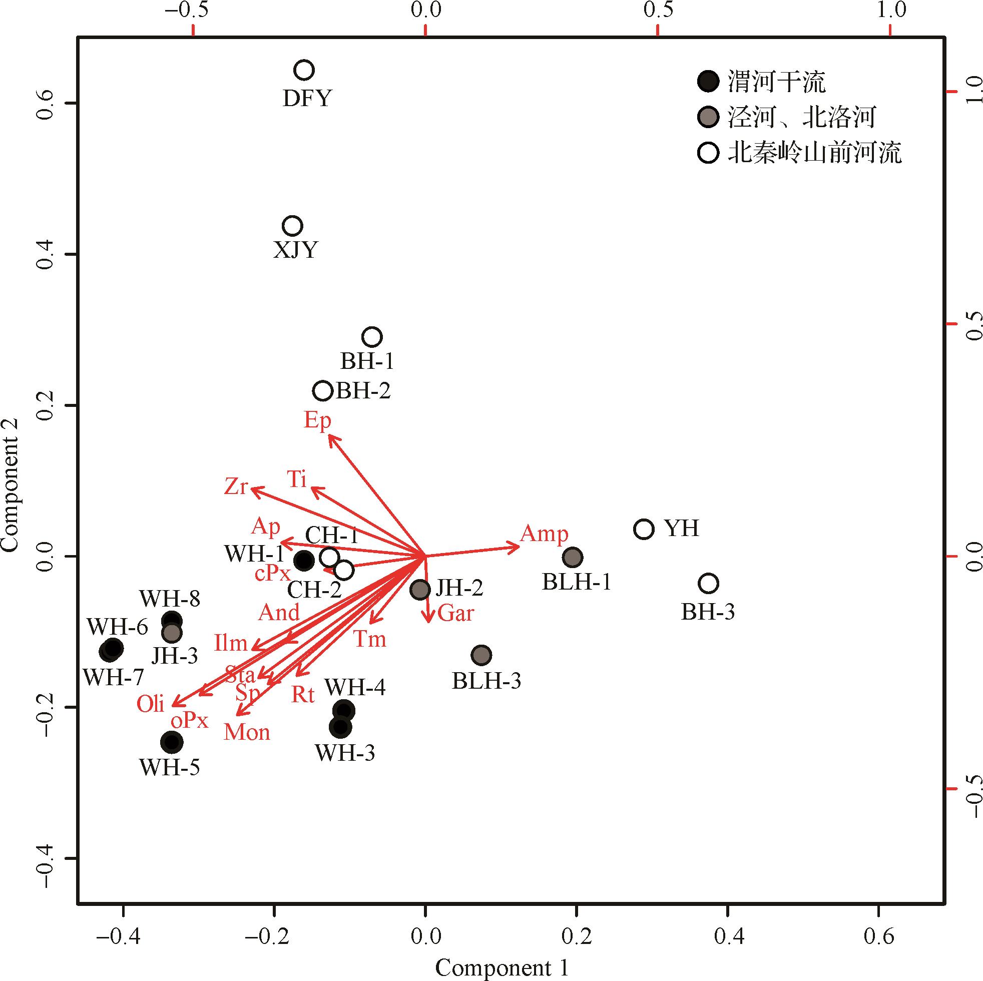
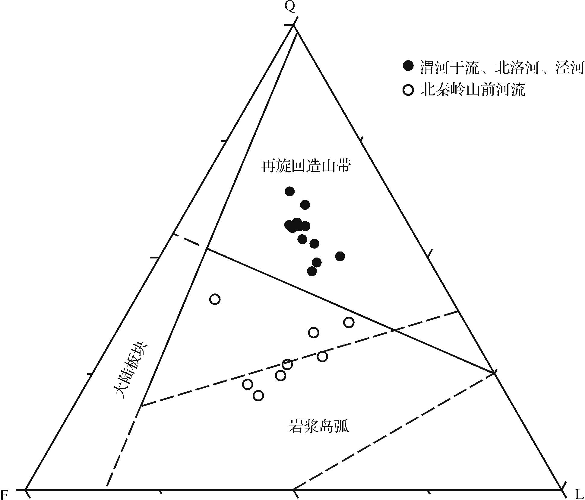
Abstract:
Quantitative analysis of sediment mineral composition using a scanning electron microscope (SEM) can quickly and accurately obtain a large amount of detailed information, such as mineral composition, mineral particle size, and rock debris composition. This study uses this method to examine the mineral and sediment clastic compositions of modern river samples in the Weihe River Basin and explore the possibility and reliability of its application in sediment tracing. The results indicate that the light minerals in the modern river sediments from the Weihe River Basin are primarily quartz, feldspar, and lithic fragments The quartz-feldspar-lithis (QFL) triangle diagram shows that the sediment components in the mainstream of the Weihe River and its two main tributaries, the Beiluo and Jinghe Rivers, flowing through the Ordos Plateau are the recycled orogen provenance, while the sedimentary clastic components of the rivers in the piedmont of the North Qinling Mountains have a magnetic arc provenance. This result is consistent with the regional geological tectonic background. The heavy mineral assemblages of sediments in the study area are primarily amphibole, epidote, and garnet. The mineral components of sediments in different areas can be distinguished by Principal Component Analysis (PCA). This study shows that the SEM quantitative analysis method can be used in QFL triangulation of sediment clastic components and tracing of heavy mineral sources.
2022, 40(4): 957-978.
doi: 10.14027/j.issn.1000-0550.2021.154
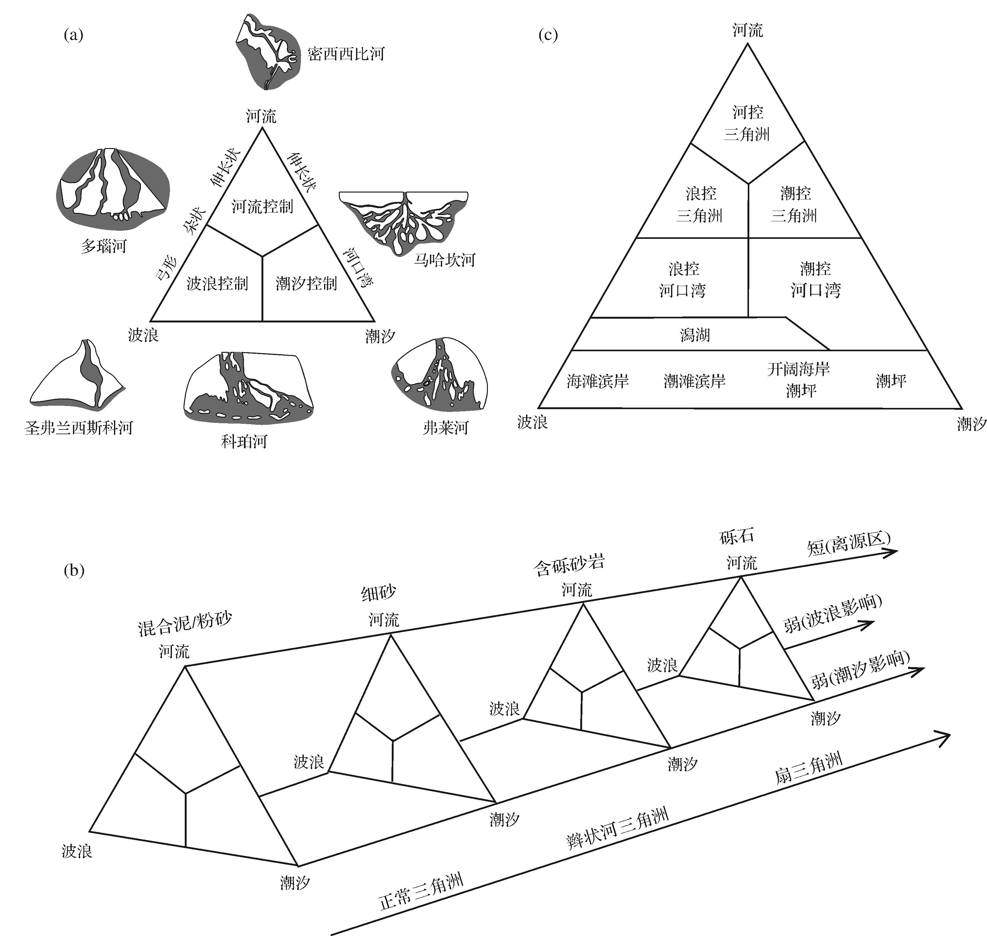
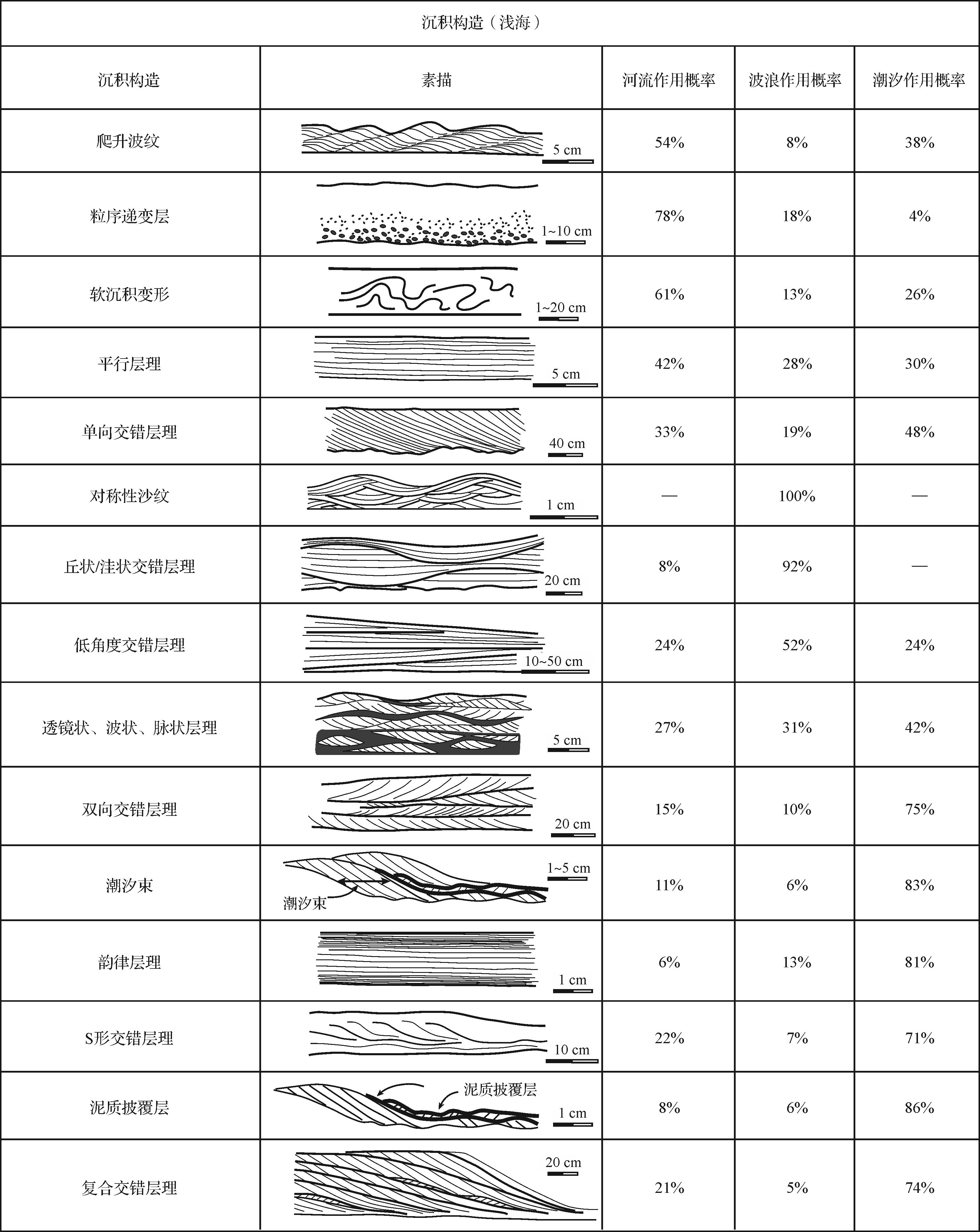
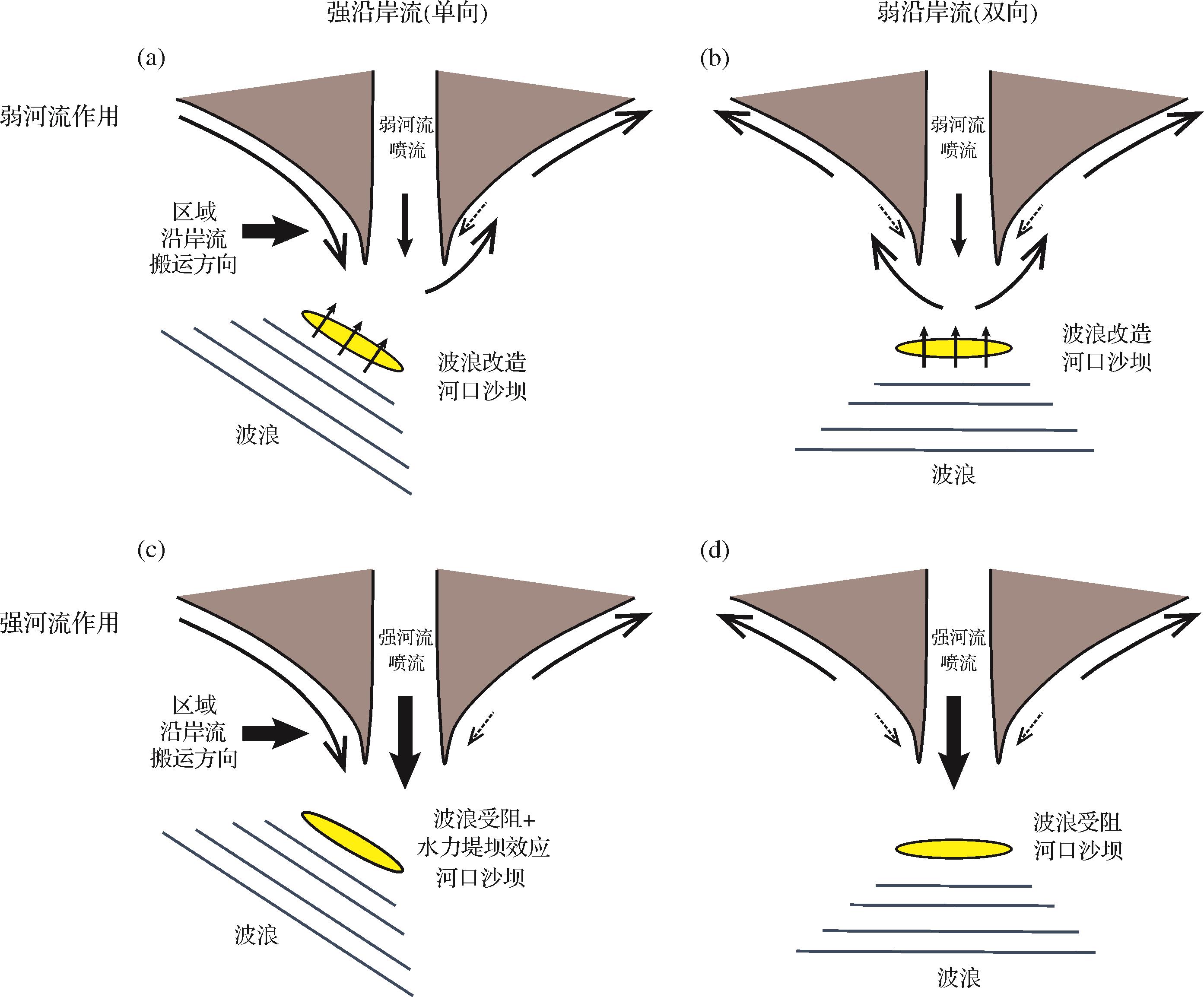
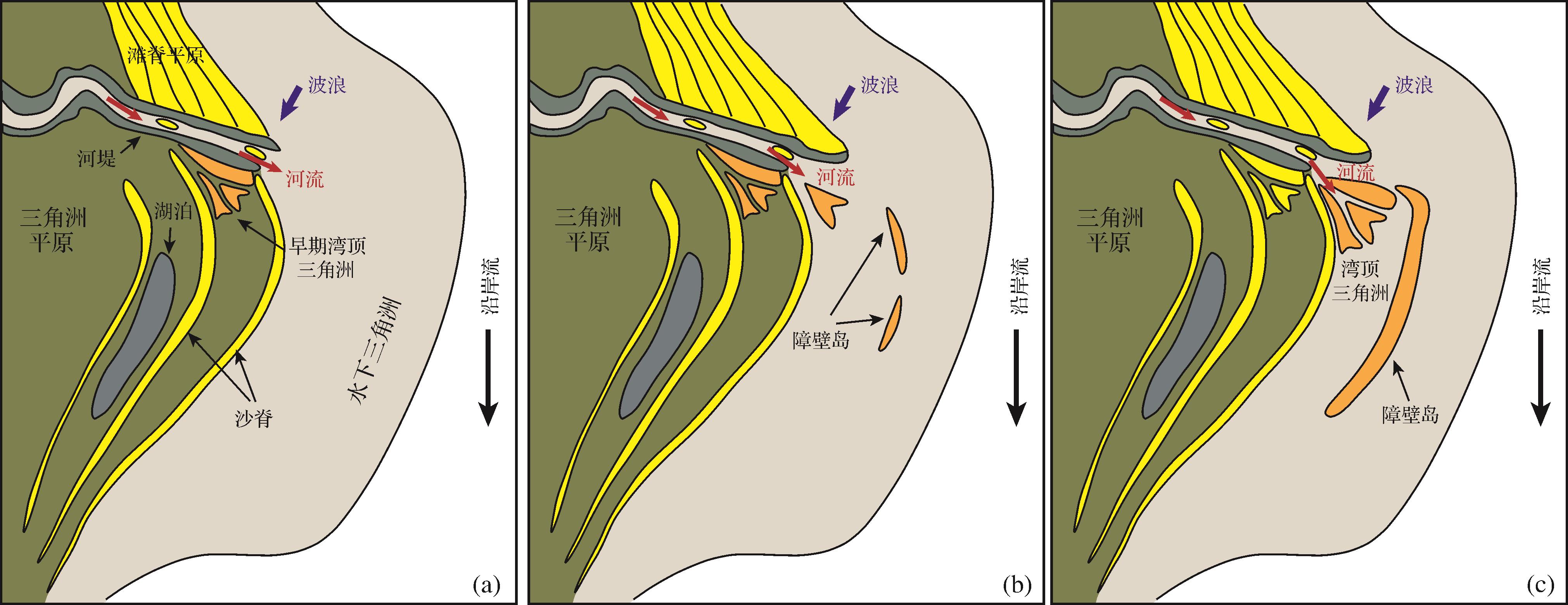
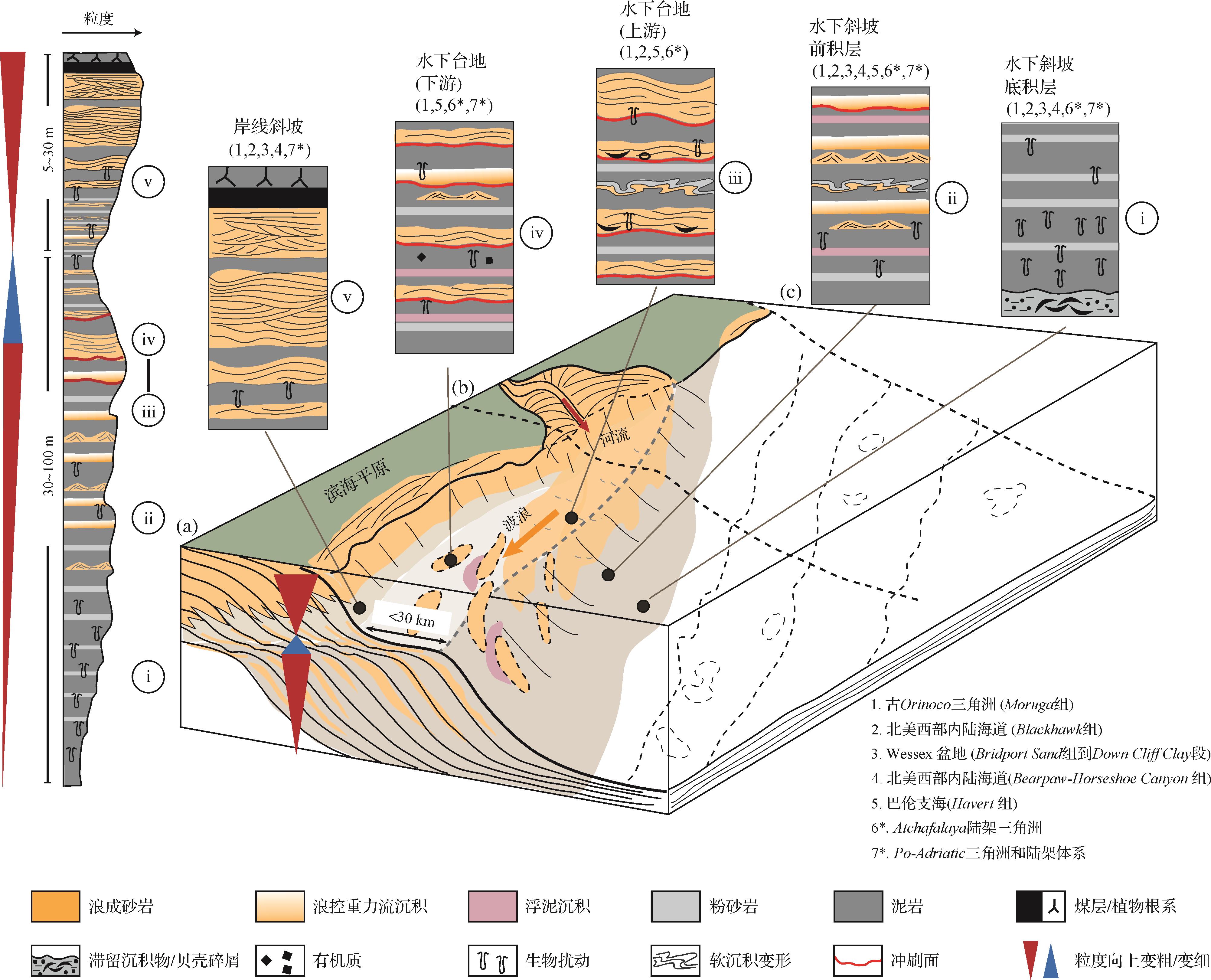
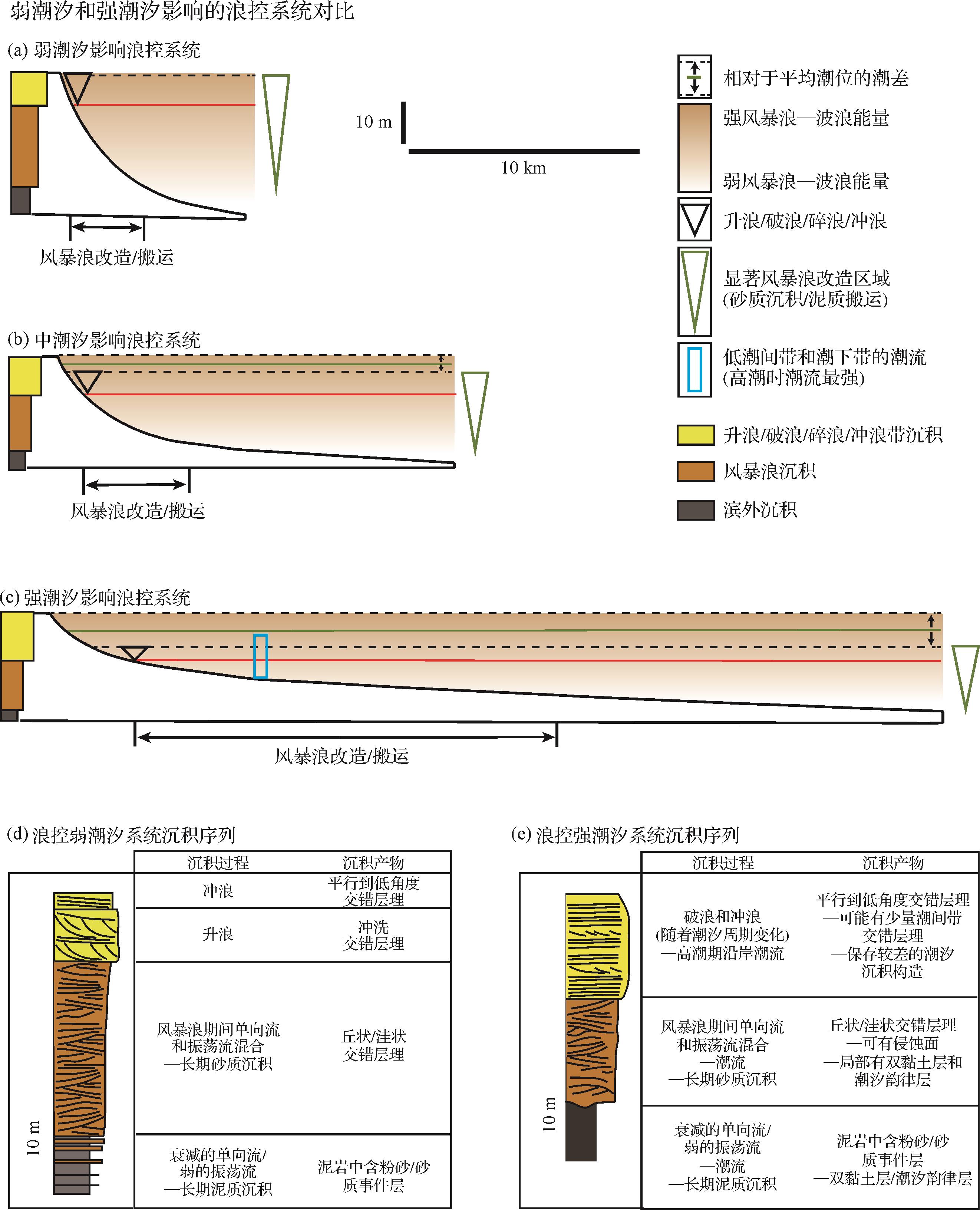
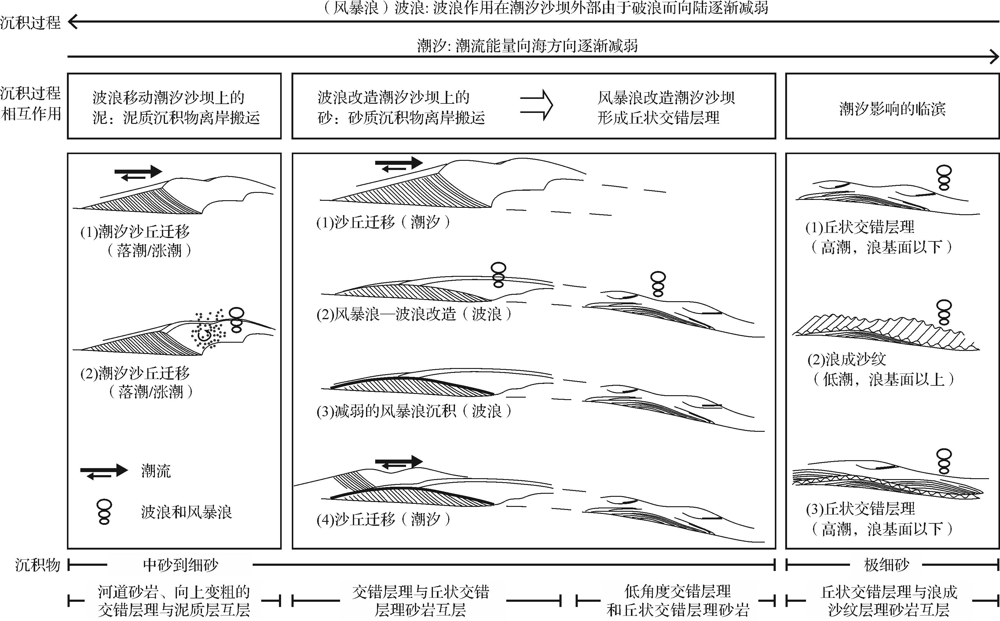
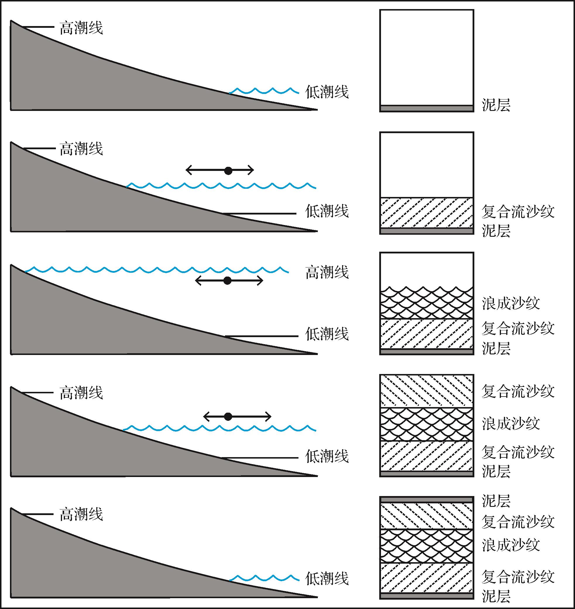
Abstract:
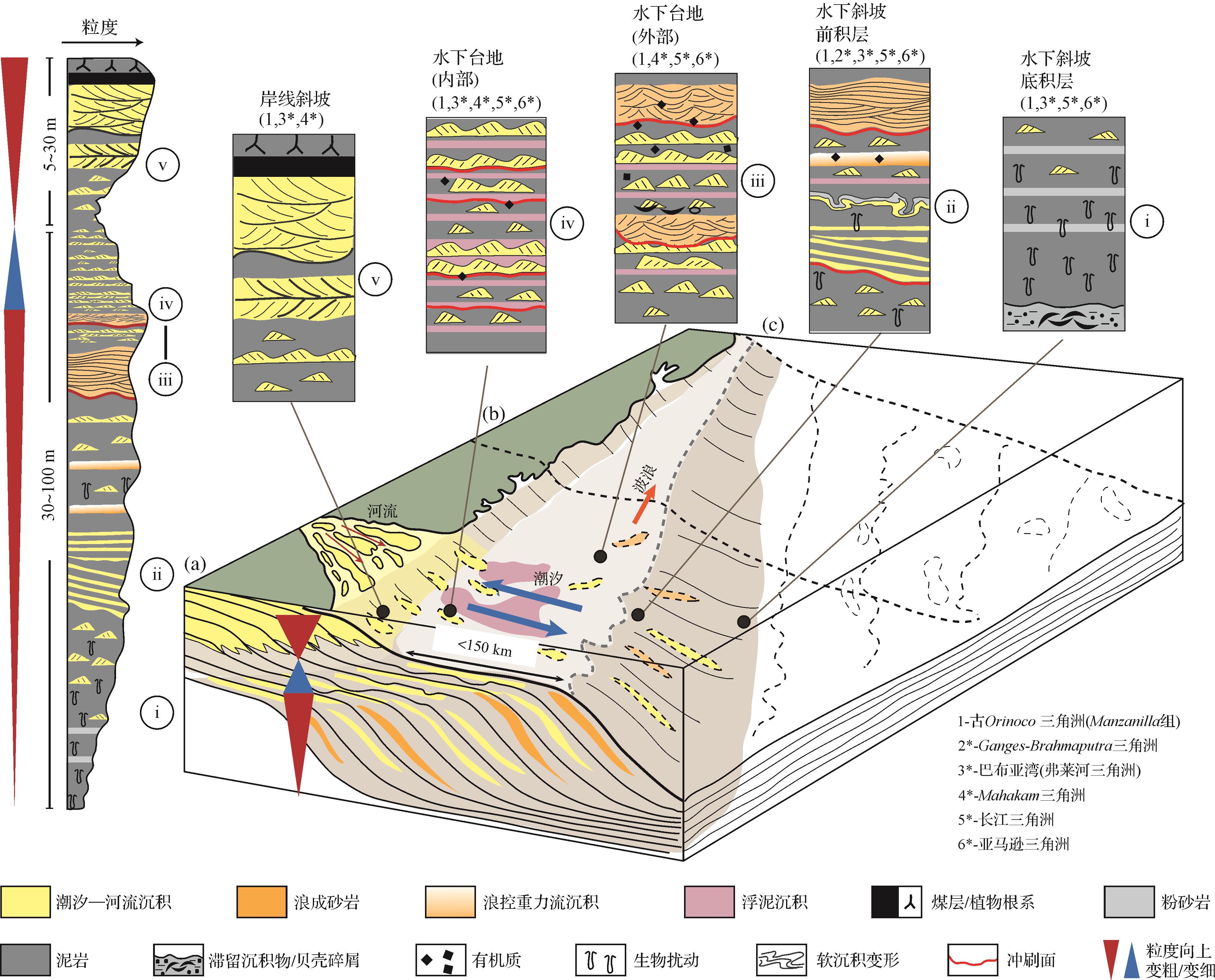
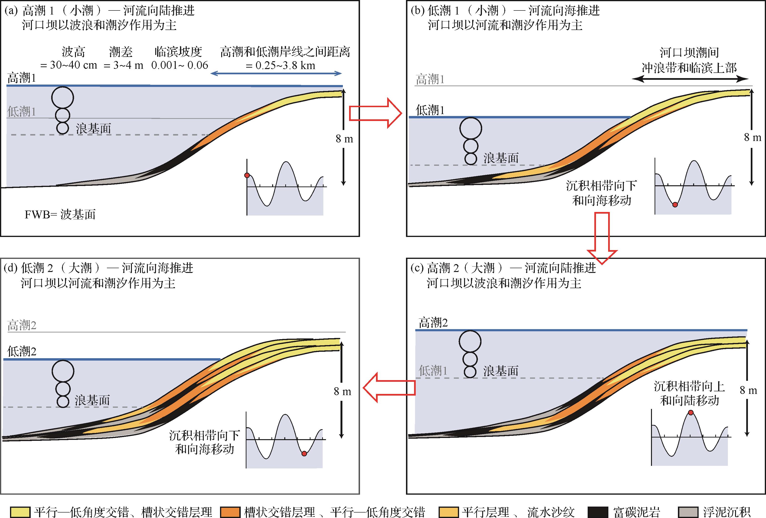
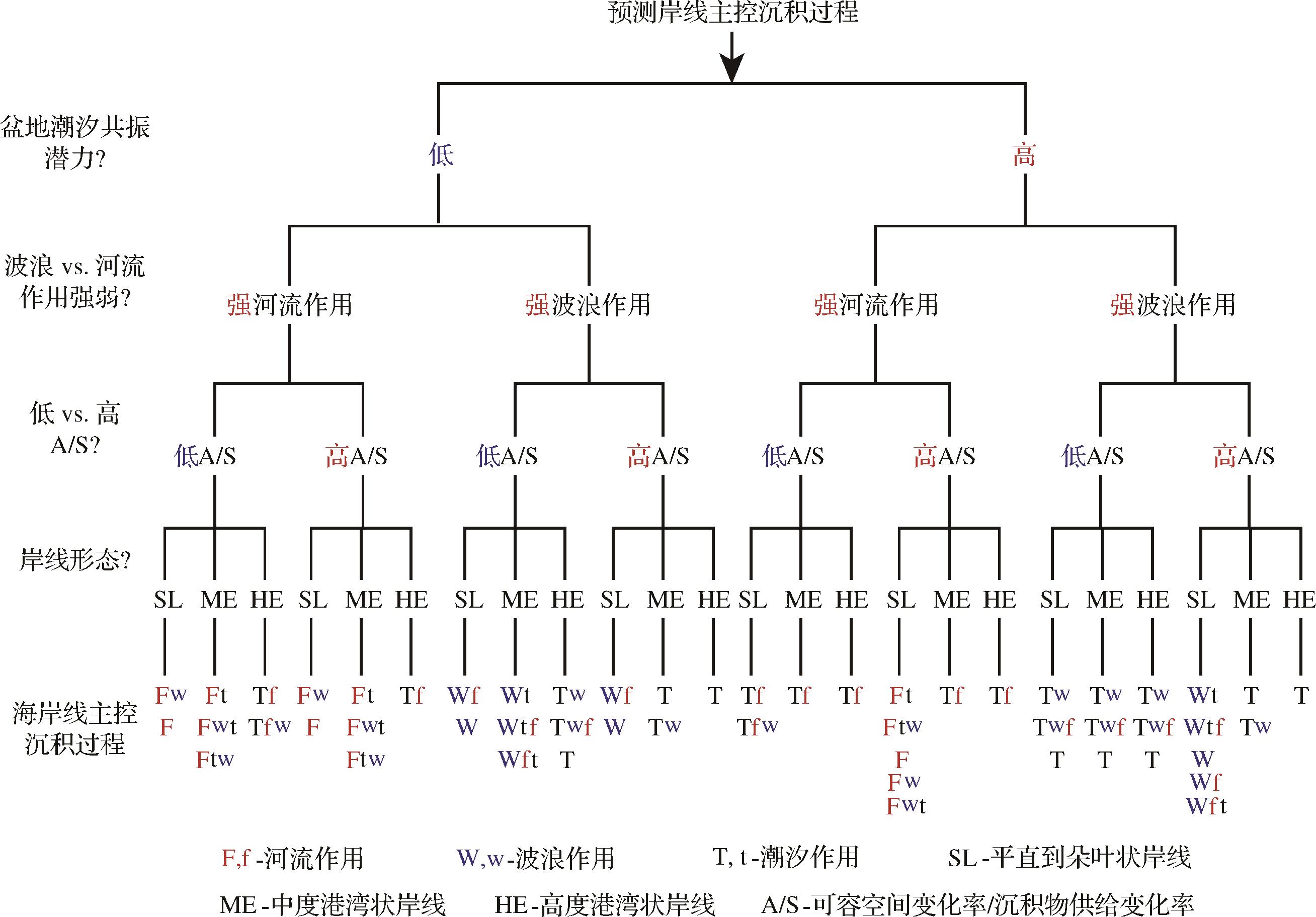
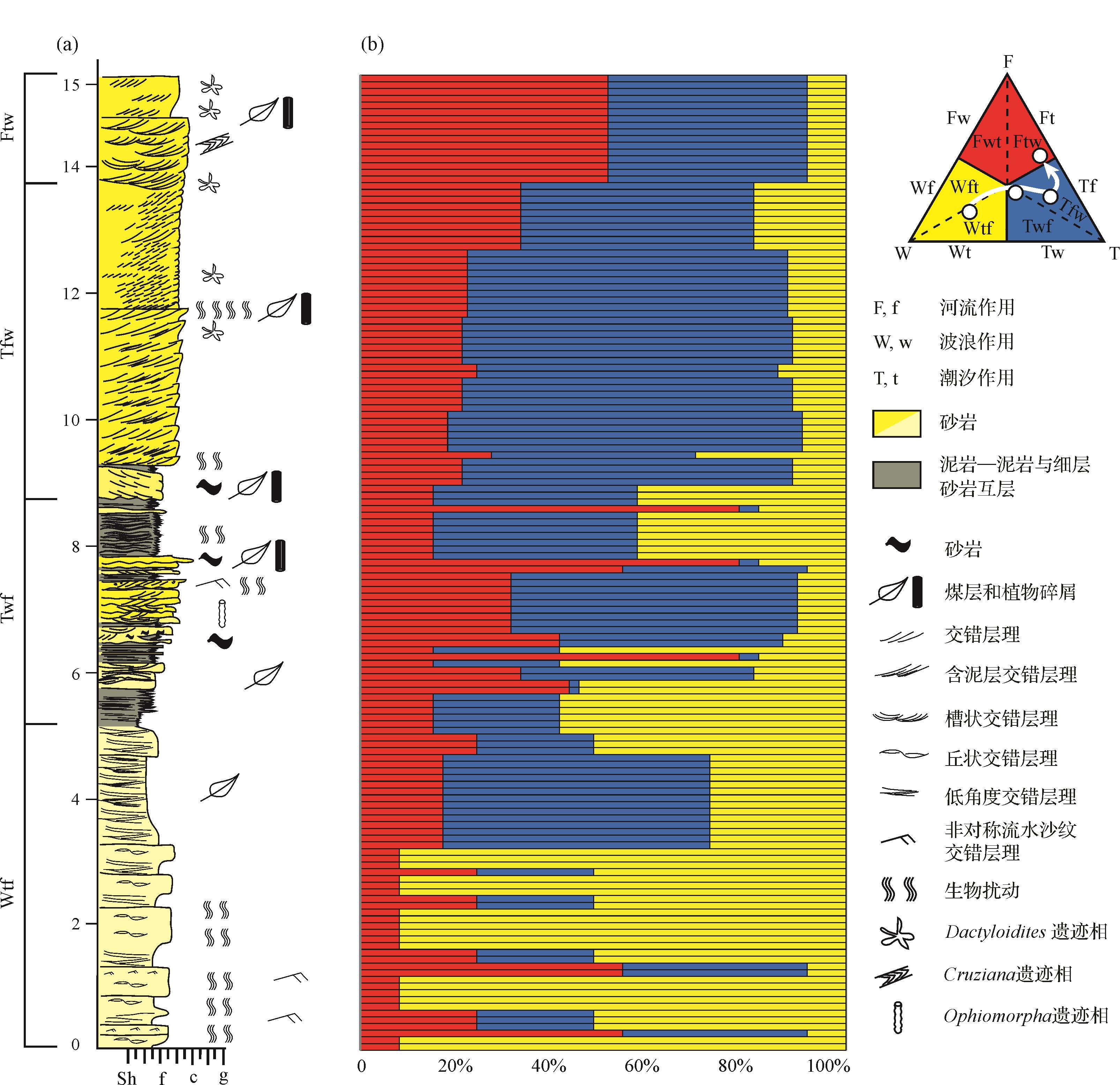
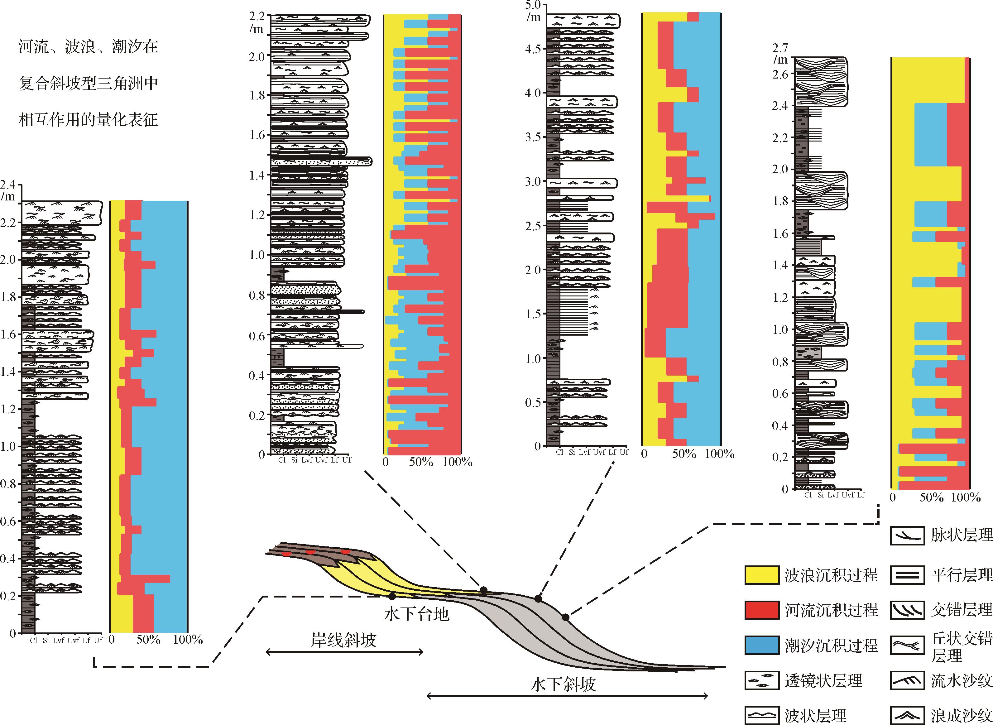
Mixed-energy process interaction of river, wave and tidal currents is one of the main research questions in sedimentology. In this study, the interactions of river-wave, river-tide, wave-tide and river-wave-tide in deltas and other coastal depositional systems are reviewed, and the associated sedimentary features are summarized. Mixed river and wave processes usually occur near the river mouth, and the relative strength and angle of the waves influence the morphology and sediment distribution in deltas. Long-term mixed processes may result in asymmetrical deltas and wave-dominated compound-clinoform deltas. The combined processes of river and tide are seen in the fluvial-to-marine transition zone of deltas and estuaries, particularly in macrotidal and mesotidal regions. Depositious of deltas and estuaries tend to repeat vertical stacking as sea level, sediment supply and climate change. Tidal processes have a significant impact on wave-influenced environments, as they not only directly influence sediment deposition, but also shift wave zones along the shoreface profile when water depth varies with tidal cycle. Despite there have been some recent research on mixed-process depositional systems, the short-term and long-term interaction processes still need to be better understood.

2022, 40(4): 979-995.
doi: 10.14027/j.issn.1000-0550.2021.109
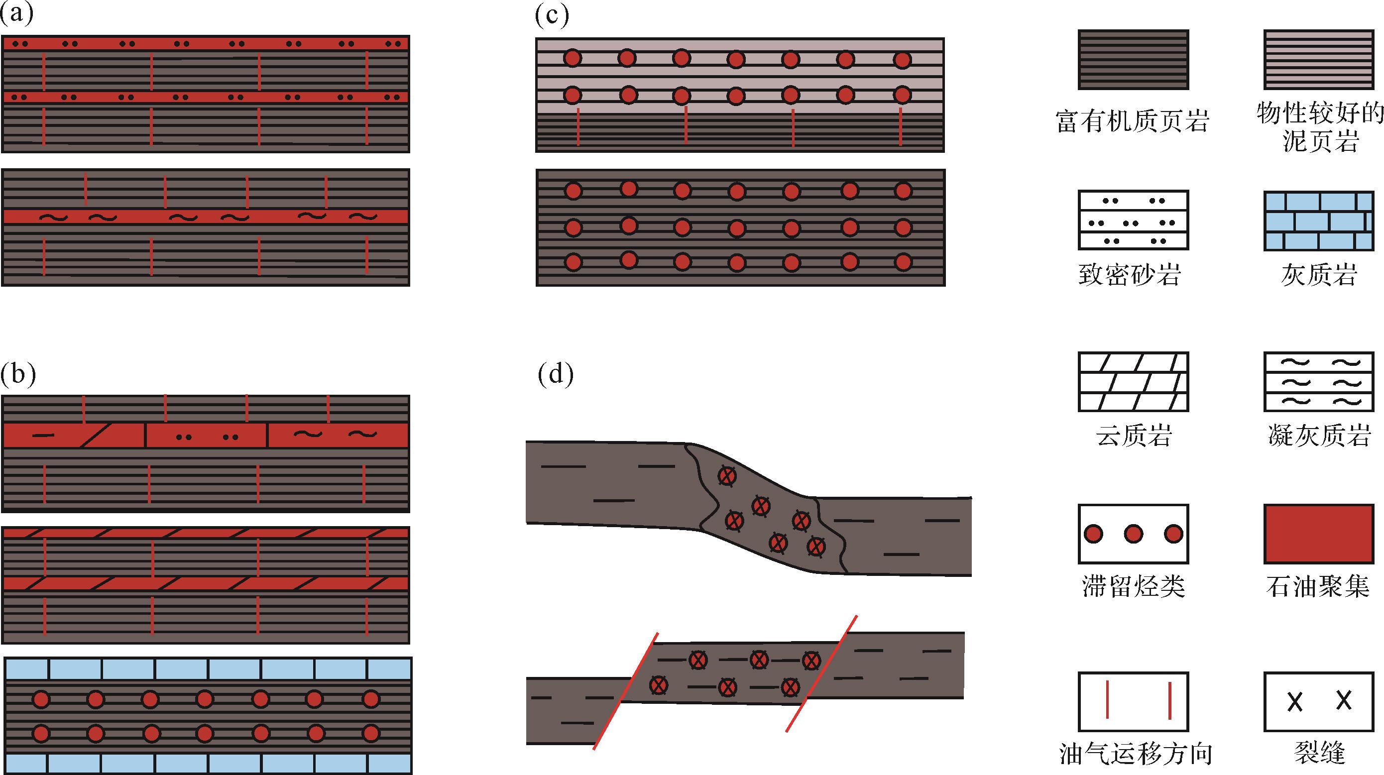
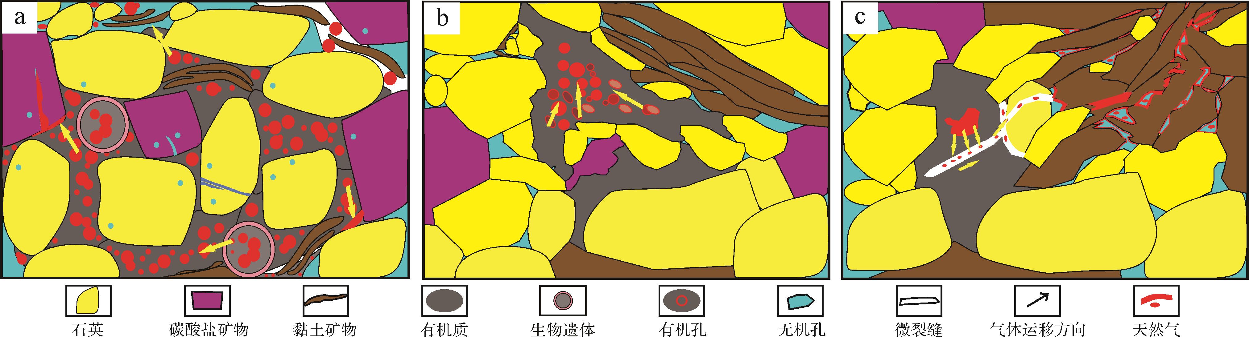
Abstract:
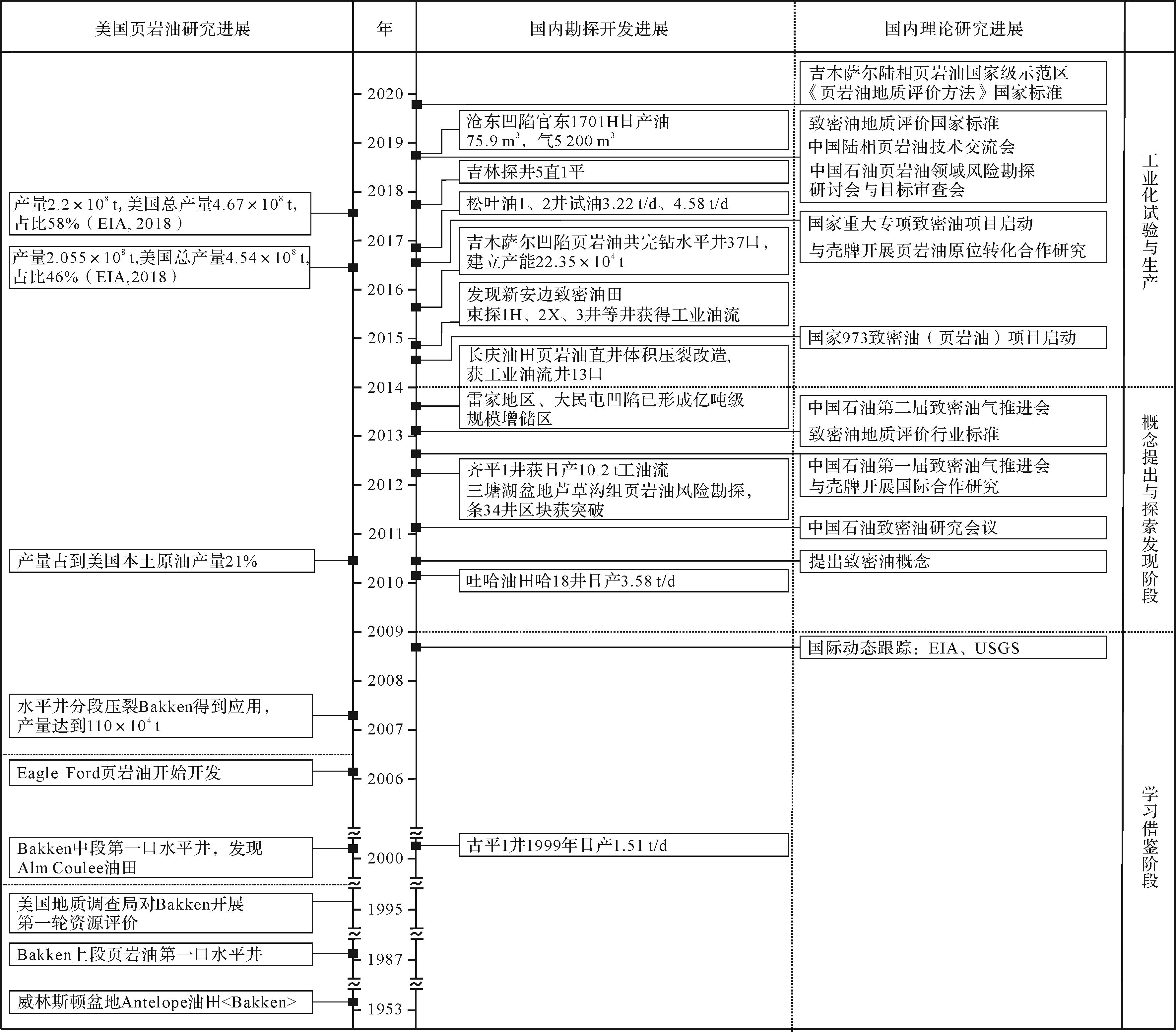
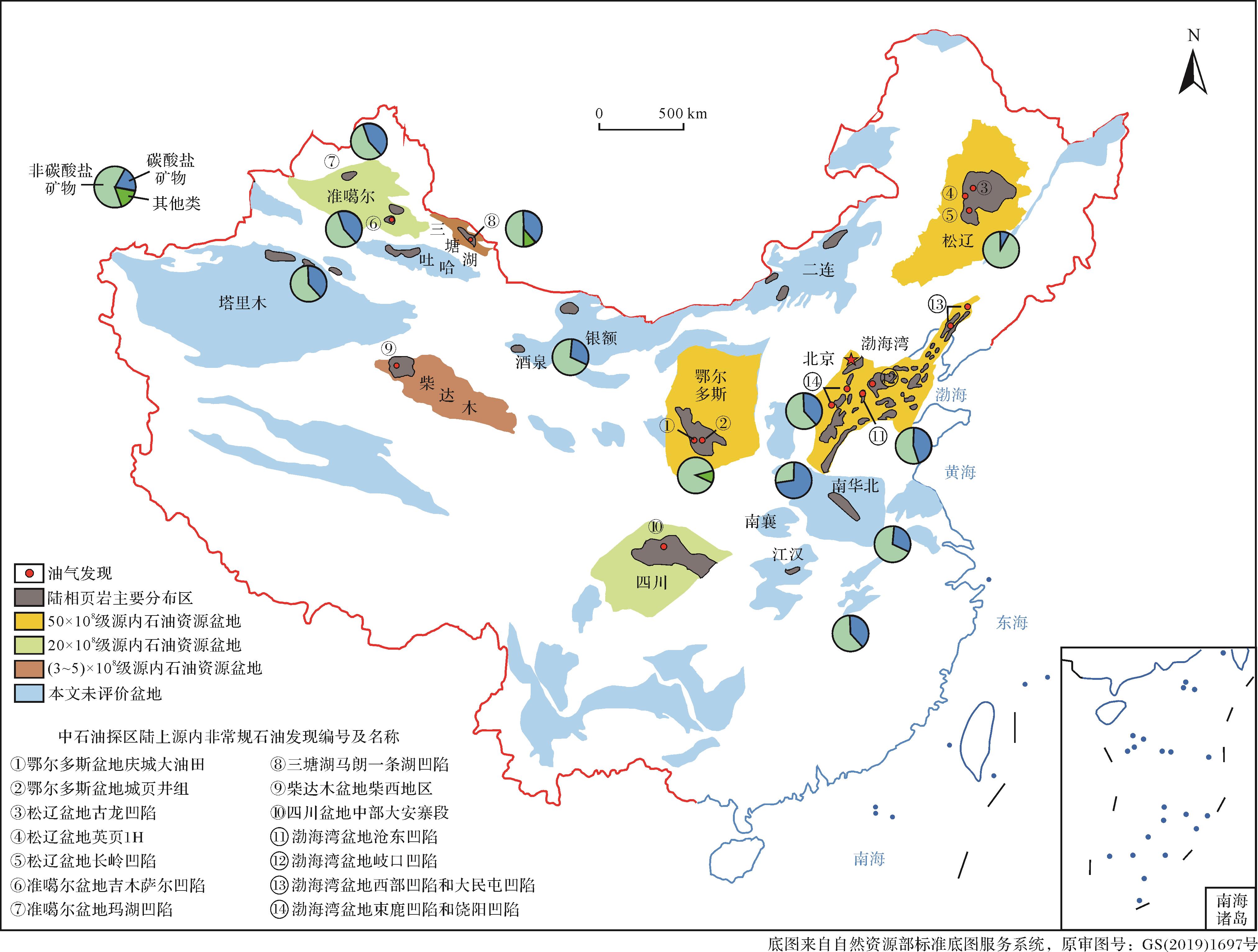
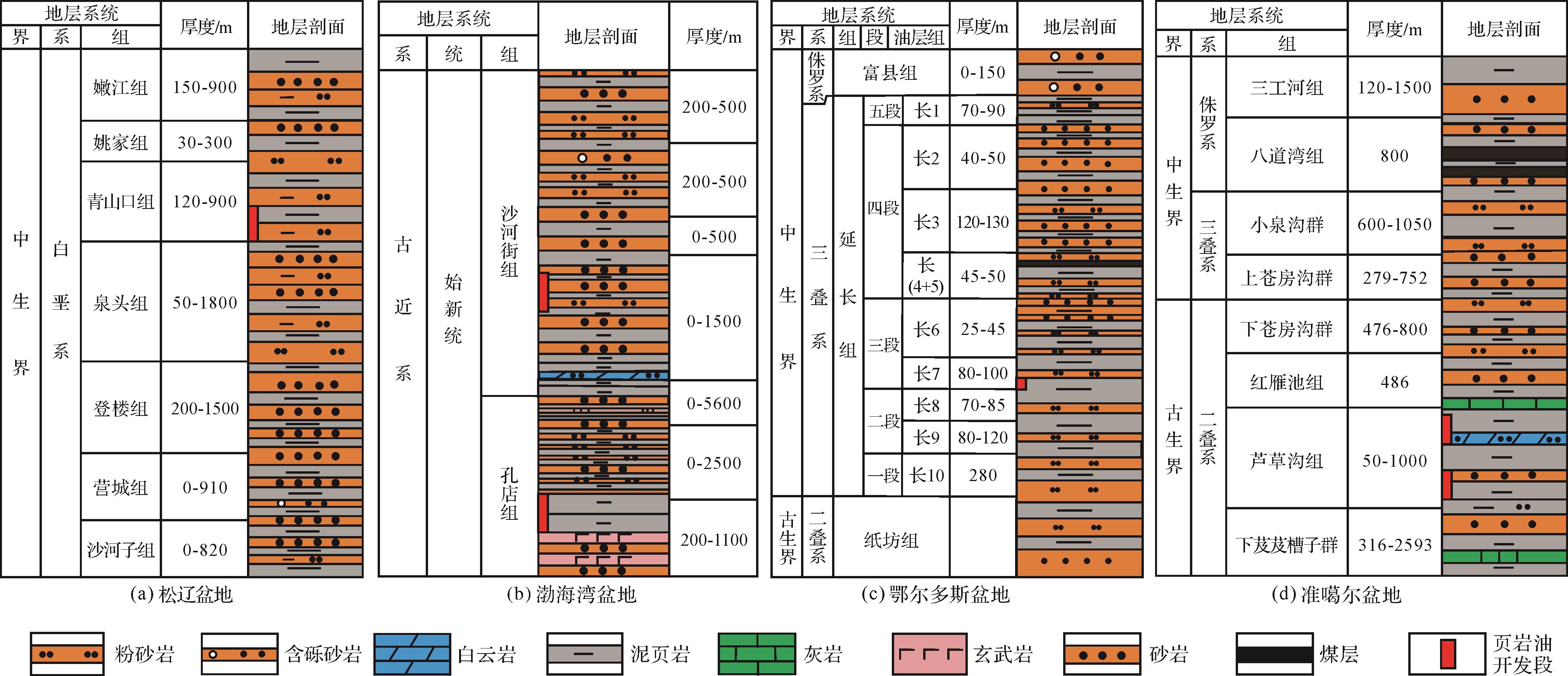
The current status of research and several key issues regarding the distribution, types and potential of continental shale oil resources, based on the concept of shale oil, its evolution and research history were assessed following an extensive literature review. This paper addresses the geological problems and prospects for the efficient development of continental shale oil.(1) A definition of shale oil and its development and production significance is proposed. The development of shale oil has undergone three stages in China and elsewhere: the theoretical understanding of shale oil has been deepened, and the development effect and level have been gradually improved. Continental shale oil is a rich resource with abundant potential, so it is a future key target for China.(2) Continental shale oil is classified into four main types, based on maturity level: solid organic matter; stagnant hydrocarbon; liquid hydrocarbon; and liquid hydrocarbon cracked gas. Oil shales are classified into three main types based on their source and reservoir: source-reservoir coexistence; separate source and reservoir; and shale type. Oil shales are also classified into four main types based on their development history: sandwich type; mixed accumulation type; shale type; and fracture type.(3) The study of continental shale oil has progressed considerably in areas such as the classification and deposition pattern of fine-grained sedimentary rocks, microscopic characteristics of source and reservoir rocks, enrichment mechanism, “seven characteristics”, and industrial exploitation technology.(4) The source-reservoir architecture of continental shale oil is strongly heterogeneous, and strengthening four aspects of geological research into its developmental is urgently needed in order to improve the economic efficiency and recovery rate of shale oil delivery. These research areas are (i) targeting ultra-high-frequency base-level cycles of fine-grained sedimentary shale; (ii) low-level sub-configuration unit genesis and distribution models of semi-deep and deep lacustrine deposits; (iii) facies-restrained reservoir quality variability; and (iv) geotechnical engineering emphasis on rapid location of the sweet spot.
2022, 40(4): 996-1009.
doi: 10.14027/j.issn.1000-0550.2021.029
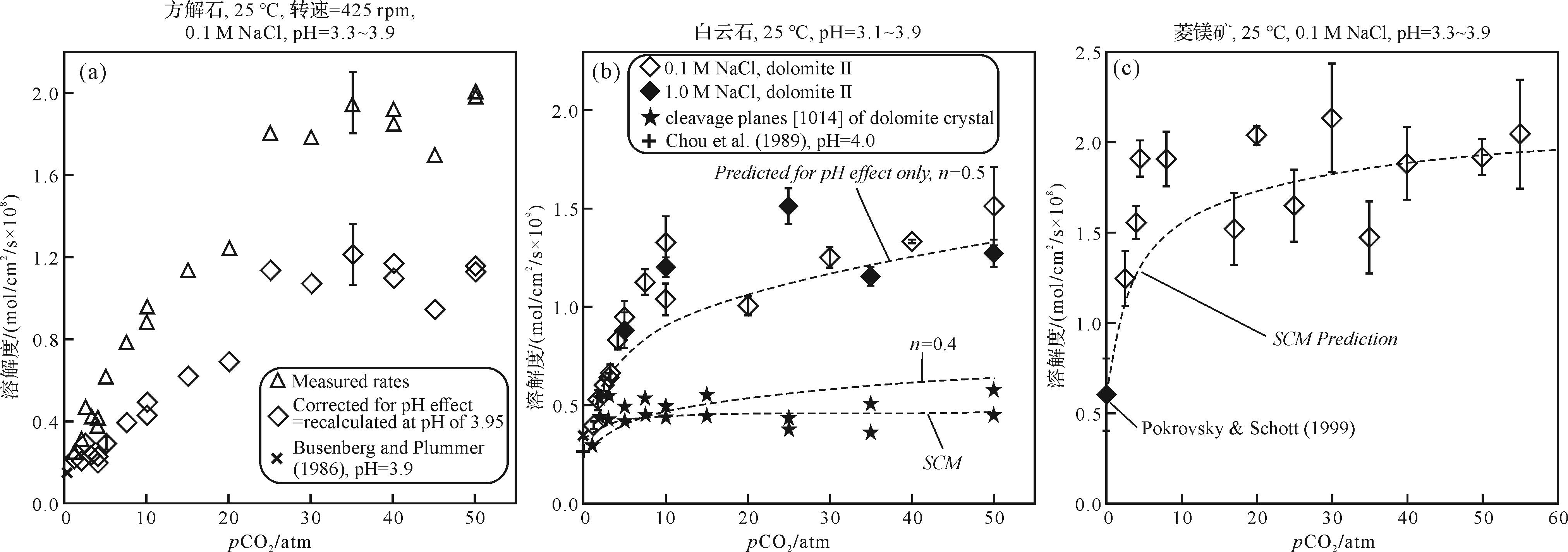
Abstract:
The “water-rock” interaction is an important part of the study of reservoir diagenesis, and its research results are of great significance in explaining the genetic mechanism of reservoir heterogeneity and the comprehensive evaluation of reservoir quality. In recent years, with the progress of basic theory, analytical testing methods, physical experiment methods, and simulation technology, much progress has been made in this field. For example, the improvement of physical modeling experiments of diagenesis has realized the macroscopic observation and research of the “water-rock” interaction process of the fluid-host rock/mineral system and clarified the influence of various physicochemical parameters on the mineral dissolution-crystallization process that take place in the system. However, the low resolution of physical modeling experiments on diagenesis limits its application in explaining the genetic mechanism and constraints of many phenomena on the micro (nano) scale. The establishment and development of crystal growth theory has laid a foundation for explaining the crystallization kinetics of the “water-rock” interaction process in the reservoir pore system. In particular, various on-line and off-line measurement techniques developed with nanotechnology in recent years have greatly improved the observation accuracy of the reservoir pore system structure and internal crystal growth, enhancing the resolution of “water-rock interaction” research to the nanometer level. This improvement provides a basis for understanding the dissolution crystallization (precipitation) phase equilibrium process and its mechanism of the fluid mineral system in pore system from the microscopic scale. The crystallization kinetics of fluid in the reservoir pore system is closely related to the pore medium system and fluid properties, which is the result of the comprehensive action of nucleation free energy, surface electrochemical characteristics of the mineral, mass transfer rate, and other factors. A systematic study on pore fluid crystallization kinetics in different diagenetic environments and pore systems is helpful in understanding the effects of the pore system spatial structure, surface chemical properties of the substrate, and surface energy on the nucleation and growth process of mineral crystals, laying a theoretical foundation for further understanding the crystallization kinetics principle of reservoir heterogeneity.
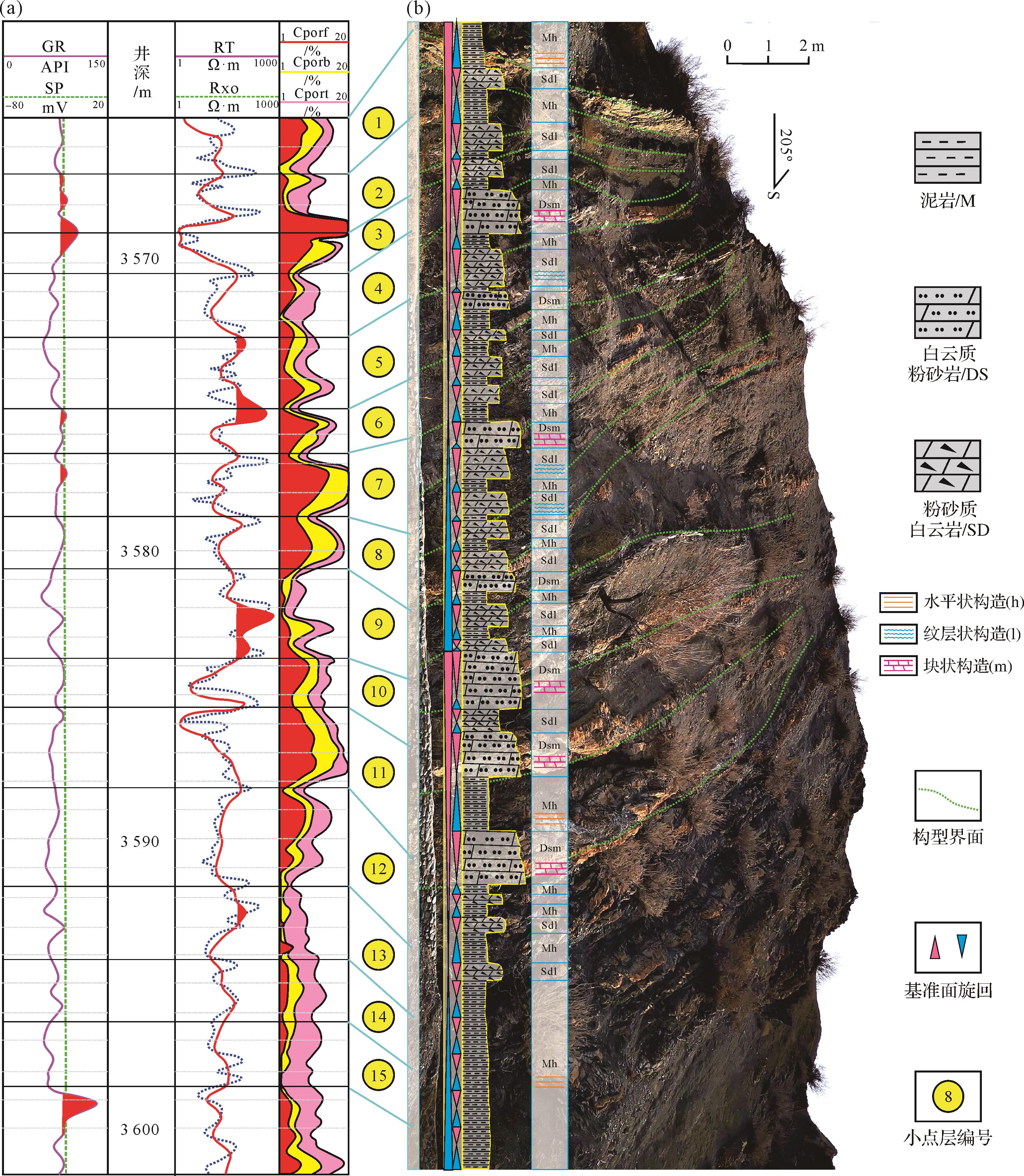
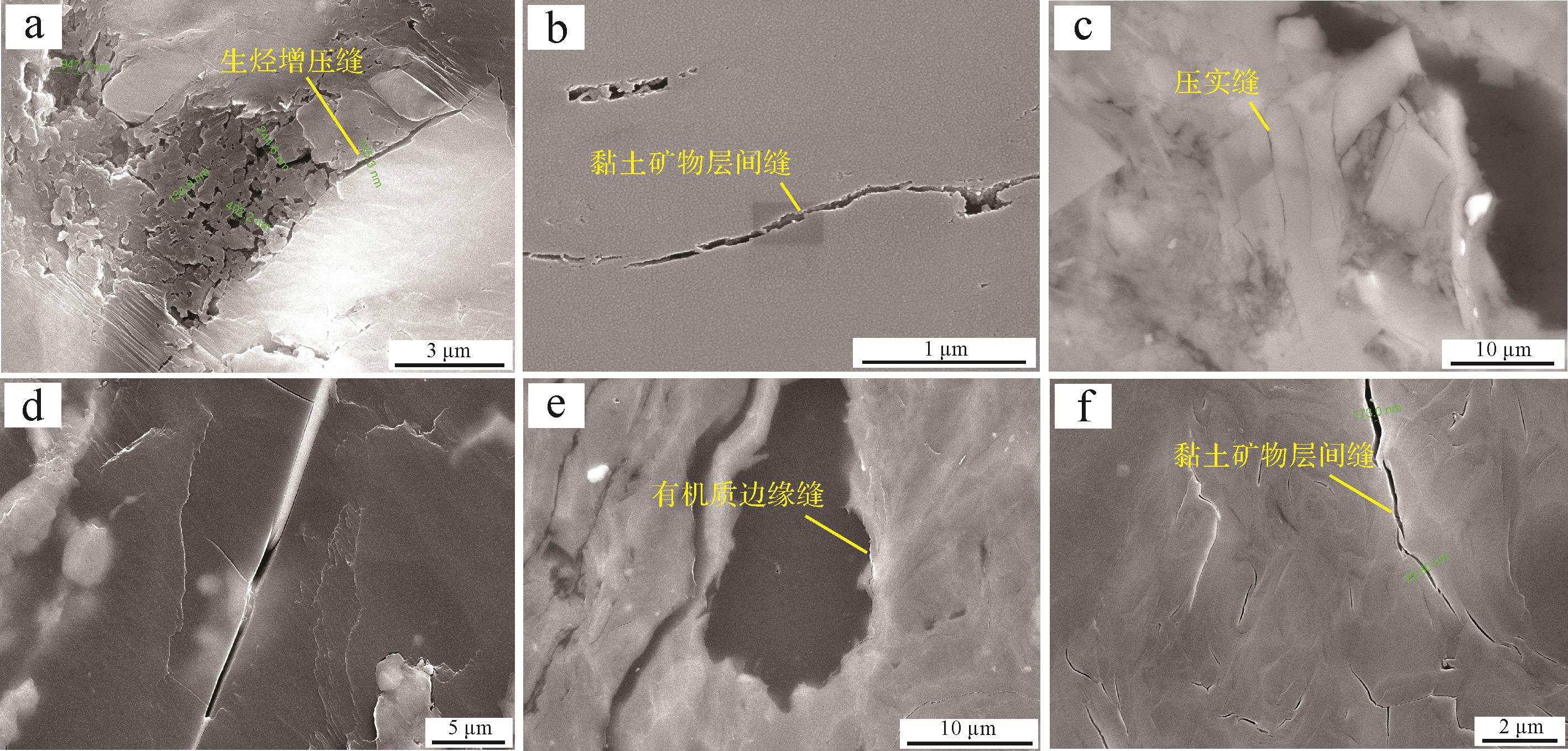
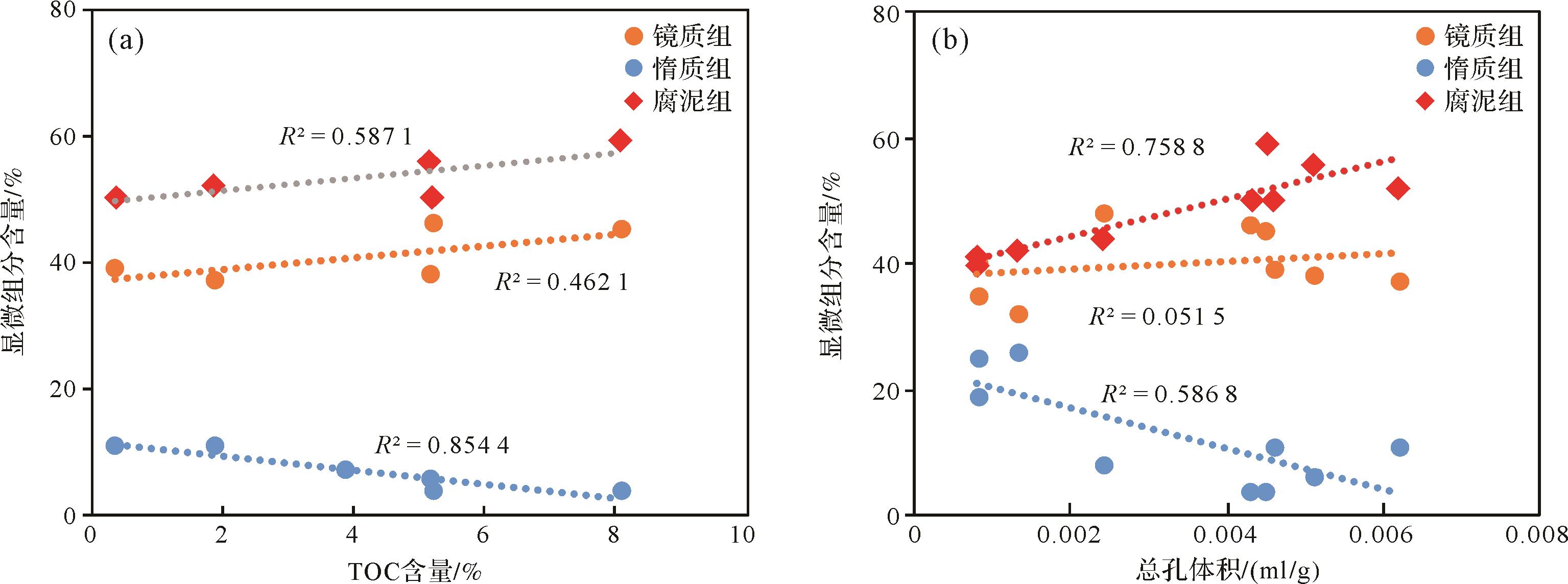
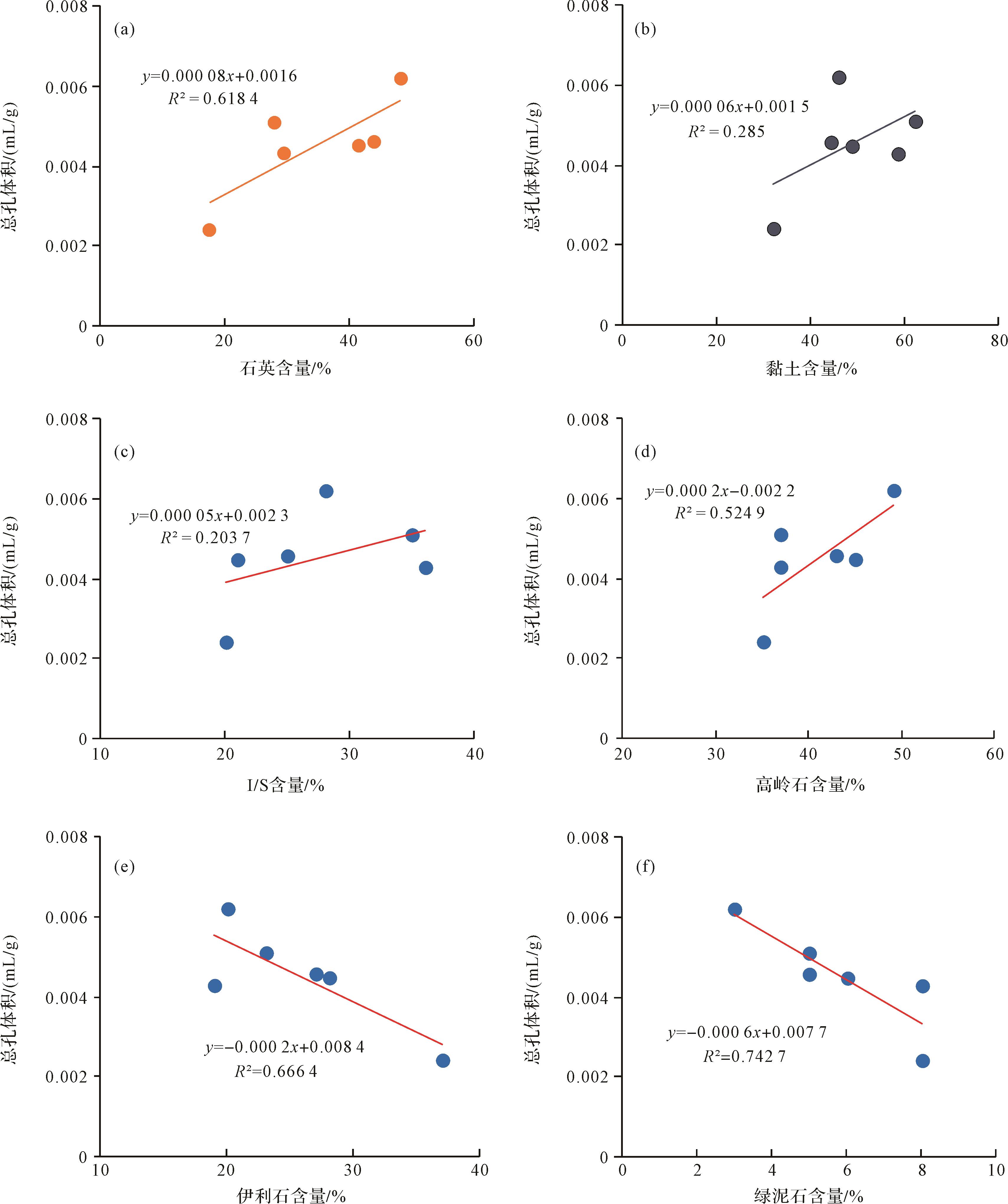
2022, 40(4): 1010-1018.
doi: 10.14027/j.issn.1000-0550.2021.053
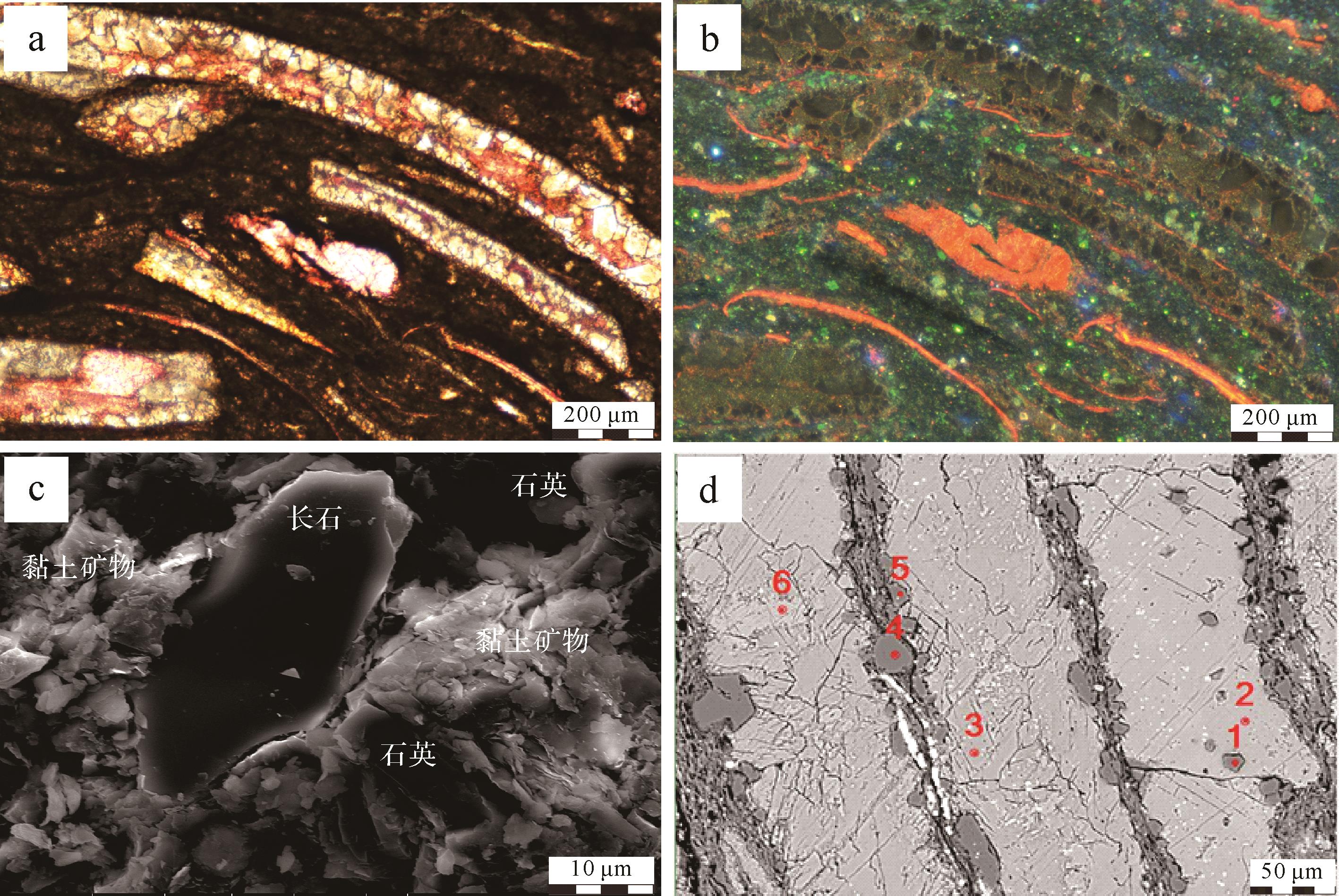
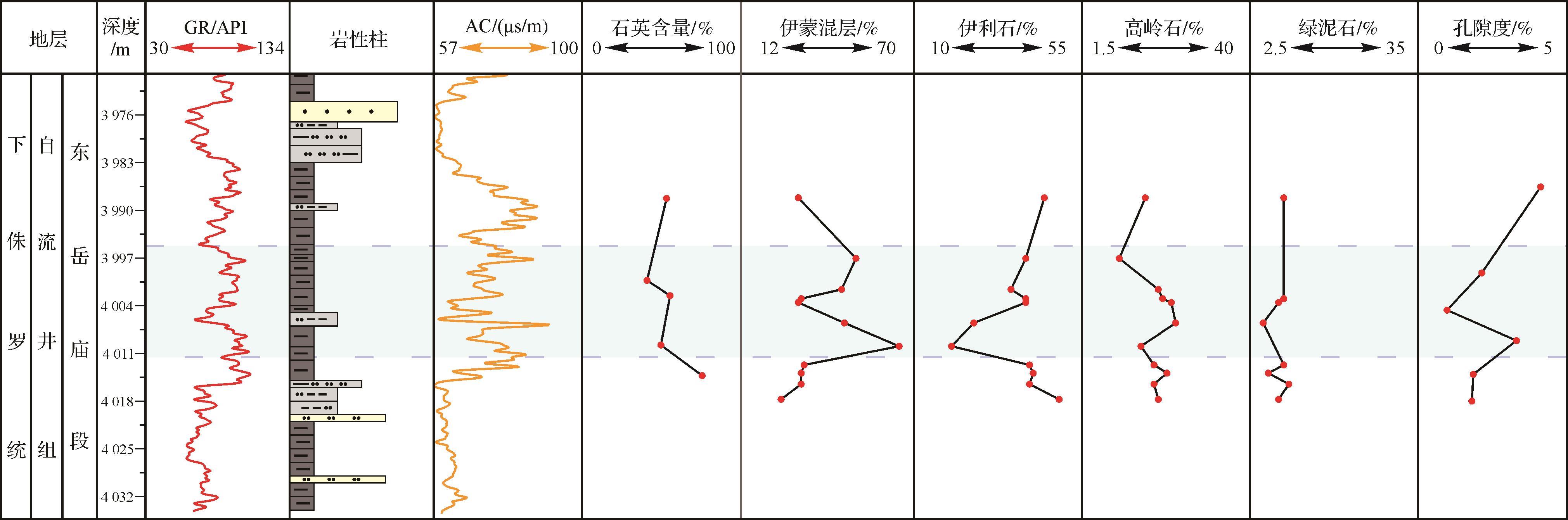
Abstract:
Gas shale from the Ziliujing Formation in the Sichuan Basin was studied to investigate the genesis of quartz in continental shale and its distribution and influencing factors. Terrigenous quartz and quartz formed during diagenesis were identified using X-ray diffraction (XRD) analysis, observation of thin sections, scanning electron microscope cathodoluminescence (SEM-CL) and electron microprobe, combined with geochemical element test methods. Terrigenous quartz has a brown cathodoluminescence and large particle size, whereas quartz formed during diagenesis shows no cathodoluminescence, has a better shape and smaller size. Quartz formed during diagenesis is either formed at the edge of siliceous shells or during the transformation of clay minerals. Depending on its diagenesis, the quartz is formed at the edge of the silica-metasomatic shell or is formed during illitization. Analysis of the different forms found that the quartz in the Dongyuemiao member was mostly formed during illitization and from terrigenous input. In the Ma’anshan member it is mainly terrigenous; and in the Da’anzhai member the genesis is siliceous metasomatism and terrigenous input. Based on this, the influence of the different forms of quartz in nonmarine shale is summarized, taking depositional environment and formation pressure into account. In terms of depositional environment, the proportion of terrigenous quartz increases with increase in terrigenous input. At the same time, suitable salinity of the lake water is conducive to the survival of shells of organisms, which provides the material for the formation of silica in silica-metasomatic shells. In addition, abnormally high pressure inhibits illitization, and a decrease of silica precipitation hinders authigenic quartz precipitation.
2022, 40(4): 1019-1029.
doi: 10.14027/j.issn.1000-0550.2021.006
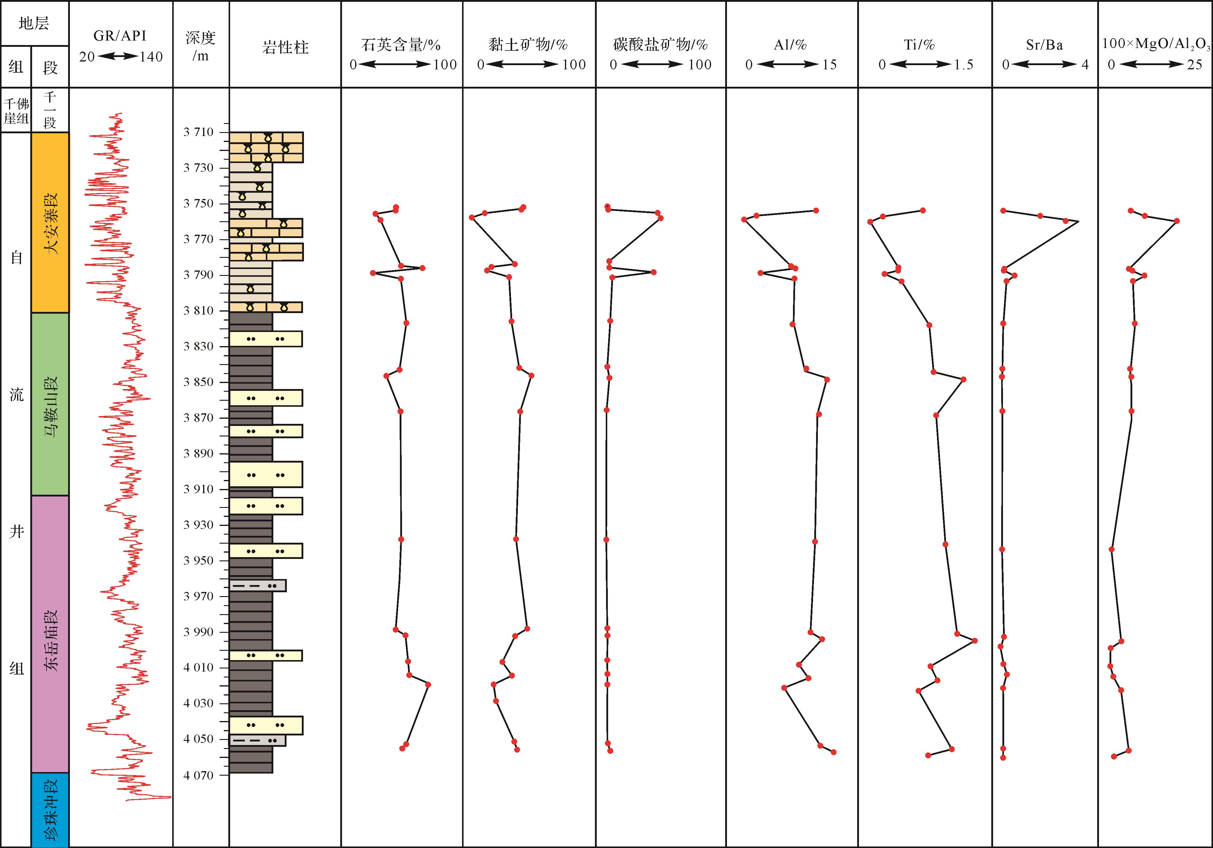
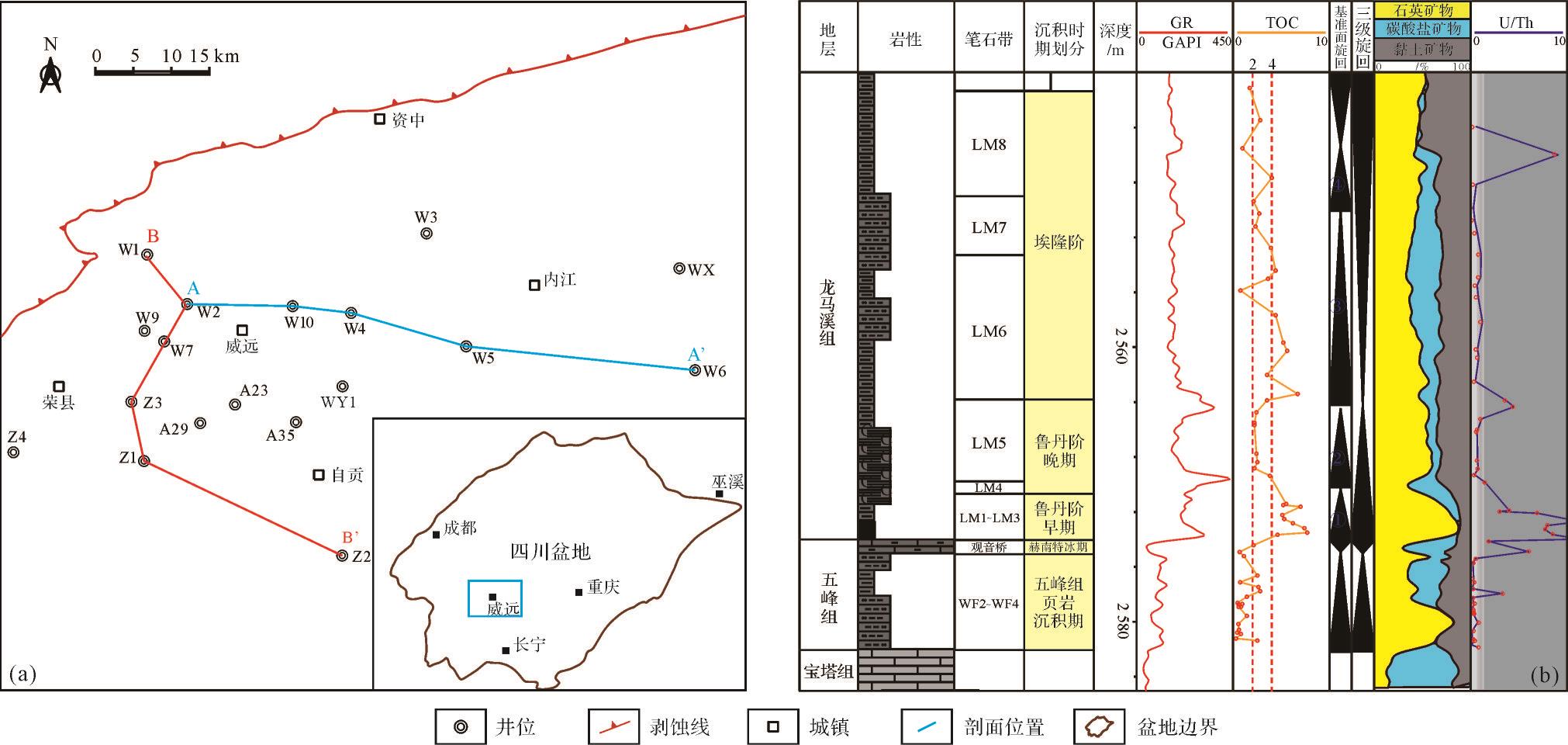
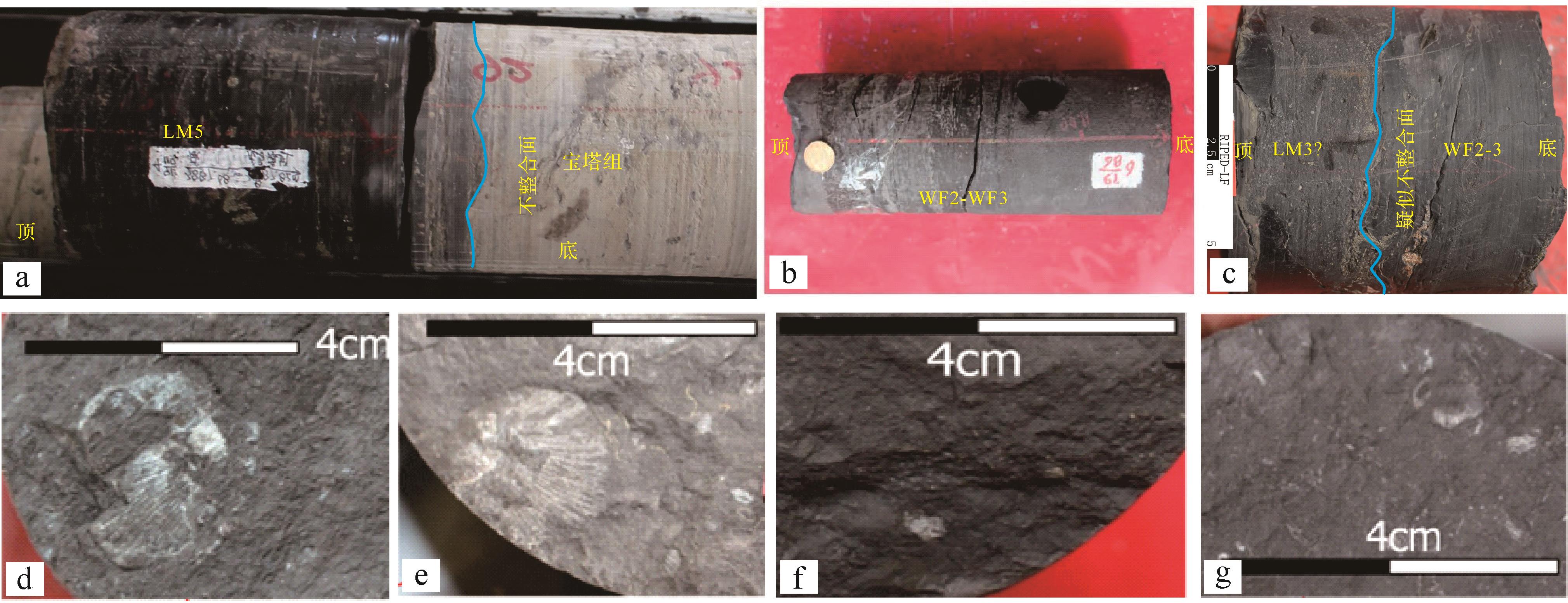
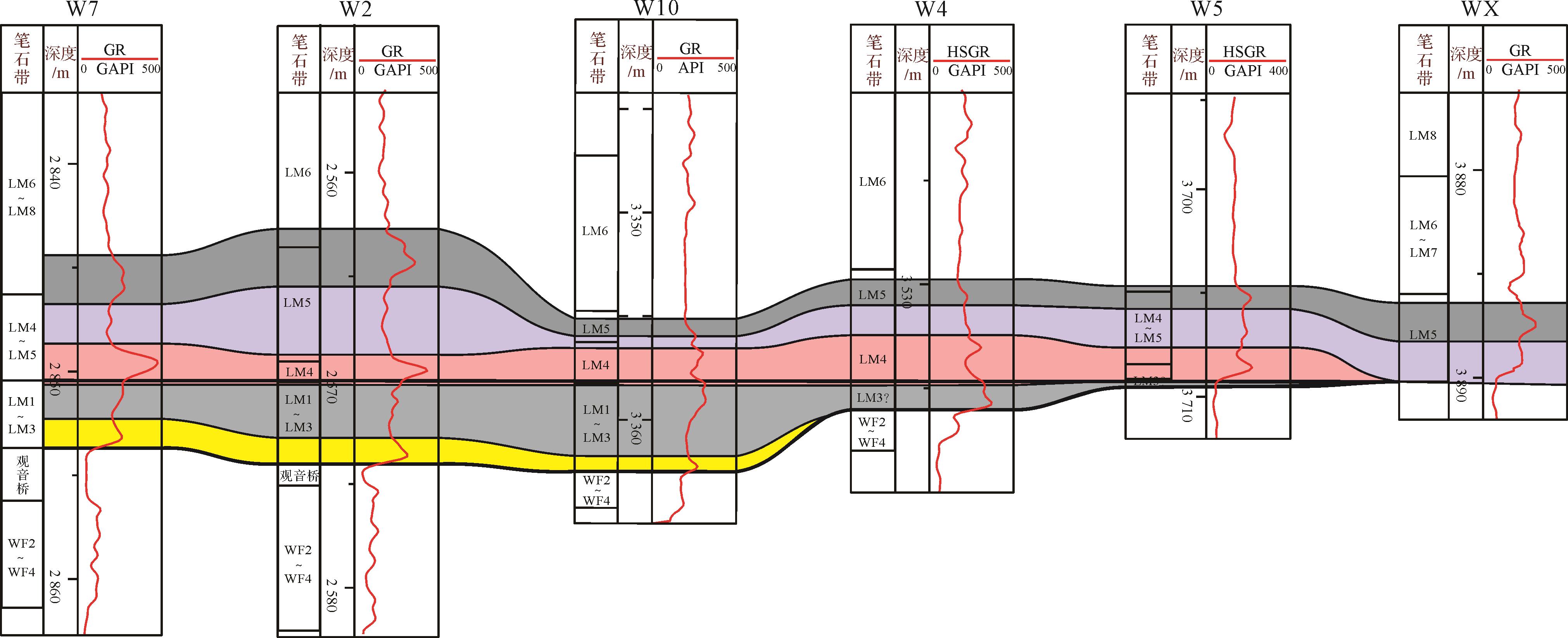
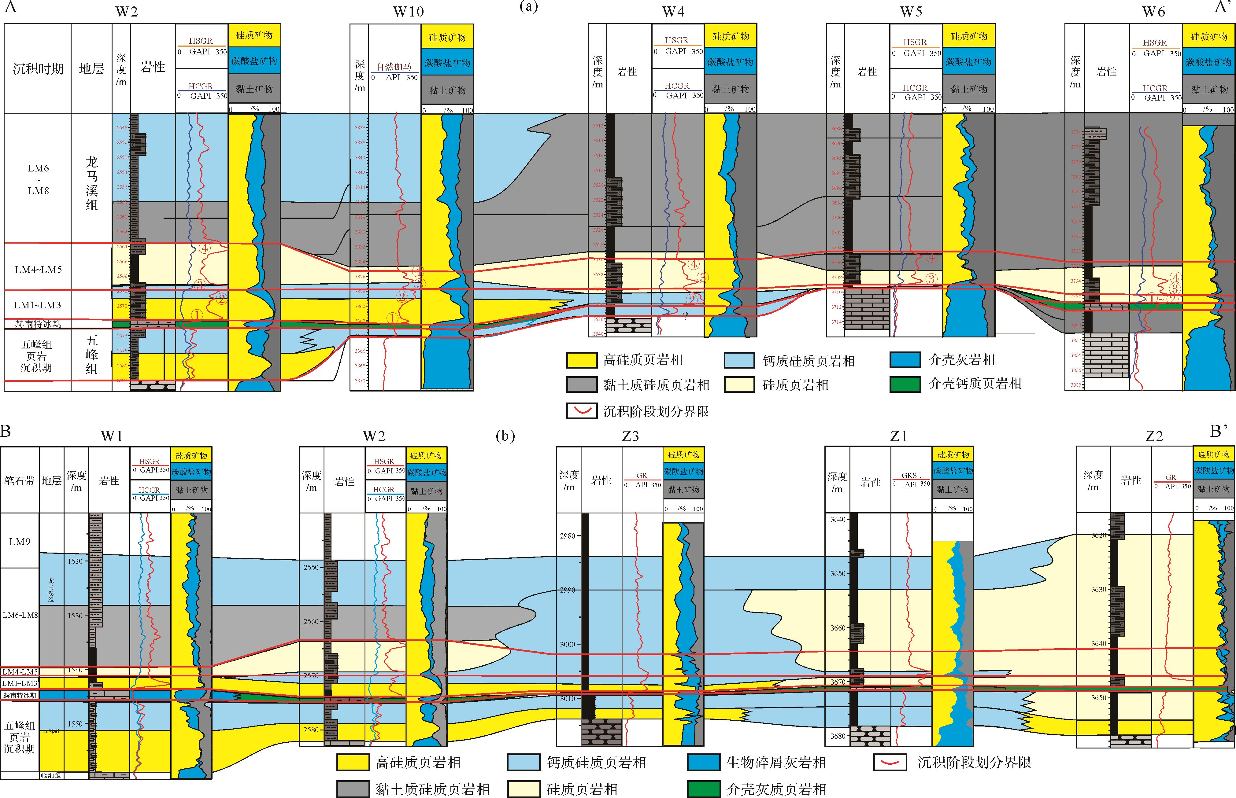
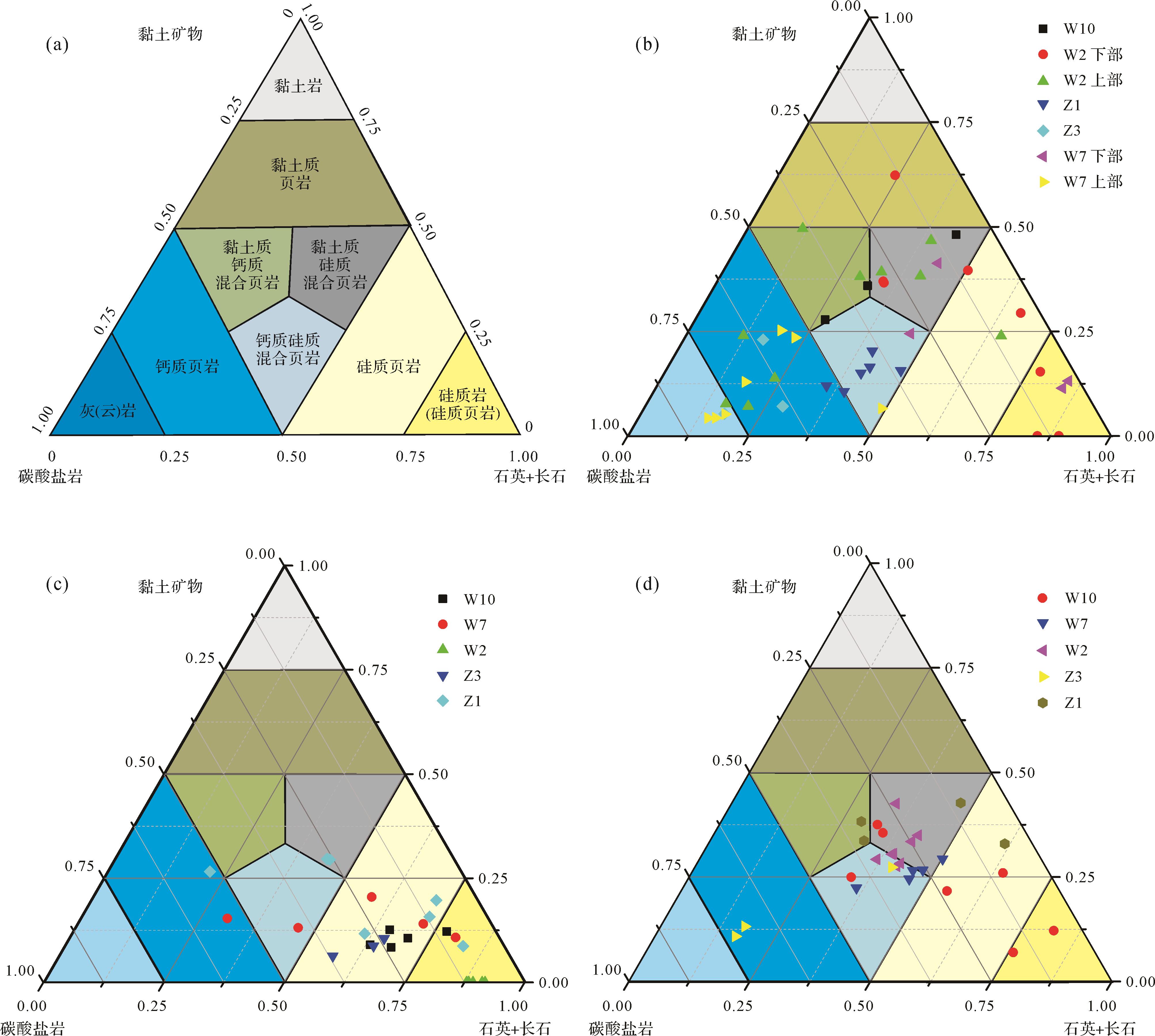
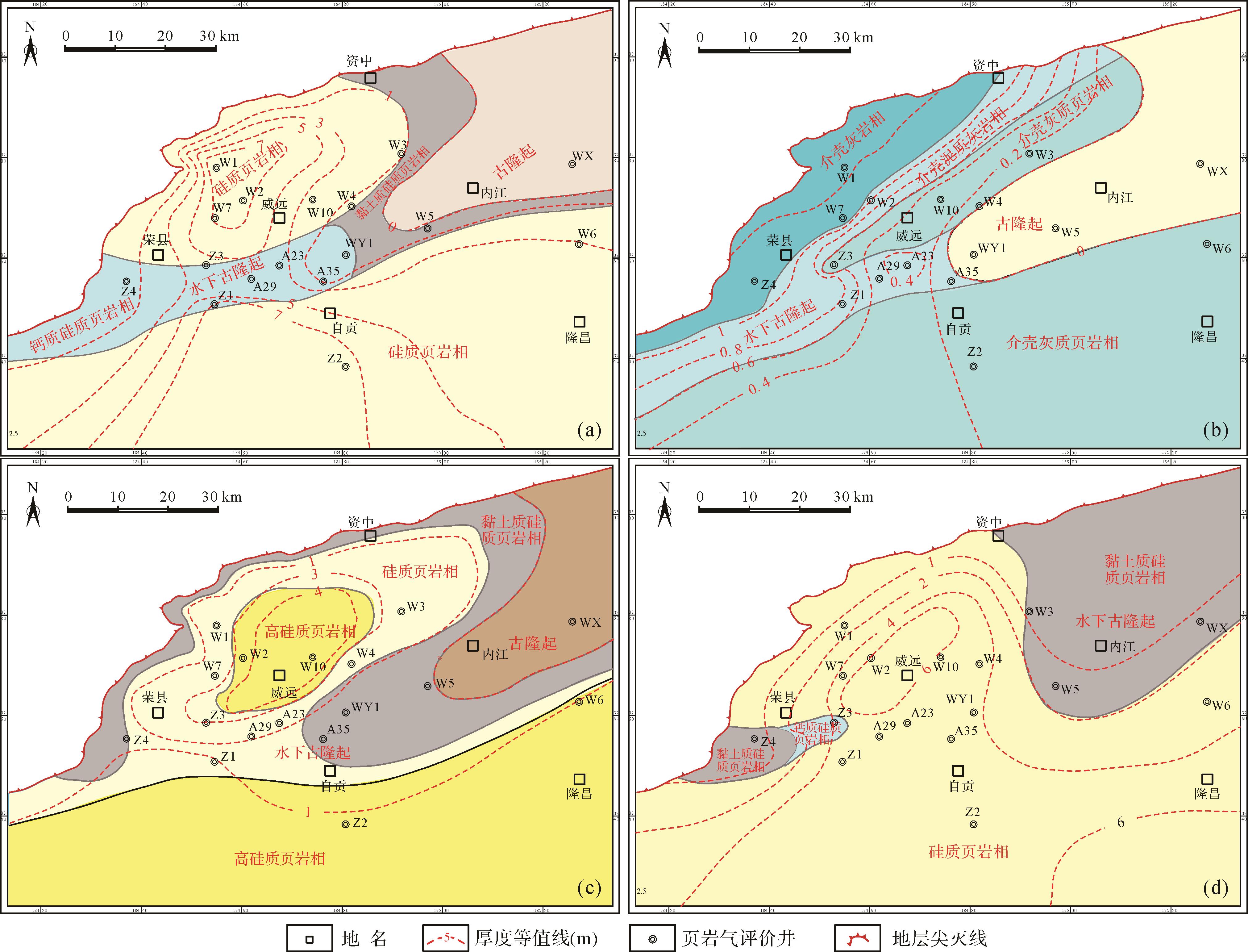
Abstract:
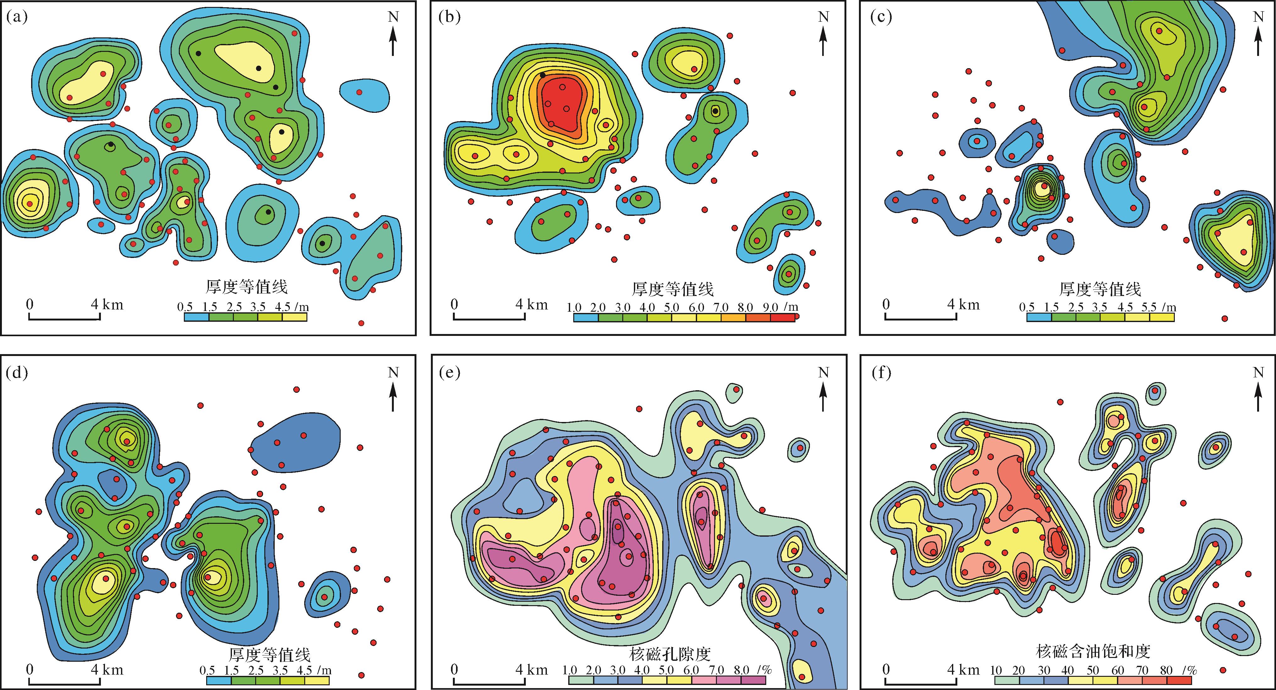
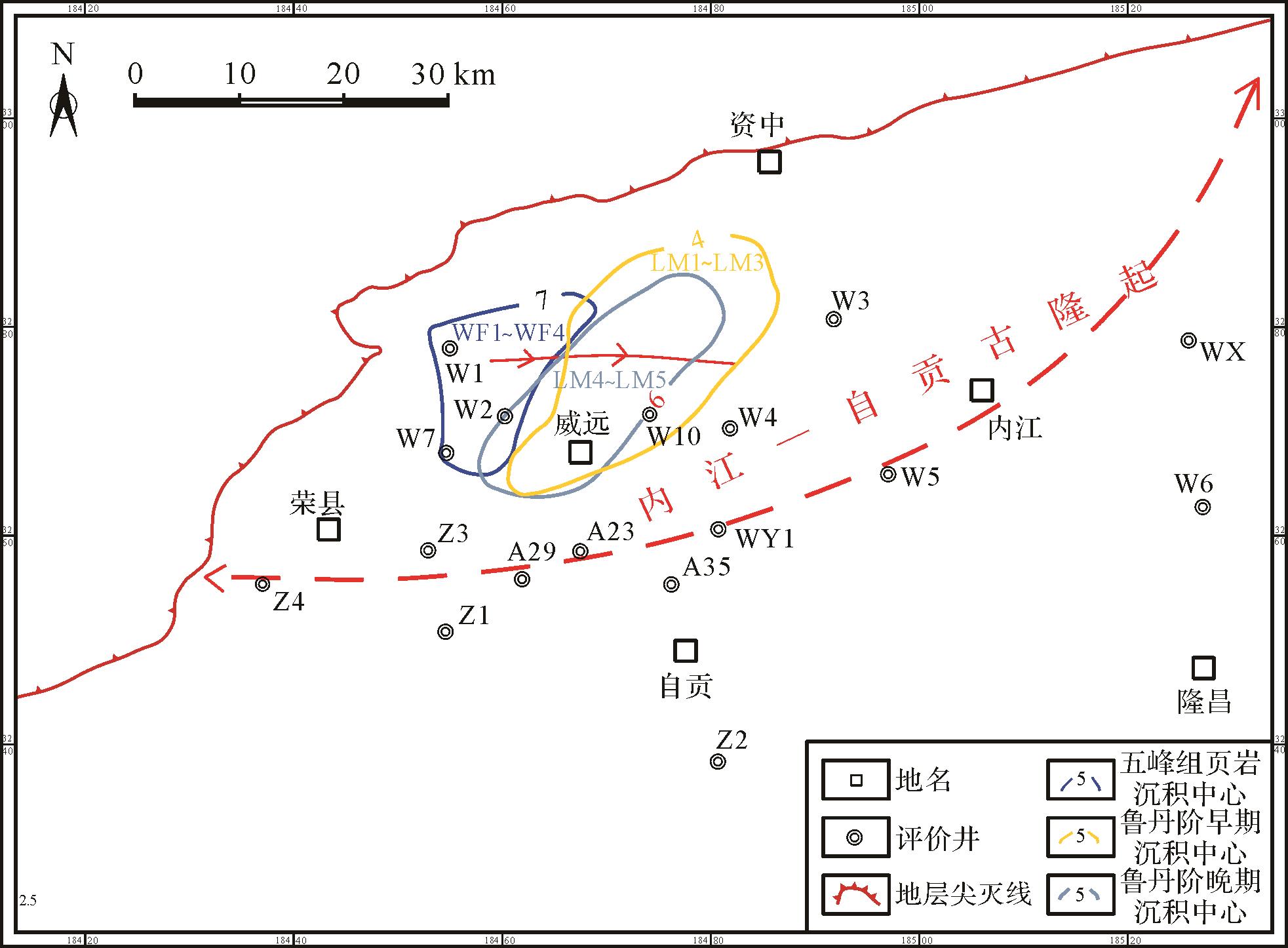
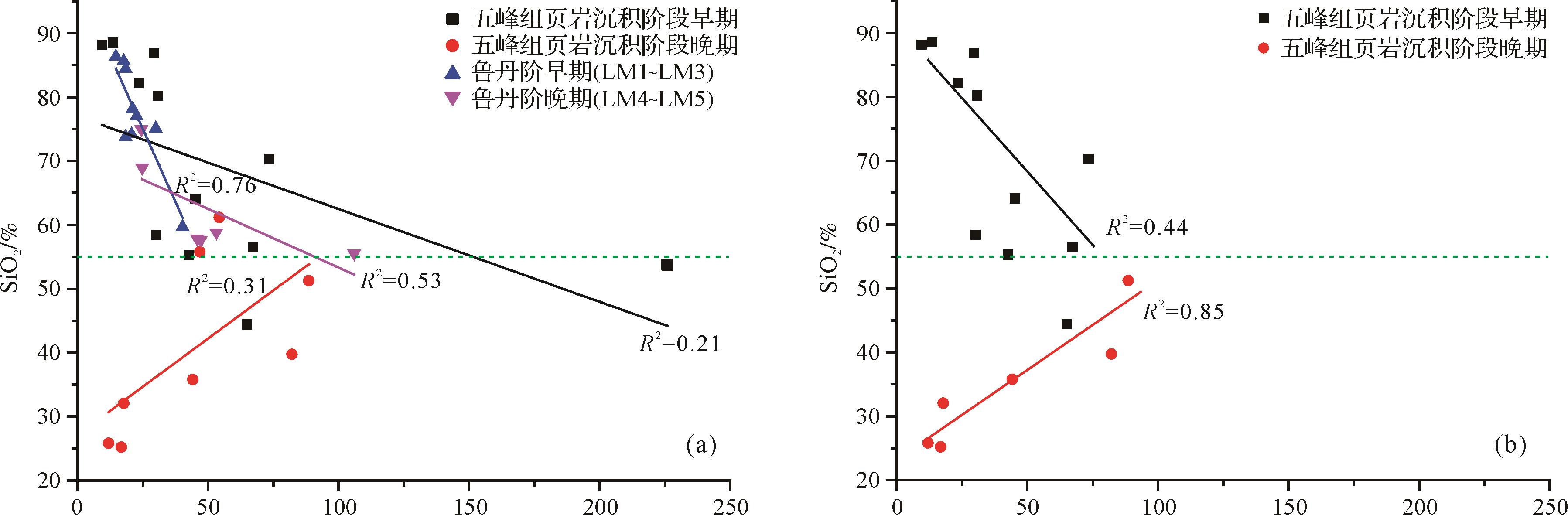
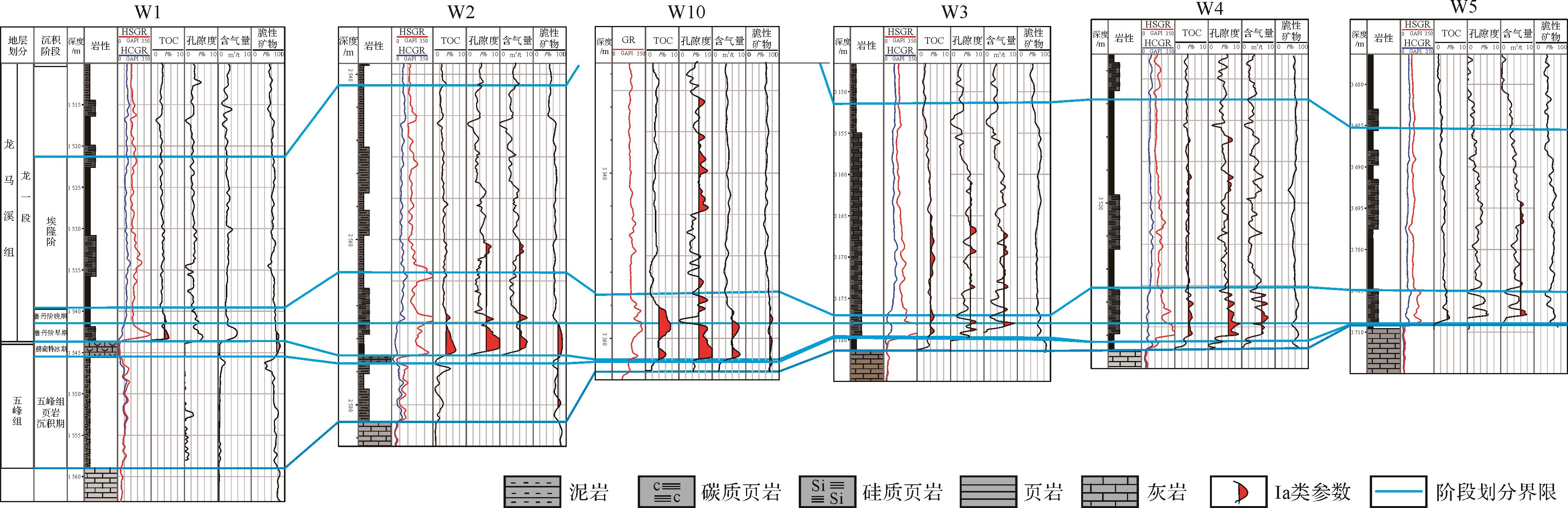
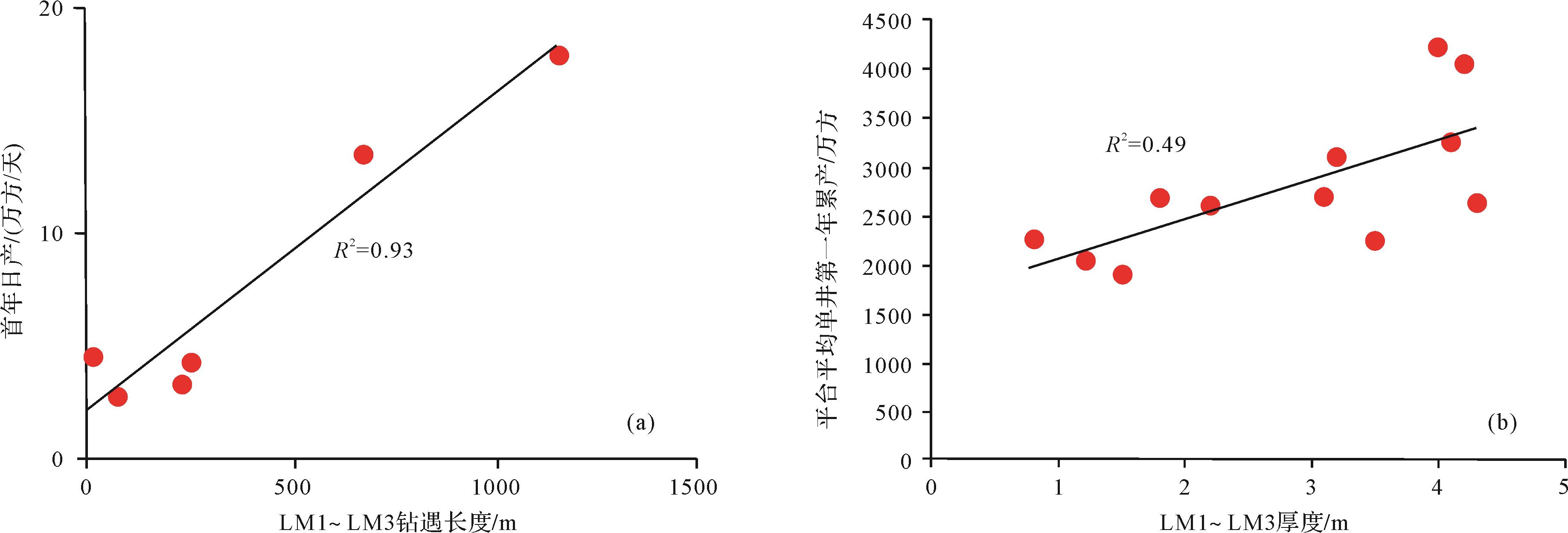
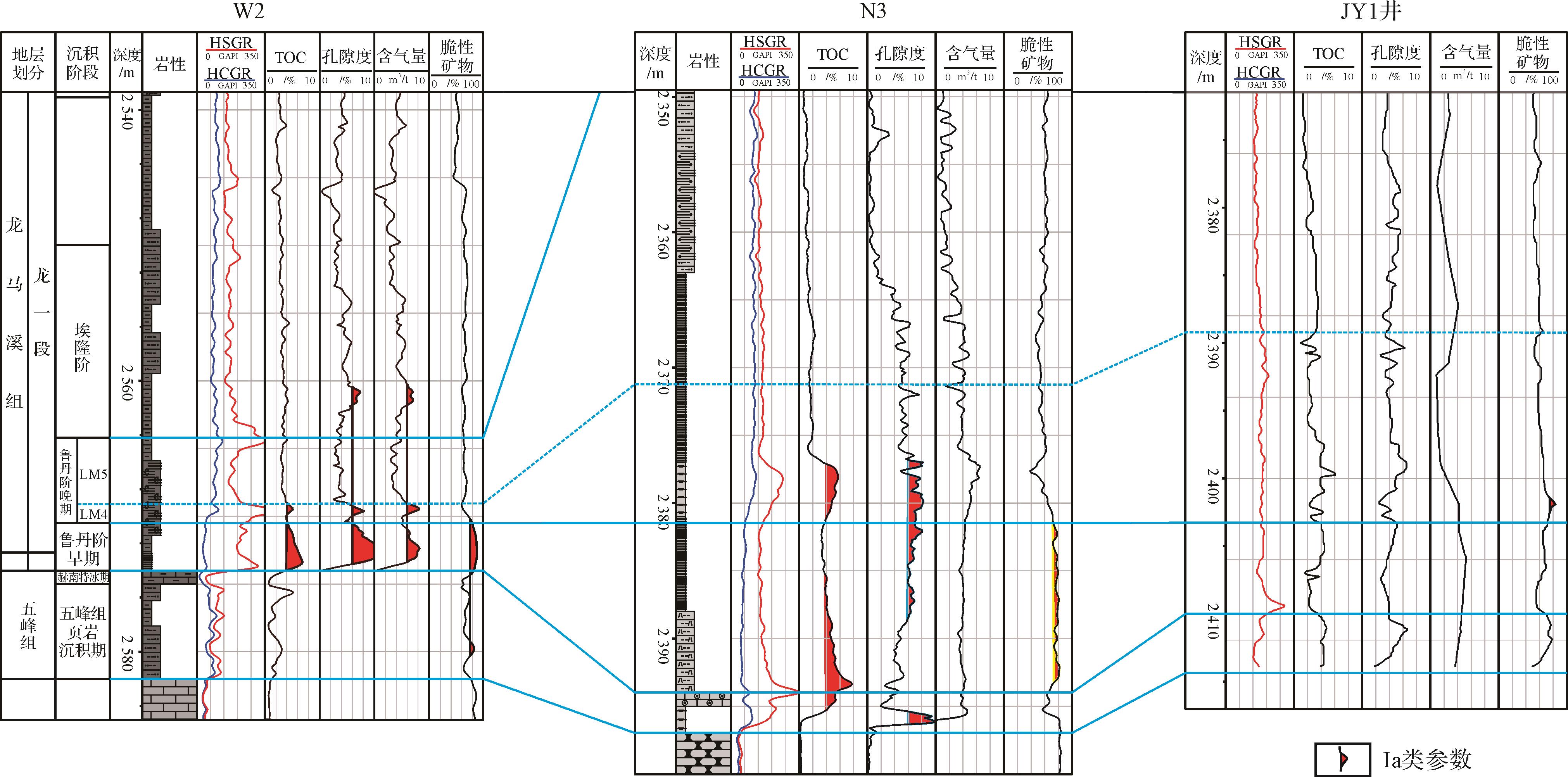
Paleo-uplift in the Weiyuan area was confirmed in this study by analysis of the graptolite biostratigraphy, lithofacies, logging response, geochemistry and element geochemistry at 14 wells in the Wufeng Formation⁃Longmaxi Formation. The thickness and lithofacies distribution of the shale are controlled by the paleo-uplift. The study clarifies that the distribution of high-quality shale was controlled by the paleo-uplift and puts forward some suggestions regarding the optimization of horizontal well location. It was concluded that: (i) The biological strata, lithological strata, electrical features and stratum thickness indicated that the (underwater) paleo-uplift was first discovered in the area of wells Z4-Z1-WY1-W5-WX. (ii) The stratigraphicand lithofacies distribution during different periods was mainly controlled by paleohigh development. The shale strata are thin in the paleo-uplift and adjacent areas, with high clay or carbonate mineral content. Thick shale containing siliceous minerals occurs in depressed areas. (iii) The sediment sources at wells WF2⁃WF4, LM1⁃LM3 and LM4⁃LM5 were central Sichuan ancient land, authigenic quartz and central Guizhou ancient land; the different provenances indicate changes in the sedimentary system. (iv) The best reservoir quality occurs in the early Ludan stage (LM1⁃LM3). The reservoir properties were controlled by paleo-uplift, with the best reservoirs in depressed areas. LM1⁃LM3 strata are recommended as the target horizon. It is also recommended that horizontal wells be give priority in the thicker LM1⁃LM3 strata.
2022, 40(4): 1030-1042.
doi: 10.14027/j.issn.1000-0550.2021.069
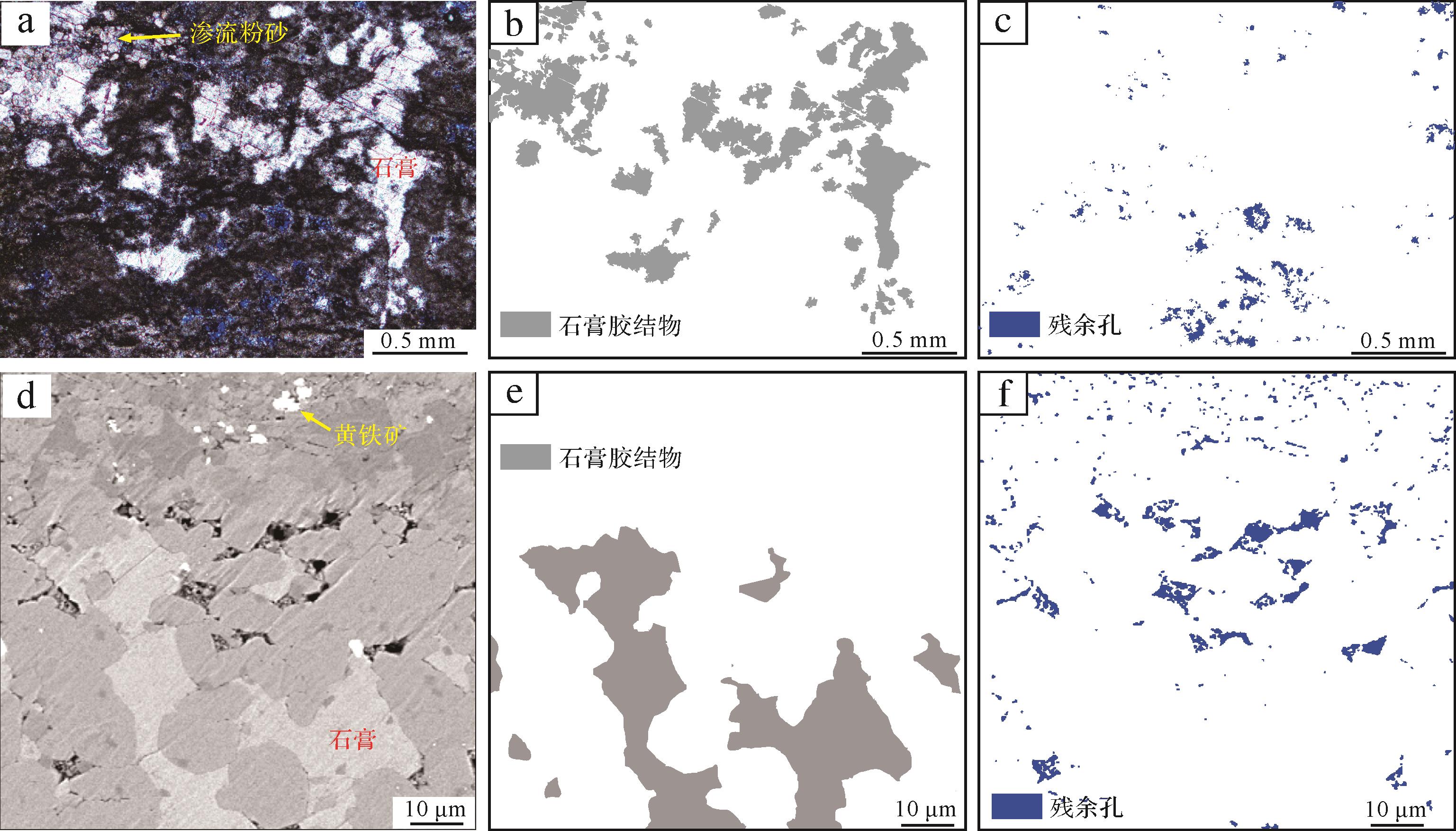
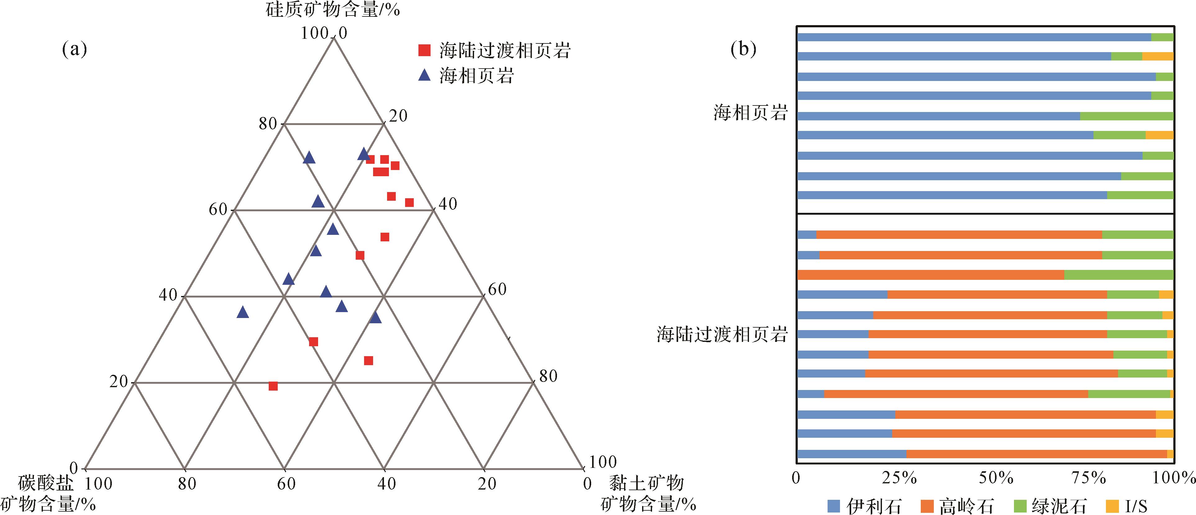
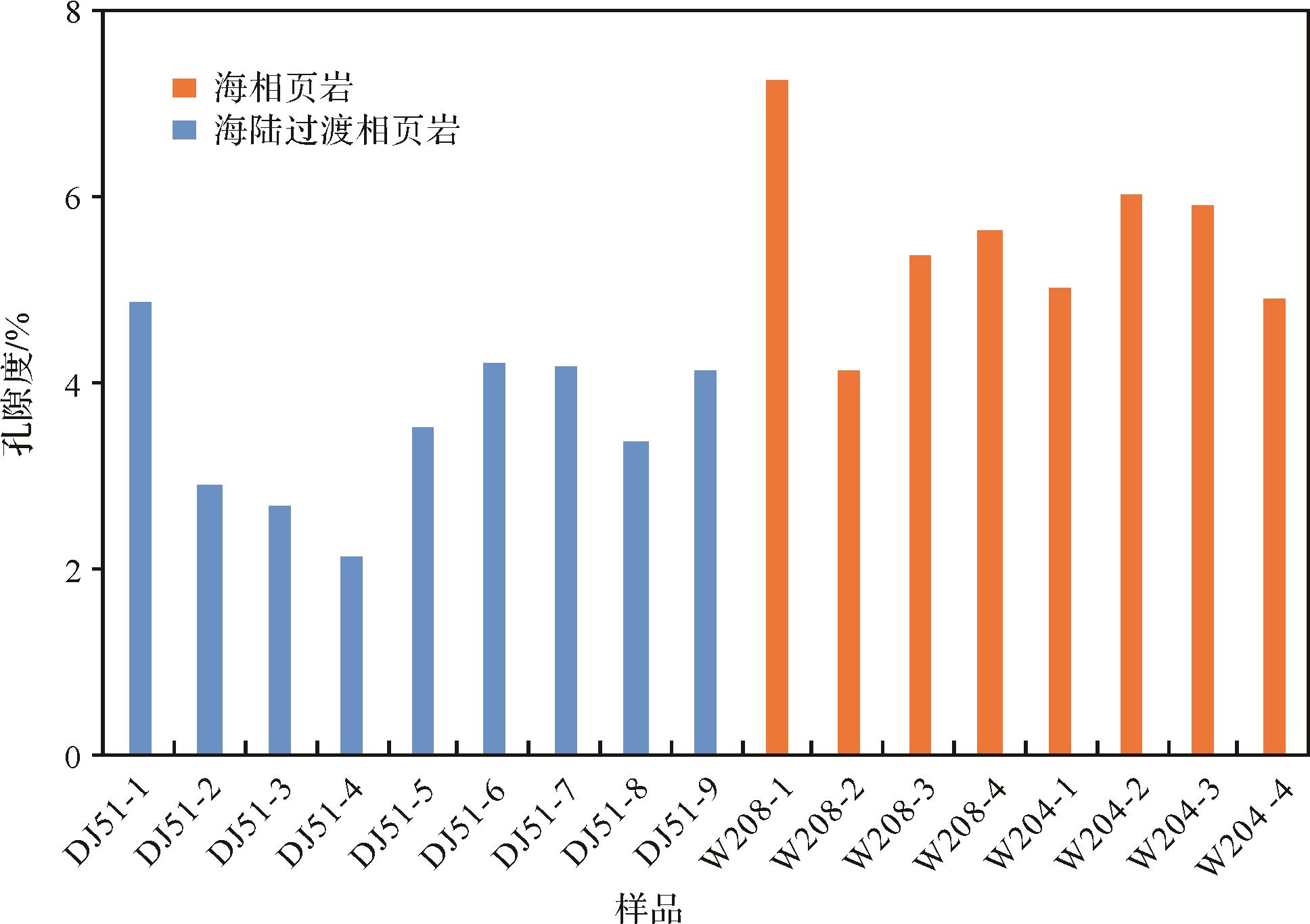
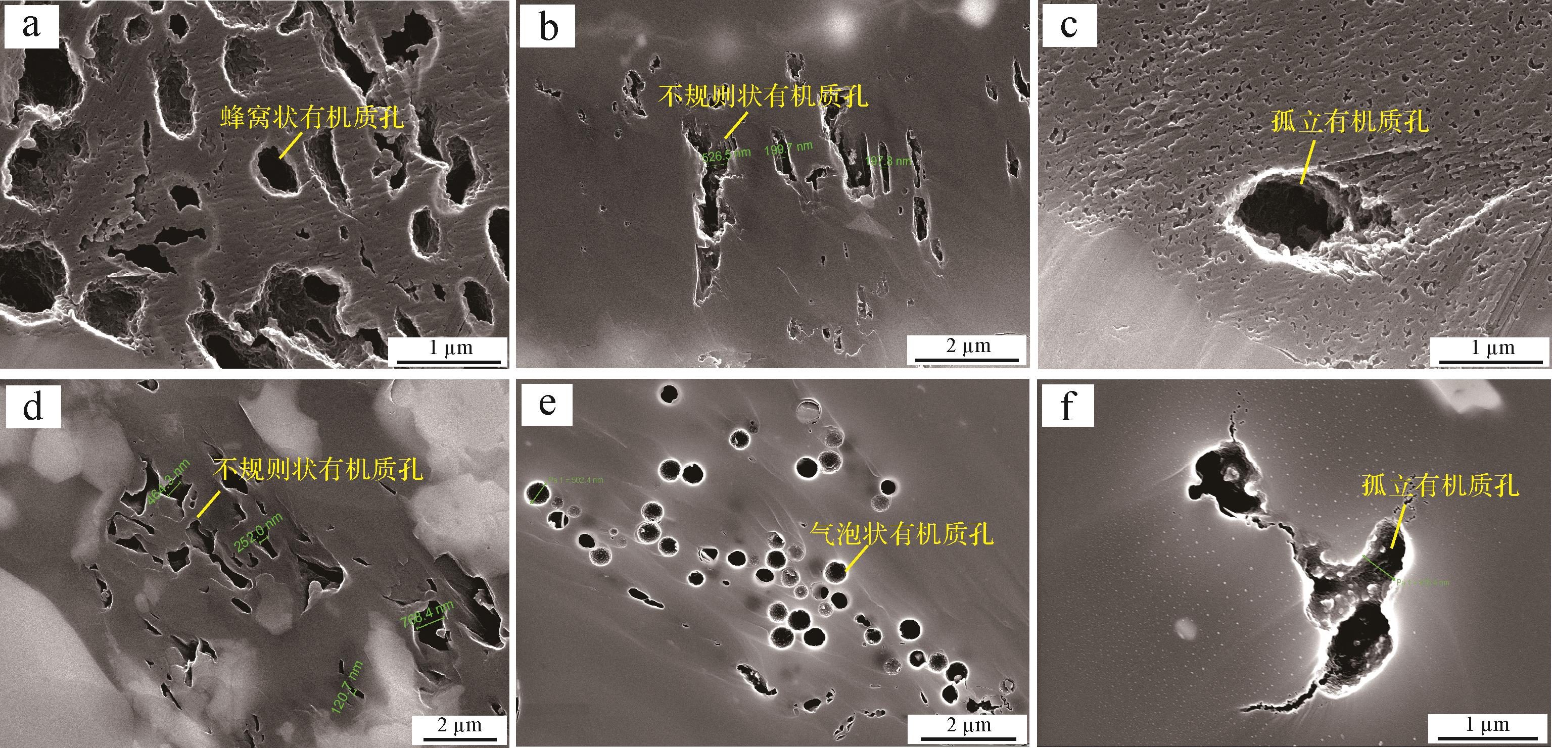
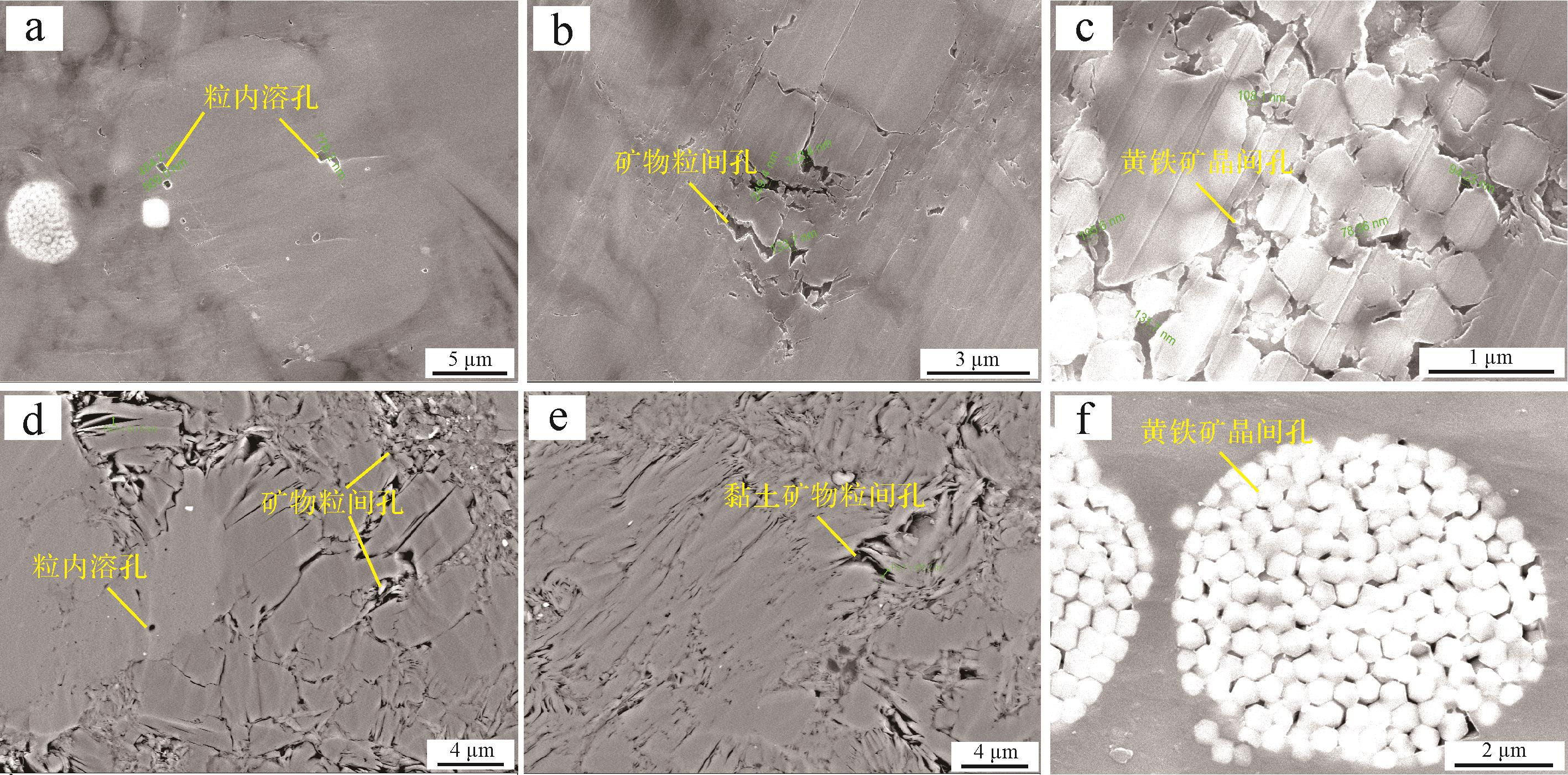
Abstract:
Transitional shale gas is gradually replacing unconventional oil and gas energy sources. Systematic analysis of the different properties of marine and transitional reservoirs provides a reference for the exploration and development of transitional shale gas. In this study, shale cores from the bottom of the Shan2 3
2022, 40(4): 1043-1058.
doi: 10.14027/j.issn.1000-0550.2021.019
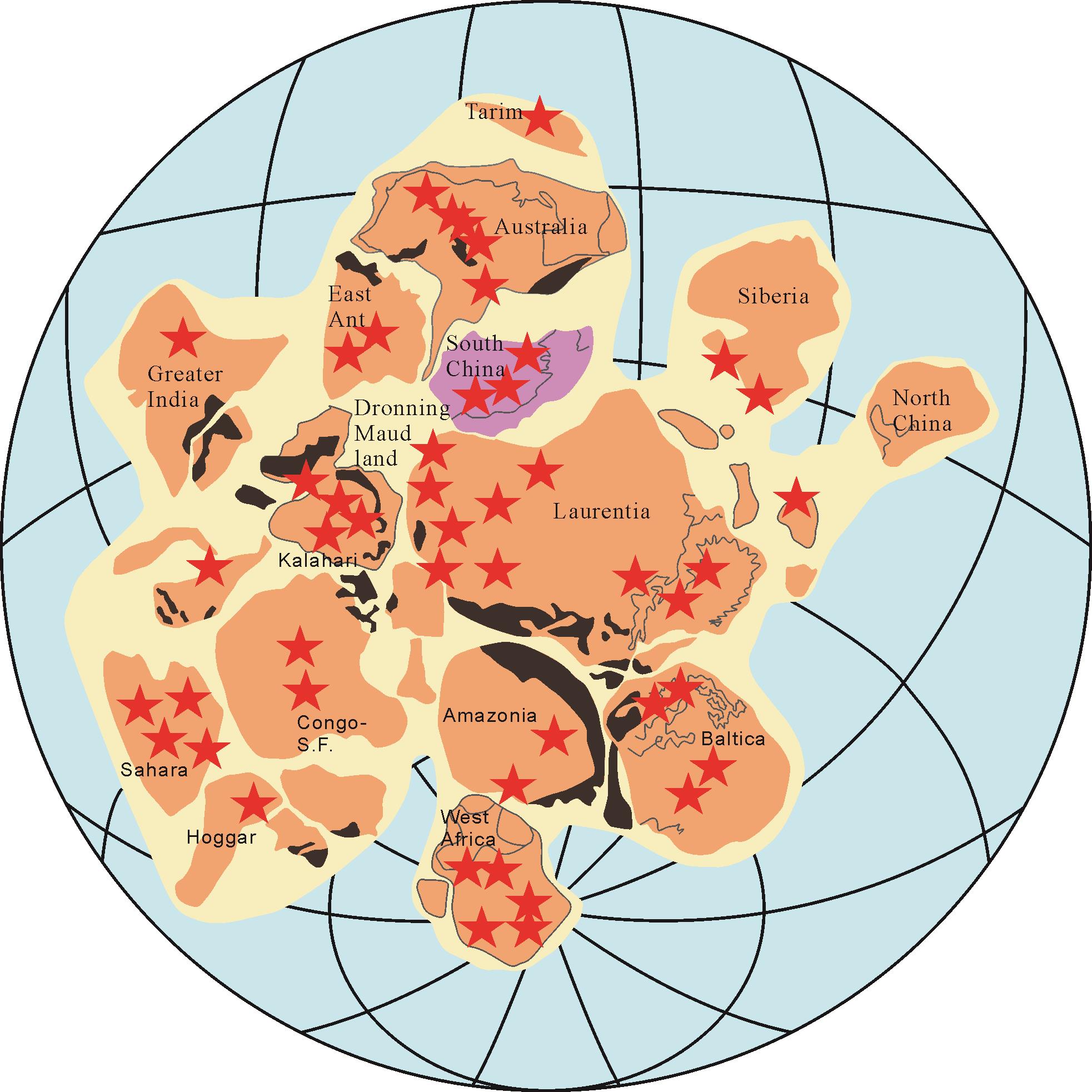
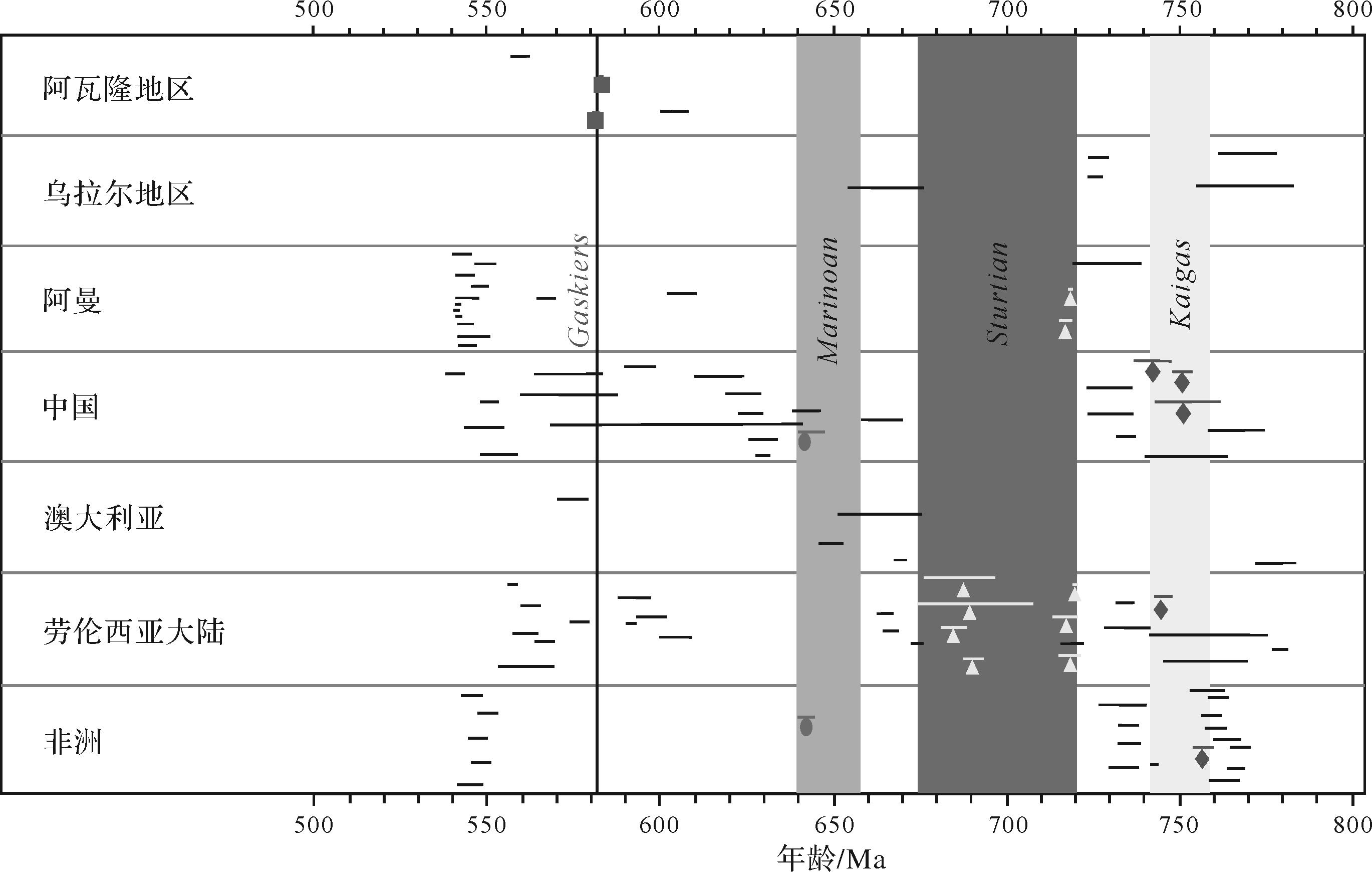
Abstract:
The Neoproterozoic is a geological period that occurred around 1 000 - 540 Ma. At that time, the earth was in the period of the Rodinia supercontinent convergence and break-up, with strong plate movement and magmatism, accompanied by global temperature decline and several large-scale glacial periods, forming snow covering the whole earth, and then forming Snowball Earth. Several glacial periods existed on the South China during the Neoproterozoic period, and numerous dating data have already been performed. However, some dispute about the formation and disappearance factors of Snowball Earth still exist, including the formation and disappearance time, mode, and influencing factors. Based on the summary of previous studies, this paper concludes the formation and disappearance factors of the Neoproterozoic Snowball Earth on the South China, were the result of multiple factors, including microbial action in early geological history, supercontinent break-up, mantle superplume, methane leakage, and glacial magmatic hydrothermal action. Since the Neoproterozoic, with the break-up of the Rodinia supercontinent and under the action of a mantle superplume, the length of the coastline has been increasing, and the favorable environment for microbial growth has gradually formed. Since the Early Paleozoic, huge microorganisms and small shelled animal populations have increased, and the content of greenhouse gases such as carbon dioxide (CO2) has decreased rapidly, thus destroying the greenhouse balance. In the later stage, due to the magmatic hydrothermal effect during the glacial period and the emission of methane (CH4) from the sea floor, the greenhouse effect has intensified again, and the original earth morphology has been restored.


2022, 40(4): 1059-1072.
doi: 10.14027/j.issn.1000-0550.2021.010
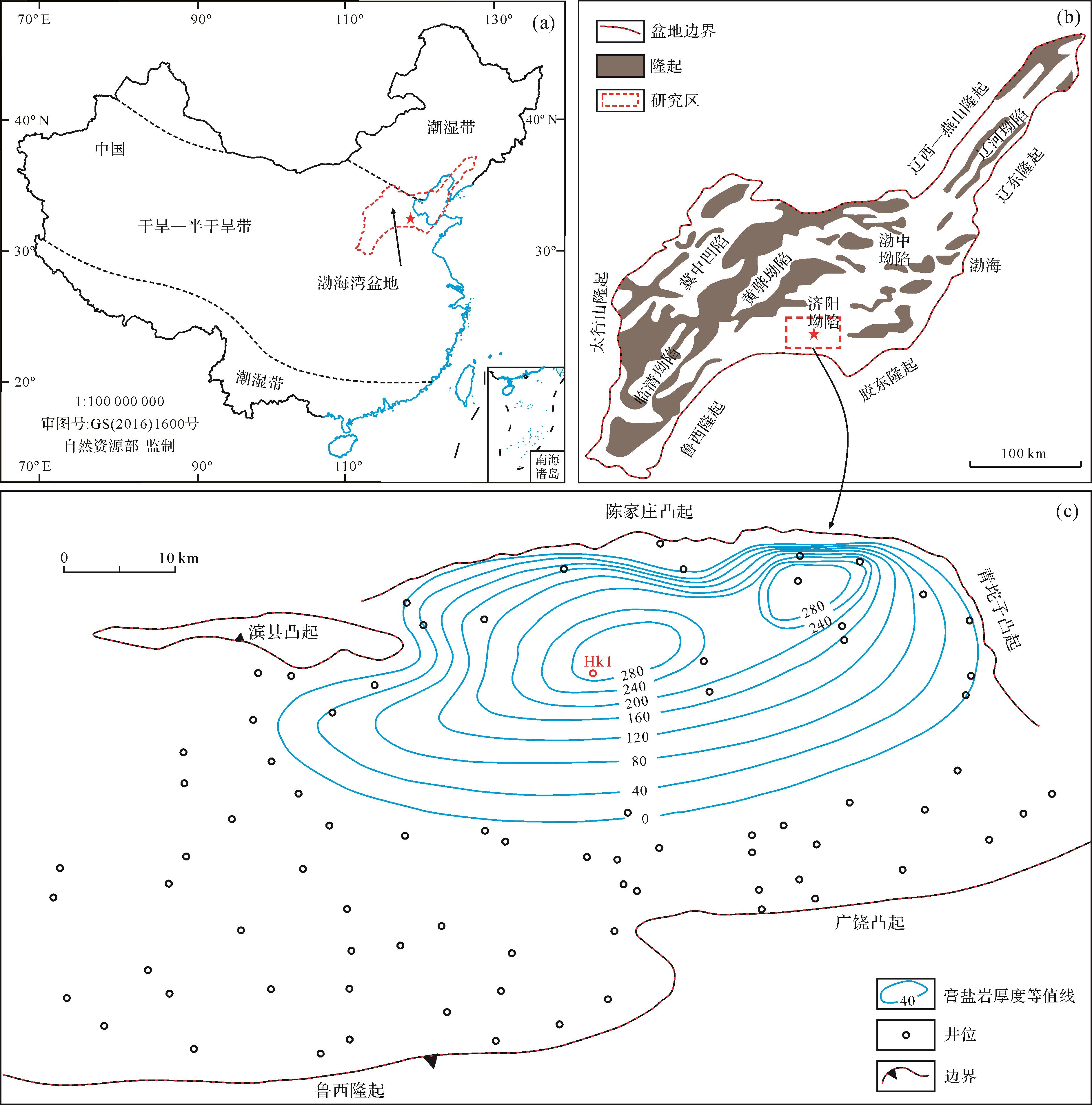
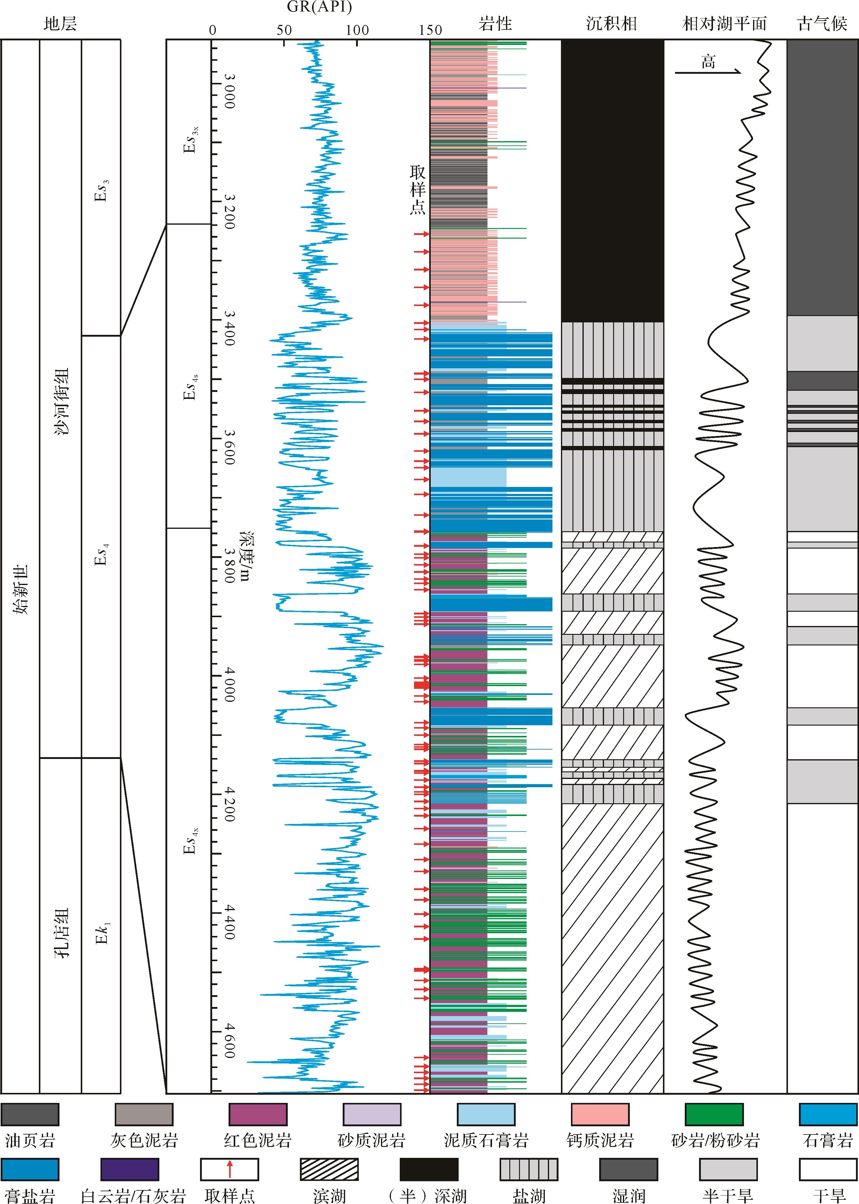
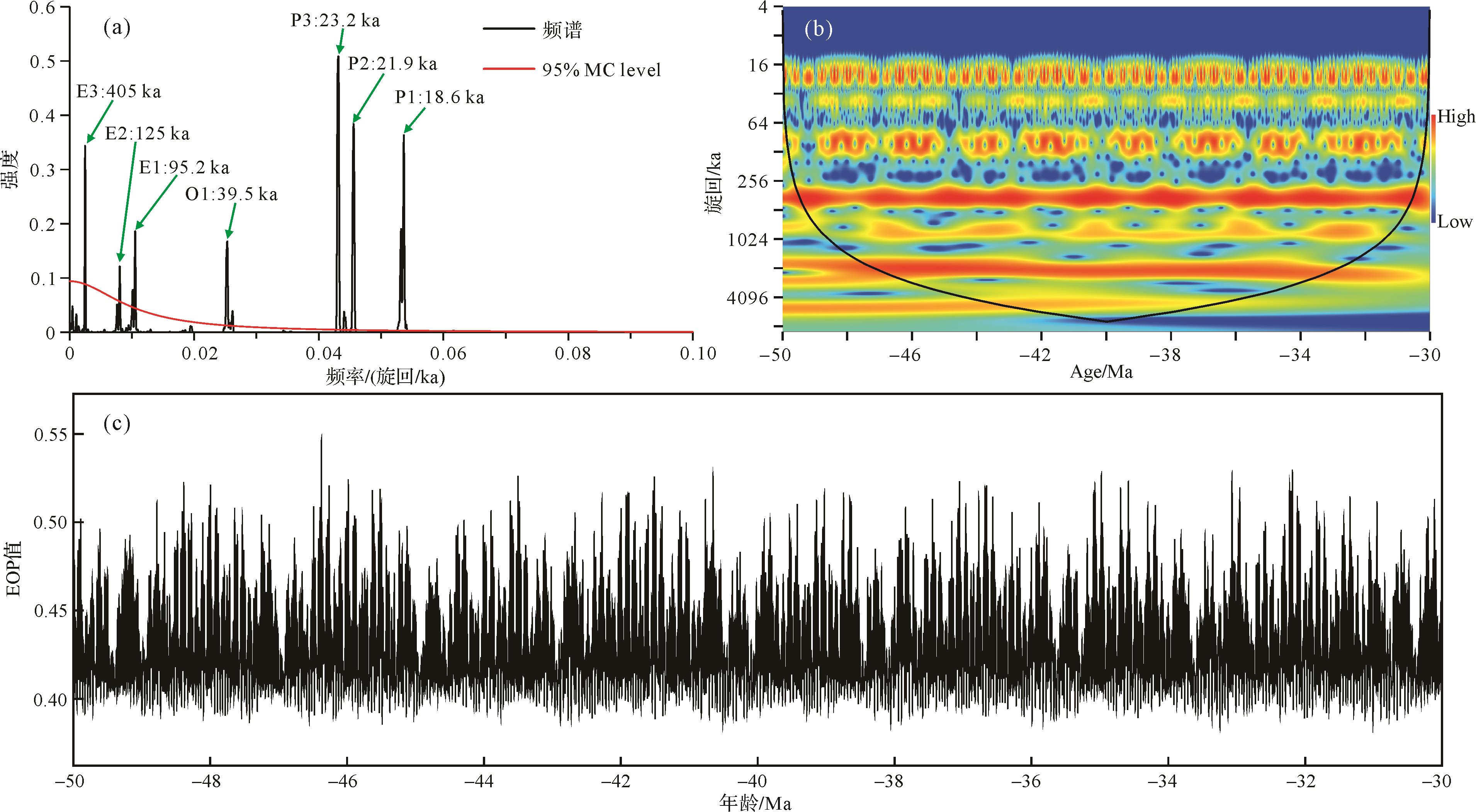
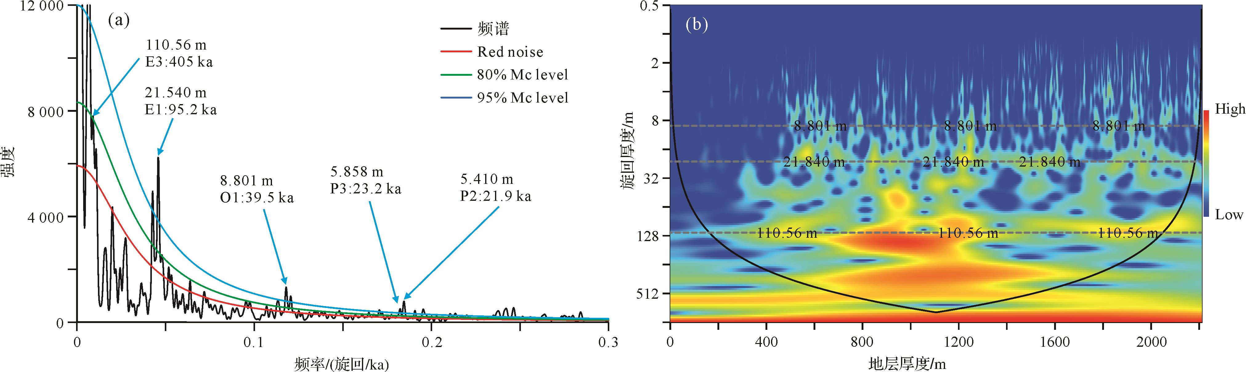
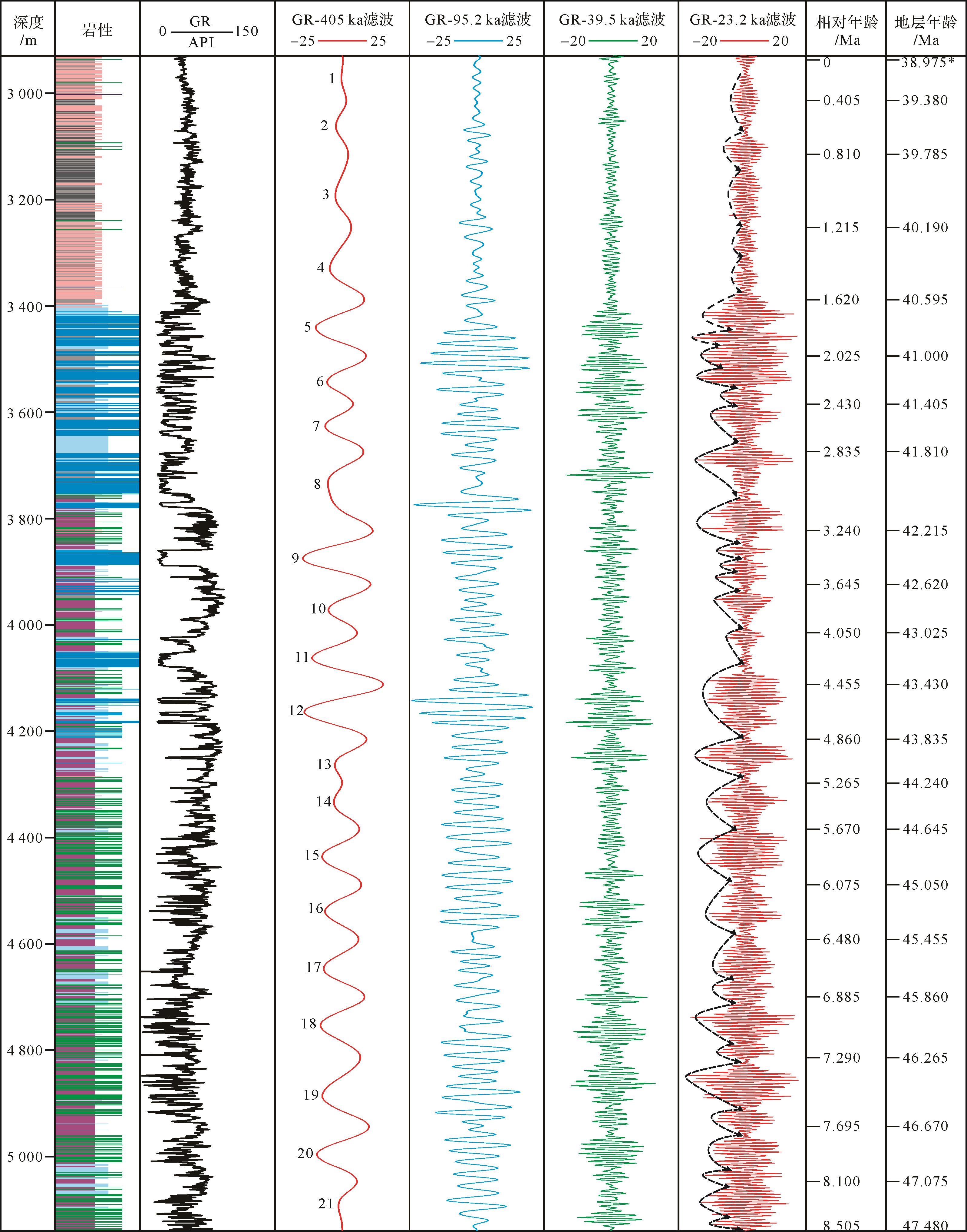
Abstract:
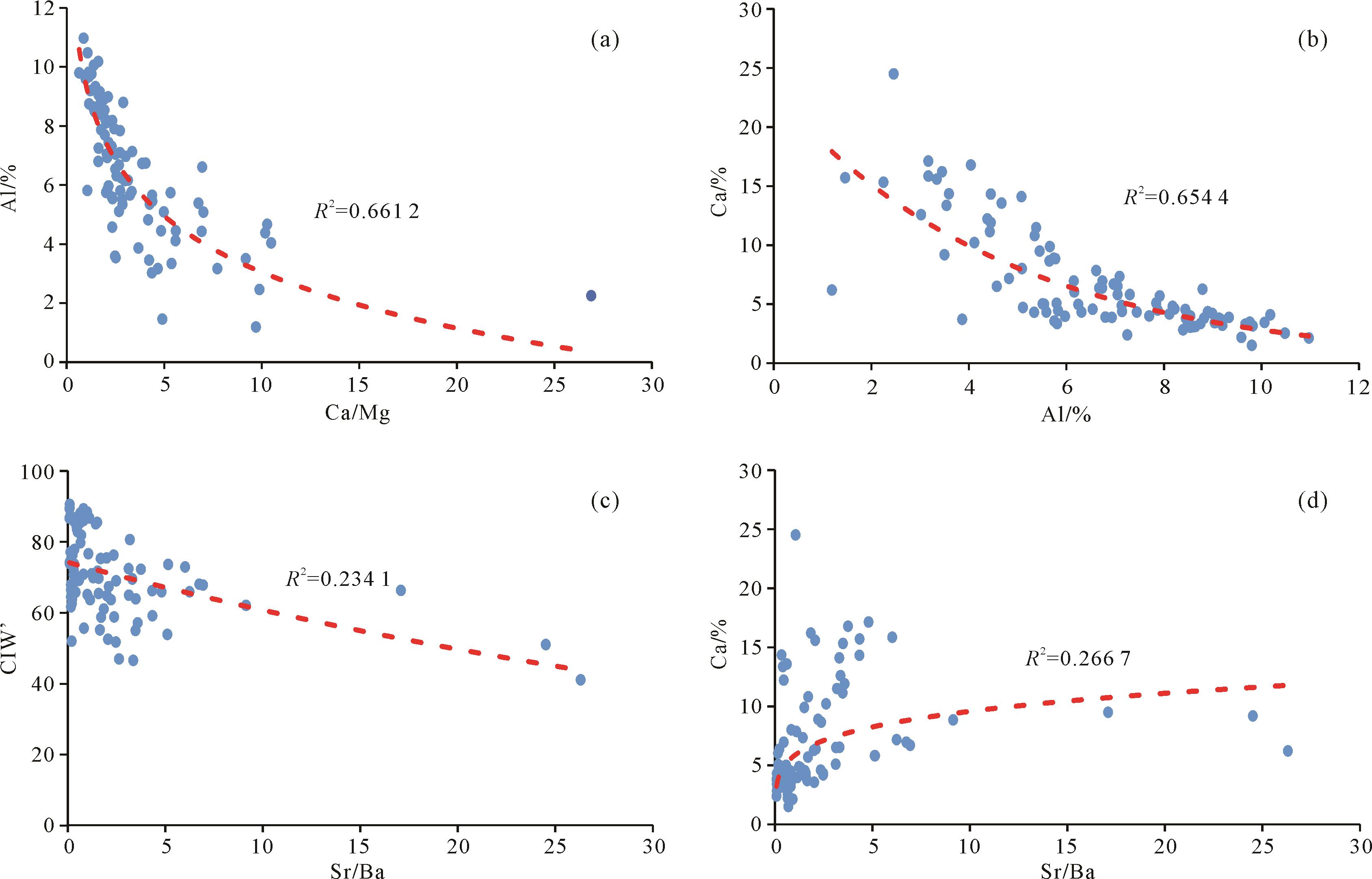
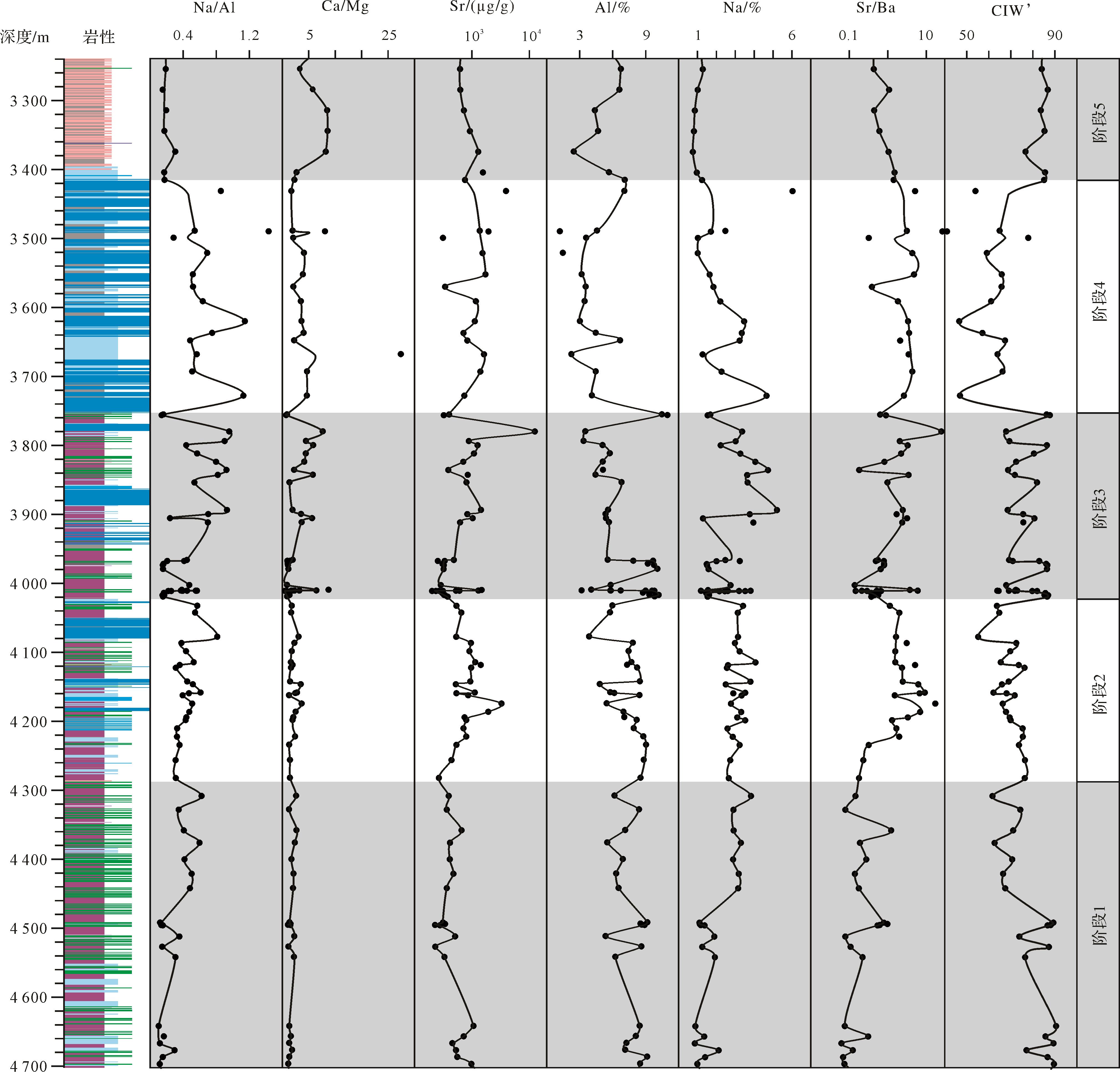
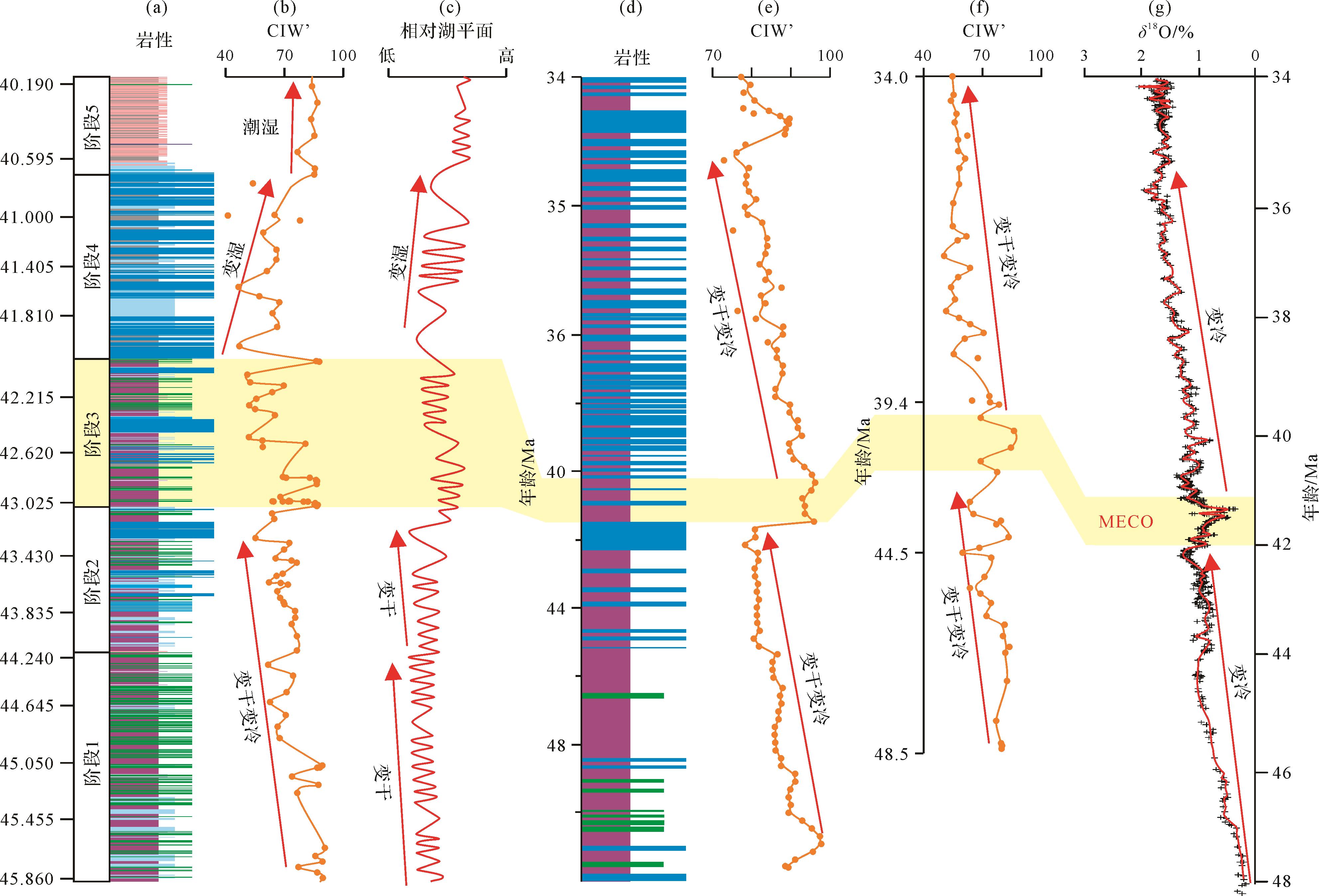
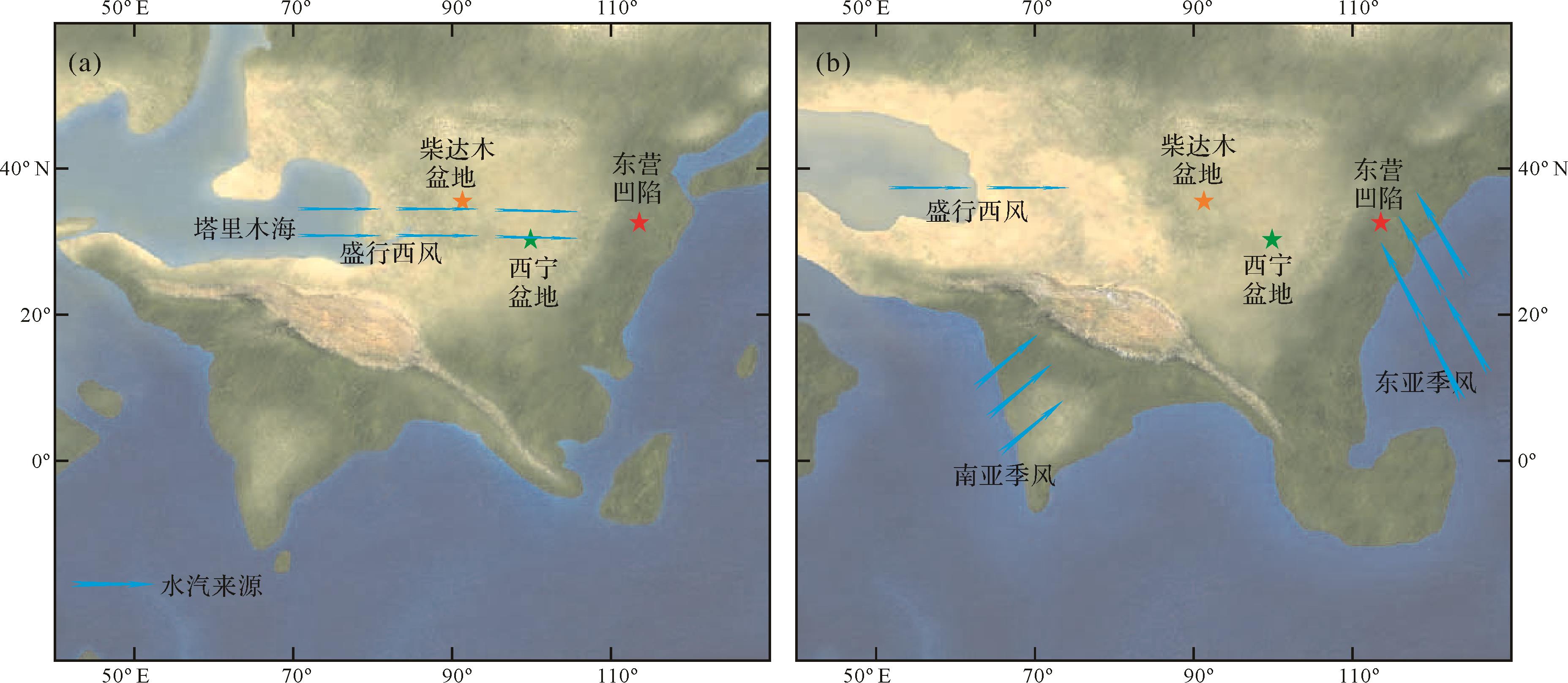
The mid⁃late Eocene with complex paleoclimate change is a key period for understanding the evolution of Paleogene paleoclimate in East Asia. Previous studies focused on this period were mainly based on sedimentological data from central and western China, but the paucity of sedimentary stratigraphic evidence from eastern China make the mid⁃late Eocene climate evolution a continuing area of research interest. The sediments of the Dongying Depression in eastern China provide a stratigraphic sequence of red-bed clastic rocks, gypsum-salt rocks and shallow-semi-deep lacustrine mudstones during the mid-late Eocene, which was a period highly sensitive to paleoclimate change. Selecting the Fourth member of the Shahejie Formation (Es4) of the Hk1 well as the study object, the evolutional characteristics and corresponding significance of the mid⁃late Eocene climate are discussed with relation to a comprehensive analysis of sedimentological data and geochemical indicators (e.g., Na/Al ratio and the Chemical Index of Weathering (CIW’)). The results indicate that the mid⁃late Eocene paleoclimate evolution in eastern China may be divided into five stages, in which the trends of paleoclimate change in stages 1⁃3 were similar to those in central and western China: long-term drying and cooling trend with the Middle Eocene Climate Optimum (MECO). The trends in stages 4 and 5 were clearly distinct from those in central and western China. The climate in eastern China became relatively humid and the latitudinal zonal paleoclimate pattern was beginning to be broken during stage 4. The paleoclimate pattern change from latitudinal zones to east/humid and west/arid during stage 5 suggest that the East Asian summer monsoon became prevalent and dominated the climate in eastern China at that time.
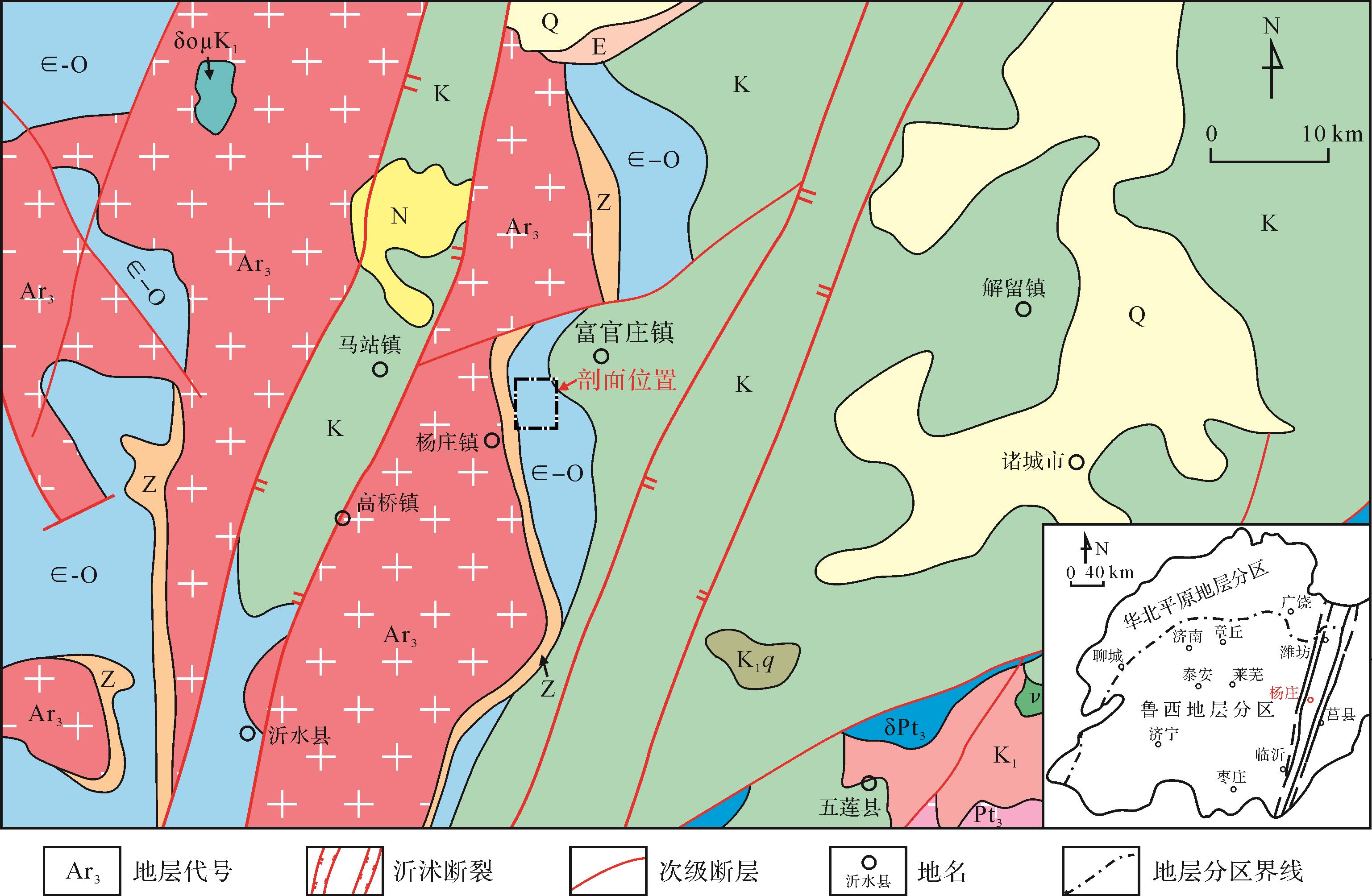
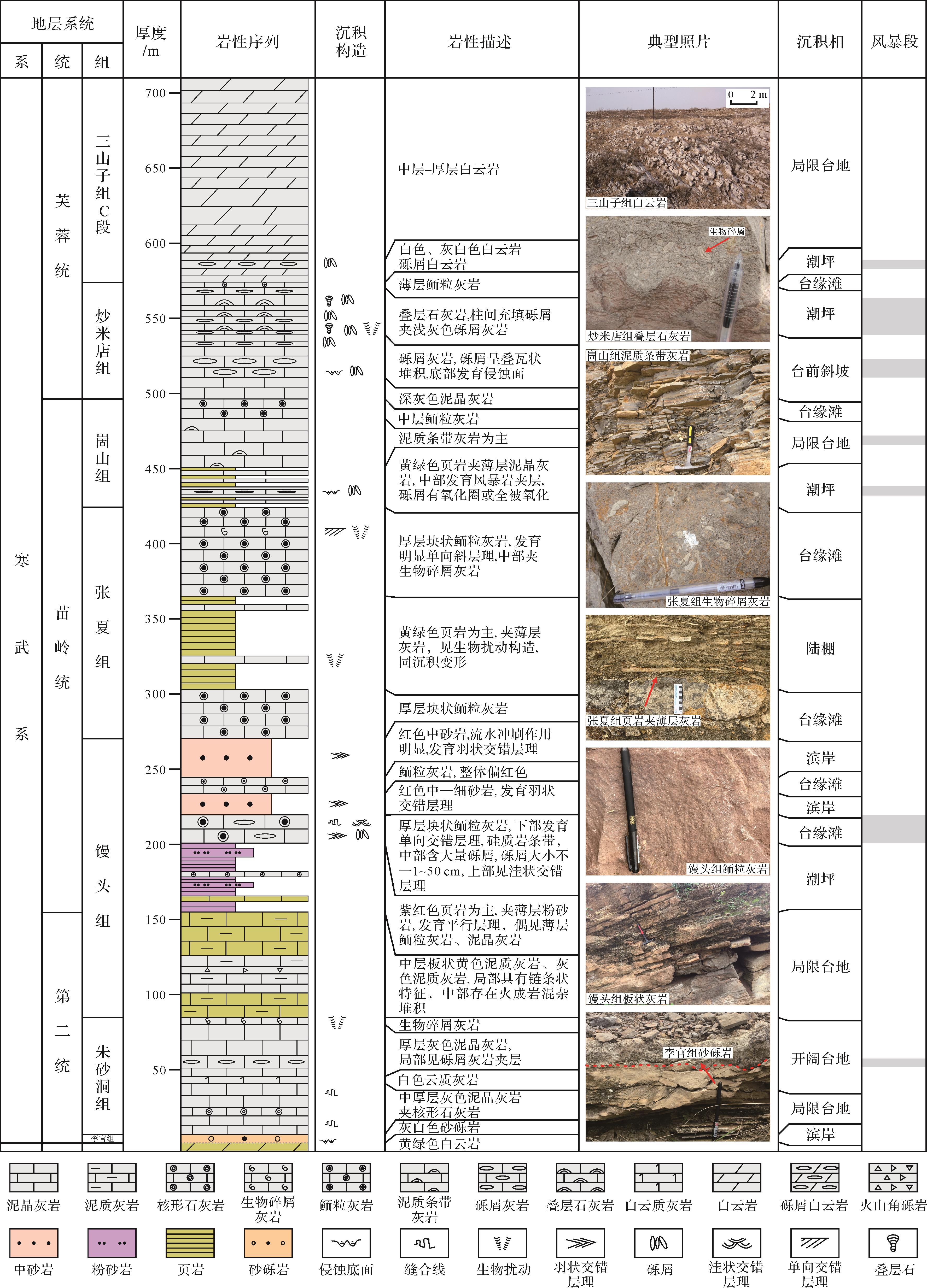
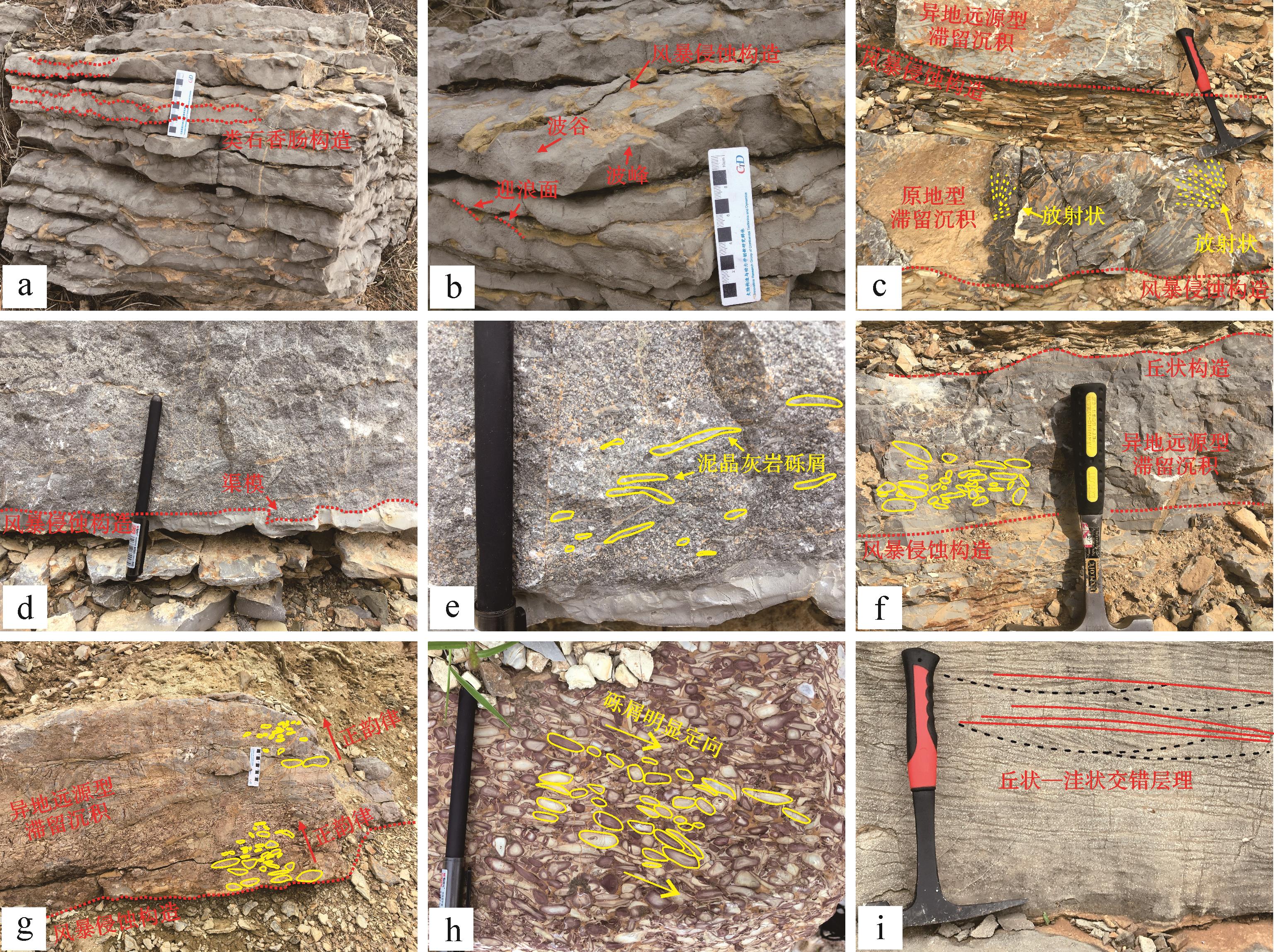
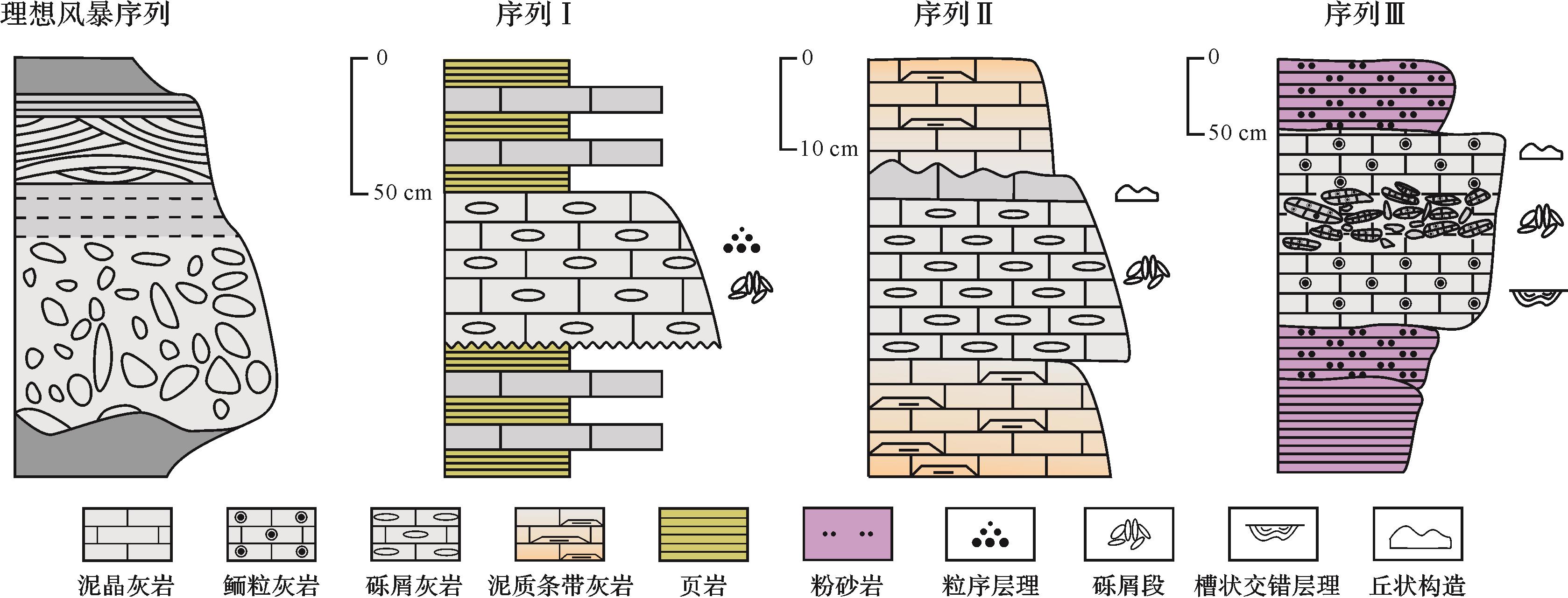
2022, 40(4): 1073-1082.
doi: 10.14027/j.issn.1000-0550.2021.022
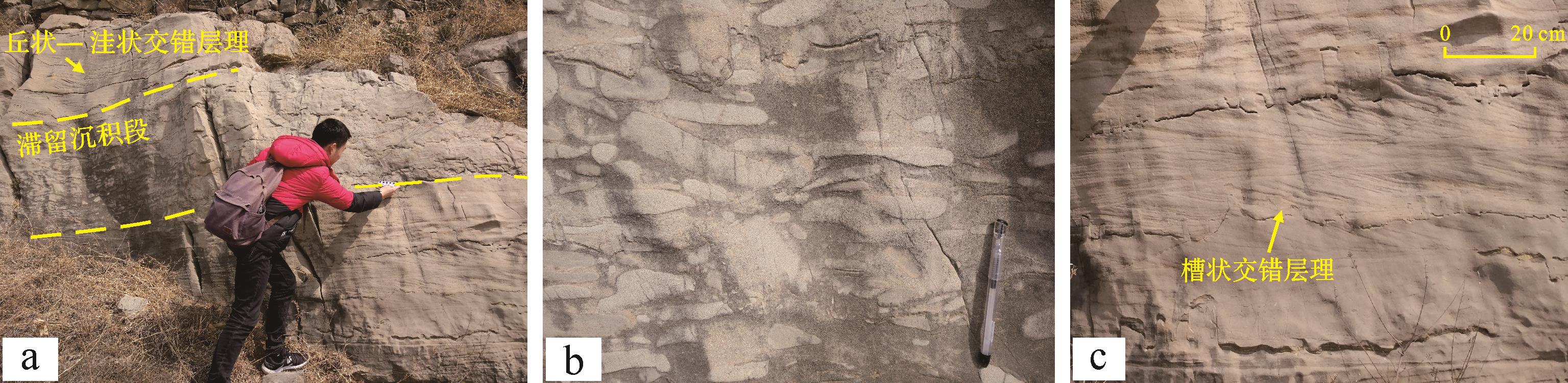
Abstract:
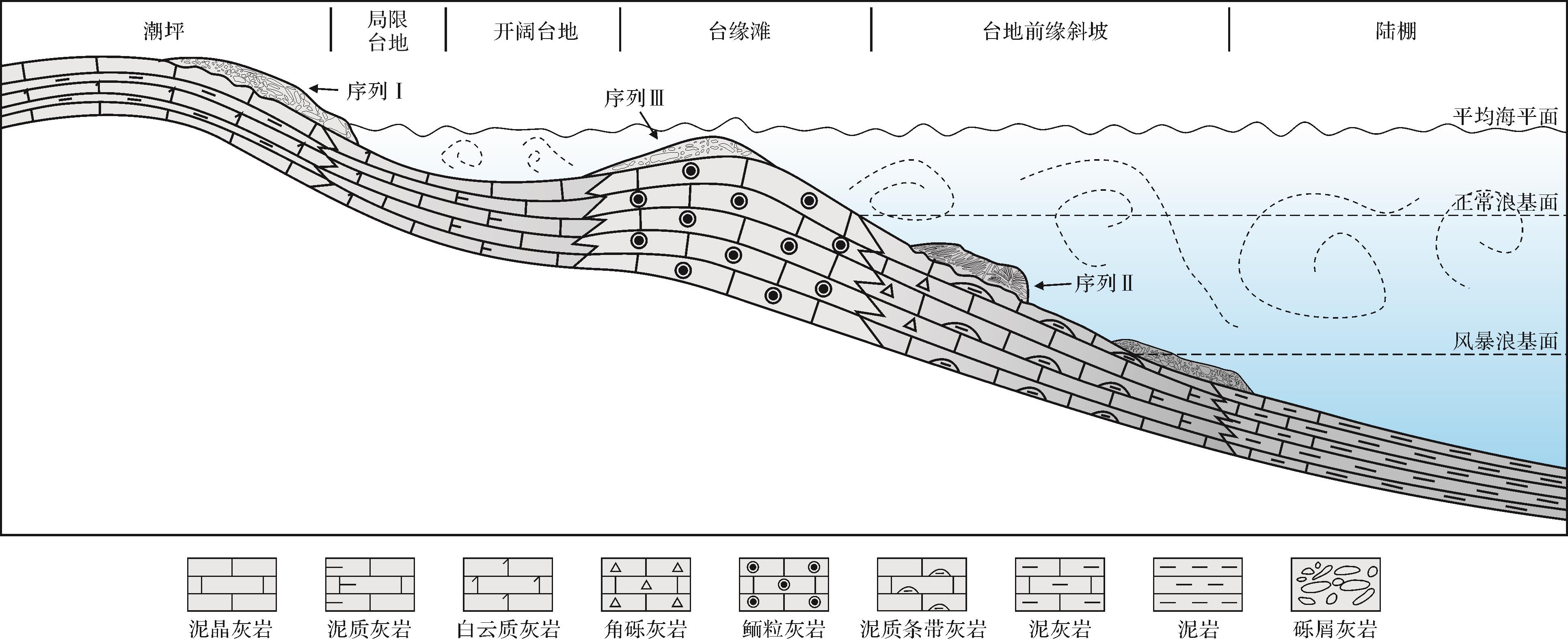
A great quantity of storm deposits and related sedimentary structures developed in the Cambrian of Yangzhuang area, Shandong province. Under the guidance of sedimentology theory, through detailed field survey and comprehensive analysis of indoor data, the typical storm sedimentary structures in the study area are identified, storm sedimentary sequences are divided, and the storm deposition model is established. The results show that there are four storm sedimentary structures: storm erosion structure, gravel section, mound structure and graded bedding in the Yangzhuang area. According to the vertical features and sedimentary structure differences of tempestites, three storm sedimentary sequences are divided, corresponding to the tidal flat, platform front slope and platform margin beach respectively. Based on the study of vertical evolution of storm deposits, a storm deposit model is established. The discovery of tempestites indicates that the Yangzhuang area is located in a low latitude tropical region during the Cambrian, and it is of great significance to the early Paleozoic paleoenvironment and paleogeography restoration in eastern North China.
2022, 40(4): 1083-1094.
doi: 10.14027/j.issn.1000-0550.2021.020
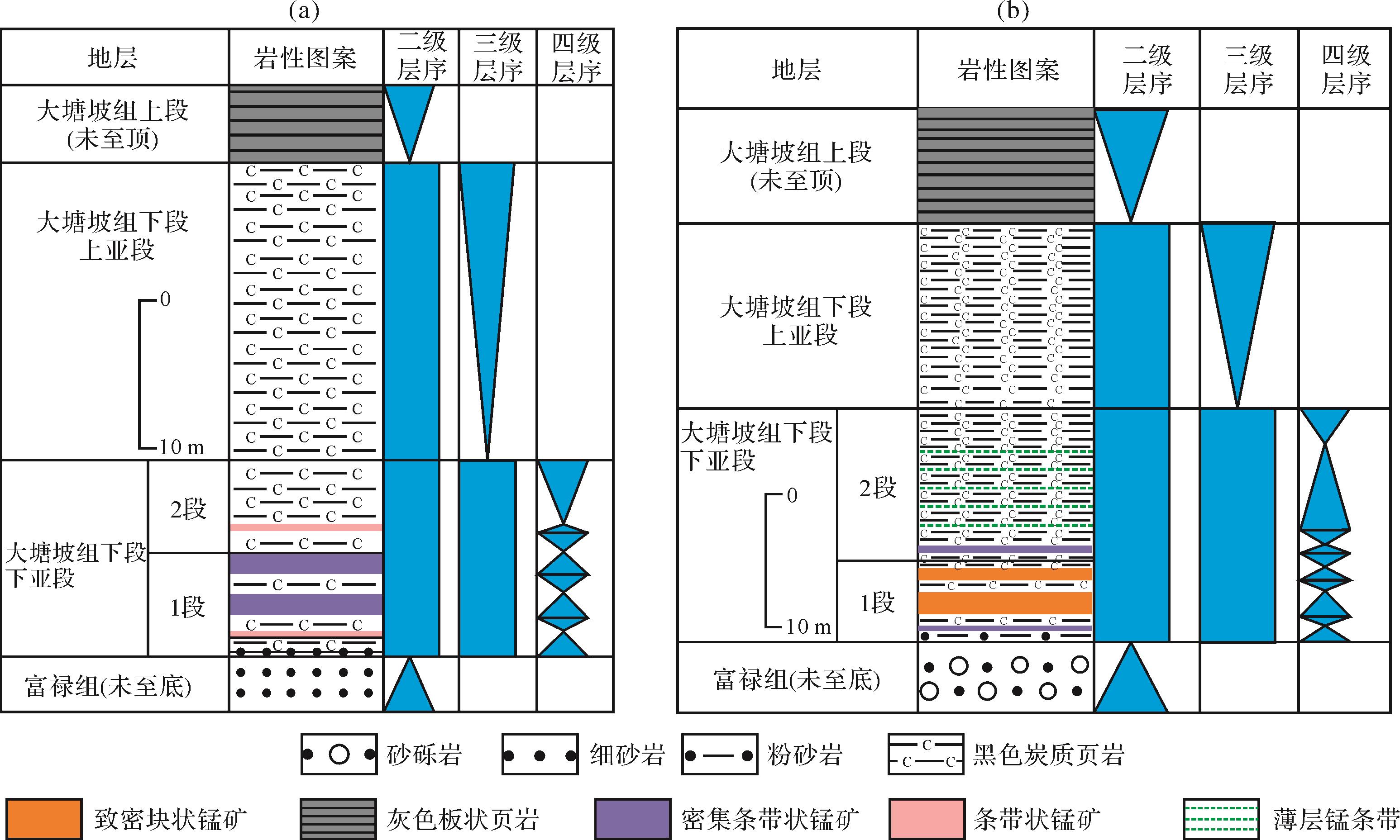
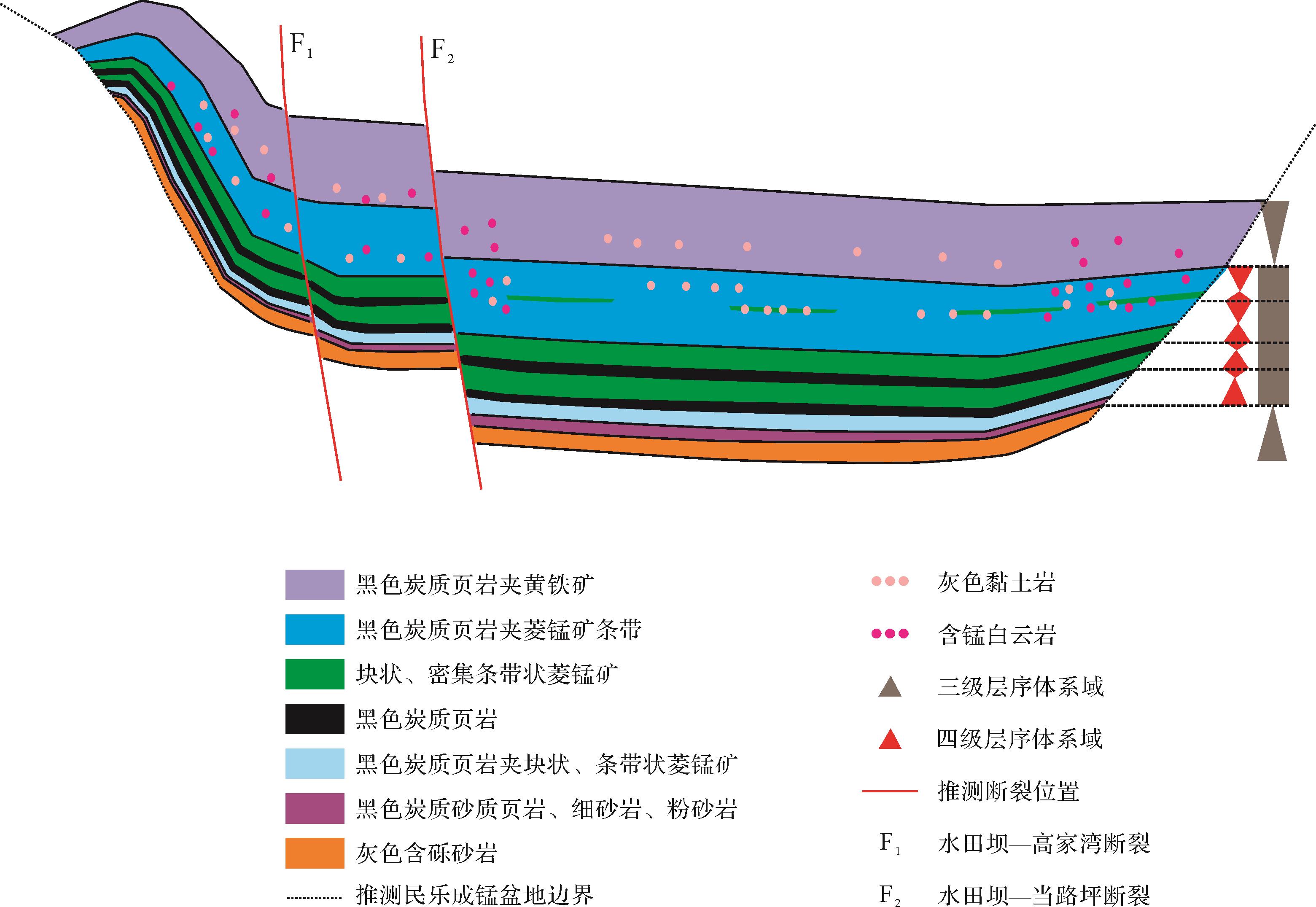
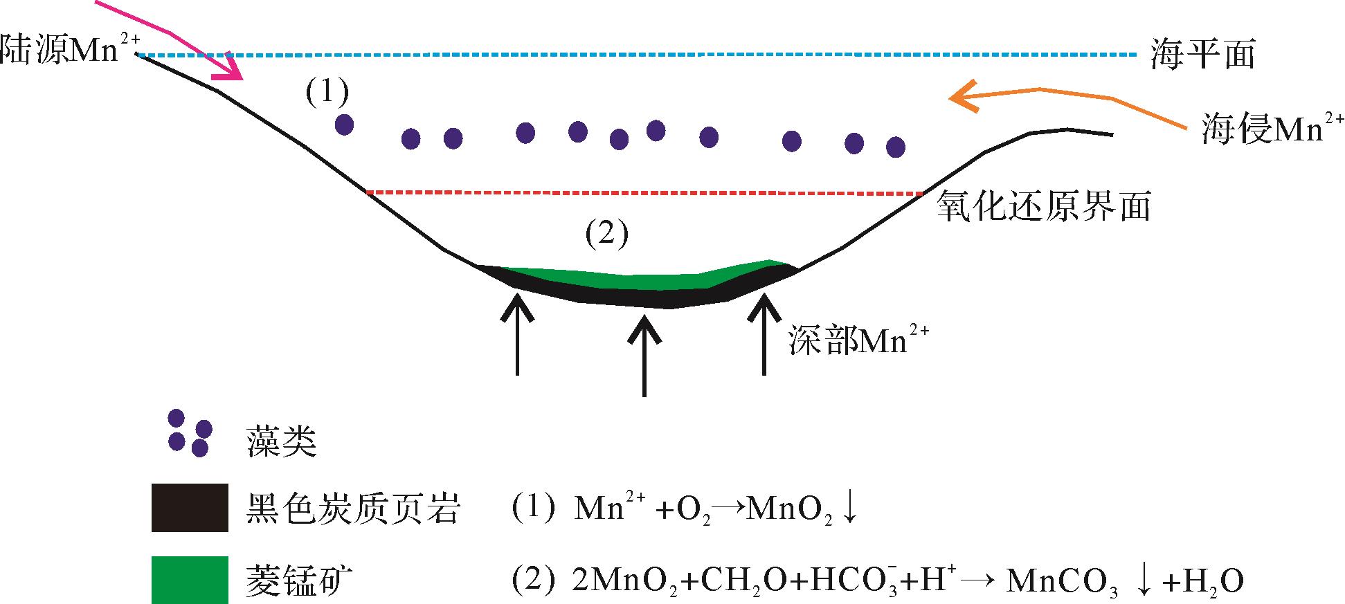
Abstract:
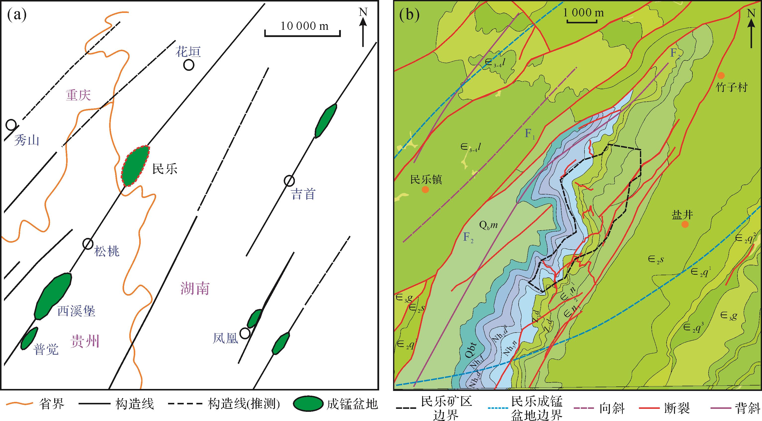
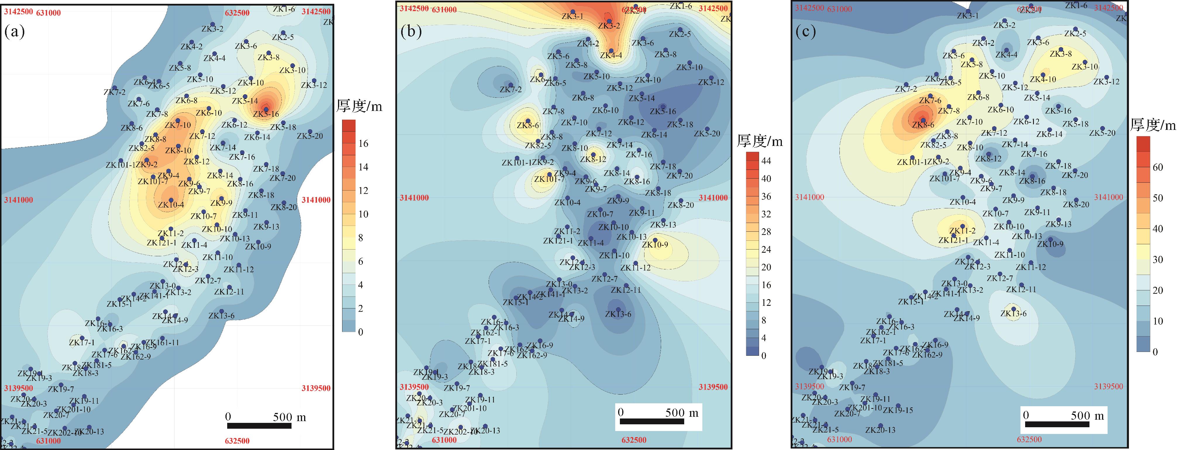
The Datangpo-type manganese ores have developed widely in the adjacent area of Hunan, Guizhou, and Chongqing provinces. This kind of manganese ore develops in the lower section of the Datangpo Formation, forming ore bodies with different grades and thicknesses in multi-periods. Current mineralization regularities are not suitable for analyzing the sedimentary process of each period. The mineralization process is controlled by ancient faults, paleogeography, paleoclimate, and variations of sea levels; all these factors are important bases in the study of the sequence stratigraphy. Applying sequence stratigraphic theories to explain the sedimentary process in each mineralizing period is feasible and can also provide help with perfecting metallogenic regularities and new thoughts with exploration and prediction. Previous studies of the Datangpo-type manganese deposit stratigraphic sequences are not accurate and seldom utilized in the analysis of mineralization regularities. Taking the Minle manganese deposit, the large-scaled manganese carbonate deposit in northwestern Hunan province, as an example, we make stratigraphic correlations based on lithological description of wells and measured profiles to build a new stratigraphic classification for the lower section of the Datangpo Formation (the mineralization period) for the Minle manganese deposits. We next analyze the sedimentary characteristics of each period according to changes in the lithology and thickness of the new strata. Then, using sedimentary features to build the third order and fourth order sequence framework, we summarize features of the sedimentary evolution based on the ancient terrain changes in third order and fourth order sequence scales. Finally, we combine all of these achievements with marine carbonated manganese forming mechanisms and geological background to investigate mineralizing laws, modes, and sedimentary processes based on sequence stratigraphic theories and the sequence stratigraphic application in mineralizing exploration and prediction. We draw the following three main conclusions: 1. The ore-bearing strata (the lower section of the Datangpo Formation) of the Minle manganese deposit can be divided into three sub-formations according to the stratigraphic correlations of different wells in the mining areas. Compact and dense-banding manganese ore bodies with black carbonaceous shales are the first member of the lower sub-formation, black carbonaceous shales with a little banding manganese ore bodies are the second member of the lower sub-formation, and black carbonaceous shales with satellite distributed pyrite are the upper sub-formation. Each member has its own characteristics of sedimentary environments, thicknesses, and terrains, and the mineralization of the Datangpo-type manganese ores is closely related to all of these sedimentary features. 2. The third order sequence framework of the Minle manganese deposit mineralization epoch (lower section of the Datangpo Formation) consists of one condensed section system tract (lower sub-formation in the lower section of the Datangpo Formation) and one high-stand system tract (upper sub-formation in the lower section of the Datangpo Formation). The condensed section mainly develops manganese carbonate ores and black carbon shales, characterized by a quiet, reduced, and deep aquatic environment. It also suggests a subtle variation of the aquatic environment. In the lower sub-formation of the lower Datangpo Formation, the first member consists of deep water and large accommodation spaces, forming compact massive and dense banding manganese deposits, while the second member exists in shallower water, and its reducibility decreases, forming discontinuous thin manganese bands in the black carbon shales. Additionally, the condensed section system tract in the third order sequence can be divided into four fourth order sequences. The second and third fourth-order sequences develop thick, compact massive and dense-banding shaped manganese ore bodies. At this moment, the northern mining area is an obvious center of the fault basin inside the bay, making numerous manganese materials aggregate and forming rich ore deposits. The first and fourth fourth-order sequences develop thin layer banding manganese ore bodies as their aquatic environments are not suitable for mineralization. Each fourth-grade sequence has its own transgression scale, which leads to differences of manganese ore body grades and thicknesses among all four ore-bearing periods. 3. The sedimentary process of the Minle manganese deposit can be explained by third order and fourth order sequences. The third order sequence framework explains the sedimentary process of manganese ore body mineralization, and the fourth order sequence framework reveals multi-period sedimentary processes of manganese ore bodies with different thicknesses and shapes. The first fourth order sequence is the transitional period from the Fulu Formation to the Datangpo Formation, lacking enough oxygen concentration so it is very hard to form manganese oxides in the water. Therefore, manganese ore bodies are mainly thin and banding-shaped. The fourth fourth-order sequence is the second member of the lower sub-formation in the lower Datangpo Formation, developing thin and banding-shaped manganese ore bodies as the water is shallow and unquiet in this period, making it unsuitable for manganese materials to aggregate. The second and third fourth-grade sequences are all in the first member of the lower sub-formation in the lower Datangpo Formation. These two periods have nice conditions for mineralization and source, including the deep, quiet water with high reducibility and high contents of organisms, which produce compact massive and thick manganese carbonate ores. Some sedimentary marks, which can be used to build sequence framework, such as the sandy carbonaceous shale in the bottom of the Datangpo Formation, banding manganese ore bodies, light color claystone, carbonaceous and muddy dolomite, all have nice indicative significances in mineralization, which can be applied to the exploration and prediction.
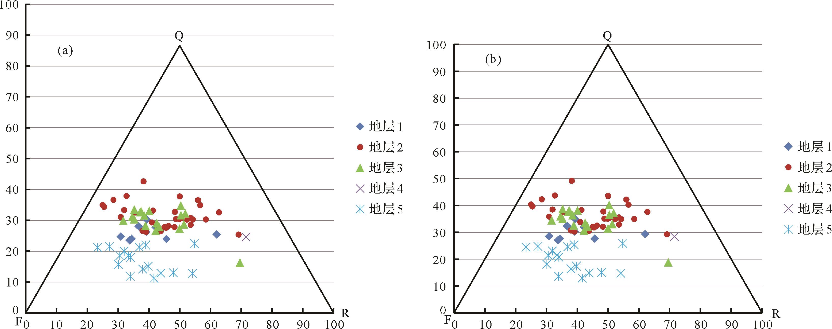
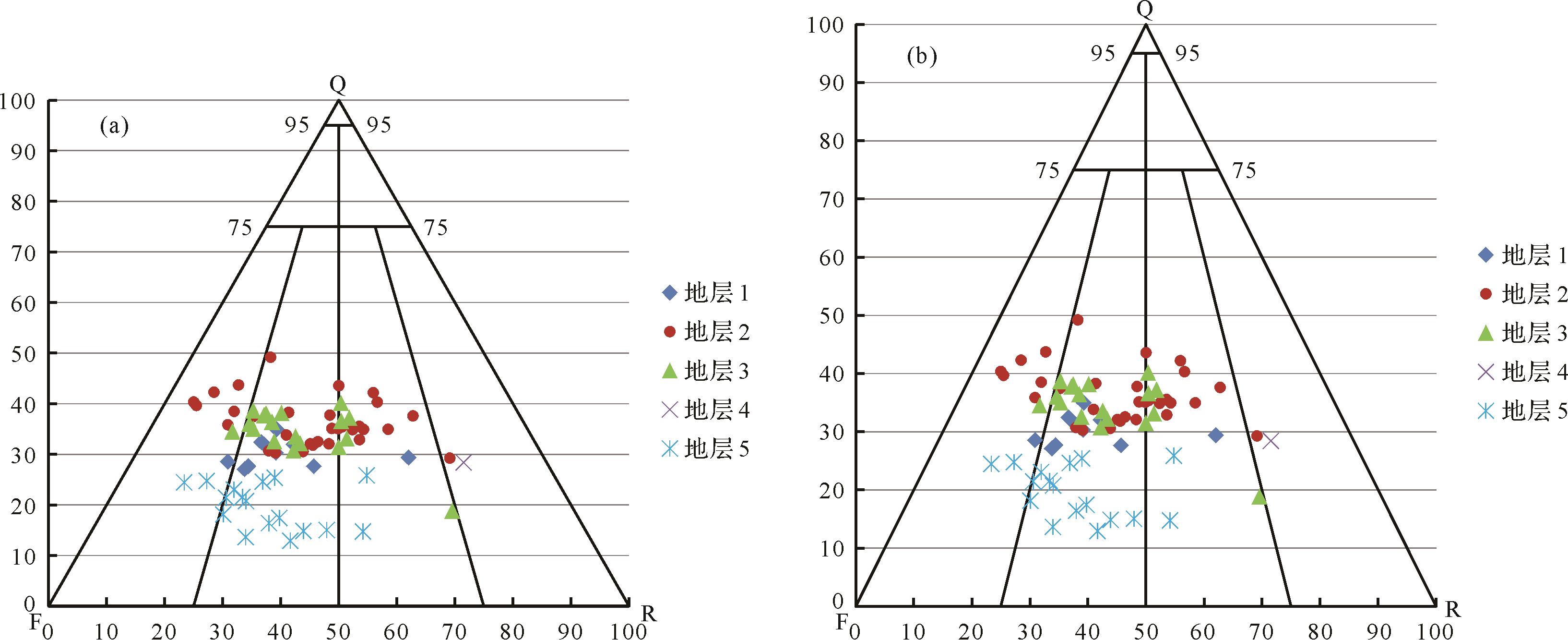
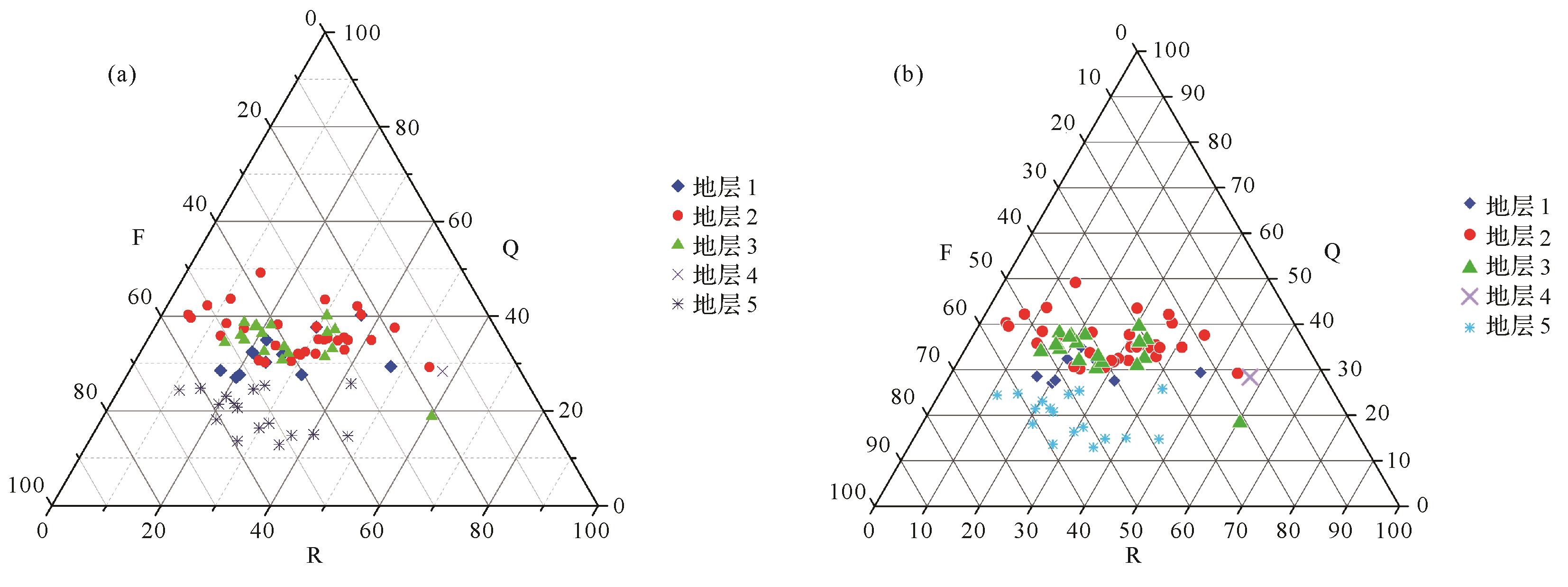
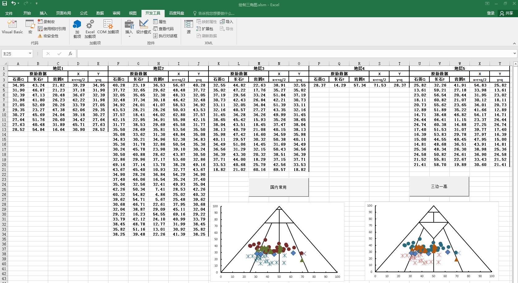
2022, 40(4): 1095-1108.
doi: 10.14027/j.issn.1000-0550.2021.166
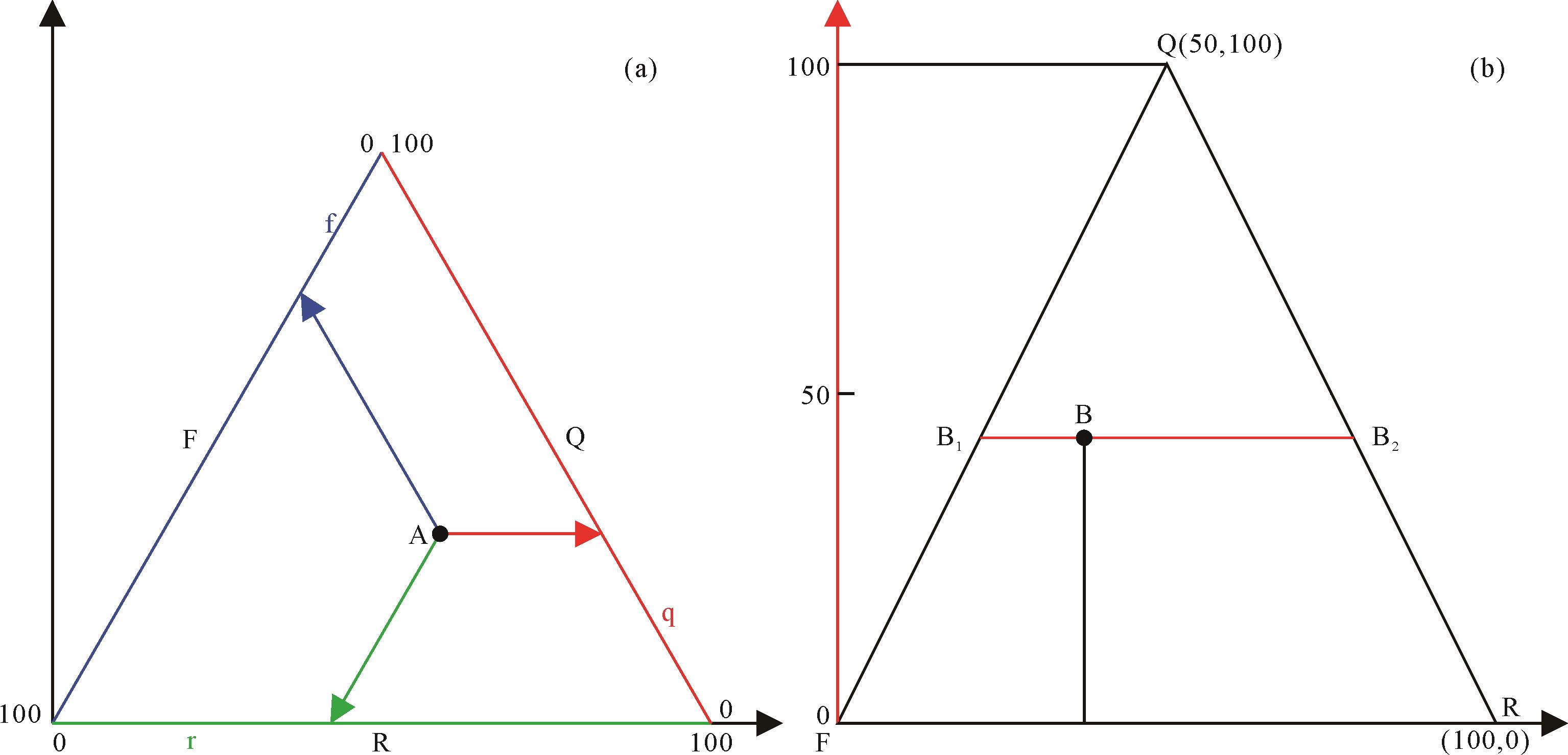
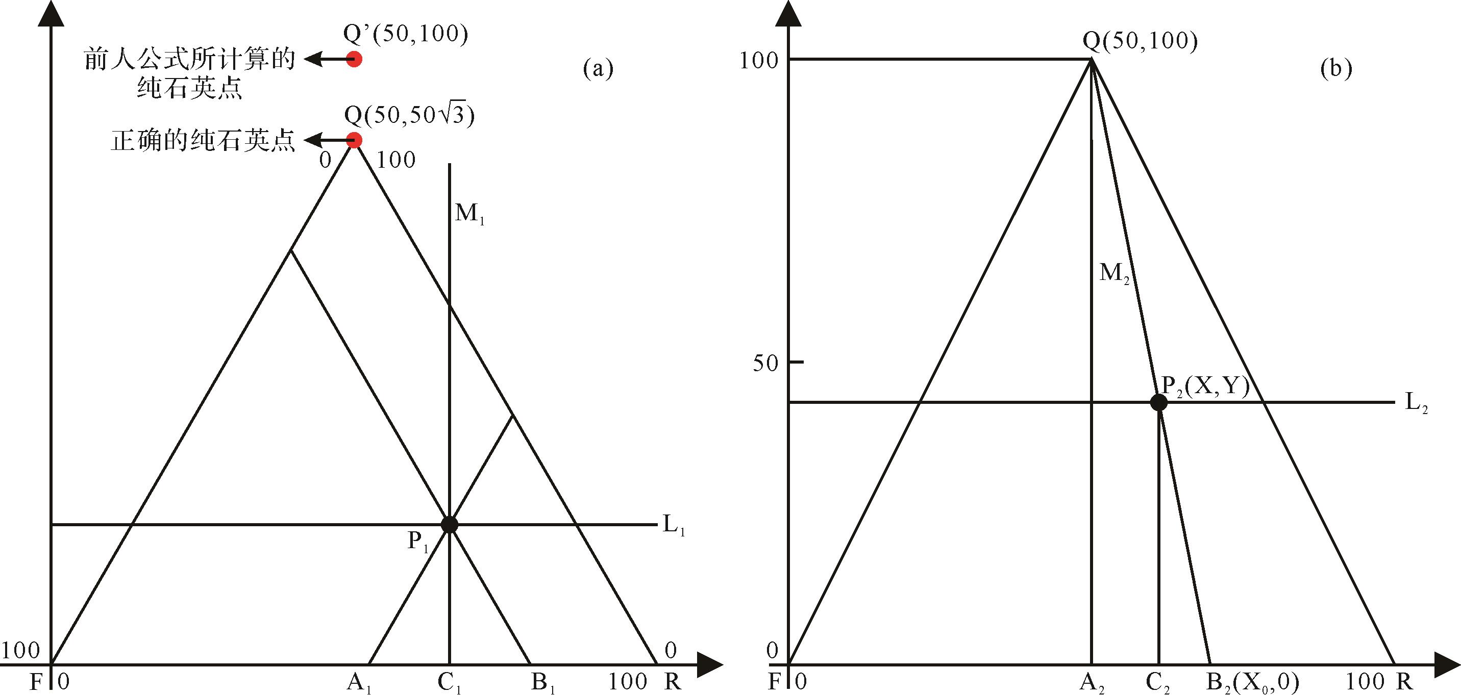
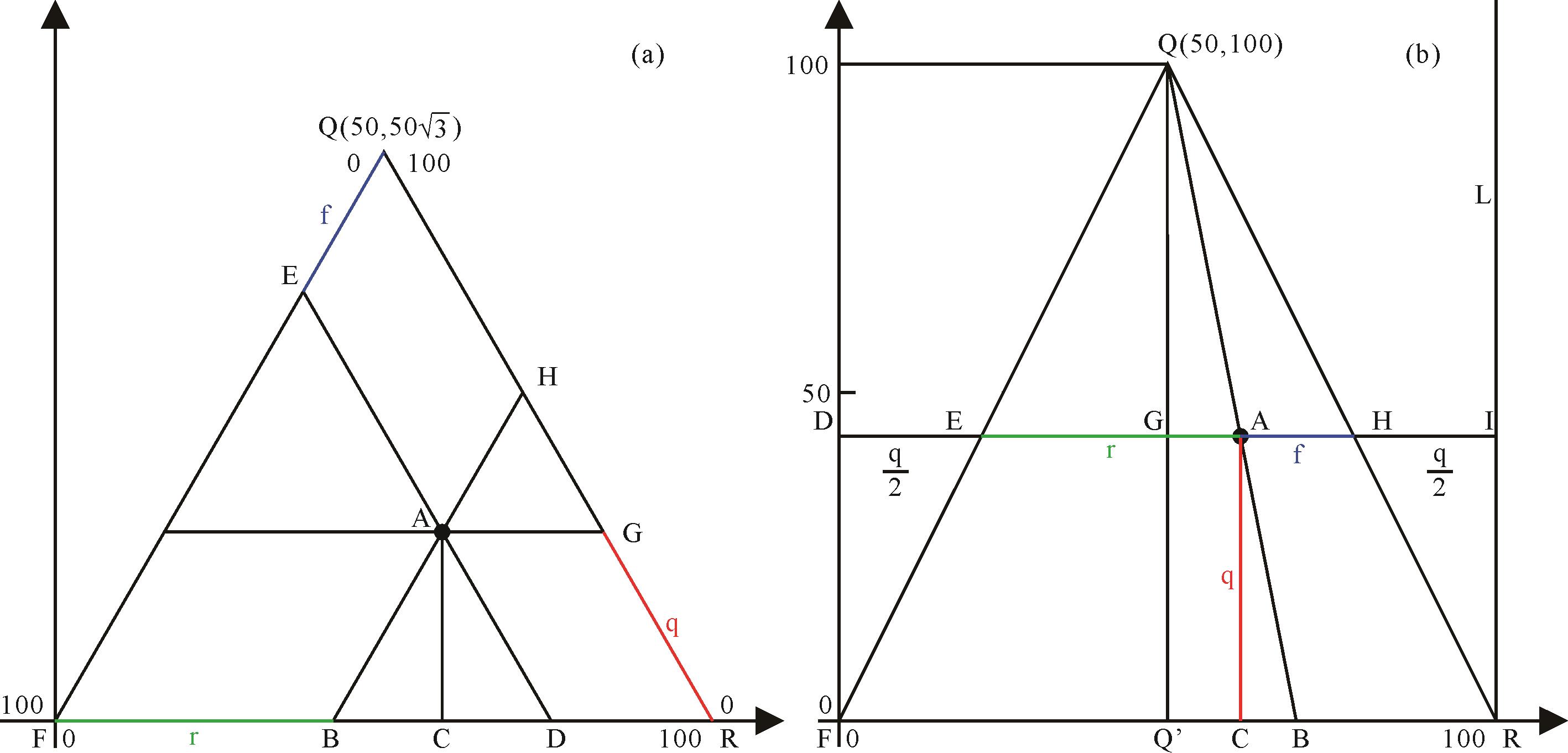
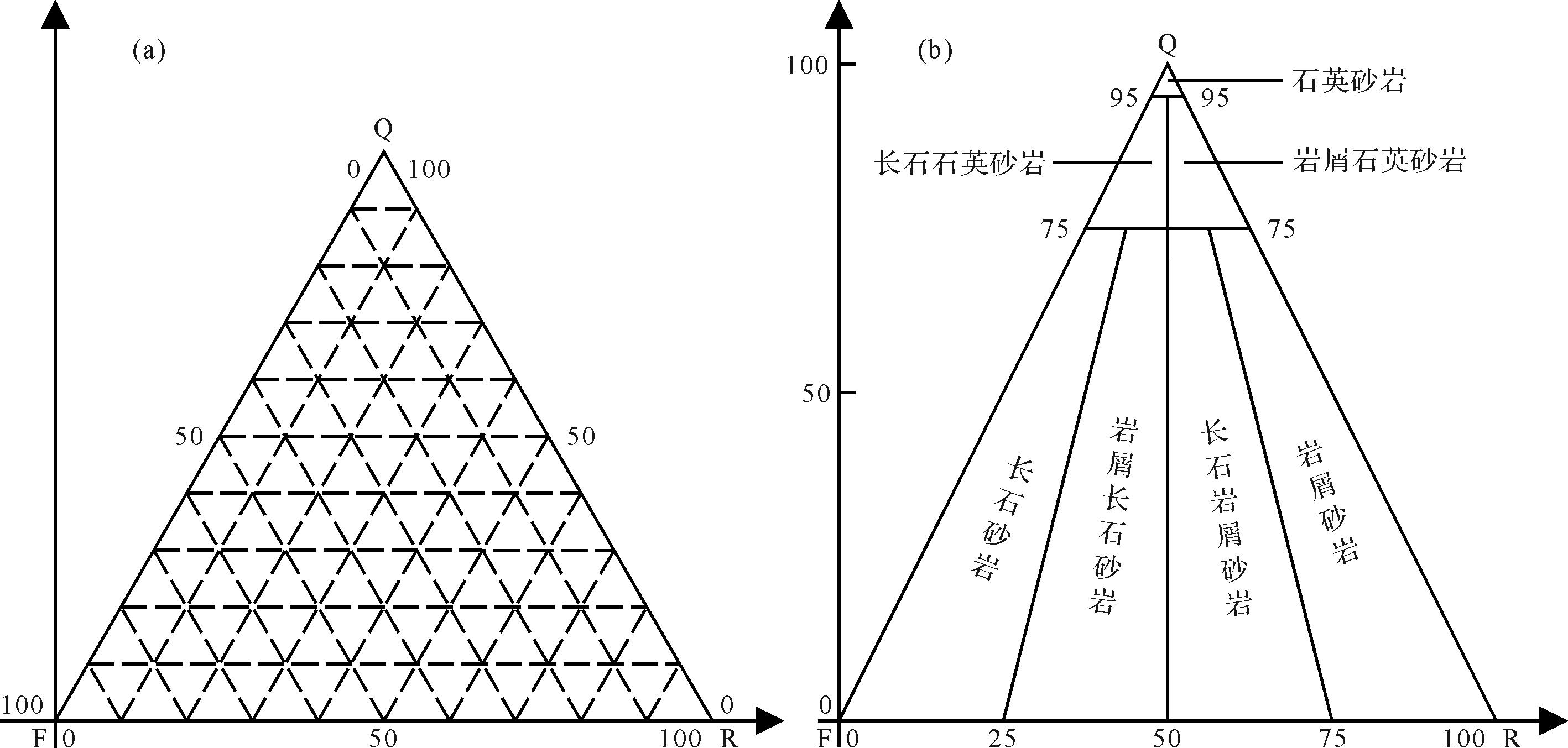
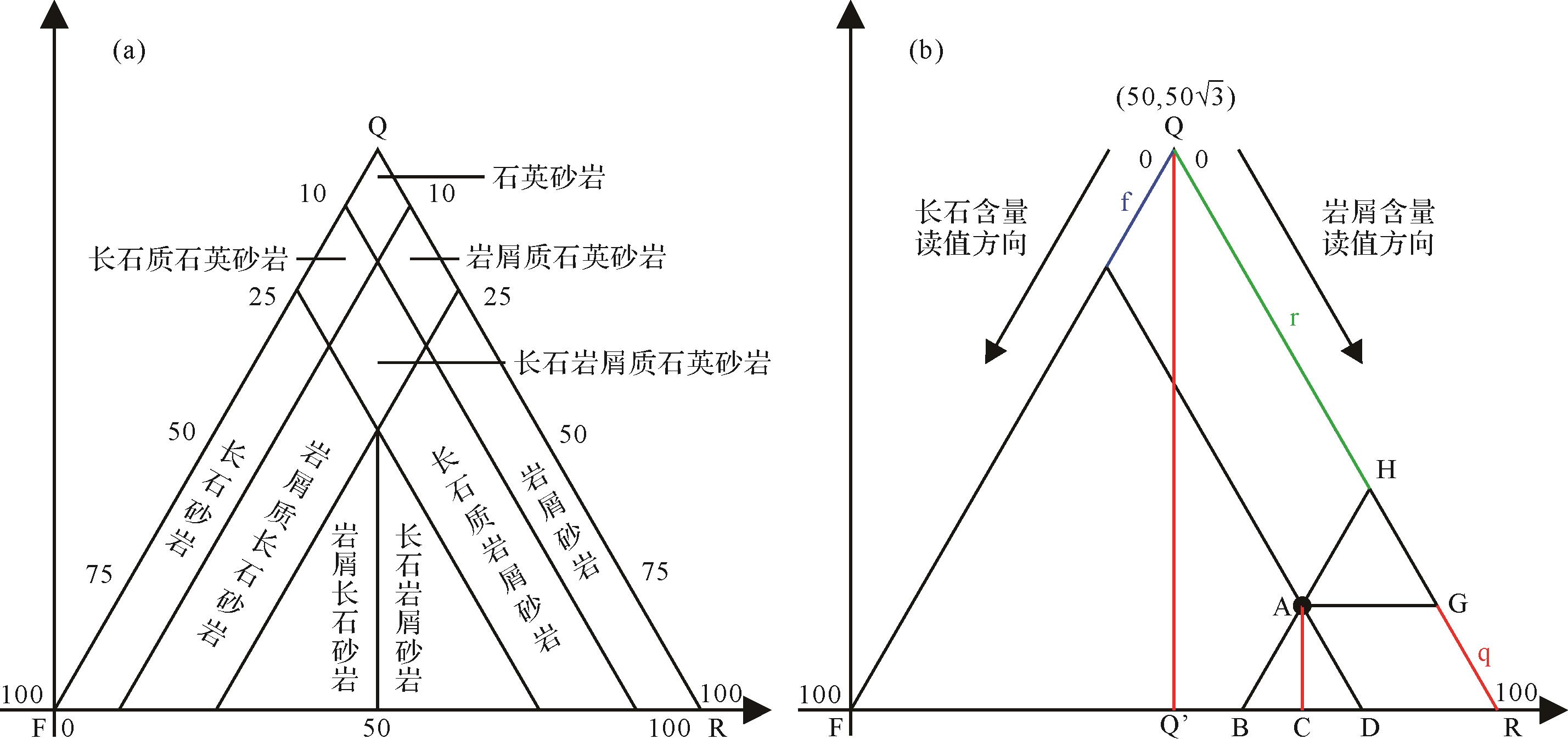
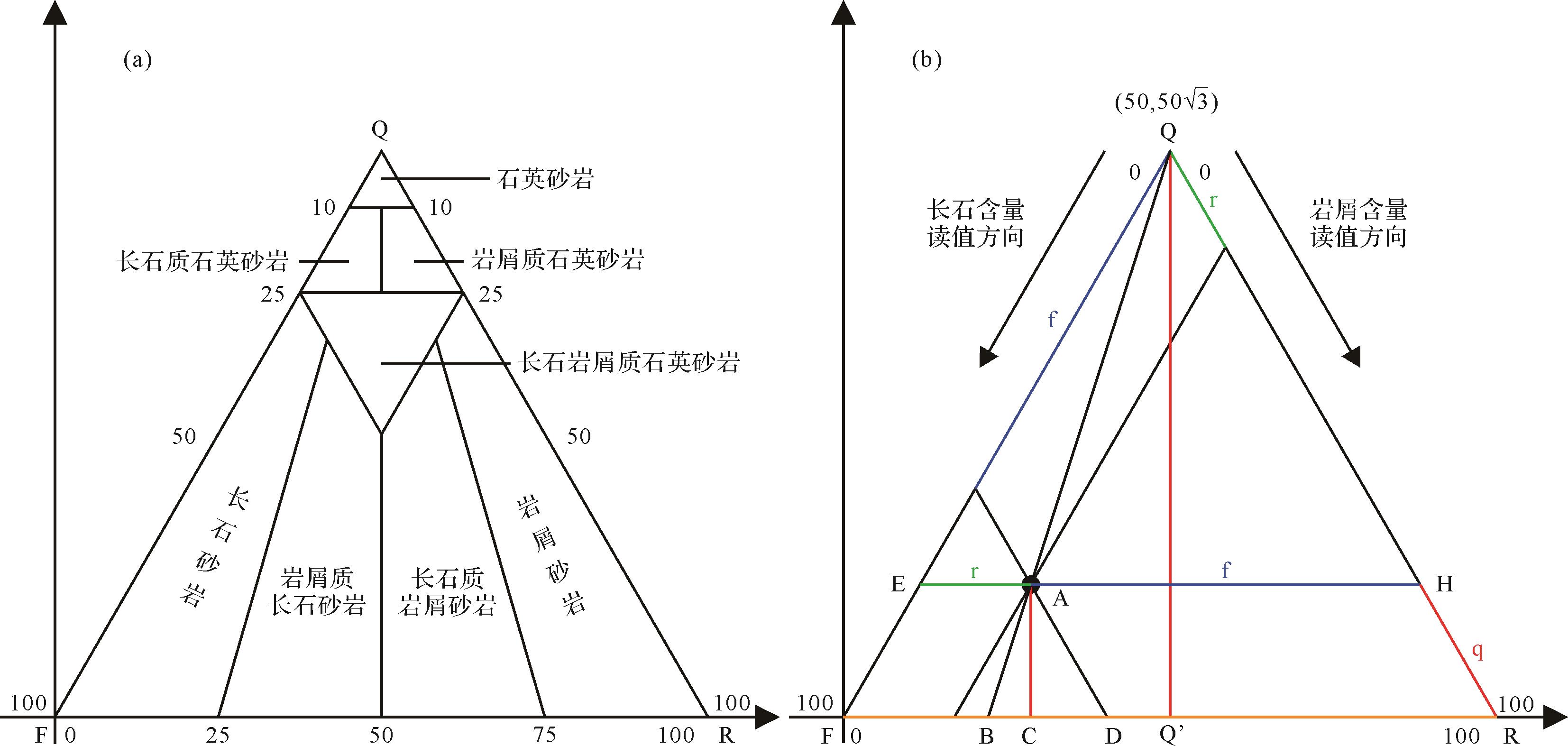
Abstract:
The ternary plot method is widely used in geological industries, especially in sandstone classification. However, many researchers do not appear to have a deep understanding of its principle. Demonstrations of the technique in individual much-cited publications are cumbersome, and even wrongly derived in some cases. This study systematically derives the principle of ternary plots from plane geometry, and how to read them. The errors of logic in the derivation by previous authors are pointed out and corrected. Finally, a comparison of ternary plots generated by Excel, Origin and Grapher software shows distinctions in the projection methods using an equilateral triangle or an isosceles triangle, and demonstrates that the plots transform each other if incorrectly operated. The shape of the triangle determines whether the side of the triangle is viewed as the ordinate axis, and whether the absolute length of the ordinate represents the quartz content. Templates provided by Origin or Grapher do not satisfy oilfield requirements. The isosceles triangle projection method in Excel is recommended, combined with geological mapping software for mapping. To reduce the workload, the VBA code written in this paper can be used to quickly draw a ternary plot for sandstone classification.
2022, 40(4): 1109-1121.
doi: 10.14027/j.issn.1000-0550.2021.081
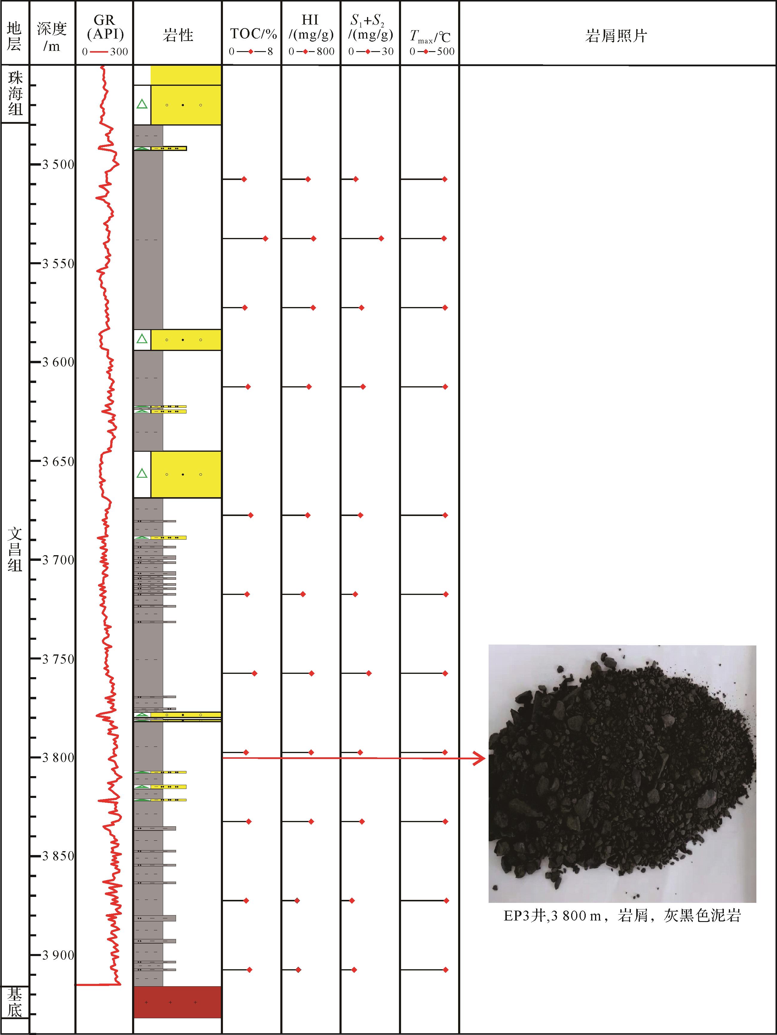
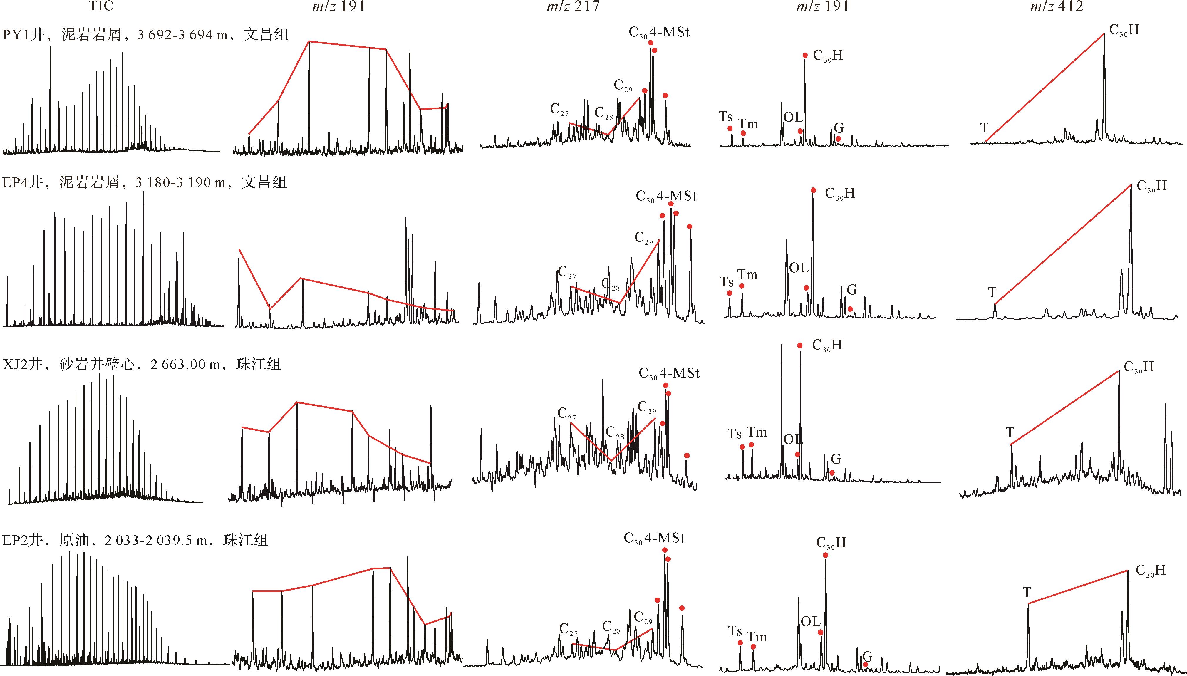
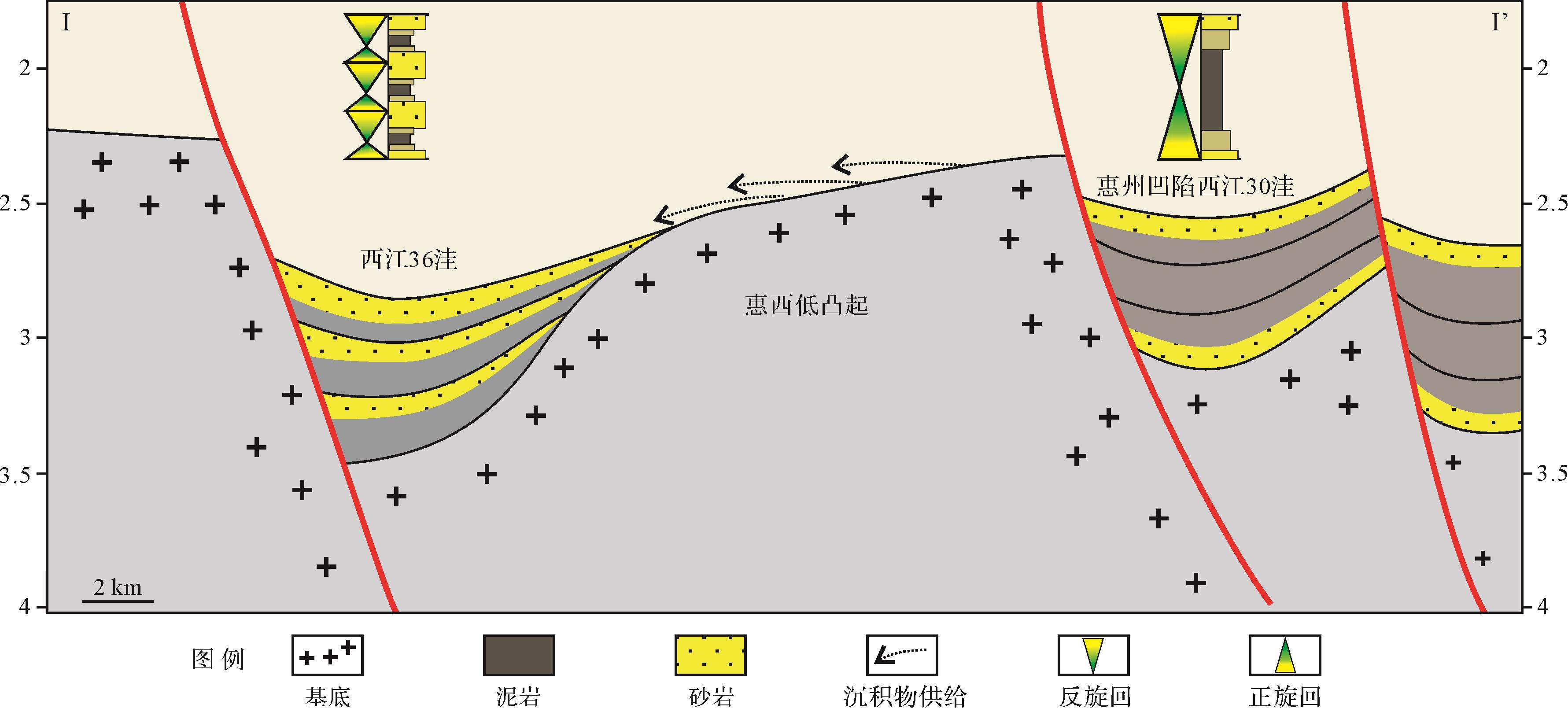
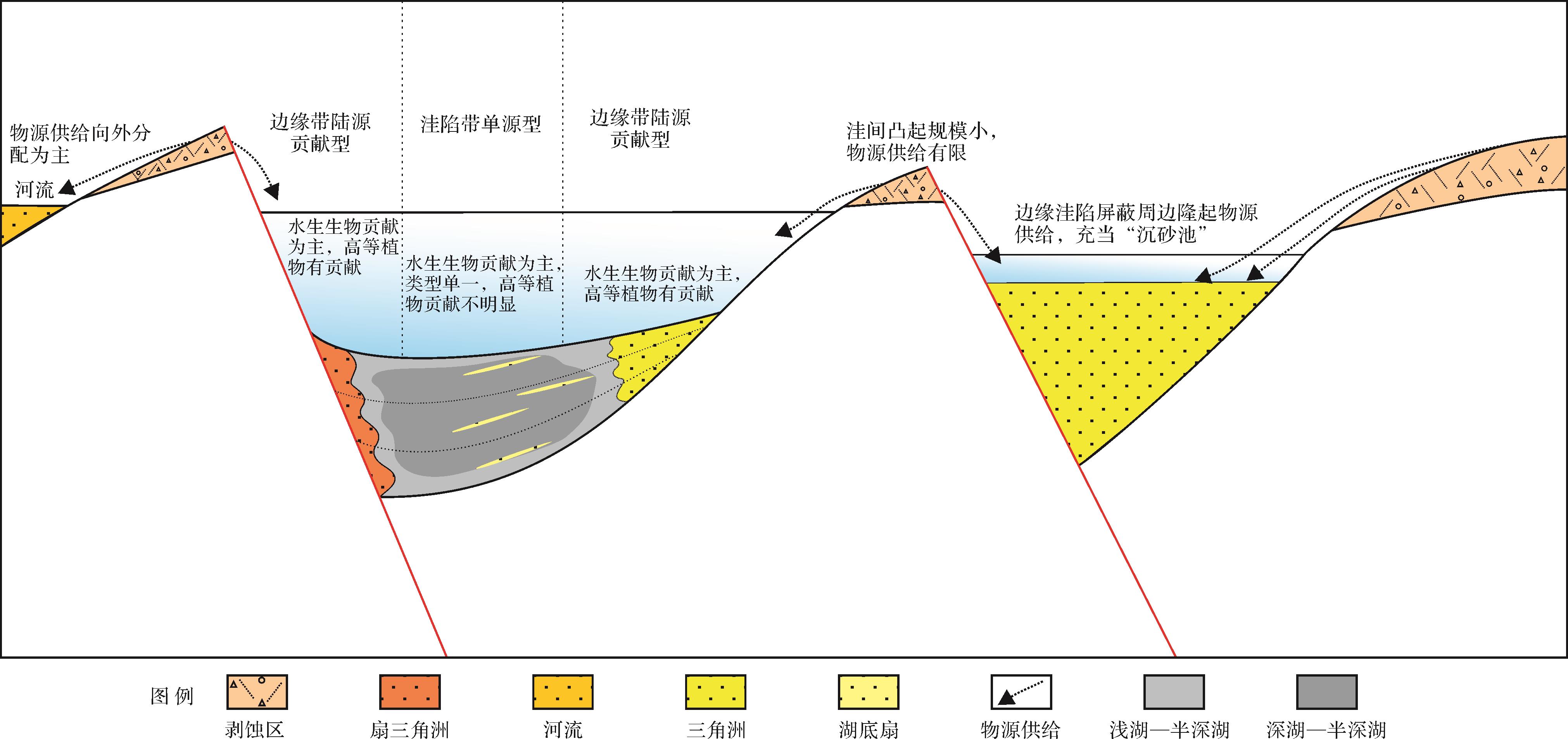
Abstract:
The geological forming condition of source rocks in a small-scale sag is different from that in a large basin. In this paper, the source rocks of the Wenchang Formation for small sags in the ZHUⅠ depression are studied. Based on the organic geochemistry and element geochemistry of the source rocks and crude oil, combined with the tectonic and sedimentary analysis of small-scale sags in the rifting stage, the formation patterns and main controlling factors of the formation of source rocks are analyzed and summarized. The Eocene source rocks of the small-scale sags in the ZHUⅠ depression were formed in a warm and humid freshwater lake. The formation patterns include the single source type in the deep depression zone and the terrigenous contribution type in the marginal zone. The source rocks of the former have a single source of organic matter, which is mainly from aquatic organisms, while the terrigenous plants have less contribution; the organic matter of the latter has a significant contribution from terrigenous organic matter besides aquatic organisms. The quality of the source rock formed in a single source pattern is better than that of the latter, and most of the discovered hydrocarbons come from the source rock formed in the former pattern. Due to the limited spatial scale, small depressions are sensitive to sediment supply and prone to overcompensation. High tectonic subsidence rate and low sediment supply are the keys that ensure the development environment of source rocks. A warm and humid climate background and high productivity of eutrophic water bodies control the scale of high-quality source rocks in small depressions
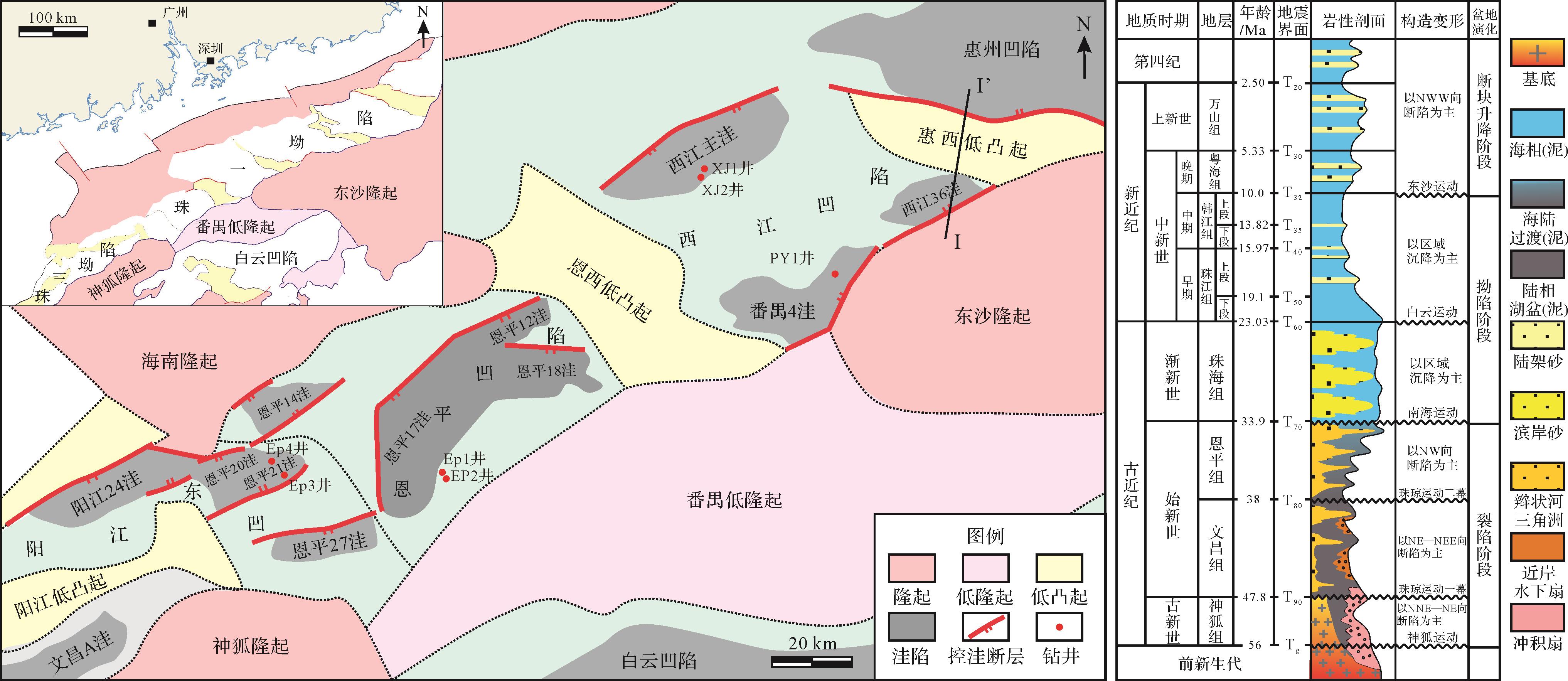
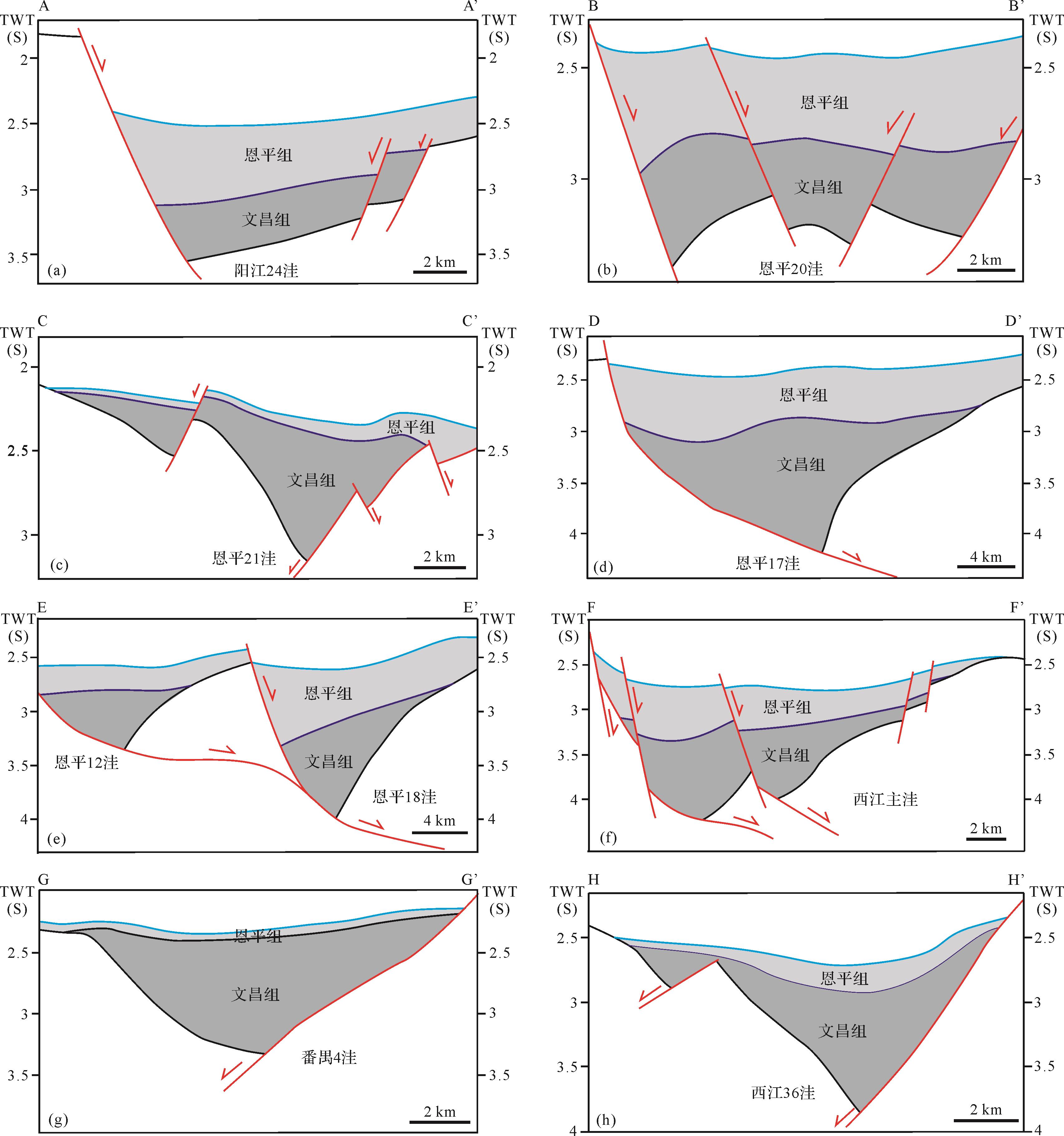
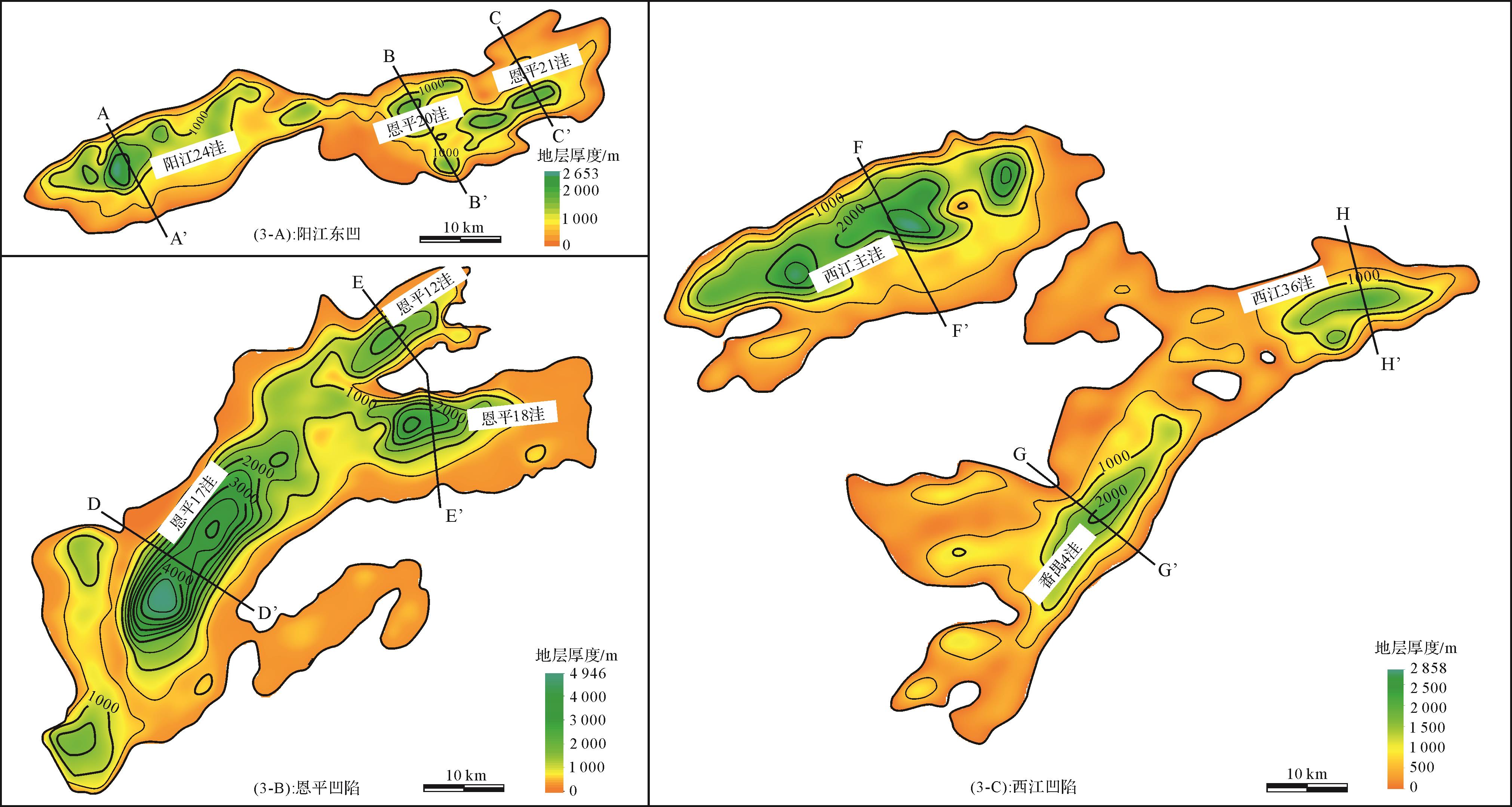
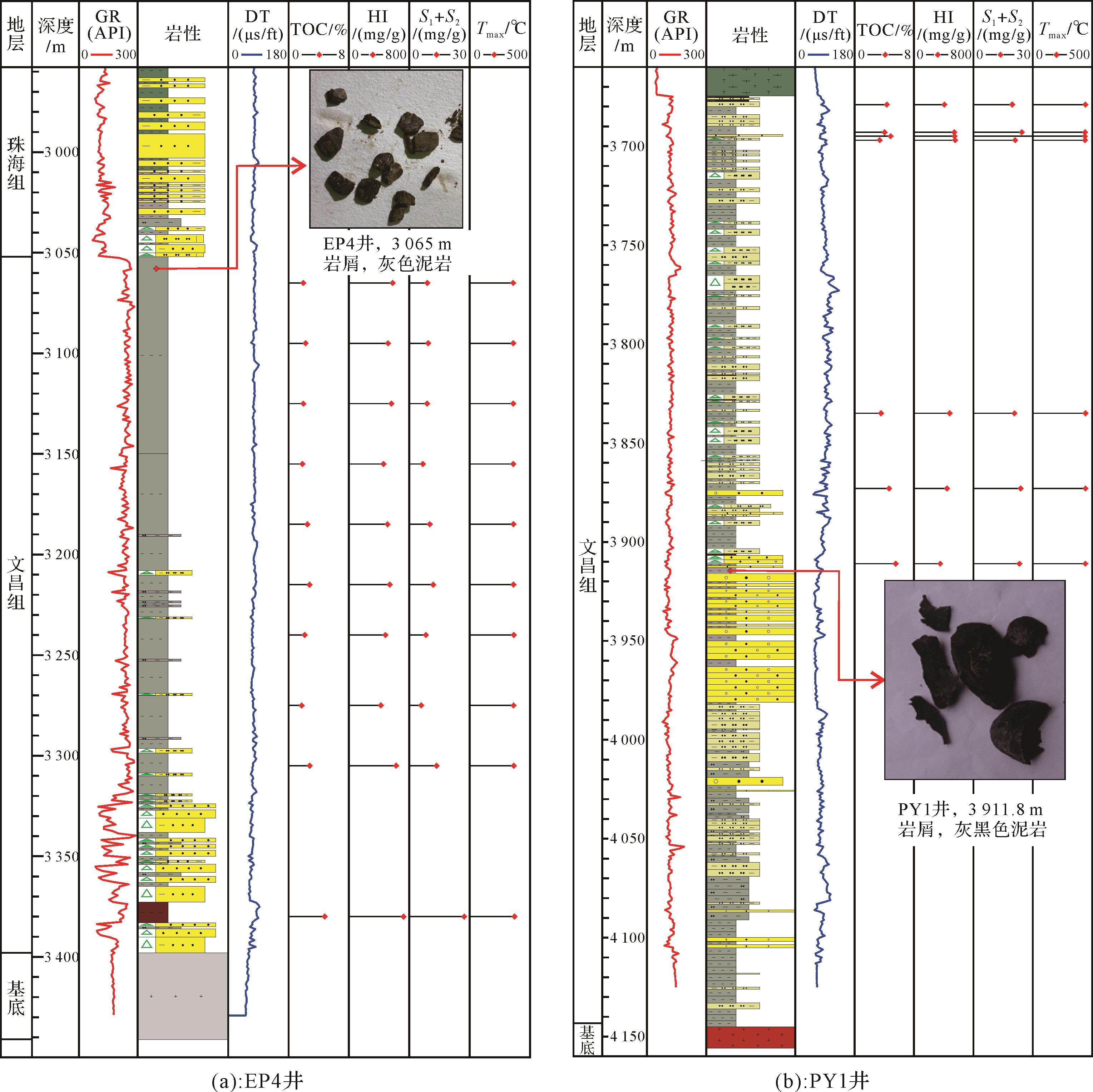


2022, 40(4): 1122-1136.
doi: 10.14027/j.issn.1000-0550.2021.024
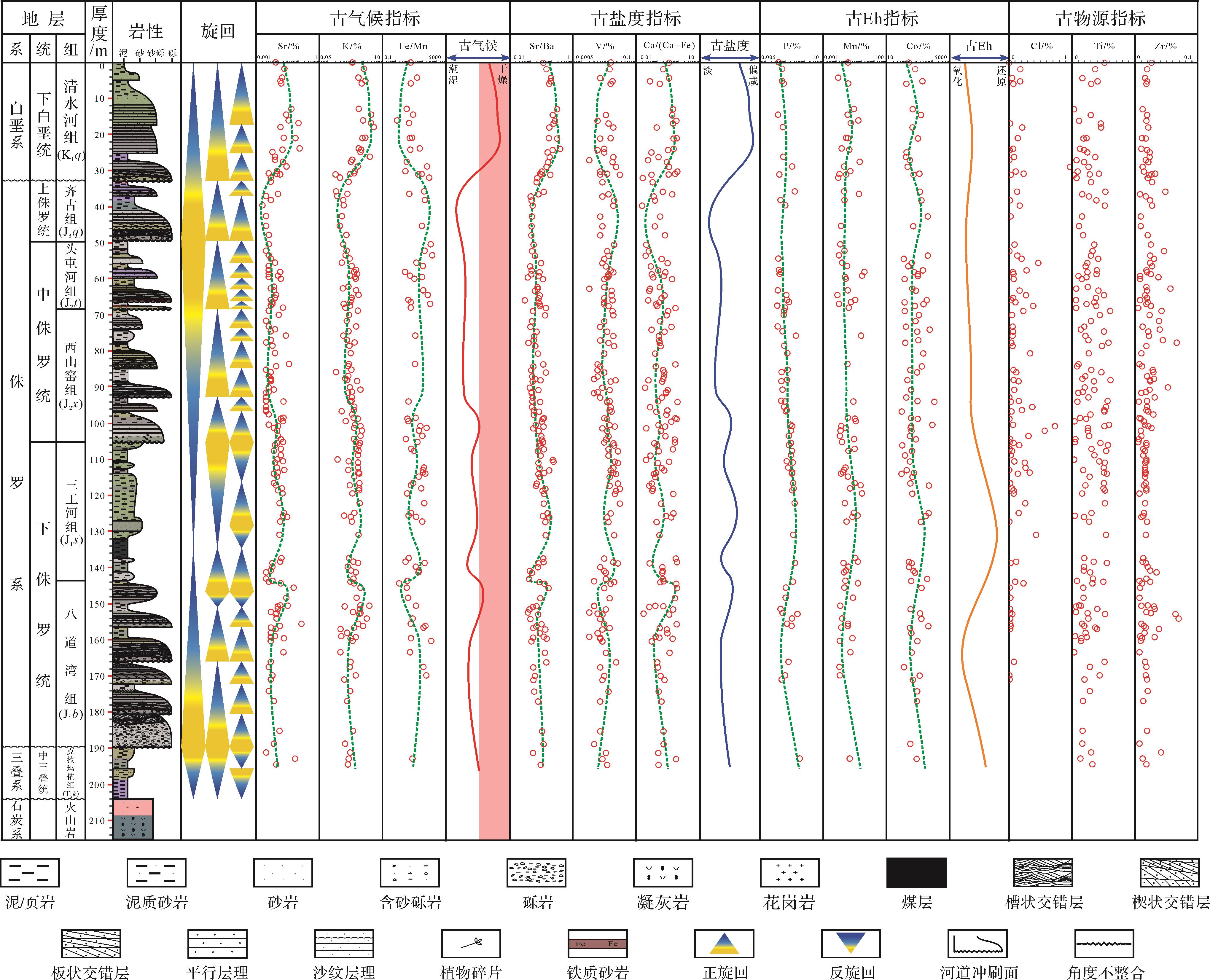
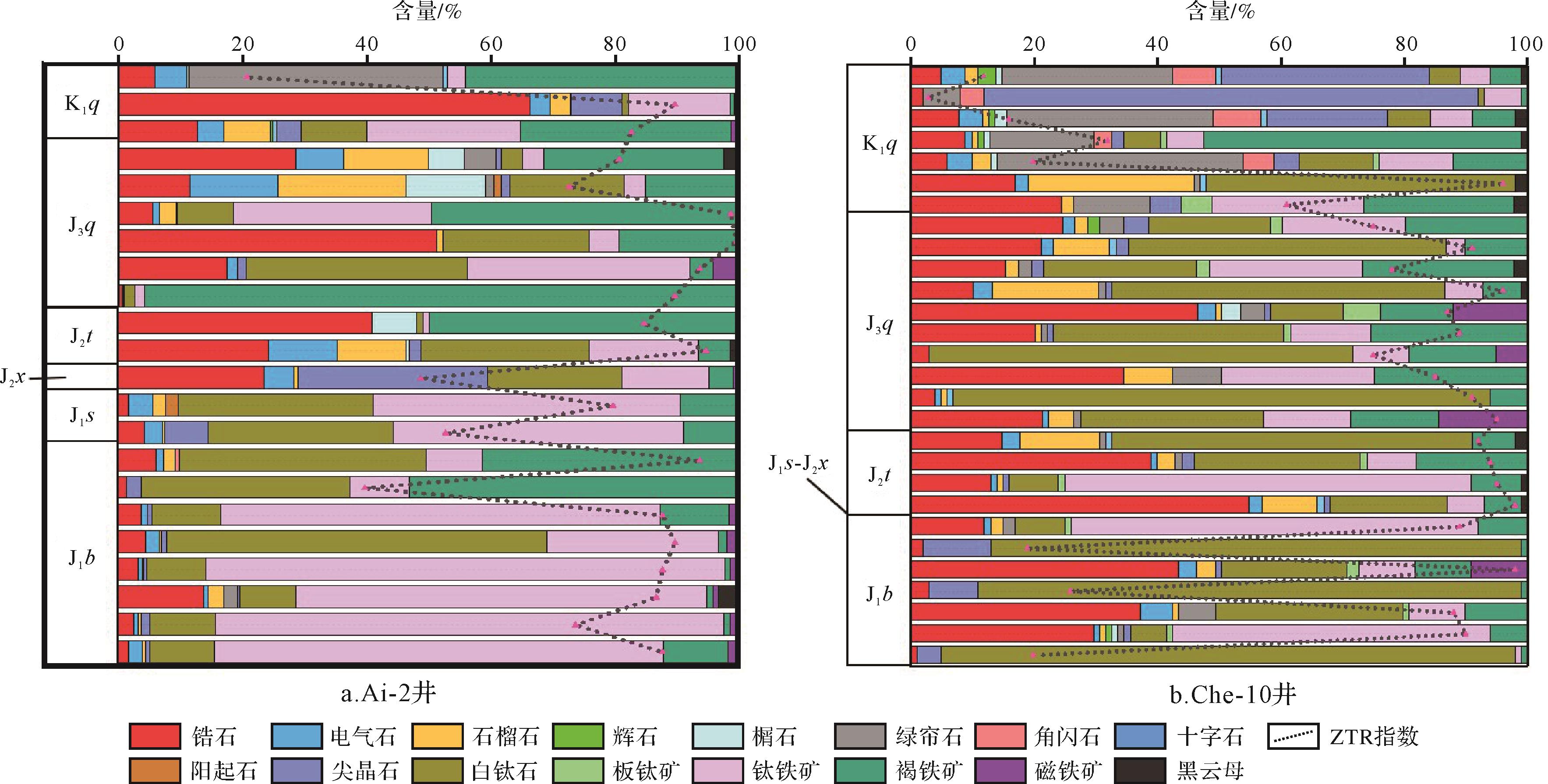
Abstract:
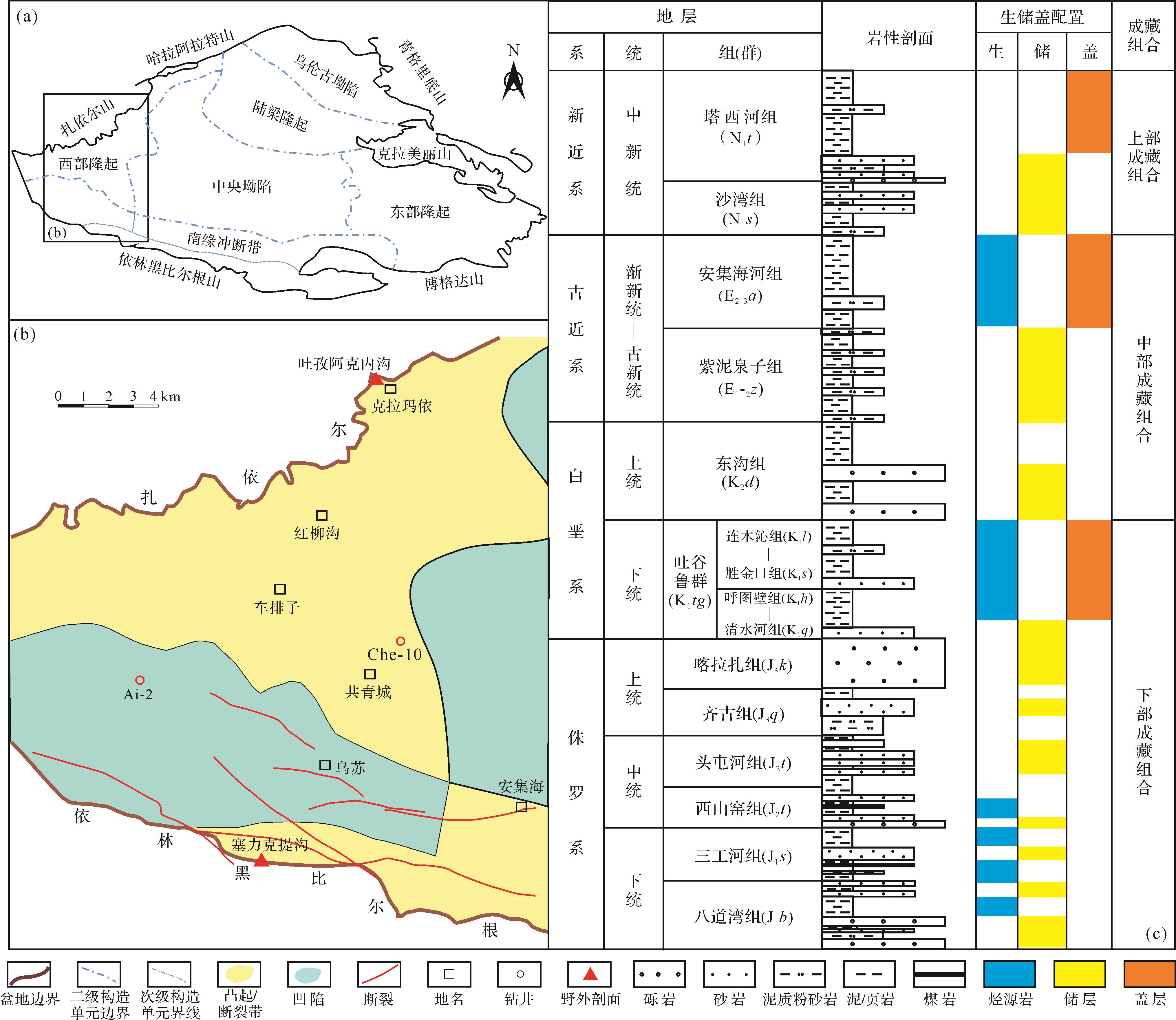
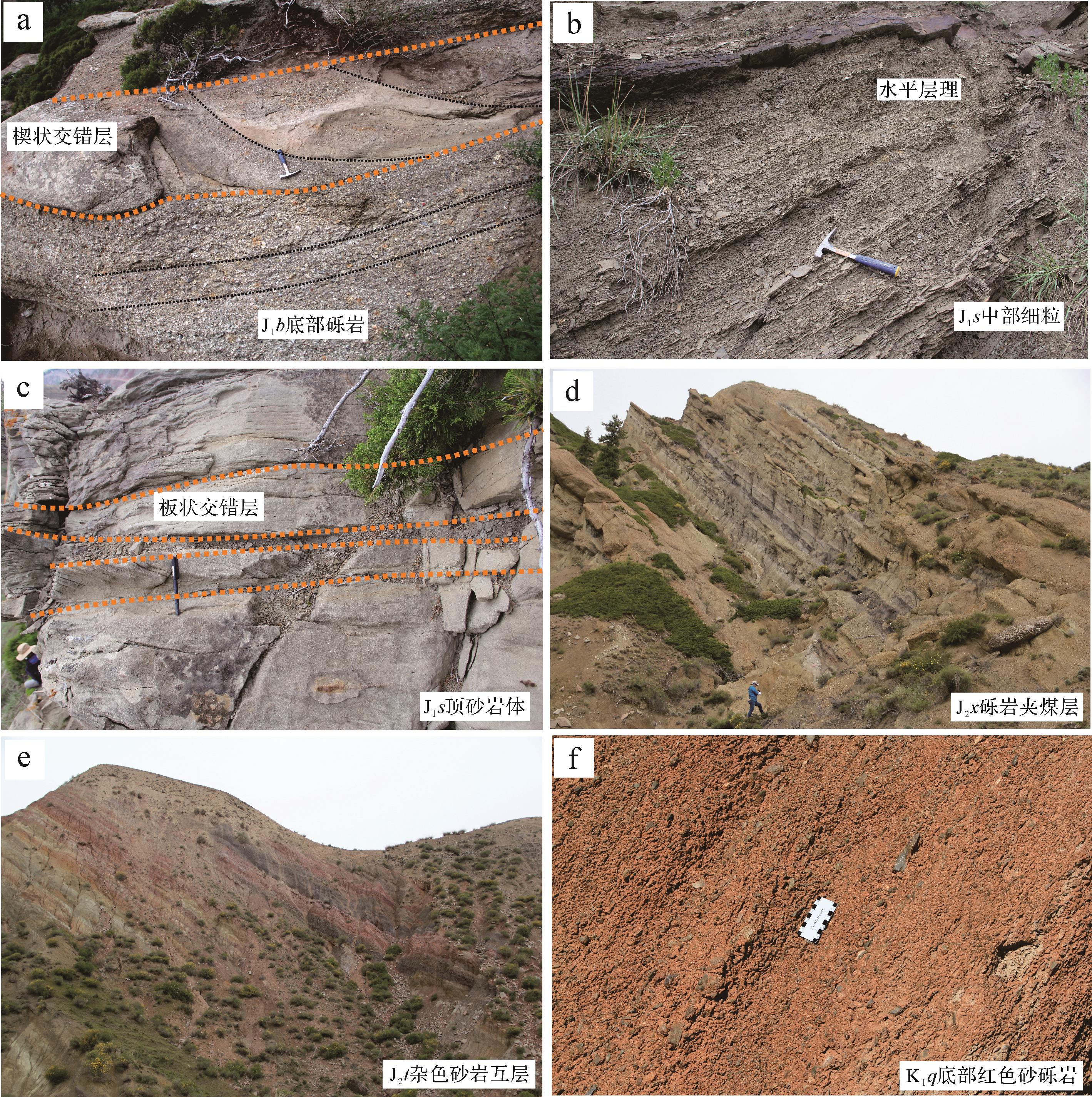
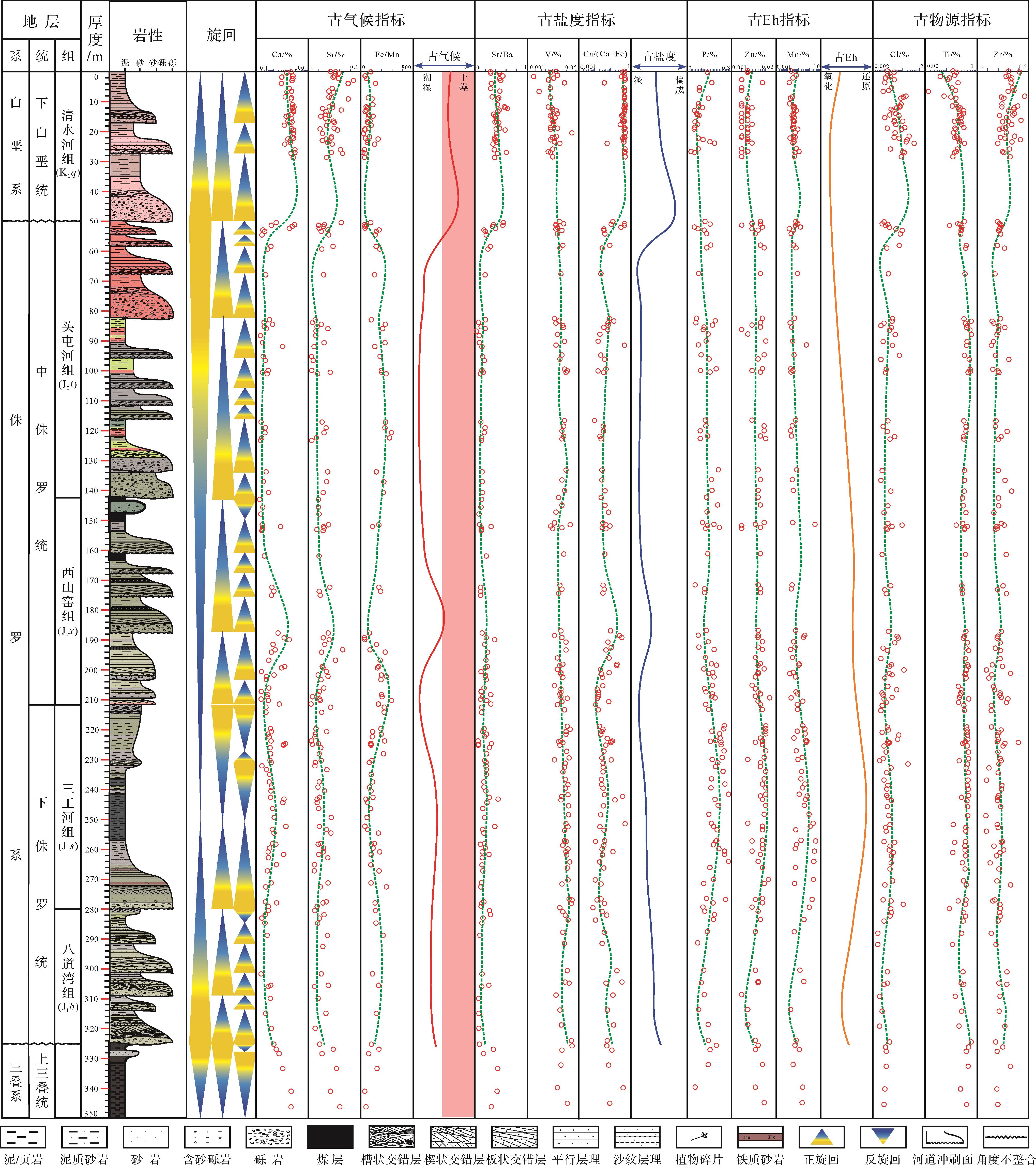
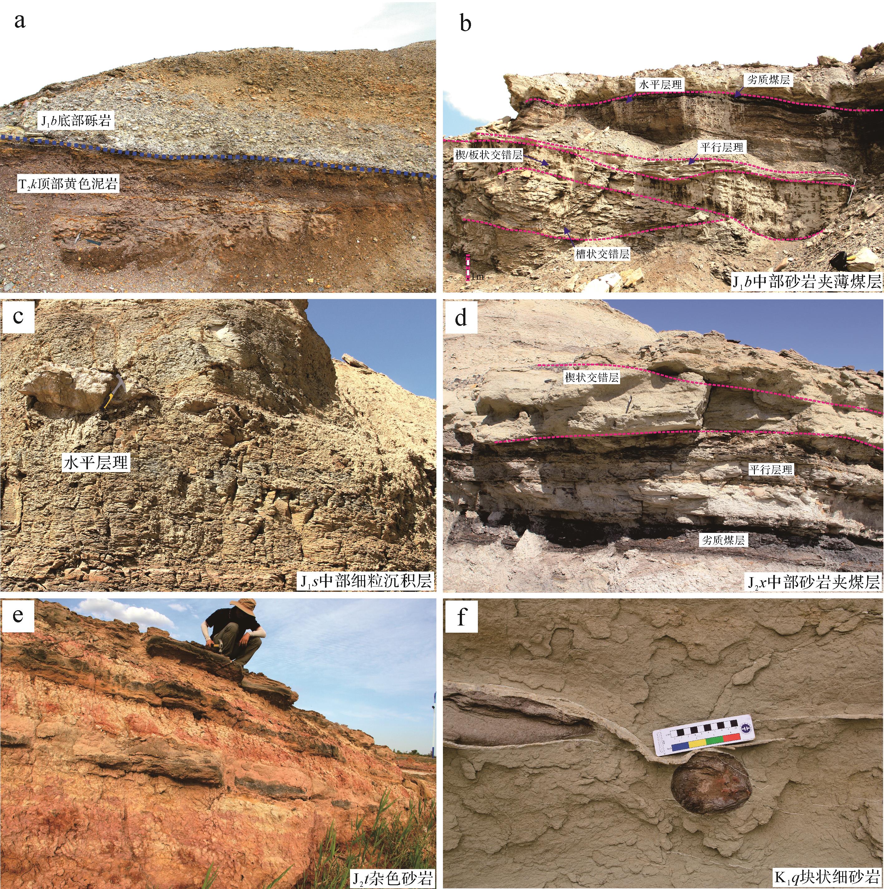
There is still some disagreement on understanding the evolution of the sedimentary palaeoenvironment from the Jurassic to the early Cretaceous within the Sikeshu sag, southwestern Junggar Basin. The low exploration level in the lower hydrocarbon accumulation system influences the comprehension of the sequence stratigraphy, sedimentation, and reservoirs, seriously restricting the process of further exploration. This paper attempts to obtain the evolution of the climate, salinity, redox condition, and provenance by applying the portable XRF element instrument and heavy mineral analysis. The instrument was used to quickly and nondestructively test a great amount of fine-grained rock samples from the two J⁃K1q outcrops, which are the Sailiketigou Formation, located at the southern sag and in front of the North Tianshan Mountain, and the Tuziakeneigou Formation, located at the southwestern basin and near the Zaire Mountain. Our results indicate a total climatic trend from humid (J) to semiarid (K1q). The temperature reduced from J1, reached minimum at J3q, and increased rapidly during K1q. The salinity, which is influenced by the climate, obviously grew in K1q despite the sedimentary water always remaining fresh. The lacustrine deposit was the deepest and anoxic in J1s and the shallowest and oxic in early K1q, which demonstrates that the lacustrine depth and Eh are governed more by tectonic subsidence than climate. The supply of terrigenous detrital to the sag was mainly governed by the North Tianshan provenance during the Jurassic, and the Zaire provenance obviously supplied the sediment during K1q. The tuffs were mixed into the source rocks of the North Tianshan provenance, and the metamorphic rocks were added into the source rocks of the Zaire provenance during the J/K periods.
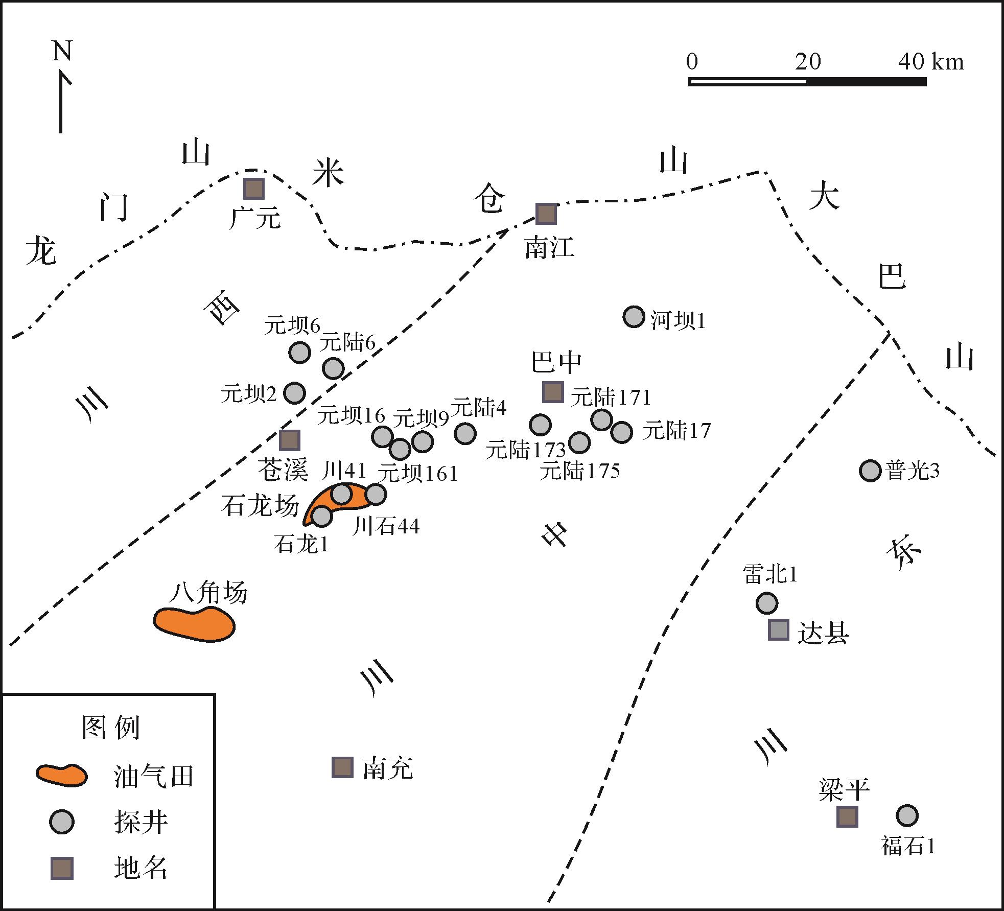
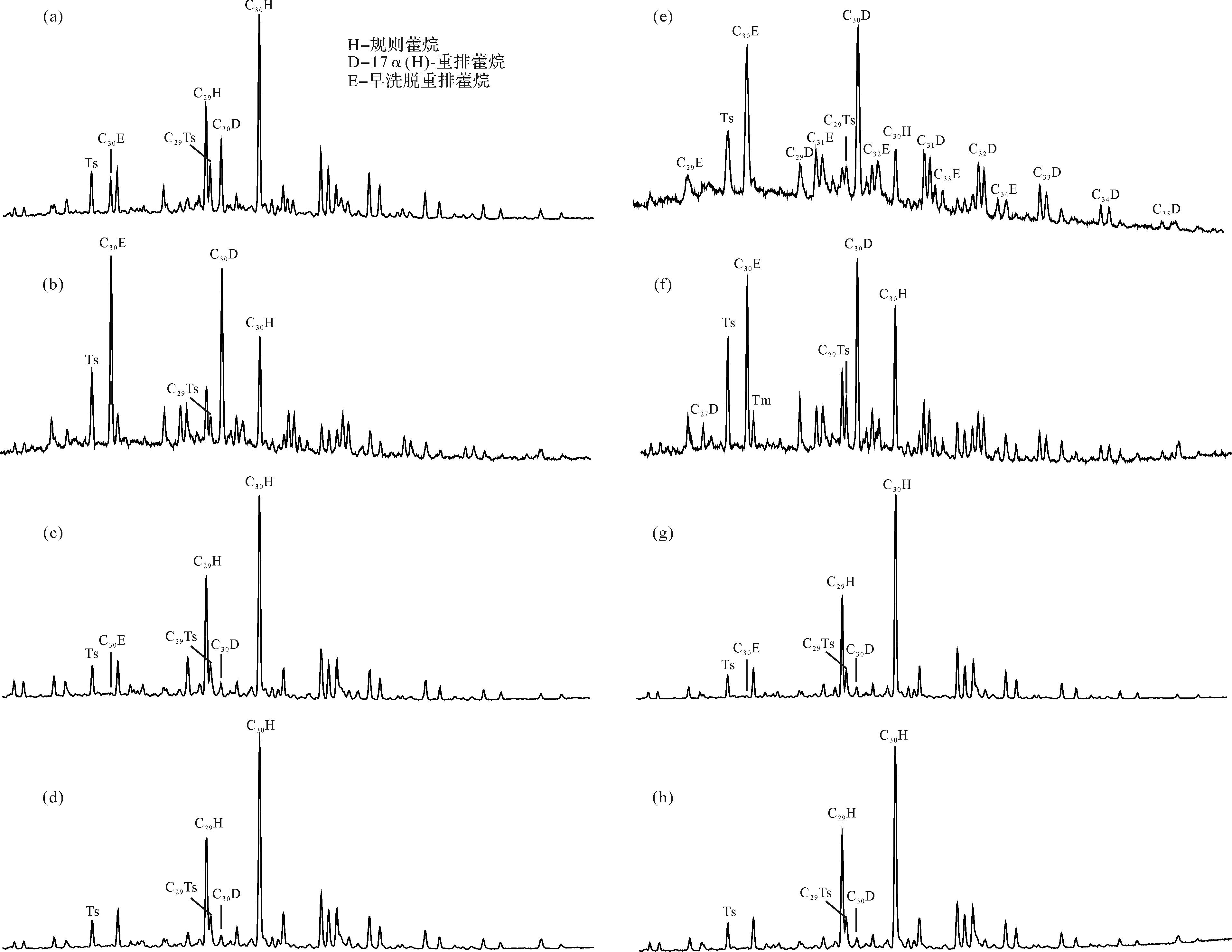
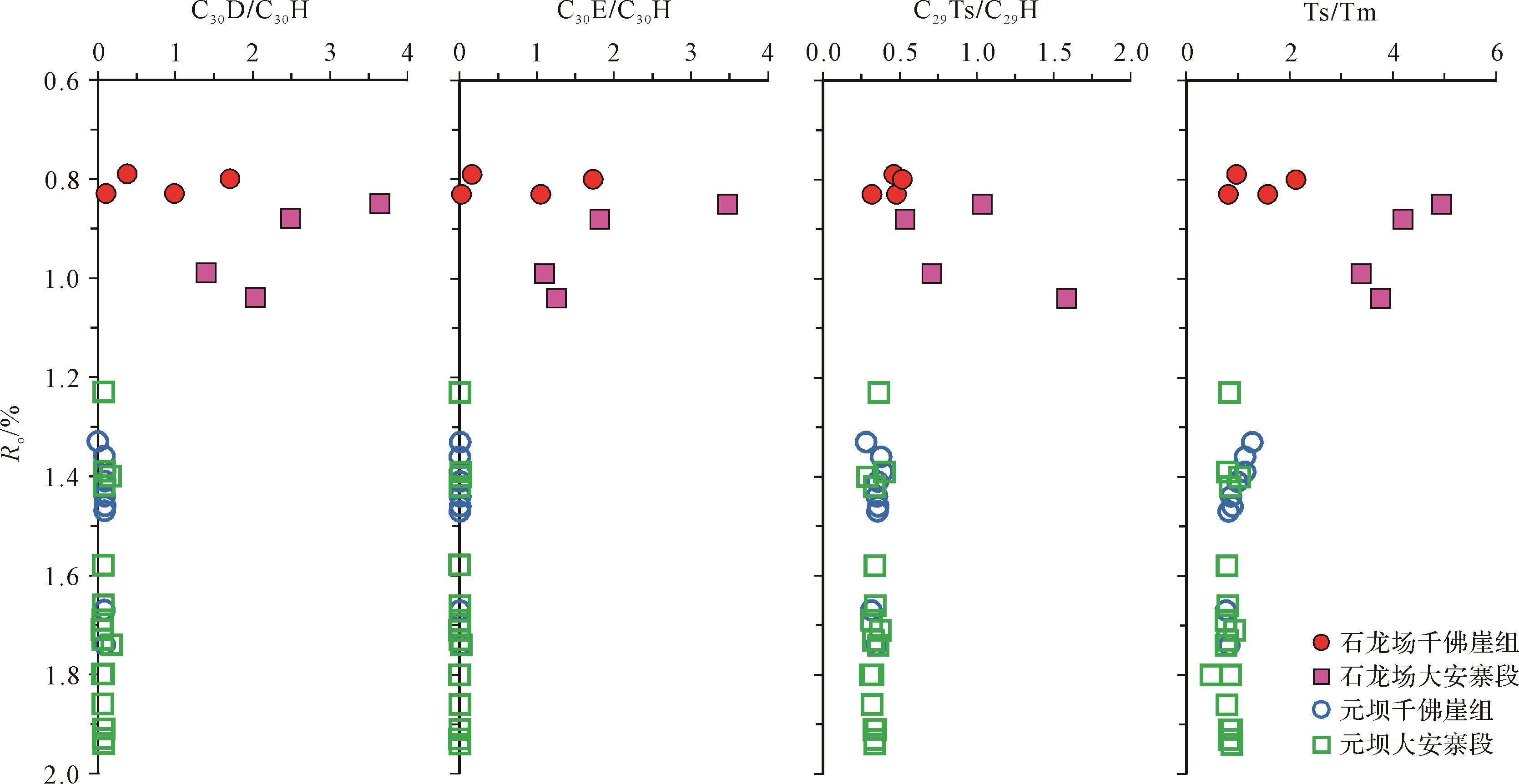
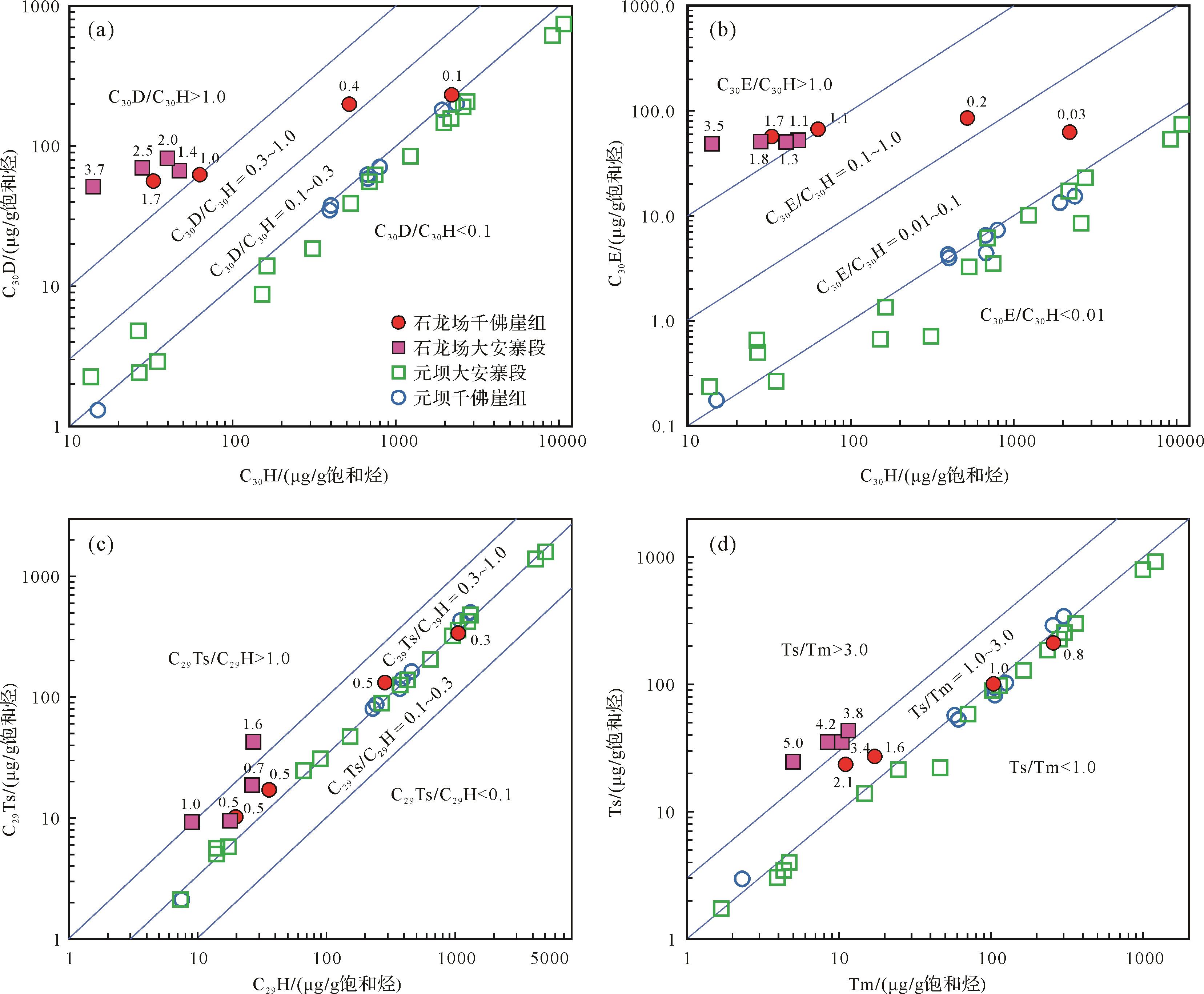
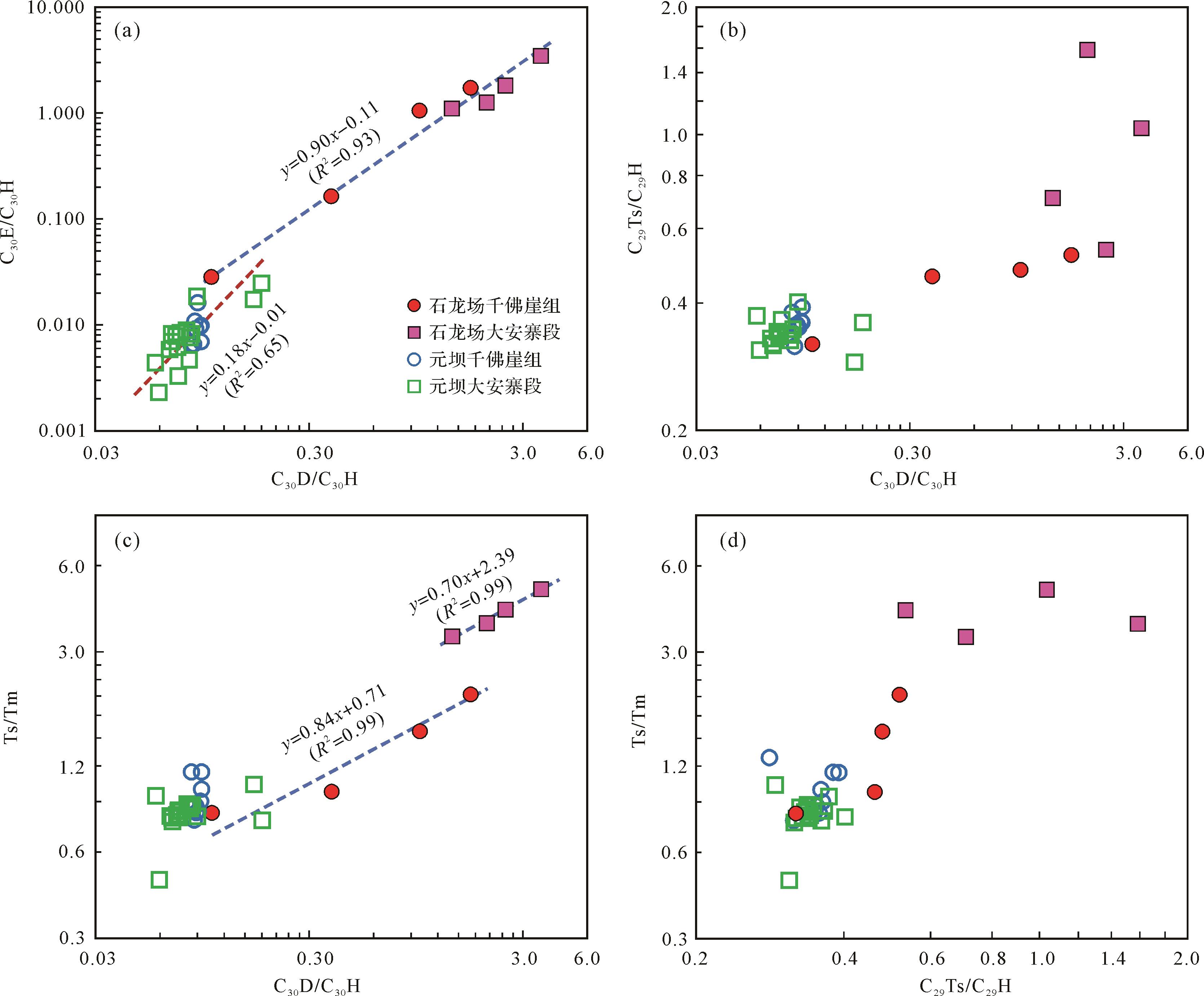
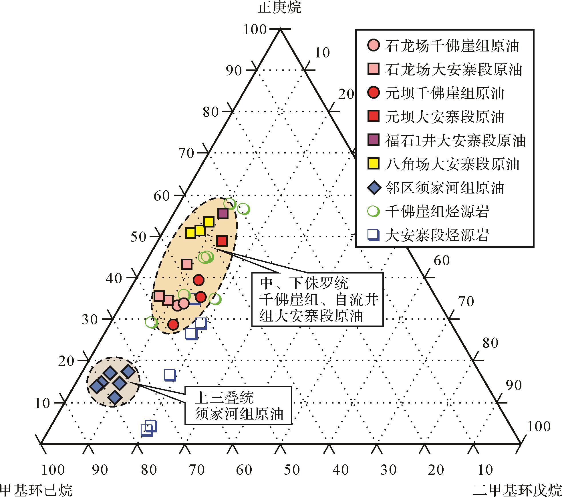
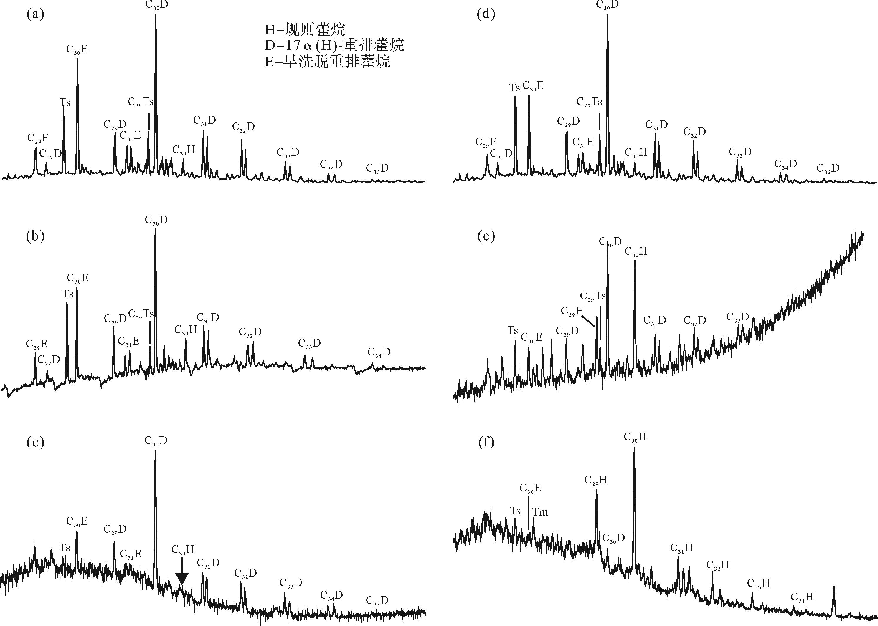
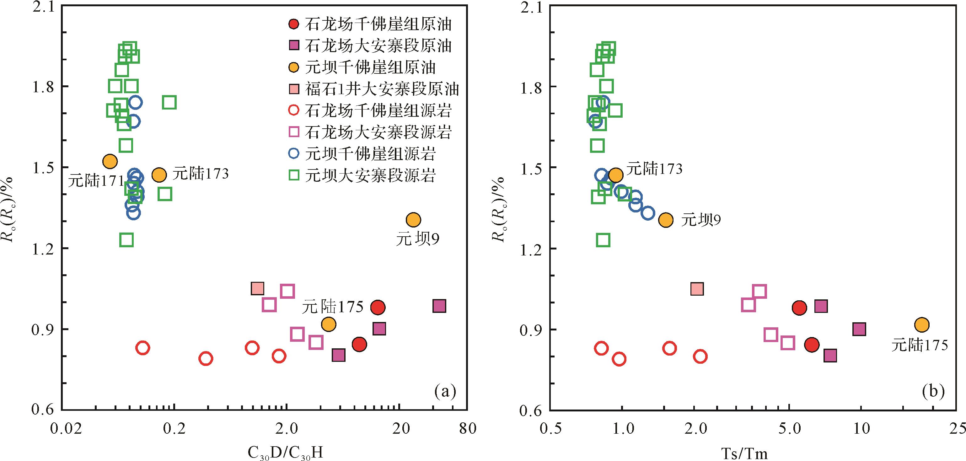
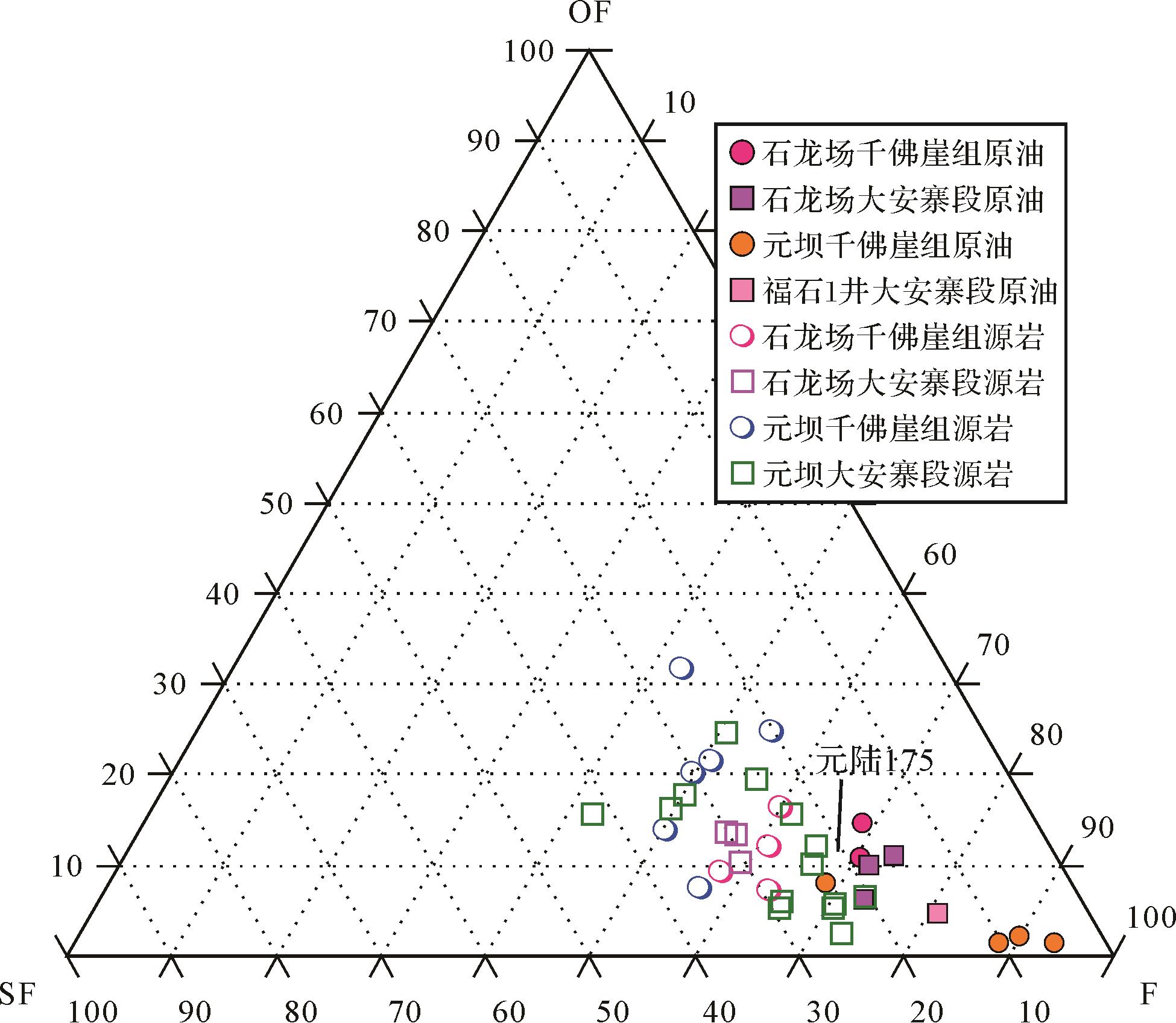
2022, 40(4): 1137-1150.
doi: 10.14027/j.issn.1000-0550.2020.118
Abstract:
Over 40 lacustrine source rock and oil samples with different maturities collected from the middle-lower Jurassic strata in the Shilongchang and Yuanba regions of the northern Sichuan Basin were analyzed using GC-MS (gas chromatography-mass spectrometry) to characterize the compositional variations of rearranged hopanes and carry out a genetic correlation between the oils and the source rocks. The results indicate the rearranged hopanes show a great difference in abundance for the different mature source rocks. The mudstones with Ro values ranging from 0.8% to 1.0% in the middle Jurassic Qianfoya Formation and the Da’anzhai member of the lower Jurassic Ziliujing Formation in the Shilongchang region are extremely enriched in three series of rearranged hopanes, i.e., 17α(H)-diahopanes, 18α(H)-neohopanes, and early-eluting rearranged hopanes with a full carbon number member. These compounds are present several times in relative concentrations as regular hopanes and can serve as a molecular indicator for the identification of hydrocarbons from the middle-lower Jurassic source rocks. In contrast, the hopanoids from over-mature source rocks (Ro mostly in 1.4%-1.9%) with similar depositional facies and lithology in the Yuanba region are found to change abnormally. Their rearranged hopanes exhibit a low relative abundance, possibly as a result of more regular hopanes generated from kerogen at a high maturity level. Enhanced rearranged hopanes in the source rocks are attributed to the relative enrichment of these compounds with respect to regular hopanes, rather than their high absolute concentration. A sub-oxic depositional environment could favor the formation of these compounds, while the bacterial component in a biological source may be of critical importance. The constitution of hopanoids appears not to be controlled by thermodynamic processes at high thermal maturity, and rearranged hopanes show a highly similar molecular distribution with the deprivation of their geochemical proprieties. The composition and distribution of rearranged hopanes in oils from the middle-lower Jurassic reservoirs also change with increasing maturation. These compounds are unusually abundant in mature oils but are found at a much lower amount in over-mature oils, an analogy to the situation in the source rocks at different maturities. Based on the oil-source rock correlation, studied oils are believed to be self-sourced.