2023 Vol. 41, No. 2
Display Method:
2023, 41(2): 333-348.
doi: 10.14027/j.issn.1000-0550.2021.138
Abstract:
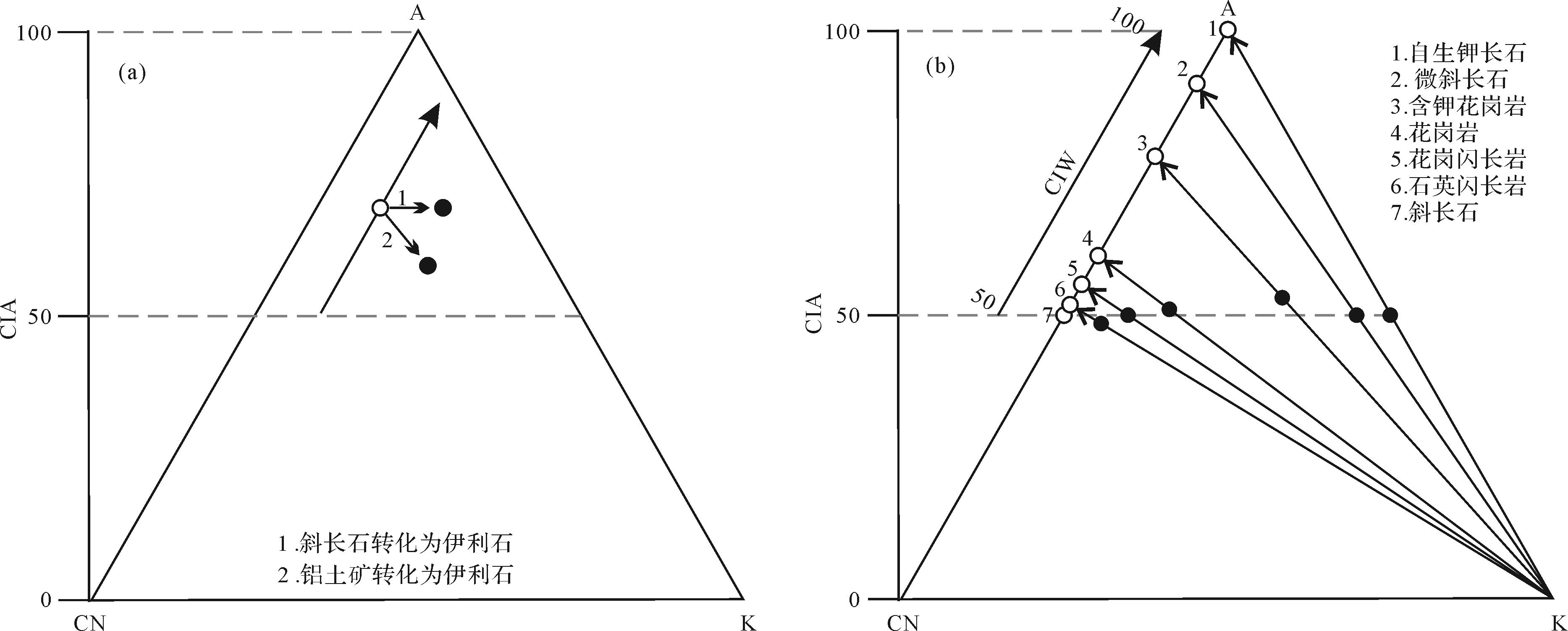
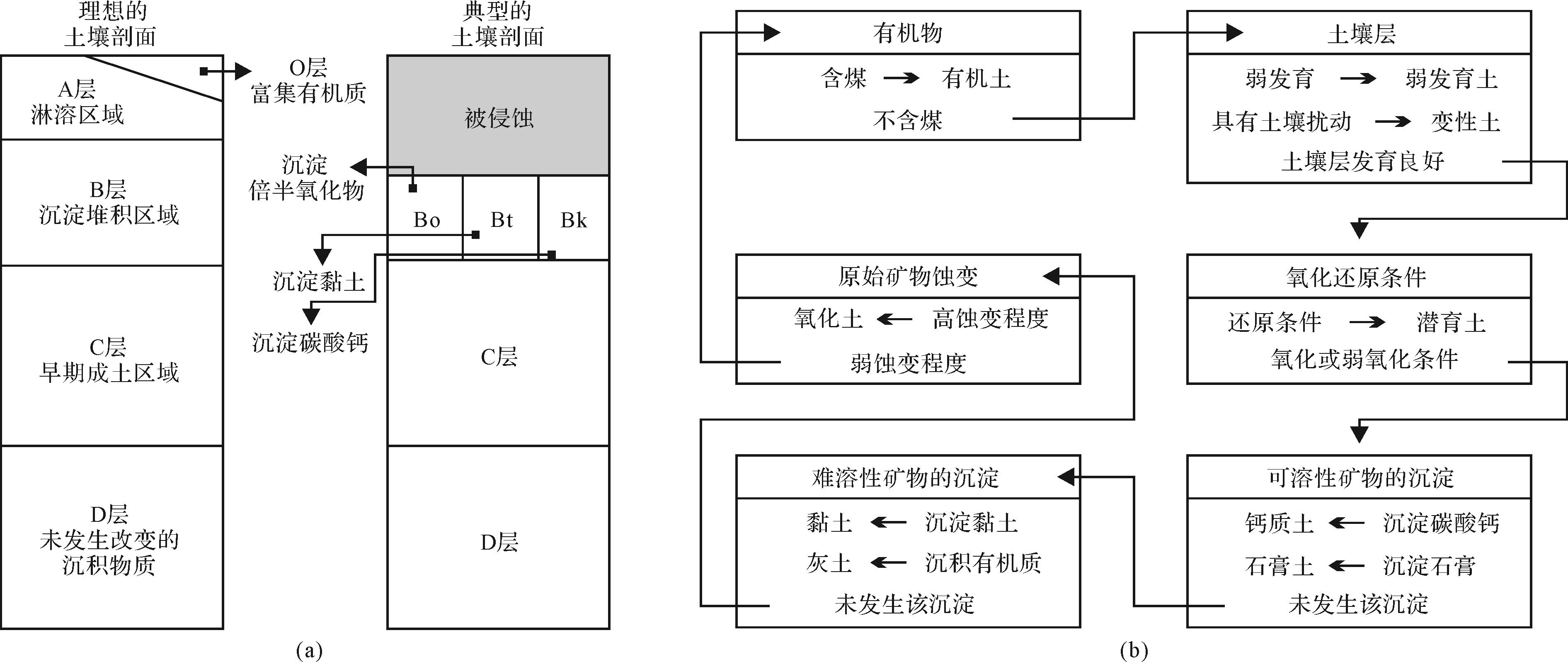
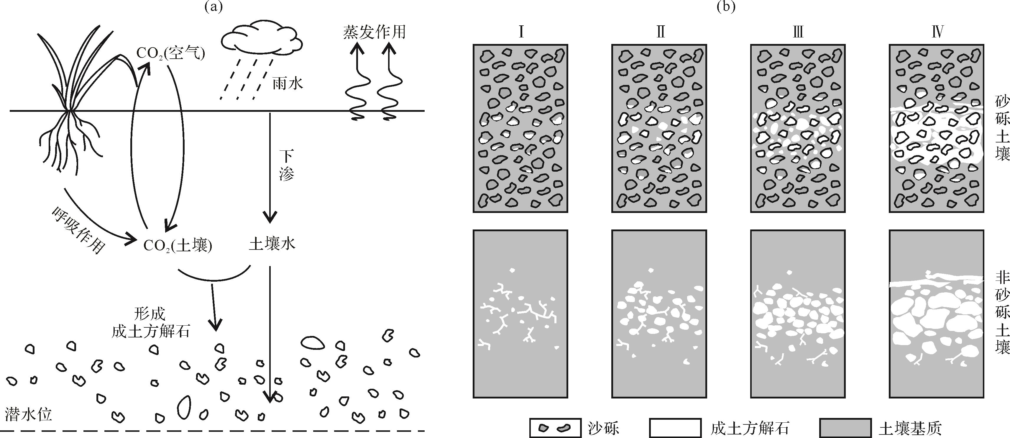
Paleoclimate reconstruction is important for predicting future climate change. The continental paleoclimate plays an important role in dividing global paleoclimate zones, contrasting marine paleoclimate differences and establishing climate models. Climatologically sensitive deposits contain the records of paleoclimate information. Stronger chemical weathering indicates a warmer and more humid paleoclimate. Chemical weathering indices (e.g., CIA, WIP, CIW, PIA, τNa and non-traditional isotope) have been established by geochemical data derived from mudstone. Mineralogical characteristics of clastic rocks (e.g., mineral maturity, different combinations of clay minerals and magnetic mineral) indicate different paleoclimates. The paleoclimatic analysis of lacustrine sediments includes the element ratio and the study of astronomically forced paleoclimate changes based on high-precision analysis. Paleosols indicate paleoclimate: paleoprecipitation can be calculated from the depth to the pedogenic carbonate (BK) horizon in paleosols. Paleotemperature, paleoprecipitation and paleoatmospheric carbon dioxide concentration (pCO2) can be calculated using the geochemical characteristics of clay minerals, pedogenic calcite, Fe⁃Mn nodules and the paleosol matrix. In the future, more and higher-resolution continental paleoclimate analysis methods need to be established and improved.
Paleoclimate reconstruction is important for predicting future climate change. The continental paleoclimate plays an important role in dividing global paleoclimate zones, contrasting marine paleoclimate differences and establishing climate models. Climatologically sensitive deposits contain the records of paleoclimate information. Stronger chemical weathering indicates a warmer and more humid paleoclimate. Chemical weathering indices (e.g., CIA, WIP, CIW, PIA, τNa and non-traditional isotope) have been established by geochemical data derived from mudstone. Mineralogical characteristics of clastic rocks (e.g., mineral maturity, different combinations of clay minerals and magnetic mineral) indicate different paleoclimates. The paleoclimatic analysis of lacustrine sediments includes the element ratio and the study of astronomically forced paleoclimate changes based on high-precision analysis. Paleosols indicate paleoclimate: paleoprecipitation can be calculated from the depth to the pedogenic carbonate (BK) horizon in paleosols. Paleotemperature, paleoprecipitation and paleoatmospheric carbon dioxide concentration (pCO2) can be calculated using the geochemical characteristics of clay minerals, pedogenic calcite, Fe⁃Mn nodules and the paleosol matrix. In the future, more and higher-resolution continental paleoclimate analysis methods need to be established and improved.
2023, 41(2): 349-377.
doi: 10.14027/j.issn.1000-0550.2021.117
Abstract:
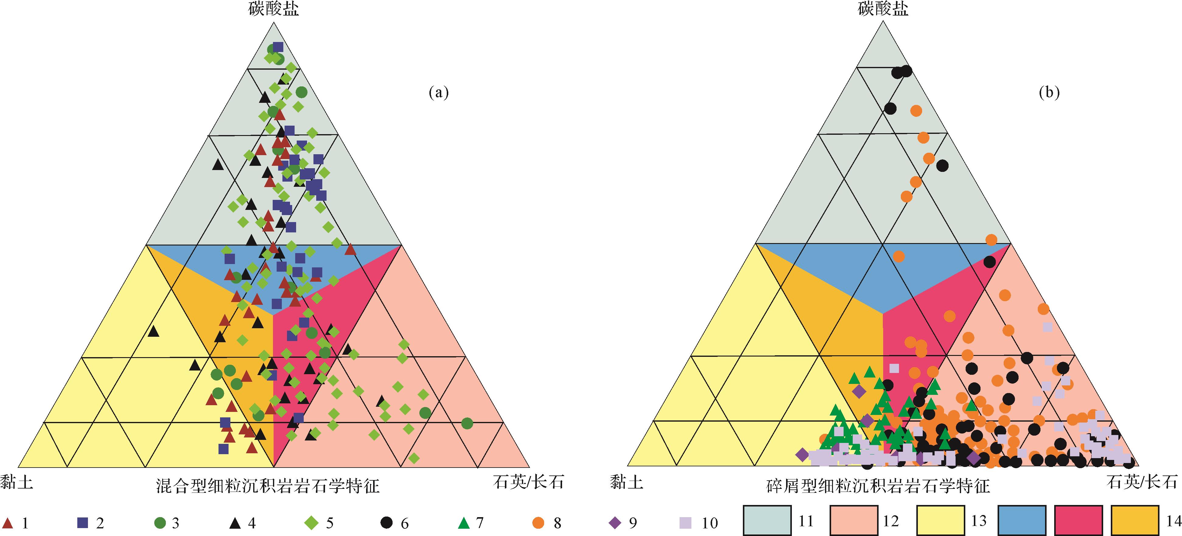
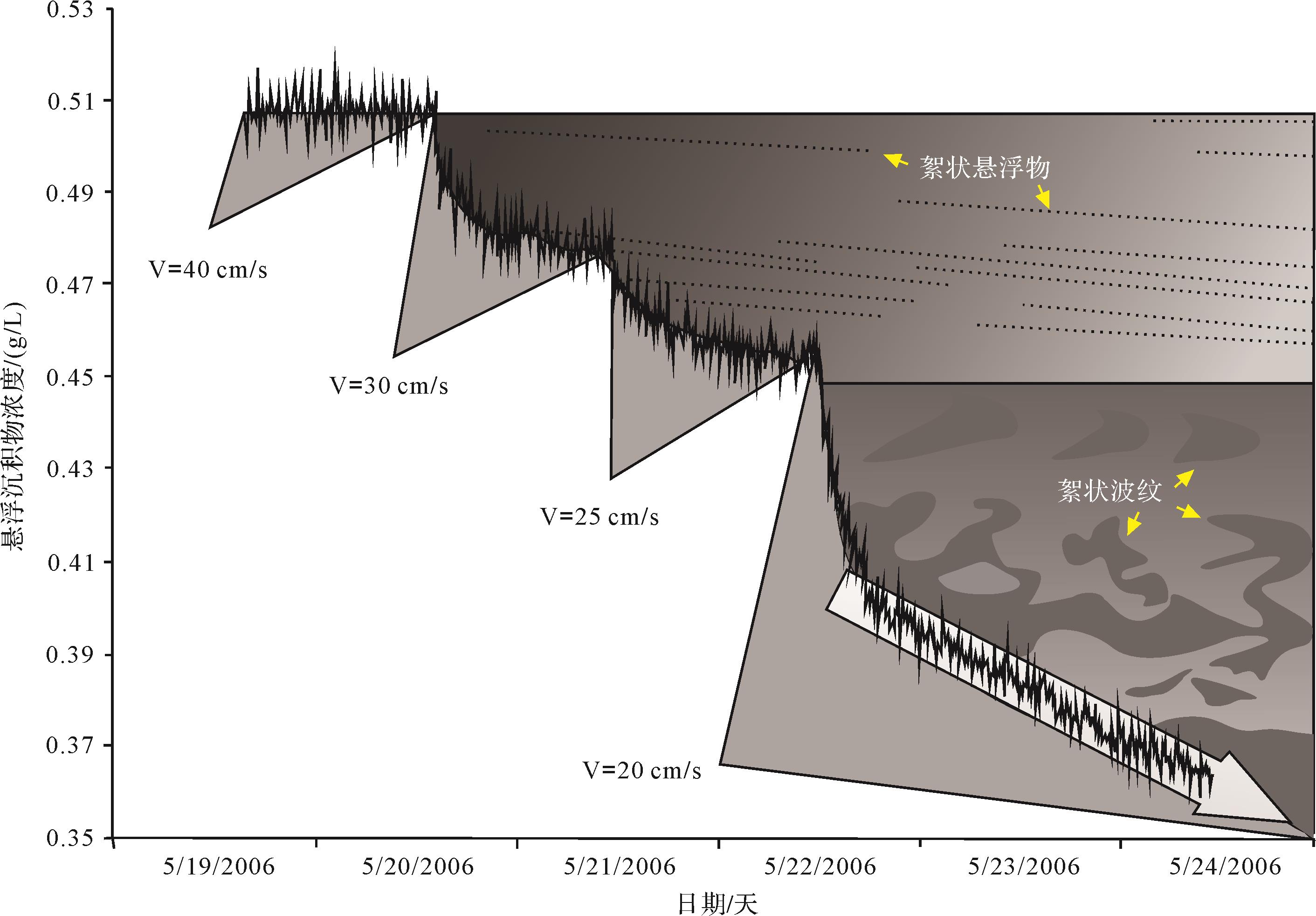
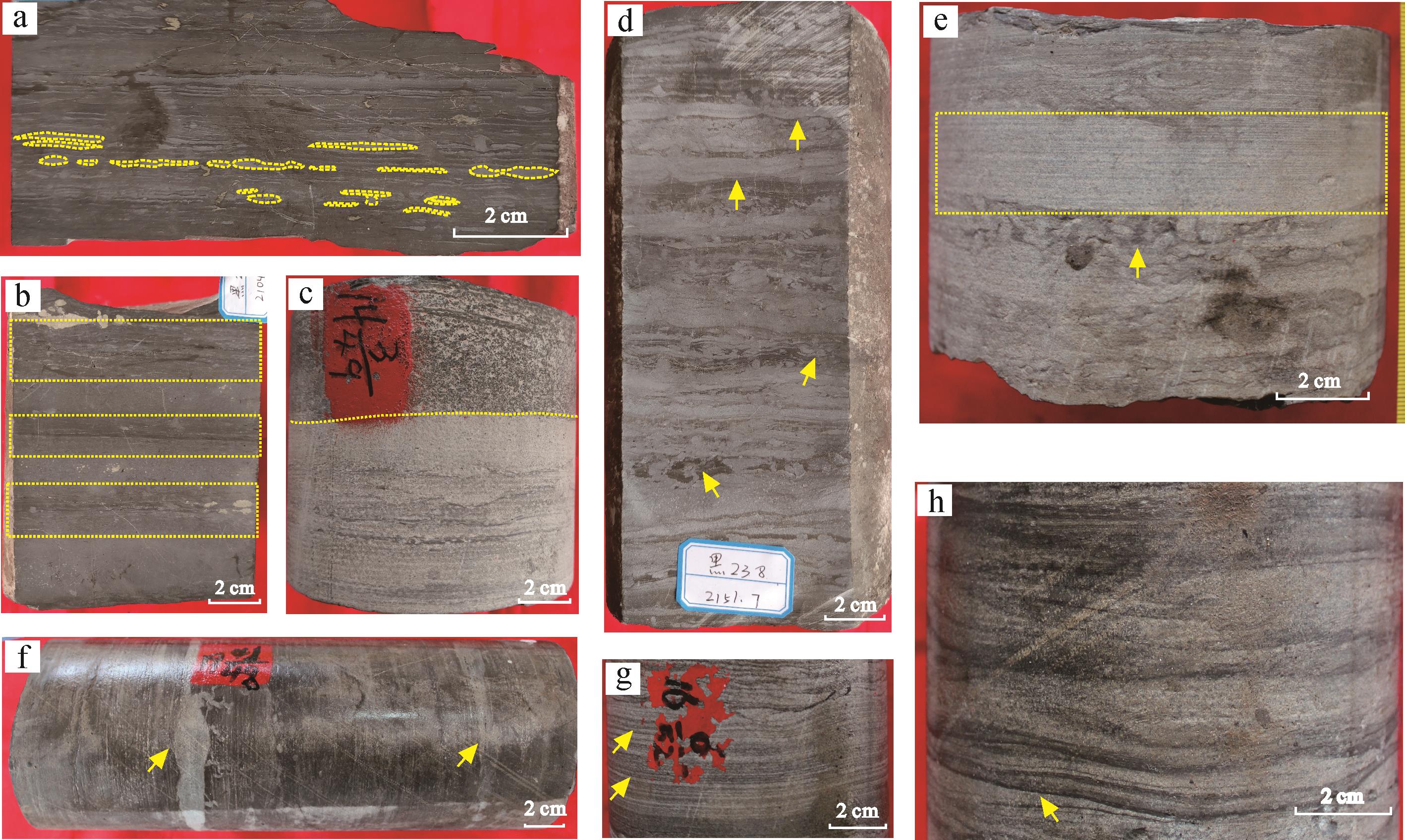
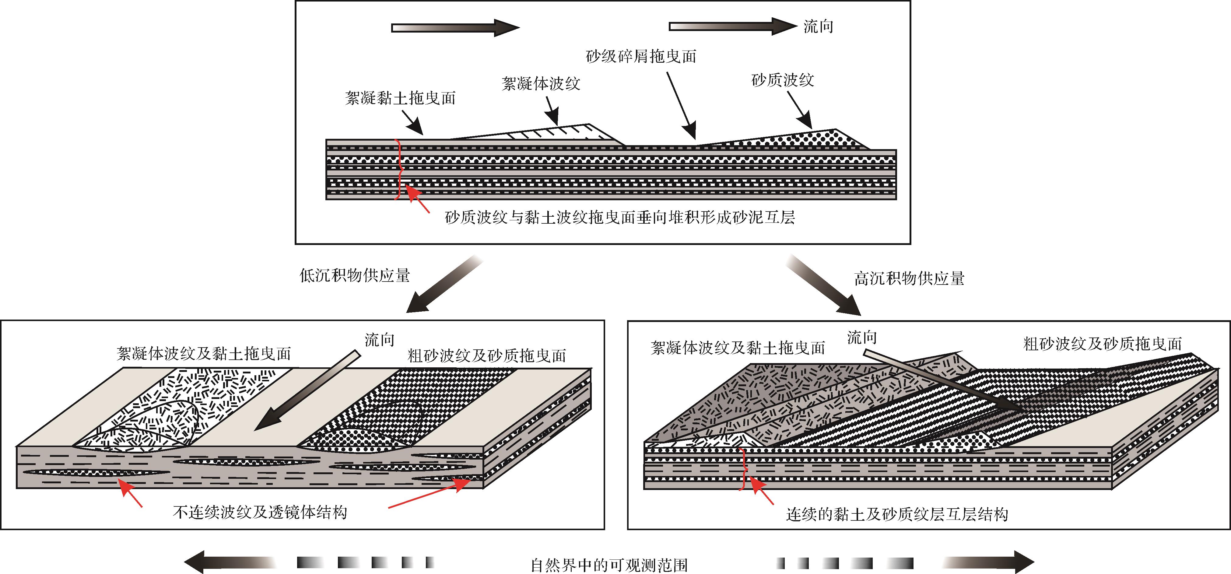
Fine-grained sediments are among the most common types of rock rich in oil and gas resources. Along with the onset of the non-conventional oil and gas revolution, research into fine-grained sediments has gradually received more attention. However, due to the fine particle size, the large number of components and the as yet to be clarified formation process and genetic mechanism of fine-grained sediments, the terminology used to describe their classification and model becomes quite confusing, and appears to lack a uniform standard. To solve these problems, a common classification criterion for fine-grained sediments and for common rock types in different modes of deposition and their characteristics, as well as the relevant genetic dynamics, are summarized here. Moreover, the “one basin, one scheme” sediment refinement mode is further classified into an organic-matter enrichment model, a facies model and a genetic model, and their connotations and applications are summarized. On this basis, it is proposed that the understanding of microstructure and the sedimentary diagenetic mechanisms of the different mineral components in fine-grained sedimentary rocks be strengthened. Effectively integrating genetic rock-classification schemes with a macro-genetic model will be key to future studies of fine-grained sedimentary rocks.
Fine-grained sediments are among the most common types of rock rich in oil and gas resources. Along with the onset of the non-conventional oil and gas revolution, research into fine-grained sediments has gradually received more attention. However, due to the fine particle size, the large number of components and the as yet to be clarified formation process and genetic mechanism of fine-grained sediments, the terminology used to describe their classification and model becomes quite confusing, and appears to lack a uniform standard. To solve these problems, a common classification criterion for fine-grained sediments and for common rock types in different modes of deposition and their characteristics, as well as the relevant genetic dynamics, are summarized here. Moreover, the “one basin, one scheme” sediment refinement mode is further classified into an organic-matter enrichment model, a facies model and a genetic model, and their connotations and applications are summarized. On this basis, it is proposed that the understanding of microstructure and the sedimentary diagenetic mechanisms of the different mineral components in fine-grained sedimentary rocks be strengthened. Effectively integrating genetic rock-classification schemes with a macro-genetic model will be key to future studies of fine-grained sedimentary rocks.
2023, 41(2): 378-391.
doi: 10.14027/j.issn.1000-0550.2021.160
Abstract:
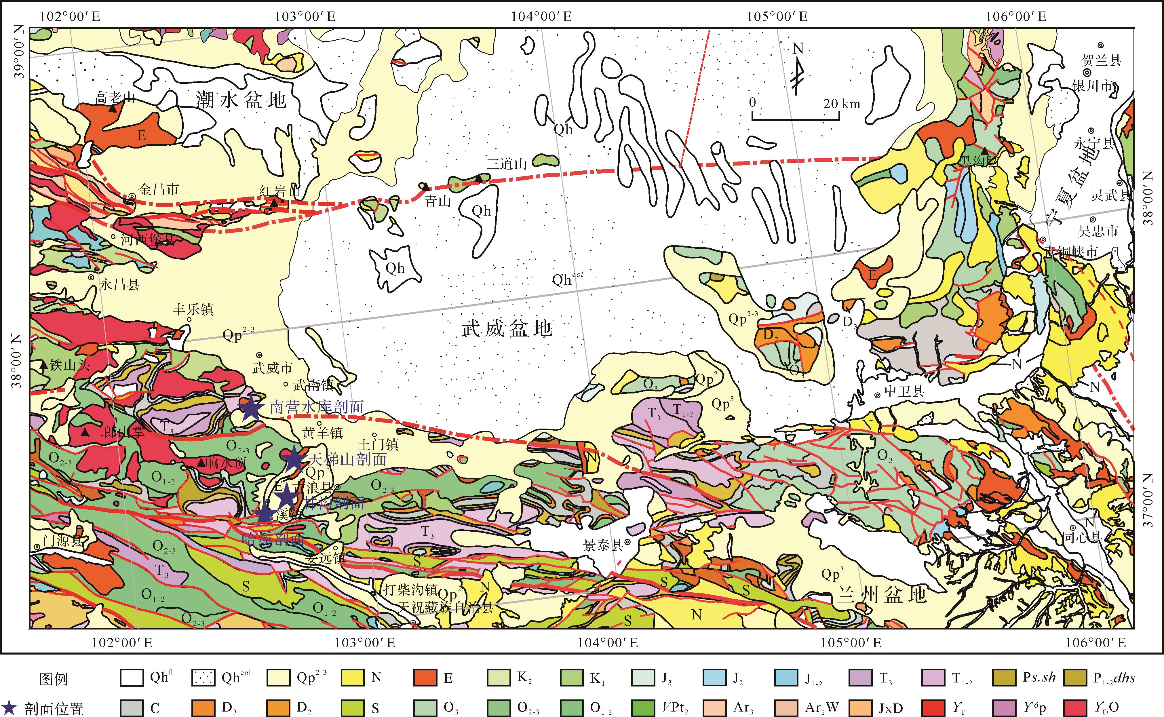
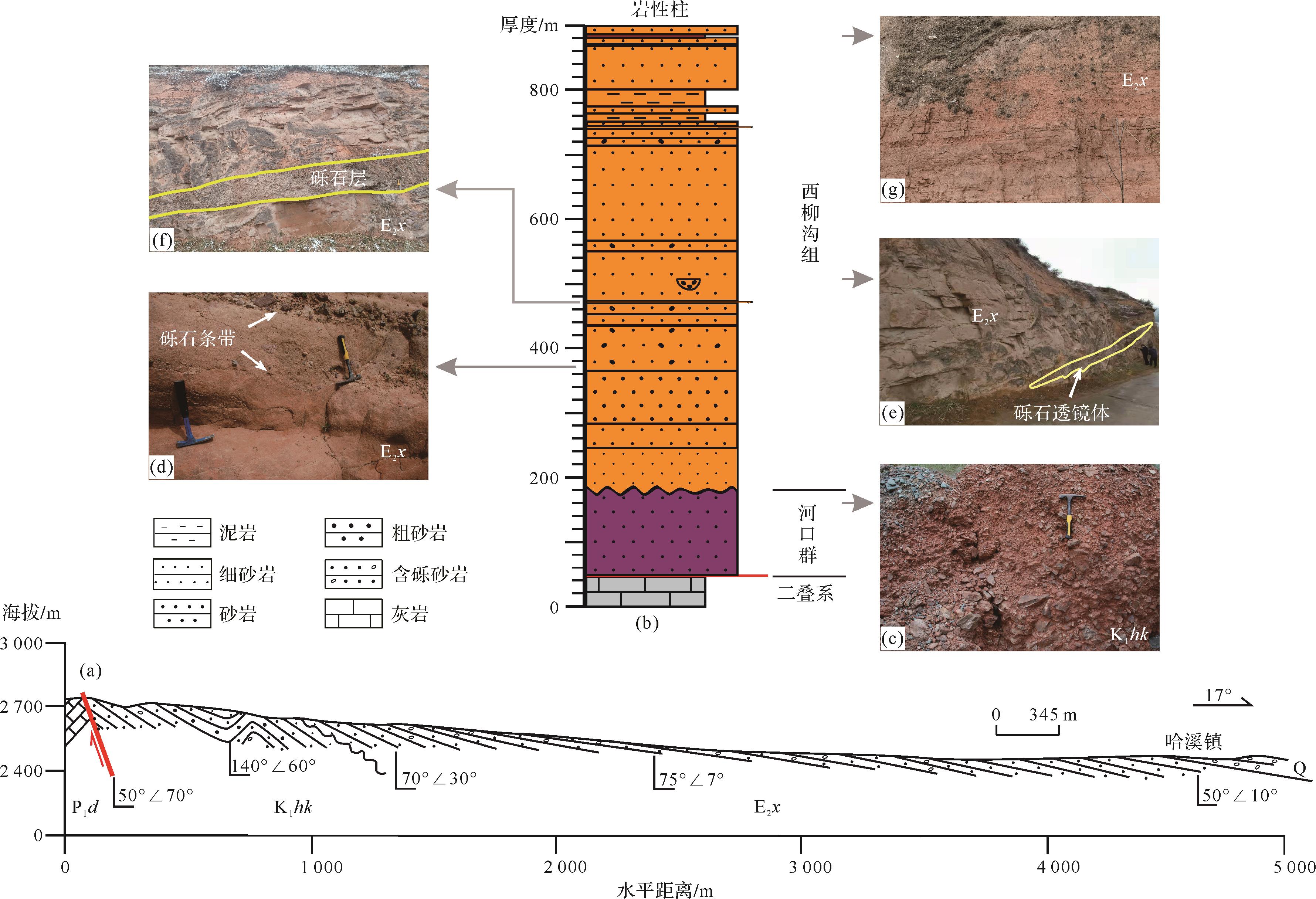
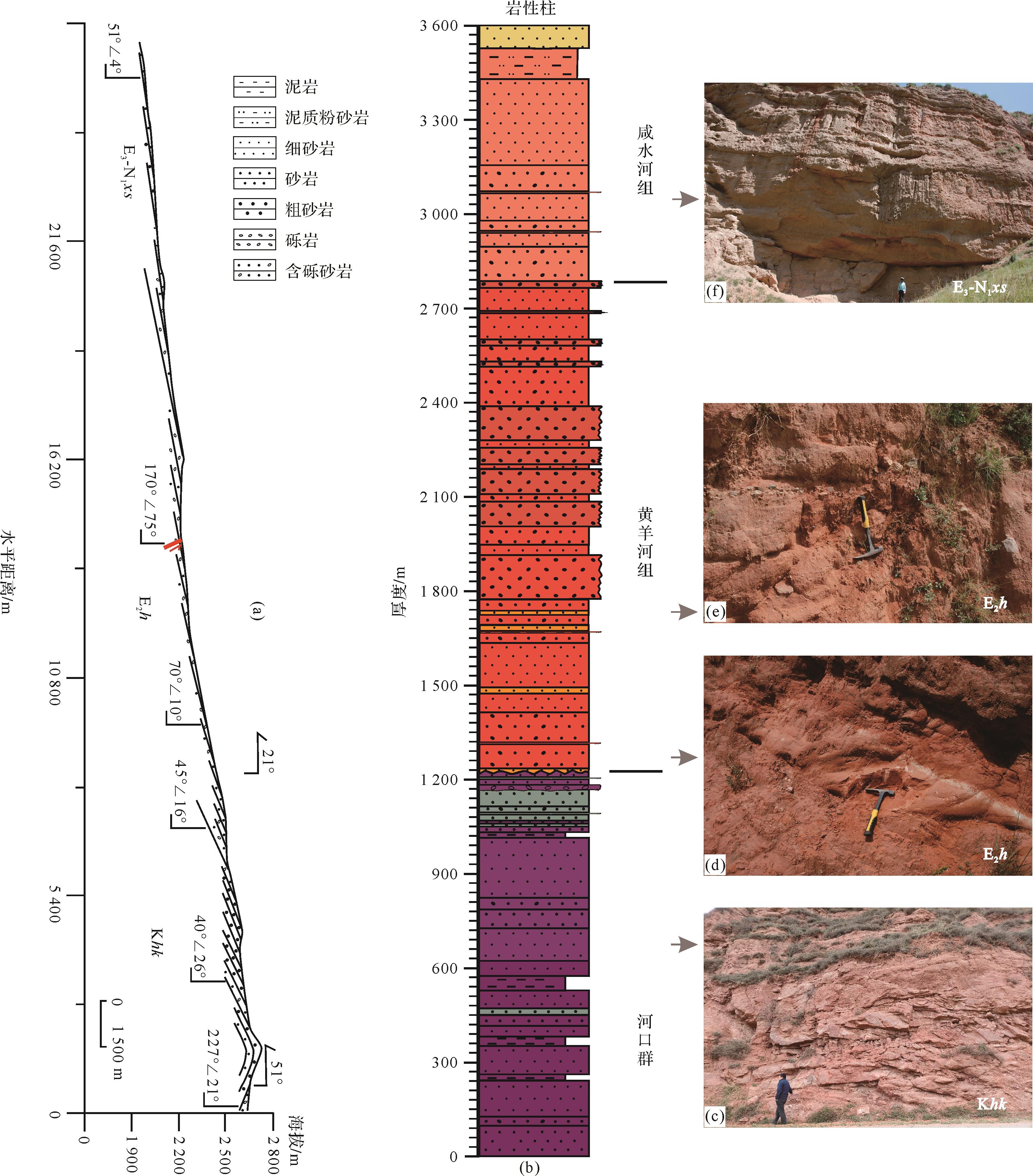
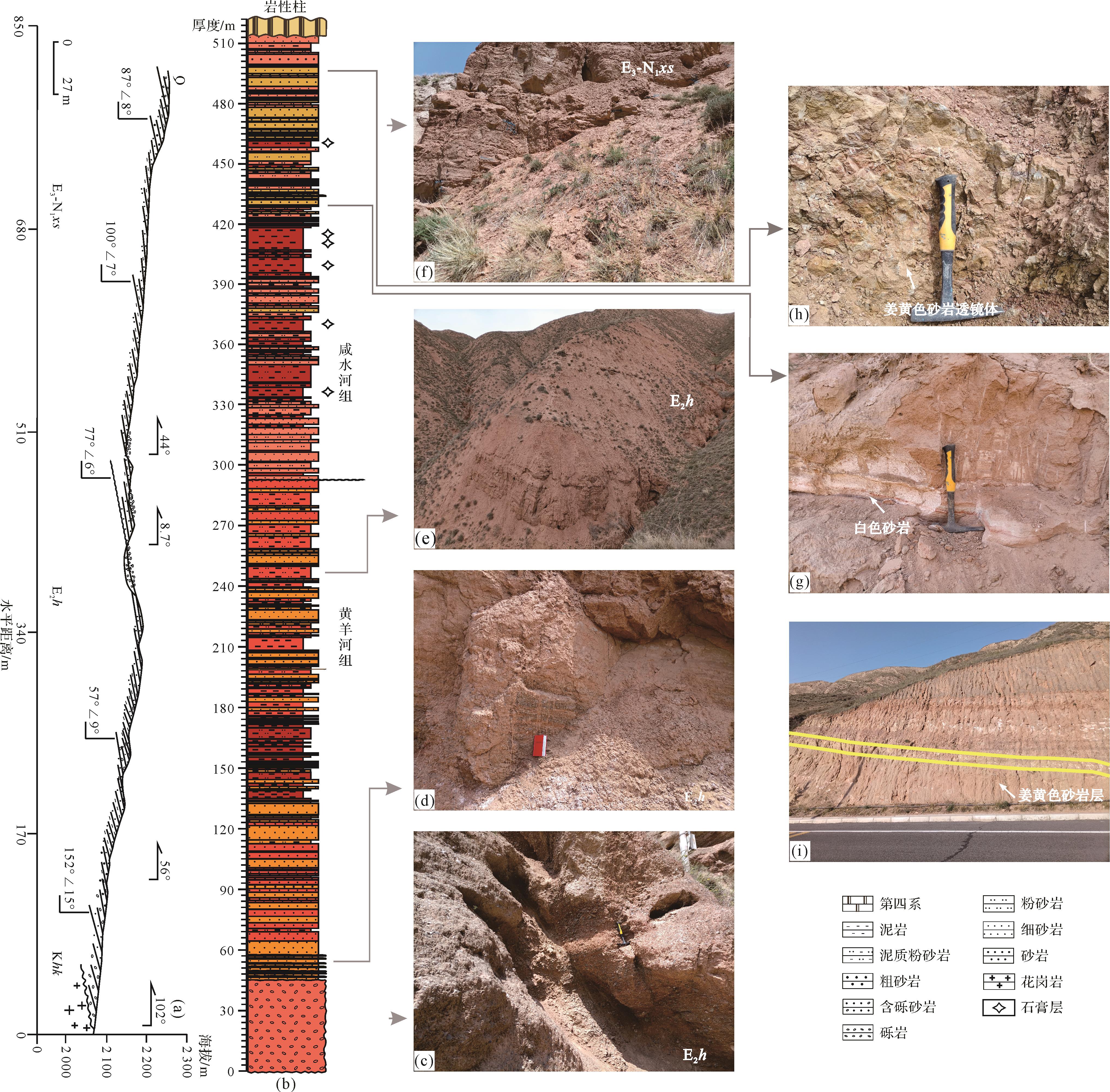
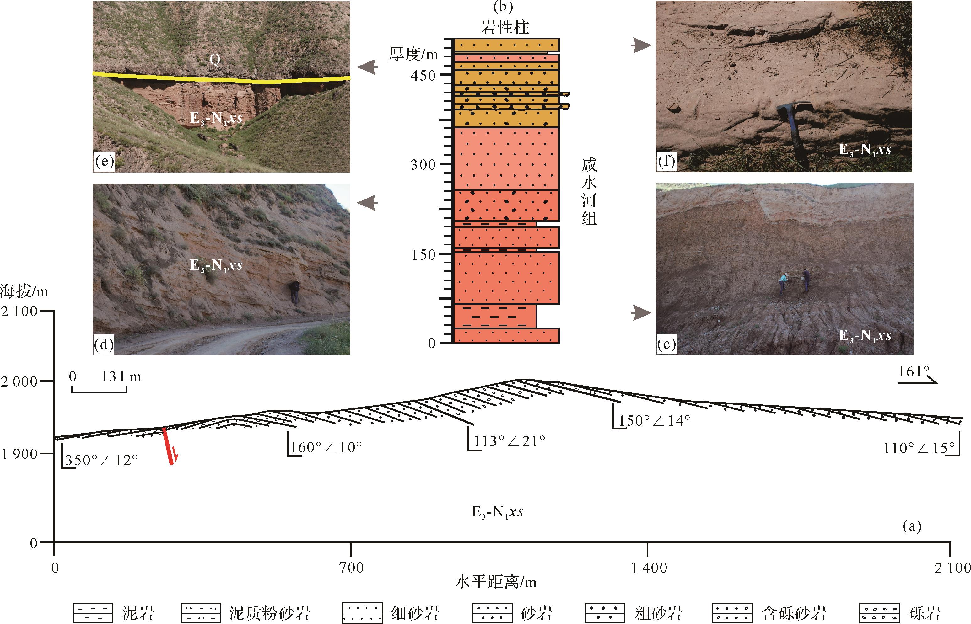
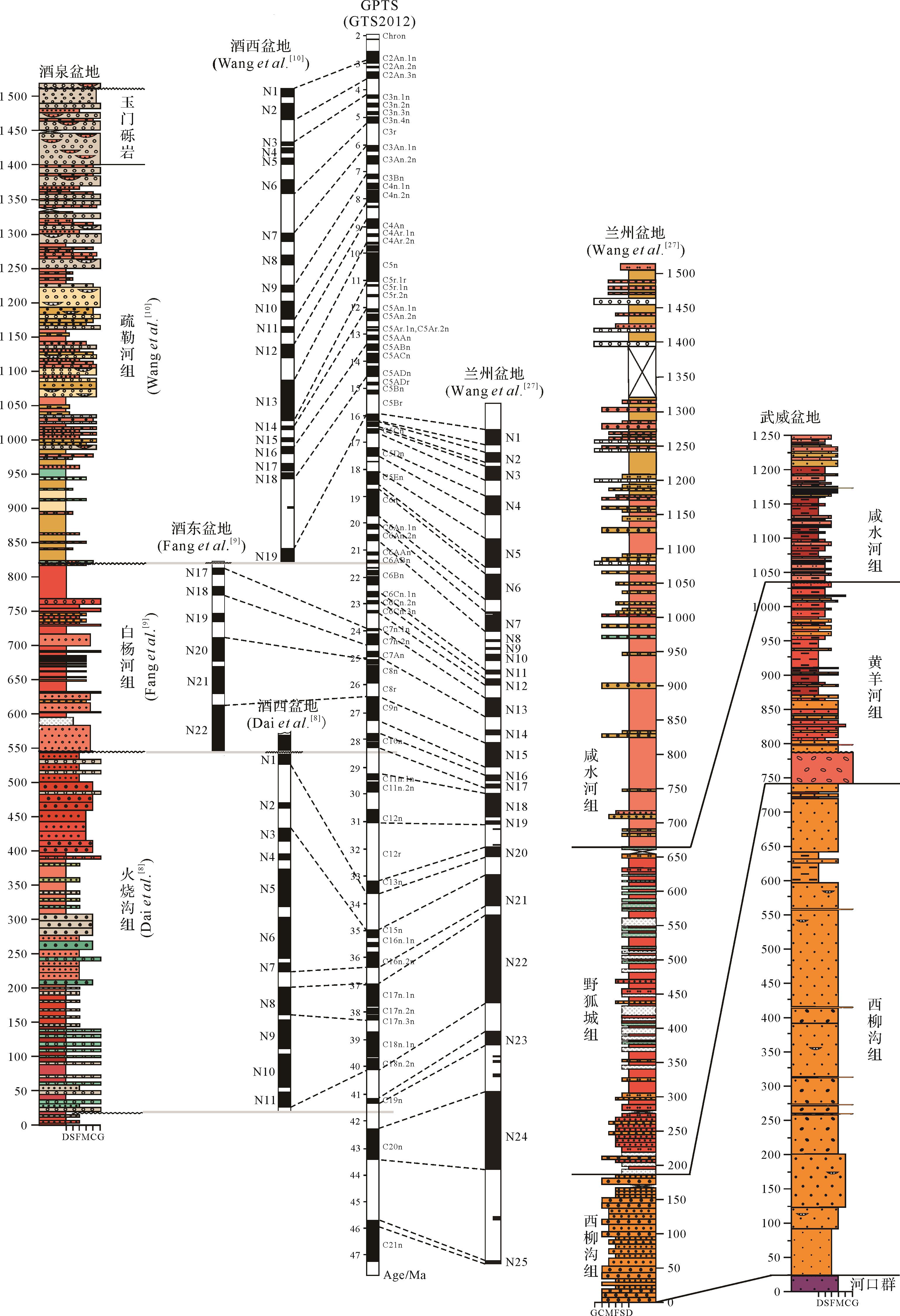
The Wuwei Basin is located in the tectonic transition zone between the approximately E⁃W and N⁃S trends in the northeastern Tibetan Plateau, thus is a key region for understanding the growth of the Tibetan Plateau and its effect on the mineral resources. In this study, the Tertiary stratigraphy was investigated and a new stratigraphical synthesis was developed for the Wuwei Basin in terms of the color of the Tertiary strata in the basin and the magnetostratigraphical data for the adjacent basins. The previously named Xiliugou Formation was subdivided into three parts from bottom to top: the Lower Cretaceous Hekou Formation, the Xiliugou Formation (renamed the Huangyanghe Formation in this study) and the Xianshuihe Formation. The Gansu Group is renamed the Xianshuihe Formation. The age was assigned to the Middle Eocene-to-Middle Miocene in accordance with correlation of the lithology of the basin, and magnetostratigraphical data for the adjacent basins. It was found that the Wuwei Basin and the Lanzhou Basin were probably contemporaneous in a uniform tectonic setting, but earlier than and different from the Jiuxi Basin. Subsequently the Wuwei Basin has been affected by the Qilian thrust-fault zone since the Middle Miocene.
The Wuwei Basin is located in the tectonic transition zone between the approximately E⁃W and N⁃S trends in the northeastern Tibetan Plateau, thus is a key region for understanding the growth of the Tibetan Plateau and its effect on the mineral resources. In this study, the Tertiary stratigraphy was investigated and a new stratigraphical synthesis was developed for the Wuwei Basin in terms of the color of the Tertiary strata in the basin and the magnetostratigraphical data for the adjacent basins. The previously named Xiliugou Formation was subdivided into three parts from bottom to top: the Lower Cretaceous Hekou Formation, the Xiliugou Formation (renamed the Huangyanghe Formation in this study) and the Xianshuihe Formation. The Gansu Group is renamed the Xianshuihe Formation. The age was assigned to the Middle Eocene-to-Middle Miocene in accordance with correlation of the lithology of the basin, and magnetostratigraphical data for the adjacent basins. It was found that the Wuwei Basin and the Lanzhou Basin were probably contemporaneous in a uniform tectonic setting, but earlier than and different from the Jiuxi Basin. Subsequently the Wuwei Basin has been affected by the Qilian thrust-fault zone since the Middle Miocene.

2023, 41(2): 392-408.
doi: 10.14027/j.issn.1000-0550.2021.122
Abstract:
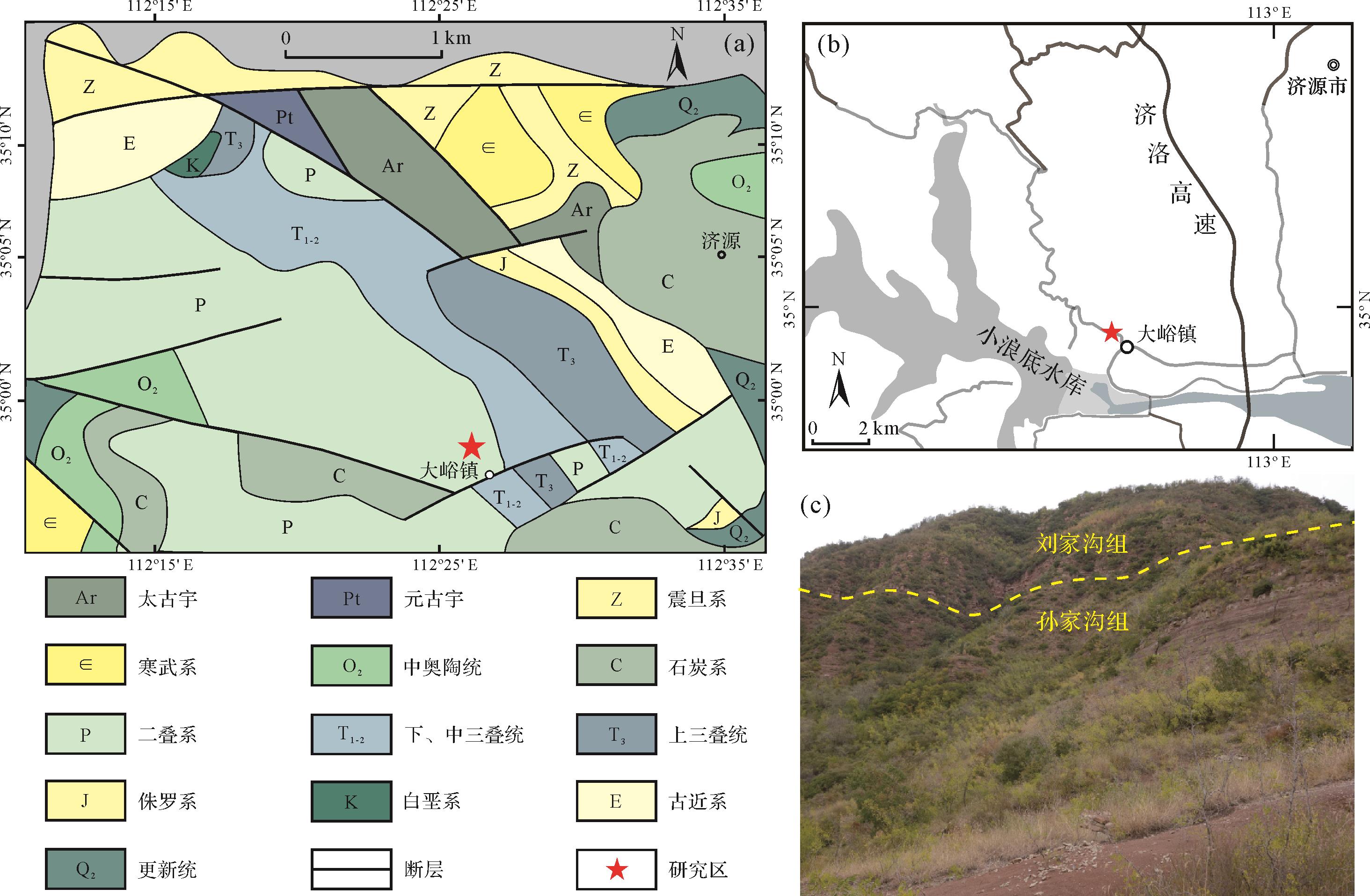
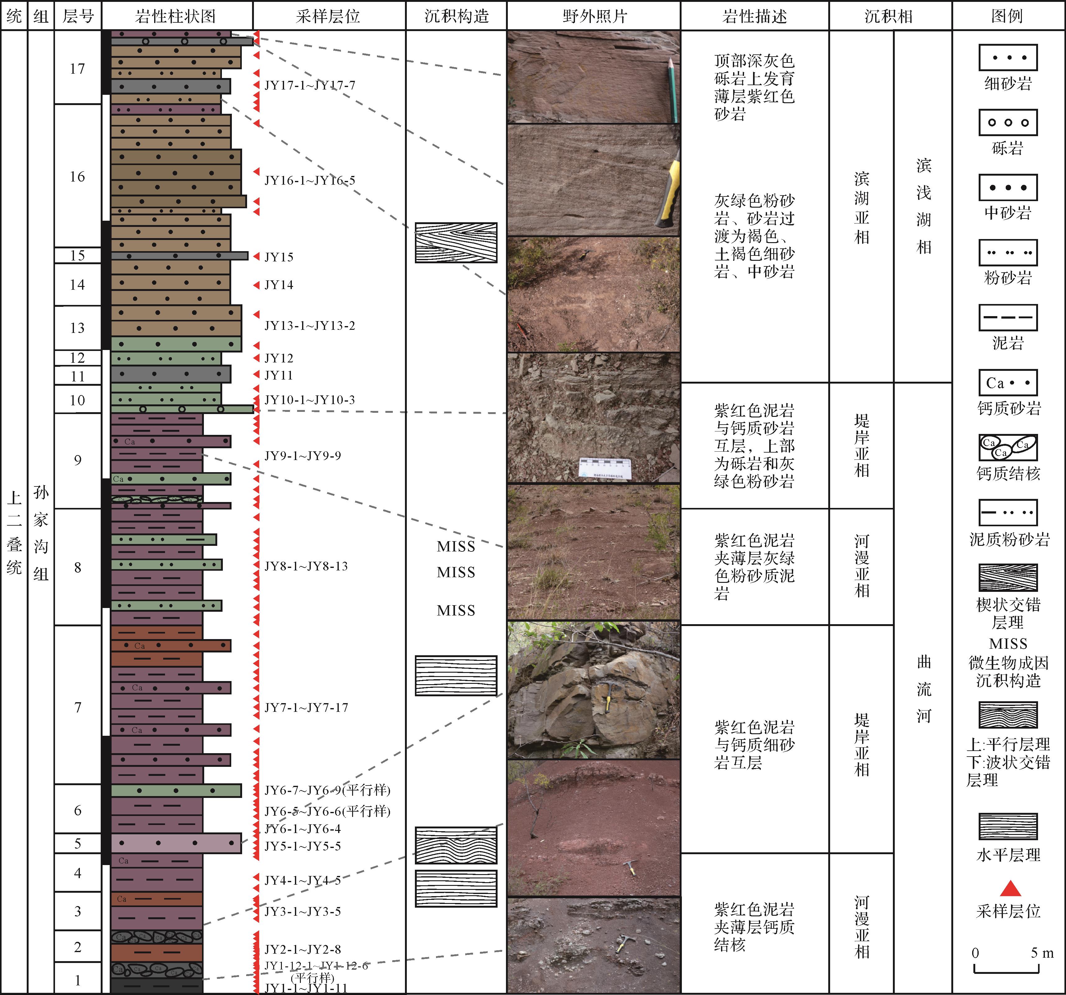
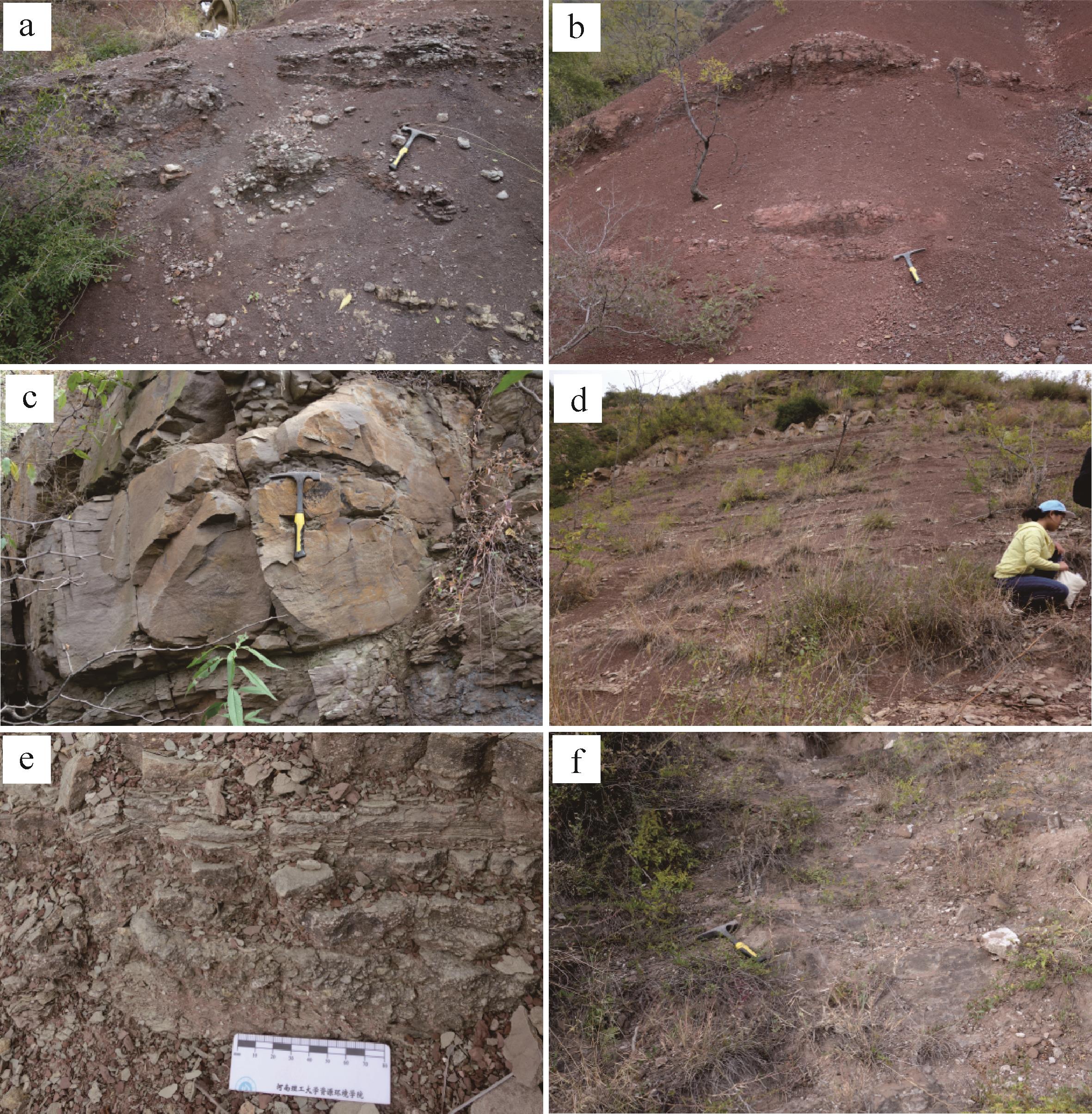
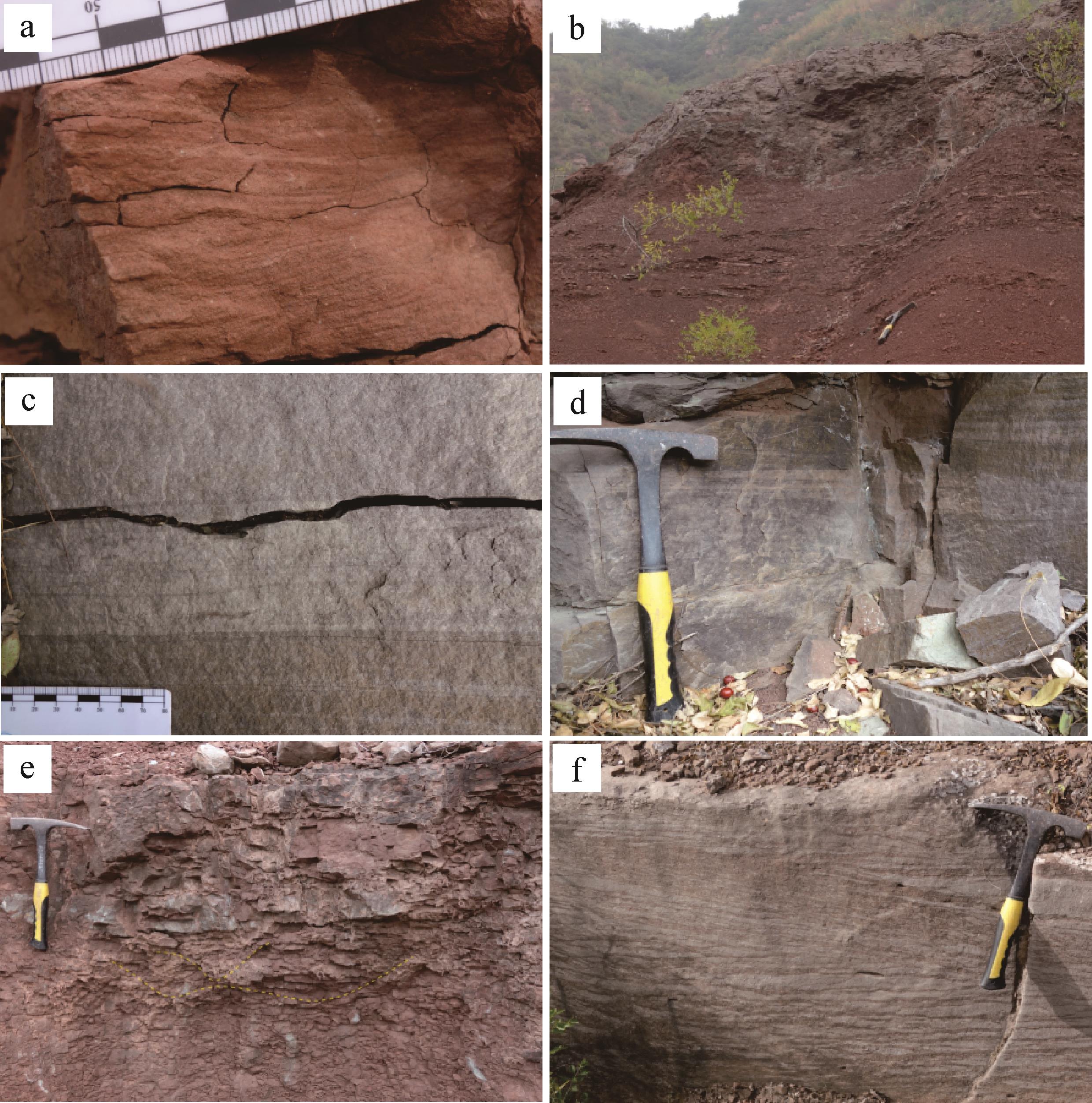
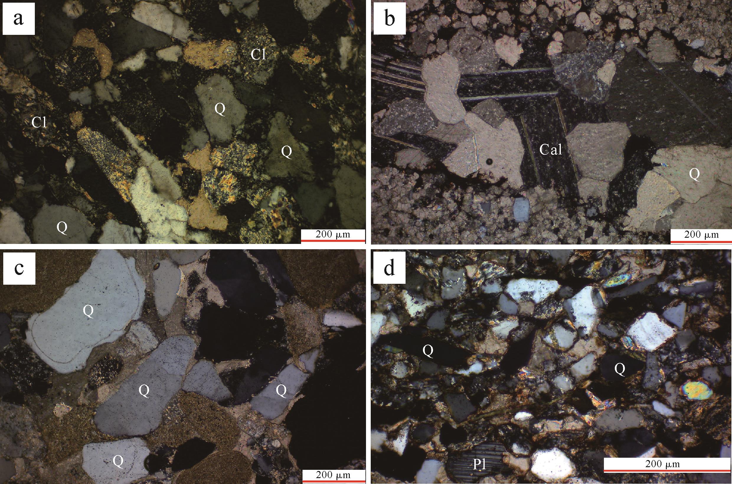
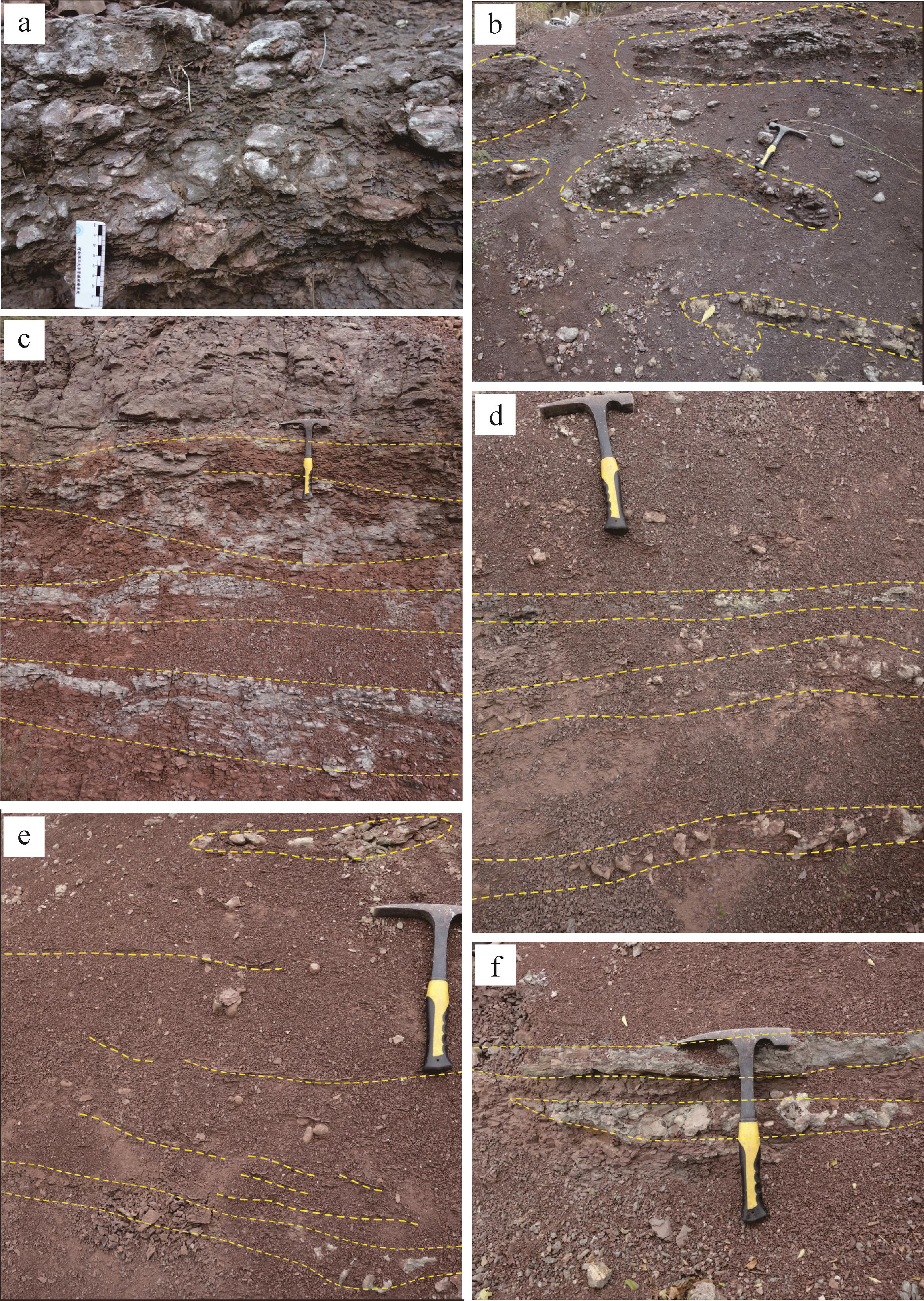
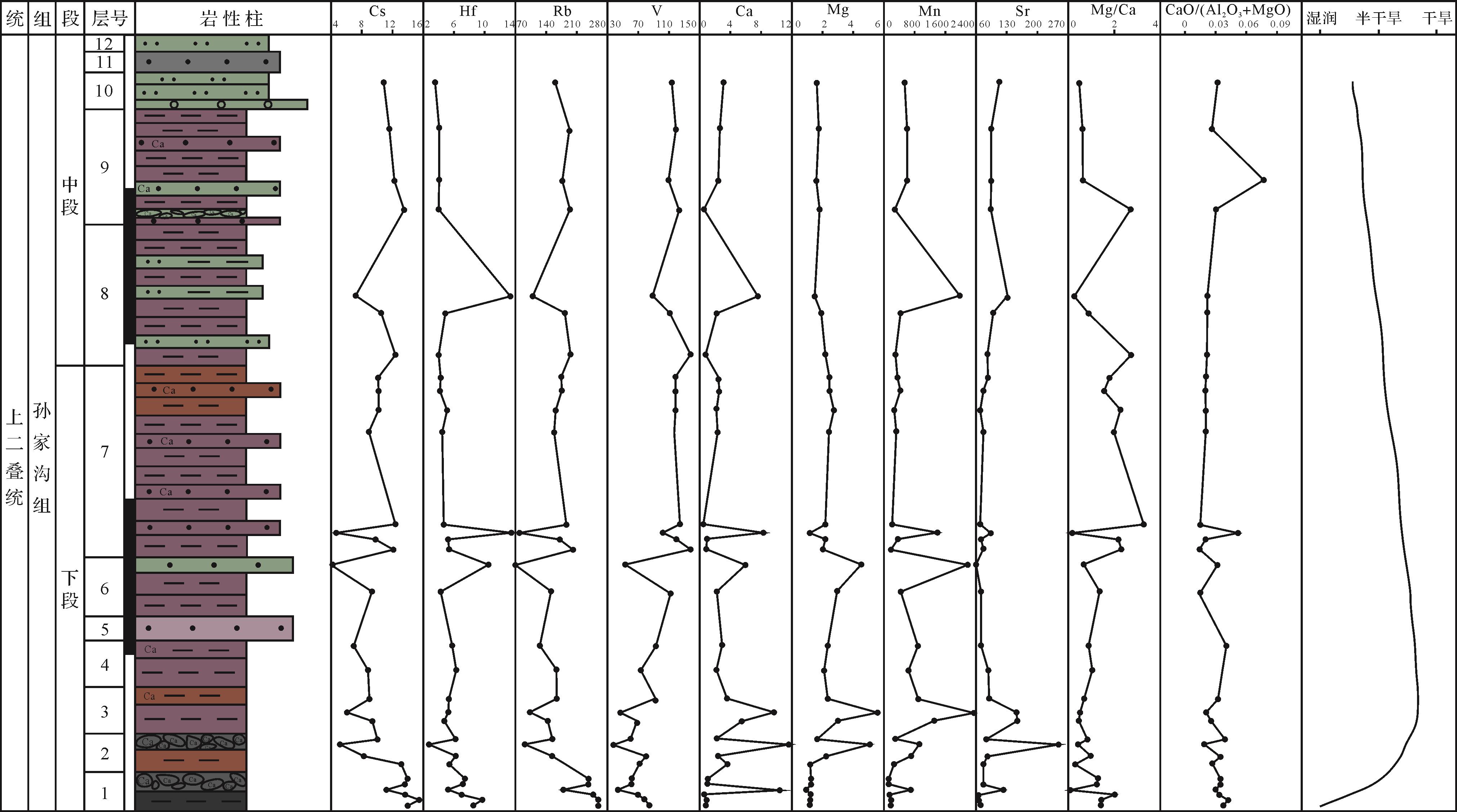
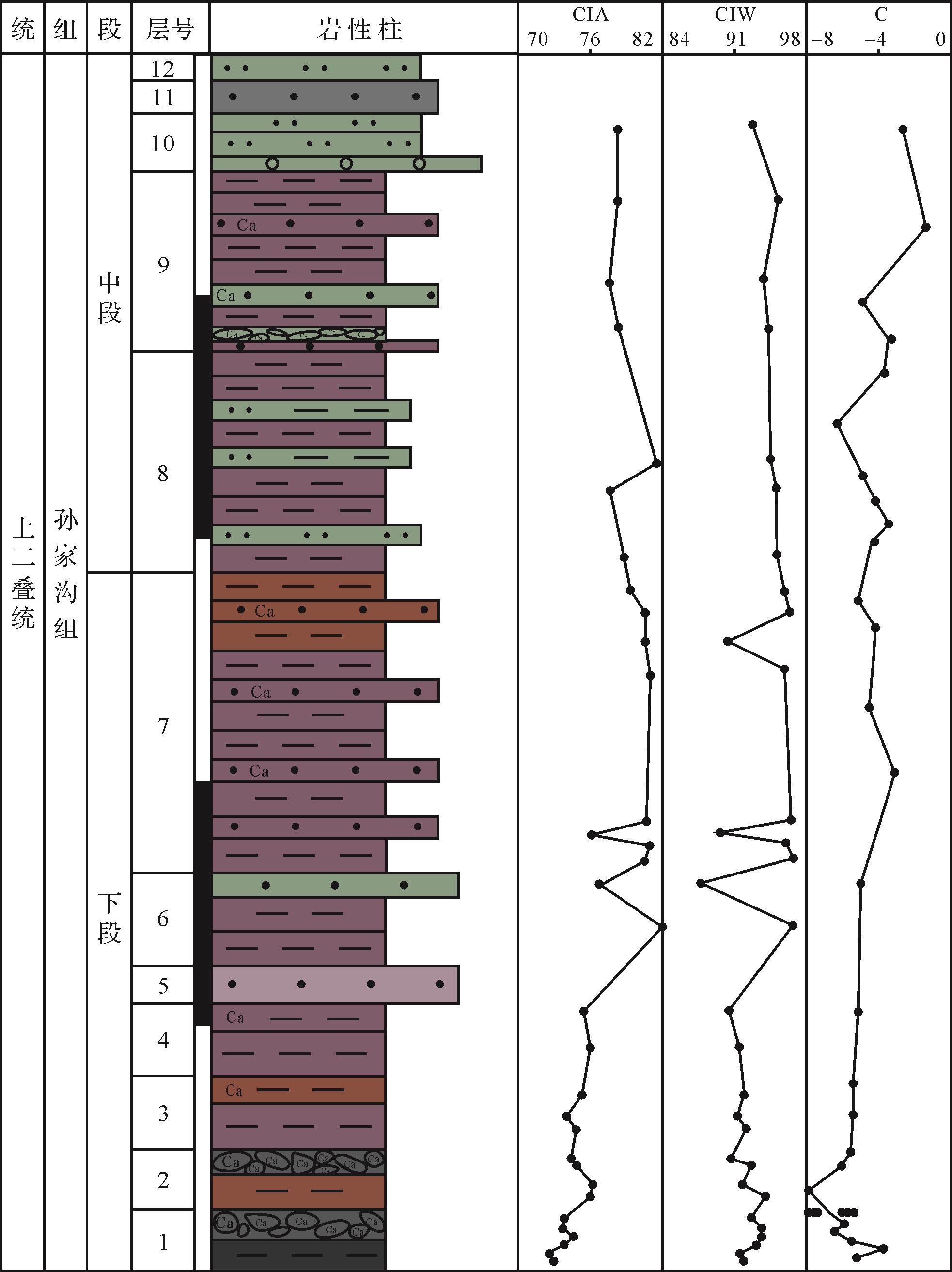
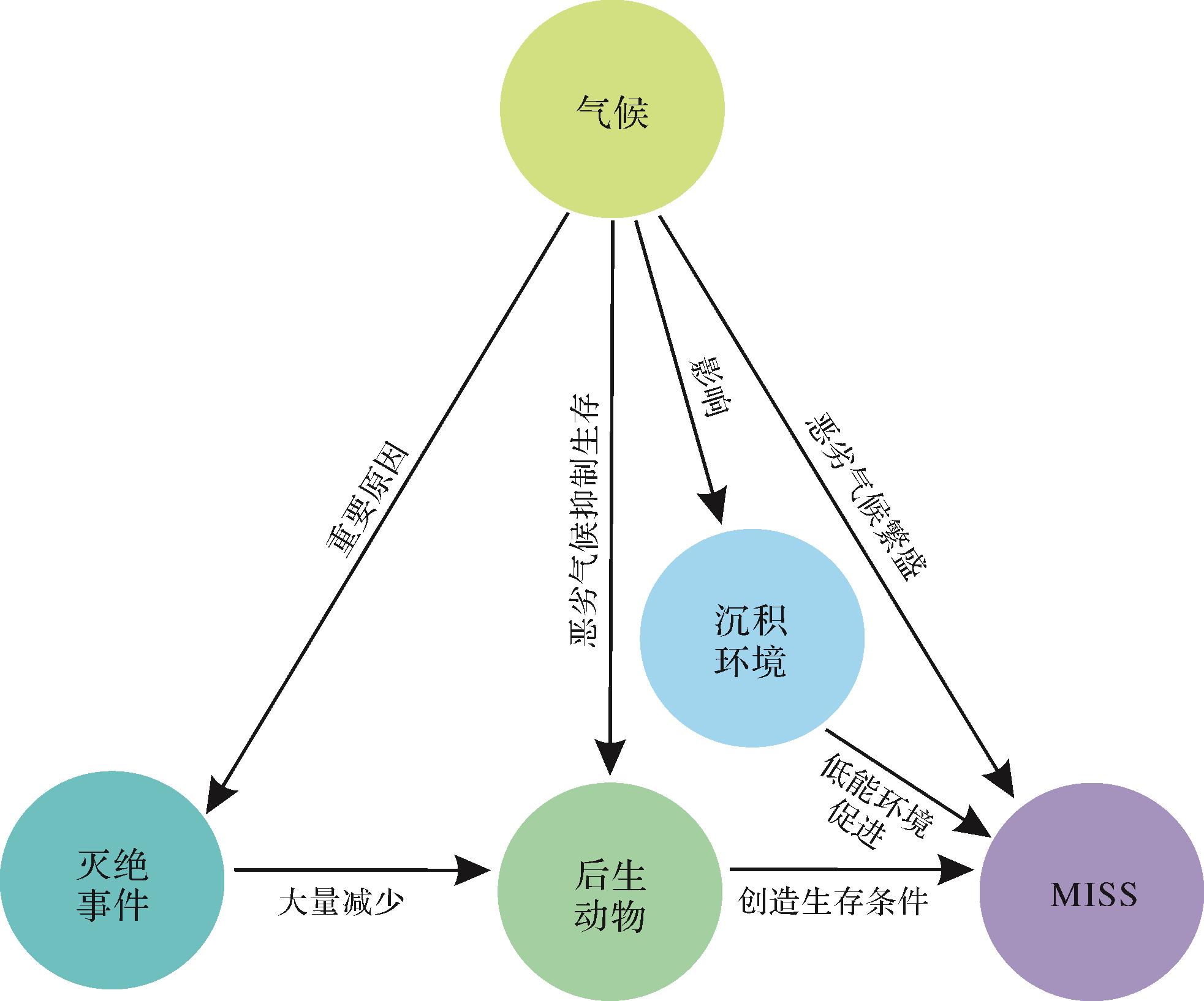
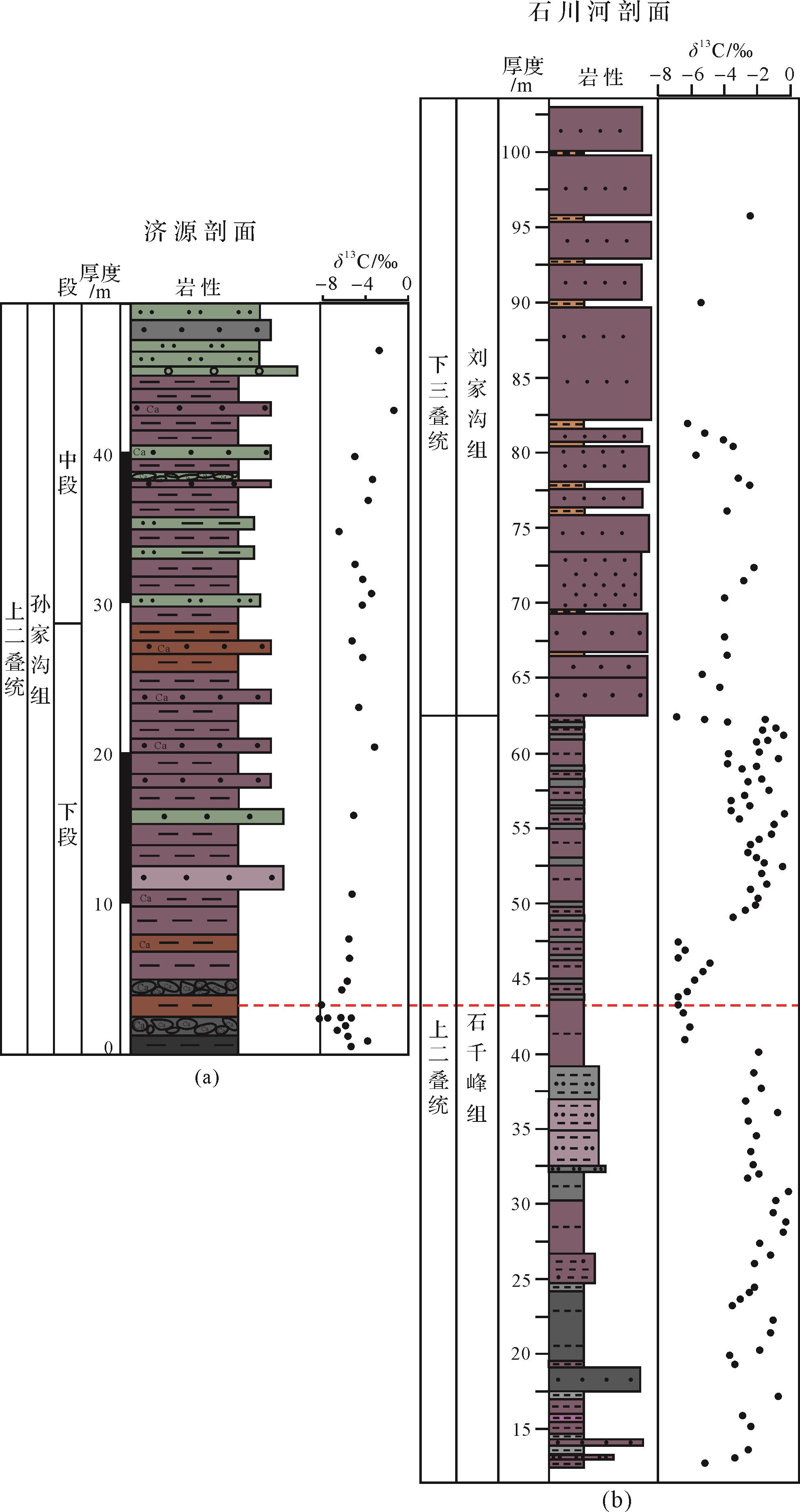
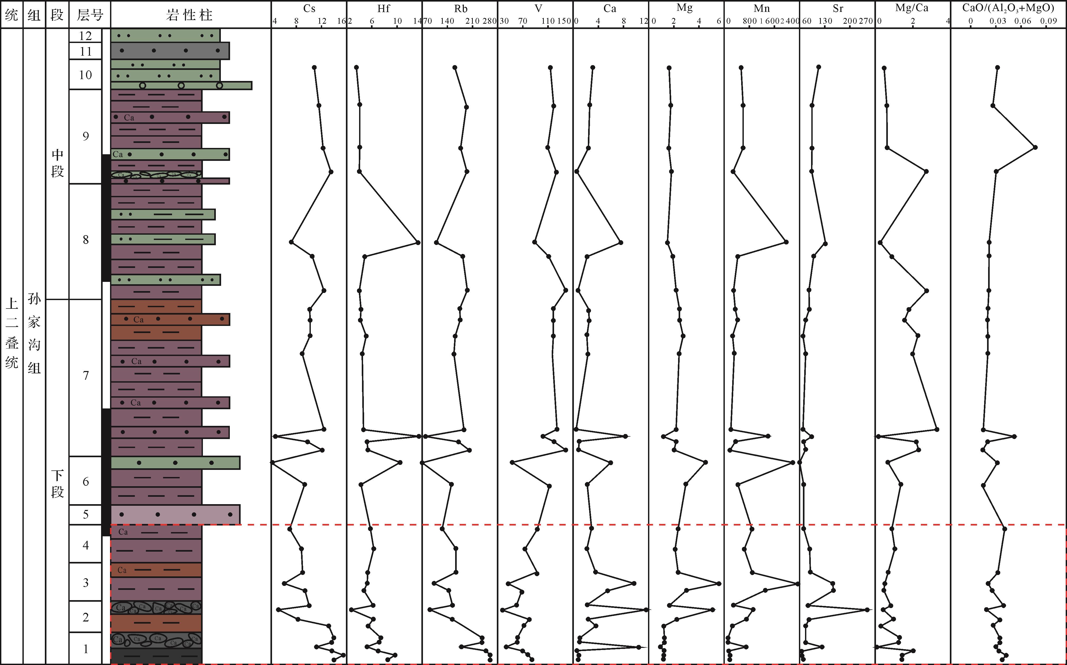
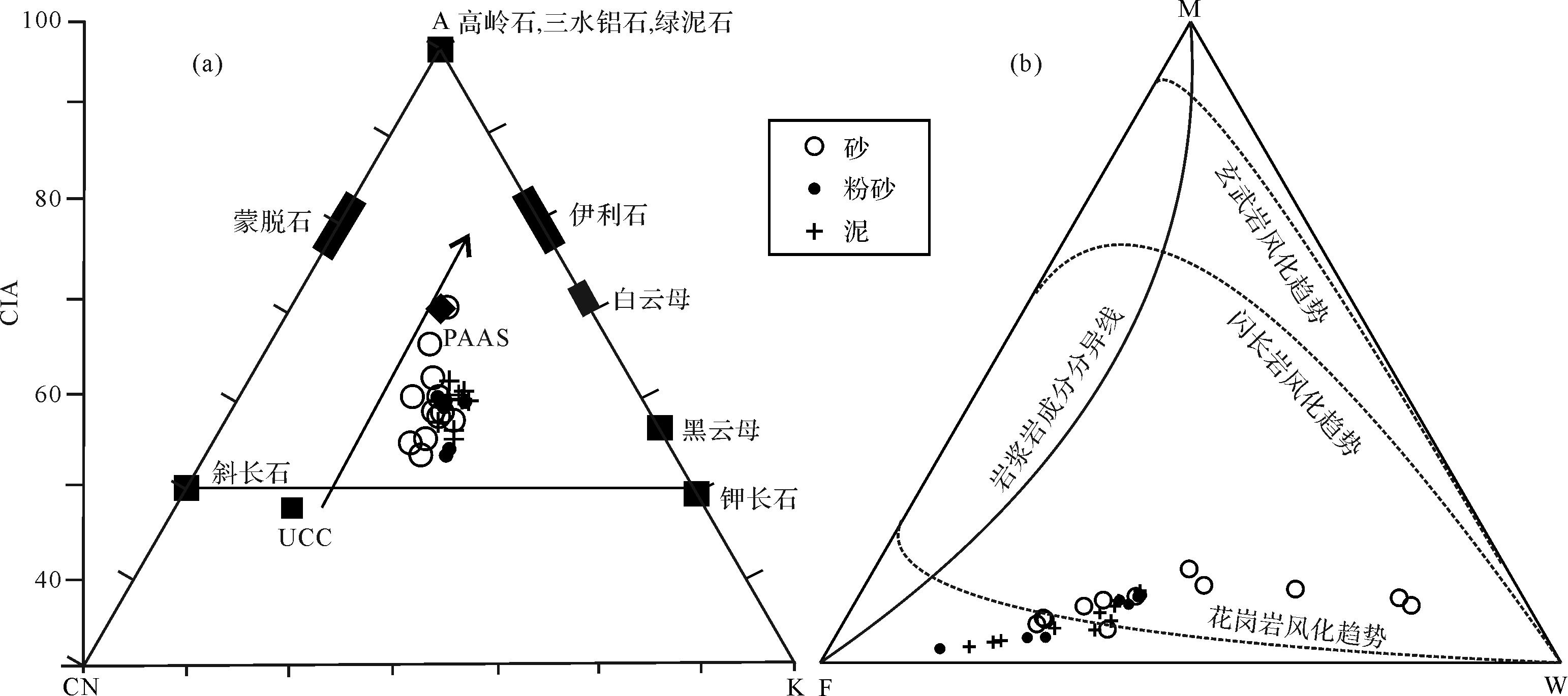
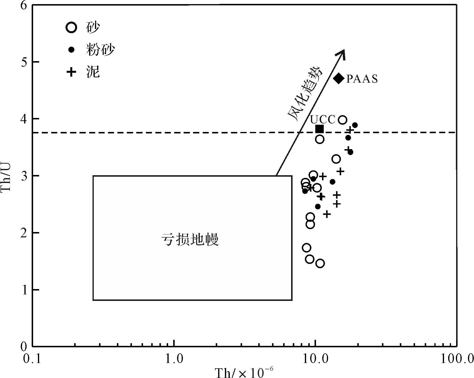
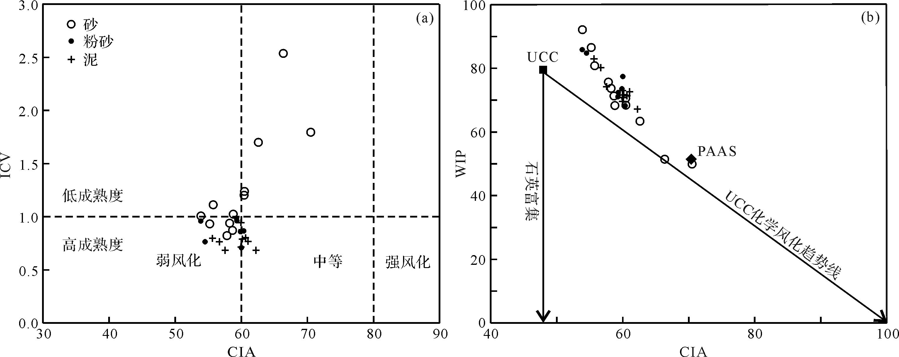
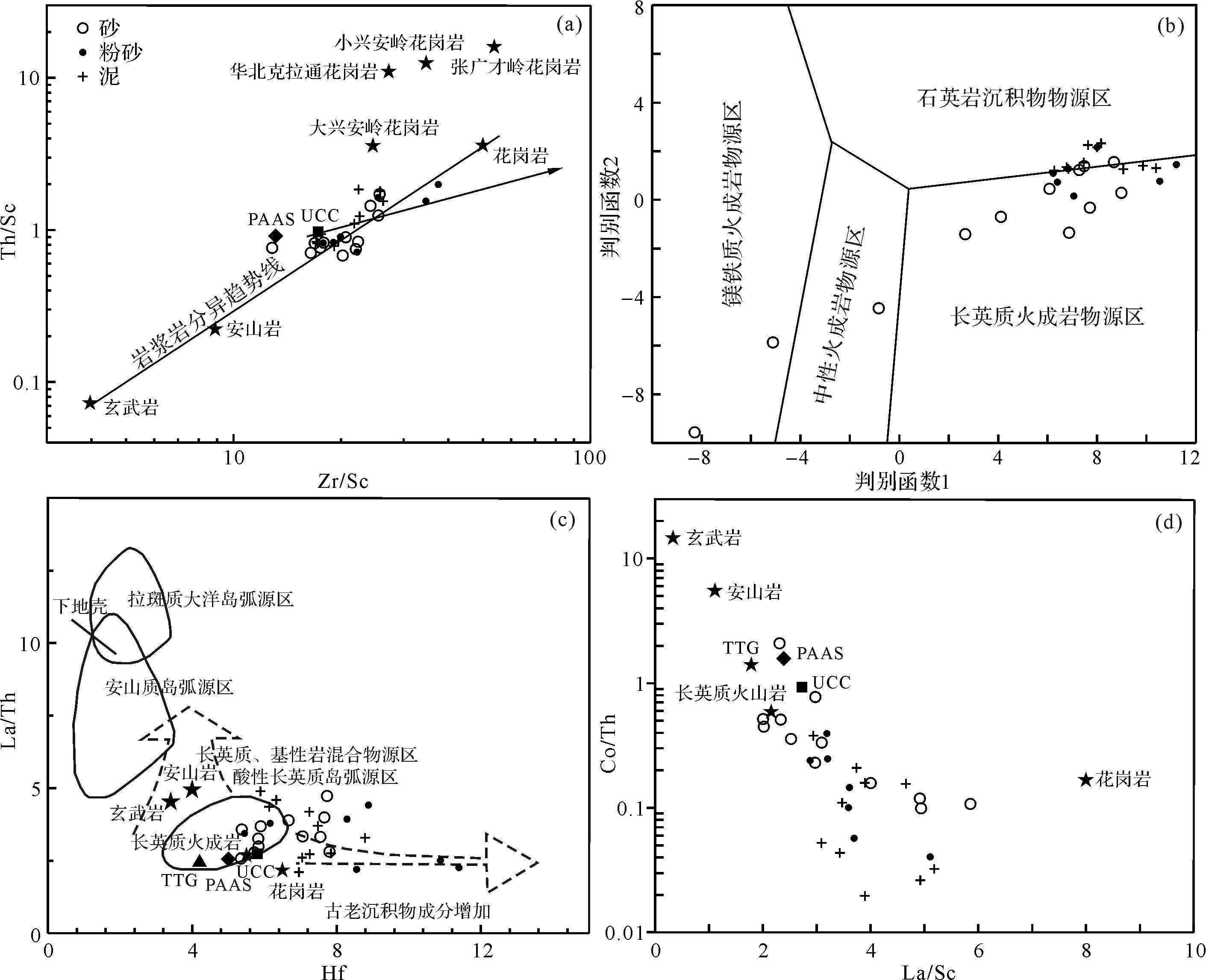
Both the ocean and the land experienced the most severe biological crisis during the Permian⁃Triassic transition. Restoration of the sedimentary environment and reconstruction of the paleoclimate before and after the mass extinction event lay the foundation of this study. The study area in the Jiyuan Basin is located at the southern margin of the North China Plate, where the Permian⁃Triassic terrestrial strata are well developed and the contact is clear. The methods of petrology, sedimentology, paleontology and geochemistry were used to study the Dayu Section of the Sunjiagou Formation, situated near Jiyuan city, western Henan province. The succession from the lower strata record a gradual change from a meandering stream environment to a lacustrine shore environment. Geochemical data from the lower and middle strata show low annual precipitation, increasing temperatures and enhanced chemical weathering, and reflect an arid to semi-arid climate, possibly arising from the global giant monsoon. Deposits from this unusual period are characterized by the disappearance of Jiyuan fauna and the emergence of microbially induced sedimentary structures (MISS). The climate tended to become humid for a short time at the end of the middle depositional period, then a persistent arid climate dominated until the Lower Triassic, as evidenced from the upper strata. On the whole, the Sunjiagou Formation reflects a transformation from a humid-arid to a subhumid-arid climate during the sedimentation period. The dry and hot climate may have been an important factor in the destruction of terrestrial ecosystems, leading to the extinction of terrestrial organisms. The lithological evidence, paleoclimate and flourishing MISS in the middle strata indicate that the Permian⁃Triassic mass extinction (PTME) possibly occurred during the early sedimentary stage of the Sunjiagou Formation.
Both the ocean and the land experienced the most severe biological crisis during the Permian⁃Triassic transition. Restoration of the sedimentary environment and reconstruction of the paleoclimate before and after the mass extinction event lay the foundation of this study. The study area in the Jiyuan Basin is located at the southern margin of the North China Plate, where the Permian⁃Triassic terrestrial strata are well developed and the contact is clear. The methods of petrology, sedimentology, paleontology and geochemistry were used to study the Dayu Section of the Sunjiagou Formation, situated near Jiyuan city, western Henan province. The succession from the lower strata record a gradual change from a meandering stream environment to a lacustrine shore environment. Geochemical data from the lower and middle strata show low annual precipitation, increasing temperatures and enhanced chemical weathering, and reflect an arid to semi-arid climate, possibly arising from the global giant monsoon. Deposits from this unusual period are characterized by the disappearance of Jiyuan fauna and the emergence of microbially induced sedimentary structures (MISS). The climate tended to become humid for a short time at the end of the middle depositional period, then a persistent arid climate dominated until the Lower Triassic, as evidenced from the upper strata. On the whole, the Sunjiagou Formation reflects a transformation from a humid-arid to a subhumid-arid climate during the sedimentation period. The dry and hot climate may have been an important factor in the destruction of terrestrial ecosystems, leading to the extinction of terrestrial organisms. The lithological evidence, paleoclimate and flourishing MISS in the middle strata indicate that the Permian⁃Triassic mass extinction (PTME) possibly occurred during the early sedimentary stage of the Sunjiagou Formation.
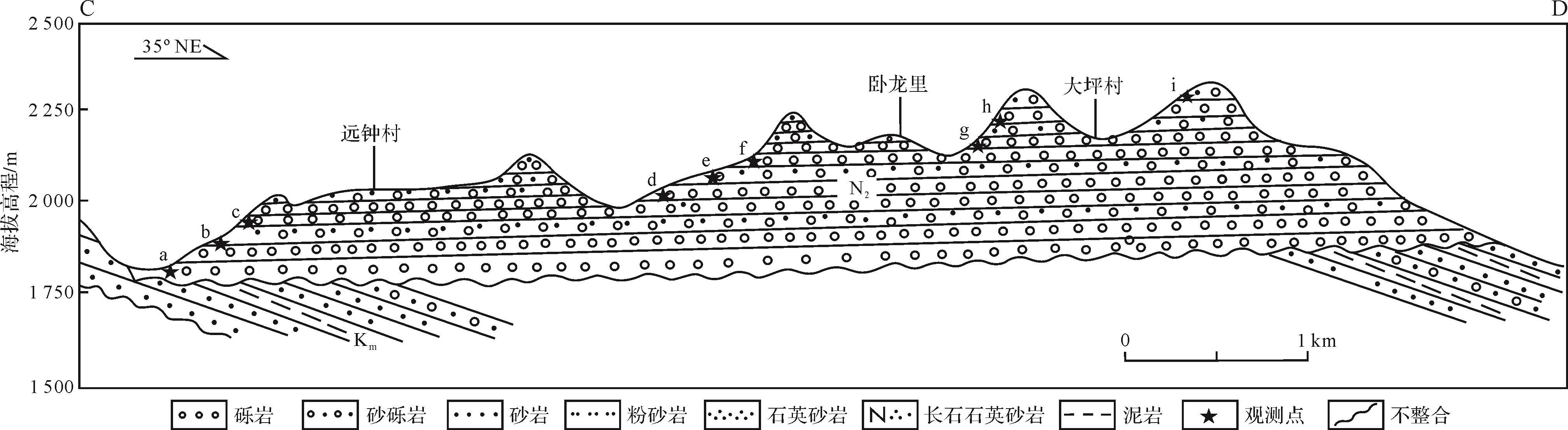
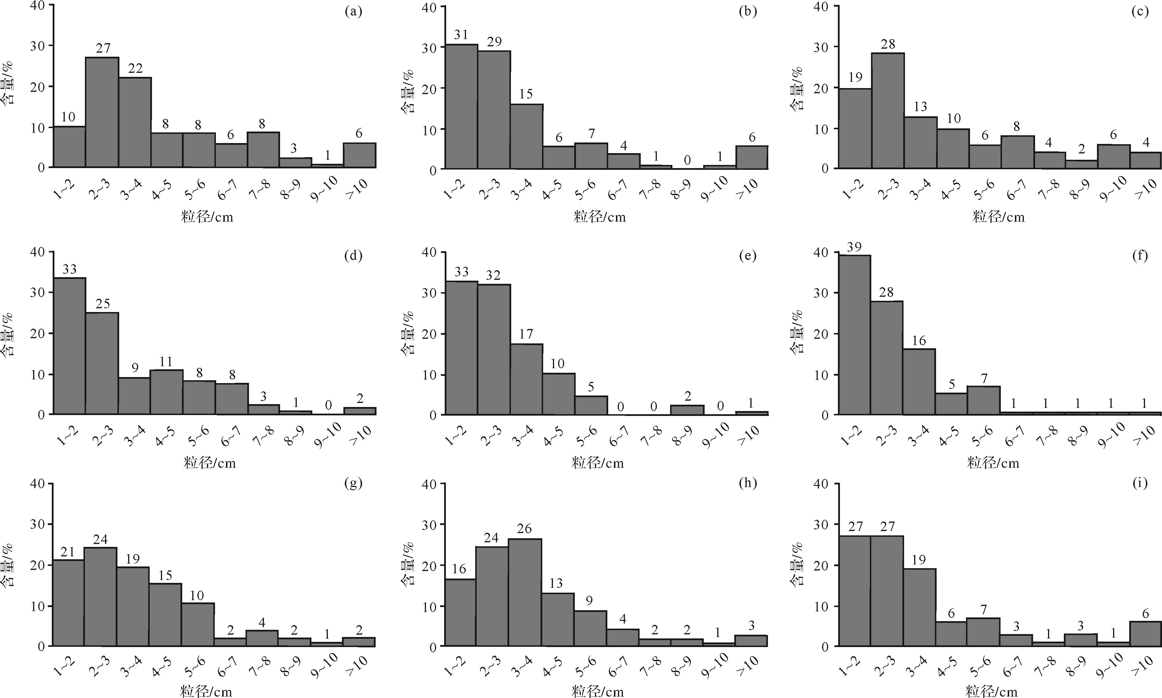
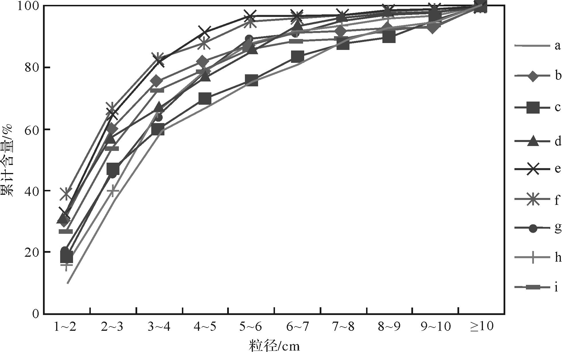
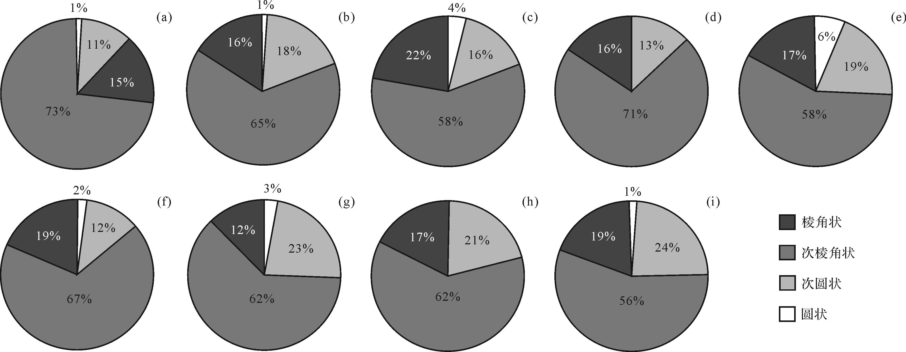
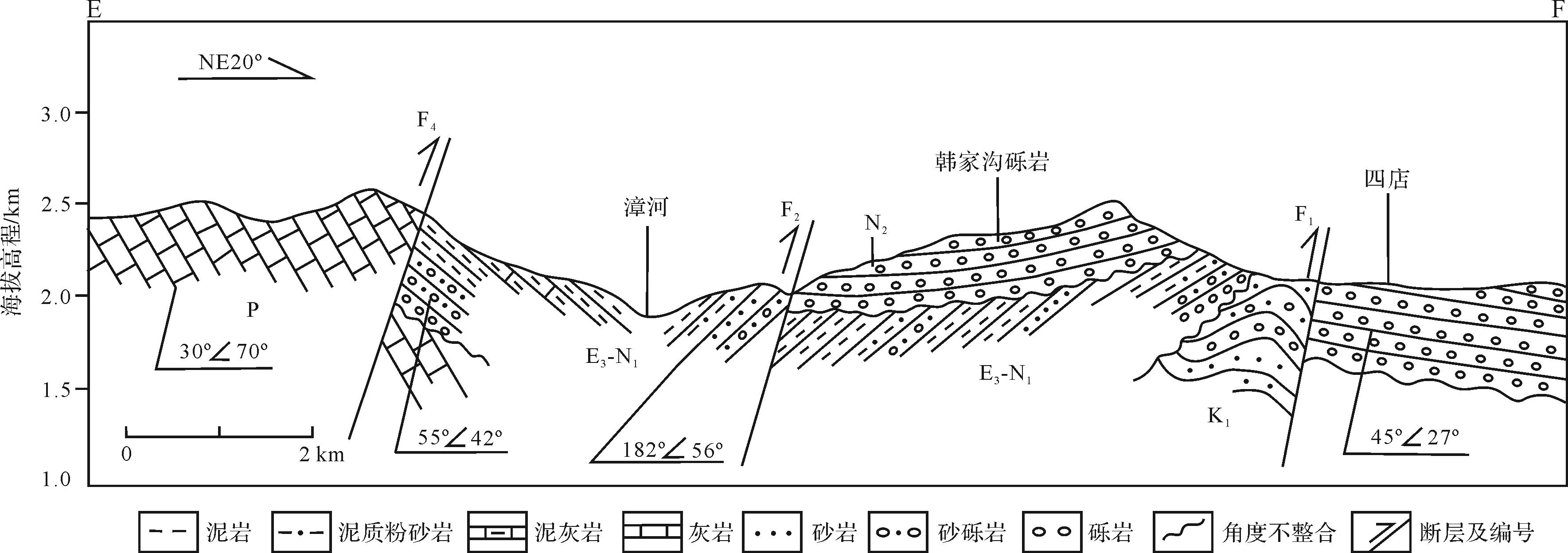
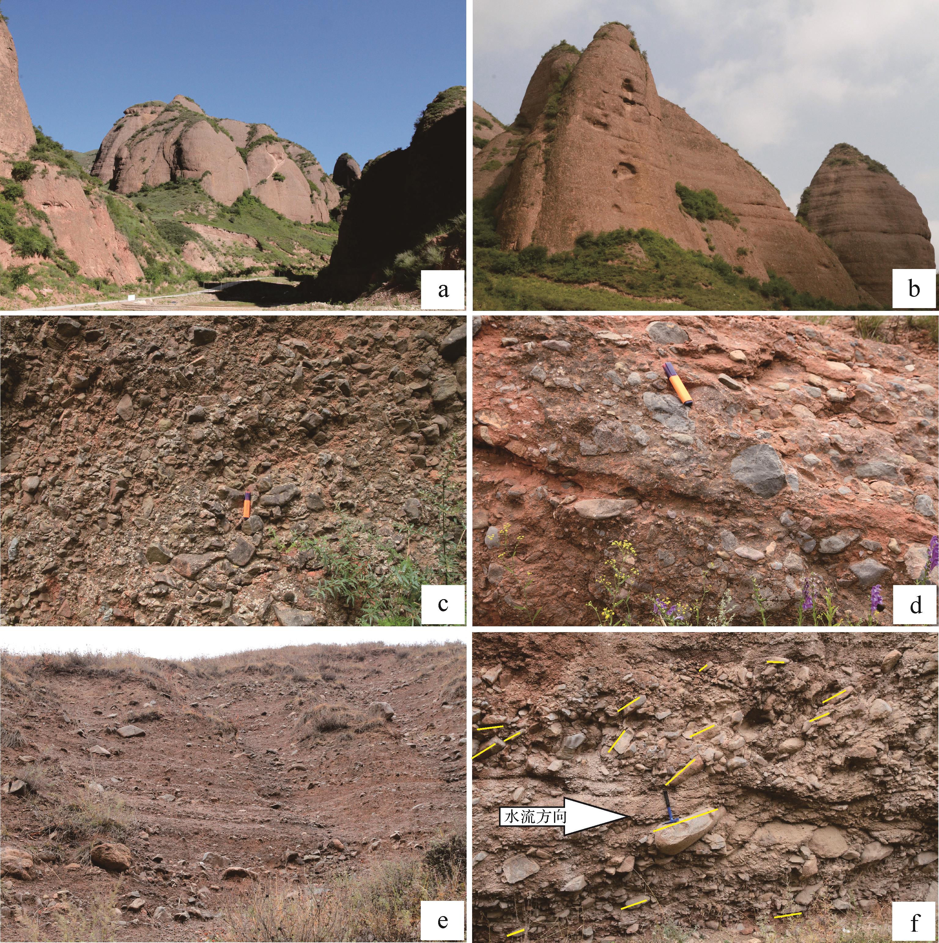
2023, 41(2): 409-424.
doi: 10.14027/j.issn.1000-0550.2021.089
Abstract:
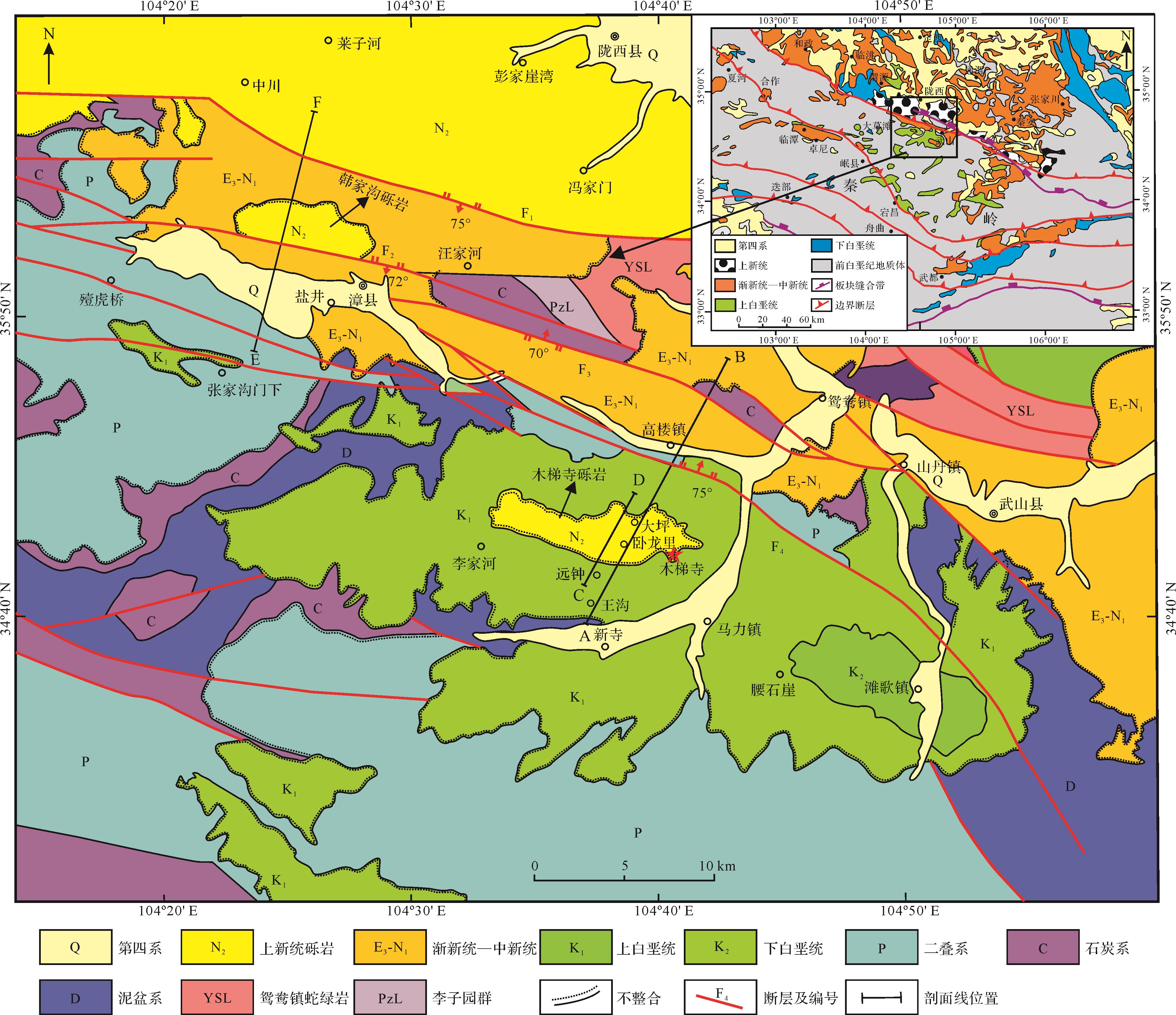
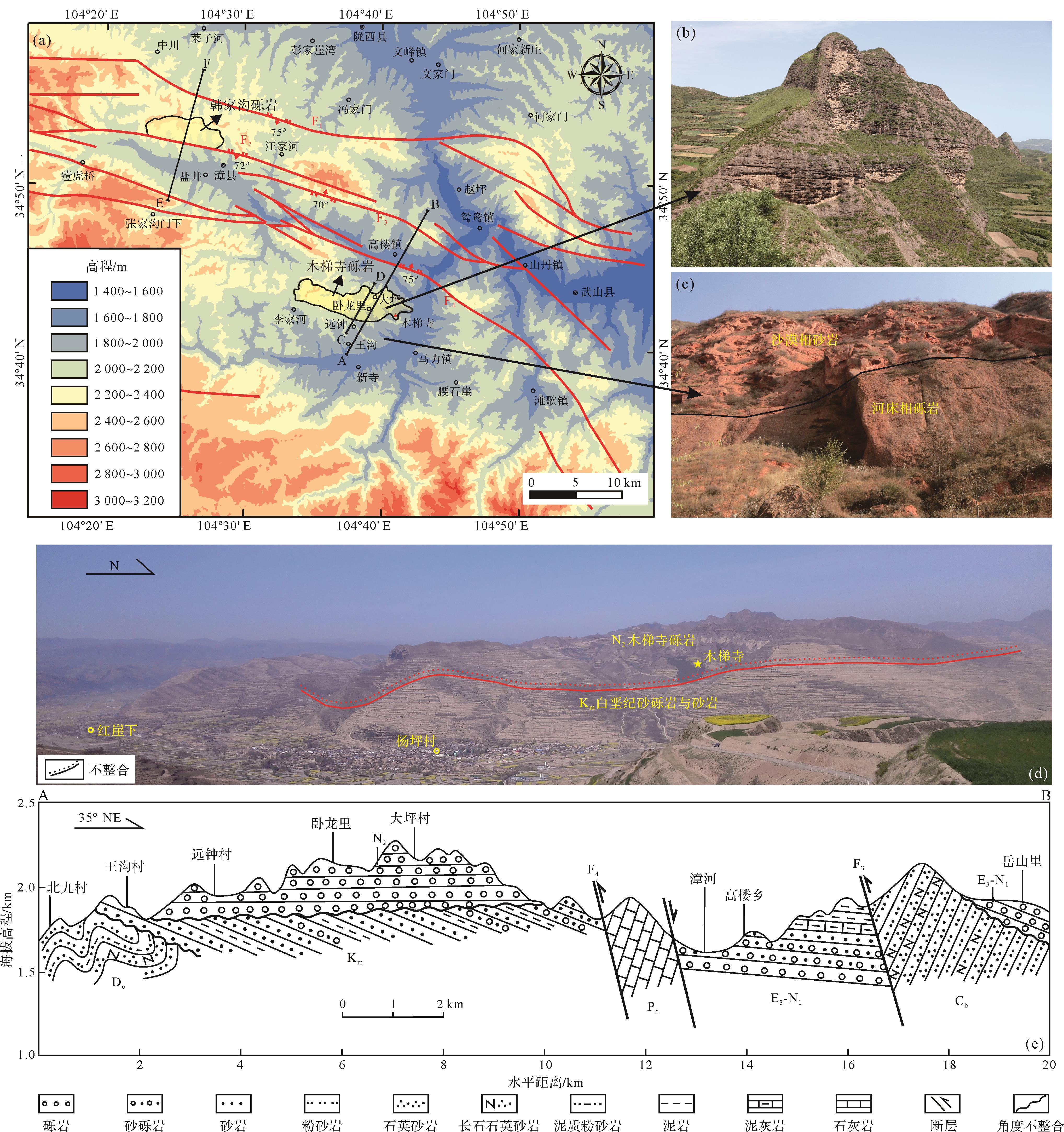
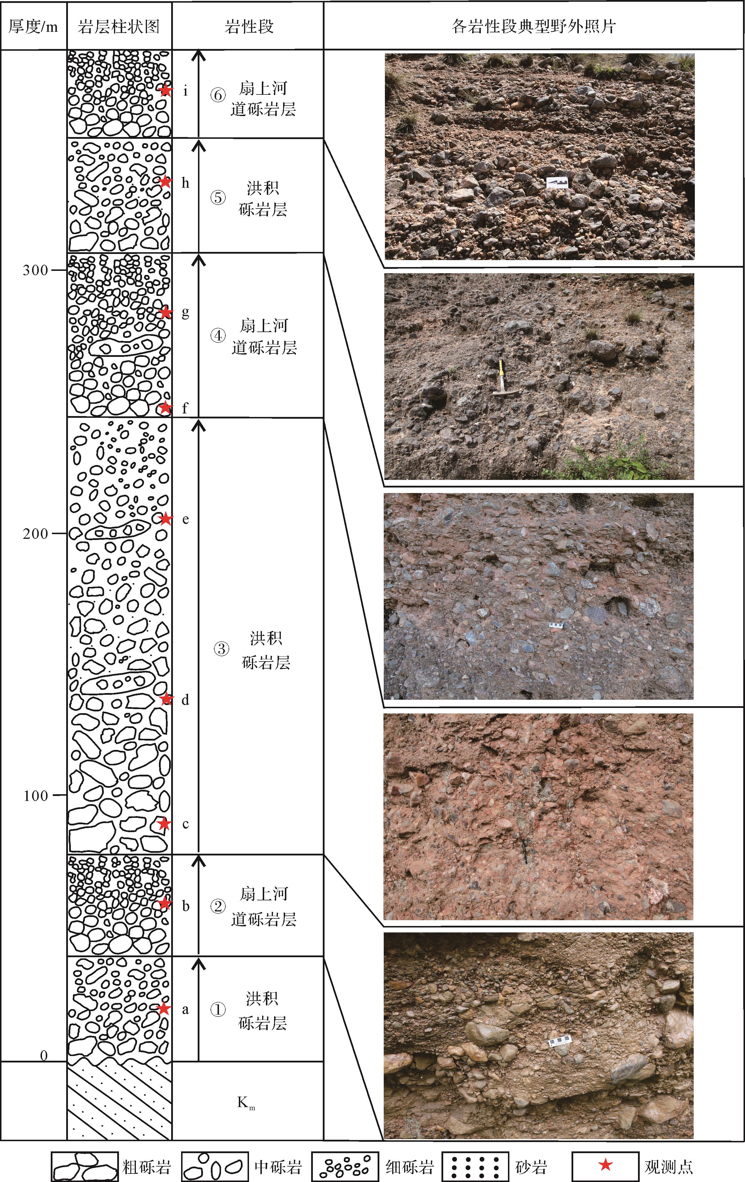
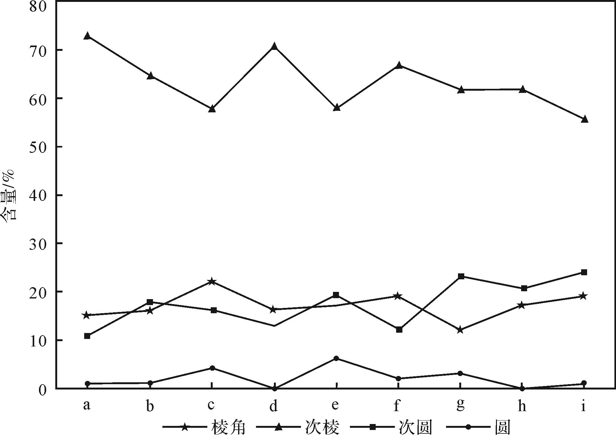
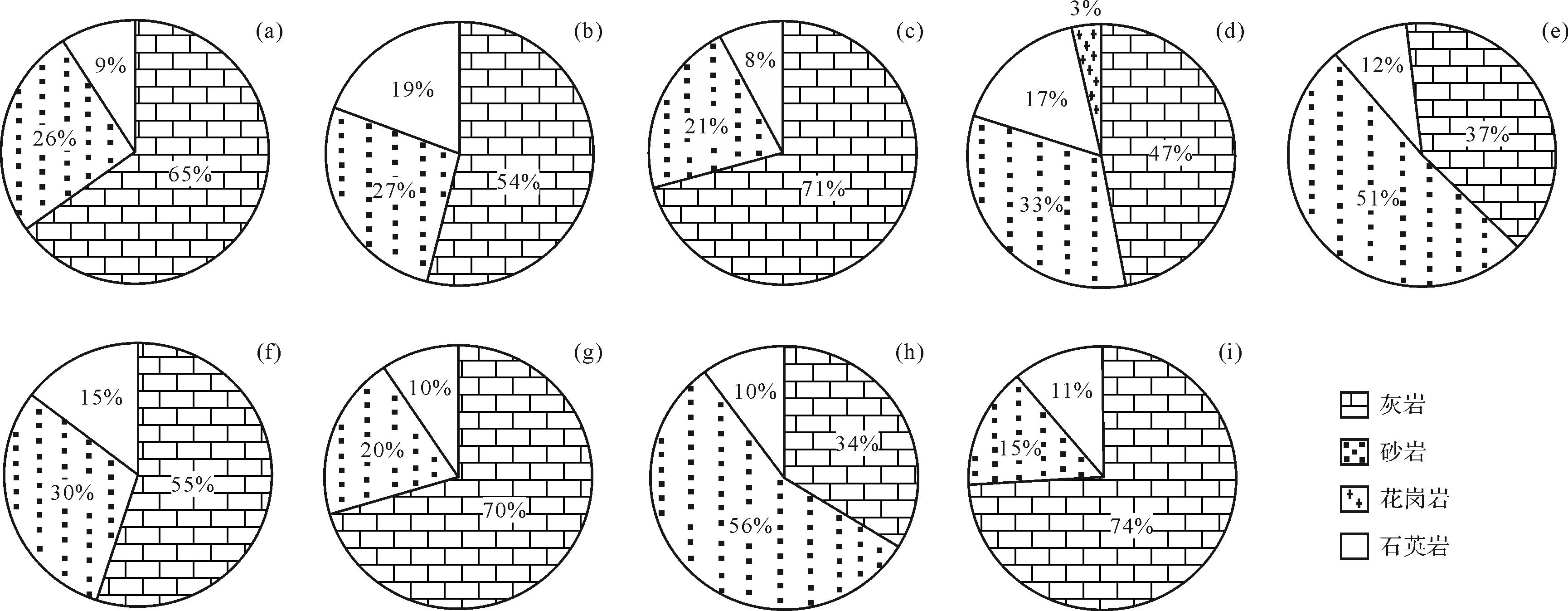
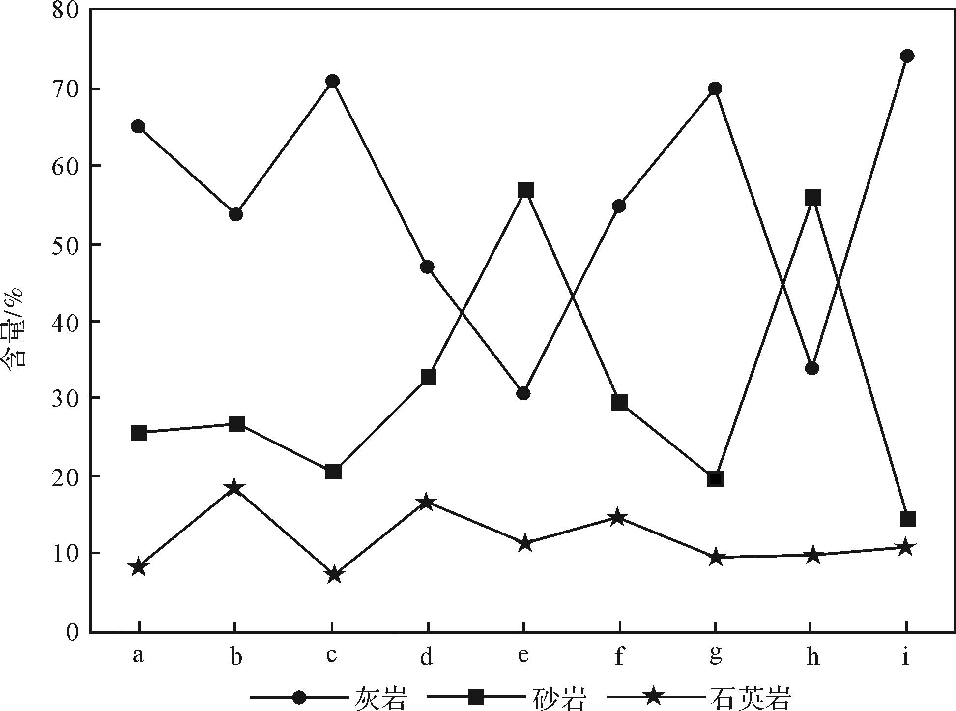
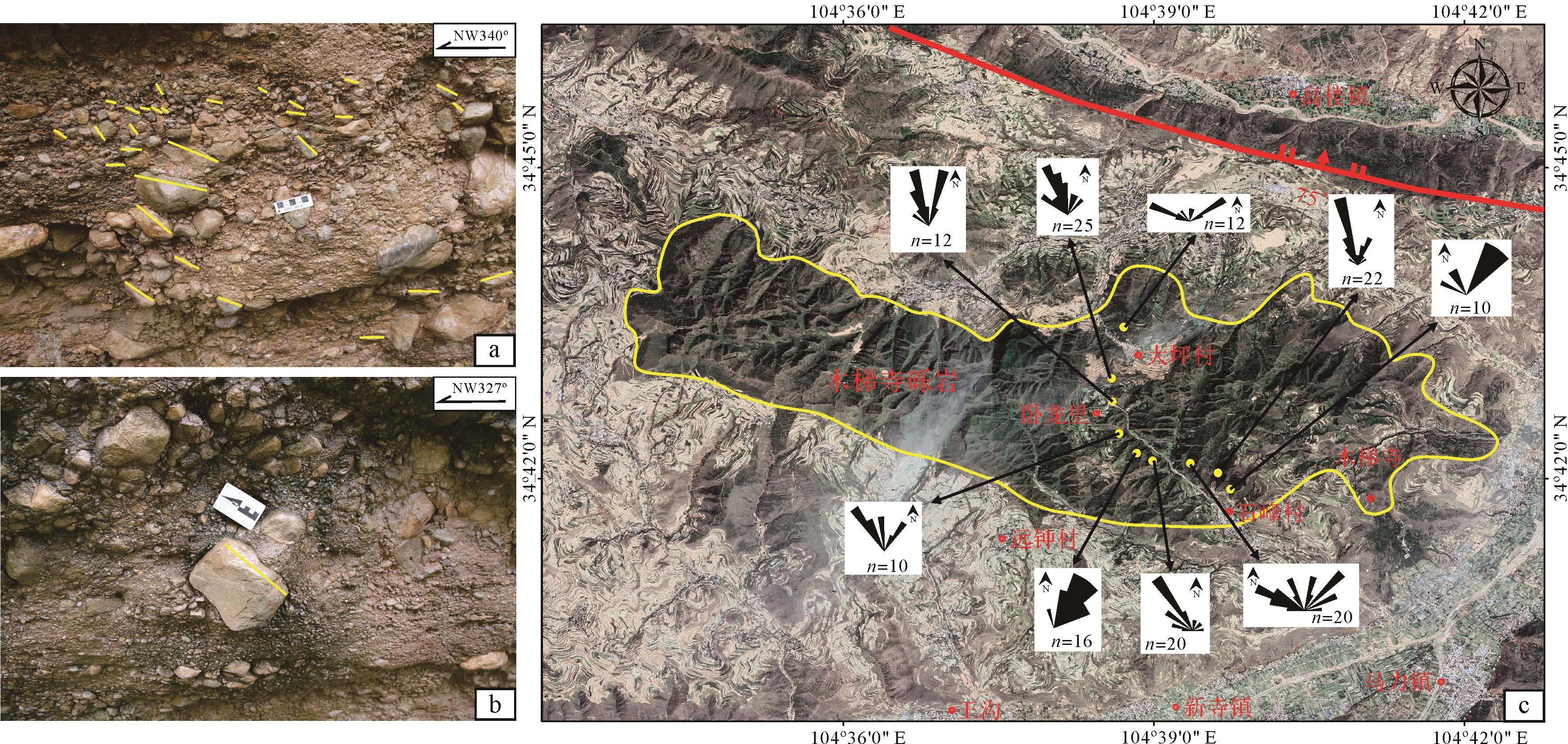
It is controversial when the northeastern margin of the Qinghai-Tibet Plateau was involved in the present dynamic system of the present Qinghai-Tibet Plateau and uplifted into a part of the plateau. Pliocene-Quaternary coarse conglomerates are widely distributed around the plateau margins, which are considered as important geological indicators for the uplift of the plateau. The Pliocene Jishishan conglomerate, Ganjia conglomerate, and Hanjiagou conglomerate, outcropped on the north side of the northern margin of the West Qinling Mountains, are considered as the geological evidence for the rapid uplift of the northeastern margin of the Qinghai-Tibet Plateau. However, due to the uplift erosion that has occurred since the Quaternary, these conglomerates are mostly distributed in isolated blocks on the top of the mountain. In the Wolongli-Daping area between Xinsi town and Gaolou town, Wushan county, the northern margin of the West Qinling Mountains, a set of coarse conglomerates (Muti Temple conglomerates, abbreviated as MTC) outcropped on the top of the mountain have the same or similar characteristics with the Pliocene Hanjiagou conglomerates outcropped in northern Zhangxian county, but they are distributed south of the northern margin fault of the West Qinling Mountains. Based on the detailed study of the geomorphic features, sedimentary cycles, lithologic segmentation, gravel size, sorting, roundness, gravel composition, and paleocurrent direction of the MTC, the following understandings are obtained: (1) the MTC is a set of conglomerates with coarse grain size and large variation, poor sorting, bad roundness, and clear cyclicity; interbeded coarse conglomerates with alluvial fan facies, seasonal channel facies on the fan, and its high and steep mountain landform are different from the relatively flat landforms of the underlying Cretaceous red conglomerate, glutenite, and sandstone; (2) The gravel imbricate arrangement in the channel facies on the fan conglomerate indicates a paleocurrent direction from south to north, and the gravel composition is mainly composed of limestone and sandstone, with a small amount of granodiorite and granite gravel, which indicate that its provenance area is mainly the West Qinling Indosinian orogenic belt strata and intrusions to the south; (3) The nearly horizontal occurrence, characteristic landform, and typical alluvial-fluvial fan conglomerate assemblage shows that it is a near source and rapid accumulation body, which is strikingly similar to the Pliocene Hanjiagou conglomerate in the Zhangxian area. Therefore, it is suggested that the MTC and Hanjiagou conglomerate have the same age and origin, that is, the age of the MTC should be Pliocene; (4) The MTC is similar to the Pliocene Hanjiagou conglomerate with the attribute of foreland-like molasses in Zhangxian. Both should be part of the geological records of a rapid uplift of the northeastern margin of the Qinghai Tibet Plateau (West Qinling block). However, the MTC is distributed to the south of the northern margin fault of the West Qinling and covered the Cretaceous in unconformity. The north boundary of the thrusting and uplifting of the West Qinling during the Pliocene should be pulled back a few ten kilometers to the south. The exact location of the boundary still needs similar conglomerate preservation clues and identified boundary faults in the West Qinling area.
It is controversial when the northeastern margin of the Qinghai-Tibet Plateau was involved in the present dynamic system of the present Qinghai-Tibet Plateau and uplifted into a part of the plateau. Pliocene-Quaternary coarse conglomerates are widely distributed around the plateau margins, which are considered as important geological indicators for the uplift of the plateau. The Pliocene Jishishan conglomerate, Ganjia conglomerate, and Hanjiagou conglomerate, outcropped on the north side of the northern margin of the West Qinling Mountains, are considered as the geological evidence for the rapid uplift of the northeastern margin of the Qinghai-Tibet Plateau. However, due to the uplift erosion that has occurred since the Quaternary, these conglomerates are mostly distributed in isolated blocks on the top of the mountain. In the Wolongli-Daping area between Xinsi town and Gaolou town, Wushan county, the northern margin of the West Qinling Mountains, a set of coarse conglomerates (Muti Temple conglomerates, abbreviated as MTC) outcropped on the top of the mountain have the same or similar characteristics with the Pliocene Hanjiagou conglomerates outcropped in northern Zhangxian county, but they are distributed south of the northern margin fault of the West Qinling Mountains. Based on the detailed study of the geomorphic features, sedimentary cycles, lithologic segmentation, gravel size, sorting, roundness, gravel composition, and paleocurrent direction of the MTC, the following understandings are obtained: (1) the MTC is a set of conglomerates with coarse grain size and large variation, poor sorting, bad roundness, and clear cyclicity; interbeded coarse conglomerates with alluvial fan facies, seasonal channel facies on the fan, and its high and steep mountain landform are different from the relatively flat landforms of the underlying Cretaceous red conglomerate, glutenite, and sandstone; (2) The gravel imbricate arrangement in the channel facies on the fan conglomerate indicates a paleocurrent direction from south to north, and the gravel composition is mainly composed of limestone and sandstone, with a small amount of granodiorite and granite gravel, which indicate that its provenance area is mainly the West Qinling Indosinian orogenic belt strata and intrusions to the south; (3) The nearly horizontal occurrence, characteristic landform, and typical alluvial-fluvial fan conglomerate assemblage shows that it is a near source and rapid accumulation body, which is strikingly similar to the Pliocene Hanjiagou conglomerate in the Zhangxian area. Therefore, it is suggested that the MTC and Hanjiagou conglomerate have the same age and origin, that is, the age of the MTC should be Pliocene; (4) The MTC is similar to the Pliocene Hanjiagou conglomerate with the attribute of foreland-like molasses in Zhangxian. Both should be part of the geological records of a rapid uplift of the northeastern margin of the Qinghai Tibet Plateau (West Qinling block). However, the MTC is distributed to the south of the northern margin fault of the West Qinling and covered the Cretaceous in unconformity. The north boundary of the thrusting and uplifting of the West Qinling during the Pliocene should be pulled back a few ten kilometers to the south. The exact location of the boundary still needs similar conglomerate preservation clues and identified boundary faults in the West Qinling area.
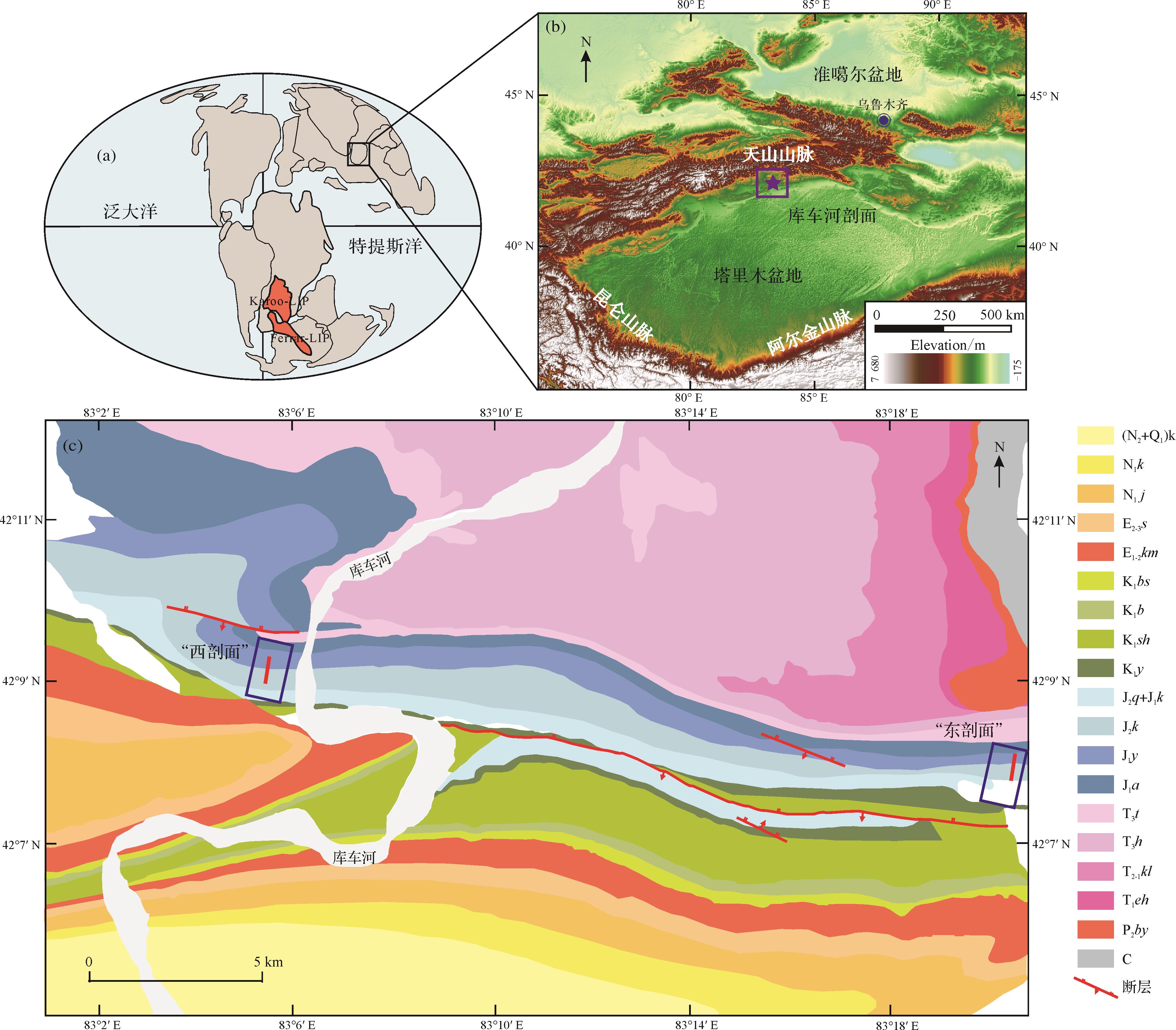
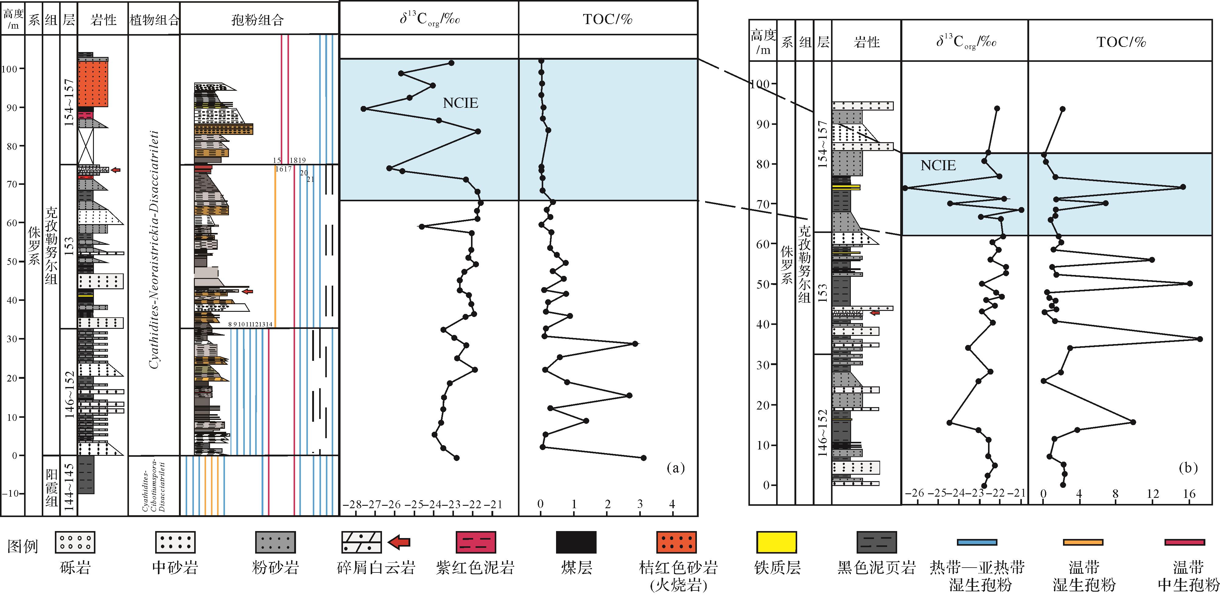
2023, 41(2): 425-434.
doi: 10.14027/j.issn.1000-0550.2021.095
Abstract:
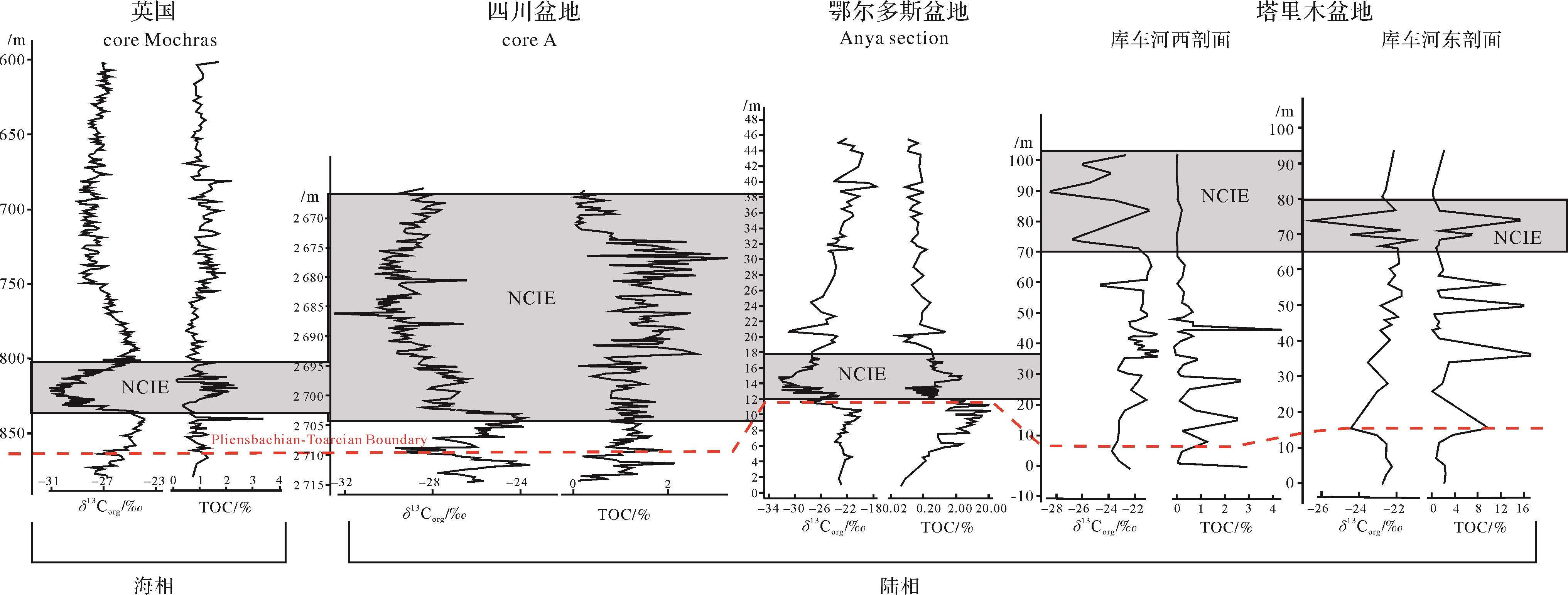
The Early Jurassic Toarcian Oceanic Anoxic Event (T-OAE) is believed to be closely related to the Karoo-Ferrar igneous explosion and the global warming caused by the rapid release of greenhouse gases related to methane gas hydrates. This event has been studied in detail in the Tethys Ocean region, but the environmental changes and sedimentary responses in terrestrial ecosystems have received less attention. Here, the organic carbon isotopic stratigraphic data for the Kuqa River area at the northern margin of the Tarim Basin are reported. The overall positive excursion trend of δ13C curves in the East and West sections are interrupted by multi-stage rapid negative excursions, which indicates that the surface carbon cycle has been greatly disturbed. The rapid fluctuation of the δ13C value in the event layer suggests that the carbon source with light isotopic characteristics was injected into the atmospheric carbon pool over a short period of time, and was characterized by unstable and periodic injection. It is speculated that this may be related to the positive feedback caused by warming. The abrupt change in sedimentary facies and the decrease in sporopollenin species indicate that the sedimentary environment has changed greatly. The presence of clastic dolomite and purplish mudstone, the attenuation of wet palynology and the occurrence of mesopalynology all indicate that the climate at the northern margin of Tarim Basin became dry and hot during T-OAE. This study reports the first T-OAE record from the margin of a continental sedimentary basin, and is crucial to understanding the evolution of terrestrial systems in the context of the significant increase of carbon dioxide in the present period of Earth history.
The Early Jurassic Toarcian Oceanic Anoxic Event (T-OAE) is believed to be closely related to the Karoo-Ferrar igneous explosion and the global warming caused by the rapid release of greenhouse gases related to methane gas hydrates. This event has been studied in detail in the Tethys Ocean region, but the environmental changes and sedimentary responses in terrestrial ecosystems have received less attention. Here, the organic carbon isotopic stratigraphic data for the Kuqa River area at the northern margin of the Tarim Basin are reported. The overall positive excursion trend of δ13C curves in the East and West sections are interrupted by multi-stage rapid negative excursions, which indicates that the surface carbon cycle has been greatly disturbed. The rapid fluctuation of the δ13C value in the event layer suggests that the carbon source with light isotopic characteristics was injected into the atmospheric carbon pool over a short period of time, and was characterized by unstable and periodic injection. It is speculated that this may be related to the positive feedback caused by warming. The abrupt change in sedimentary facies and the decrease in sporopollenin species indicate that the sedimentary environment has changed greatly. The presence of clastic dolomite and purplish mudstone, the attenuation of wet palynology and the occurrence of mesopalynology all indicate that the climate at the northern margin of Tarim Basin became dry and hot during T-OAE. This study reports the first T-OAE record from the margin of a continental sedimentary basin, and is crucial to understanding the evolution of terrestrial systems in the context of the significant increase of carbon dioxide in the present period of Earth history.
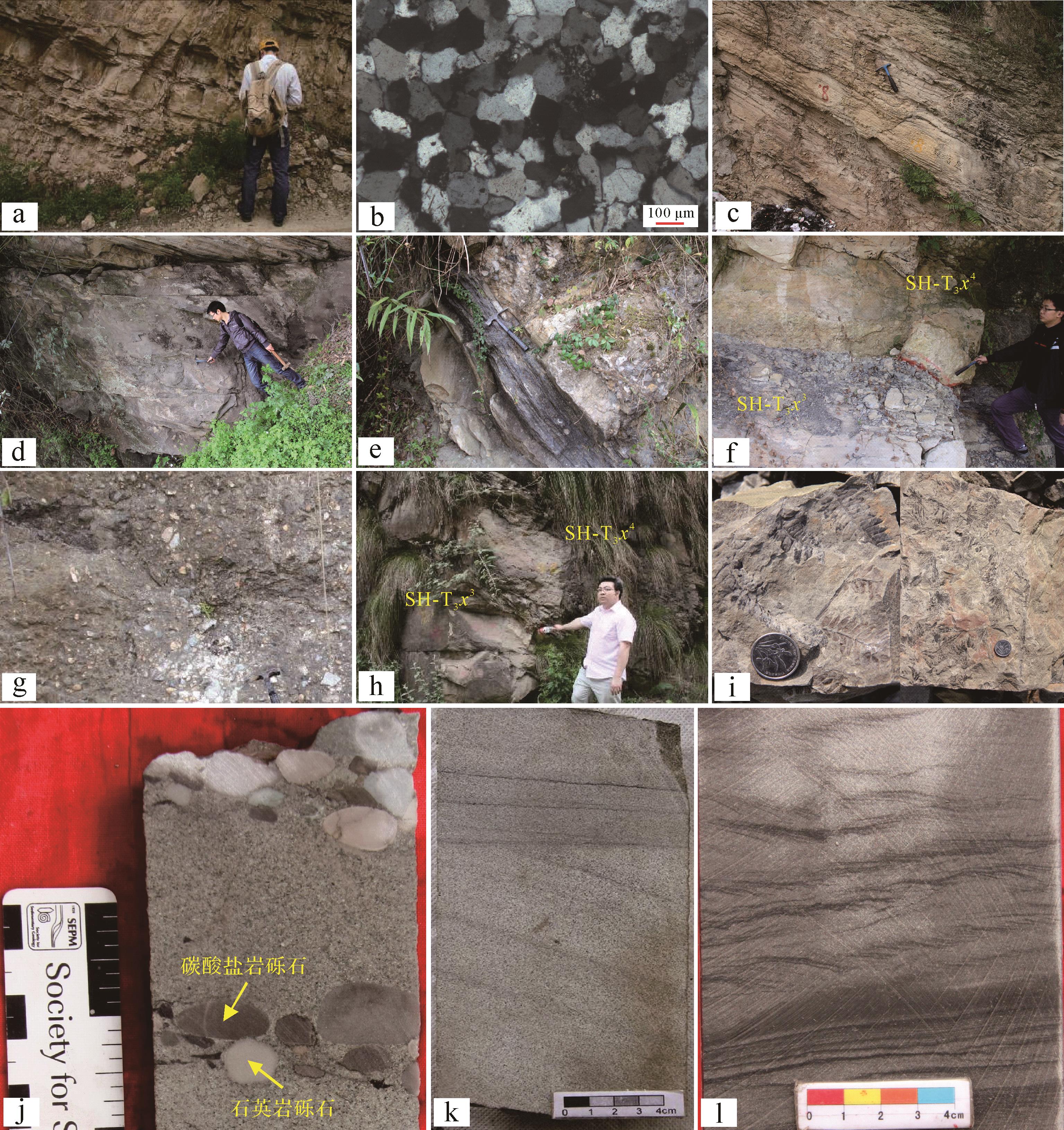
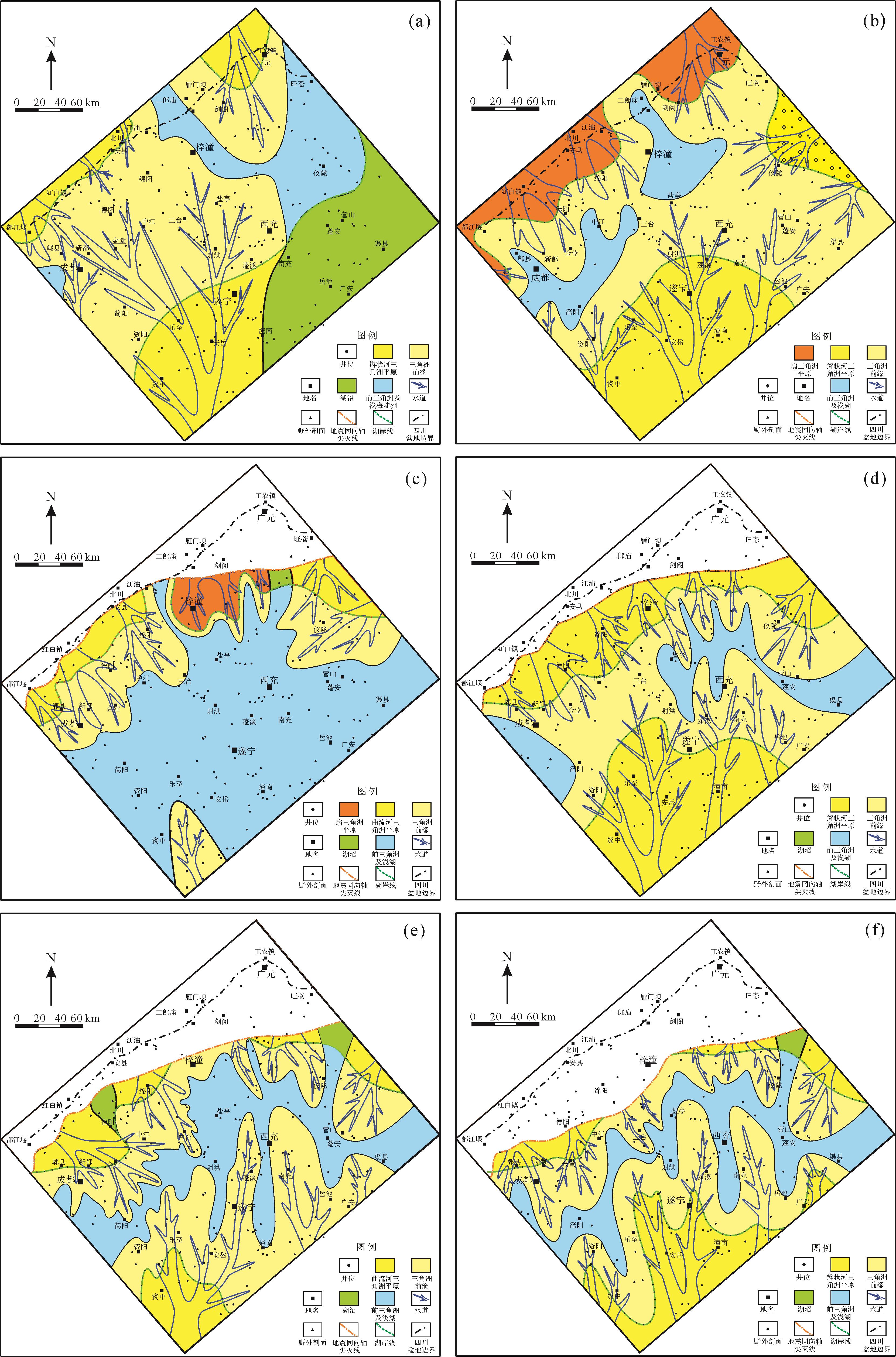
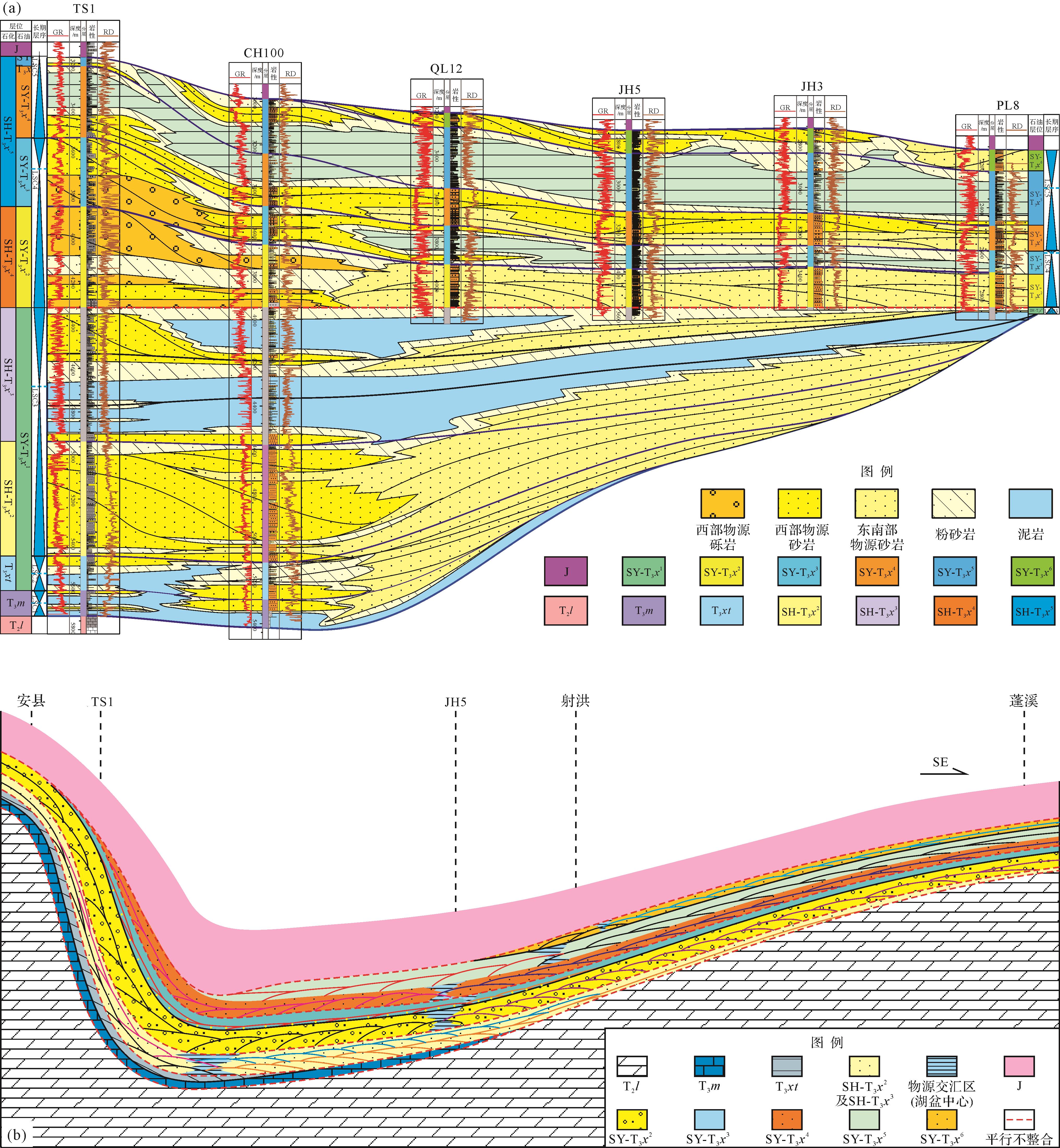
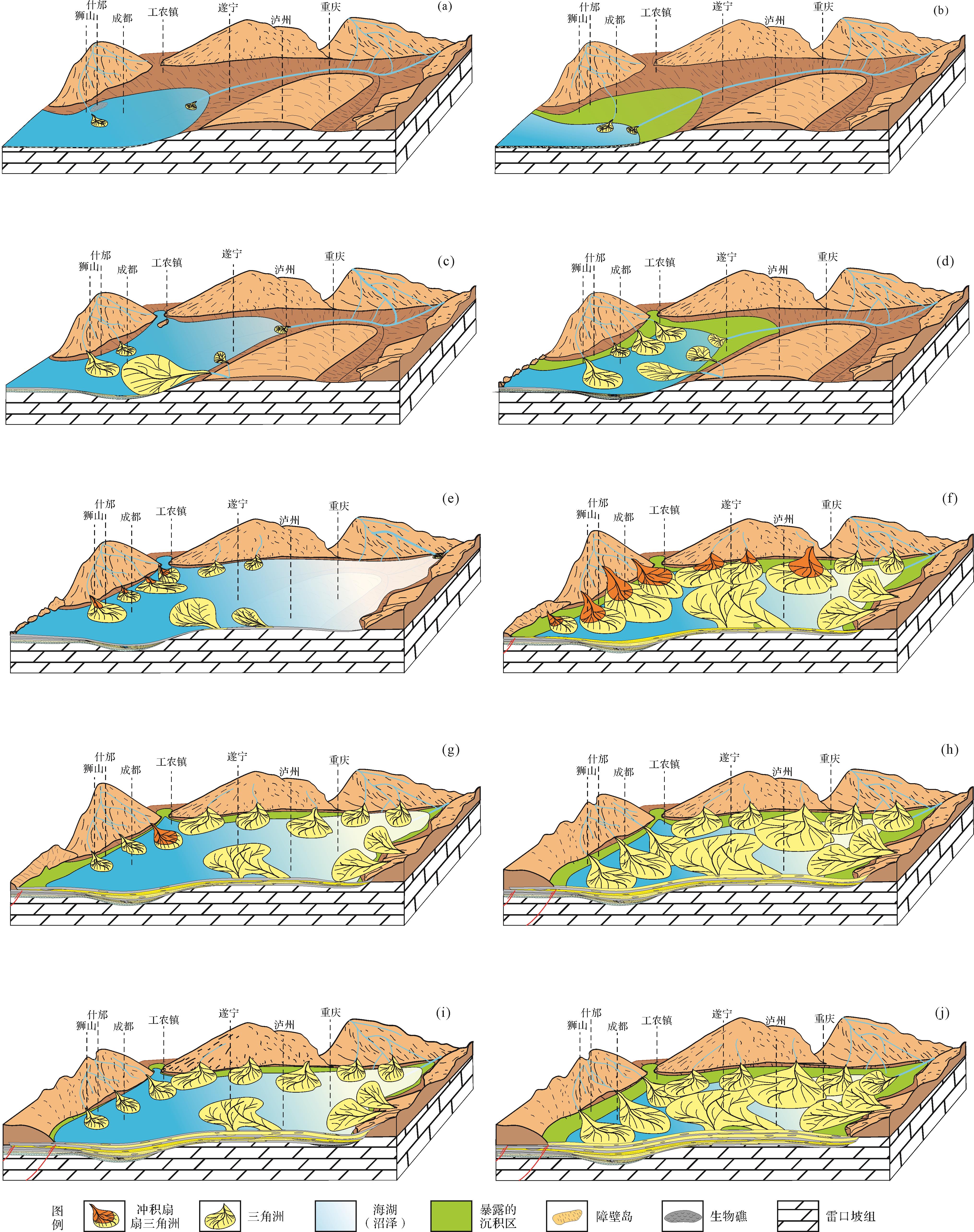
2023, 41(2): 435-449.
doi: 10.14027/j.issn.1000-0550.2021.087
Abstract:
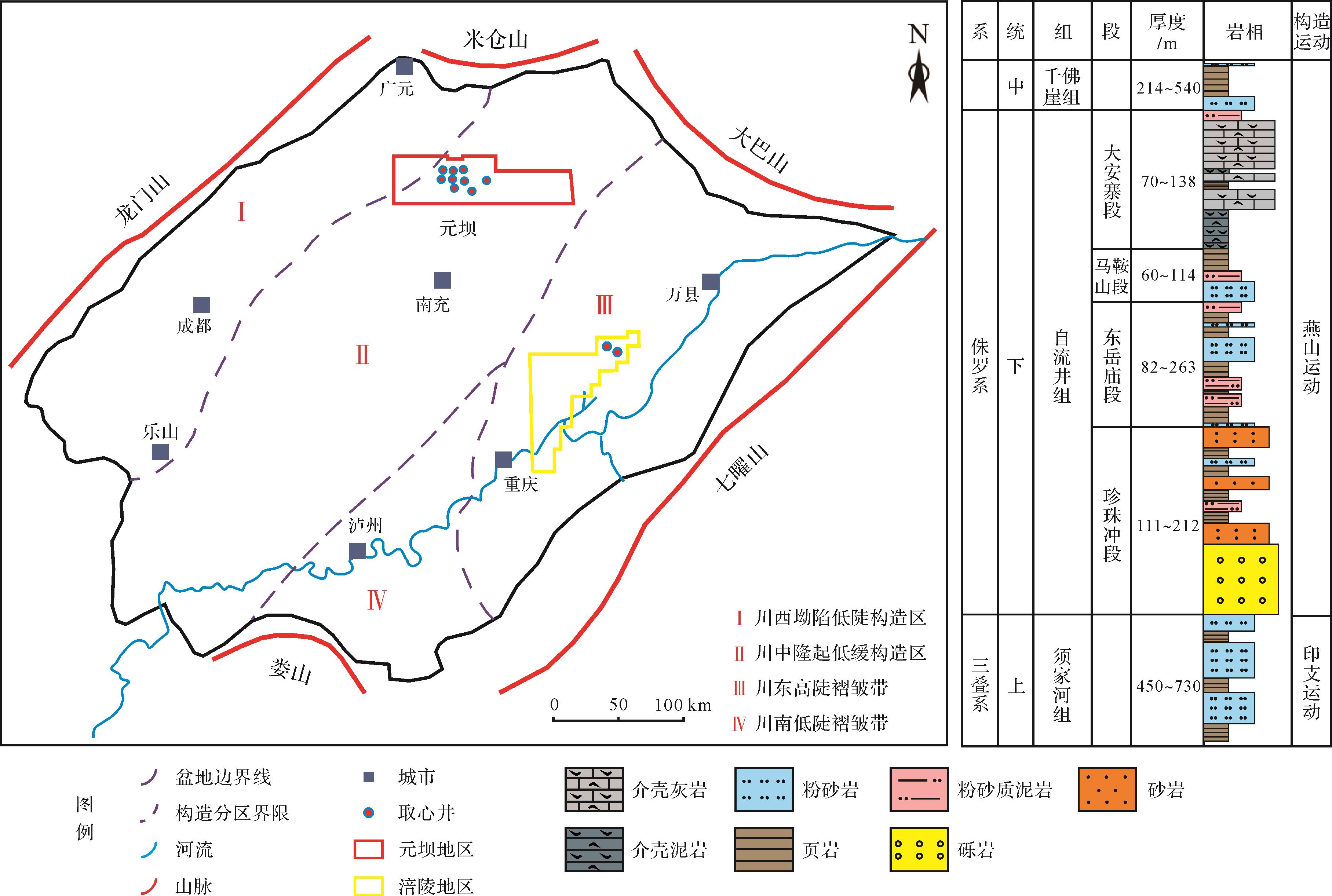
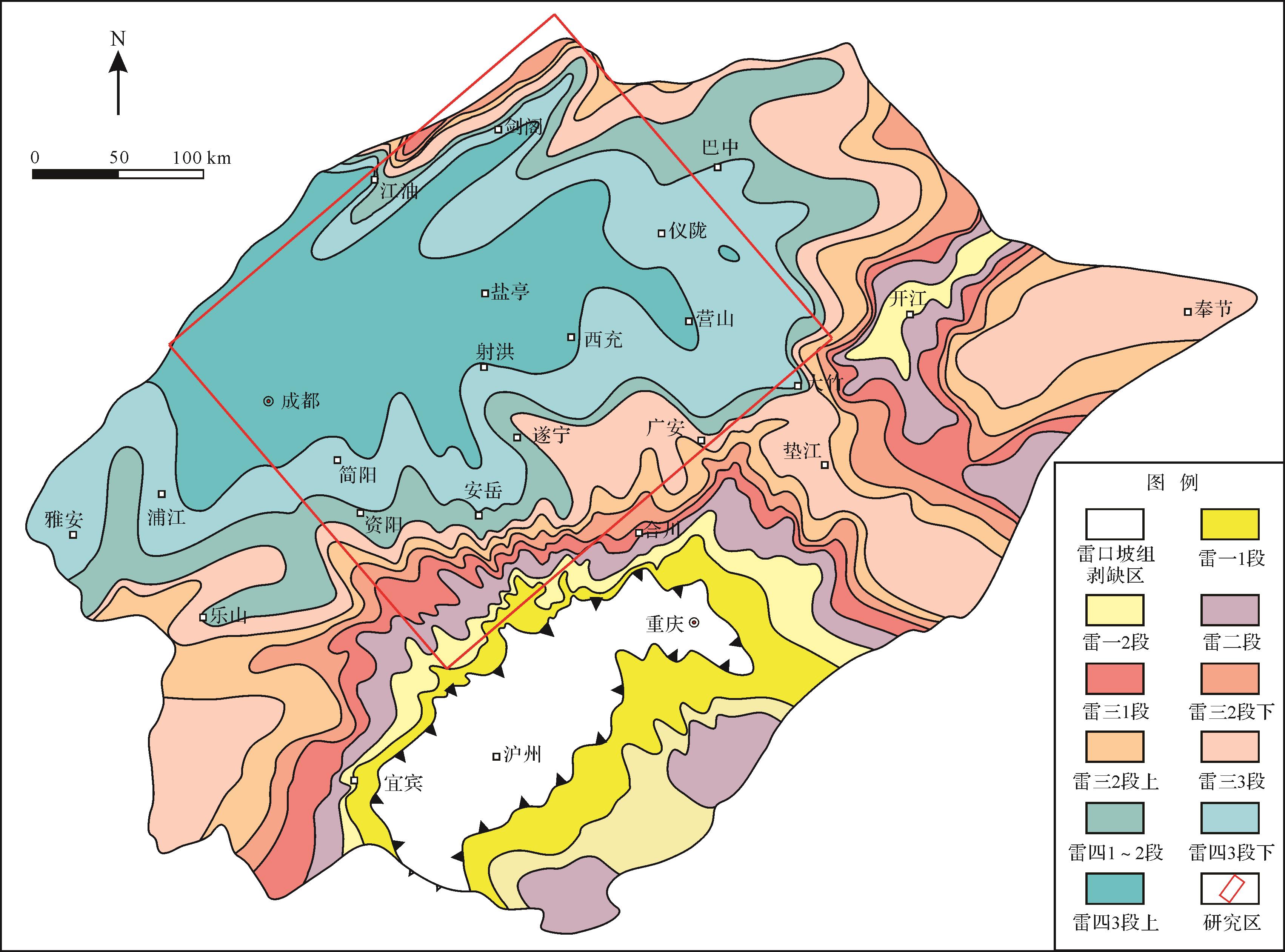
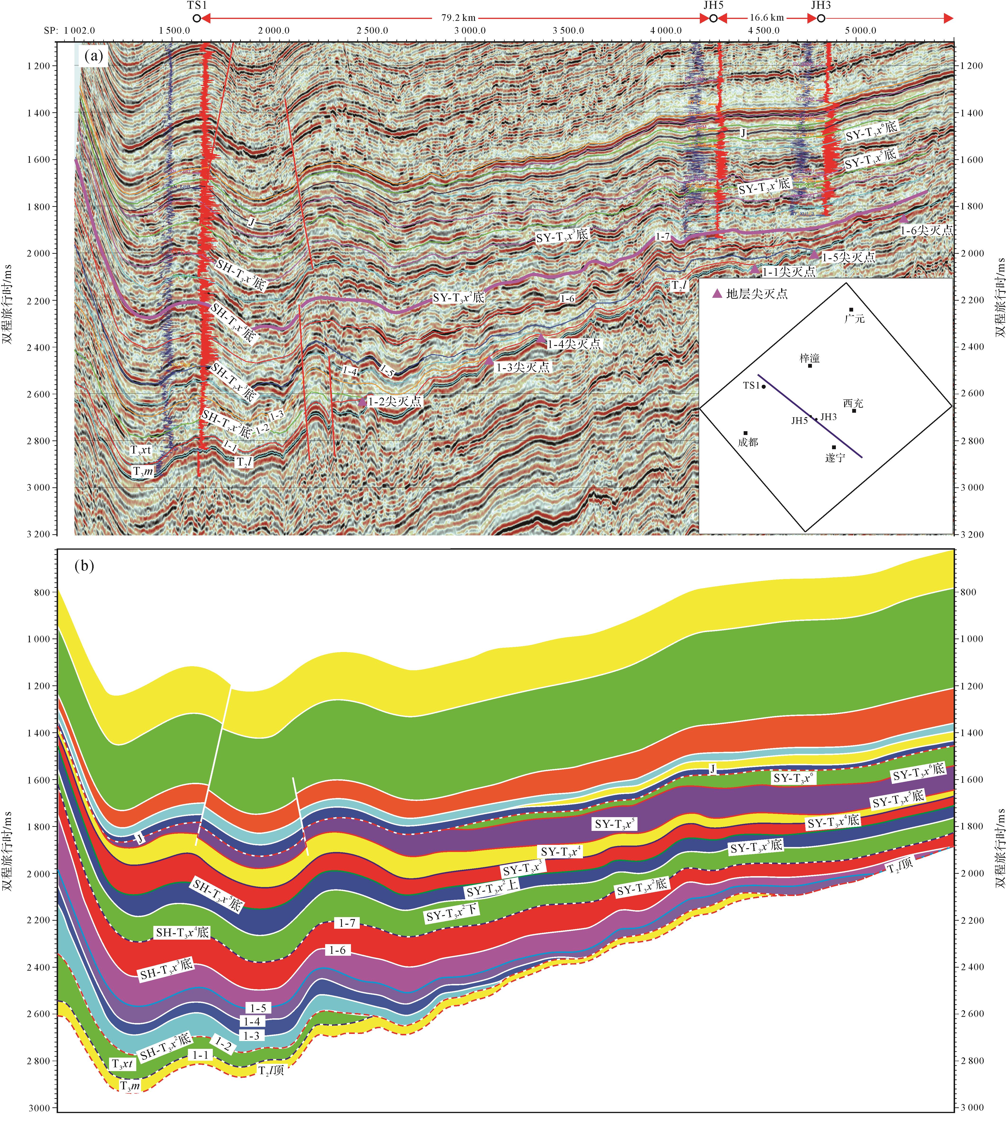
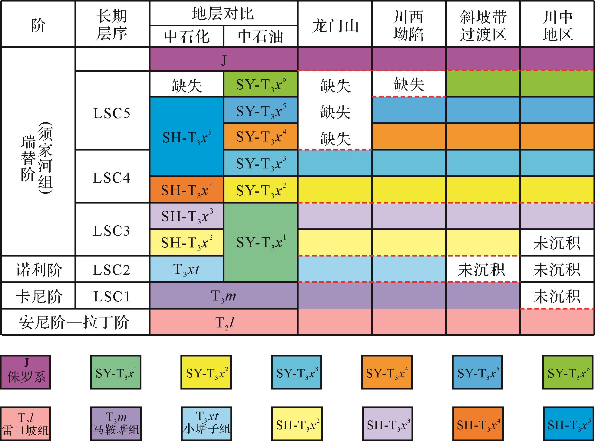
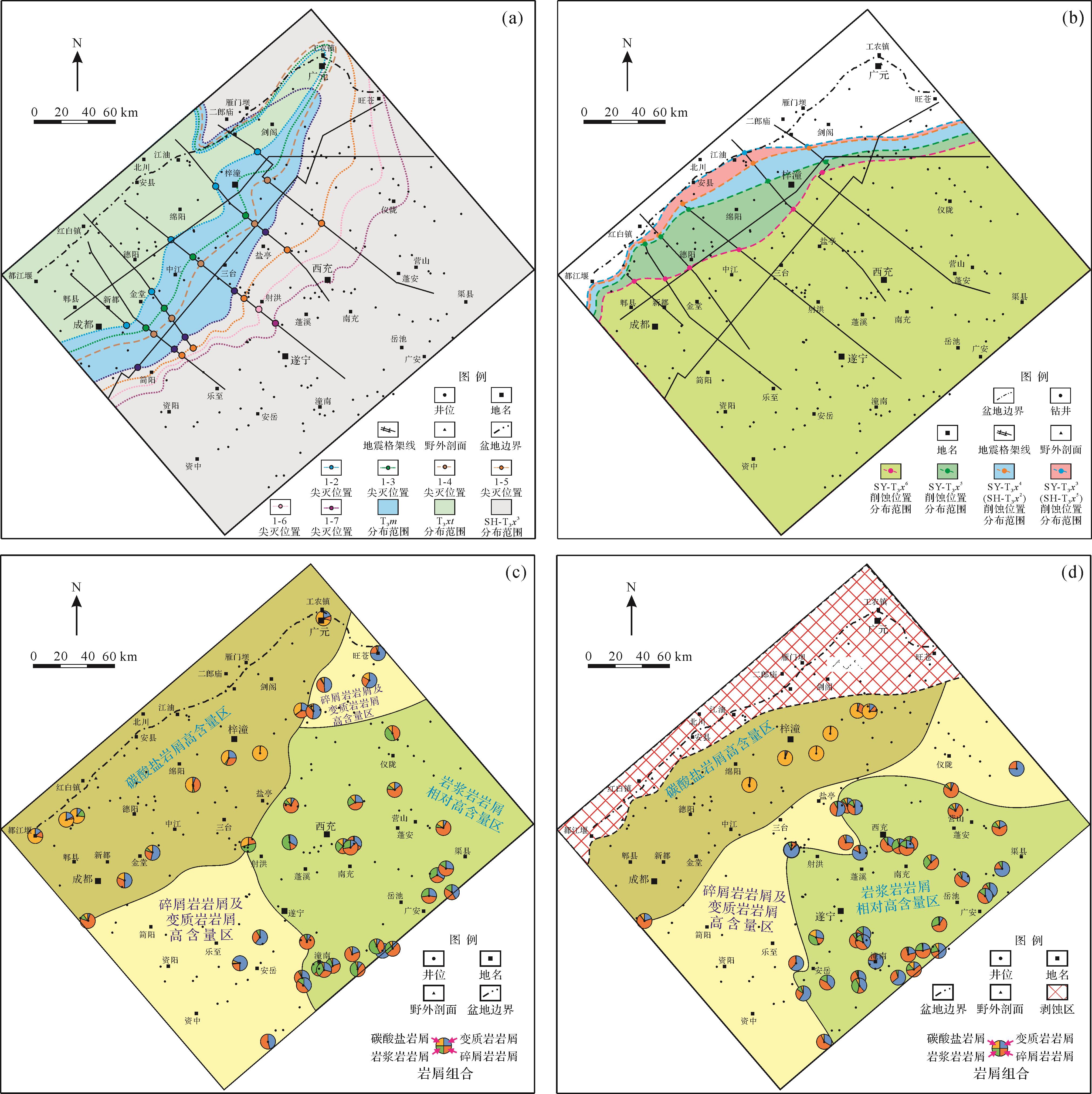
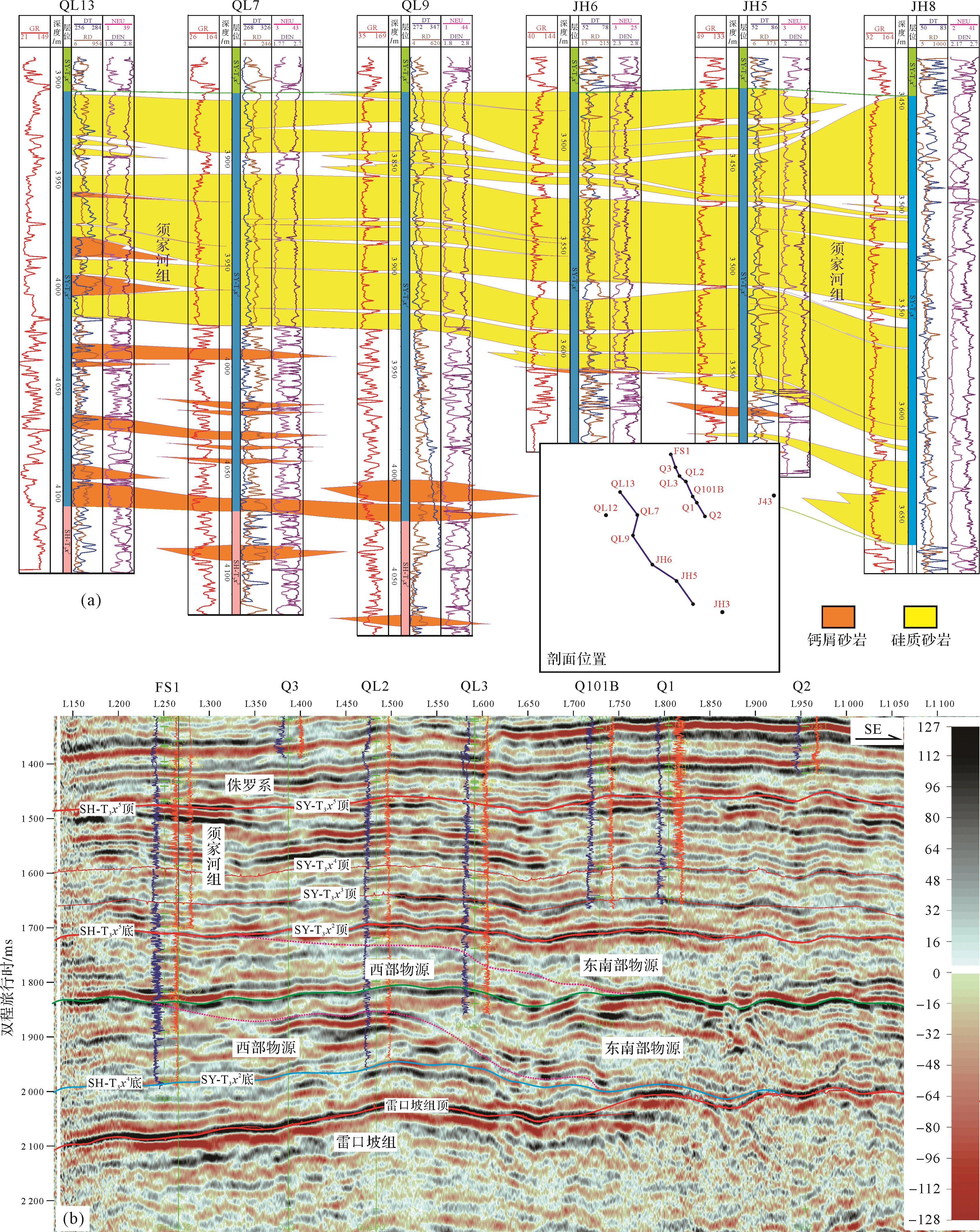
Based on outcrops, core logging, seismic interpretation, rock thin section analysis, and other analysis results, the internal layer of the Upper Triassic in the western and central Sichuan Basin was recorrelated. The provenance system and sedimentary filling characteristics of the Upper Triassic in the study area were studied in this paper. The Western Sichuan Depression was the first to receive sediments in the Early Carnian, and the Ma’antang Formation overlays the paleokarst surface of the Leikoupo Formation from west to east and south to north. Strong regressions occurred during the Late Carnian, which resulted in the reduction of the sedimentary range, and the Western Sichuan Depression was dominated by the development of a barrier coastal and shelf sedimentary system. Accompanied by re-transgression in the Early Norian period, the Xiaotangzi Formation uplifted to the central Sichuan Basin again. The tectonic activities in the Late Norian led to significant uplift and denudation in the central and northern sections of the Longmen Mountains, and the sedimentary environment evolved from barrier coastal shelf to fluvial and marine delta. The fluvial and delta sedimentary system developed extensively during the Early Rhaetian, the strata continued to overlap towards the central Sichuan uplift, and the uplift zone began to accept sediments during the Middle Rhaetian. The Anxian Movement resulted in the substantial uplift of the Longmen Mountains and vast denudation of the early deposits of the Xujiahe Formation. The sedimentary facies were characterized by alluvial fan, fan delta, and delta during the Late Rhaetian stage. The differential tectonic uplift in the Late Indosinian resulted in the truncation of the upper strata of the Xujiahe Formation, and the erosion of the top of the Xujiahe Formation increased gradually from the southeast to the northwest. The Upper Triassic in the western and central Sichuan Basin is mainly controlled by the western and southeastern provenance systems. The early sedimentary filling characteristics are mainly controlled by the paleokarst landform of the Leikoupo Formation, while the late sedimentary filling characteristics are mainly controlled by the tectonic activities in the Late Indosinian.
Based on outcrops, core logging, seismic interpretation, rock thin section analysis, and other analysis results, the internal layer of the Upper Triassic in the western and central Sichuan Basin was recorrelated. The provenance system and sedimentary filling characteristics of the Upper Triassic in the study area were studied in this paper. The Western Sichuan Depression was the first to receive sediments in the Early Carnian, and the Ma’antang Formation overlays the paleokarst surface of the Leikoupo Formation from west to east and south to north. Strong regressions occurred during the Late Carnian, which resulted in the reduction of the sedimentary range, and the Western Sichuan Depression was dominated by the development of a barrier coastal and shelf sedimentary system. Accompanied by re-transgression in the Early Norian period, the Xiaotangzi Formation uplifted to the central Sichuan Basin again. The tectonic activities in the Late Norian led to significant uplift and denudation in the central and northern sections of the Longmen Mountains, and the sedimentary environment evolved from barrier coastal shelf to fluvial and marine delta. The fluvial and delta sedimentary system developed extensively during the Early Rhaetian, the strata continued to overlap towards the central Sichuan uplift, and the uplift zone began to accept sediments during the Middle Rhaetian. The Anxian Movement resulted in the substantial uplift of the Longmen Mountains and vast denudation of the early deposits of the Xujiahe Formation. The sedimentary facies were characterized by alluvial fan, fan delta, and delta during the Late Rhaetian stage. The differential tectonic uplift in the Late Indosinian resulted in the truncation of the upper strata of the Xujiahe Formation, and the erosion of the top of the Xujiahe Formation increased gradually from the southeast to the northwest. The Upper Triassic in the western and central Sichuan Basin is mainly controlled by the western and southeastern provenance systems. The early sedimentary filling characteristics are mainly controlled by the paleokarst landform of the Leikoupo Formation, while the late sedimentary filling characteristics are mainly controlled by the tectonic activities in the Late Indosinian.
2023, 41(2): 450-458.
doi: 10.14027/j.issn.1000-0550.2021.094
Abstract:
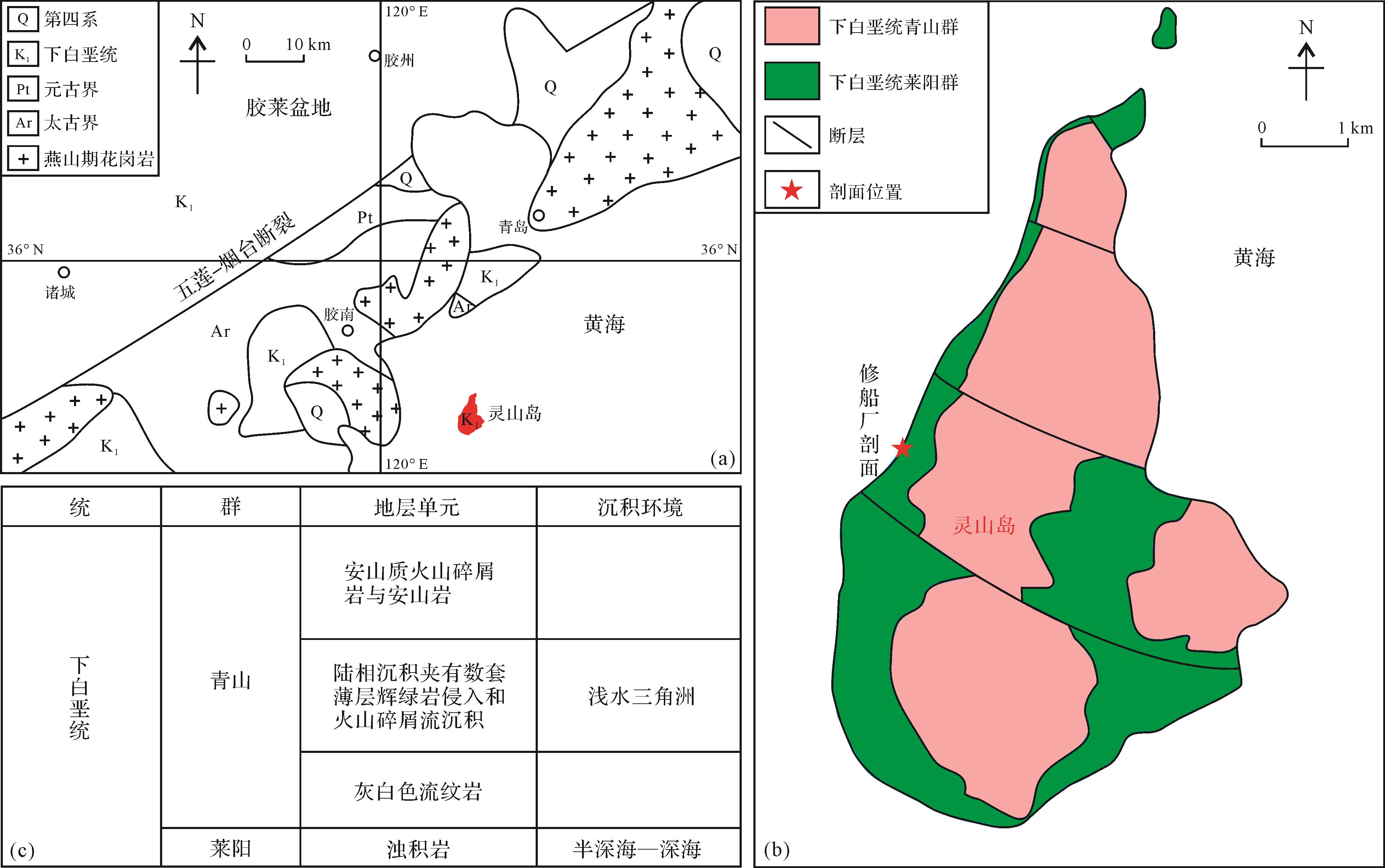
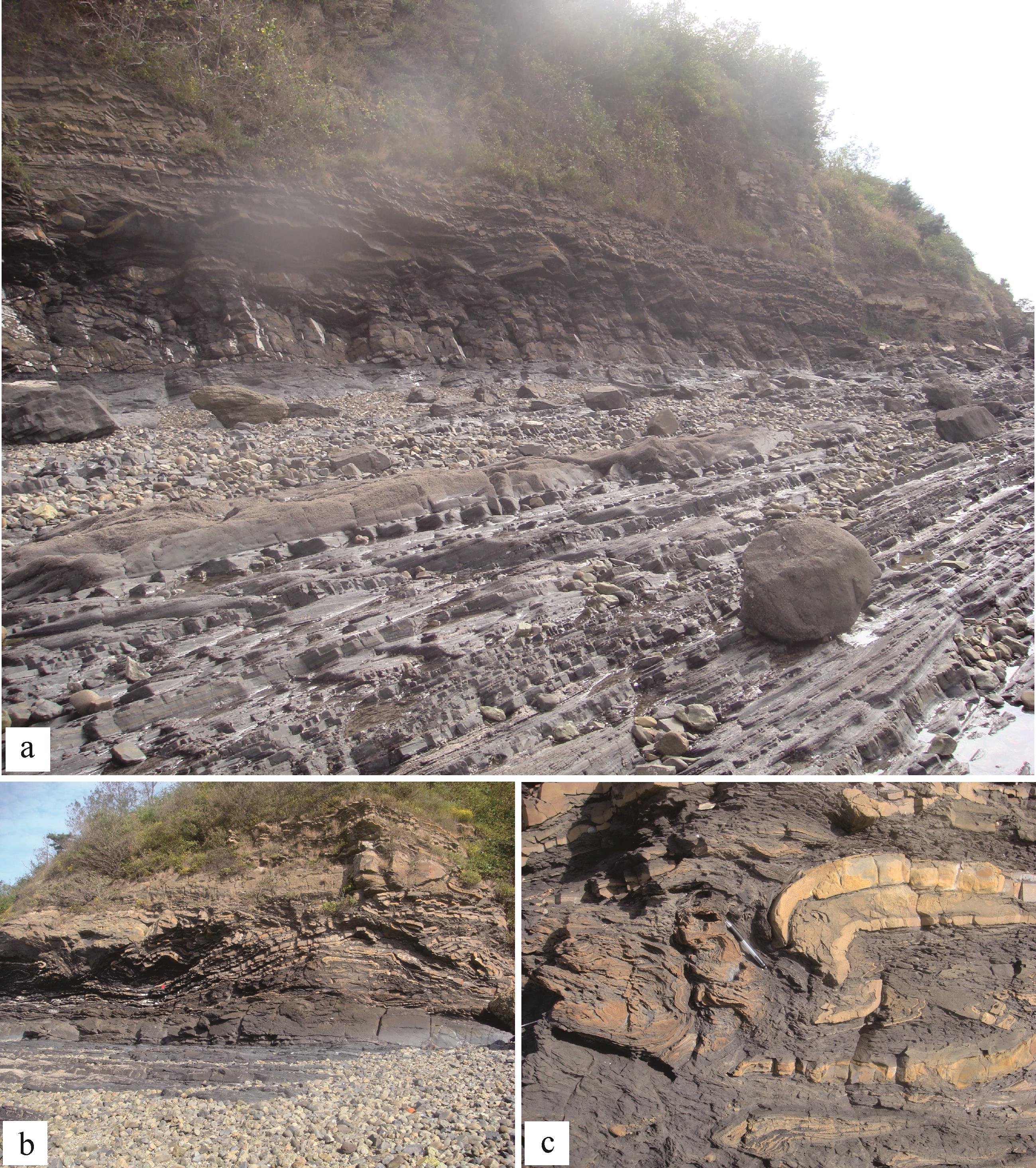
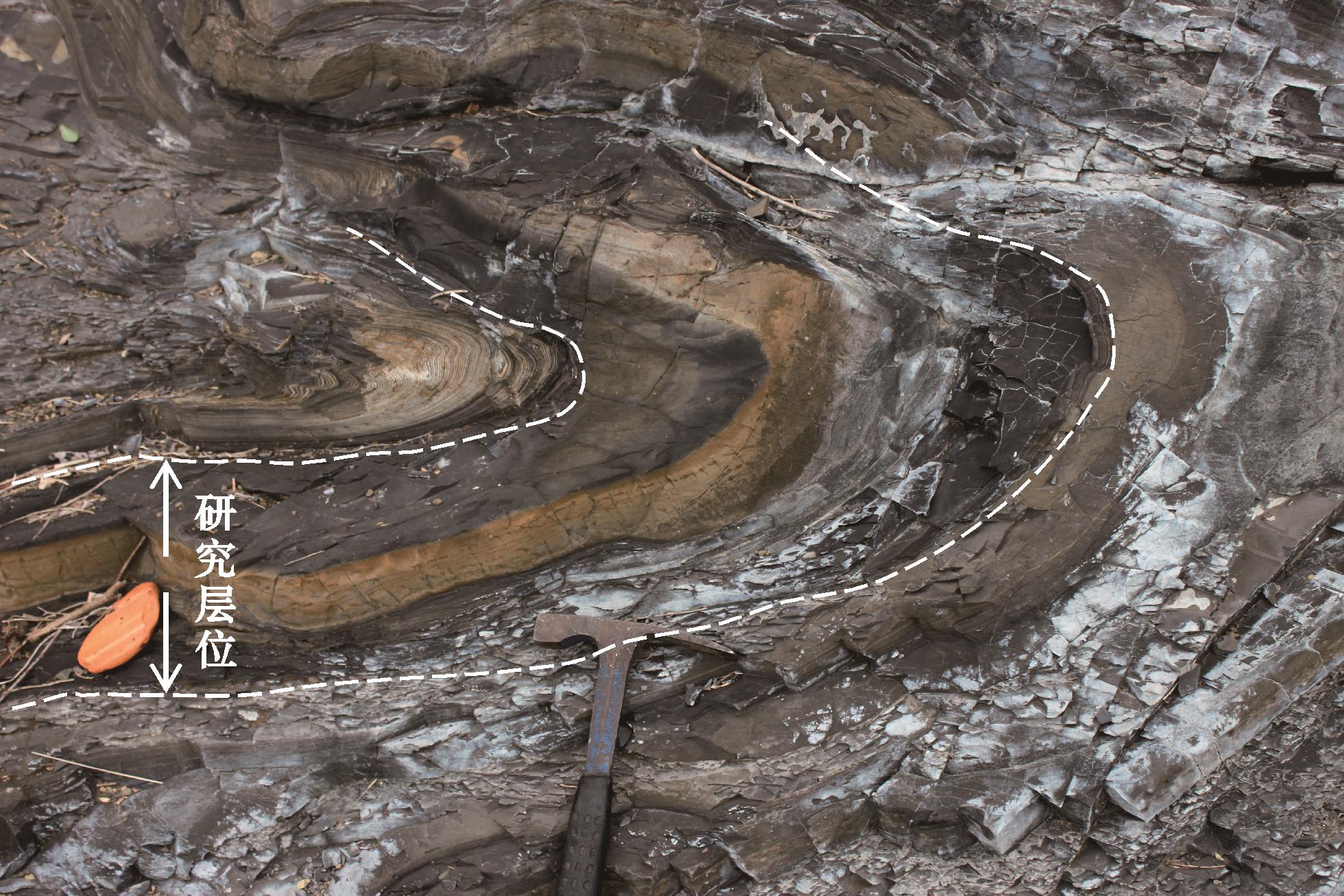
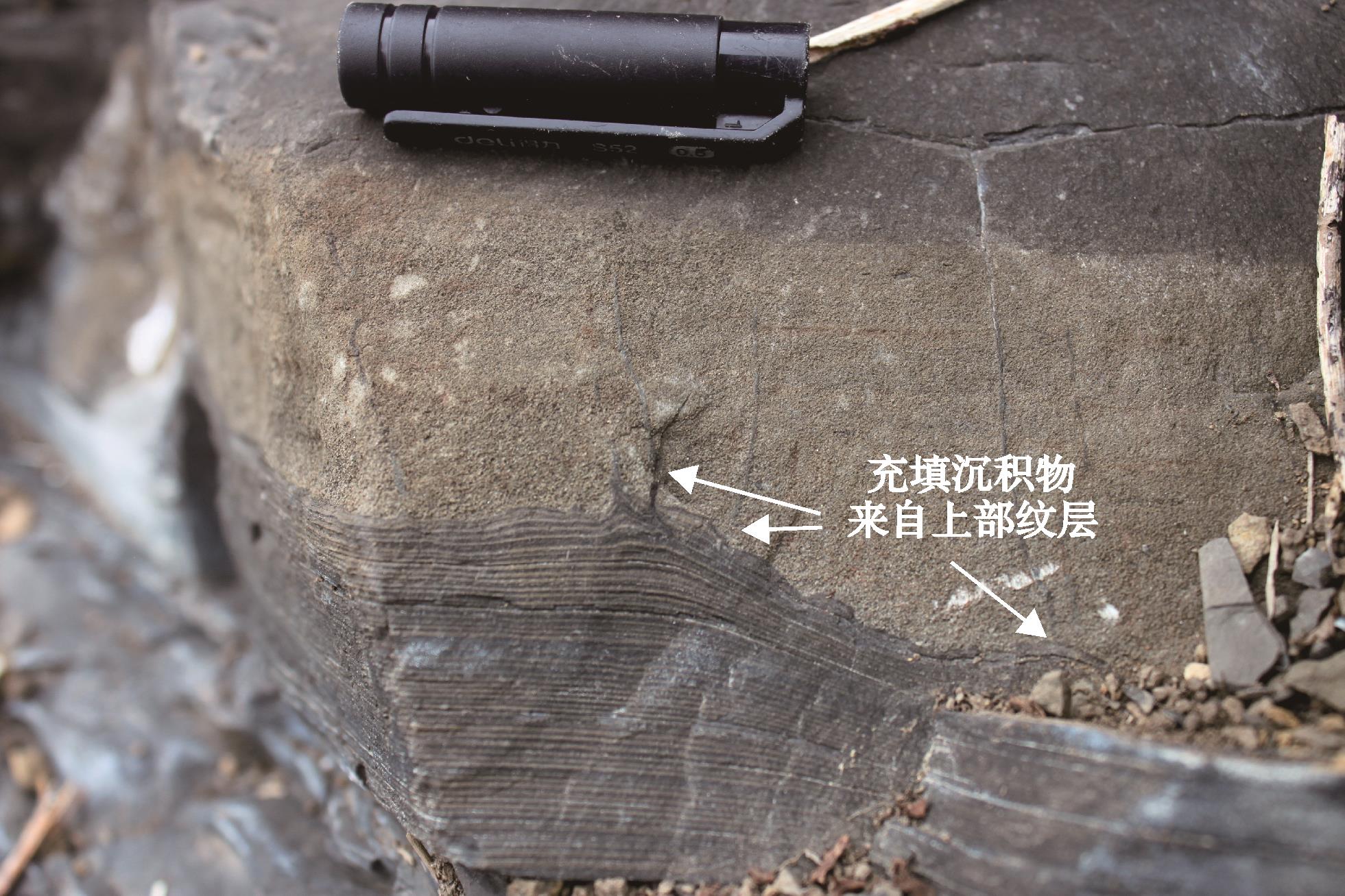
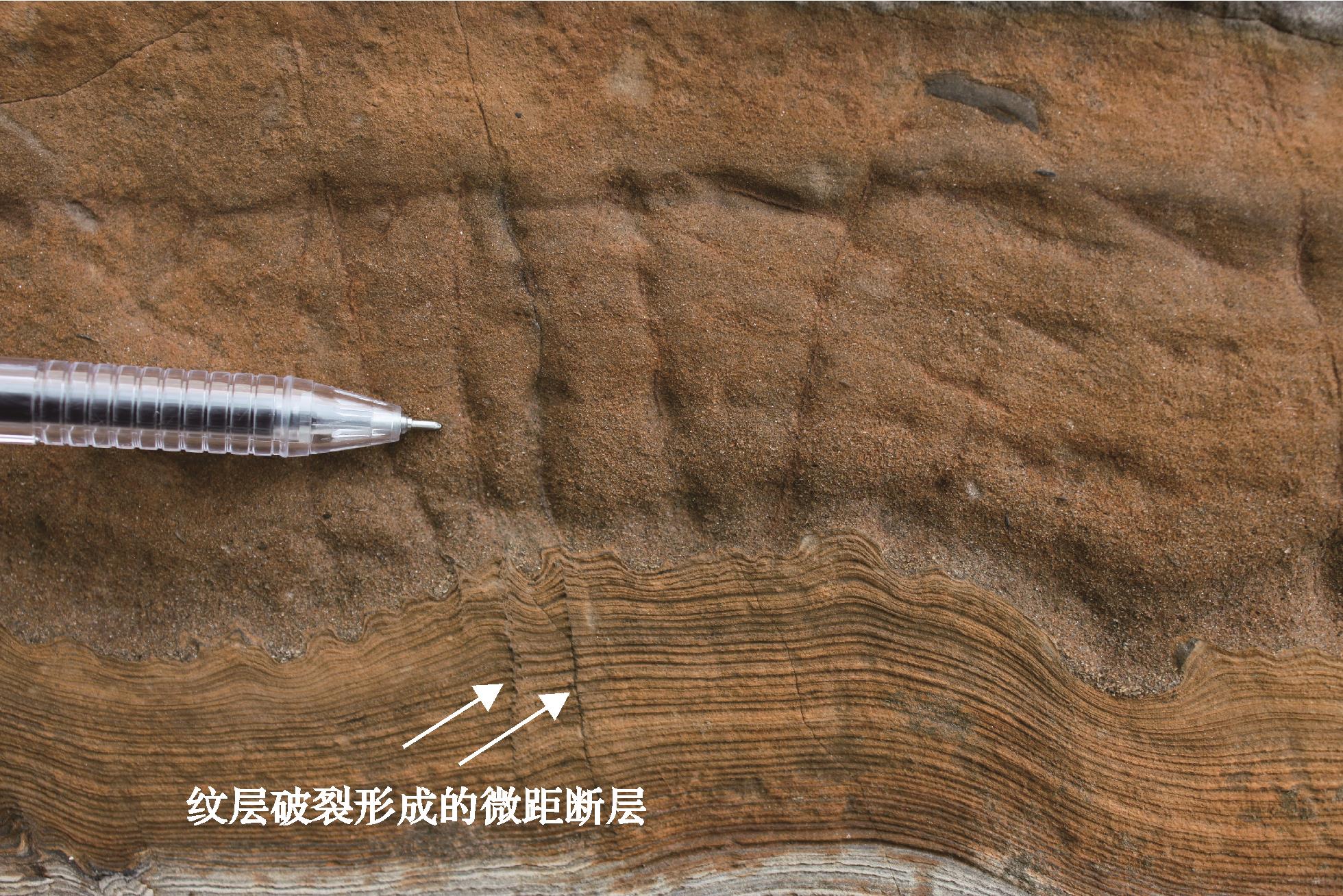
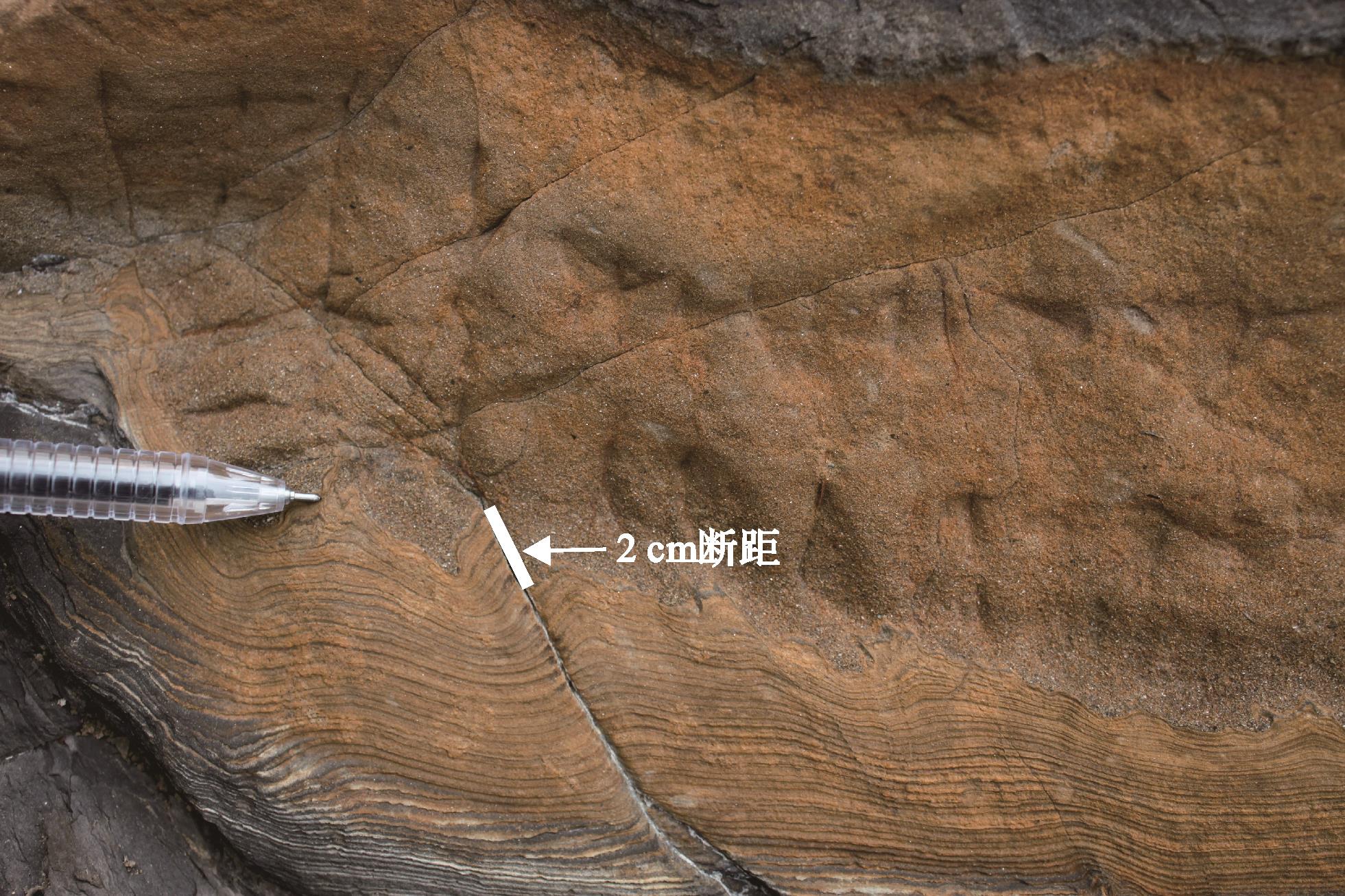
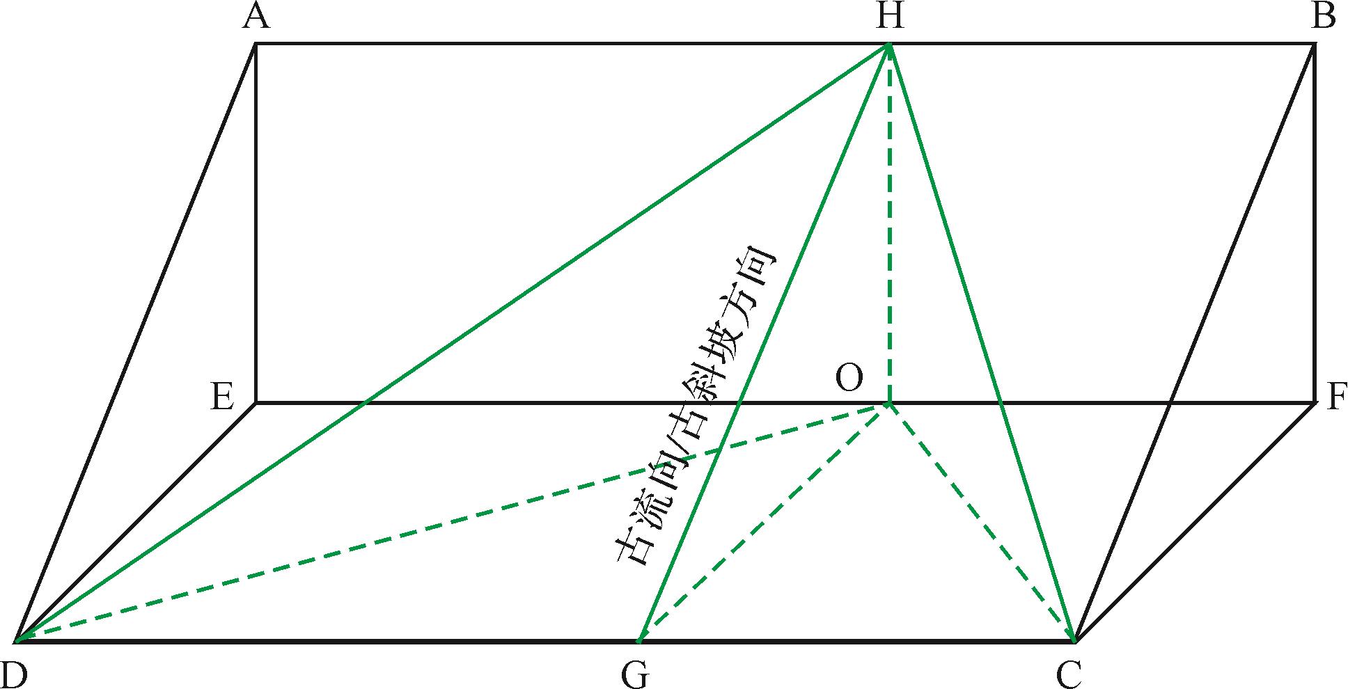
Many types of soft-sediment deformation structures are evident in the Xiuchuanchang section, Lingshan Island. Some are directionally inclined, and the influencing factors are not yet clear. This study researched the forming process, triggering agent and geological significance of the deformation structures combining field observation and analysis. It was found that load-squeeze structures, water-escape and sediment-injection structures and micro-faults had developed between two turbidite sequences in the Xiuchuanchang section. The deformation mechanism was mainly fluidization triggered by the load pressure resulting from the rapid sedimentation from the turbidity current. The deformation process of the structure is mainly related to two driving forces: inverse density gradient and lateral shear, the latter being derived from turbidity current flow caused the components of the deformed structures to be directionally inclined towards the SEE, indicating that the paleocurrent mainly came from the SEE direction. This is consistent with the paleocurrent direction measured from marks at the base of the turbidite sequences. It is concluded that the soft-sediment deformational structures in the study area induced by rapid sedimentation from turbidity flow can indicate the paleocurrent/paleoslope direction.
Many types of soft-sediment deformation structures are evident in the Xiuchuanchang section, Lingshan Island. Some are directionally inclined, and the influencing factors are not yet clear. This study researched the forming process, triggering agent and geological significance of the deformation structures combining field observation and analysis. It was found that load-squeeze structures, water-escape and sediment-injection structures and micro-faults had developed between two turbidite sequences in the Xiuchuanchang section. The deformation mechanism was mainly fluidization triggered by the load pressure resulting from the rapid sedimentation from the turbidity current. The deformation process of the structure is mainly related to two driving forces: inverse density gradient and lateral shear, the latter being derived from turbidity current flow caused the components of the deformed structures to be directionally inclined towards the SEE, indicating that the paleocurrent mainly came from the SEE direction. This is consistent with the paleocurrent direction measured from marks at the base of the turbidite sequences. It is concluded that the soft-sediment deformational structures in the study area induced by rapid sedimentation from turbidity flow can indicate the paleocurrent/paleoslope direction.


2023, 41(2): 459-471.
doi: 10.14027/j.issn.1000-0550.2021.088
Abstract:
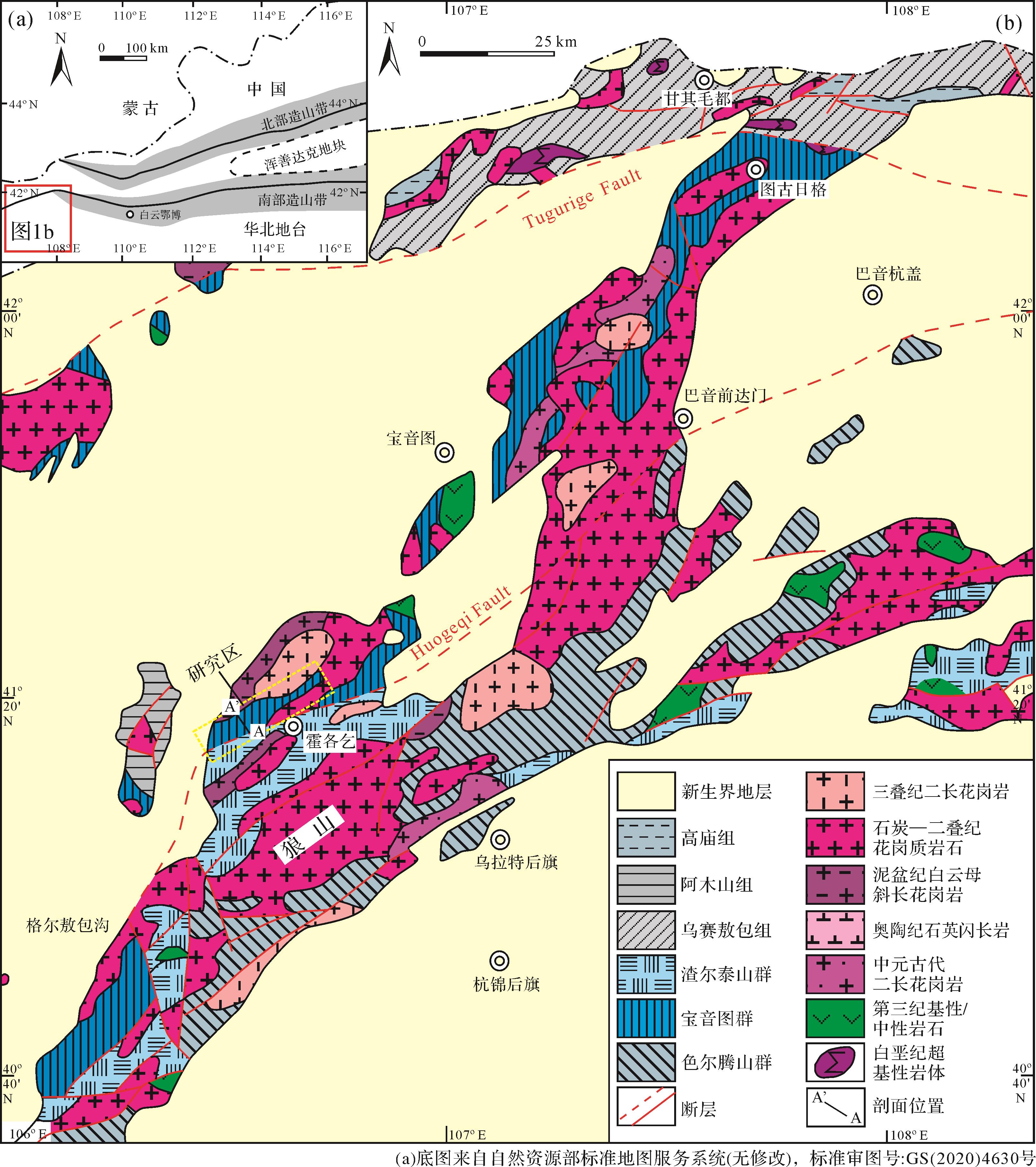
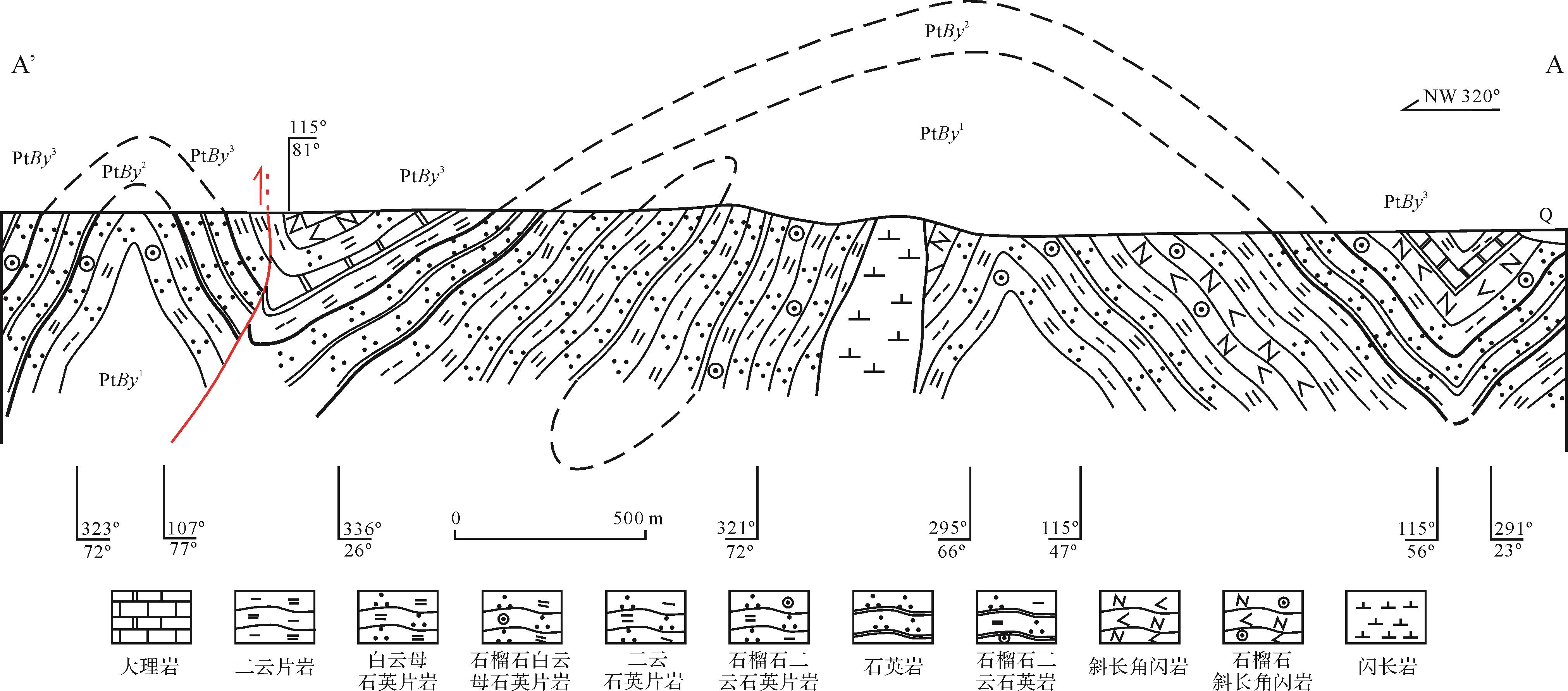
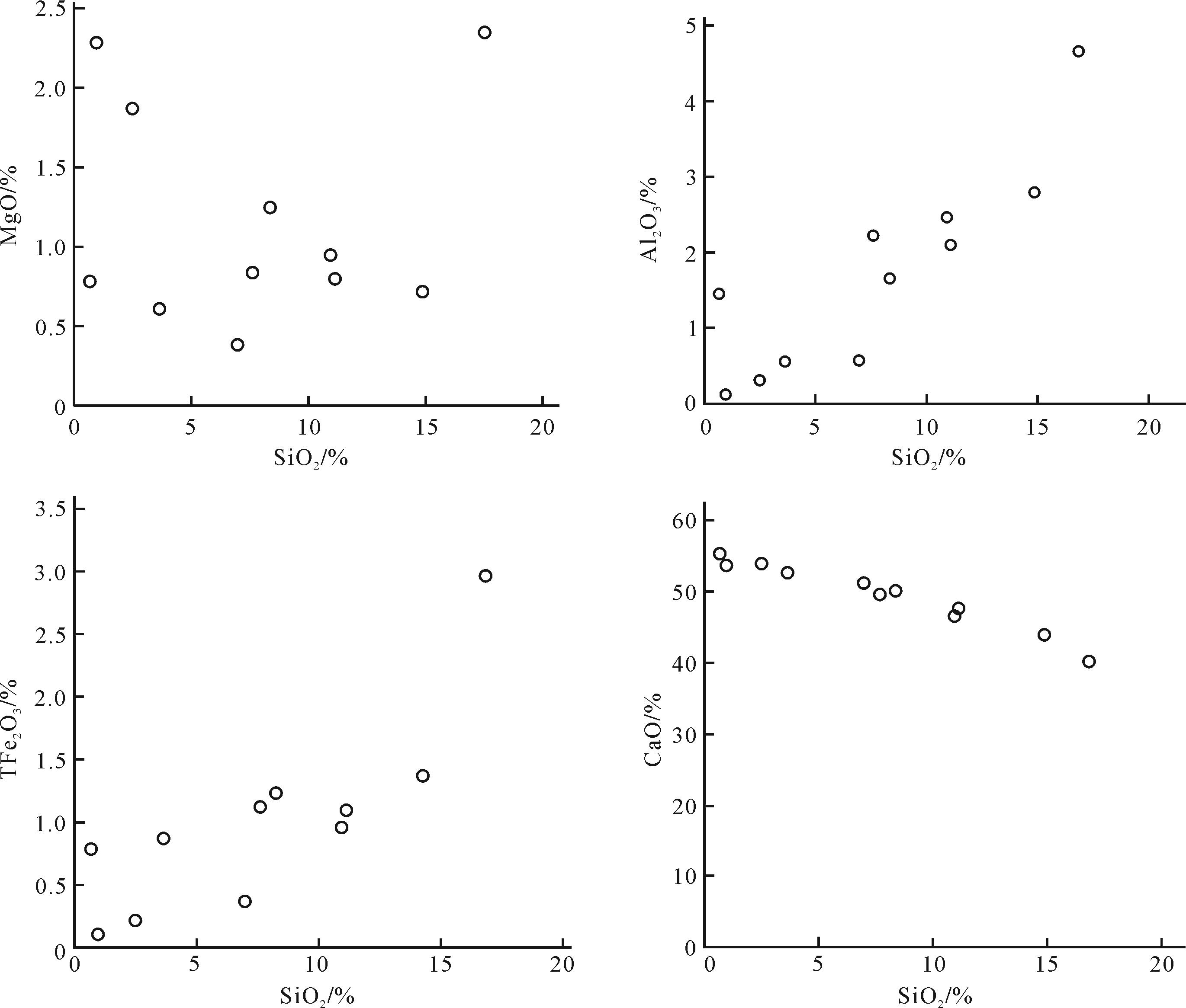
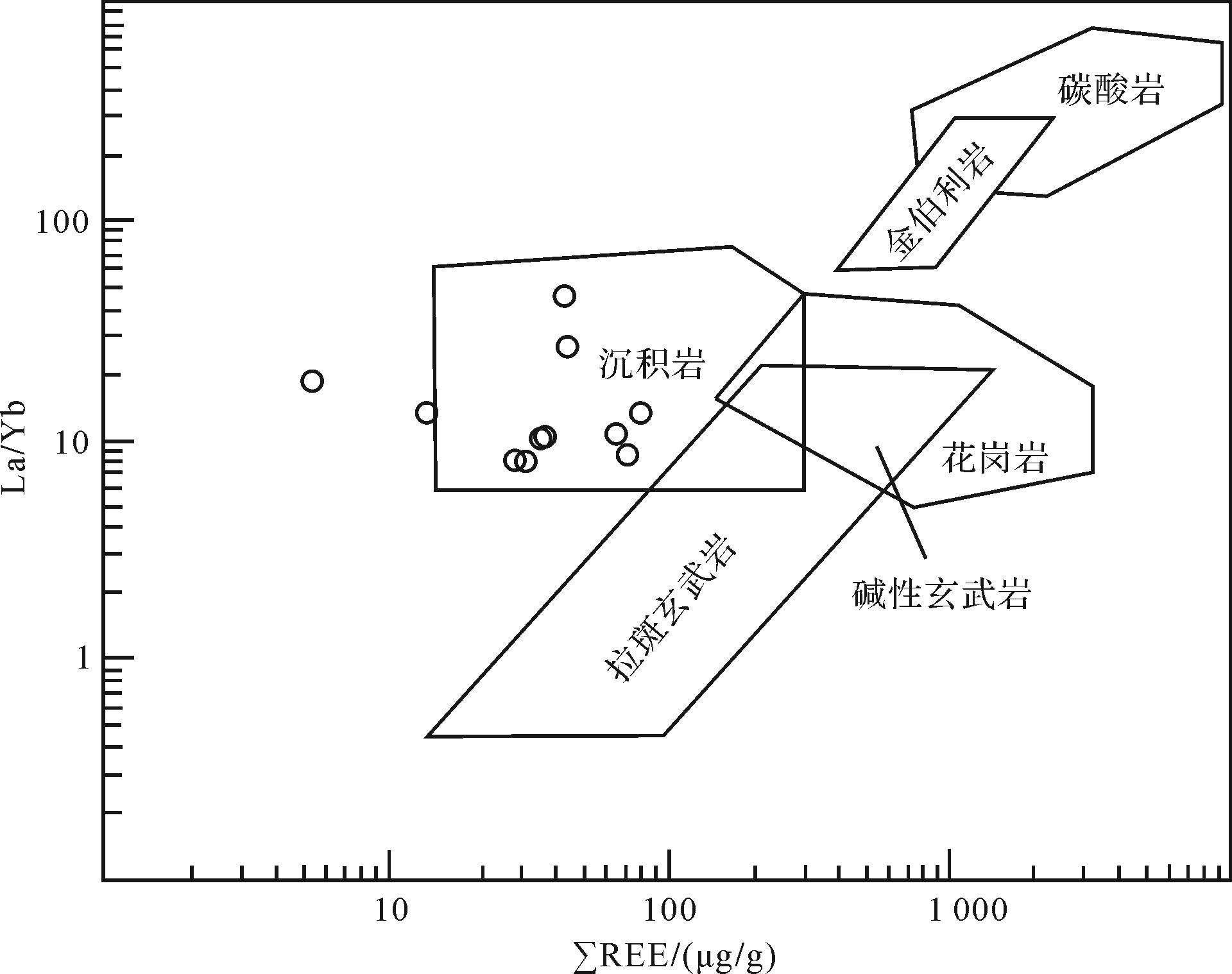
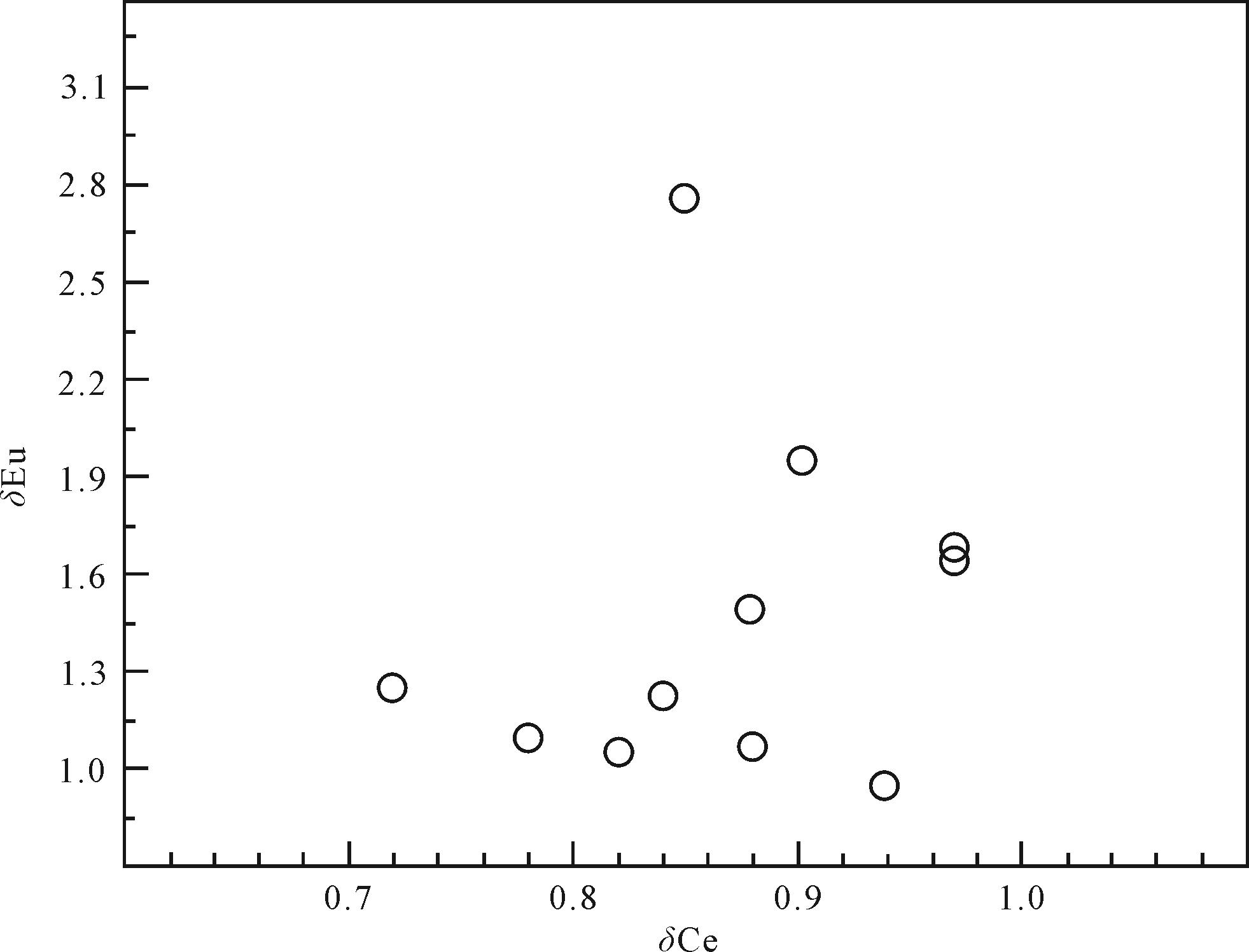
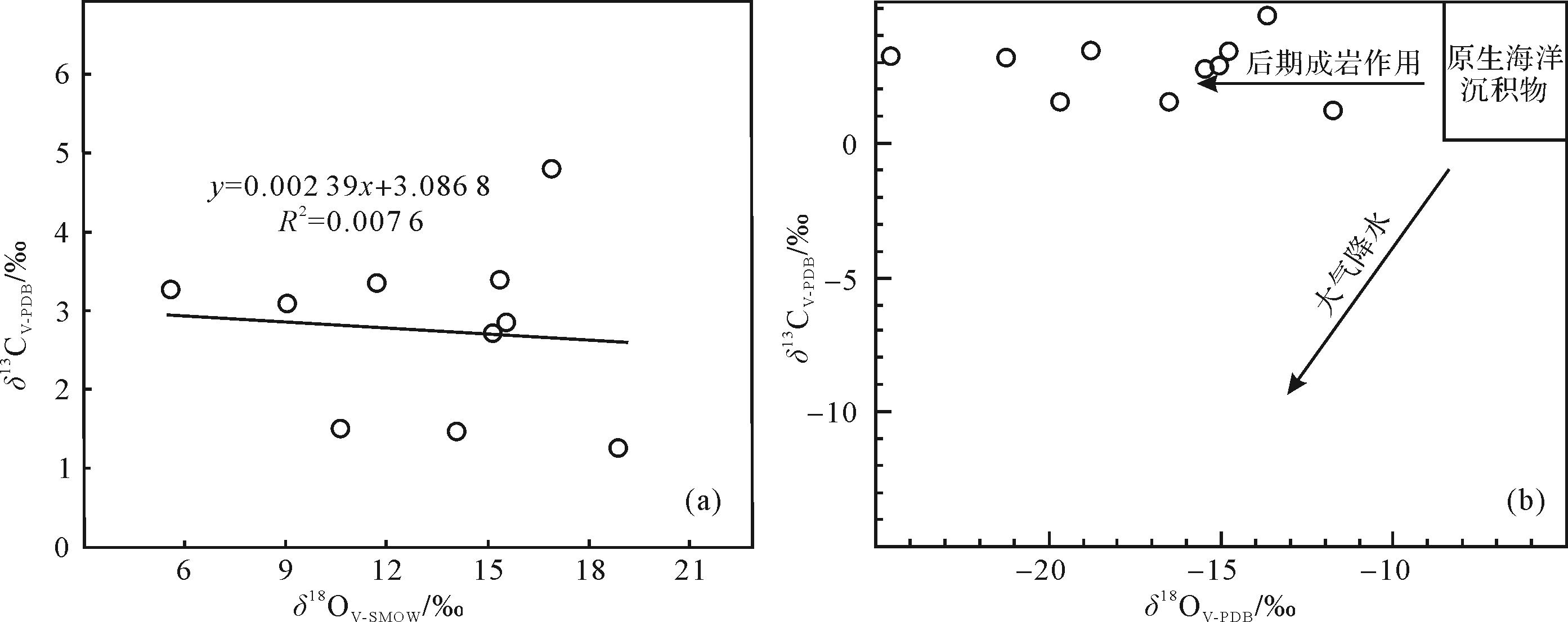
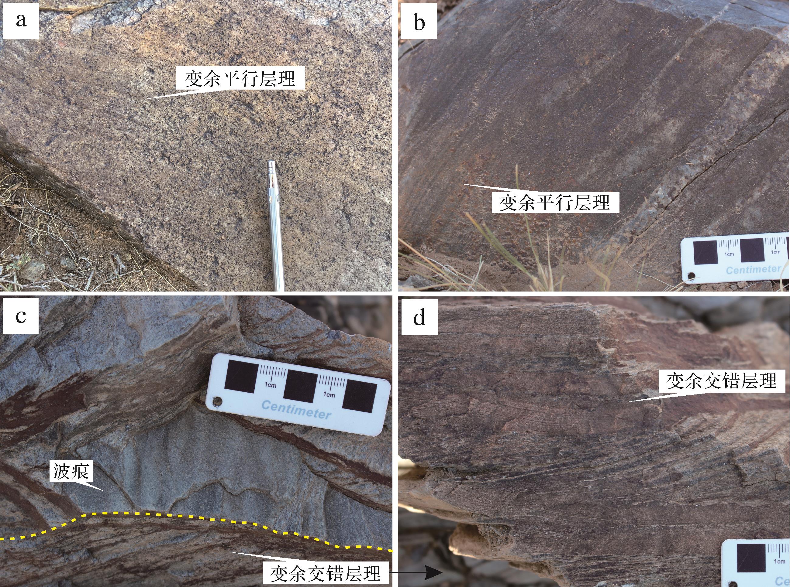
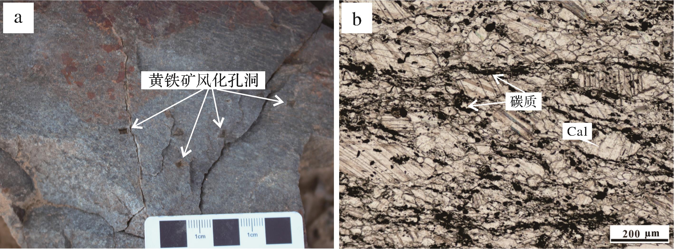
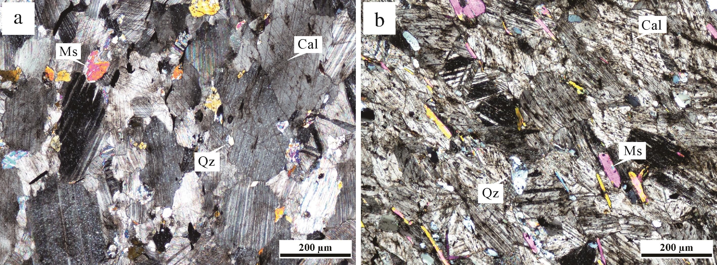
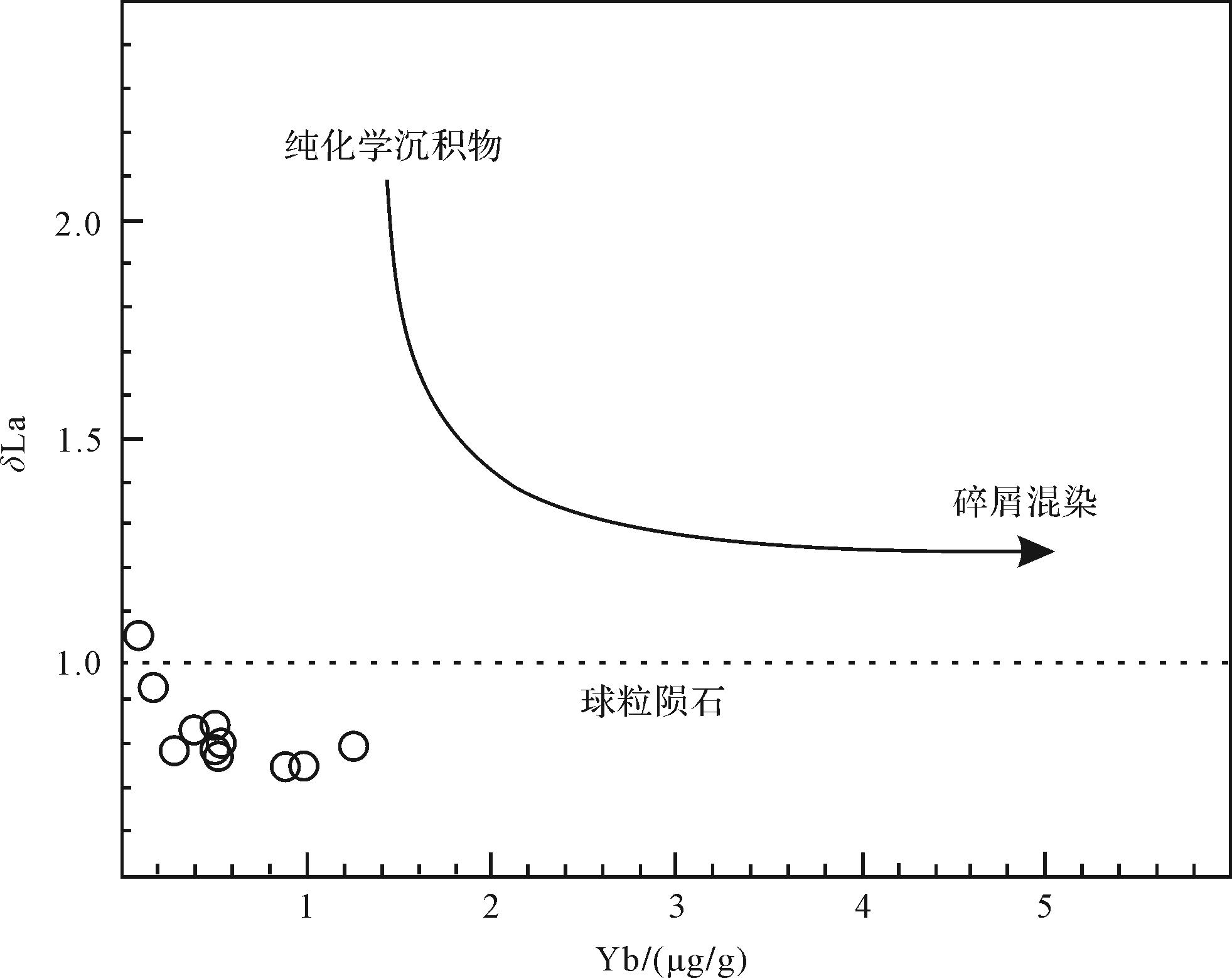
The Buyant group is one of the most widely distributed stratigraphic units in the northern margin of the North China Platform. This paper presents the study of marbles from the Buyant group in Huogeqi, which is important for reconstructing the paleogeographic environment in the northern margin of the North China Platform. The study of marble and stratigraphic fabric characteristics of the Buyant Group in Huogeqi shows: Z value (121-130), Sr/Ba ratio (1.90⁃55.8), m value (25.7⁃1 973), and carbon isotope composition (δ13CV-PDB is 1.25 to 4.79) of marbles, as well as blastobedding structure and wave ripples in stratum, which indicate there was a marine environment. The weak negative Ce anomaly (δCe is 0.78⁃0.97), weak positive Eu anomaly (δEu is 0.93⁃2.75), V/Cr ratio (0.46⁃4.09) of marbles, and the existence of carbon and weathering pores of primary pyrite in stratum indicate that the original sedimentary water was in a sub-oxidized state. The Hucker diagram, Y/Ho ratio (27.2⁃45.0), δLa-Yb diagram, and the distribution of silica-alumina minerals in marbles show there was abundant input of terrestrial clastic materials in the original deposition process. From the late Mid-Proterozoic to early Neo-Proterozoic, the northern margin of the North China Platform was a marine environment.
The Buyant group is one of the most widely distributed stratigraphic units in the northern margin of the North China Platform. This paper presents the study of marbles from the Buyant group in Huogeqi, which is important for reconstructing the paleogeographic environment in the northern margin of the North China Platform. The study of marble and stratigraphic fabric characteristics of the Buyant Group in Huogeqi shows: Z value (121-130), Sr/Ba ratio (1.90⁃55.8), m value (25.7⁃1 973), and carbon isotope composition (δ13CV-PDB is 1.25 to 4.79) of marbles, as well as blastobedding structure and wave ripples in stratum, which indicate there was a marine environment. The weak negative Ce anomaly (δCe is 0.78⁃0.97), weak positive Eu anomaly (δEu is 0.93⁃2.75), V/Cr ratio (0.46⁃4.09) of marbles, and the existence of carbon and weathering pores of primary pyrite in stratum indicate that the original sedimentary water was in a sub-oxidized state. The Hucker diagram, Y/Ho ratio (27.2⁃45.0), δLa-Yb diagram, and the distribution of silica-alumina minerals in marbles show there was abundant input of terrestrial clastic materials in the original deposition process. From the late Mid-Proterozoic to early Neo-Proterozoic, the northern margin of the North China Platform was a marine environment.
2023, 41(2): 472-484.
doi: 10.14027/j.issn.1000-0550.2021.111
Abstract:
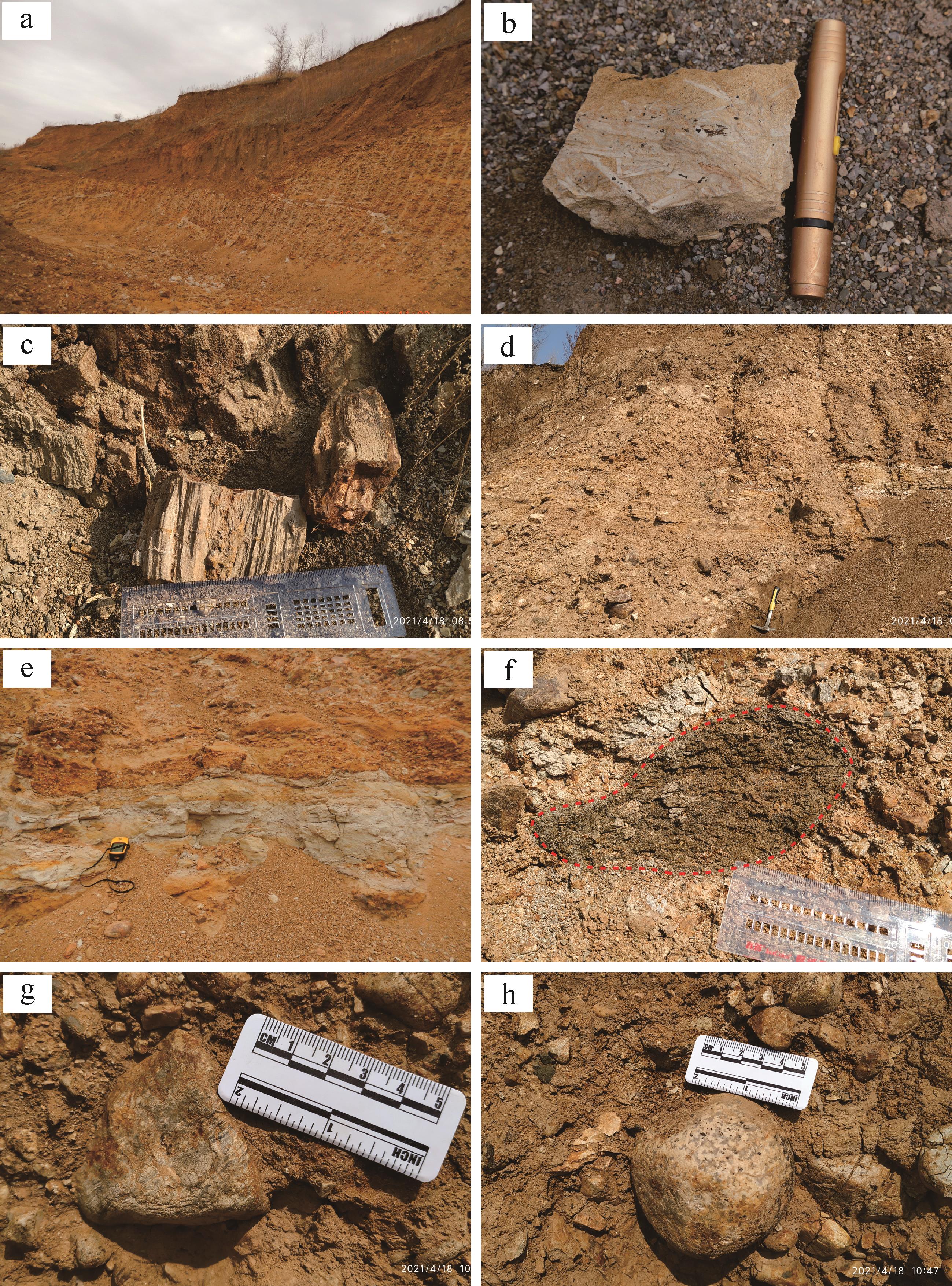
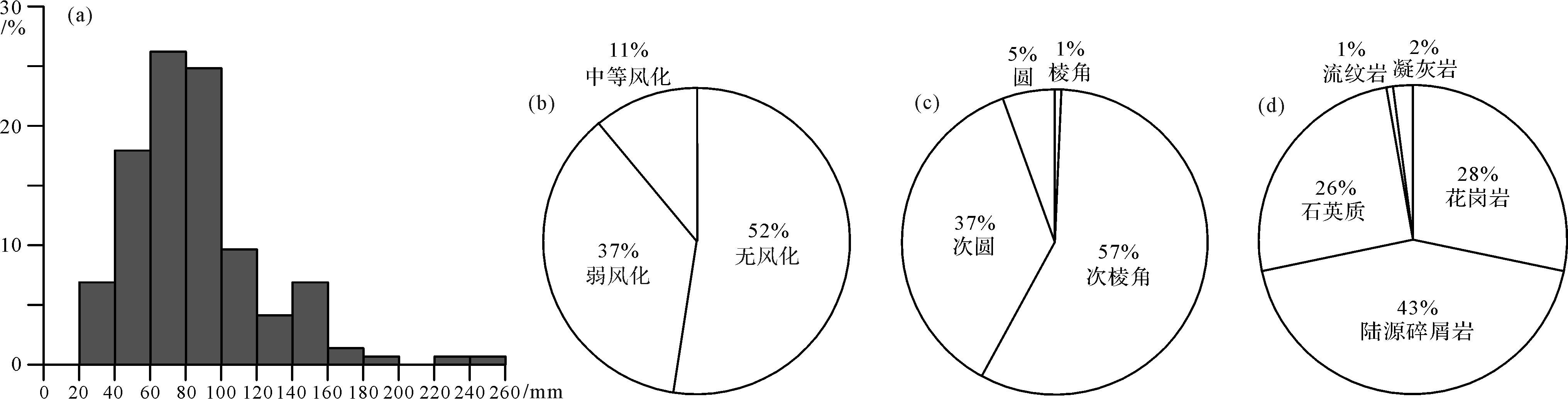
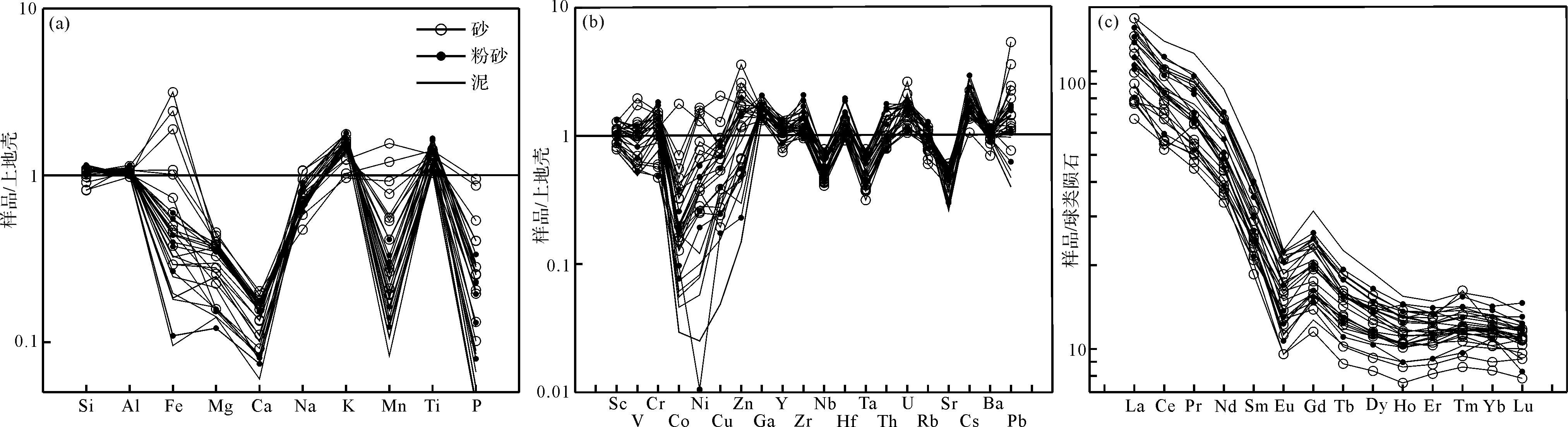
The gravel layer (Juren profile) in Juren town, Bin county, Heilongjiang province has previously been regarded as part of the Luojiawopeng Formation, and its genesis was thought to be Early Pleistocene glacial moraine deposits. Very little research has been done on the Juren profile and the Luojiawopeng Formation, however, which has greatly restricted reconstruction of the regional tectonic-landform-climate-drainage evolution from the information recorded in the strata. To throw more light on this topic, the Juren profile was selected to study its sedimentology, mineralogy and elemental geochemistry. It was found that the gravel has a low degree of weathering, poor sorting, good rounding, and is non-directional. It is dominated by terrigenous clastic rocks (43%), granite (28%) and quartz (26%), and contains small amounts of tuff and rhyolite. The composition of heavy minerals is dominated by epidote (42%) and anatase (9.9%), followed by leucoxene (8.7%), barite (15.2%), pyrite (14.5%) and fluorite (11.3%). They occur in large amounts in individual samples, with a lower content of other heavy minerals. Elemental geochemical tests revealed a weak-to-medium degree of chemical weathering, most of which has undergone the first cycle and retains its felsic source-rock properties. Sediment color, degree of consolidation, sediment structure, stratigraphic structure, sediment genetic type and geomorphological characteristics are all significantly different from those in the Luojiawopeng Formation, from which it is inferred that the two are not related. The genetic type is lakeside or river inflow delta deposit. These findings are of great importance for the division of Quaternary strata in the Harbin area and for the reconstruction of the regional environment in the Early Pleistocene.
The gravel layer (Juren profile) in Juren town, Bin county, Heilongjiang province has previously been regarded as part of the Luojiawopeng Formation, and its genesis was thought to be Early Pleistocene glacial moraine deposits. Very little research has been done on the Juren profile and the Luojiawopeng Formation, however, which has greatly restricted reconstruction of the regional tectonic-landform-climate-drainage evolution from the information recorded in the strata. To throw more light on this topic, the Juren profile was selected to study its sedimentology, mineralogy and elemental geochemistry. It was found that the gravel has a low degree of weathering, poor sorting, good rounding, and is non-directional. It is dominated by terrigenous clastic rocks (43%), granite (28%) and quartz (26%), and contains small amounts of tuff and rhyolite. The composition of heavy minerals is dominated by epidote (42%) and anatase (9.9%), followed by leucoxene (8.7%), barite (15.2%), pyrite (14.5%) and fluorite (11.3%). They occur in large amounts in individual samples, with a lower content of other heavy minerals. Elemental geochemical tests revealed a weak-to-medium degree of chemical weathering, most of which has undergone the first cycle and retains its felsic source-rock properties. Sediment color, degree of consolidation, sediment structure, stratigraphic structure, sediment genetic type and geomorphological characteristics are all significantly different from those in the Luojiawopeng Formation, from which it is inferred that the two are not related. The genetic type is lakeside or river inflow delta deposit. These findings are of great importance for the division of Quaternary strata in the Harbin area and for the reconstruction of the regional environment in the Early Pleistocene.


2023, 41(2): 485-497.
doi: 10.14027/j.issn.1000-0550.2021.100
Abstract:
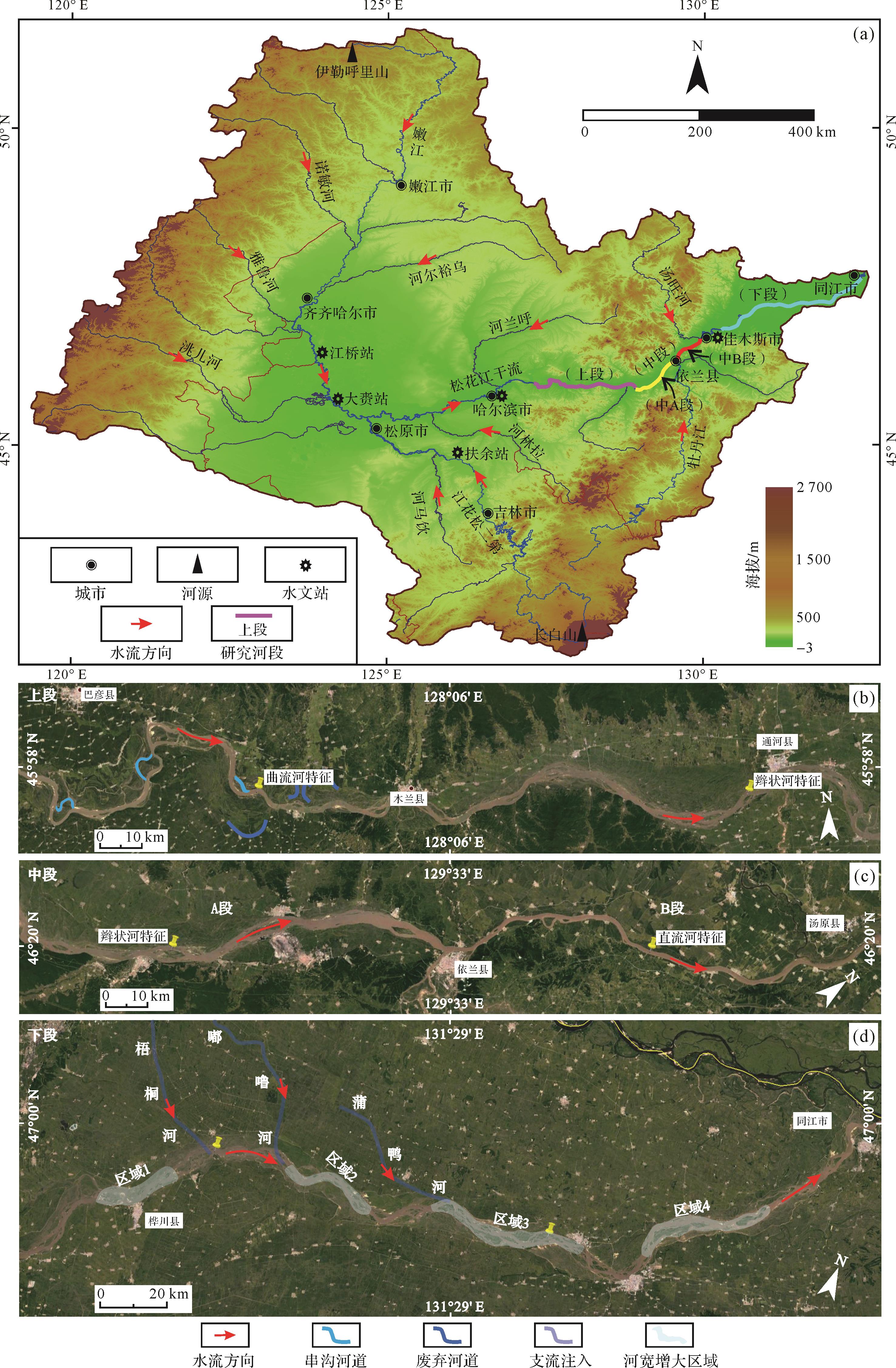
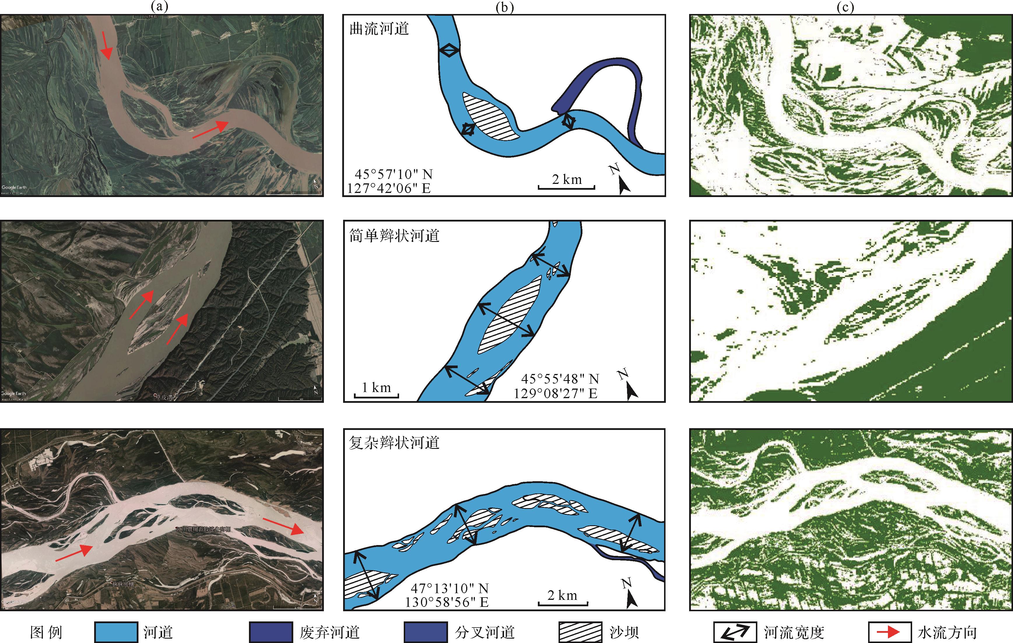
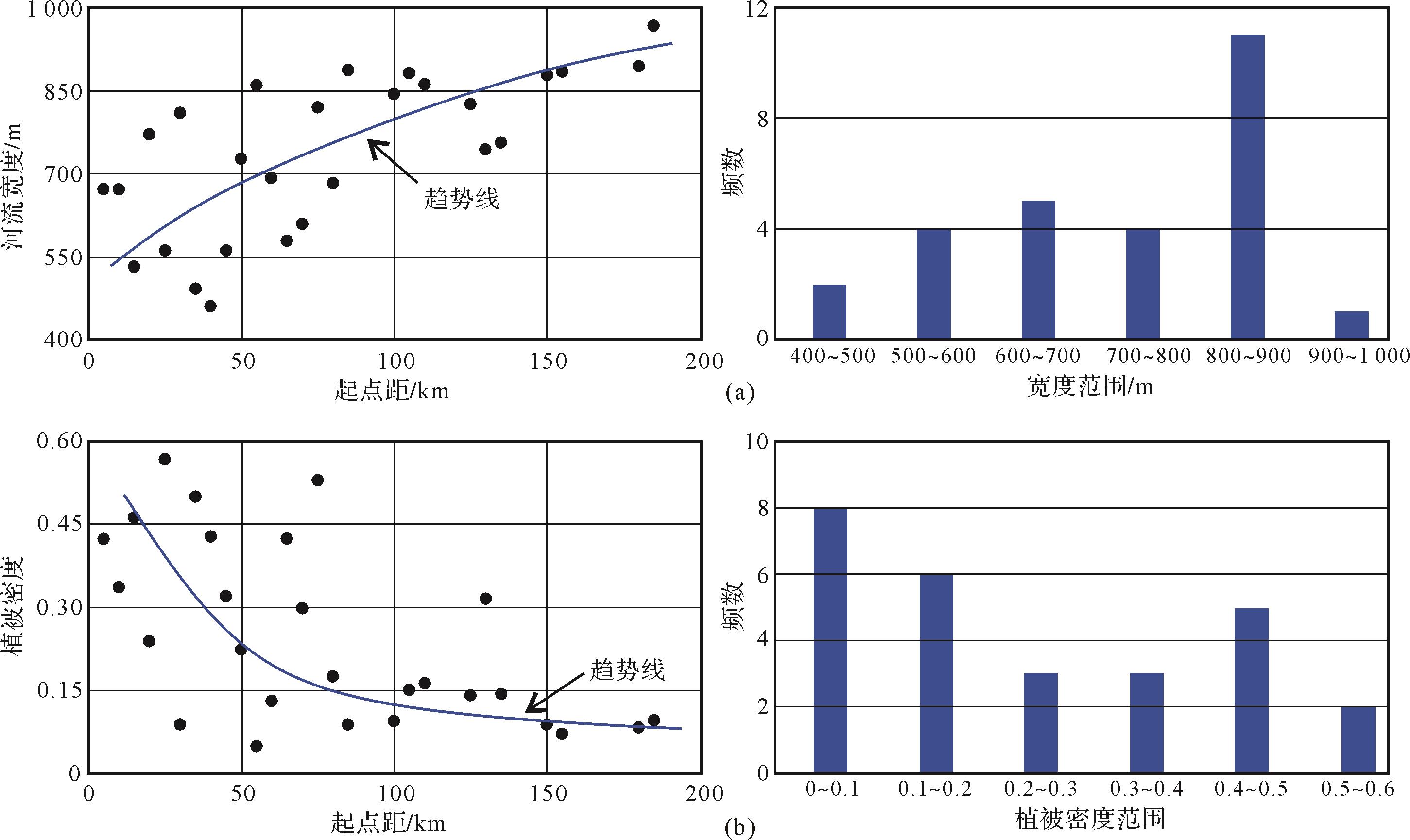
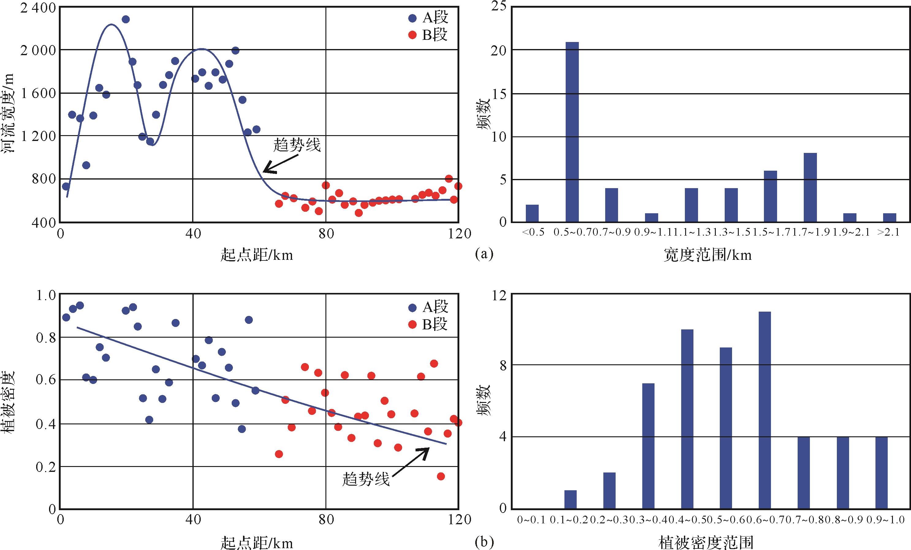
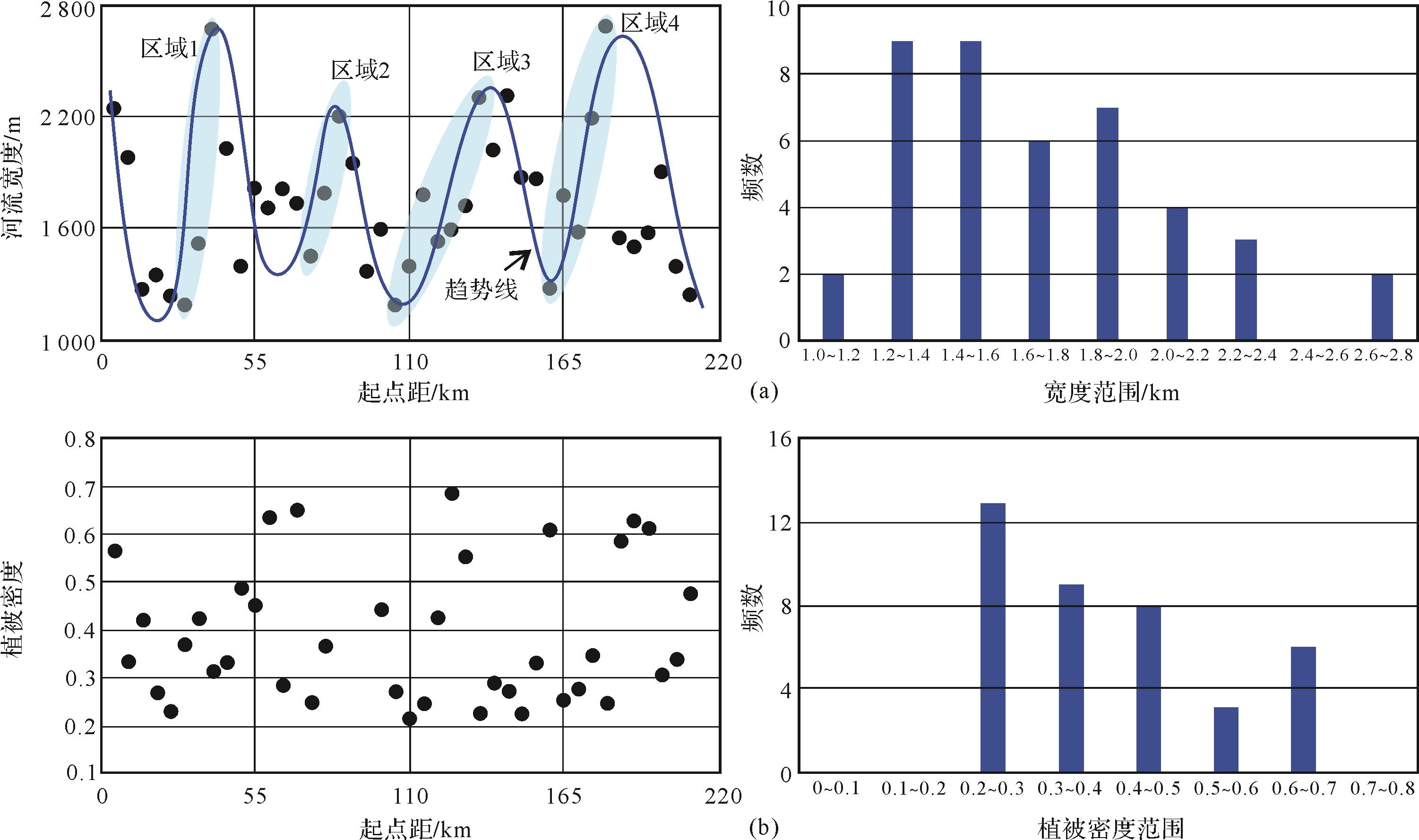
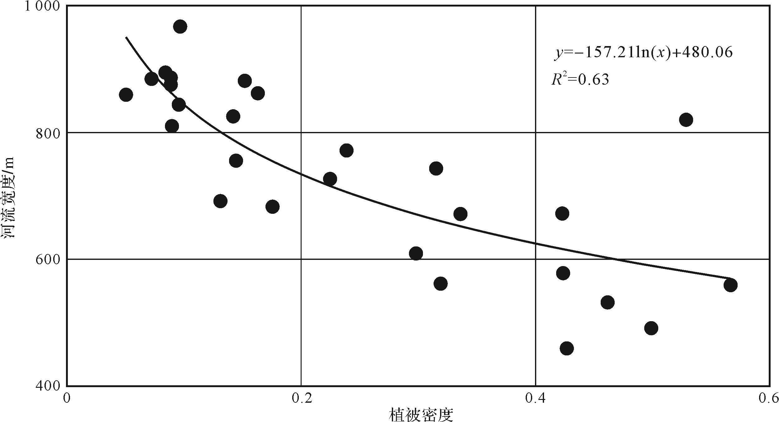
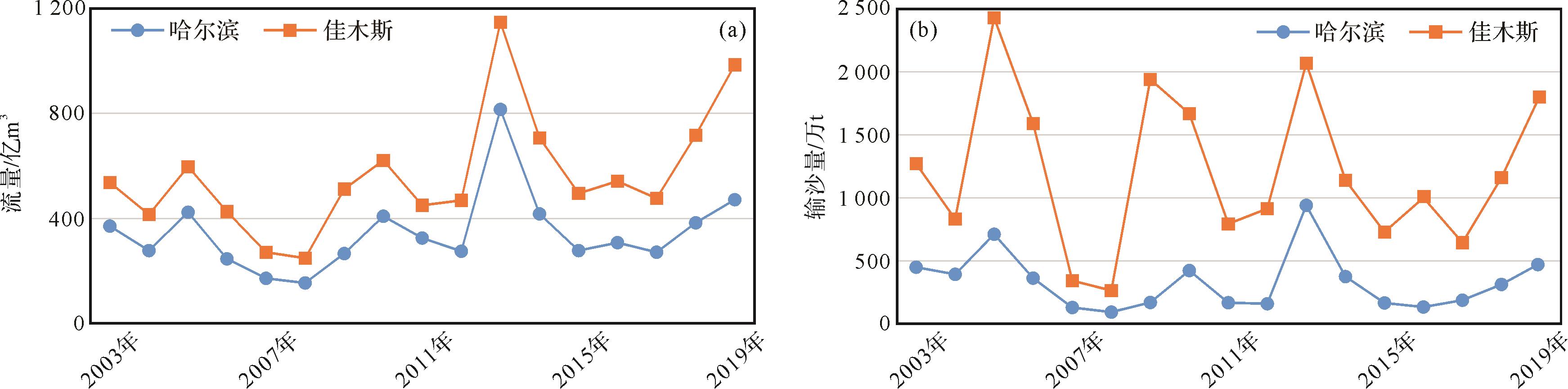
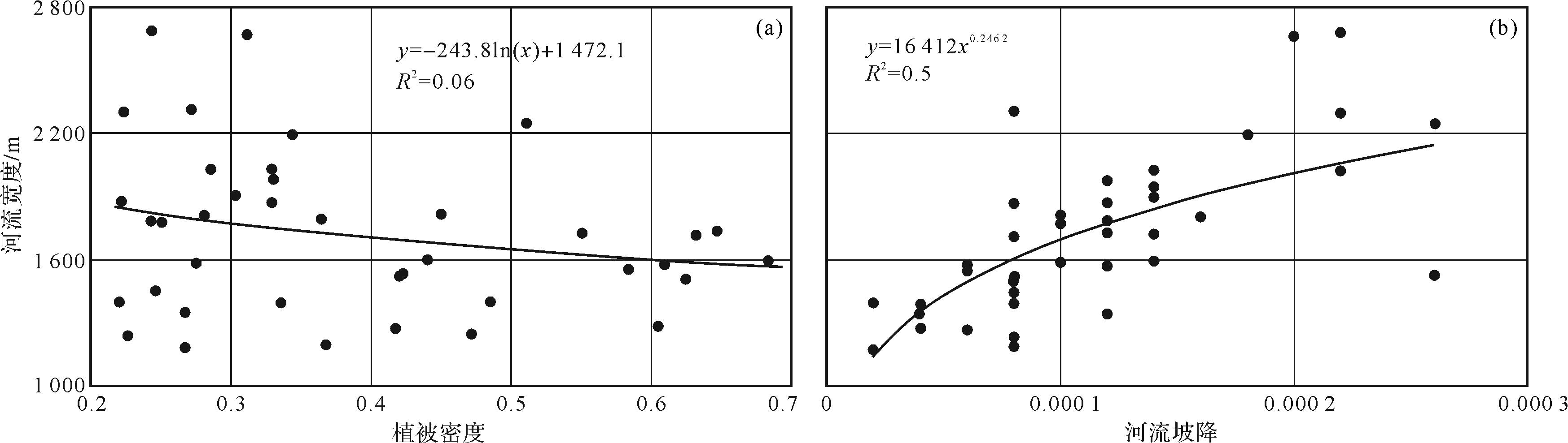
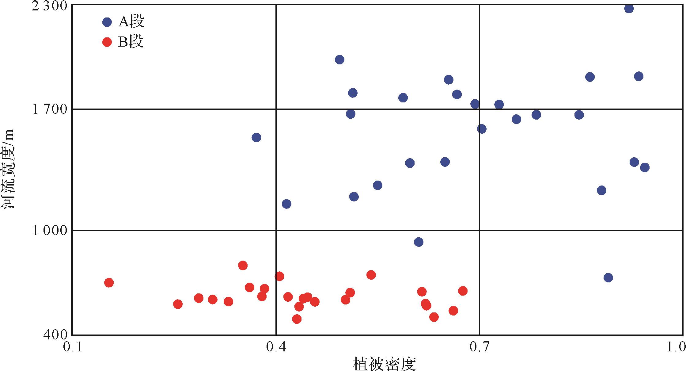
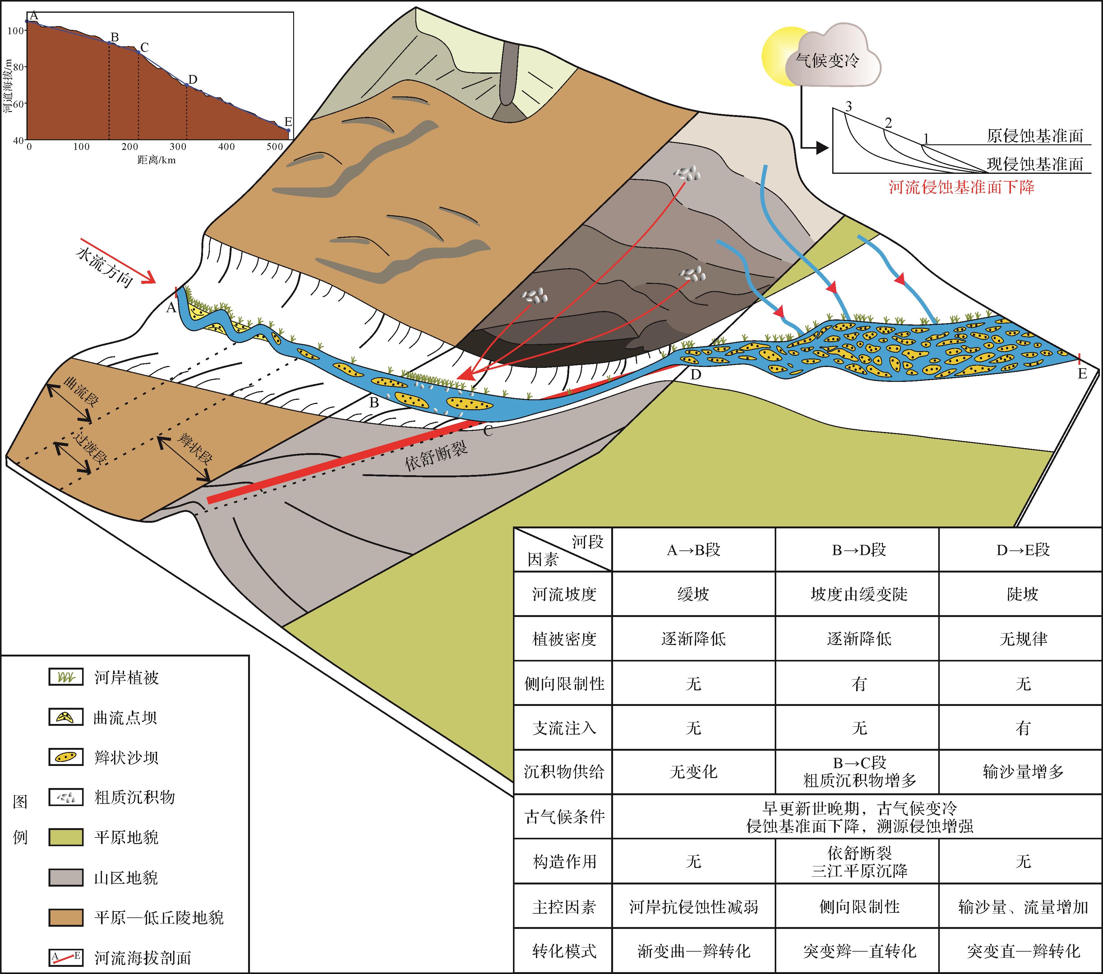
The study of river pattern transformation mechanisms is highly significant in the analysis of river sedimentary deposits. The middle and lower reaches of the Songhua River main stream were the object of this study. Google Earth and Arc GIS software were used to carefully measure the morphological parameters of the river, and the river-pattern growth and the influences leading to changes in the two reaches were then investigated. The study showed the following. (1) Three river types occur in these regions: meandering, braided and straight river zones. These were divided into three sections from upstream to downstream according to their geomorphic features, plane morphology and sinuosity. The upper section of the river is a coexisting meandering-braided river that has gradually widened and gradually reduced the density of the vegetation on a slight sloping background. The middle section ‘A’ is a wide, simple braided river with high vegetation density on a low slope. The middle section ‘B’ is straight and relatively narrow, with low vegetation density on a steeply sloping background. The lower section is a complex braided river in steeply sloping ground; its width changes frequently. (2) The main cause of transformation from a meandering river to a braided river is the erosion resistance of the banks due to the decrease in vegetation density. The factor influencing transformation from braided to straight river is the enhancement of downwards erosion resulting from the “clamping” effect of the steeply sloping terrain. The final transformation from straight river to braided river is due to the increased water and sediment discharge from tributaries. (3) Three river pattern transformation models were established for the middle and lower reaches of the river,a gradual change from meandering to braided stream in the upper section; abrupt change from braided to straight in the middle section; and abrupt change from straight to braided in the lower section.
The study of river pattern transformation mechanisms is highly significant in the analysis of river sedimentary deposits. The middle and lower reaches of the Songhua River main stream were the object of this study. Google Earth and Arc GIS software were used to carefully measure the morphological parameters of the river, and the river-pattern growth and the influences leading to changes in the two reaches were then investigated. The study showed the following. (1) Three river types occur in these regions: meandering, braided and straight river zones. These were divided into three sections from upstream to downstream according to their geomorphic features, plane morphology and sinuosity. The upper section of the river is a coexisting meandering-braided river that has gradually widened and gradually reduced the density of the vegetation on a slight sloping background. The middle section ‘A’ is a wide, simple braided river with high vegetation density on a low slope. The middle section ‘B’ is straight and relatively narrow, with low vegetation density on a steeply sloping background. The lower section is a complex braided river in steeply sloping ground; its width changes frequently. (2) The main cause of transformation from a meandering river to a braided river is the erosion resistance of the banks due to the decrease in vegetation density. The factor influencing transformation from braided to straight river is the enhancement of downwards erosion resulting from the “clamping” effect of the steeply sloping terrain. The final transformation from straight river to braided river is due to the increased water and sediment discharge from tributaries. (3) Three river pattern transformation models were established for the middle and lower reaches of the river,a gradual change from meandering to braided stream in the upper section; abrupt change from braided to straight in the middle section; and abrupt change from straight to braided in the lower section.
2023, 41(2): 498-510.
doi: 10.14027/j.issn.1000-0550.2021.090
Abstract:
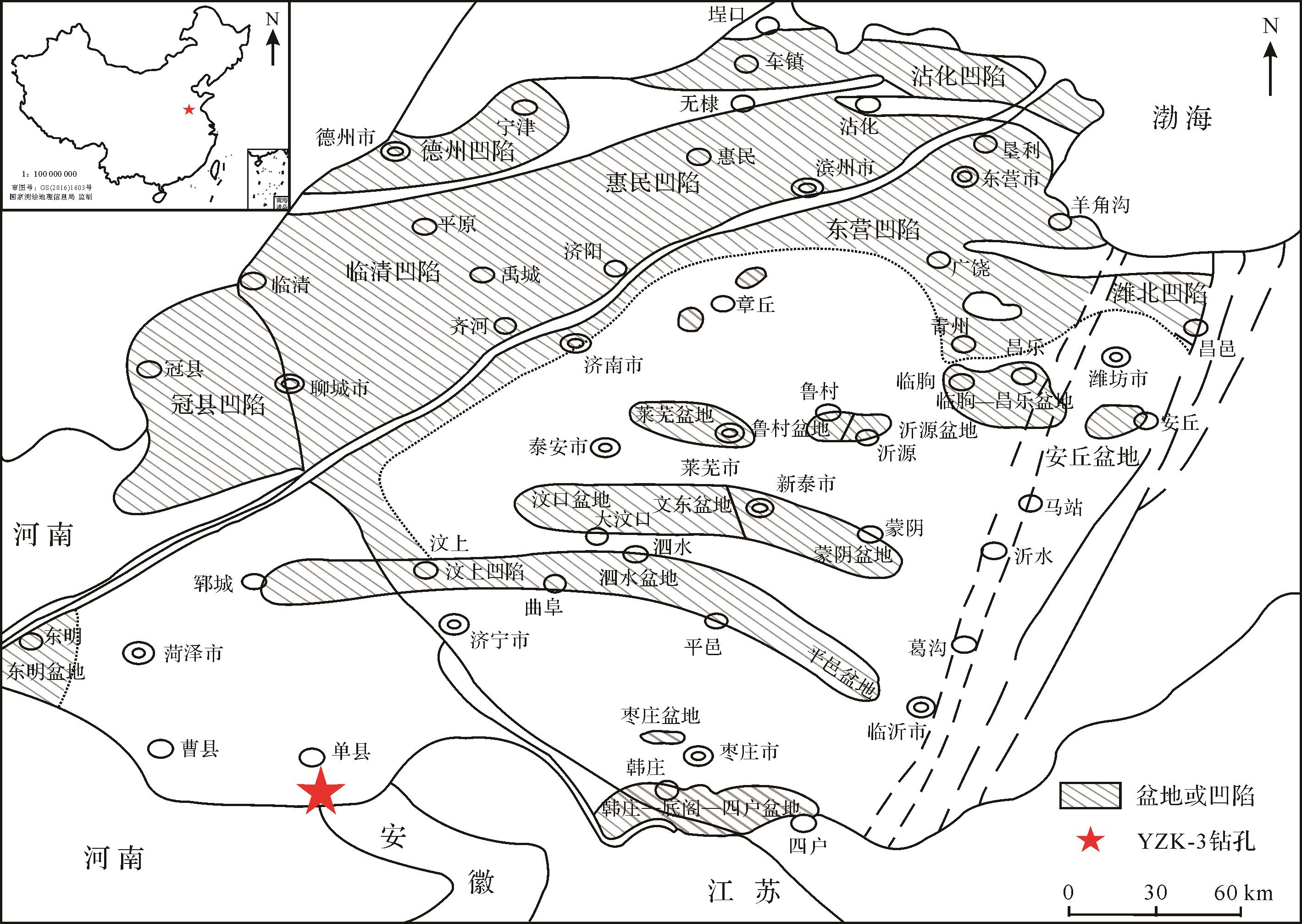
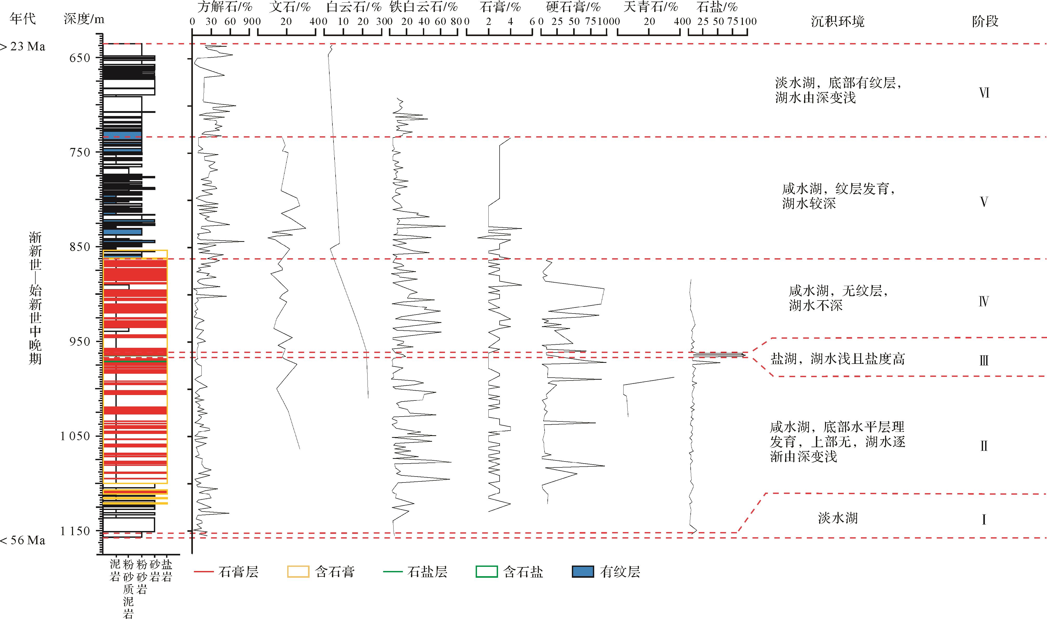
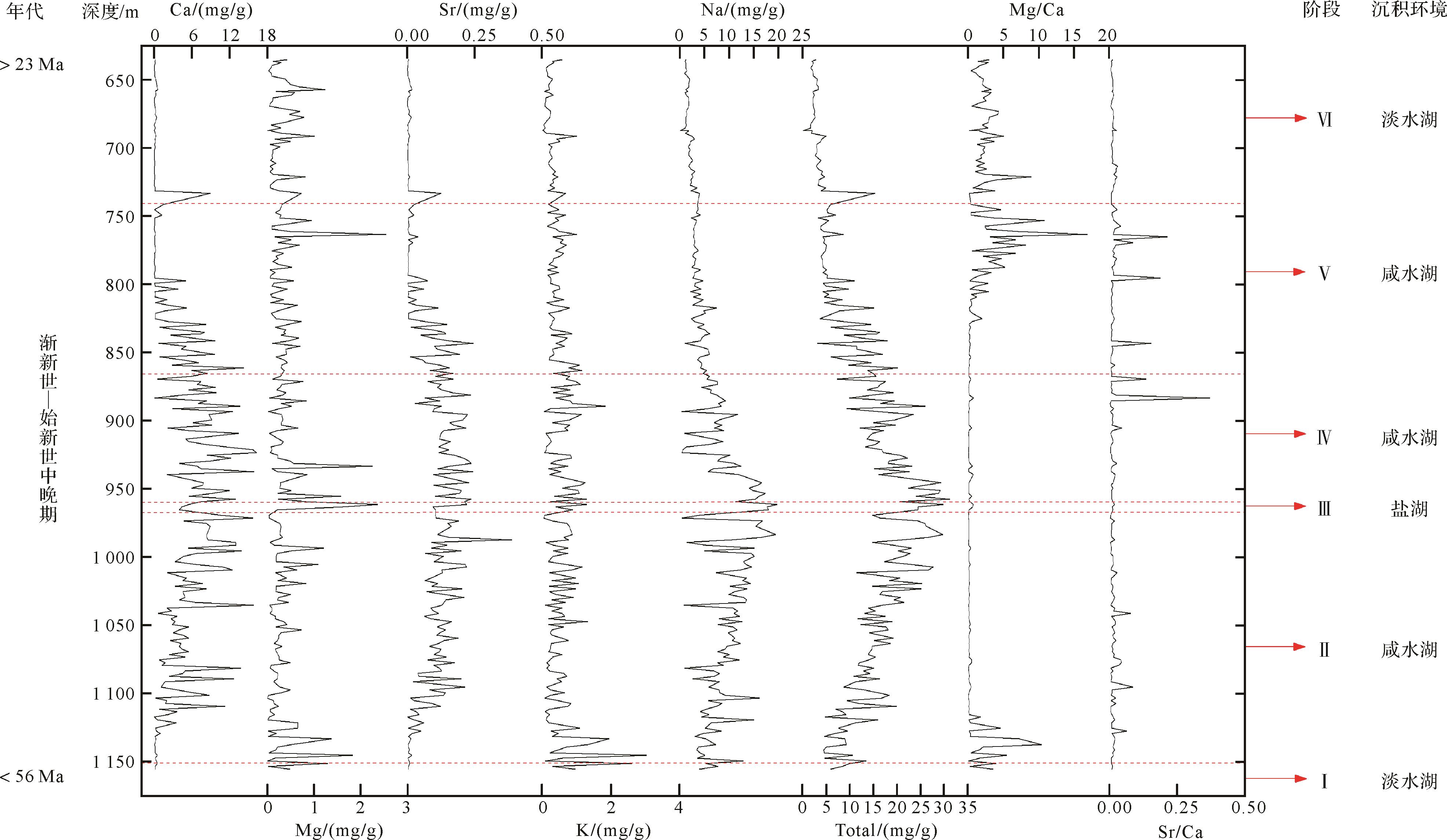
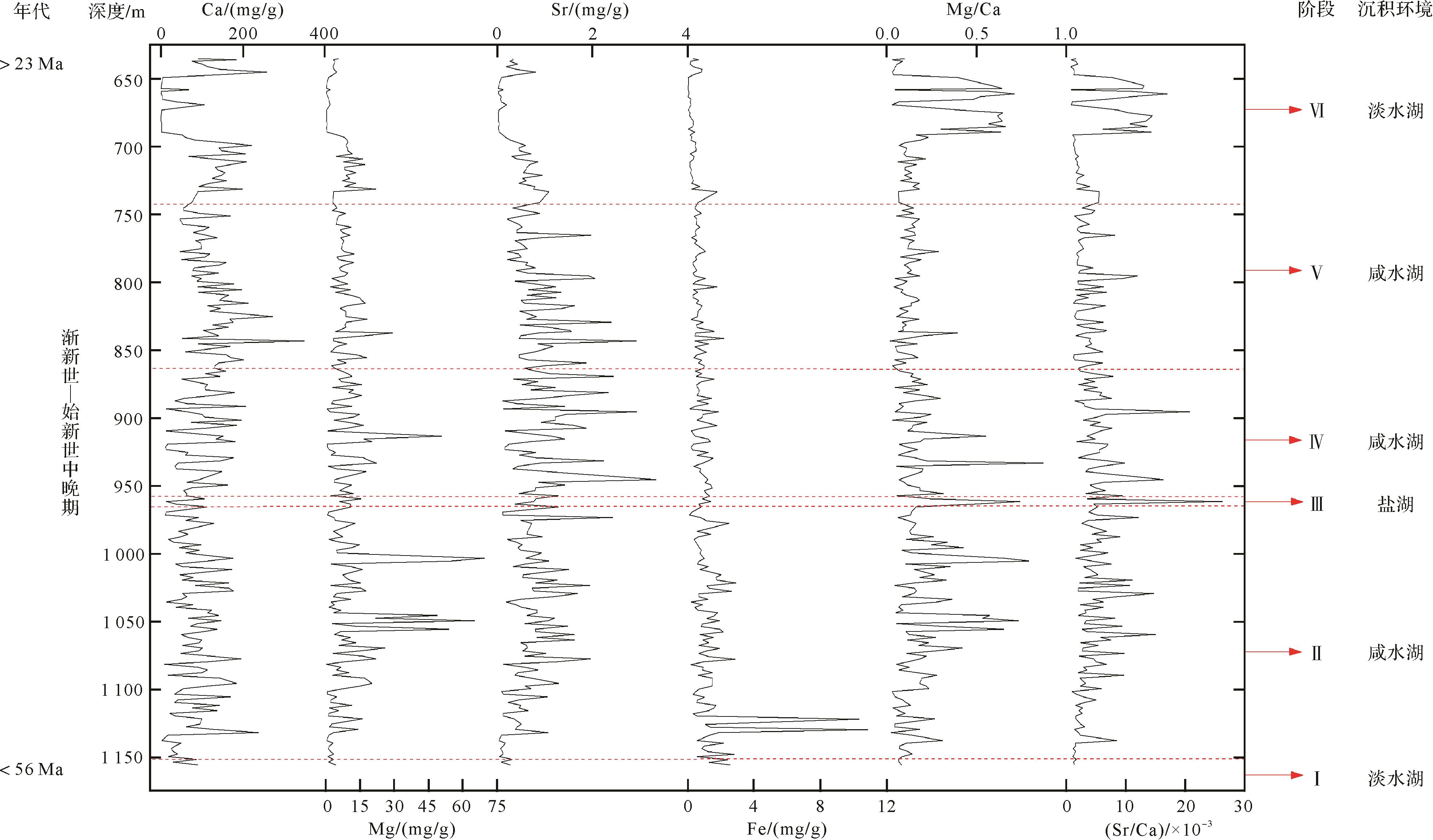
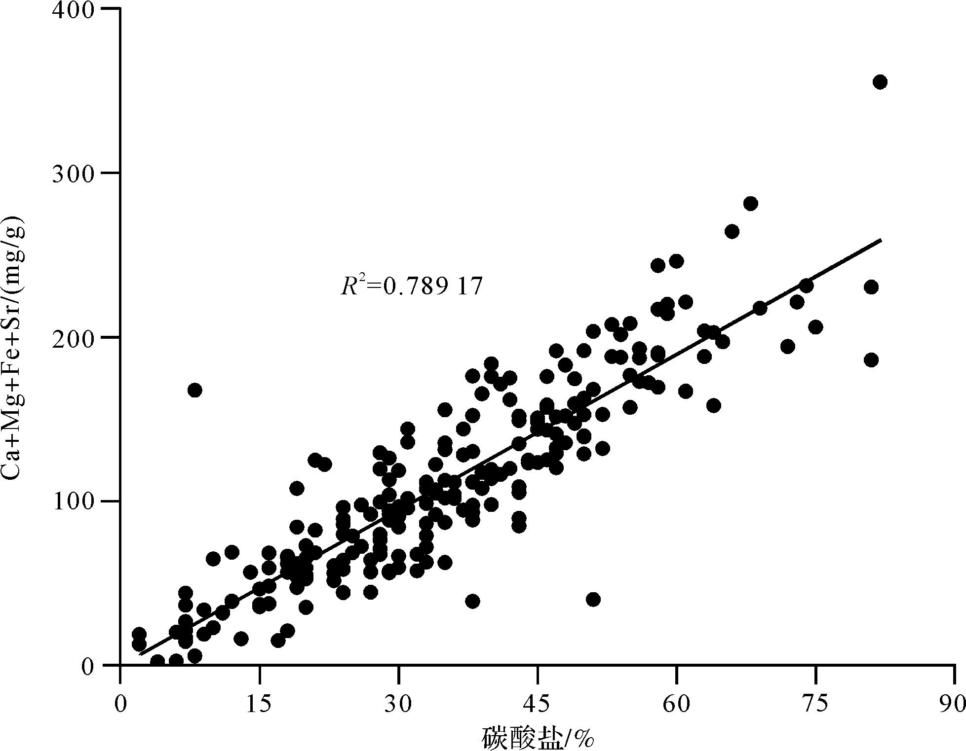
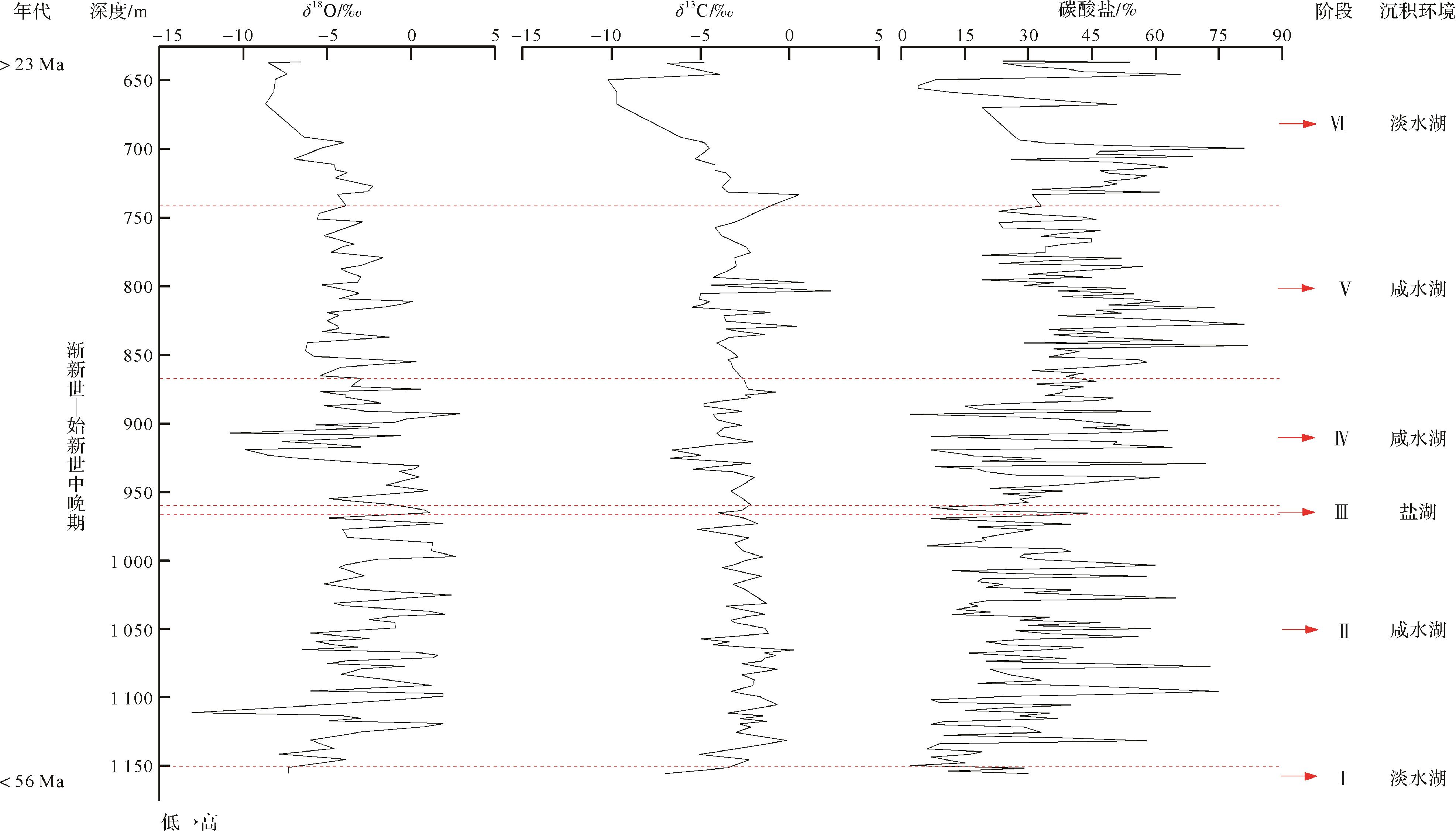
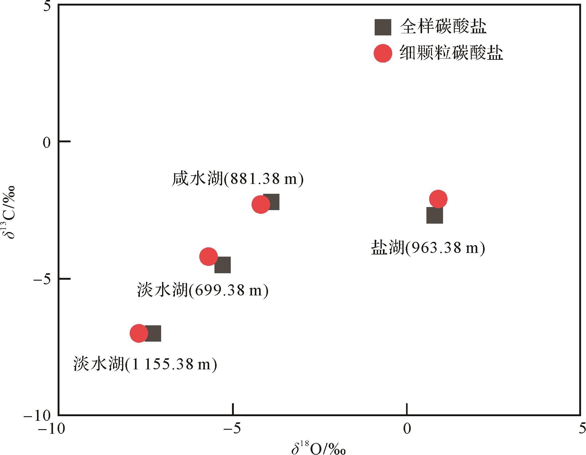
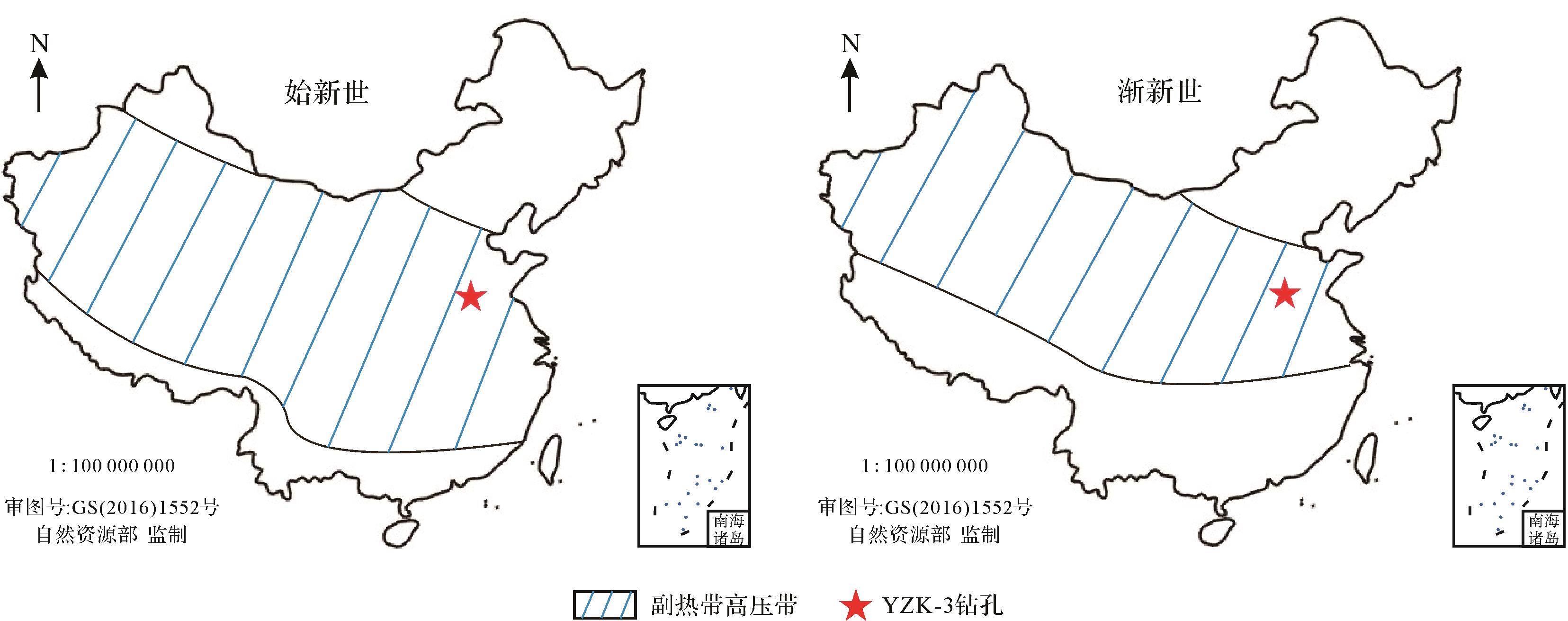
The salt deposit in the Shanxian Basin in southwestern Shandong is a large-scale salt deposit formed in a typical small continental basin. This salt deposit developed during the Paleogene period (mainly the Middle and Late Eocene-Oligocene). Based on the elements and carbon and oxygen isotopes (δ18O and δ13C) in borehole YZK-3 (521.7 m) in the Shanxian Basin, this study tried to reconstruct the paleoenvironmental evolution characteristics of the Shanxian Basin. The main conclusions are as follows: (1) The changes of water soluble and acid soluble element contents and ratios are basically consistent with the lake status as freshwater or salt water. (2) Due to hydrothermal inflow and diagenesis, the correlation between δ18O and δ13C of carbonate minerals is not useful in discussing the closure and open state of the lake. However, the trend of δ18O and δ13C still could be used to talk about the paleo-environmental changes. (3) From the Eocene to the Oligocene, the ancient lakes of the Shanxian Basin experienced the evolution process of freshwater lake⁃brackish water lake⁃salt lake⁃brackish water lake⁃freshwater lake. Global climate change is the main driving factor for the evaporate deposit.
The salt deposit in the Shanxian Basin in southwestern Shandong is a large-scale salt deposit formed in a typical small continental basin. This salt deposit developed during the Paleogene period (mainly the Middle and Late Eocene-Oligocene). Based on the elements and carbon and oxygen isotopes (δ18O and δ13C) in borehole YZK-3 (521.7 m) in the Shanxian Basin, this study tried to reconstruct the paleoenvironmental evolution characteristics of the Shanxian Basin. The main conclusions are as follows: (1) The changes of water soluble and acid soluble element contents and ratios are basically consistent with the lake status as freshwater or salt water. (2) Due to hydrothermal inflow and diagenesis, the correlation between δ18O and δ13C of carbonate minerals is not useful in discussing the closure and open state of the lake. However, the trend of δ18O and δ13C still could be used to talk about the paleo-environmental changes. (3) From the Eocene to the Oligocene, the ancient lakes of the Shanxian Basin experienced the evolution process of freshwater lake⁃brackish water lake⁃salt lake⁃brackish water lake⁃freshwater lake. Global climate change is the main driving factor for the evaporate deposit.
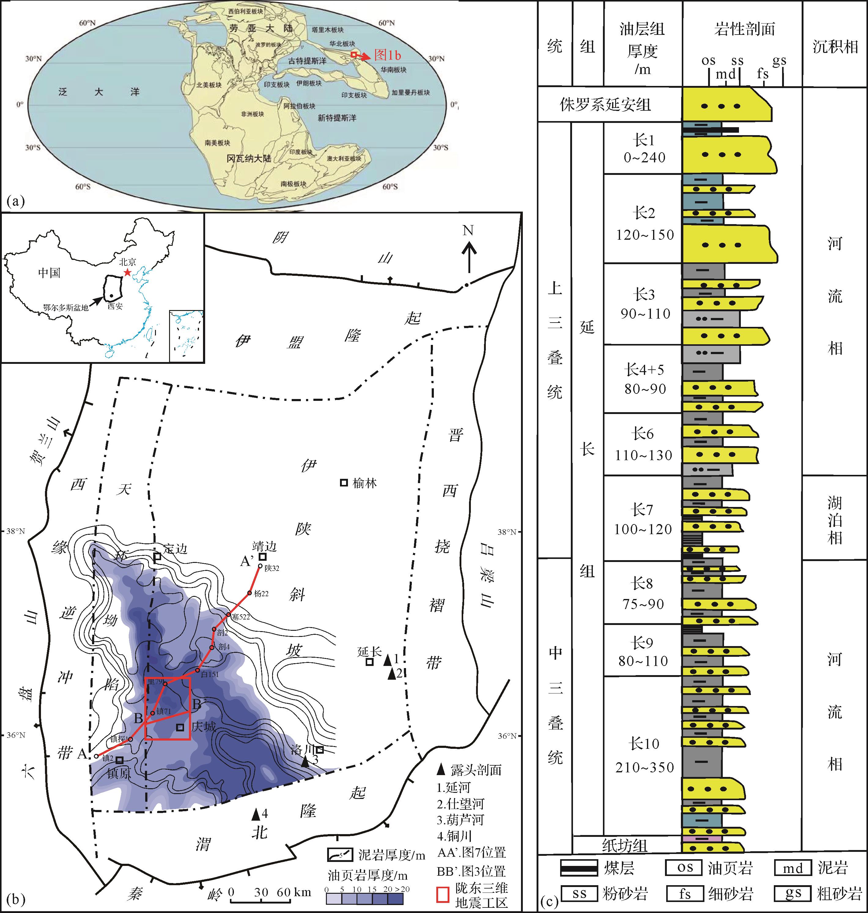
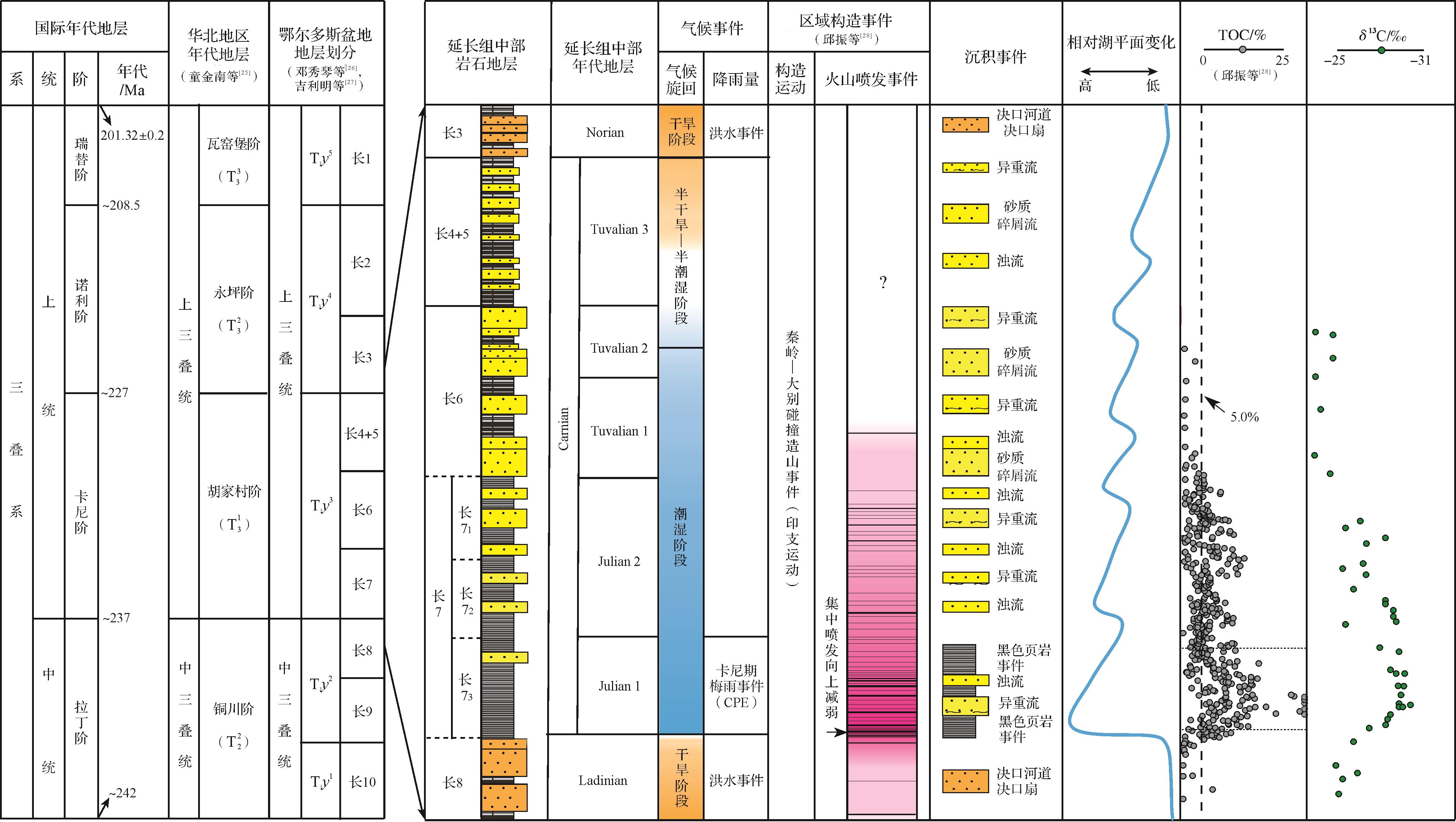
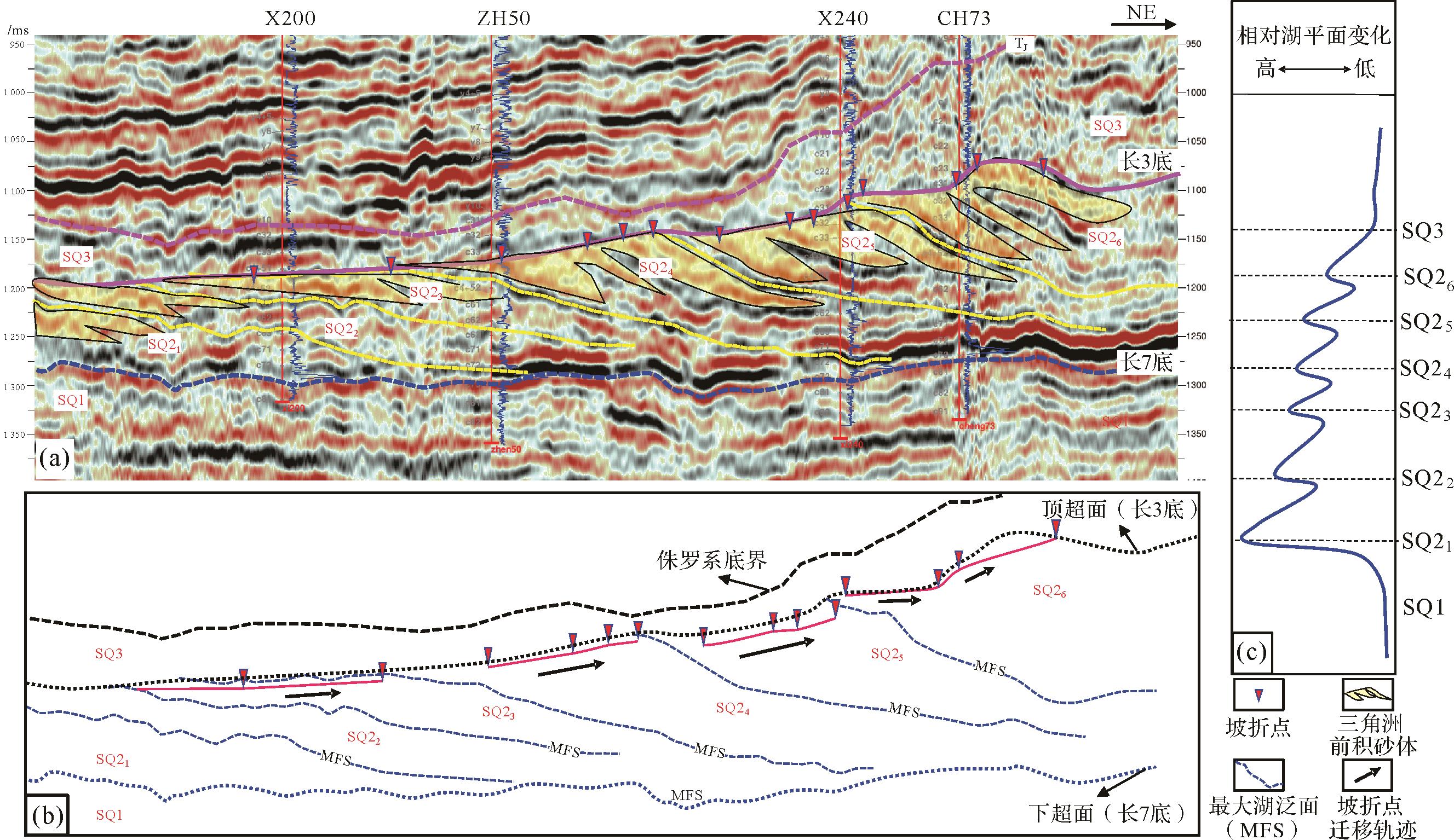
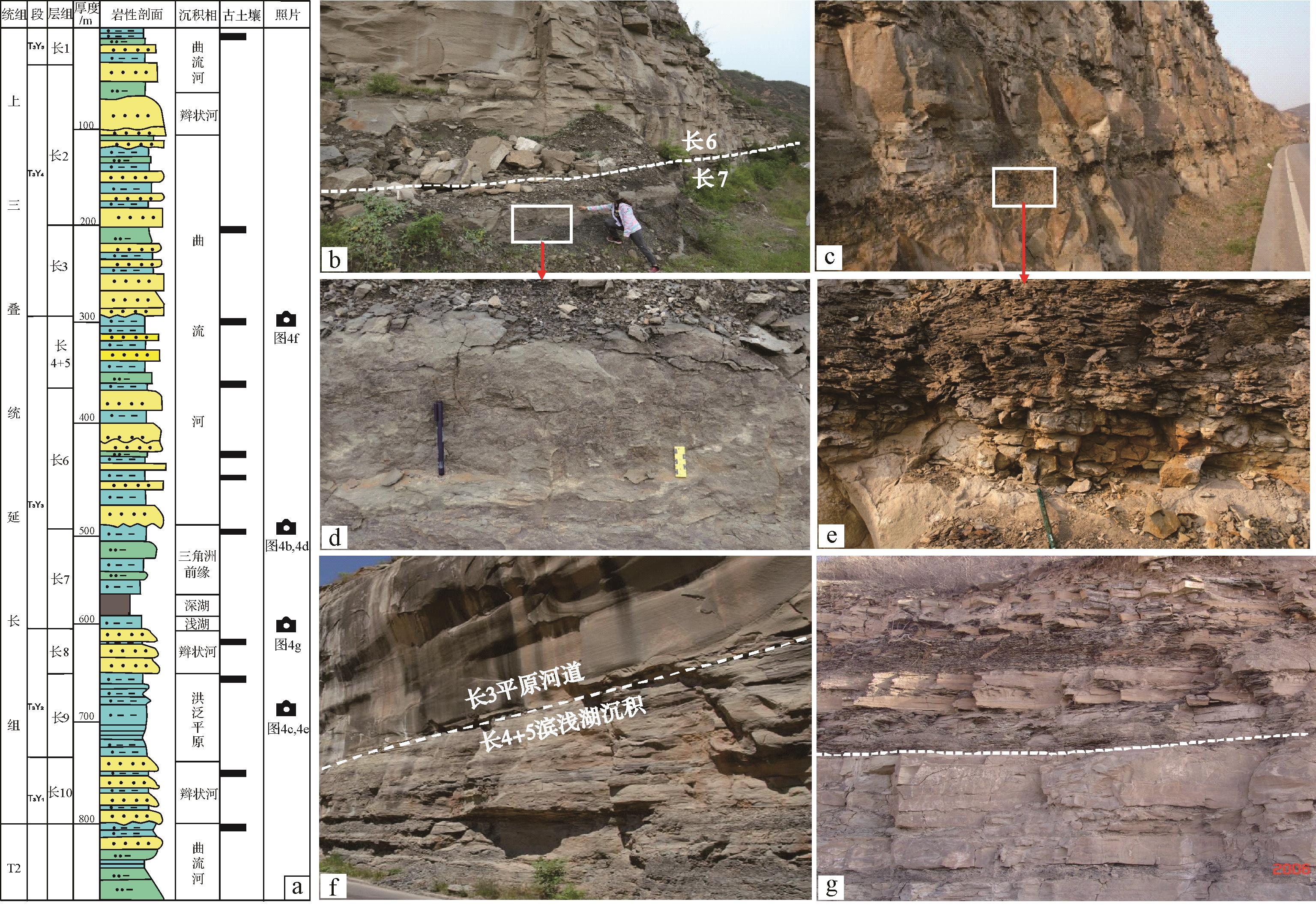
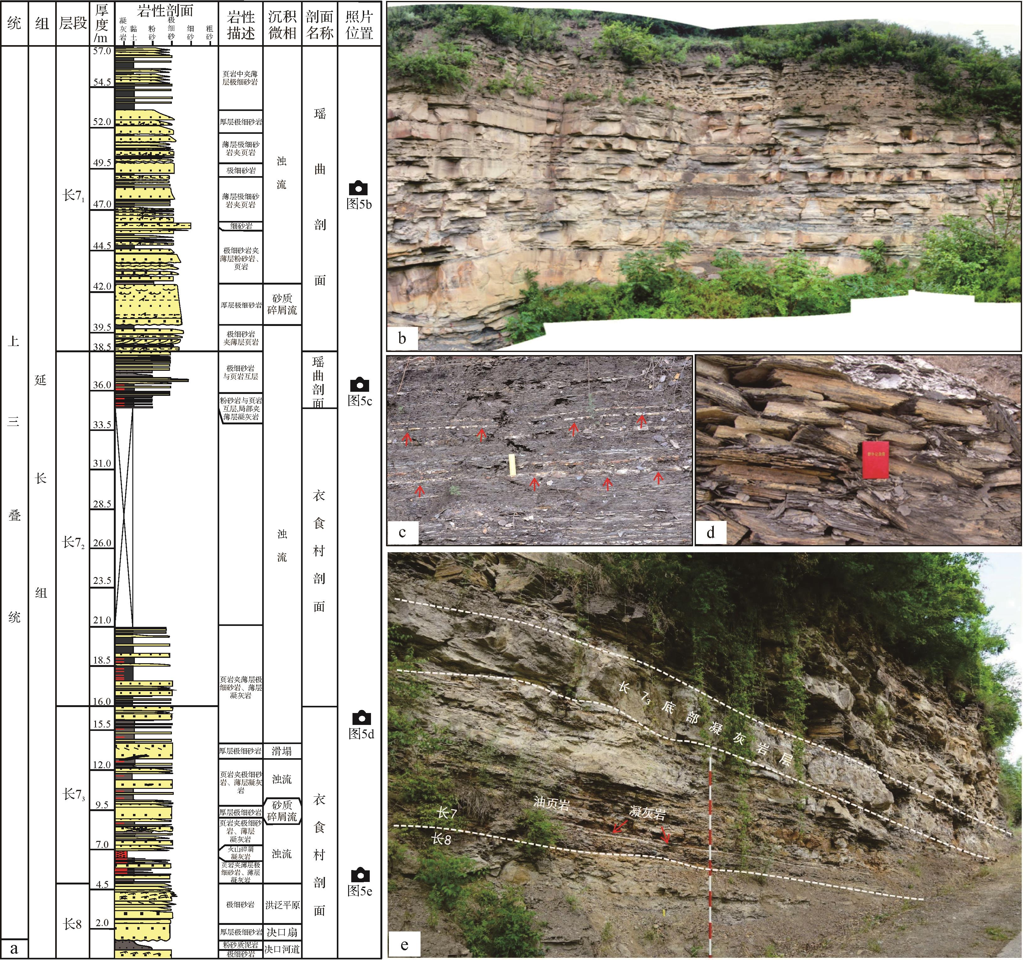
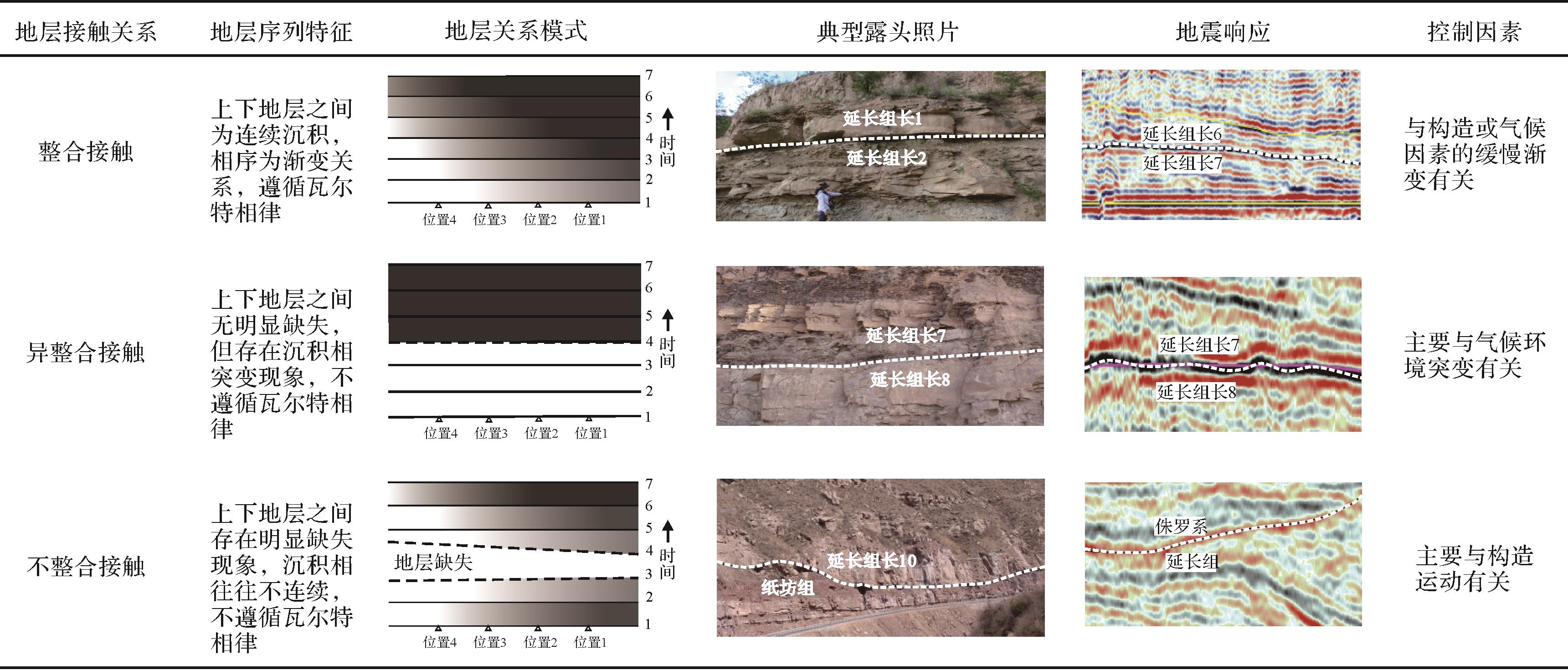
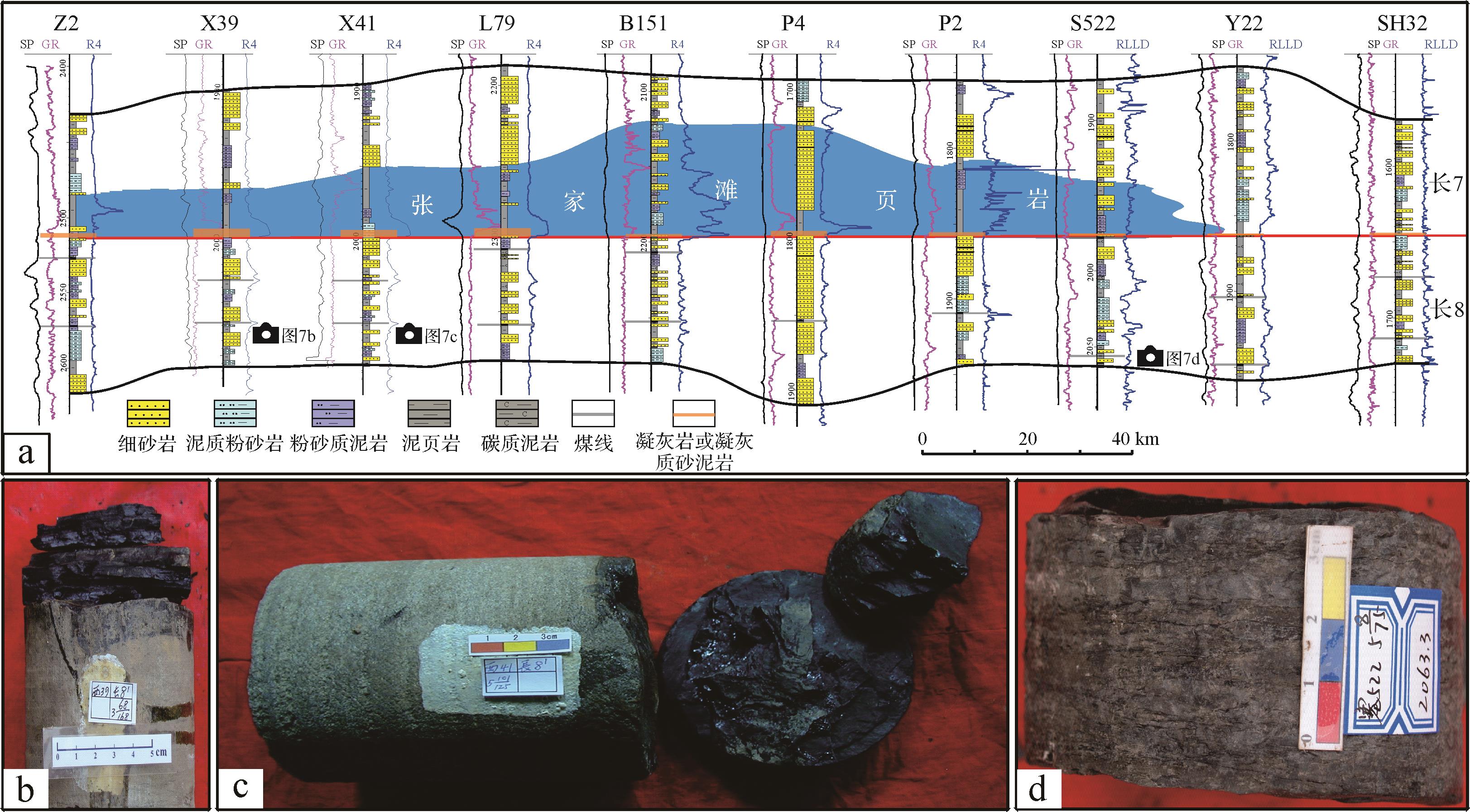
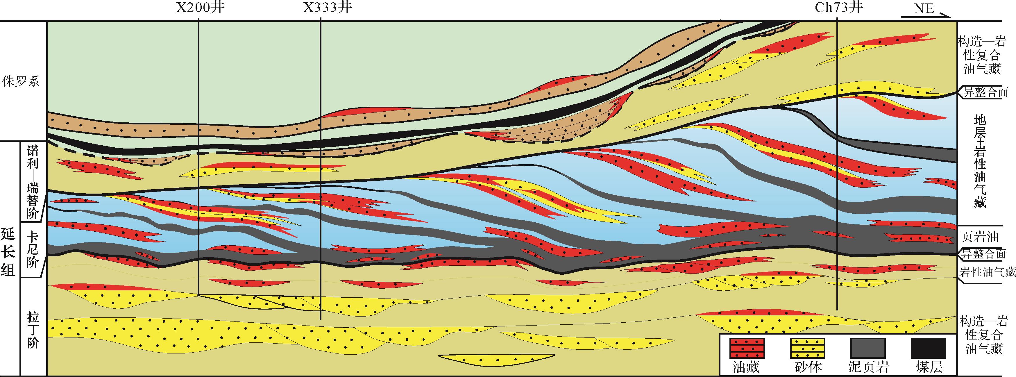
2023, 41(2): 511-526.
doi: 10.14027/j.issn.1000-0550.2022.008
Abstract:
The Carnian Pluvial Episode (CPE) in the Triassic was one of the most abrupt known climatic events in the Earth’s history. It strongly influenced sediment deposition in inland lakes. The case considered here (the Yanchang Formation in the Ordos Basin) is the most important terrestrial petroliferous basin in China. A comprehensive review of research progress in China and elsewhere was carried out for global paleoclimate, event sedimentation, source rock development mechanisms and xenoconformity in terrestrial basins. Rethinking and investigating some of the sedimentation and accumulation questions related to the Yanchang Formation has revealed the following three points. (1) The Yanchang Formation, which developed during the Carnian stage at the beginning of the Upper Triassic, is redefined and its sedimentary depositional response to the CPE is clarified. The upper boundary is equivalent to the stratigraphic boundary between the Chang 4 + 5 members and the Chang 3 member. The CPE roughly corresponds to the deposition of the so-called “Chang 7 member black shale event”. (2) During the Carnian and CPE, the Yanchang Formation sedimentary lake basin underwent rapid transgression and oscillating slow retreat, very conducive to the development of high-quality hydrocarbon source rocks. (3) Due to the paleoclimatic conditions and CPE, upper and lower xenoconformities were formed in response to the abrupt climatic and environmental changes. These both significantly influenced the distribution of oil and gas. This study is of positive significance for in-depth discussion of the formation and evolution mechanisms of the Yanchang Formation lake basin, as well as sedimentary sequence filling and evolution, and as a guide for oil and gas exploration.
The Carnian Pluvial Episode (CPE) in the Triassic was one of the most abrupt known climatic events in the Earth’s history. It strongly influenced sediment deposition in inland lakes. The case considered here (the Yanchang Formation in the Ordos Basin) is the most important terrestrial petroliferous basin in China. A comprehensive review of research progress in China and elsewhere was carried out for global paleoclimate, event sedimentation, source rock development mechanisms and xenoconformity in terrestrial basins. Rethinking and investigating some of the sedimentation and accumulation questions related to the Yanchang Formation has revealed the following three points. (1) The Yanchang Formation, which developed during the Carnian stage at the beginning of the Upper Triassic, is redefined and its sedimentary depositional response to the CPE is clarified. The upper boundary is equivalent to the stratigraphic boundary between the Chang 4 + 5 members and the Chang 3 member. The CPE roughly corresponds to the deposition of the so-called “Chang 7 member black shale event”. (2) During the Carnian and CPE, the Yanchang Formation sedimentary lake basin underwent rapid transgression and oscillating slow retreat, very conducive to the development of high-quality hydrocarbon source rocks. (3) Due to the paleoclimatic conditions and CPE, upper and lower xenoconformities were formed in response to the abrupt climatic and environmental changes. These both significantly influenced the distribution of oil and gas. This study is of positive significance for in-depth discussion of the formation and evolution mechanisms of the Yanchang Formation lake basin, as well as sedimentary sequence filling and evolution, and as a guide for oil and gas exploration.
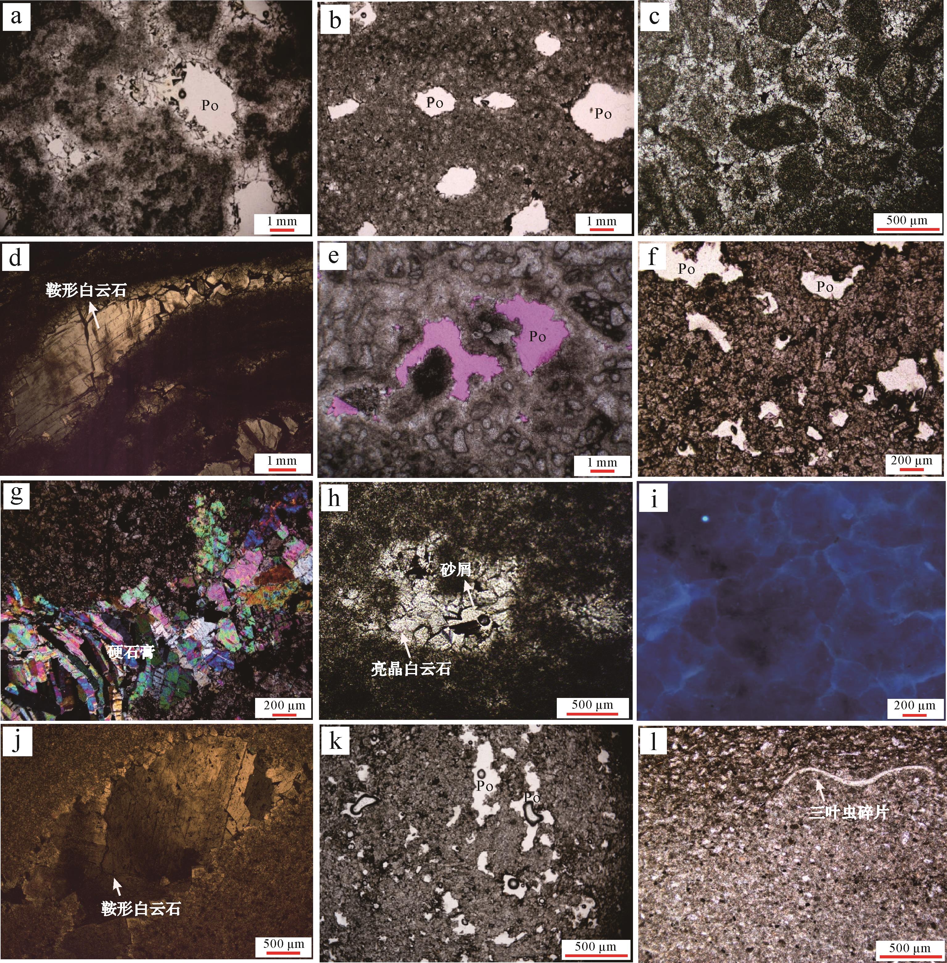
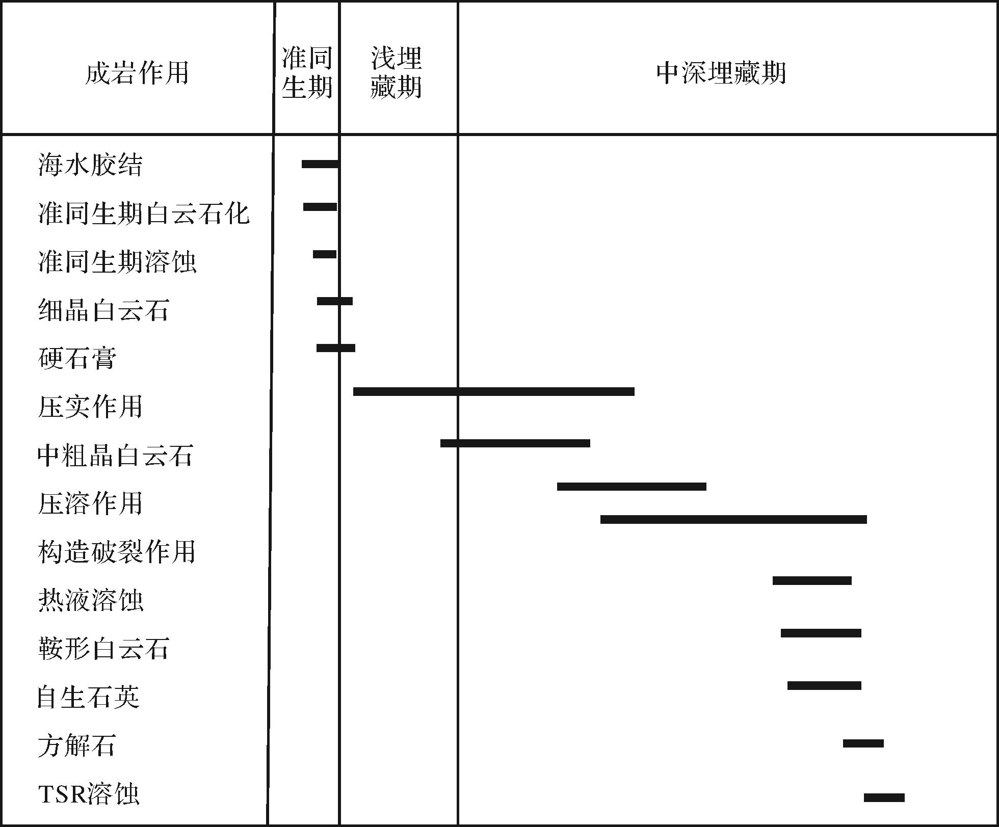
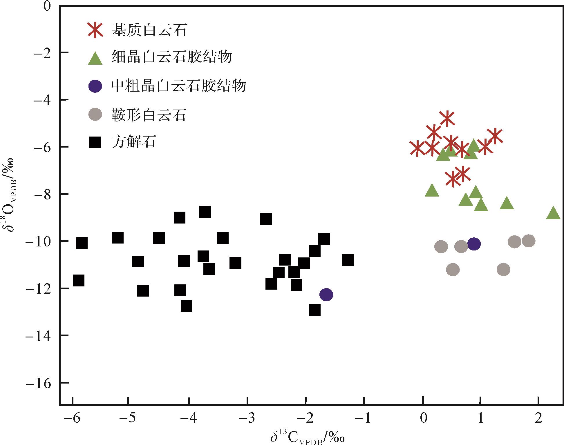
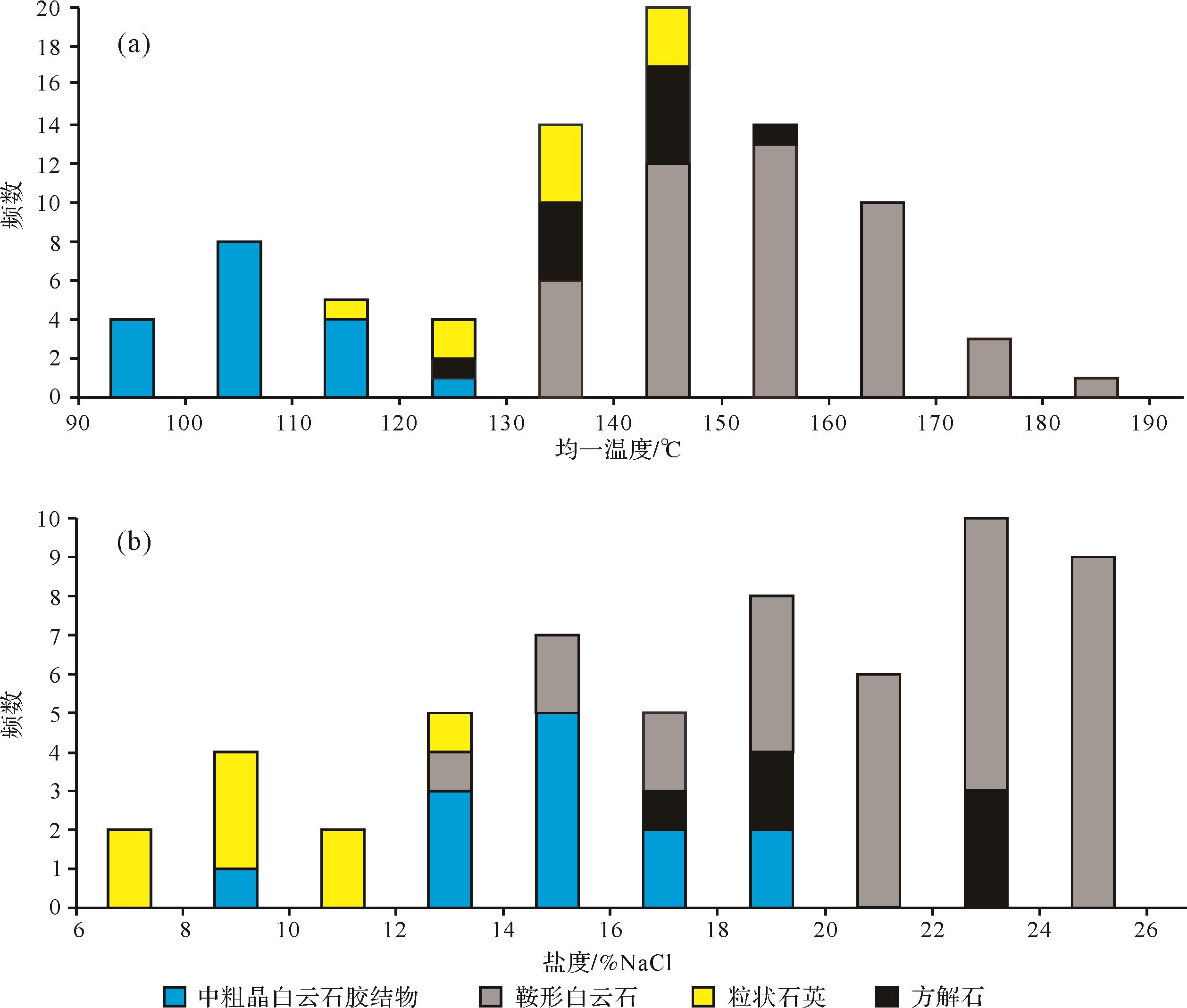
2023, 41(2): 527-544.
doi: 10.14027/j.issn.1000-0550.2021.116
Abstract:
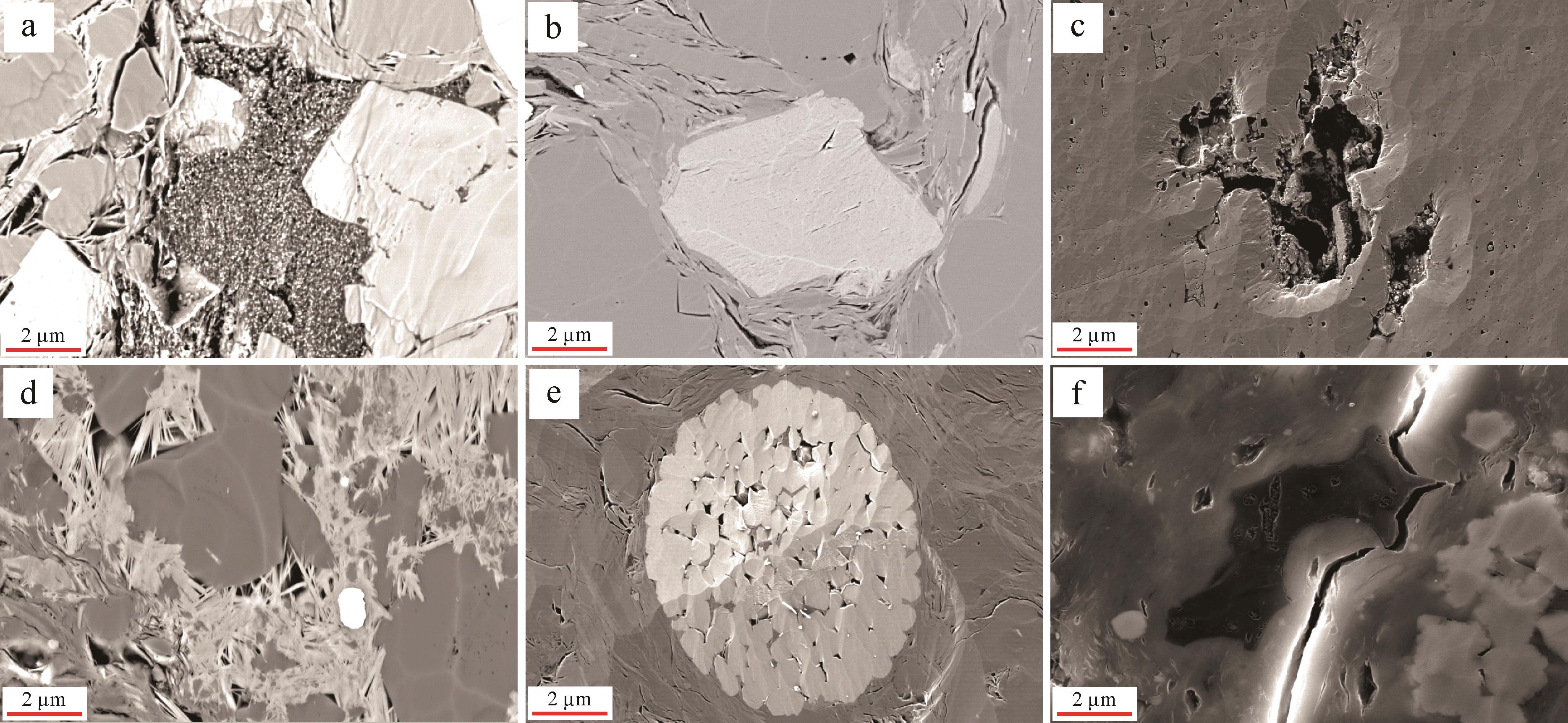
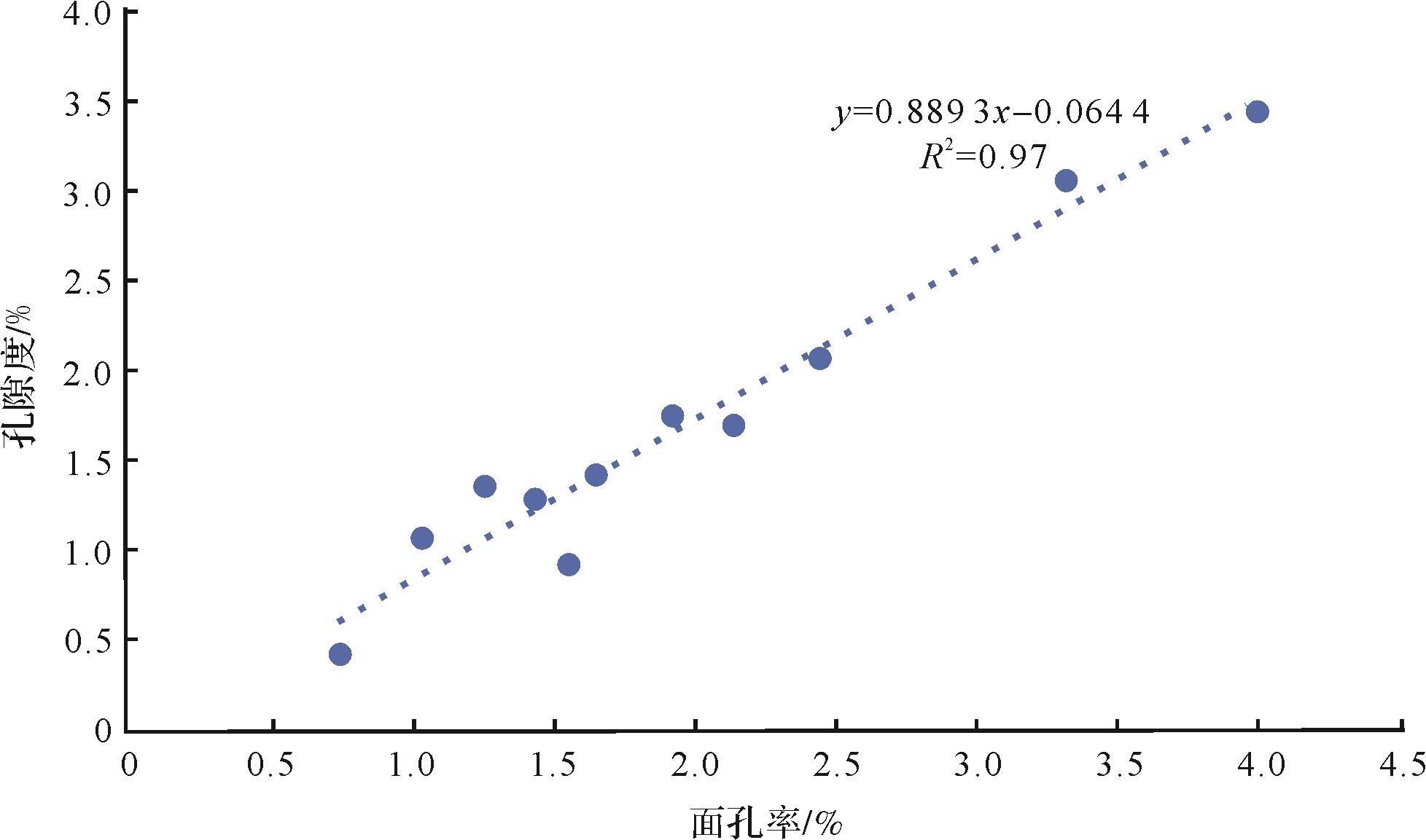
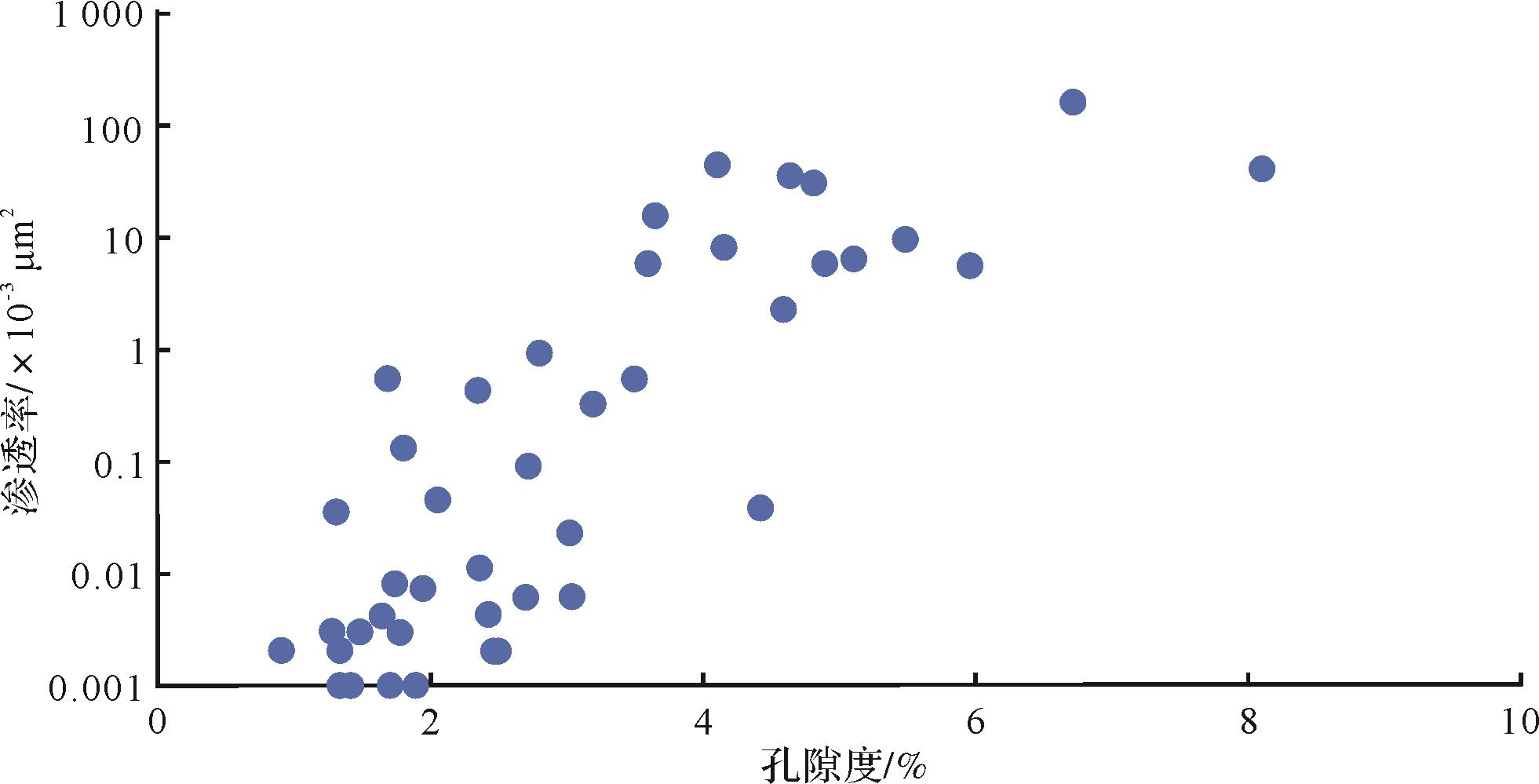
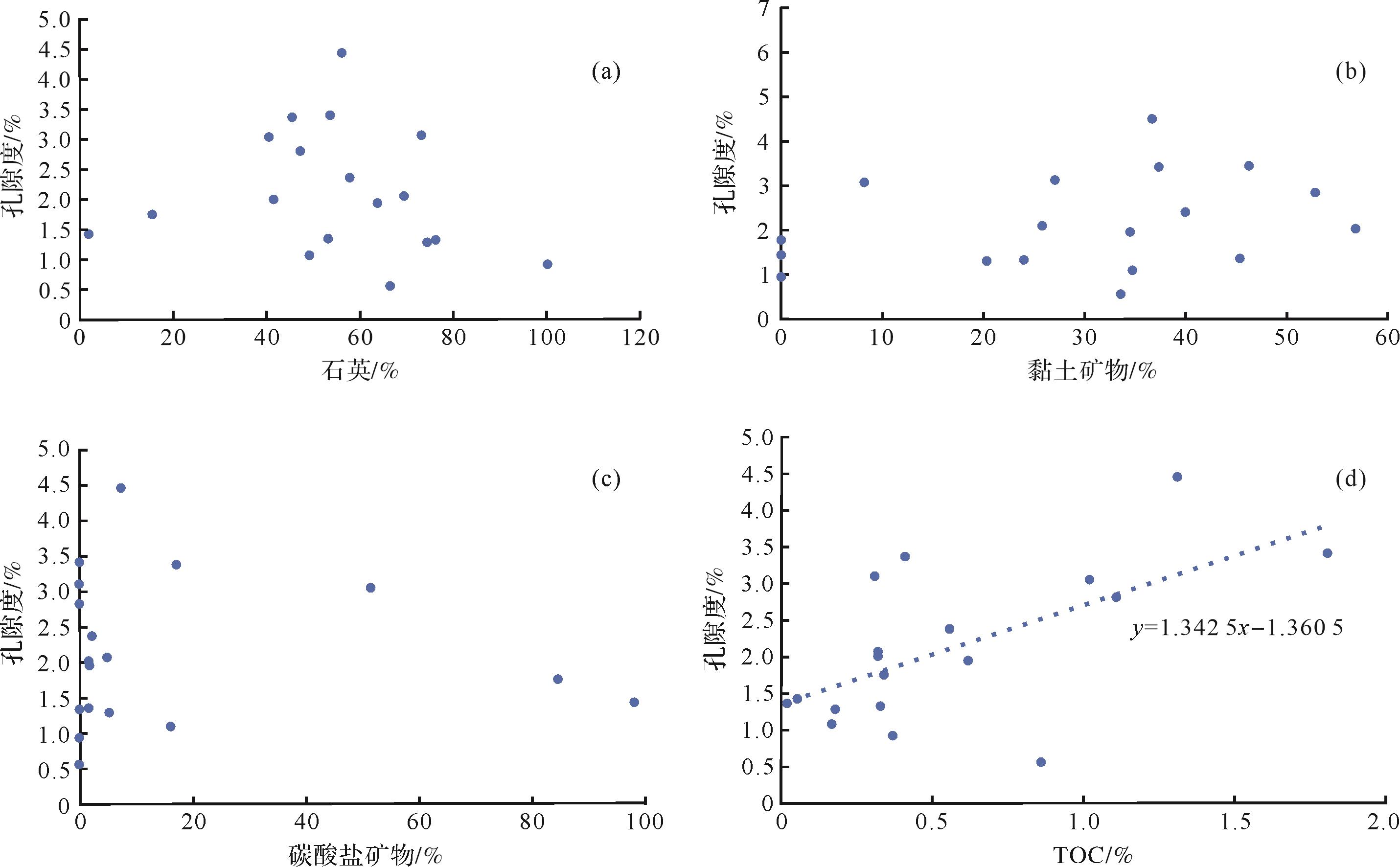
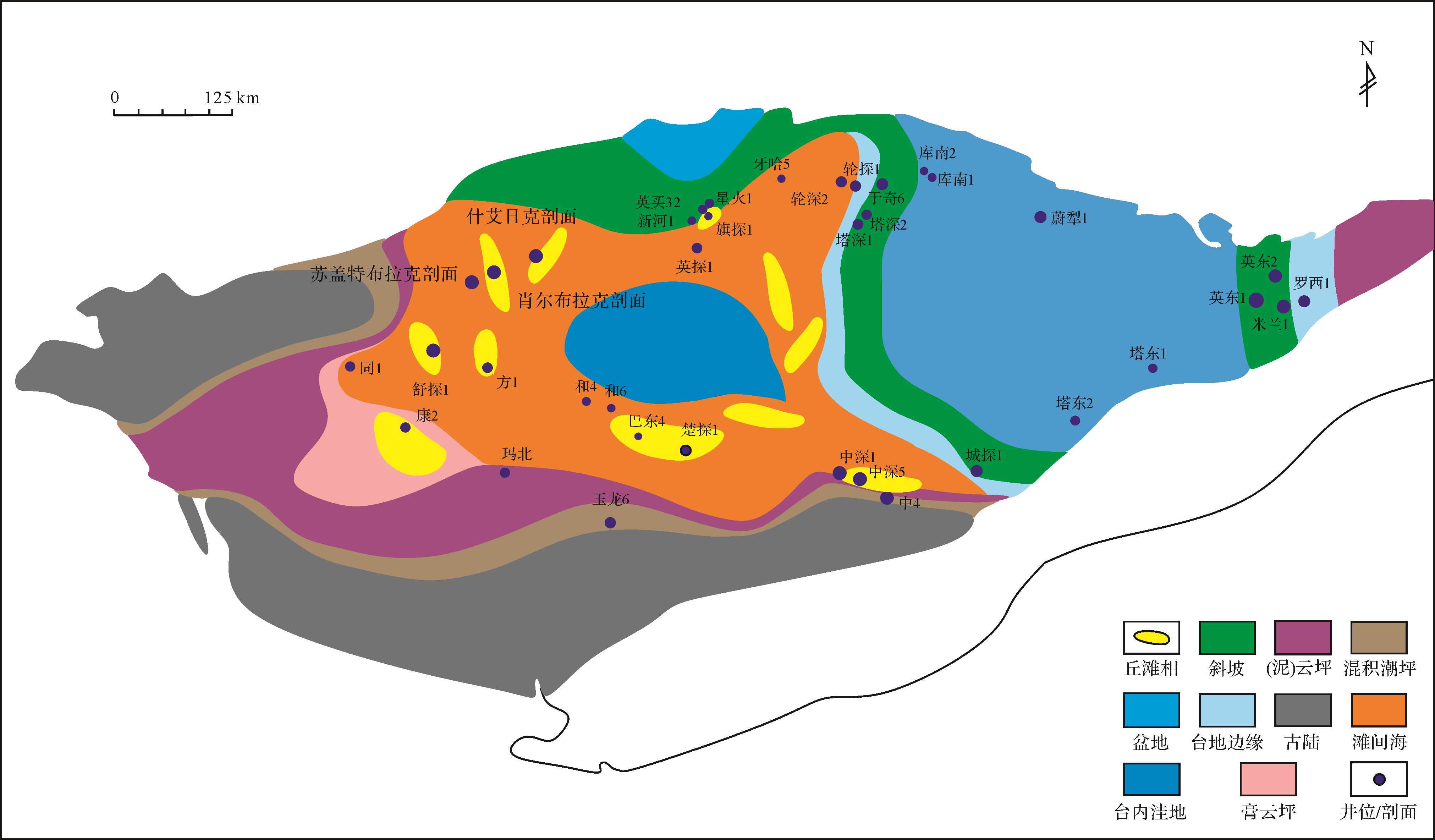
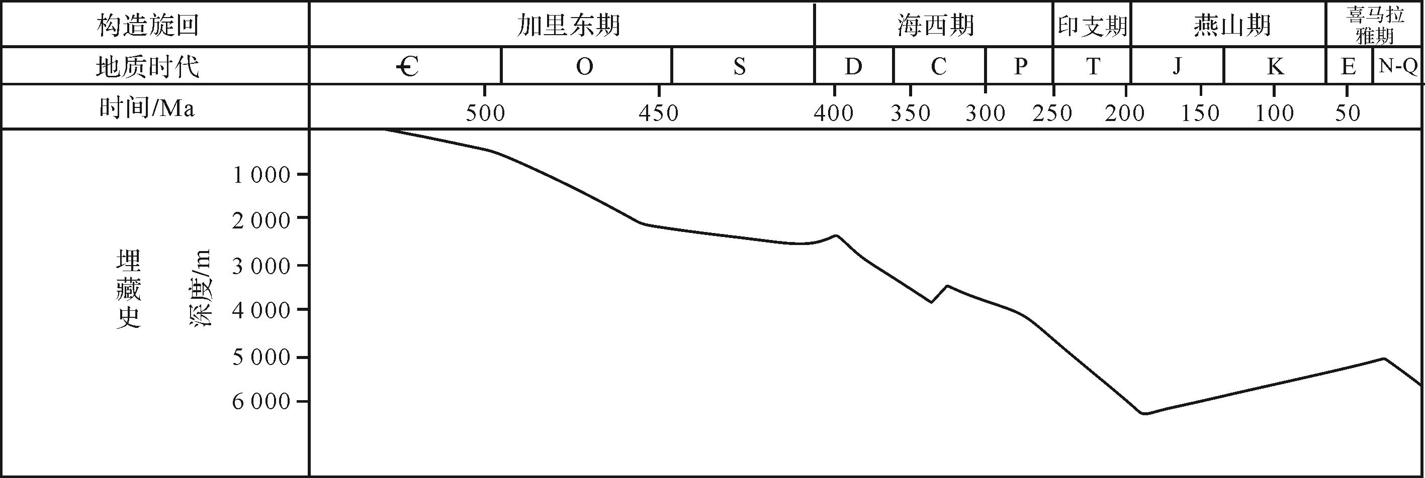
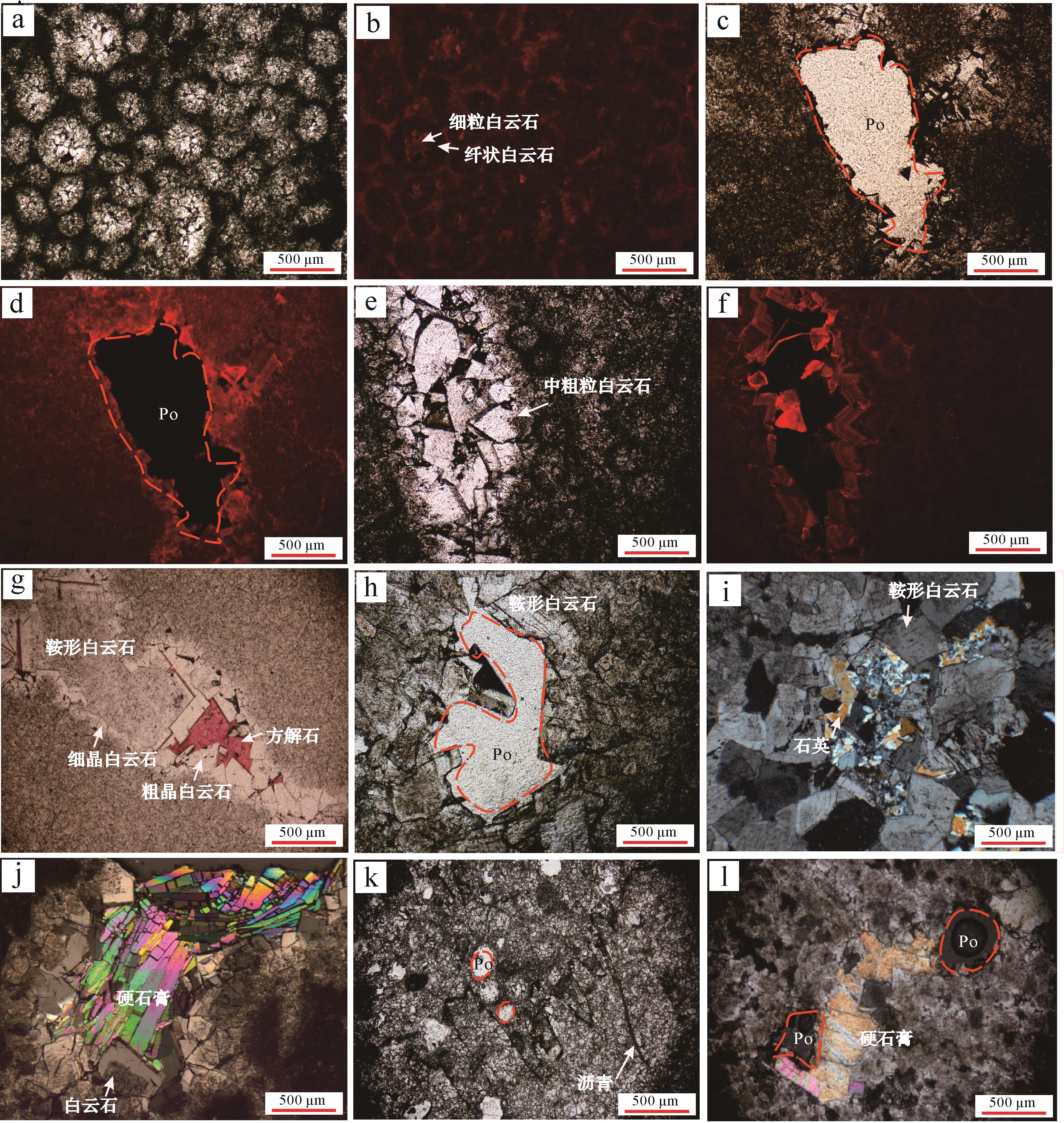
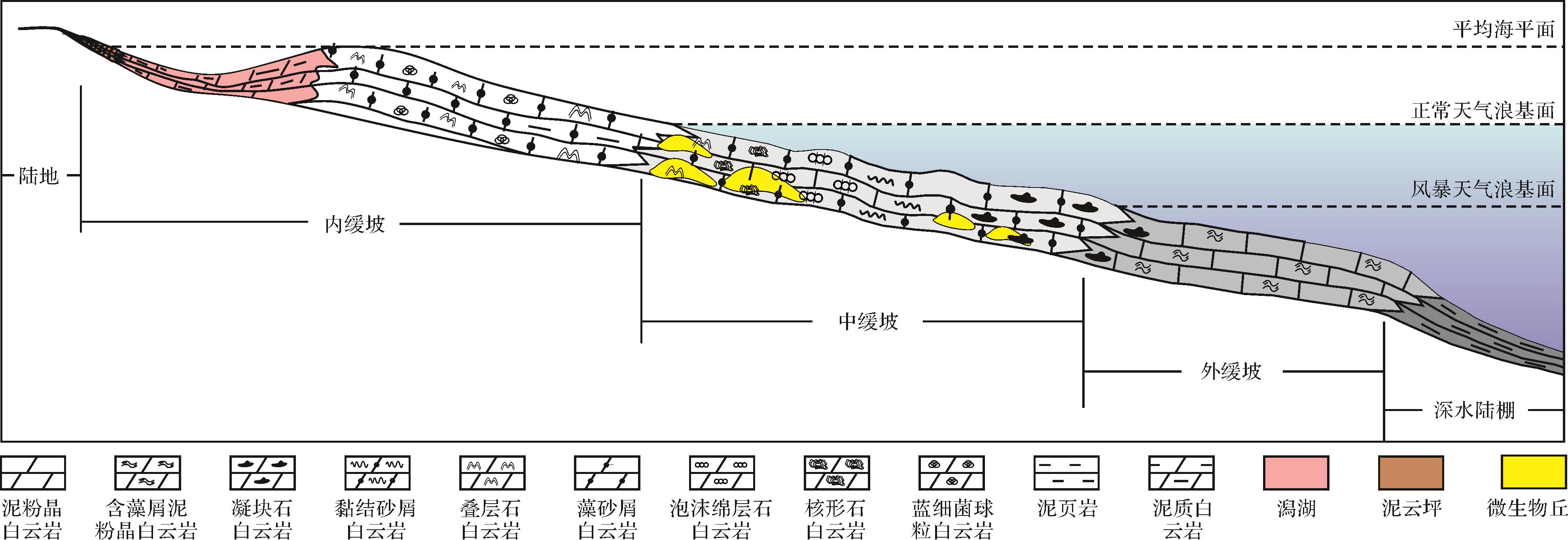
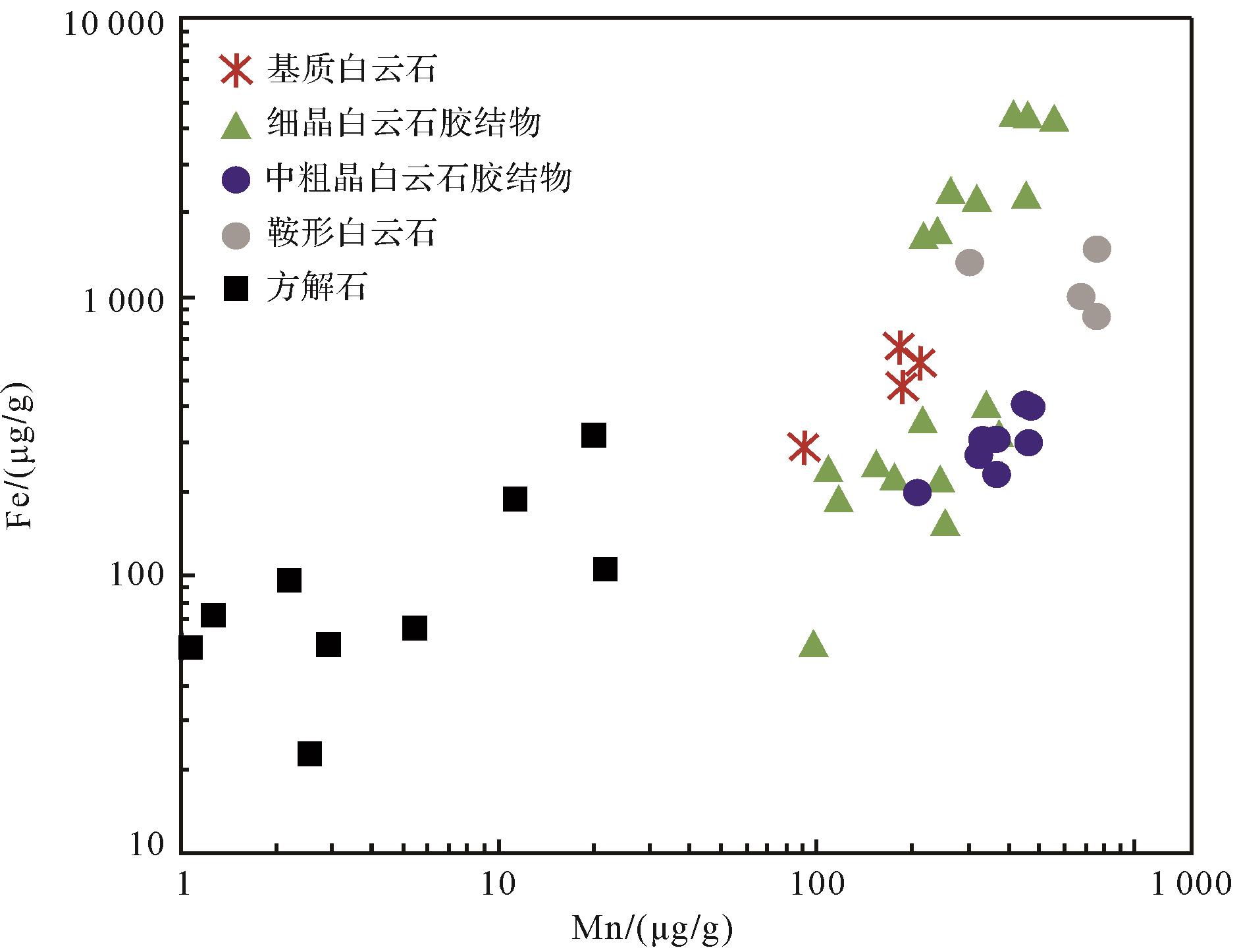
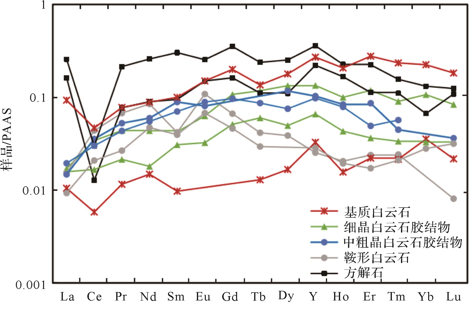
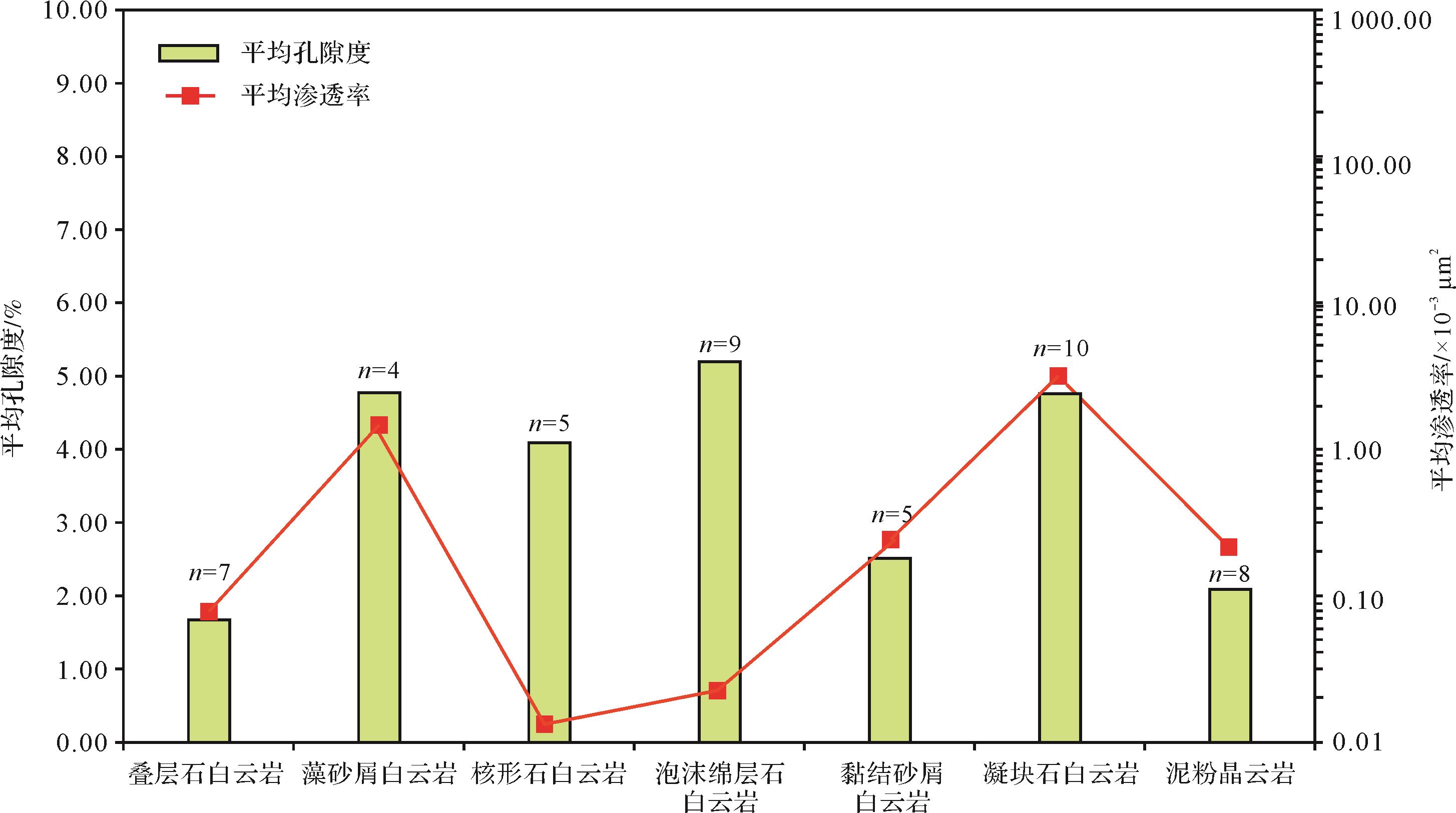
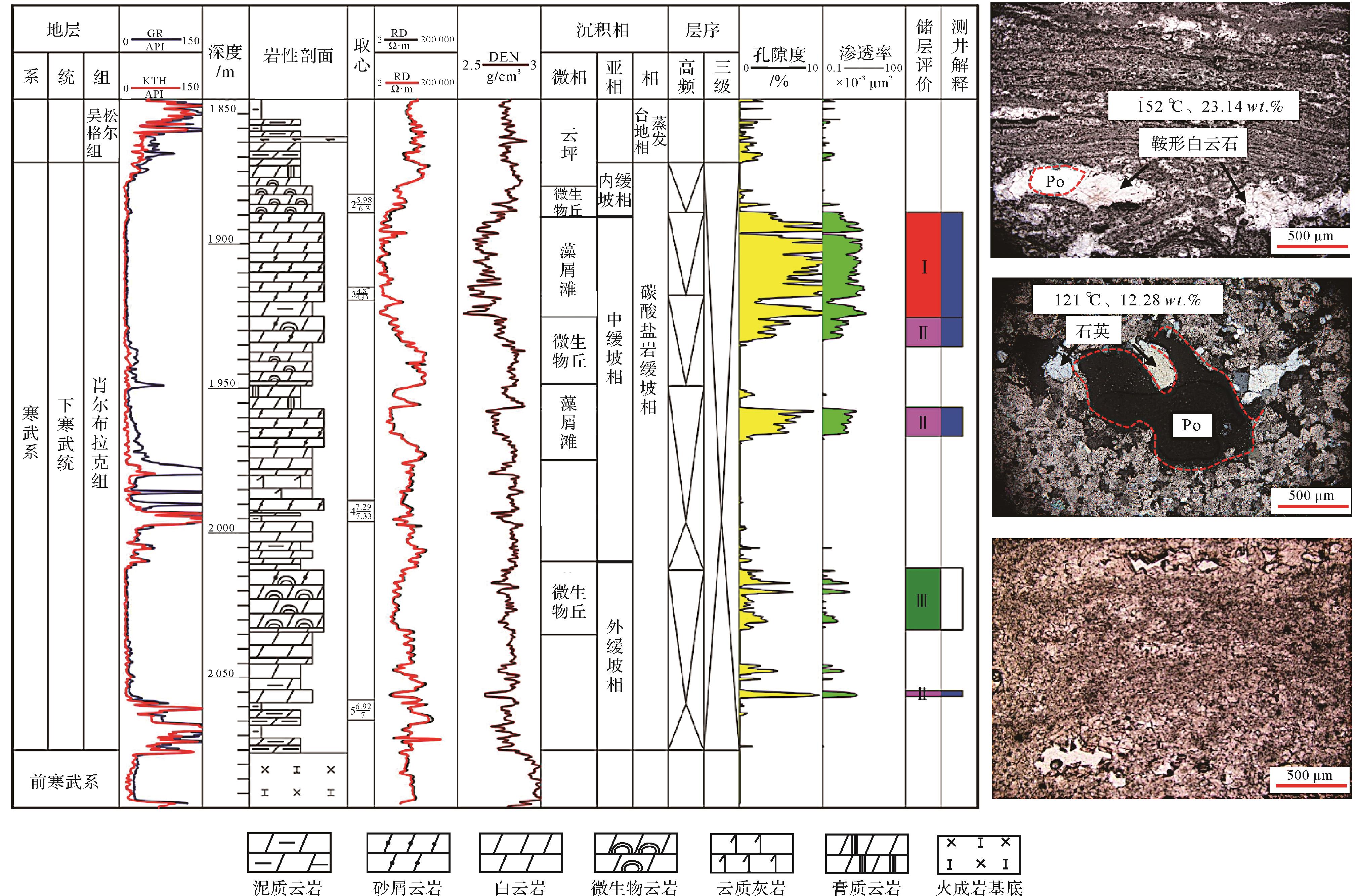
Well-developed deep-time and deep-burial dolostone reservoirs are currently sedimentlogical research topics in petroleum exploration, for example in the Sichuan and Tarim Basins in China, and the South Oman Salt Basin. Due to the influence of sedimentary environments and constructive diageneses, ancient deep and ultra-deep dolostone (>4 500 m) have demonstrated high-quality reservoir properties in some case studies. The porosity of some intervals is up to 10%⁃20%, producing oil and gas of industrial standard, and are of great importance in hydrocarbon exploration. However, our understanding of the genesis of the pore structures of deeply buried dolostone reservoirs is still limited: are they generated from later diagenesis, or are they preserved sediments retaining early diagenetic pores? Distinguishing between these two types of pores and explaining their formation mechanisms is a controversial and much-debated topic in sedimentology. The Cambrian Xiaoerbulak Formation underwent long periods of deep burial settings, to a maximum burial depth of 6 000 m. This formation is characterized by the complexity of the diagenesis of dolostone and the heterogeneity of the reservoirs. In addition, they are associated with many different microbialite types.Overall, this suggested that the Xiaoerbulak Formation is a suitable case for solving the debated issue of late microbialitic dissolution. For this reason, the Cambrian Xiaoerbulak Formation in the Tarim Basin was selected as the research object, and the rocks from typical wells and field profiles were carefully selected and used in a variety of advanced experiments, comprising multi-scale geological and geochemical methods included microscopic observation of rocks and minerals, stable δ13C and δ18O isotope analysis, and in-situ trace element and rare earth element analyses. Combined with basic data from previous sedimentological studies, this paper attaches importance to the analysis of fluid⁃rock interactions and solves deep and ultra-deep issues such as the evolution of diagenetic fluids and dissolution transformation of dolomite reservoirs. Firstly, based on comprehensive and detailed petrological observations, it is concluded that there are four main types of rocks developed in the Xiaoerbulak Formation: microbialites (thrombolite dolostone, foam spongy dolostone, oncolite dolostone, stromatolite dolostone, bonded sandy dolostone, and algal framework dolostone), dolo-grainstone, crystalline dolomite (dolo-micrite and fine crystalline dolomite) and micritic limestone. The analyses of porosity and permeability suggest that dolo-grainstone and thrombolites contain the best reservoir properties. In contrast, stromatolite dolostone and fine crystalline dolostone have lower porosities and permeabilities. Cathodoluminescence studies, fluid inclusion data and carbon and oxygen isotope testing suggest that matrix dolomite and fine-crystalline dolomite were formed in sedimentary oxidized seawater with δ18O values of -6.16‰ ± 0.72‰. Subsequently, fine-crystalline dolomite cements (δ18O = -7.47‰ ± 1.2‰) were mainly formed in near-surface to shallow burial environments. In deep burial conditions, coarse-crystalline dolomite cements (δ18O =-11.35‰ ± 1.41‰) and saddle dolomites (δ18O = -10.44‰ ± 0.6‰) were developed. With gradually increasing depth, oxygen isotope values of carbonate minerals show a decreasing trend, indicating a rising formation temperature. However, these dolomites have relatively positive carbon isotopes, and there is no significant change among them. By comparison, due to the oxidation of hydrocarbons and their incorporation into calcite, the calcite has negative δ13C values (-4.07‰ ± 0.92‰), suggesting that it is typical of thermochemical sulfate reduction (TSR).The presence of hydrothermal minerals, including saddle dolomite and authigenic quartz, is evidence of homogenization temperatures above that of the formation. In-situ trace element and rare earth tests show that diagenetic fluids evolved from early to late stages: distribution curves indicate enriched heavy rare earth elements (HREE), to enrichment of medium rare earth elements (MREE), and finally to a mode of enrichment of light rare earth elements (LREE). In consequence, the following evolutionary sequence of diagenetic fluids was comprehensively considered: from seawater-dominated pore water, shallow-buried iron-rich pore water, medium-deep buried manganese-rich pore water, to lately crust-derived hydrothermal fluid-dominated pore water, and finally evolved into acidic fluids related to TSR dissolution. It is noteworthy that the properties of the fluids gradually evolved from low-temperature and low-salinity to high-temperature and high-salinity. Quantitative statistics show that hydrothermal dissolution increased the porosity of the reservoir by 3%; the maximum porosity is close to 10%.Thus it is concluded that the late dissolution re-formation of those formed in early high-energy mound-shoal facies contributed most to the development of high-quality reservoirs. Depending on the type of sedimentation- diagenetic re-formation, three categories of high-quality reservoirs are classified in the Xiaoerbulak Formation as follows: (i) hydrothermal/meteoric water-altered thrombolitic reservoir of high-energy reef and shoal facies; (ii) hydrothermal/TSR-altered shoal facies dolo-grainstone reservoirs; and (iii) TSR-altered gypsum-related dolostone reservoirs. This list provides favorable exploration directions for Xiaoerbulak Formation carbonate oil and gas exploration in the Tarim Basin, and also helps to better understand the genesis of deep and ultra-deep high-quality dolomite reservoirs.
Well-developed deep-time and deep-burial dolostone reservoirs are currently sedimentlogical research topics in petroleum exploration, for example in the Sichuan and Tarim Basins in China, and the South Oman Salt Basin. Due to the influence of sedimentary environments and constructive diageneses, ancient deep and ultra-deep dolostone (>4 500 m) have demonstrated high-quality reservoir properties in some case studies. The porosity of some intervals is up to 10%⁃20%, producing oil and gas of industrial standard, and are of great importance in hydrocarbon exploration. However, our understanding of the genesis of the pore structures of deeply buried dolostone reservoirs is still limited: are they generated from later diagenesis, or are they preserved sediments retaining early diagenetic pores? Distinguishing between these two types of pores and explaining their formation mechanisms is a controversial and much-debated topic in sedimentology. The Cambrian Xiaoerbulak Formation underwent long periods of deep burial settings, to a maximum burial depth of 6 000 m. This formation is characterized by the complexity of the diagenesis of dolostone and the heterogeneity of the reservoirs. In addition, they are associated with many different microbialite types.Overall, this suggested that the Xiaoerbulak Formation is a suitable case for solving the debated issue of late microbialitic dissolution. For this reason, the Cambrian Xiaoerbulak Formation in the Tarim Basin was selected as the research object, and the rocks from typical wells and field profiles were carefully selected and used in a variety of advanced experiments, comprising multi-scale geological and geochemical methods included microscopic observation of rocks and minerals, stable δ13C and δ18O isotope analysis, and in-situ trace element and rare earth element analyses. Combined with basic data from previous sedimentological studies, this paper attaches importance to the analysis of fluid⁃rock interactions and solves deep and ultra-deep issues such as the evolution of diagenetic fluids and dissolution transformation of dolomite reservoirs. Firstly, based on comprehensive and detailed petrological observations, it is concluded that there are four main types of rocks developed in the Xiaoerbulak Formation: microbialites (thrombolite dolostone, foam spongy dolostone, oncolite dolostone, stromatolite dolostone, bonded sandy dolostone, and algal framework dolostone), dolo-grainstone, crystalline dolomite (dolo-micrite and fine crystalline dolomite) and micritic limestone. The analyses of porosity and permeability suggest that dolo-grainstone and thrombolites contain the best reservoir properties. In contrast, stromatolite dolostone and fine crystalline dolostone have lower porosities and permeabilities. Cathodoluminescence studies, fluid inclusion data and carbon and oxygen isotope testing suggest that matrix dolomite and fine-crystalline dolomite were formed in sedimentary oxidized seawater with δ18O values of -6.16‰ ± 0.72‰. Subsequently, fine-crystalline dolomite cements (δ18O = -7.47‰ ± 1.2‰) were mainly formed in near-surface to shallow burial environments. In deep burial conditions, coarse-crystalline dolomite cements (δ18O =-11.35‰ ± 1.41‰) and saddle dolomites (δ18O = -10.44‰ ± 0.6‰) were developed. With gradually increasing depth, oxygen isotope values of carbonate minerals show a decreasing trend, indicating a rising formation temperature. However, these dolomites have relatively positive carbon isotopes, and there is no significant change among them. By comparison, due to the oxidation of hydrocarbons and their incorporation into calcite, the calcite has negative δ13C values (-4.07‰ ± 0.92‰), suggesting that it is typical of thermochemical sulfate reduction (TSR).The presence of hydrothermal minerals, including saddle dolomite and authigenic quartz, is evidence of homogenization temperatures above that of the formation. In-situ trace element and rare earth tests show that diagenetic fluids evolved from early to late stages: distribution curves indicate enriched heavy rare earth elements (HREE), to enrichment of medium rare earth elements (MREE), and finally to a mode of enrichment of light rare earth elements (LREE). In consequence, the following evolutionary sequence of diagenetic fluids was comprehensively considered: from seawater-dominated pore water, shallow-buried iron-rich pore water, medium-deep buried manganese-rich pore water, to lately crust-derived hydrothermal fluid-dominated pore water, and finally evolved into acidic fluids related to TSR dissolution. It is noteworthy that the properties of the fluids gradually evolved from low-temperature and low-salinity to high-temperature and high-salinity. Quantitative statistics show that hydrothermal dissolution increased the porosity of the reservoir by 3%; the maximum porosity is close to 10%.Thus it is concluded that the late dissolution re-formation of those formed in early high-energy mound-shoal facies contributed most to the development of high-quality reservoirs. Depending on the type of sedimentation- diagenetic re-formation, three categories of high-quality reservoirs are classified in the Xiaoerbulak Formation as follows: (i) hydrothermal/meteoric water-altered thrombolitic reservoir of high-energy reef and shoal facies; (ii) hydrothermal/TSR-altered shoal facies dolo-grainstone reservoirs; and (iii) TSR-altered gypsum-related dolostone reservoirs. This list provides favorable exploration directions for Xiaoerbulak Formation carbonate oil and gas exploration in the Tarim Basin, and also helps to better understand the genesis of deep and ultra-deep high-quality dolomite reservoirs.

2023, 41(2): 545-558.
doi: 10.14027/j.issn.1000-0550.2022.077
Abstract:
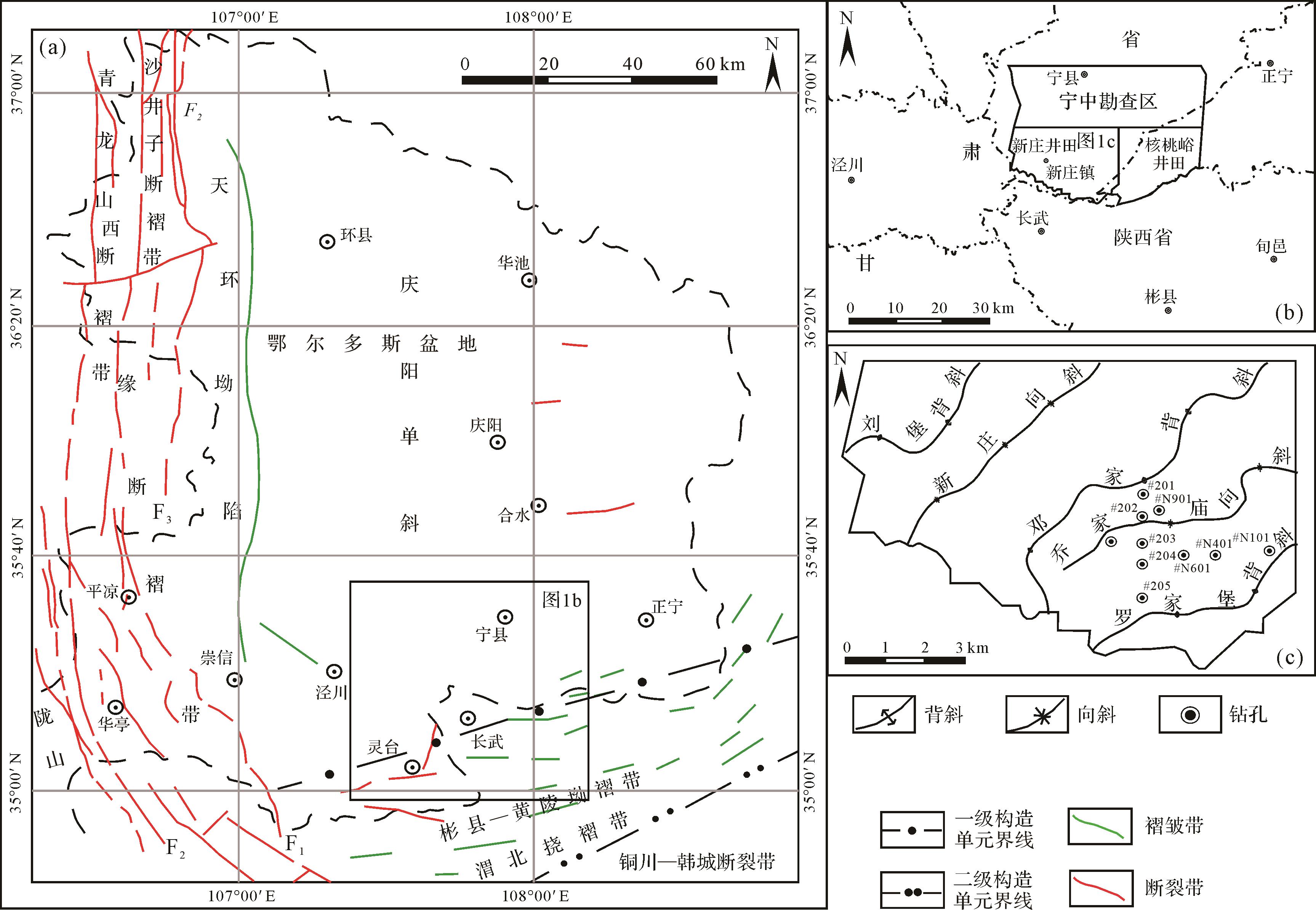
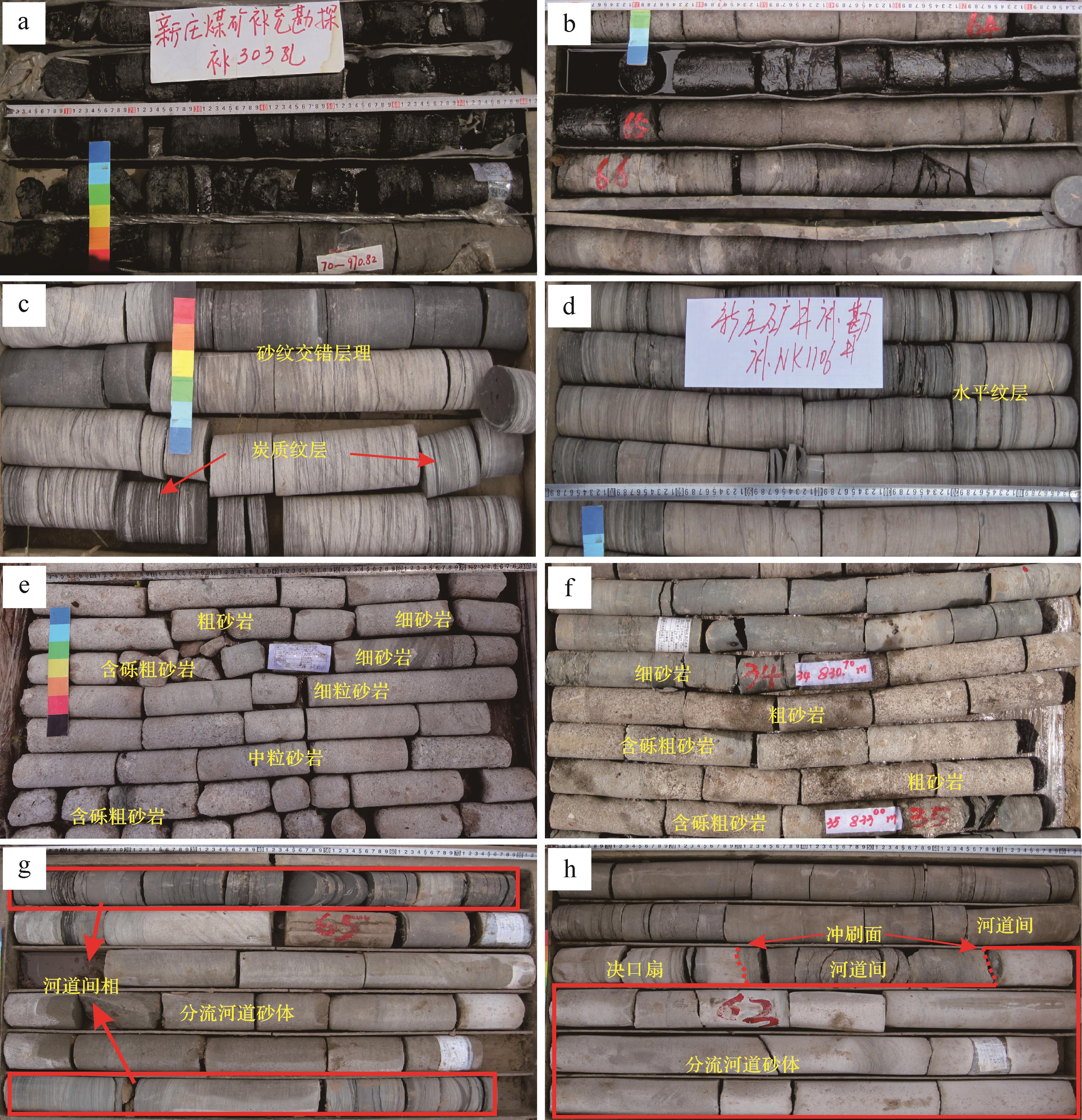
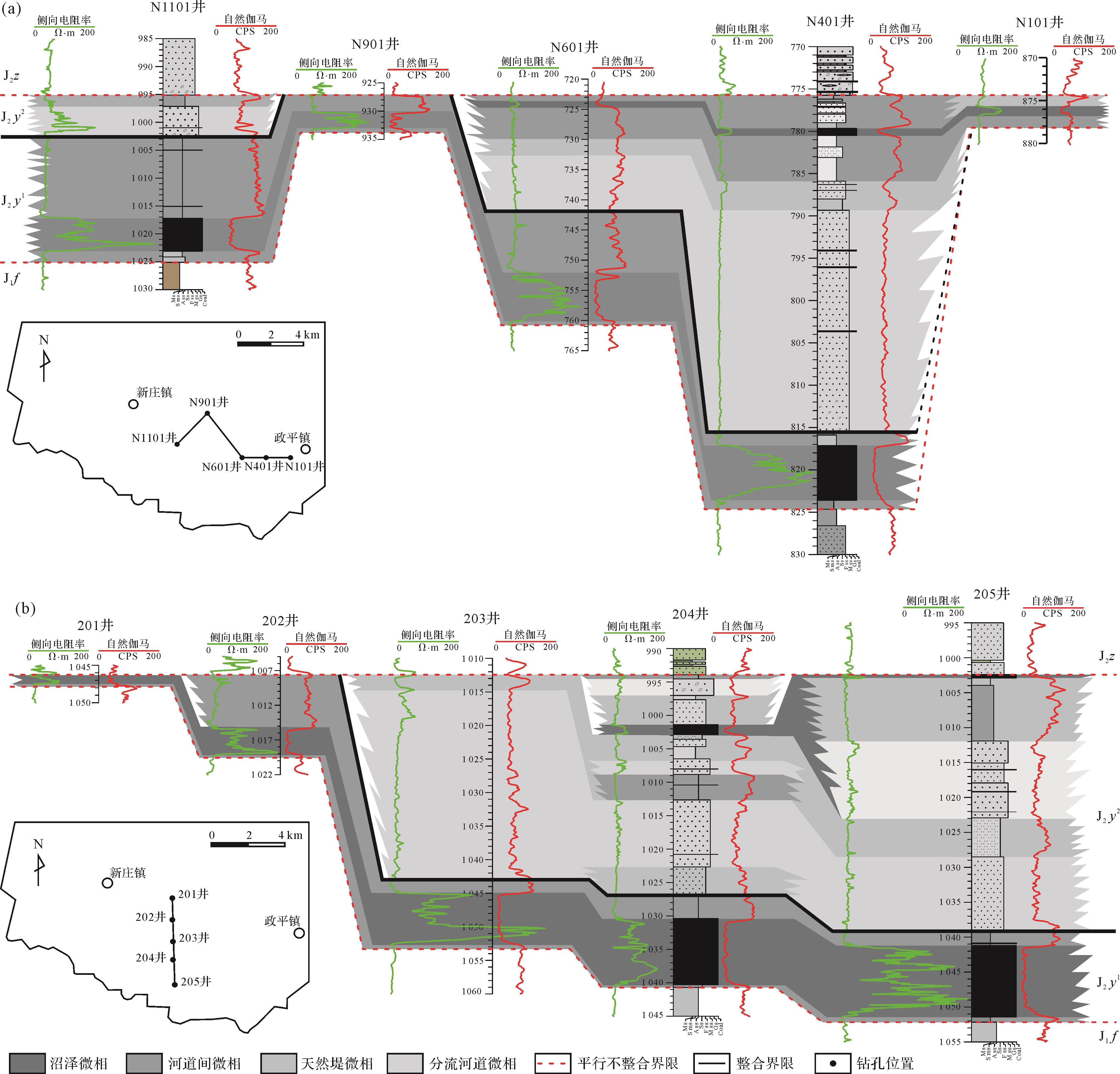
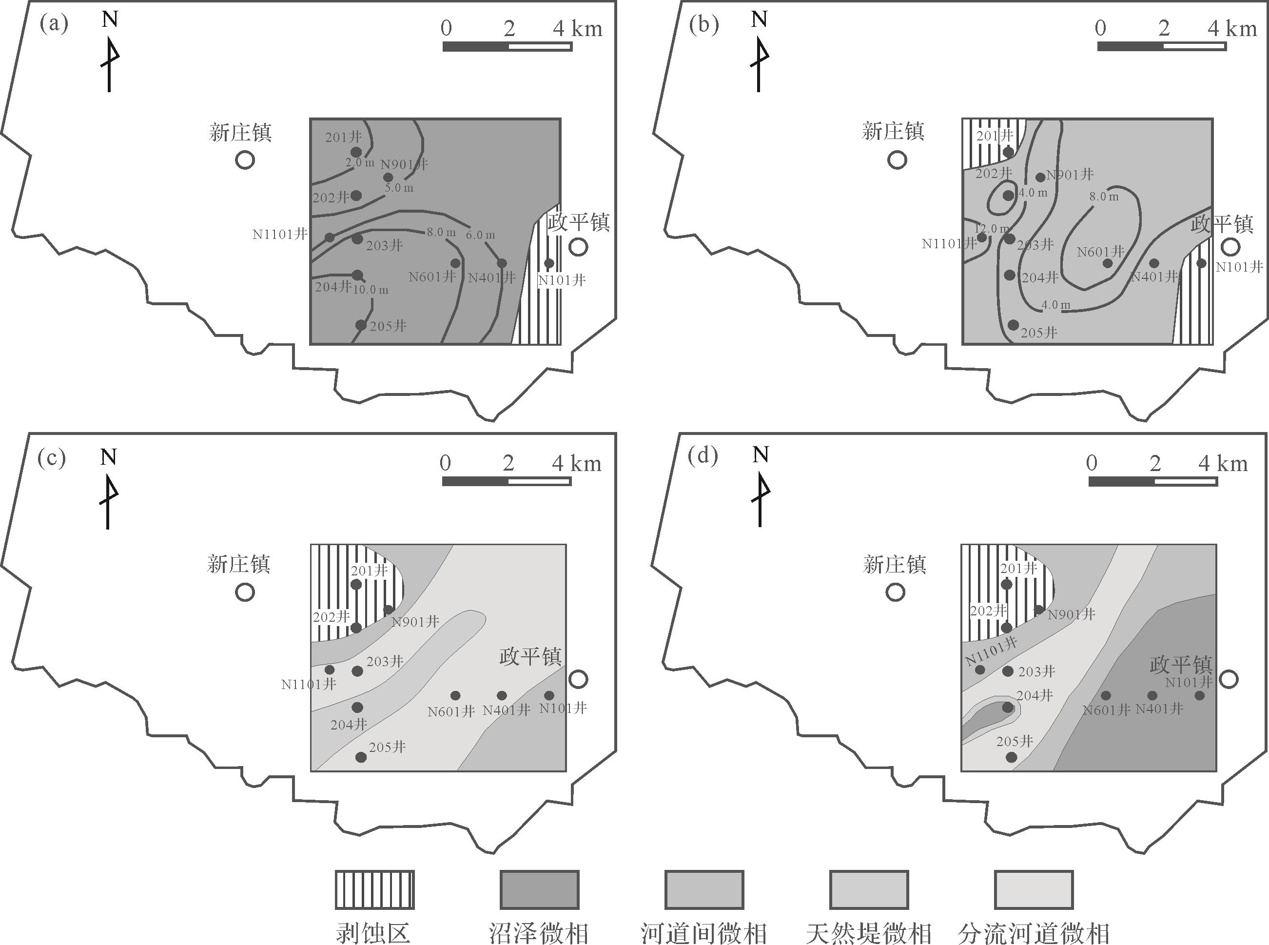
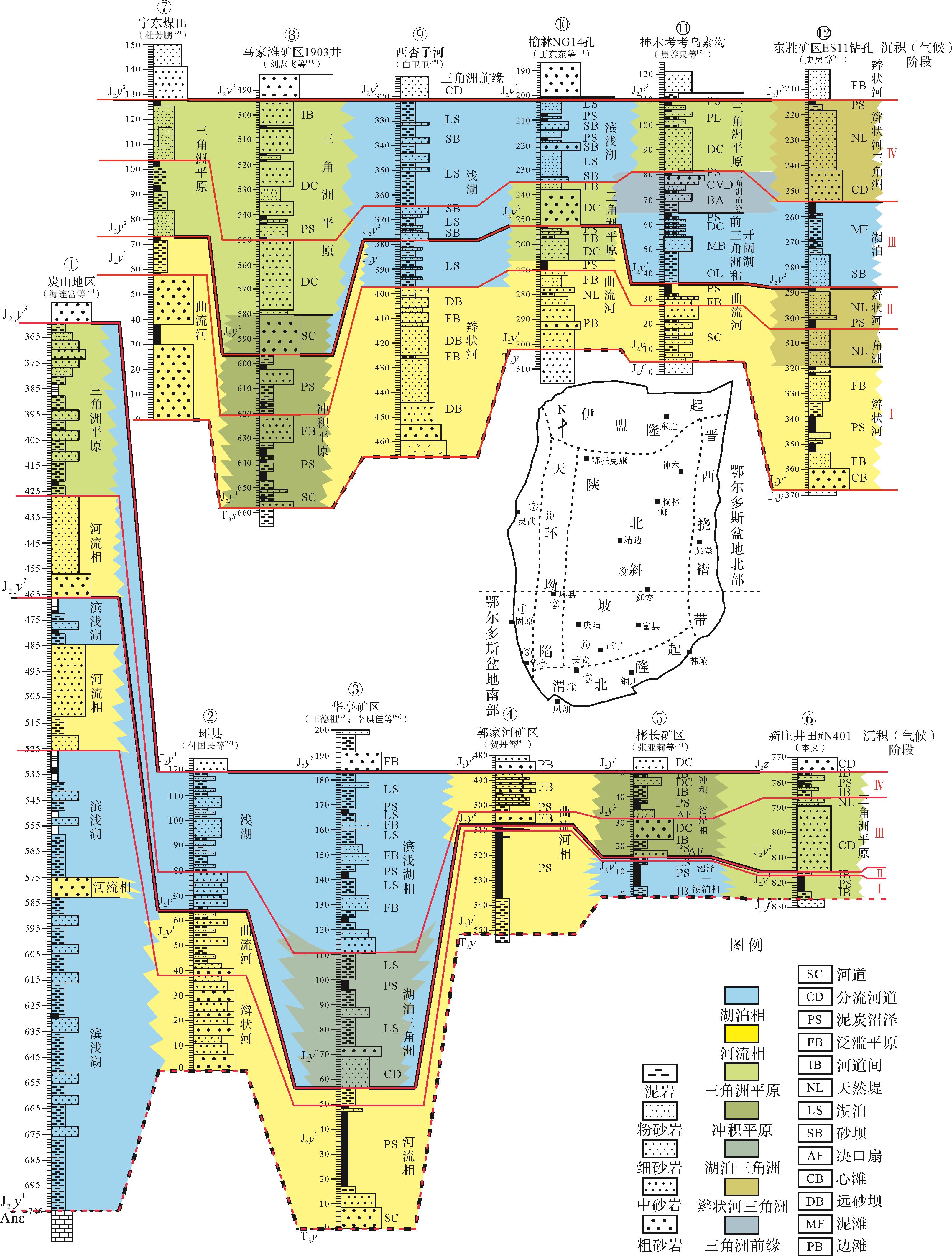
Studying the evolution of sedimentary environments of the Yan’an Formation in the Longdong area is of great significance for understanding the evolution of coal forming and climate environments in Northwest China. Based on the analysis of borehole lithology and logging data in the Xinzhuang well field in the southwest Ningzheng mining area of Longdong, the sedimentary environment in this area is shown to be a meandering river delta environment, further divided into four microfacies types: interchannel, marsh, natural dike, and distributary channel. The coal seam is primarily formed in an interchannel marsh environment. Bottom-up reflects the process of water body changing from deep to shallow and hydrodynamics changing from weak to strong and then to weak. Combined with the regional climatic and tectonic data, the overall climate in the basin during the sedimentary period of the Yan’an Formation was warm and humid, the tectonic setting was relatively stable, and the coal forming stage was primarily affected by seasonal climate differences. Based on the comprehensive analysis of lithology and sedimentary microfacies changes of the First and Second members of the Yan’an Formation, the paleogeographic environment of the Ordos Basin can be divided into four stages: the early stage of the First member of the Yan’an Formation was a marsh stage with a stable climate; in the late stage of the First member of Yan’an Formation, the climate was relatively dry, and the interchannel environment was dominant. The early stage of the Second member of the Yan’an Formation was characterized by a hot and dry climate and distributary channel environment. The basin of the late stage of the Second member of the Yan’an Formation was characterized by a warm and humid climate and interchannel sedimentary environment.
Studying the evolution of sedimentary environments of the Yan’an Formation in the Longdong area is of great significance for understanding the evolution of coal forming and climate environments in Northwest China. Based on the analysis of borehole lithology and logging data in the Xinzhuang well field in the southwest Ningzheng mining area of Longdong, the sedimentary environment in this area is shown to be a meandering river delta environment, further divided into four microfacies types: interchannel, marsh, natural dike, and distributary channel. The coal seam is primarily formed in an interchannel marsh environment. Bottom-up reflects the process of water body changing from deep to shallow and hydrodynamics changing from weak to strong and then to weak. Combined with the regional climatic and tectonic data, the overall climate in the basin during the sedimentary period of the Yan’an Formation was warm and humid, the tectonic setting was relatively stable, and the coal forming stage was primarily affected by seasonal climate differences. Based on the comprehensive analysis of lithology and sedimentary microfacies changes of the First and Second members of the Yan’an Formation, the paleogeographic environment of the Ordos Basin can be divided into four stages: the early stage of the First member of the Yan’an Formation was a marsh stage with a stable climate; in the late stage of the First member of Yan’an Formation, the climate was relatively dry, and the interchannel environment was dominant. The early stage of the Second member of the Yan’an Formation was characterized by a hot and dry climate and distributary channel environment. The basin of the late stage of the Second member of the Yan’an Formation was characterized by a warm and humid climate and interchannel sedimentary environment.


2023, 41(2): 559-568.
doi: 10.14027/j.issn.1000-0550.2021.106
Abstract:
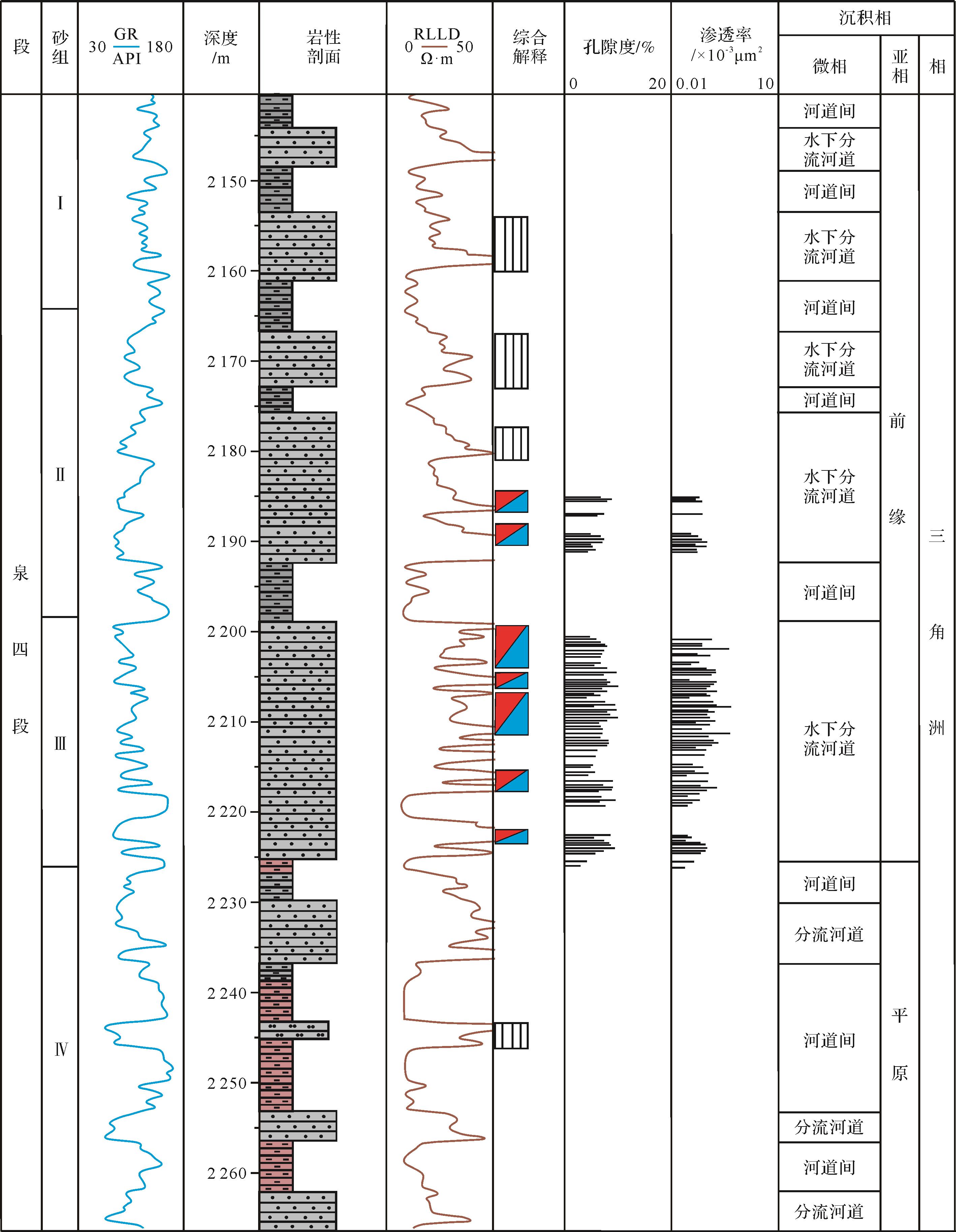
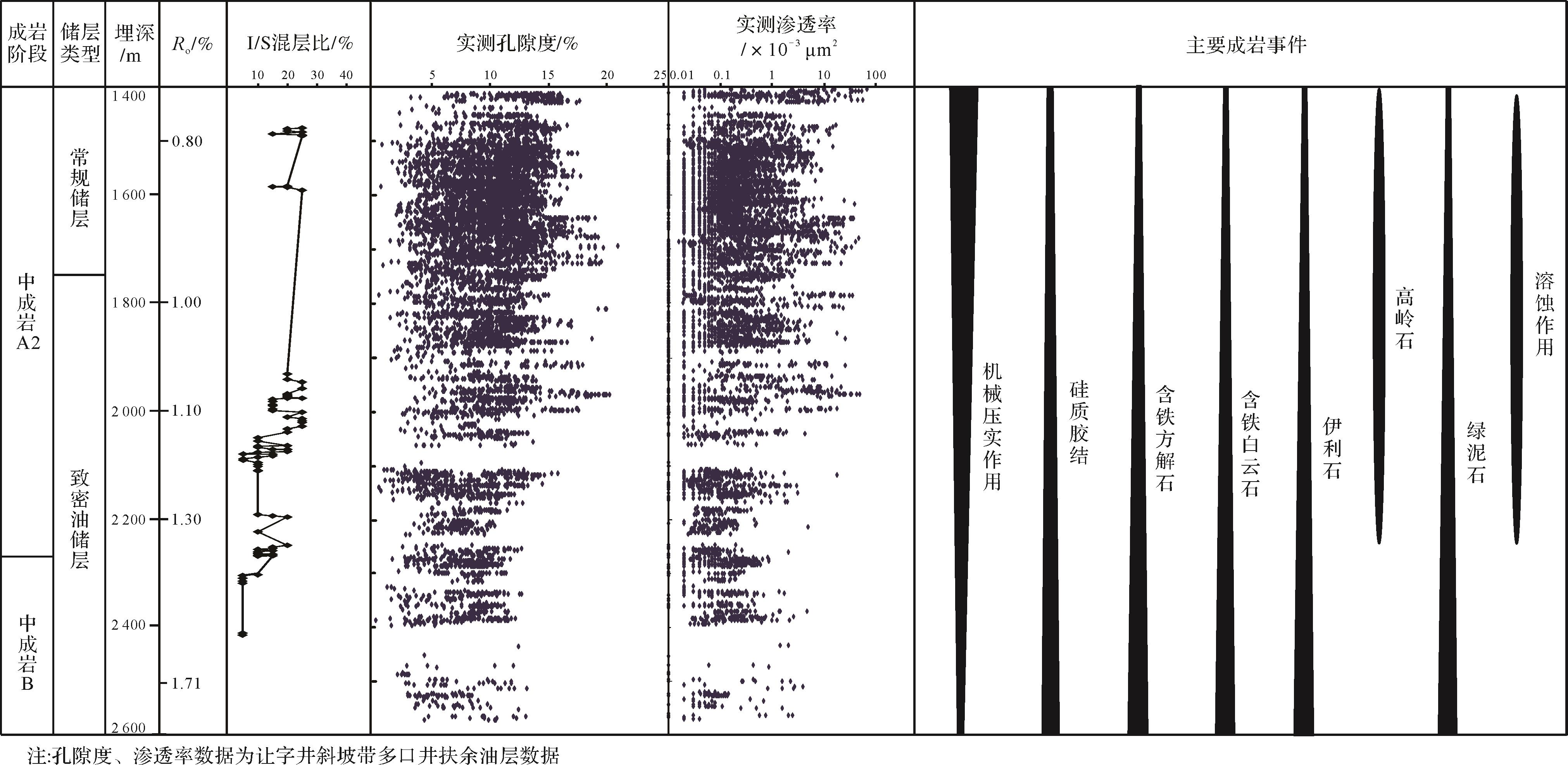
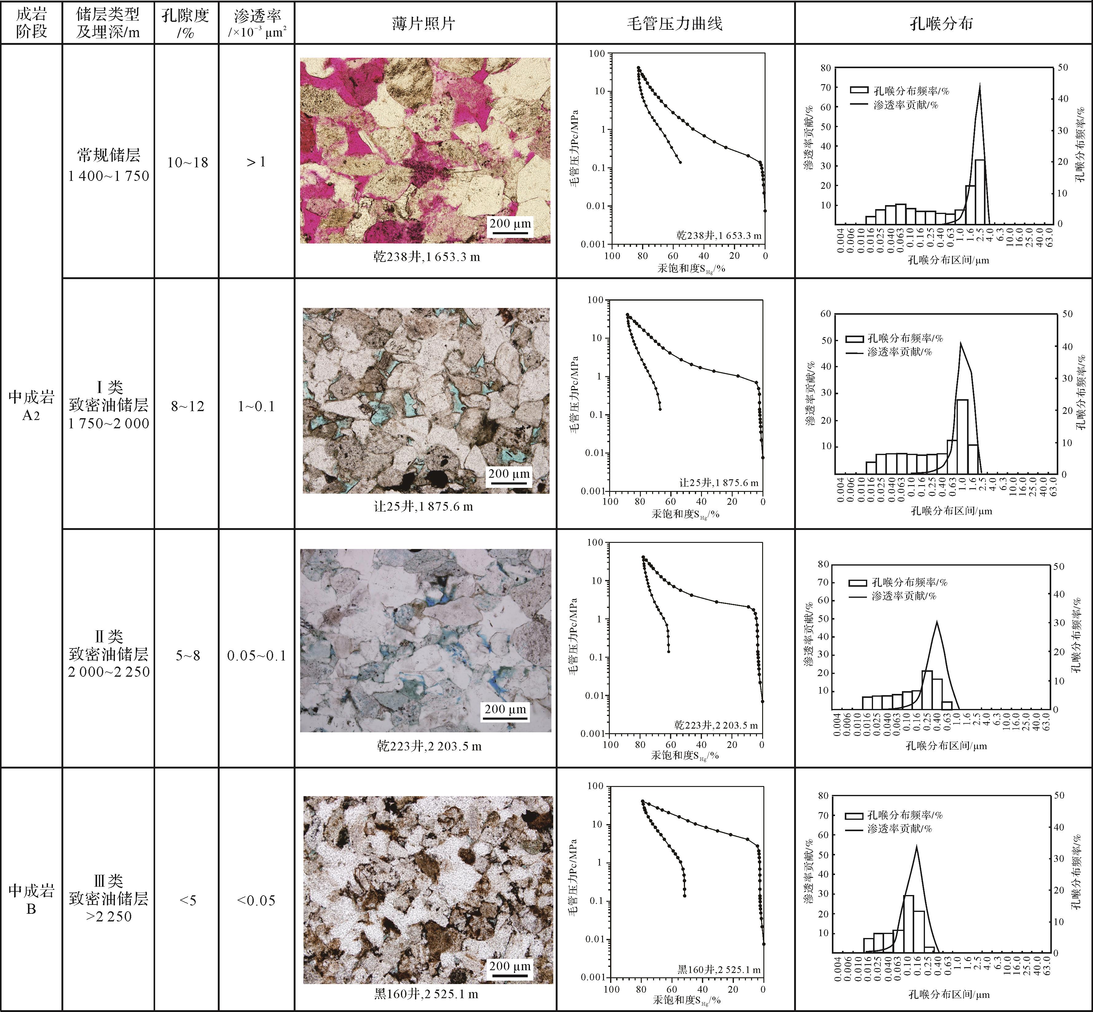
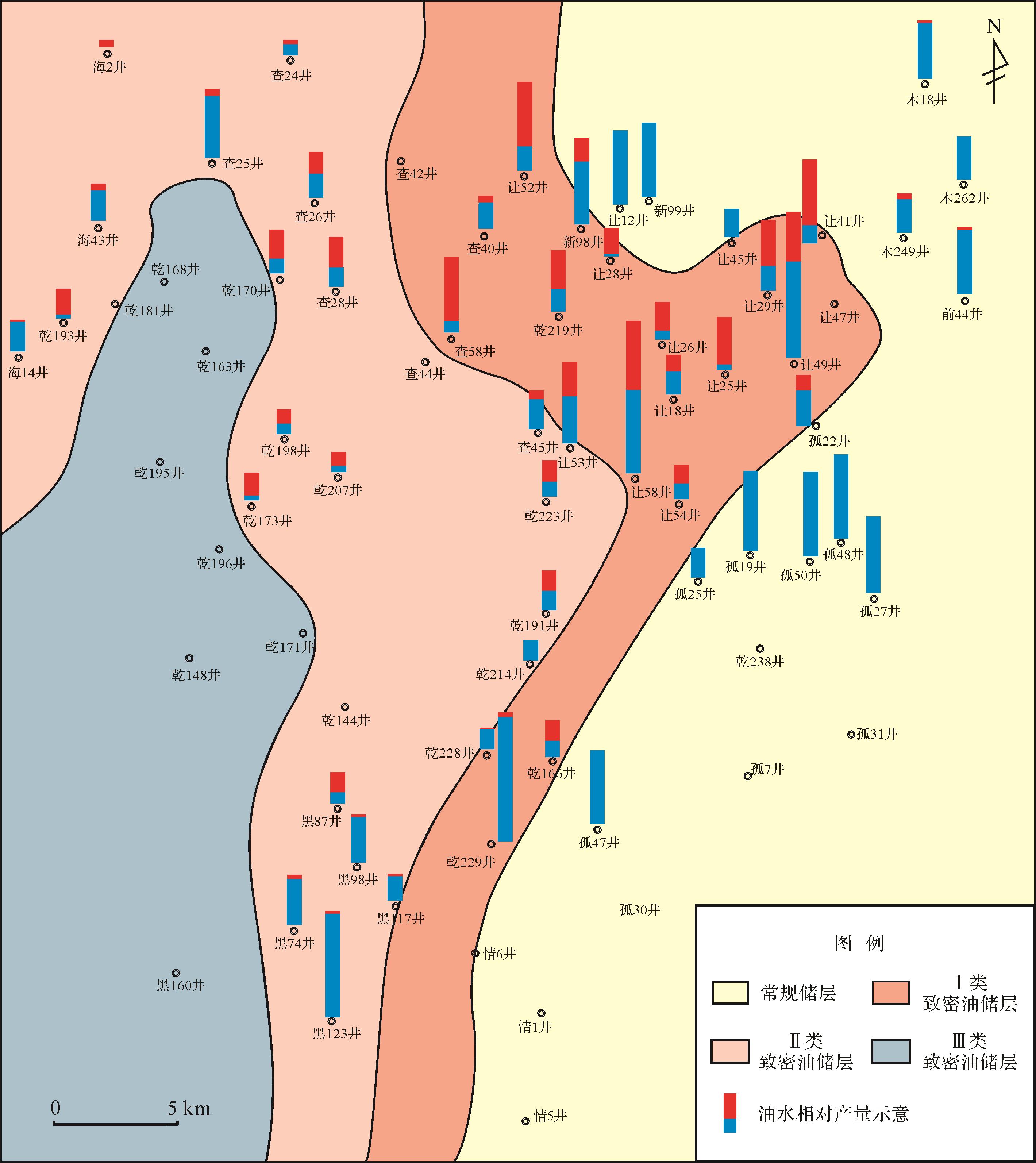
The Fuyu reservoir in the Fourth member of the Quantou Formation is the most important oil-bearing reservoir in the southern Songliao Basin, and is currently being explored for tight oil resources. The diagenesis is highly influential in the formation and distribution of tight oil reservoirs. The Fuyu reservoir, located in the Rangzijing slope zone, was studied to determine the influence of diagenesis on the distribution of tight oil reservoirs using the methods of thin sections, clay mineral XRD, SEM observations, physical properties, high-pressure Hg injection and other experimental techniques. These showed that most of the effective reservoirs with dissolution pores in the study area comprise deltaic underwater distributary channels and resulting sandstone. At depths of 1 750⁃2 250 m, the mudstone I/S mixture ratio is 15%⁃25%, and the reservoir is at the mid-diagenetic A2 stage, with secondary dissolution pores. This is the main tight-oil exploitation zone. Below 2 250 m the mudstone I/S mixing ratio is less than 15%, and the reservoir is accordingly at mid-diagenetic stage B. In the study area the Fuyu reservoir is divided into conventional reservoir and tight-oil reservoir types I, II and III. Longitudinally, all reservoir types appear in turn with increasing depth. The most favorable reservoirs in the study area are types I and II. The most favorable exploration depth is between 1 750 m and 2 250 m.
The Fuyu reservoir in the Fourth member of the Quantou Formation is the most important oil-bearing reservoir in the southern Songliao Basin, and is currently being explored for tight oil resources. The diagenesis is highly influential in the formation and distribution of tight oil reservoirs. The Fuyu reservoir, located in the Rangzijing slope zone, was studied to determine the influence of diagenesis on the distribution of tight oil reservoirs using the methods of thin sections, clay mineral XRD, SEM observations, physical properties, high-pressure Hg injection and other experimental techniques. These showed that most of the effective reservoirs with dissolution pores in the study area comprise deltaic underwater distributary channels and resulting sandstone. At depths of 1 750⁃2 250 m, the mudstone I/S mixture ratio is 15%⁃25%, and the reservoir is at the mid-diagenetic A2 stage, with secondary dissolution pores. This is the main tight-oil exploitation zone. Below 2 250 m the mudstone I/S mixing ratio is less than 15%, and the reservoir is accordingly at mid-diagenetic stage B. In the study area the Fuyu reservoir is divided into conventional reservoir and tight-oil reservoir types I, II and III. Longitudinally, all reservoir types appear in turn with increasing depth. The most favorable reservoirs in the study area are types I and II. The most favorable exploration depth is between 1 750 m and 2 250 m.
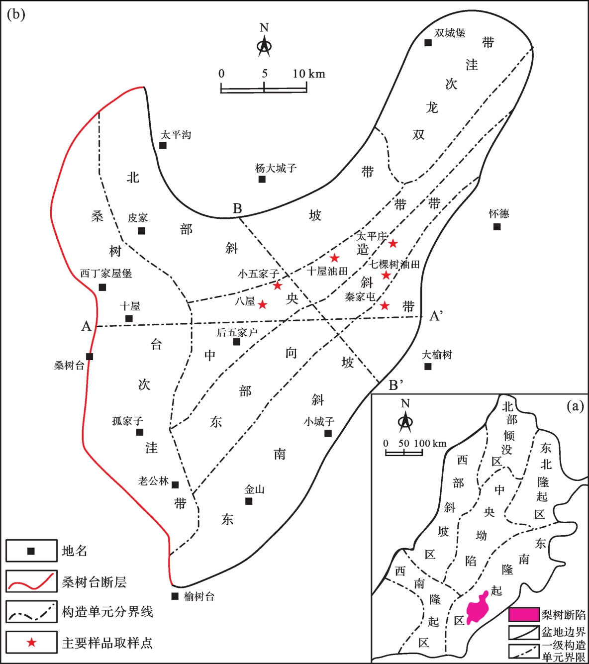
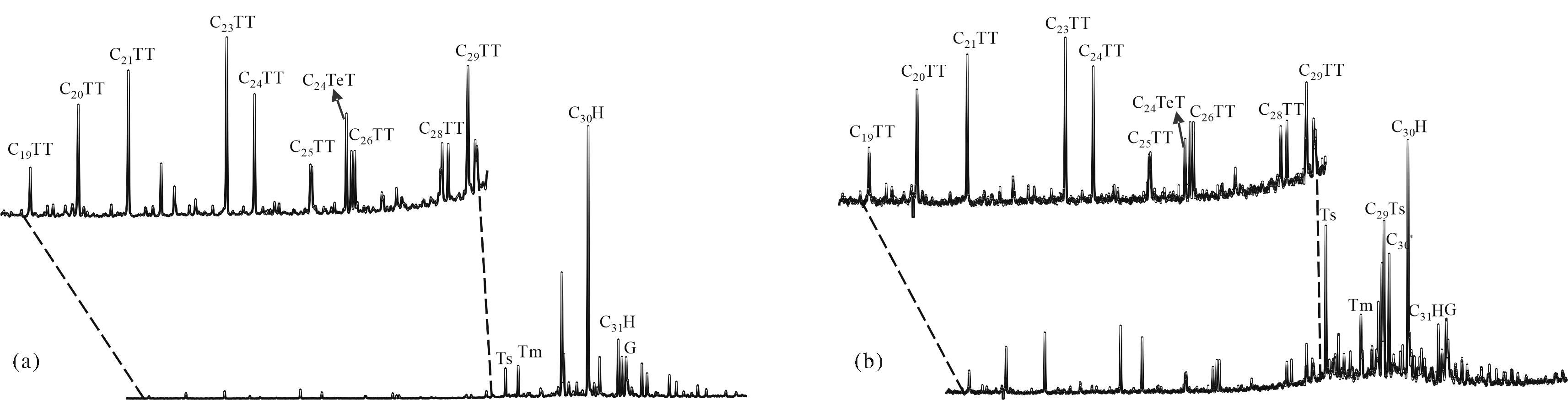
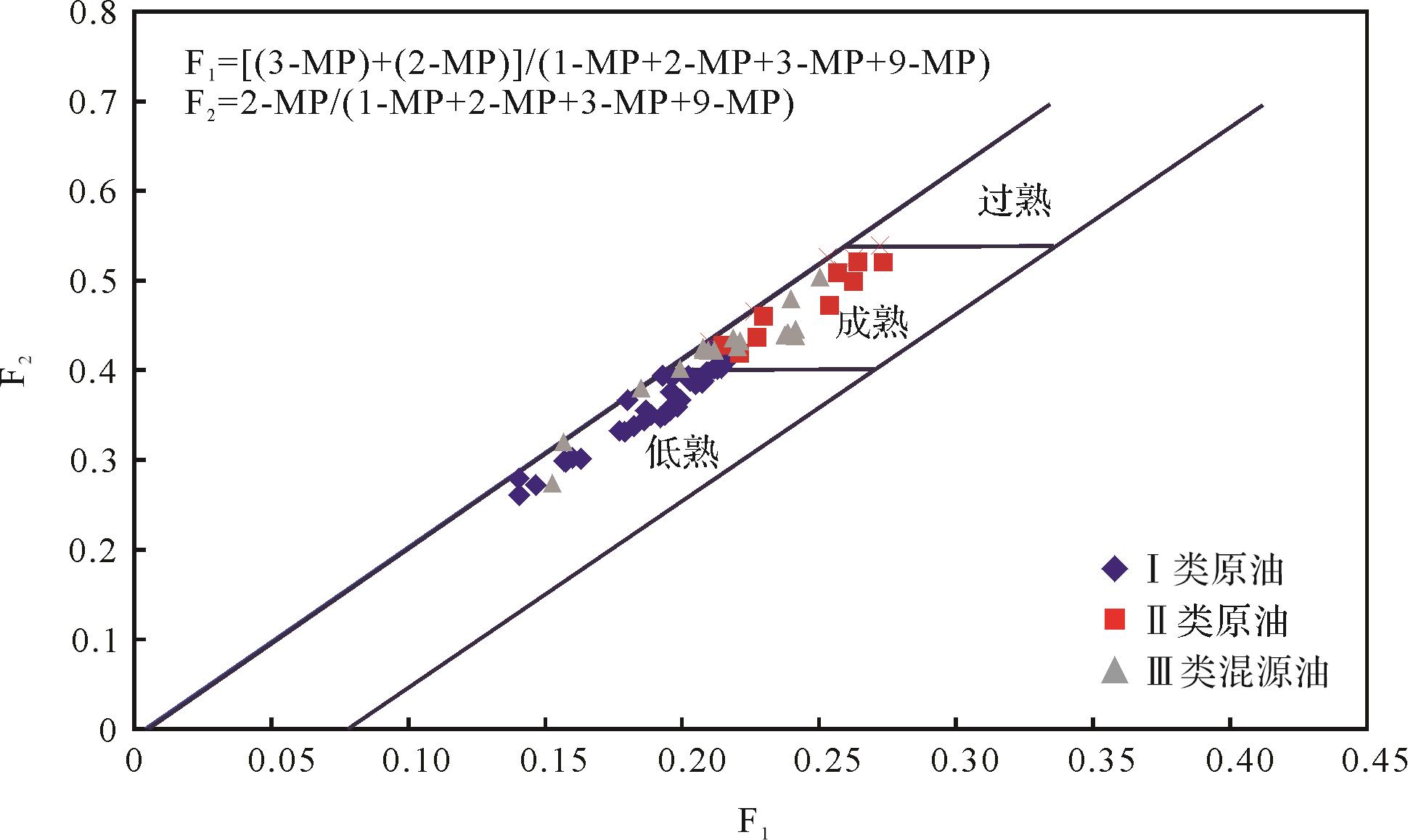
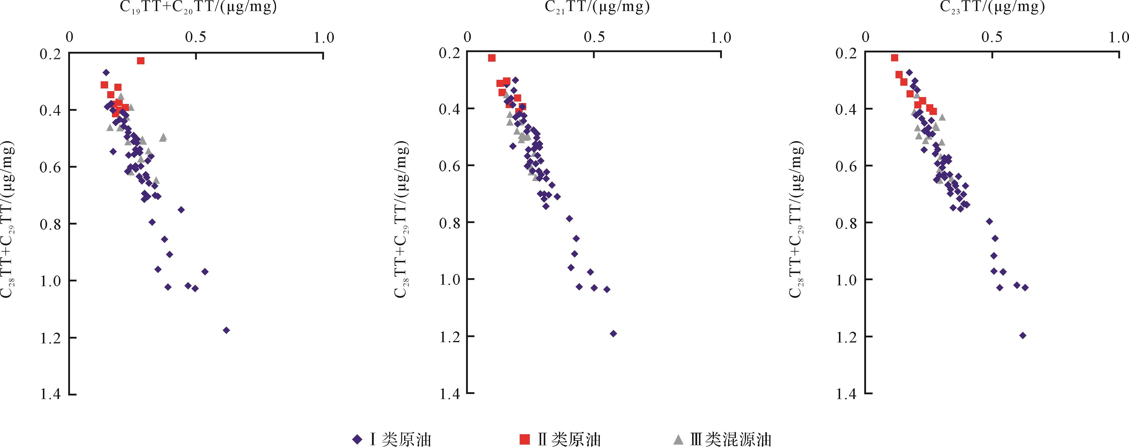
2023, 41(2): 569-583.
doi: 10.14027/j.issn.1000-0550.2022.071
Abstract:
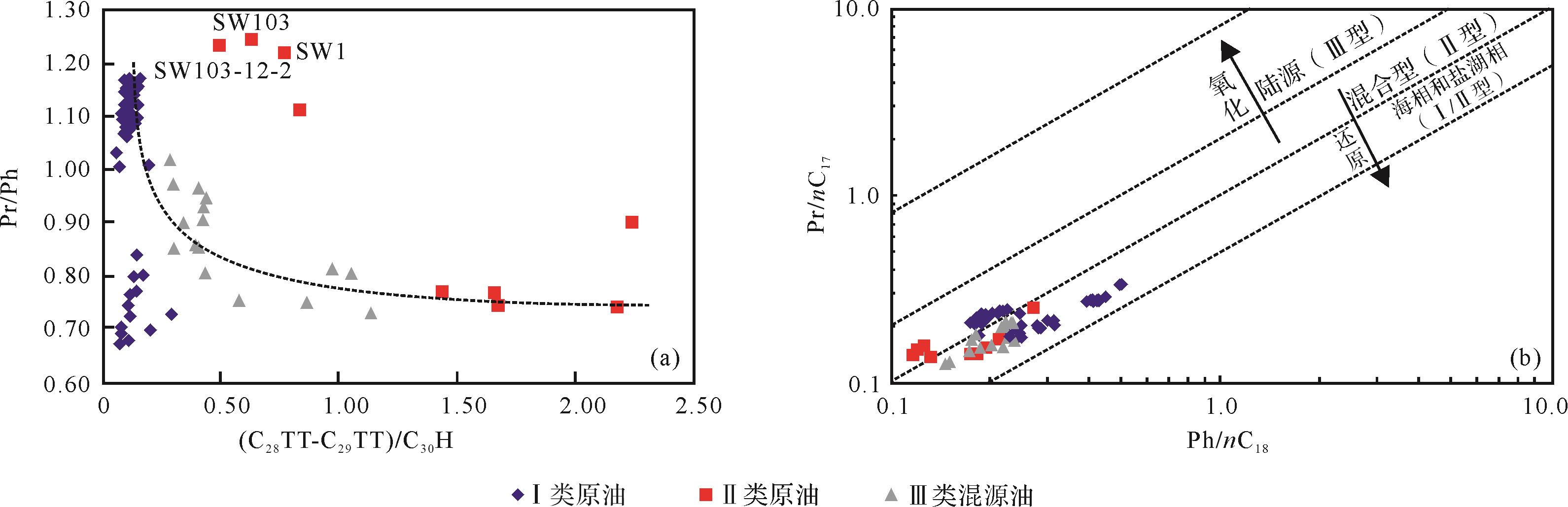
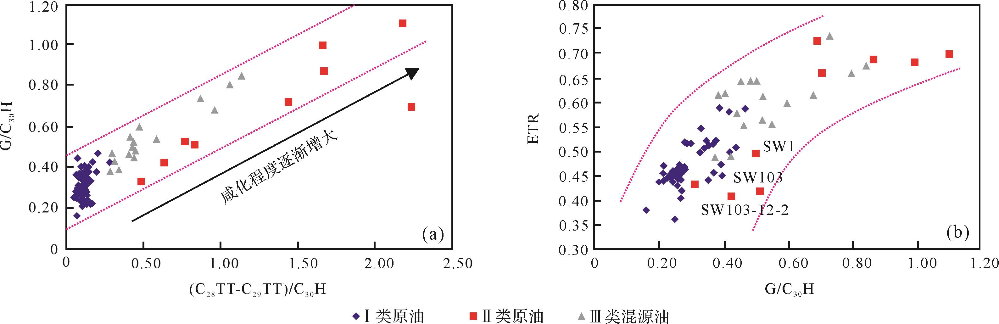
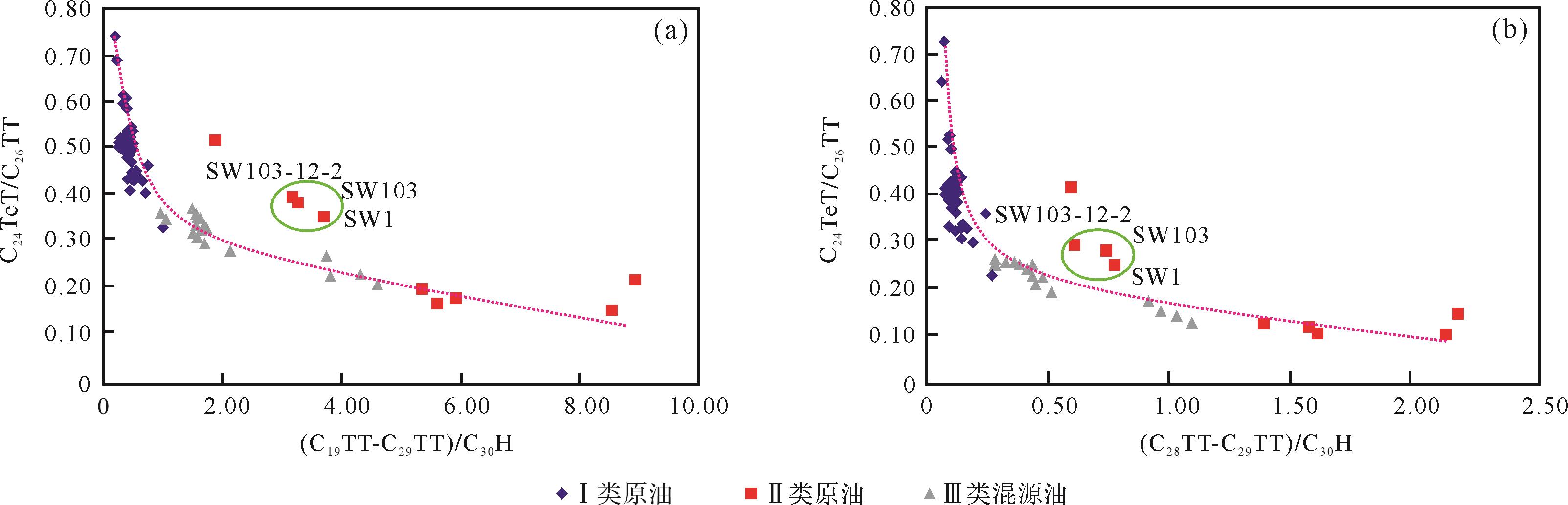
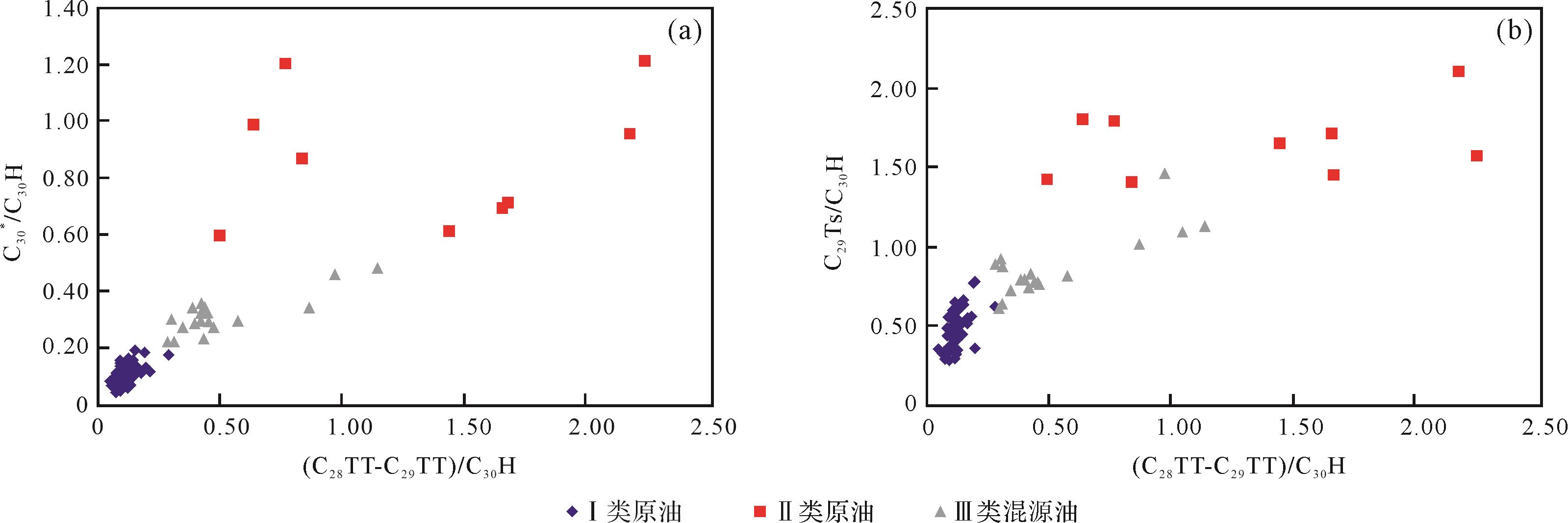
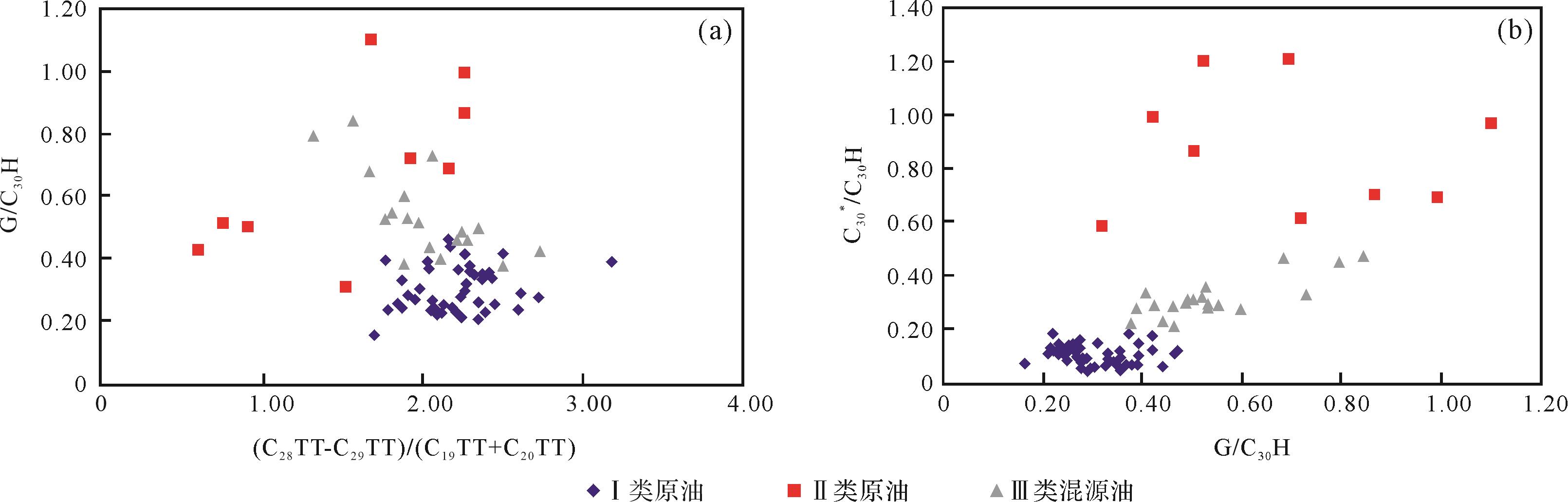
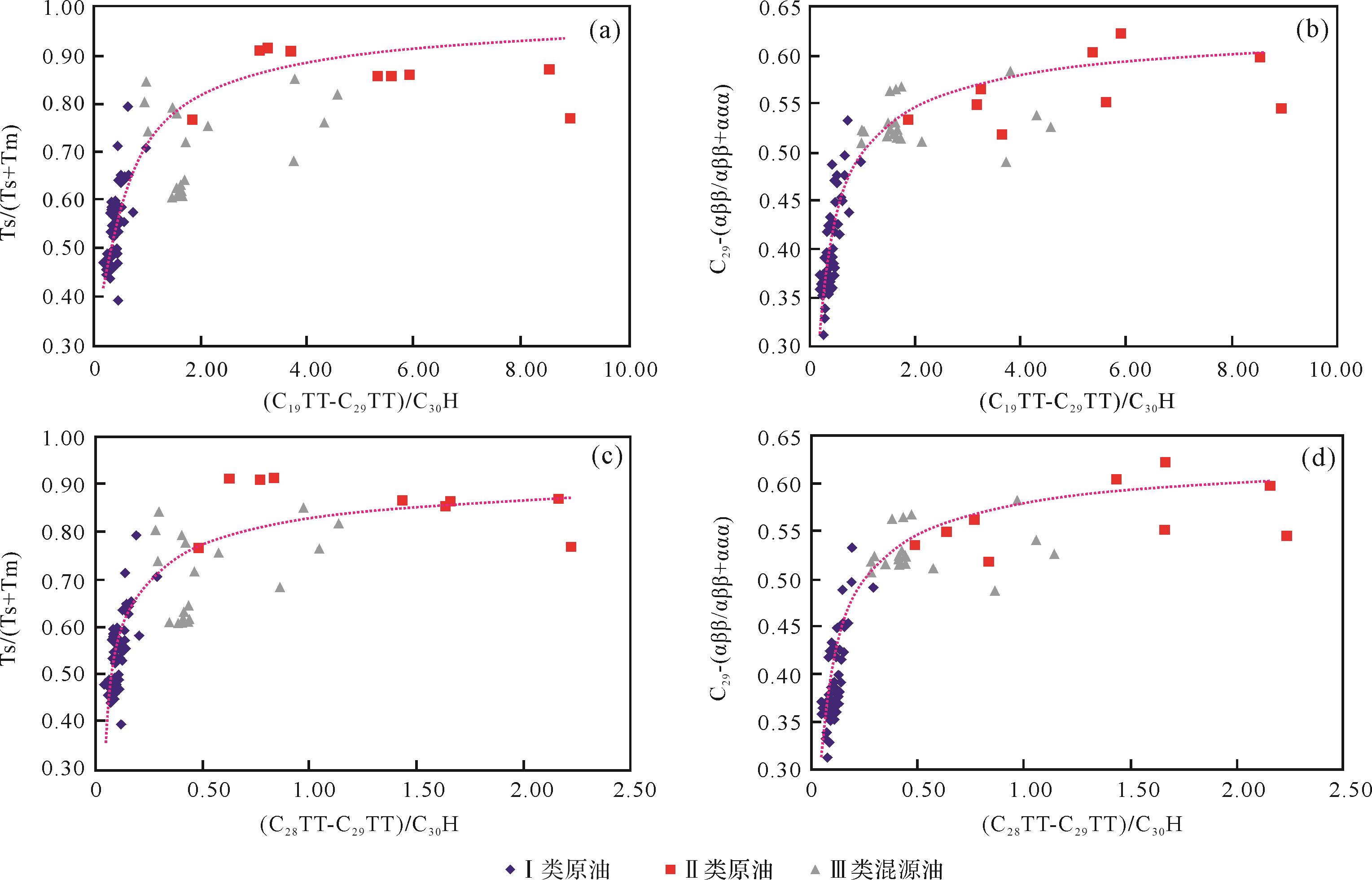
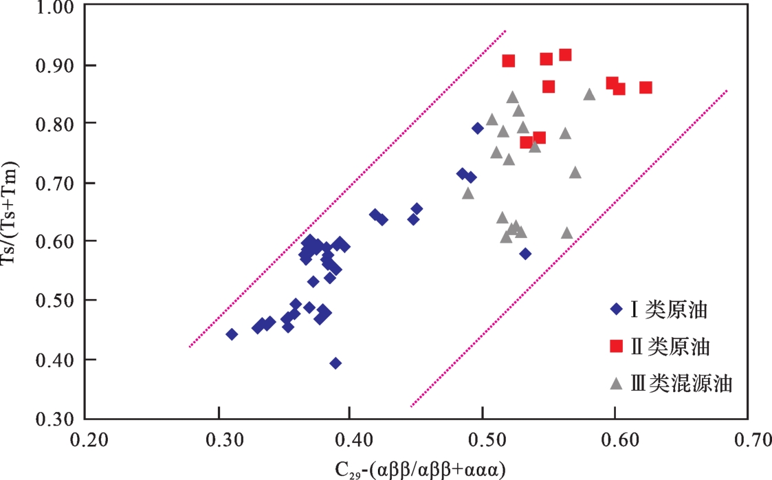
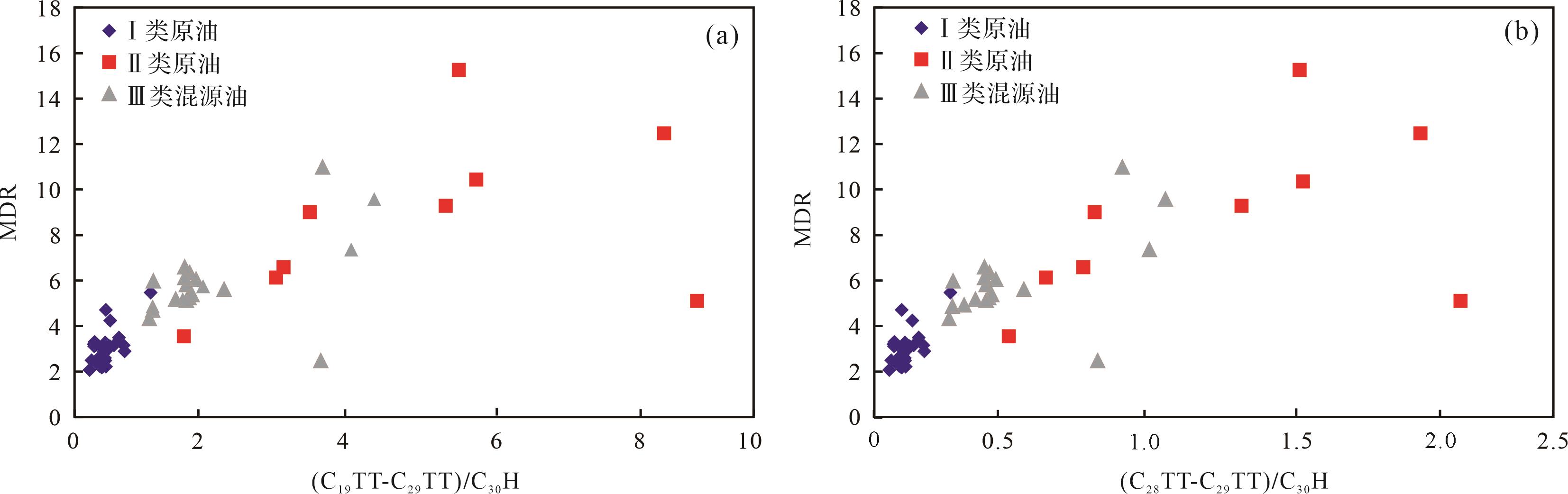
The Songliao Basin is one of the largest continental oil and gas basins in China; the Lishu Fault Depression is a secondary tectonic unit of the Songliao Basin. In this study, 71 lacustrine Lishu Fault oil samples were analyzed for saturated hydrocarbons and aromatics. The different compositions indicated by the gas chromatography and gas chromatography-mass spectrometry (GC-MS) data indicated three types of crude oil from the Lishu Fault, each with quite different distributions of tricyclic terpanes. The absolute concentration of tricyclic terpanes in type I oil is obviously higher than in type II; however, the Σtricyclic terpanes/17α(H)-hopanes ratio in type I crude oil is significantly higher than in type II, but it is enriched in high carbon-number tricyclic terpane (C28TT-C29TT) compounds, with higher relative percentages than in low carbon tricyclic terpenes (C19TT-C20TT, C21TT, C23TT). The main influences affecting high carbon number C28TT-C29TT in the Lishu Fault crude oil are discussed from three aspects: deposition environment, organic matter source, and maturity of the crude oils. It was found that, in the organic matter sources of the different genetic types of crude oil (mainly bacteria and low-grade aquatic organisms), the (C28TT-C29TT)/17α(H)-hopanes ratio is positively correlated with the gammacerane index, indicating that a more reductant salt water environment is another factor affecting the enrichment of tricyclic terpane with high carbon number. In the study area, the Σtricyclic terpanes/17α(H)-hopanes ratio is positively correlated with thermal maturity, indicating that a high degree of thermal evolution of the crude oil is more conducive to enrichment in high carbon number tricyclic terpanes. It follows that thermal maturity is the main influence on the different relative abundances of high-carbon tricyclic terpenes in the Lishu Fault Depression.
The Songliao Basin is one of the largest continental oil and gas basins in China; the Lishu Fault Depression is a secondary tectonic unit of the Songliao Basin. In this study, 71 lacustrine Lishu Fault oil samples were analyzed for saturated hydrocarbons and aromatics. The different compositions indicated by the gas chromatography and gas chromatography-mass spectrometry (GC-MS) data indicated three types of crude oil from the Lishu Fault, each with quite different distributions of tricyclic terpanes. The absolute concentration of tricyclic terpanes in type I oil is obviously higher than in type II; however, the Σtricyclic terpanes/17α(H)-hopanes ratio in type I crude oil is significantly higher than in type II, but it is enriched in high carbon-number tricyclic terpane (C28TT-C29TT) compounds, with higher relative percentages than in low carbon tricyclic terpenes (C19TT-C20TT, C21TT, C23TT). The main influences affecting high carbon number C28TT-C29TT in the Lishu Fault crude oil are discussed from three aspects: deposition environment, organic matter source, and maturity of the crude oils. It was found that, in the organic matter sources of the different genetic types of crude oil (mainly bacteria and low-grade aquatic organisms), the (C28TT-C29TT)/17α(H)-hopanes ratio is positively correlated with the gammacerane index, indicating that a more reductant salt water environment is another factor affecting the enrichment of tricyclic terpane with high carbon number. In the study area, the Σtricyclic terpanes/17α(H)-hopanes ratio is positively correlated with thermal maturity, indicating that a high degree of thermal evolution of the crude oil is more conducive to enrichment in high carbon number tricyclic terpanes. It follows that thermal maturity is the main influence on the different relative abundances of high-carbon tricyclic terpenes in the Lishu Fault Depression.
2023, 41(2): 584-600.
doi: 10.14027/j.issn.1000-0550.2021.085
Abstract:
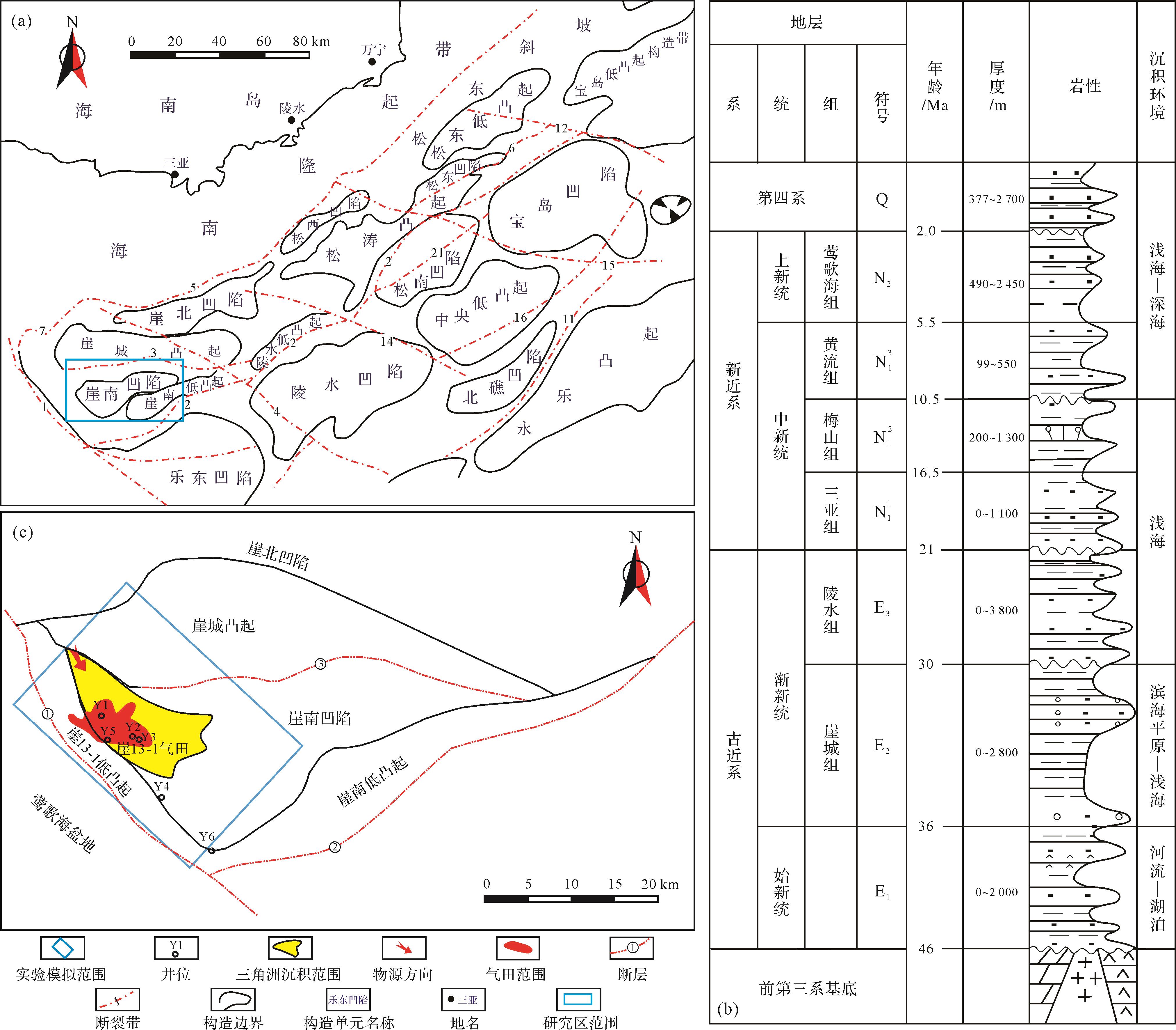
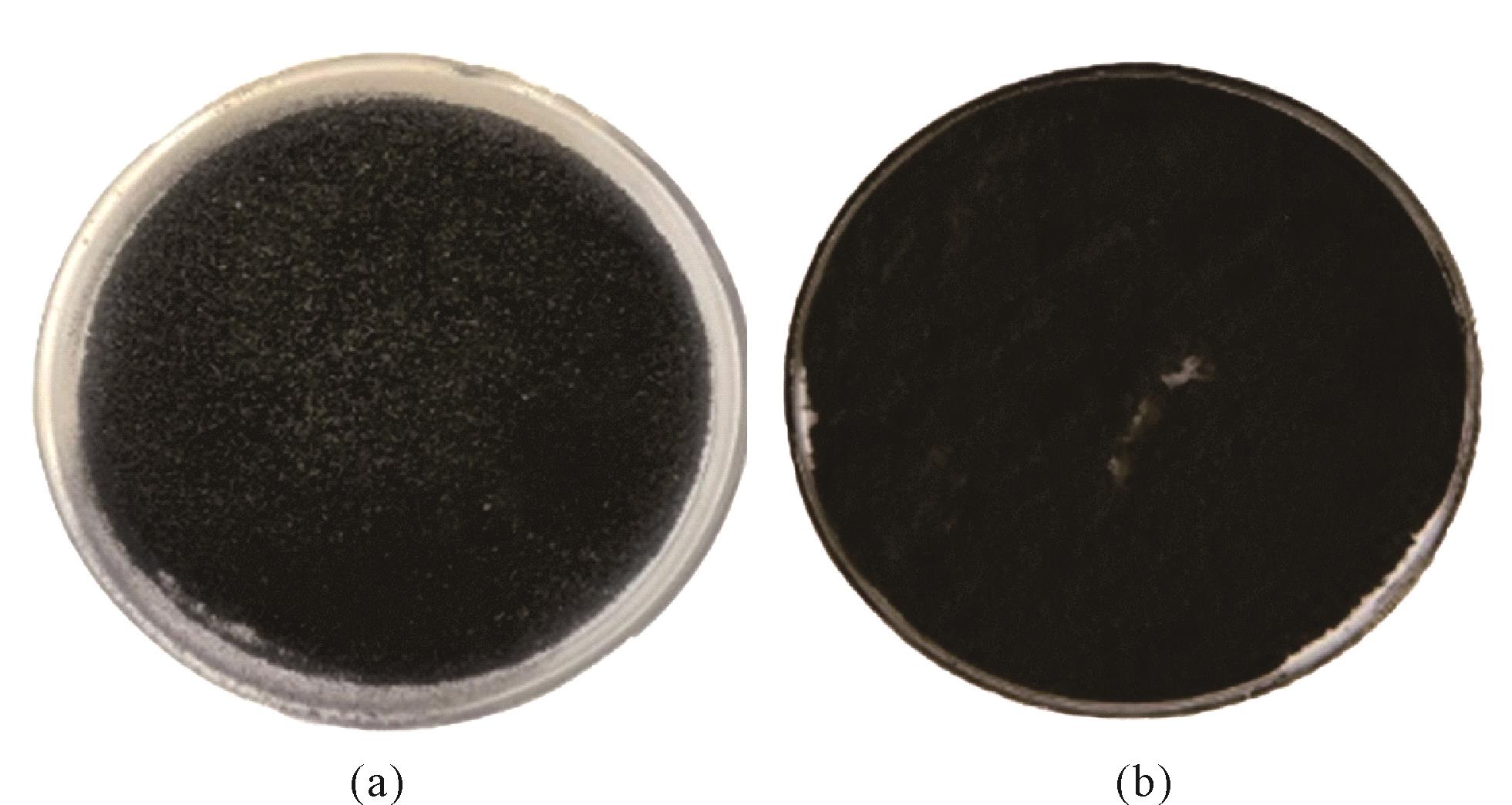
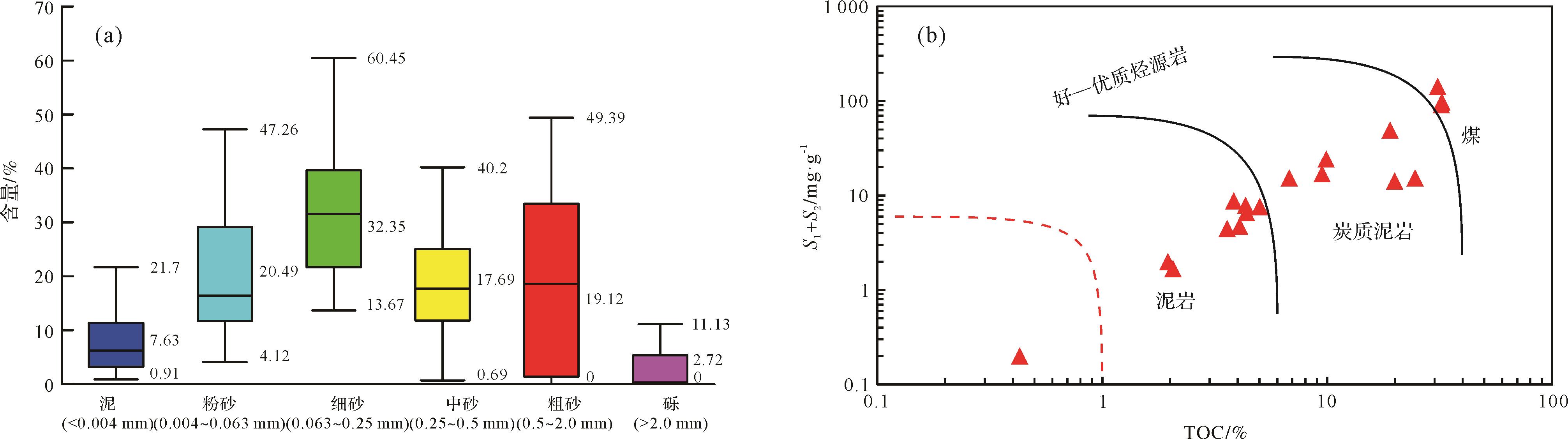
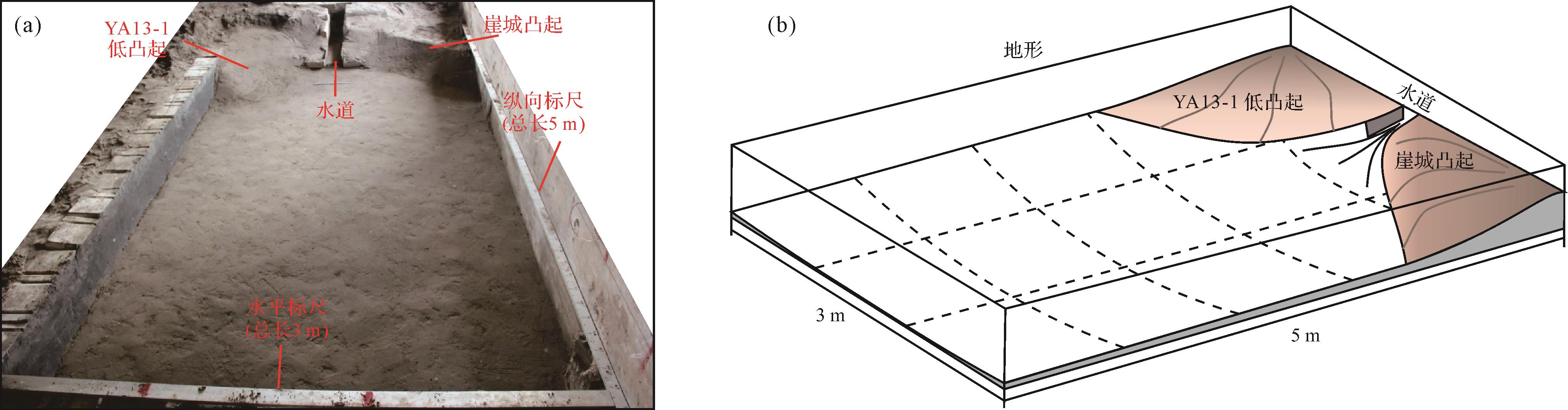
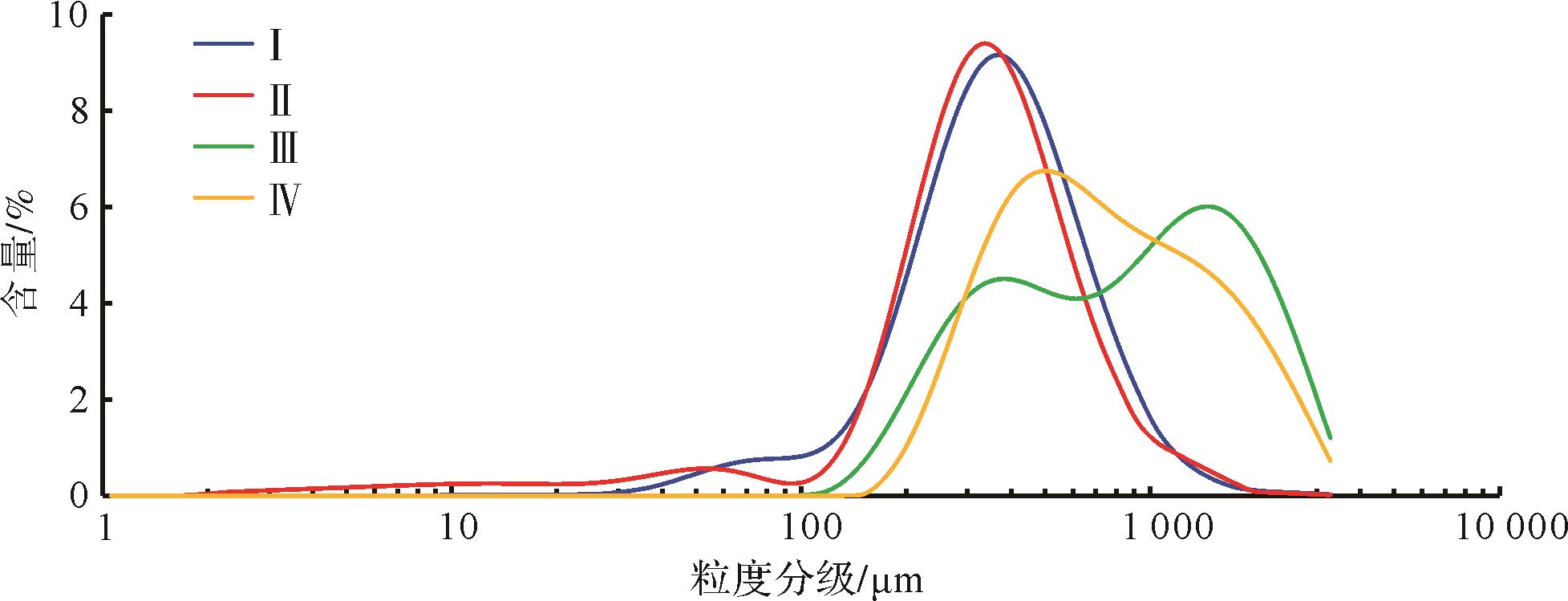
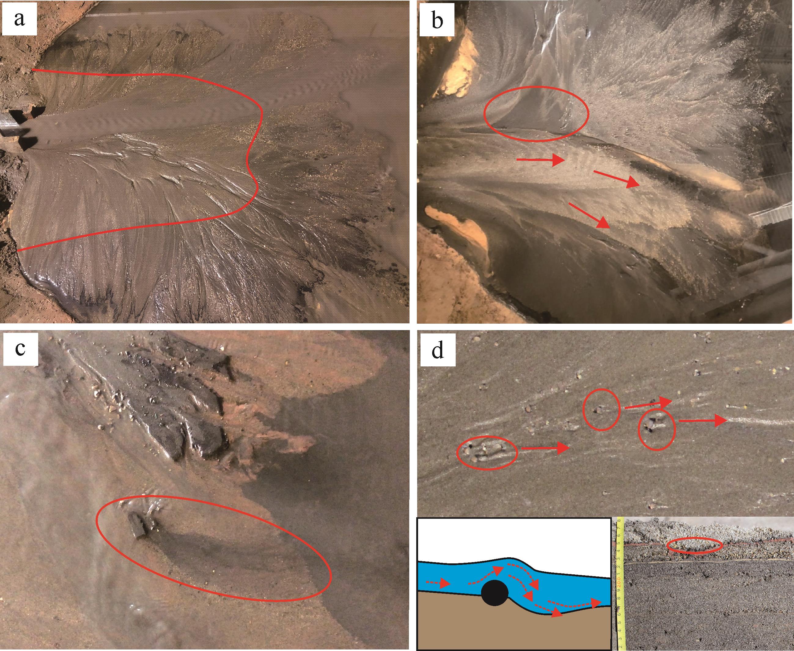
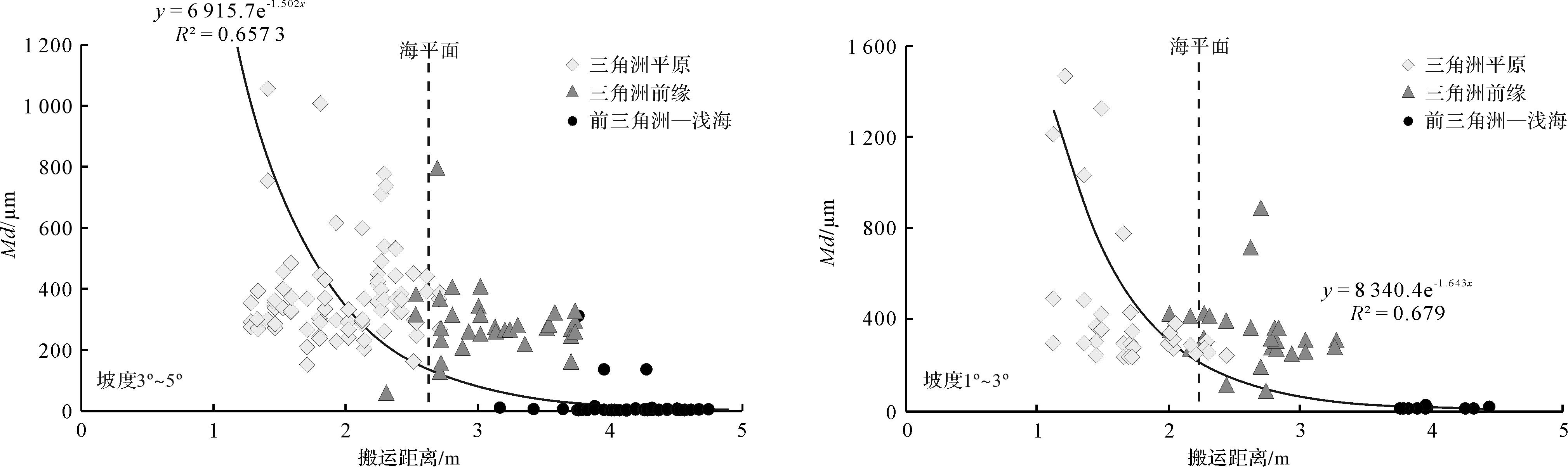
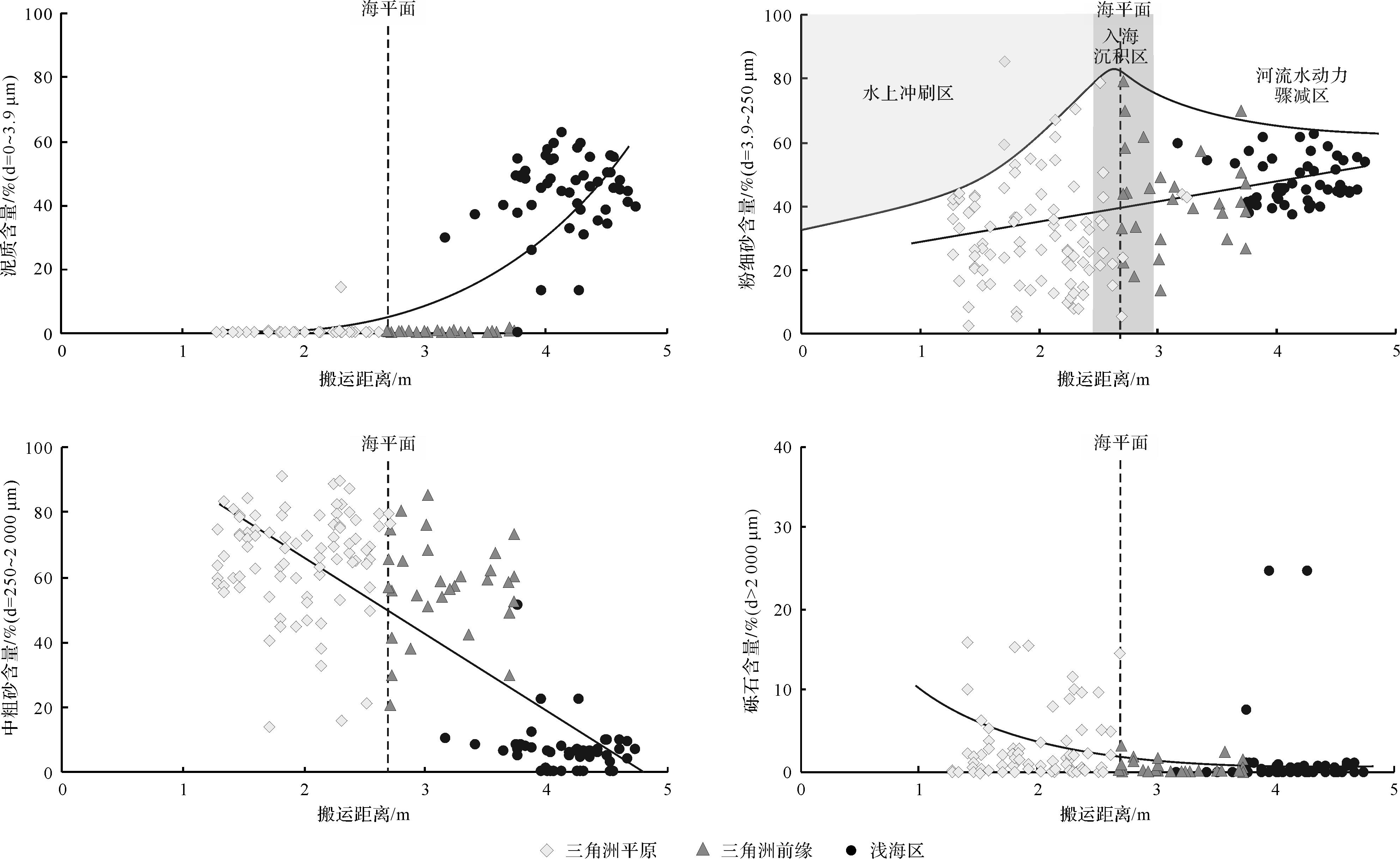
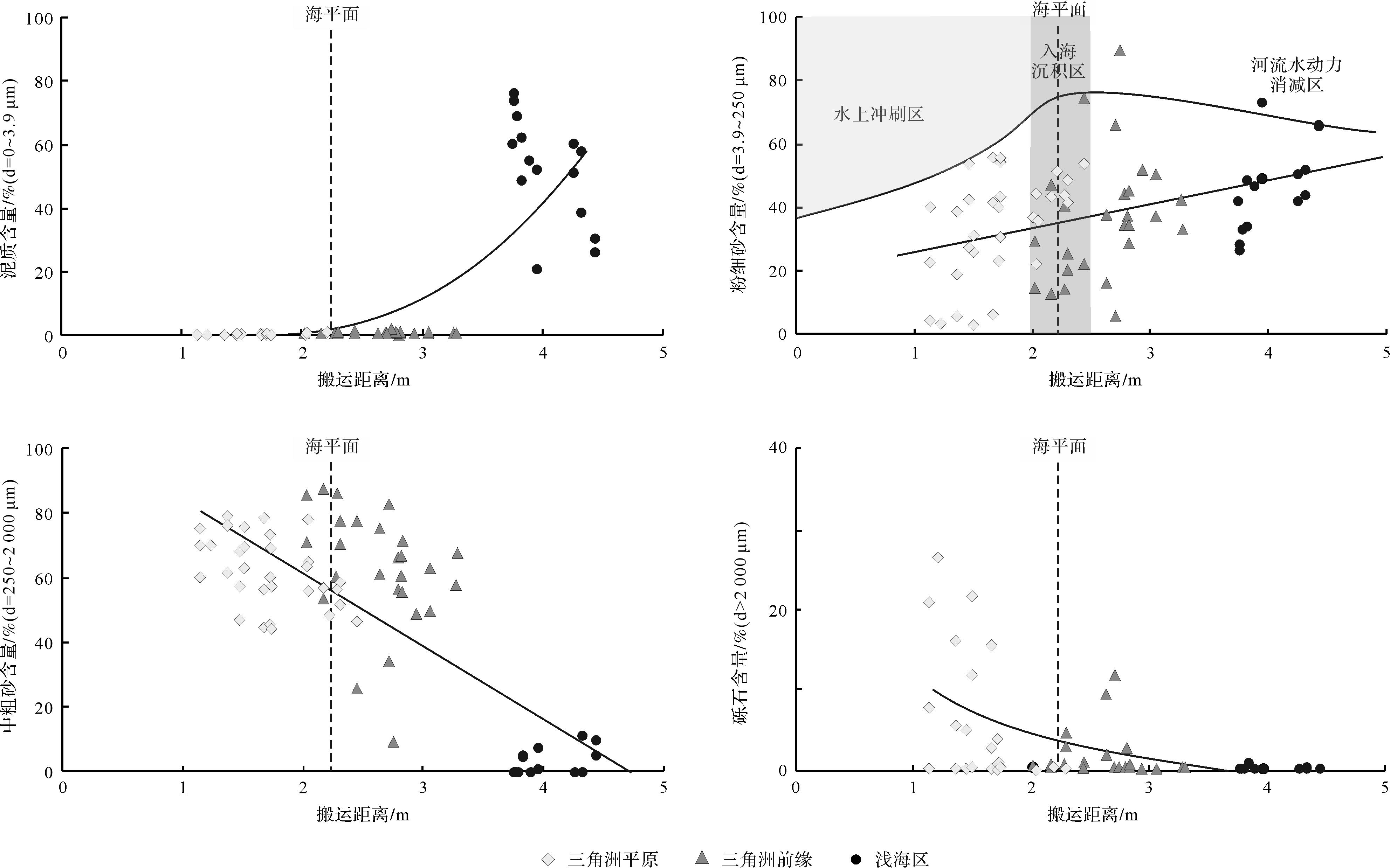
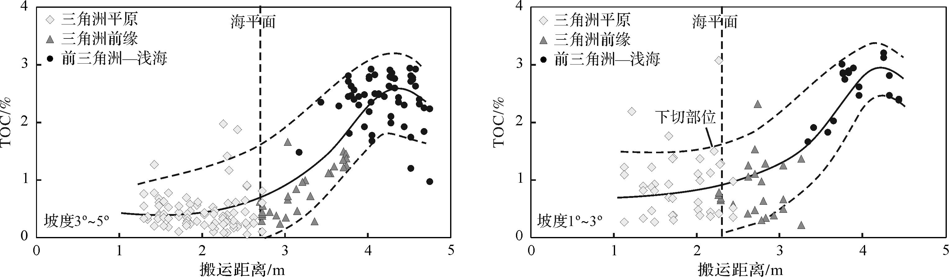
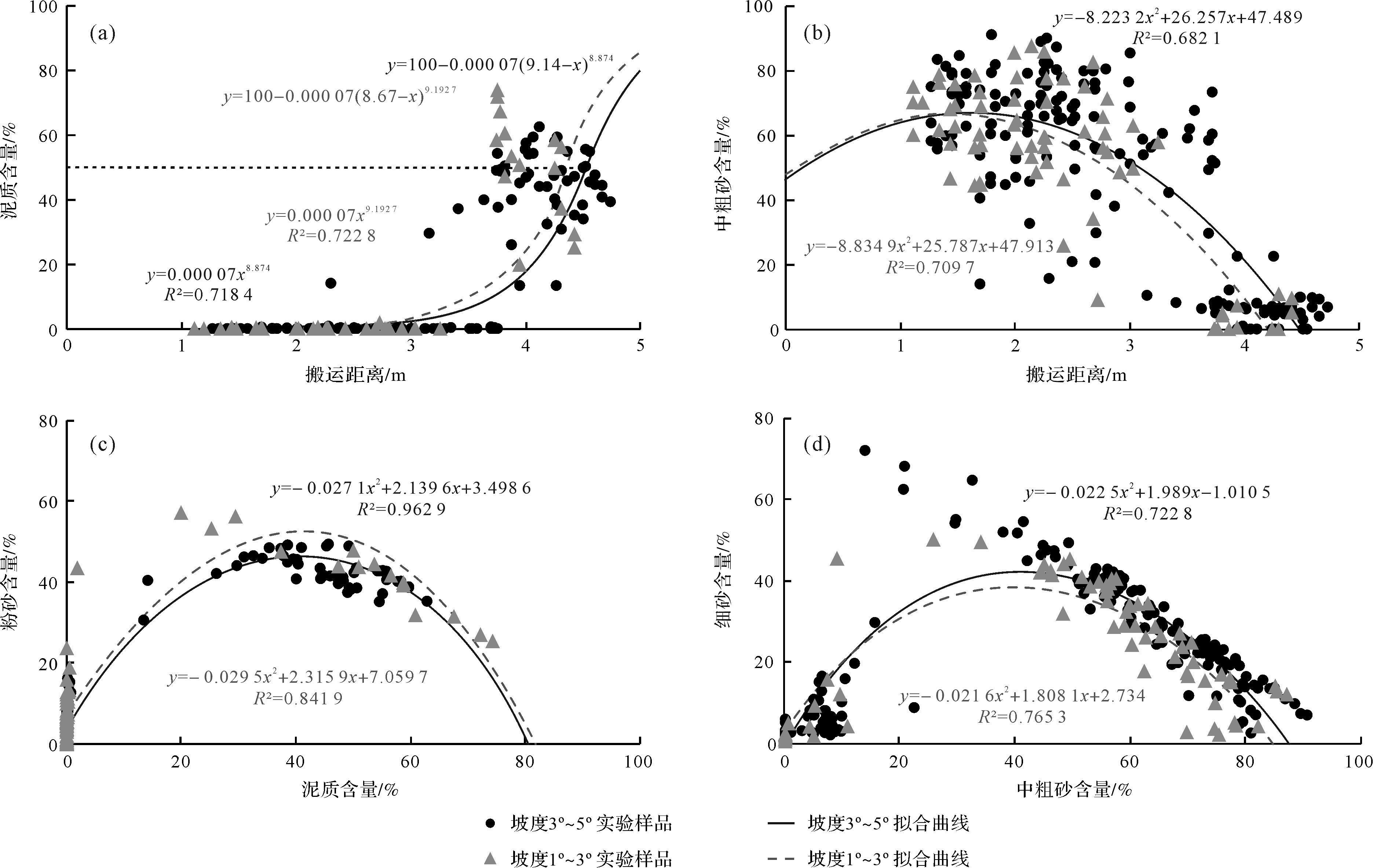
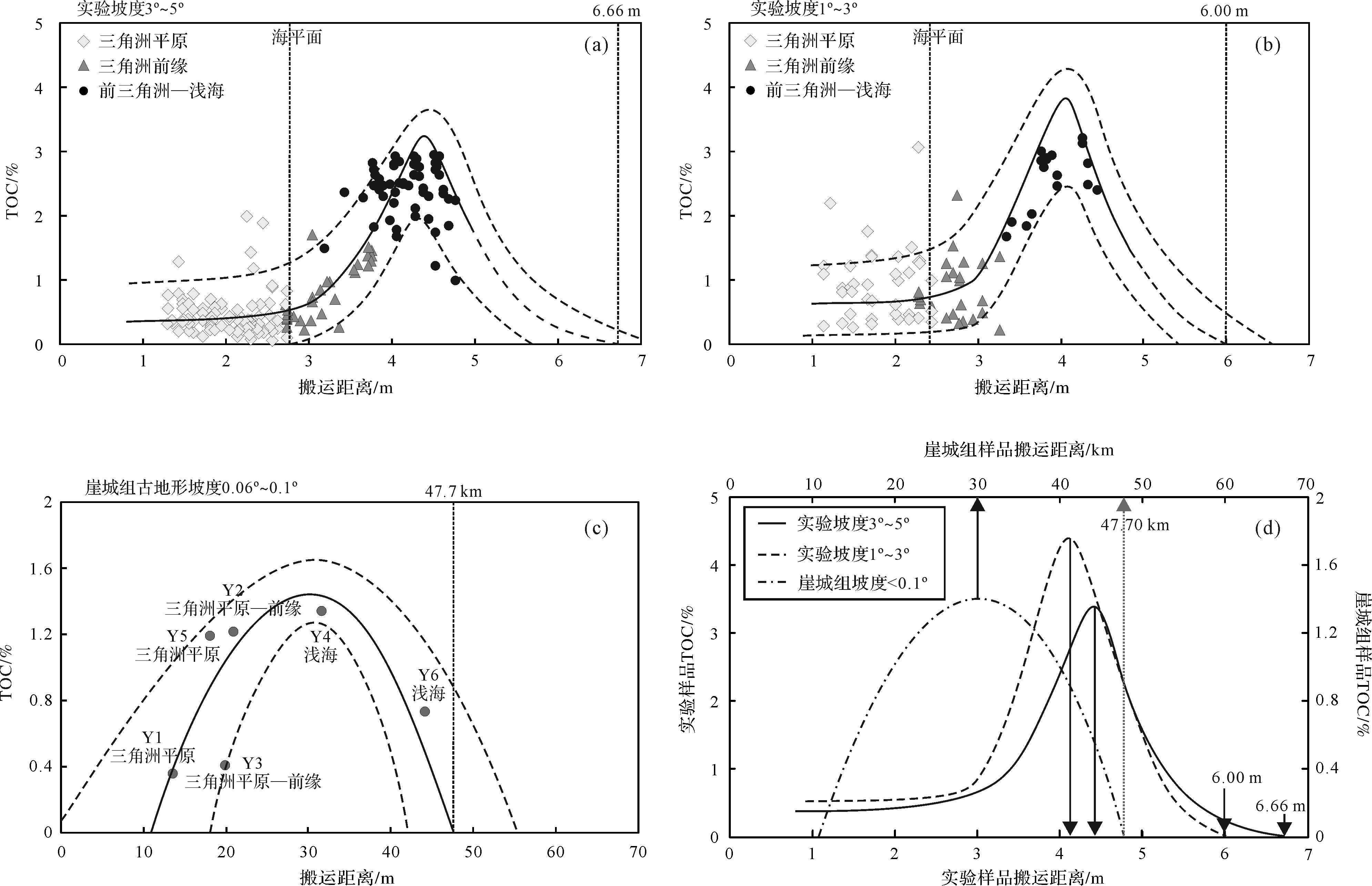
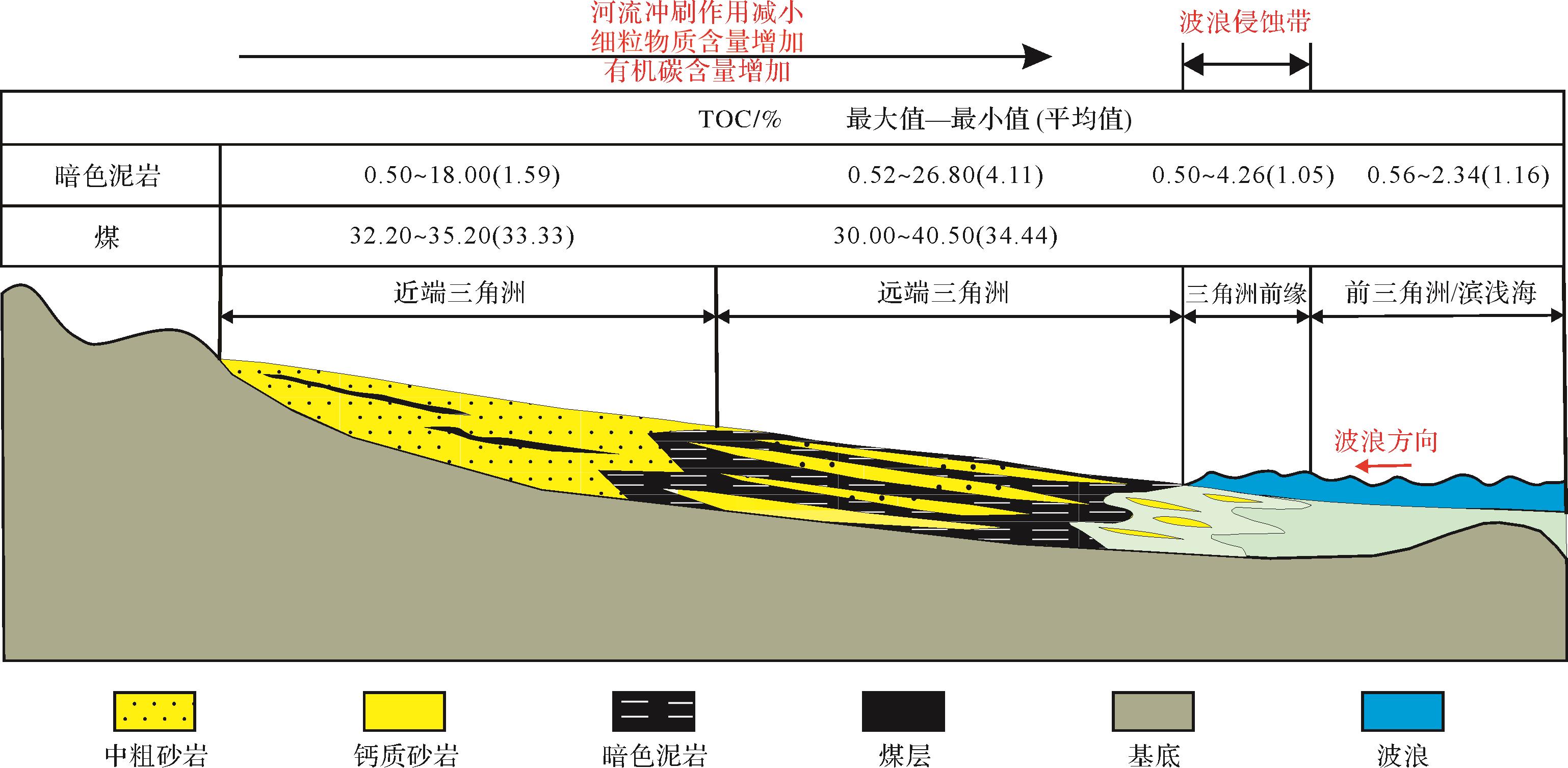
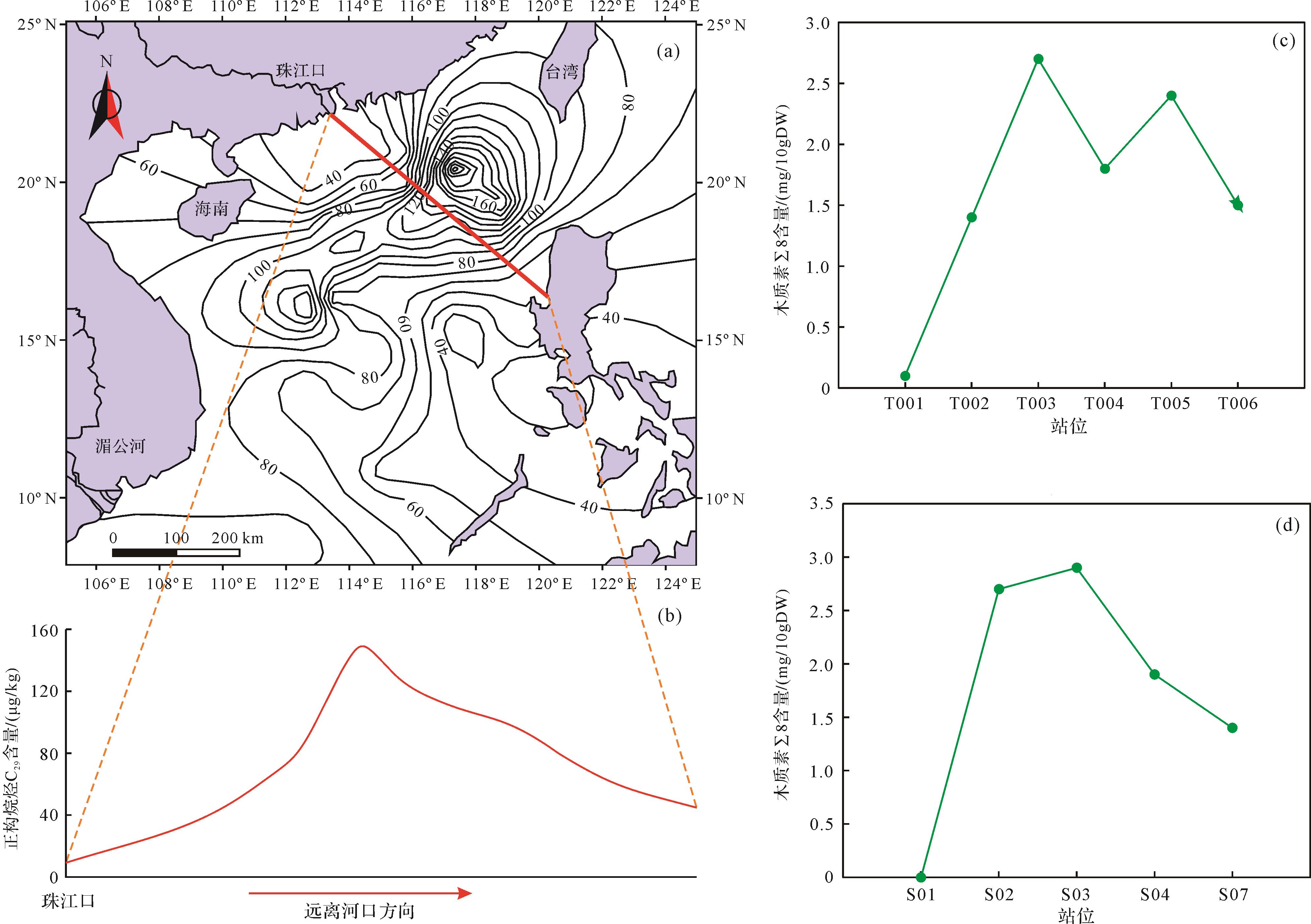
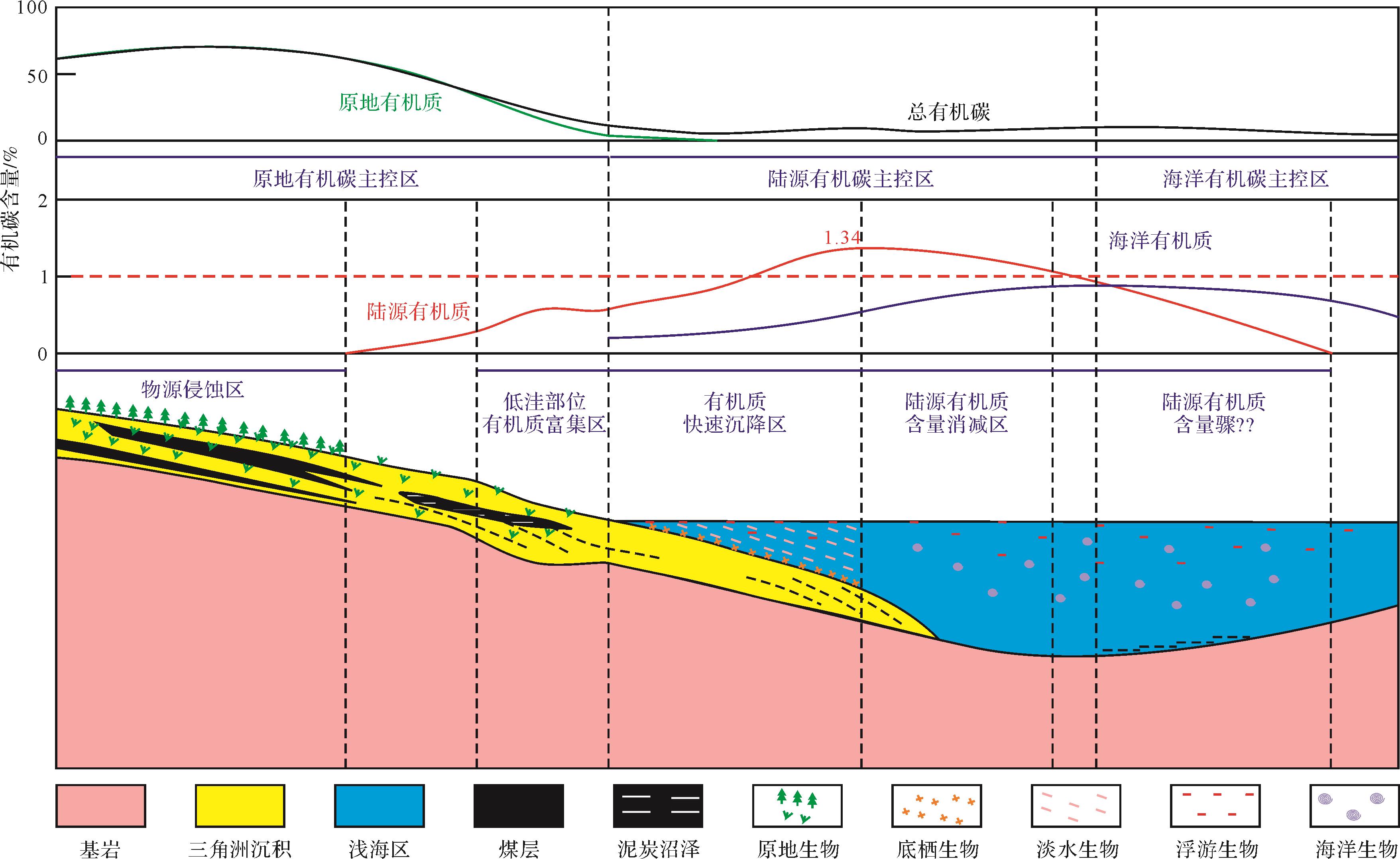
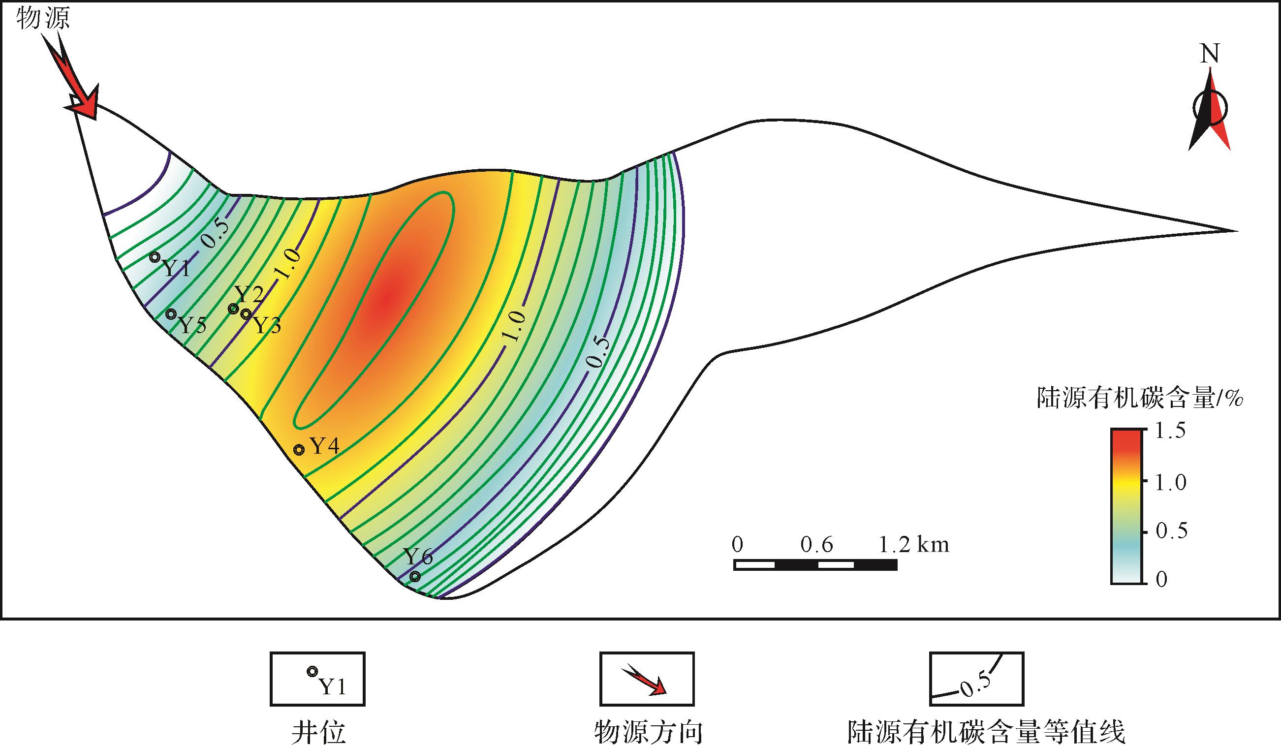
Terrestrial organic matter plays an important role in the delta-shallow sea sedimentary system. More and more oil and gas exploration practices find the contribution of terrestrial organic matter in deep-water areas. In the Yacheng Formation of the Qiongdongnan Baisn, the source rocks are dominated by terrestrial organic matter, which has attracted the attention of many scholars. However, due to the deep buried depth of the source rock and the lake in the deep-water area, the research and exploration progress of the source rock in this area is greatly restricted. Based on the geological background of the Yacheng Formation in the Yanan Sag, Qiongdongnan Basin, this study designed a flume experiment of terrestrial organic matter, which is a “forward modeling” method, to observe the deposition process of terrestrial organic matter and sample the sedimentation results. Particle size and total organic carbon (TOC) analyses were carried out on the samples, establishing a terrestrial organic carbon content prediction model through a large amount of analytical test data and applying the model to an actual research area with less data. We combine the qualitative observation of the experimental process and quantitative calculation results to establish a terrestrial organic matter distribution pattern. The results show that the terrigenous organic matter is mainly deposited in the low-lying parts with a weak hydrodynamic force. From the source area to the deep water area, due to the interaction between the river and the sea water, the transport capacity of the river is reduced, and the organic carbon content increases obviously in the shallow water. In a certain range of the shallow water area, due to the gradual decline of river transport capacity, organic carbon content decreased. Using the change of sediment grain size to reflect the hydrodynamic conditions, the correlation between hydrodynamic conditions and transport organic carbon content was explored, and the changing trend of terrigenous organic carbon content was predicted. This is consistent with the distribution characteristics of terrigenous organic matter in modern estuarine sediments. According to the prediction, for Experiment 1 (slope 3°-5°), the longest distance of terrigenous organic matter transport is 6.66 m, and the maximum of terrigenous organic carbon content is 4.4 m; for Experiment 2 (slope 1°-3°), the maximum distance of terrigenous organic matter transport is 6.00 m, and the maximum content of terrigenous organic carbon is 4.12 m; for the Yacheng Formation (slope < 0.1°), the maximum transport distance of terrigenous organic matter is 47.7 km, and the maximum content of terrigenous organic carbon is at 30 km. With the decrease of the paleotopography slope, the maximum transport distance of terrigenous organic matter also decreases, and the high value area of organic carbon content migrates to the source direction. The dominant distribution area of terrigenous organic matter is near the delta front shallow sea area. Based on the observation of the experimental process and the prediction of the changing trend of terrigenous organic carbon content, a single source "single peak" terrigenous organic matter distribution model map was established. In the delta plain area, the organic carbon content was mainly controlled by the growth and enrichment of in-situ organisms, which was the main control area of in-situ organic carbon. In the delta front littoral shallow sea area, terrigenous organic matter is deposited in large quantities, and its contribution may exceed that of shallow sea organisms, which is the main control area of terrigenous organic carbon. In the coastal shallow sea deep sea area, marine organisms are the main suppliers of organic matter, which is the main control area of marine organic carbon. The main control area of terrigenous organic carbon is the most favorable area for the development of terrigenous marine source rocks. With multi-source intersection, the distribution characteristics of terrigenous organic matter are superimposed for a single source, and the terrigenous organic carbon content in the source intersection area will be higher than that of a single source supply, which can also be used as the dominant area for the development of terrigenous marine source rocks. Using the first mock exam, we can predict the distribution of organic carbon for the Yancheng Formation in the Yanan Sag. The source of the northwest part of the Yanan Sag can transport the organic matter 47.7 km, that is, the transported organic matter can be transported to the center of the depression. The content of terrigenous organic carbon gradually increased from well Y1 to the center of the depression, and reached the maximum at well Y4. Since then, the content of terrigenous organic carbon gradually decreased to the center of the depression. The content of terrigenous organic carbon rapidly decreased from well Y6 to 0 in the center of the depression. This method can also be used to predict the distribution of terrigenous organic matter in other deep-water basins.
Terrestrial organic matter plays an important role in the delta-shallow sea sedimentary system. More and more oil and gas exploration practices find the contribution of terrestrial organic matter in deep-water areas. In the Yacheng Formation of the Qiongdongnan Baisn, the source rocks are dominated by terrestrial organic matter, which has attracted the attention of many scholars. However, due to the deep buried depth of the source rock and the lake in the deep-water area, the research and exploration progress of the source rock in this area is greatly restricted. Based on the geological background of the Yacheng Formation in the Yanan Sag, Qiongdongnan Basin, this study designed a flume experiment of terrestrial organic matter, which is a “forward modeling” method, to observe the deposition process of terrestrial organic matter and sample the sedimentation results. Particle size and total organic carbon (TOC) analyses were carried out on the samples, establishing a terrestrial organic carbon content prediction model through a large amount of analytical test data and applying the model to an actual research area with less data. We combine the qualitative observation of the experimental process and quantitative calculation results to establish a terrestrial organic matter distribution pattern. The results show that the terrigenous organic matter is mainly deposited in the low-lying parts with a weak hydrodynamic force. From the source area to the deep water area, due to the interaction between the river and the sea water, the transport capacity of the river is reduced, and the organic carbon content increases obviously in the shallow water. In a certain range of the shallow water area, due to the gradual decline of river transport capacity, organic carbon content decreased. Using the change of sediment grain size to reflect the hydrodynamic conditions, the correlation between hydrodynamic conditions and transport organic carbon content was explored, and the changing trend of terrigenous organic carbon content was predicted. This is consistent with the distribution characteristics of terrigenous organic matter in modern estuarine sediments. According to the prediction, for Experiment 1 (slope 3°-5°), the longest distance of terrigenous organic matter transport is 6.66 m, and the maximum of terrigenous organic carbon content is 4.4 m; for Experiment 2 (slope 1°-3°), the maximum distance of terrigenous organic matter transport is 6.00 m, and the maximum content of terrigenous organic carbon is 4.12 m; for the Yacheng Formation (slope < 0.1°), the maximum transport distance of terrigenous organic matter is 47.7 km, and the maximum content of terrigenous organic carbon is at 30 km. With the decrease of the paleotopography slope, the maximum transport distance of terrigenous organic matter also decreases, and the high value area of organic carbon content migrates to the source direction. The dominant distribution area of terrigenous organic matter is near the delta front shallow sea area. Based on the observation of the experimental process and the prediction of the changing trend of terrigenous organic carbon content, a single source "single peak" terrigenous organic matter distribution model map was established. In the delta plain area, the organic carbon content was mainly controlled by the growth and enrichment of in-situ organisms, which was the main control area of in-situ organic carbon. In the delta front littoral shallow sea area, terrigenous organic matter is deposited in large quantities, and its contribution may exceed that of shallow sea organisms, which is the main control area of terrigenous organic carbon. In the coastal shallow sea deep sea area, marine organisms are the main suppliers of organic matter, which is the main control area of marine organic carbon. The main control area of terrigenous organic carbon is the most favorable area for the development of terrigenous marine source rocks. With multi-source intersection, the distribution characteristics of terrigenous organic matter are superimposed for a single source, and the terrigenous organic carbon content in the source intersection area will be higher than that of a single source supply, which can also be used as the dominant area for the development of terrigenous marine source rocks. Using the first mock exam, we can predict the distribution of organic carbon for the Yancheng Formation in the Yanan Sag. The source of the northwest part of the Yanan Sag can transport the organic matter 47.7 km, that is, the transported organic matter can be transported to the center of the depression. The content of terrigenous organic carbon gradually increased from well Y1 to the center of the depression, and reached the maximum at well Y4. Since then, the content of terrigenous organic carbon gradually decreased to the center of the depression. The content of terrigenous organic carbon rapidly decreased from well Y6 to 0 in the center of the depression. This method can also be used to predict the distribution of terrigenous organic matter in other deep-water basins.


2023, 41(2): 601-609.
doi: 10.14027/j.issn.1000-0550.2021.107
Abstract:
Phenylphenanthrenes (PhP) are important phenyl polycyclic aromatic hydrocarbons and are ubiquitous in sedimentary organic matters and crude oils. In this study, PhP were unambiguously identified in 26 coal samples from the Junggar and Ordos Basins by comparing the relative retention times and retention indices. The elution order of PhP in a HP-5MS chromatographic column was 4-, 9-, 1-, 3-, 2-PhP. The thermodynamic properties of PhP isomers were accurately calculated by quantum chemical calculation; the thermodynamic stability of PhP isomers is in the sequence 2->3->9->1->4-PhP. Combining the distributions of PhP in coals of different maturity, a maturity parameter PhP ratio PhPR=(2+3)-PhP/(1+9)-PhP is proposed, and its quantitative relationship with vitrinite reflectance (Ro) is preliminarily established as follows: Rc(%)=0.06×PhPR+0.32 (Ro>0.4%). In addition, the sedimentary environment of organic matter has no significant effect on PhPR. Therefore, PhPR is a useful maturity indicator for quantitatively assessing the thermal maturity of oils and source rocks (Types II⁃III kerogen) with low-high maturation levels. Comparisons of the distribution and thermodynamic stability of PhP and methylphenanthrenes (MP) suggest that the chemical mechanism of the ratio PhPR may be mainly related to a phenyl group shift in which the increase of maturation 1-PhP may be transformed into 2- and 3-PhP by a 1,2-phenyl shift. For (2+3)-MP/(1+9)-MP, PhPR is more sensitive to maturity change than the corresponding MP.
Phenylphenanthrenes (PhP) are important phenyl polycyclic aromatic hydrocarbons and are ubiquitous in sedimentary organic matters and crude oils. In this study, PhP were unambiguously identified in 26 coal samples from the Junggar and Ordos Basins by comparing the relative retention times and retention indices. The elution order of PhP in a HP-5MS chromatographic column was 4-, 9-, 1-, 3-, 2-PhP. The thermodynamic properties of PhP isomers were accurately calculated by quantum chemical calculation; the thermodynamic stability of PhP isomers is in the sequence 2->3->9->1->4-PhP. Combining the distributions of PhP in coals of different maturity, a maturity parameter PhP ratio PhPR=(2+3)-PhP/(1+9)-PhP is proposed, and its quantitative relationship with vitrinite reflectance (Ro) is preliminarily established as follows: Rc(%)=0.06×PhPR+0.32 (Ro>0.4%). In addition, the sedimentary environment of organic matter has no significant effect on PhPR. Therefore, PhPR is a useful maturity indicator for quantitatively assessing the thermal maturity of oils and source rocks (Types II⁃III kerogen) with low-high maturation levels. Comparisons of the distribution and thermodynamic stability of PhP and methylphenanthrenes (MP) suggest that the chemical mechanism of the ratio PhPR may be mainly related to a phenyl group shift in which the increase of maturation 1-PhP may be transformed into 2- and 3-PhP by a 1,2-phenyl shift. For (2+3)-MP/(1+9)-MP, PhPR is more sensitive to maturity change than the corresponding MP.
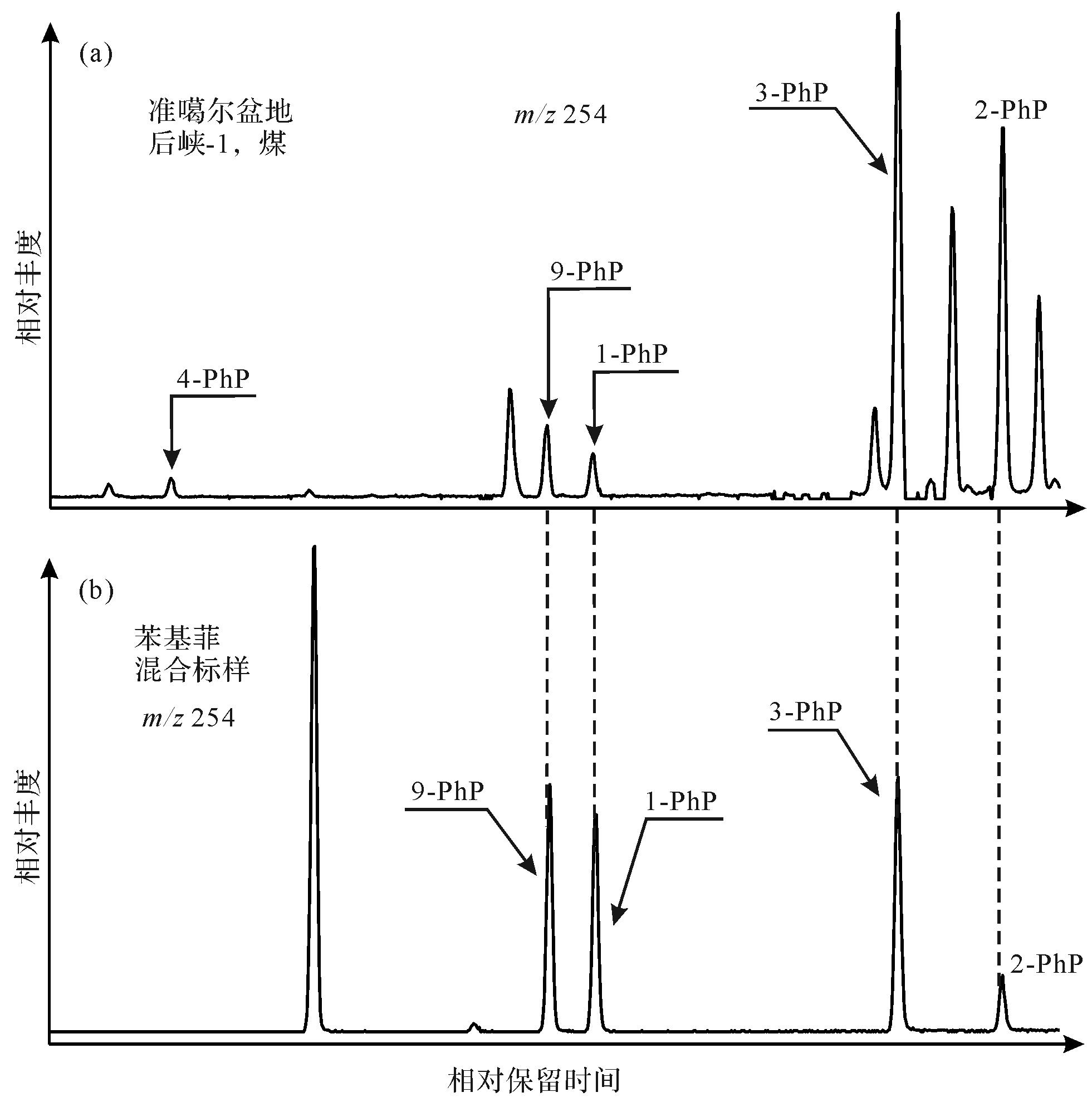
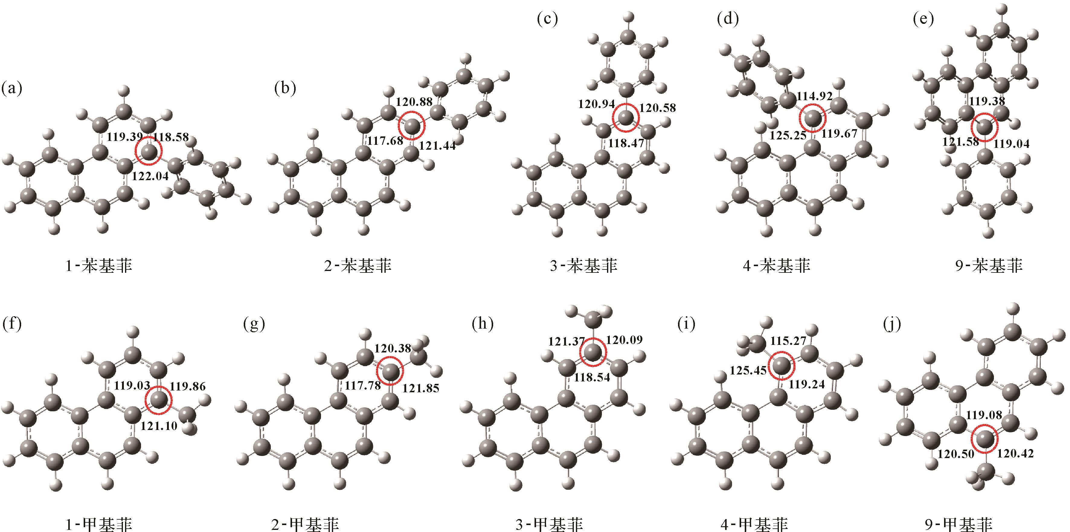
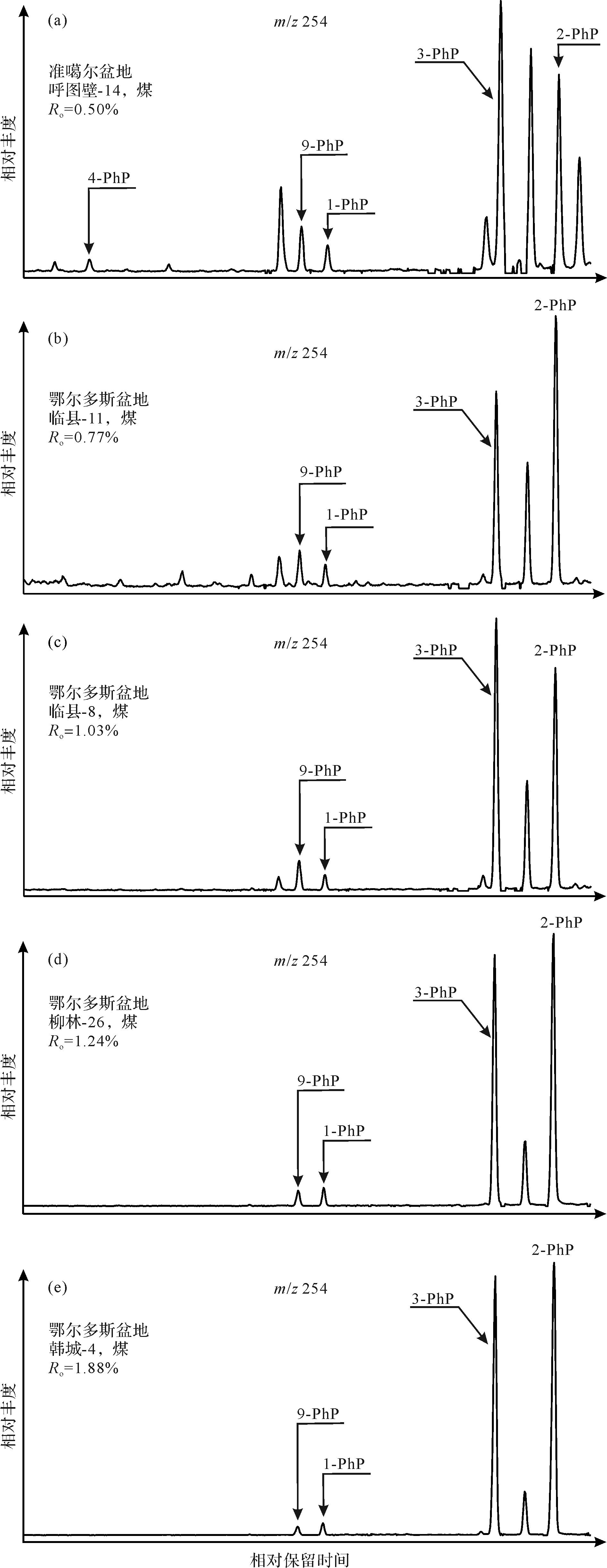
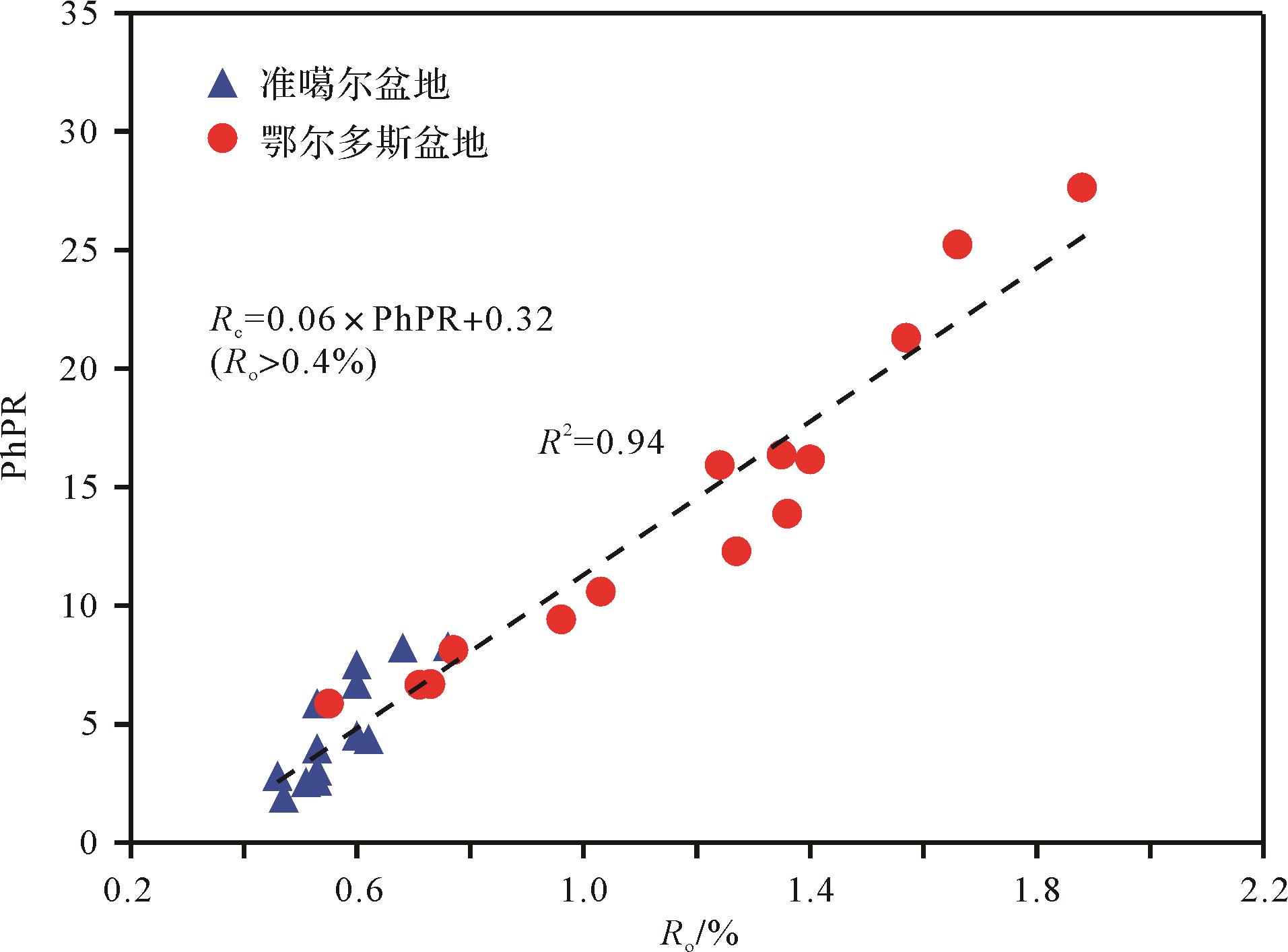
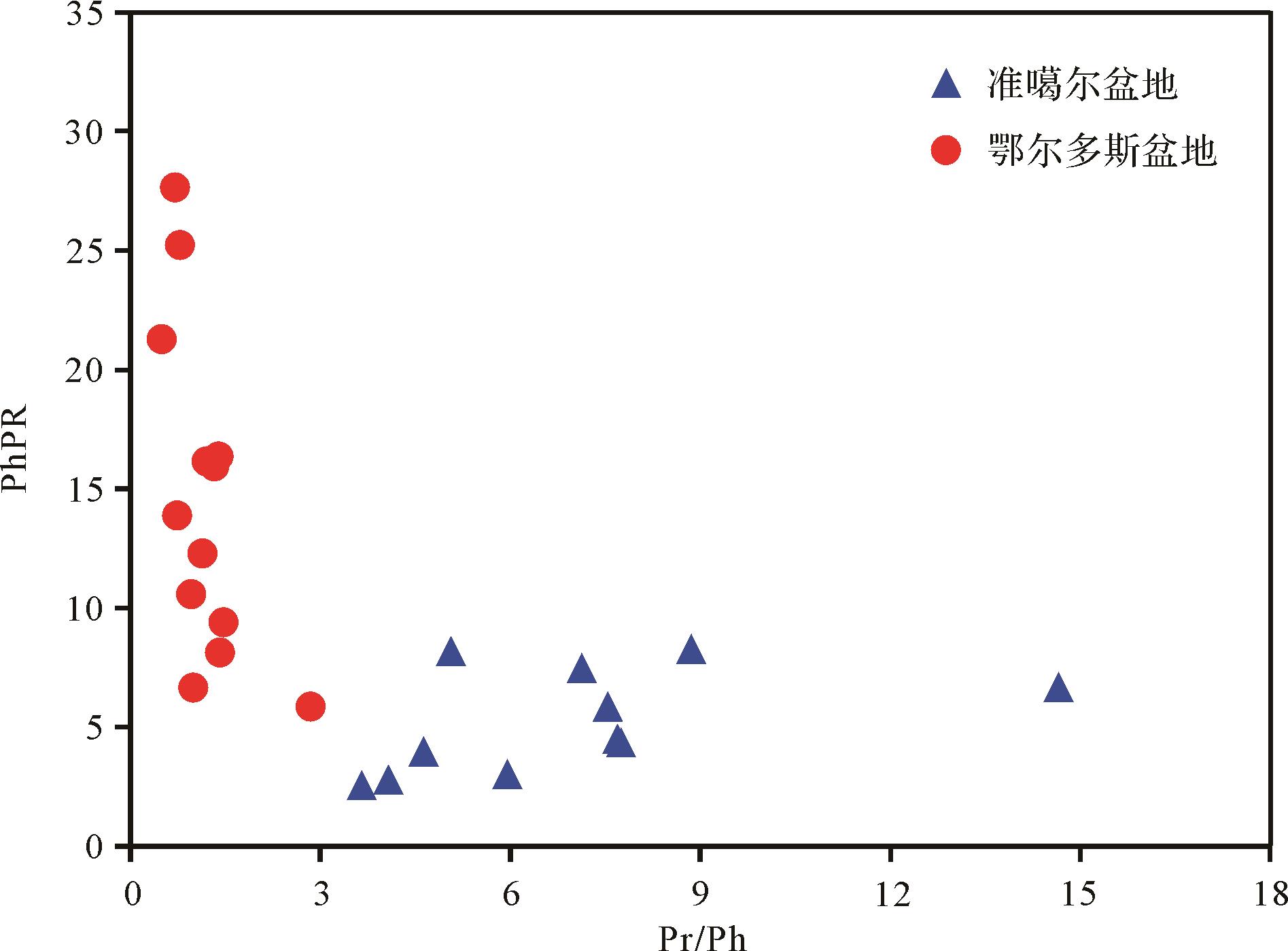
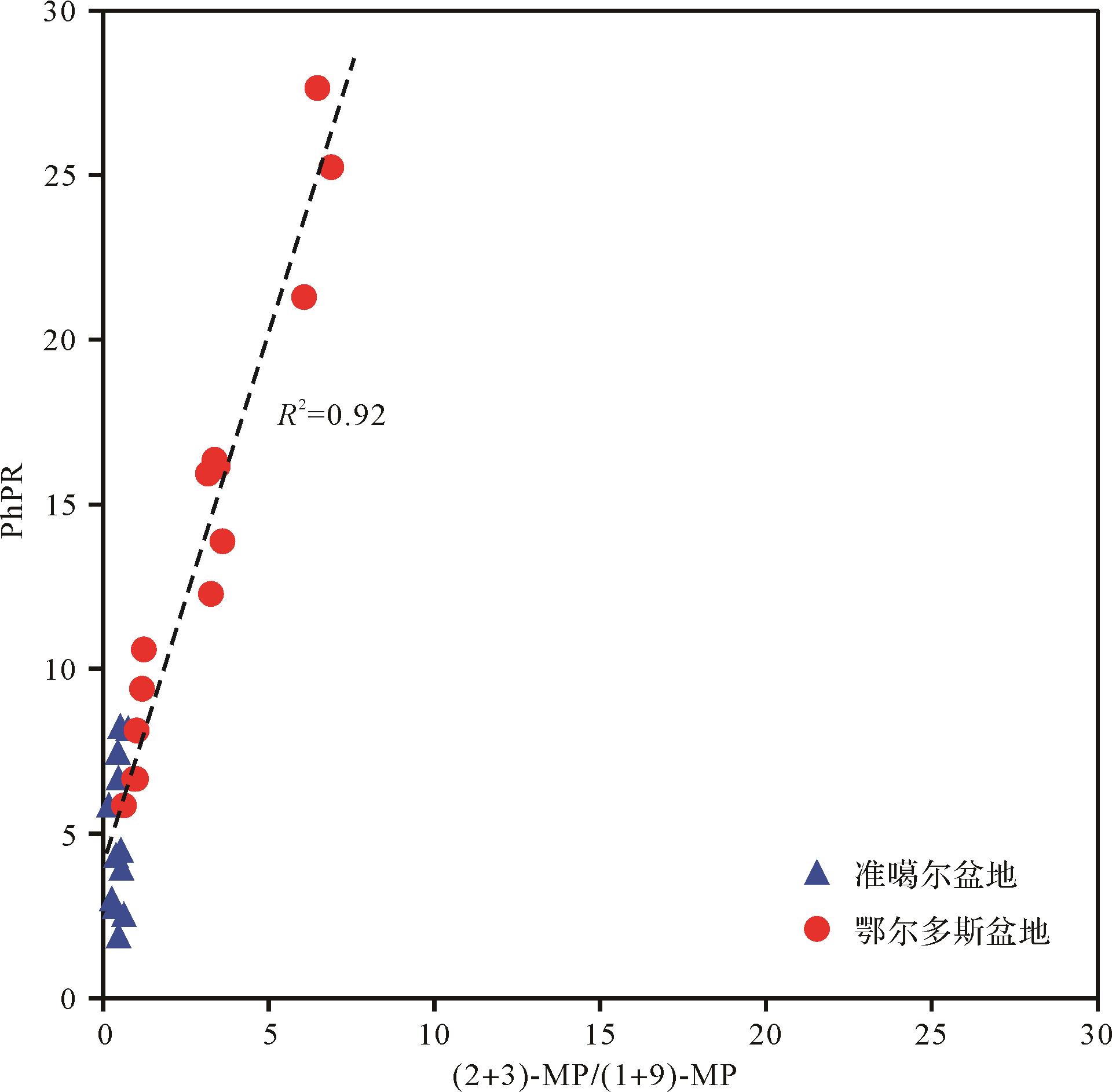
2023, 41(2): 610-618.
doi: 10.14027/j.issn.1000-0550.2021.079
Abstract:
Metalloporphyrins in crude oil are of great significance since they reveal the organic/inorganic interactions and oceanic anoxic events during paleoenvironmental change. To date, few studies have been reported on the molecular composition of metalloporphyrins in high-maturity crude oils with metal content < 10 mg/kg. In this study, a new matrix with ionization energy 1.3 eV above that of metalloporphyrins was synthesized for the matrix-assisted laser/desorption ionization (MALDI) source to promote ionization of the metalloporphyrins. Metalloporphyrins in high-maturity crude oil (equivalent Ro=1.79 to 2.42) from the Tarim Basin were enriched by liquid⁃liquid extraction. The molecular composition of the trace metalloporphyrins in these crude oils with metal content <4.0 mg/kg was analyzed by MALDI combined with Fourier Transform ion cyclotronic resonance mass spectrometry (FT-ICR MS). A total of 10 O2 vanadium porphyrins, seven O3 vanadium porphyrins and one O1S1 vanadium porphyrin were newly discovered and identified in the Tarim oils. Simultaneity analysis of the trace vanadium porphyrins oxidized and nickel porphyrins confirmed the presence of metalloporphyrins in highly mature crude oils. The formation mechanism of the new metalloporphyrins is also discussed.
Metalloporphyrins in crude oil are of great significance since they reveal the organic/inorganic interactions and oceanic anoxic events during paleoenvironmental change. To date, few studies have been reported on the molecular composition of metalloporphyrins in high-maturity crude oils with metal content < 10 mg/kg. In this study, a new matrix with ionization energy 1.3 eV above that of metalloporphyrins was synthesized for the matrix-assisted laser/desorption ionization (MALDI) source to promote ionization of the metalloporphyrins. Metalloporphyrins in high-maturity crude oil (equivalent Ro=1.79 to 2.42) from the Tarim Basin were enriched by liquid⁃liquid extraction. The molecular composition of the trace metalloporphyrins in these crude oils with metal content <4.0 mg/kg was analyzed by MALDI combined with Fourier Transform ion cyclotronic resonance mass spectrometry (FT-ICR MS). A total of 10 O2 vanadium porphyrins, seven O3 vanadium porphyrins and one O1S1 vanadium porphyrin were newly discovered and identified in the Tarim oils. Simultaneity analysis of the trace vanadium porphyrins oxidized and nickel porphyrins confirmed the presence of metalloporphyrins in highly mature crude oils. The formation mechanism of the new metalloporphyrins is also discussed.
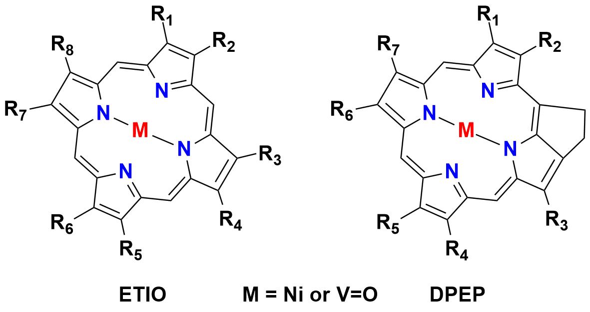
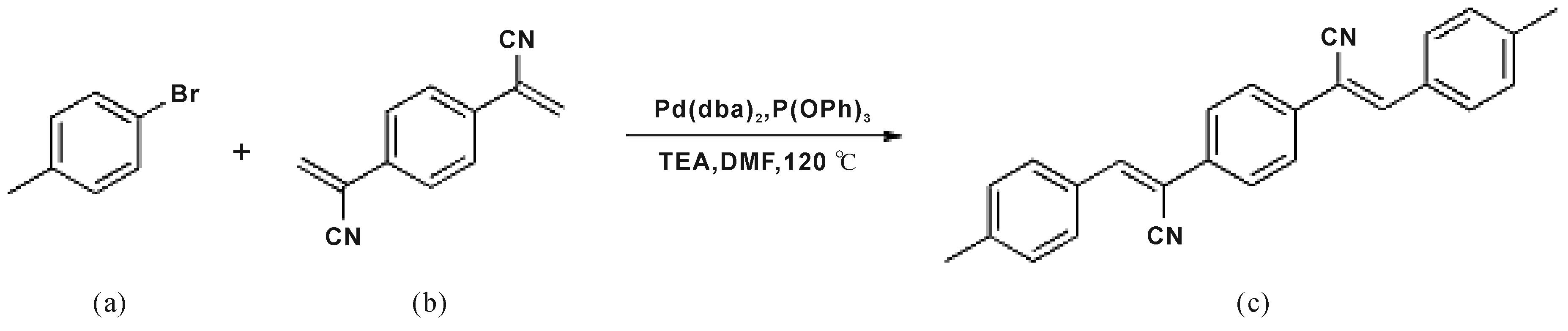

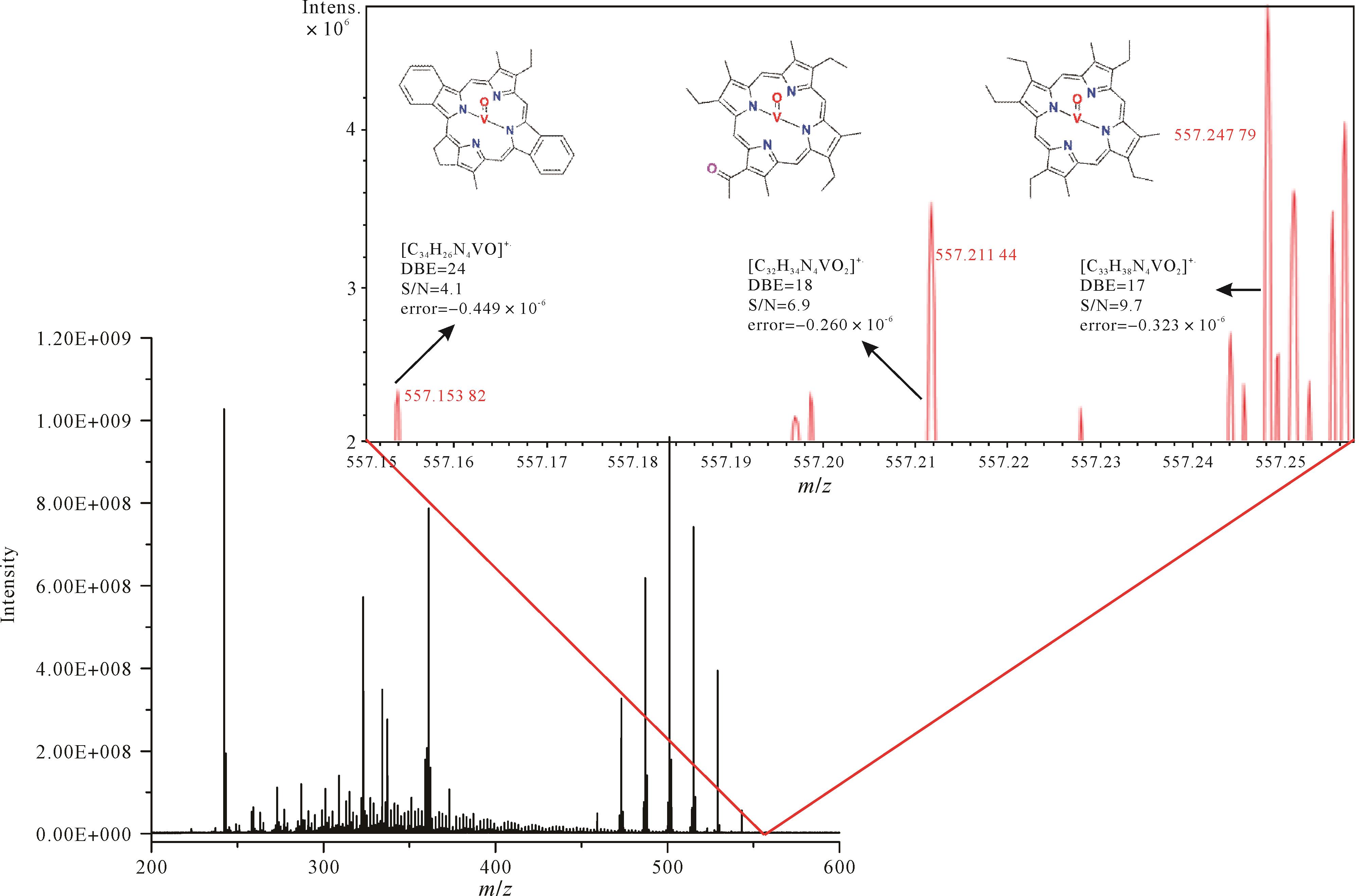
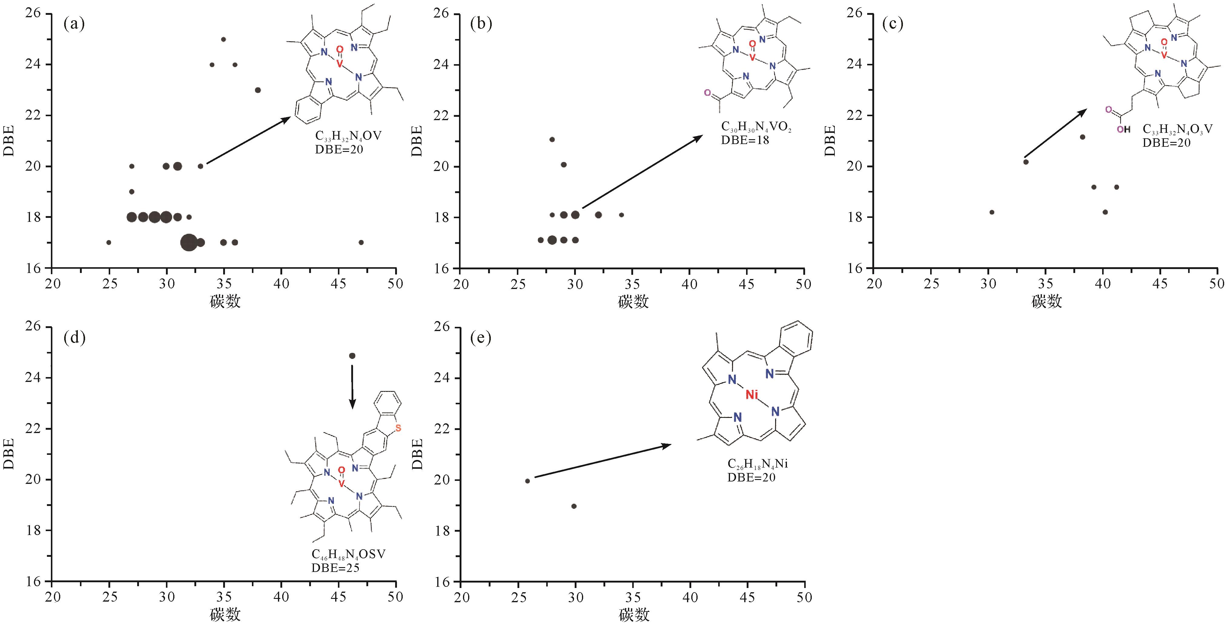
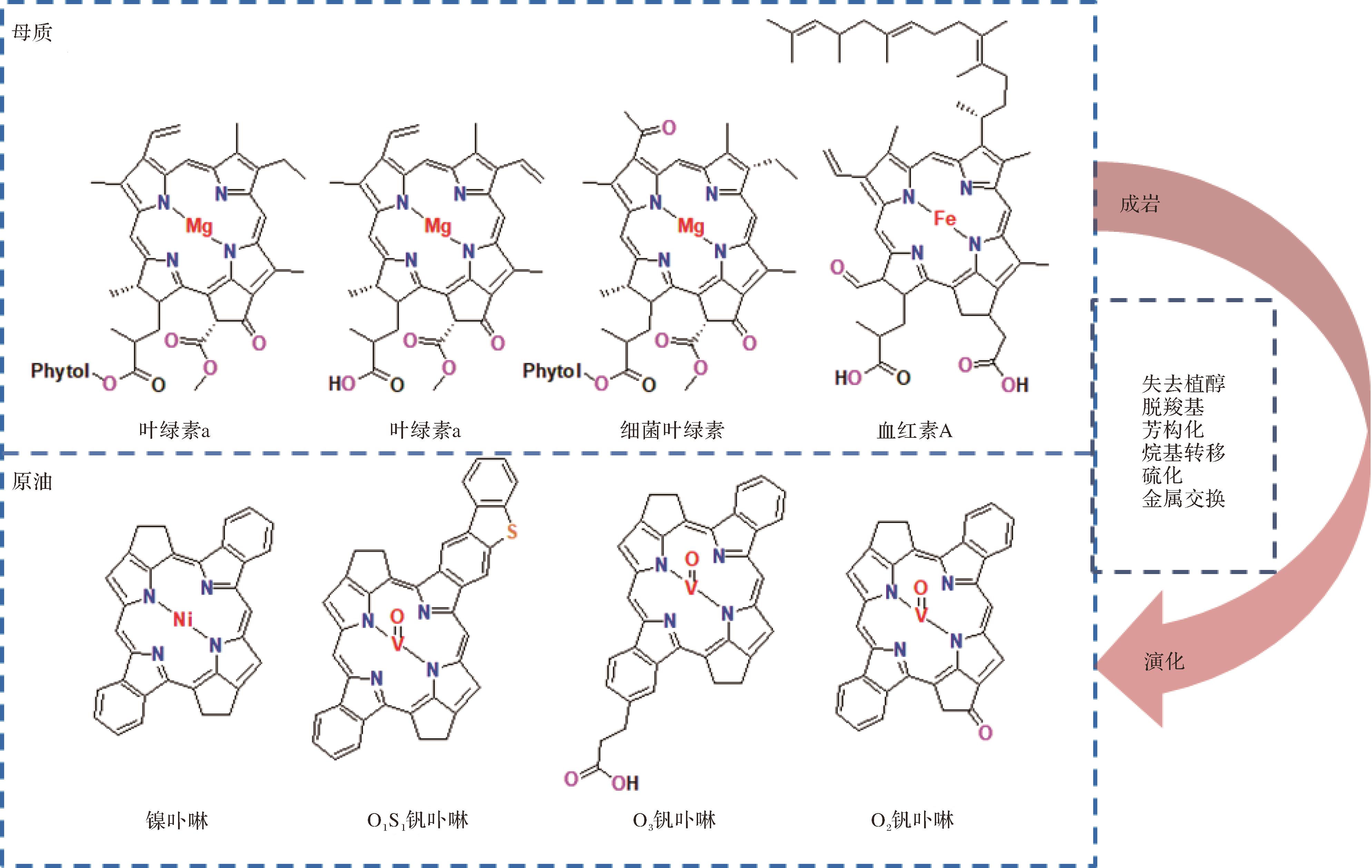
2023, 41(2): 619-632.
doi: 10.14027/j.issn.1000-0550.2021.097
Abstract:
The exploitation in China of organic-rich shale containing marine-land transitional facies for gas production has advanced considerably. This study of the organic-rich shale in the Upper Triassic Baiguowan Formation, Xichang Basin, was based on its lithological properties. A synthetic analysis reservoir potential included casting thickness, thin section observation and comparison, organic geochemical considerations, whole-rock XRD, porosity and permeability, SEM, N2 adsorption at low temperature, and high-pressure Hg injection. The organic carbon content is in the range 0.3%-2.21% (average 1.02%). The OM types are II2 and III, with maturity 1.02%-3.87%. The deposit is 30-110 m thick. Brittle mineral content is 11%v77% (average 40.5%). Porosity is 1.28%-9.02% (average 4.03%); permeability is 0.001 7×10⁻³ μm2 to 0.146×10⁻³ μm2 (average 0.03×10⁻³ μm2), with specific surface area 6.25-13.7 m2/g (average 10.17 m2/g). The average pore size is 6.66-9.79 nm. There is a positive correlation between organic carbon content and porosity. The degree of OM evolution in the study area is not uniform, and the porosity is positively correlated with maturity. Brittle mineral content is weakly positively correlated with porosity, and clay mineral content is weakly negatively correlated with porosity. In general, the study indicates that this organic-rich shale possesses basic geological conditions suitable for shale gas, and has considerable exploration and development potential.
The exploitation in China of organic-rich shale containing marine-land transitional facies for gas production has advanced considerably. This study of the organic-rich shale in the Upper Triassic Baiguowan Formation, Xichang Basin, was based on its lithological properties. A synthetic analysis reservoir potential included casting thickness, thin section observation and comparison, organic geochemical considerations, whole-rock XRD, porosity and permeability, SEM, N2 adsorption at low temperature, and high-pressure Hg injection. The organic carbon content is in the range 0.3%-2.21% (average 1.02%). The OM types are II2 and III, with maturity 1.02%-3.87%. The deposit is 30-110 m thick. Brittle mineral content is 11%v77% (average 40.5%). Porosity is 1.28%-9.02% (average 4.03%); permeability is 0.001 7×10⁻³ μm2 to 0.146×10⁻³ μm2 (average 0.03×10⁻³ μm2), with specific surface area 6.25-13.7 m2/g (average 10.17 m2/g). The average pore size is 6.66-9.79 nm. There is a positive correlation between organic carbon content and porosity. The degree of OM evolution in the study area is not uniform, and the porosity is positively correlated with maturity. Brittle mineral content is weakly positively correlated with porosity, and clay mineral content is weakly negatively correlated with porosity. In general, the study indicates that this organic-rich shale possesses basic geological conditions suitable for shale gas, and has considerable exploration and development potential.
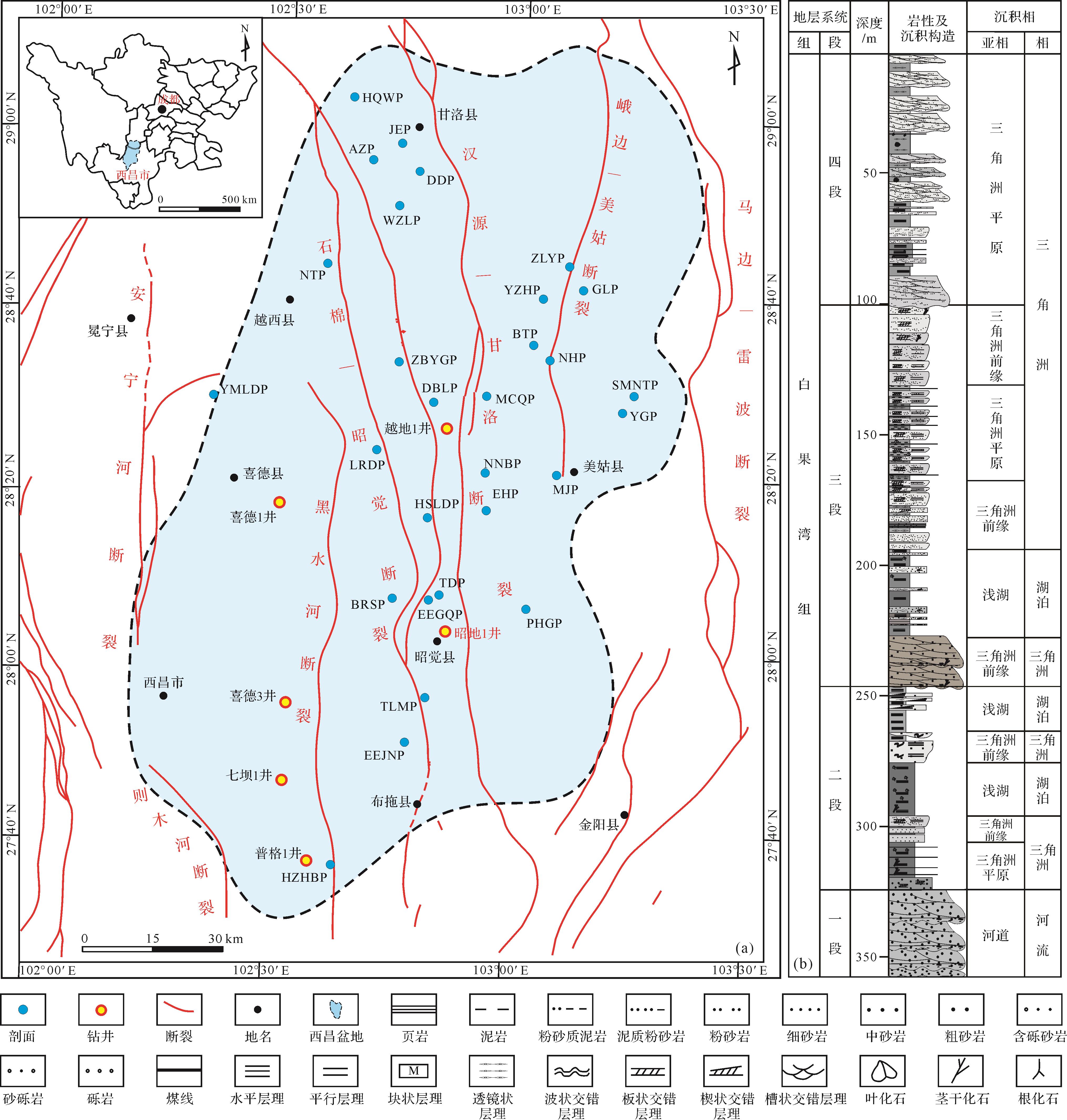
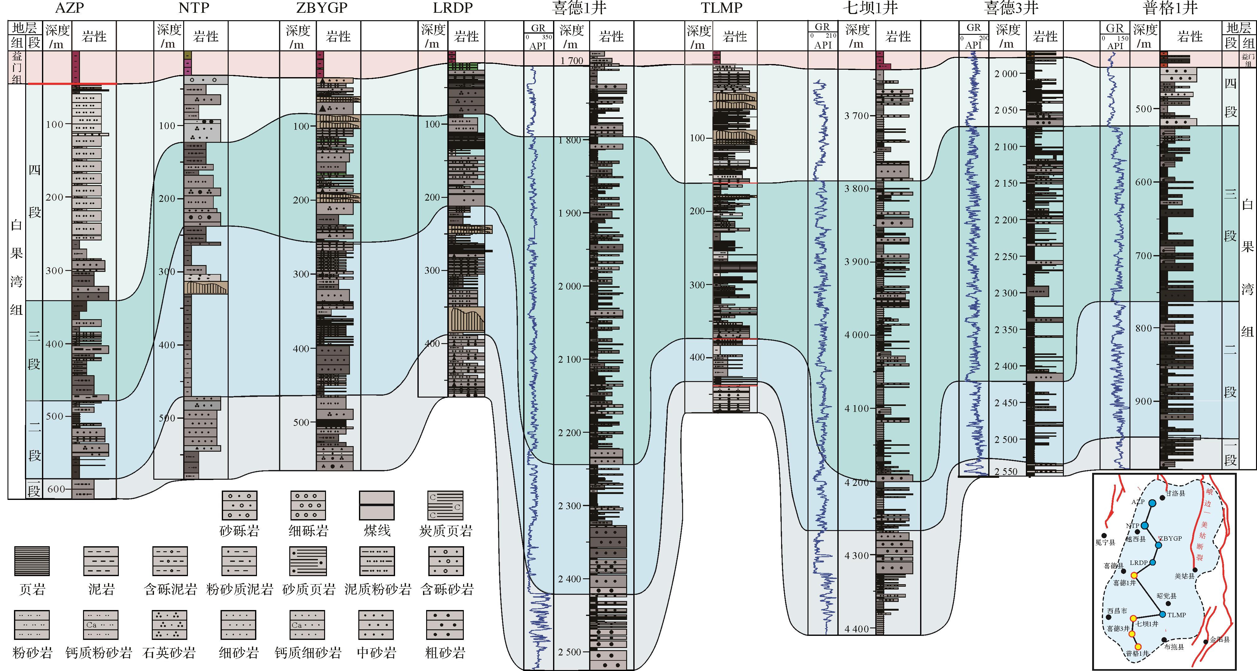
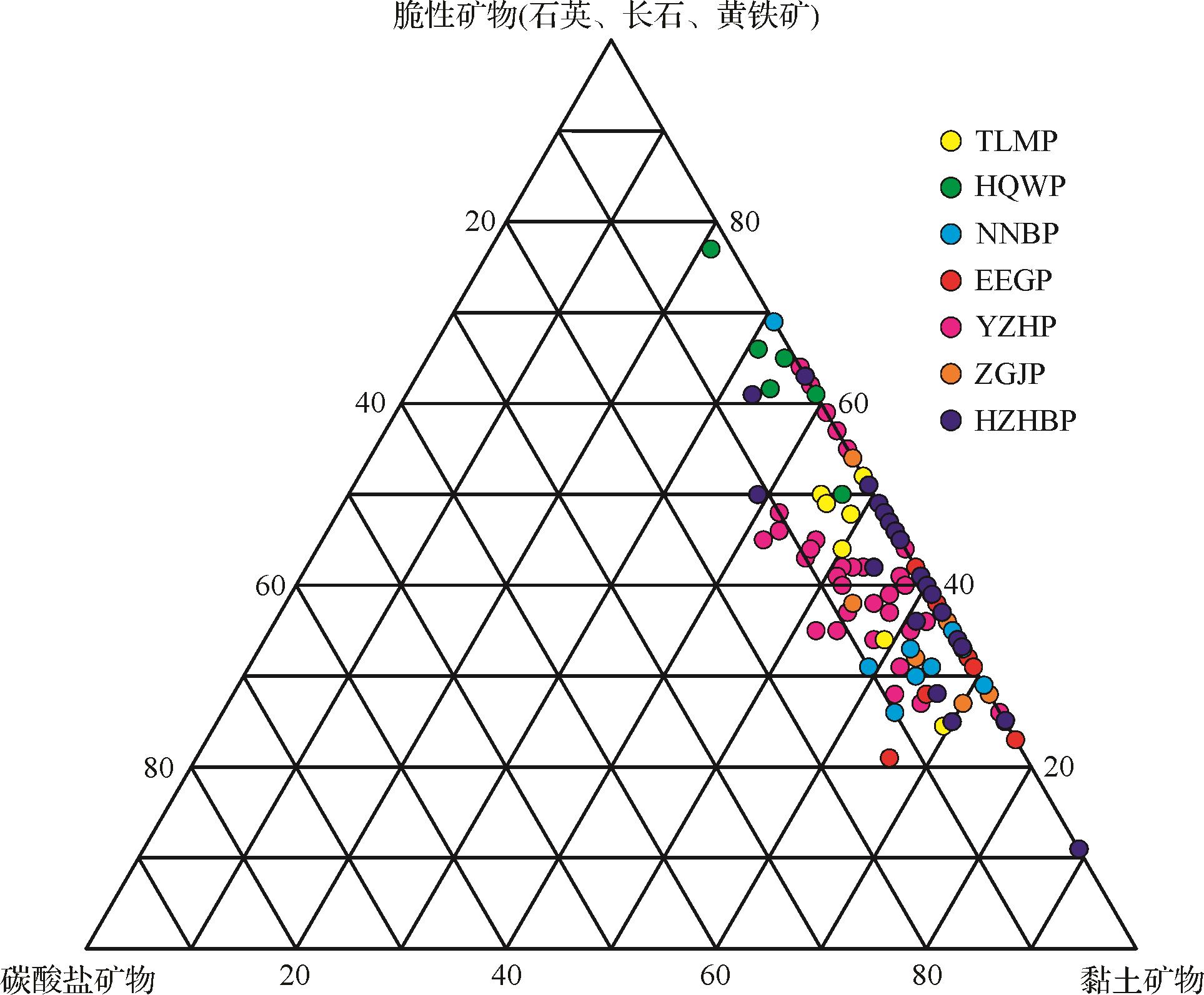
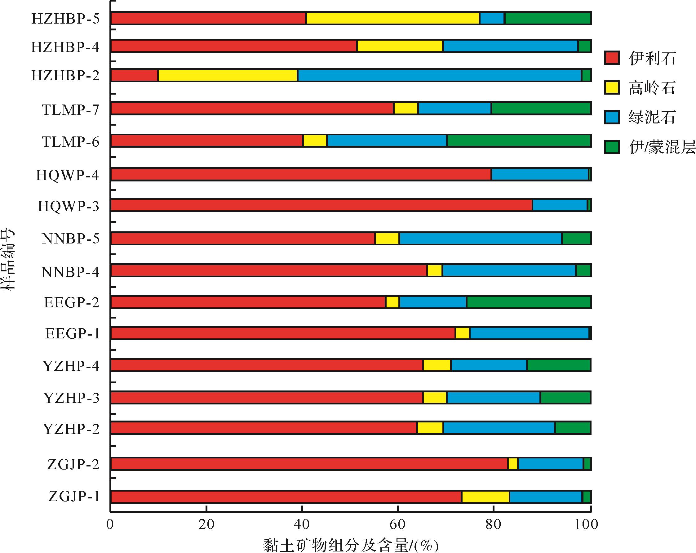
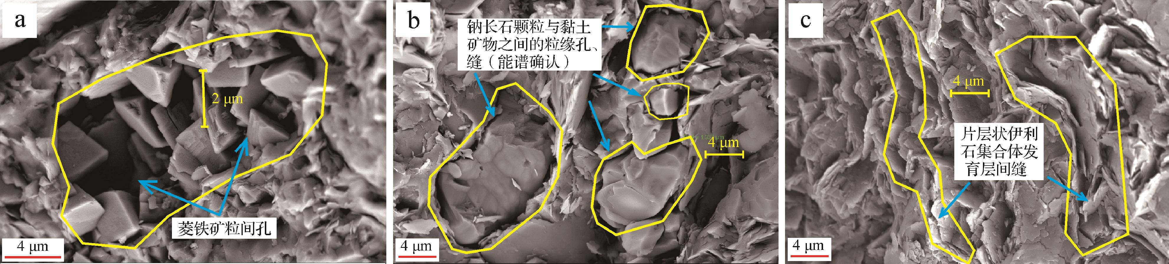
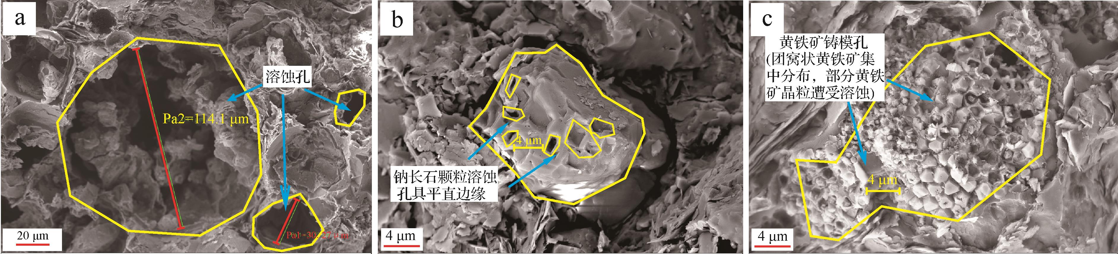

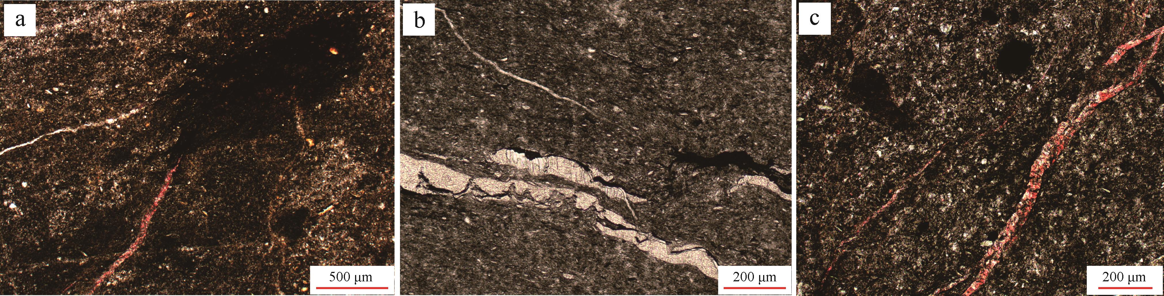
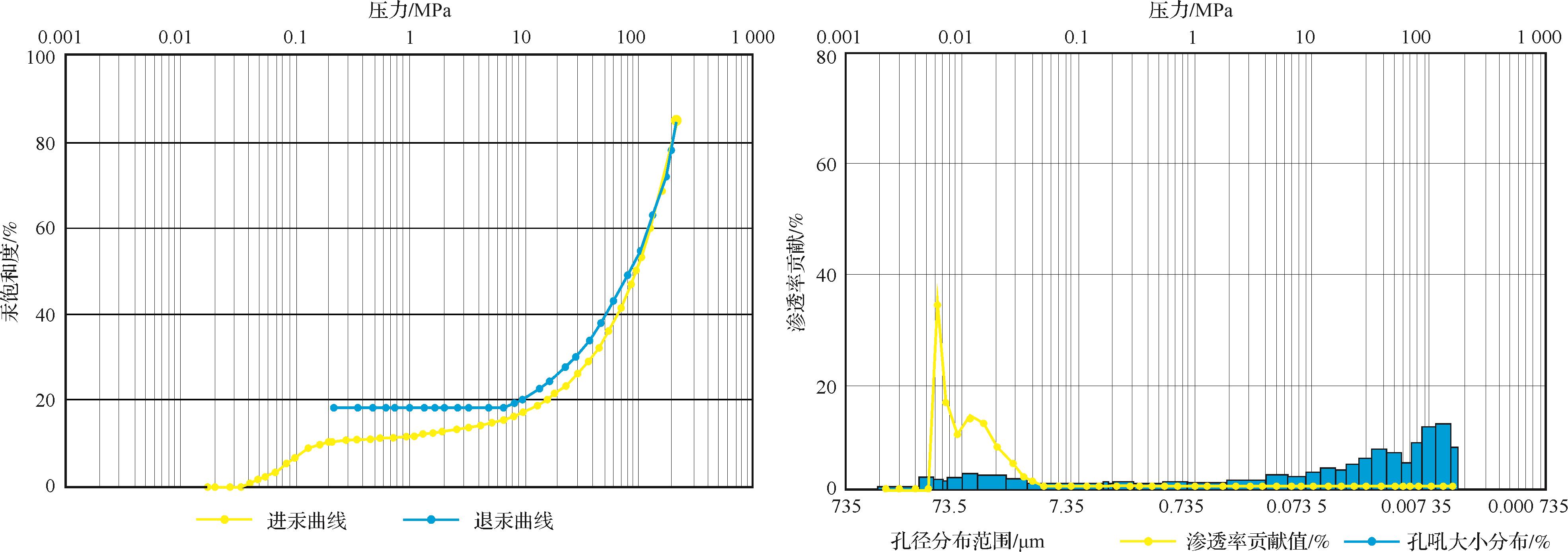
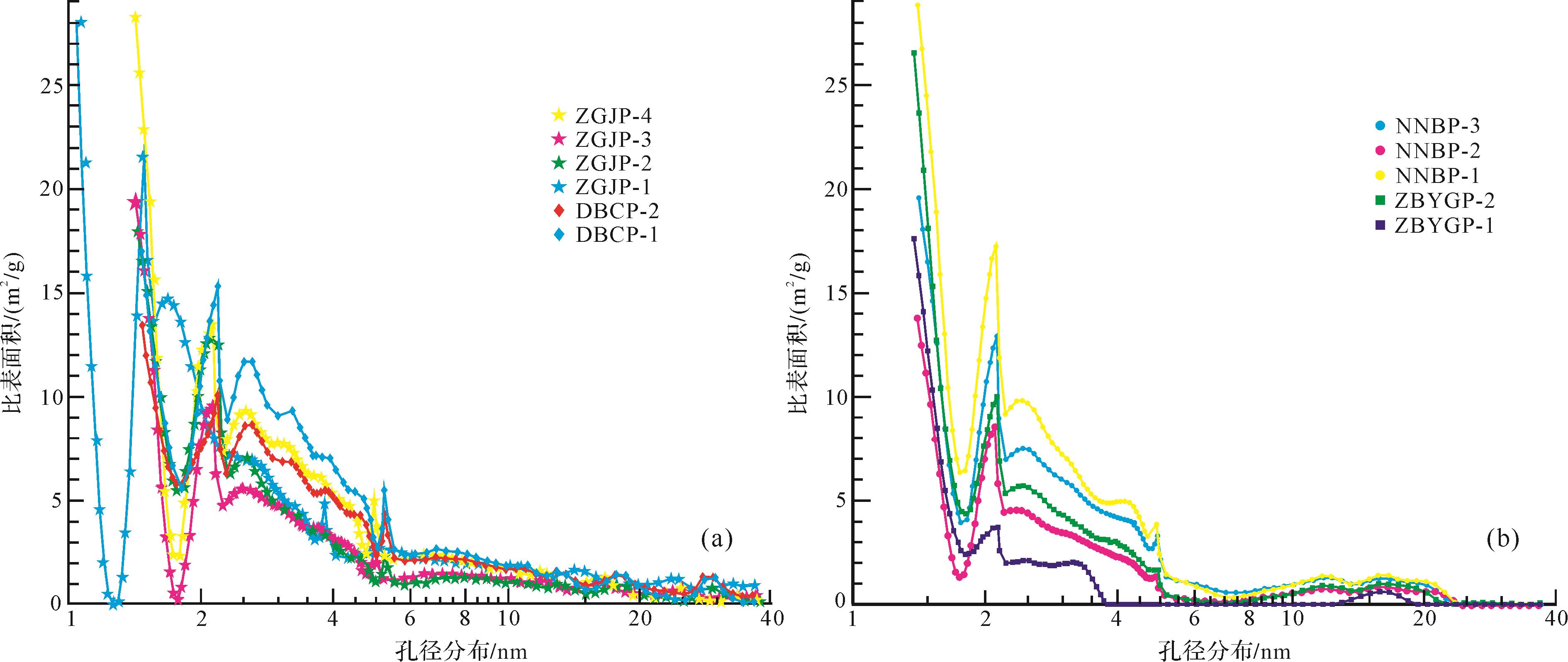
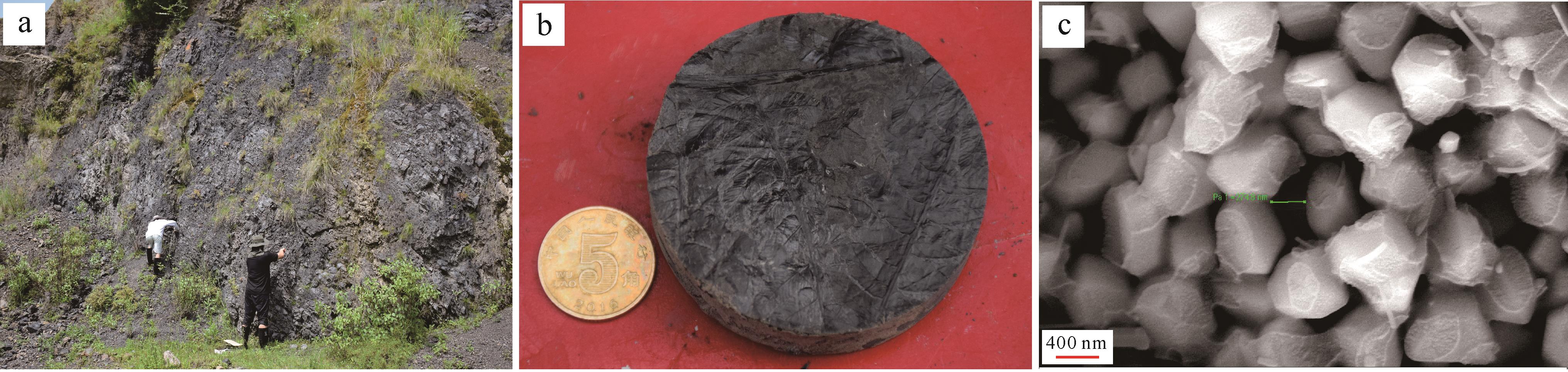
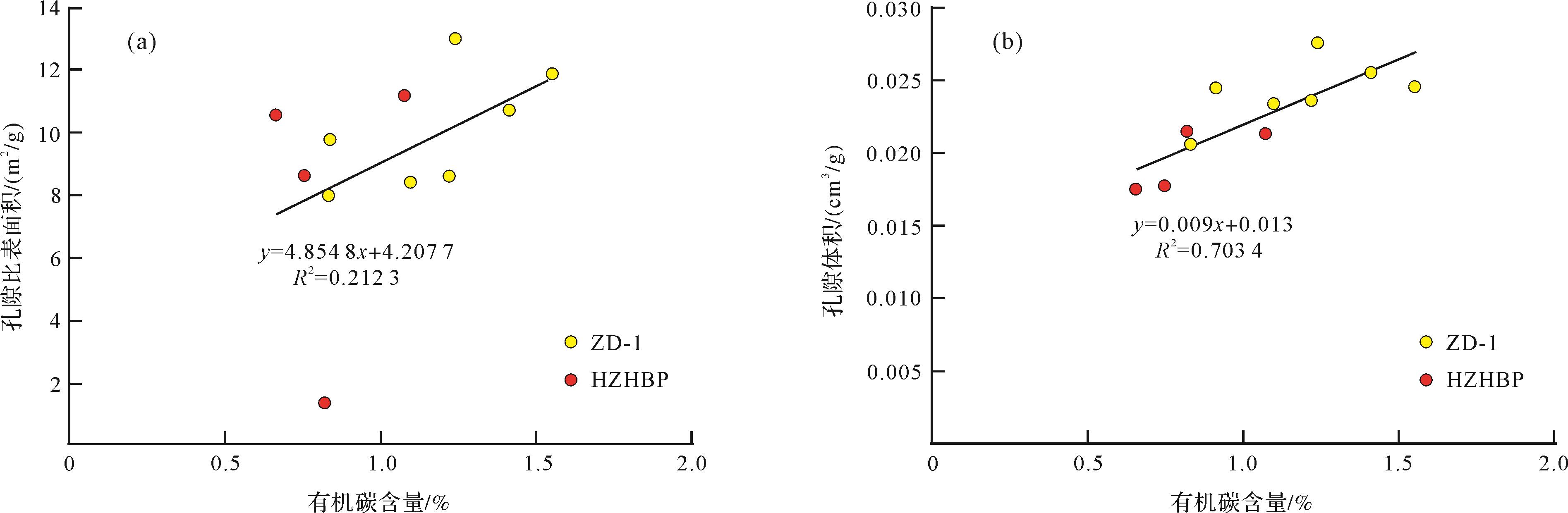
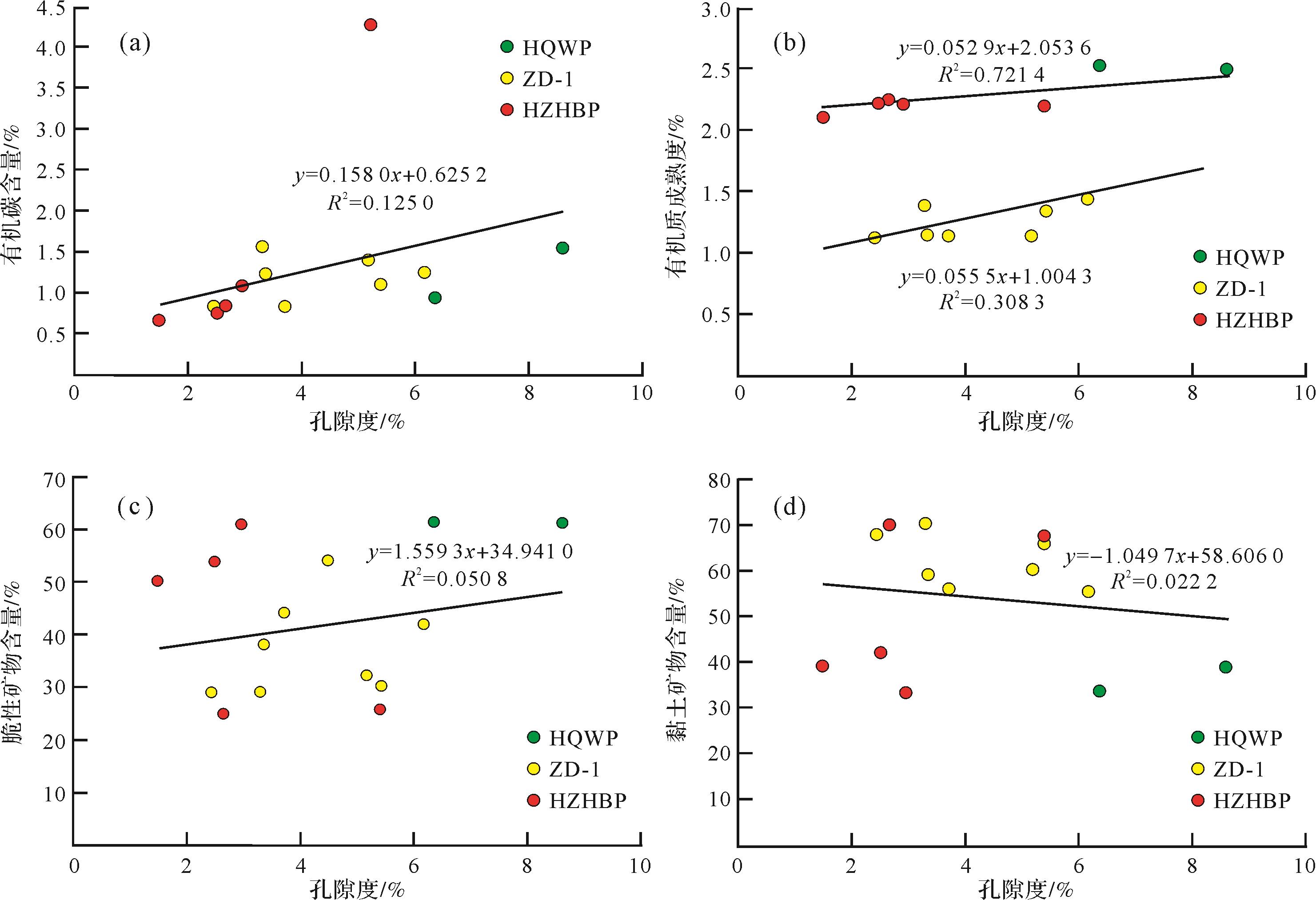
2023, 41(2): 633-645.
doi: 10.14027/j.issn.1000-0550.2021.101
Abstract:
The sedimentary characteristics, basic characteristics of the reservoir, diagenesis and diagenetic stages of the Cenozoic lacustrine fine-grained clastic rock reservoirs in the Qaidam Basin were studied by core observation description, thin section identification, laser confocal pore scanning, X-ray diffraction component analysis, SEM observation and other technologies. Genesis and controlling factors of high-quality fine-grained clastic rock reservoirs in the shallow and medium⁃deep layers were clarified. It was found that the sedimentary environment in which the fine-grained clastic rocks in the Mangya area were developed were beach-bar and mudflat in shore-shallow lake, in a rapidly changing zone, with mixed rock composition and high matrix content. The reservoirs mainly have ultra-low porosity and ultra-low permeability. The physical properties in the shallow layer are relatively good, with residual intergrain pores, intergrain dissolved pores and intercrystal pores in clay minerals, with two types of pore throat combinations: one type has scattered, relatively coarse pore throats, and the other type is relatively concentrated interconnecting fine pore throats. The deep layer is tight, with locally developed intergrain dissolved pores, and a relatively concentrated combination of fine pores and throats. The diagenesis affecting reservoir development is mainly compaction, dissolution and two-stage carbonate cementation. Compaction influenced the development of shallow residual intergrain pores. Early-stage calcite cement inhibited the compaction effect, and calcite cement is also the main constituent of late dissolution. The dissolution forming intergrain pores is due mainly to the action of shallow acidic fluids. Dissolution is the key to forming high-quality reservoirs.
The sedimentary characteristics, basic characteristics of the reservoir, diagenesis and diagenetic stages of the Cenozoic lacustrine fine-grained clastic rock reservoirs in the Qaidam Basin were studied by core observation description, thin section identification, laser confocal pore scanning, X-ray diffraction component analysis, SEM observation and other technologies. Genesis and controlling factors of high-quality fine-grained clastic rock reservoirs in the shallow and medium⁃deep layers were clarified. It was found that the sedimentary environment in which the fine-grained clastic rocks in the Mangya area were developed were beach-bar and mudflat in shore-shallow lake, in a rapidly changing zone, with mixed rock composition and high matrix content. The reservoirs mainly have ultra-low porosity and ultra-low permeability. The physical properties in the shallow layer are relatively good, with residual intergrain pores, intergrain dissolved pores and intercrystal pores in clay minerals, with two types of pore throat combinations: one type has scattered, relatively coarse pore throats, and the other type is relatively concentrated interconnecting fine pore throats. The deep layer is tight, with locally developed intergrain dissolved pores, and a relatively concentrated combination of fine pores and throats. The diagenesis affecting reservoir development is mainly compaction, dissolution and two-stage carbonate cementation. Compaction influenced the development of shallow residual intergrain pores. Early-stage calcite cement inhibited the compaction effect, and calcite cement is also the main constituent of late dissolution. The dissolution forming intergrain pores is due mainly to the action of shallow acidic fluids. Dissolution is the key to forming high-quality reservoirs.
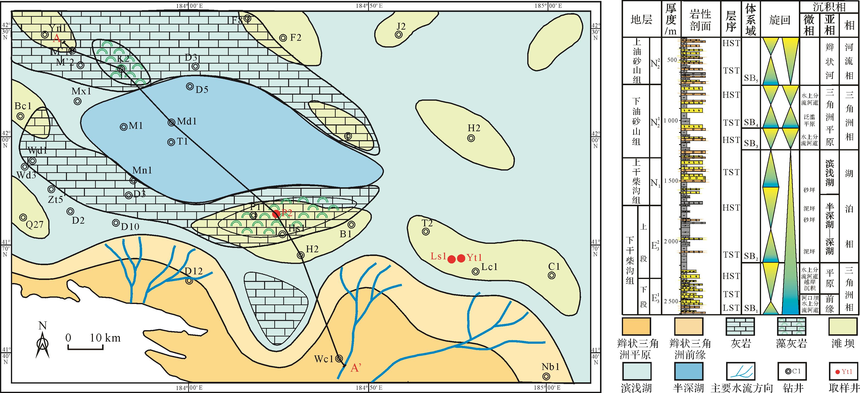
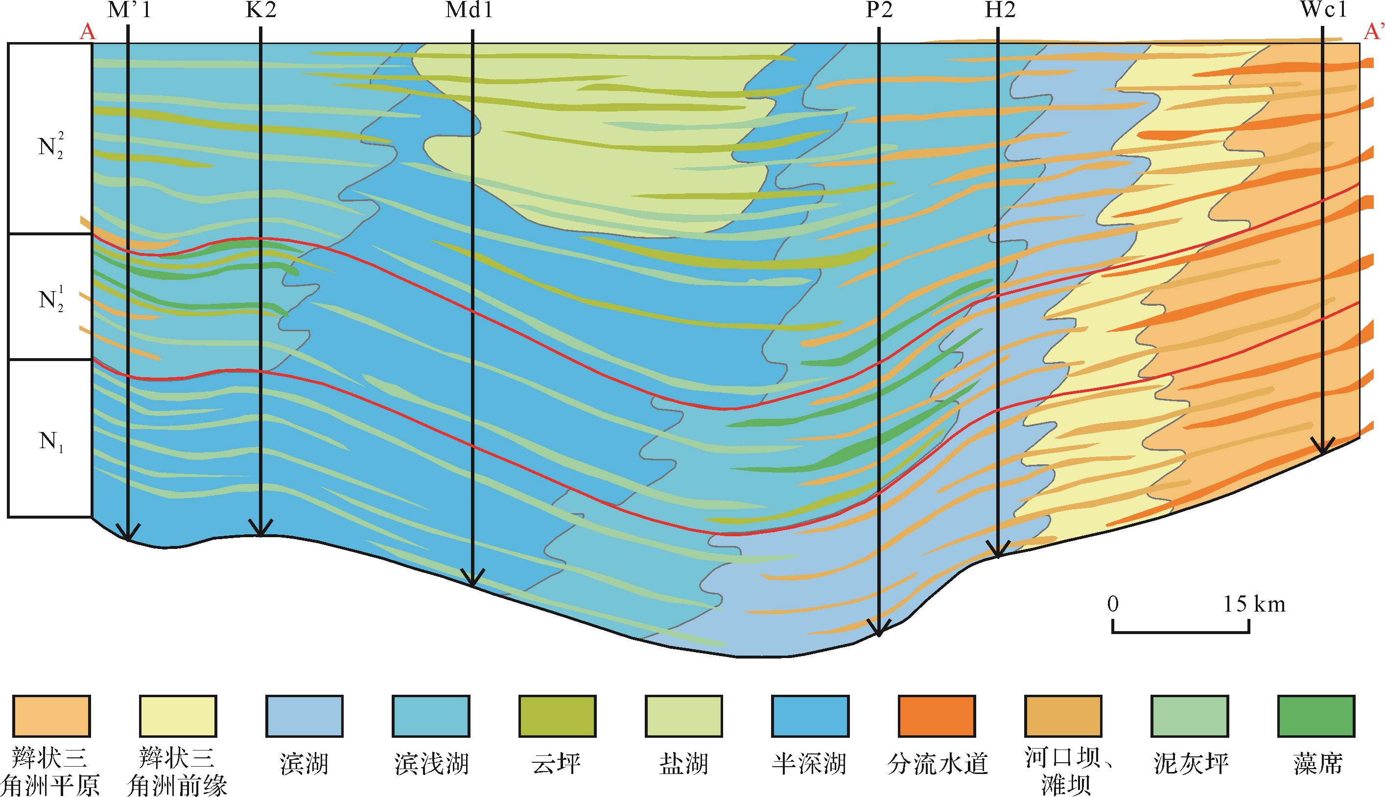
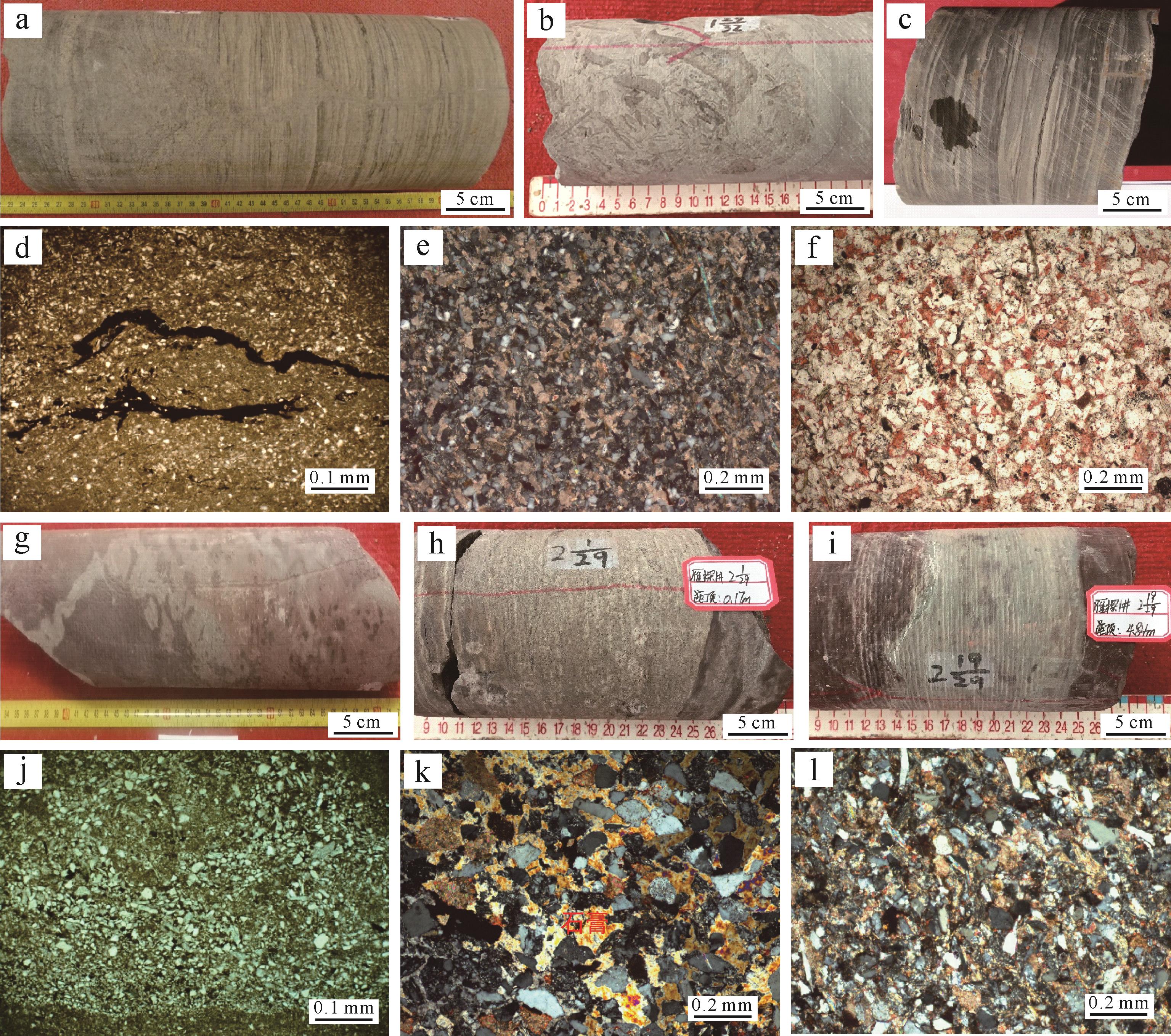
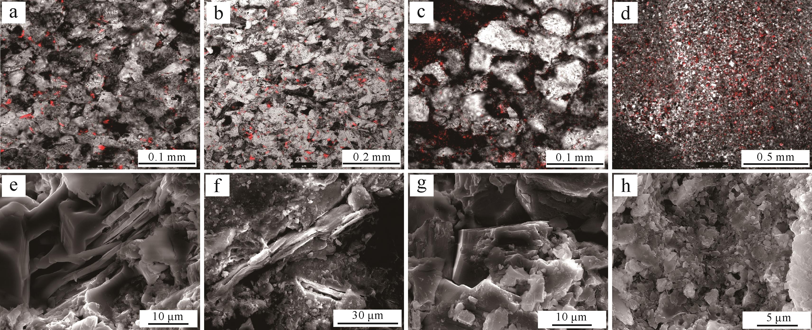
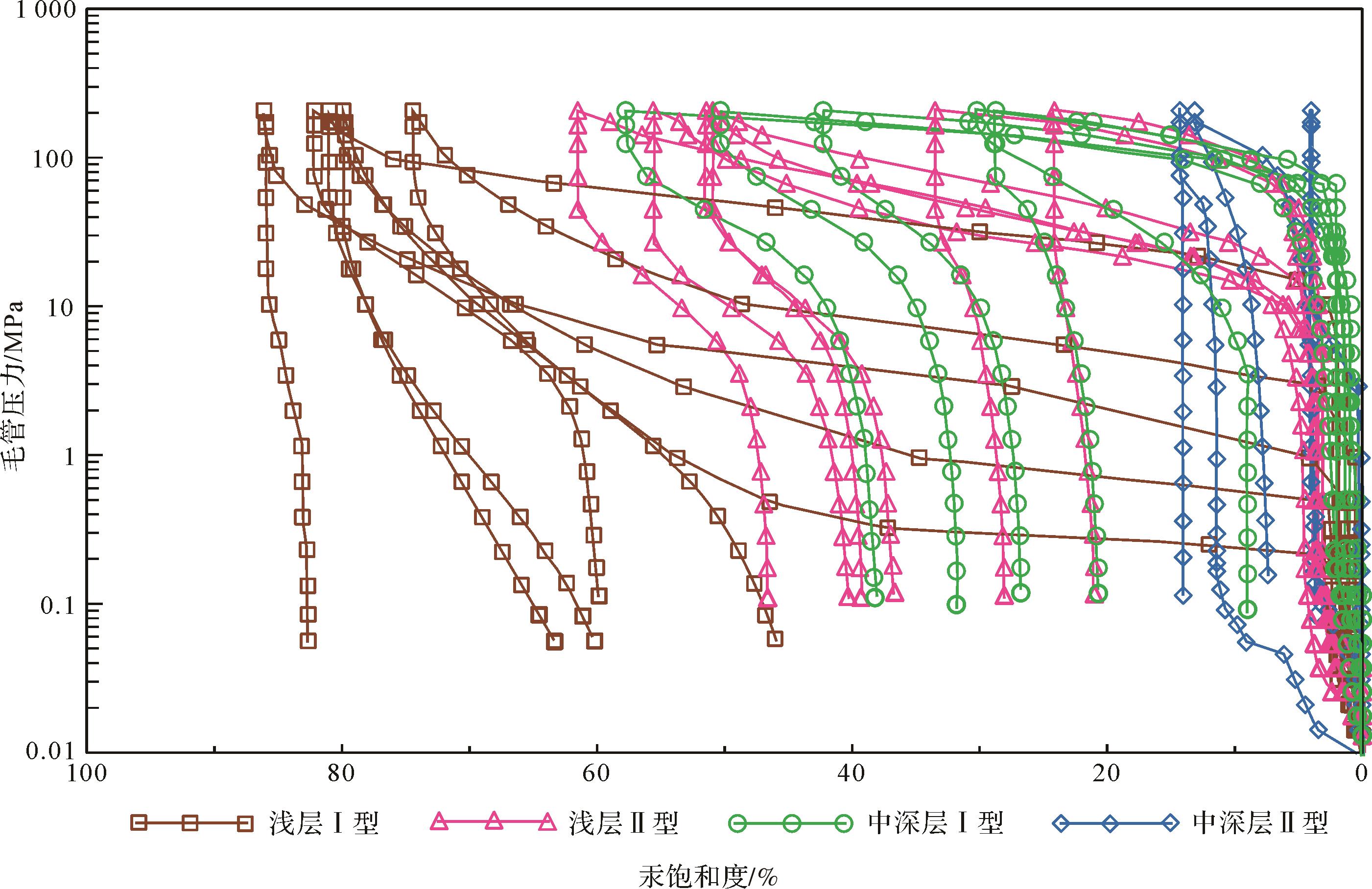
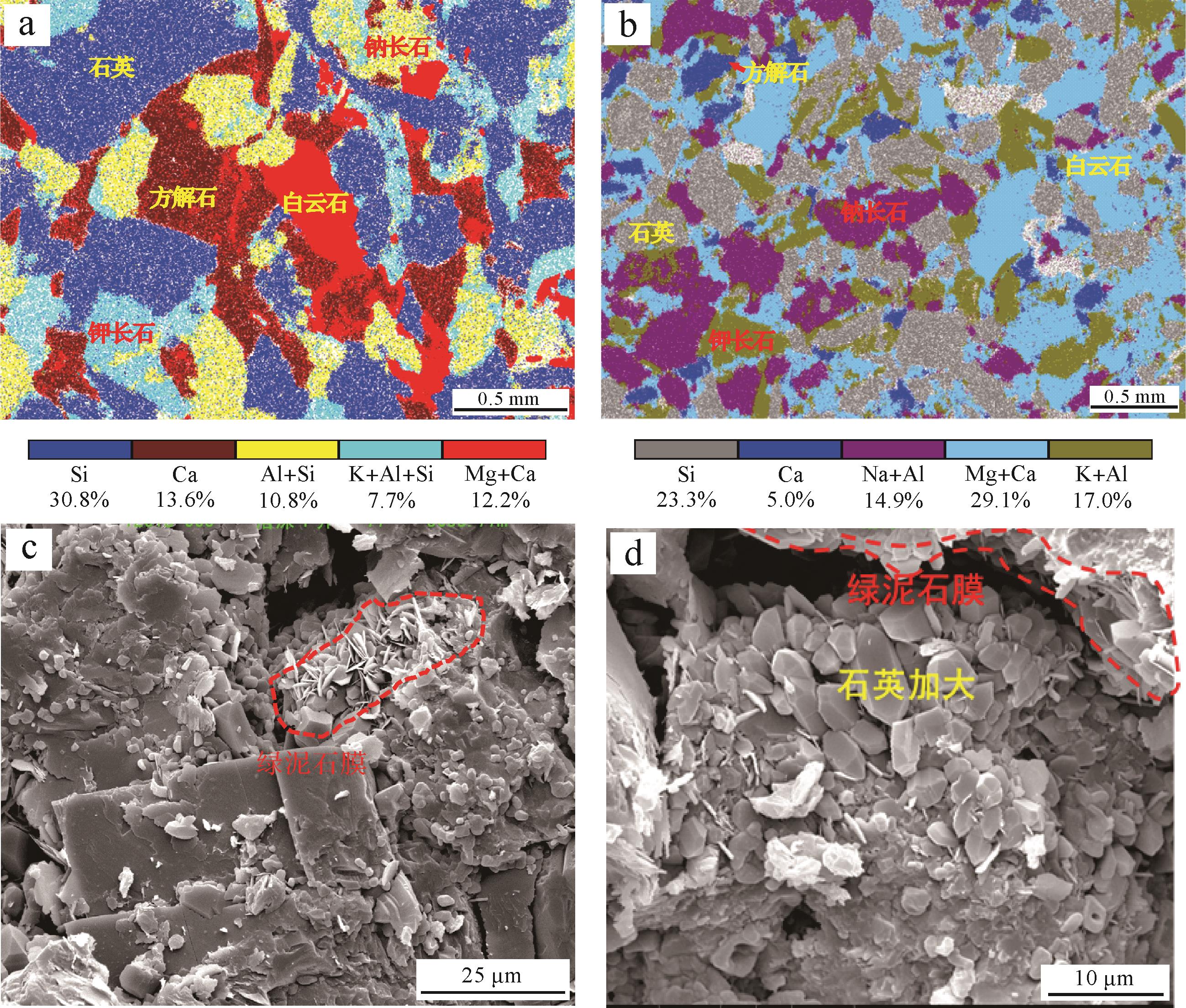
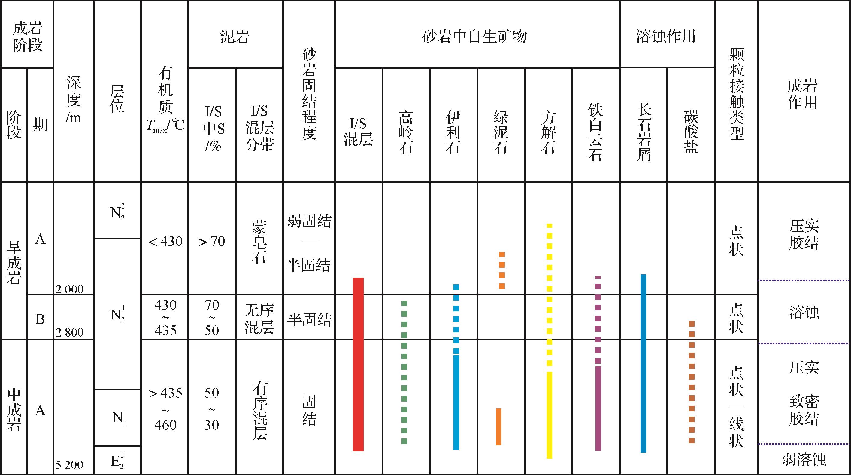
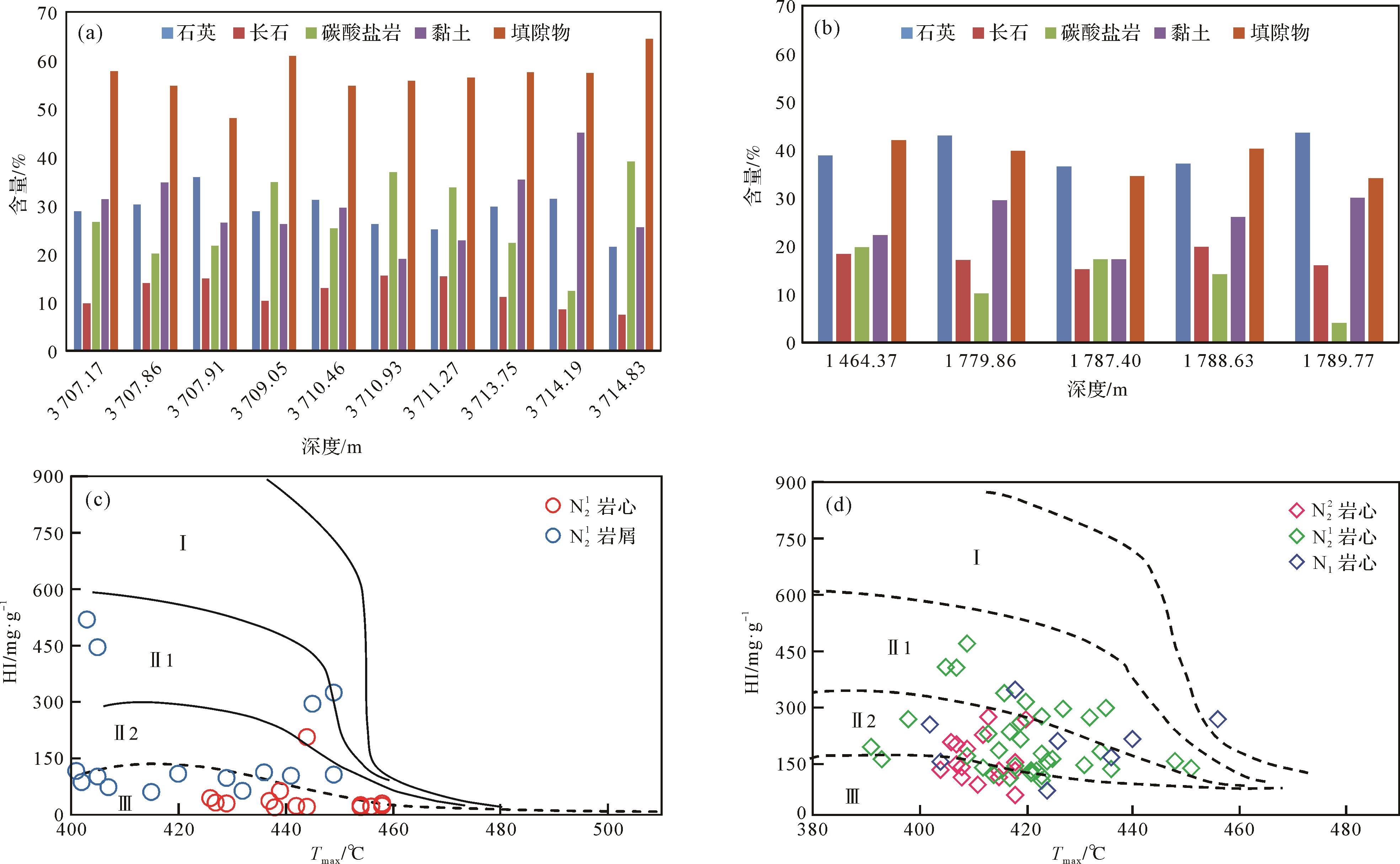
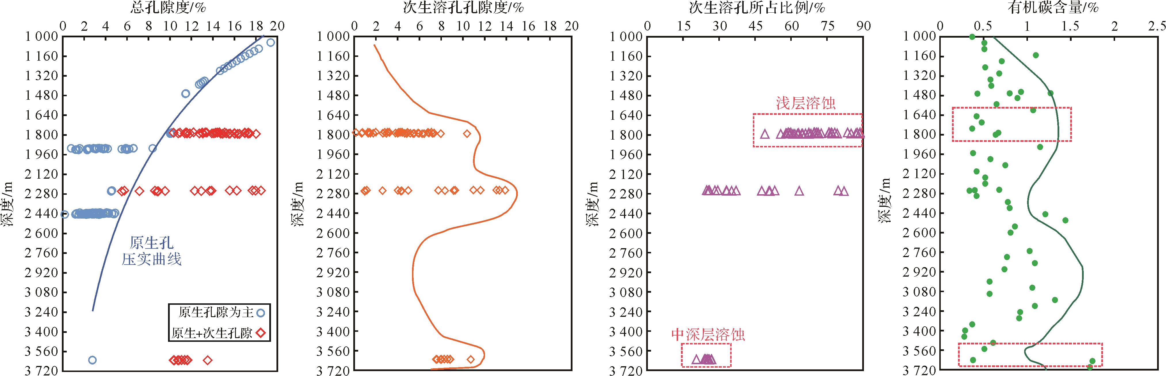
2023, 41(2): 646-659.
doi: 10.14027/j.issn.1000-0550.2021.092
Abstract:
Reservoirs in nonmarine and marine fine-grained rocks differ in both material composition and sedimentary environment, and the factors influencing reservoir quality are also different. In this study of the Lower Jurassic in the Sichuan Basin, the methods used were whole rock analysis of X-ray diffraction (XRD), He permeability, elemental geochemistry, organic geochemical analysis, scanning electron microscopy (SEM), analysis of nonmarine fine-grained rock composition, reservoir space types and microstructure. The factors controlling the reservoir quality of nonmarine fine-grained rocks are discussed. It is shown that the main minerals of the Lower Jurassic fine-grained rocks in the Sichuan Basin are clay minerals, quartz and carbonate minerals. The contents of clay minerals and quartz are high in the whole section, but the carbonate mineral content is locally enriched. The nonmarine fine-grained rocks mainly consist of five rock types: shale, shell mudstone, silty mudstone, siltstone and shell limestone. The shale and shell mudstone have high organic matter content and good shale gas reservoir physical properties. The reservoir space of the terrestrial fine-grained rock reservoir mainly consists of clay mineral interlamellar pores and microfractures, but fewer organic pores. The reservoir quality is mainly affected by sedimentary environment and diagenesis, and has little relation to its composition. Semi-deep lake conditions control the distribution of organic-rich fine-grained rocks; a reducing depositional environment of low salinity, humidity and sufficient provenance is conducive to the development of pore space in fine-grained rocks and provides the basic material for the formation of reservoirs. The interlaminar pores in clay minerals are preserved by overburden pressure and provide storage space for shale gas enrichment.
Reservoirs in nonmarine and marine fine-grained rocks differ in both material composition and sedimentary environment, and the factors influencing reservoir quality are also different. In this study of the Lower Jurassic in the Sichuan Basin, the methods used were whole rock analysis of X-ray diffraction (XRD), He permeability, elemental geochemistry, organic geochemical analysis, scanning electron microscopy (SEM), analysis of nonmarine fine-grained rock composition, reservoir space types and microstructure. The factors controlling the reservoir quality of nonmarine fine-grained rocks are discussed. It is shown that the main minerals of the Lower Jurassic fine-grained rocks in the Sichuan Basin are clay minerals, quartz and carbonate minerals. The contents of clay minerals and quartz are high in the whole section, but the carbonate mineral content is locally enriched. The nonmarine fine-grained rocks mainly consist of five rock types: shale, shell mudstone, silty mudstone, siltstone and shell limestone. The shale and shell mudstone have high organic matter content and good shale gas reservoir physical properties. The reservoir space of the terrestrial fine-grained rock reservoir mainly consists of clay mineral interlamellar pores and microfractures, but fewer organic pores. The reservoir quality is mainly affected by sedimentary environment and diagenesis, and has little relation to its composition. Semi-deep lake conditions control the distribution of organic-rich fine-grained rocks; a reducing depositional environment of low salinity, humidity and sufficient provenance is conducive to the development of pore space in fine-grained rocks and provides the basic material for the formation of reservoirs. The interlaminar pores in clay minerals are preserved by overburden pressure and provide storage space for shale gas enrichment.