2020 Vol. 38, No. 6
Display Method:
2020, 38(6): 1123-1139.
doi: 10.14027/j.issn.1000-0550.2020.012
Abstract:
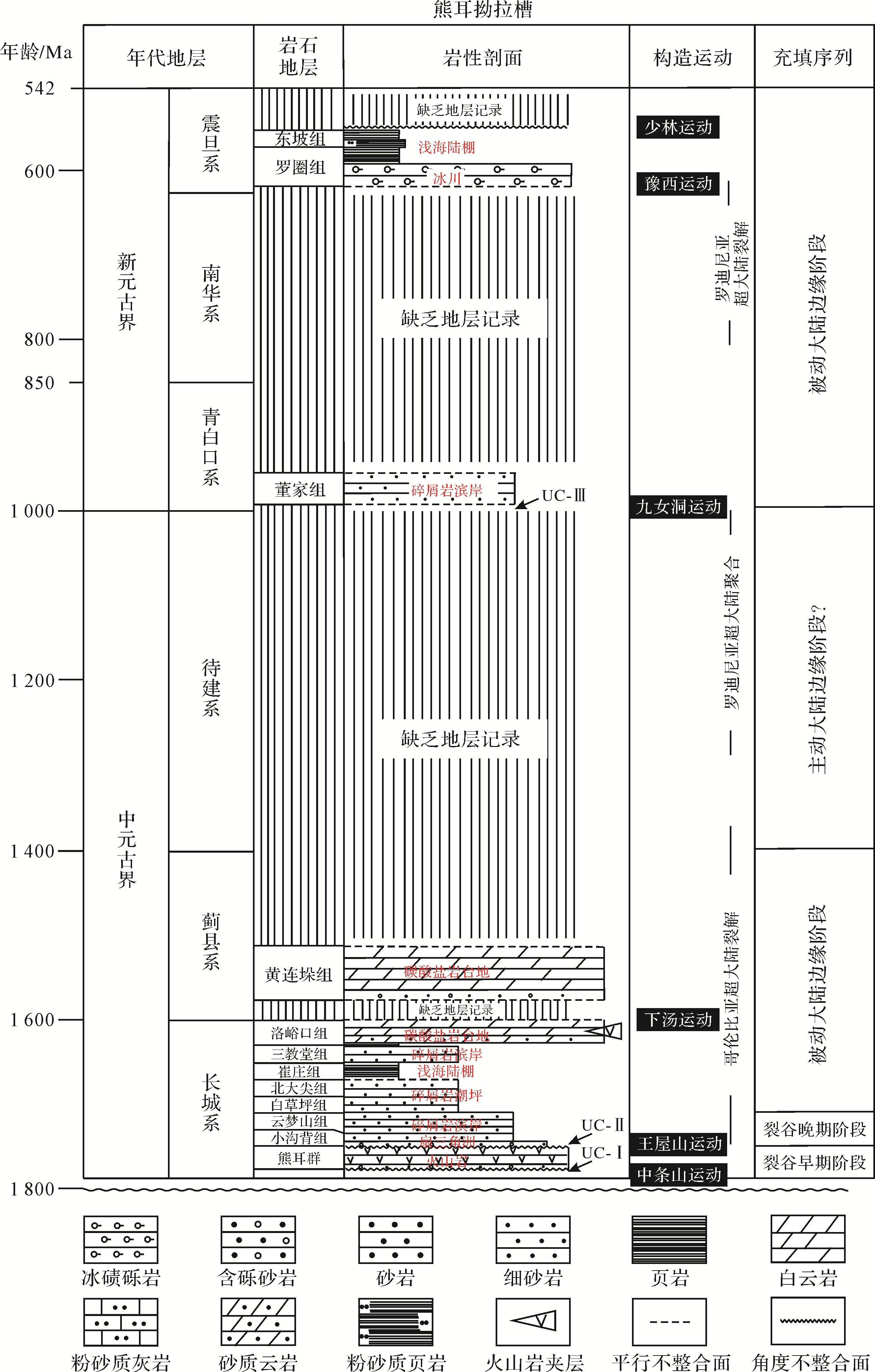
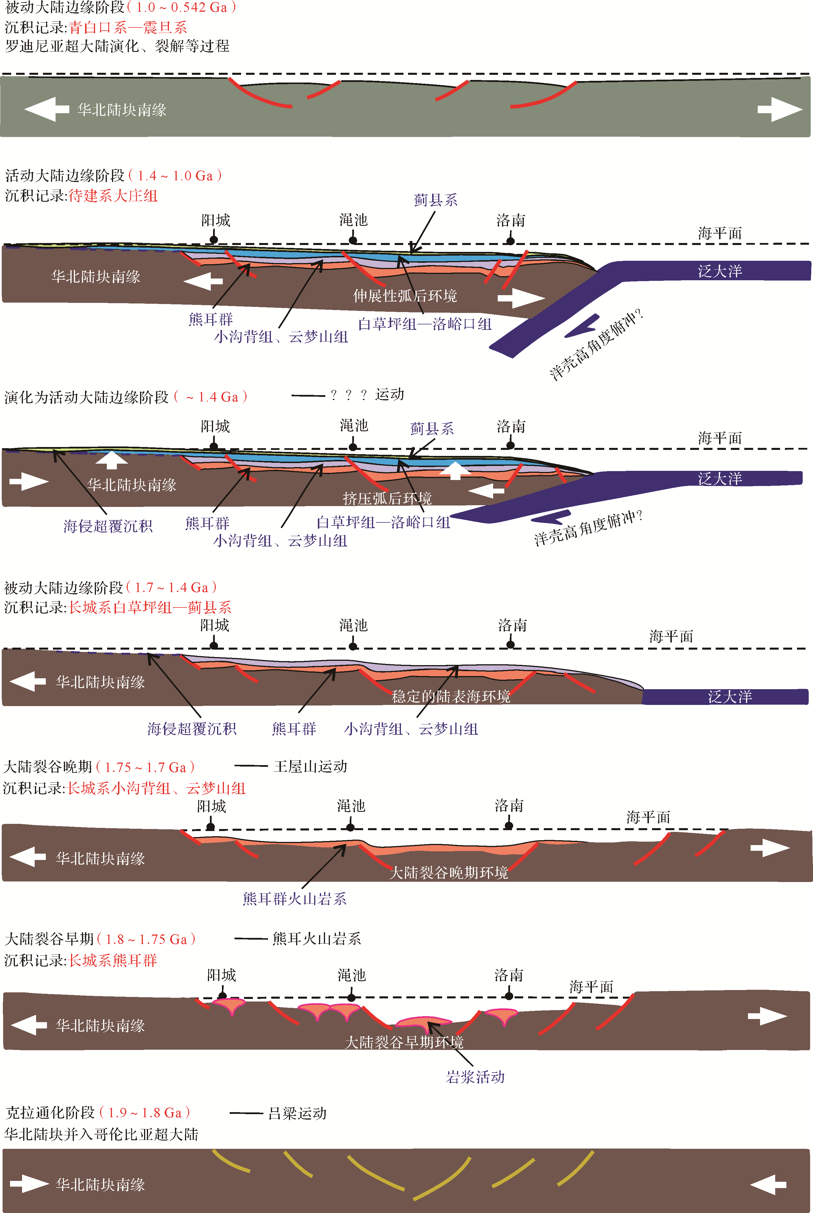
The Meso⁃Neoproterozoic strata in the southern margin of the North China Craton (NCC) are well developed and exposed. In this study, after summarizing and comparing the results of previous work, four typical fundamental profiles and three key auxiliary profiles were observed and described, and an in⁃depth analysis was conducted on the types, characteristics, distribution of sedimentary facies and sedimentary sequences from the aspects of rock color, rock association type, rock structure and sedimentary structure. These showed that, in the study area, there are six sedimentary facies, 10 subfacies and 15 microfacies comprising barrier⁃type coastal facies, barrier⁃free coastal facies, neritic shelf facies, carbonate platform facies, fan delta facies and glacial facies. The sedimentary characteristics of the various facies, subfacies and microfacies are described in detail, defining the main types and characteristics of the sediments from different geological periods of the Meso⁃Neoproterozoic. The sedimentary filling characteristics are discussed in depth. The strata are divided into four sedimentary sequences: early continental rift deposits (Xiong’er Group); late continental rift deposits (Xiaogoubei⁃Yunmengshan Formations); passive continental margin deposits of the Mesoproterozoic (Baicaoping⁃Huanglianduo Formations); and passive continental⁃margin deposits of the Neoproterozoic (Dongjia⁃Dongpo Formations).


2020, 38(6): 1140-1151.
doi: 10.14027/j.issn.1000-0550.2019.115
Abstract:
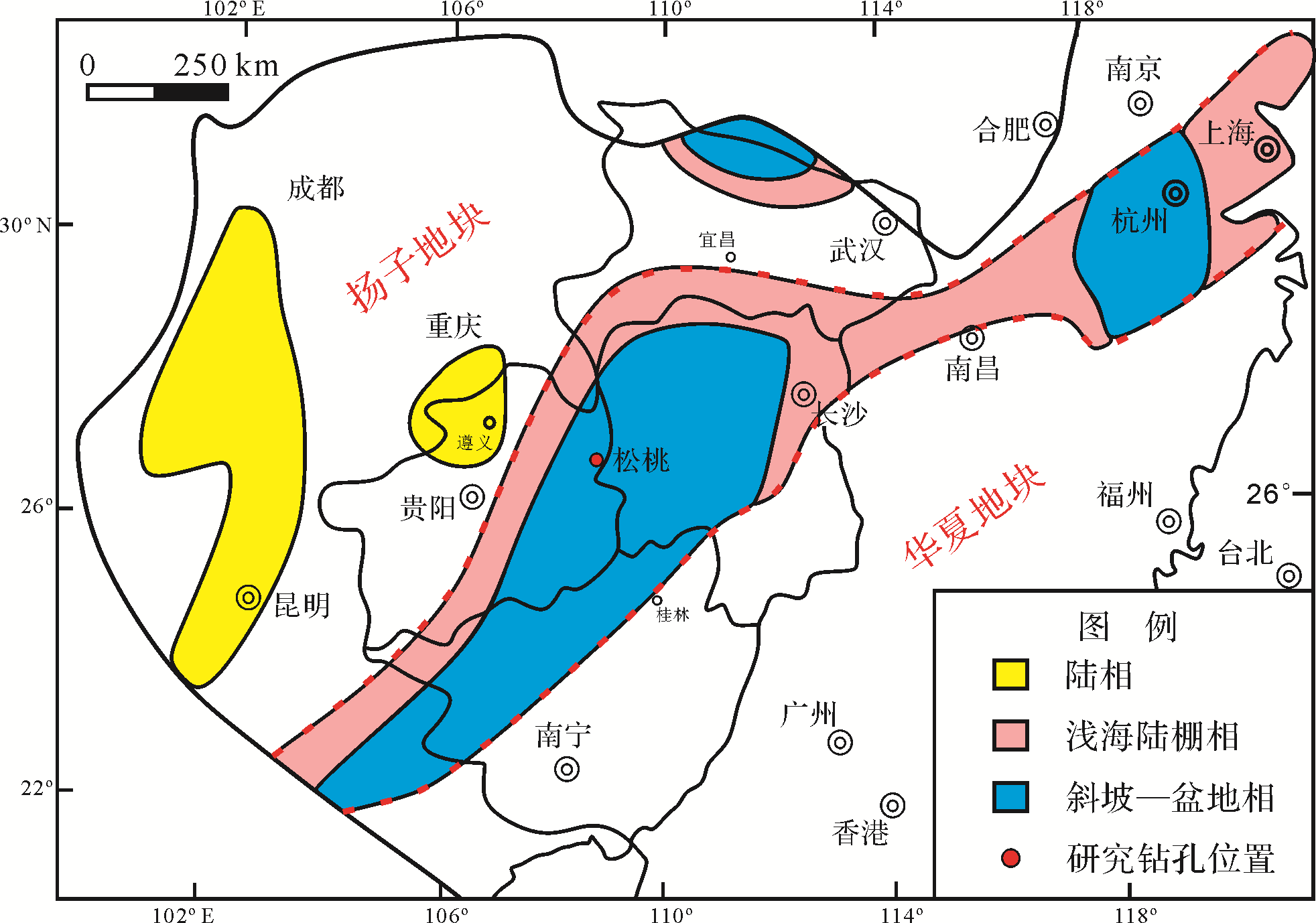
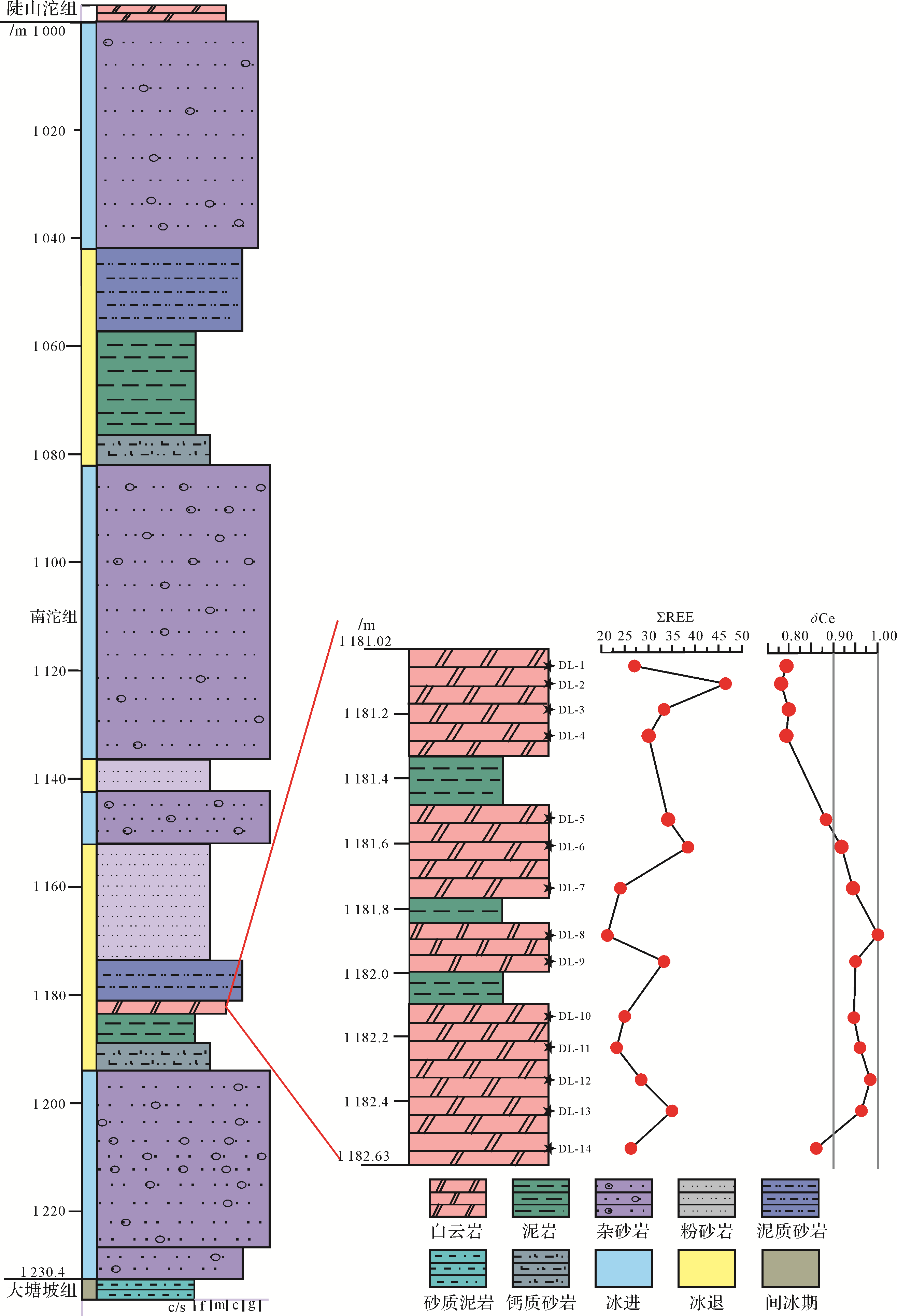
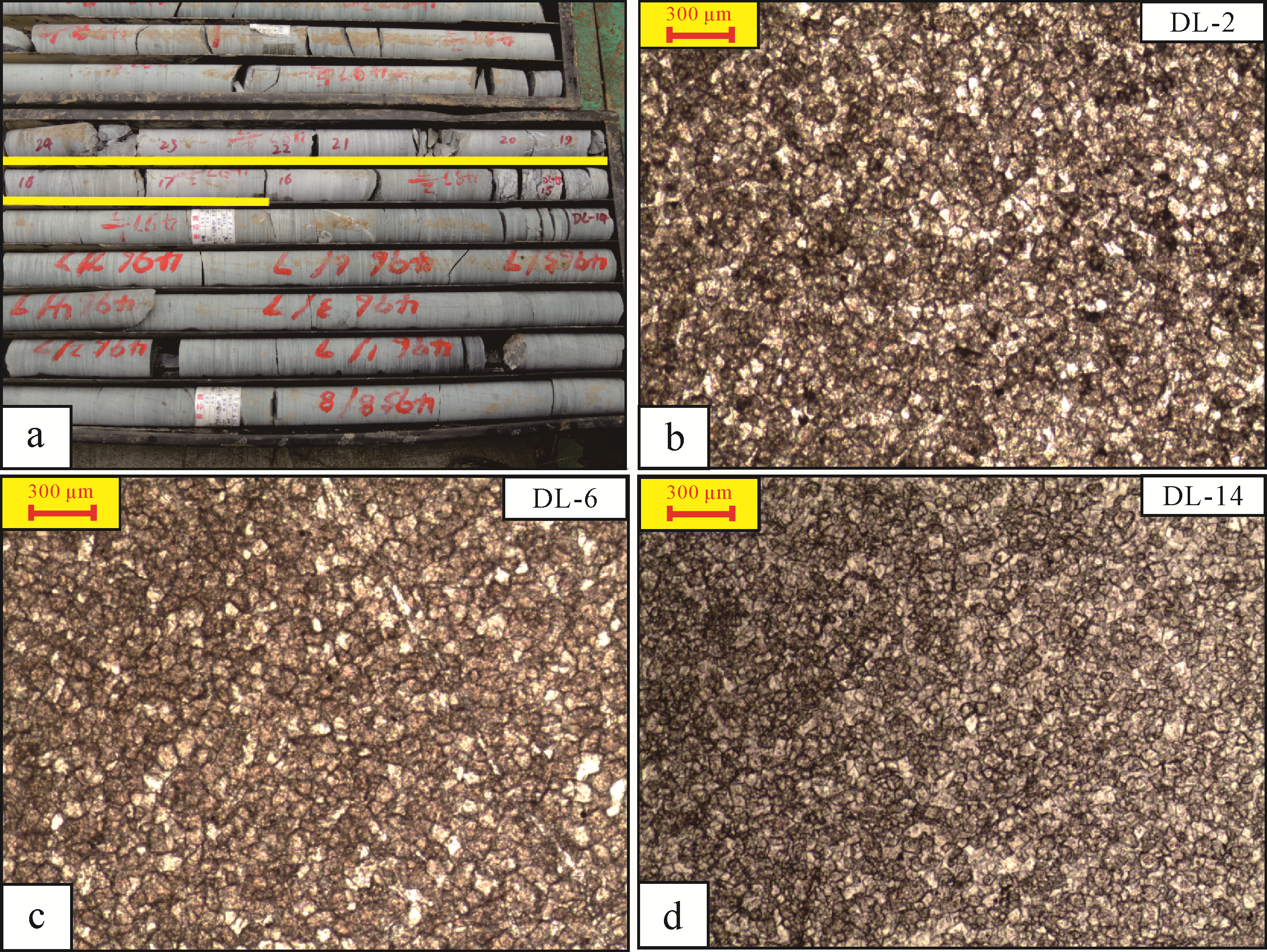
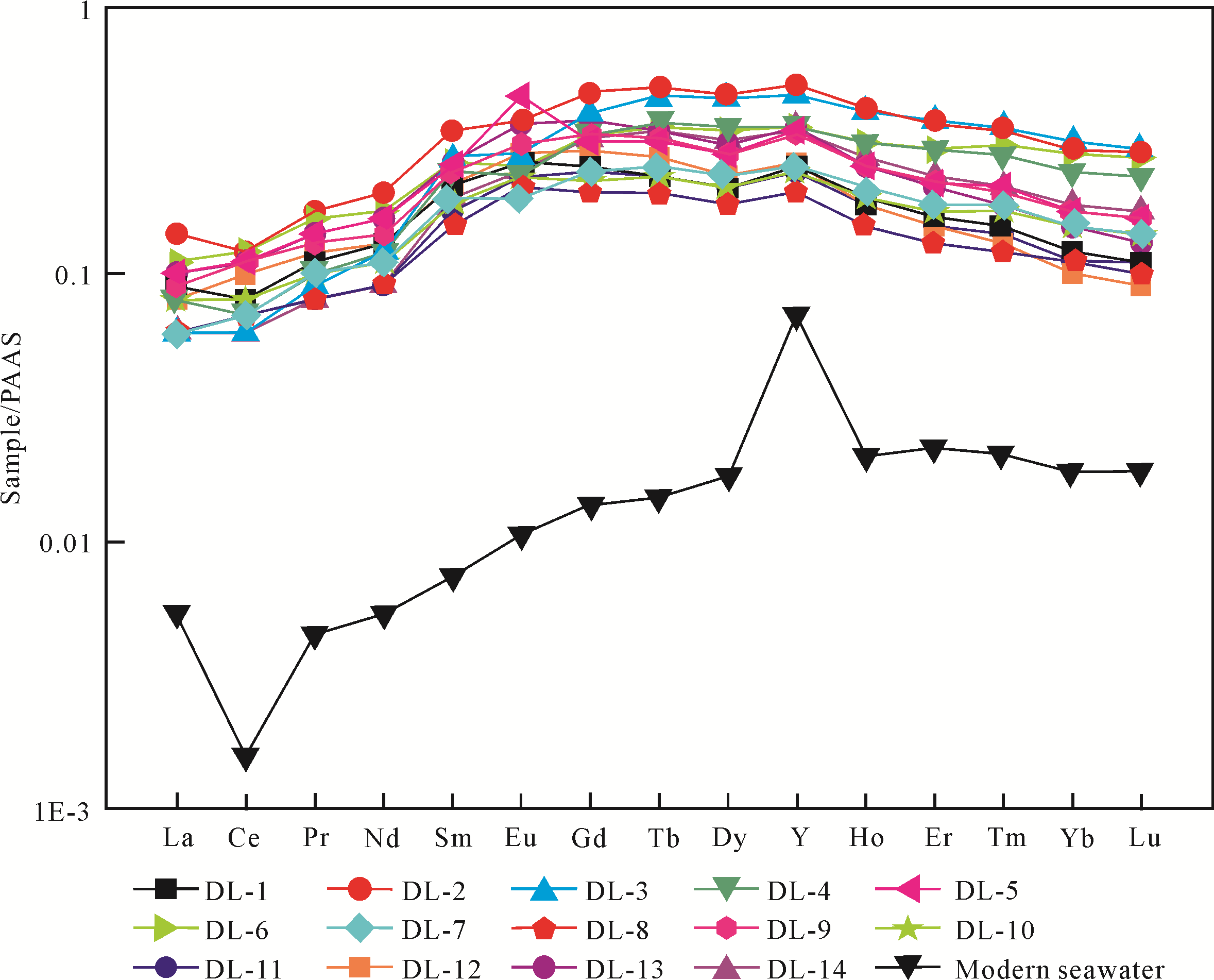
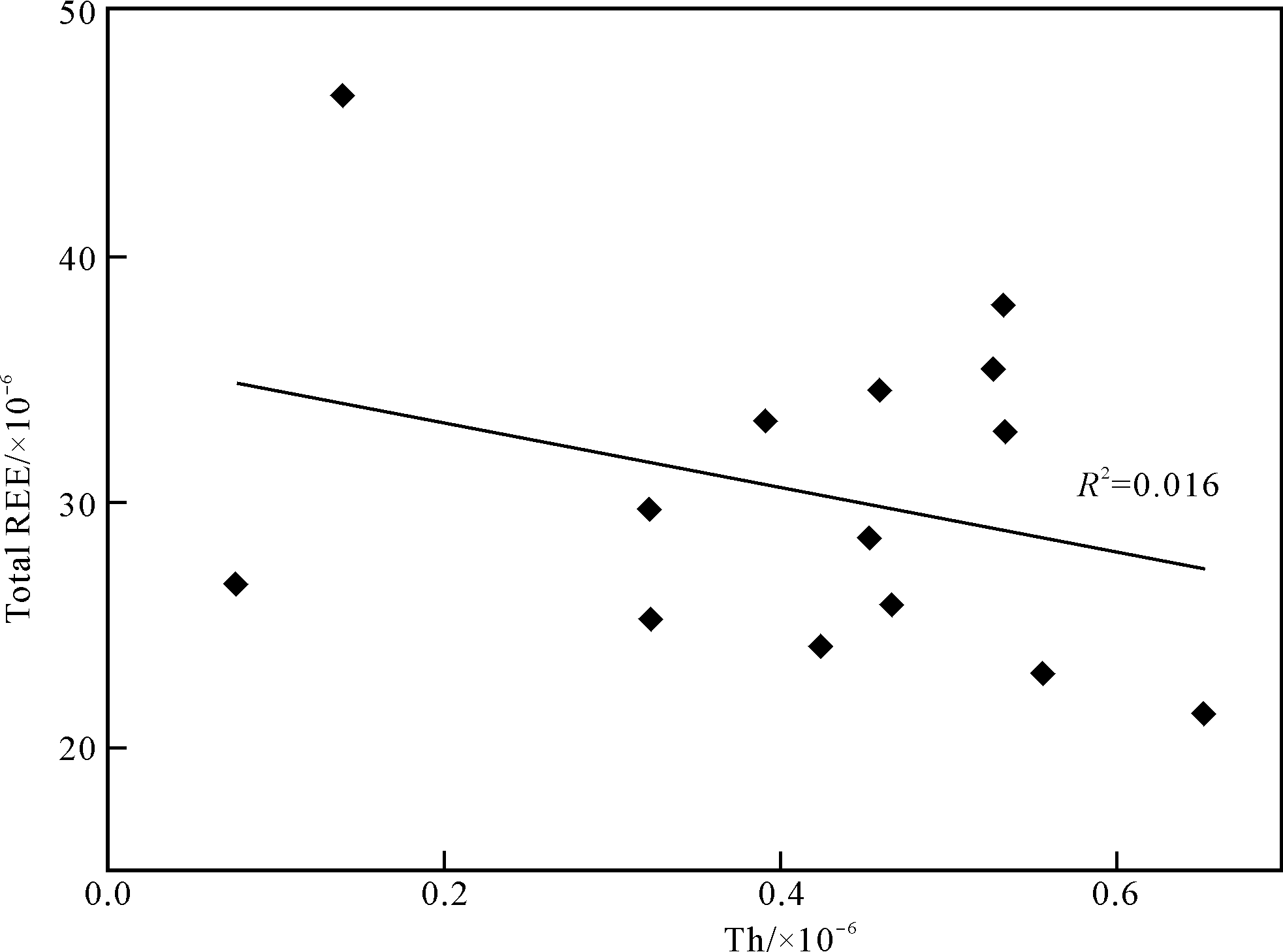
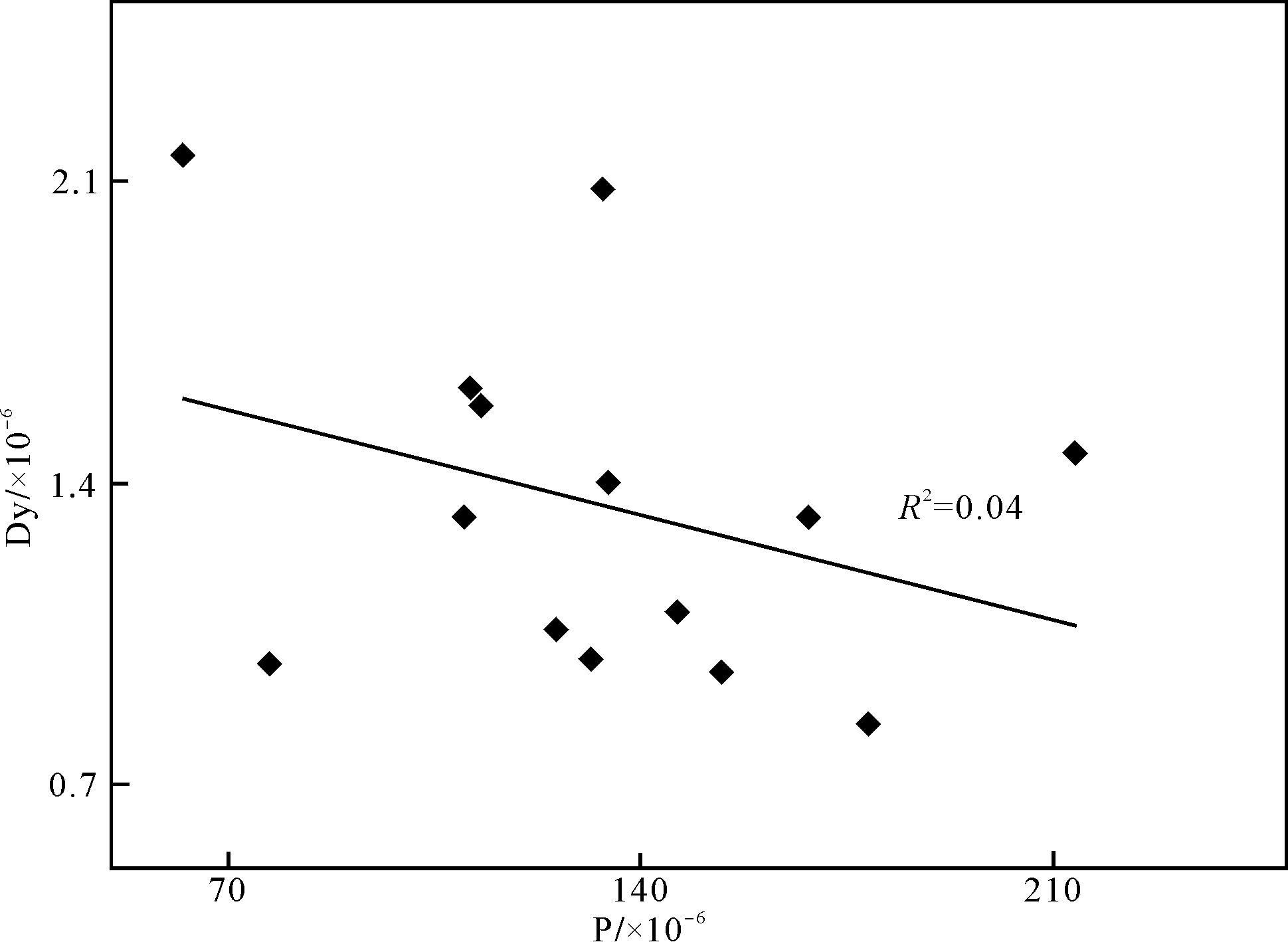
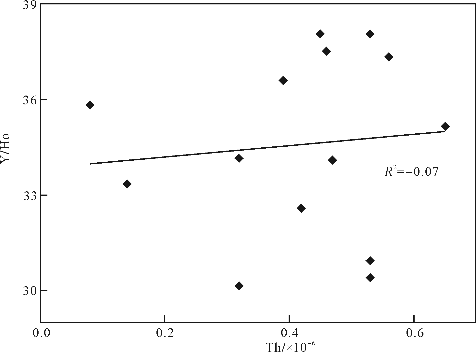
In the late Neoproterozoic, the Earth experienced two "Snowball Earth" events, which had a significant impact on the marine oxidation and the diversification of multicellular organisms in the subsequent Ediacaran period. However, due to the lack of chemical sedimentary rocks during the glacial period, little is known about the marine redox conditions of the Nantuo Ice Age. The authors discovered a bed of carbonate deposits from the Nantuo Formation in the Songtao area of Guizhou Province, which provides an ideal window for exploring the marine paleoenvironment of the Nantuo Ice Age in South China. The geochemical characteristics of rare earth elements (REEs) in carbonate rocks can effectively reflect the environmental conditions at the time of their formation and have been widely used to reconstruct the marine redox conditions in geological history. The dolomite occurs in the lower part of the Nantuo Formation, about 1.6 m thick, and is sandwiched between two sets of diamictites. Dolomite powder was drilled by micro⁃drilling and dissolved in dilute acetic acid. REEs and other trace elements were analyzed using a ionization coupled plasma mass spectrometer (ICP⁃MS). The analytical results show that the contents of REEs are high ranged from 23.0×10⁻⁶ to 46.6×10⁻⁶. After PAAS(Post⁃Archaean Australian Shale) normalization, REEs show negative or no anomalies of Ce (average 0.90), variable Eu and La anomalies, MREE(Middle REEs) enrichment and Y /Ho ratio averages 34.6. The characteristics of REEs in dolomite are significantly different from those of modern oxic seawater. Combined with the high Fe and Mn contents in the sample, it reflects the fact that the surface seawater in South China was an iron⁃rich and anoxic environment in the Nantuo Ice Age. It may restrict the ocean oxidation and the evolution of multicellular eukaryotes after the glacial period.
2020, 38(6): 1152-1165.
doi: 10.14027/j.issn.1000-0550.2019.113
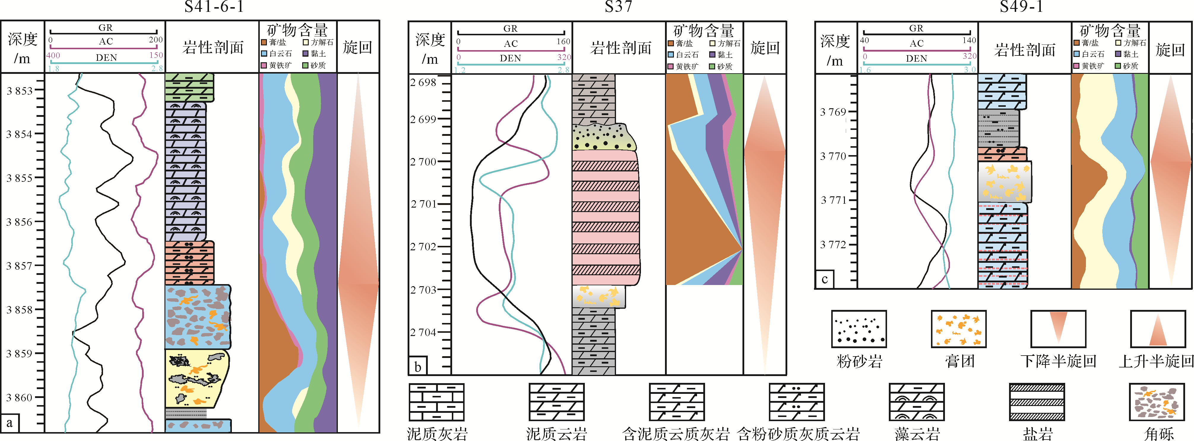
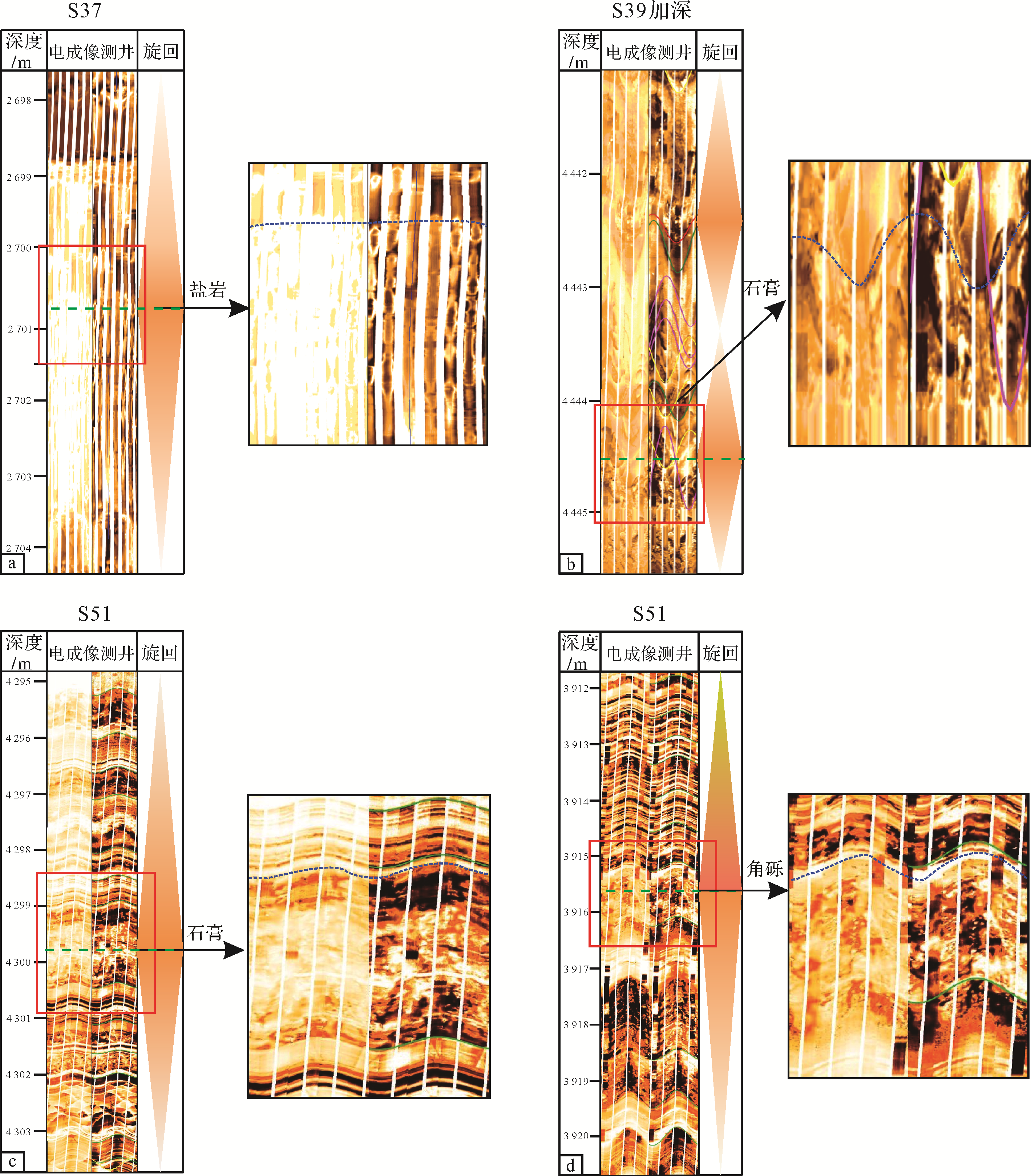
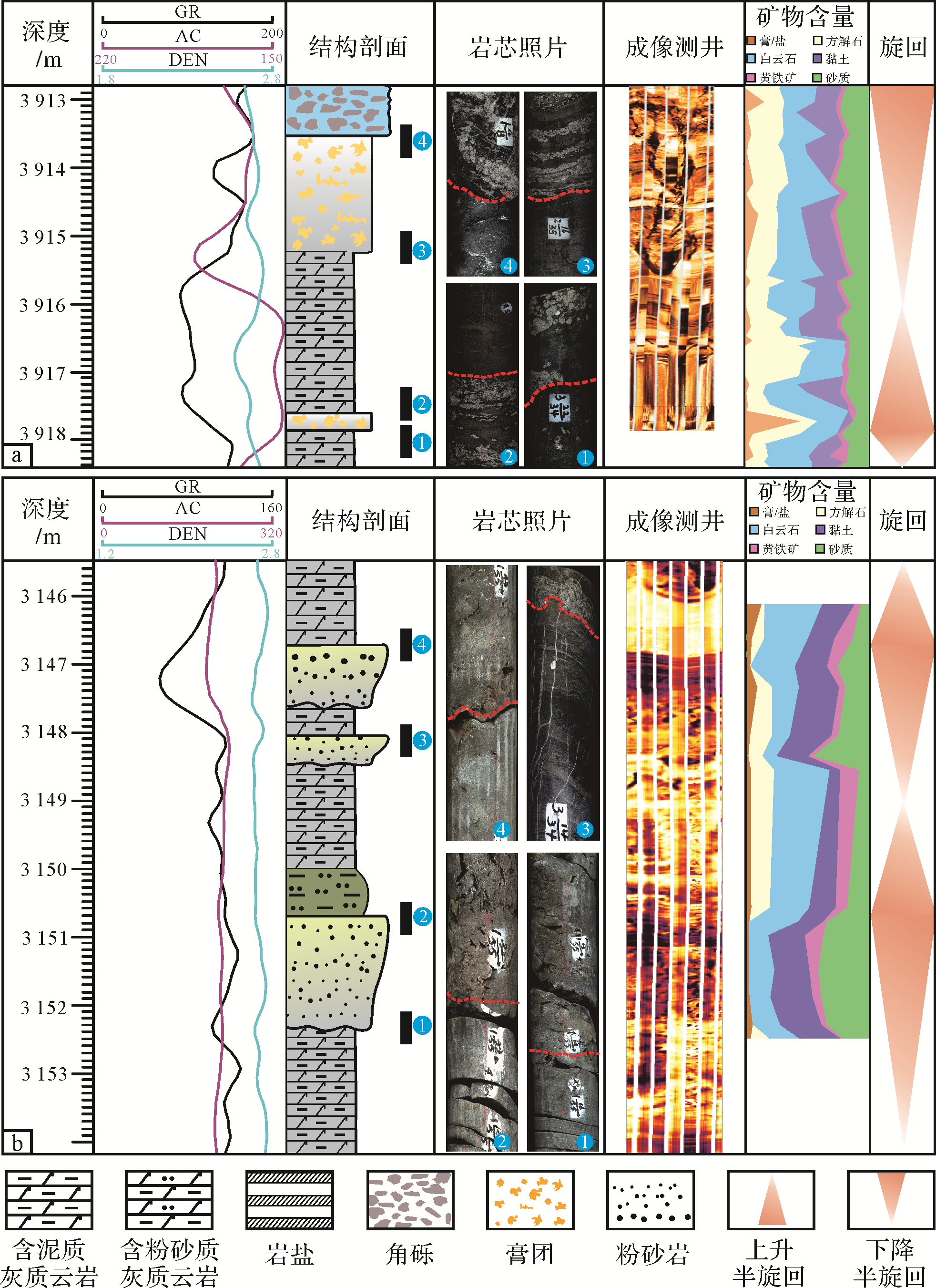
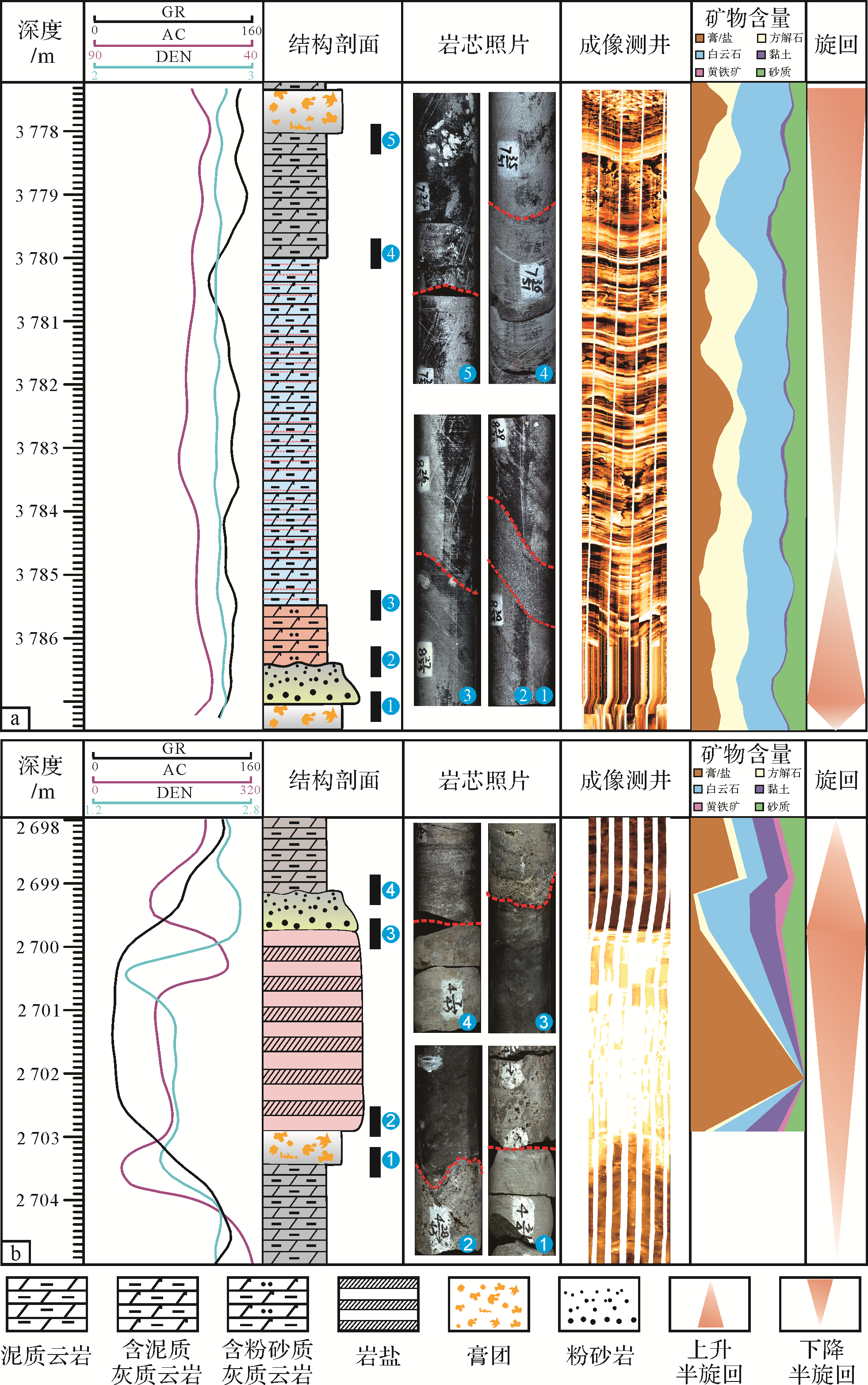
Abstract:
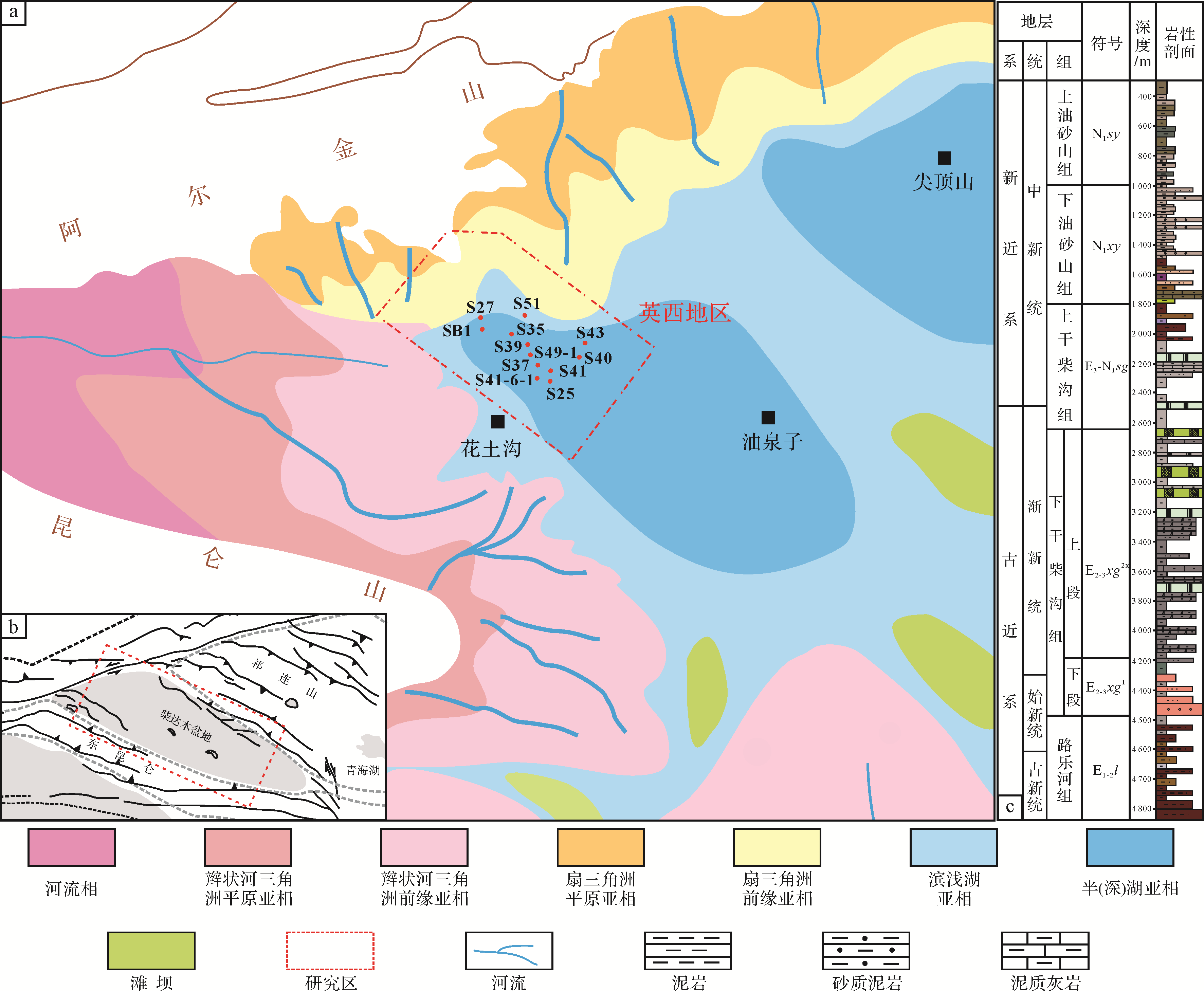
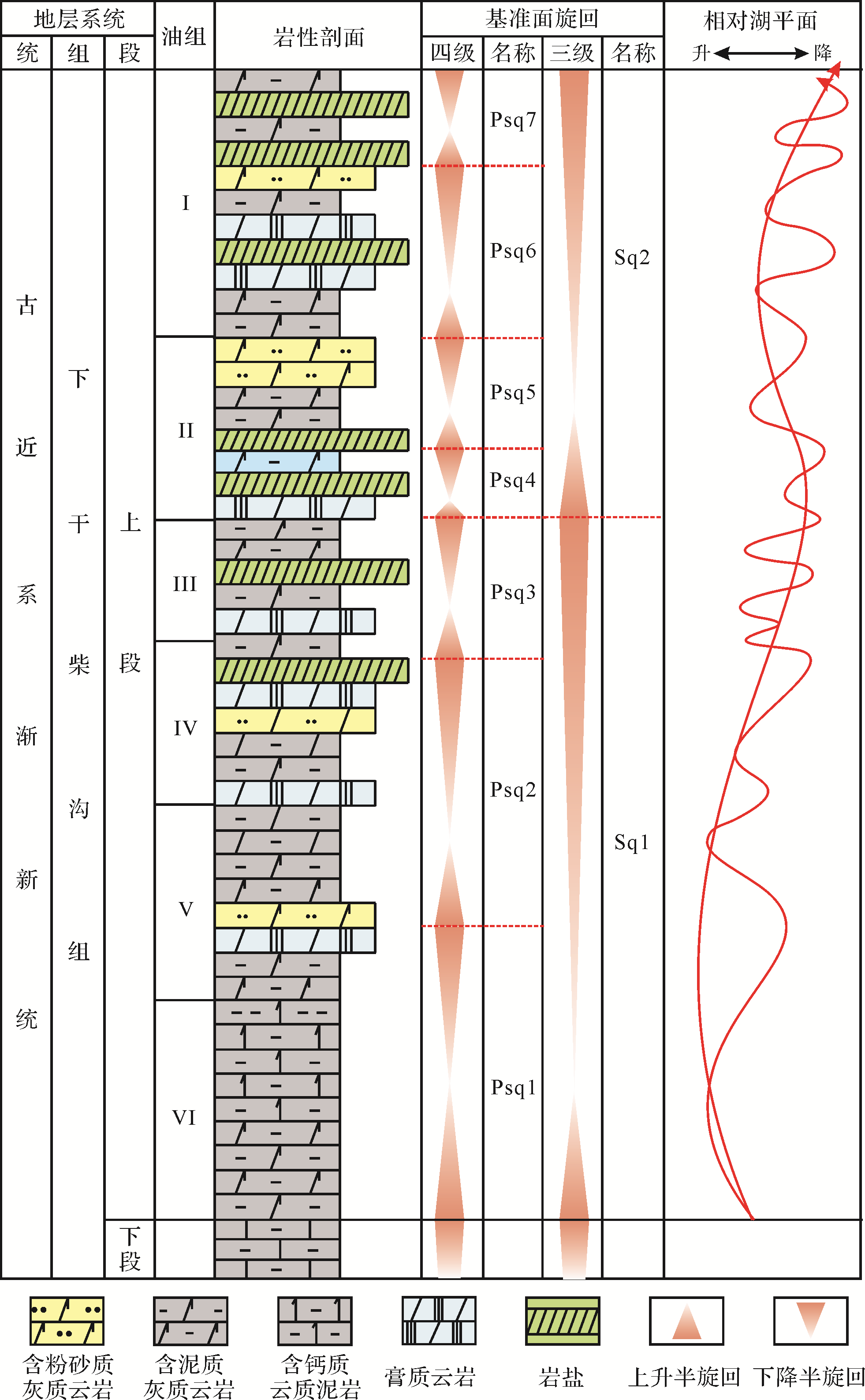
Based on analysis of cores, thin sections, scanning electron microscopy, well⁃logging , and correlation analytic data of the upper member of the Paleogene Lower Ganchaigou Formation (E 3 2 E 3 2


2020, 38(6): 1166-1178.
doi: 10.14027/j.issn.1000-0550.2020.001
Abstract:
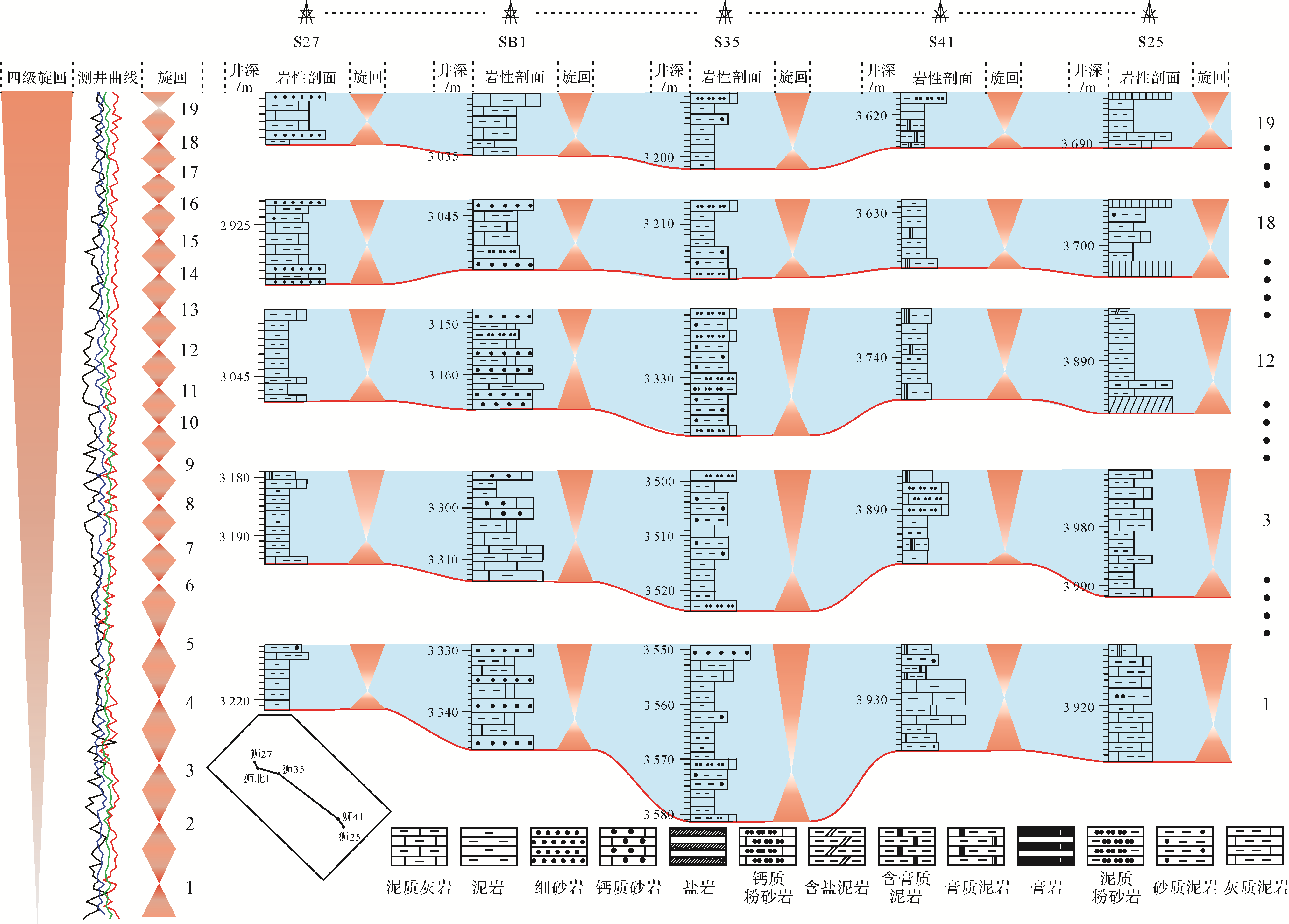
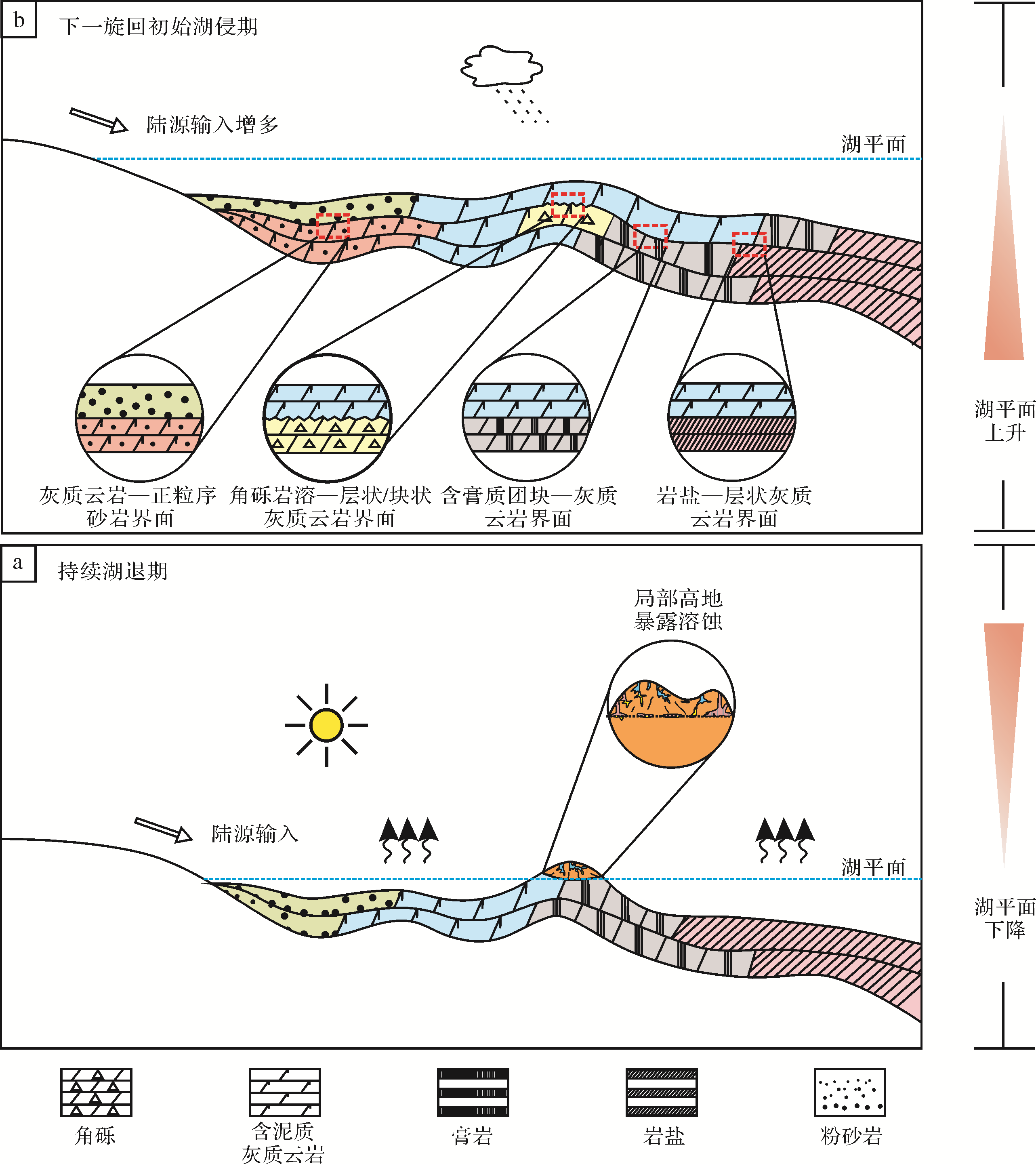
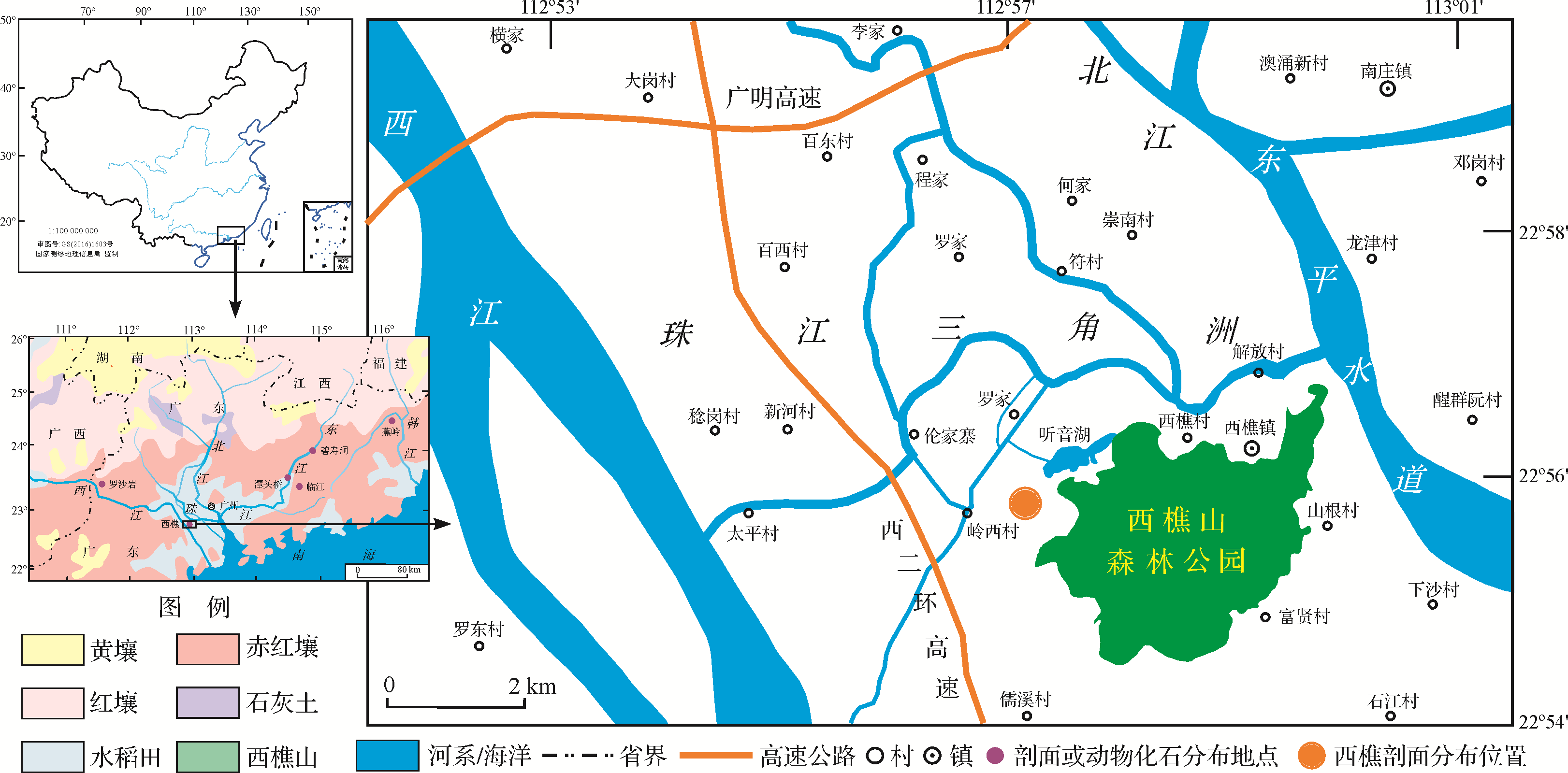
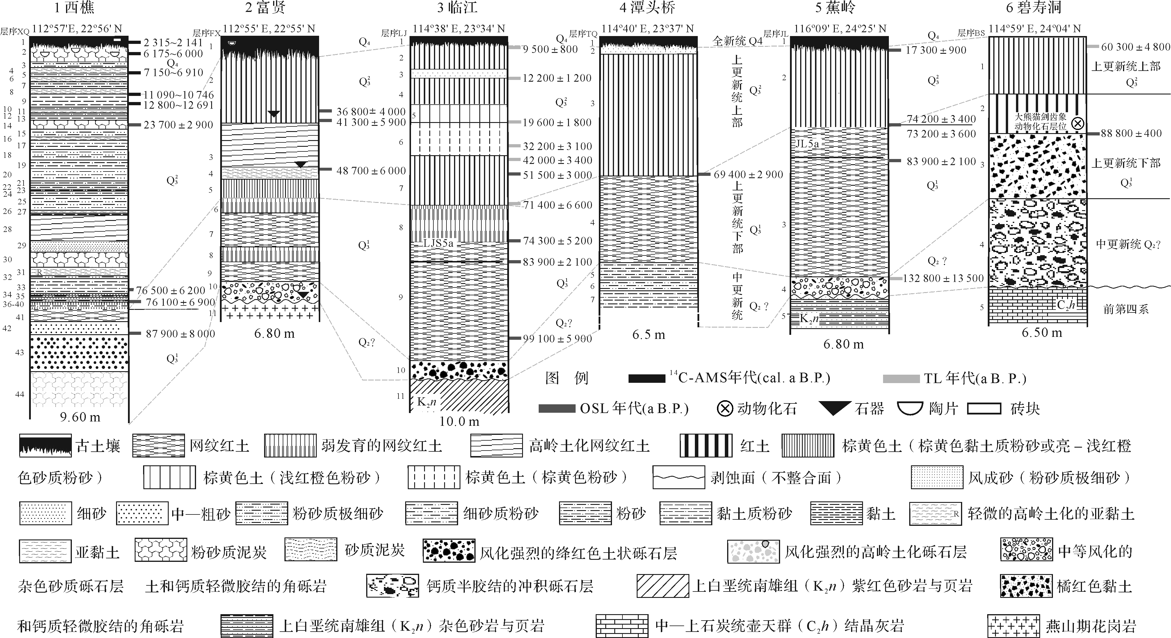
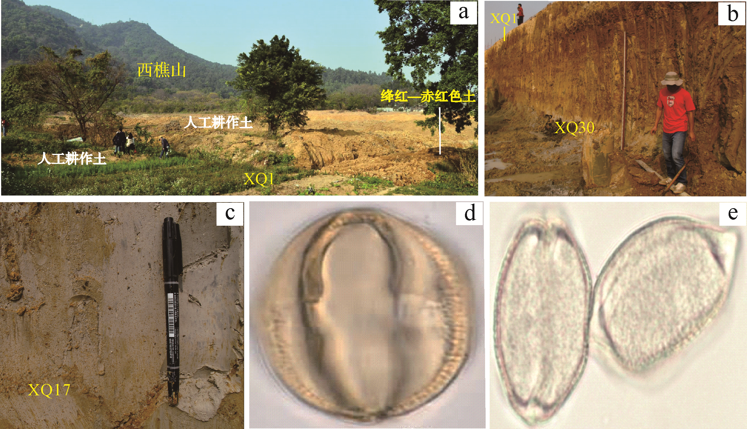
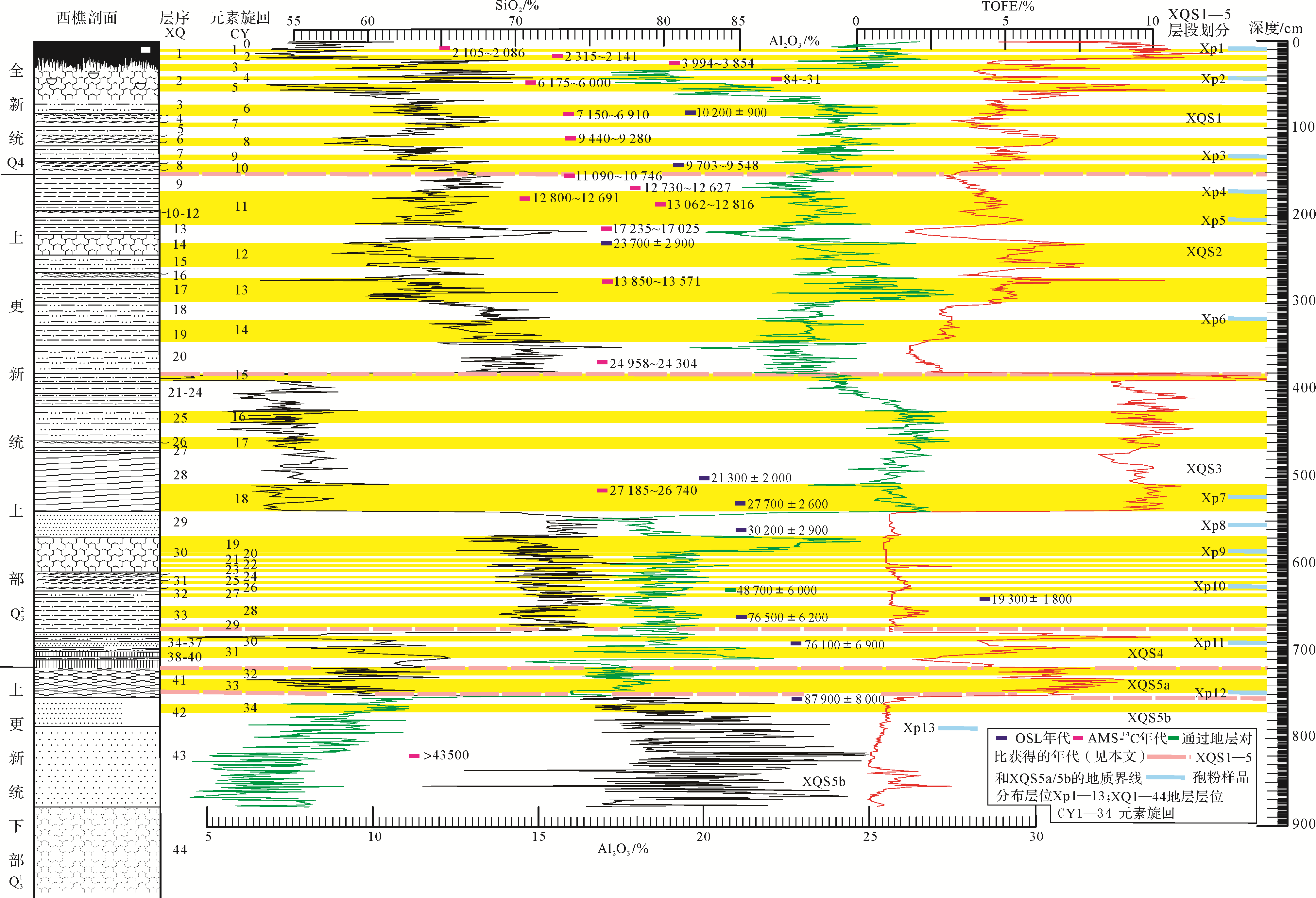
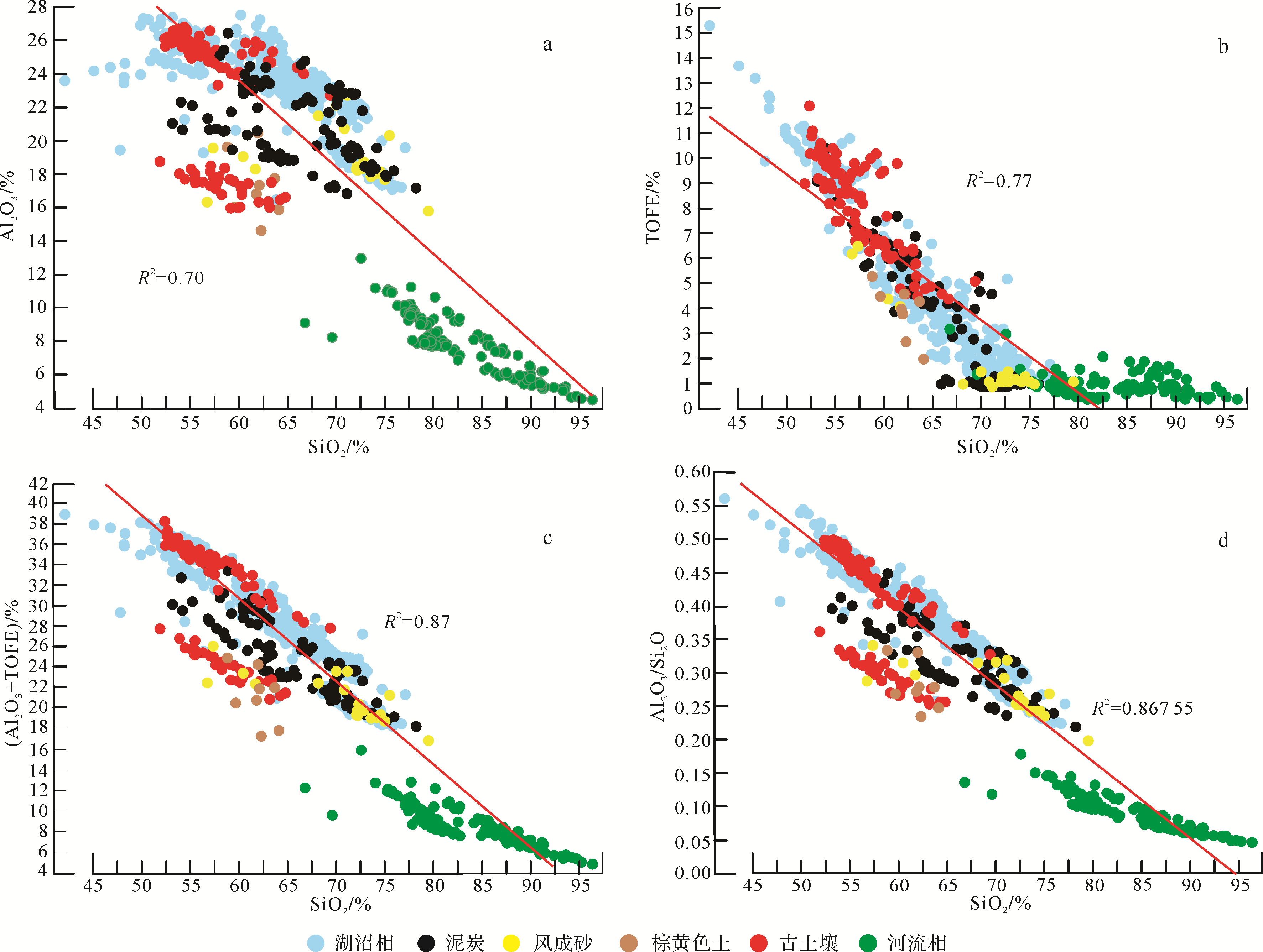
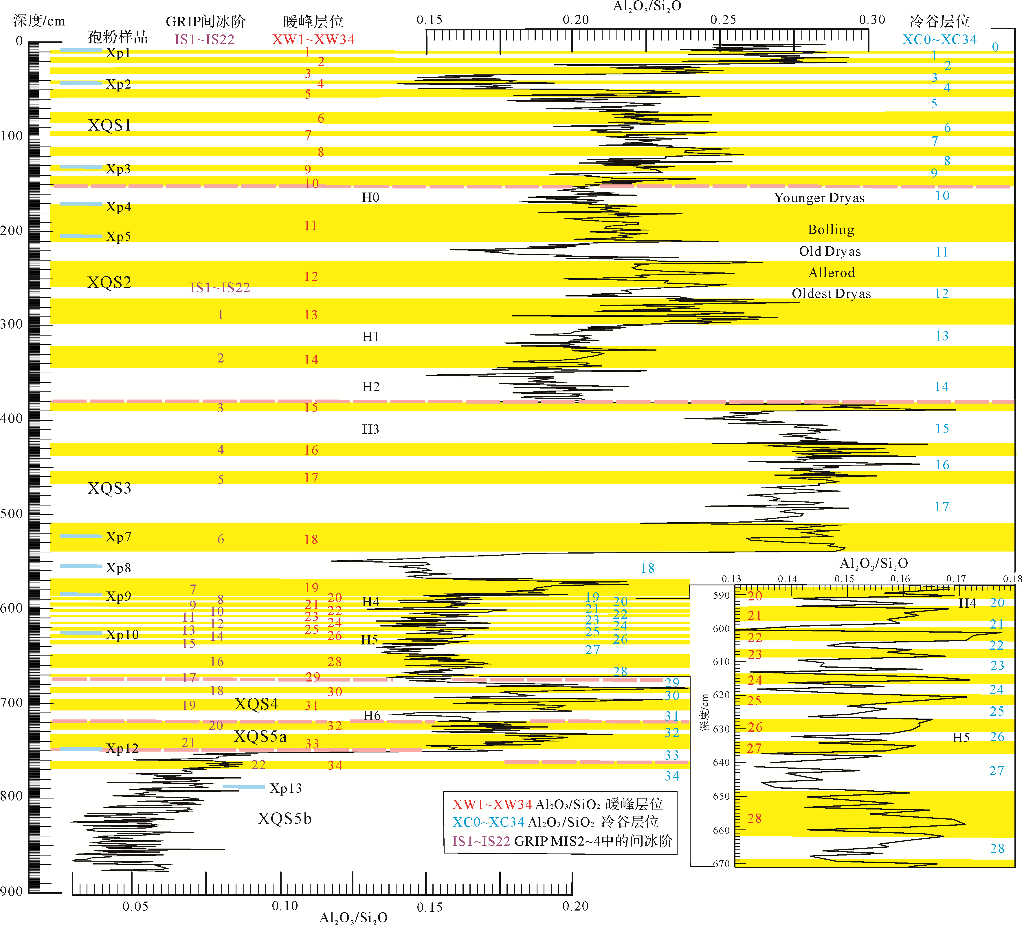
The Xiqiao section located in the southern subtropical zone of China mainly comprises lacustrine facies formed since the Marine Isotope Stage 5b (MIS5b). For 759 samples from the Xiqiao section, analyses of the main element oxides SiO2, Al2O3 and TOFE (Fe2O3+FeO) content and the Al2O3/SiO2 ratio, as climate indicators, found that 34.5 cycles CY0⁃CY34 (CY0 as 0.5 cycle) of fluctuations of the main elements have occurred since MIS5b at an average variability of 3.1 ka/cycle, which represents millennial⁃scale climate change. By means of the relationships between the main elements and changes of climate, and the paleoecology from paleontological evidence (spore and mammalian fossils), it is believed that there is a causal relationship between the climate changes and these element cycles, and it suggests that the study area has experienced 34.5 periods of cold⁃warm millennial⁃scale climate change in the alternation of the East Asian winter and summer monsoons since MIS5b. The study shows that several periods within these cycles since MIS5b correlate well with Dansgaard⁃Oeschger (D⁃O) events in the high latitudes of the northern hemisphere, being basically the same in terms of time and characteristics. This is the first time that high⁃resolution climate fluctuation records of main elements since MIS5b has been discovered in the southern subtropics of China, which suggests that relatively complete D⁃O climate cycles take place in the southern East Asian continent. It also probably indicates that the occurrence, development and evolution of cyclic changes in the East Asian monsoon were once greatly affected by the Western Pacific warm pool (increasing and decreasing temperature and amplitude), in addition to the influence of the variation in the ice volume in the northern hemisphere, during which it affected the low latitudes even more intensely during the summer monsoon period.
2020, 38(6): 1179-1191.
doi: 10.14027/j.issn.1000-0550.2019.121
Abstract:
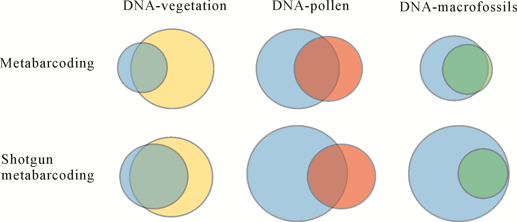
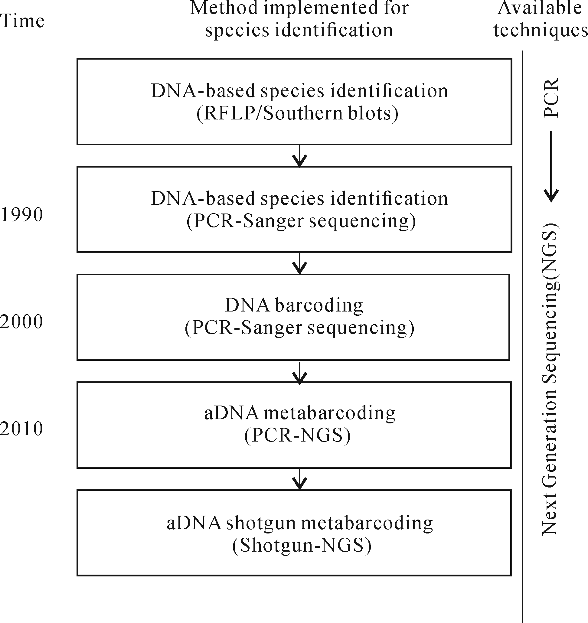
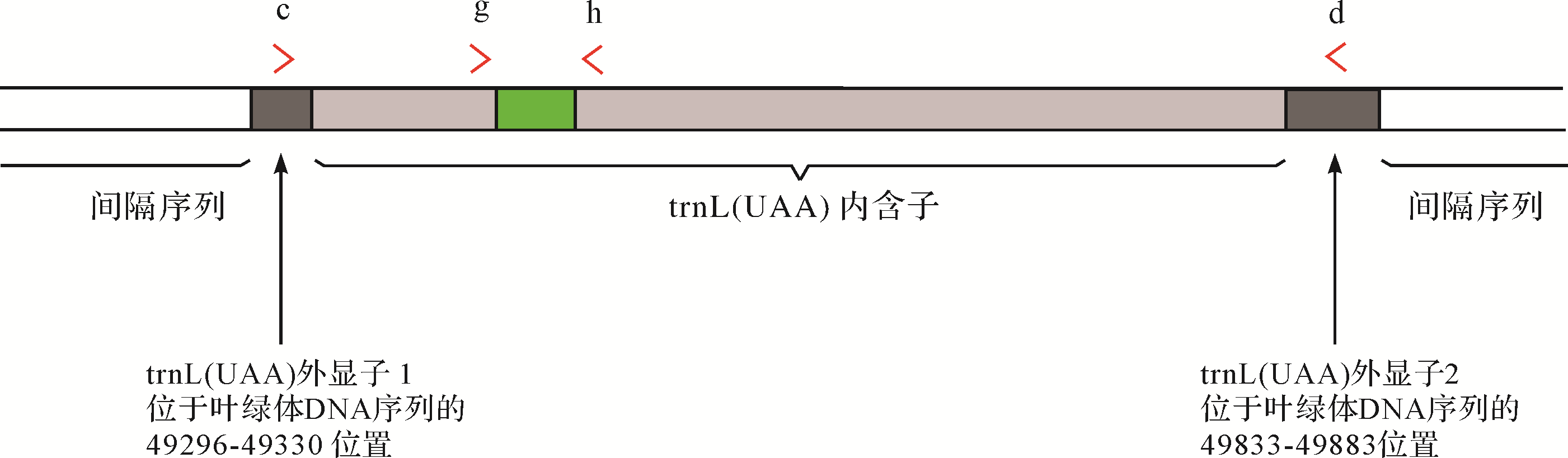
Recent advances in sequencing technologies now permit the analysis of plant DNA from fossil samples and enable the reconstruction of paleovegetation at the molecular level. Some studies have suggested that sediment aDNA from sediments is a powerful tool for the reconstruction of paleovegetation. In this study, the basic theory, cientometric statistics, and the development and application of experimental procedures concerning sediment plant aDNA technology are introduced.It shows that this technology is applicable to the study of paleovegetation by inproving taxonomic resolution and enabling more precise estimations of abundance. Although key questions and challenges remain, the technique will become an important aid in paleovegetation reconstruction in the future.
2020, 38(6): 1192-1203.
doi: 10.14027/j.issn.1000-0550.2019.112
Abstract:
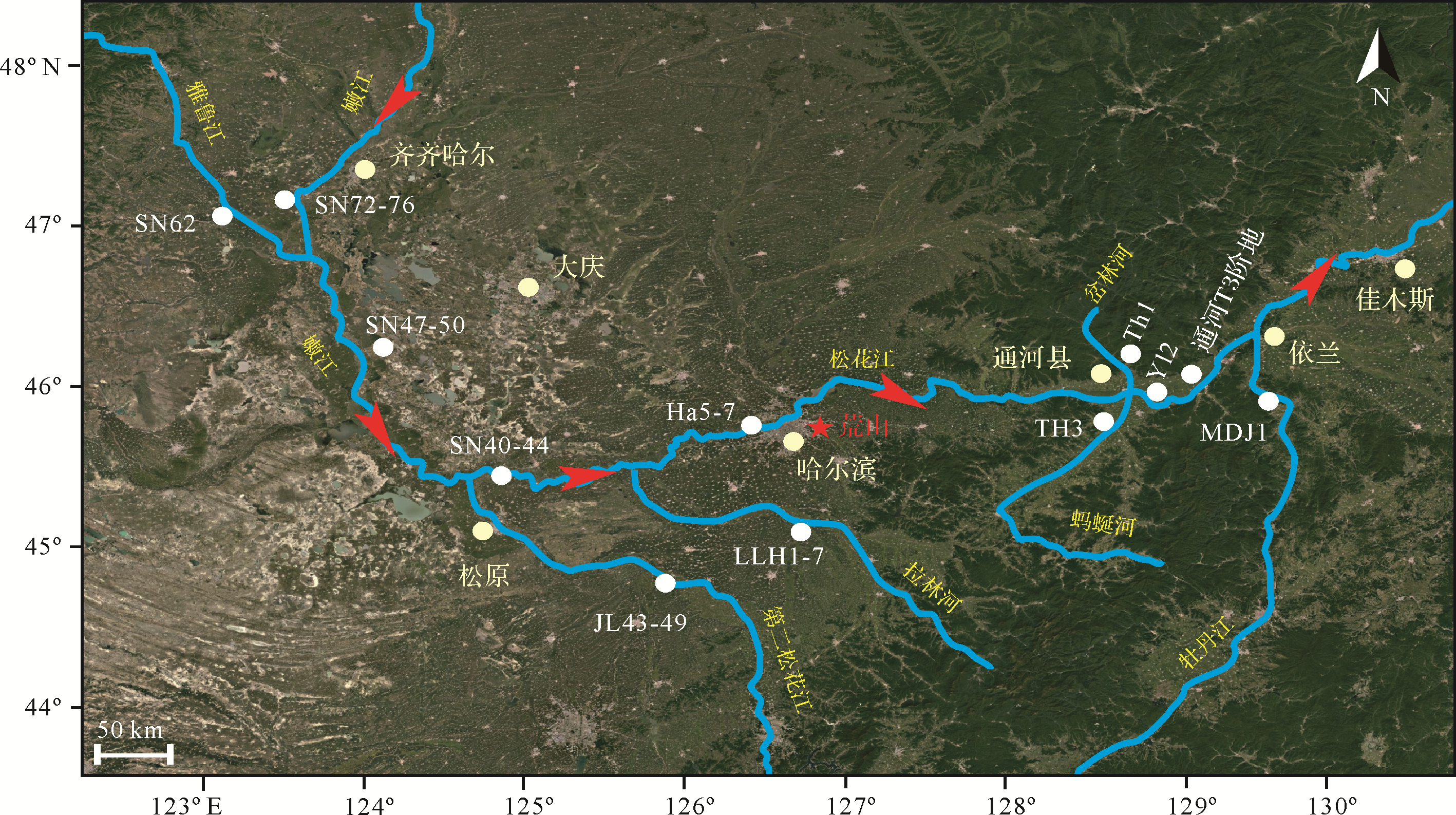
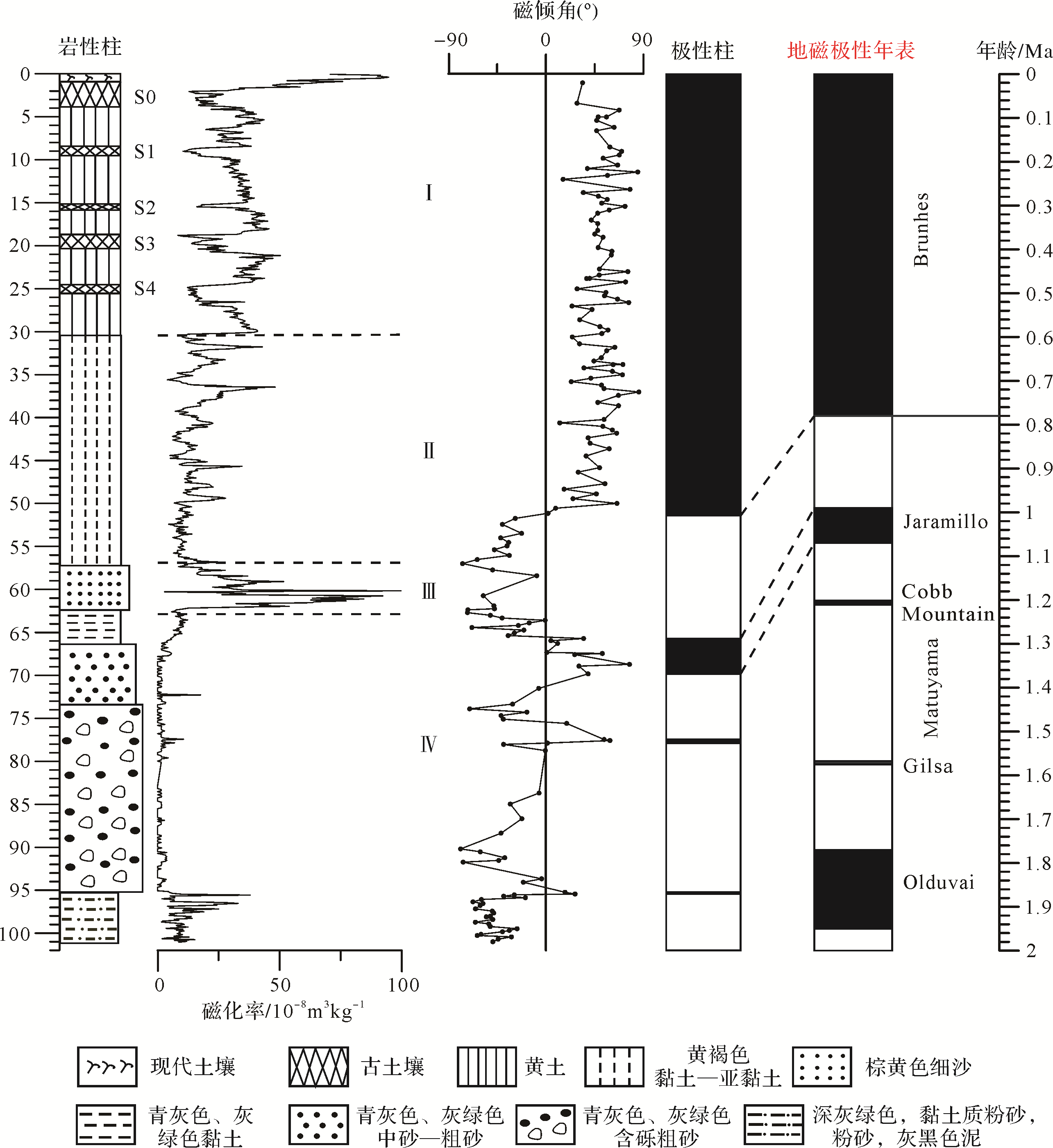
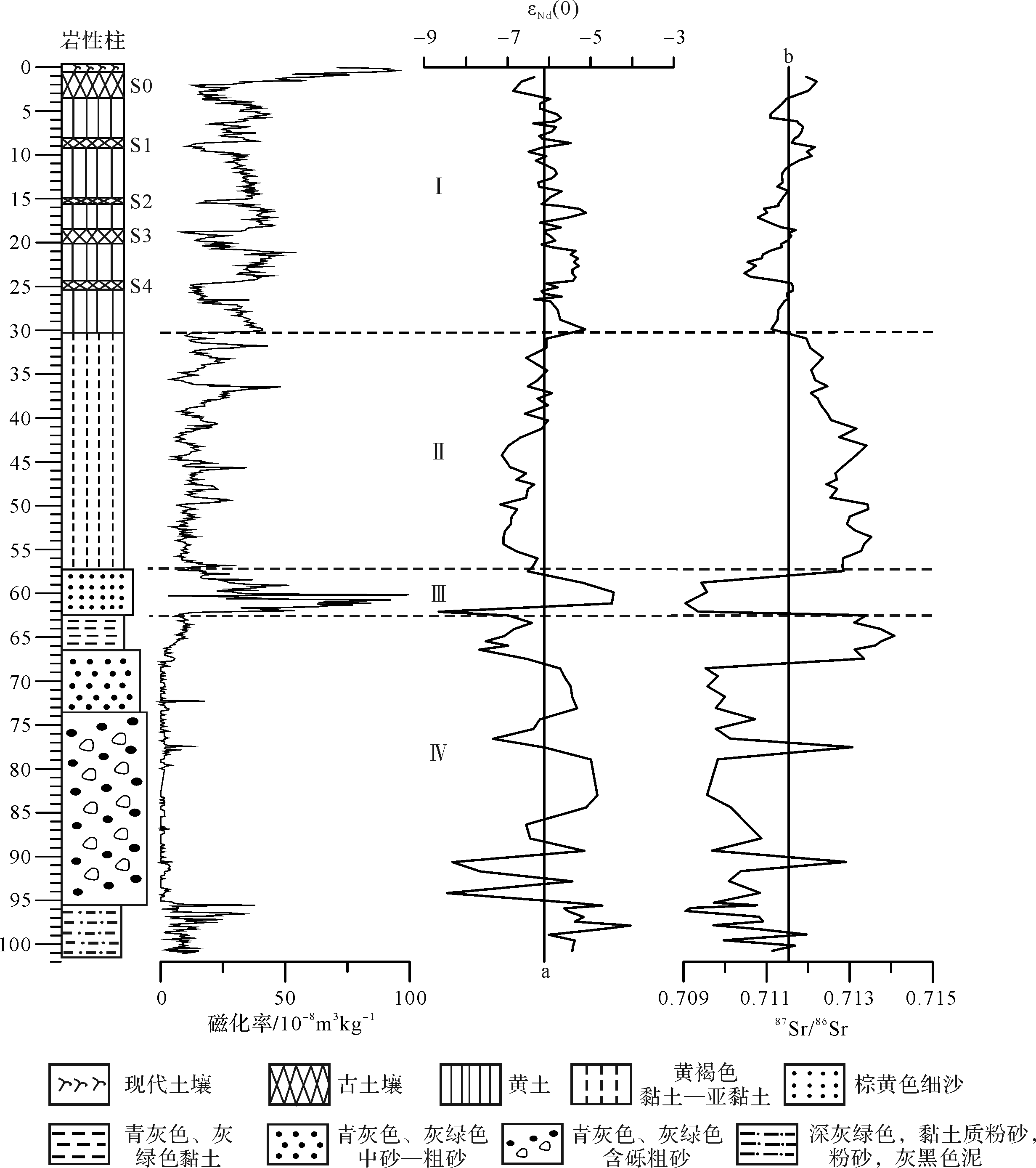
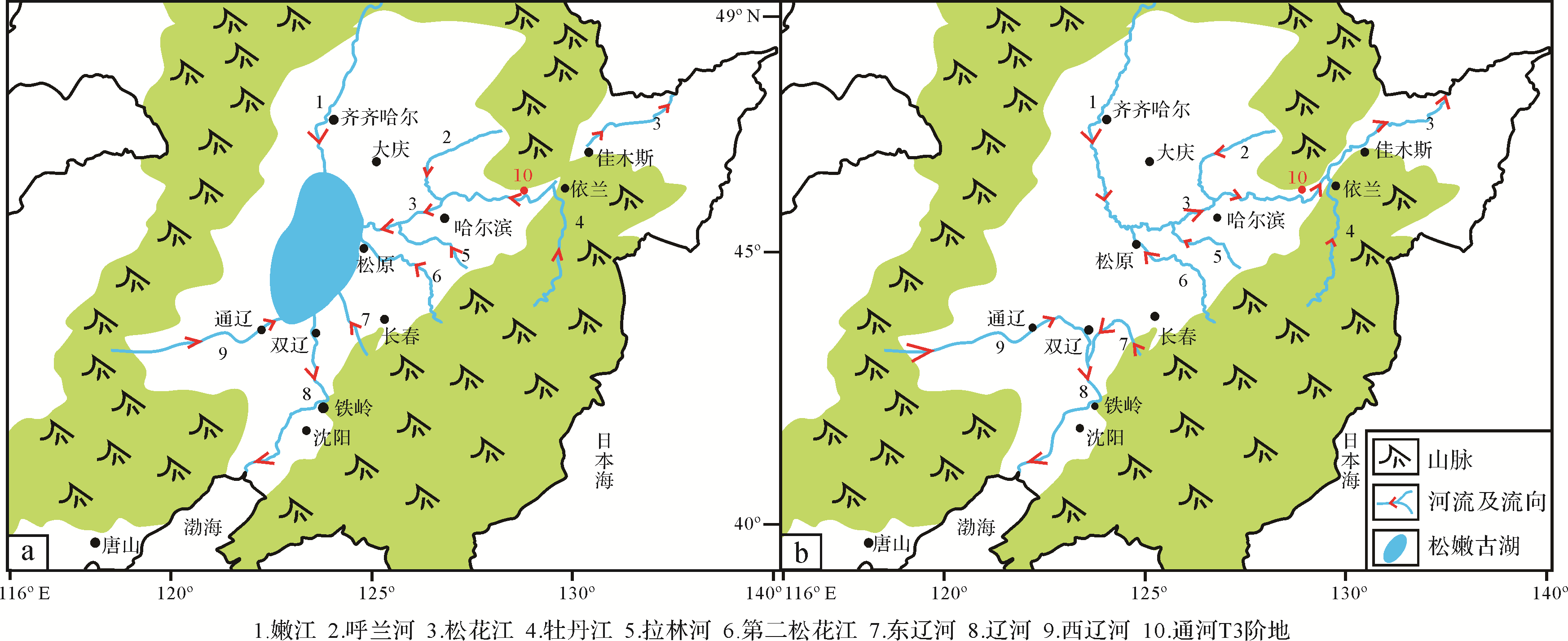
Drainage evolution reconstruction is crucial for understanding global change and the regional response. As the most important river in northeast China, the study of the evolution of the Songhua River system is extremely weak. Whether the water system of the Songhua River reversed in the early Pleistocene has been especially controversial and without clear evidence. As a direct product of river geological processes, sediment is the most direct evidence of the water system evolution. Located in the east Songnen Plain and the middle reaches of the Songhua River, Harbin has an arid⁃semiarid temperate continental climate. Located in the eastern suburb of Tuanjie town, Daowai district, Harbin city, the Huangshan (HS) belongs to the second⁃order terrace on the right bank of the Songhua River geomorphology The evolution information of its sediment provenance can provide direct evidence for the study of the formation and evolution of the Songhua River, especially for the inversion of the Songhua River system. Therefore, magnetic susceptibility, paleomagnetic, and Sr⁃Nd isotope composition analysis of sediments from boreholes core in the HS are performed. The results showed that the magnetic susceptibility and Sr⁃Nd isotope characteristics of the upper and lower strata at a core depth of 62.3 m were significantly different. The magnetic susceptibility of the strata below 62.3 m is extremely low, and 0 value appears many times with only a small variation in range. The Sr⁃Nd isotope composition differ sharply above and below the mean value of the core. However, the magnetic susceptibility of the strata above 62.3 m increased sharply, and showed periodic high and low changes. And the isotopic composition of Sr⁃Nd varied slightly. Through the comparison with the Nd isotope composition of the upper and lower strata of 62.3 m in the rock core of Huangshan Mountain, we observe that the Nd isotope characteristics of the strata below 62.3 m are similar to those of the modern river system in the direction of Yilan⁃Tonghe. The Nd isotope characteristics of the Nenjiang River, second Songhua River, Lalin River, and Kule River systems are similar to those of the 62.3 m above. It indicates that the river direction in the middle and upper reaches of the Songhua River (Zhaoyuan⁃Yilan reach) was reversed in the late early Pleistocene.To summarize, the following evolution model of the Songhua River system is proposed: In the early and middle early Pleistocene, the upper and lower reaches of Songhua River were not connected. Bounded by the Jiayi (Jiamusi⁃Yilan) watershed, the lower reaches of the Songhua River flow eastward through the Sanjiang Plain, while the upper reaches of the Songhua River flow westward into the Songnen Lake basin. In the late early Pleistocene, due to the combined effect of tectonic⁃climate change, the Sanjiang and Songnen Plains continued to decline, while the Jiayi watershed continued to rise, leading to the erosion of rivers on both sides of the watershed to the source. At the same time, affected by 0.9 Ma in the Pleistocene climate transformation, headward erosion at 0.94 Ma B.P., the watershed is cut to wear. The Songhua River shelter⁃forest system was captured by the downstream drainage and began to reverse the Songhua River shelter⁃forest and downstream, the Songhua River shelter⁃forest river from west to east through better in canyon in Sanjiang plain, and the Songhua River shelter⁃forest and downstream river, thus linking modern Songhua River water system gradually established.

2020, 38(6): 1204-1214.
doi: 10.14027/j.issn.1000-0550.2020.002
Abstract:
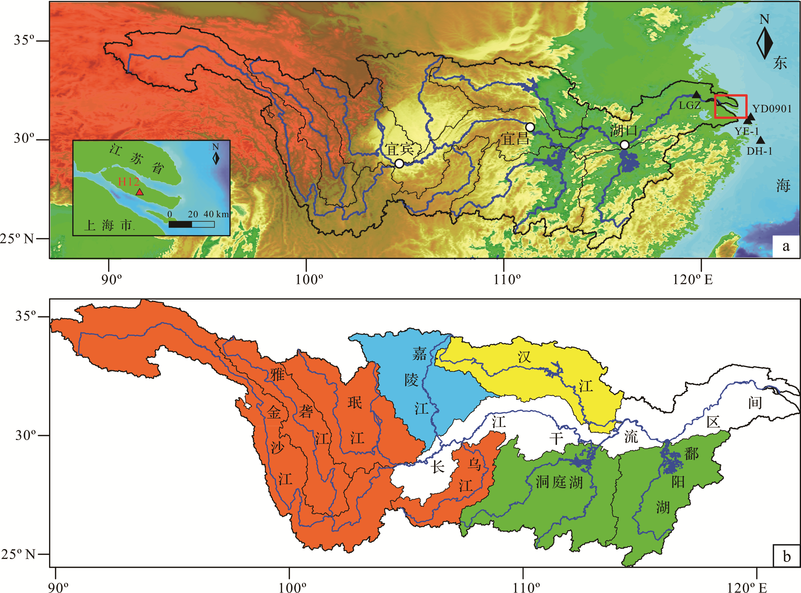
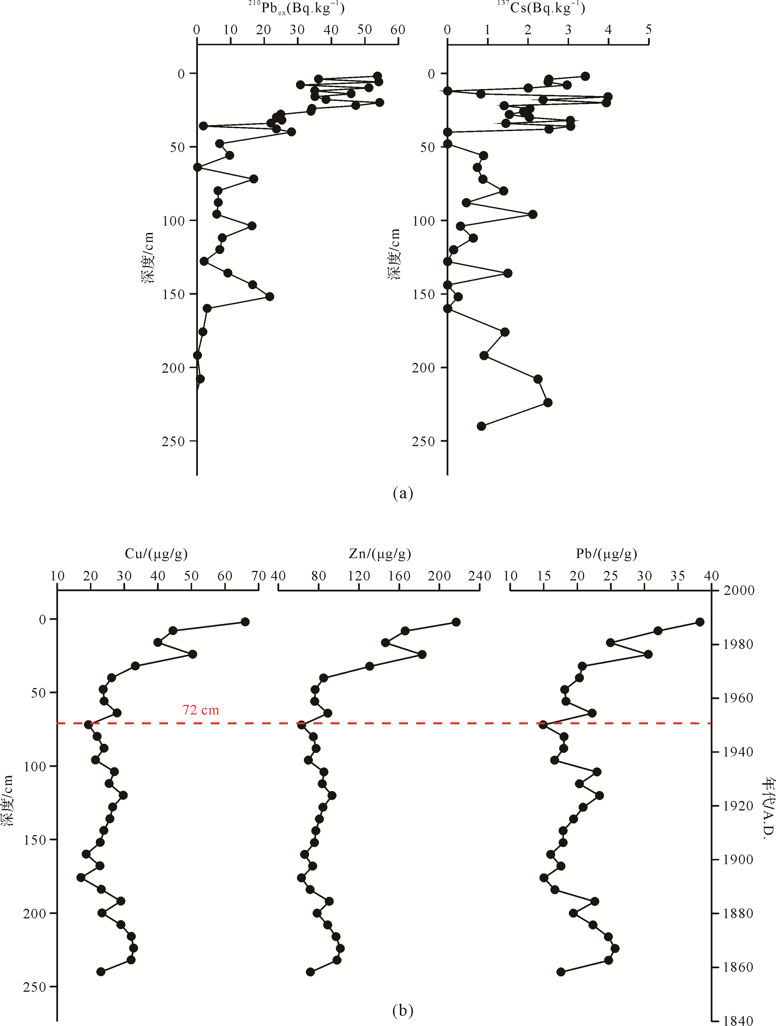
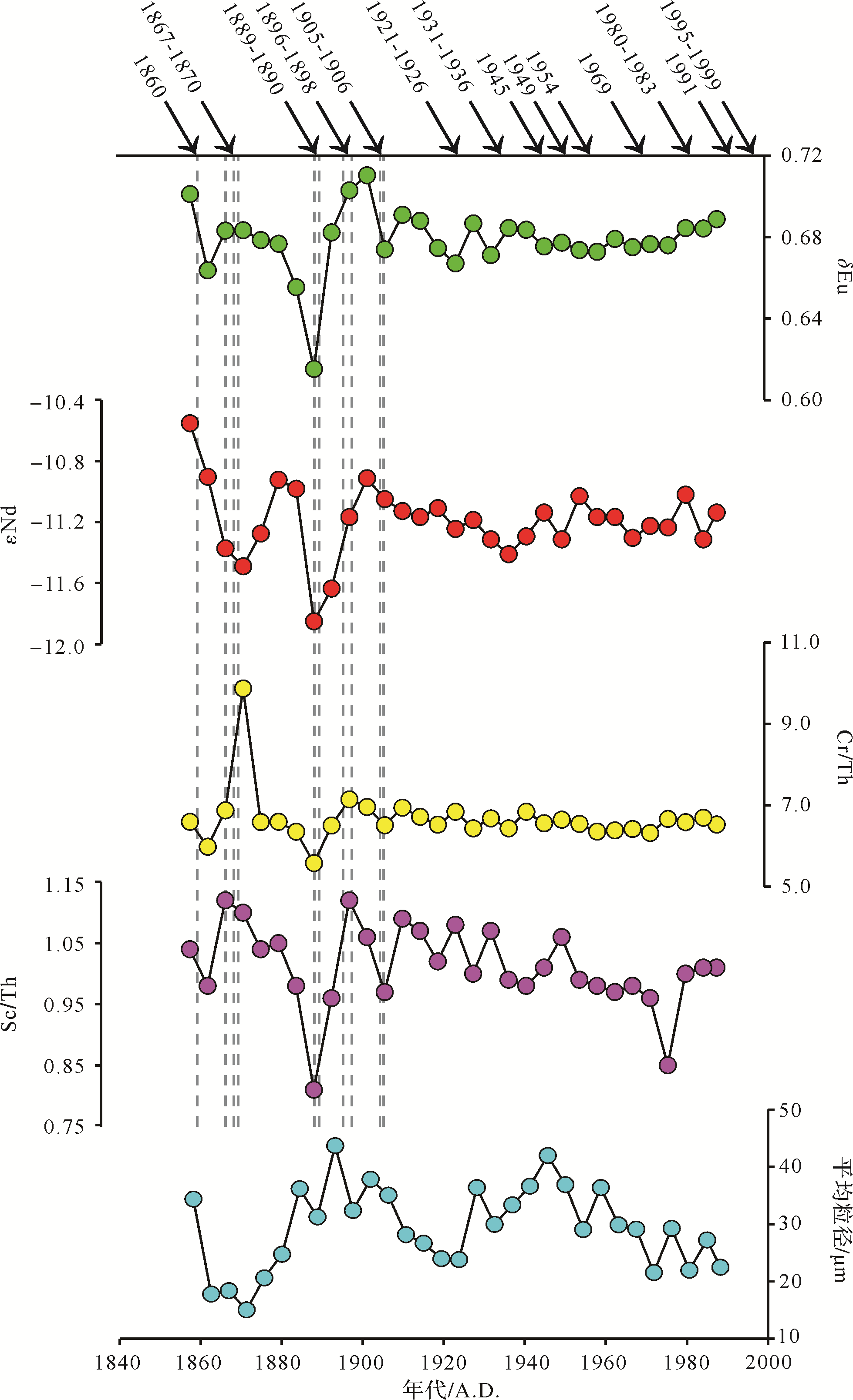
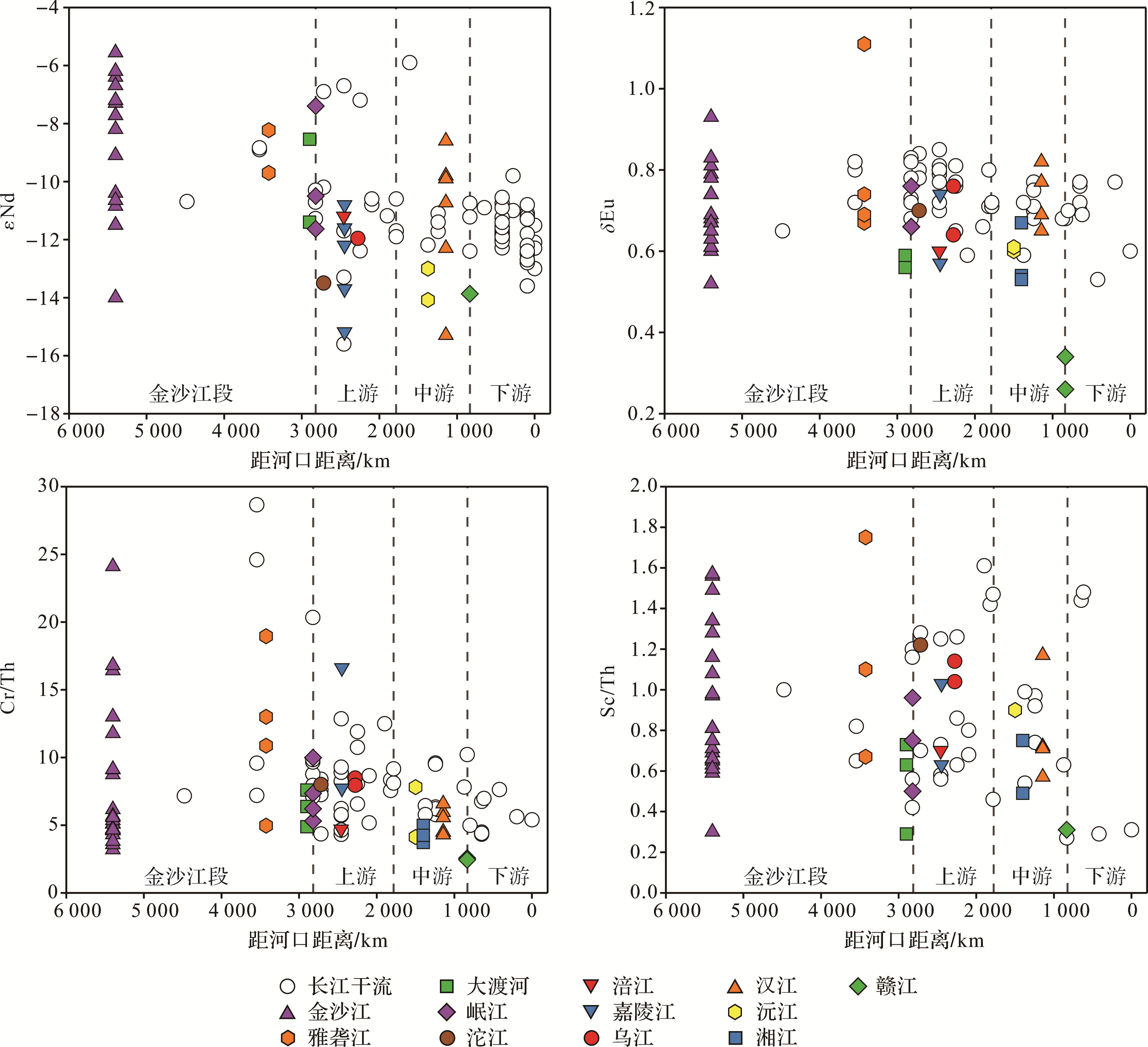
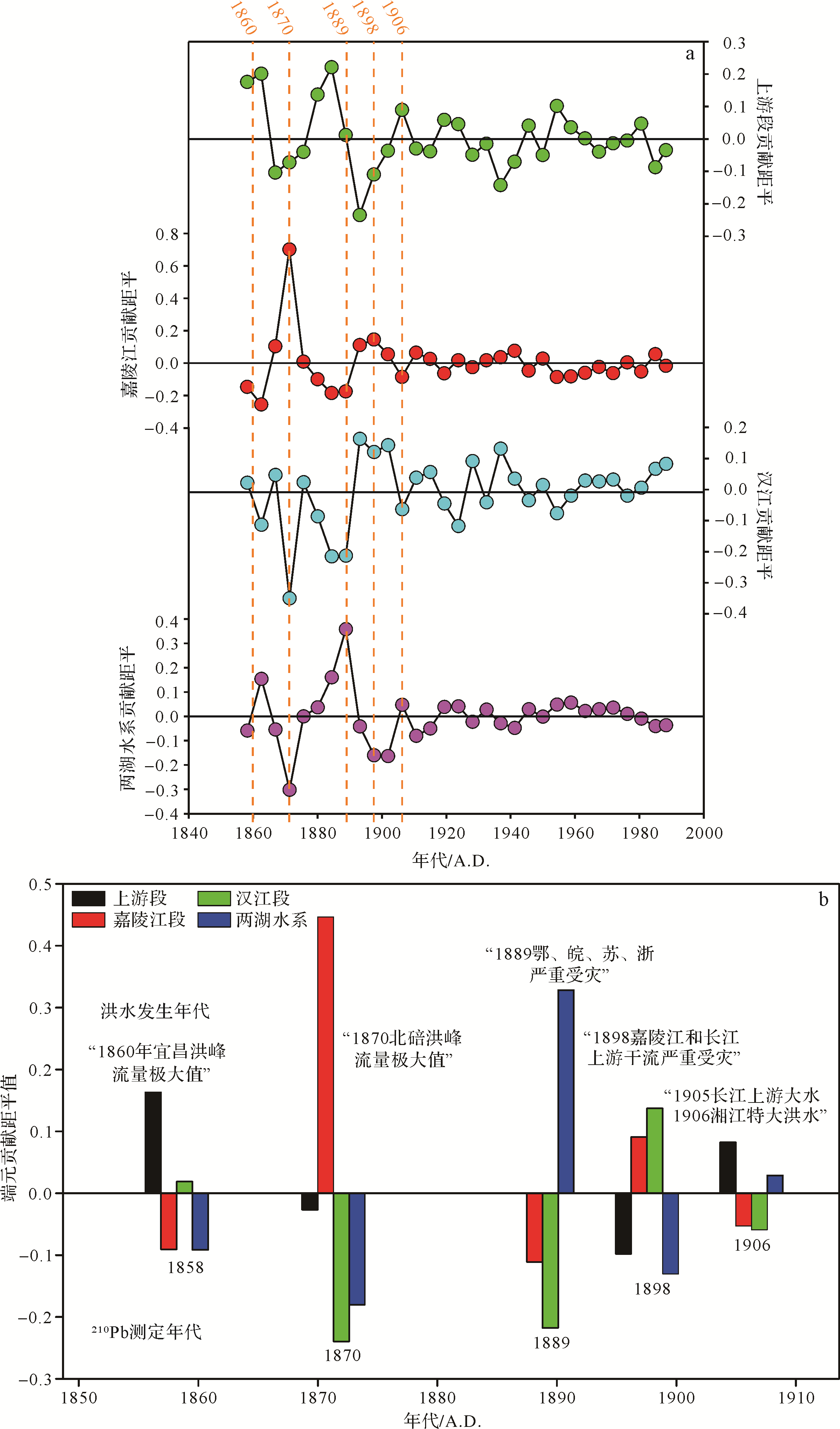
As part of the “sediment source to sink” study, the provenance of sediment in East Asian marginal seas is of great importance, thus making the provenance of Changjiang sediment over different timescales one of the critical research issues. Trace elements and neodymium isotopes were analyzed on a 2.45 m⁃long sediment core at Chongming Island. Proven provenance indicators widely used to determine the sediment sources from the river catchment, εNd, Eu anomaly (δEu), Cr/Th and Sc/Th displayed distinct variations in the Changjiang catchment between the years 1858 and 1906, then became steady between 1906 and 1988. Combined data from previous studies suggested dividing the sediment source into four end⁃members, rather than upper and middle/lower catchment as previously. The four proposed end⁃members are (1) the Dongting and Poyang Lakes and their connected tributaries; (2) Han River; (3) Jialing River; and (4) the other tributaries in the upper catchment areas. A linear mixing model was used to quantify the contribution from each of the end⁃members. The result reveals that the other tributaries in the upper catchment and Hanjiang made a significant sediment contribution between 1858 and 1988, which corresponds well to flood events in 1858⁃1906. The steady source provenance since 1906 is attributed to anthropogenic changes on Chongming Island: for instance, dam construction, which has averted sediment deposition during the flood season and thus eradicated the provenance discrepancy promoted by the flood events.
2020, 38(6): 1215-1225.
doi: 10.14027/j.issn.1000-0550.2019.119
Abstract:
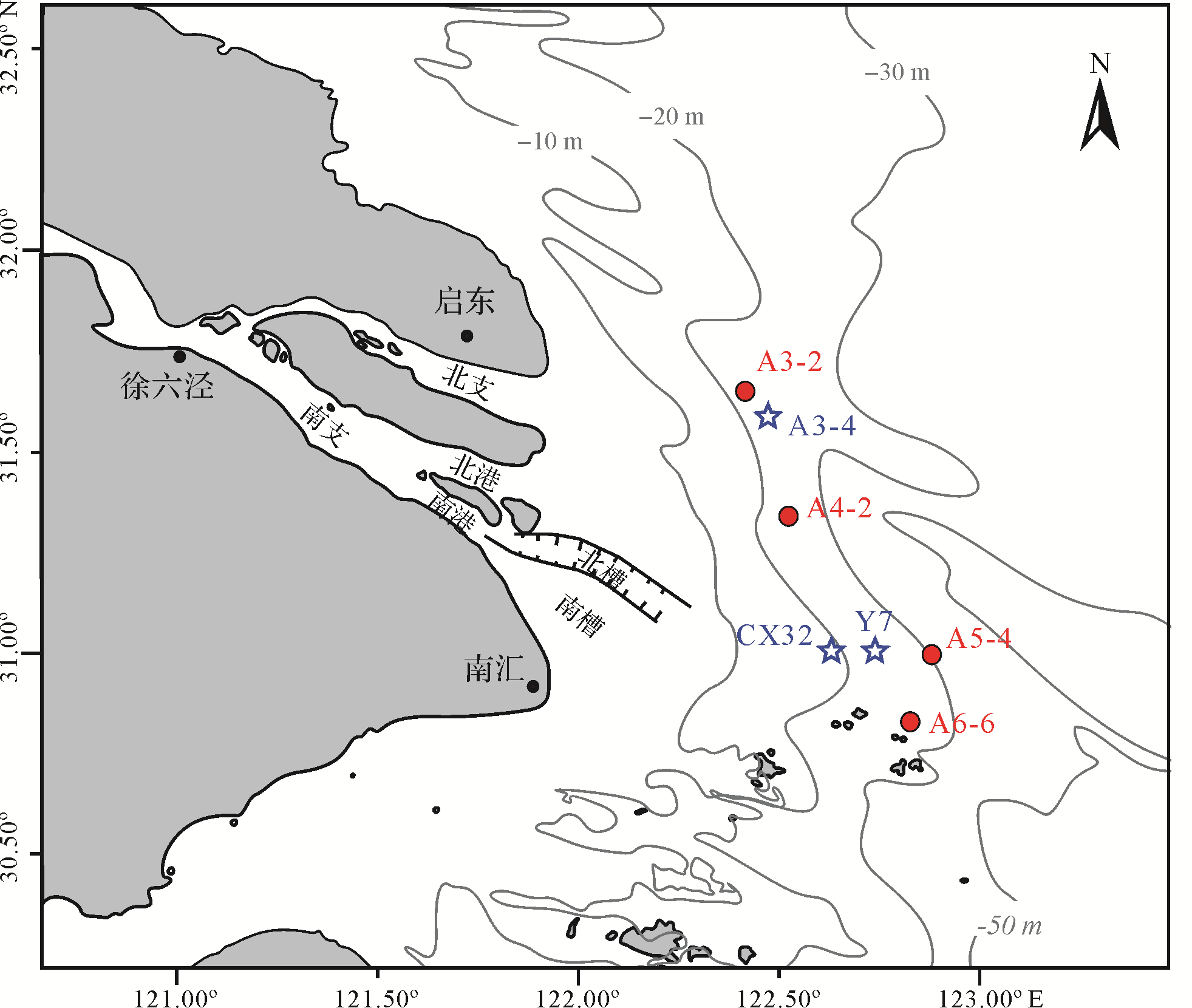
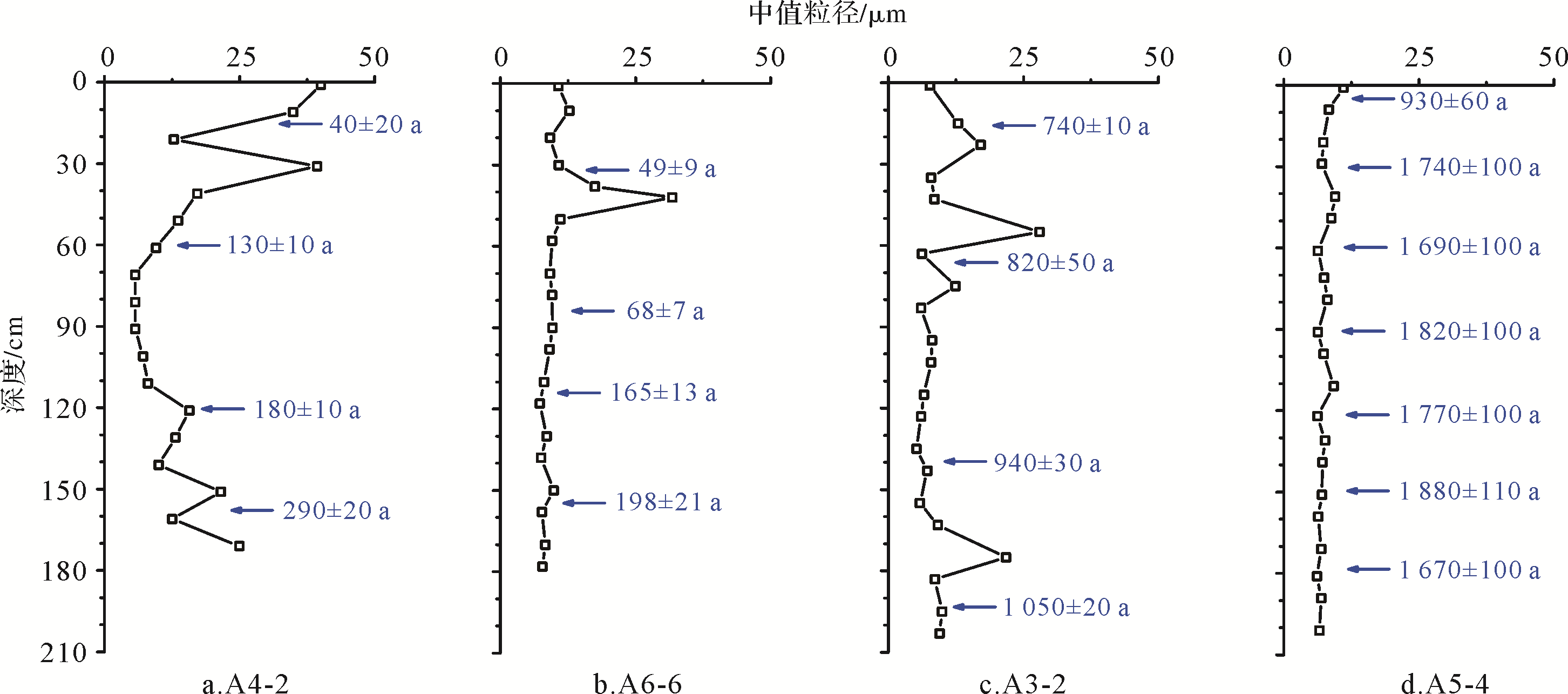
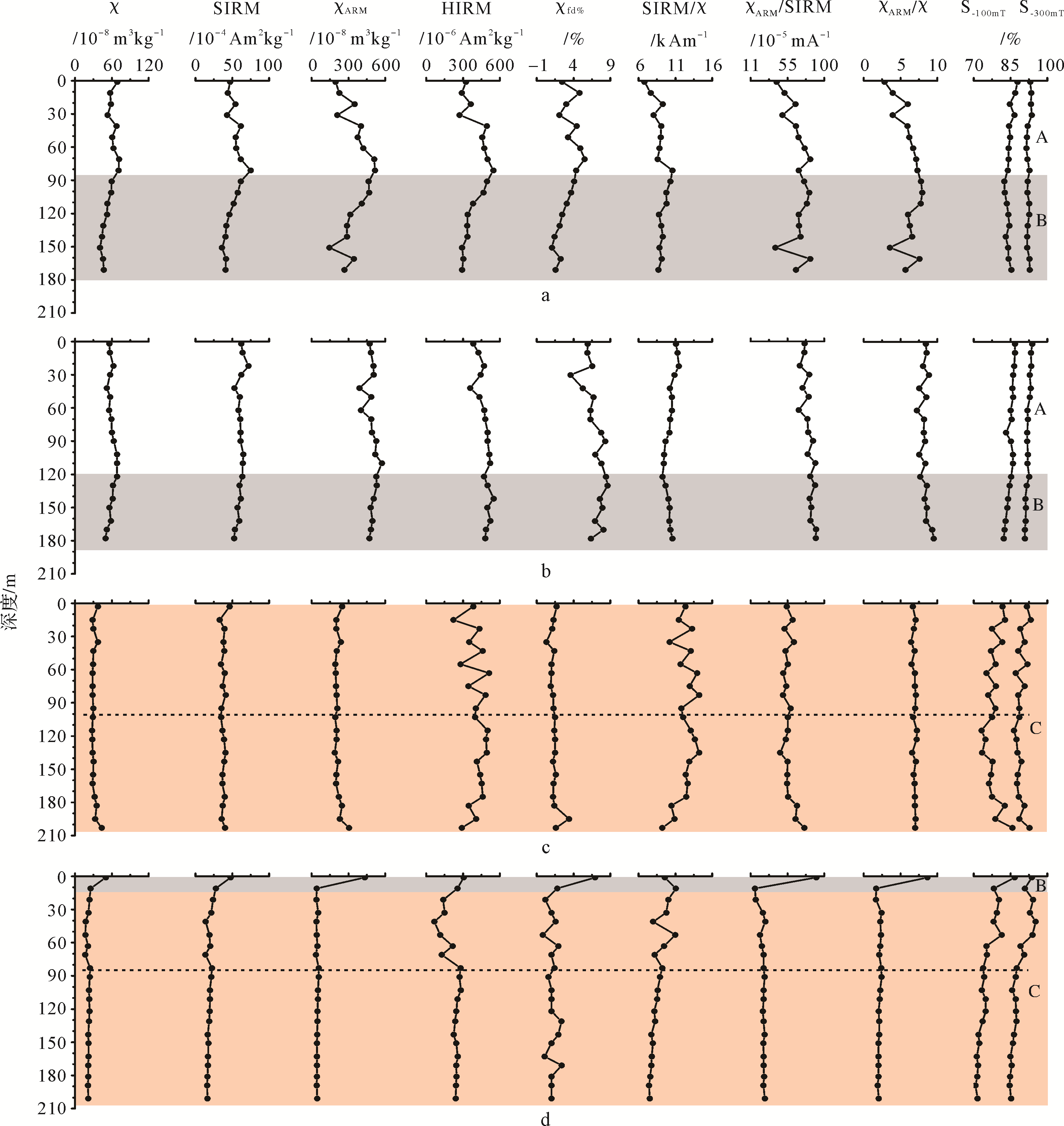
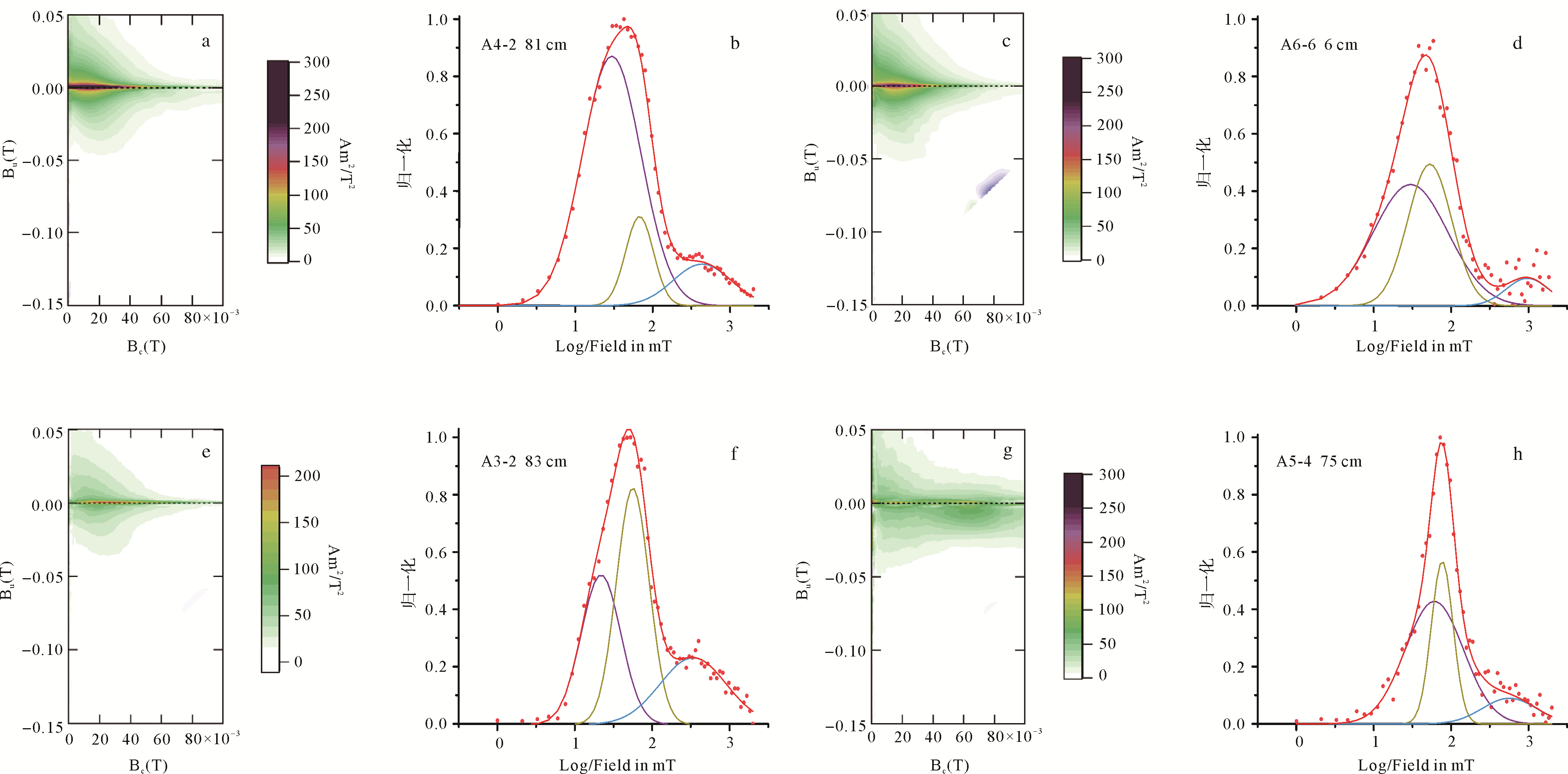
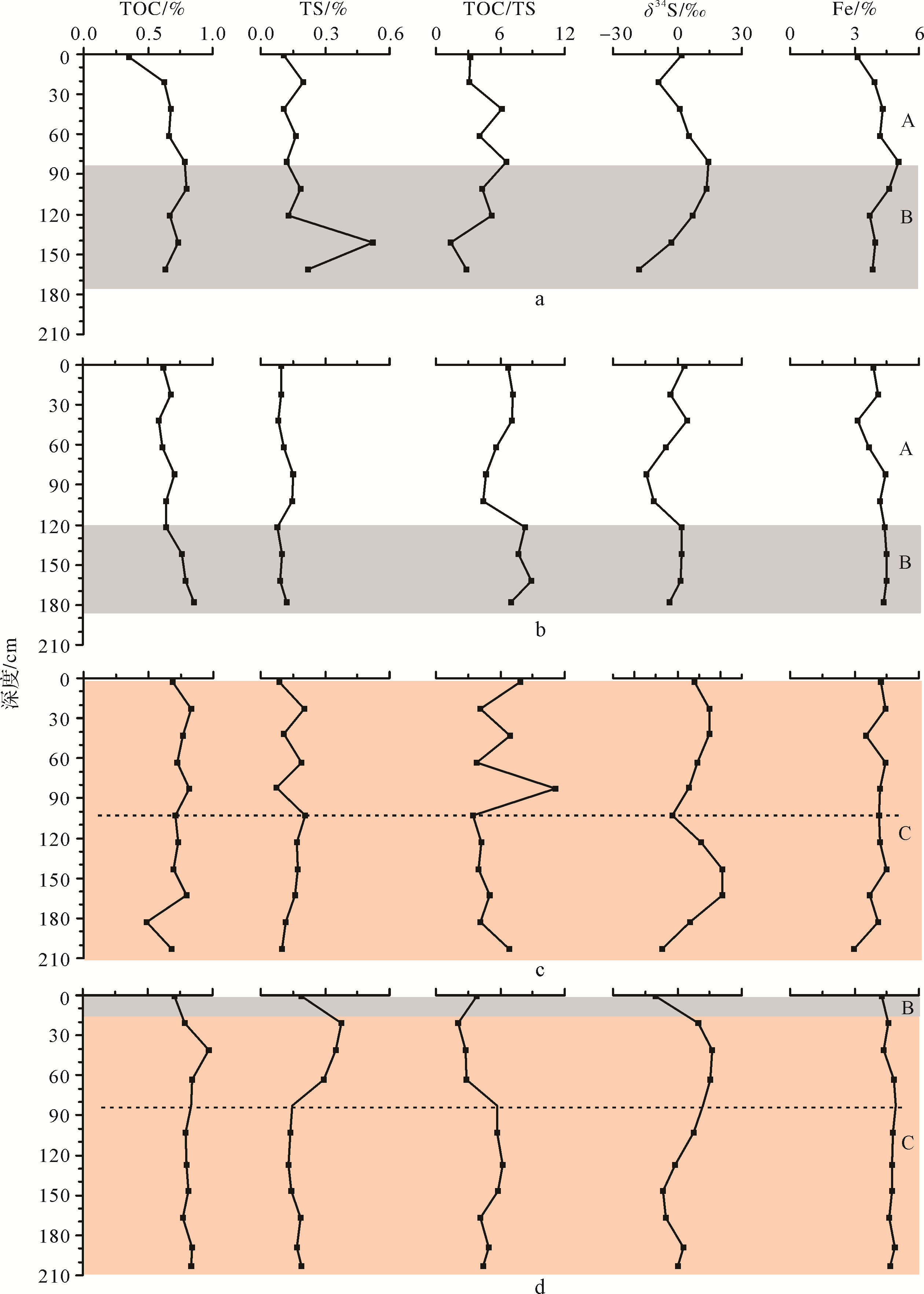
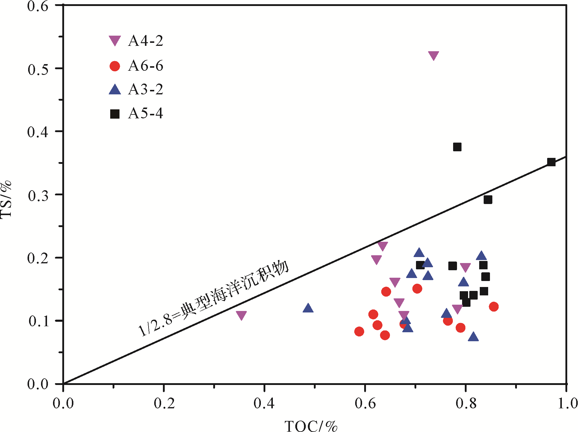
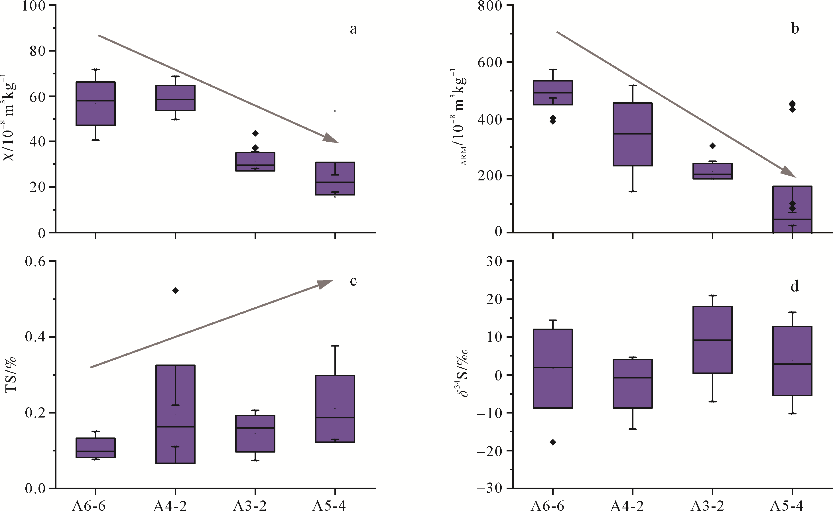
Delta deposits show great spatial heterogeneity in erosion and depositional patterns. Magnetic properties of sediments are sensitive to the sediment source, hydrodynamics, and early diagenesis and, therefore, can indicate spatial heterogeneity in an efficient way. In this paper, four cores (ca. 2 m in length) from the subaqueous Yangtze River Delta were subjected to environmental magnetic, organic carbon, and sulfur analyses. In combination with particle size analysis and dating results, this paper discusses the spatial variations of magnetic properties and their implications for indicating erosion/deposition patterns. Our results show that hydrodynamic sorting plays an important role in the magnetic property variations. In general, ferromagnetic minerals are enriched in fine⁃grained sediments in young deposits (<350 a), resulting in higher magnetic susceptibility (χ). The Yangtze River subaqueous delta deposits exhibit a weaker sulfate reduction, as revealed by carbon, sulfur, and sulfur isotope characteristics. Such a feature is similar to that reported from Amazon delta deposits. Sediment age and sedimentation rate affect the degree of diagenetic alteration, and therefore, the spatial and temporal variations of magnetic properties. Cores distant from the modern depo⁃center show a greater diagenetic alteration of magnetic properties. Magnitude of χ, diagenetic zonation of χ, and the depth of the ferruginous to sulfidic boundary can reflect the spatial pattern of erosion and deposition in deltaic deposits.
2020, 38(6): 1226-1238.
doi: 10.14027/j.issn.1000-0550.2019.118
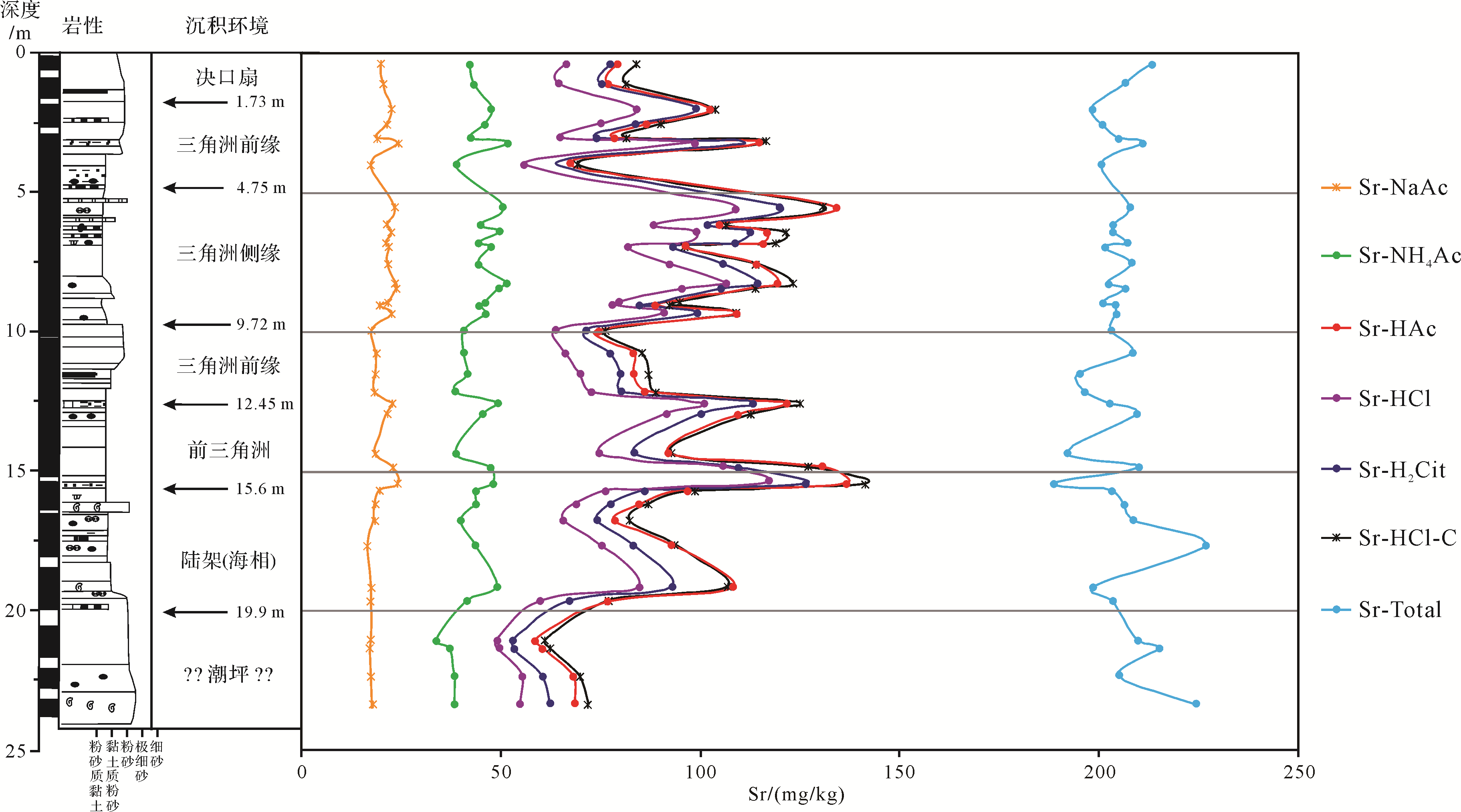
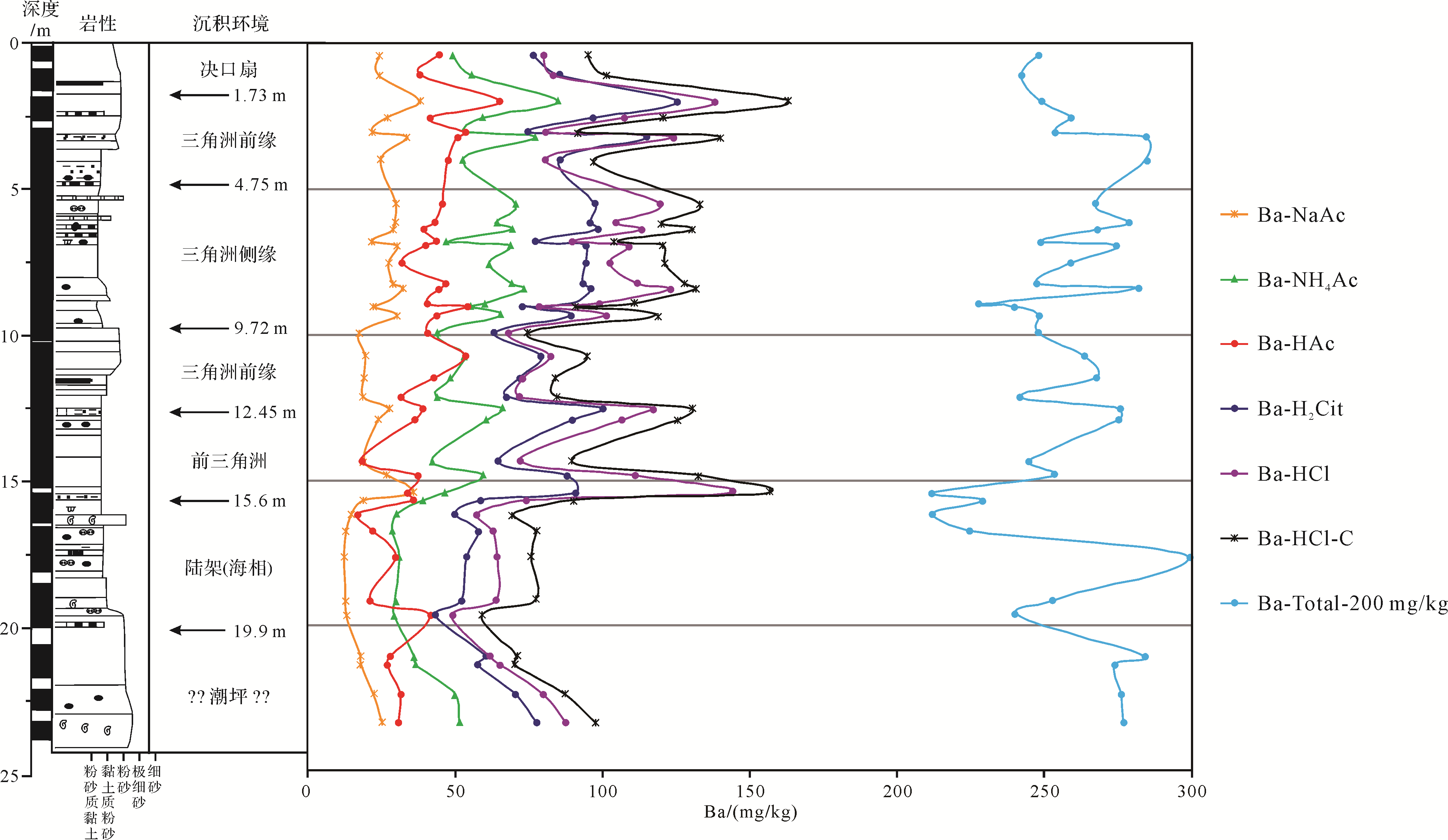
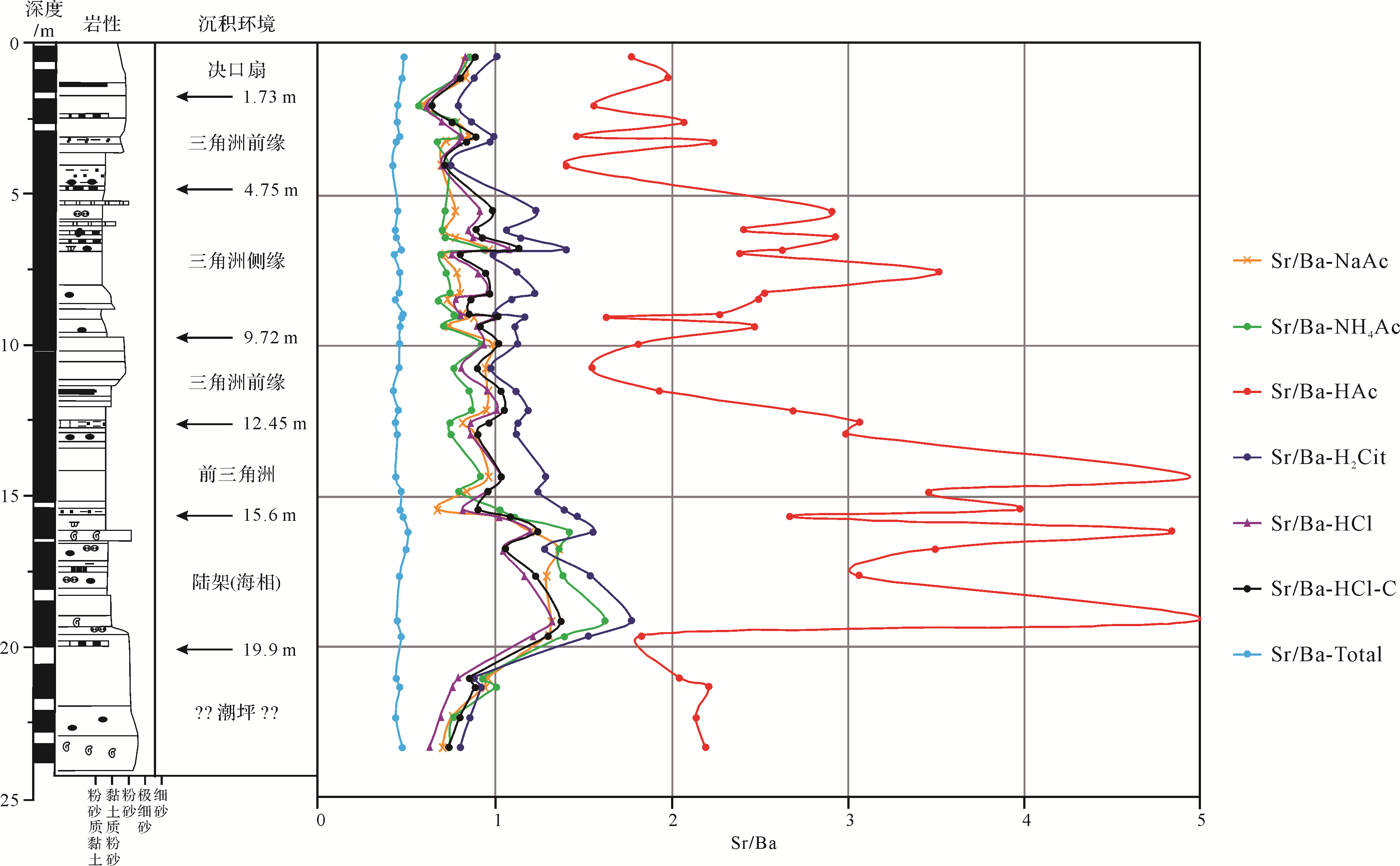
Abstract:
The ratio of Sr/Ba is a commonly used methods for the distinction between terrestrial and marine sedimentary environments. "The Sr/Ba Ratio is less than 1.0 for terrestrial sedimentary environments and more than 1.0 for marine sedimentary environments" widely exists in various related textbooks and books. However, the traditional total Sr/Ba ratio of borehole sediments in the Yellow River Delta is between 0.45 and 0.5, which cannot be distinguished between marine and terrestrial sedimentary environments. The result of selective extraction for borehole samples from the Yellow River Delta shows that more than 75% of the total barium and more than 50% of the total strontium in the whole sample occur in terrigenous clastic minerals unrelated to the marine and terrestrial geochemical environment at the time of deposition, which should be excluded when we distinguish between the marine and terrestrial sedimentary environments. The results of different selective extraction methods show that strontium in the sediments of the Yellow River Delta is mainly exchangeable and carbonate, except for clastic silicate minerals, and its occurrence mode form is relatively single, while barium is complex, except for the clastic silicate minerals. The ratio of Sr/Ba mainly extracted is exchangeable by the sodium acetate method and ammonium acetate method, and the ratio of Sr/Ba mainly extracted is exchangeable and bound to carbonates by the citric acid method, dilute hydrochloric acid method, and complexing agent + dilute hydrochloric acid method, which can better distinguish between the marine and terrestrial sedimentary environments of the Yellow River Delta, as the high calcium carbonate from the source of the Yellow River and acetic acid cannot extract barite. The results from dilute acetic acid extraction in sediments are characterized by high strontium and low barium content, which leads to a high Sr/Ba ratio. Although the Sr/Ba ratio is greater than 1.0, the sensitivity of the Sr/Ba ratio by dilute acetic acid extraction to the salinity environment during deposition is greater than that of other selective extraction methods. The selective extraction method is the only effective method to solve the problem that the discrimination effect is not good enough to distinguish between marine and terrestrial sedimentary environments using the ratio of Sr/Ba.
2020, 38(6): 1239-1248.
doi: 10.14027/j.issn.1000-0550.2020.009
Abstract:
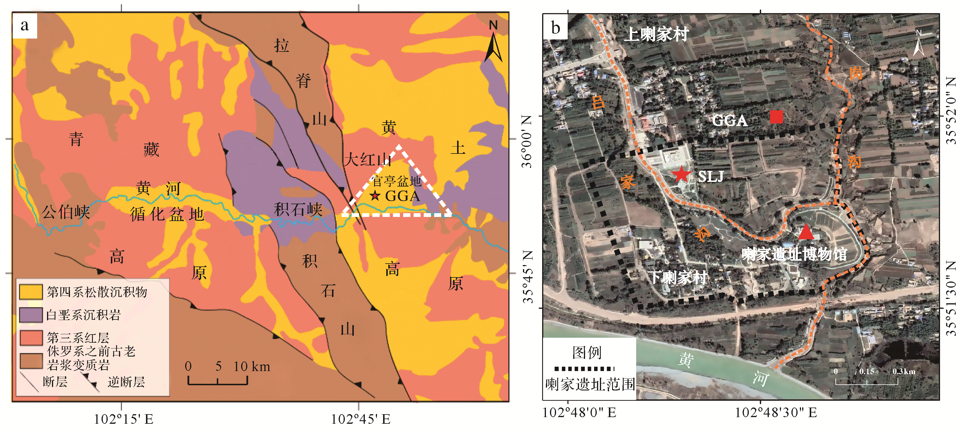
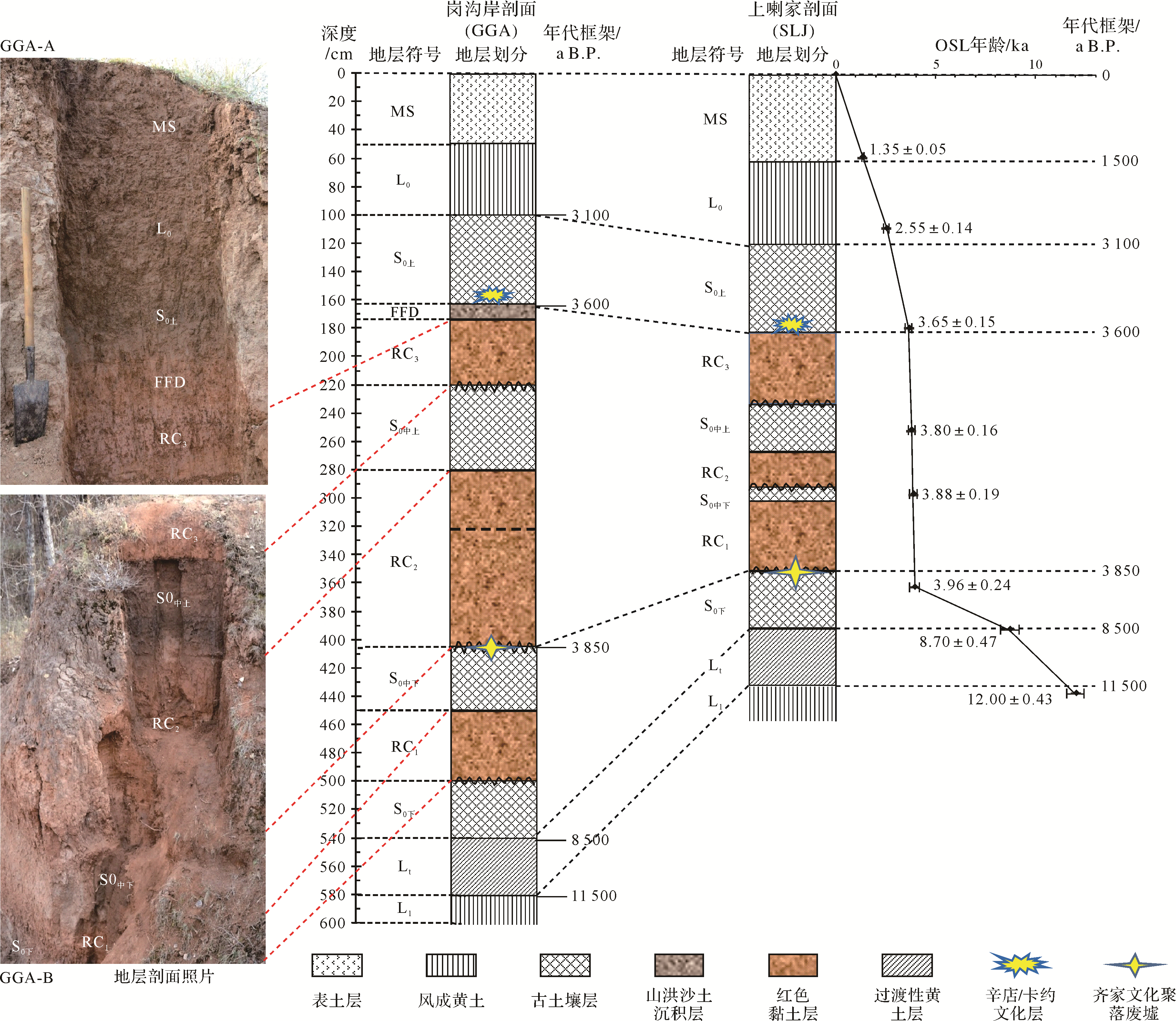
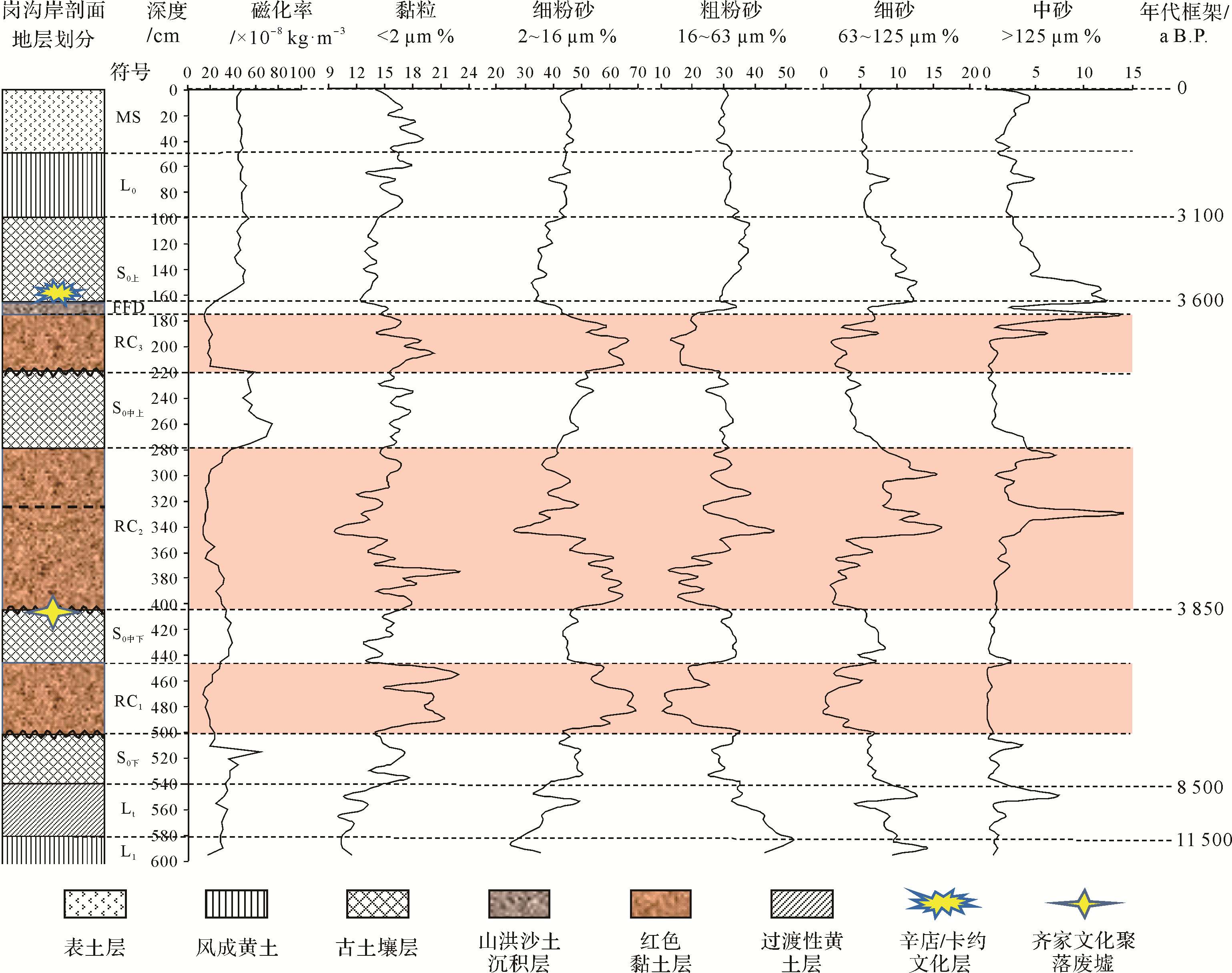
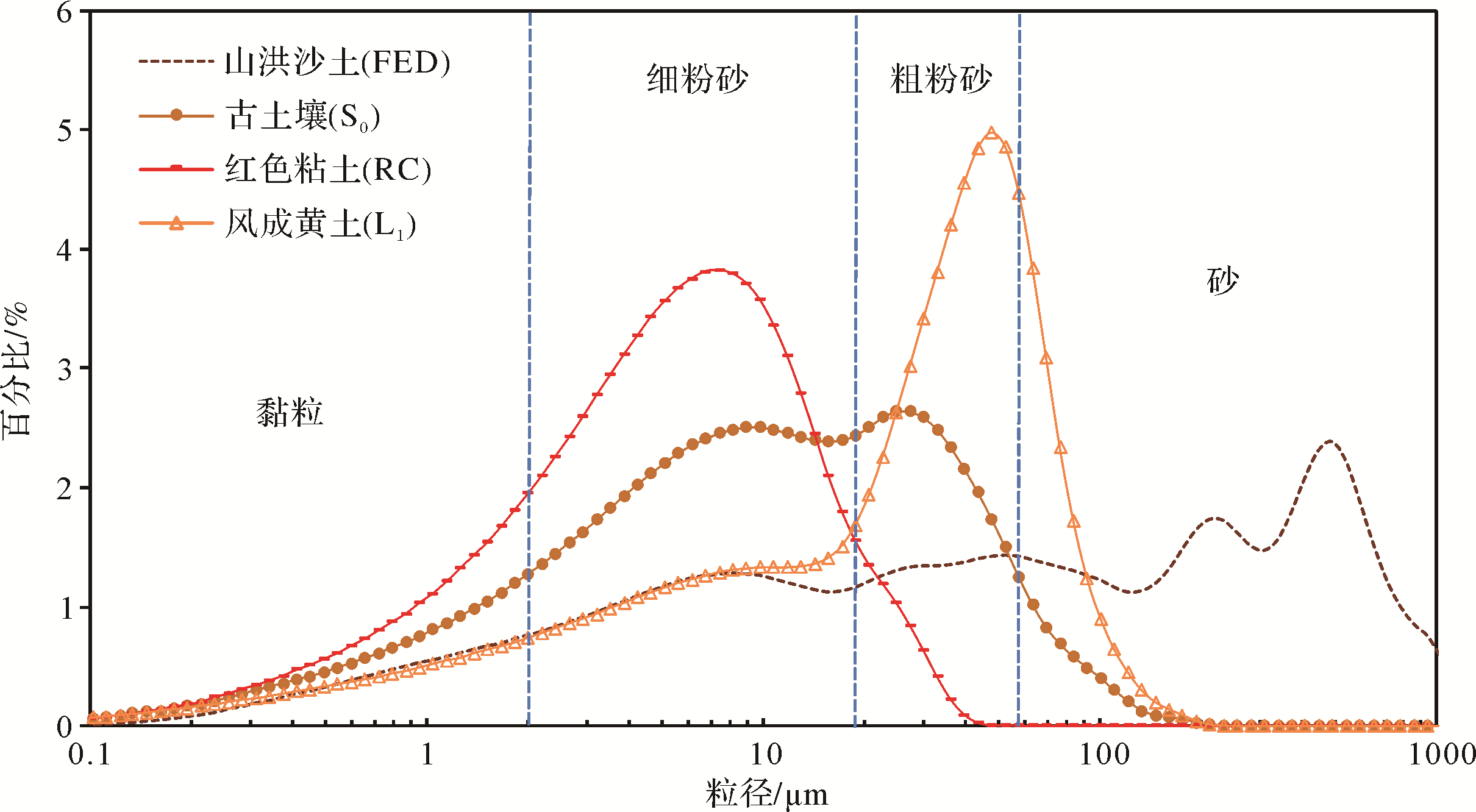
One of the main focuses of research in the field of prehistoric environmental change and civilization evolution in China is the prehistoric calamities that occurred in the area of the Lajia Ruins in the Guanting Basin along the Upper Yellow River, between the Qinghai⁃Tibet Plateau and the Loess Plateau. Sediment deposition relationships were studied across the Guanting Basin by detailed field observations and sedimentological and stratigraphic analysis. It was established that the sequence of Holocene aeolian loess paleosols is basically the same in the central and eastern parts of the Loess Plateau. A complete and continuous stratigraphic section was discovered on the western bank of the Ganggou Gully, at the northeastern corner of the Lajia Ruins. Three layers of red clay mudflow sediment (RC1/RC2/RC3) within the paleosol (S0) were formed over the Guanting Basin and surrounding areas, mainly due to disastrous climatic decline in the middle and late Holocene. Multiple flash floods and mudflows transported a large amount of loose material from the Tertiary gully to the Guanting Basin. Large⁃scale flash flooding and mudflows frequently overflowed into the shallow region of the gully at the front of an ancient alluvial fan and were spread and deposited over the Yellow River terrace, destroying the prehistoric settlement of the Qijia people (the Lajia Ruins) located in the low⁃lying area. Moreover, dense particles of charcoal in the middle and lower parts of the red clay mudflow (RC2) indicate a significant fire at 3 850 a B.P. in the Guanting Basin, at which time a great earthquake and flash flooding and mudflows occurred. This study established a pedostratigraphic sequence at the periphery of the Guanting Basin and analyzed the causes of the events. It is of scientific importance, and reveals the evolution of human⁃land interconnection in the region in prehistoric times.

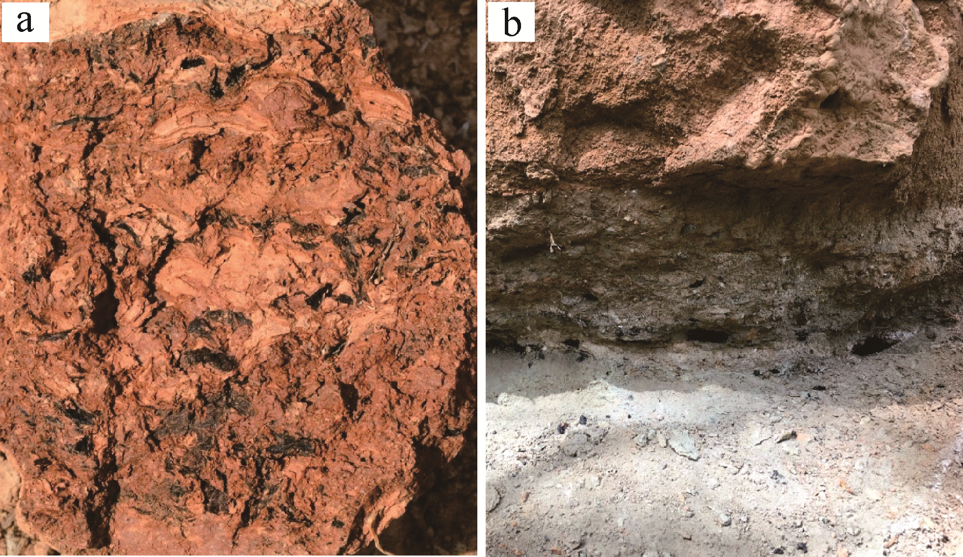
2020, 38(6): 1249-1257.
doi: 10.14027/j.issn.1000-0550.2019.106
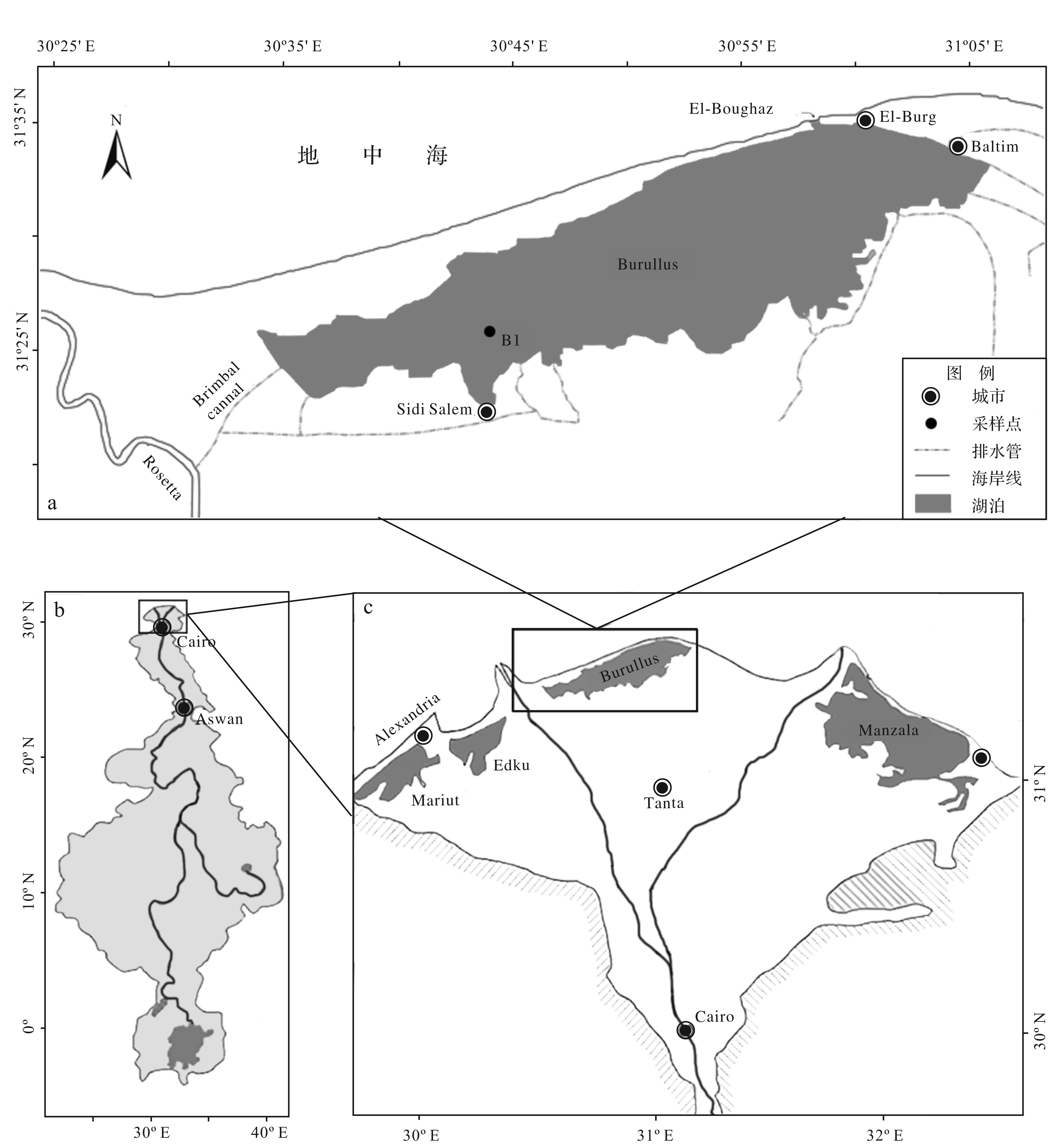
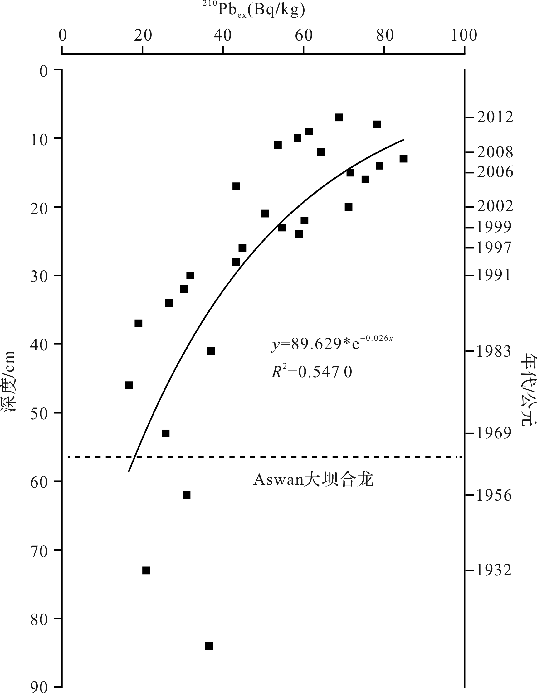
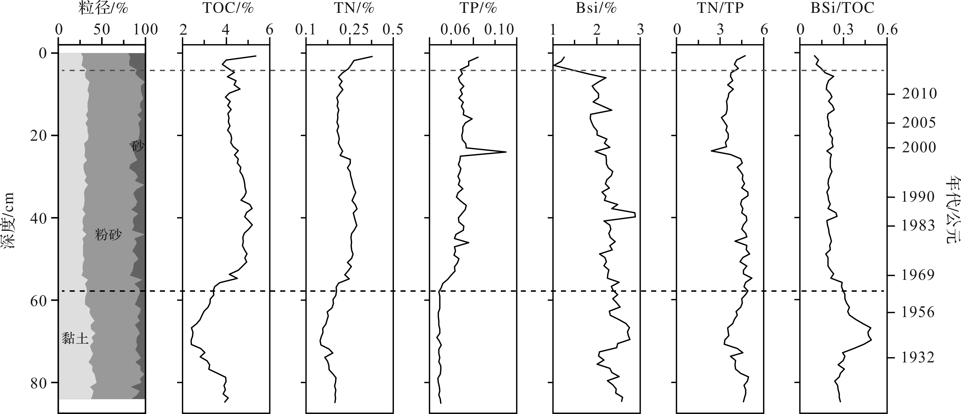
Abstract:
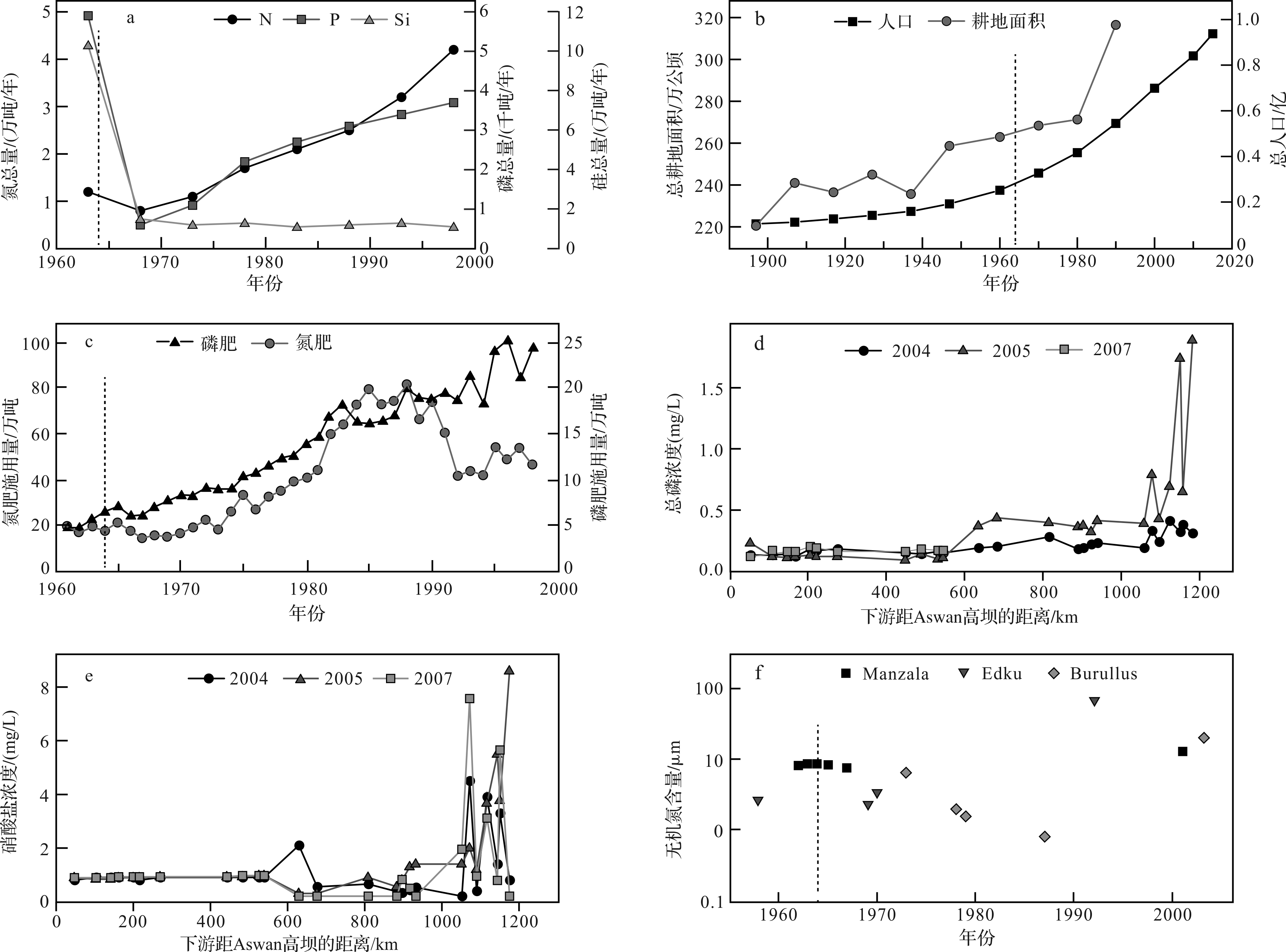
Burullus Lagoon is a a high, closed lagoon at the mouth of the Nile River, whose nutrients were mainly from the Nile. It is a critical area for studying how the changes in the Nile Basin has affected the lake environment of the Nile estuary after the Aswan Dam was built. This study investigated the changes of 210Pb dates, grain size, total organic carbon (TOC), total nitrogen (TN), total phosphorus (TP) and biogenic silica (BSi) in the B1 core from Burullus Lagoon, combined with historical data, to reveal the changes of nutrient salts in estuarine lakes and the impact of these changes on the ecological environment following construction of the Aswan Dam. The results showed that: (1) The content of depositional TOC, TN and TP increased from bottom to top, indicating that although the Aswan Dam led to a sharp decrease in nutrient flux, the TN/TP concentration in the downstream lakes did not decrease due to the greatly increased TN/TP flux discharged by human activity downstream of the dam. Also, TN/TP was less than 16, indicating that the lake was still P-restricted. (2) However, BSi and BSi/TOC generally decreased from bottom to top, indicating that the reduction of water and sediment caused by the Aswan Dam has led to a decrease in the biomass of diatoms and the ratio of total primary productivity in the lake. The ecological environment of the lake tends to be deteriorating.
2020, 38(6): 1258-1271.
doi: 10.14027/j.issn.1000-0550.2019.105
Abstract:
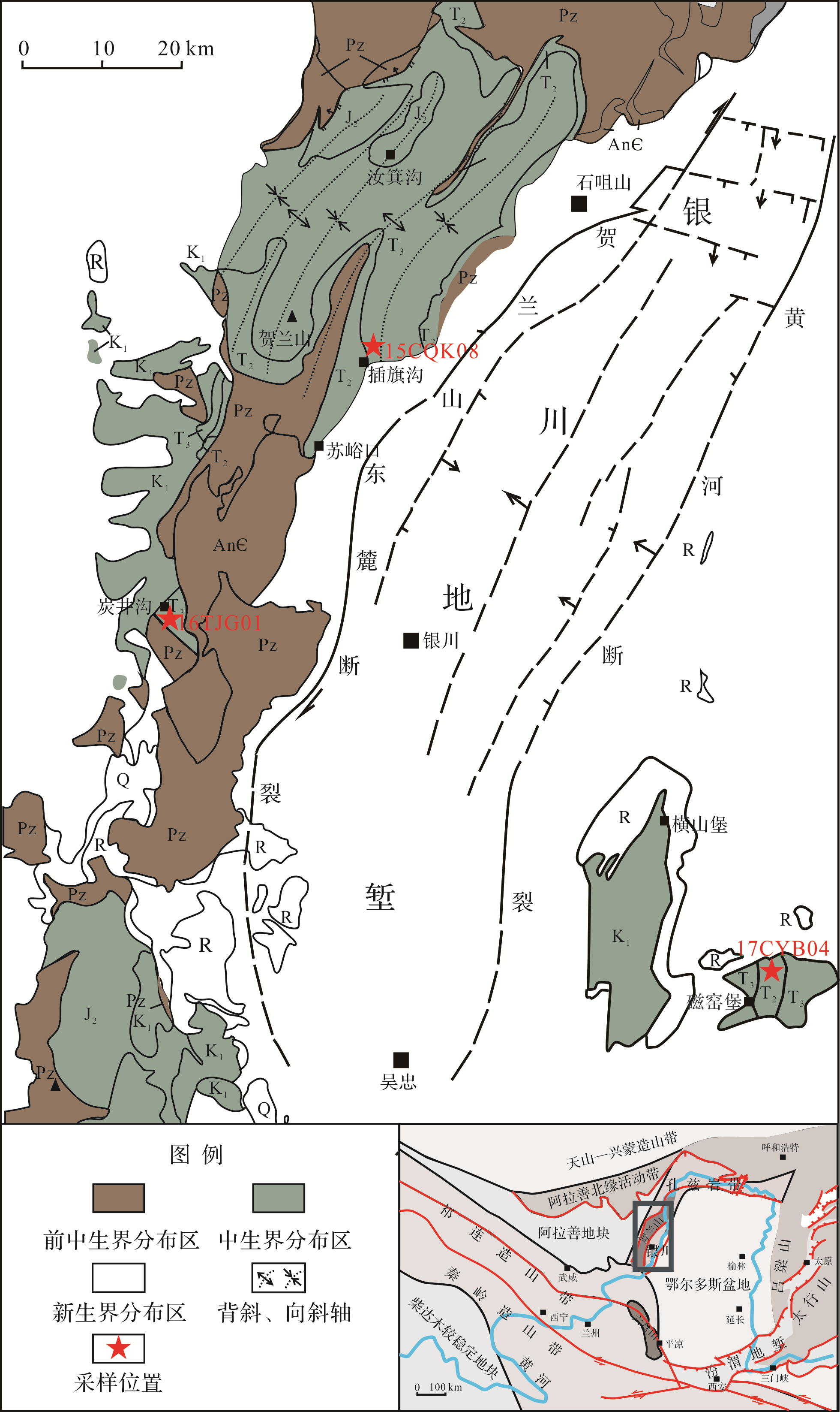
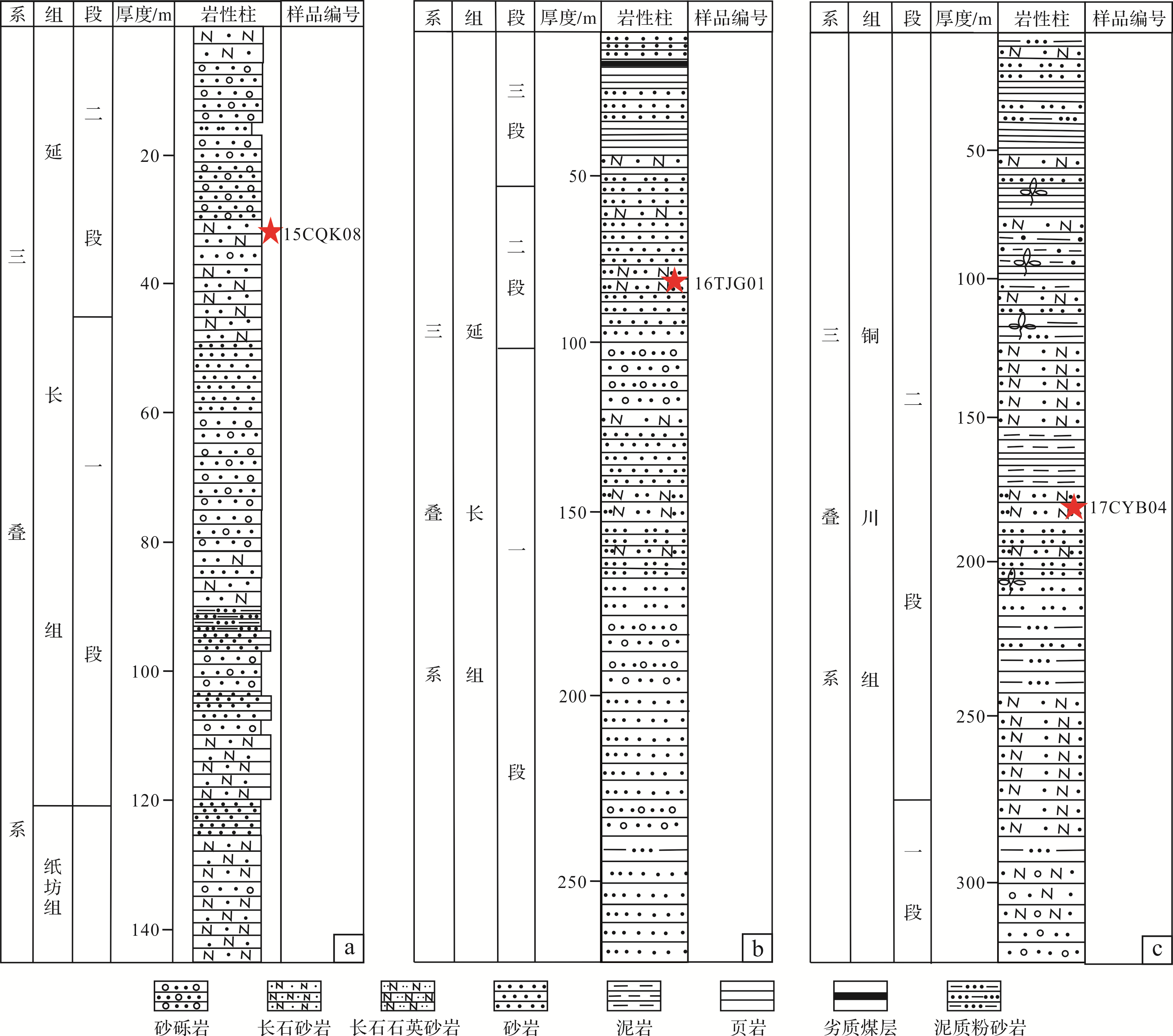
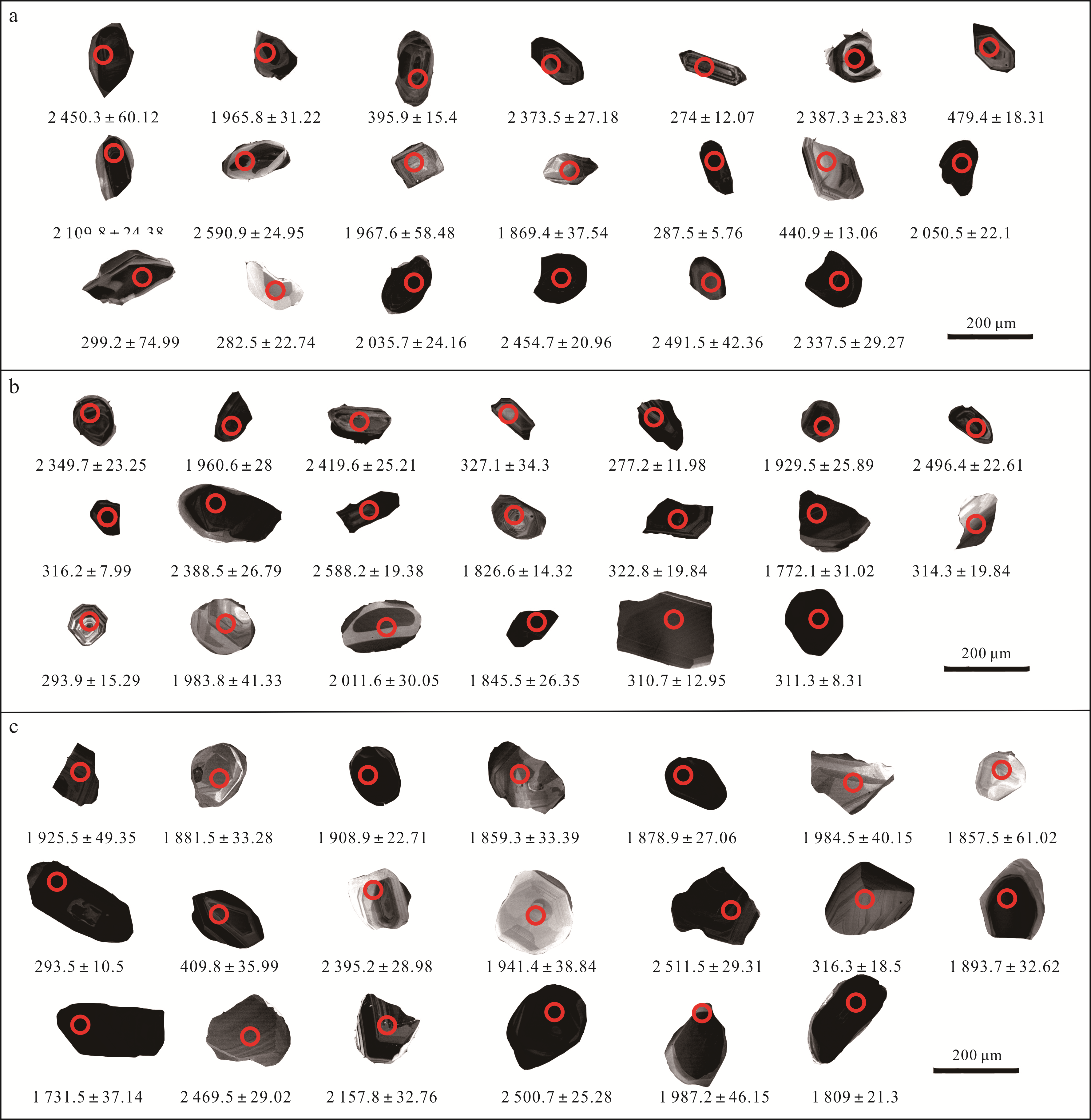
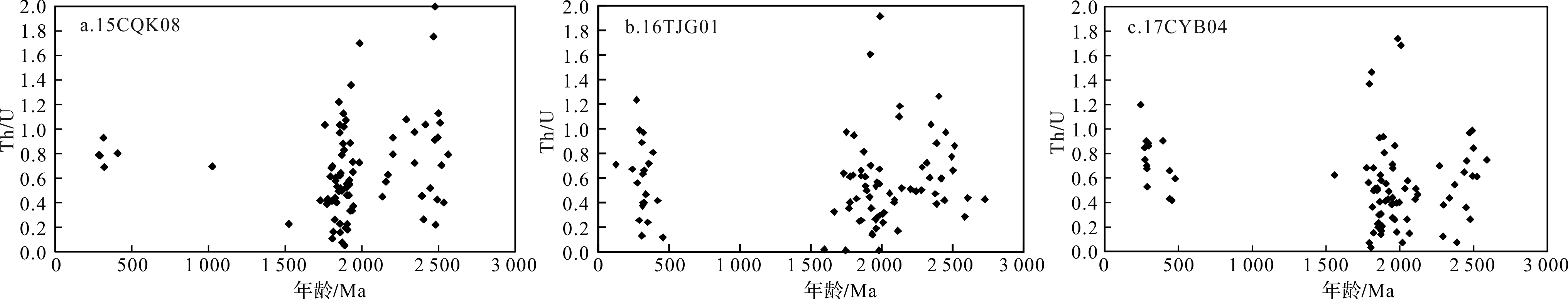
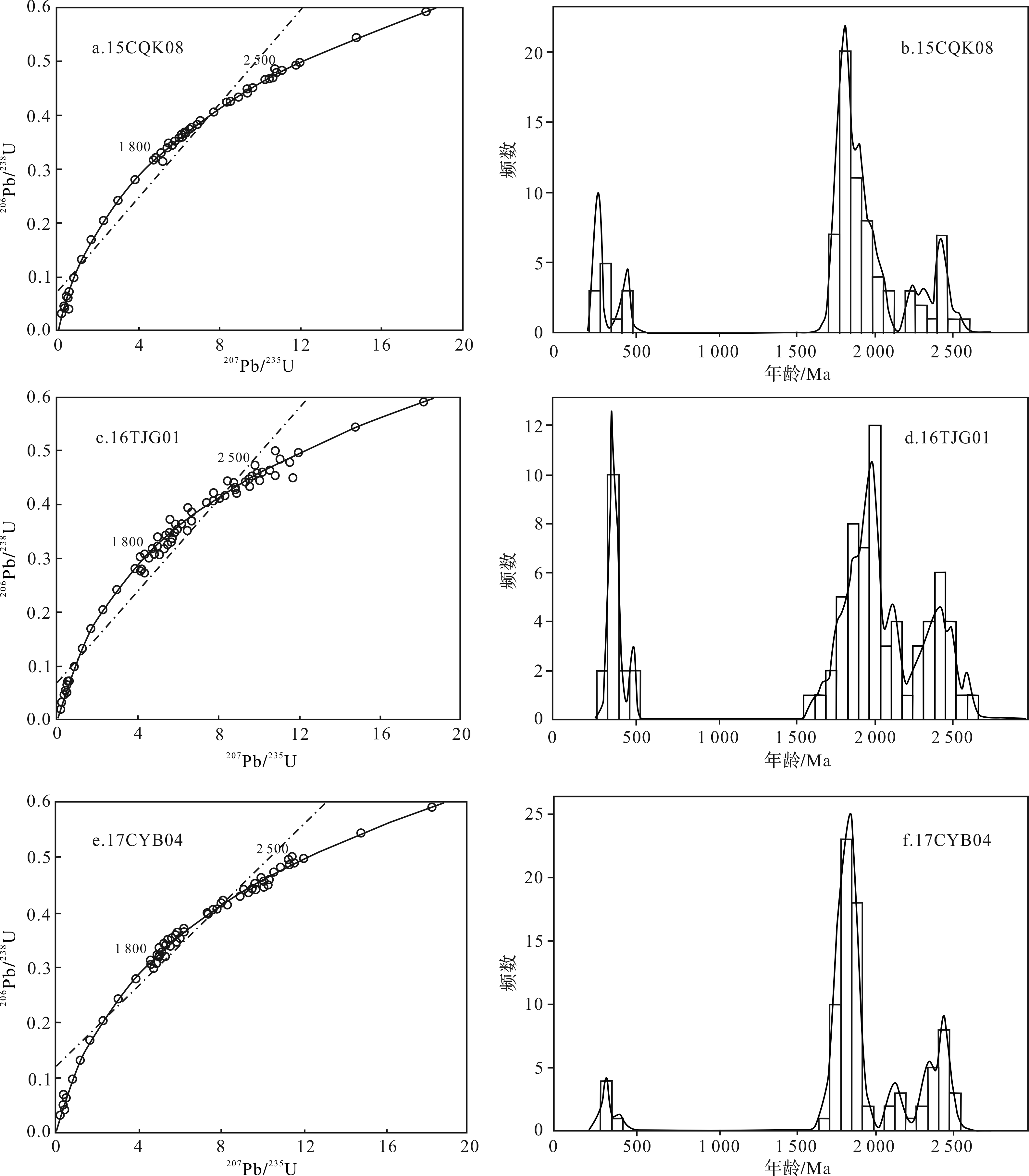
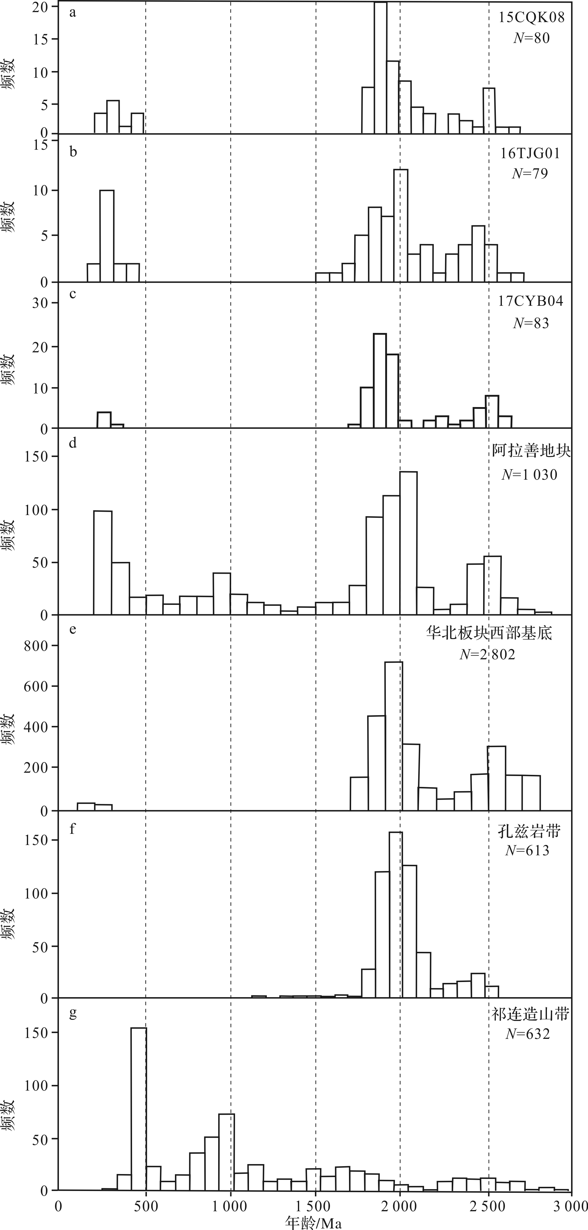
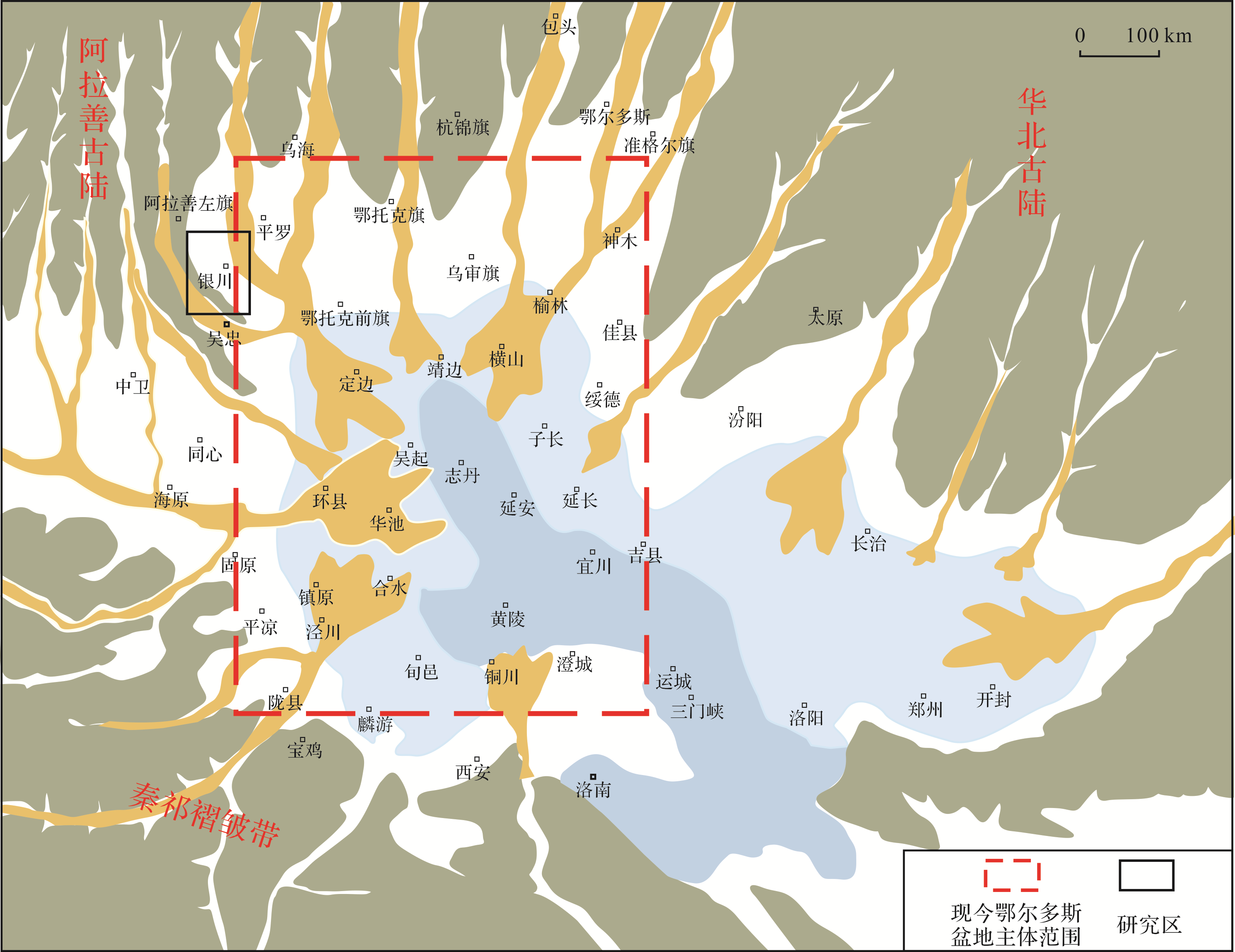
Laser ablation inductively coupled plasma⁃mass spectrometry (LA⁃ICP⁃MS) U⁃Pb was used on detrital zircons to analyze the provenance of the early Upper Triassic in the Tanjinggou, Chaqigou and Ciyaobao areas of the Helan Mountain in the northwestern Ordos Basin. It was found that Cathodoluminescence (CL) images of some zircons from the study area have annular structure. The Th/U ratio of most of the zircons was above 0.4, with very few below 0.1; these indicated that most of the zircons were from magma, with a small number from metamorphic rock. Three age peaks were evident in the age distributions of the zircons, one in each region: late Neoarchean⁃early Paleoproterozoic (2 204.3⁃2 610.1 Ma, corresponding to the completion of North China cratonization); Paleoproterozoic (1 667⁃2 171.8 Ma, corresponding to collision and assemblage of the Yinshan, Ordos and Eastern Continental Blocks); and late Paleozoic (245.1⁃322.6 Ma, corresponding to tectonomagmatic events related to subduction of the Paleo-Asian Ocean beneath the North China Plate). Comparison of zircon ages and palaeogeographic lithofacies analysis showed that early Upper Triassic provenances in the northwestern Ordos Basin were from the northern and northwestern regions, and were mainly derived from magmatic and metamorphic rocks of the Paleoproterozoic Alashan Block and Khondalite Belt. Secondary sources were the western basement of the North China Plate and the Hercynian magmatic rocks of the Alashan Block.
2020, 38(6): 1272-1283.
doi: 10.14027/j.issn.1000-0550.2019.114
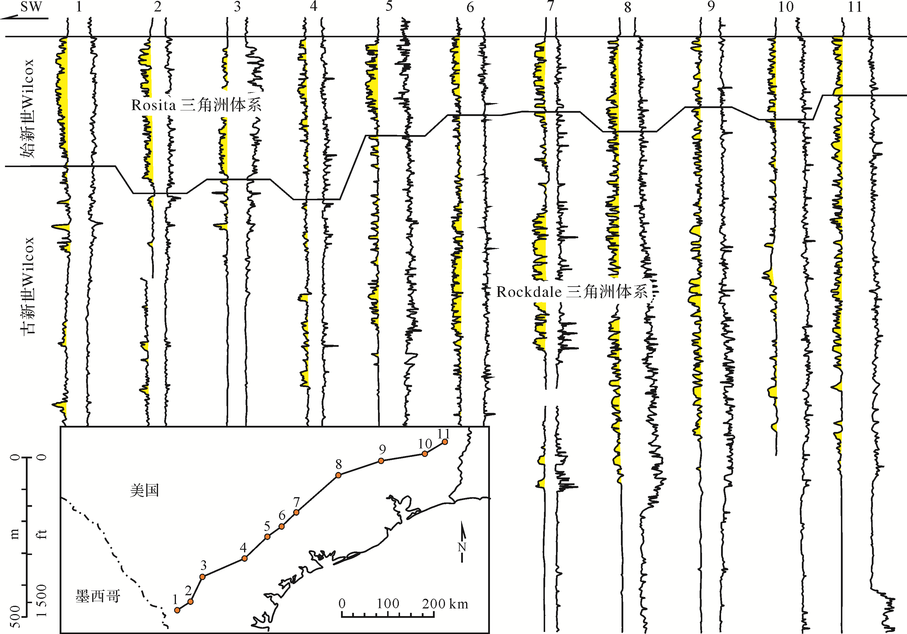
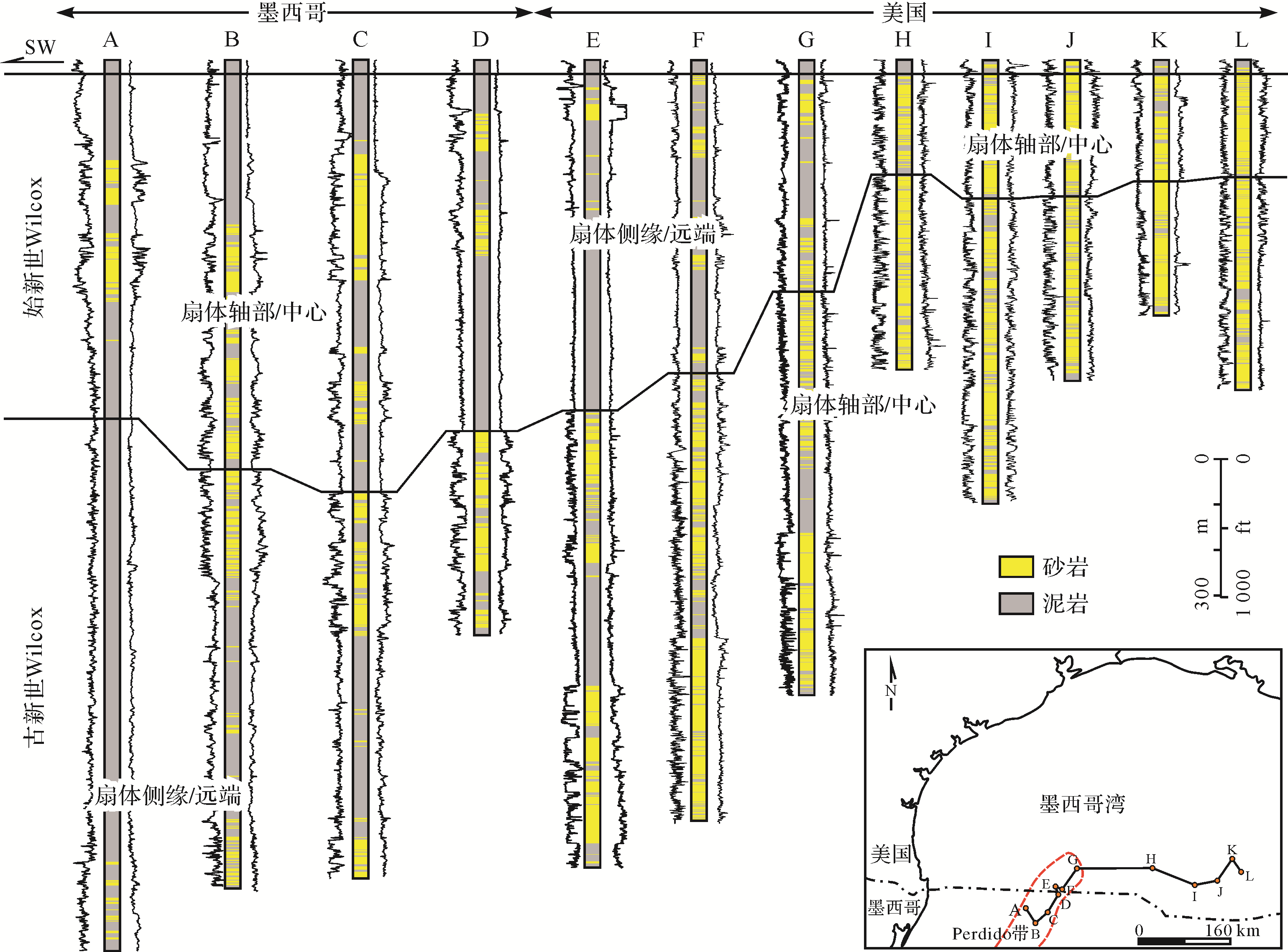
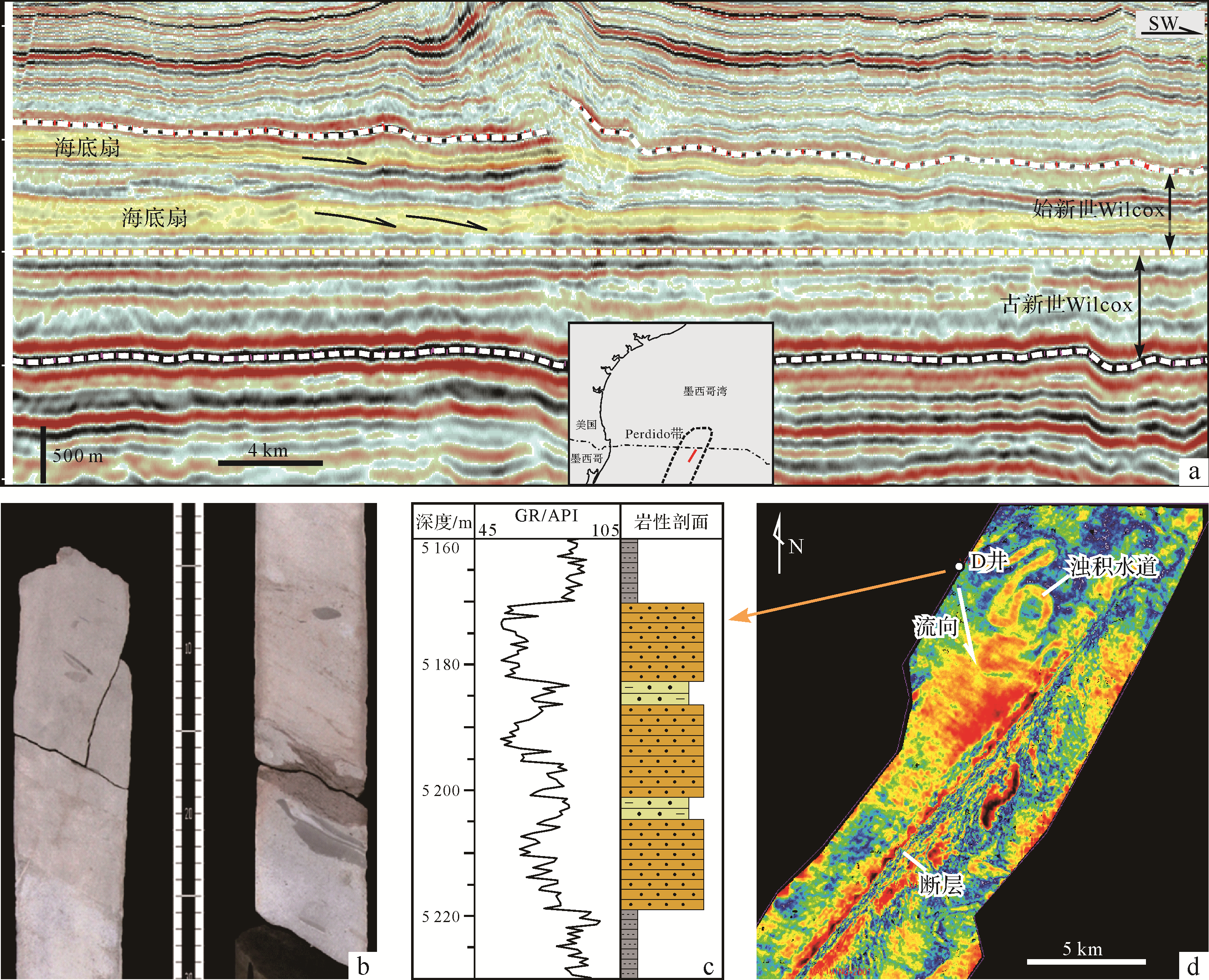
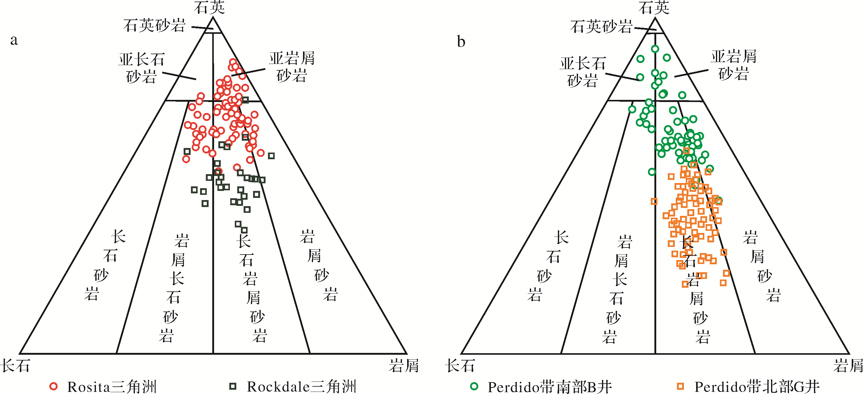
Abstract:
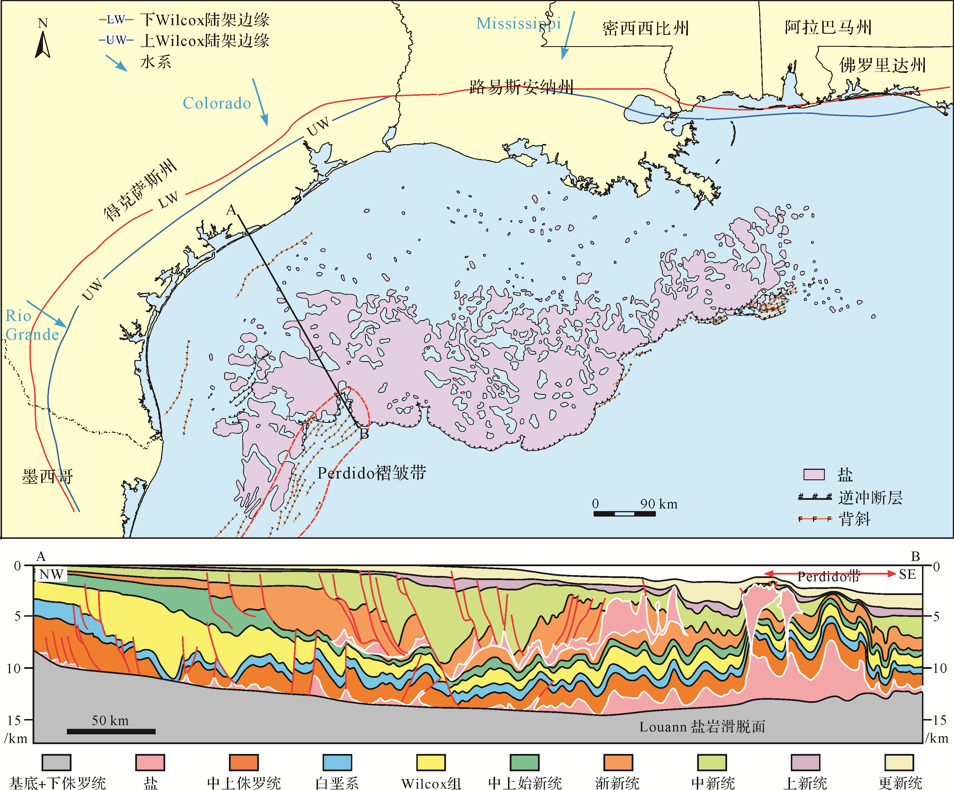
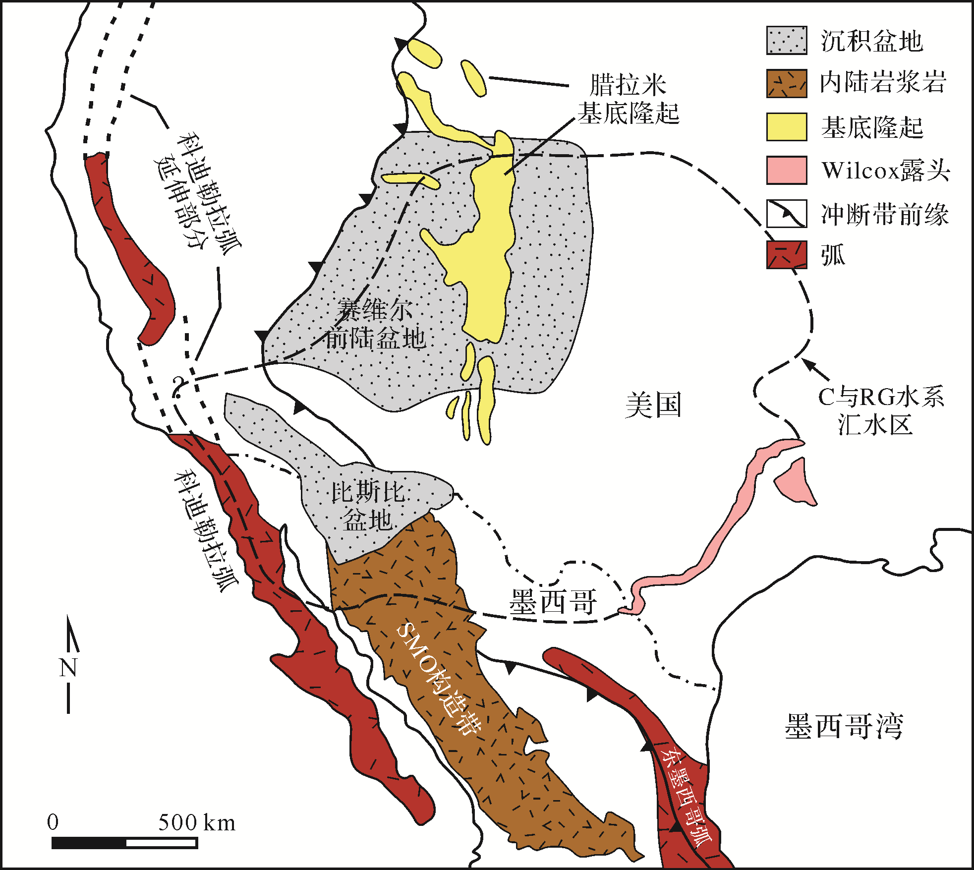
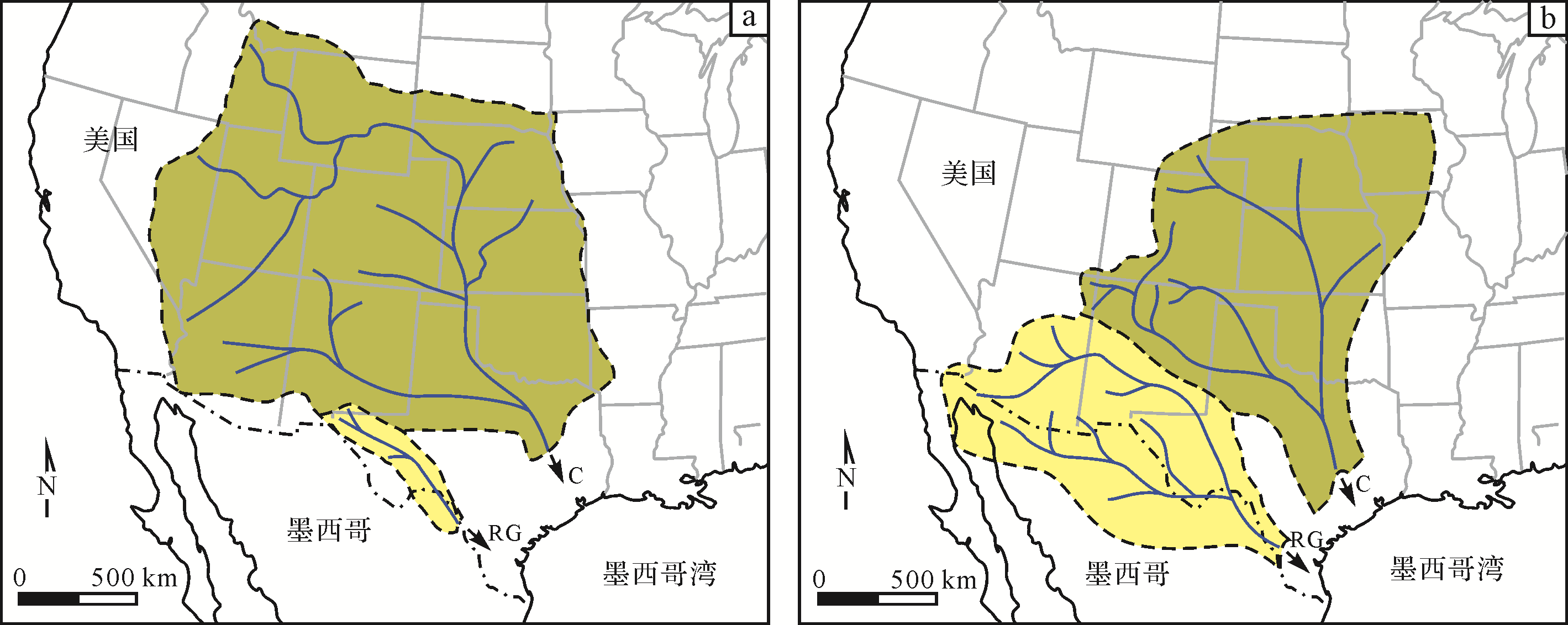
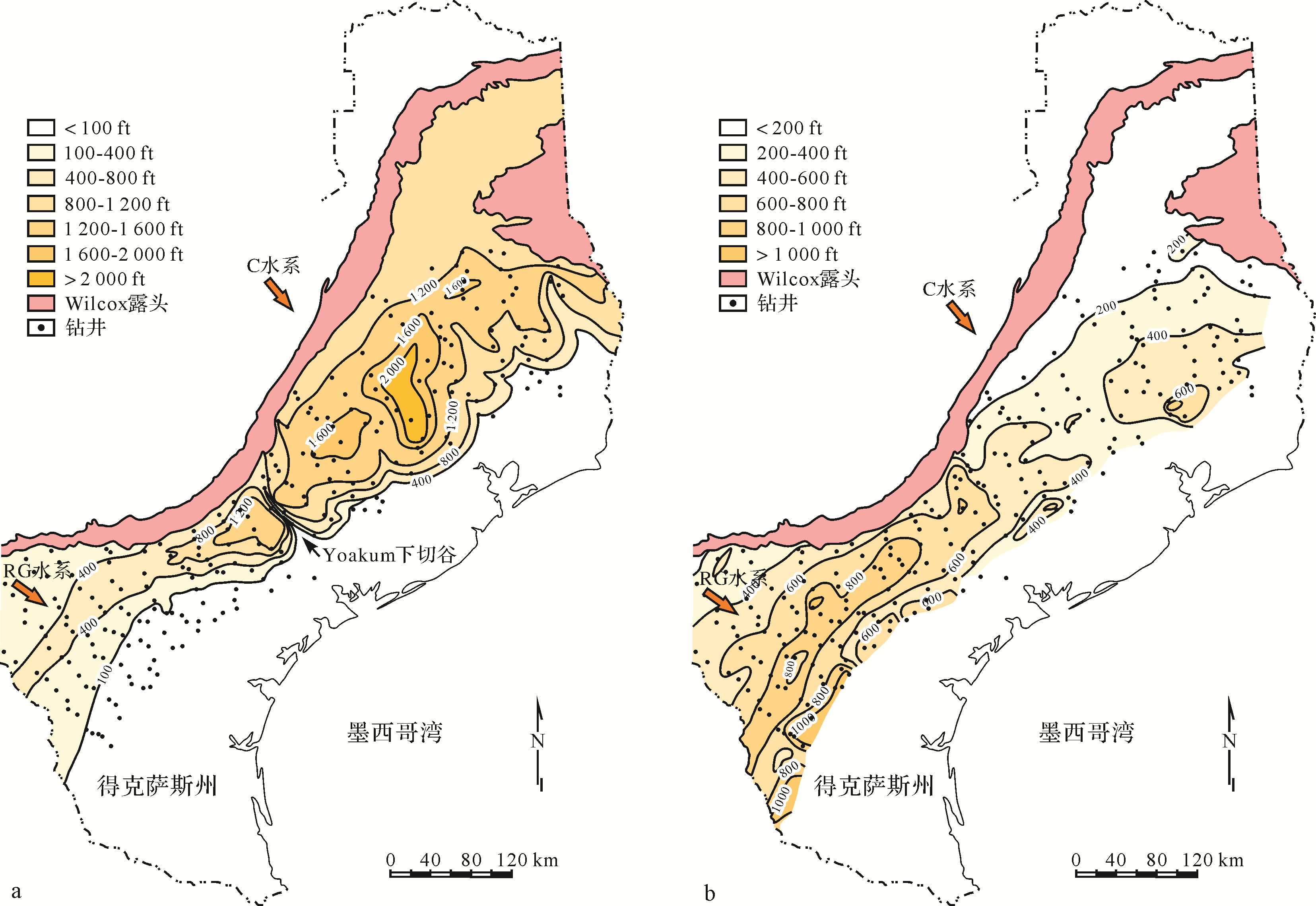
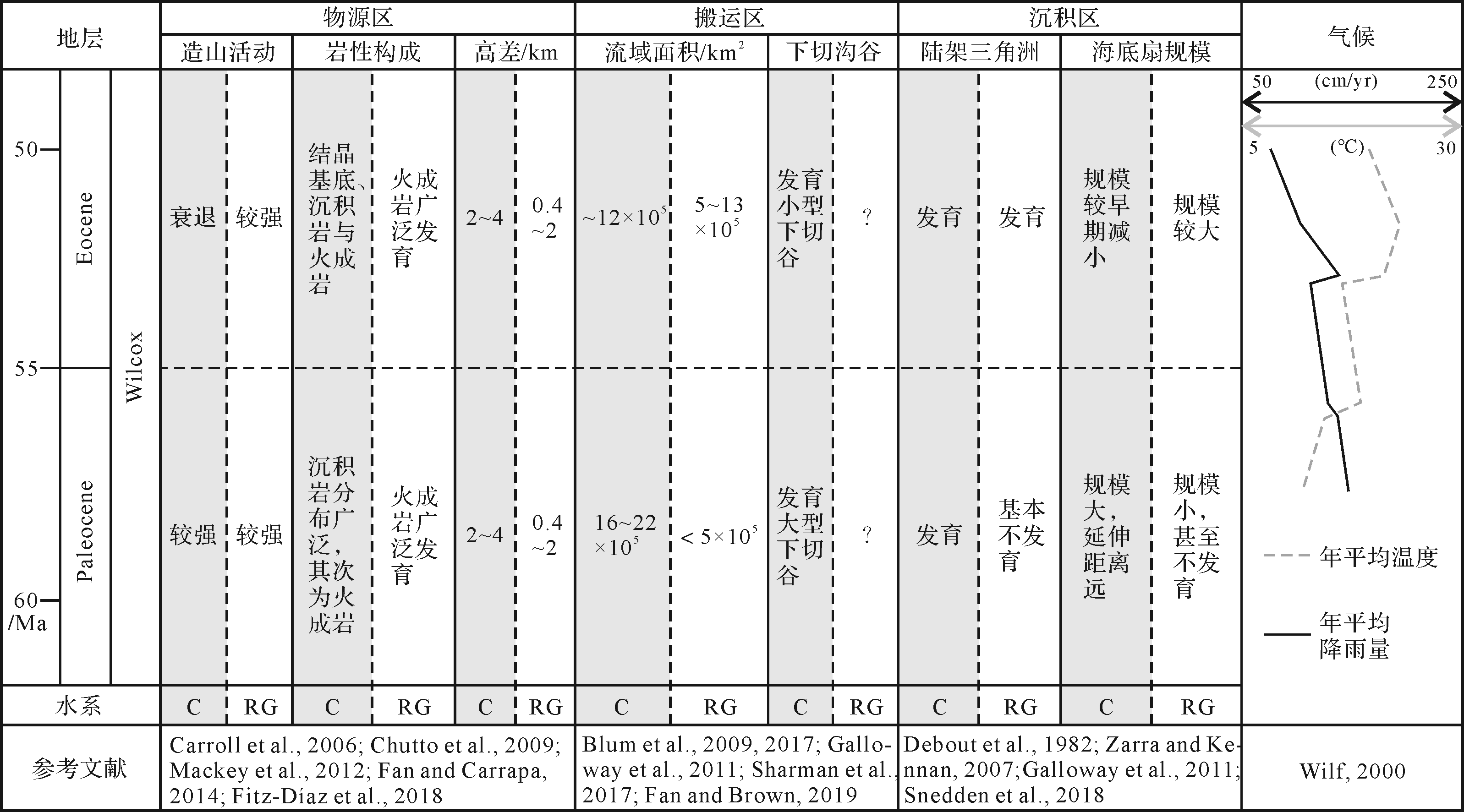
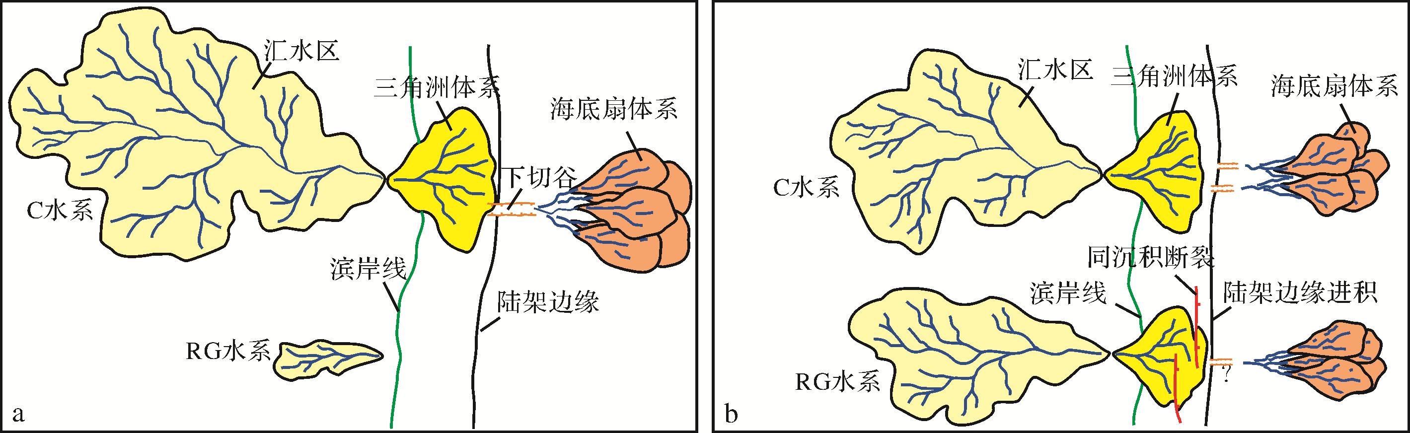
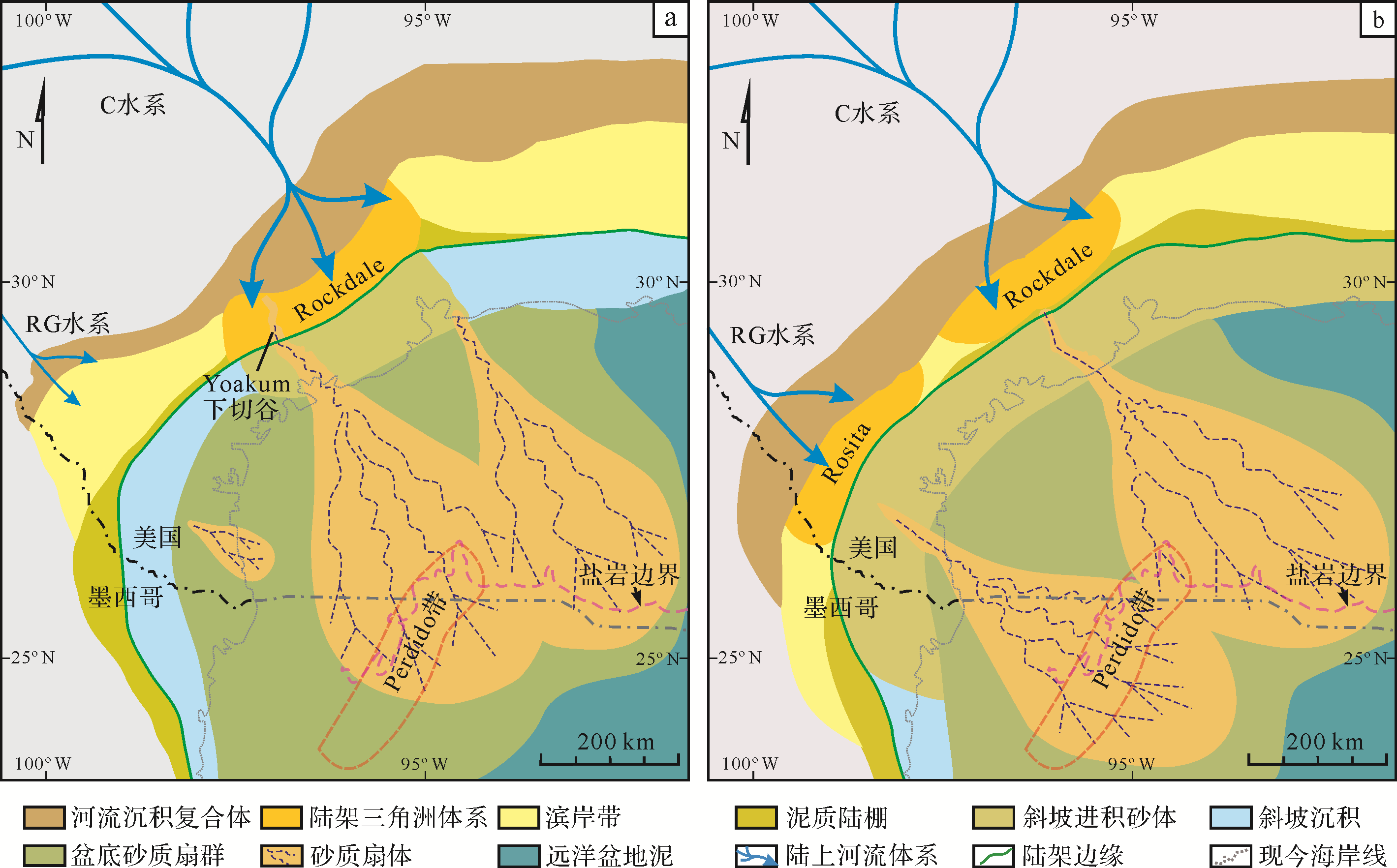
Due to the influence of a deep buried depth and complex salt structure, it is difficult to study the deep⁃water Wilcox deposition. Therefore, it is necessary to conduct large⁃scale source⁃to⁃sink system analysis to understand the changes of the Wilcox sedimentary pattern in the northwestern gulf of Mexico. In this paper, the evolution characteristics of the deep water sedimentary pattern and its significance for the deep water Wilcox reservoir are analyzed by systematically combing the related research achievements of the paleo⁃Colorado and paleo⁃Rio Grande fluvial systems with seismic, drilling, core, and mineral composition analysis data. The paleo⁃Colorado and paleo⁃Rio Grande fluvial systems form two different source⁃to⁃sink systems, and their units not only show certain internal connections, but also have obvious differences. The spatio⁃temporal variation of the units in the source and transport areas determine the variation of the sediment supply capacity and the change of the deep⁃water sedimentary pattern. During the Paleocene Wilcox sedimentary period, the paleo⁃Colorado fluvial system had a strong sediment supply capacity and formed a large⁃scale delta and sand⁃rich submarine fan system in the shallow water shelf and deep water basin. The Perdido fold belt in the western gulf of Mexico was mainly controlled by this fluvial system. In the Eocene Wilcox sedimentary period, the water discharge of the paleo⁃Colorado fluvial system and the scale of the submarine fan decreased, and the axis of the fan body migrated eastward. By contrast, the sediment supply of the paleo⁃Rio Grande fluvial system increased significantly, and a large delta system with high net to gross ratios developed in the continental shelf area. The sandy sediments further crossed the continental shelf to form the western submarine fan, and the turbidite in the Perdido fold belt mainly came from this system. The widely developed turbidite sandstone reservoirs indicate that the Eocene Wilcox Formation in the Perdido fold belt of Mexico has great exploration potential.
2020, 38(6): 1284-1295.
doi: 10.14027/j.issn.1000-0550.2019.108
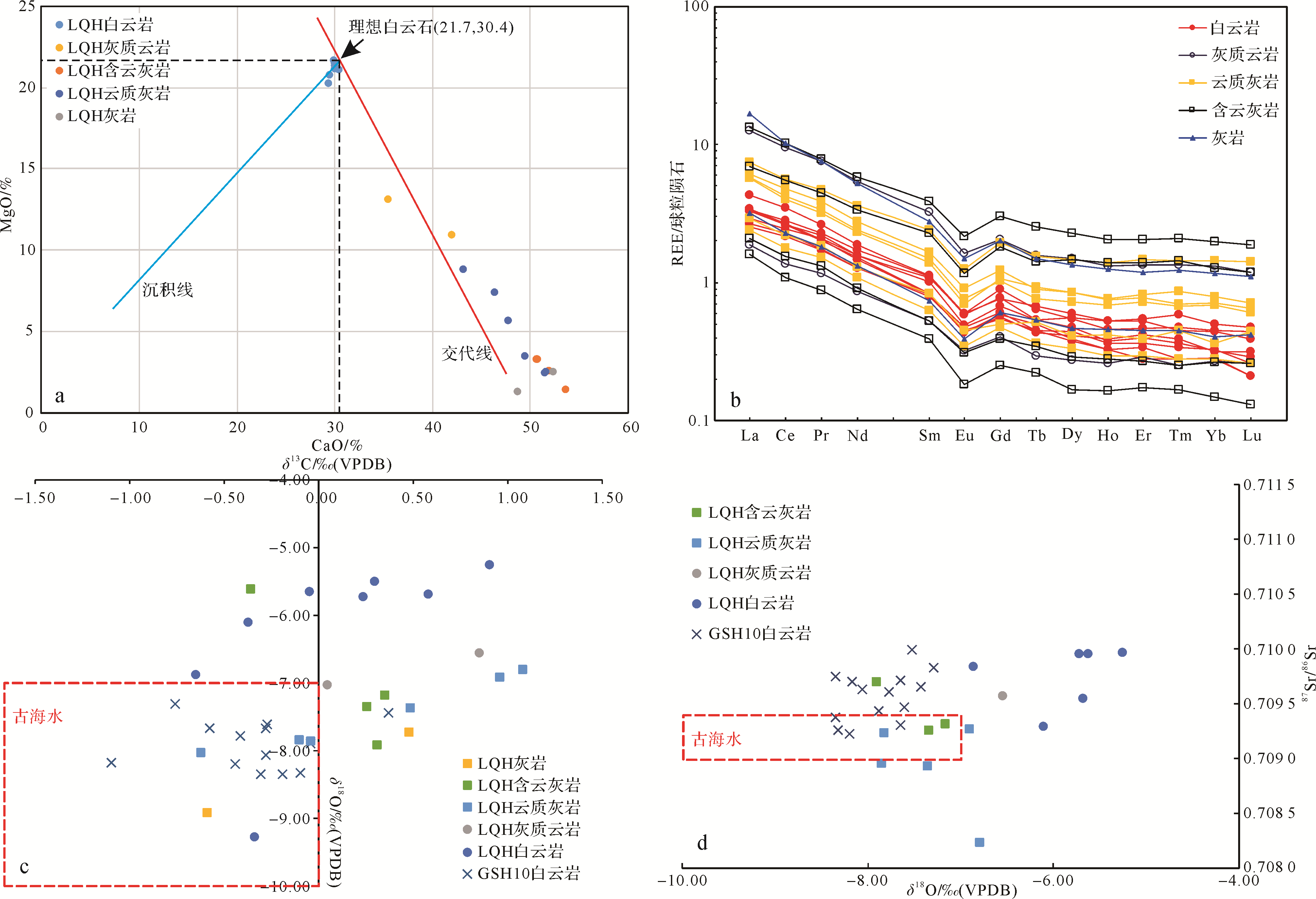
Abstract:
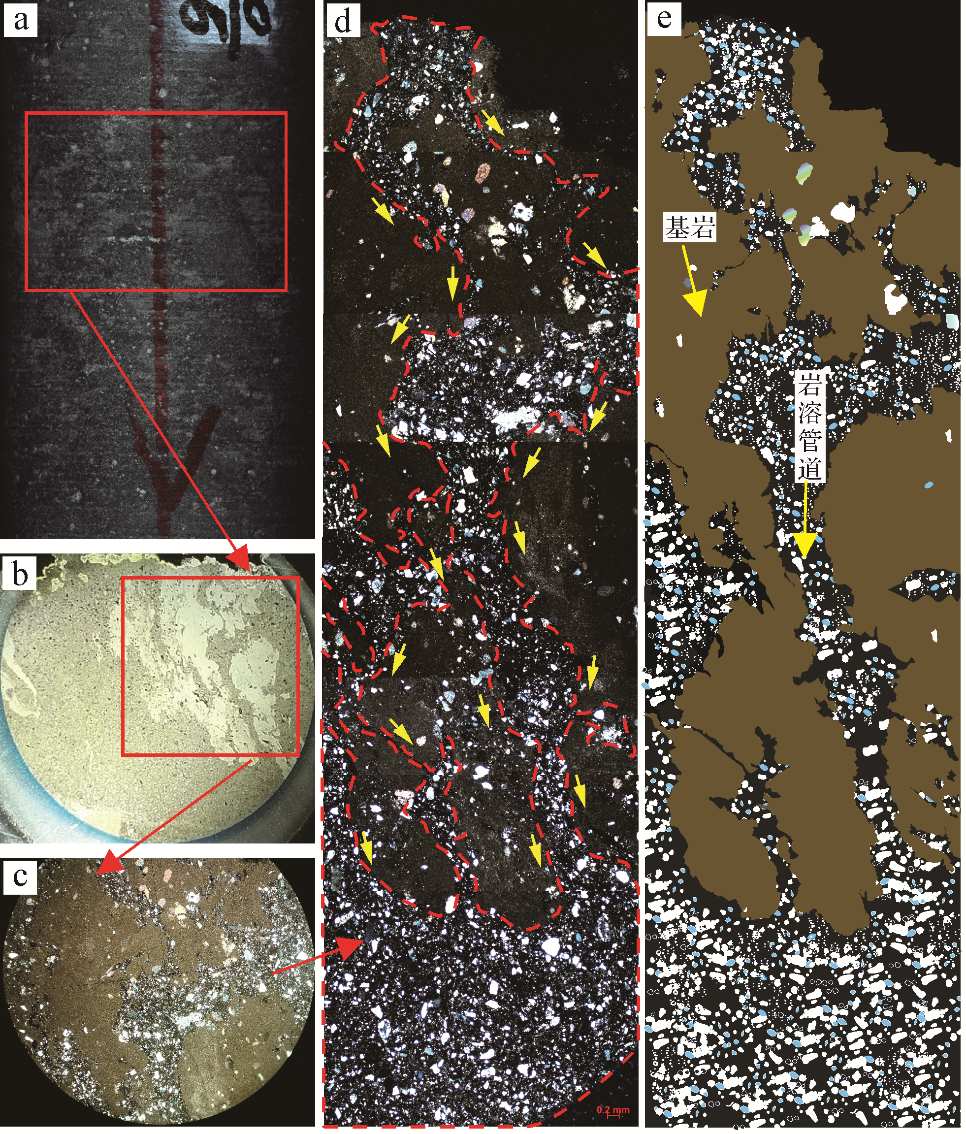
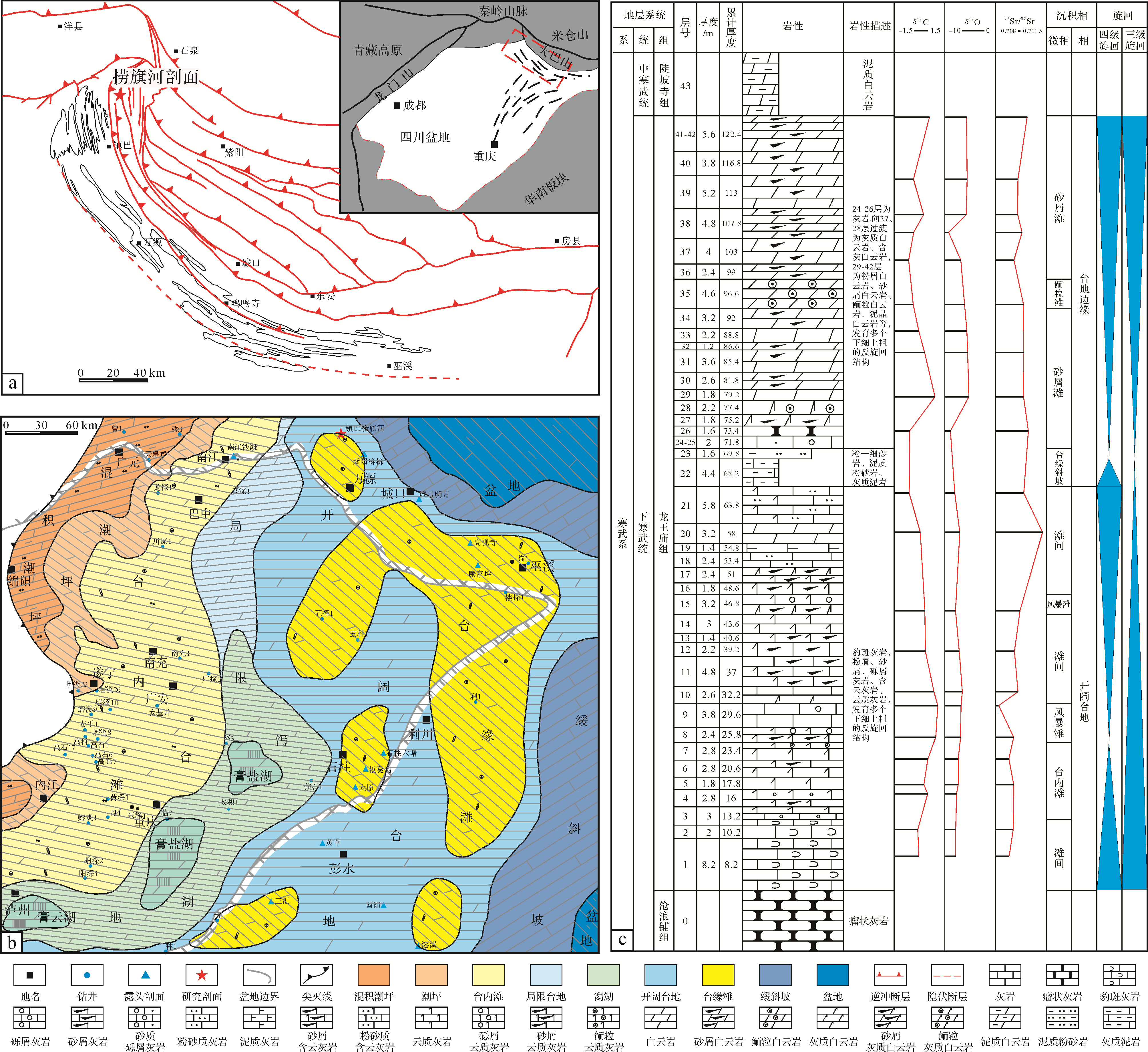
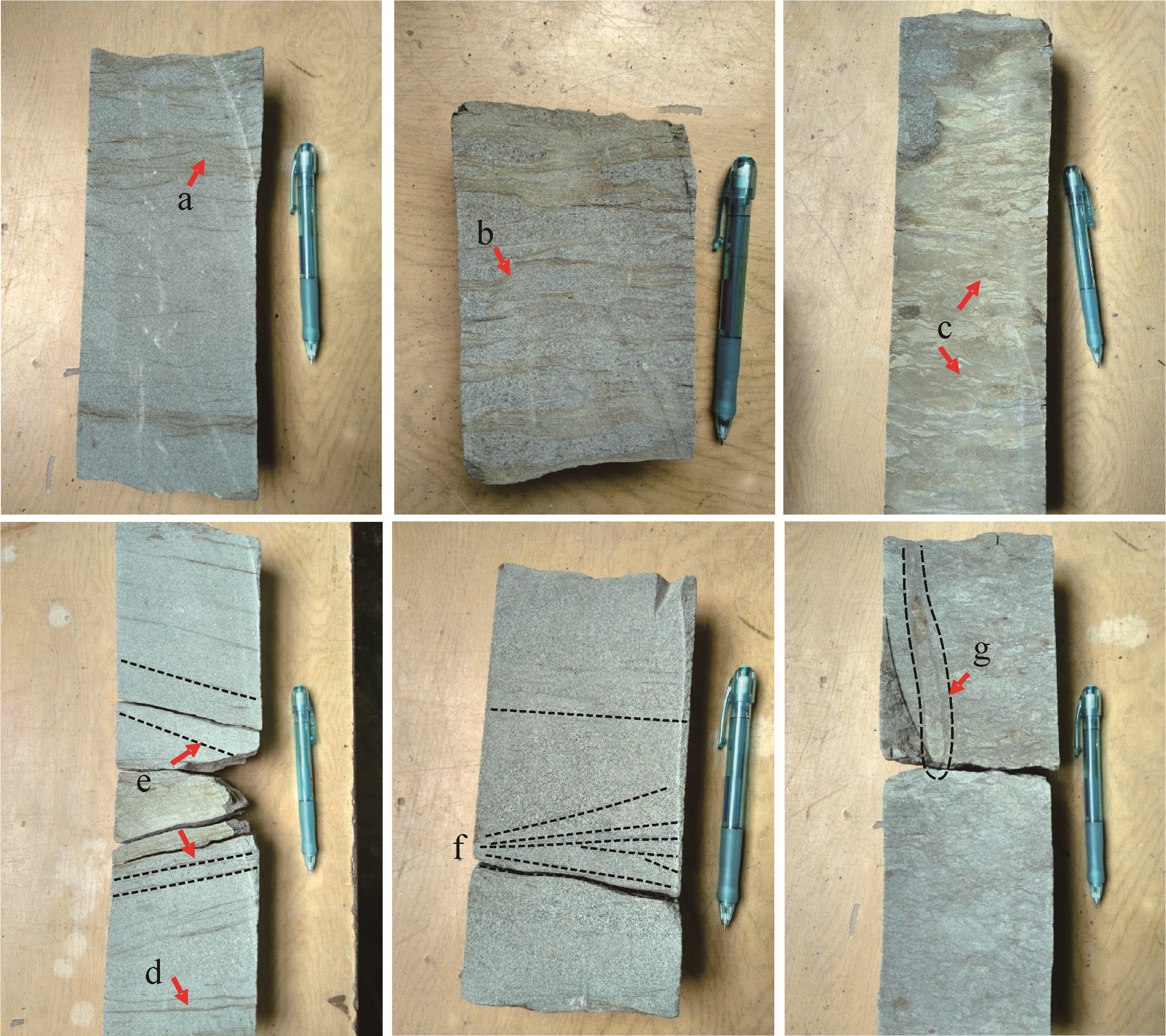
Based on measurement of field outcrops, microscopic thin section identification, cathodoluminescence analysis and geochemical analysis, this paper systematically studied the genesis of dolomite in the lower Cambrian Longwangmiao Formation, northeastern Sichuan Basin. It was found that limestone⁃transitional lithology⁃dolomite was developed from bottom to top in the study area, and the rocks have a predominantly grainy texture. The dolomite is mainly subhedral⁃xenotopic micritic to powder crystalline, and exhibits dim, dark⁃red luminescence. The MgO and CaO contents of the samples are negatively correlated. The Mg2+/Ca2+ ratio, the Sr, Fe and Mn contents and the order degree of the dolomite are relatively low, but the Na content is relatively high. The distribution curves of rare earth elements (REE) in each lithology are parallel and uniform, and it shows δEu anomalies but no δCe anomalies. The δ18O value of the limestone is consistent with that of coeval seawater. The δ13C and δ18O values of the dolomite and the δ13C values of the limestone are slightly higher than for coeval seawater. The 87Sr/86Sr ratio of the dolomite is higher than for coeval seawater. Combined with the regional geological background, petrological characteristics and geochemical analysis results, it is considered that the dolomitization fluid in the study area was highly saline evaporating seawater. The dolomite in the study area was formed by seepage⁃reflux dolomitization.


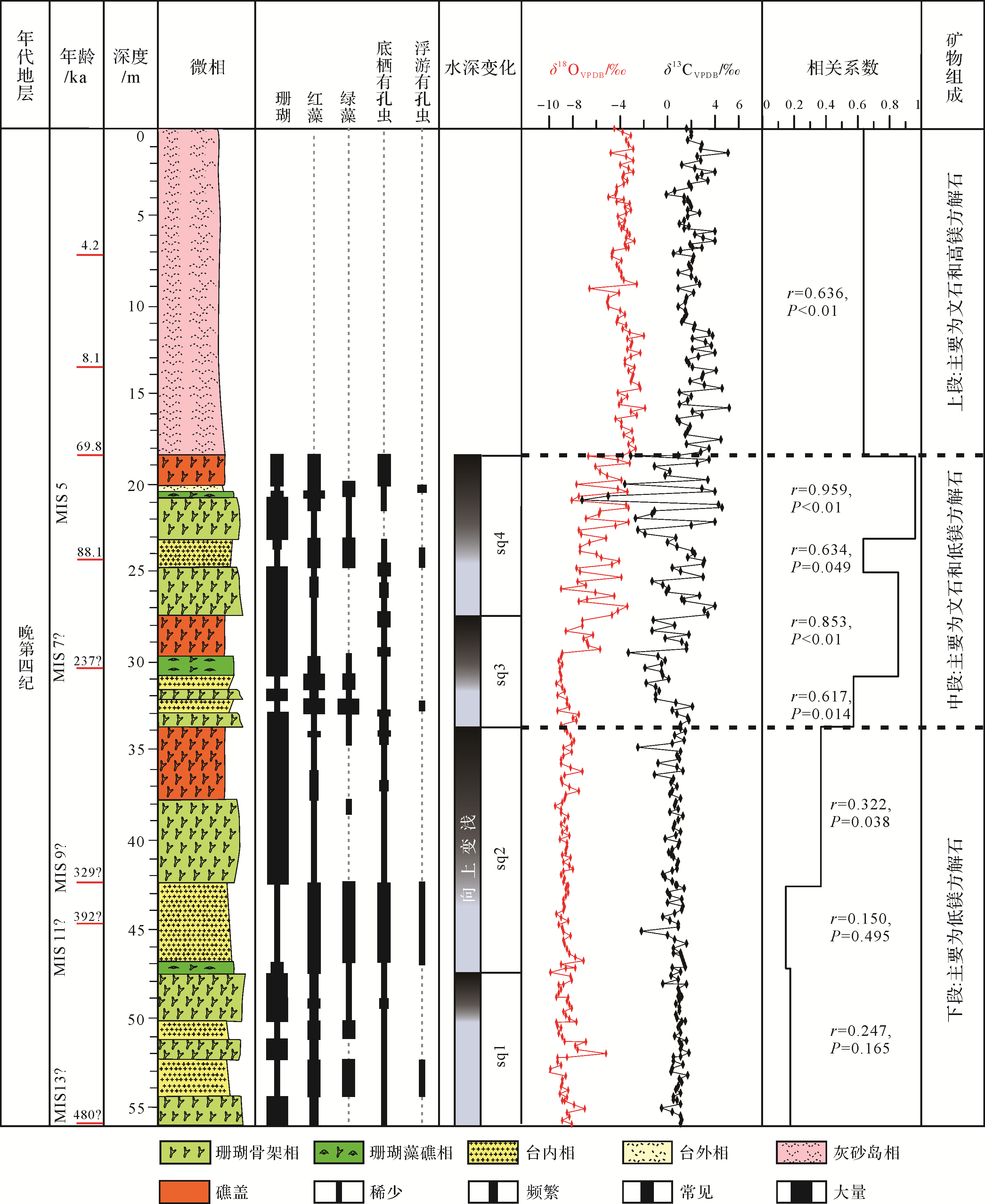
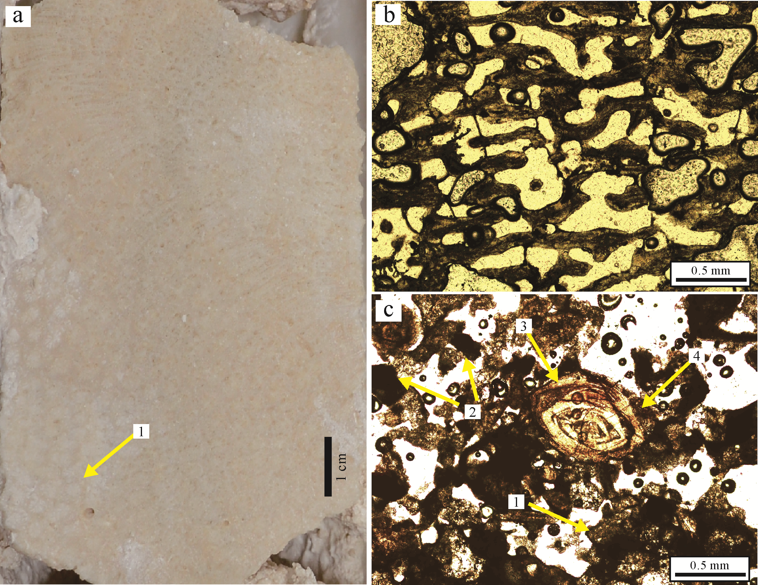
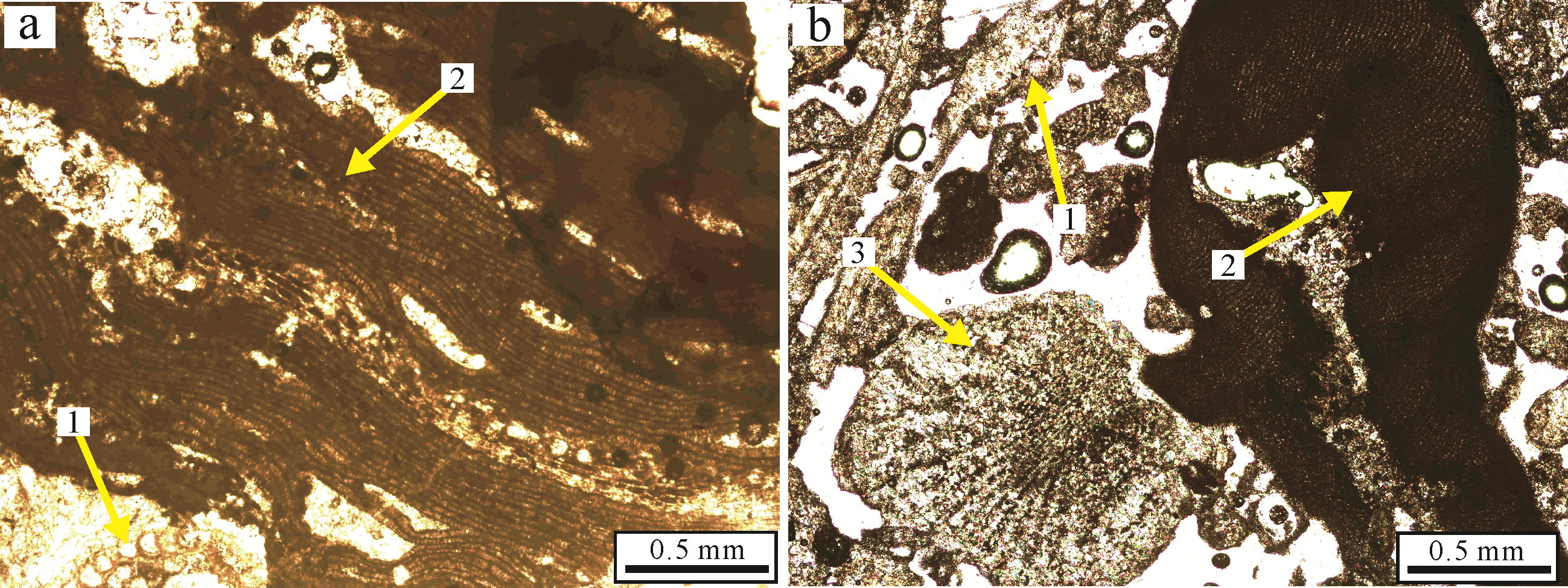
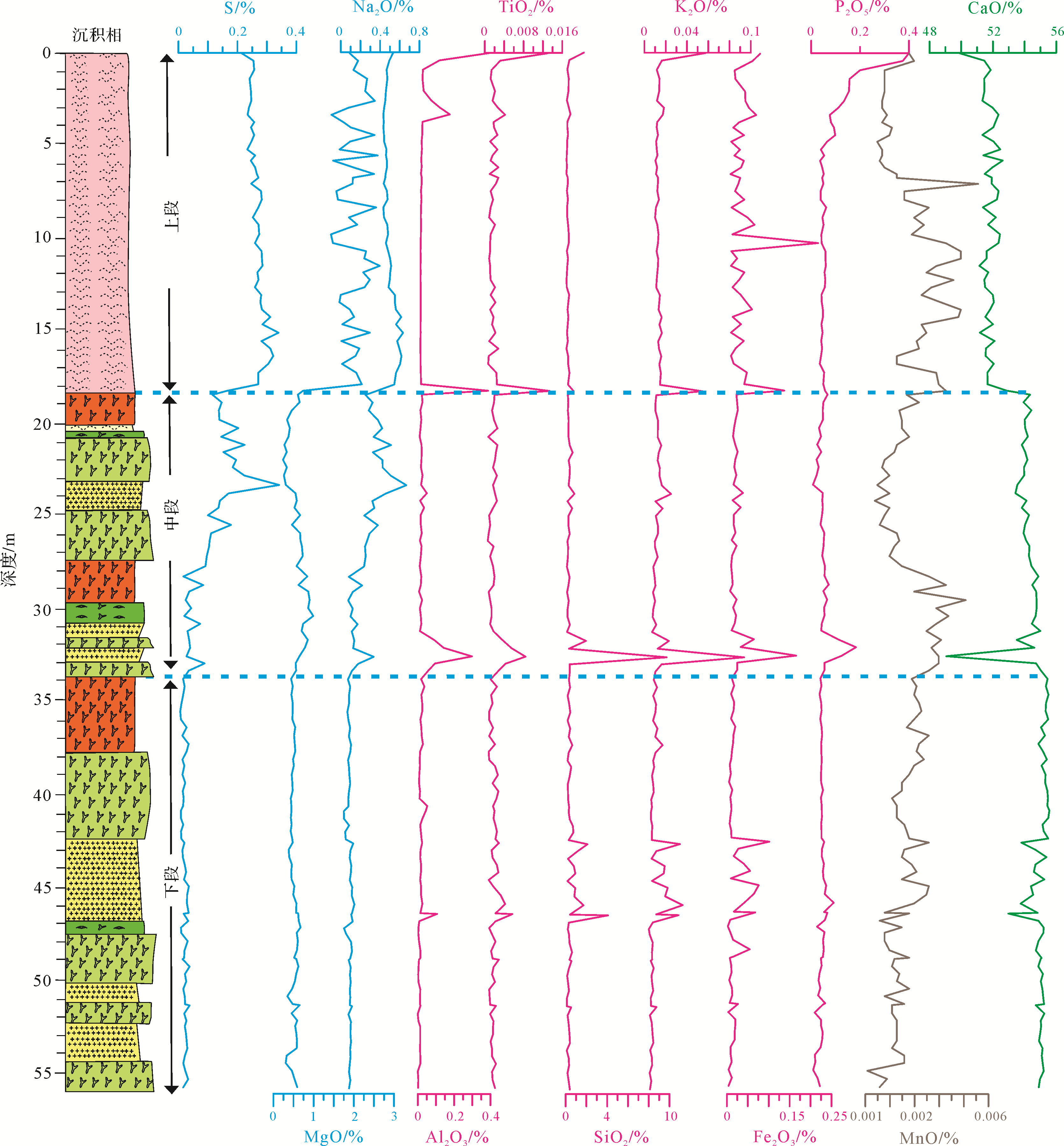
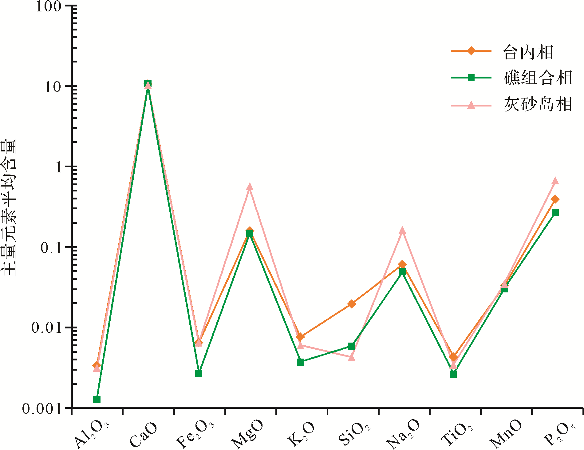
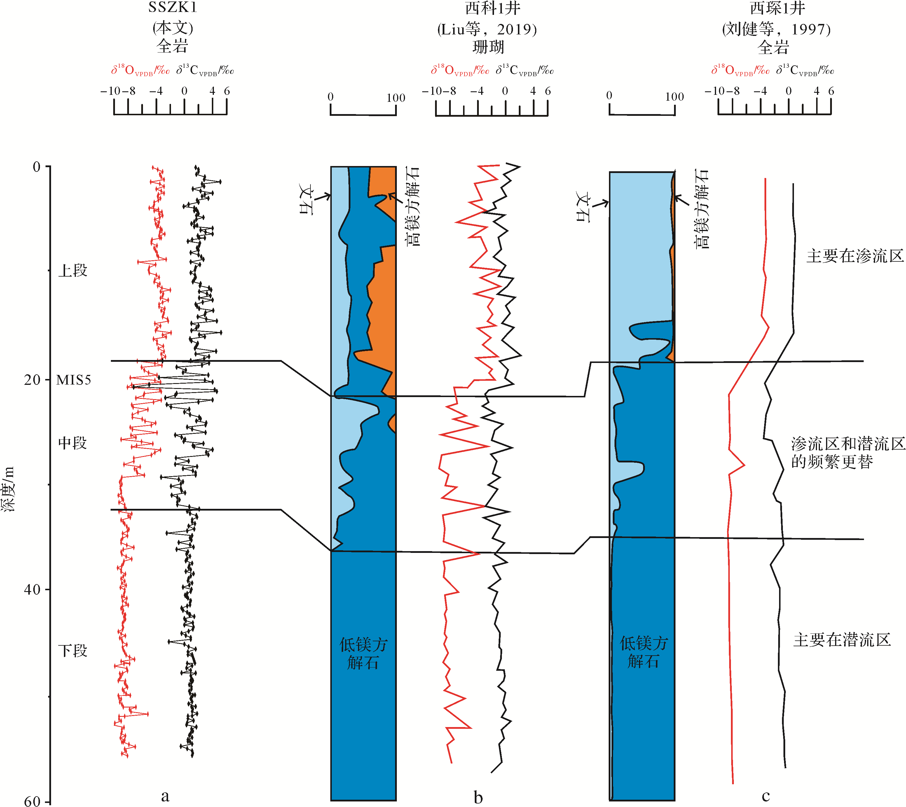
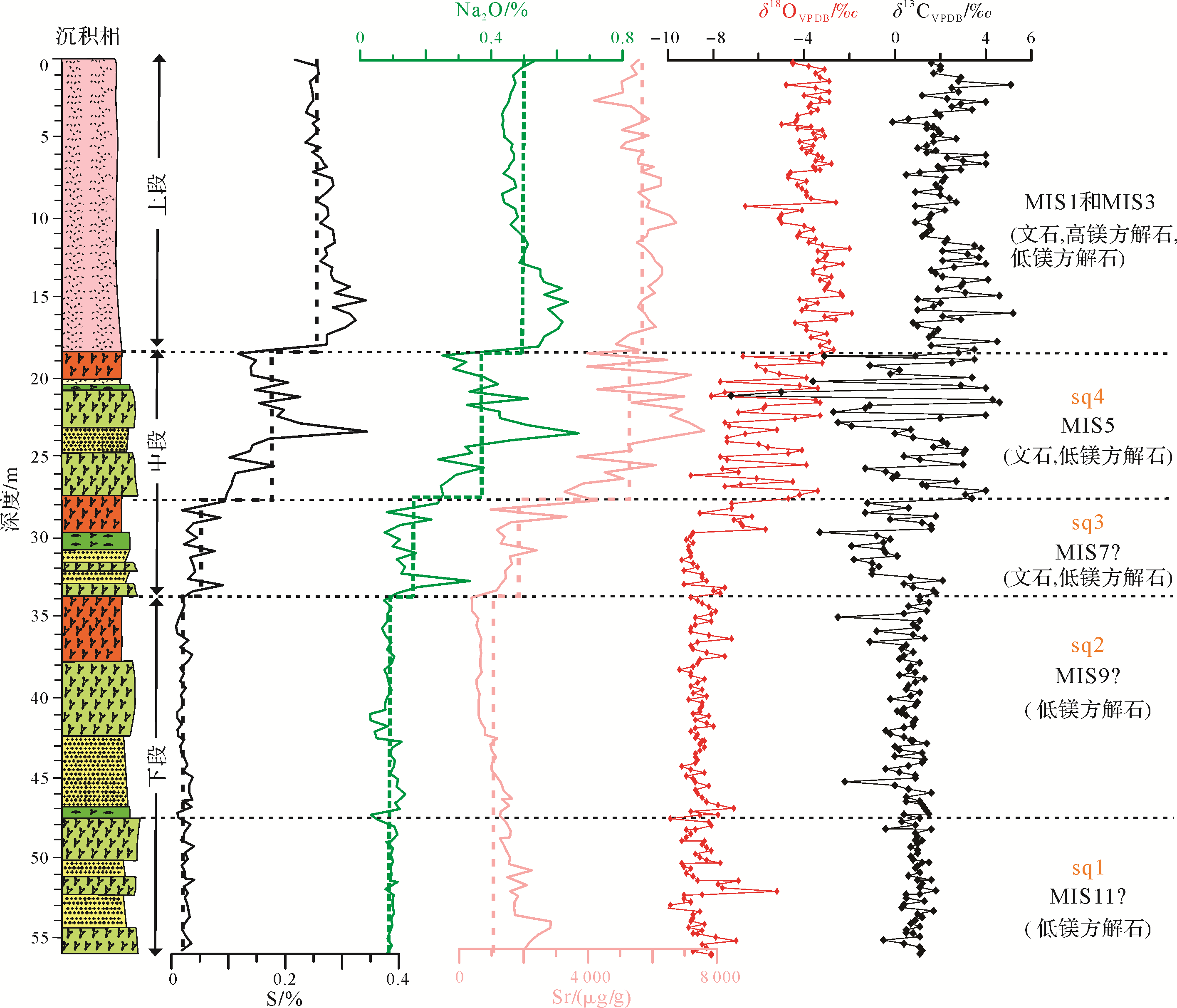
2020, 38(6): 1296-1312.
doi: 10.14027/j.issn.1000-0550.2020.006
Abstract:
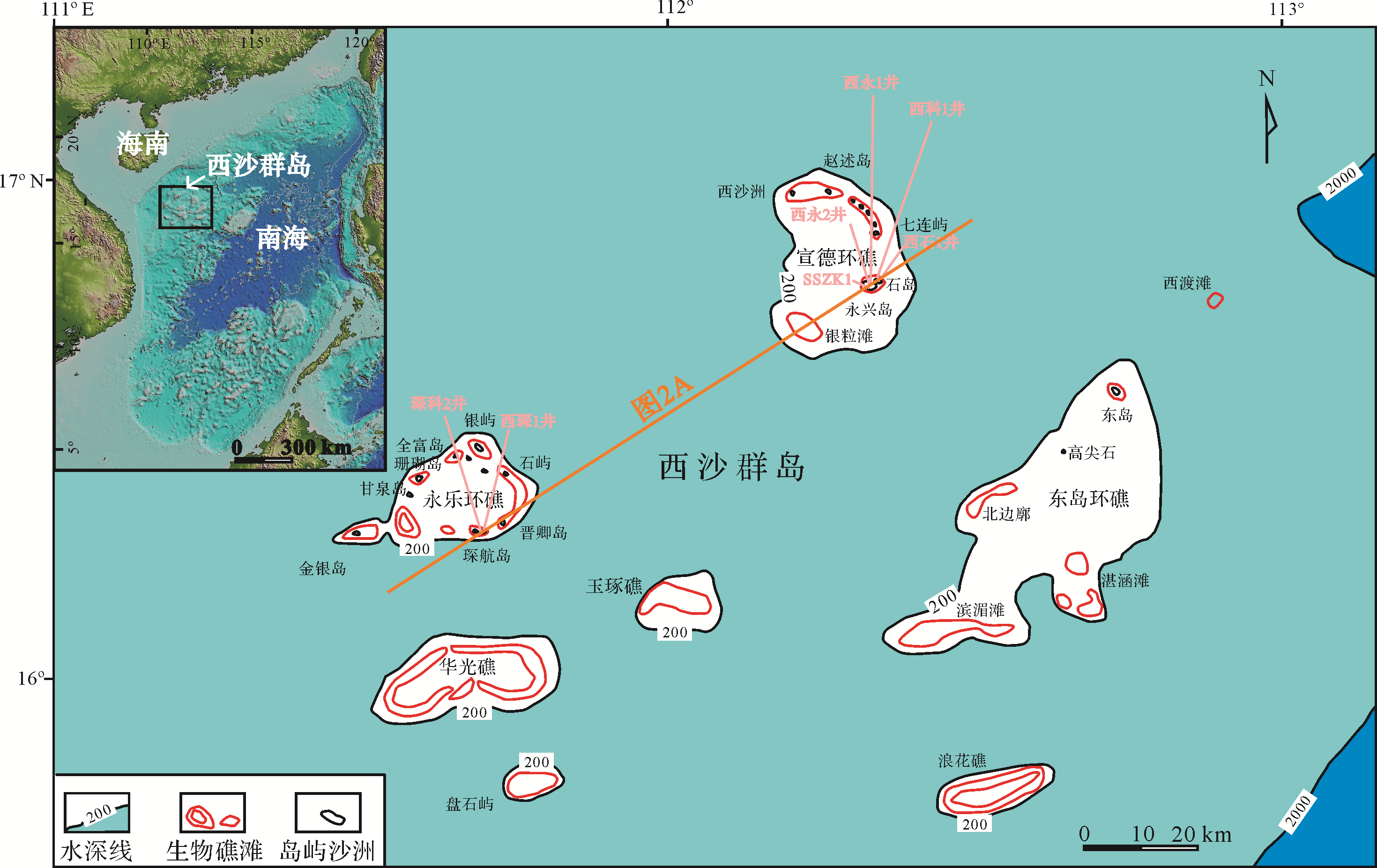
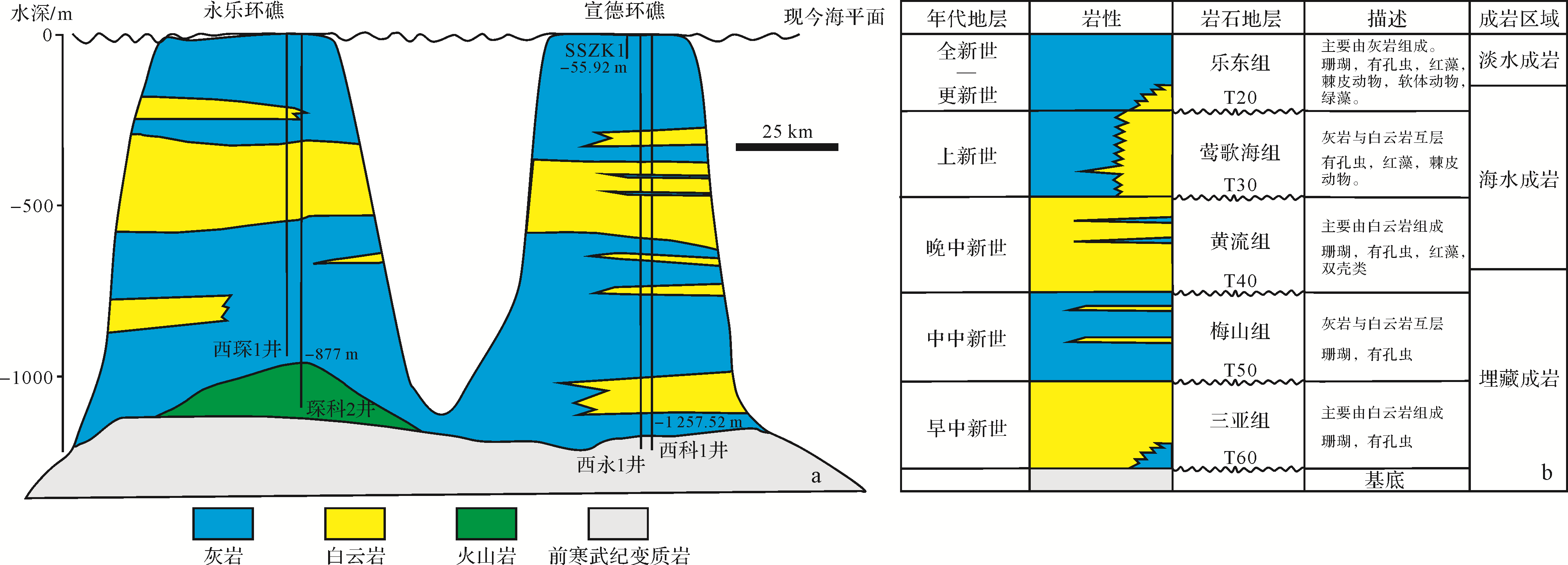
Petrographic, mineralogical, stable isotopic and elemental data from the late Quaternary carbonates at Xisha Islands indicate that the sequences were calcitized in a near⁃surface meteoric diagenetic environment. The variation in the distribution of aragonite, high⁃Mg calcite (HMC) and low⁃Mg calcite (LMC) divides the shallow⁃water carbonates in core SSZK1 into three intervals: unit I (33.89⁃55.92 m; LMC), unit II (18.39⁃33.89 m; aragonite and LMC) and unit III (upper 18.39 m of core; aragonite, LMC and HMC). The lowermost unit I, which consists of Pleistocene shallow⁃water carbonate, has suffered almost complete freshwater diagenesis, whereas the overlying units II and III have undergone incomplete meteoric freshwater diagenesis, in which the shallow⁃water carbonates feature more positive and various δ18O and δ13C values. Especially in unit II, high⁃frequency and high⁃amplitude fluctuations of stable isotopic values suggest a more complex mineralogical composition, which may be explained by frequently alternating vadose and phreatic paleoenvironments. Elemental concentration has been influenced by the different degrees of diagenetic effects as well as the facies conditions. Approximately four intact facies/water⁃depth cycles were recognized. The study demonstrates that the cumulative depletion of elements such as Sr, Na and S caused by multiple episodes of meteoric diagenesis distinguishes the old reef sequences from those of the young reef.


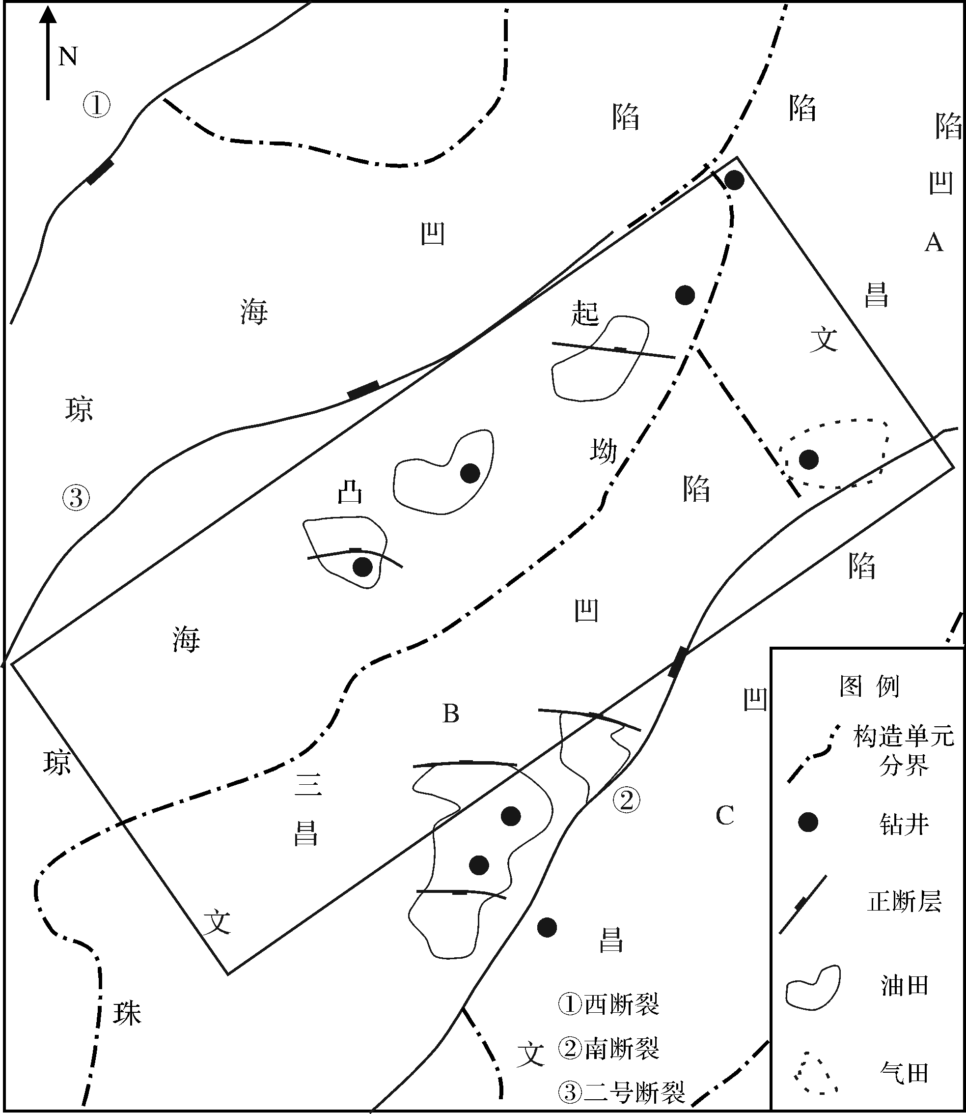
2020, 38(6): 1313-1326.
doi: 10.14027/j.issn.1000-0550.2020.007
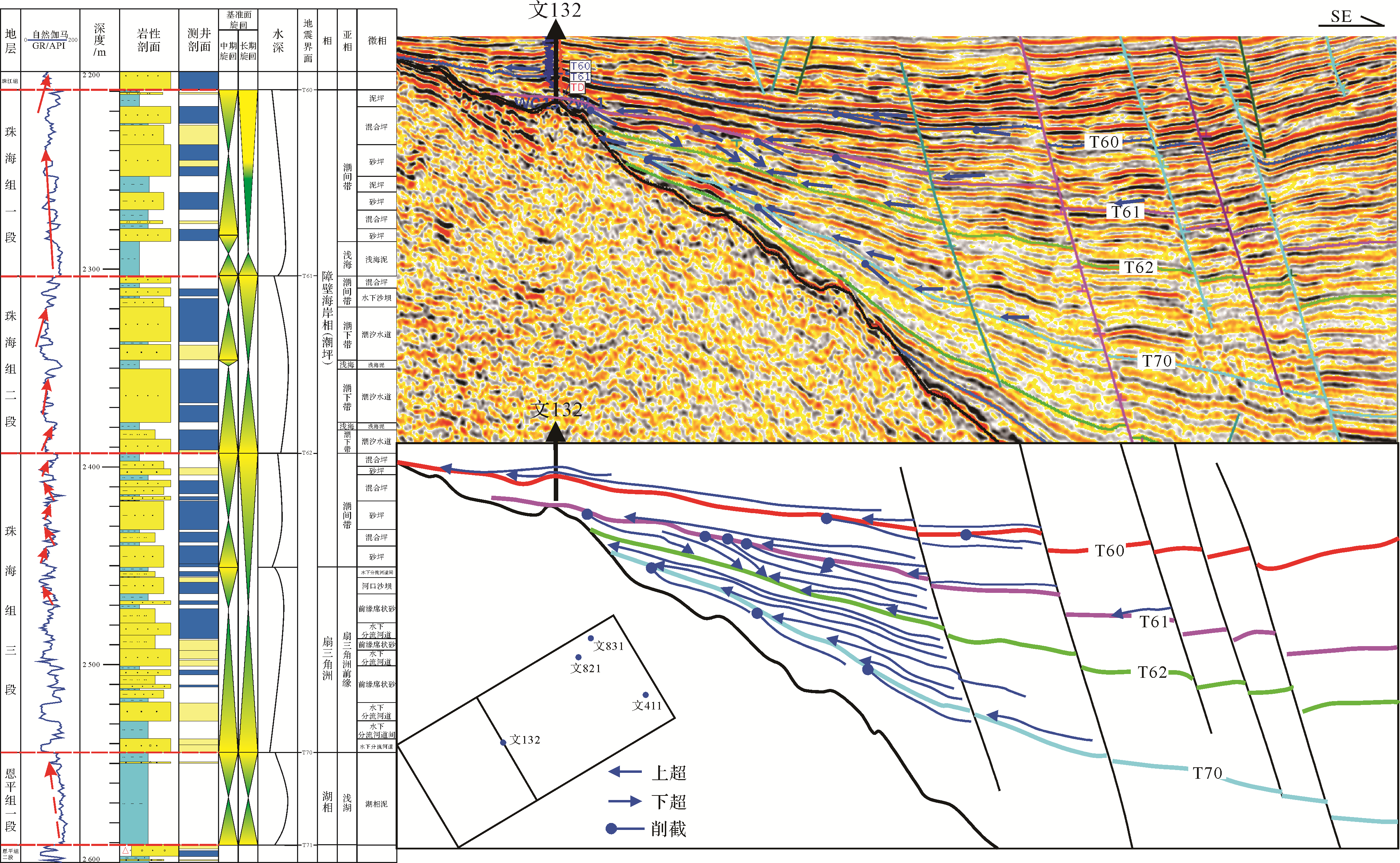
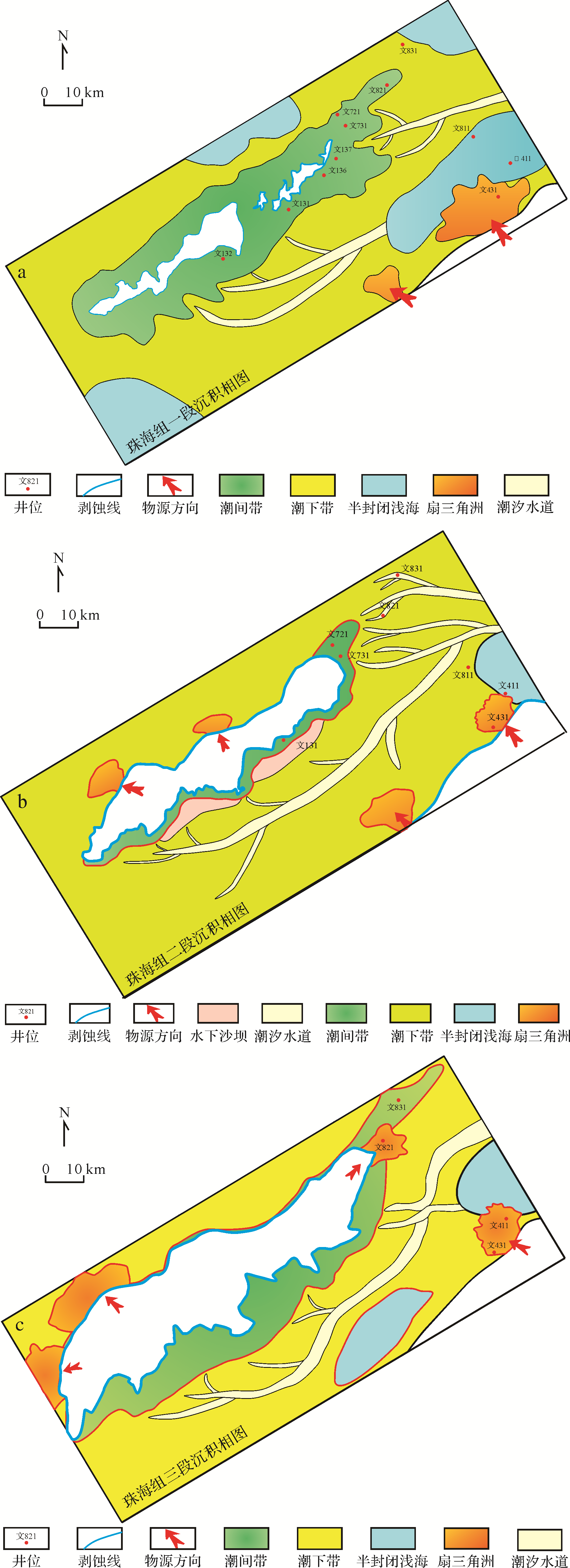
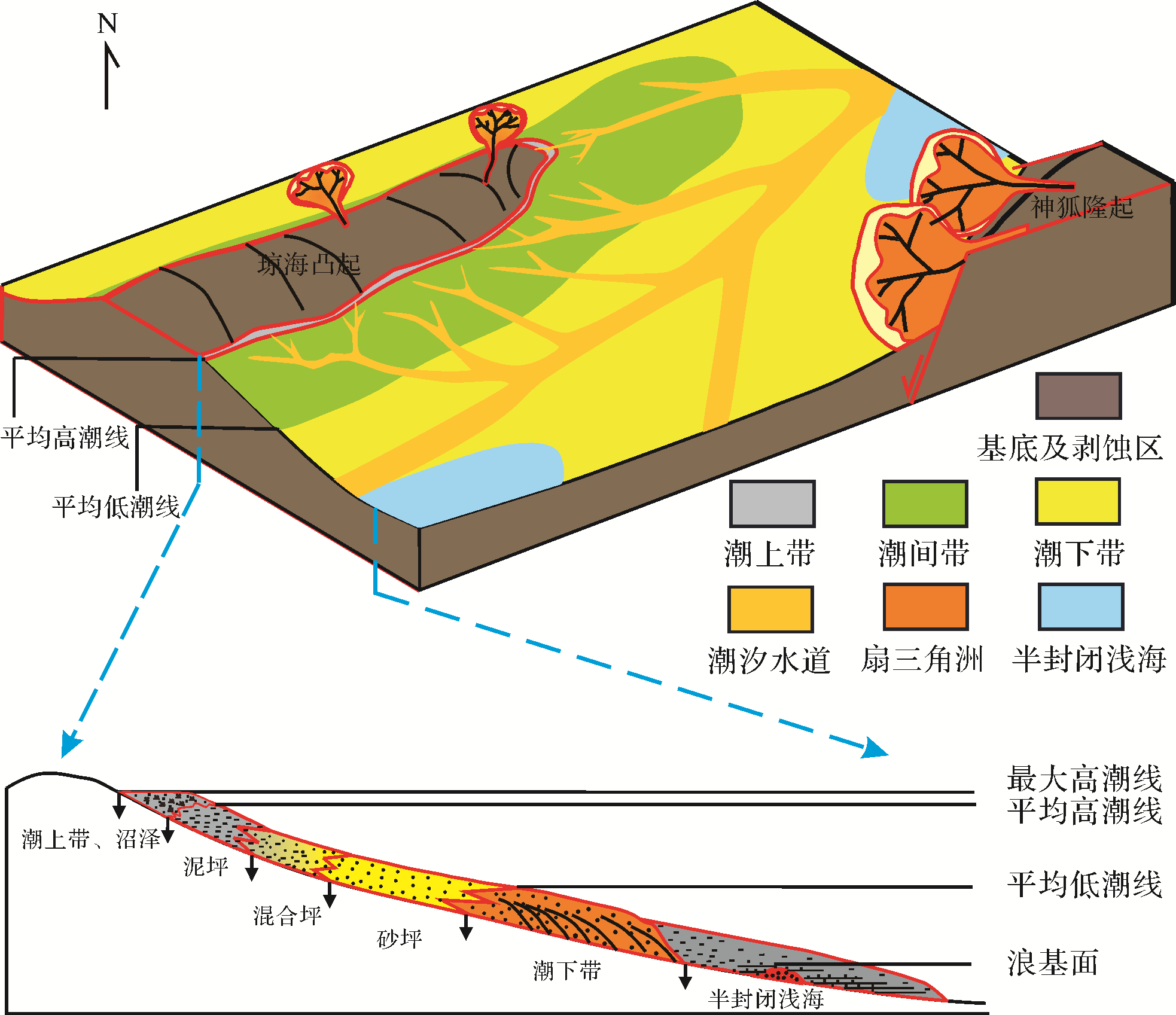
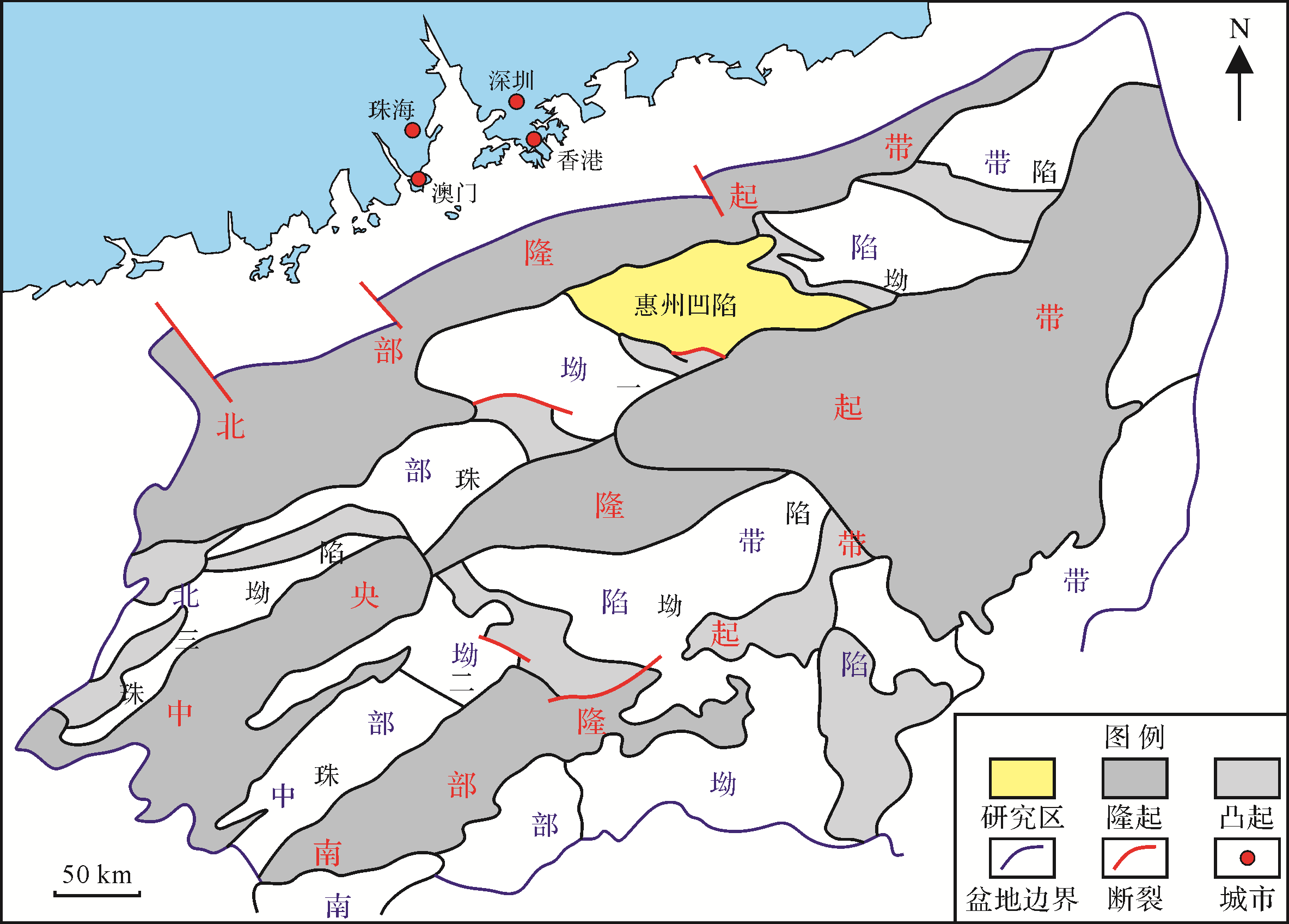
Abstract:
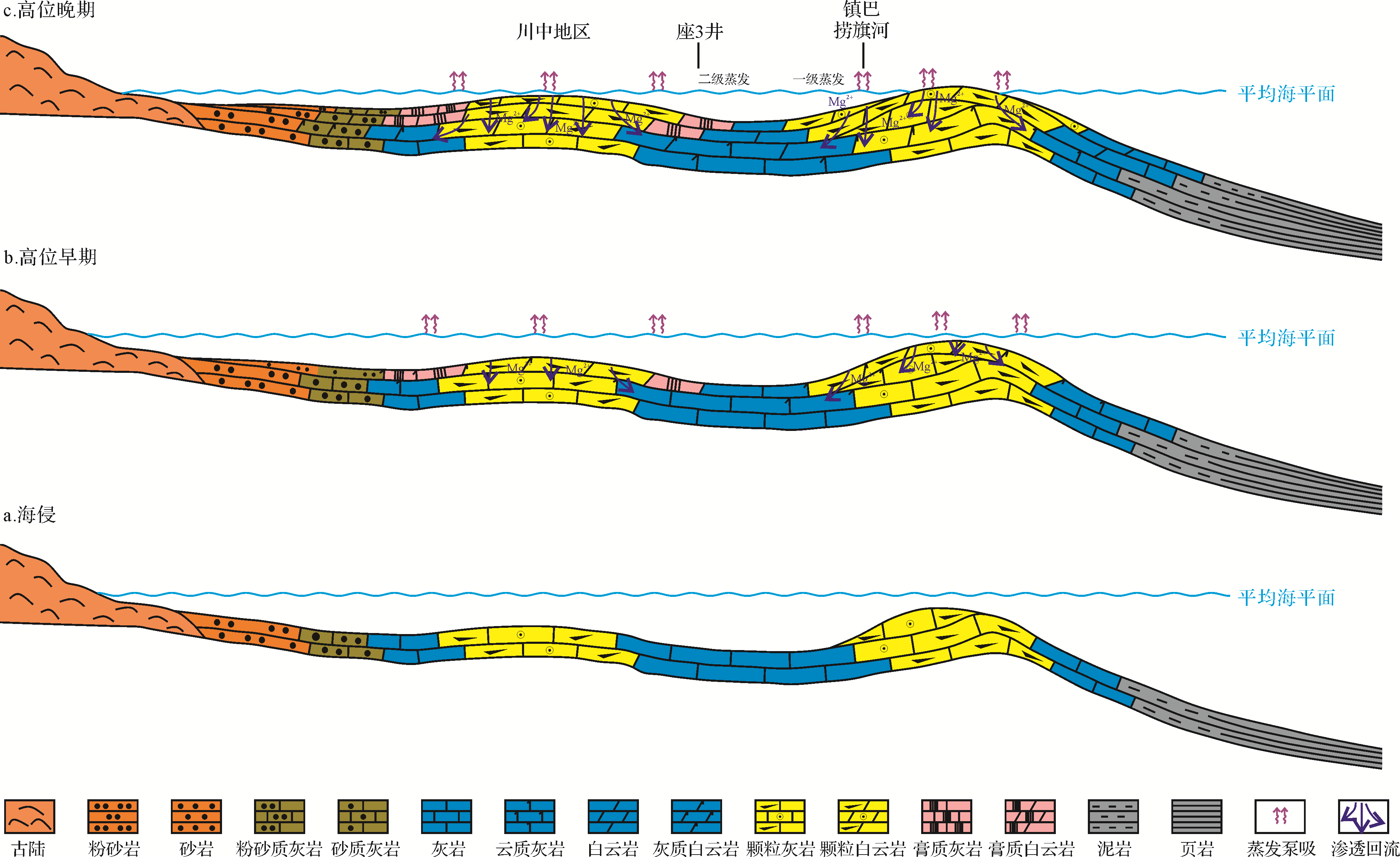
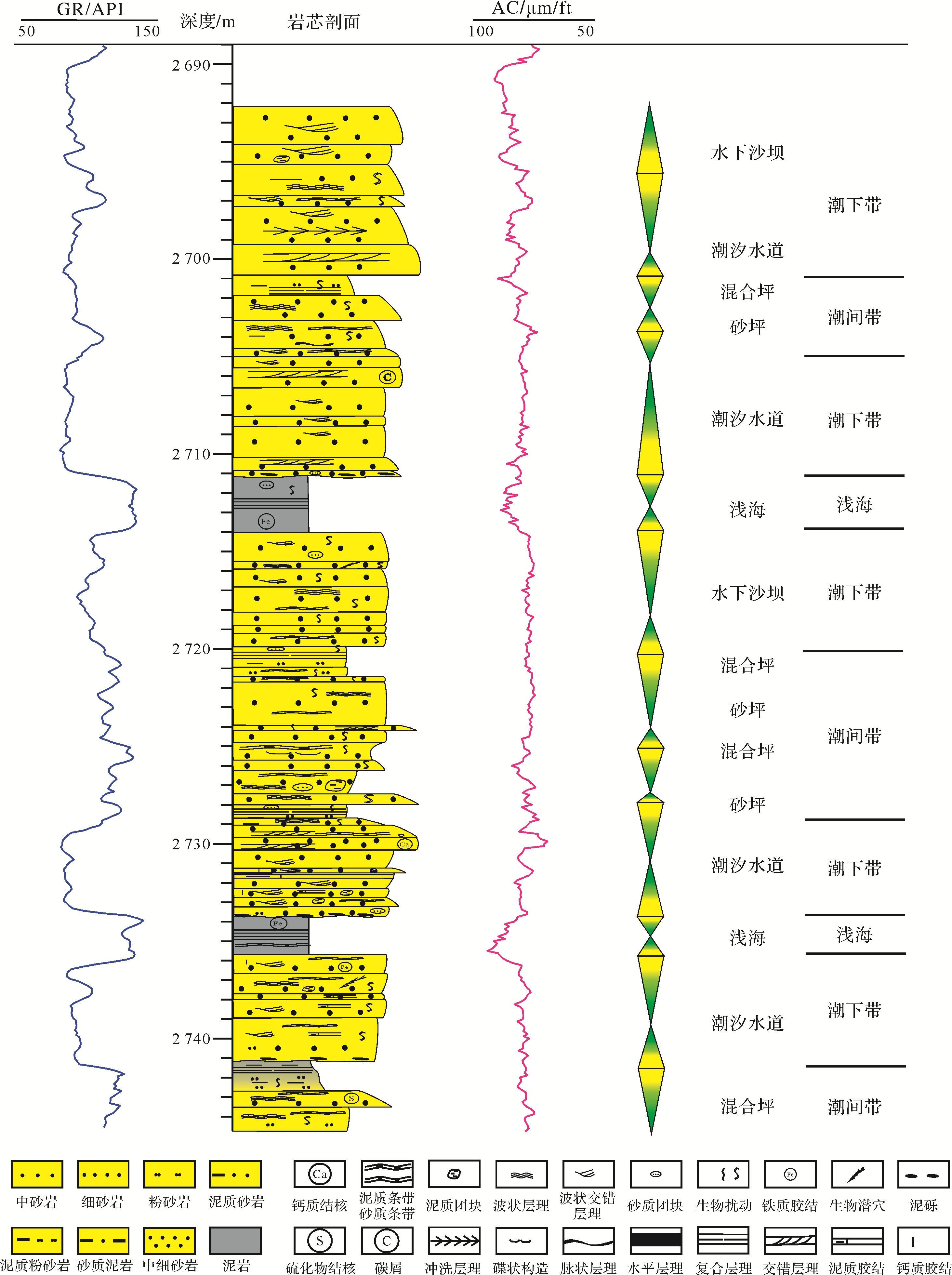
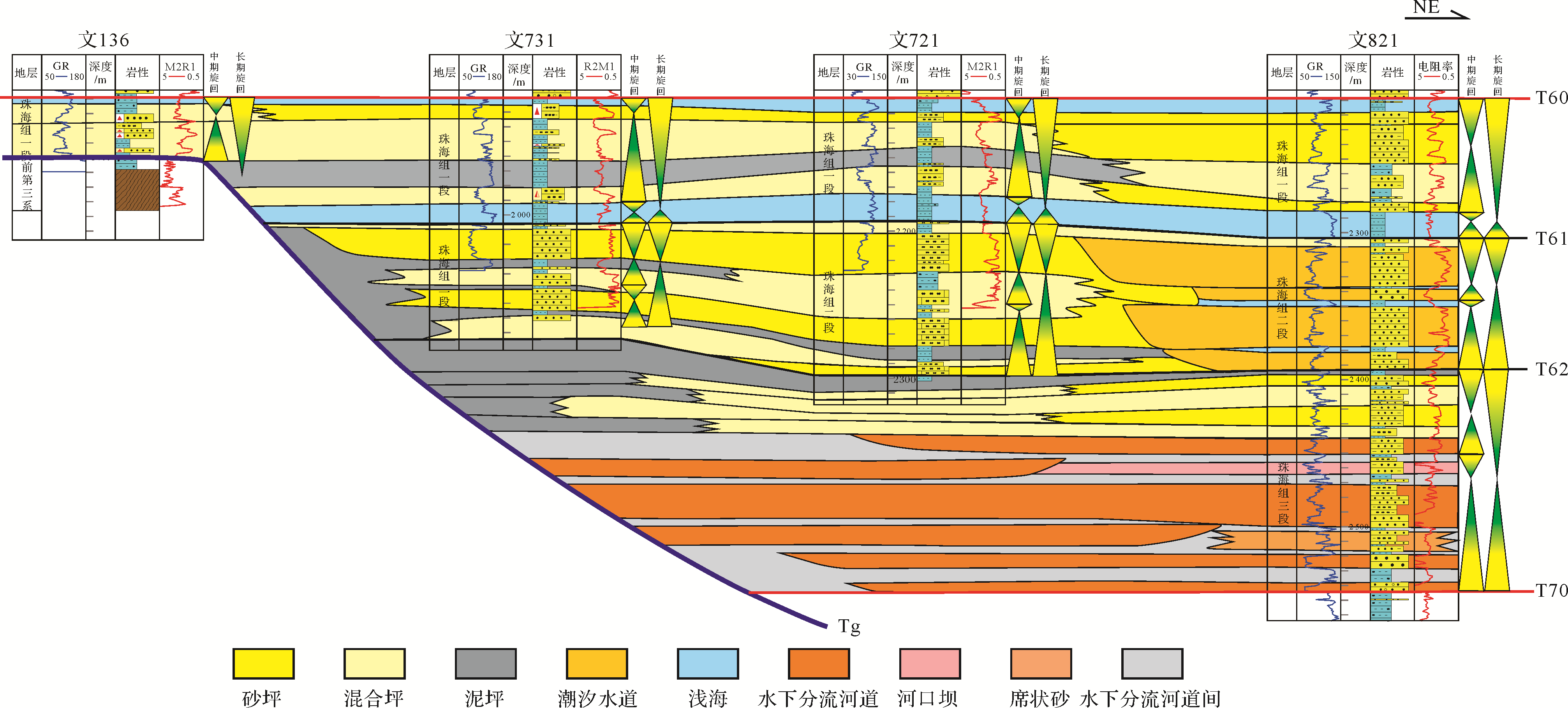
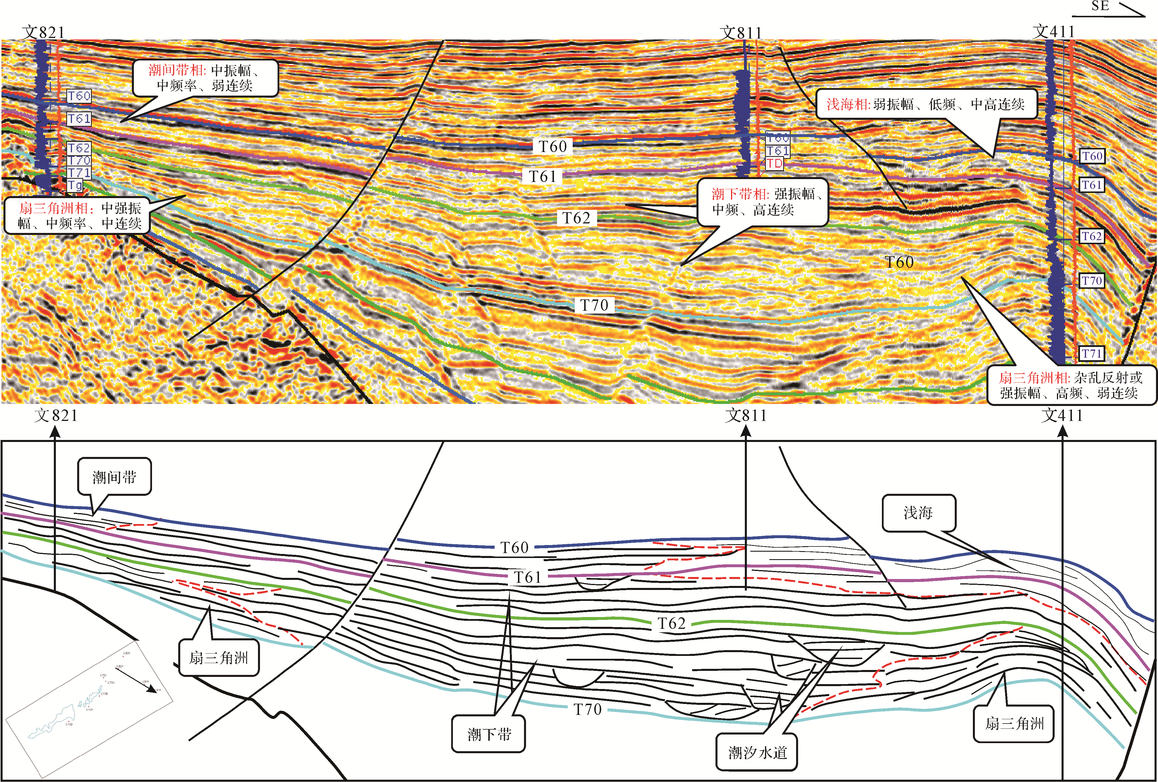
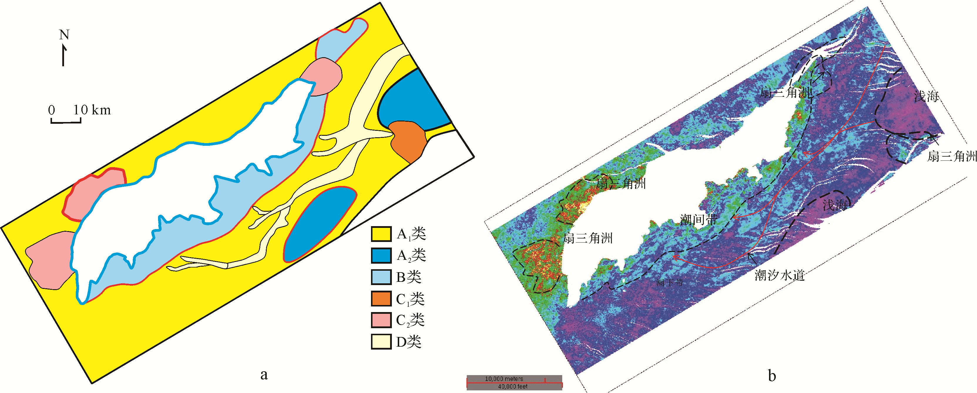
The northern slope of Wenchang B Sag lies between the Sag and the Qionghai Uplift, With the deepening of exploration, the breakthrough in this area becomes increasingly important. The Zhuhai Formation is an important oil bearing formation in the Wenchang area, but the lack of systematic research on the sedimentary characteristics of Zhuhai Formation in the area has limited further exploration. Firstly, the sequence interface was identified, and the Zhuhai Formation was divided into three long⁃term cycles and six intermediate cycles by high⁃resolution sequence stratigraphy based on core, logging and seismic data. The stratigraphic sequence was divided to identify the seismic facies and analyze the sedimentary characteristics and evolution of the Zhuhai Formation. A comprehensive study has shown three sequences: tidal complex stratification, pinnate cross⁃stratification of two⁃way flow, and strong biological disturbance and wormhole structures widely developed in the study area, which are intertidal and subtidal deposits typical of tidal flats. Seven typical seismic facies were identified from the three seismic sequences, and the relationship between the seismic and sedimentary facies was established to study their distribution. During deposition of the three sections of the Zhuhai Formation, seawater began to invade the basin. Due to the obscuration by the Shenhu Uplift, the sediment was controlled by tidal action, and was mainly deposited in the subtidal and intertidal zones. A short source fan delta was deposited at the margin of the bulge. The tidal effect of the second section of the Zhuhai Formation was strengthened, producing a subtidal zone which is widely distributed throughout the study area. During initial Zhuhai Formation deposition, the barrier gradually disappeared as the transgression intensified; tidal action gradually weakened, and the intertidal zone became more relatively developed. Subsequently the transgression was further intensified and gradually transitioned to normal shore⁃neritic sediments in the Neogene system. The subtidal and intertidal sand flat deposits of the high sequence system tract, and the upper mud flat deposits, or transgressive shallow sea mud deposits, now constitute a good reservoir caprock. The tidal channel and wedge⁃shaped underwater bar sedimentary sand bodies are thick and well sorted, and are likely to be high⁃quality reservoirs and favorable exploration targets.
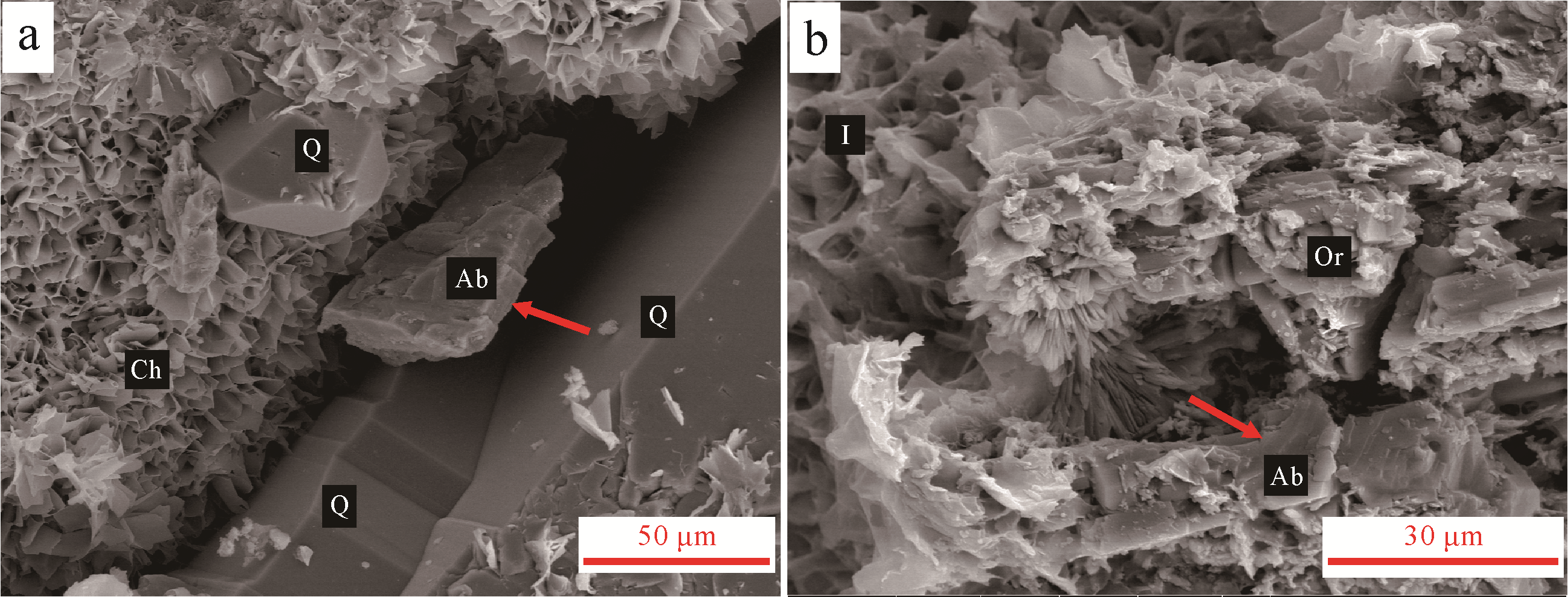
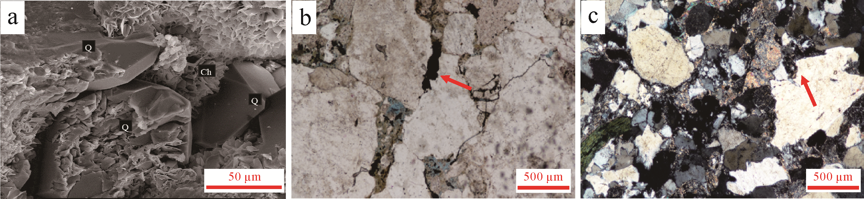
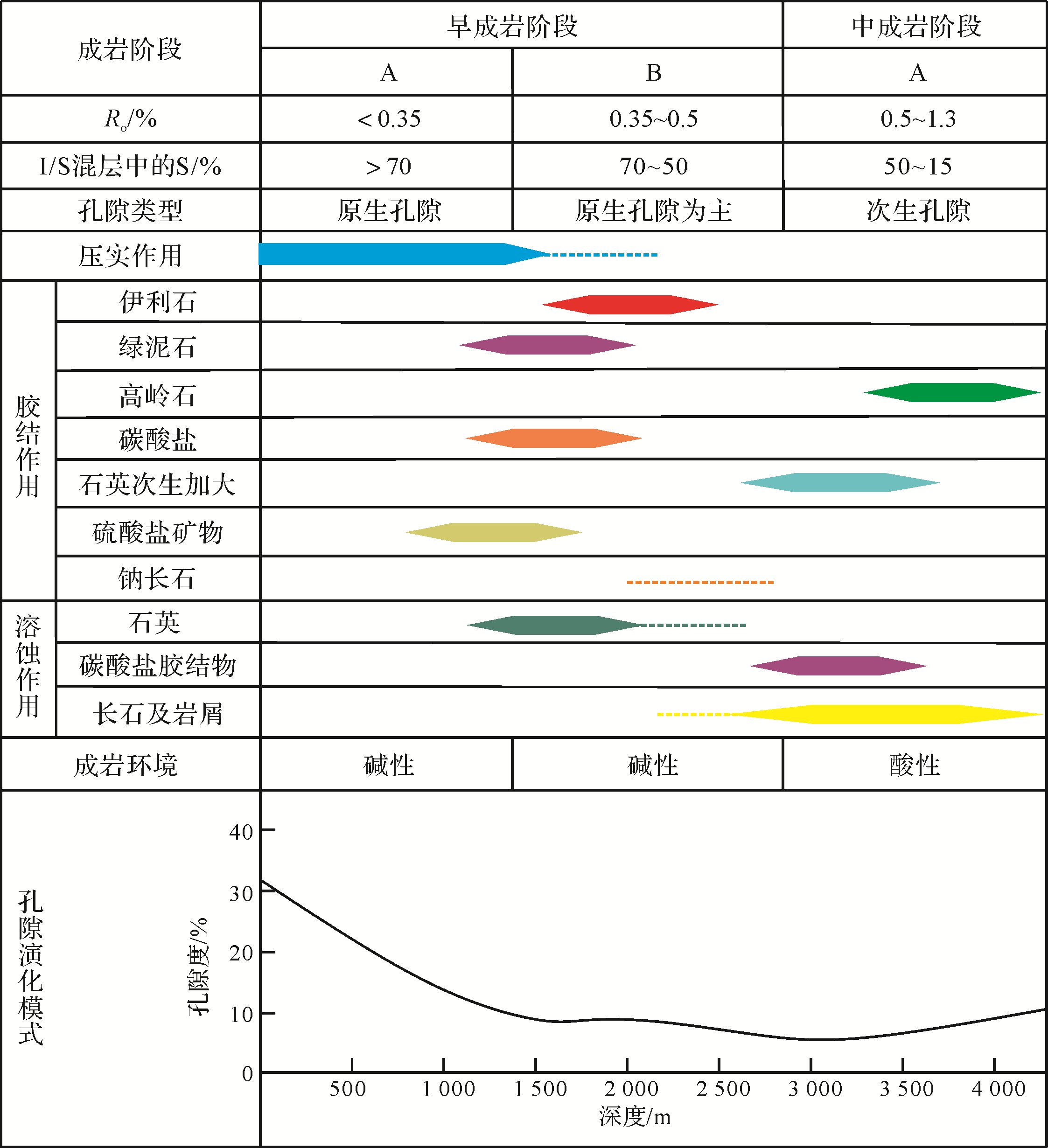
2020, 38(6): 1327-1337.
doi: 10.14027/j.issn.1000-0550.2020.011
Abstract:
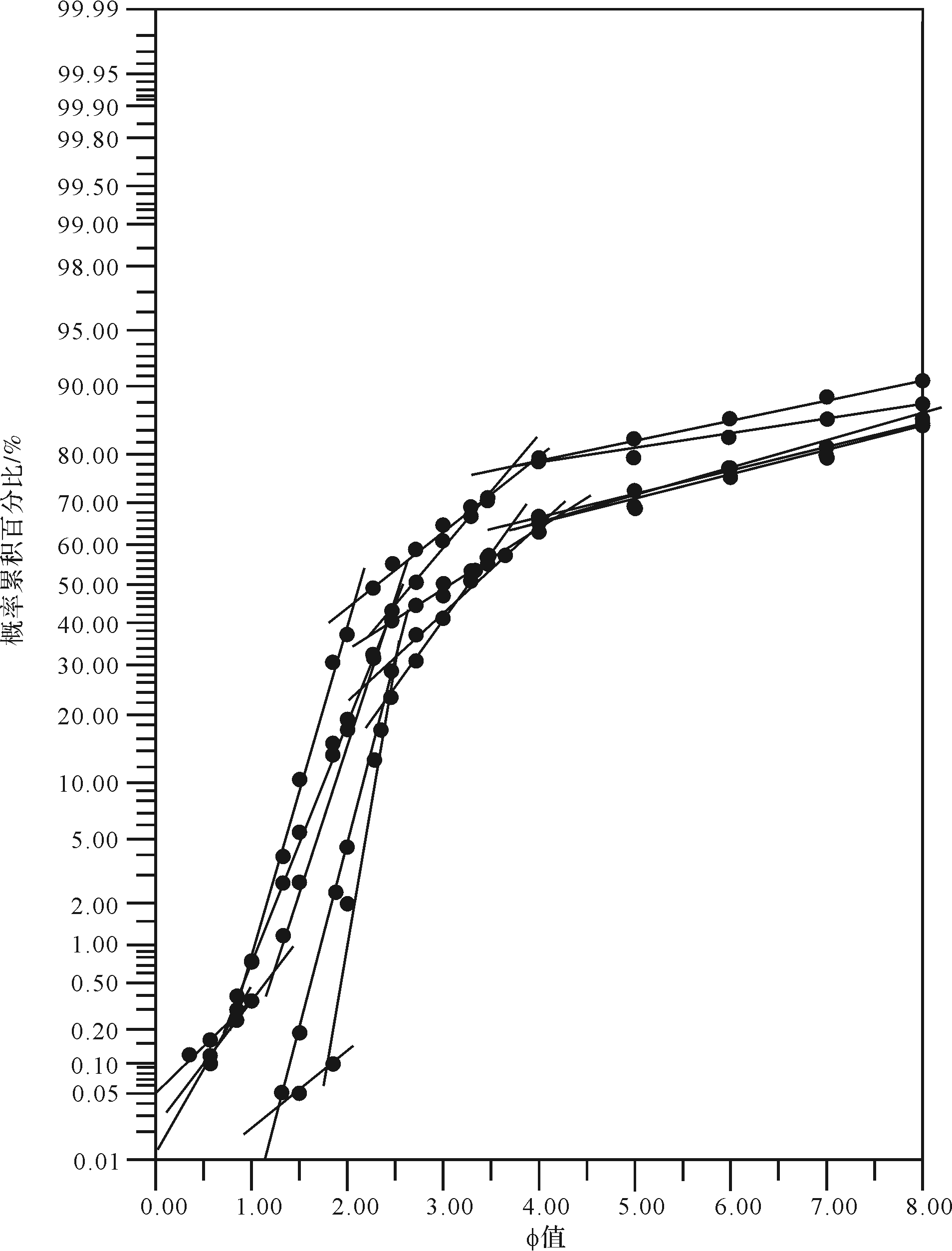
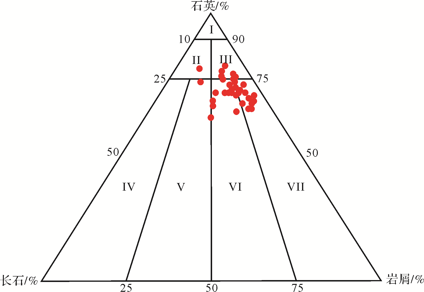
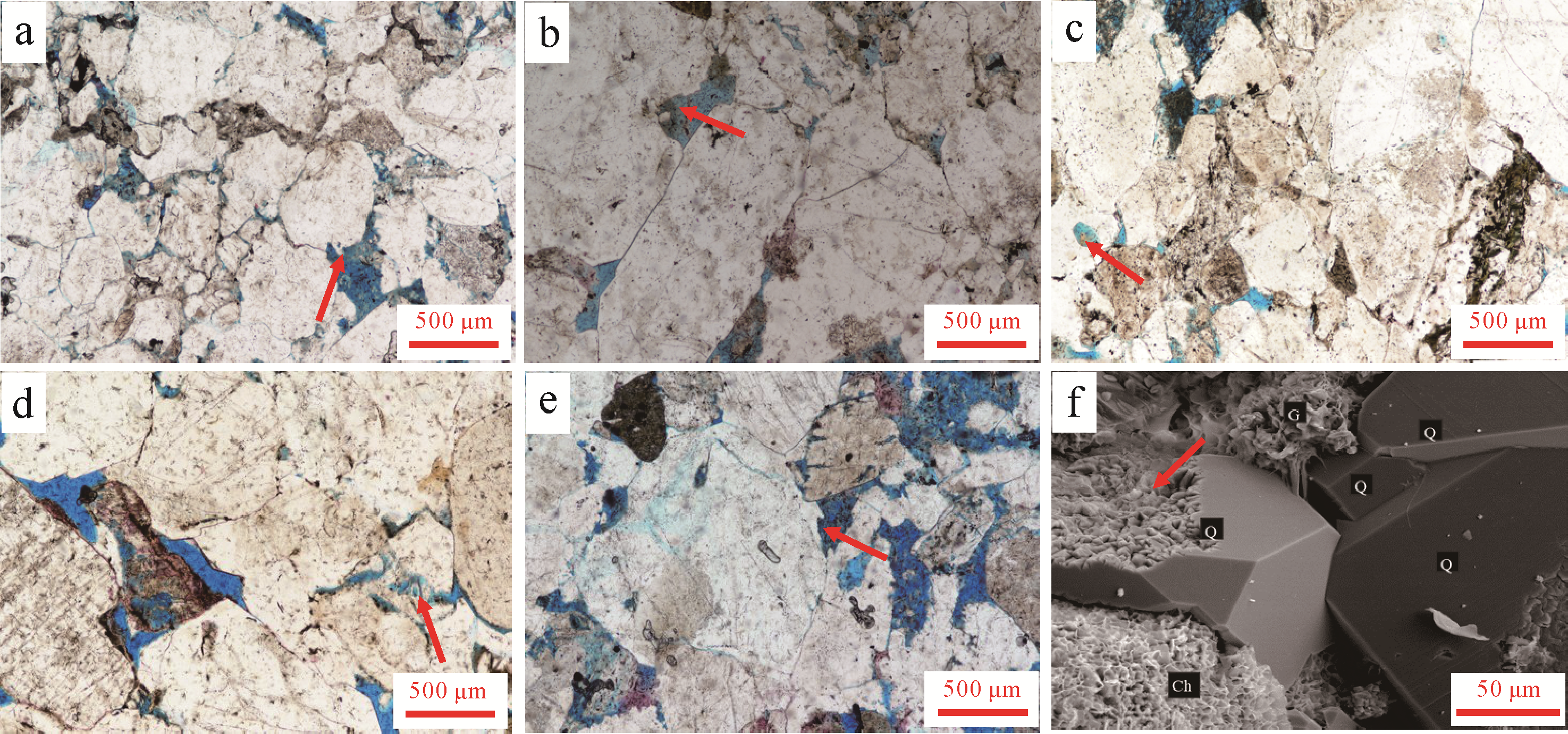
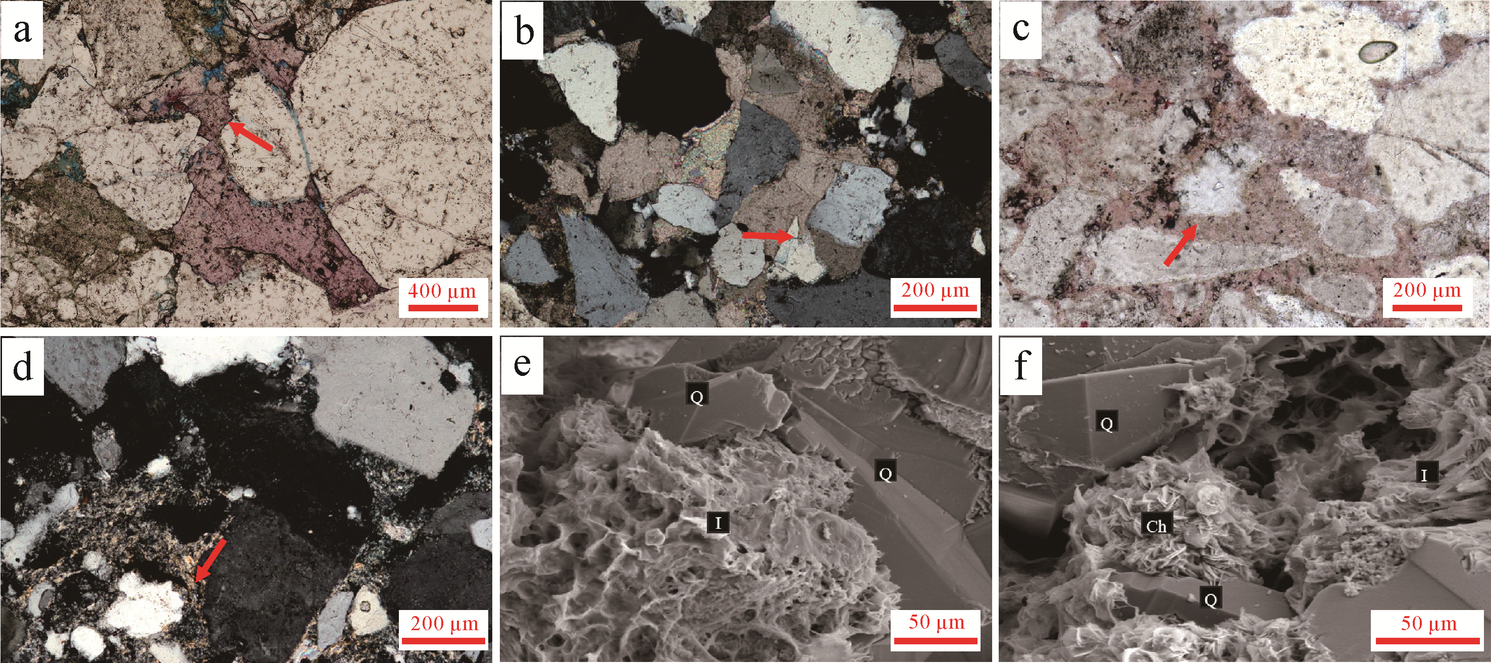
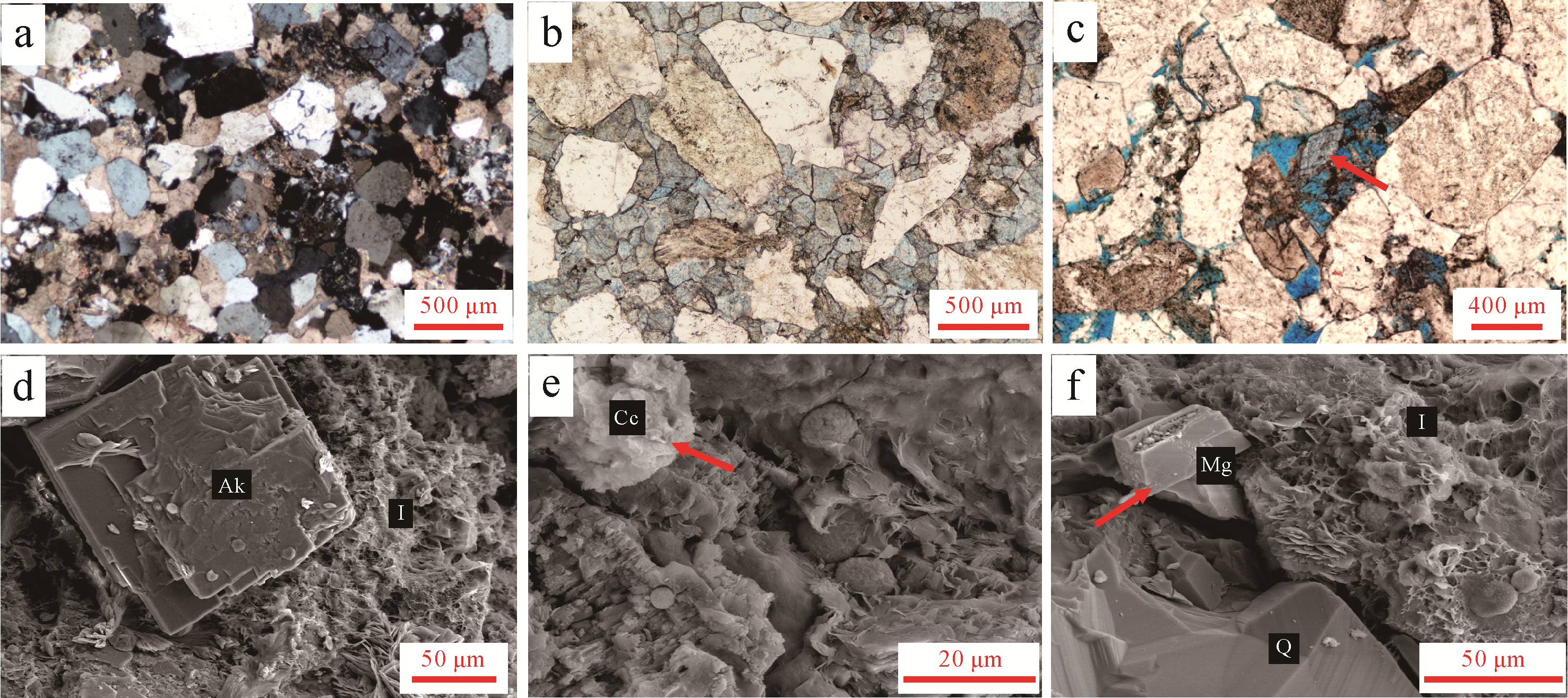
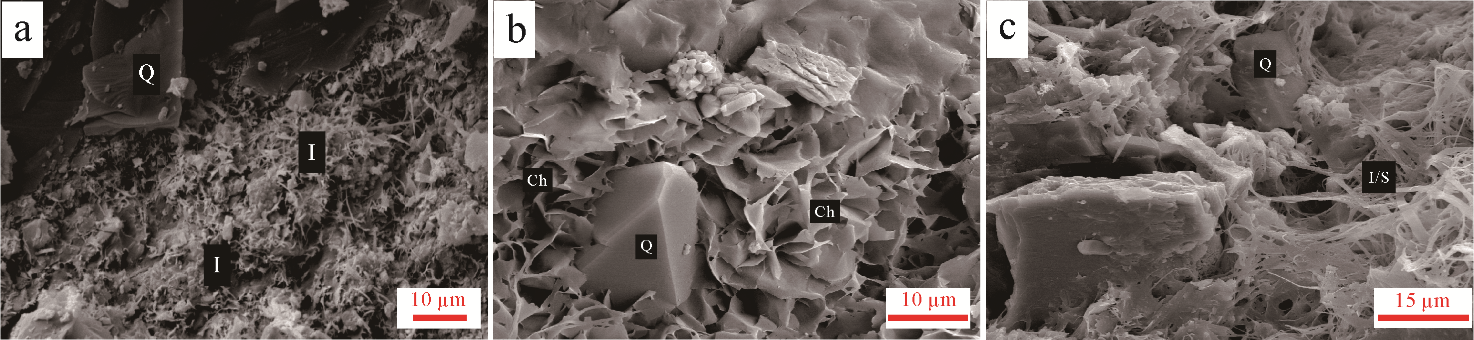
The petrological characteristics, diagenesis and porosity evolution of Zhuhai Formation reservoirs in the eastern Huizhou Sag were studied based on data from thin sections, scanning electron microscopy, grain⁃size analysis and X⁃ray diffraction. The reservoir rock types are mainly lithic sandstone, feldspathic lithic sandstone, lithic quartz sandstone and lithic feldspathic sandstone with both low compositional and structural maturity. There is clear evidence of alkaline diagenesis during sandstone burial, such as quartz dissolution and metasomatism, carbonate cementation, precipitation of illite and chlorite, and albitization. The alkaline diagenesis has had many effects on pores, including quartz dissolution to form secondary solution pores, carbonate cement precipitation infilling intergranular pores and clay mineral precipitation forming intergranular micropores. The Zhuhai Formation in the study area now contains mainly intra⁃and intergranular dissolution pores, with fewer primary pores. The reservoirs are at the middle of stage A diagenesis, symptomatic of strong compaction. The original porosity has been reduced from 32.1% to 8.8%. The early diagenetic stage is evidence of an alkaline environment. During this stage, quartz dissolution increased the porosity by about 0.5%, and precipitation of carbonate, sulfate and illite cements reduced porosity by about 2.3%. The middle of stage A diagenesis represents an acidic environment, in which feldspar and debris dissolution increased porosity by about 4.3%. Quartz formed secondary overgrowth edges and kaolinite was precipitated, reducing porosity by about 1.2%. The final porosity is 10.1%.
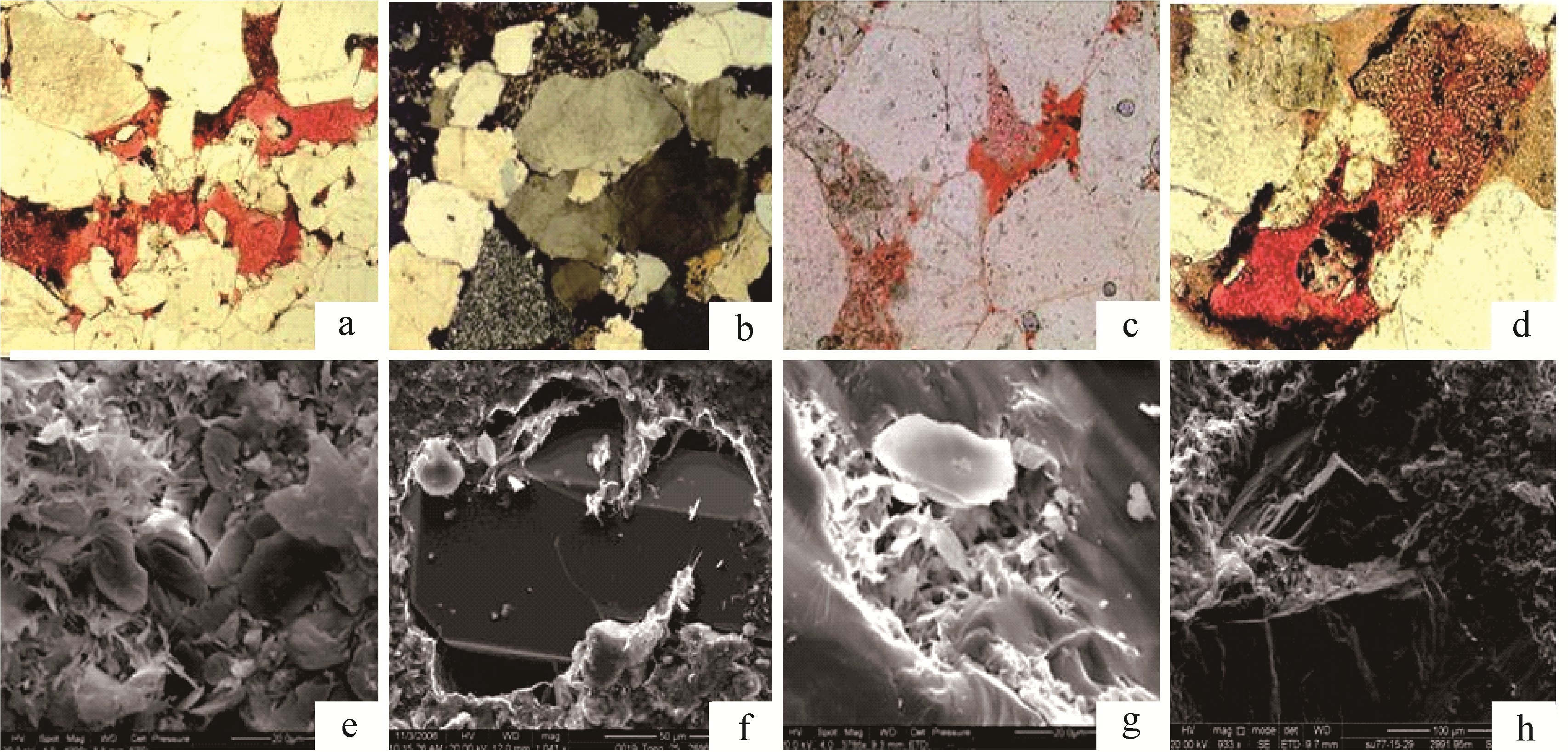
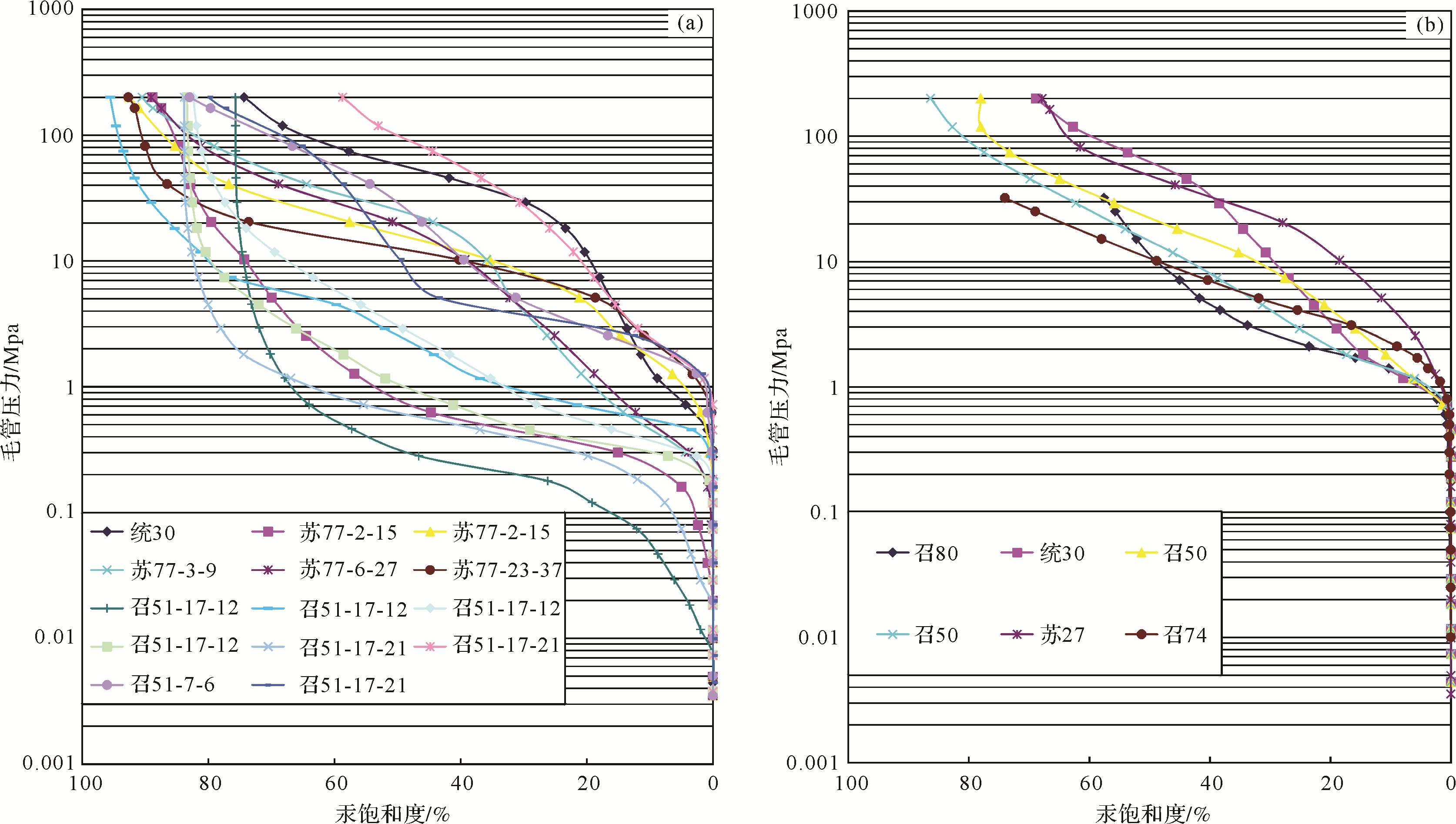
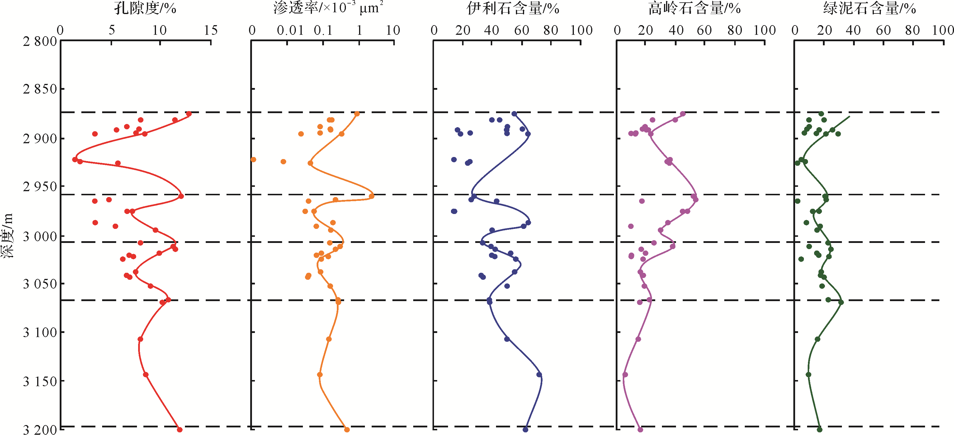
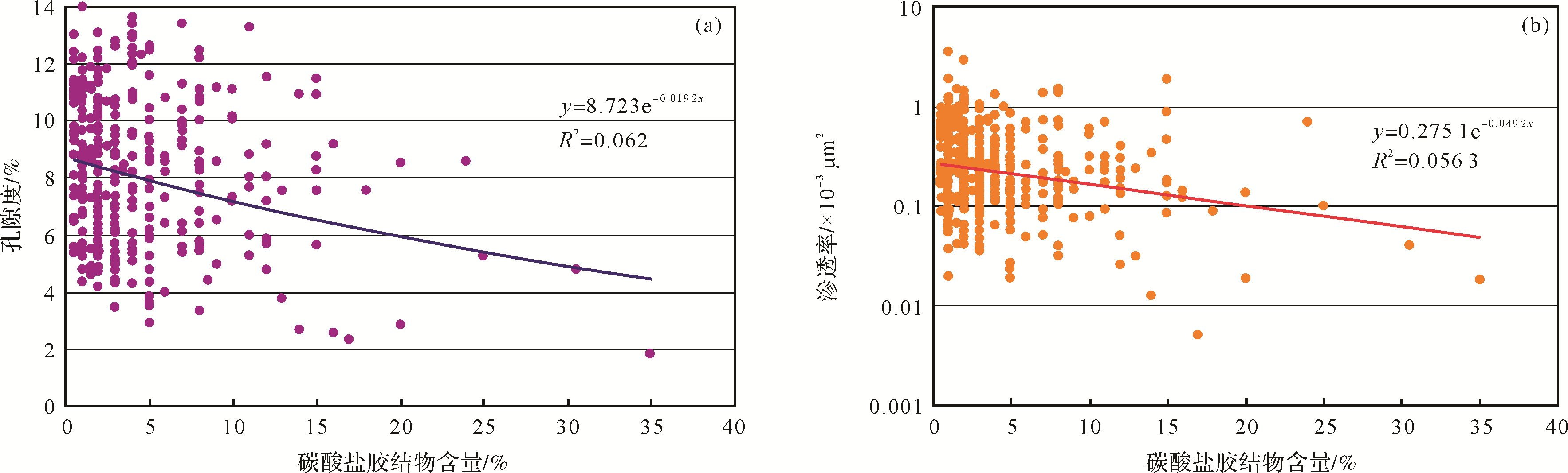
2020, 38(6): 1338-1348.
doi: 10.14027/j.issn.1000-0550.2019.122
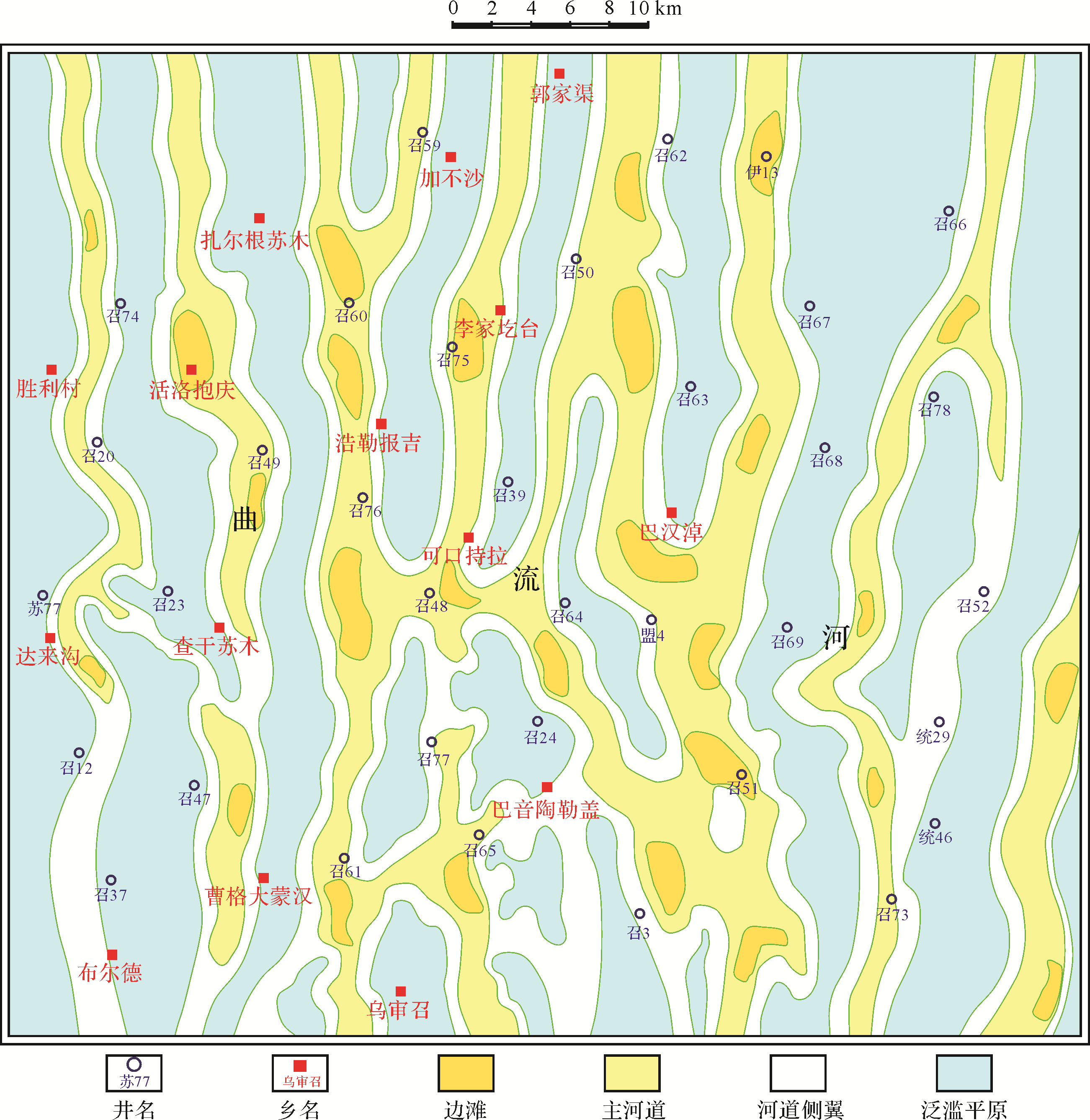
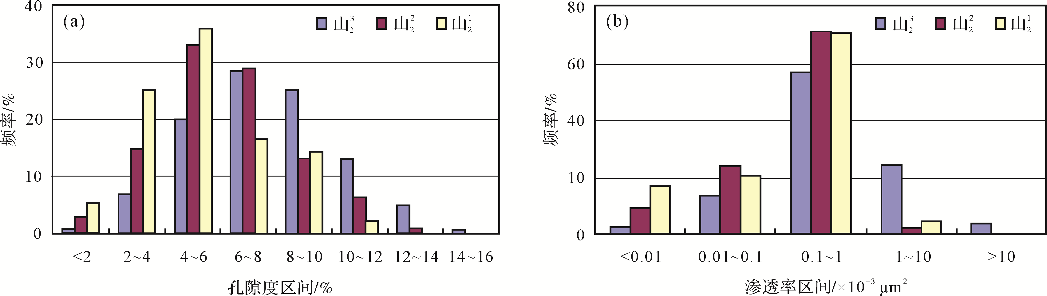
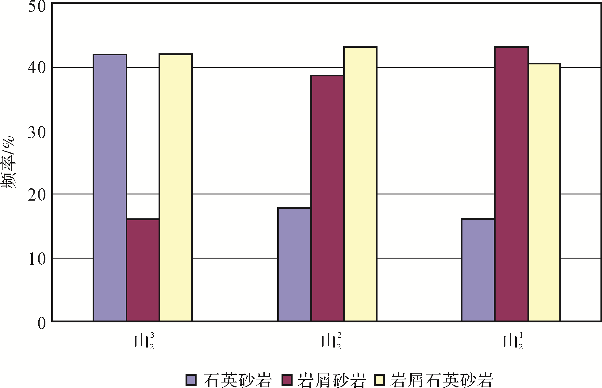
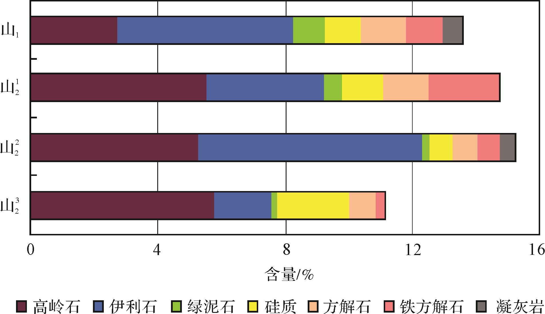
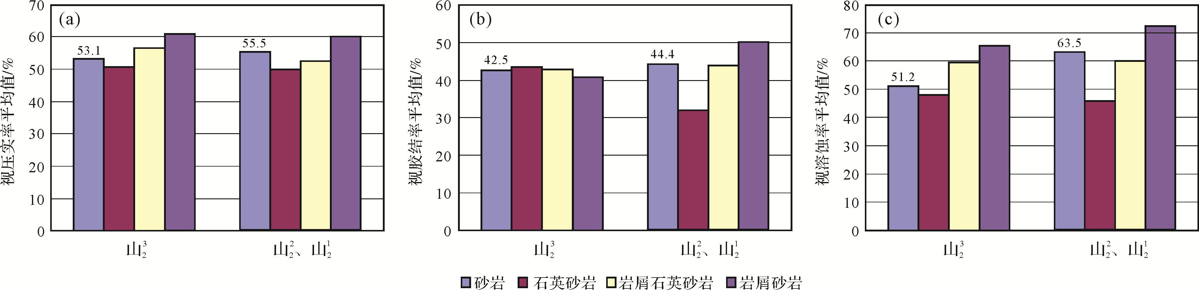
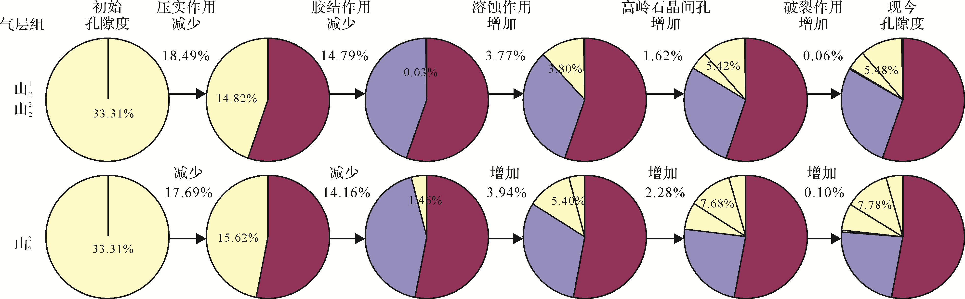
Abstract:
Meandering rivers developed from north to south formed the second member of the lower Permian Shanxi formation (P1 s 2) in Su77 block, Sulige gas field. The sedimentary characteristics of each gas⁃bearing member were consistent. The first and second members are tight sandstone reservoirs with low levels of residual intergranular and secondary pores due to intense compaction and cementation, with an average porosity less than 7% and average permeability less than 0.3×10⁻³ μm2. These members are less permeable than the third gas⁃bearing member of P1 s 2 (average porosity 7.7%; average permeability 1.74×10⁻³ μm2). The change in porosity was quantitatively analyzed in the present study as functions of the apparent rates of compaction, cementation and dissolution in order to measure the degree of diagenesis. The calculations indicate that the first and second gas⁃bearing members of P1 s 2 suffered medium compaction, less intense cementation, and intense dissolution. Compared to the third gas⁃bearing member of P1 s 2, the reduction in porosity caused by compaction and cementation was much greater than the increase by dissolution and rupturing in the other members, which are poor reservoirs, currently with a porosity of only 5.48%.