2021 Vol. 39, No. 2
Display Method:
2021, 39(2): 269-280.
doi: 10.14027/j.issn.1000-0550.2020.132
Abstract:
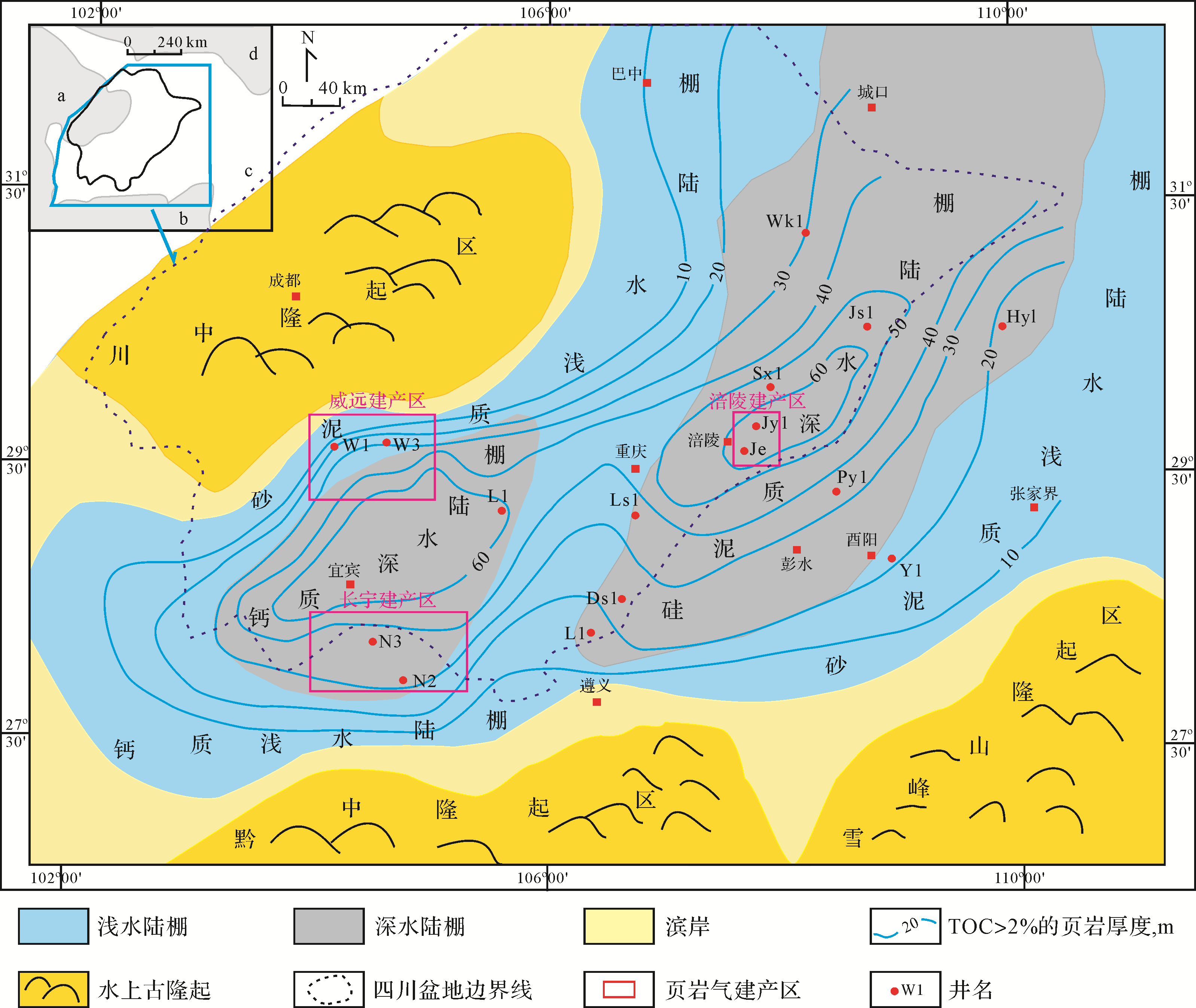
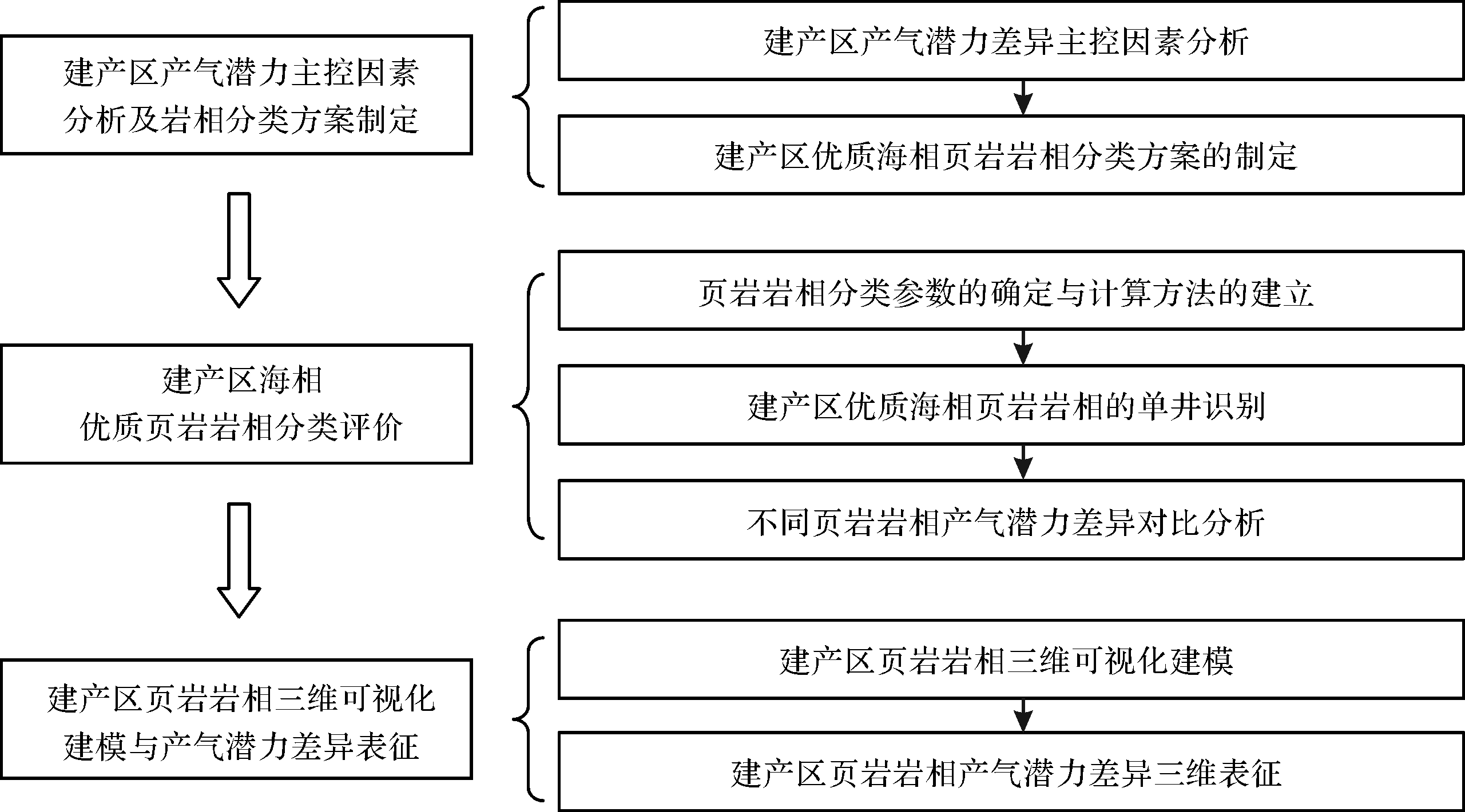
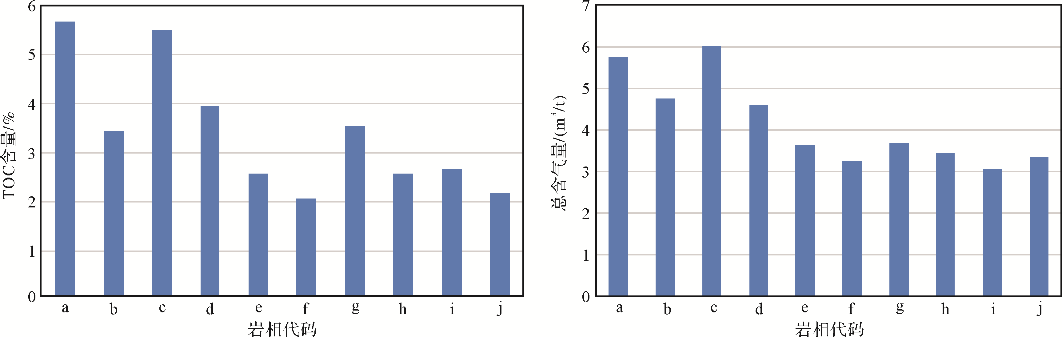
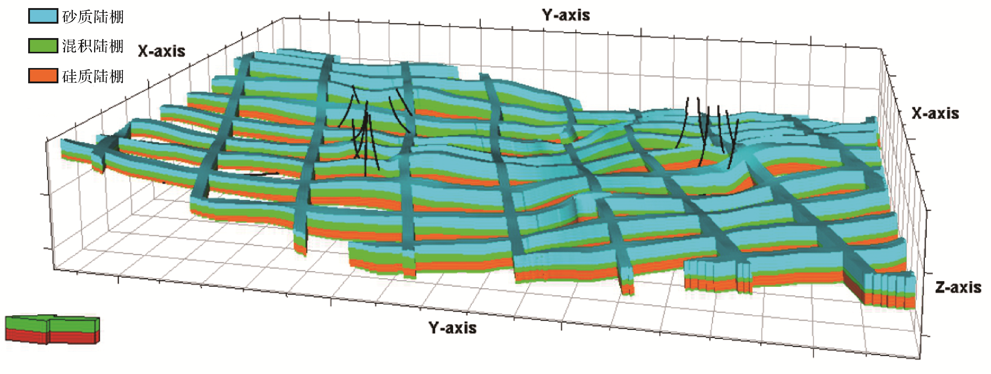
The gas production capacity difference among single wells and the difficulties in sustaining stable production are the key problems faced by shale gas production areas. Based on the typical characteristics of the shale gas production areas, a technical process for the lithofacies classification of high-quality marine shale affected by the gas production capacity was established in this paper. Firstly, for the high-quality marine shale in the shale gas production area, the main gas production capacity difference control factors were analyzed, and the lithofacies classification scheme was determined. Then, using the developed logging calculation model of total organic carbon (TOC) content, porosity, clay, siliceous, and calcareous mineral content, the single well parameter calculation and the lithofacies identification in one shale gas producing area were completed. A total of 10 types of shale lithofacies were identified in one shale gas production area, and the relationship between shale lithofacies type and gas production capacity difference was revealed by comparing the gas content of each lithofacies. Finally, a three-dimensional (3D) lithofacies model in one shale gas production area was established by using the truncated Gaussian simulation algorithm and the sedimentary microfacies confined lithofacies strategies, the spatial distribution characteristics of each kind of lithofacies were shown, and the gas production capacity difference in the Wufeng-Longmaxi black shale in the study area was revealed. At the same time, according to the two conditions of large volume proportion and great gas potential in 3D space, the three different lithofacies with excellent gas production capacity in the study area were determined as i. rich in carbon, high in porosity, calcium, muddy siliceous shale, ii. rich in both carbon and porosity mixed shale, and iii. high in carbon, medium to high in porosity, calcium, muddy siliceous shale. The above results are helpful for explaining the essential causes for the great difference in the decline amplitude and output effect of shale gas production areas, laying a solid theory foundation and technical support for fine production management in shale gas production areas.


2021, 39(2): 281-296.
doi: 10.14027/j.issn.1000-0550.2020.110
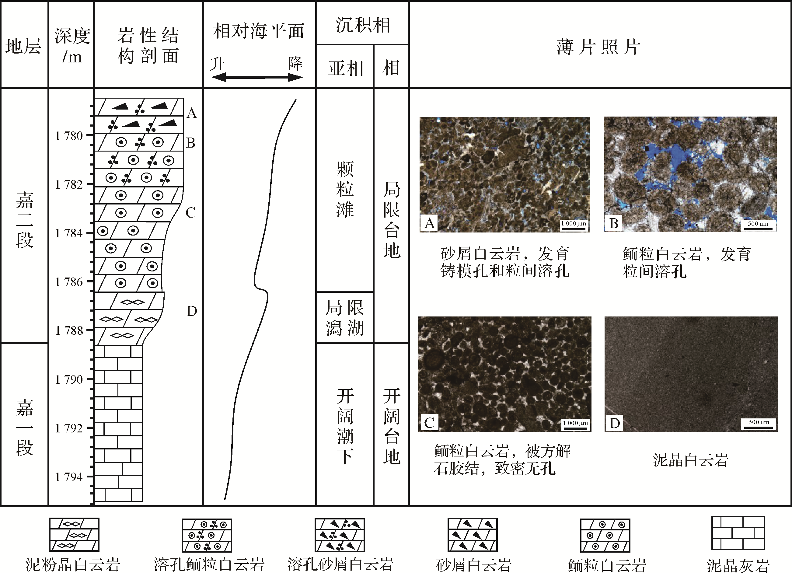
Abstract:
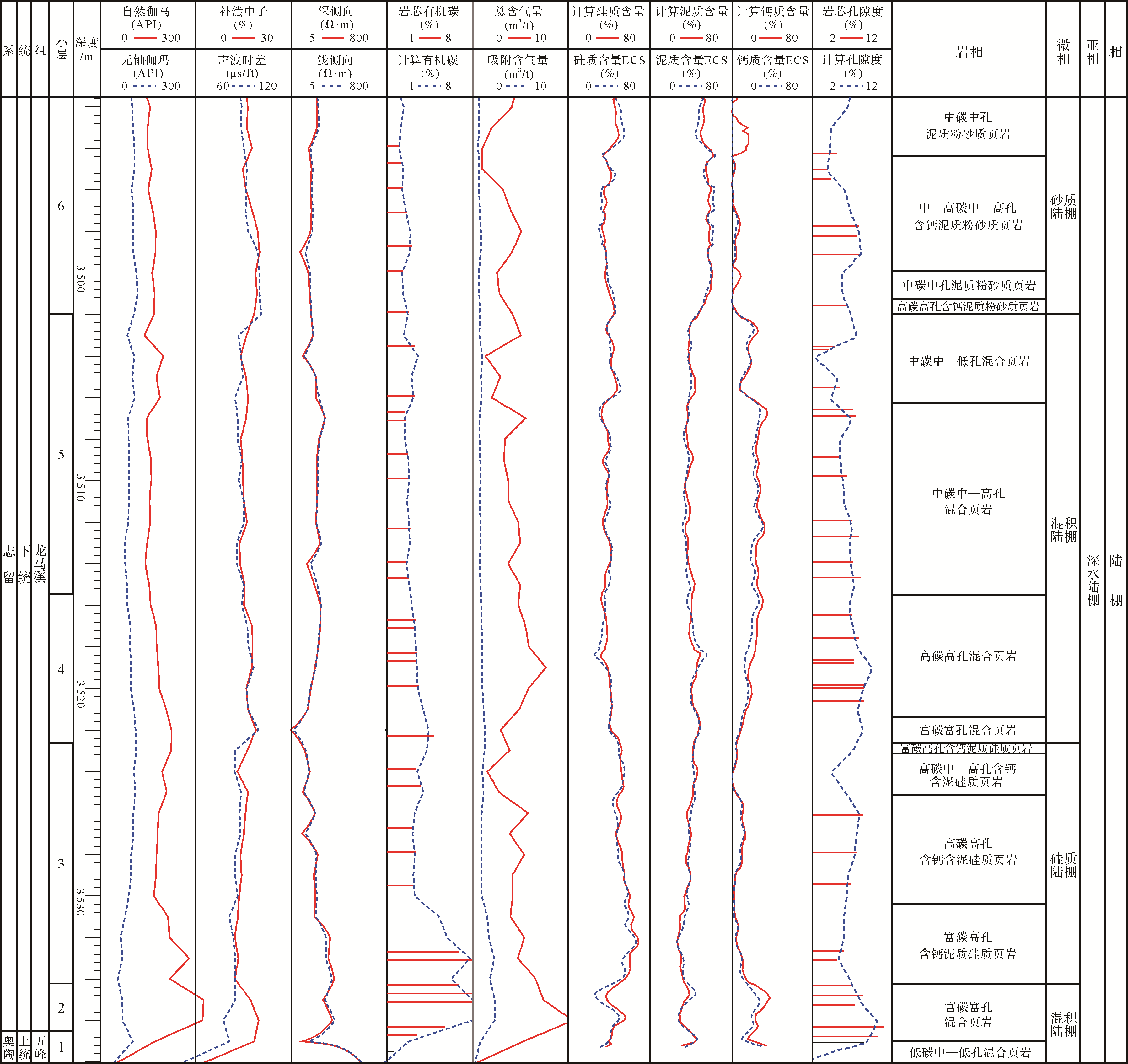
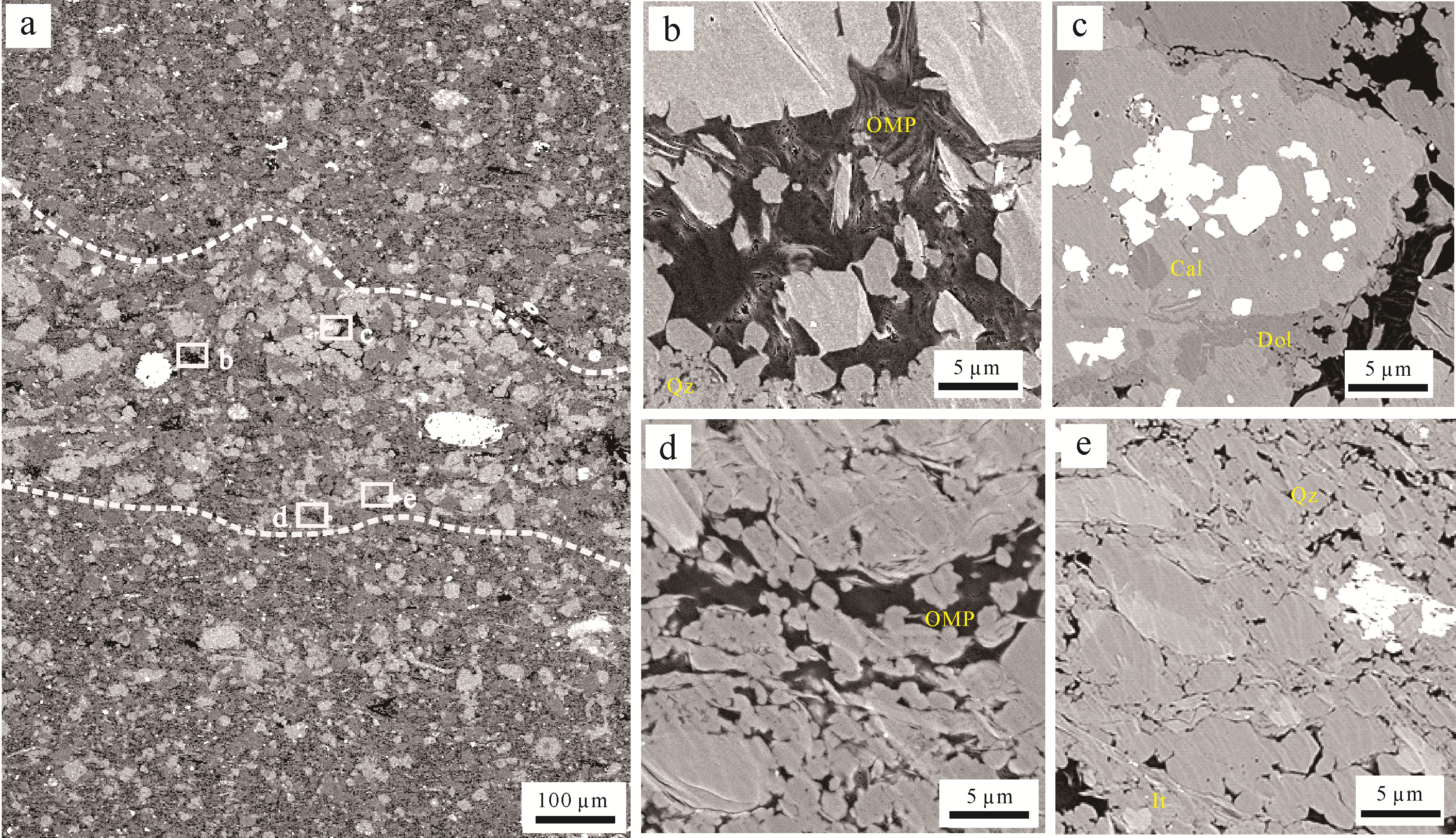
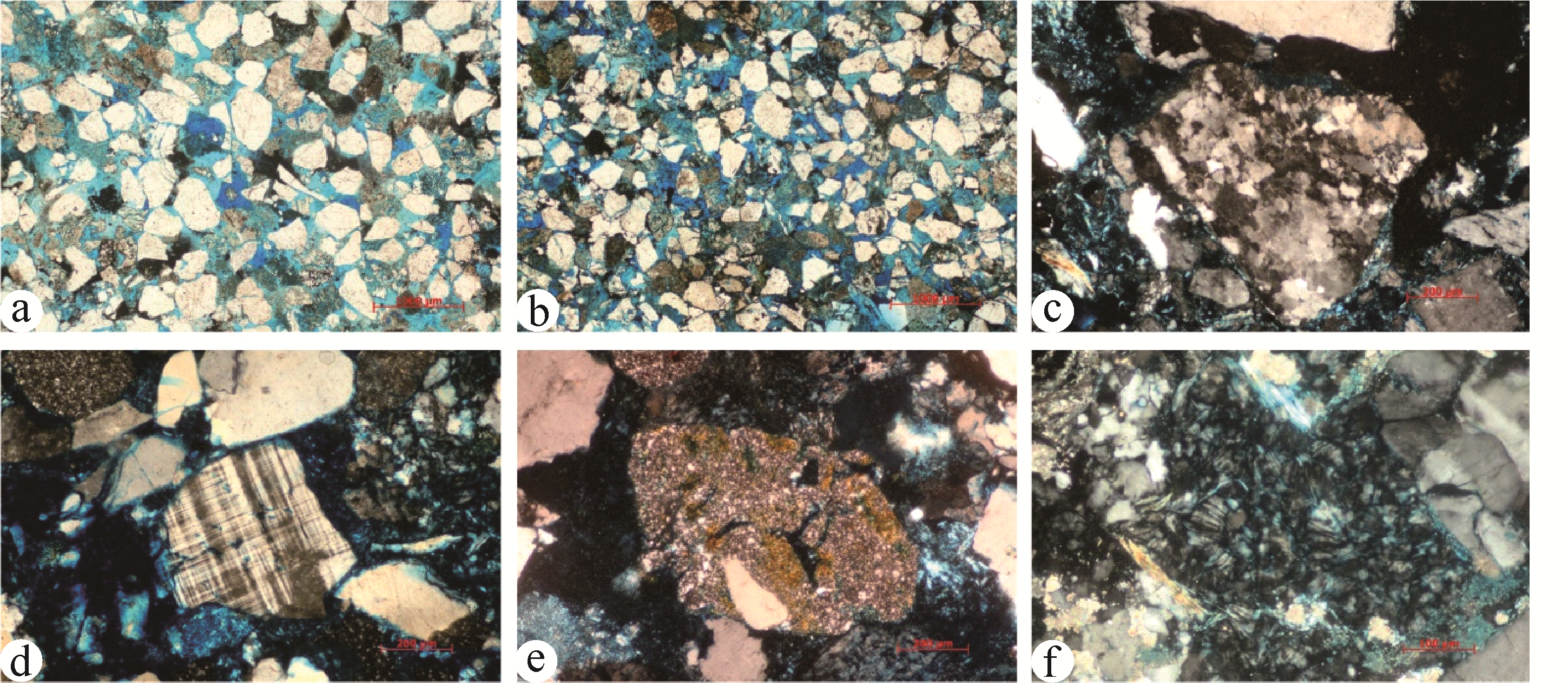
Lamination texture is of great significance in shale reservoir effectiveness. This study of the marine Silurian Longmaxi Formation in the Sichuan Basin used image logging, optical microscopy, field emission scanning electron microscopy (FE-SEM), porosity measurement, nitrogen adsorption testing and gas content testing to clarify the structural characteristics of shale laminations at different scales. The relative reservoir properties of the different shales were evaluated. The Longmaxi Formation contains sedimentary rock combinations of horizontal equi-thickness medium coarse shale laminae and a combination of horizontal, slightly wavy to medium coarse laminae shale, and horizontal beds of unequal thickness, thin laminae combinations, and also combinations with massive mudstones. The laminations mainly include quartz, carbonate minerals, organic matter and clay minerals. The carbonate laminations exhibit large pores in organic matter and inorganic matter. The laminated shales and massive mudstones reveal obvious differences in pore types, pore volumes, organic matter enrichment and gas content. The data from this study indicates that the reservoir properties of the medium coarse laminae combinations are superior to those of thin laminae combinations, which in turn are better than those of the massive mudstone. The medium coarse laminae combination is the priority exploration target in the Longmaxi Formation. Future research should focus on the hydrodynamic background of laminae texture formation and its influence on organic matter enrichment and reservoir stimulation. Relevant knowledge can provide an important reference and technical support for increasing the optimization and evaluation of favorable reservoirs in the Longmaxi Formation, Sichuan Basin.


2021, 39(2): 297-309.
doi: 10.14027/j.issn.1000-0550.2020.095
Abstract:
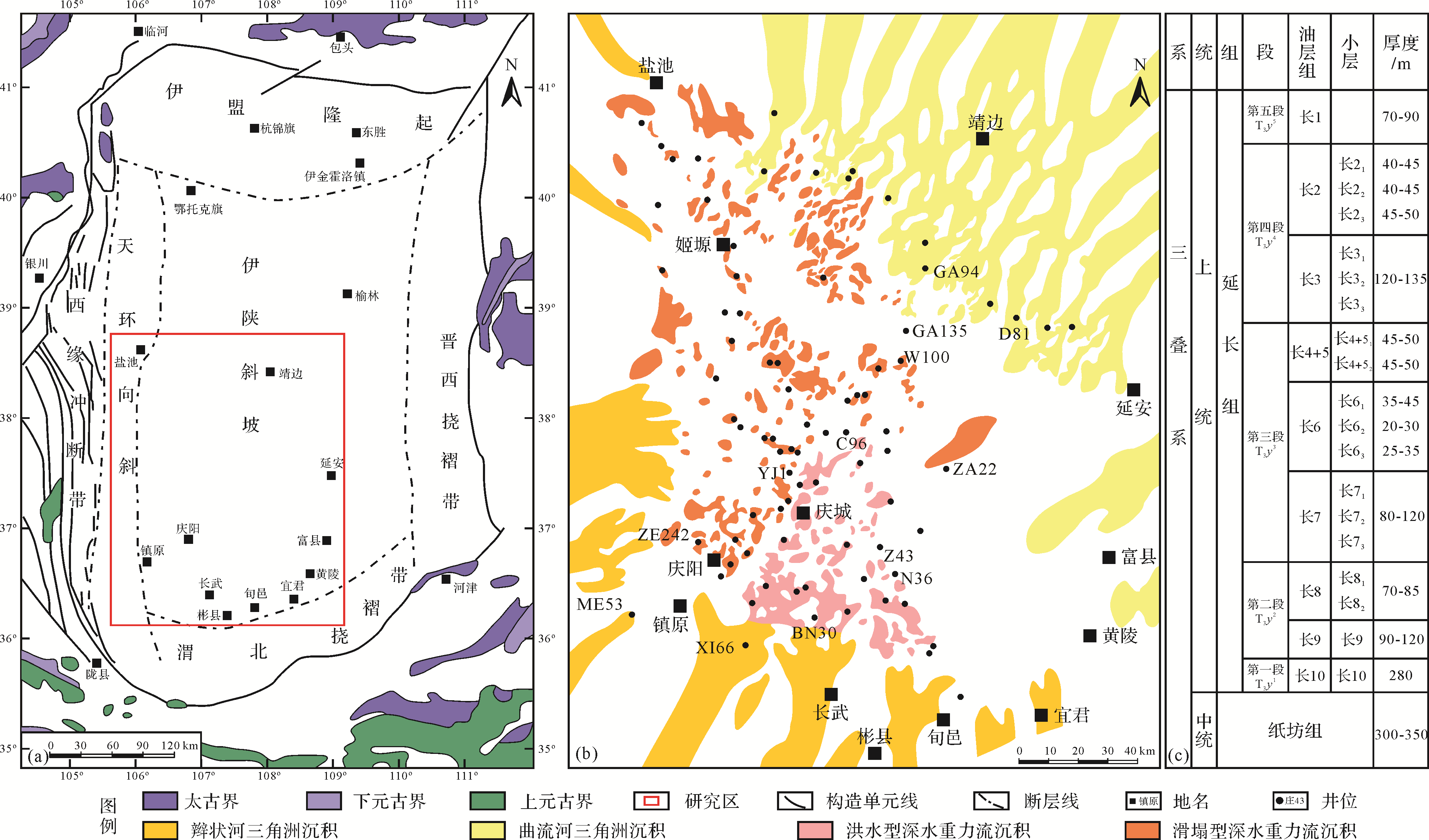
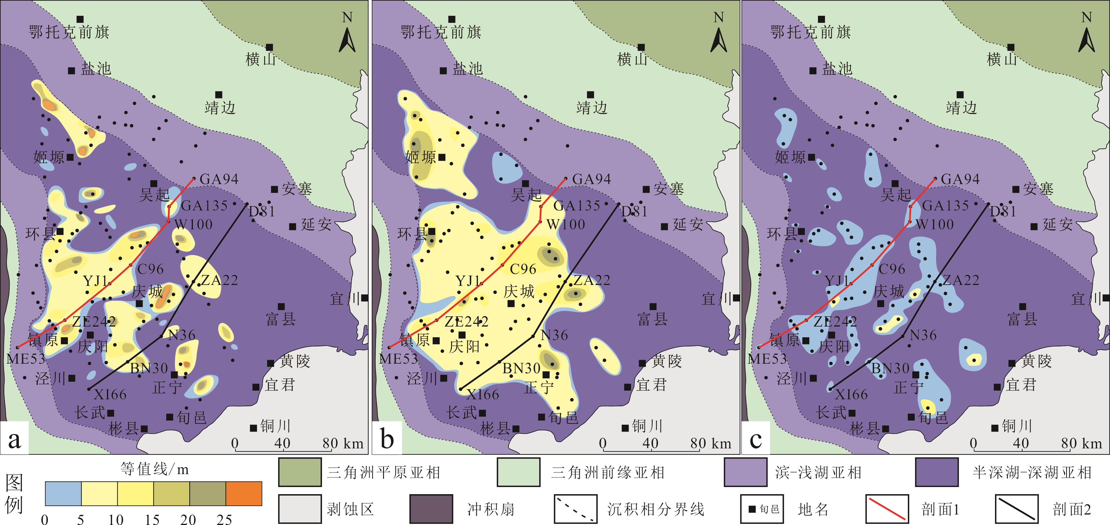
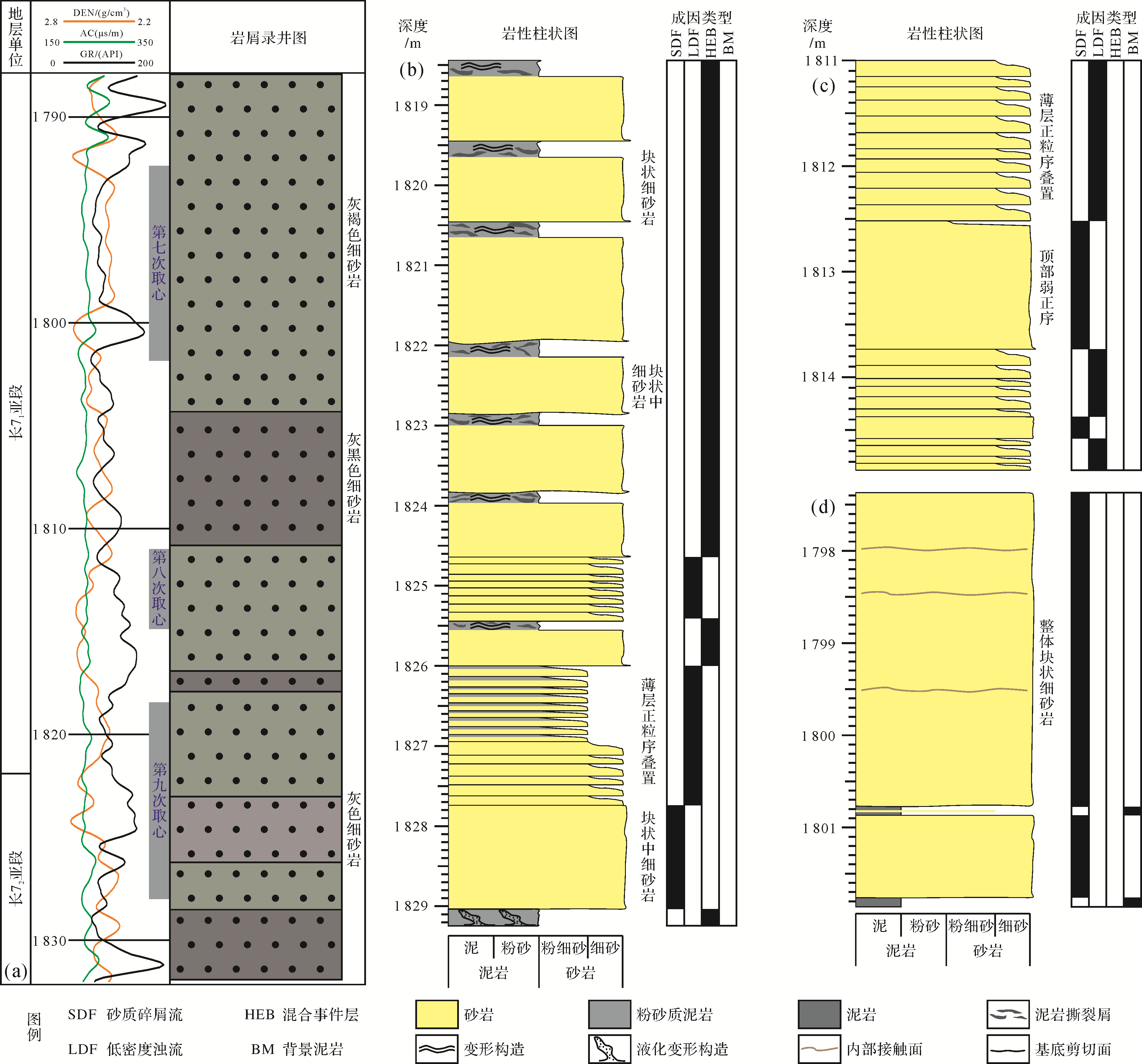
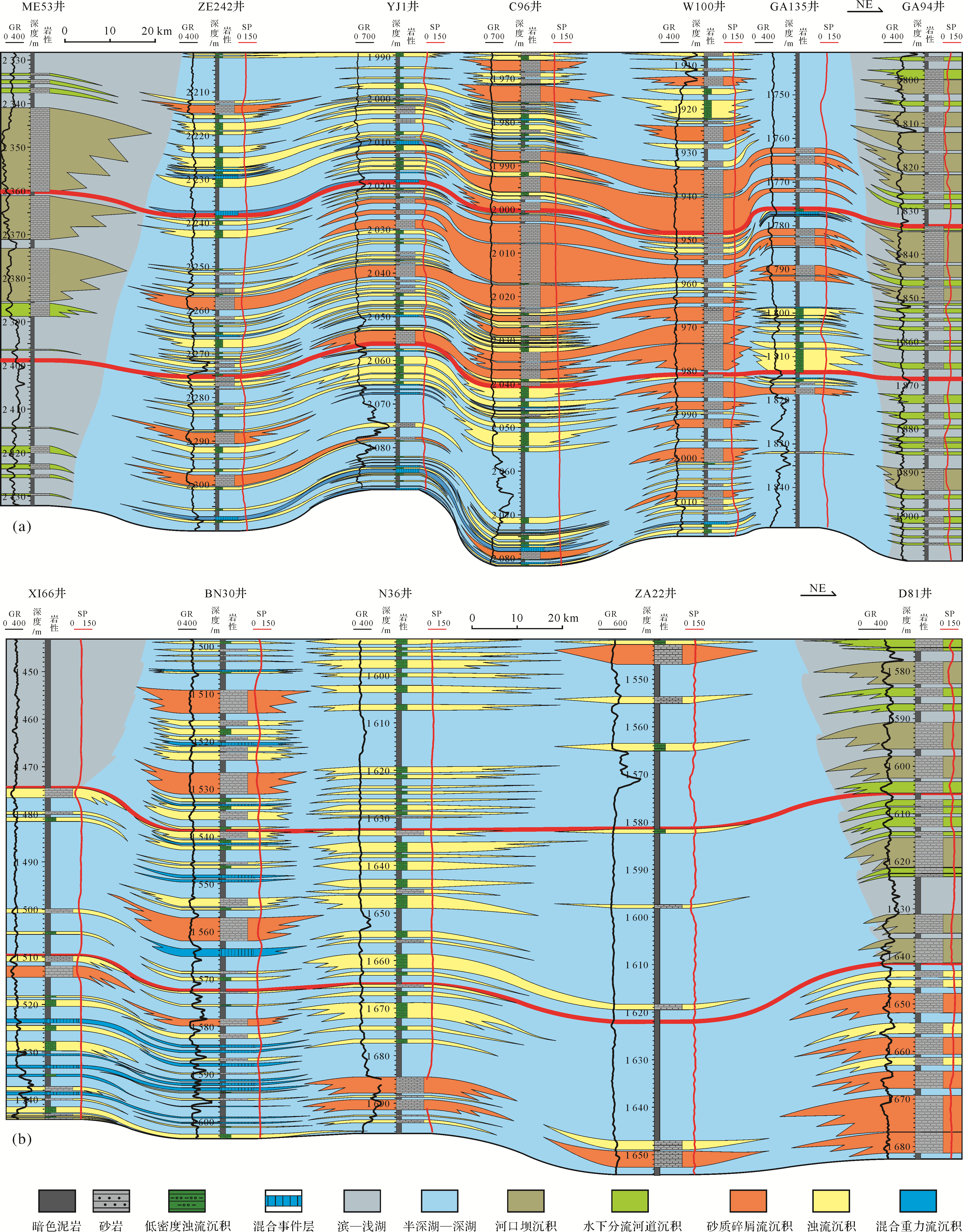
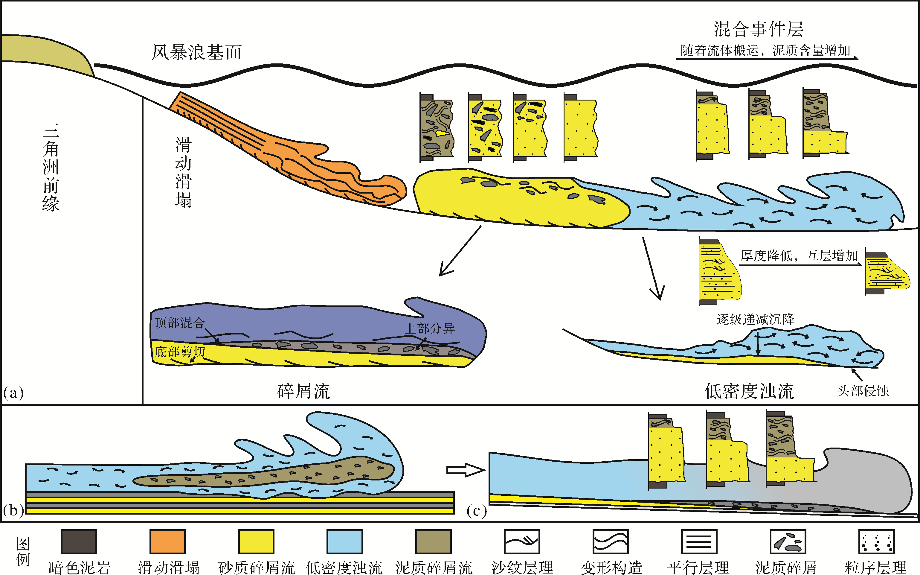
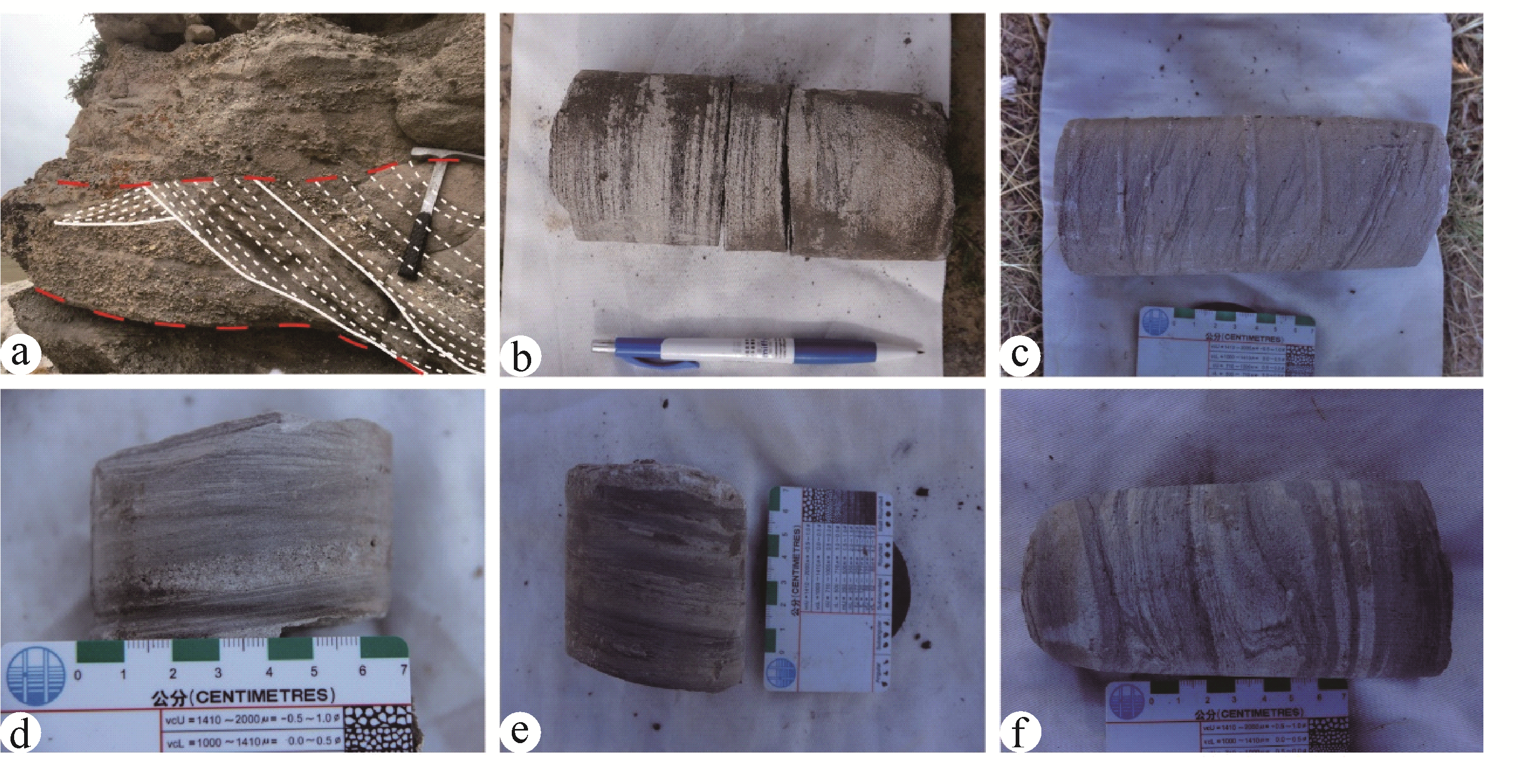
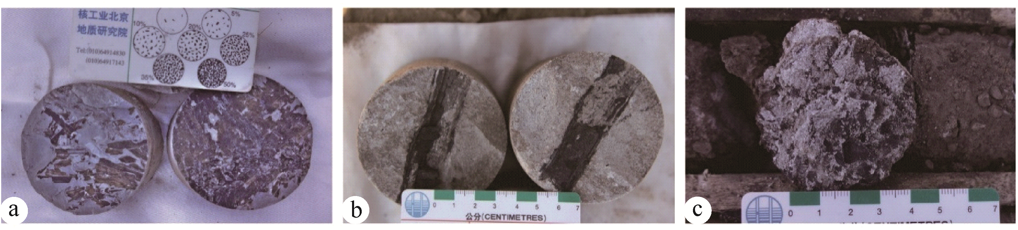
The deep-water gravity-flow deposits in the Chang7 member of the Upper Triassic Yanchang Formation, Ordos Basin, were the object of this study. The types and characteristics of deep-water gravity-flow deposits were determined by detailed analysis of a drill core from well Z43. The results suggest that sandy debris-flow deposits (debrites), low-density turbidity current deposits and hybrid event beds were developed in the region penetrated by well Z43. Most of the sandy debrites were featured by structureless medium- to fine-grained sandstone. Several amalgamation surfaces were observed, indicating different stages of vertical stacking of the deposits. Low-density turbidity current deposits were characteried by vertical stacking of medium- to thinly bedded sandstone having normal grading. The upper part of this sandstone featured a high mud content with clear sandstone/mudstone interbedding. Hybrid event beds were primarily characterized by a bipartite structure,of which the lower part is clean structureless fine-grained sandstone and the upper part is sandy mudstone or muddy sandstone with deformed mud clasts. The argillaceous base may indicate erosion by the turbidity current that caused an increase in the clay content of the current. The presence of mud clasts and/or clay content may have been the key element driving flow transformation from low-density turbidity current to muddy debris flow. This transformation resulted in the event beds that are characteristically observed as muddy debrite to low-density turbidite couplets. The fact that several types of deep-water gravity-flow deposits appear at the same location indicating a complicated gravity flow evolution process. An accurate recognition of gravity-flow types might contribute to understanding the flow transformation and the distribution of their deposits. This advancement could provide theoretical guidance on deep-water gravity-flow deposits and conventional and unconventional oil and gas exploration and development in the Ordos Basin.


2021, 39(2): 310-323.
doi: 10.14027/j.issn.1000-0550.2020.111
Abstract:
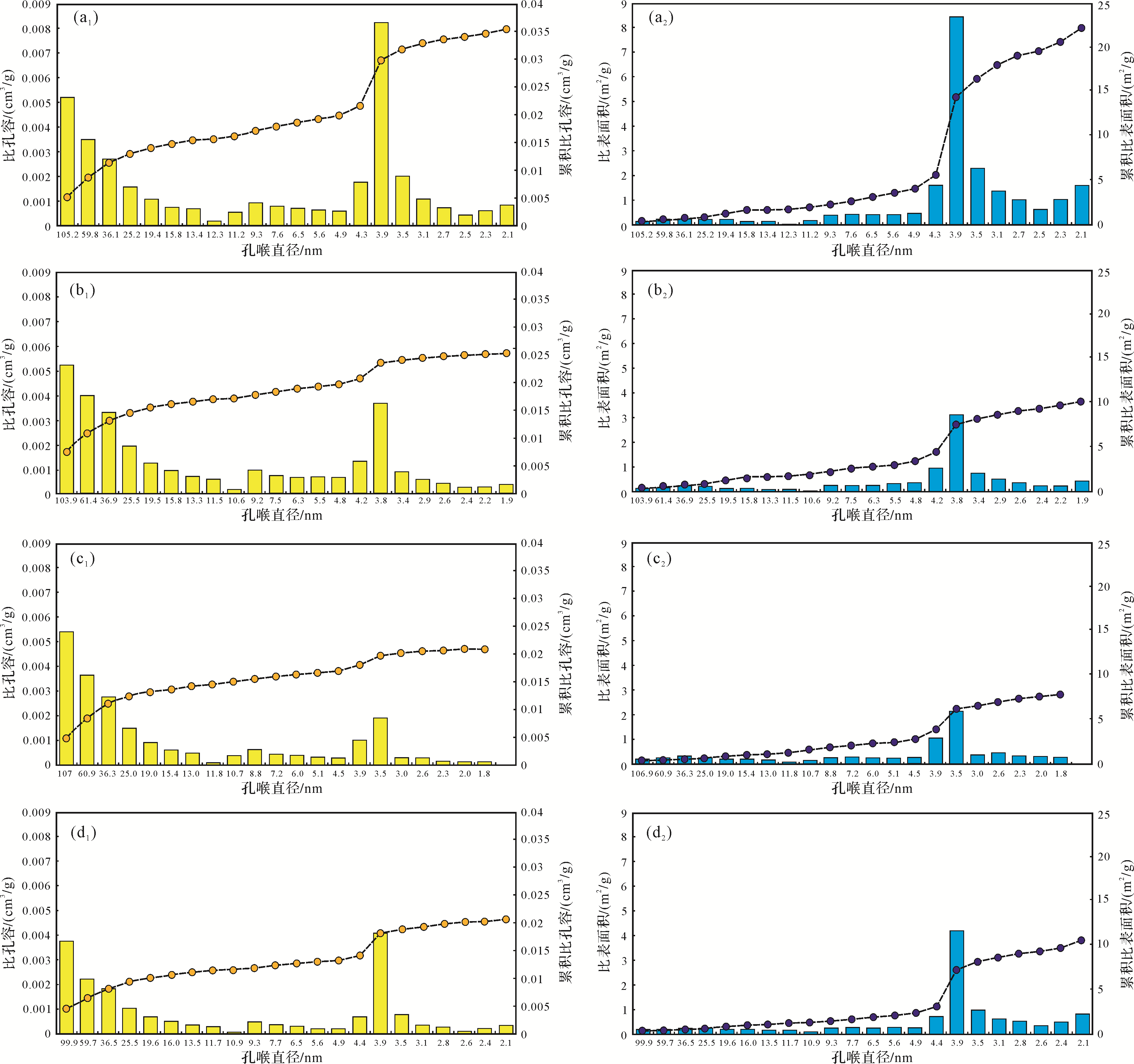
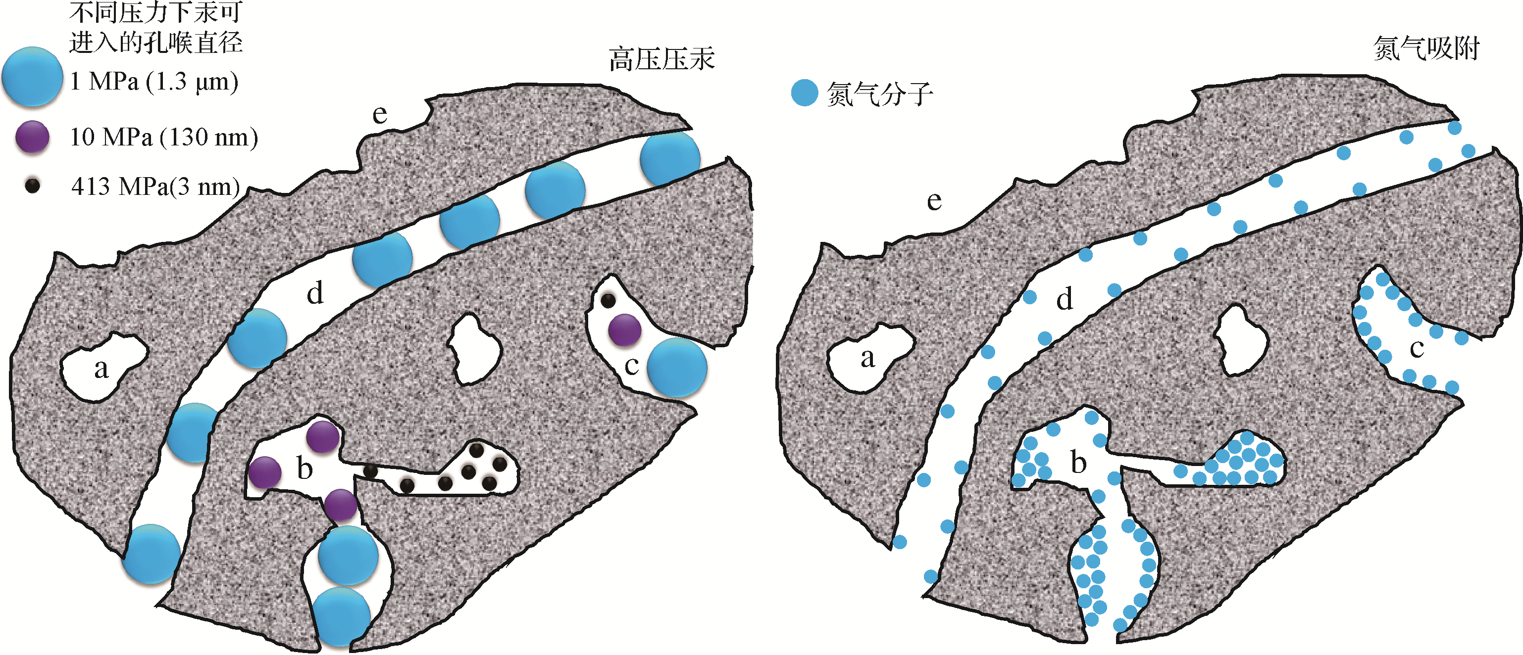
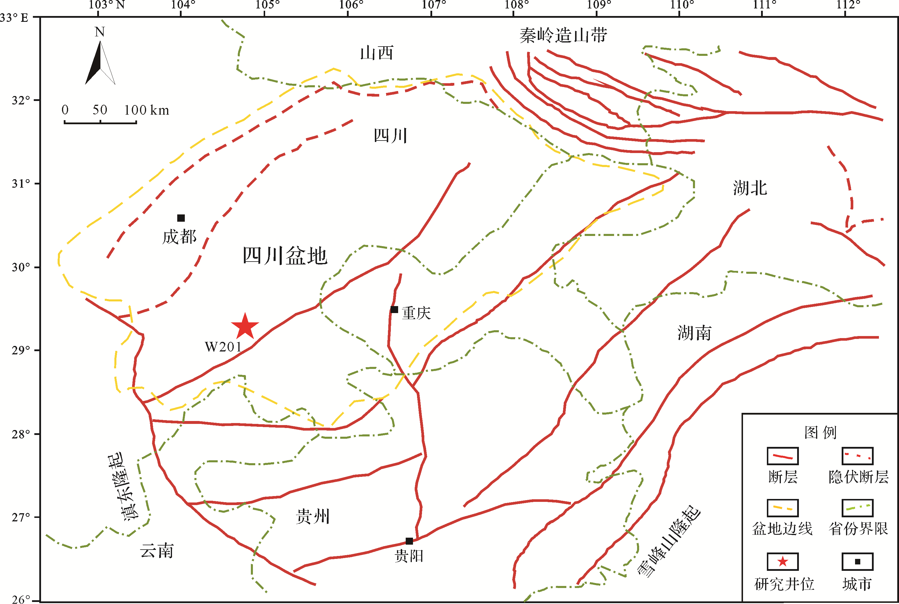
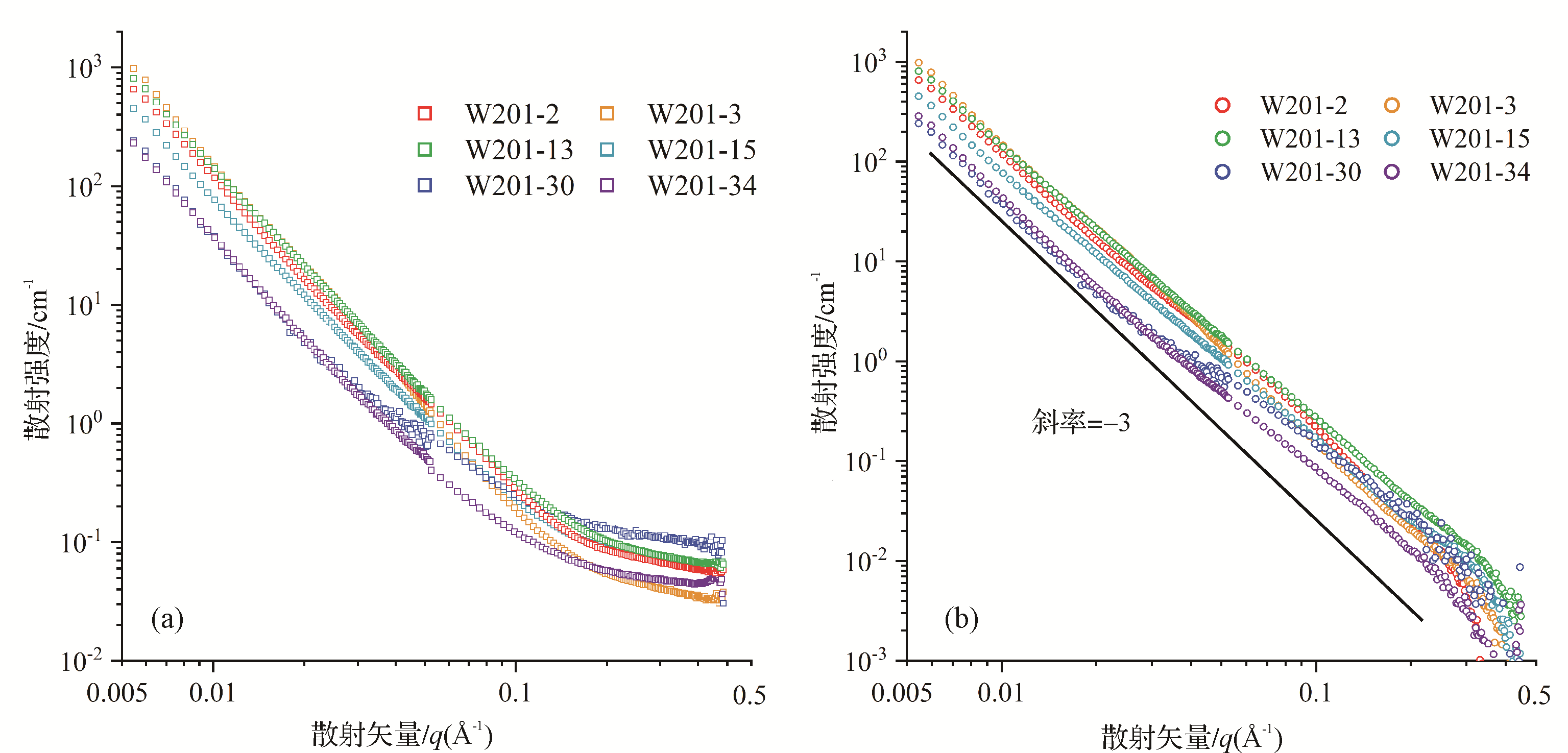
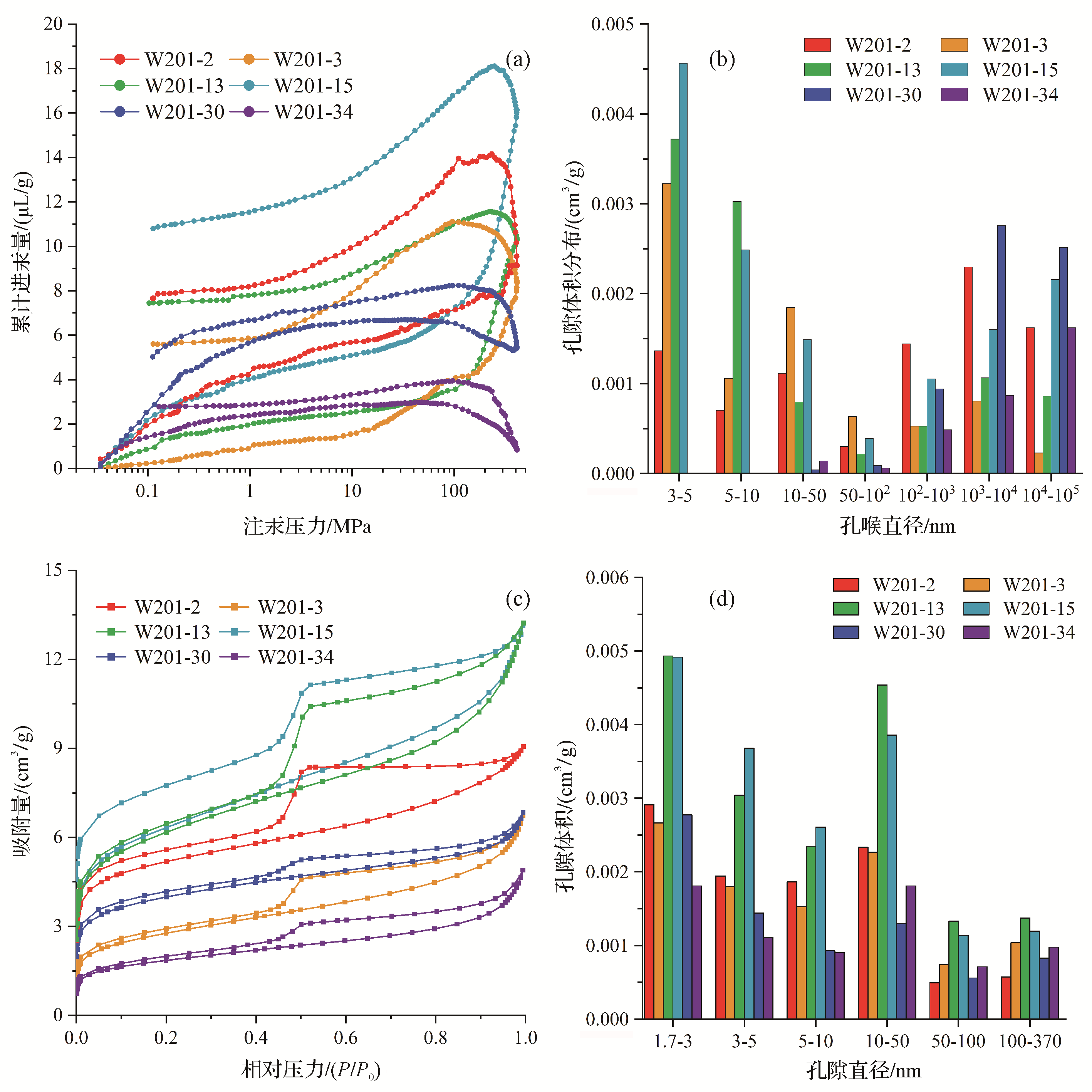
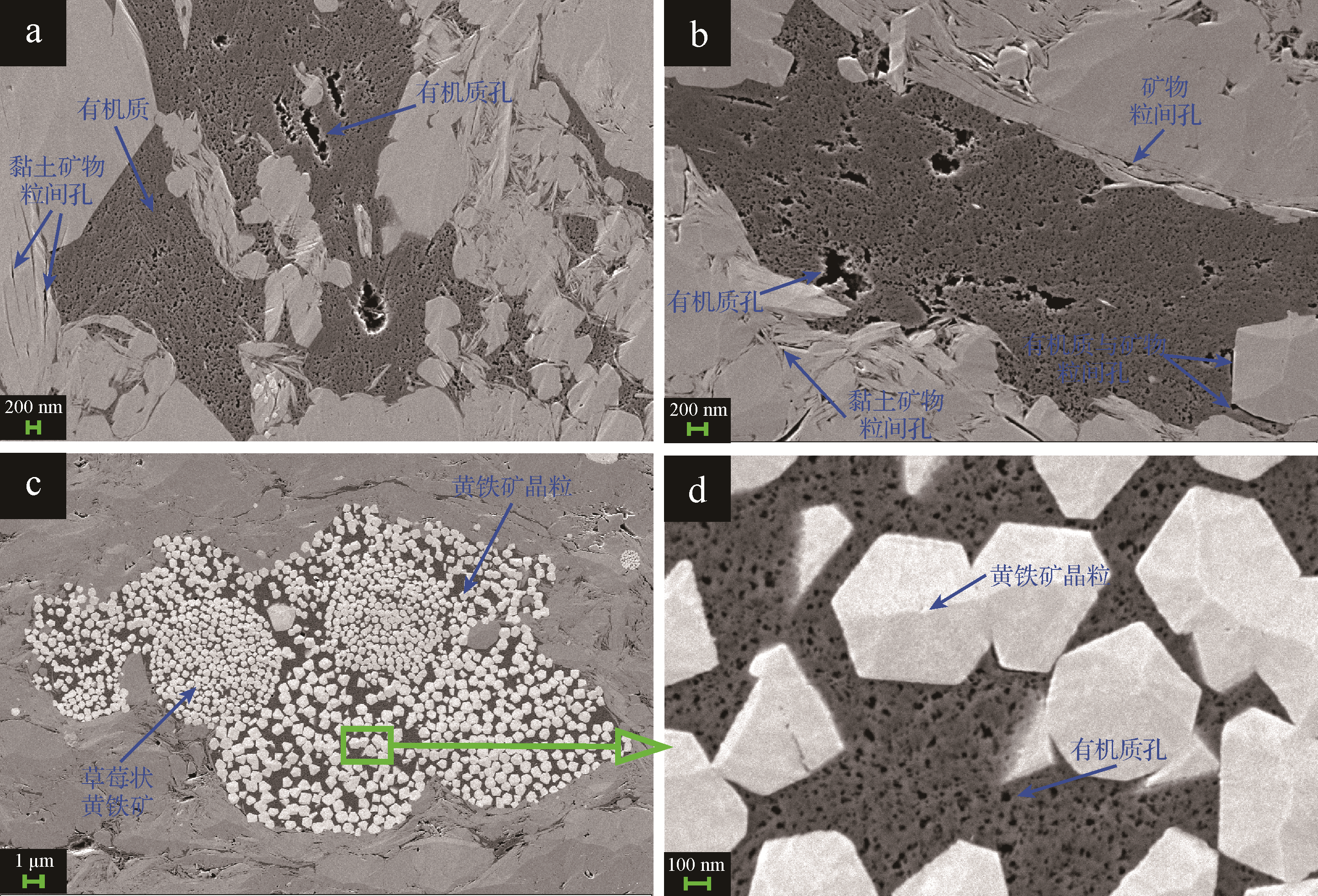
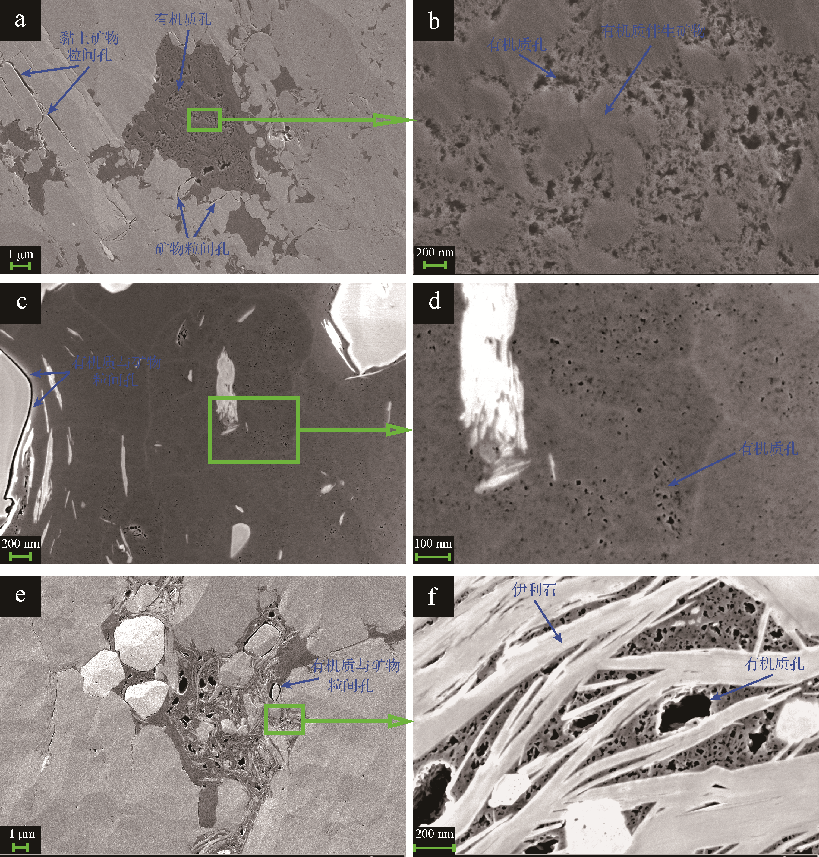
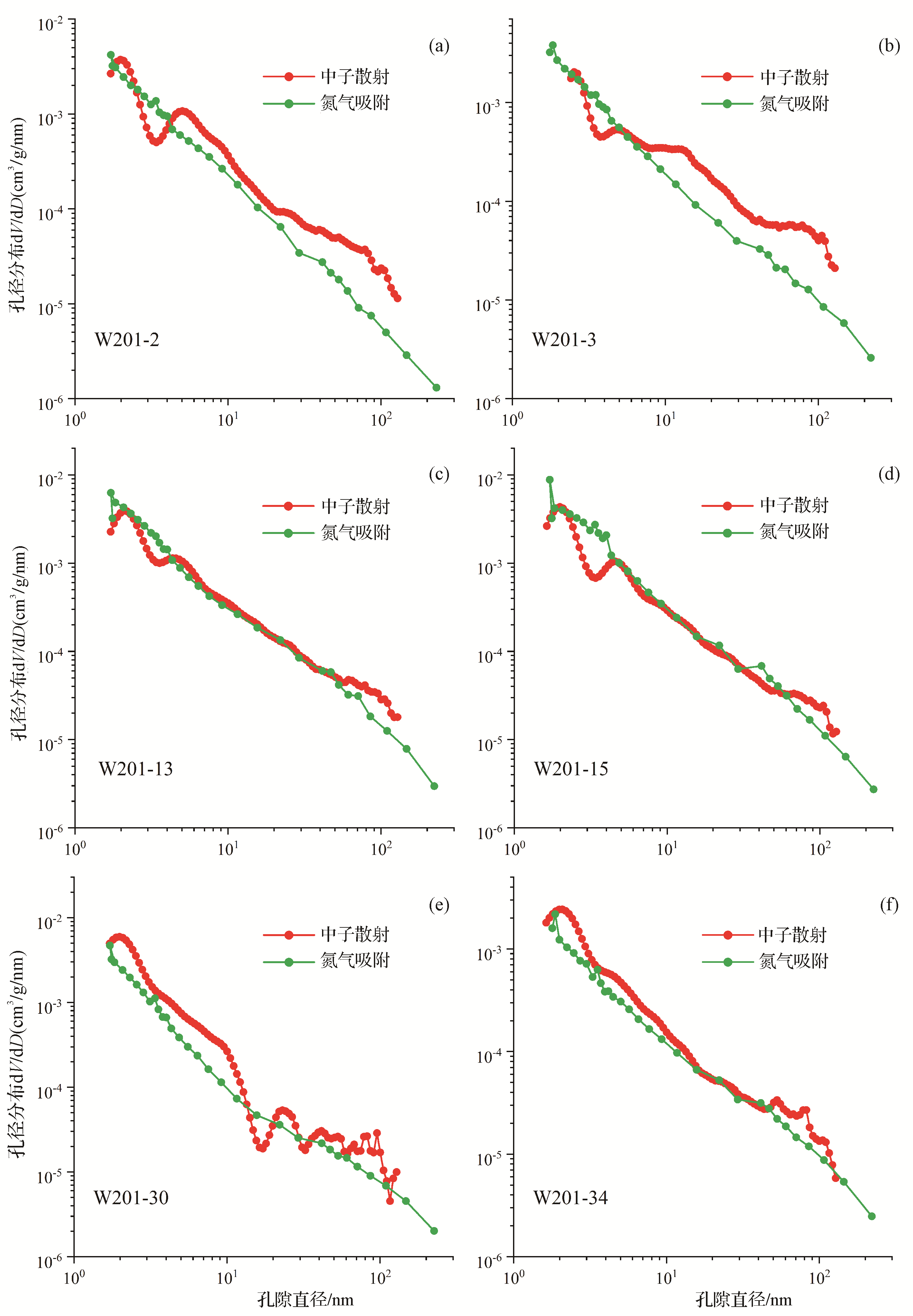
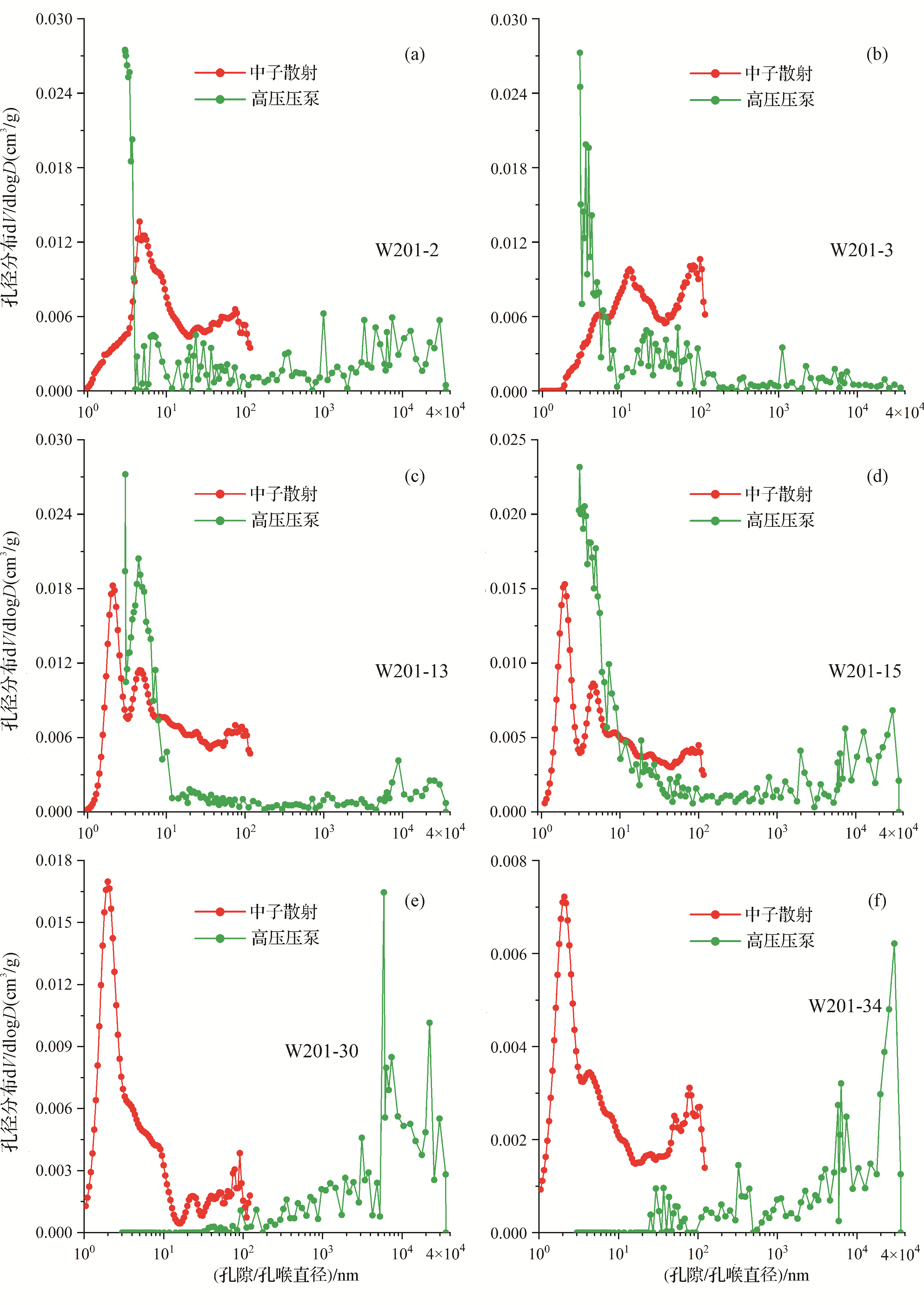
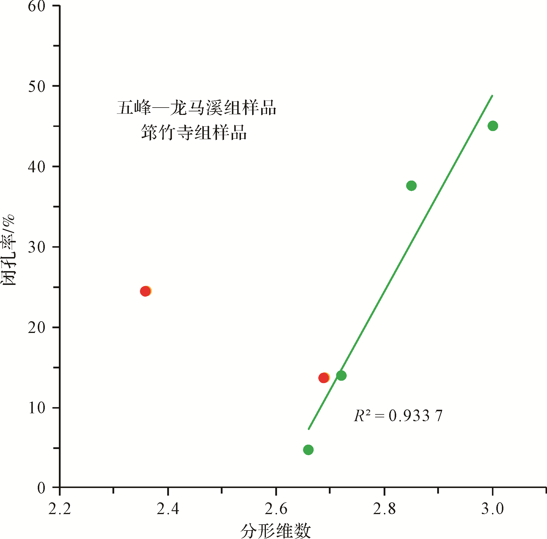
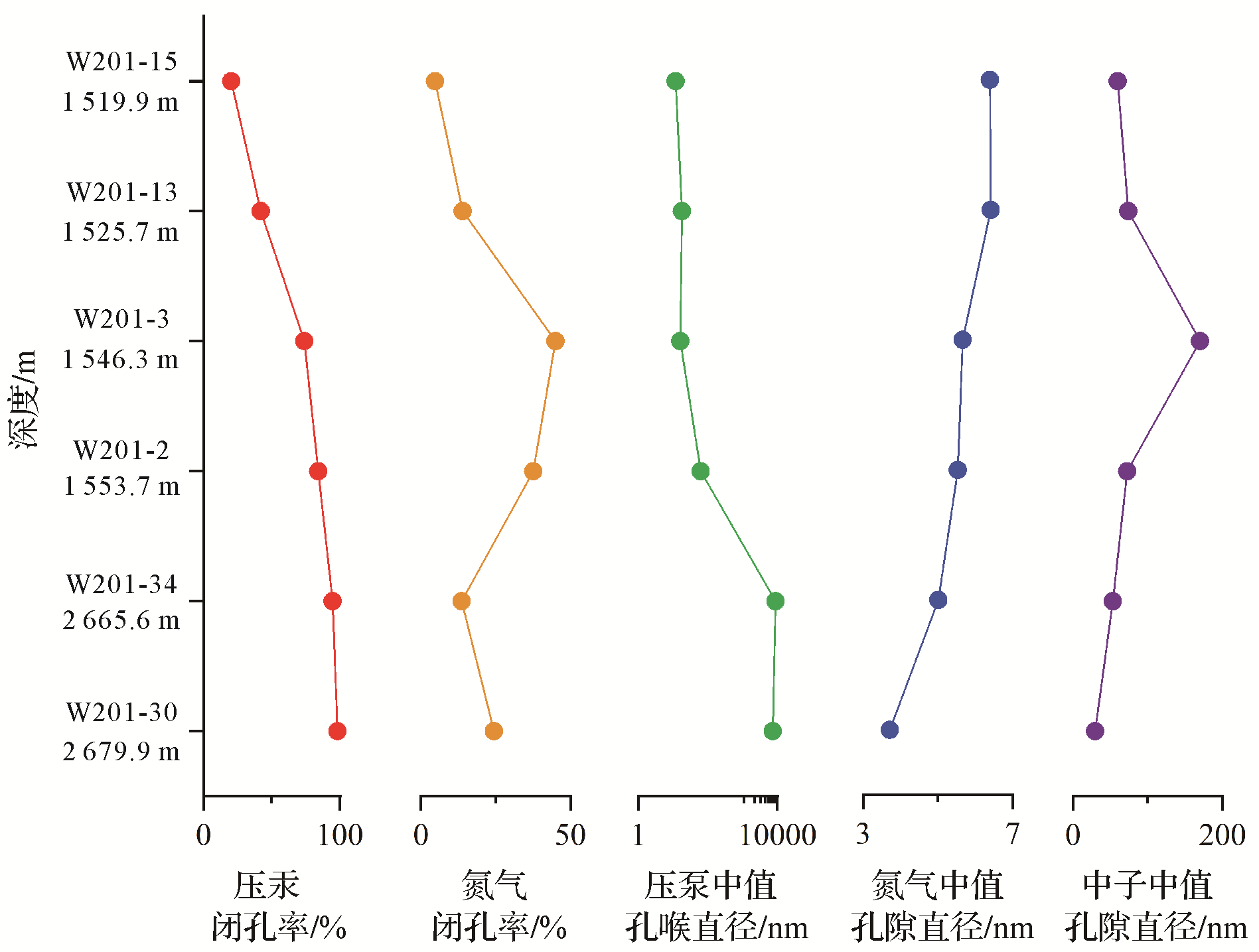
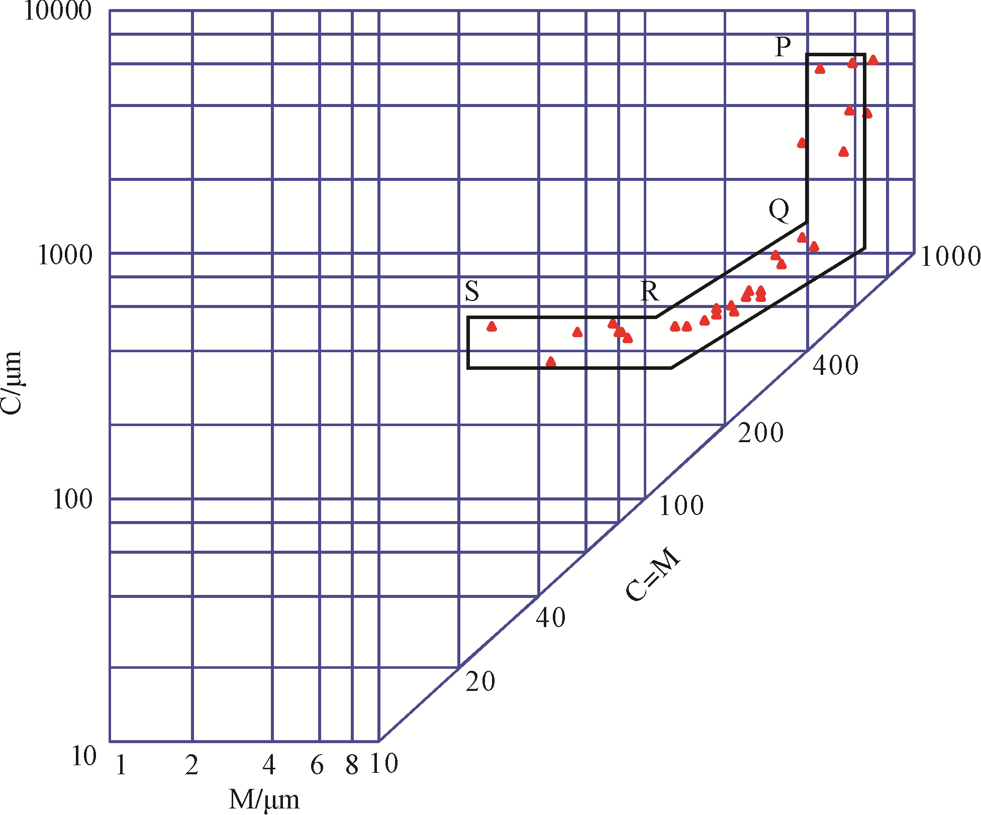
With the development of increasingly precise and quantitative characterization of shale pore network structures, the content, structure and evolution of closed pores in shales has attracted widespread attention. To study the closed-pore characteristics of shale, methods such as small angle neutron scattering (SANS), low pressure N2 adsorption (LPNP), mercury injection capillary pressure (MICP), argon ion polishing field emission scanning electron microscopy (AIP-FESEM) and other methods were used to determine the content and structure of closed pores in the early Silurian Longmaxi Formation, the Upper Ordovician Wufeng Formation and the early Cambrian Qiongzhusi Formation shale in well W201, Sichuan Basin. The experimental results show that closed pores are developed in all three formations at well W201. Their development is related to the organic pore network system. A good positive correlation was found between the fractal dimension and the closed porosity of Longmaxi shale in the Wufeng Formation. Analysis of the depth of the three formations showed that, with increasing depth, the percentage of closed pores in shale gradually increases when measured by MICP, the main reason being that, as shale pore throats change, the smallest throats disappear, thus raising the lower limit of the amount of mercury that can fill the pores. By comparing the results of LPNP and SANS, the closed pore sizes at well W201 descend in an orderly manner in shale from all three formations. This study of the properties of closed pores in shale reservoirs provides a new idea for evaluating the storage capability and permeability of shale reservoirs, and also has important geological and engineering significance in shale oil and gas exploration and development.
2021, 39(2): 324-340.
doi: 10.14027/j.issn.1000-0550.2020.056
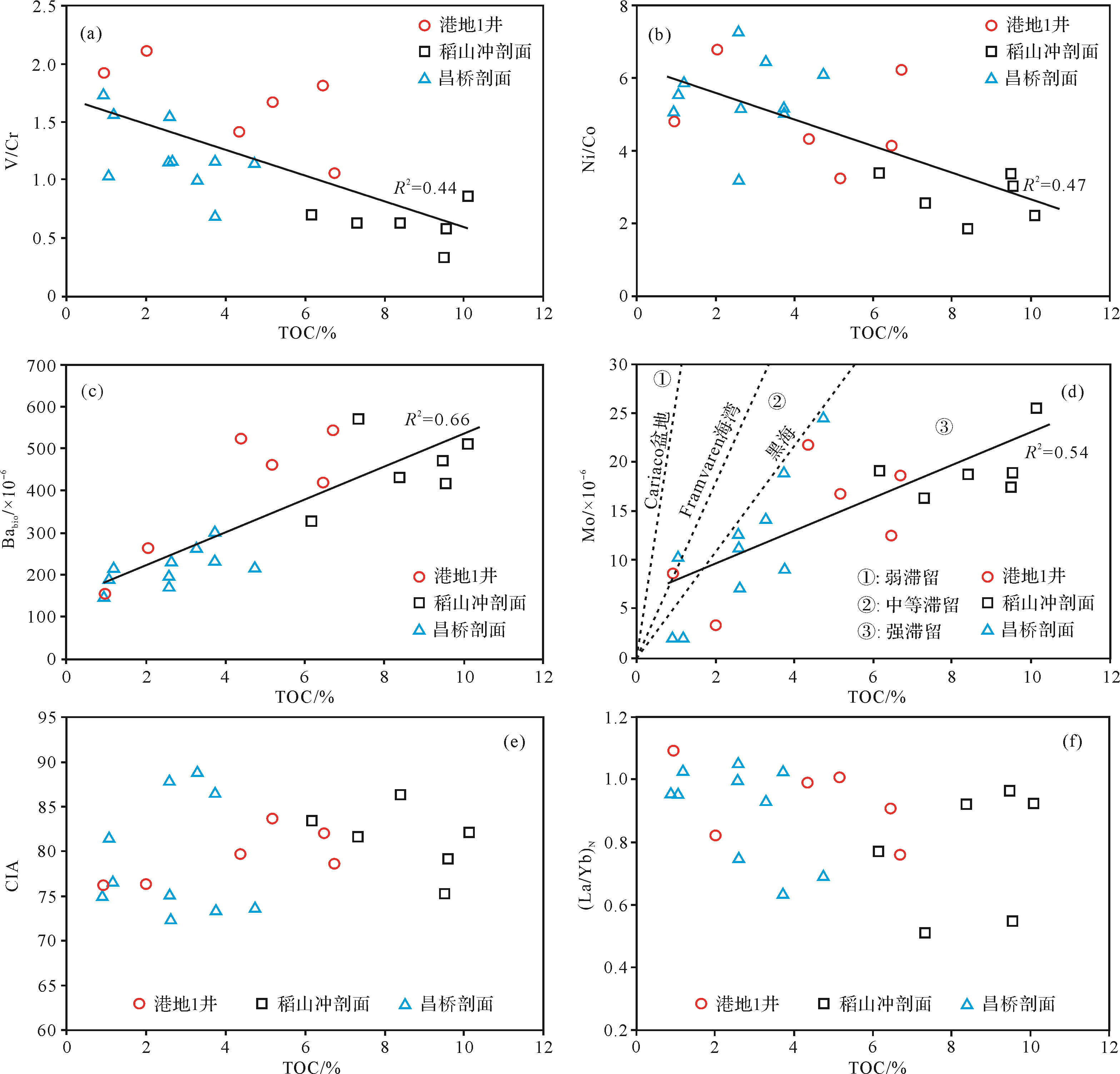
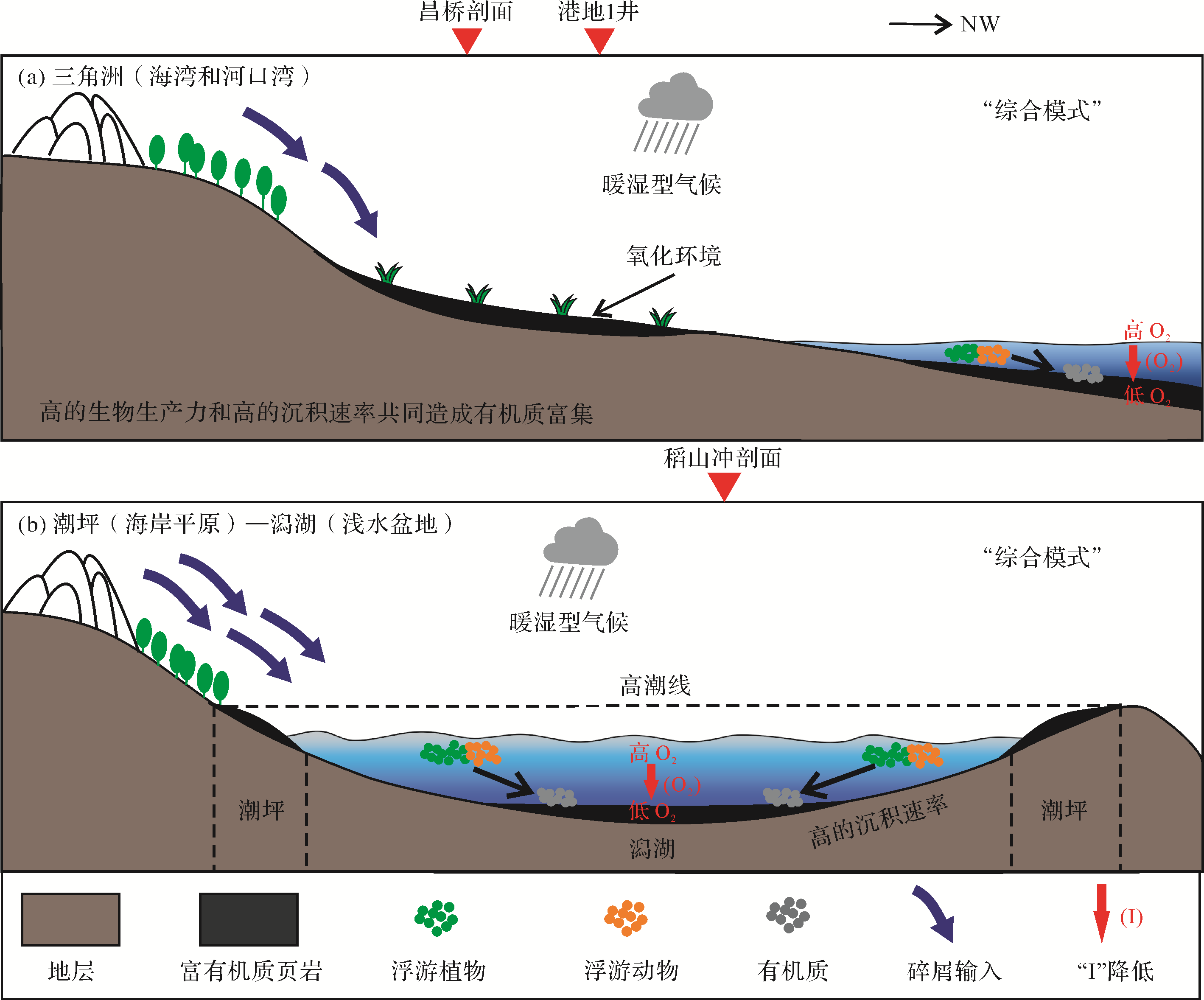
Abstract:
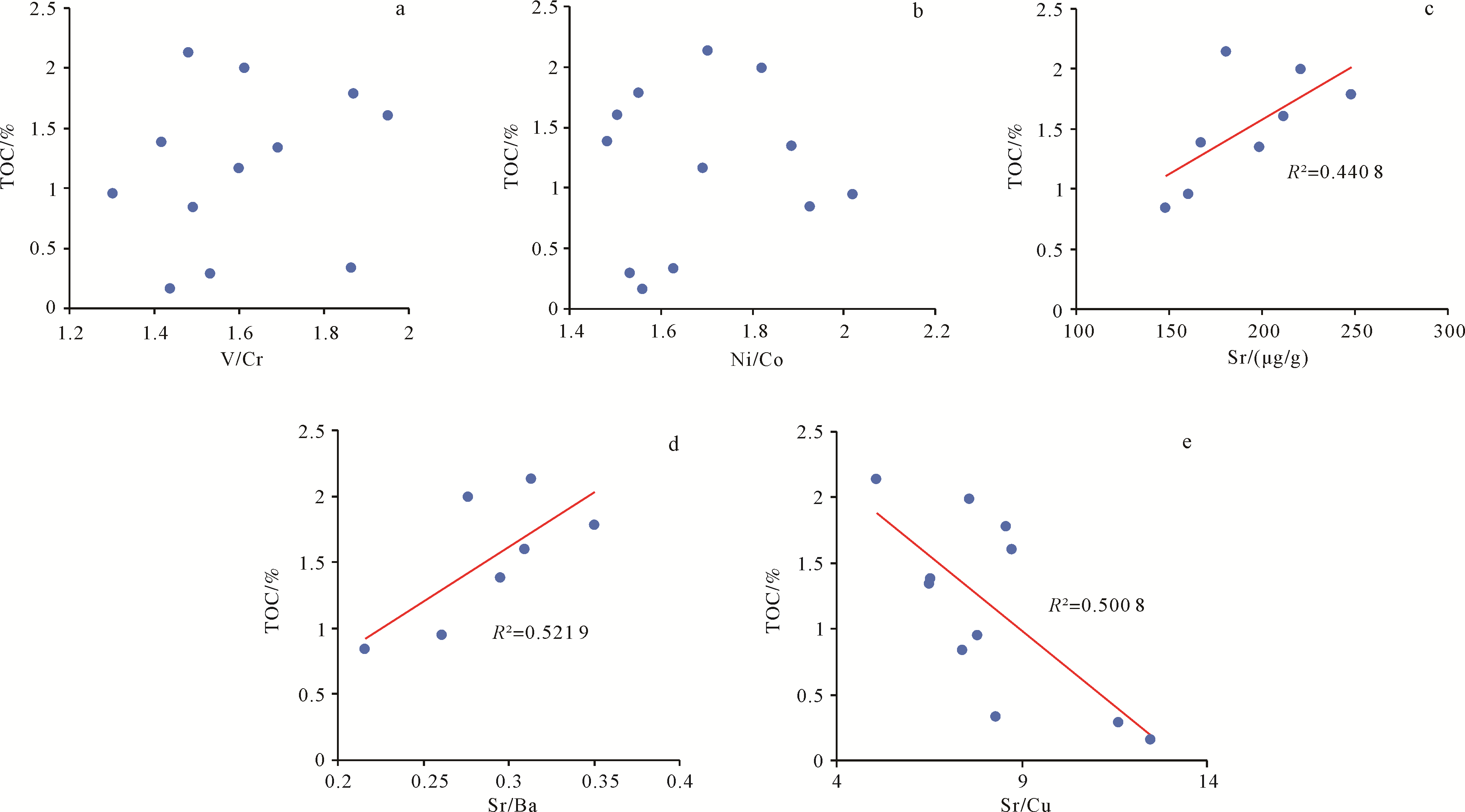
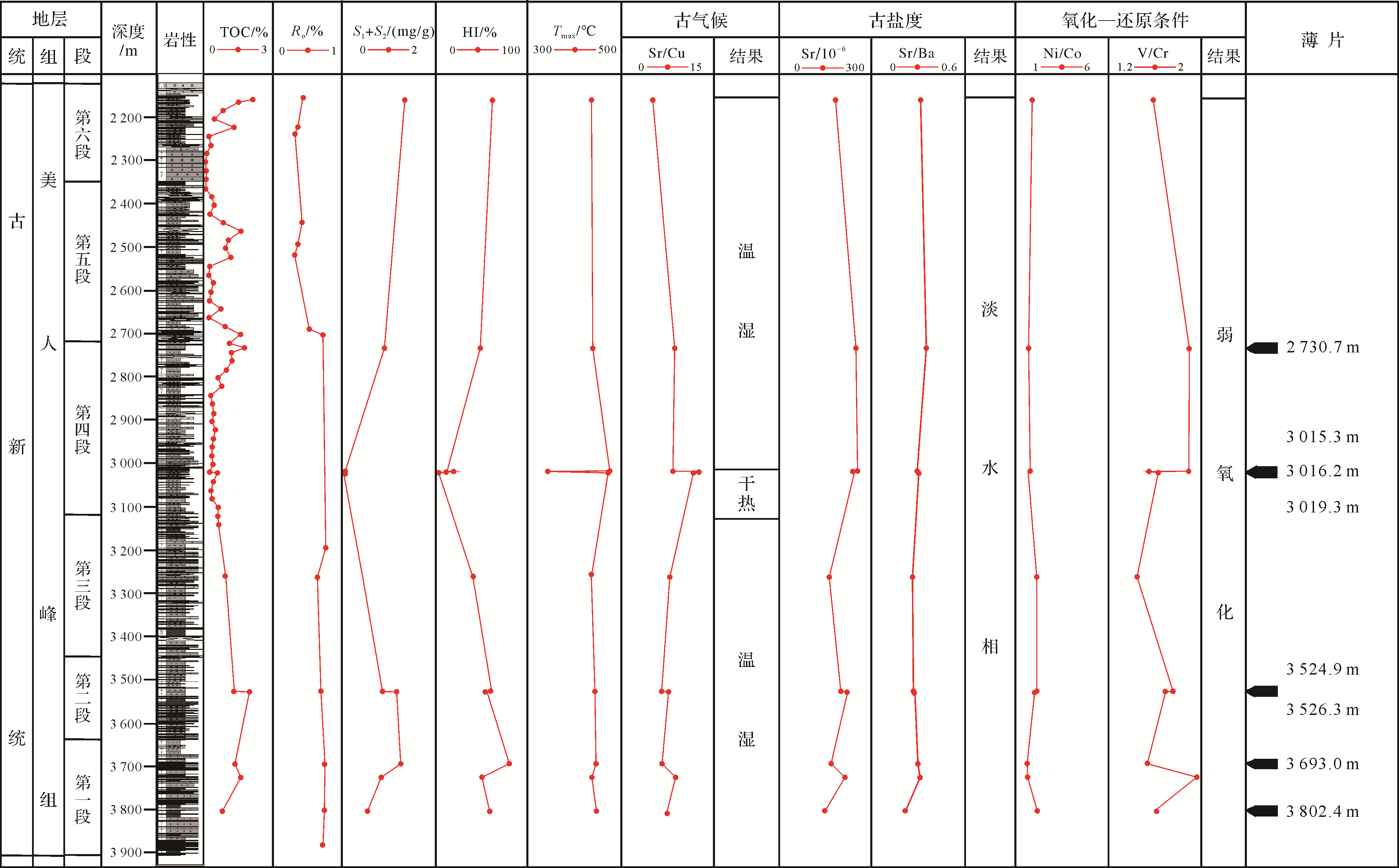
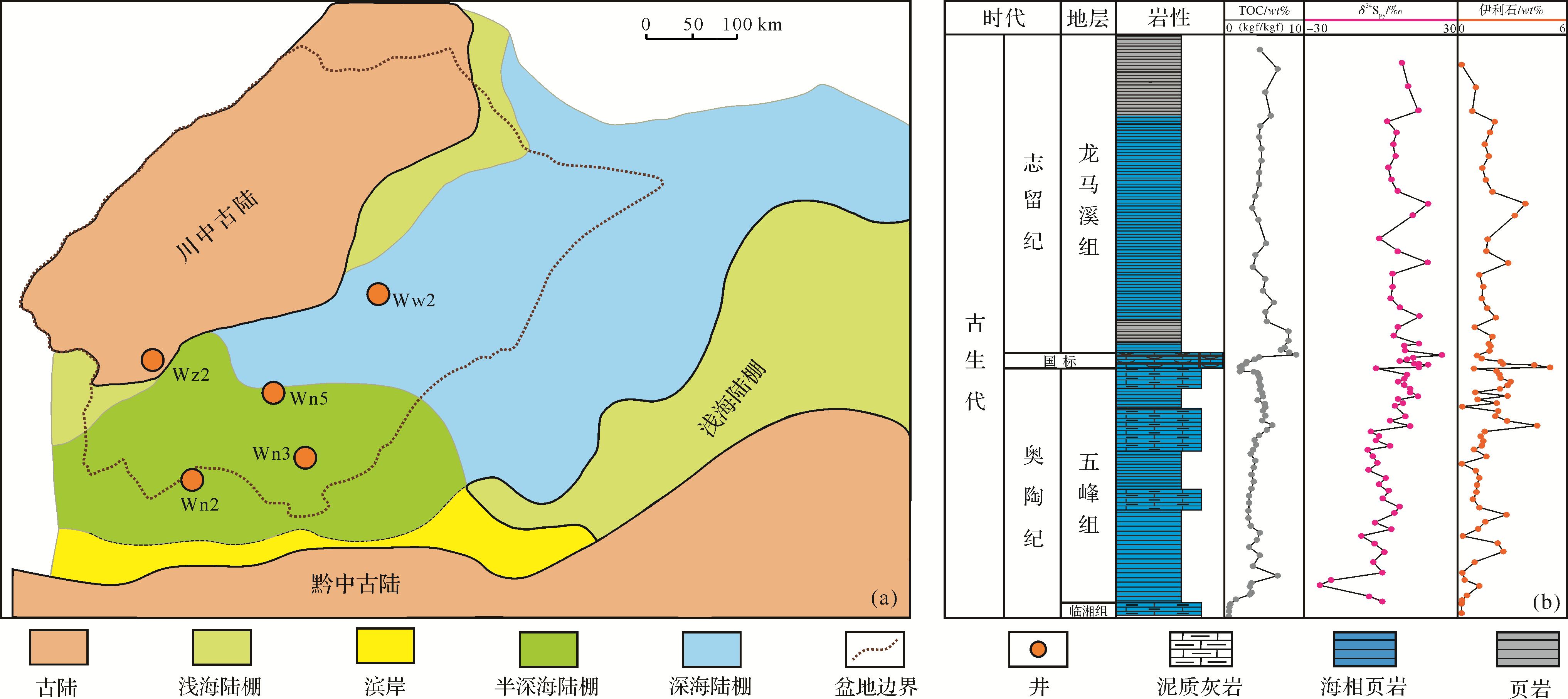
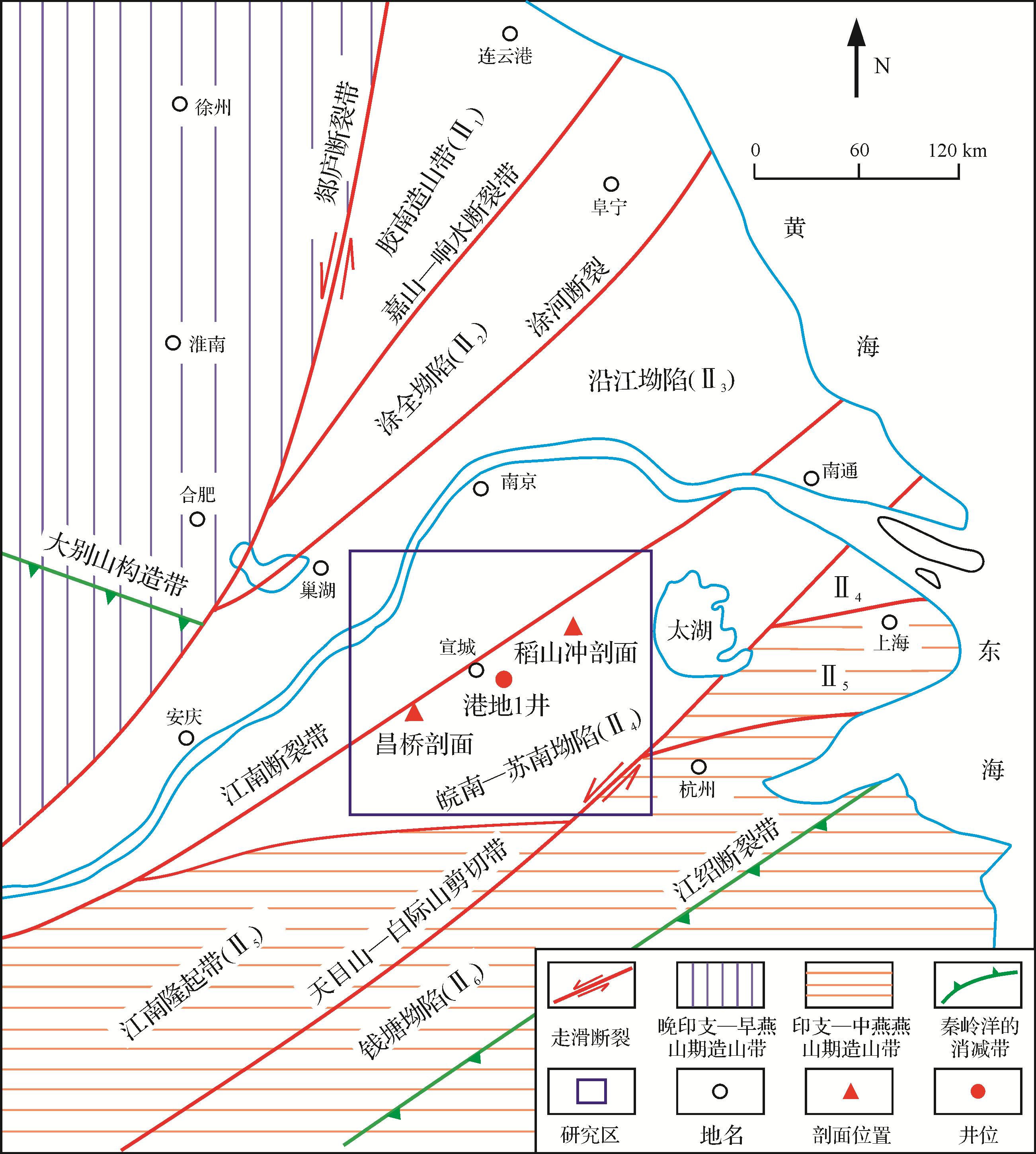
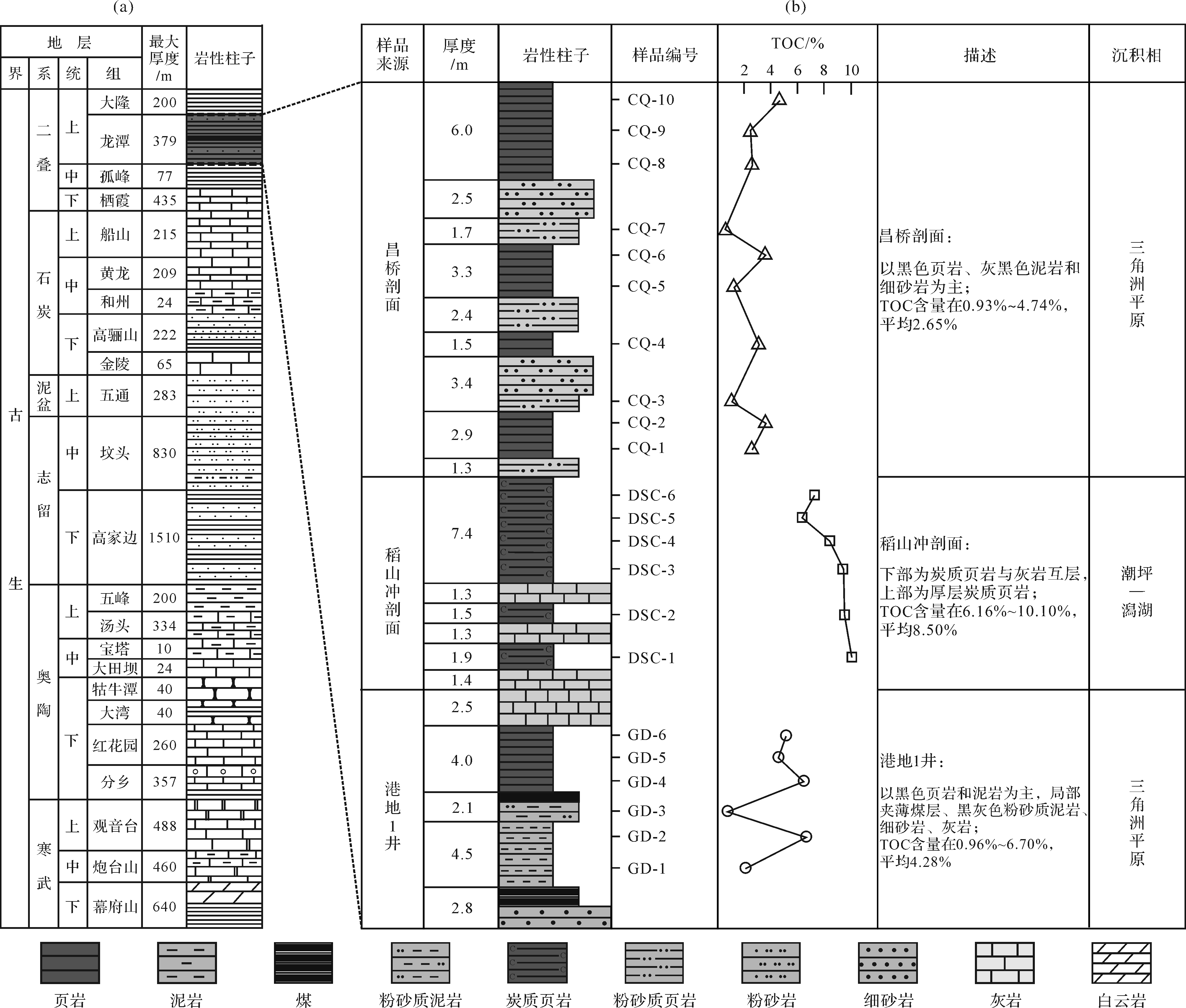
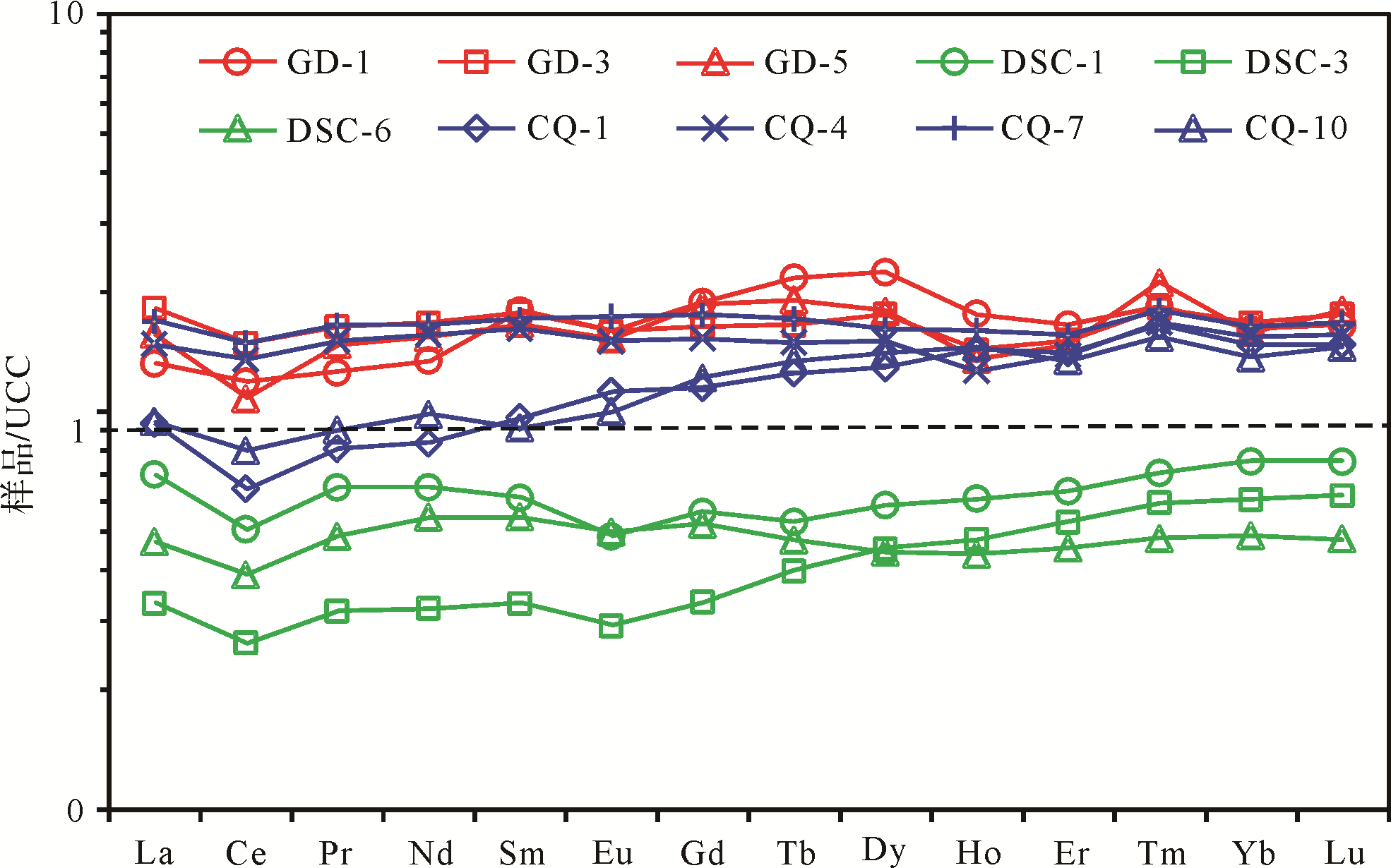
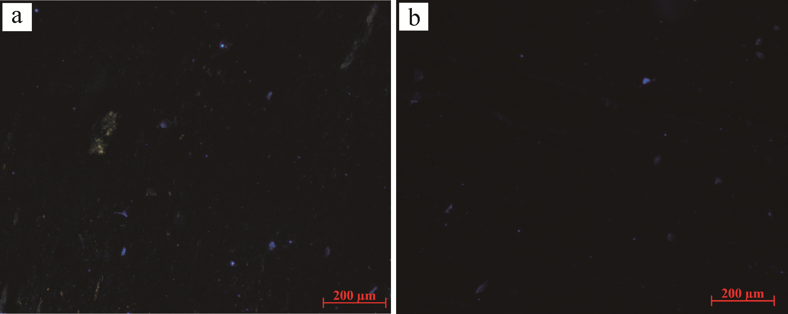
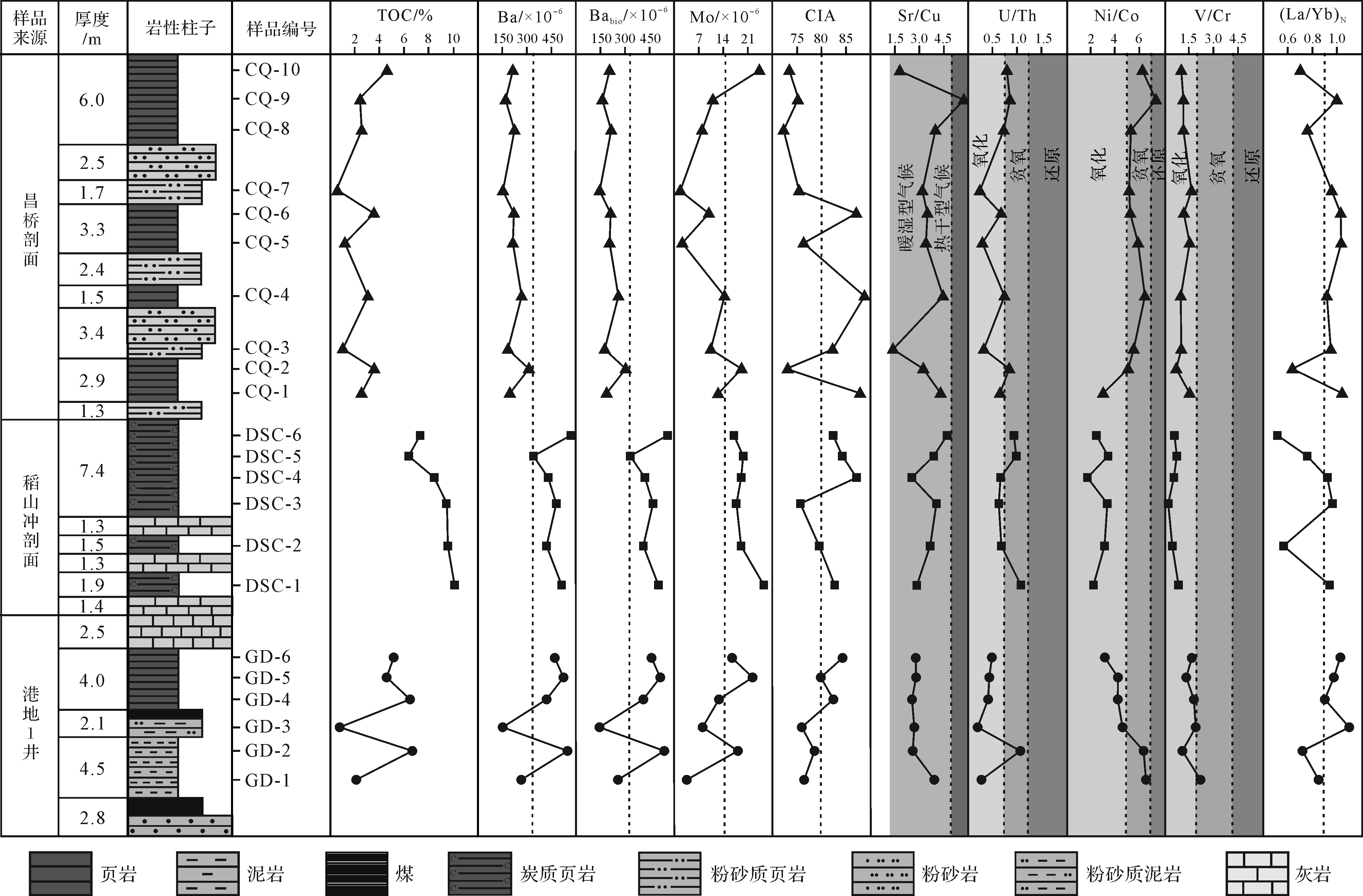
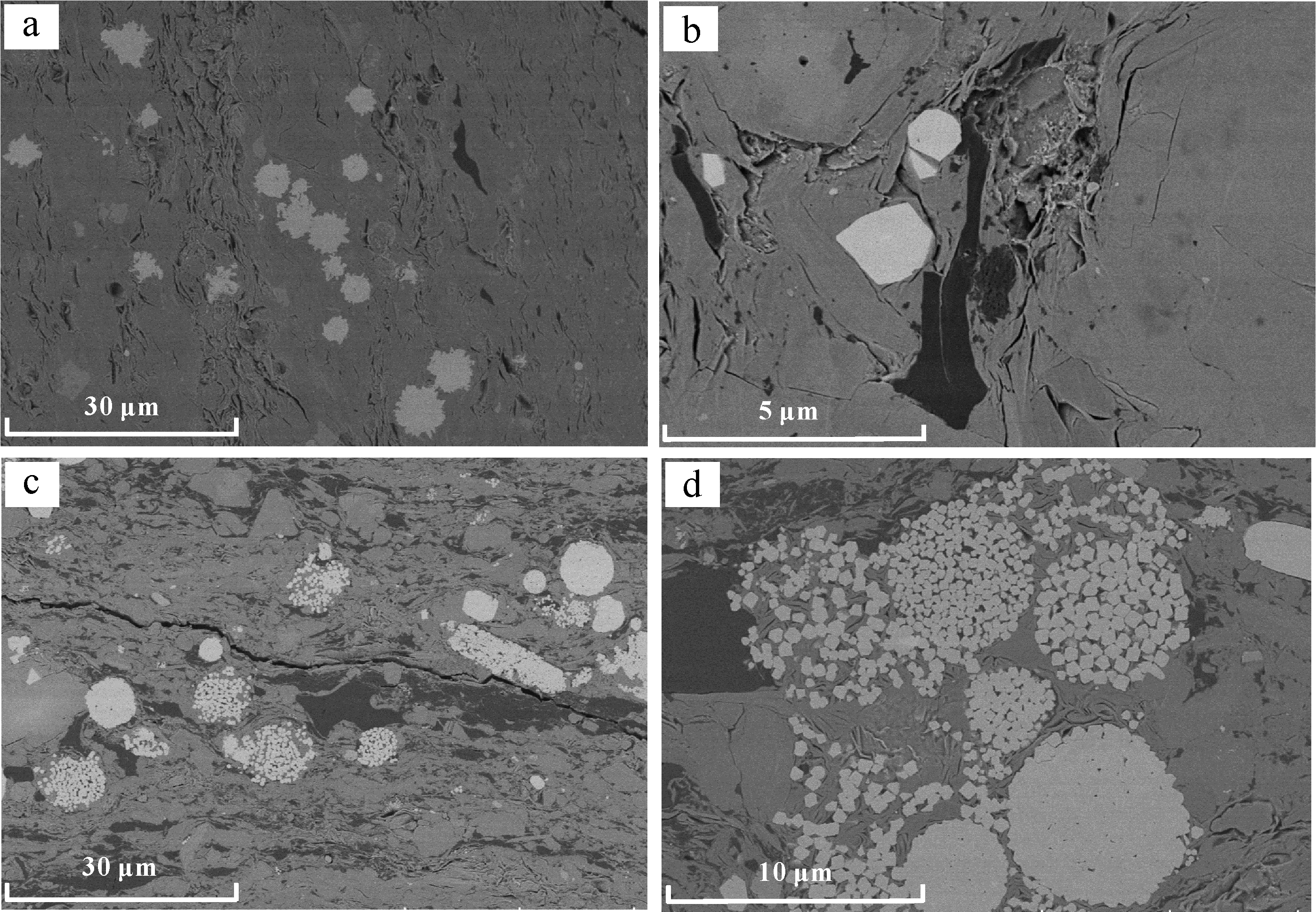
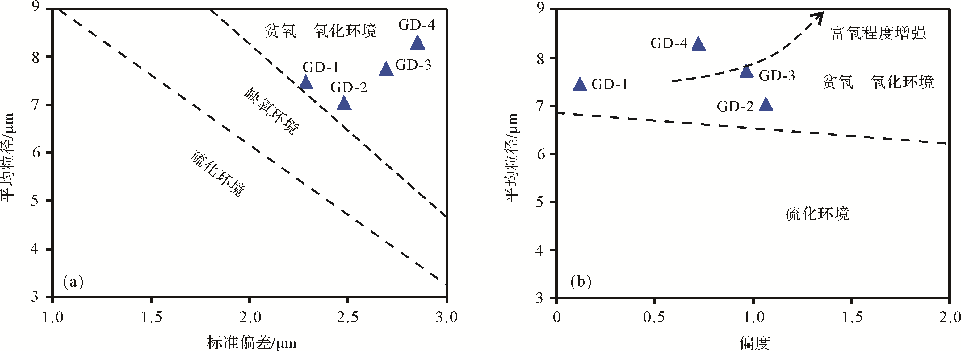
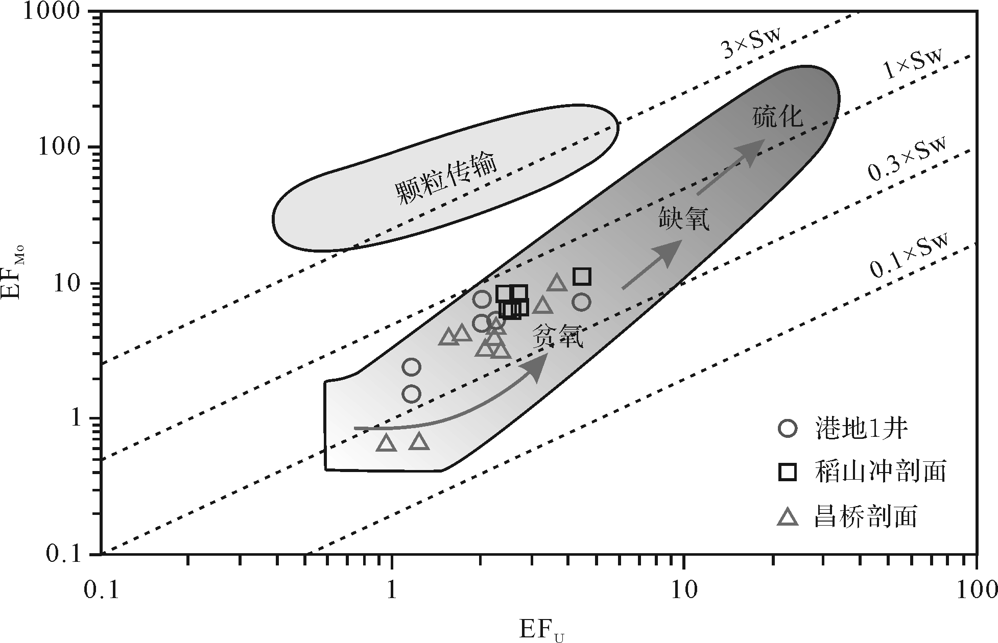
The marine-continental transitional organic-rich shale in the Longtan Formation in Xuancheng area, Anhui Province is not only considered as an excellent source rock in the Lower Yangtze region, but also one of the important layers of shale gas exploration in China. In order to clarify the relationship between sedimentary environment and organic matter accumulation in such a setting, a case study was carried out from one core (Gangdi-1 well) and two outcrops (Changqiao outcrop and Daoshanchong outcrop) by conducting organic geochemical test, organic petrologic study, argon ion polishing-scanning electron microscopy (SEM) observation, elemental geochemical analysis. Results show that the transitional shale in the Longtan interval in Xuancheng area was deposited in a complex paleoenvironment that was mainly characterized by a warm and humid paleoclimate, oxic-dysoxic conditions, a high paleoproductivity, and a high sedimentary rate. Besides, the transitional shale formation is not determined by a single factor, but is the result of the mutual configuration and coupling of multiple factors such as paleoclimate, paleoredox conditions, paleoproductivity, and sedimentary rate. All these factors will directly or indirectly affect the supply or preservation of organic matter. Furthermore, the warm and humid paleoclimate not only facilitates the growth of higher plants, but also promotes the biogeochemical process, and thus accelerates the chemical weathering rate of the parent rock and increases the input of nutrients to the water column, which is conducive to the blooms of lower aquatic organisms. Both higher plant debris and lower aquatic organisms together provide abundant organic matter sources. Moreover, during the transitional shale deposition in the Longtan interval, the high paleoproductivity could create abundant organic matter. After organic matter was produced, it was further buried and preserved. Although the oxidizing water environments are usually unfavorable for organic matter preservation, a higher sedimentary rate tends to shorten organic matter exposure time in the decomposition region of aerobic bacteria, and some organic matters cannot be oxidized or degraded through the rapid burial, further promoting organic matter accumulation.

2021, 39(2): 341-352.
doi: 10.14027/j.issn.1000-0550.2020.094
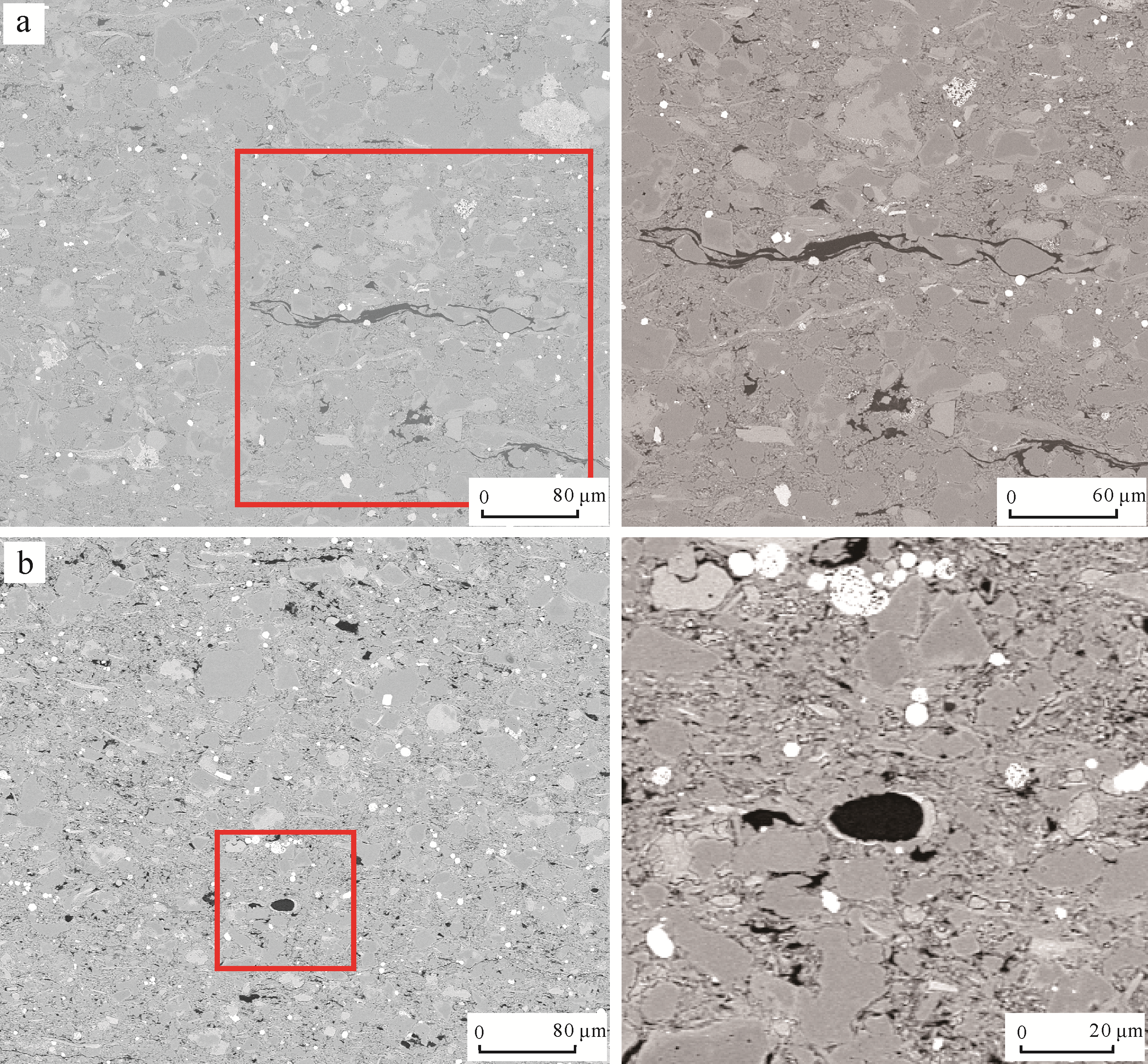
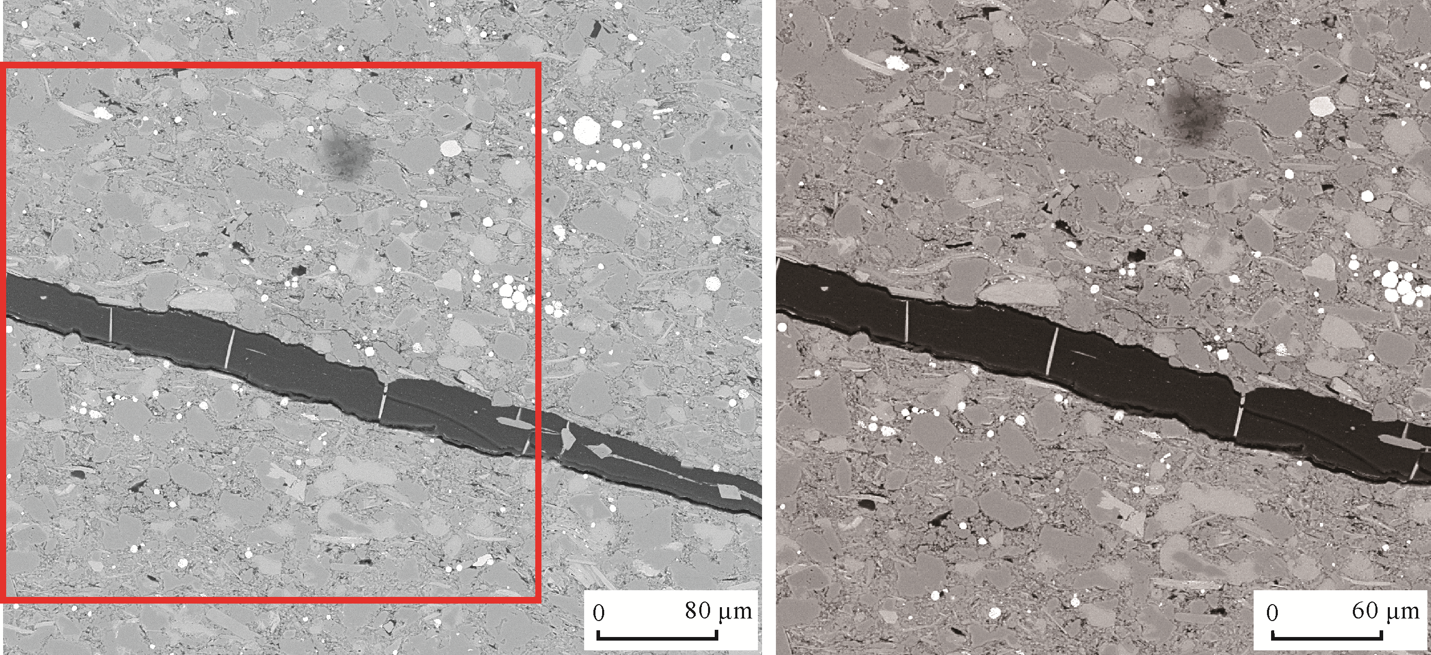
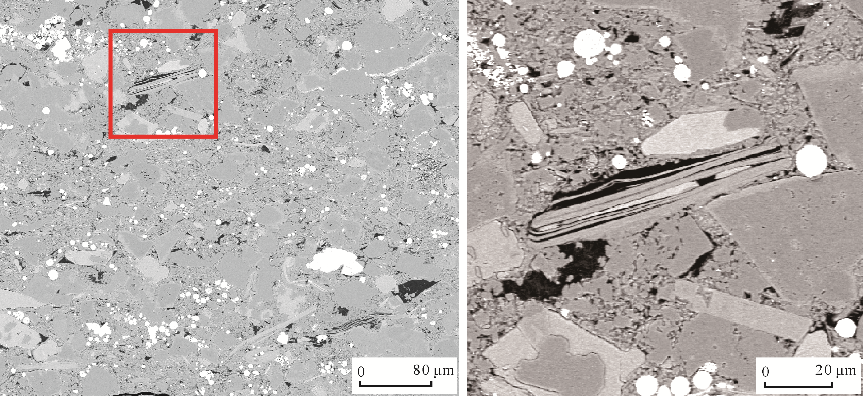
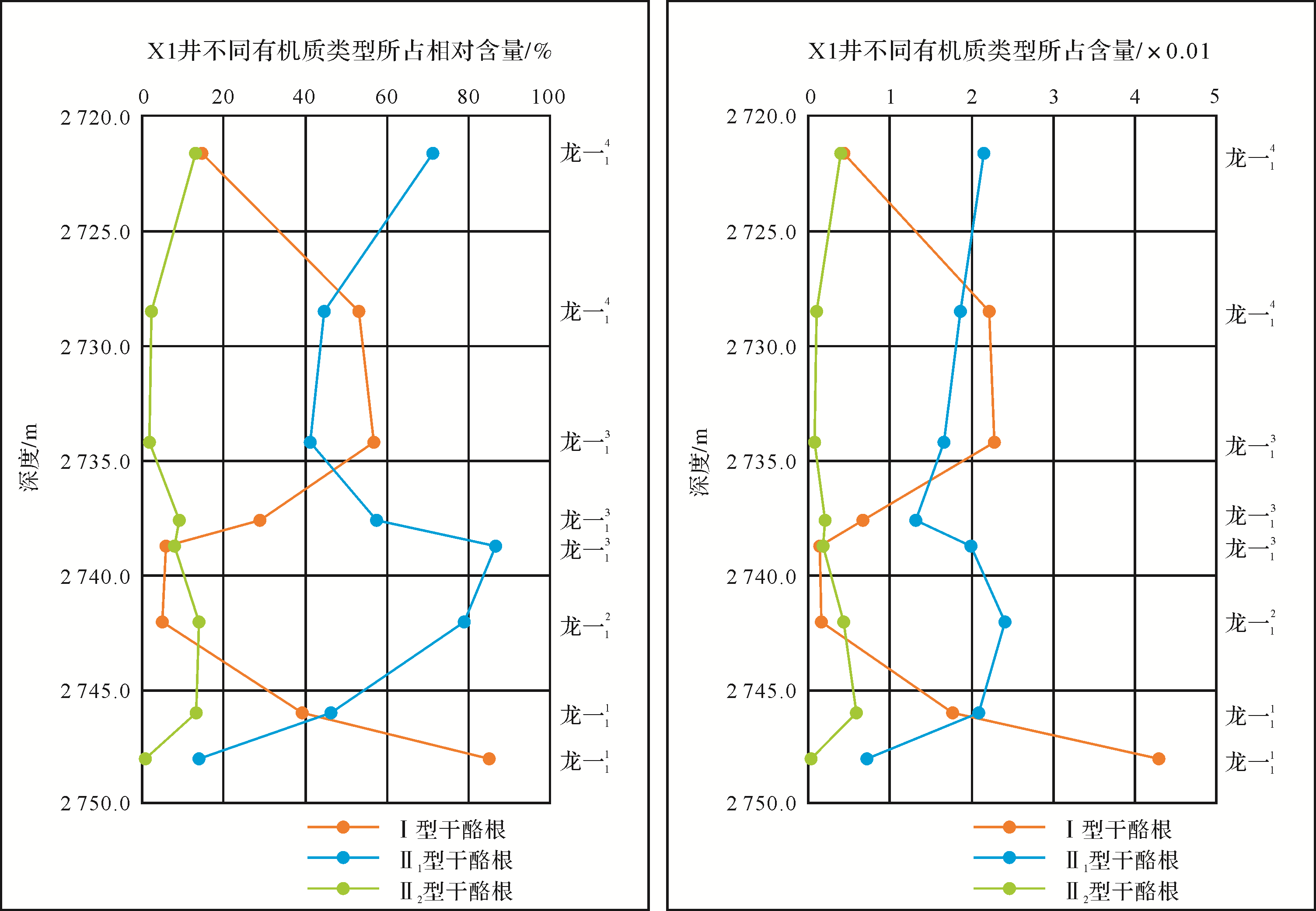
Abstract:
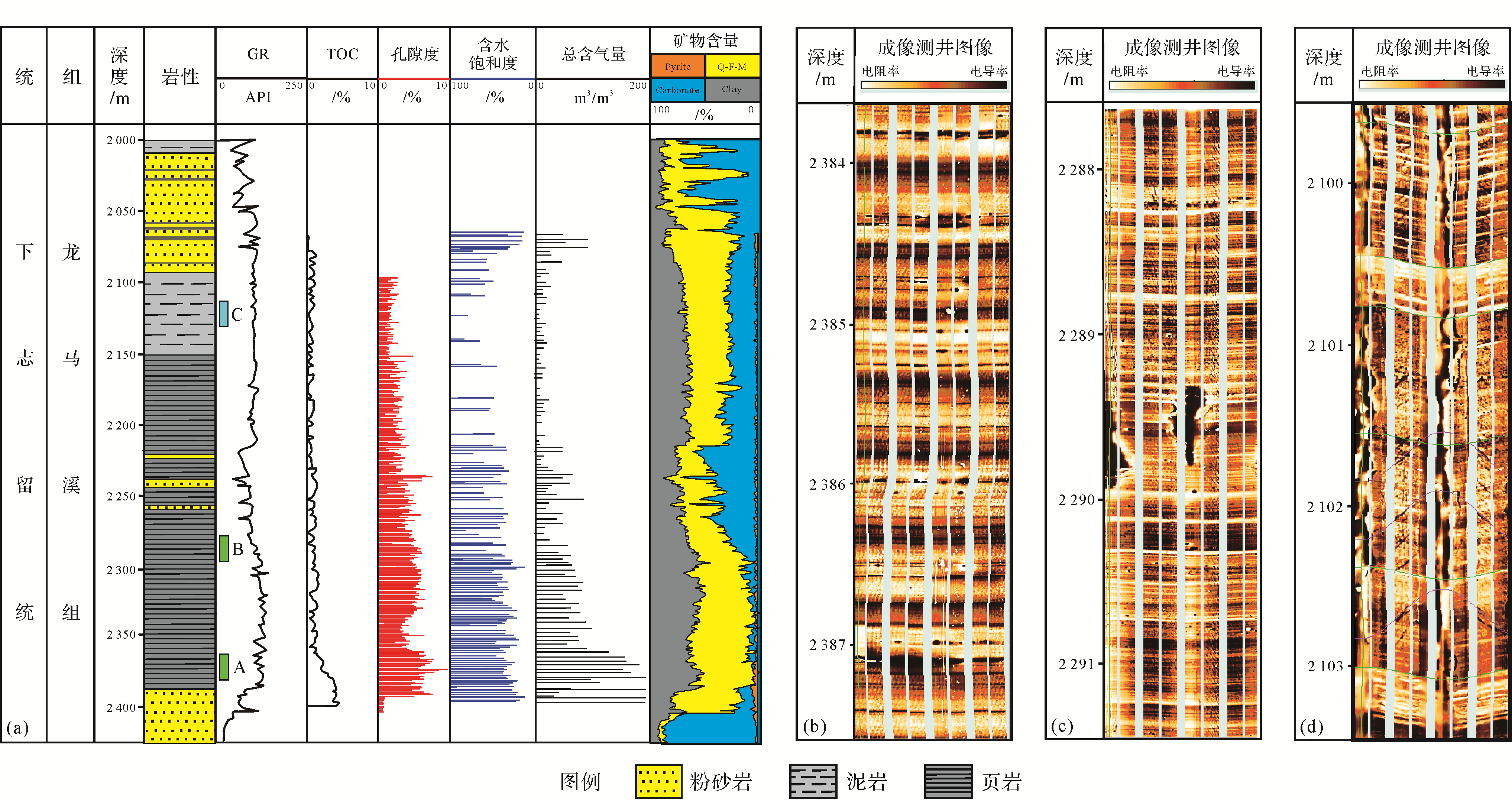
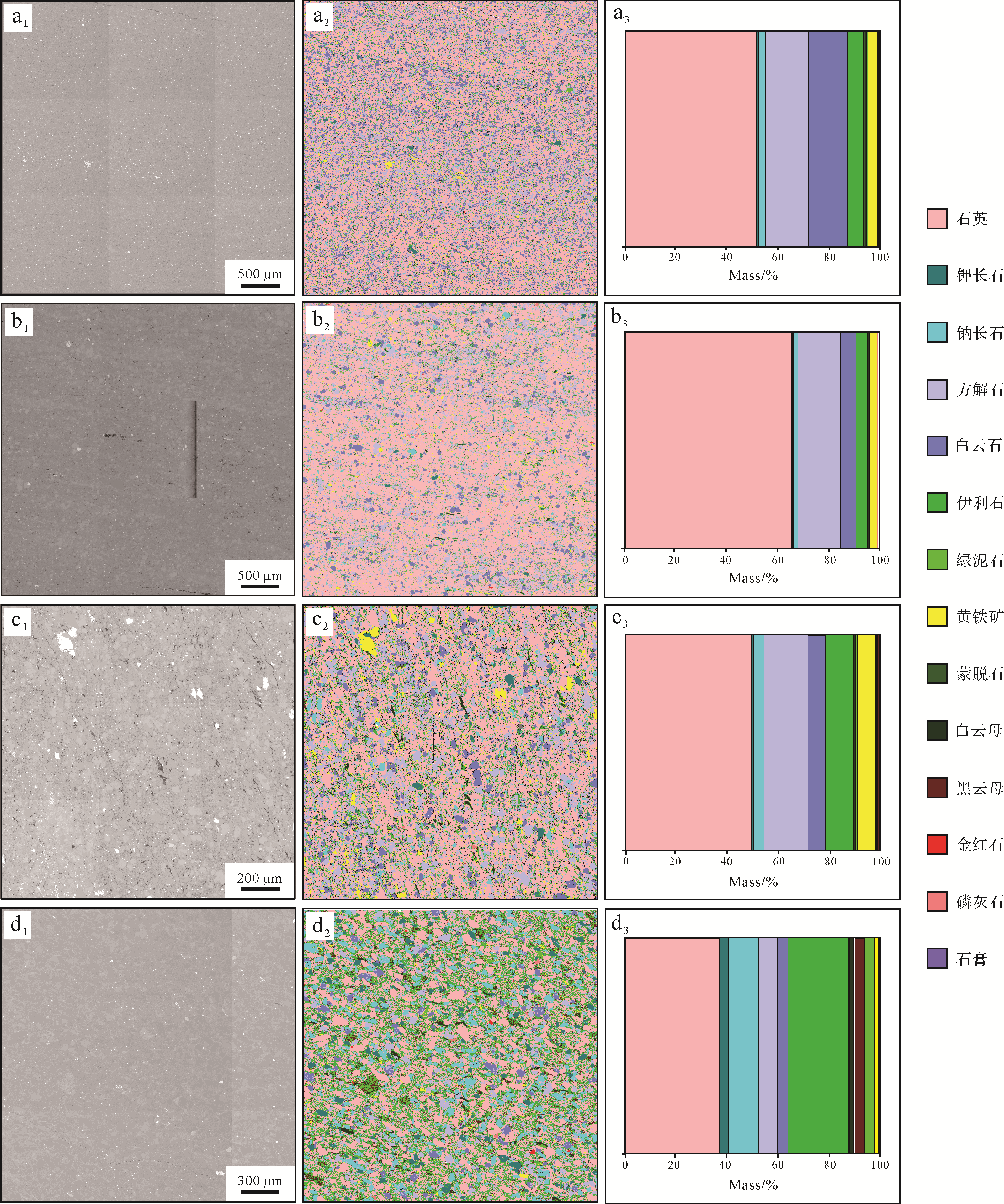
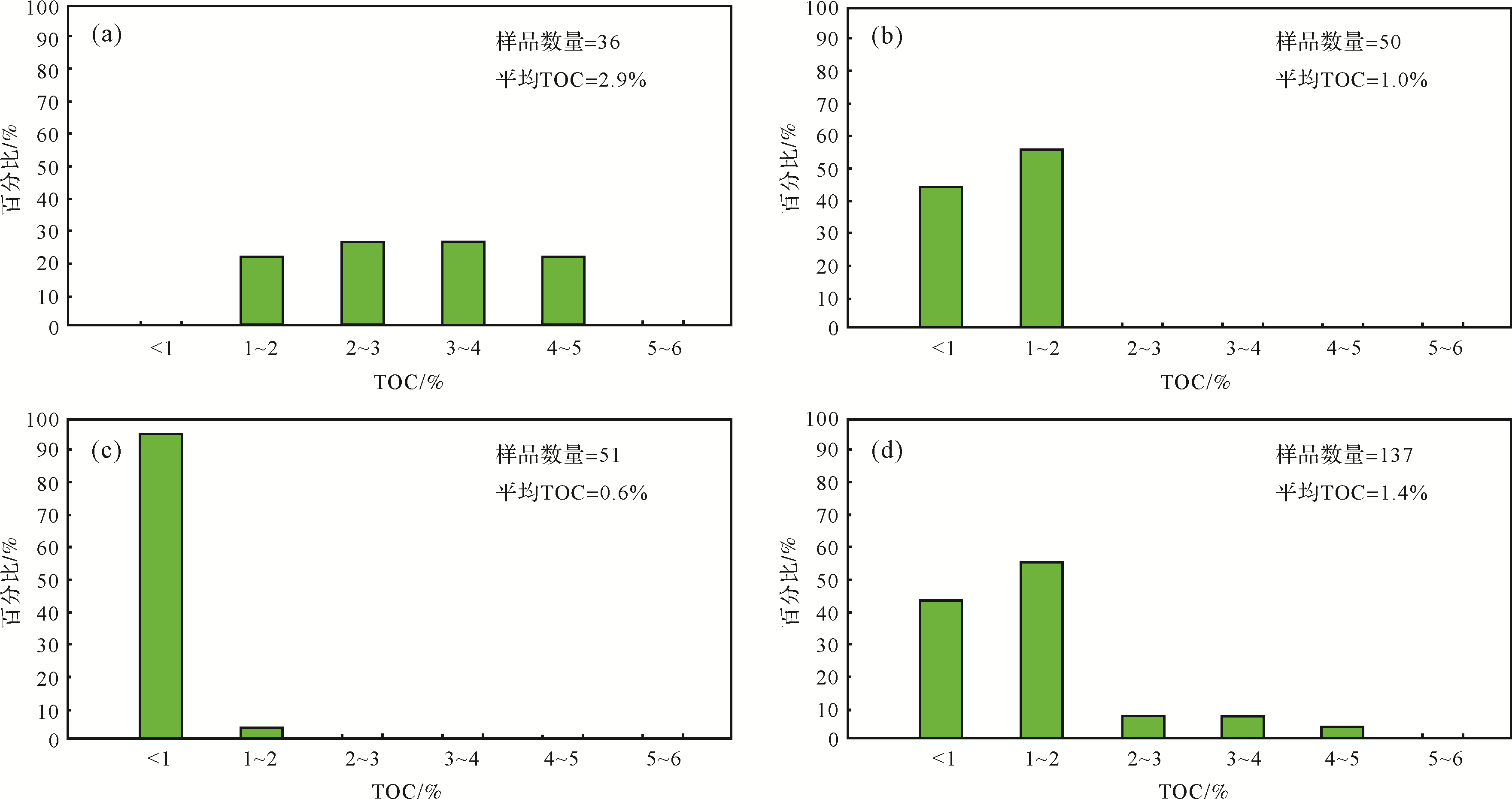
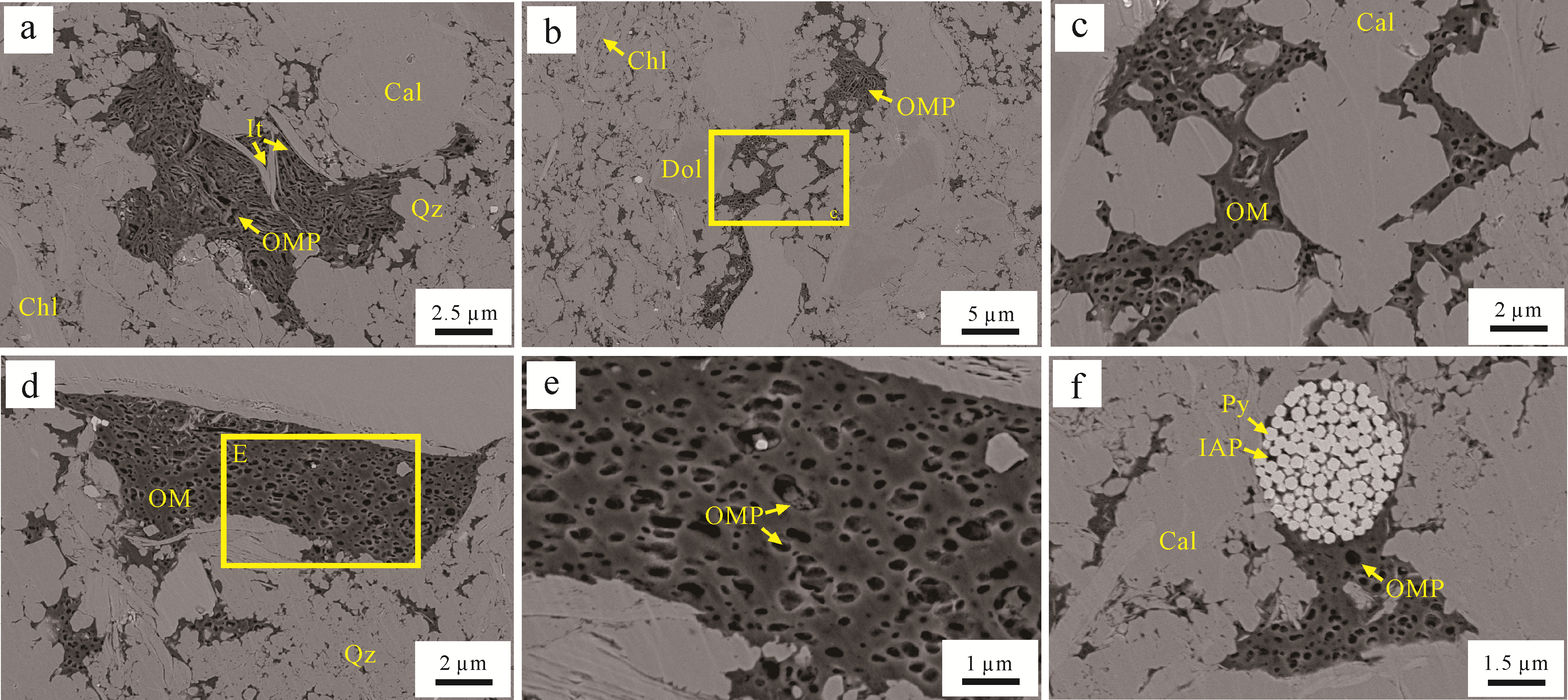
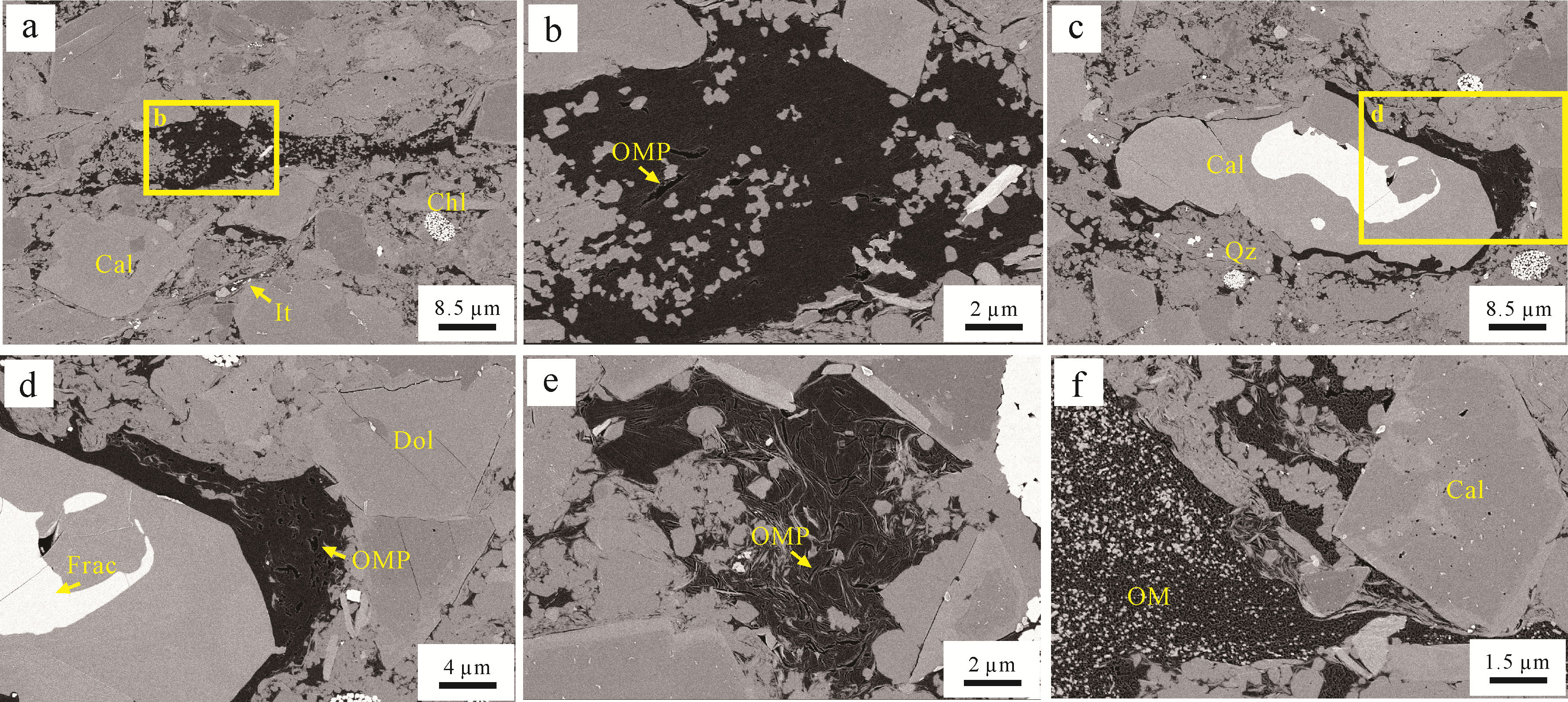
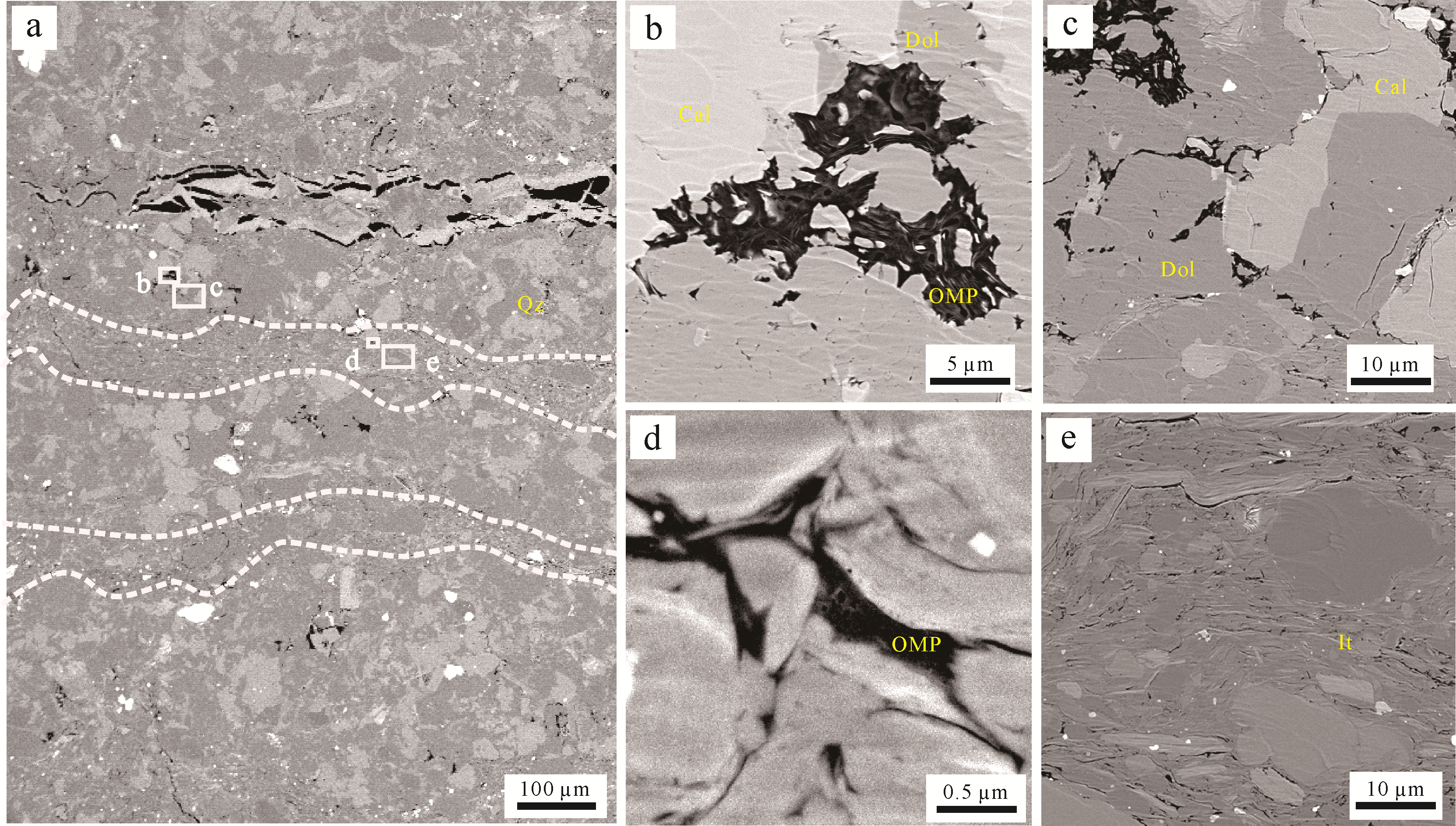
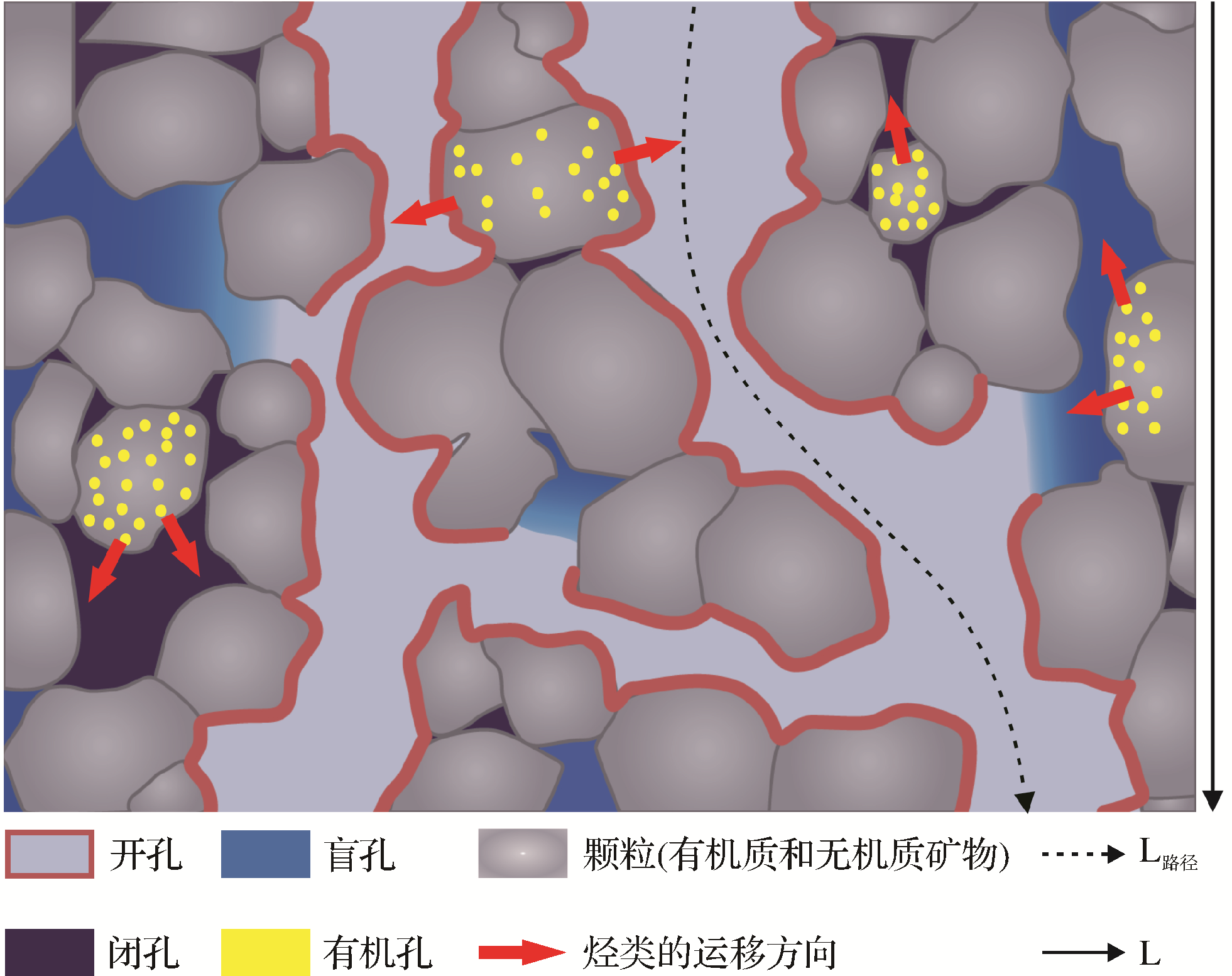
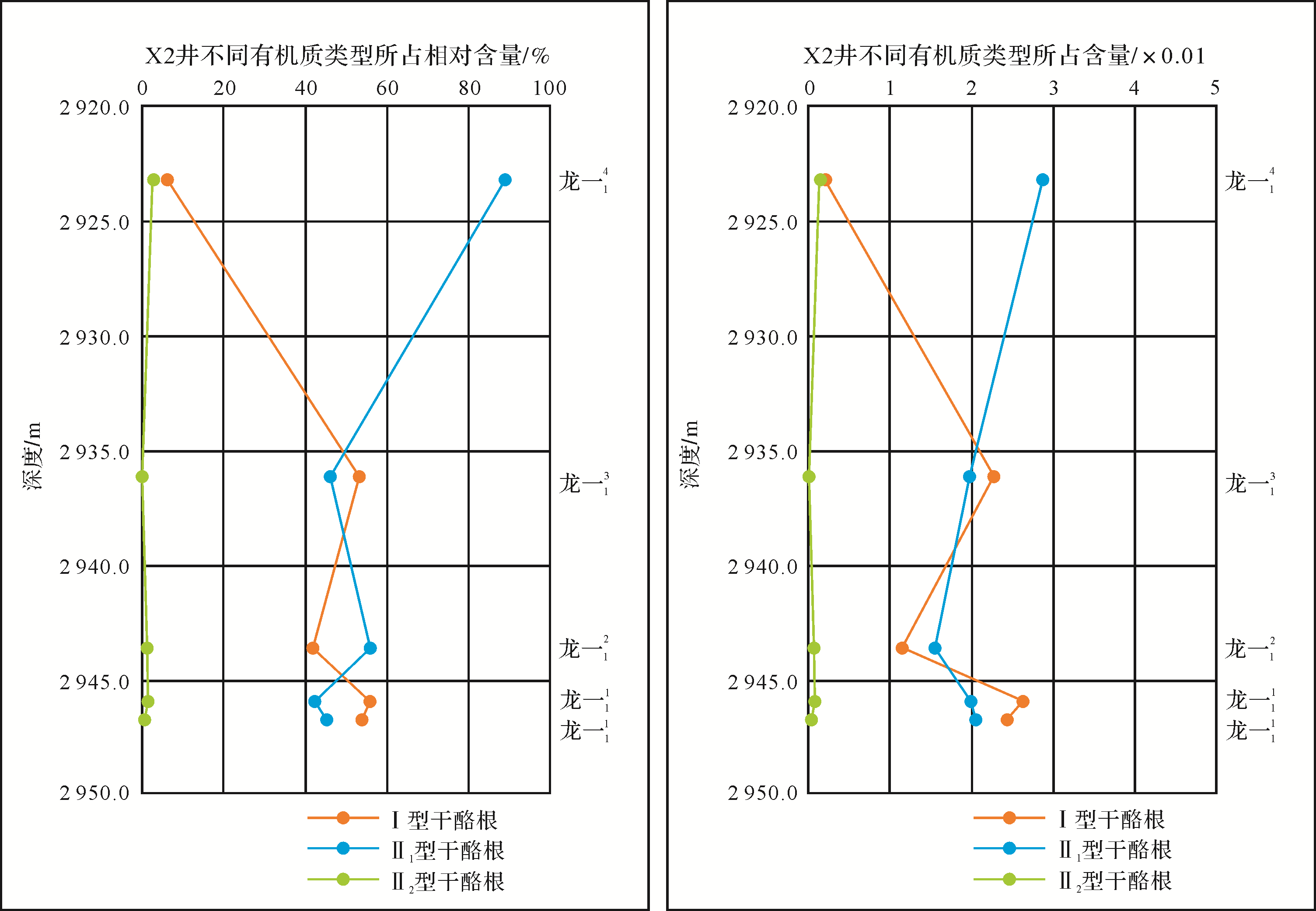
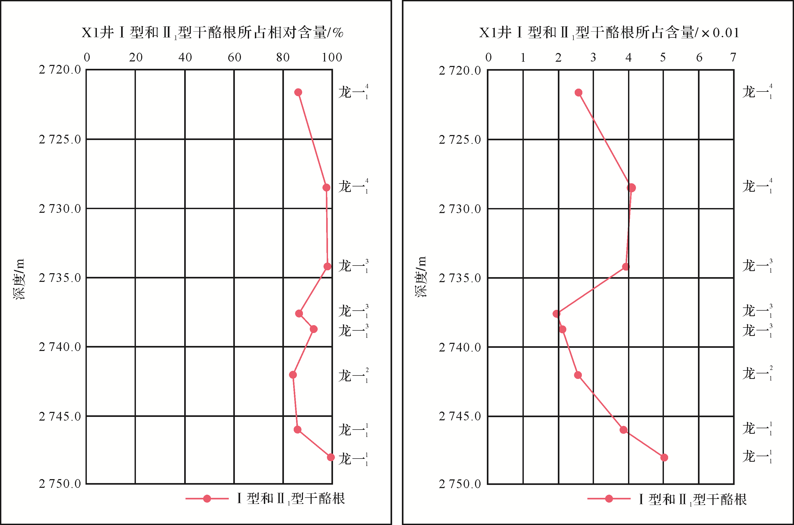
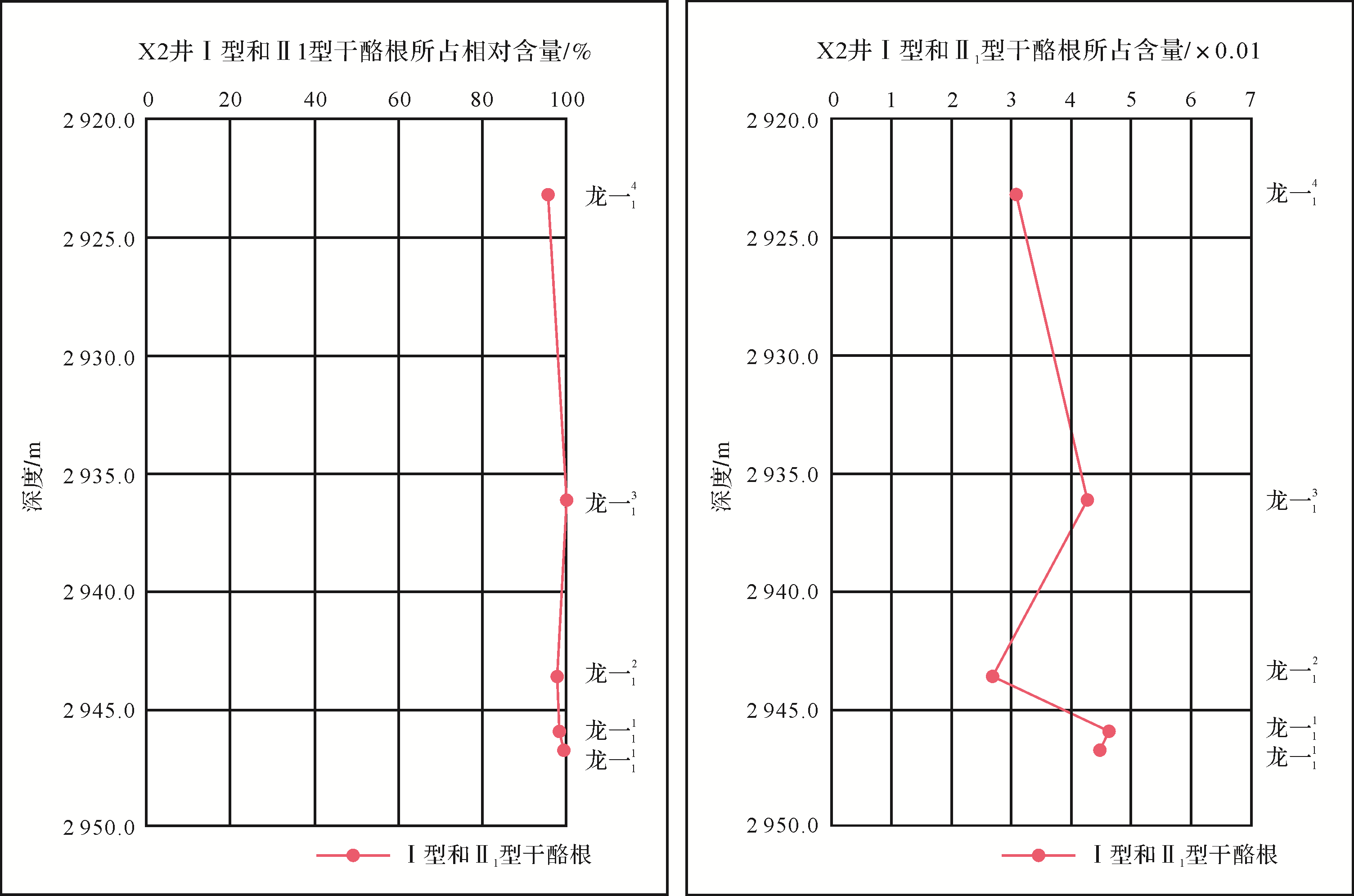
The organic matter in shale reservoirs is not only the core factor of hydrocarbon generation, but it also generates porosity. Previous evaluations of organic matter types have shown that the hydrocarbon generation and pore formation capacity of the various types of organic matter are significantly different. However, previous identification and evaluation of organic matter types have mainly used organic geochemical procedures for destructive testing, making it impossible to quantitatively evaluate the type and content distribution of the organic matter on a microscopic scale. This study takes as an example the shale reservoirs of the Silurian Longmaxi Formation in the Weiyuan gas field in the Sichuan Basin, focusing on organic matter enrichment in the Long11 sub-segment using two-dimensional large-area multi-scale combined SEM to produce images of micro-components. The modular automated processing system (MAPS) technique was used for maceral analysis to quantitatively identify types of organic matter and analyze their vertical distribution. It was found that the organic matter in the Long11 sub-segment consists mainly of types I and II1 kerogen, with a predominance of type II1. The change in organic matter type with depth was determined as a sedimentary facies belt. Sublayers L o n g 1 1 1 L o n g 1 1 3 L o n g 1 1 2 L o n g 1 1 4


2021, 39(2): 353-373.
doi: 10.14027/j.issn.1000-0550.2020.030
Abstract:
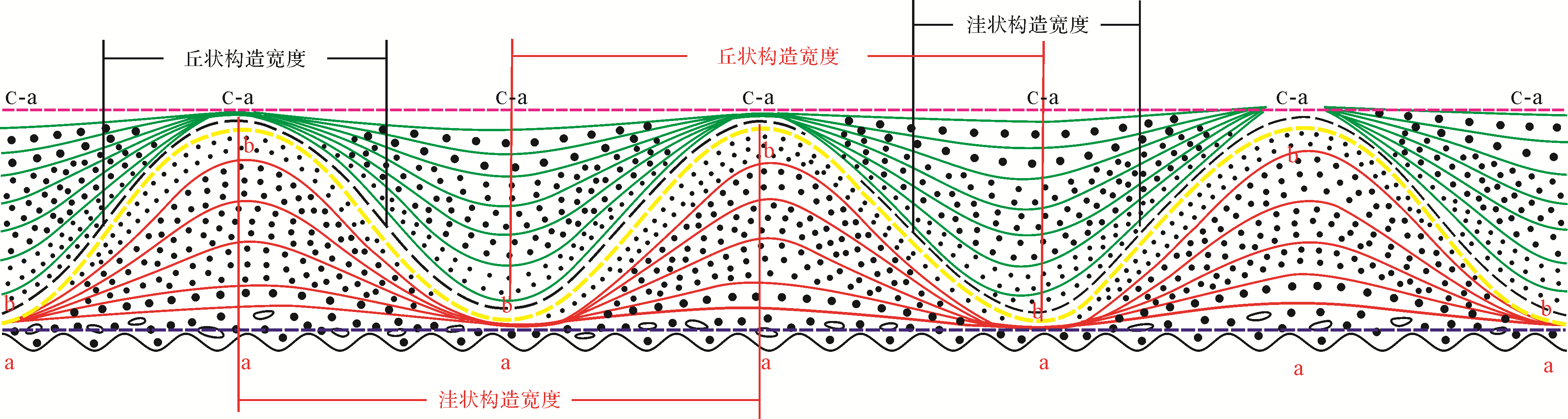
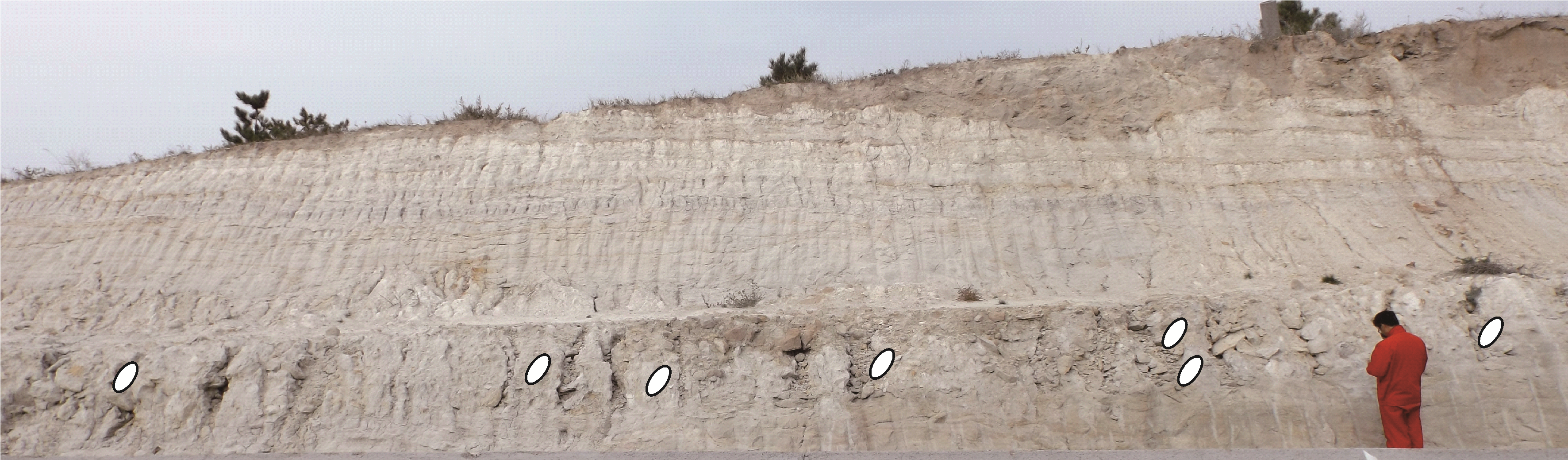
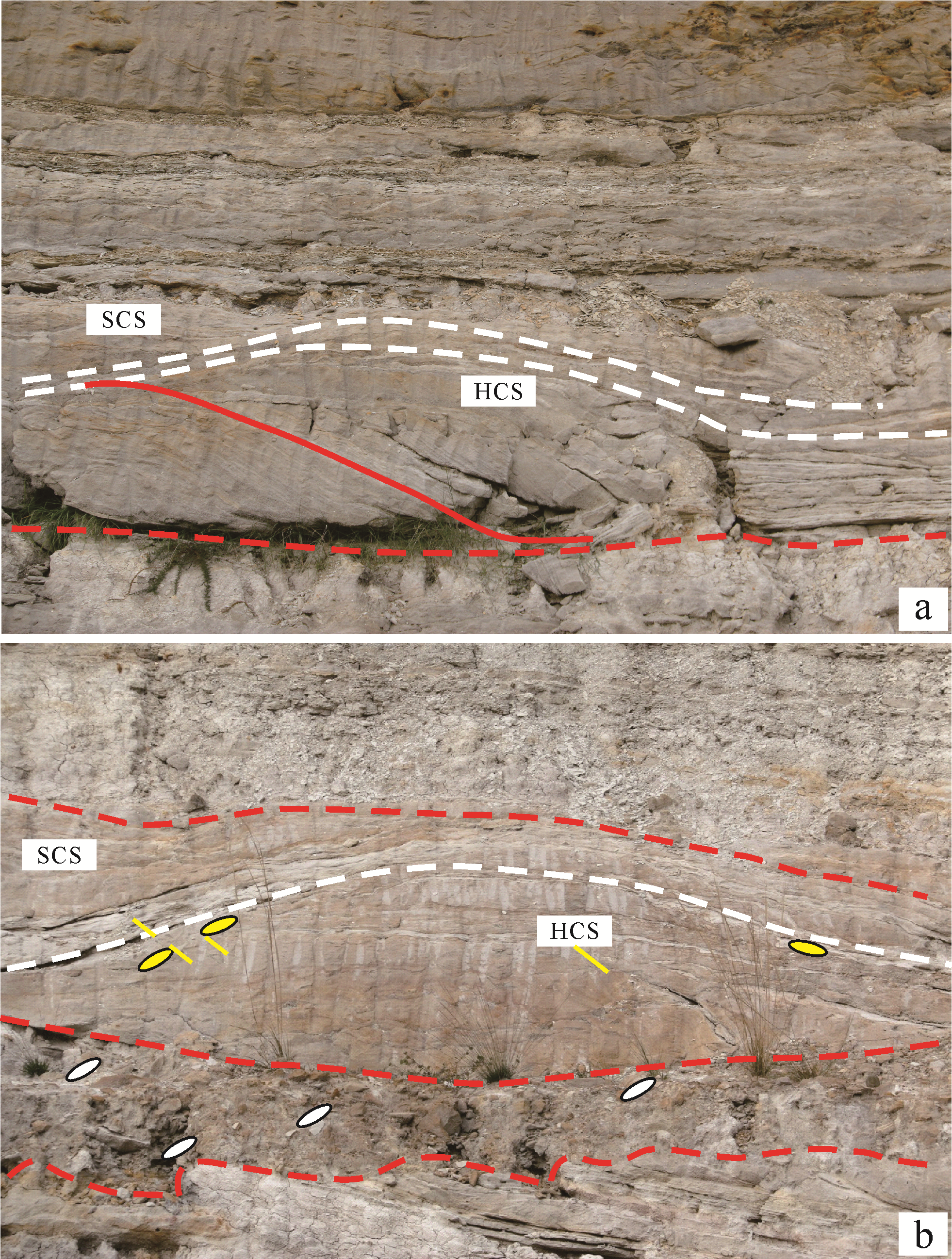
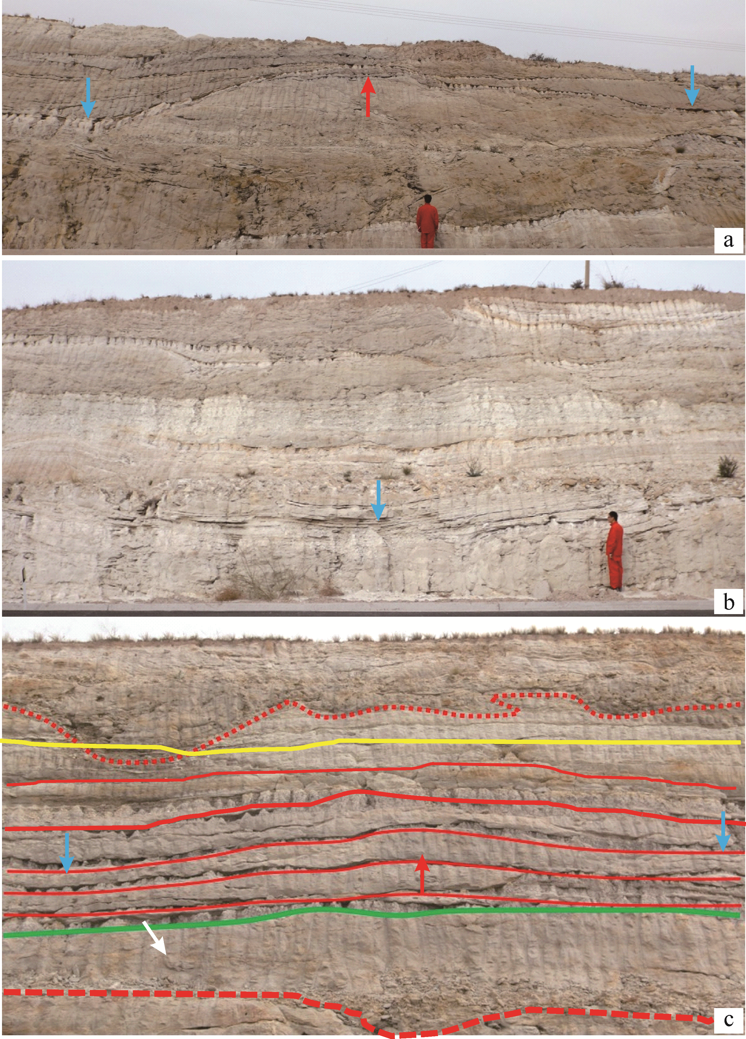
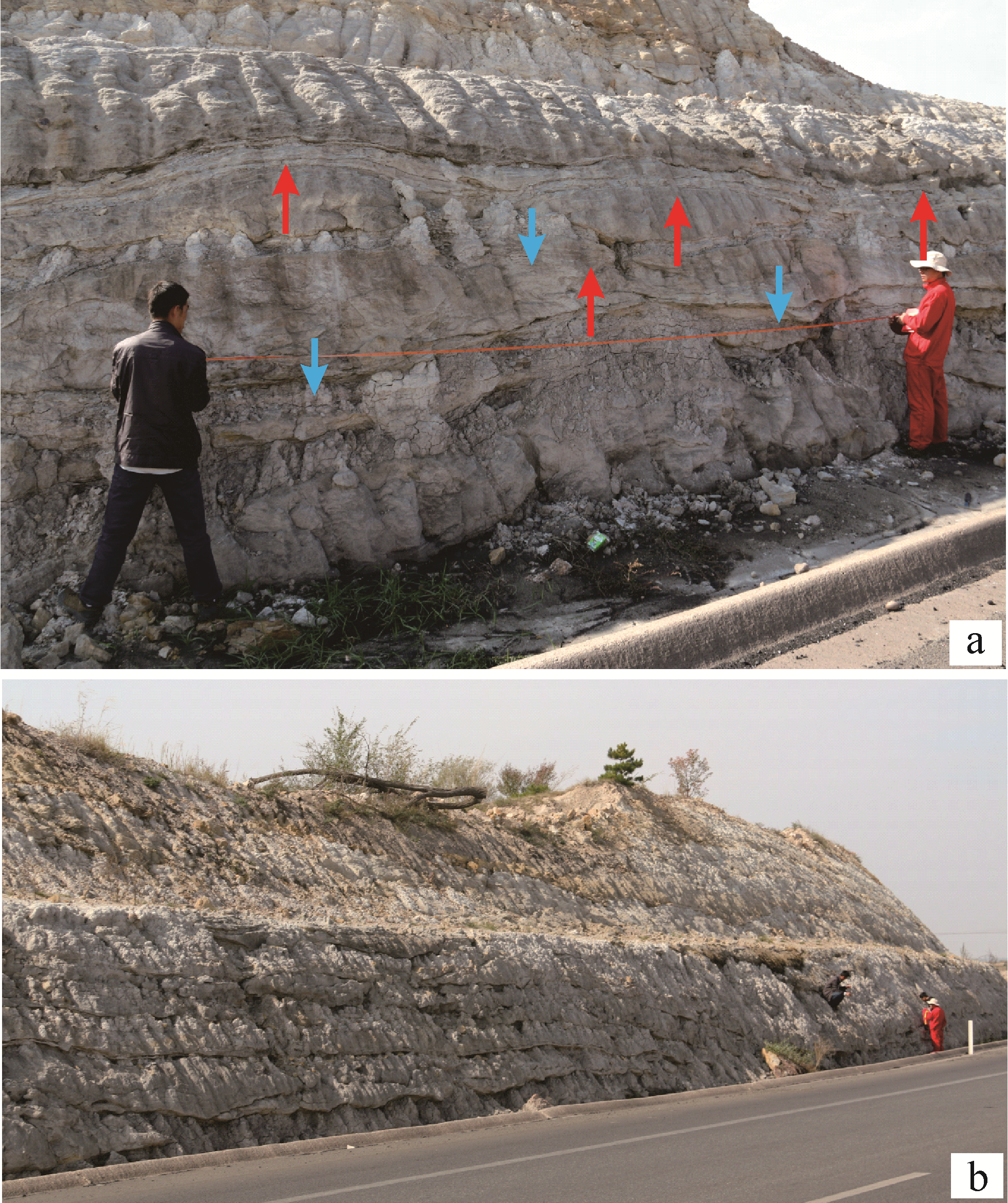
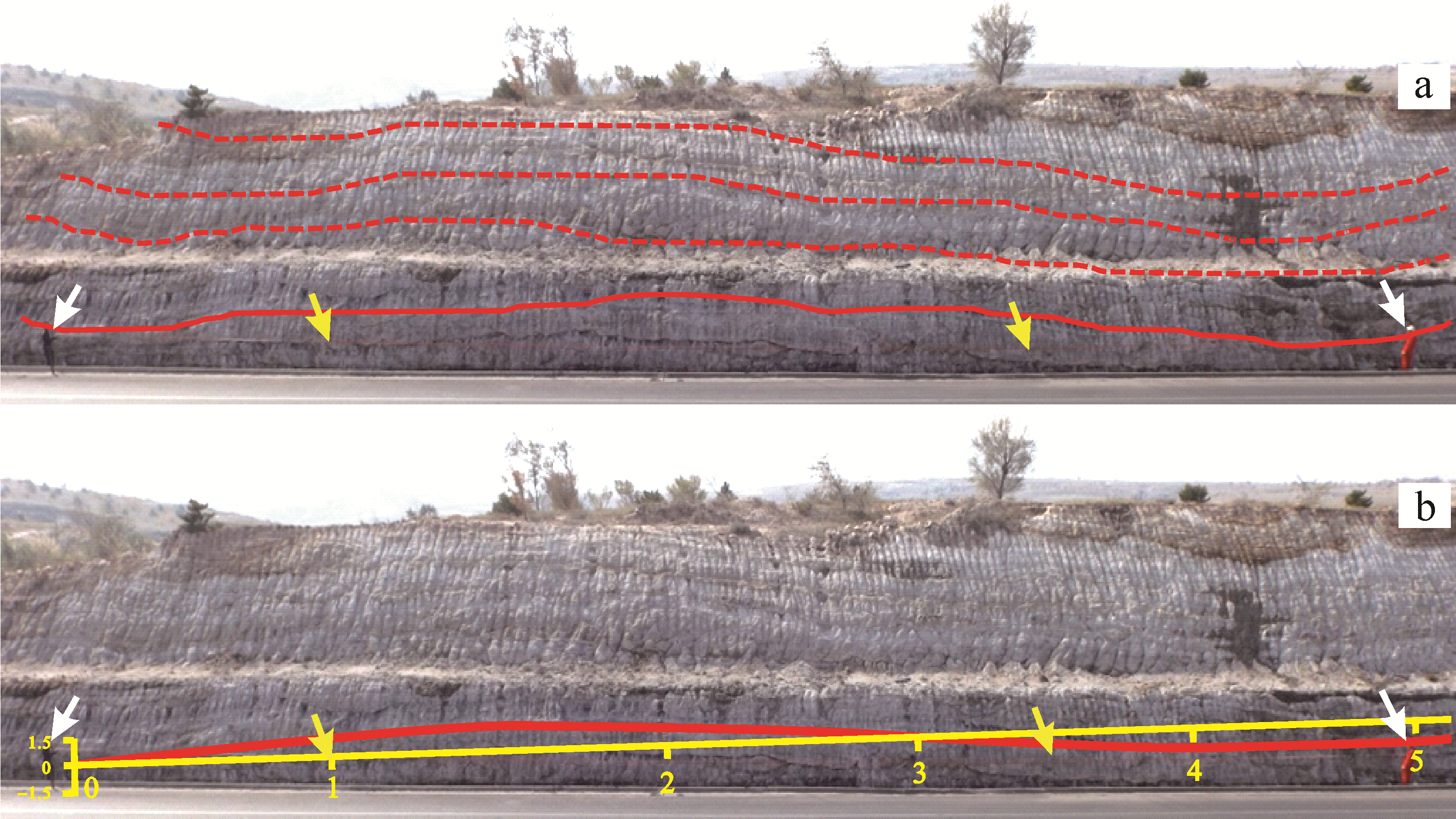
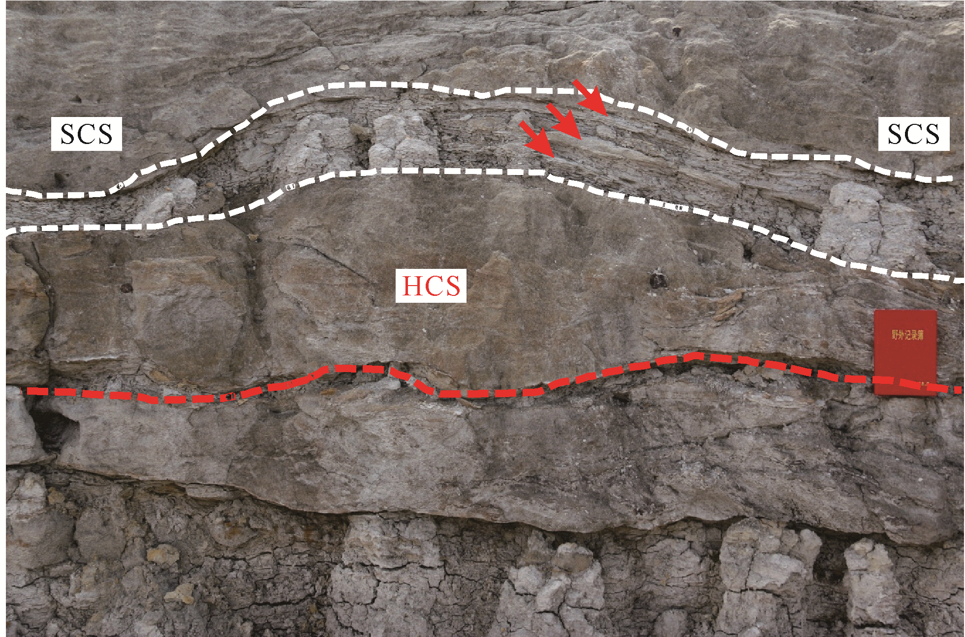
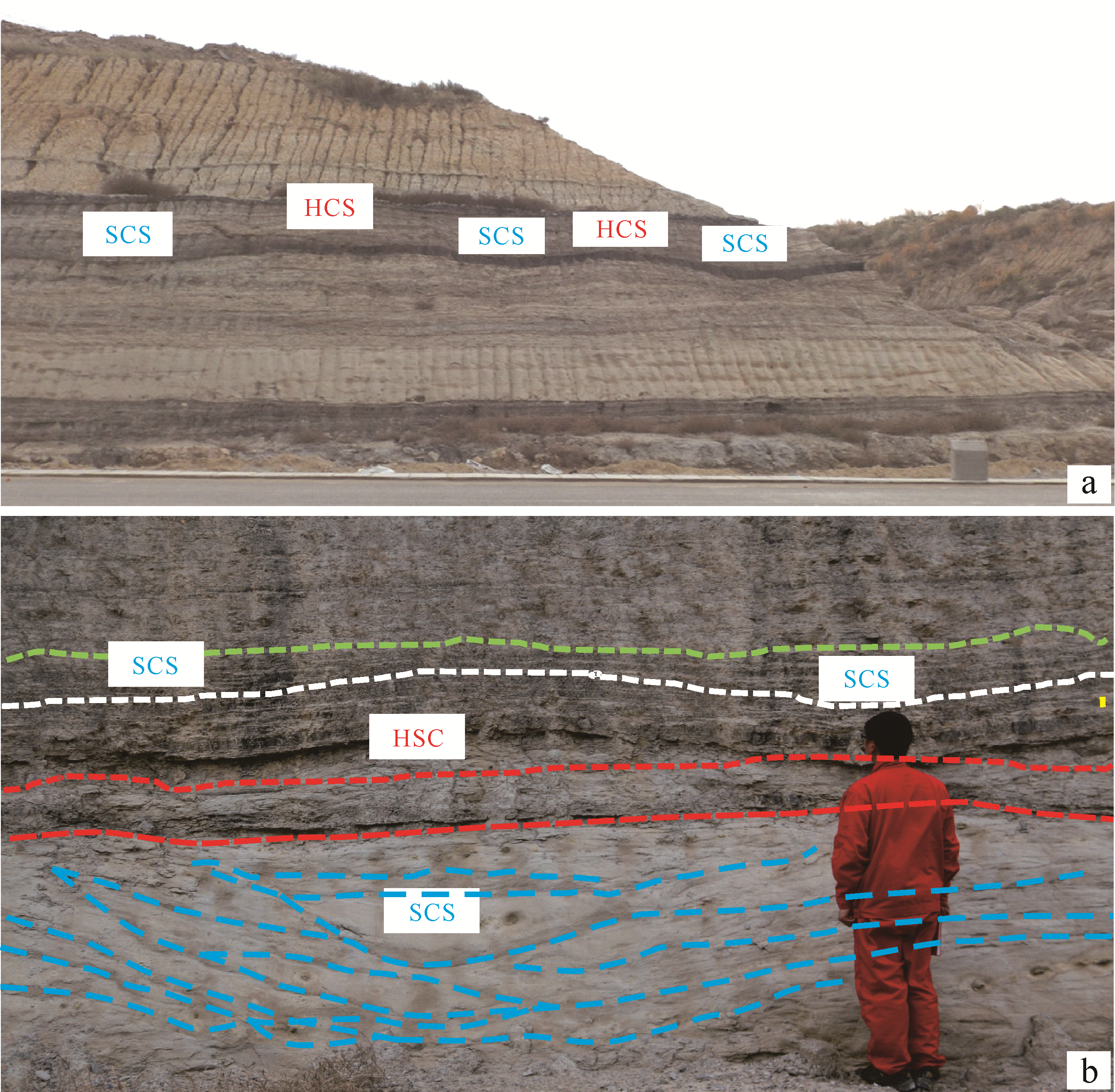
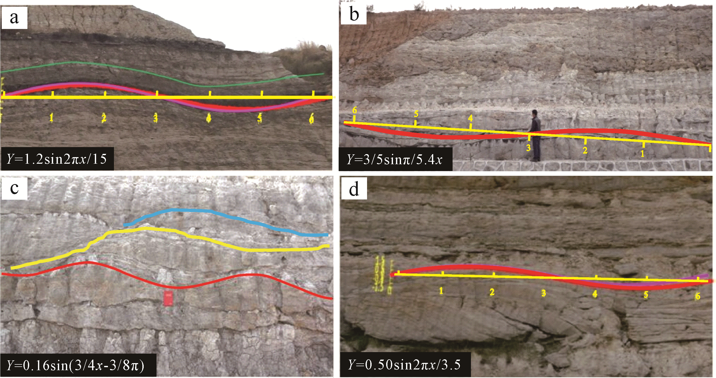
Mesozoic rocks are exposed in the northeastern corner of Ordos City. The main strata consist of a set of Triassic⁃Jurassic lacustrine deposits. Well⁃developed storm deposits and tempestites are found in the Triassic⁃Jurassic. The main site of the study is in the Triassic⁃Jurassic on both sides of National Highway 109 from Nalinhe coal mine to western Desheng, a distance of about 40 km. The western Desheng profile shows well⁃developed storm deposits and tempestites over a continuous length of 548 m. These are mainly a fluvial⁃delta⁃lacustrine deposit (with a few peat bogs), which is remarkable for its type⁃perfect HCS and SCS. Preliminary studies suggest that this set of storm deposits and storm rocks mainly developed in shallow lakes. The main features are as follows. (1) Where there are storm deposits or storm rocks, the stratification is very poor, and the strata are mostly lenticular, or lenticular/wavy. (2) The mounds and depressions form perfect medium⁃ and large⁃scale continuous sinusoidal curves of wavelength ranging from several meters to nearly 100 meters, and amplitude ranging from tens of centimeters to 1⁃2 meters. (3) The lithology and its combinations are mainly a set of yellow⁃brown conglomerate + sandstone + gray mudstone. It has an obvious binary structure (lower coarse / upper fine). Stratification has developed in the upper part of the lower block. Conglomerate dominated by coarse debris is a common bottom deposit in the storm deposits. Storm deposits and tempestites have been formed by coal seams near the Nalinhe coal mine. (4) Gray gravel⁃bearing block mudstone with floating gravel reveals that it was deposited rapidly, similar to debris flows formed by storms rather than hydrostatic deposits formed in normal weather. The pebbly mudstone is tens of centimeters thick, which indicates a considerable rate of deposition at the time.(5) In western Desheng, a prominent profile of storm sediments and rock, the bottom developing the 1 to 3 thick gravel layers, with a middle layer tens of centimeters to 1⁃2 m thick and large amounts gravel 30⁃40 cm in diameter, most with imbricate structure. The former may be instructed the backflow storm in the direction of the lake, which indicates flushing flow to the lake shore caused by very strong storms. (6) Oscillatory flow is dominant, but has clear characteristics of composite and oscillatory flow in some places. (7) The overall sedimentary background is that of a broad, shallow lake environment, with mainly in situ oscillatory vertical deposition. Lake storm deposits and tempestites in the Triassic⁃Jurassic in Ordos is not usual; to date, no such large HCS and SCS have been reported anywhere worldwide. This study has shown that the lacustrine water in which these storm deposits and tempestites were formed was about 50 meters deep.


2021, 39(2): 374-382.
doi: 10.14027/j.issn.1000-0550.2020.029
Abstract:
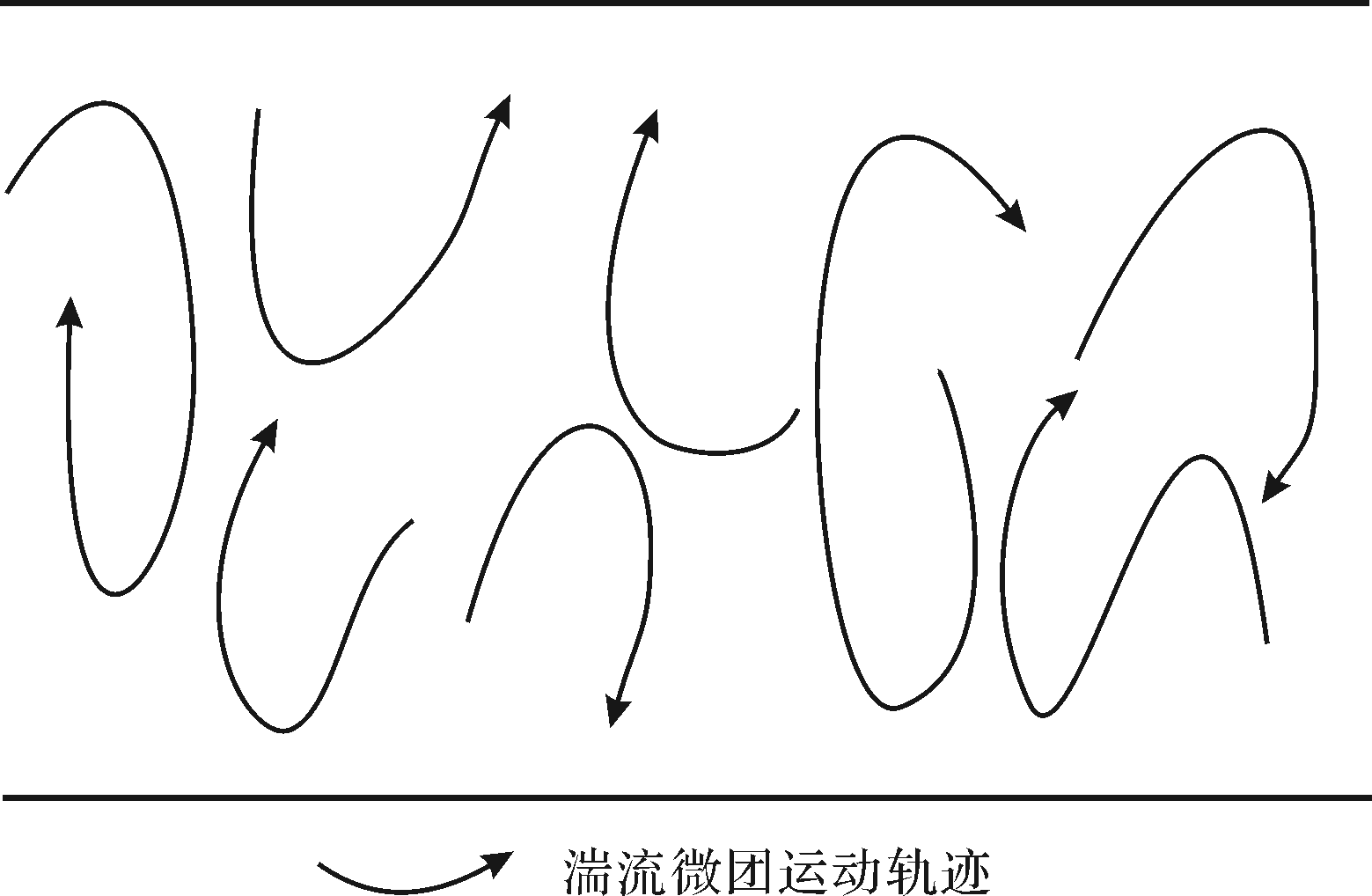
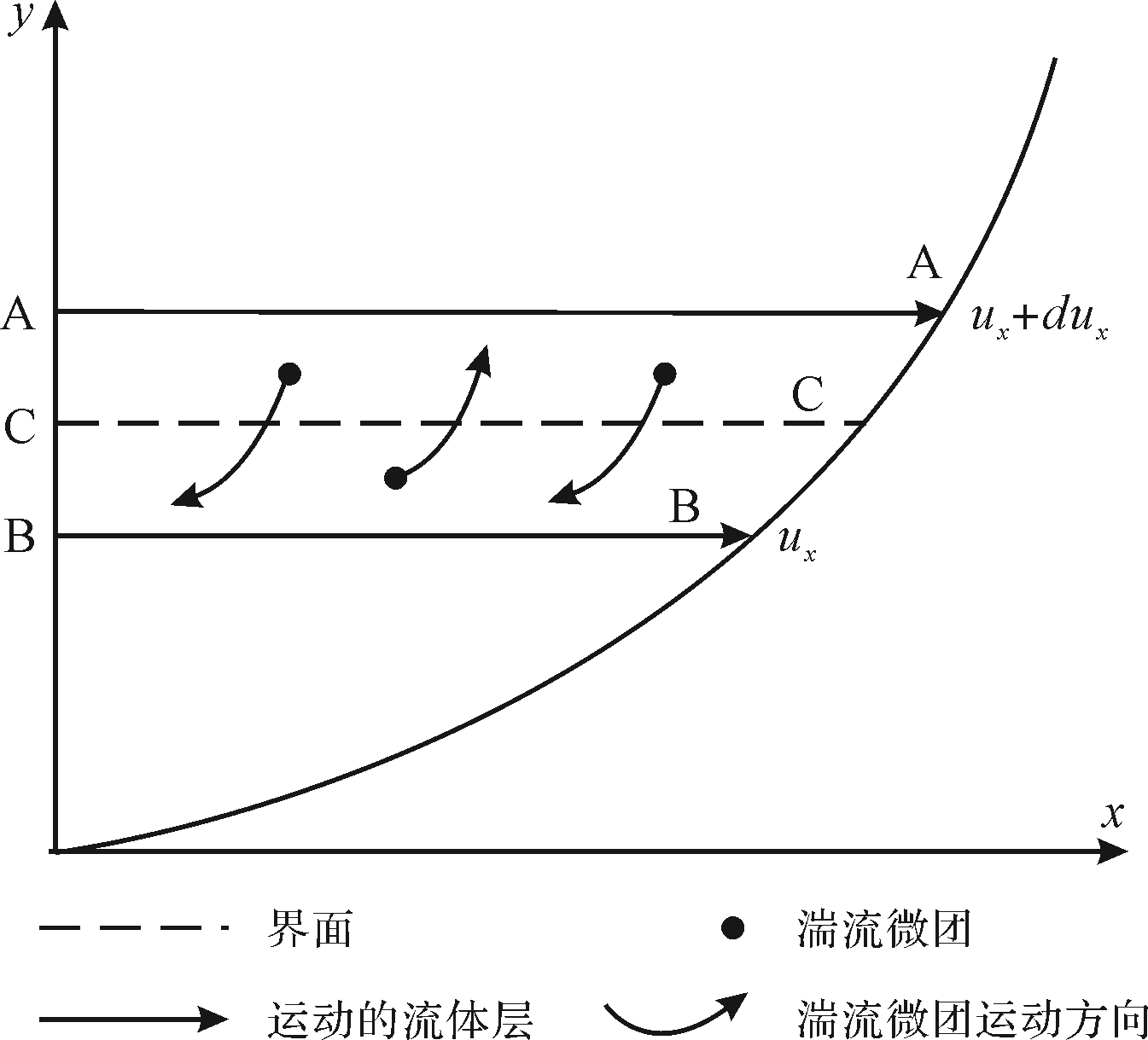
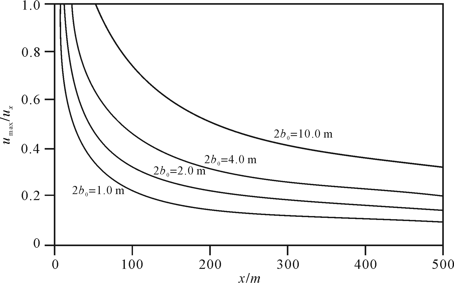
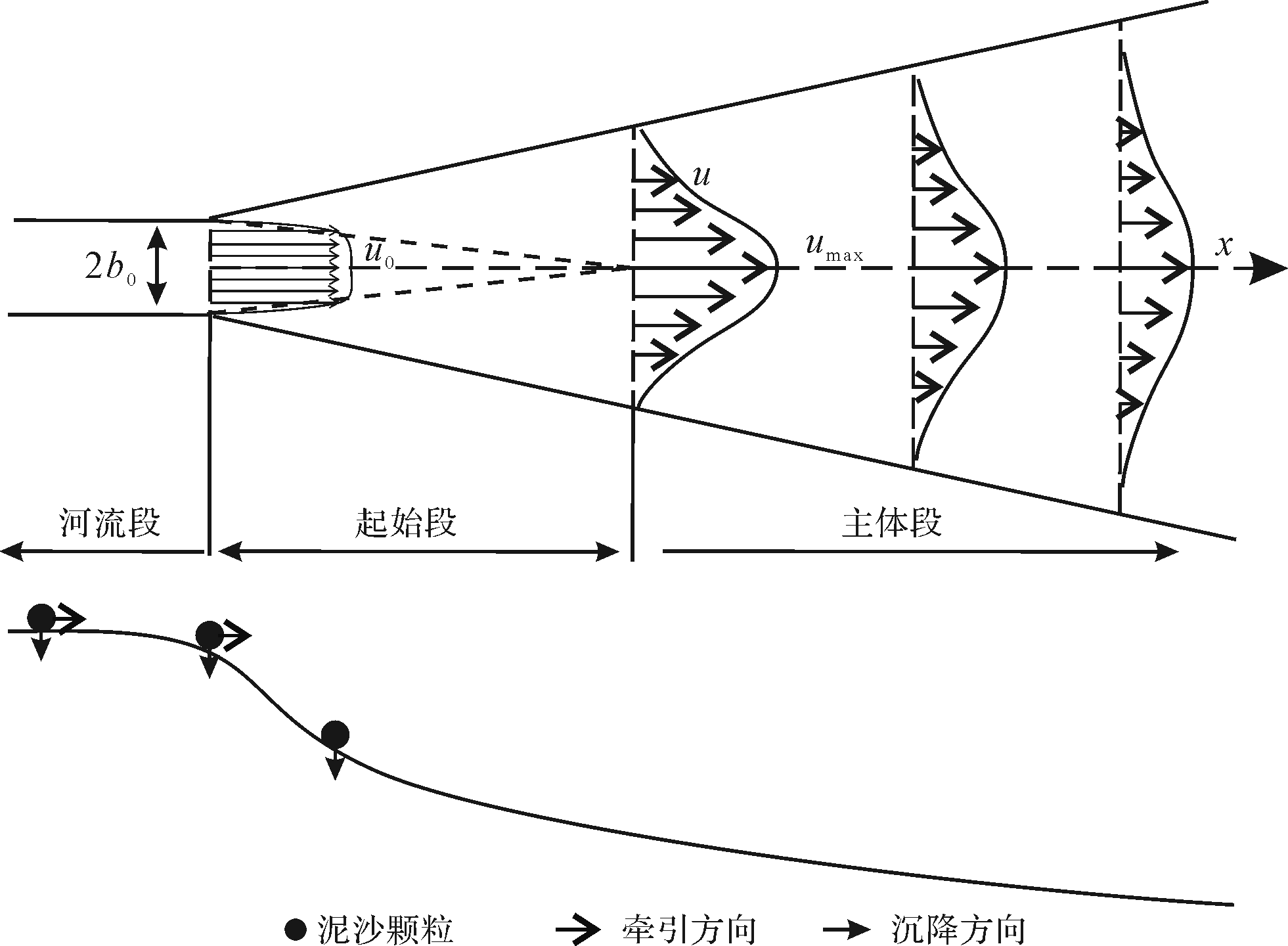
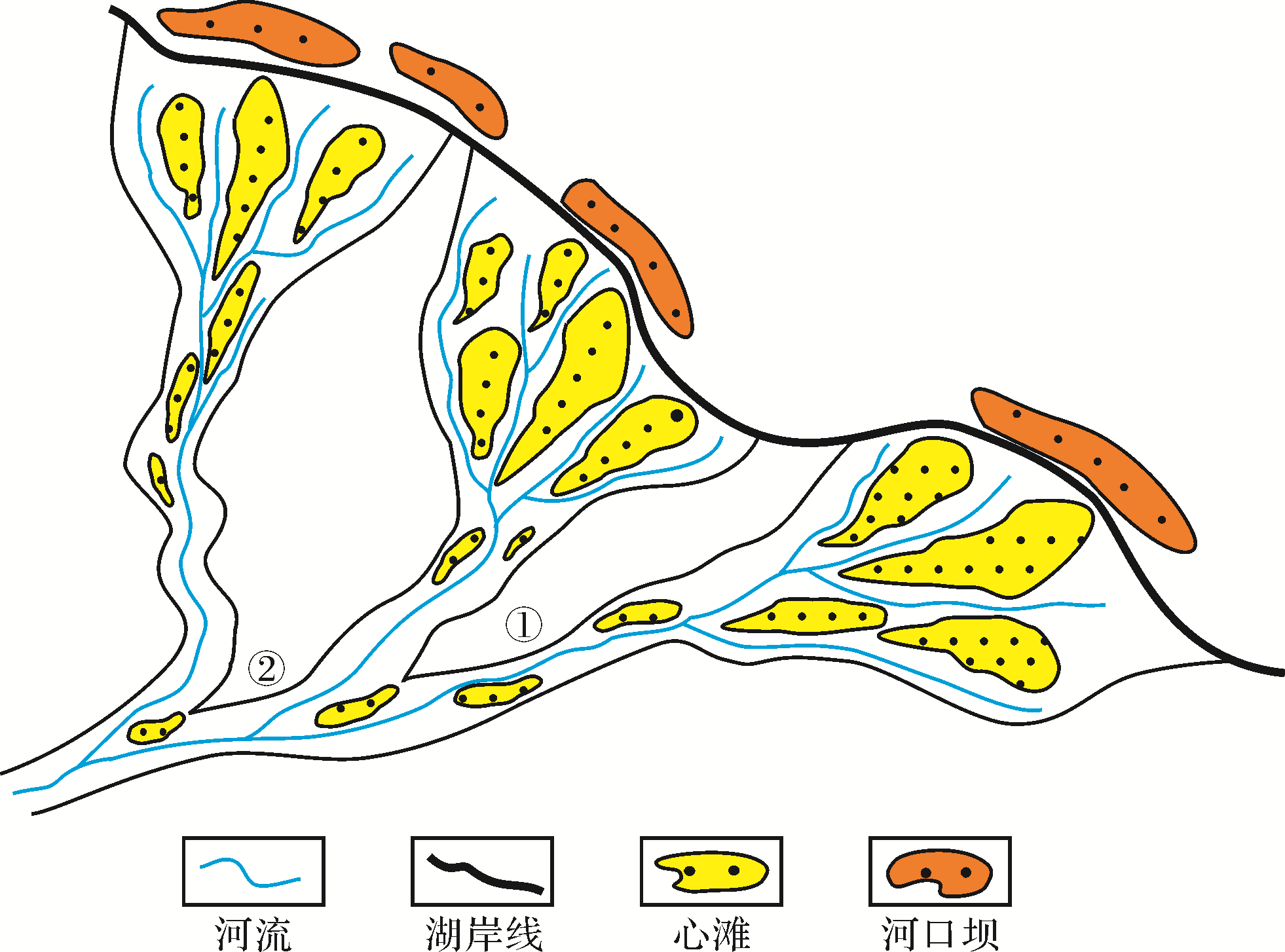
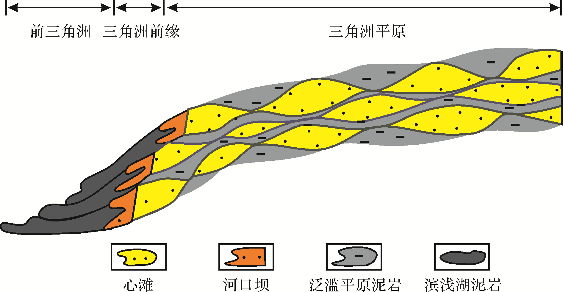
Analysis of the hydrodynamic characteristics of estuaries, and examination of the bedload transport and deposition processes of a sediment⁃carrying river in a delta front controlled by the estuary, are the premises of this study of the growth patterns of river⁃dominated deltas. Turbulence theory is applied from the perspective of microscopic dynamic processes to analyze the interaction mechanism and movement process of a river flowing into a lake. In this process, the river flows into the lake by inertia and without the constraints of a riverbed. Combining physical flume modeling and numerical simulation carried out for the growth process of a river⁃controlled delta with reference to the theory of fluvial sediment dynamics, the dynamic and sedimentary models of river⁃delta growth are established in terms of fluid dynamics and river sediment dynamics. The results show that the characteristics of turbulence determine the strong inertial mass, momentum and kinetic energy transfer between the two water bodies. The process of river water entering the lake is neither a circular (an axial), nor a plane (two⁃dimensional) jet, but a rectangular (three⁃dimensional) jet. The flow velocity in the lake is rapidly negative⁃exponentially attenuated. The estuary marks the termination of the sediment⁃carrying river, and the delta front under its control is its bedload terminal point. The growth process of delta plain sedimentary bodies consists of the delta plain power and the sedimentary and geomorphological interaction processes. The dynamic and sedimentary patterns may be summarized as: end of river⁃water flow; velocity attenuation along with reduction in carrying capacity and sediment deposition; river plate drive up to a bank run; river⁃tributary flow velocity with lower sedimentation; and distributary channel sandbodies. These produce the skeleton of sandbodies in a delta plain region. Frequent oscillation determined by river topography is also an important mechanism for the growth of delta plain sedimentary bodies. The main body of river⁃dominated delta deposition is determined by the plain environment, not the front environment.
2021, 39(2): 383-394.
doi: 10.14027/j.issn.1000-0550.2020.017
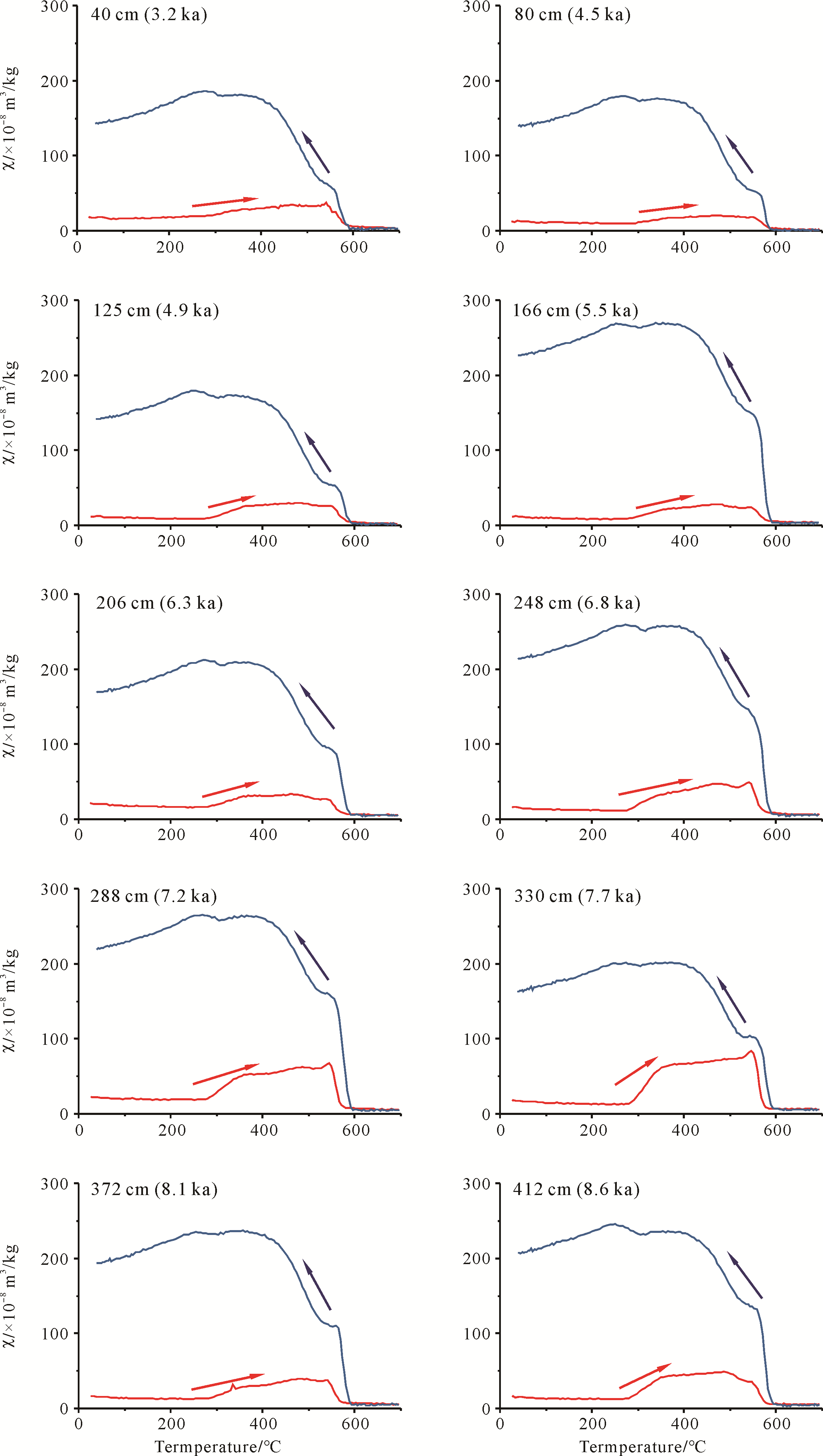
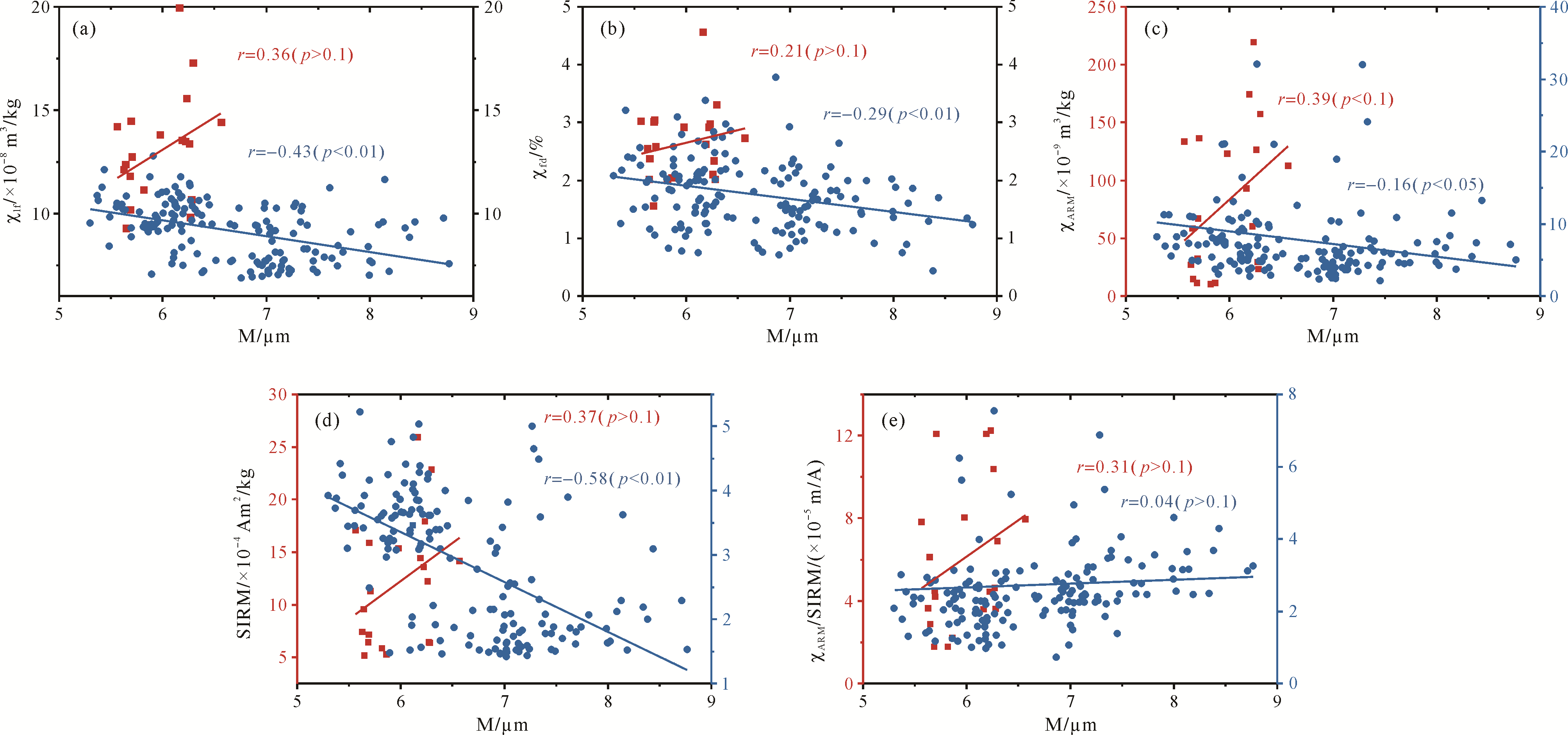
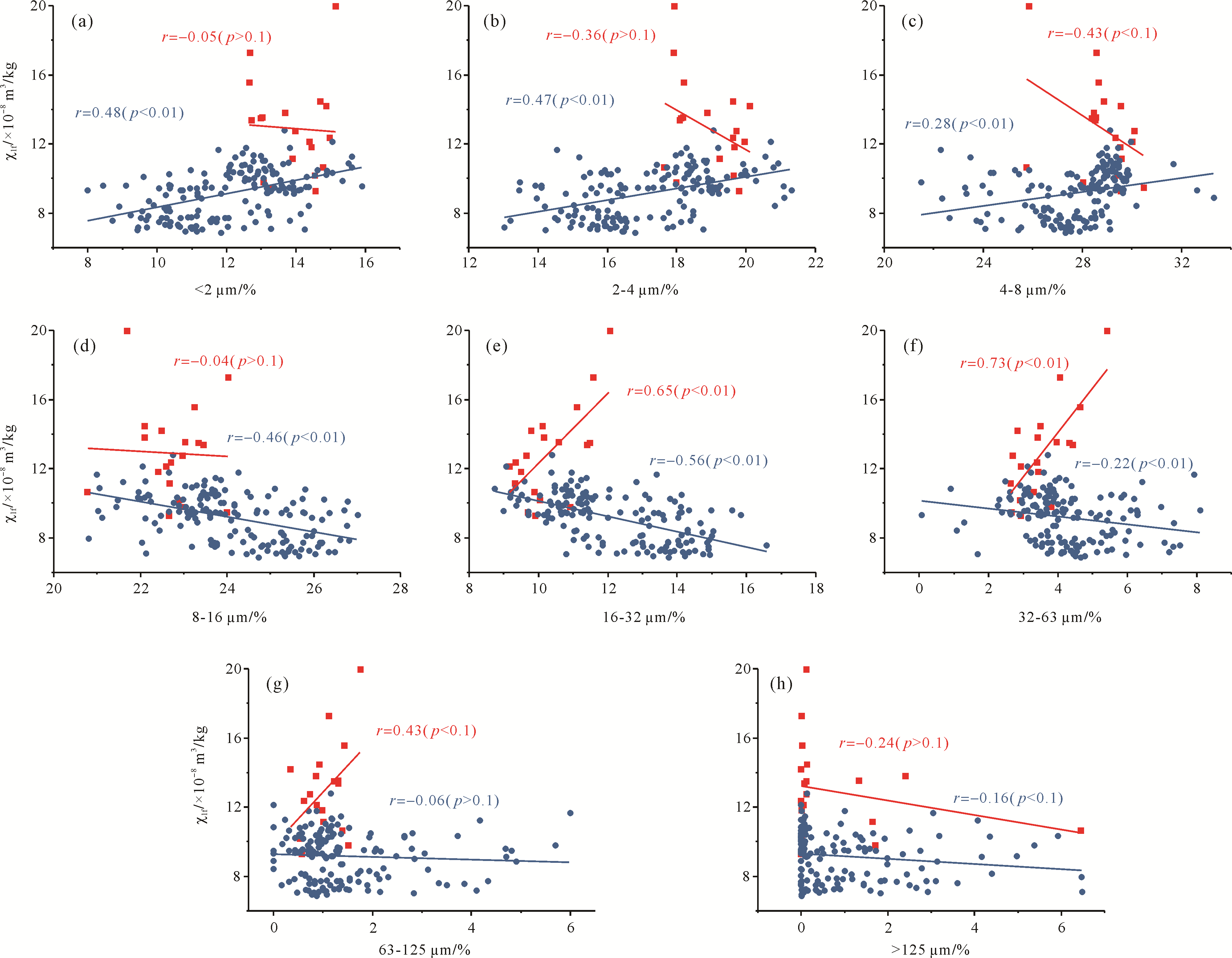
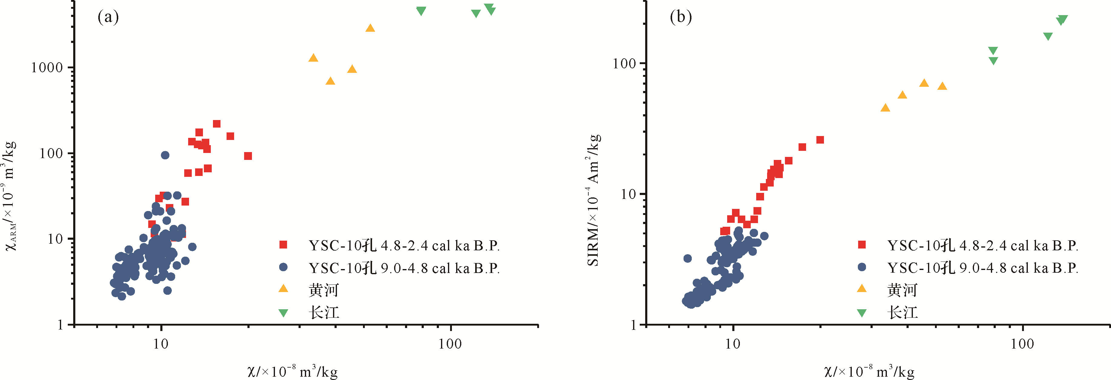
Abstract:
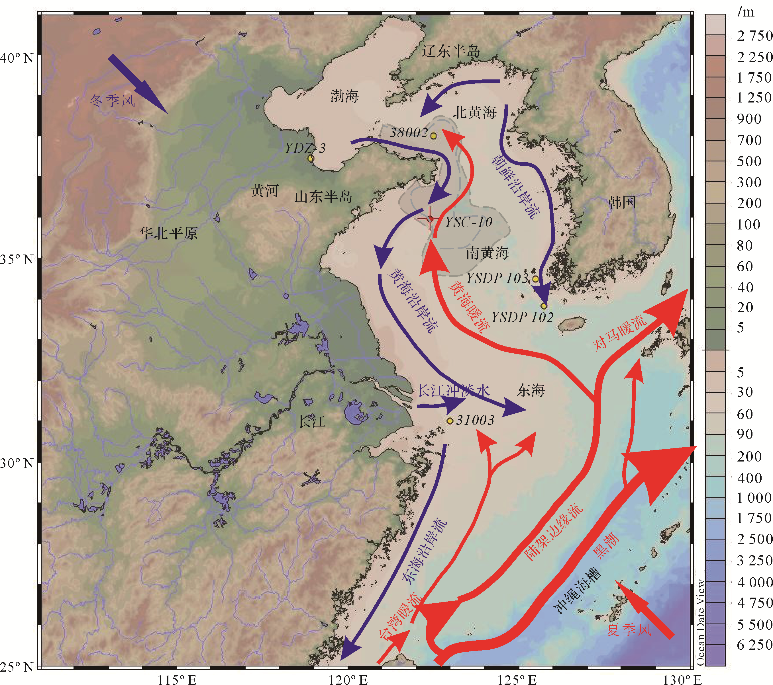
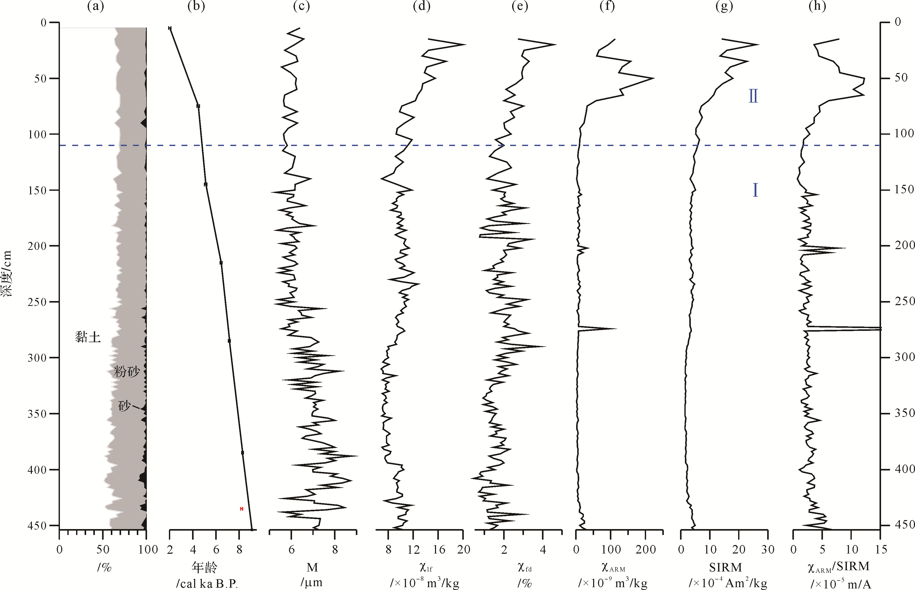
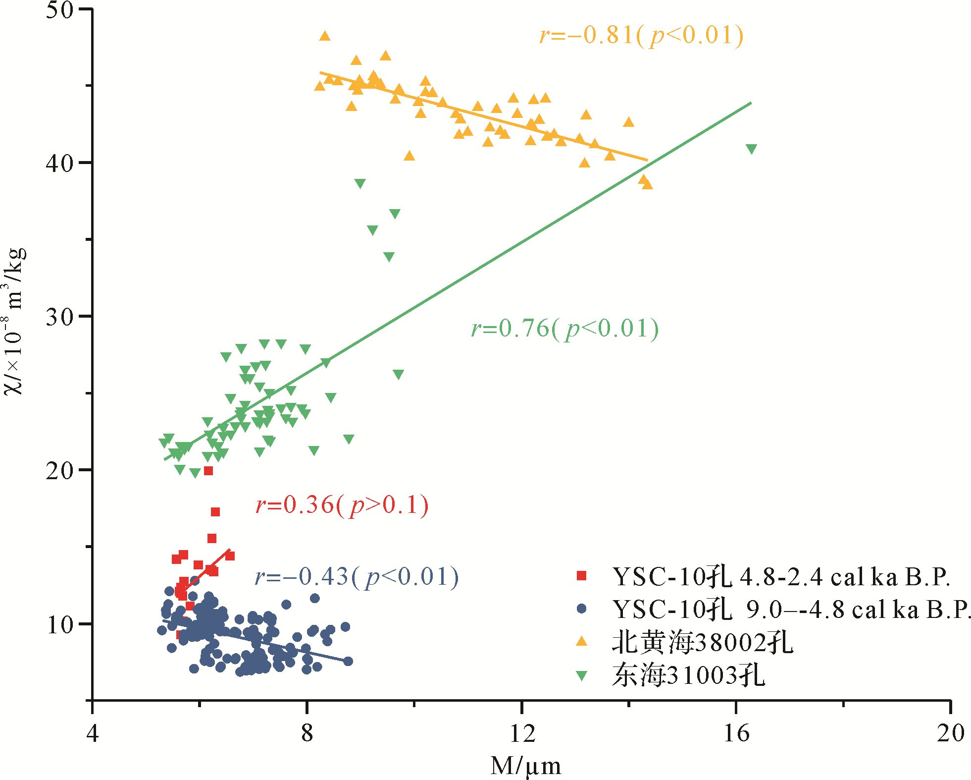
The Central Yellow Sea Mud Area is a huge sink of sediments on the East Asian continental shelf. The provenance changes in this area are important for understanding the effects of paleoclimate changes. Based on differences between magnetic mineral content of the Yellow River and the Yangtze River, environmental magnetic parameters and the correlation between magnetic susceptibility and median grain size indicate a change of provenance in the South Yellow Sea. The positive correlation between magnetic susceptibility and median grain size in core YSC⁃10 implies that the sediments were mainly from the Yellow River from 9.0 to 4.8 cal ka B.P., then a negative correlation and an increase in environmental magnetic parameters after 4.8 cal ka B.P. until 2.4 cal ka B.P. indicates an increasingly dominant influence of the Yangtze River. The southward movement of the East Asian monsoon rainfall belt and the development of the Yellow River delta since the middle Holocene marked a reduction in the depositional rate of materials transported by the Yellow River. Materials carried by the Yangtze River and the Yellow Sea Warm Current were seen to increase after 4.8 cal ka B.P.
2021, 39(2): 395-407.
doi: 10.14027/j.issn.1000-0550.2019.107
Abstract:
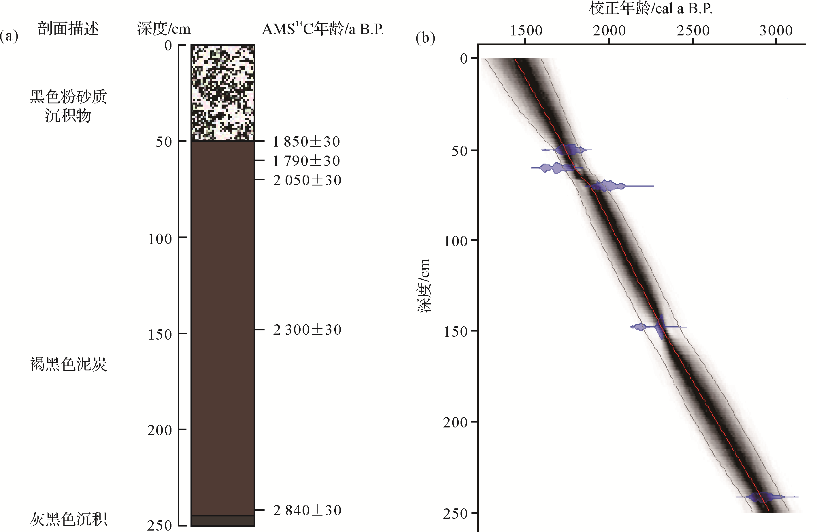
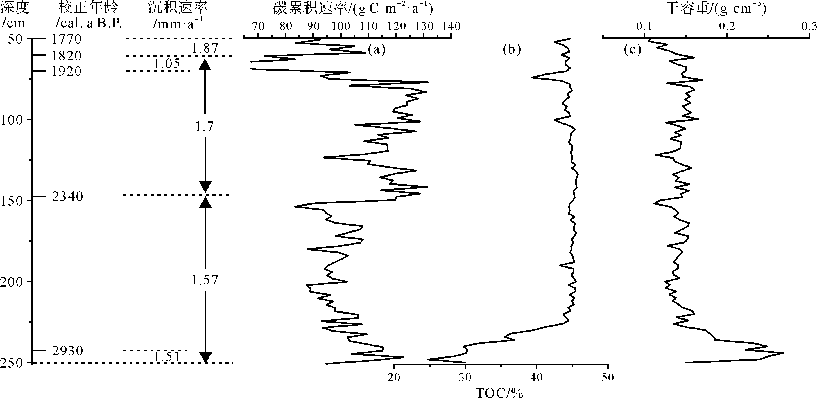
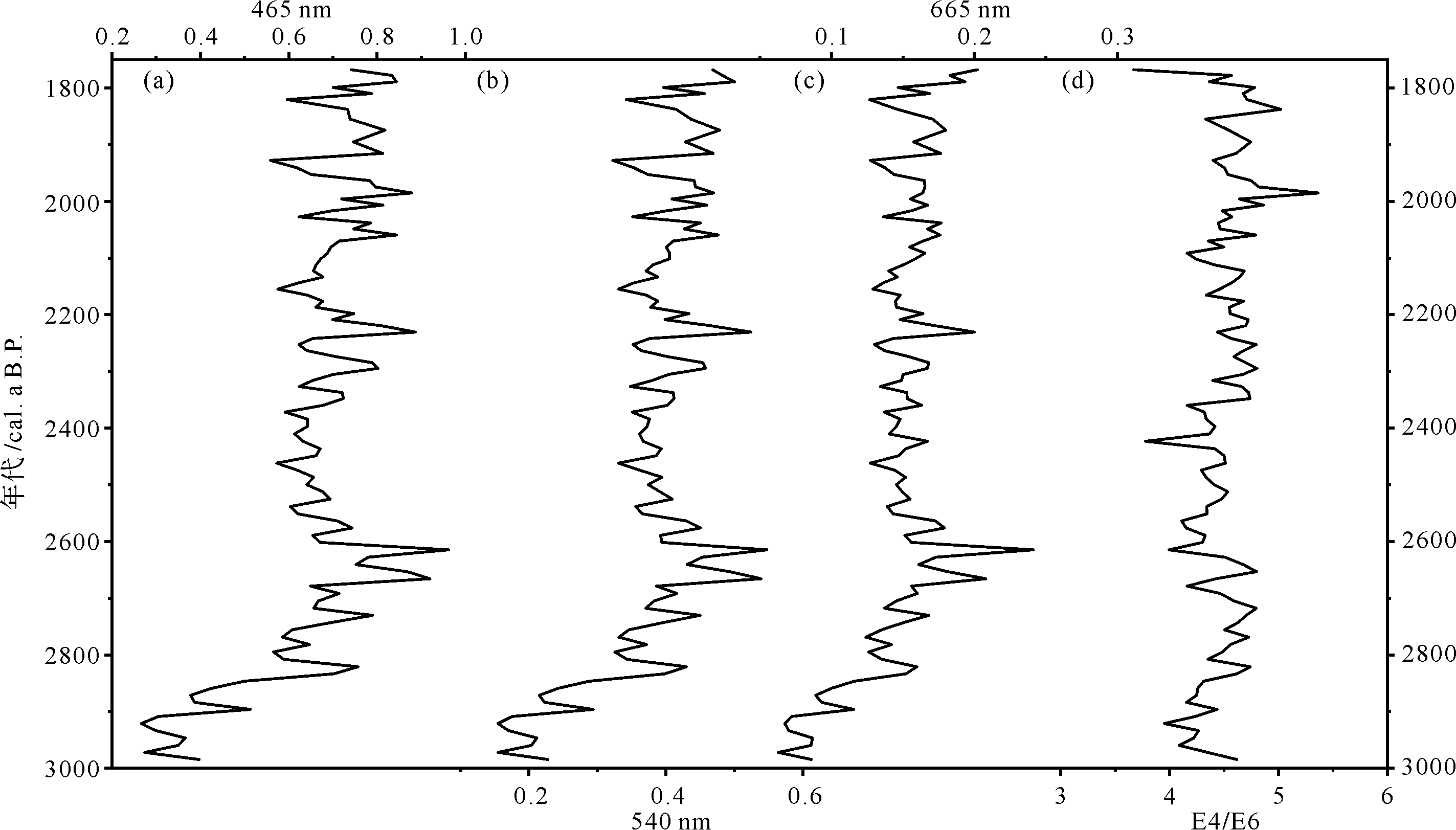
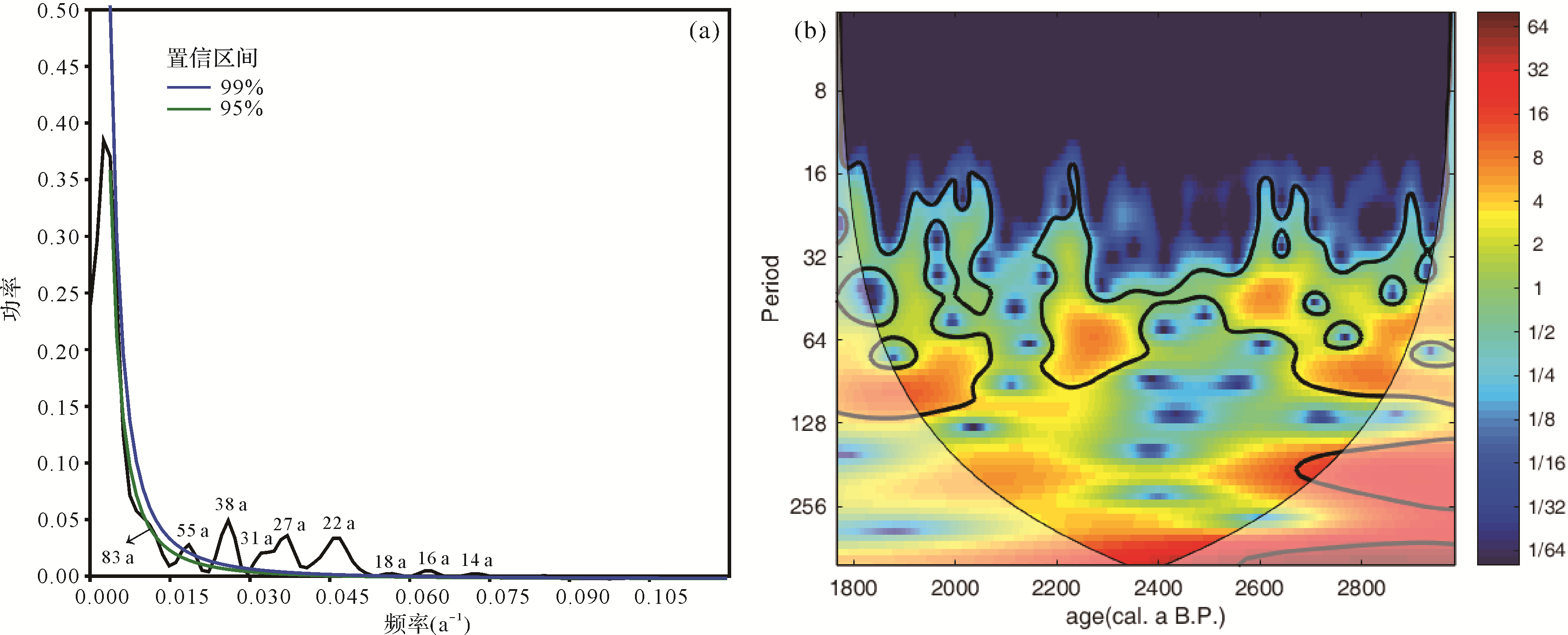
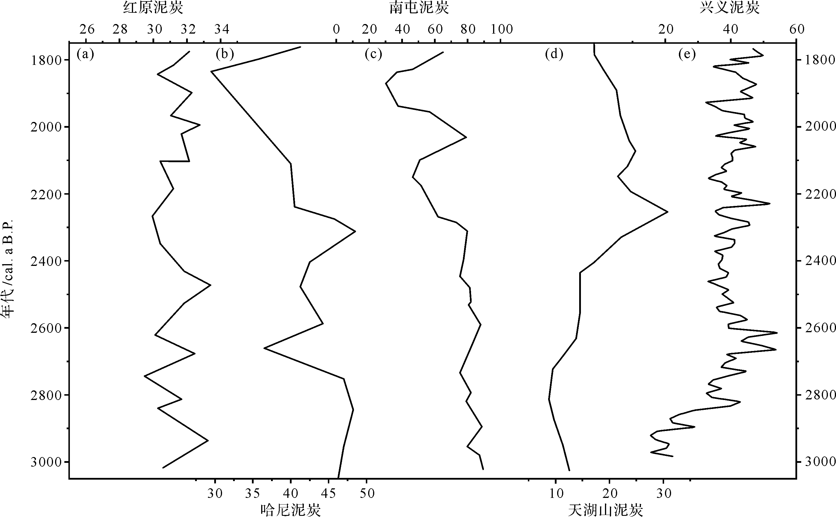
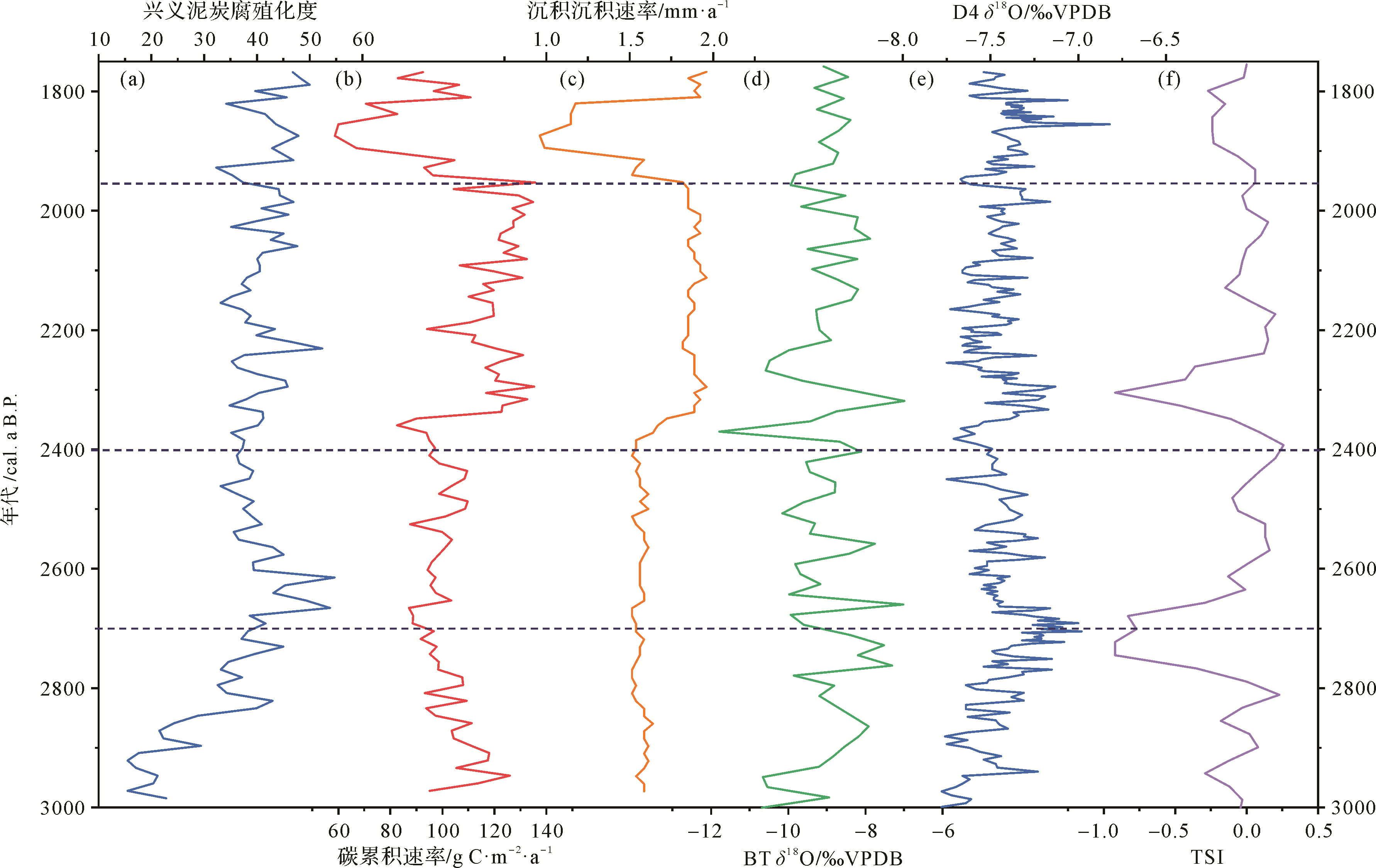
Peat in Guizhou province is an important source of peat in the Asian monsoon zone. This study reveals the environmental significance of the degree of humification of Guizhou peat. The AMS 14C dating method was used to establish a chronological framework of XY1 core from Xingyi peatland, a new paleoenvironmental record from the karst area of southwestern China. A high⁃resolution analysis of the extent of humification, the deposition rate and the carbon accumulation rate estimated the climatic evolutionary history and peat deposition process for the period 3 000⁃1 770 cal. a B.P., and a possible mechanism is discussed. The following were found. (1) The humification extent of XY1 core was controlled by both precipitation and temperature. High humification values indicate cold, dry conditions, and vice versa. (2) During the 3 000 ⁃2 700 cal. a B.P. period, the degree of humification was low, but with a rising trend. The carbon accumulation rate was low and showed a decreasing trend. The deposition rate was low and relatively stable, and the peat deposition process was relatively weak. From 2 700 cal. a B.P. to 2 400 cal. a B.P. the humification degree decreased, while the carbon accumulation rate and deposition rate increased slightly, indicating that the peat deposition was accelerating slowly. Between 2 400 cal. a B.P. and 1 950 cal. a B.P., the humification degree increased, and the carbon accumulation rate and deposition rate all peaked, and peat was deposited rapidly. From 1 950 cal. a B.P. to 1 770 cal. a B.P., the humification degree, carbon accumulation rate and deposition rate all varied significantly and a fluctuating peat deposition was obvious. (3) The power spectrum and wavelet analysis of the degree of humification indicated a double Hale cycle, Brückner cycle and century cycle of solar activity. Consequently, it was inferred that climate change and Xingyi peatland deposition were driven by solar activity in Xingyi, southwestern Guizhou.
2021, 39(2): 408-424.
doi: 10.14027/j.issn.1000-0550.2020.013
Abstract:
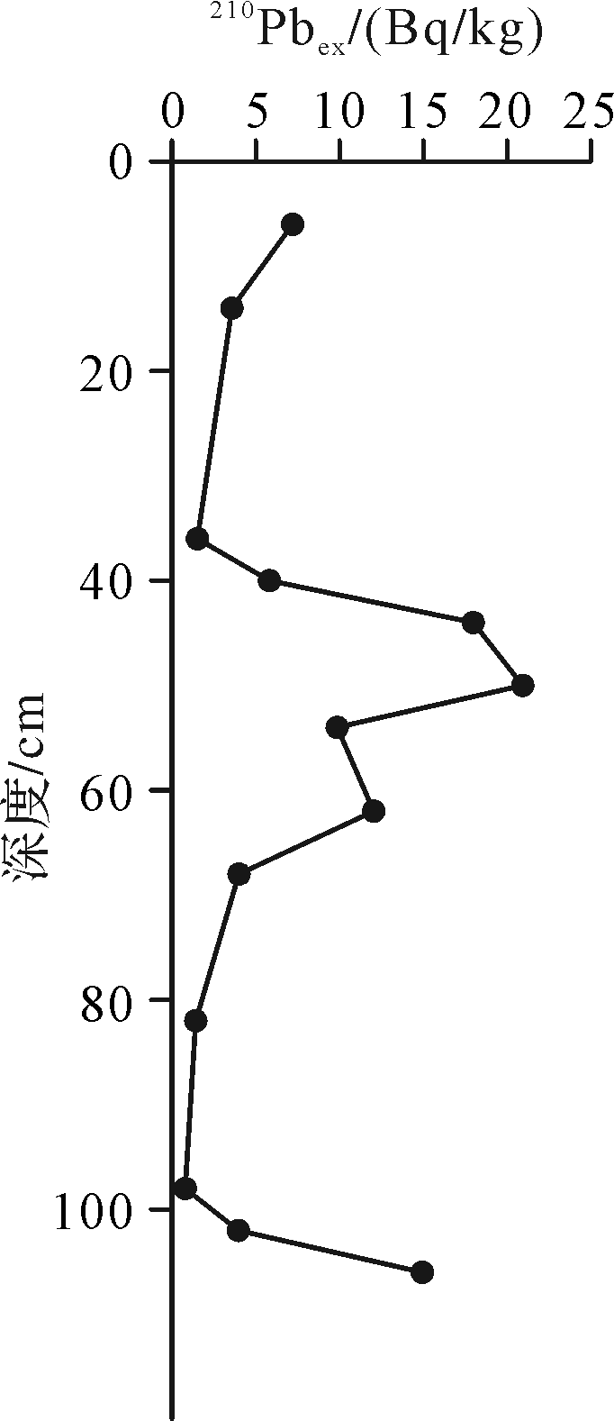
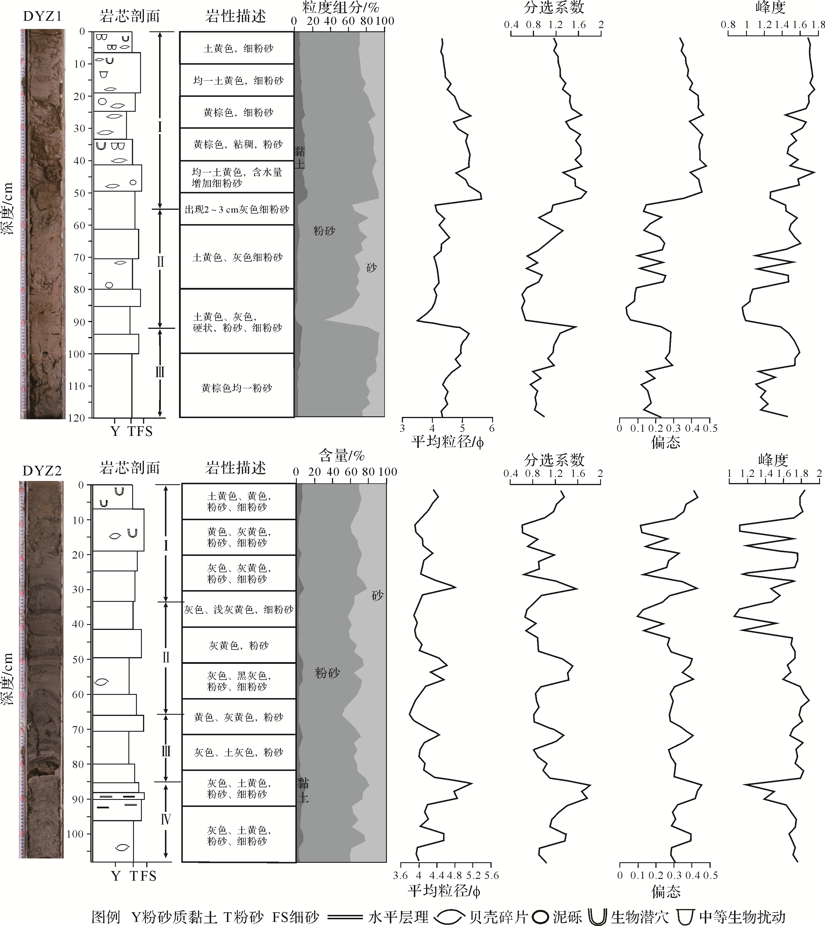
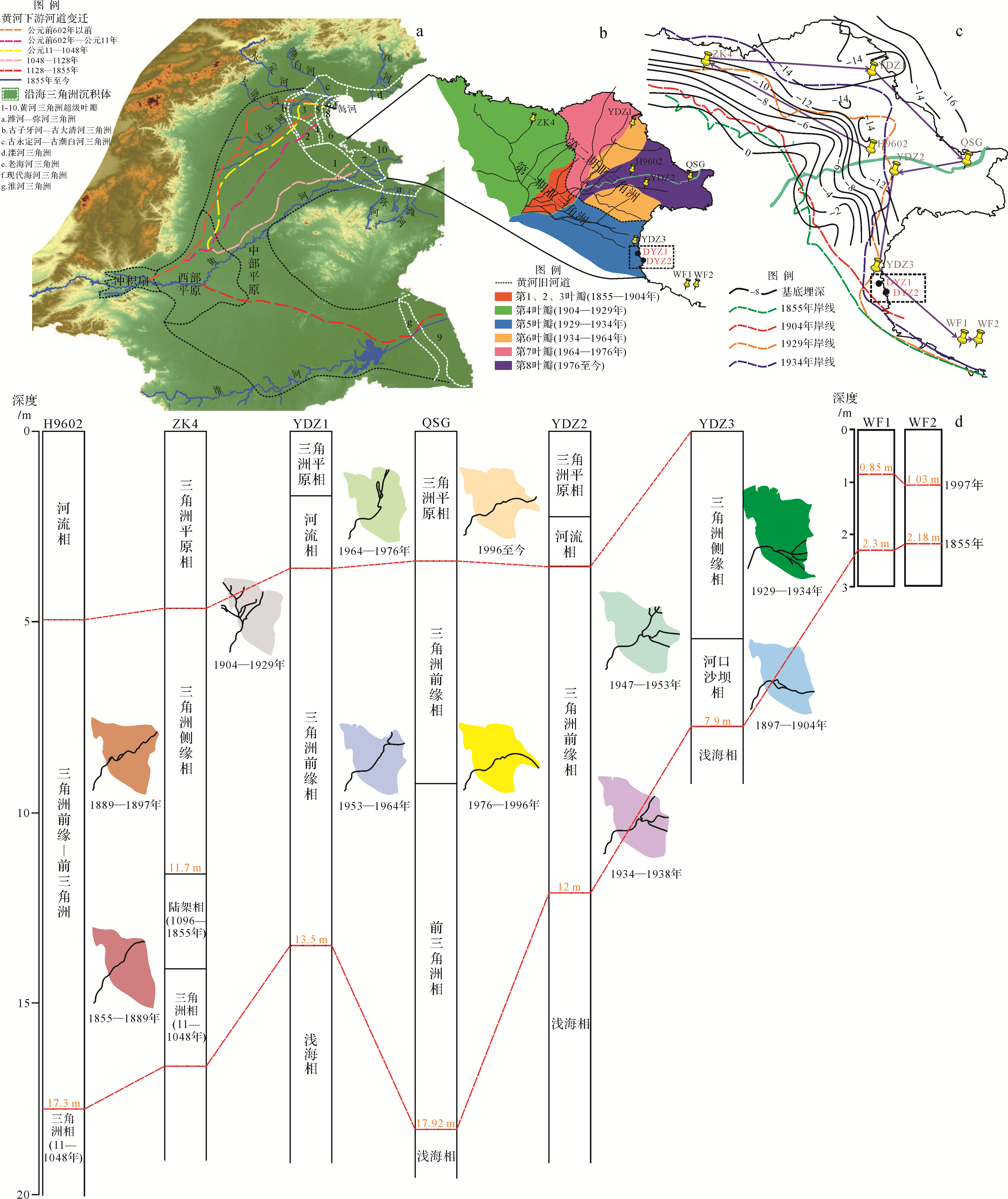
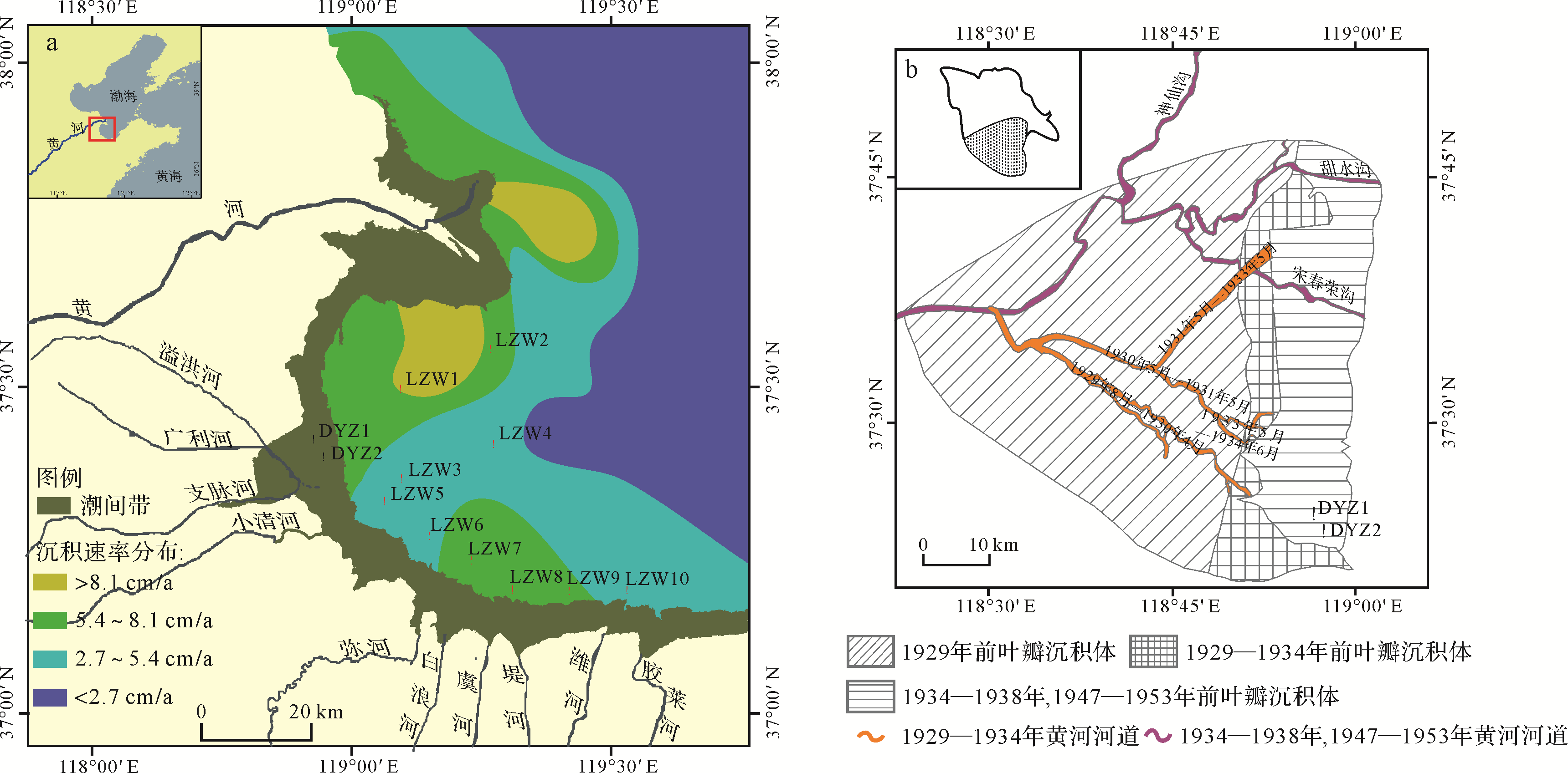
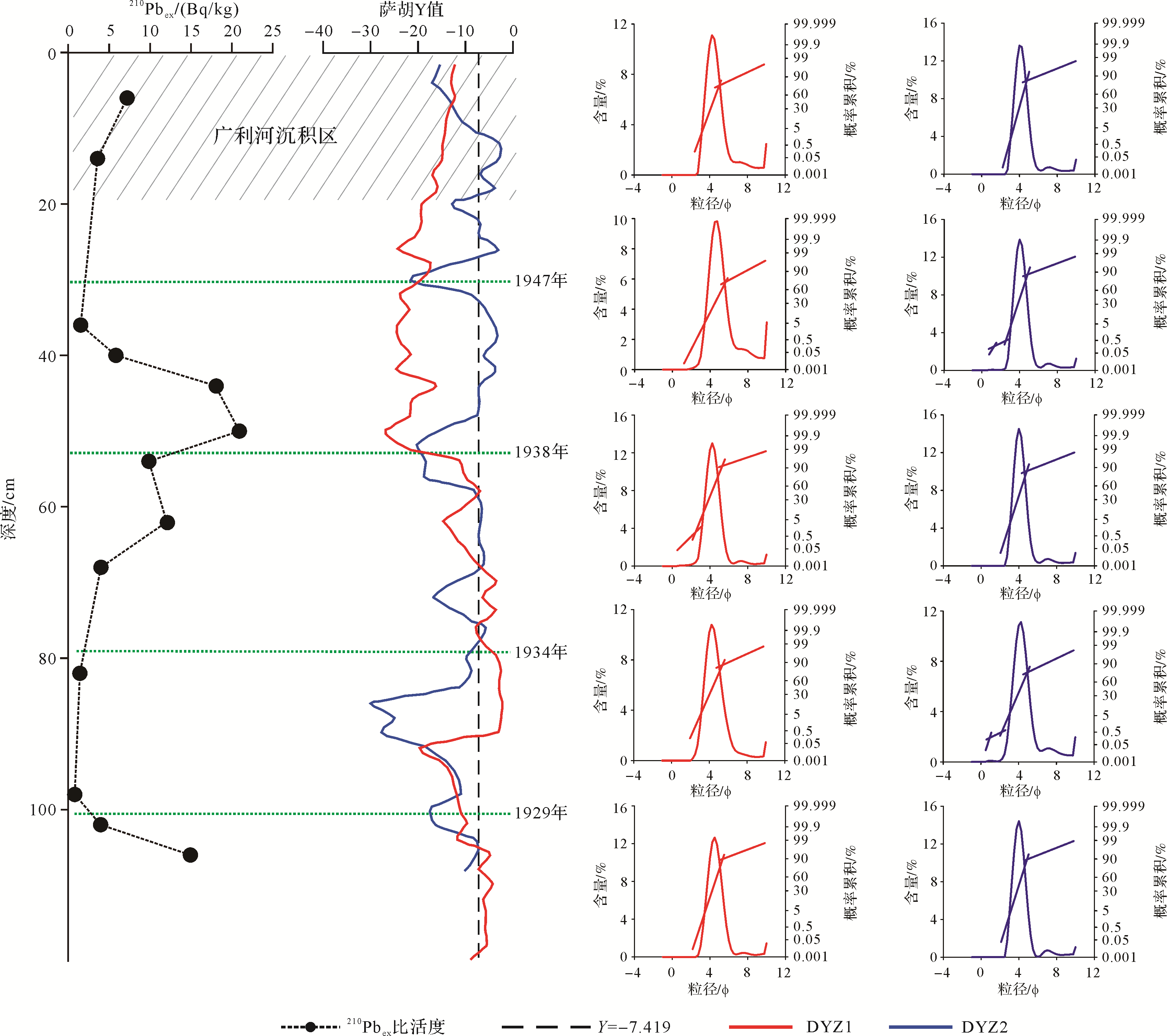
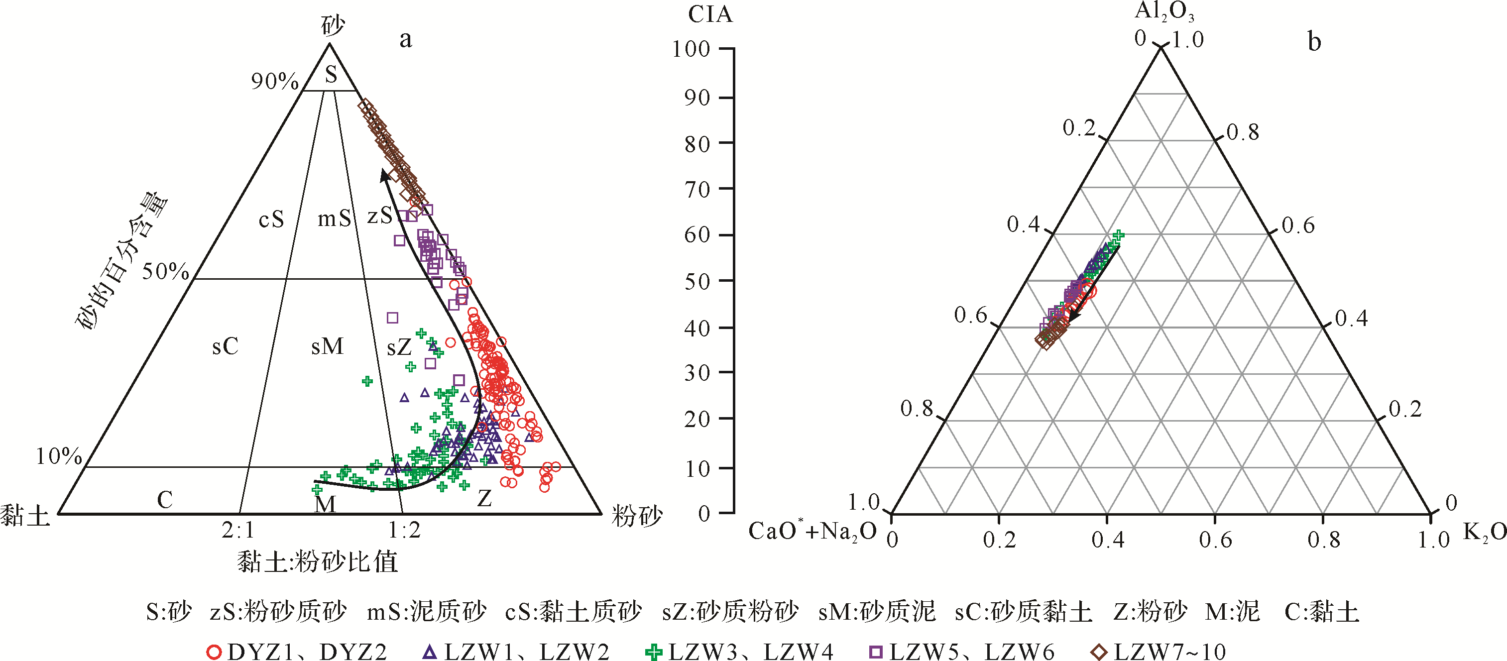
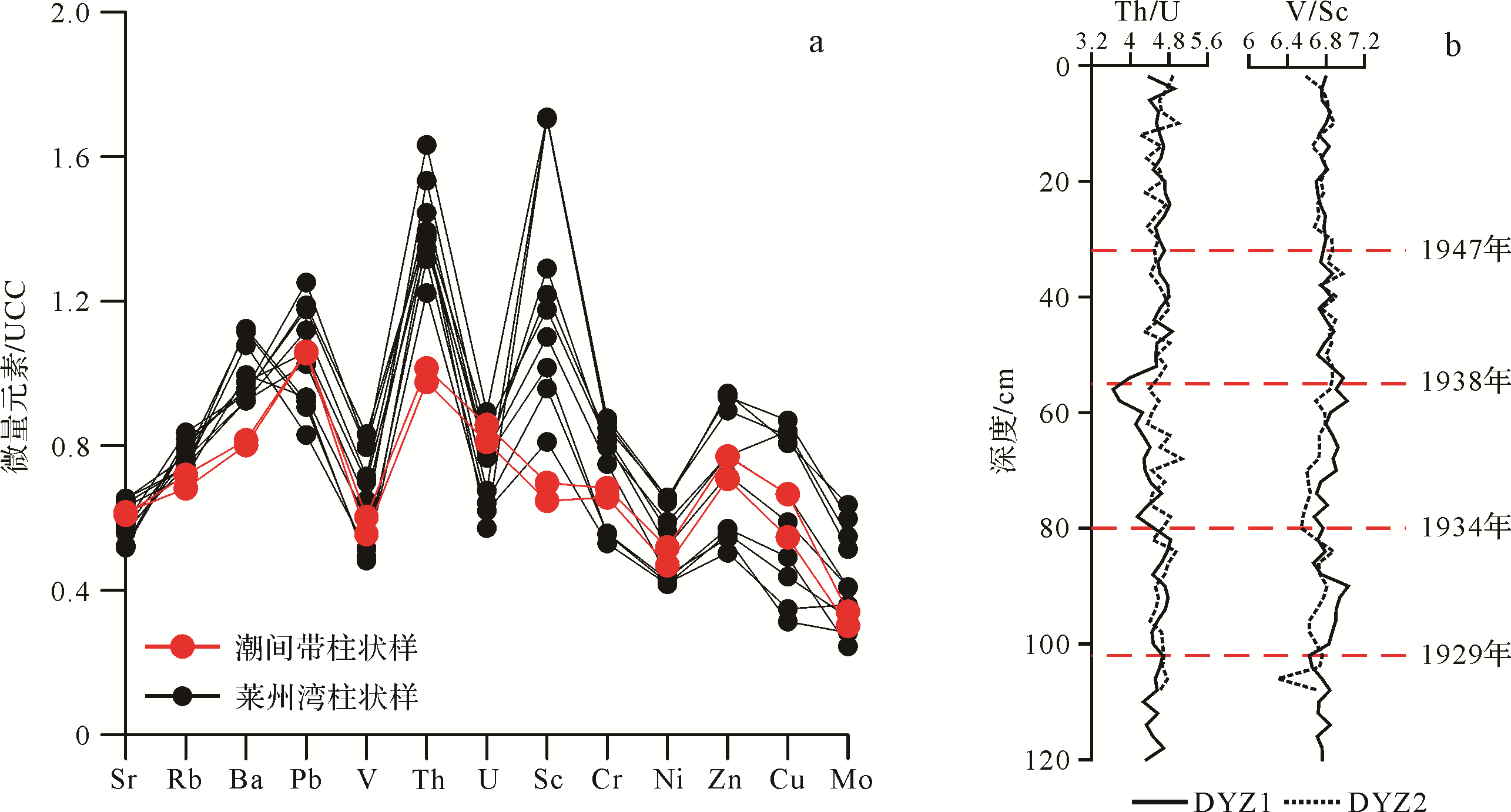
Measured data for grain size, geochemical elements and 210Pb isotopes from 12 cores in the intertidal zone and shallow sea of the intertidal zone south of the Yellow River Delta and in the western area of Laizhou Bay, in combination with chronological characteristics of the rivers and historical changes of the shorelines, were used to analyze their sedimentary characteristics. The study referred to previously reported works on sedimentary facies and sediment deposition rates. Preliminary values for dates of the intertidal zone of the modern southern Yellow River Delta were calculated from the excess 210Pb profile (210Pbex) using the methods of historical geography, sedimentary environment discrimination formulae and changes in the grain⁃size curve. The analysis of the data in the cores indicated that the provenance of the sediment differed in the number of relevant eigenvalues, suggesting that in an unstable sedimentary environment such as the intertidal zone, multi⁃stage inverted distribution of 210Pbex does not continuously calibrate the age of the sediment. To a large extent, however, it indicates changes in the external sedimentary environment. The period of sediment formation in the southern intertidal zone of the modern Yellow River Delta was much earlier than in the western Laizhou Bay. The sedimentary environment discriminant function, together with historical geographical data and grain⁃size characteristics, indicates depths of 102 cm, 80 cm and 32 cm in 1929, 1934 and 1947, respectively. The Guangli River system has affected the sedimentary environment in depths up to 20 cm. Analysis of geochemical element⁃related characteristic values shows the degree of sediment weathering in this zone between the Yellow River and the southern bank of Laizhou Bay. The degree of enrichment of individual trace elements is obviously different from that in Laizhou Bay sediments, showing that the sedimentary environment differed from modern Yellow River sediments.

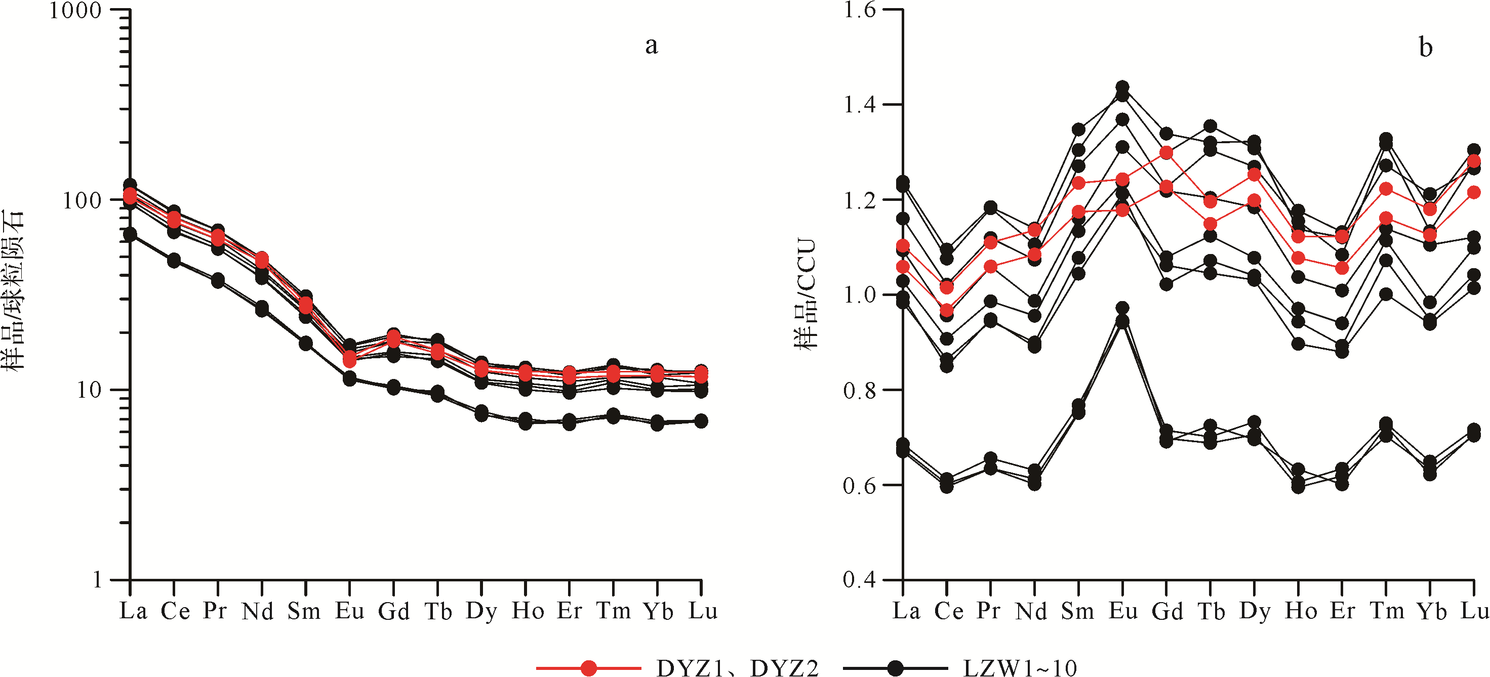
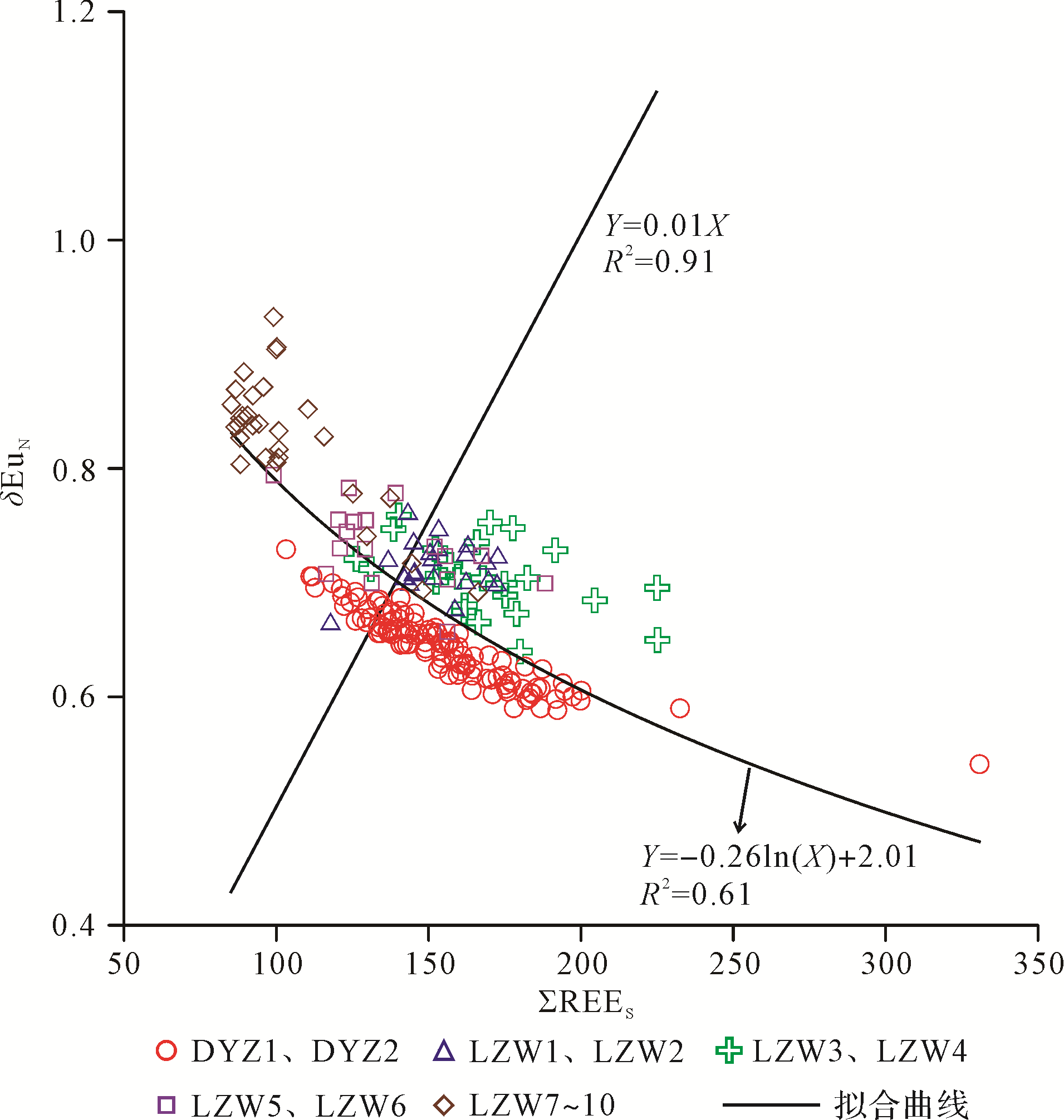
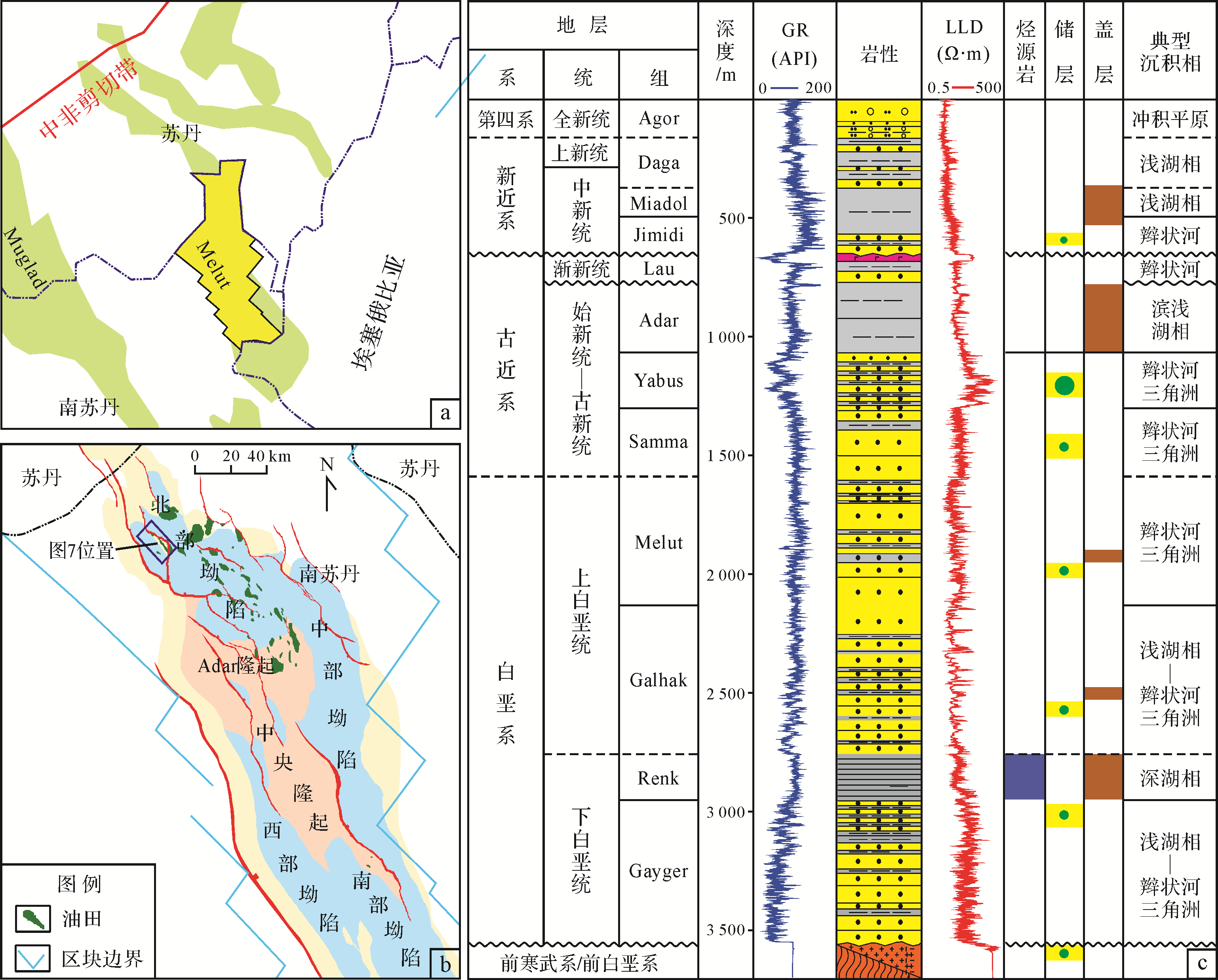
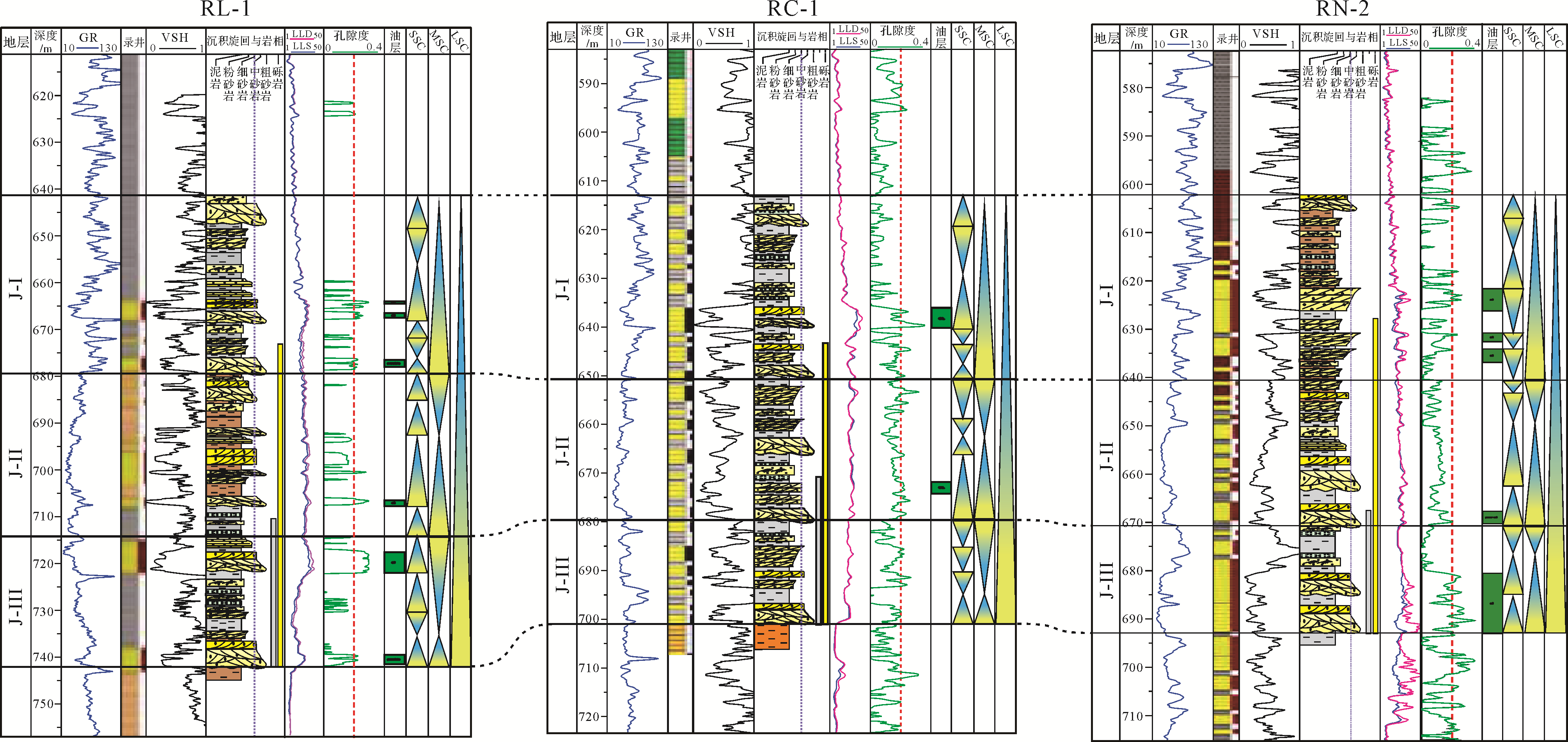
2021, 39(2): 424-433.
doi: 10.14027/j.issn.1000-0550.2020.036
Abstract:
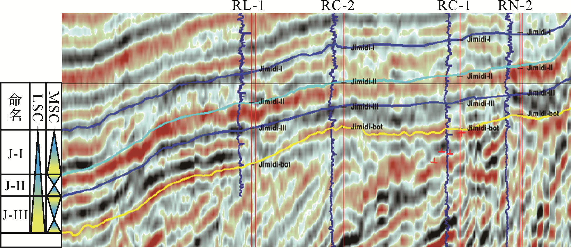
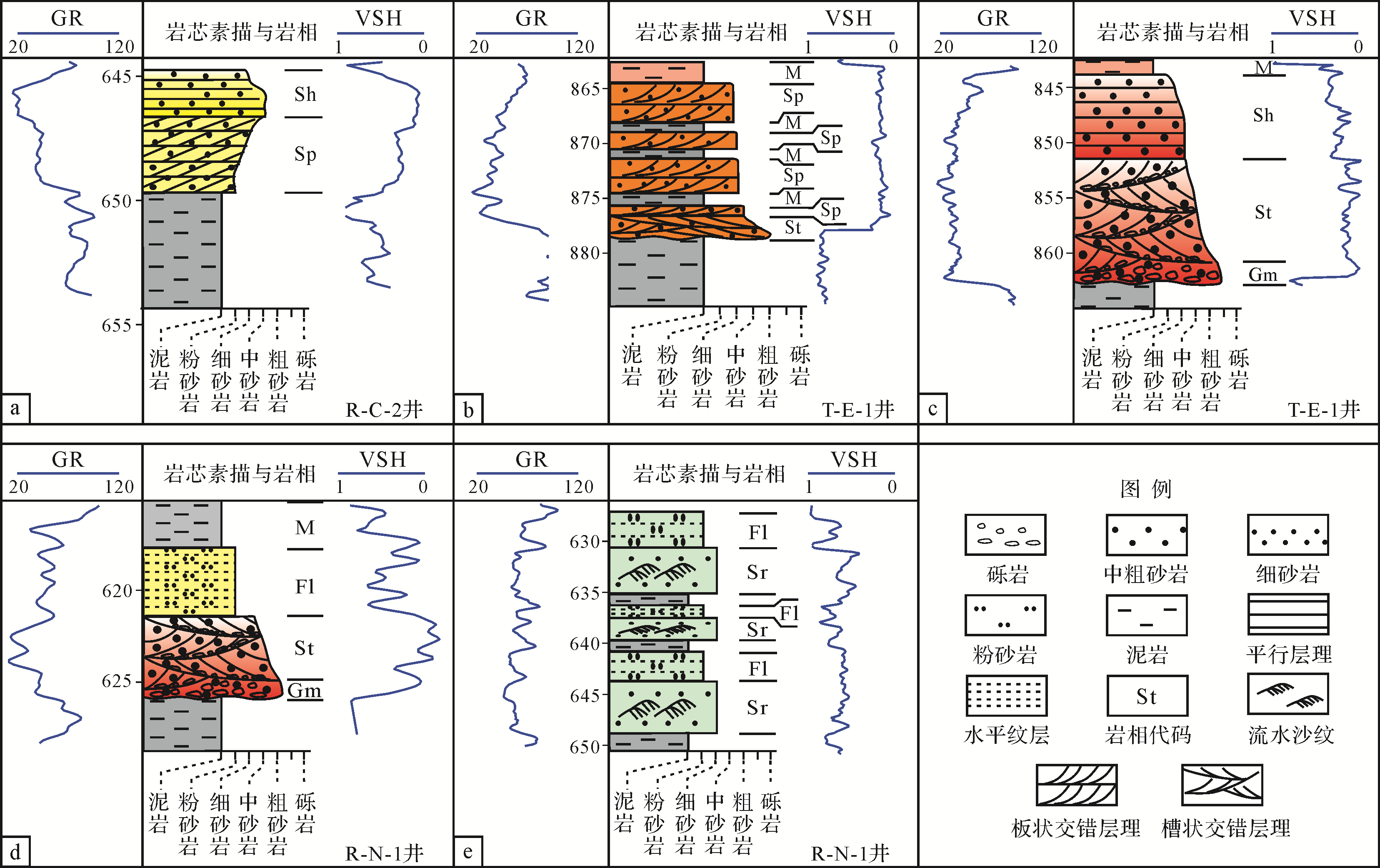
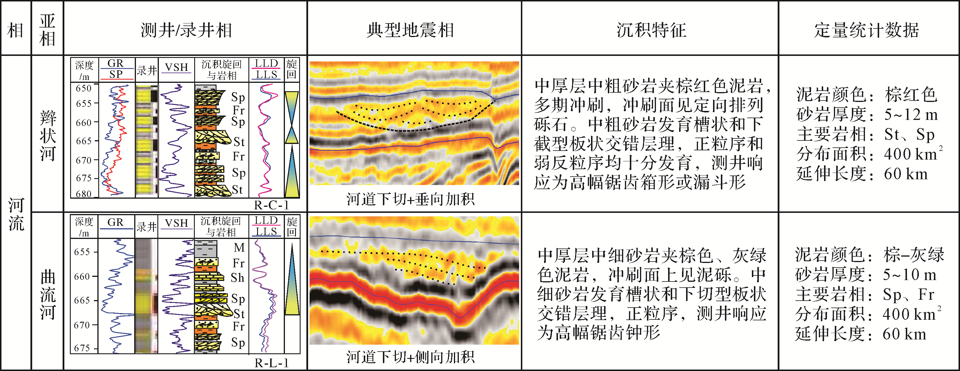
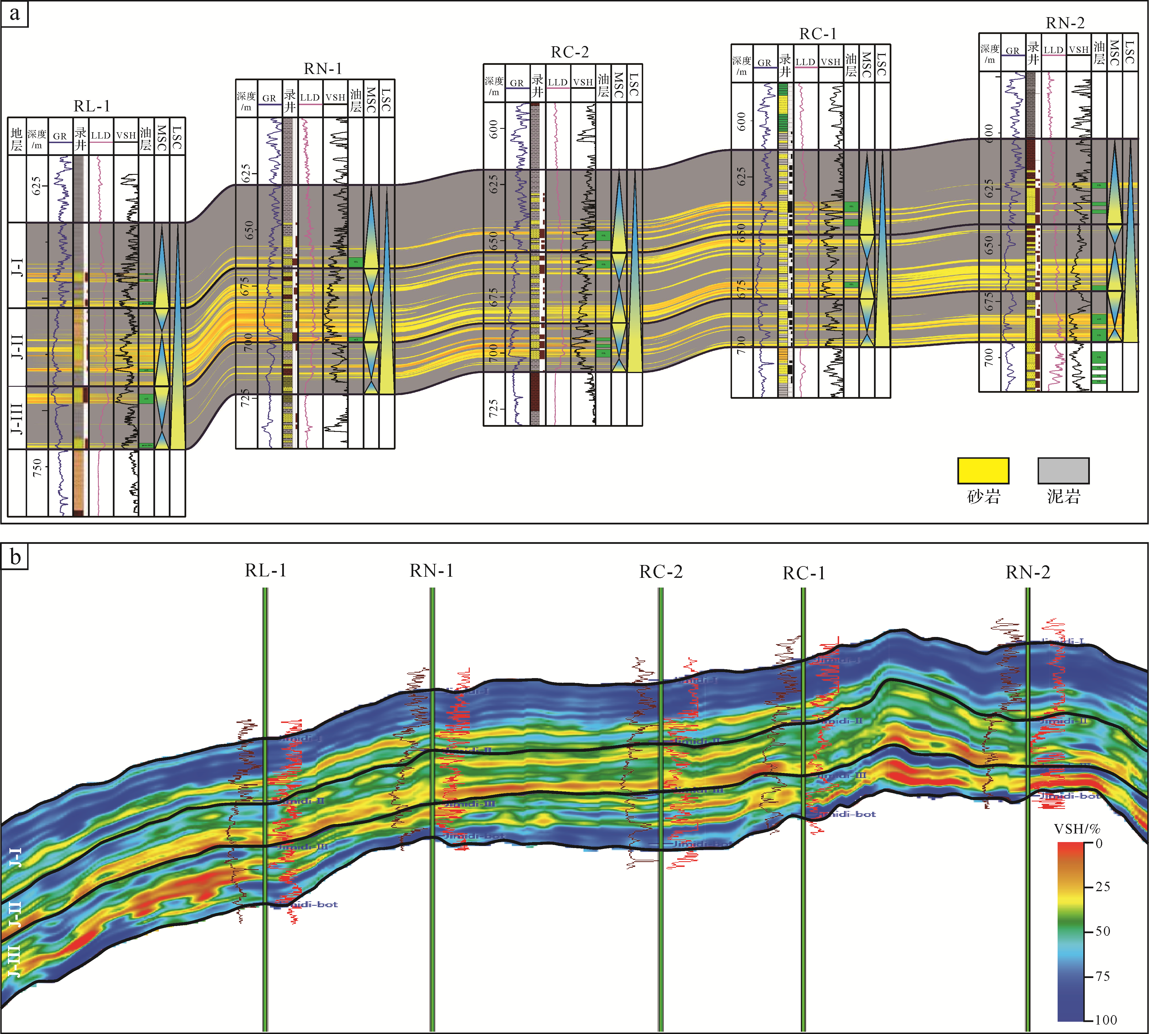
Fluvial sandstone is an important type of reservoir in continental petroliferous basins. The time⁃space transition of river type is direct evidence of basin evolution studies and also the core content for accurate evaluation and prediction of oil and gas reservoirs. It has become one focus of sedimentation research in recent years. Taking the Jimidi Formation in the Ruman depression of the Melut Basin as an example, sequence division, lithofacies type and lithofacies association analysis, high⁃resolution reservoir inversion, and plane sandbody distribution analysis were carried out. The results show that (1) Three medium⁃term base⁃level cycles developed in the fluvial interval of the Jimidi Formation in the depression period, and five types of lithofacies assemblage were identified: vertical accretion, lateral accretion, filling, abandoned⁃filling, and overflow type. (2) The study revealed that the Jimidi Formation has a meandering⁃braided⁃meandering⁃river transition feature from bottom to top, and the main controlling factors for this were the paleogeomorphologic background created by tectonic activity and a general trend of long⁃term base level rise. (3) The new understanding of river⁃type transition has effectively guided the discovery of isolated, relatively low⁃porosity zones continuously distributed in the meandering⁃river type in the study area, and promoted the deployment and exploration breakthrough of a first⁃risk exploration well for a lithological reservoir in the Jimidi Formation, Melut Basin.

2021, 39(2): 434-445.
doi: 10.14027/j.issn.1000-0550.2020.003
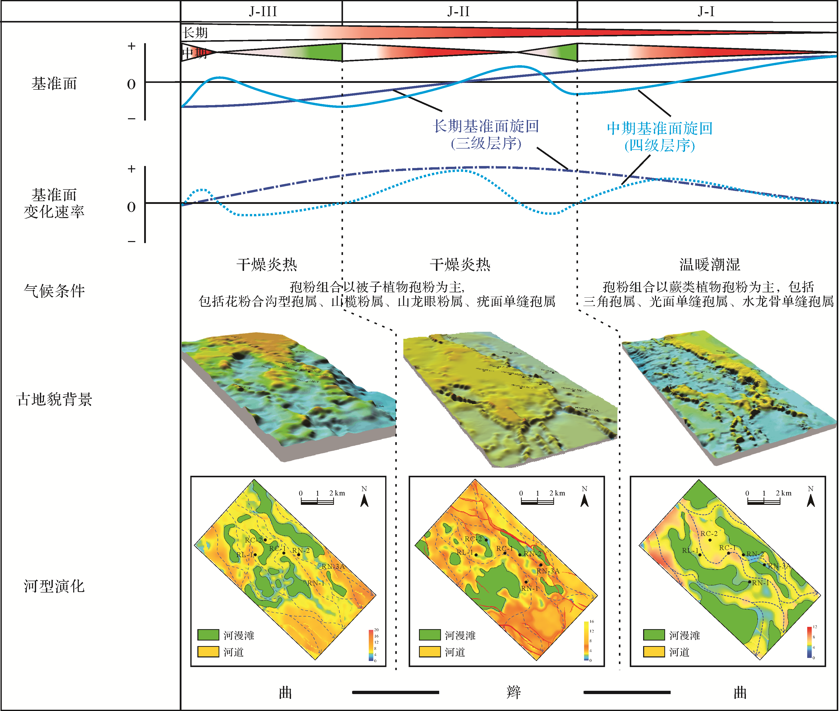
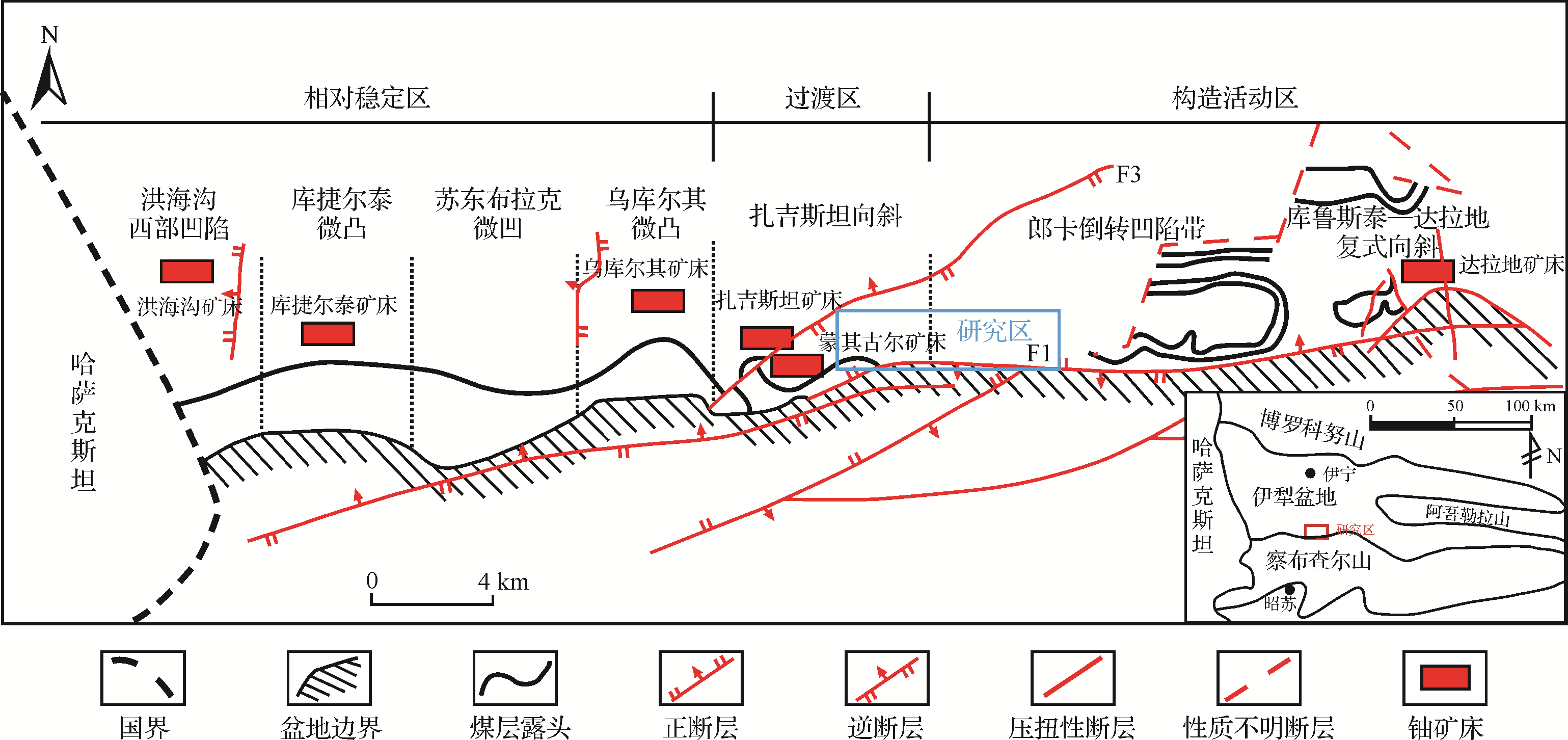
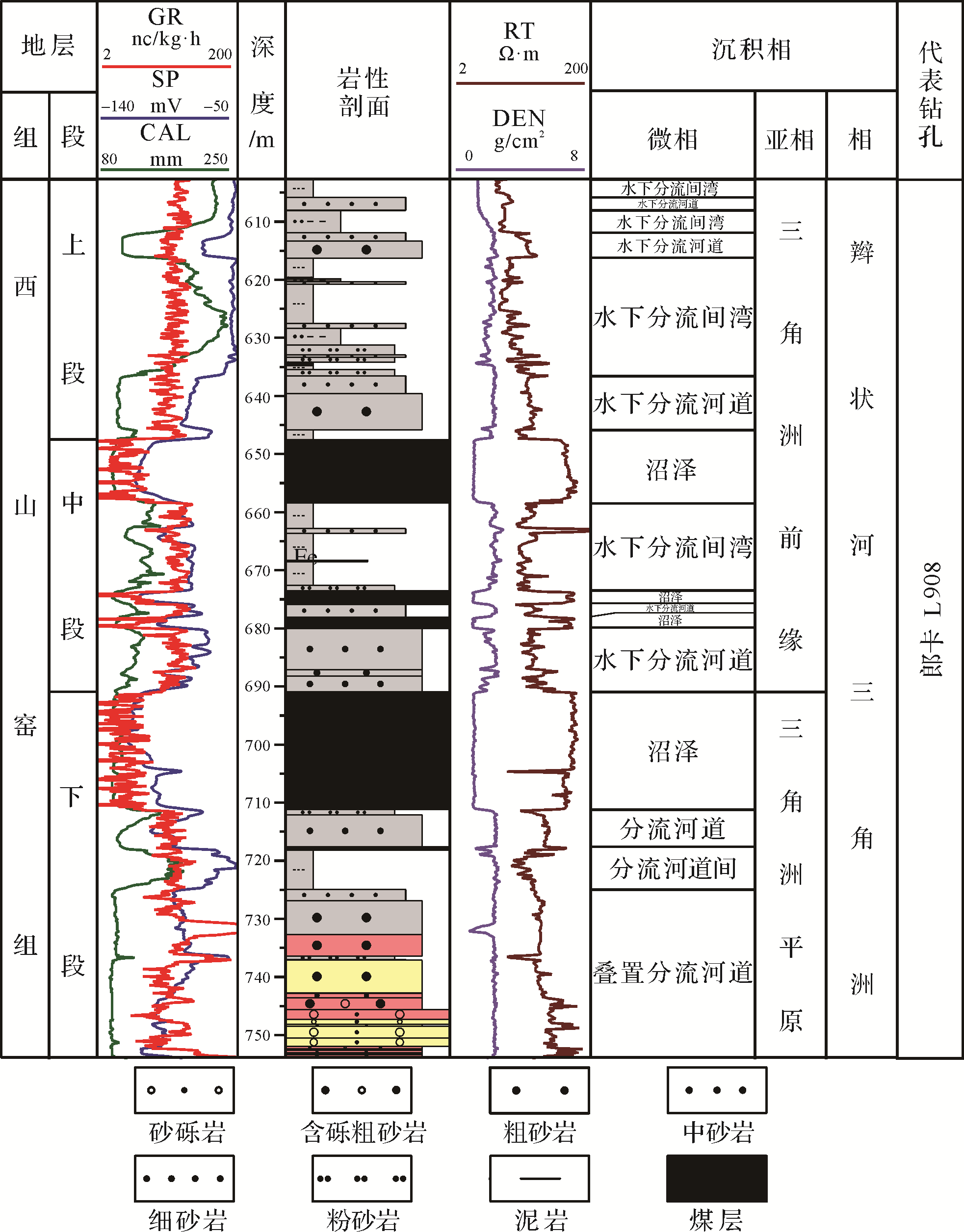
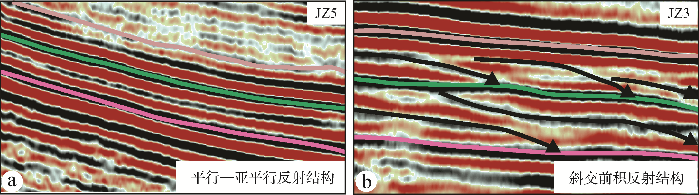
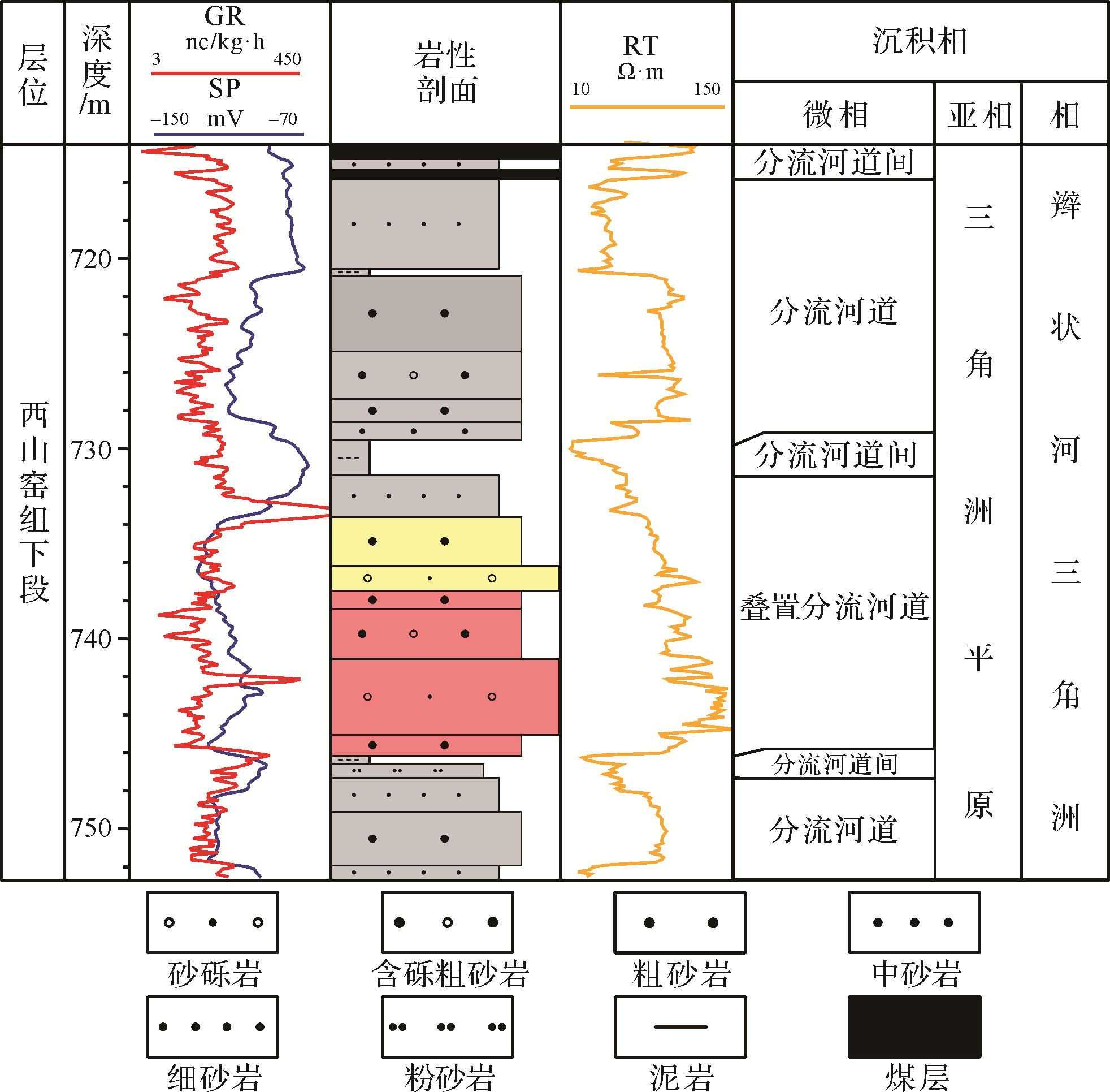
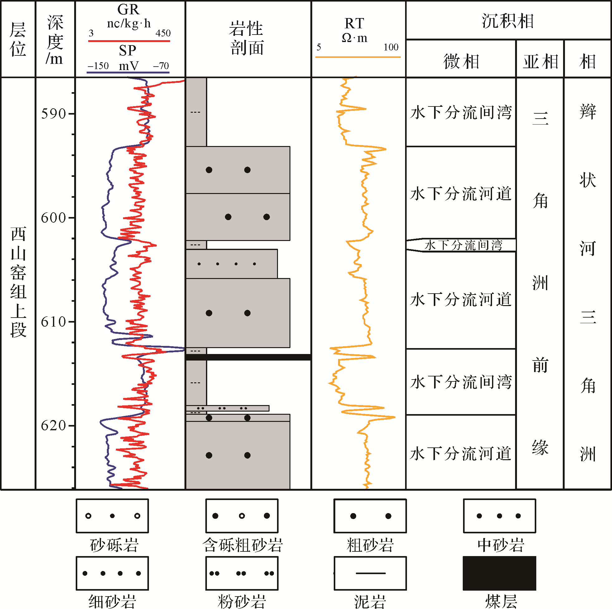
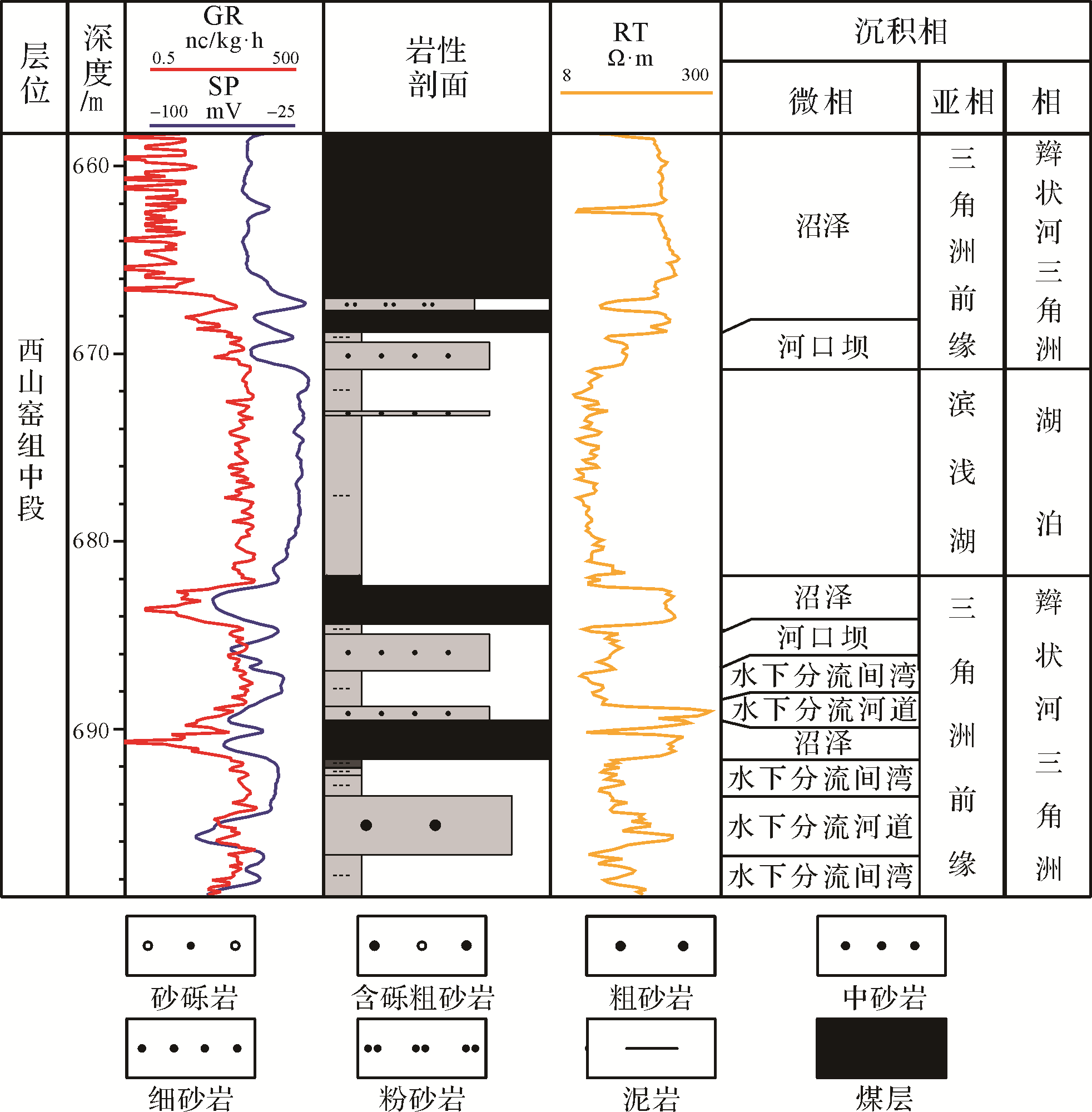
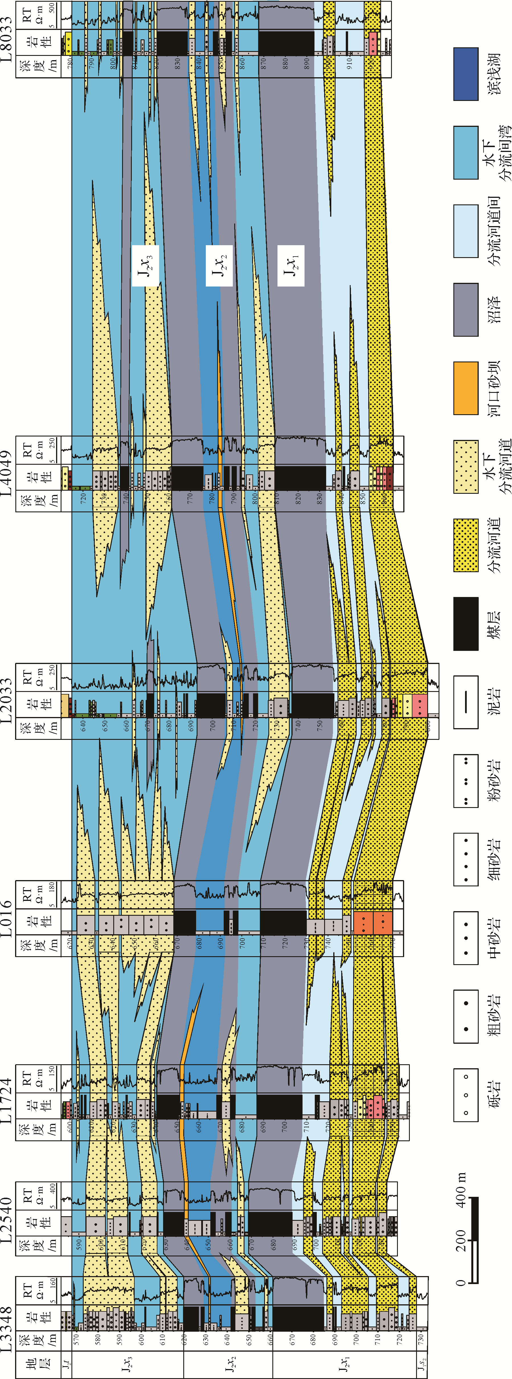
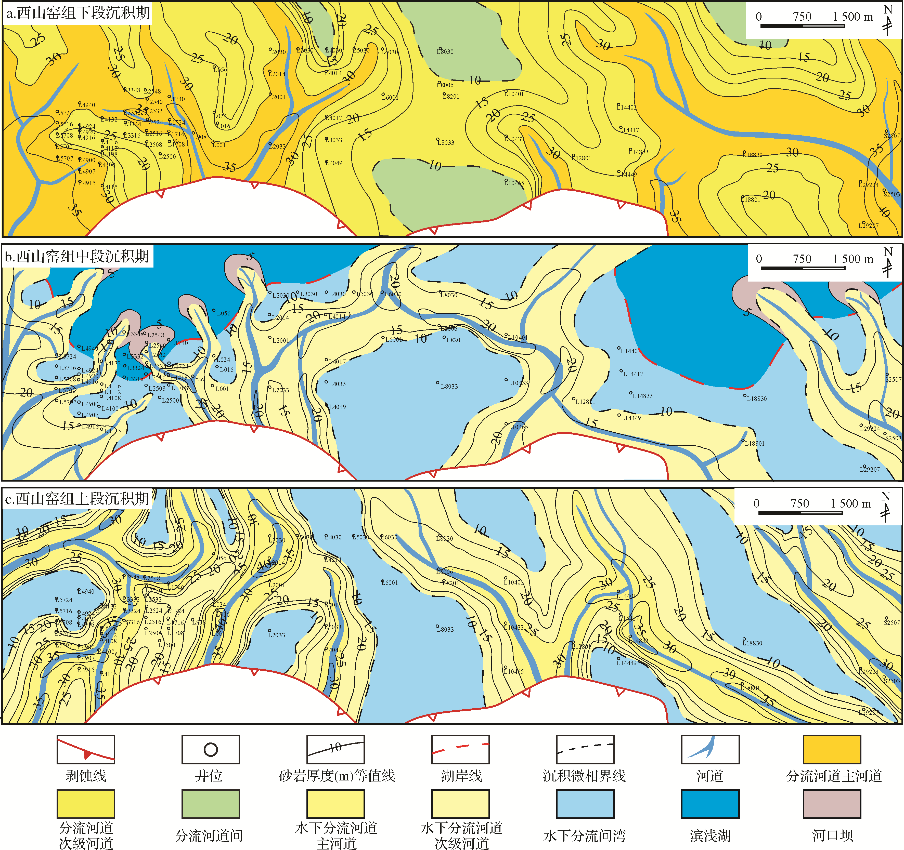
Abstract:
To determine the best approach to the analysis of sedimentary facies during uranium exploration in the Langka area, Yili Basin, a series of studies was carried out involving detailed core observation. The appearance, distribution and evolution of the sedimentary facies were examined in the context of the regional geological background, core logging, seismic information and particle⁃size data. The studies suggest that braided river delta facies and lacustrine facies were developed in the Xishanyao Formation within the study area. During the deposition of the lower Member of Xishanyao Formation, braided delta plain sediments were deposited during the depositional period of the Lower Member, and overlapping distributary channel sandbodies were widely distributed. For the Middle Member, the lake level rose and shallow lake and mainly braided delta front facies were developed in the study area and ribbon⁃shaped sandbodies of subaqueous distributary channels were also widely developed. For the Upper Member, a regression process was evident in the study area together with progradation of the braided delta system. A mainly braided delta plain developed and its subaqueous distributary channel began to dominate the distribution of depositions.
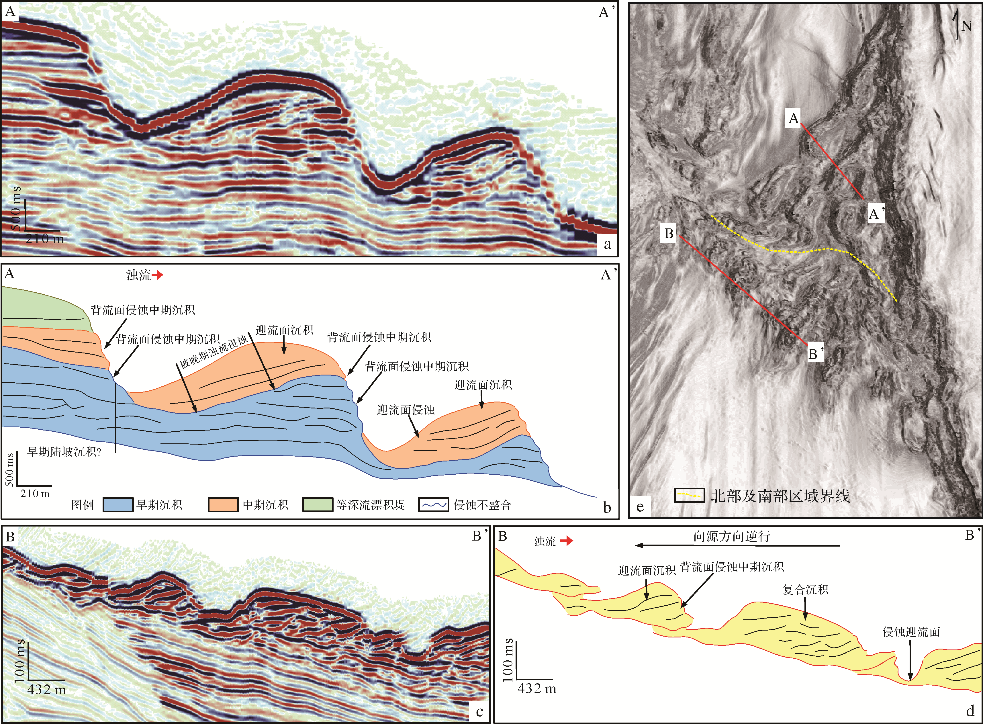
2021, 39(2): 446-455.
doi: 10.14027/j.issn.1000-0550.2020.014
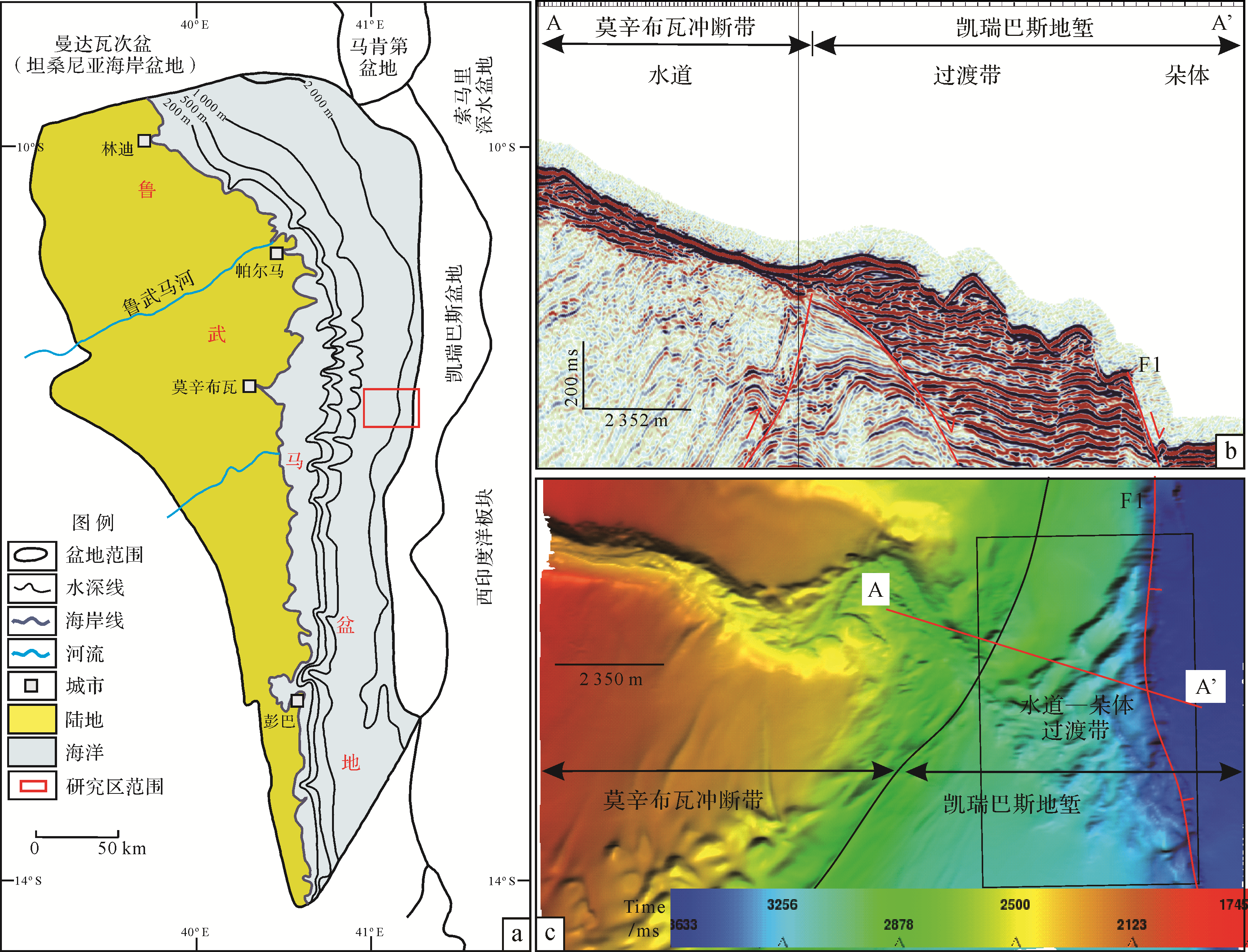
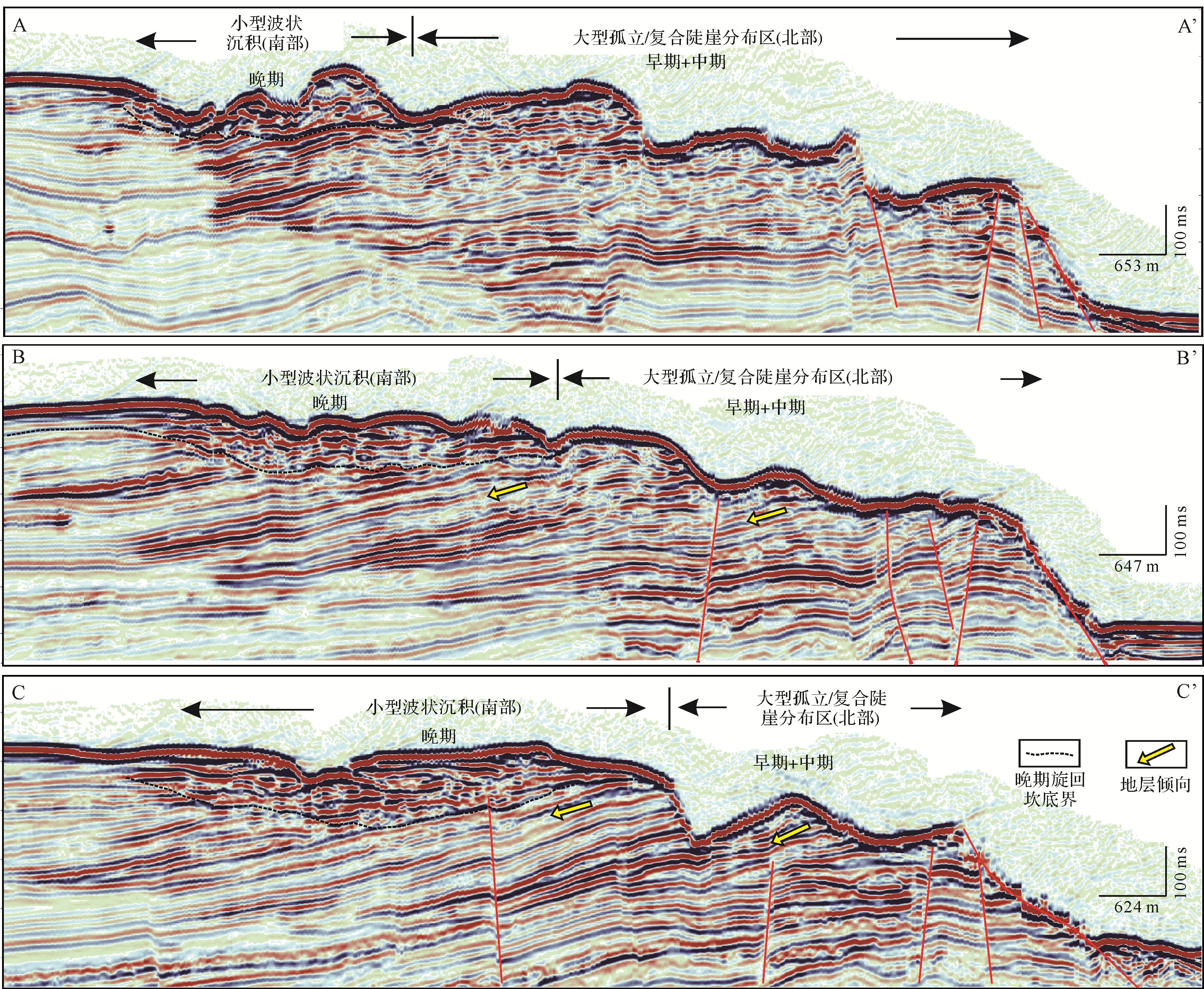
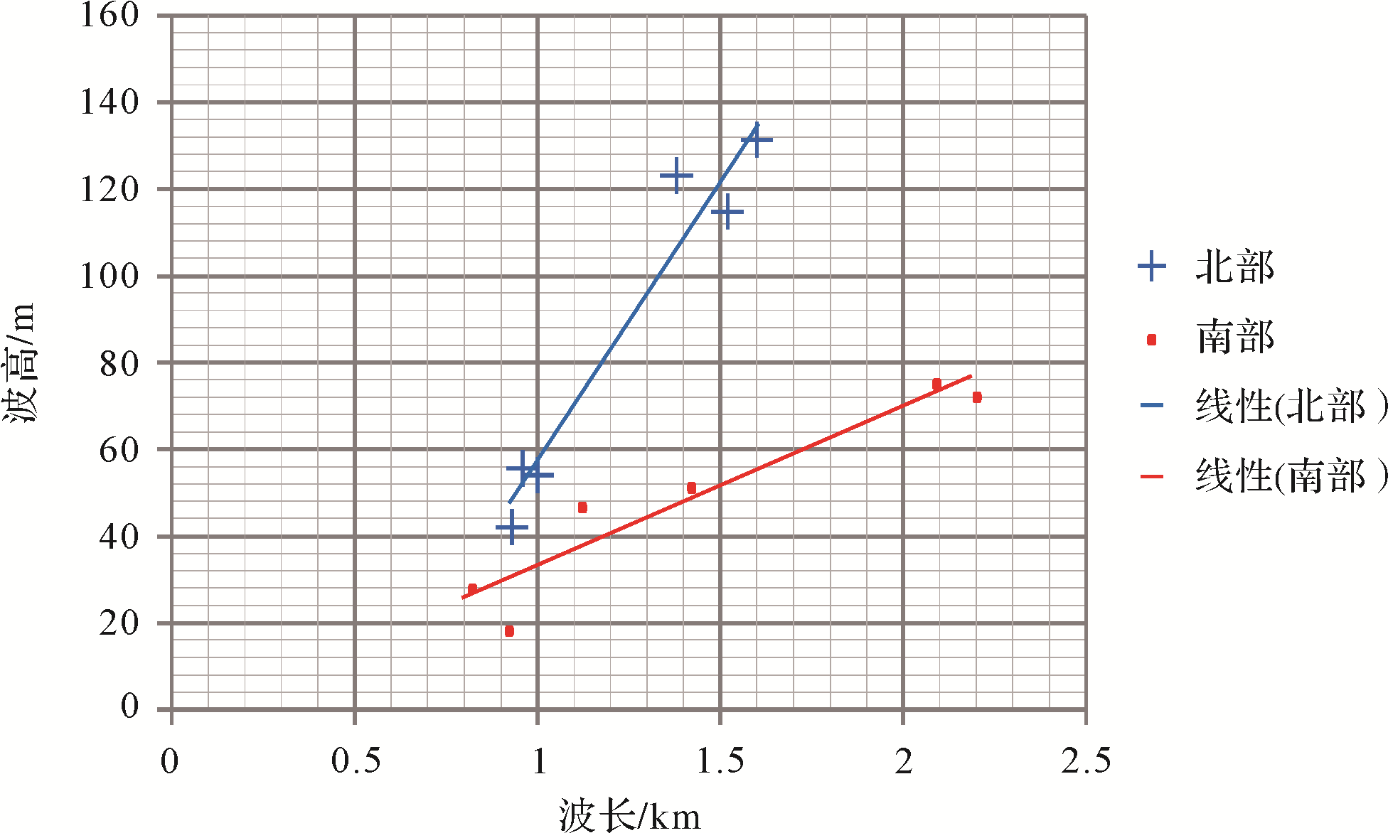
Abstract:
The submarine channel⁃lobe transition zone in the Rovuma Basin (located on the border between Tanzania and Mozambique, east Africa) is characterized by a bed profile with high ridges and deep scours. High⁃resolution 3D seismic data and various seismic interpretation techniques were used in this study. The morphology, scale and movement of cyclic steps at different stages in the transition zone are described in detail, and analysis of the cyclic pattern showed that the cyclic steps occurred mainly in three stages. Seismic reflections had poor continuity at identical stages of the cycles, tending towards imbricate reflections of the up⁃flow surfaces. There is angular contact between the reflections of different stages in the channel⁃lobe transitional zones. Unlike the early cyclic steps, the up⁃current middle cyclic steps migrated from basin to land in the north, and the late cyclic steps were deposited only in the south. The multi⁃stage migration and overlap of cyclic steps has resulted in the evolution of different northern and southern geomorphological forms, with lower average wavelength and much larger average amplitude in the north. The later deposits cover the upstream surface of the previous deposits, with eroded backstream surfaces being seen on each deposit. The wave heights of the deposits at different stages were significantly increased by overlapping. The location of the backflow and upflow zones of the waves also changes. Affected by the southward migration of the channel, the geomorphological form of the mid⁃stage cyclic steps and the southward dip of the underlying strata resulted in a new, unchanged cyclic step in the south of the channel⁃lobe transitional zone, and the form of the antidune bed is well preserved.

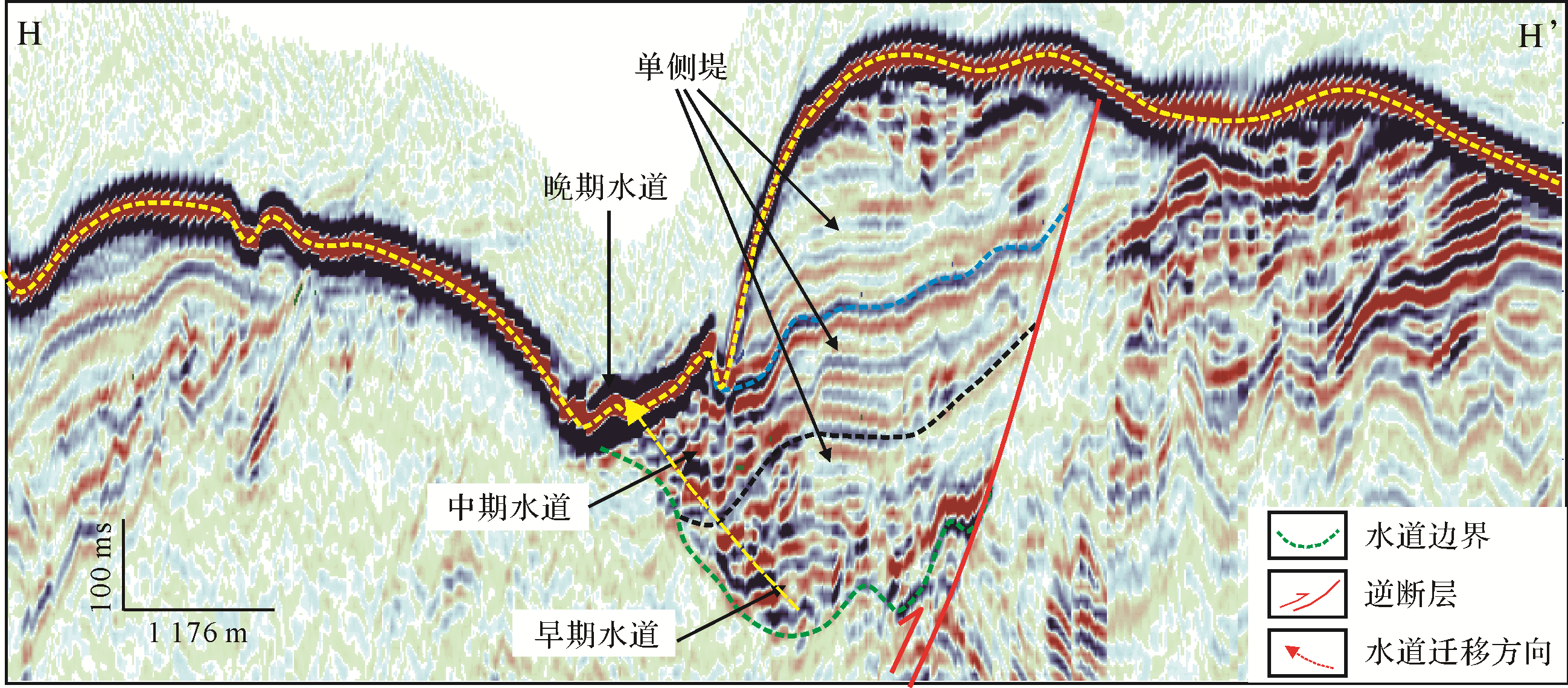
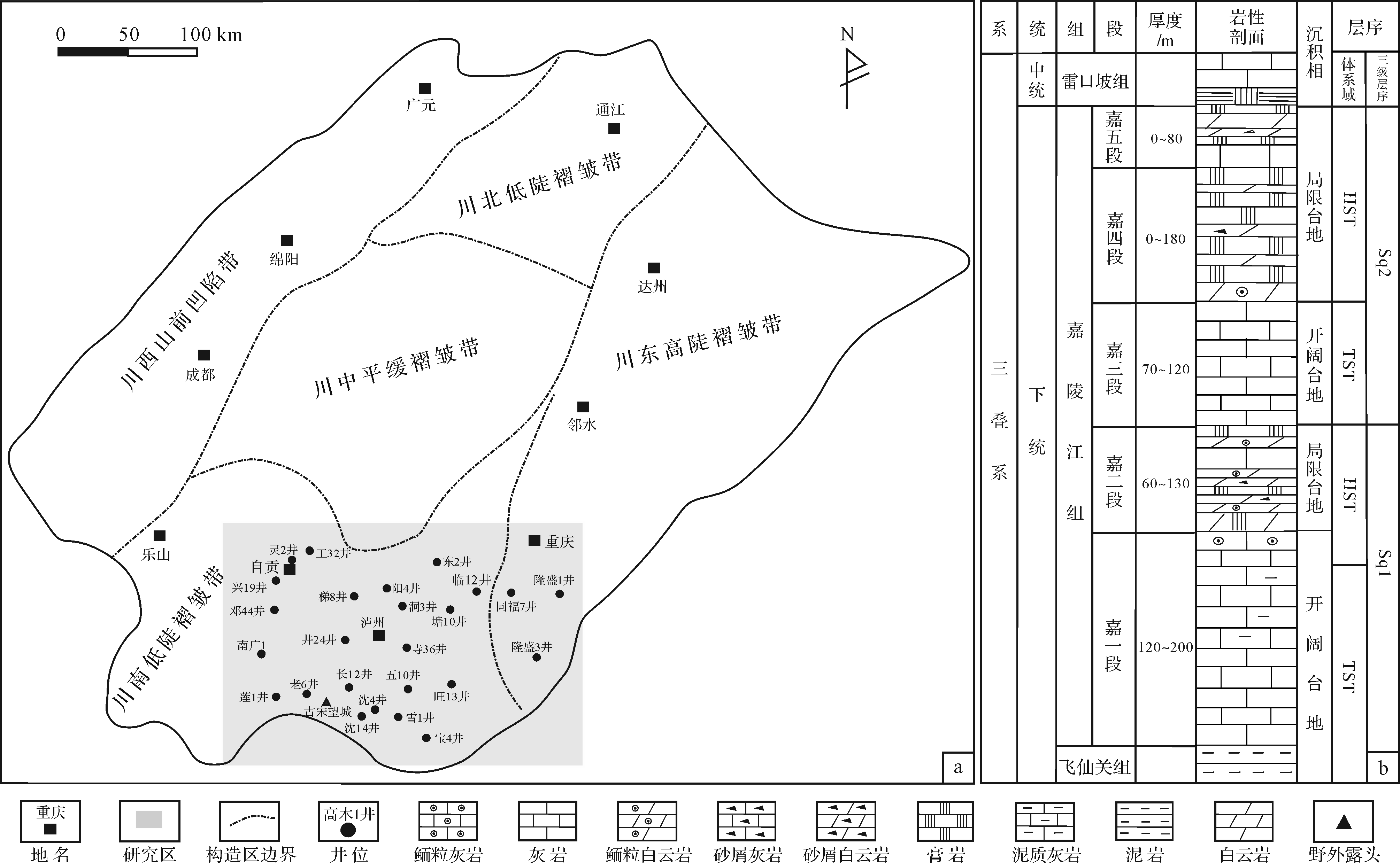
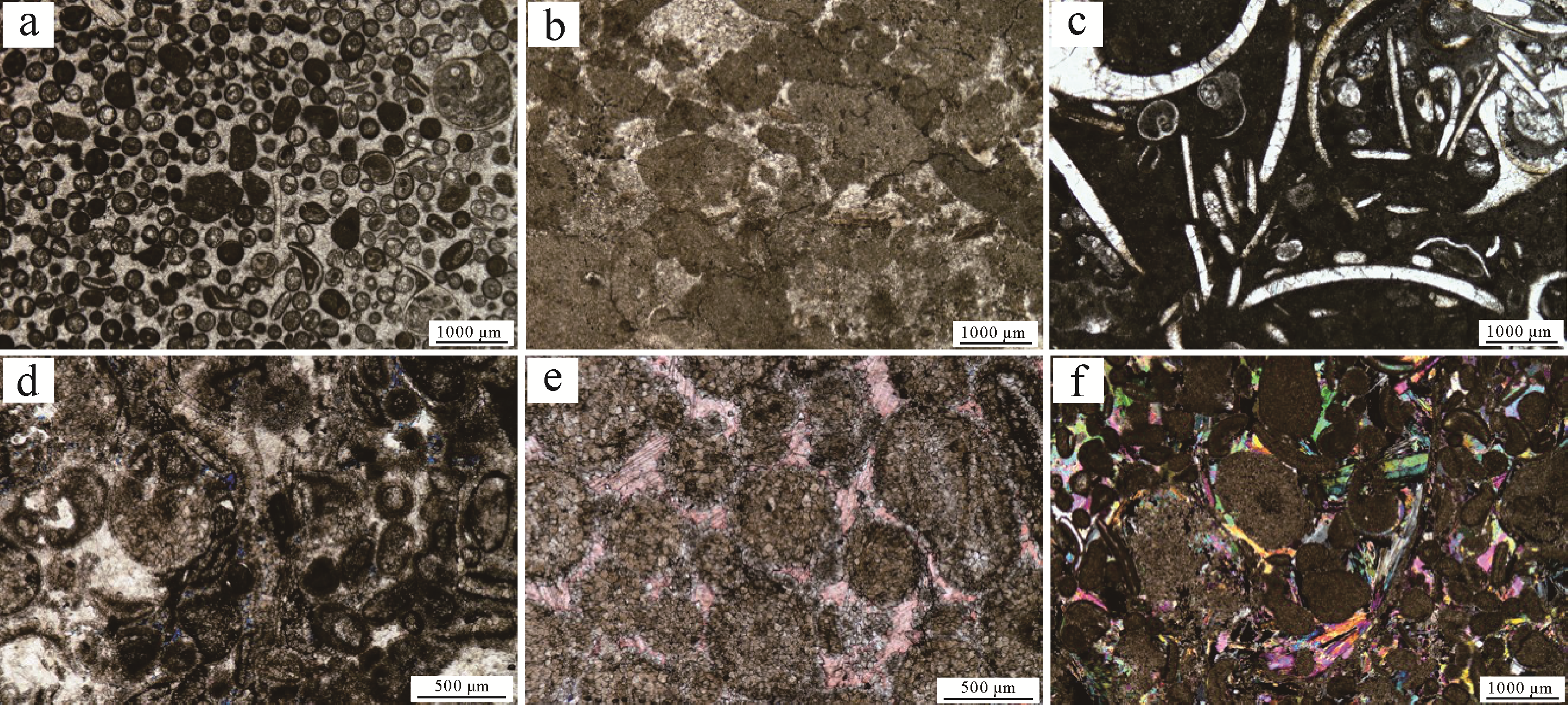
2021, 39(2): 456-469.
doi: 10.14027/j.issn.1000-0550.2020.020
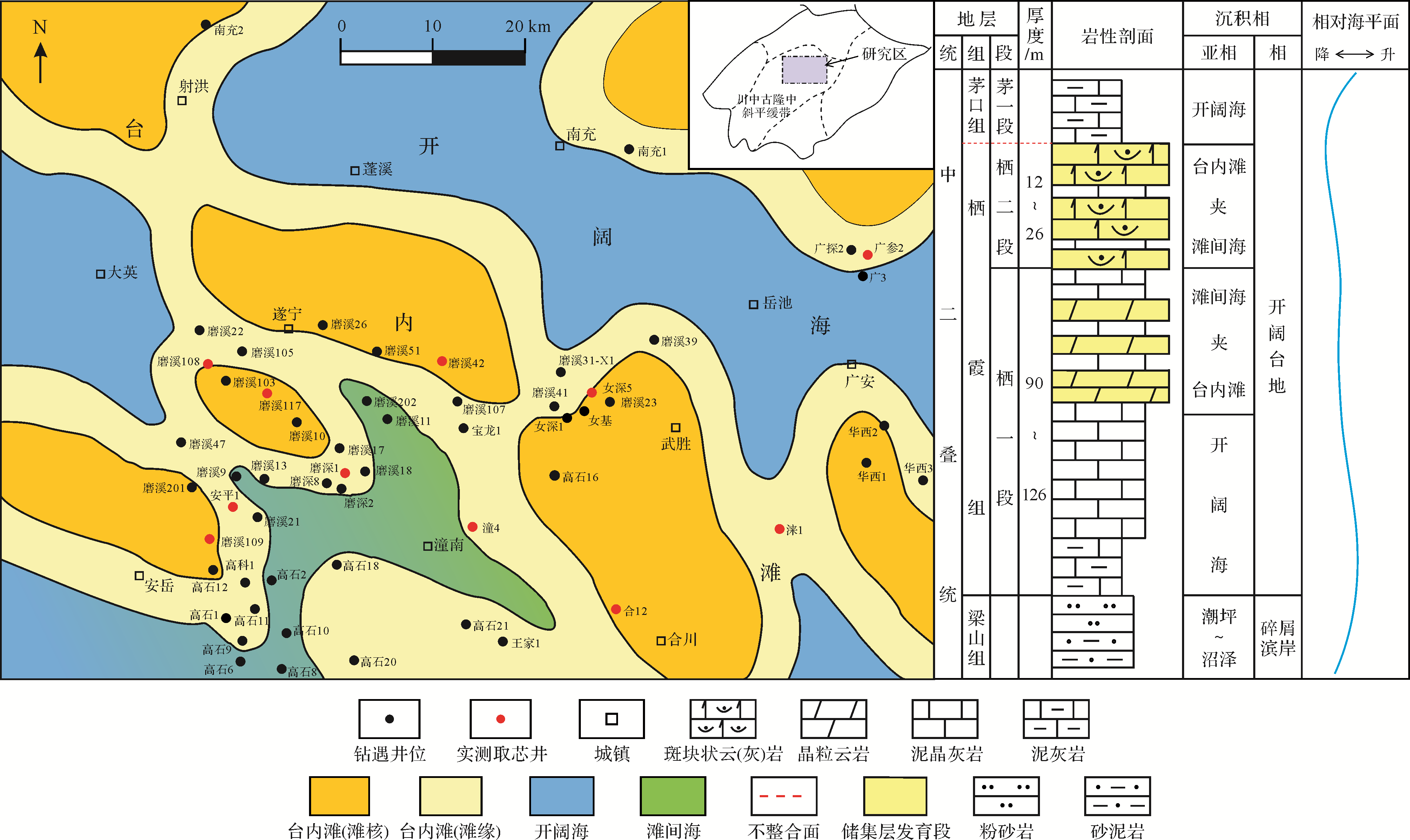
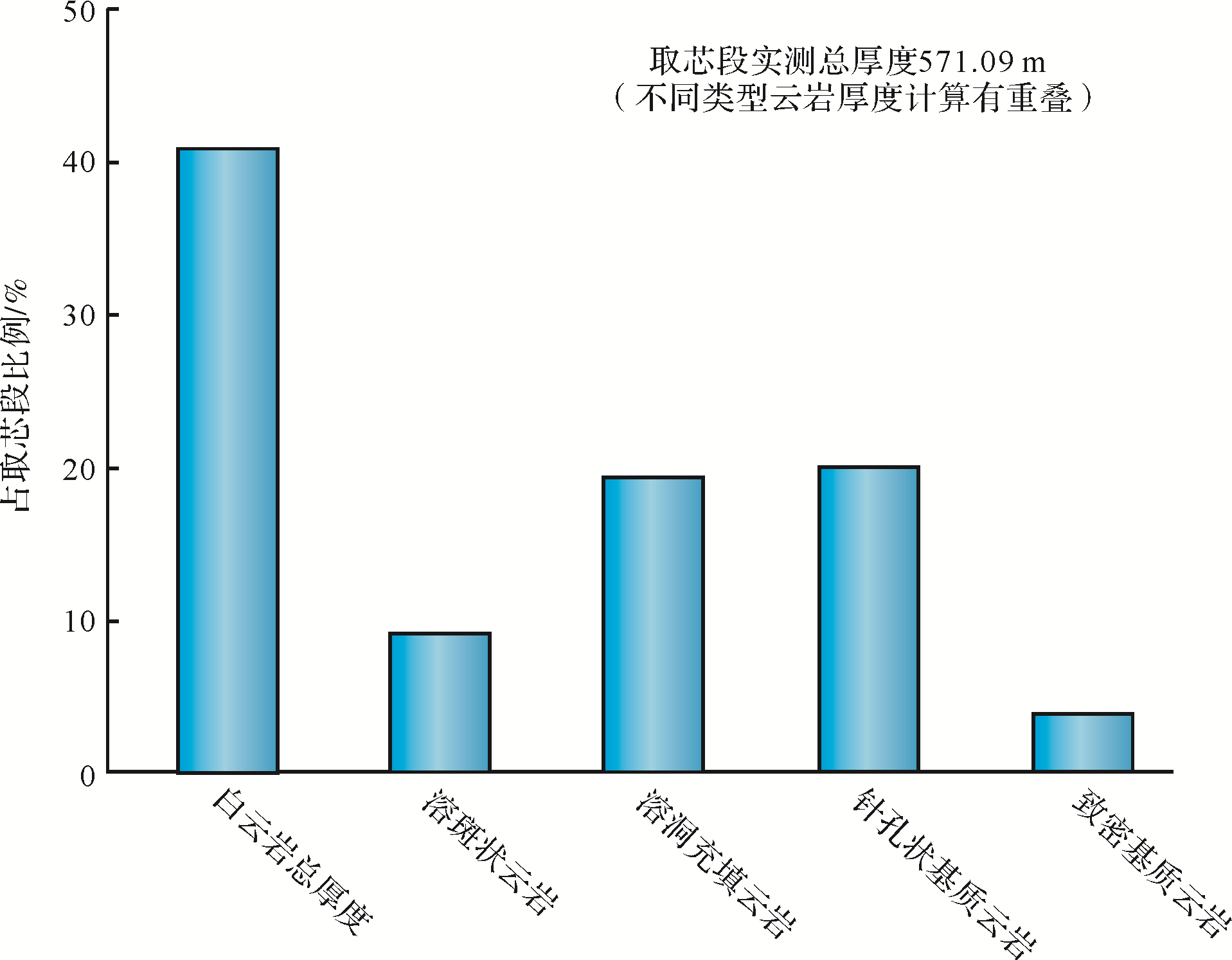
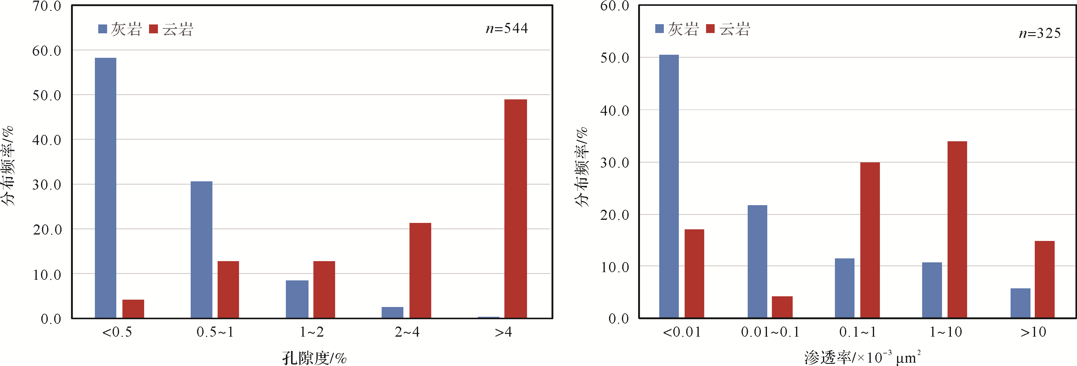
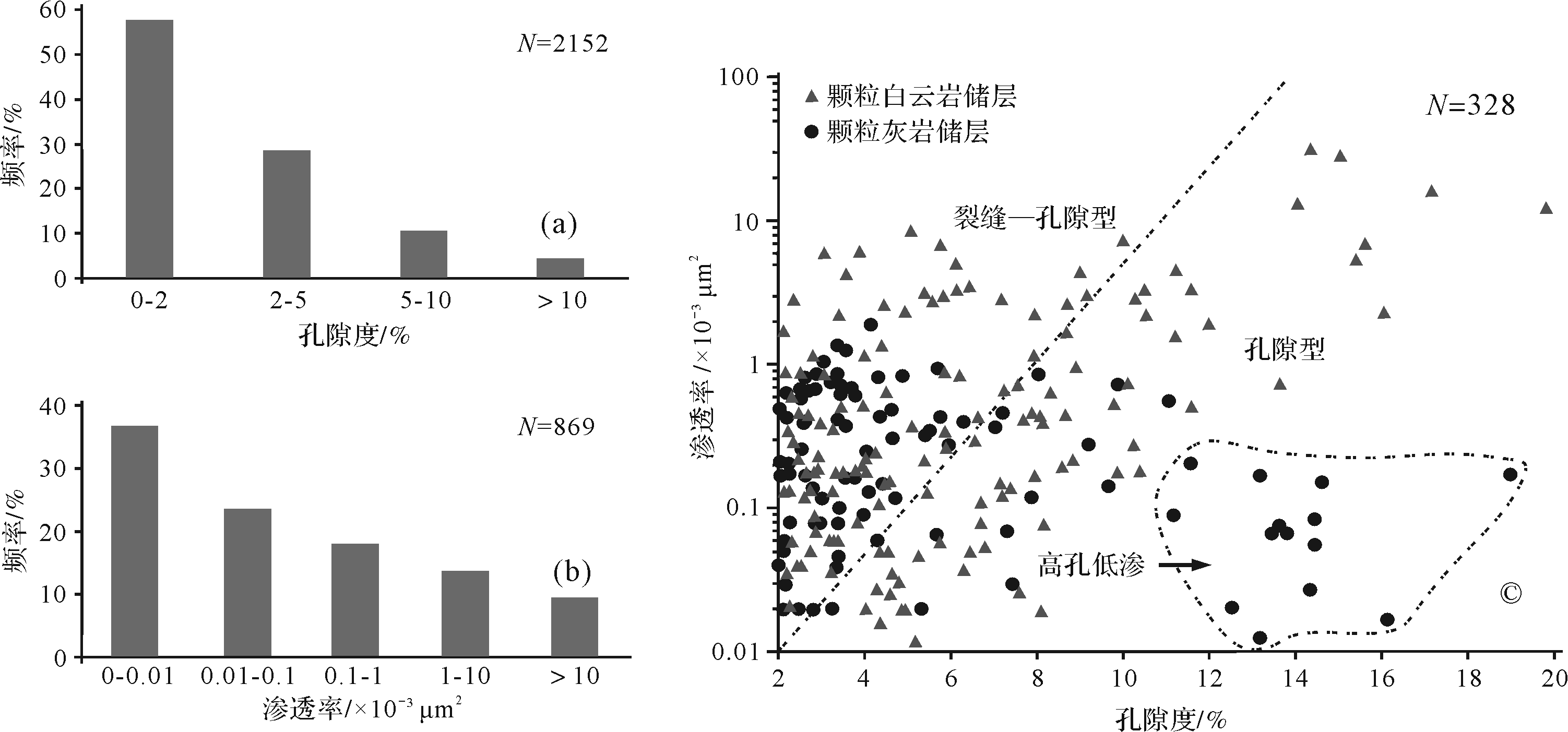
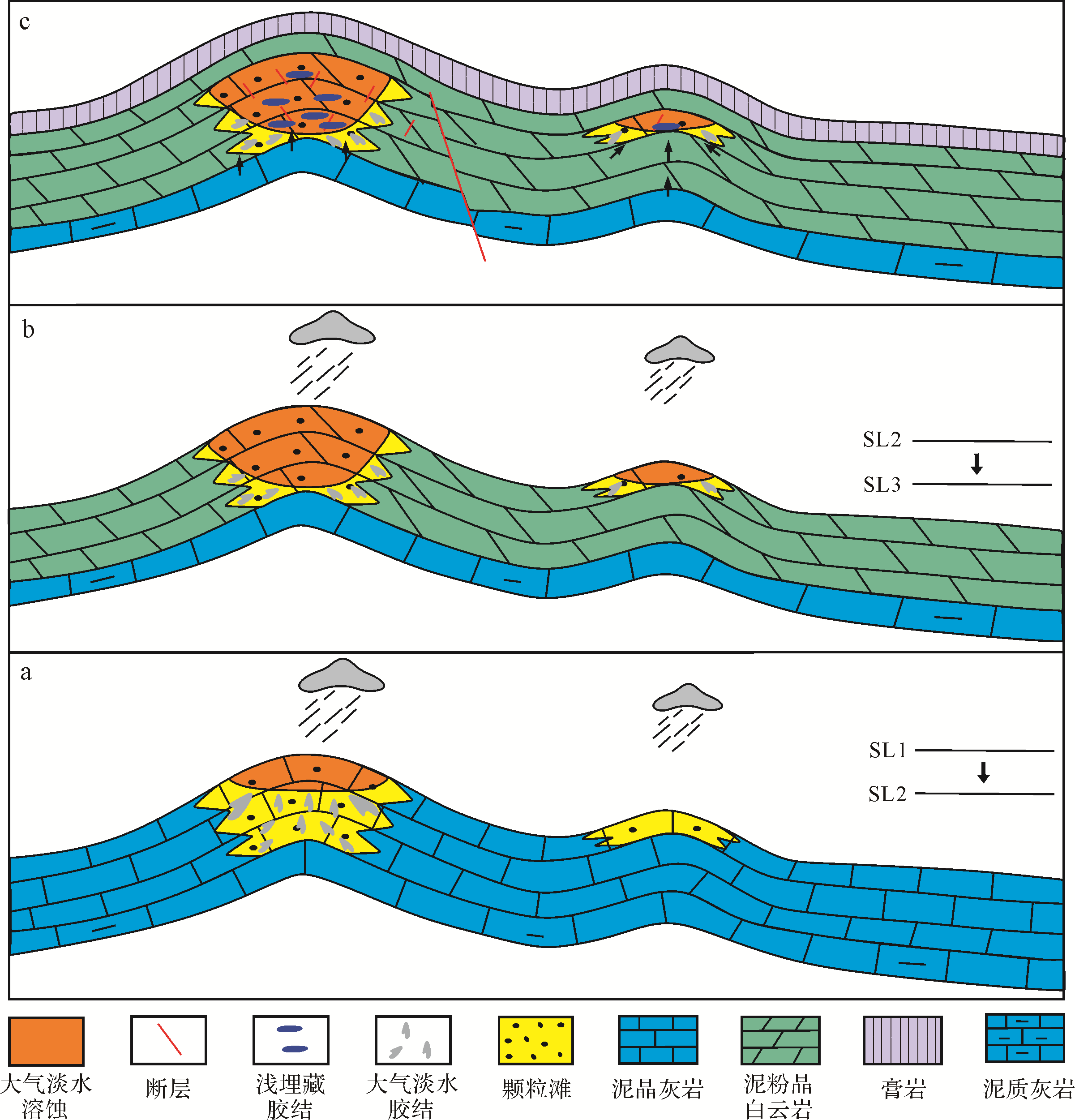
Abstract:
The dolomites of the middle Permian Qixia Formation form the main reservoir in the study area. Further examination has shown that the reservoir formation is related to shoal facies⁃controlled eogenetic karst. Data from core analysis indicates that reservoirs occur mainly in the grain shoal stratum located in the middle⁃upper part of the Qixia Formation, and are divided into four types depending on the macro⁃and micro-occurrences of dolomites: (1) porphyritic dolomite derived from weakly re⁃formed karst; (2) dolomitic karst filled by strongly re⁃formed karst; (3) dolomite with pinhole⁃like features that has retained the pore structure of the original grain shoal; and (4) a compact dolomitic matrix. Of these, dolomitic karst⁃filled reservoirs have the best physical properties. The dolomite reservoir in the Qixia Formation is of the fracture⁃porosity type. Analysis shows that the shoal facies strata in the study area experienced a period of uplift and exposure immediately after sediment deposition, resulting in early diagenetic karstification which formed facies⁃controlled karst systems. These systems, along with residual pores in the granular limestone, became the fluid pathways for dolomitization. Porphyritic dolomite, dolomitic karst fillings, ‘pinhole’ dolomite and some of the compact dolomitic matrix are the result of hydrothermal dolomitization which took place after the depositional stage in the middle Permian, thus retaining abundant intercrystalline pores in the karst system. The crystalline dolomite tends to be automorphic, largely due to the presence of voids within the karst. By contrast, the matrix surrounding the karst systems was densely compacted in the early burial stage, and subsequent dolomitization produced dolomite with poor physical properties. A small proportion of the grainstone retained some of the original pores, forming the ‘pinhole’ dolomite. The study reveals that the Qixia Formation dolomite reservoirs are characterized by facies control, scale and inheritance, and that the presence of high⁃quality reservoirs is due to the karst system. This new concept of the genesis of Qixia Formation dolomite reservoirs is significant for guiding the prediction of reservoir distribution and further exploration and deployment in this area.


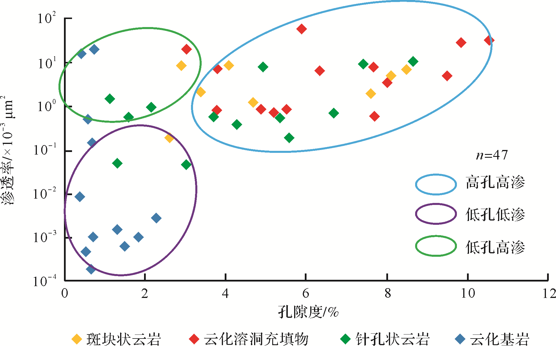


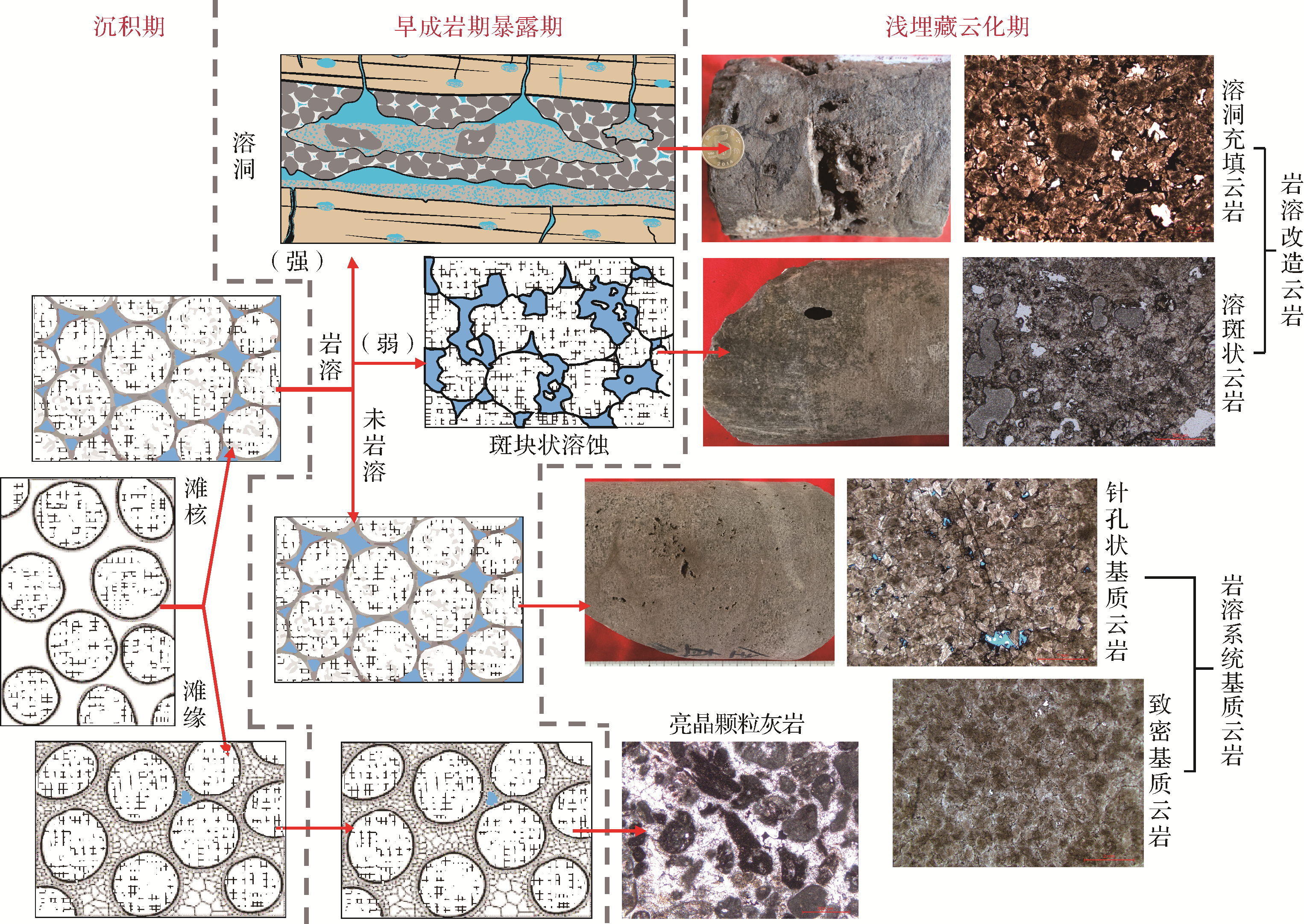
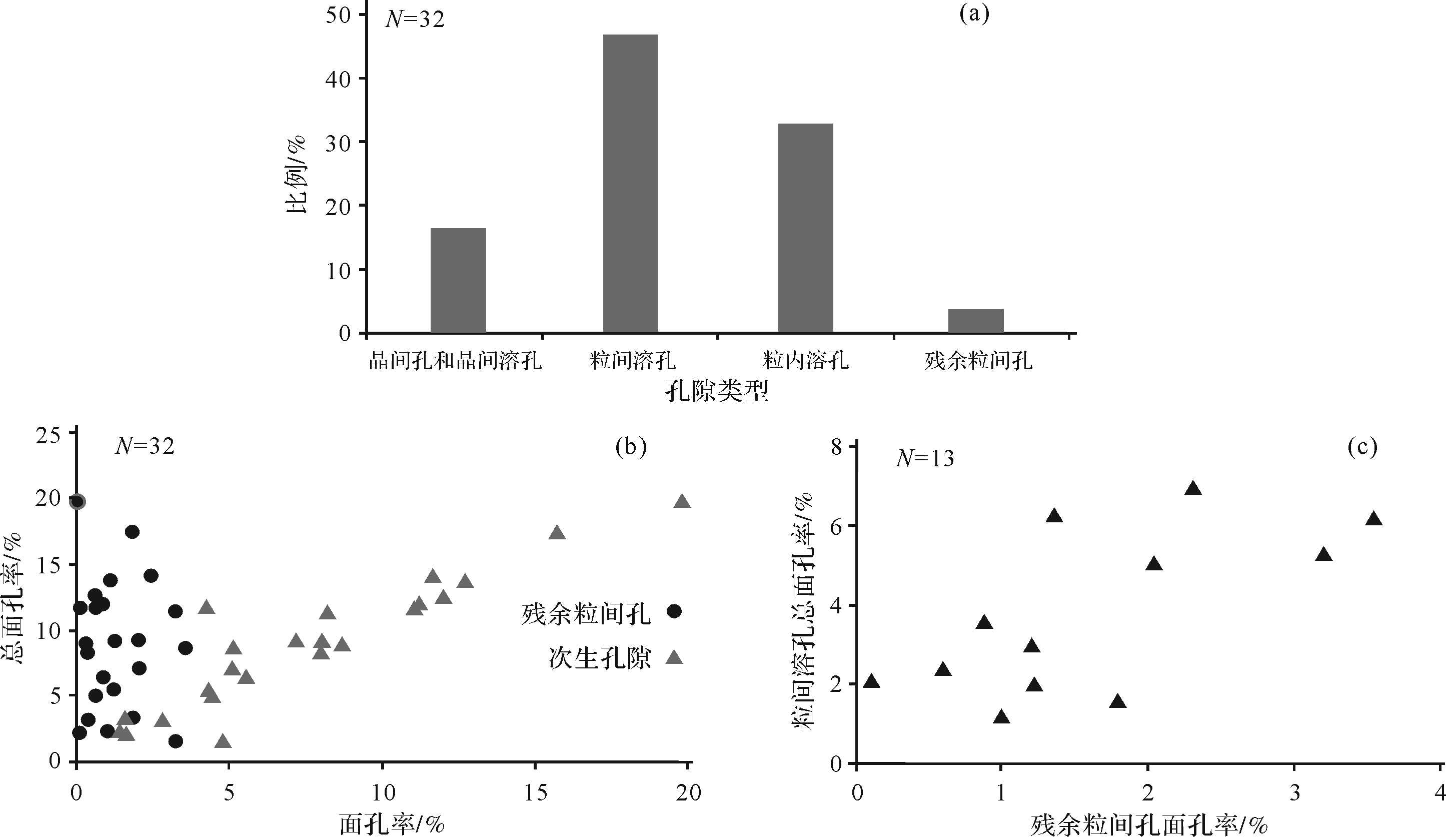
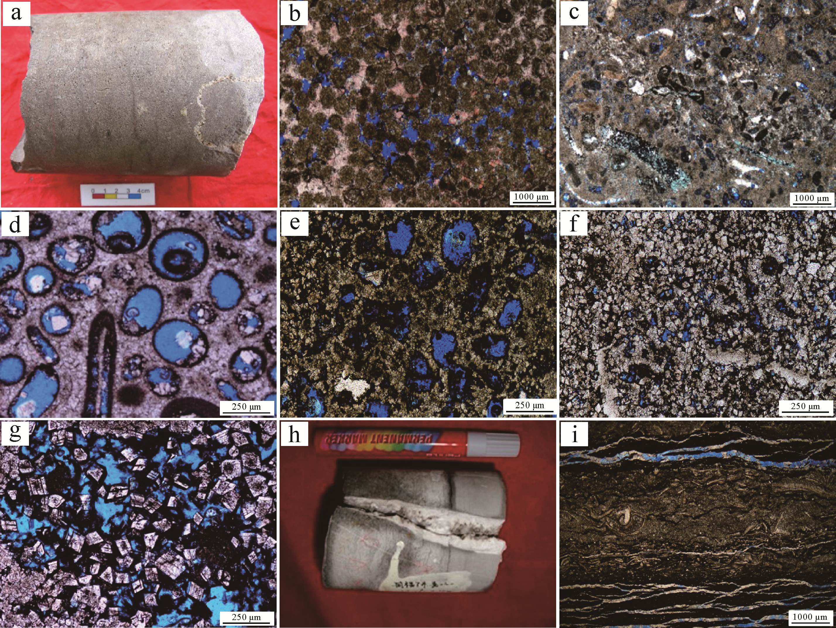
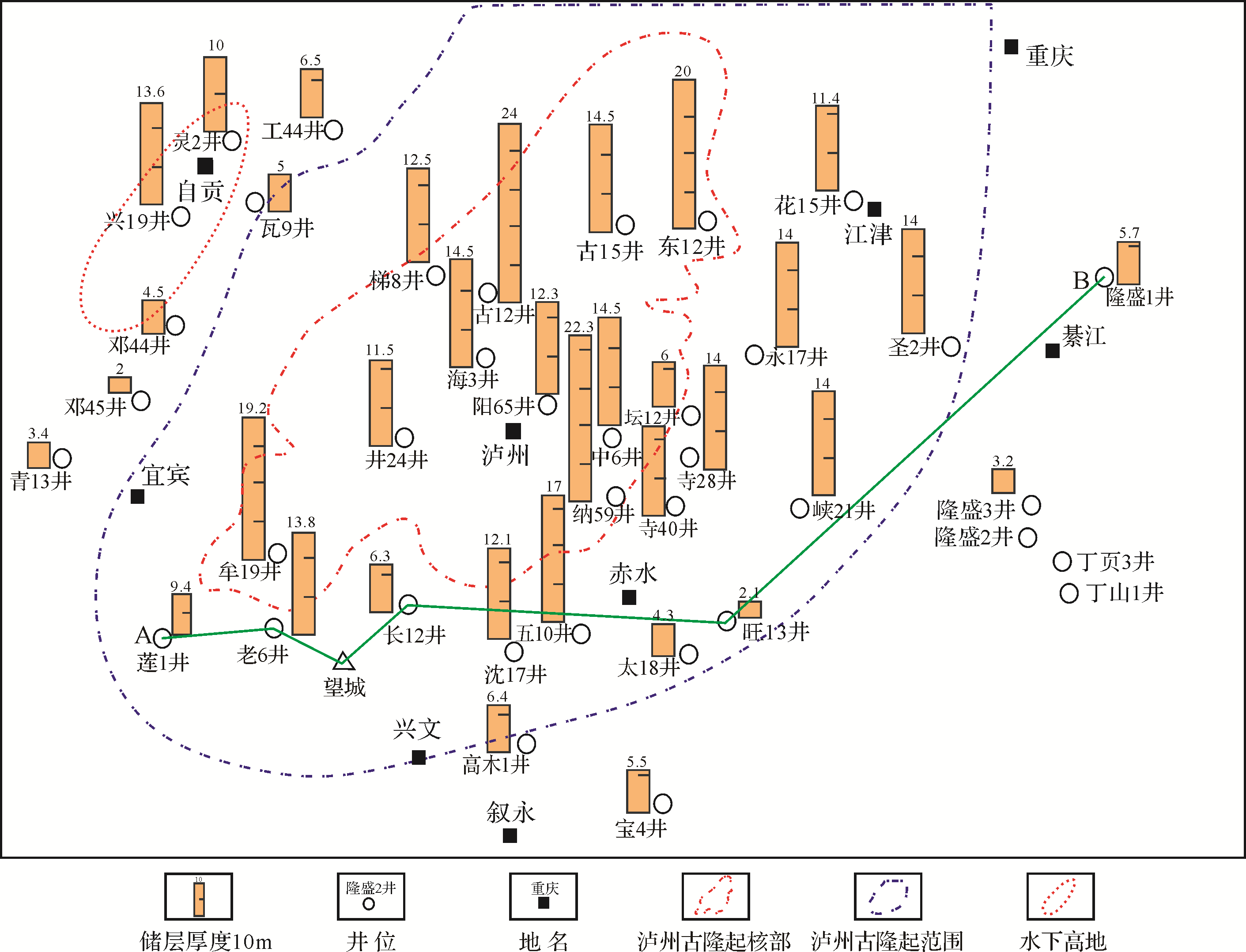
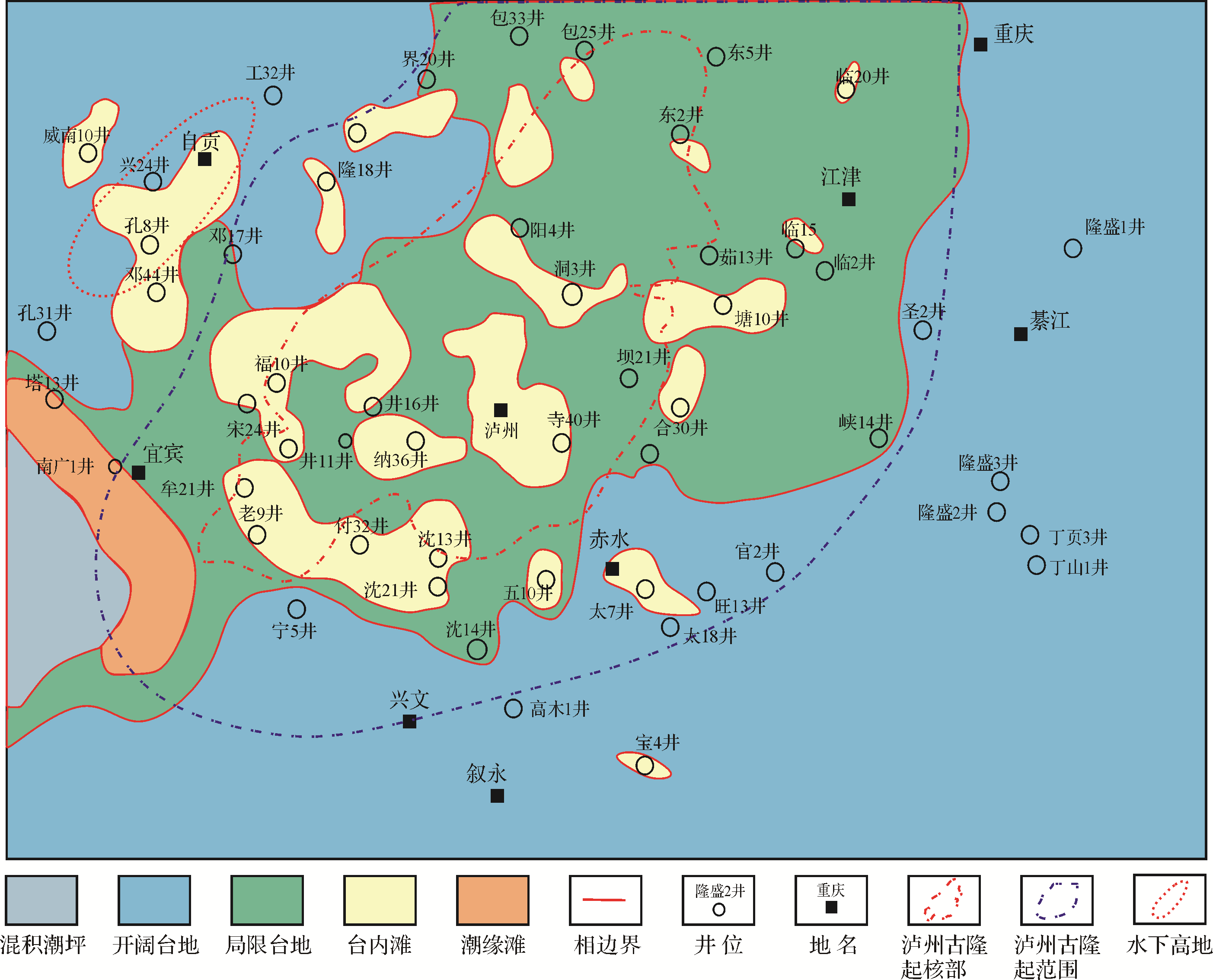
2021, 39(2): 470-481.
doi: 10.14027/j.issn.1000-0550.2020.015
Abstract:
The shoal reservoir in the Jialingjiang Formation is a potential site for natural gas exploration. Drill core observations, thin section identification, cathode luminescence, scanning electron microscopy and physical property analysis were employed in this study to analyze the petrological characteristics, pore types, diagenesis and pore permeability relationships of the reservoir. The main factors controlling the development of the reservoir were also analyzed. The results indicate that the shoal reservoir occurs vertically in T1 j1⁃T1 j21, T1 j22, T1 j41 and T1 j51, and comprises several rock types. These include grainy limestone, grainy dolostone and powder⁃size dolomite crystals which retain the original structure. The main types of reservoir space are inter⁃ and intragranular dissolved pores, intercrystalline pores and intercrystalline dissolution pores. The material basis of the shoal reservoir was controlled by its sequential and sedimentary paleotopography, being mainly developed vertically in the middle and lower parts of a highstand system tract, and horizontally on the Luzhou paleo⁃uplift. The diagenetic history of the shoals is the key to their evolution into a hydrocarbon reservoir. The main destructive diagenesis was compaction, pressure dissolution and cementation; the main constructive diagenesis was dissolution and dolomitization. Fractures generated by tectonic movement further improve the physical properties of the reservoir.

2021, 39(2): 482-492.
doi: 10.14027/j.issn.1000-0550.2020.023
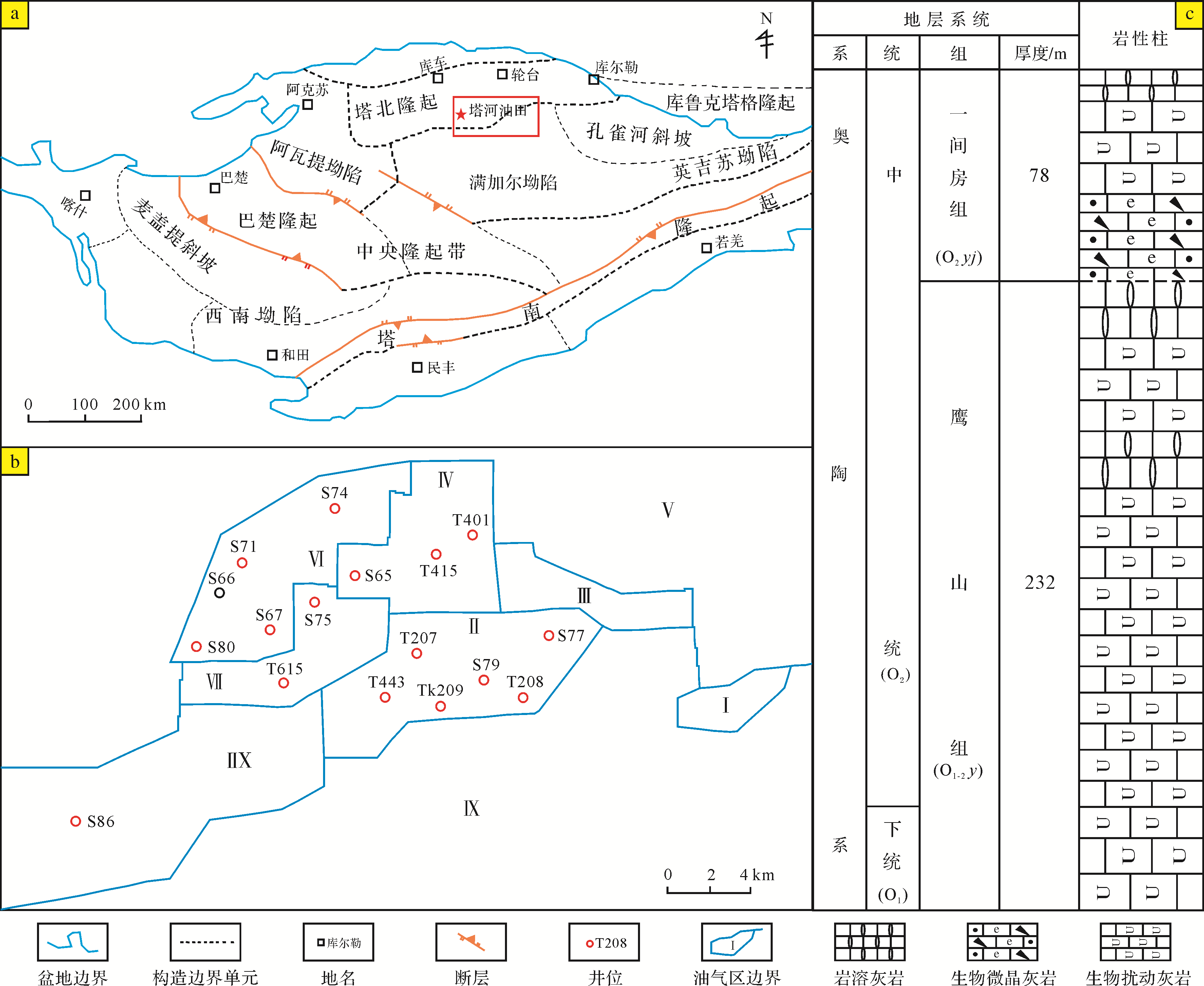
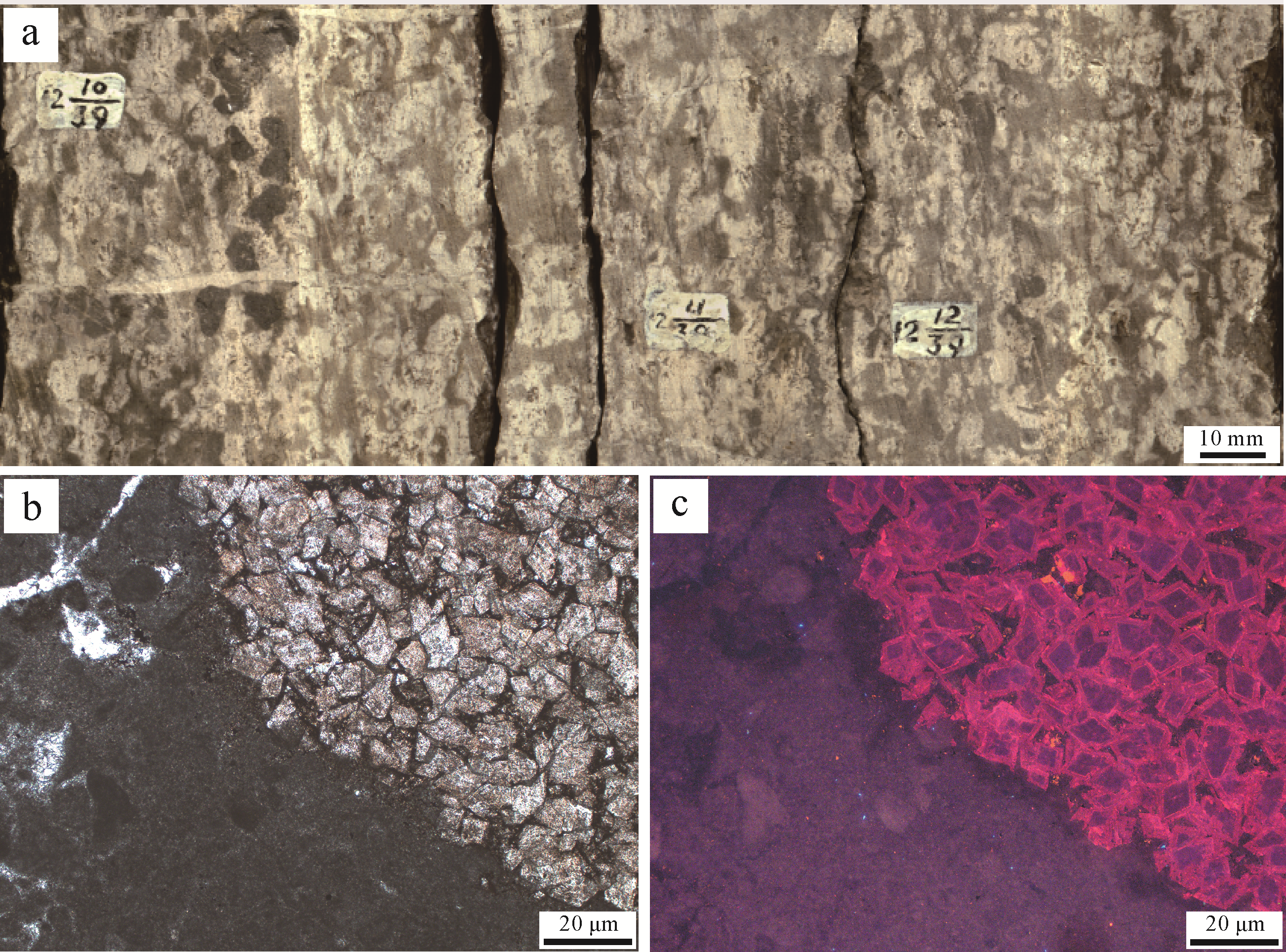
Abstract:
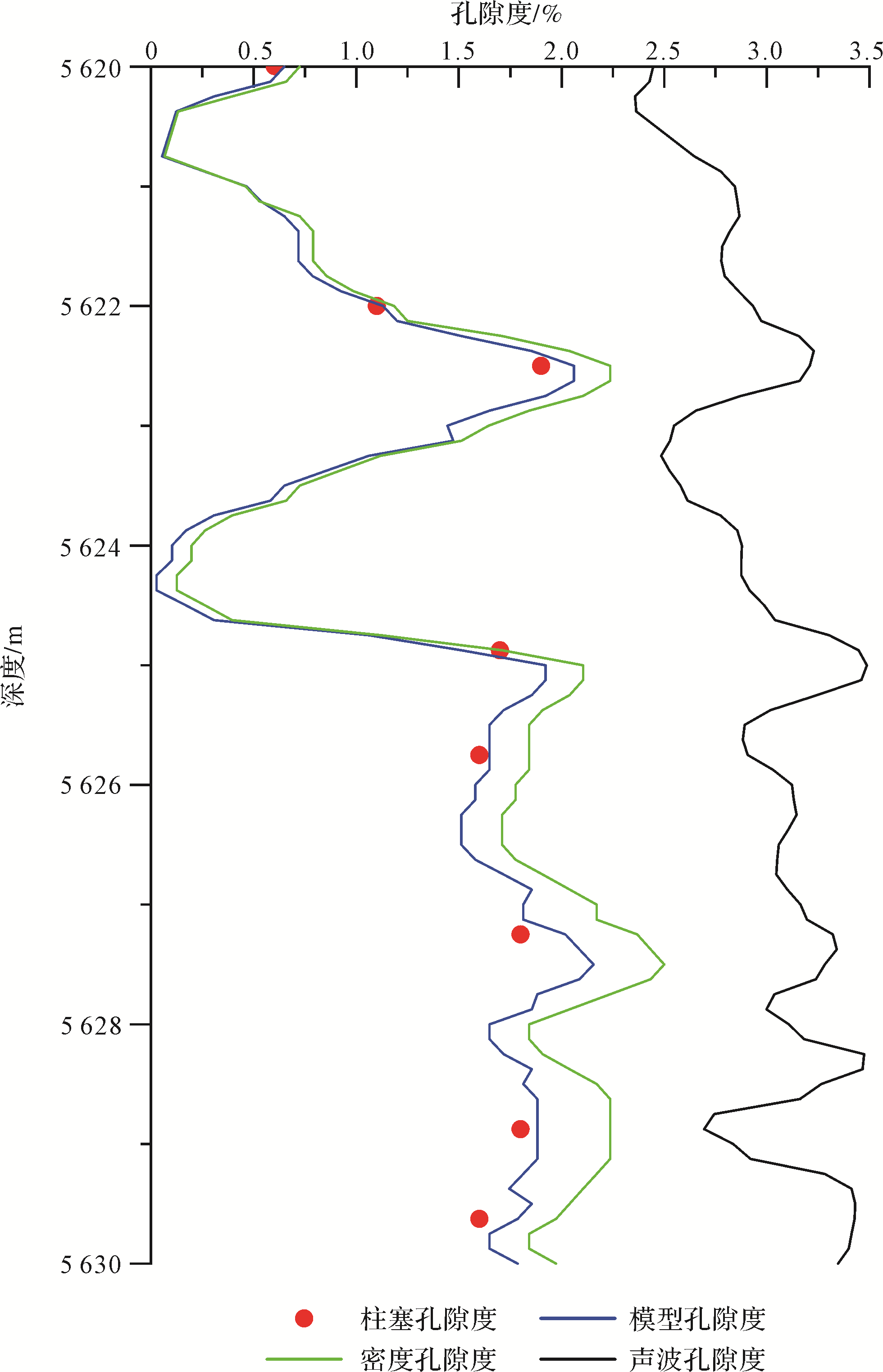
The bioturbated carbonate reservoirs in the Ordovician Yingshan and Yijianfang Formations of the Tahe oilfield are well developed. The macro⁃and microcharacteristics and genetic mechanism of the bioturbated carbonate reservoirs in the study area were examined by core observation, using thin⁃section microscope observation and porosity and permeability analysis of the plugs. A new porosity calculation sample inspection model is proposed based on core data and conventional logging data. Firstly, the results show that the Ordovician reservoirs in the study area are mostly oil⁃bearing plaques with irregular or ribbon distribution on the core. The burrow fills are mainly dolomite, and the reservoir spaces are mainly intercrystalline pores. With the increase of the bioturbation index, the average porosity firstly increased and then decreased, but average permeability continued to increase. Secondly, during Lower⁃Middle Ordovician deposition, [paleo]organisms produced many burrows of various shapes within or on the surface of the carbonate deposits. Bioturbation caused the differences in composition and structure between the burrow fills and the surrounding rock matrix. Such differences gradually increased with the subsequent diagenetic process, which has an important effect on both storage and permeability of the reservoir. Thirdly, by summing the previous logging porosity calculation methods, a porosity calculation sample inspection model is proposed based on core data and conventional logging data by introducing a bioturbation index into the density logging porosity calculation model. The effectiveness and accuracy of the porosity calculation model were verified by core plunger test results. This model compensates for the shortcomings of the conventional porosity model. The pseudo core data generated by the proposed model provides reliable sample training data for the general porosity calculation model for bioturbated carbonate reservoirs established in the next step. This is highly significant both for calculating reserves and reservoir description.
2021, 39(2): 493-505.
doi: 10.14027/j.issn.1000-0550.2020.024
Abstract:
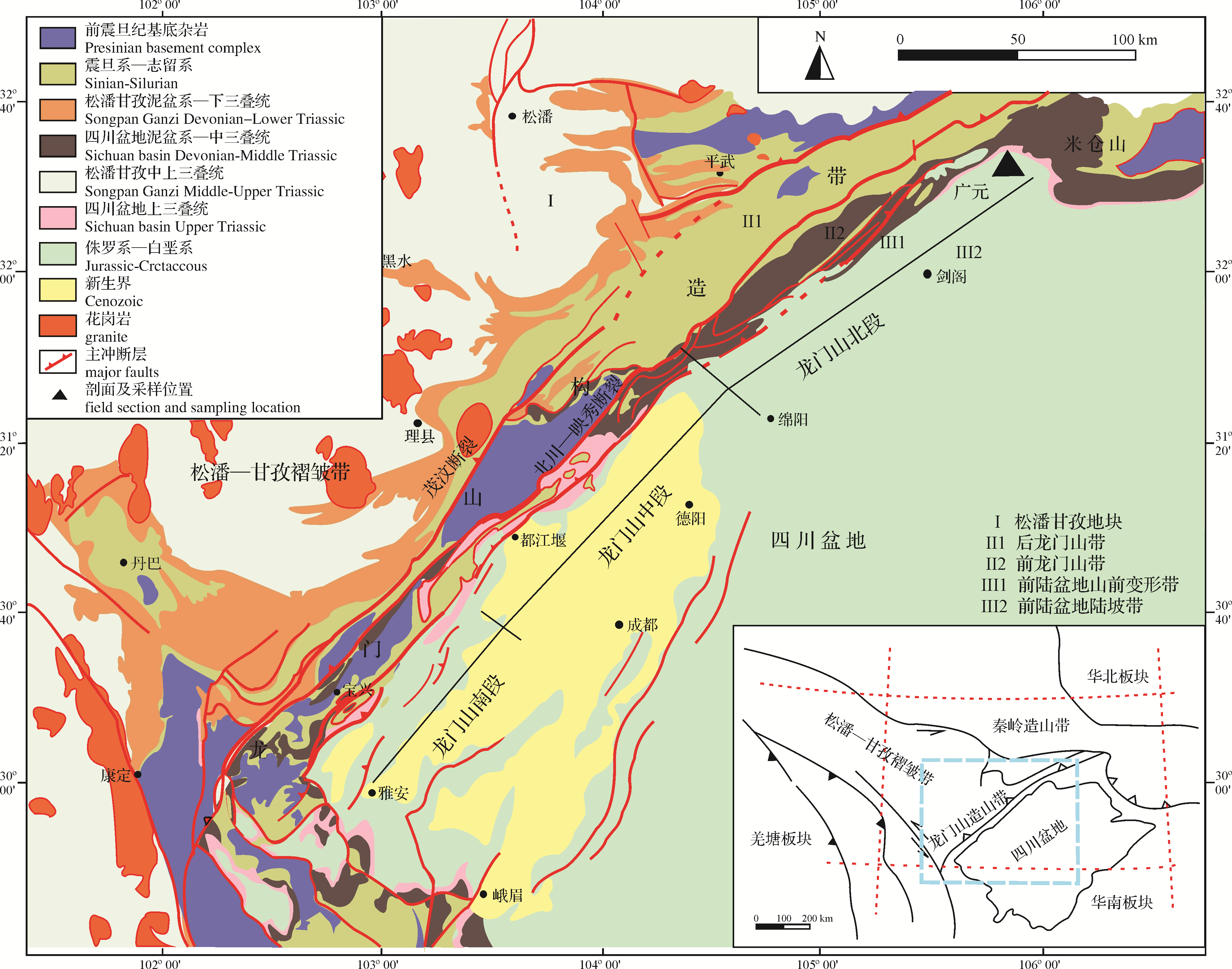
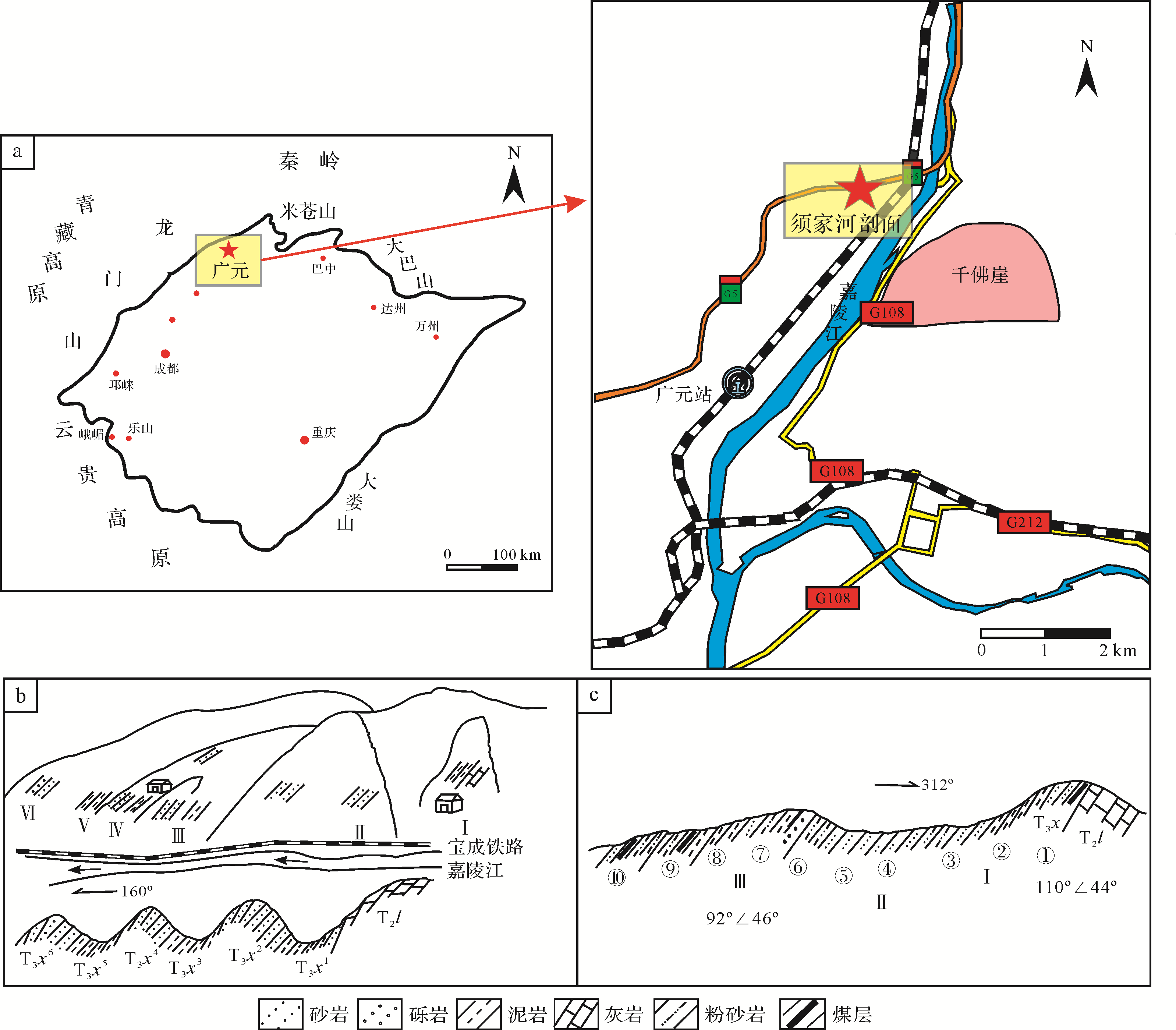
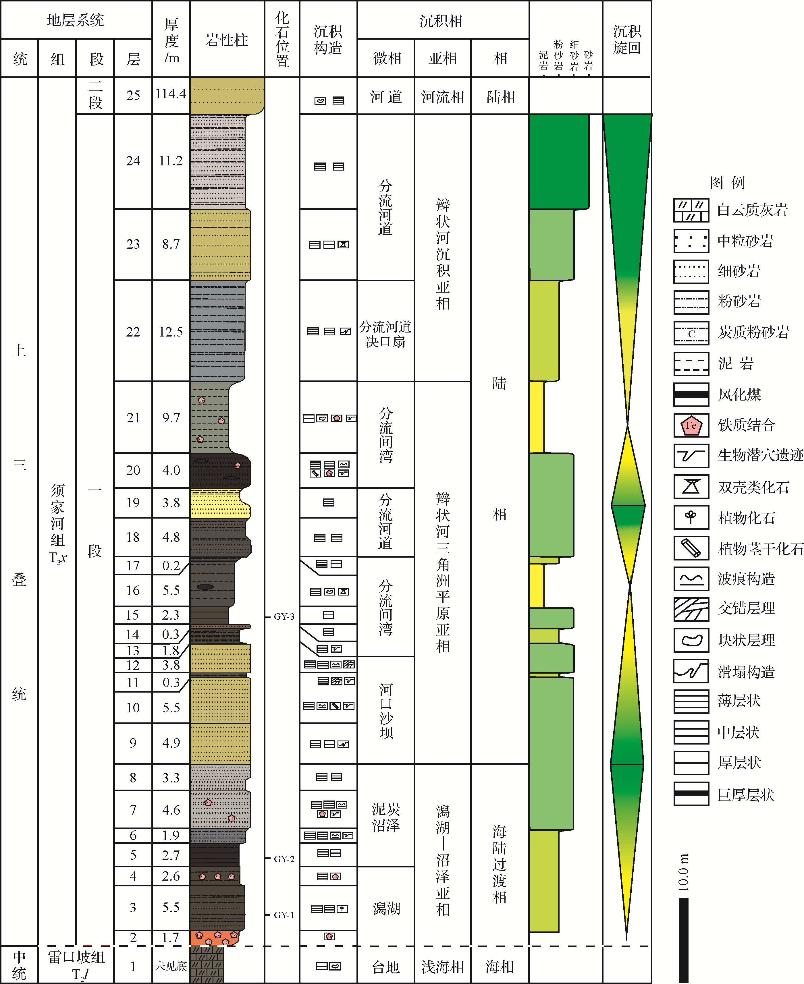
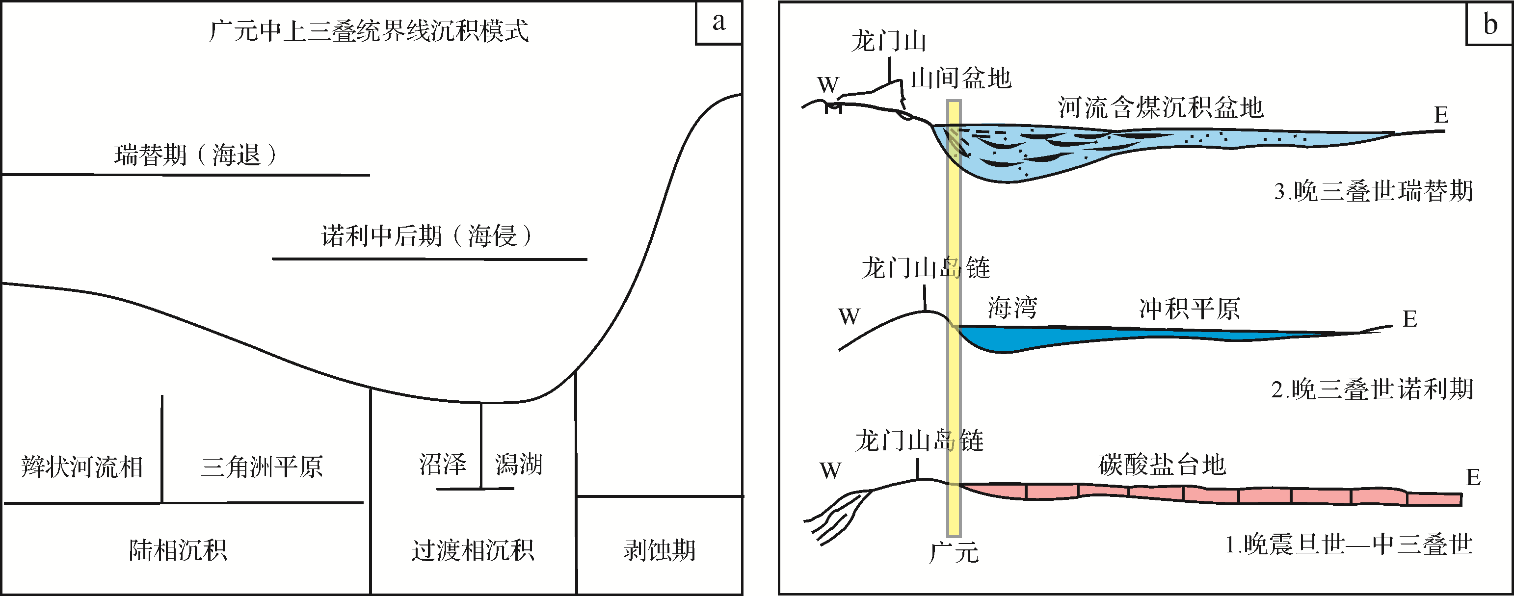
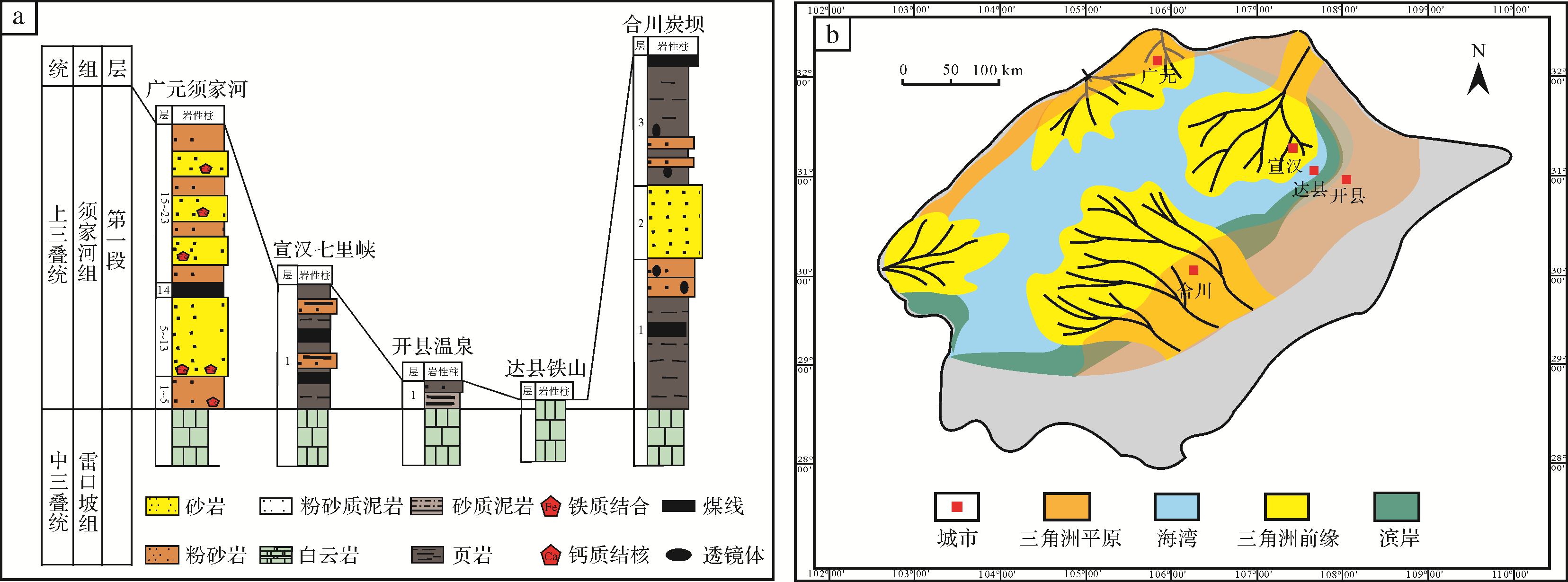
The Norian stage of the Upper Triassic was an important transitional episode from marine to terrestrial environment in the development of the Sichuan Basin. The Late Triassic environment and climate became more complex following the mass extinctions at the turn of the Triassic⁃Jurassic periods, with the most significant impact being on terrestrial ecosystems. The well developed and exposed Triassic⁃Jurassic strata in the northern Sichuan Basin, which comprise continuous deposits of the Upper Triassic Xujiahe Formation and the Lower Jurassic Zhenzhuchong Formation, represents an excellent record of the paleoclimatic and paleoenvironmental changes. In particular, in the Sichuan Basin the Norian and Rhaetian stages were crucial in the transition of the marine and terrestrial environmental changes. We investigated the first member of the Xujiahe Formation in Guangyuan, northern Sichuan Basin, focusing on analysis of the sedimentary facies and environmental evolution. The results show that lagoon marshes, delta plains and braided rivers facies developed in the section in the Guangyuan region, which is a remarkable continental transitional⁃continental facies sedimentary system. Through the influence of the formation and development of the Ganzi⁃Aba back⁃arc basin, the transgression that had begun in the Carnian stage at the beginning of the Upper Triassic affected the Guangyuan region during the late Norian. The uplift of the Qinling orogenic belt and Longmen Mountain ended the production of marine facies in the Guangyuan area, and terrestrial facies are then seen in the first member of Xujiahe Formation. We have reconstructed the paleoclimate in the later Norian stage in the Guangyuan area by analyzing the plant fossil assemblage combined with the sedimentary cycle and facies characteristics. We suggest that the Guangyuan area experienced a humid, subtropical coastal climate from the depositional stage of the first member of the Xujiahe Formation until the late Norian in the Upper Triassic.


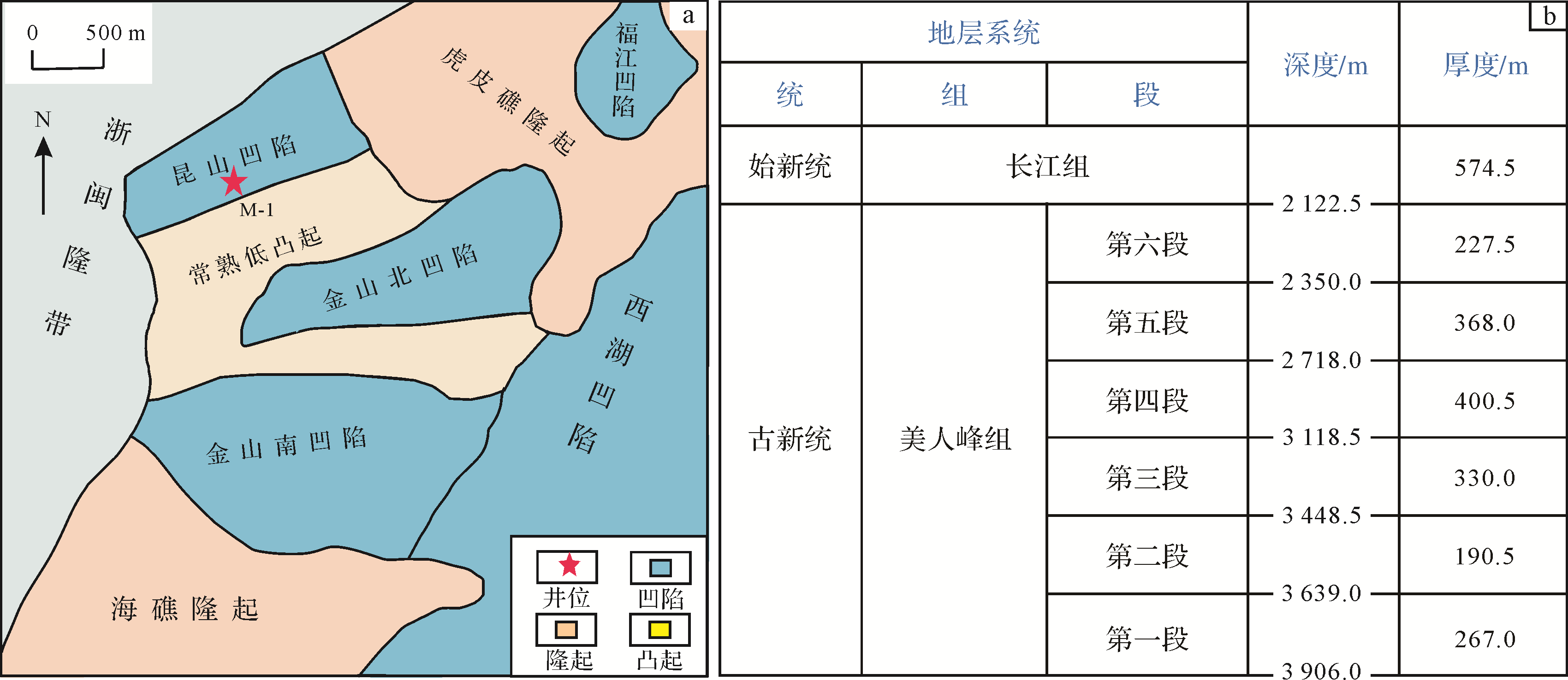
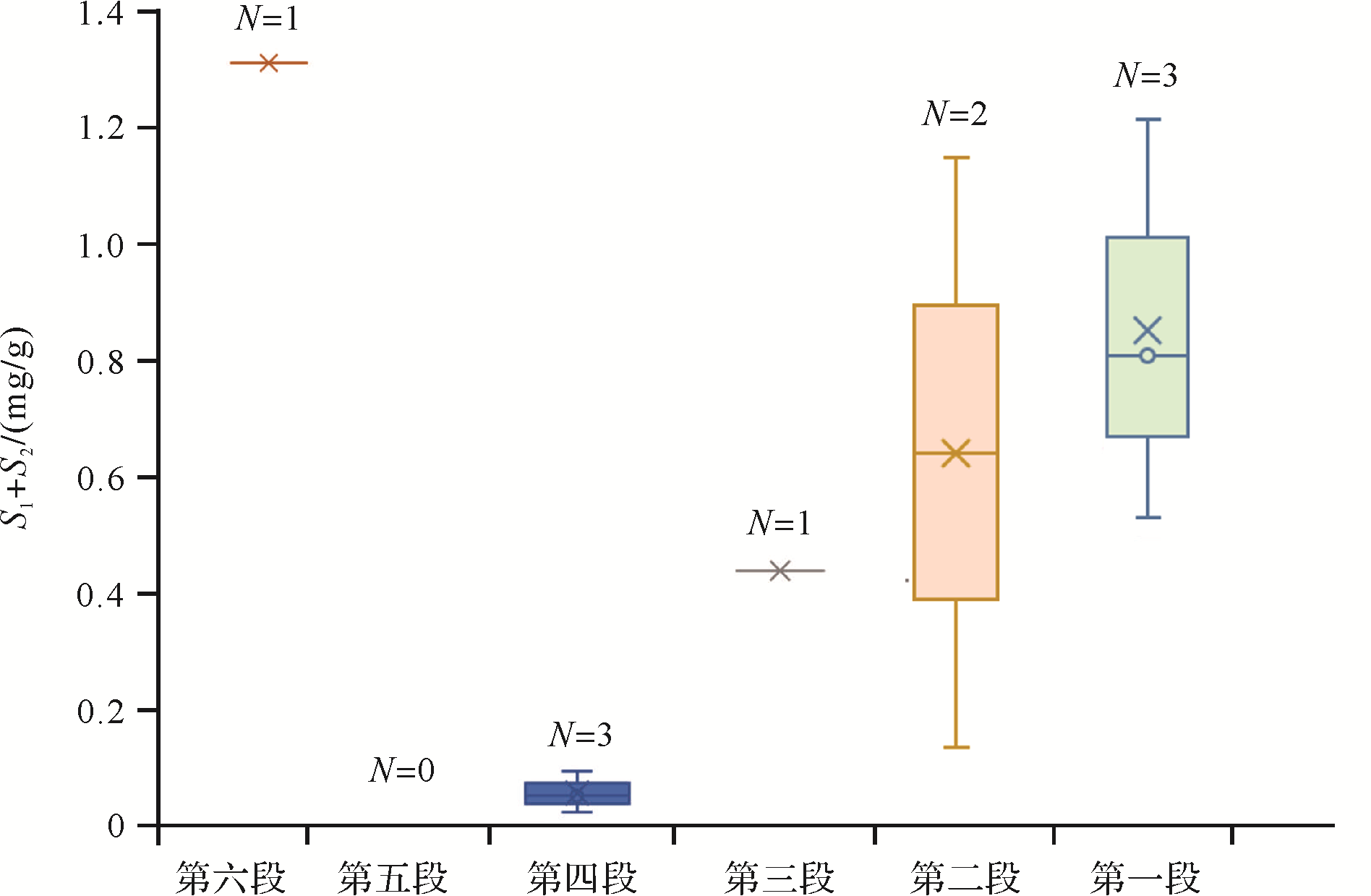
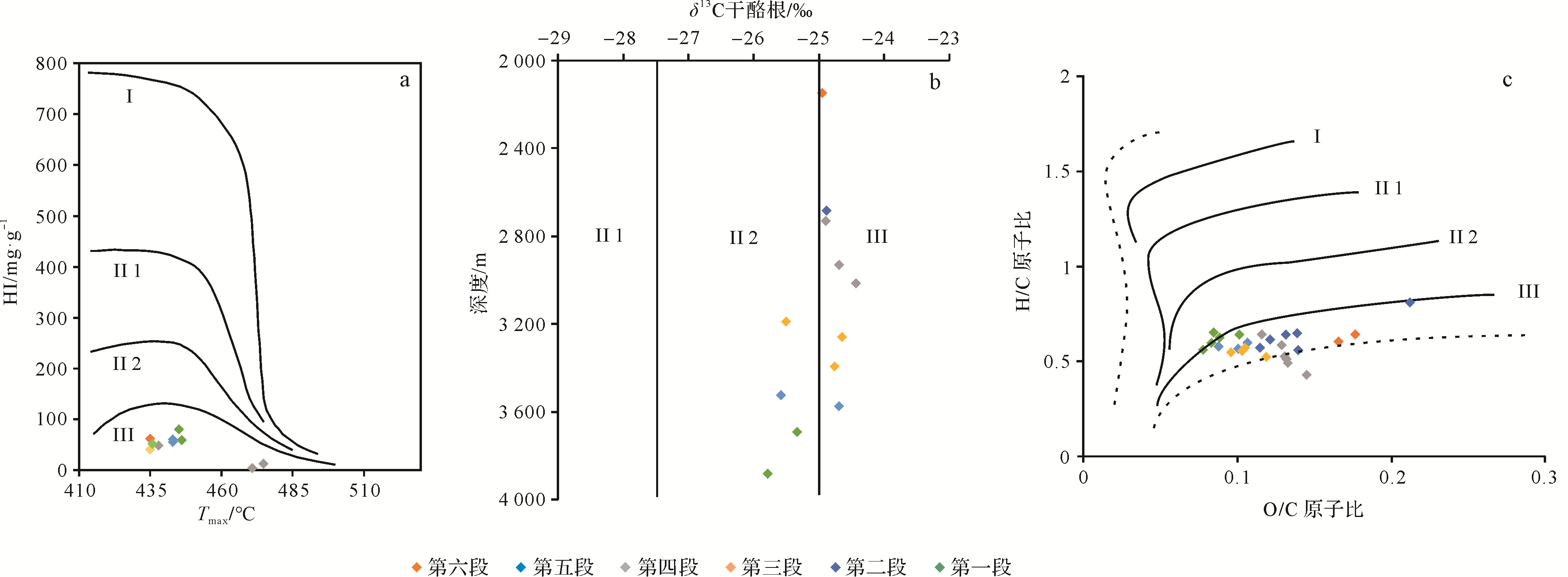
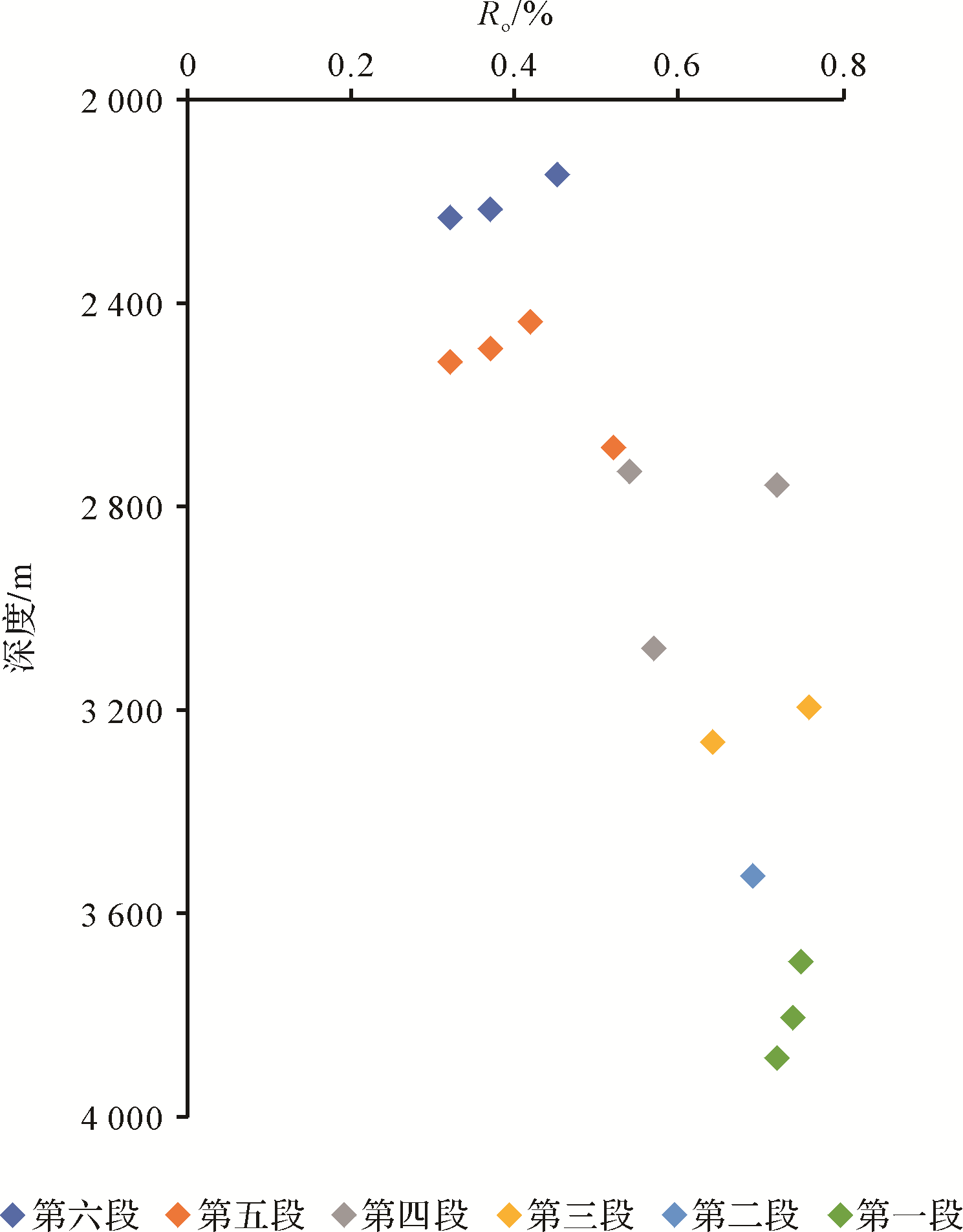
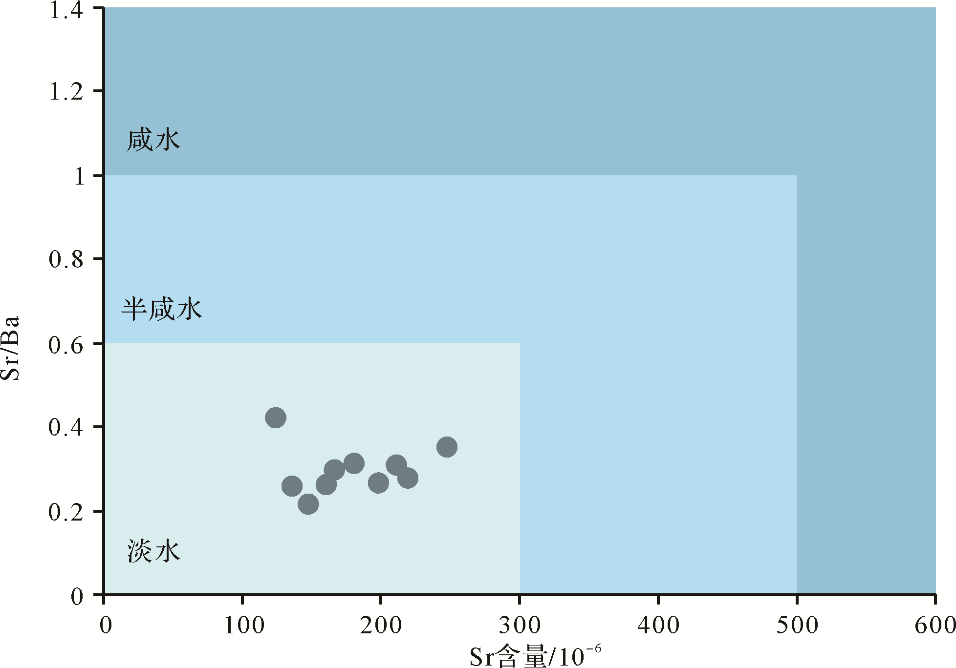
2021, 39(2): 506-514.
doi: 10.14027/j.issn.1000-0550.2020.016
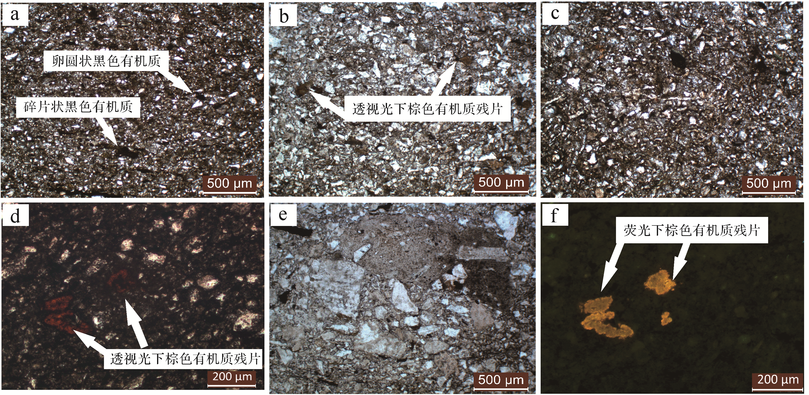
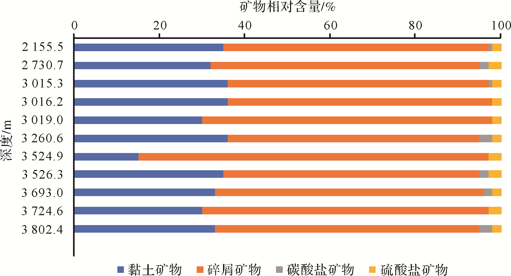
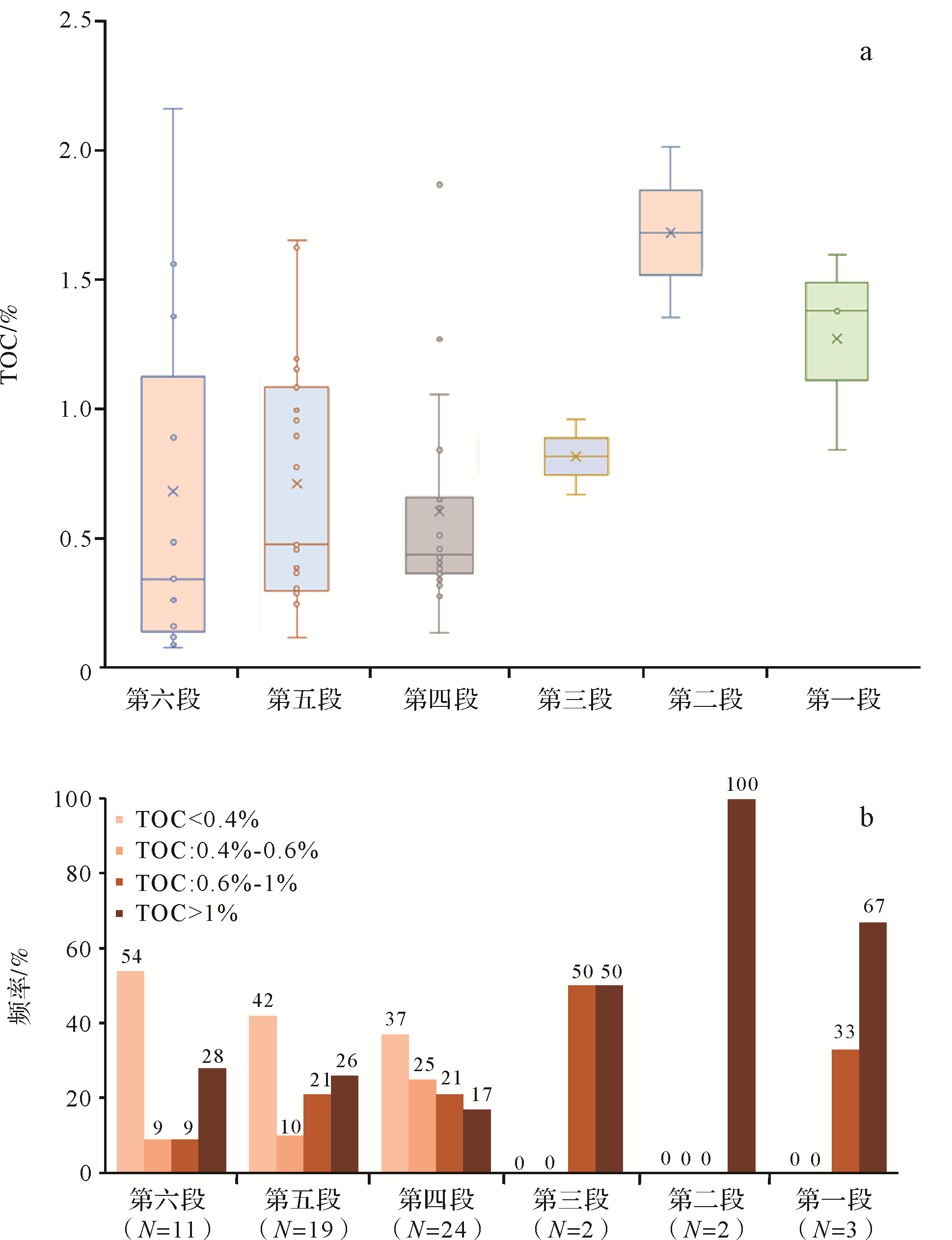
Abstract:
Trace element content, pyrolysis, kerogen δ13C, vitrinite reflectance, thin⁃sections and X⁃ray diffraction images were examined to determine the sedimentary environment and hydrocarbon generation potential of source rocks in the different layers making up the Meirenfeng Formation in the Changjiang Depression, East China Sea Basin. These revealed a suboxic freshwater sedimentary environment in a warm, humid climate. Paleosalinity and paleoclimate were the main environmental factors in source rock development. During deposition of the first and second members, the climate was warm and humid. There was a large amount of terrestrial organic matter (OM) input and the salinity was relatively high, which has benefited OM preservation. The OM is highly abundant and is mainly type Ⅲ, with a small amount of type II maturity is mainly in the low⁃mature to mature stage, indicating that these members have the greatest hydrocarbon generation potential. During deposition of the thirdand fourth members, the climate was relatively dry and hot and input of terrigenous minerals and OM was reduced, and the salinity was lower than for the firstand second members. The OM has low abundance and is mainly type Ⅲ, with mainly low⁃maturity, suggesting a low hydrocarbon generation potential. Deposition of the fifth and sixth members saw the climate again become warm and humid. The OM is more abundant than in the thirdand fourth members, but is type Ⅲ and mainly at the immature stage, which indicates no exploration potential. The fact that the maturity of the Meirenfeng Formation source rocks was found to increase with greater burial depth suggests that the potential for hydrocarbon generation is better in the deeper rock.