2023 Vol. 41, No. 5
Display Method:
2023, 41(5): 1281-1294.
doi: 10.14027/j.issn.1000-0550.2022.084
Abstract:
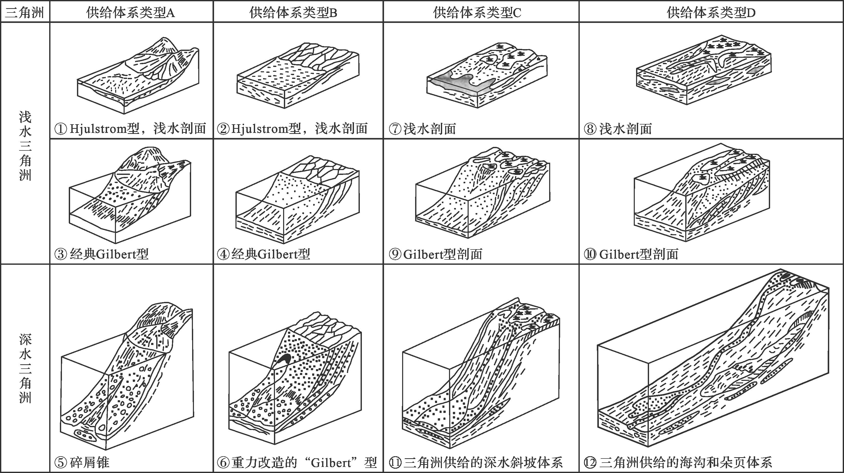
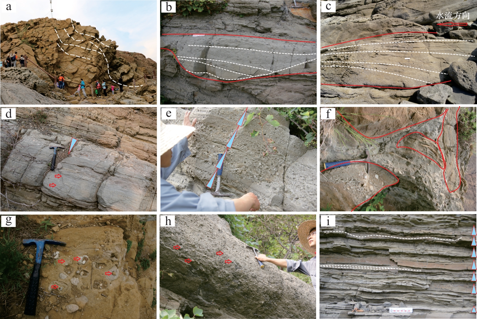
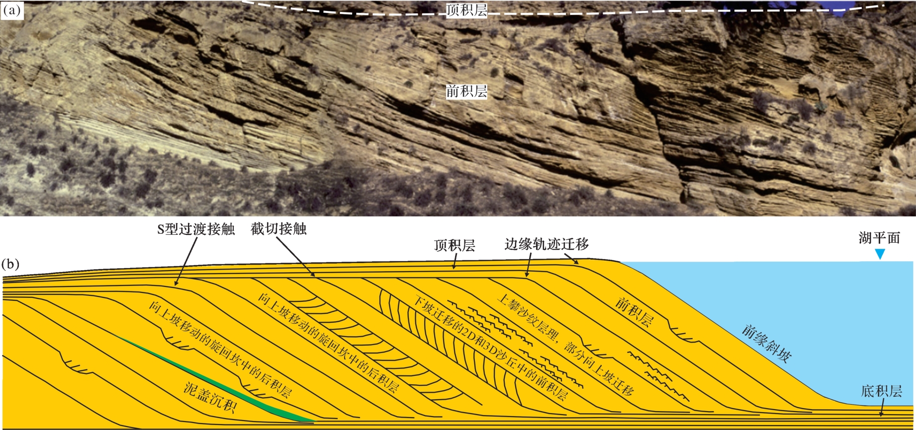
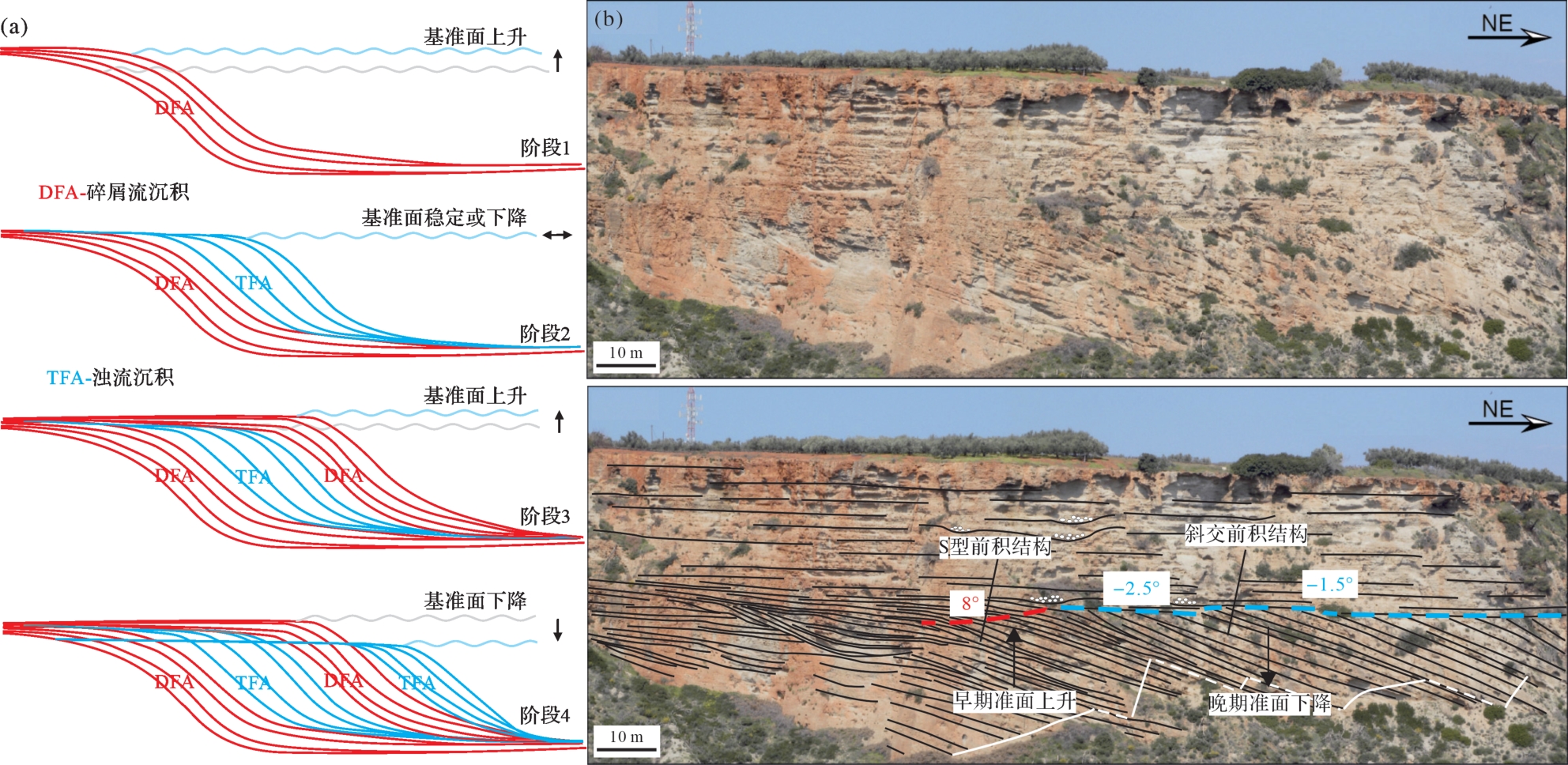
Reports from China and overseas on the concept, sedimentary characteristics, depositional processes, and depositional model of Gilbert-type deltas are systematically reviewed and summarized. Gilbert-type deltas are dominated by gravity-flow sedimentary deposits, typically with tripartite structures having distinct bottomset, foreset and topset stratal units comprising a combination of gravity-flow and traction-flow deposits. The topset consists of delta plains mainly composed of vertical stacking of braided river deposits modified by wave action. The slope of the delta front is dominated by debrite and turbidite, commonly exhibiting supercritical turbidity current sedimentary structures. Typical sedimentary structures include scour and fill, cyclic steps and backset stratification, with spaced stratification being common. The bottomset is a prodelta composed of low-density turbidite. Slump deposits, debris fall deposits, and storm-reworked deposits are also common in this area. The foreset comprises gravity-flow sediments following either the failure of shallow-water deposits or hyperpycnal flows from flooding rivers. These processes are affected by internal factors (e.g., grain size, mud content of the matrix) and external factors (e.g., base-level changes, climate changes, tectonic movement). Two aspects influence the prospect of studies related to Gilbert deltas: either the formation process of the foreset and the effect of supercritical turbidity currents, or the depositional model taking the sedimentary processes and architecture elements into account.
Reports from China and overseas on the concept, sedimentary characteristics, depositional processes, and depositional model of Gilbert-type deltas are systematically reviewed and summarized. Gilbert-type deltas are dominated by gravity-flow sedimentary deposits, typically with tripartite structures having distinct bottomset, foreset and topset stratal units comprising a combination of gravity-flow and traction-flow deposits. The topset consists of delta plains mainly composed of vertical stacking of braided river deposits modified by wave action. The slope of the delta front is dominated by debrite and turbidite, commonly exhibiting supercritical turbidity current sedimentary structures. Typical sedimentary structures include scour and fill, cyclic steps and backset stratification, with spaced stratification being common. The bottomset is a prodelta composed of low-density turbidite. Slump deposits, debris fall deposits, and storm-reworked deposits are also common in this area. The foreset comprises gravity-flow sediments following either the failure of shallow-water deposits or hyperpycnal flows from flooding rivers. These processes are affected by internal factors (e.g., grain size, mud content of the matrix) and external factors (e.g., base-level changes, climate changes, tectonic movement). Two aspects influence the prospect of studies related to Gilbert deltas: either the formation process of the foreset and the effect of supercritical turbidity currents, or the depositional model taking the sedimentary processes and architecture elements into account.
2023, 41(5): 1295-1310.
doi: 10.14027/j.issn.1000-0550.2022.083
Abstract:
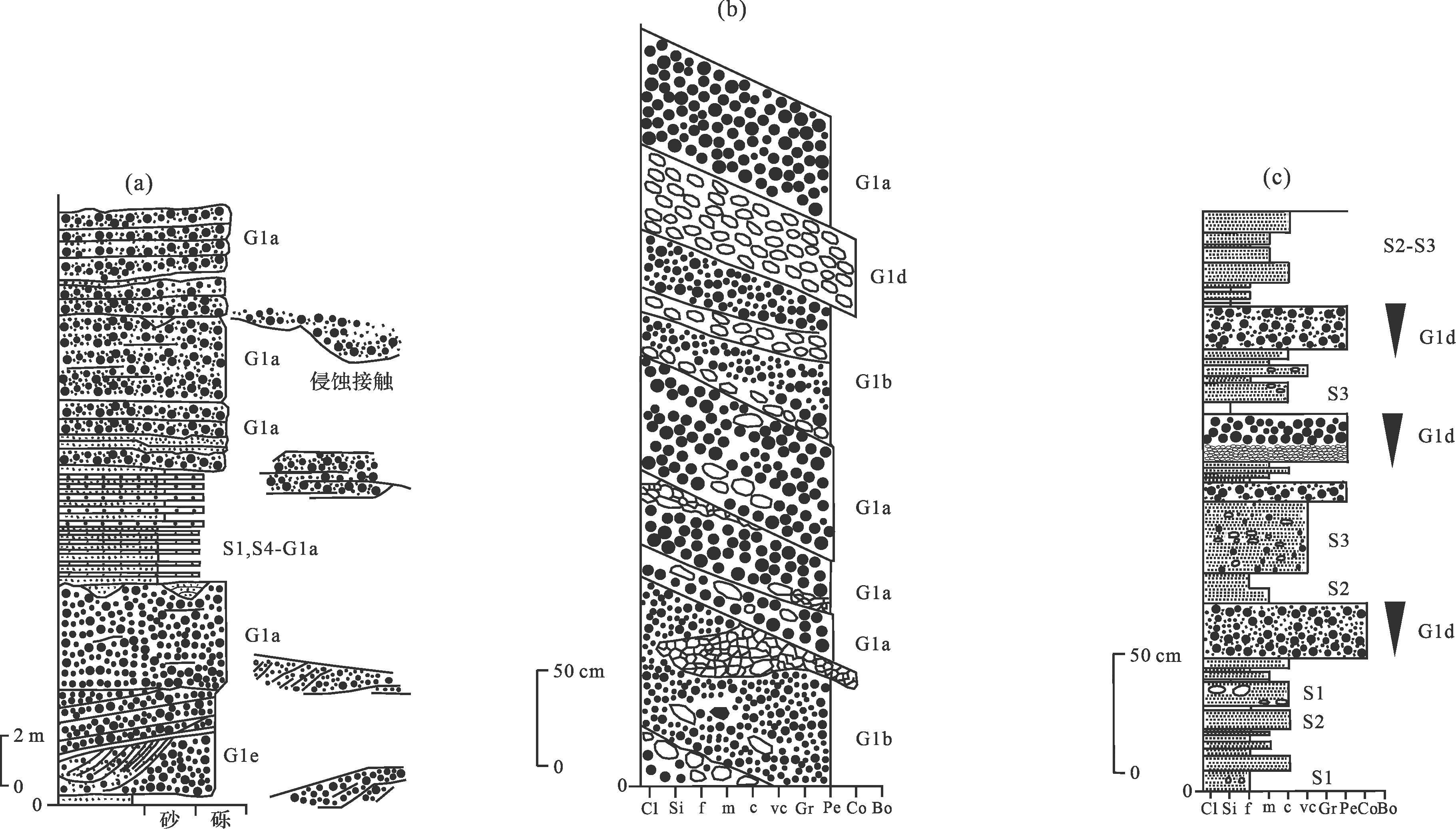
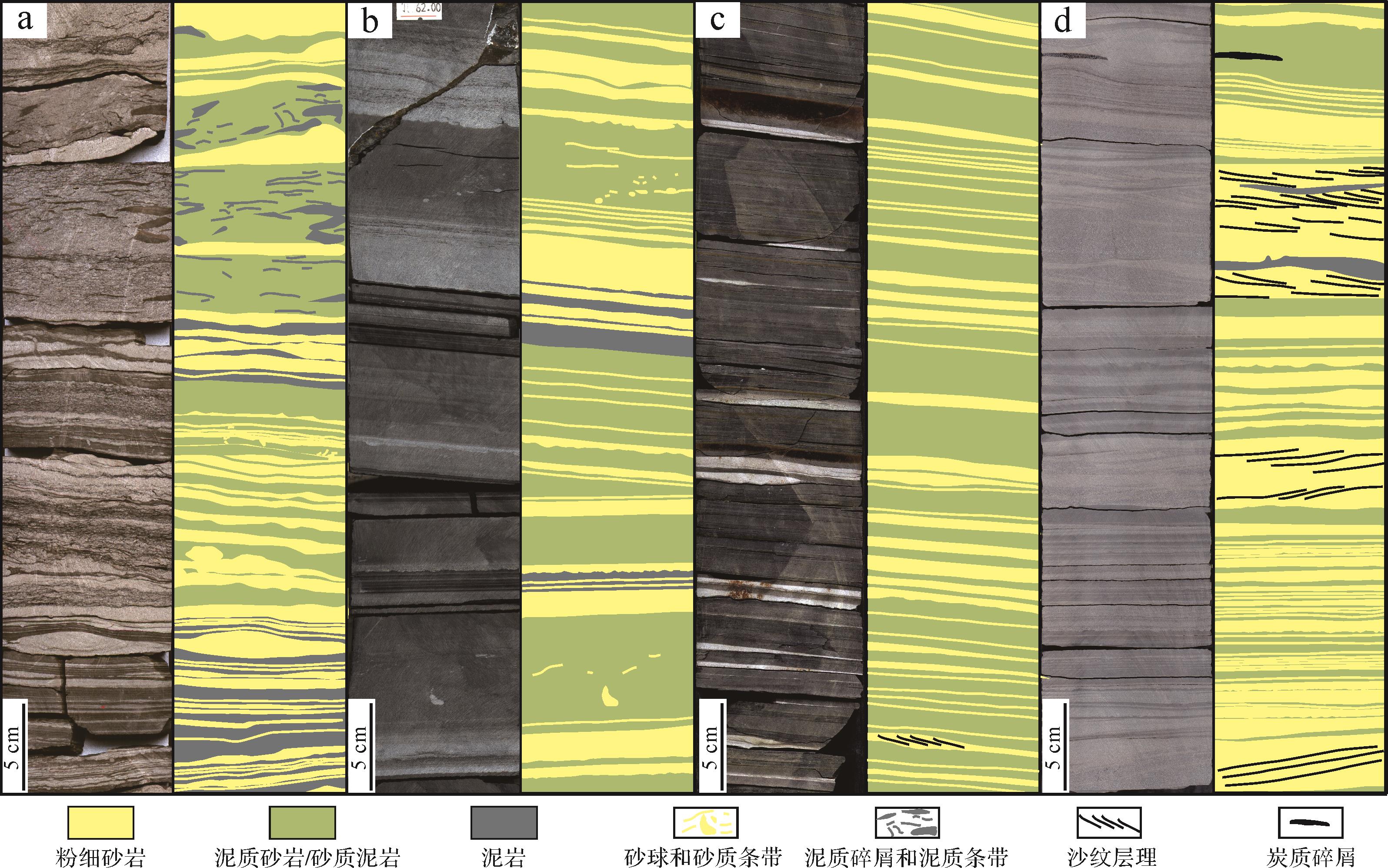
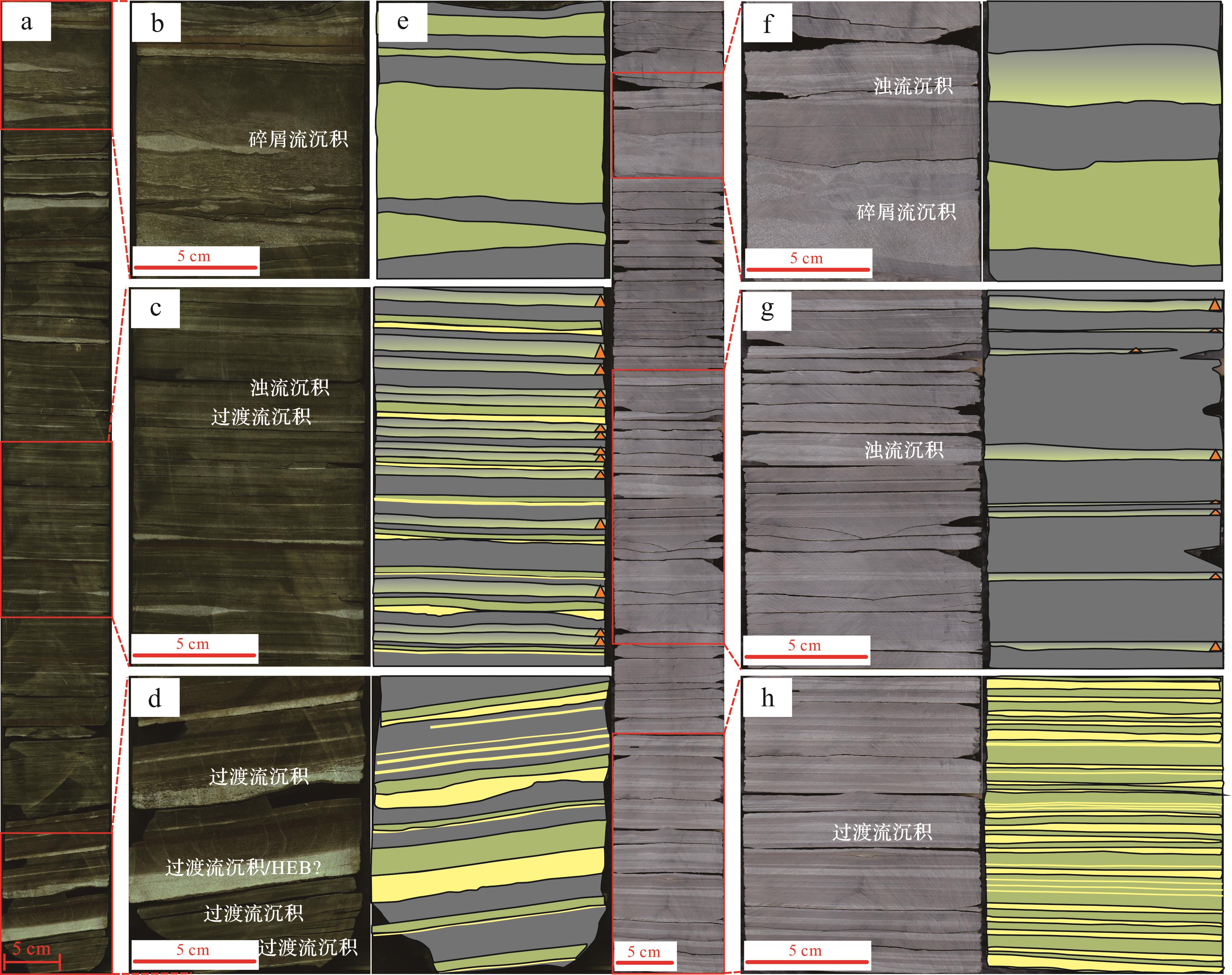
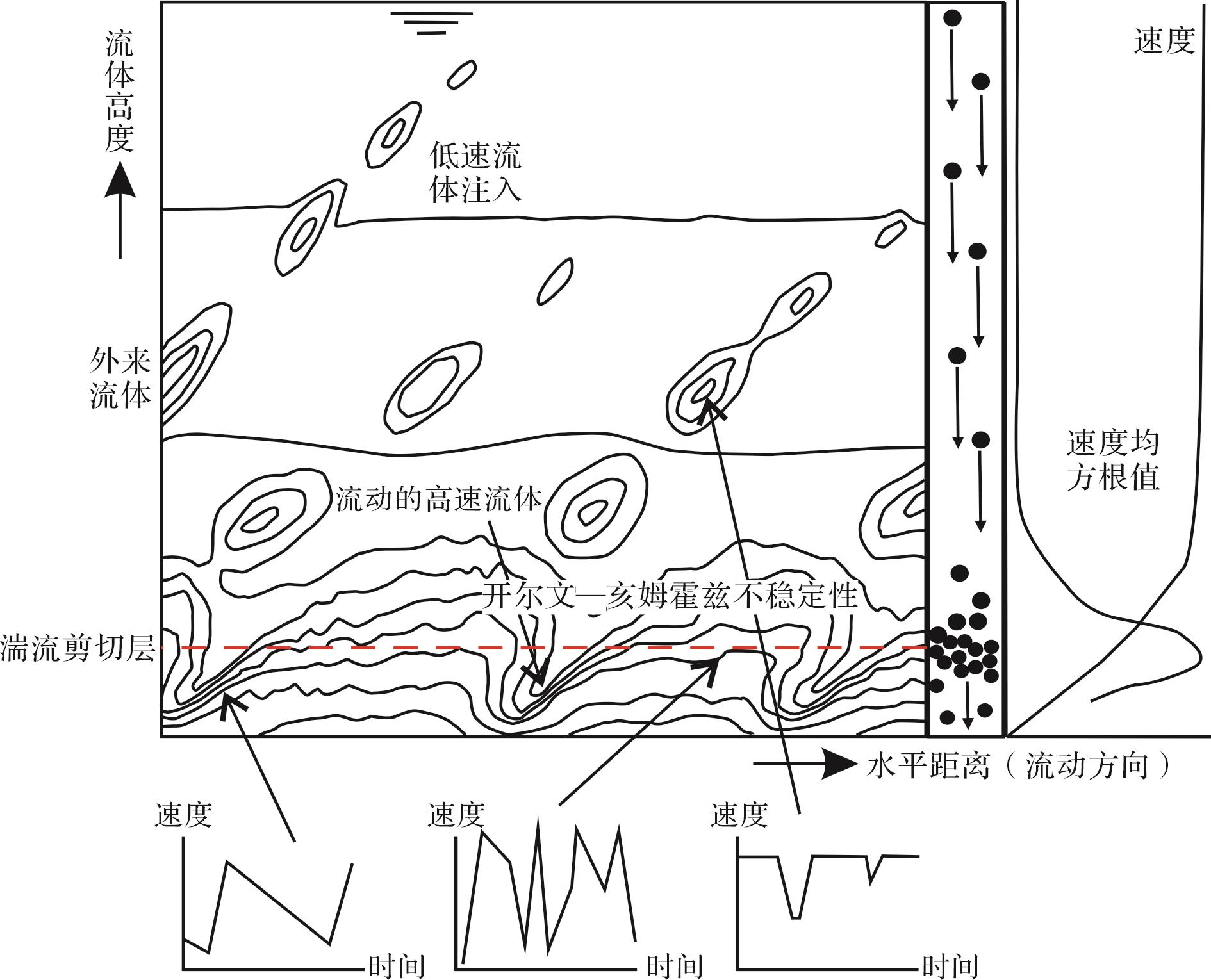
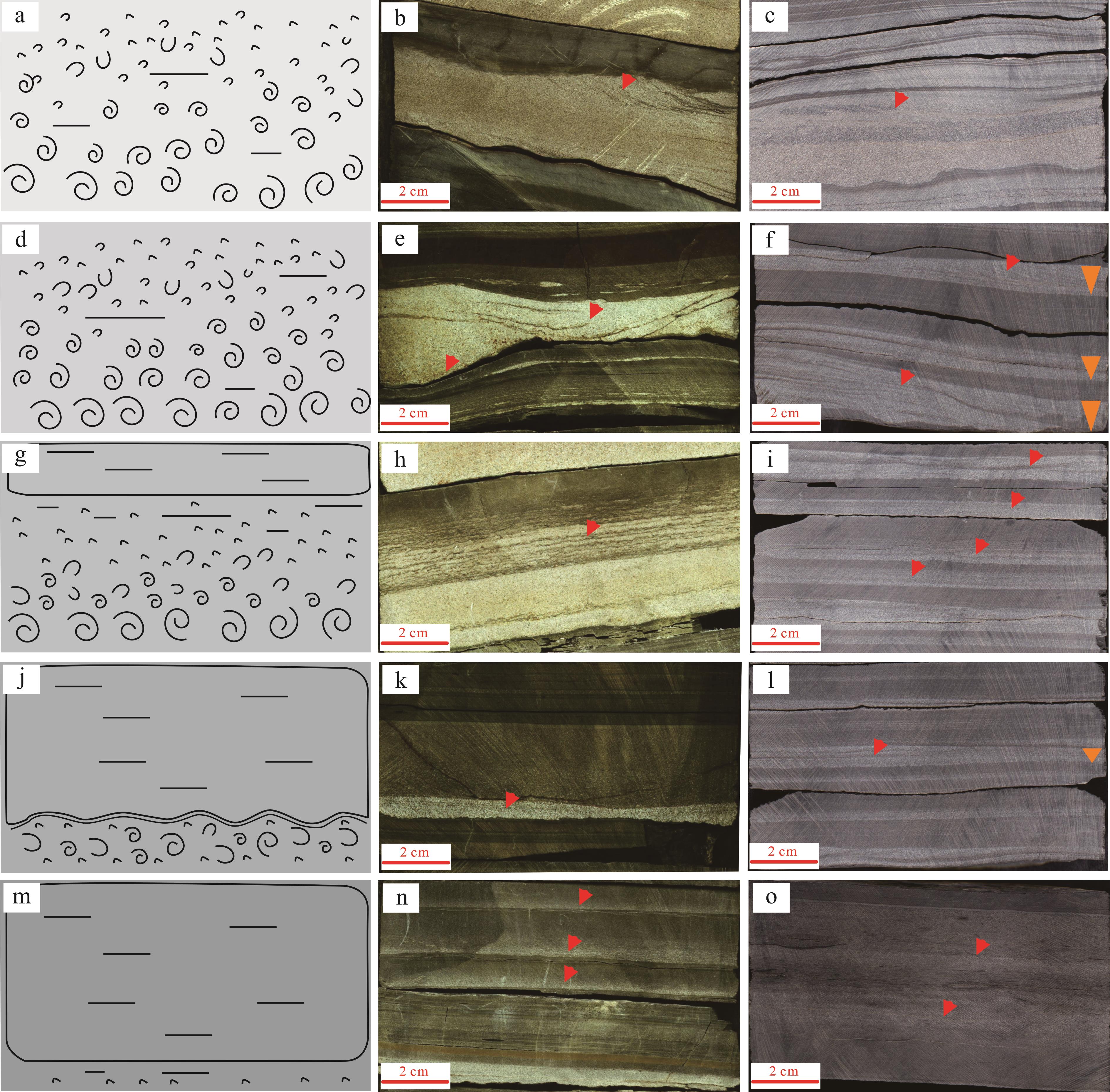
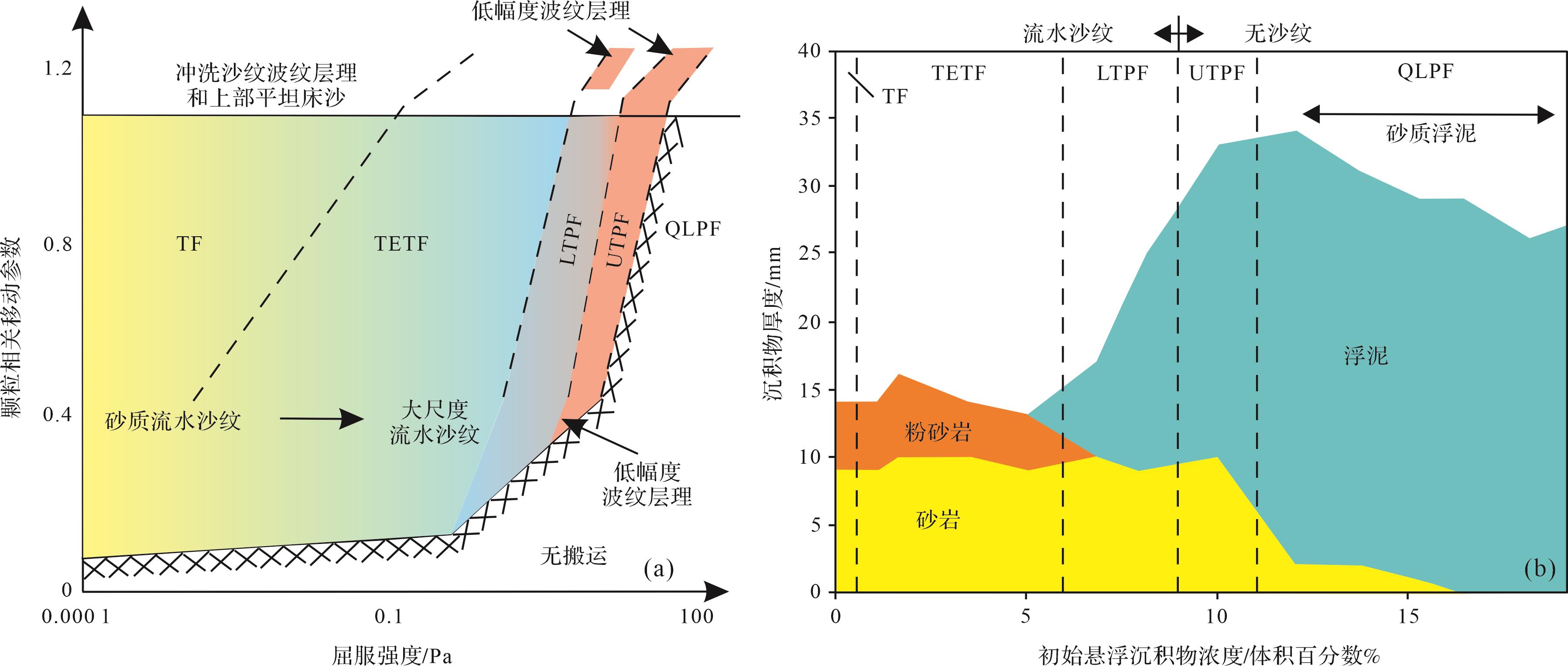
A full understanding of the fine-grained sediment depositional process in transitional flow between turbidity current and muddy debris flow in a deep-water environment is highly significant for unconventional oil and gas exploration. Three types of transitional gravity flow occur in lacustrine basins: turbulence-enhanced transitional flow, lower transitional plug flow, and upper transitional plug flow. Turbulence-enhanced transitional flow deposits are dominated by upward coarse-grading pattern sandstone with evidence of large current ripples. Lower transitional plug flow deposits have bipartite structures with upper and low divisions of equal thickness, mostly with a thin layer of sandy or argillaceous light or dark band between the upper and lower divisions. Upper transitional plug flow deposits are mainly argillaceous deposits, with thin lower inversely graded sandstone beds, showing evidence of low-amplitude bed-waves. The formation mechanisms of transitional flow in lacustrine basins include lateral transport evolution and vertical differentiation settling. The former is found adjacent to relatively coarse-grained sand deposits. The expansion of late-stage low-density turbidity current caused by deceleration is attributed to the transformation of turbulence-enhanced transitional flow and lower transitional plug flow. The lower sandstone unit of these deposits is thicker than the upper argillaceous unit. The latter is mainly developed in distal areas, caused either by the upper transitional plug flow formed by late-stage bottom shear of muddy debris flow, or by the rearrangement of detrital grains after the muddy debris flow has stopped. The thickness of the sandy sediment unit in the lower part is less than in the upper argillaceous sedimentary unit in these flow deposits. The banded structures of interbedded light sandstone and dark argillaceous sediment in fine-grained deep-water gravity-flow deposits are influenced both by external factors and internal sedimentary differentiation. The interpretation of the depositional process of these fine-grained sediments is important for reconstructing the depositional paleoenvironment. The transitional flow area in a lacustrine basin may favor organic matter accumulation and potential shale oil and gas “sweet spots”.
A full understanding of the fine-grained sediment depositional process in transitional flow between turbidity current and muddy debris flow in a deep-water environment is highly significant for unconventional oil and gas exploration. Three types of transitional gravity flow occur in lacustrine basins: turbulence-enhanced transitional flow, lower transitional plug flow, and upper transitional plug flow. Turbulence-enhanced transitional flow deposits are dominated by upward coarse-grading pattern sandstone with evidence of large current ripples. Lower transitional plug flow deposits have bipartite structures with upper and low divisions of equal thickness, mostly with a thin layer of sandy or argillaceous light or dark band between the upper and lower divisions. Upper transitional plug flow deposits are mainly argillaceous deposits, with thin lower inversely graded sandstone beds, showing evidence of low-amplitude bed-waves. The formation mechanisms of transitional flow in lacustrine basins include lateral transport evolution and vertical differentiation settling. The former is found adjacent to relatively coarse-grained sand deposits. The expansion of late-stage low-density turbidity current caused by deceleration is attributed to the transformation of turbulence-enhanced transitional flow and lower transitional plug flow. The lower sandstone unit of these deposits is thicker than the upper argillaceous unit. The latter is mainly developed in distal areas, caused either by the upper transitional plug flow formed by late-stage bottom shear of muddy debris flow, or by the rearrangement of detrital grains after the muddy debris flow has stopped. The thickness of the sandy sediment unit in the lower part is less than in the upper argillaceous sedimentary unit in these flow deposits. The banded structures of interbedded light sandstone and dark argillaceous sediment in fine-grained deep-water gravity-flow deposits are influenced both by external factors and internal sedimentary differentiation. The interpretation of the depositional process of these fine-grained sediments is important for reconstructing the depositional paleoenvironment. The transitional flow area in a lacustrine basin may favor organic matter accumulation and potential shale oil and gas “sweet spots”.

2023, 41(5): 1311-1328.
doi: 10.14027/j.issn.1000-0550.2022.125
Abstract:
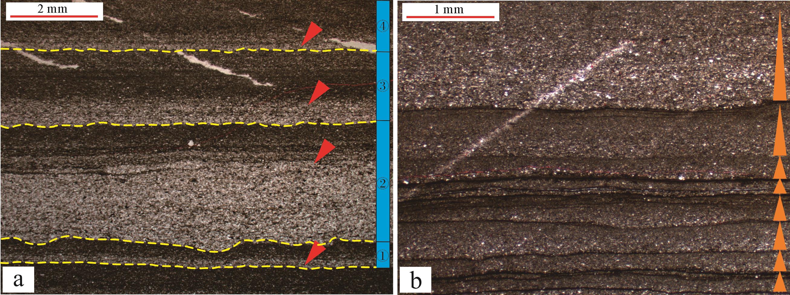
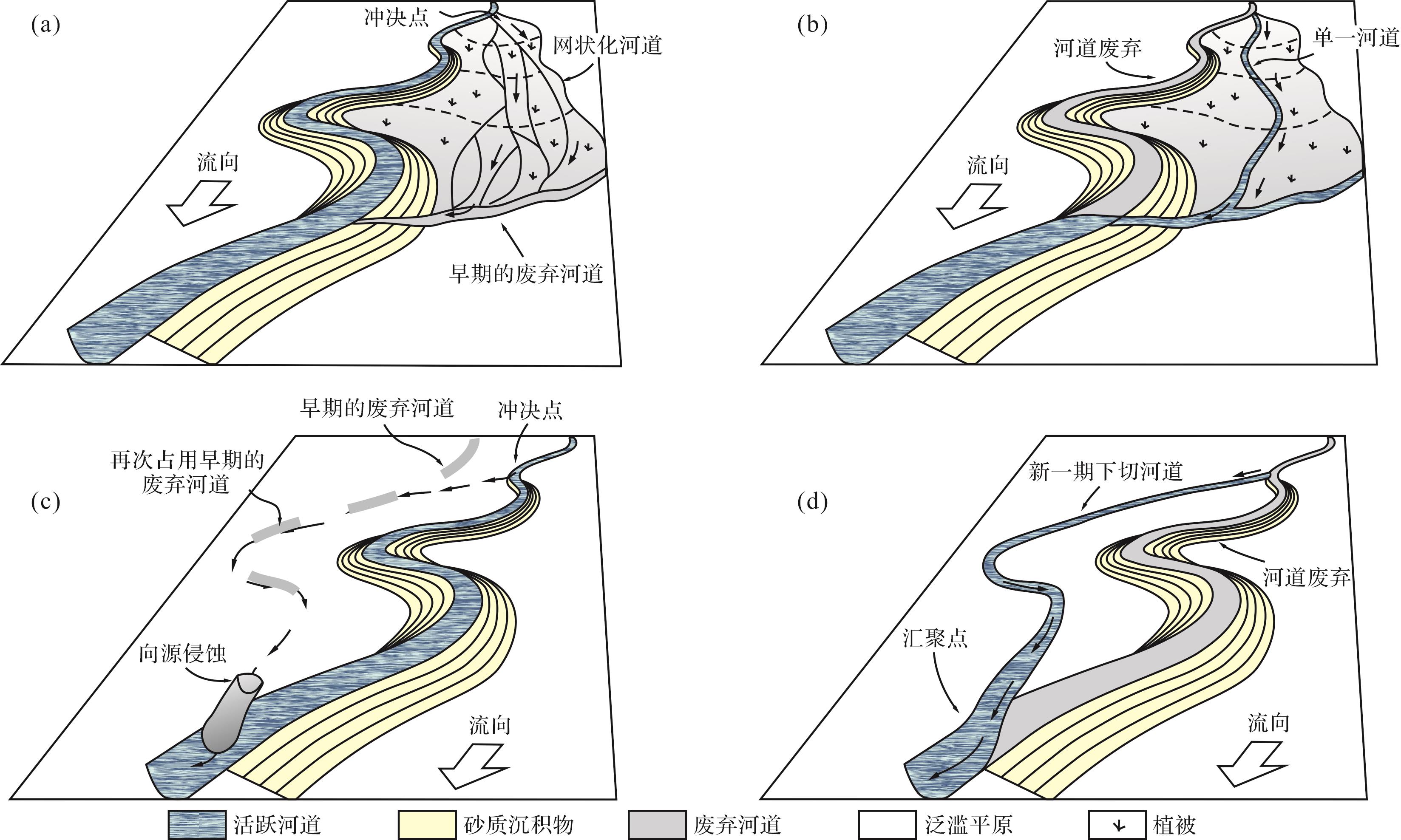
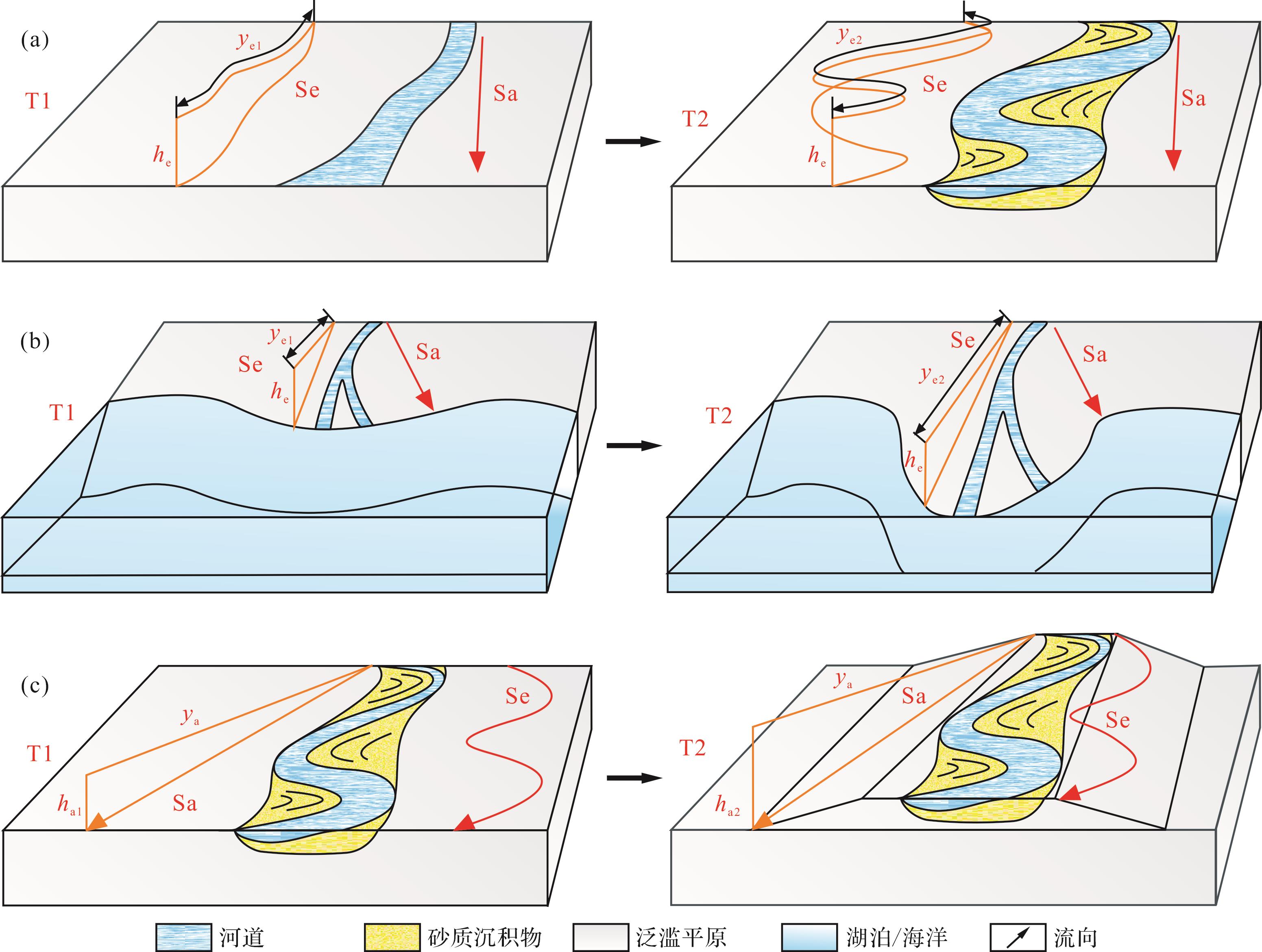
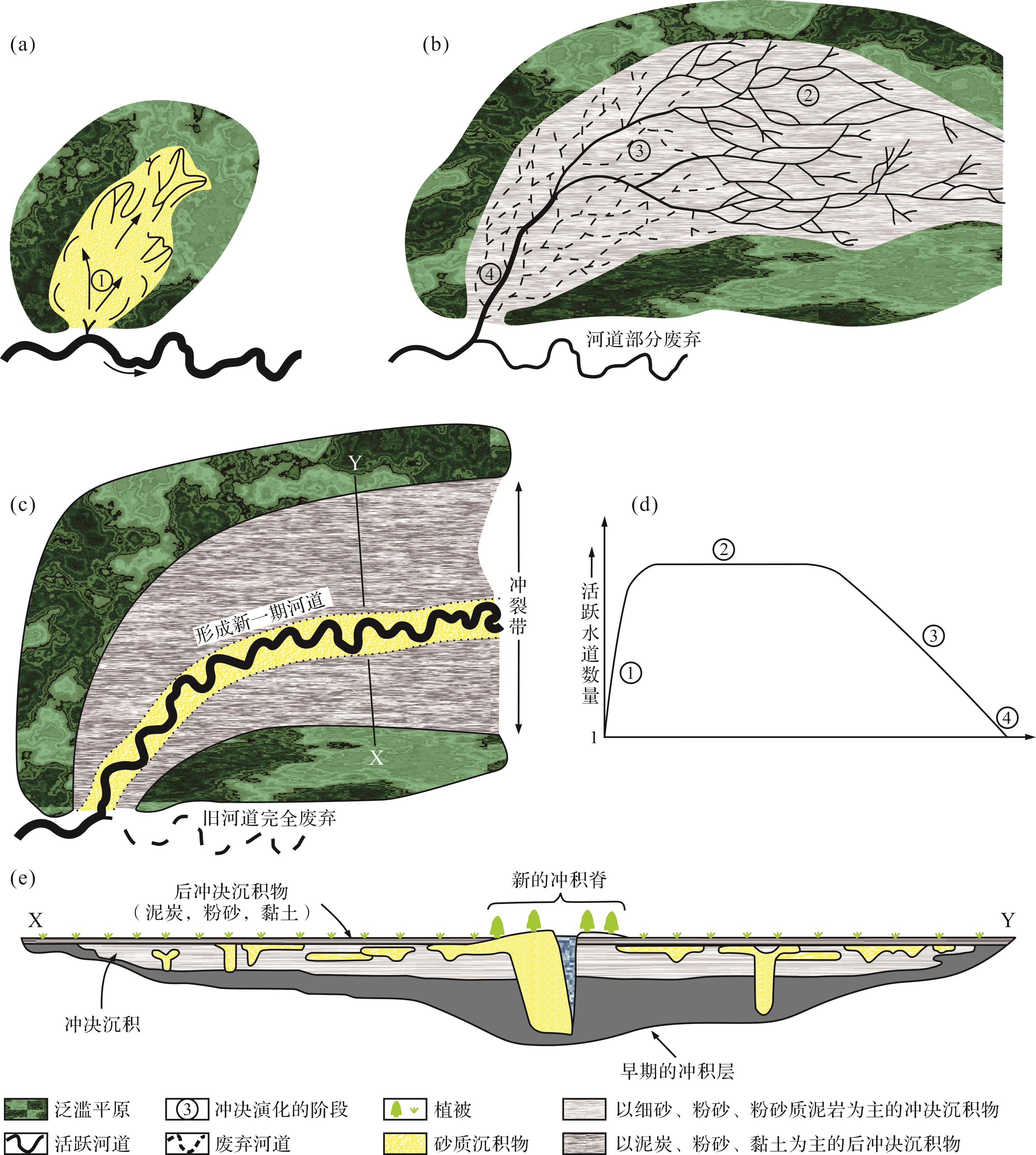
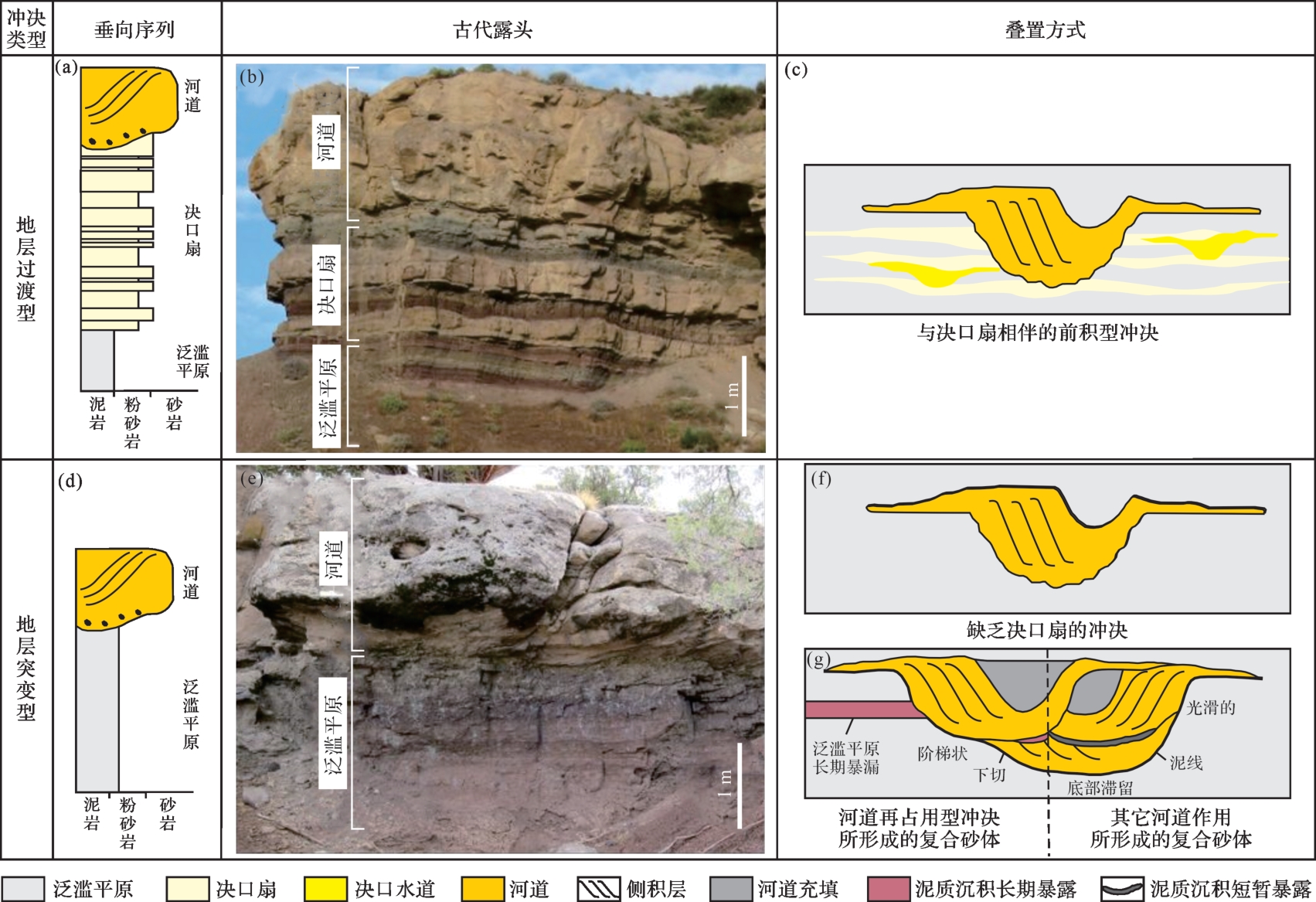
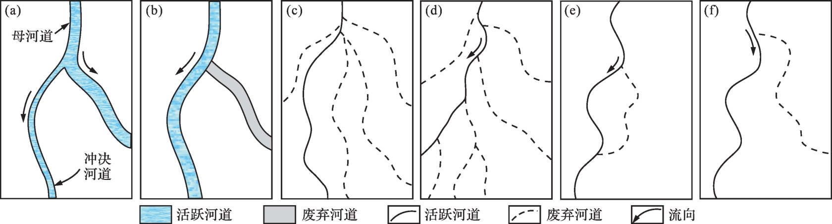
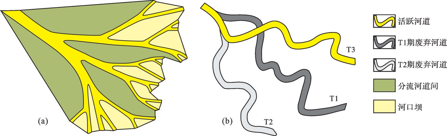
Studies on avulsion have been conducted in geology, geomorphology, hydrology and other fields, but it has not received sufficient attention from domestic sedimentologists. Based on the sorting of relevant controversial issues, the key issues concerning the concept, genesis, evolution, identification, and application of avulsion are reviewed and discussed. The main results include :(1) the concept of avulsion, the similarities and differences between avulsion, crevasse splay and diversion, and the narrow definition of avulsion can explain large-scale river diversion. (2) Clear slope ratio is the main control factor of avulsion, and the anti-flood property of natural levees (sandy or muddy) and the geomorphic characteristics of flood plains (surface vegetation, water level, drainage condition, and abandoned river) are the secondary control factors. (3) The evolution model and identification criteria of avulsion are summarized, and a classification suitable for reservoir sedimentology is proposed. Sedimentologists in China should identify different channel types and evolution models by using avulsion accompanied by reoccupation and crevasse-splay deposits to distinguish fluvial evolution or use the models of stratigraphically transitional and abrupt avulsion to distinguish the superposition between channel sand bodies. (4) The application prospect of avulsion in current significant research focuses such as reservoir architecture and river transformation is discussed. The concept of avulsion should be introduced to improve the five-level evolution in reservoir architecture, the establishment of a geological knowledge base of large-scale fluvial system, and the influence of heterocyclic cycles on reservoir architecture. Sedimentary models of intertransformation were proposed between a large single channel and network channel in supplementary fluvial transformation. The review and discussion on avulsion not only enriches the current domestic theory of fluvial facies deposition, but also provides a more scientific basis for reservoir sedimentologists to restore the evolution mode of ancient channels and establish more accurate geological models.
Studies on avulsion have been conducted in geology, geomorphology, hydrology and other fields, but it has not received sufficient attention from domestic sedimentologists. Based on the sorting of relevant controversial issues, the key issues concerning the concept, genesis, evolution, identification, and application of avulsion are reviewed and discussed. The main results include :(1) the concept of avulsion, the similarities and differences between avulsion, crevasse splay and diversion, and the narrow definition of avulsion can explain large-scale river diversion. (2) Clear slope ratio is the main control factor of avulsion, and the anti-flood property of natural levees (sandy or muddy) and the geomorphic characteristics of flood plains (surface vegetation, water level, drainage condition, and abandoned river) are the secondary control factors. (3) The evolution model and identification criteria of avulsion are summarized, and a classification suitable for reservoir sedimentology is proposed. Sedimentologists in China should identify different channel types and evolution models by using avulsion accompanied by reoccupation and crevasse-splay deposits to distinguish fluvial evolution or use the models of stratigraphically transitional and abrupt avulsion to distinguish the superposition between channel sand bodies. (4) The application prospect of avulsion in current significant research focuses such as reservoir architecture and river transformation is discussed. The concept of avulsion should be introduced to improve the five-level evolution in reservoir architecture, the establishment of a geological knowledge base of large-scale fluvial system, and the influence of heterocyclic cycles on reservoir architecture. Sedimentary models of intertransformation were proposed between a large single channel and network channel in supplementary fluvial transformation. The review and discussion on avulsion not only enriches the current domestic theory of fluvial facies deposition, but also provides a more scientific basis for reservoir sedimentologists to restore the evolution mode of ancient channels and establish more accurate geological models.

2023, 41(5): 1329-1339.
doi: 10.14027/j.issn.1000-0550.2022.161
Abstract:
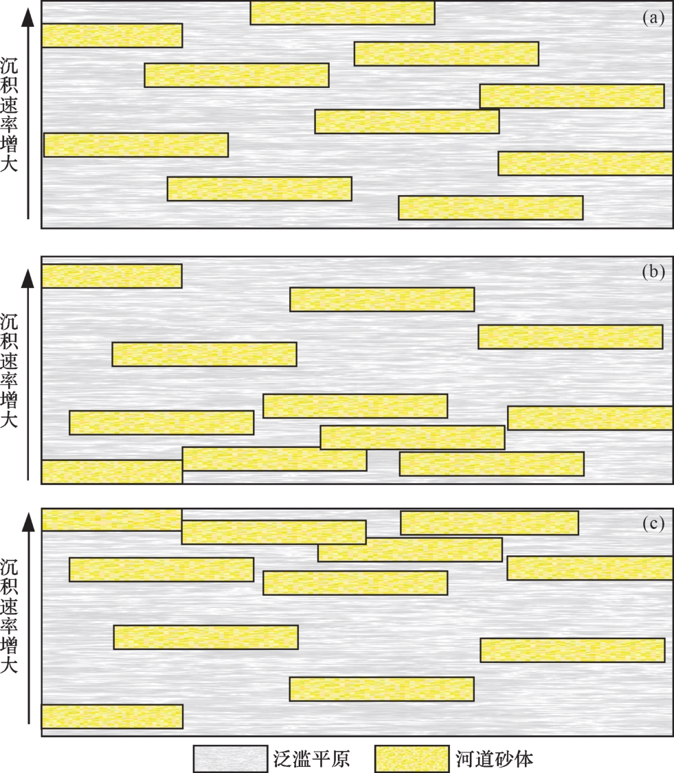
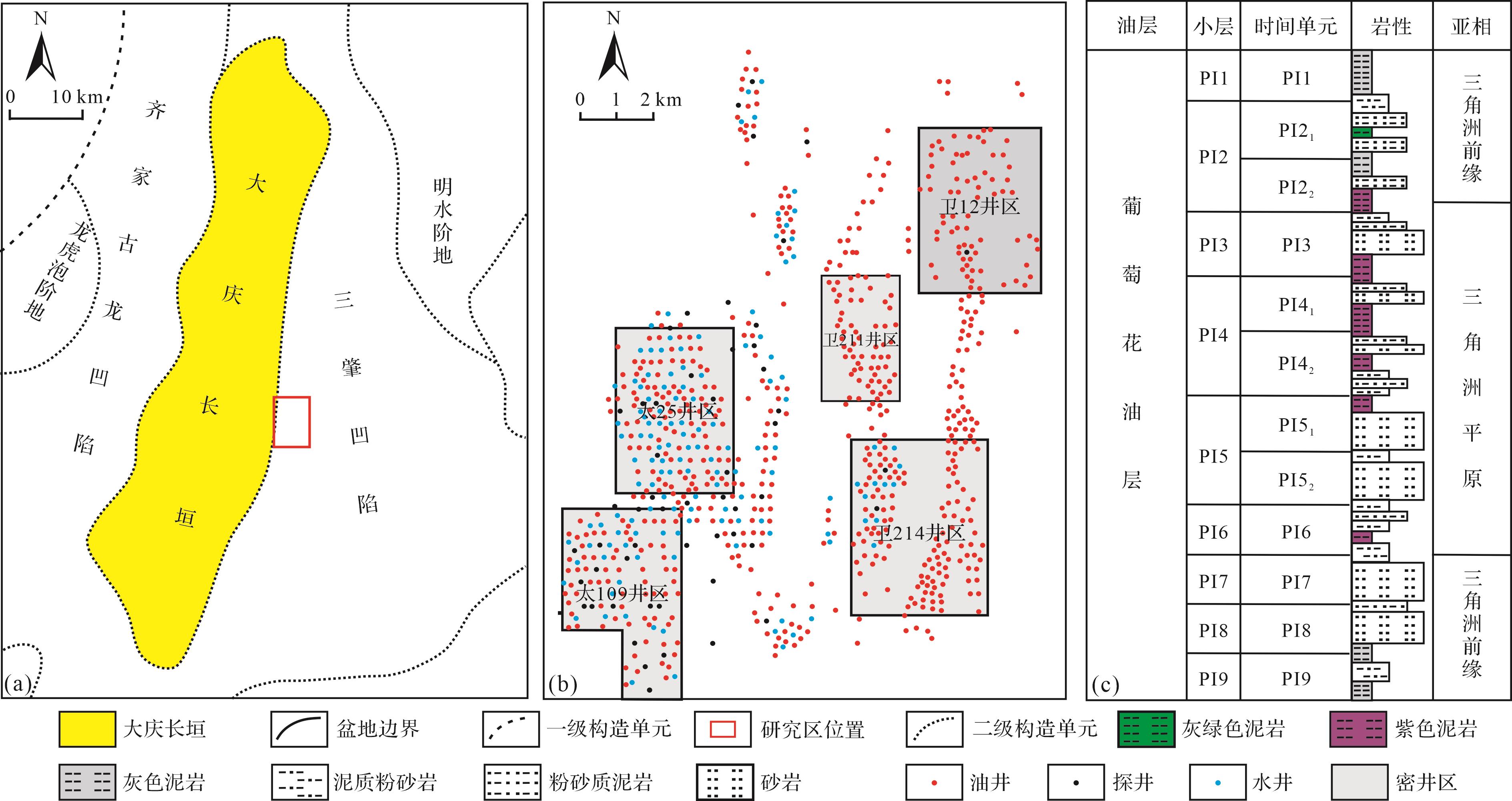
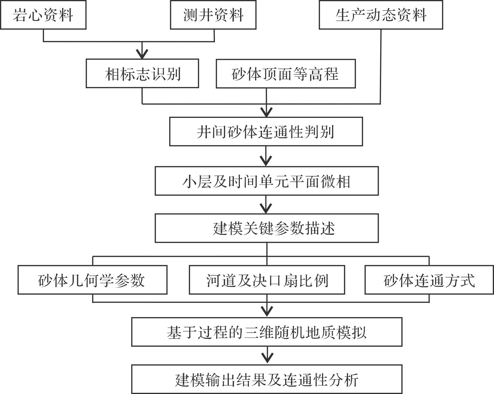
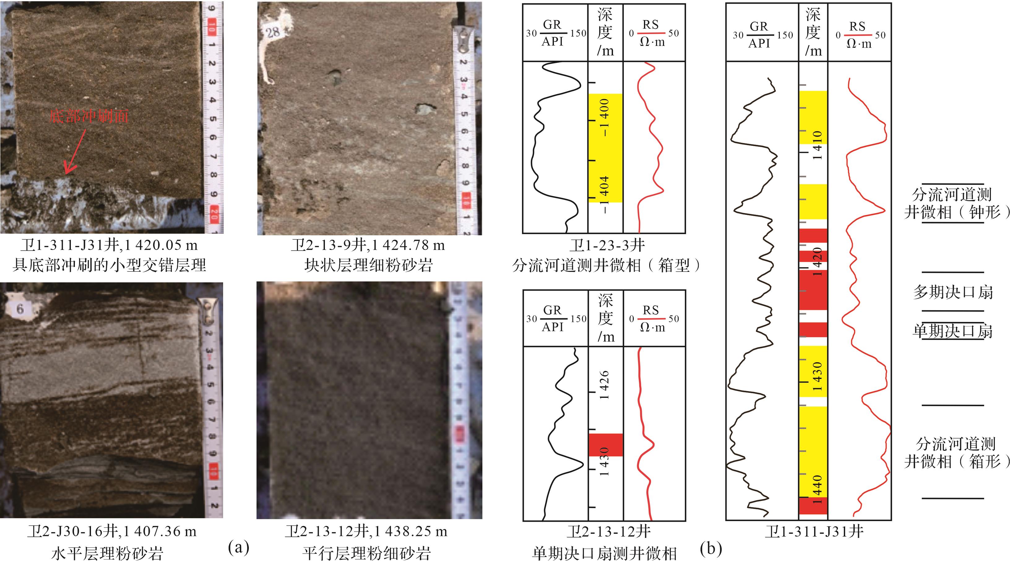
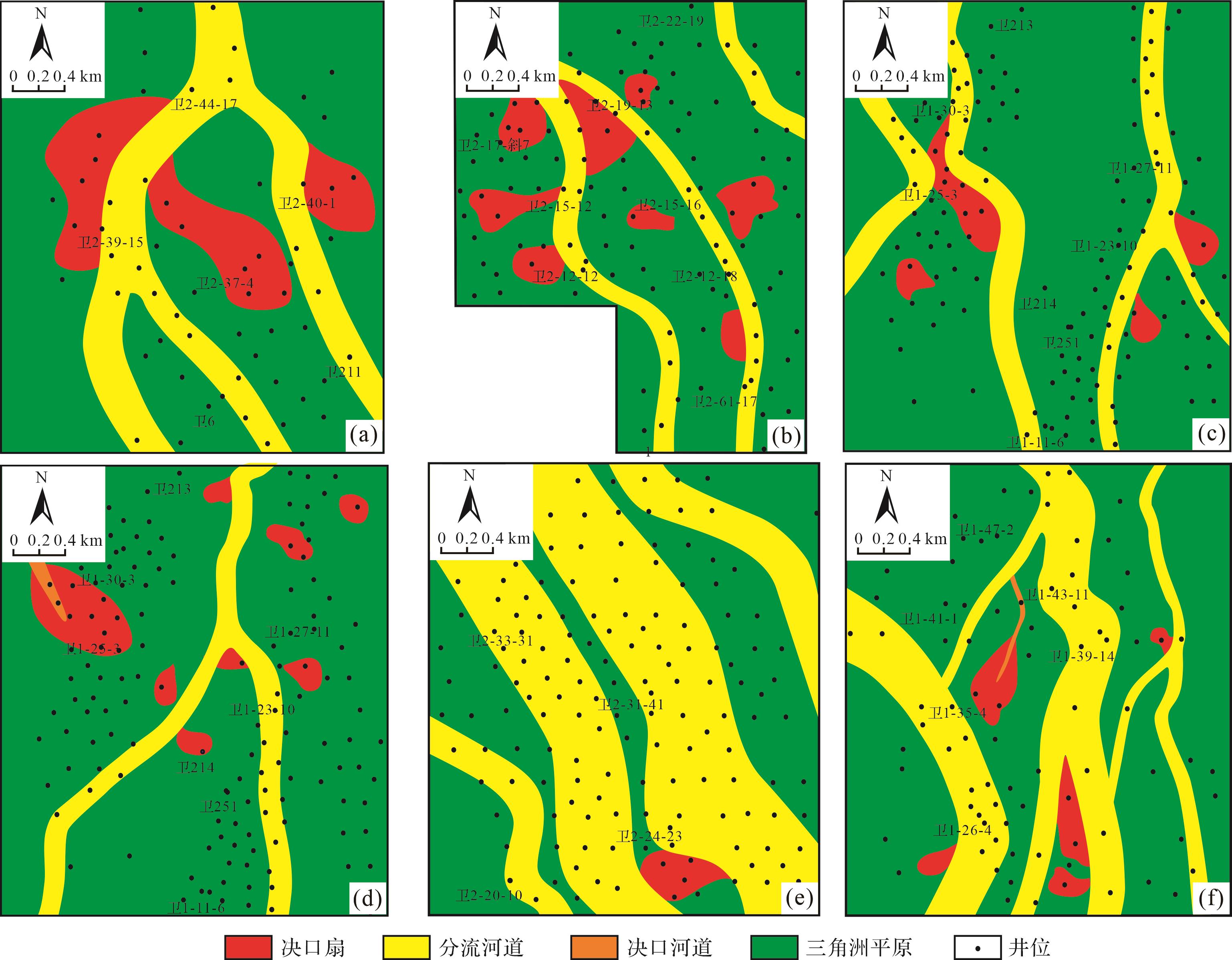
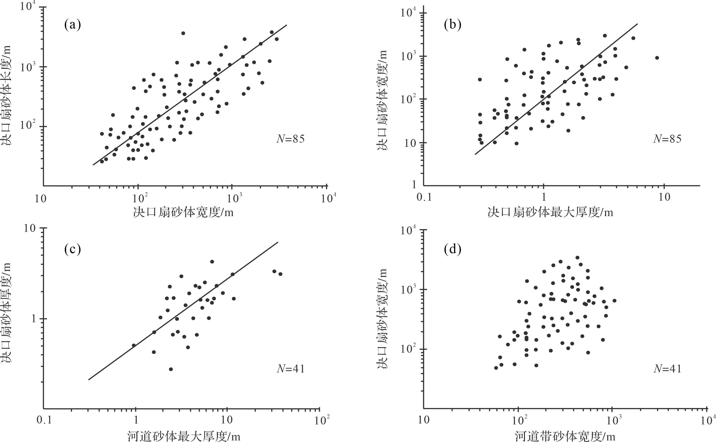
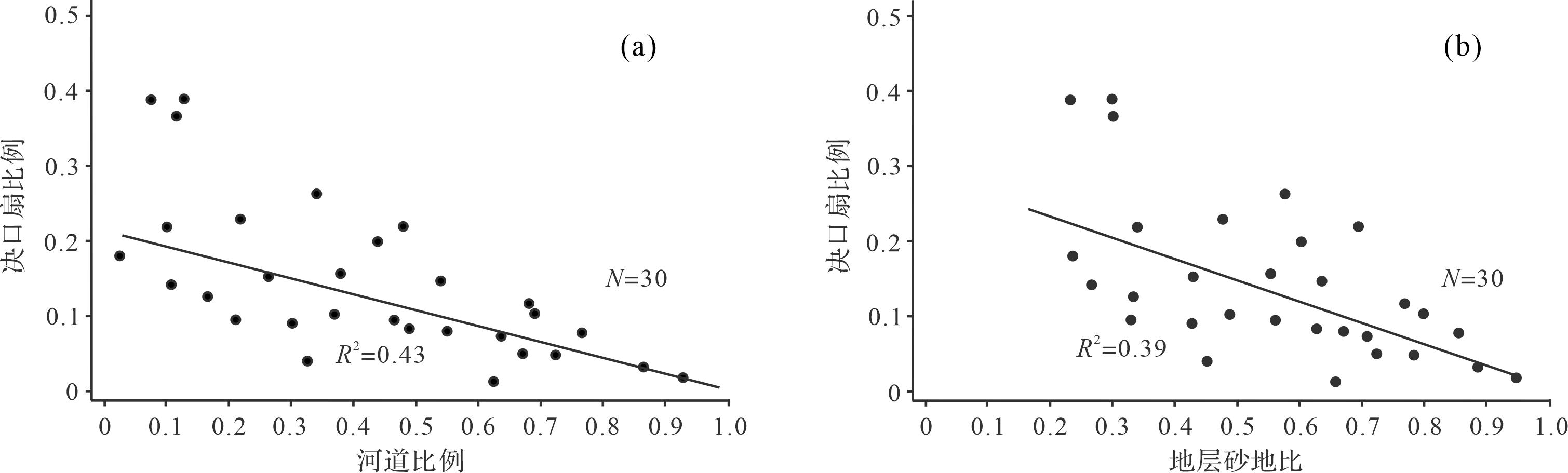
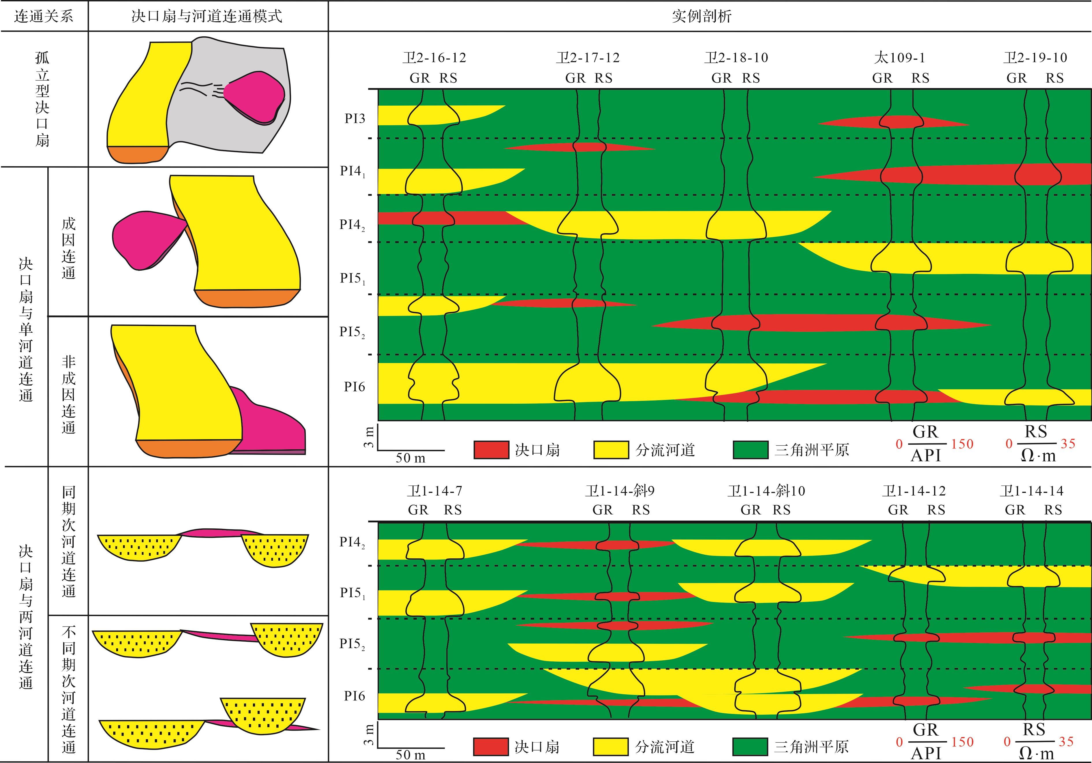
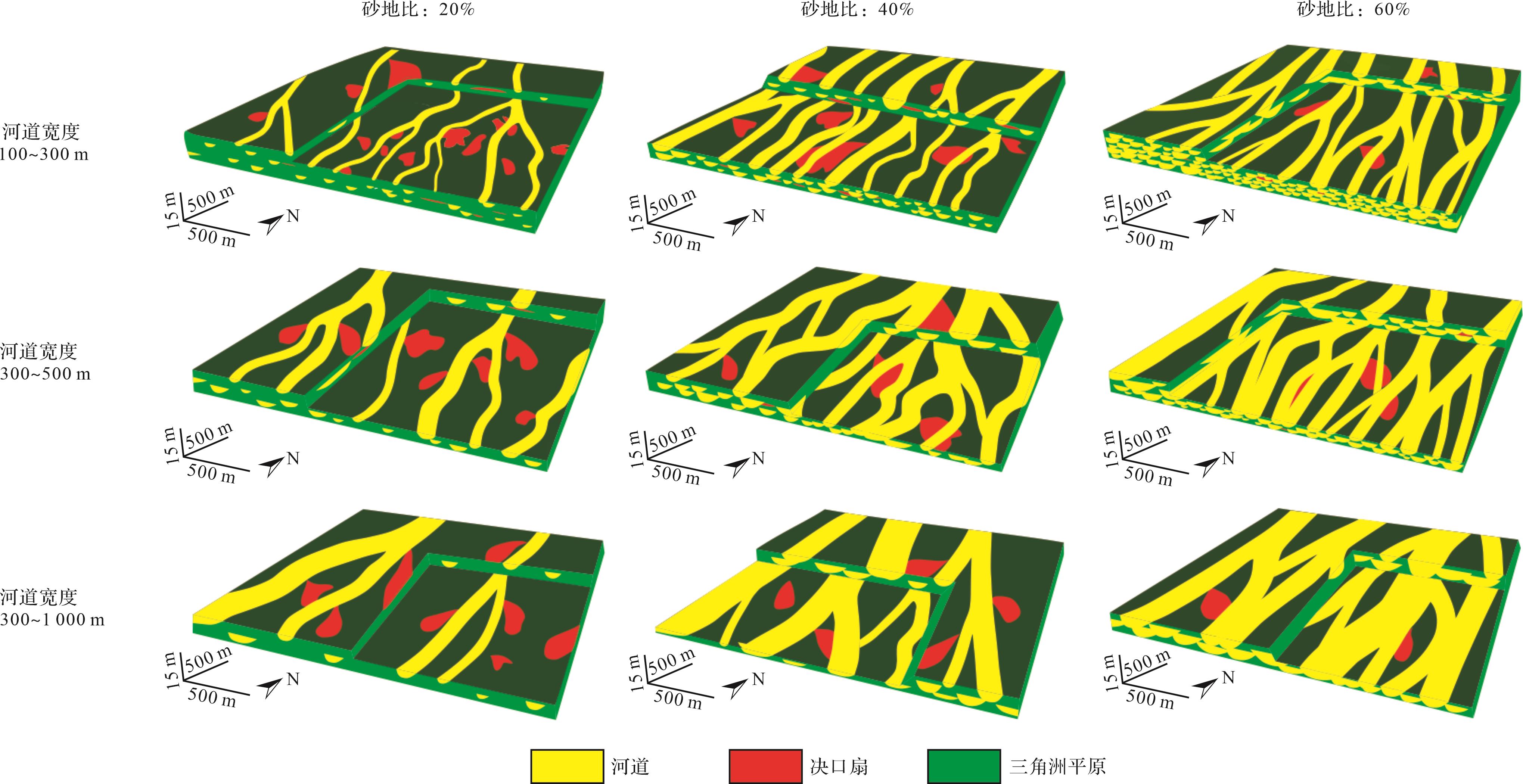
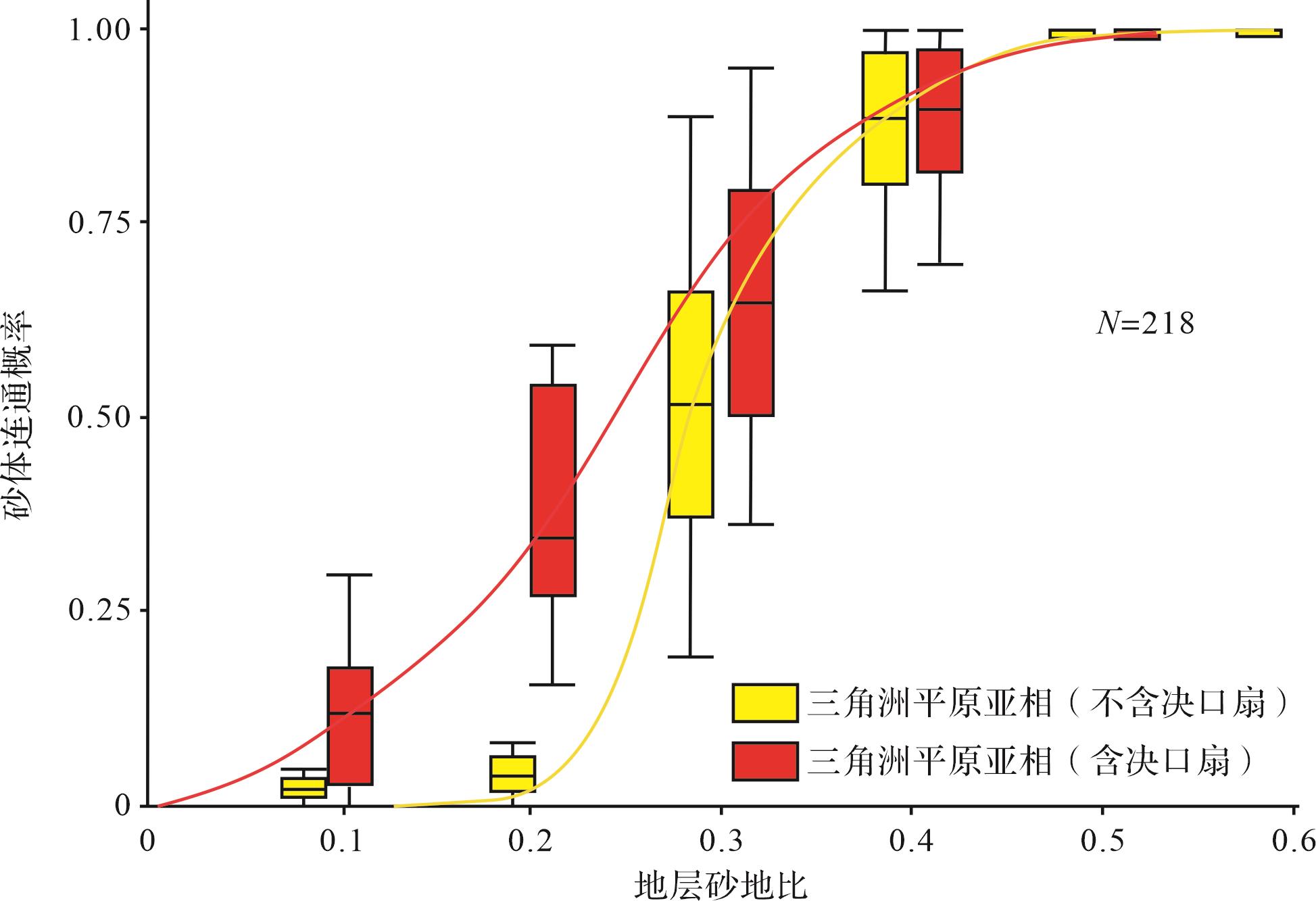
Crevasse splay deposits are an important component of river delta depositional systems, which is conducive to the enrichment of remaining oil and gas. However, the study on the way and extent of crevasse splay deposition connecting distributary channel sand bodies in the delta plain subfacies is relatively weak at present. Therefore, the purpose of this study was to determine the quantitative impact of crevasse splay deposits on the connectivity of sand body in delta plain subfacies. To determine the influence of crevasse splay sedimentation on the connectivity of sand body in delta plain subfacies, the Putaohua oil layer of the Lower Cretaceous Yaojia Formation in the Weixing oilfield of Songliao Basin is selected as the research object. The core, logging, and production data of 5 exploitation areas of the Putaohua oil layer in the Weixing oilfield were used in our study. At first, the quantitative characterization of the crevasse splay sedimentary structures is carried out, focusing on the identification of sedimentary facies markers, characterization of sand body geometric parameters, an analysis of the sand body drilling ratio, and analysuis of the connection mode of the sand bodies. Based on the results, the connectivity of the delta plain sand body subfacies is quantitatively characterized by 3D random geological modeling technology, and the influence of crevasse splay deposition on the connectivity of sand body in the delta plain subfacies is quantitatively analyzed. The results of the study show that: (1) The lengths of the crevasse splay sand bodies are 50⁃3 000 m, and the widths are 50⁃2 500 m, and the thicknesses are 0.2⁃5.0 m, the length to width of the sand body is about 1.2, and the width to thickness of the sand body is 400⁃600. The ratio of well drilling in crevasse splays is 2%⁃38%, negatively correlated with that in delta distributary channels. (2) The connection mode of sand bodies between crevasse splays and delta distributary channels can be divided into 5 types: the crevasse splay sand body is not connected with the distributary channel, i.e., an isolated crevasse splay; the crevasse splay sand body is connected with a single distributary channel, which is genetically related to the formation of crevasse splay sand body; the crevasse splay sand body is connected with a single distributary channel, which has no genetic relationship with the formation of the crevasse splay sand body; the crevasse splay sand body is connected with two different distributary channel sand bodies, and the two distributary channels belong to the same sedimentary period; and, the crevasse splay sand body is connected with two different distributary channel sand bodies, however, the two distributary channels belong to different sedimentary periods. (3) Crevasse splay sedimentation has an obvious influence on the connectivity of sand bodies in medium and small delta plain subfacies, especially when the net-to-gross ratio of the delta plain subfacies is less than 30%. This study is helpful to the deployment and design of well patterns in the middle and late stages of oil and gas field development, and can effectively guide the efficient extraction of any remaining oil and gas, thus reducing the cost of oil and gas exploration and development.
Crevasse splay deposits are an important component of river delta depositional systems, which is conducive to the enrichment of remaining oil and gas. However, the study on the way and extent of crevasse splay deposition connecting distributary channel sand bodies in the delta plain subfacies is relatively weak at present. Therefore, the purpose of this study was to determine the quantitative impact of crevasse splay deposits on the connectivity of sand body in delta plain subfacies. To determine the influence of crevasse splay sedimentation on the connectivity of sand body in delta plain subfacies, the Putaohua oil layer of the Lower Cretaceous Yaojia Formation in the Weixing oilfield of Songliao Basin is selected as the research object. The core, logging, and production data of 5 exploitation areas of the Putaohua oil layer in the Weixing oilfield were used in our study. At first, the quantitative characterization of the crevasse splay sedimentary structures is carried out, focusing on the identification of sedimentary facies markers, characterization of sand body geometric parameters, an analysis of the sand body drilling ratio, and analysuis of the connection mode of the sand bodies. Based on the results, the connectivity of the delta plain sand body subfacies is quantitatively characterized by 3D random geological modeling technology, and the influence of crevasse splay deposition on the connectivity of sand body in the delta plain subfacies is quantitatively analyzed. The results of the study show that: (1) The lengths of the crevasse splay sand bodies are 50⁃3 000 m, and the widths are 50⁃2 500 m, and the thicknesses are 0.2⁃5.0 m, the length to width of the sand body is about 1.2, and the width to thickness of the sand body is 400⁃600. The ratio of well drilling in crevasse splays is 2%⁃38%, negatively correlated with that in delta distributary channels. (2) The connection mode of sand bodies between crevasse splays and delta distributary channels can be divided into 5 types: the crevasse splay sand body is not connected with the distributary channel, i.e., an isolated crevasse splay; the crevasse splay sand body is connected with a single distributary channel, which is genetically related to the formation of crevasse splay sand body; the crevasse splay sand body is connected with a single distributary channel, which has no genetic relationship with the formation of the crevasse splay sand body; the crevasse splay sand body is connected with two different distributary channel sand bodies, and the two distributary channels belong to the same sedimentary period; and, the crevasse splay sand body is connected with two different distributary channel sand bodies, however, the two distributary channels belong to different sedimentary periods. (3) Crevasse splay sedimentation has an obvious influence on the connectivity of sand bodies in medium and small delta plain subfacies, especially when the net-to-gross ratio of the delta plain subfacies is less than 30%. This study is helpful to the deployment and design of well patterns in the middle and late stages of oil and gas field development, and can effectively guide the efficient extraction of any remaining oil and gas, thus reducing the cost of oil and gas exploration and development.
2023, 41(5): 1340-1353.
doi: 10.14027/j.issn.1000-0550.2022.138
Abstract:
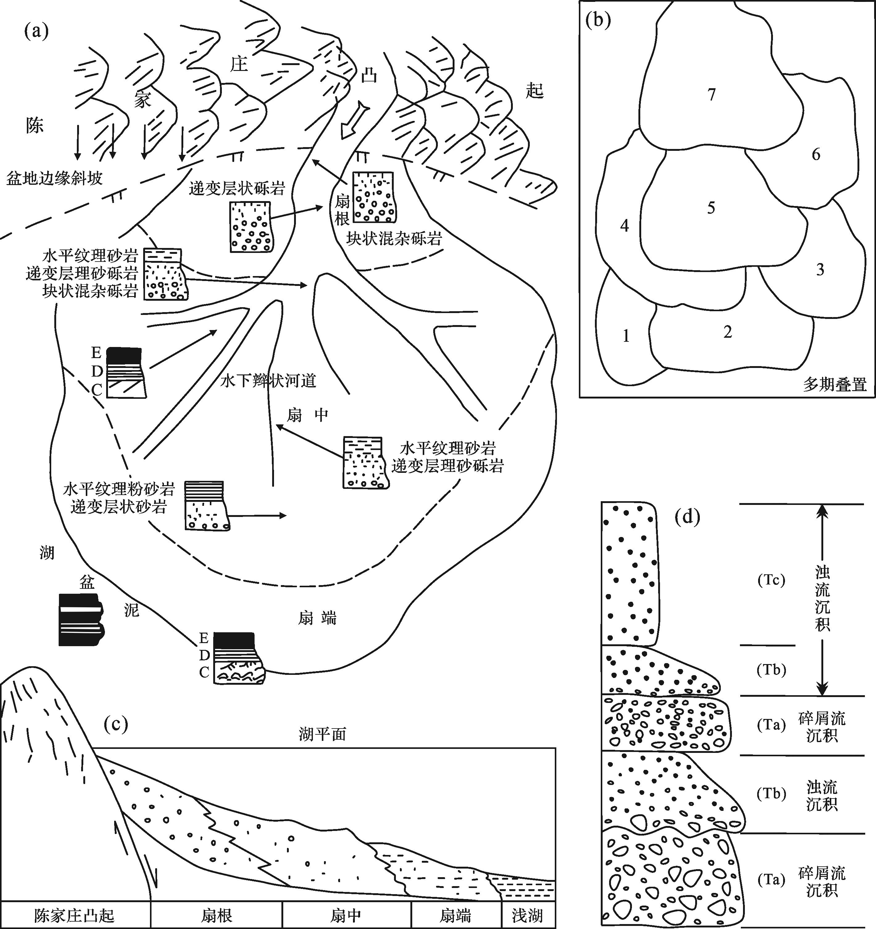
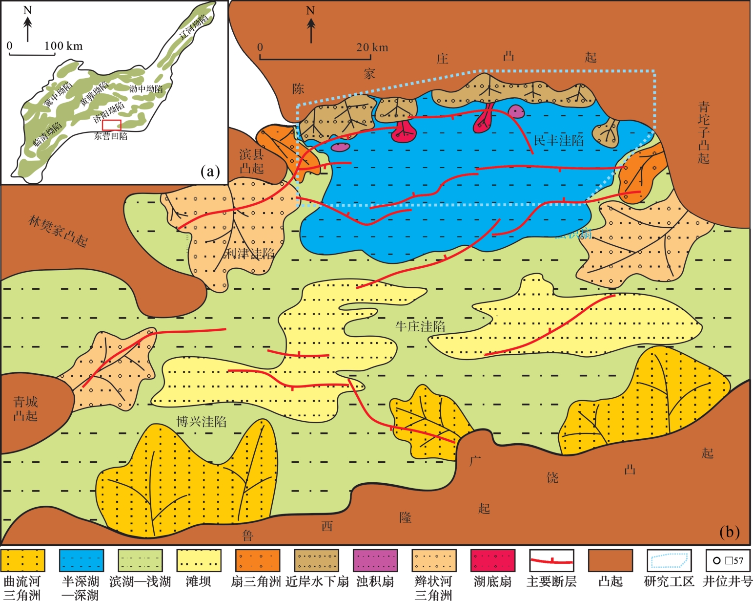
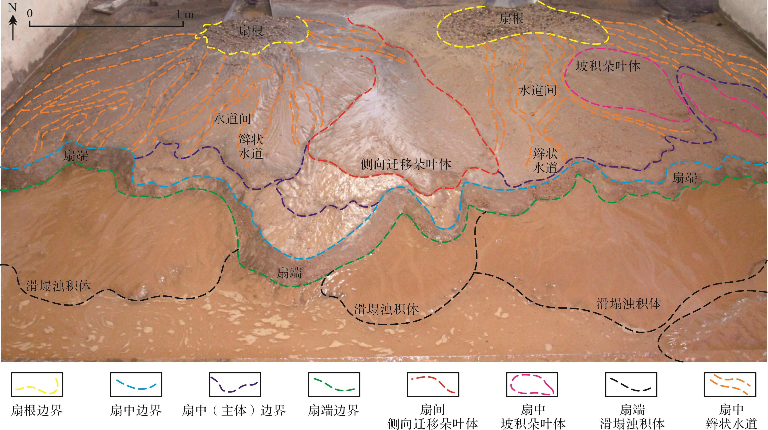
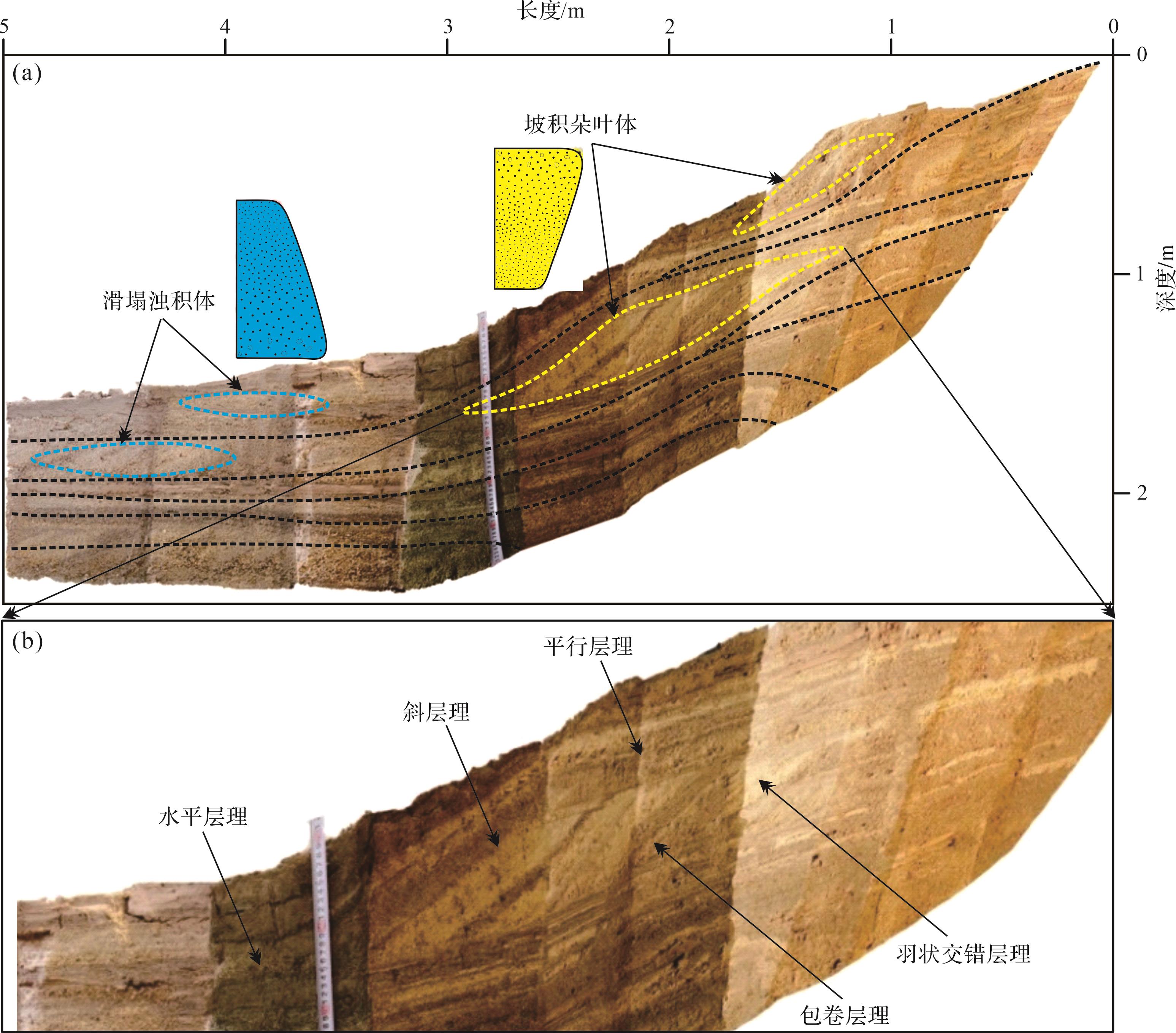
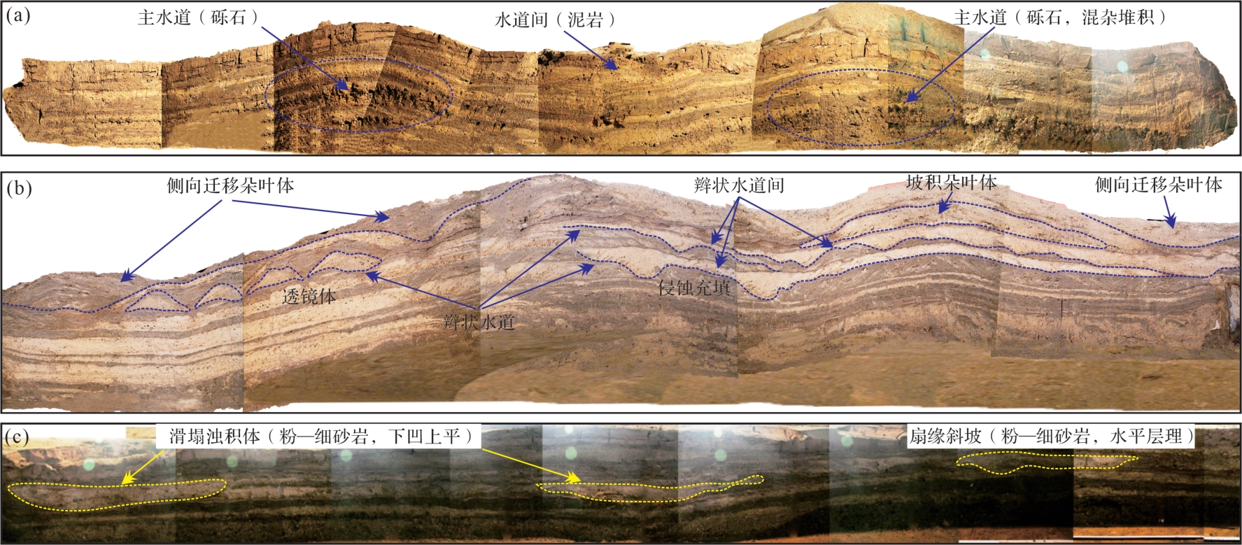
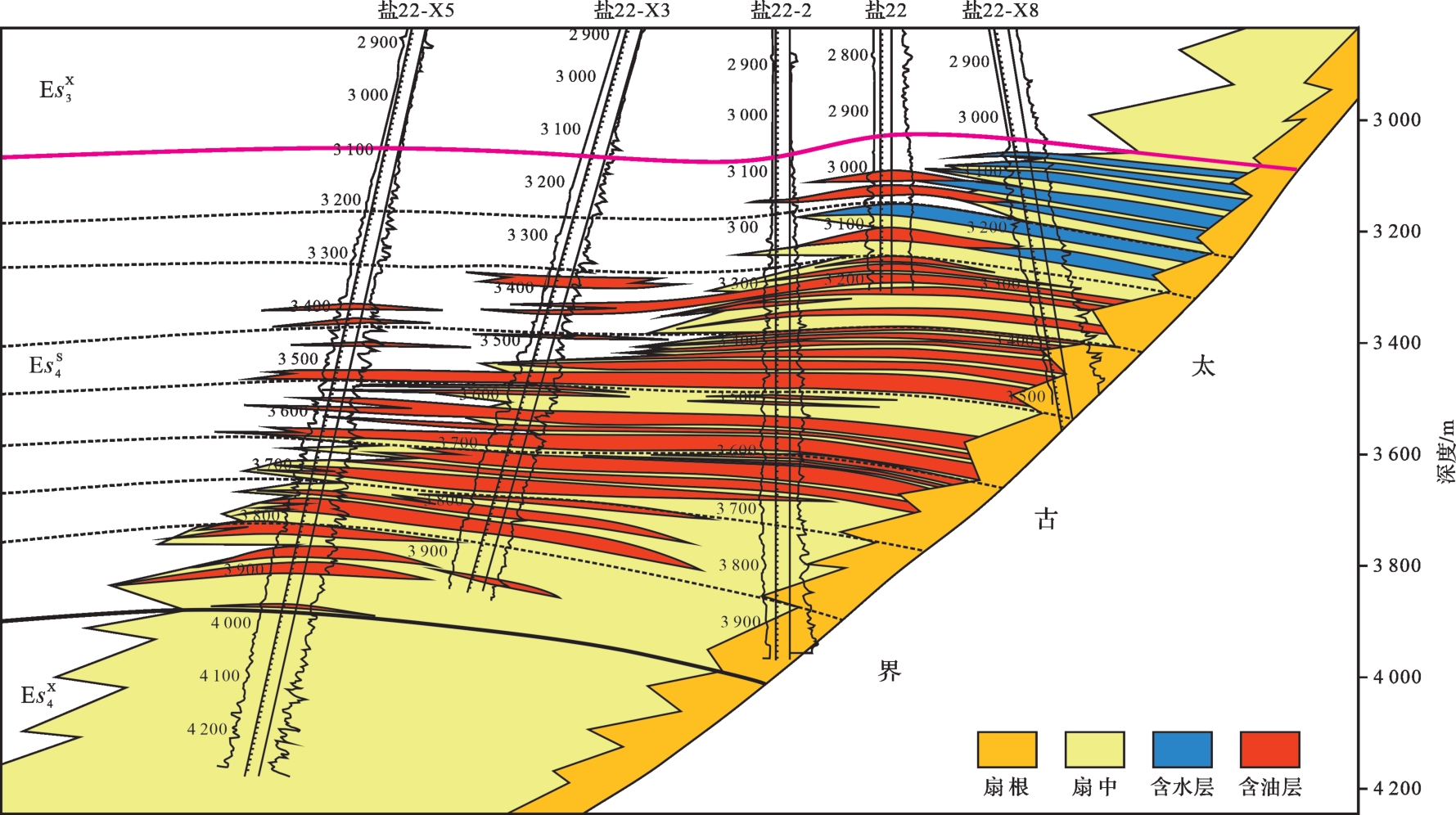
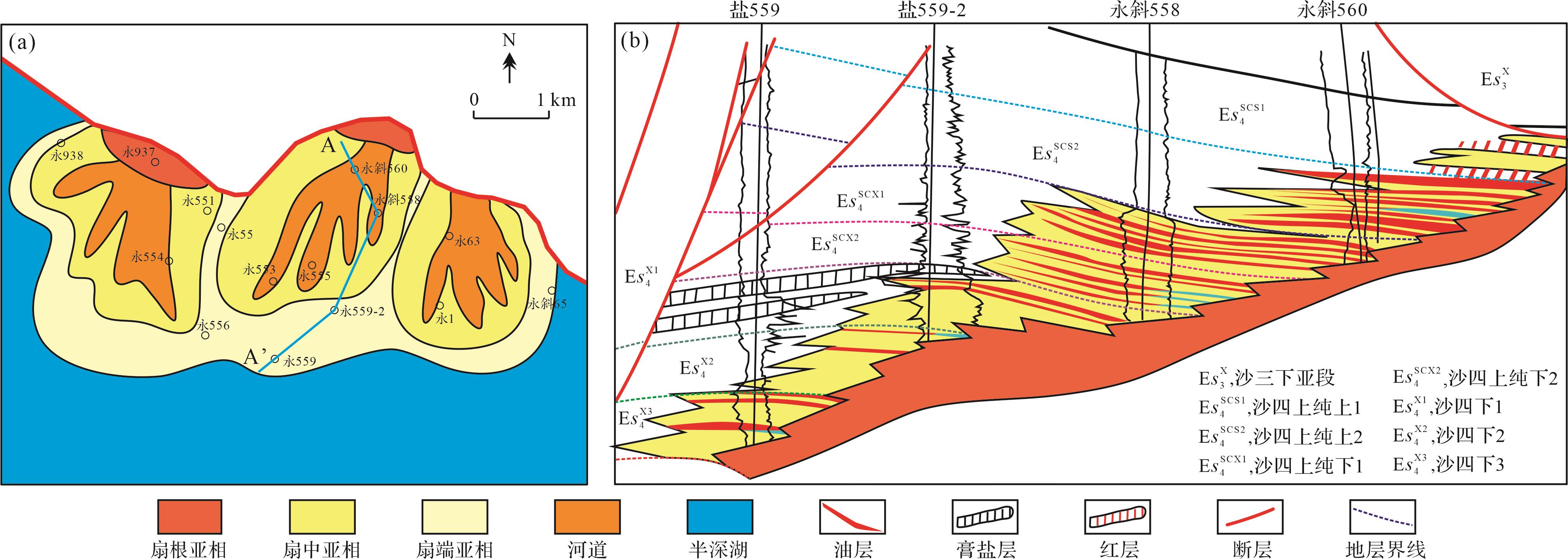
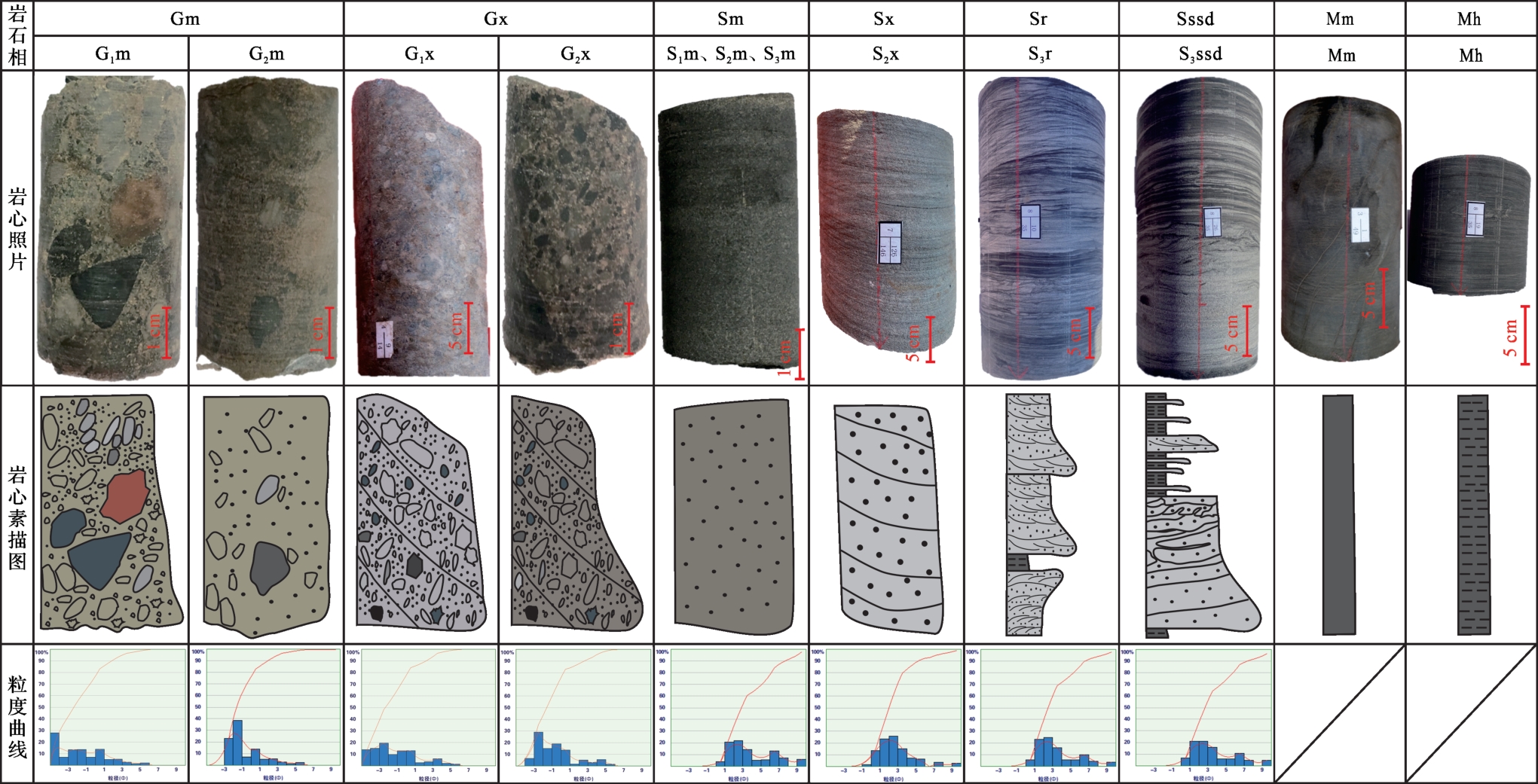
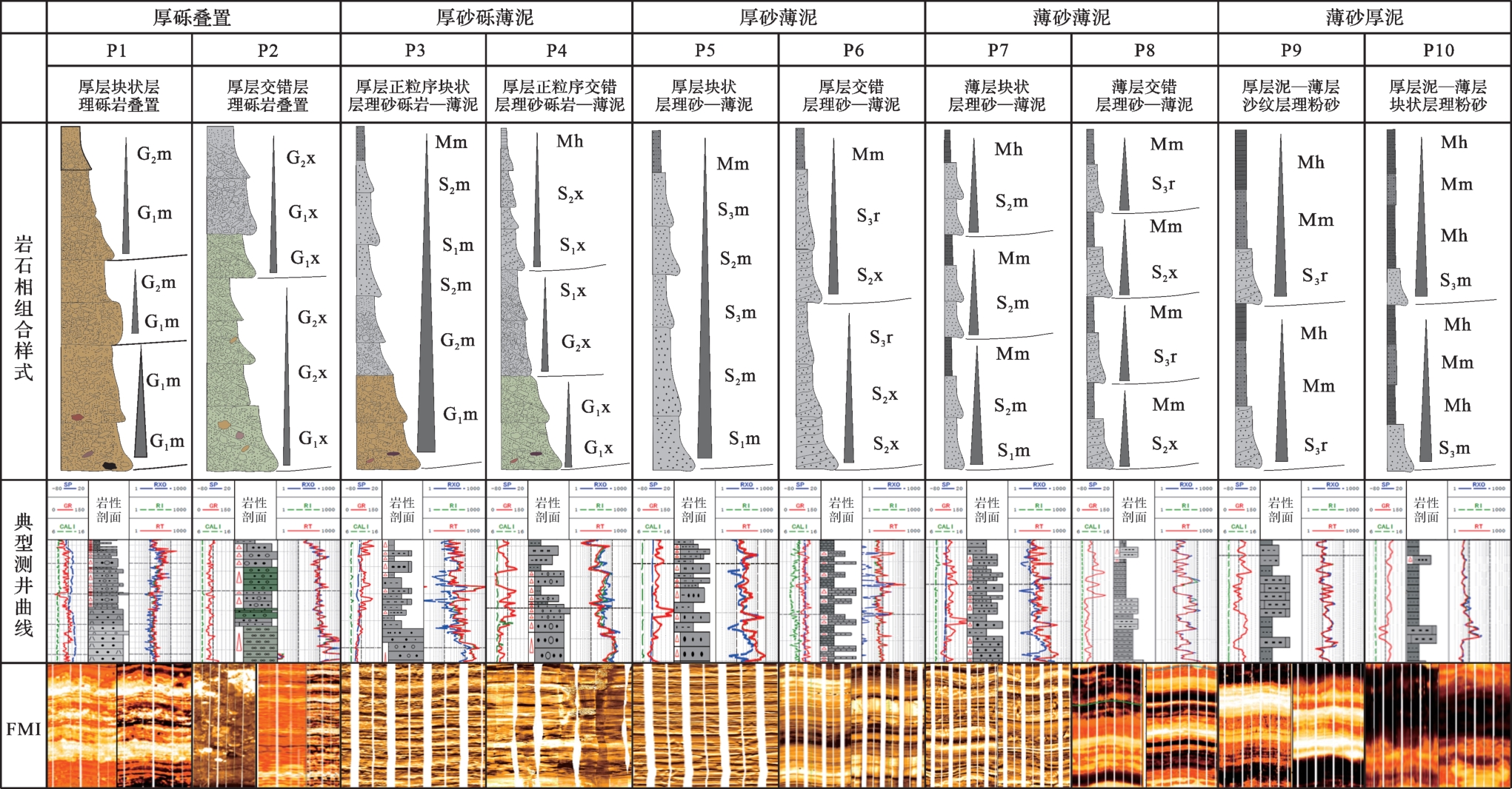
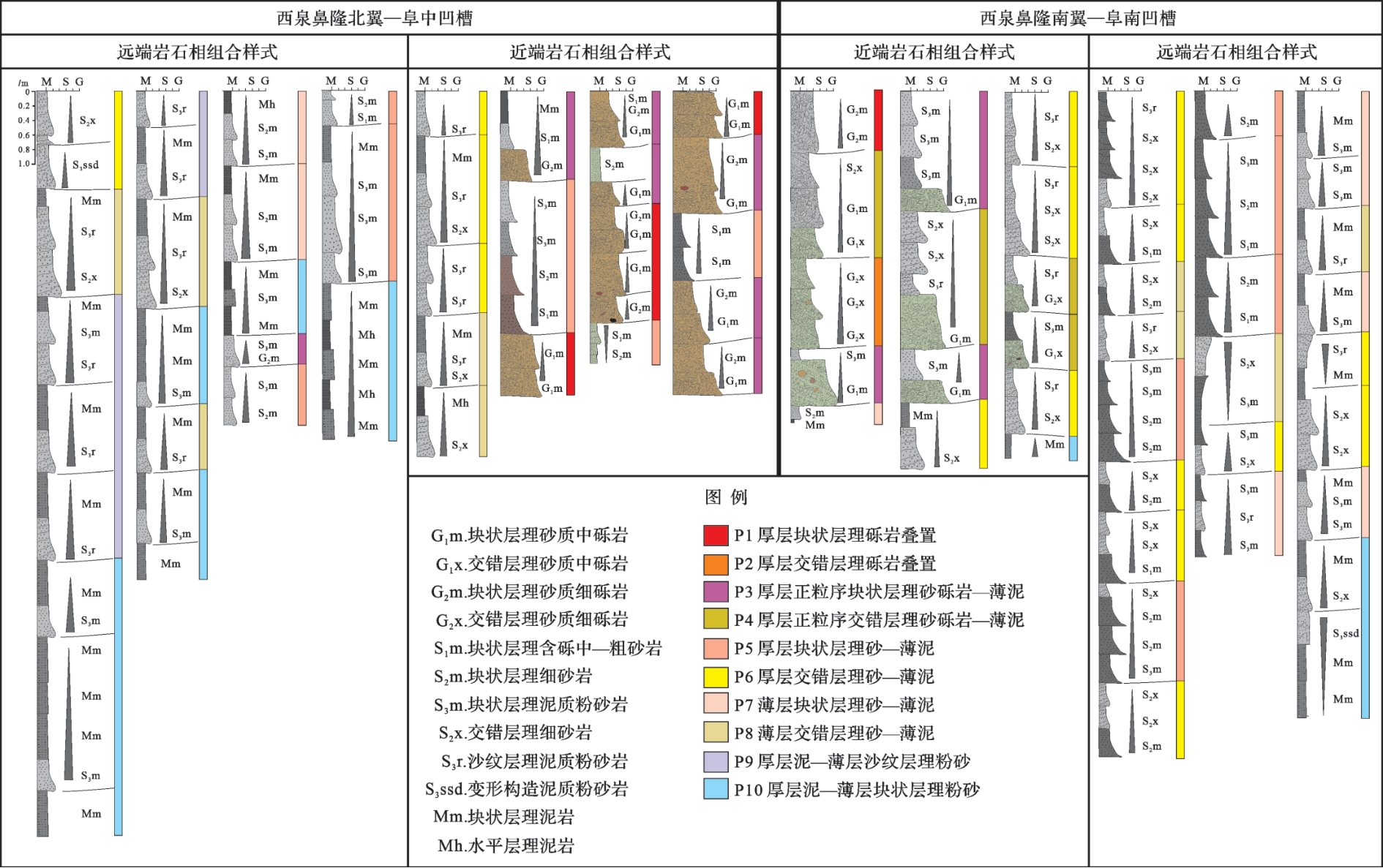
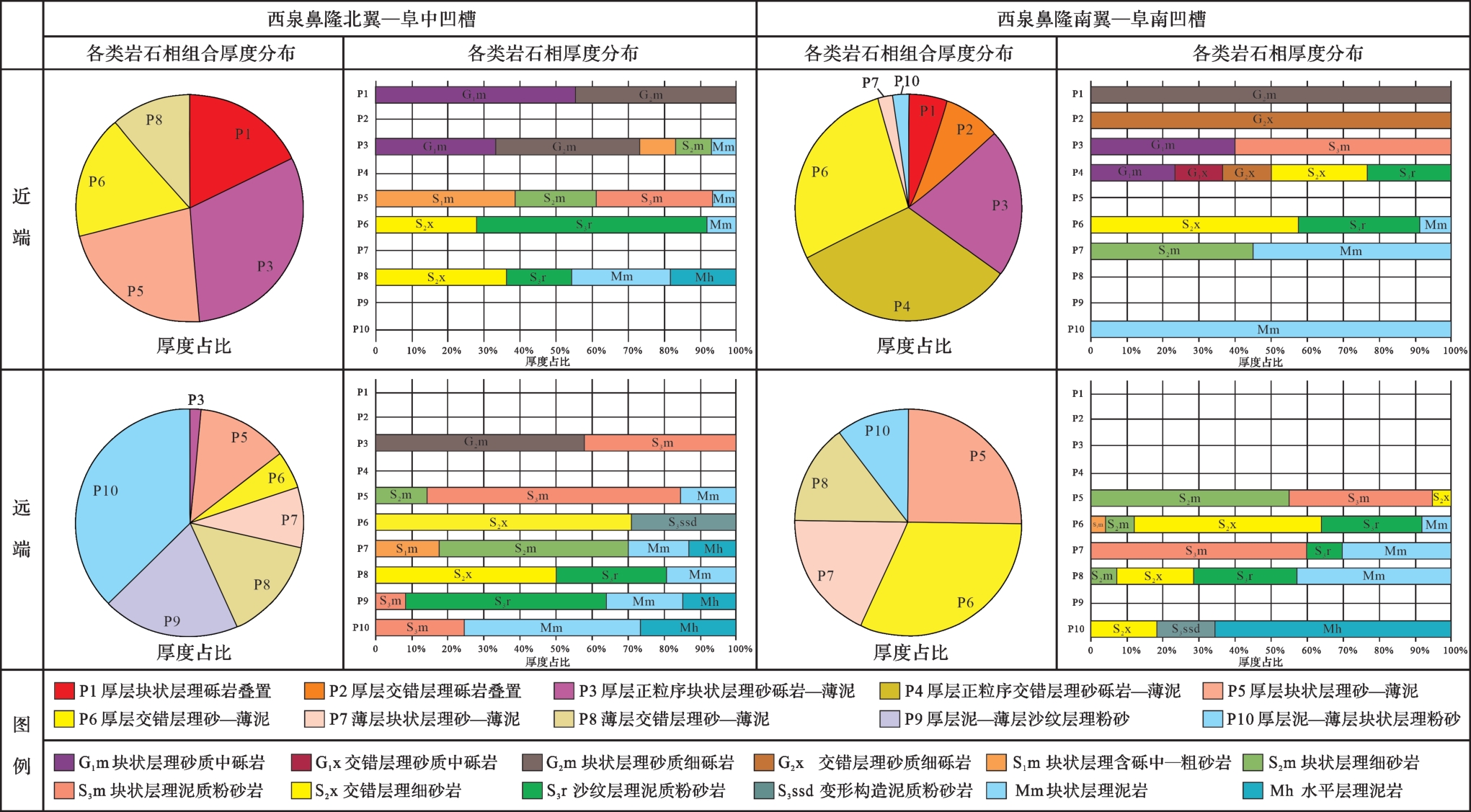
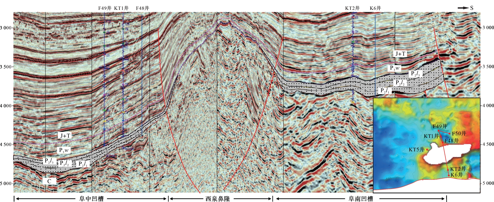
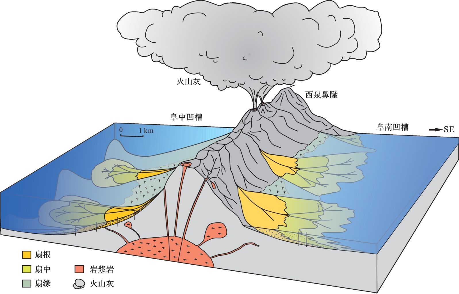
In the oil⁃gas exploration of glutenite bodies in the Jiyang Depression, the complex sand distribution and differential accumulation of oil and water have led us to ponder, explore and supplement the evident deposition filling pattern of nearshore subaqueous fans, which provides experimental materials and geological examples for perfecting the glutenite development patterns in the steep slope of faulted lacustrine basin. Based on systematically sorting out the previous research results, by conducting the flume simulation experiments, analyzing the sedimentation filling process, and combining with the oil and gas exploration practice, it is considered that nearshore subaqueous fans in the steep slope zone of a fault-depressed lacustrine basin is divided into four sedimentary subfacies: fan-root, fan-middle, fan-inter and fan-terminal, including nine sedimentary microfacies. Compared with previous studies, the microfacies of slope accumulation lobes in fan-middle and lateral migrating lobes in fan-inter are established. The slope accumulation lobes mostly overlie the early fan body with an external form of “concave bottom and convex top” having a longitudinal cycle presenting a unique reverse rhythm. Lateral migrating lobes are characterized by positive-rhythm medium and fine sandstones, with notable sedimentary filling characteristics. Both of these are in close contact with semi- and deep-lake mudstones, fan-terminal mudstones and fan-inter mudstones, which is conducive to the formation of lithological traps. In the steep slope zone of the Jiyang Depression, many exploration wells targeting slope accumulation lobes and lateral migrating lobes have successfully established high, stable industrial oil⁃gas flows. This verifies the new sedimentary understandings of nearshore subaqueous fans in oil⁃gas exploration practice, and suggests a new exploration space for glutenite bodies in fault-depressed lacustrine basins. One of the driving forces of scientific development stems from the contradiction between theory and experiment. Petroleum geology especially shows the discipline characteristics of "problems come from practice, and knowledge goes into practice". The study of sedimentary filling model based on flume simulation experiment is an effective means to promote the development of sedimentology.
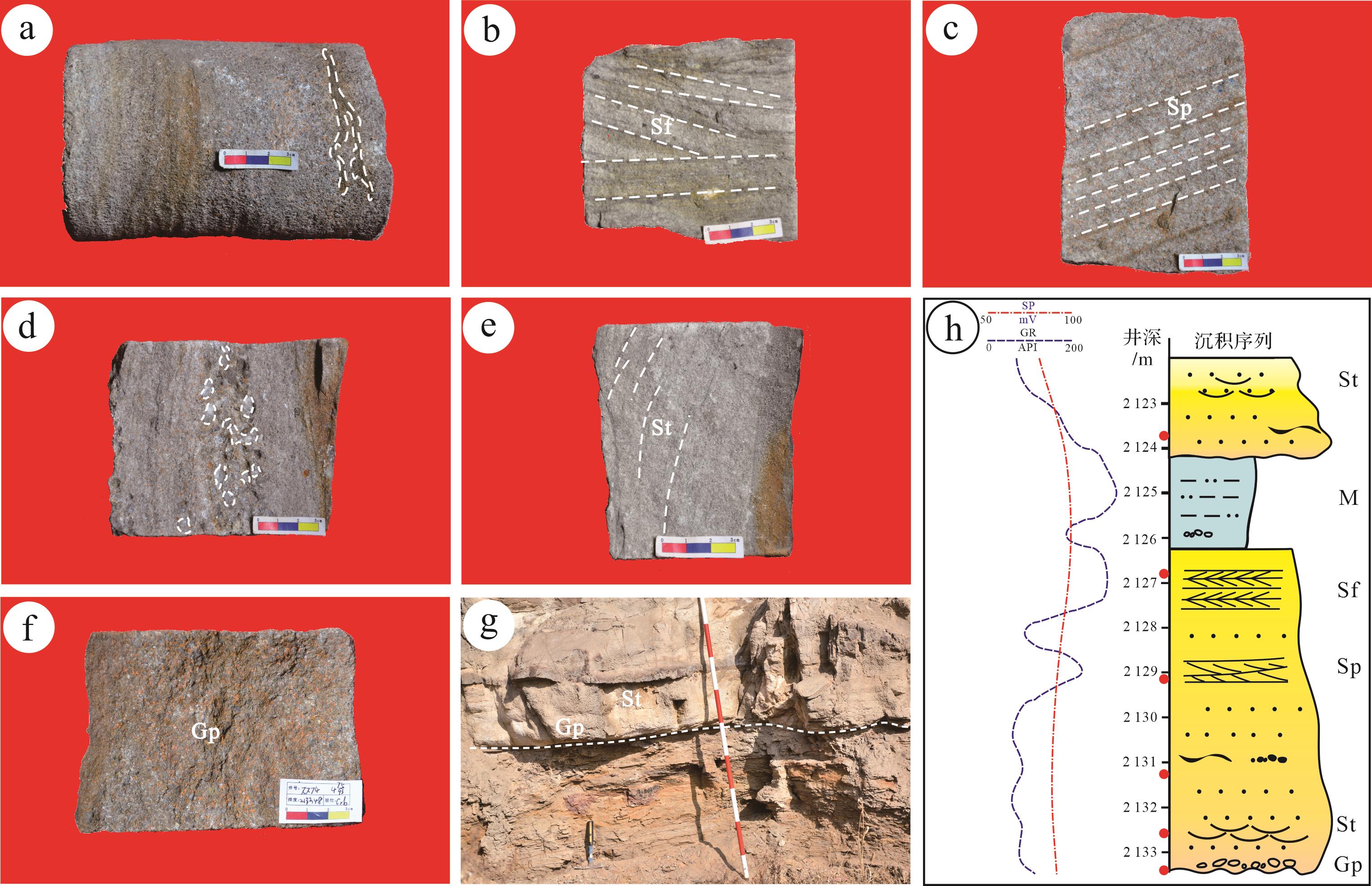
In the oil⁃gas exploration of glutenite bodies in the Jiyang Depression, the complex sand distribution and differential accumulation of oil and water have led us to ponder, explore and supplement the evident deposition filling pattern of nearshore subaqueous fans, which provides experimental materials and geological examples for perfecting the glutenite development patterns in the steep slope of faulted lacustrine basin. Based on systematically sorting out the previous research results, by conducting the flume simulation experiments, analyzing the sedimentation filling process, and combining with the oil and gas exploration practice, it is considered that nearshore subaqueous fans in the steep slope zone of a fault-depressed lacustrine basin is divided into four sedimentary subfacies: fan-root, fan-middle, fan-inter and fan-terminal, including nine sedimentary microfacies. Compared with previous studies, the microfacies of slope accumulation lobes in fan-middle and lateral migrating lobes in fan-inter are established. The slope accumulation lobes mostly overlie the early fan body with an external form of “concave bottom and convex top” having a longitudinal cycle presenting a unique reverse rhythm. Lateral migrating lobes are characterized by positive-rhythm medium and fine sandstones, with notable sedimentary filling characteristics. Both of these are in close contact with semi- and deep-lake mudstones, fan-terminal mudstones and fan-inter mudstones, which is conducive to the formation of lithological traps. In the steep slope zone of the Jiyang Depression, many exploration wells targeting slope accumulation lobes and lateral migrating lobes have successfully established high, stable industrial oil⁃gas flows. This verifies the new sedimentary understandings of nearshore subaqueous fans in oil⁃gas exploration practice, and suggests a new exploration space for glutenite bodies in fault-depressed lacustrine basins. One of the driving forces of scientific development stems from the contradiction between theory and experiment. Petroleum geology especially shows the discipline characteristics of "problems come from practice, and knowledge goes into practice". The study of sedimentary filling model based on flume simulation experiment is an effective means to promote the development of sedimentology.

2023, 41(5): 1354-1365.
doi: 10.14027/j.issn.1000-0550.2023.027
Abstract:
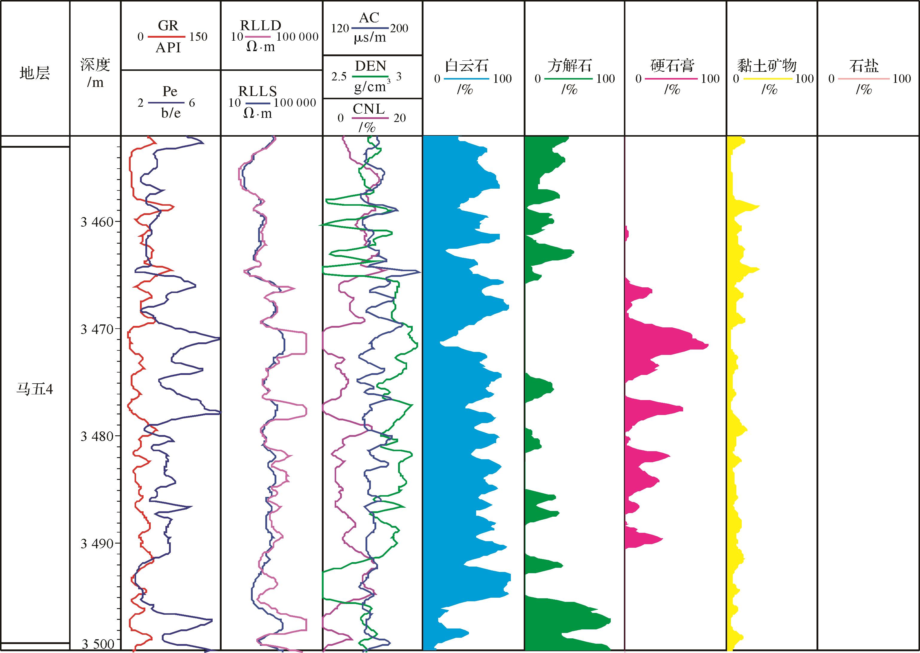
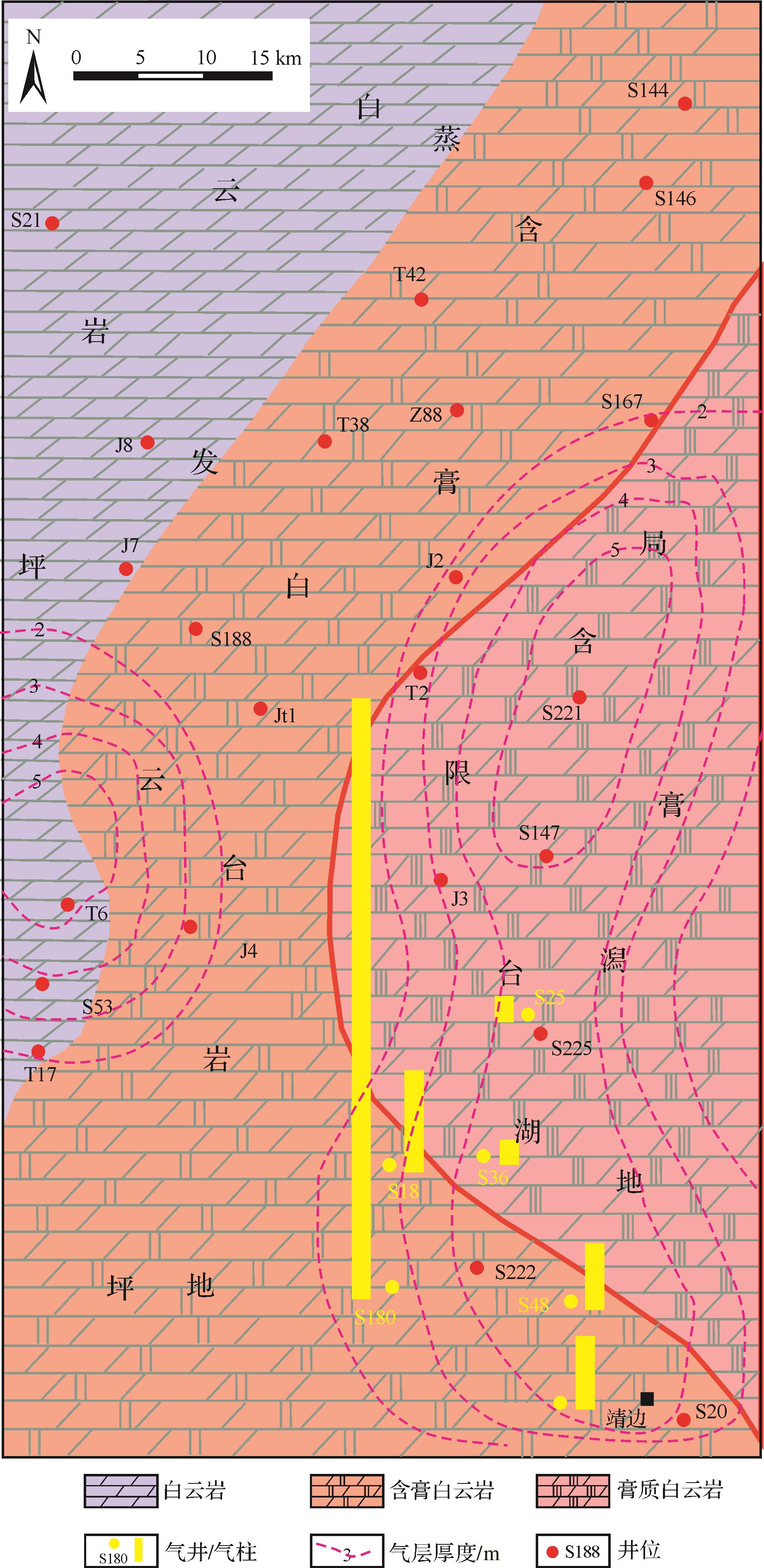
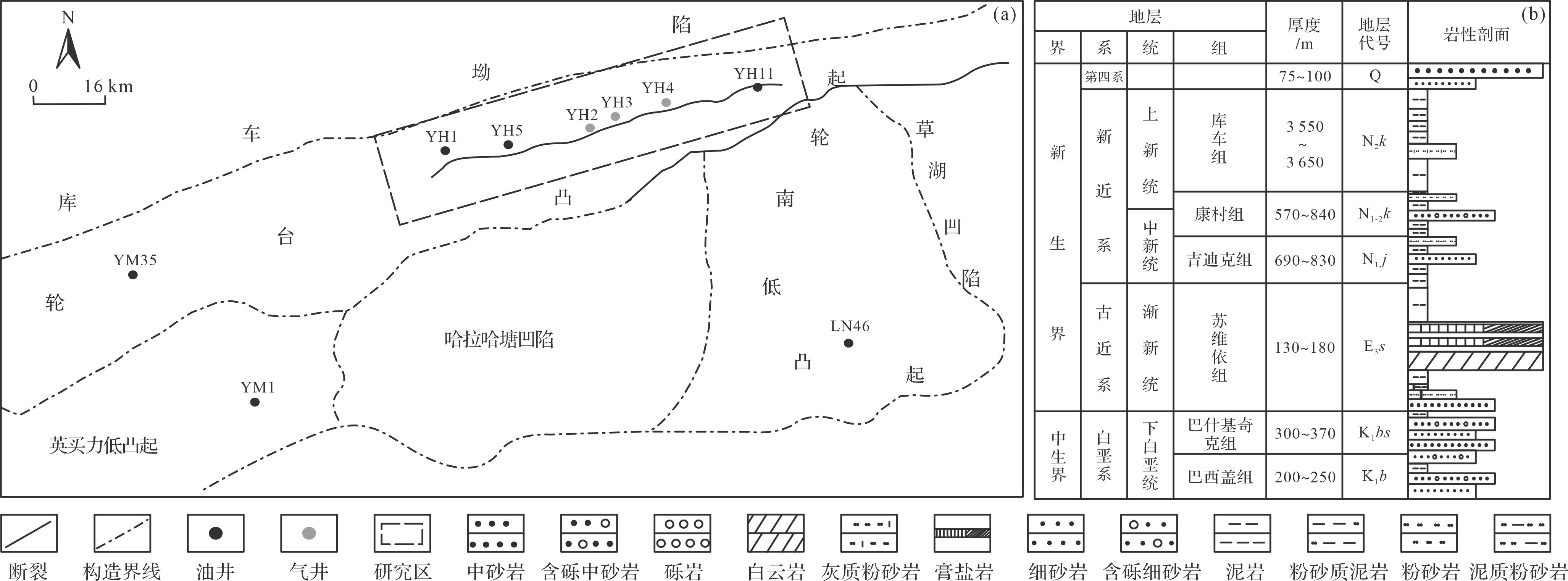
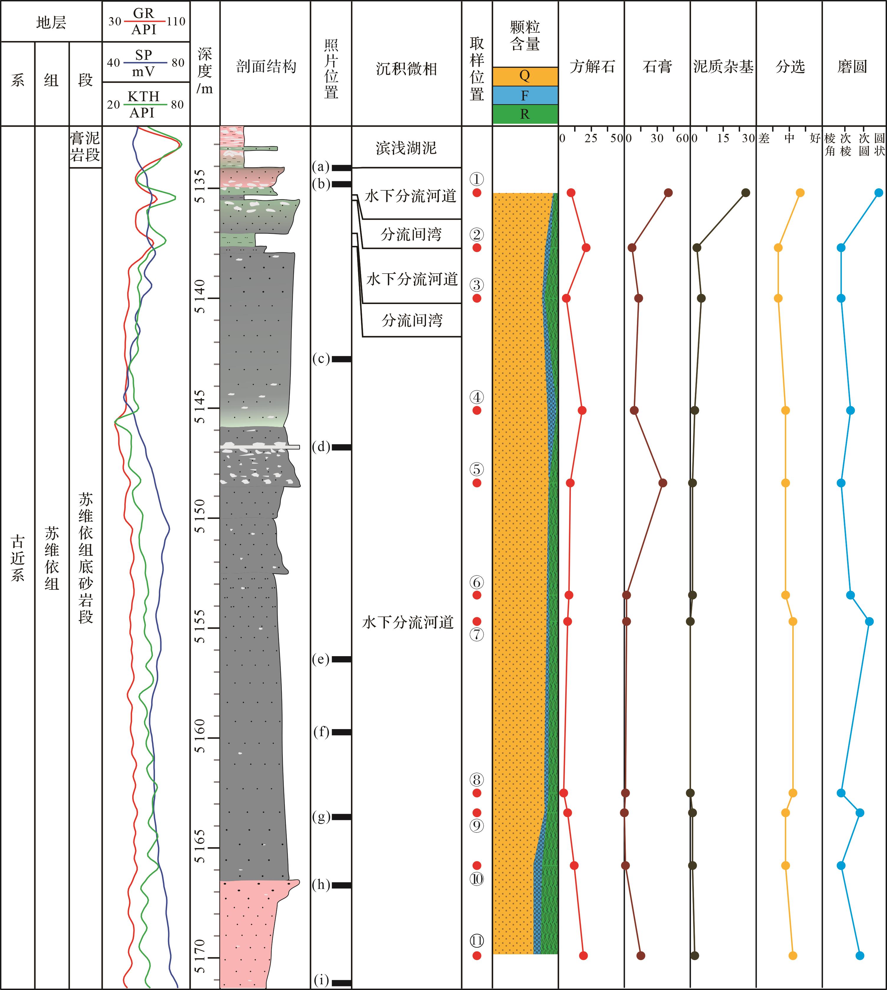
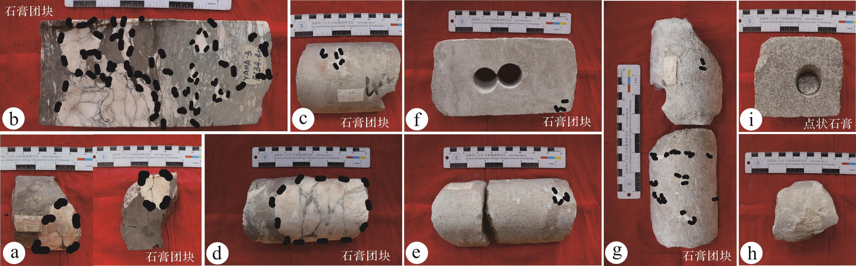
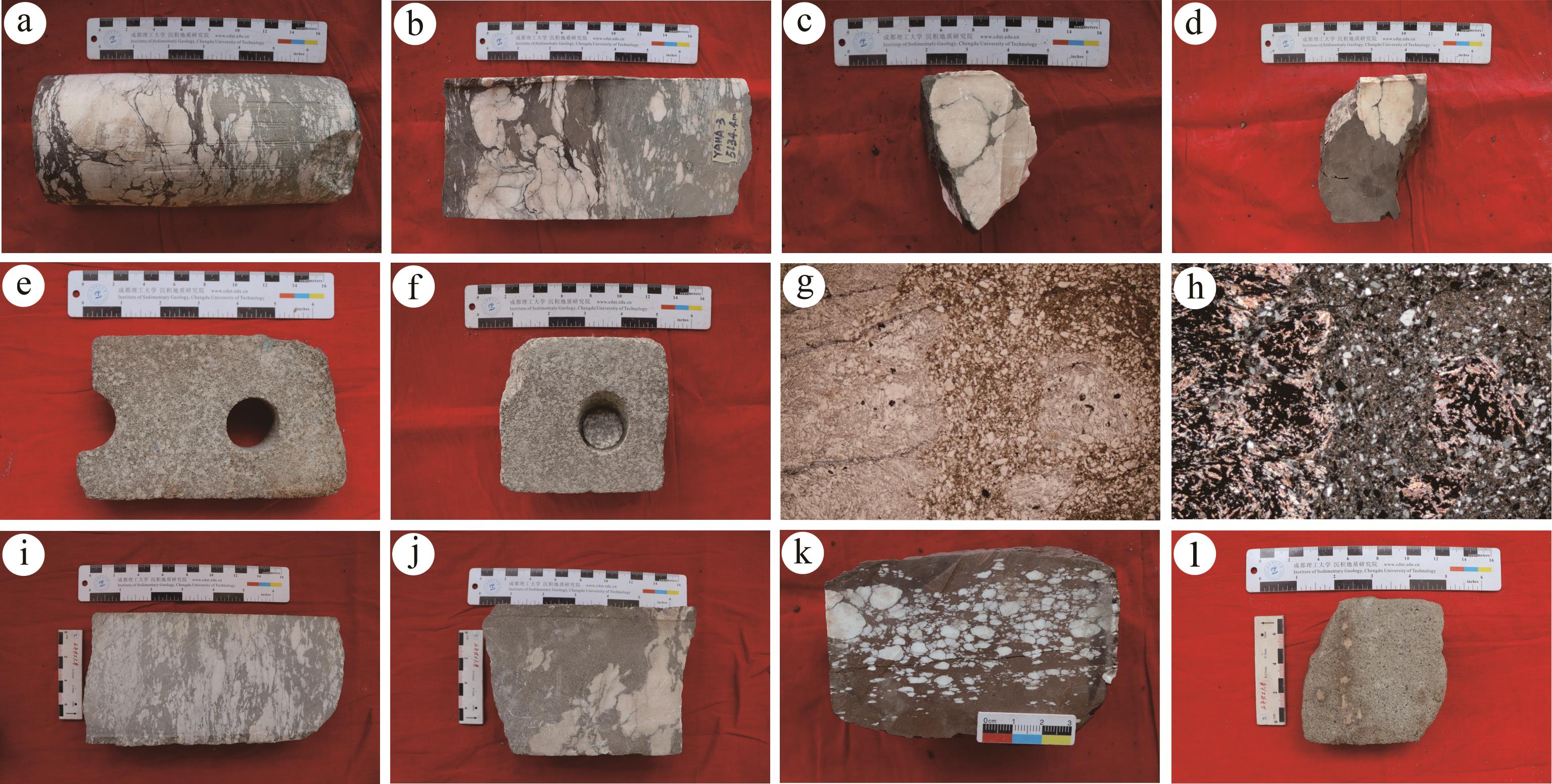
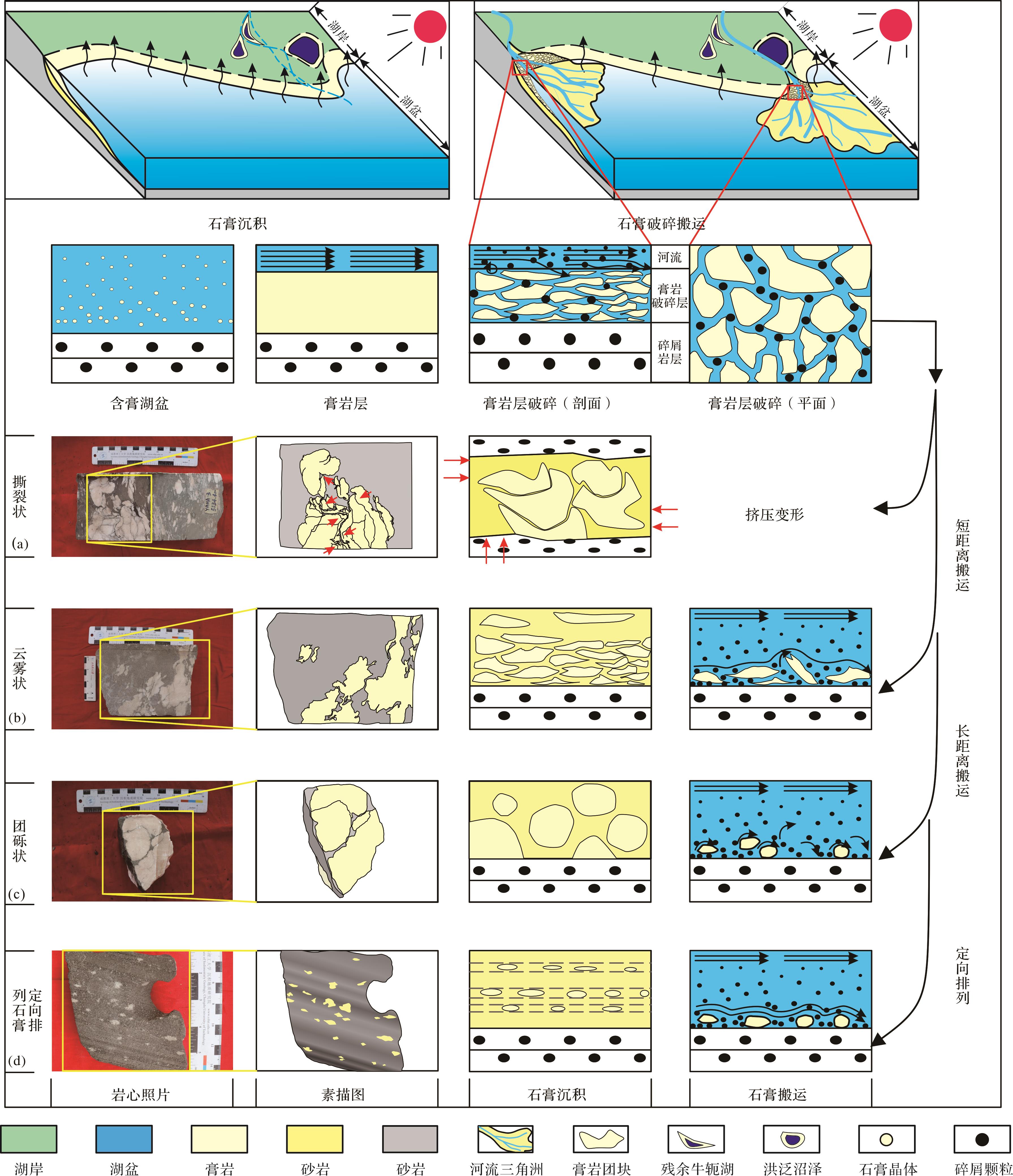
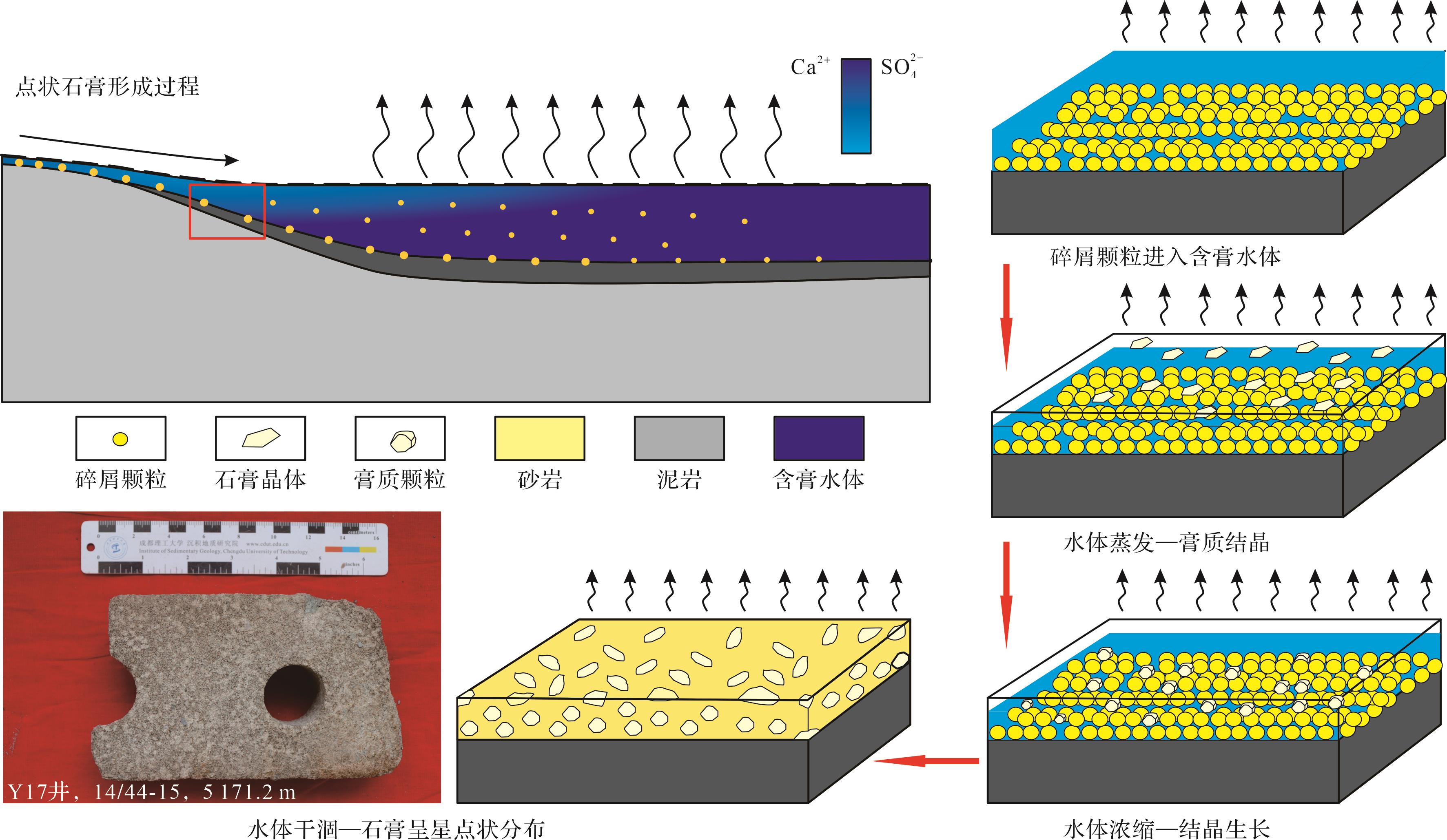
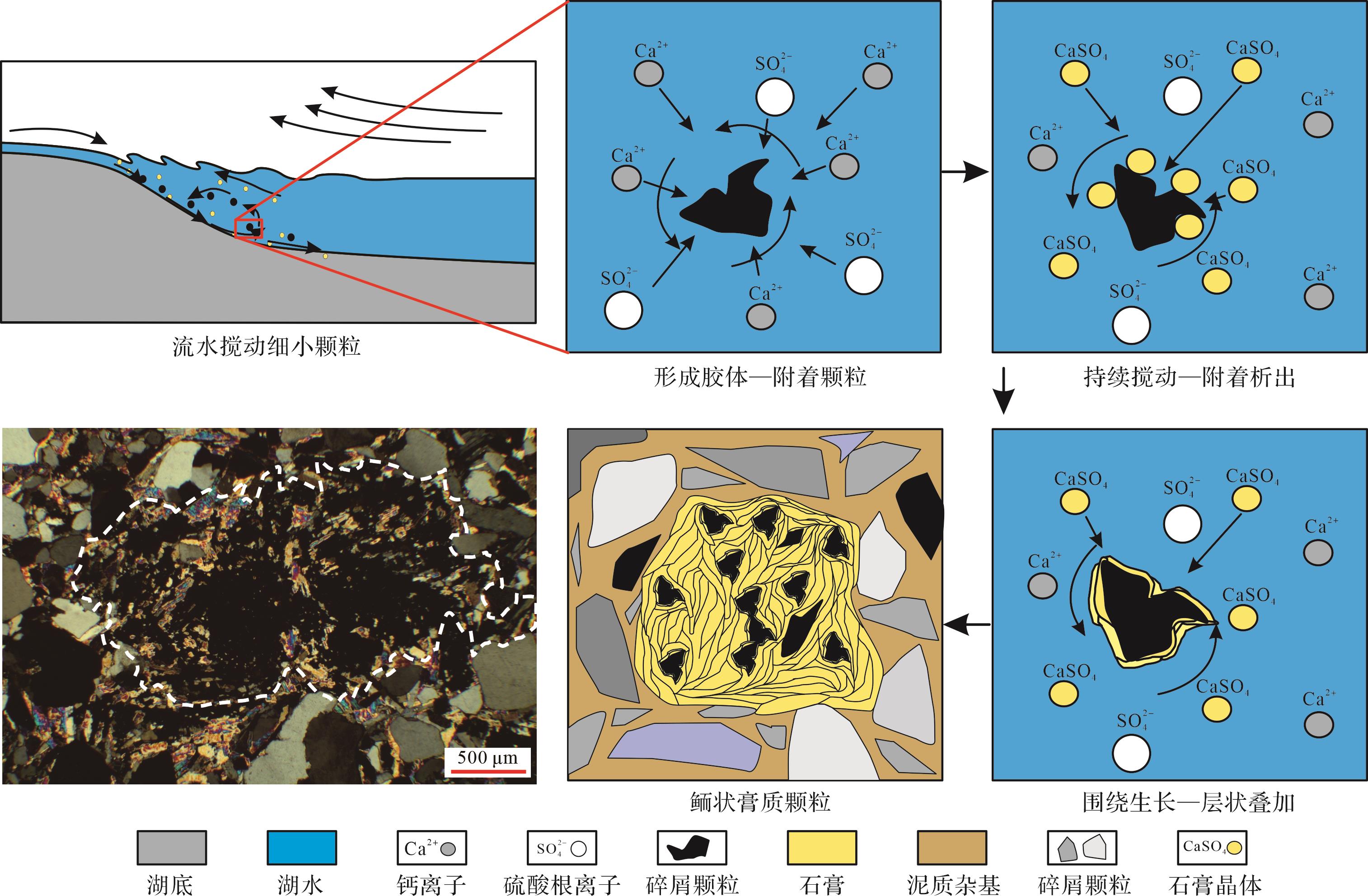
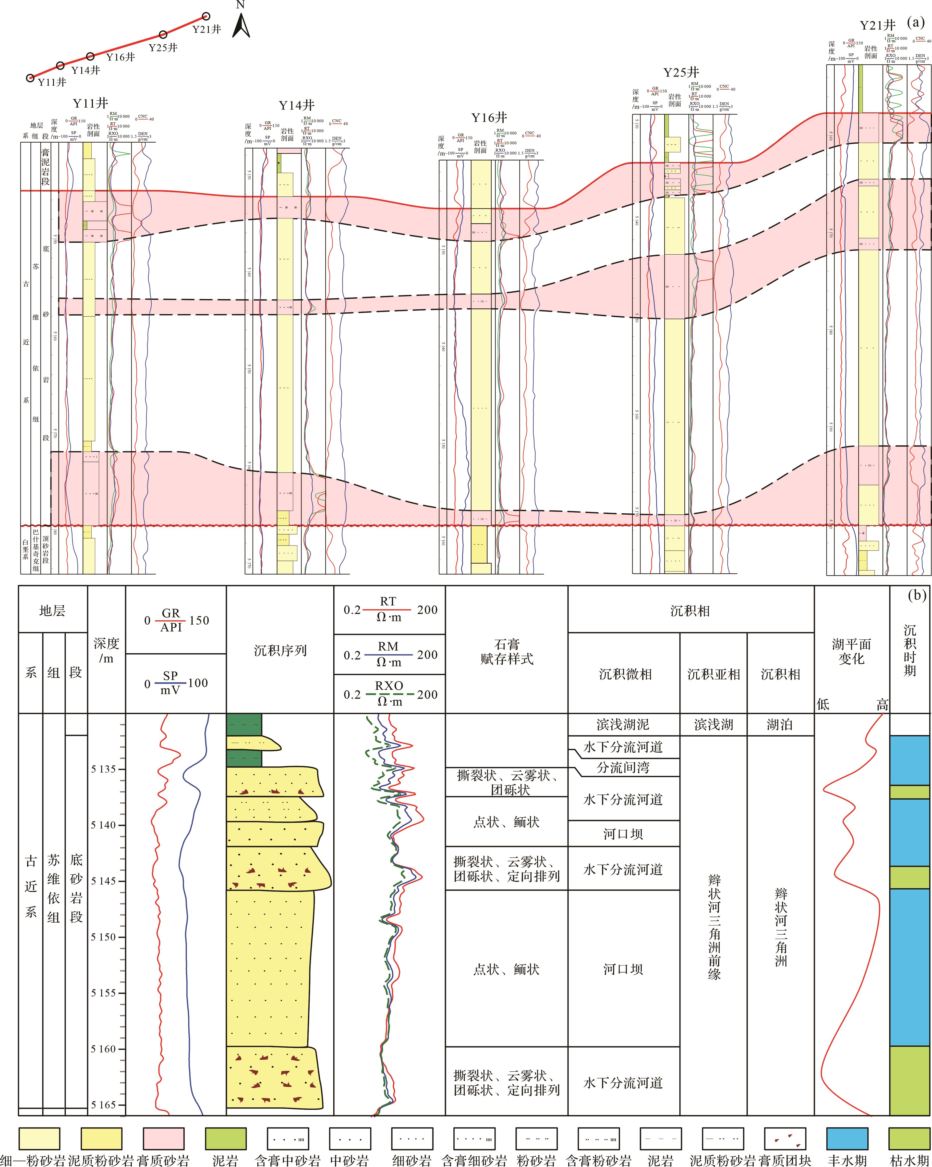
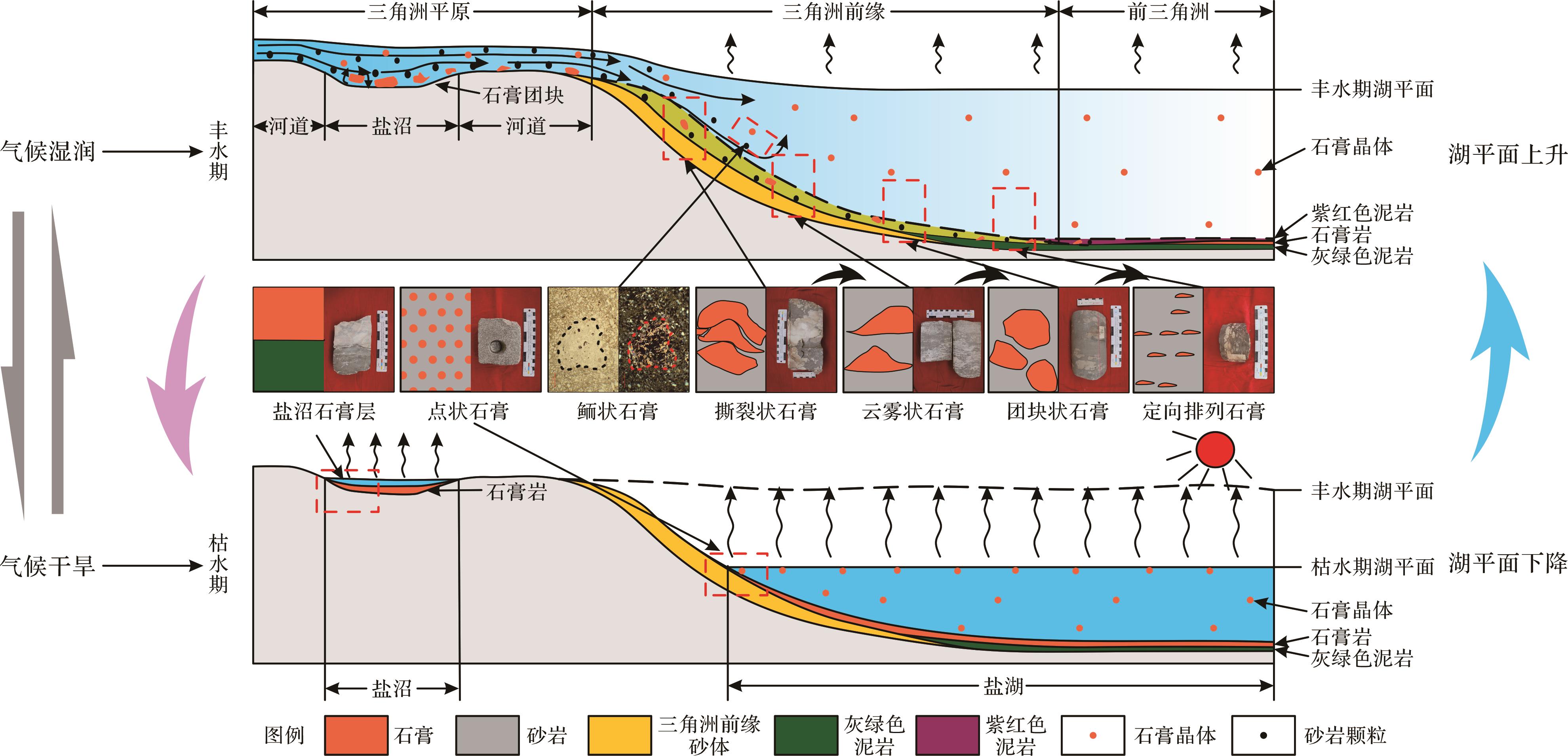
The Yaha gas reservoir in the Kuqa Depression is a condensate gas reservoir with the earliest development time and most mature development technology in China. Its main producing interval is the bottom sandstone interval of the Paleogene Suweiyi Formation. The block is dominated by fine sandstone. The occurrence states of gypsum in sandstone are varied, and the development period, hydrodynamic conditions, depositional environment and physical properties of gypsum of different occurrence states are different. Based on the data of drilling cores, field profiles, and rock thin sections in the bottom sandstone section of the Paleogene Suweiyi Formation in the Yaha gas field, the occurrence state and deposition of gypsum were discussed. The results show that: (1) The different occurrence states of gypsum in the study area are caused by differences in the depositional environment, depositional process and diagenetic environment. The sedimentary gypsum of the Paleogene bottom sandstone in the study area can be divided into allochthonous deposit and in-situ deposit gypsum. (2) The gypsum masses deposited in different places are primarily transported by flowing water, and the transport distances from near to far are as follows: ① irregular gypsum masses with a particle size of 8⁃10 cm; ② cloud shape gypsum masses with a particle size of 4⁃8 cm, angular; ③ Granular gypsum, with a particle size of 2⁃5 cm; it is a nearly round gypsum mass, and the roundness is good; ④directional arranged gypsum, with a diameter of 0.5⁃2 cm and parallel bedding structure. (3)The gypsum deposited in situ includes the uniformly distributed spot-shaped gypsum formed by evaporation concentration and the oolitic gypsum with core and no concentric ring structure formed by flowing water agitation. Gypsum in different occurrence states represents different paleoenvironment, paleoclimate, and paleohydrodynamic conditions and can provide new ideas for the study of the sedimentary process of the Suweiyi Formation in the seasonal river salt lake delta under an arid climate.
The Yaha gas reservoir in the Kuqa Depression is a condensate gas reservoir with the earliest development time and most mature development technology in China. Its main producing interval is the bottom sandstone interval of the Paleogene Suweiyi Formation. The block is dominated by fine sandstone. The occurrence states of gypsum in sandstone are varied, and the development period, hydrodynamic conditions, depositional environment and physical properties of gypsum of different occurrence states are different. Based on the data of drilling cores, field profiles, and rock thin sections in the bottom sandstone section of the Paleogene Suweiyi Formation in the Yaha gas field, the occurrence state and deposition of gypsum were discussed. The results show that: (1) The different occurrence states of gypsum in the study area are caused by differences in the depositional environment, depositional process and diagenetic environment. The sedimentary gypsum of the Paleogene bottom sandstone in the study area can be divided into allochthonous deposit and in-situ deposit gypsum. (2) The gypsum masses deposited in different places are primarily transported by flowing water, and the transport distances from near to far are as follows: ① irregular gypsum masses with a particle size of 8⁃10 cm; ② cloud shape gypsum masses with a particle size of 4⁃8 cm, angular; ③ Granular gypsum, with a particle size of 2⁃5 cm; it is a nearly round gypsum mass, and the roundness is good; ④directional arranged gypsum, with a diameter of 0.5⁃2 cm and parallel bedding structure. (3)The gypsum deposited in situ includes the uniformly distributed spot-shaped gypsum formed by evaporation concentration and the oolitic gypsum with core and no concentric ring structure formed by flowing water agitation. Gypsum in different occurrence states represents different paleoenvironment, paleoclimate, and paleohydrodynamic conditions and can provide new ideas for the study of the sedimentary process of the Suweiyi Formation in the seasonal river salt lake delta under an arid climate.
2023, 41(5): 1366-1379.
doi: 10.14027/j.issn.1000-0550.2022.133
Abstract:
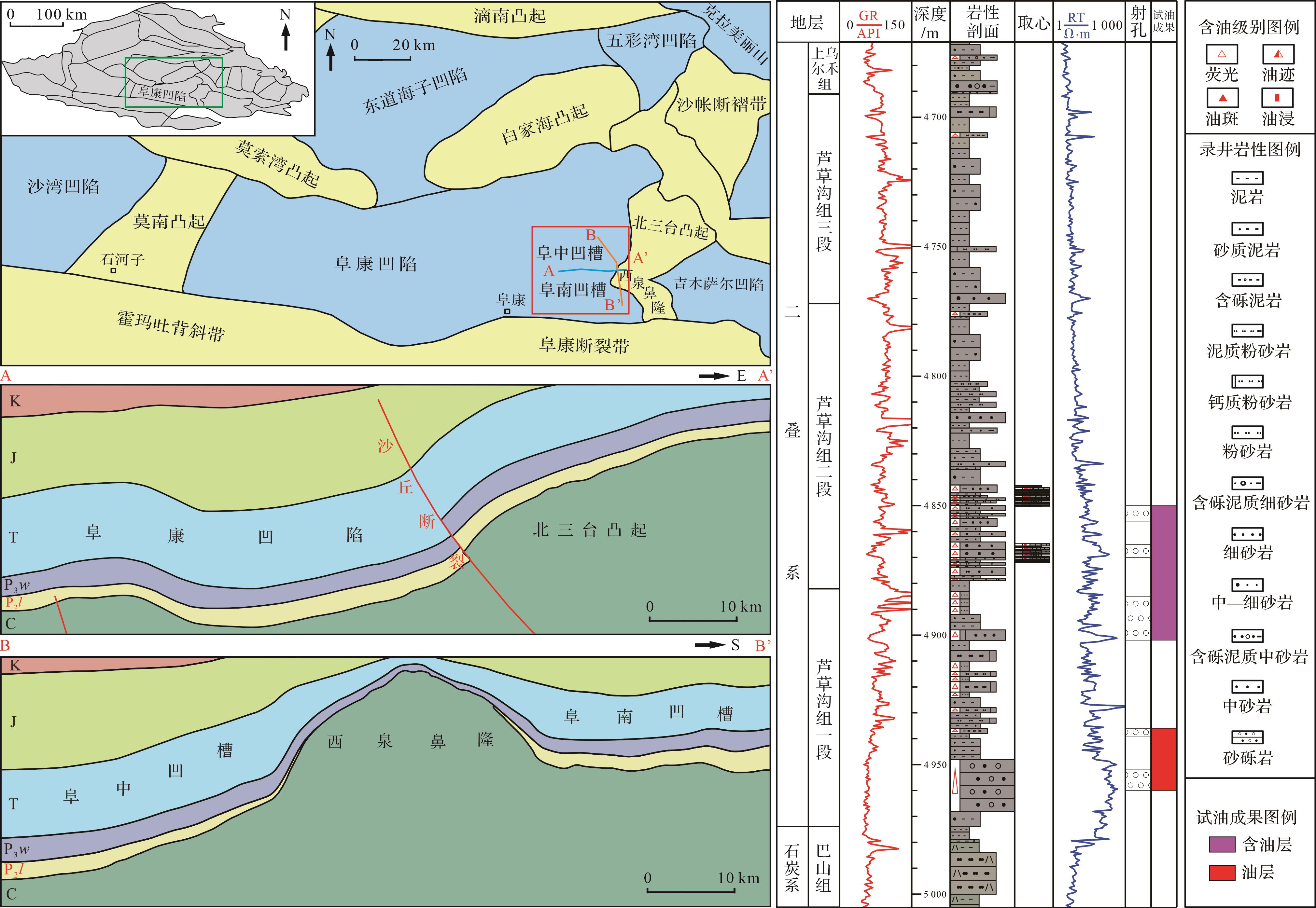
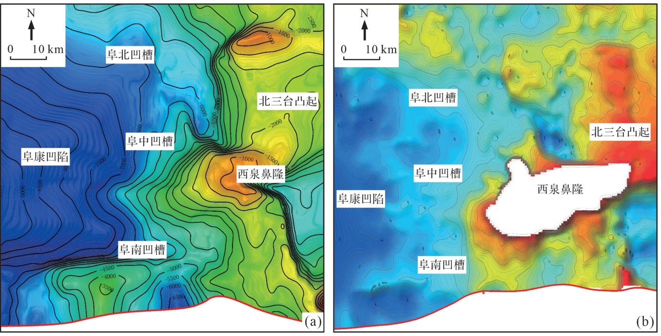
After the exploration of deep oil and gas in the Fukang Sag, eastern Junggar Basin, a thick-bed conglomerate was drilled for the first time in the Lucaogou Formation, which disproved the previously held belief that the Lucaogou Formation reservoir was not developed and the whole deposit was fine grained. At present, the systematic study of the lithofacies types, assemblage characteristics and distribution rules of the Lucaogou Formation is urgent for future oil and gas exploration. Based on core, thin section, and logging data, the petrological characteristics and lithofacies types of the conglomerate reservoir in the Lucaogou Formation were identified and distinguished, and the distribution law of lithofacies was predicted. Results showed that the Lucaougou Formation developed longitudinally due to a lake invasion retrogradation sequences, several main development coarse clastic rocks. The upper Lucaogou Formation primarily contains argillaceous siltstone and mudstone, The thickness is relatively large, and the late mudstone cap overlies the early low region conglomerate reservoir, forming a lithologic reservoir. North and south of Xiquan uplift, a braided river delta sedimentary system was developed, with a steep near-shore subaqueous fan and gentle slope, respectively. The north wing has poor conglomerate sorting, angular gravel particles with poor orientation, and heterobasic particle support, exhibiting characteristics of short transport distance, strong hydrodynamic force, and gravity flow deposition. The south wing has good sorting, particle support with certain orientation, and obvious traction flow characteristics. Based on comprehensive analysis, the lithofacies characteristics and distribution were found to be controlled by the Late Carboniferous and Early Permian volcanism, with a paleogeomorphic slope of the Carboniferous top boundary north and south of the Xiquanbi uplift, and fluctuation of the lake plane.
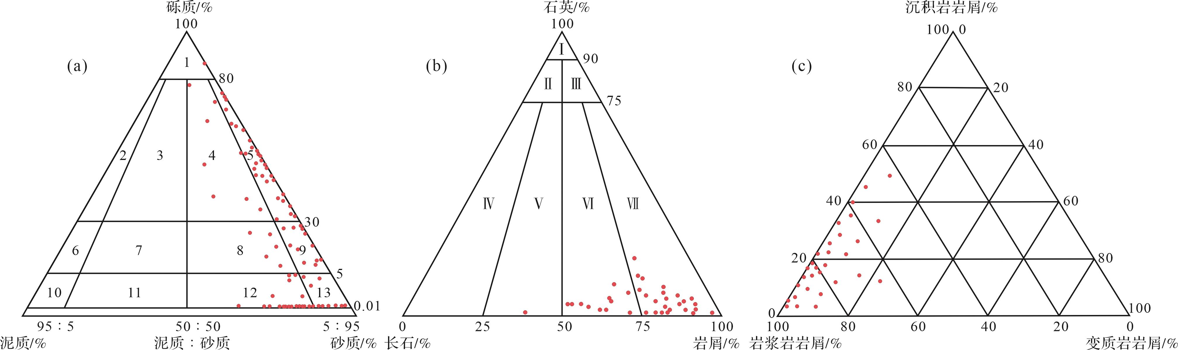
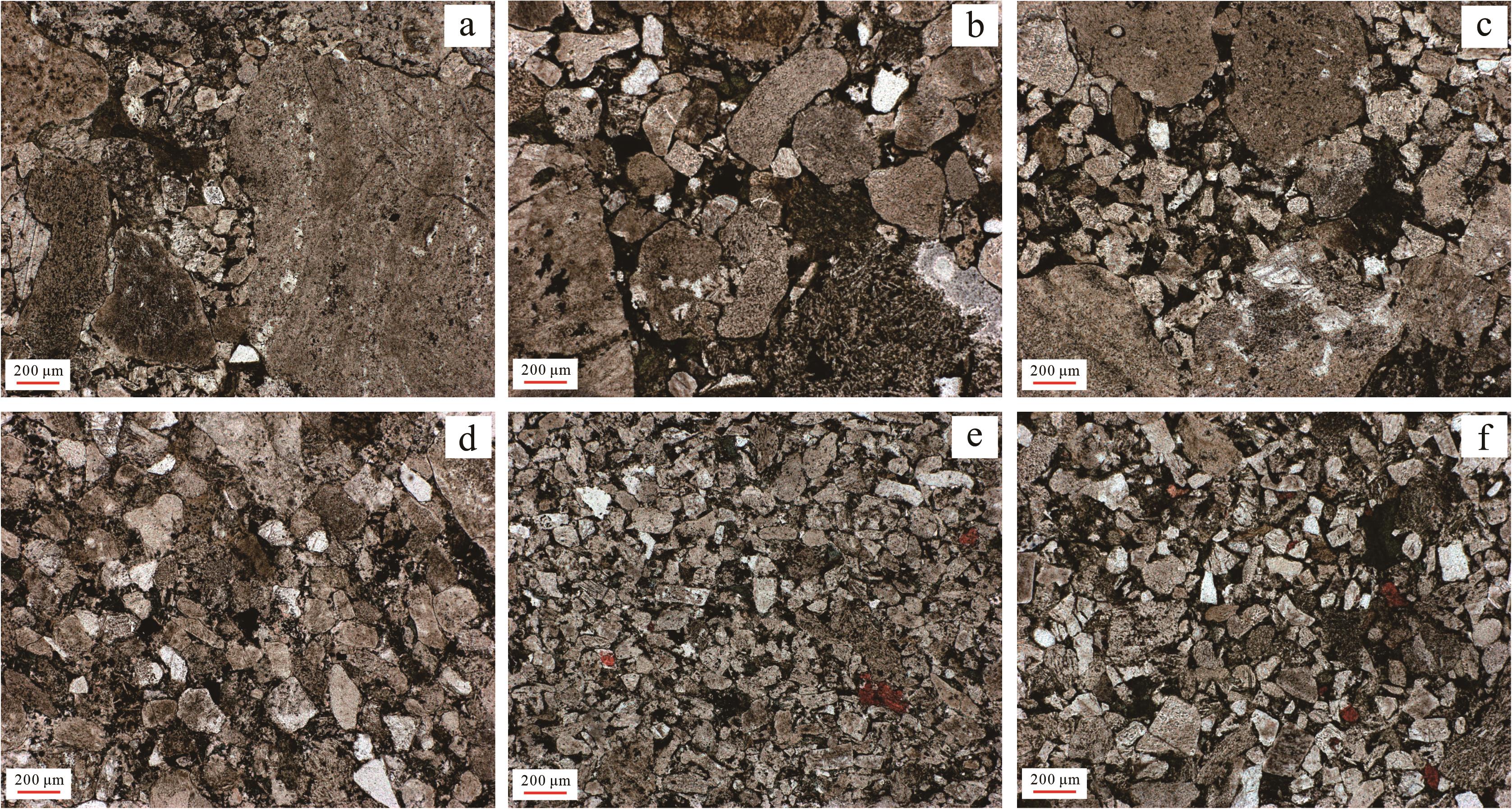
After the exploration of deep oil and gas in the Fukang Sag, eastern Junggar Basin, a thick-bed conglomerate was drilled for the first time in the Lucaogou Formation, which disproved the previously held belief that the Lucaogou Formation reservoir was not developed and the whole deposit was fine grained. At present, the systematic study of the lithofacies types, assemblage characteristics and distribution rules of the Lucaogou Formation is urgent for future oil and gas exploration. Based on core, thin section, and logging data, the petrological characteristics and lithofacies types of the conglomerate reservoir in the Lucaogou Formation were identified and distinguished, and the distribution law of lithofacies was predicted. Results showed that the Lucaougou Formation developed longitudinally due to a lake invasion retrogradation sequences, several main development coarse clastic rocks. The upper Lucaogou Formation primarily contains argillaceous siltstone and mudstone, The thickness is relatively large, and the late mudstone cap overlies the early low region conglomerate reservoir, forming a lithologic reservoir. North and south of Xiquan uplift, a braided river delta sedimentary system was developed, with a steep near-shore subaqueous fan and gentle slope, respectively. The north wing has poor conglomerate sorting, angular gravel particles with poor orientation, and heterobasic particle support, exhibiting characteristics of short transport distance, strong hydrodynamic force, and gravity flow deposition. The south wing has good sorting, particle support with certain orientation, and obvious traction flow characteristics. Based on comprehensive analysis, the lithofacies characteristics and distribution were found to be controlled by the Late Carboniferous and Early Permian volcanism, with a paleogeomorphic slope of the Carboniferous top boundary north and south of the Xiquanbi uplift, and fluctuation of the lake plane.

2023, 41(5): 1380-1395.
doi: 10.14027/j.issn.1000-0550.2023.033
Abstract:
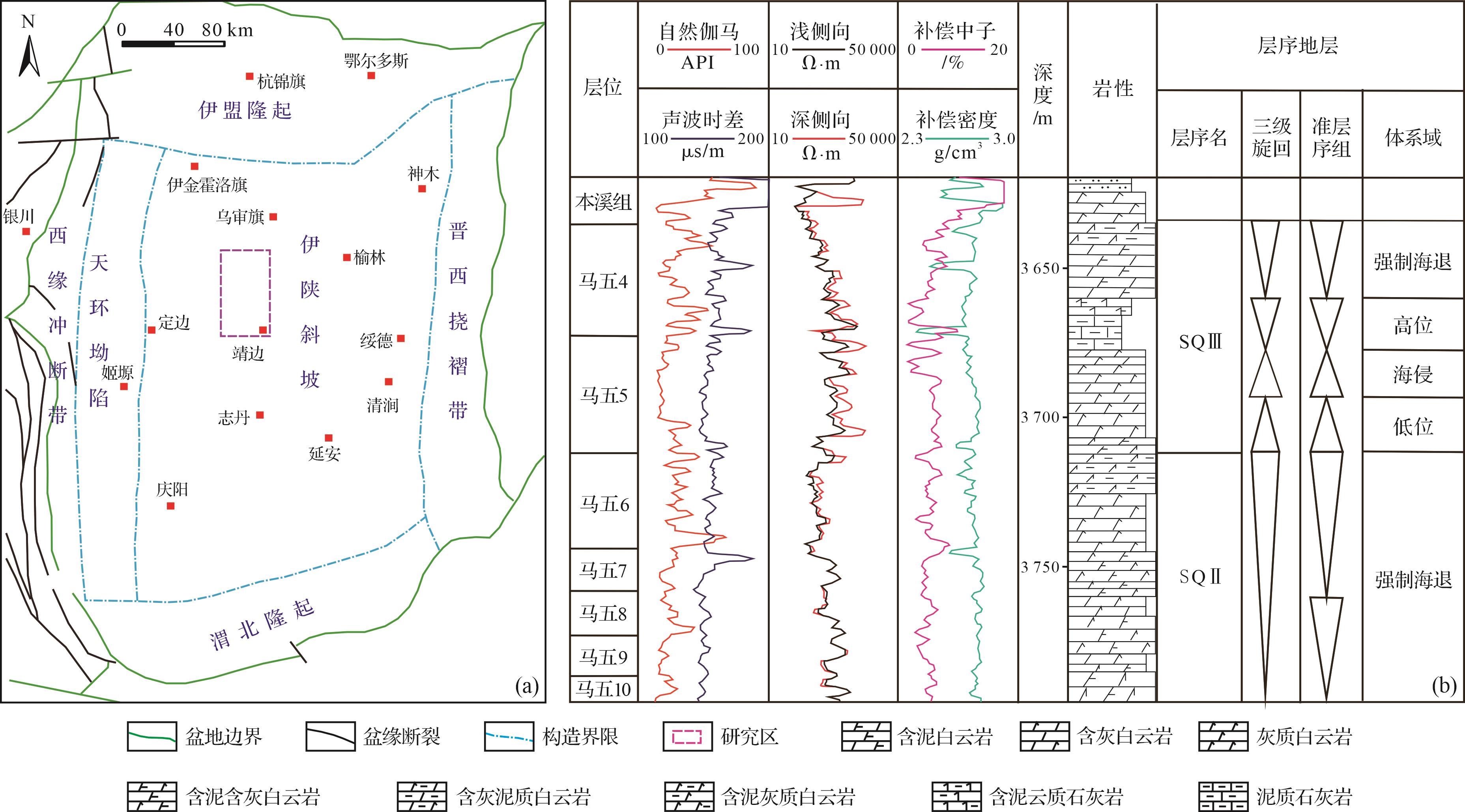
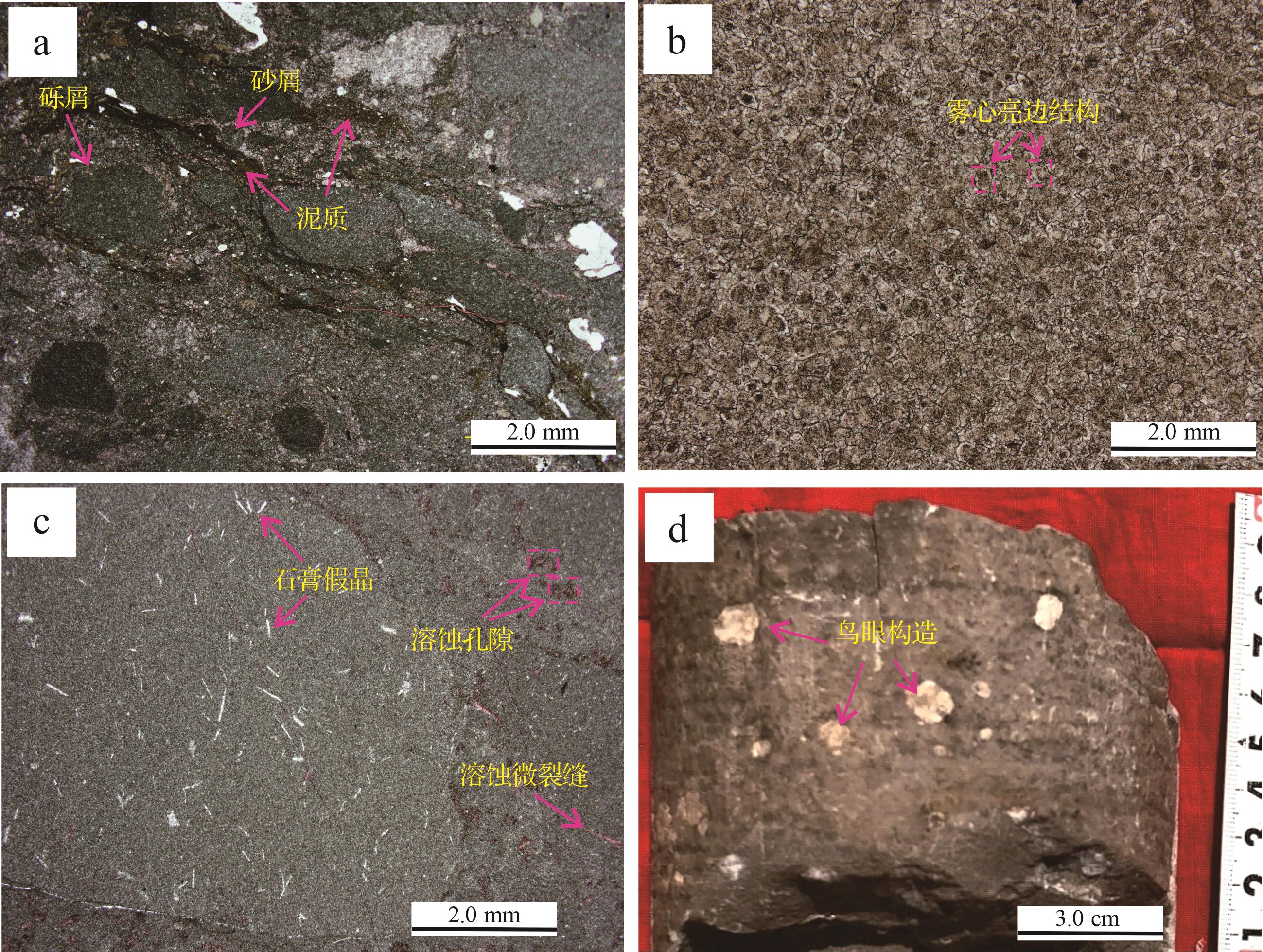
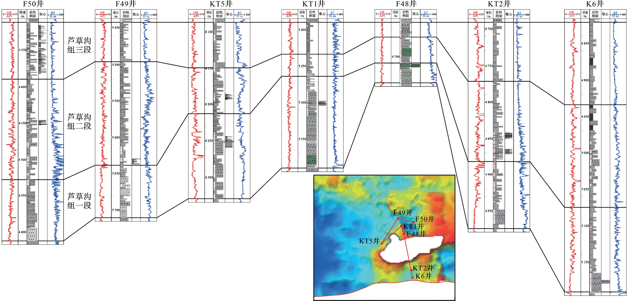
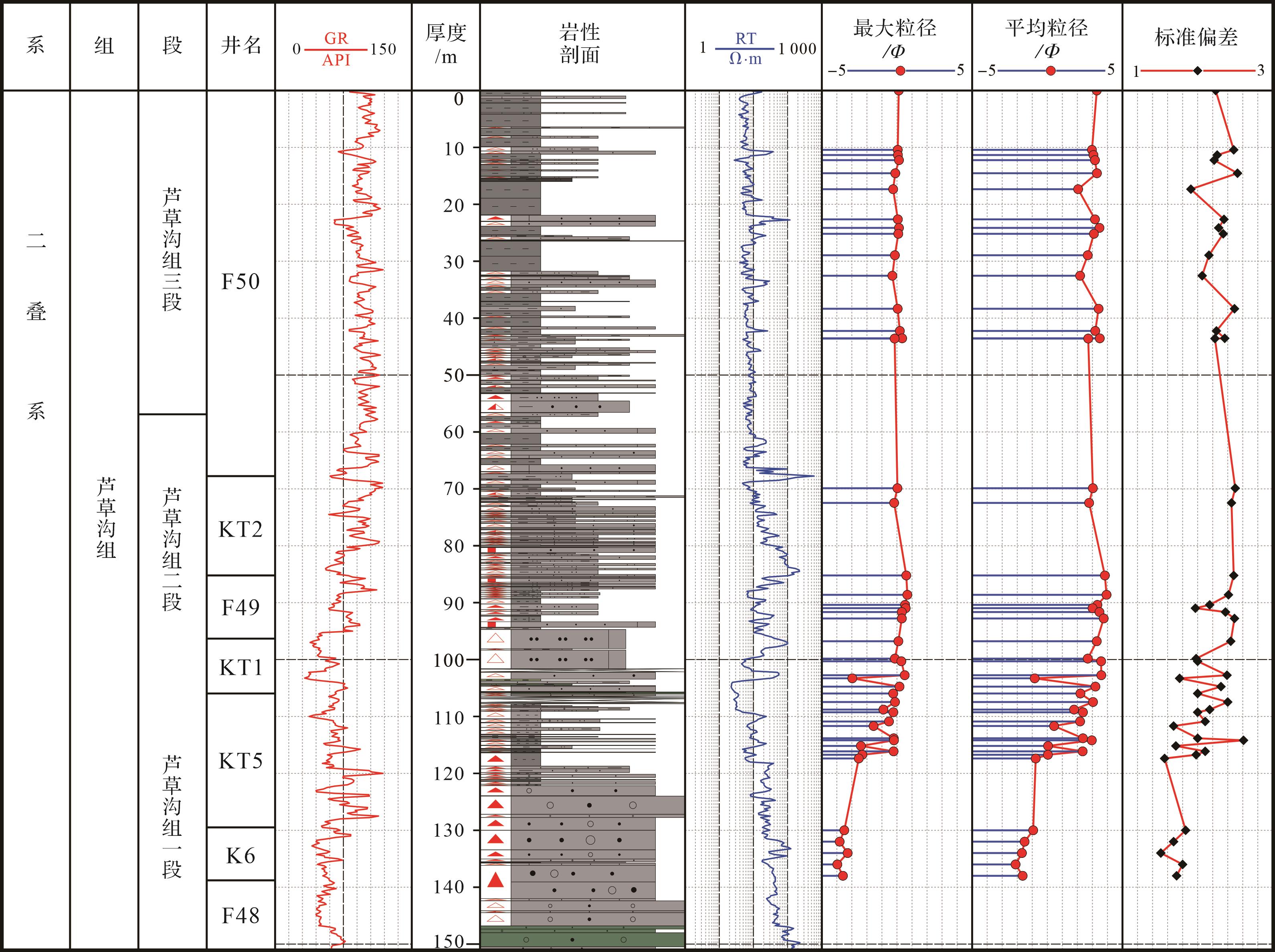
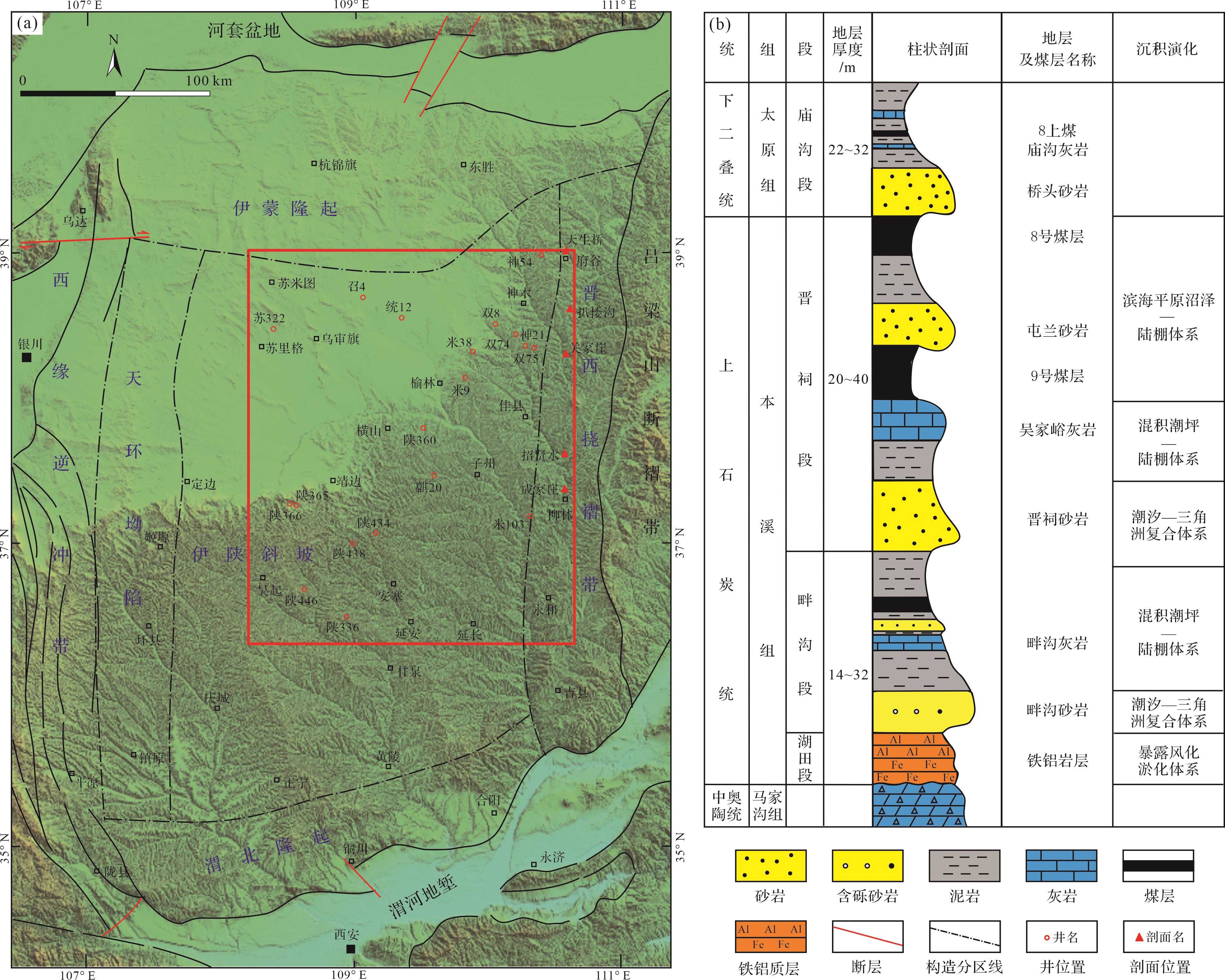
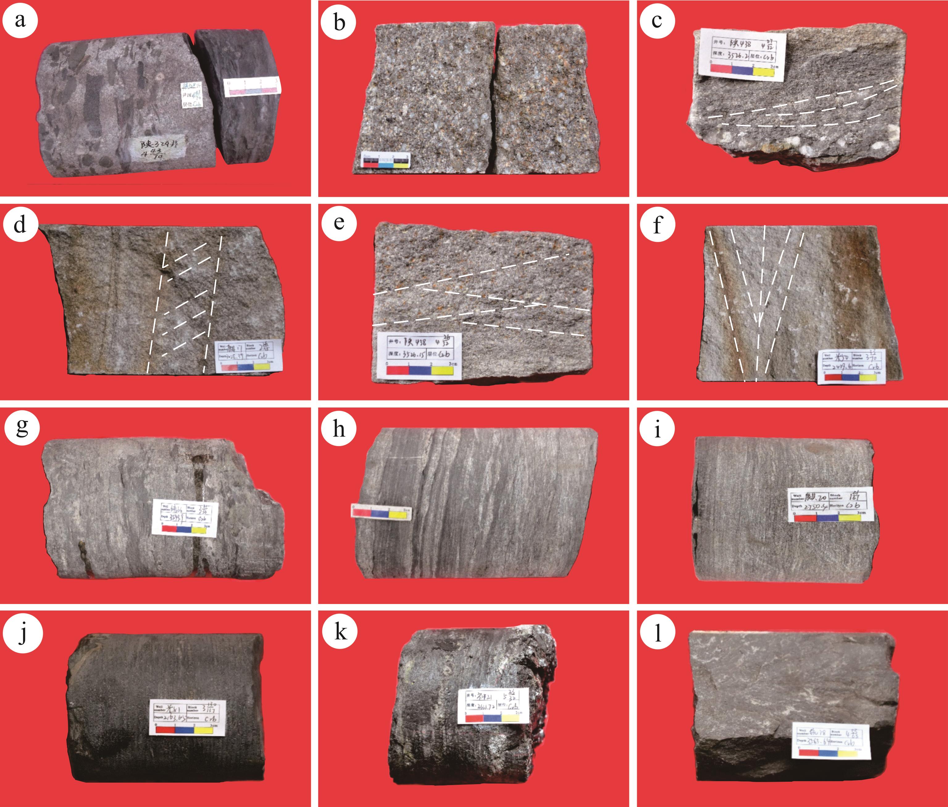
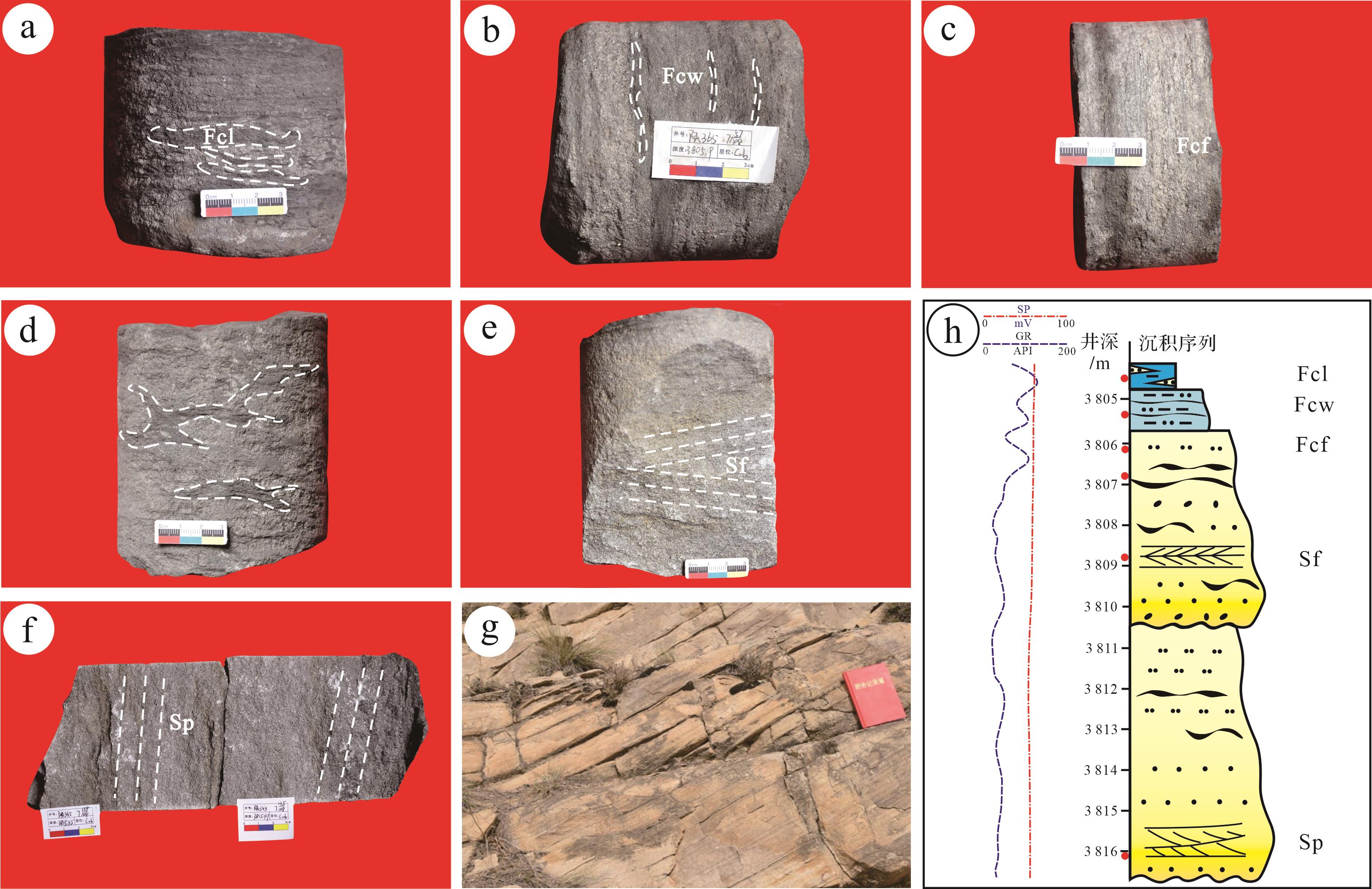
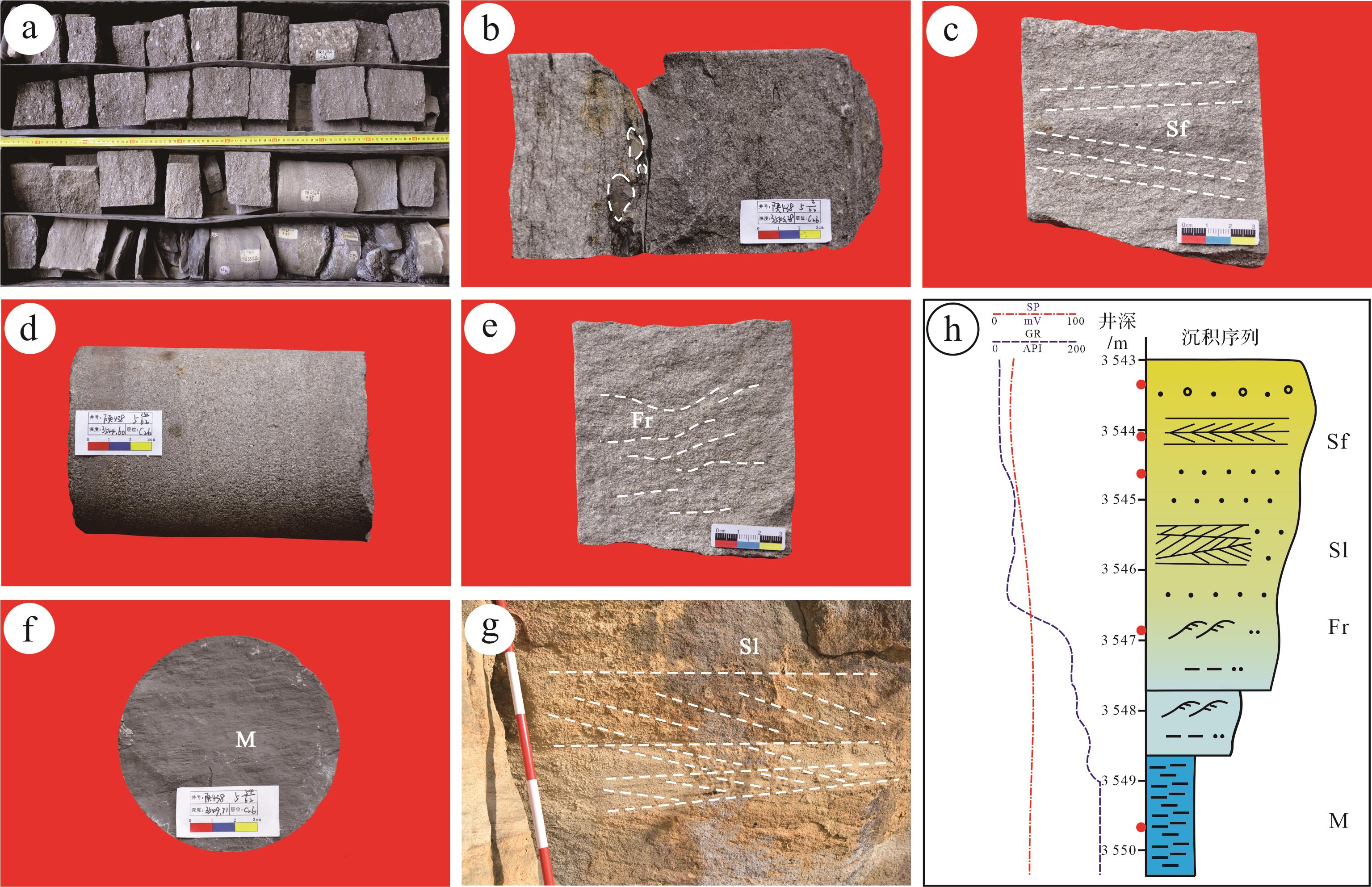
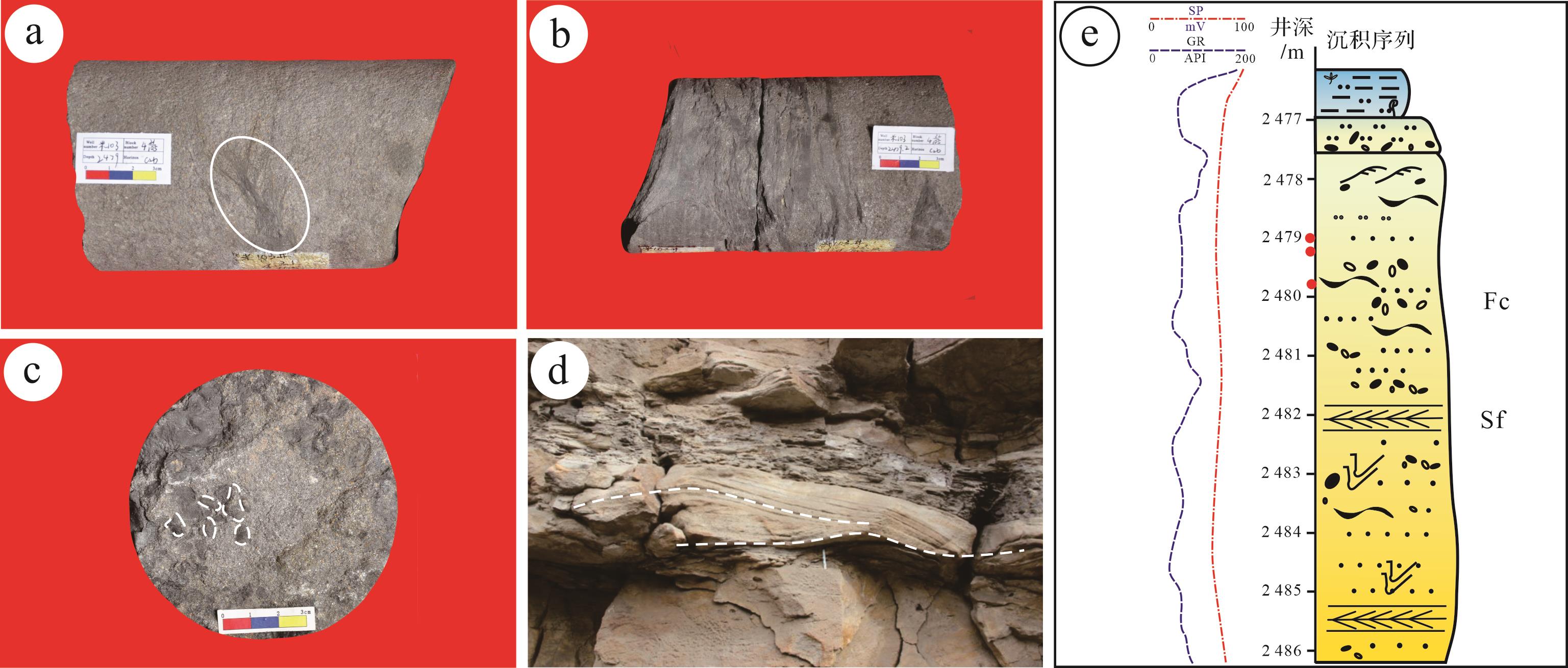
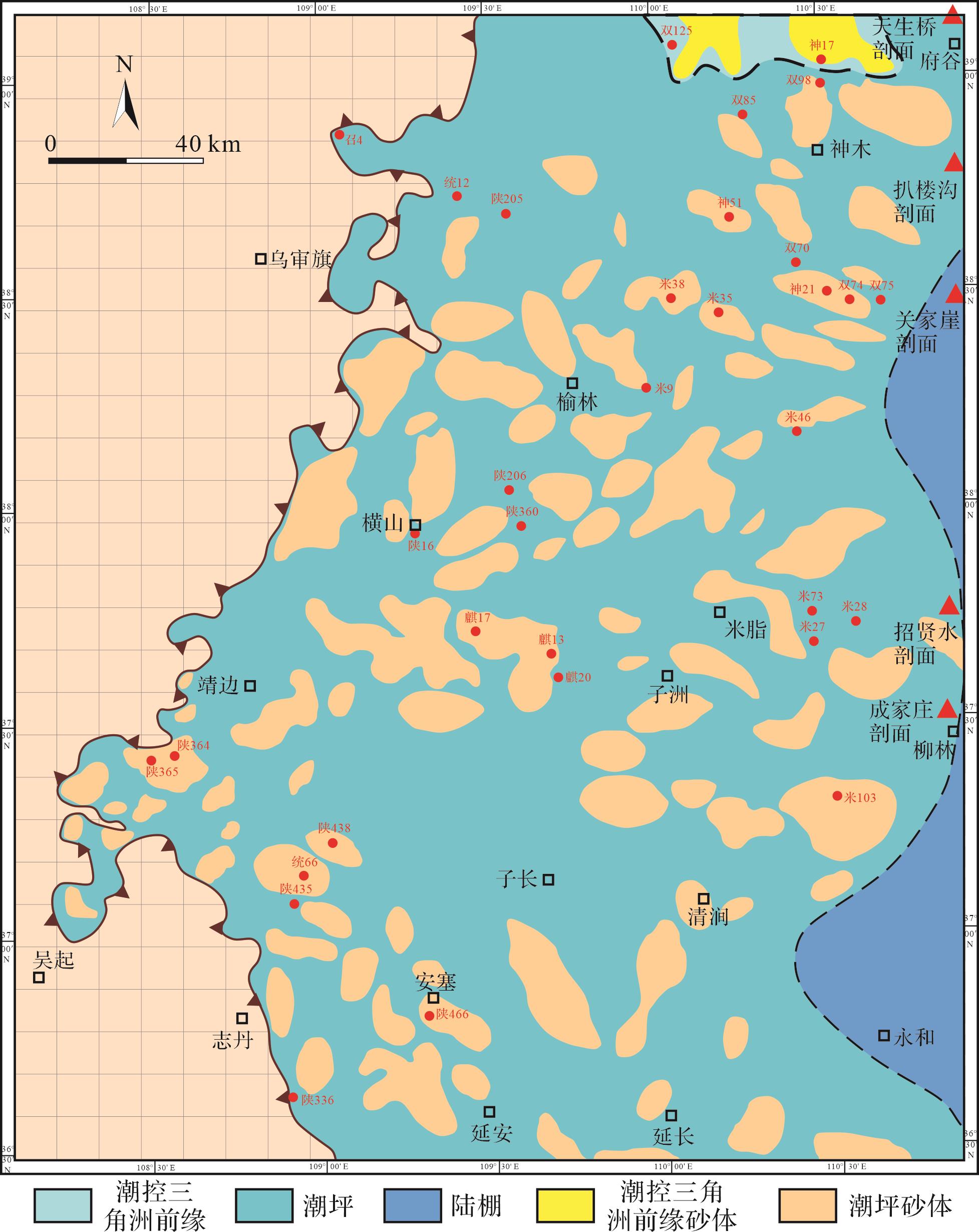
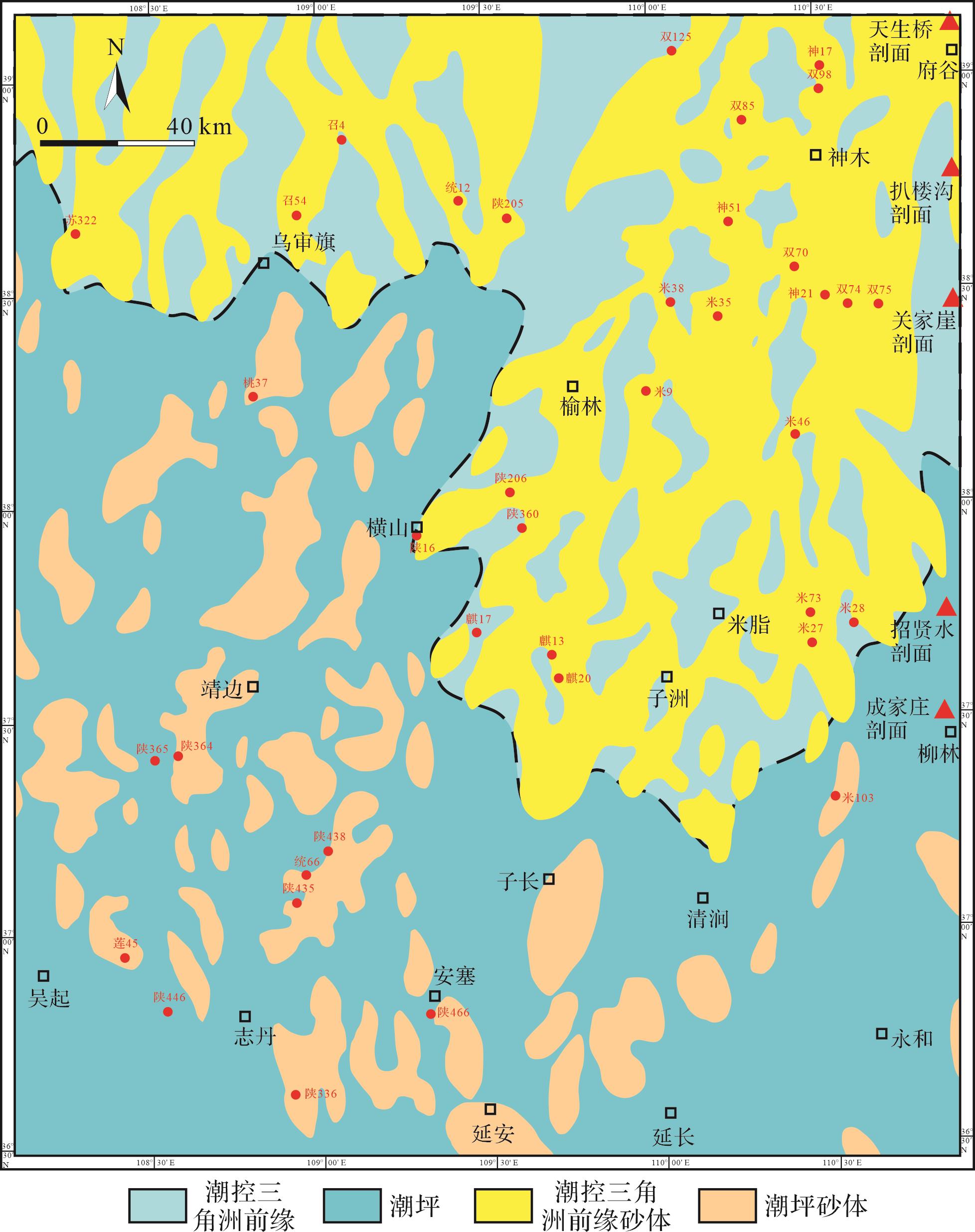
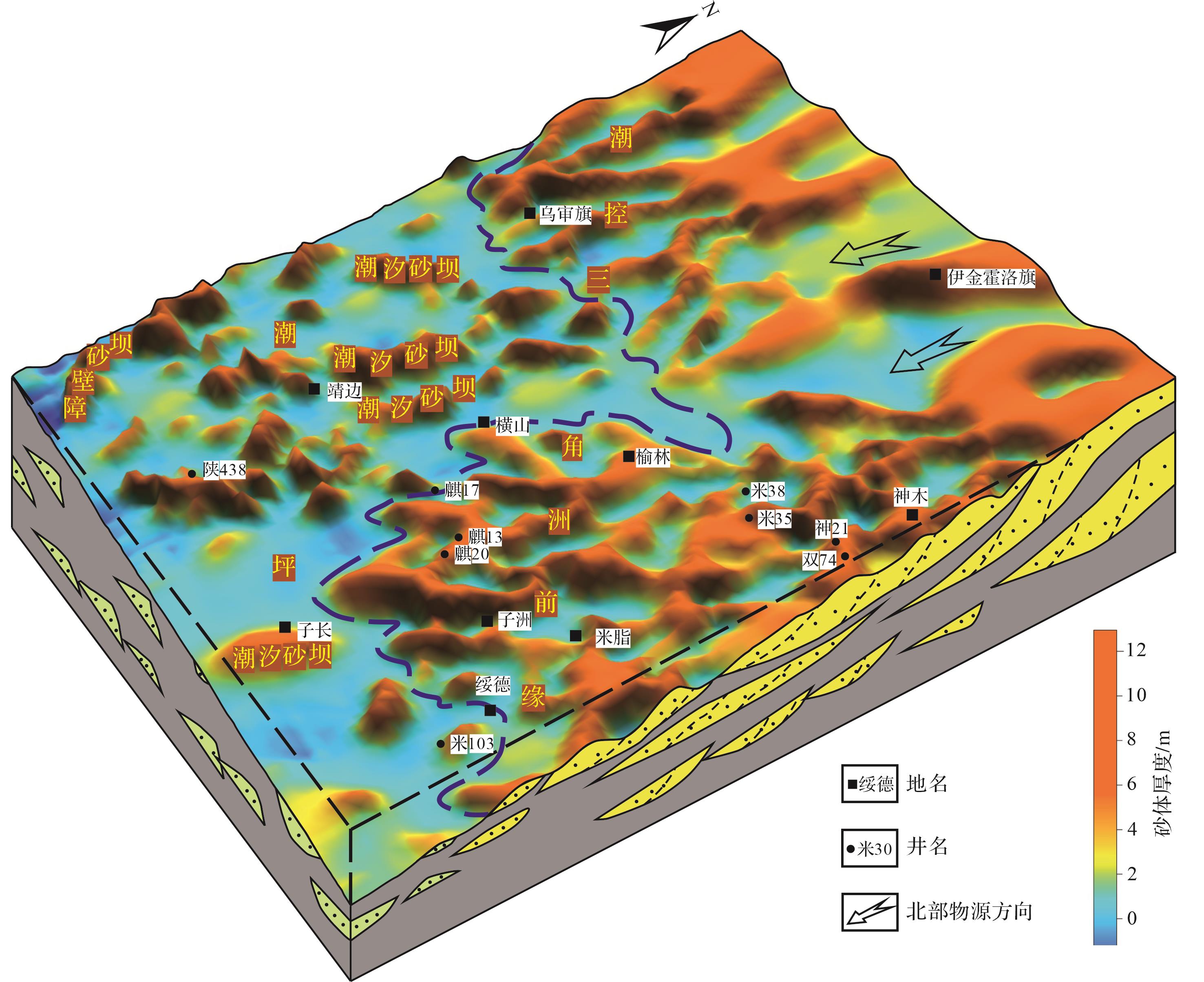
The Benxi Formation in the central and eastern part of the Ordos Basin is rich in natural gas resources and has exploration potential, but the sedimentary complex sand body changes laterally, the continuity of fast gas reservoir is poor, and the origin is unclear. Discussion on the genetic types and development of sand bodies in this period provides a useful reference for oil and gas exploration and paleogeographic reconstruction in this area. Based on field outcrop and core observations, combined with rock thin section grain size and logging data, the lithofacies and lithofacies association characteristics of the Benxi Formation are studied, the genetic types of the sand bodies from the Benxi Formation are discussed, the distribution law and sedimentary evolution of sand bodies are revealed, and the sedimentation of the Benxi Formation is established. The study shows that there are 12 lithofacies types in the Benxi Formation in the central and eastern Ordos Basin during the sedimentary period. There are six genetic types of sand bodies: underwater distributary channel, tidal channel, tidal flat (sand flat-mixed flat), tidal bar, barrier bar, tidal storm, and shelf. Among them, the north and south ends of the North China Plate were in the initial collision and splicing stage of small landmasses during the sedimentary period of the Hutian section, and the provenance supplied weak and undeveloped sand bodies. The eastern part of the study area was covered by seawater, and the north-south provenance system basin was reformed by the tidal action mainly based on the spring tide differences. The sand bodies are mainly tidal bar, small-scale underwater distributary channel, tidal channel, and tidal flat (sand flat-mixed flat) sand bodies. During the sedimentary period of the Jinci section, the orogeny in the north and south was enhanced. In the north of the study area, the source supply was sufficient, and the delta system was developed continuously into the basin. The delta sand body was reformed by tidal action dominated by medium and small tidal range background, but it was mainly reformed by the underwater distributary channel sand body in the south-central part, mainly developed tidal bar sand body in the west, which was relatively shallow near paleowater body, and was reformed by tidal action dominated by medium and small tidal range background. Barrier ba, tidal channel, and tidal flat (sand flat-mixed flat) sand bodies were developed.
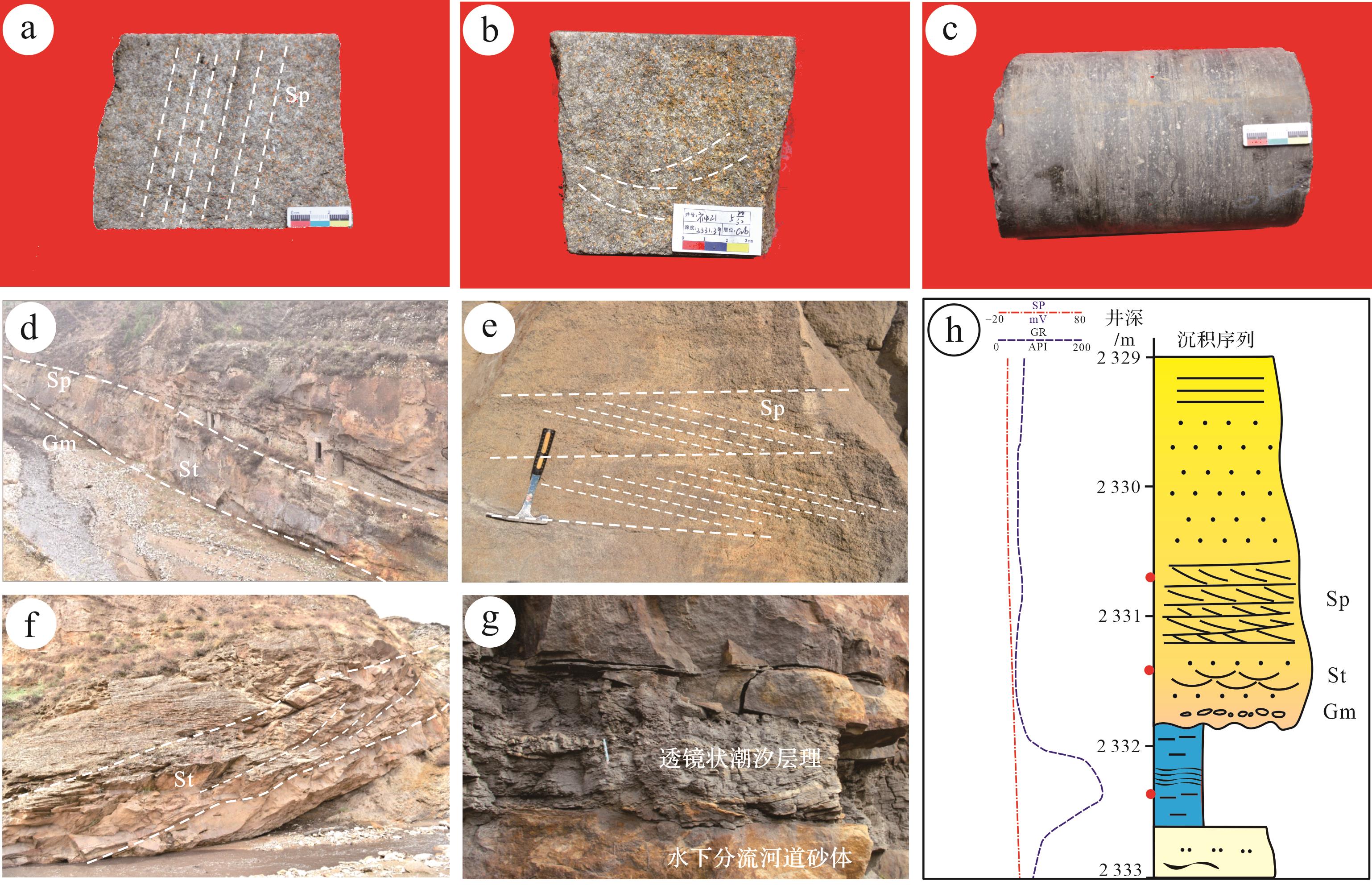
The Benxi Formation in the central and eastern part of the Ordos Basin is rich in natural gas resources and has exploration potential, but the sedimentary complex sand body changes laterally, the continuity of fast gas reservoir is poor, and the origin is unclear. Discussion on the genetic types and development of sand bodies in this period provides a useful reference for oil and gas exploration and paleogeographic reconstruction in this area. Based on field outcrop and core observations, combined with rock thin section grain size and logging data, the lithofacies and lithofacies association characteristics of the Benxi Formation are studied, the genetic types of the sand bodies from the Benxi Formation are discussed, the distribution law and sedimentary evolution of sand bodies are revealed, and the sedimentation of the Benxi Formation is established. The study shows that there are 12 lithofacies types in the Benxi Formation in the central and eastern Ordos Basin during the sedimentary period. There are six genetic types of sand bodies: underwater distributary channel, tidal channel, tidal flat (sand flat-mixed flat), tidal bar, barrier bar, tidal storm, and shelf. Among them, the north and south ends of the North China Plate were in the initial collision and splicing stage of small landmasses during the sedimentary period of the Hutian section, and the provenance supplied weak and undeveloped sand bodies. The eastern part of the study area was covered by seawater, and the north-south provenance system basin was reformed by the tidal action mainly based on the spring tide differences. The sand bodies are mainly tidal bar, small-scale underwater distributary channel, tidal channel, and tidal flat (sand flat-mixed flat) sand bodies. During the sedimentary period of the Jinci section, the orogeny in the north and south was enhanced. In the north of the study area, the source supply was sufficient, and the delta system was developed continuously into the basin. The delta sand body was reformed by tidal action dominated by medium and small tidal range background, but it was mainly reformed by the underwater distributary channel sand body in the south-central part, mainly developed tidal bar sand body in the west, which was relatively shallow near paleowater body, and was reformed by tidal action dominated by medium and small tidal range background. Barrier ba, tidal channel, and tidal flat (sand flat-mixed flat) sand bodies were developed.


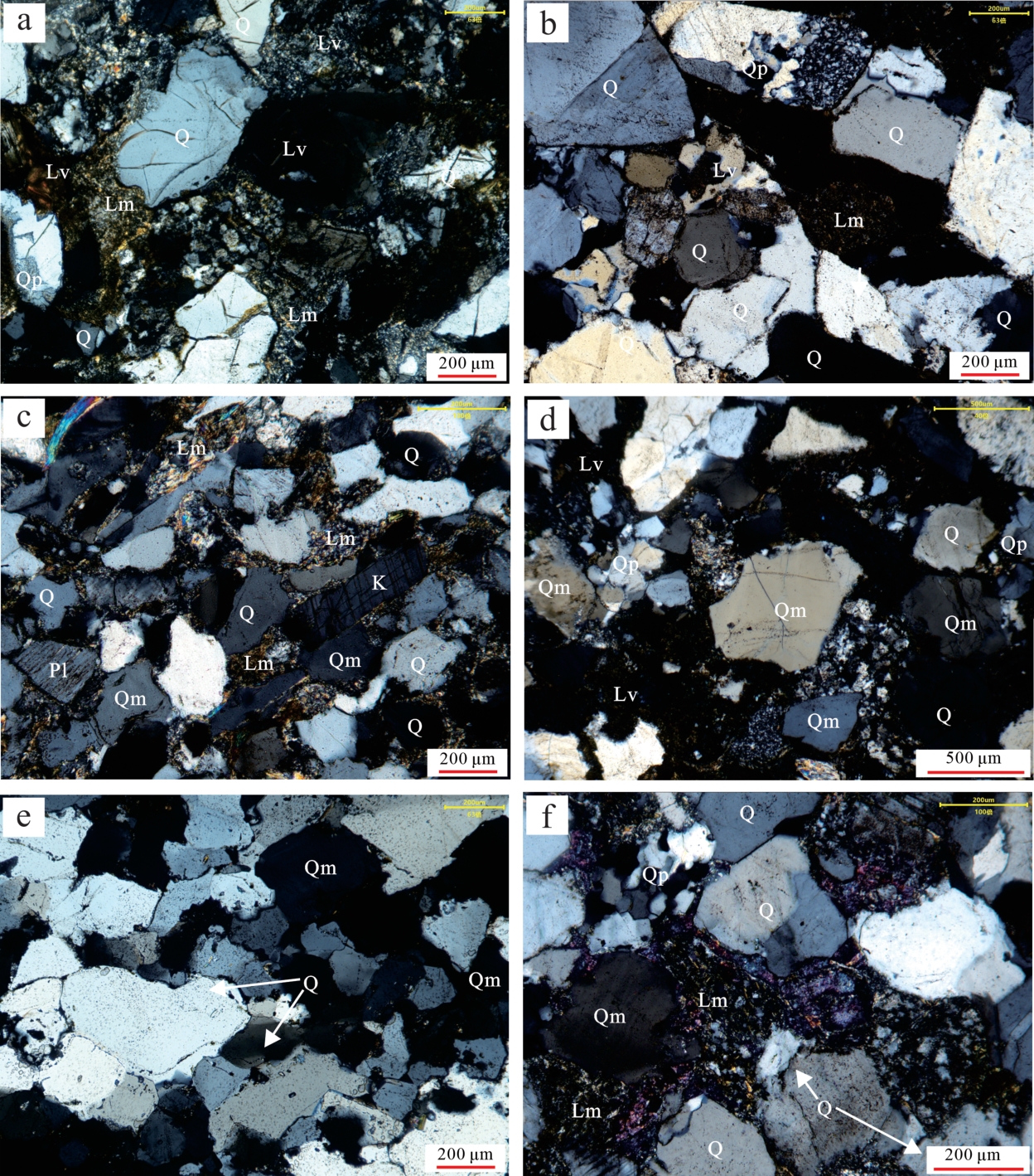
2023, 41(5): 1396-1413.
doi: 10.14027/j.issn.1000-0550.2022.118
Abstract:
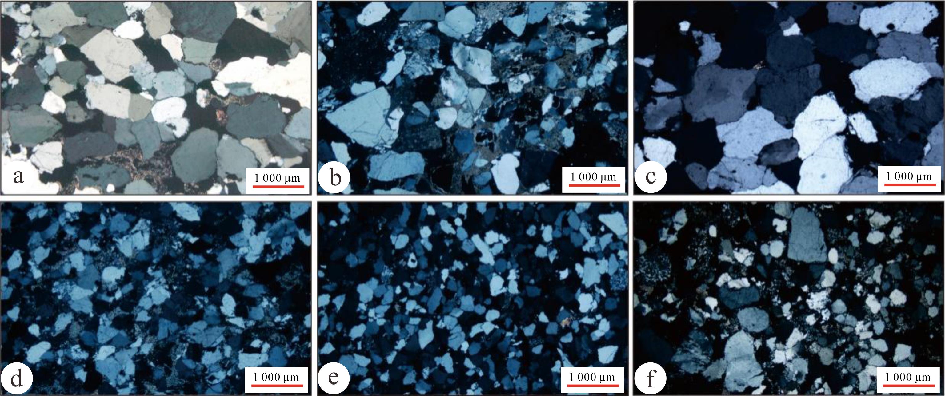
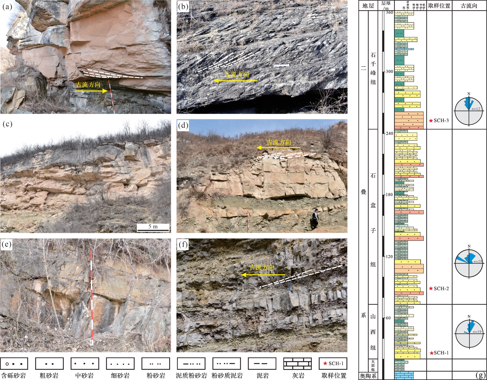
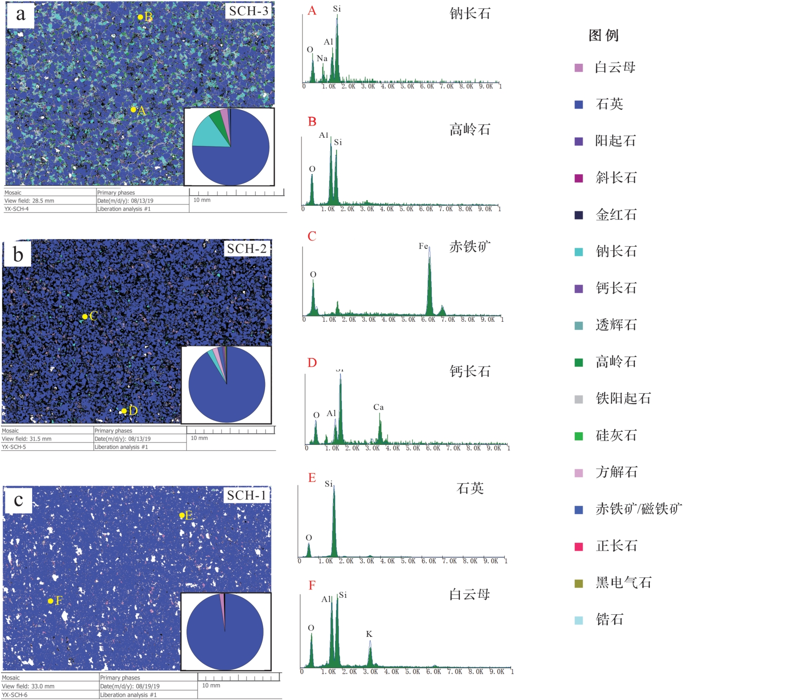
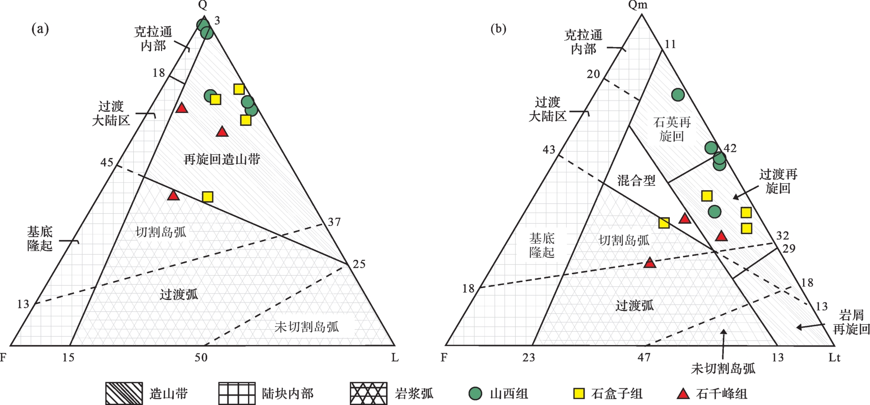
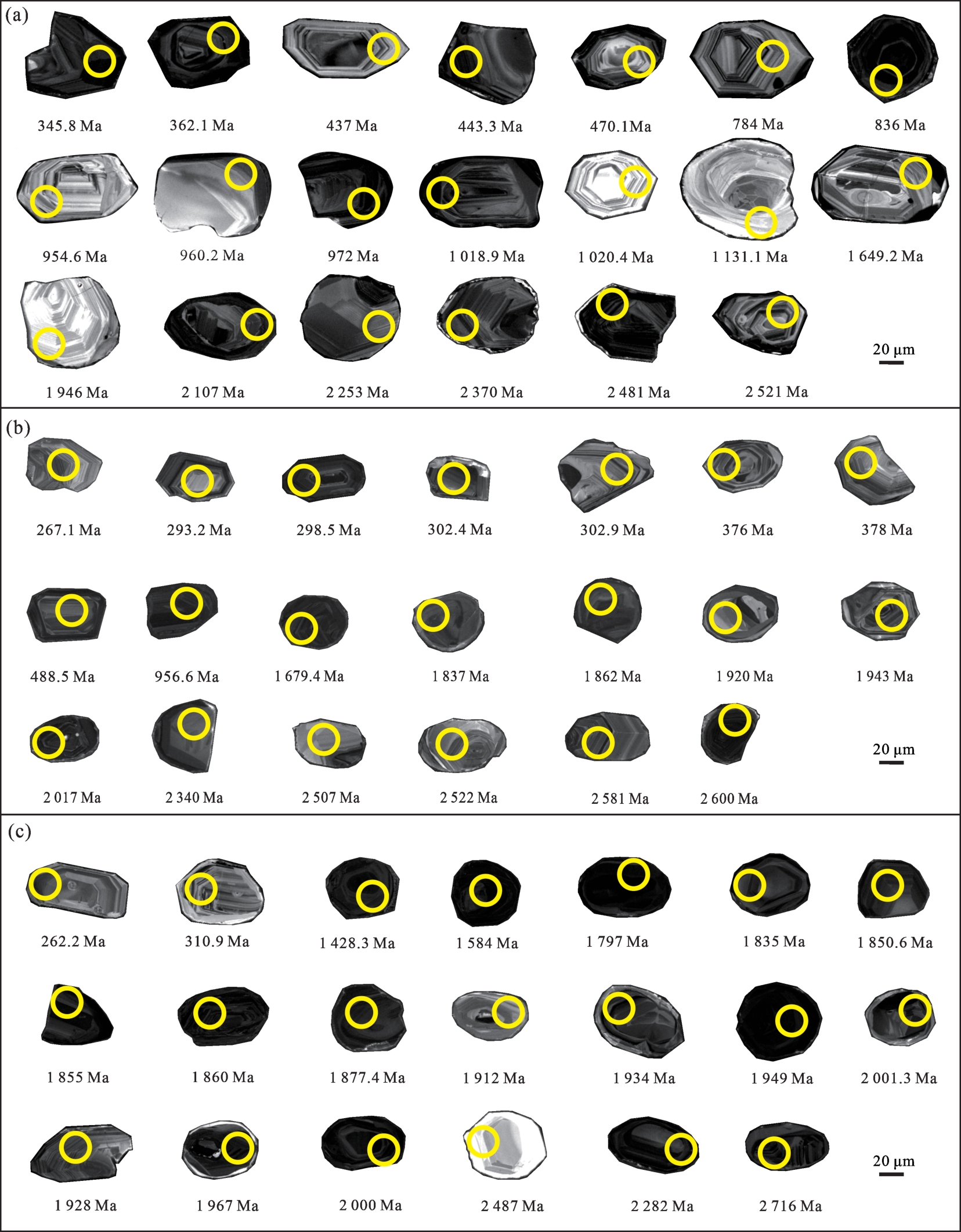
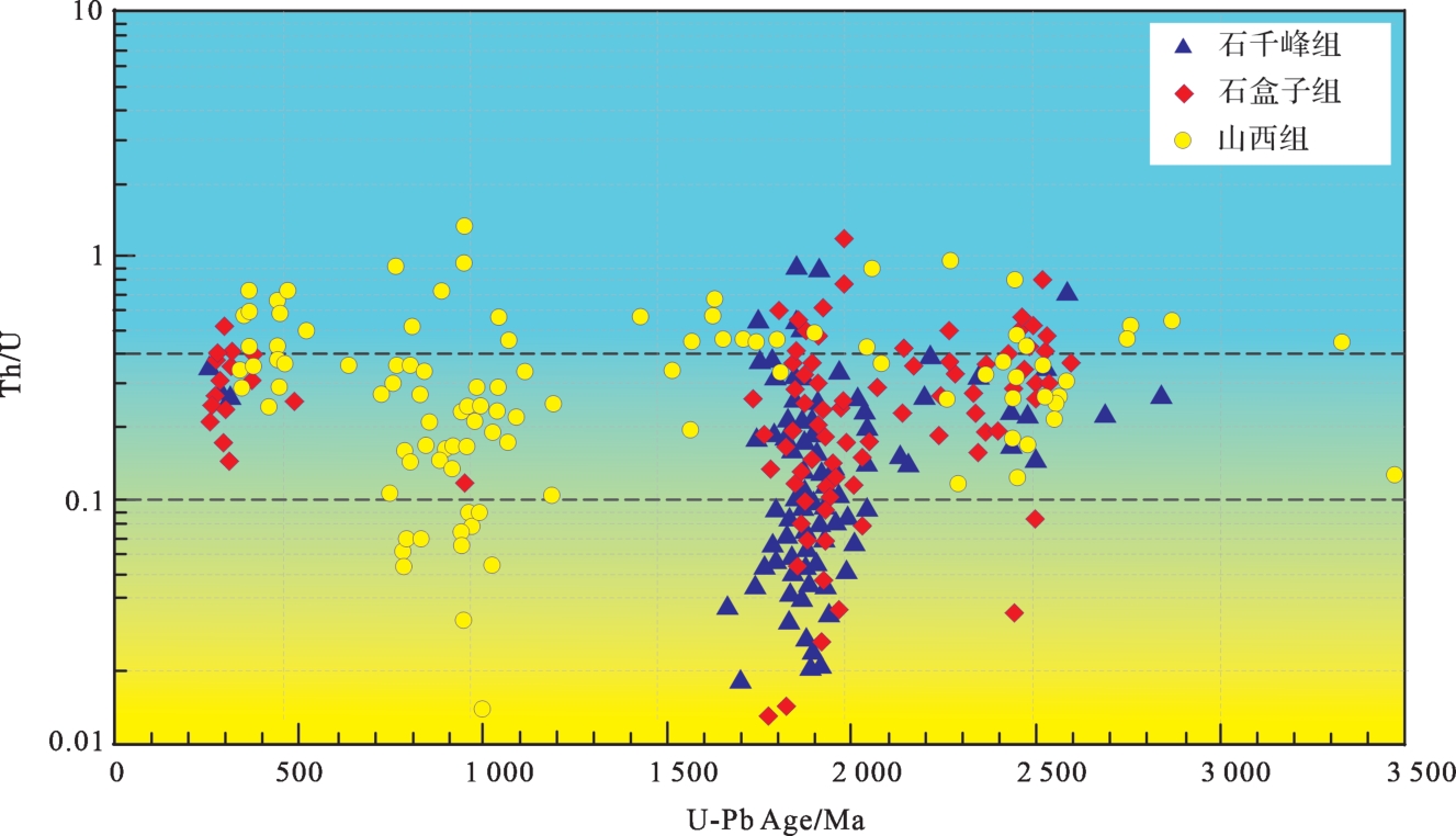
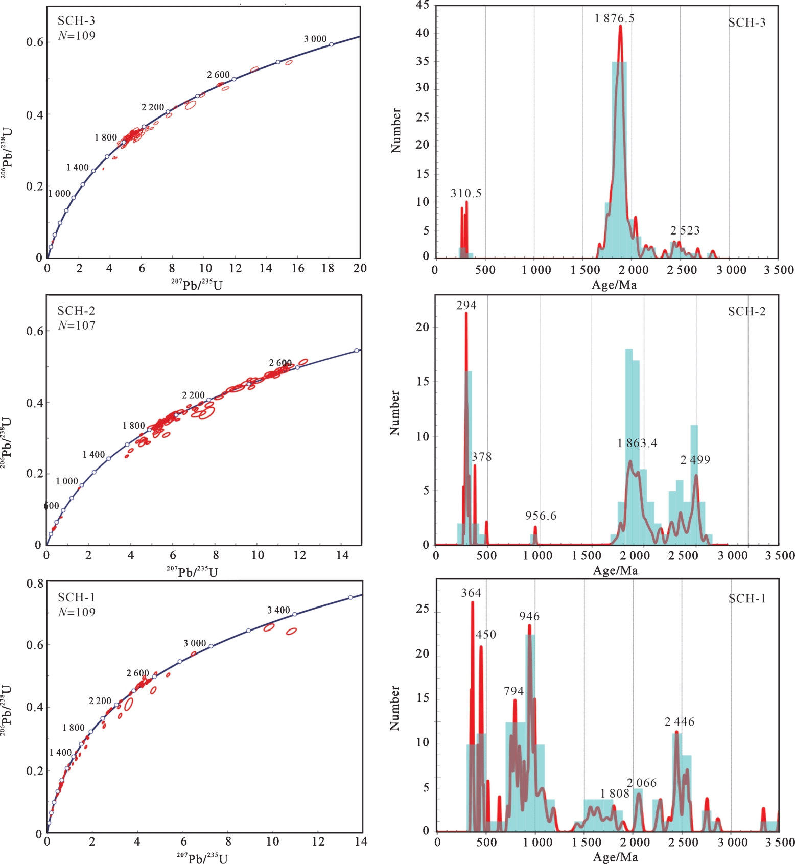
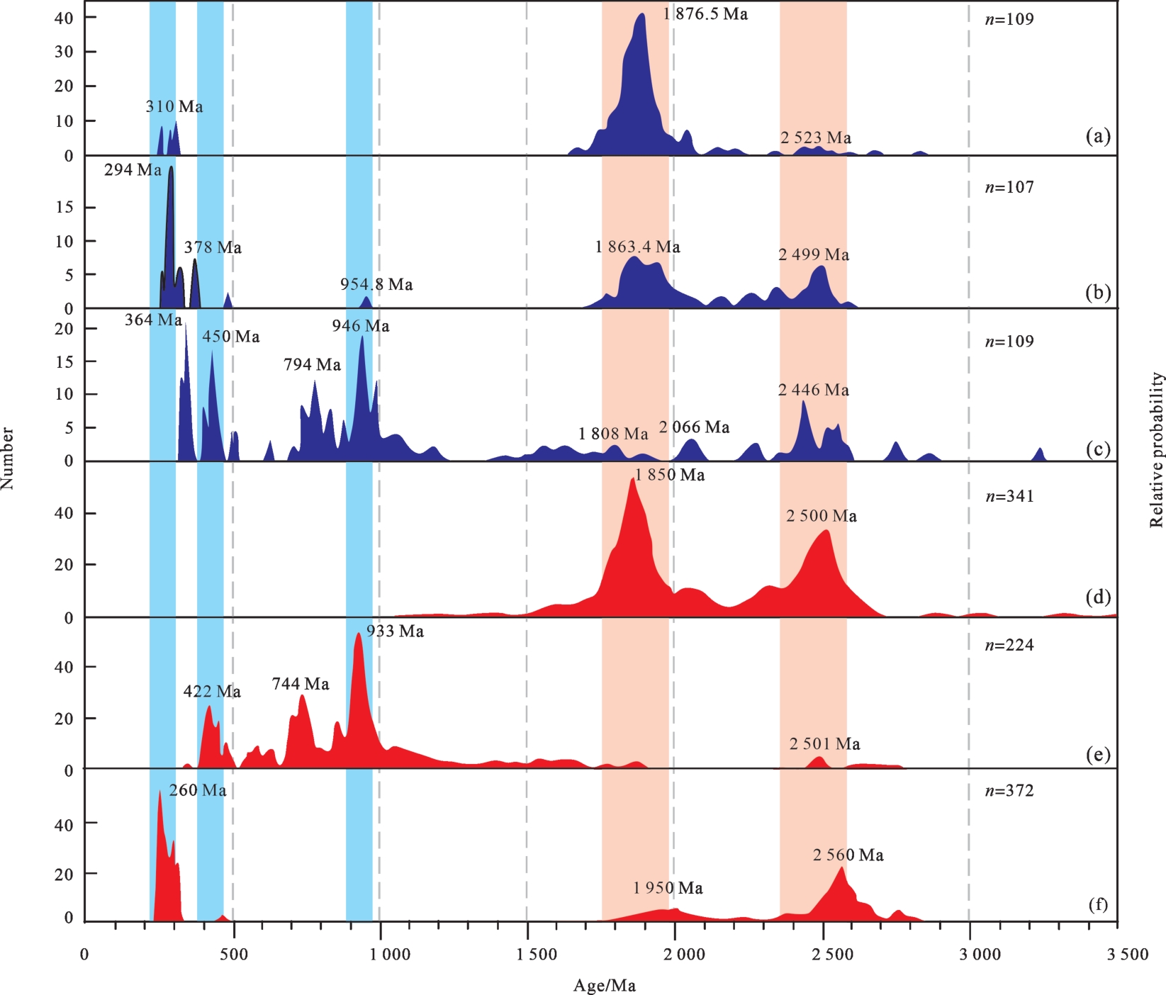
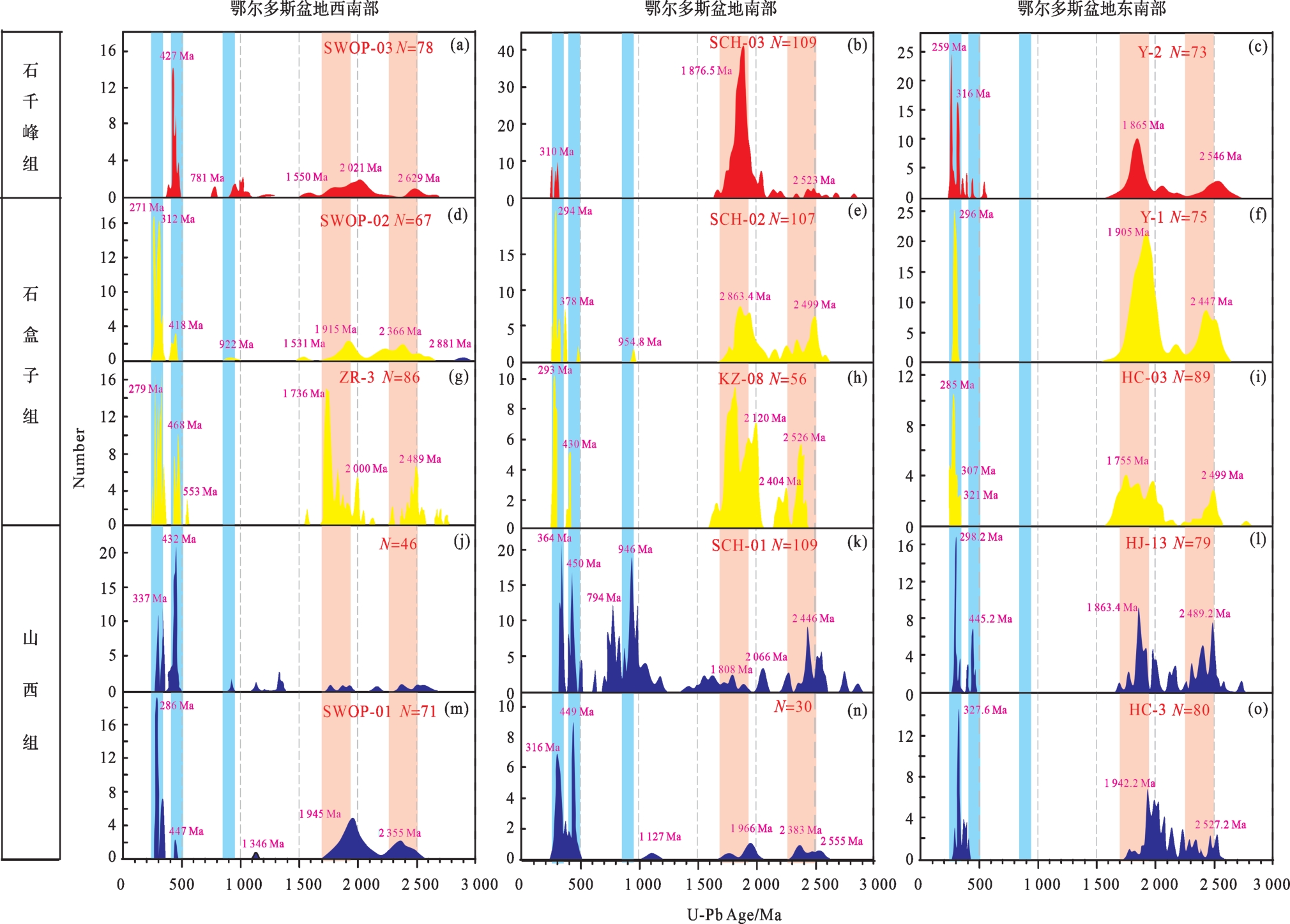
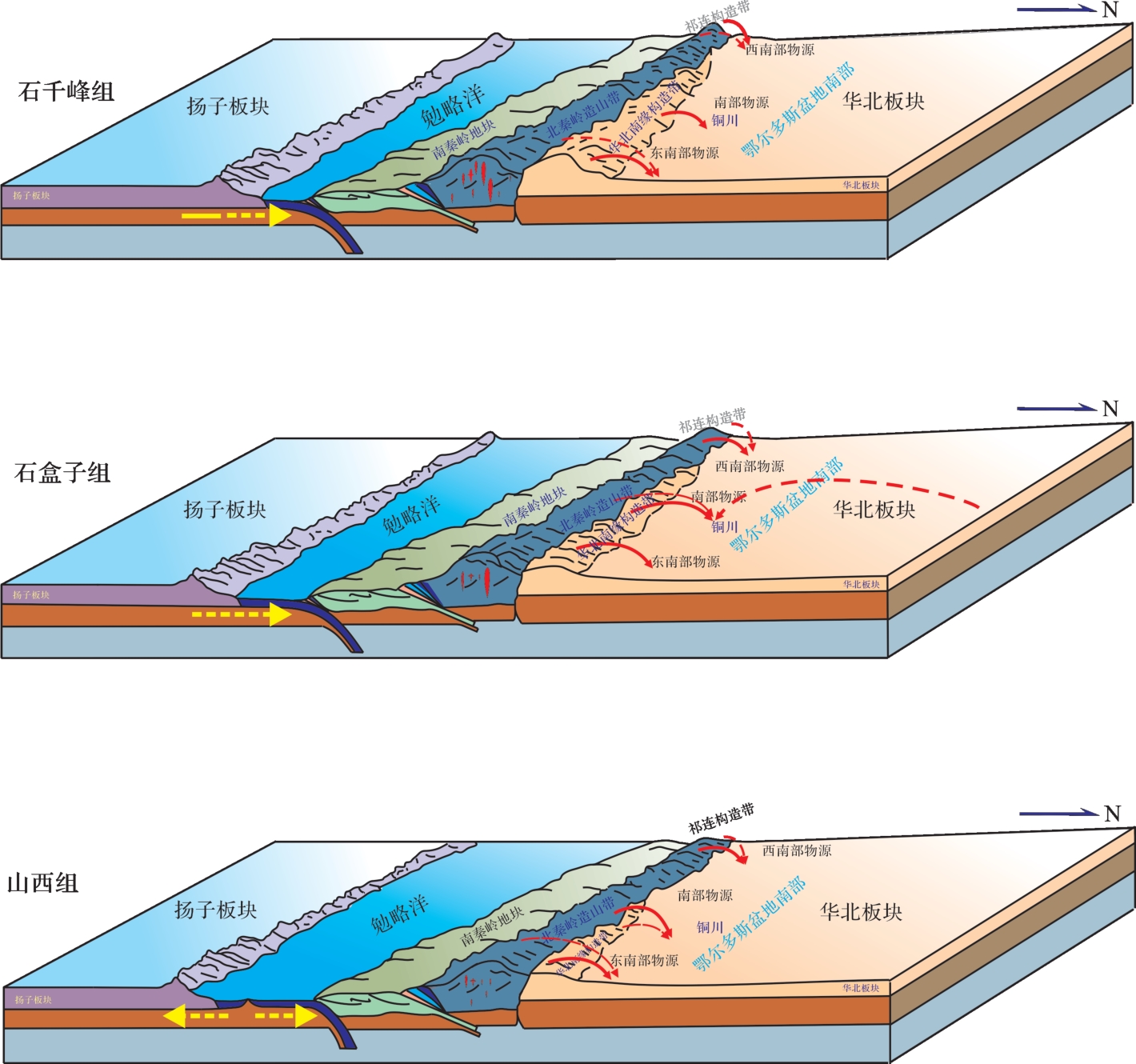
The material sources and changes of terrigenous clastic rocks are closely related to sedimentary basins and tectonic evolution. Based on the identification of rock thin sections, quantitative mineralogical analysis, and detrital zircon U-Pb chronology of sandstone samples from the Shanxi, Shihezi, and Shiqianfeng Formations of the Permian Shichuanhe sectionin the Tongchuan area, southern Ordos Basin, the provenance was traced, and the tectonic-sedimentary process of Permian in southern Ordos Basin was examined. The results show that the detrital zircon from the Early Permian Shanxi Group had four major age group peaks at 364 Ma, 450 Ma, 946 Ma, and 2 446 Ma. The detrital zircons from the Lower Shihezi Formation in the Middle Permian had three major age group peaks at 294 Ma, 1 963.4 Ma, and 2 499 Ma. The main peak value of detrital zircons from the Late Permian Shiqianfeng Formation was 1 876.5 Ma, and the weak peak values were 310.5 Ma and 2 523 Ma. There is a lack of Neoproterozoic and Early Paleozoic detrital zircon records representing the North Qinling orogenic belt. The main provenance of the Shanxi Formation is thought to be the North Qinling orogenic belt, and the secondary provenance is the structural belt of the southern margin of North China. The provenance of the Shihezi Formation is provided by the North Qinling orogenic belt, the structural belt of the southern margin of North China Plate, and the western segment of Inner Mongolia uplift. The provenance of the Shiqianfeng Formation is the structural belt in the southern margin of North China. During the Shanxi period of the Early Permian, the uplift of the southern margin of North China was low and did not affect the source of the North Qinling orogenic belt. During the Shihezi period, the tectonics of the Mianlue Ocean changed from passive tension to active compression, and the Qinling orogenic belt was in a state of continuous uplift, resulting in the continuous uplift of the southern margin of the North China Plate. During the Shiqianfeng period, the southern margin of North China was strongly uplifted, not only providing material sources for the Tongchuan area, but also preventing materials from the North Qinling orogenic belt from entering the study area. Based on the comparison between the Permian provenance analysis results in the Tongchuan area and the zircon data, the southern margin of the Ordos Basin uplifted from east to west. This difference in time can reflect the start-up process of the scissors-type closed collision between the North China and South China Plates from east to west in the Permian, and the evolution of paleotopography and provenance system caused by this behavior.
The material sources and changes of terrigenous clastic rocks are closely related to sedimentary basins and tectonic evolution. Based on the identification of rock thin sections, quantitative mineralogical analysis, and detrital zircon U-Pb chronology of sandstone samples from the Shanxi, Shihezi, and Shiqianfeng Formations of the Permian Shichuanhe sectionin the Tongchuan area, southern Ordos Basin, the provenance was traced, and the tectonic-sedimentary process of Permian in southern Ordos Basin was examined. The results show that the detrital zircon from the Early Permian Shanxi Group had four major age group peaks at 364 Ma, 450 Ma, 946 Ma, and 2 446 Ma. The detrital zircons from the Lower Shihezi Formation in the Middle Permian had three major age group peaks at 294 Ma, 1 963.4 Ma, and 2 499 Ma. The main peak value of detrital zircons from the Late Permian Shiqianfeng Formation was 1 876.5 Ma, and the weak peak values were 310.5 Ma and 2 523 Ma. There is a lack of Neoproterozoic and Early Paleozoic detrital zircon records representing the North Qinling orogenic belt. The main provenance of the Shanxi Formation is thought to be the North Qinling orogenic belt, and the secondary provenance is the structural belt of the southern margin of North China. The provenance of the Shihezi Formation is provided by the North Qinling orogenic belt, the structural belt of the southern margin of North China Plate, and the western segment of Inner Mongolia uplift. The provenance of the Shiqianfeng Formation is the structural belt in the southern margin of North China. During the Shanxi period of the Early Permian, the uplift of the southern margin of North China was low and did not affect the source of the North Qinling orogenic belt. During the Shihezi period, the tectonics of the Mianlue Ocean changed from passive tension to active compression, and the Qinling orogenic belt was in a state of continuous uplift, resulting in the continuous uplift of the southern margin of the North China Plate. During the Shiqianfeng period, the southern margin of North China was strongly uplifted, not only providing material sources for the Tongchuan area, but also preventing materials from the North Qinling orogenic belt from entering the study area. Based on the comparison between the Permian provenance analysis results in the Tongchuan area and the zircon data, the southern margin of the Ordos Basin uplifted from east to west. This difference in time can reflect the start-up process of the scissors-type closed collision between the North China and South China Plates from east to west in the Permian, and the evolution of paleotopography and provenance system caused by this behavior.
2023, 41(5): 1414-1429.
doi: 10.14027/j.issn.1000-0550.2022.154
Abstract:
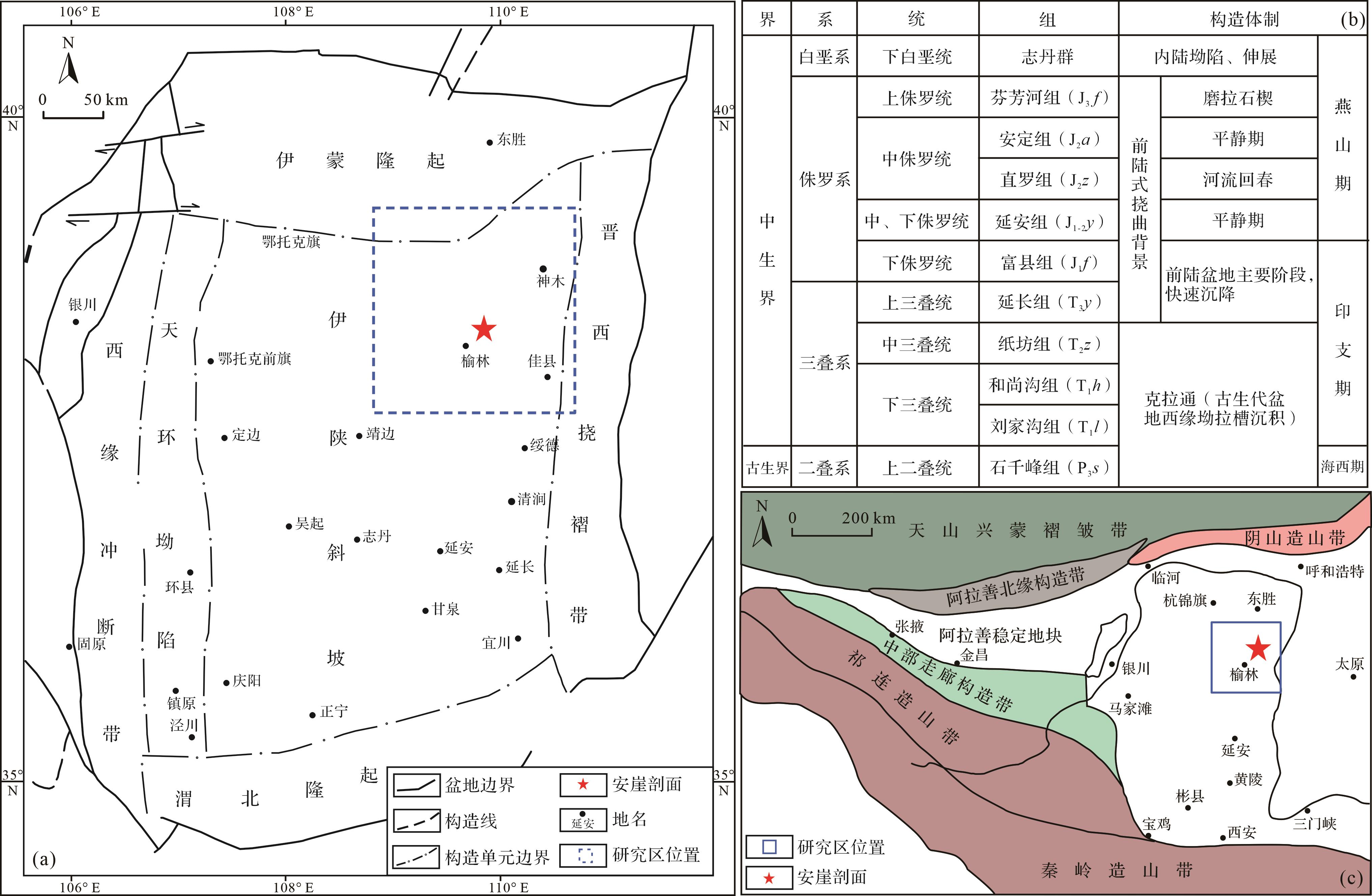
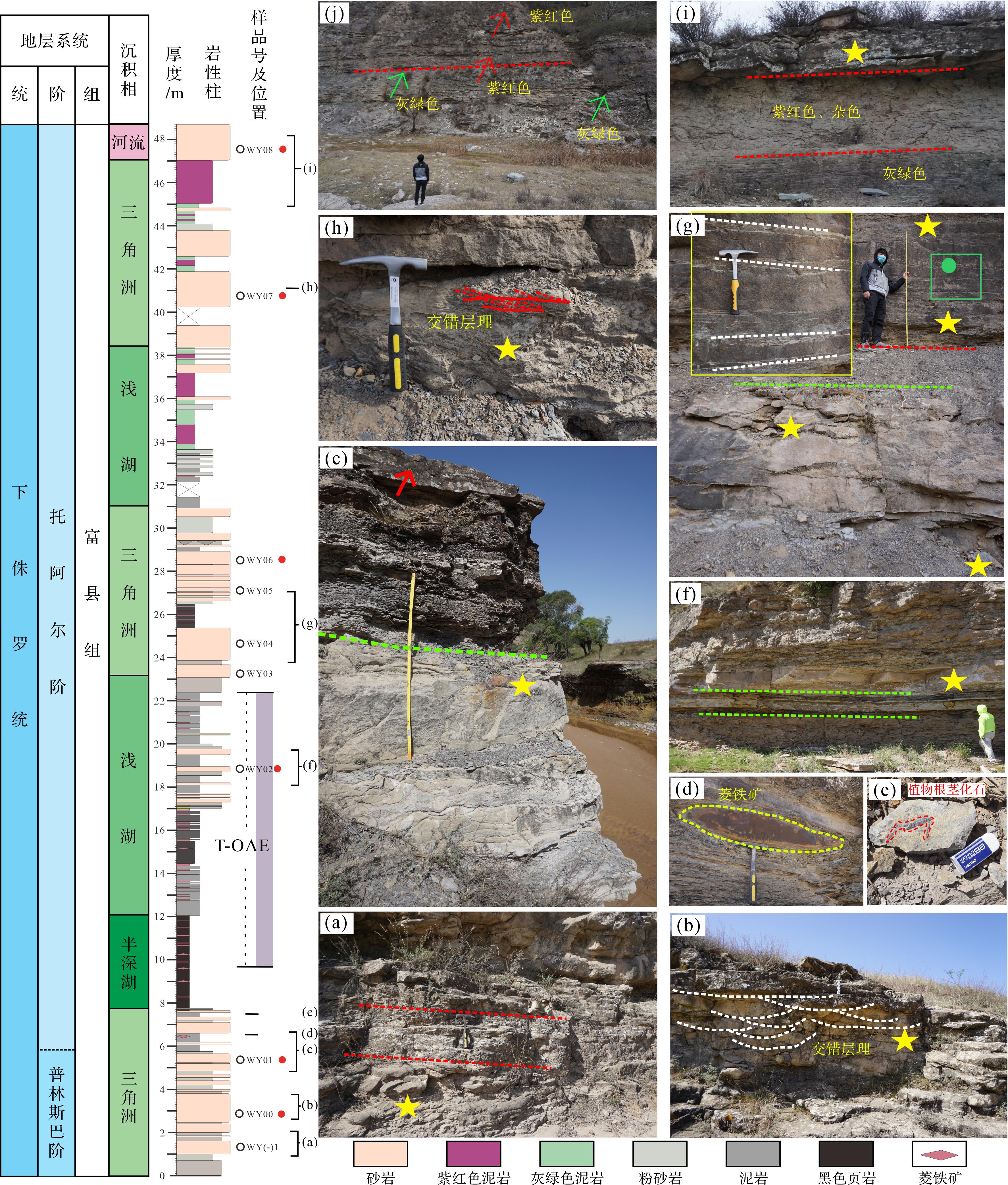
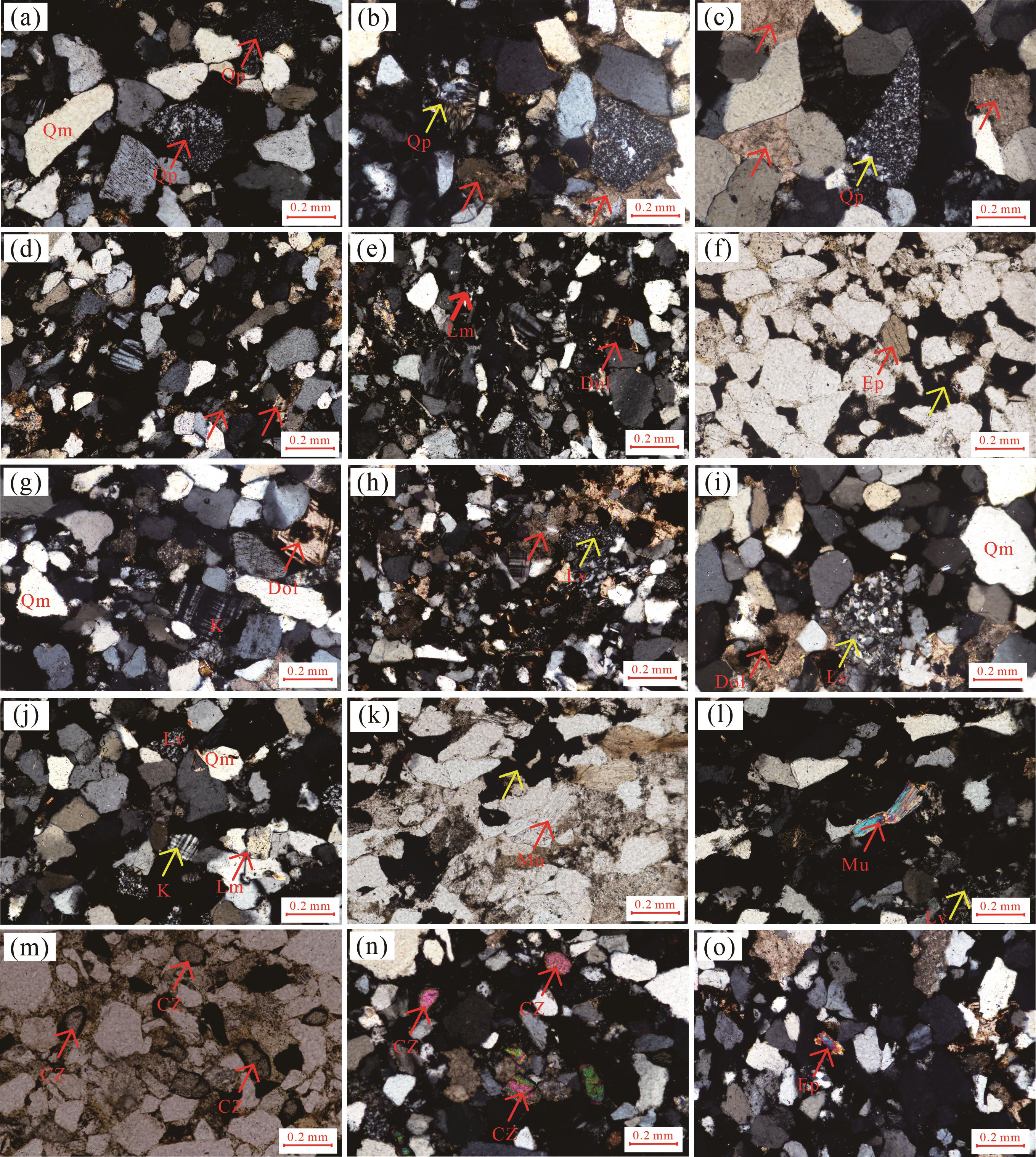
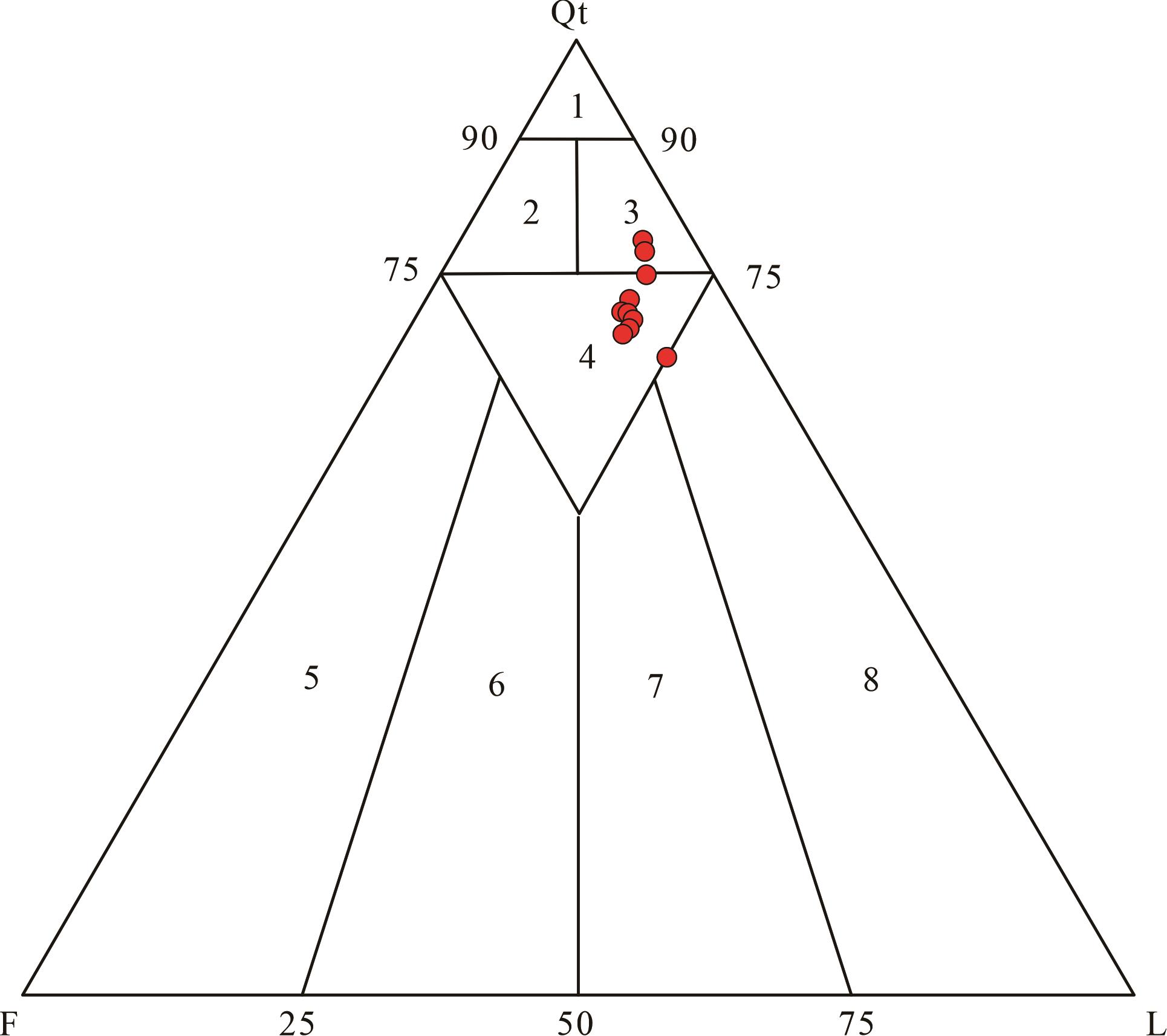
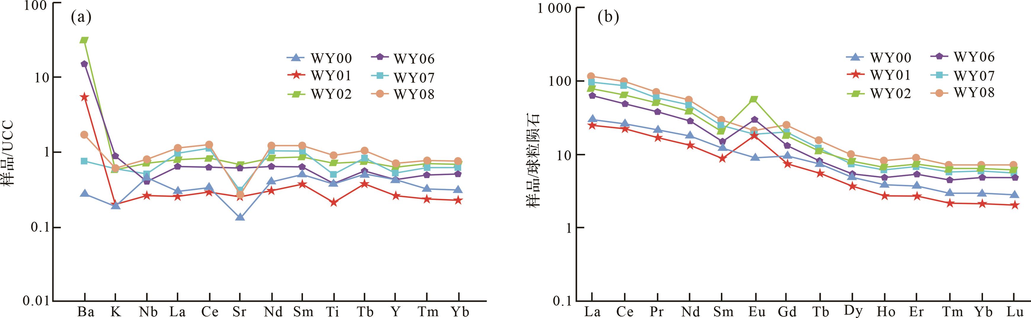
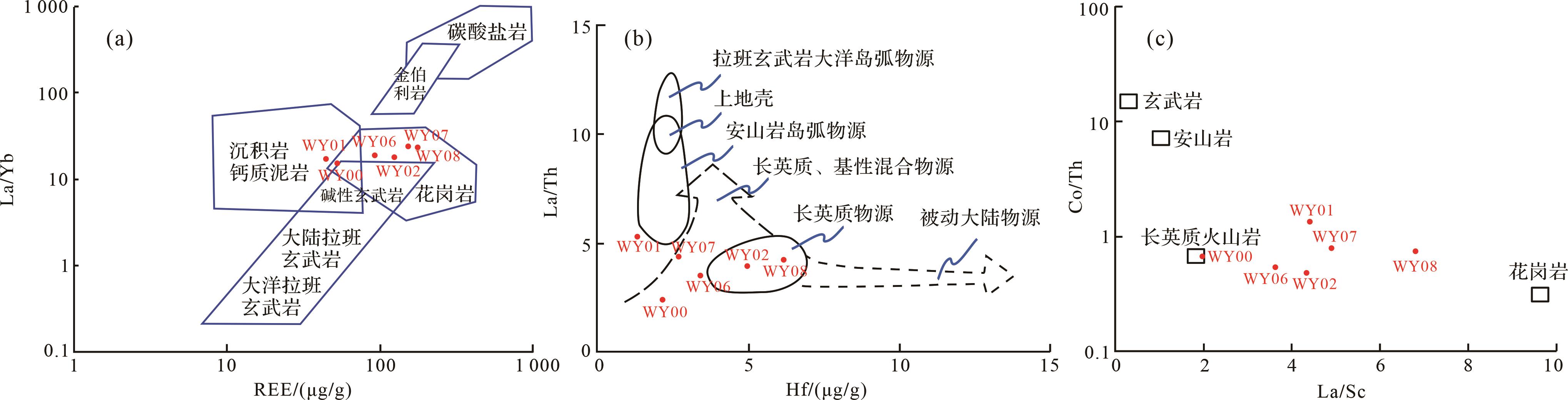
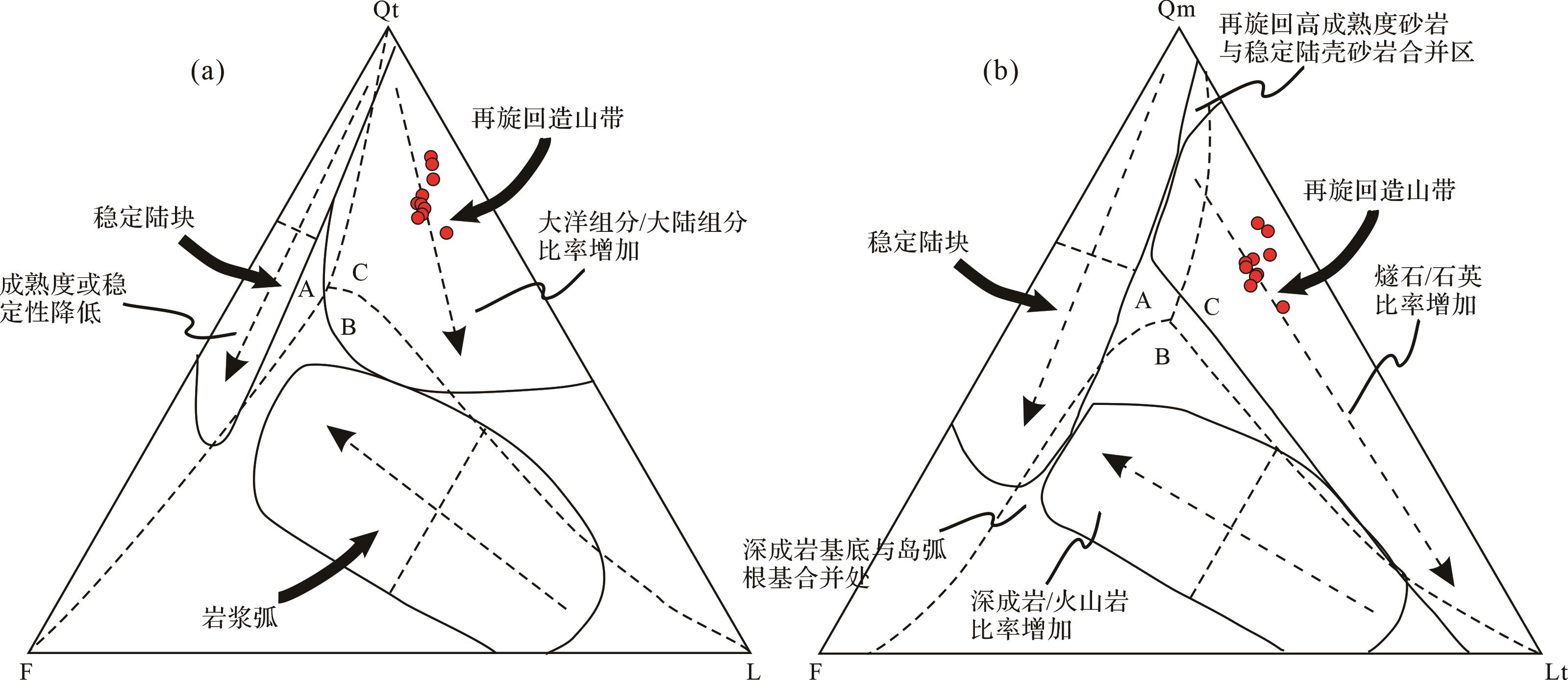
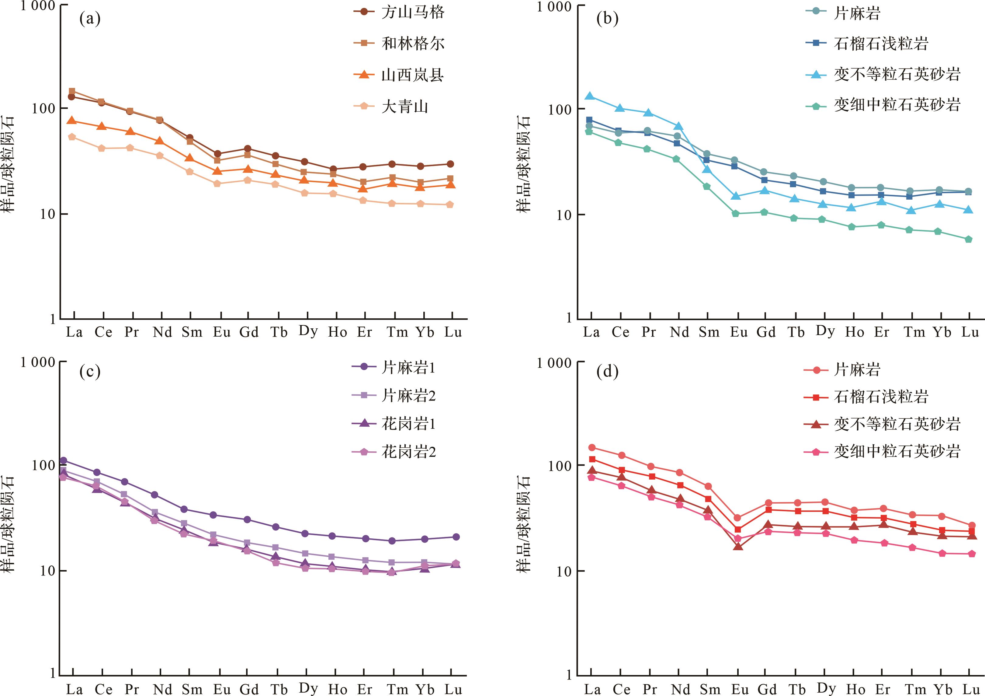
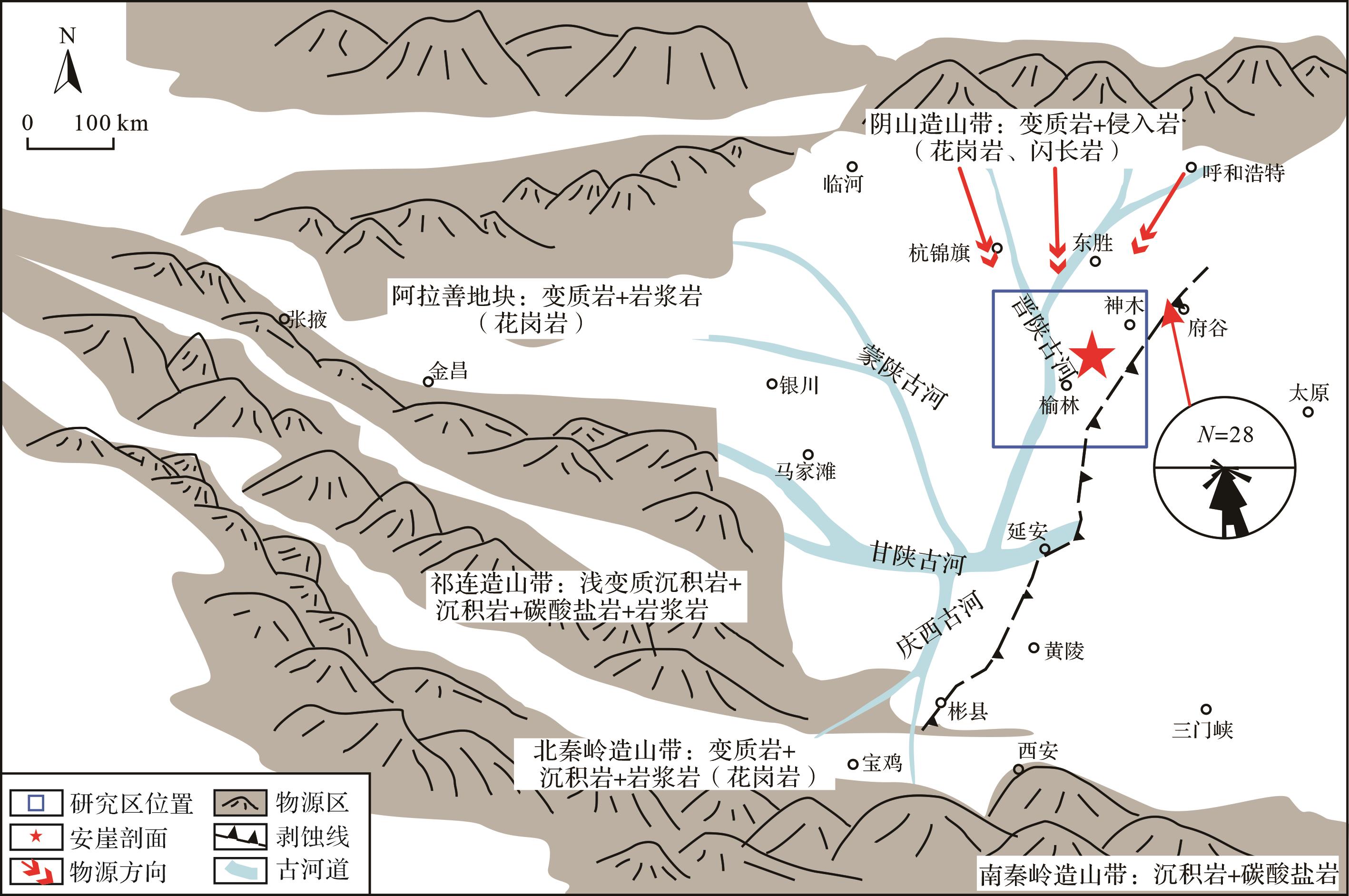
The Ordos Basin, located in the western North China Block, is found at the junction between the stable area of eastern China and the active belt of western China. It is located between the ancient Asian and Qinqi-Kun oceans (Shangdan Ocean) of the Proto-Tethys Ocean. Therefore, the Ordos Basin is a natural laboratory for studying the Ancient Asian and Tethys tectonic domains. The provenance system of the Ordos Basin is key to understanding the tectonic evolution of the Tethyan and Paleo-Asian oceanic domains. At present, the provenance system of the Lower Jurassic in the Ordos Basin is concentrated in the central and southwestern parts of the basin, while the Early Jurassic provenance system in the northeastern Ordos Basin remains unclear. To address this scientific question, we conducted this study on the Anya section located 40 km NE of Yulin city, northern Ordos Basin. We collected 10 sandstone samples from the Fuxian Formation for petrological analysis and 6 for element geochemical analysis. This study used the Gazzi-Dickinson counting method to classify the sandstone composition. The surface dust and weathered portions of samples were removed with a rasper and then washed with deionized water. After 8 hours of oven drying at 50 °C, samples were ground into powder using agate mortars. Sample preparations were completed in the School of Materials and Chemistry & Chemical Engineering, Chengdu University of Technology. Approximately 30⁃50 mg of powdered sample were digested with HF+HNO3+HClO4 mixed acid, and then inductively coupled plasma-optical emission (ICP-OES; IRIS Advantage) and inductively coupled plasma-mass spectrometry (ICP-MS; Thermo VG-X7) were used to determine the major and trace elements at the State Key Laboratory of Marine Geology, Tongji University, Shanghai. International standards (BHVO-2, W-2a, GSP-2, GSD-9); blank samples were utilized for monitoring during the analytical process, and the relative deviations of the detected data were less than 5%. Results show that the sandstones of the Fuxian Formation in the study area are composed of feldspar lithic quartz and lithic quartz sandstones. Major and trace elements contents of all samples from the Anya section are similar, indicating that the Fuxian Formation has a single provenance system. The La/Yb-∑REE, Hf-La/Th, and Co/TH-La/Sc diagrams, together with the characteristics of lithic fragments, reveal that the parent rocks of the Fuxian Formation were intermediate acid magmatic and metamorphic rocks. The Dickinson plot indicates that the main provenance of the Fuxian Formation sandstones was formed in the tectonic setting of the recycled orogenic belt. The distribution of rare earth elements (REEs) is flat and exhibits a "lean slowly to the right" pattern. Comparing REE distribution models to that of surrounding potential source areas reveals that those of the Fuxian Formation sandstones are comparable to that of Yinshan orogenic belt. As a result, we concluded that the main provenance area of the Fuxian Formation in the northeastern Ordos Basin is the Yinshan orogenic belt, which is further supported by paleocurrent data from previous work. From the Permian to the Triassic, the root of the oceanic crust formed by the subduction of the ancient Asian Ocean block fractured and disintegrated, causing a large amount of granite to penetrate the Yinshan orogenic belt, weathered and denuded during the Early-Middle Jurassic, and transported to the northeastern Ordos Basin by the Jinshaan-Guhe River.
The Ordos Basin, located in the western North China Block, is found at the junction between the stable area of eastern China and the active belt of western China. It is located between the ancient Asian and Qinqi-Kun oceans (Shangdan Ocean) of the Proto-Tethys Ocean. Therefore, the Ordos Basin is a natural laboratory for studying the Ancient Asian and Tethys tectonic domains. The provenance system of the Ordos Basin is key to understanding the tectonic evolution of the Tethyan and Paleo-Asian oceanic domains. At present, the provenance system of the Lower Jurassic in the Ordos Basin is concentrated in the central and southwestern parts of the basin, while the Early Jurassic provenance system in the northeastern Ordos Basin remains unclear. To address this scientific question, we conducted this study on the Anya section located 40 km NE of Yulin city, northern Ordos Basin. We collected 10 sandstone samples from the Fuxian Formation for petrological analysis and 6 for element geochemical analysis. This study used the Gazzi-Dickinson counting method to classify the sandstone composition. The surface dust and weathered portions of samples were removed with a rasper and then washed with deionized water. After 8 hours of oven drying at 50 °C, samples were ground into powder using agate mortars. Sample preparations were completed in the School of Materials and Chemistry & Chemical Engineering, Chengdu University of Technology. Approximately 30⁃50 mg of powdered sample were digested with HF+HNO3+HClO4 mixed acid, and then inductively coupled plasma-optical emission (ICP-OES; IRIS Advantage) and inductively coupled plasma-mass spectrometry (ICP-MS; Thermo VG-X7) were used to determine the major and trace elements at the State Key Laboratory of Marine Geology, Tongji University, Shanghai. International standards (BHVO-2, W-2a, GSP-2, GSD-9); blank samples were utilized for monitoring during the analytical process, and the relative deviations of the detected data were less than 5%. Results show that the sandstones of the Fuxian Formation in the study area are composed of feldspar lithic quartz and lithic quartz sandstones. Major and trace elements contents of all samples from the Anya section are similar, indicating that the Fuxian Formation has a single provenance system. The La/Yb-∑REE, Hf-La/Th, and Co/TH-La/Sc diagrams, together with the characteristics of lithic fragments, reveal that the parent rocks of the Fuxian Formation were intermediate acid magmatic and metamorphic rocks. The Dickinson plot indicates that the main provenance of the Fuxian Formation sandstones was formed in the tectonic setting of the recycled orogenic belt. The distribution of rare earth elements (REEs) is flat and exhibits a "lean slowly to the right" pattern. Comparing REE distribution models to that of surrounding potential source areas reveals that those of the Fuxian Formation sandstones are comparable to that of Yinshan orogenic belt. As a result, we concluded that the main provenance area of the Fuxian Formation in the northeastern Ordos Basin is the Yinshan orogenic belt, which is further supported by paleocurrent data from previous work. From the Permian to the Triassic, the root of the oceanic crust formed by the subduction of the ancient Asian Ocean block fractured and disintegrated, causing a large amount of granite to penetrate the Yinshan orogenic belt, weathered and denuded during the Early-Middle Jurassic, and transported to the northeastern Ordos Basin by the Jinshaan-Guhe River.
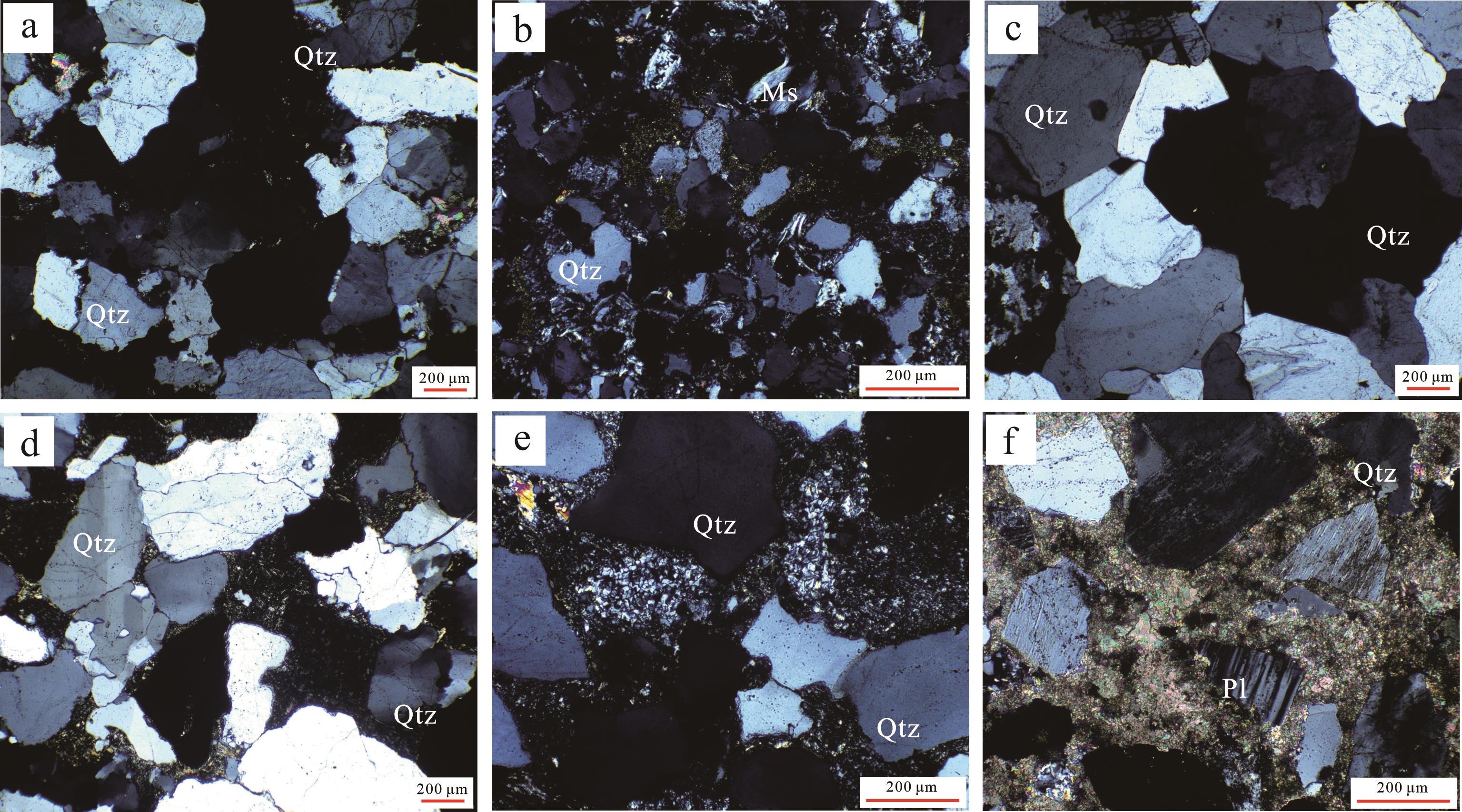
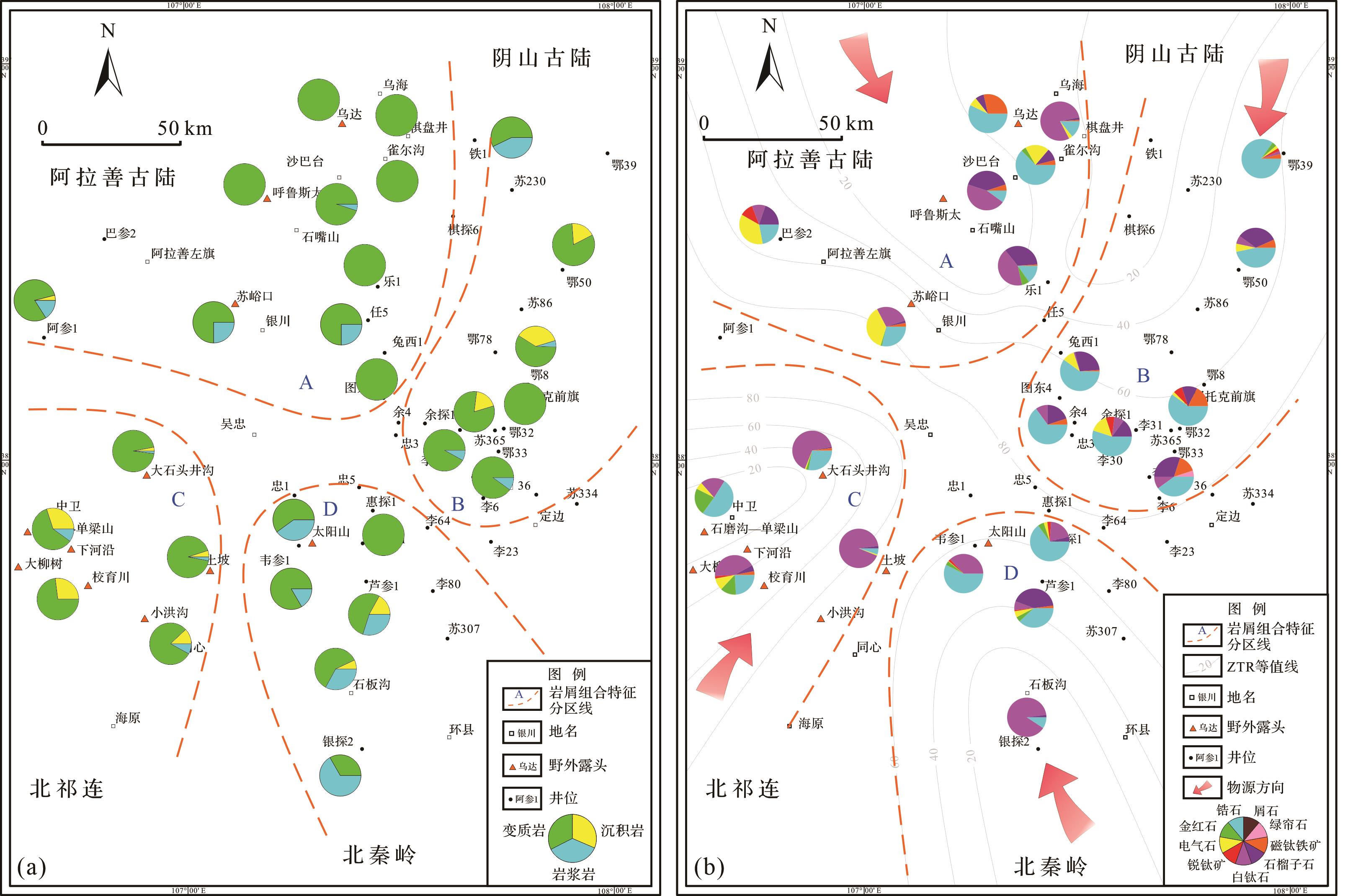
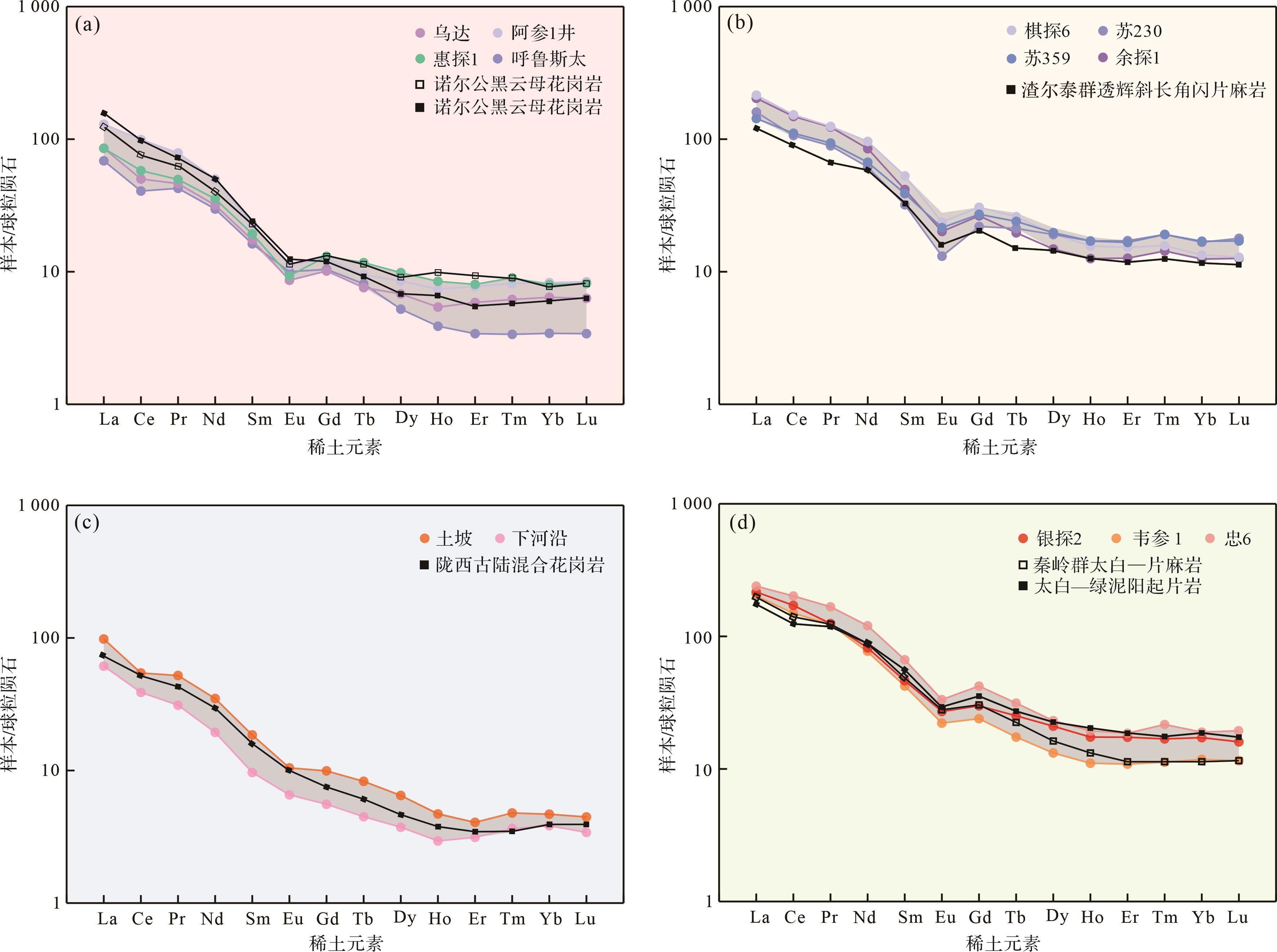
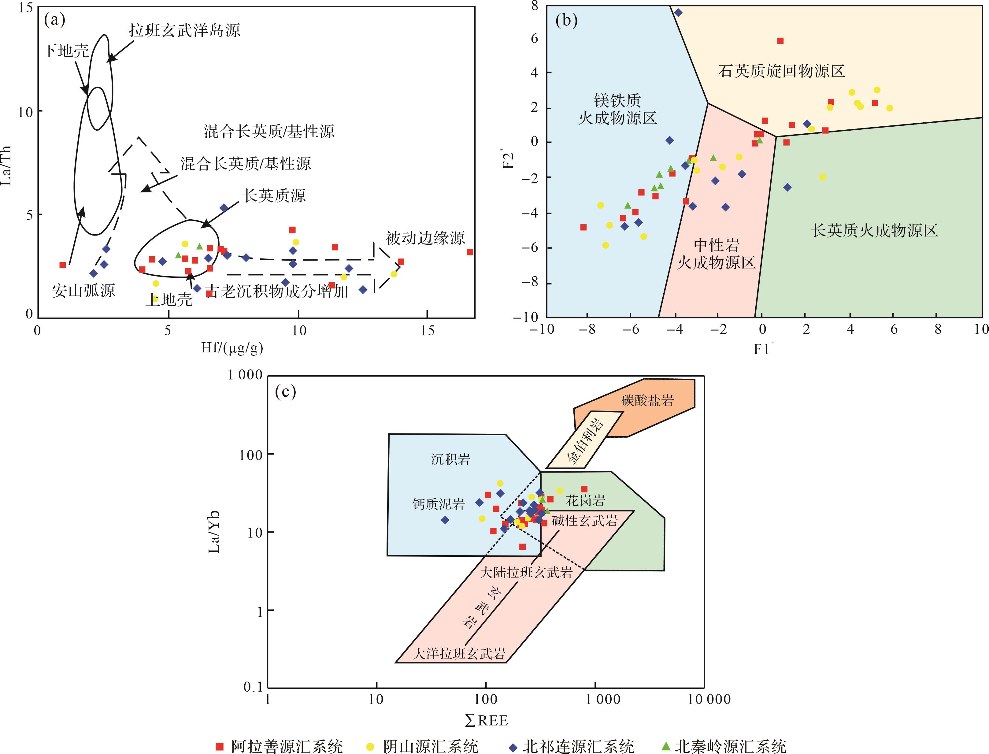
2023, 41(5): 1430-1450.
doi: 10.14027/j.issn.1000-0550.2022.134
Abstract:
The Carboniferous Yanghugou Formation in the western margin of the Ordos Basin has large exploration potential for oil and gas resources. However, owing to its complex tectonic behavior, its filling process from source to sink and paleogeographic pattern remain controversial. Combined with previous research data, through provenance analysis of the characteristics of light and heavy minerals, lithic assemblages and rare earth elements, four source-to-sink systems were proposed: Alxa in the northwest, Yinshan in the Northeast, North Qilian in the southwest, and North Qinling in the southeast. The tectonic setting of the source area in the Alxa source-to-sink system is an active continental margin and continental island arc, and the sediments are derived from the average upper crust felsic and mafic igneous material source areas. The tectonic setting of the source area in the Yinshan source-to-sink system is a passive continental margin. The sediment sources are relatively complex, a mixture of the average upper crust felsic, intermediate, and mafic igneous material. The tectonic setting of the source area in the North Qilian source-to-sink system is a mixture of passive and active continental margins, and the sediments are derived from source areas of mafic and intermediate igneous rocks; The tectonic setting of the source area in the North Qinling source-to-sink system is a the passive continental margin, and the sediments are derived from the mafic igneous source region. The parent rocks of the four source-to-sink systems are a mixture of alkaline basalts, granites, and calcareous argillaceous sedimentary rocks. Based on the division of the source-to-sink systems, the paleogeographic pattern is reconstructed: (1) The detrital sediments of the Alxa source-to-sink system flowed from the northwest and were transported to the southeast; the transport distance was long, and the river-controlled delta sedimentary system of the marine and continental transitional facies developed. (2) The detrital sediments of the Yinshan source-to-sink system flowed from the northeast and were transported to the southwest. The transport distance was large, the area was widely distributed, and the tide-controlled deltas sedimentary system developed from the marine and continental transitional facies. (3) The clastic sediments of the North Qilian source-to-sink system flowed from the southwest, small river controlled deltas deposits were developed along the coast, and marine sedimentary systems dominated by shallow sea-semi deep sea shelf deposits were developed in the deep water area. (4) The clastic sediments of the North Qinling source-to-sink system flowed from the southeast, and the sediment transport distance was short owing to the influence of the central ancient uplift, and the barrier island coastal sedimentary system of Marine facies was developed.
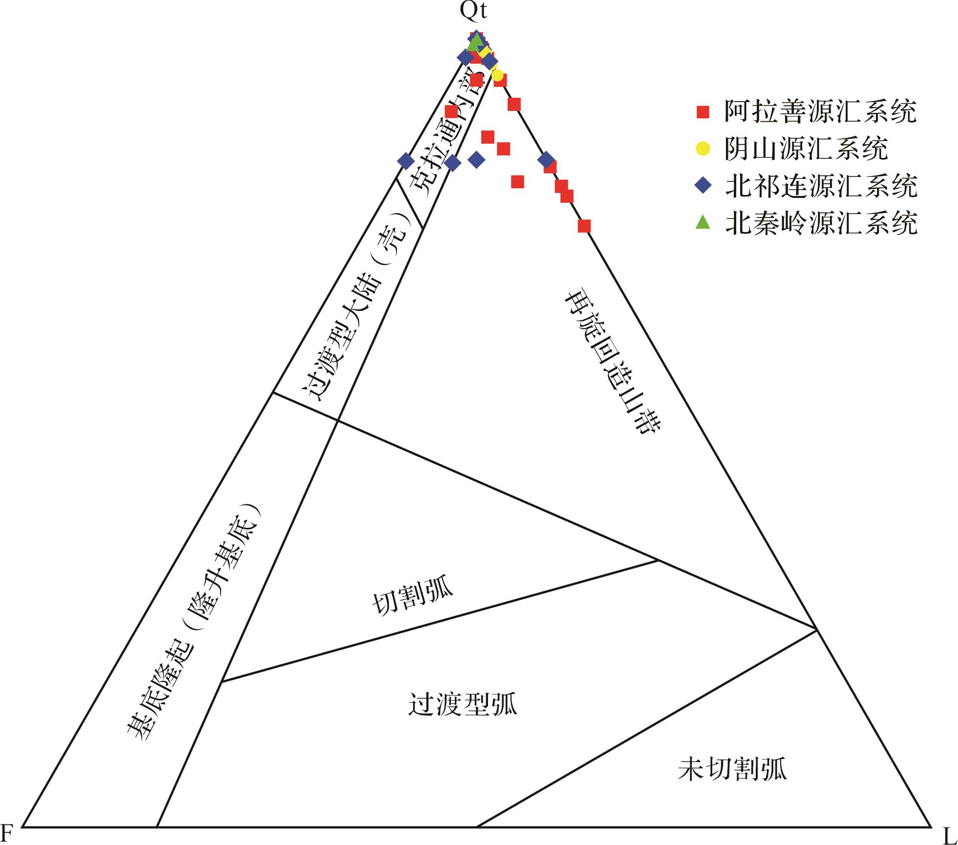
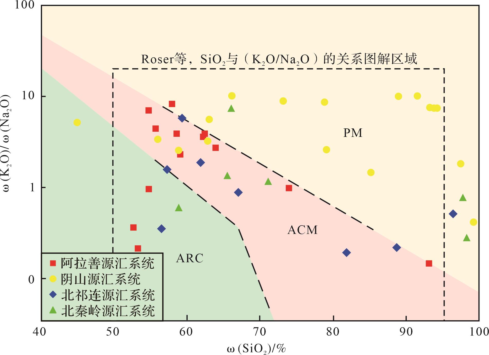
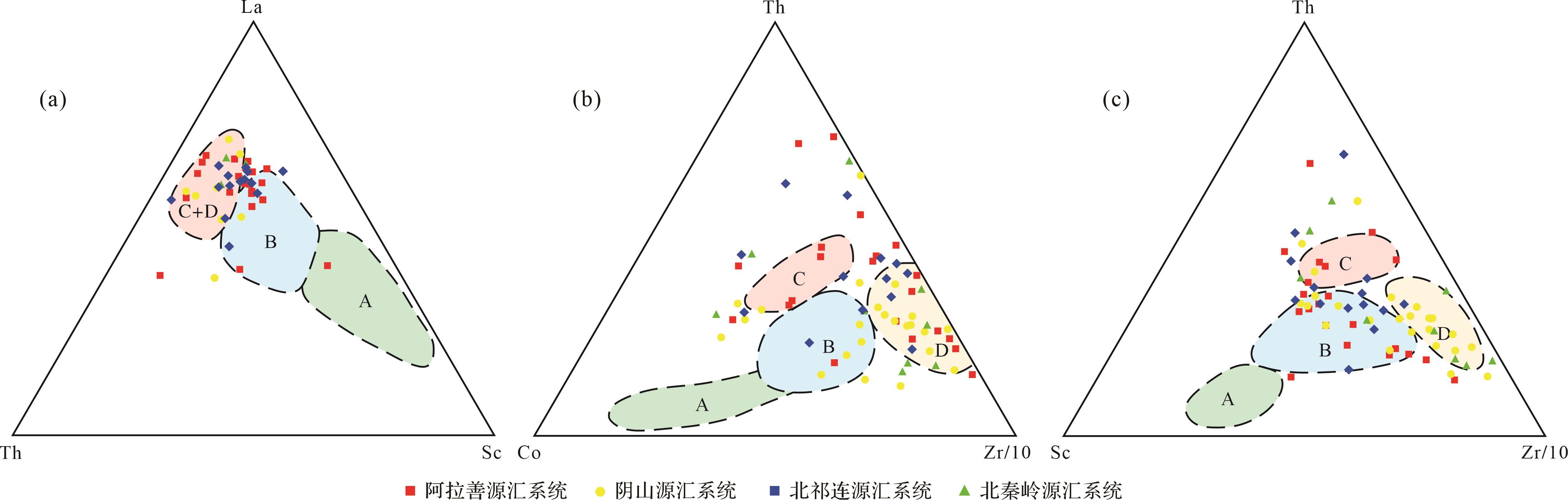
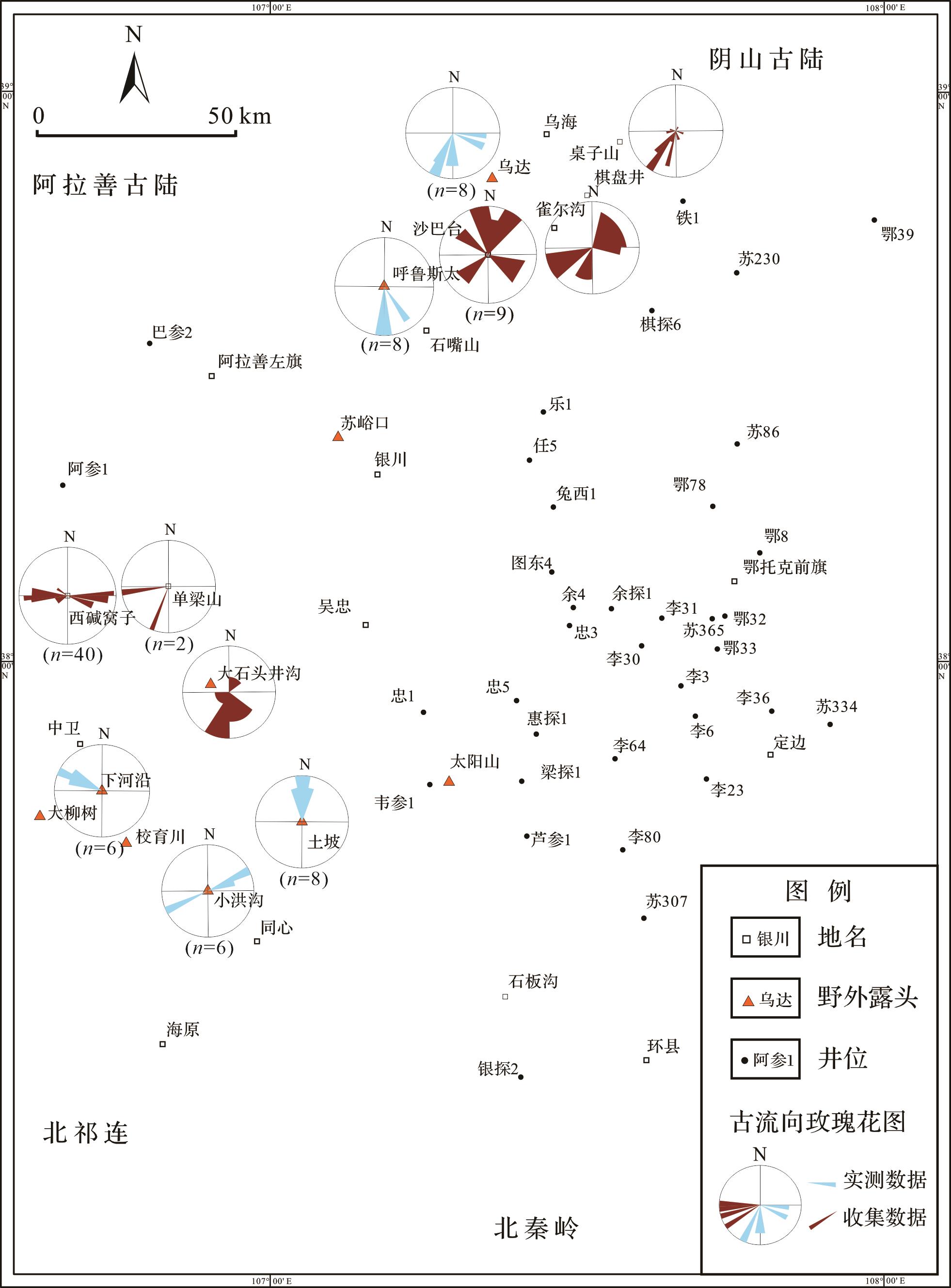
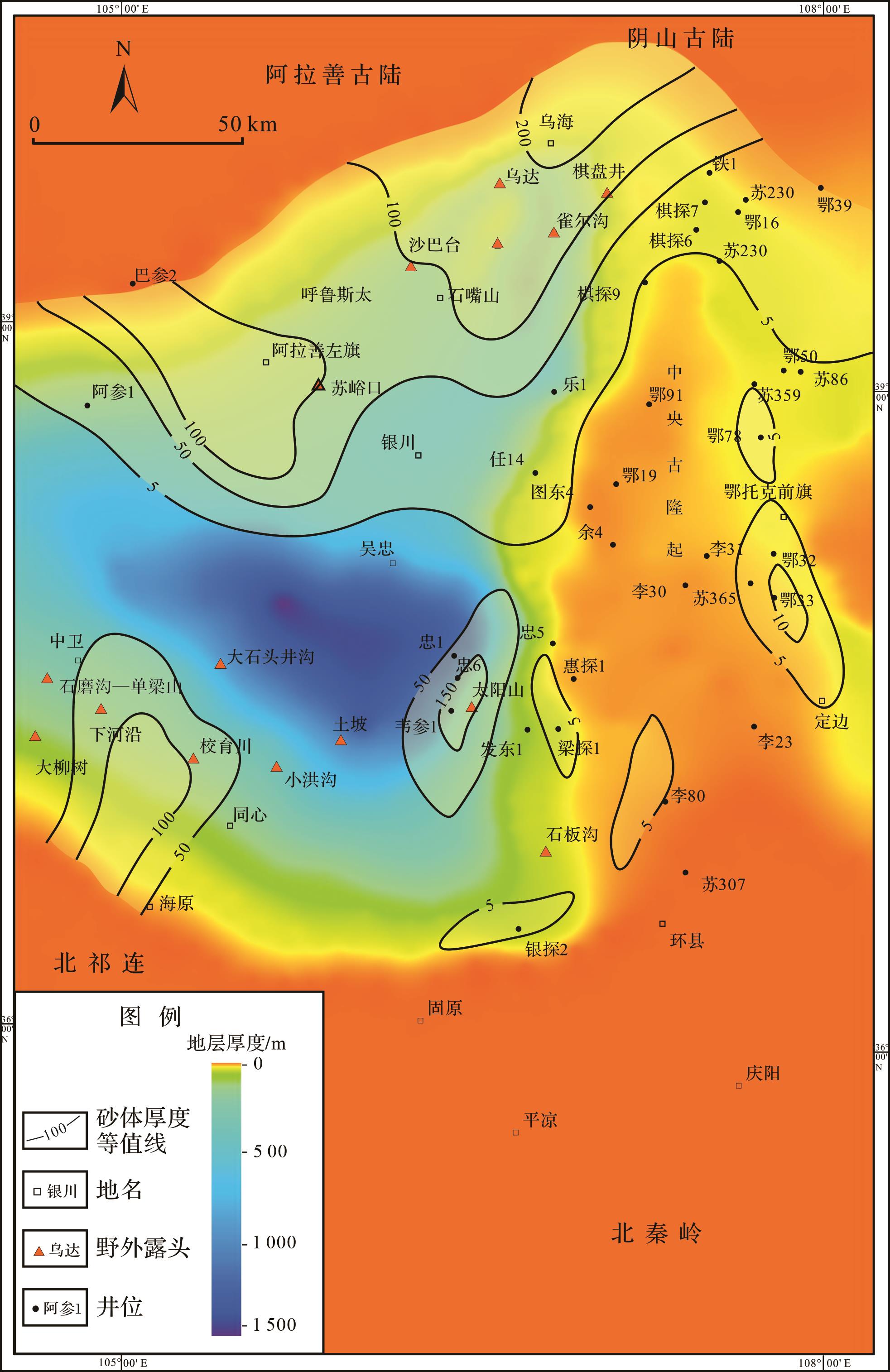
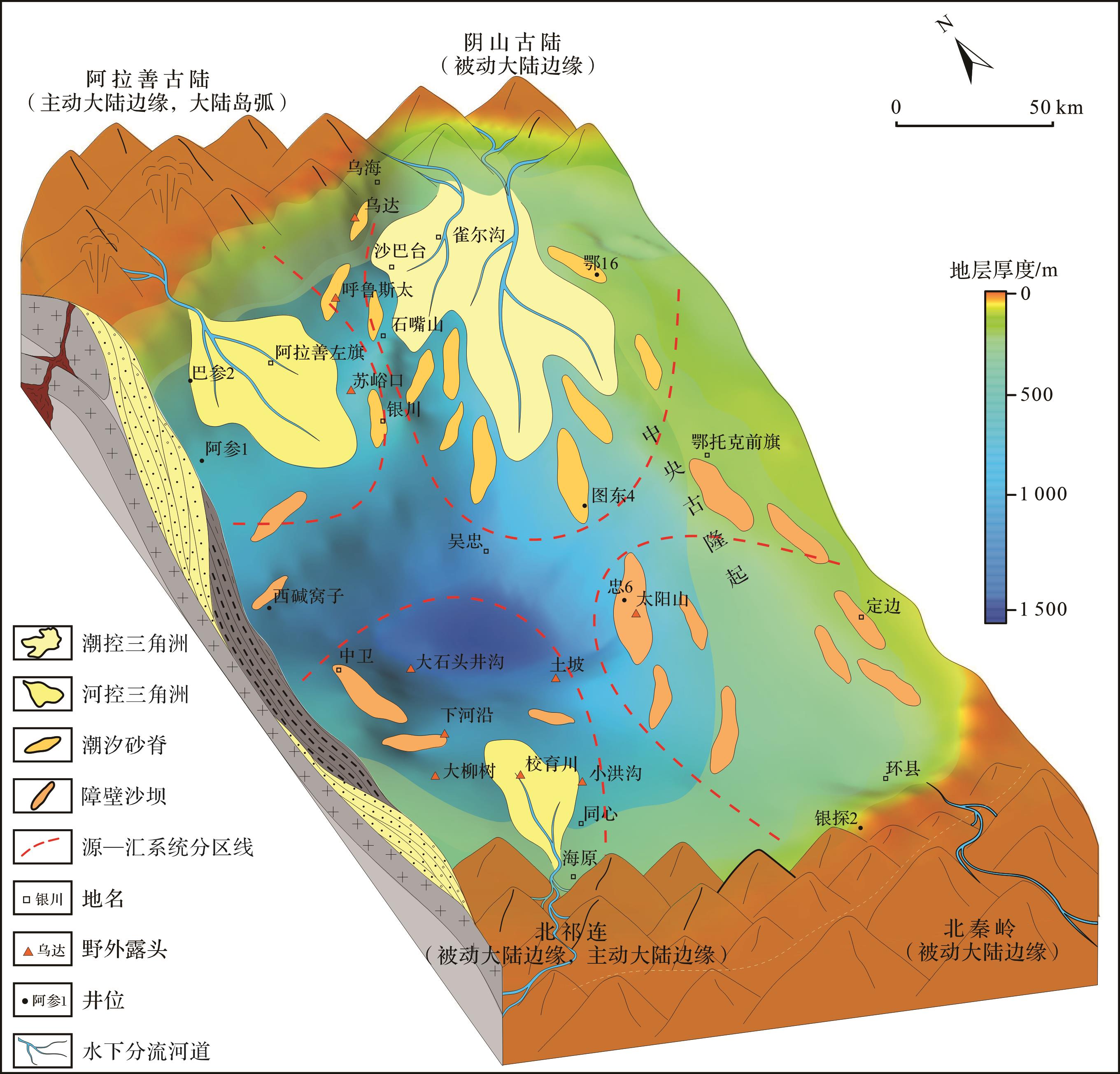
The Carboniferous Yanghugou Formation in the western margin of the Ordos Basin has large exploration potential for oil and gas resources. However, owing to its complex tectonic behavior, its filling process from source to sink and paleogeographic pattern remain controversial. Combined with previous research data, through provenance analysis of the characteristics of light and heavy minerals, lithic assemblages and rare earth elements, four source-to-sink systems were proposed: Alxa in the northwest, Yinshan in the Northeast, North Qilian in the southwest, and North Qinling in the southeast. The tectonic setting of the source area in the Alxa source-to-sink system is an active continental margin and continental island arc, and the sediments are derived from the average upper crust felsic and mafic igneous material source areas. The tectonic setting of the source area in the Yinshan source-to-sink system is a passive continental margin. The sediment sources are relatively complex, a mixture of the average upper crust felsic, intermediate, and mafic igneous material. The tectonic setting of the source area in the North Qilian source-to-sink system is a mixture of passive and active continental margins, and the sediments are derived from source areas of mafic and intermediate igneous rocks; The tectonic setting of the source area in the North Qinling source-to-sink system is a the passive continental margin, and the sediments are derived from the mafic igneous source region. The parent rocks of the four source-to-sink systems are a mixture of alkaline basalts, granites, and calcareous argillaceous sedimentary rocks. Based on the division of the source-to-sink systems, the paleogeographic pattern is reconstructed: (1) The detrital sediments of the Alxa source-to-sink system flowed from the northwest and were transported to the southeast; the transport distance was long, and the river-controlled delta sedimentary system of the marine and continental transitional facies developed. (2) The detrital sediments of the Yinshan source-to-sink system flowed from the northeast and were transported to the southwest. The transport distance was large, the area was widely distributed, and the tide-controlled deltas sedimentary system developed from the marine and continental transitional facies. (3) The clastic sediments of the North Qilian source-to-sink system flowed from the southwest, small river controlled deltas deposits were developed along the coast, and marine sedimentary systems dominated by shallow sea-semi deep sea shelf deposits were developed in the deep water area. (4) The clastic sediments of the North Qinling source-to-sink system flowed from the southeast, and the sediment transport distance was short owing to the influence of the central ancient uplift, and the barrier island coastal sedimentary system of Marine facies was developed.
2023, 41(5): 1451-1467.
doi: 10.14027/j.issn.1000-0550.2022.142
Abstract:
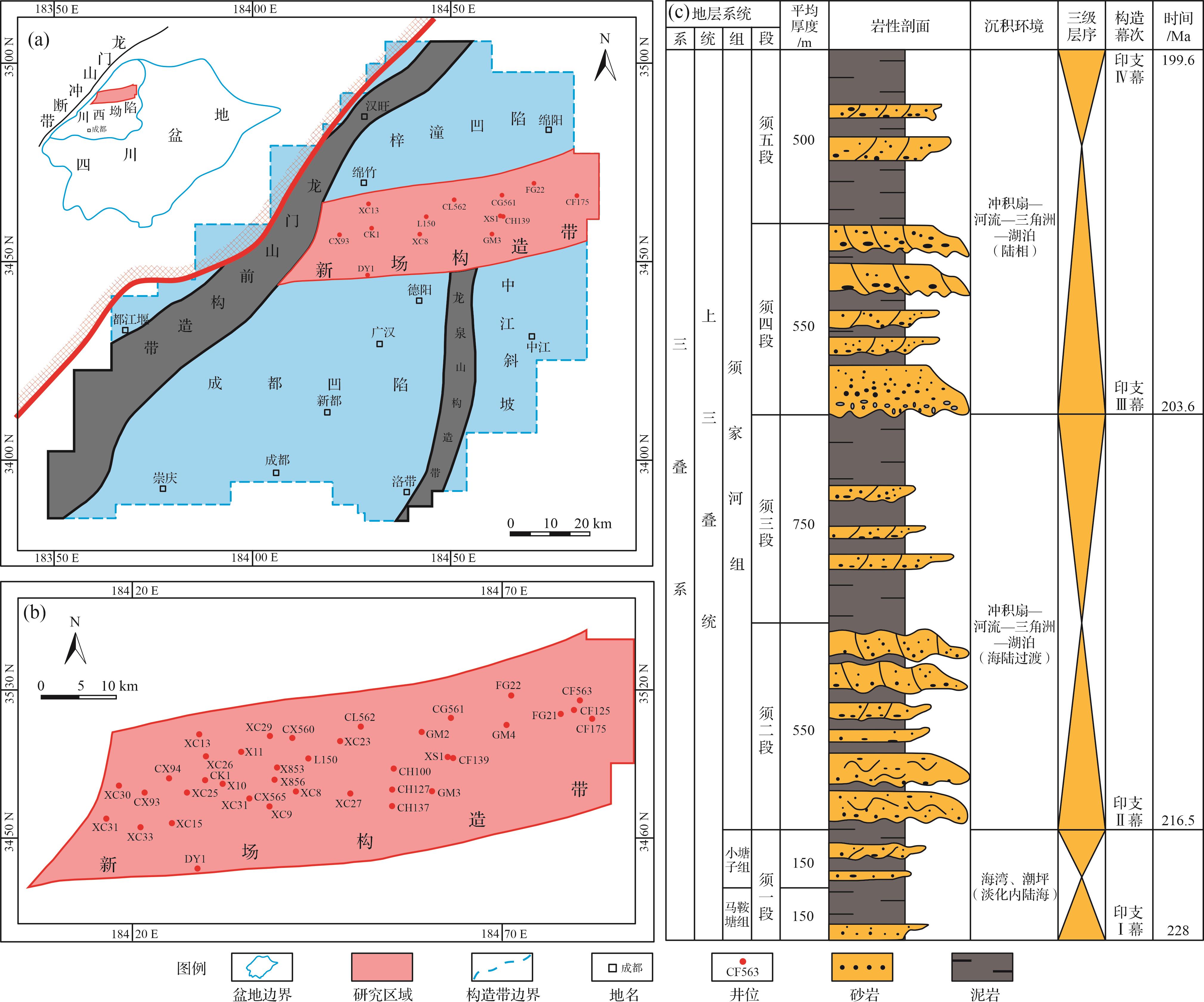
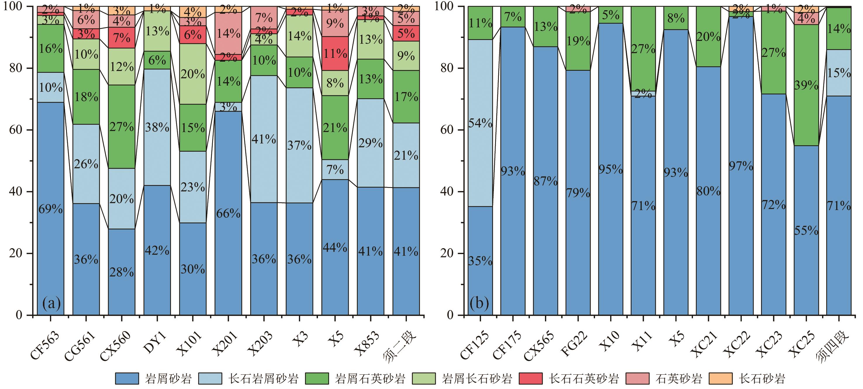
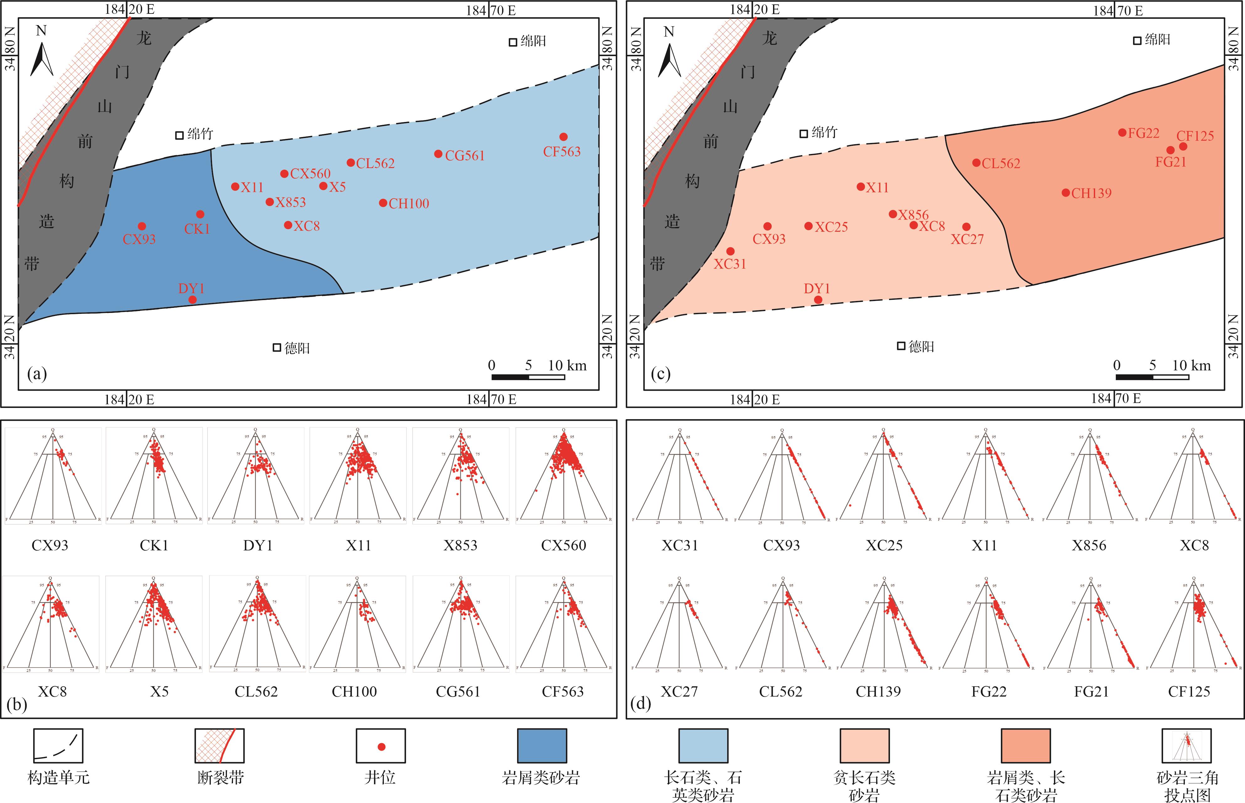
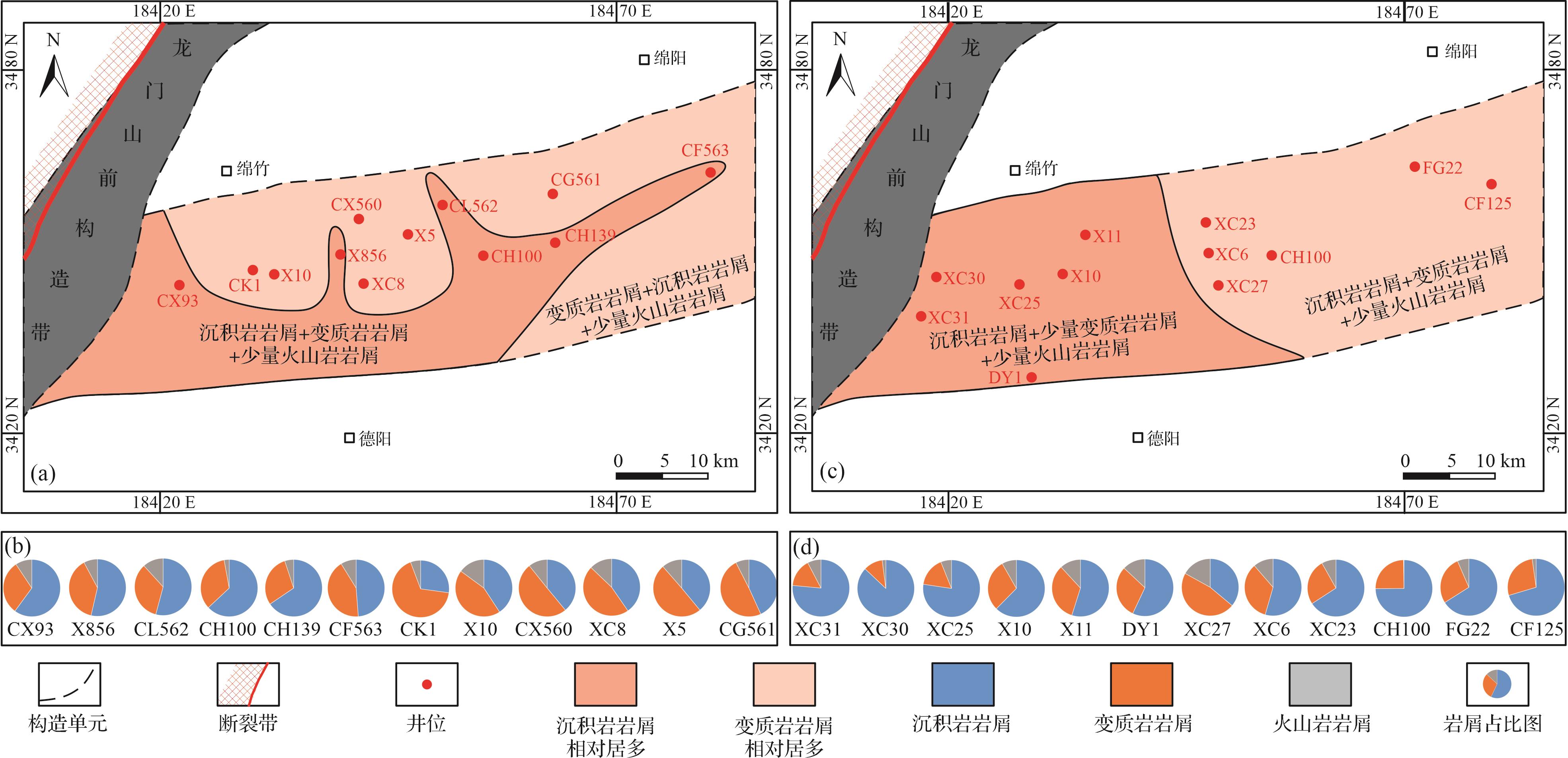
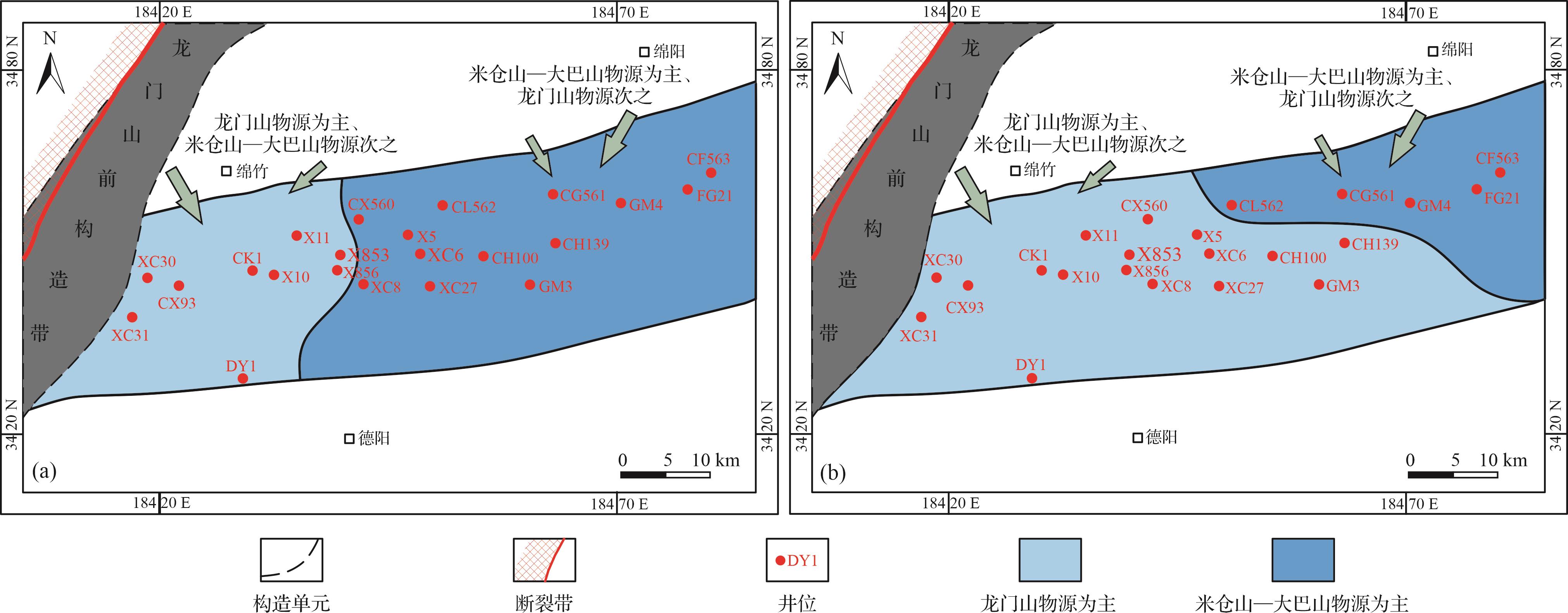
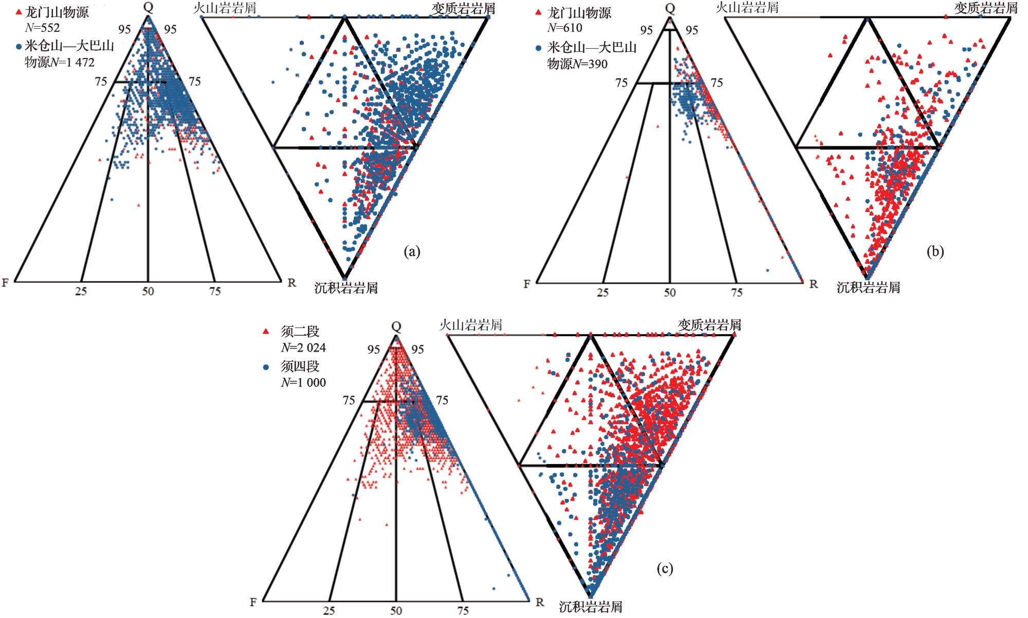
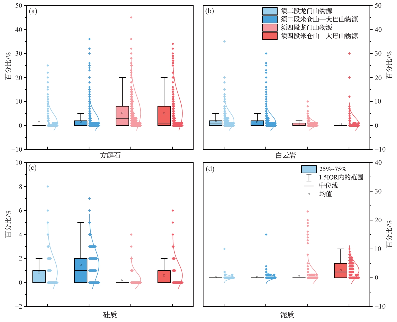
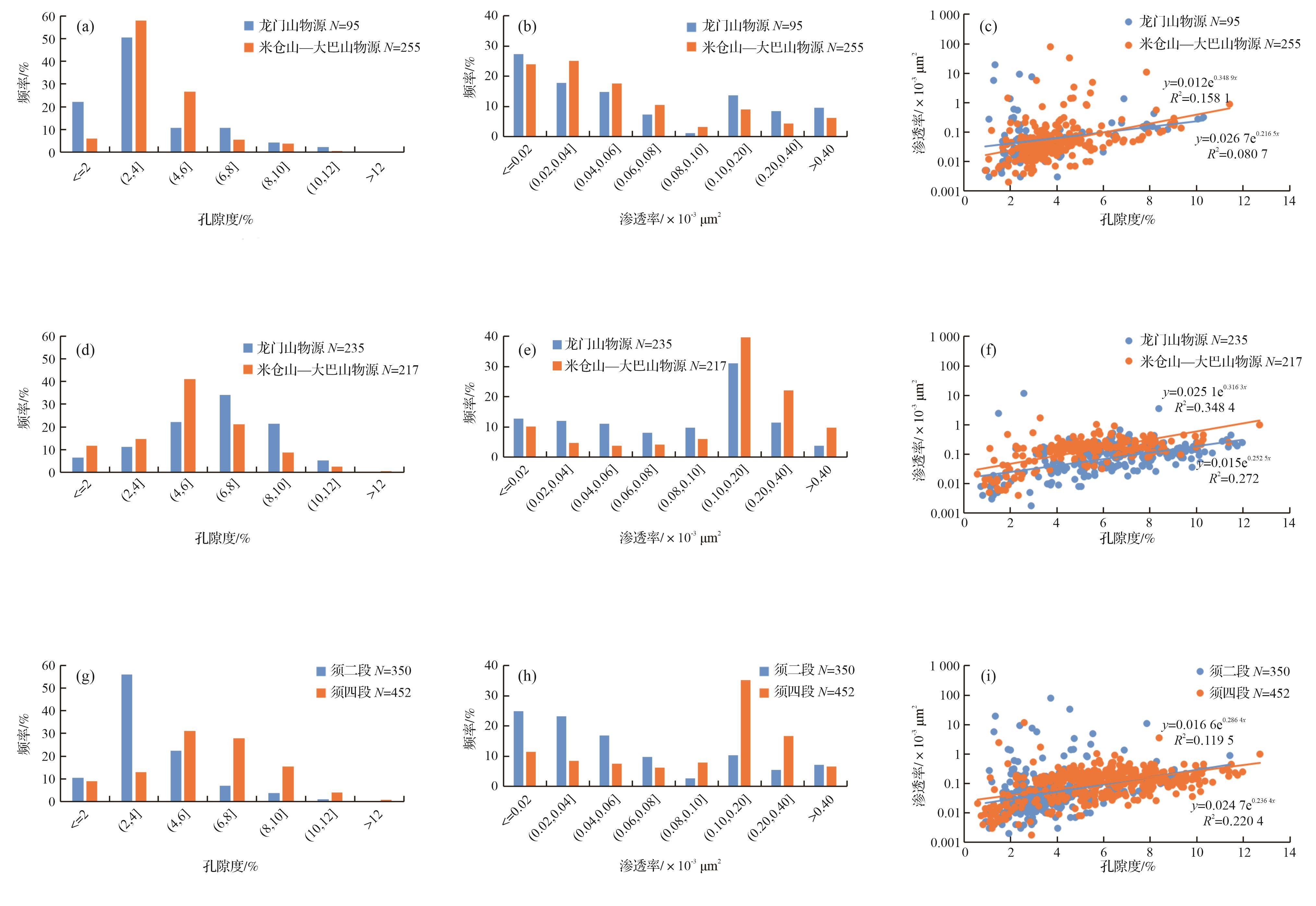
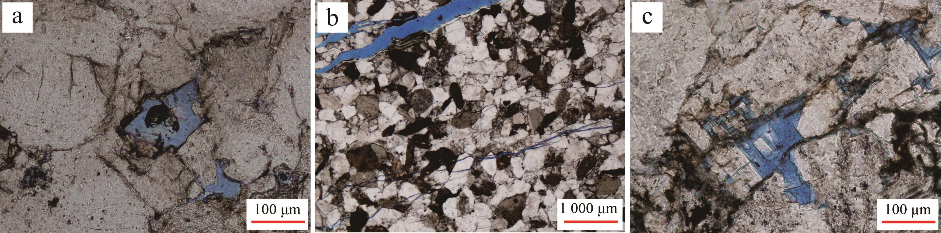
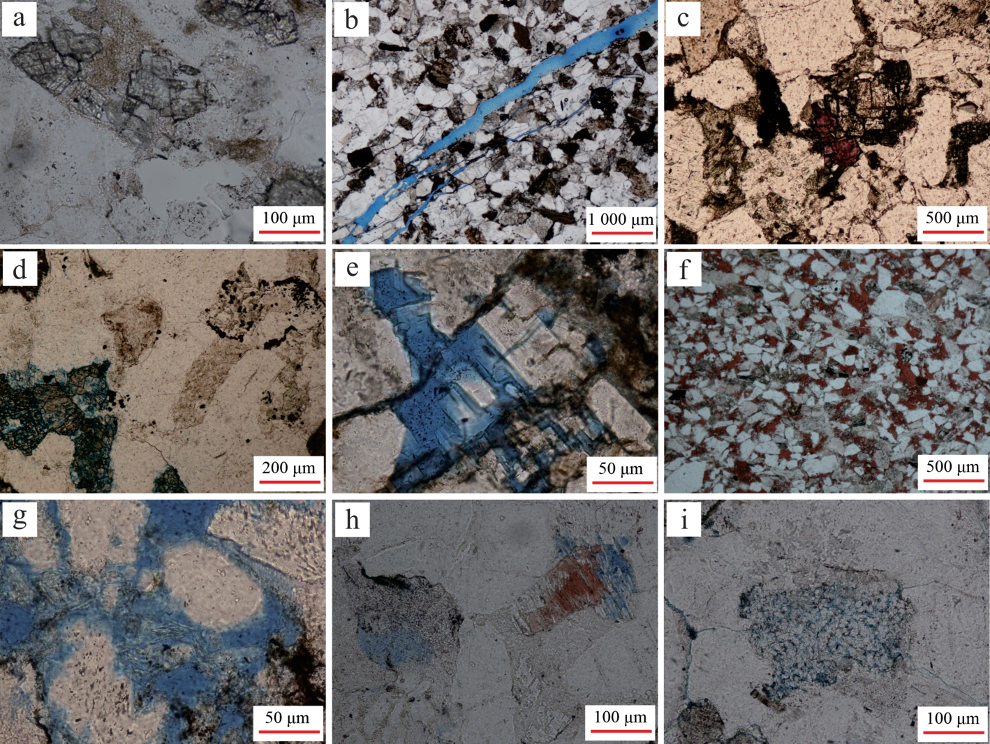
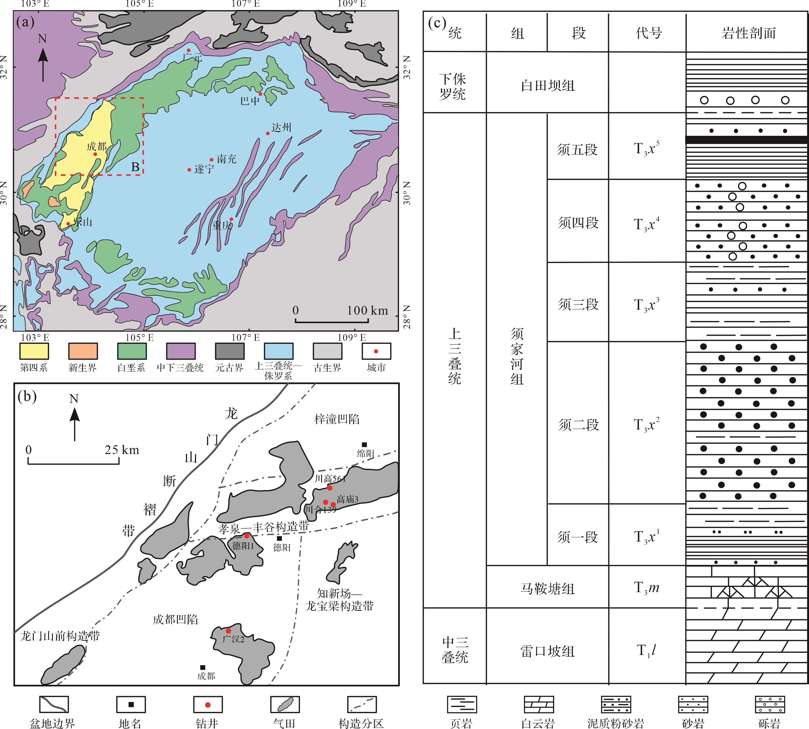
With the deepening of exploration from conventional to unconventional oil and gas, tight sandstone gas has gradually become a hot spot of exploration. The tight sandstone reservoirs of the Second and Fourth members of the Xujiahe Formation in the Xinchang area of the Western Sichuan Depression are the main gas producing layers of the Xujiahe Formation. Influenced by sedimentary environment, burial depth, and diagenetic environment, there are significant differences in mineral composition, diagenetic evolution, and reservoir physical properties for the sandstones of different provenance in this area. First, through the characteristics of sandstone and debris type, combined with previous research results, the provenance directions of the Second and Fourth members of the Xujiahe Formation in the study area are analyzed. Second, the influence of provenance on reservoir characteristics is explored through reservoir petrological characteristics, physical properties, reservoir space characteristics, and reservoir diagenesis types. Finally, the differences in reservoir characteristics of the Second and Fourth members of the Xujiahe Formation in the study area under different provenances are discussed, revealing the control effect of provenance on reservoir. Get the following understanding : (1) The main provenance area of the Second member of the Xujiahe Formation is Micangshan-Dabashan, and the main provenance area of the Fourth member of the Xujiahe Formation is Longmenshan; (2) In the Second member of the Xujiahe Formation, the reservoir compaction and siliceous cementation controlled by Micangshan-Dabashan provenance were stronger than those controlled by Longmenshan provenance, a chlorite film developed, and carbonate cementation was weak. In the Fourth member of the Xujiahe Formation, the carbonate debris of the reservoir controlled by the Longmenshan provenance greatly improved the compaction resistance of the reservoir compared with the Micangshan-Dabashan provenance. The feldspar dissolution was significant, and the calcite cementation was slightly weak; (3) Under the provenance of Longmenshan, the chlorite cementation and feldspar dissolution of the Second member of the Xujiahe Formation mainly changed the reservoir physical properties. Carbonate and siliceous cementation were the key factors for reservoir densification. The dissolution and relatively weak compaction of the Fourth member of the Xujiahe Formation were the main factors of reservoir pore development, and carbonate cementation was the key factor of reservoir densification. Under the provenance of Micangshan-Dabashan, chlorite cementation and feldspar dissolution were the main factors improving reservoir physical properties, and siliceous cementation was the key factor to reservoir densification. The dissolution of the Fourth member of the Xujiahe Formation and the anti-compaction ability of carbonate debris were the main factors improving the physical properties of the reservoir, and carbonate cementation was the key factor of reservoir density. The diagenetic characteristics of reservoirs controlled by different provenances in the same layer are distinct and the diagenetic characteristics of different layers of reservoirs under the control of the same provenance display obvious differences.
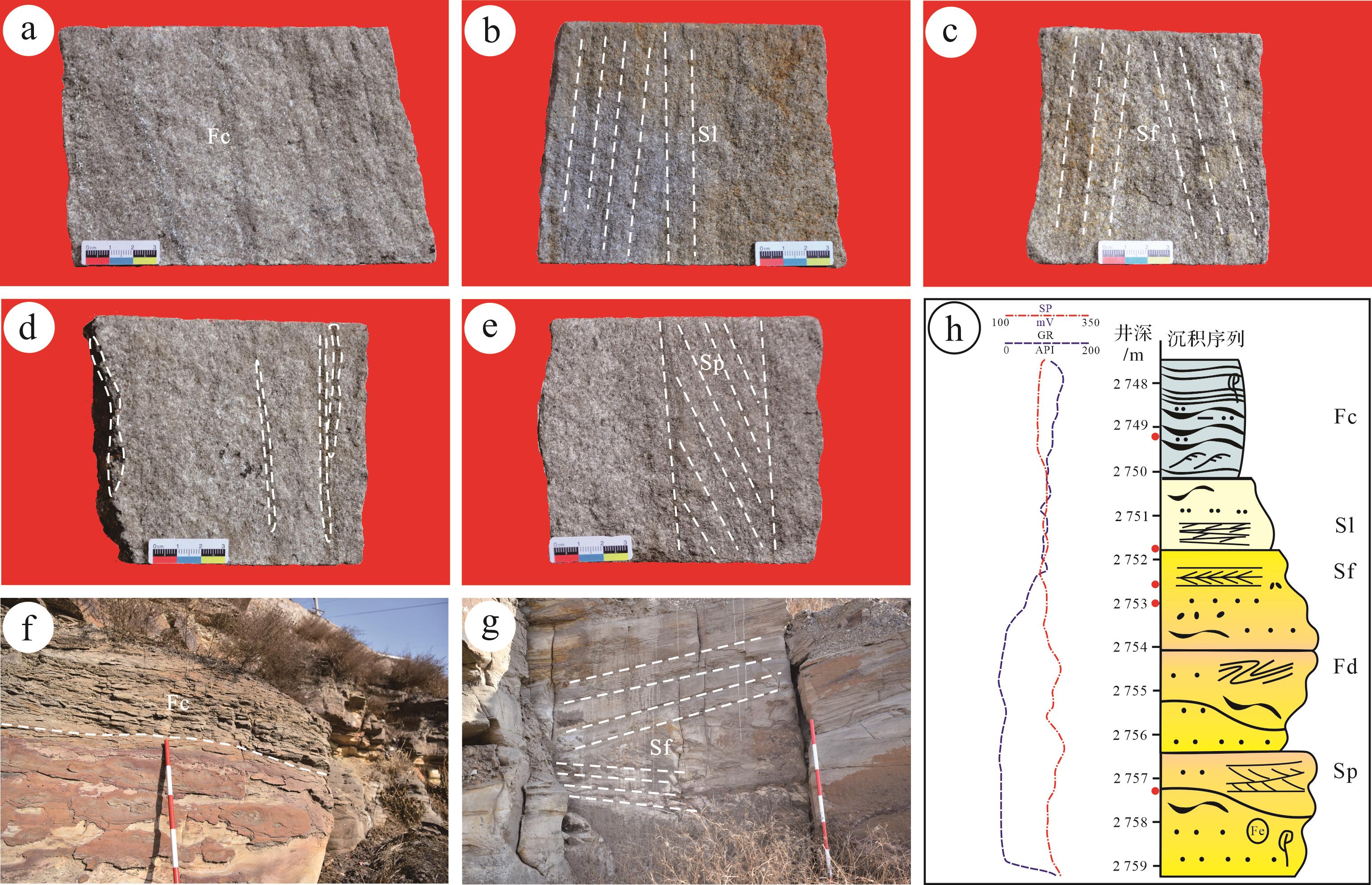
With the deepening of exploration from conventional to unconventional oil and gas, tight sandstone gas has gradually become a hot spot of exploration. The tight sandstone reservoirs of the Second and Fourth members of the Xujiahe Formation in the Xinchang area of the Western Sichuan Depression are the main gas producing layers of the Xujiahe Formation. Influenced by sedimentary environment, burial depth, and diagenetic environment, there are significant differences in mineral composition, diagenetic evolution, and reservoir physical properties for the sandstones of different provenance in this area. First, through the characteristics of sandstone and debris type, combined with previous research results, the provenance directions of the Second and Fourth members of the Xujiahe Formation in the study area are analyzed. Second, the influence of provenance on reservoir characteristics is explored through reservoir petrological characteristics, physical properties, reservoir space characteristics, and reservoir diagenesis types. Finally, the differences in reservoir characteristics of the Second and Fourth members of the Xujiahe Formation in the study area under different provenances are discussed, revealing the control effect of provenance on reservoir. Get the following understanding : (1) The main provenance area of the Second member of the Xujiahe Formation is Micangshan-Dabashan, and the main provenance area of the Fourth member of the Xujiahe Formation is Longmenshan; (2) In the Second member of the Xujiahe Formation, the reservoir compaction and siliceous cementation controlled by Micangshan-Dabashan provenance were stronger than those controlled by Longmenshan provenance, a chlorite film developed, and carbonate cementation was weak. In the Fourth member of the Xujiahe Formation, the carbonate debris of the reservoir controlled by the Longmenshan provenance greatly improved the compaction resistance of the reservoir compared with the Micangshan-Dabashan provenance. The feldspar dissolution was significant, and the calcite cementation was slightly weak; (3) Under the provenance of Longmenshan, the chlorite cementation and feldspar dissolution of the Second member of the Xujiahe Formation mainly changed the reservoir physical properties. Carbonate and siliceous cementation were the key factors for reservoir densification. The dissolution and relatively weak compaction of the Fourth member of the Xujiahe Formation were the main factors of reservoir pore development, and carbonate cementation was the key factor of reservoir densification. Under the provenance of Micangshan-Dabashan, chlorite cementation and feldspar dissolution were the main factors improving reservoir physical properties, and siliceous cementation was the key factor to reservoir densification. The dissolution of the Fourth member of the Xujiahe Formation and the anti-compaction ability of carbonate debris were the main factors improving the physical properties of the reservoir, and carbonate cementation was the key factor of reservoir density. The diagenetic characteristics of reservoirs controlled by different provenances in the same layer are distinct and the diagenetic characteristics of different layers of reservoirs under the control of the same provenance display obvious differences.
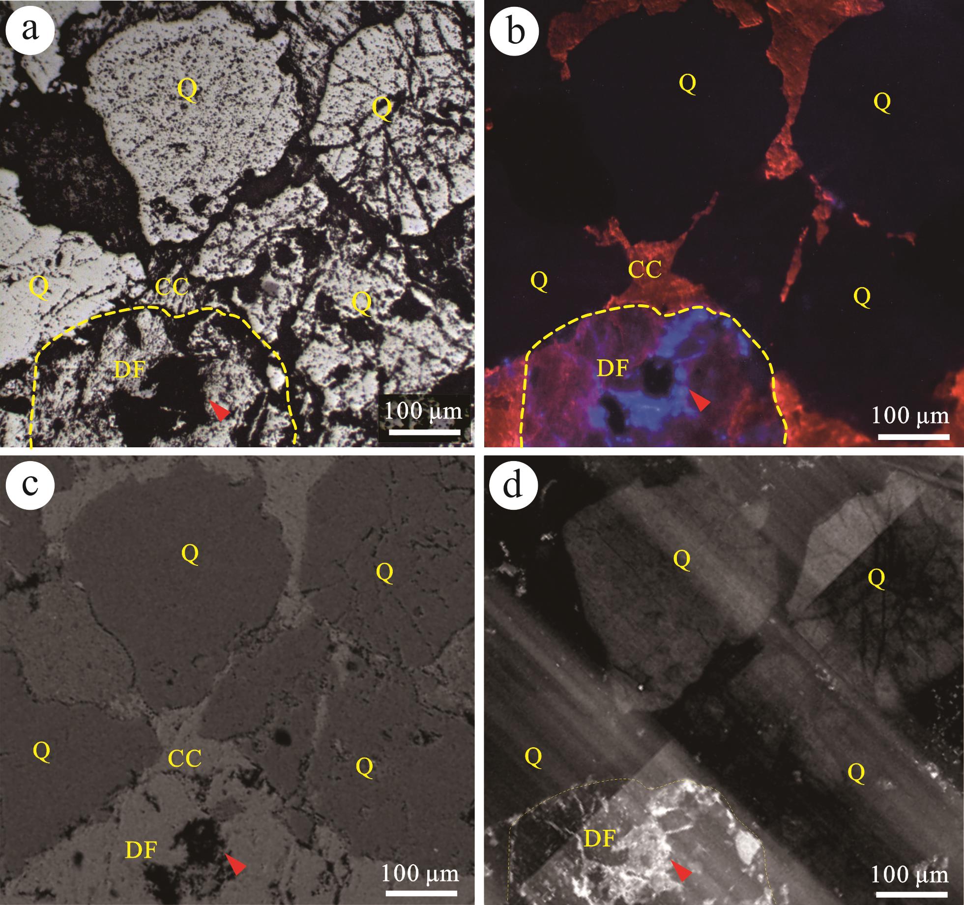
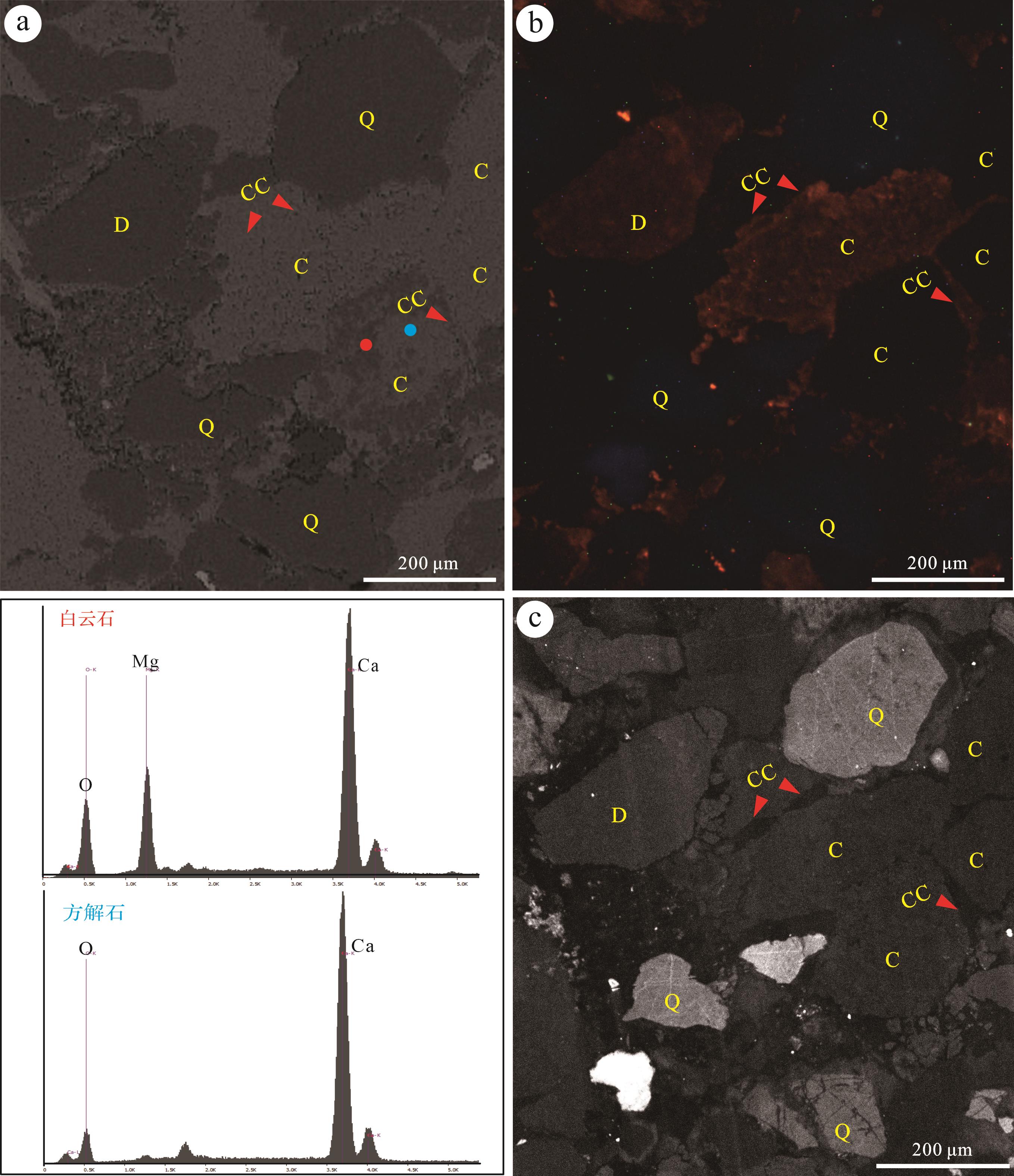
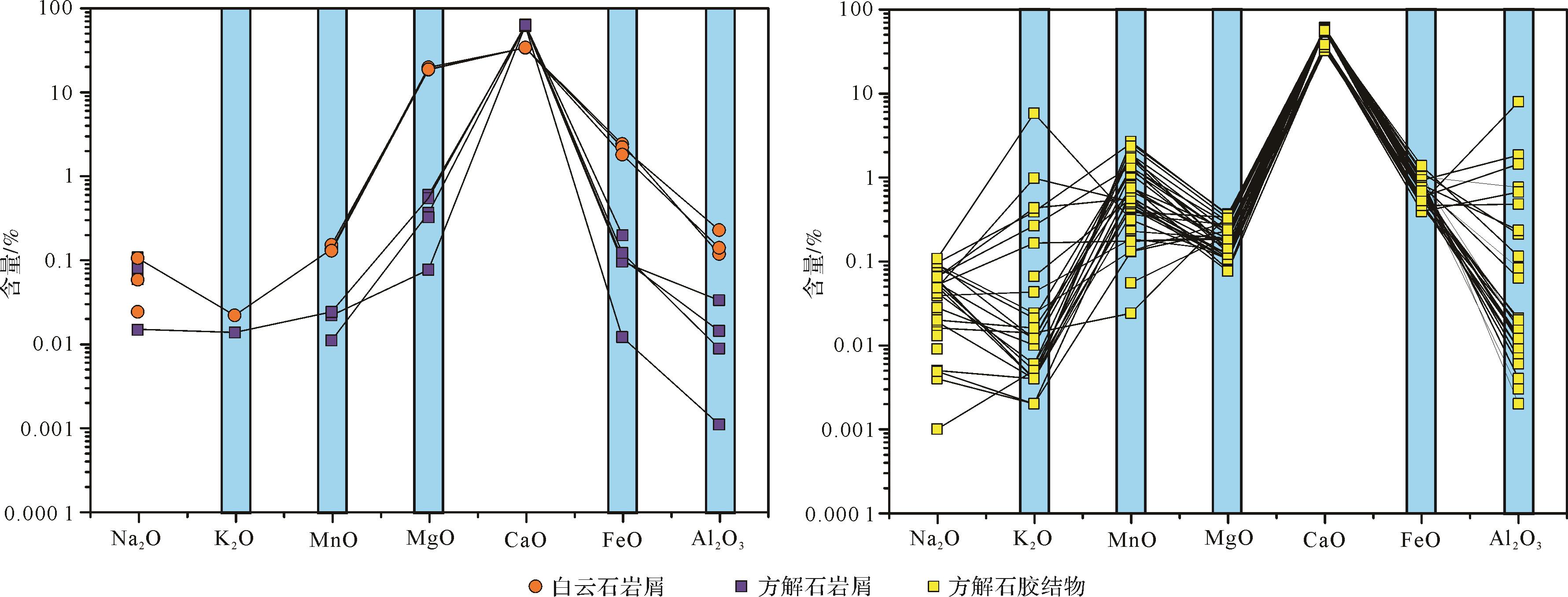
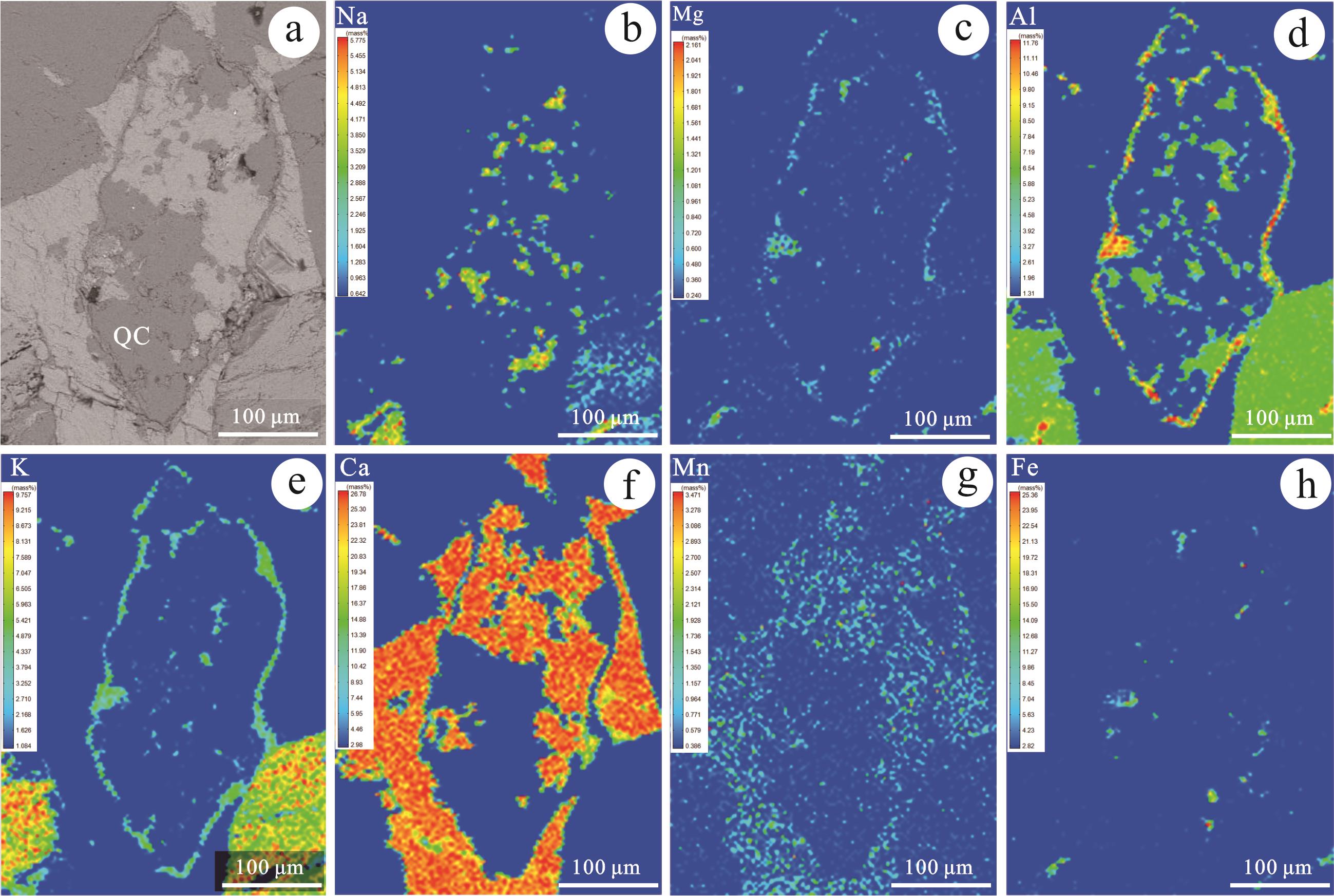
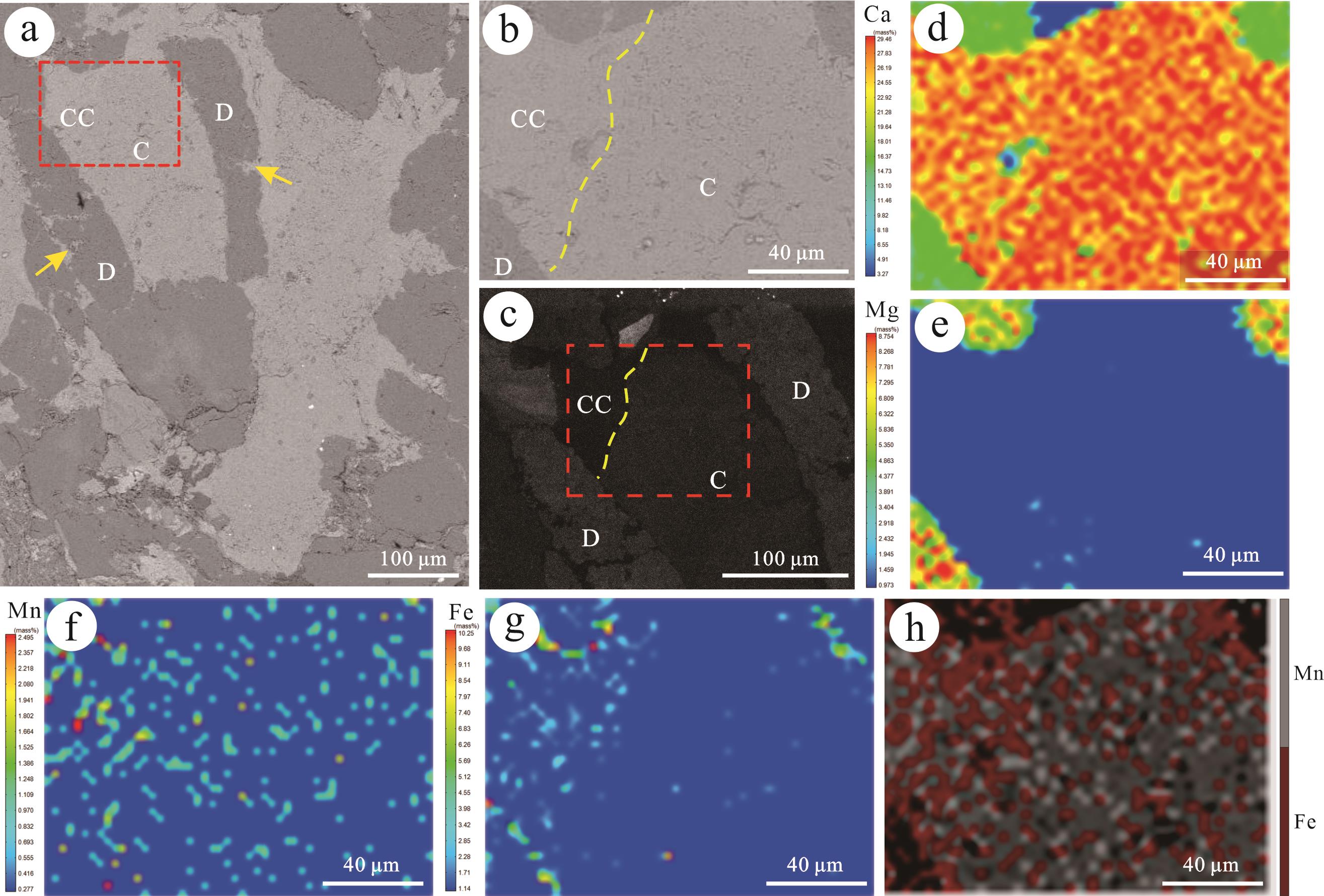
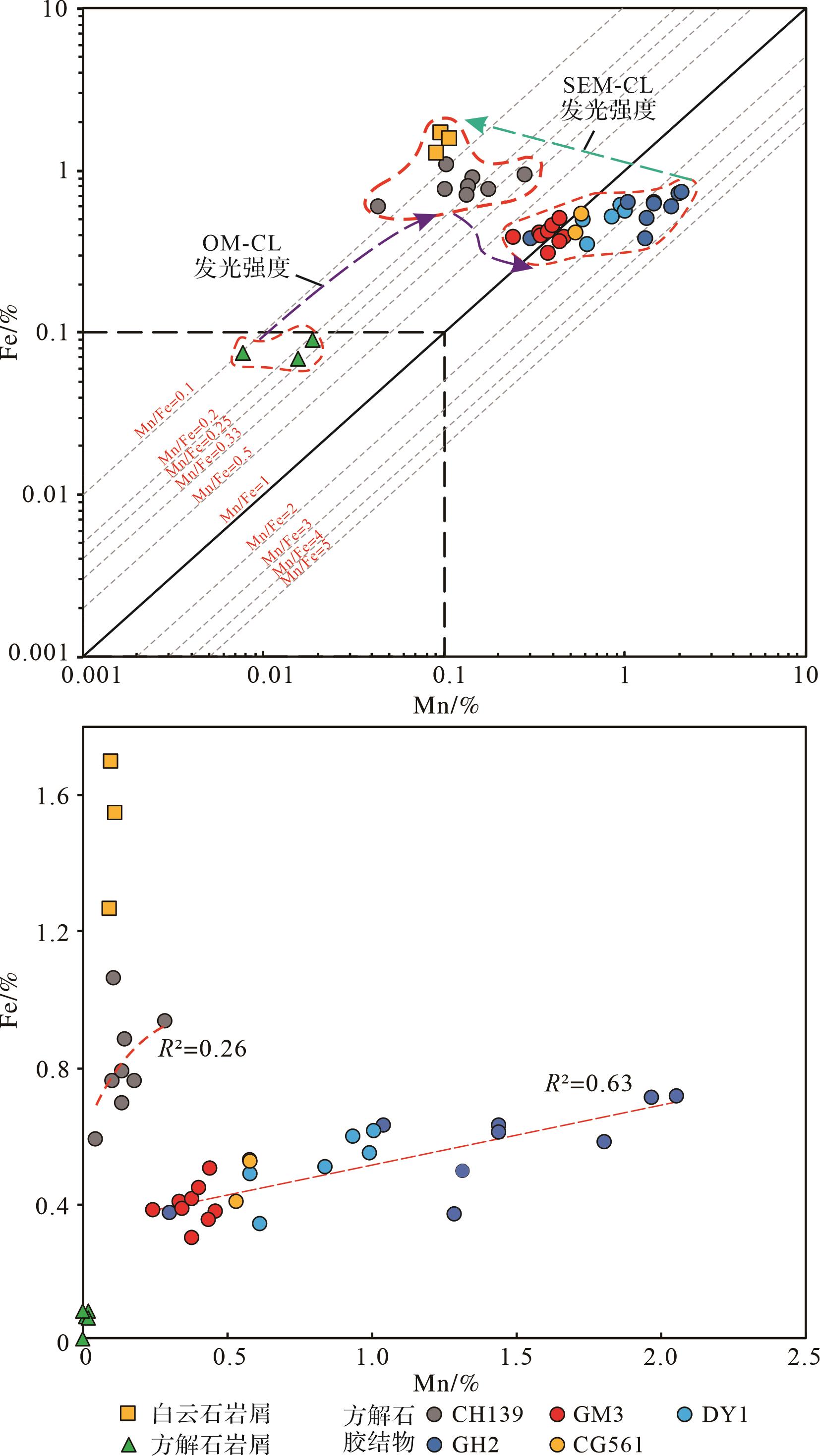
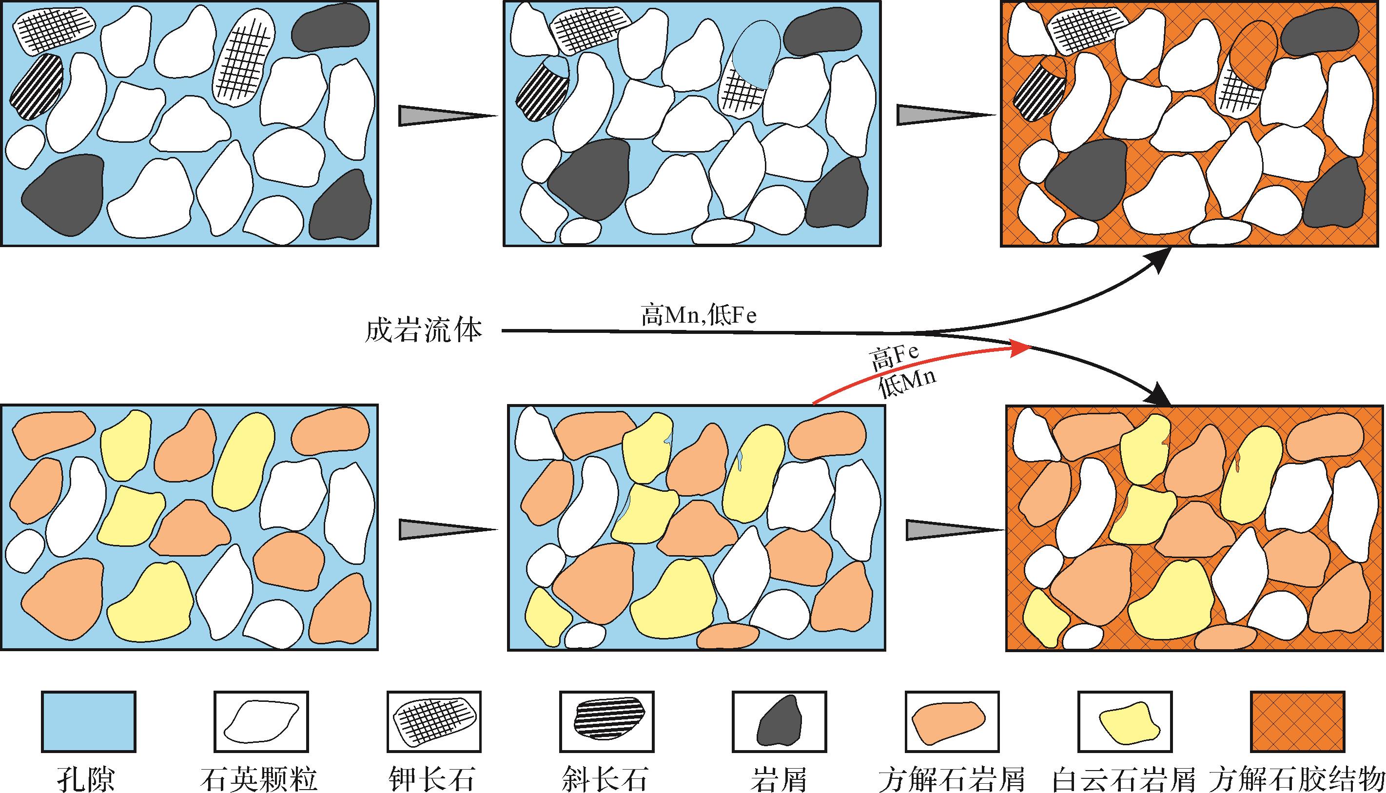
2023, 41(5): 1468-1477.
doi: 10.14027/j.issn.1000-0550.2022.112
Abstract:
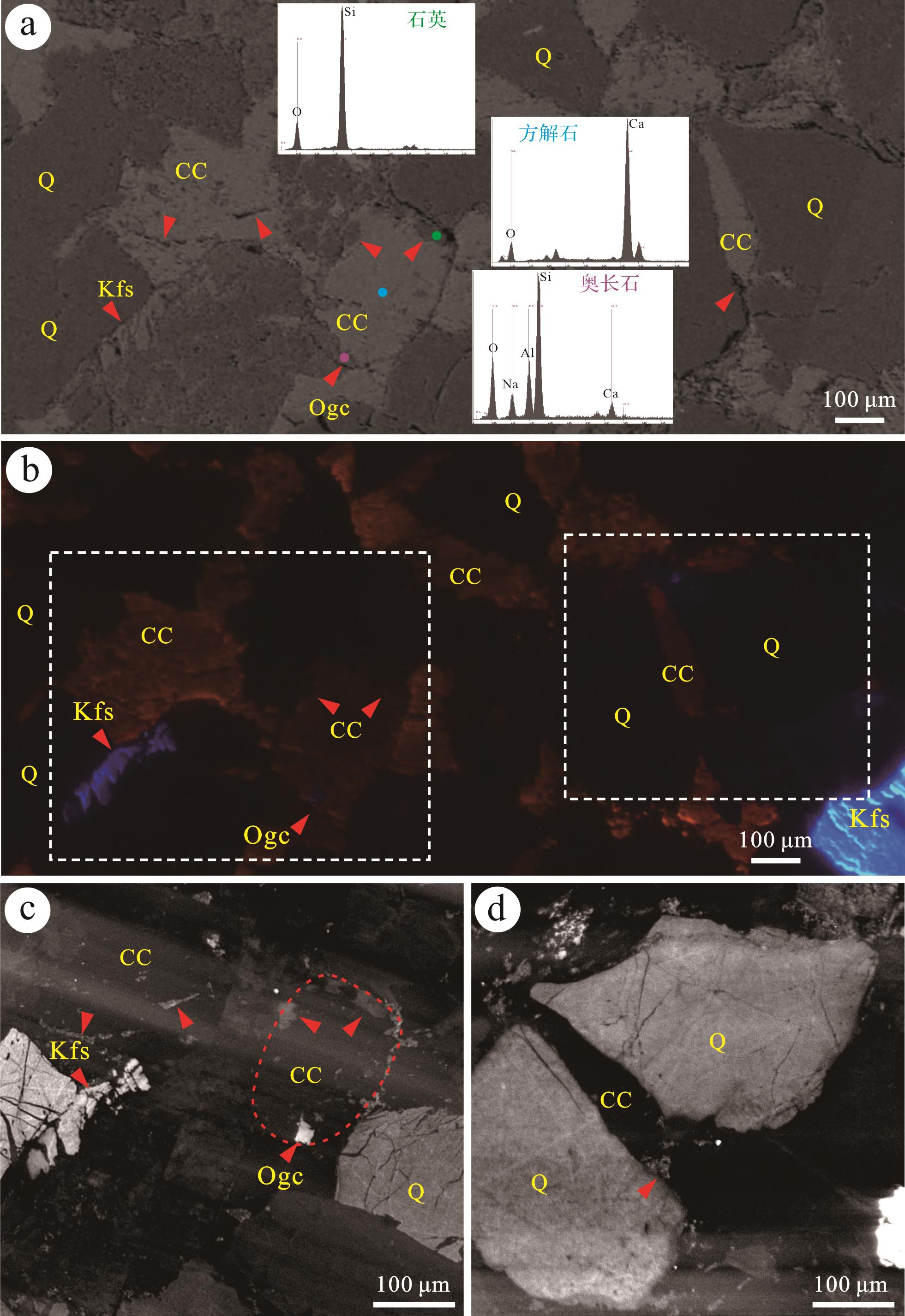
Scanning electron microscope-cathodoluminescence (SEM-CL) analysis is an effective tool for tracing the diagenesis associated with fluid flow in buried material by determining both the micro-texture and the CL response of authigenic minerals. However, neither the luminescence of carbonate minerals nor how their elemental compositions influence CL response is not clear. In this study, the CL response of carbonate minerals and its correlation with element compositions were observed when subjected to optical microscope-CL (OM-CL) and SEM-CL illumination, electron probe microanalysis (EPMA) and SEM-CL were used to analyze tight gas sandstone samples from the Xujiahe Formation in the western Sichuan Basin, China. The results suggest that SEM-CL distinguishes carbonate grains from carbonate cements with greater sensitivity than OM-CL. SEM-CL images generally showed that carbonate minerals with Mn/Fe values lower than 0.1 have low- to moderate intensity luminescence. This was also apparent in Mn/Fe values of 0.1 to 0.5 with < 0.1% Fe content, but carbonate minerals with Mn/Fe > 0.5 and Fe content < 0.1 barely showed a visible CL response. The Mn/Fe ratio and Fe content were found to have the greatest effect on CL. The integration of SEM-CL and OM-CL with element mapping showed that the calcite cement is homogeneous, suggesting a single episode of calcite precipitation after the dissolution of feldspar. Sublitharenitic and litharenitic calcite cements have the same/similar source of diagenetic fluid that is indicated by high Mn/Fe values. The calcite cement in calcarenaceous sandstone showed low Mn and high Fe contents similar to dolomite rock fragments, suggesting that the fluid may have been influenced by the dissolution of dolomite rock fragments.
Scanning electron microscope-cathodoluminescence (SEM-CL) analysis is an effective tool for tracing the diagenesis associated with fluid flow in buried material by determining both the micro-texture and the CL response of authigenic minerals. However, neither the luminescence of carbonate minerals nor how their elemental compositions influence CL response is not clear. In this study, the CL response of carbonate minerals and its correlation with element compositions were observed when subjected to optical microscope-CL (OM-CL) and SEM-CL illumination, electron probe microanalysis (EPMA) and SEM-CL were used to analyze tight gas sandstone samples from the Xujiahe Formation in the western Sichuan Basin, China. The results suggest that SEM-CL distinguishes carbonate grains from carbonate cements with greater sensitivity than OM-CL. SEM-CL images generally showed that carbonate minerals with Mn/Fe values lower than 0.1 have low- to moderate intensity luminescence. This was also apparent in Mn/Fe values of 0.1 to 0.5 with < 0.1% Fe content, but carbonate minerals with Mn/Fe > 0.5 and Fe content < 0.1 barely showed a visible CL response. The Mn/Fe ratio and Fe content were found to have the greatest effect on CL. The integration of SEM-CL and OM-CL with element mapping showed that the calcite cement is homogeneous, suggesting a single episode of calcite precipitation after the dissolution of feldspar. Sublitharenitic and litharenitic calcite cements have the same/similar source of diagenetic fluid that is indicated by high Mn/Fe values. The calcite cement in calcarenaceous sandstone showed low Mn and high Fe contents similar to dolomite rock fragments, suggesting that the fluid may have been influenced by the dissolution of dolomite rock fragments.
2023, 41(5): 1478-1494.
doi: 10.14027/j.issn.1000-0550.2023.003
Abstract:
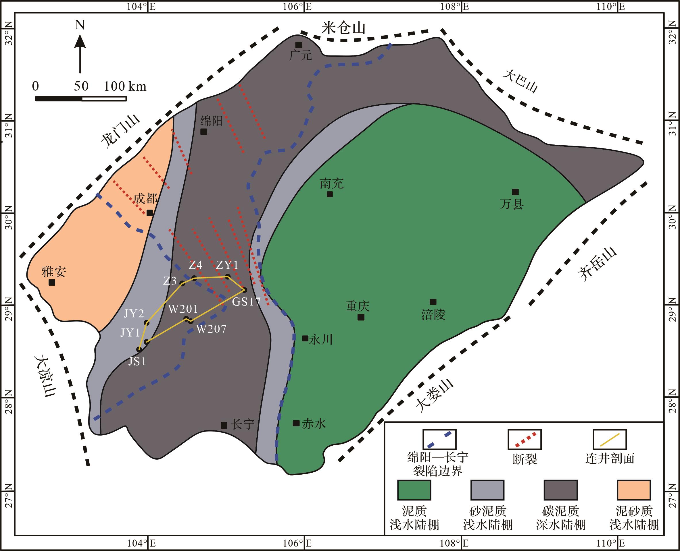
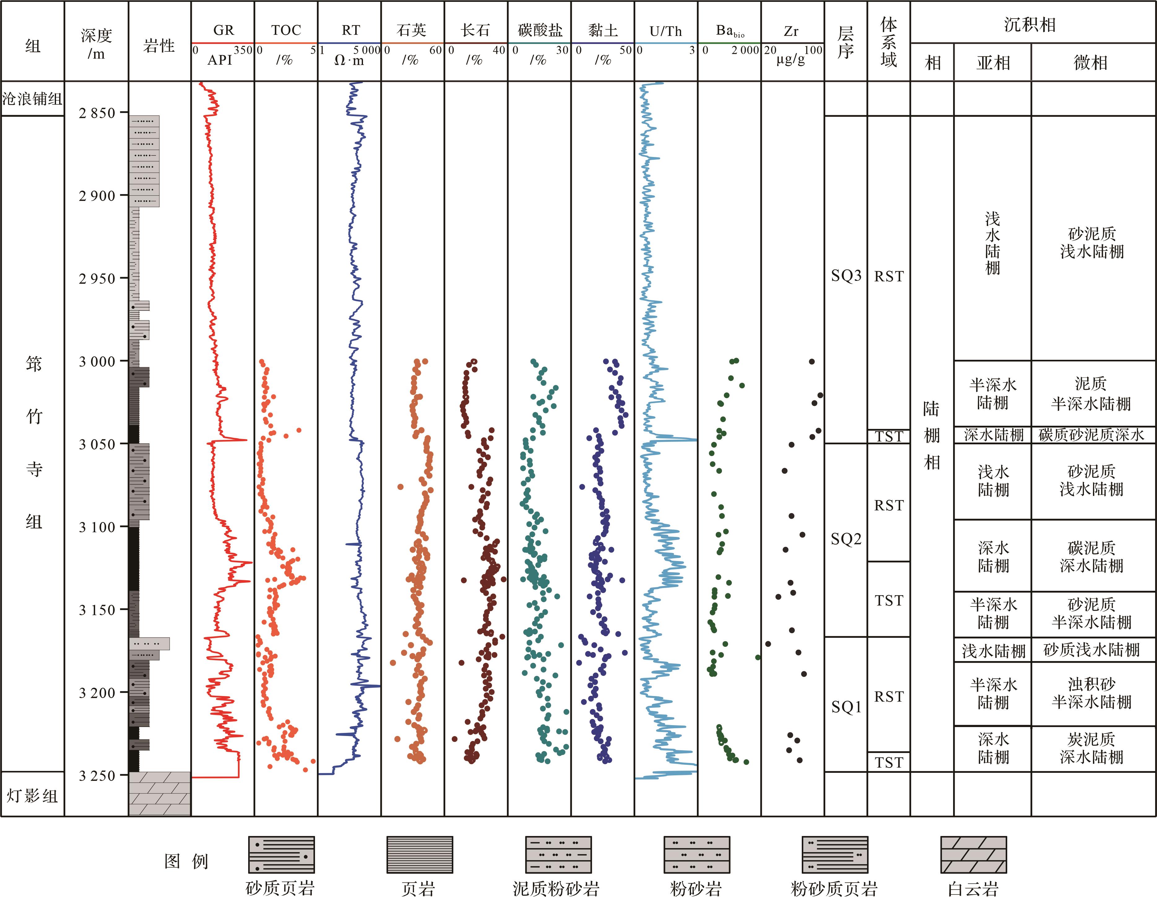
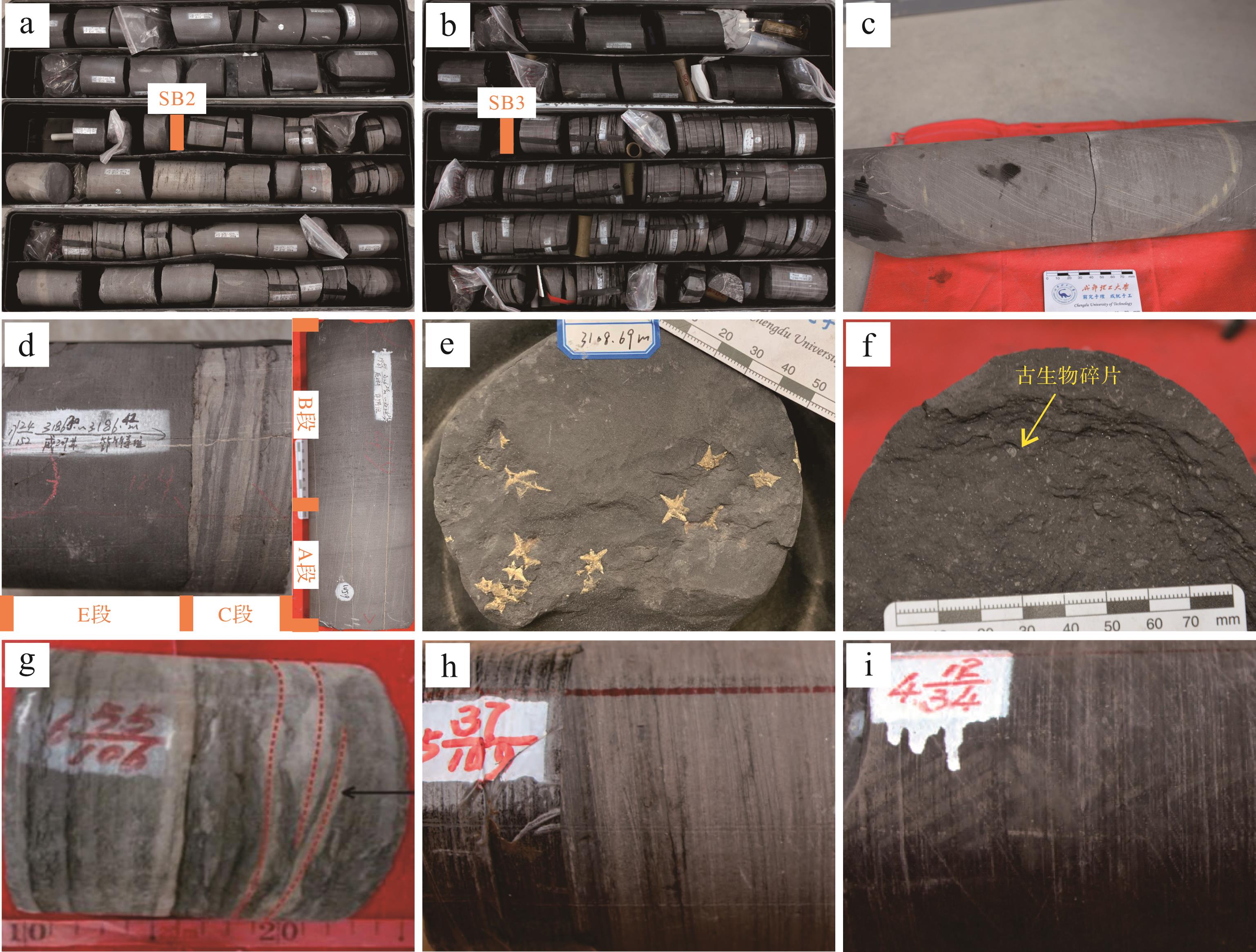
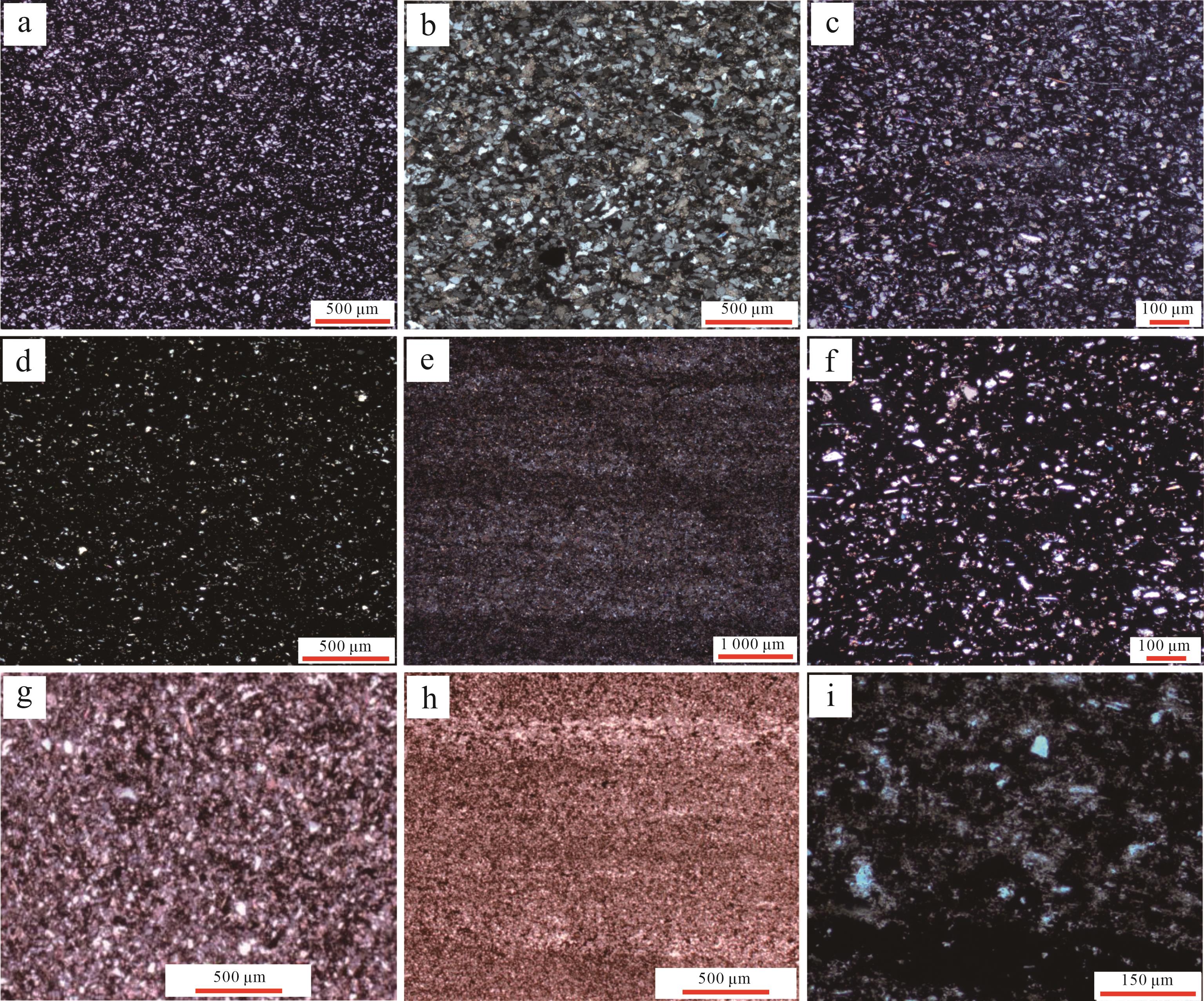
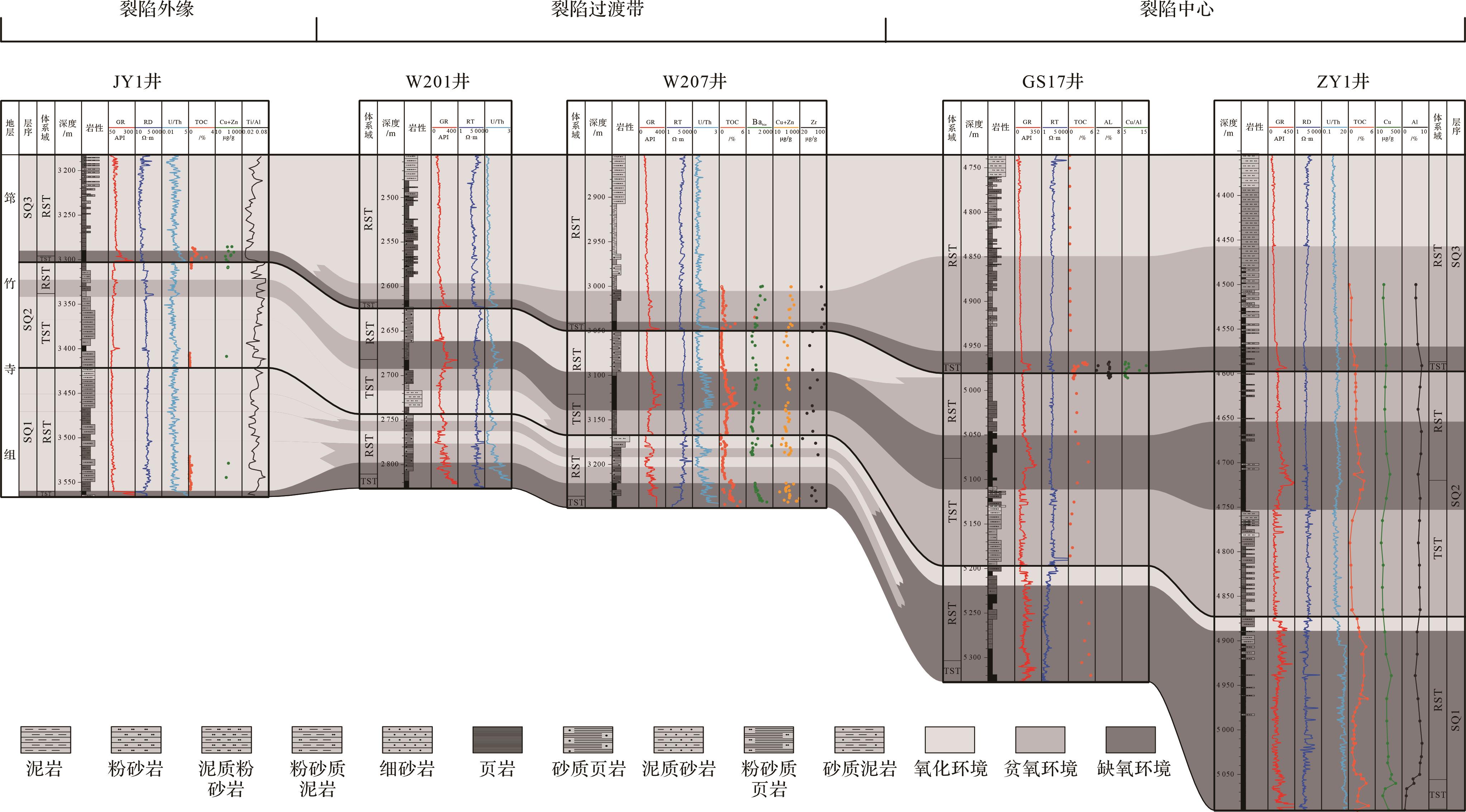
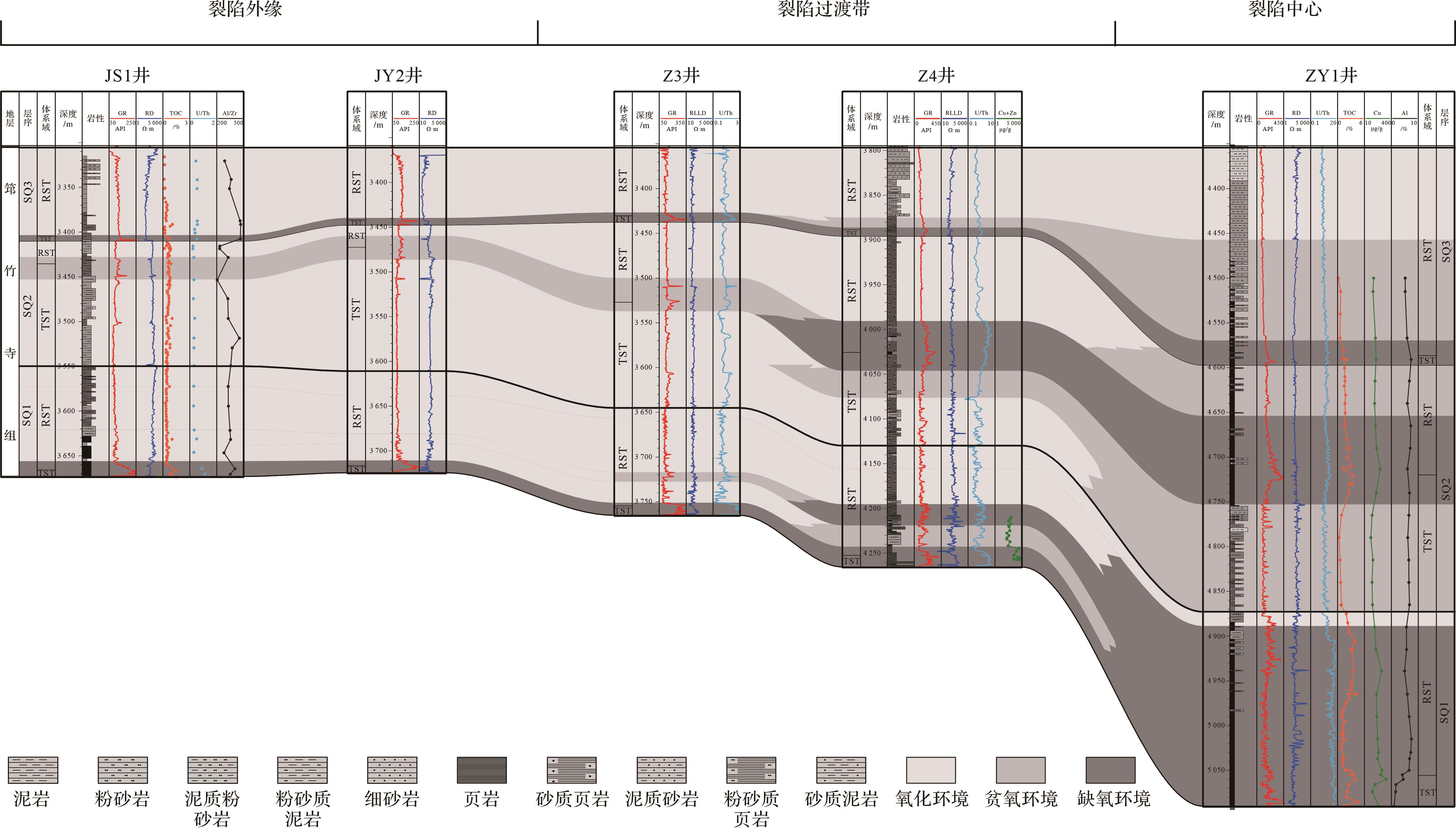
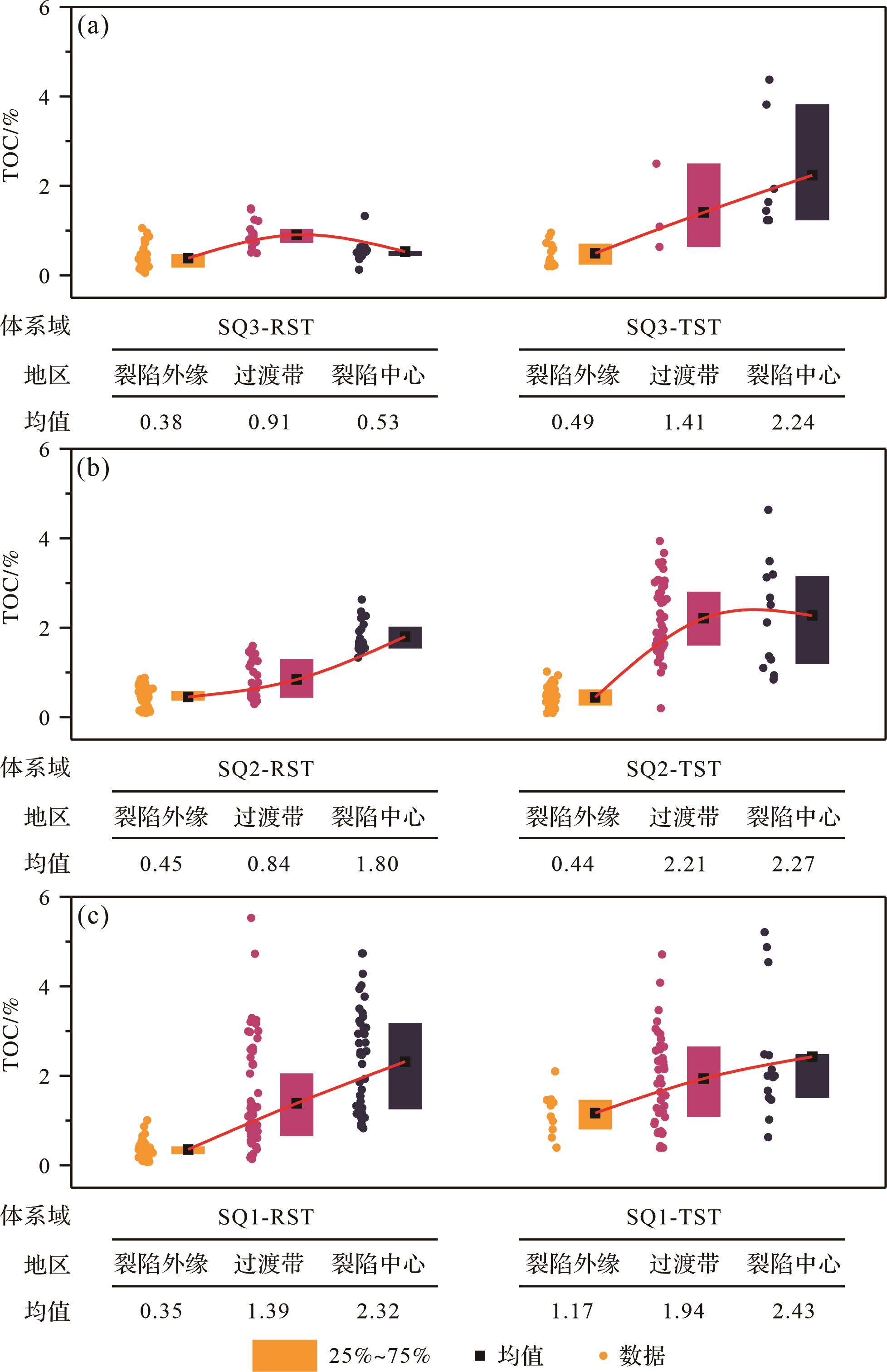
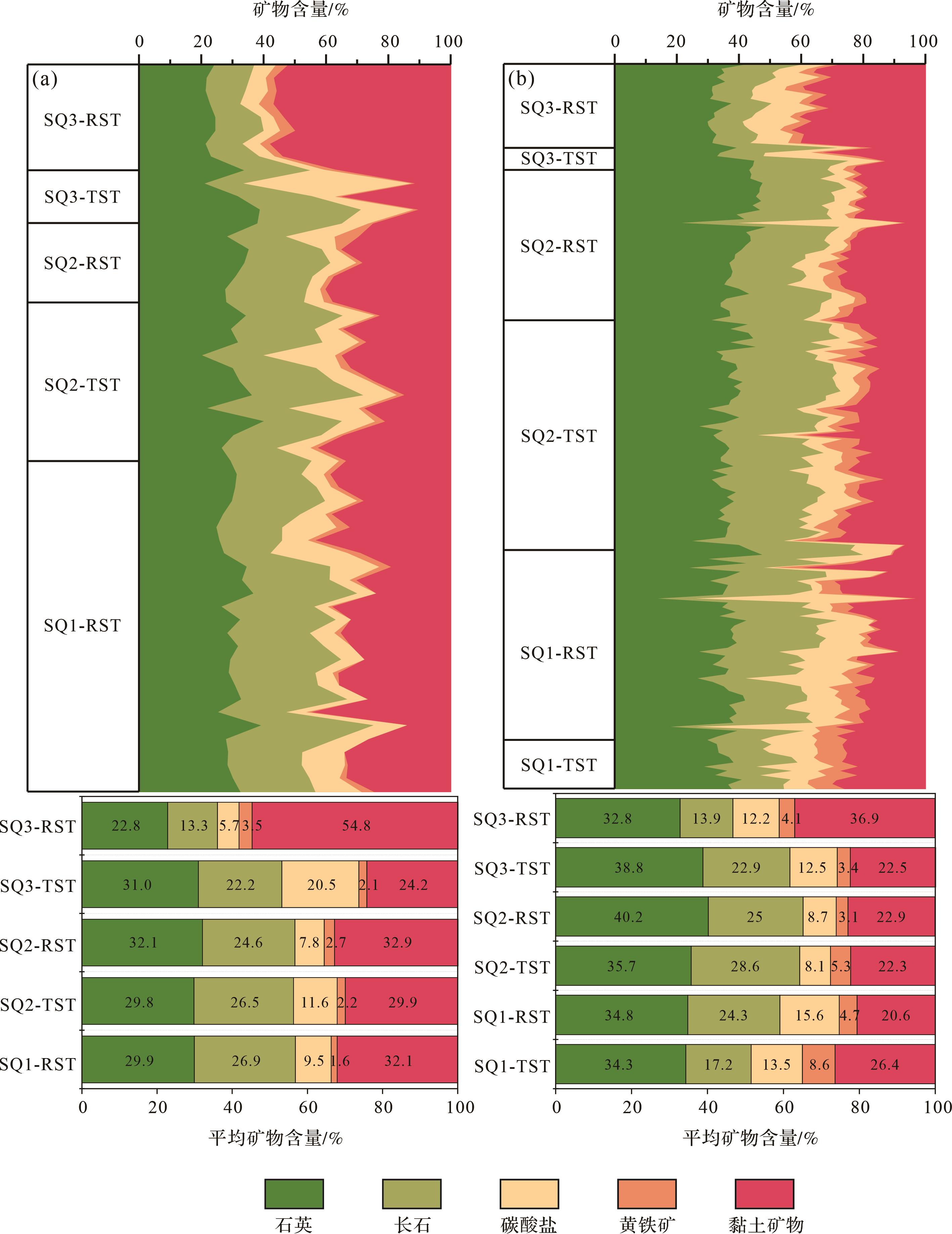
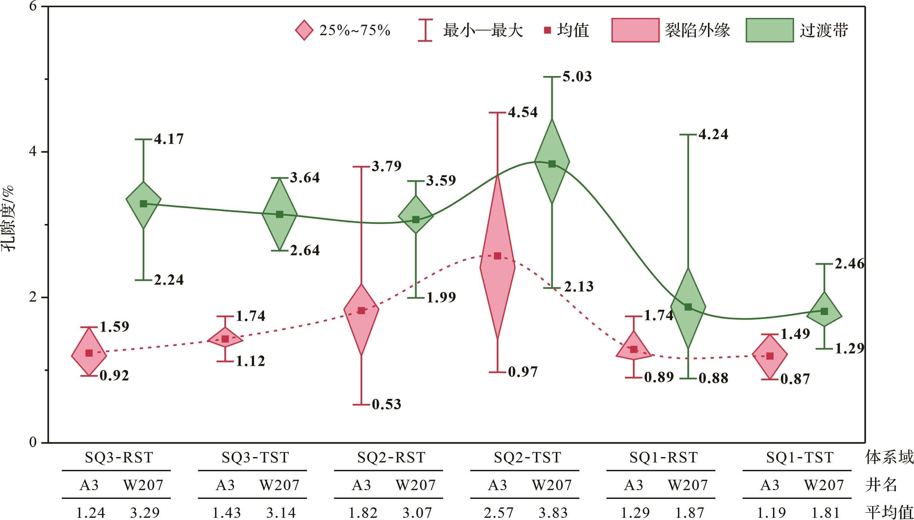
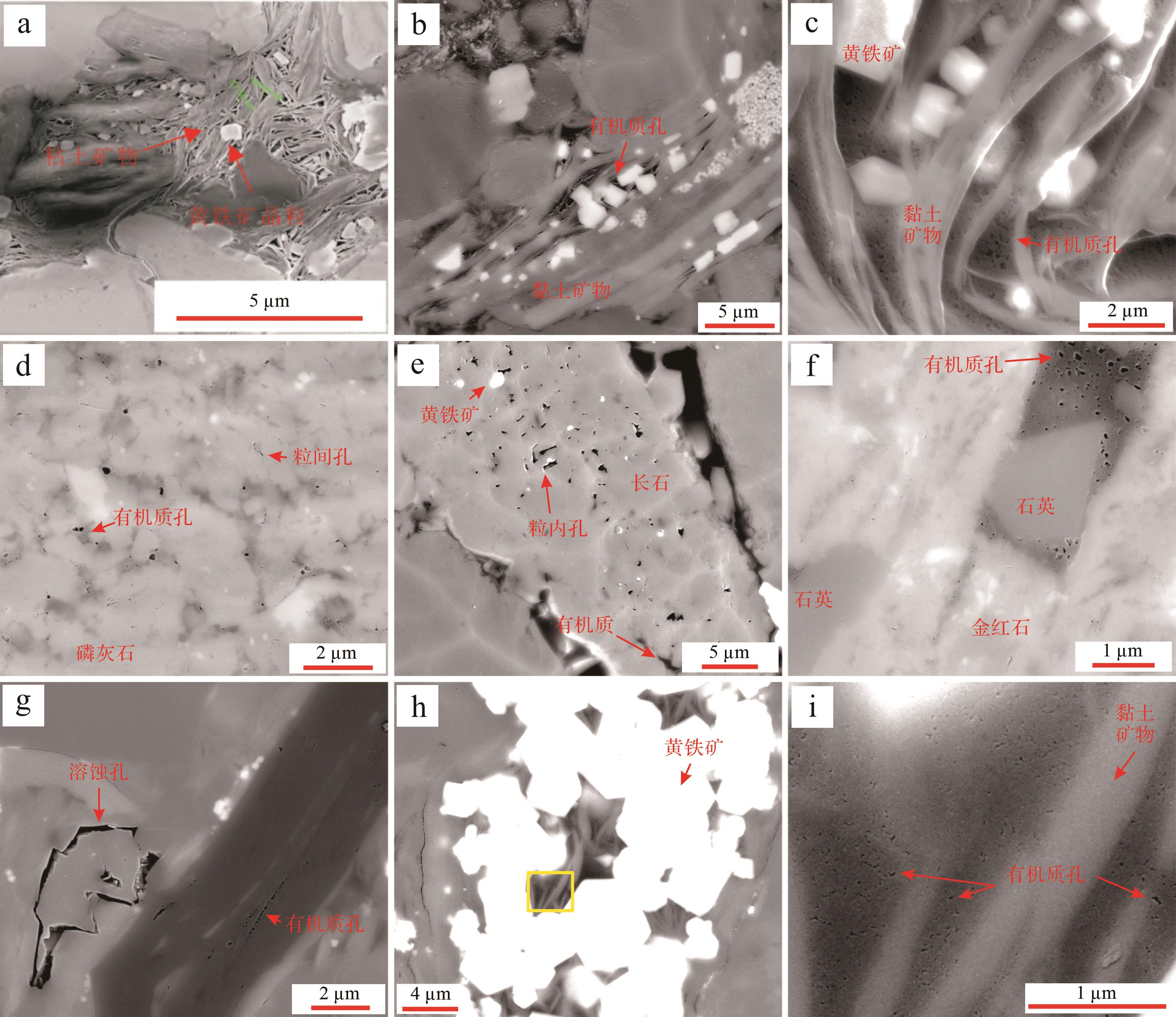
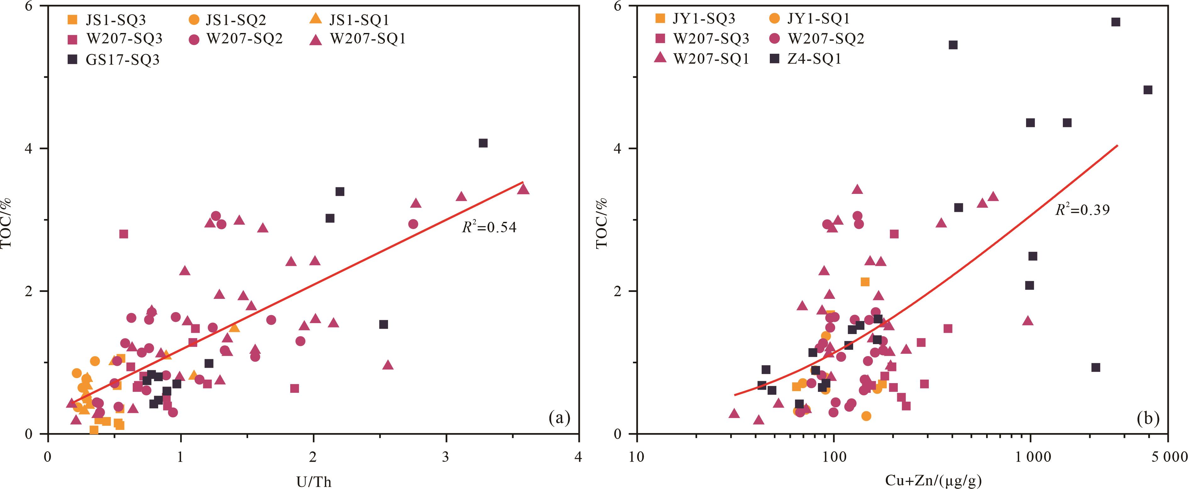
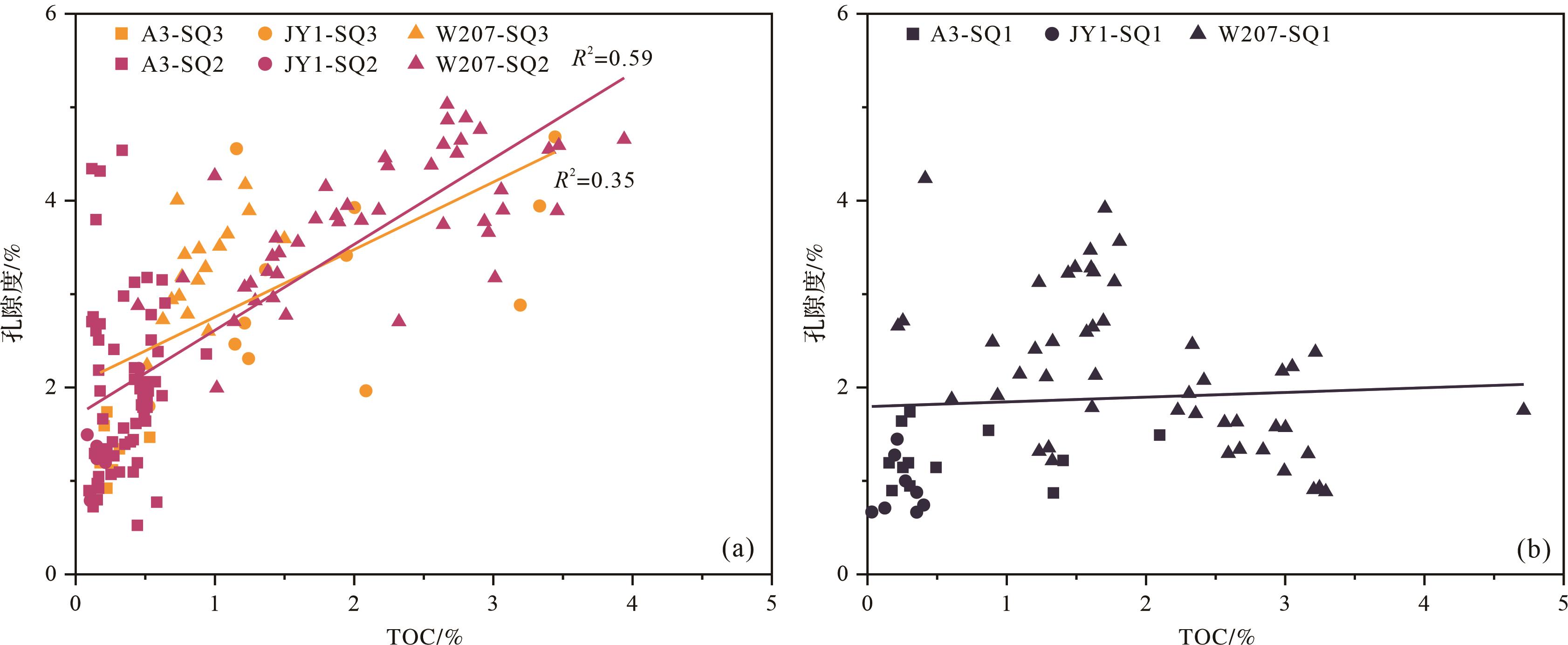
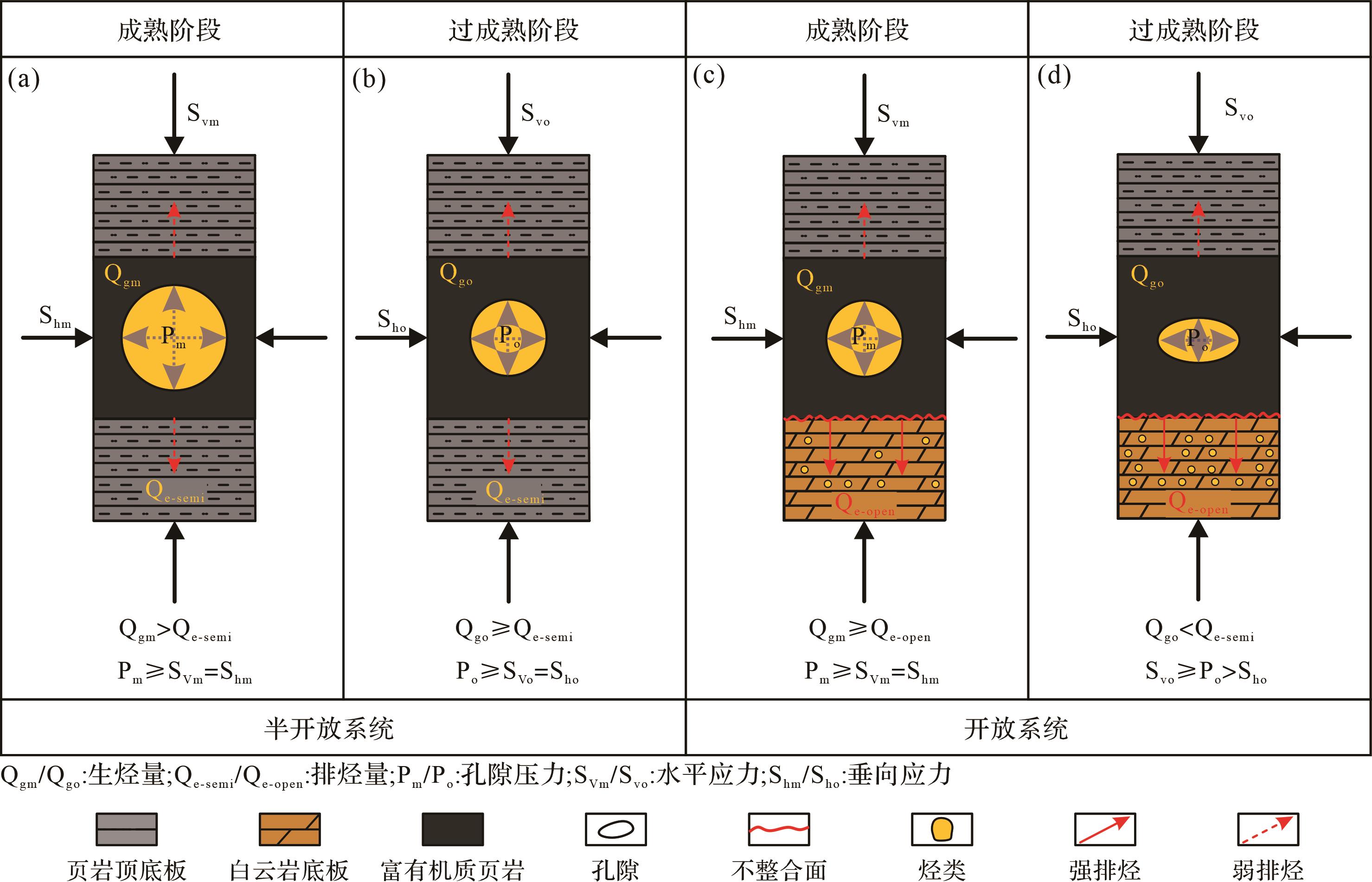
To clarify the characteristics of organic shale distribution and shale gas reservoir in different tectonic-depositional differentiation patterns under the sequence framework, we examined the stratigraphy of the Qiongzhusi Formation in the southwestern Sichuan Basin. Based on the transgressive⁃regressive sequence model, the sequence of the Qiongzhusi Formation was divided, and the sequence stratigraphic framework was established. Under the constraints of the sequence framework, core, logging, geochemical, and pore structure data of the Qiongzhusi Formation were analyzed. The characteristics and influencing factors of the Qiongzhusi Formation shale gas reservoirs under different structural-sedimentary differentiation patterns were identified. The study shows that four sequence boundaries and three third-order sequences can be classified in the Qiongzhusi Formation. The thickness of each sequence is gradually reduced from the center to the outer edge of the Mianyang-Changning intracratonic rift owing to tectonic-deposition differentiation. The thickness of strata sequence (SQ) 2 regressive systems tract is significantly thinned in the JS1⁃JY2 area, and the thinning of SQ3 extends to the Z4⁃JS1 area. The shale gas reservoir characteristics of the Qiongzhusi Formation under different tectonic-deposition differentiation patterns and the sequence framework are clarified: the total organic carbon content shows that transgressive systems tract is larger than regressive systems tract, and the center of the rift is larger in the transition zone than at the outer edge of rift; the mineral content shows that SQ1 and SQ2 are dominated by feldspar and quartz, but SQ3 changes to be dominated by clay and quartz. The quartz and pyrite content in the transition zone is higher than the outer edge of the rift; the porosity shows that the transition zone is larger than the outer edge of the rift, SQ1 is lower than SQ3 and SQ2, and the organic matter pore of SQ1 is poorly developed. The tectonic-deposition differentiation of the Mianyang-Changning intracratonic rift controlled the topography and water depth during the deposition of the Qiongzhusi Formation, resulting in differences in the redox conditions, paleoproductivity level, authigenic mineral formation environment, and floor sealing ability in different sequences and tectonic-deposition differentiation patterns, and further influenced the organic matter enrichment, mineral content and pore development characteristics.
To clarify the characteristics of organic shale distribution and shale gas reservoir in different tectonic-depositional differentiation patterns under the sequence framework, we examined the stratigraphy of the Qiongzhusi Formation in the southwestern Sichuan Basin. Based on the transgressive⁃regressive sequence model, the sequence of the Qiongzhusi Formation was divided, and the sequence stratigraphic framework was established. Under the constraints of the sequence framework, core, logging, geochemical, and pore structure data of the Qiongzhusi Formation were analyzed. The characteristics and influencing factors of the Qiongzhusi Formation shale gas reservoirs under different structural-sedimentary differentiation patterns were identified. The study shows that four sequence boundaries and three third-order sequences can be classified in the Qiongzhusi Formation. The thickness of each sequence is gradually reduced from the center to the outer edge of the Mianyang-Changning intracratonic rift owing to tectonic-deposition differentiation. The thickness of strata sequence (SQ) 2 regressive systems tract is significantly thinned in the JS1⁃JY2 area, and the thinning of SQ3 extends to the Z4⁃JS1 area. The shale gas reservoir characteristics of the Qiongzhusi Formation under different tectonic-deposition differentiation patterns and the sequence framework are clarified: the total organic carbon content shows that transgressive systems tract is larger than regressive systems tract, and the center of the rift is larger in the transition zone than at the outer edge of rift; the mineral content shows that SQ1 and SQ2 are dominated by feldspar and quartz, but SQ3 changes to be dominated by clay and quartz. The quartz and pyrite content in the transition zone is higher than the outer edge of the rift; the porosity shows that the transition zone is larger than the outer edge of the rift, SQ1 is lower than SQ3 and SQ2, and the organic matter pore of SQ1 is poorly developed. The tectonic-deposition differentiation of the Mianyang-Changning intracratonic rift controlled the topography and water depth during the deposition of the Qiongzhusi Formation, resulting in differences in the redox conditions, paleoproductivity level, authigenic mineral formation environment, and floor sealing ability in different sequences and tectonic-deposition differentiation patterns, and further influenced the organic matter enrichment, mineral content and pore development characteristics.
2023, 41(5): 1495-1511.
doi: 10.14027/j.issn.1000-0550.2022.019
Abstract:
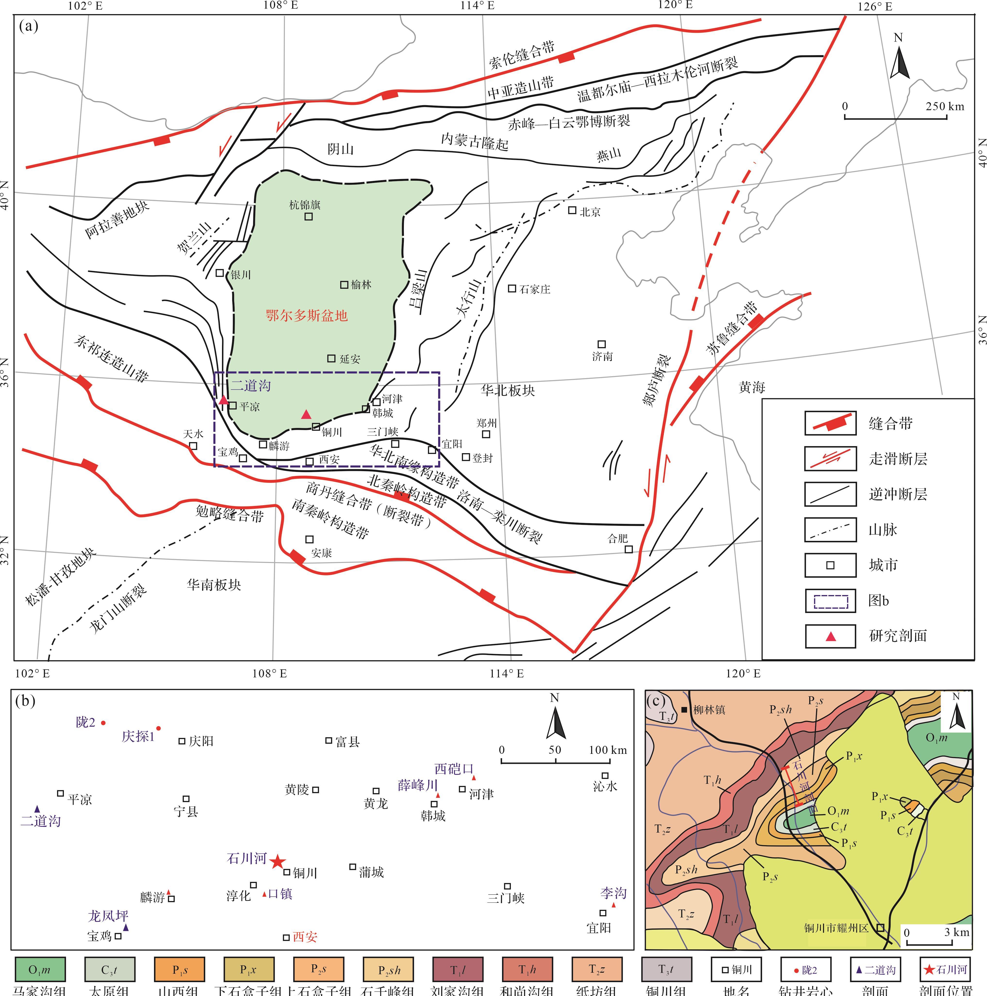
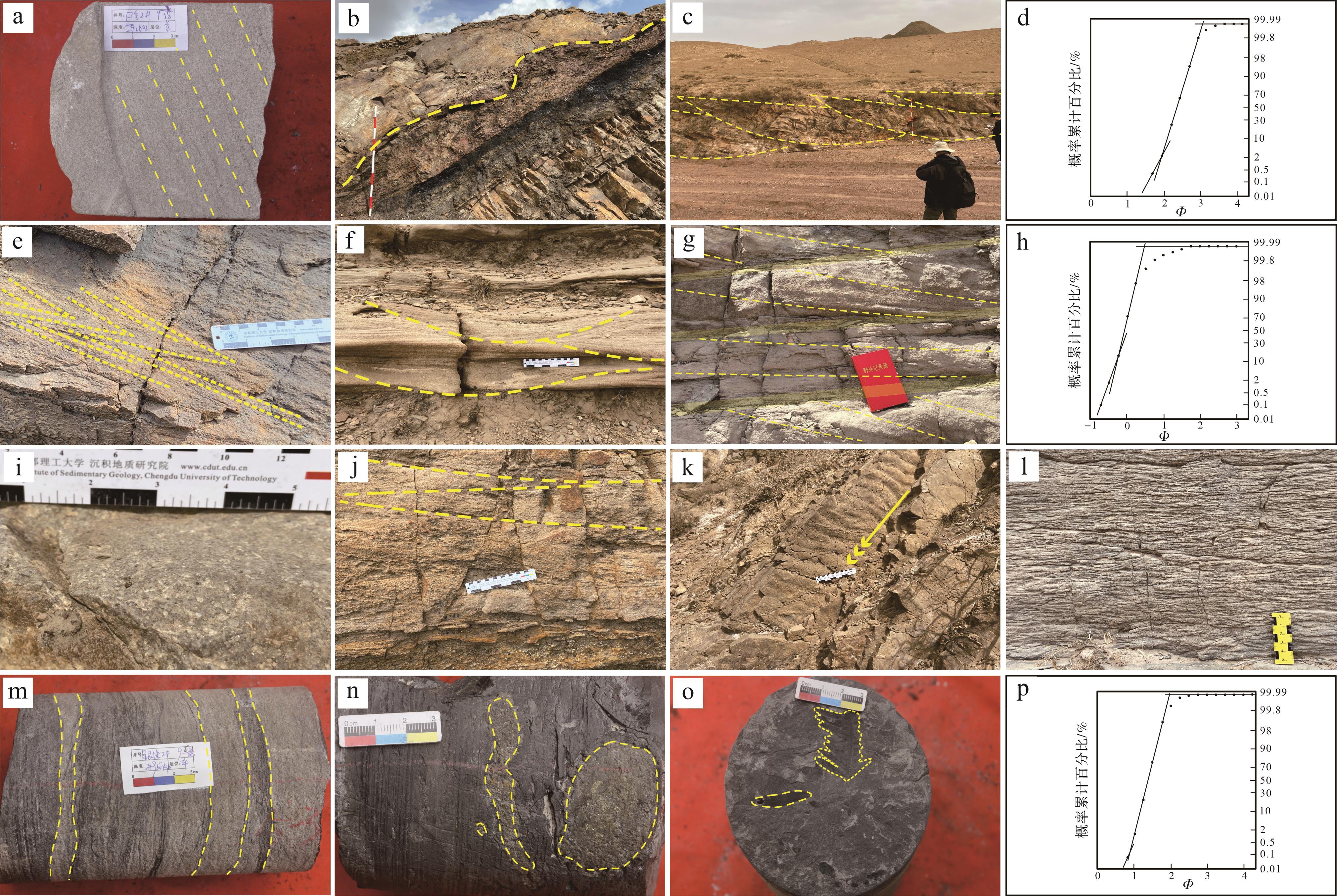
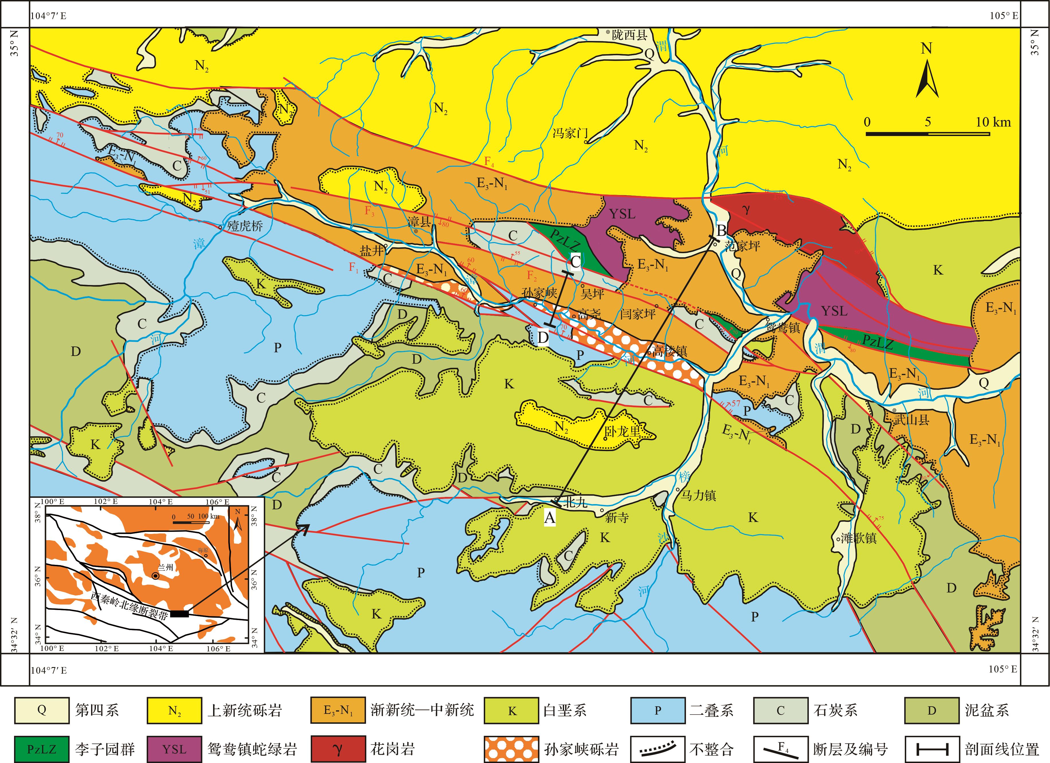
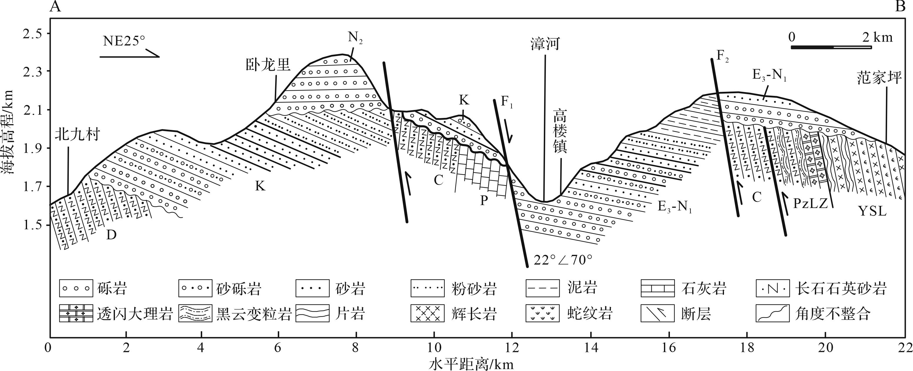
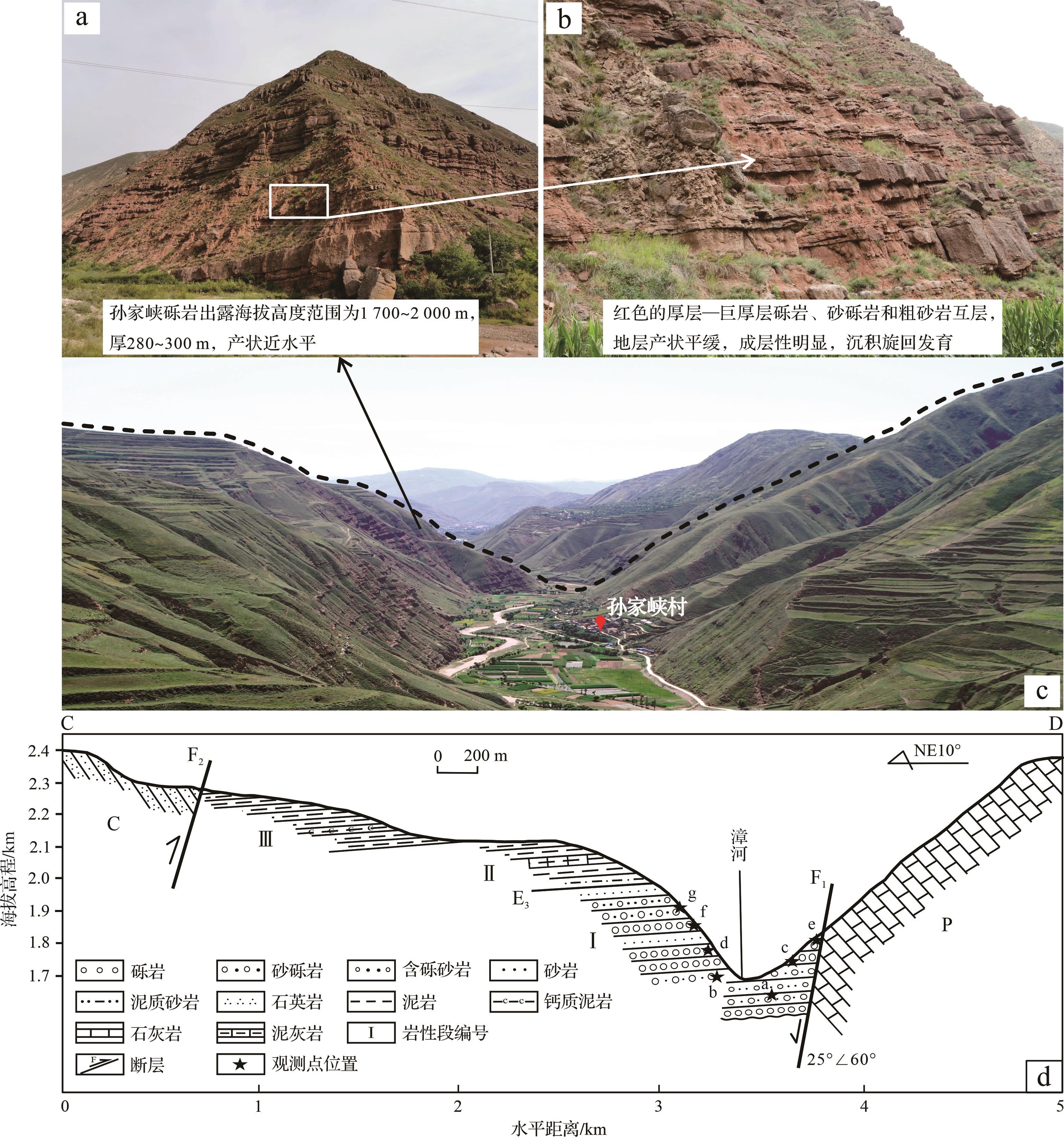
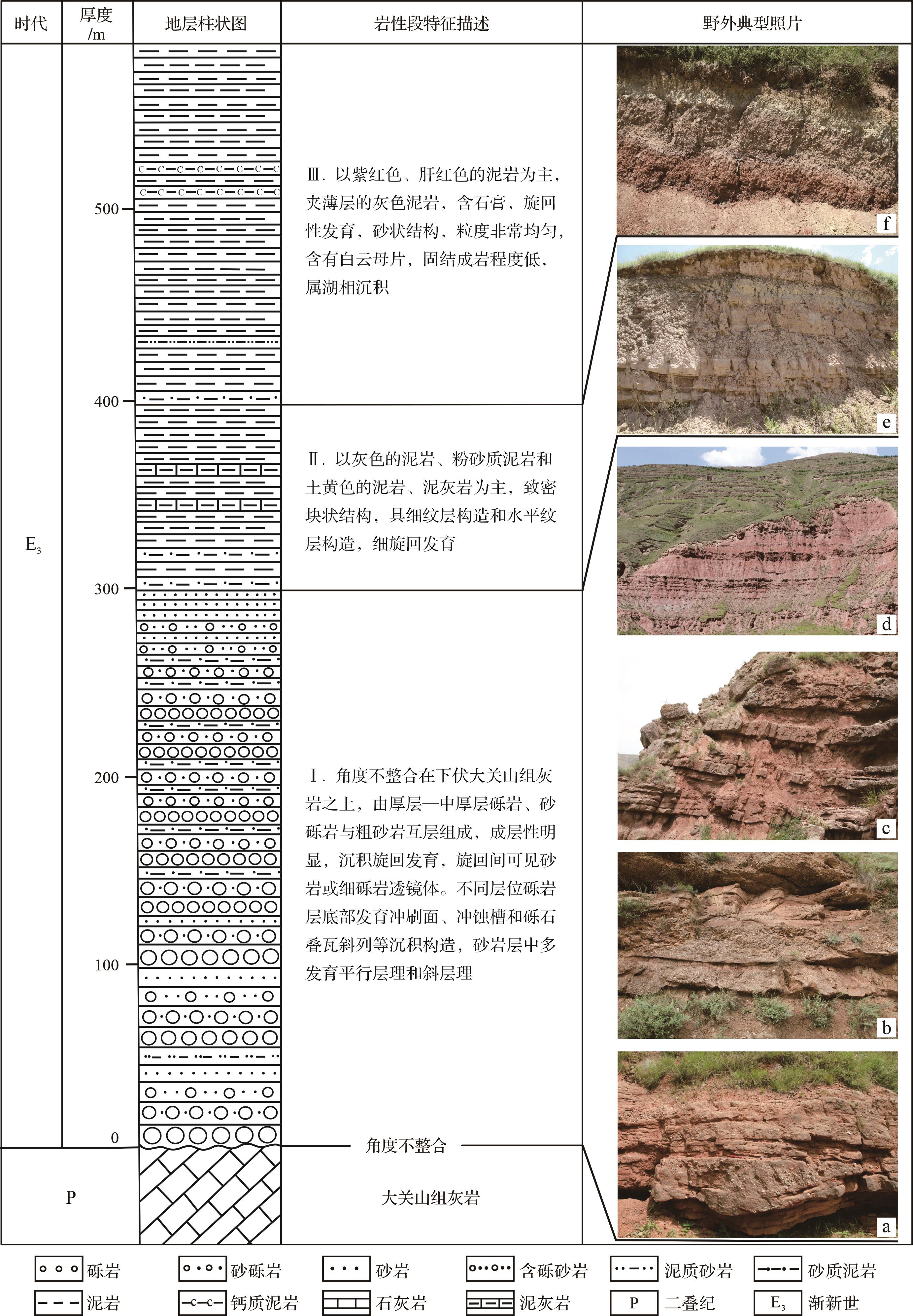
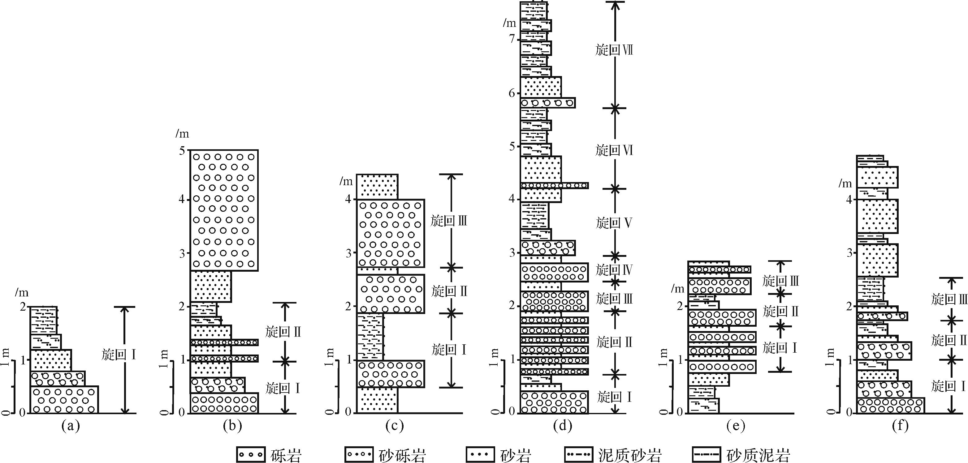
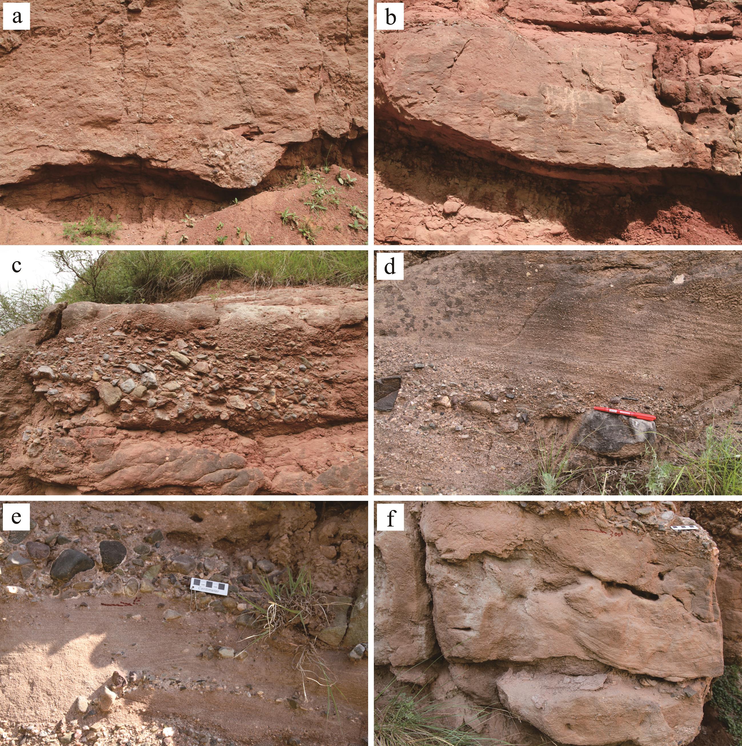
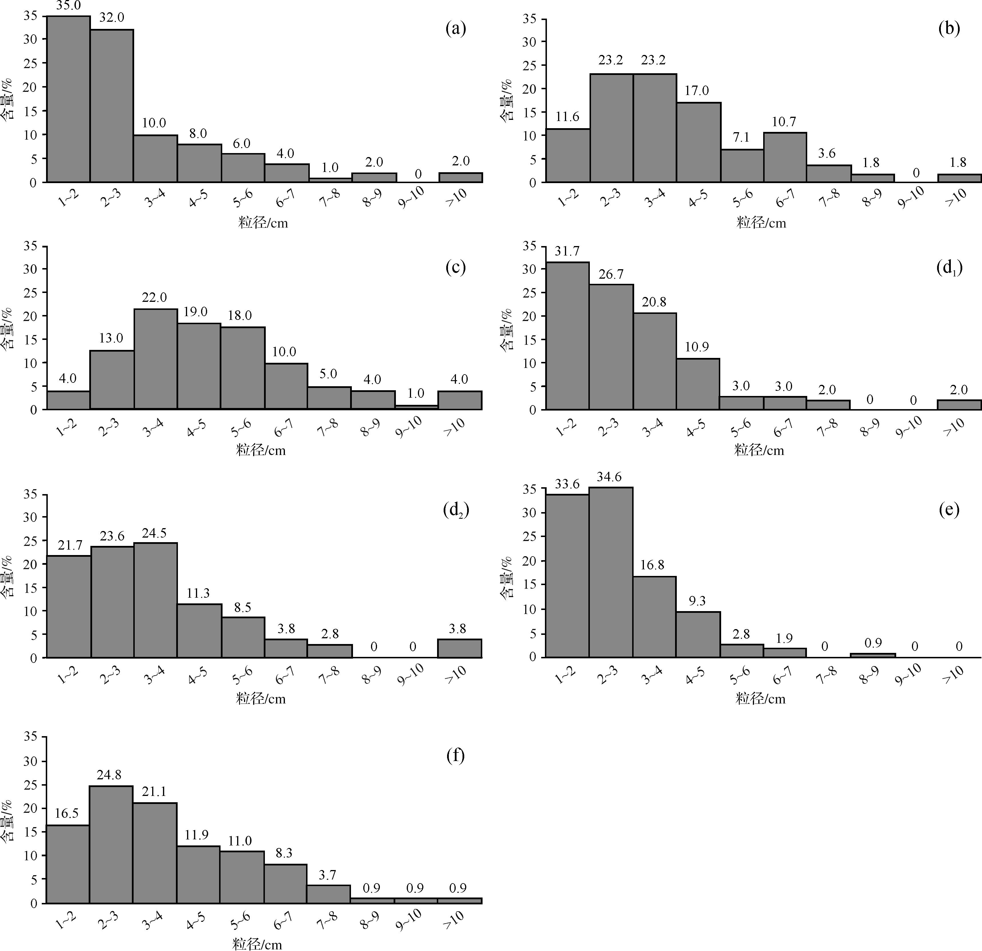
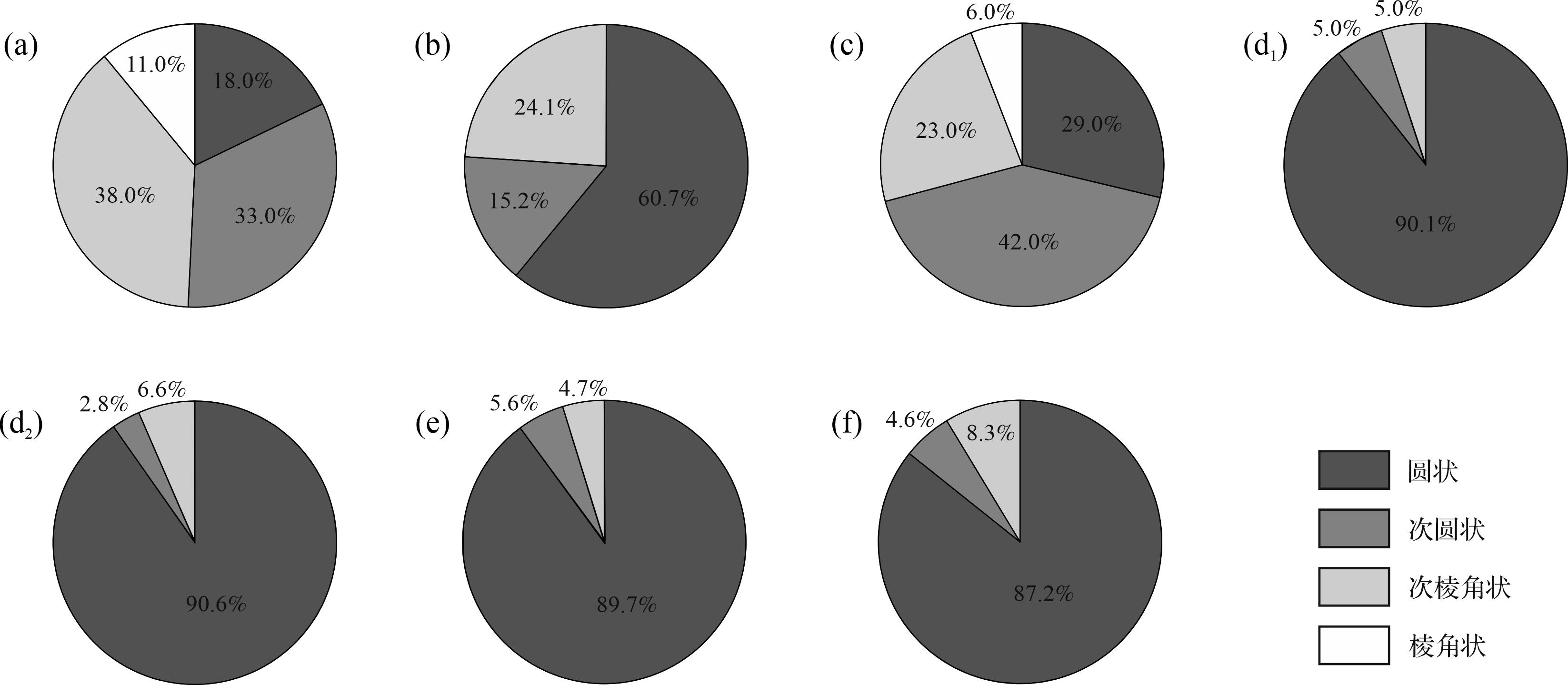
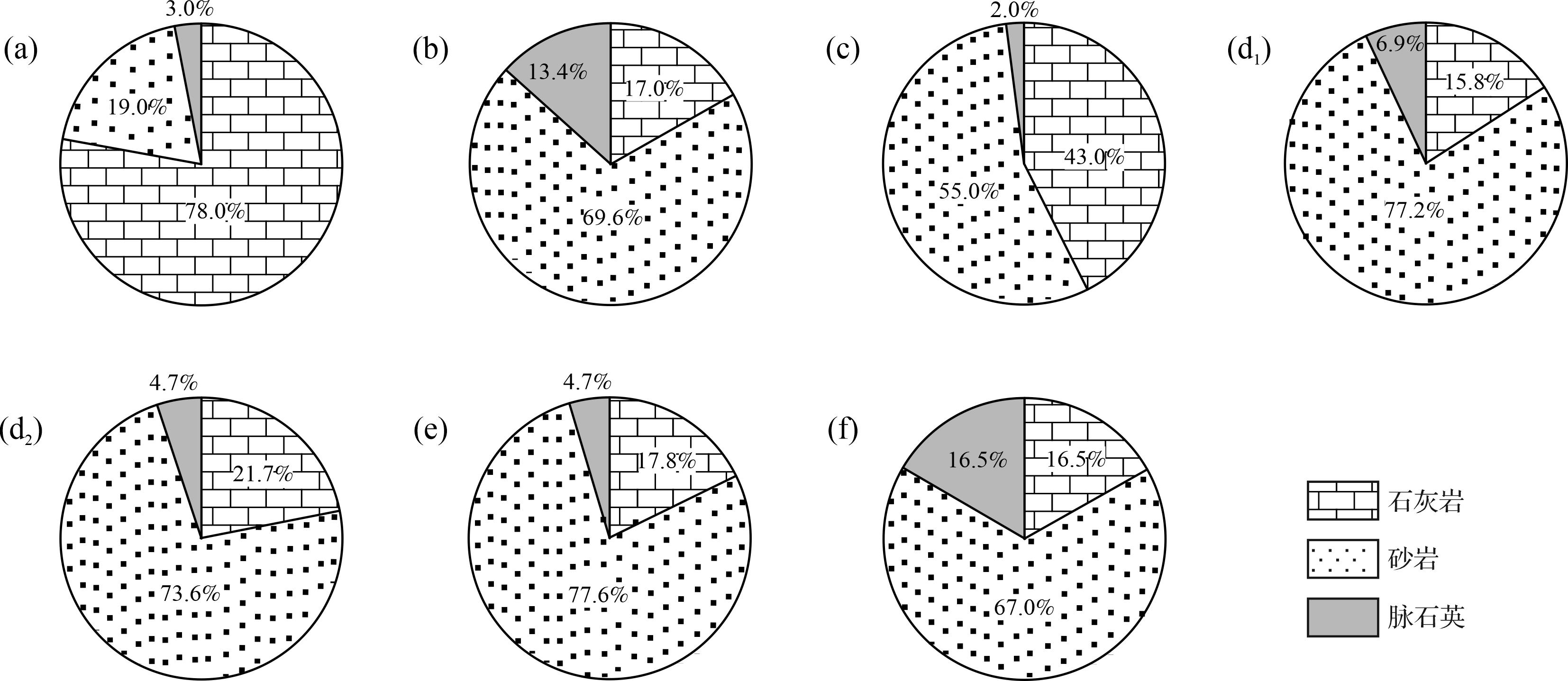
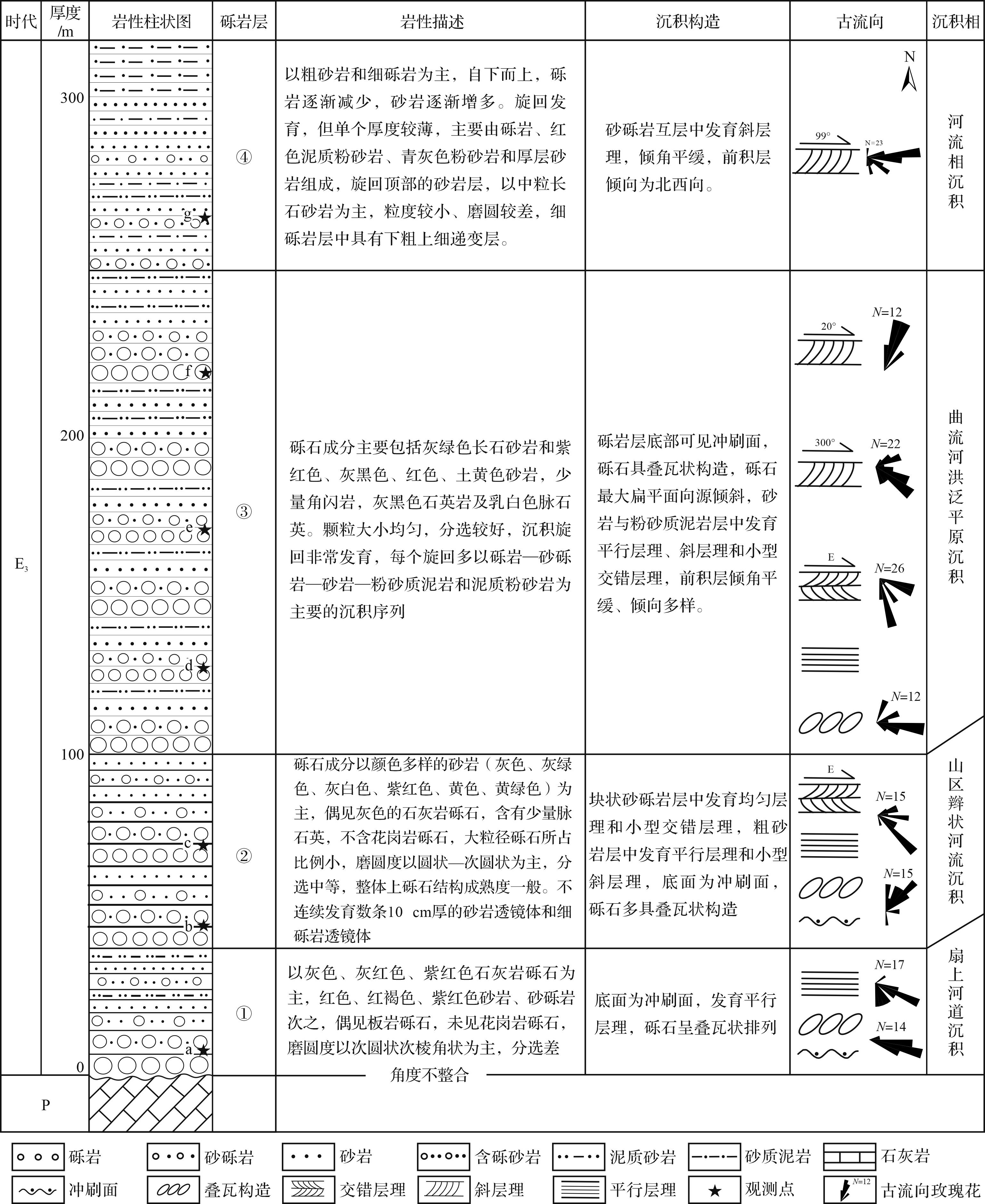
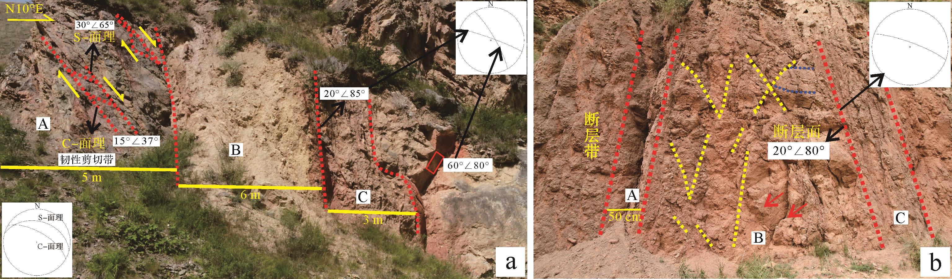
The Oligocene conglomerate association is exposed along both banks of the Zhanghe River in the Zhangxian-Wushan area of the northern margin of West Qinling mountains. This conglomerate association, which is bounded by a disconformity or fault on the different Palaeozoic and Mesozoic strata, is mainly composed of red conglomerate and glutenite interbedded with coarse sandstone with a thickness of nearly 300 m. It is called the Sunjiaxia conglomerate for the well exposed and complete preserved sequence. Furthermore, the Sunjiaxia conglomerate with the upper red or grey, silty mudstone interbedded with marletal lacustrine deposits formed a relative complete normal sedimentary cycle, going from coarse to fine from bottom to top. This normal cycle sedimentary sequence is the lowest sedimentary sequence of the Zhangxian Oligocene-Miocene saline basin. The study of its sedimentary characteristics and tectonic setting could provide the constraints to the tectonic attributes of the Cenozoic Zhangxian saline basin, the Cenozoic basin-mountain evolution in the northern margin of the West Qinling, and the remote geological response to the Indian-Eurasian Plate collisional convergence. Based on the detailed study of the sedimentary cycle, sedimentary structure, gravel characteristics and paleocurrent direction of the Sunjiaxia conglomerate, combined with the multiple phase deformation of the basin-controlled boundary fault, and the comparison with the corresponding the same era sedimentary strata in the norther margin of West Qinling, the following understandings are obtained: (1) The characteristics of the sedimentary cycle, sedimentary structure, and sorting, rounding and arrangement of gravels of the Sunjiaxia conglomerate association indicate that, except for the bottom alluvial fan with channel deposits, most are river aggradation deposits, which include the braided channel, meandering channel, and flood facies; Gravel composition and paleocurrent direction show that though the Silurian-Triassic orogenic strata to the south of fault F1 had little contribution to its provenance, but its main provenance area is more likely to come from the Western Qilian block; (2) The normal cycle sedimentary sequence of the Sunjiaxia conglomerate association with the conformable overlying lacustrine sedimentation and early extensional normal faulting of the basin-controlled boundary fault F1 supported that the Sunjiaxa conglomerate association developed at an extensional tectonic setting, i.e., extensional faulted sag basin sedimentation. The lacustrine sedimentation covering the conglomerate could be attributed to continuous and rapid extensional faulting. (3) The confirmation of the Oligocene faulted basin in the northern margin of West Qinling clarifies the existing misunderstanding about whether the Oligocene-Miocene sedimentary basins are compressive sag, foreland flexure, or pull-apart basins. Furthermore, existence of the Oligocene-Miocene extensional faulted sag basins in the northern margin of West Qinling imply that at this duration, the compressional shortening resulting from the Indian-Eurasia convergence has not yet spread to this region. Therefore, the dynamic response of the India-Eurasia convergence to the northeast margin of Qinhai-Tibetan Plateau occurred after the Miocene, i.e., a Pliocene geological event.
The Oligocene conglomerate association is exposed along both banks of the Zhanghe River in the Zhangxian-Wushan area of the northern margin of West Qinling mountains. This conglomerate association, which is bounded by a disconformity or fault on the different Palaeozoic and Mesozoic strata, is mainly composed of red conglomerate and glutenite interbedded with coarse sandstone with a thickness of nearly 300 m. It is called the Sunjiaxia conglomerate for the well exposed and complete preserved sequence. Furthermore, the Sunjiaxia conglomerate with the upper red or grey, silty mudstone interbedded with marletal lacustrine deposits formed a relative complete normal sedimentary cycle, going from coarse to fine from bottom to top. This normal cycle sedimentary sequence is the lowest sedimentary sequence of the Zhangxian Oligocene-Miocene saline basin. The study of its sedimentary characteristics and tectonic setting could provide the constraints to the tectonic attributes of the Cenozoic Zhangxian saline basin, the Cenozoic basin-mountain evolution in the northern margin of the West Qinling, and the remote geological response to the Indian-Eurasian Plate collisional convergence. Based on the detailed study of the sedimentary cycle, sedimentary structure, gravel characteristics and paleocurrent direction of the Sunjiaxia conglomerate, combined with the multiple phase deformation of the basin-controlled boundary fault, and the comparison with the corresponding the same era sedimentary strata in the norther margin of West Qinling, the following understandings are obtained: (1) The characteristics of the sedimentary cycle, sedimentary structure, and sorting, rounding and arrangement of gravels of the Sunjiaxia conglomerate association indicate that, except for the bottom alluvial fan with channel deposits, most are river aggradation deposits, which include the braided channel, meandering channel, and flood facies; Gravel composition and paleocurrent direction show that though the Silurian-Triassic orogenic strata to the south of fault F1 had little contribution to its provenance, but its main provenance area is more likely to come from the Western Qilian block; (2) The normal cycle sedimentary sequence of the Sunjiaxia conglomerate association with the conformable overlying lacustrine sedimentation and early extensional normal faulting of the basin-controlled boundary fault F1 supported that the Sunjiaxa conglomerate association developed at an extensional tectonic setting, i.e., extensional faulted sag basin sedimentation. The lacustrine sedimentation covering the conglomerate could be attributed to continuous and rapid extensional faulting. (3) The confirmation of the Oligocene faulted basin in the northern margin of West Qinling clarifies the existing misunderstanding about whether the Oligocene-Miocene sedimentary basins are compressive sag, foreland flexure, or pull-apart basins. Furthermore, existence of the Oligocene-Miocene extensional faulted sag basins in the northern margin of West Qinling imply that at this duration, the compressional shortening resulting from the Indian-Eurasia convergence has not yet spread to this region. Therefore, the dynamic response of the India-Eurasia convergence to the northeast margin of Qinhai-Tibetan Plateau occurred after the Miocene, i.e., a Pliocene geological event.
2023, 41(5): 1512-1529.
doi: 10.14027/j.issn.1000-0550.2022.006
Abstract:
Guizhou province is an important production base for aluminum. It is the second largest in China, with a recoverable reserve of bauxite of 1.289 billion tons, accounting for 17% of the national total. The bauxite deposits are enriched in critical metals, including Li, Ga, Sc and rare earth elements (REE). The enrichments of critical metals were evaluated and their resource potentials were summarized in this study of the geological characteristics of the Guizhou bauxite deposits occurring in the aluminiferous rock series, to determine the distributions of critical metals. It was found that Li, Ga, Sc and REE are enriched to varying extents in the bauxite. Li content is higher in the Wu-Zheng-Dao bauxite ore area (northern Guizhou province) than in the other study areas, mainly occurring in the dense bauxite in the middle-to-upper section of the aluminiferous rock series. Ga content is relatively highest in the Wu-Zheng-Dao and Zunyi-Weng'an (central Guizhou) bauxite, and is mainly present in the claylike and clastic bauxite in the middle section of the aluminiferous rock series. REE content is relatively higher in the Wu-Zheng-Dao and Xiuwen-Qingzhen (southwest Guizhou) bauxite, being mainly hosted by chlorite mudstone and ferruginous claystone in the lower section of the aluminiferous rock series. Sc is relatively evenly distributed, both horizontally and vertically. The Li, Ga, Sc and REE present throughout the aluminous rock series are mainly adsorbed onto mineral surfaces and fractures, or occur as isomorphic substitutes in the structures of clay minerals, aluminum-bearing minerals and accessory minerals. Small amounts of REE are present in independent minerals. Overall, these Li, Ga, Sc and REE resources in Guizhou province and their economic potential are huge. Further studies are needed to achieve the maximum economic and environmental benefits of these resources.
Guizhou province is an important production base for aluminum. It is the second largest in China, with a recoverable reserve of bauxite of 1.289 billion tons, accounting for 17% of the national total. The bauxite deposits are enriched in critical metals, including Li, Ga, Sc and rare earth elements (REE). The enrichments of critical metals were evaluated and their resource potentials were summarized in this study of the geological characteristics of the Guizhou bauxite deposits occurring in the aluminiferous rock series, to determine the distributions of critical metals. It was found that Li, Ga, Sc and REE are enriched to varying extents in the bauxite. Li content is higher in the Wu-Zheng-Dao bauxite ore area (northern Guizhou province) than in the other study areas, mainly occurring in the dense bauxite in the middle-to-upper section of the aluminiferous rock series. Ga content is relatively highest in the Wu-Zheng-Dao and Zunyi-Weng'an (central Guizhou) bauxite, and is mainly present in the claylike and clastic bauxite in the middle section of the aluminiferous rock series. REE content is relatively higher in the Wu-Zheng-Dao and Xiuwen-Qingzhen (southwest Guizhou) bauxite, being mainly hosted by chlorite mudstone and ferruginous claystone in the lower section of the aluminiferous rock series. Sc is relatively evenly distributed, both horizontally and vertically. The Li, Ga, Sc and REE present throughout the aluminous rock series are mainly adsorbed onto mineral surfaces and fractures, or occur as isomorphic substitutes in the structures of clay minerals, aluminum-bearing minerals and accessory minerals. Small amounts of REE are present in independent minerals. Overall, these Li, Ga, Sc and REE resources in Guizhou province and their economic potential are huge. Further studies are needed to achieve the maximum economic and environmental benefits of these resources.
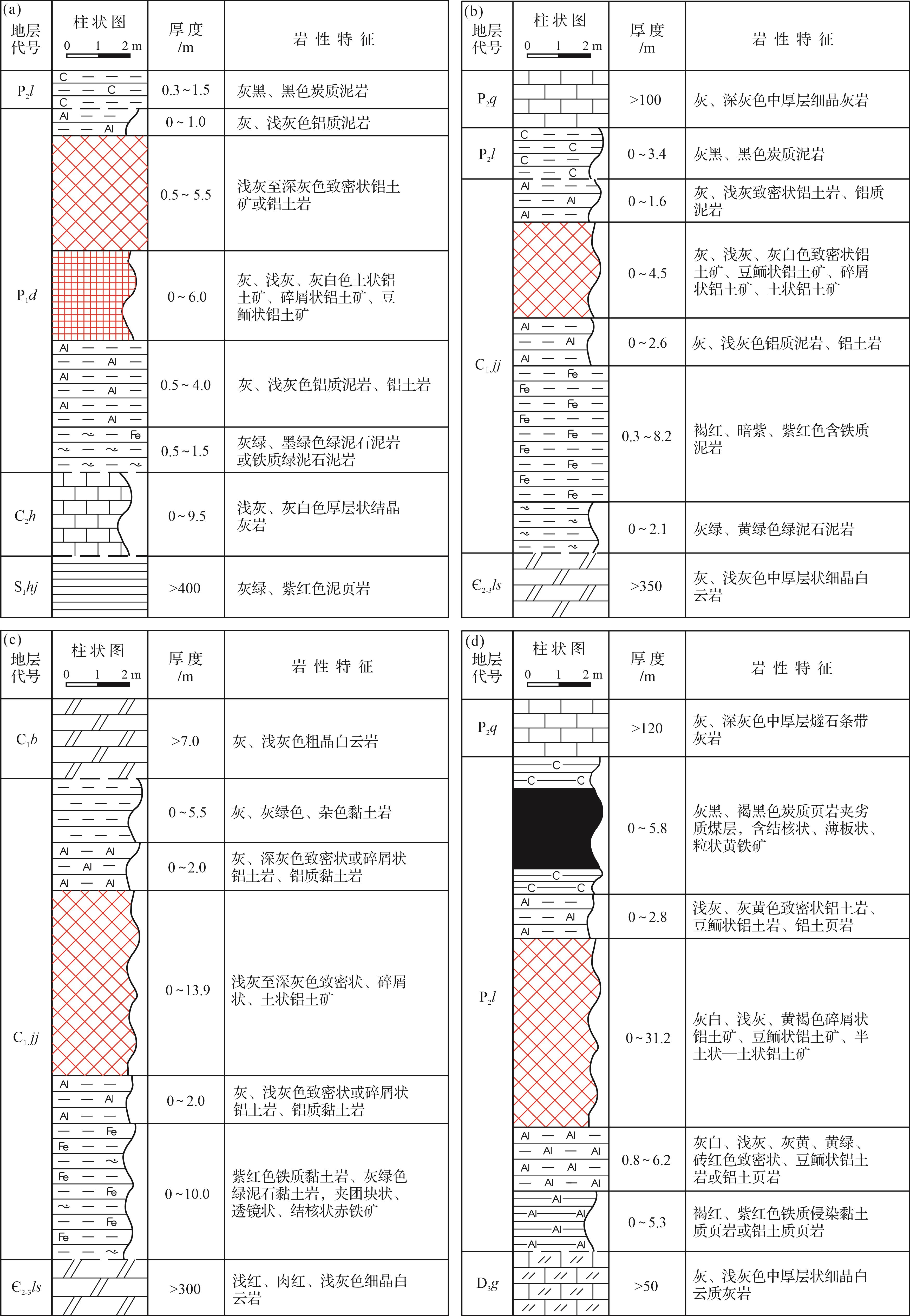
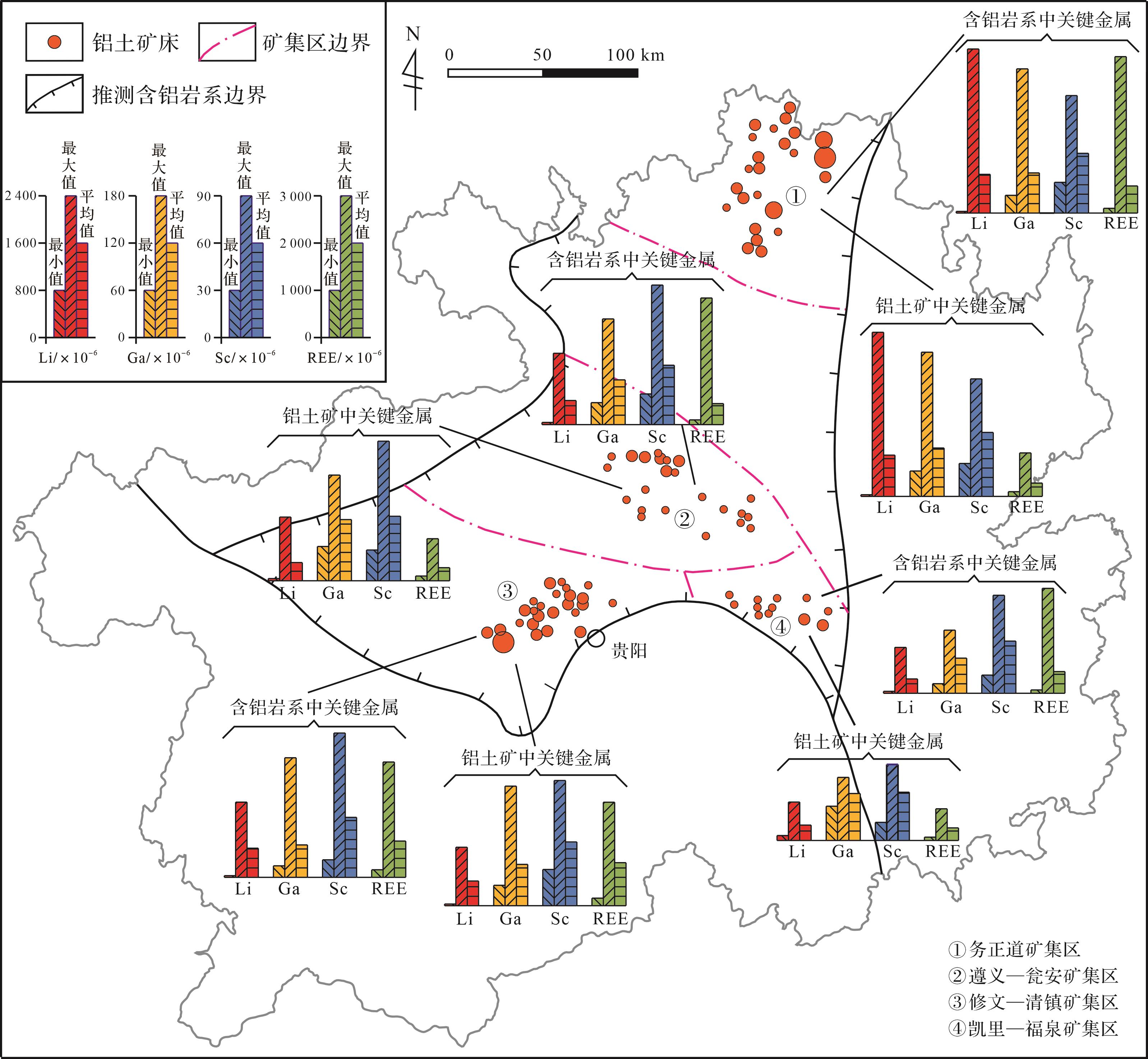
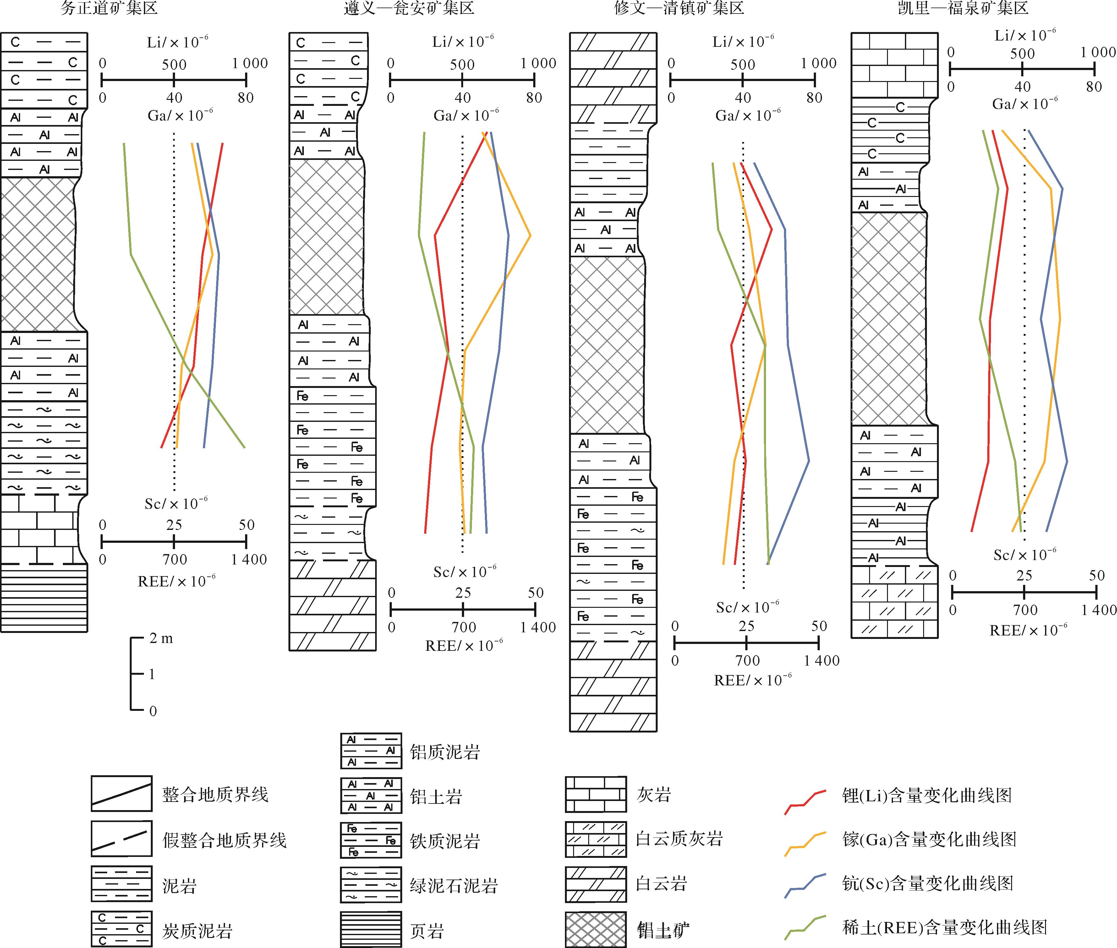
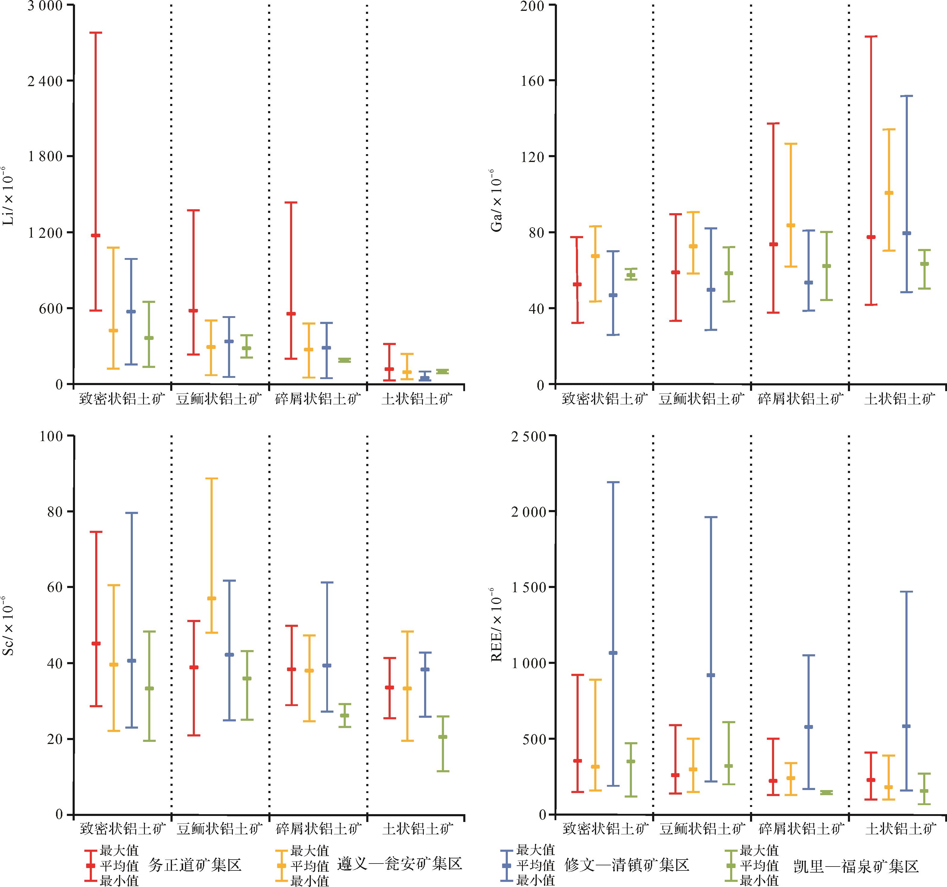
2023, 41(5): 1530-1542.
doi: 10.14027/j.issn.1000-0550.2022.113
Abstract:
The mechanisms of the formation of sand injectites include differential compaction, earthquakes, fluid injection, waves and gravitational landslides, etc. Of these, earthquakes are generally considered to be the most common mechanism. At present, relatively few studies of the mechanism for earthquake-triggered sand injectites have been reported. The process at different earthquake stages was simulated in this study using a purpose- designed and built experimental device for simulating the production of earthquake-triggered sand injectites. Based on observation and analysis of the experimental results, three evolution stages in the formation process of earthquake-triggered sand injectites are identified. (1) Prior to an earthquake, local differential compaction or fluid-saturated strata may produce slight undulations of sandy strata, or there may be no change some cases. (2) The epicenter stage, in which different media transmit the seismic waves at different velocities and cause rapid rises in abnormal pressures within the formation, causing simultaneous fracturing and liquefaction of the sand if the rupture strength of the overlying layers is exceeded. (3) The post-earthquake stage in which, as well as continuing aftershocks, abnormal pressures are retained in the formation. Liquefied sand continues to deform and migrate until the earthquake activity ceases completely, and the final shape of the sand injectites is evident. Earthquakes may also cause sandstone intrusion and induce other geological processes, all of which may contribute to the formation of sand injectites.
The mechanisms of the formation of sand injectites include differential compaction, earthquakes, fluid injection, waves and gravitational landslides, etc. Of these, earthquakes are generally considered to be the most common mechanism. At present, relatively few studies of the mechanism for earthquake-triggered sand injectites have been reported. The process at different earthquake stages was simulated in this study using a purpose- designed and built experimental device for simulating the production of earthquake-triggered sand injectites. Based on observation and analysis of the experimental results, three evolution stages in the formation process of earthquake-triggered sand injectites are identified. (1) Prior to an earthquake, local differential compaction or fluid-saturated strata may produce slight undulations of sandy strata, or there may be no change some cases. (2) The epicenter stage, in which different media transmit the seismic waves at different velocities and cause rapid rises in abnormal pressures within the formation, causing simultaneous fracturing and liquefaction of the sand if the rupture strength of the overlying layers is exceeded. (3) The post-earthquake stage in which, as well as continuing aftershocks, abnormal pressures are retained in the formation. Liquefied sand continues to deform and migrate until the earthquake activity ceases completely, and the final shape of the sand injectites is evident. Earthquakes may also cause sandstone intrusion and induce other geological processes, all of which may contribute to the formation of sand injectites.
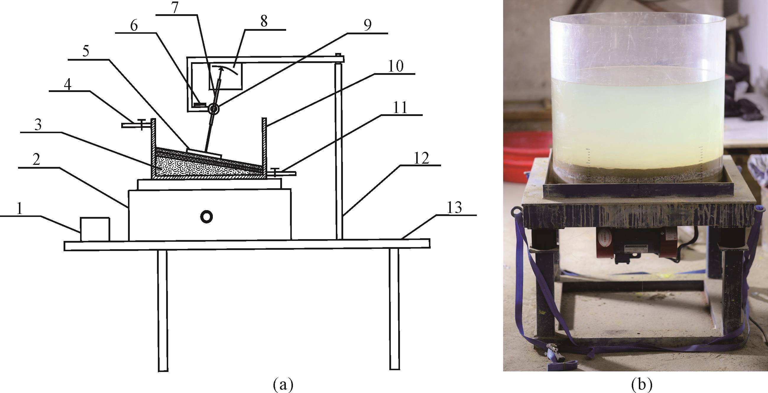
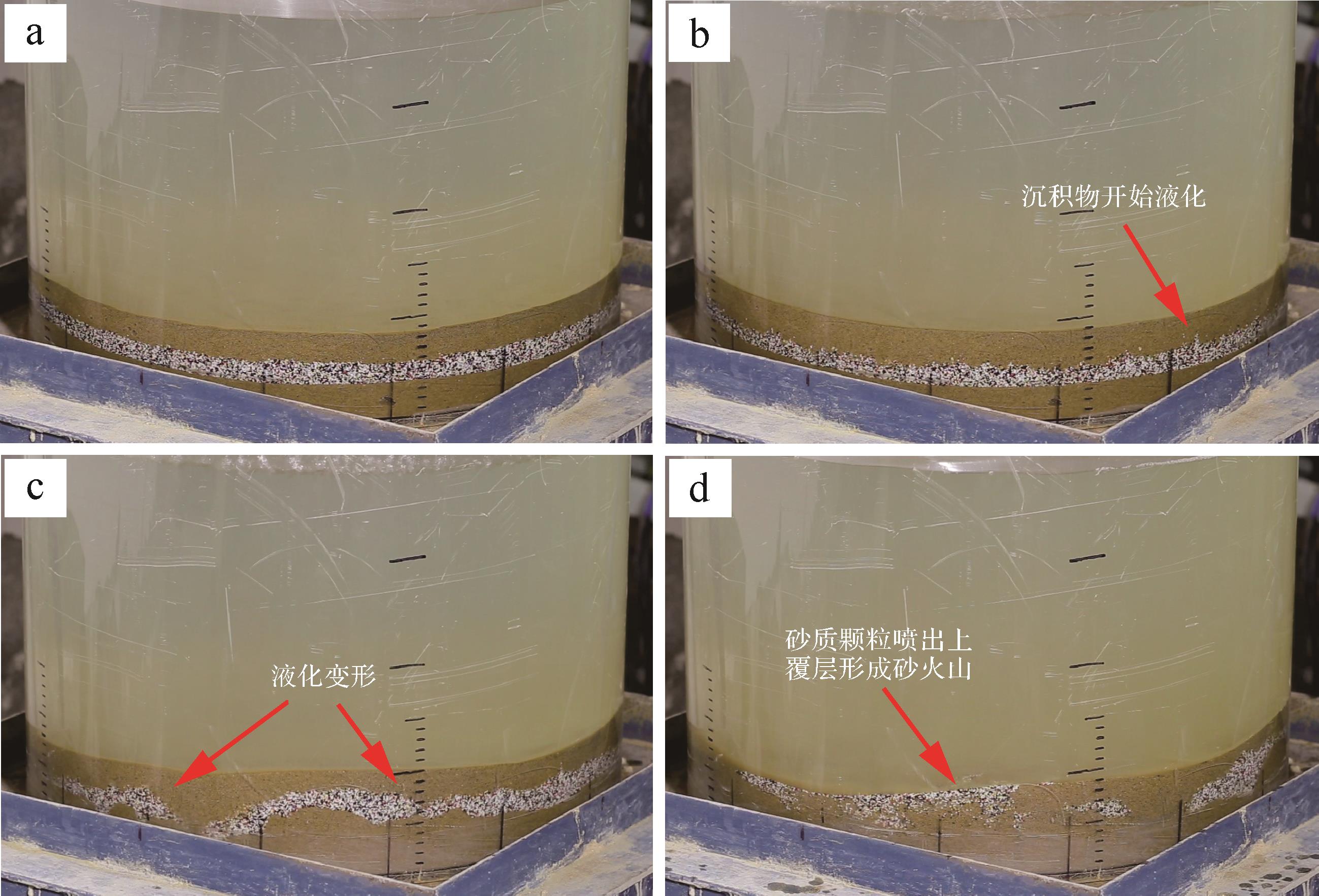
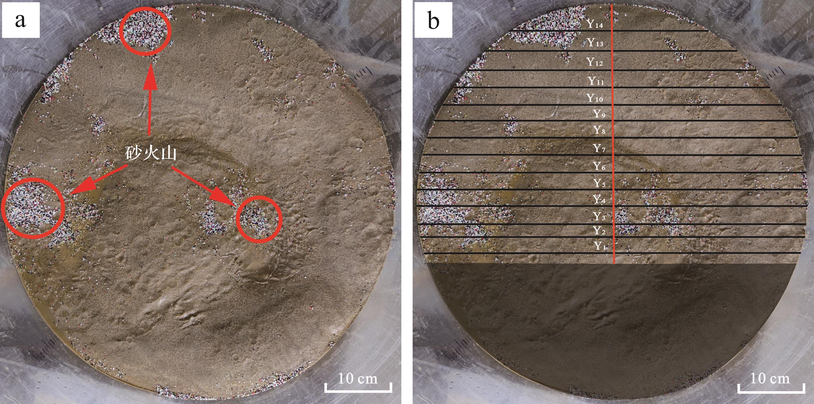
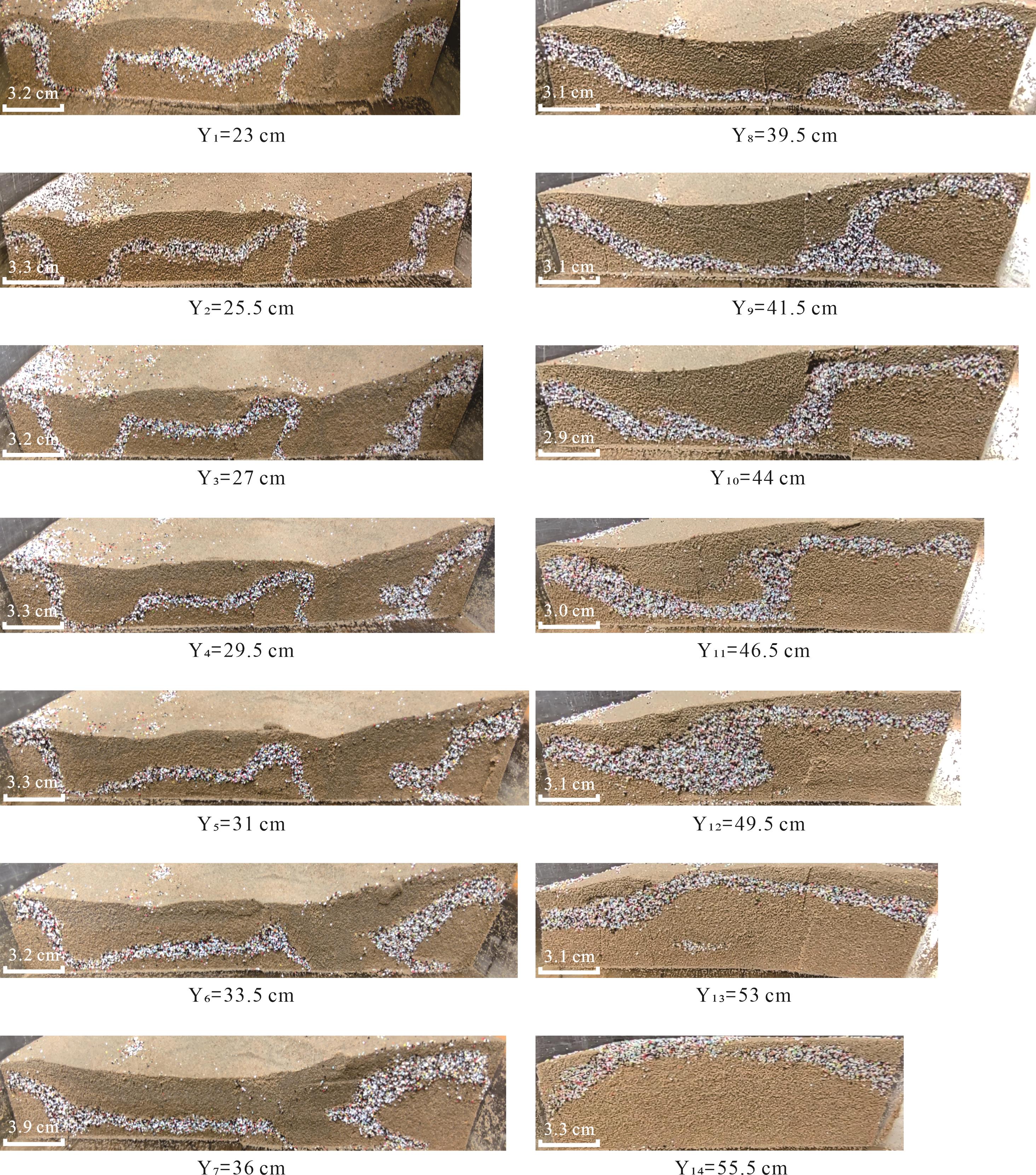

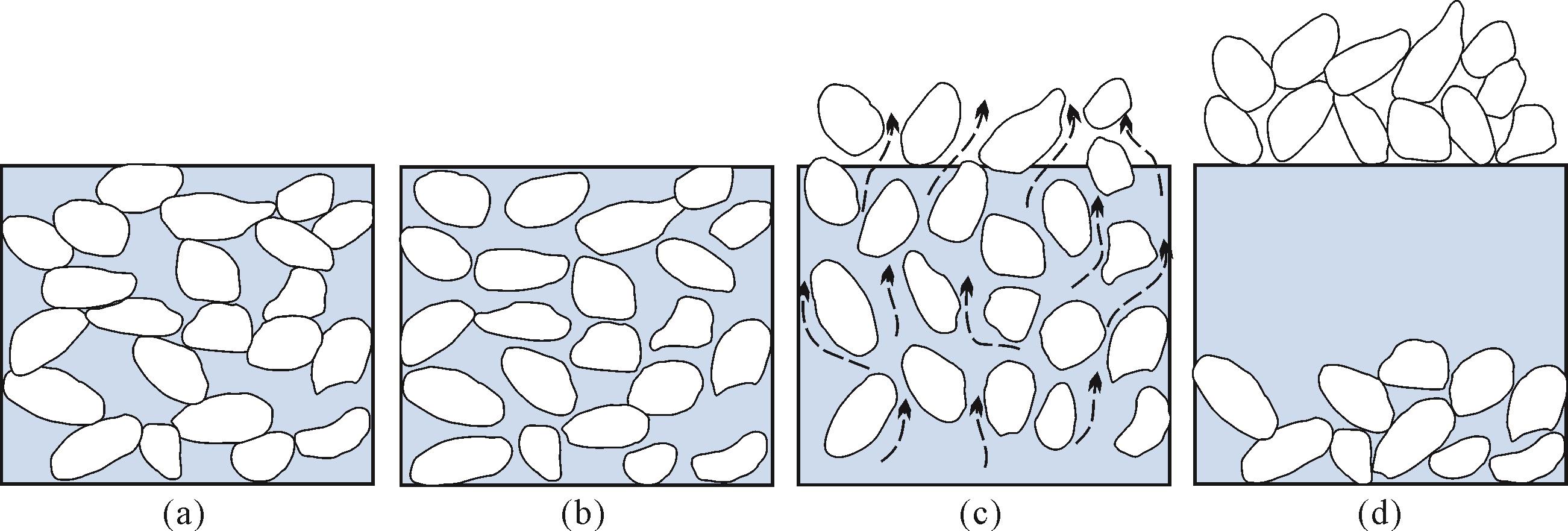

2023, 41(5): 1543-1558.
doi: 10.14027/j.issn.1000-0550.2023.049
Abstract:
Glutenites, which significantly contribute to gravity flow sedimentation studies, have become prime targets for oil, gas, and groundwater exploration, owing to their advantageous reservoir conditions. However, their complex depositional attributes, heterogeneous composition, and intricate pore structures pose challenges, affecting the elastic response of seismic waves. This complexity can compromise the reliability of fluid inversion methodologies and the outcomes of fluid identification processes. Consequently, a comprehensive understanding of the interrelationship between reservoir lithology, its physical properties, involved fluids, and seismic attributes is vital. Such understanding, attainable through petrophysical experiments, is critical for accurately deciphering the petrophysical response characteristics of glutenites. We undertook multi-frequency-band measurements (employing seismic frequencies at 1⁃100 Hz and ultrasonic frequency at 1 MHz) on the elastic parameters of the glutenite from the Dongying Sag in the Bohai Bay Basin. Initially, we selected a series of samples from each grain level for porosity and permeability tests, followed by classification and analysis of the rock types and physical properties. We then measured the P- and S-wave ultrasonic velocities in samples saturated with varying fluids, assessing the effects of fluid, lithology, and pressure on velocity. This led to the determination of the relationship between pressure and velocity by evaluating different water-saturated samples, followed by the calculation of indicative factors to identify rock types and fluid sensitivity parameters. Furthermore, we measured the Young’s modulus and Poisson’s ratio to calculate the P- and S-wave velocities of the seismic band. Lastly, we computed the crack density and soft porosity using ultrasonic velocity and compared the velocity dispersion with the seismic frequency band measurements. Our results suggest that: (1) sensitive parameters ρ, K, λ, λρ, and λϕ help distinguish glutenite from shale and conglomerate, but not sandstone. For fluids, gas-water can be separated through υ, ρVP/VS, ρυ, and λυ, whereas oil and water cannot; (2) at in-situ reservoir pressure, glutenite demonstrates larger P-wave velocity dispersion, crack density, and corresponding closure pressure compared to those of sandstone, conglomerate, and mudstone; (3) the dispersion can be explained by the "squirt flow" mechanism, aligning with a crack aspect ratio distribution that mirrors the actual scenario. The velocity dispersion range of oil-saturated samples is found at lower frequencies, with a larger dispersion span, thus positioning seismic band dispersion range as a sensitive parameter for differentiating between oil and water, overcoming the limitations of traditional sensitive parameters. This study offers insights into lithology and fluid-sensitive parameters via ultrasonic experiments and explores the pronounced velocity dispersion characteristics of glutenite under in-situ reservoir conditions through seismic frequency band experimental results, thereby identifying the key dispersion physical mechanism in glutenite. We assert that the fractured glutenite possesses excellent reservoir properties, exhibiting velocity dispersion characteristics markedly different from marl with fluid sensitivity. This prompts the consideration of frequency effects in fluid identification for traditional inversion methods. Our work systematically encapsulates the petrophysical response characteristics of glutenite bodies, establishing a theoretical groundwork for studying seismic wave response and identifying fluids in glutenite reservoirs. This could enhance reservoir prediction accuracy and effectively guide the geophysical exploration of glutenite reservoirs.
Glutenites, which significantly contribute to gravity flow sedimentation studies, have become prime targets for oil, gas, and groundwater exploration, owing to their advantageous reservoir conditions. However, their complex depositional attributes, heterogeneous composition, and intricate pore structures pose challenges, affecting the elastic response of seismic waves. This complexity can compromise the reliability of fluid inversion methodologies and the outcomes of fluid identification processes. Consequently, a comprehensive understanding of the interrelationship between reservoir lithology, its physical properties, involved fluids, and seismic attributes is vital. Such understanding, attainable through petrophysical experiments, is critical for accurately deciphering the petrophysical response characteristics of glutenites. We undertook multi-frequency-band measurements (employing seismic frequencies at 1⁃100 Hz and ultrasonic frequency at 1 MHz) on the elastic parameters of the glutenite from the Dongying Sag in the Bohai Bay Basin. Initially, we selected a series of samples from each grain level for porosity and permeability tests, followed by classification and analysis of the rock types and physical properties. We then measured the P- and S-wave ultrasonic velocities in samples saturated with varying fluids, assessing the effects of fluid, lithology, and pressure on velocity. This led to the determination of the relationship between pressure and velocity by evaluating different water-saturated samples, followed by the calculation of indicative factors to identify rock types and fluid sensitivity parameters. Furthermore, we measured the Young’s modulus and Poisson’s ratio to calculate the P- and S-wave velocities of the seismic band. Lastly, we computed the crack density and soft porosity using ultrasonic velocity and compared the velocity dispersion with the seismic frequency band measurements. Our results suggest that: (1) sensitive parameters ρ, K, λ, λρ, and λϕ help distinguish glutenite from shale and conglomerate, but not sandstone. For fluids, gas-water can be separated through υ, ρVP/VS, ρυ, and λυ, whereas oil and water cannot; (2) at in-situ reservoir pressure, glutenite demonstrates larger P-wave velocity dispersion, crack density, and corresponding closure pressure compared to those of sandstone, conglomerate, and mudstone; (3) the dispersion can be explained by the "squirt flow" mechanism, aligning with a crack aspect ratio distribution that mirrors the actual scenario. The velocity dispersion range of oil-saturated samples is found at lower frequencies, with a larger dispersion span, thus positioning seismic band dispersion range as a sensitive parameter for differentiating between oil and water, overcoming the limitations of traditional sensitive parameters. This study offers insights into lithology and fluid-sensitive parameters via ultrasonic experiments and explores the pronounced velocity dispersion characteristics of glutenite under in-situ reservoir conditions through seismic frequency band experimental results, thereby identifying the key dispersion physical mechanism in glutenite. We assert that the fractured glutenite possesses excellent reservoir properties, exhibiting velocity dispersion characteristics markedly different from marl with fluid sensitivity. This prompts the consideration of frequency effects in fluid identification for traditional inversion methods. Our work systematically encapsulates the petrophysical response characteristics of glutenite bodies, establishing a theoretical groundwork for studying seismic wave response and identifying fluids in glutenite reservoirs. This could enhance reservoir prediction accuracy and effectively guide the geophysical exploration of glutenite reservoirs.
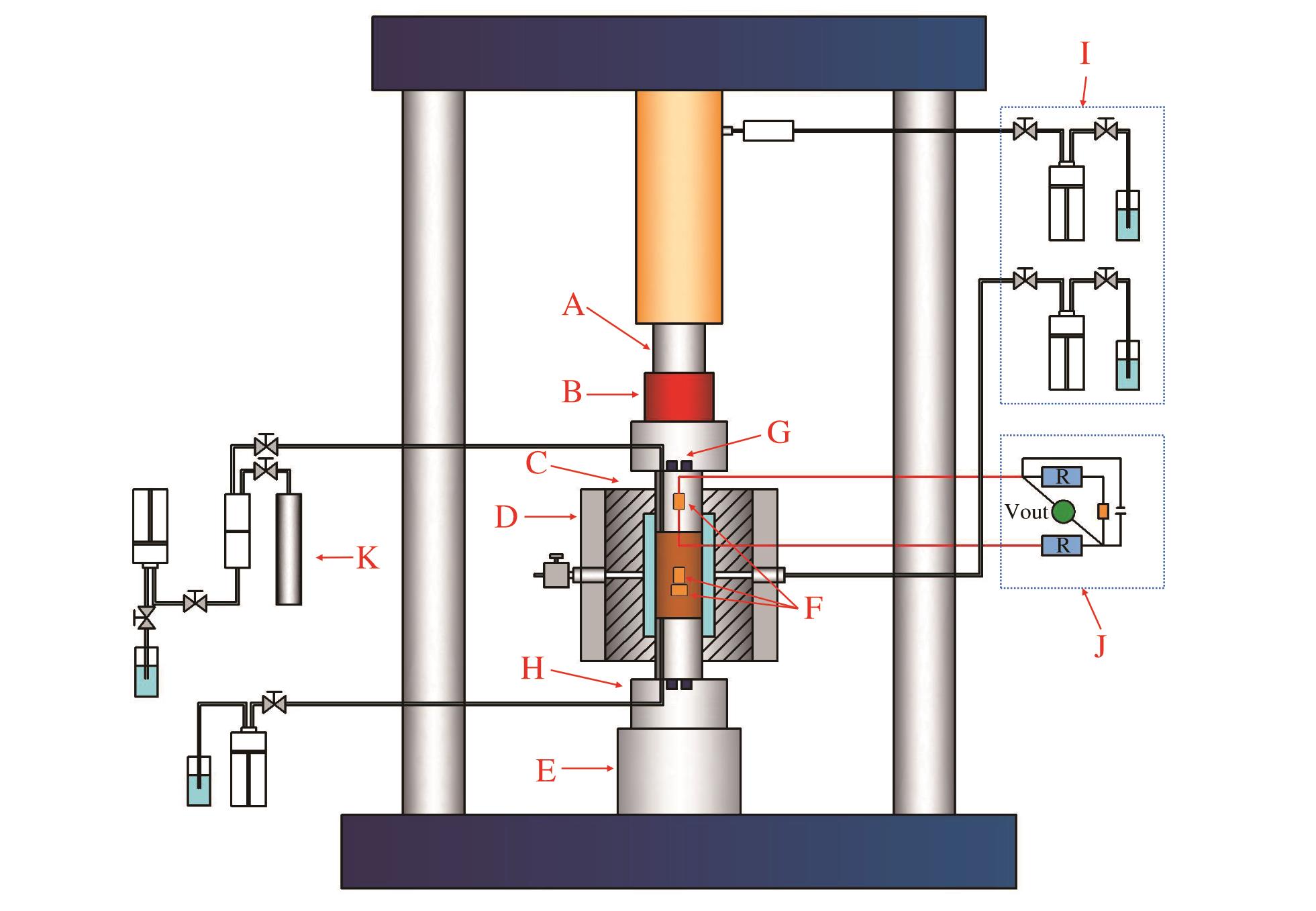
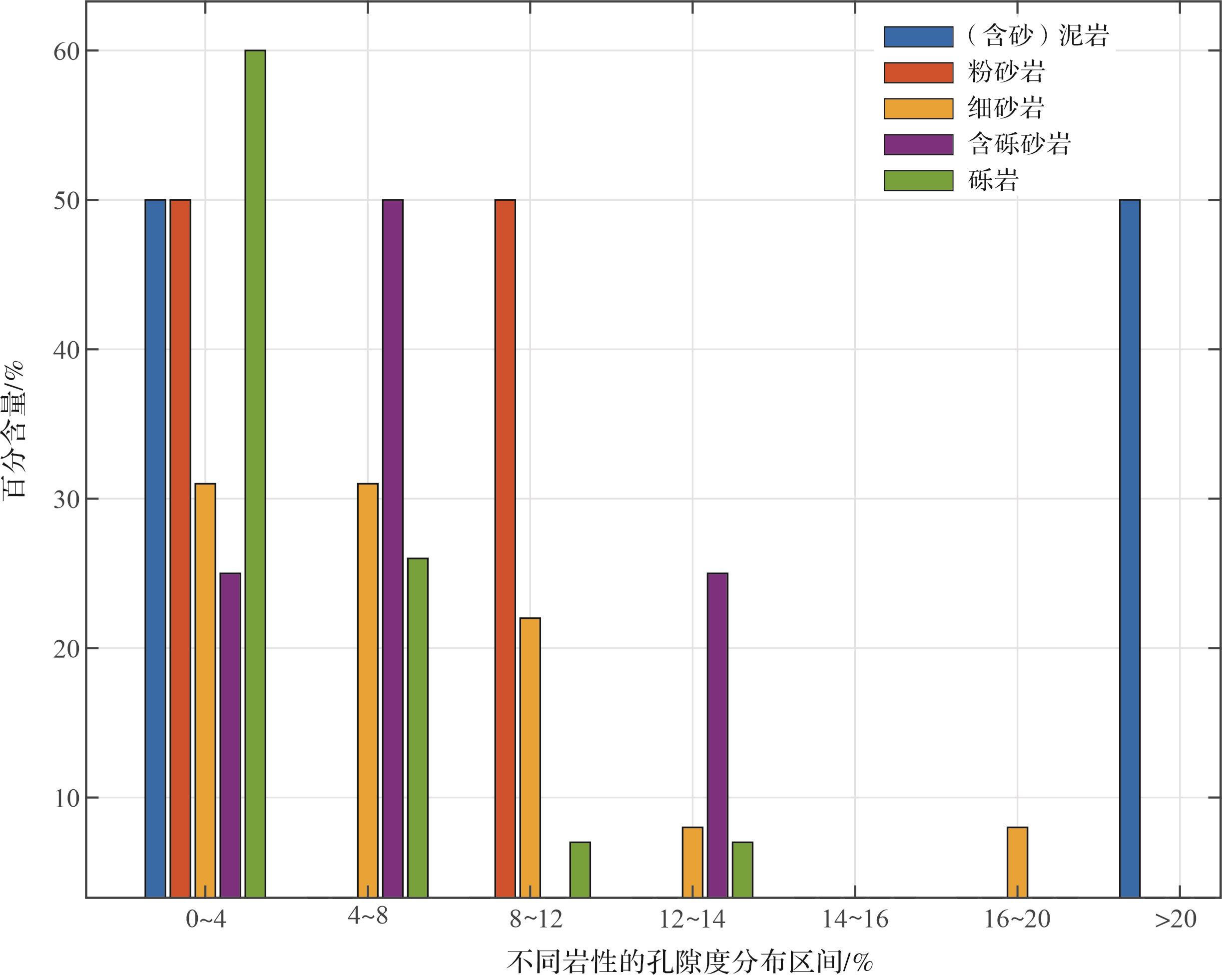
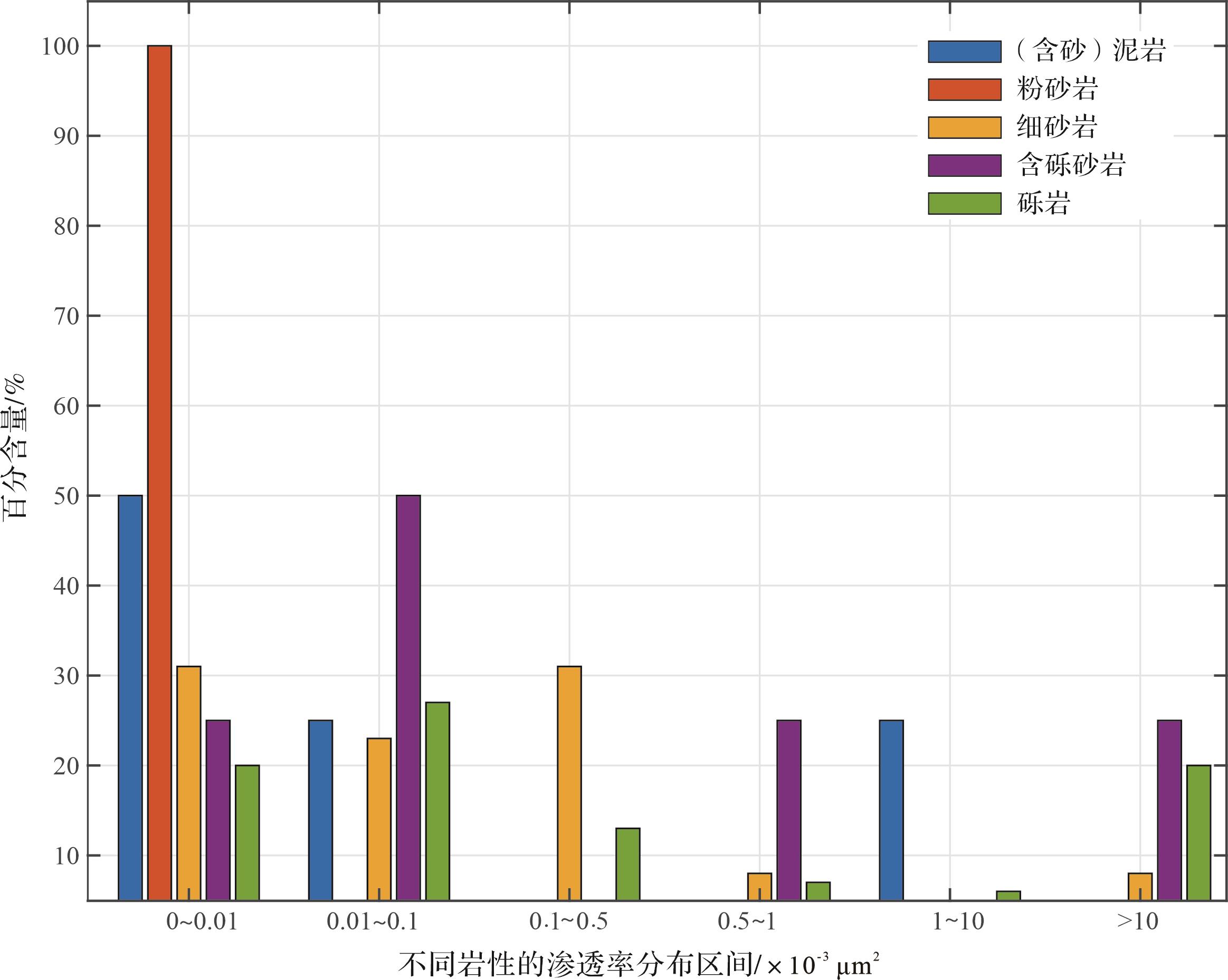
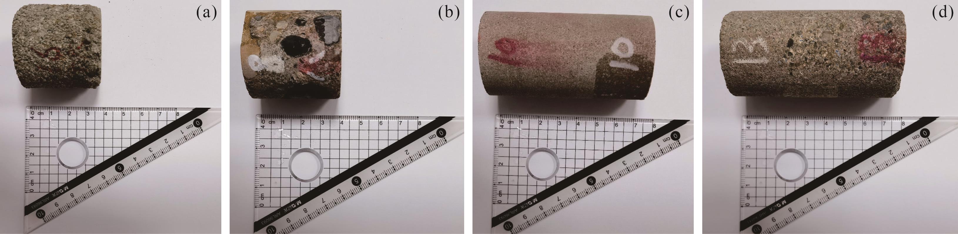
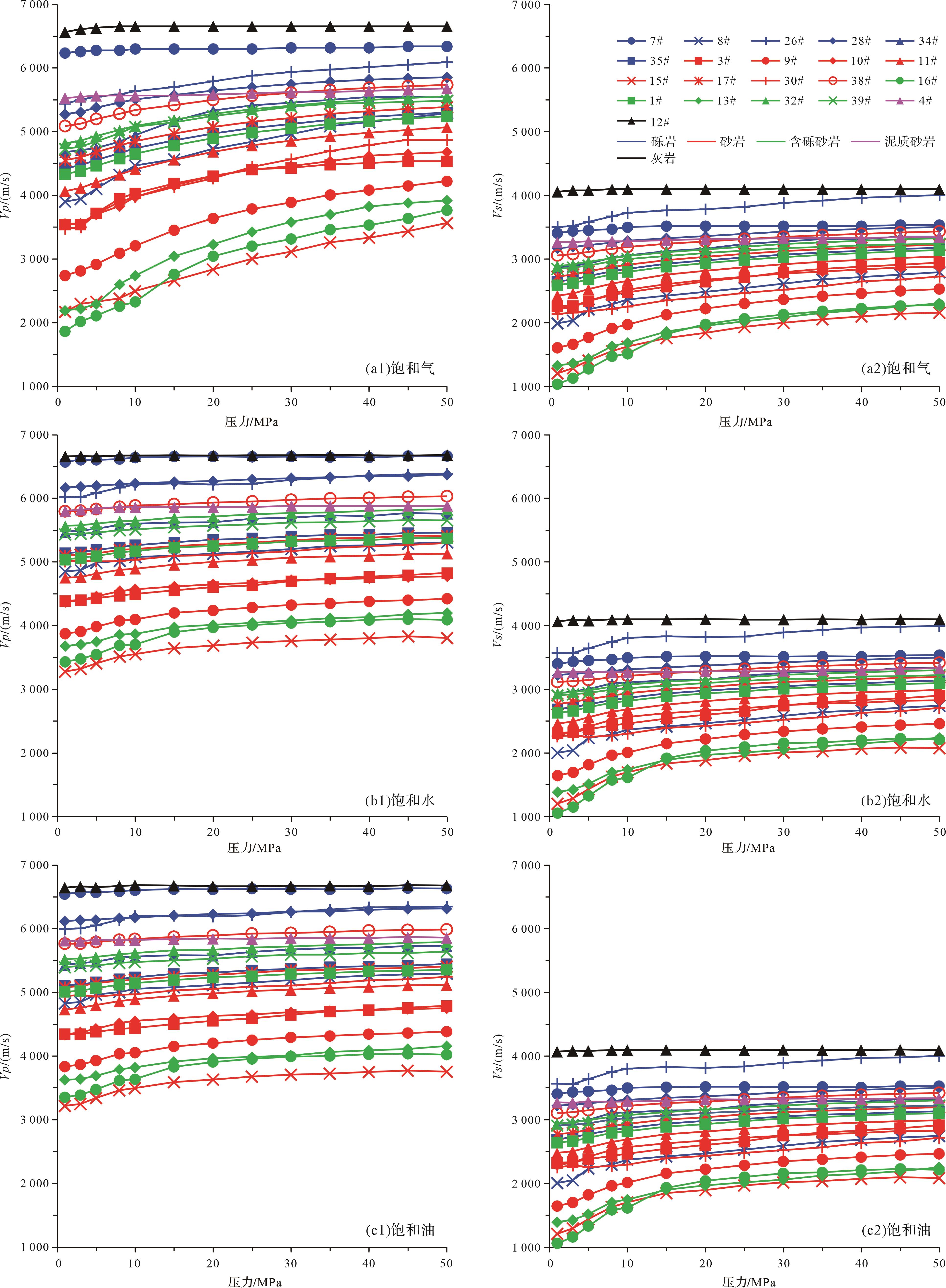
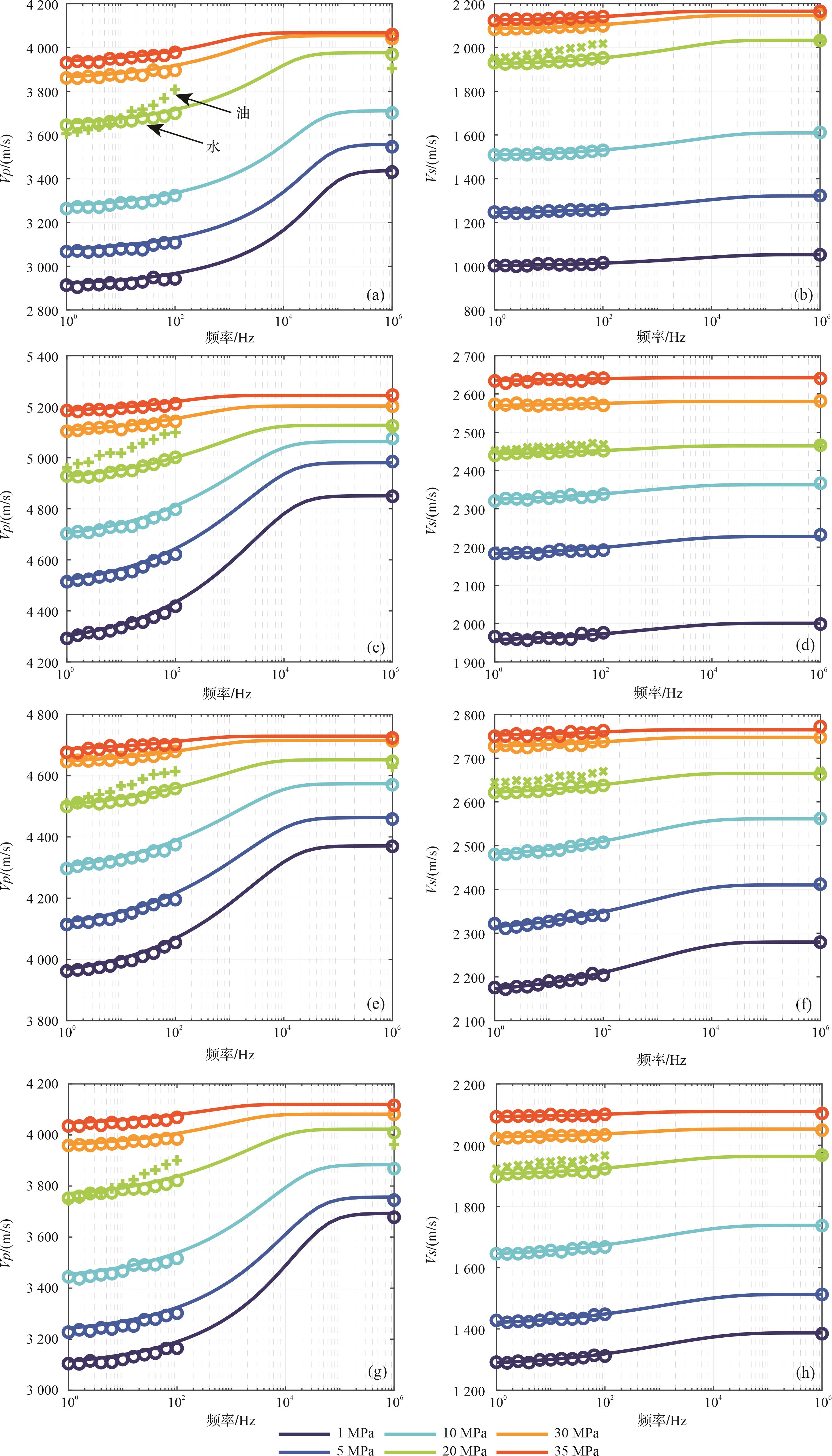
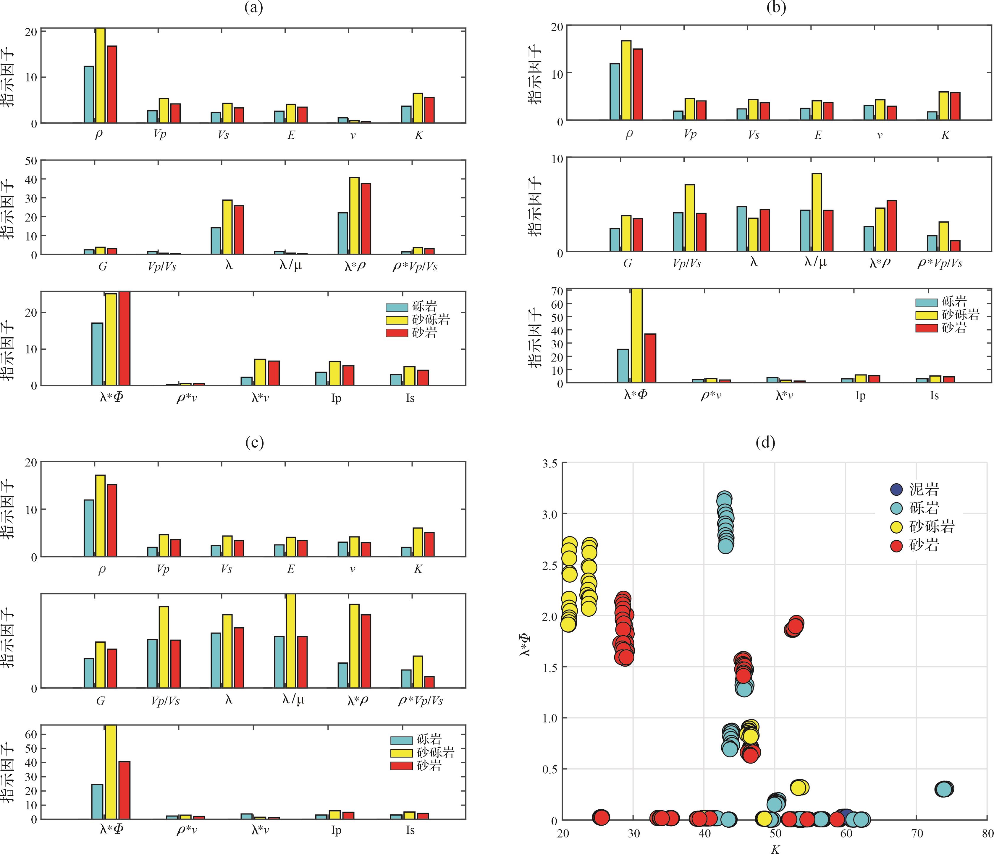
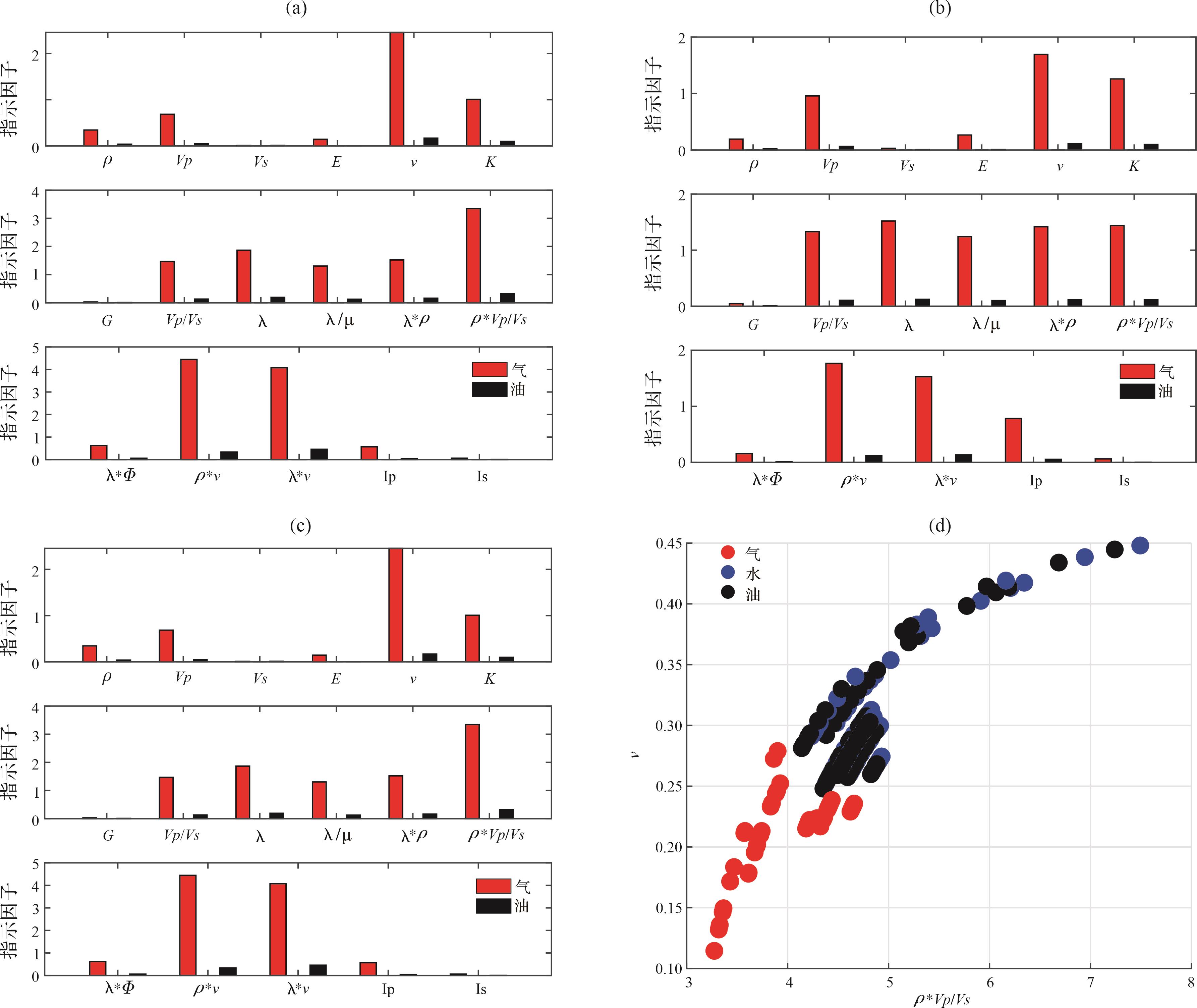
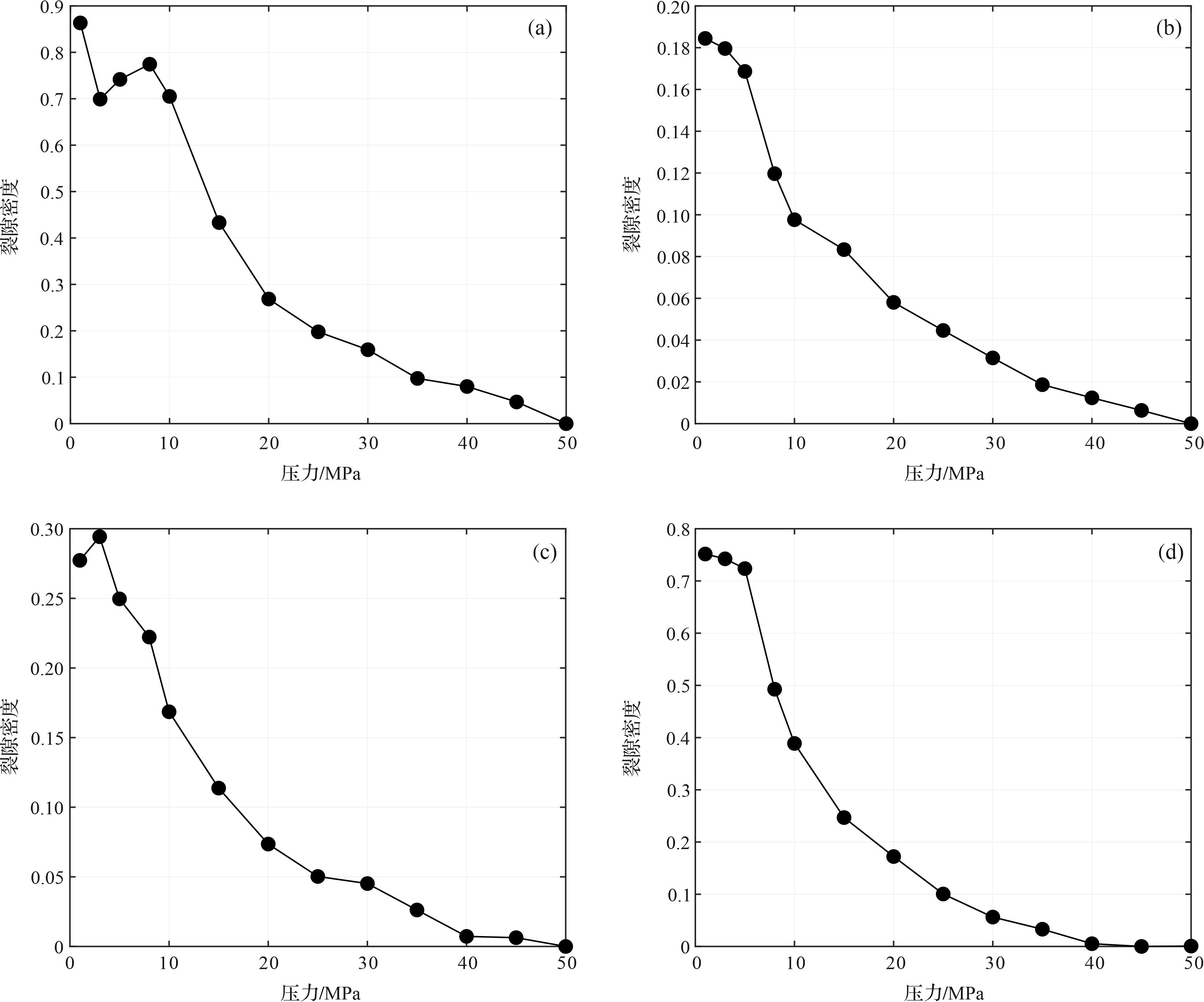
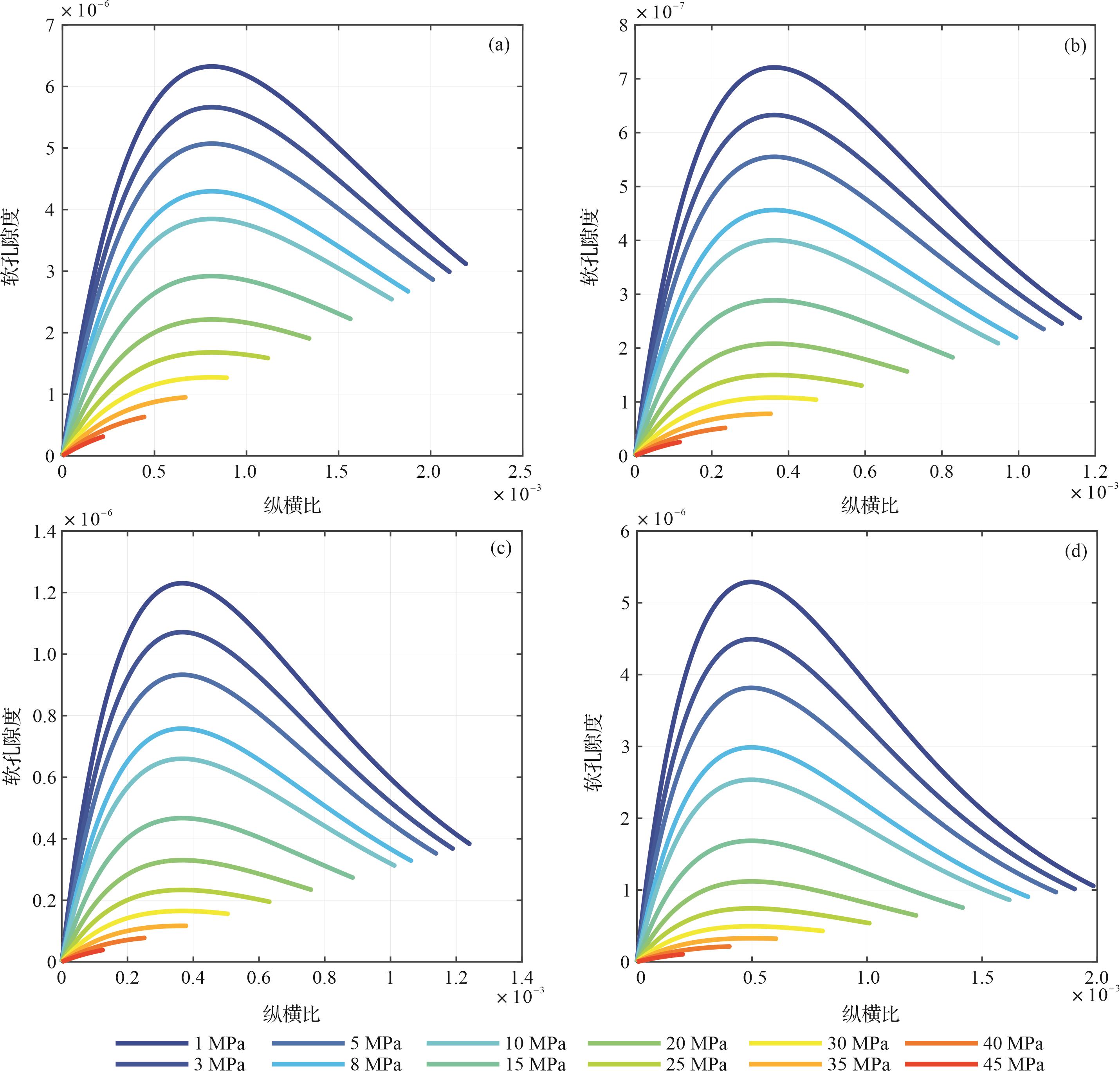
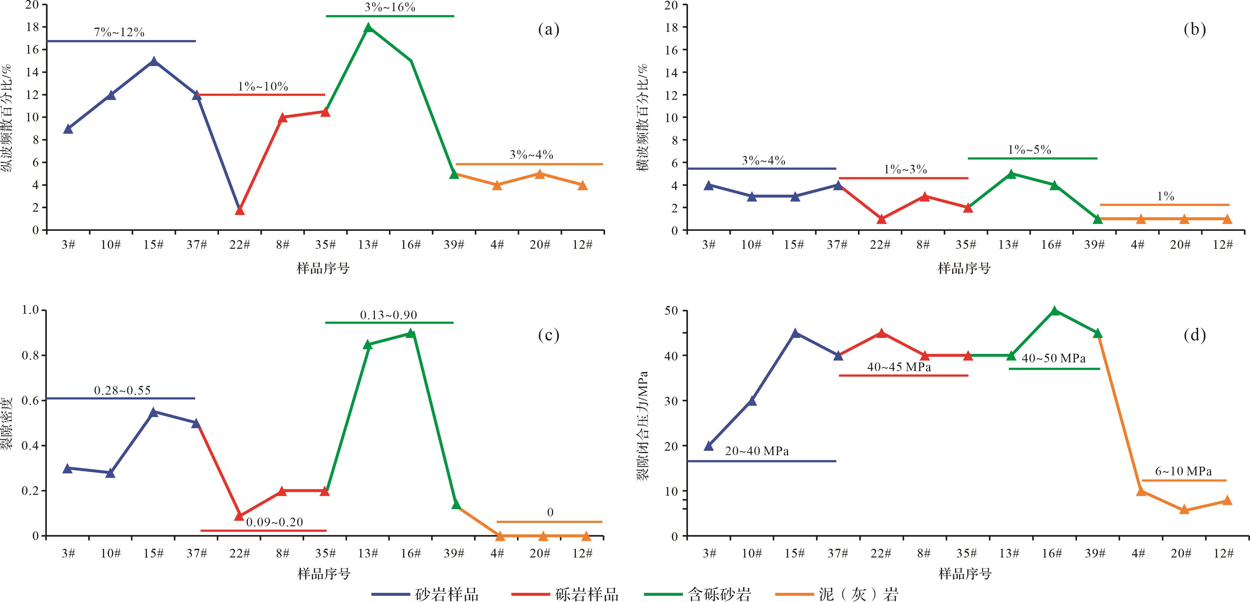
2023, 41(5): 1559-1567.
doi: 10.14027/j.issn.1000-0550.2022.100
Abstract:
The facies of Cretaceous reservoirs are beach and bar, and the sandstone reservoirs are characterized by thin and sharp vertical change in the Chepaizi area of the Junggar Basin. As a result, new challenges appear in estimating the porosity of reservoirs. In this study, based on the measured porosity in the laboratory and corresponding logging data, a new porosity estimation model was established using the extreme gradient boosting (Xgboost) machine learning algorithm. The results show that the correlation coefficients between reservoir porosity and GR, AC, CNL, and RXO are 0.38, 0.42, 0.28, and 0.32, respectively, suggesting that porosity is influenced by the logging data in the study area. Based on the input logging data, the predicted porosity using the Xgboost algorithm matches the measured porosity, with a correlation coefficient of 0.92 and a mean squared error of 0.20. To test and verify the predicted results from the Xgboost mothed, we use the production test result as collateral evidence. The results show that the well sections with higher porosity match with the test data, indicating the reliability of the model. This result provides fundamental data for reservoir evaluation and modelling, improving the exploration accuracy in the study area. Furthermore, the model can be used in the study of reservoir porosity estimation in similar sedimentary environments.
The facies of Cretaceous reservoirs are beach and bar, and the sandstone reservoirs are characterized by thin and sharp vertical change in the Chepaizi area of the Junggar Basin. As a result, new challenges appear in estimating the porosity of reservoirs. In this study, based on the measured porosity in the laboratory and corresponding logging data, a new porosity estimation model was established using the extreme gradient boosting (Xgboost) machine learning algorithm. The results show that the correlation coefficients between reservoir porosity and GR, AC, CNL, and RXO are 0.38, 0.42, 0.28, and 0.32, respectively, suggesting that porosity is influenced by the logging data in the study area. Based on the input logging data, the predicted porosity using the Xgboost algorithm matches the measured porosity, with a correlation coefficient of 0.92 and a mean squared error of 0.20. To test and verify the predicted results from the Xgboost mothed, we use the production test result as collateral evidence. The results show that the well sections with higher porosity match with the test data, indicating the reliability of the model. This result provides fundamental data for reservoir evaluation and modelling, improving the exploration accuracy in the study area. Furthermore, the model can be used in the study of reservoir porosity estimation in similar sedimentary environments.
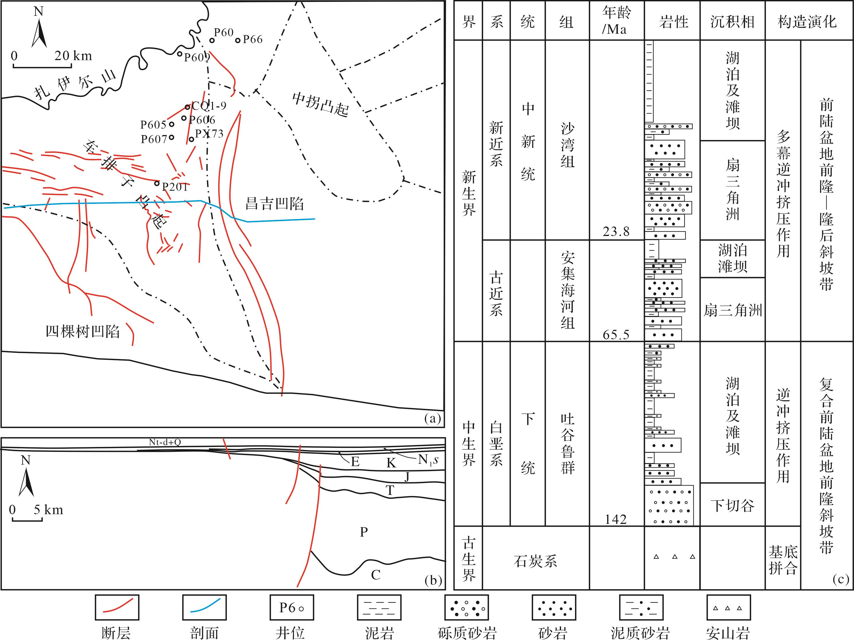
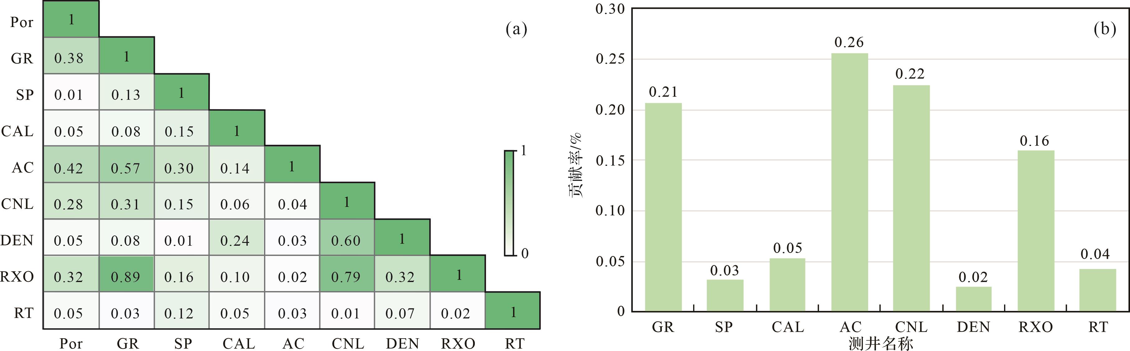
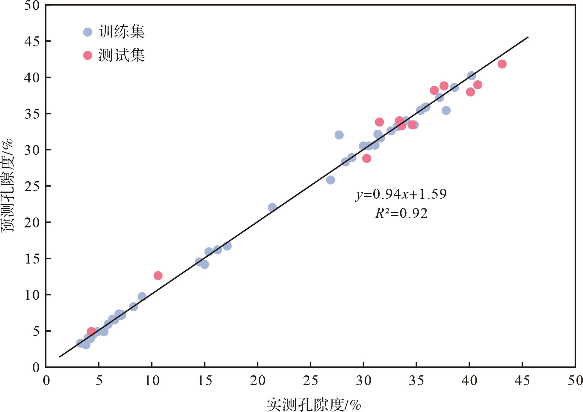
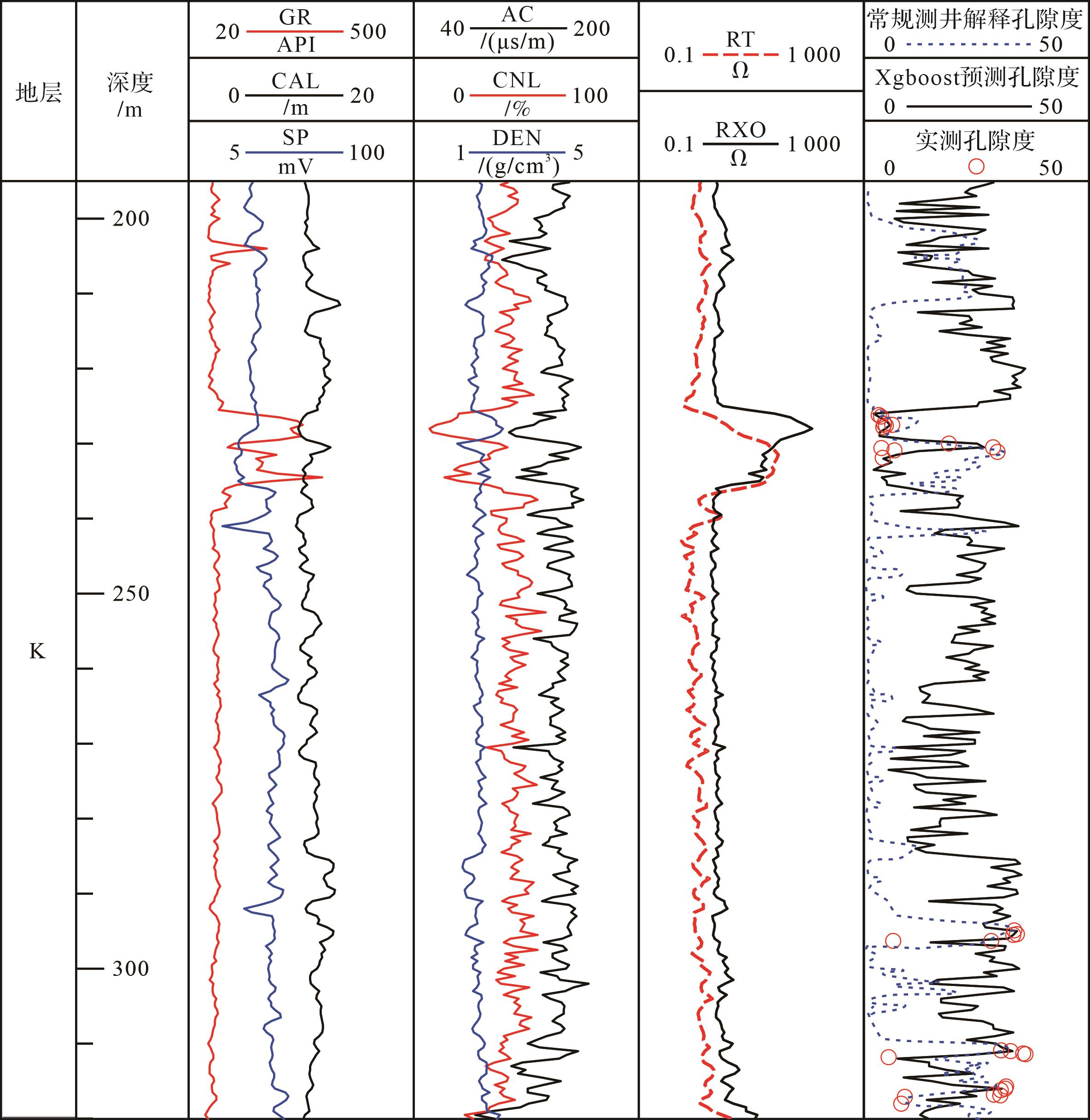
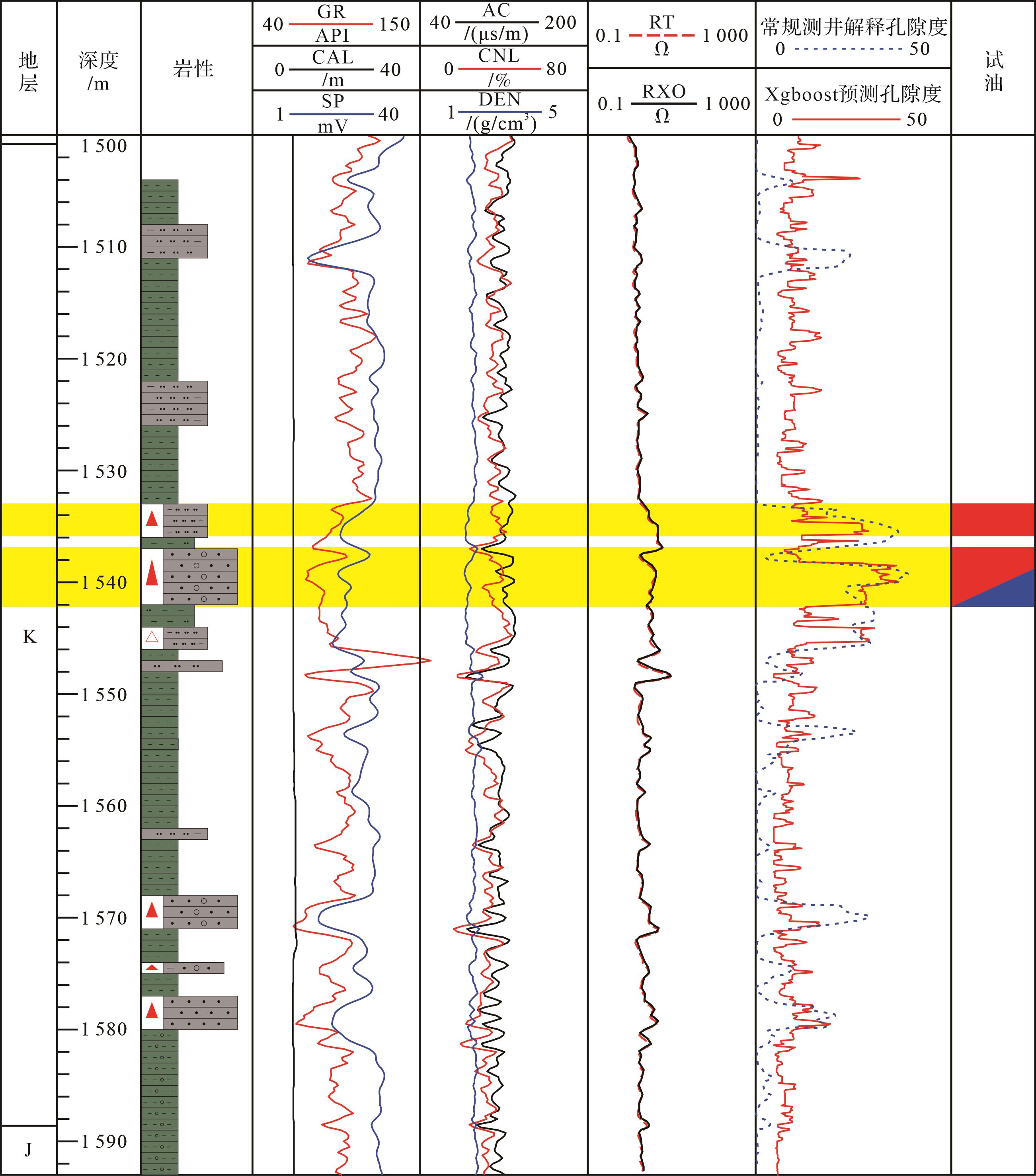
2023, 41(5): 1568-1582.
doi: 10.14027/j.issn.1000-0550.2022.024
Abstract:
The South Kunsong sag is located in the western Wan'an Basin. Since the Cenozoic, with the multi-stage left-lateral strike-slip movement of the Wan'an fault, the strata distribution of the sag presents a typical double-layer structure of lower faults and upper bends. This study comprehensively uses sedimentary basin analysis, sequence stratigraphic analysis, and seismic interpretation to analyze the seismic response of the delta since the Miocene by finely characterizing the seismic facies, focusing on three types of shelf deltas since the Late Miocene, including the distribution characteristics of subphases on the plane. The results show that: during the Early Miocene-Middle Miocene, the provenance of the South Kunsong Sag was derived primarily from the Natuna uplift; alluvial fans developed in the western portion of the sag, and braided river deltas developed at the far end of the alluvial fans. The Mekong River water system crossed the Kunsong uplift area, forming a large number of intermountain water systems, which gradually affected the deposition of the South Kunsong Sag. With the rise of sea level, the study area began to develop shelf deltas, and the South Kunsong Sag became the main sedimentary area of the Mekong River source. During the Pleistocene period, the Mekong delta developed on a large scale, prograding from west to east; the delta front entered the central area of the Wan'an Basin, and the delta and the shelf delta-slope depositional systems were formed in the central and western regions of the Wan'an Basin.
The South Kunsong sag is located in the western Wan'an Basin. Since the Cenozoic, with the multi-stage left-lateral strike-slip movement of the Wan'an fault, the strata distribution of the sag presents a typical double-layer structure of lower faults and upper bends. This study comprehensively uses sedimentary basin analysis, sequence stratigraphic analysis, and seismic interpretation to analyze the seismic response of the delta since the Miocene by finely characterizing the seismic facies, focusing on three types of shelf deltas since the Late Miocene, including the distribution characteristics of subphases on the plane. The results show that: during the Early Miocene-Middle Miocene, the provenance of the South Kunsong Sag was derived primarily from the Natuna uplift; alluvial fans developed in the western portion of the sag, and braided river deltas developed at the far end of the alluvial fans. The Mekong River water system crossed the Kunsong uplift area, forming a large number of intermountain water systems, which gradually affected the deposition of the South Kunsong Sag. With the rise of sea level, the study area began to develop shelf deltas, and the South Kunsong Sag became the main sedimentary area of the Mekong River source. During the Pleistocene period, the Mekong delta developed on a large scale, prograding from west to east; the delta front entered the central area of the Wan'an Basin, and the delta and the shelf delta-slope depositional systems were formed in the central and western regions of the Wan'an Basin.
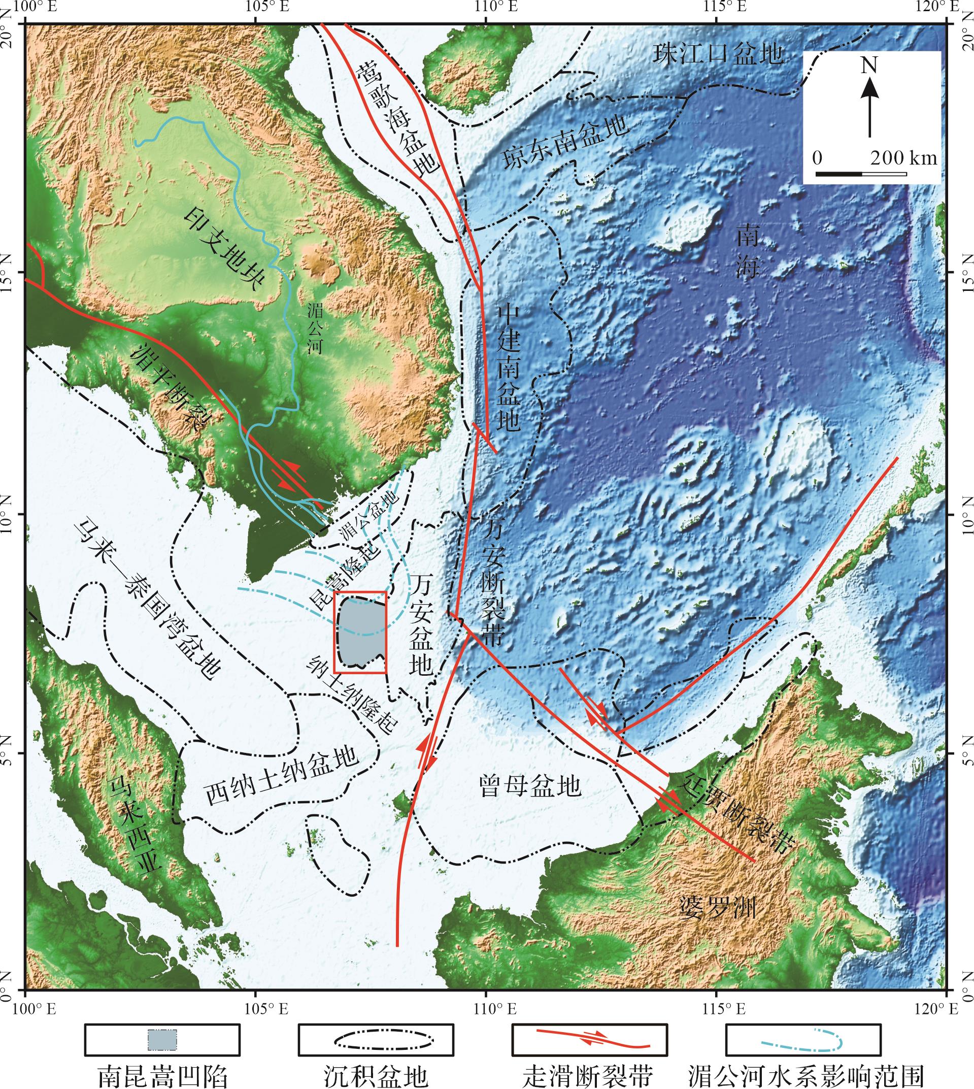
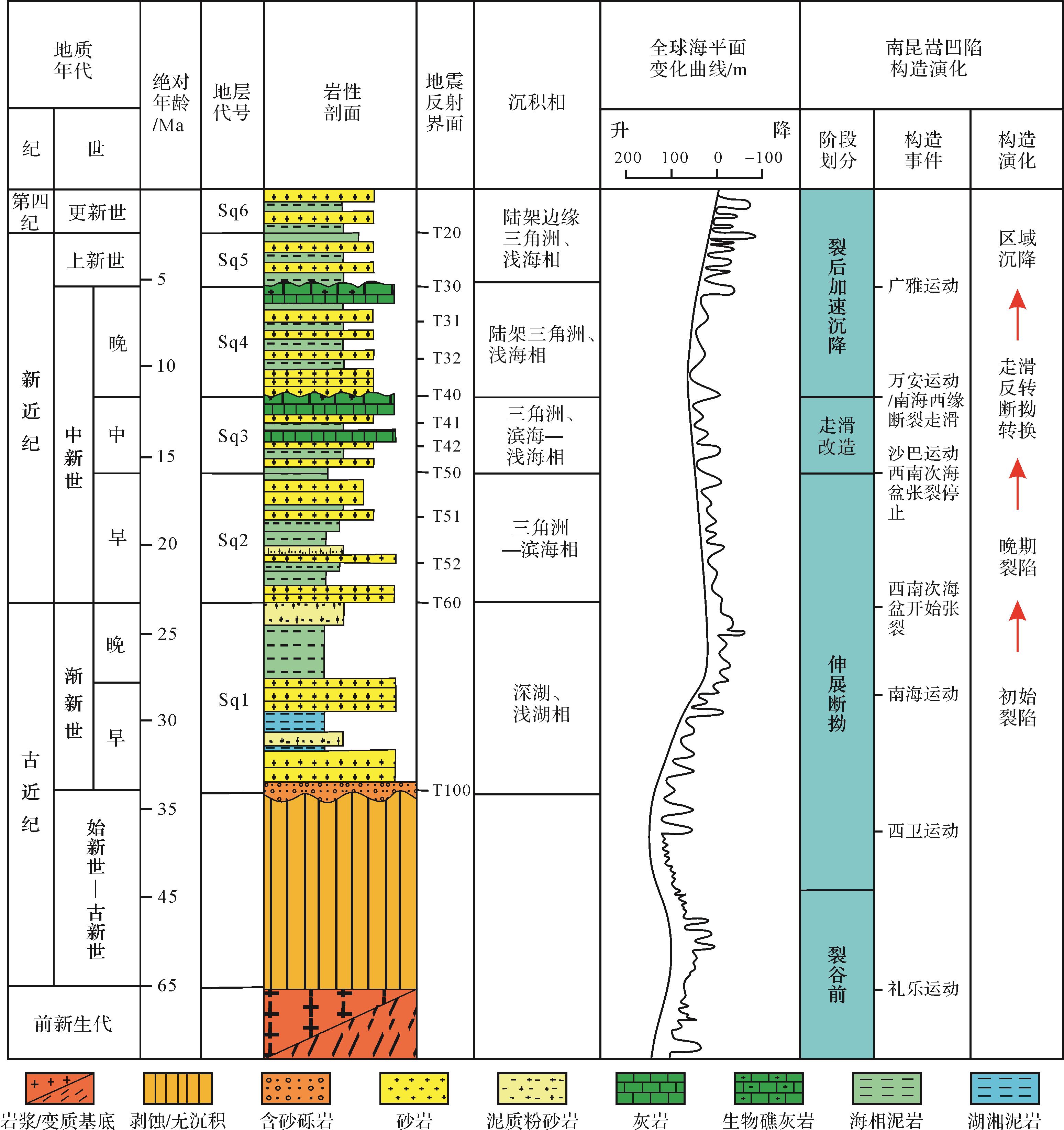
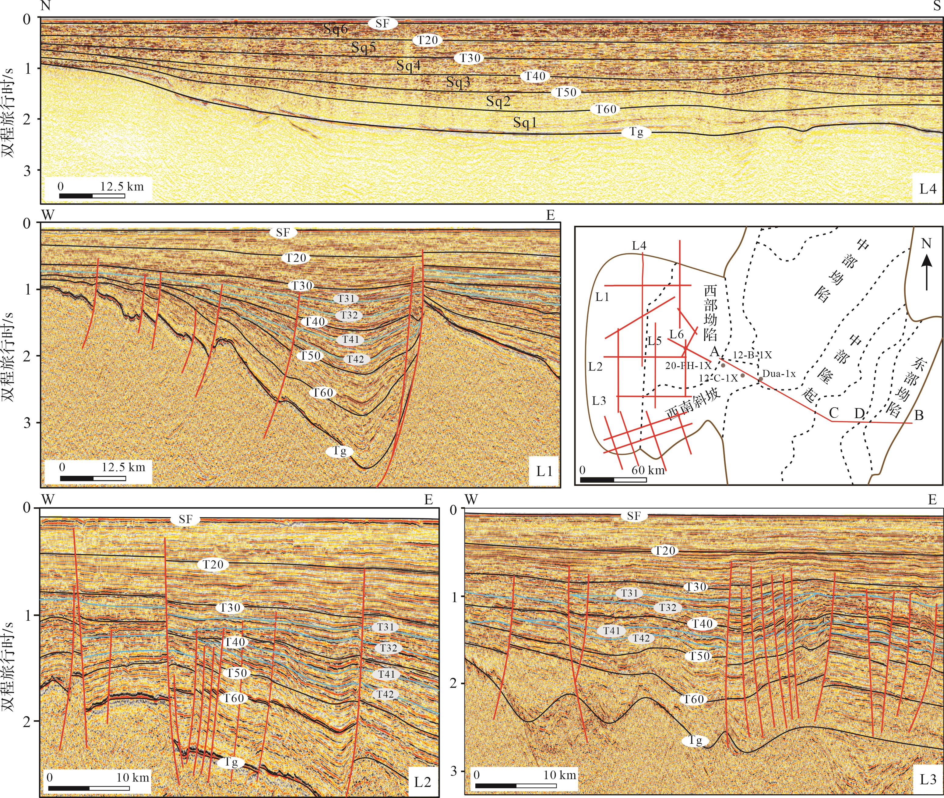
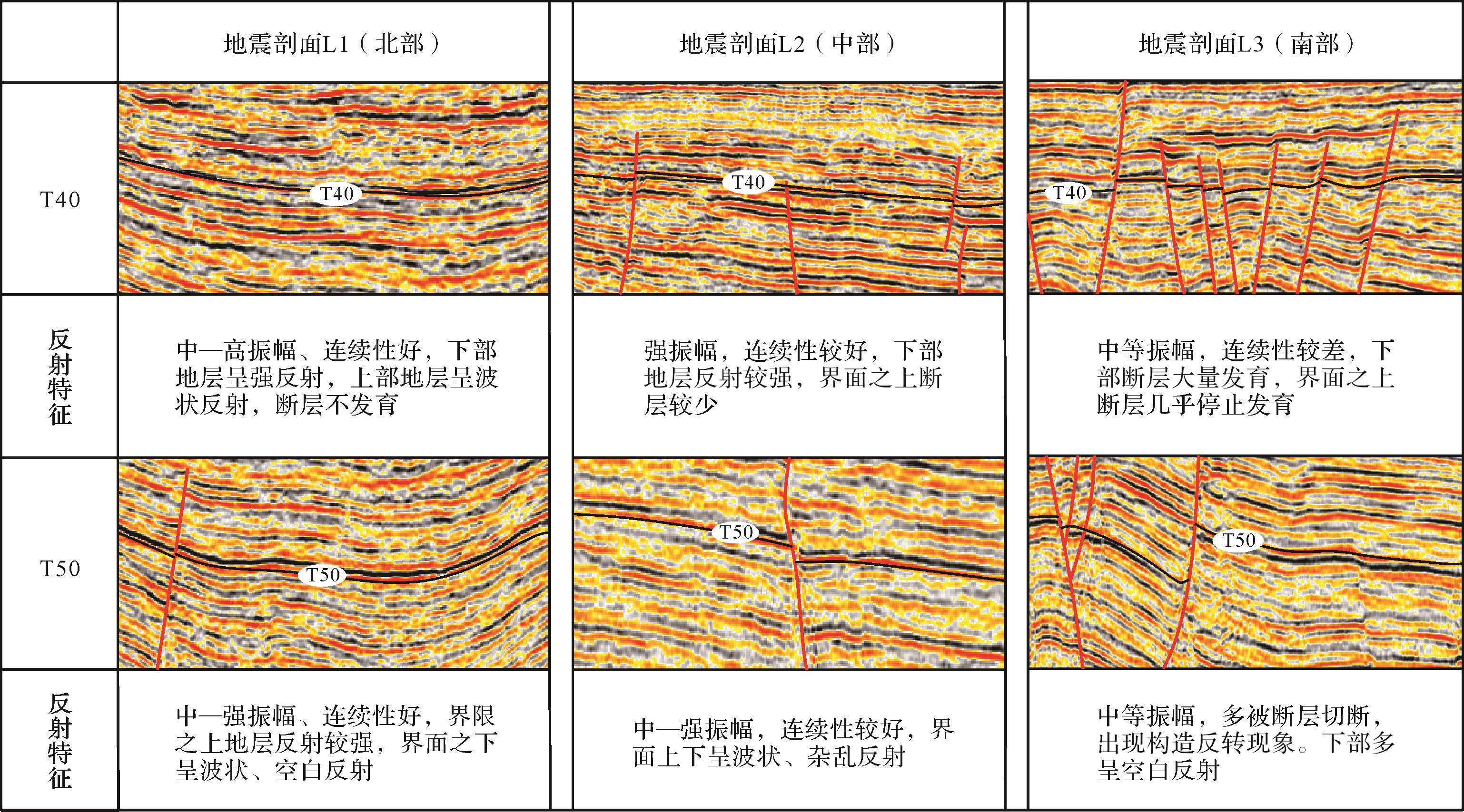
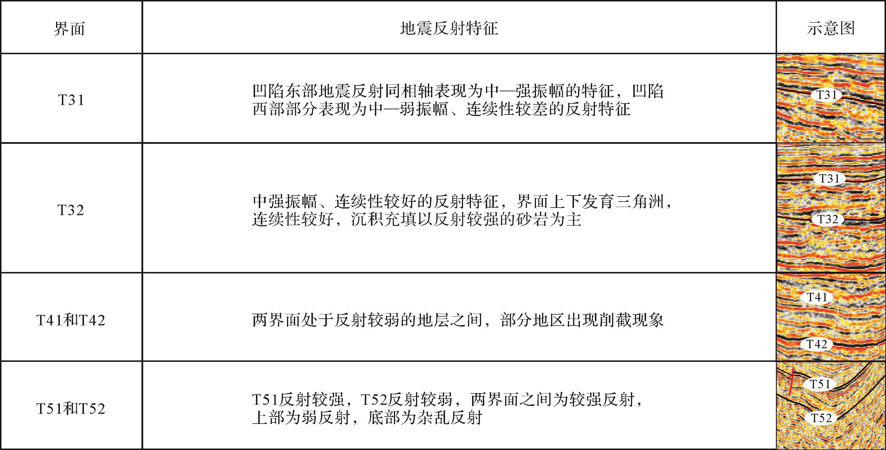
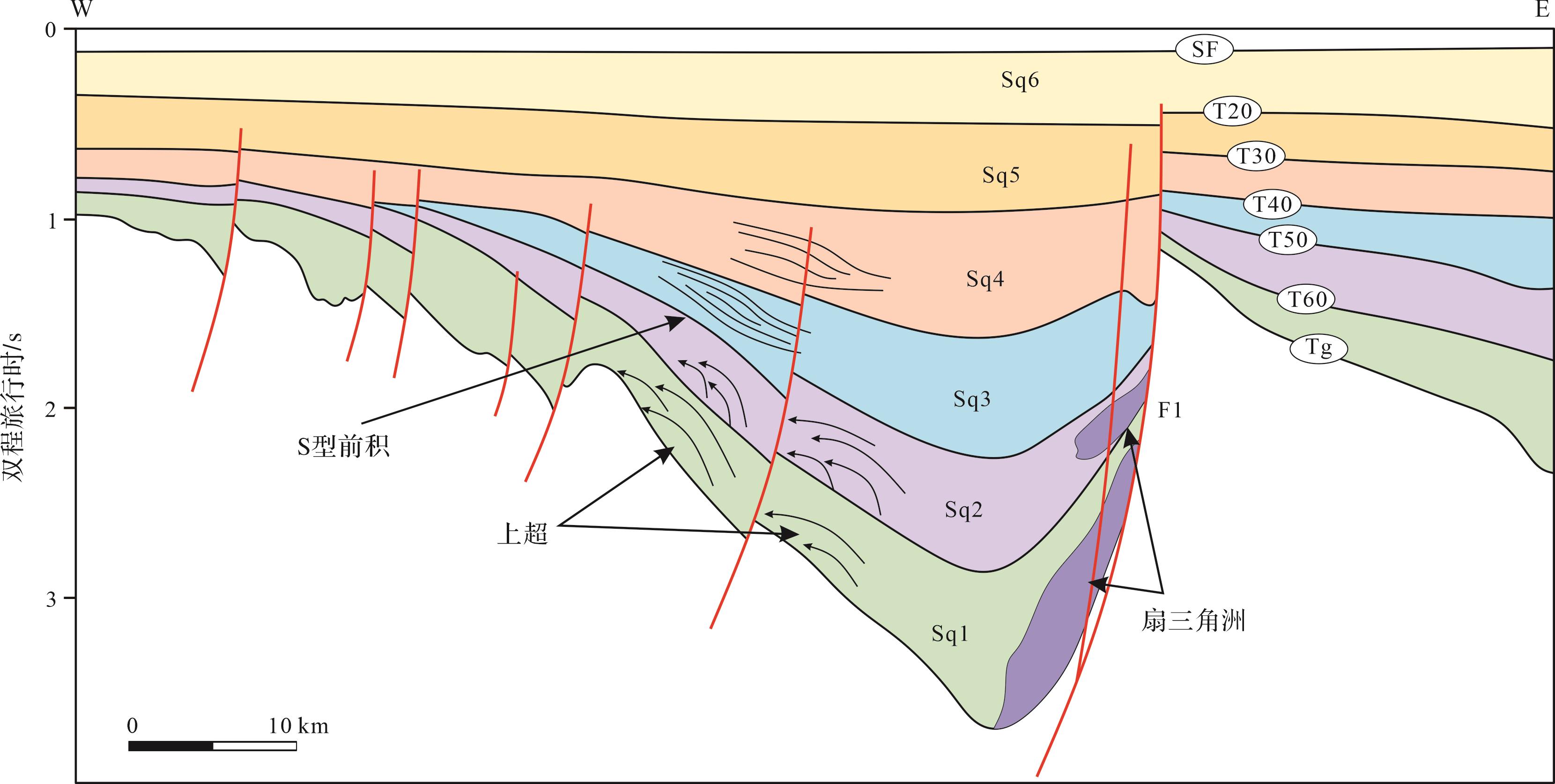
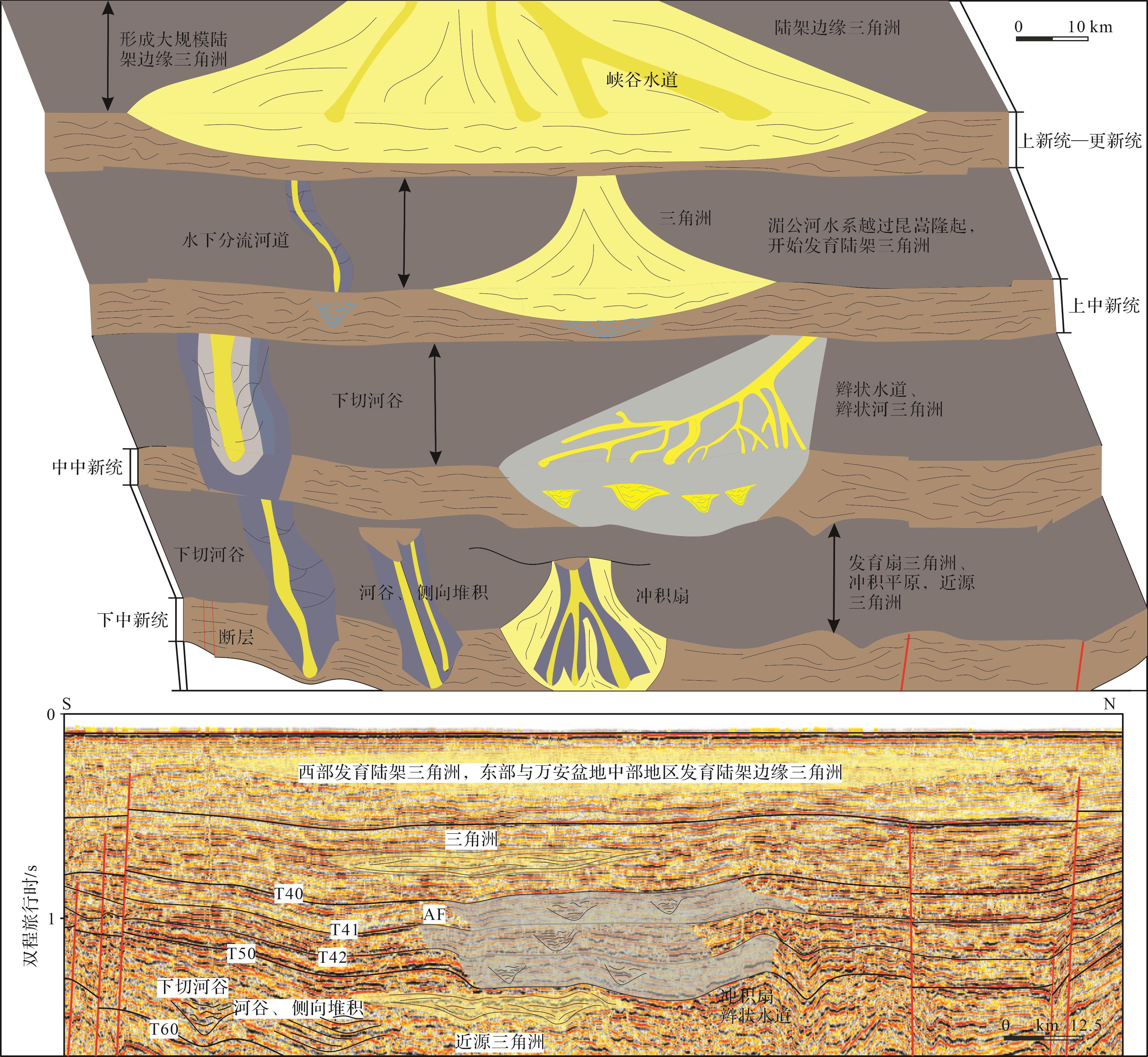
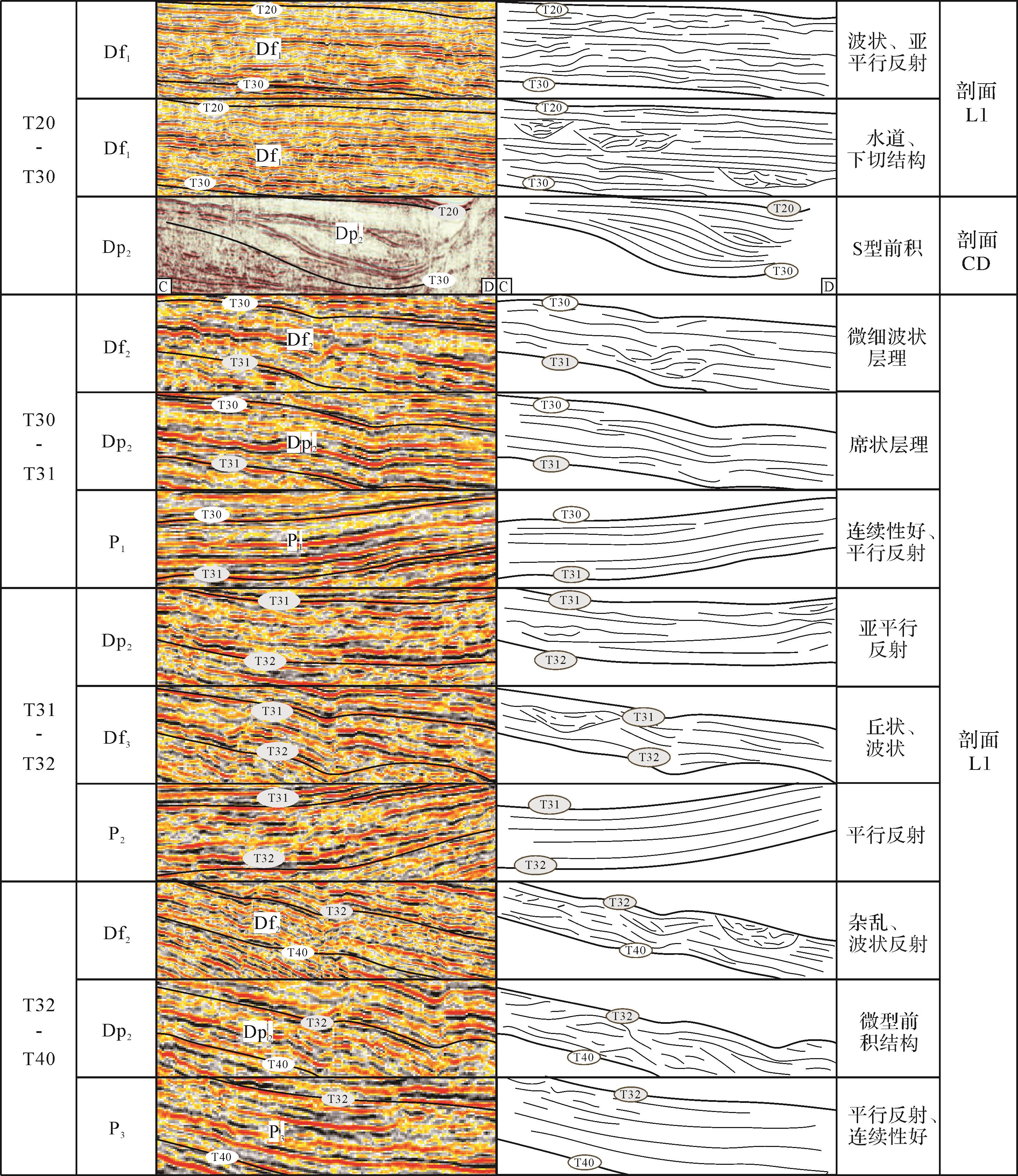
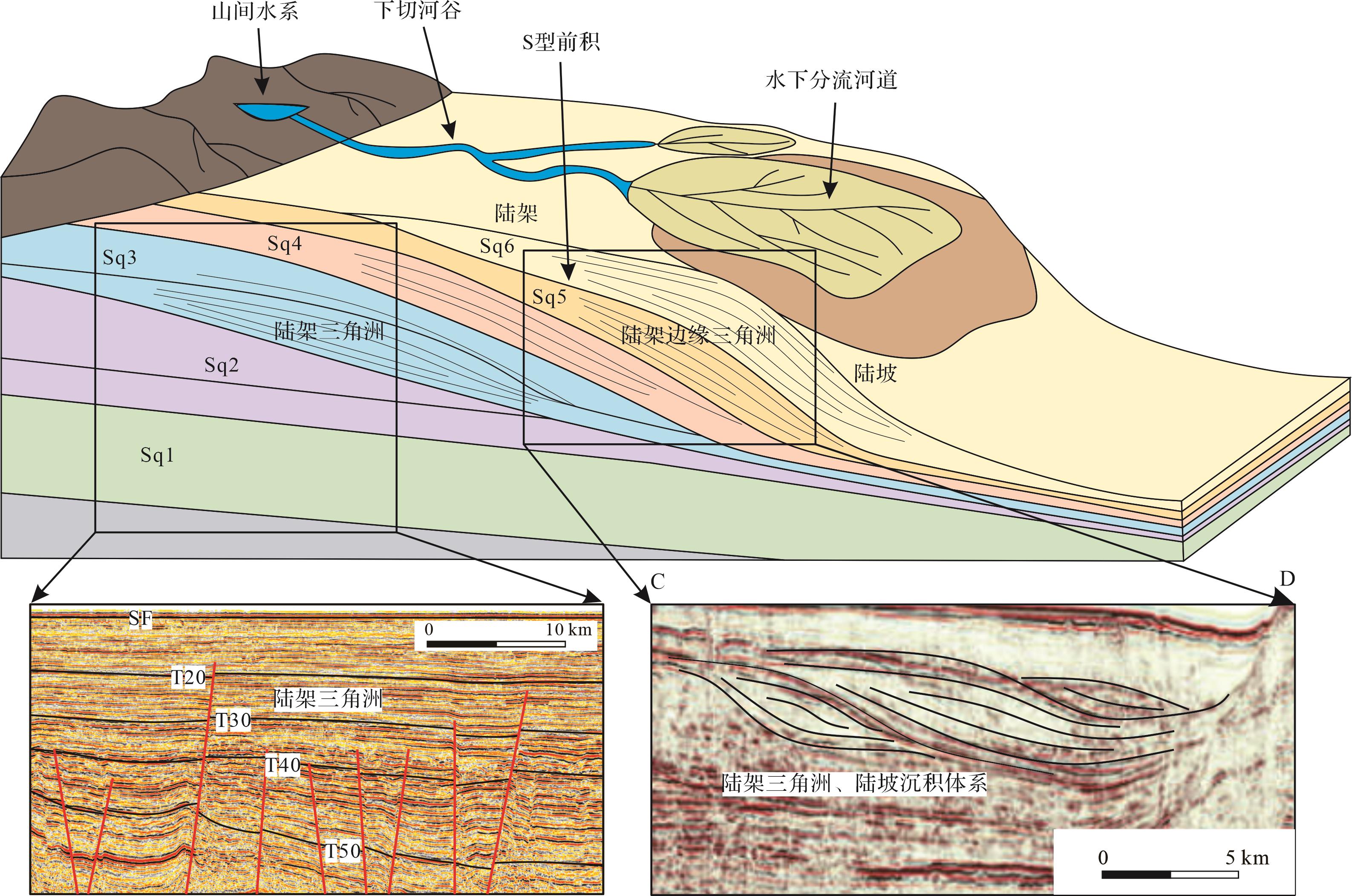
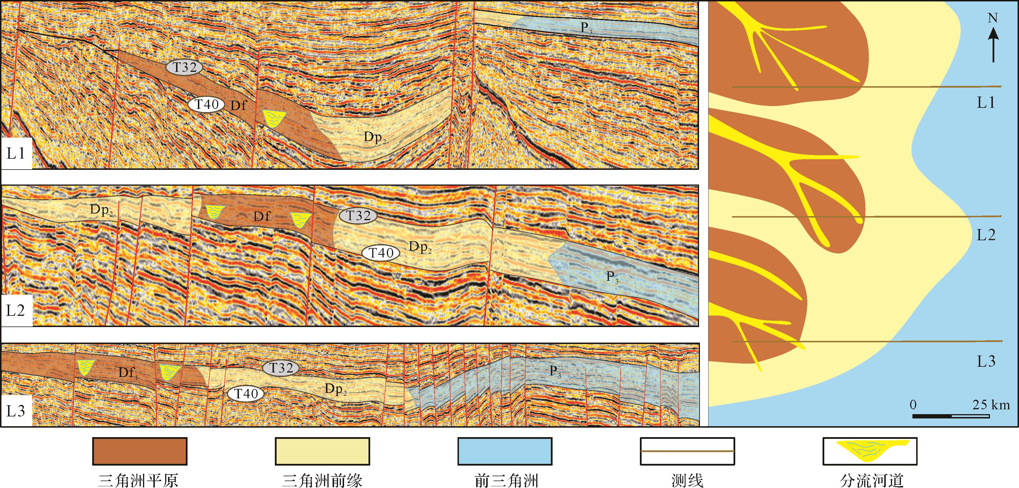
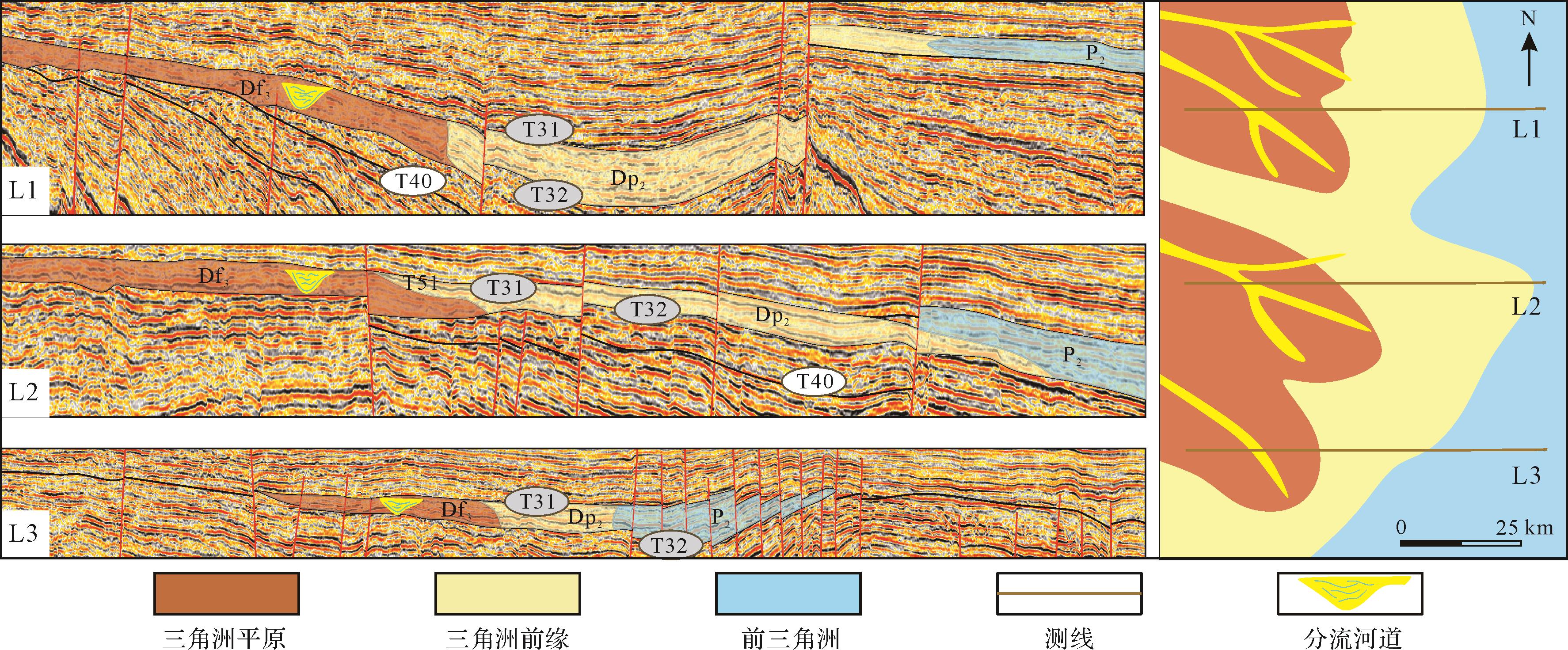
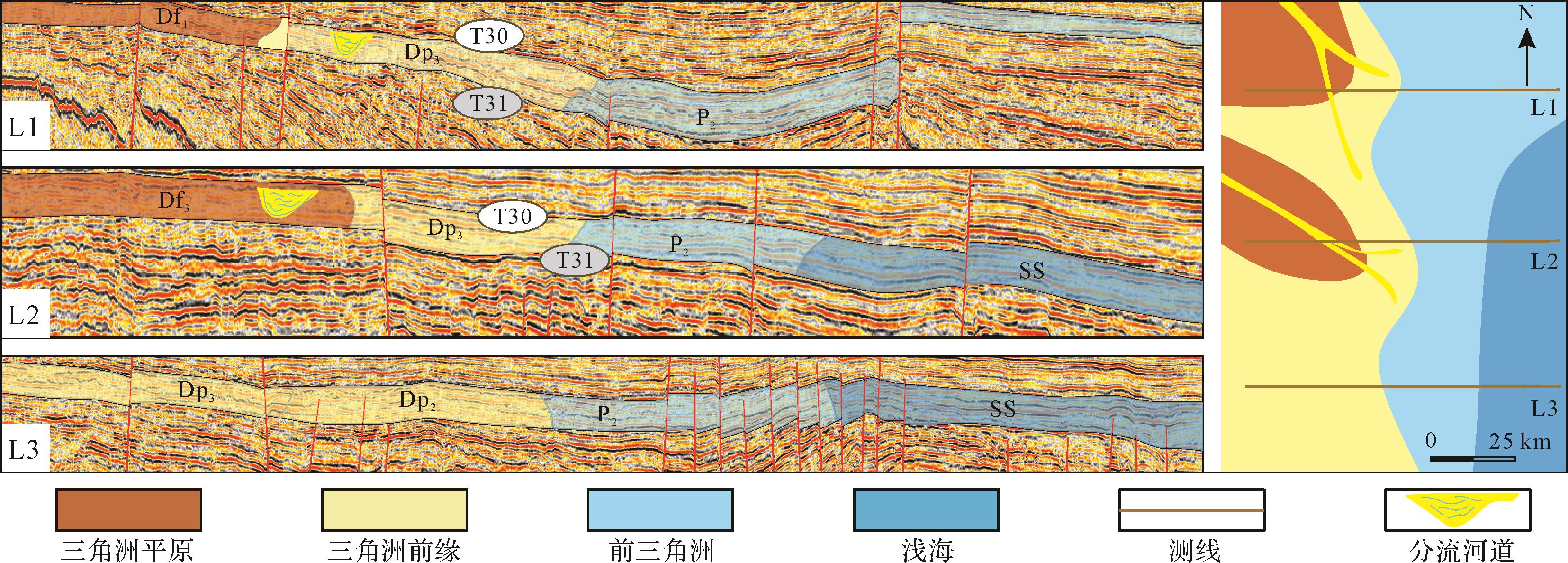
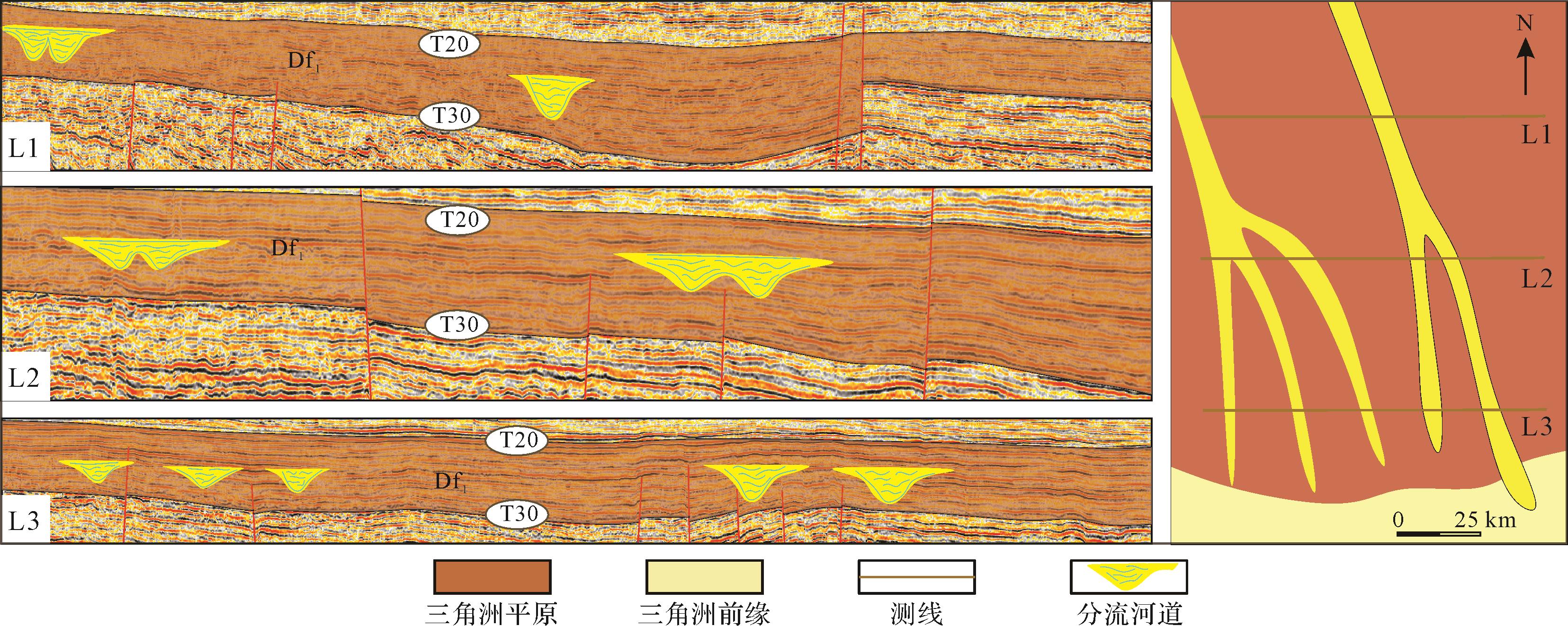
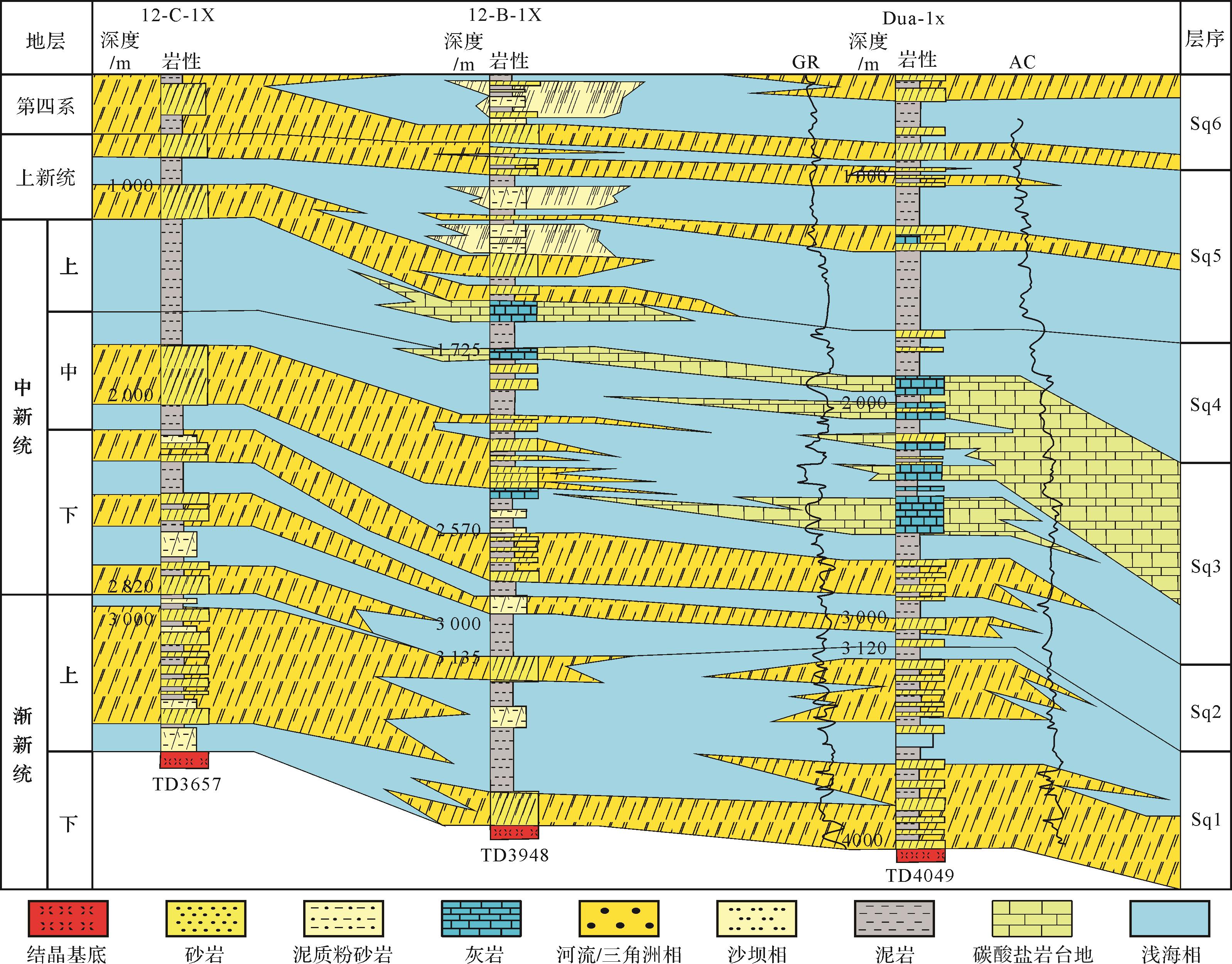
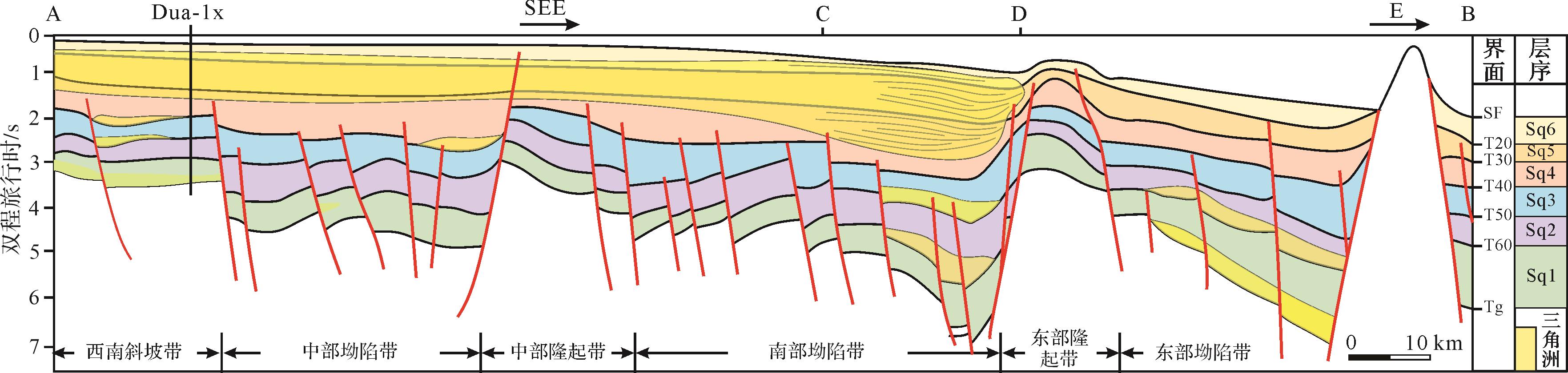
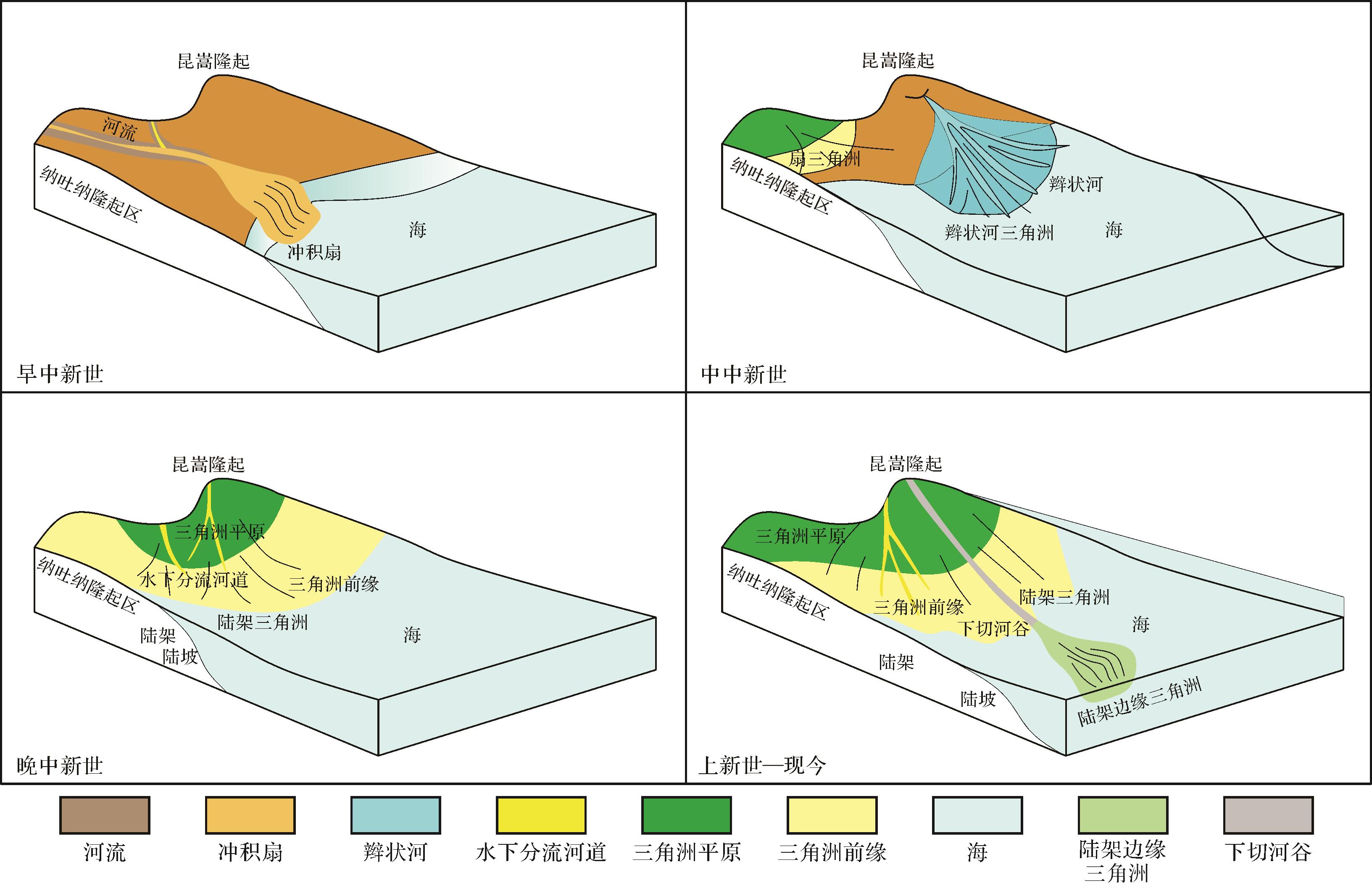
2023, 41(5): 1583-1597.
doi: 10.14027/j.issn.1000-0550.2022.034
Abstract:
Recently, a breakthrough has been made in the gas exploration of the bauxite rock series from the Permian Taiyuan Formation in the Longdong area, southwestern margin of the Ordos Basin, introducing a new field of gas reservoir exploration. As a new type of reservoir, the study of the bauxite rock series reservoir has significant research value. In this study, based on core observation, well logging, earthquakes, rock slice analysis, whole rock analysis by X-ray diffraction and scanning electron microscope-energy spectroscopy, high pressure mercury injection, low temperature nitrogen adsorption and other experimental methods, the petrological and pore structure characteristics of bauxite reservoirs were systematically studied. Furthermore, the main control factor and exploration significance of bauxite reservoirs in the basin is expounded. The results show that: (1) the lithologic sequence is characterized by three segments in the vertical direction. The upper and lower parts are composed of bauxitic mudstone, the middle part is composed of bauxite, and the solution pores are well developed in the main reservoir section of the bauxite rock series; (2) The main mineral composition of the bauxite rock series from the Taiyuan Formation is bauxite and clay minerals, the main minerals are diaspore, kaolinite, illite and chlorite, and the crystals are small, primarily cryptocrystalline, microcrystalline and cryptocrystalline masses; (3) the bauxite reservoir spaces are primarily composed of intragranular solution, matrix solution, intergranular dissolution, and intercrystalline pores and micro-fractures. The pore size ranges from 20 to 200 μm. The pore size of the mainstream throat ranges from 150 nm to 4 μm, and has better pore structure and high mercury removal efficiency. Overall, the pores are primarily sub-micron and micron pores. The average porosity and permeability of the reservoir are 10.6% and 4.04×10⁻³ μm2, 36% of which are larger than 0.3×10⁻³ μm2, and the reservoir performance is good. (4) Sedimentary environment and paleogeomorphology control the distribution of bauxite reservoir. Buried pit and terrace micro-paleogeomorphology enrich bauxite and are the main favorable exploration areas. The bauxite reservoir distribution is controlled by the sedimentary environment and palaeogeomorphology, and bauxite is enriched by buried pits and terrace micro-paleogeomorphology, and favorable areas are relatively developed. The research results can provide reference for the exploration of bauxite natural gas in North China and other areas.
Recently, a breakthrough has been made in the gas exploration of the bauxite rock series from the Permian Taiyuan Formation in the Longdong area, southwestern margin of the Ordos Basin, introducing a new field of gas reservoir exploration. As a new type of reservoir, the study of the bauxite rock series reservoir has significant research value. In this study, based on core observation, well logging, earthquakes, rock slice analysis, whole rock analysis by X-ray diffraction and scanning electron microscope-energy spectroscopy, high pressure mercury injection, low temperature nitrogen adsorption and other experimental methods, the petrological and pore structure characteristics of bauxite reservoirs were systematically studied. Furthermore, the main control factor and exploration significance of bauxite reservoirs in the basin is expounded. The results show that: (1) the lithologic sequence is characterized by three segments in the vertical direction. The upper and lower parts are composed of bauxitic mudstone, the middle part is composed of bauxite, and the solution pores are well developed in the main reservoir section of the bauxite rock series; (2) The main mineral composition of the bauxite rock series from the Taiyuan Formation is bauxite and clay minerals, the main minerals are diaspore, kaolinite, illite and chlorite, and the crystals are small, primarily cryptocrystalline, microcrystalline and cryptocrystalline masses; (3) the bauxite reservoir spaces are primarily composed of intragranular solution, matrix solution, intergranular dissolution, and intercrystalline pores and micro-fractures. The pore size ranges from 20 to 200 μm. The pore size of the mainstream throat ranges from 150 nm to 4 μm, and has better pore structure and high mercury removal efficiency. Overall, the pores are primarily sub-micron and micron pores. The average porosity and permeability of the reservoir are 10.6% and 4.04×10⁻³ μm2, 36% of which are larger than 0.3×10⁻³ μm2, and the reservoir performance is good. (4) Sedimentary environment and paleogeomorphology control the distribution of bauxite reservoir. Buried pit and terrace micro-paleogeomorphology enrich bauxite and are the main favorable exploration areas. The bauxite reservoir distribution is controlled by the sedimentary environment and palaeogeomorphology, and bauxite is enriched by buried pits and terrace micro-paleogeomorphology, and favorable areas are relatively developed. The research results can provide reference for the exploration of bauxite natural gas in North China and other areas.
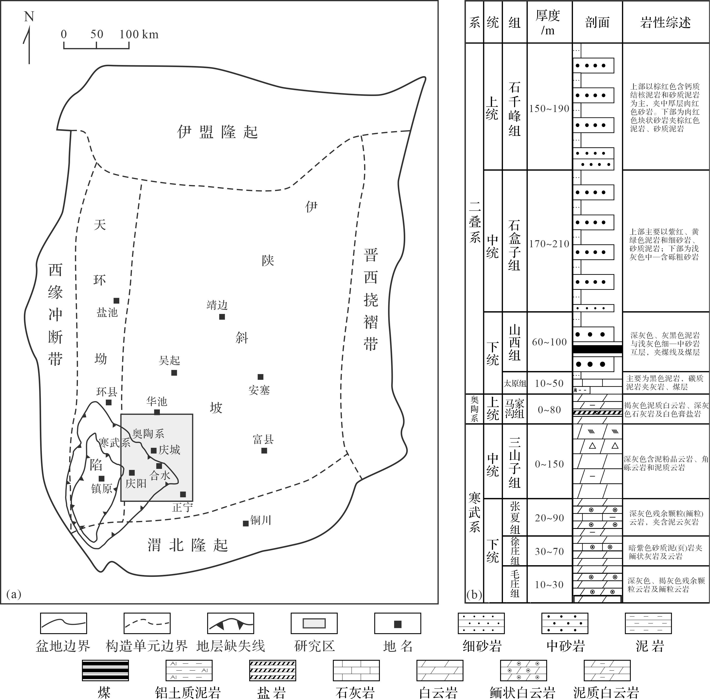
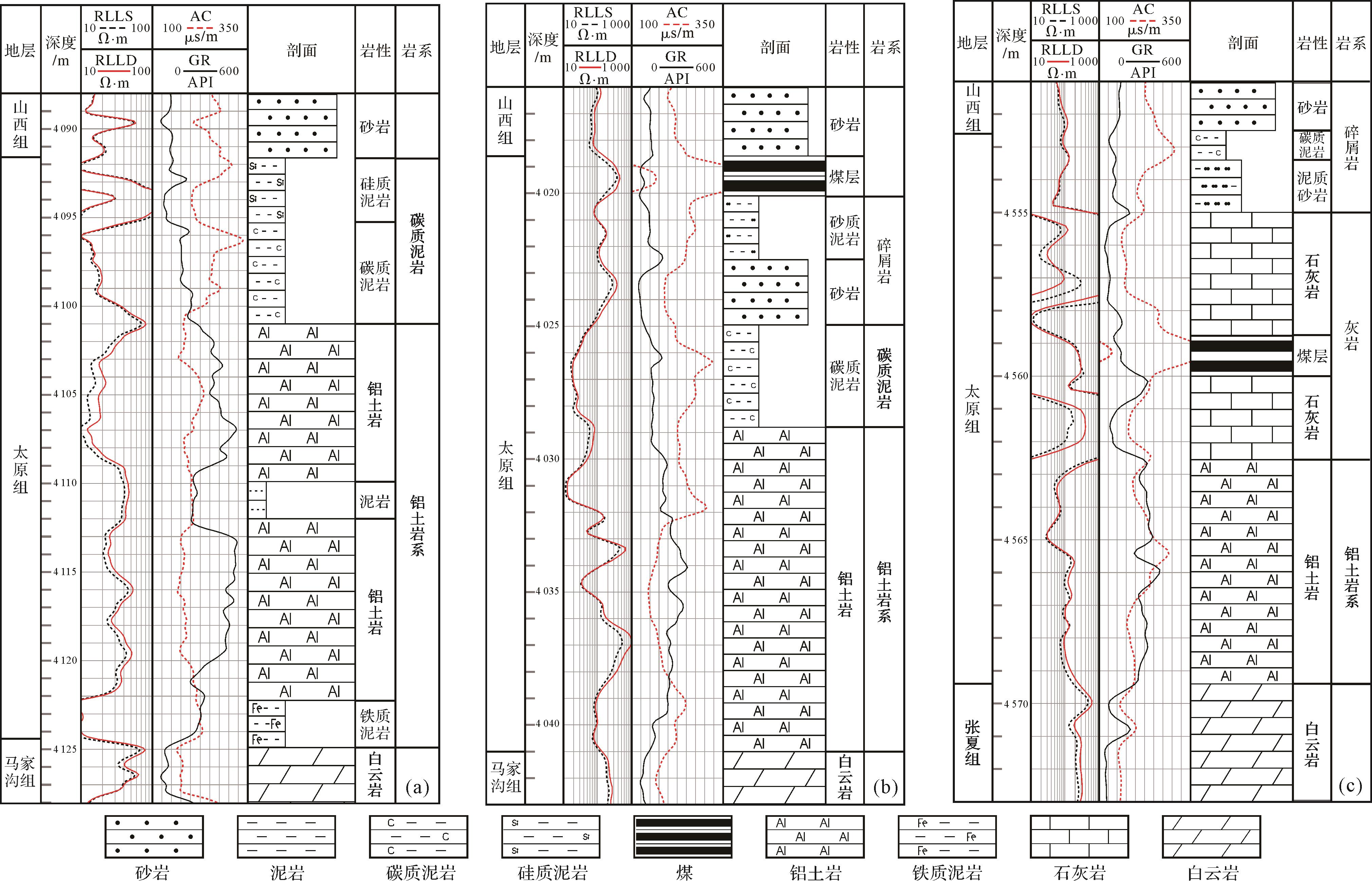
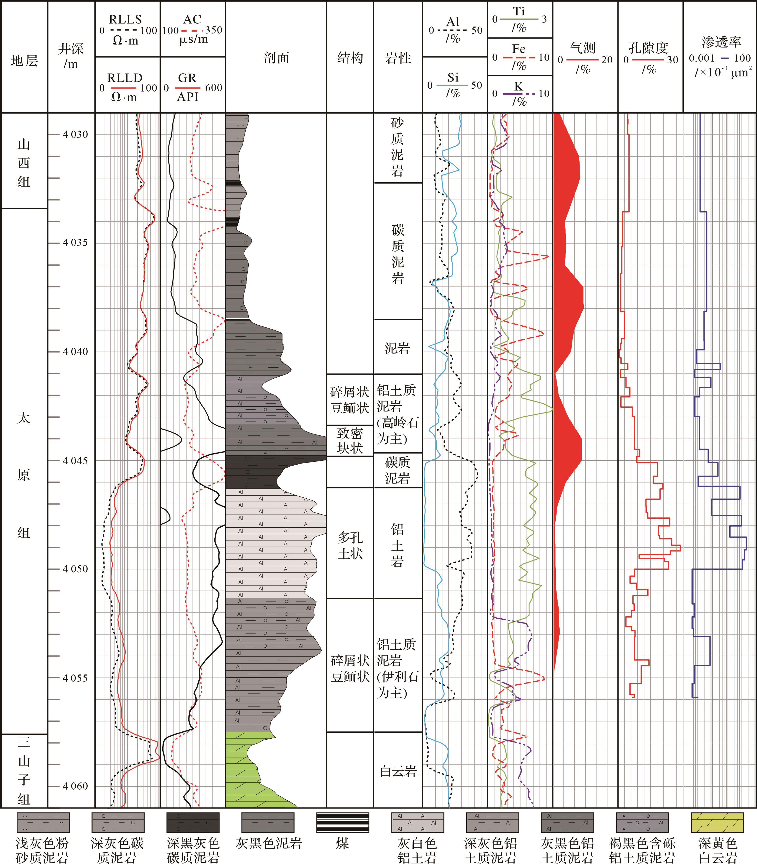
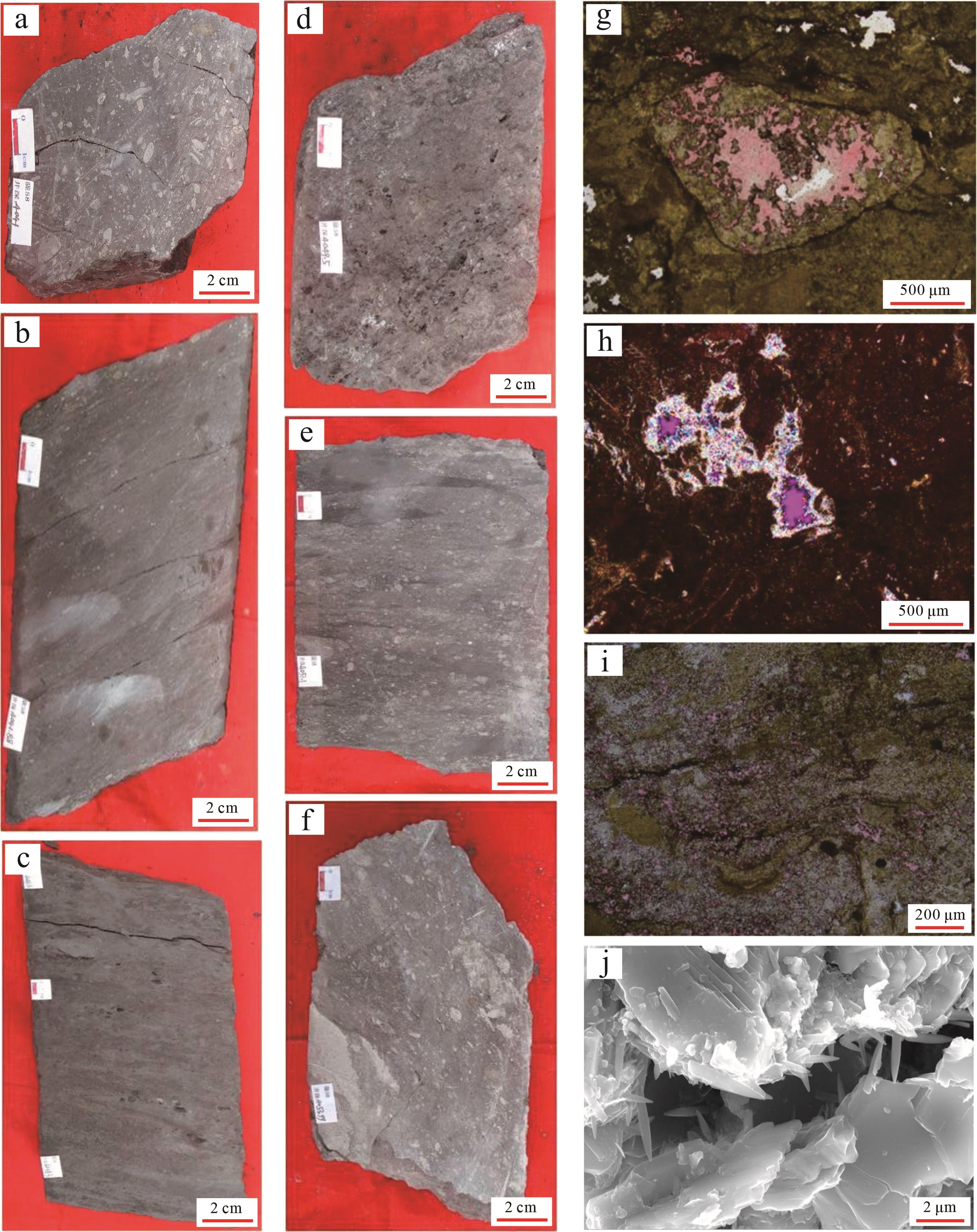
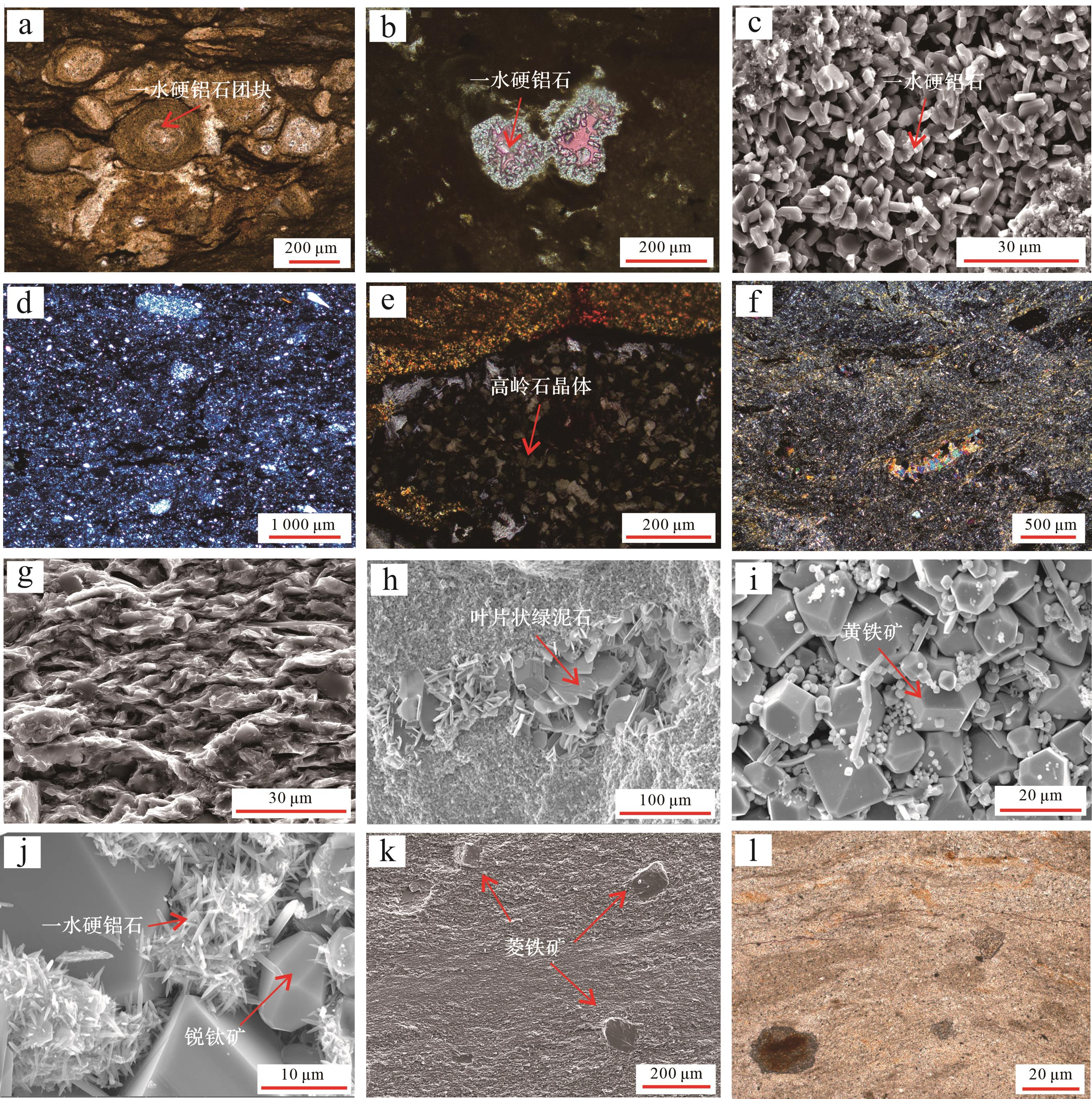
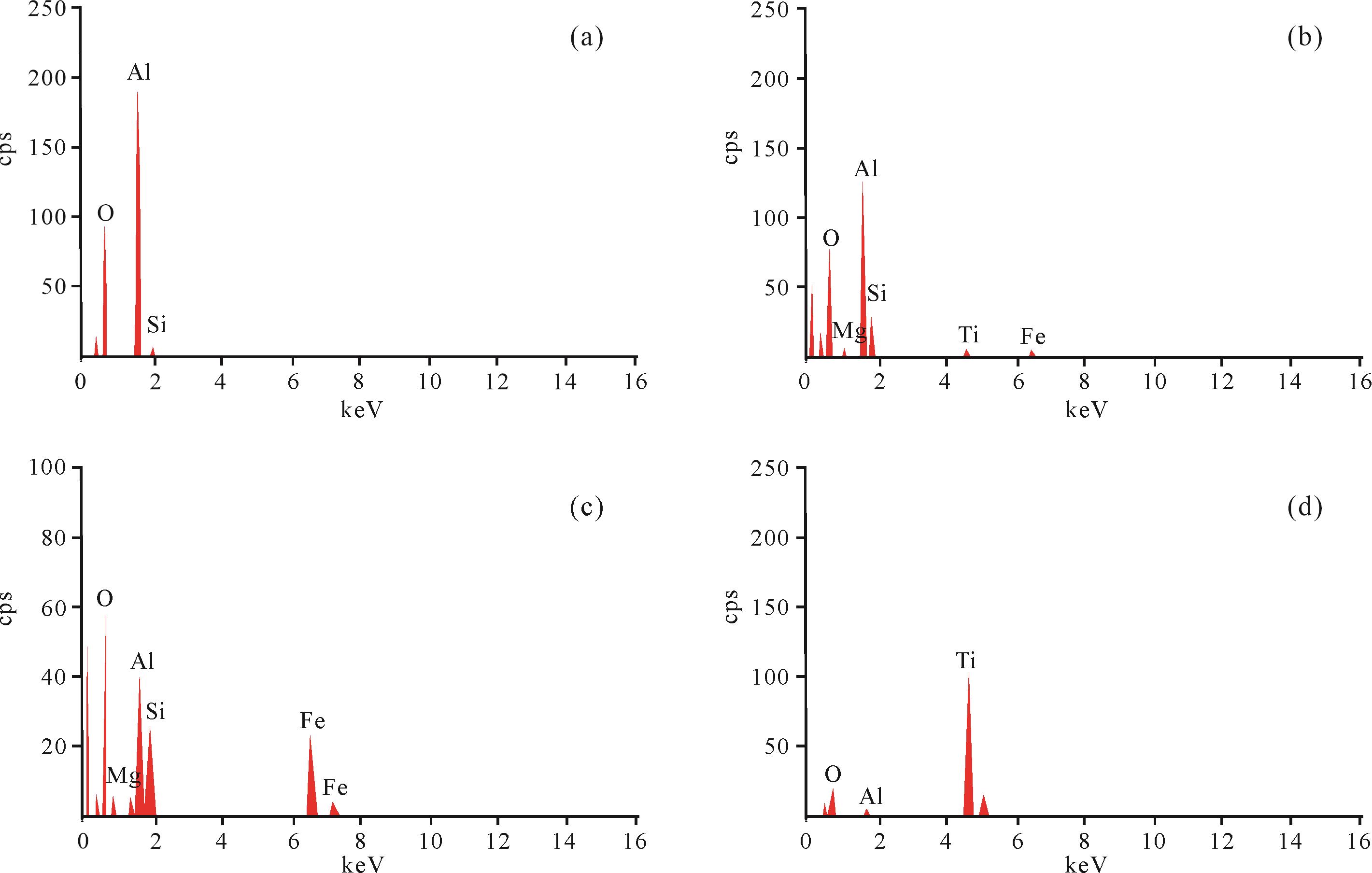
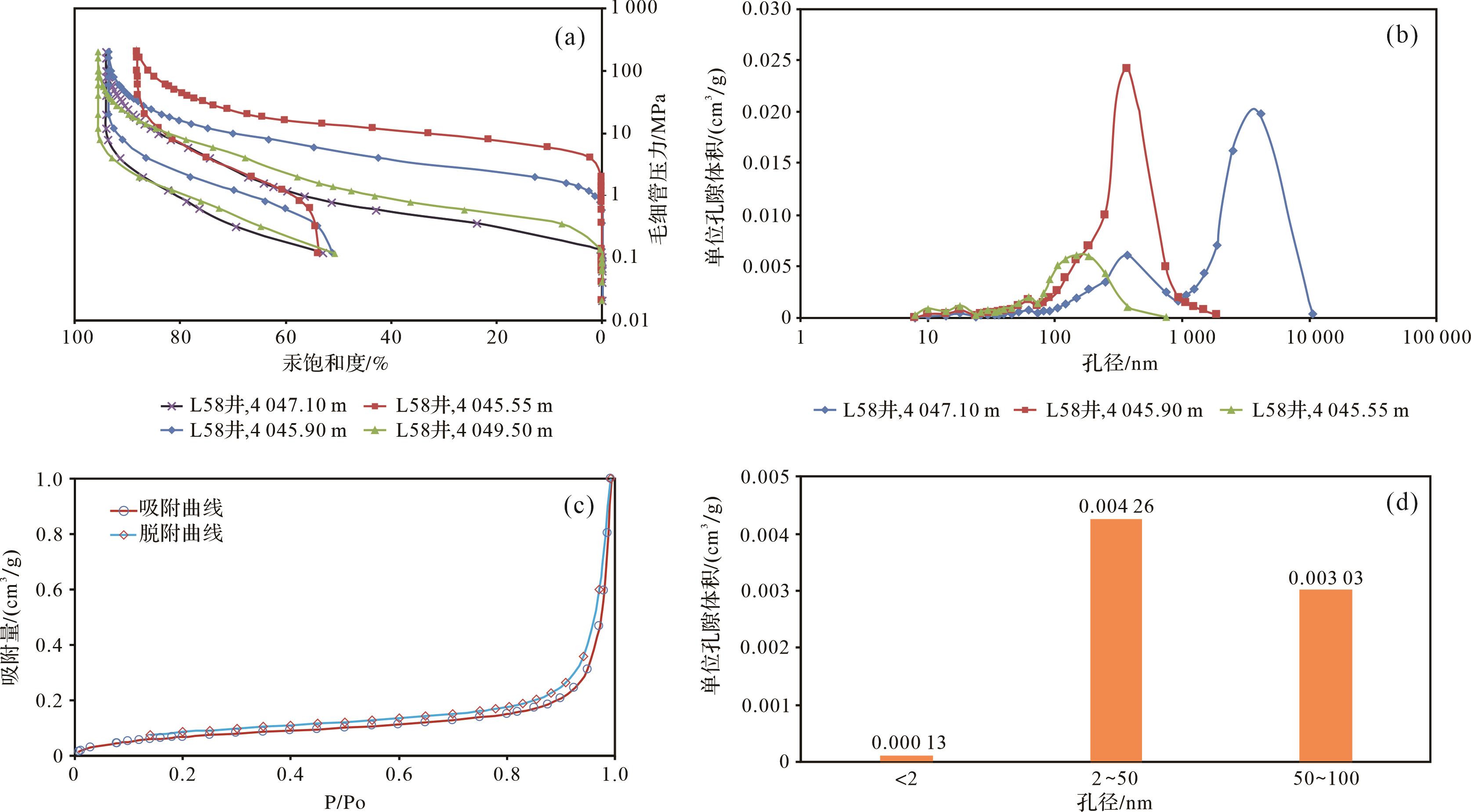
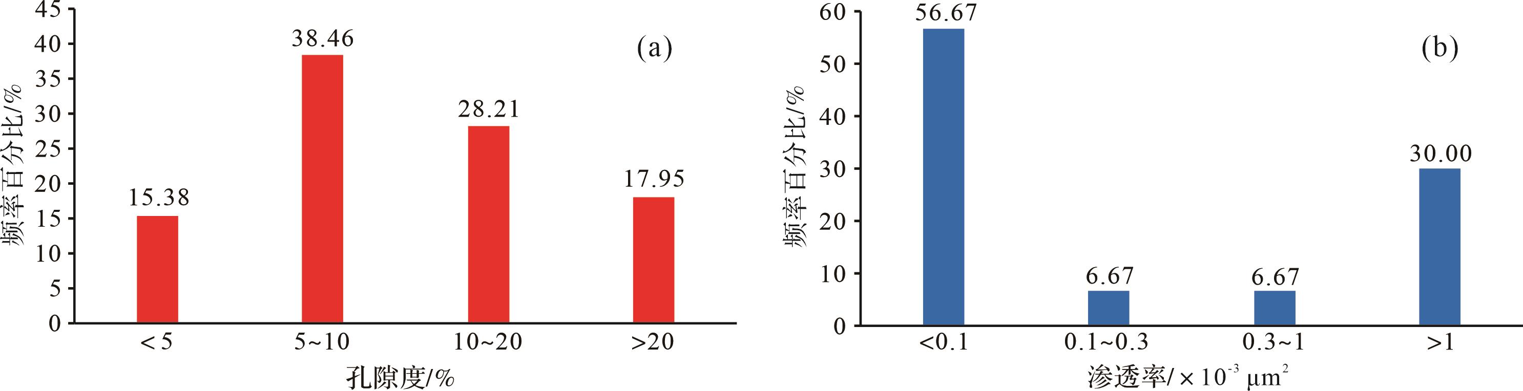
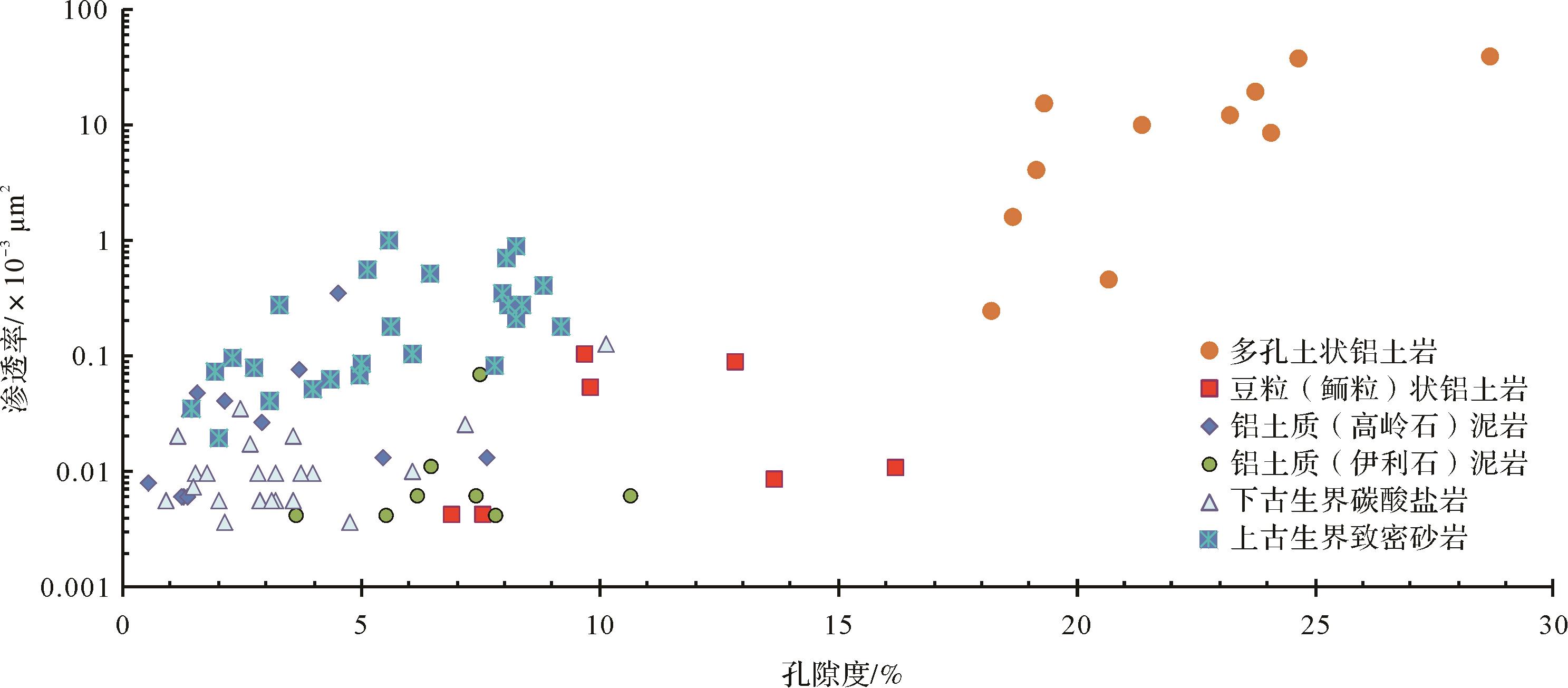
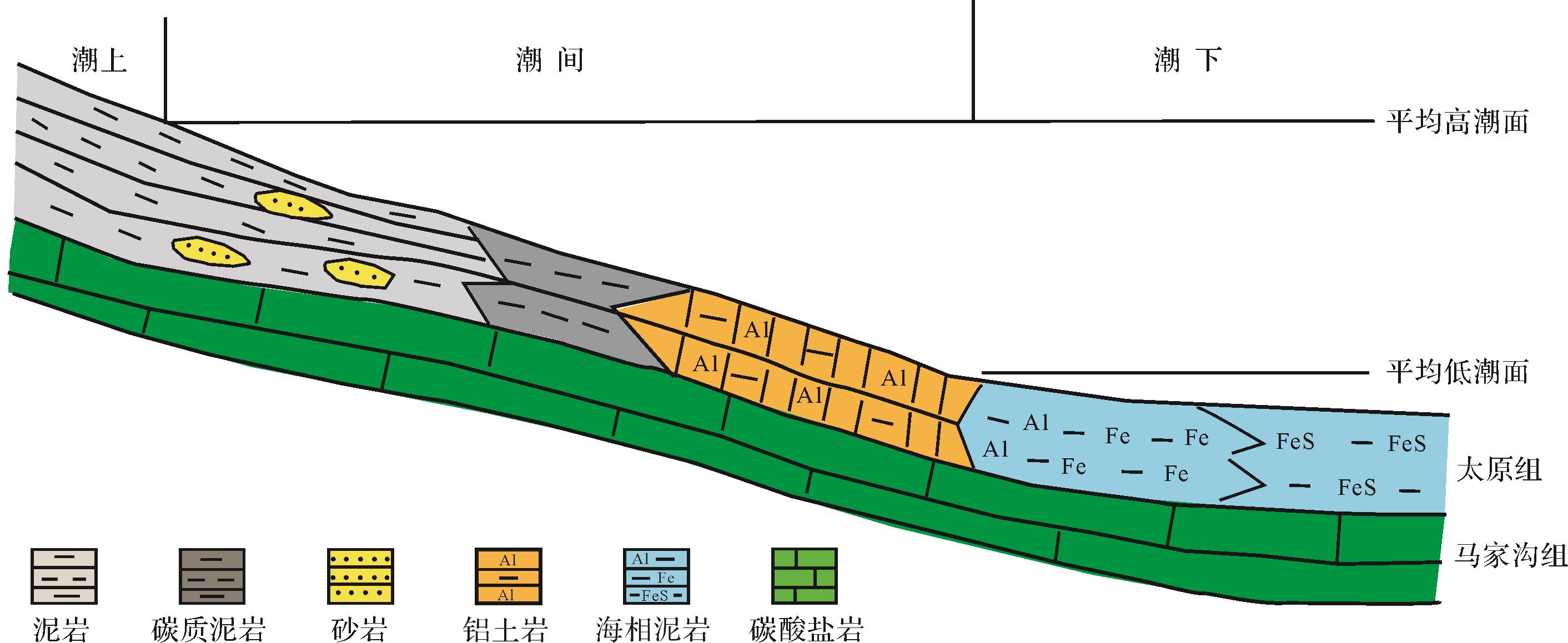
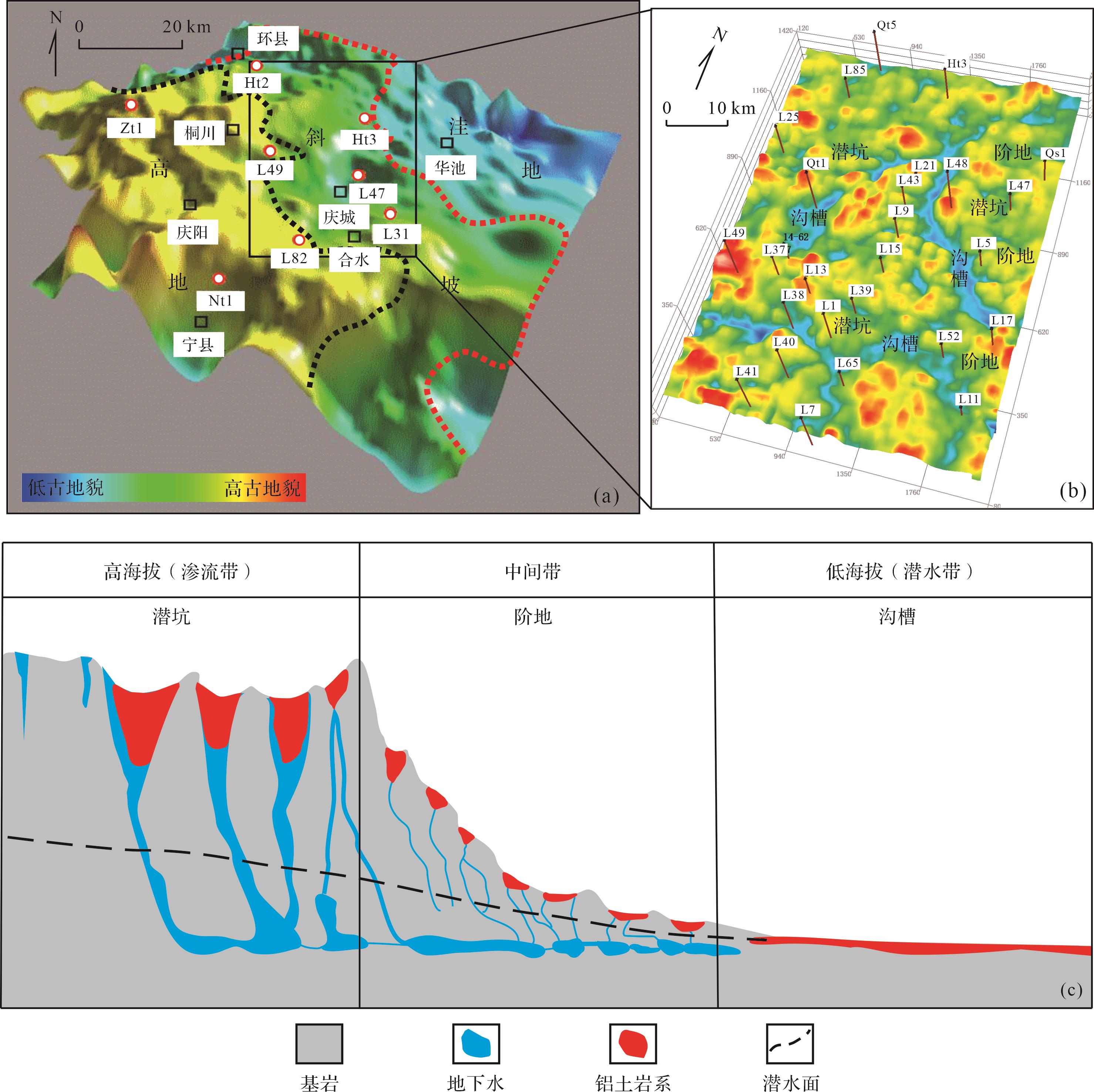
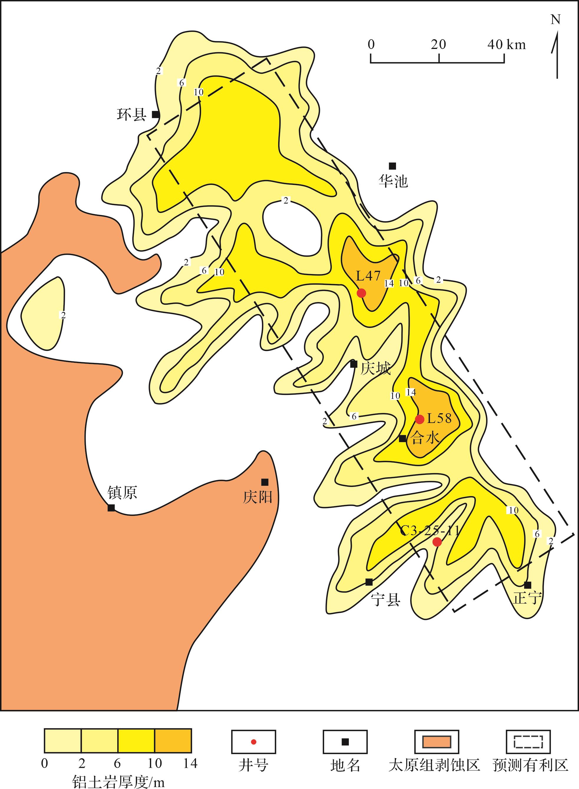
2023, 41(5): 1598-1608.
doi: 10.14027/j.issn.1000-0550.2022.015
Abstract:
The Southeastern Ordos Basin is one of the most critical production sources of coal and coalbed methane in China. Its complex sedimentary evolution provides a case for studying the stratigraphic sequences forming a gentle slope and their coal accumulation patterns. The focus of this study was the sedimentary process that took place during the Late Paleozoic. After establishing the stratigraphic sequence of a gently sloping region, the sequence stratigraphic stack pattern was reconstructed. The regional differences in coal accumulation settings in this epicontinental sea basin and their relationships within the various layers and the coal-bearing sediments was clarified by a quantitative analysis of integrated well-logs and seismic data and relating it to sediment supply (S) and accumulation space (A). The sequence stratigraphy was classified into three patterns: aggressive-dominated (AD) pattern, exposed-dominated (ED) pattern), and transfer (Tf) pattern. In AD-type coal accumulation, a medium-thickness coal seam tended to develop, dominated by the paleotopography. ED coal accumulation mostly developed thin coal seams of limited distribution. A change in sediment supply formed the Tf coal accumulation, resulting in the thickest coal layers, but of limited areal distribution. From consideration of the accumulation patterns and their main influences, it was inferred that AD and ED patterns were determined by the accumulation space (A), whereas the Tf pattern resulted from the sediment supply rate.
The Southeastern Ordos Basin is one of the most critical production sources of coal and coalbed methane in China. Its complex sedimentary evolution provides a case for studying the stratigraphic sequences forming a gentle slope and their coal accumulation patterns. The focus of this study was the sedimentary process that took place during the Late Paleozoic. After establishing the stratigraphic sequence of a gently sloping region, the sequence stratigraphic stack pattern was reconstructed. The regional differences in coal accumulation settings in this epicontinental sea basin and their relationships within the various layers and the coal-bearing sediments was clarified by a quantitative analysis of integrated well-logs and seismic data and relating it to sediment supply (S) and accumulation space (A). The sequence stratigraphy was classified into three patterns: aggressive-dominated (AD) pattern, exposed-dominated (ED) pattern), and transfer (Tf) pattern. In AD-type coal accumulation, a medium-thickness coal seam tended to develop, dominated by the paleotopography. ED coal accumulation mostly developed thin coal seams of limited distribution. A change in sediment supply formed the Tf coal accumulation, resulting in the thickest coal layers, but of limited areal distribution. From consideration of the accumulation patterns and their main influences, it was inferred that AD and ED patterns were determined by the accumulation space (A), whereas the Tf pattern resulted from the sediment supply rate.
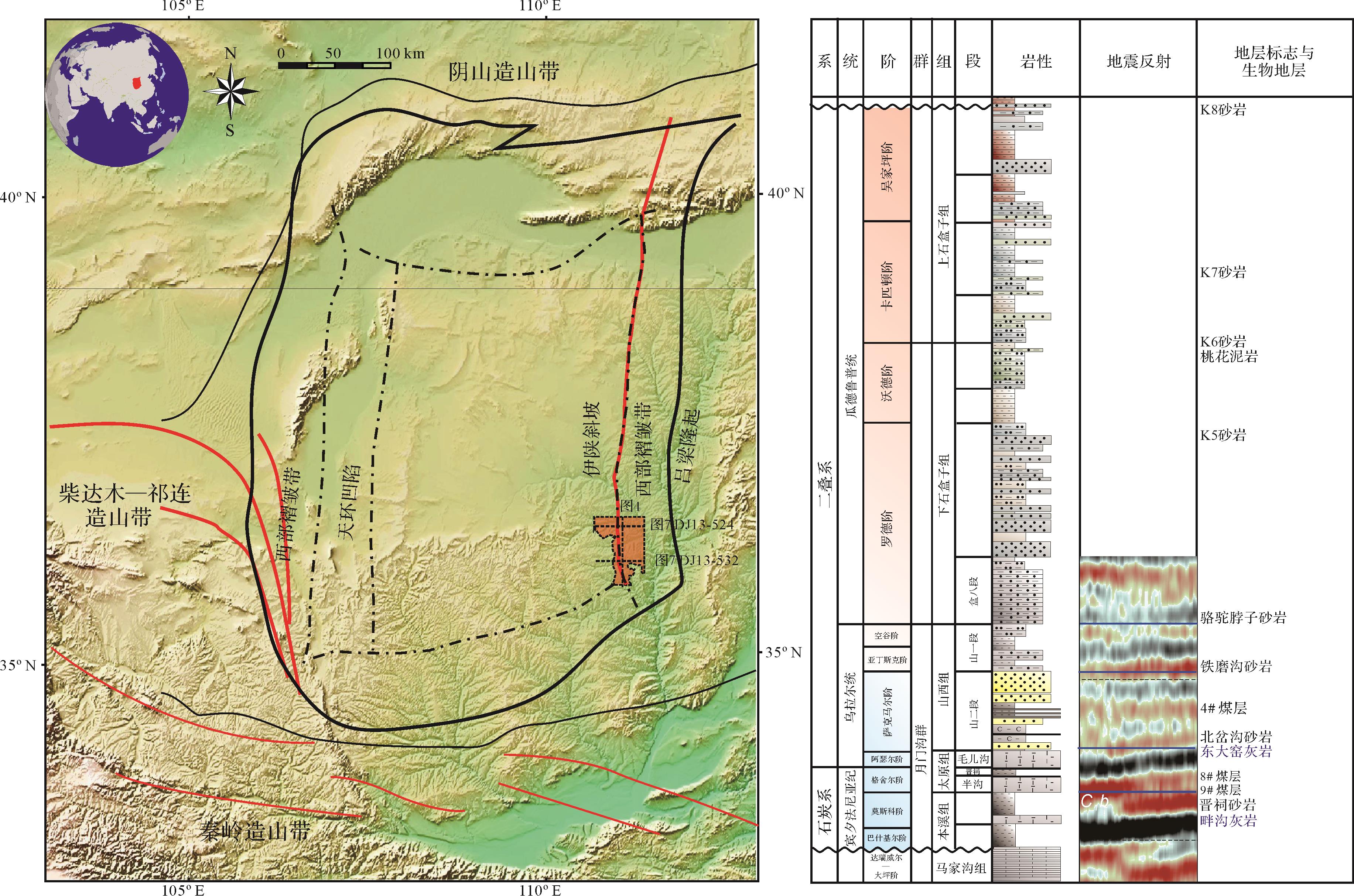
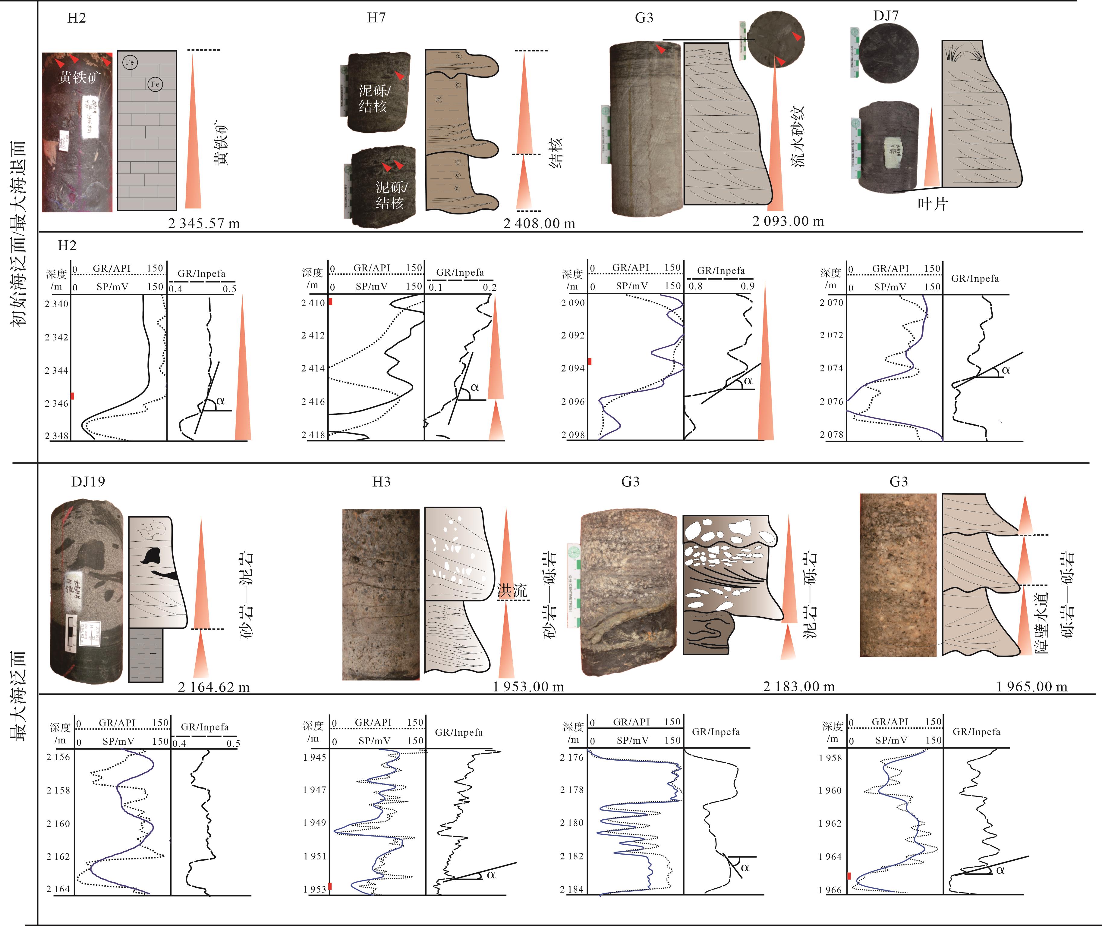
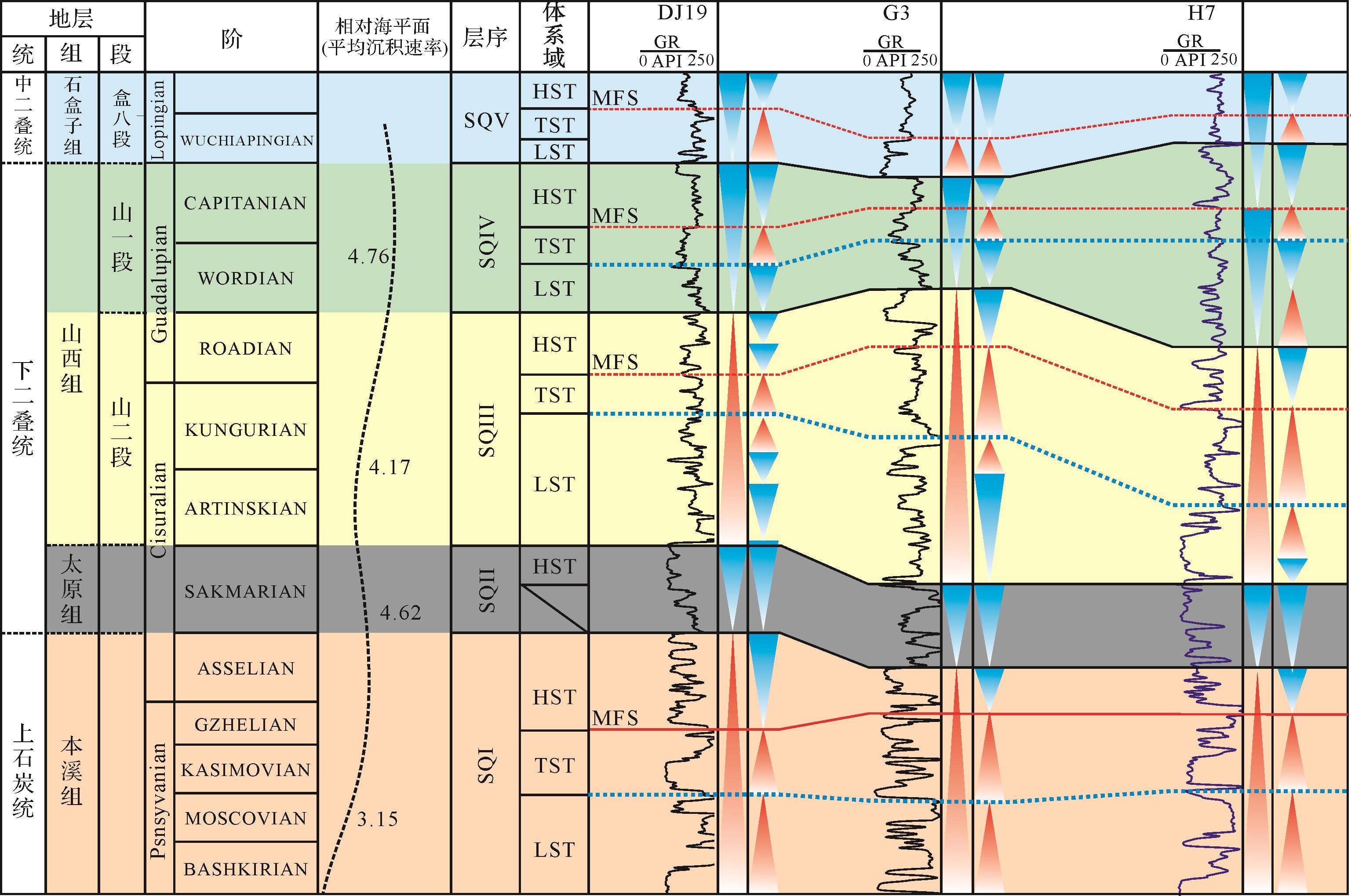
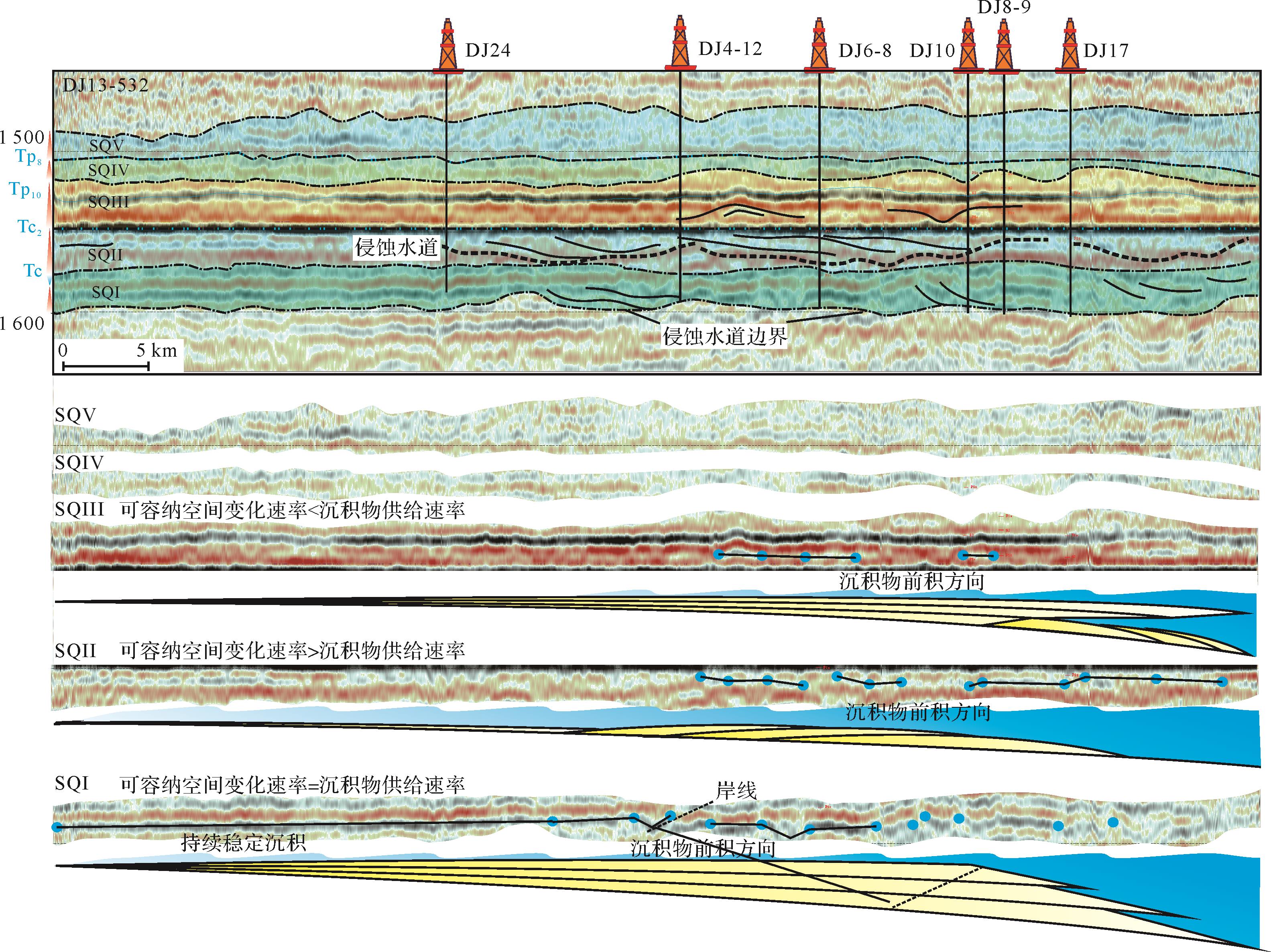
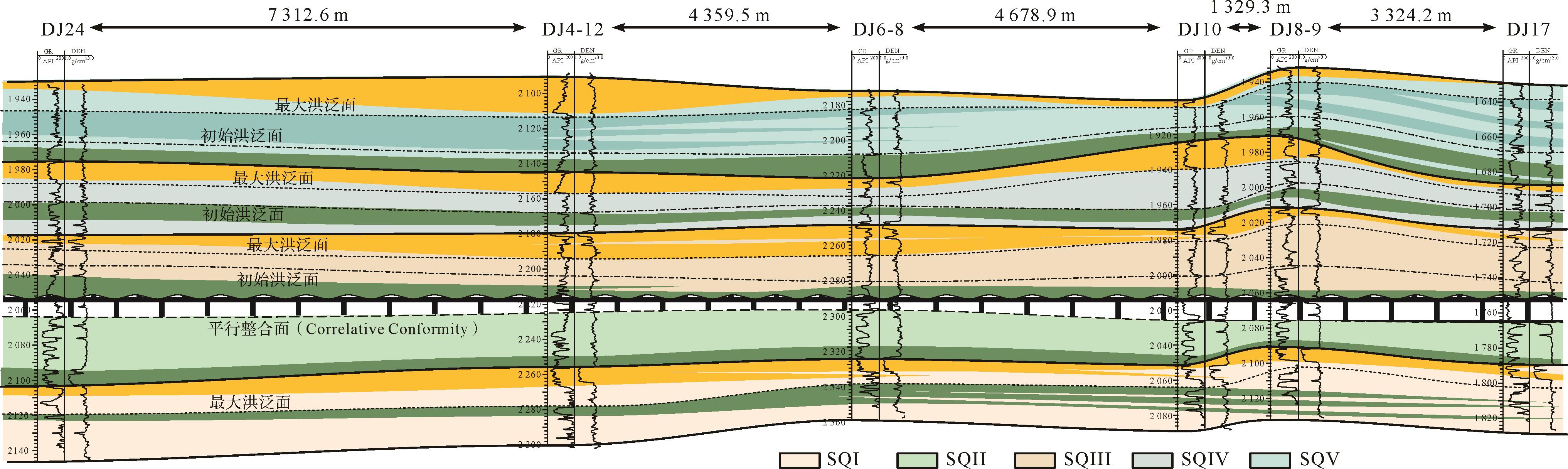
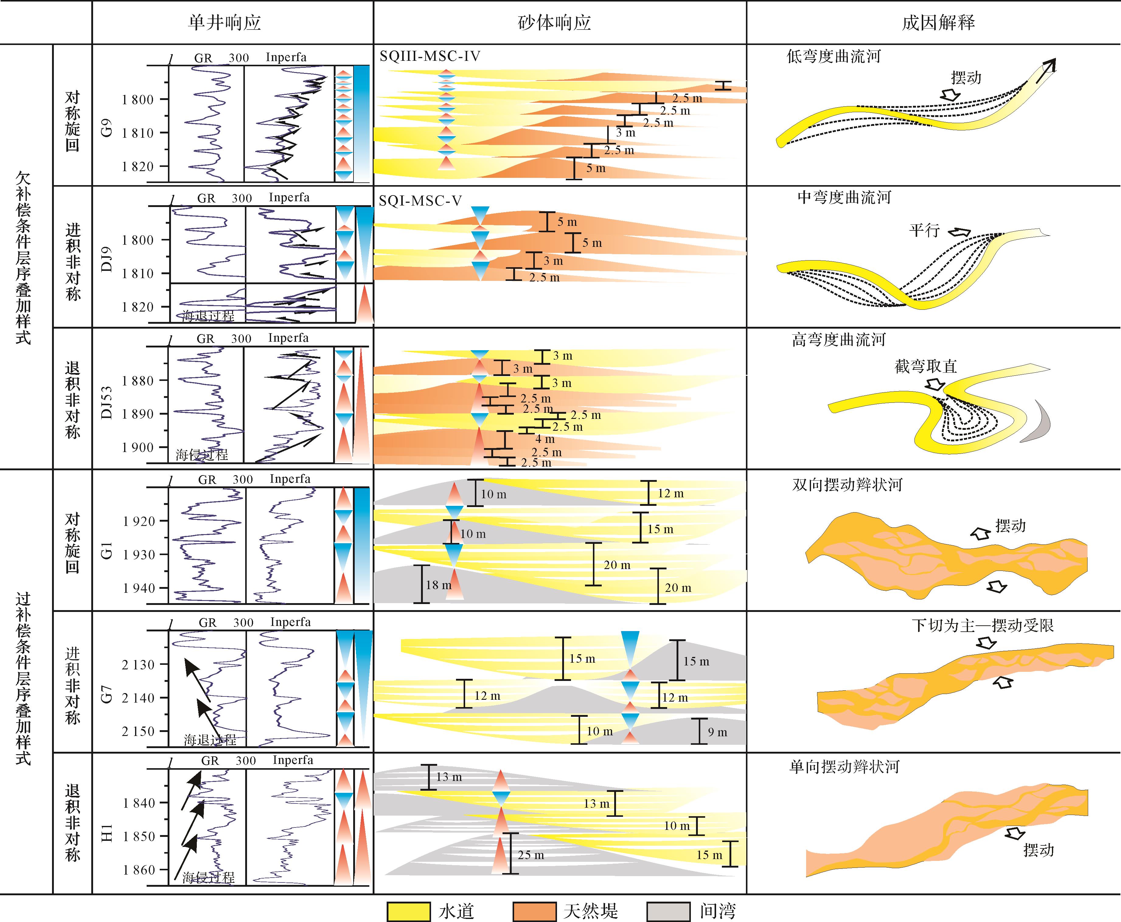
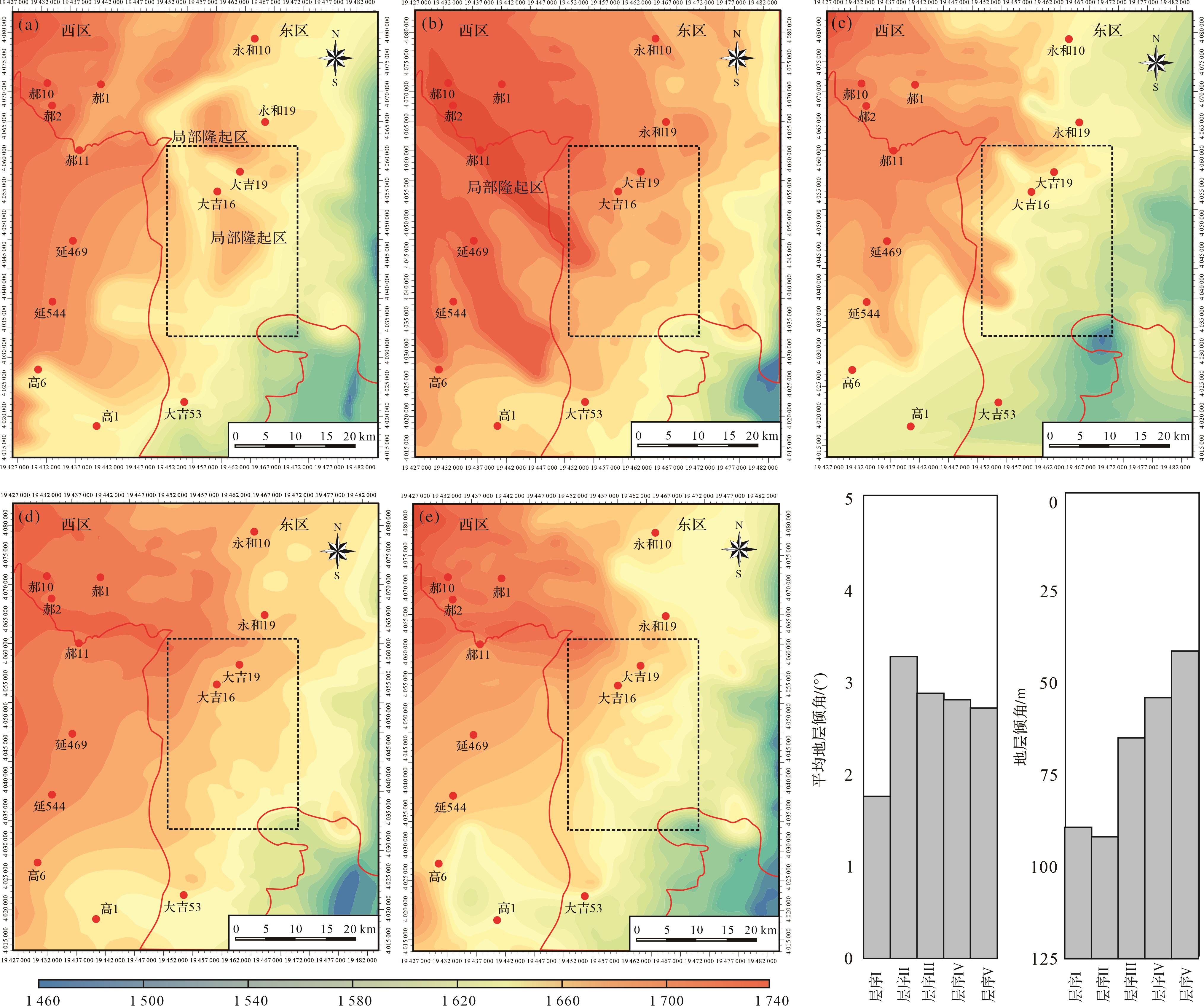
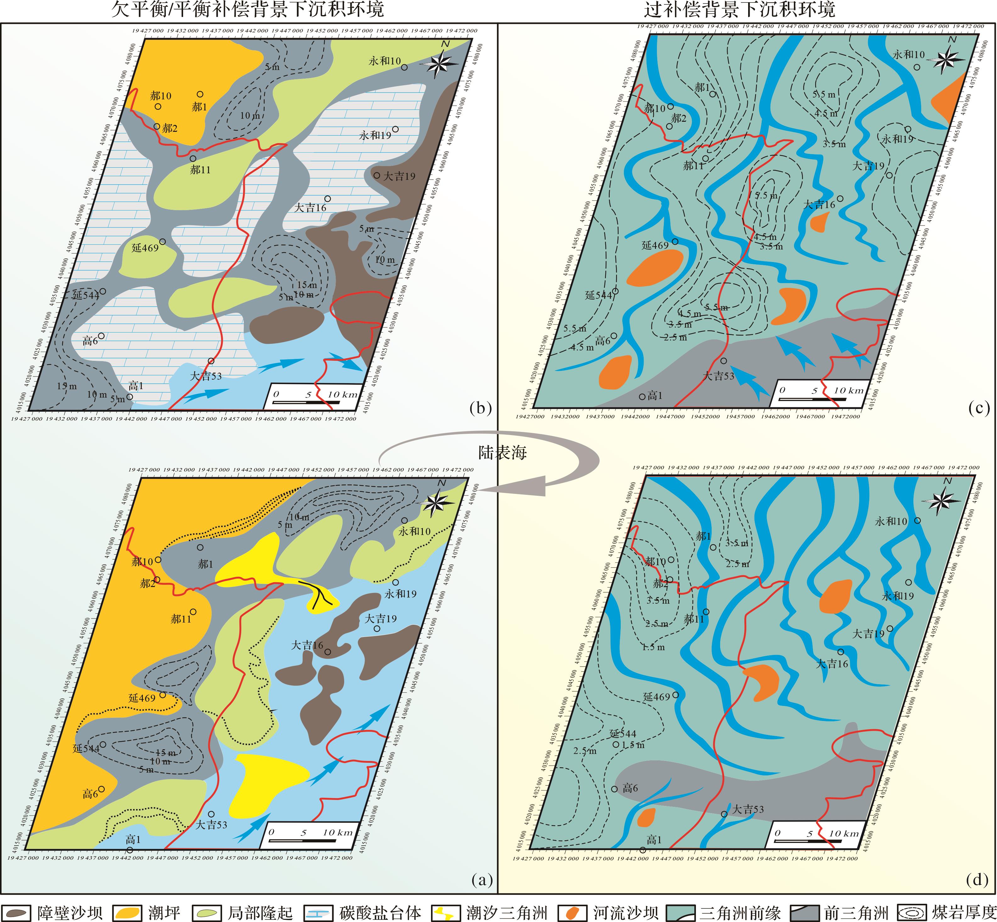
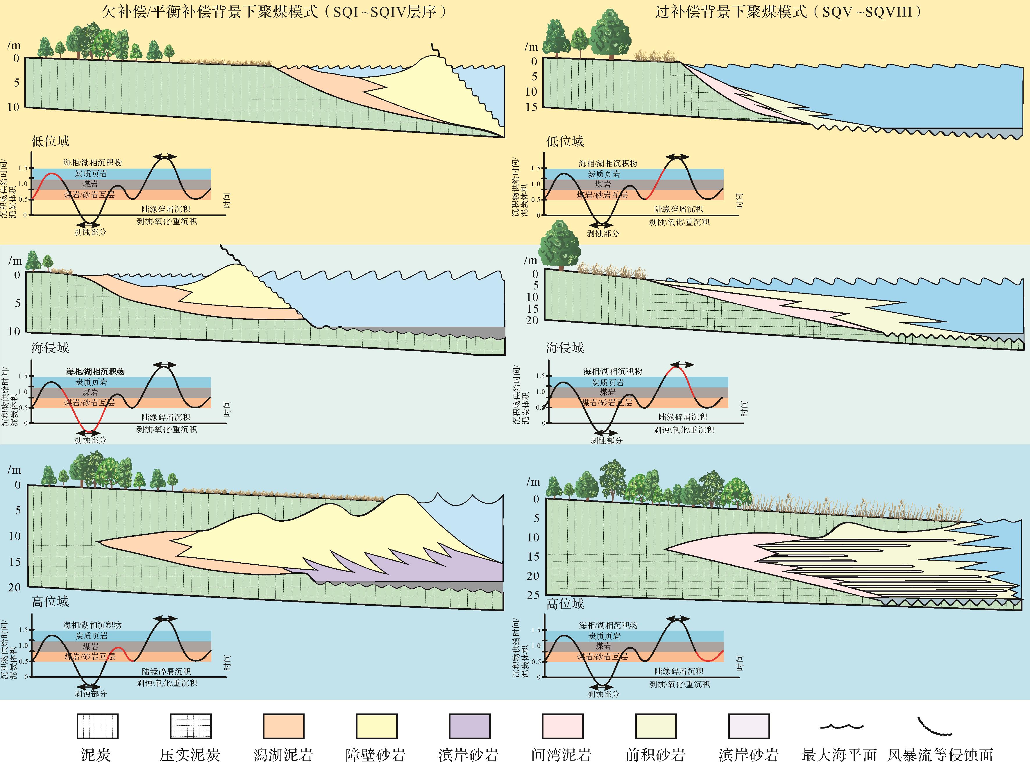
2023, 41(5): 1609-1623.
doi: 10.14027/j.issn.1000-0550.2022.022
Abstract:
The Early Cretaceous was the latest evolution period of the Mesozoic Ordos Basin. The tectonic environment and sedimentary provenance system have undergone significant changes since then that are of great significance to the evolution of the basin and the exploration of multi-energy mineral reservoirs and/or mineralization. This study takes the Lower Cretaceous Yijun Formation in the southern Ordos Basin as the main research object, uses the detrital zircon laser ablation inductively coupled plasma mass spectrometry (LA-ICP-MS) uranium-lead (U-Pb) dating method, and analyses the characteristics of zircon U-Pb age spectrum peaks and structural evolution characteristics of surrounding blocks to trace the provenance of the Yijun Formation and discuss its geological significance. The results show that the detrital zircons U-Pb ages from the Yijun Formation are distributed in the Early Mesozoic (ca. 195⁃250 Ma) and Early Paleozoic (ca. 400⁃500 Ma) periods, with peak ages of ca. 218 Ma and ca. 450 Ma, respectively, which are consistent with the age of the widely exposed rock masses in the North Qinling area today. The Proterozoic-Archaean zircon ages are not only small in number, but have no obvious age peaks. Based on comparison of the regional geological background, the provenance comes from the North Qinling orogenic belt. It was uplifted and exposed to the surface at the beginning of the Cretaceous, providing a large amount of material to the southern Ordos Basin. This study restrained the uplift and exhumation of Qinling in the Late Mesozoic to a certain extent and restricts the time limit for the development of the Weibei uplift. The research has a certain guiding role in determining the uranium ore sources and ore-forming distribution of Mesozoic sandstone-type uranium deposits in the southern part of the basin.
The Early Cretaceous was the latest evolution period of the Mesozoic Ordos Basin. The tectonic environment and sedimentary provenance system have undergone significant changes since then that are of great significance to the evolution of the basin and the exploration of multi-energy mineral reservoirs and/or mineralization. This study takes the Lower Cretaceous Yijun Formation in the southern Ordos Basin as the main research object, uses the detrital zircon laser ablation inductively coupled plasma mass spectrometry (LA-ICP-MS) uranium-lead (U-Pb) dating method, and analyses the characteristics of zircon U-Pb age spectrum peaks and structural evolution characteristics of surrounding blocks to trace the provenance of the Yijun Formation and discuss its geological significance. The results show that the detrital zircons U-Pb ages from the Yijun Formation are distributed in the Early Mesozoic (ca. 195⁃250 Ma) and Early Paleozoic (ca. 400⁃500 Ma) periods, with peak ages of ca. 218 Ma and ca. 450 Ma, respectively, which are consistent with the age of the widely exposed rock masses in the North Qinling area today. The Proterozoic-Archaean zircon ages are not only small in number, but have no obvious age peaks. Based on comparison of the regional geological background, the provenance comes from the North Qinling orogenic belt. It was uplifted and exposed to the surface at the beginning of the Cretaceous, providing a large amount of material to the southern Ordos Basin. This study restrained the uplift and exhumation of Qinling in the Late Mesozoic to a certain extent and restricts the time limit for the development of the Weibei uplift. The research has a certain guiding role in determining the uranium ore sources and ore-forming distribution of Mesozoic sandstone-type uranium deposits in the southern part of the basin.
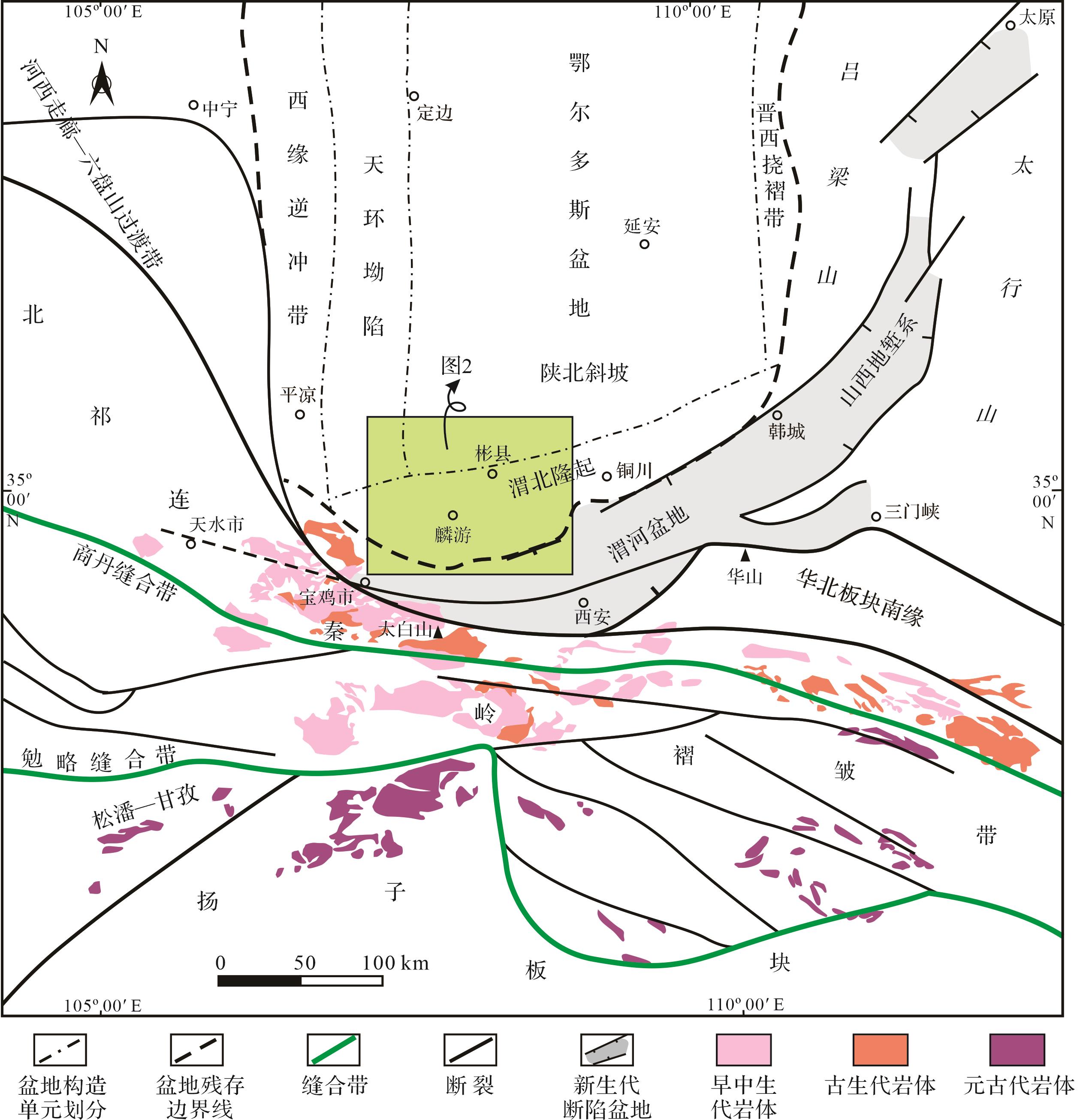
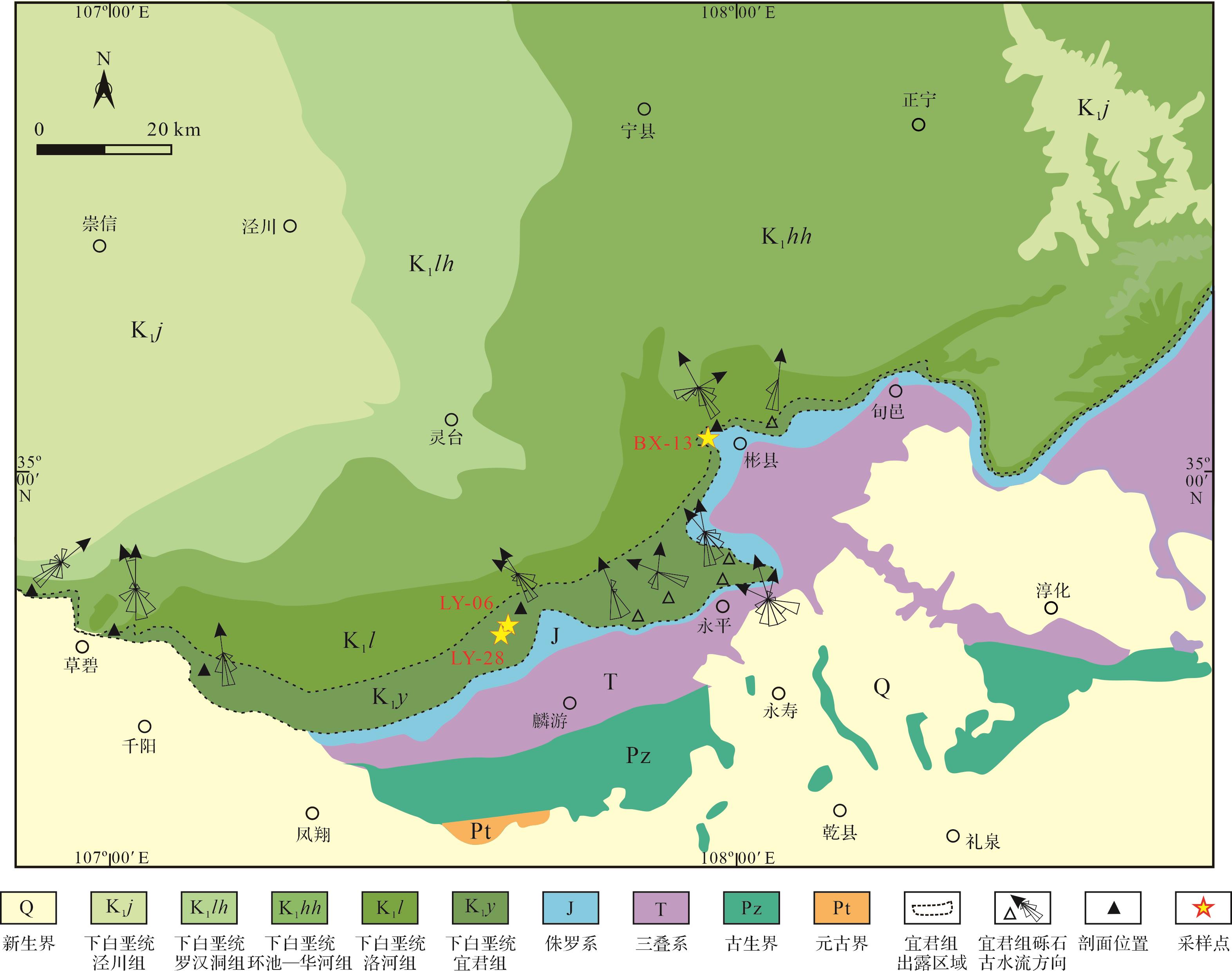
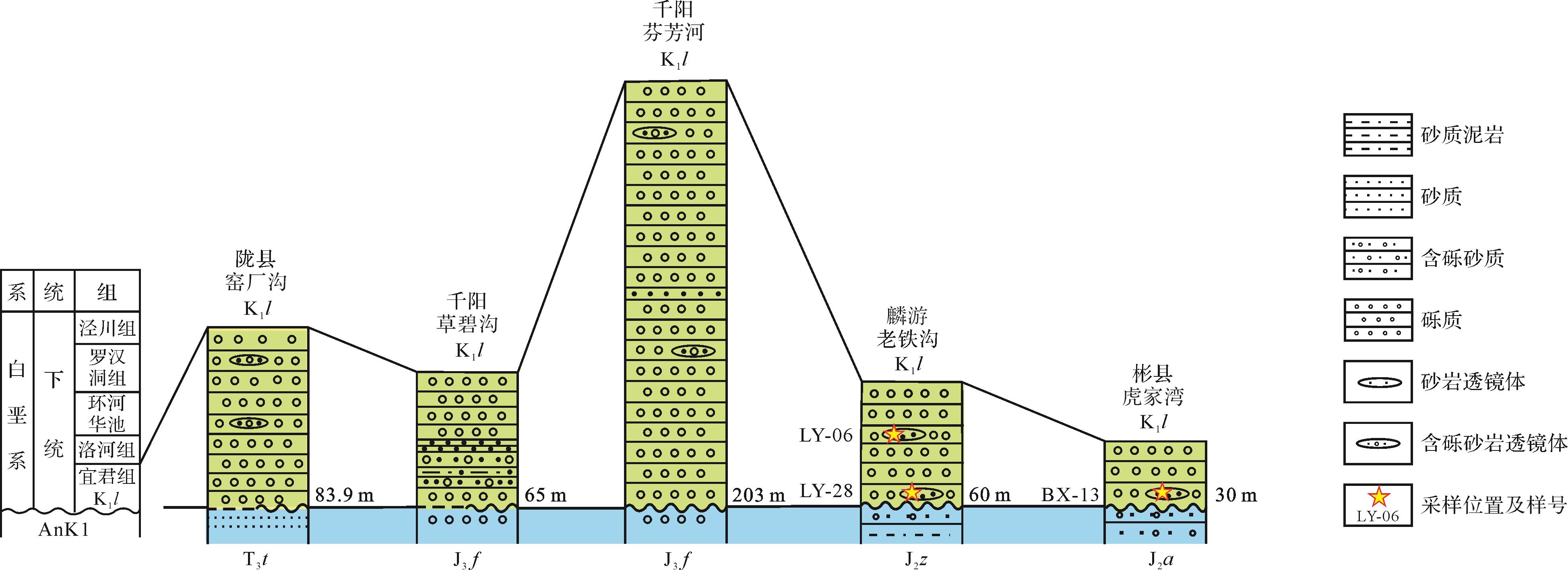
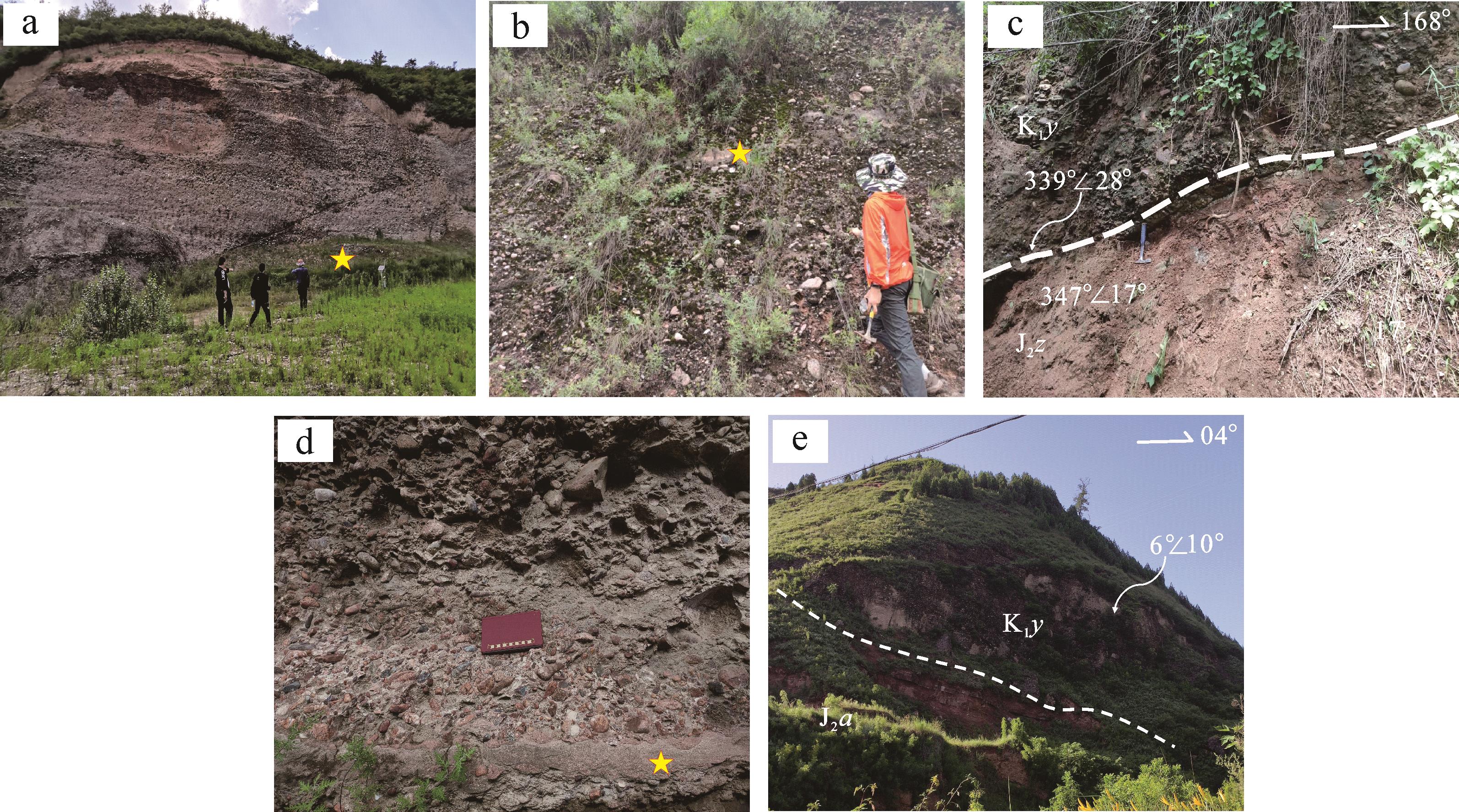
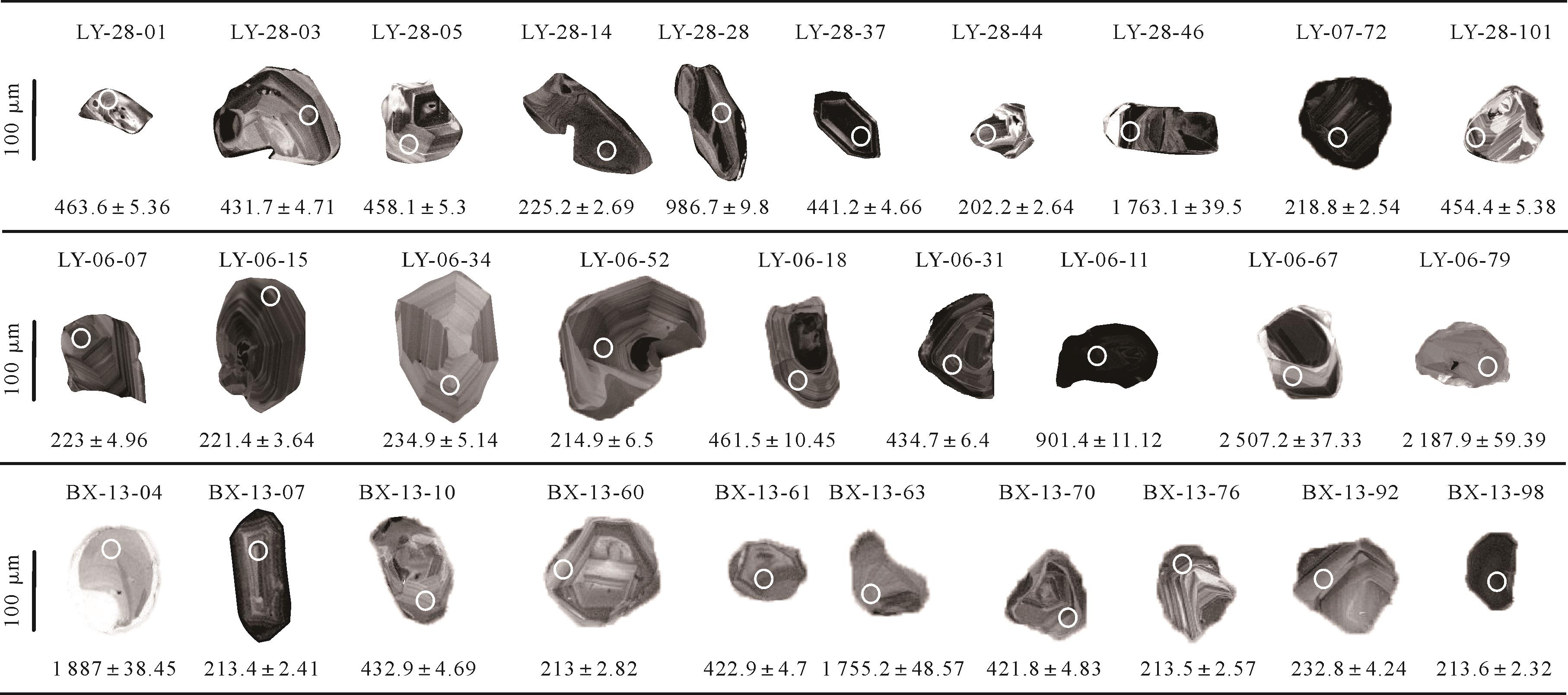
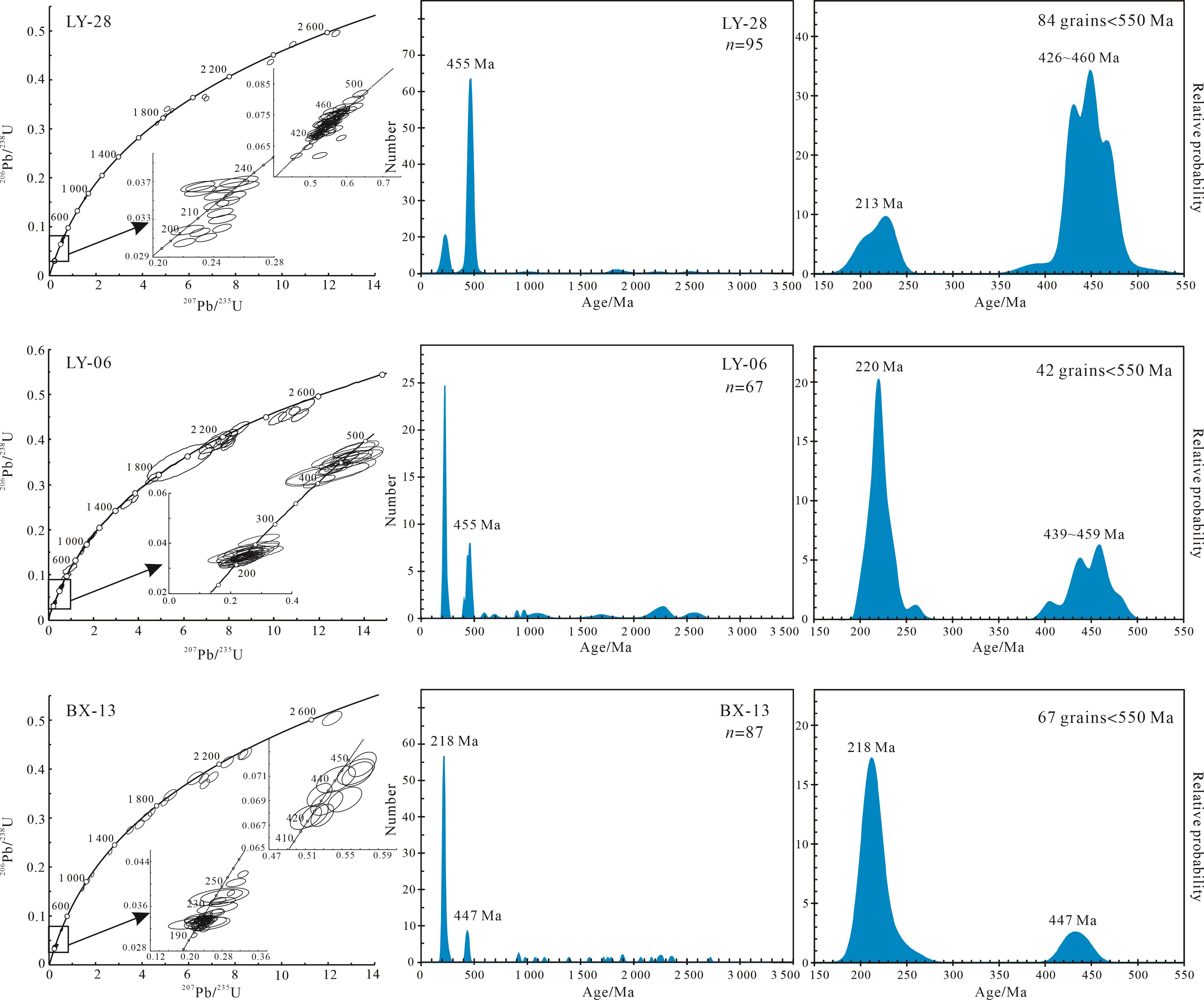
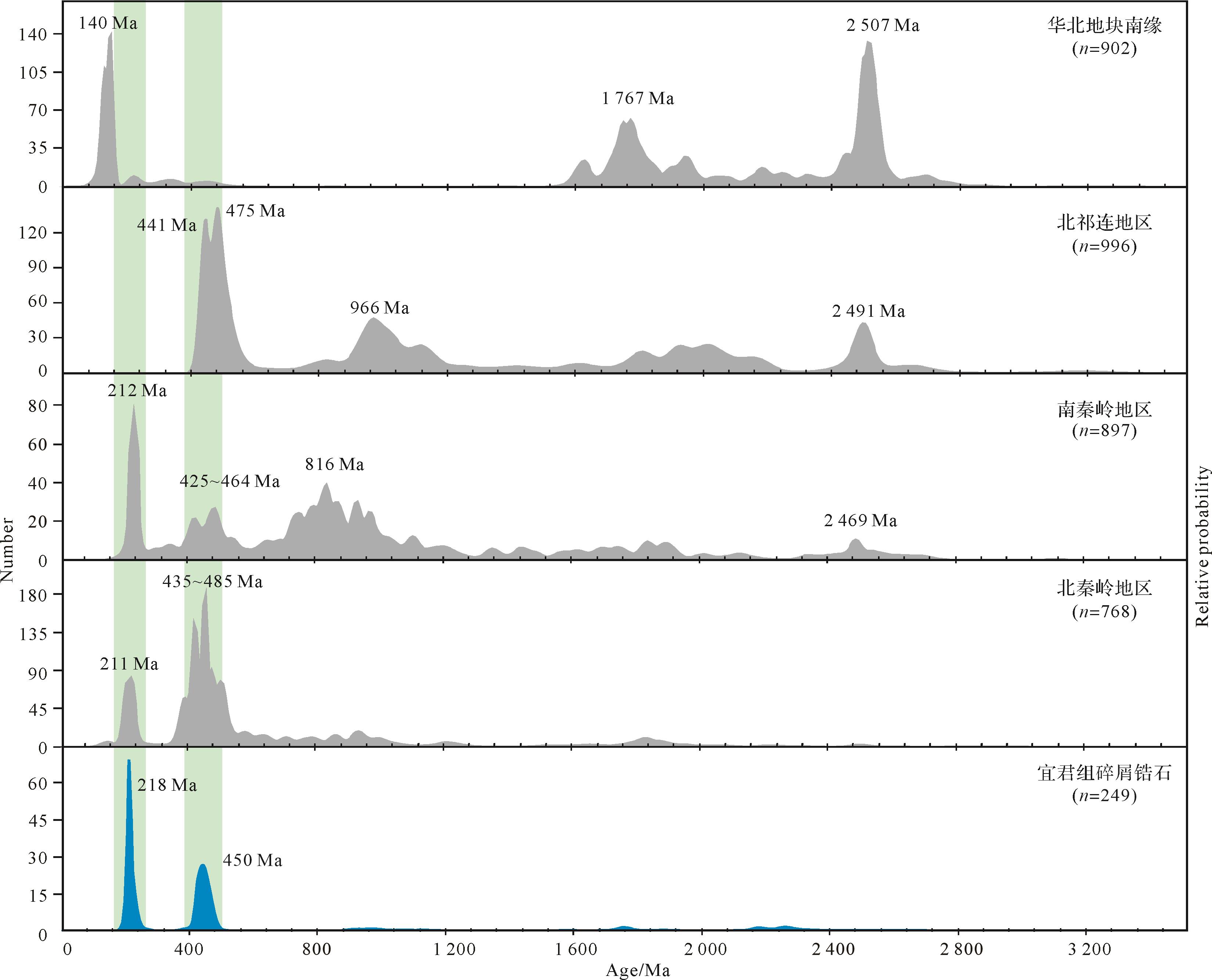
2023, 41(5): 1624-1634.
doi: 10.14027/j.issn.1000-0550.2022.090
Abstract:
Reconstruction of the lithological paleogeography is an important link for oil and gas exploration in carbonate reservoirs. To clarify the relationship between the paleogeography and distribution of natural gas in sub-member Ma54, Majiagou Formation, northwestern Ordos Basin, the lithology and lithofacies paleogeography were investigated by core observation, thin section identification, interpretation of mineral content in core logs, and “single-factor analysis and multifactor comprehensive mapping” The relationship between the lithological paleogeography and the presence of natural gas was then assessed by combining data of gas yield with the natural gas layer thickness. It was found that the main rock types in sub-member Ma54 are argillaceous dolostone, gypsum dolostone, dolomitic limestone and dolostone. The paleogeographical environment was divided into two facies:An evaporite platform and a restricted platform. Two subfacies in the former are mainly a dolomitic tidal flat and a gypsum-containing dolomitic tidal flat. The former occurs mainly in the northwestern and central parts of the study area; the latter, which reflects the development of a lagoon containing gypsum, occurs mainly in the central, eastern and southeastern areas. The gypsum-containing dolomitic flat in the evaporite platform is considered to have the greatest potential for natural gas retention.
Reconstruction of the lithological paleogeography is an important link for oil and gas exploration in carbonate reservoirs. To clarify the relationship between the paleogeography and distribution of natural gas in sub-member Ma54, Majiagou Formation, northwestern Ordos Basin, the lithology and lithofacies paleogeography were investigated by core observation, thin section identification, interpretation of mineral content in core logs, and “single-factor analysis and multifactor comprehensive mapping” The relationship between the lithological paleogeography and the presence of natural gas was then assessed by combining data of gas yield with the natural gas layer thickness. It was found that the main rock types in sub-member Ma54 are argillaceous dolostone, gypsum dolostone, dolomitic limestone and dolostone. The paleogeographical environment was divided into two facies:An evaporite platform and a restricted platform. Two subfacies in the former are mainly a dolomitic tidal flat and a gypsum-containing dolomitic tidal flat. The former occurs mainly in the northwestern and central parts of the study area; the latter, which reflects the development of a lagoon containing gypsum, occurs mainly in the central, eastern and southeastern areas. The gypsum-containing dolomitic flat in the evaporite platform is considered to have the greatest potential for natural gas retention.