2022 Vol. 40, No. 3
Display Method:
2022, 40(3): 573-598.
doi: 10.14027/j.issn.1000-0550.2021.003
Abstract:
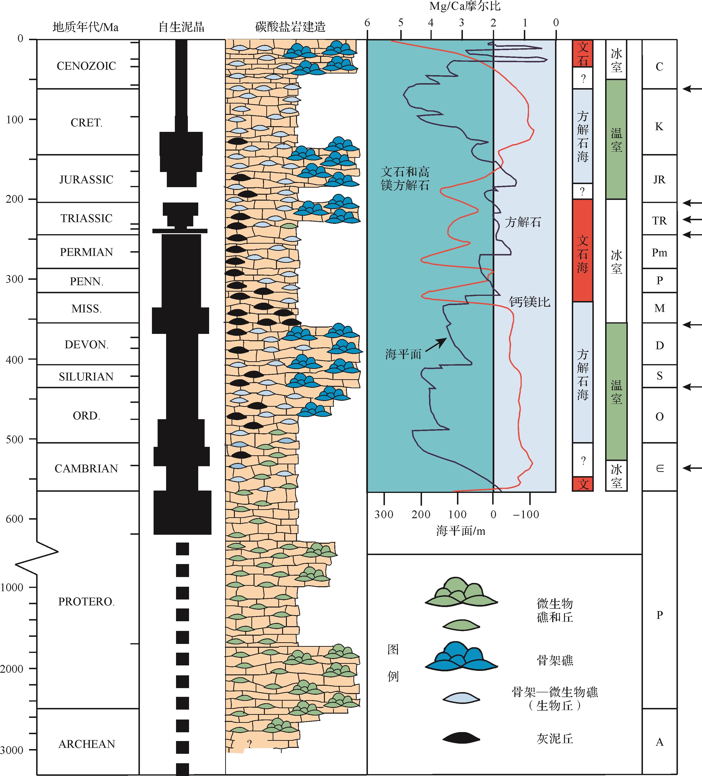
The term ‘automicrites’, also known as in situ microcrystalline Ca-carbonate, or
2022, 40(3): 599-615.
doi: 10.14027/j.issn.1000-0550.2021.049
Abstract:
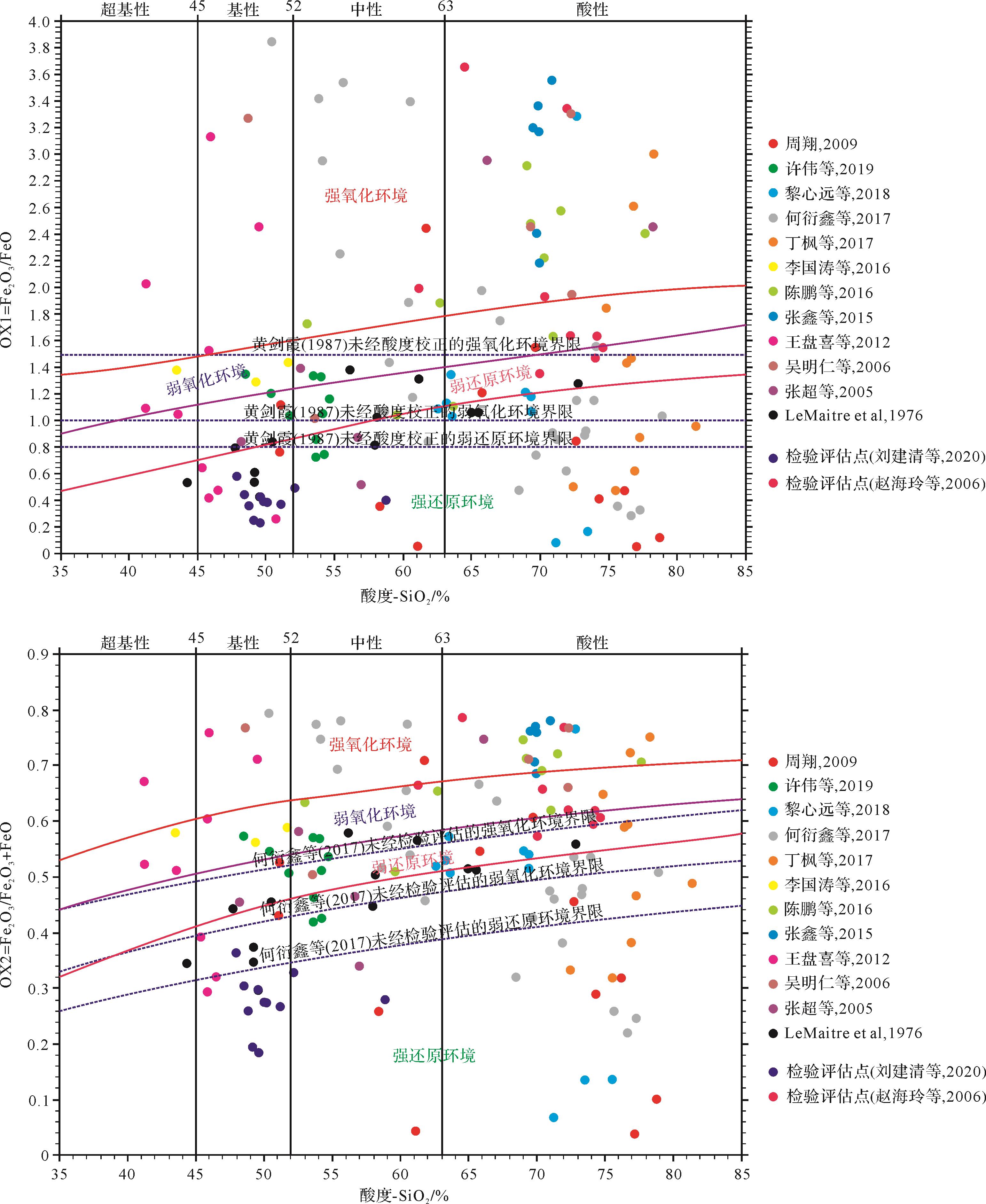
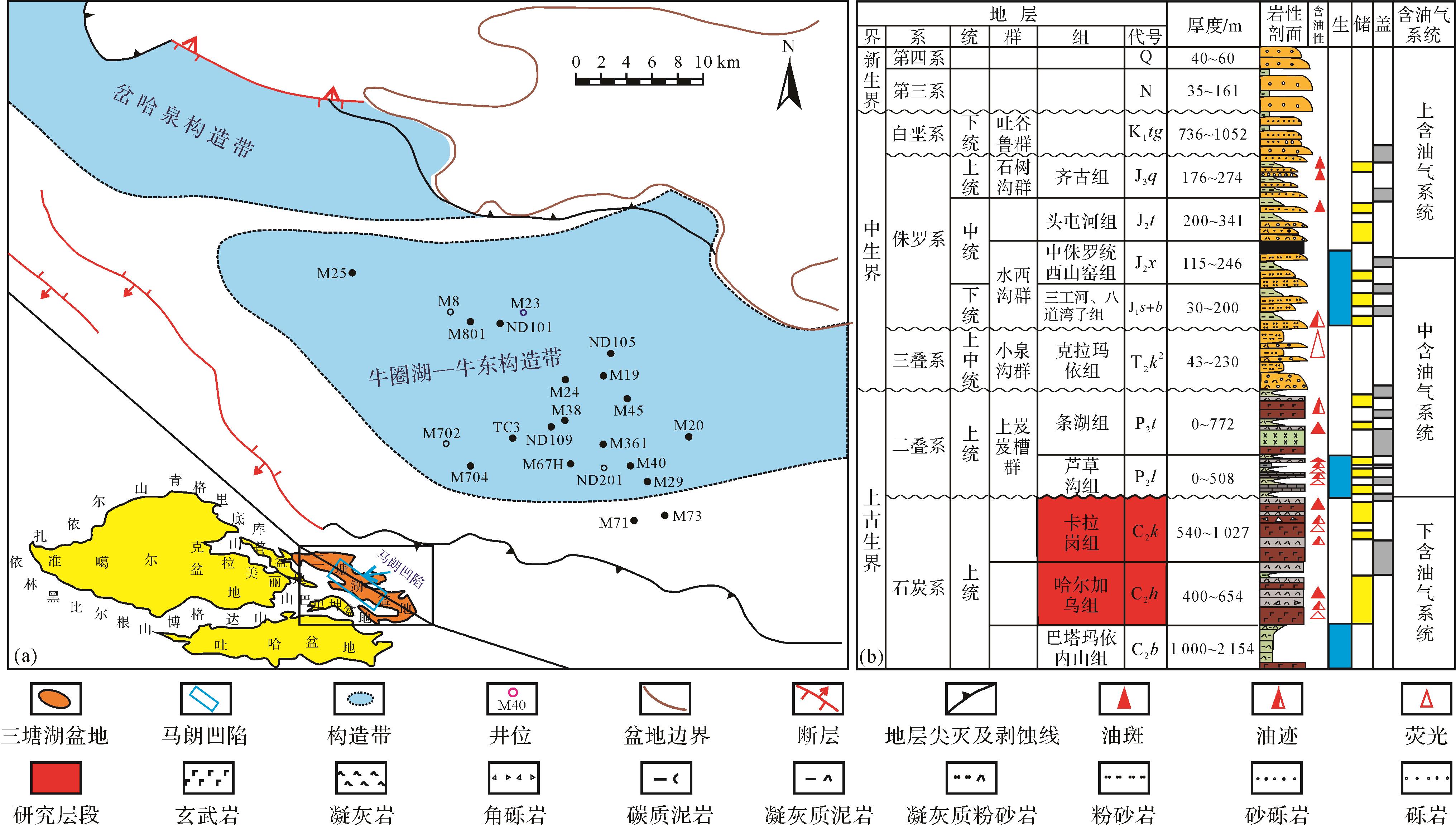
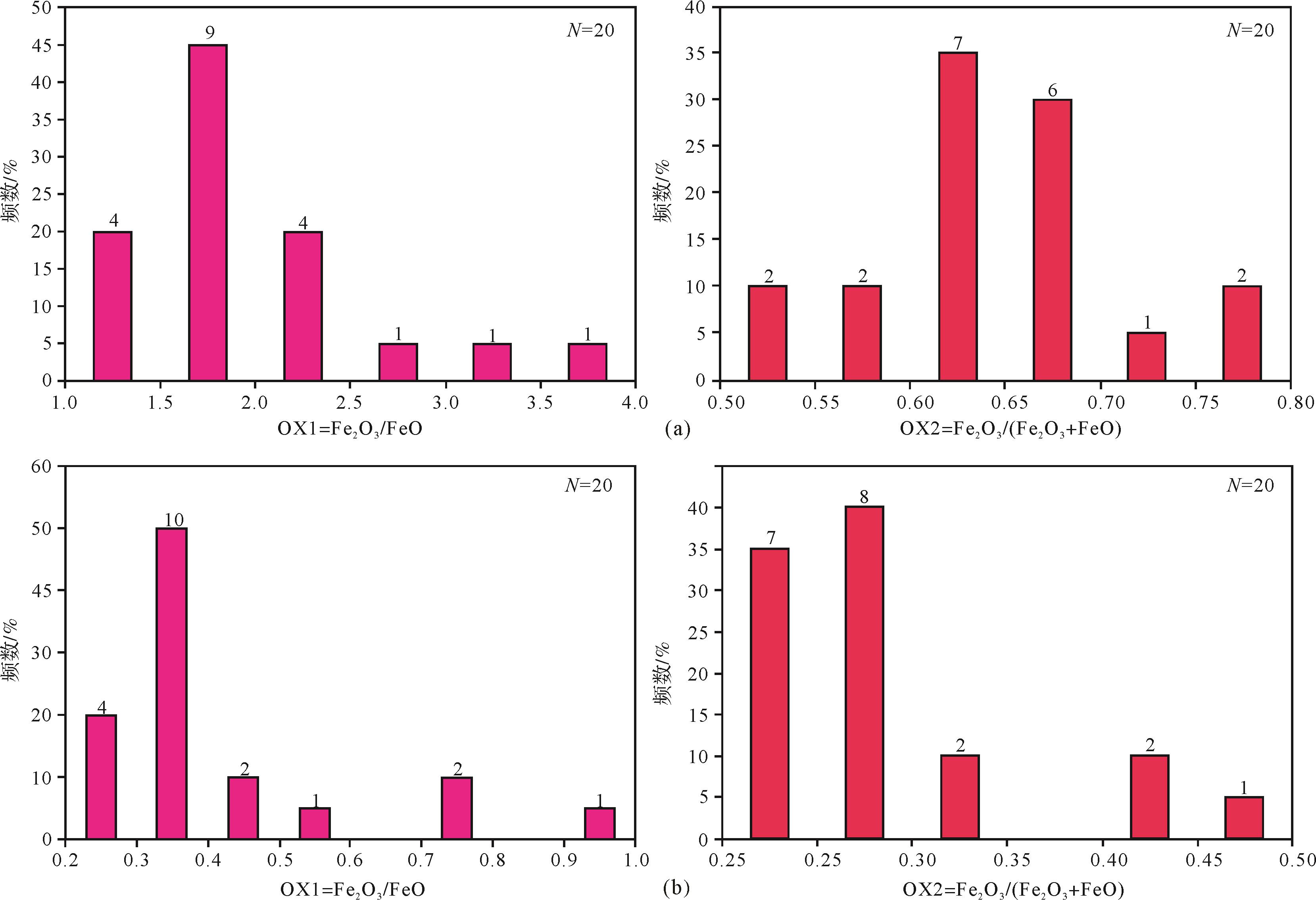
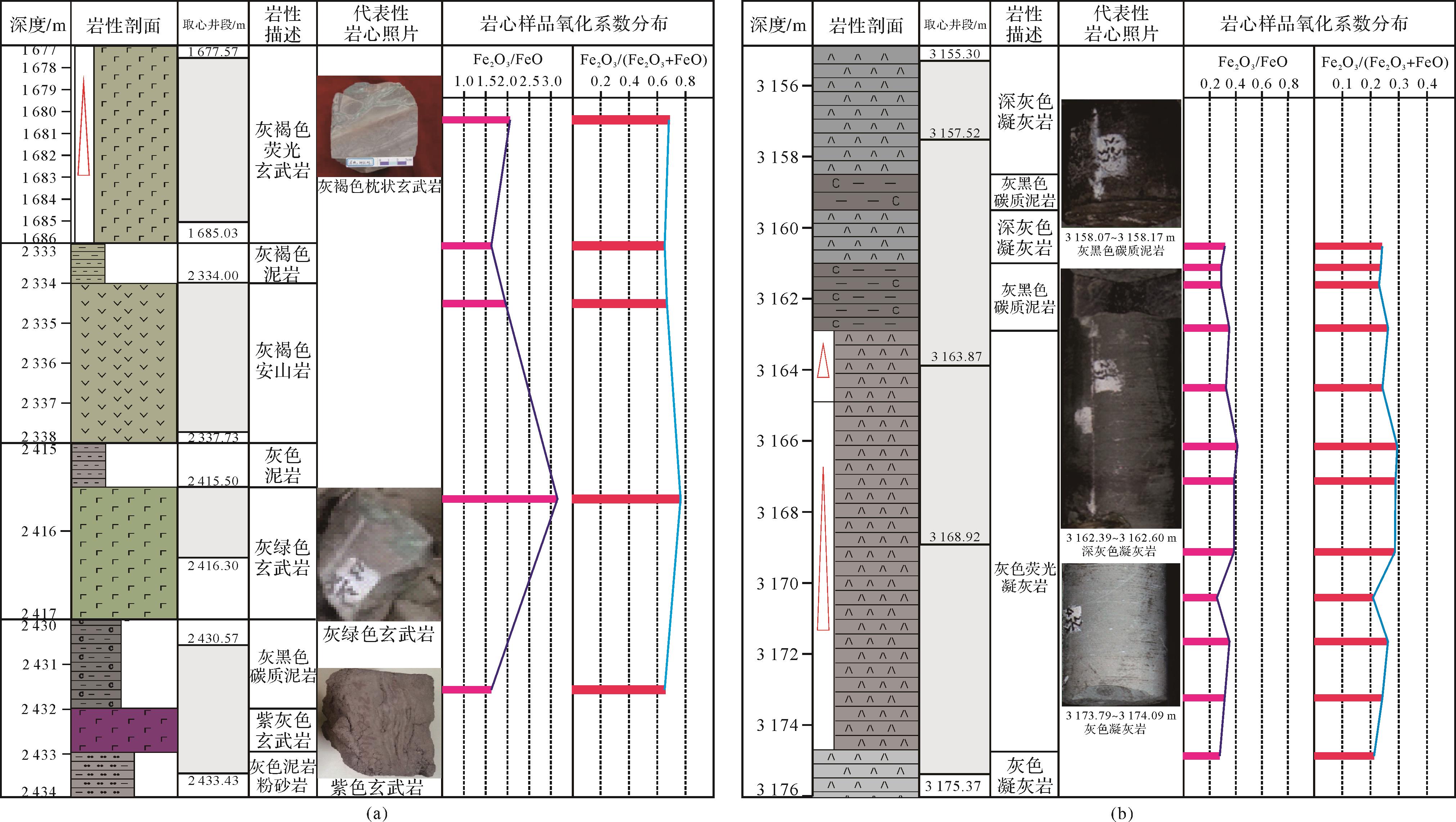
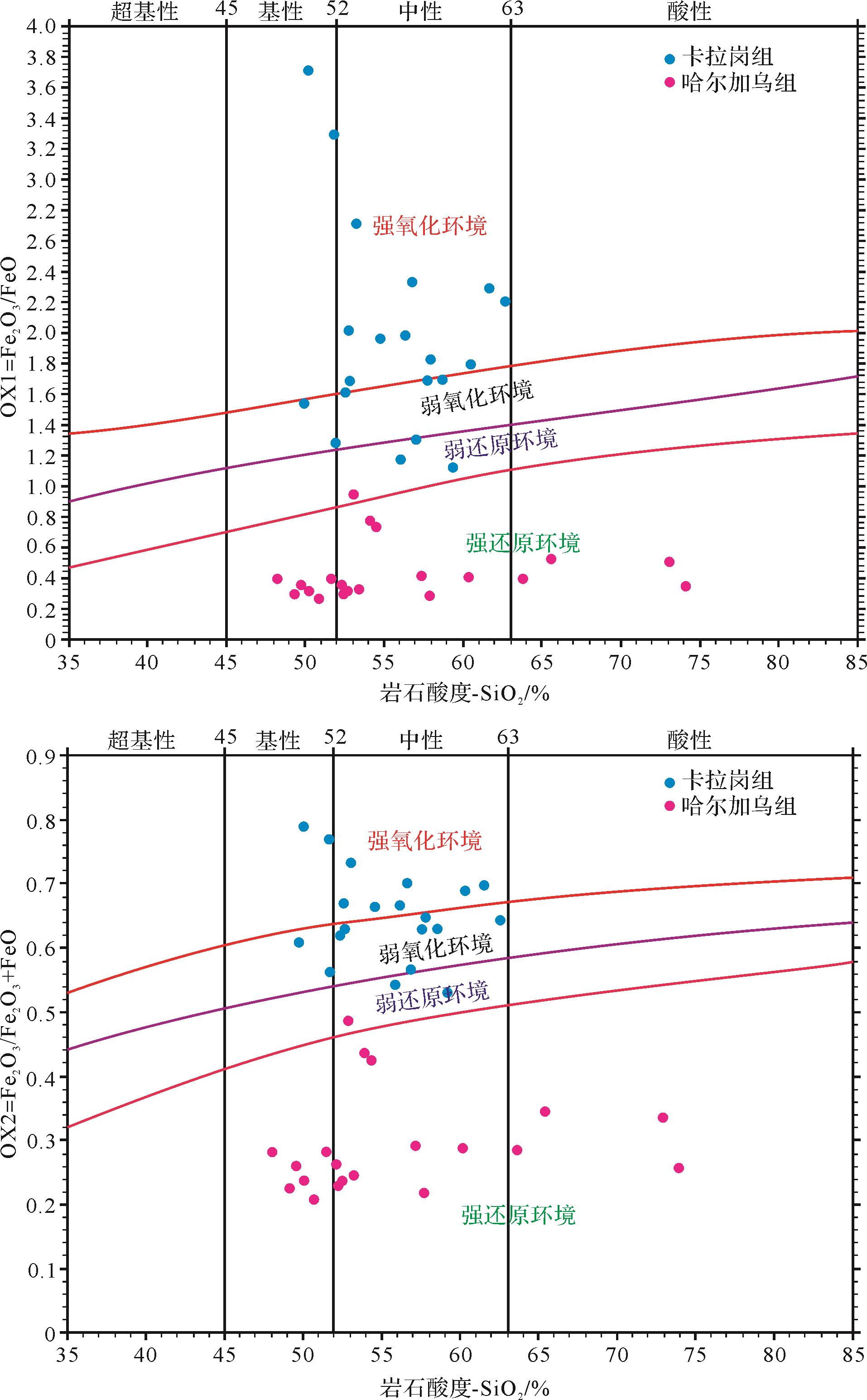
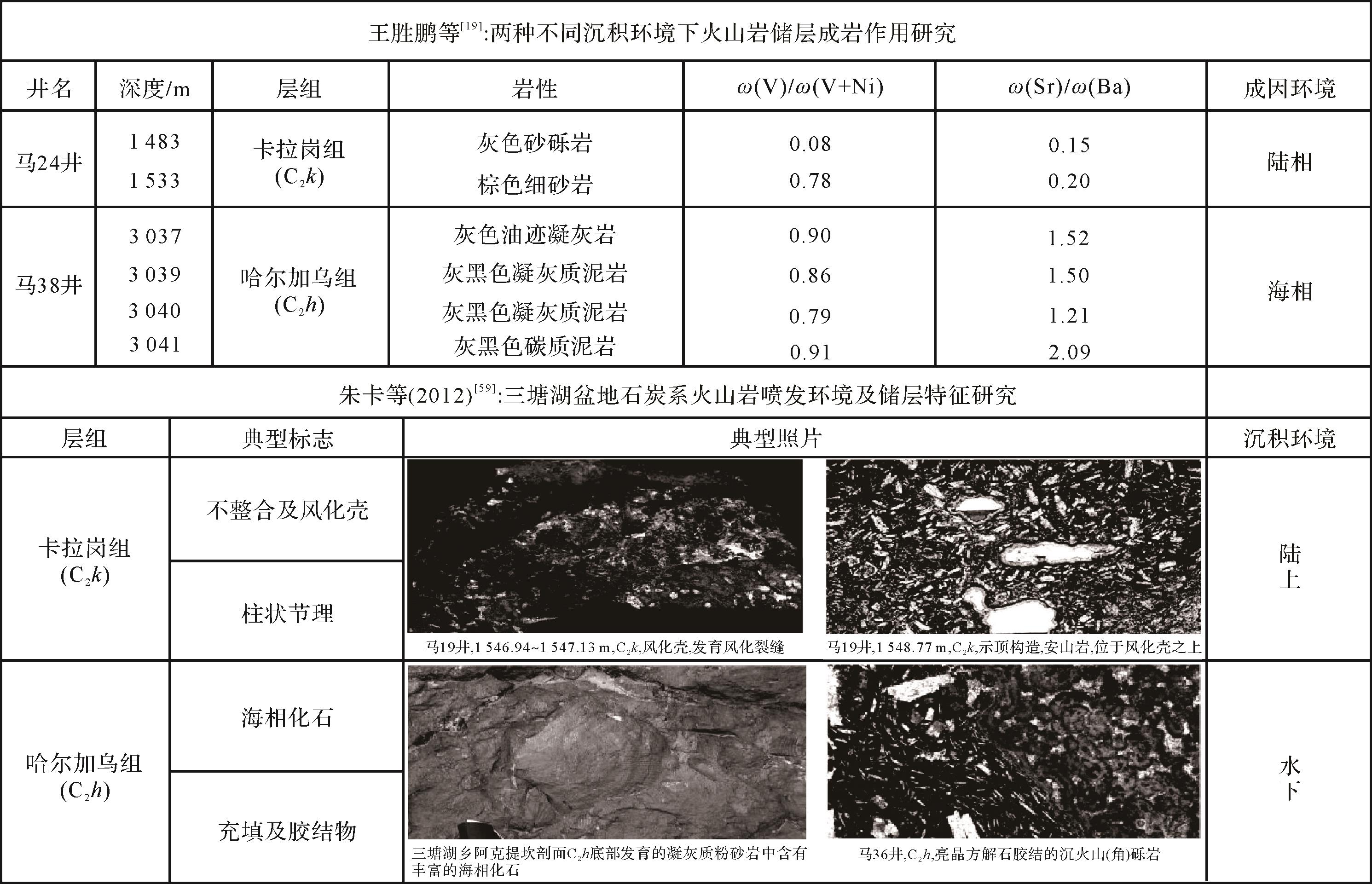
Paleogeographic environment is one of the key factors controlling the development of volcanic oil and gas reservoirs.At present, the research on the discrimination between terrestrial and underwater eruptive sedimentary volcanic rocks mainly focuses on the characteristics of lithologic association, structural structure, alteration, occurrence, pore and fracture development,however, the study of using geochemical characteristics of volcanic rocks to reflect and record volcanic eruption environment has not been paid attention to.In this study, Fe2O3/FeO and Fe2O3/(Fe2O3+FeO) are used as the oxidation coefficients of volcanic rocks, and the influence of rock acidity, weathering leaching, dissolution and alteration, tectonic background and other factors are fully considered, which improves the traditional discrimination standard of volcanic eruption environment based on the oxidation coefficient of volcanic rocks.The results of practical application in Malang Sag of Santanghu Basin, Xinjiang show that,the sedimentary environment of volcanic eruption in Kalagang Formation is complex, which is mainly land oxidation environment, and the complex environment of frequent water land alternation also exists,and the eruptive deposits of the volcanic rocks in the Haerjiawu Formation are relatively single, and they are mainly deposited in an underwater reducing environment; the results are consistent with those obtained by predecessors on the basis of the combination of volcanic paragenetic rocks and fossils, weathering crust and trace element ratio characteristics of some mudstones sandwiched by volcanic rocks,also this geochemical method is universal,the Identification map can be used to distinguish the paleogeographic environment of volcanic eruption deposits in different basins and geological ages.
2022, 40(3): 616-625.
doi: 10.14027/j.issn.1000-0550.2021.015
Abstract:
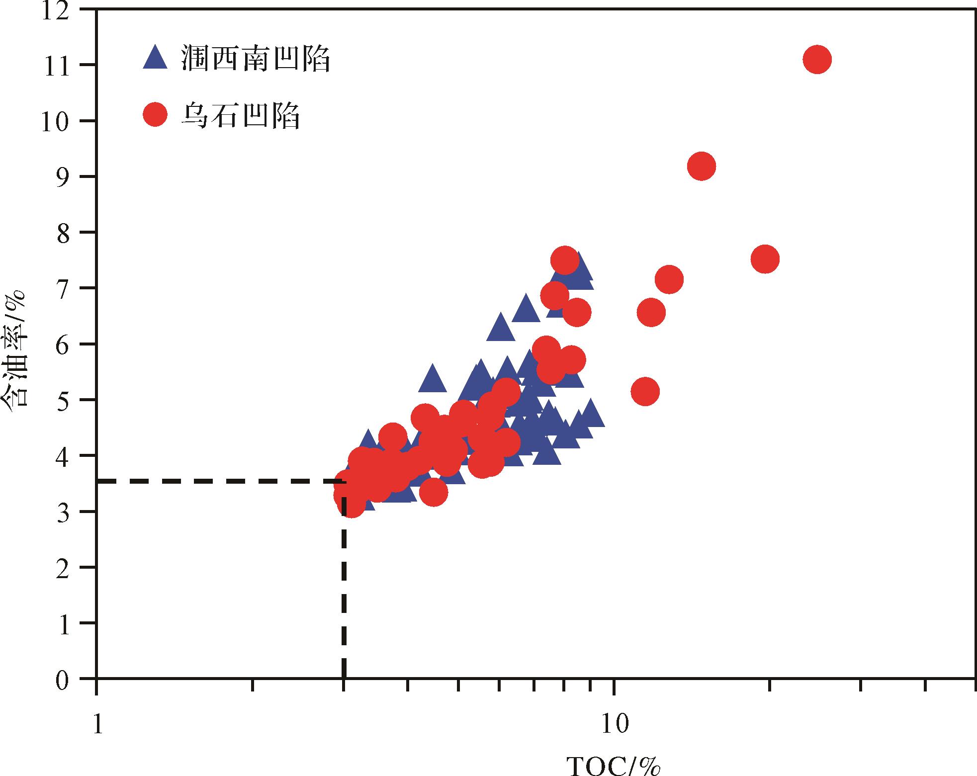
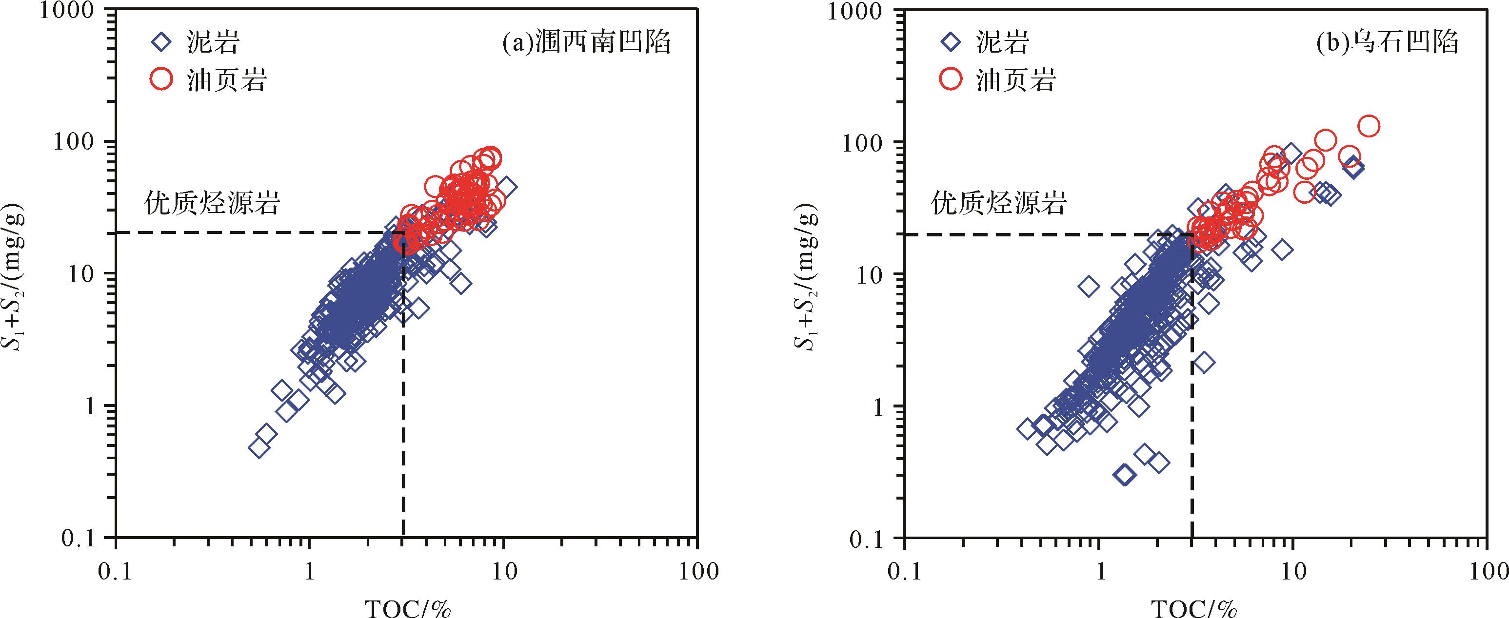
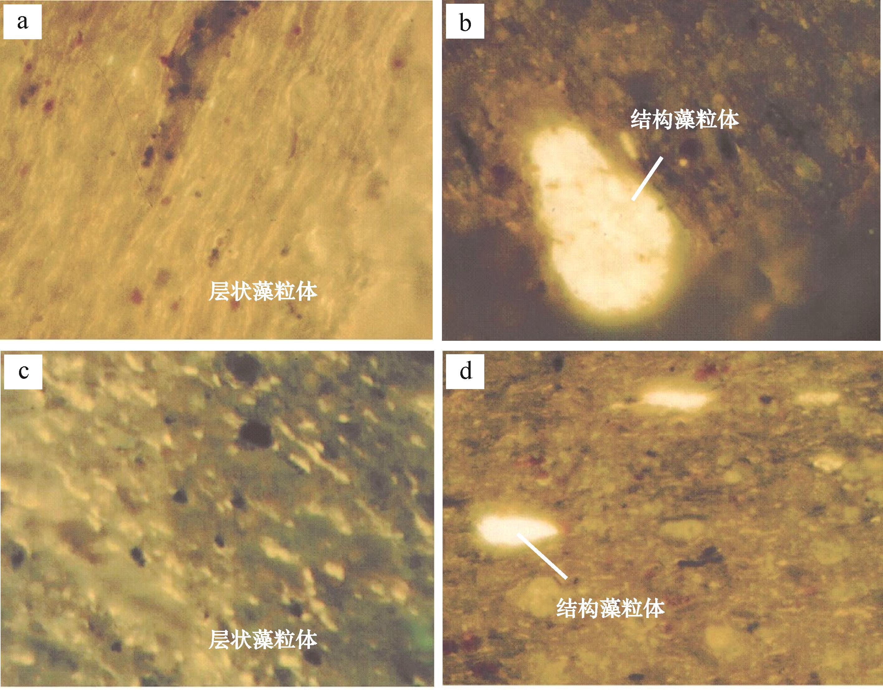
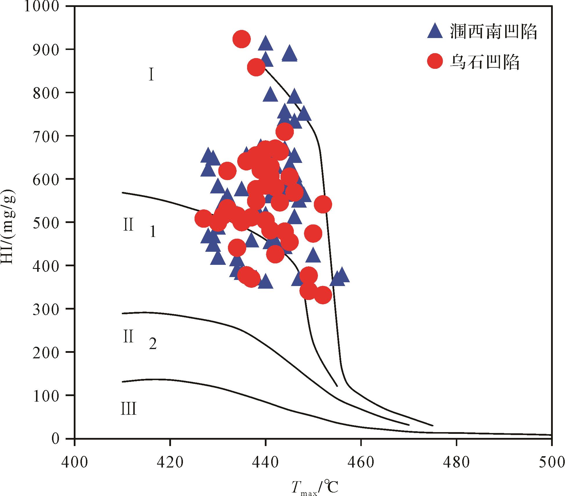
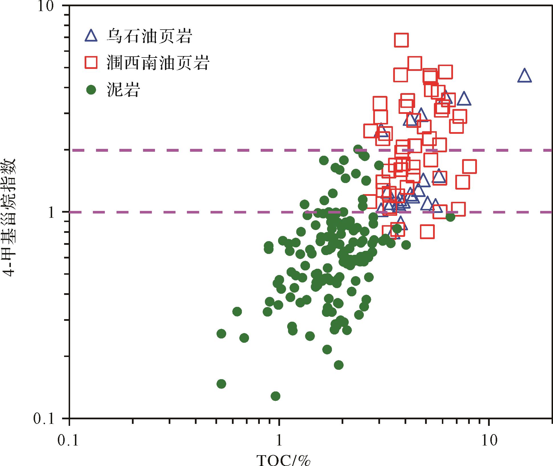
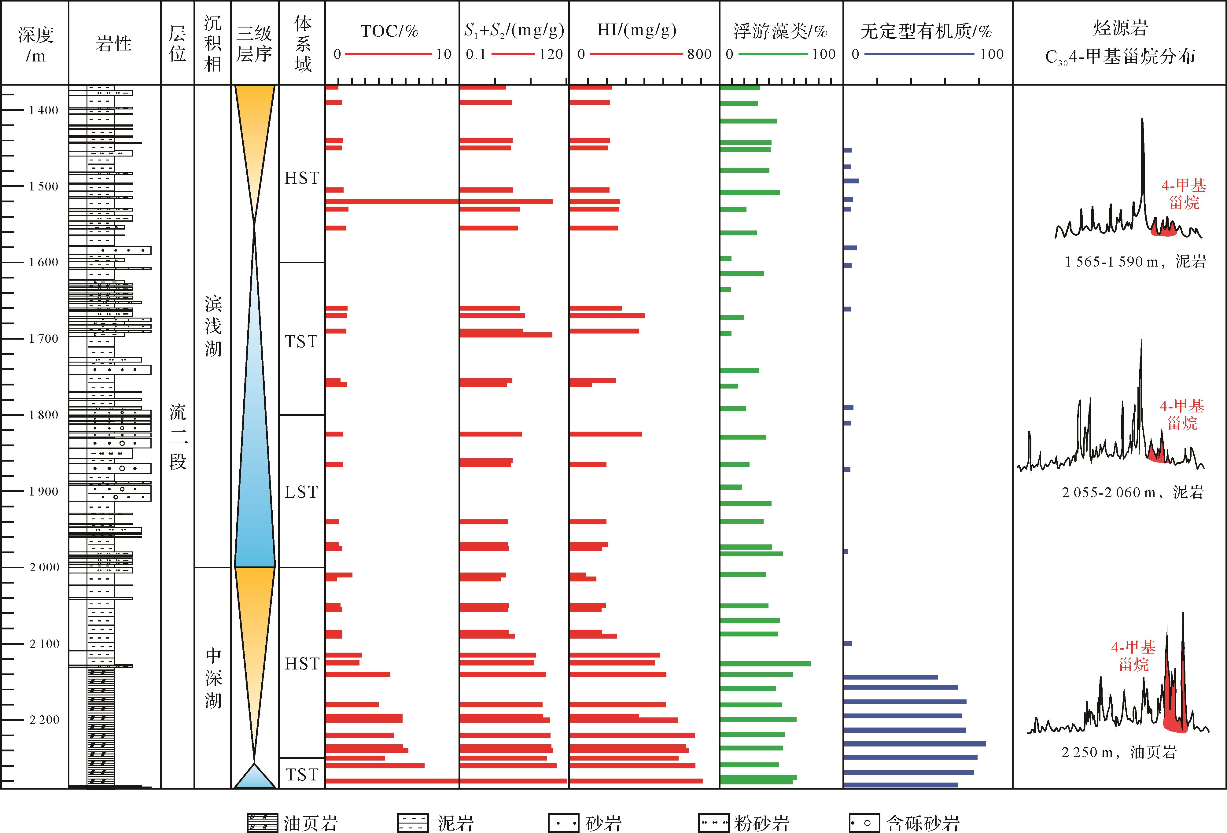
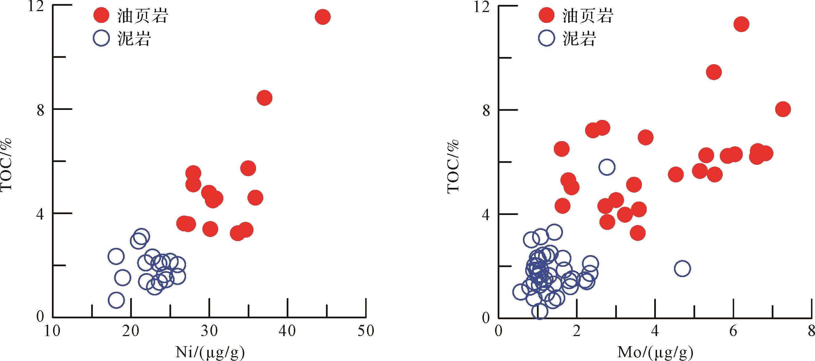
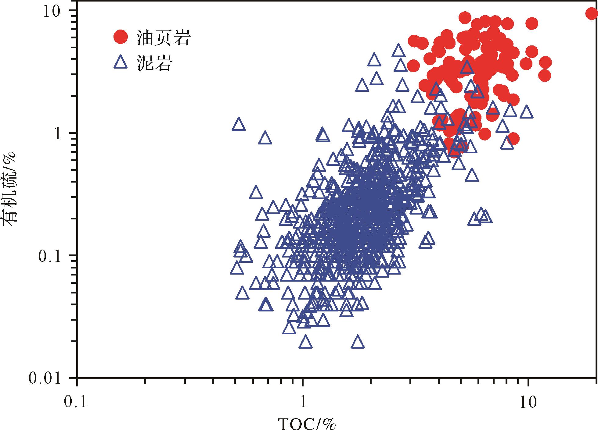
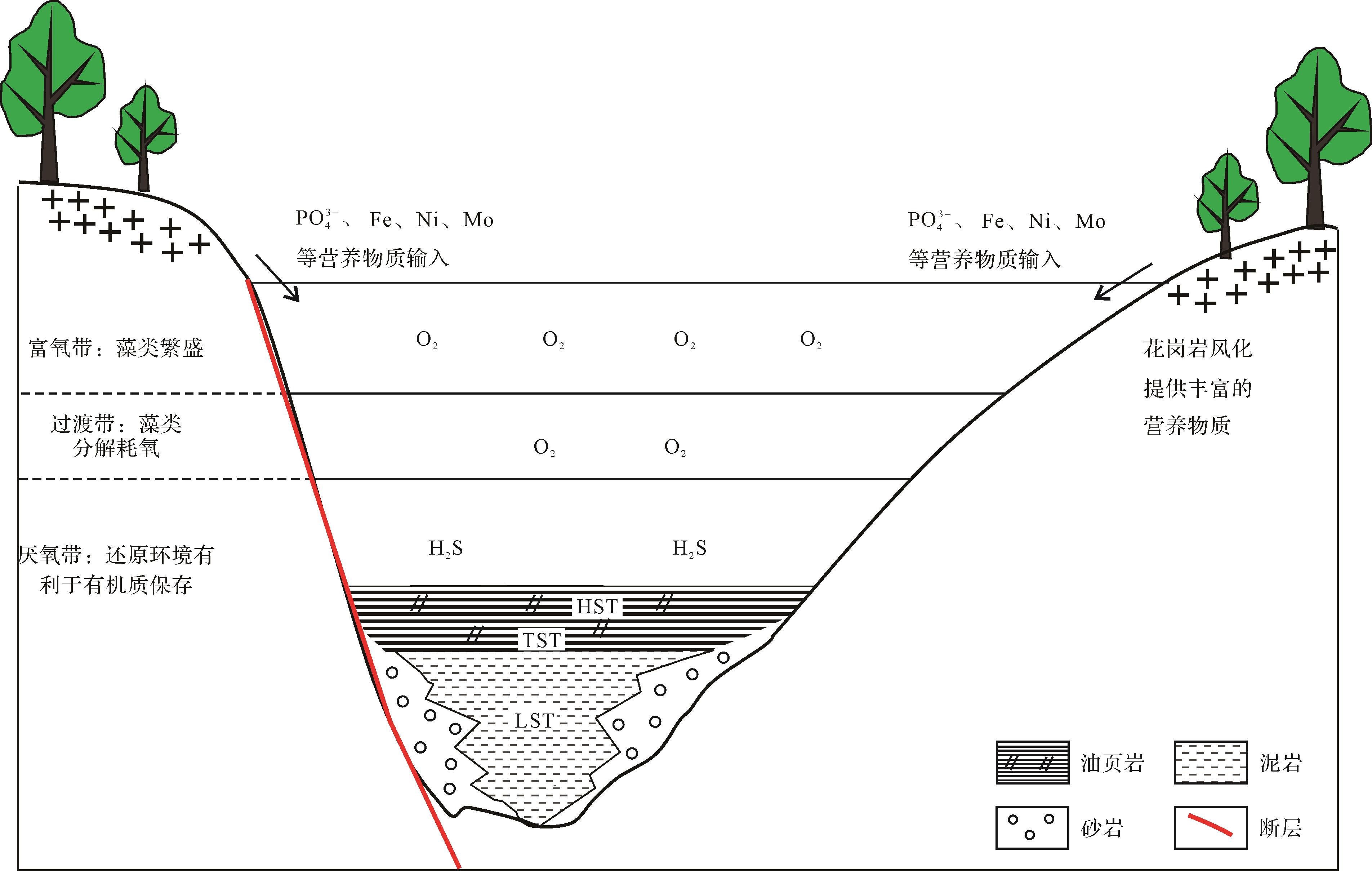
Oil shale is widely developed in Member 2 of Liushagang Formation of the Weixinan Sag and Wushi Sag in the Beibuwan Basin. Organic geochemical analysis shows that oil shale in Member 2 contains an abundance of organic matter. The lower limit of TOC for oil shale is 3%, and the oil yield is between 3.5% and 10%, reaching the middle and high quality oil shale ore grade, and they are also an excellent source rock. Whole-rock organic maceral, kerogen microscopy and pyrolysis analysis show that this oil shale is rich in algae, which are the main source of organic matter. Most of the organic matter is humic⁃sapropel type, with some being sapropel type. The humic⁃sapropel and sapropel oil shale are both lacustrine. The contents of trace elements such as Ni and Mo in oil shale are generally high, with a positive correlation with the organic carbon content, all showing that the characteristics of a eutrophic lake during the formation of the oil shale. The geochemical indicators such as the reduced sulfur content show that it formed in a reducing sedimentary environment with good organic matter preservation conditions. The high organic matter productivity and the reducing environment of the middle and deep lakes at the top of TST and bottom of HST controlled the development of oil shale in Member 2 of Liushagang Formation in Beibuwan Basin.
2022, 40(3): 626-640.
doi: 10.14027/j.issn.1000-0550.2021.045
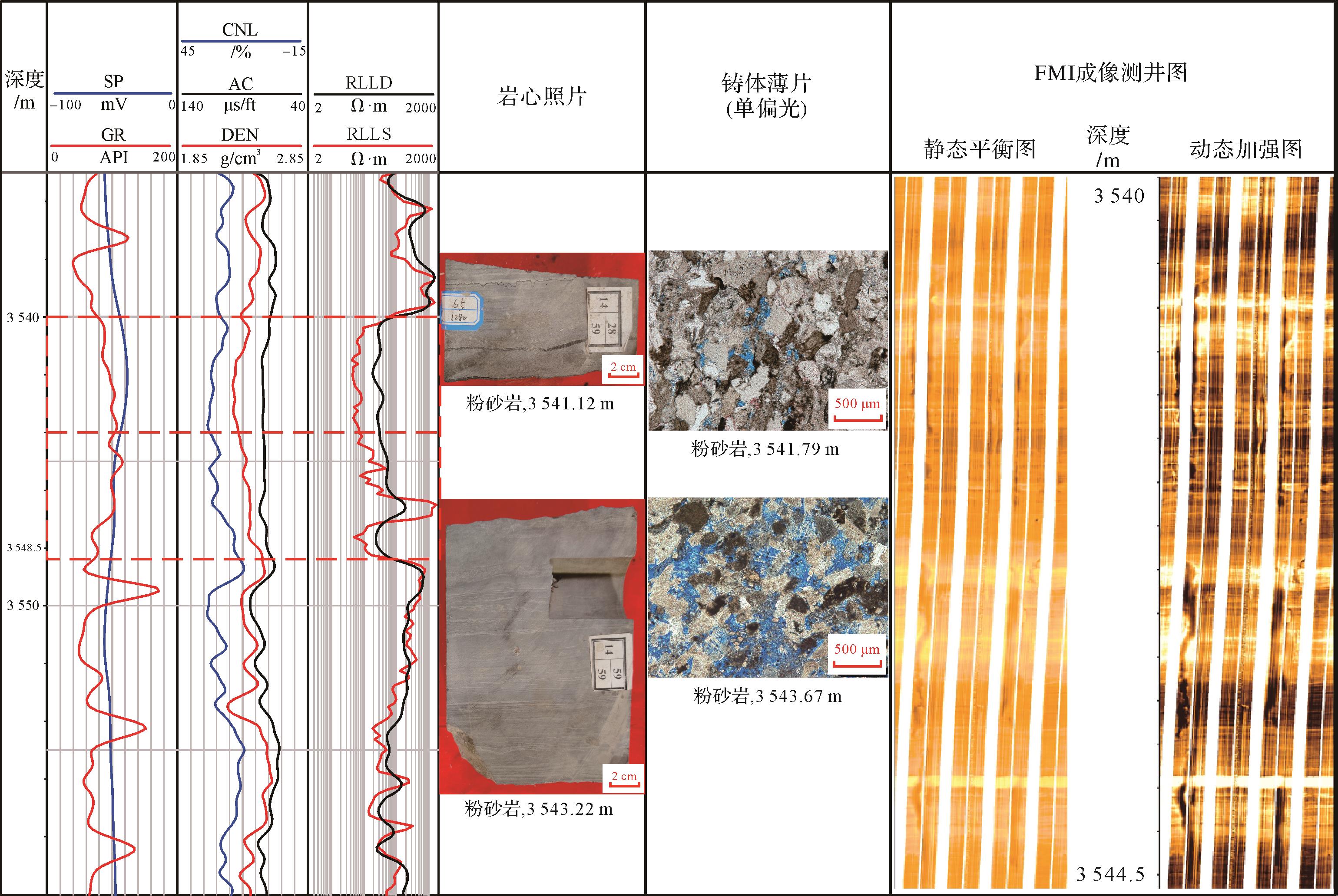
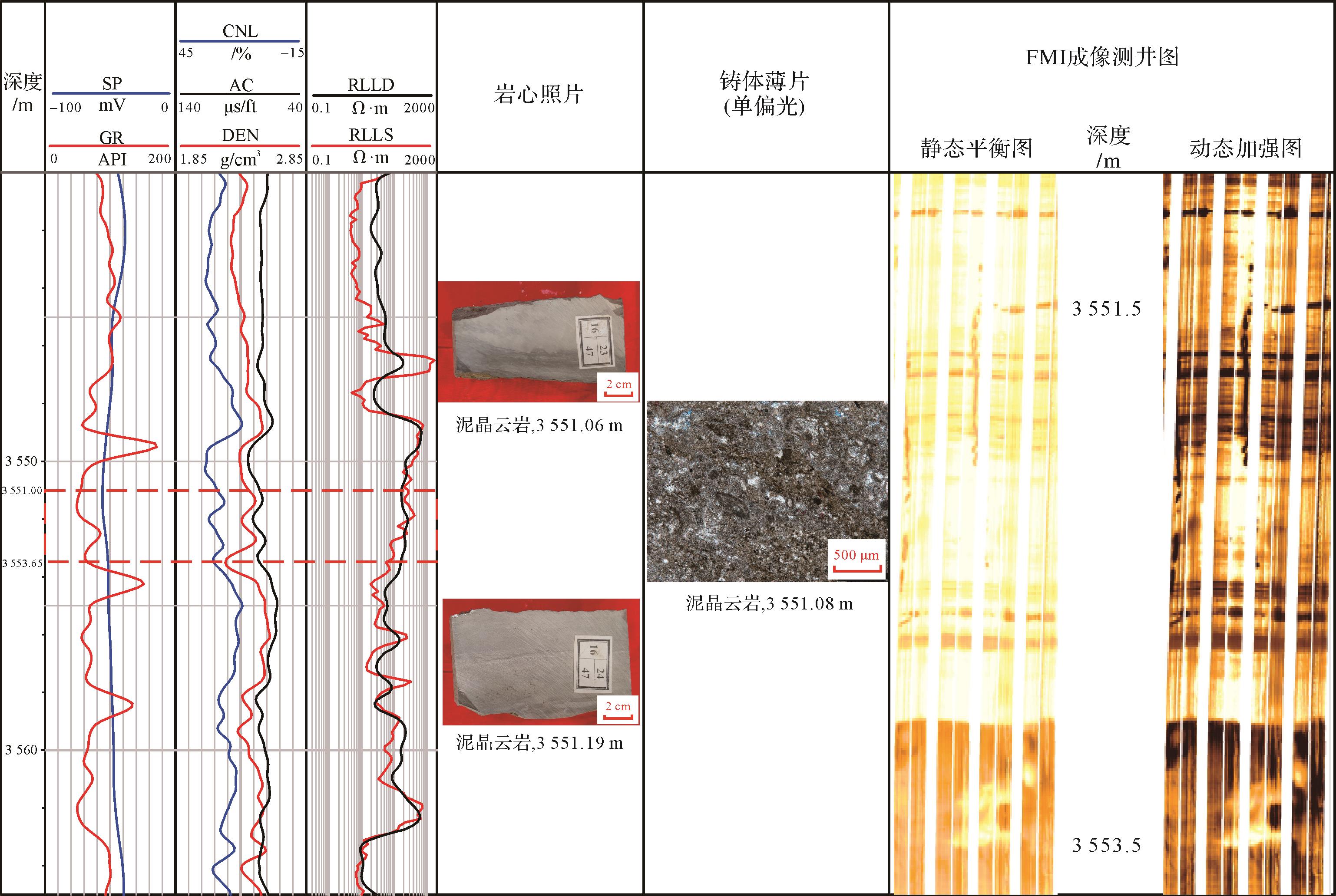
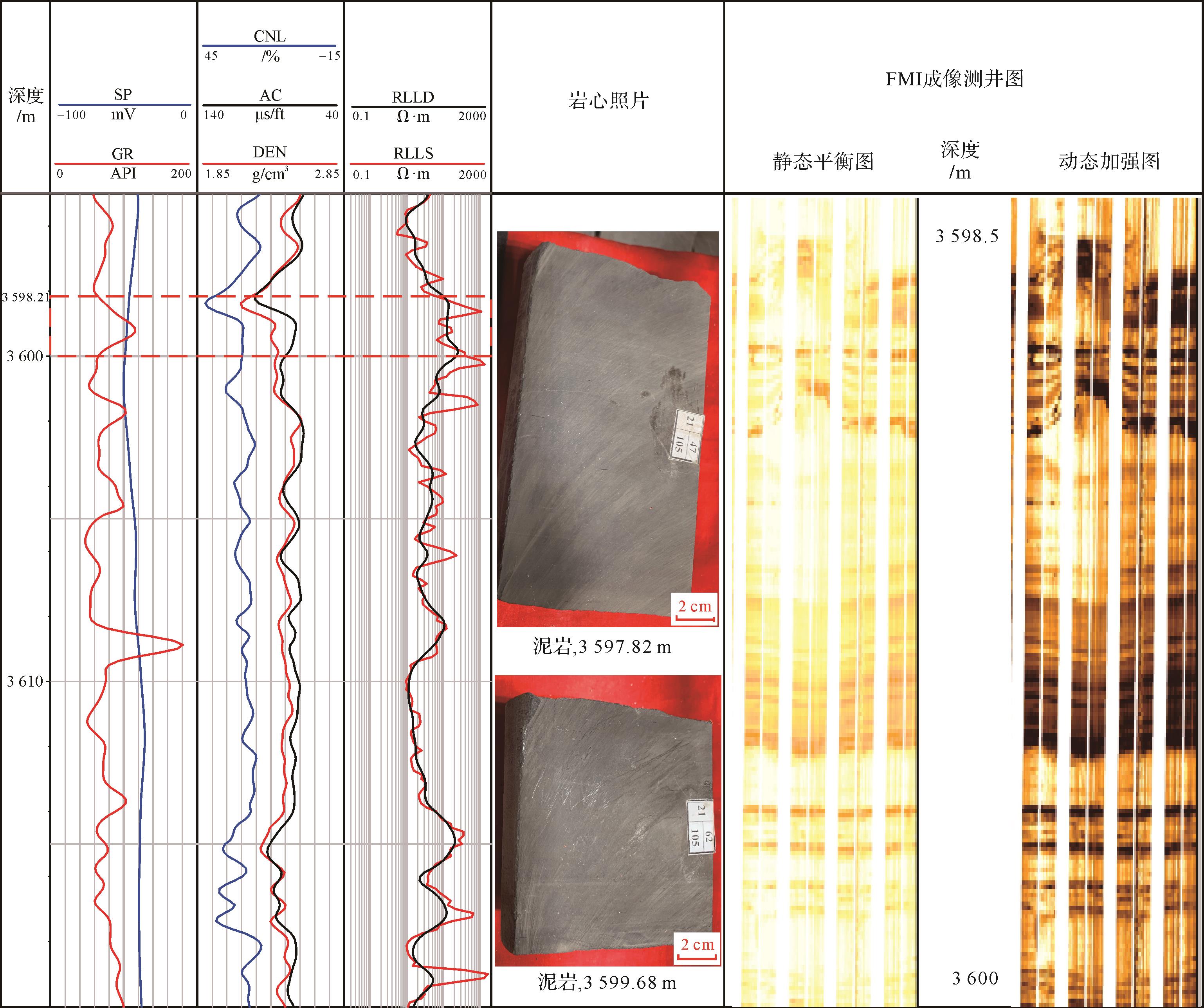
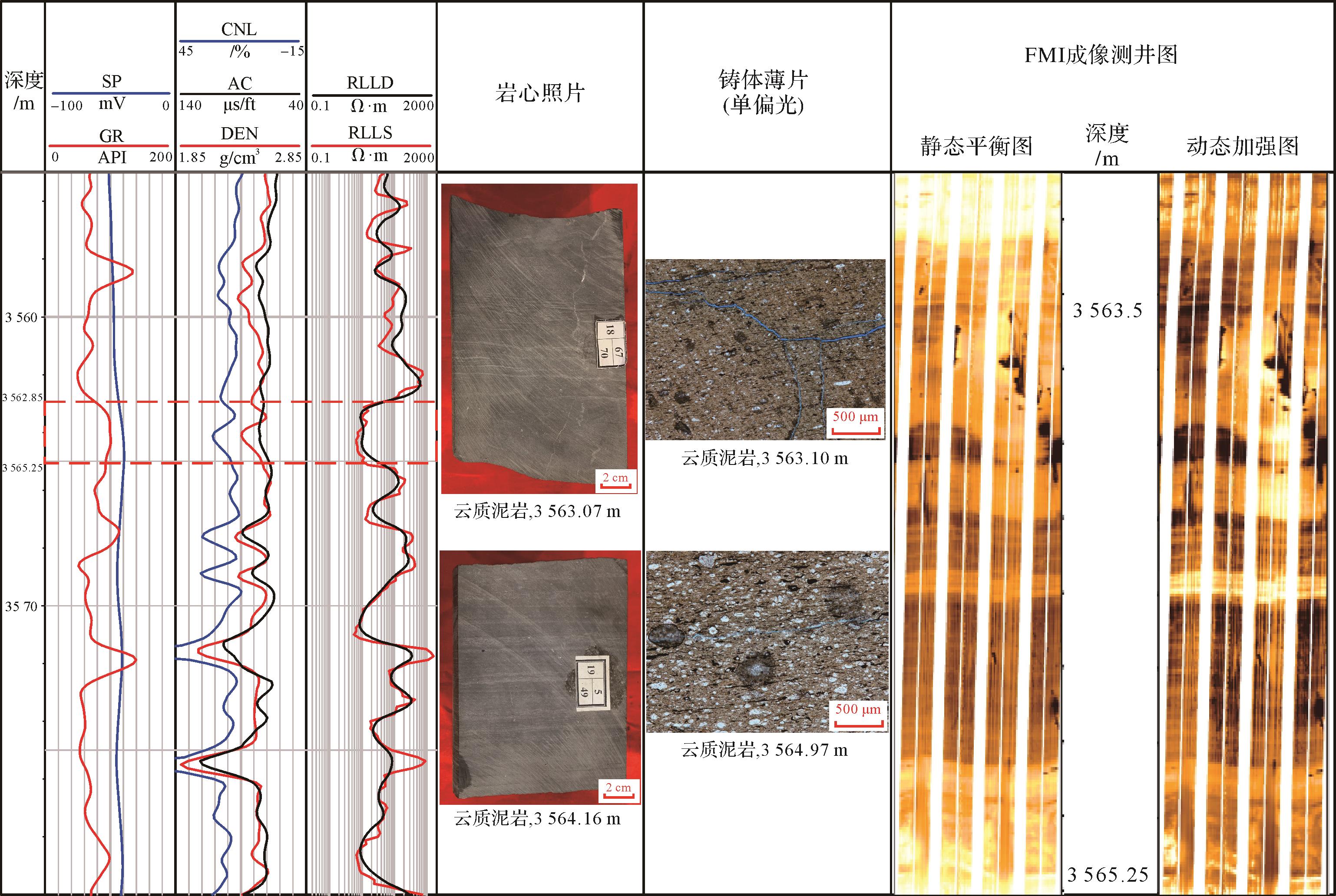
Abstract:
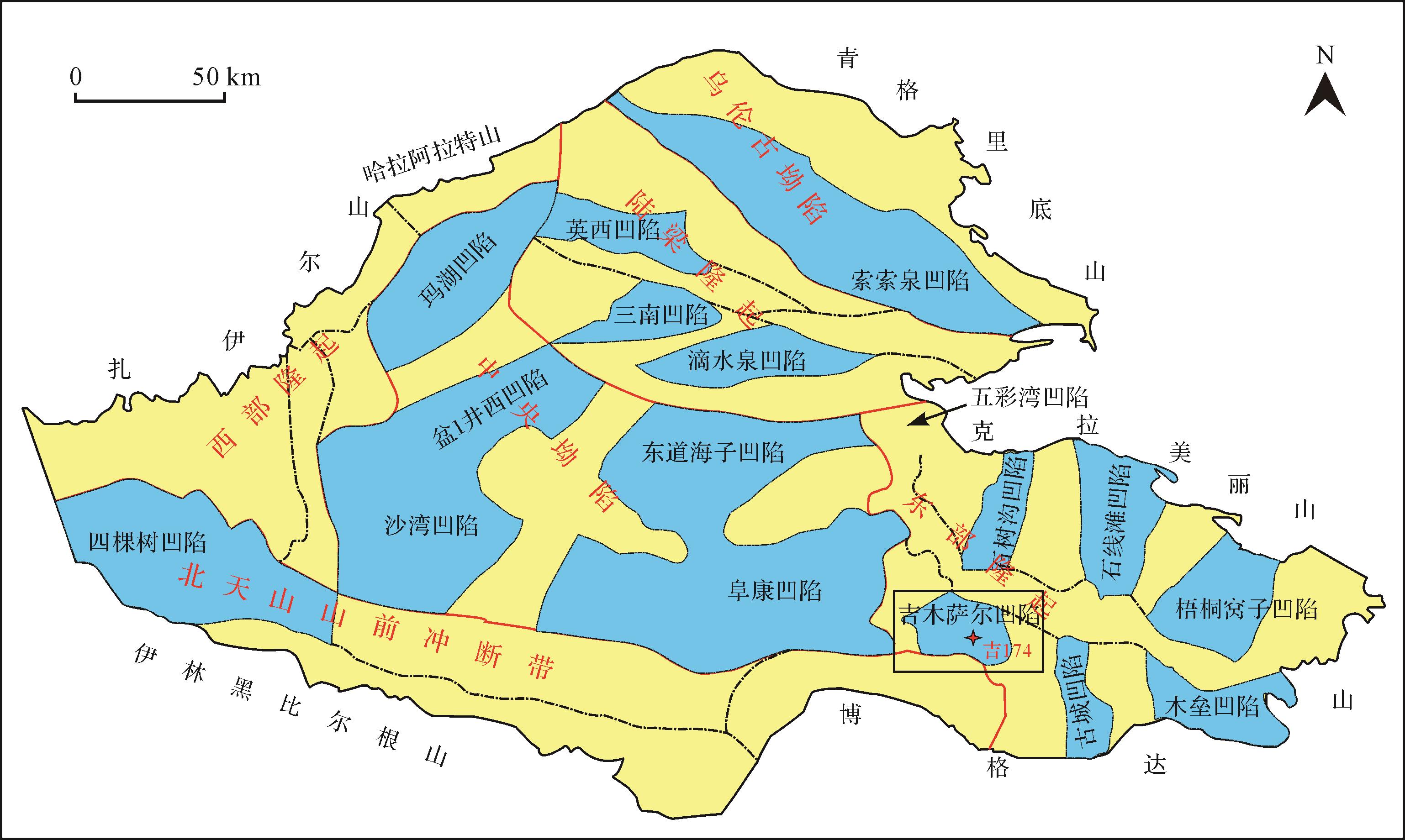
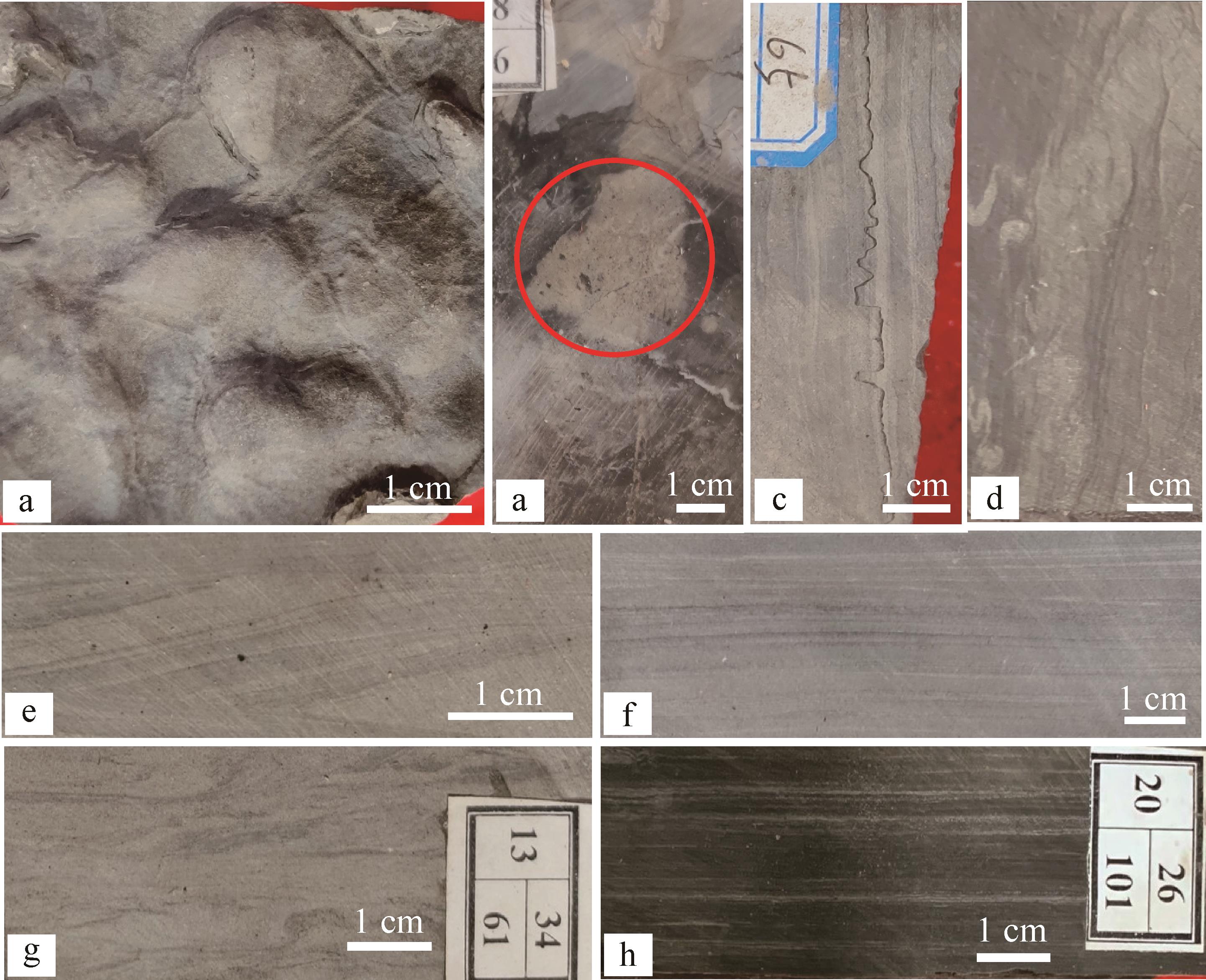
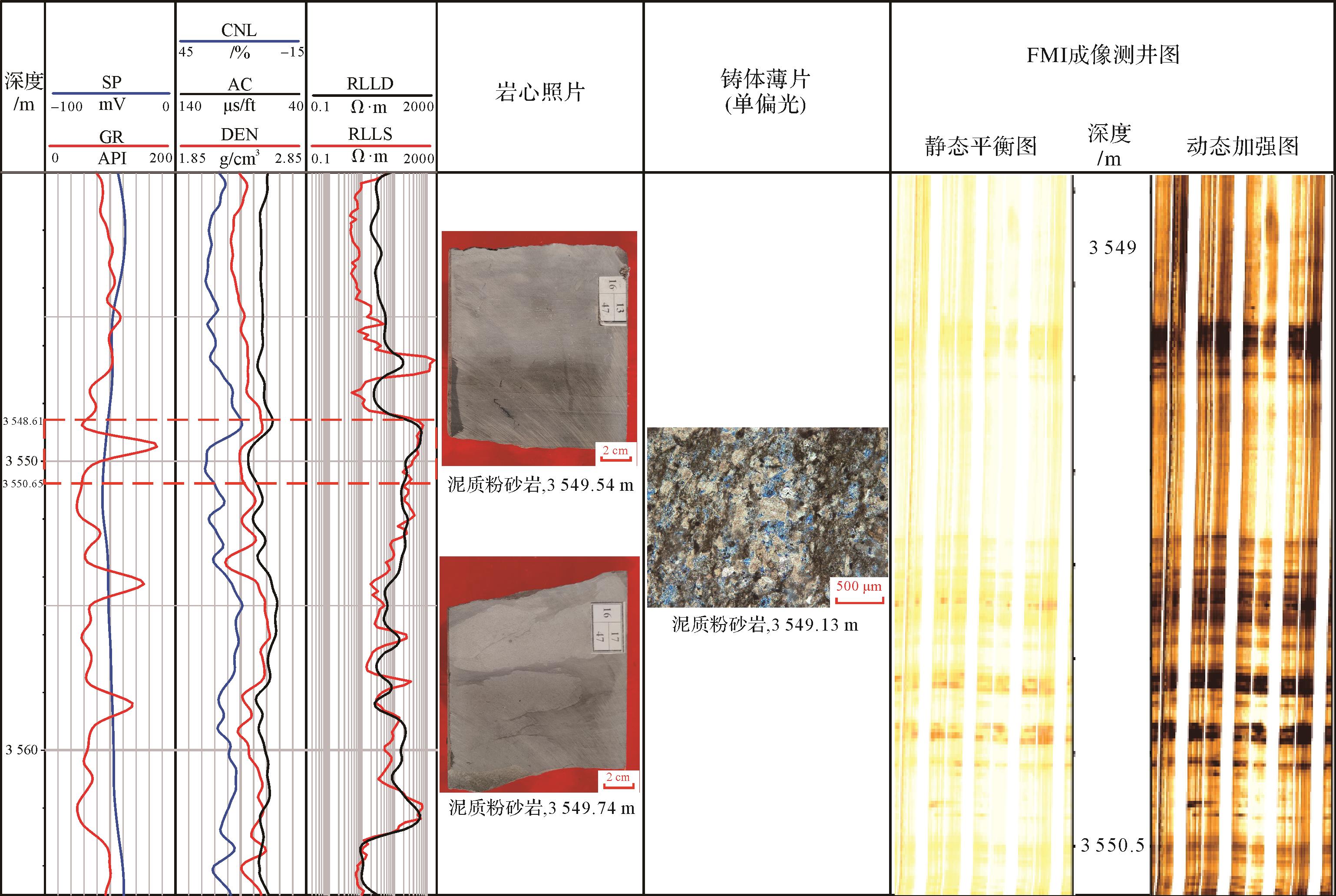
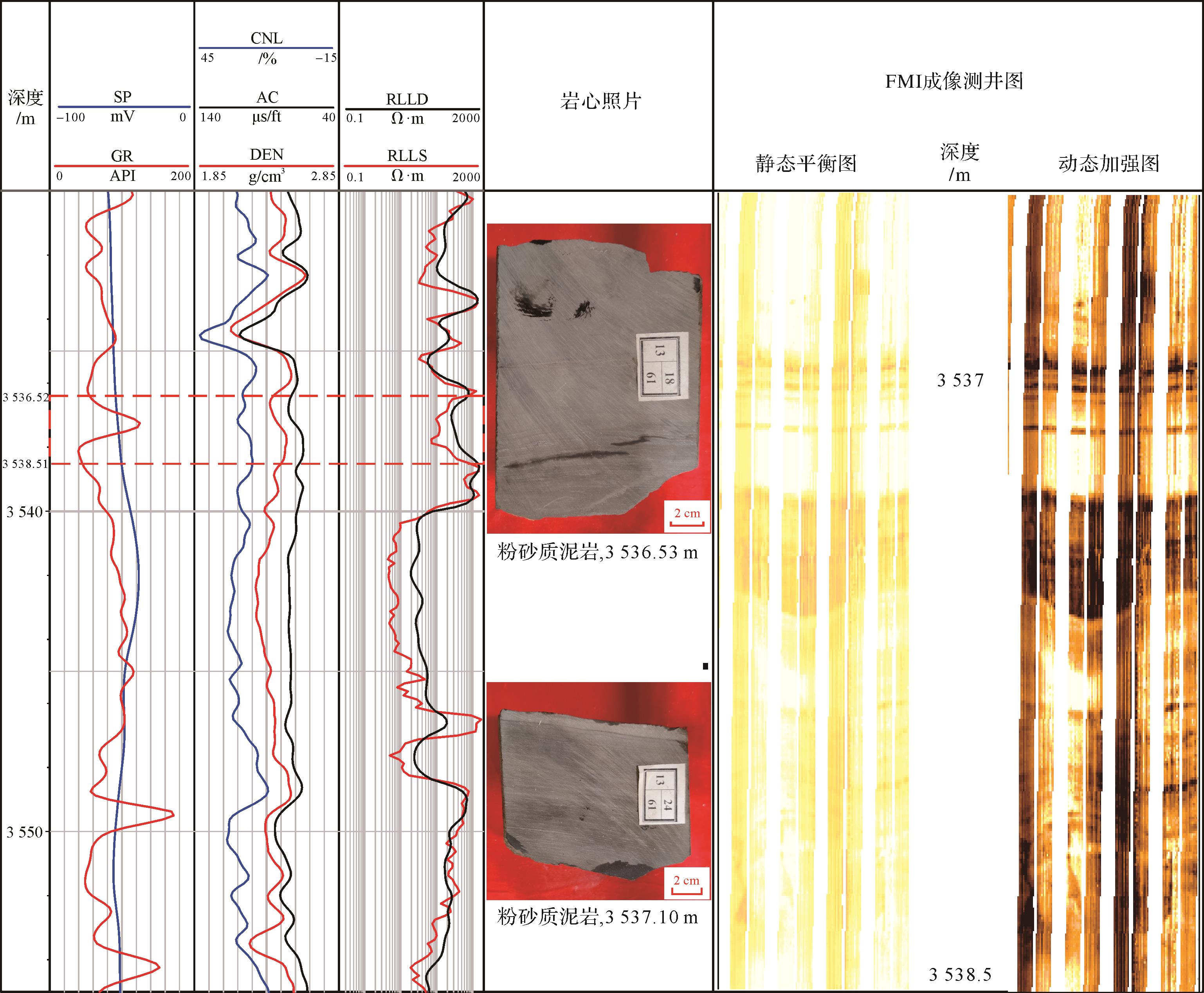
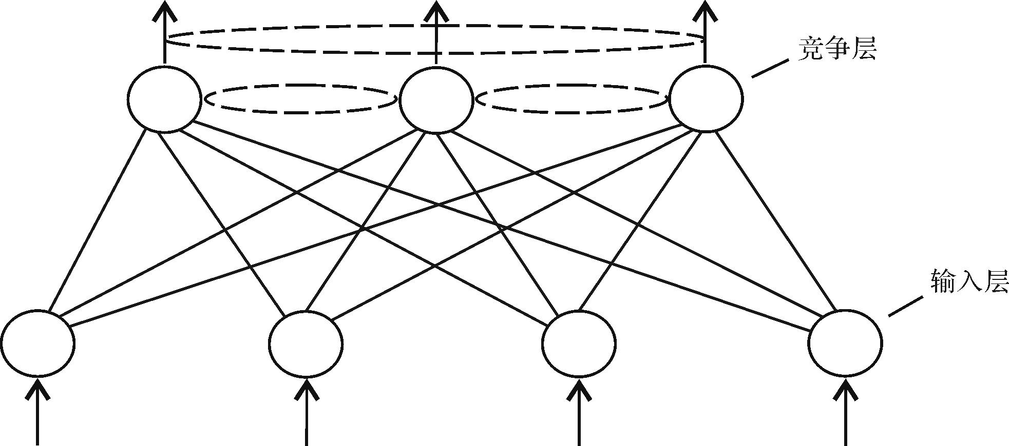
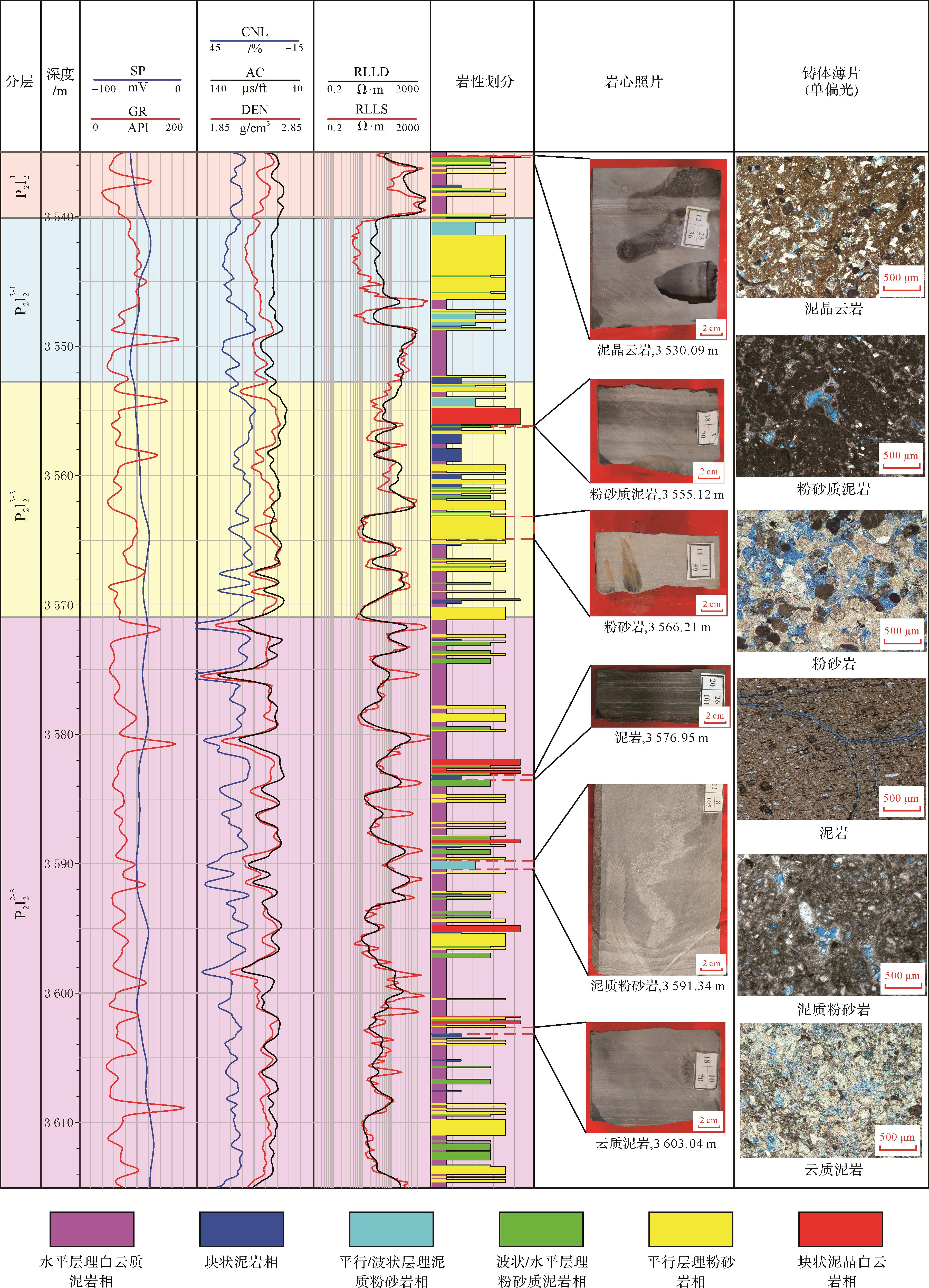
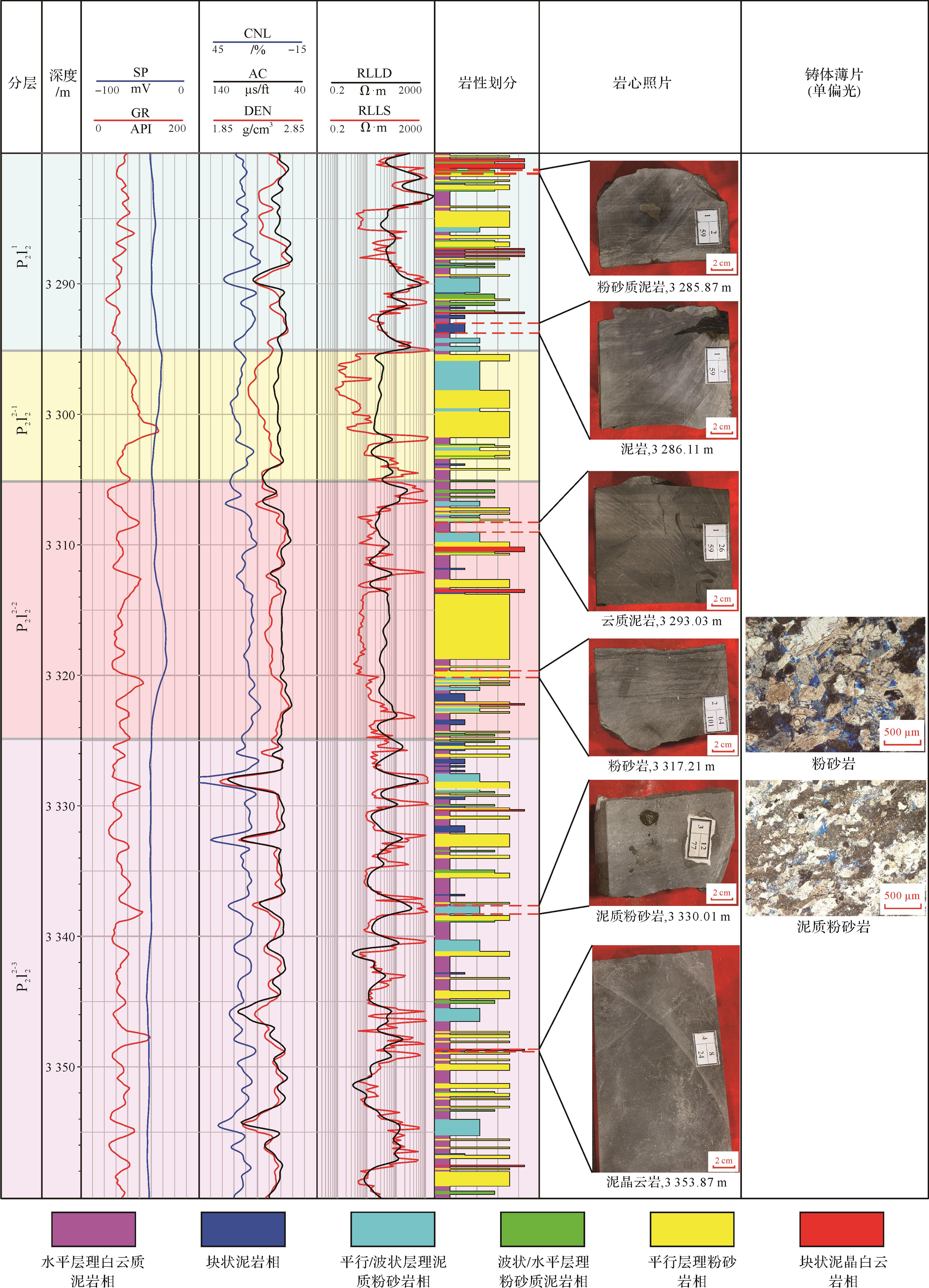
The Permian Lucaogou Formation in the Jimusaer Sag, Junggar Basin, has a complex lithology and various lithofacies, and urgently requires a lithofacies-matching logging identification method to be established. In this study, core slice, conventional logging and image logging data, among other methods, were comprehensively used to examine the lithology, sedimentary structure and other characteristics of the Lucaogou Formation in order to classify lithofacies types and analyze their logging response, and to establish a lithofacies logging evaluation model. The mineral composition of the core indicated that the study area comprises mainly dolomitic mudstone, argillaceous siltstone, silty mudstone and other lithologies. This took into consideration the distinguishability of the lithofacies at the core scale. Lithofacies identification determined for logs was divided into six main types: massive dolomitic mudstone, silty mudstone with parallel/wavy bedding, massive mudstone, massive micrite dolomite, siltstone with parallel bedding, and argillaceous siltstone with wavy/horizontal bedding. Adopting these criteria to establish the scale, the Kohonen neural network method of single well logging was used to automatically determine the lithofacies and to match these divisions as closely as possible. The research results indicated improvement in the efficiency and accuracy of lithofacies identification for coreless wells. The study also provides a theoretical basis and a method supporting shale oil exploration in this area.

2022, 40(3): 641-652.
doi: 10.14027/j.issn.1000-0550.2021.017
Abstract:
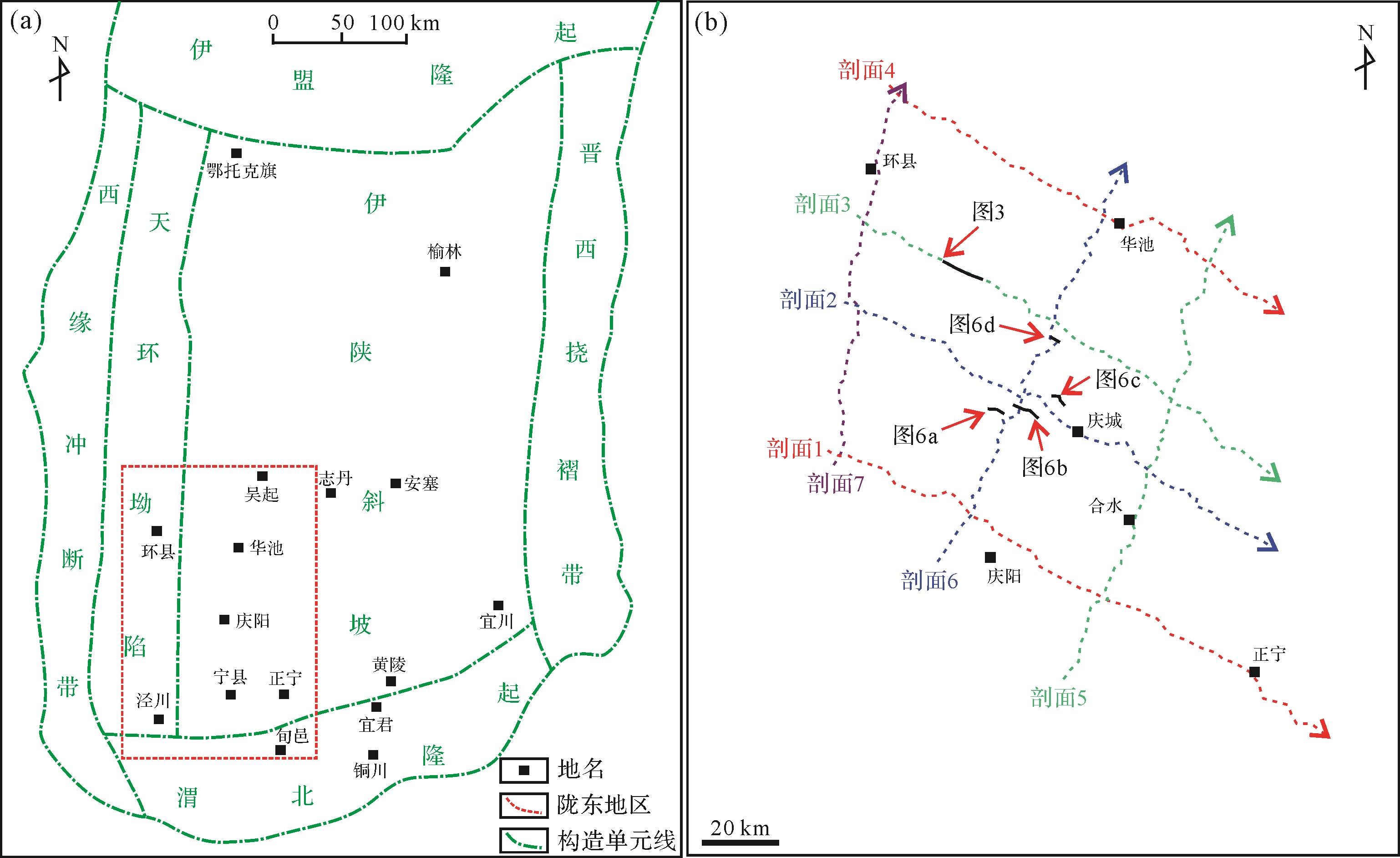
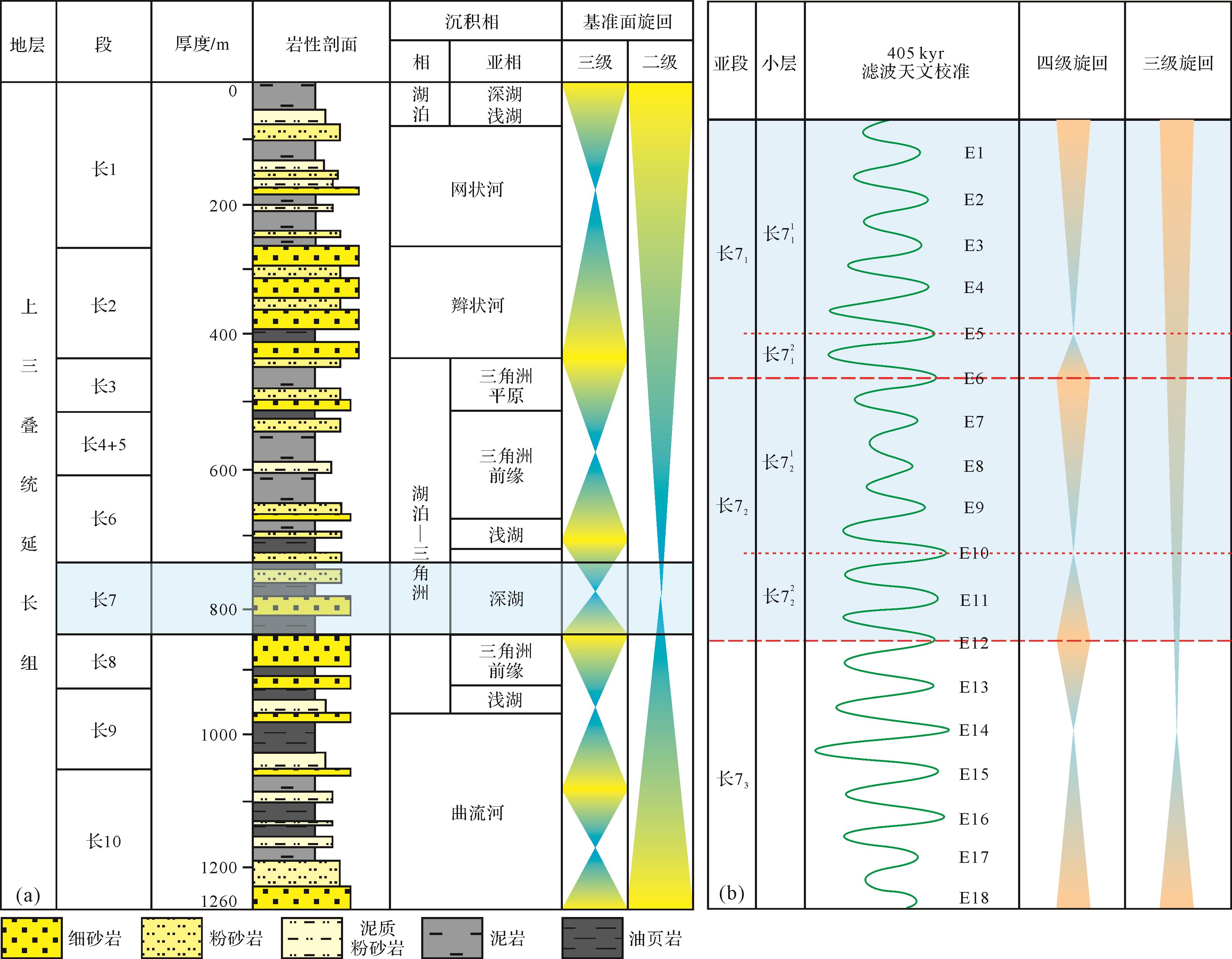
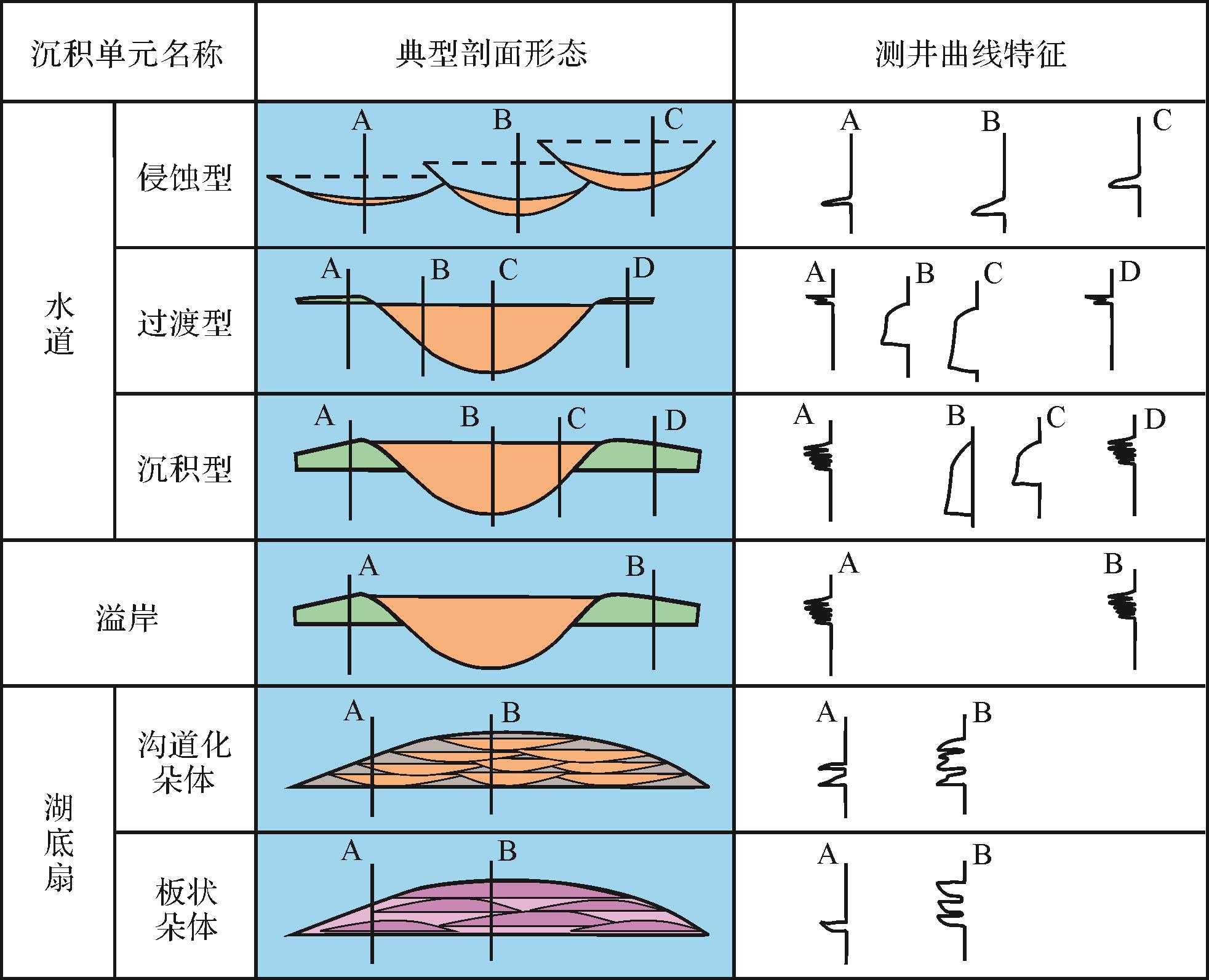
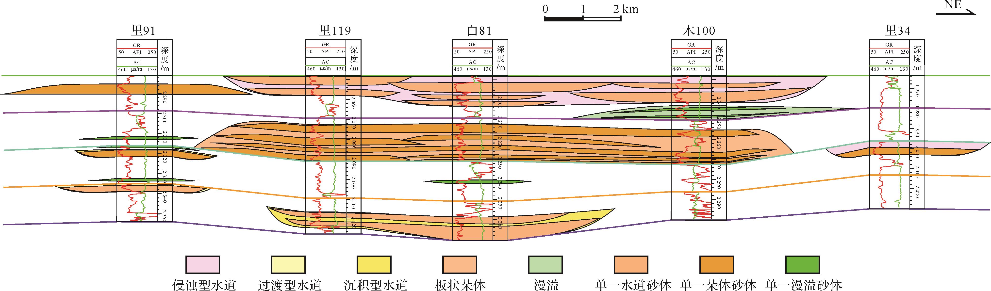
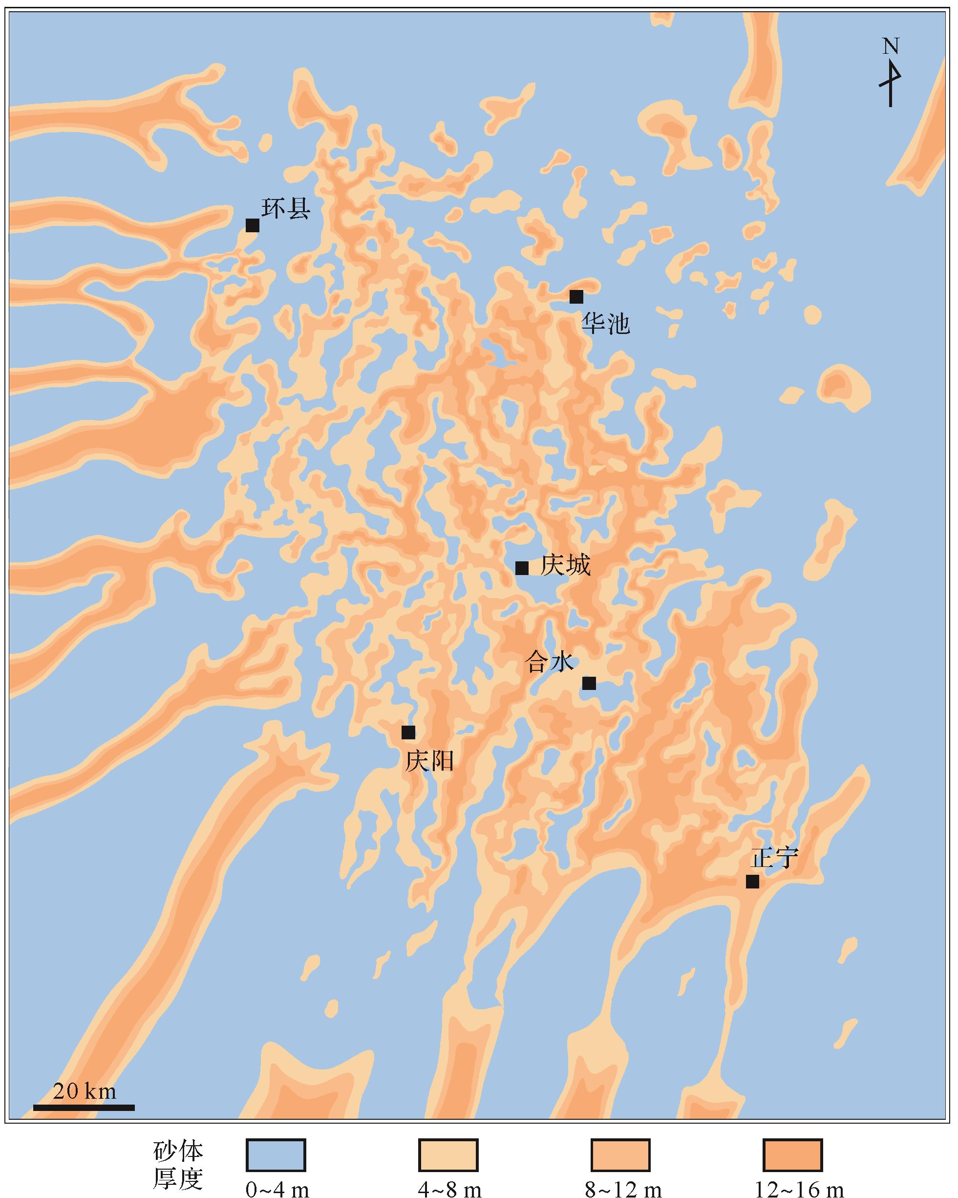
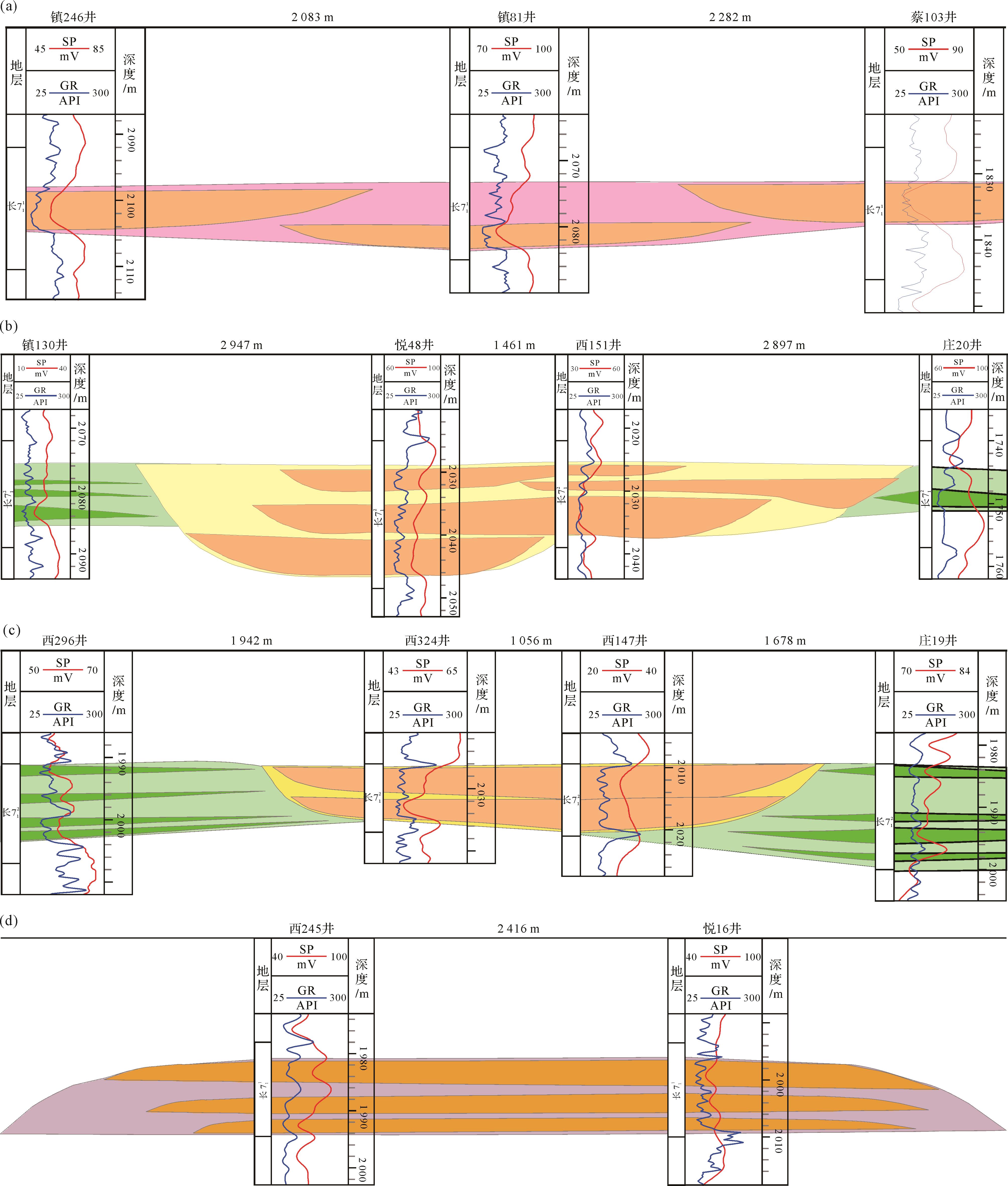
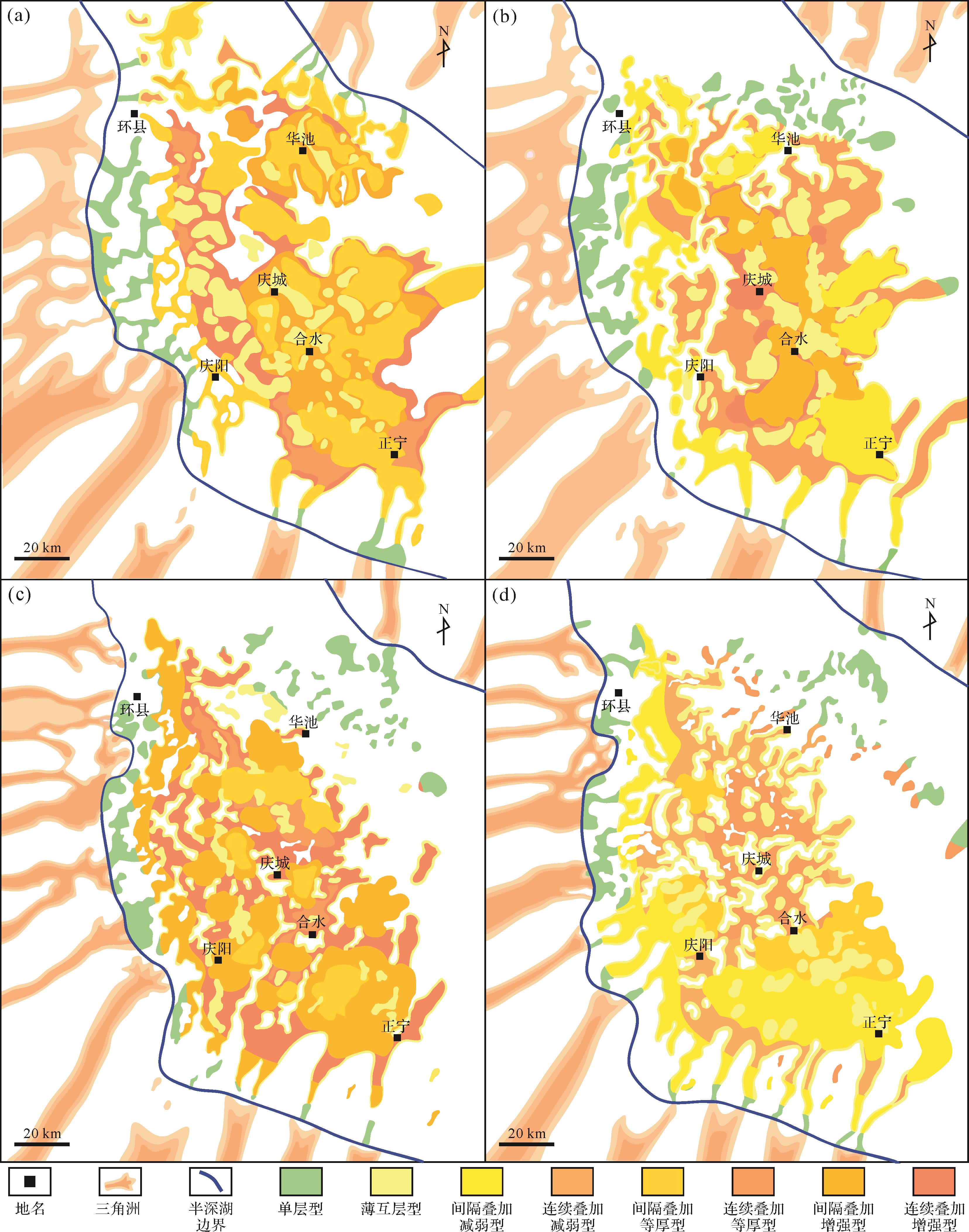
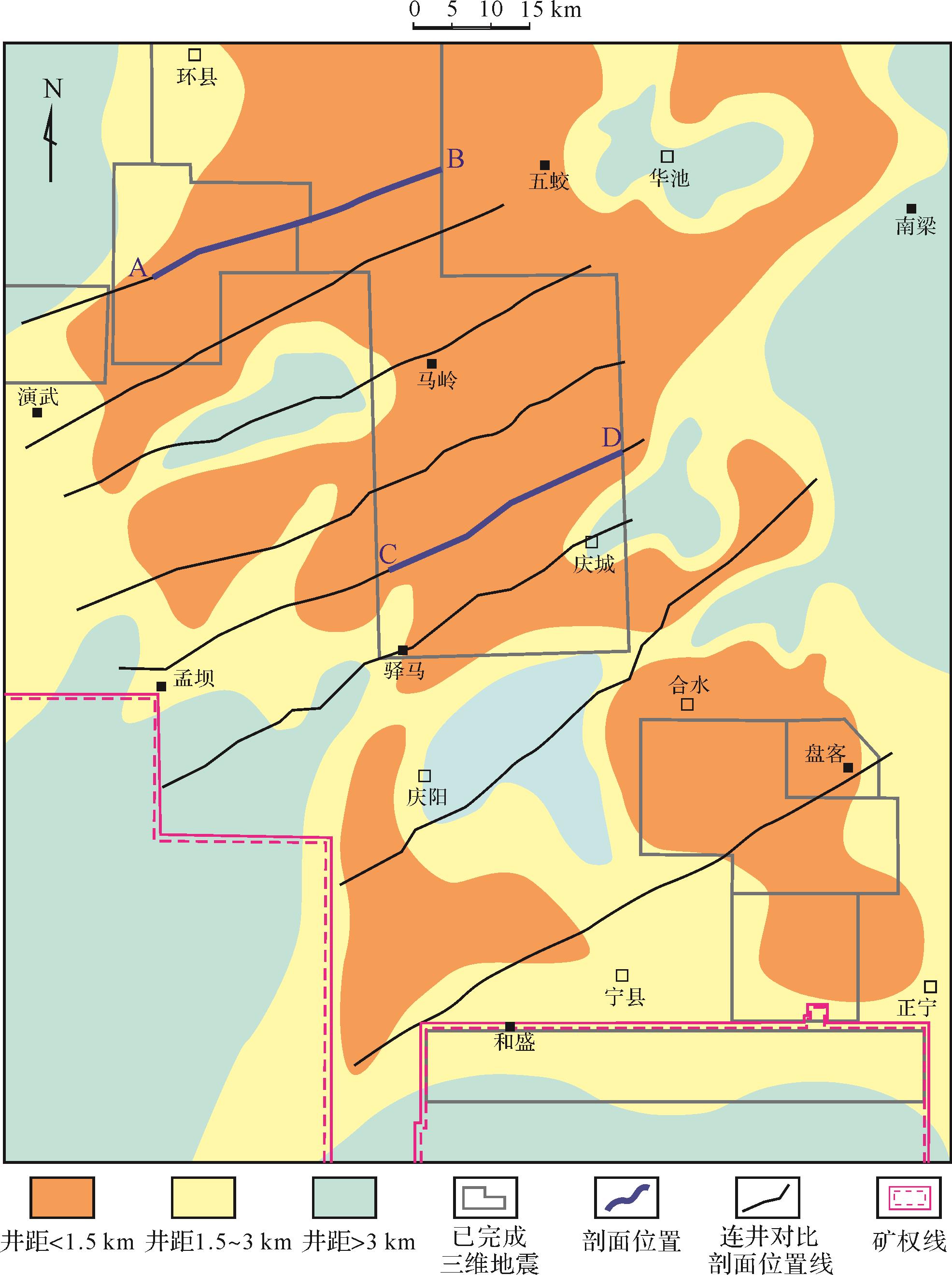
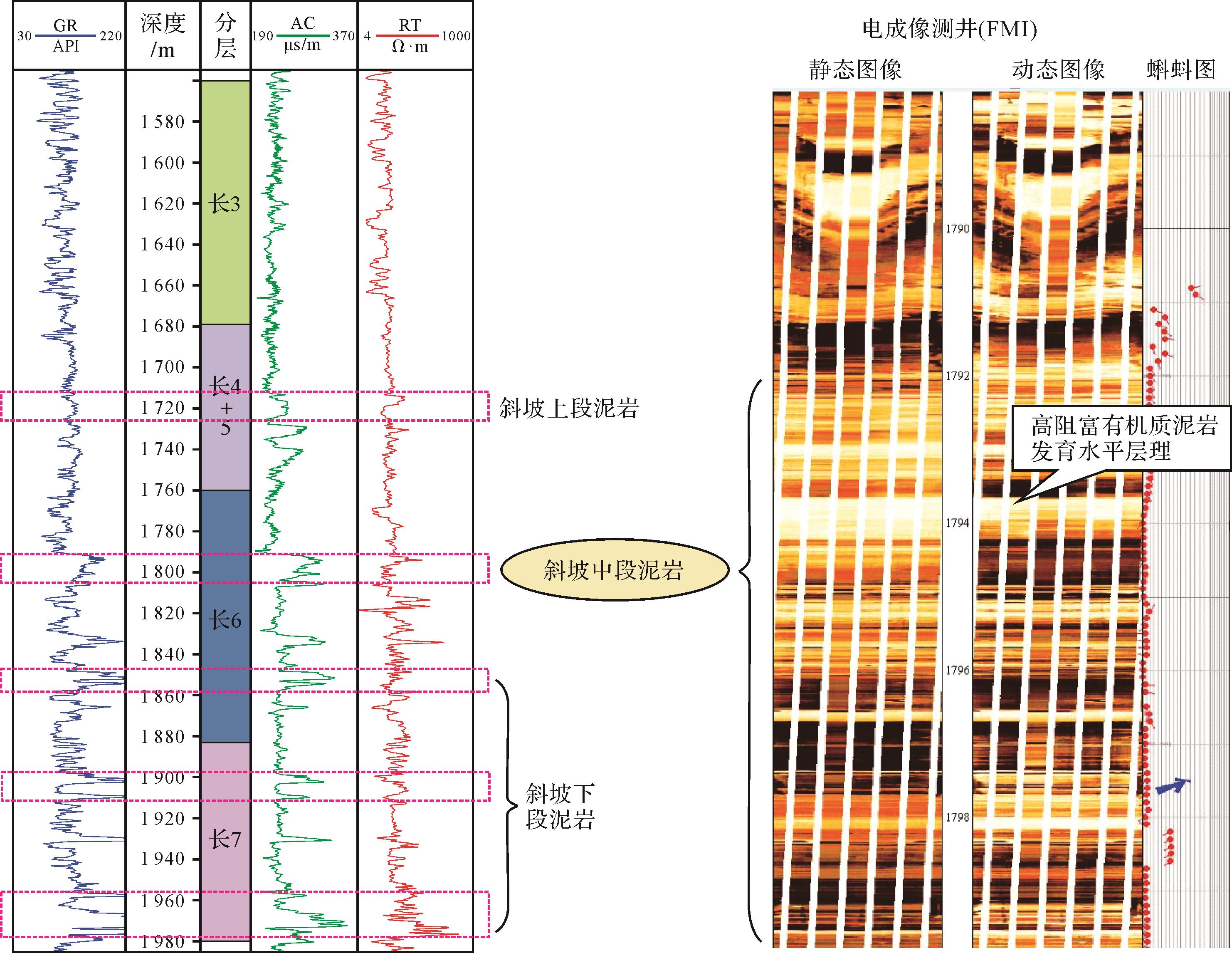
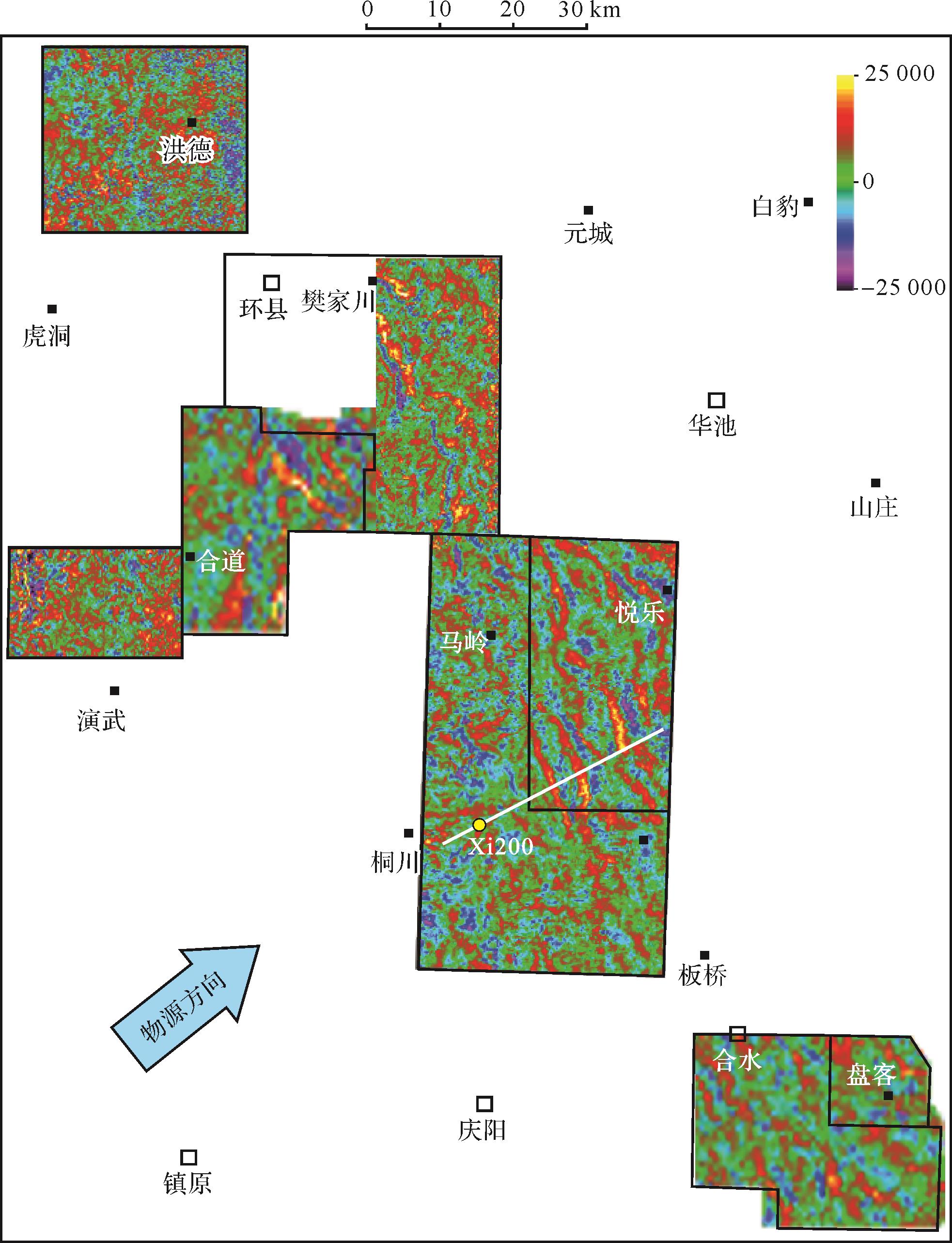
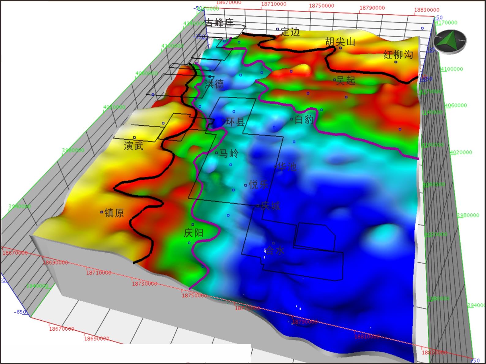
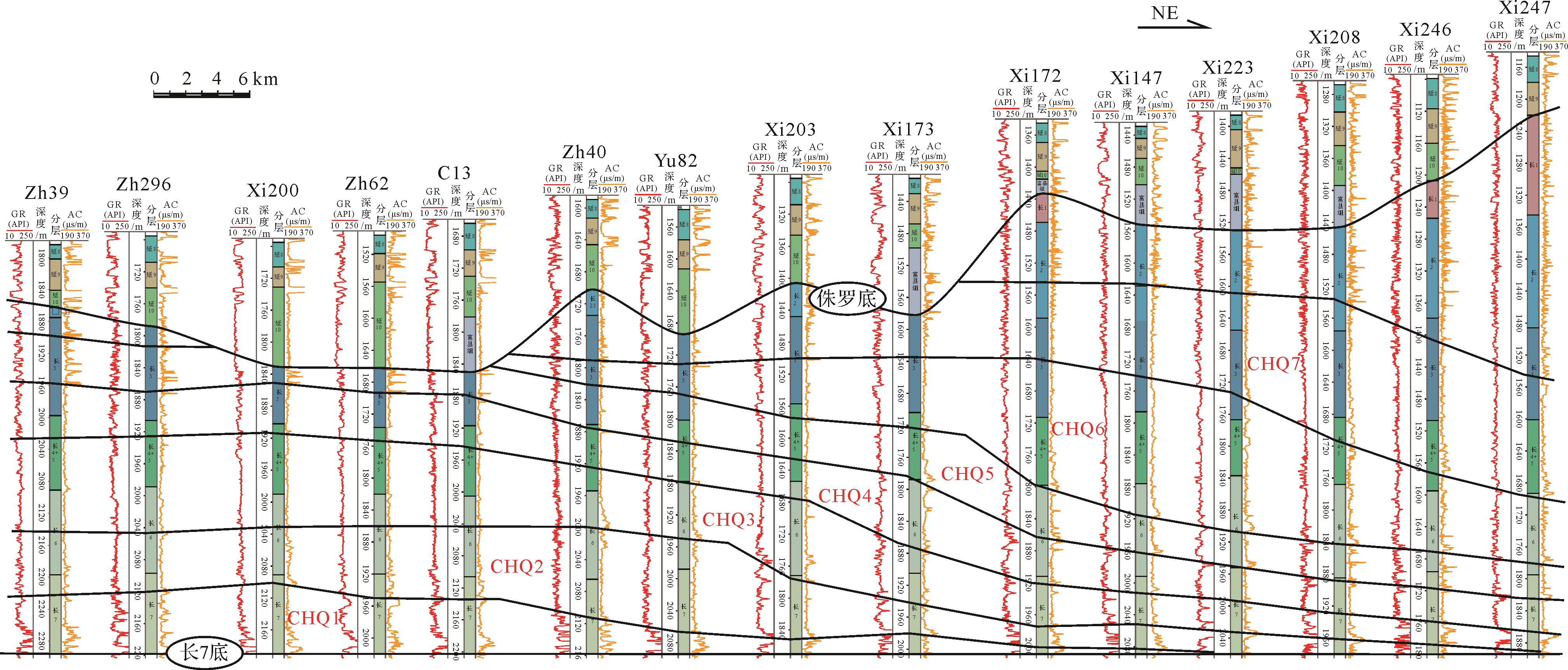
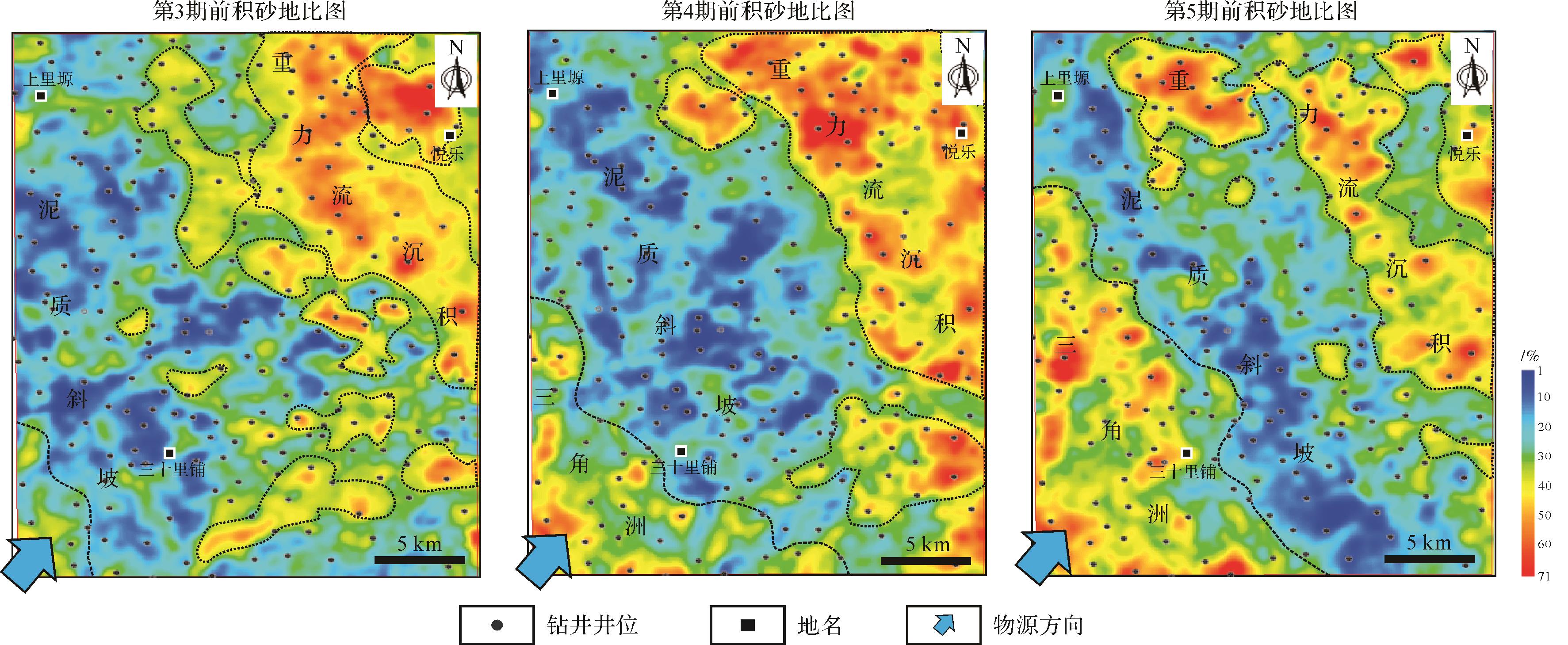
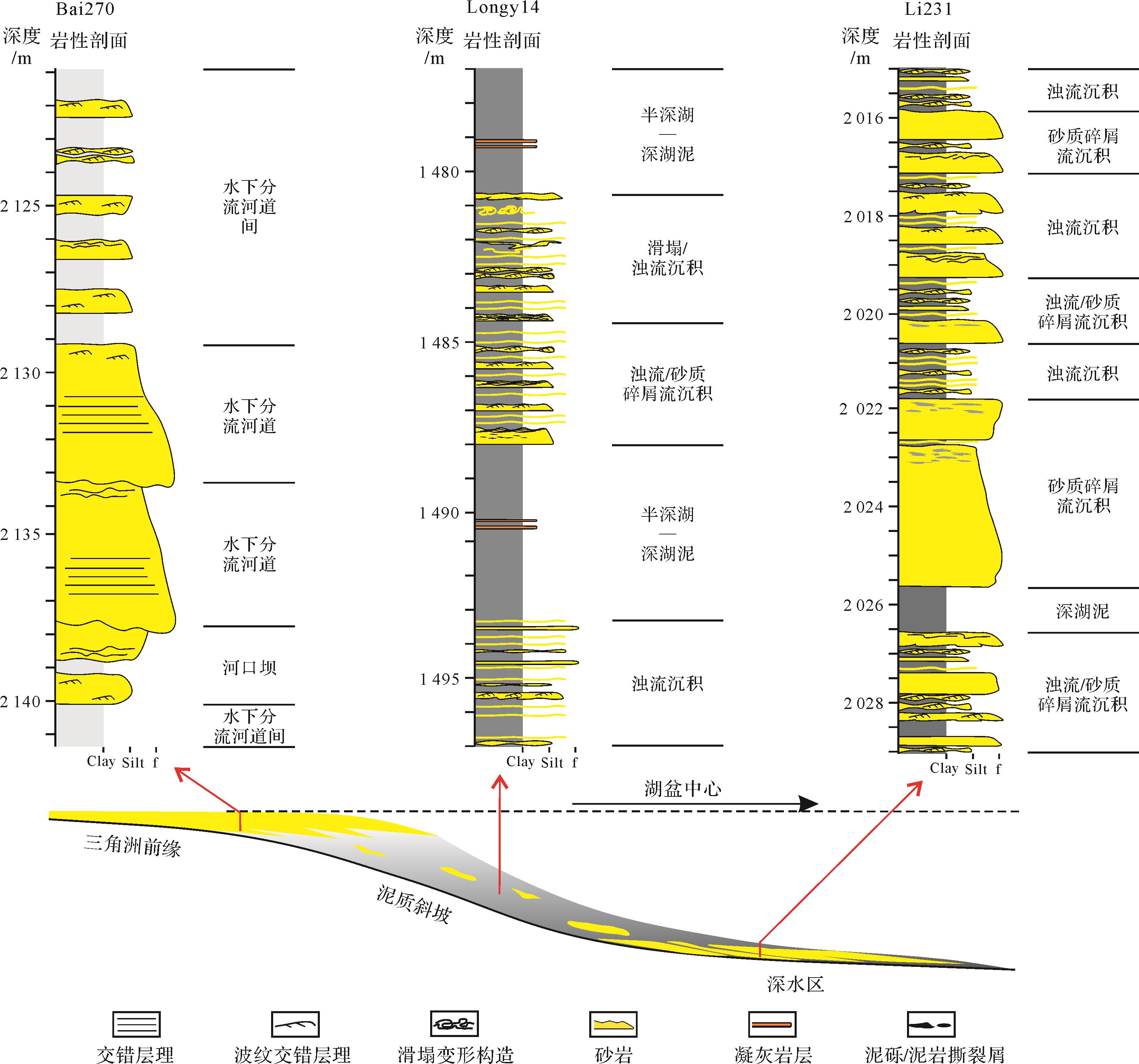
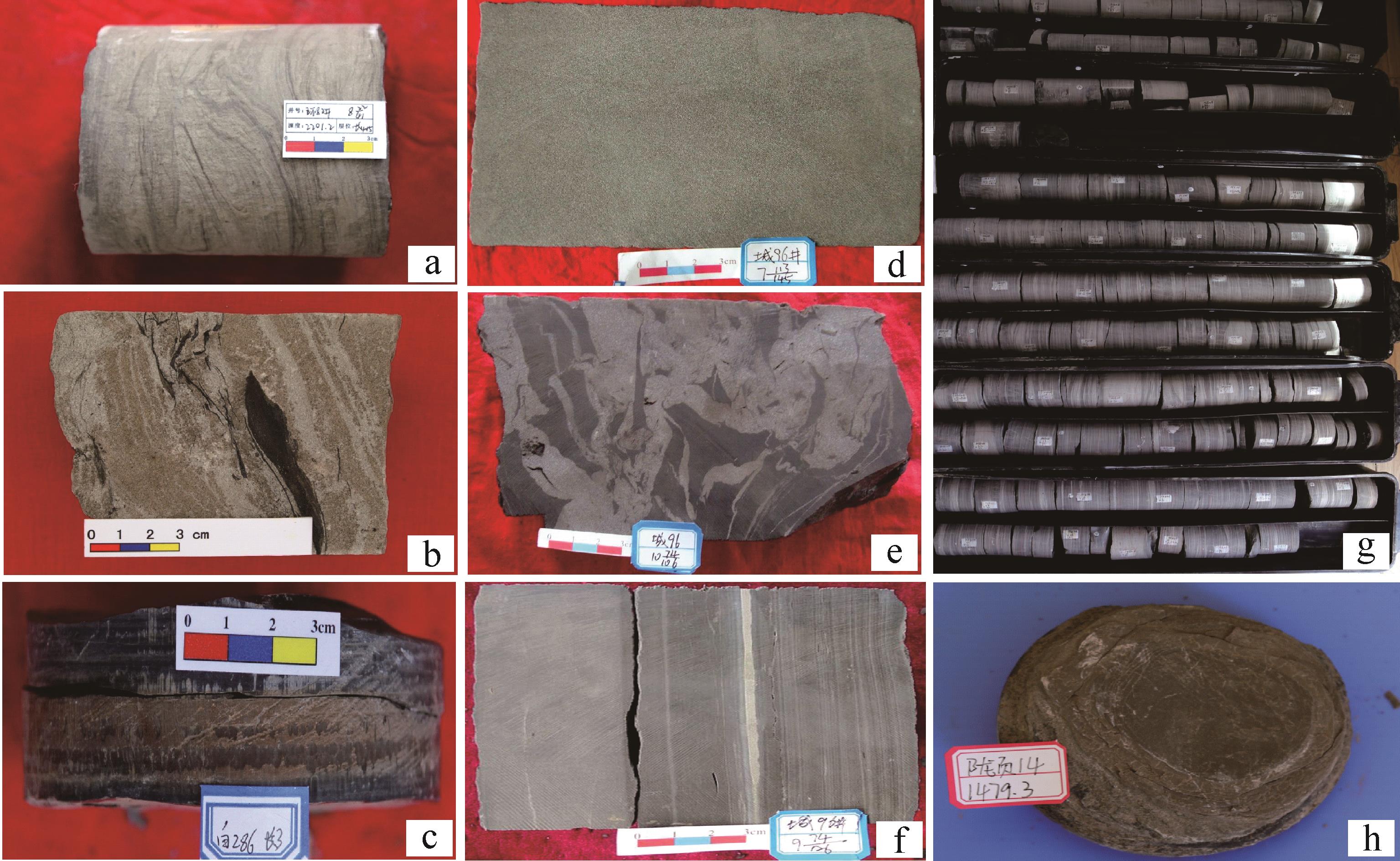
The Chang 7 member in the Longdong area of the Ordos Basin contains huge gravity-flow sandbodies and rich oil and gas resources. However, their shape, scale and superpositional relationships differ considerably in different strata regions, and very little is known about their architecture and development. This restricts the improvement of their oil and gas rolling exploration and development efficiency. A study based on core analysis, on the architectural division and the development characteristics of the sandbodies was carried out based on the identification of individual well sandbody architecture interface and their comparison at regionally connected wells, together with sandbody sedimentary facies analysis. The study suggests that the scale of gravity-flow sandbodies in this area is relatively large. The main provenance is a south⁃southwestern system, followed by a northeastern provenance system. The sandbodies are characterized as a typical lacustrine channel⁃fan system subdivided into seven sedimentary microfacies: erosional channel, transitional channel, sedimentary channel, levee, channelized lobe, tabular lobe and turbidite sheet sand. The thickness of the sandbody increases from the delta front slope to the deep-lake depocenter, and its shape changes from a strip to a fan. In addition, the architectural properties change (e.g., the scale). The vertical superpositional relationships and the lateral migration aspects of the sandbodies also show regular changes in the planar view. In the nearshore semi-deep lake delta front slope area individual sandbodies are relatively thin, and the isolated strips occur as thinly interbedded or single layers. The thickness of the single sand layer increases towards the center of the basin, and the lateral connectivity is enhanced. Superimposition of the bodies has led to an increase in vertical connectivity and a transition to continuous stacking. The thickness of individual sandbodies is slightly reduced near the depocenter, but the lateral connectivity is significantly enhanced with obvious continuity, evident as an interval-stacking type of deposition. Comprehensive analysis suggests that the configuration of the gravity-flow sandbodies in this area is controlled by gravity-flow sedimentary facies, base-level cyclic changes and provenance supply rate.
2022, 40(3): 653-666.
doi: 10.14027/j.issn.1000-0550.2021.113
Abstract:
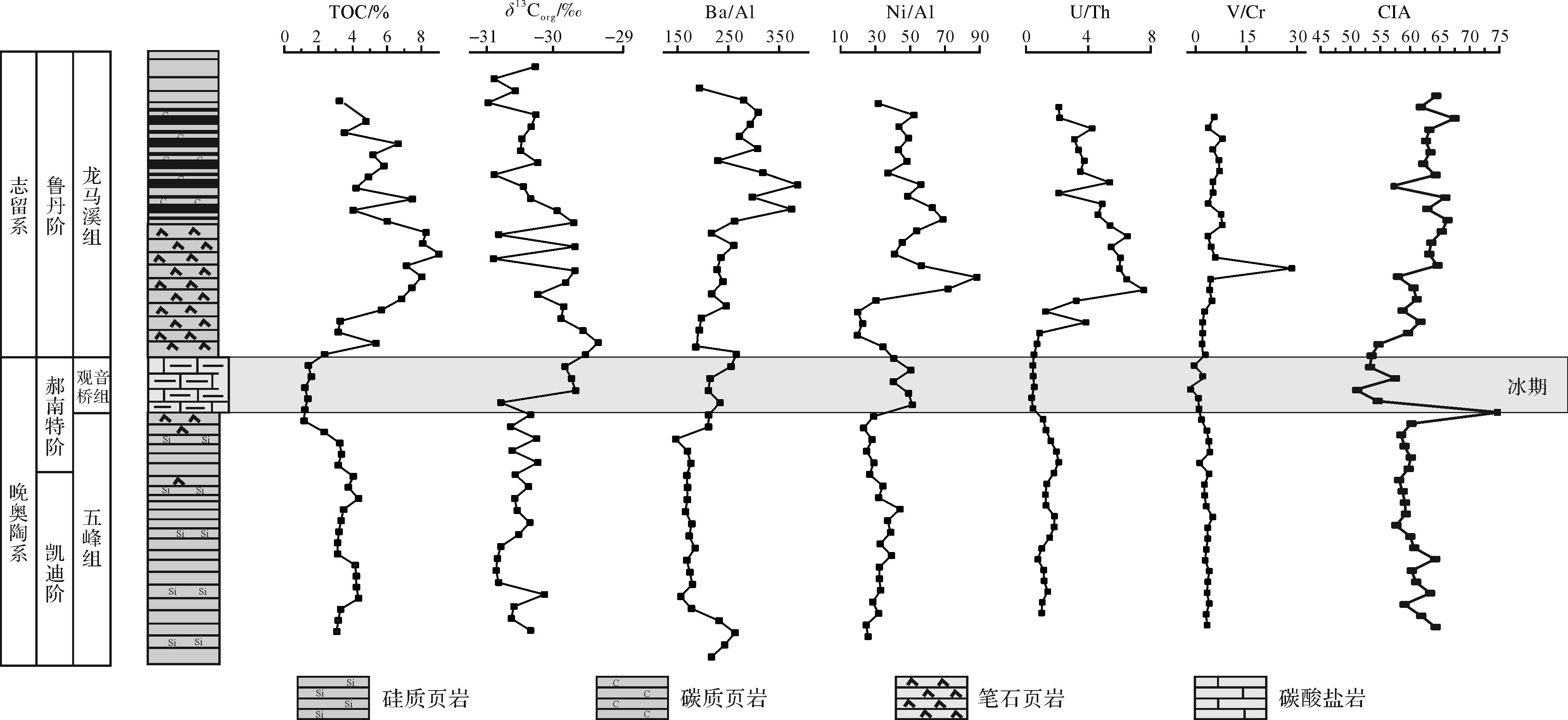
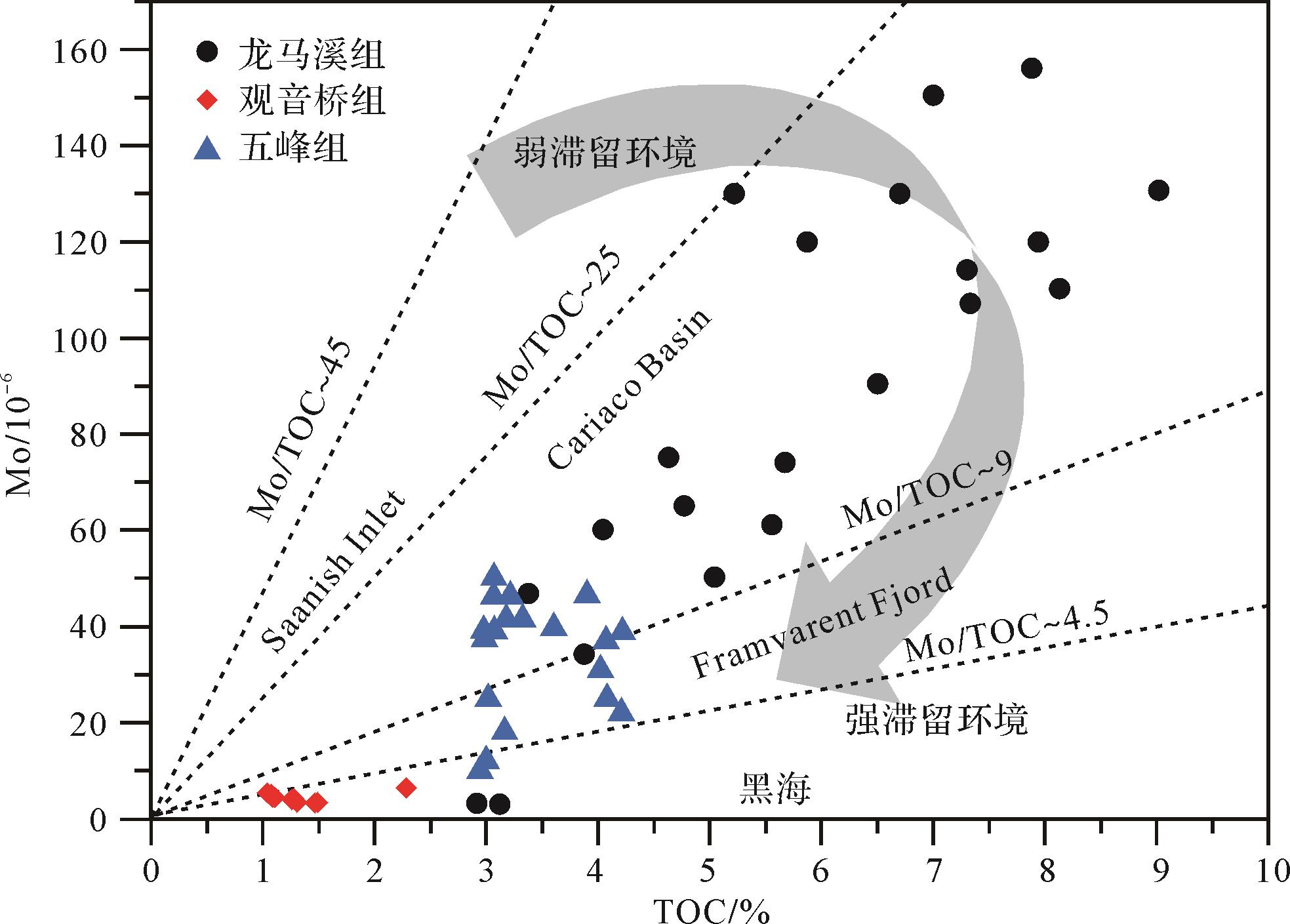
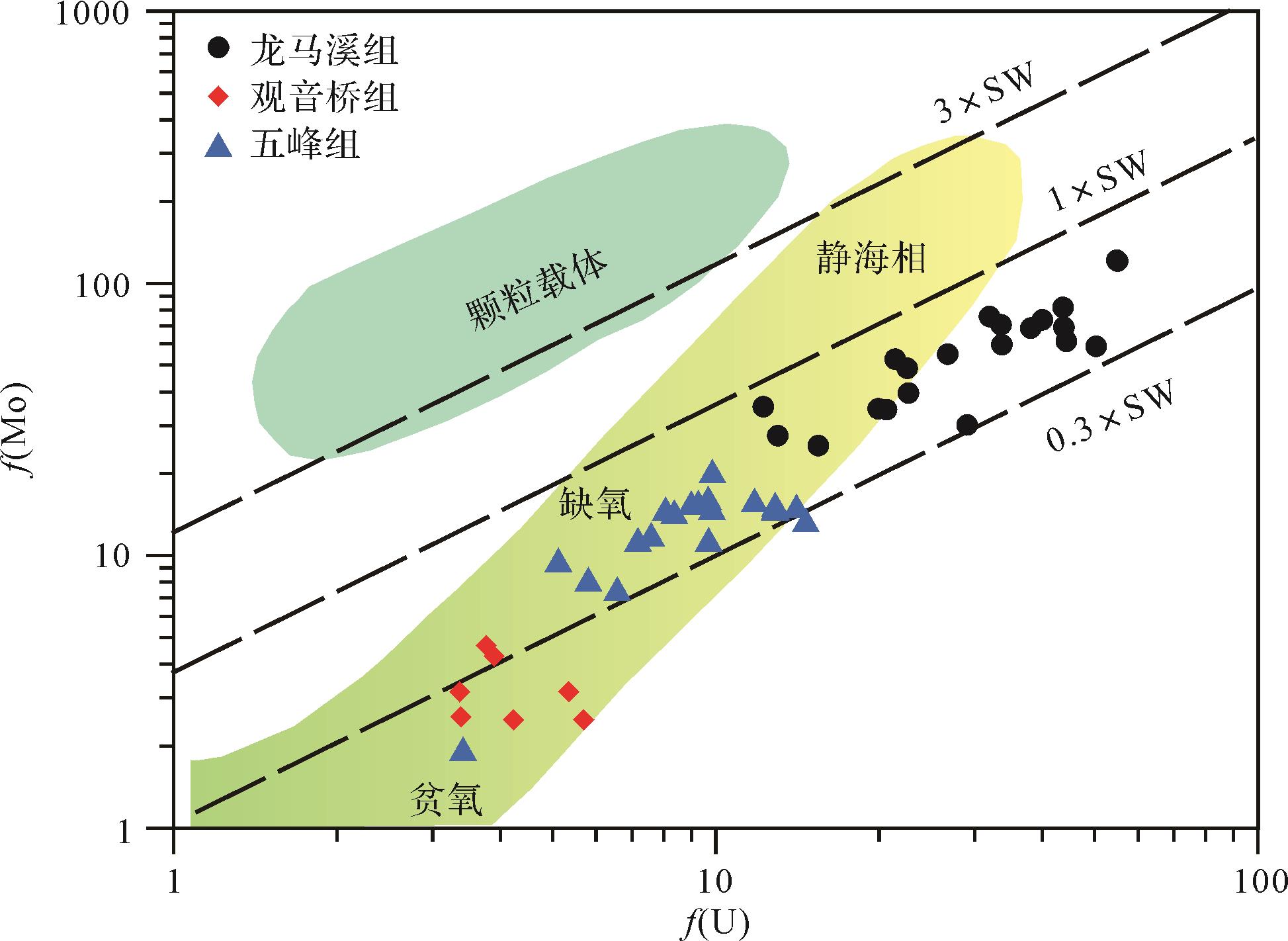
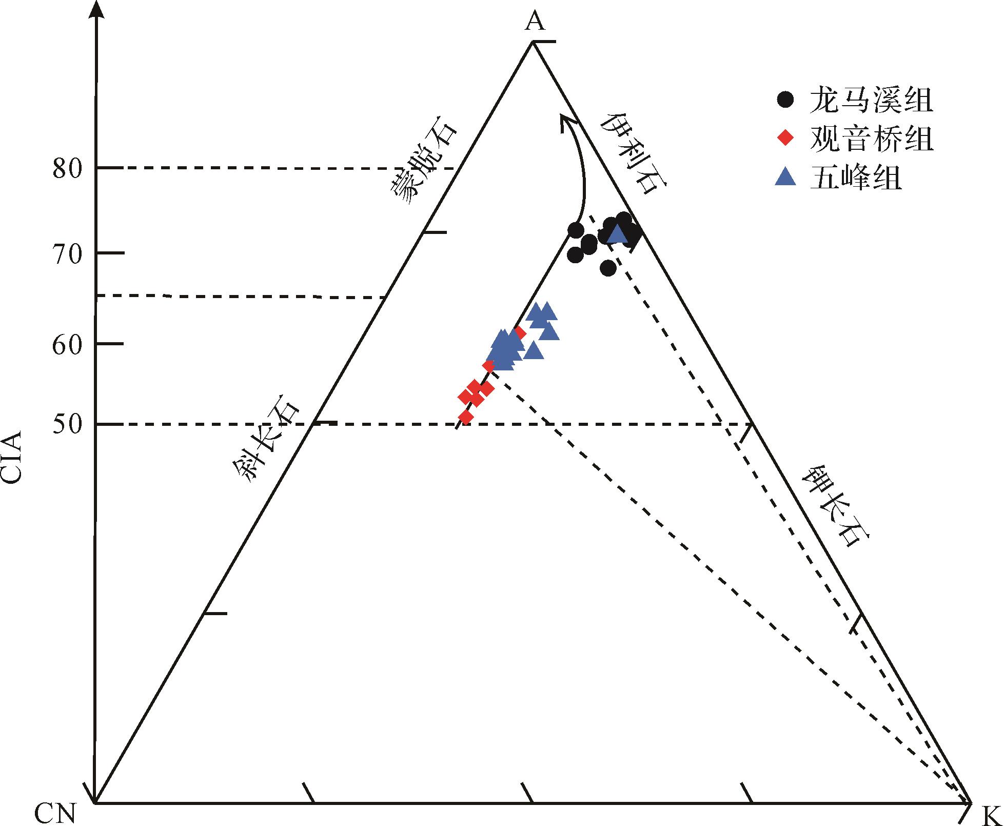
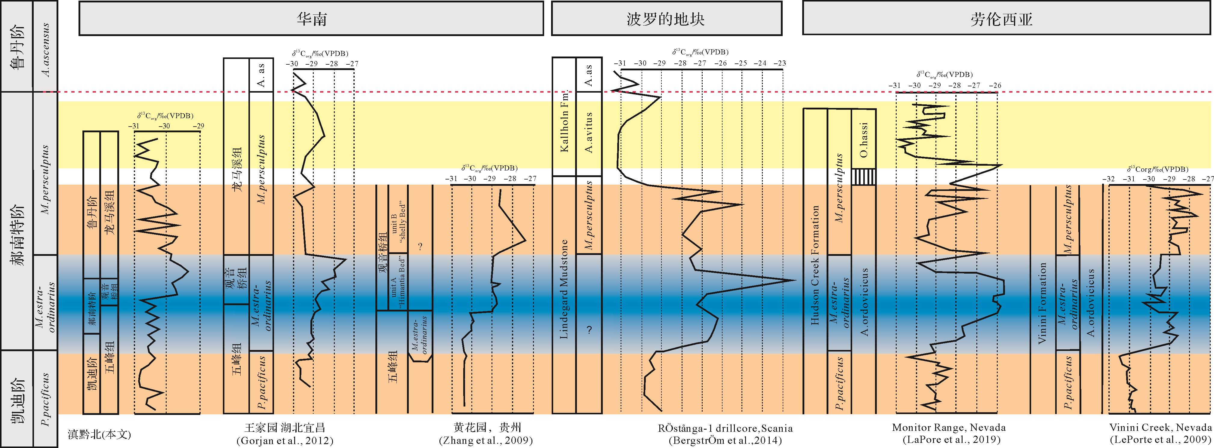
To study the relationship between the mass extinction of life in the Ordovician and the paleoenvironment and paleogeography of that period, total organic carbon (TOC), major elements, trace elements and carbon isotope geochemical analyses were carried out on samples from the Wufeng Formation⁃Longmaxi Formation in the northern Yunan-Guizhou area. The results show that the changes in the Ba/Al and Ni/Al values of the Wufeng Formation⁃Longmaxi Formation indicate that the marine productivity of the Wufeng Formation was relatively stable, starting from the Wufeng Formation and gradually increasing until the Guanyinqiao Formation reached its peak and then decreased. In the Longmaxi Formation, marine productivity began to rise again, then gradually decreased and stabilized. Especially in the Guanyinqiao Formation during the Hirnantian period, there was a jump in productivity in the Guanyinqiao Formation, which indicated a significant change in the nature of the Ordovician seawater. The Vr/Cr ratio and U/Th ratio generally show that the Wufeng, Guanyinqiao and Longmaxi Groups were in anaerobic environments. The U-Mo covariant model shows that the Dianqianbei area was a strong retention basin during the period of the Wufeng Formation, and during the period of Longmaxi Formation it was a semi-retention basin. The chemical weathering index (CIA) indicates that the temperature in northern Yunnan and Guizhou began to decline slowly in the early Wufeng Formation. The regional temperature fell until the glacial period during the Guanyinqiao period. The Longmaxi Formation gradually recovered in the early period, but from the Longmaxi Formation to the Guanyinqiao Formation to the Wufeng Formation the climate was extremely unstable. The mass extinction of life at the end of the Ordovician was caused by changes in the pattern and intensity of ocean currents, and changes in the physical and chemical properties of seawater as polar glaciers developed. Both of these changes were due to the distribution pattern of sea and land.
2022, 40(3): 667-678.
doi: 10.14027/j.issn.1000-0550.2020.100
Abstract:
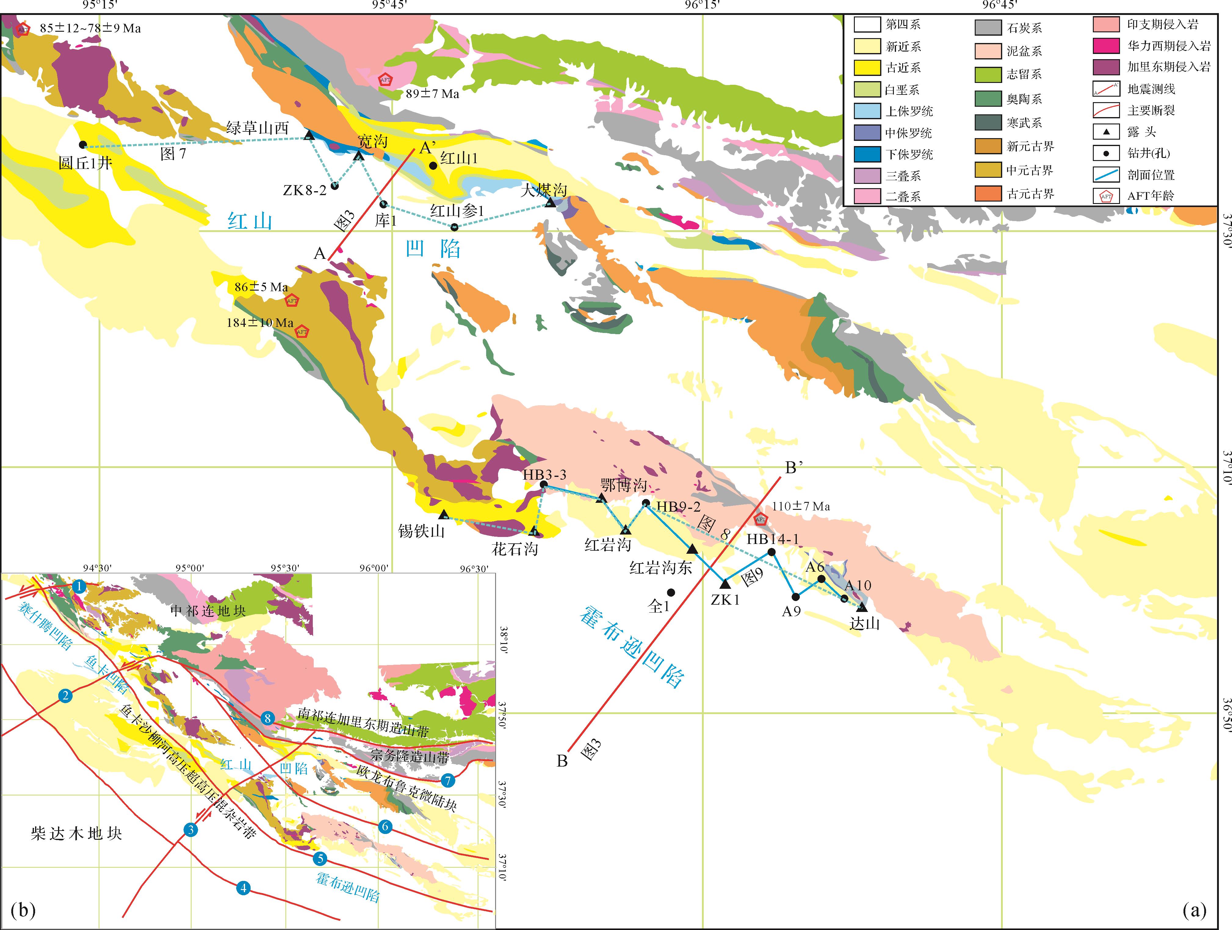
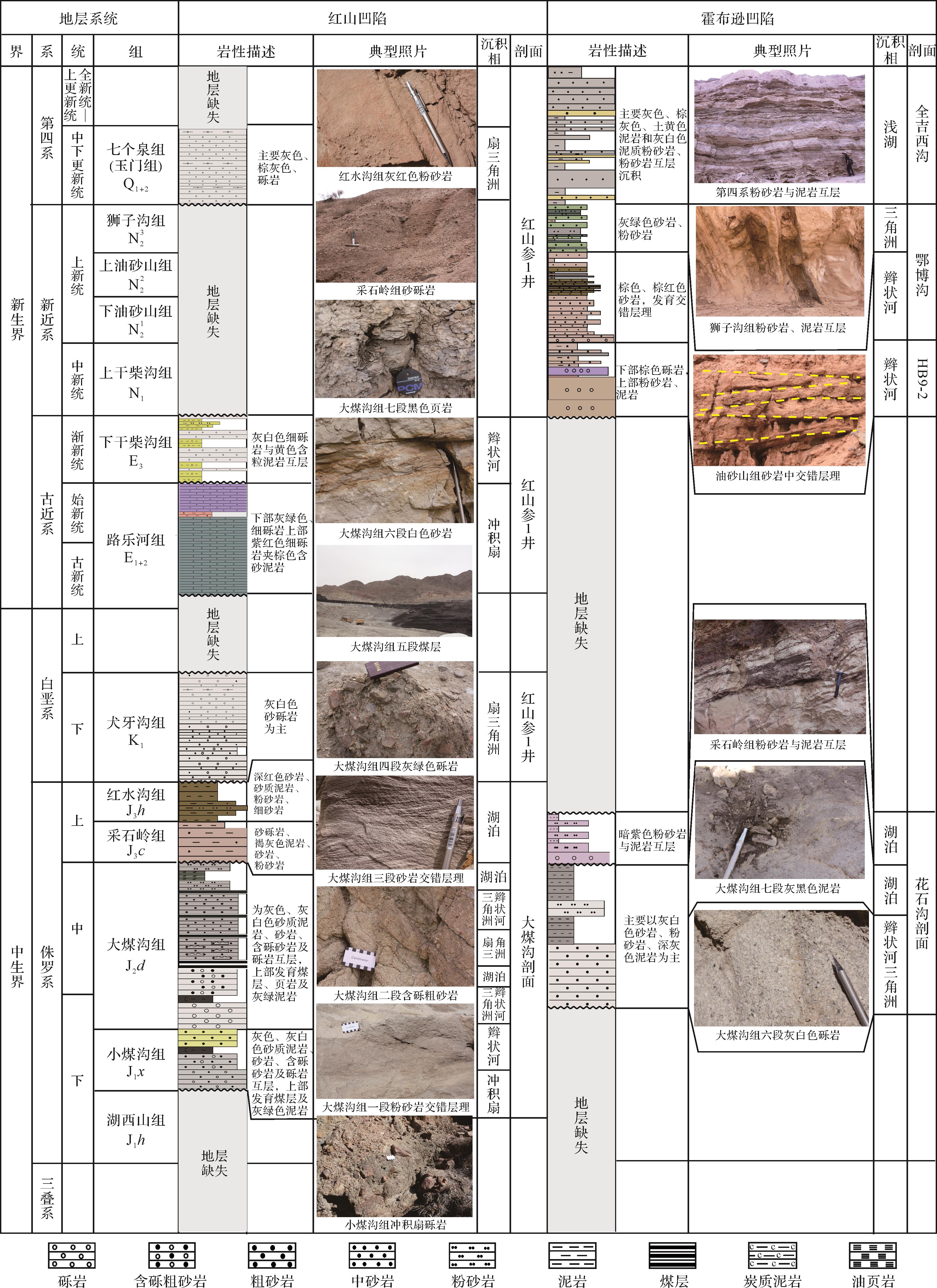
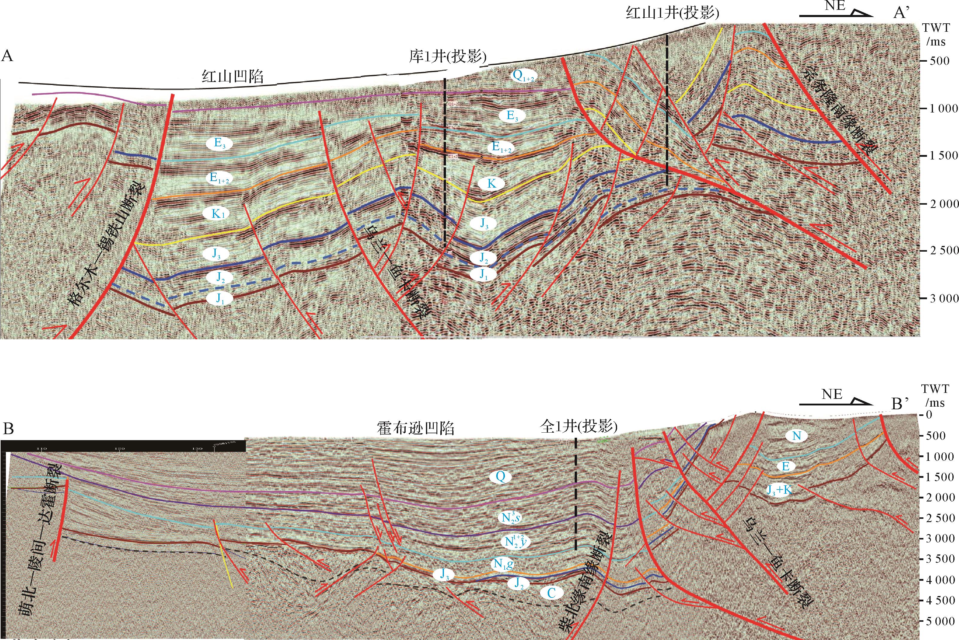
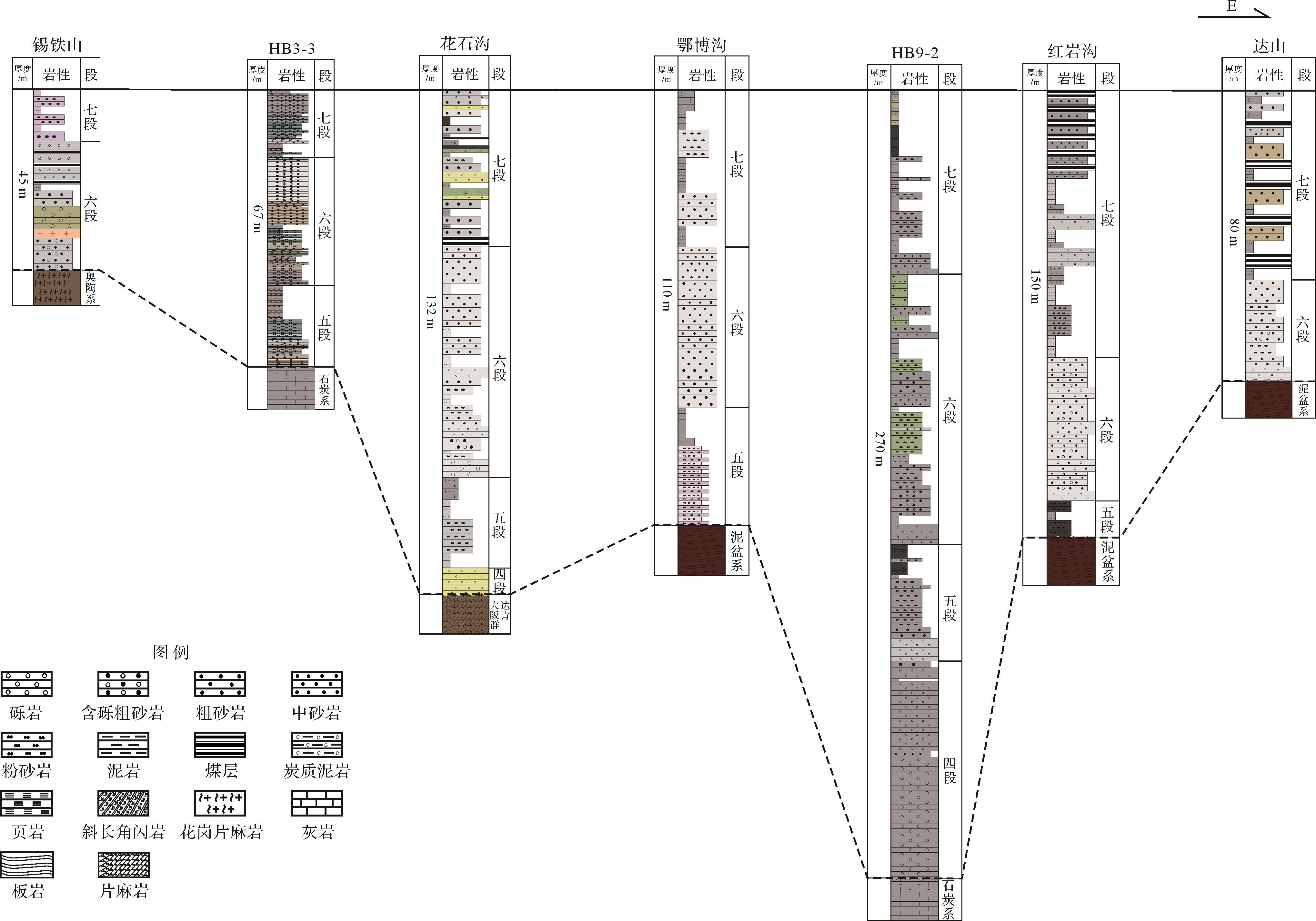
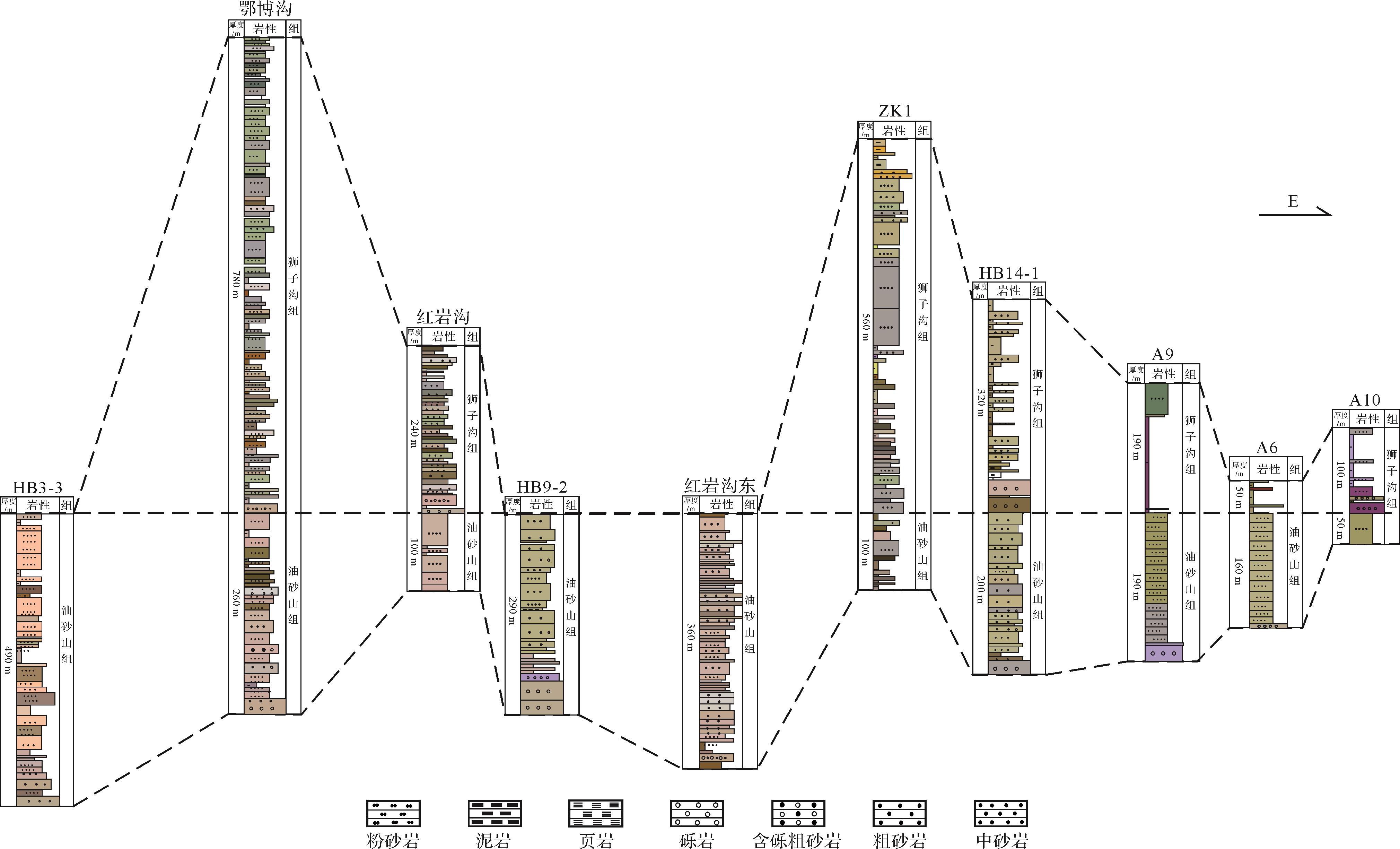
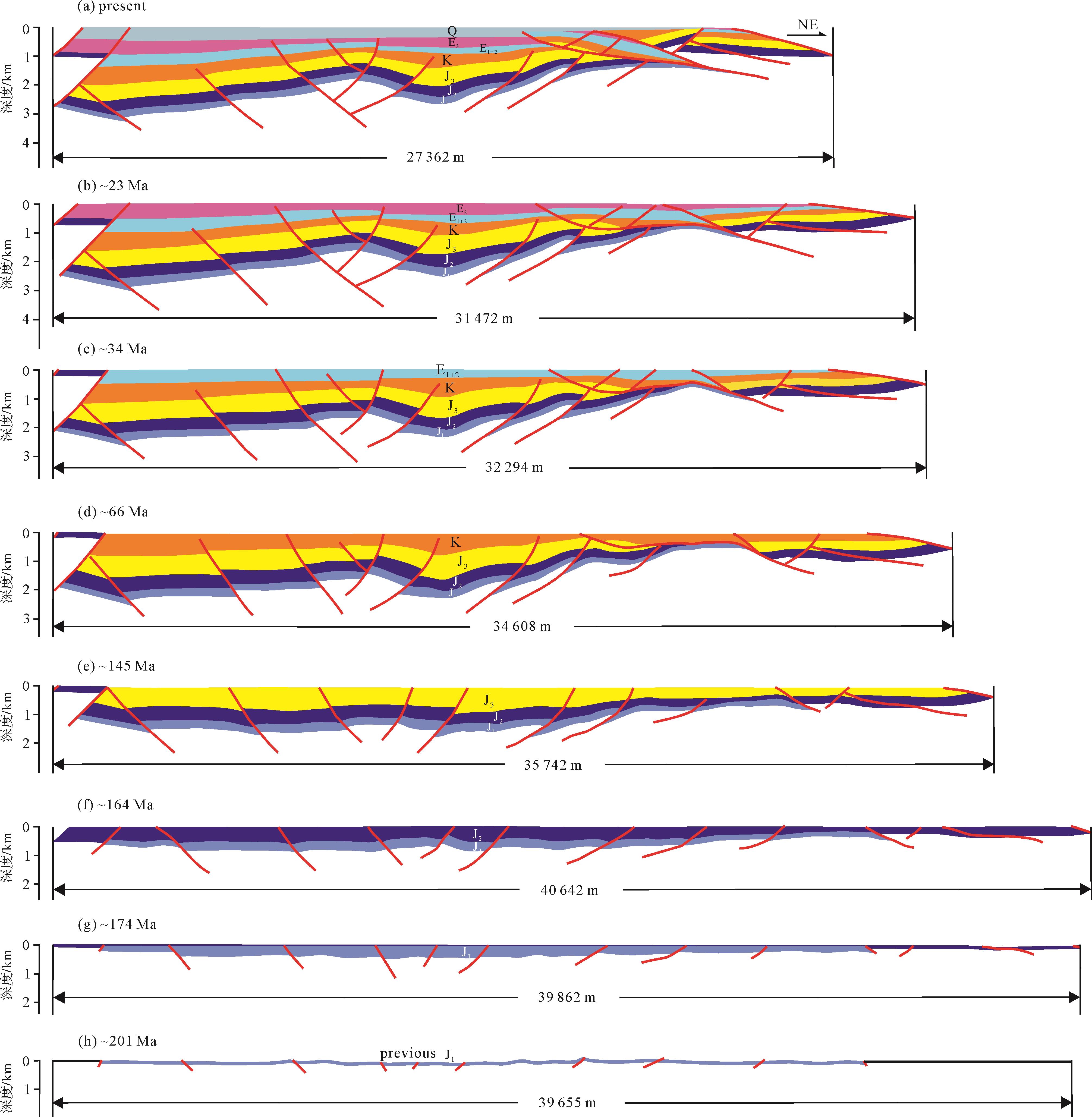
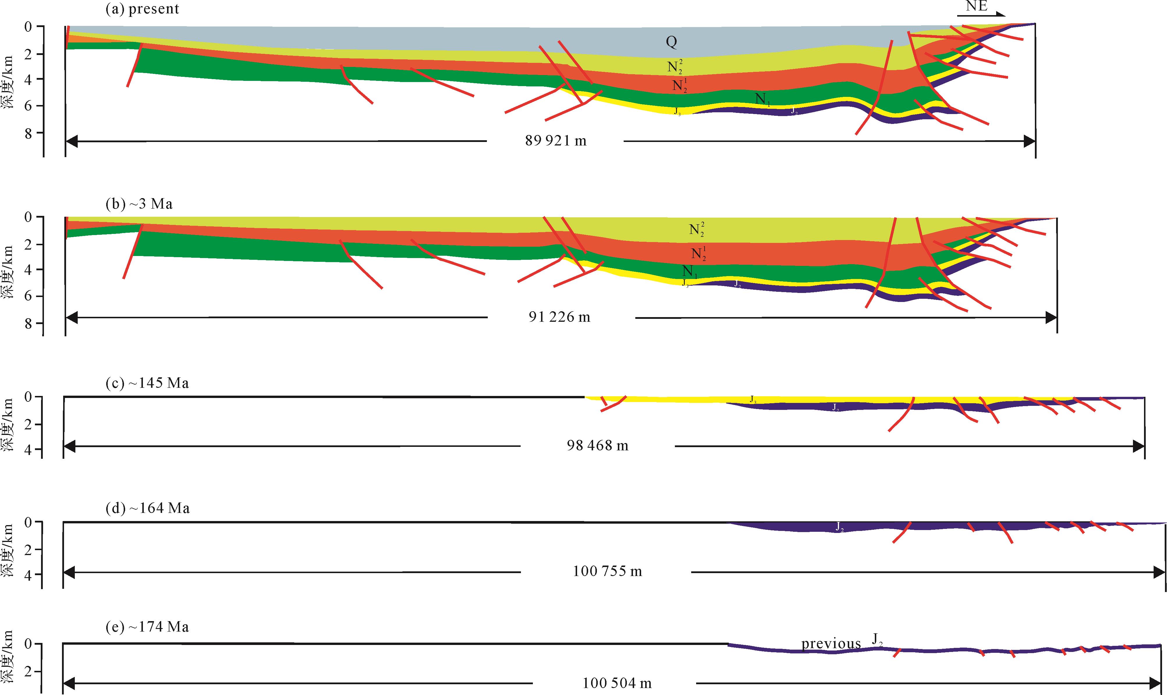
This clarification of the changes in sedimentary migration and Mesozoic and Cenozoic prototype basins in the eastern segment of the Qaidam Basin was based on a field geological survey of Mesozoic and Cenozoic strata. Interpretation of seismic sections, analysis of lithofacies features, division and correlation of the strata, and a study of balanced geological cross-sections found that the sedimentary migration took place in a teeterboard, or seesaw, manner. This phenomenon is related to the geotectonic location, the basin prototypes and continental plate motion. Lower Jurassic strata is localized in the Hongshan small fault basin. With protracted rifting, Middle Jurassic deposits appear in the Huobuxun Sag, related to tensile stress caused by the collision of the Qiangtang and Lhasa Plates with the southern margin of the Eurasian Plate during the Early-to-Middle Jurassic. Northward movement of the sedimentary scope of Upper Jurassic and Lower Cretaceous strata was related to the collision between the Lhasa Terrane and Eurasian Plate, which led to structural inversion of the northern Qaidam Block. The appearance of Paleogene strata only in the Hongshan Sag, and not in the Huobuxun Sag, is associated with closure of the eastern Neotethys, which resulted in uplift of the Huobuxun region. Neogene and Quaternary strata occur mainly in the Huobuxun Sag, due to the overall uplift of the mountains in the northern Qaidam Basin.

2022, 40(3): 679-690.
doi: 10.14027/j.issn.1000-0550.2021.064
Abstract:
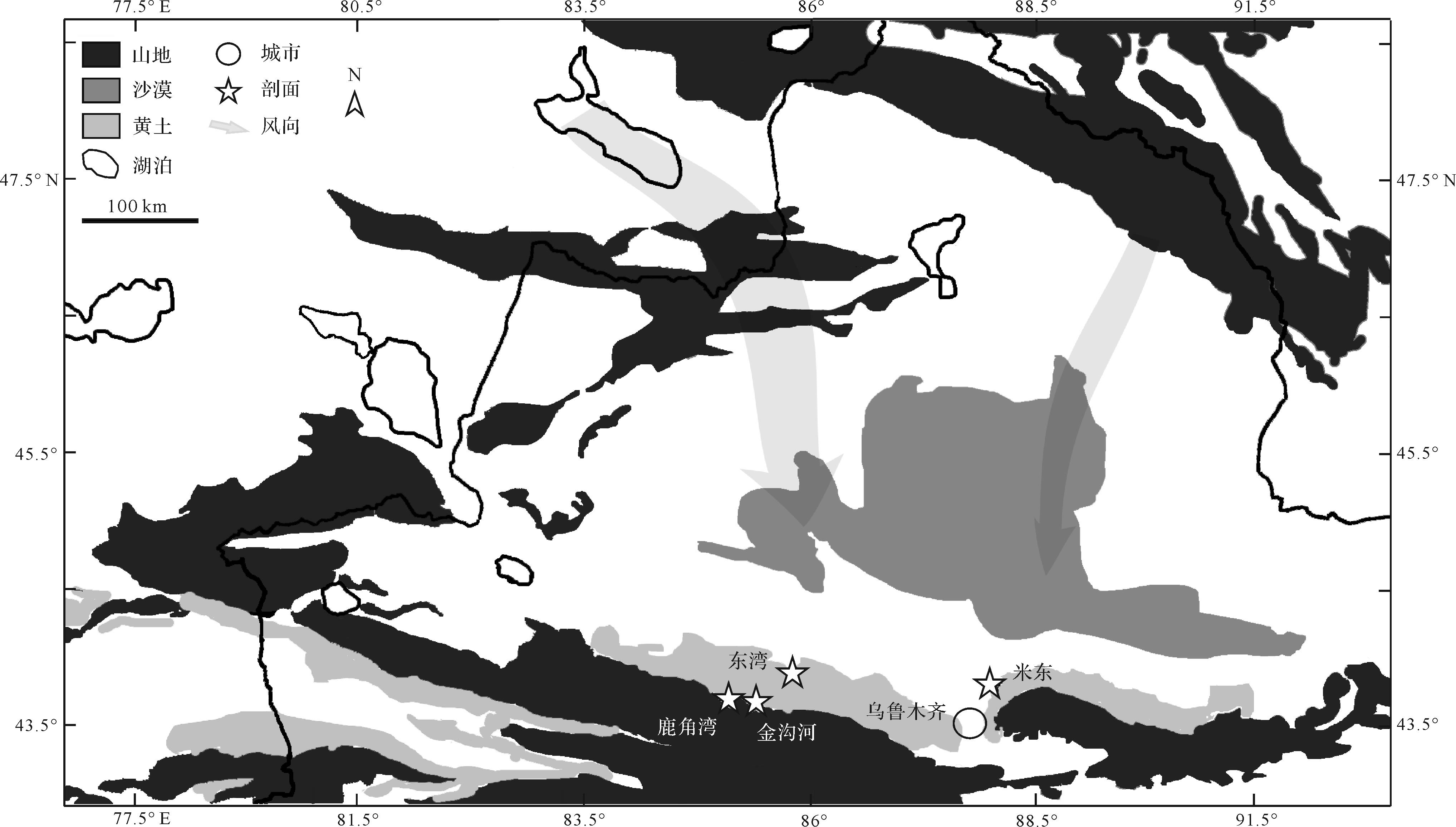
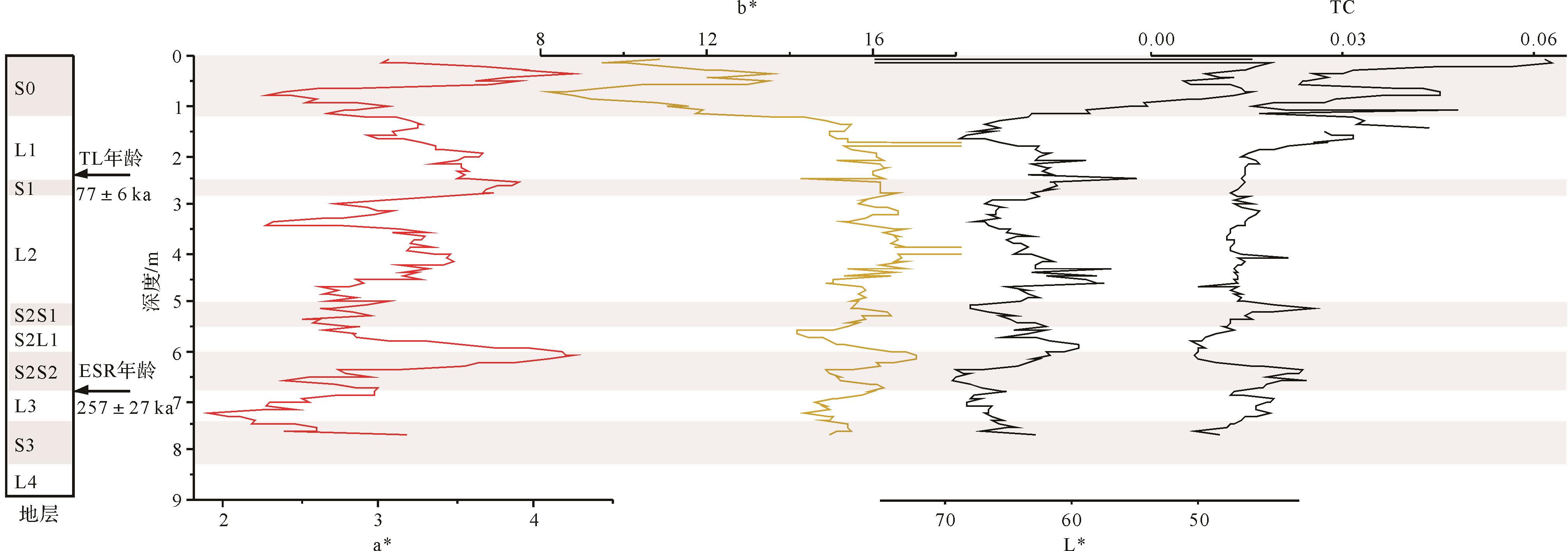
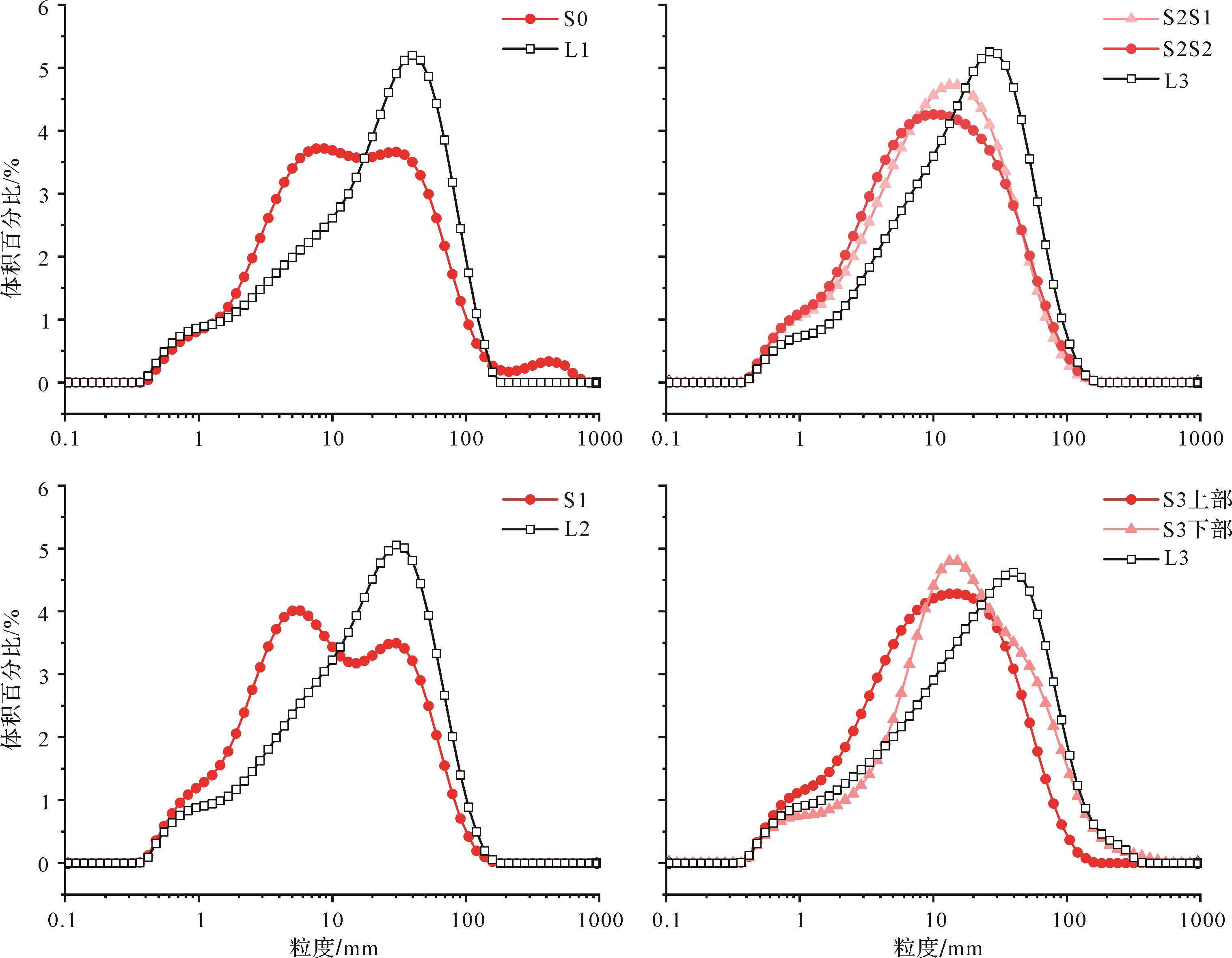
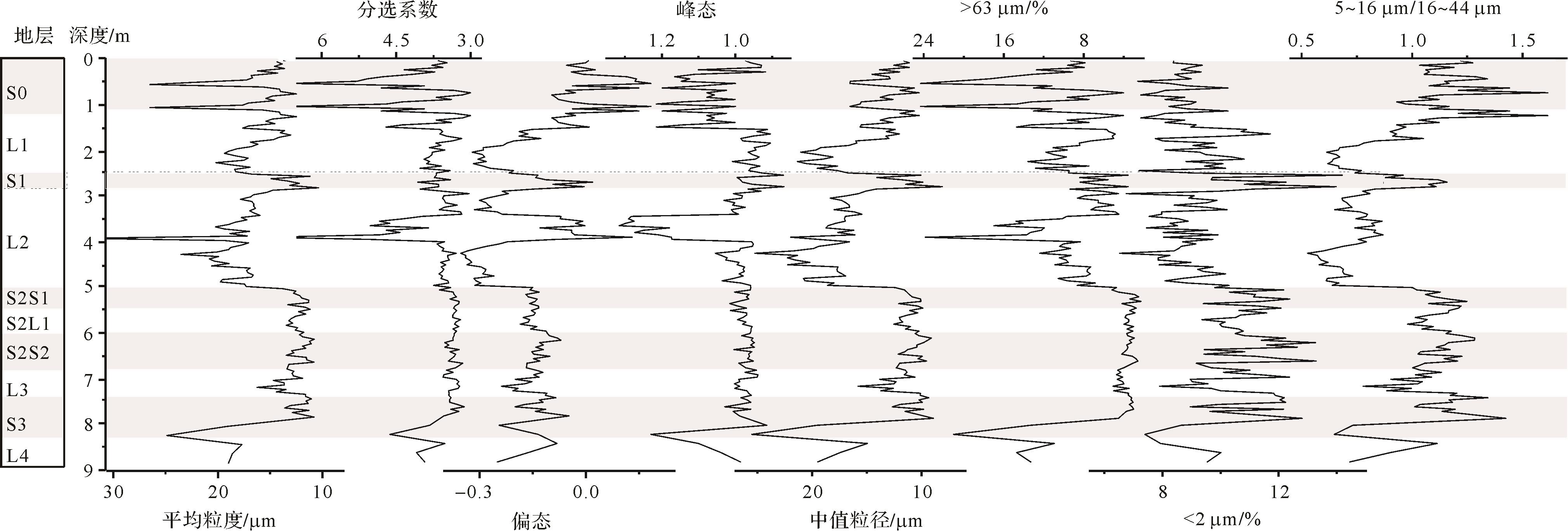
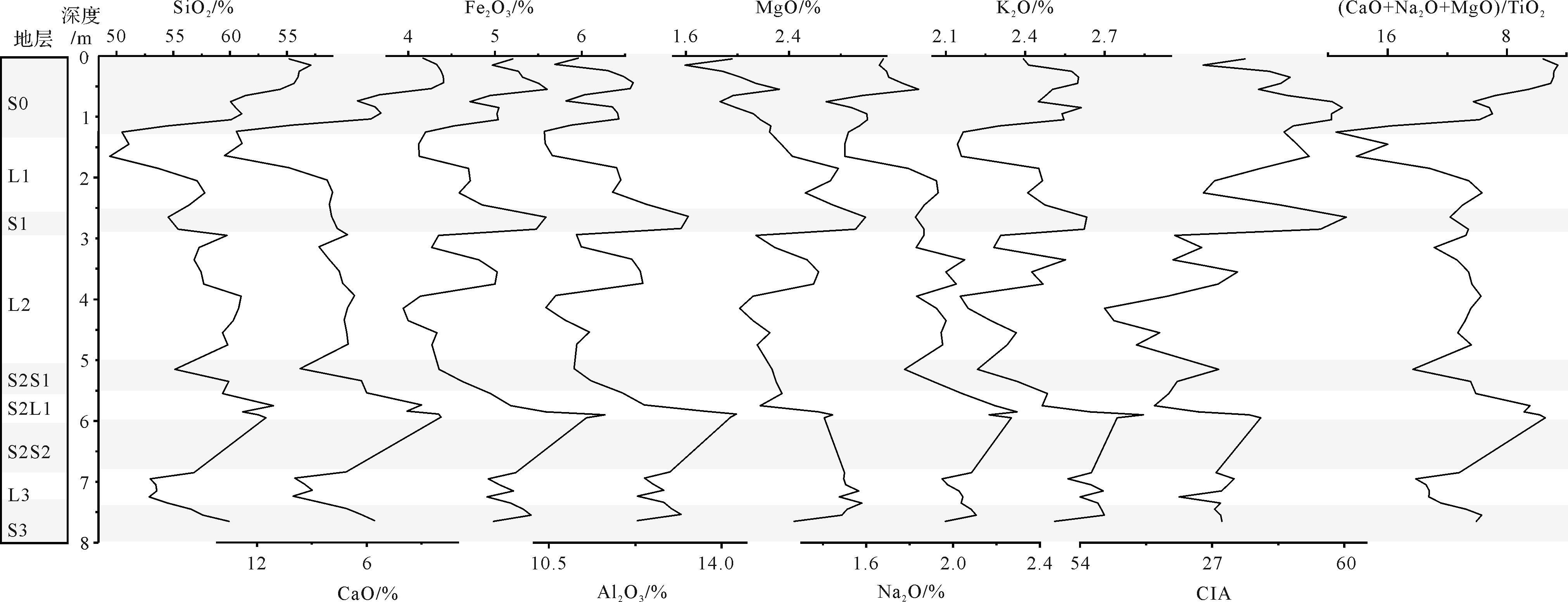
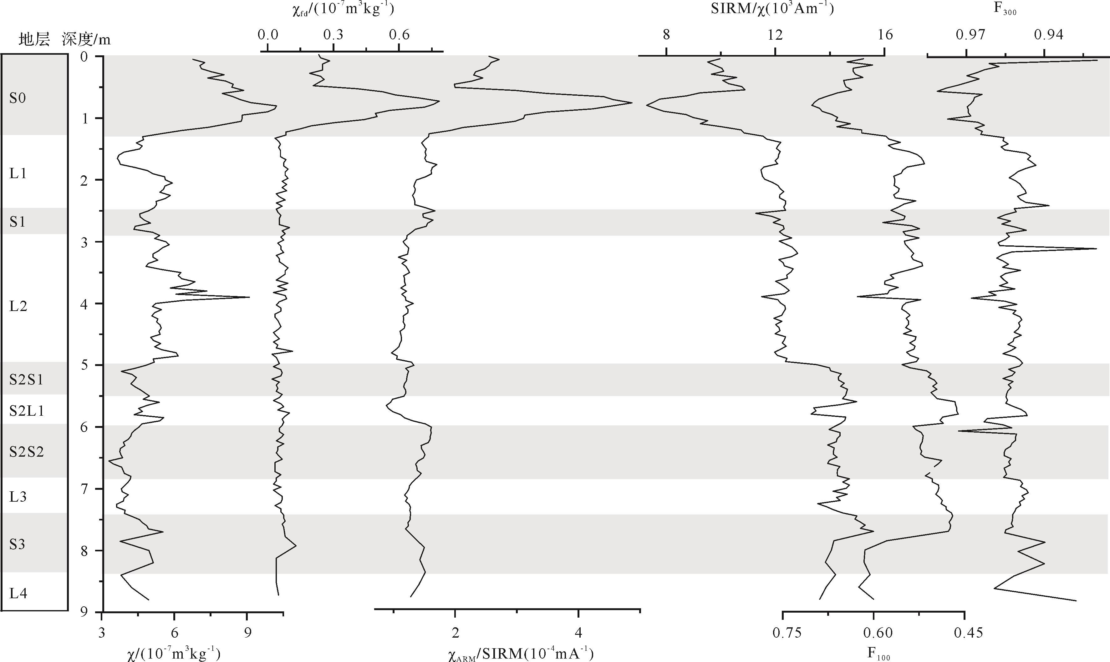
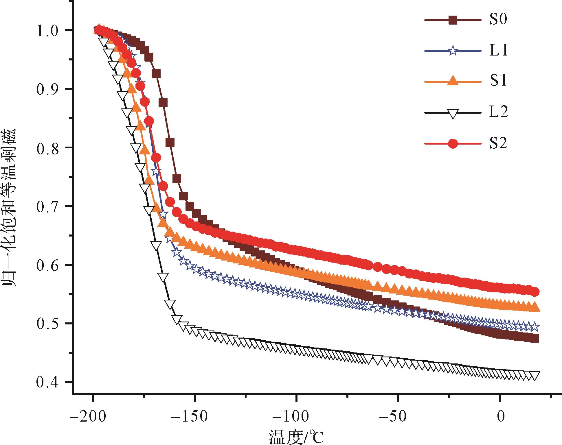
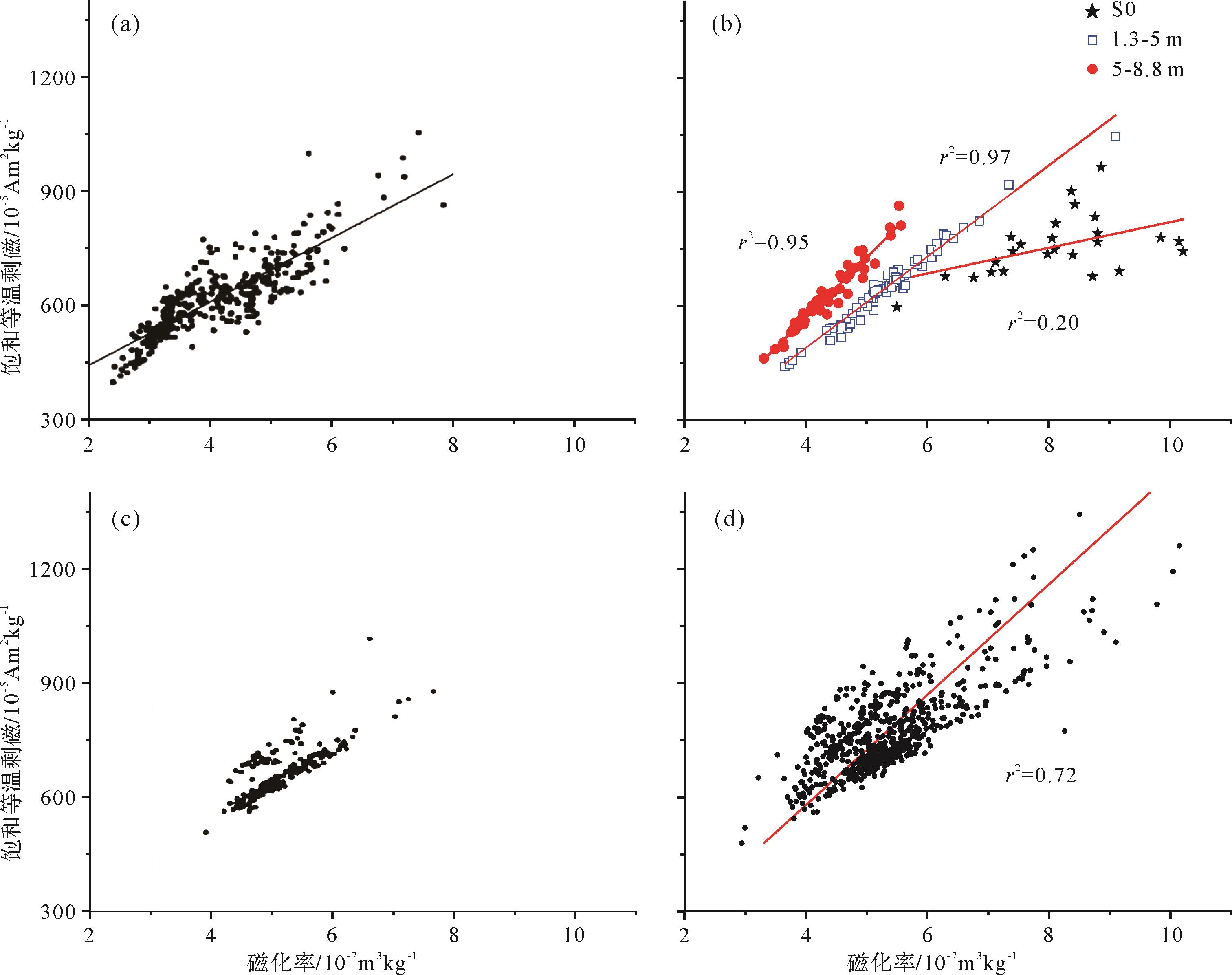
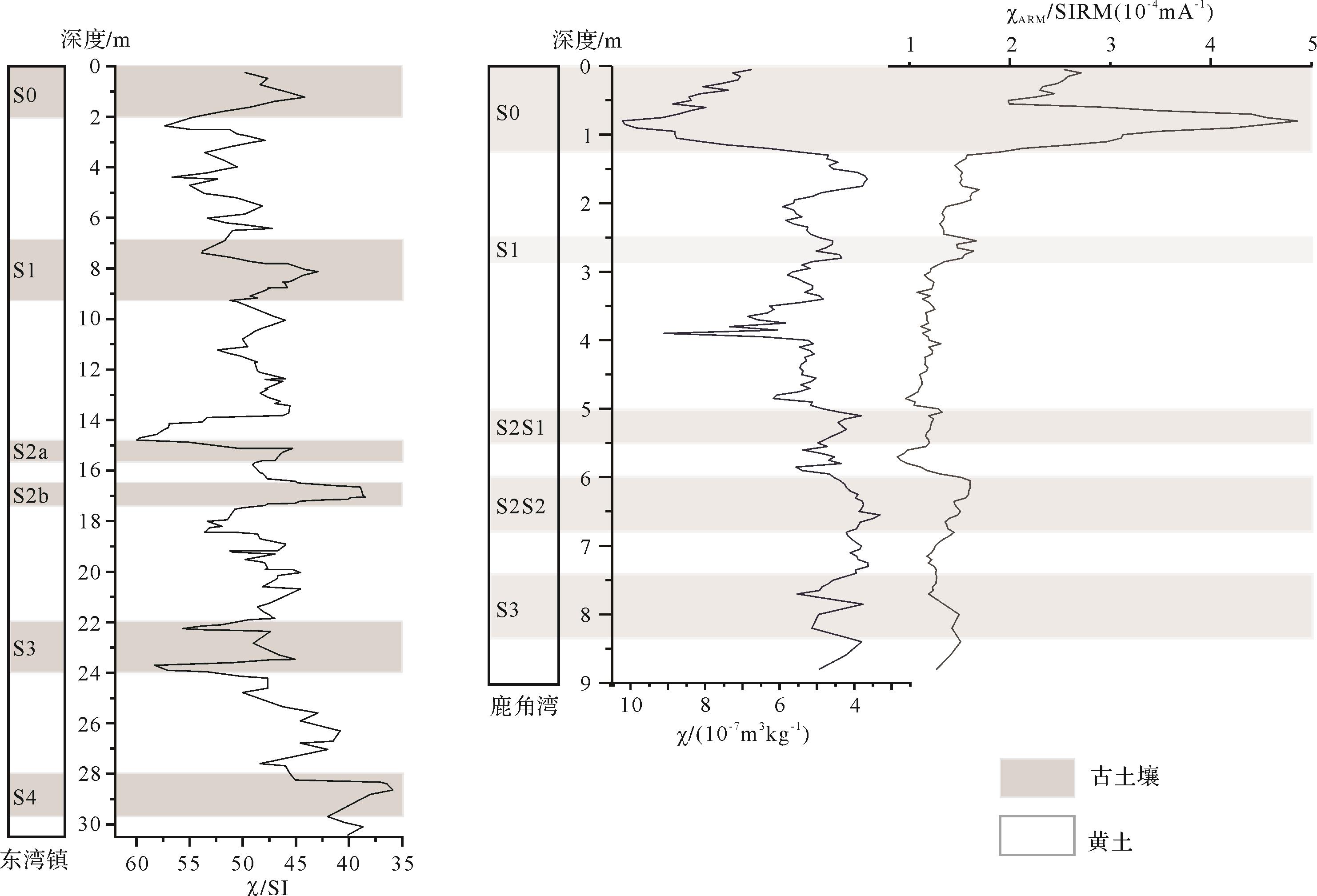
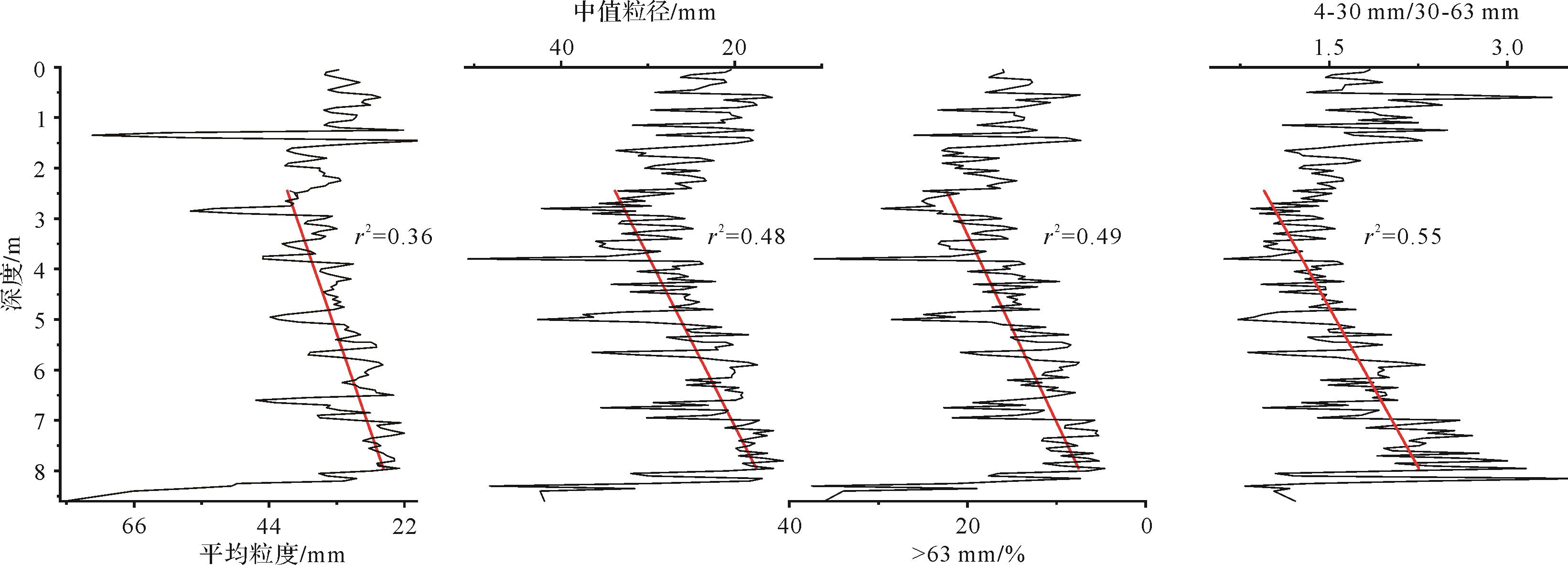
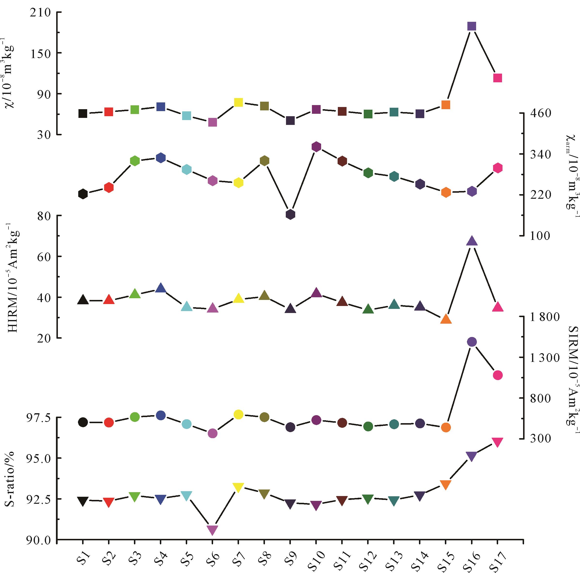
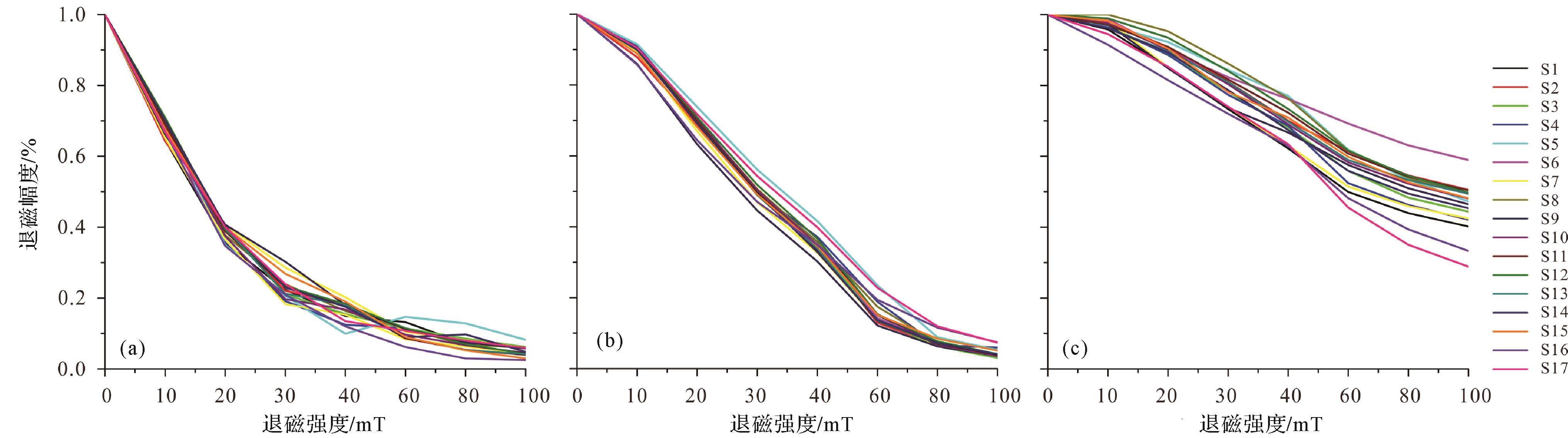
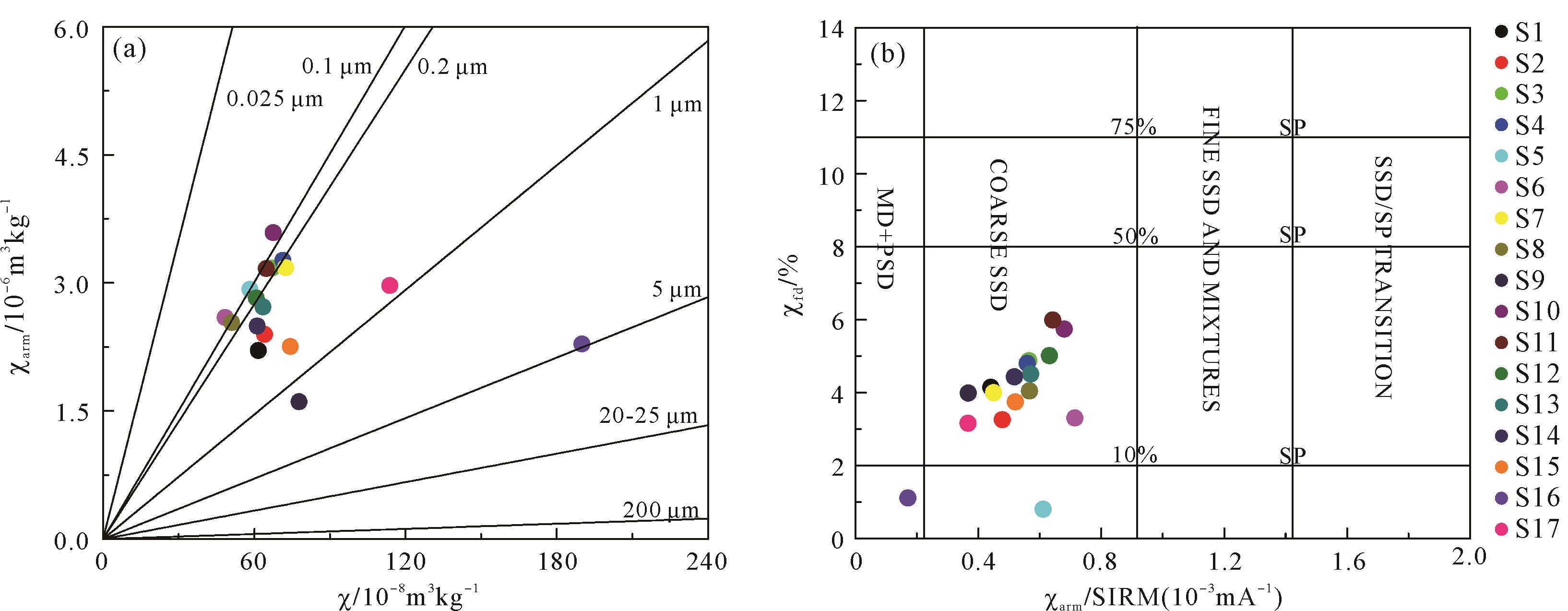
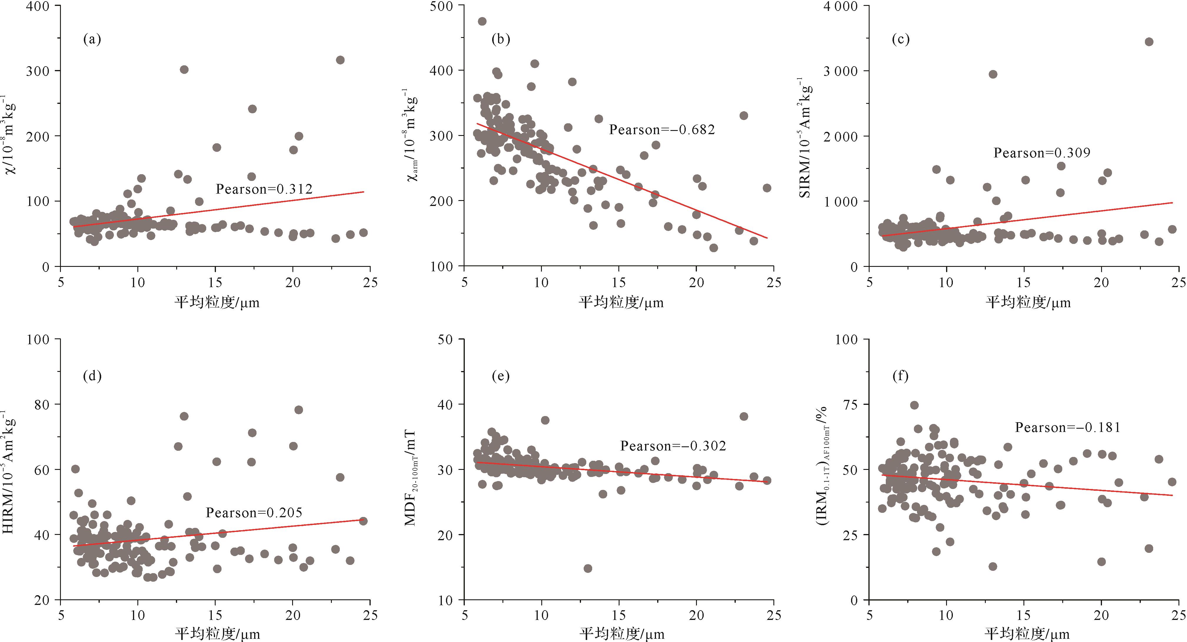
Considerable progress has been made in studies of the distribution, age and paleoclimatic significance of loess deposits in arid central Asia. However, the focus has been on long-term drying trends (since 800 ka) or short-term moisture evolution (since the last interglacial or during the Holocene). The paleosols are generally undeveloped in the pediment of the Tianshan Mountains, which makes detailed paleoclimate reconstruction difficult. Based on previous work, a number of methods were used in the present study to investigate loess deposit samples from different sections along the north pediment of the Tianshan Mountains. These include a typical loess section at Lujiaowan at relatively high elevation, and sections in low-lying areas along the southern margin of the deserts. The Lujiaowan section consists of four paleosols and intercalated loess dating back to 300 ka. According to the stratigraphic divisions on the Chinese loess plateau, the four down-section paleosols were designated S0, S1, S2 (subdivided into S2S1, S2L1 and S2S2), and S3. The sections possess similar variations in color, grain size, geochemistry and rock magnetism with depth, consistent with loess/paleosol alternation. They also indicate a significant change in paleoclimatic proxies at the S2/L2 boundary. The grain size distribution of loess is unimodal, but is bimodal for the paleosols (or broadly unimodal), suggesting that the loess origins are related to two winds, the westerlies and near-surface winds. The variation in the dominance of the winds is consistent with the loess/paleosol alternation. Also, grain sizes are finer in the lower part of the section (S2, L3 and S3) than in the upper part. The chemical index of alteration (CIA) and (CaO+Na2O+MgO)/TiO2 ratio indicate more intensive weathering in the paleosols than in adjacent loess units. Integrated rock magnetic analysis indicates that the loess–paleosol sequence experienced three stages in the relation between pedogenetic intensity and magnetic susceptibility in response to different paleoclimates. The lower paleosols (S3 and S2) show higher pedogenetic intensity but lower magnetic susceptibility, reflecting humid paleoclimates. The upper loess–paleosol sequence exhibits the dominance of wind strength (for L2⁃L1) or pedogenesis (for S0) in magnetic enhancement. Compared to the underlying or overlying loess, the paleosols have fine magnetic grain size. It is suggested that the SIRM/χ and χARM/SIRM ratios are sensitive to climate change. A study of the relationship between SIRM and χ of the loess from the Lujiaowan, Jingouhe, Dongwan and Midong sections indicated that the origins of magnetic variations along the northern piedmont of the Tianshan Mountains are section-specific, and differ between layers. However, a common drying trend following loess deposition was observed. Various proxies implied that S2S2 was more highly developed than S3. Likewise, S2b, one of the sub-units of the S2 paleosols, shows lower χ than S3 in the Dongwan town loess section. The time span in which S2S2 or S2b developed was possibly wetter than the interglacial period during which S3 developed. This is consistent with studies of the loess from Kunlun Mountains. For the paleoclimate evolution over the last interglacial/glacial period, the grain size parameters of the Dongwan loess demonstrate a drying trend, which is in line with the χARM/χ and SIRM/χ ratios of the Midong loess.This study provides further evidence for the contribution of the different winds to the loess deposits along the northern piedmont of the Tianshan Mountains. Paleoclimate evolution was affected by both westerly and near-surface winds. The westerlies dominated the moisture variation, and the near-surface winds were responsible to a greater extent for the origin of the loess deposits. The different magnetic mechanisms resulting from varying geographic exposure to paleoclimatic changes were revealed. The local pedogenetic signals revealed by rock magnetism are the result of changes in moisture conditions. Both the high-elevation Lujiaowan loess and the low-lying Dongwan loess show that the S2 paleosols experienced more humid conditions than the S3 paleosols. L2 loess was deposited during much drier periods; S1 is less developed than both S2 and S3 due to the presence of inadequate moisture. The aridity further intensified from the last glacial to the onset of the Holocene. The drying trend and major drying events are attributable to the uplift of the Tibet plateau.
2022, 40(3): 691-700.
doi: 10.14027/j.issn.1000-0550.2020.117
Abstract:
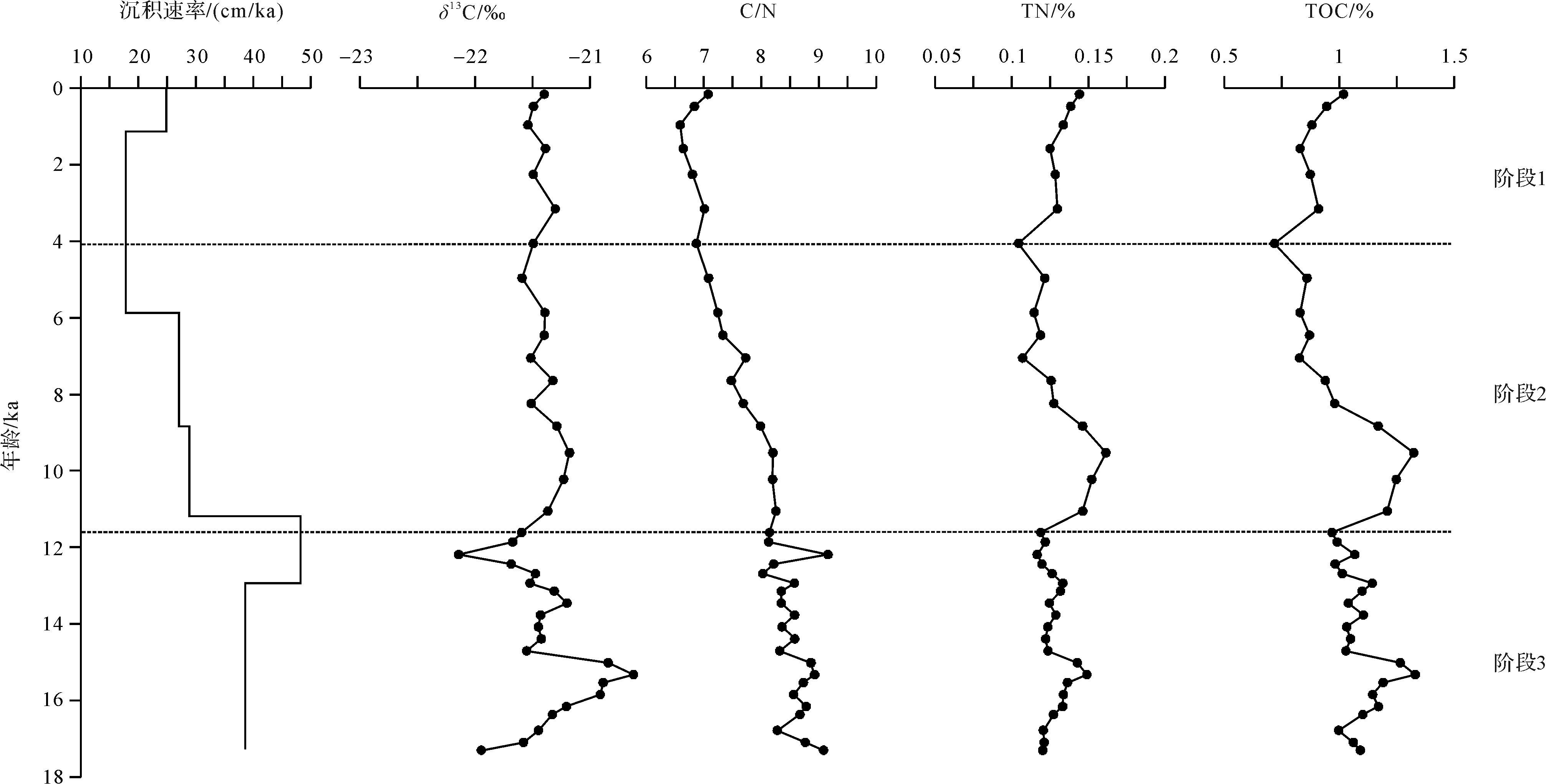
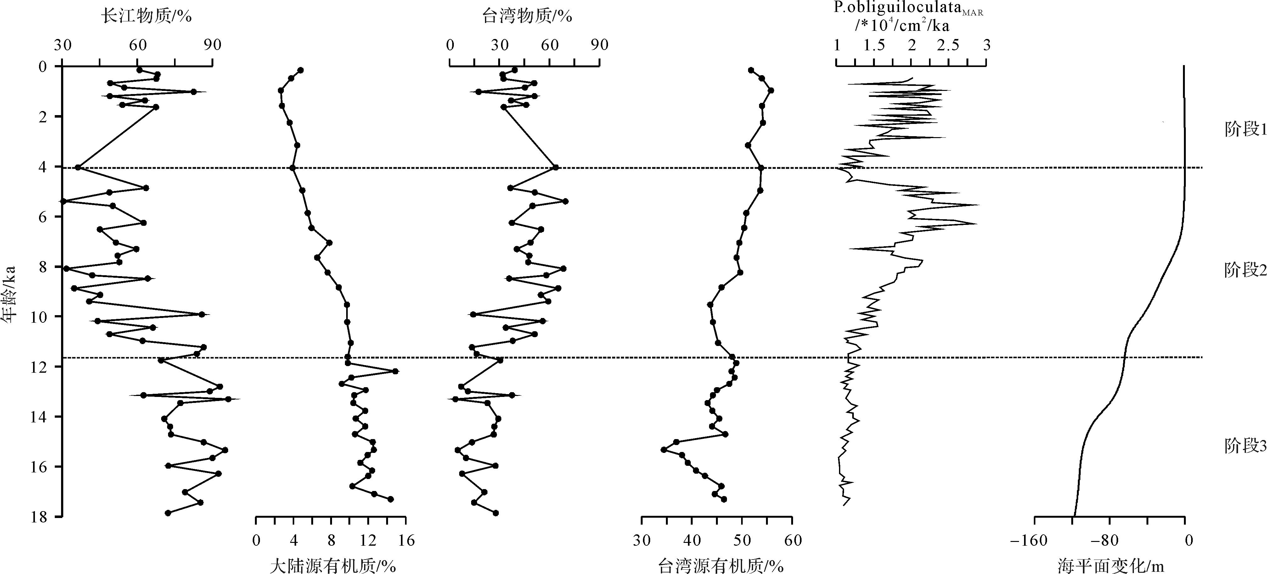
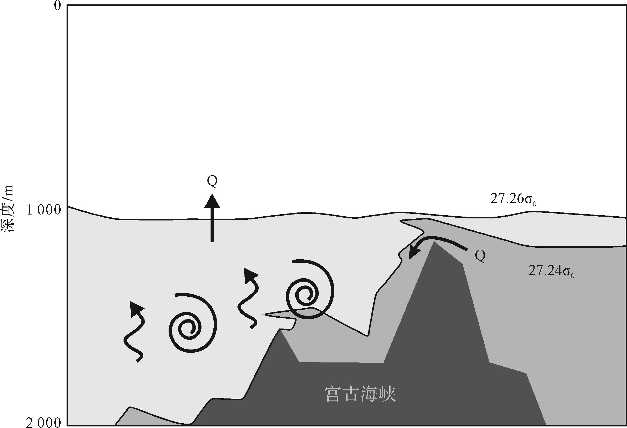
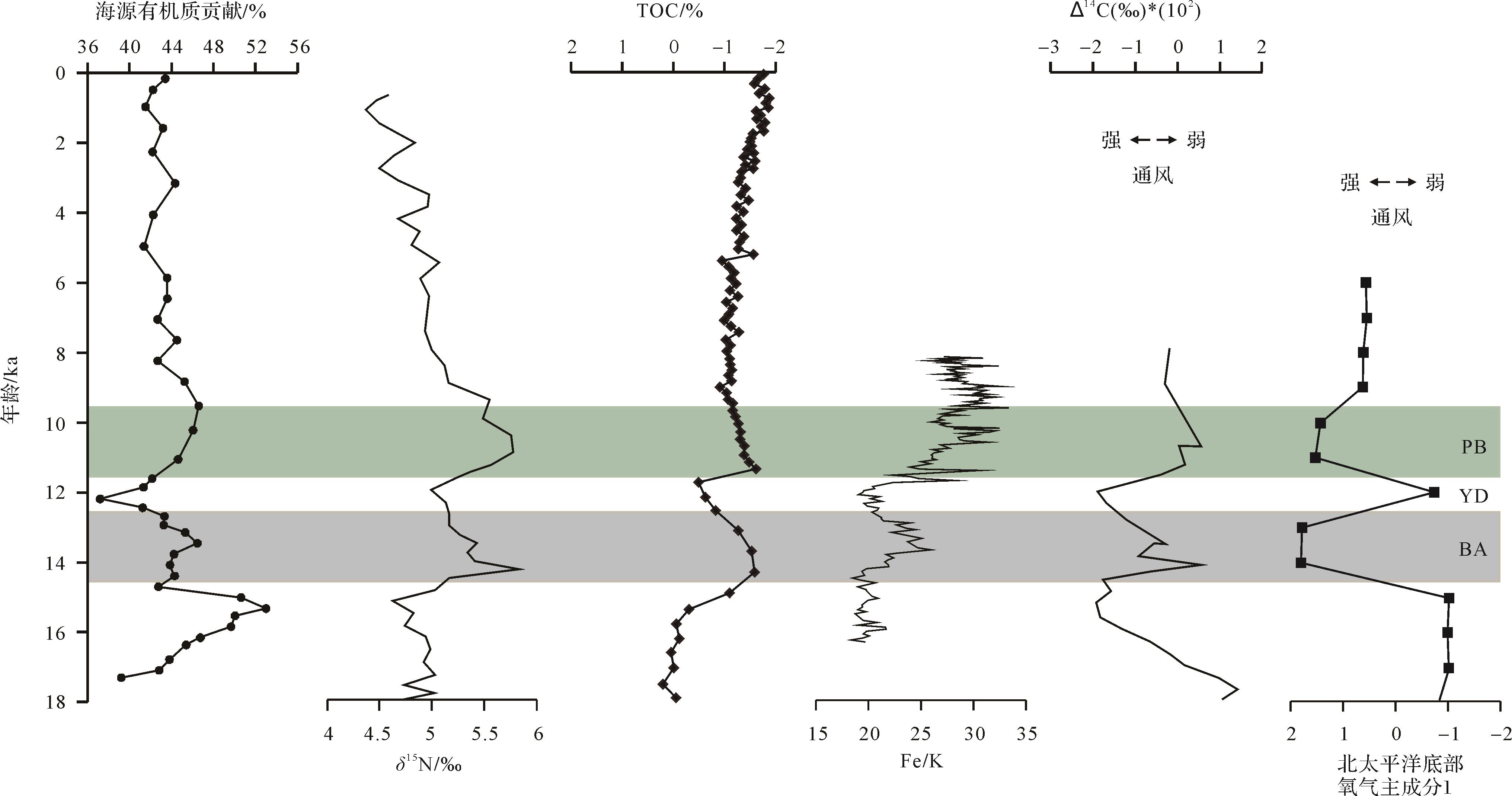
A piston core (OKT-3) is collected from the middle southern Okinawa Trough (26.018 °N, 125.282 °E) at a water depth of 1 792 m, providing depositional records since 17.3 ka. Total organic carbon, total nitrogen content, and organic carbon isotope data in this study, combined with previous data, have been analyzed to discuss the organic matter source and its response to paleoenvironmental evolution since the last deglaciation. The organic component of core OKT-3 is composed of terrestrial and marine organic matter. Terrestrial organic matter is mainly derived from the Changjiang and Taiwan Rivers, which is controlled by sea level change, the Kuroshio Current, and climate variation. The Changjiang-sourced organic matter of core OKT-3 showed a decreasing trend during 17.3~4 ka B.P., consistent with the decreasing contribution of Changjiang-derived detrital sediments. In contrast, the Taiwan-sourced organic matter, which is transported by the Kuroshio Current, showed an increasing trend. It is worth noting that the Changjiang-sourced and Taiwan-sourced organic matter did not exhibit synchronous changes with the Kuroshio Current during 4~1.5 ka B.P., which may be controlled by summer monsoon. Marine organic matter from core OKT-3 showed two peaks during Bølling-Ållerød and Pre-Boreal periods, with low values during the Younger Dryas period. Consistency between marine organic matter and primary productivity suggests that North Pacific Intermediate Water (NPIW) acts as a conveyor belt transporting nutrient from the North Pacific to the Okinawa Trough. NPIW passes through the Kerama Gap to the Okinawa Trough and carries nutrients to the surface water by way of upwelling. The consistency between marine organic matter and δ15N further suggests there may exist a link between the Okinawa Trough and the North Pacific, and NPIW may play an important role.
2022, 40(3): 701-714.
doi: 10.14027/j.issn.1000-0550.2021.018
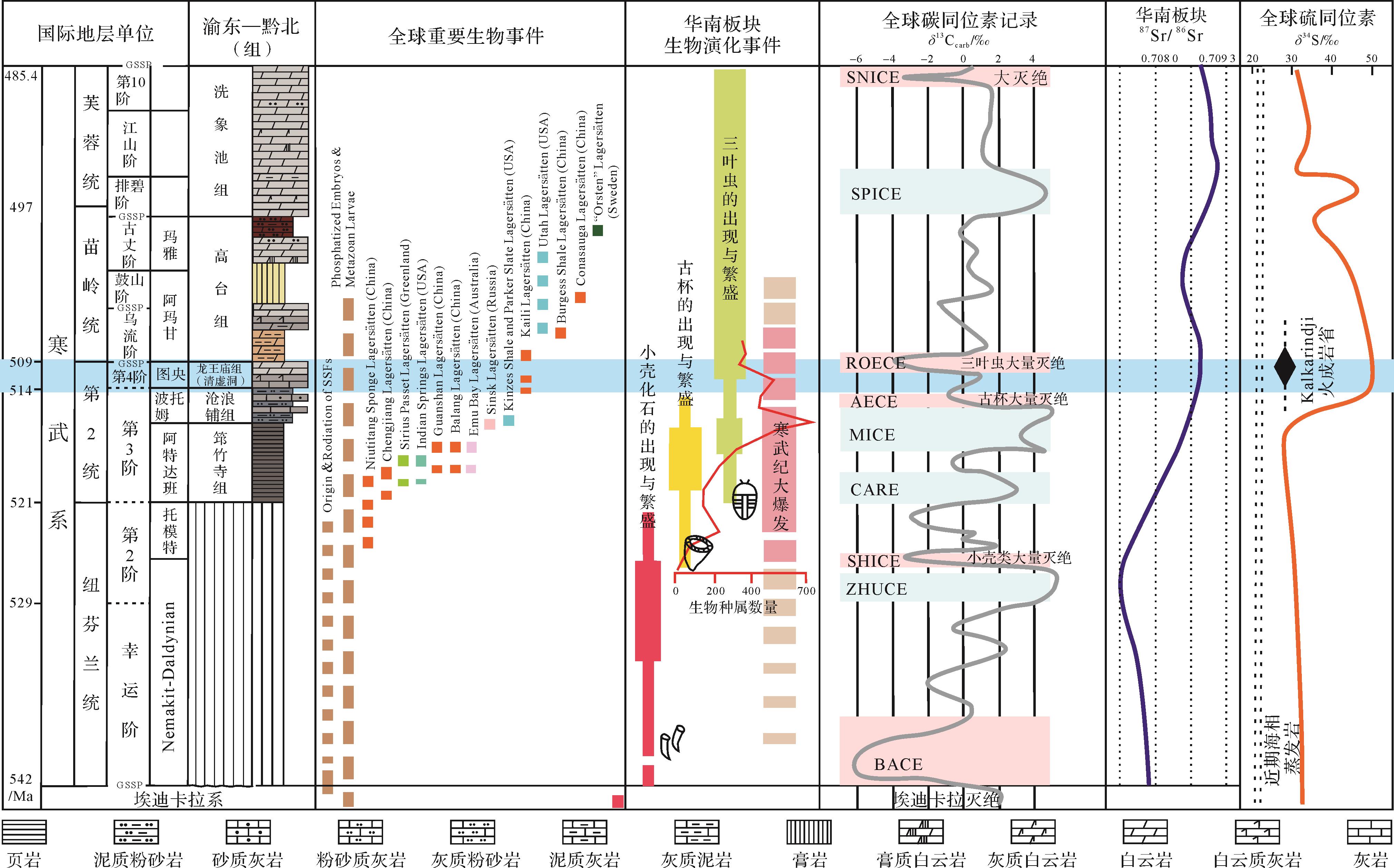
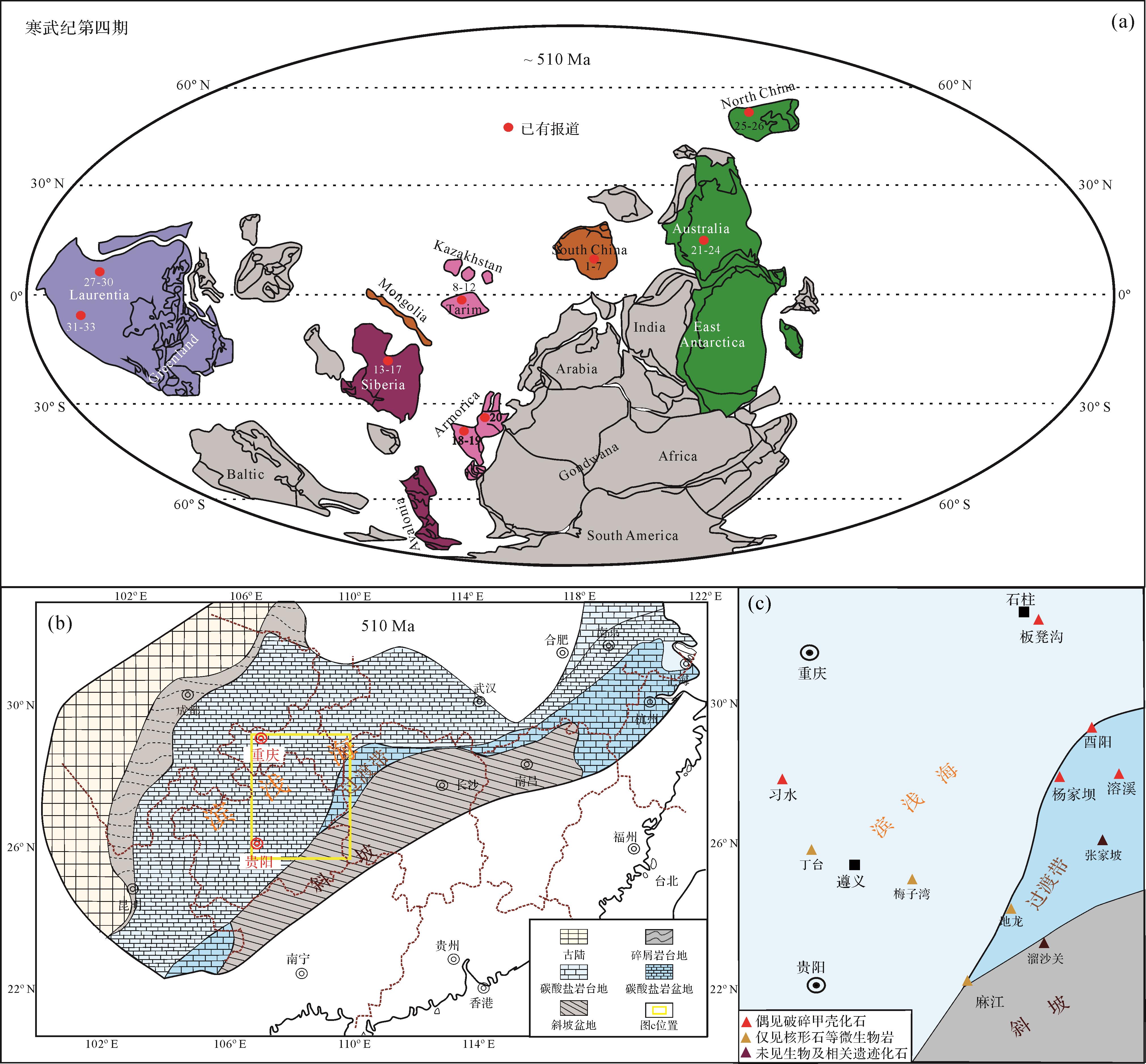
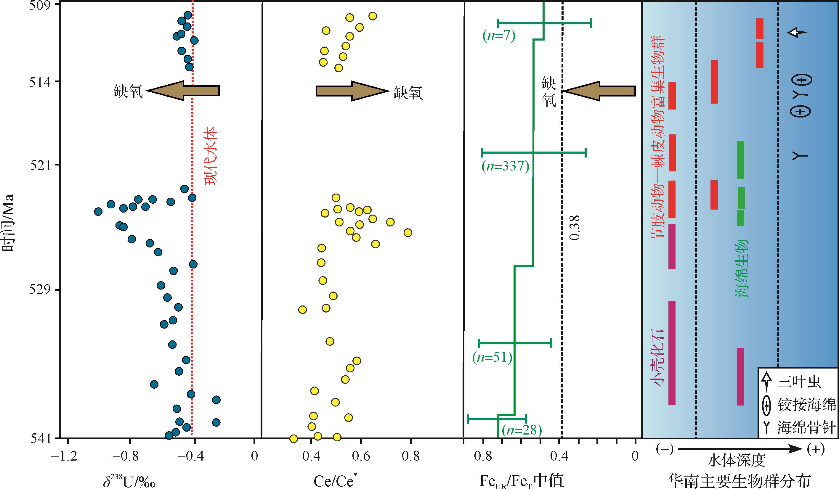
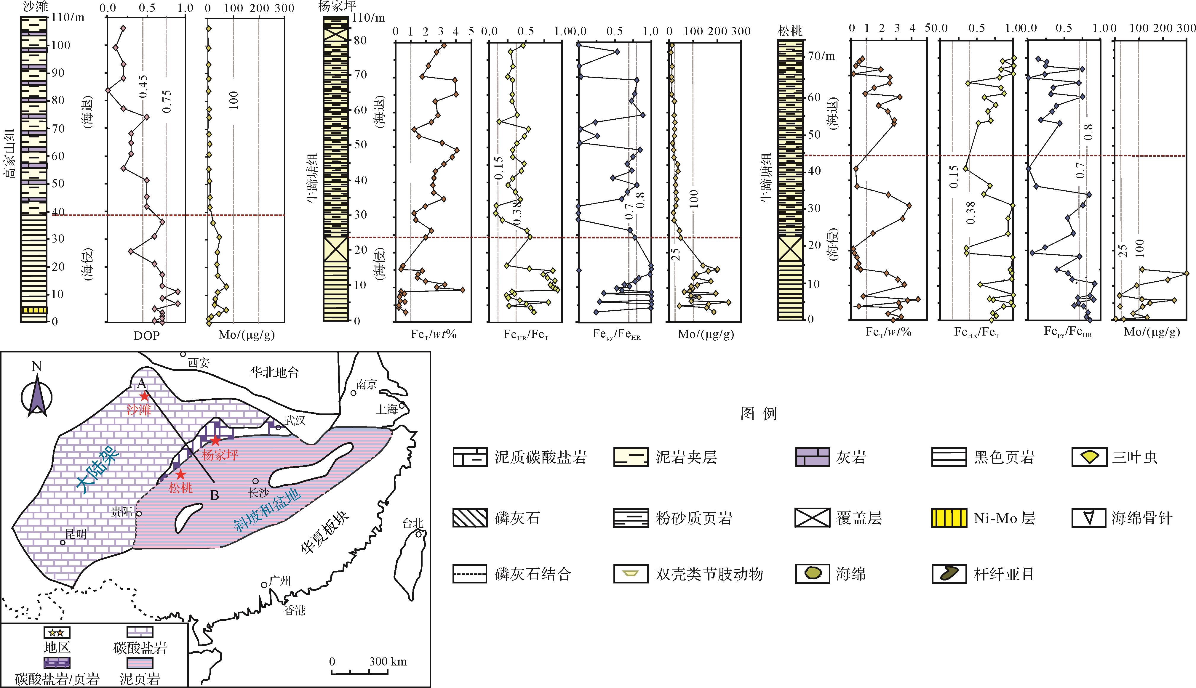
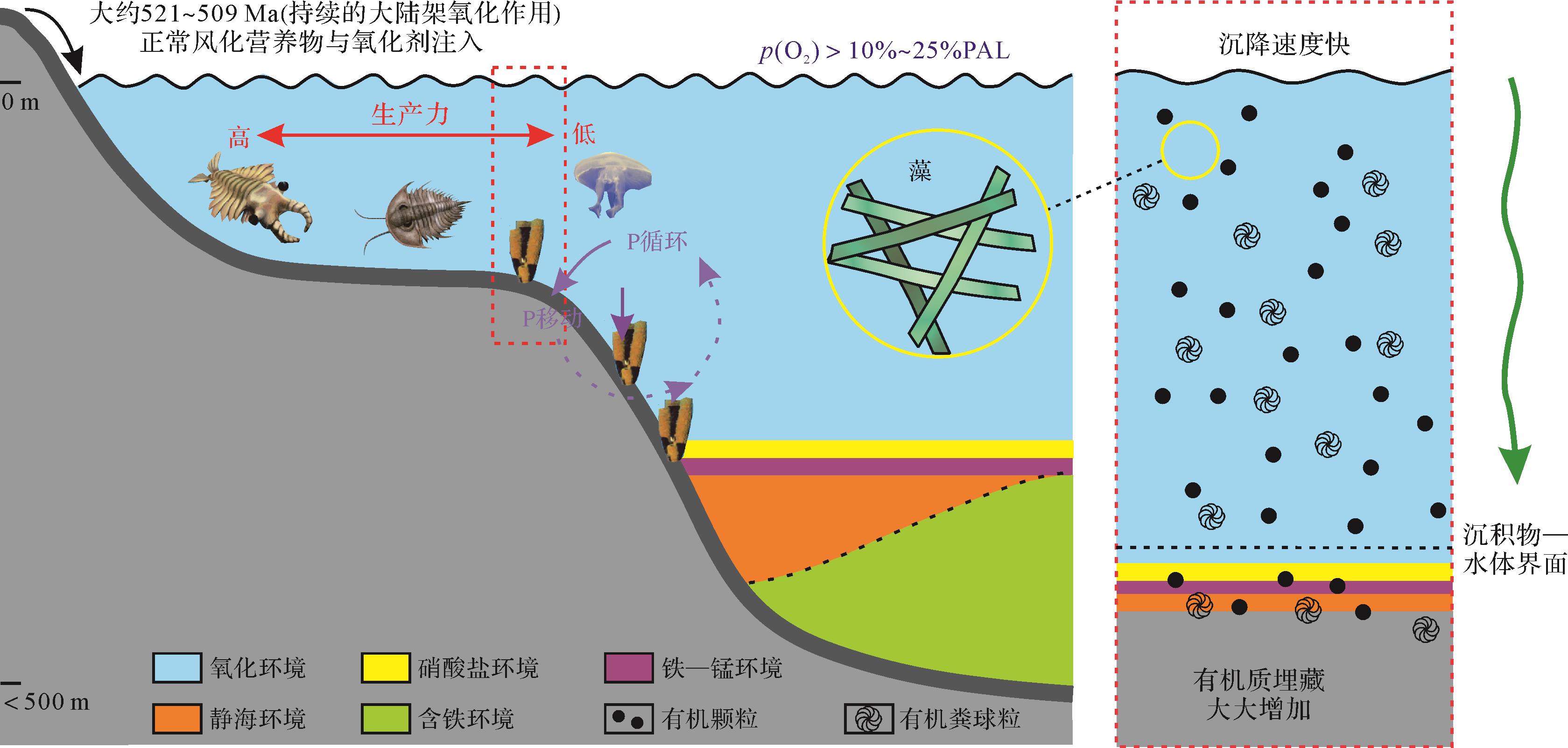
Abstract:
The genetic relationship between the Cambrian Explosion and the evolution of the paleo-marine environment is one of the frontier scientific issues in tracing the origin and development of life, environmental changes, and their co-evolution. The Cambrian Stage 4 is one of the key points during this period, and the South China Plate is a prominent window for the research on Cambrian Explosion related issues. Thus, the redox condition of the paleo-ocean is a crucial pointcut for analyzing the geological origin of great changes of paleontological species and numbers. Therefore, based on the sufficient survey of previous research, this paper systematically reviews and summarizes the sedimentary paleogeographic background, paleo-marine environment conditions, biological development situation, and cataclysmic geological events, and then explores the genetic relationships among geological events, paleo-marine redox conditions, and biological evolutions during the Cambrian Stage 4 to reveal the co-evolution between paleo-ocean redox conditions and biology in the Early Cambrian. The results infer that the frequent terrestrial water injection, storm surge, intensively volcanic activity, and transgressive events during the Cambrian Stage 4 affected the paleo-marine redox conditions significantly, and the biological crisis was closely related with the paleo-marine anoxic event caused by geological events. However, the differences in biological abundance among different fluctuation stages of redox conditions and the differences in redox conditions at different paleontological abundance points, as well as the exact temporal correspondences between paleo-marine anoxic and/or oxidation events and the proposed triggering geological events, are still controversial, leading to confusion about the internal relationships among them. Thus, this paper introduces the paleo-marine redox conditions of the Early Cambrian and their co-evolution with biology in order to provide reference for the research on the causal relationships between life and environmental changes on the earth.
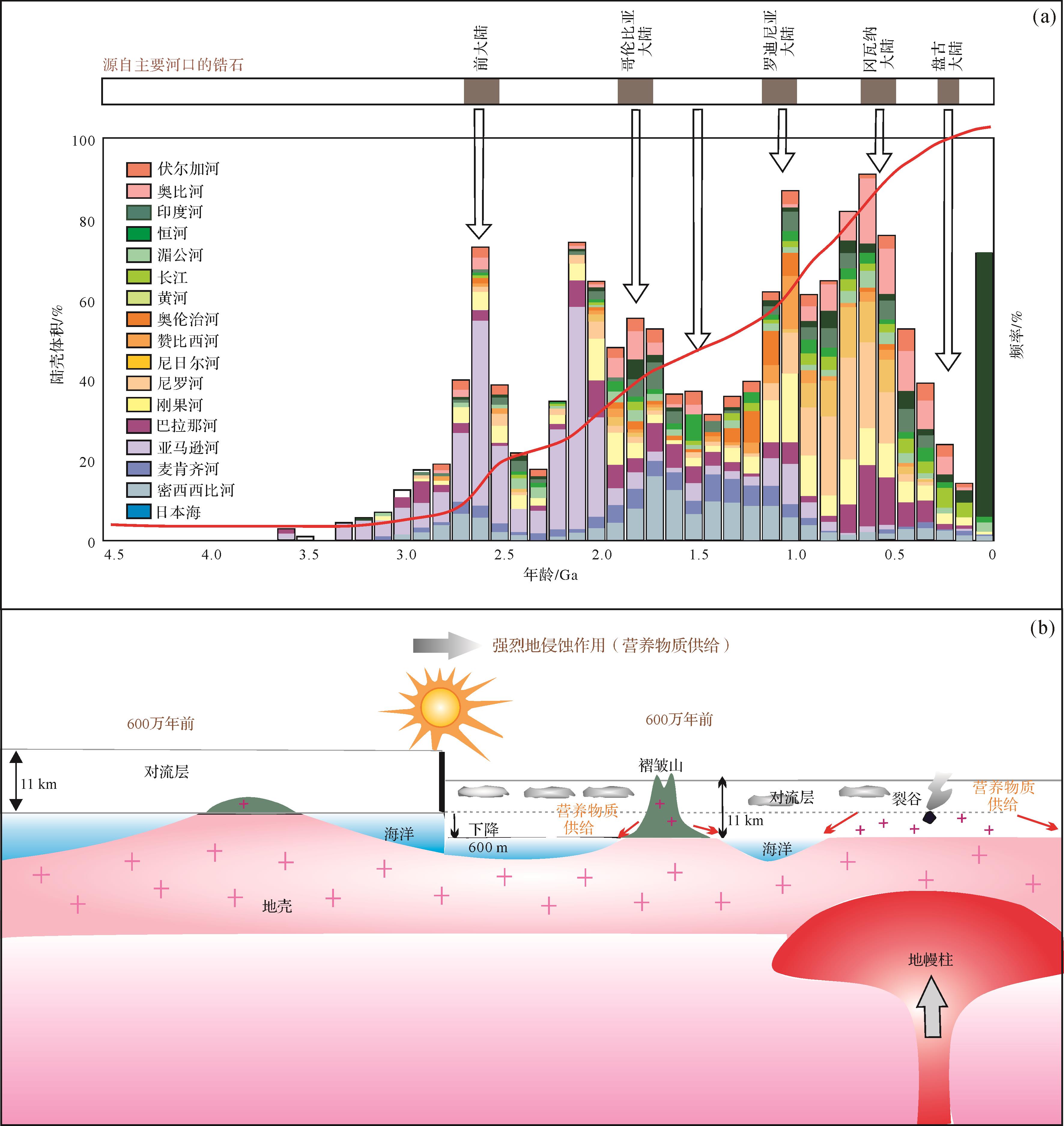
2022, 40(3): 715-729.
doi: 10.14027/j.issn.1000-0550.2021.139
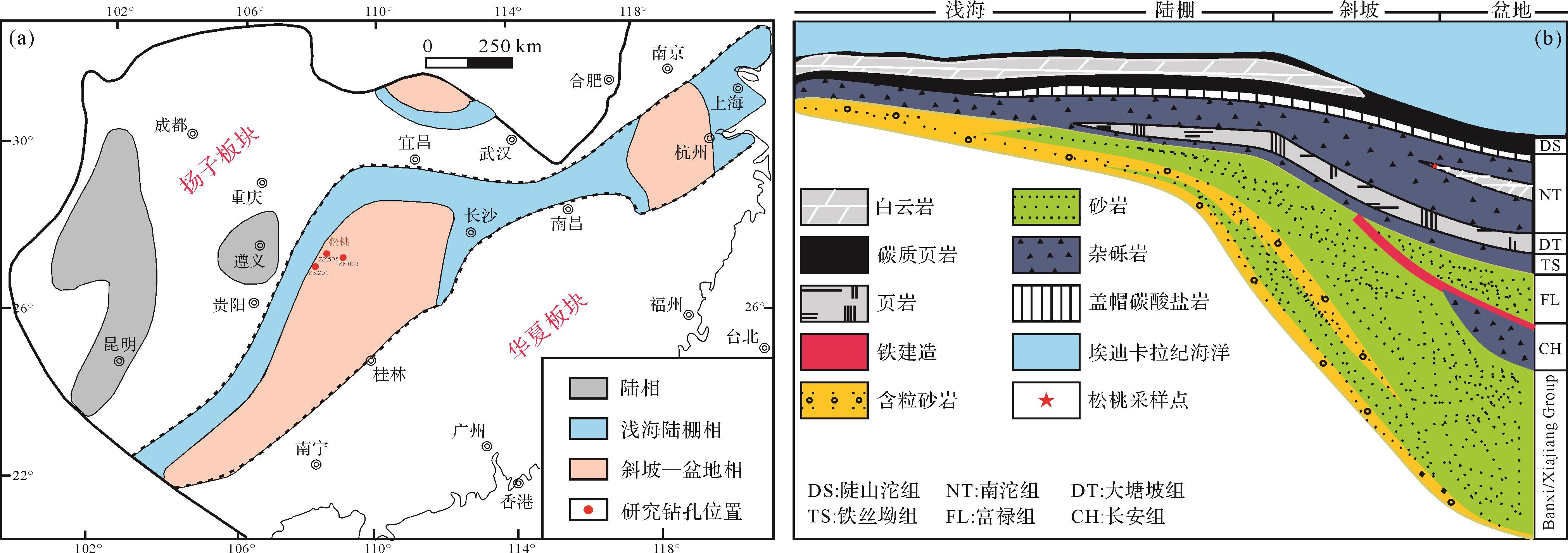
Abstract:
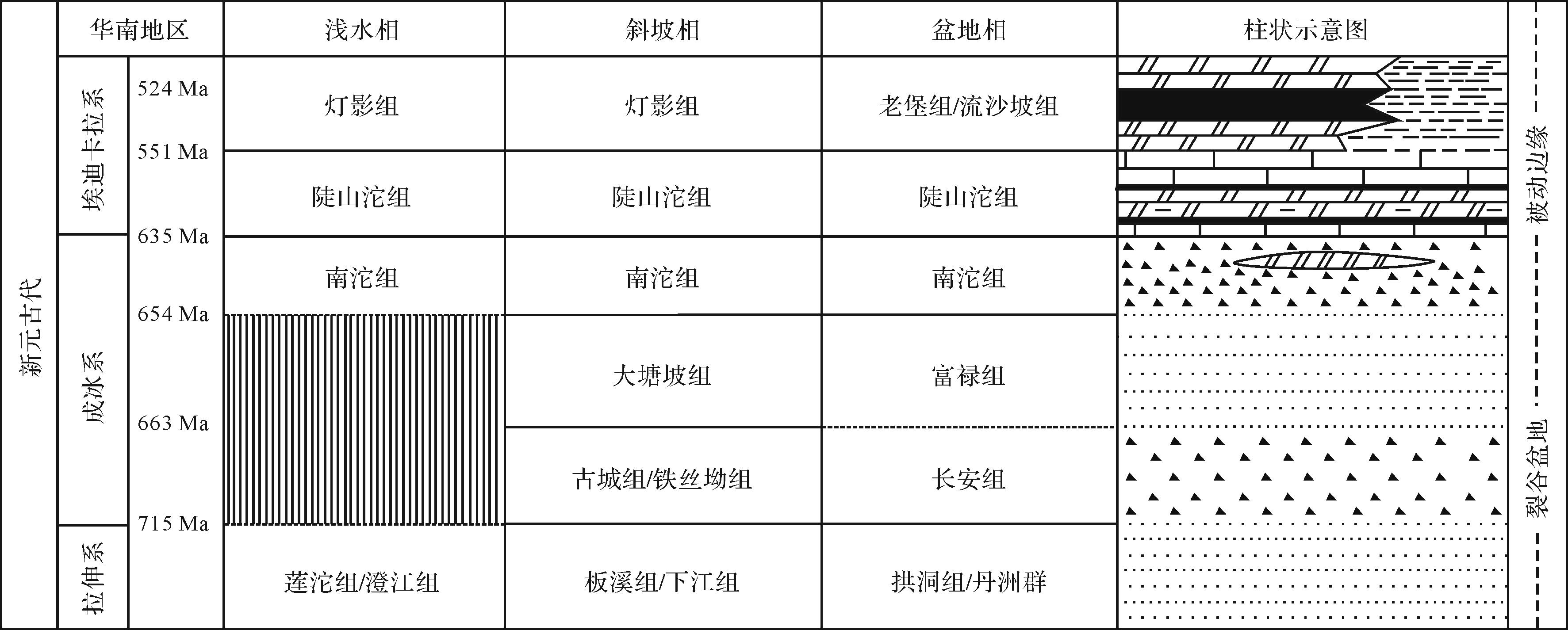
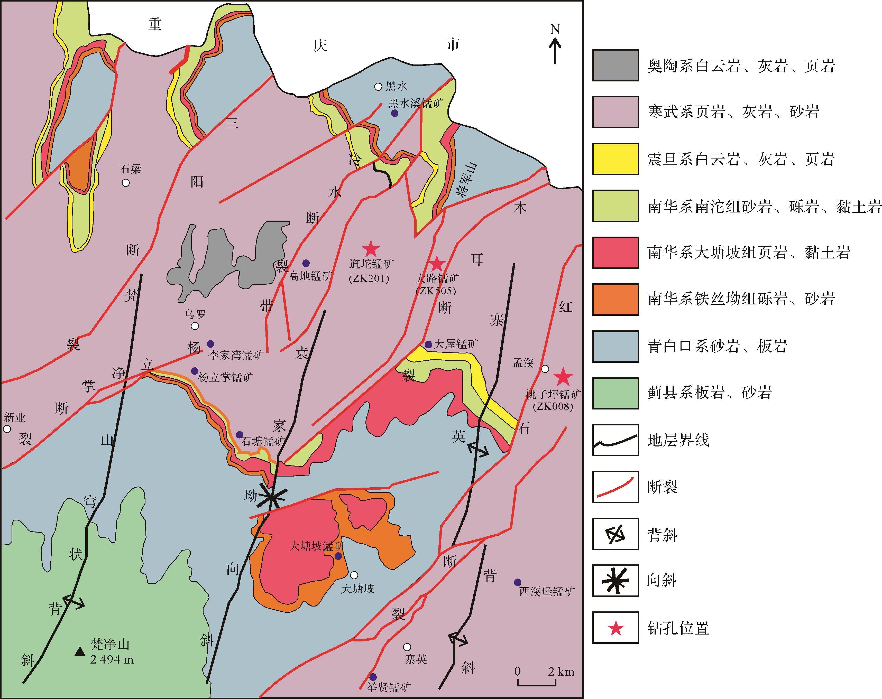
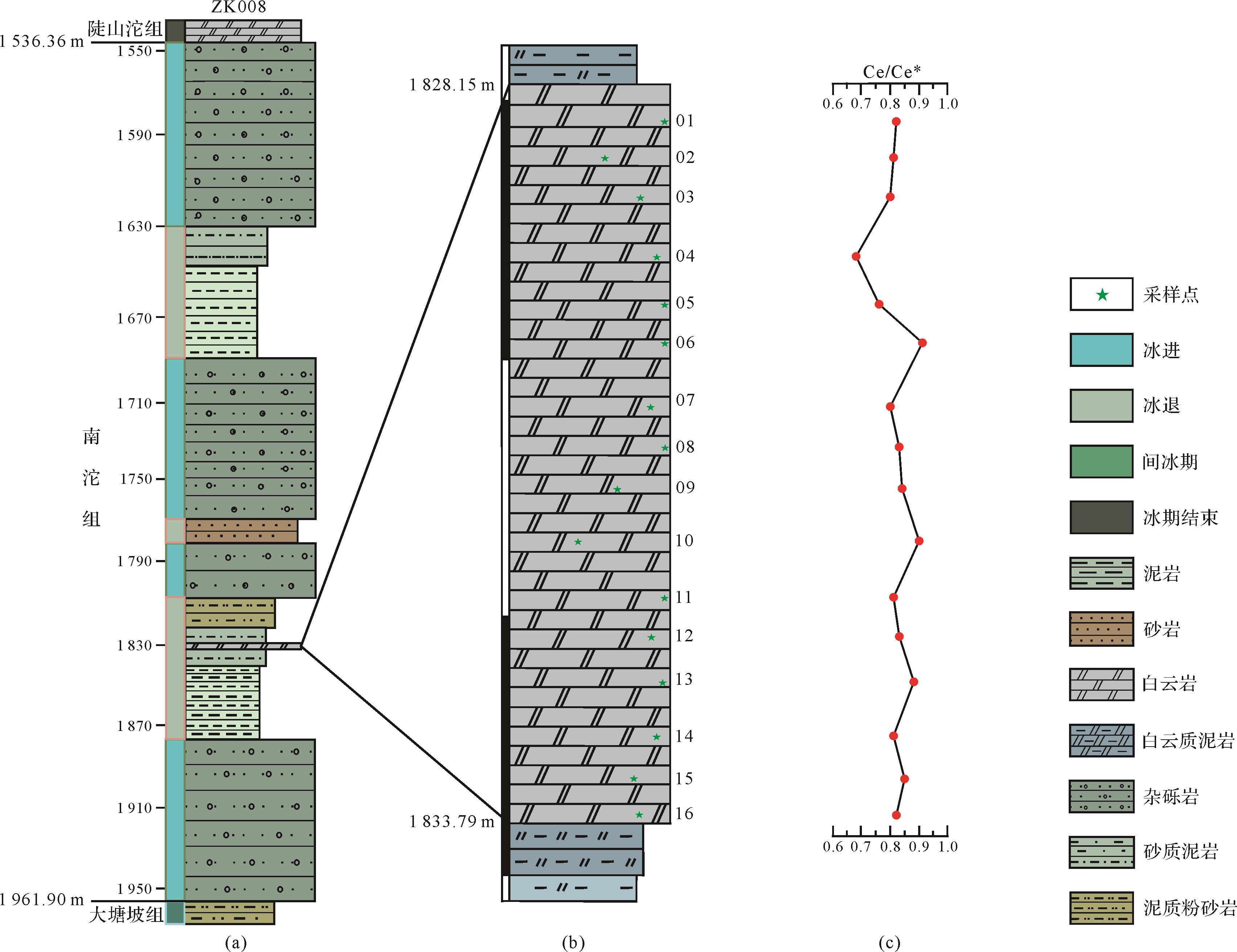
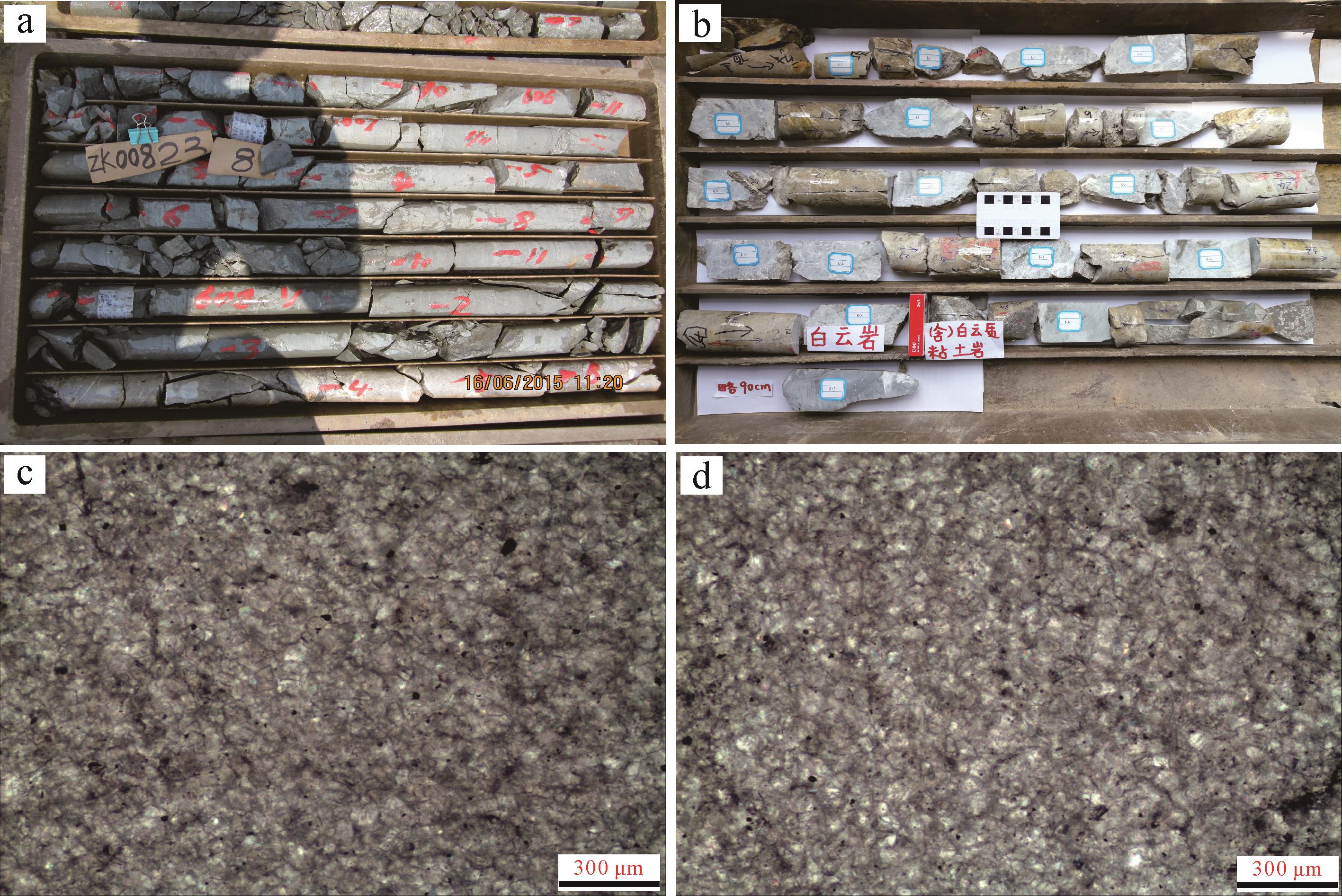
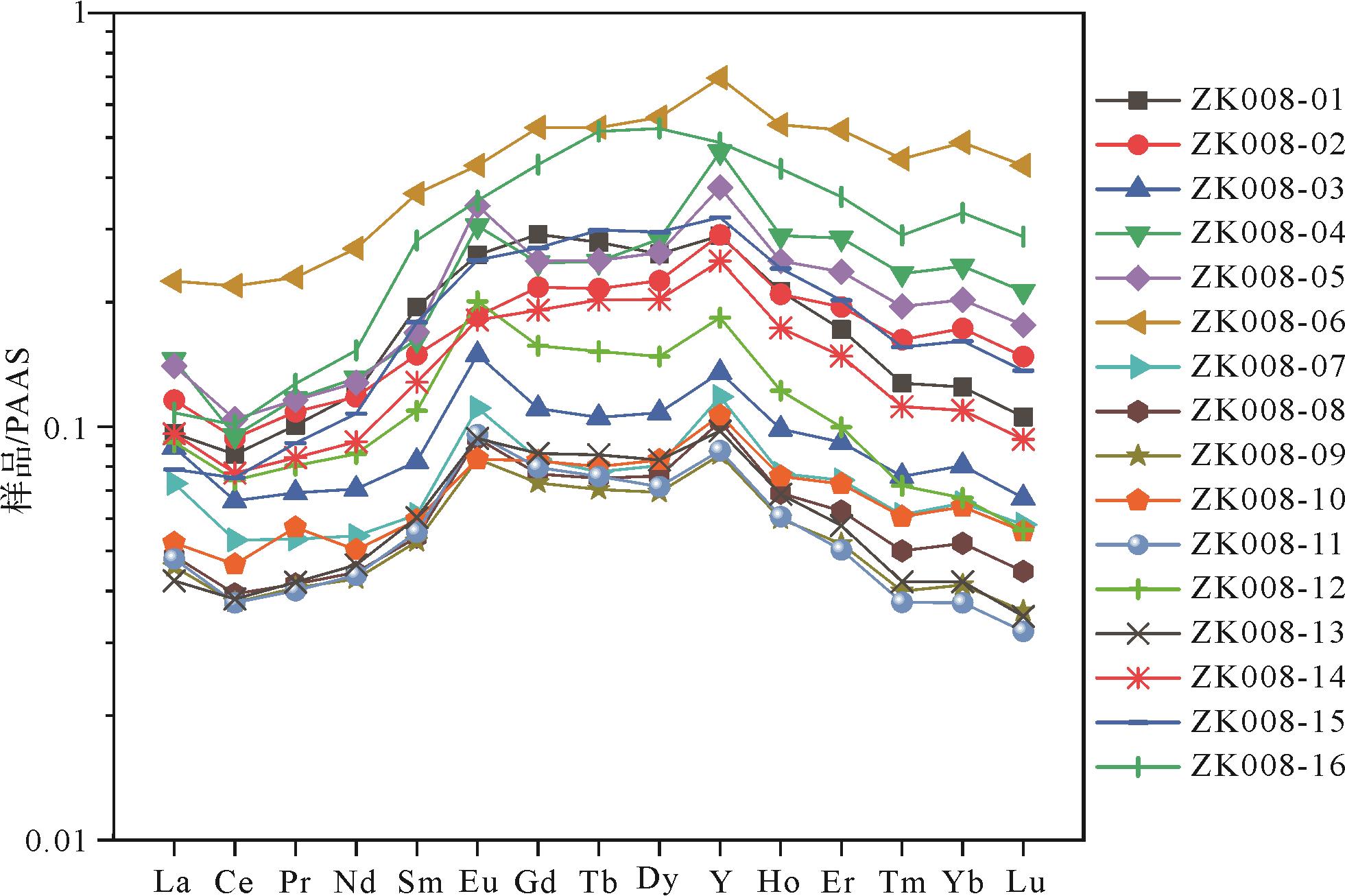
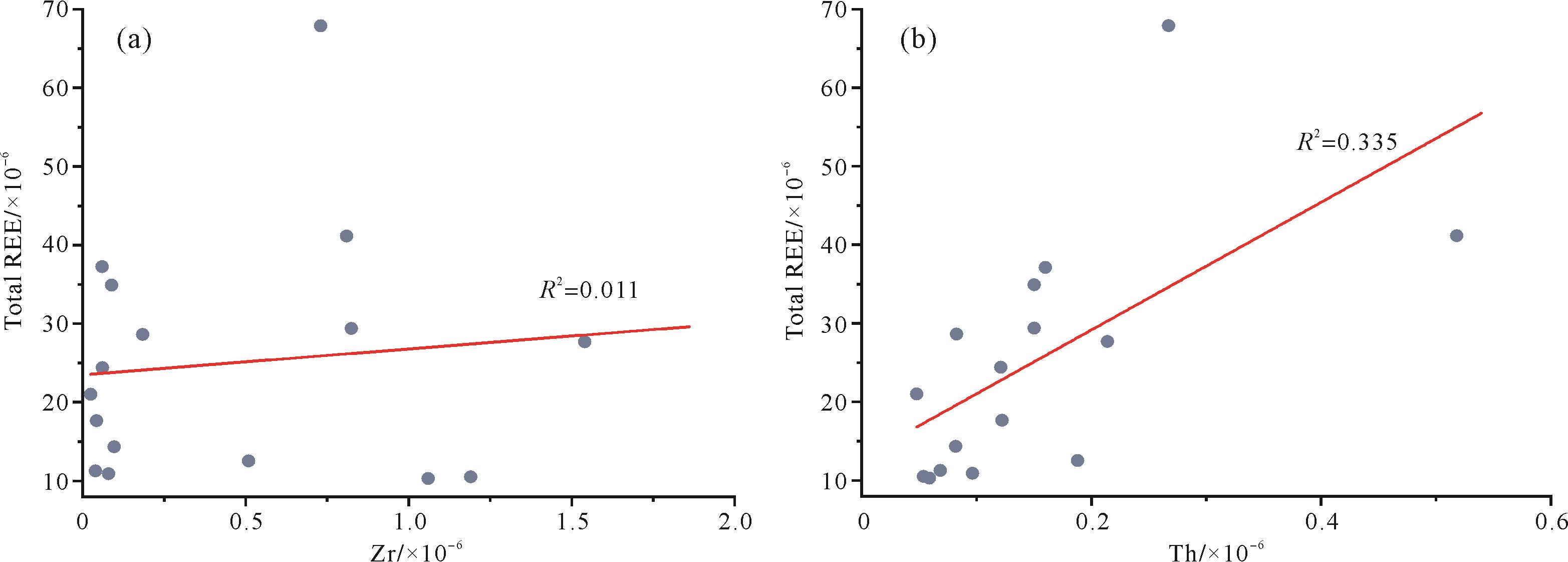
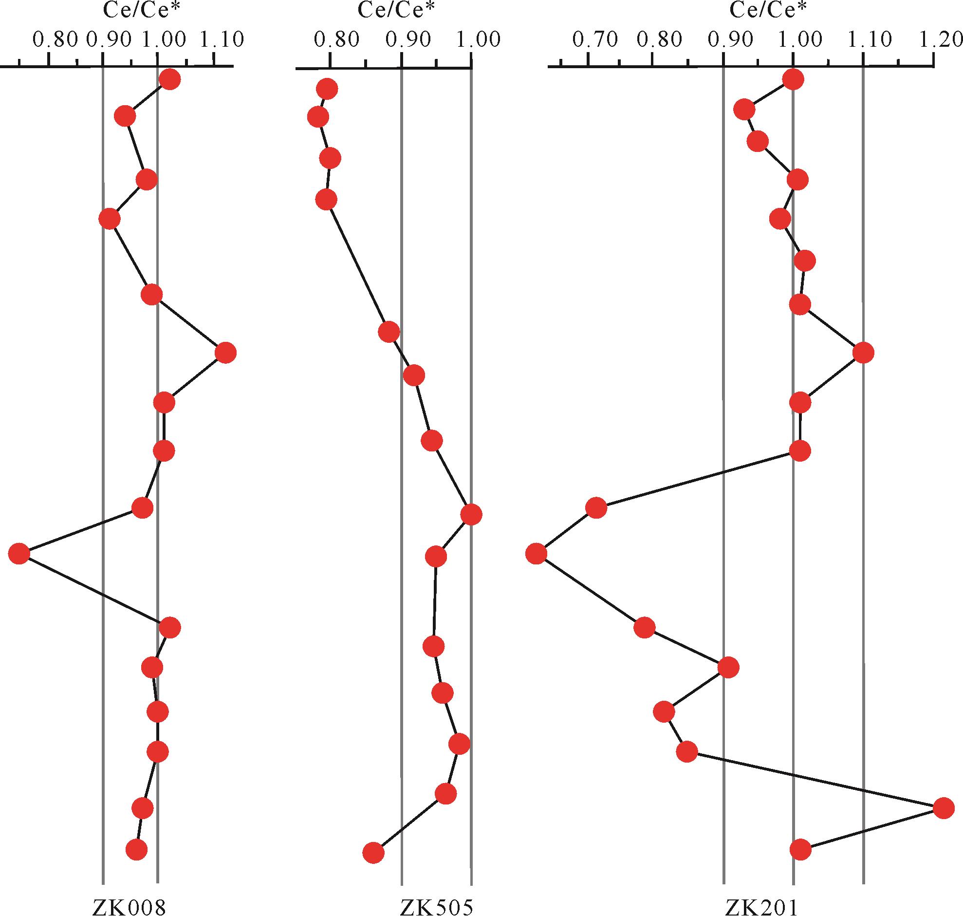
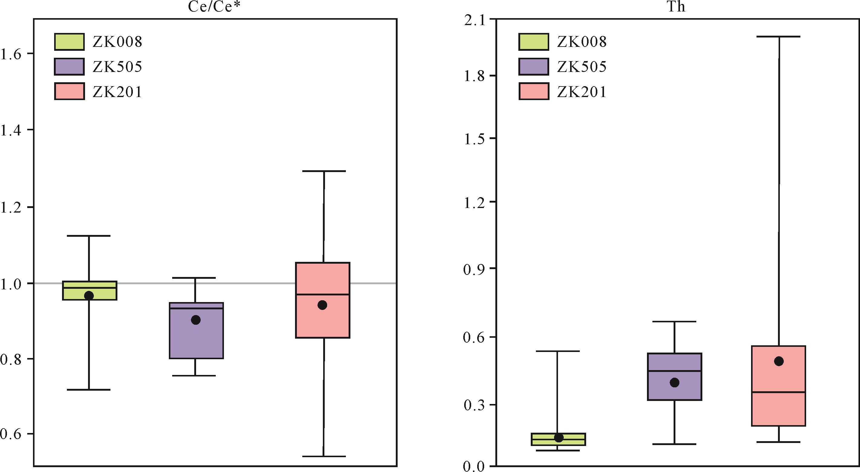
During the Neoproterozoic “Snowball Earth” glaciations, ice sheets probably covered the entire surface of the Earth. Knowledge of marine environmental conditions during the glaciation and the survival of eukaryotic life forms in such conditions has been severely limited, is a scientific question of general interest to the academic community. However, the apparent lack of primary marine precipitates limited the understanding of the syn-glacial ocean chemistry during the Snowball Earth. Synglacial dolomites in the Nantuo Formation in eastern Guizhou province are ideal materials for exploring the ocean redox environment during this period. A bed of synglacial dolomite was collected from a drill core in the Nantuo Formation, Songtao, Guizhou province, and samples were analyzed by inductively coupled plasma mass spectrometry (ICP-MS) for rare earth and other trace elements. It was found that the rare earth content ranged from 10.33×10⁻⁶ to 67.91×10⁻⁶. After post-Archean Australian shale (PAAS) normalization, the content of Ce anomalies ranged between 0.68 and 0.91 (average 0.82); iron concentrations 1 470×10-6⁃37 200×10-6 (average 9 902×10-6); and manganese concentrations 4 040×10–6⁃17 500×10–6 (average 10 476×10–6). The high Fe and Mn contents together with very low Ce anomalies in the dolomite indicate that iron-rich, anoxic (ferruginous) conditions were predominant in the Nanhua Basin during the Nantuo glaciation. Comparison with the sedimentary characteristics and Ce anomalies in two other drill cores from Guizhou province suggest that near-shore seawater was stratified during this period, with oxic conditions at the ocean surface overlying ferruginous water at depth. This implies that subglacial melt water supplied oxygen for the survival of eukaryotes during extreme Marinoan glaciation.
2022, 40(3): 730-738.
doi: 10.14027/j.issn.1000-0550.2020.053
Abstract:
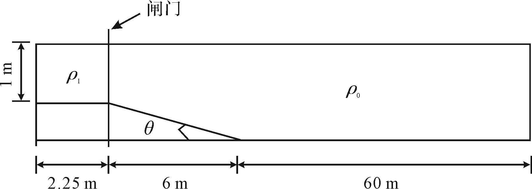
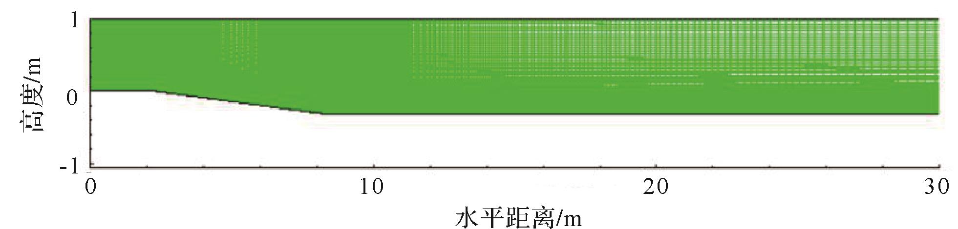
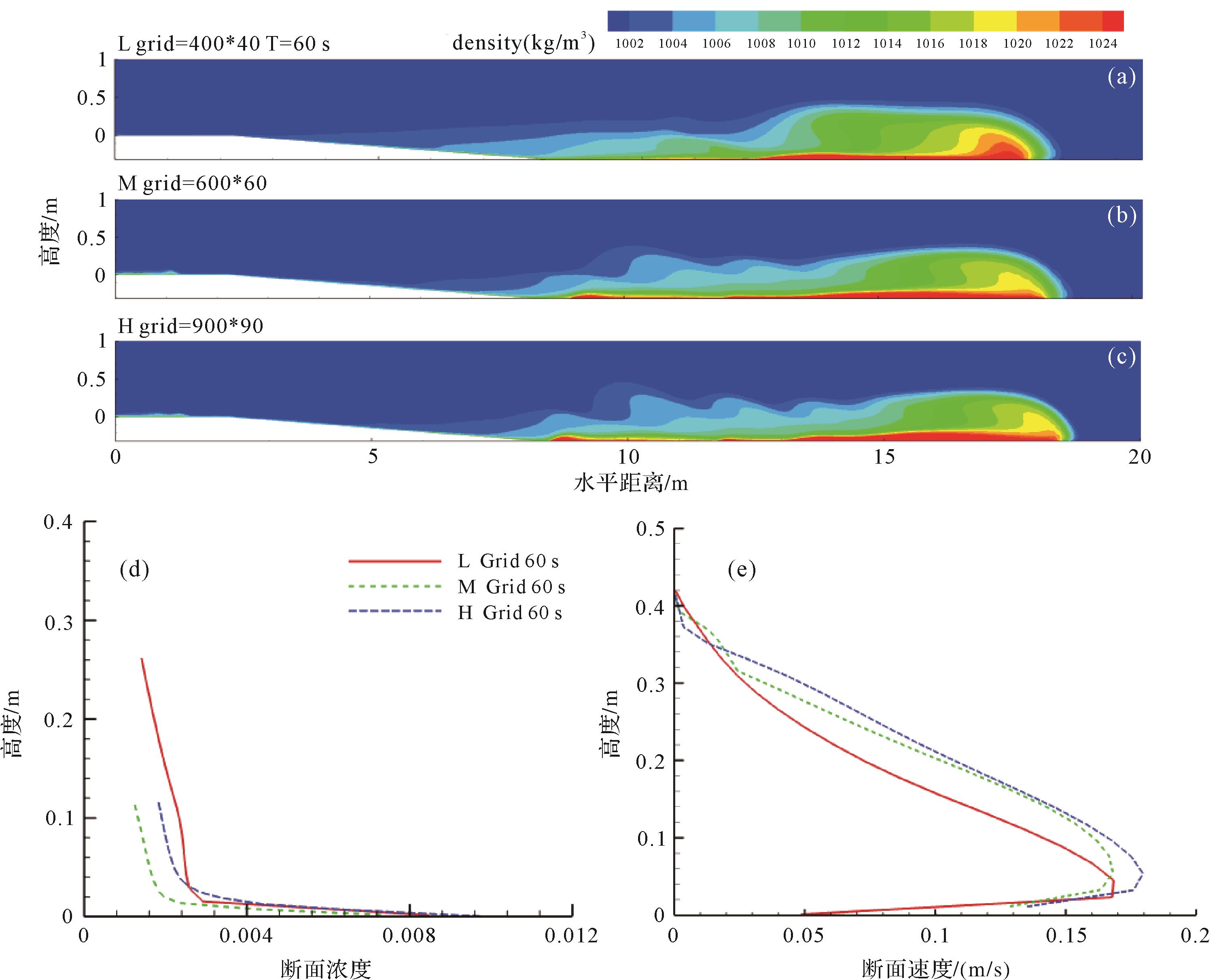
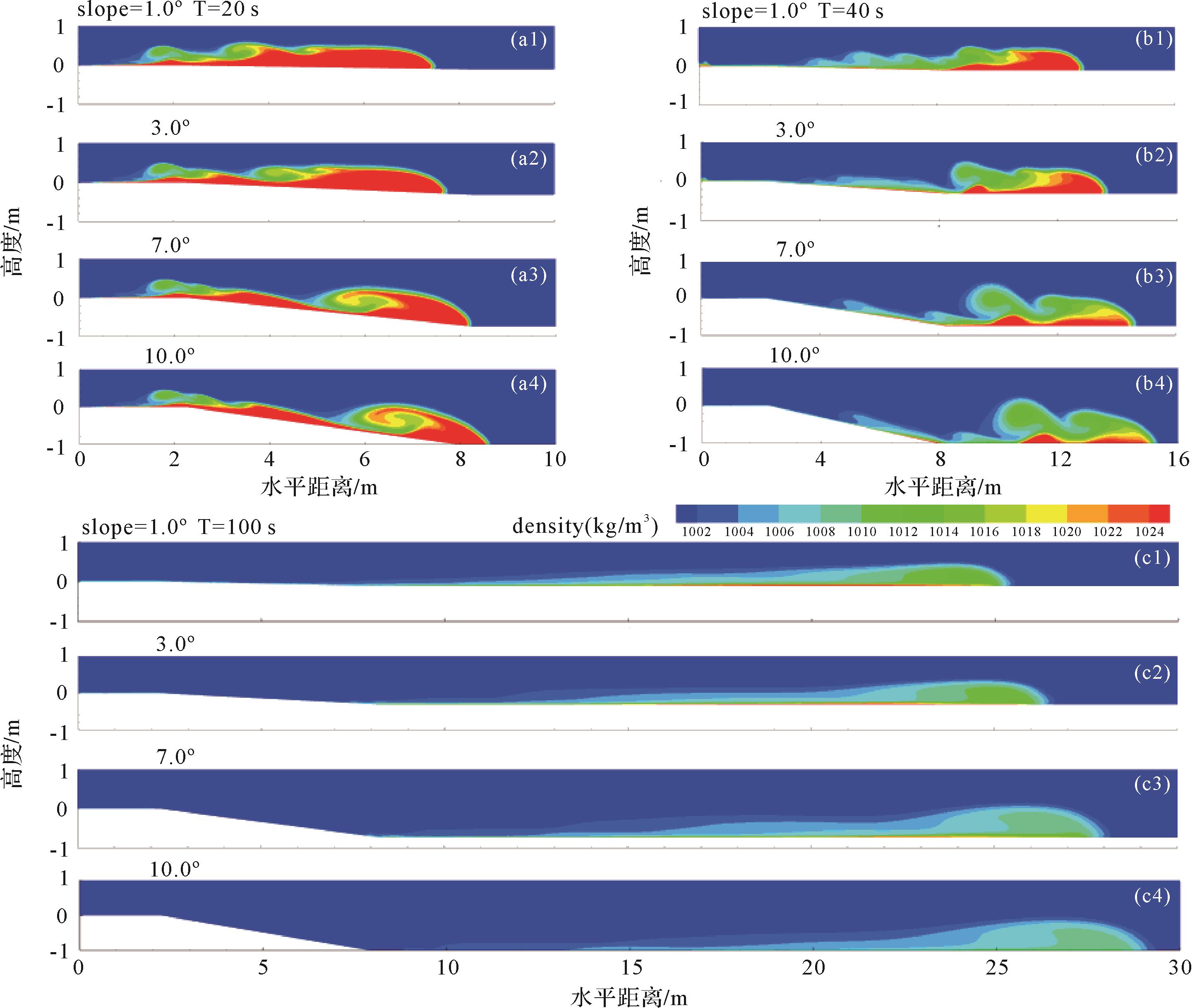
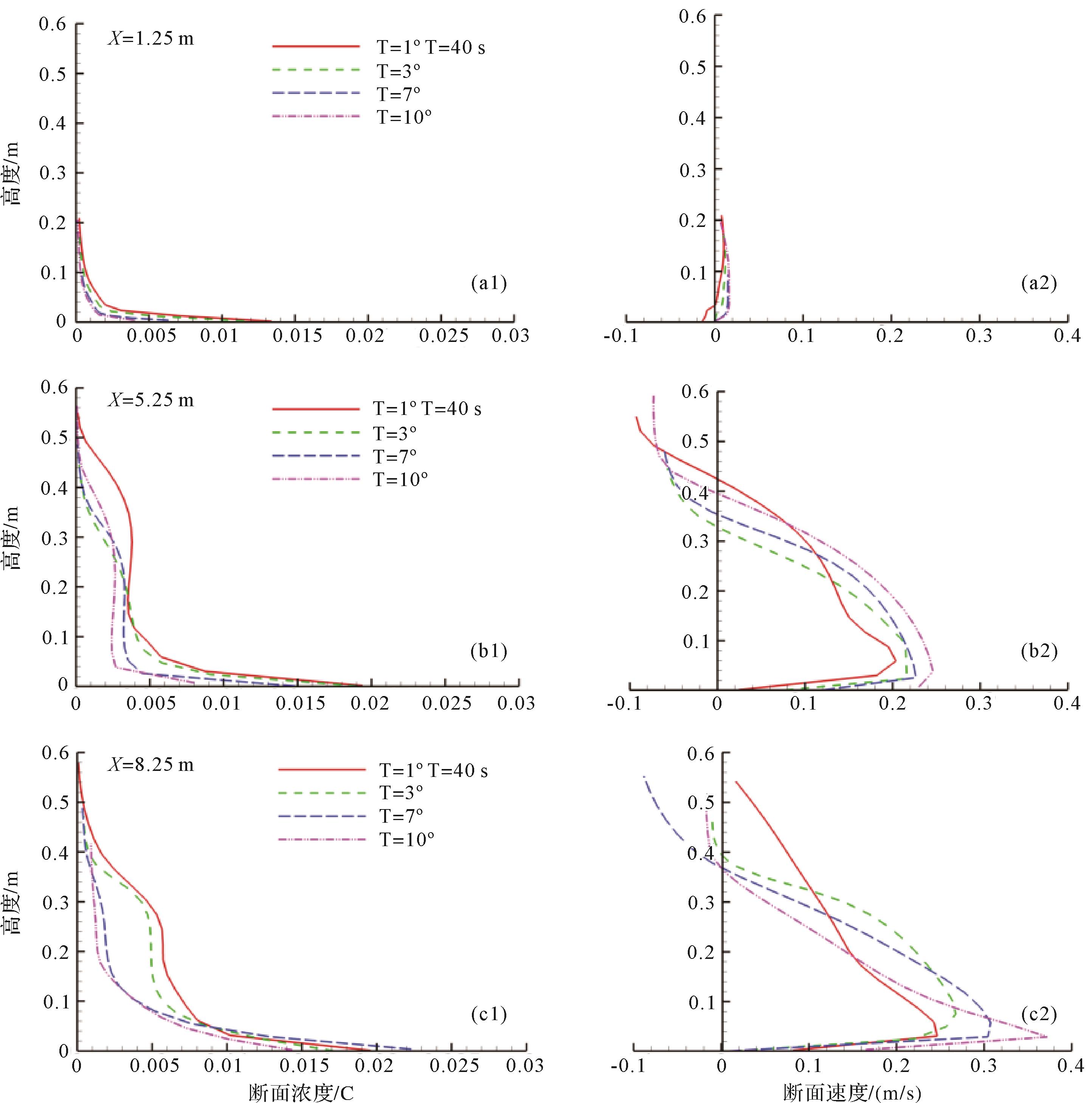
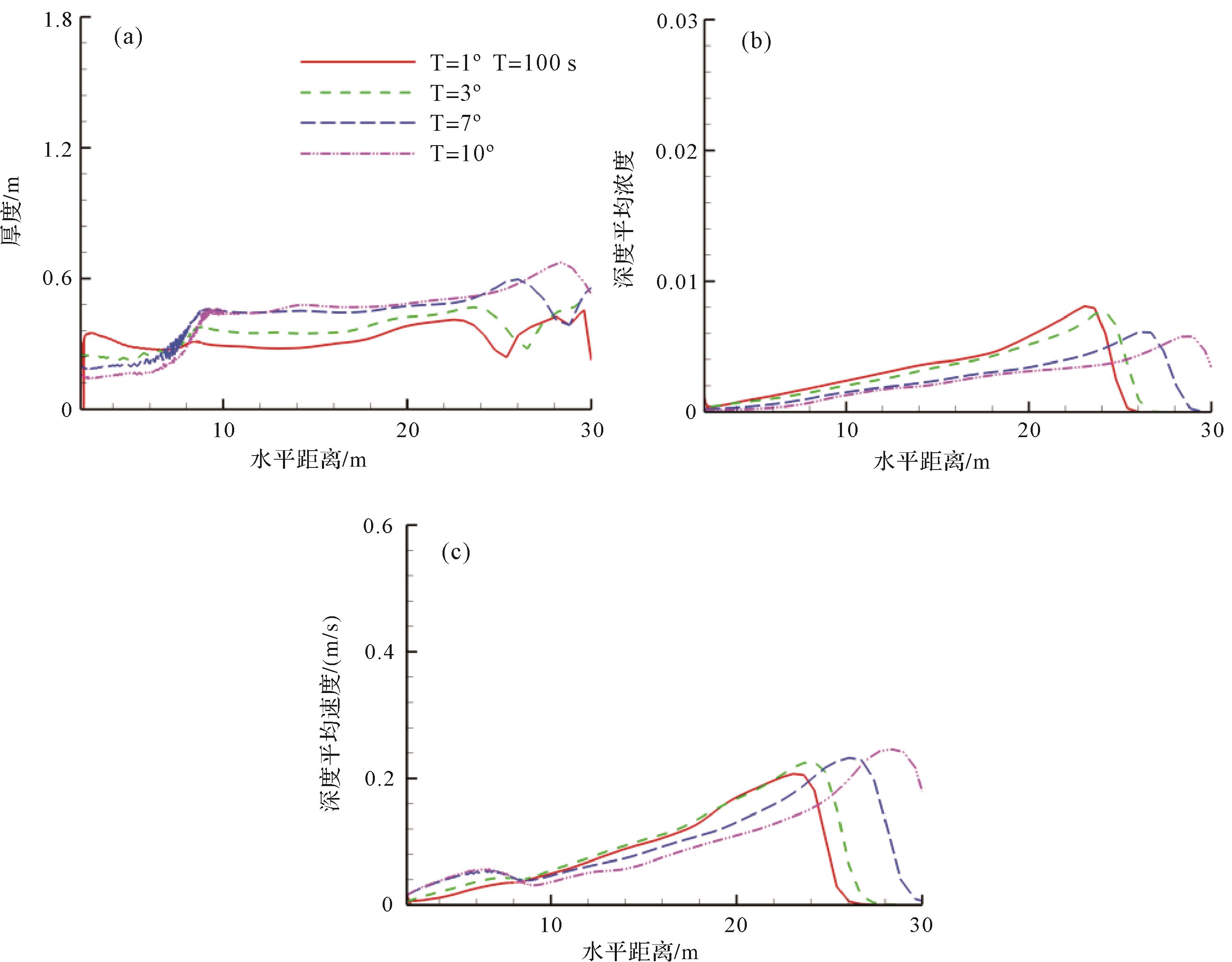
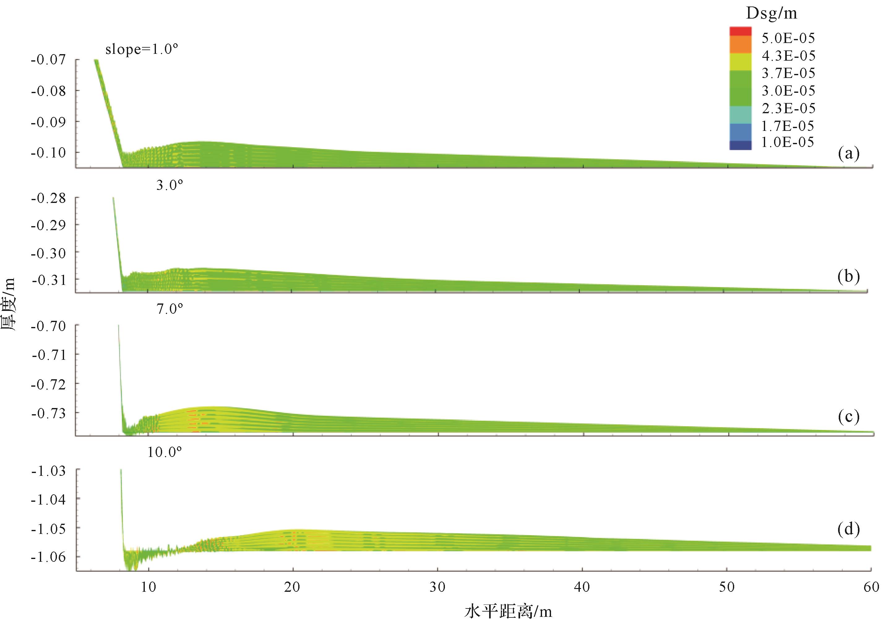
This work studied the flow and deposition of sudden-release turbidity currents with equal initial volume passing over different slope breaks by applying the Bussinesq-assumption adopted RANS model. The following main conclusions are obtained: the growth rate of the current velocity becomes slower with the bed slope increasing due to the enhancement of entrainment; the depth-averaged speed and concentration are similar in that they are big at head and linear decreasing towards the tail. Deposit occurs at the small slope break, the thickest deposition is not far from the slope break, the average particle size of the upstream and downstream is not much different, and toward the downstream thickness decreases linearly. Erosion occurs at larger slope break. With slope increasing this erosion deepens and deposition happens further from the slope break and the average particle diameter of the upstream and downstream varies greatly, and the deposition is arched in shape. These understandings have a certain reference role in predicting the formation environment according to the characteristics of turbid current deposition.
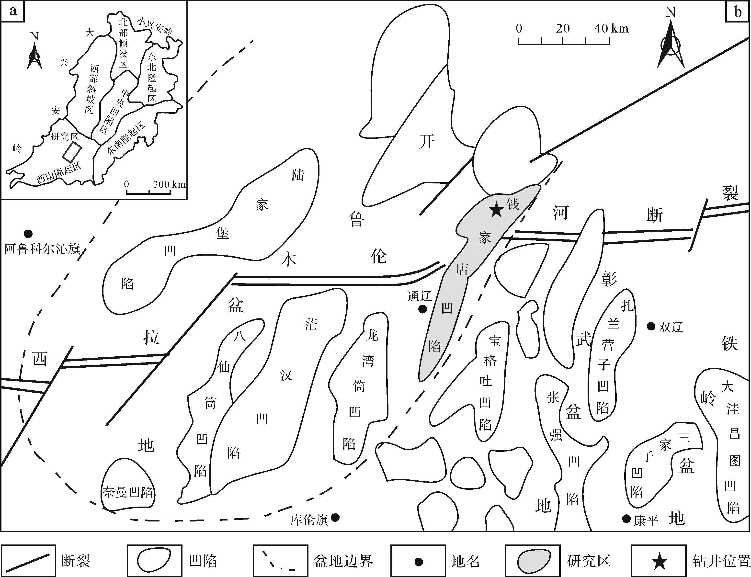
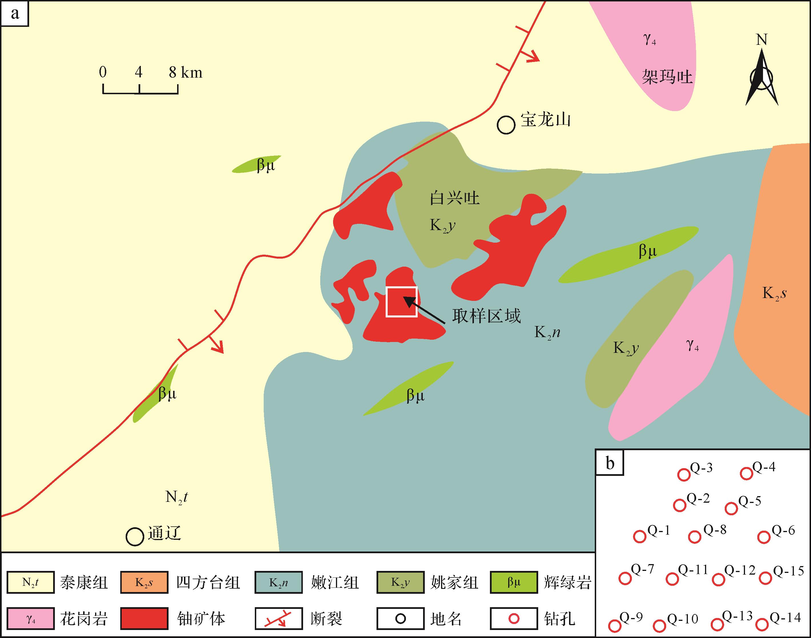
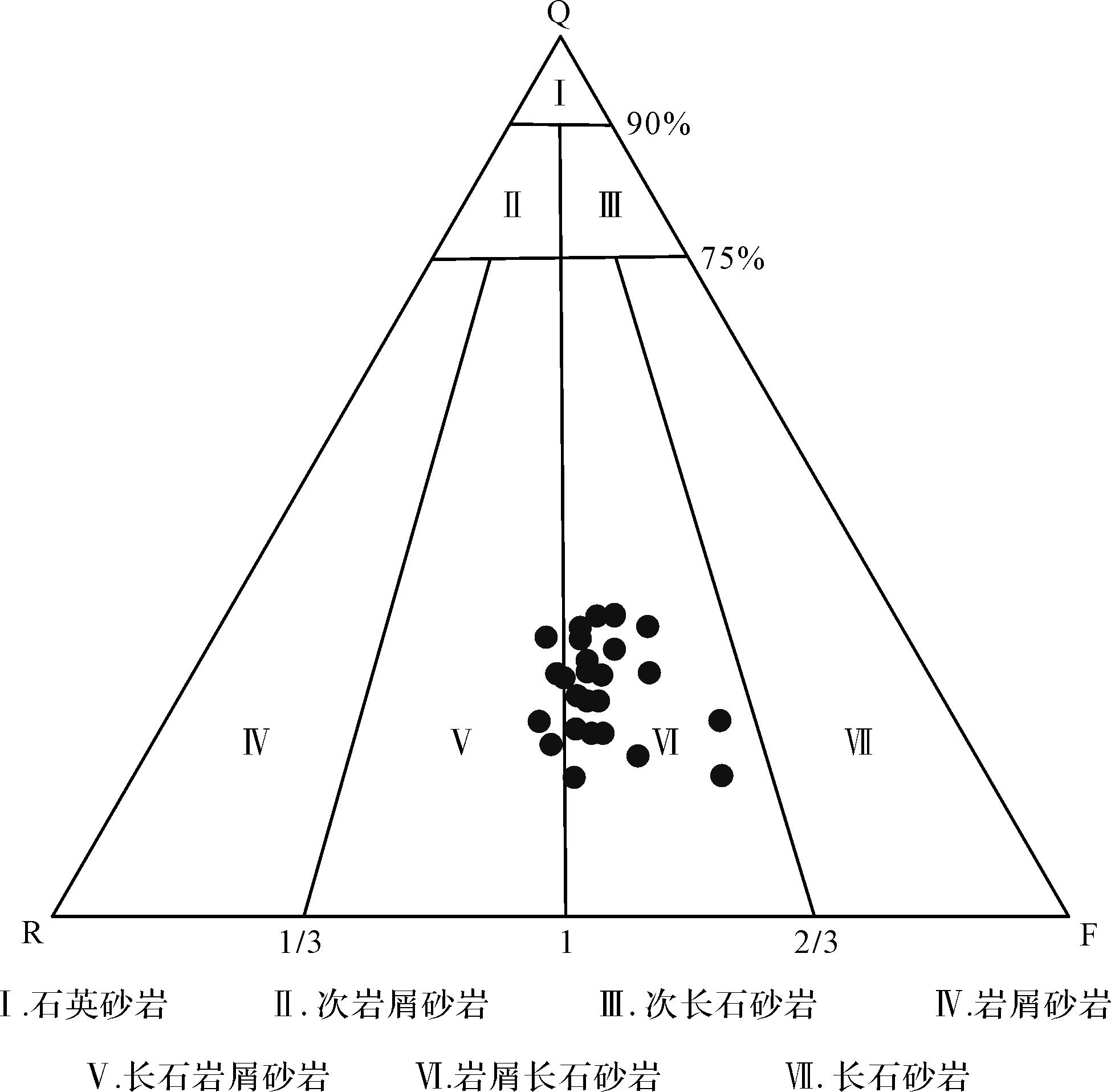
2022, 40(3): 739-752.
doi: 10.14027/j.issn.1000-0550.2021.012
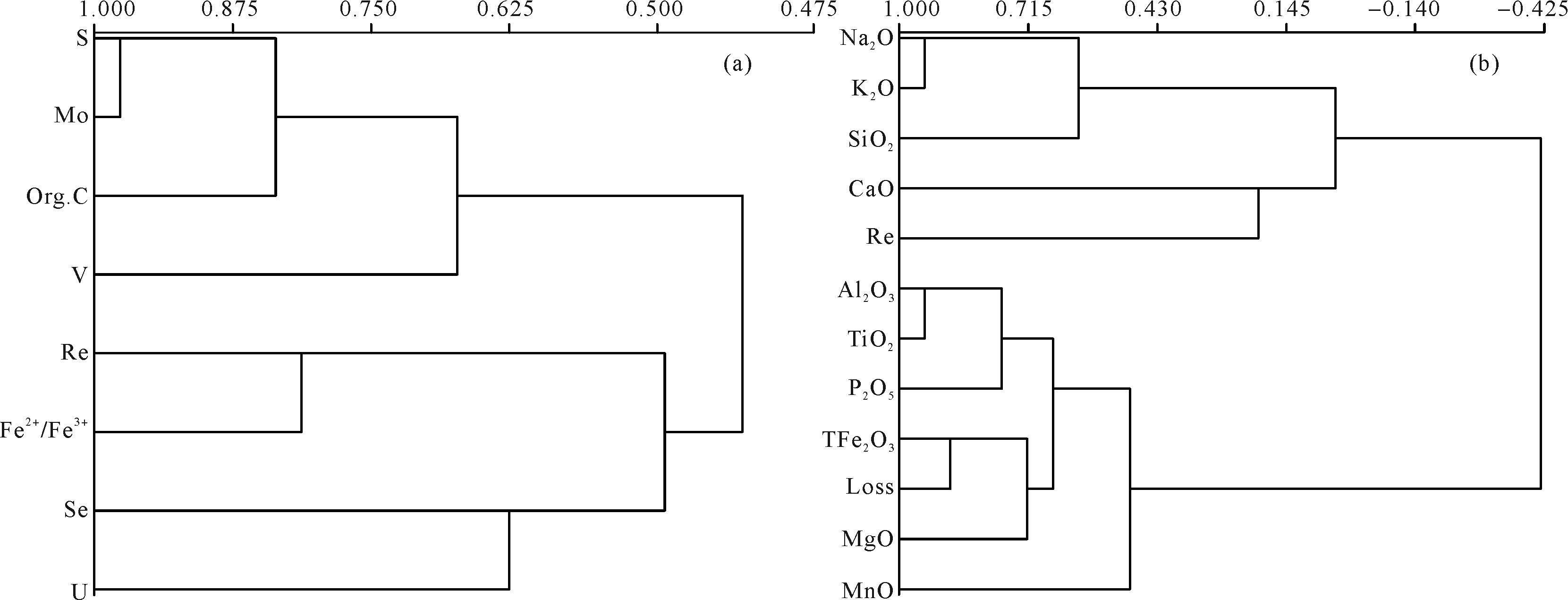
Abstract:
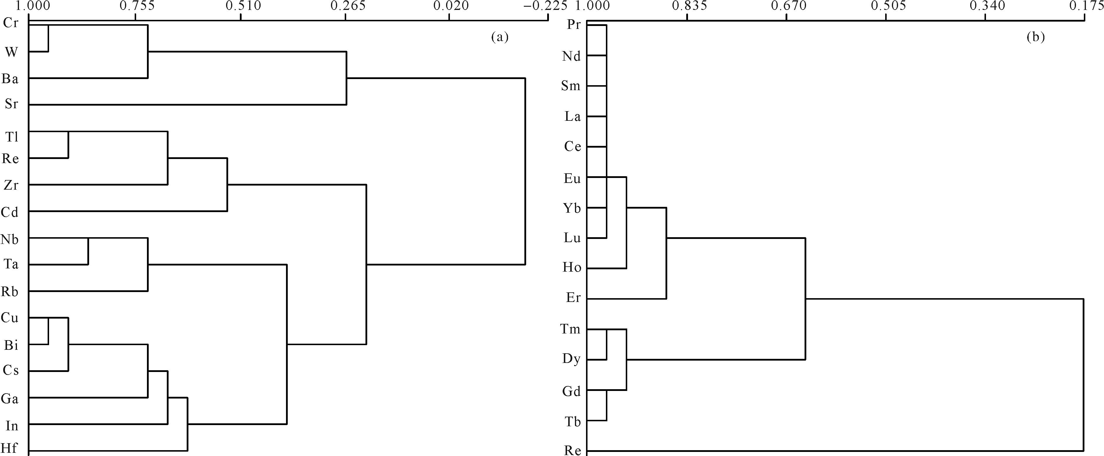
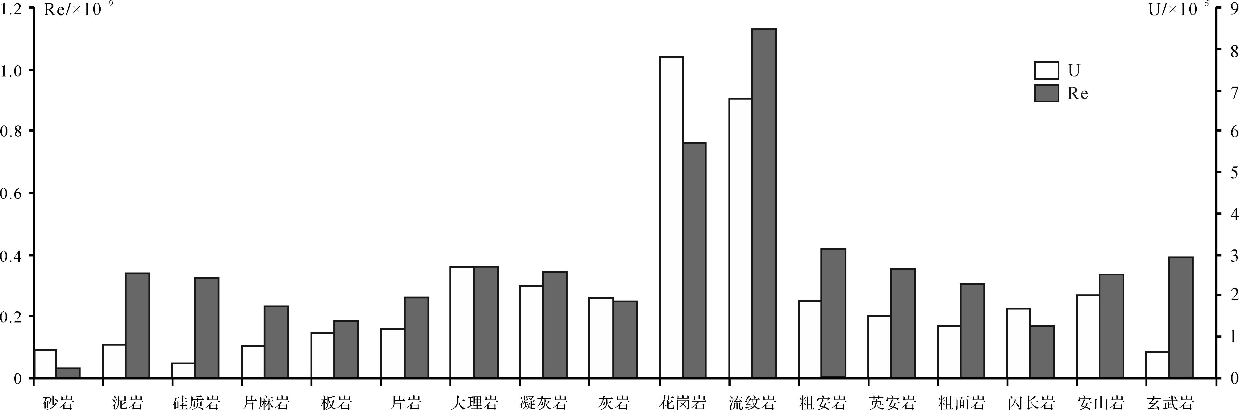
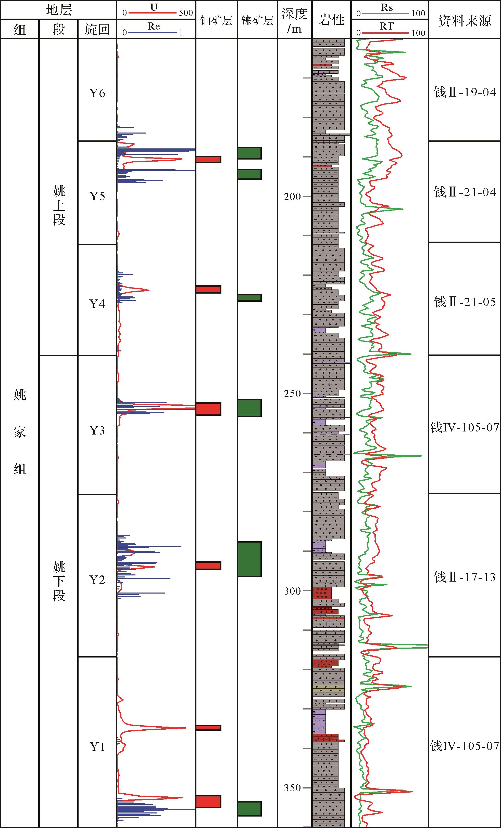
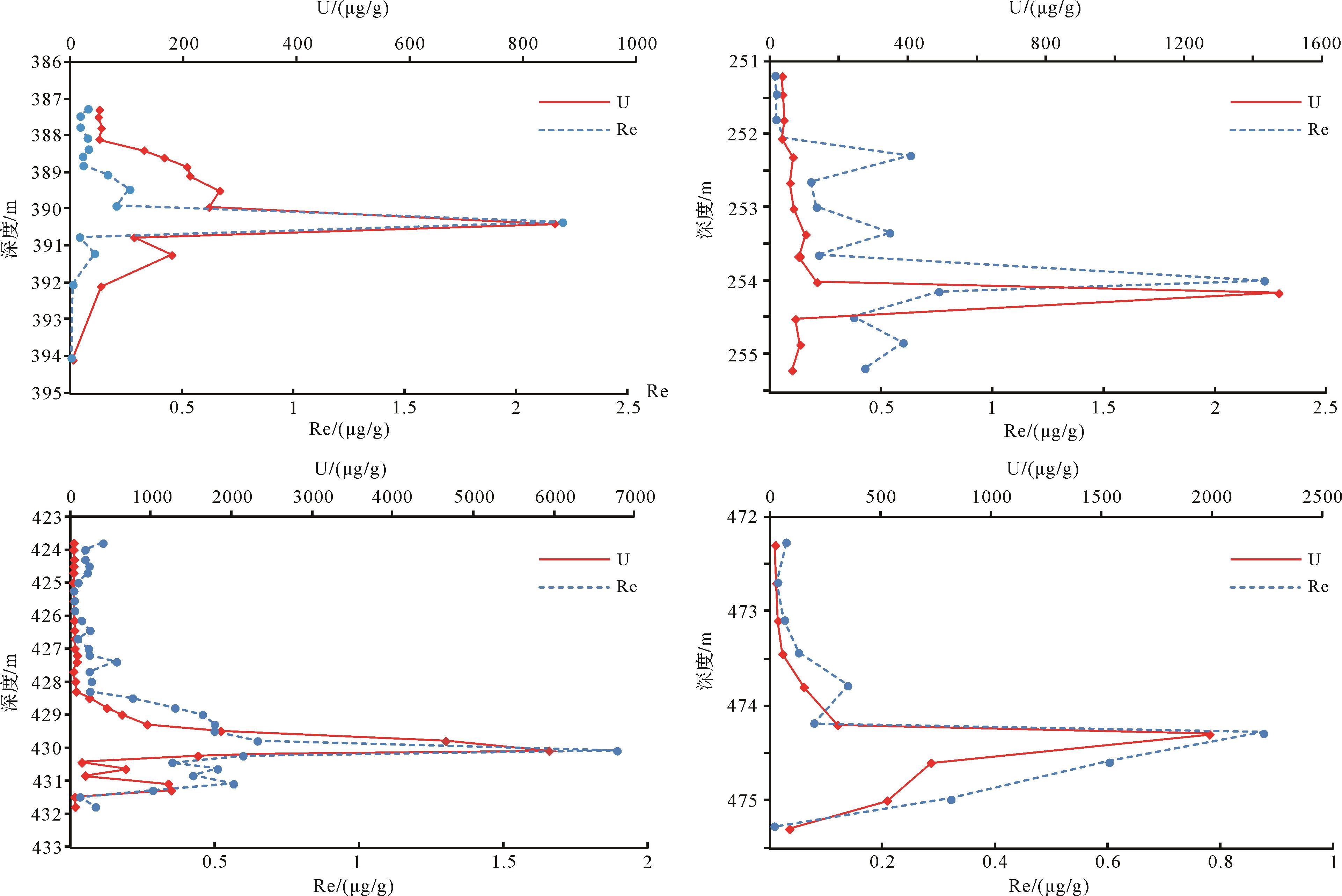
This study discusses the mineralization of rhenium associated with uranium in the Qianjiadian uranium deposit. Present studies of the geochemical characteristics of rhenium in this area are combined with previous research results. The content of rhenium in the sandstone uranium ore of the Qianjiadian uranium deposit is high, and has reached the comprehensive utilization index. Re correlates well with Fe2+/Fe3+, Se, U and organic C, indicating a close symbiotic relationship. The very poor correlation with rare earth elements suggests less stability than the surface stability of rare earth elements. The formation of the rhenium deposit in the Qianjiadian area has undergone five stages: pre-enrichment; the formation of ore-bearing main rocks in the Upper Cretaceous Yaojia Formation, and the sedimentary and metallogenic stages.The main ore-forming stages were interlayer oxidation and hydrodynamics, and shallow oxidation and modification in the Paleogene.The superposition and metallogenic stage of hydrothermal rhenium, and the ore-preserving stage of hydrocarbon diffusion and reduction in the Neogene. These five stages are very similar to the spatial distribution of uranium in the region. The similarity also determines the coexistence of uranium and rhenium in the same horizon and the enrichment in the same region on the stratum, which provides a basis for the joint exploration and mining of uranium and rhenium.
2022, 40(3): 753-764.
doi: 10.14027/j.issn.1000-0550.2021.007
Abstract:
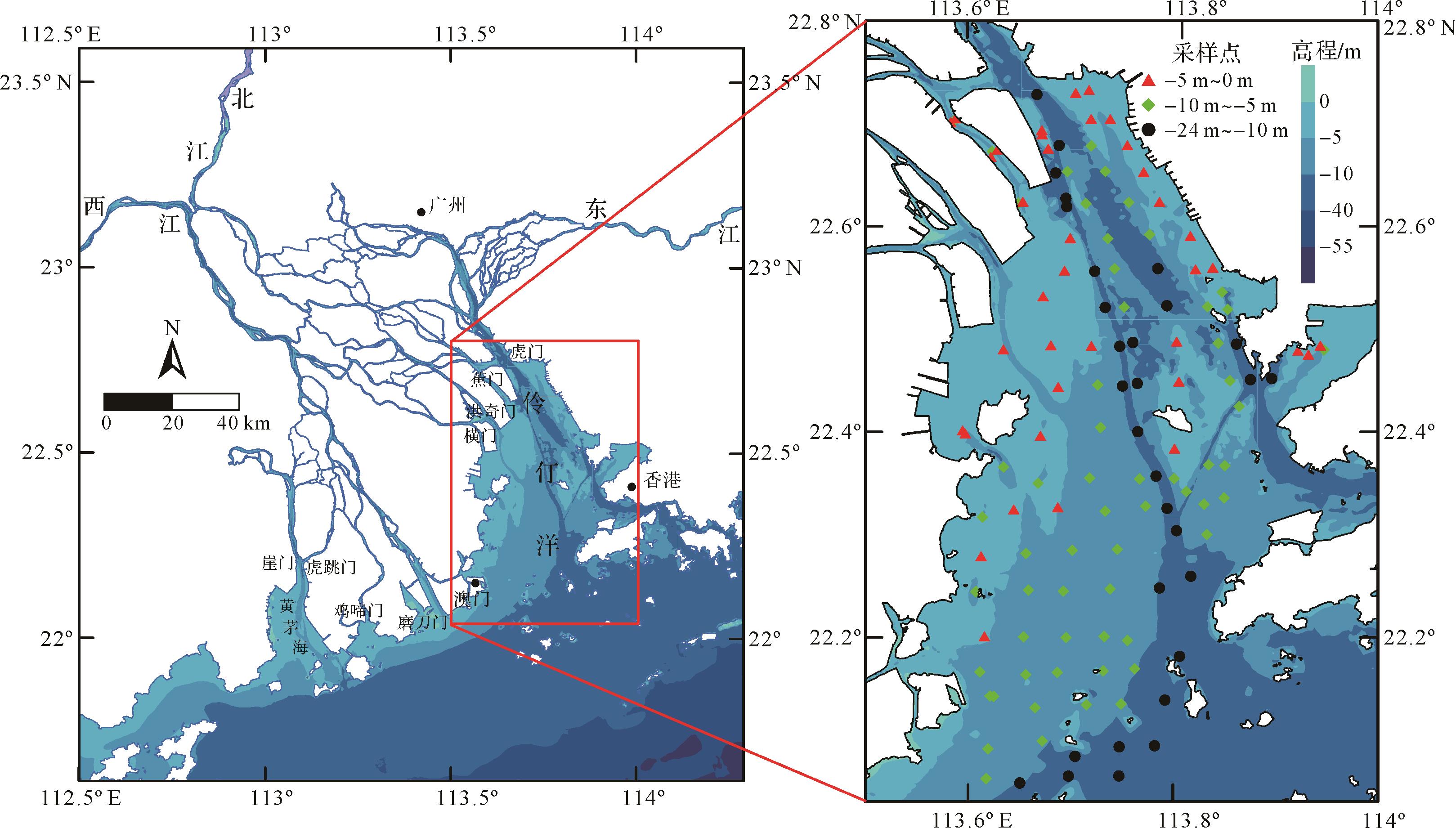
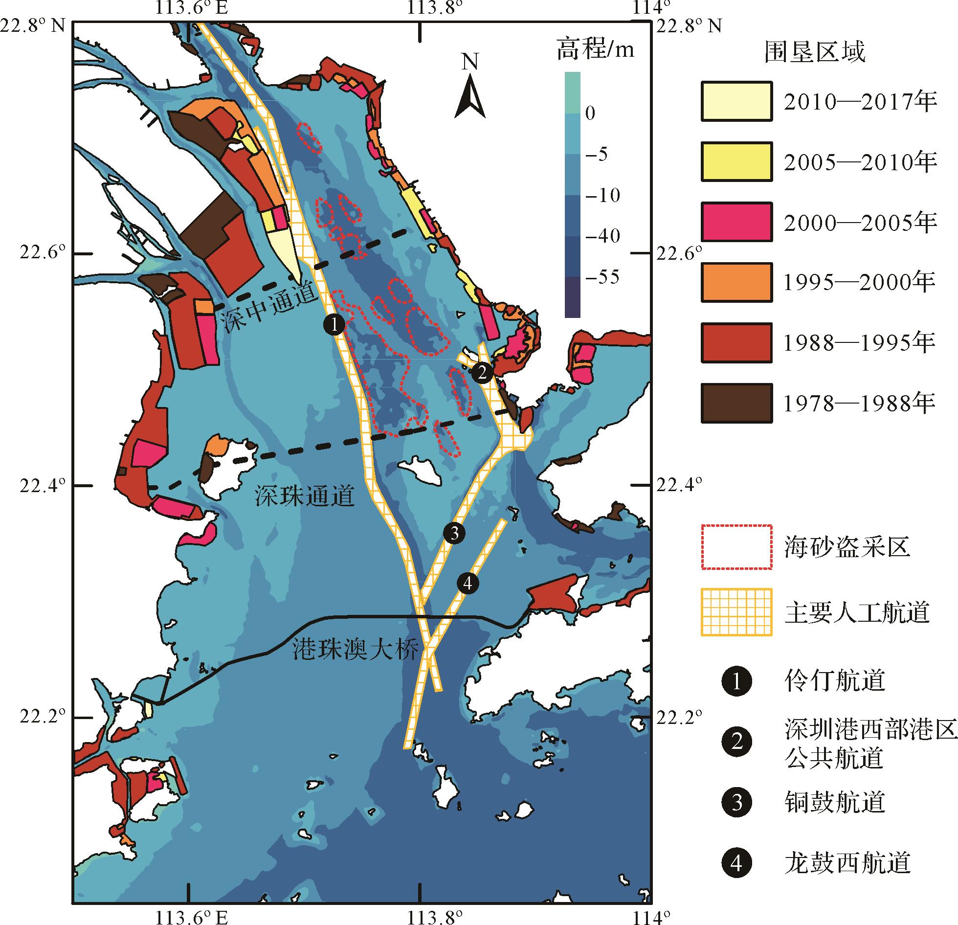
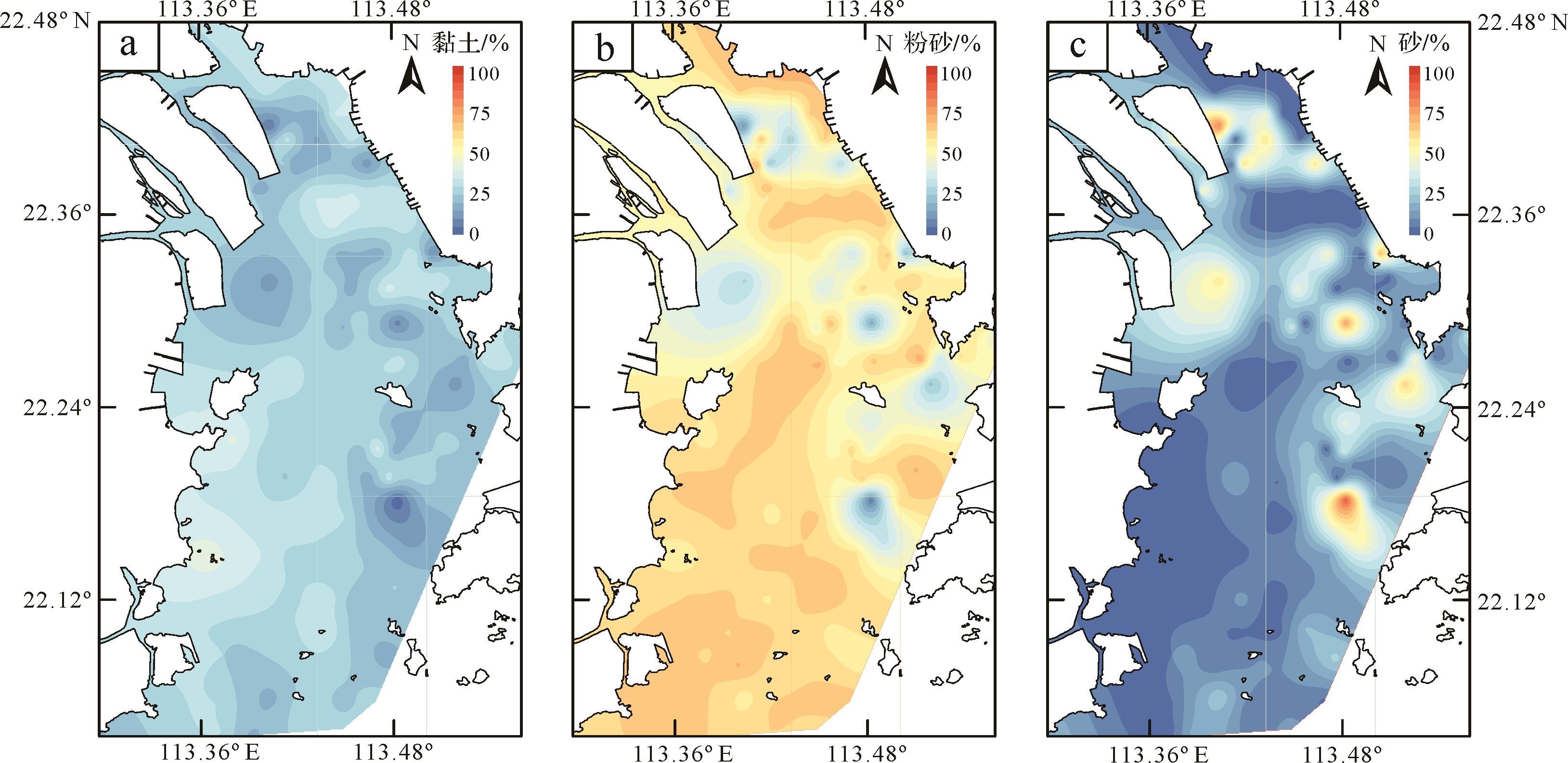
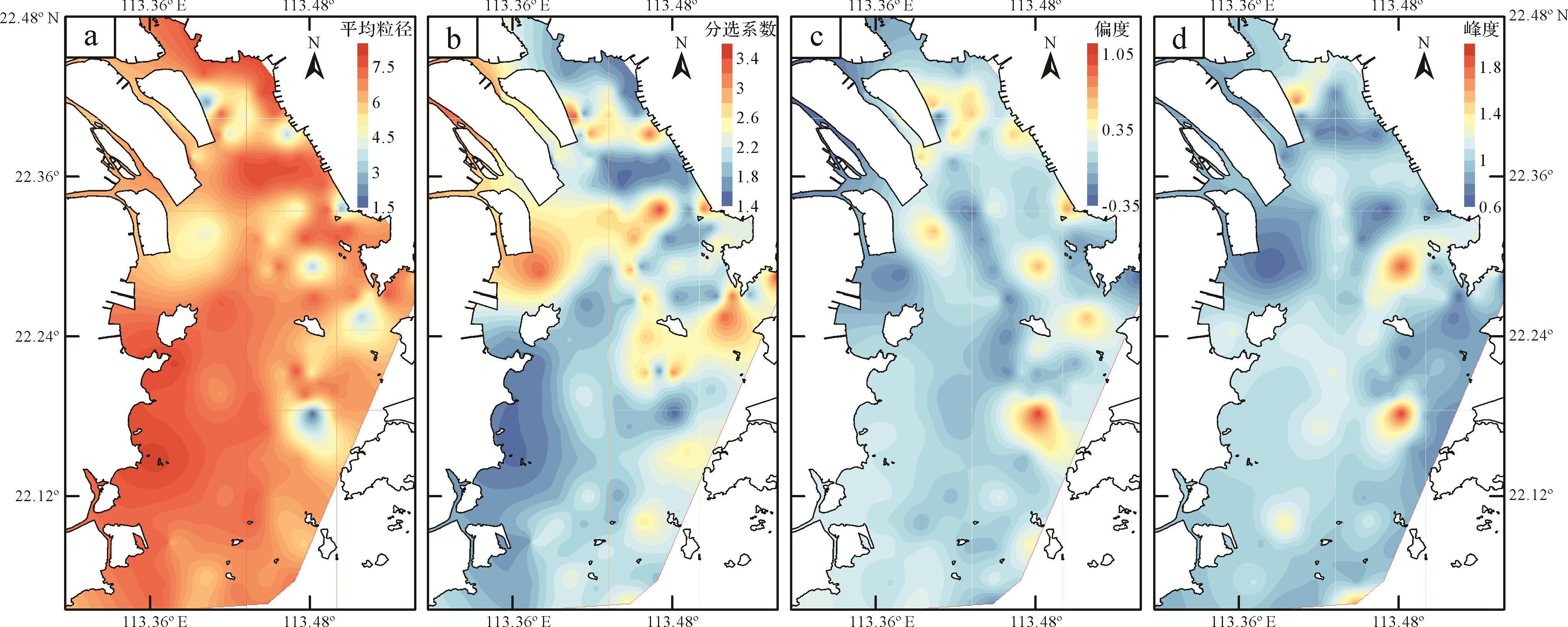
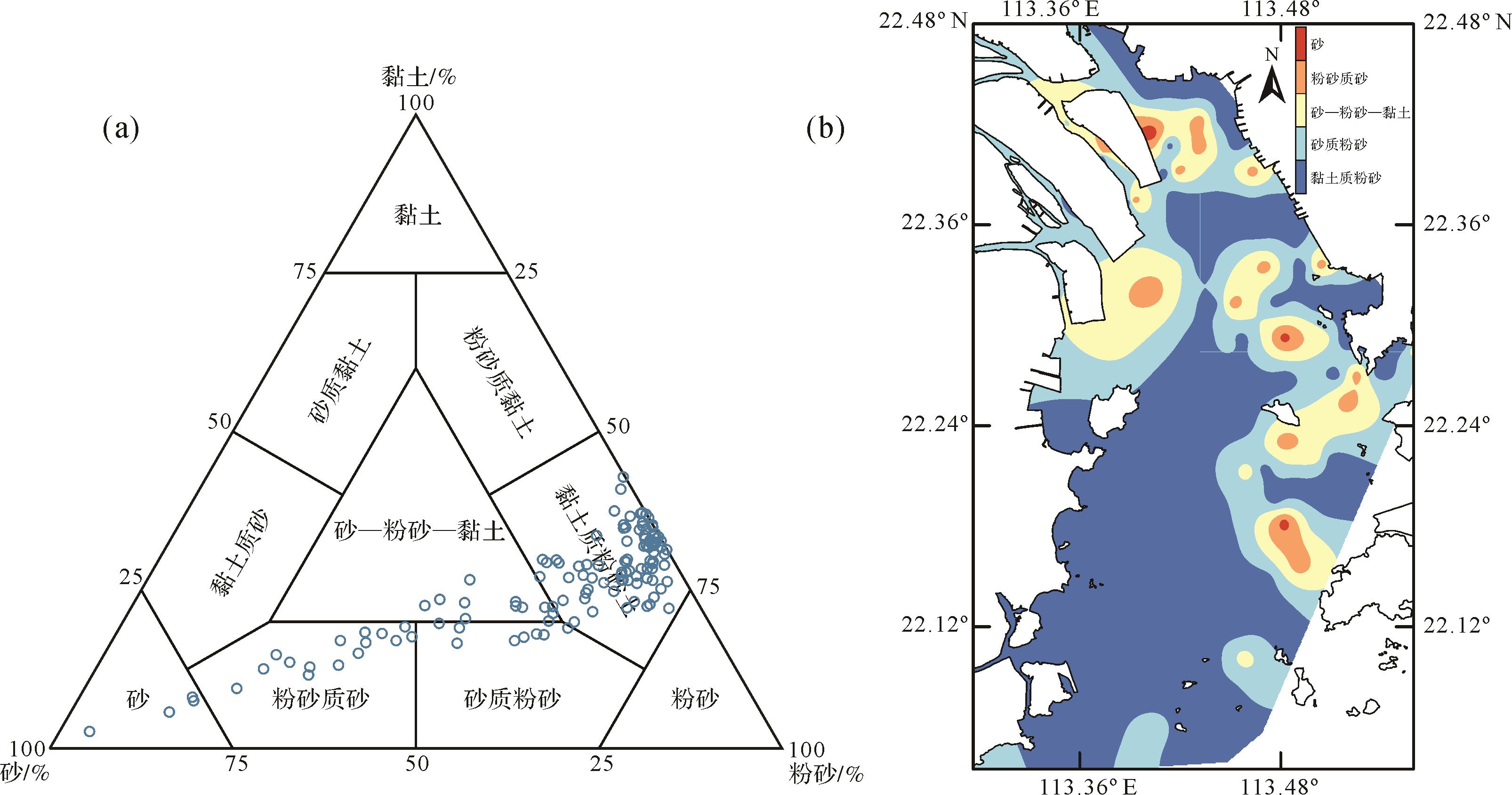
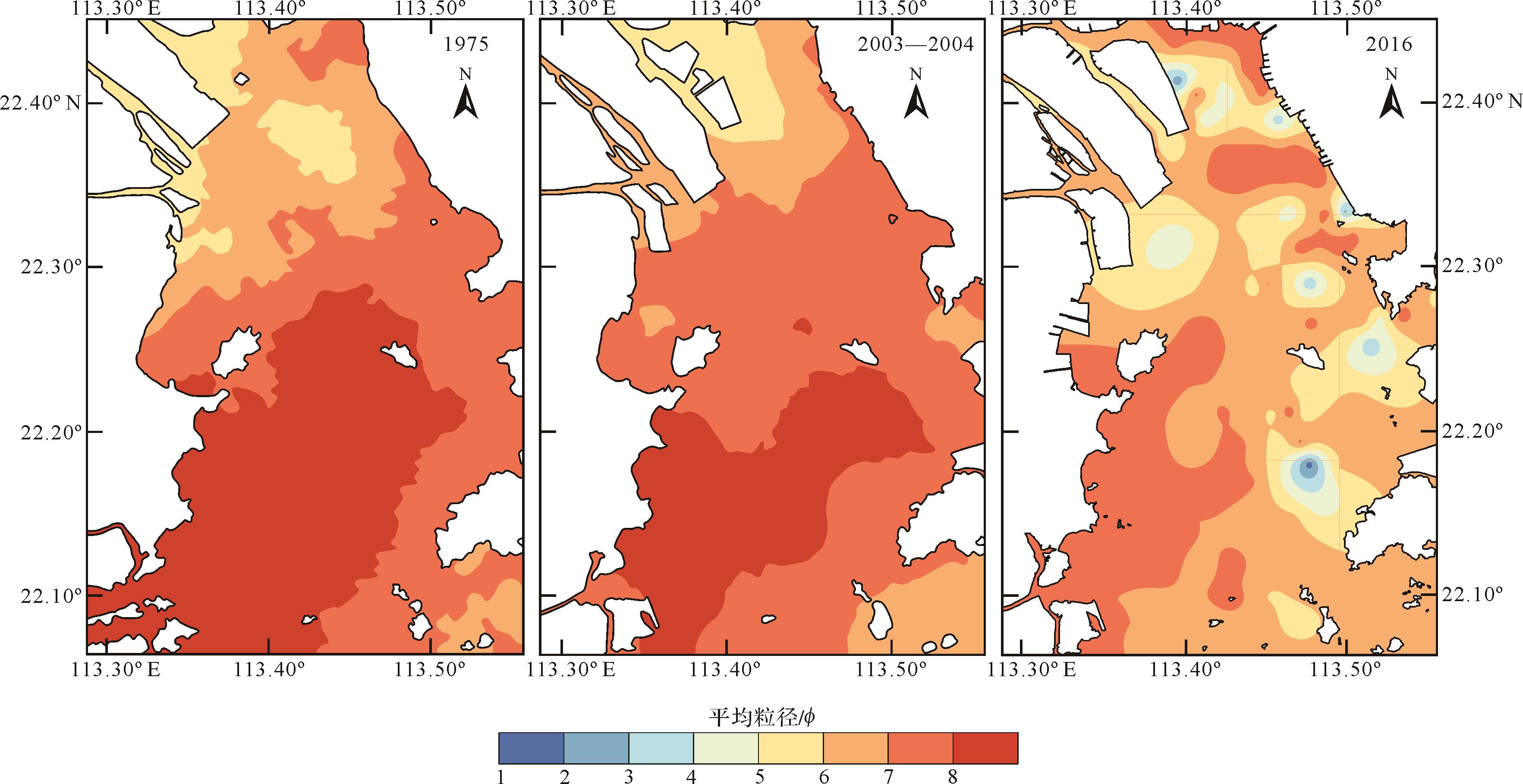
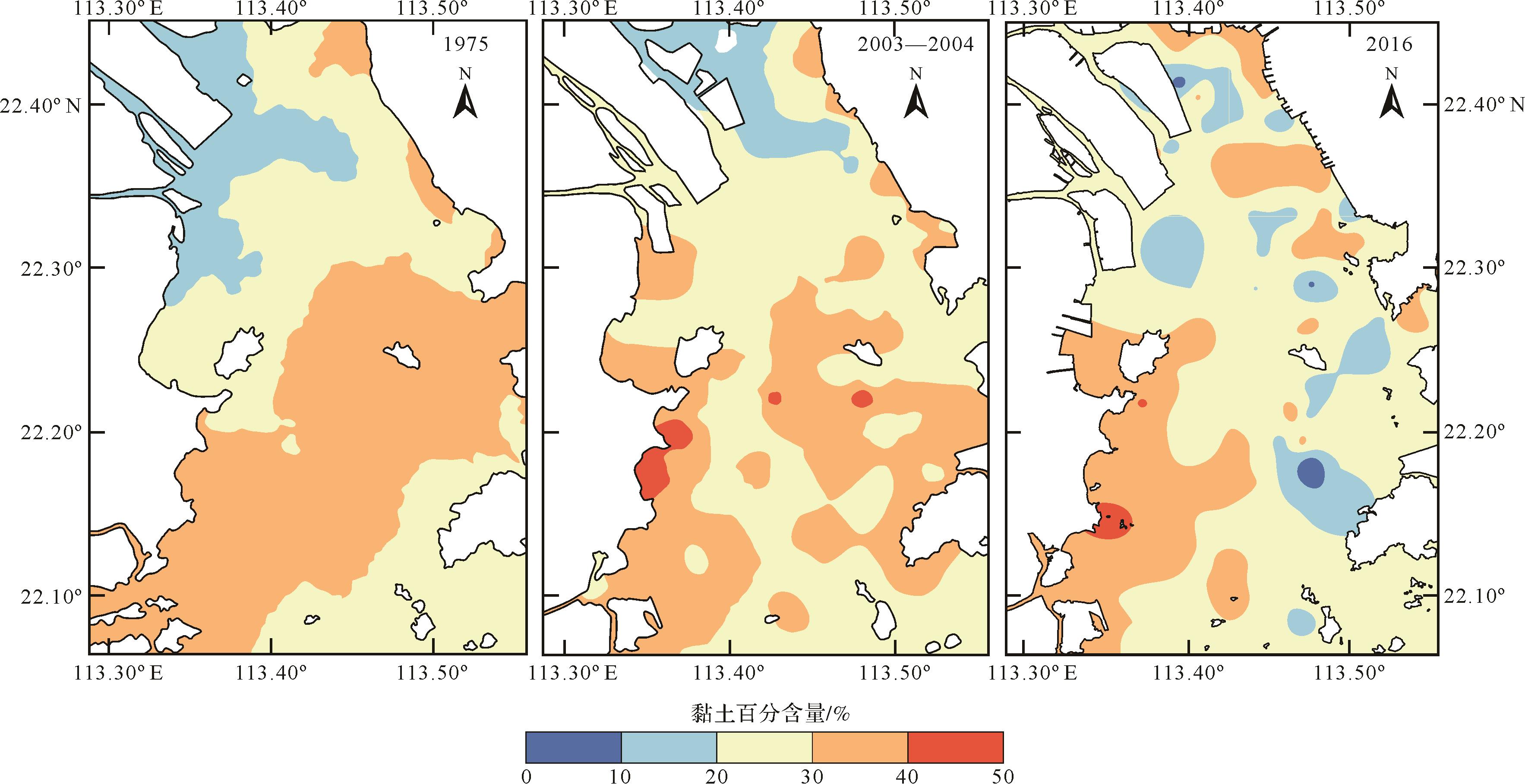
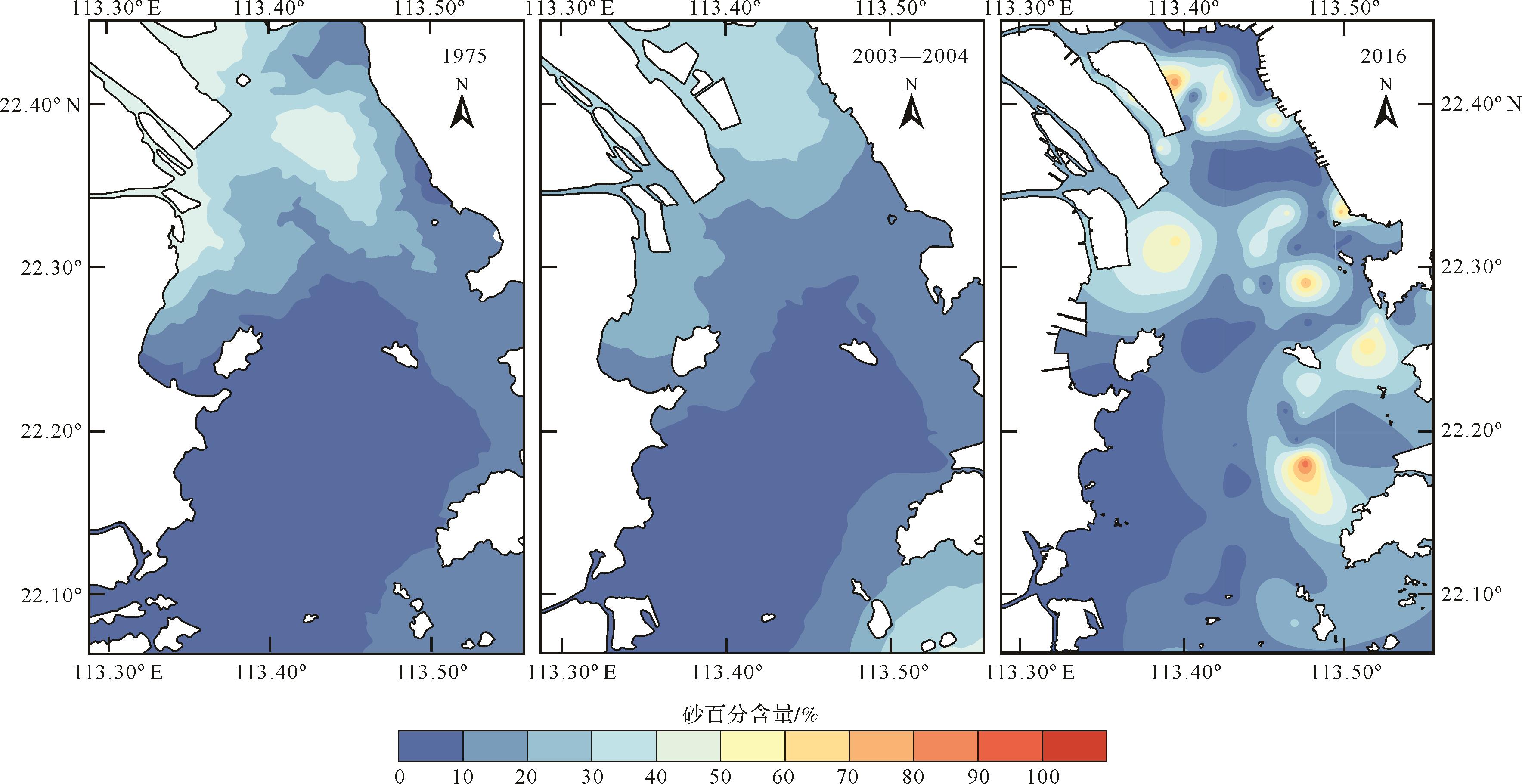
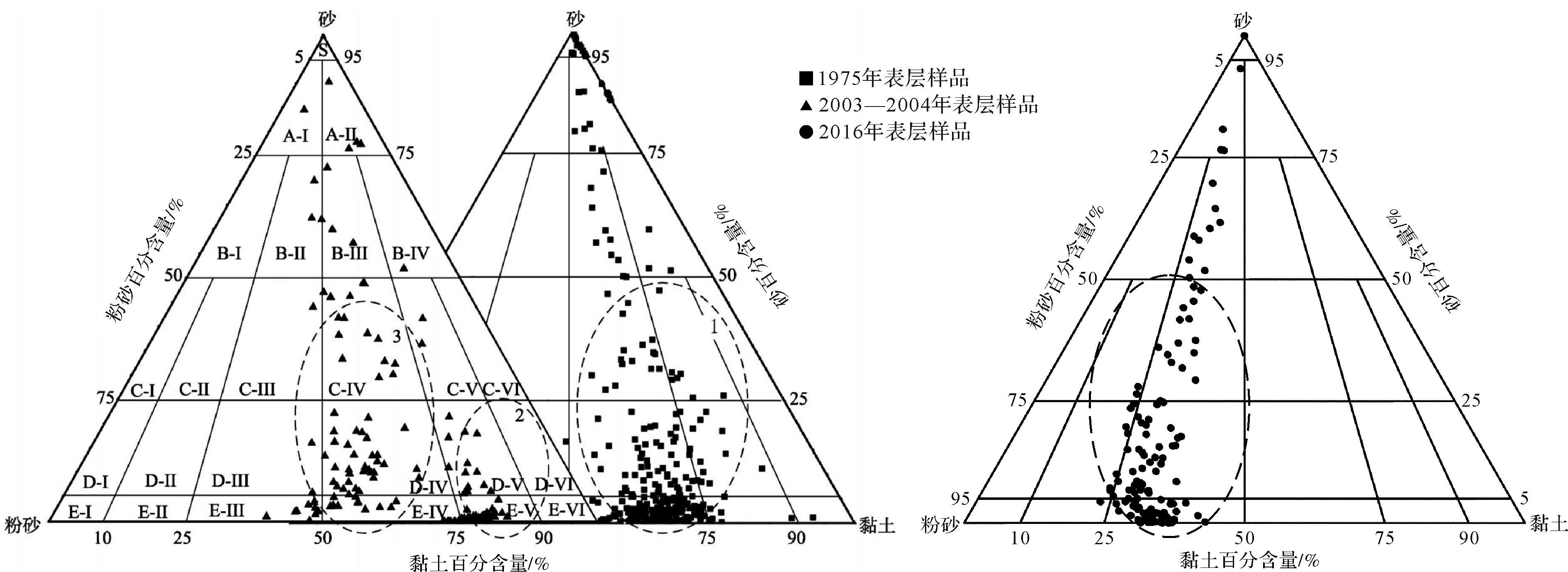
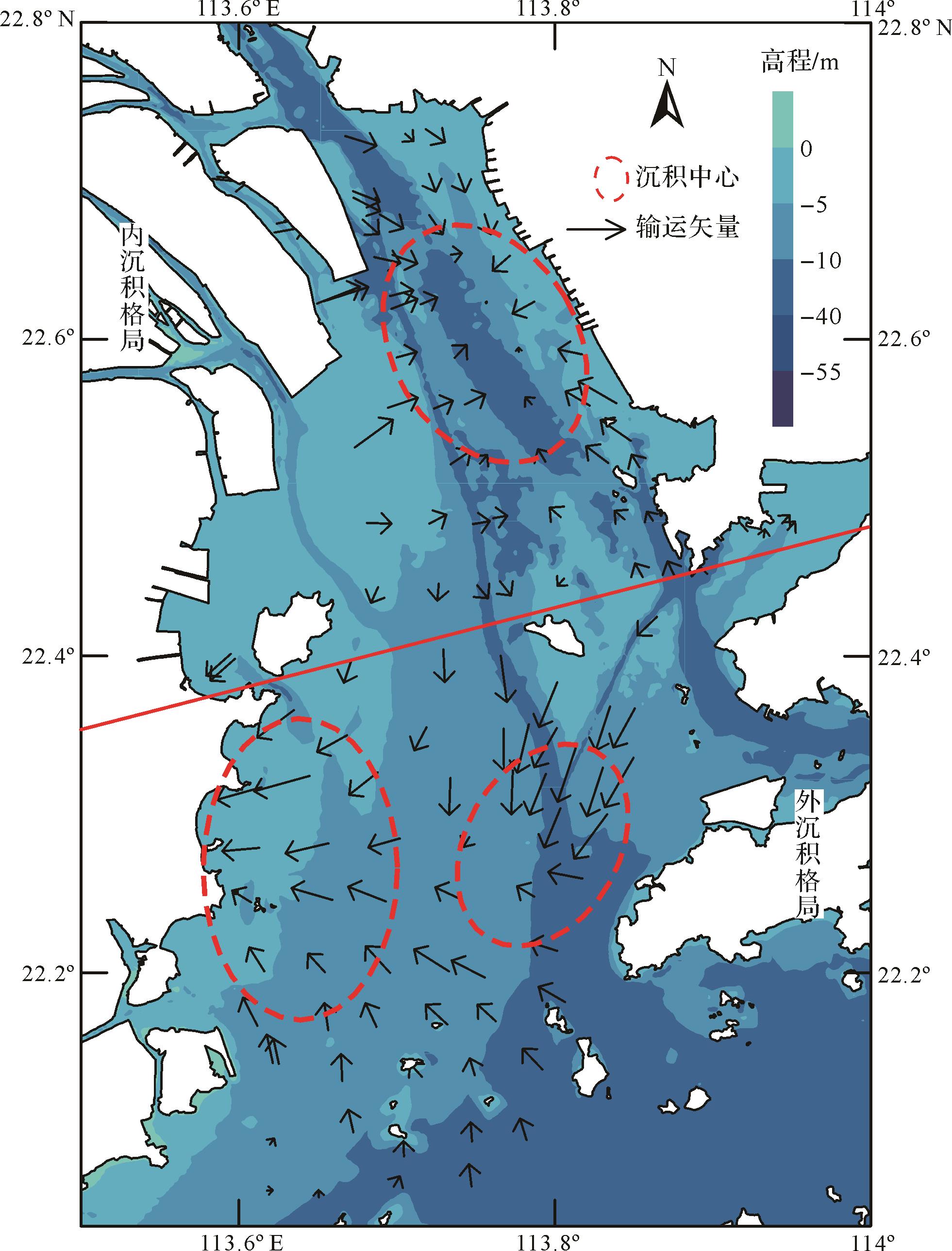
A grain-size analysis of 128 surface sediment samples collected from Lingding Bay (LDB) in 2016 and were combined with earlier values for the surface sediment in LDB in a Flemming sediment dynamics discrimination diagram and grain-size trend analysis (GSTA) model to analyze the sediment evolution in LDB over the 40 years before 2016. The results are as follows. (1) In 2016, the silt content of surface sediments in LDB is the highest (56.67%), clay content is the second (26.08%), and sand content is the least (17.23%), the surface sediments are generally finer. The main types of surface sediment were sand, sand-silty-clay, sandy silt, silty sand and clayey silt. Various types of these sediments appeared in the form of plaques. (2) Over the previous 40 years, the mean grain size and particle size composition of surface sediments in LDB had changed dramatically from the original banded distribution to a patch-like distribution. The Flemming triangle graph partition indicates that the dynamic trend in LDB increased in the 40 years. (3) Influenced by large-scale sand mining activity, the intact midland depocenter has been dispersed, forming a so-called “source” of fine particles in the sand-mining area. Ebb and flow action has formed the new situation of “two patterns” in the north and “three centers” in the south, thus changing the sediment source–sink process of LDB. (4) The changes of sediment spatial distribution, sedimentary dynamic environment, migration trend and other characteristics of LDB are closely related to human activities such as sand mining and deep channel dredging, reflecting that human engineering activities have become an important factor in the evolution of the sedimentation pattern of LDB.
2022, 40(3): 765-773.
doi: 10.14027/j.issn.1000-0550.2021.005
Abstract:
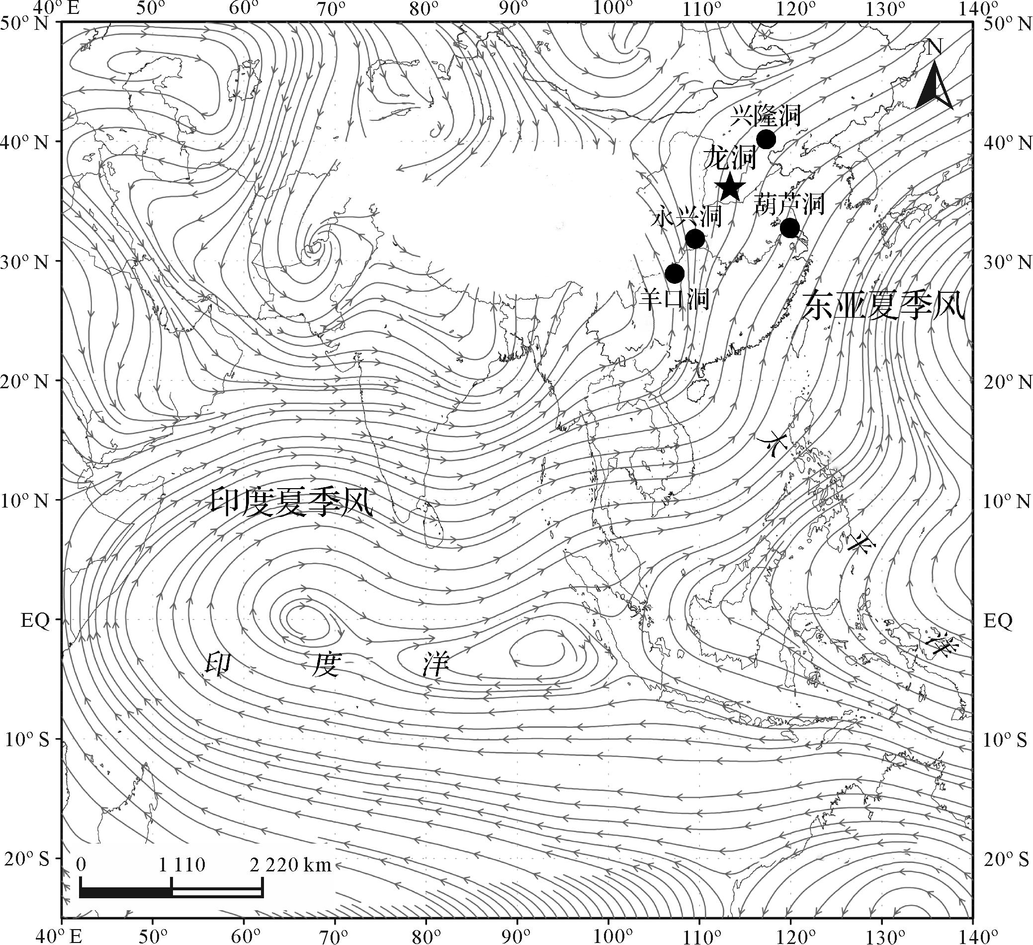
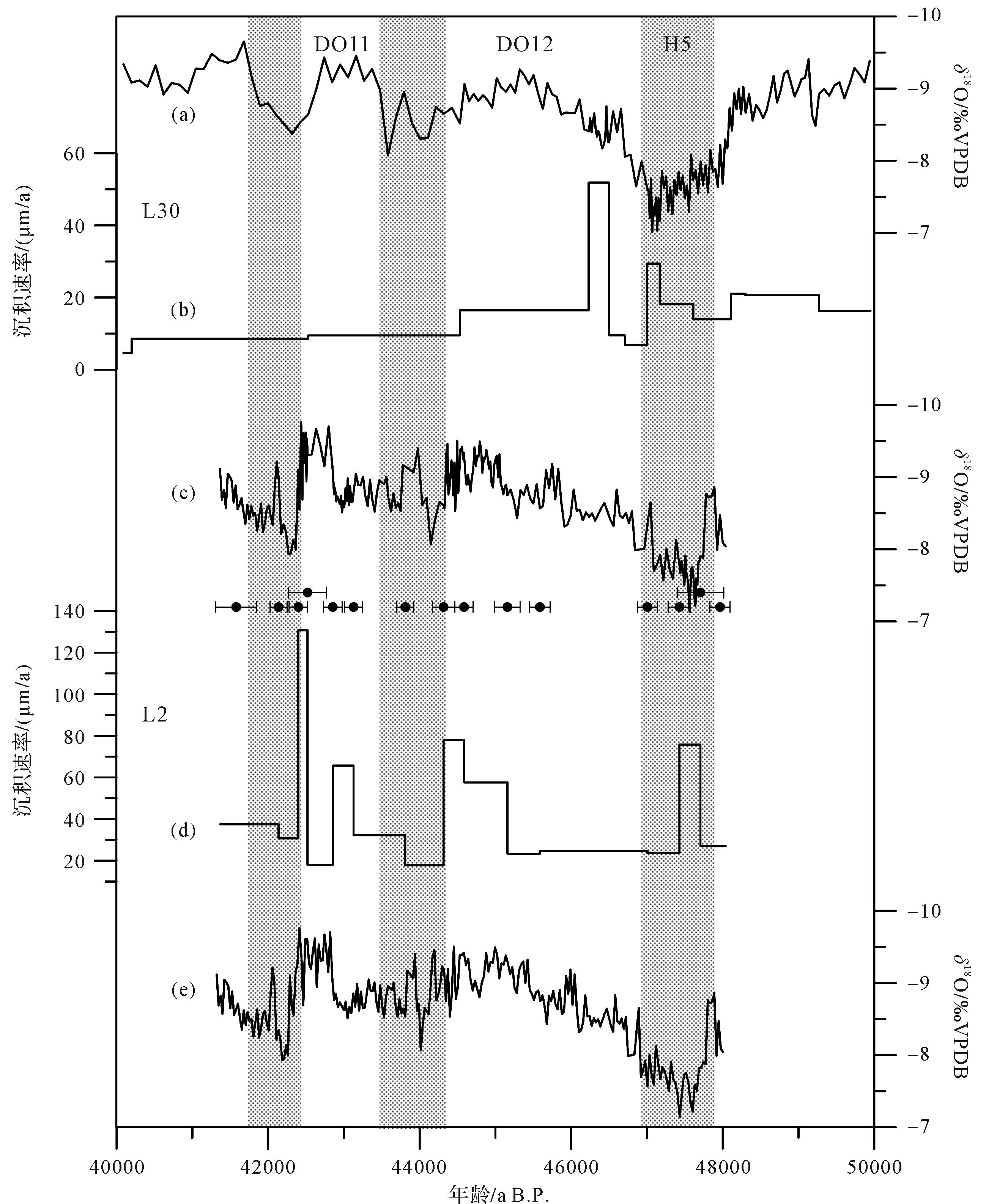
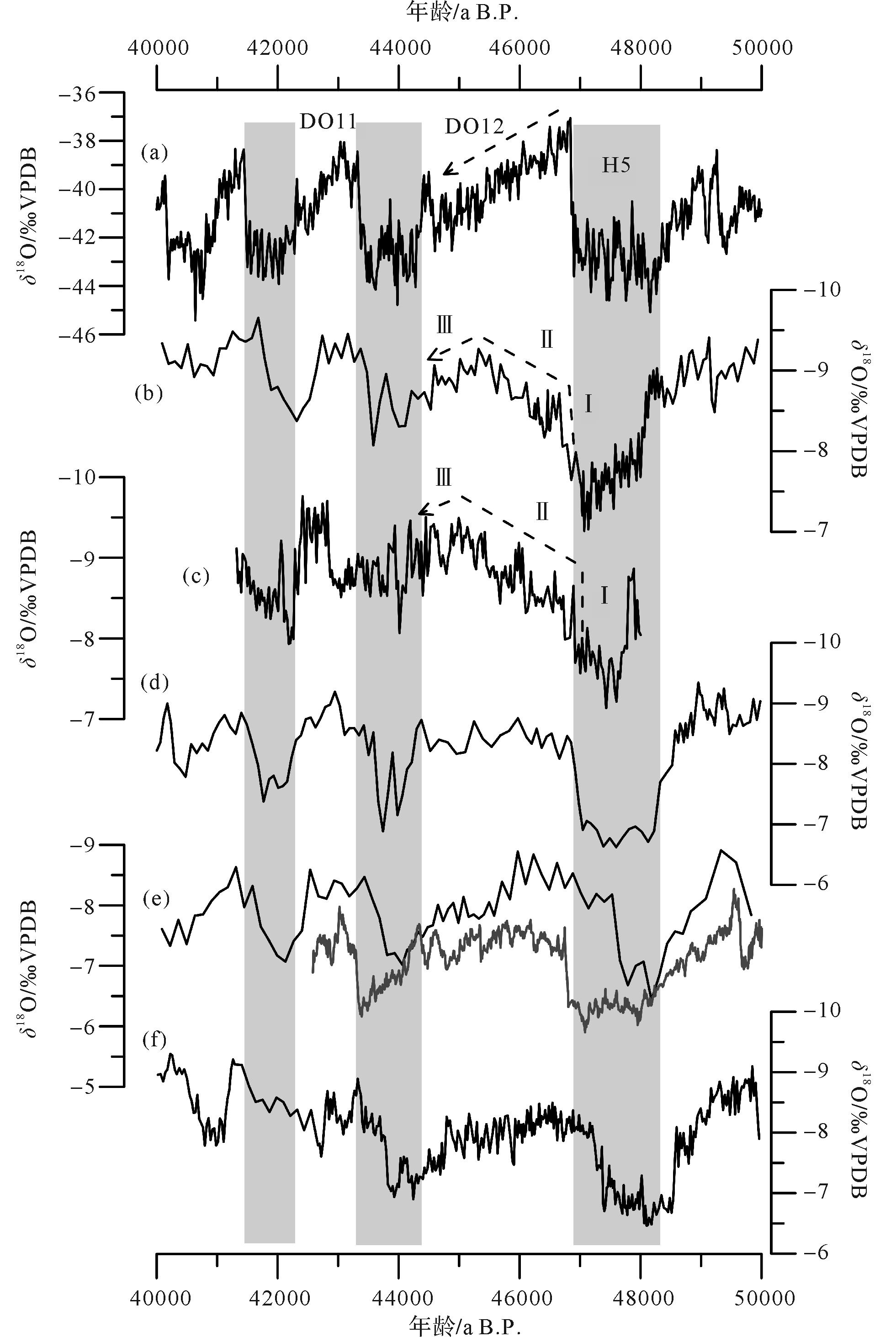
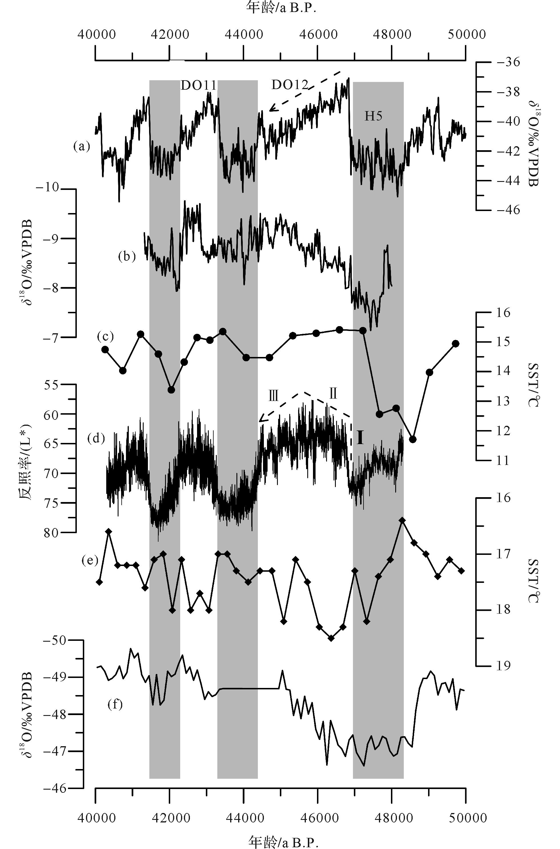
To date, the pattern of Dansgaard-Oeschger (DO) events in response to monsoon climate is a question of greatest interest in paleoclimate research. Whether it is manifested as a single pattern or as multiple patterns remains controversial. A high-resolution oxygen isotope profile established with 239 oxygen isotope and 15 230Th dates from the Dragon Cave, Shanxi province, North China, provides a detailed history of the East Asian summer monsoon (EASM) variation during the middle marine isotope stage (MIS 3). Our records show significant millennial-scale variability, and are consistent in rate with DO events 11⁃12 and Heinrich event 5 recorded in other Chinese caves and in the Greenland ice core. Their close consistency supports a strong climatic link between high and low latitudes.Early in the DO 12 event, the δ18O values of stalagmite L2 remained negative, indicating the persistent intensification of the Asian summer monsoon, which is quite different from the pattern of stepwise temperature decrease recorded in the Greenland ice core after approaching the maximum. Comparison of records from different regions demonstrates that the response to the DO event of the Asian summer monsoon, and to the tropical low-latitude hydrological process, was characterized by an asymmetrical inverted V-shape. This may have been related to the release of latent heat from the southern ocean and a strengthened cross-equatorial flow (later weakened), resulting in the intertropical convergence zone (ITCZ) gradually north (south). By extension, the summer monsoon in Northern China started to increase continuously, and eventually wane.
2022, 40(3): 774-786.
doi: 10.14027/j.issn.1000-0550.2020.116
Abstract:
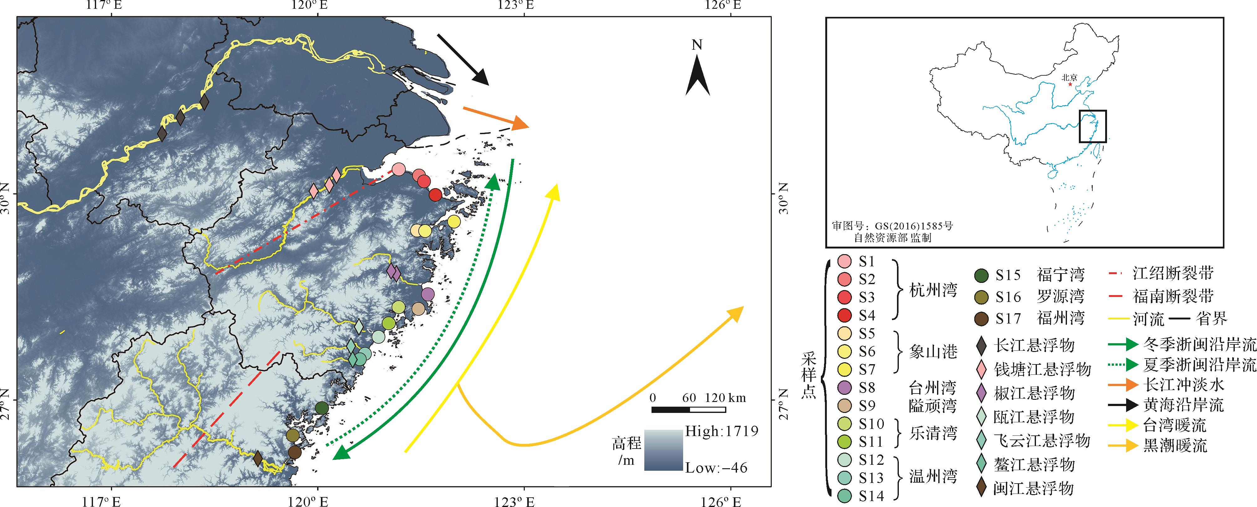
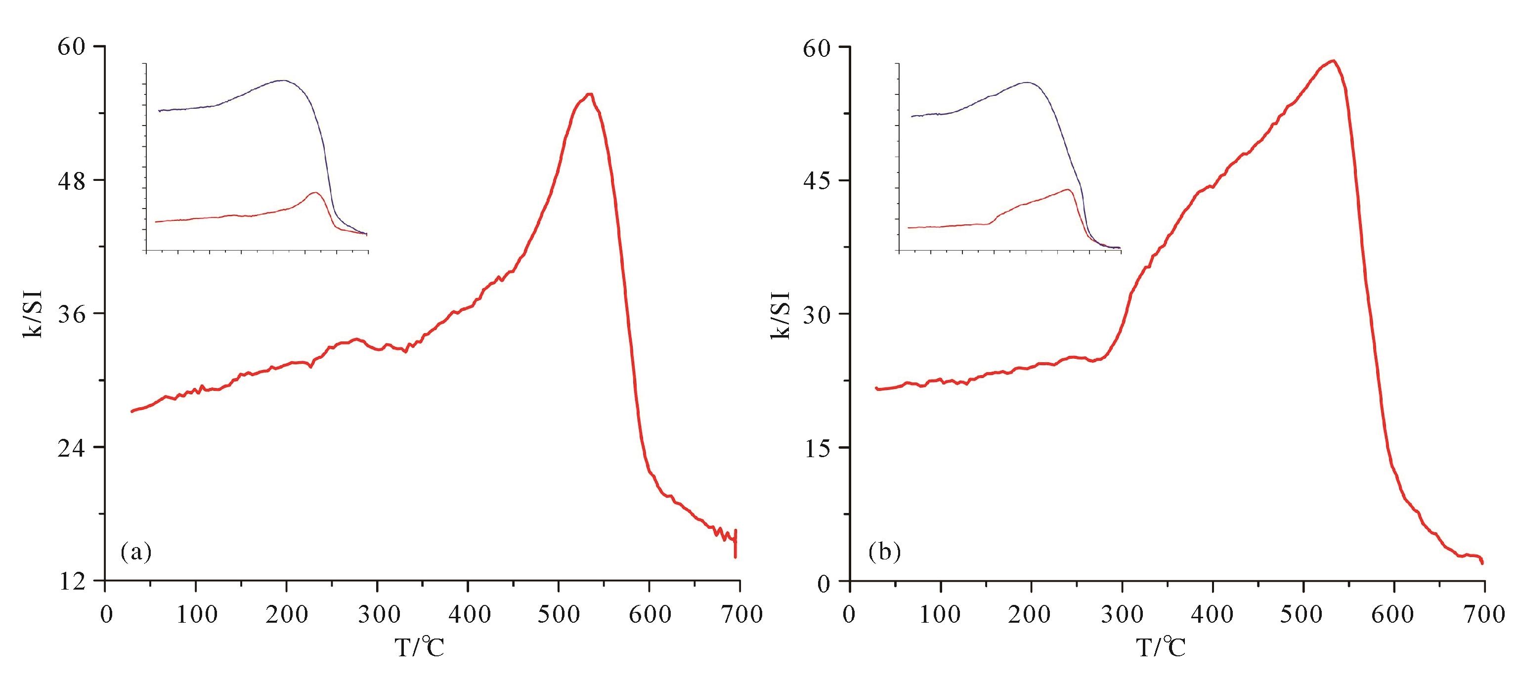
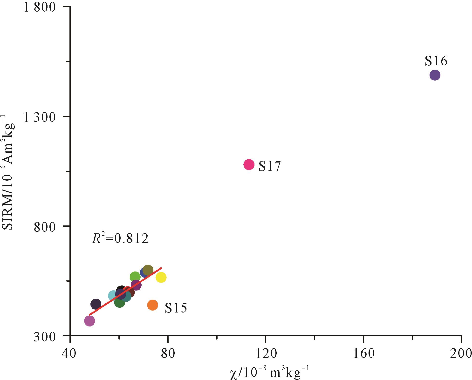
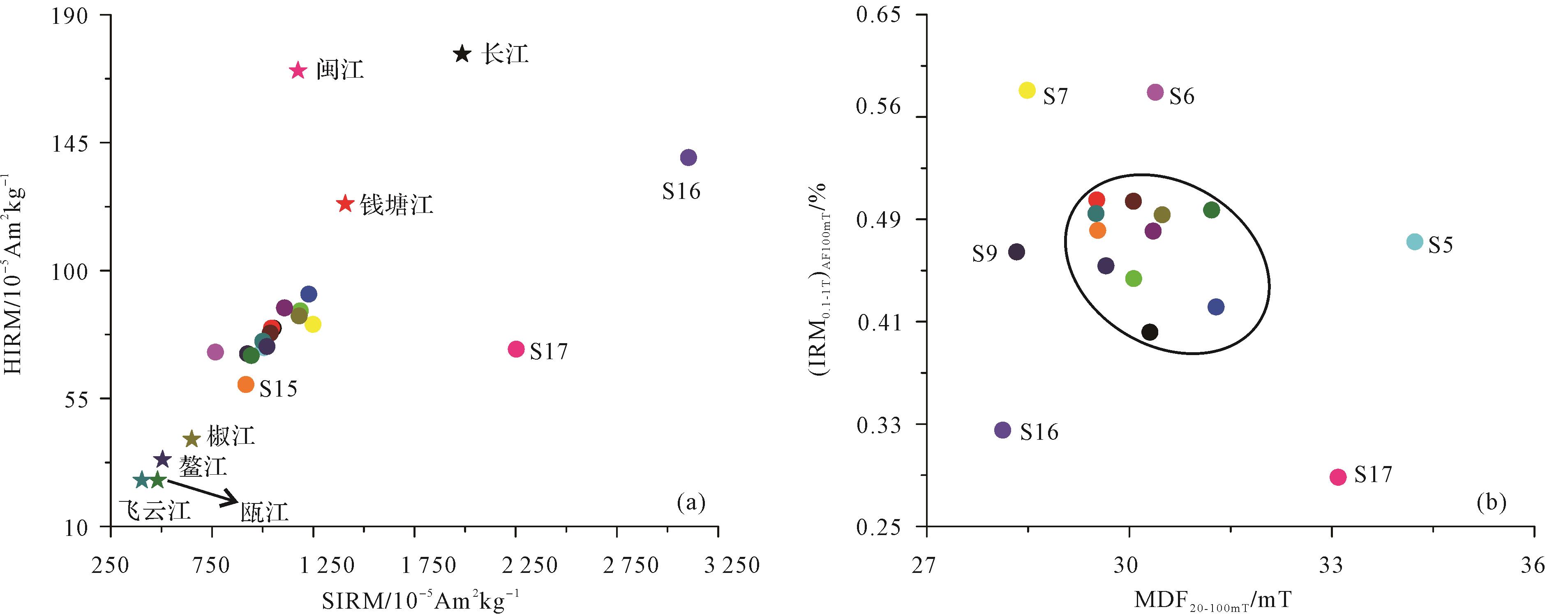
Tidal flats are one of most vital regions in the world. In the Zhejiang and Fujian Coastal regions, the tidal flat is the most important reserved land resource. Research on the provenance of tidal flat sediment along the coast of Zhejiang and Fujian is an important source for managing the land resource. In the past 30 years, it has been observed that the tidal flat sediment in the area originates from the Yangtze River. As the flux of suspended matter declines, its contribution to the Zhejiang and Fujian tidal flats is continuously decreasing. In this study, exploring the provenance of the tidal flats has important practical significance. In order to clarify the provenance of muddy tidal deposits along the coast of Zhejiang and Fujian, 154 muddy tidal flat surface samples are collected from Qiantang River to Minjiang River. Simultaneously, the suspended matter from 12 rivers is sampled from corresponding rivers as well as the Yangtze. Particle size analysis and detailed magnetic studies were carried out on these samples, which include isothermal three-axis stepwise alternating demagnetization, thermomagnetic analysis, magnetic susceptibility parameter, remanence parameter and coercive force parameter. The results show that the magnetic properties of the sediment in the study area are dominated by magnetite; there are differences in the magnetic mineral content, magnetic domains and coercivity among the sediment, which may mean that the sediment are affected by multiple sources; Pearson correlation analysis confirms that the magnetic characteristics of the sediment are basically independent of the grain size, and it is mainly related to the difference of the provenance. The provenance identification results indicate that the provenance of the mud tidal flats in Zhejiang and Fujian include the Yangtze River, coastal bedrock, and Zhejiang and Fujian Rivers. From Hangzhou Bay to Funing Bay, the sediment is generally affected by the mixed material of the Yangtze River and Zhejiang rivers, and the material from the Zhejiang rivers is relatively large. Among them, the sediment of Aiwan Bay and Xiangshan Bay is also affected by the coastal bedrock material, and the sediment of Funing Bay may be additionally influenced by the Minjiang River and coastal bedrock materials. The sediment in Luoyuan Bay and Minjiang Estuary may mainly originate from the Minjiang River, and the coastal bedrock material also has a certain influence on it.
2022, 40(3): 787-800.
doi: 10.14027/j.issn.1000-0550.2021.140
Abstract:
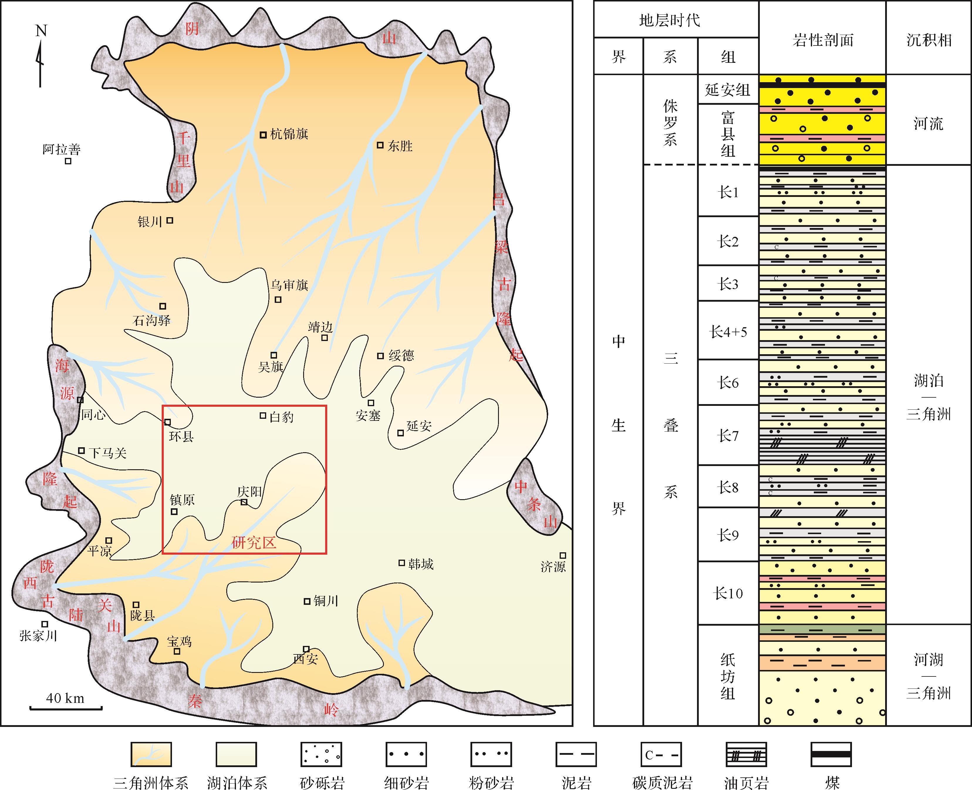
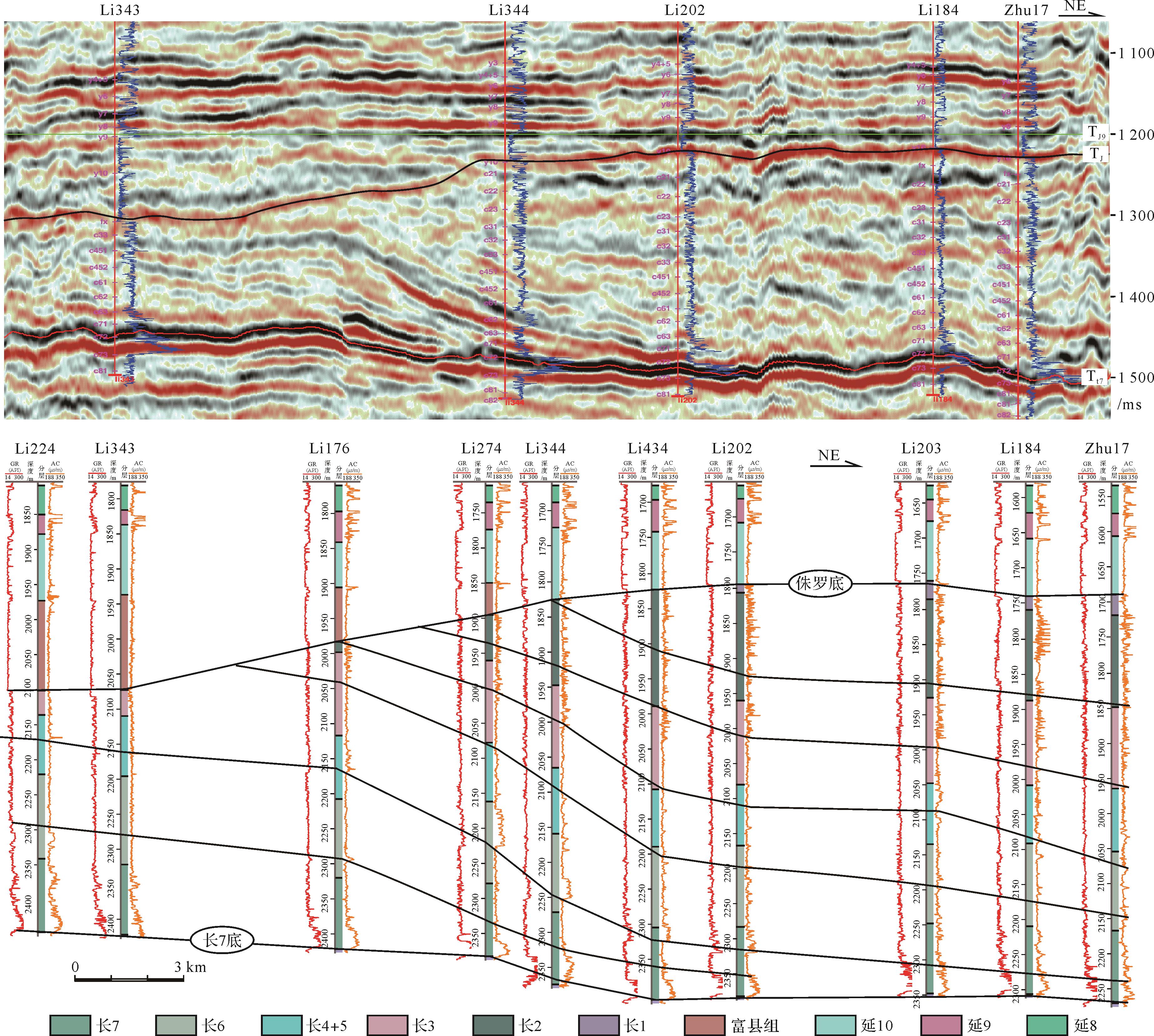
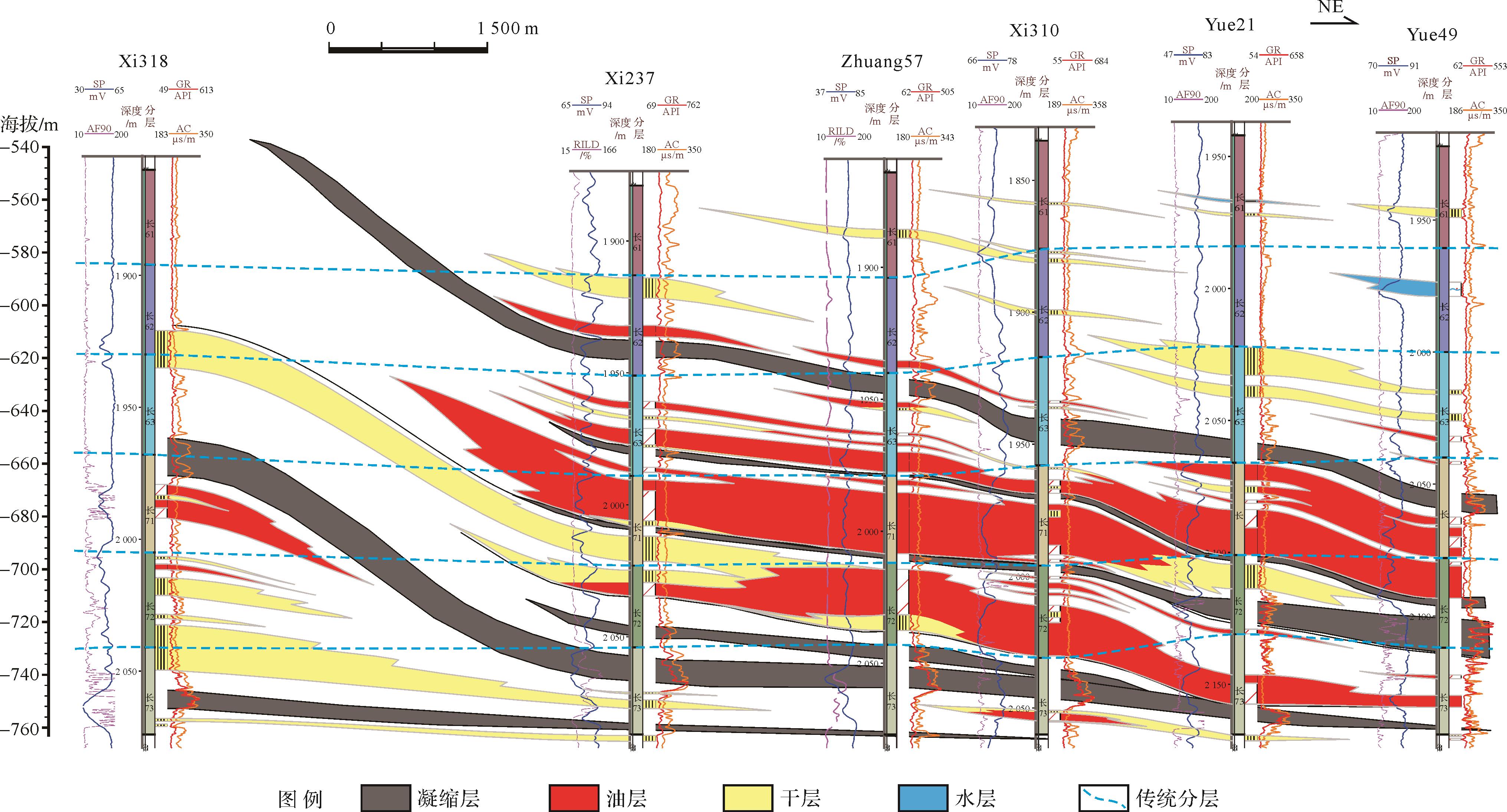
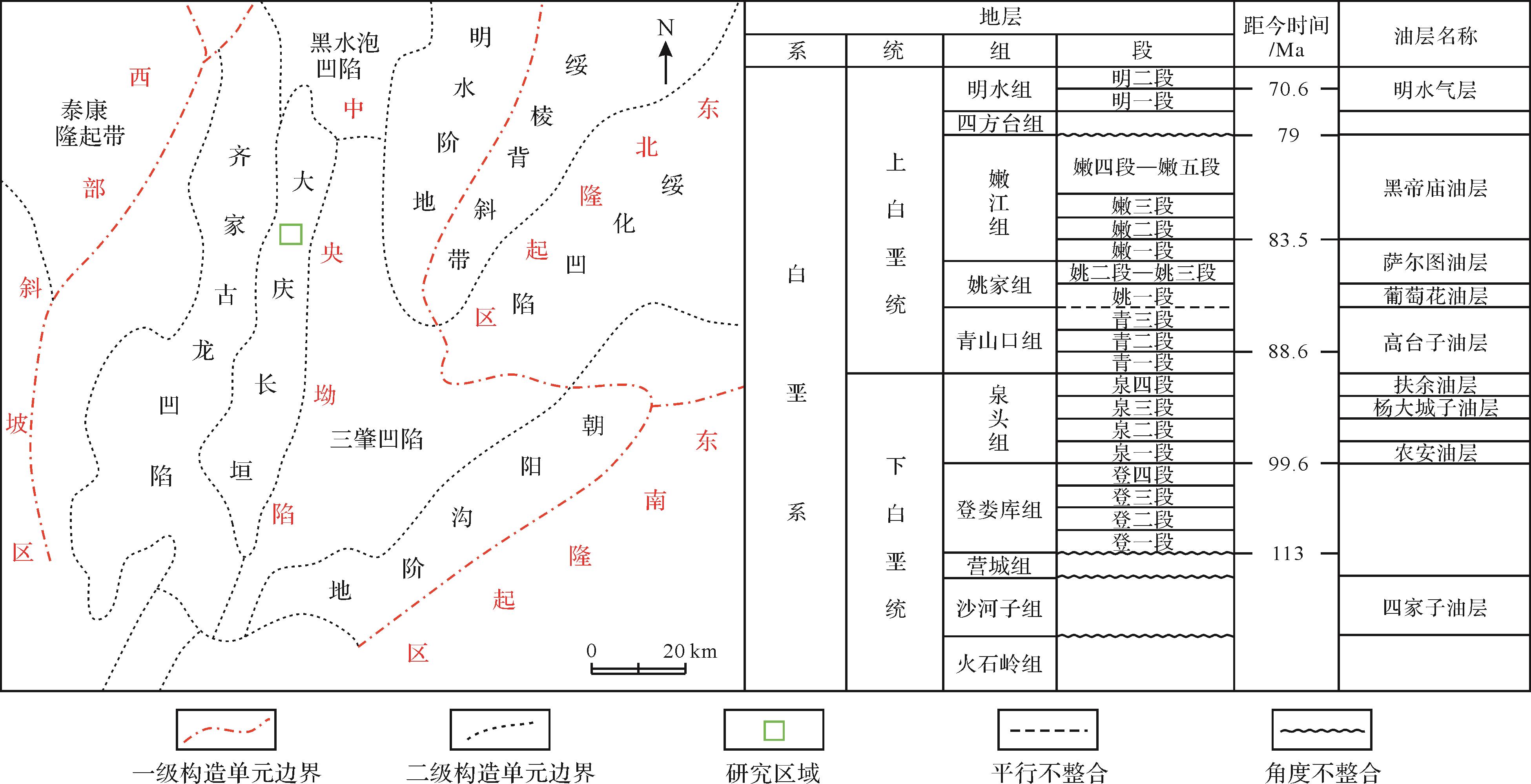
The Triassic Yanchang Formation in the Ordos Basin consists of multiple source-reservoir-cap packages, of which the Longdong is one of the most important oil-producing areas. Progradational continuous strong reflections predominate in the Longdong area seismic profiles. Based on the most recent 3-D seismic data and a large amount of data from drilling, logging and cores, this study emphasized the strata division, sedimentary evolution and sand body distribution of progradational stratigraphic structures. The continuous strong reflections in the seismic profiles correspond to mudstone more than 10 m thick, indicating condensed sections deposited during periods of lake flooding. These sections divide the strata into seven sedimentary units, each of which overlaps the previous section towards the basin center. Each unit comprises three sedimentary facies: delta front facies in the upper section, mud-rich slope facies in the middle, and deep-water gravity-flow facies in the lowest section. The lake basin experienced fluctuating regressions during deposition of the middle Yanchang Formation. Sand bodies were mainly developed in the upper and lower sections, with banding distribution styles. Unlike the traditional scheme of lithological stratigraphy, there are great differences in lateral correlation of the sand bodies along the source direction, and in spatial distribution and horizontal overlapping relationships, which this study found to be in line with the sedimentary settings of fluctuating regression, thus giving much more guidance for oil field exploration and development.

2022, 40(3): 801-812.
doi: 10.14027/j.issn.1000-0550.2020.137
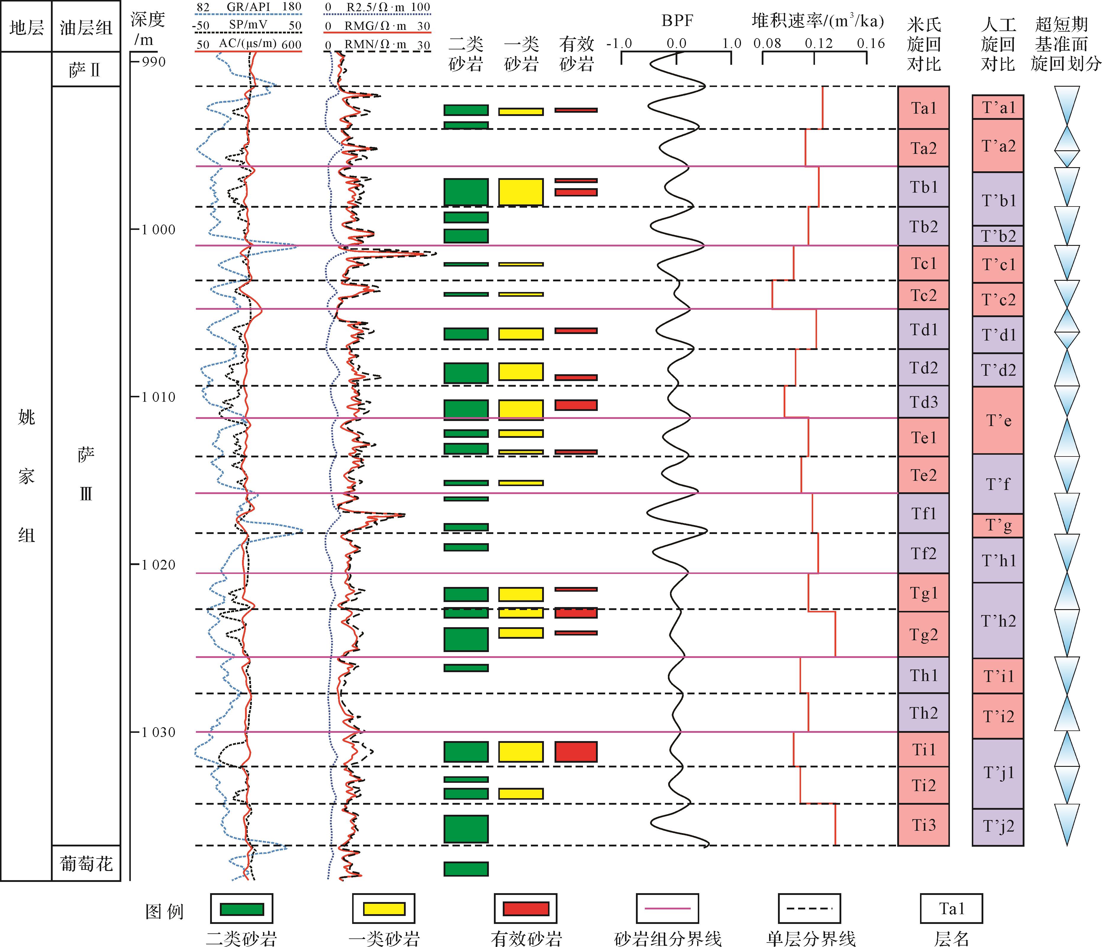
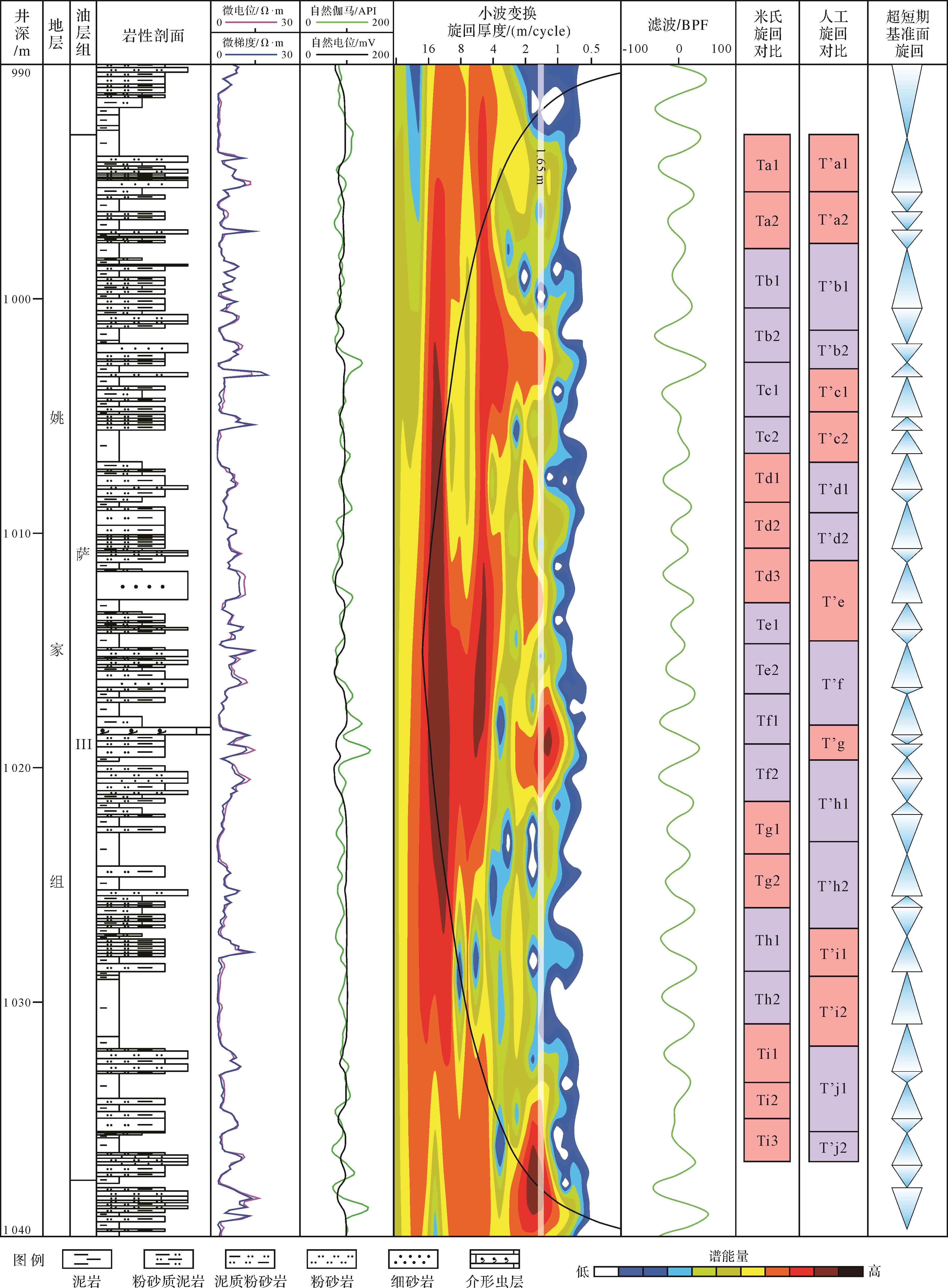
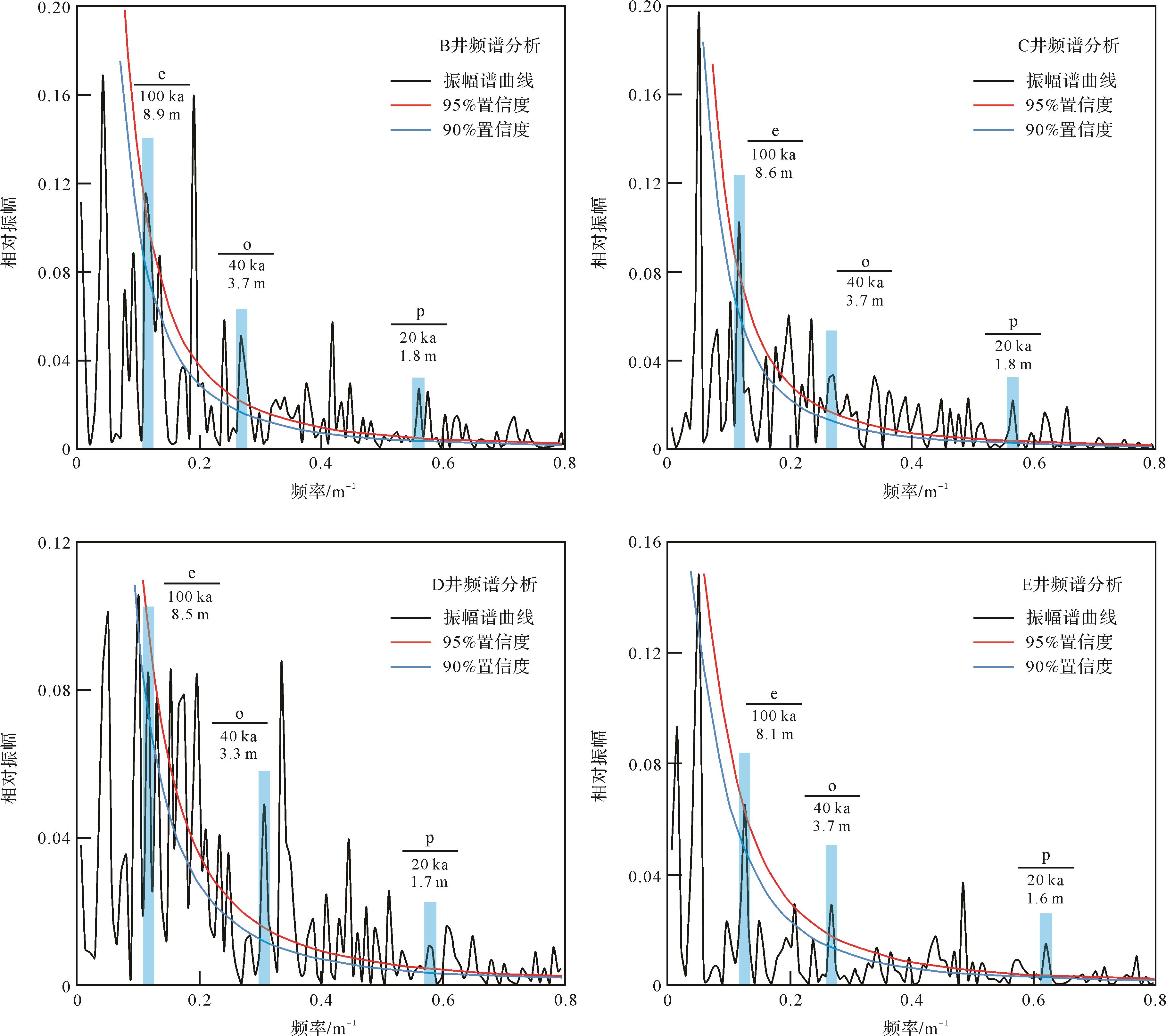
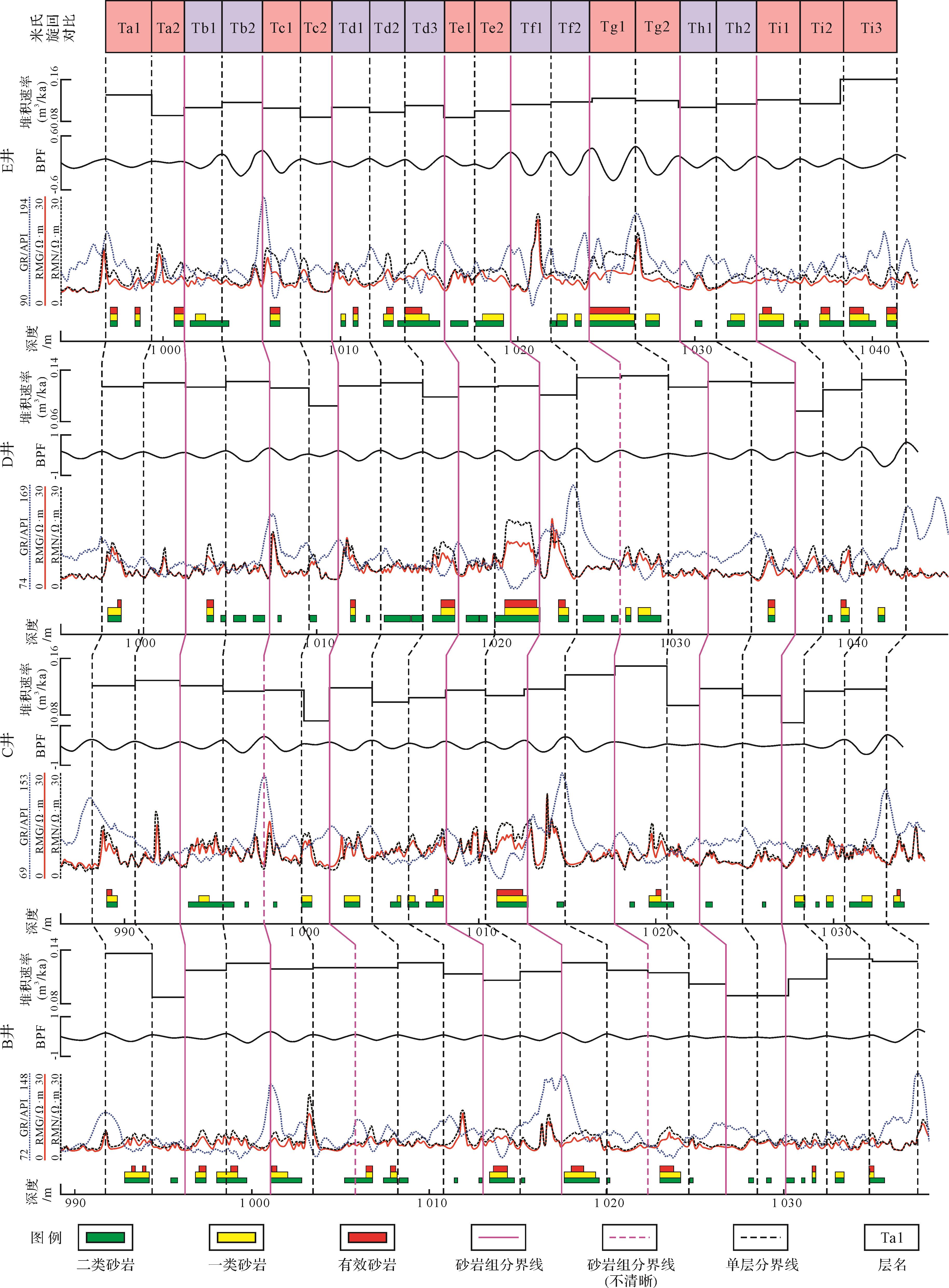
Abstract:
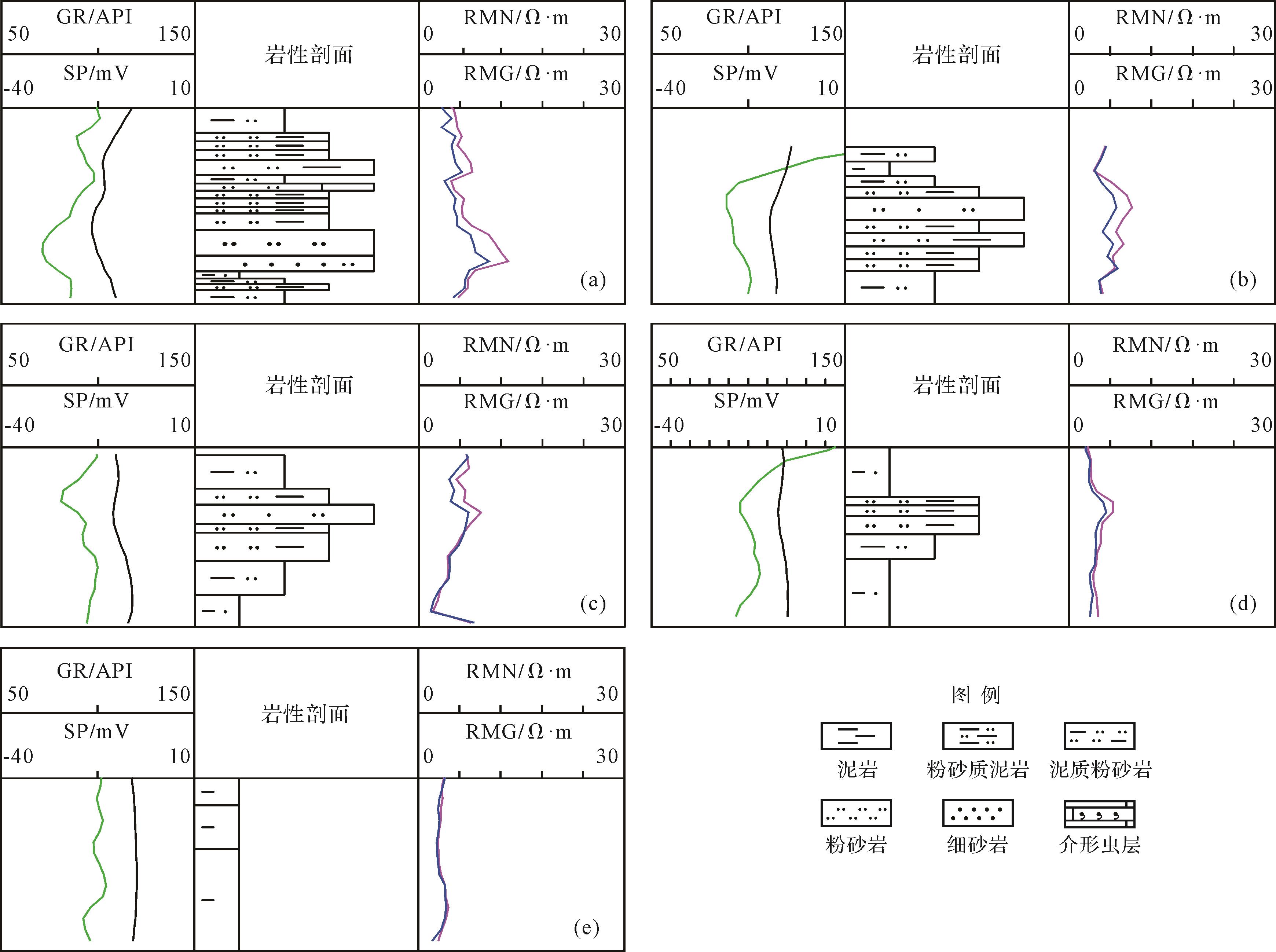
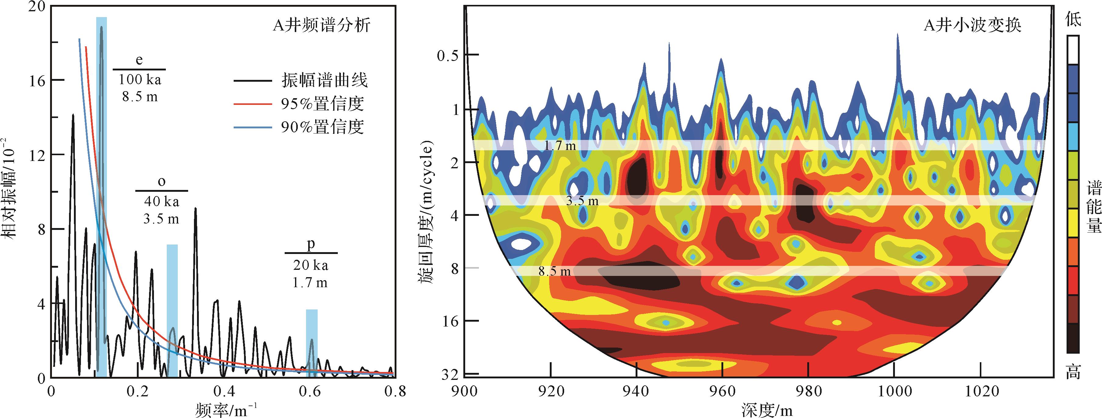
Sandstone groups and monolayers were studied in terms of Milankovitch astronomical cycles by dividing and contrasting oil reservoirs in a delta front. Spectral analysis and wavelet transforms revealed that the Milankovitch cycles are reflected in the third reservoir of Saertu Formation (SIII). An eccentricity period of 100 ka, an obliquity period of 40 ka and a precession period of 20 ka in SIII correspond closely to the 5∶2∶1 ratio of cyclic formation thicknesses. Evidently, the astronomical orbital period had an impact on SIII. Bandpass filtering indicates a variation of sediment accumulation rate corresponding to the 20 ka precession period. SIII comprises nine sandstone groups and 20 monolayers. It is suggested that there is a degree of correspondence between the 20 ka precession cycle that regulated climate fluctuations and super-short-term base-level rises and falls. The monolayers have a strictly isochronous division corresponding to the Milankovitch cycles. The distribution of sand in the 20 monolayers reveals that SIII experienced multi-stage transgression and regression, which correspond well with the division of the sandstone groups.
2022, 40(3): 813-824.
doi: 10.14027/j.issn.1000-0550.2020.138
Abstract:
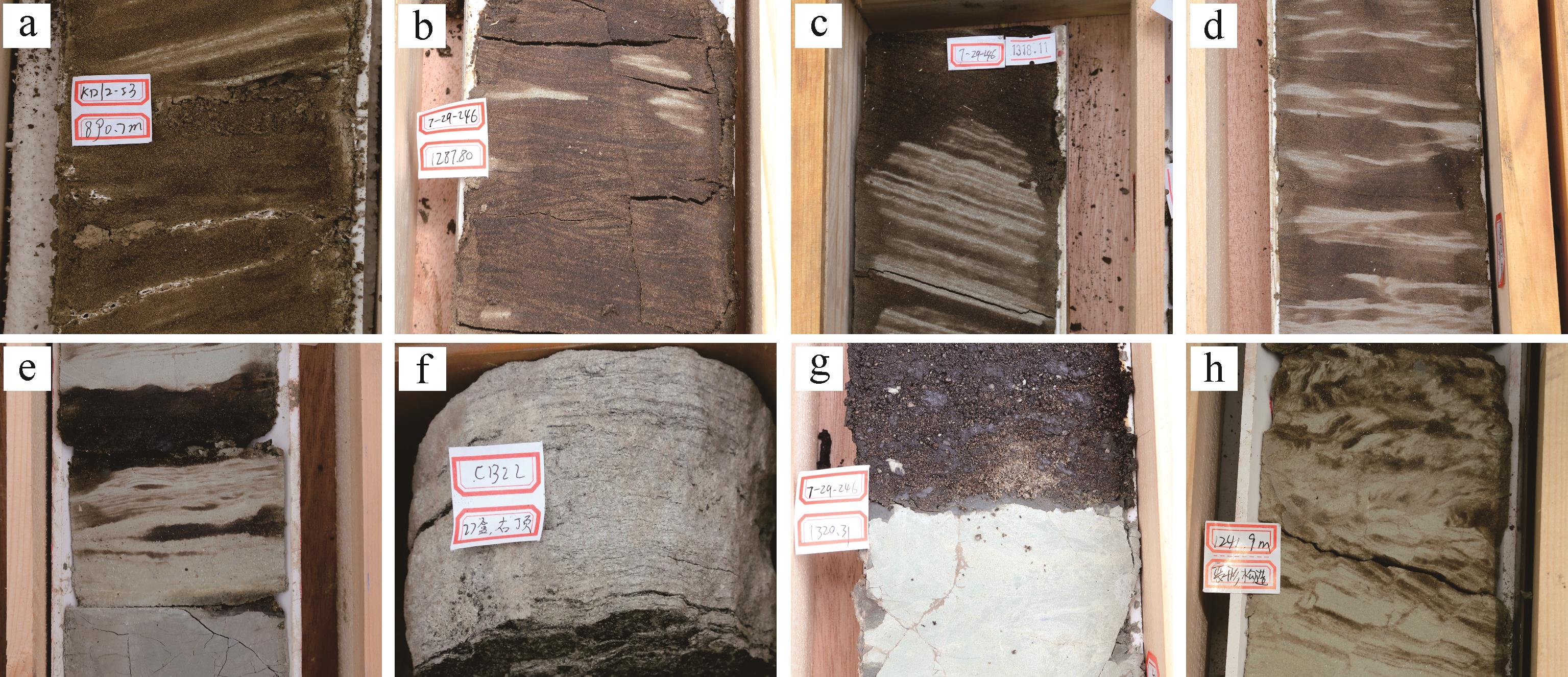
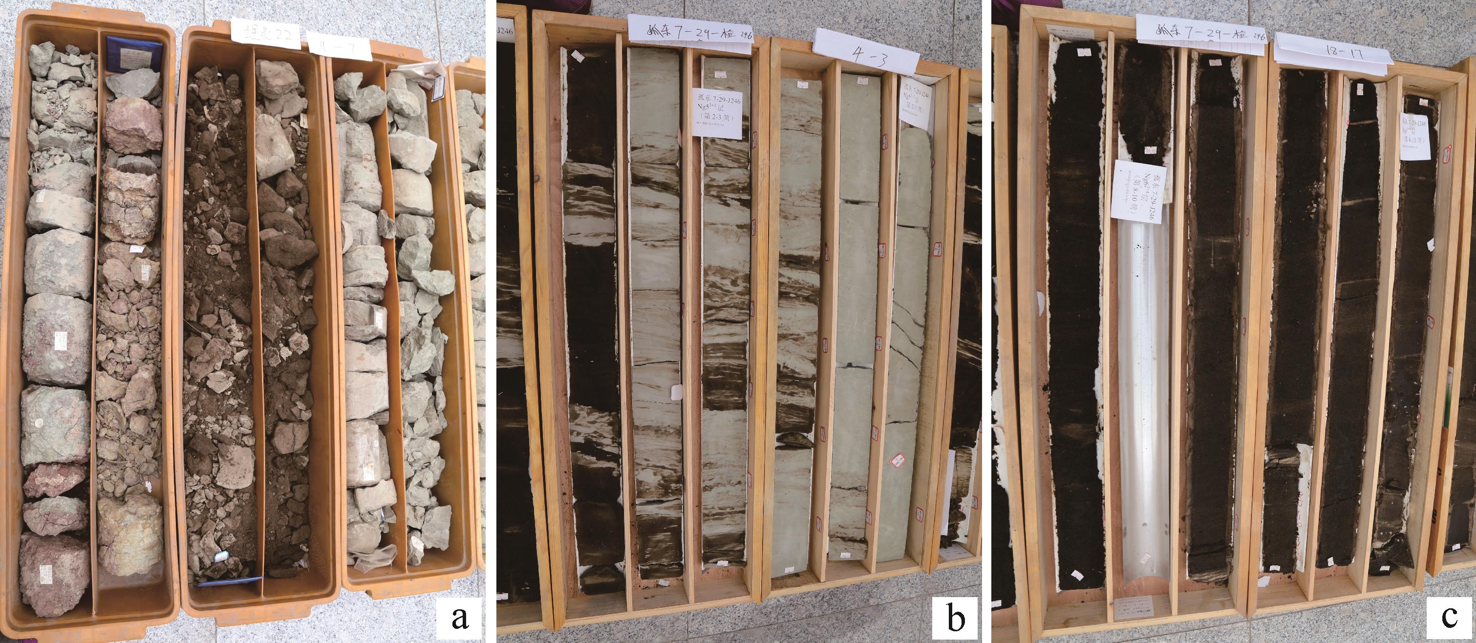
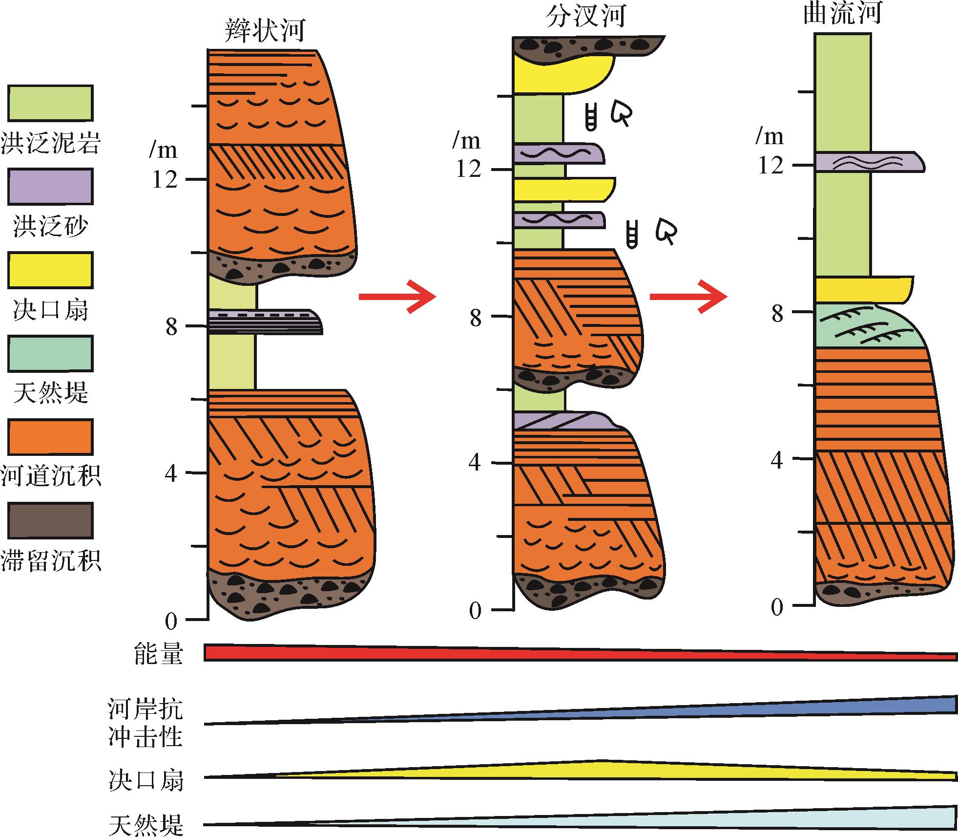
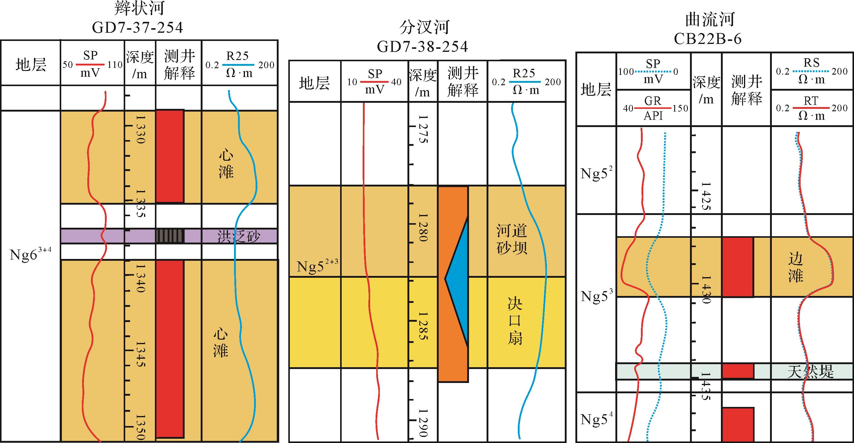
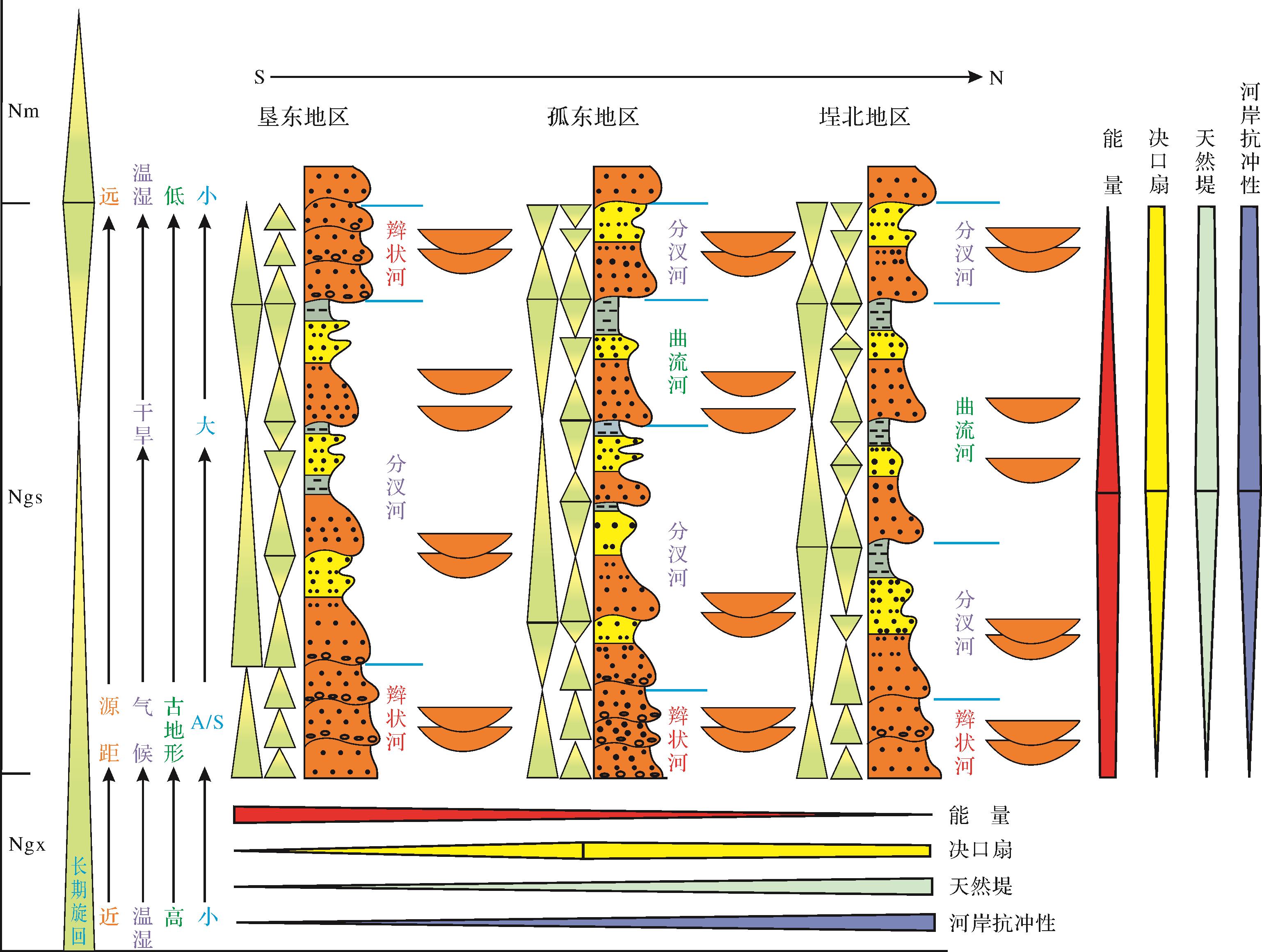
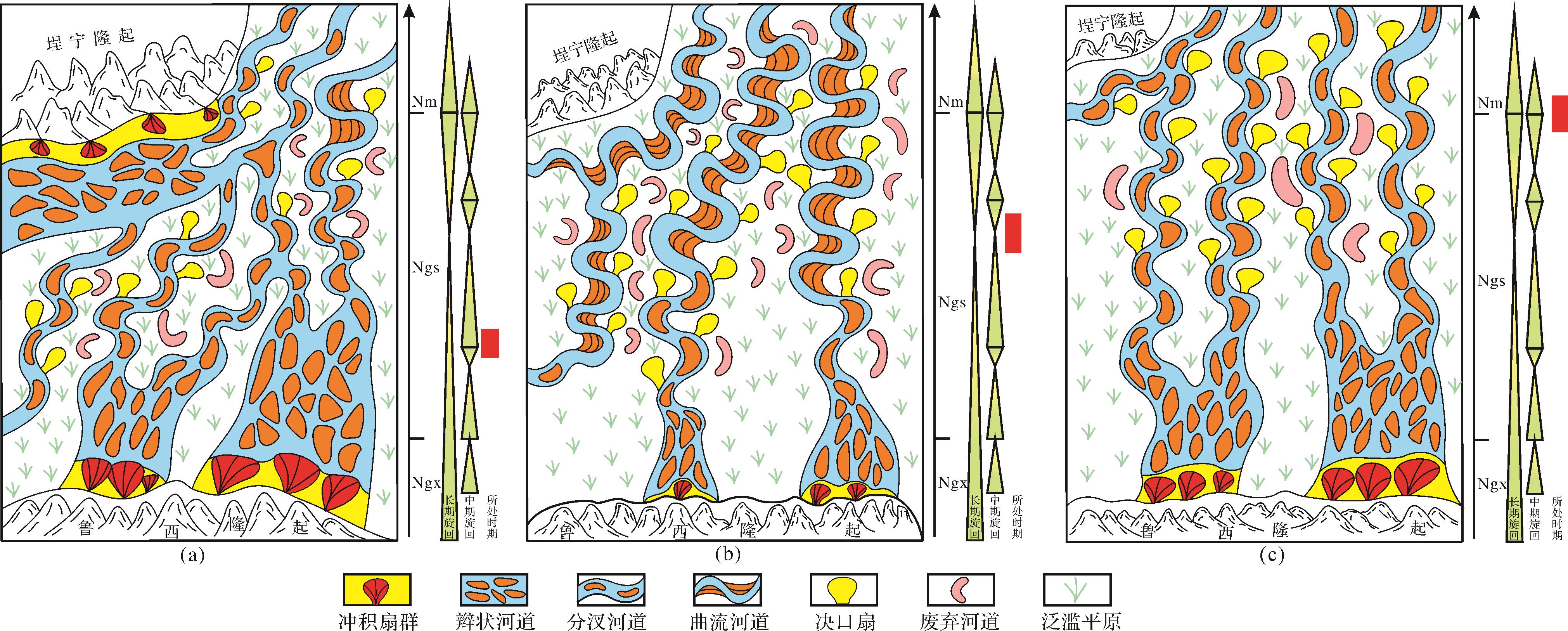
The types and evolutionary process of rivers in the upper member of the Neogene Guantao Formation and bottom of the Minghuazhen Formation in the offshore area of the Shengli oilfield were studied by careful observation and description of sealed drill cores, grain size analysis and detailed well logging data analysis, together with an investigation of regional paleostructure, paleoclimate and base-level cyclic change. It was found that, in general, three types of river developed in the study area: braided, meandering and anabranching rivers. Braided rivers were mainly developed in no. 7 sand stratum of the upper member of the Guantao Formation, and in the lower part of no. 6 sand stratum of the upper member of the Guantao Formation at the southern and central parts of the study area, and in nos. 1 and 2 sand strata of the upper member of the Guantao Formation in the southern part of study area. Meandering rivers were developed in the no. 3 sand stratum of the upper member of the Guantao Formation in the central part of the study area, and in the northern part of study area from the upper part of no. 5 to no. 3 sand strata in the upper member of the Guantao Formation. Anabranching rivers were widely developed in the other sand group. The three major influencing factors were tectonism, paleoclimate and base-level change. Their effect was a forward evolutionary relationship from braided to anabranching river (then to meandering river) and a reverse evolutionary relationship from anabranching to braided river, and meandering to anabranching river from the upper member of the Guantao Formation to the bottom of Minghuazhen Formation. The process was not continuous from high-energy rivers to low-energy rivers.
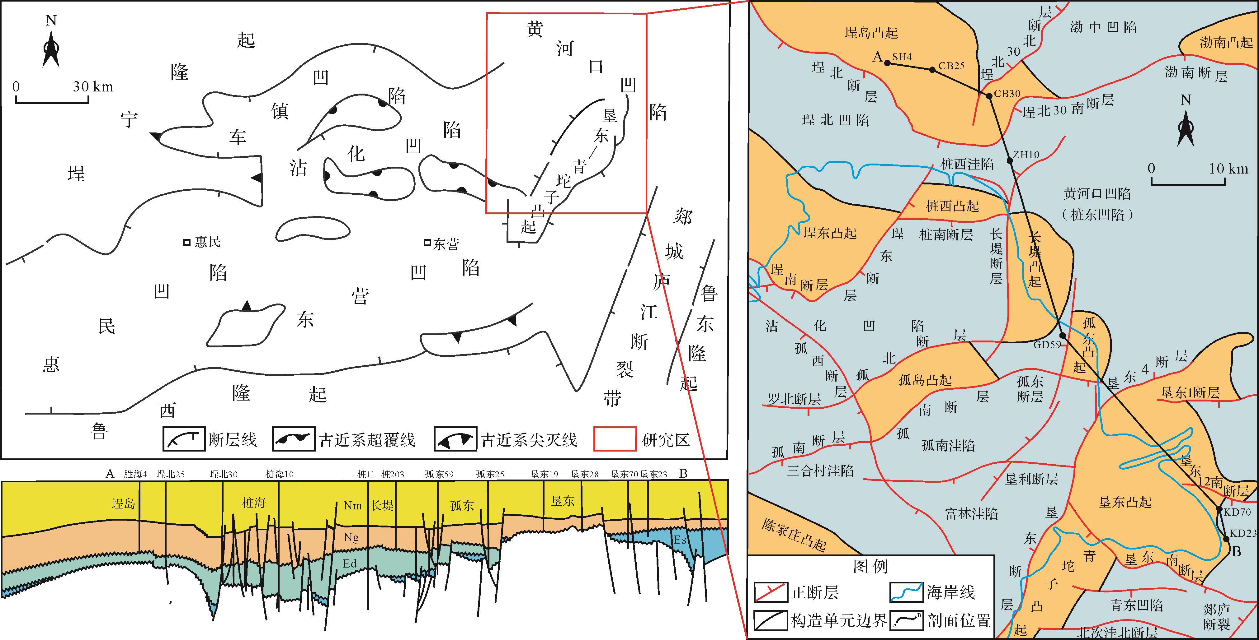
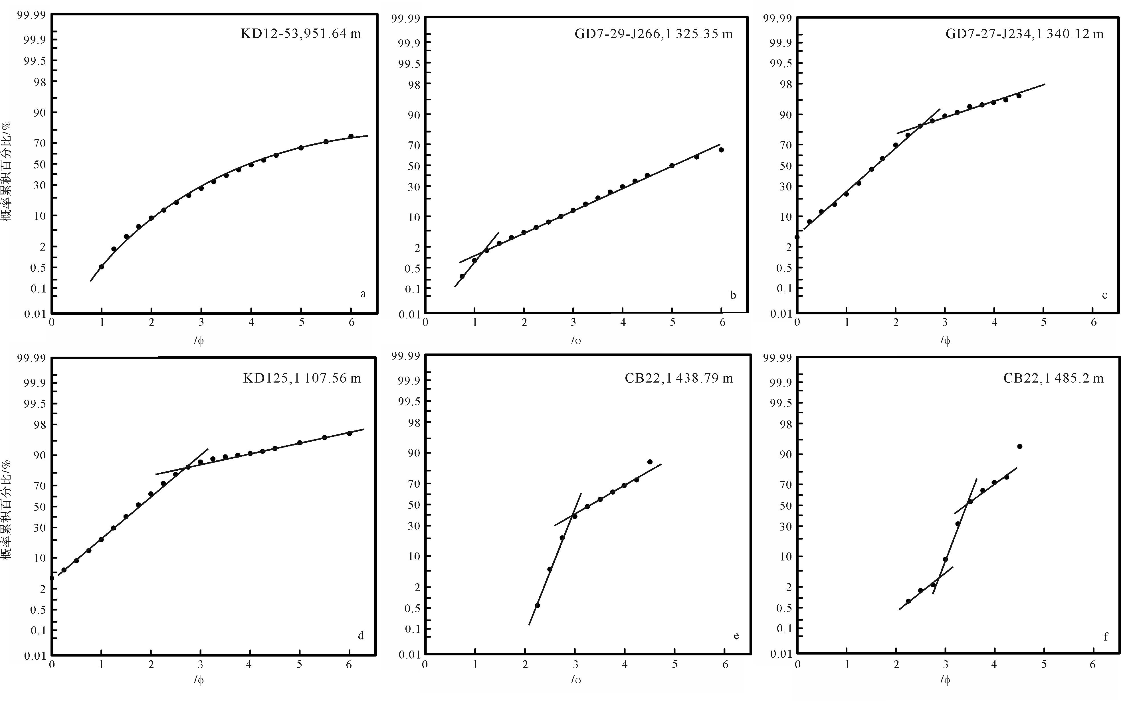
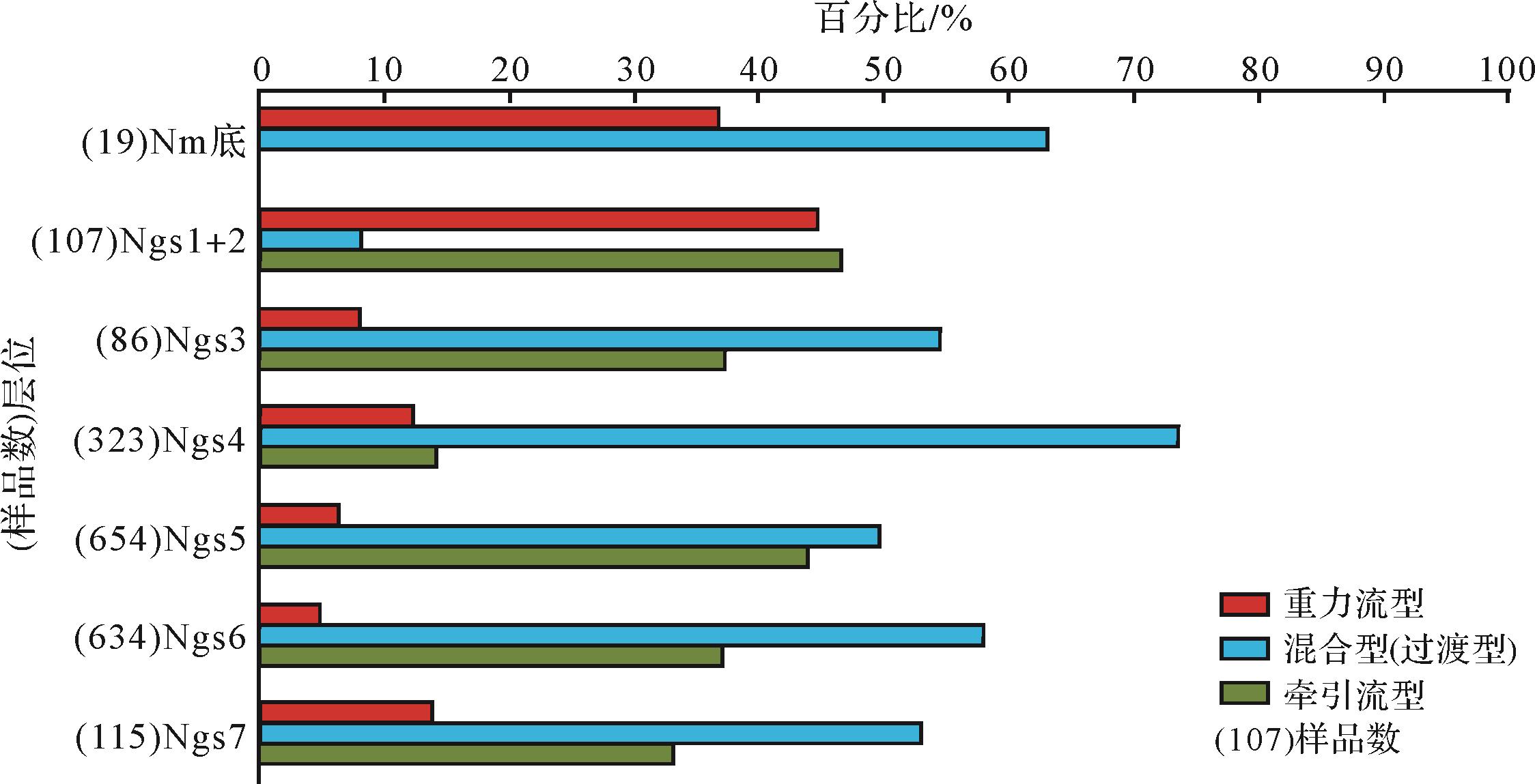
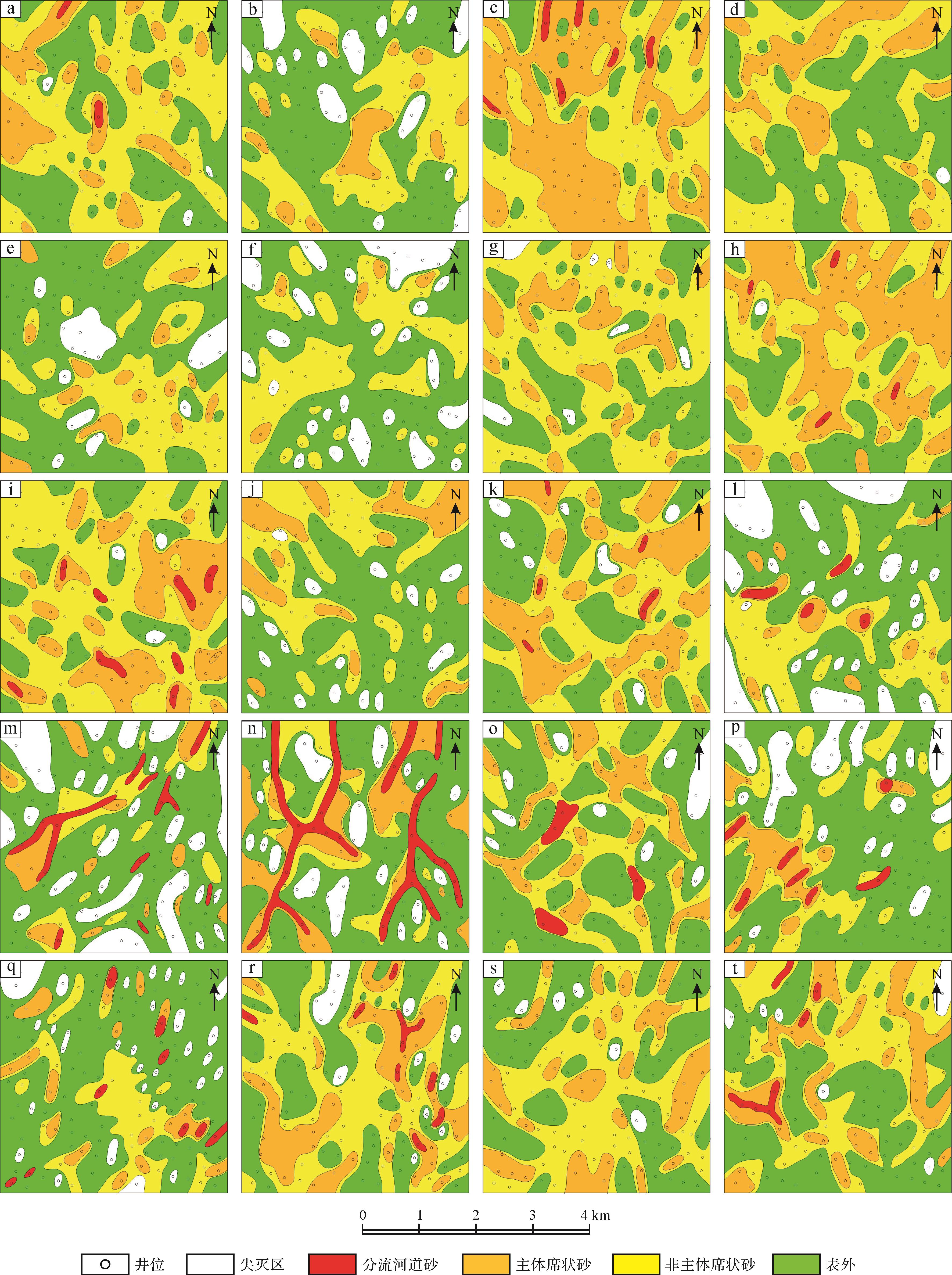
2022, 40(3): 825-837.
doi: 10.14027/j.issn.1000-0550.2021.146
Abstract:
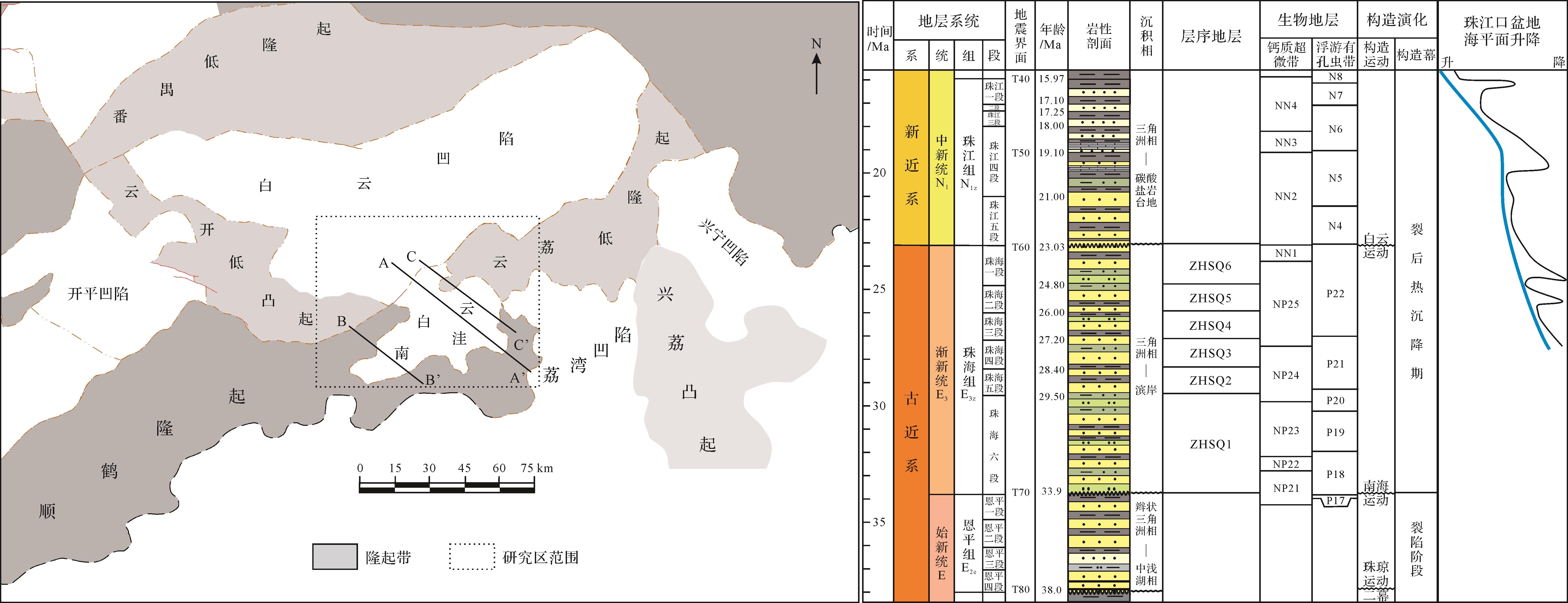
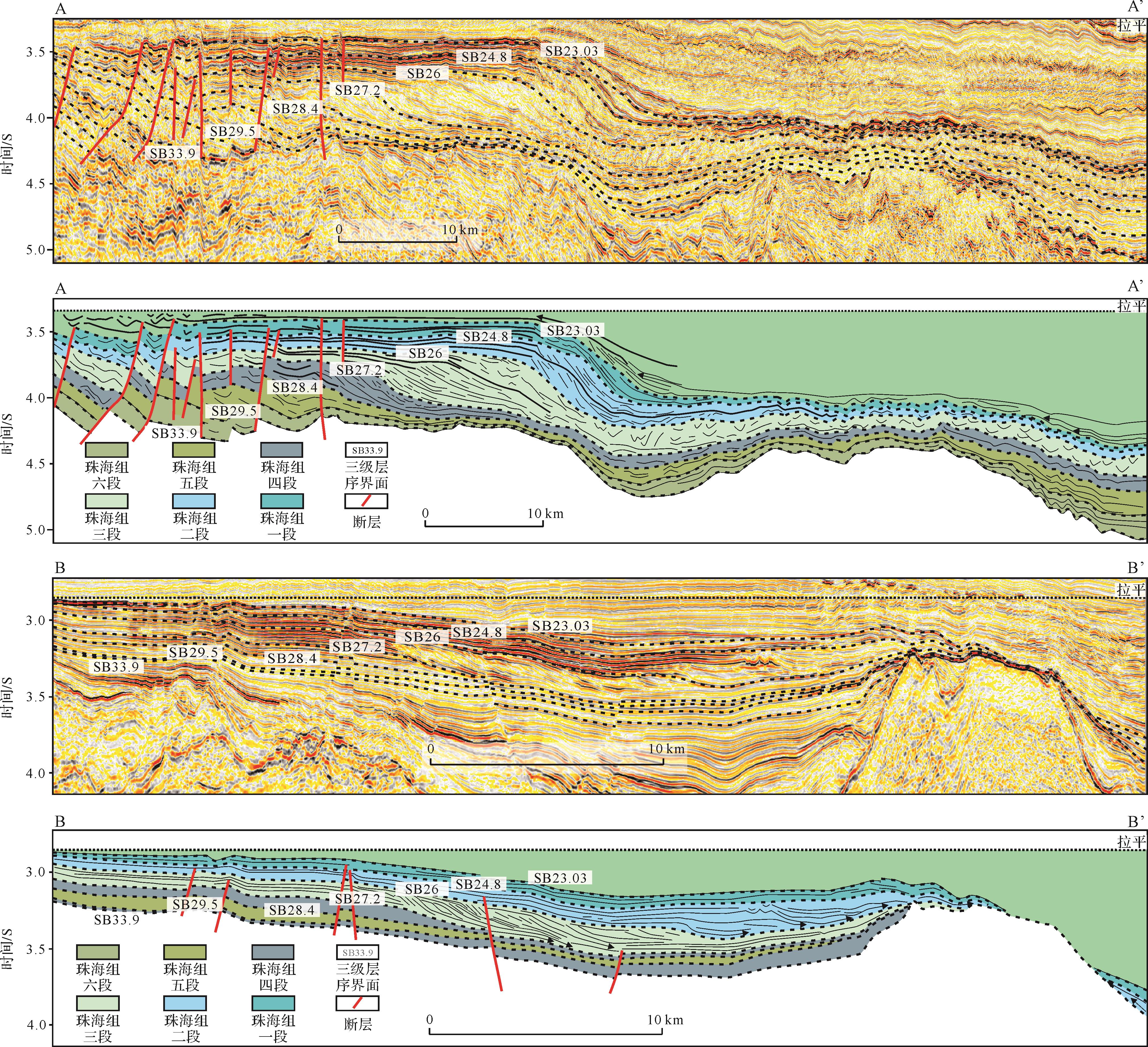
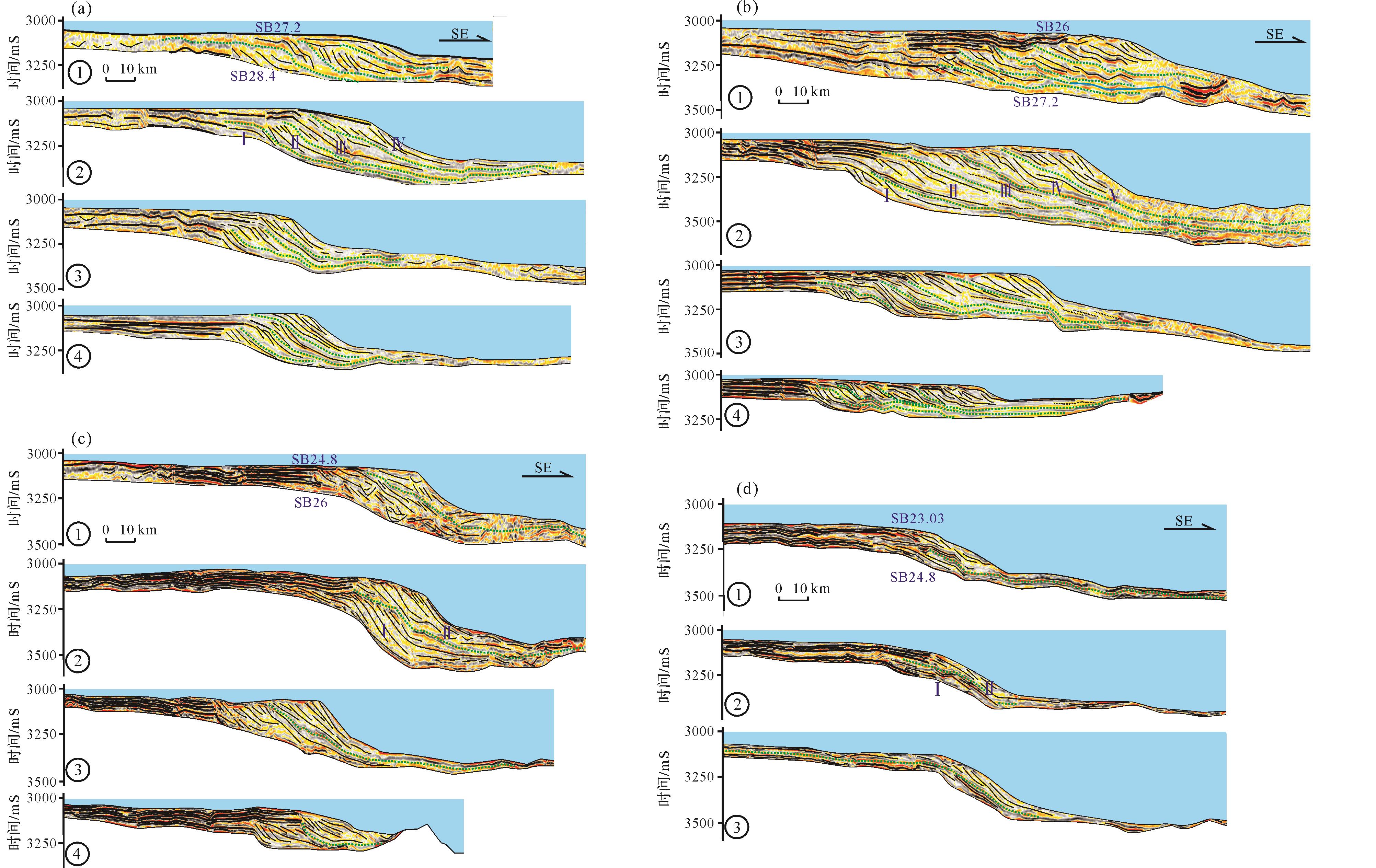
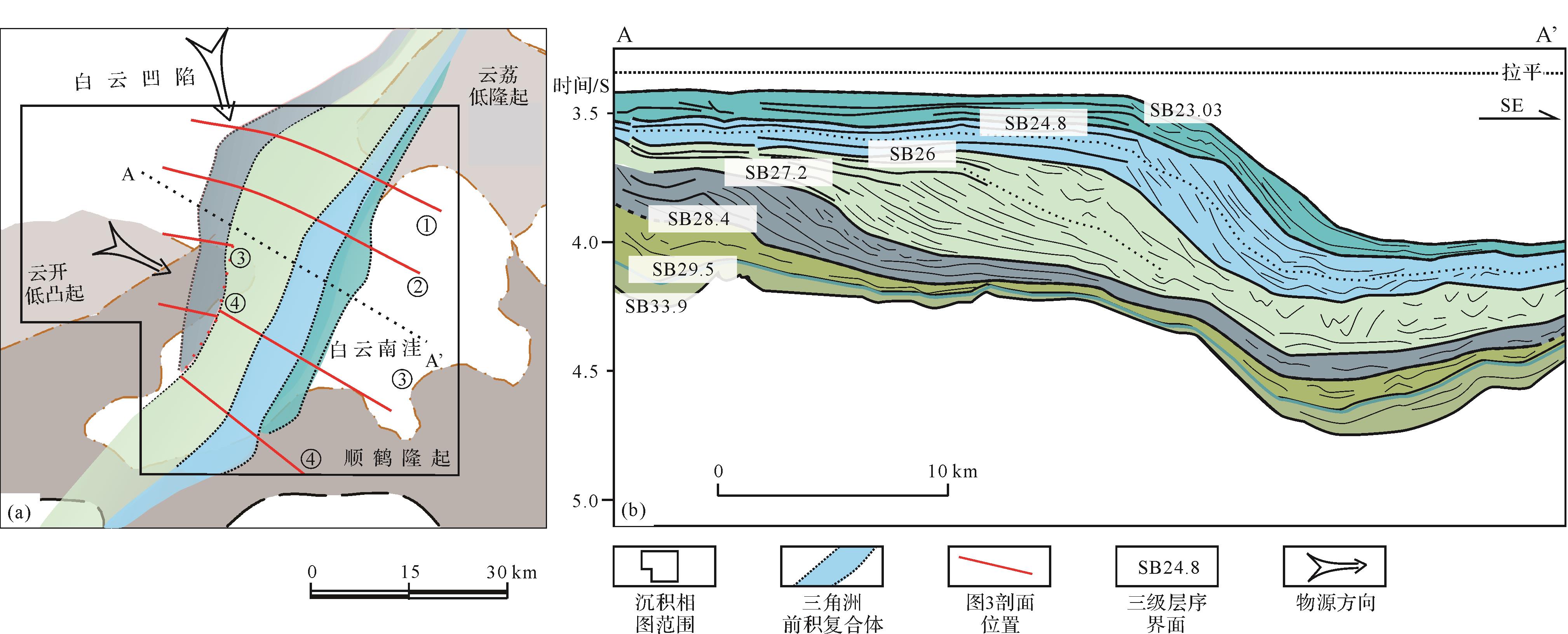
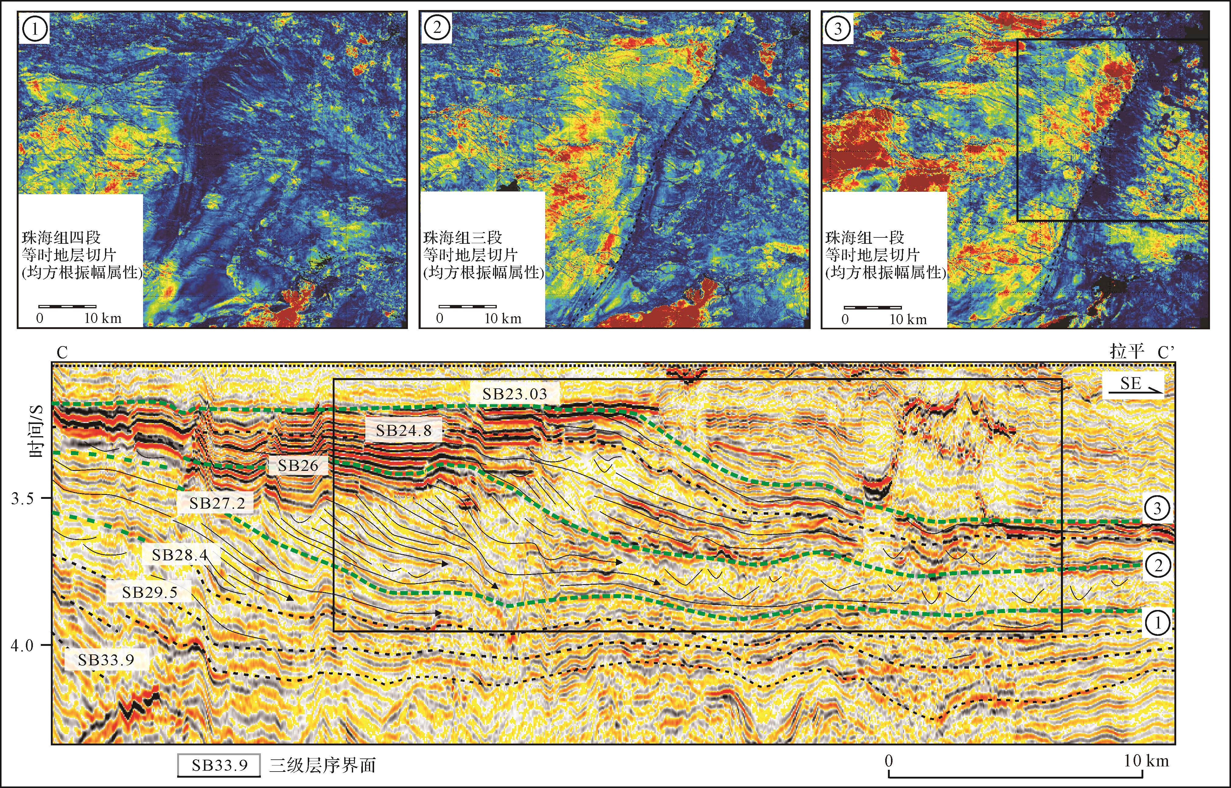
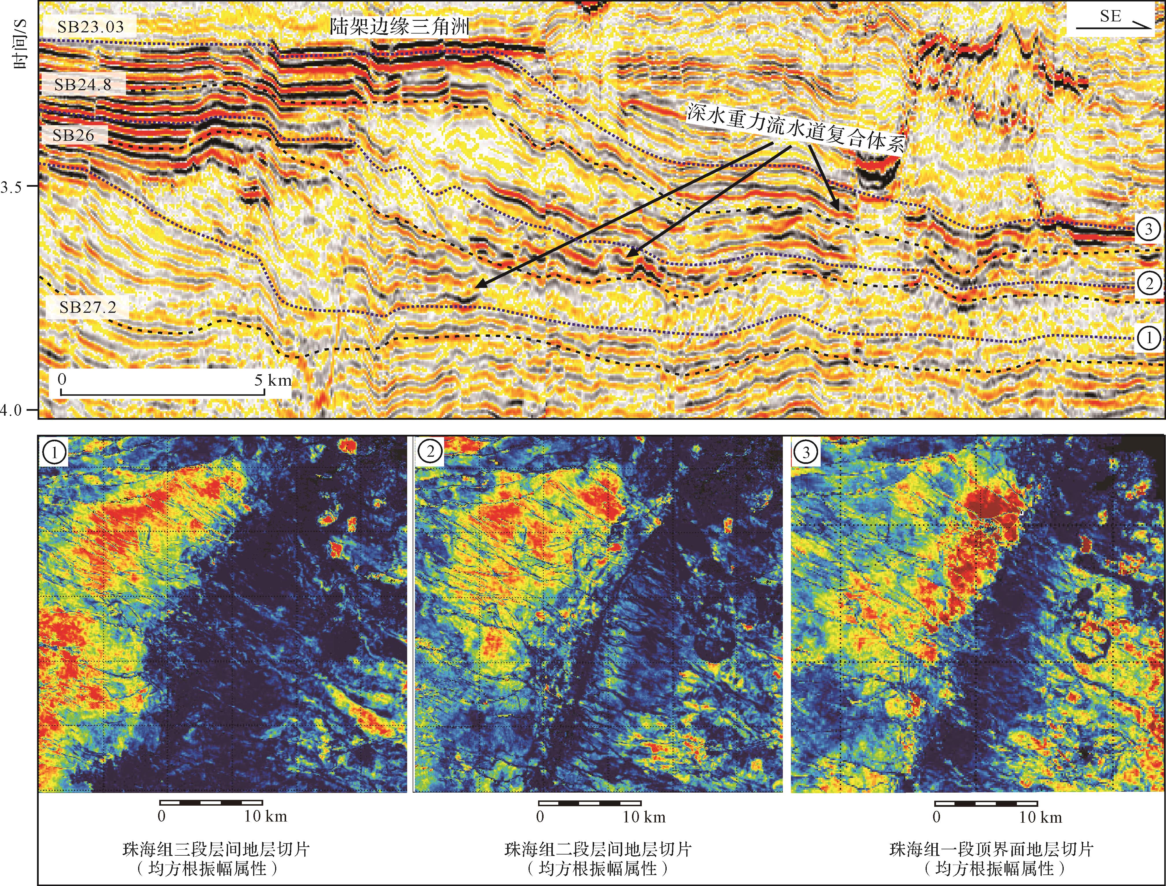
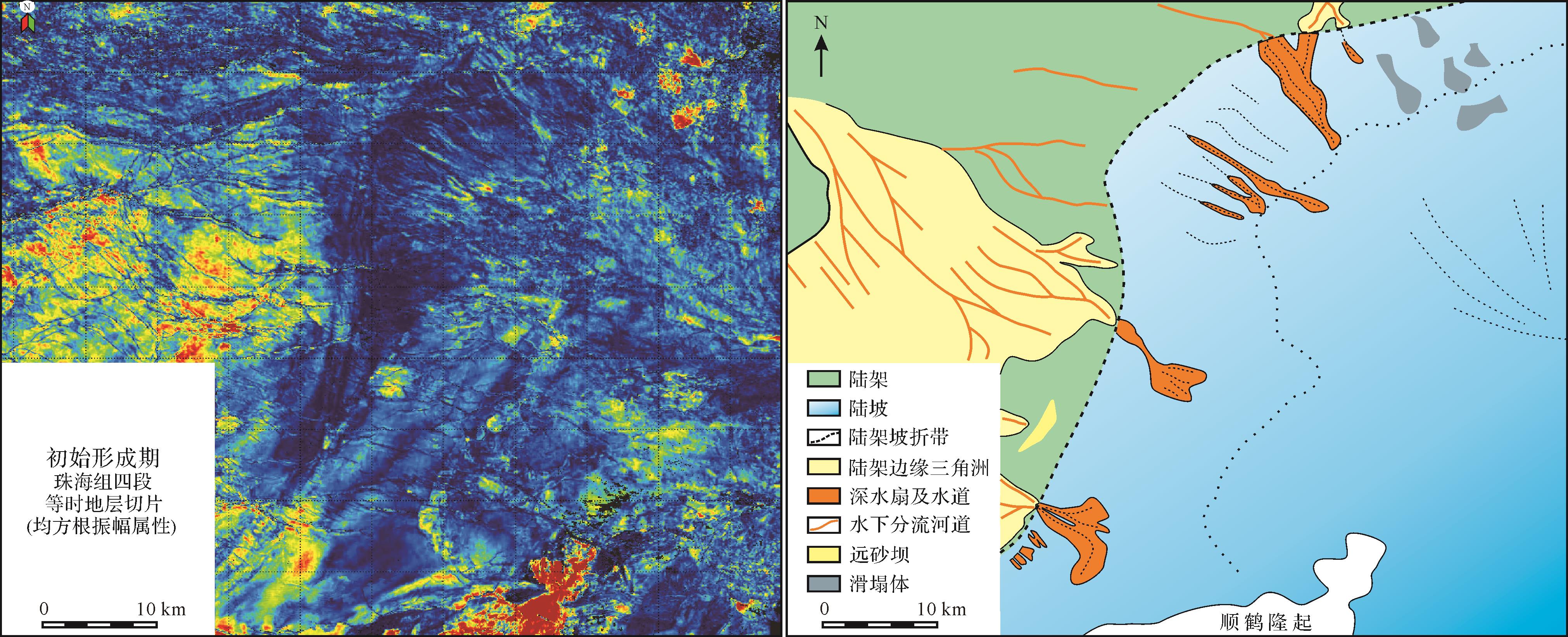
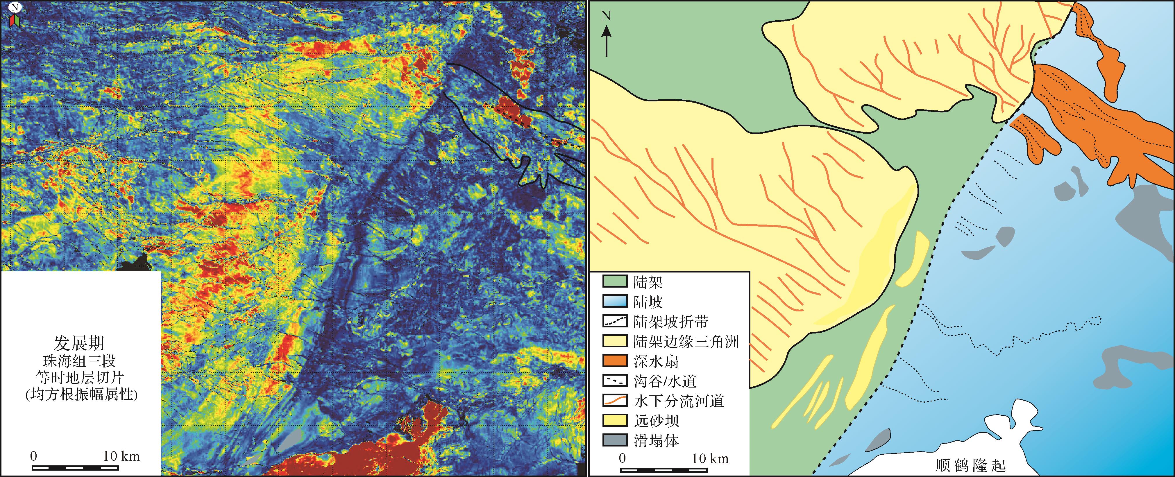
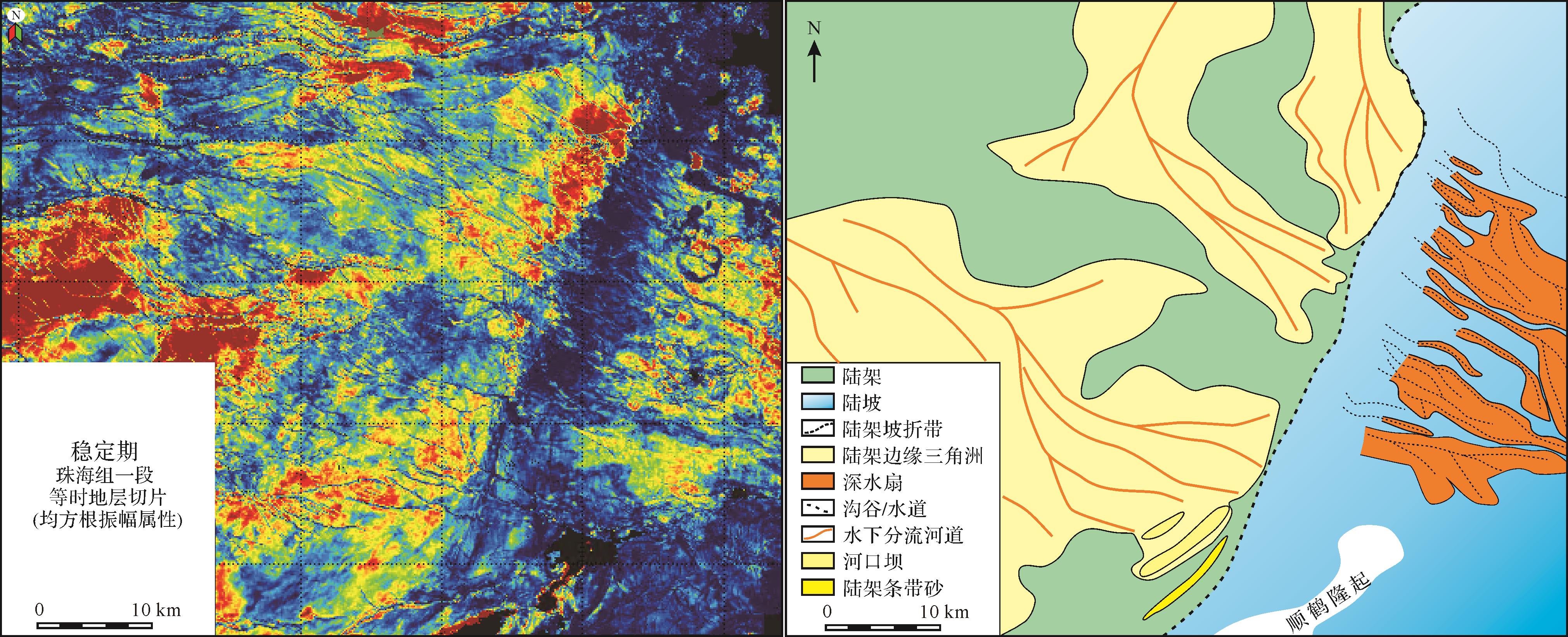
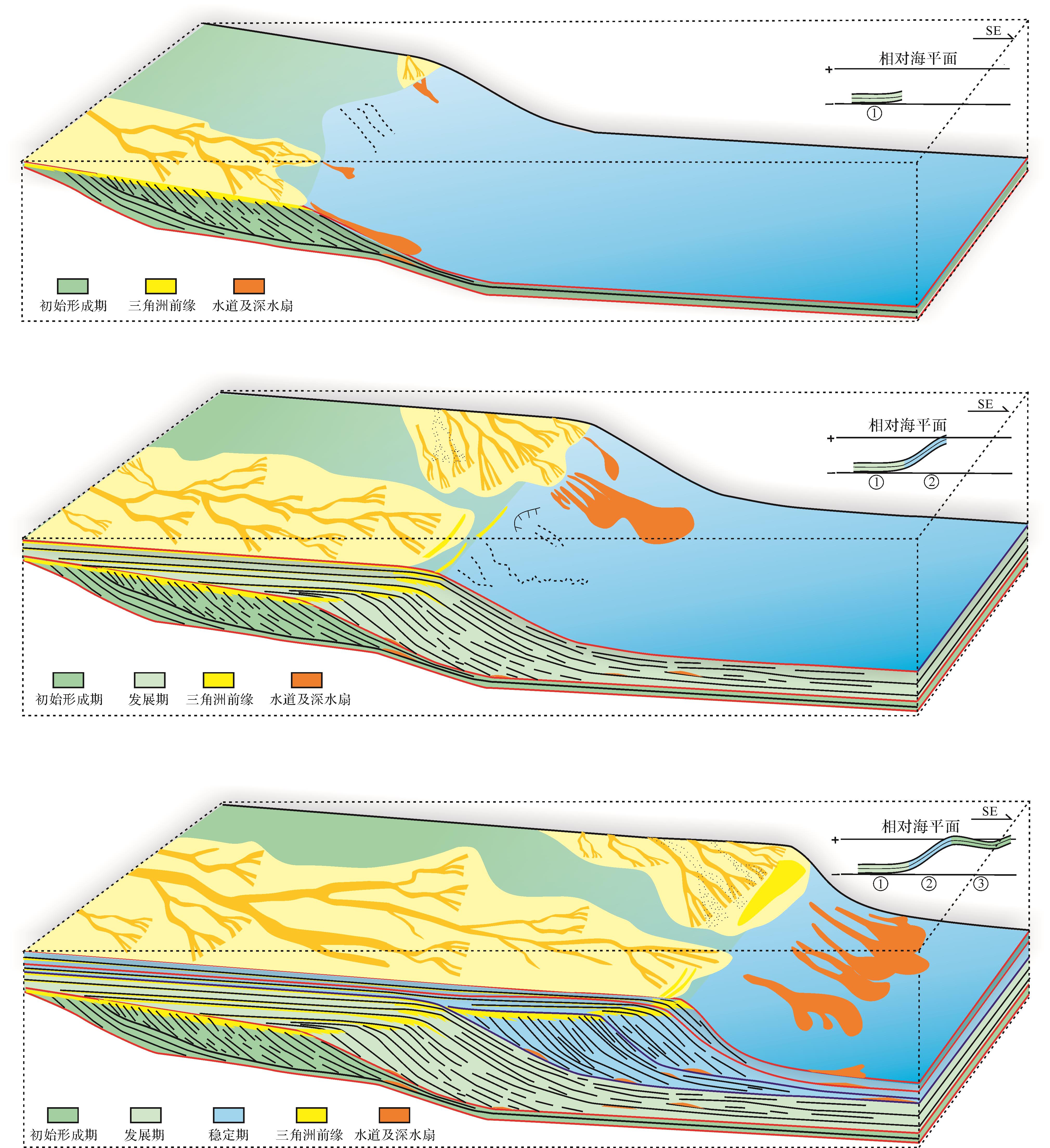
Shelf-margin deltas, as important petroleum reservoirs, were widely developed in the Upper Oligocene strata of the south subsag of Baiyun Sag in the Pearl River Mouth Basin. It is also a research hotspot of sedimentary and petroleum geology. Based on high-resolution three-dimensional seismic data, this paper examined the sedimentary structure in the third-order sequence and evolution of the shelf-margin deltas of the Zhuhai Formation in the south subsag of Baiyun Sag. The study revealed that the shelf-margin deltas have two provenances in the north and northwest and formed 4 consecutive delta complexes; each complex can be subdivided into 2–5 sets of delta frontal bodies by dissecting the delta front structure and superimposed styles, and they have sigmoid-tangential and S-shaped seismic reflections. The deltas have significant differences in the rate of delta progression and accumulation in different source supply systems. The shelf-margin deltas have three evolution stages including the initial formation stage, development stage, and stable stage. The initial formation stage occurred in the middle and late stages of the 4th member of the Zhuhai Formation, and deltas mainly experienced progradational clinoform growth in the vertical direction. On the plane, the delta area from the northern provenance was small, and the area from the northwestern provenances was relatively large. The development stage occurred in the 3rd member of the Zhuhai Formation; during the development stages, deltas experienced aggradational-progradational clinoform growth in the vertical direction. The thickness of the shelf margin deltas reached its maximum. The northern provenance developed a certain scale shelf-margin delta-deep water fan systems, and the northwestern provenance shelf-margin delta front developed a shelf belt sand ridge. The stable stage occurred in the 2nd and 1st members of the Zhuhai Formation and experienced progradational clinoform growth first followed by aggradational clinoform growth. The scale of the delta fronts were larger, and the slope channels and deep-water fans were the most developed. The formation and evolution of shelf-margin deltas were controlled by the differential sediment supplies of the dual provenance, the rising and falling relative sea level, and the relative stability of tectonic activity. Therefore, the shelf-margin deltas from the northern provenance and the corresponding deep-water slope sedimentary system are the most favorable exploration targets in the study area.
2022, 40(3): 838-848.
doi: 10.14027/j.issn.1000-0550.2020.096
Abstract:
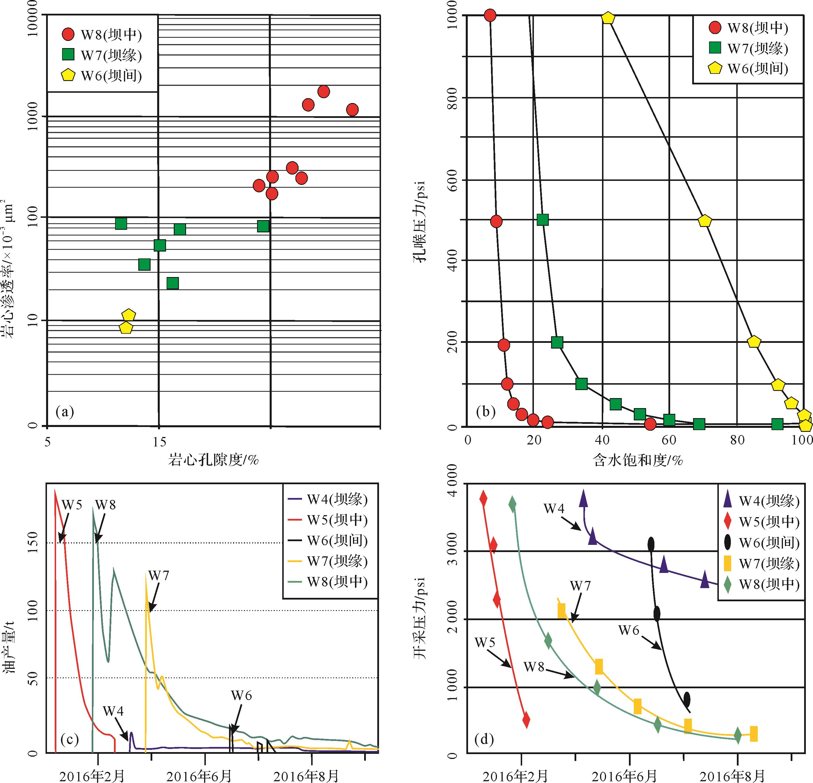
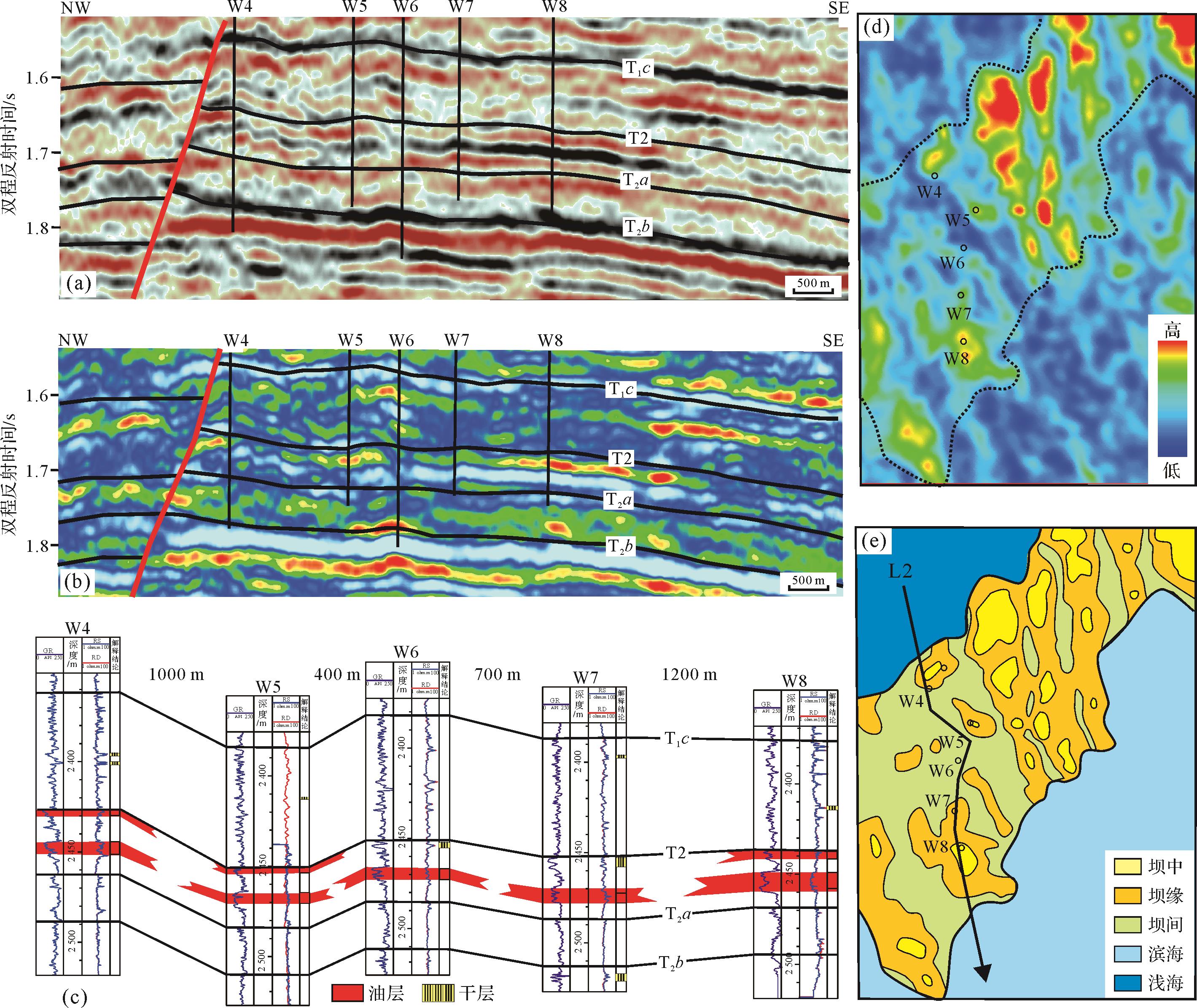
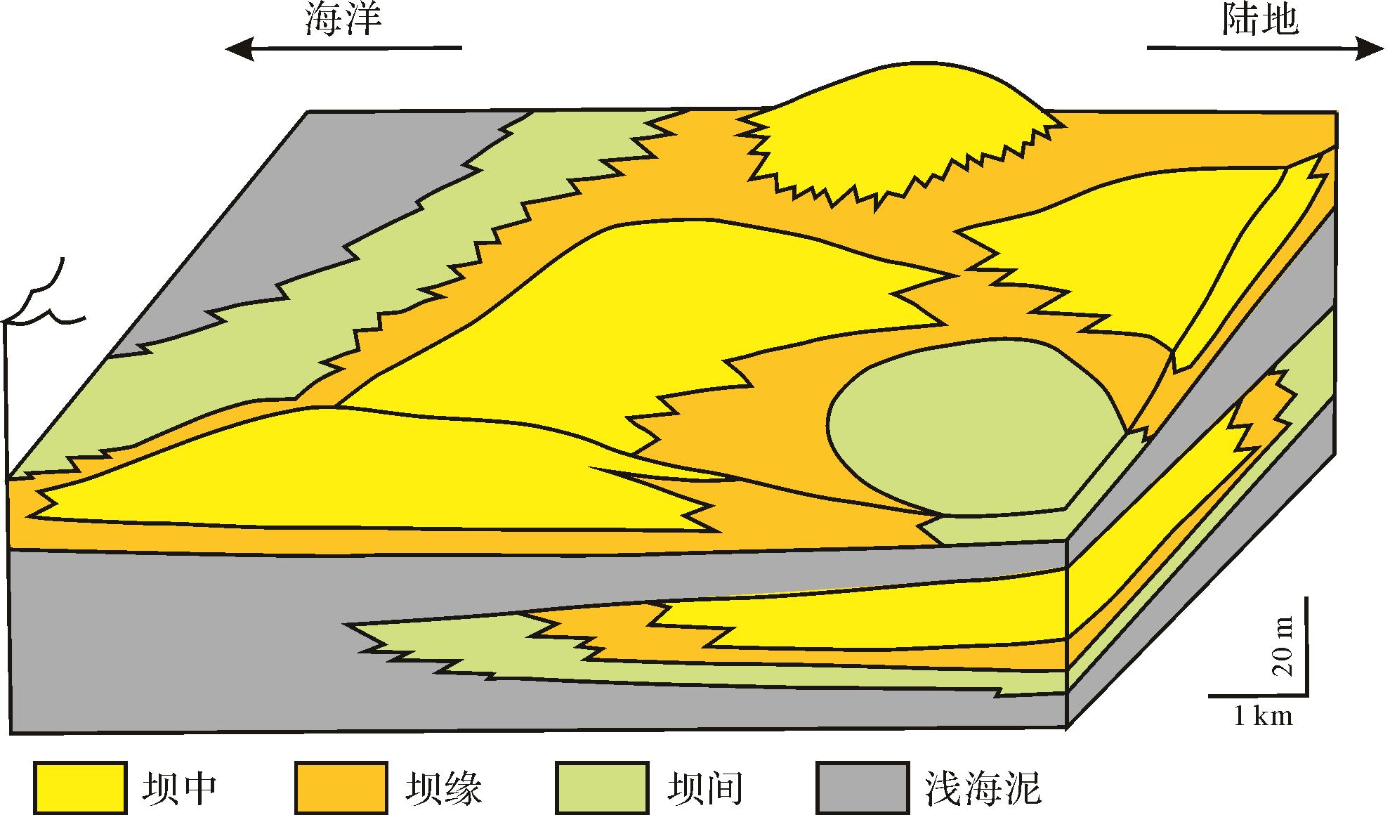
Shoreland sandbars are the main hydrocarbon reservoir type and exploration target in S Block, South Asia area. Sandbar reservoirs usually feature high porosity and high permeability. However, further evaluation of the oil and gas field has found that the internal physical properties of sandbar reservoirs change rapidly. They are strongly heterogeneous with complex distribution of oil and gas. Core logging, seismic and production test data, detailed reservoir description and microfacies prediction of a sandbar were carried out in this study of sandbar, and internal differences in the reservoir were analyzed, with the following results: (1) The shoreland sandbar is located in a relatively high-energy coastal sedimentary environment and has experienced long-term wave washing, forming a favorable reservoir zone. (2) The sandbar complex is subdivided into four microfacies types: center bar, bar edge, interbar and mudstone interbeds. The sedimentary microfacies influence the reservoir properties. The center bar comprises a thick, pure, mainly medium-fine sandstone in which the facies seismicity is seen as low-frequency, high-amplitude reflections. Both primary and secondary pores are relatively well developed, giving the best reservoir performance. The bar edge microfacies are located on the flank of the sandbar. The lithology is fine-grained with some filled pores, giving a medium reservoir performance. Interbar facies, located between sandbars, contain mainly micropores with poor storage performance. The mudstone facies are shallow sea or confined bay deposits, and are interspersed throughout the sandbar, intensifying the reservoir heterogeneity. (3) The changes in the physical properties of sandbar reservoirs directly increases the complexity of the reservoir characteristics. Because the lithologies of the different microfacies overlap and intersect within the sandbar, it is not connected horizontally and the physical properties change rapidly. To summarize, the sandbar reservoir is cut into several relatively independent oil reservoirs.

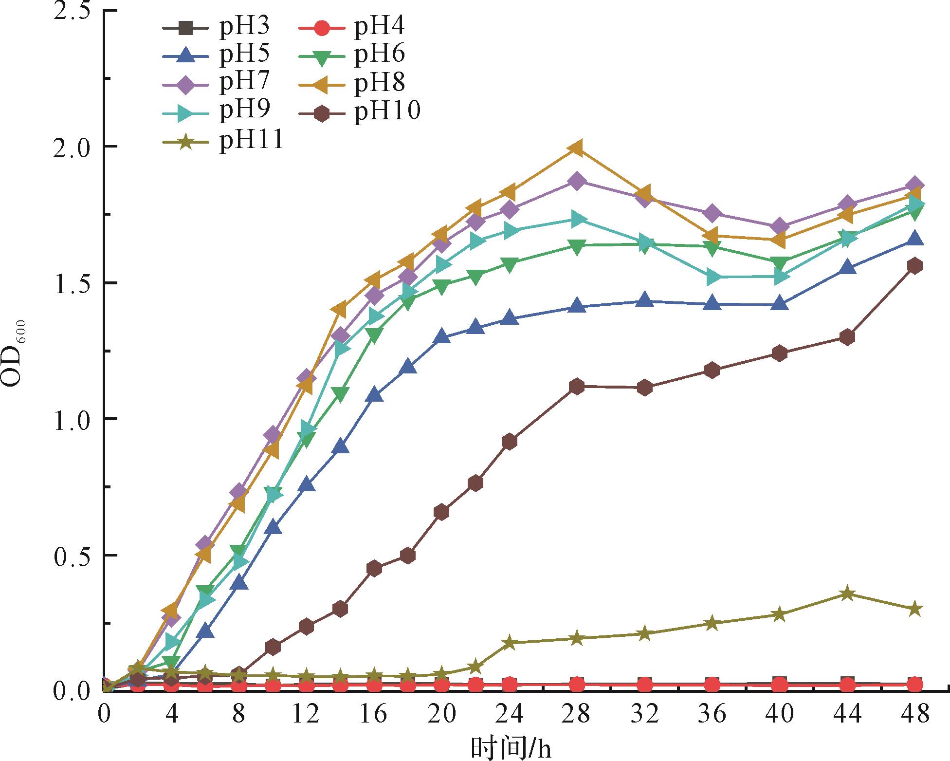
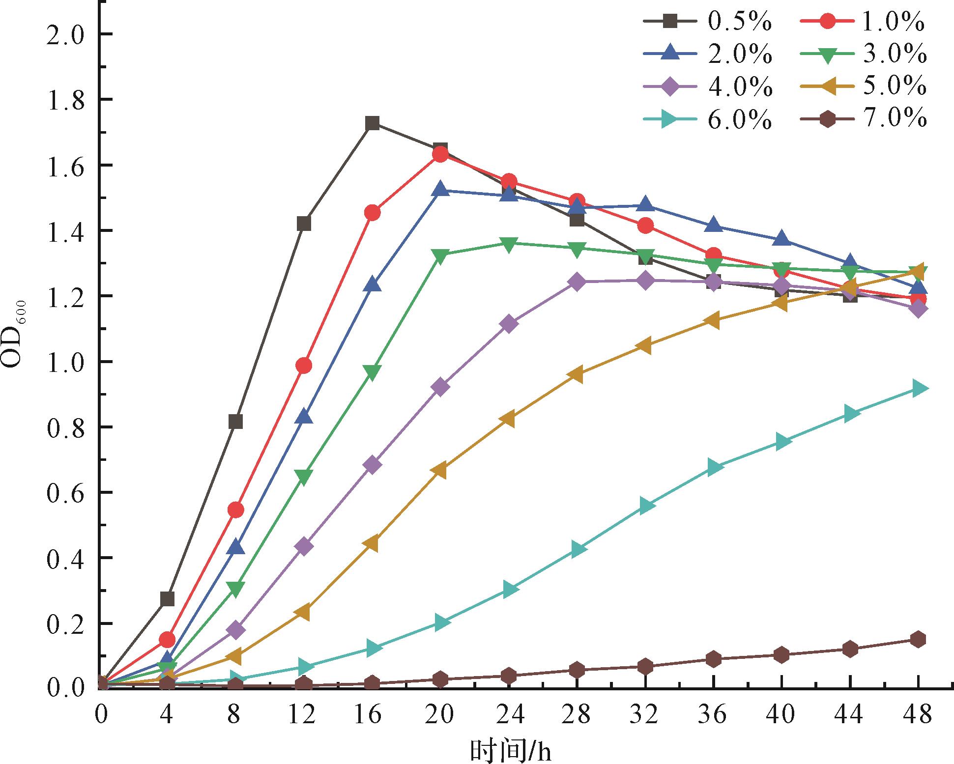
2022, 40(3): 849-860.
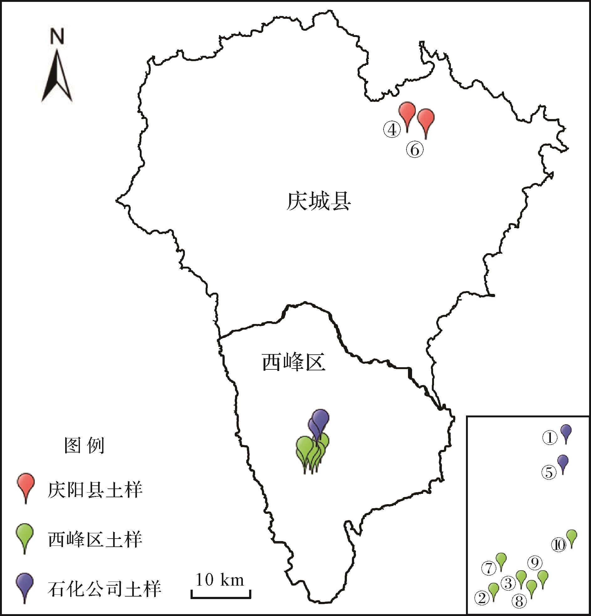
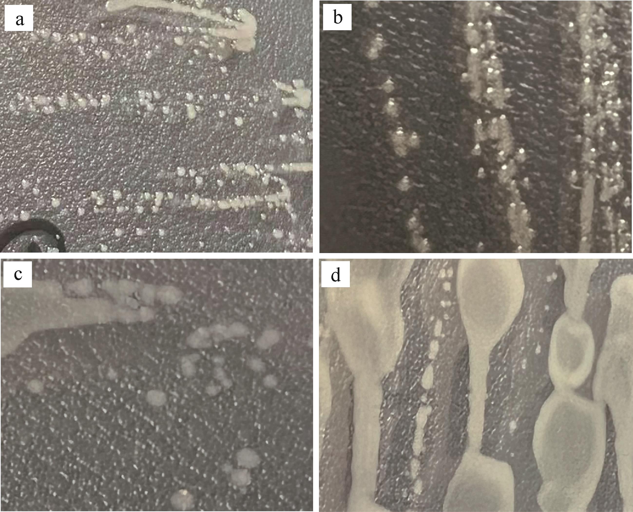
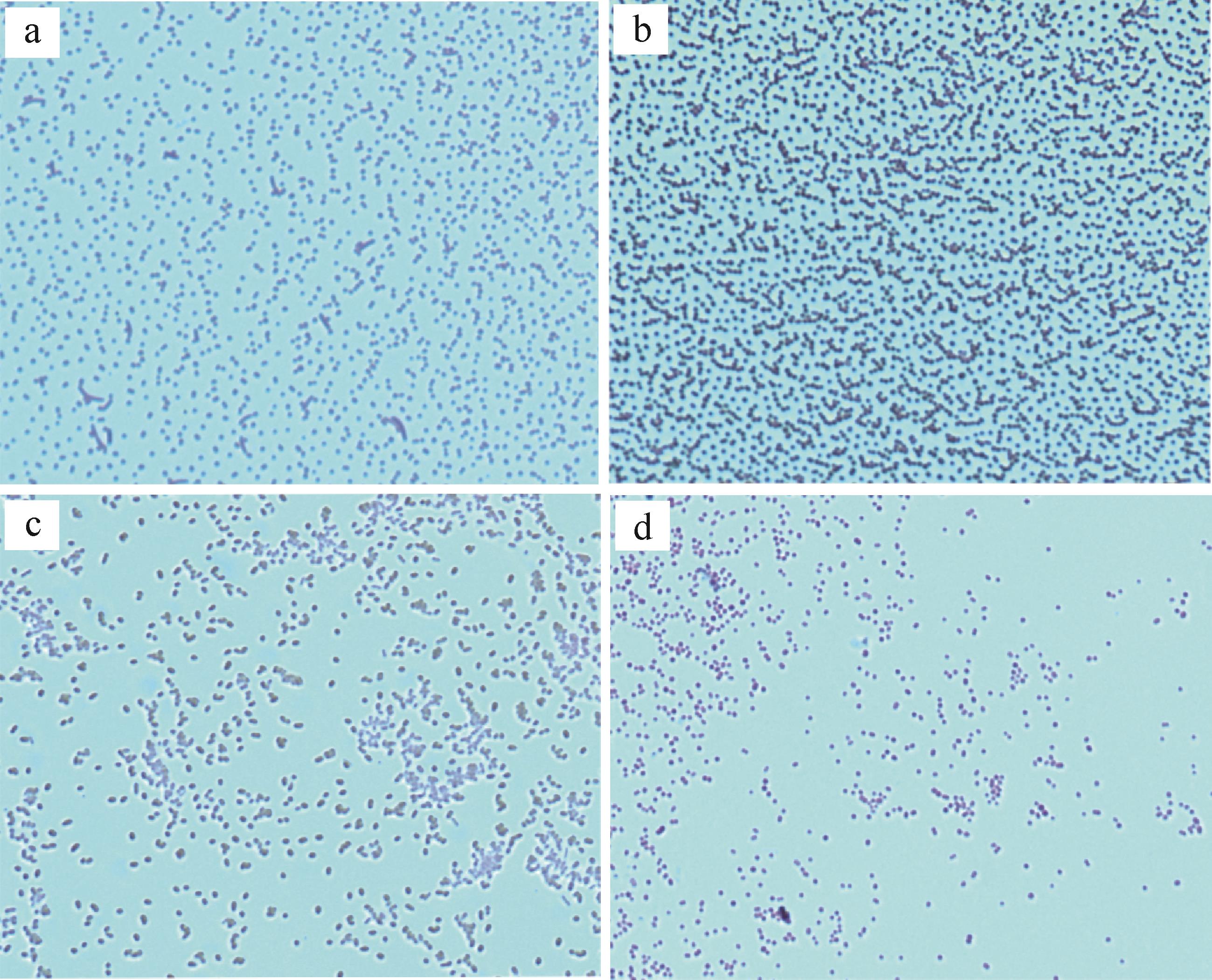
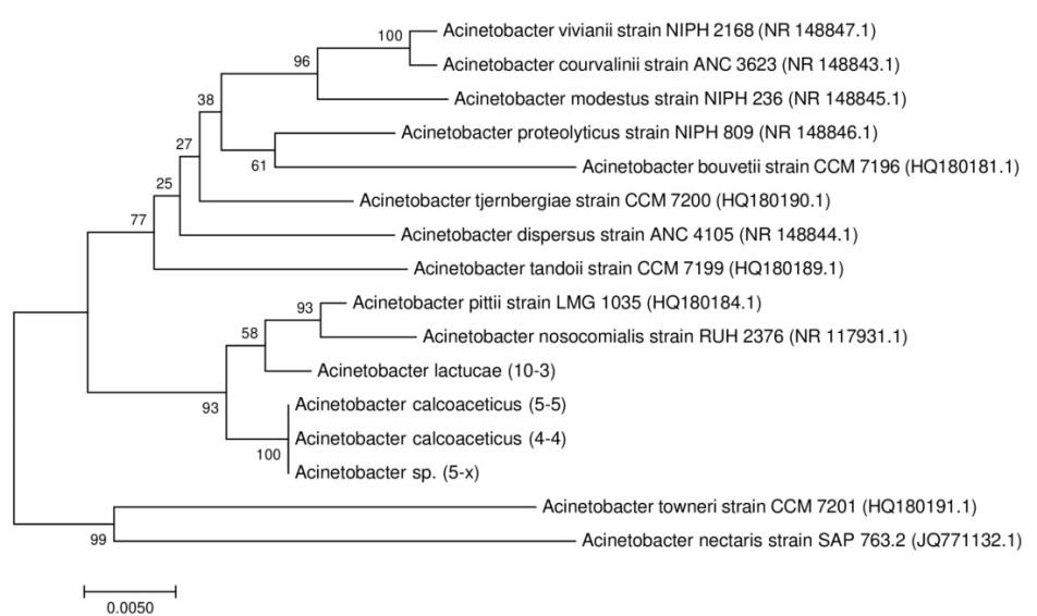
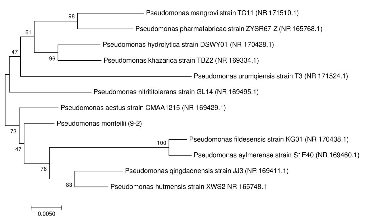
doi: 10.14027/j.issn.1000-0550.2022.003
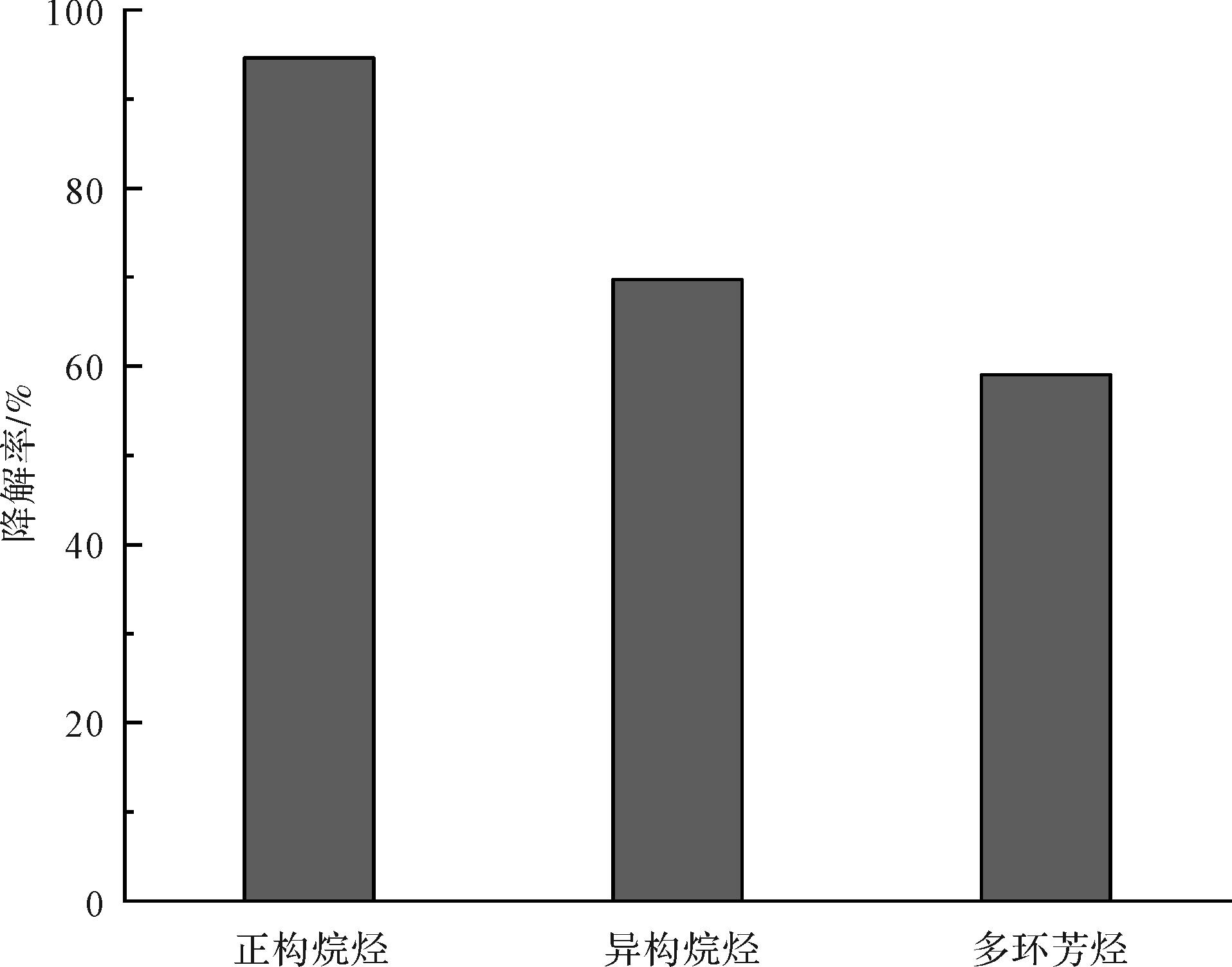
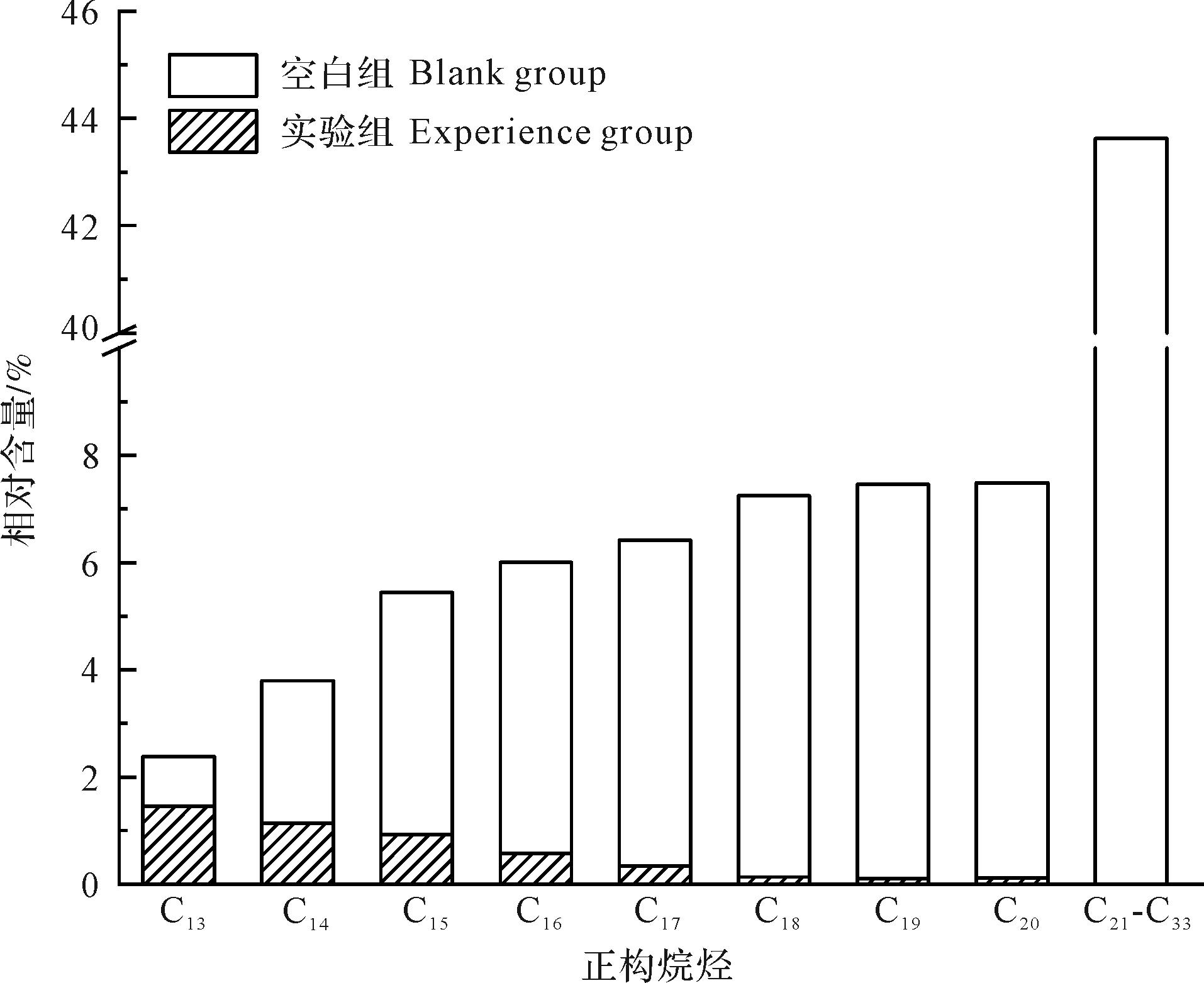
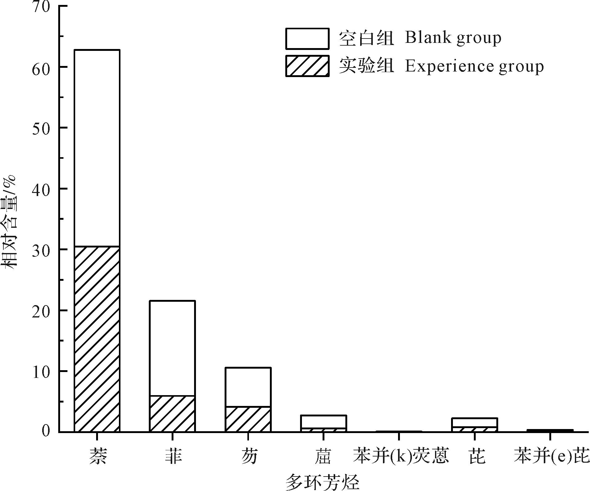
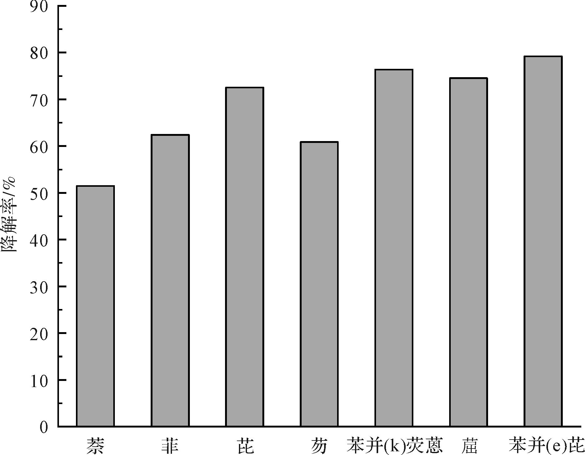
Abstract:
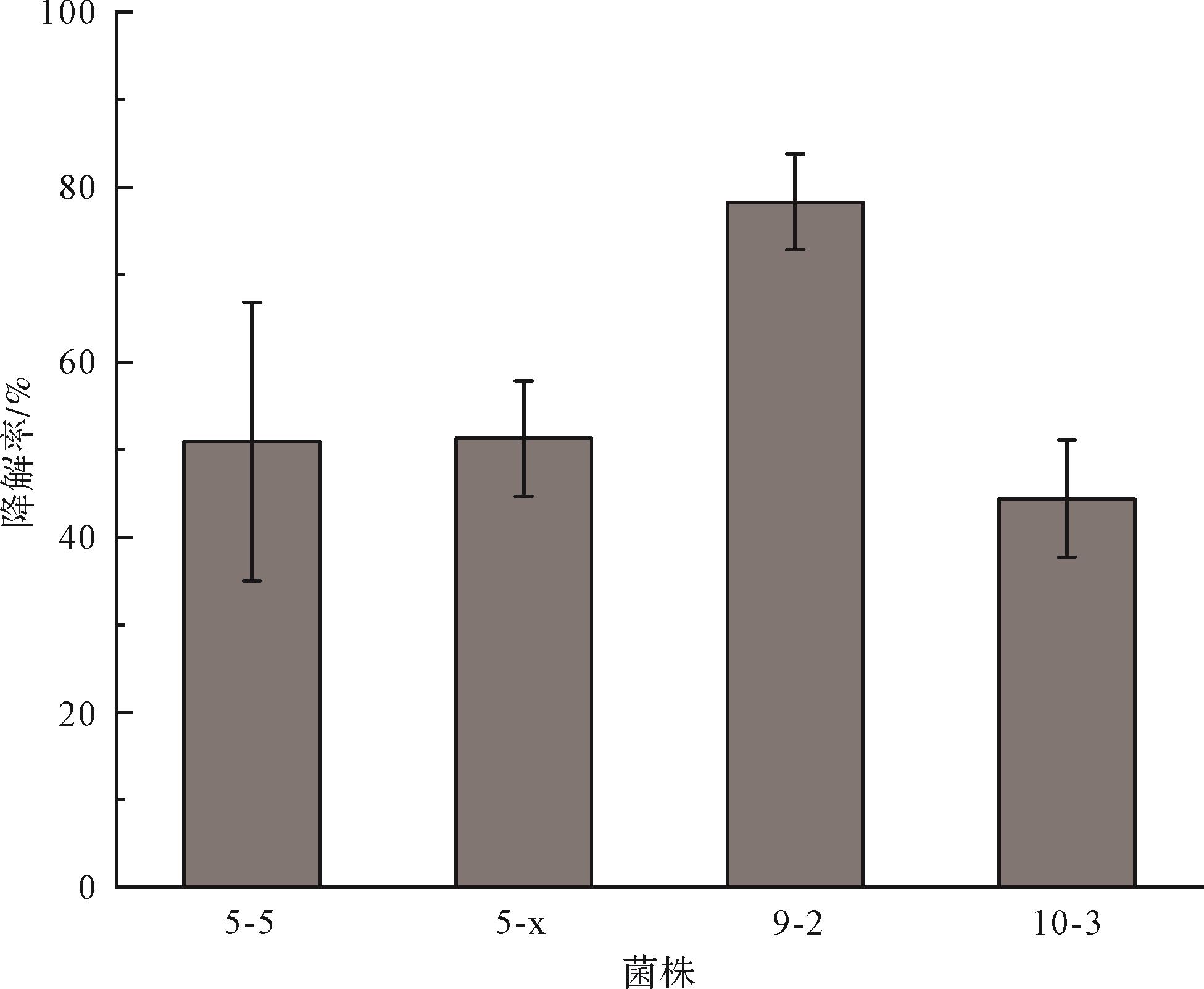
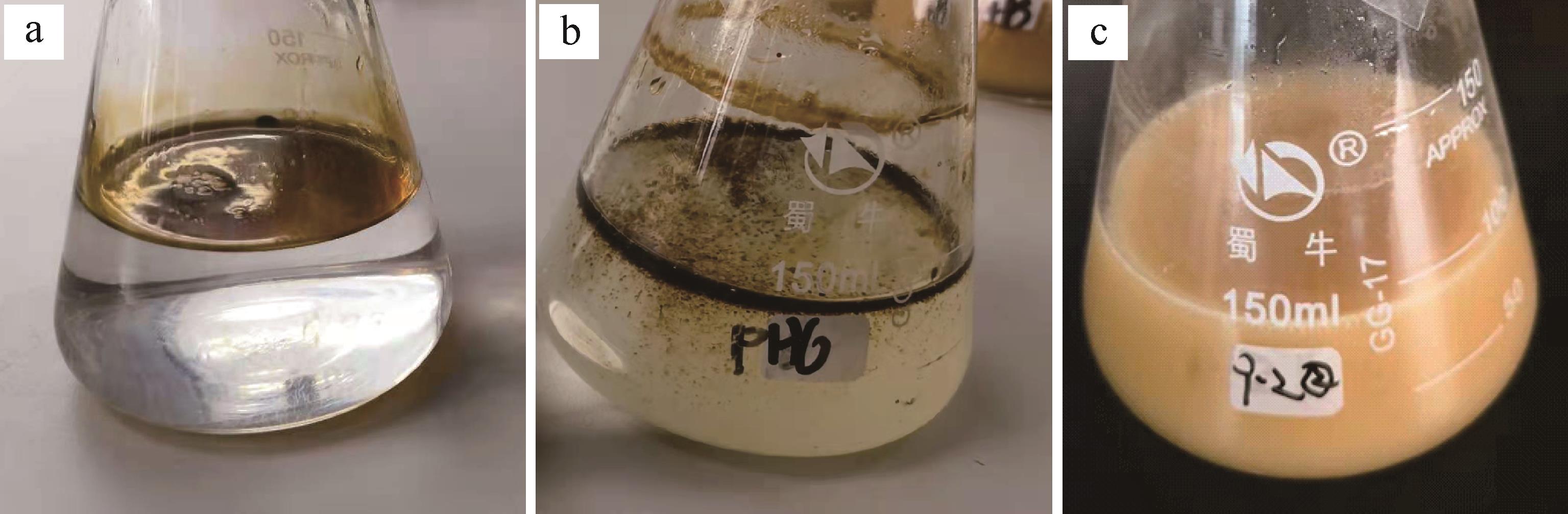
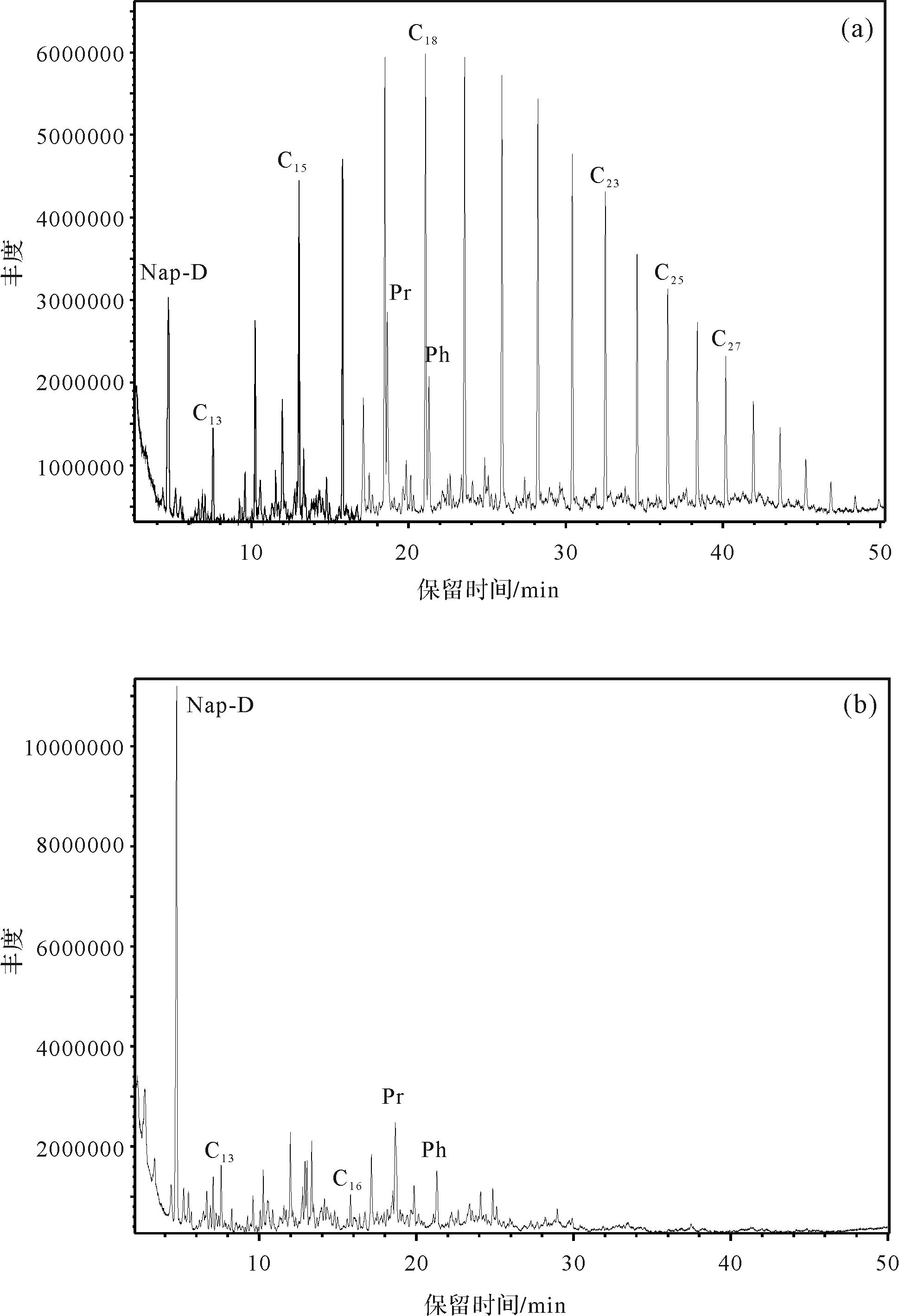
To repair petroleum hydrocarbon pollution of saline alkaline soil in the arid area of northwestern China using an efficient environmental protection method, petroleum hydrocarbon degrading bacteria were screened, isolated and degraded at ten sampling points close to the Changqing oilfield, Qingyang, Gansu province. The following tests were carried out with the four selected strains 5-5, 5-X, 9-2 and 10-3: Gram staining, colony morphology observation, microscopic morphology, biochemical and physicochemical property tests and 16S rDNA sequencing. It was confirmed that the four petroleum hydrocarbon degrading bacteria were Acinetobacter calcoaceticus, Acinetobacter sp., Pseudomonas monteilii and A. lactucae, respectively. The degradation results for 1 mL/100 mL petroleum hydrocarbons showed that the degradation rates of 5-5, 5-X, 9-2 and 10-3 reached 50.92%, 51.27%, 78.30% and 44.39%, respectively, at 30 °C, 150 r/min and pH 7.0 after 14 days of degradation experiments. In addition, the strain Pseudomonas sp. 9-2, which has excellent degradation performance, was studied for its degradation of petroleum hydrocarbon components. It was found that it degraded 94.65% n-alkanes, 69.73% isoalkanes and 59.07% polycyclic aromatic hydrocarbons. It also showed excellent degradation performance for high carbon number n-alkanes and high ring number polycyclic aromatic hydrocarbons. In the stress-resistance experiment, Pseudomonas sp. 9-2 showed a tolerance to pH from 5.0 to 10.0, and a tolerance of 0.5%-6.0% salinity. Therefore, the petroleum hydrocarbon degrading bacteria screened in this study are completely suitable for microbial remediation of the petroleum hydrocarbon pollution of saline alkaline soil in the northwestern arid regions.