2023 Vol. 41, No. 4
Display Method:
2023, 41(4): 959-967.
doi: 10.14027/j.issn.1000-0550.2022.010
Abstract:
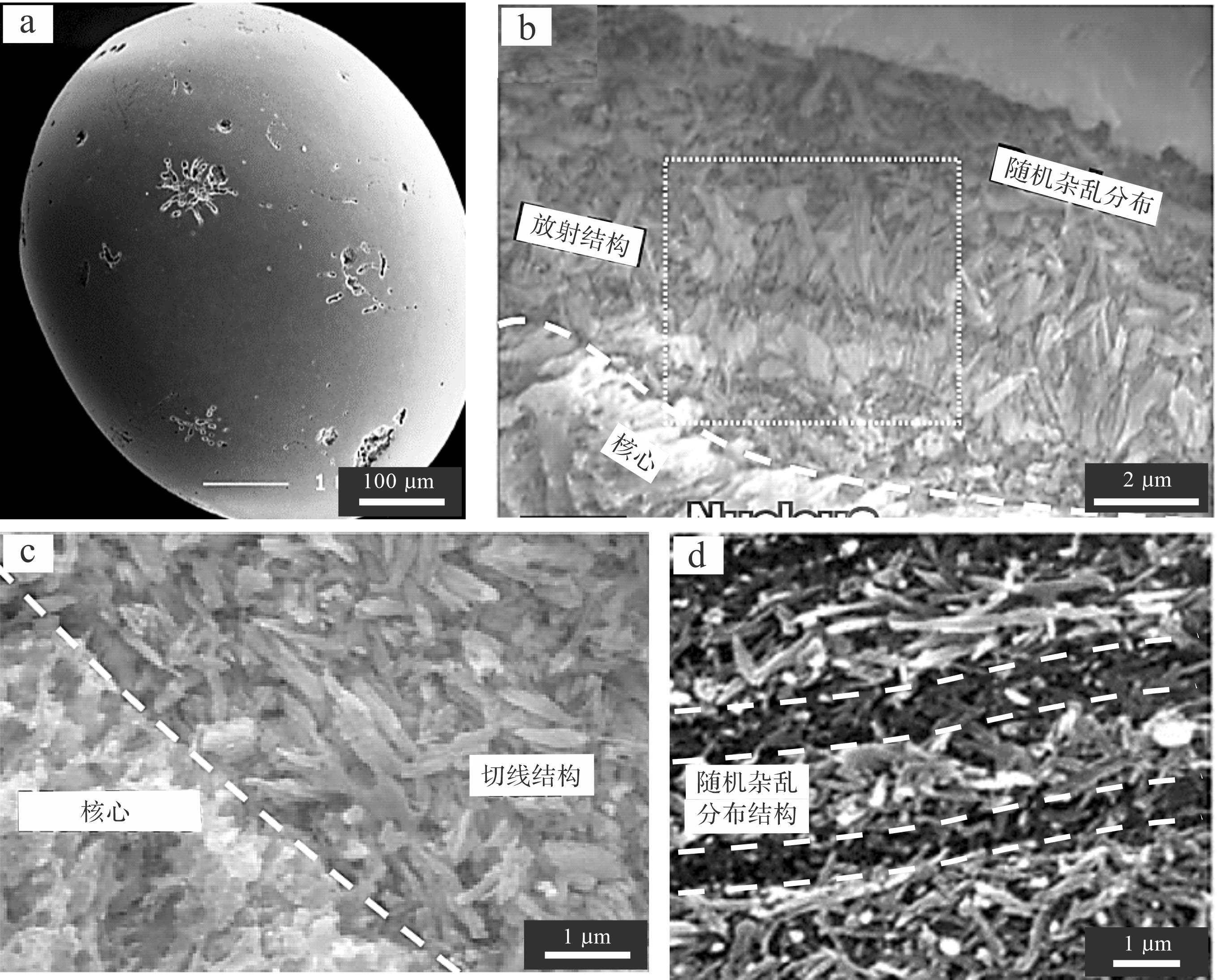
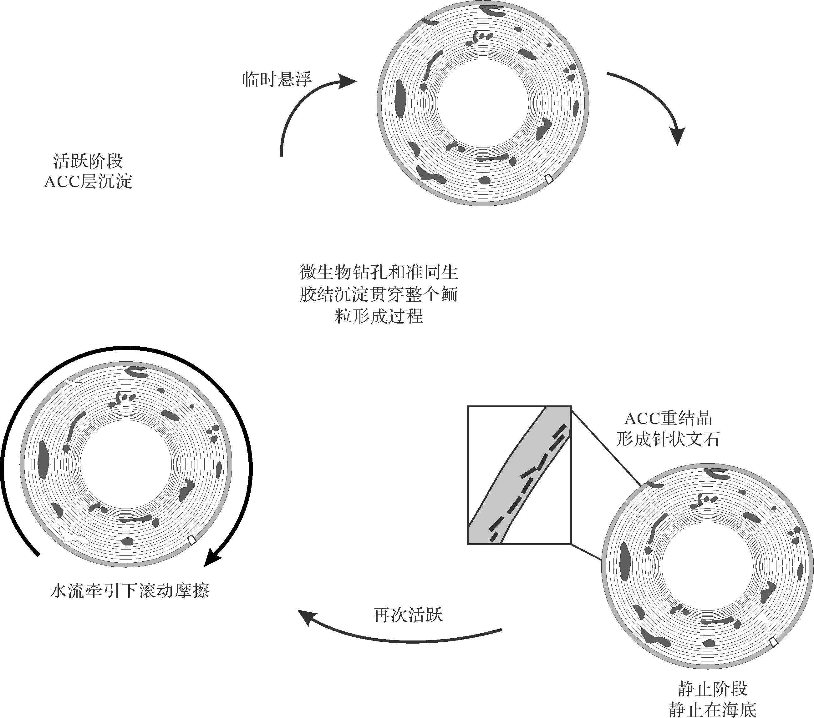
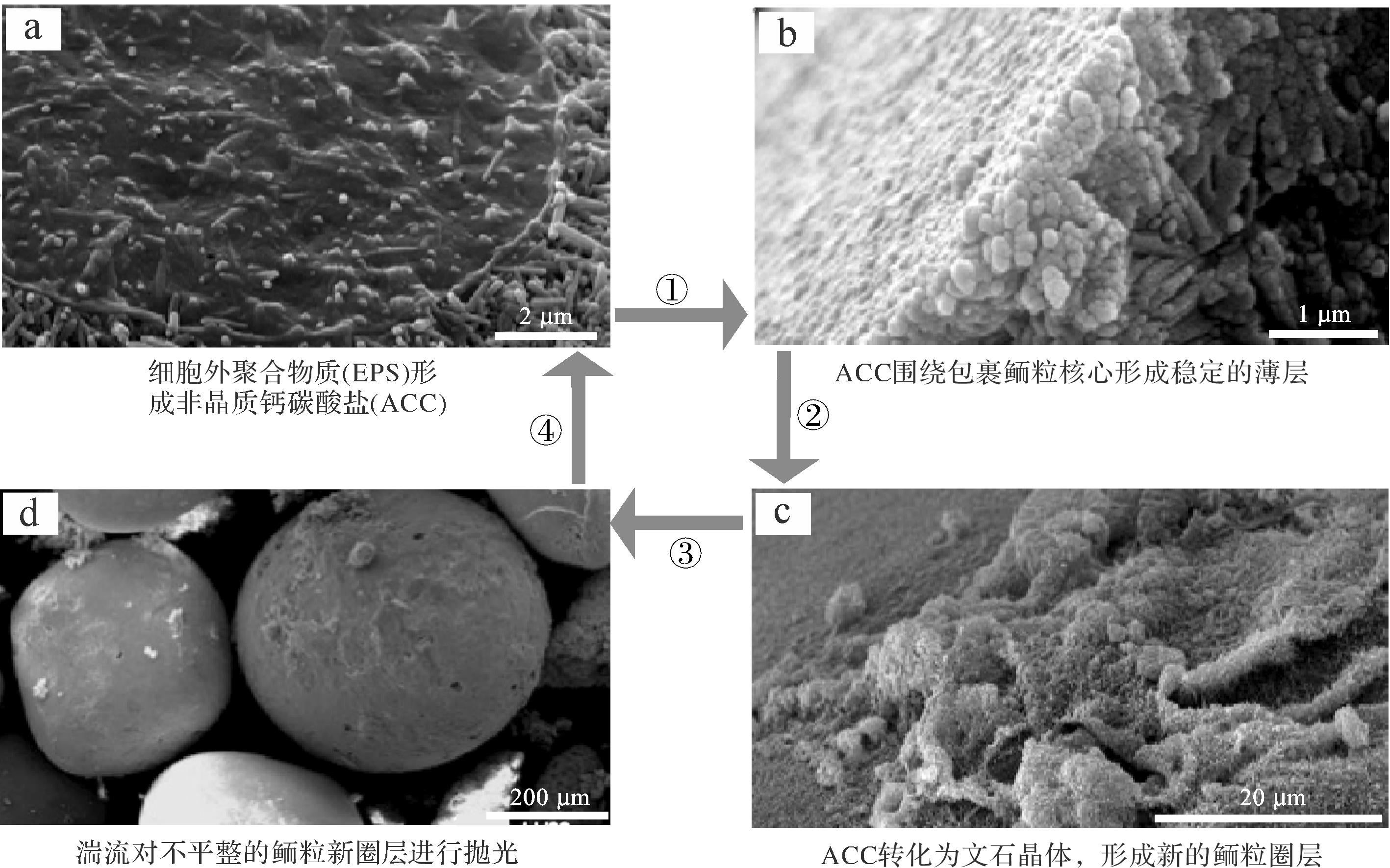
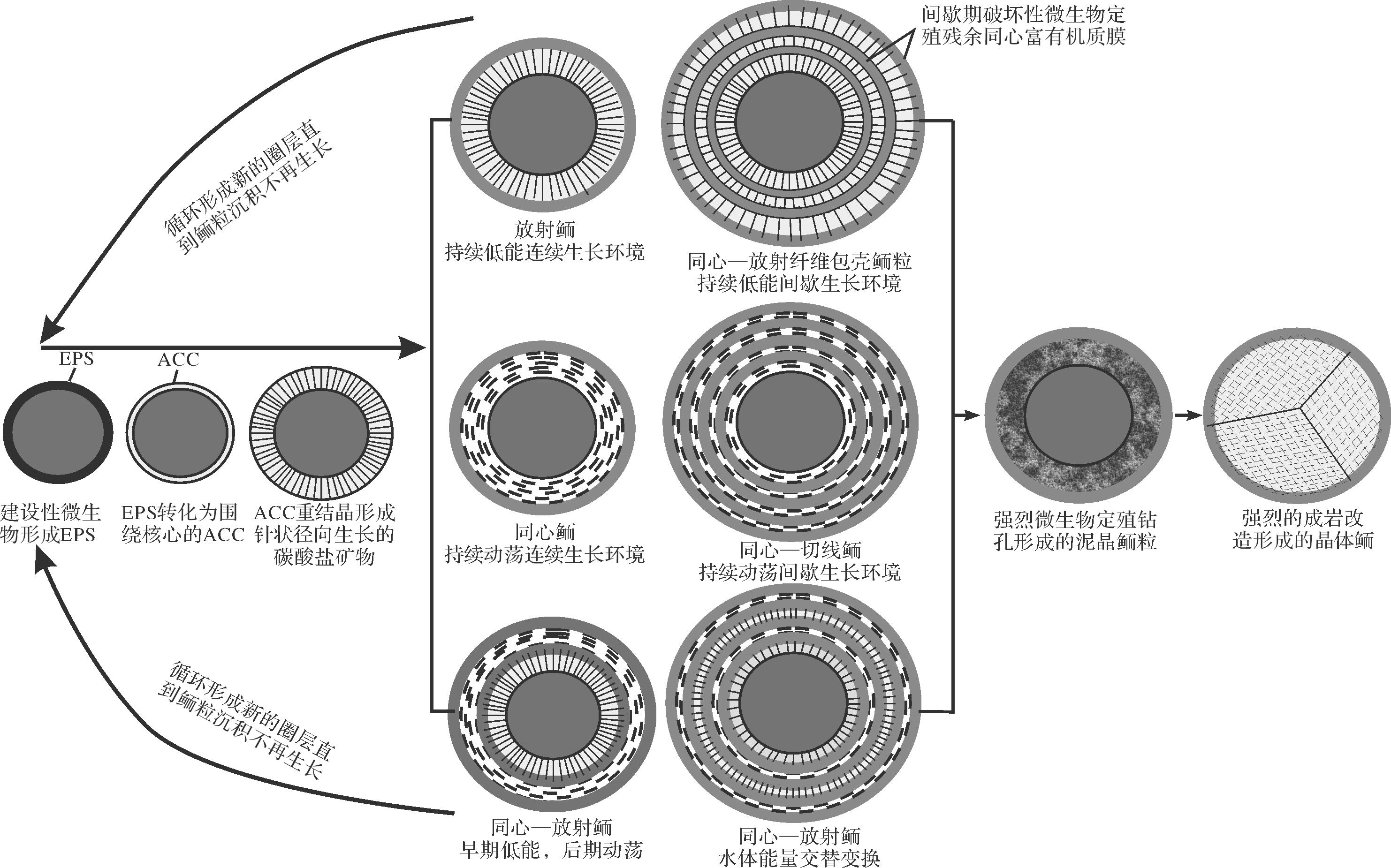
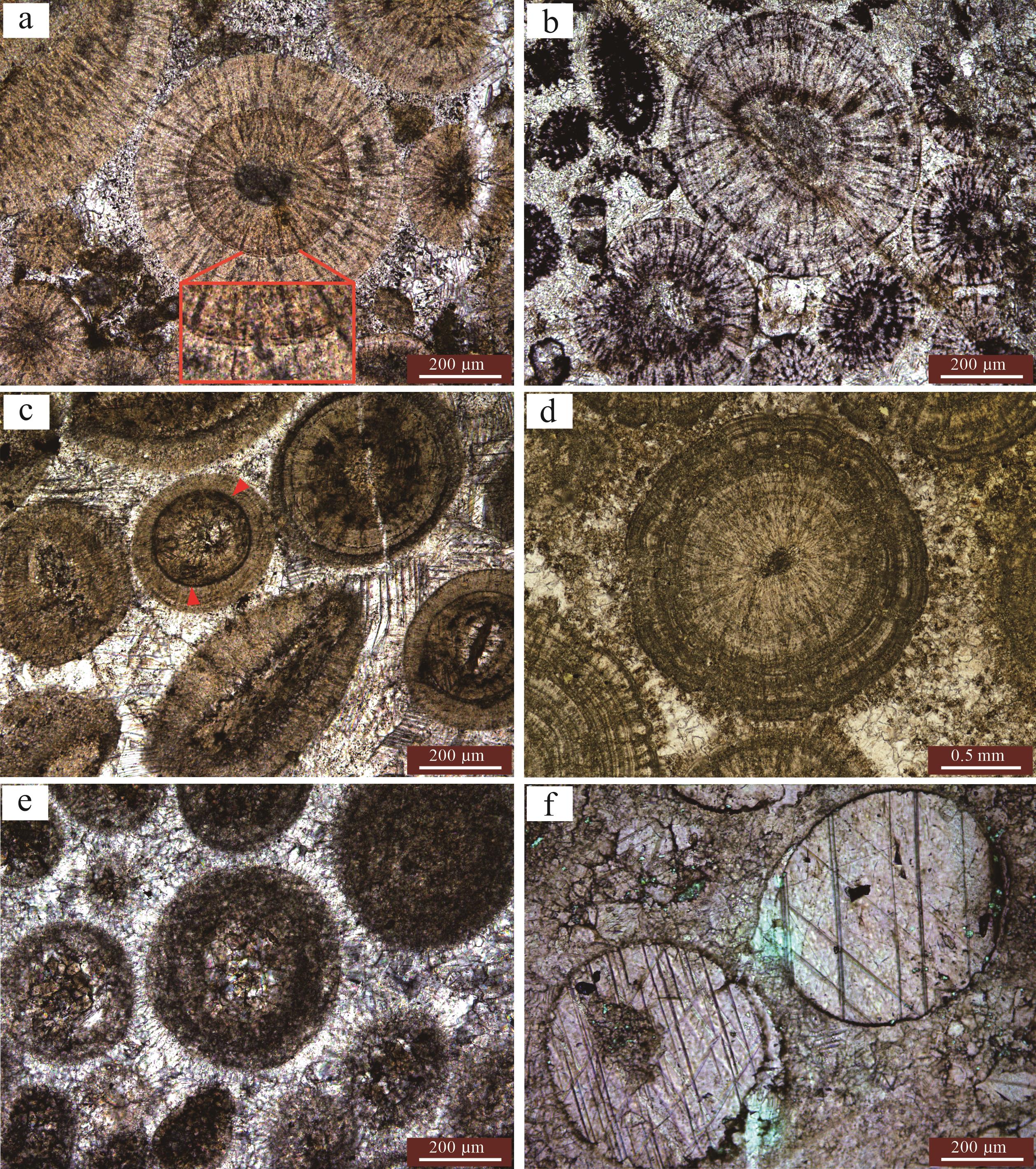
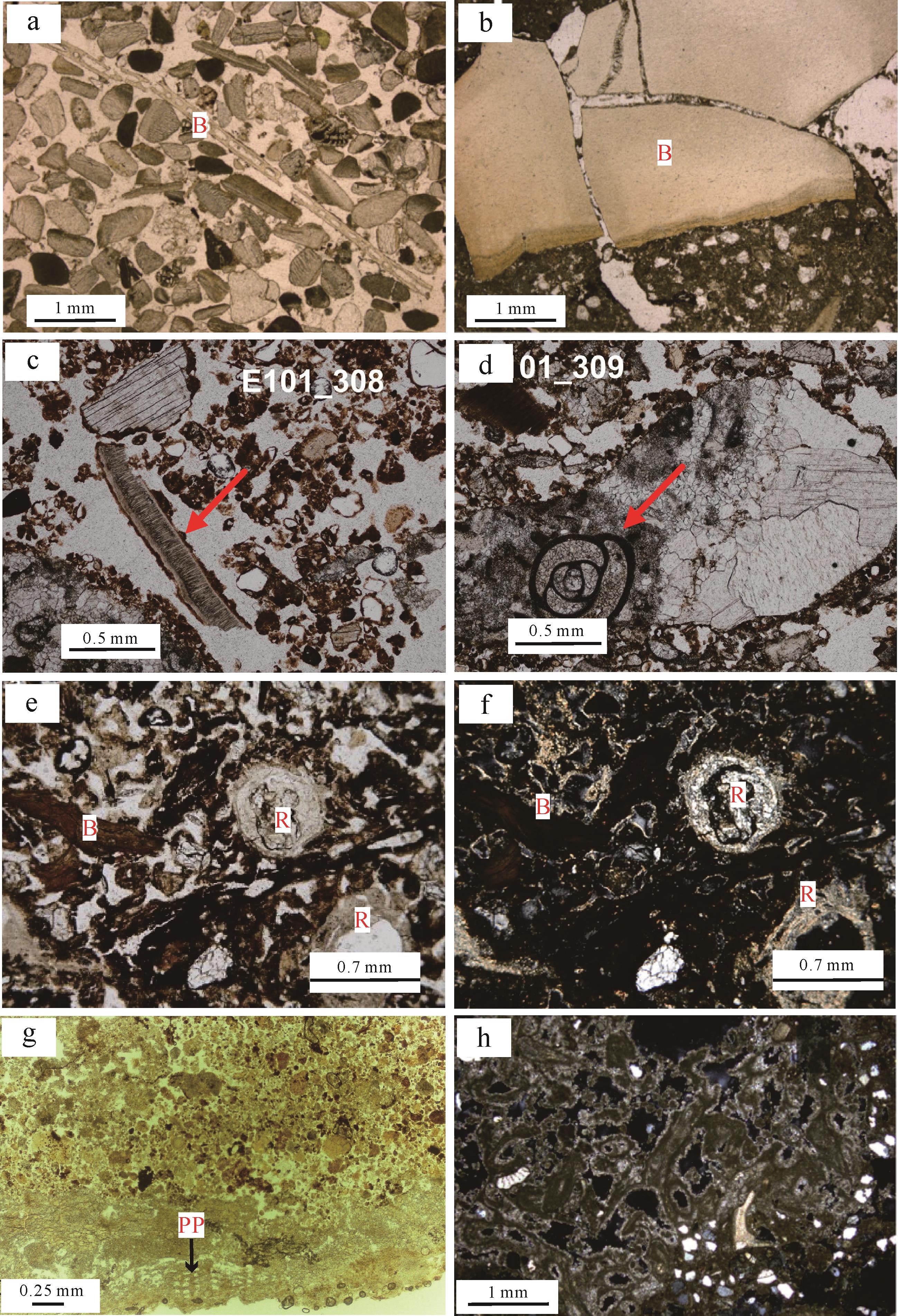
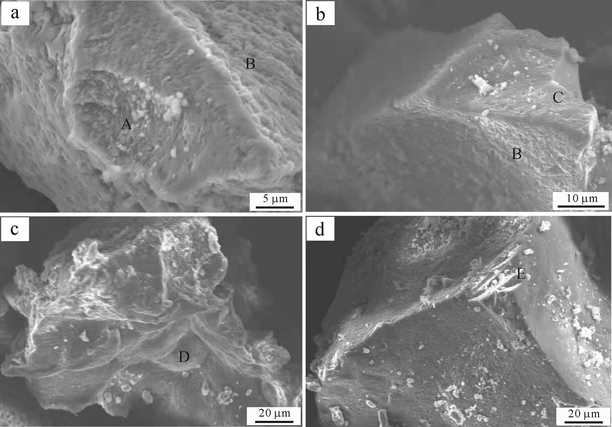
Oolitic limestone is a significant indicator of the paleoenvironment, and also provides an important hydrocarbon reservoir. However, ever since ooids were first recognized more than a century ago their origin, whether organic or inorganic, has been controversial. This study systematically summarizes the physicochemical and microbiological genesis of typical ooids and their structural types. A new formation mechanism for ooids is proposed, based on previous research reports. The research review and case analysis suggests that microorganisms mediate the formation of new oolitic circles. The distribution of carbonate minerals in the oolitic circles is influenced by the energy of the sedimentary water body, and constructive microbial communities (e.g., photosynthetic microorganisms and sulfate reduction bacteria) promote the precipitation of the oolitic circles. The circular structure is mainly radial, randomly distributed and tangential. Other observed oolitic structures have all been modified by the action of destructive drilling organisms and different degrees of diagenesis. The most primitive structure of an ooid is radial growth formed by the mineralization of amorphous calcium carbonate (ACC) in a low-energy, static water environment. The random distribution and tangential structure are the result of hydrodynamic shearing. The obvious dark concentric thin layers observed in ooids are the product of biomineralization of the microbial community that appears intermittently during the growth of the ooid after constructive or destructive colonization. These three structures develop either individually or in combination depending on the hydrodynamics of their environment. The core supply rate, the calcium carbonate saturation and energy of the sedimentary water body, and the action of the constructive microbial community, all influence the size of the oolitic particle size.
Oolitic limestone is a significant indicator of the paleoenvironment, and also provides an important hydrocarbon reservoir. However, ever since ooids were first recognized more than a century ago their origin, whether organic or inorganic, has been controversial. This study systematically summarizes the physicochemical and microbiological genesis of typical ooids and their structural types. A new formation mechanism for ooids is proposed, based on previous research reports. The research review and case analysis suggests that microorganisms mediate the formation of new oolitic circles. The distribution of carbonate minerals in the oolitic circles is influenced by the energy of the sedimentary water body, and constructive microbial communities (e.g., photosynthetic microorganisms and sulfate reduction bacteria) promote the precipitation of the oolitic circles. The circular structure is mainly radial, randomly distributed and tangential. Other observed oolitic structures have all been modified by the action of destructive drilling organisms and different degrees of diagenesis. The most primitive structure of an ooid is radial growth formed by the mineralization of amorphous calcium carbonate (ACC) in a low-energy, static water environment. The random distribution and tangential structure are the result of hydrodynamic shearing. The obvious dark concentric thin layers observed in ooids are the product of biomineralization of the microbial community that appears intermittently during the growth of the ooid after constructive or destructive colonization. These three structures develop either individually or in combination depending on the hydrodynamics of their environment. The core supply rate, the calcium carbonate saturation and energy of the sedimentary water body, and the action of the constructive microbial community, all influence the size of the oolitic particle size.
2023, 41(4): 968-991.
doi: 10.14027/j.issn.1000-0550.2022.127
Abstract:
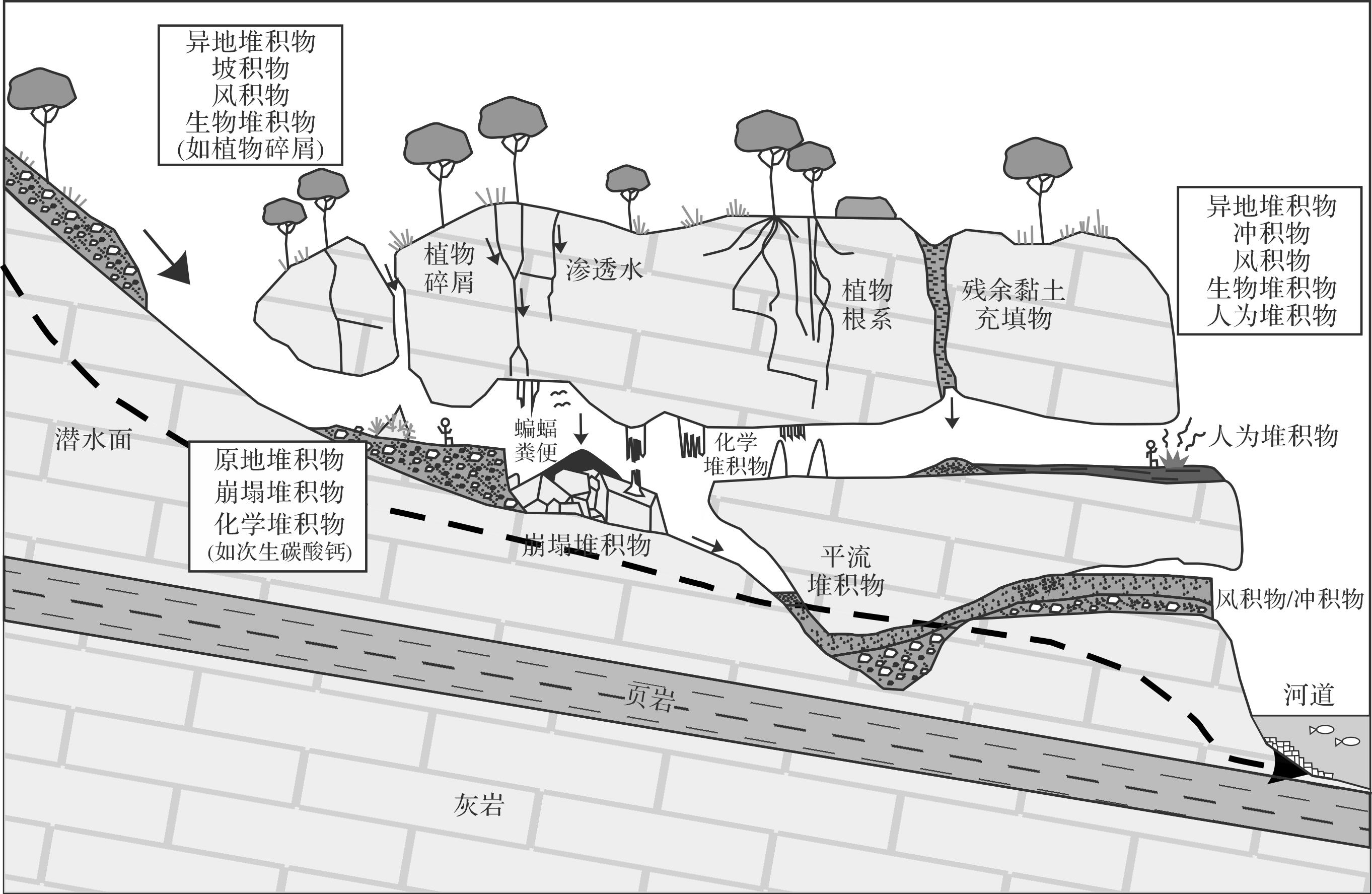
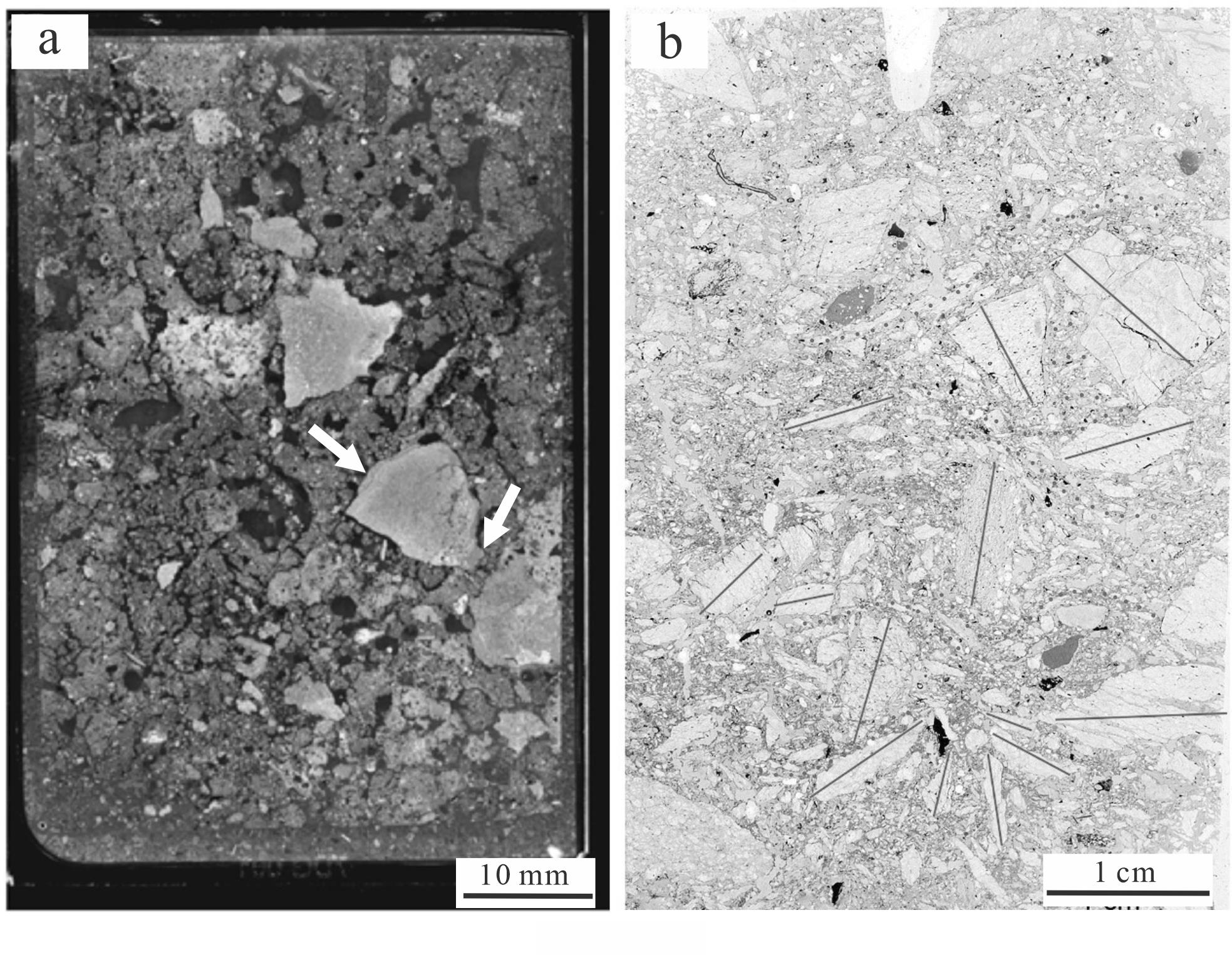
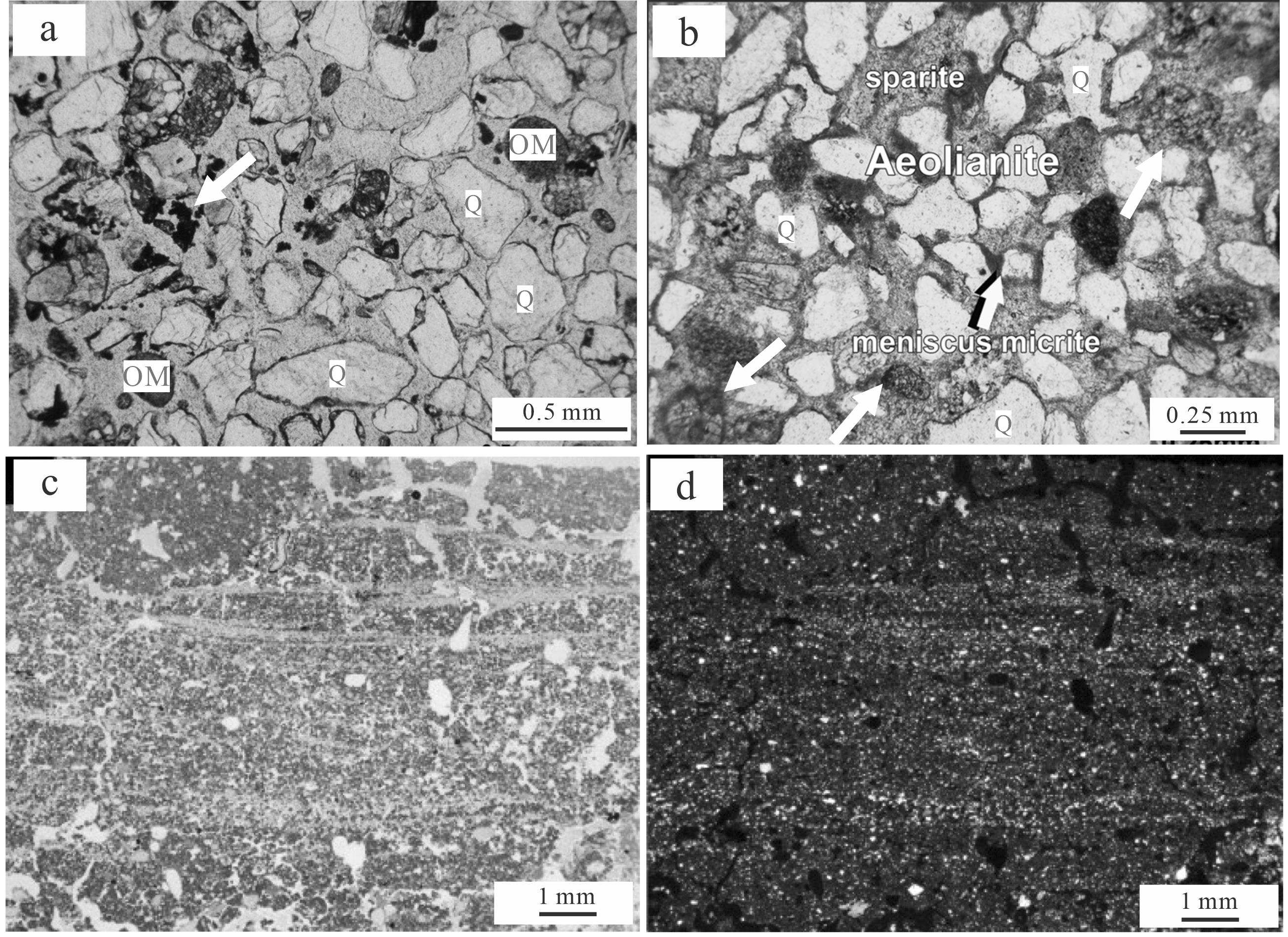
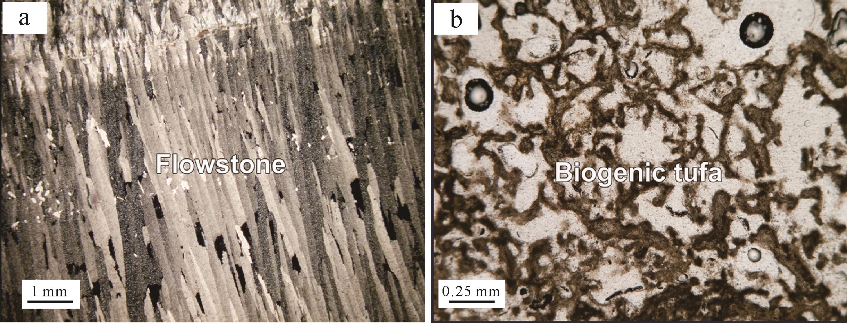
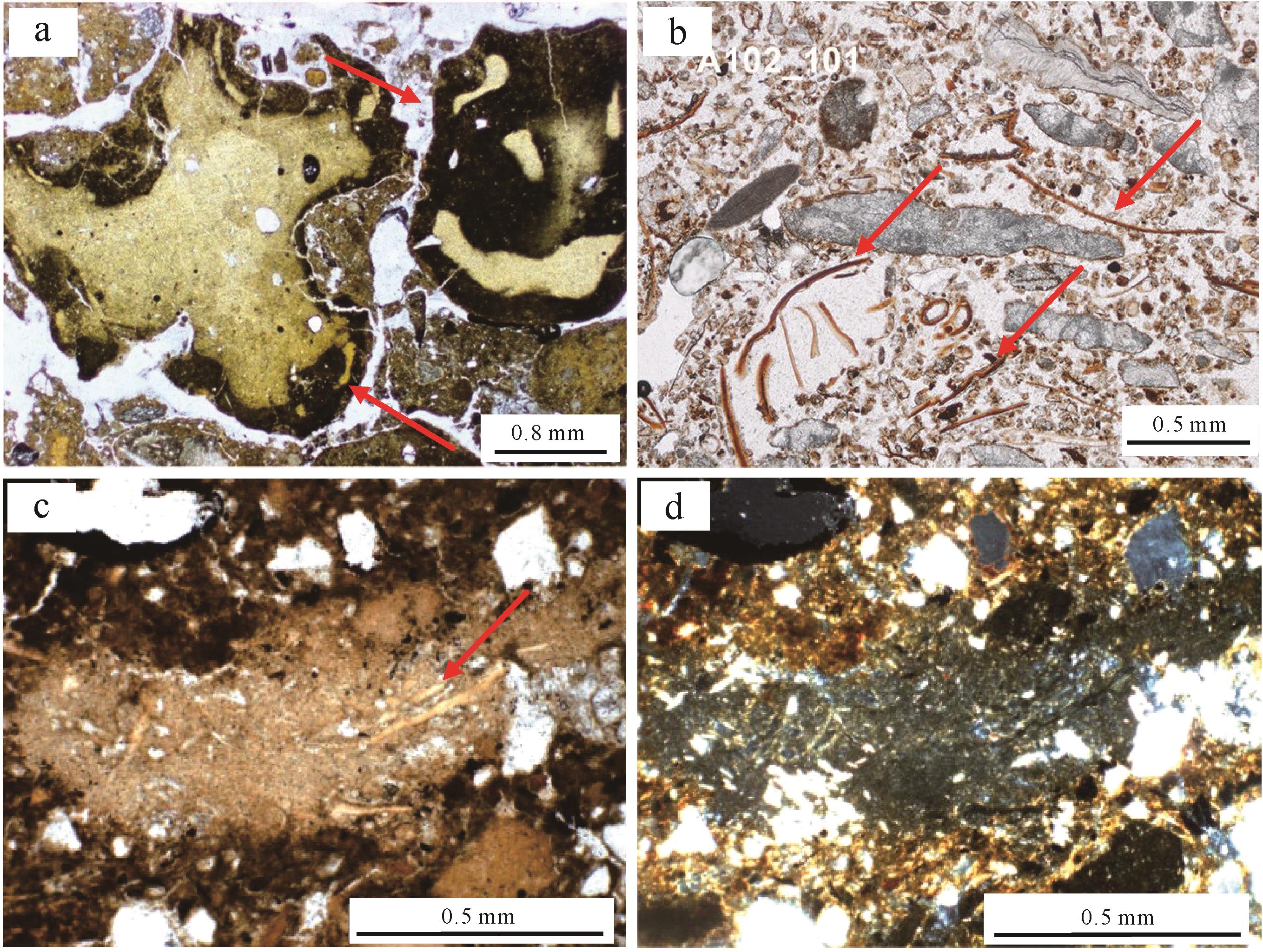
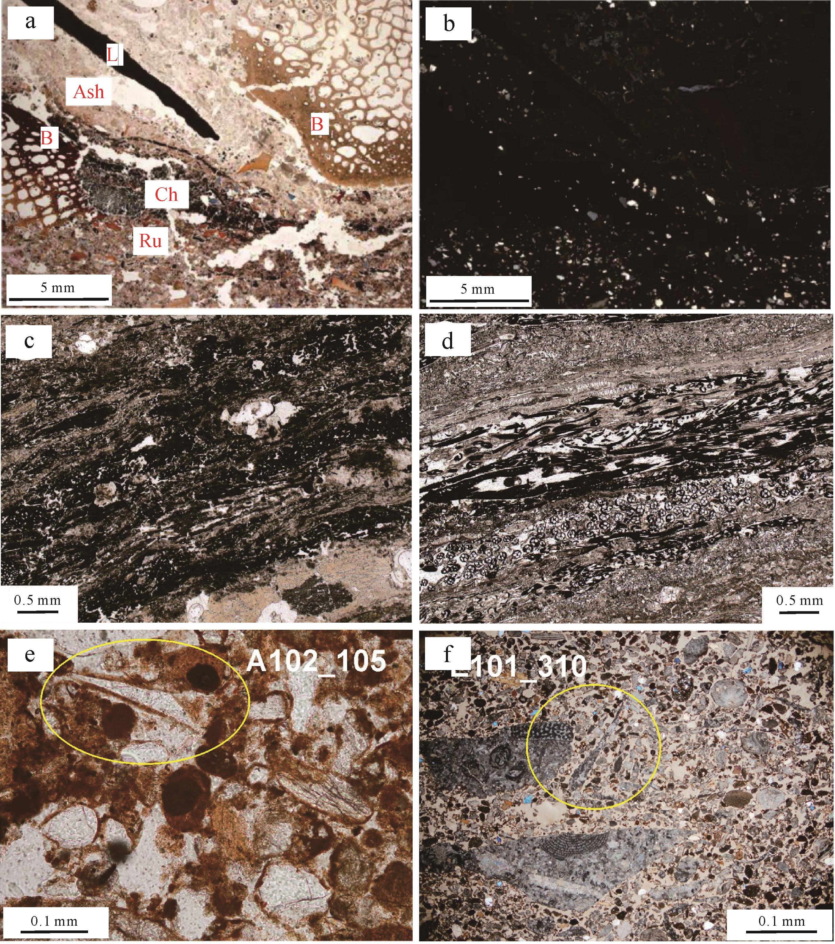
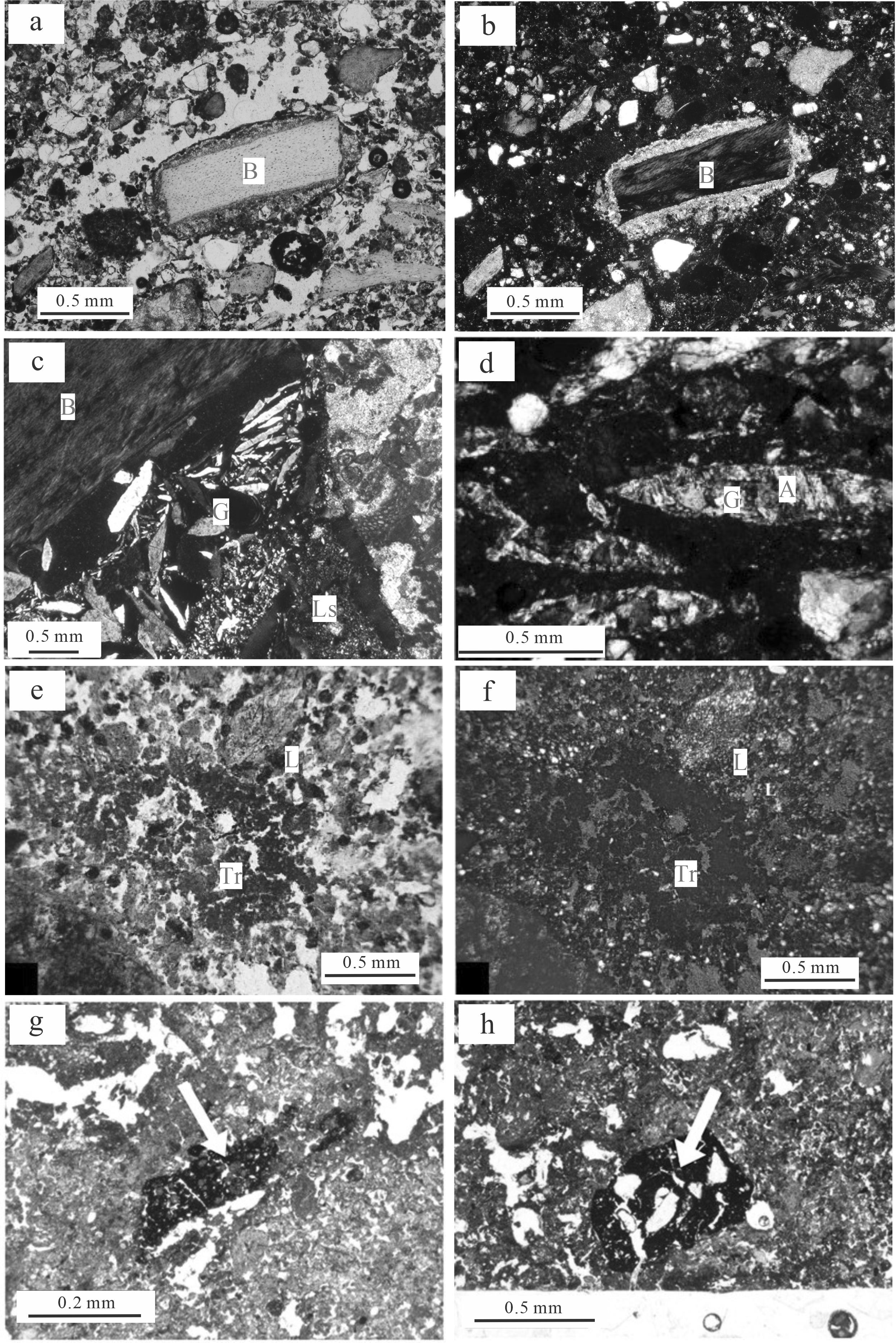
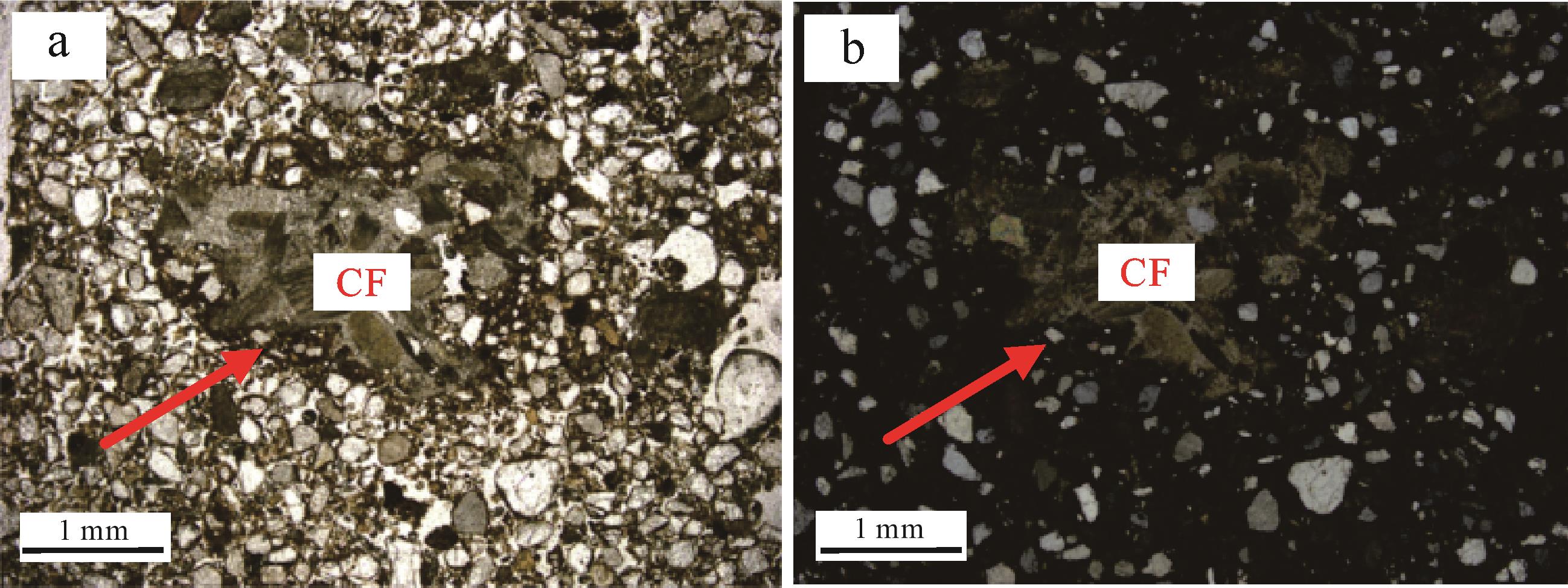
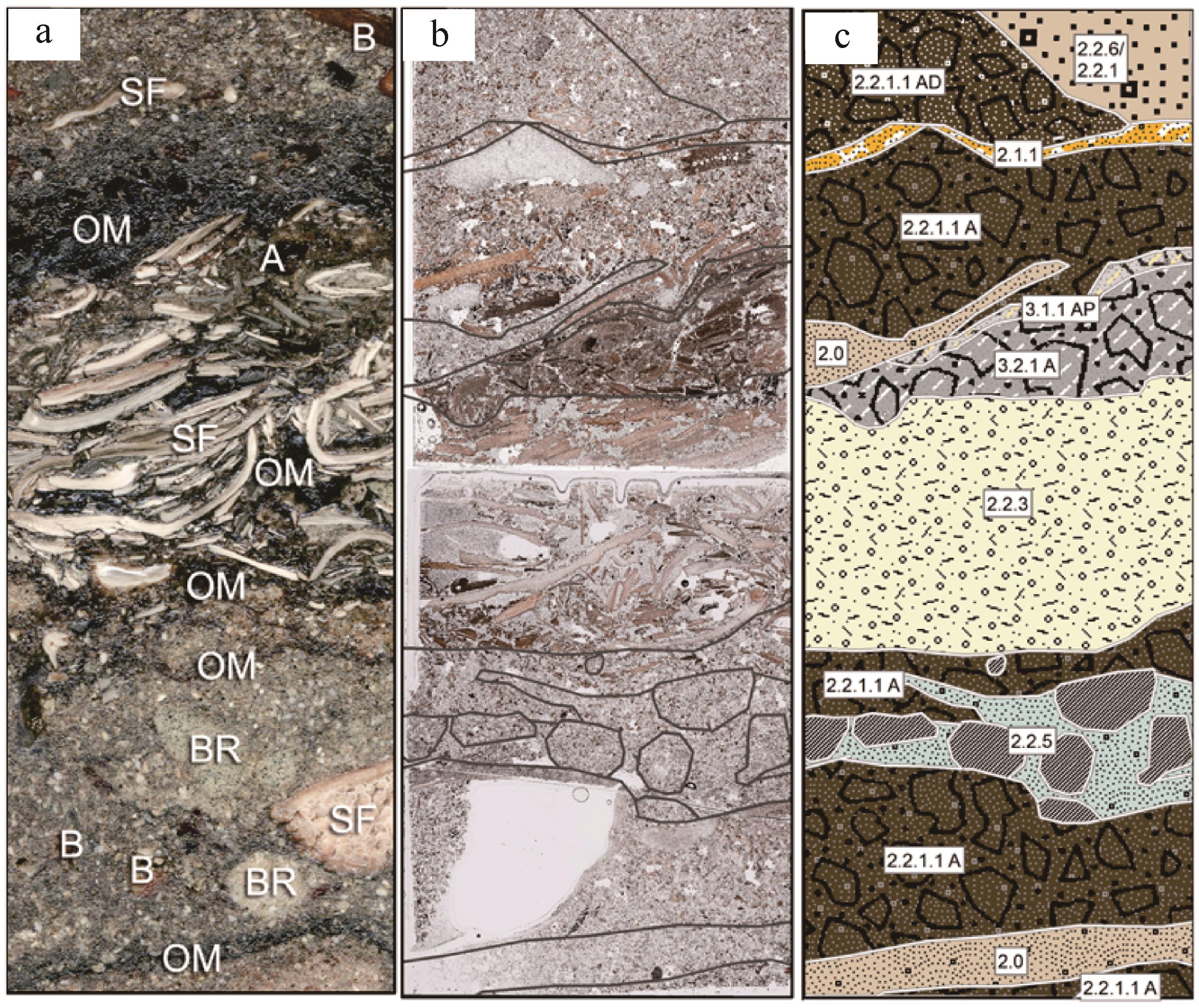
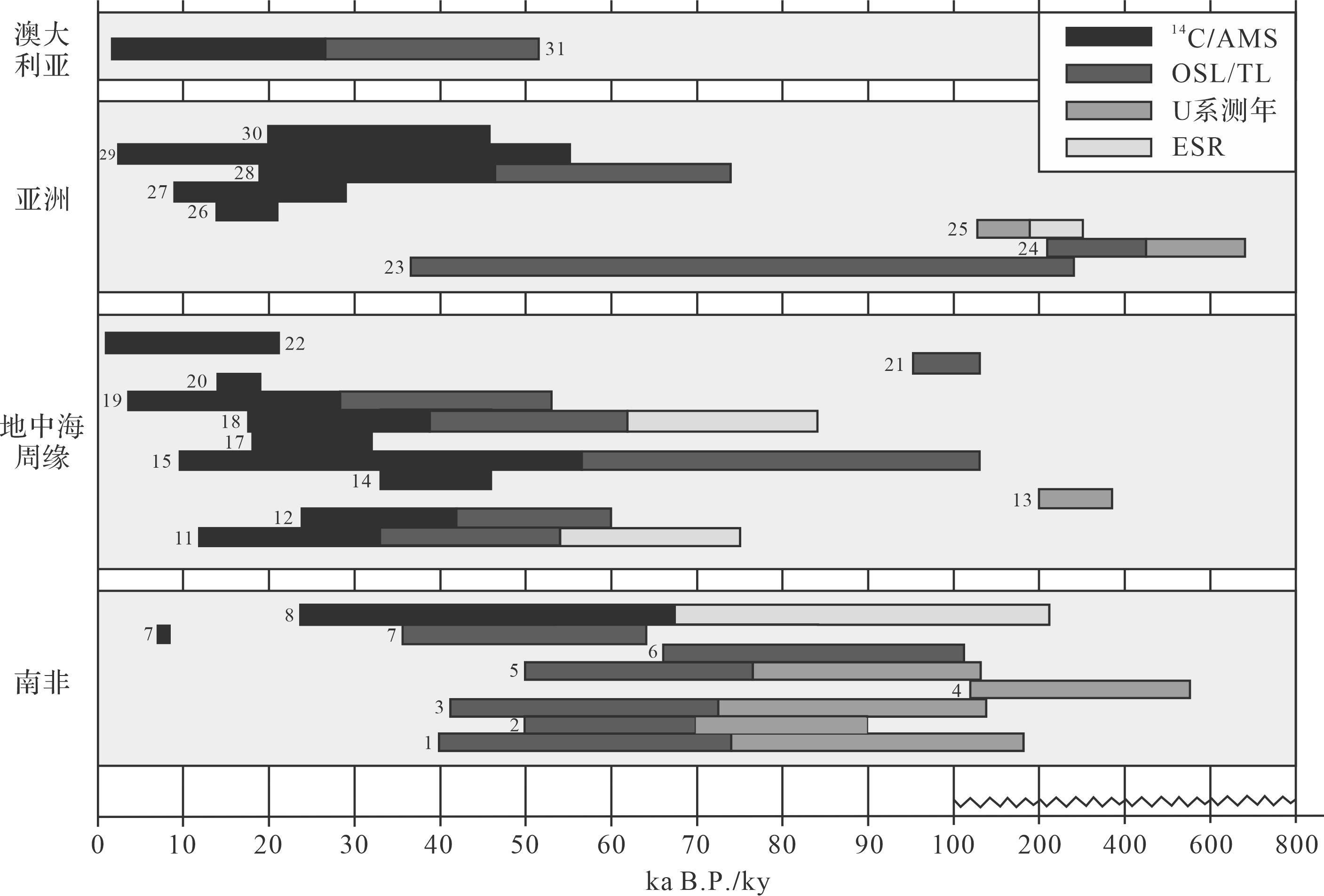
As the important part of a karst system, caves preserve numerous geological and archaeological deposits, including autochthonous, allochthonous, chemical, biological, and anthropogenic deposits, which are disturbed by the post-depositional processes in the cave deposit process. Micromorphology is the study of undisturbed, oriented samples, with the aid of microscopic and ultramicroscopic techniques, to identify the composition, texture, and structure that cannot be observed by the naked eye and deduce their chronological, spatial, and genetic relationships. Here, we reviewed the current research on micromorphological analysis of different cave deposits. The micromorphological analysis has been applied widely, including the restoration of the cave paleoclimate and paleoenvironment, the reconstruction of the cave deposit and burial process, the construction of stratigraphic chronology framework, and the interpretation of ancient human activities and genetic information. However, micromorphological analysis has not fully applied on the cave deposits in China. We are curious as to the broad application prospect of this effective research method.
As the important part of a karst system, caves preserve numerous geological and archaeological deposits, including autochthonous, allochthonous, chemical, biological, and anthropogenic deposits, which are disturbed by the post-depositional processes in the cave deposit process. Micromorphology is the study of undisturbed, oriented samples, with the aid of microscopic and ultramicroscopic techniques, to identify the composition, texture, and structure that cannot be observed by the naked eye and deduce their chronological, spatial, and genetic relationships. Here, we reviewed the current research on micromorphological analysis of different cave deposits. The micromorphological analysis has been applied widely, including the restoration of the cave paleoclimate and paleoenvironment, the reconstruction of the cave deposit and burial process, the construction of stratigraphic chronology framework, and the interpretation of ancient human activities and genetic information. However, micromorphological analysis has not fully applied on the cave deposits in China. We are curious as to the broad application prospect of this effective research method.
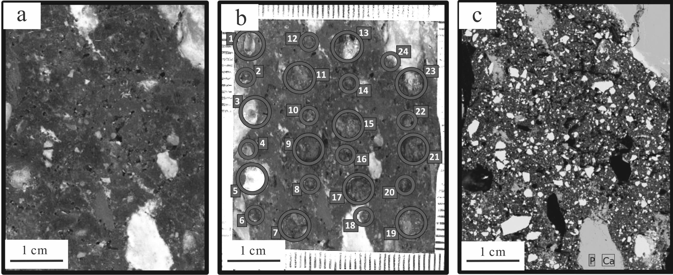
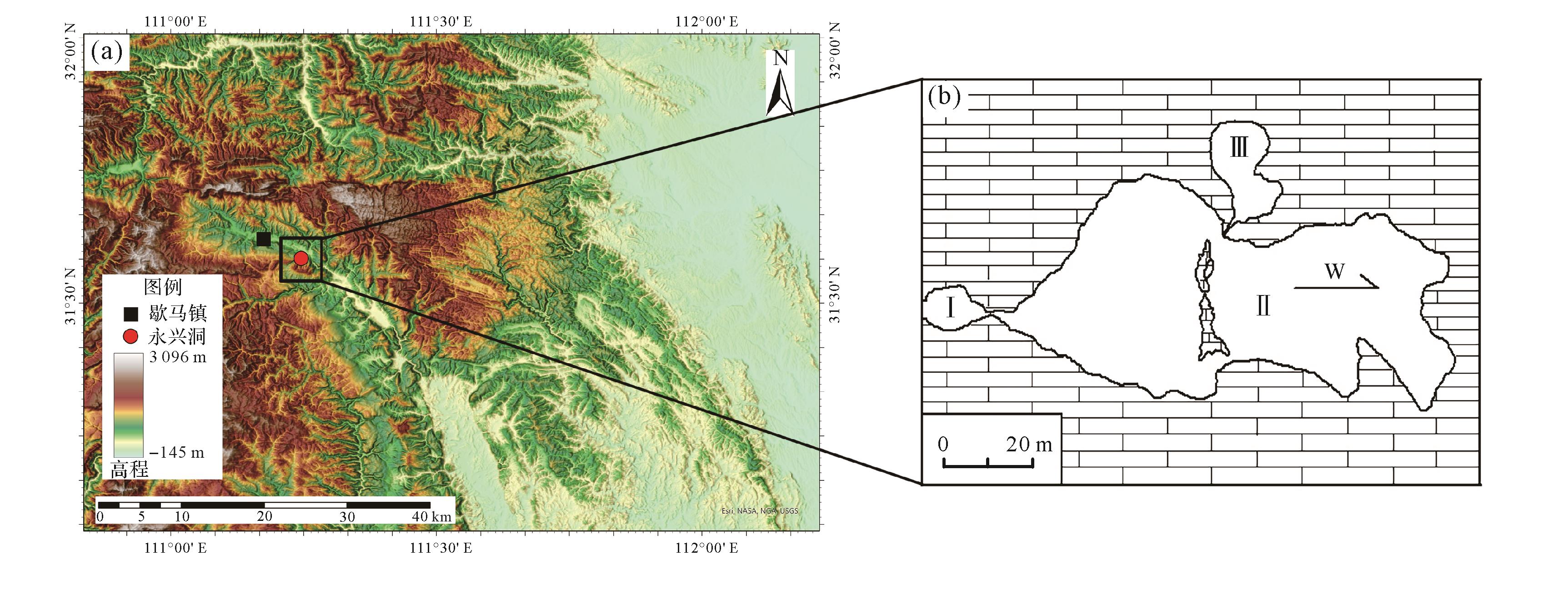
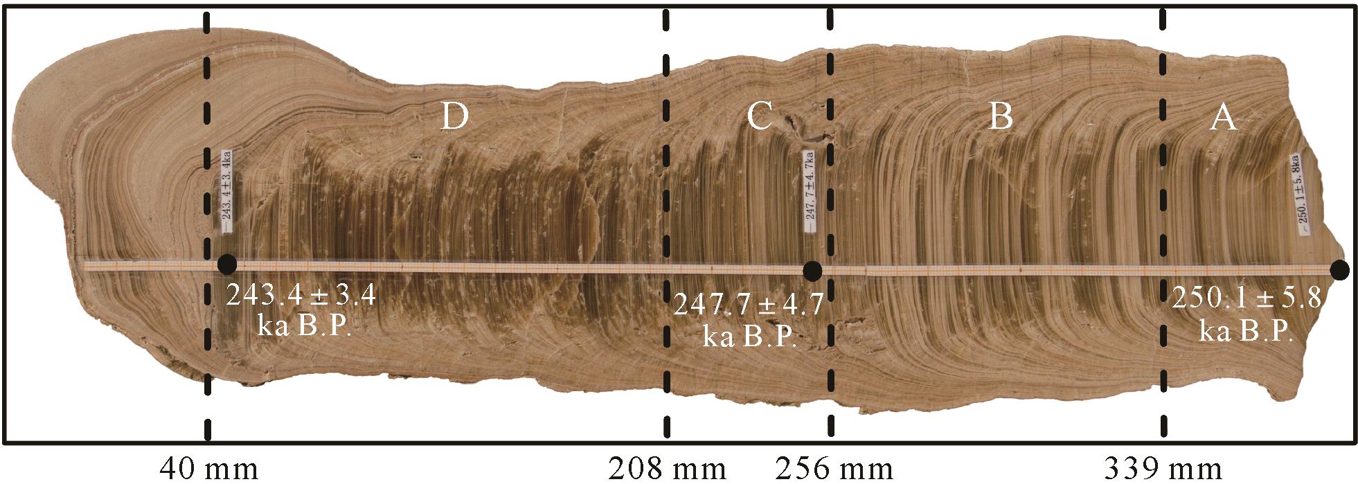
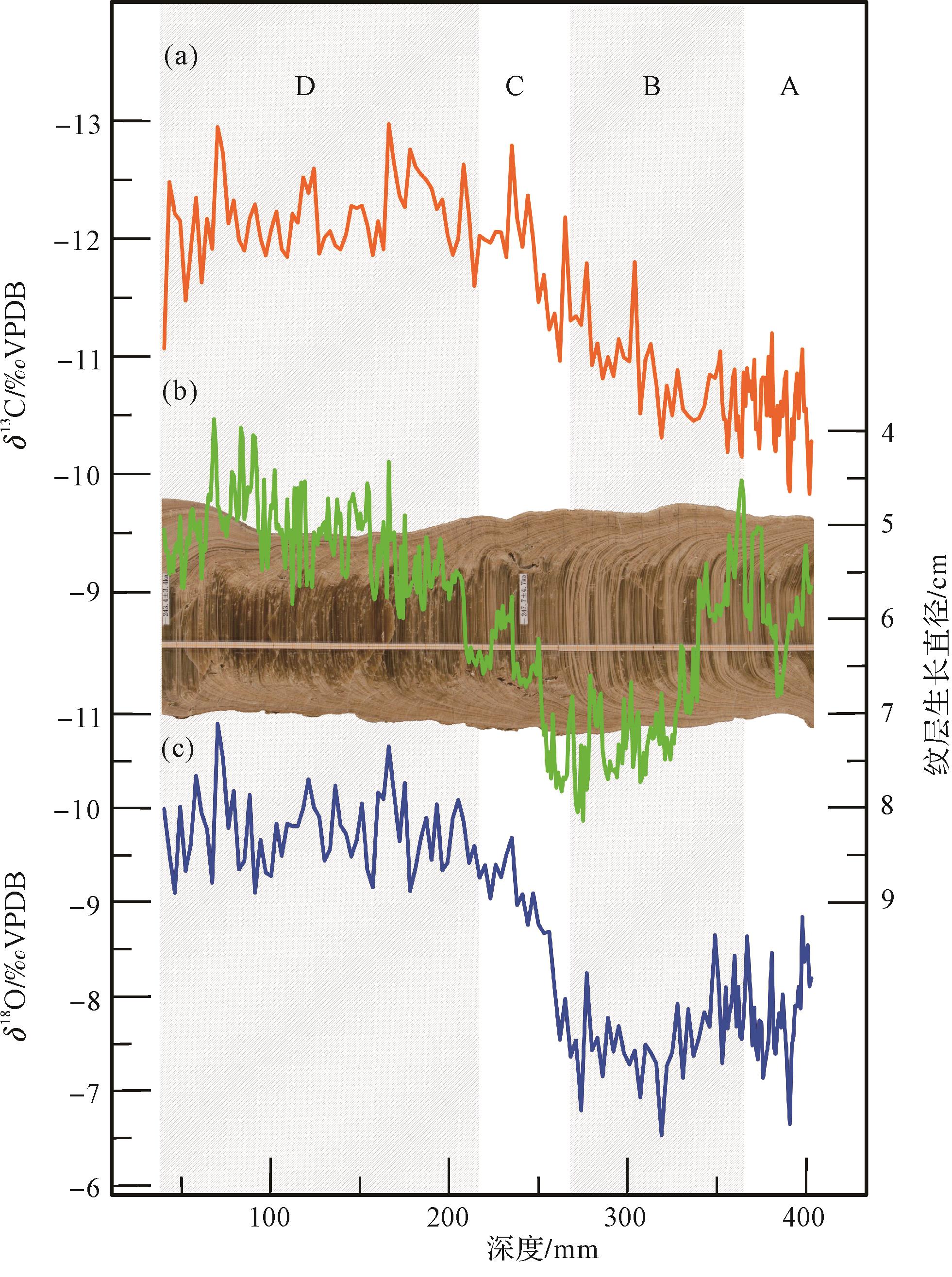
2023, 41(4): 992-1001.
doi: 10.14027/j.issn.1000-0550.2022.020
Abstract:
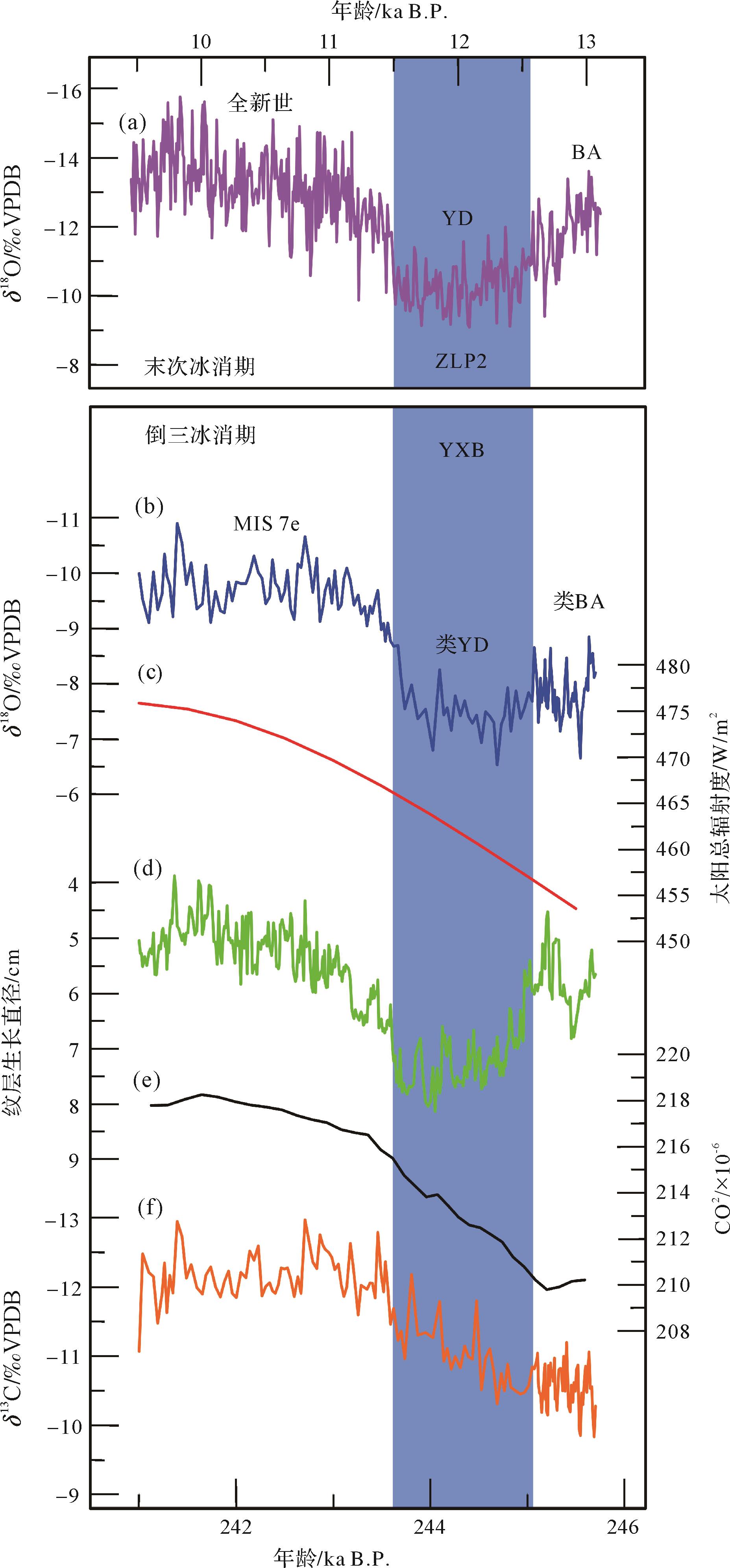
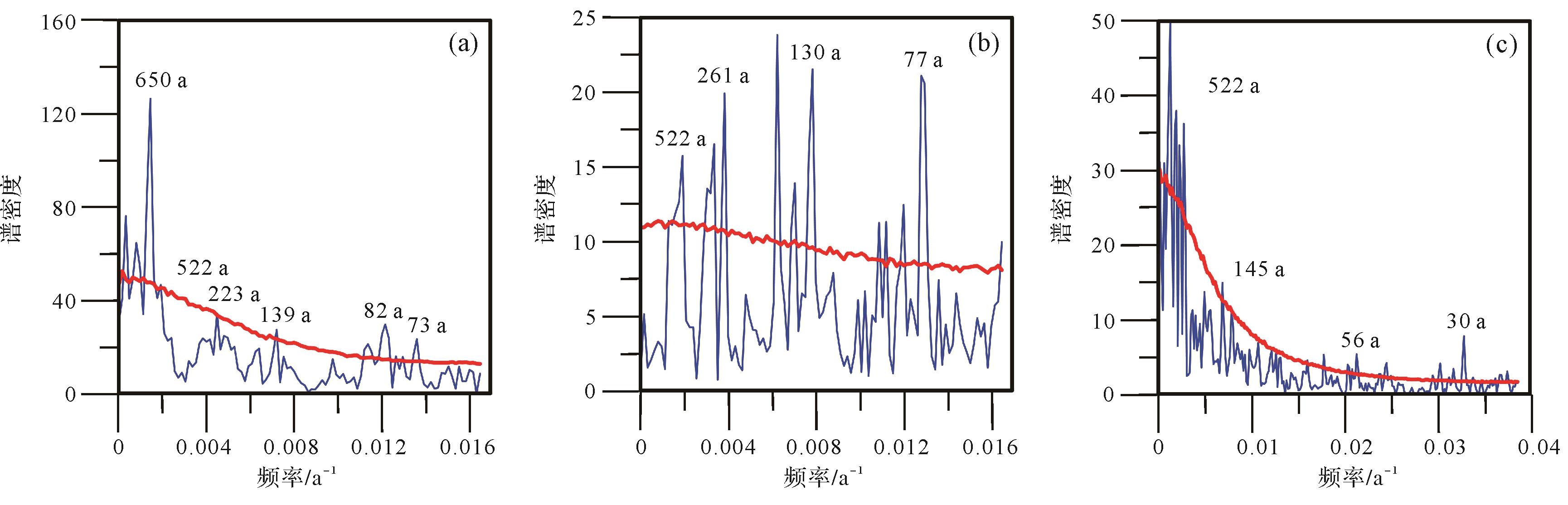
Multi-proxy Analysis from a stalagmite that grew during Ice Age Termination III (referred to as T III) is conducted to comprehensively understand the climate change characteristics and monsoon mechanisms during this period. Based on isotopes, stalagmite laminae growth diameter, and lithologic characteristic analysis of the stalagmite (No: YXB) from Yongxing Cave, Hubei province, the Asian monsoon climate change sequence during the T III was reconstructed. The lamina growth diameter is related to δ18O and has the same variation characteristics, i.e., when stalagmites δ18O is negative, the laminae growth diameter decreases, and when δ18O is positive, the laminae growth diameter increases. When the change of laminae growth diameter is same as stalagmite δ18O, there is an obvious weak monsoon event (known as “YD-like event”) during T III. The lithologic characteristics of stalagmites also have an obvious response to this event. In this period, stalagmites develop white opaque lamina, which is obviously different from the gray transparent lamina developed in other periods. This shows that the karst system signals, such as laminae growth diameter and lithology, also respond to δ18O indications of climate change. Stalagmite δ13C is same as δ18O, but the response to YD-like events is not obvious. It shows that in the Asian monsoon region, the vegetation represented by δ13C responds to the deglaciation process, but is not sensitive to the weakening response of monsoon during the transition from glacial period to interglacial period. Using power spectrum analysis of the above indices, periodic components, such as 522 a, 223⁃261 a, 130⁃145 a, 73⁃82 a, 64 a, and 30 a, are obtained, which may be the result of the coupling of solar activity and ocean-atmosphere interaction.
Multi-proxy Analysis from a stalagmite that grew during Ice Age Termination III (referred to as T III) is conducted to comprehensively understand the climate change characteristics and monsoon mechanisms during this period. Based on isotopes, stalagmite laminae growth diameter, and lithologic characteristic analysis of the stalagmite (No: YXB) from Yongxing Cave, Hubei province, the Asian monsoon climate change sequence during the T III was reconstructed. The lamina growth diameter is related to δ18O and has the same variation characteristics, i.e., when stalagmites δ18O is negative, the laminae growth diameter decreases, and when δ18O is positive, the laminae growth diameter increases. When the change of laminae growth diameter is same as stalagmite δ18O, there is an obvious weak monsoon event (known as “YD-like event”) during T III. The lithologic characteristics of stalagmites also have an obvious response to this event. In this period, stalagmites develop white opaque lamina, which is obviously different from the gray transparent lamina developed in other periods. This shows that the karst system signals, such as laminae growth diameter and lithology, also respond to δ18O indications of climate change. Stalagmite δ13C is same as δ18O, but the response to YD-like events is not obvious. It shows that in the Asian monsoon region, the vegetation represented by δ13C responds to the deglaciation process, but is not sensitive to the weakening response of monsoon during the transition from glacial period to interglacial period. Using power spectrum analysis of the above indices, periodic components, such as 522 a, 223⁃261 a, 130⁃145 a, 73⁃82 a, 64 a, and 30 a, are obtained, which may be the result of the coupling of solar activity and ocean-atmosphere interaction.
2023, 41(4): 1002-1010.
doi: 10.14027/j.issn.1000-0550.2022.014
Abstract:
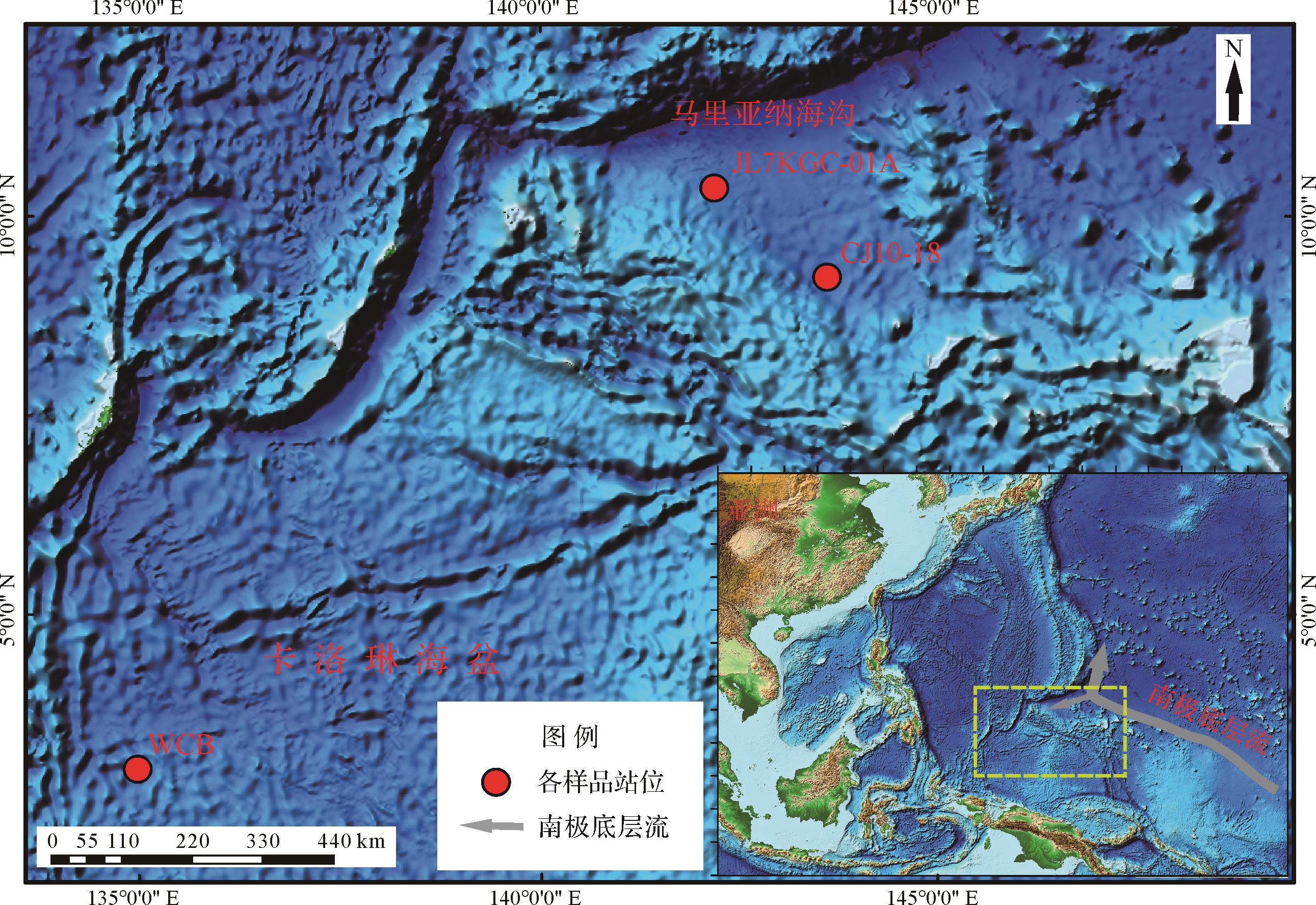
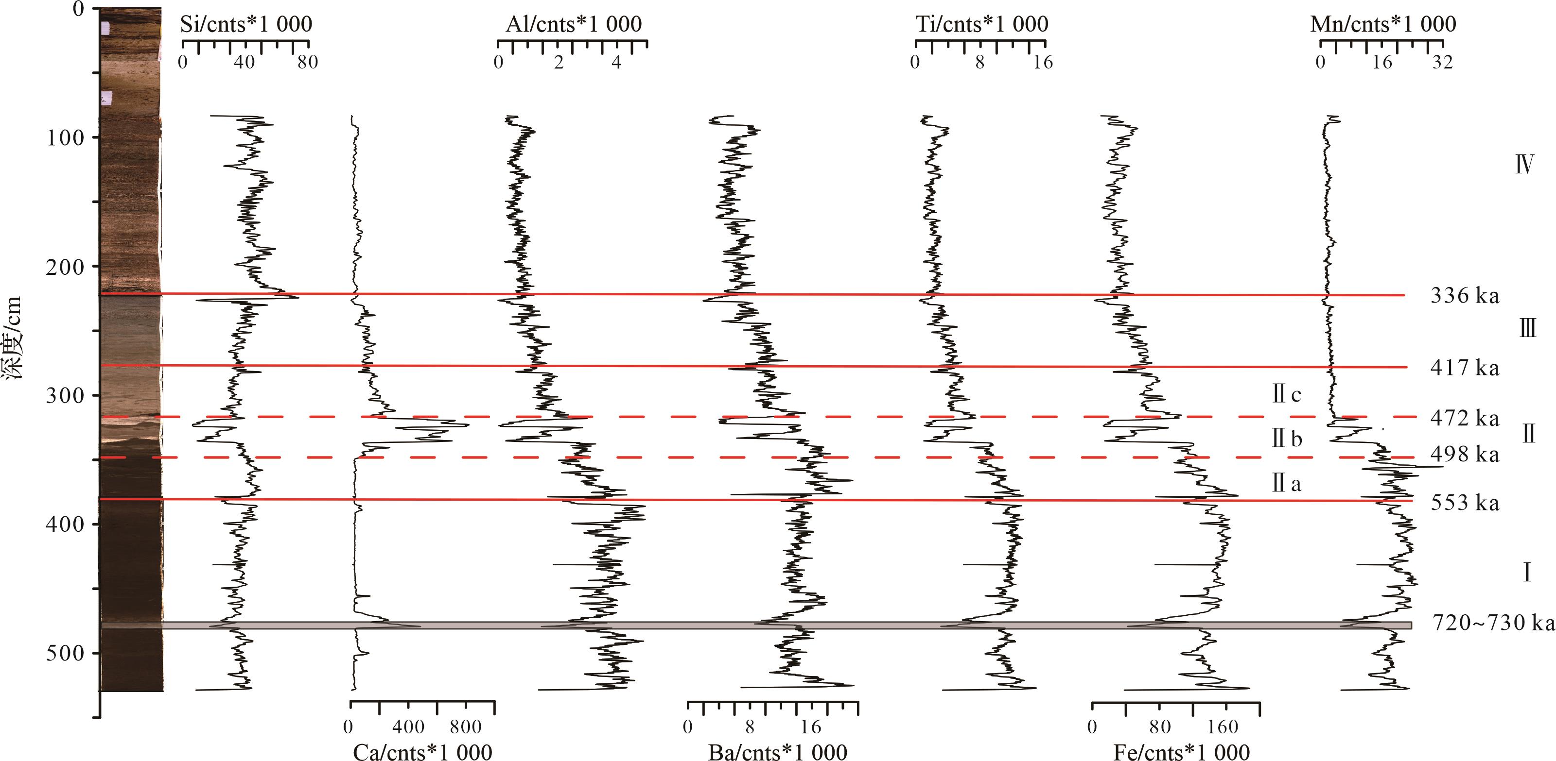
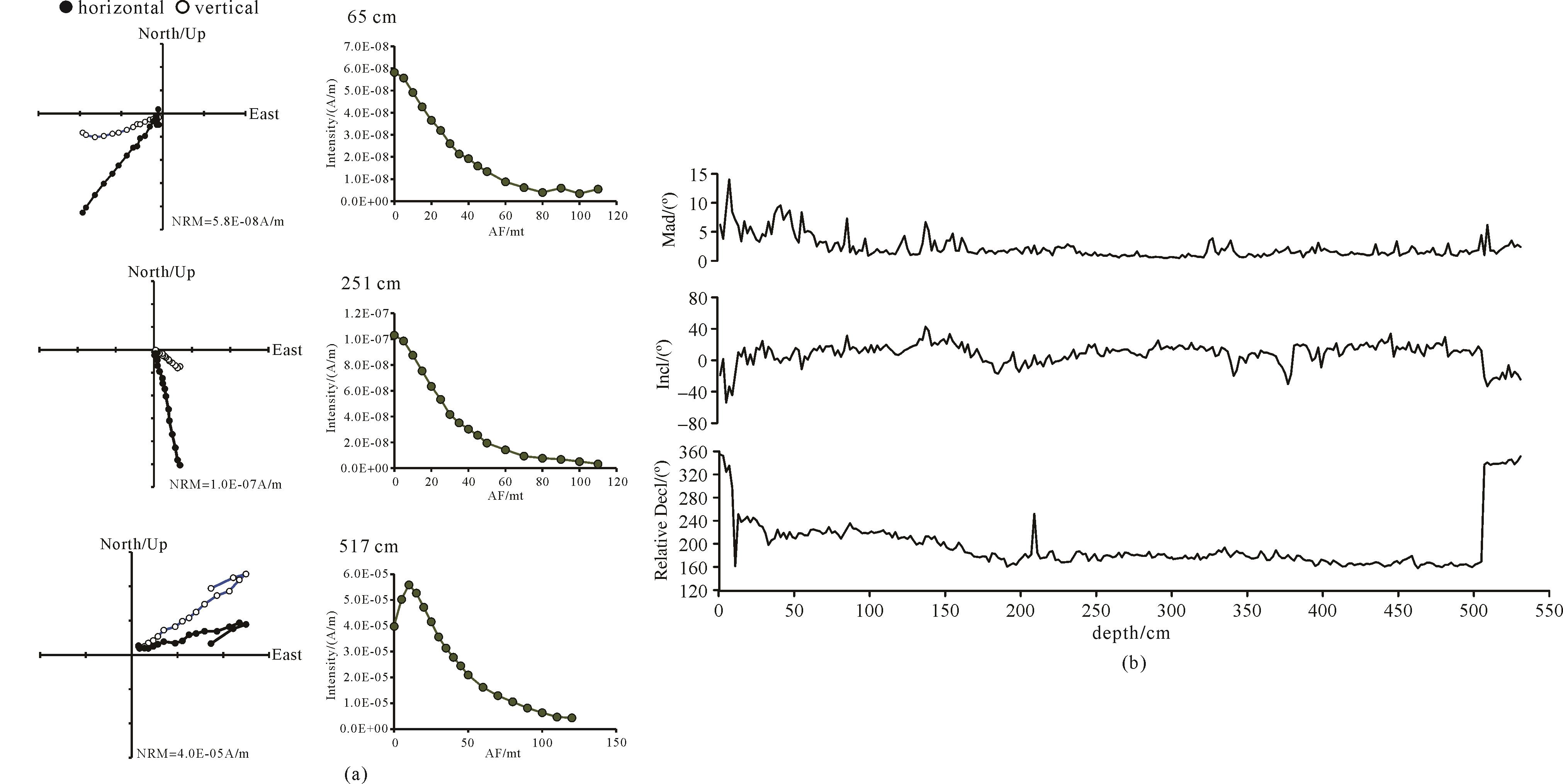
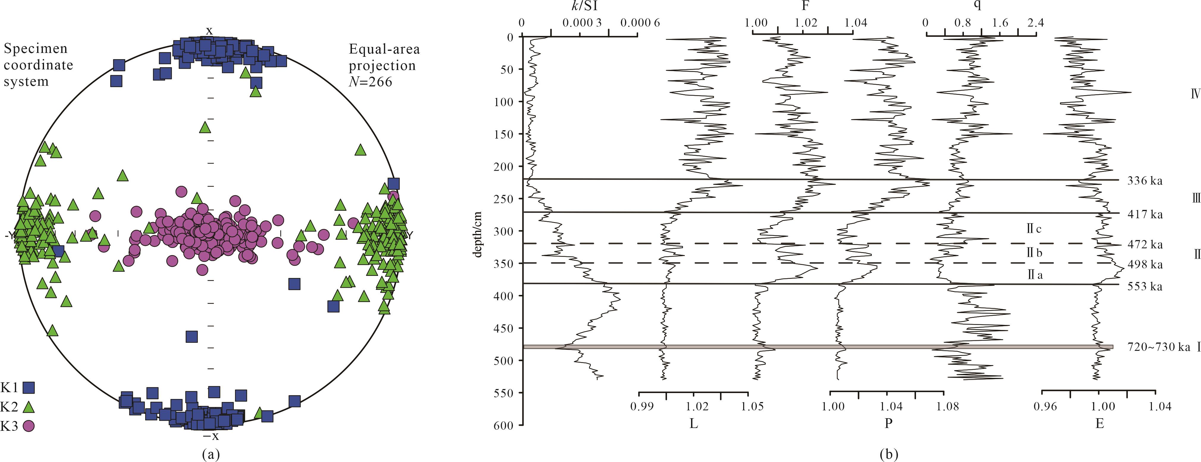
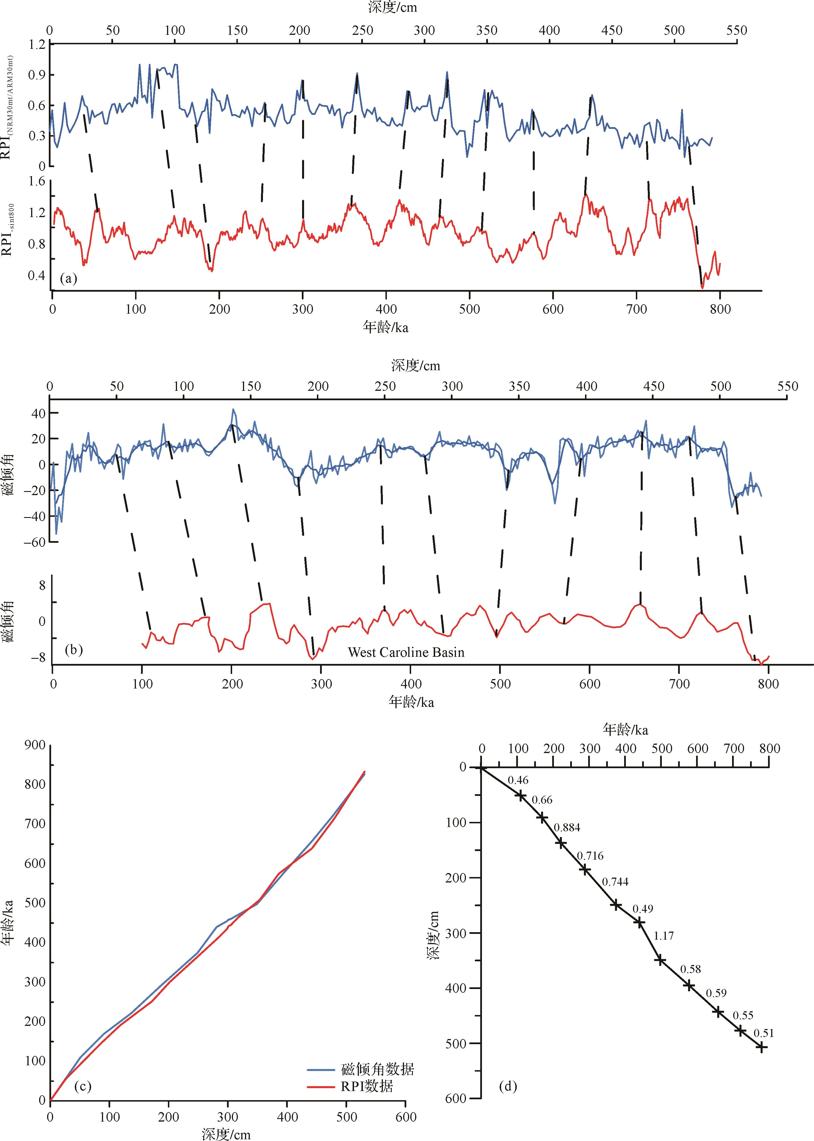
A gravity core sample with 533 cm long obtained in the southern Marina Trench was analyzed by grain-size smear tests, XRF scanning, paleomagnetism and magnetic anisotropy. The paleomagnetic analysis revealed the Brunhes-Matuyama reversal event (B-M boundary) at 507 cm, near the bottom of the core, indicating that the sample contains the record of at least 0.78 million years of the depositional environment. The chronological framework was established by analyzing the relative paleomagnetic intensity (RPI) and long-term variation in paleomagnetic inclination. The grain-size analysis and XRF scans indicate that the sediment type in the core underwent a fundamental change from bottom to top: at the bottom it is dominated by pelagic clay with evidence of terrigenous input; at the top it is dominated by siliceous ooze consisting mainly of diatoms. Analysis indicated that this change was mainly because of the appearance of the Antarctic Bottom Water (AABW) during the Mid-Brunhes Event (MBE). The paleomagnetism establishes the age model, and the magnetic anisotropy and sediment composition indicate that the MBE began to influence this area with the appearance of the AABW around 553 ka. The sediment type began to change from terrigenous input to biogenesis, at about 417 ka, by which time the main composition of the sediment was already biogenetic. The AABW enhanced the change until the sediment was almost completely composed of pure siliceous ooze from 336 ka until the present day, indicating the termination of the MBE in this area.
A gravity core sample with 533 cm long obtained in the southern Marina Trench was analyzed by grain-size smear tests, XRF scanning, paleomagnetism and magnetic anisotropy. The paleomagnetic analysis revealed the Brunhes-Matuyama reversal event (B-M boundary) at 507 cm, near the bottom of the core, indicating that the sample contains the record of at least 0.78 million years of the depositional environment. The chronological framework was established by analyzing the relative paleomagnetic intensity (RPI) and long-term variation in paleomagnetic inclination. The grain-size analysis and XRF scans indicate that the sediment type in the core underwent a fundamental change from bottom to top: at the bottom it is dominated by pelagic clay with evidence of terrigenous input; at the top it is dominated by siliceous ooze consisting mainly of diatoms. Analysis indicated that this change was mainly because of the appearance of the Antarctic Bottom Water (AABW) during the Mid-Brunhes Event (MBE). The paleomagnetism establishes the age model, and the magnetic anisotropy and sediment composition indicate that the MBE began to influence this area with the appearance of the AABW around 553 ka. The sediment type began to change from terrigenous input to biogenesis, at about 417 ka, by which time the main composition of the sediment was already biogenetic. The AABW enhanced the change until the sediment was almost completely composed of pure siliceous ooze from 336 ka until the present day, indicating the termination of the MBE in this area.
2023, 41(4): 1011-1024.
doi: 10.14027/j.issn.1000-0550.2021.164
Abstract:
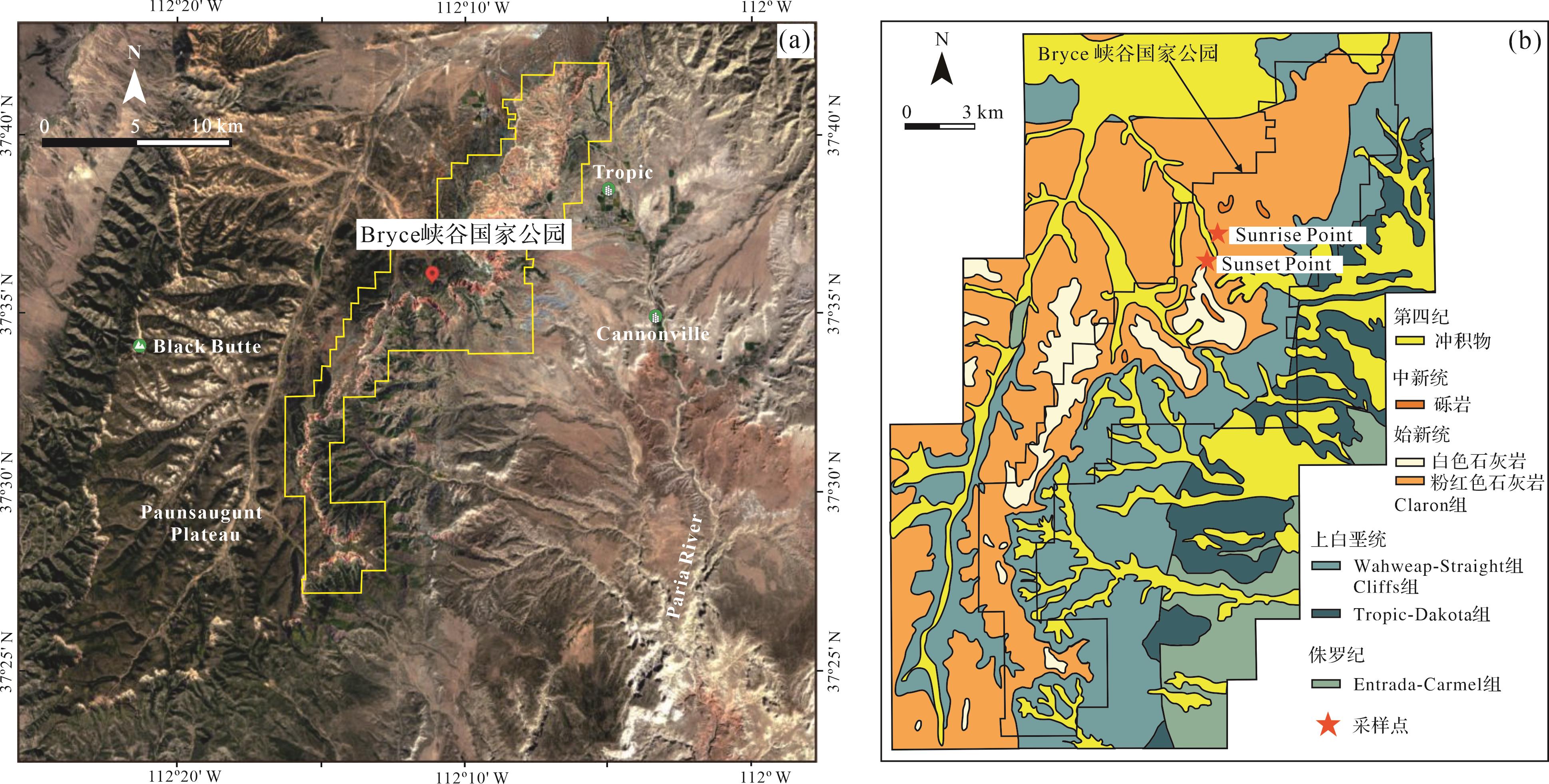
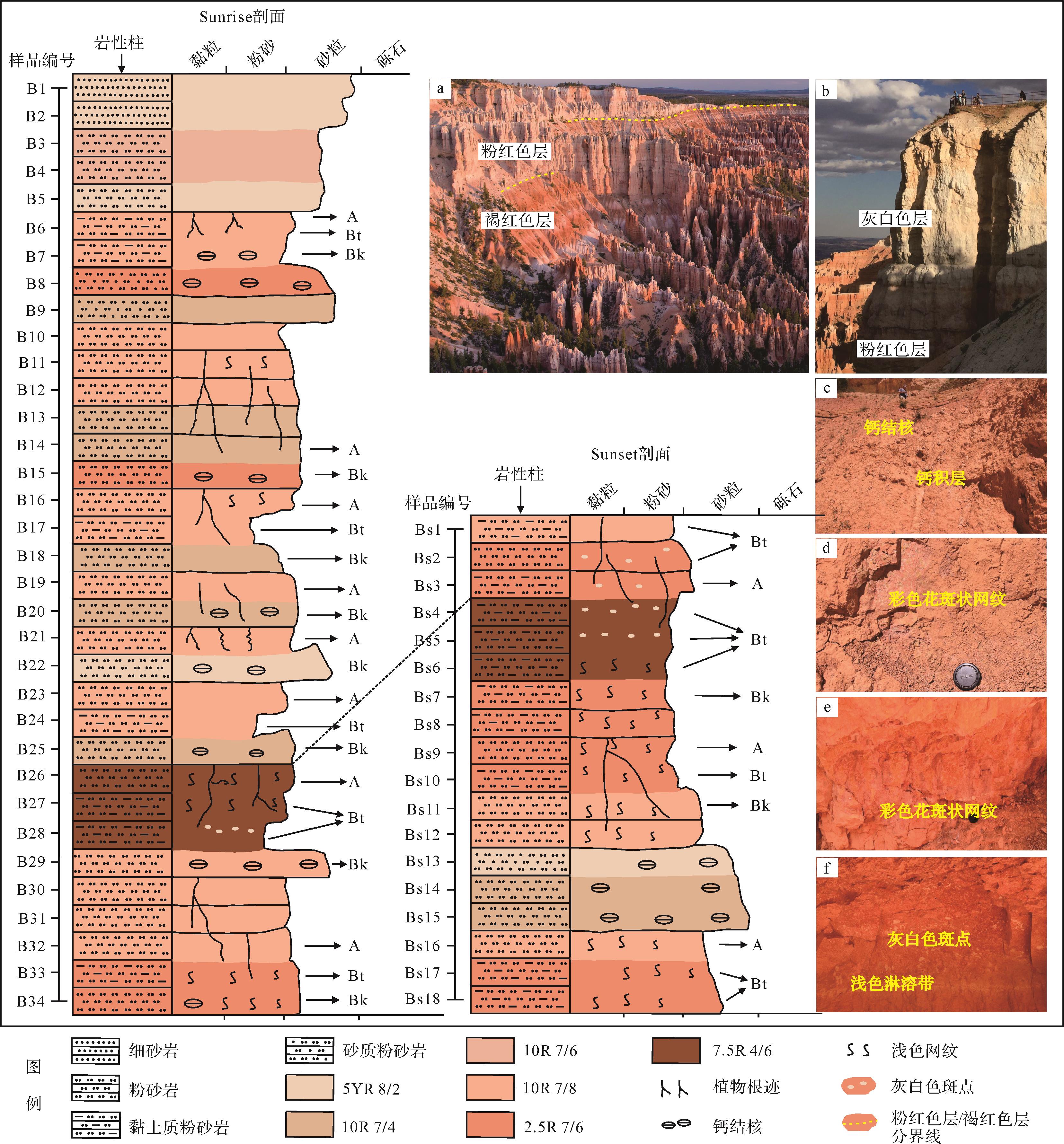
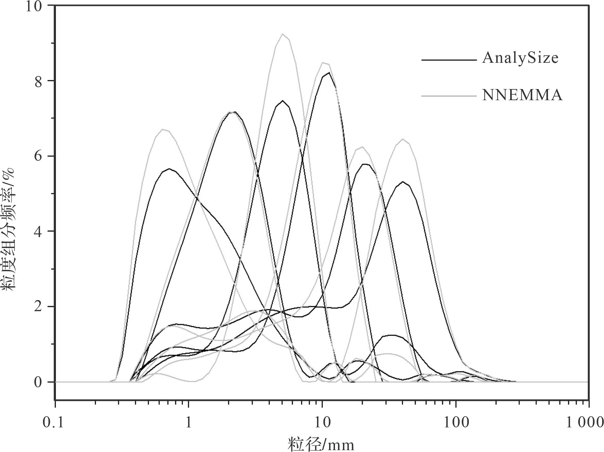
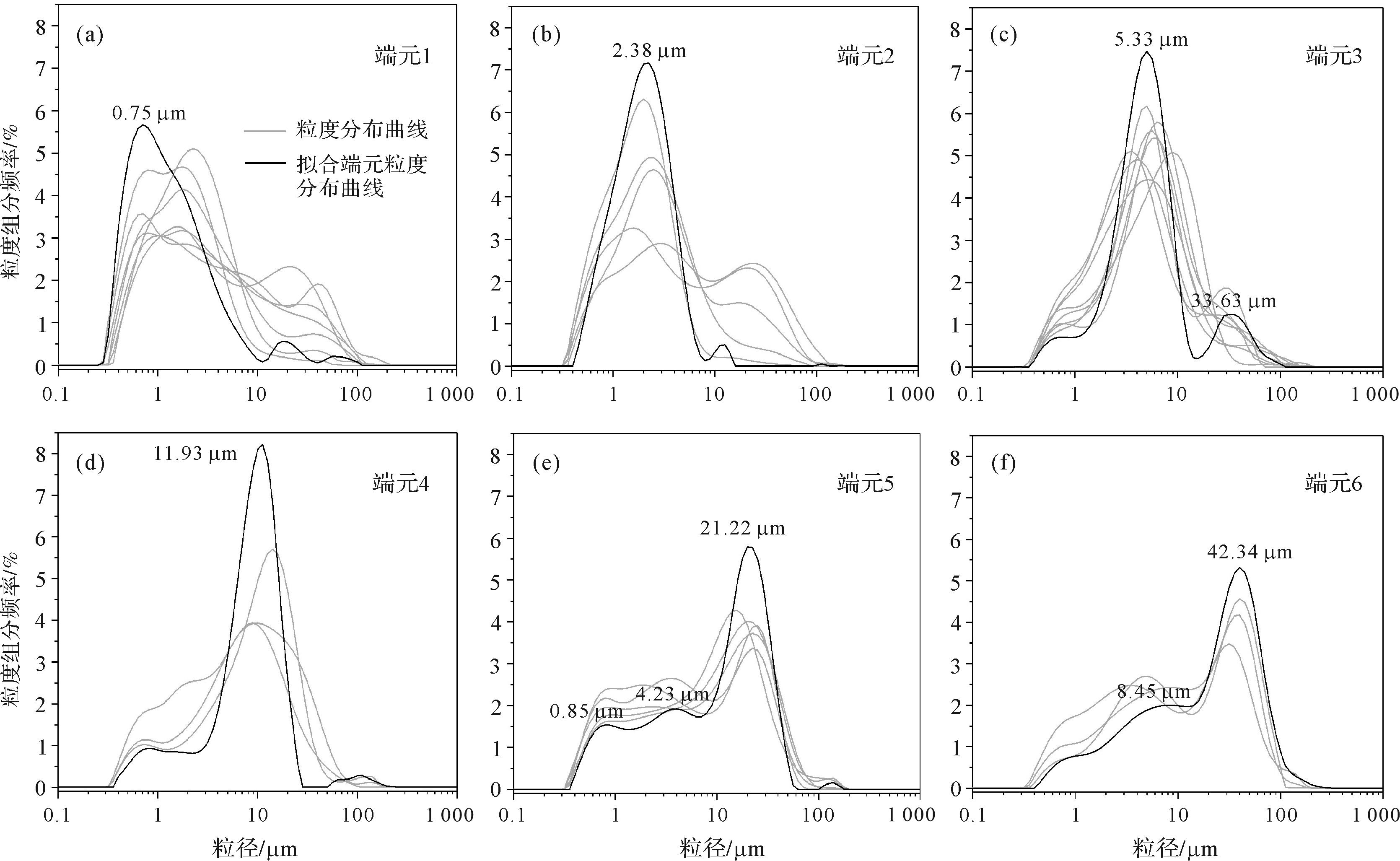
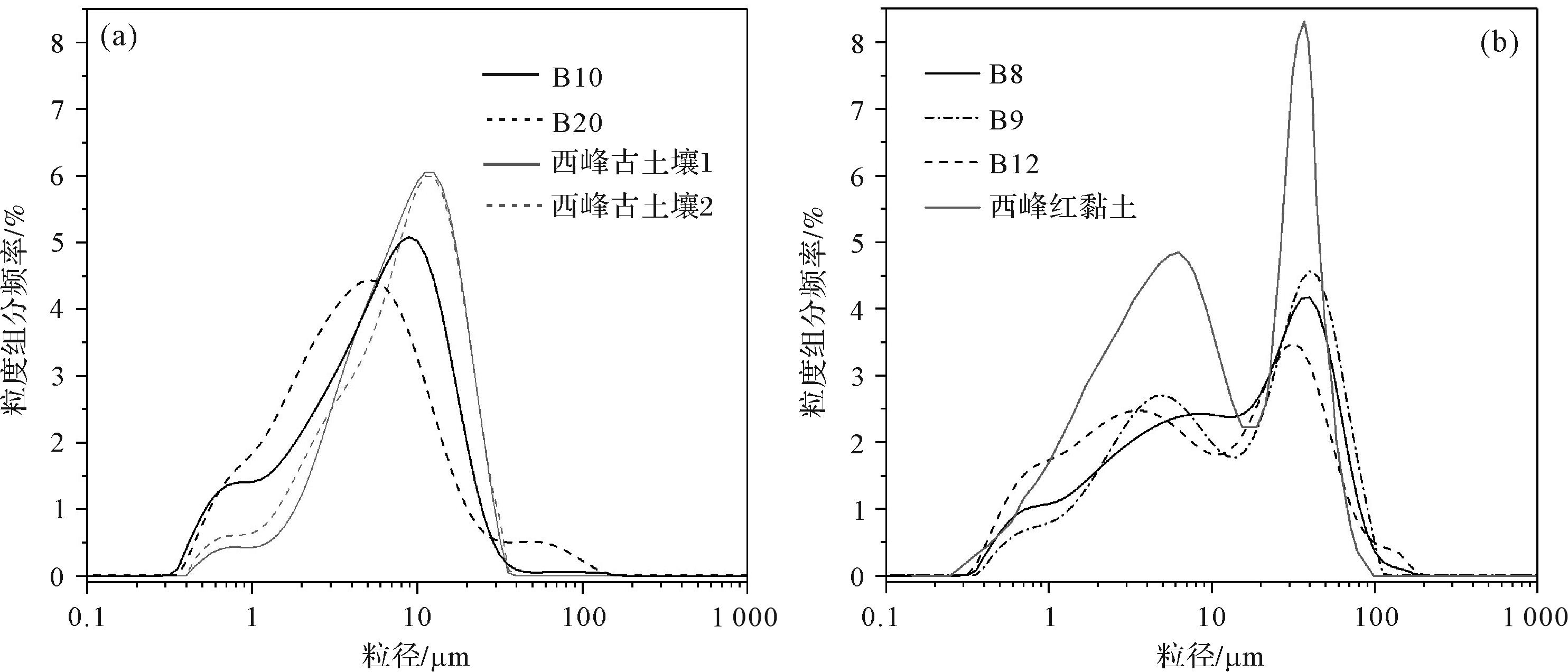
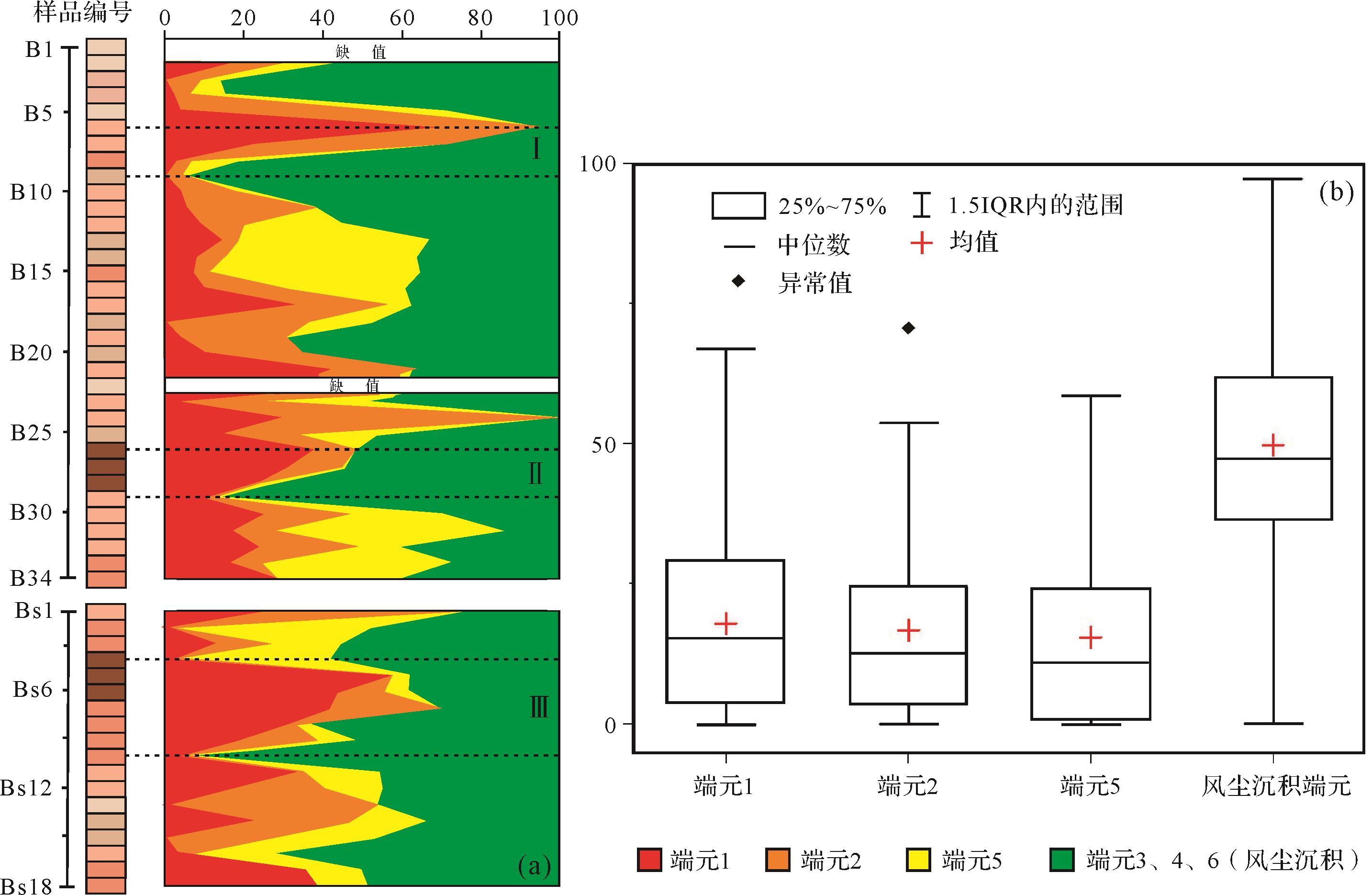
The Cenozoic Claron Formation spanning the Paleocene to Eocene, which is widely exposed in the western United States, is suitable for studying climatic and environmental change in this period. The Claron Formation has generally been interpreted as a fluvial-lacustrine deposit, but eolian deposit features are evident from field observations. Therefore, identifying eolian components in the strata and discussing their significance is of vital importance for interpreting the sedimentary environment of the Claron Formation. The area of the Claron Formation covered by this study was the Bryce Canyon National Park. The eolian deposits in the strata were firstly identified by field observation of the sedimentary characteristics and the surface textures of quartz grains. Then the eolian components of the rock were determined by non-parametric grain-size end-member analysis to unmix the grain-size components. It was found that most of layers are red in color, and the deep-to-light variation of the red color of the strata and the off-white color vary overall with the bedding/horizon. The sediments were found to be homogeneous, mainly composed of silt and clay and rich in carbonate, with well developed vertical joints. Aggradational deposit properties were clearly observed in the red layers, evidence that the sedimentation and weathering processes were simultaneous. These field sedimentary characteristics indicate that the red layers are mainly eolian deposits. The quartz grains in the red samples were found to have surfaces characterized by large and small mechanical saucer-shaped pits, deep troughs, round pits, upturned plates and precipitation of SiO2, all of which are indicative of an eolian environment. This provides further evidence of eolian deposition in the red layers. Six end members with different sedimentary significance were obtained from the non-parametric grain-size end-member analysis model: soil-forming components; components of hydrostatic sedimentation formed in soak/ephemeral lake; components transported by high altitude air streams over long distances; components of dust settling after storms; alluvial-diluvial components; and near-source or far-source components transported by storms. End members 3, 4 and 6 (first mode grain size 5.33, 11.93 and 42.34 μm, respectively) were identified as eolian components, with an average content of approximately 50% in the strata. This indicates that eolian deposition accounted for more than half of the sediments in the strata. Moreover, the eolian components were found to occupy a large proportion in each layer, indicating that they were a stable strata component. Obvious variation of the content of each end member in the strata indicates inconsistent sedimentary environments at different times. The strata consist of alternate layers of eolian sediments, alluvial-diluvial deposition and soak/ephemeral lake deposition. The climate was humid during the periods of alluvial-diluvial and soak/ephemeral lake sedimentation, and arid during eolian deposition and soil formation.
The Cenozoic Claron Formation spanning the Paleocene to Eocene, which is widely exposed in the western United States, is suitable for studying climatic and environmental change in this period. The Claron Formation has generally been interpreted as a fluvial-lacustrine deposit, but eolian deposit features are evident from field observations. Therefore, identifying eolian components in the strata and discussing their significance is of vital importance for interpreting the sedimentary environment of the Claron Formation. The area of the Claron Formation covered by this study was the Bryce Canyon National Park. The eolian deposits in the strata were firstly identified by field observation of the sedimentary characteristics and the surface textures of quartz grains. Then the eolian components of the rock were determined by non-parametric grain-size end-member analysis to unmix the grain-size components. It was found that most of layers are red in color, and the deep-to-light variation of the red color of the strata and the off-white color vary overall with the bedding/horizon. The sediments were found to be homogeneous, mainly composed of silt and clay and rich in carbonate, with well developed vertical joints. Aggradational deposit properties were clearly observed in the red layers, evidence that the sedimentation and weathering processes were simultaneous. These field sedimentary characteristics indicate that the red layers are mainly eolian deposits. The quartz grains in the red samples were found to have surfaces characterized by large and small mechanical saucer-shaped pits, deep troughs, round pits, upturned plates and precipitation of SiO2, all of which are indicative of an eolian environment. This provides further evidence of eolian deposition in the red layers. Six end members with different sedimentary significance were obtained from the non-parametric grain-size end-member analysis model: soil-forming components; components of hydrostatic sedimentation formed in soak/ephemeral lake; components transported by high altitude air streams over long distances; components of dust settling after storms; alluvial-diluvial components; and near-source or far-source components transported by storms. End members 3, 4 and 6 (first mode grain size 5.33, 11.93 and 42.34 μm, respectively) were identified as eolian components, with an average content of approximately 50% in the strata. This indicates that eolian deposition accounted for more than half of the sediments in the strata. Moreover, the eolian components were found to occupy a large proportion in each layer, indicating that they were a stable strata component. Obvious variation of the content of each end member in the strata indicates inconsistent sedimentary environments at different times. The strata consist of alternate layers of eolian sediments, alluvial-diluvial deposition and soak/ephemeral lake deposition. The climate was humid during the periods of alluvial-diluvial and soak/ephemeral lake sedimentation, and arid during eolian deposition and soil formation.
2023, 41(4): 1025-1039.
doi: 10.14027/j.issn.1000-0550.2021.149
Abstract:
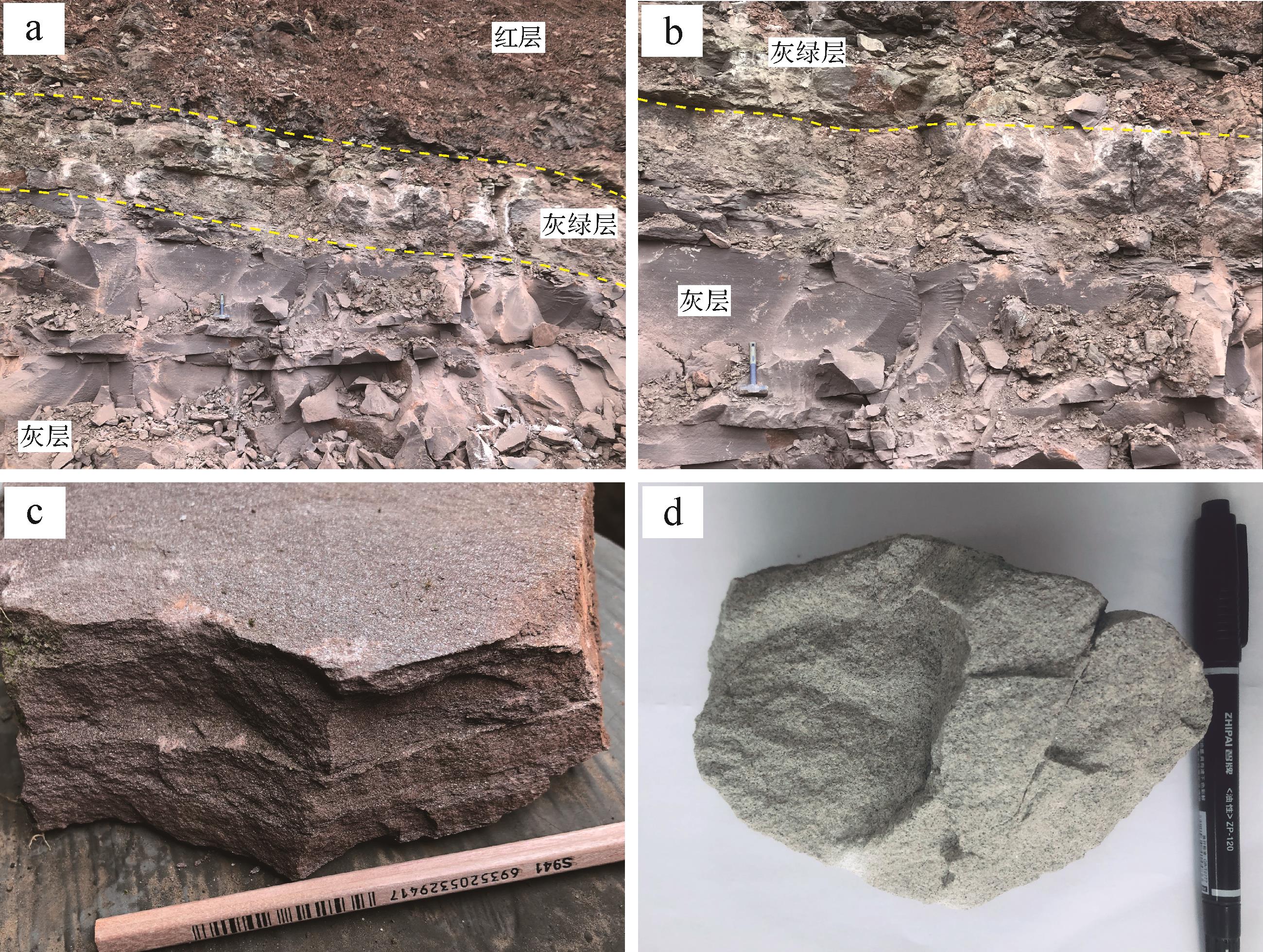
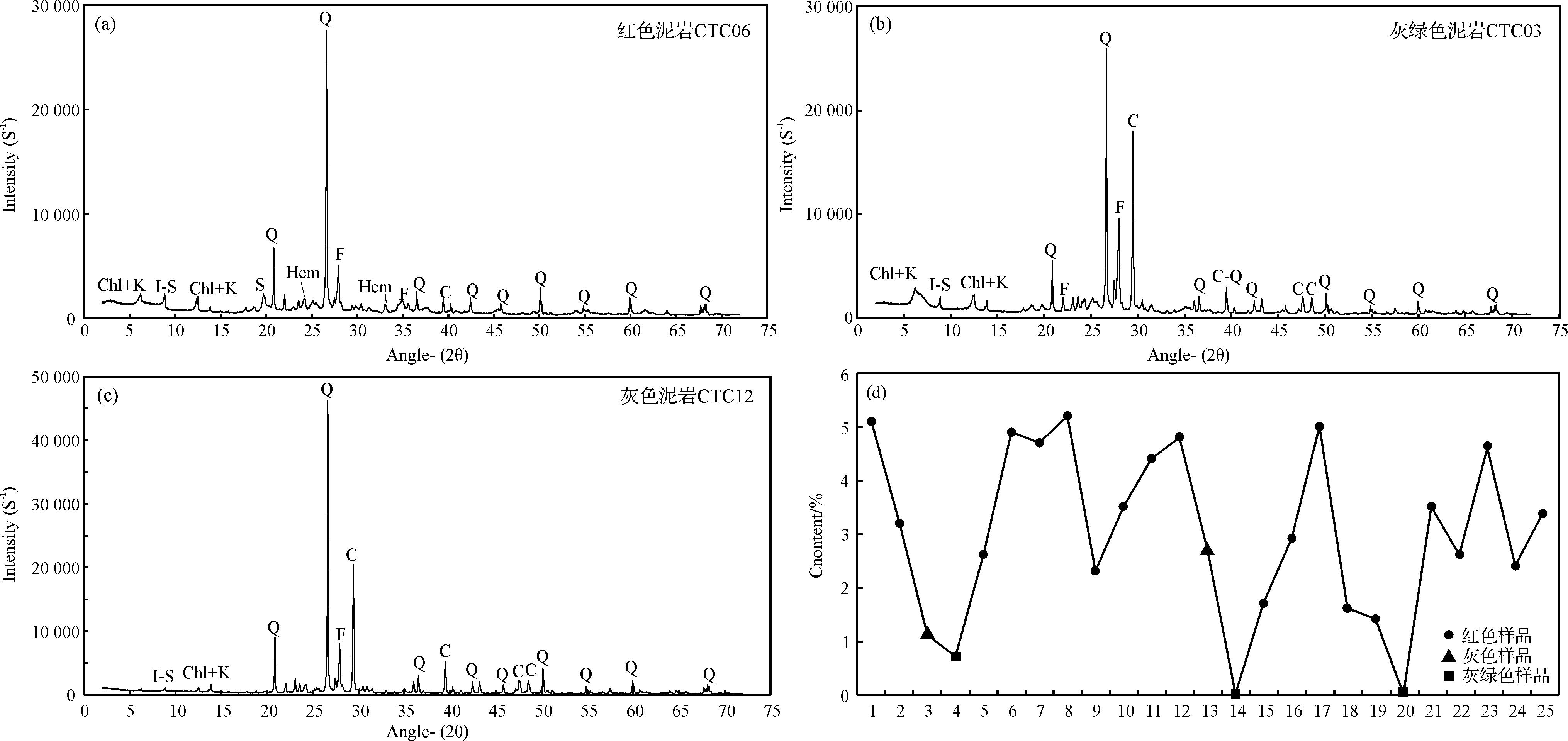
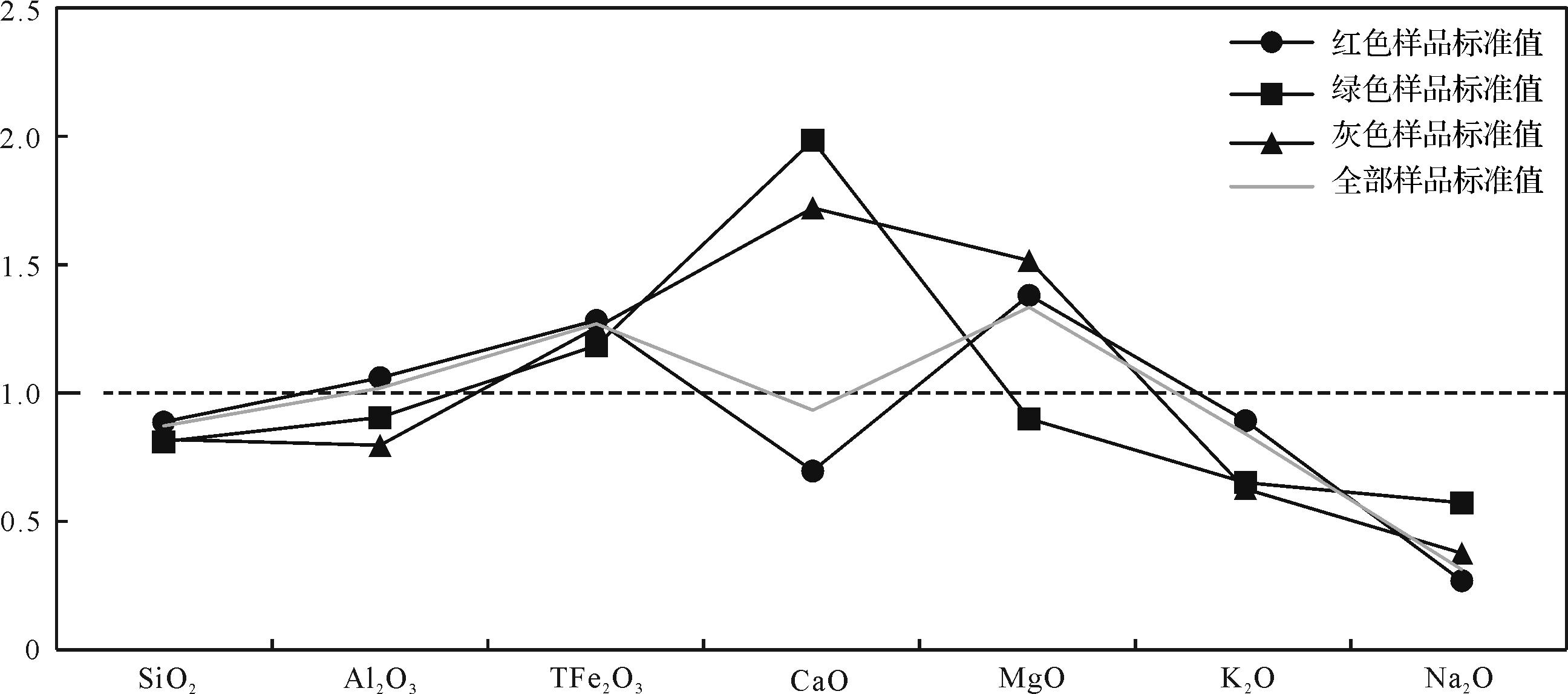
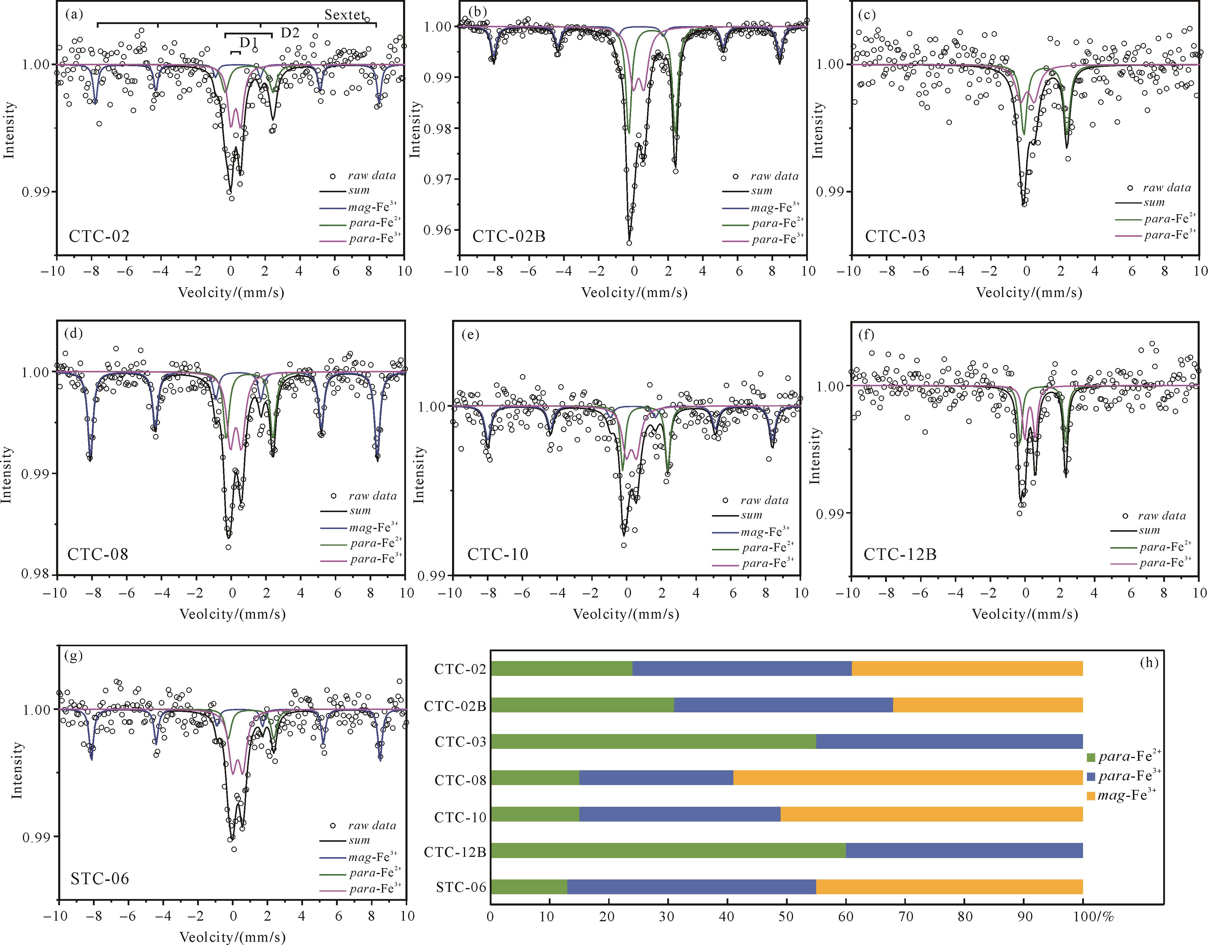
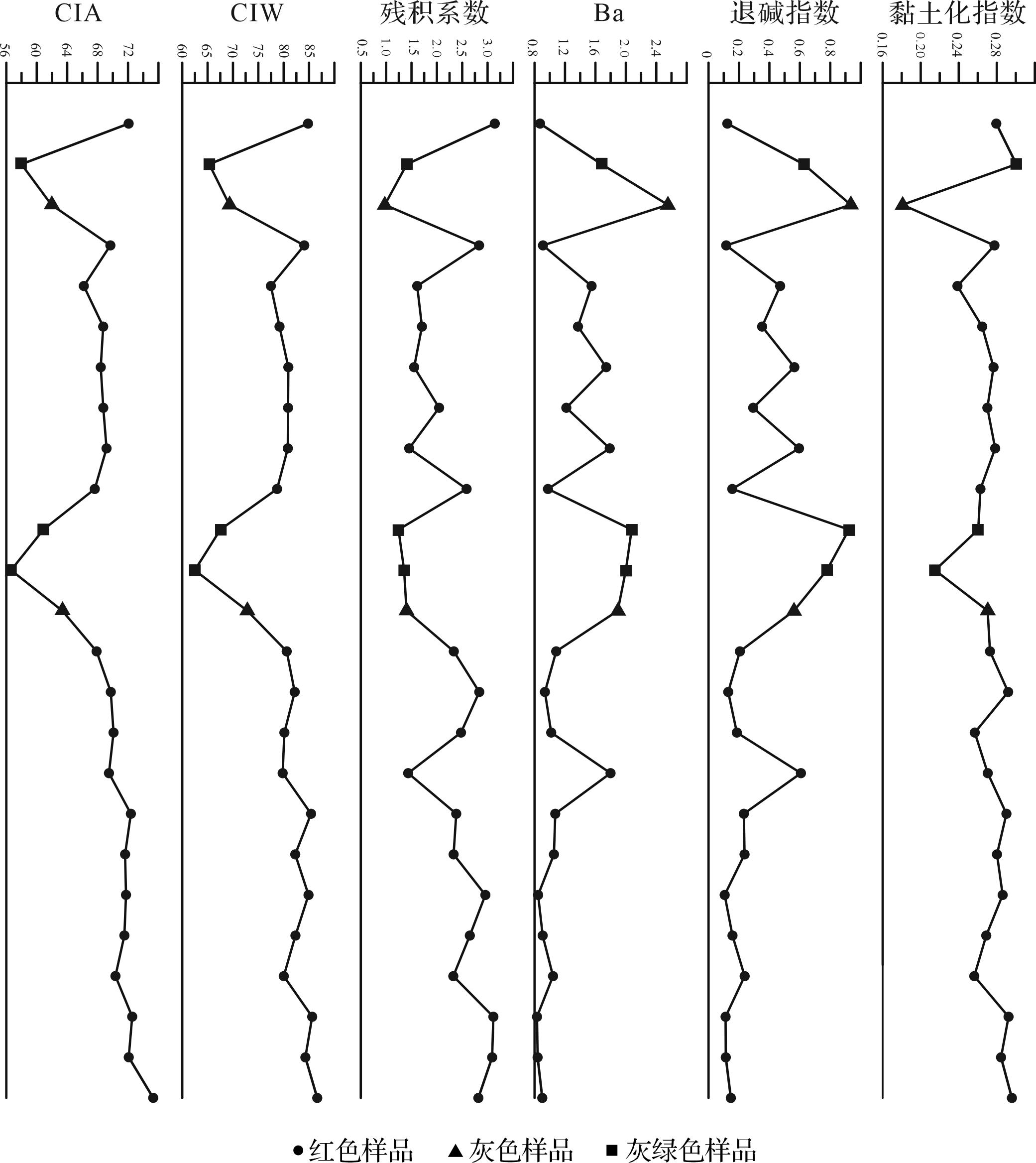
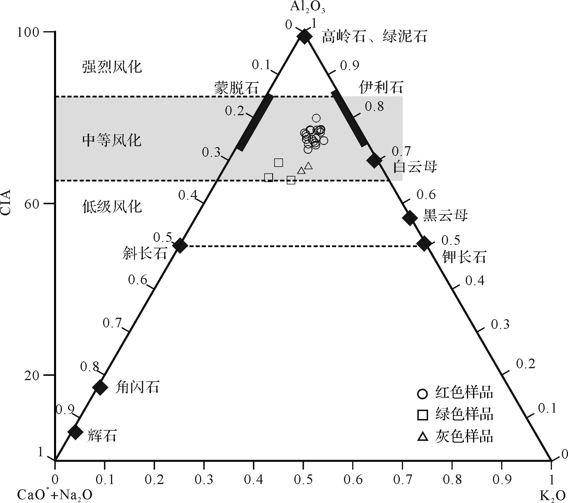
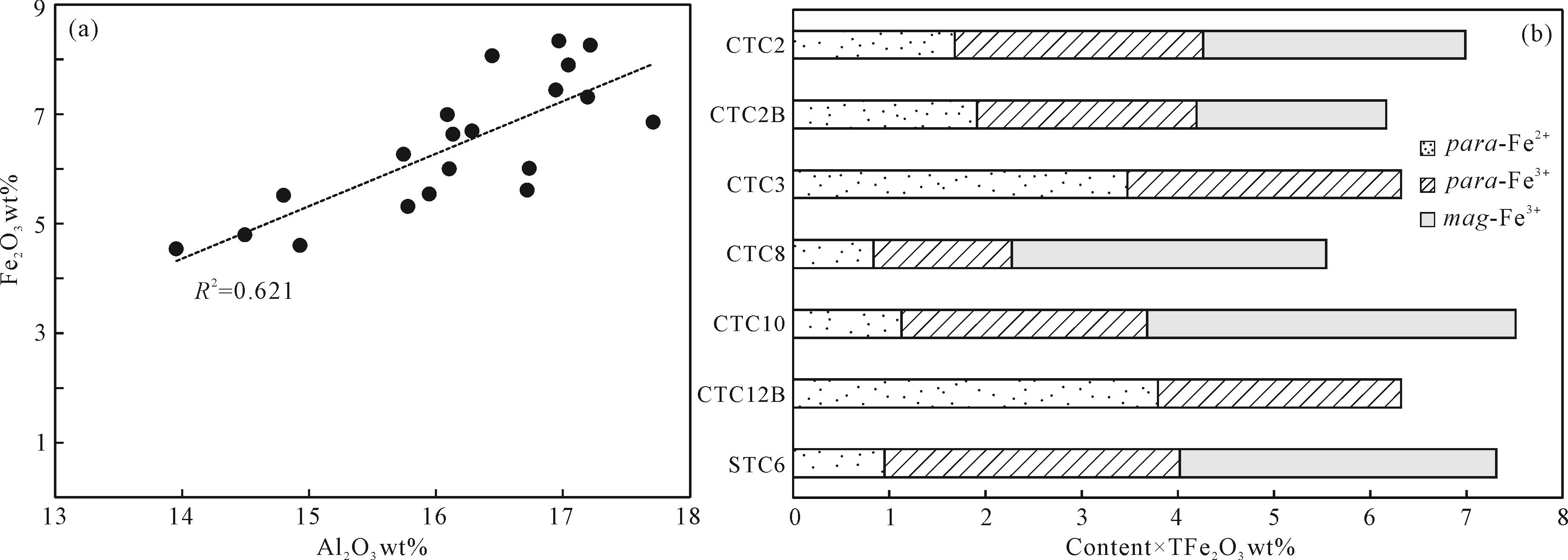
The fresh color of sediment/rock is the intuitive response of its internal composition and fabric and records the rich climate, environment, structure, and diagenetic transformation. The Shangshaximiao Formation of the Middle Jurassic in the Sichuan Basin is a set of clastic strata from river lake facies. The profile is well exposed, fresh, and continuously changeable. It is an excellent object for studying the origin of sediment/rock color and its indicative significance of climate and environment. Through test and analysis of mineral composition, element content, and iron speciation of mudstone samples with gray-green, gray, and red colors in the Shangshaximiao Formation, we found that the change of hematite content directly causes the color difference in the mudstone in Shaximiao Formation. For red mudstone, the average values of chemical index of alteration (CIA), chemical Index of Weathering (CIW), weather eluviation index (Ba), regression index, clayization index, and residual coefficient are 70.27, 82.05, 1.14, 0.26, 0.27, and 2.38, respectively, indicating the strongest chemical weathering intensity. The corresponding geochemical indexes of gray samples are 62.65, 71.06, 2.22, 0.75, 0.23 and 1.19, respectively. The grey-green samples were 58.50, 65.11, 1.92, 0.78, 0.26 and 1.34 respectively, and the chemical weathering was the weakest. The red sample contains the highest hematite iron content. The gray-green sample mainly represents paramagnetic ferrous in clay minerals. The geochemical contents of the three iron elements in the gray sample have a slight difference, mainly trivalent iron. The change of iron chemical species content in samples with different colors shows that the Fe element forming hematite in red bed samples may come from the weathering of source rock and clay minerals subjected to secondary weathering. At present, the causes of the different colors can only be confirmed to be related to the weathering of source rocks to varying degrees, which cannot be attributed to the hot and arid climate conditions. It is necessary to distinguish the climate type in combination with other indicators.
The fresh color of sediment/rock is the intuitive response of its internal composition and fabric and records the rich climate, environment, structure, and diagenetic transformation. The Shangshaximiao Formation of the Middle Jurassic in the Sichuan Basin is a set of clastic strata from river lake facies. The profile is well exposed, fresh, and continuously changeable. It is an excellent object for studying the origin of sediment/rock color and its indicative significance of climate and environment. Through test and analysis of mineral composition, element content, and iron speciation of mudstone samples with gray-green, gray, and red colors in the Shangshaximiao Formation, we found that the change of hematite content directly causes the color difference in the mudstone in Shaximiao Formation. For red mudstone, the average values of chemical index of alteration (CIA), chemical Index of Weathering (CIW), weather eluviation index (Ba), regression index, clayization index, and residual coefficient are 70.27, 82.05, 1.14, 0.26, 0.27, and 2.38, respectively, indicating the strongest chemical weathering intensity. The corresponding geochemical indexes of gray samples are 62.65, 71.06, 2.22, 0.75, 0.23 and 1.19, respectively. The grey-green samples were 58.50, 65.11, 1.92, 0.78, 0.26 and 1.34 respectively, and the chemical weathering was the weakest. The red sample contains the highest hematite iron content. The gray-green sample mainly represents paramagnetic ferrous in clay minerals. The geochemical contents of the three iron elements in the gray sample have a slight difference, mainly trivalent iron. The change of iron chemical species content in samples with different colors shows that the Fe element forming hematite in red bed samples may come from the weathering of source rock and clay minerals subjected to secondary weathering. At present, the causes of the different colors can only be confirmed to be related to the weathering of source rocks to varying degrees, which cannot be attributed to the hot and arid climate conditions. It is necessary to distinguish the climate type in combination with other indicators.
2023, 41(4): 1040-1053.
doi: 10.14027/j.issn.1000-0550.2022.060
Abstract:
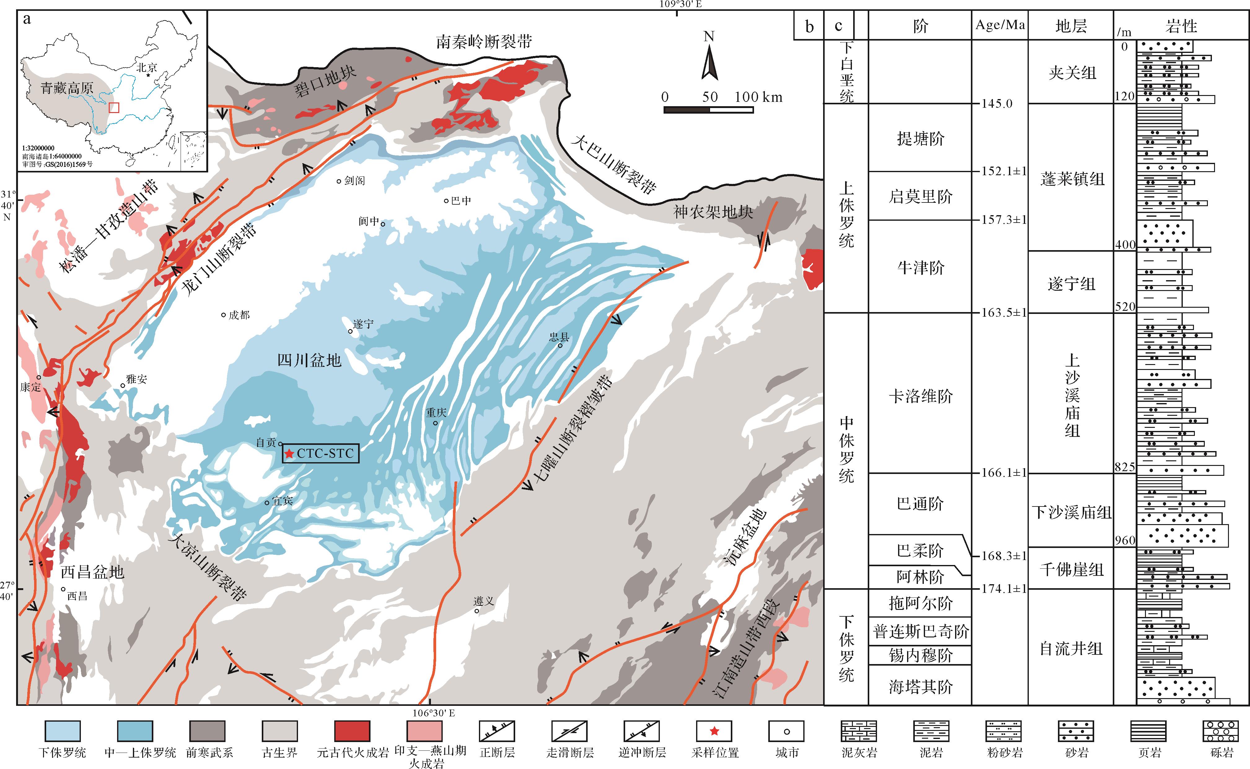
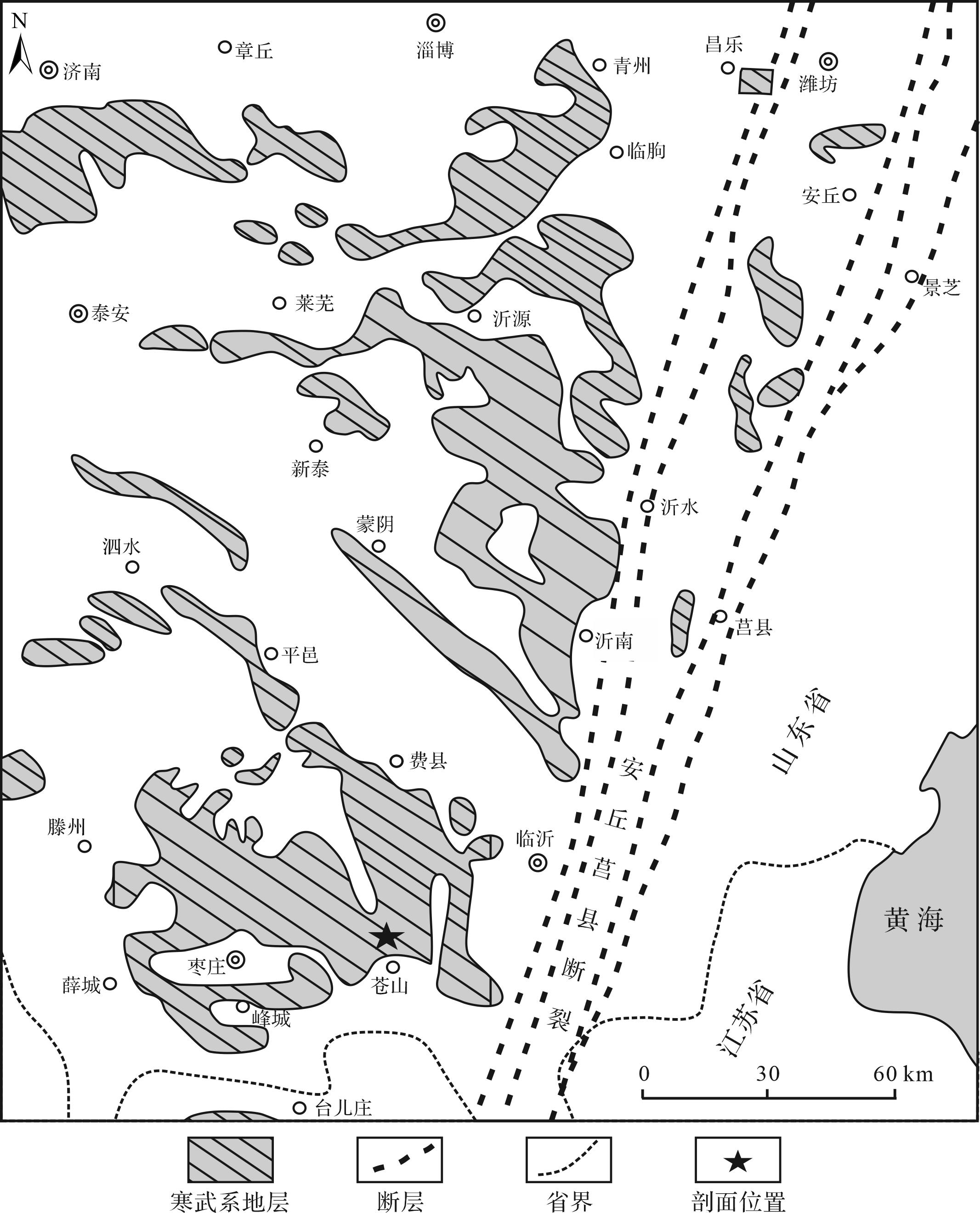
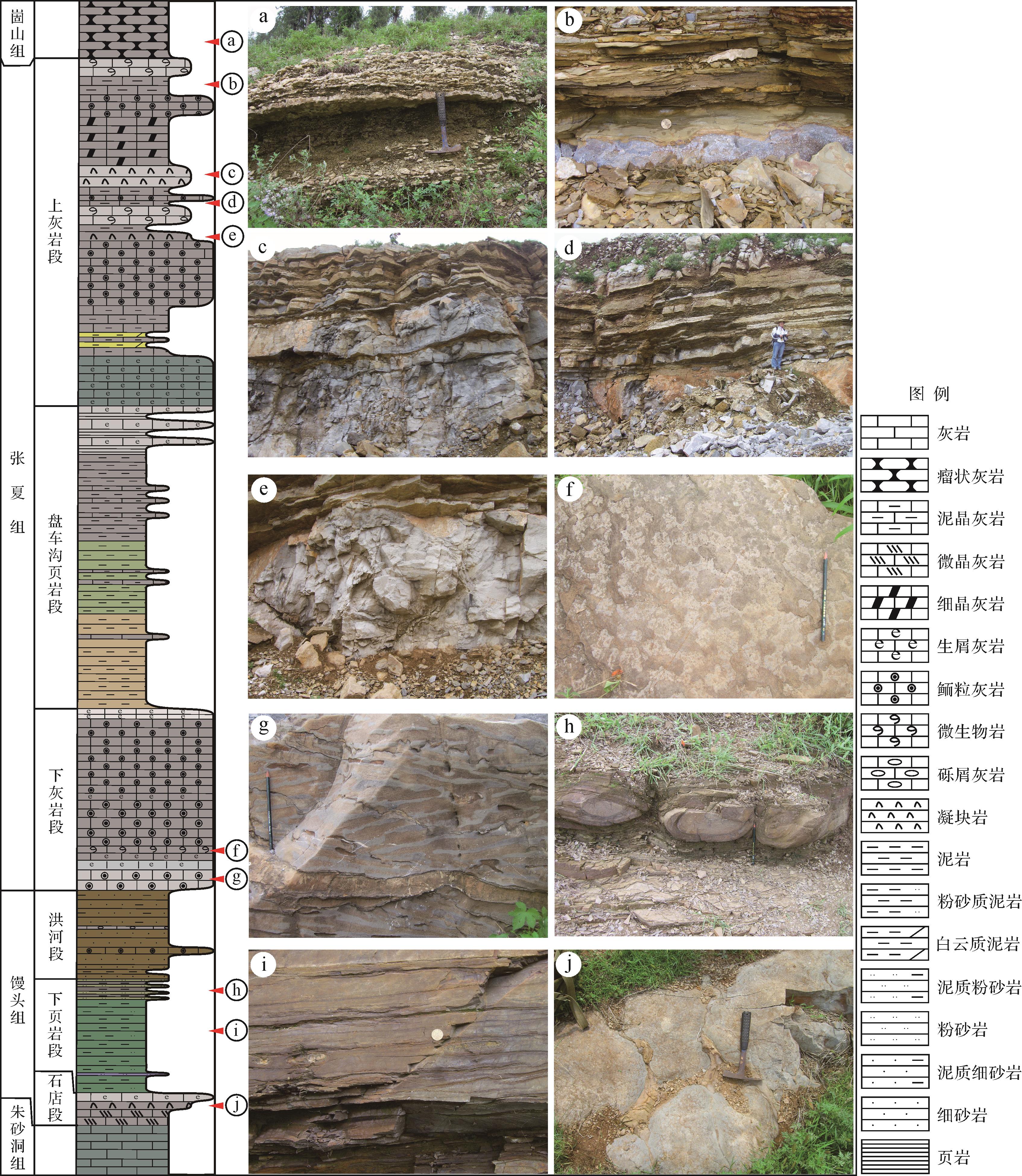
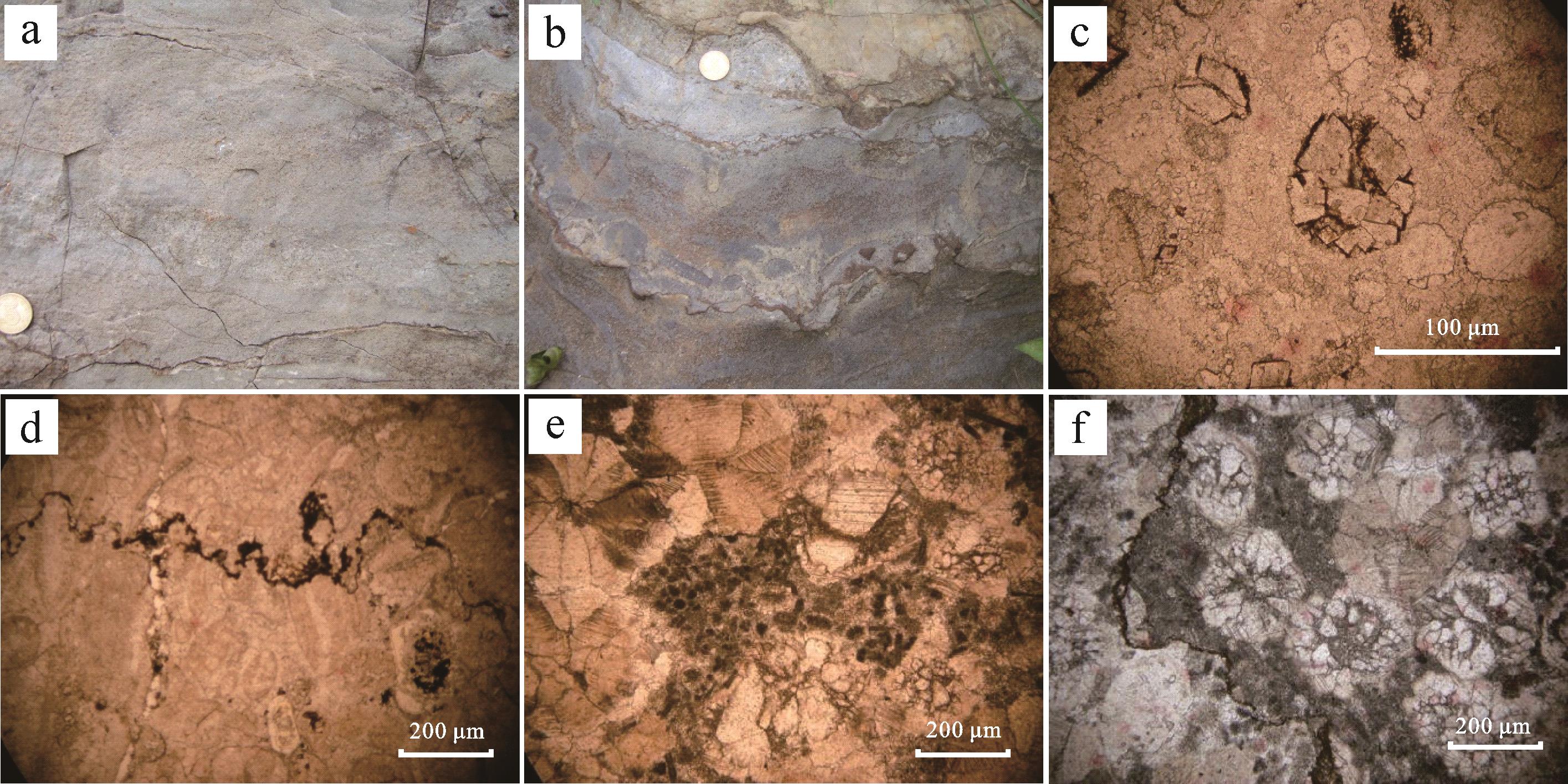
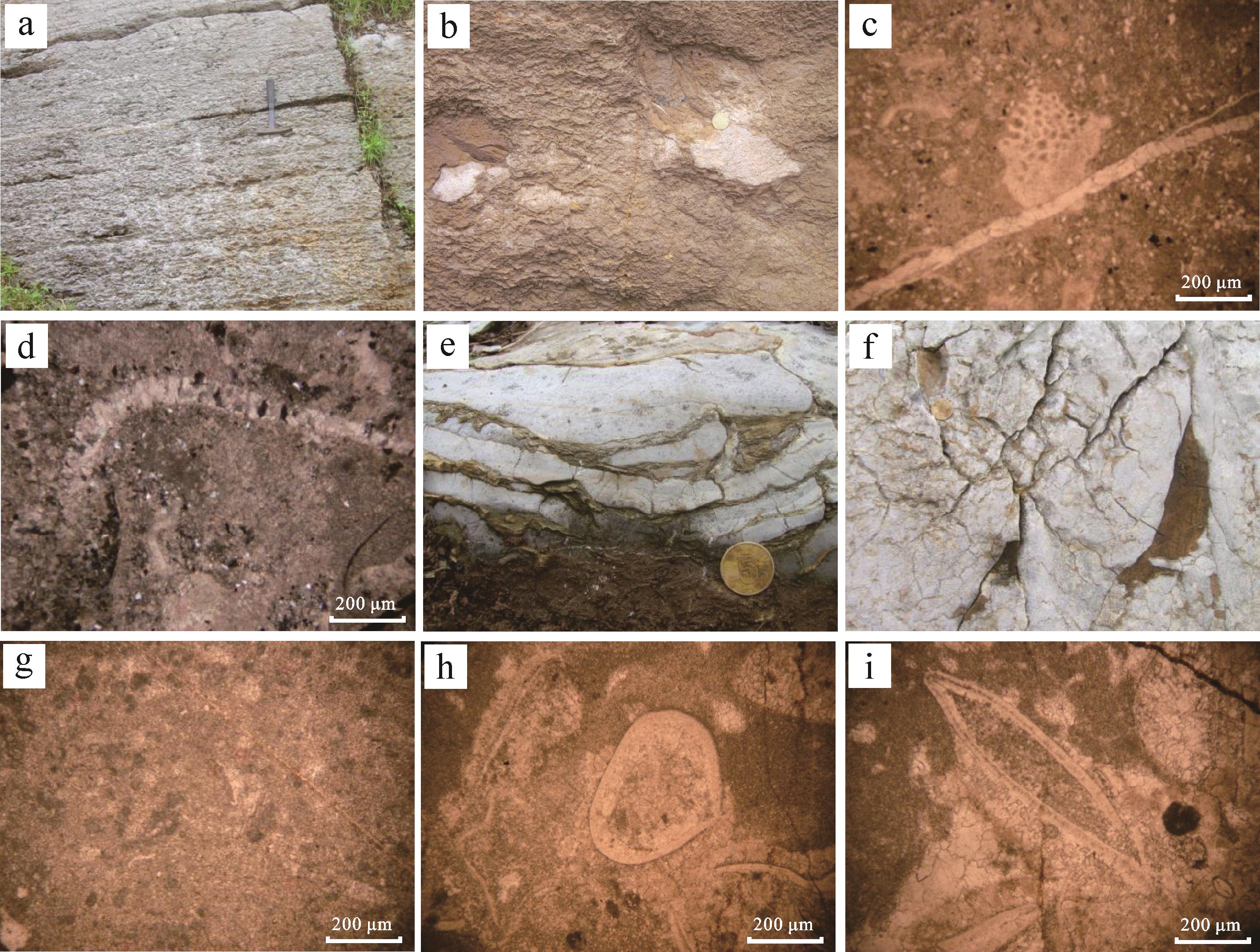
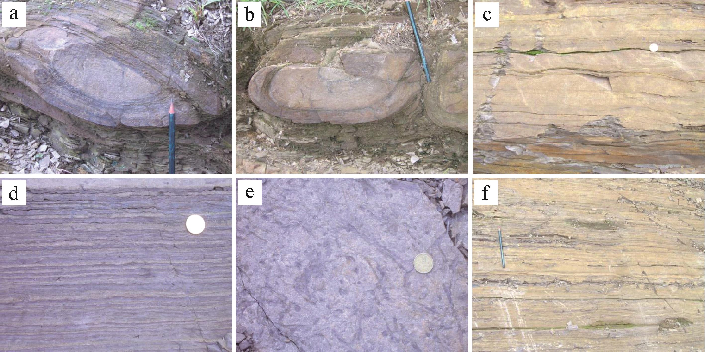
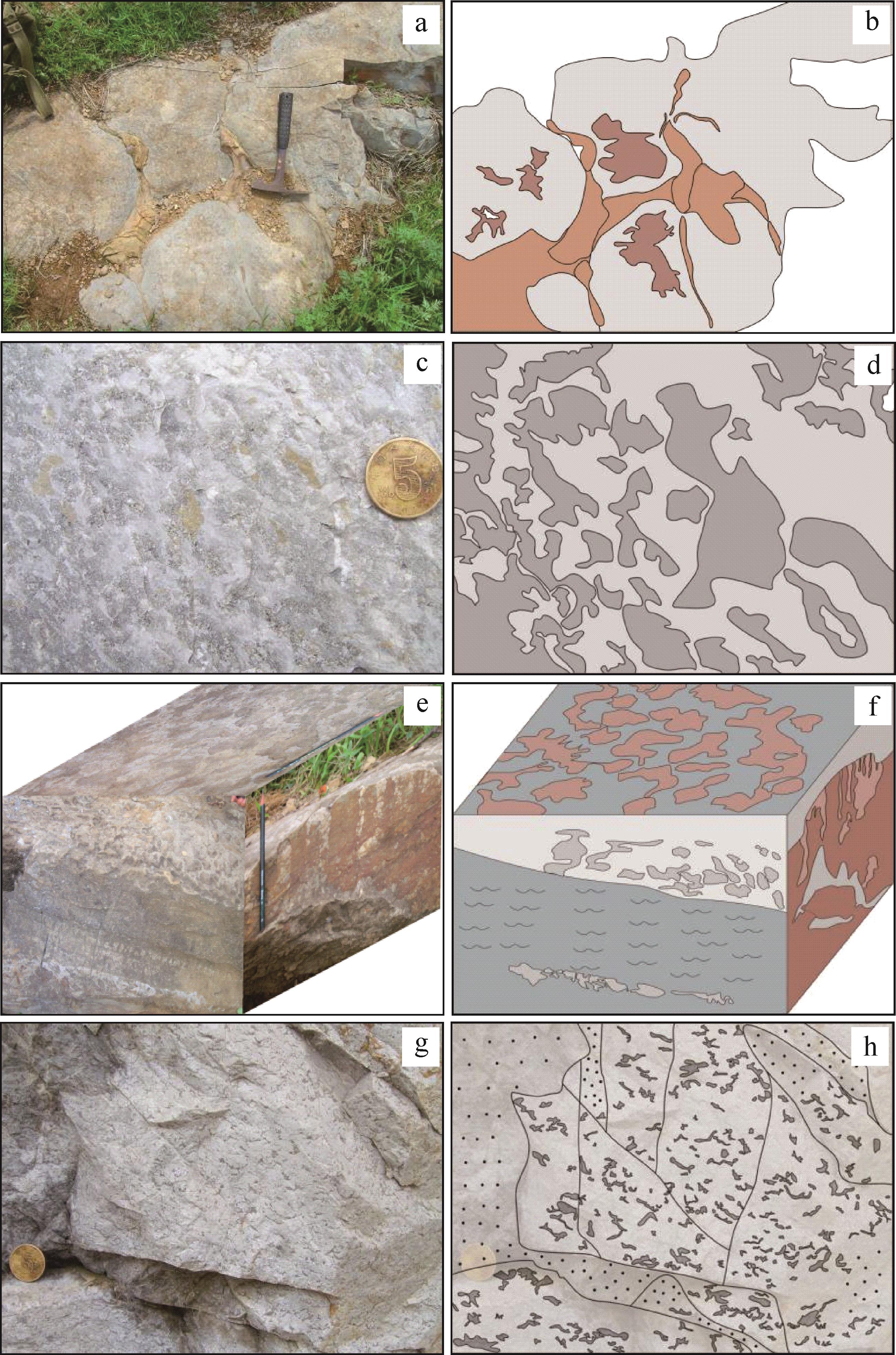
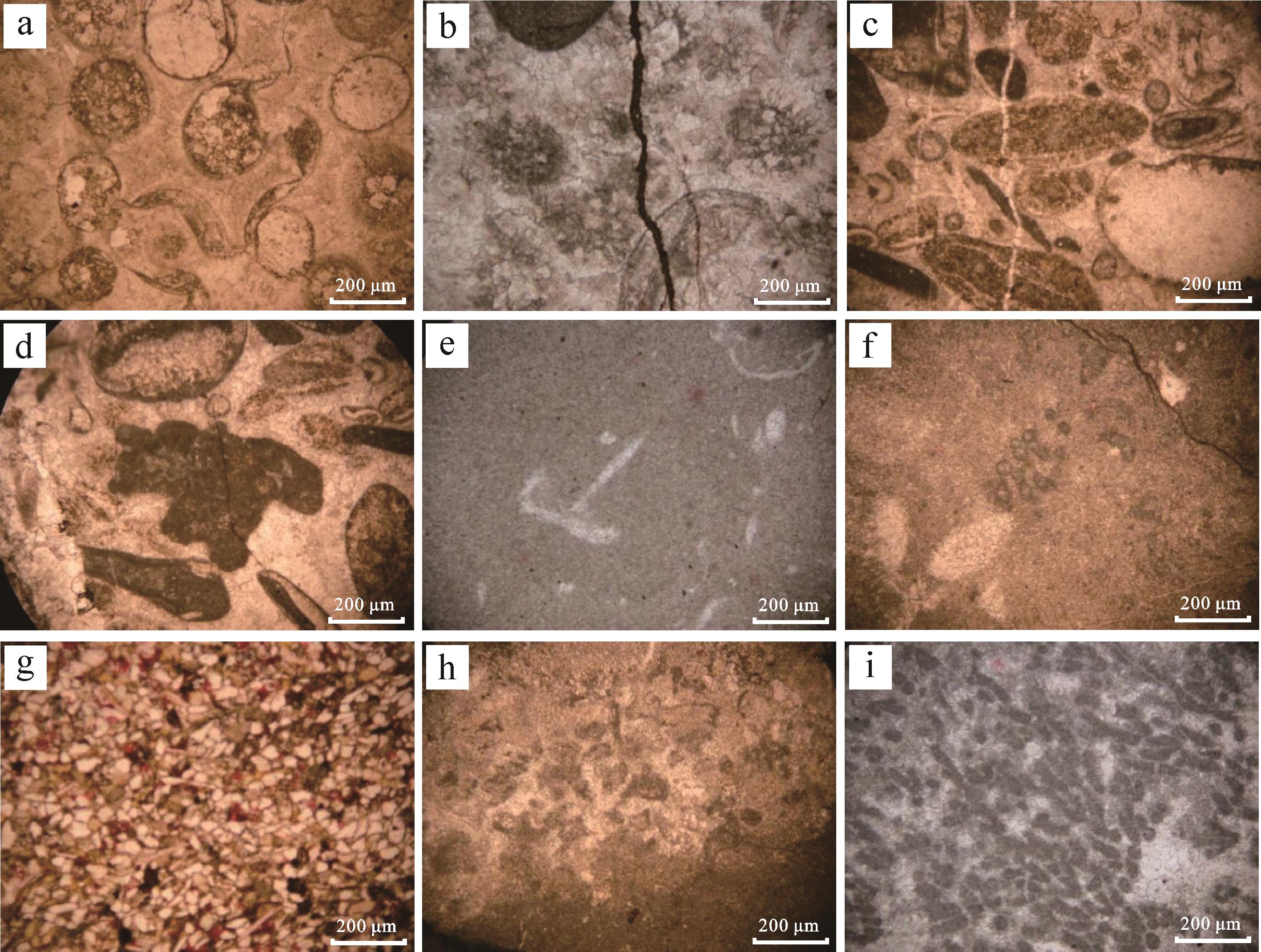
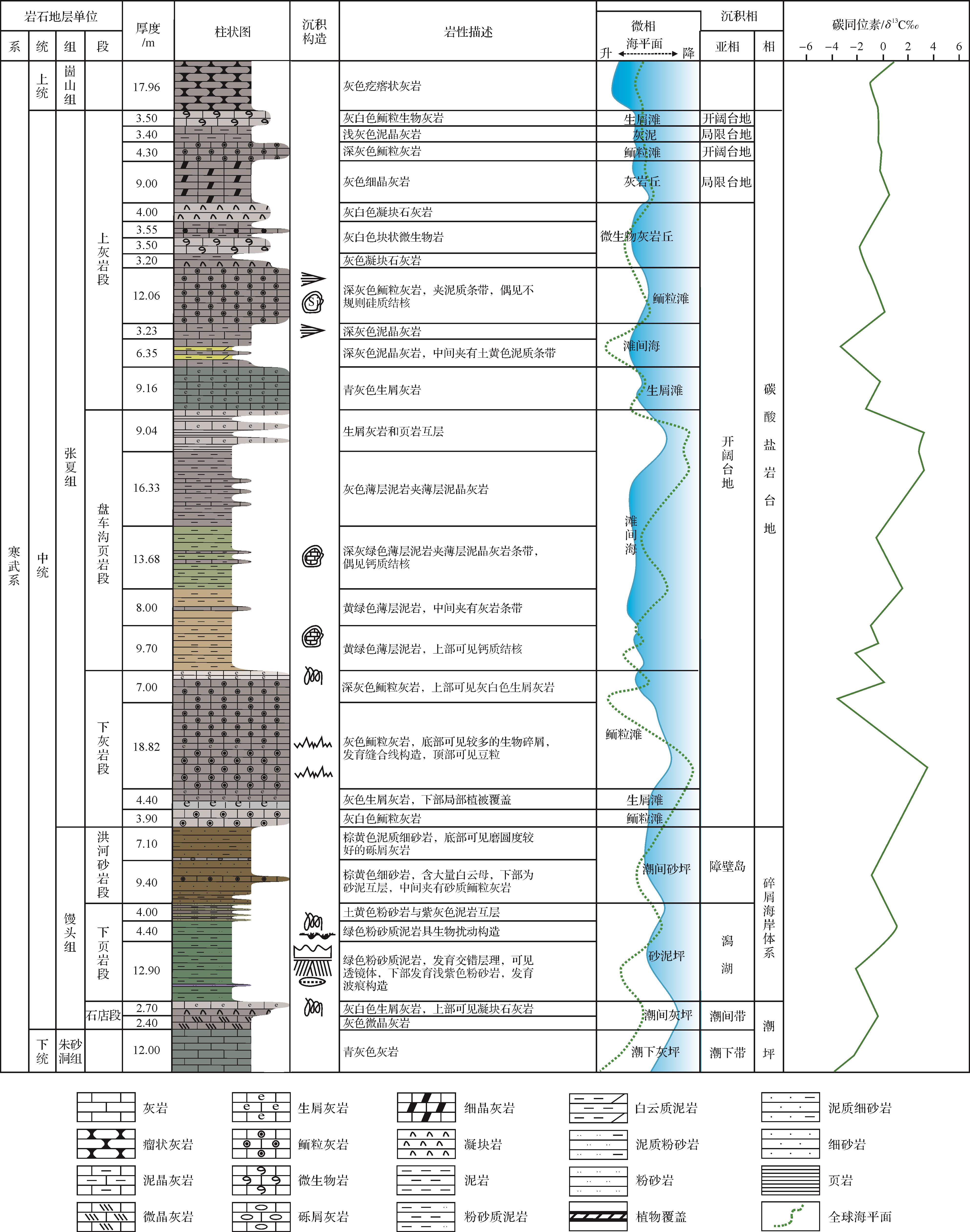
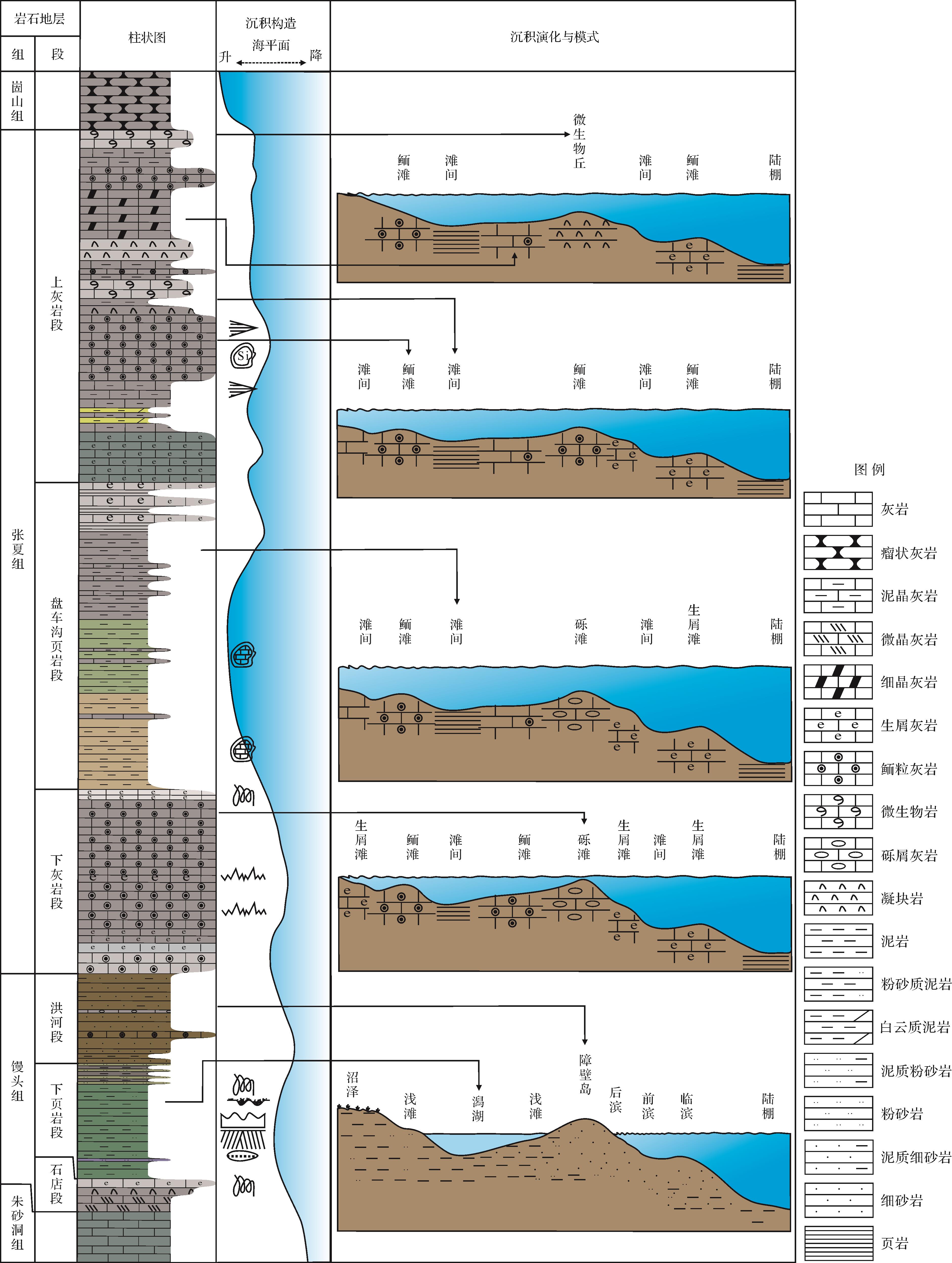
For epeiric-sea shallow water deposition, small-scale fluctuations of sea level cause rapid changes of sedimentary environment and lithofacies. The example of the response of lithofacies characteristics to sea-level fluctuations in this study is the Cambrian Cangshan profile (Shandong province), which has good outcrop conditions and frequent lithofacies changes. The lithological characteristics were analyzed in detail using field observation, section measurement and thin section identification. The area contains seven lithofacies: oolitic limestone, bioclastic limestone, marl, gray sandstone, microbial limestone, shale and sandstone. It is considered that the Mantou Formation in this area mainly developed intertidal zone-barrier island-lagoon deposition. The Zhangxia Formation developed from restricted- and open-platform deposition; and experienced stronger hydrodynamic conditions than the Mantou Formation, with cyclical changes of water energy, depth, light and clarity affecting the growth of microorganisms and the characteristics of microbial rocks. The frequent changes of lithofacies reflect the vertical sea-level fluctuation and sedimentary environment. The open platform dominated in the late period of rising or high sea level, with a high-energy facies zone conducive to the development of oolitic limestone and bioclastic limestone deposits and a low-energy zone below the tide level of the open platform that was conducive to the development of microbial limestone hills and keloid limestone. In the early or descending period of sea-level rise, platform and tidal flat sediments dominated shallow-water deposits, developing more mud limestone and argillaceous limestone. The frequent changes in hydrodynamic conditions on the tidal-flat environment resulted in the development of many sedimentary facies types, including bioclastic limestone, mud limestone, shale and sandstone.
For epeiric-sea shallow water deposition, small-scale fluctuations of sea level cause rapid changes of sedimentary environment and lithofacies. The example of the response of lithofacies characteristics to sea-level fluctuations in this study is the Cambrian Cangshan profile (Shandong province), which has good outcrop conditions and frequent lithofacies changes. The lithological characteristics were analyzed in detail using field observation, section measurement and thin section identification. The area contains seven lithofacies: oolitic limestone, bioclastic limestone, marl, gray sandstone, microbial limestone, shale and sandstone. It is considered that the Mantou Formation in this area mainly developed intertidal zone-barrier island-lagoon deposition. The Zhangxia Formation developed from restricted- and open-platform deposition; and experienced stronger hydrodynamic conditions than the Mantou Formation, with cyclical changes of water energy, depth, light and clarity affecting the growth of microorganisms and the characteristics of microbial rocks. The frequent changes of lithofacies reflect the vertical sea-level fluctuation and sedimentary environment. The open platform dominated in the late period of rising or high sea level, with a high-energy facies zone conducive to the development of oolitic limestone and bioclastic limestone deposits and a low-energy zone below the tide level of the open platform that was conducive to the development of microbial limestone hills and keloid limestone. In the early or descending period of sea-level rise, platform and tidal flat sediments dominated shallow-water deposits, developing more mud limestone and argillaceous limestone. The frequent changes in hydrodynamic conditions on the tidal-flat environment resulted in the development of many sedimentary facies types, including bioclastic limestone, mud limestone, shale and sandstone.
2023, 41(4): 1054-1066.
doi: 10.14027/j.issn.1000-0550.2021.168
Abstract:
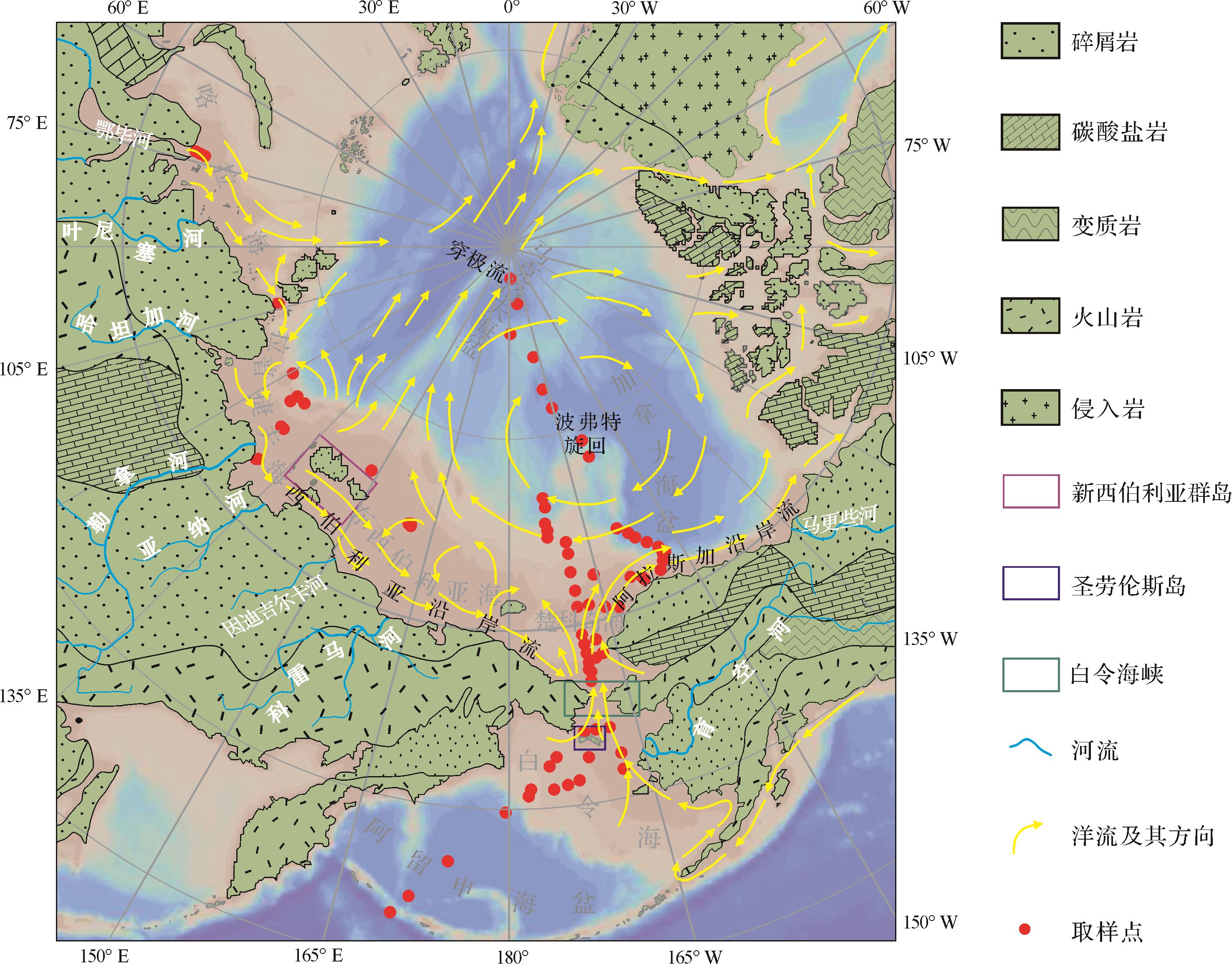
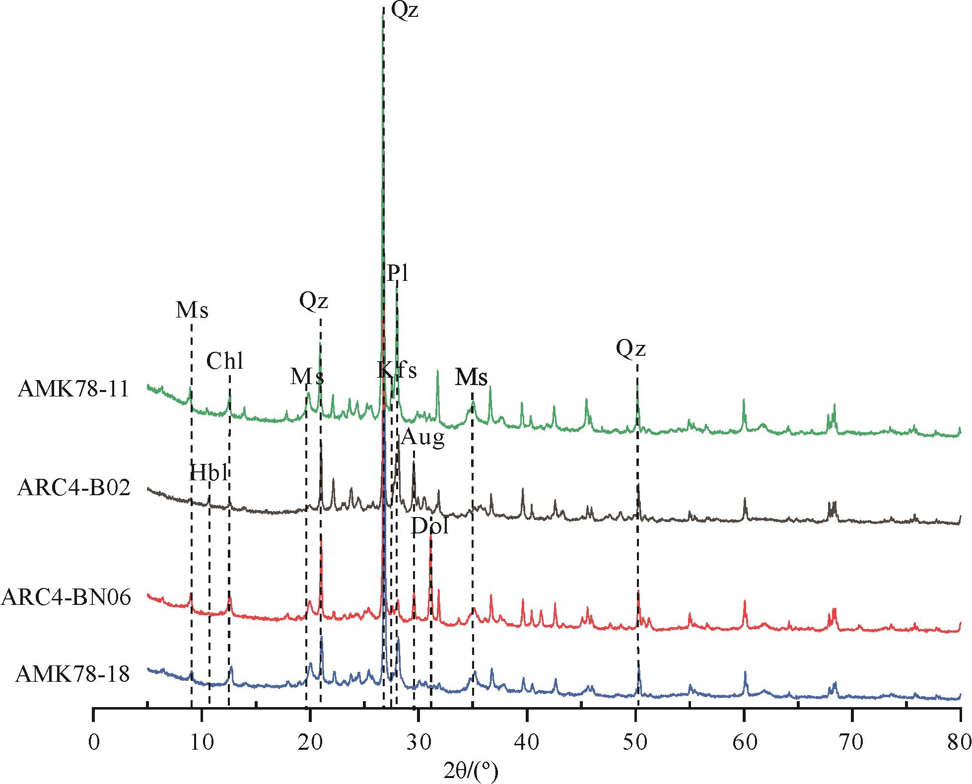
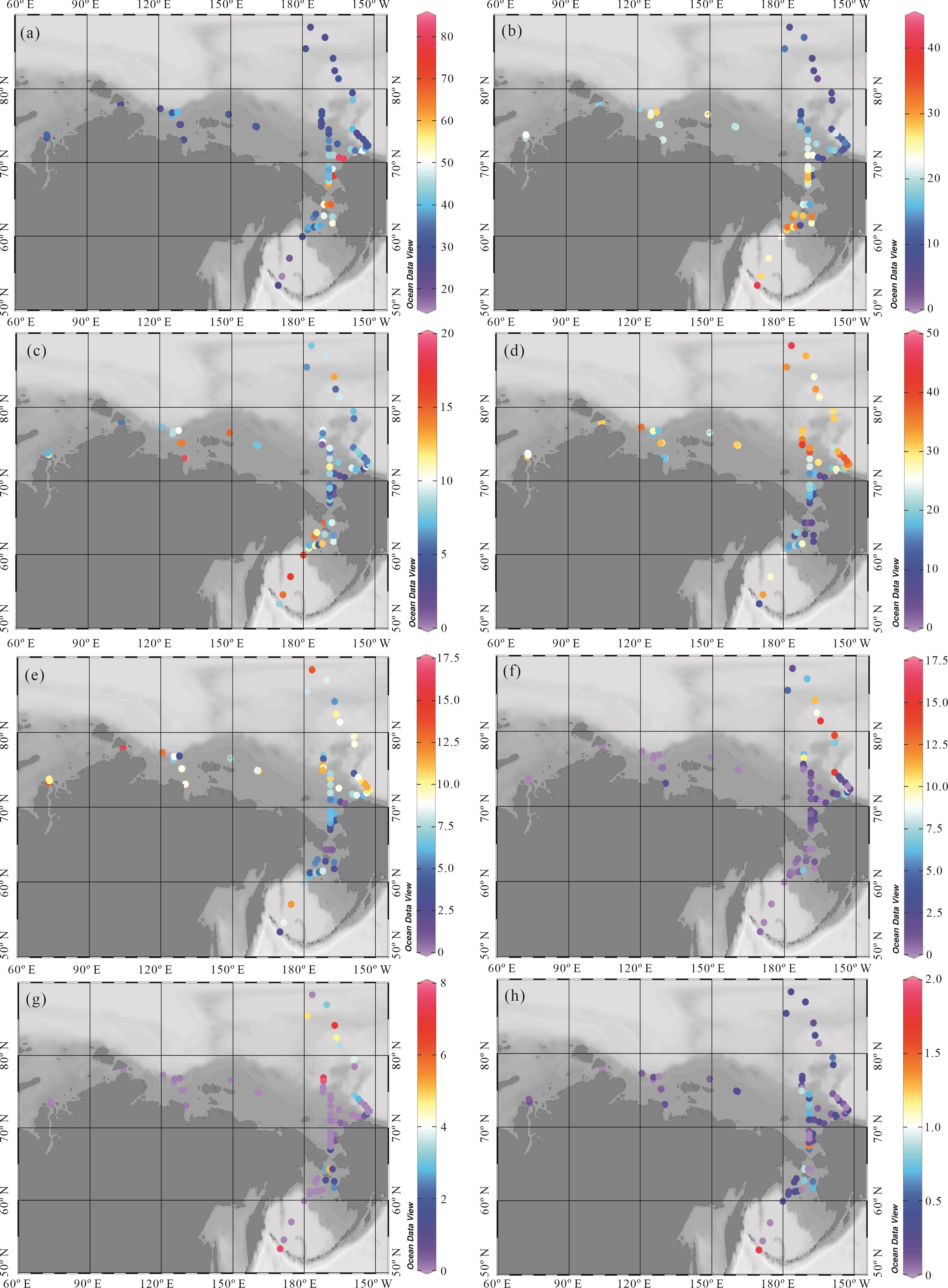
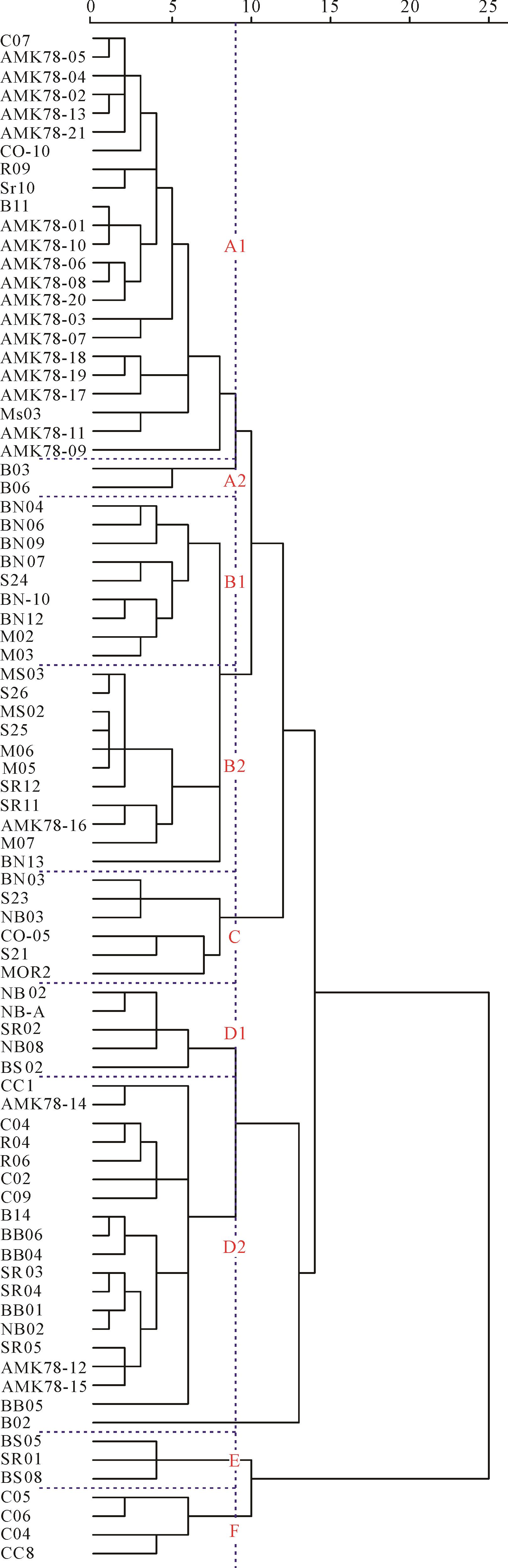
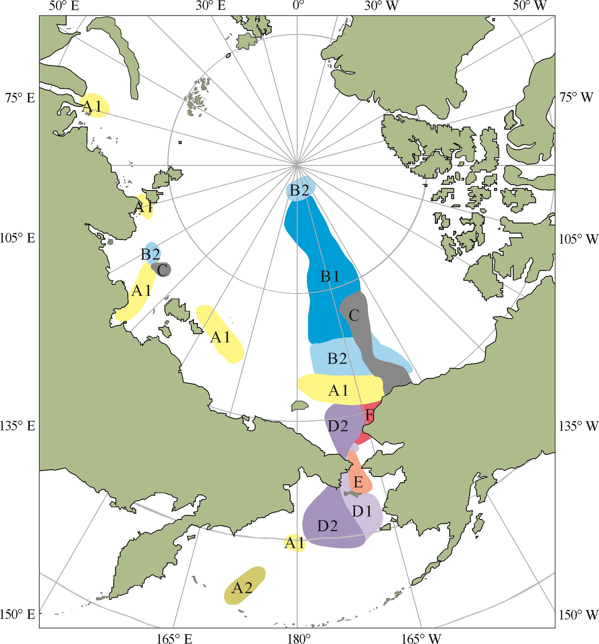
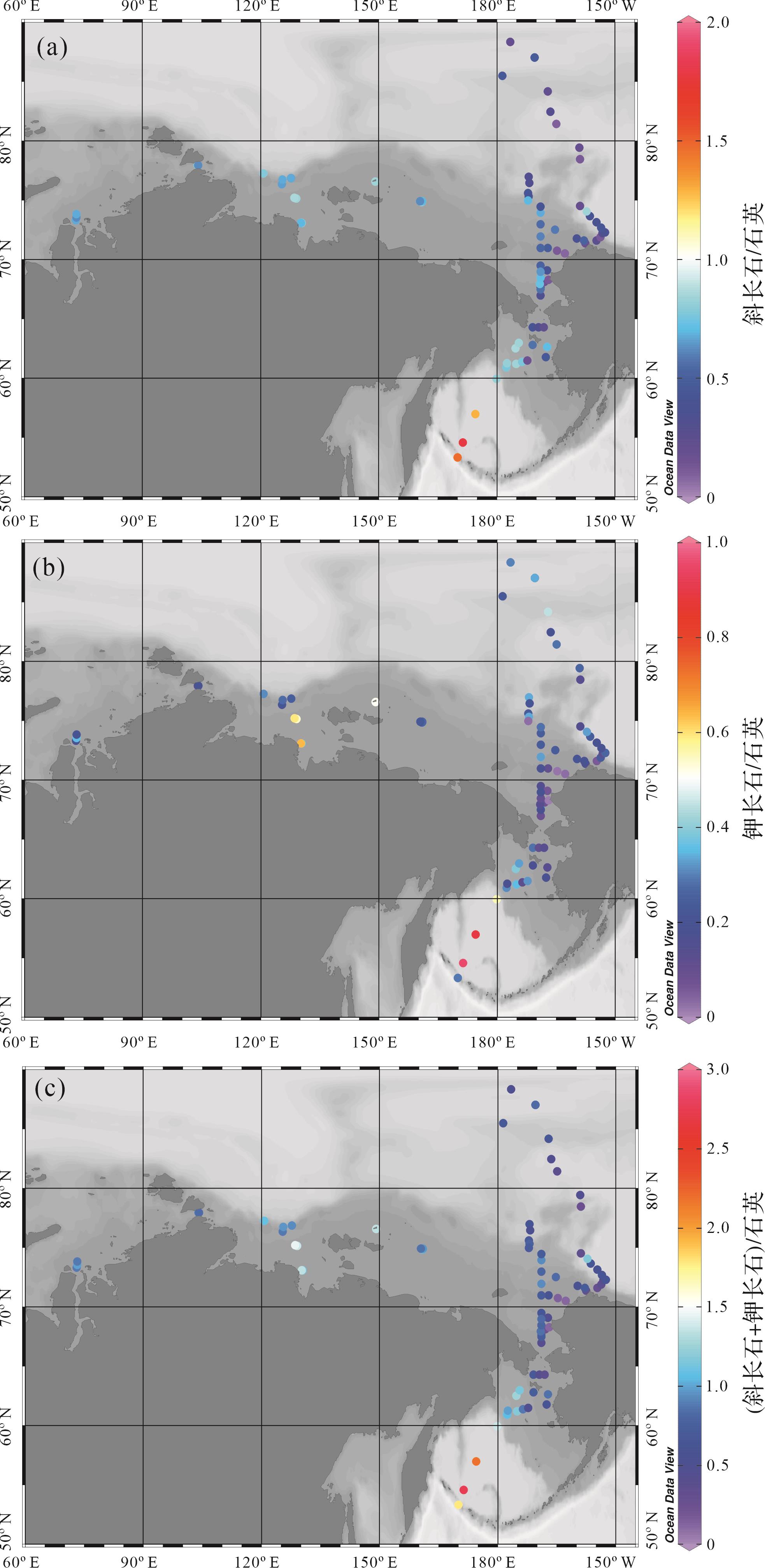
X-Ray Diffraction (XRD) bulk mineral analysis was conducted for 82 surface sediments from the western Arctic Ocean and Bering Sea, with an attempt to elucidate the distribution patterns of minerals, as well as the provenance and transportation of the surface sediments in the Arctic region. The results show that quartz, plagioclase feldspar, potassium feldspar, mica, and chlorite are dominant minerals in sediments, and dolomite, pyroxene, amphibole occur in sediments regionally. The Laptev Sea receives sediments from the Siberian and granites from the New Siberian Islands, several of which are transported to the Canadian Basin by sea ice under the Transpolar Drift and Beaufort Gyre. Sediments rich in quartz in the offshore of Chukchi Sea result from coastal erosion and transportation by local rivers. The Yukon River transport larger amounts of sediments rich in minerals, such as feldspar, mica, chlorite, etc., from the Alaska continent into the Bering Sea shelf, and a portion of it was further transported to the Chukchi Sea and Canadian Basin by currents. The dolomite occurring in the Canadian Basin is from the Arctic Islands and the watershed of the Mackenzie River.
X-Ray Diffraction (XRD) bulk mineral analysis was conducted for 82 surface sediments from the western Arctic Ocean and Bering Sea, with an attempt to elucidate the distribution patterns of minerals, as well as the provenance and transportation of the surface sediments in the Arctic region. The results show that quartz, plagioclase feldspar, potassium feldspar, mica, and chlorite are dominant minerals in sediments, and dolomite, pyroxene, amphibole occur in sediments regionally. The Laptev Sea receives sediments from the Siberian and granites from the New Siberian Islands, several of which are transported to the Canadian Basin by sea ice under the Transpolar Drift and Beaufort Gyre. Sediments rich in quartz in the offshore of Chukchi Sea result from coastal erosion and transportation by local rivers. The Yukon River transport larger amounts of sediments rich in minerals, such as feldspar, mica, chlorite, etc., from the Alaska continent into the Bering Sea shelf, and a portion of it was further transported to the Chukchi Sea and Canadian Basin by currents. The dolomite occurring in the Canadian Basin is from the Arctic Islands and the watershed of the Mackenzie River.
2023, 41(4): 1067-1079.
doi: 10.14027/j.issn.1000-0550.2022.030
Abstract:
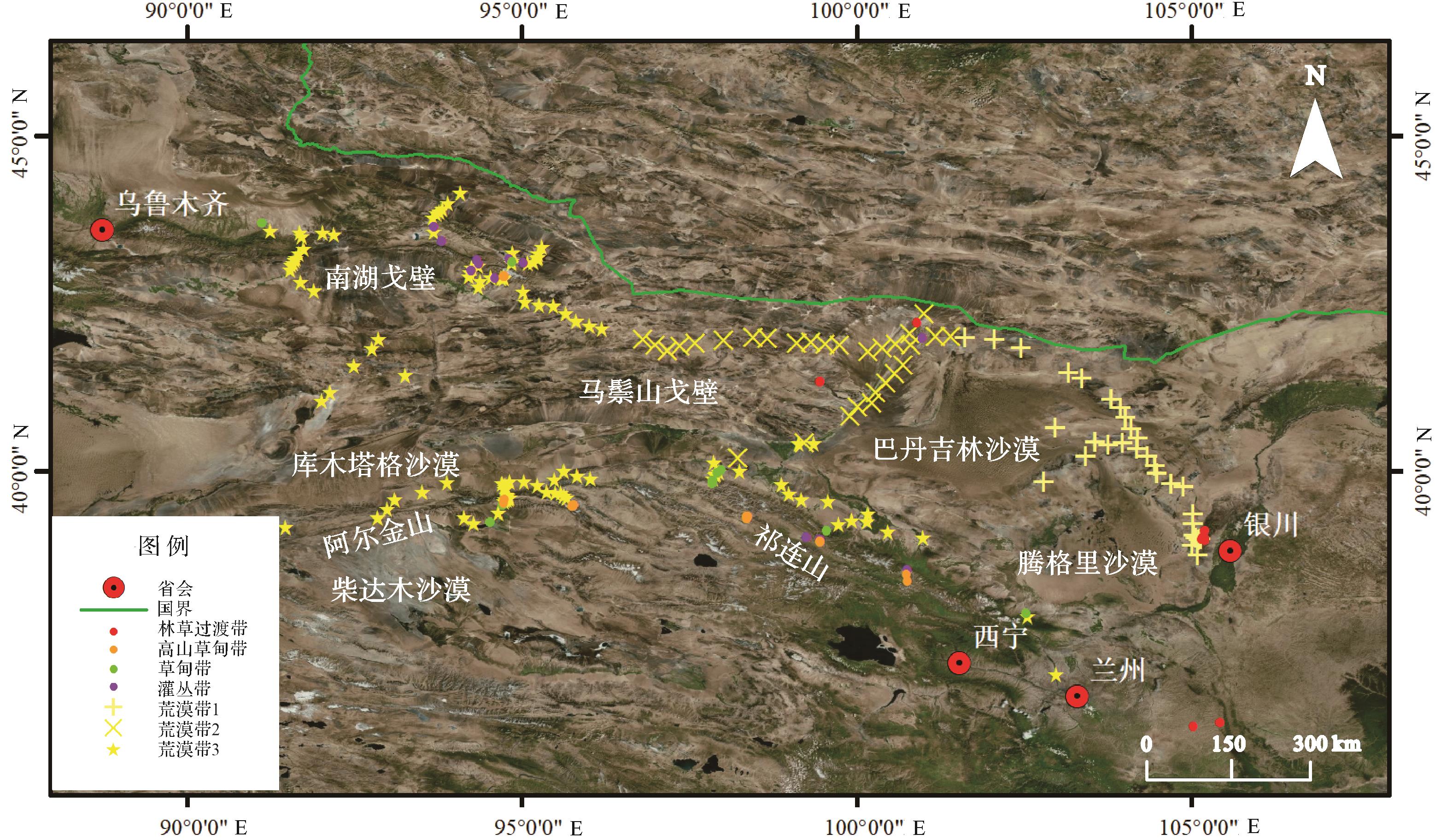
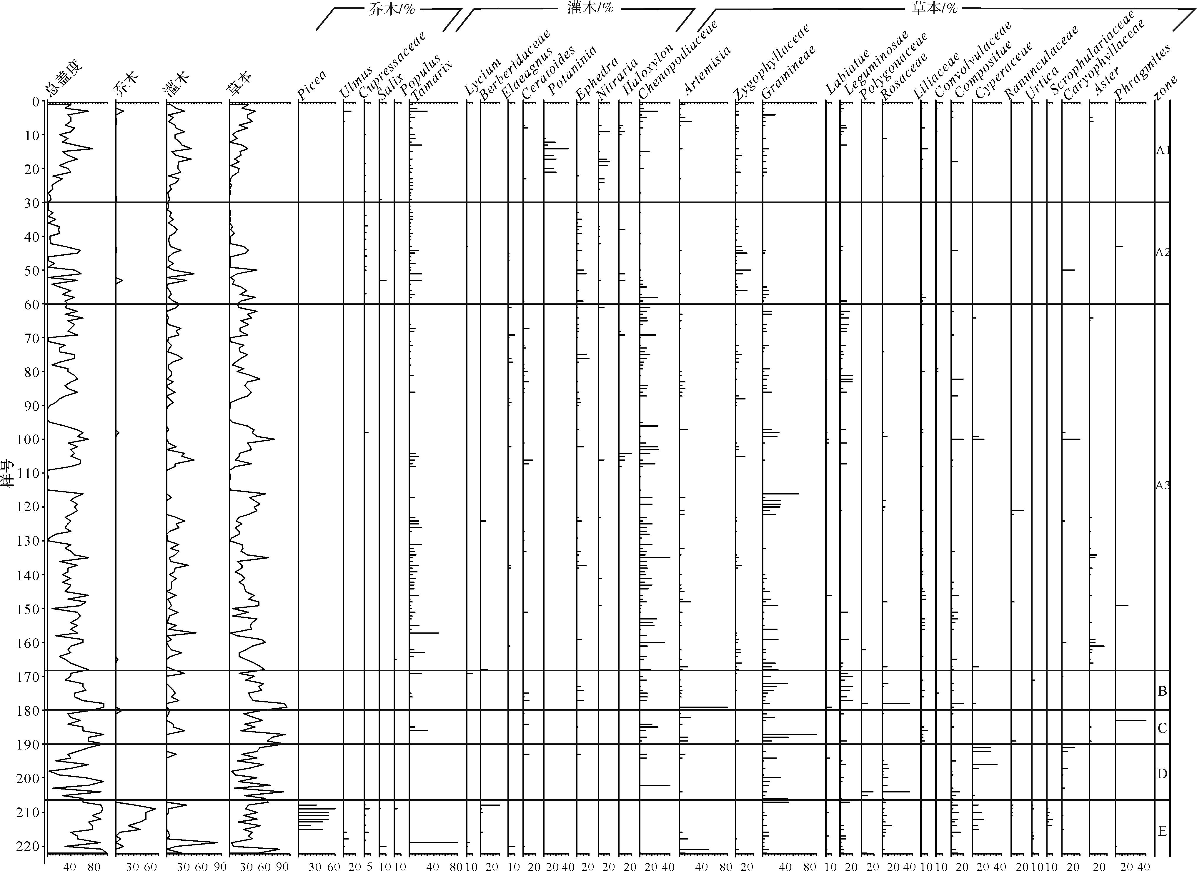
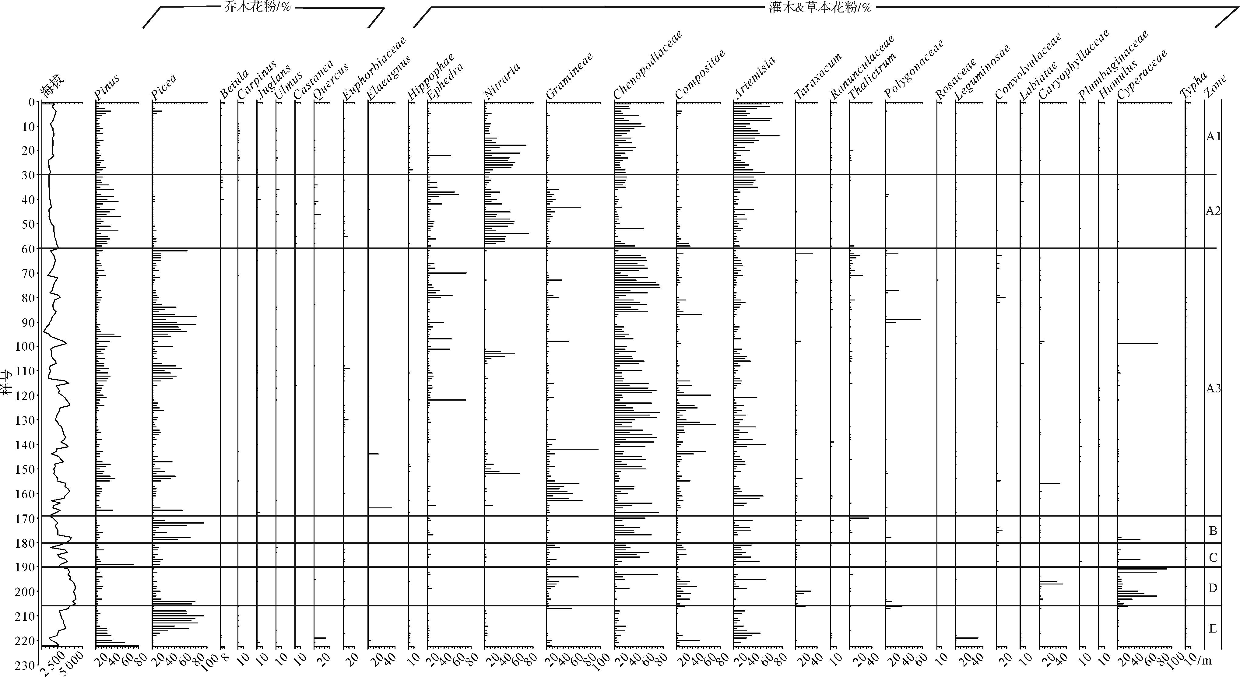
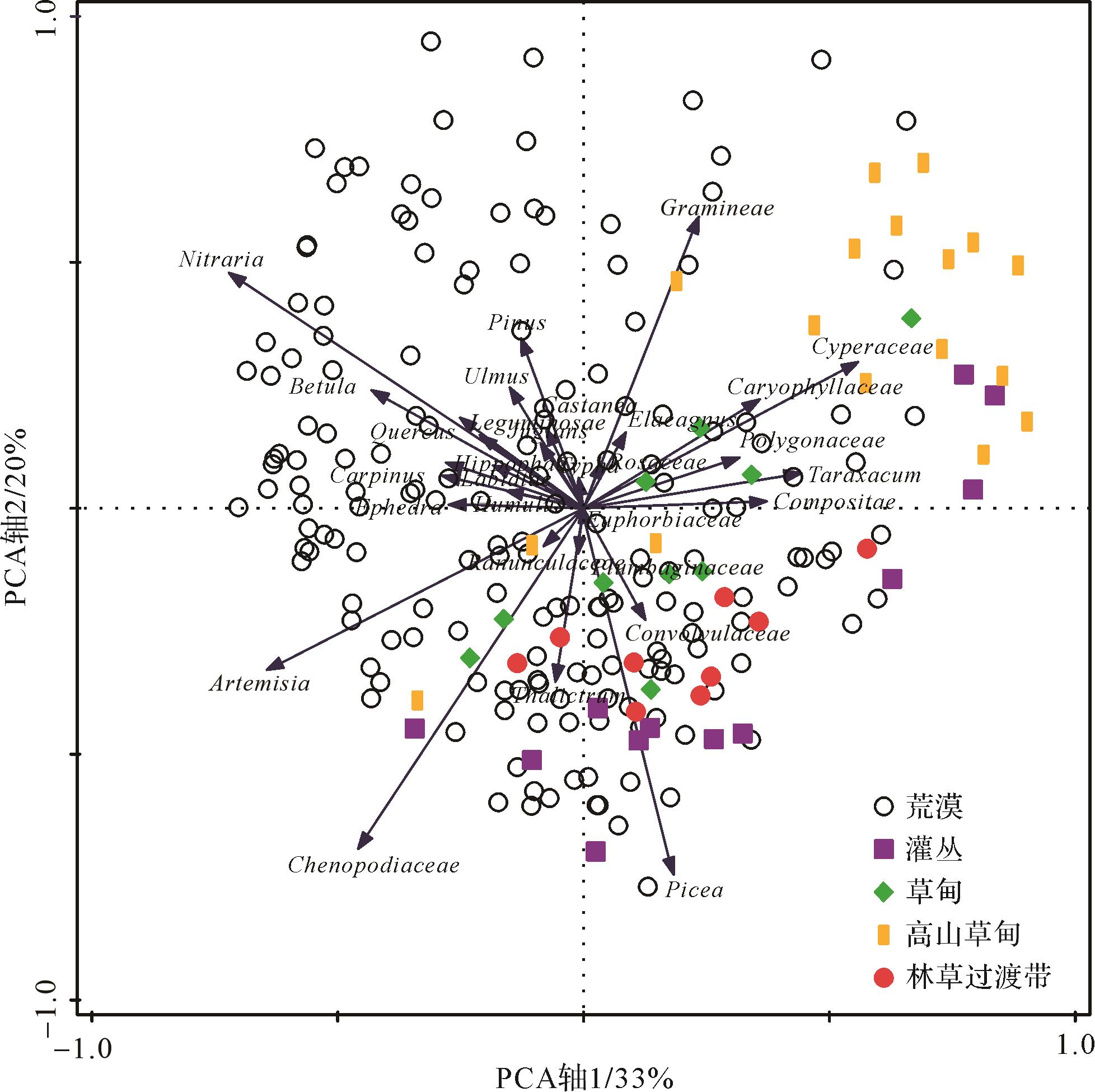
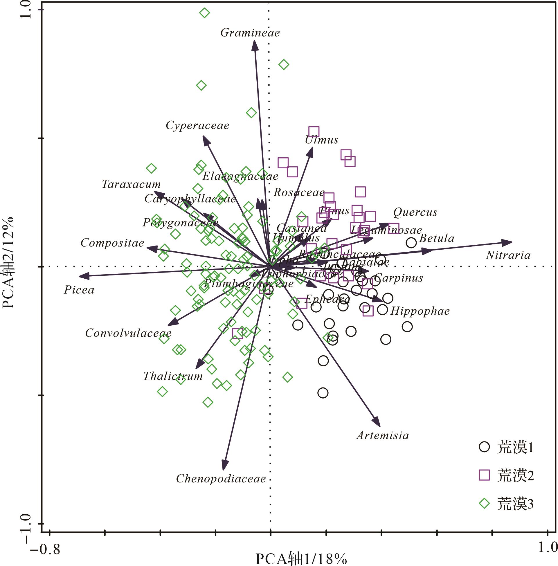
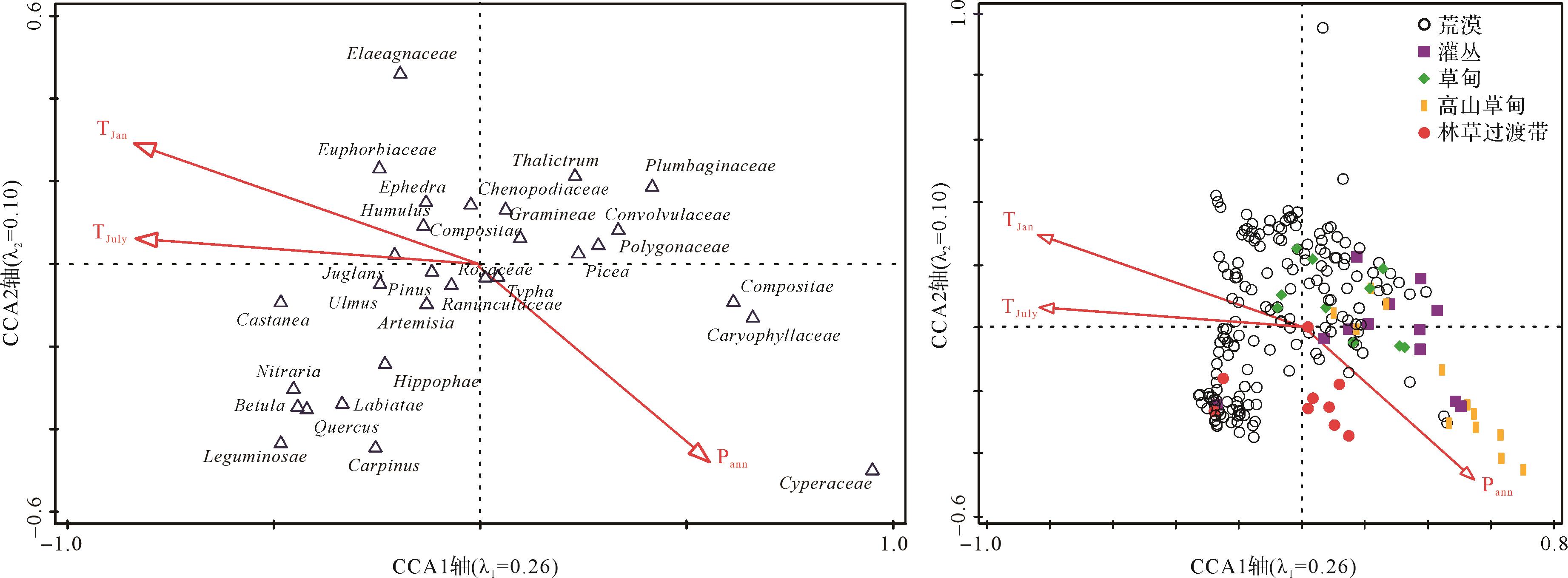
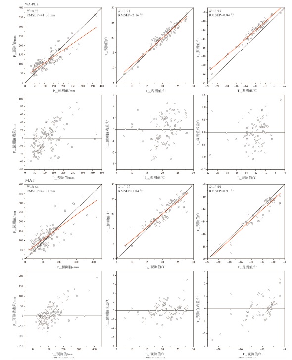
To explore the qualitative and quantitative relationship among modern pollen, vegetation, and climate in the adjacent desert of northwest China, 222 topsoil pollen samples, vegetation sample survey results, and meteorological data were used to perform indicator species, pollen representative, and sequence analyses and paleoclimate quantitative reconstruction. The results show that the topsoil pollen in the adjacent desert area can be divided into three desert subzones, as well as shrub, meadow, alpine meadow, and forest-grass transition zones. The representativeness of pollen from major families and genera in each vegetation zone is low, and that of the same species differs significantly in different regions. The pollen assemblage of desert zone 2 and the shrub zone is not consistent with the vegetation investigation. The pollen assemblage and vegetation survey results of other vegetation belts are in good agreement. Indicator species and sequencing analyses show that except for the poor differentiation of the meadow and alpine meadow zones, there is a good distinction among the different zones, and the three important climate variables in the study area are annual mean precipitation (Pann), July mean temperature (TJuly), and January mean temperature (TJan), among which Pann is the most ideal factor for climate reconstruction. The pollen-climate calibration set is established by using the weighted partial least square (WA-PLS) and modern analogy (MAT) methods. The cross-validation results show that the prediction performance of WA-PLS is better than that of MAT.
To explore the qualitative and quantitative relationship among modern pollen, vegetation, and climate in the adjacent desert of northwest China, 222 topsoil pollen samples, vegetation sample survey results, and meteorological data were used to perform indicator species, pollen representative, and sequence analyses and paleoclimate quantitative reconstruction. The results show that the topsoil pollen in the adjacent desert area can be divided into three desert subzones, as well as shrub, meadow, alpine meadow, and forest-grass transition zones. The representativeness of pollen from major families and genera in each vegetation zone is low, and that of the same species differs significantly in different regions. The pollen assemblage of desert zone 2 and the shrub zone is not consistent with the vegetation investigation. The pollen assemblage and vegetation survey results of other vegetation belts are in good agreement. Indicator species and sequencing analyses show that except for the poor differentiation of the meadow and alpine meadow zones, there is a good distinction among the different zones, and the three important climate variables in the study area are annual mean precipitation (Pann), July mean temperature (TJuly), and January mean temperature (TJan), among which Pann is the most ideal factor for climate reconstruction. The pollen-climate calibration set is established by using the weighted partial least square (WA-PLS) and modern analogy (MAT) methods. The cross-validation results show that the prediction performance of WA-PLS is better than that of MAT.
2023, 41(4): 1080-1096.
doi: 10.14027/j.issn.1000-0550.2021.156
Abstract:
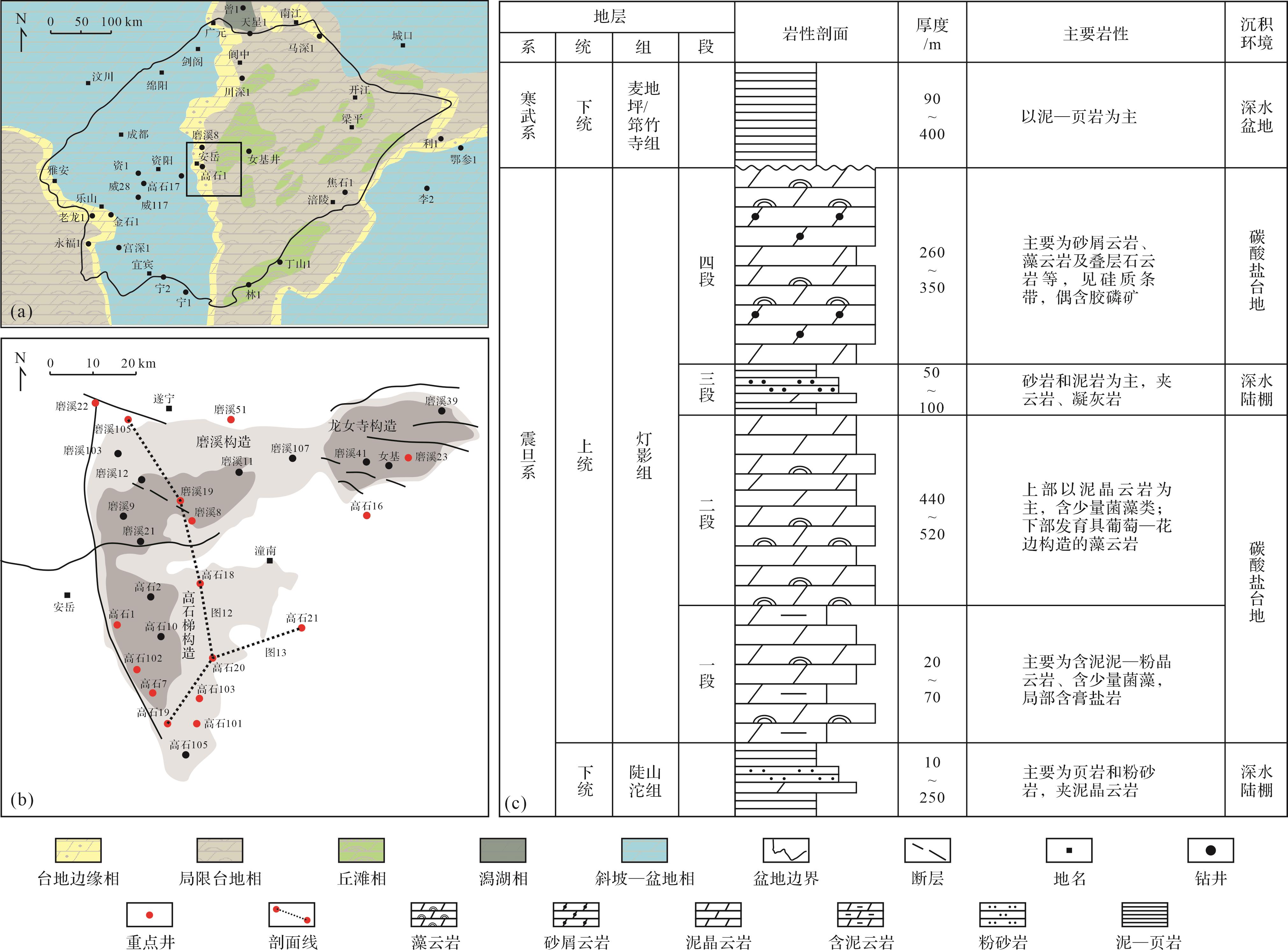
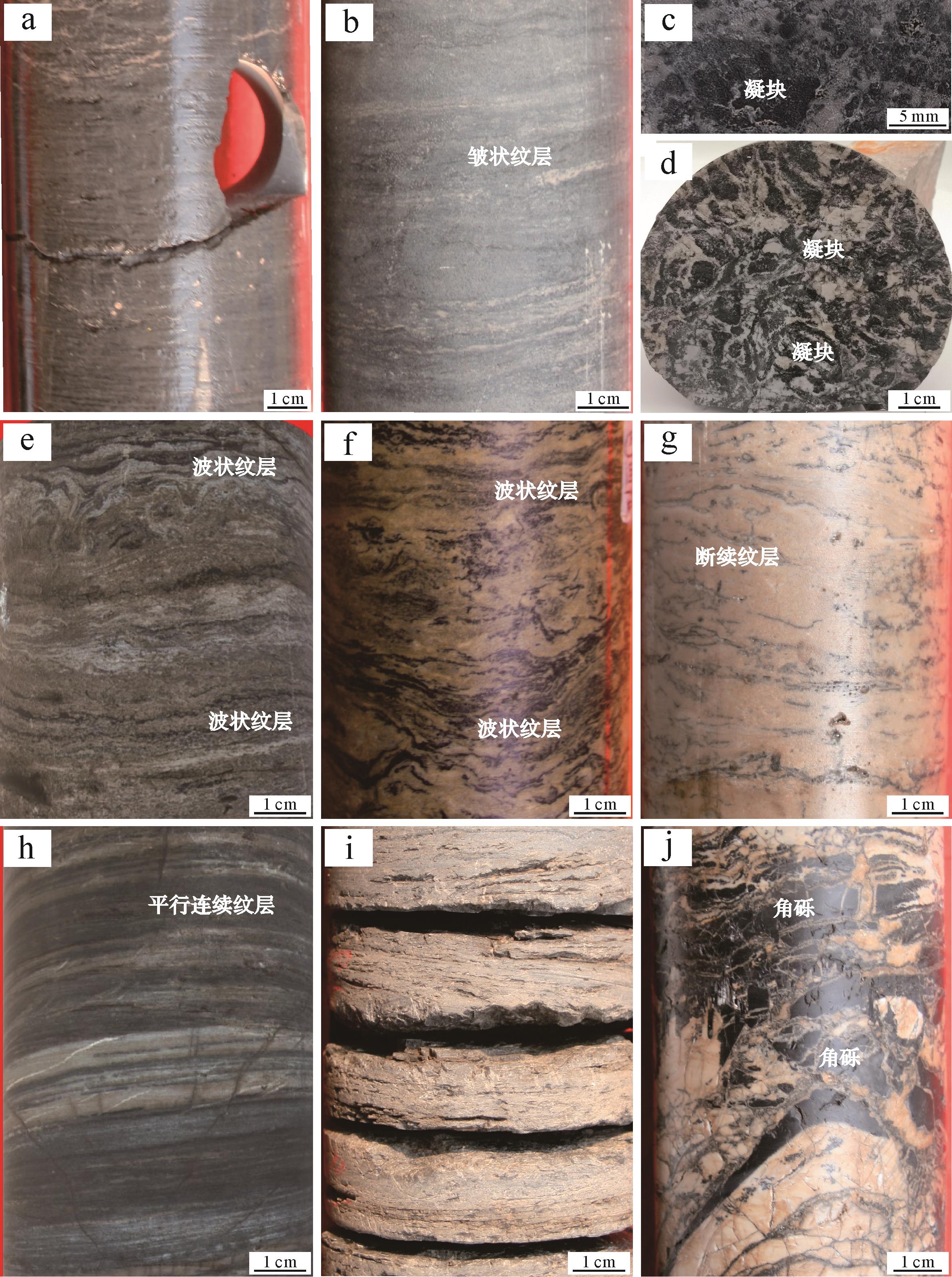
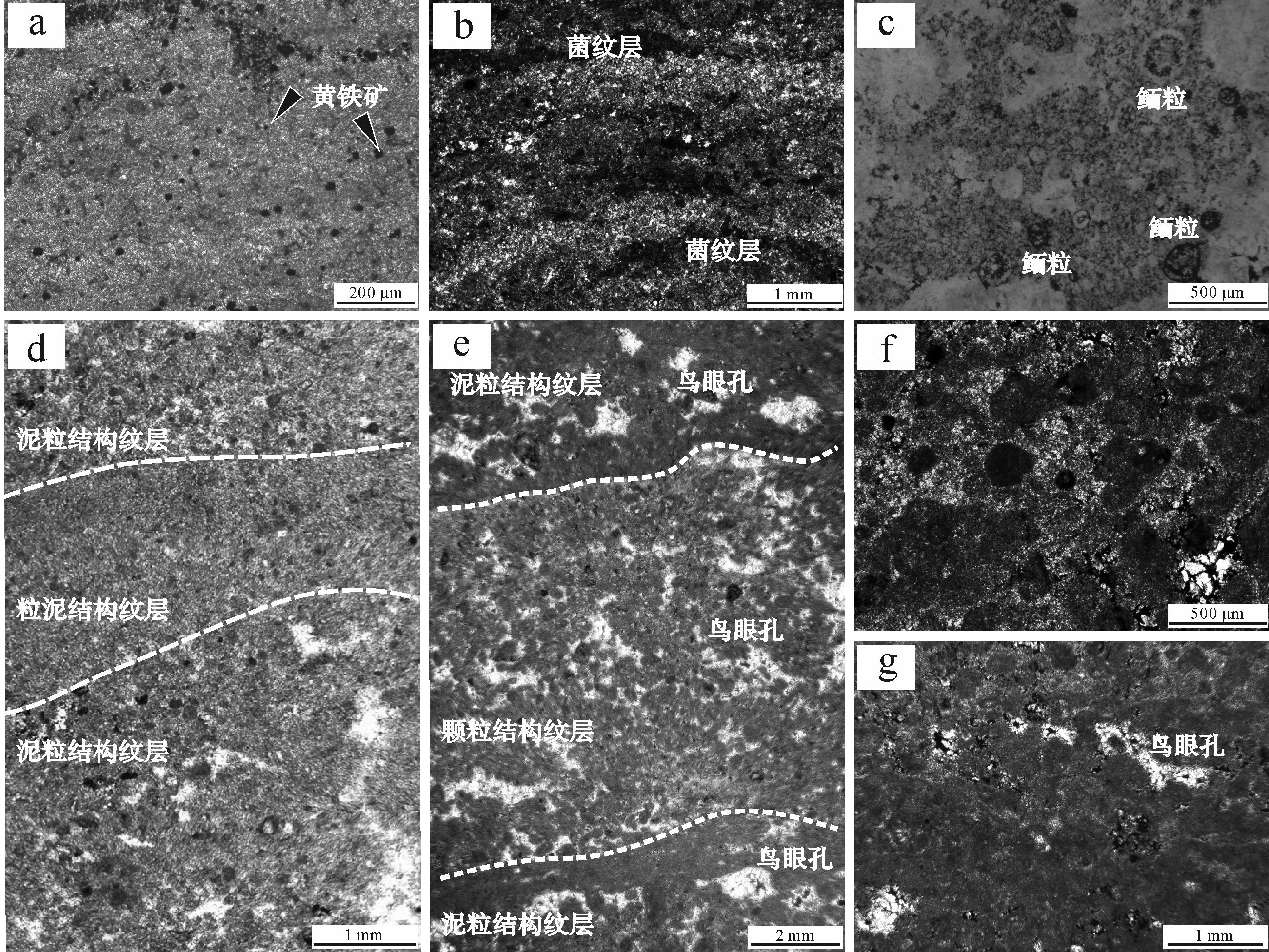
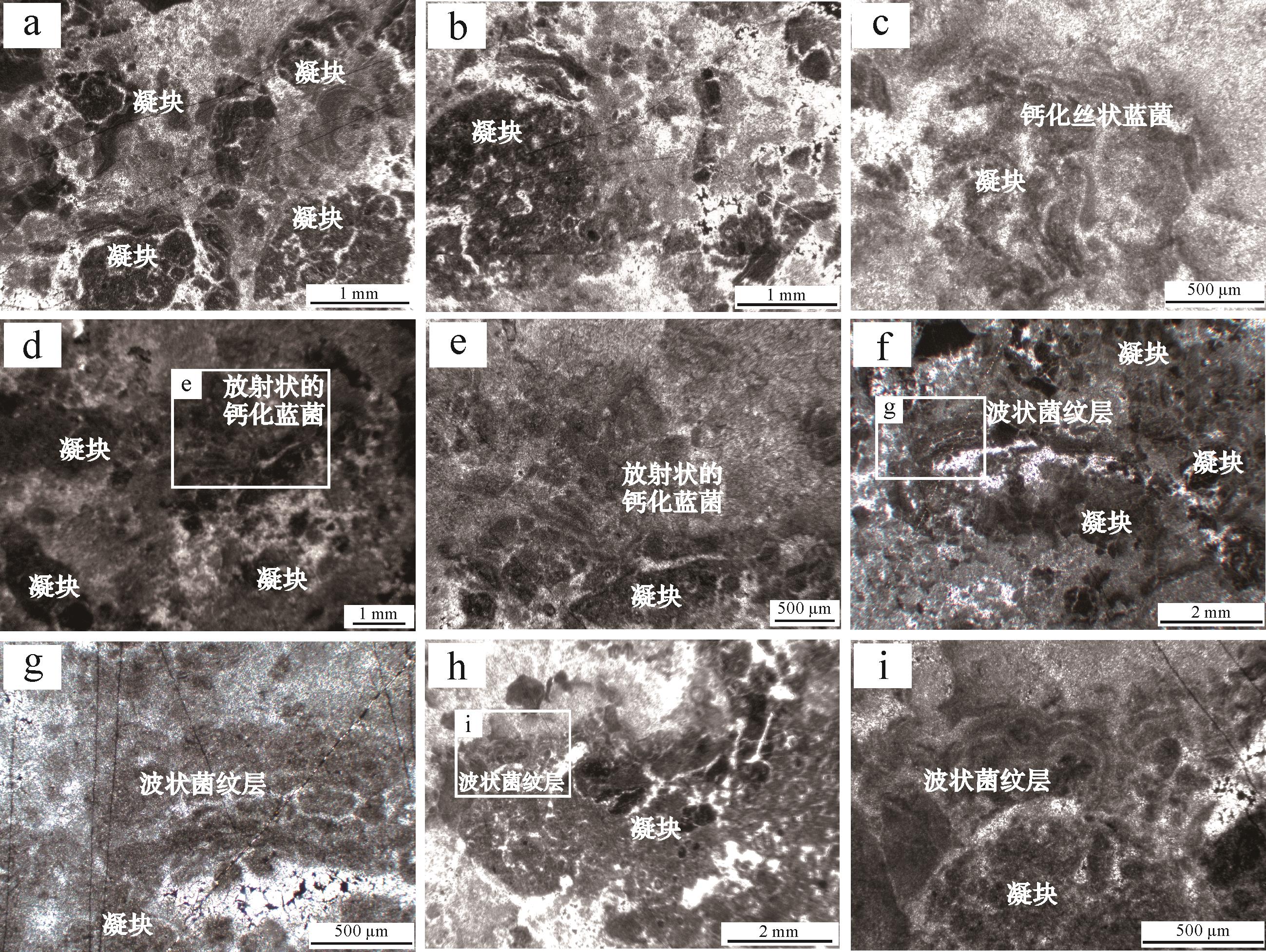
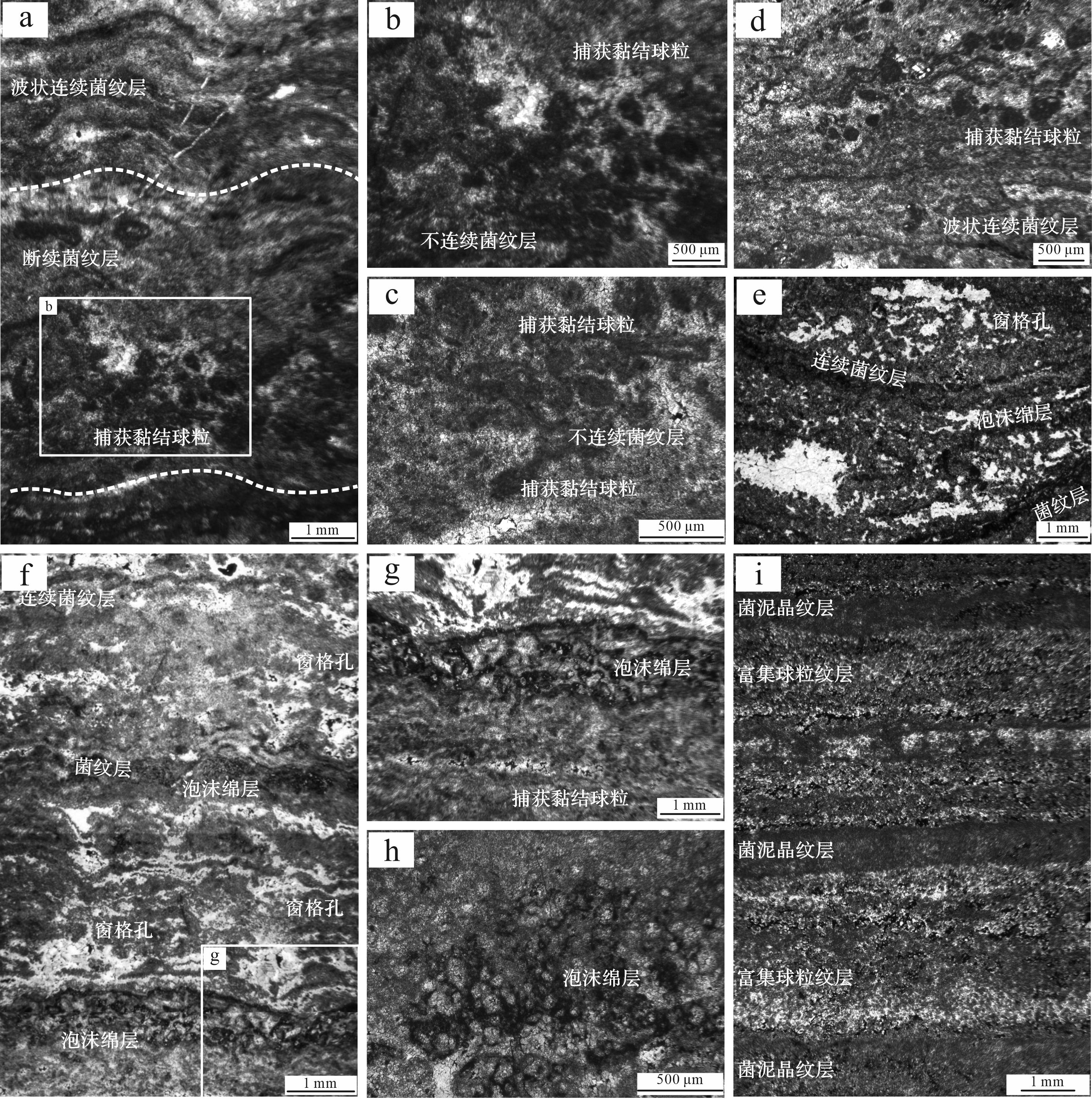
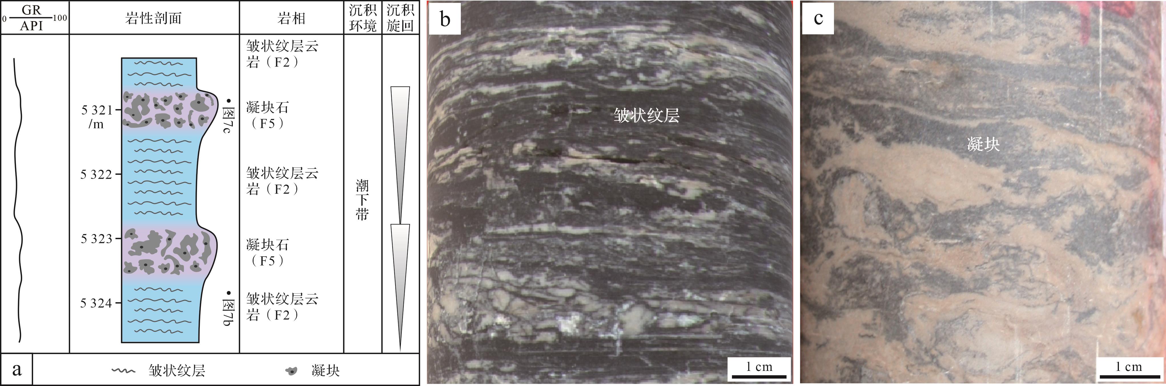
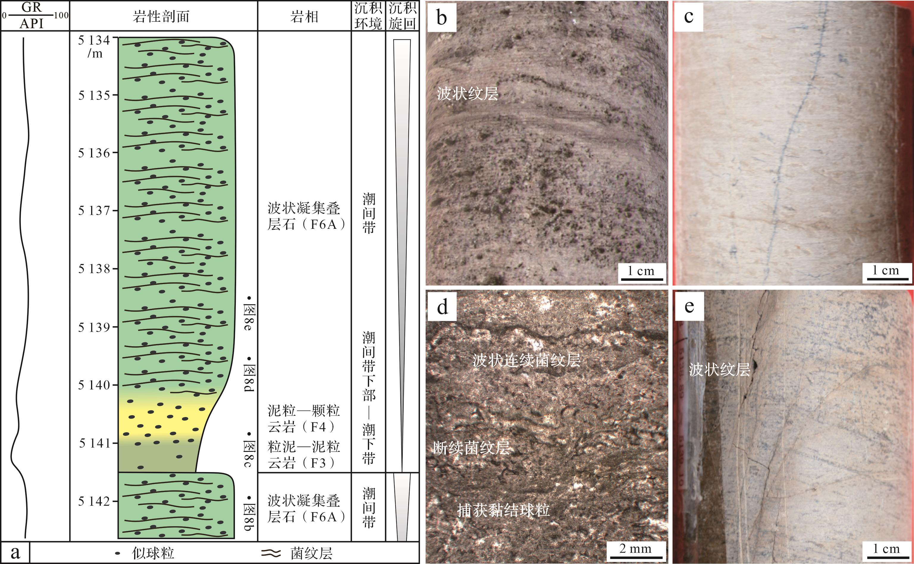
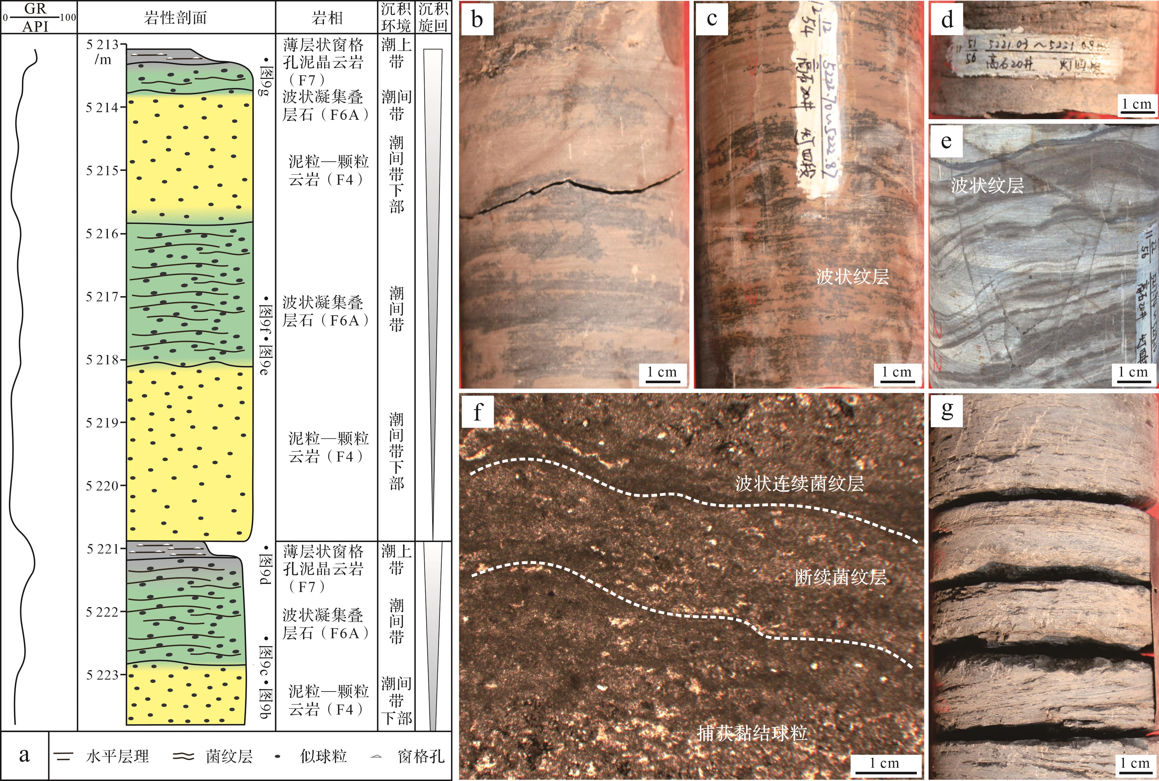
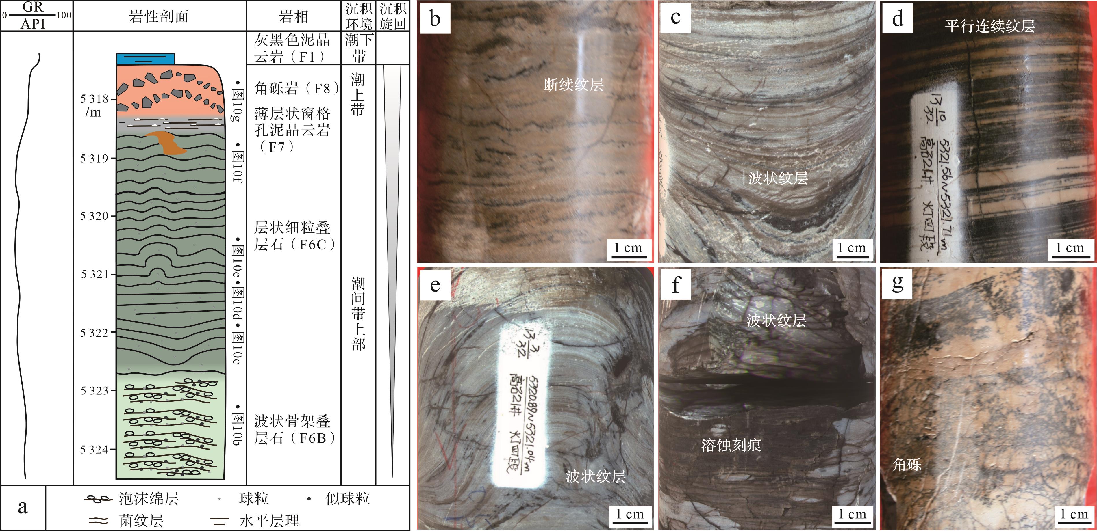
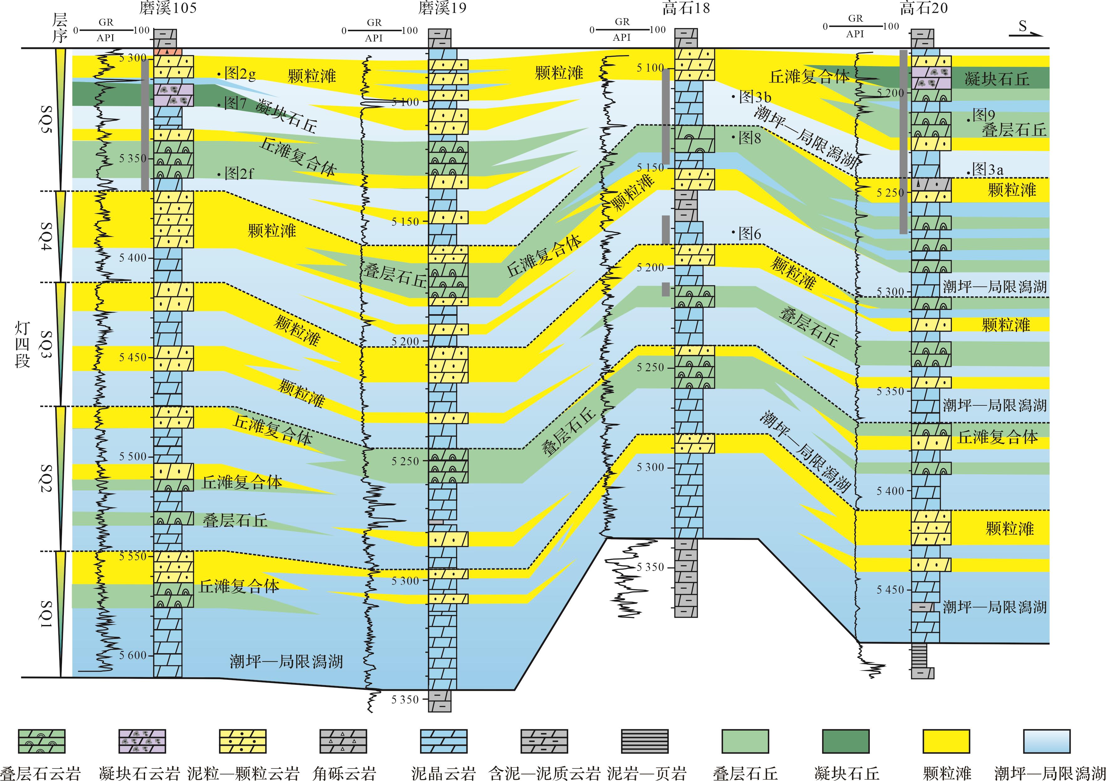
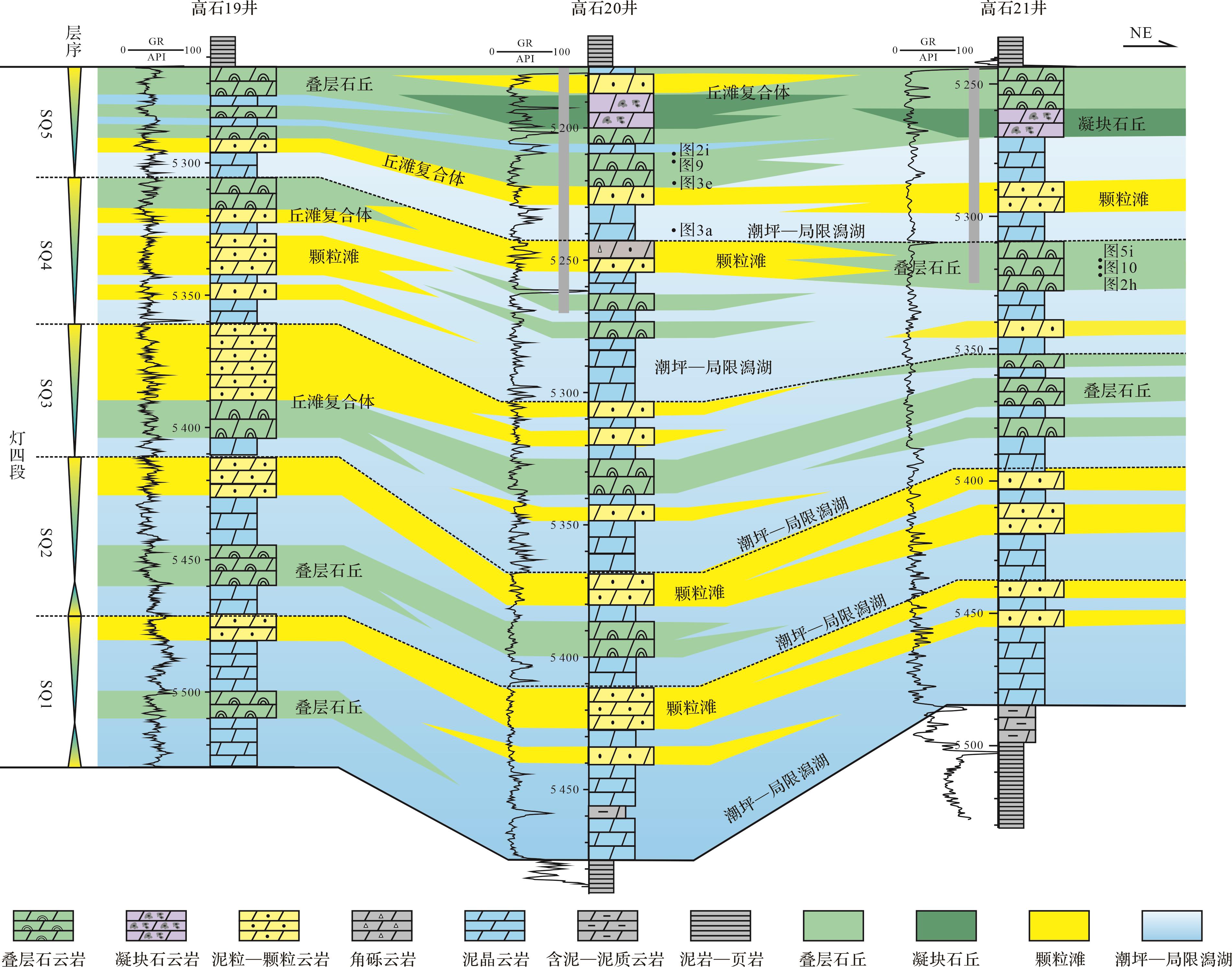
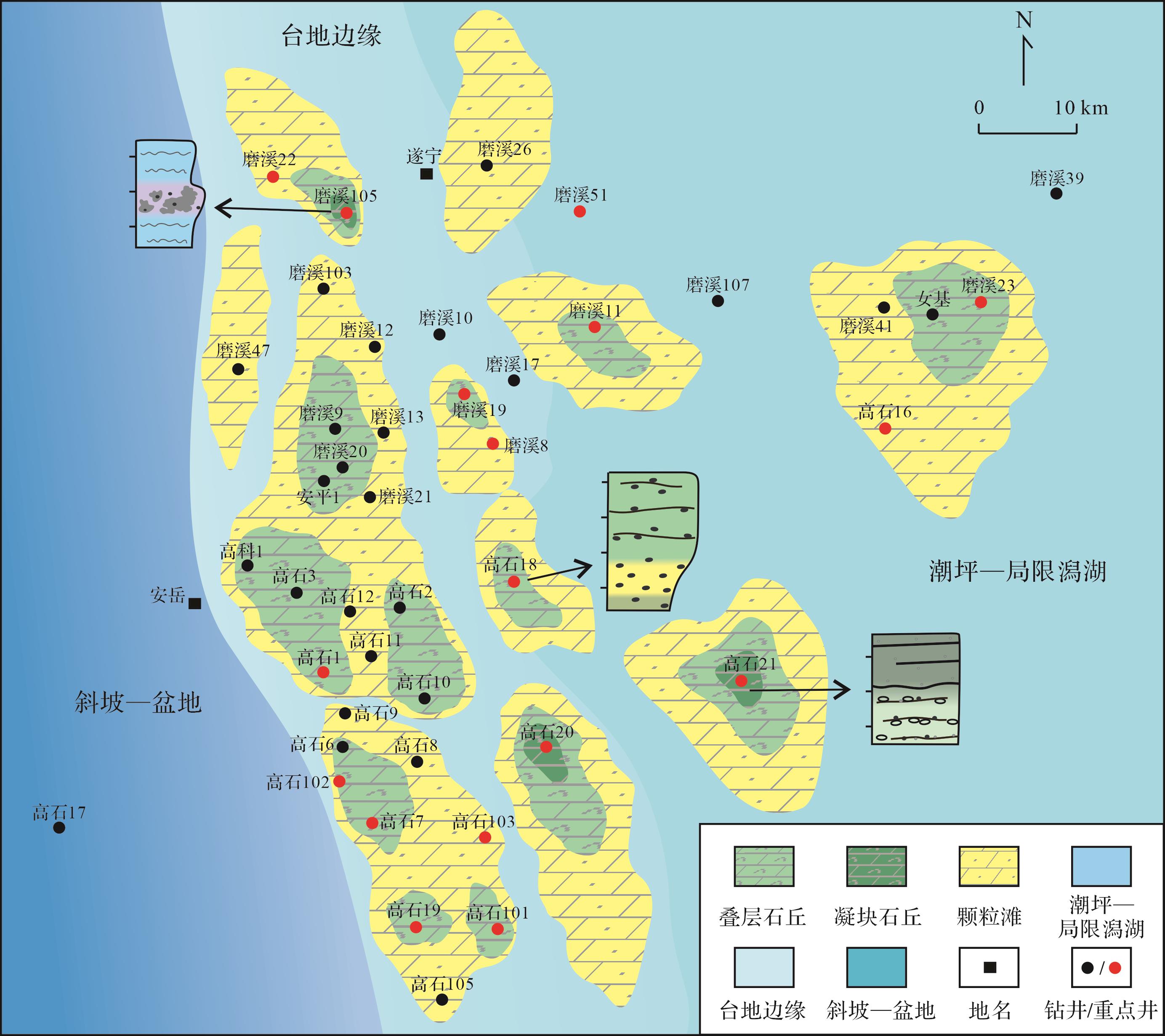
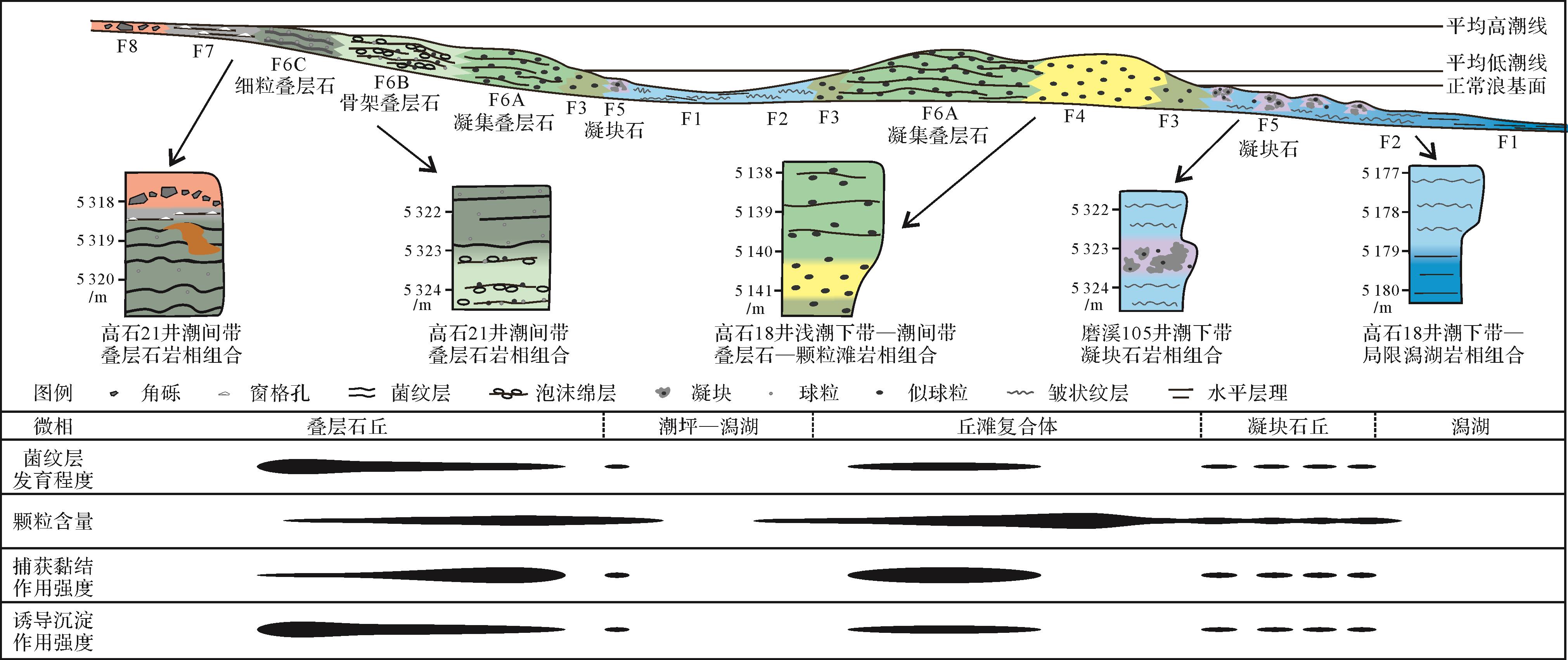
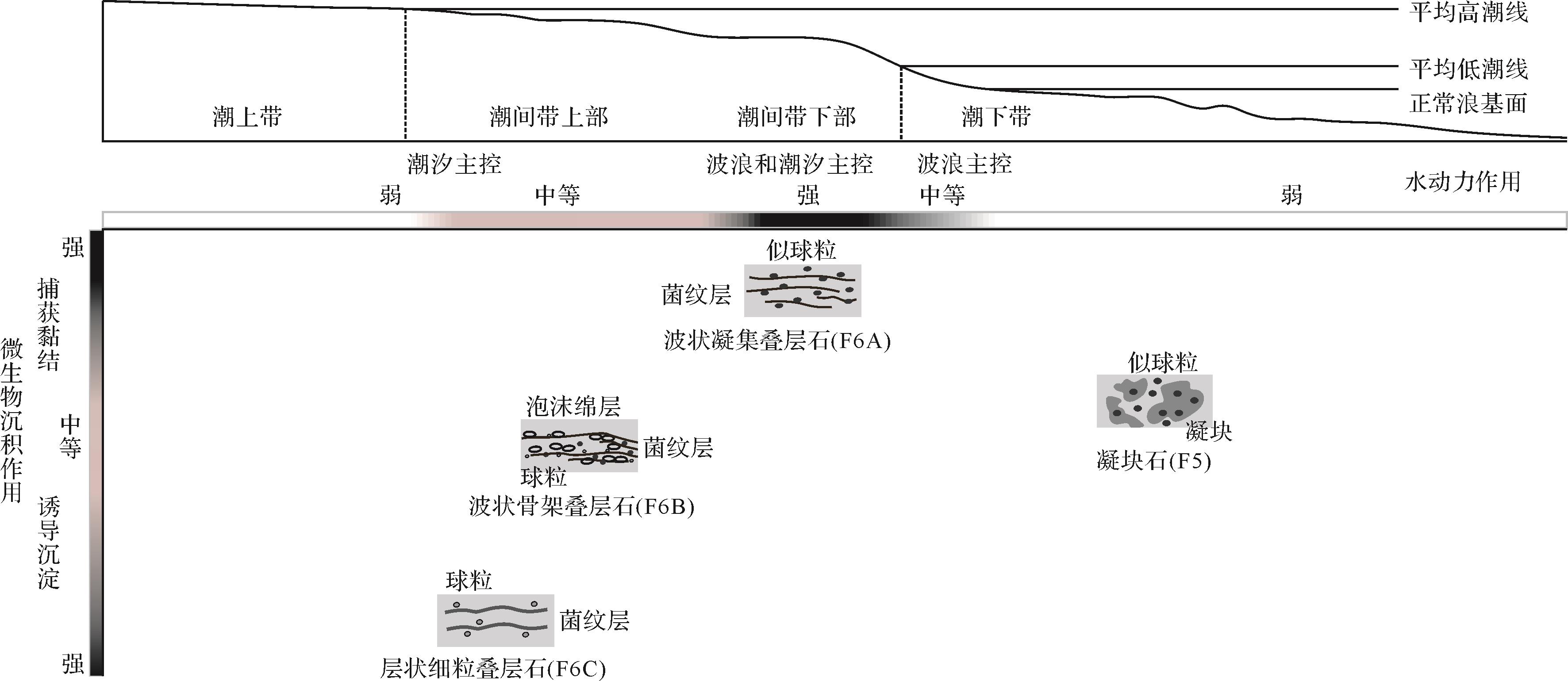
In order to establish the deposition model of microbialites in the Fourth member of Dengying Formation in central Sichuan Basin, and to clarify the main controlling deposition factors, a detailed deposition microfacies analysis was carried out on macrostructures and microfabrics using data from drill cores and thin sections. Eight lithofacies were identified in the study area, among which the microbialites include thrombolites and stromatolites. The stromatolites are further divided into wavy-laminated agglutinated stromatolites, wavy-laminated skeletal stromatolite and flat-laminated fine-grained stromatolites. The stacking patterns indicate four types of lithofacies associations: subtidal-restricted lagoon deposition; subtidal thrombolites; shallow-subtidal to intertidal stromatolites to shoal complex; and intertidal stromatolites. The microfacies distribution in the sequence stratigraphic framework shows that microbial mounds and shoals were located mainly in the upper part of the sequences, which became better-developed from bottom to top in this member of the Dengying Formation. The mound-shoals were more developed at the platform margin, decreasing in scale and continuity at the restricted platform. A microbialite deposition model was established based on the macrostructures, microfabrics and vertical sequence of the microbialites for the Fourth member of Dengying Formation. The thrombolites were mainly deposited in the subtidal environment below the wave base, with low hydrodynamics. Clots were locally formed by microbial trapping and binding small grains. The wavy-laminated agglutinated stromatolites were mainly deposited in the lower part of intertidal zone, in which various types of microbes flourished, and were formed by microbial trapping and binding of ooids and peloids in conditions of strong waves and tides. The wavy-laminated skeletal stromatolites were mainly deposited in the upper part of intertidal zone with moderate hydrodynamics dominated by the tide. The sponge structures were formed by microbially induced precipitation and in situ calcification, trapping and binding small amounts of pellets. The flat-laminated, fine-grained stromatolites were mainly deposited in the upper intertidal zone, and the deposition processes were predominantly microbially induced precipitation.
In order to establish the deposition model of microbialites in the Fourth member of Dengying Formation in central Sichuan Basin, and to clarify the main controlling deposition factors, a detailed deposition microfacies analysis was carried out on macrostructures and microfabrics using data from drill cores and thin sections. Eight lithofacies were identified in the study area, among which the microbialites include thrombolites and stromatolites. The stromatolites are further divided into wavy-laminated agglutinated stromatolites, wavy-laminated skeletal stromatolite and flat-laminated fine-grained stromatolites. The stacking patterns indicate four types of lithofacies associations: subtidal-restricted lagoon deposition; subtidal thrombolites; shallow-subtidal to intertidal stromatolites to shoal complex; and intertidal stromatolites. The microfacies distribution in the sequence stratigraphic framework shows that microbial mounds and shoals were located mainly in the upper part of the sequences, which became better-developed from bottom to top in this member of the Dengying Formation. The mound-shoals were more developed at the platform margin, decreasing in scale and continuity at the restricted platform. A microbialite deposition model was established based on the macrostructures, microfabrics and vertical sequence of the microbialites for the Fourth member of Dengying Formation. The thrombolites were mainly deposited in the subtidal environment below the wave base, with low hydrodynamics. Clots were locally formed by microbial trapping and binding small grains. The wavy-laminated agglutinated stromatolites were mainly deposited in the lower part of intertidal zone, in which various types of microbes flourished, and were formed by microbial trapping and binding of ooids and peloids in conditions of strong waves and tides. The wavy-laminated skeletal stromatolites were mainly deposited in the upper part of intertidal zone with moderate hydrodynamics dominated by the tide. The sponge structures were formed by microbially induced precipitation and in situ calcification, trapping and binding small amounts of pellets. The flat-laminated, fine-grained stromatolites were mainly deposited in the upper intertidal zone, and the deposition processes were predominantly microbially induced precipitation.
2023, 41(4): 1097-1109.
doi: 10.14027/j.issn.1000-0550.2022.004
Abstract:
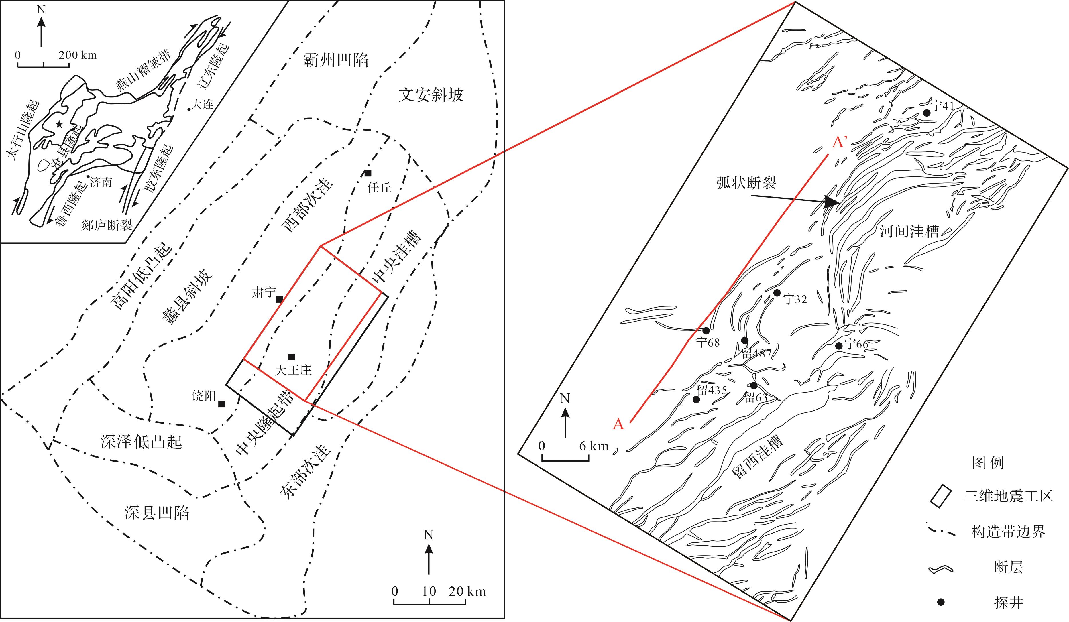
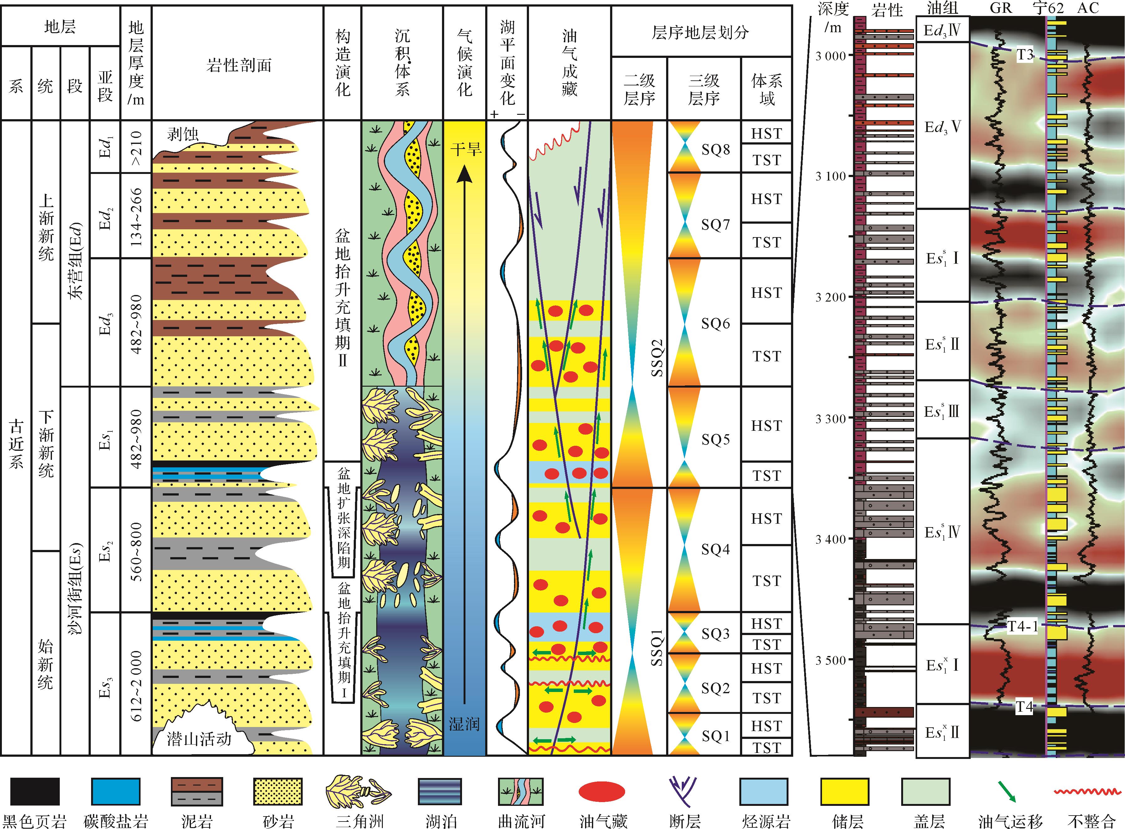
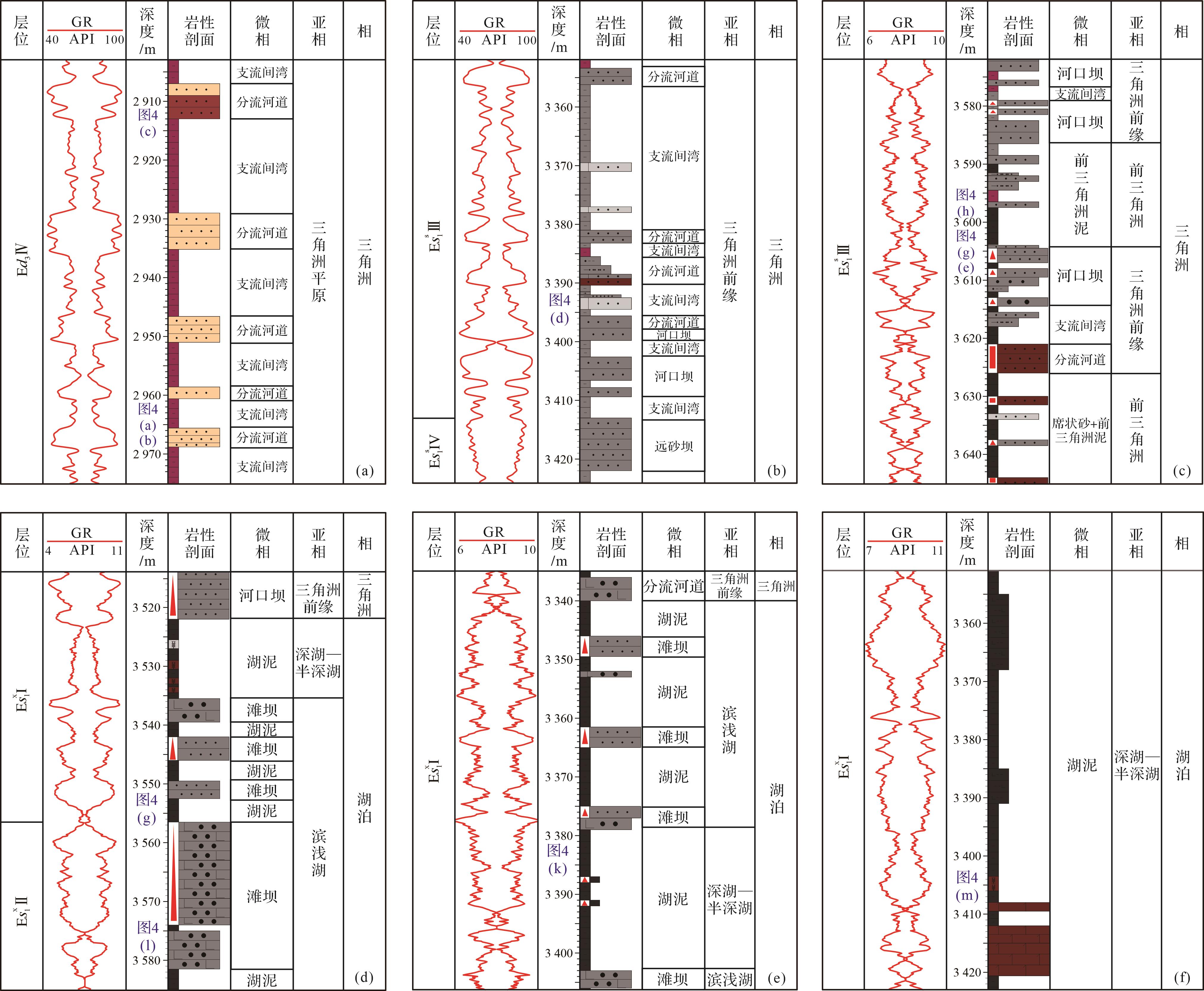
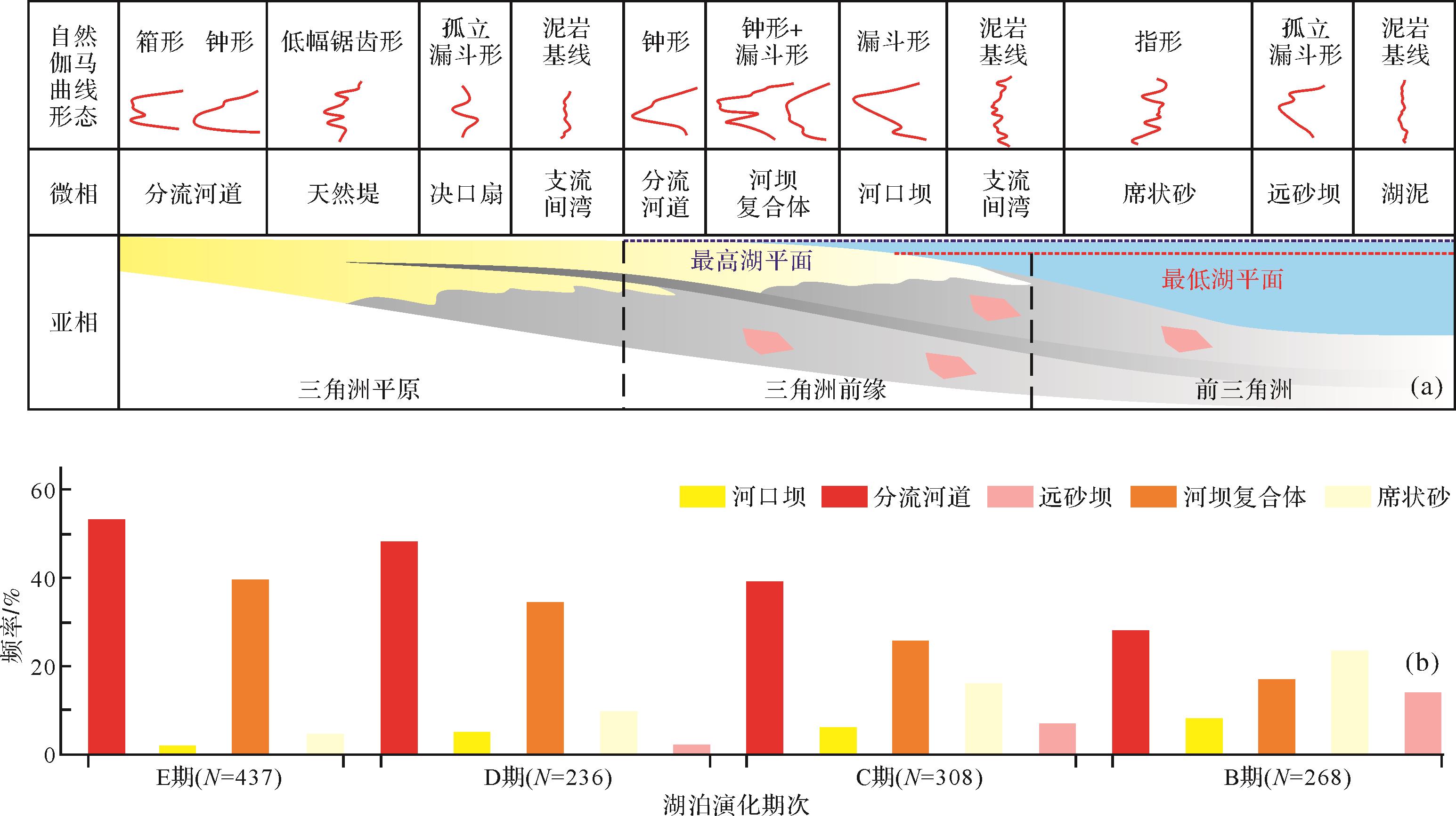
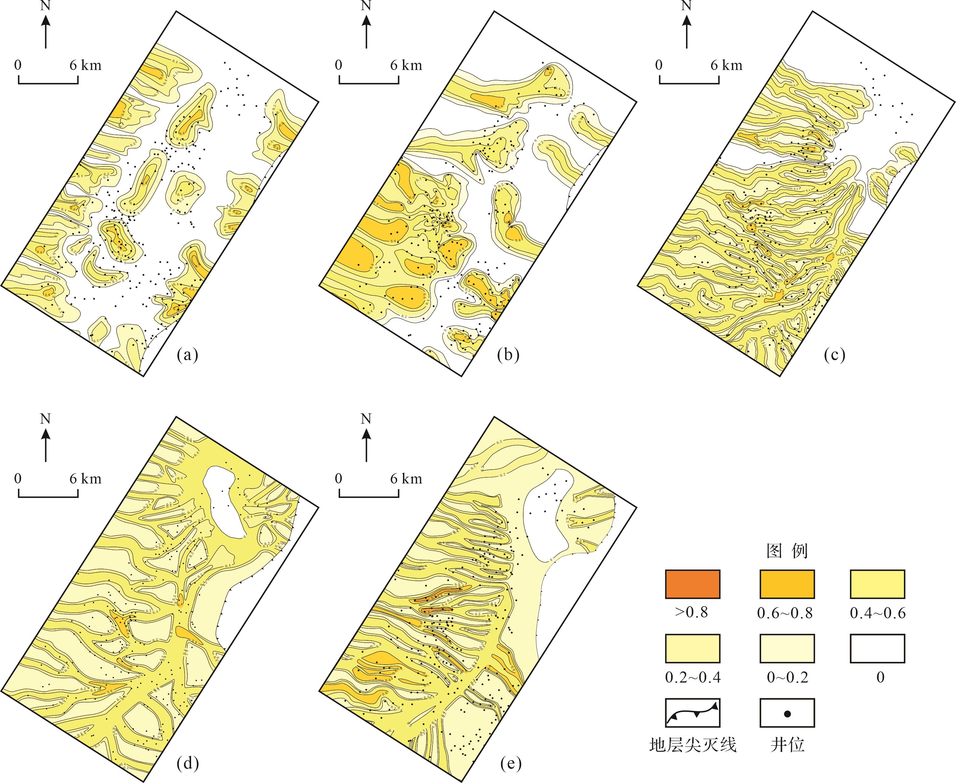
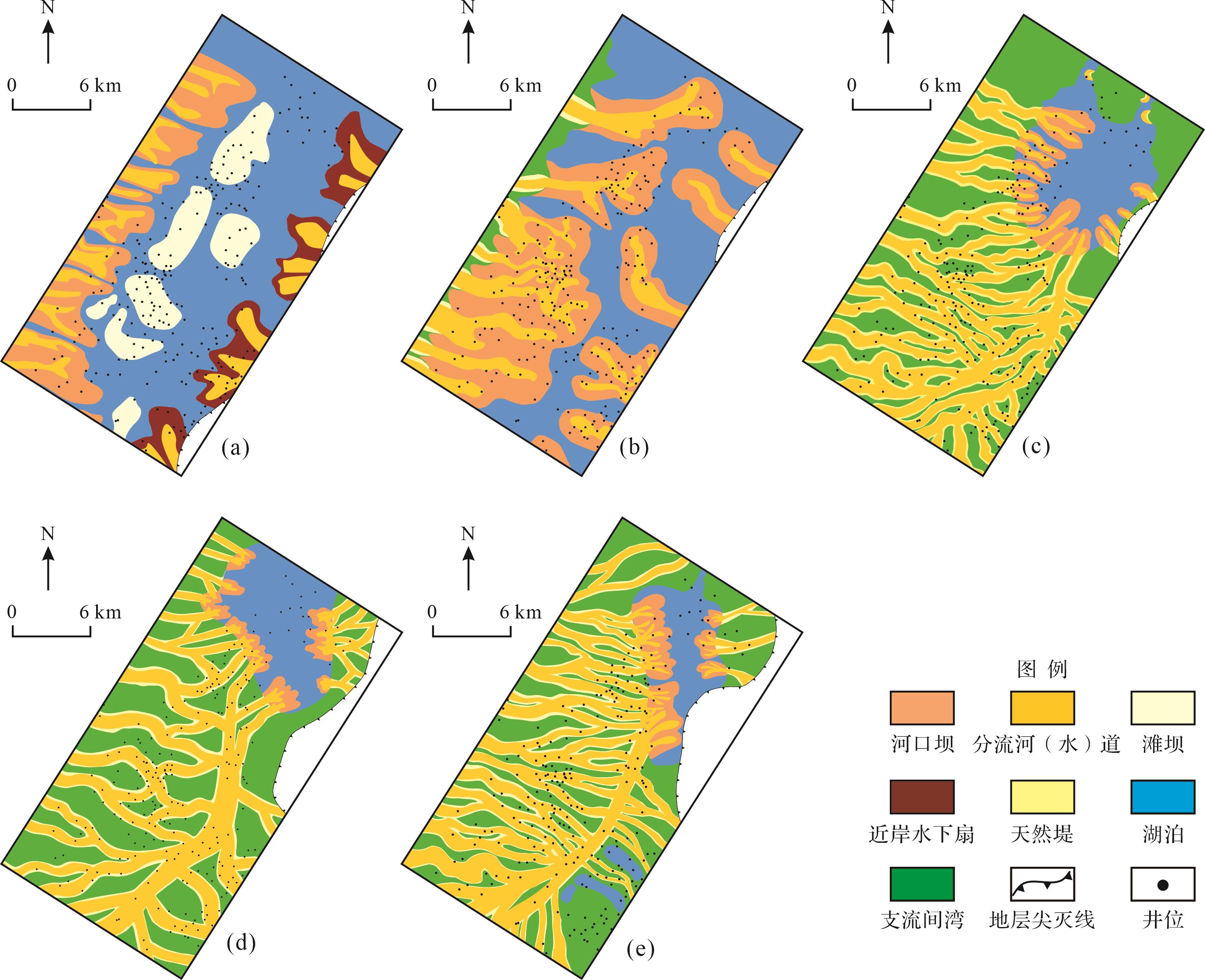
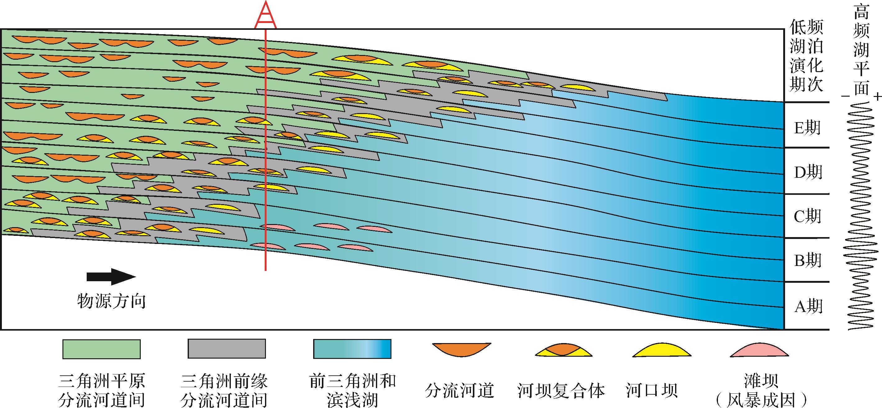
Studies of the spatial distribution of sedimentary microfacies in continental lacustrine basins have mainly concentrated on high-frequency lake level changes. However, this is unrelated to low-frequency lacustrine evolutional stages and lake regression processes. This study was based on core observation, combining well logs and 3D seismic volumes to restore the types of sedimentary microfacies in the Oligocene interval of rocks in the Suning-Dawangzhuang area. The stages and features of lacustrine evolution were investigated by integrating lithological and seismic sedimentological evidence. The spatial distribution at different stages of lacustrine evolution is also discussed. It was found that, against the background of stable down-warp lake basins, the ancient lake in the Raoyang Sag underwent a complete low-frequency evolutional expansion⁃extinction cycle in the Early Oligocene. This occurred in stages: rapid active expansion followed by slow passive contraction, rapid passive contraction, slow active contraction and slow passive extinction. During active expansion, the early distributary channels and mouth bars were reworked into beach bars. The passive contraction of the lake during normal lake regression created broad delta-front channel-mouth bar composite sand bodies and delta-plain distributary channel networks. The active contraction of the lake resulting from forced lake regression formed a dendritic distributary channel system. The continuous extinction process of the lake caused these various types of composite sand body to migrate towards the lake, unlike in the previous stage, thus vertically superposing the different types of composite sand body.
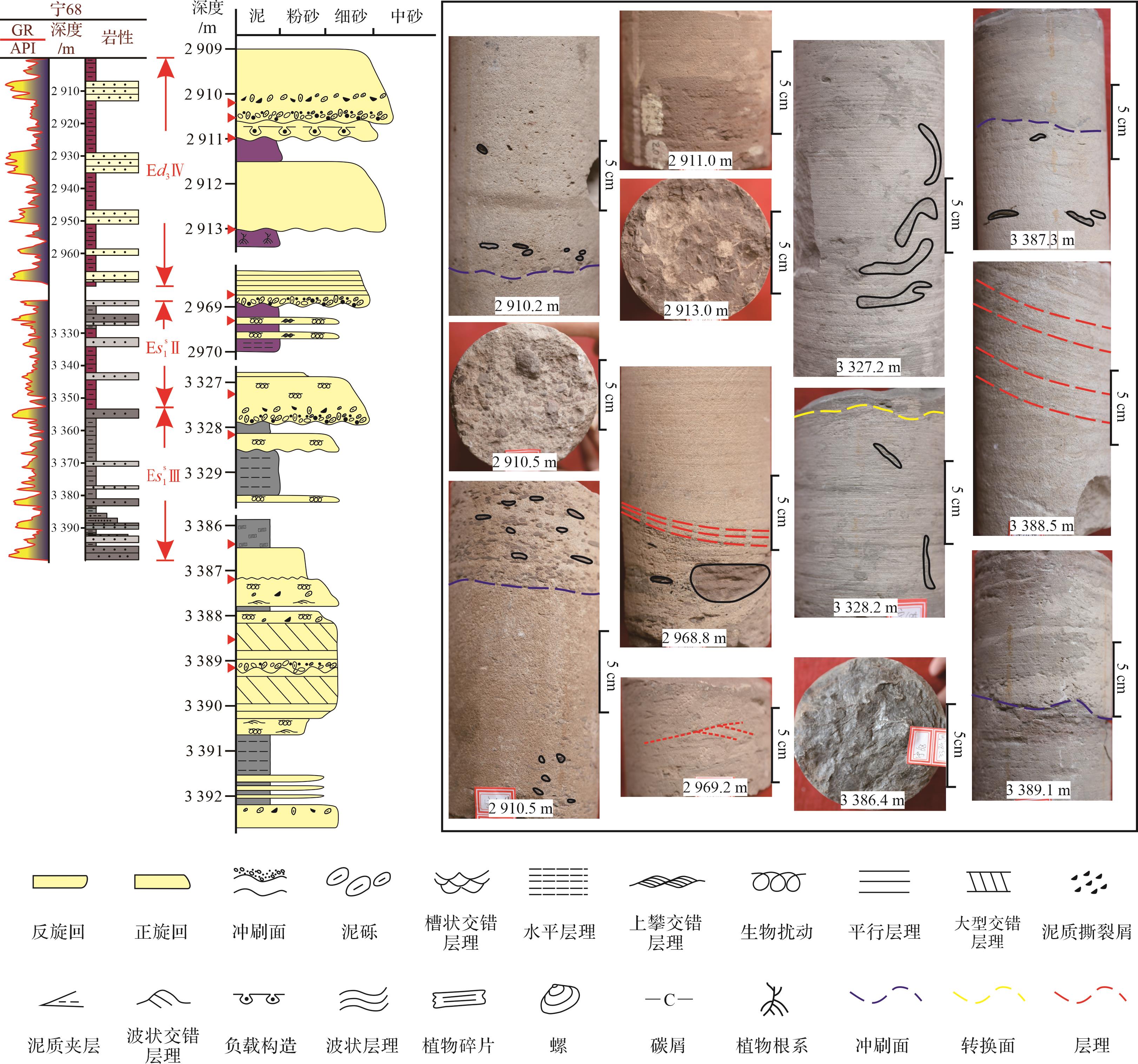
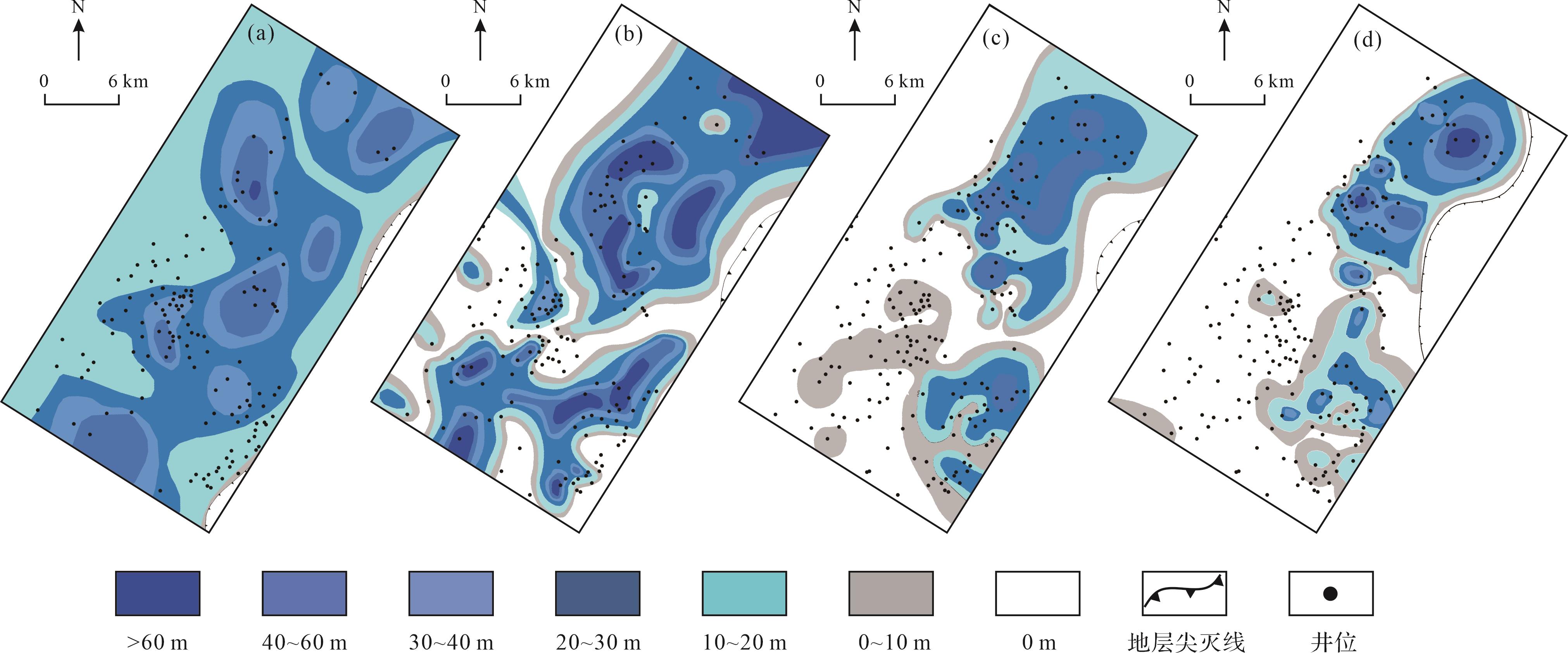
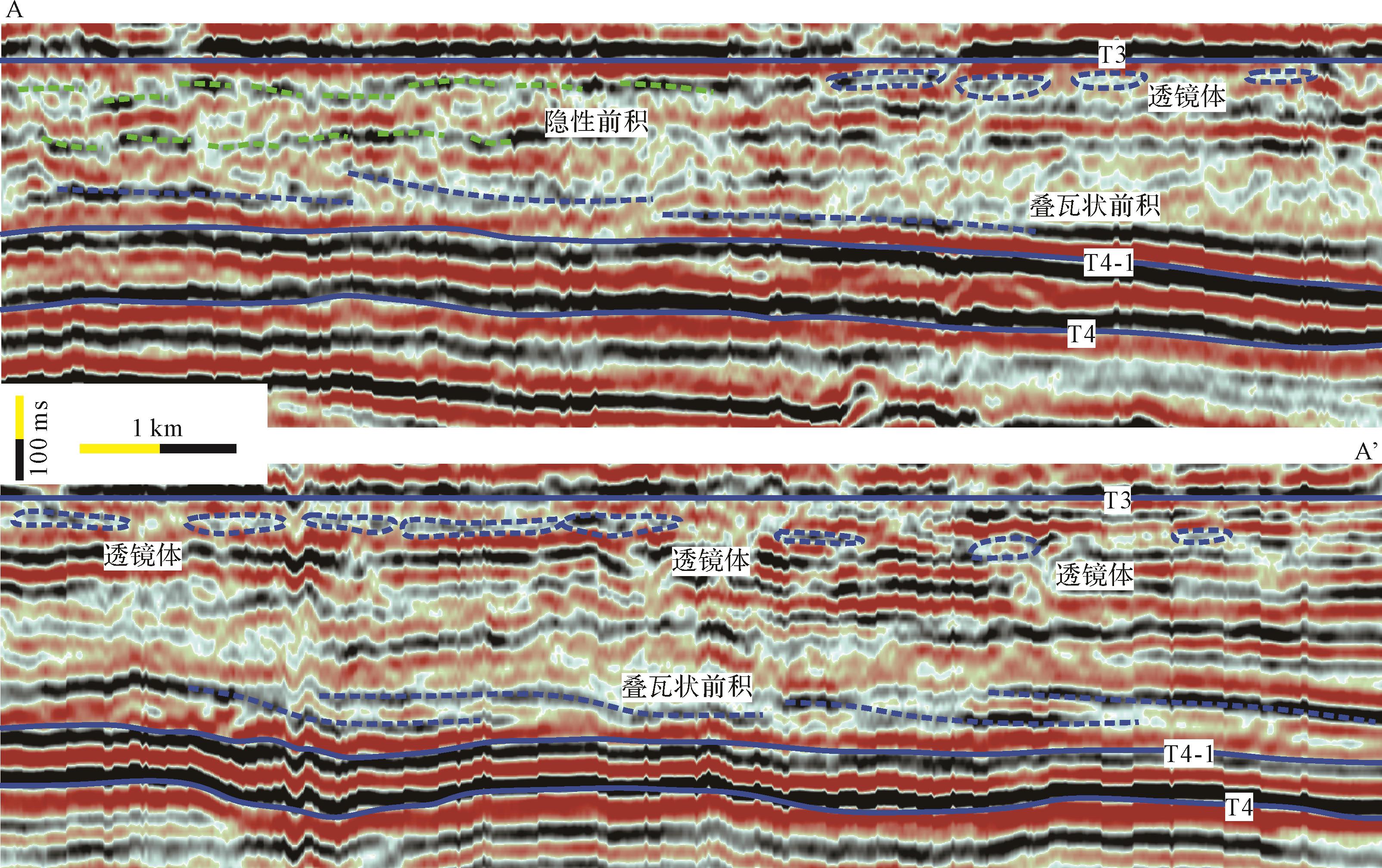
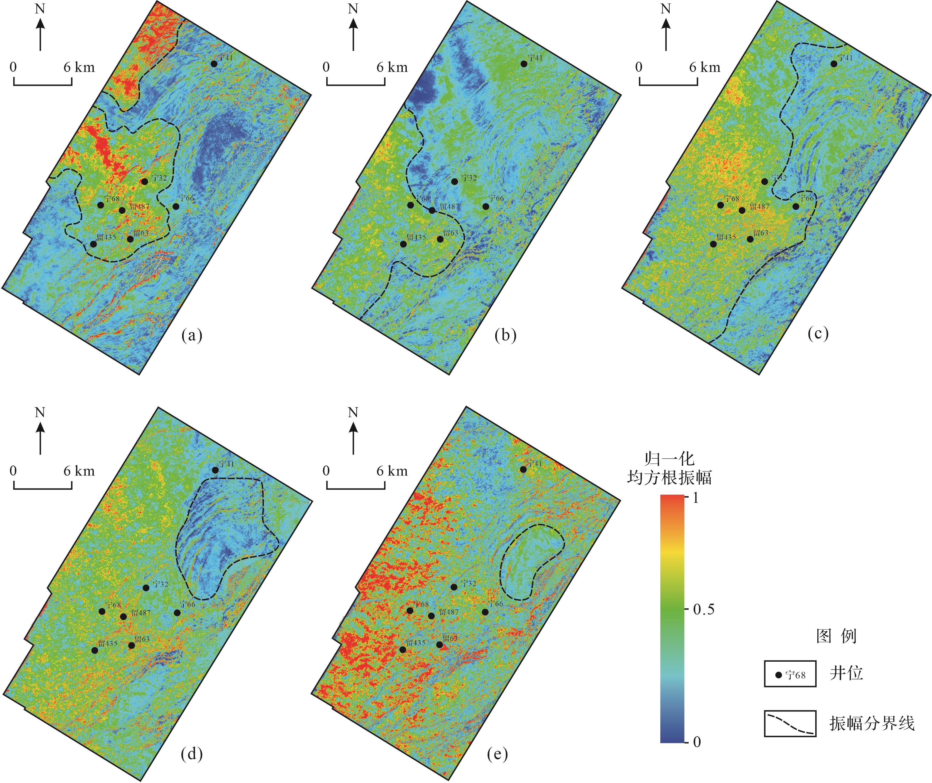
Studies of the spatial distribution of sedimentary microfacies in continental lacustrine basins have mainly concentrated on high-frequency lake level changes. However, this is unrelated to low-frequency lacustrine evolutional stages and lake regression processes. This study was based on core observation, combining well logs and 3D seismic volumes to restore the types of sedimentary microfacies in the Oligocene interval of rocks in the Suning-Dawangzhuang area. The stages and features of lacustrine evolution were investigated by integrating lithological and seismic sedimentological evidence. The spatial distribution at different stages of lacustrine evolution is also discussed. It was found that, against the background of stable down-warp lake basins, the ancient lake in the Raoyang Sag underwent a complete low-frequency evolutional expansion⁃extinction cycle in the Early Oligocene. This occurred in stages: rapid active expansion followed by slow passive contraction, rapid passive contraction, slow active contraction and slow passive extinction. During active expansion, the early distributary channels and mouth bars were reworked into beach bars. The passive contraction of the lake during normal lake regression created broad delta-front channel-mouth bar composite sand bodies and delta-plain distributary channel networks. The active contraction of the lake resulting from forced lake regression formed a dendritic distributary channel system. The continuous extinction process of the lake caused these various types of composite sand body to migrate towards the lake, unlike in the previous stage, thus vertically superposing the different types of composite sand body.

2023, 41(4): 1110-1123.
doi: 10.14027/j.issn.1000-0550.2021.161
Abstract:
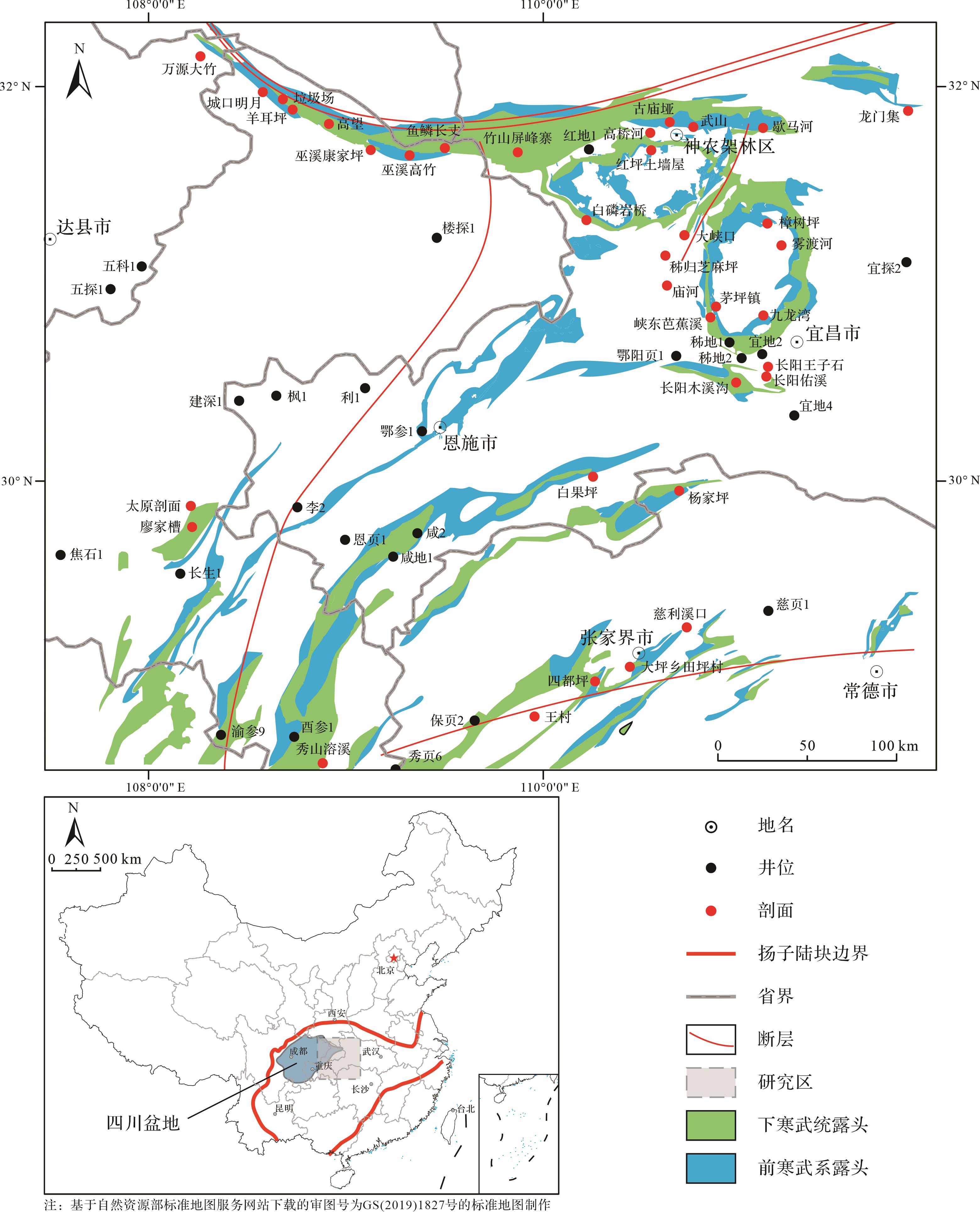
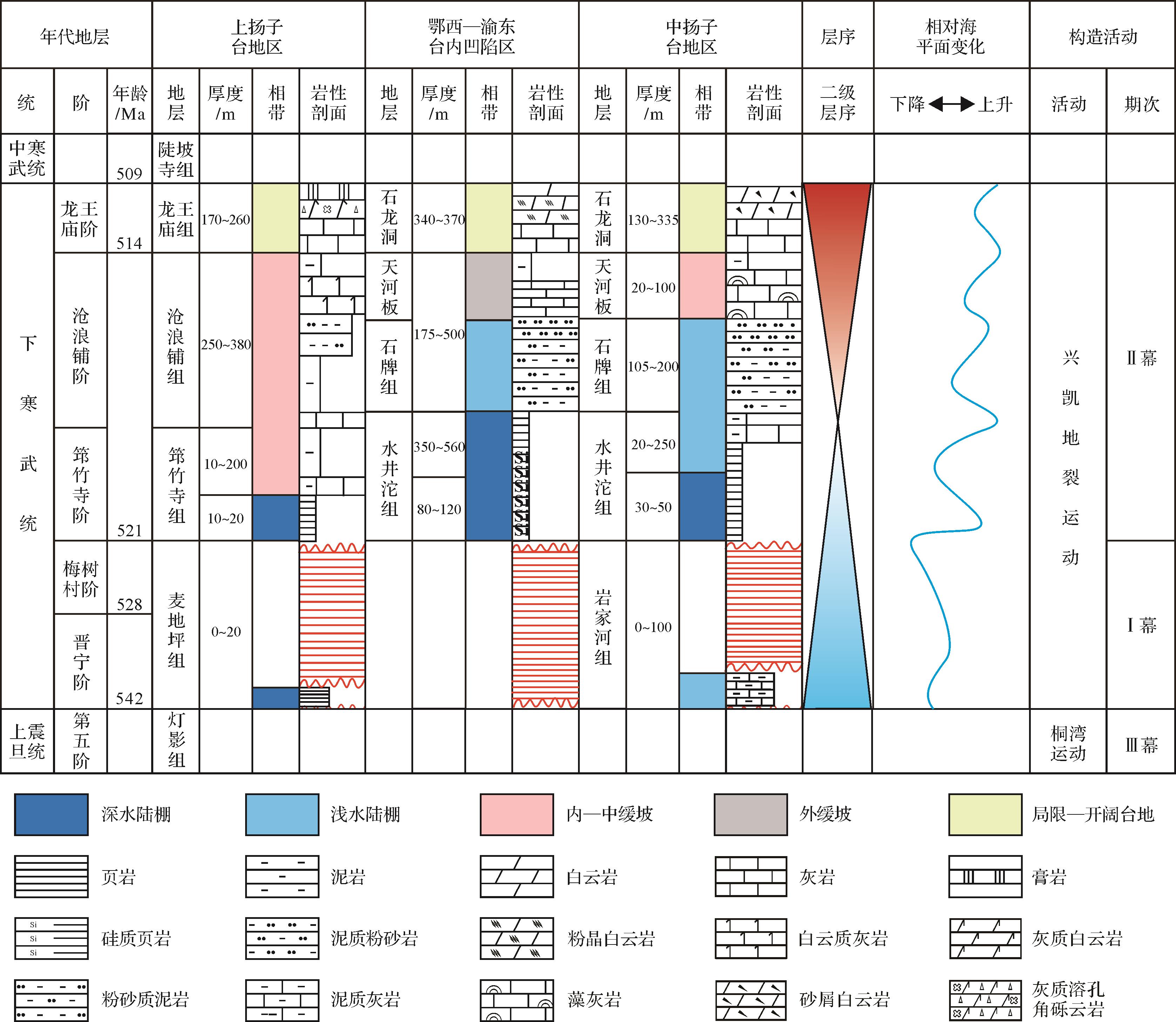
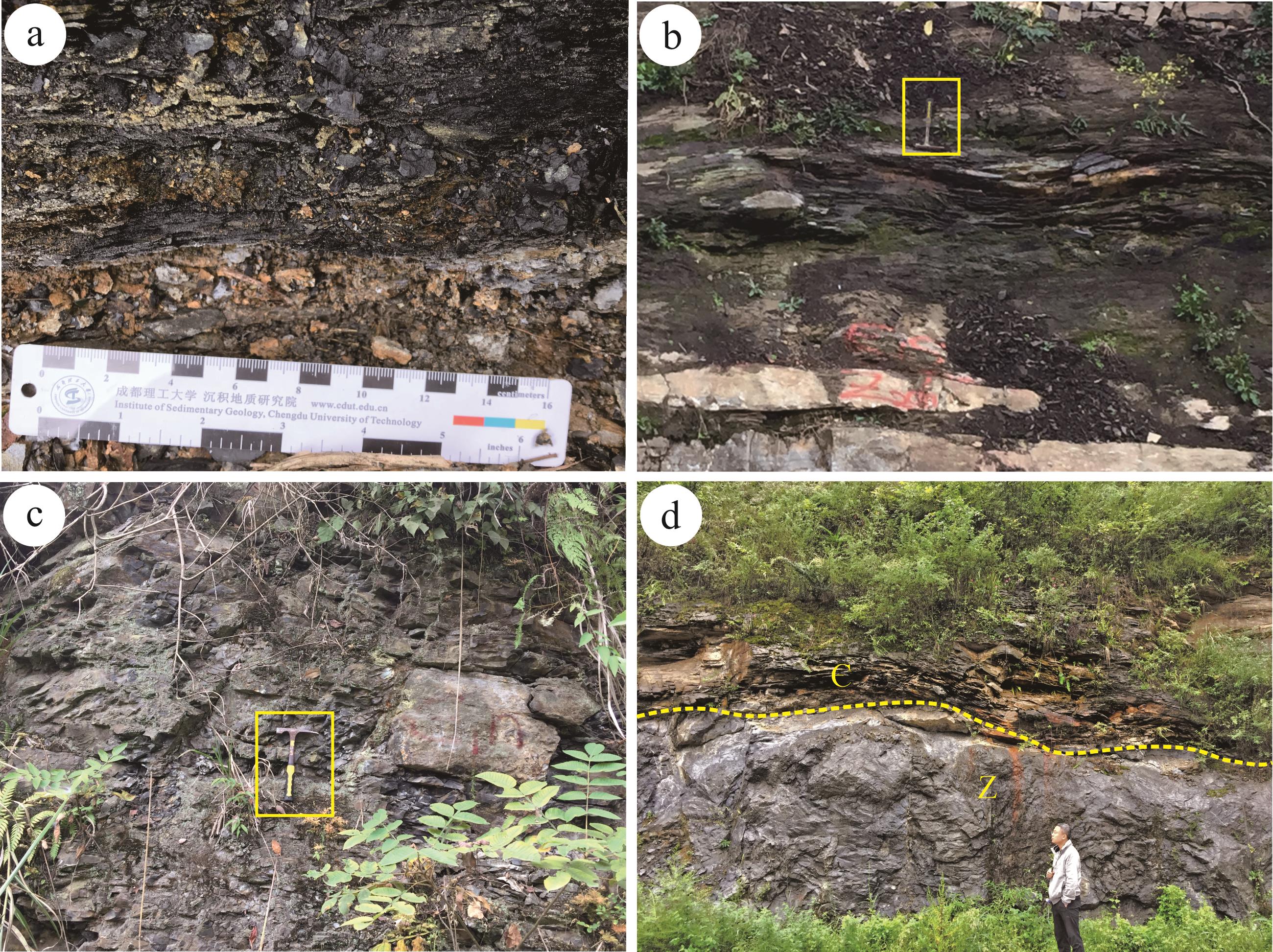
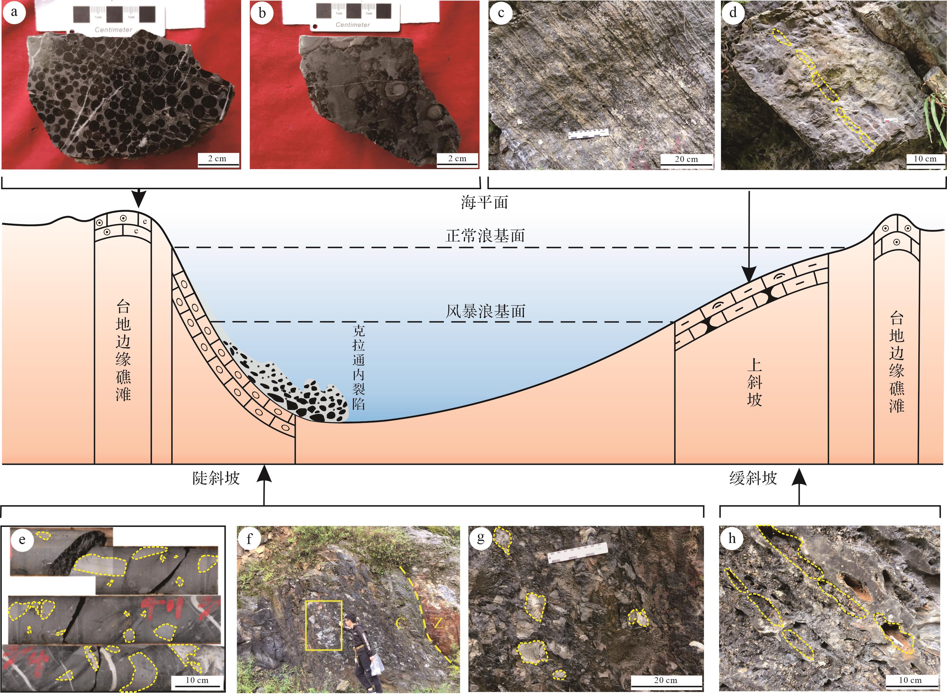
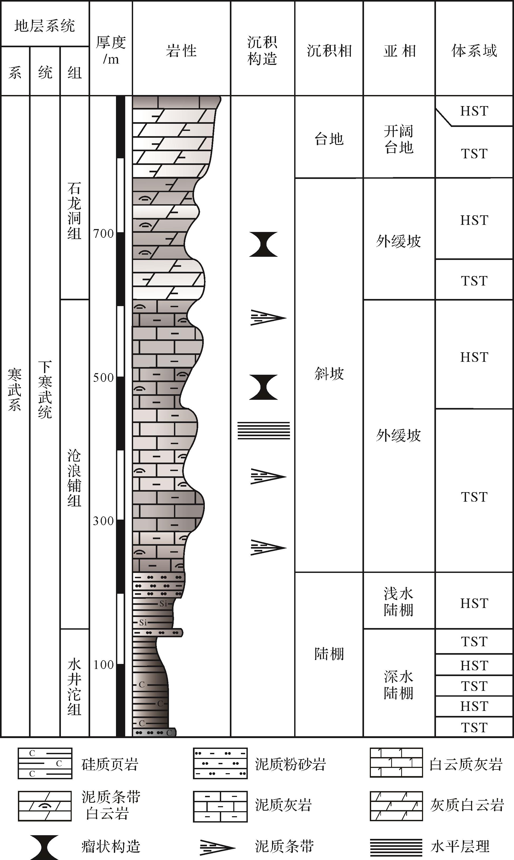
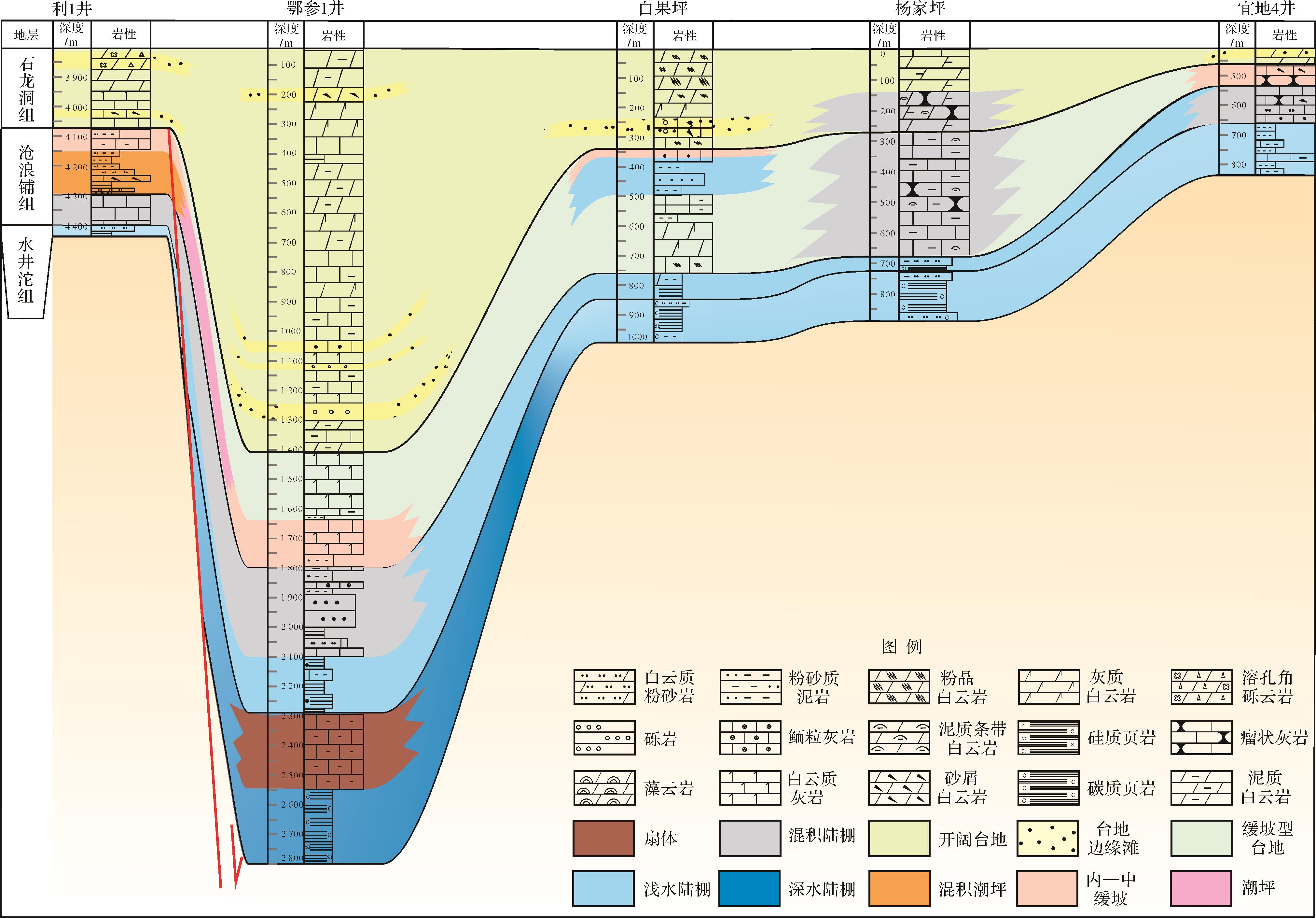
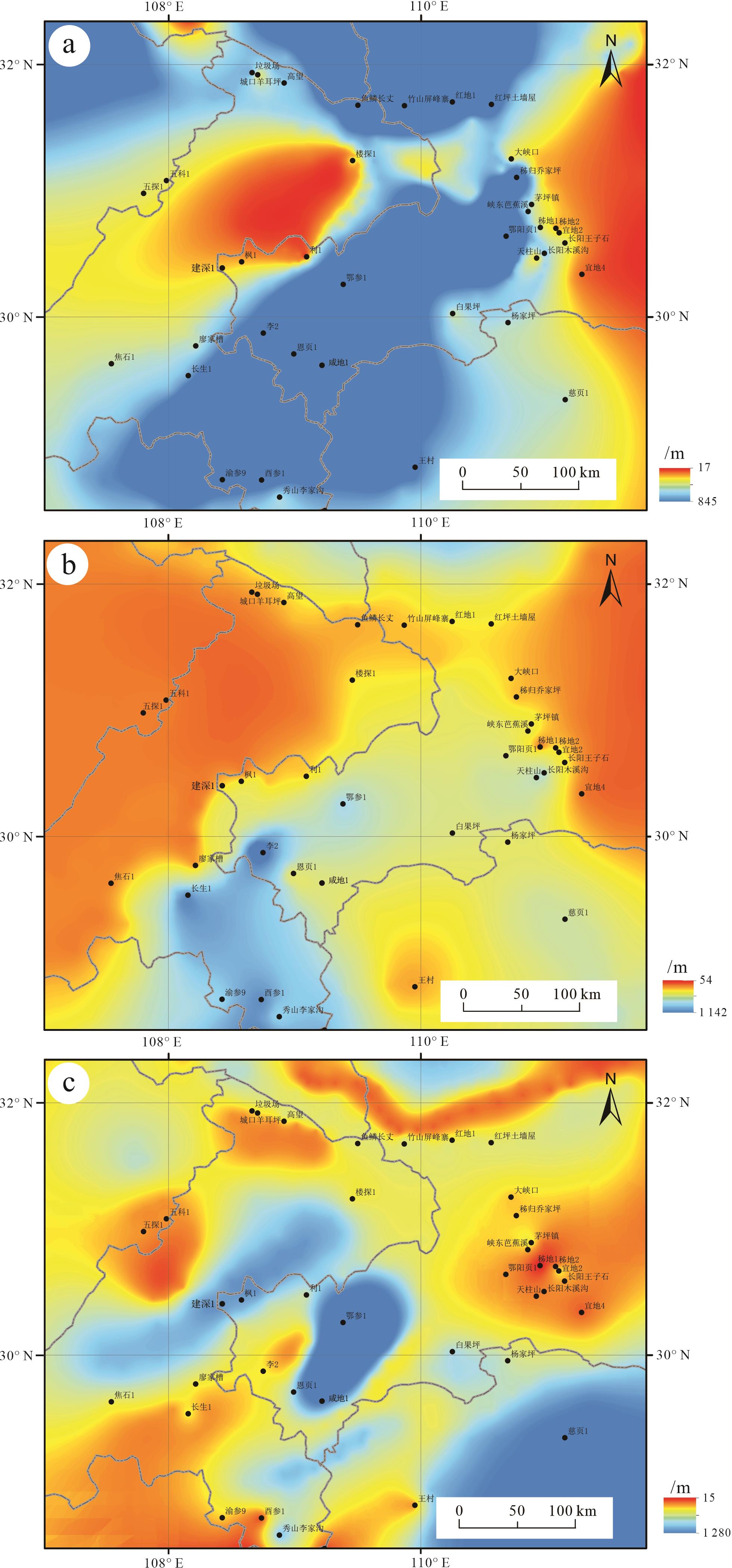
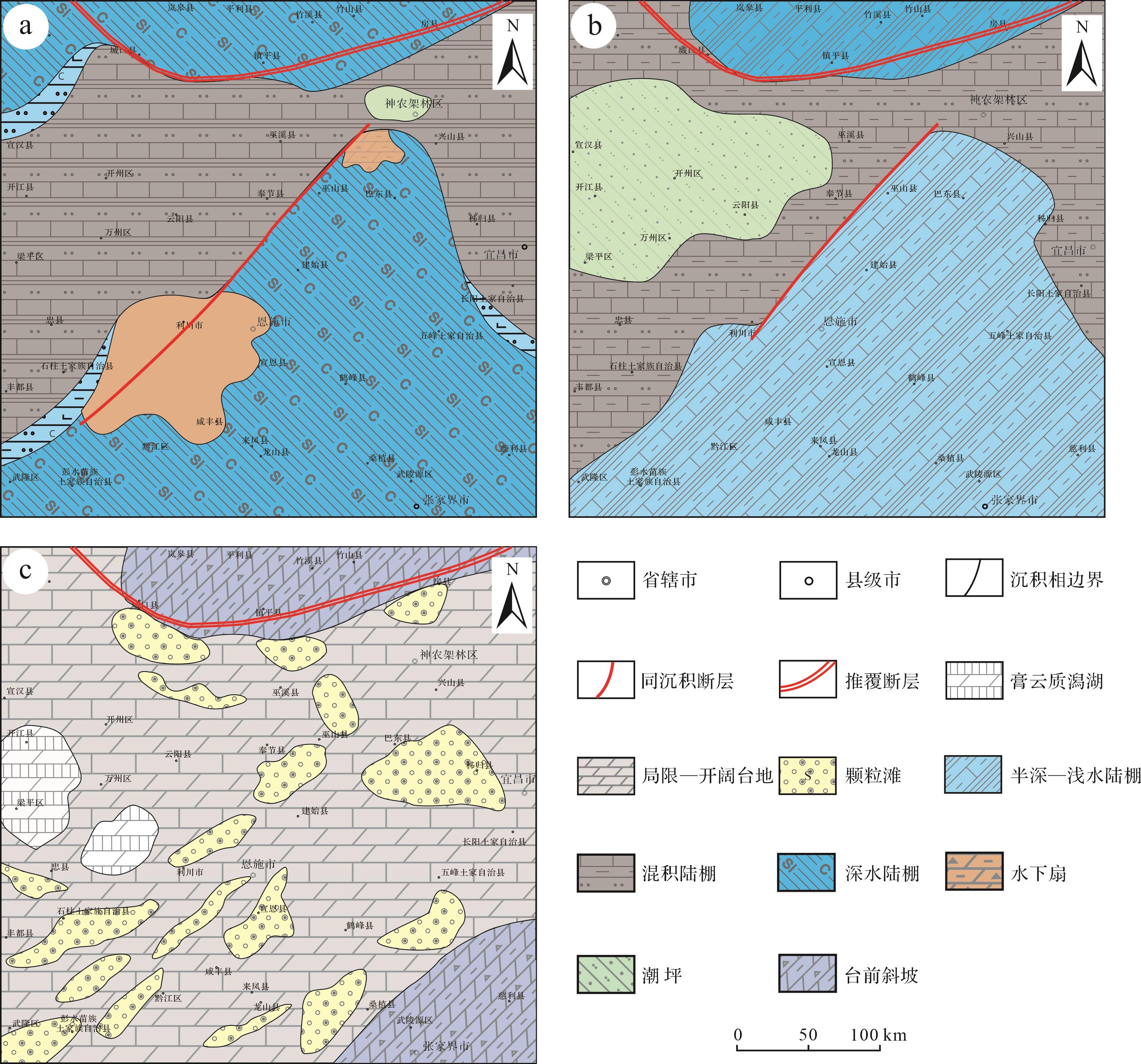
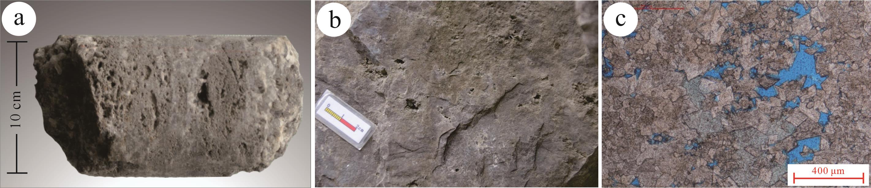
Intracraton rifts have had an important influence on favorable areas for marine carbonate oil and gas exploration in the Sichuan Basin and surrounding areas. A large amount of outcrop evidence reveals the existence of Early Cambrian intracraton rifts in western Hubei⁃eastern Chongqing. In this study, full use was made of field outcrop and available drilling data, combined with related its structural background and geodynamic origin. Based on previous studies, the study describes the identification marks of cratonic rifts in the western Hubei⁃eastern Chongqing area during the Early Cambrian. The evolution process of the sedimentary filling of the rift and its influence on the paleogeographic pattern was as follows. (1) The rift was wide in the south and narrow in the north, and gently sloping in the east and steep in the west. (2) It exhibits obvious differentiation which is positively correlated with fault activity. (3) The rift was mainly filled with compensation sediments that transitioned from the initial shelf sedimentation to finally a carbonate platform. The evolution of the rift occurred in three stages: rift (Shuijingtuo Formation deposition period), depression (Canglangpu Formation deposition period), and filling (Shilongdong Formation deposition period). (4) The rift opened and closed in response to the fragmentation/aggregation activity of the supercontinent between the Middle and Upper Yangtze. The structural background of paleogeographic differentiation, syn-sedimentary fault activity and sea level change determined its geographic pattern. This proposed Early Cambrian intracraton rift in the western Hubei⁃eastern Chongqing area provides a new understanding of the tectonic/sedimentary pattern of the internal craton rift in the Sichuan Basin and is also an important guide for oil and gas exploration in the Middle-Upper Yangtze area.
Intracraton rifts have had an important influence on favorable areas for marine carbonate oil and gas exploration in the Sichuan Basin and surrounding areas. A large amount of outcrop evidence reveals the existence of Early Cambrian intracraton rifts in western Hubei⁃eastern Chongqing. In this study, full use was made of field outcrop and available drilling data, combined with related its structural background and geodynamic origin. Based on previous studies, the study describes the identification marks of cratonic rifts in the western Hubei⁃eastern Chongqing area during the Early Cambrian. The evolution process of the sedimentary filling of the rift and its influence on the paleogeographic pattern was as follows. (1) The rift was wide in the south and narrow in the north, and gently sloping in the east and steep in the west. (2) It exhibits obvious differentiation which is positively correlated with fault activity. (3) The rift was mainly filled with compensation sediments that transitioned from the initial shelf sedimentation to finally a carbonate platform. The evolution of the rift occurred in three stages: rift (Shuijingtuo Formation deposition period), depression (Canglangpu Formation deposition period), and filling (Shilongdong Formation deposition period). (4) The rift opened and closed in response to the fragmentation/aggregation activity of the supercontinent between the Middle and Upper Yangtze. The structural background of paleogeographic differentiation, syn-sedimentary fault activity and sea level change determined its geographic pattern. This proposed Early Cambrian intracraton rift in the western Hubei⁃eastern Chongqing area provides a new understanding of the tectonic/sedimentary pattern of the internal craton rift in the Sichuan Basin and is also an important guide for oil and gas exploration in the Middle-Upper Yangtze area.

2023, 41(4): 1124-1137.
doi: 10.14027/j.issn.1000-0550.2021.169
Abstract:
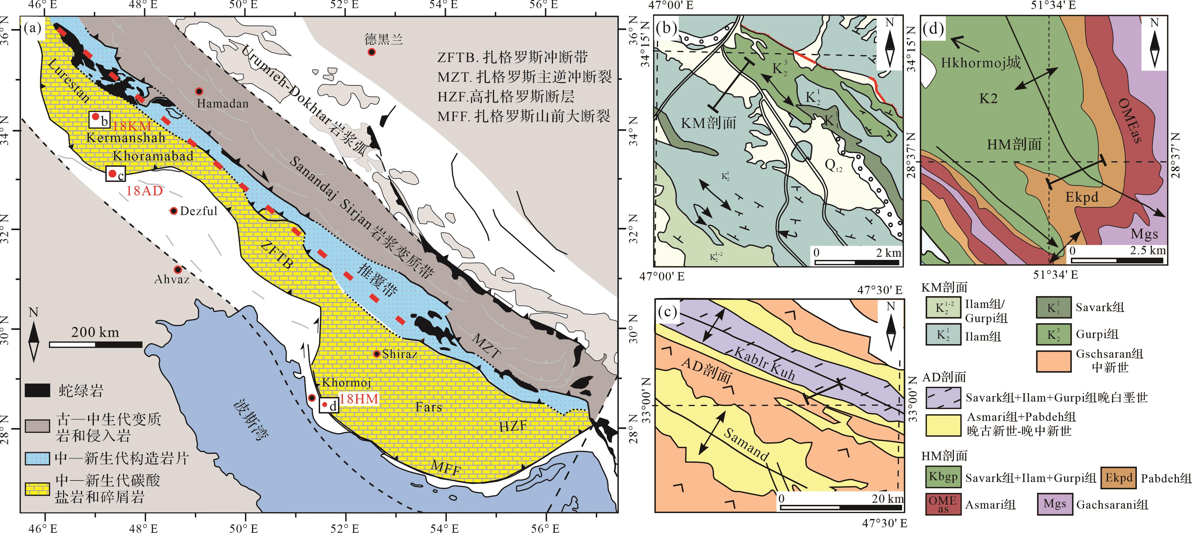
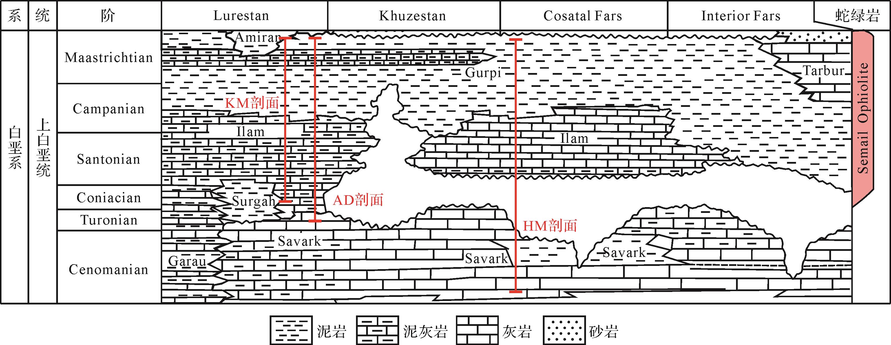
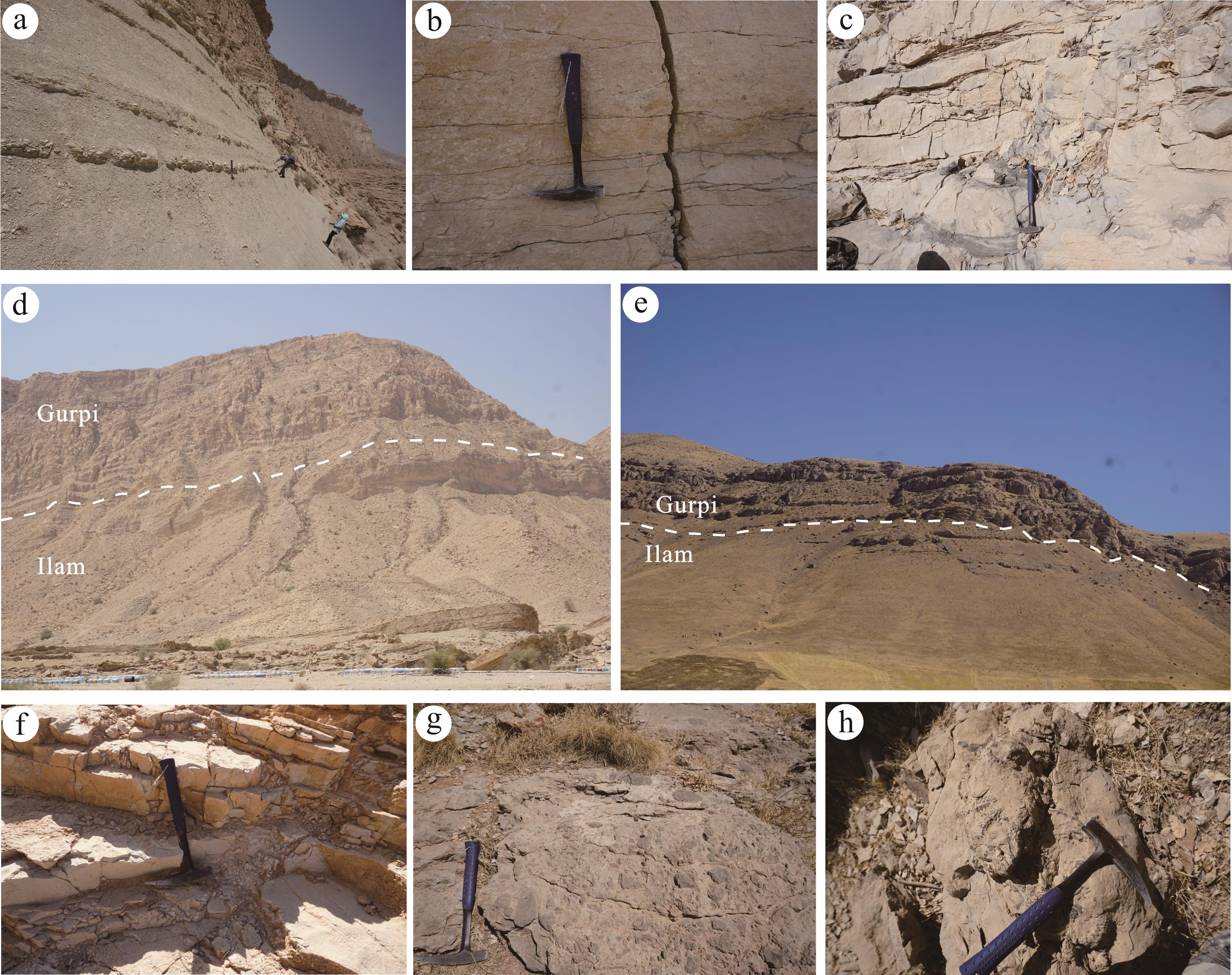
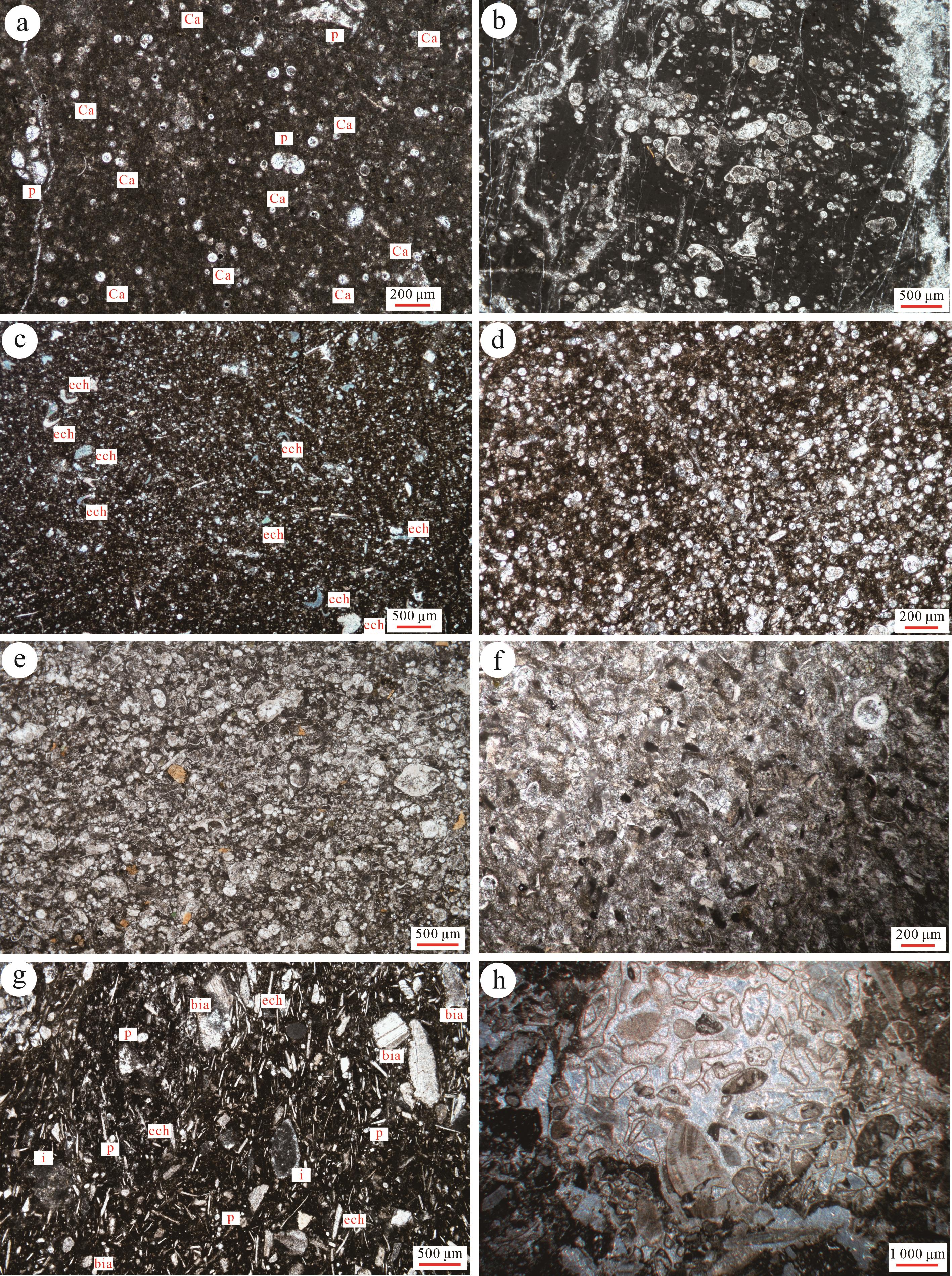
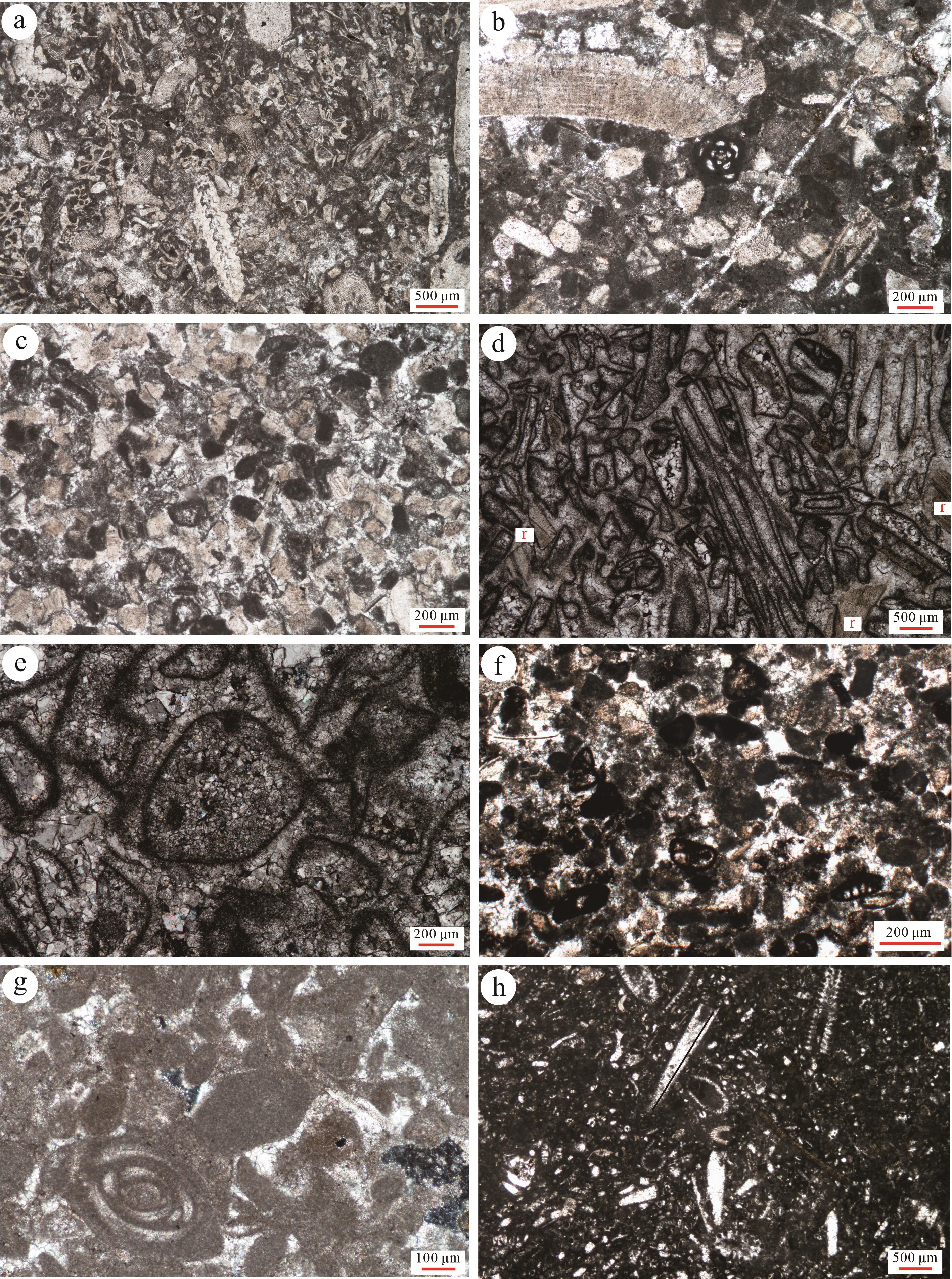
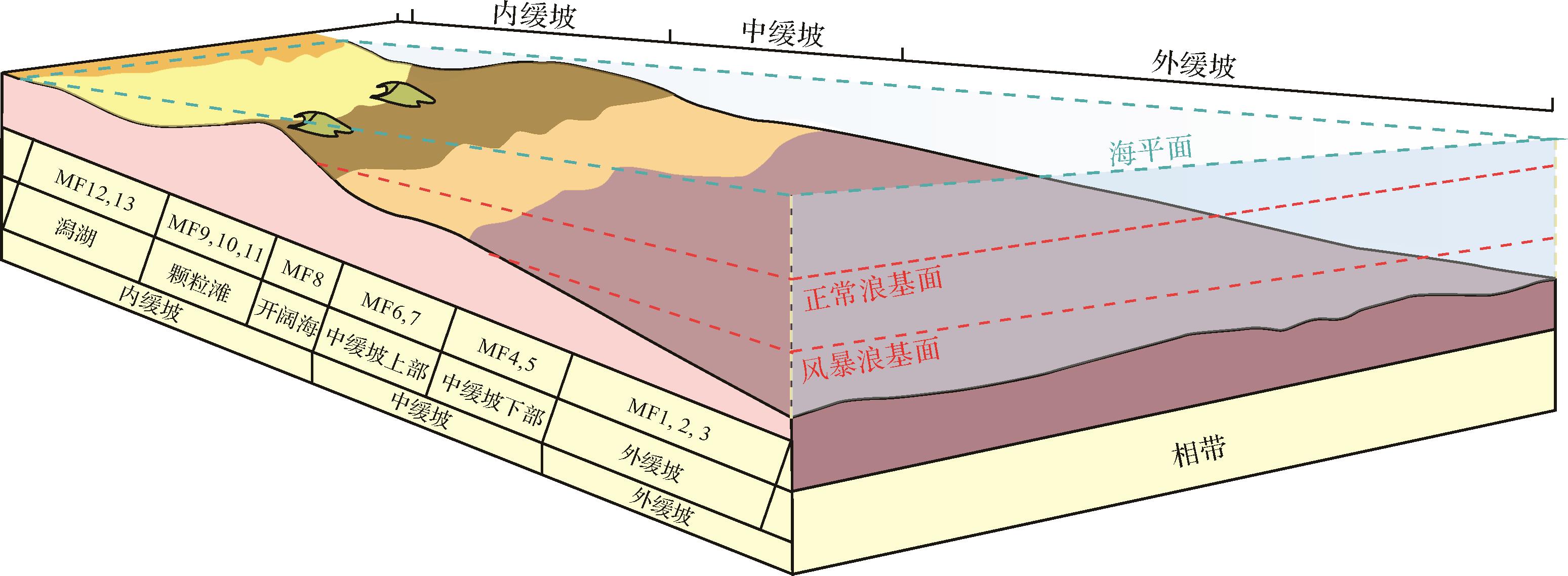
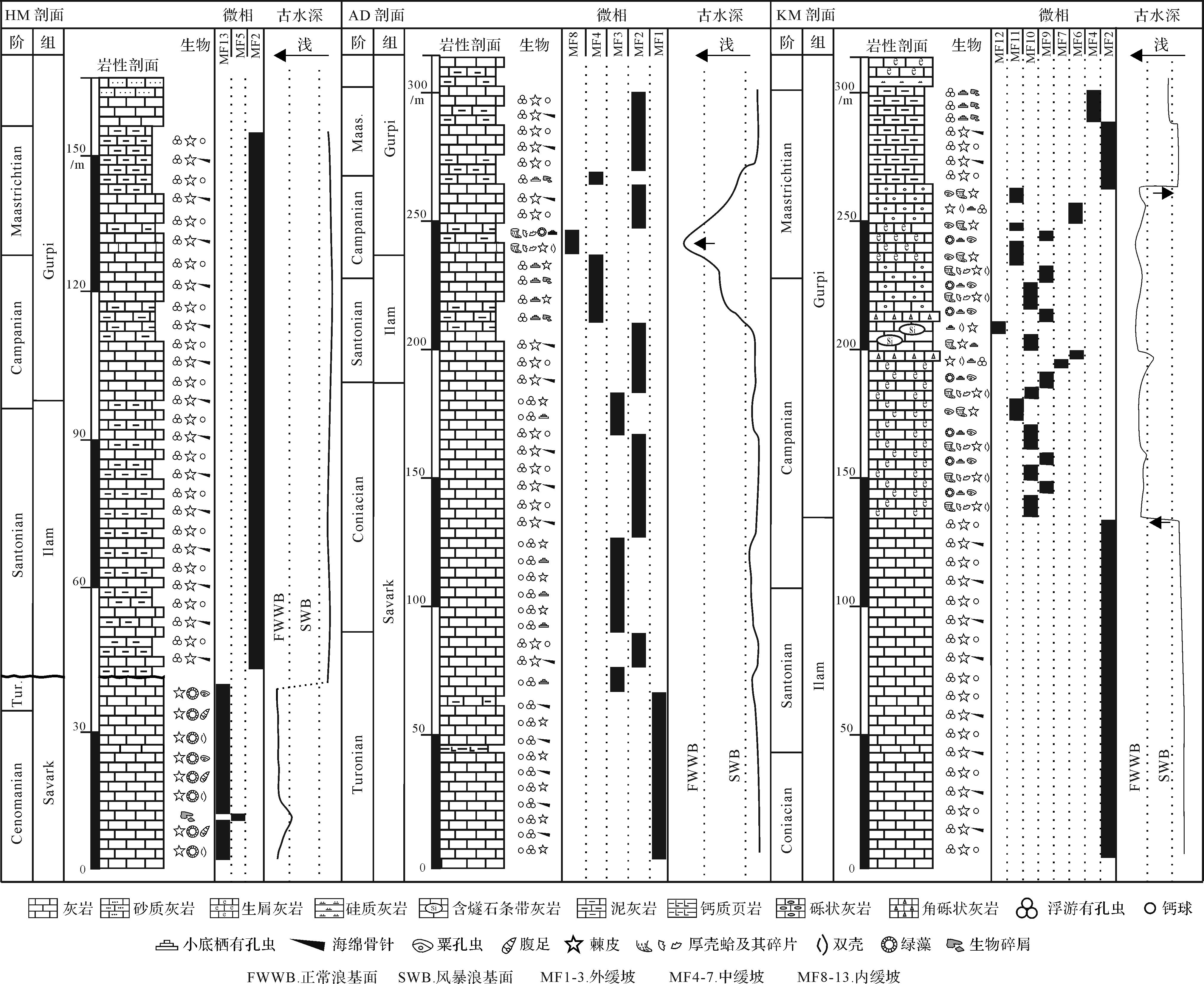
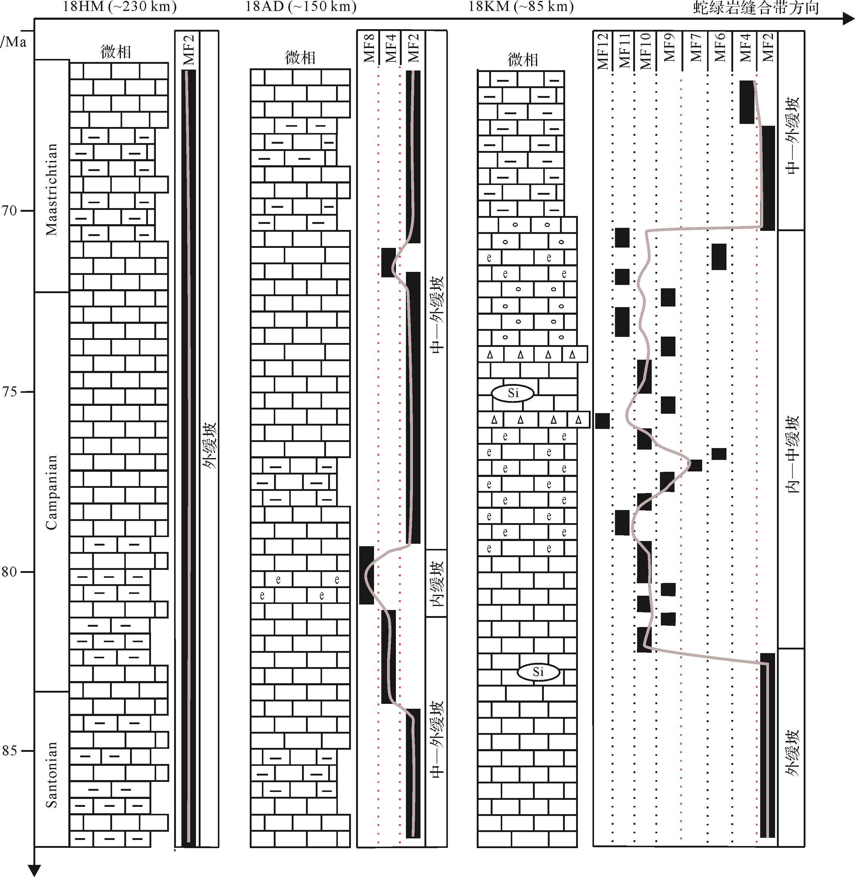
The Arab region in the Middle East has developed extremely thick carbonate deposits since the Late Cretaceous, creating favorable reservoirs for oil and gas resources. The evolution of its sedimentary environment has long been a focus of the international academic community. In this study, three stratigraphic sections (Kermanshan-KM section, Khoramabad-AD section, Hkhormoj-HM section) are taken as the research objects located in the Lurestan-Fars areas on the northern margin of the Arabian Plate (Zagros, Iran). Detailed field observation and thin section analysis of the Upper Cretaceous Savark, Ilam and Gurpi Formations are conducted. In total, 13 carbonate microfacies were identified and grouped into 3 sedimentary facies: outer, middle, and inner ramps. During the Santonian, these three sections were in a deep-water outer ramp environment, while in the Campanian, the AD and KM sections changed from outer to inner ramp, indicating a sudden shallowing of paleo-water depth. However, at the same time, the HM section was still in outer ramp. Considering the different distances between three sections from the ophiolite belt, we suggest that the shallowing events recorded in sections KM & AD of the Lurestan area during the Campanian are related to the ophiolite obduction in the north, while the HM section in the Fars area is too far away from the ophiolite belt.
The Arab region in the Middle East has developed extremely thick carbonate deposits since the Late Cretaceous, creating favorable reservoirs for oil and gas resources. The evolution of its sedimentary environment has long been a focus of the international academic community. In this study, three stratigraphic sections (Kermanshan-KM section, Khoramabad-AD section, Hkhormoj-HM section) are taken as the research objects located in the Lurestan-Fars areas on the northern margin of the Arabian Plate (Zagros, Iran). Detailed field observation and thin section analysis of the Upper Cretaceous Savark, Ilam and Gurpi Formations are conducted. In total, 13 carbonate microfacies were identified and grouped into 3 sedimentary facies: outer, middle, and inner ramps. During the Santonian, these three sections were in a deep-water outer ramp environment, while in the Campanian, the AD and KM sections changed from outer to inner ramp, indicating a sudden shallowing of paleo-water depth. However, at the same time, the HM section was still in outer ramp. Considering the different distances between three sections from the ophiolite belt, we suggest that the shallowing events recorded in sections KM & AD of the Lurestan area during the Campanian are related to the ophiolite obduction in the north, while the HM section in the Fars area is too far away from the ophiolite belt.
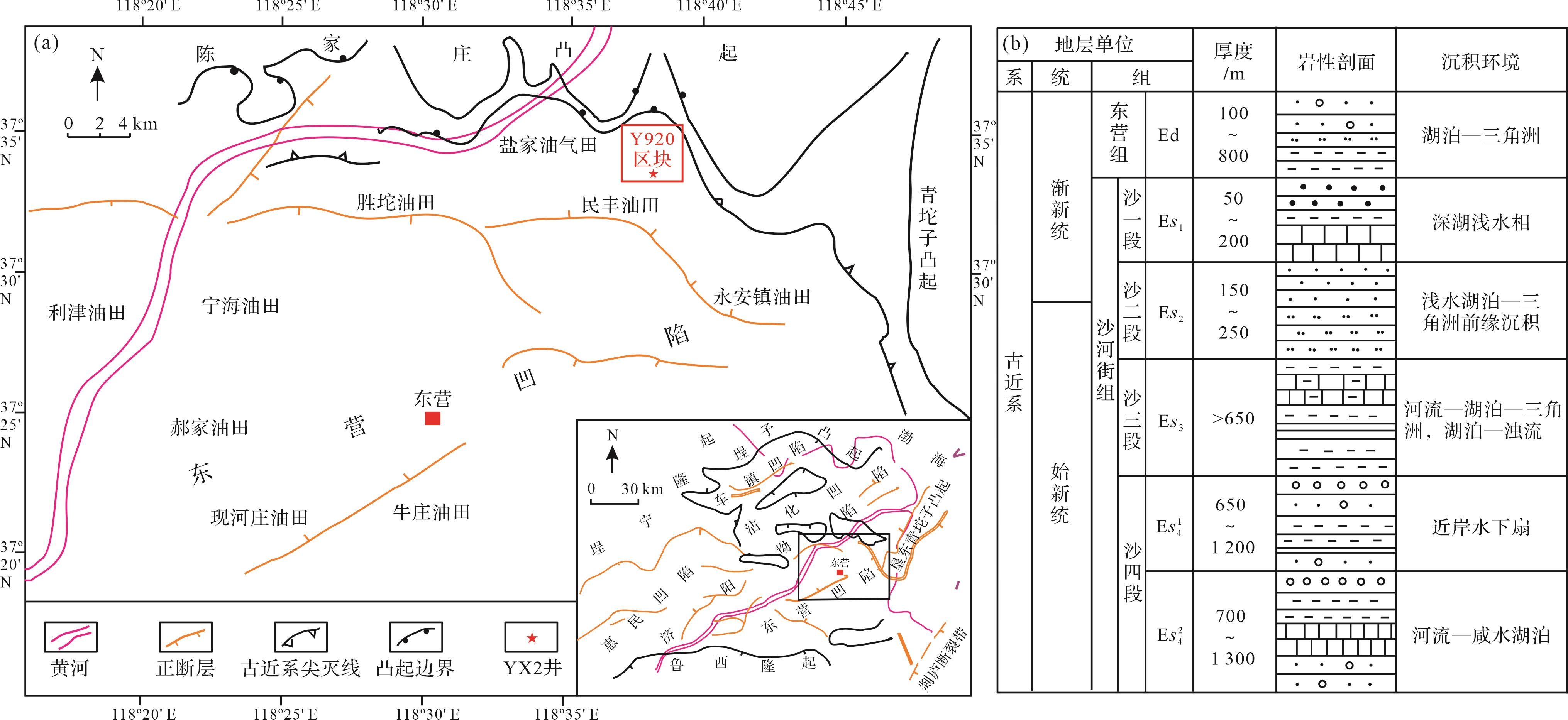
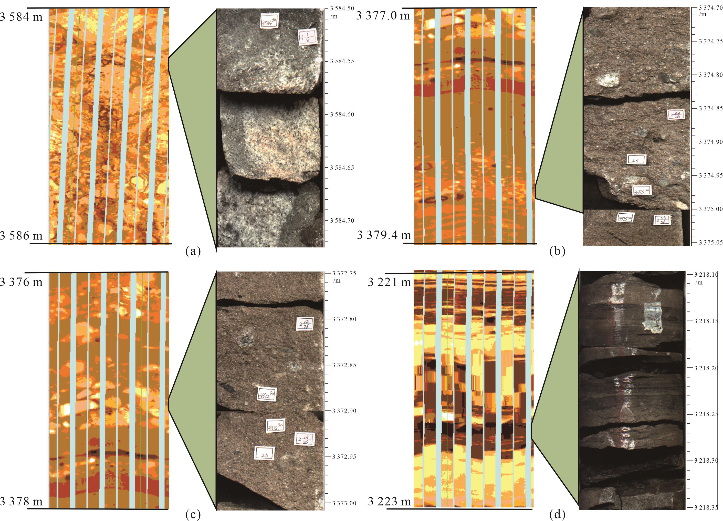
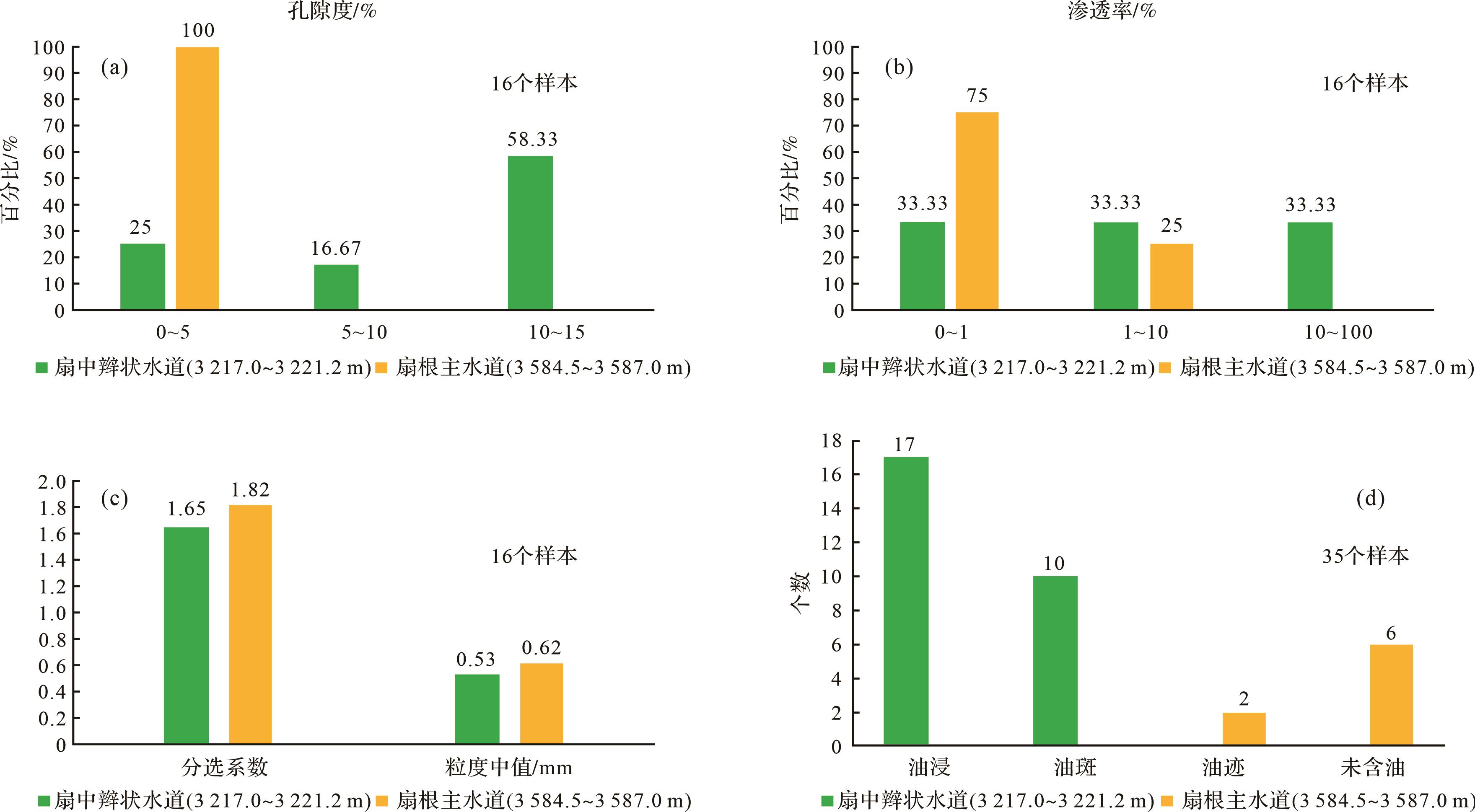
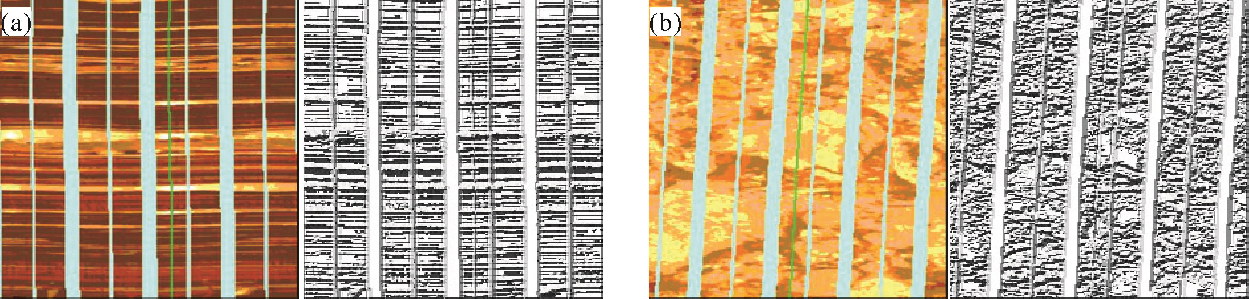
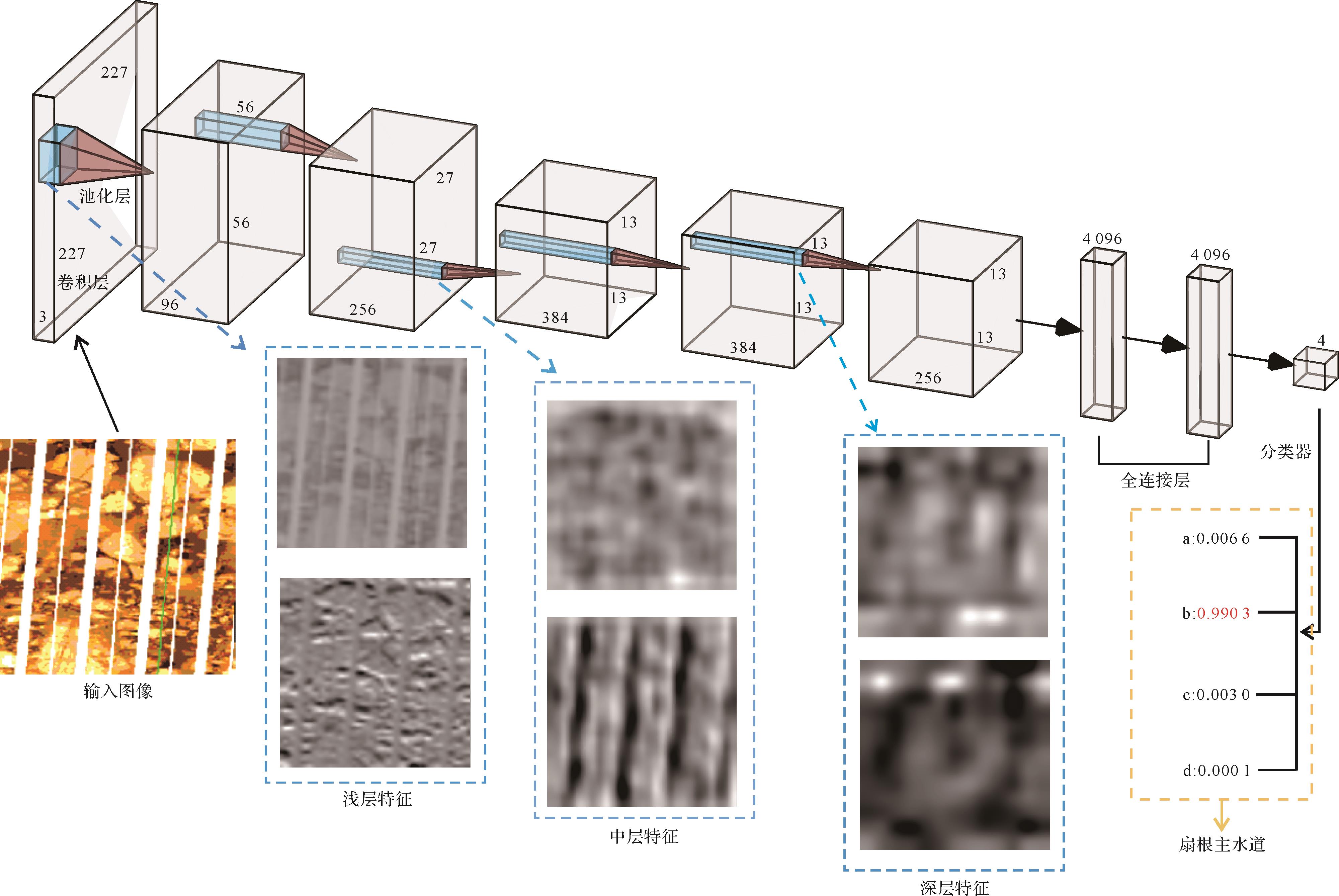
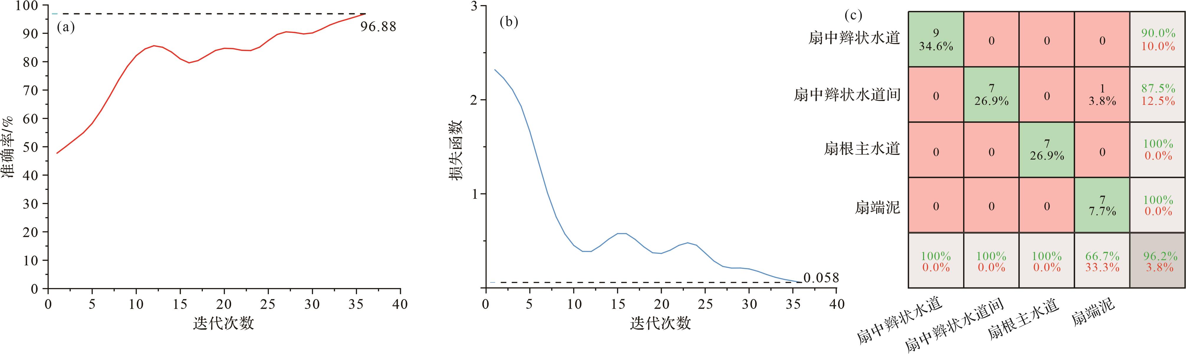
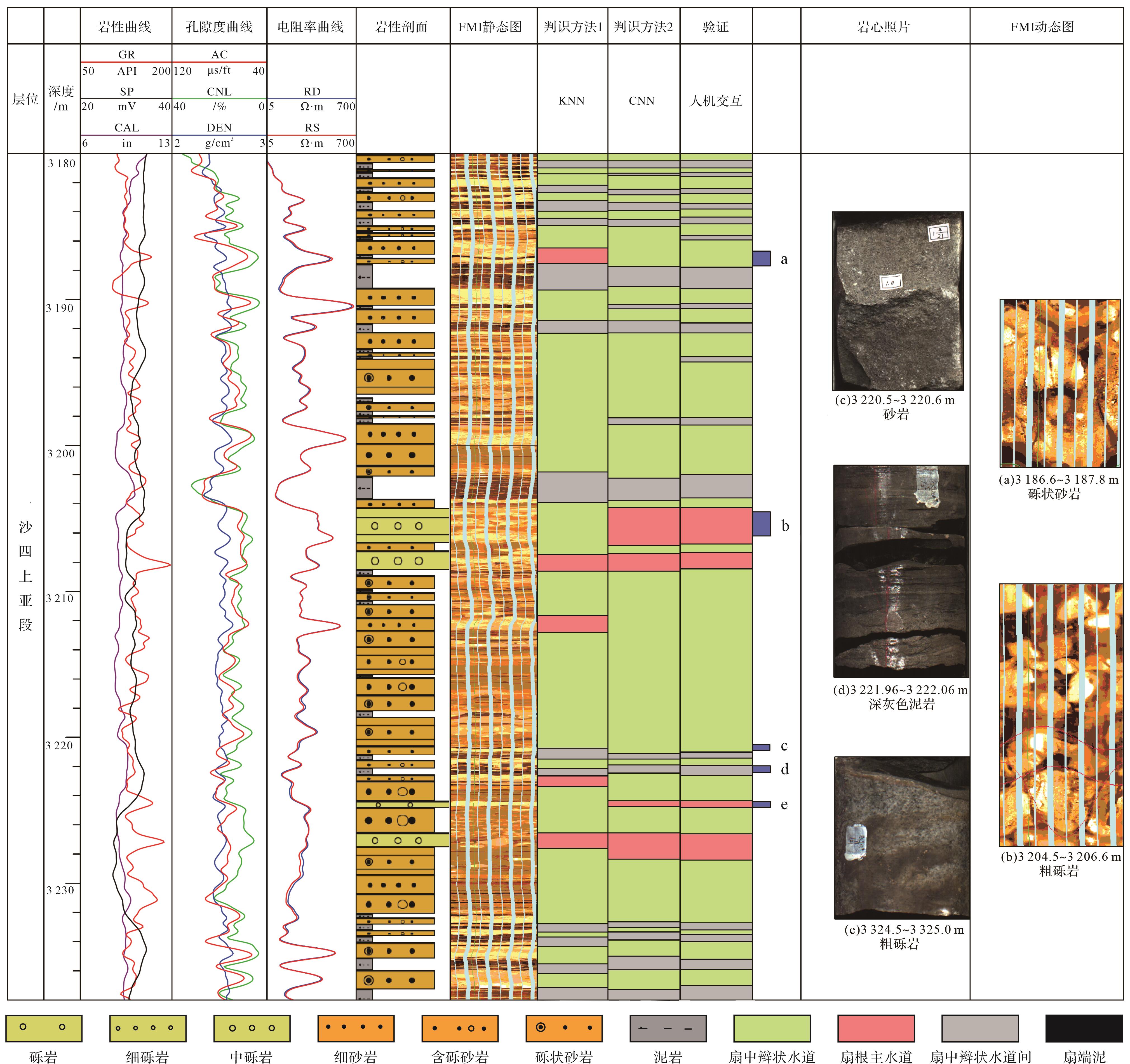
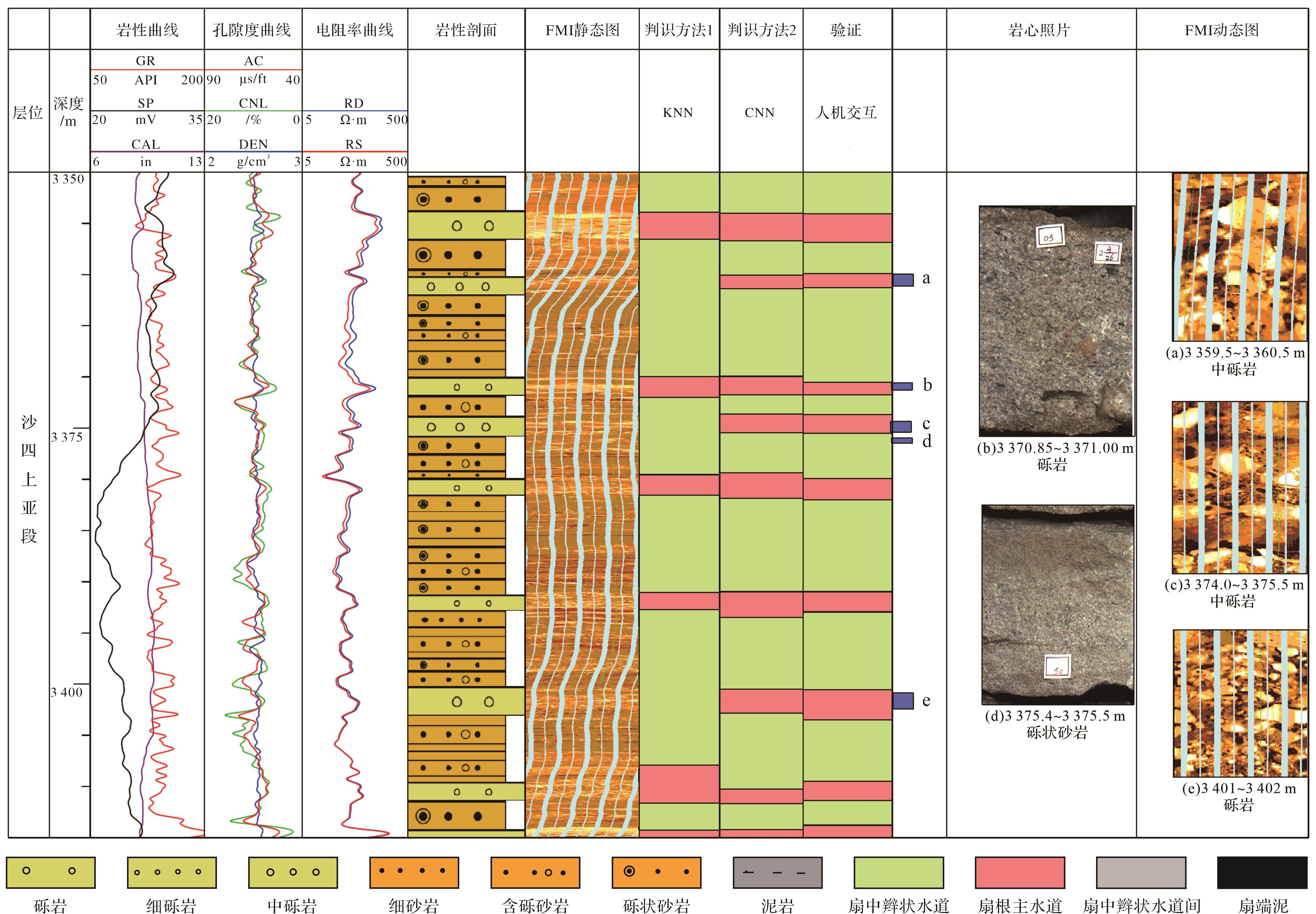
2023, 41(4): 1138-1152.
doi: 10.14027/j.issn.1000-0550.2021.148
Abstract:
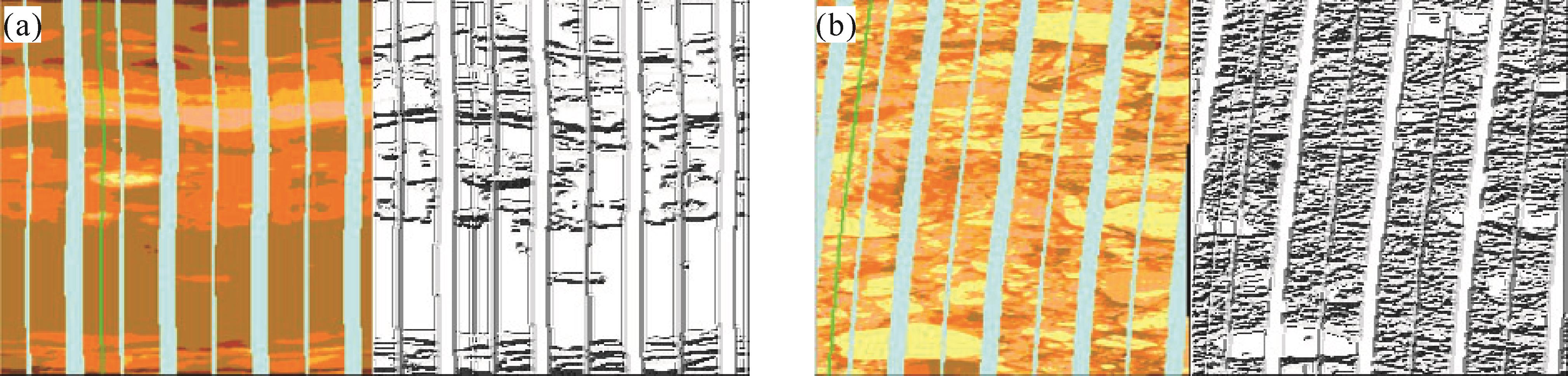
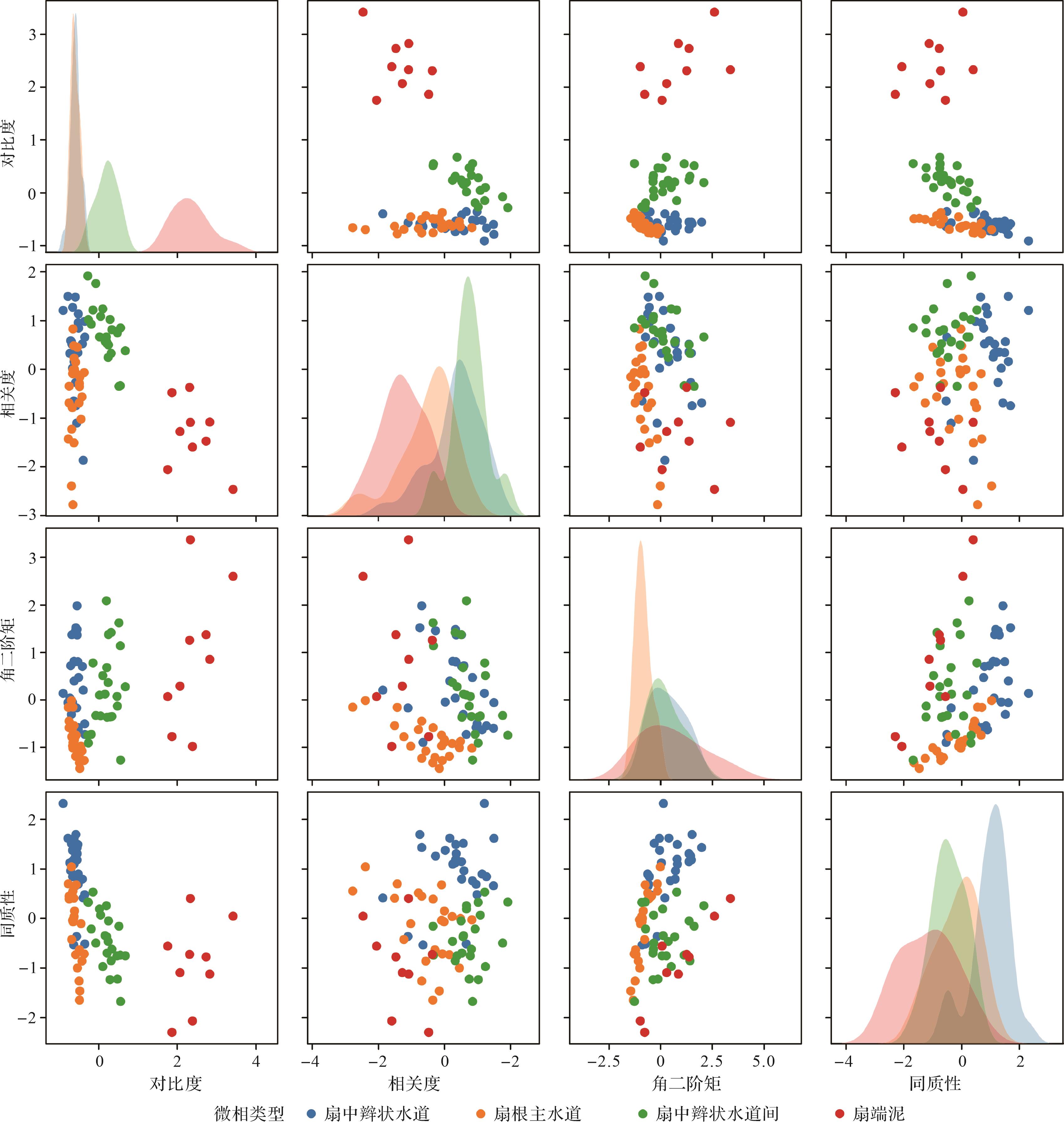
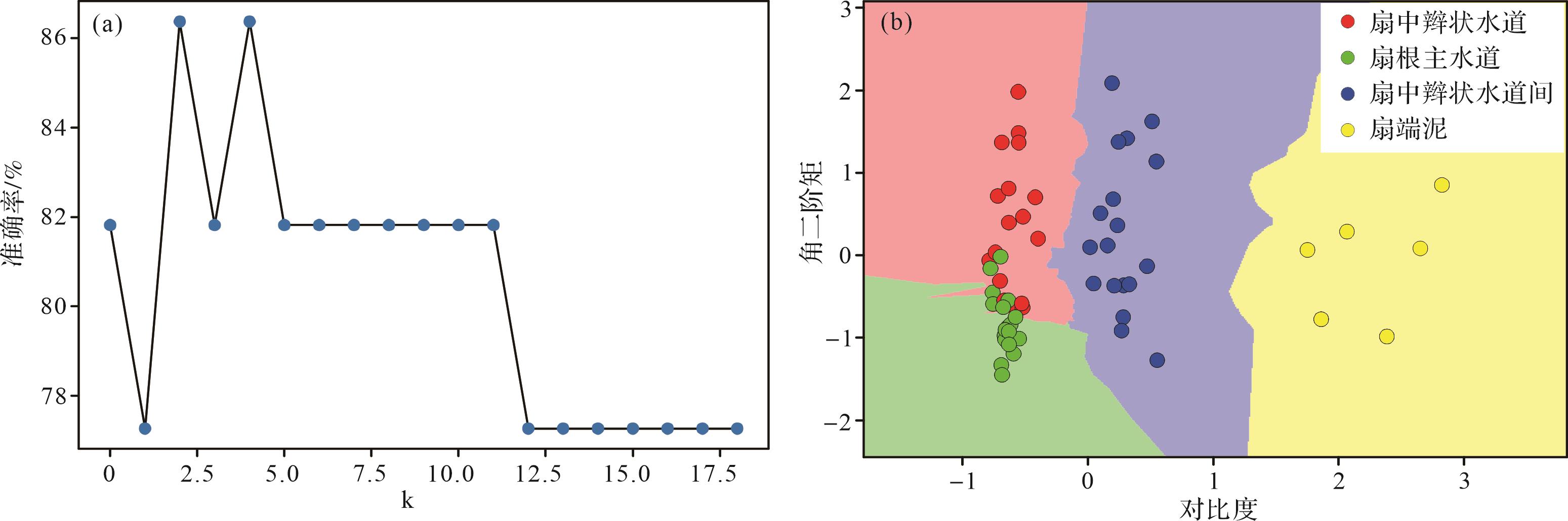
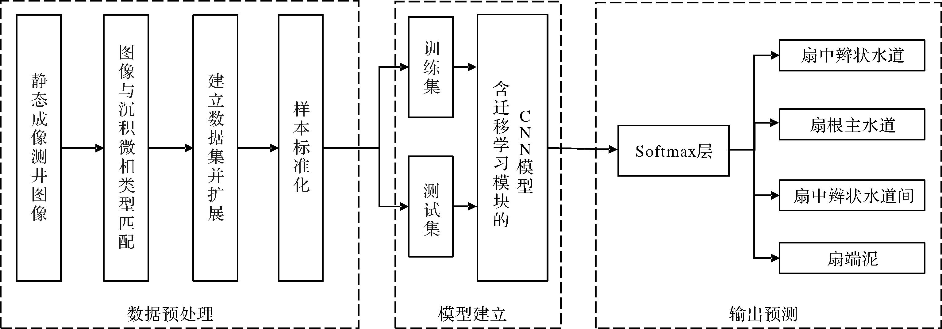
Sandy conglomerate bodies are the result of rapid near-source accumulation of sediment, with multi-phase superposition of fan bodies, and diverse, non-homogeneous lithological properties. Conventional logging is adversely affected by coarse clastic rock formations and fluid complexity, which often hinder the identification of sedimentary microphases. In this study, core-scale full borehole micro-resistivity scanning imaging (FMI) of the sand and gravel body was used to summarize the properties of each sedimentary microphase. The relationships between microphases and lithology, physical properties and oil content were analyzed. The contrast, correlation, angular second-order moments, and the four texture parameters and FMI images of the core sections were used as learning samples for the k-nearest neighbors classification algorithm (KNN) and convolutional neural network (CNN). The machine-learning and deep-learning networks were trained to classifiy and identify sedimentary microphases. The results show that this sand and gravel body is divided into four microphase types: fan-root main channel, mid-fan braided channel, inter-fan braided channel and fan-end mud. The KNN classification algorithm and CNN network model were both able to identify the sedimentary microphases, but the CNN deep-learning model showed smaller error and greater robustness than traditional KNN machine learning. The application of FMI image-feature extraction together with CNN deepens the understanding of the internal structure of sedimentary microphases in gravels, and provides a basis for fine characterization of sedimentary microphases and effective reservoir prediction.
Sandy conglomerate bodies are the result of rapid near-source accumulation of sediment, with multi-phase superposition of fan bodies, and diverse, non-homogeneous lithological properties. Conventional logging is adversely affected by coarse clastic rock formations and fluid complexity, which often hinder the identification of sedimentary microphases. In this study, core-scale full borehole micro-resistivity scanning imaging (FMI) of the sand and gravel body was used to summarize the properties of each sedimentary microphase. The relationships between microphases and lithology, physical properties and oil content were analyzed. The contrast, correlation, angular second-order moments, and the four texture parameters and FMI images of the core sections were used as learning samples for the k-nearest neighbors classification algorithm (KNN) and convolutional neural network (CNN). The machine-learning and deep-learning networks were trained to classifiy and identify sedimentary microphases. The results show that this sand and gravel body is divided into four microphase types: fan-root main channel, mid-fan braided channel, inter-fan braided channel and fan-end mud. The KNN classification algorithm and CNN network model were both able to identify the sedimentary microphases, but the CNN deep-learning model showed smaller error and greater robustness than traditional KNN machine learning. The application of FMI image-feature extraction together with CNN deepens the understanding of the internal structure of sedimentary microphases in gravels, and provides a basis for fine characterization of sedimentary microphases and effective reservoir prediction.
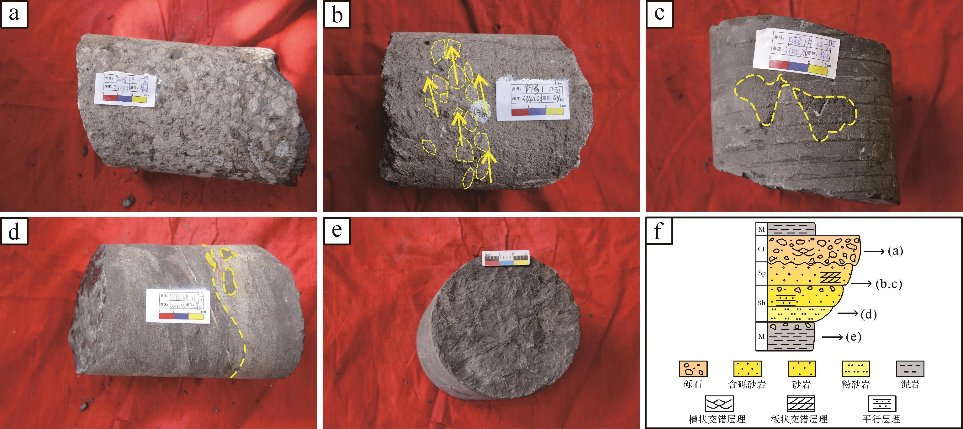
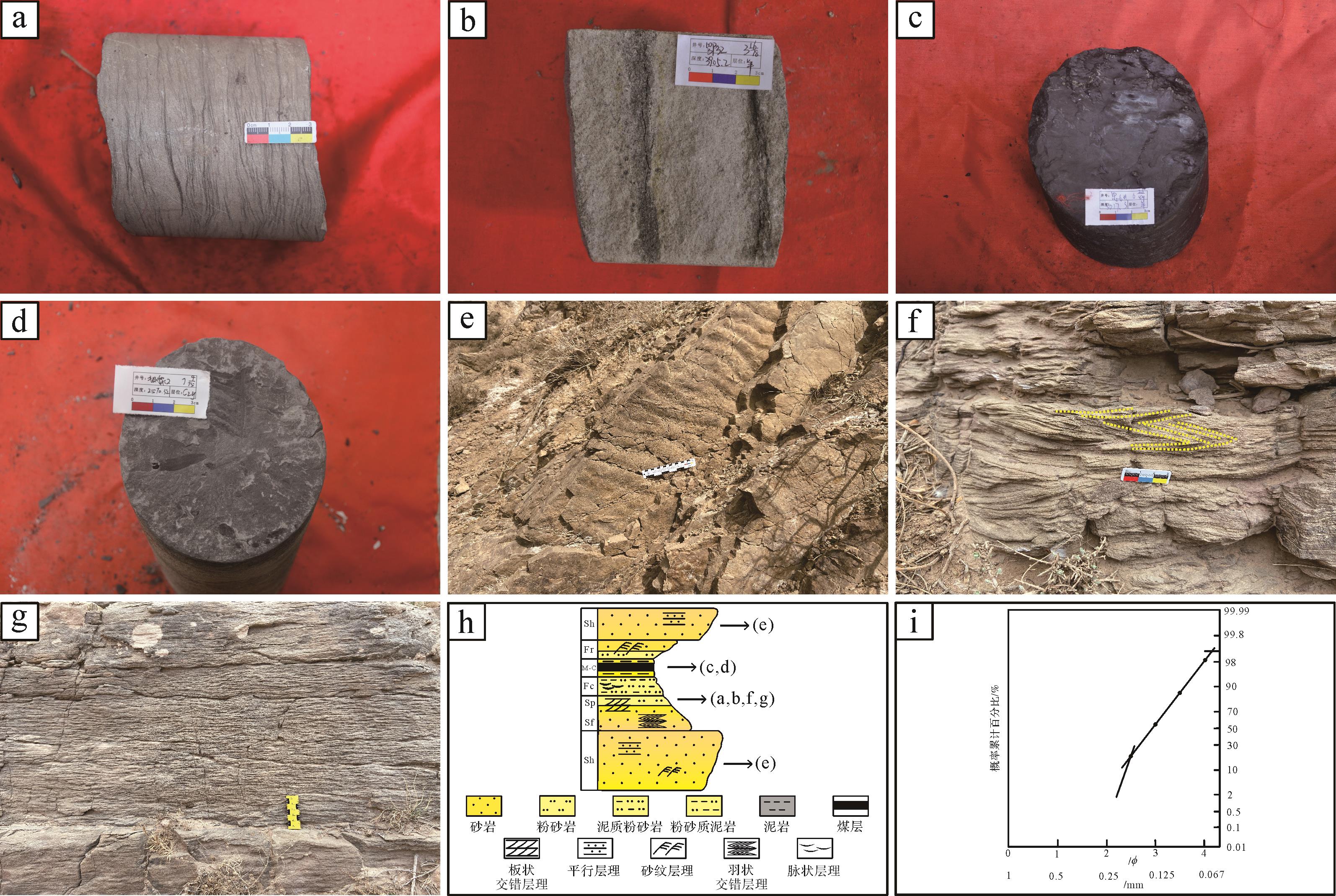
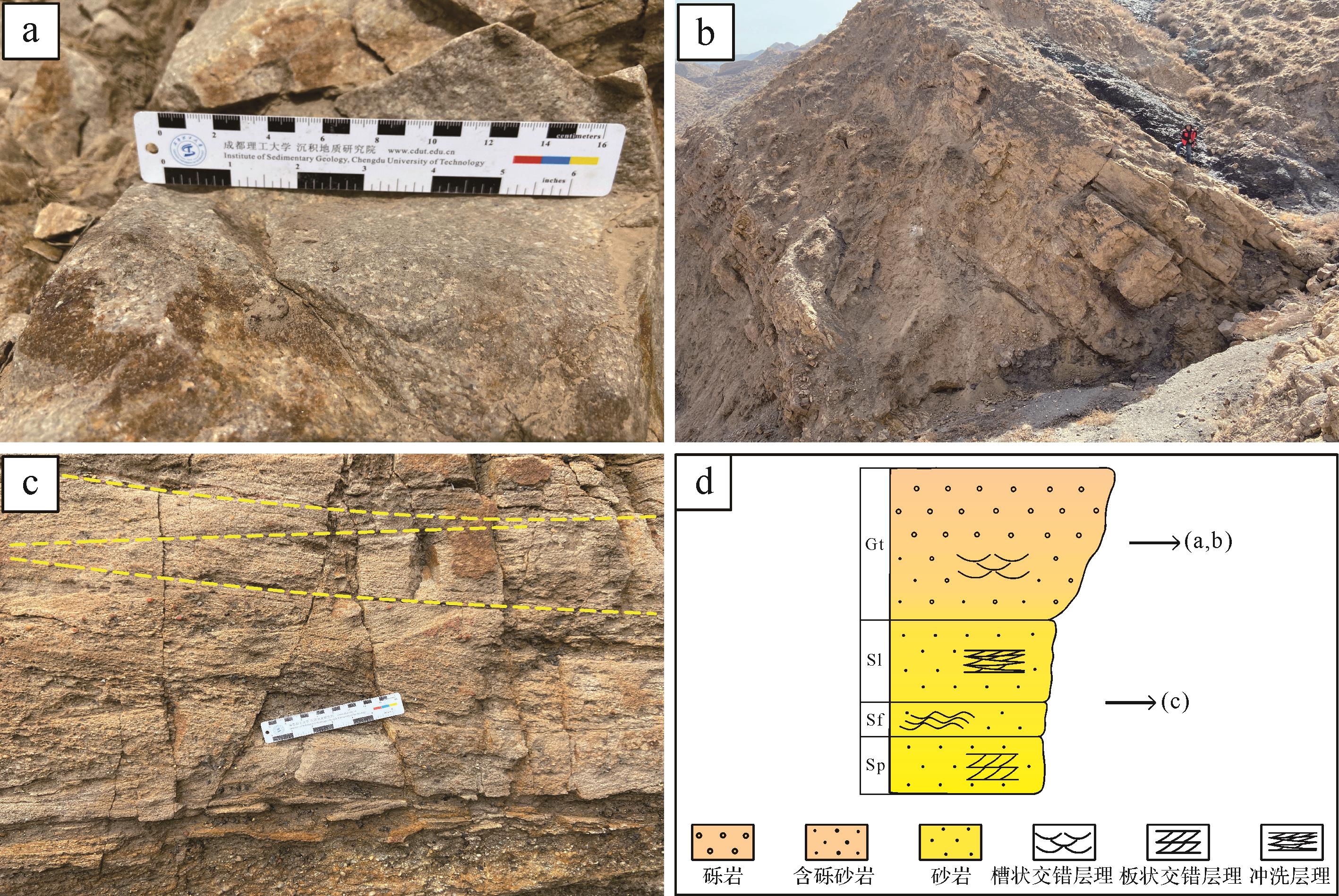
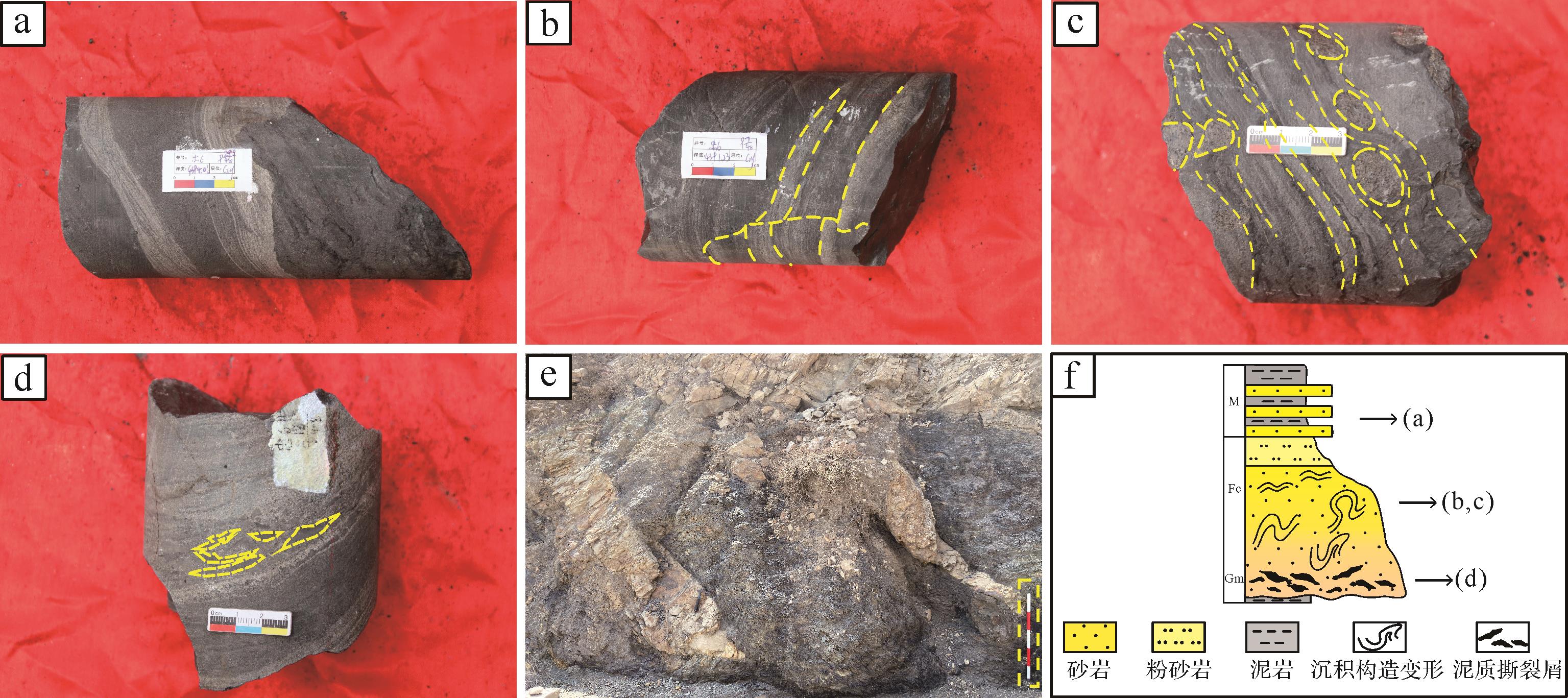
2023, 41(4): 1153-1169.
doi: 10.14027/j.issn.1000-0550.2022.001
Abstract:
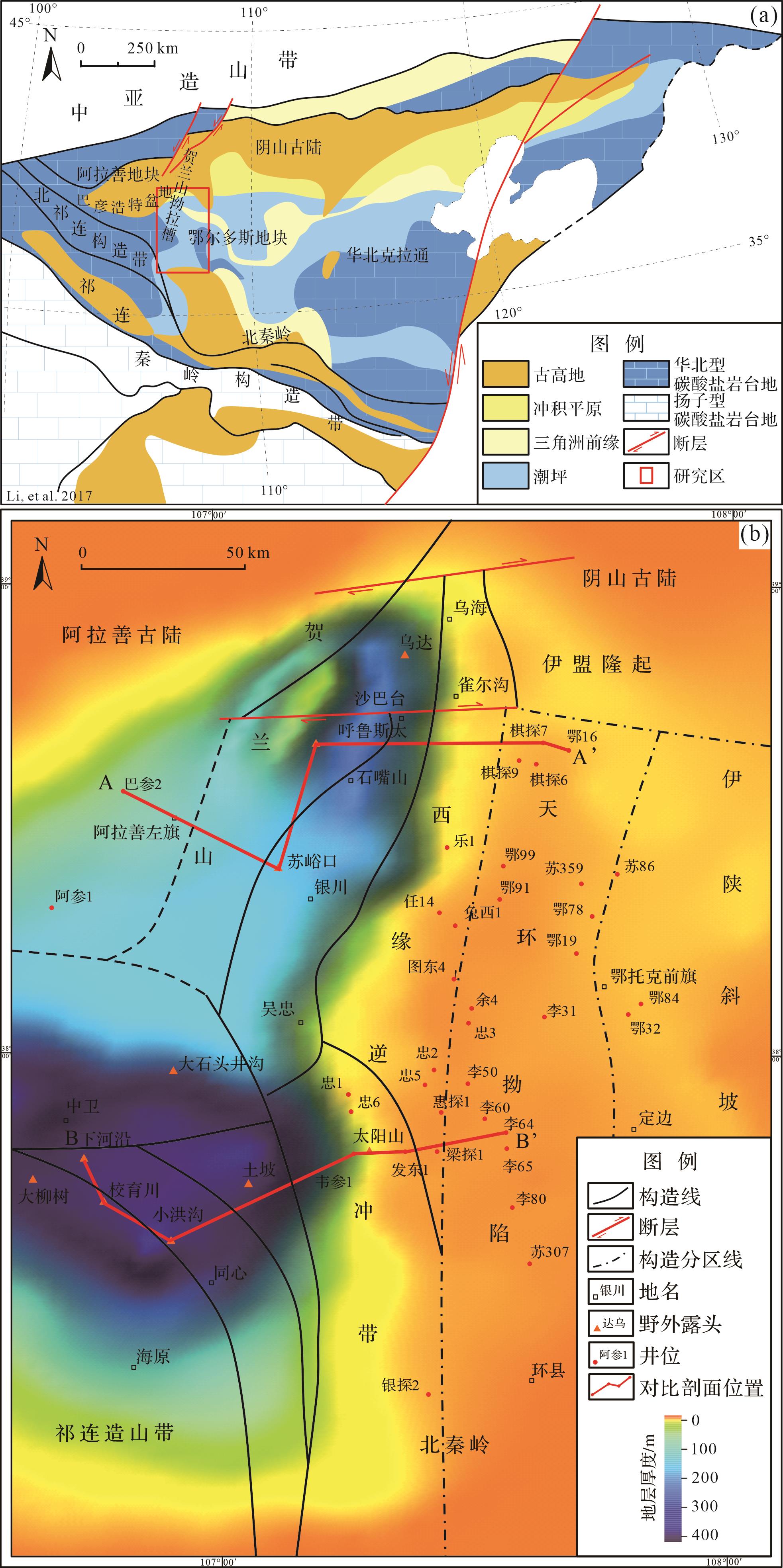
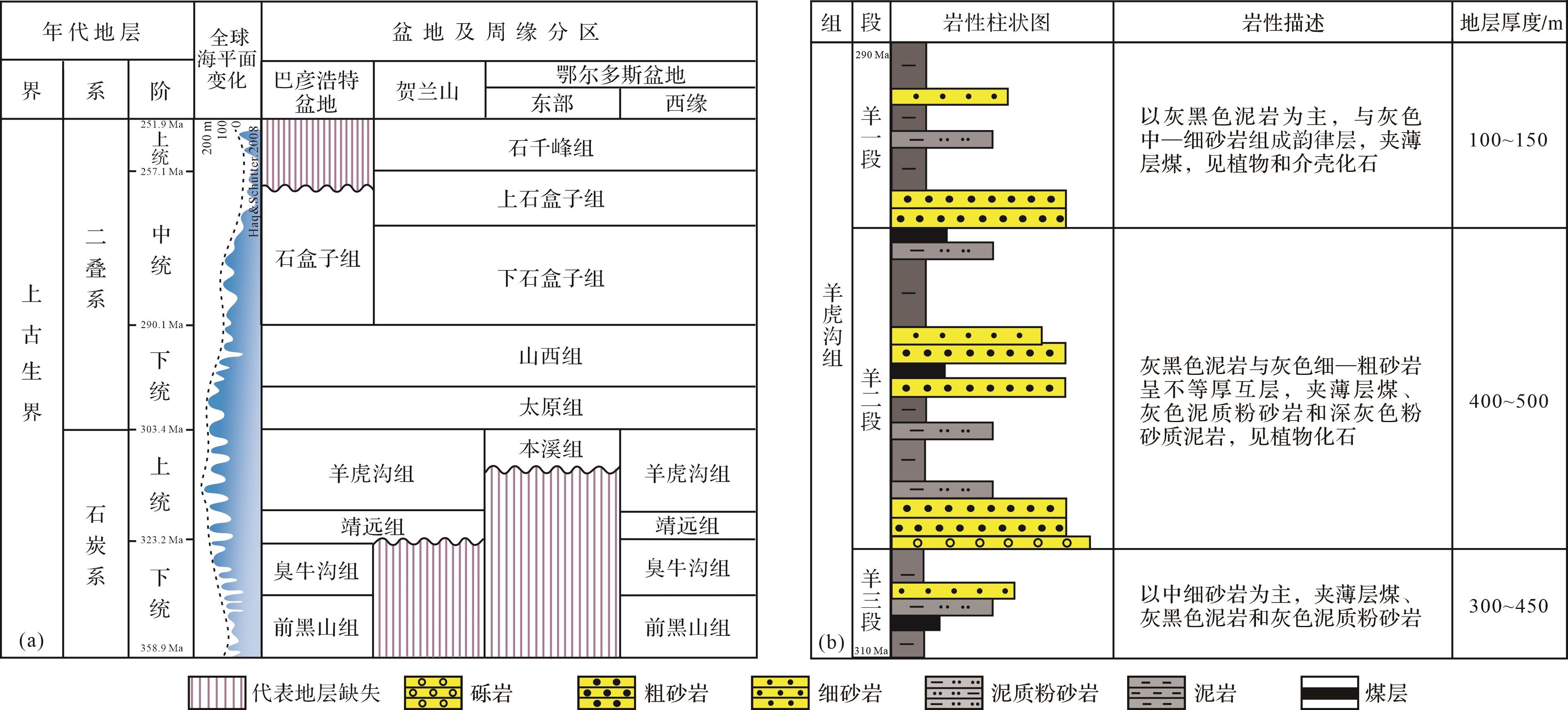
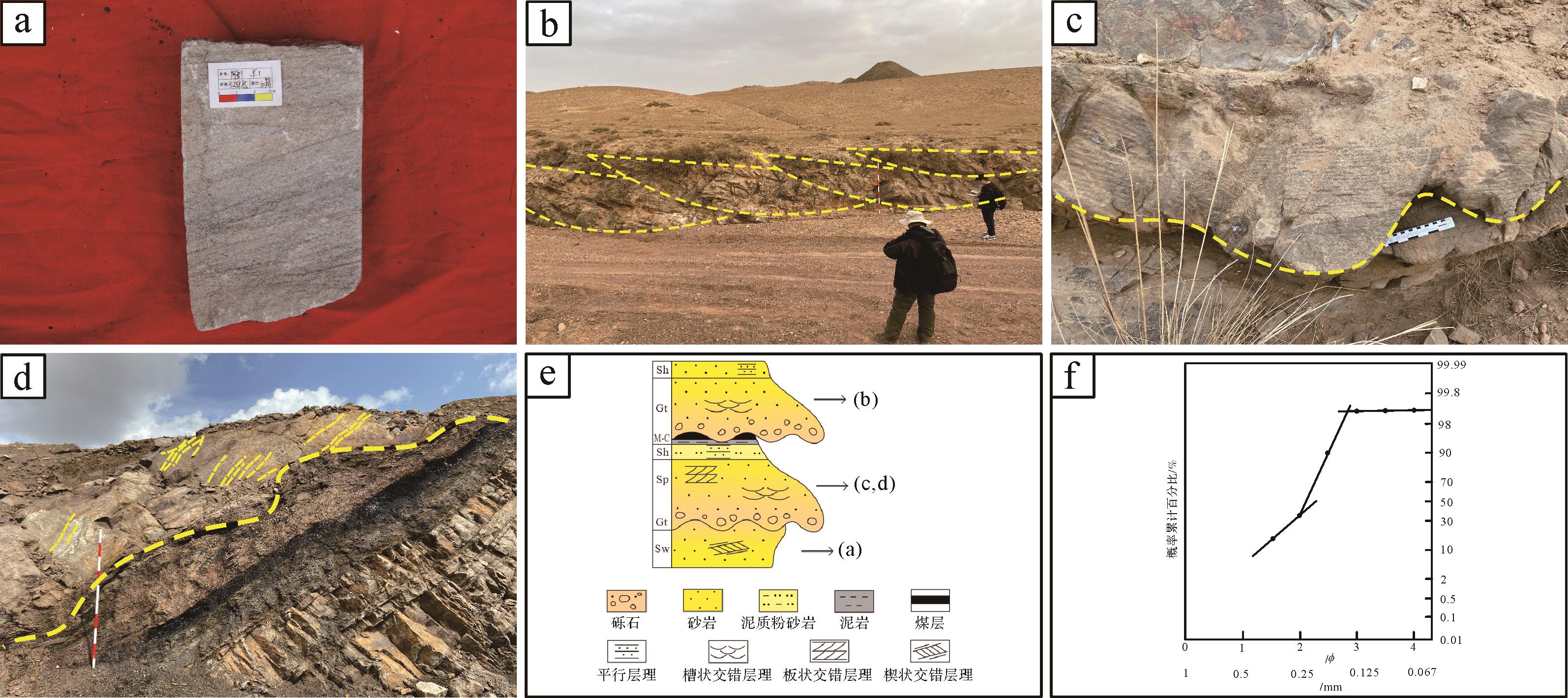
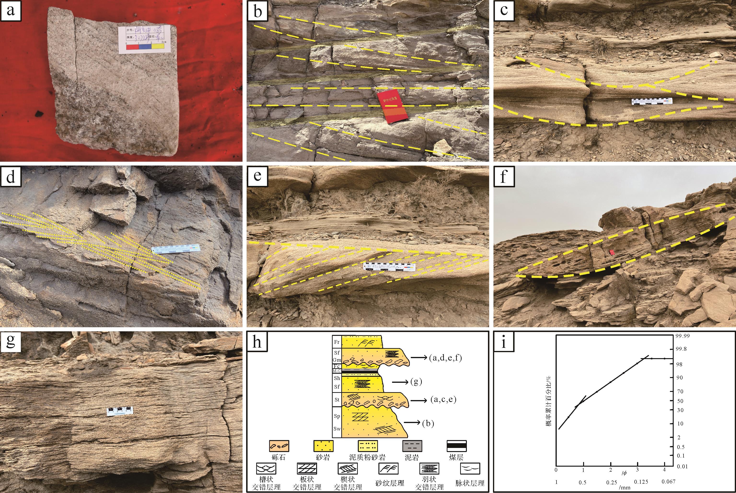
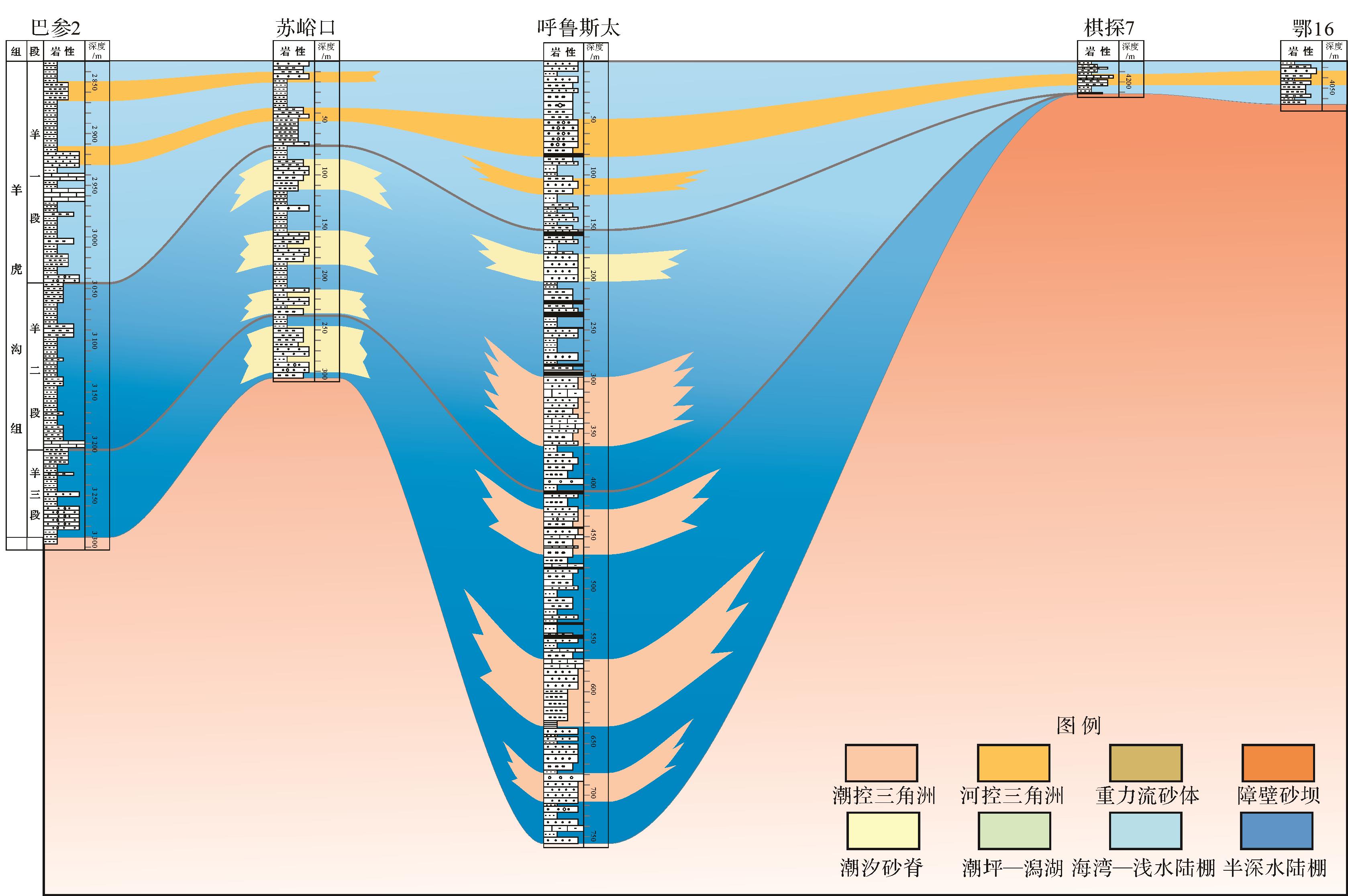
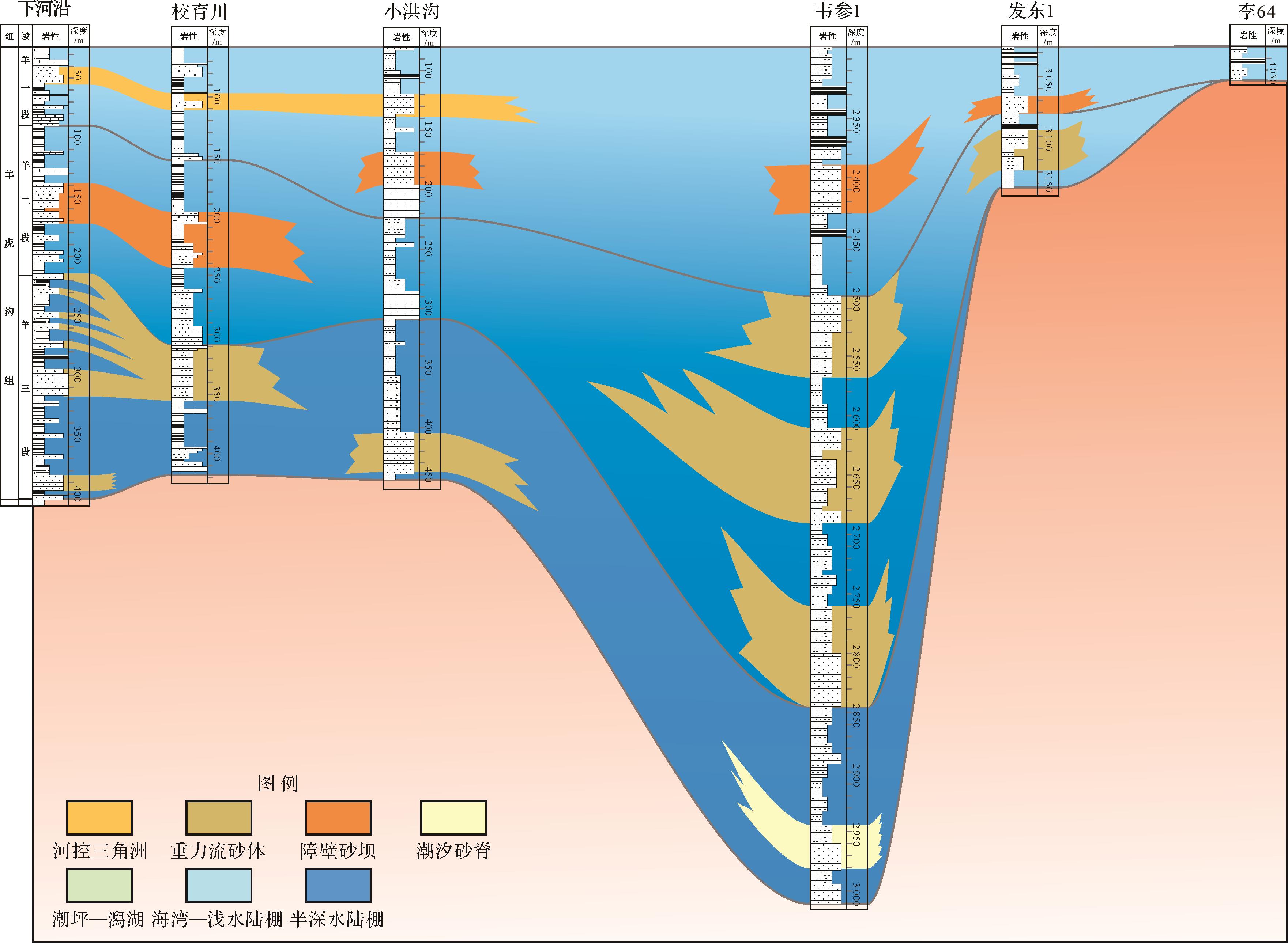
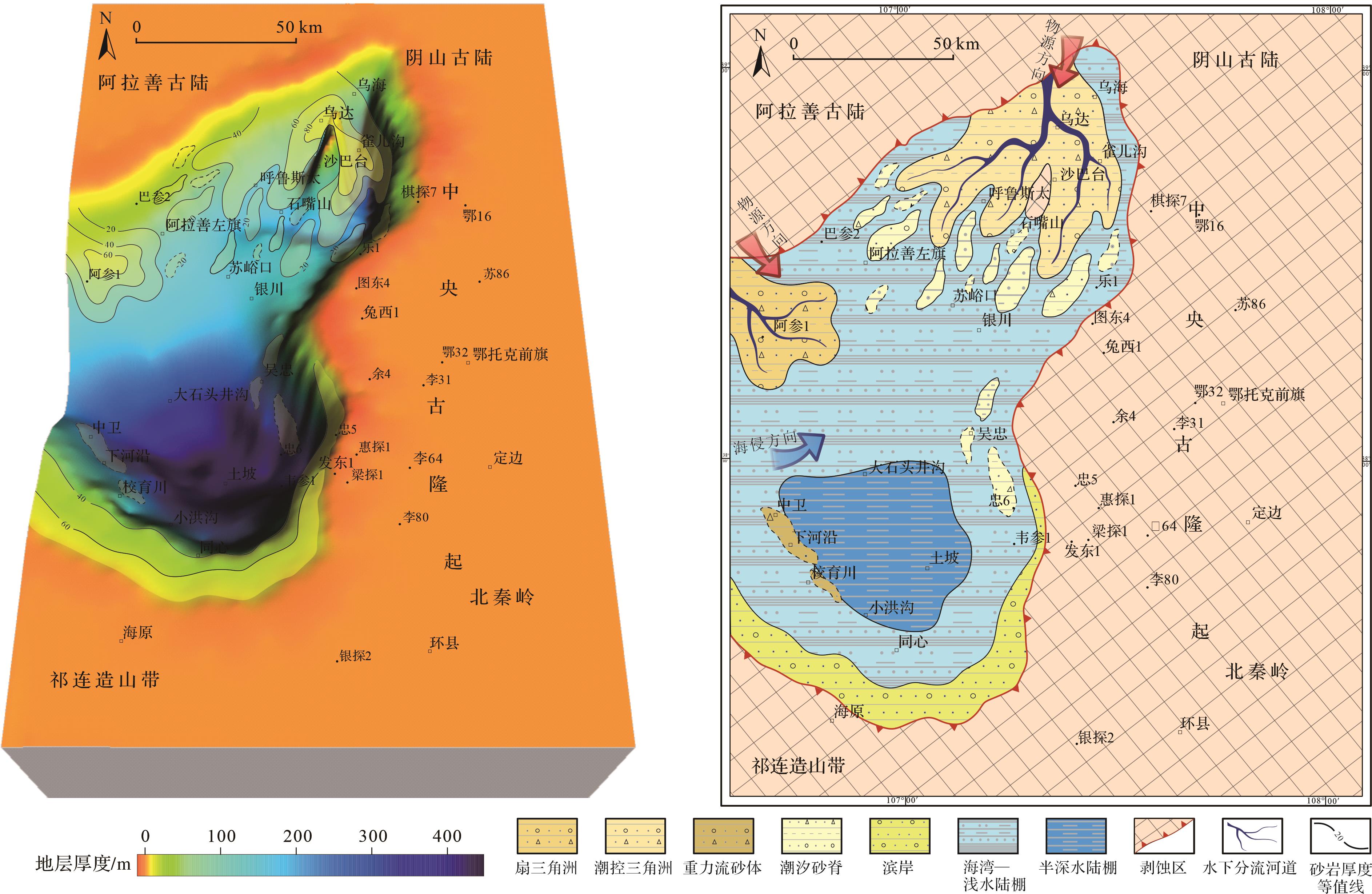
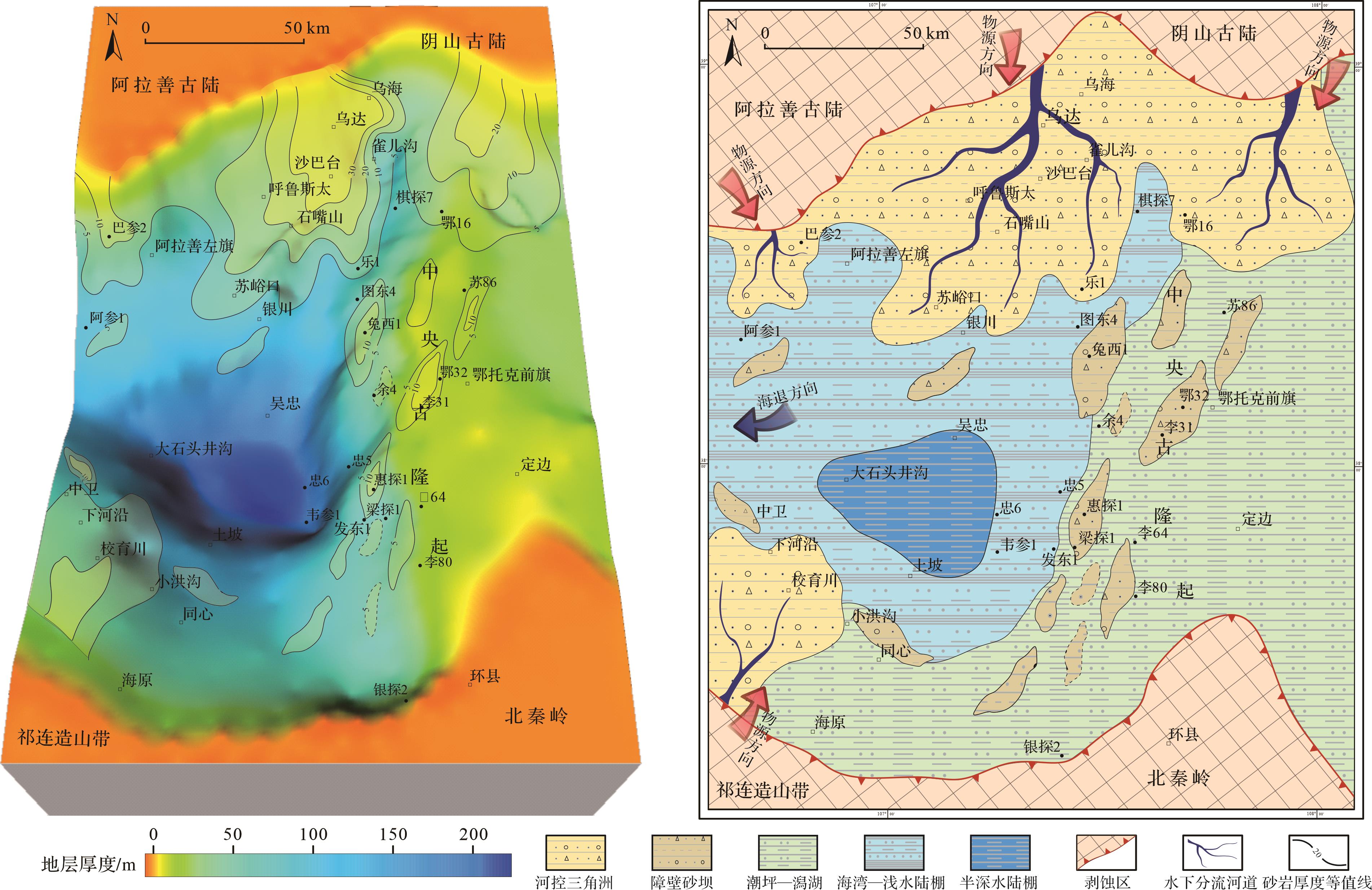
The depositional period of the Yanghugou Formation in the western margin of the Ordos Basin was a resurrected aulacogen after the Caledonian movement. The Yanghugou Formation has a wide stratigraphic distribution area, large thickness variations, well-developed source-reservoir-caprock association, and huge exploration potential. Owing to the strong tectonic movements and frequent changes in the sedimentary environment, the sedimentary genesis of the sandy sediments are complicated. Currently, there is a lack of systematic research on the genetic mechanism of the Yanghugou Formation sandy sediments. A single depositional model cannot fully summarize the sedimentary characteristics and distribution laws of various sandy sediments. In this study, six types of lithofacies associations were identified through field profile, core observation, drilling data, provenance analysis, and other research methods. Based on the lithology, grain size, sedimentary structure, and sandy sediment distribution characteristics in various periods, we conduct a systematic discussion on its genetic mechanism and dispersion process. The sandy sediments of the Yanghugou Formation in the western margin of the Ordos Basin are mainly by fluvial deltas, tide-controlled deltas, fan deltas, barrier island coasts, barrier-free coasts, and slump gravity flows. The overall climate of the Yanghugou Formation was humid, and the sea level gradually rose during the deposition of the 3rd the 2nd member of the Yanghugou Formation, and then gradually decreased after the 2nd member of the Yanghugou Formation reached the highest levle. The sedimentary period of the 3rd member of the Yanghugou Formation was the early stage of rifting. Tide-controlled and fan delta sandy sediments were primarily developed in the northern region of the study area. Tidal sand ridges can be seen in the central part. The southern sandy sediments are generally barrier-free coastal sediments. The sedimentary period of the 2nd member of the Yanghugou Formation is the climax of rifting. The increase of landform drop leads to the rapid deepening of the water body, and the sandy sediments were primarily distributed on the edge of the basin. Point slump gravity flow sandy sediments developed in the deep-water of the center of the basin. The tidal sand ridges near the central paleo-uplift in the East is gradually transformed into barrier sand dams, and the high parts of the paleo-uplift were deposited with tidal flats and lagoons. During the sedimentary period of the 1st member of the Yanghugou Formation, the tectonic activity weakened and the Ordos Basin gradually connected to the east and west. The provenance supply was sufficient and the landform becomes slower, and a large area of fluvial delta sandy sediments with progradation characteristics are developed. The genetic mechanism of the Yanghugou Formation sandy sediments is affected by many factors, such as tectonic movement, paleogeomorphic evolution, provenance supply, paleoclimate, sedimentary dynamic environment, and so on. However, the distribution of sandy sediments and the process of sandy sediments dispersion are controlled by tectonic activities and paleogeographic evolution. The research results are of great significance for enriching the oil and gas exploration theory in the Ordos Basin and the genetic mechanism of rifted basin sandy sediments.
The depositional period of the Yanghugou Formation in the western margin of the Ordos Basin was a resurrected aulacogen after the Caledonian movement. The Yanghugou Formation has a wide stratigraphic distribution area, large thickness variations, well-developed source-reservoir-caprock association, and huge exploration potential. Owing to the strong tectonic movements and frequent changes in the sedimentary environment, the sedimentary genesis of the sandy sediments are complicated. Currently, there is a lack of systematic research on the genetic mechanism of the Yanghugou Formation sandy sediments. A single depositional model cannot fully summarize the sedimentary characteristics and distribution laws of various sandy sediments. In this study, six types of lithofacies associations were identified through field profile, core observation, drilling data, provenance analysis, and other research methods. Based on the lithology, grain size, sedimentary structure, and sandy sediment distribution characteristics in various periods, we conduct a systematic discussion on its genetic mechanism and dispersion process. The sandy sediments of the Yanghugou Formation in the western margin of the Ordos Basin are mainly by fluvial deltas, tide-controlled deltas, fan deltas, barrier island coasts, barrier-free coasts, and slump gravity flows. The overall climate of the Yanghugou Formation was humid, and the sea level gradually rose during the deposition of the 3rd the 2nd member of the Yanghugou Formation, and then gradually decreased after the 2nd member of the Yanghugou Formation reached the highest levle. The sedimentary period of the 3rd member of the Yanghugou Formation was the early stage of rifting. Tide-controlled and fan delta sandy sediments were primarily developed in the northern region of the study area. Tidal sand ridges can be seen in the central part. The southern sandy sediments are generally barrier-free coastal sediments. The sedimentary period of the 2nd member of the Yanghugou Formation is the climax of rifting. The increase of landform drop leads to the rapid deepening of the water body, and the sandy sediments were primarily distributed on the edge of the basin. Point slump gravity flow sandy sediments developed in the deep-water of the center of the basin. The tidal sand ridges near the central paleo-uplift in the East is gradually transformed into barrier sand dams, and the high parts of the paleo-uplift were deposited with tidal flats and lagoons. During the sedimentary period of the 1st member of the Yanghugou Formation, the tectonic activity weakened and the Ordos Basin gradually connected to the east and west. The provenance supply was sufficient and the landform becomes slower, and a large area of fluvial delta sandy sediments with progradation characteristics are developed. The genetic mechanism of the Yanghugou Formation sandy sediments is affected by many factors, such as tectonic movement, paleogeomorphic evolution, provenance supply, paleoclimate, sedimentary dynamic environment, and so on. However, the distribution of sandy sediments and the process of sandy sediments dispersion are controlled by tectonic activities and paleogeographic evolution. The research results are of great significance for enriching the oil and gas exploration theory in the Ordos Basin and the genetic mechanism of rifted basin sandy sediments.

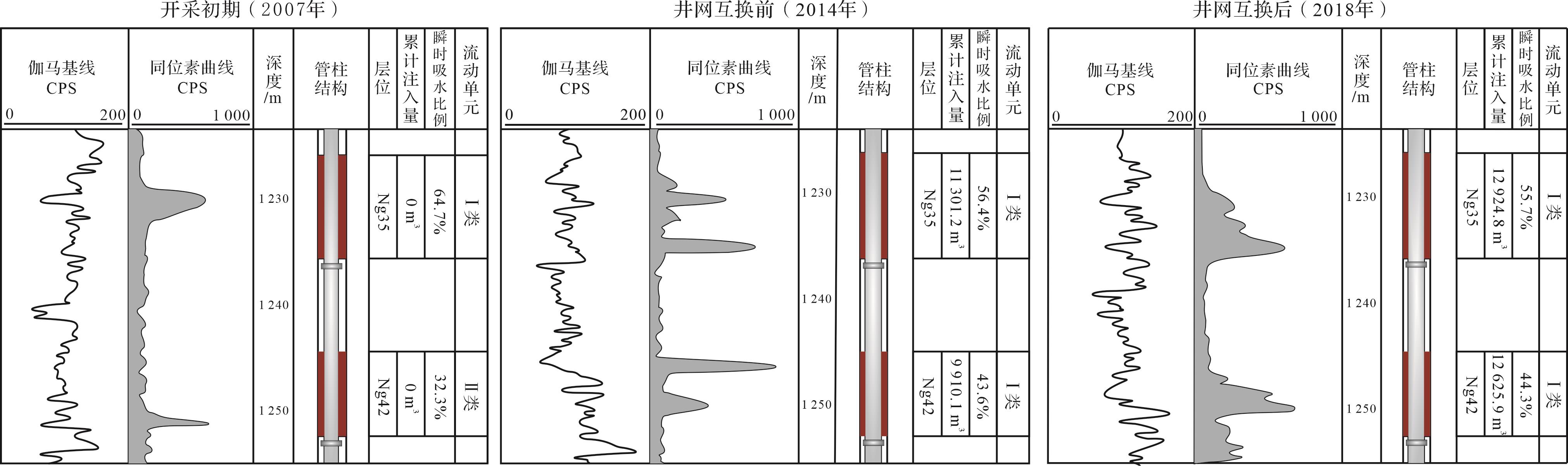
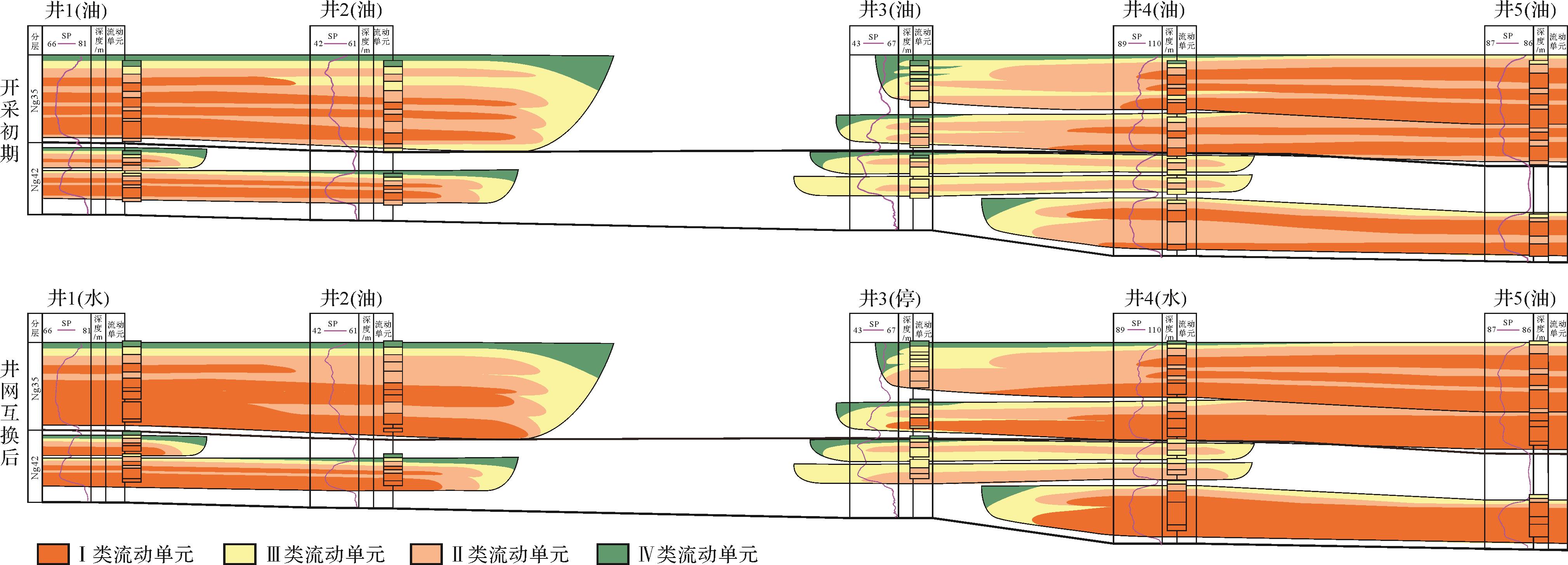
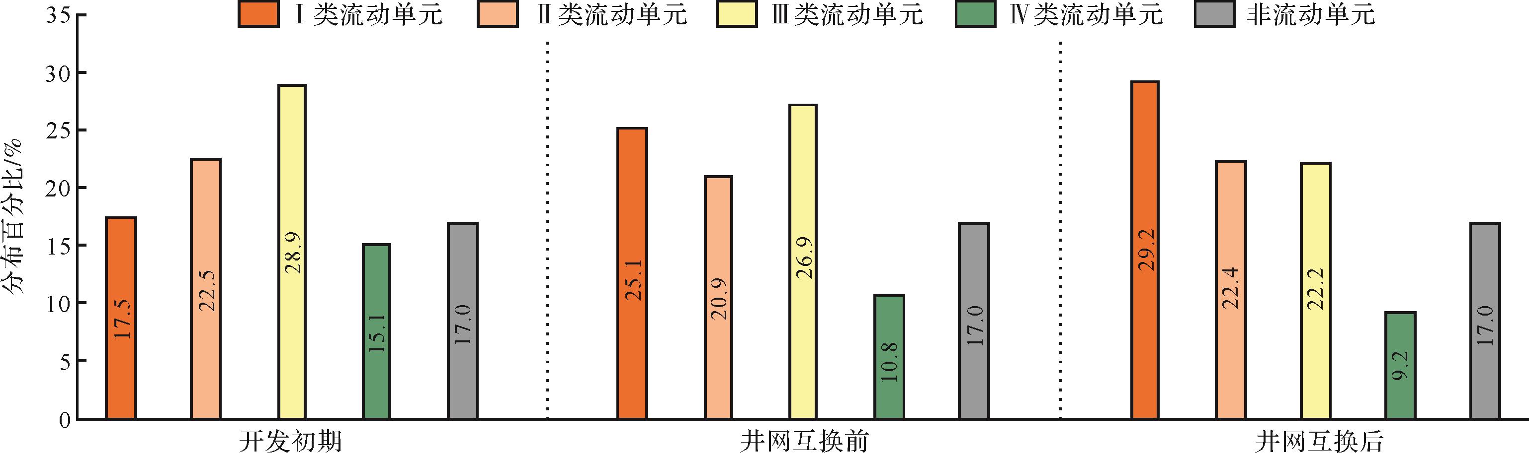
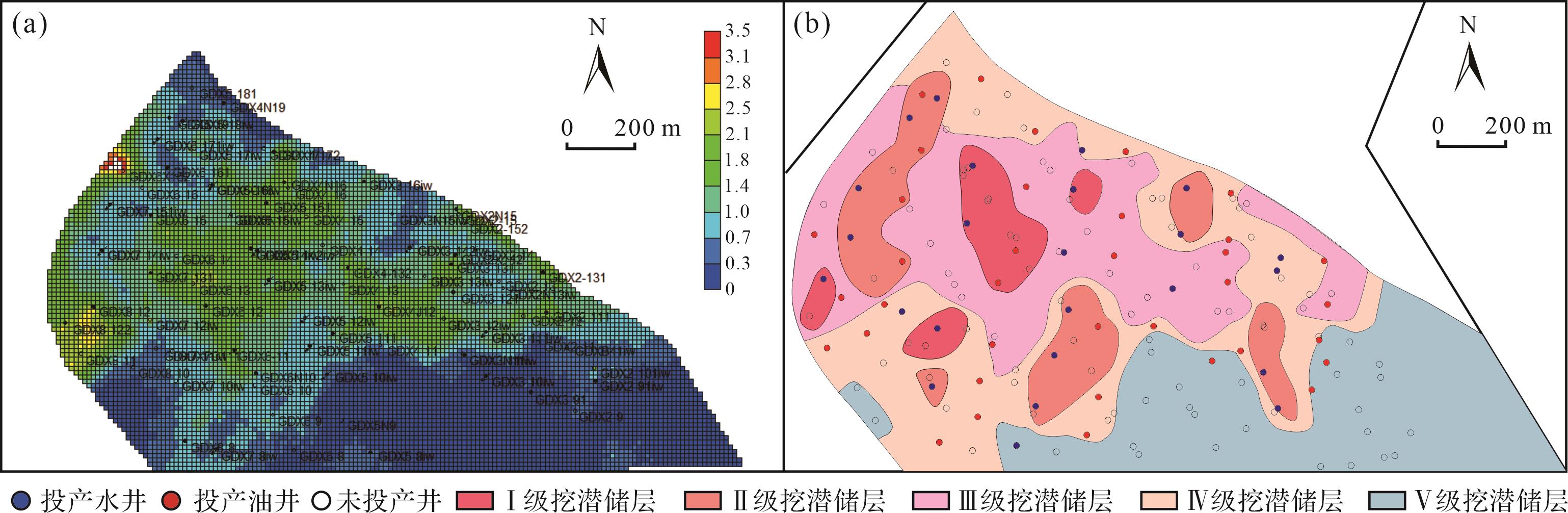
2023, 41(4): 1170-1180.
doi: 10.14027/j.issn.1000-0550.2021.163
Abstract:
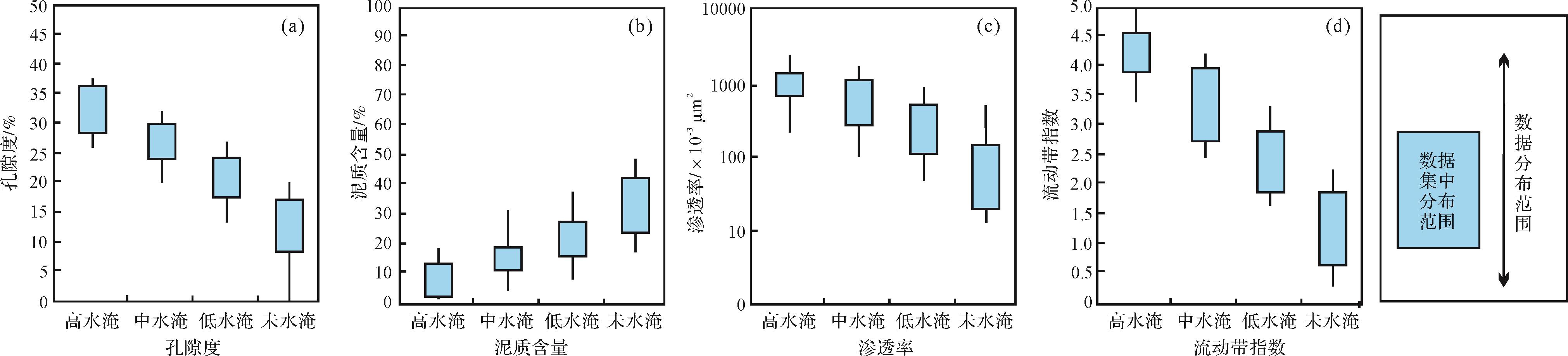
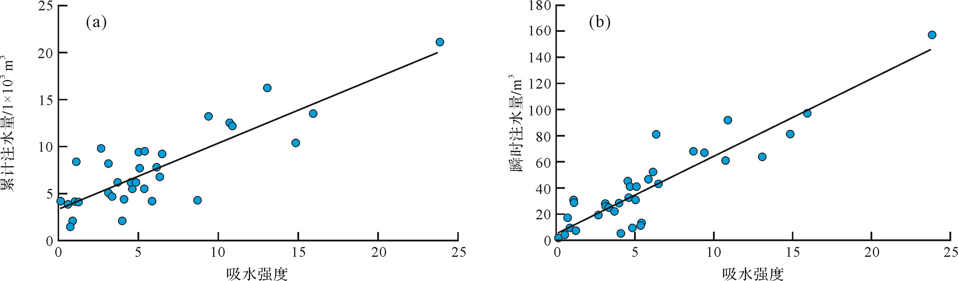
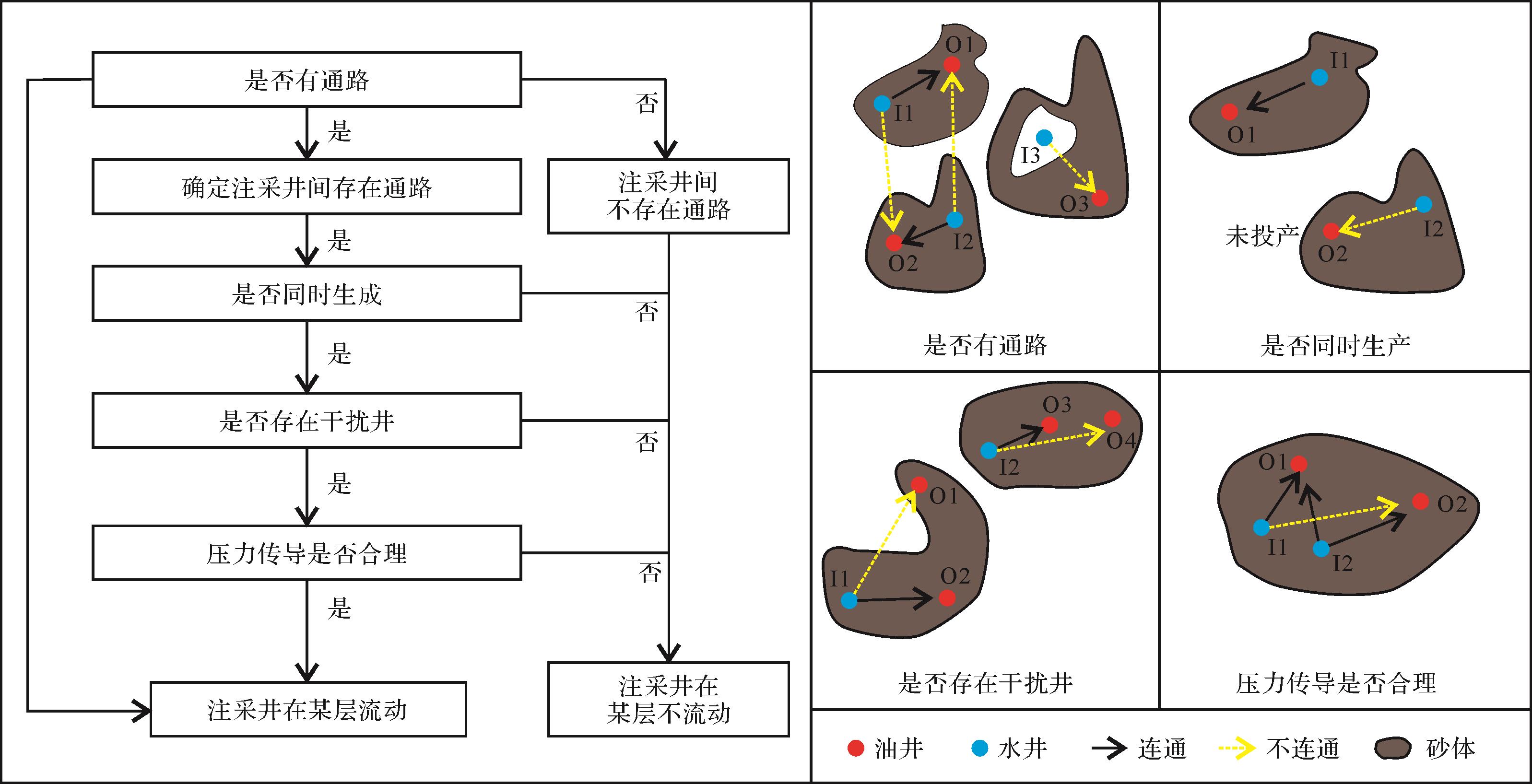
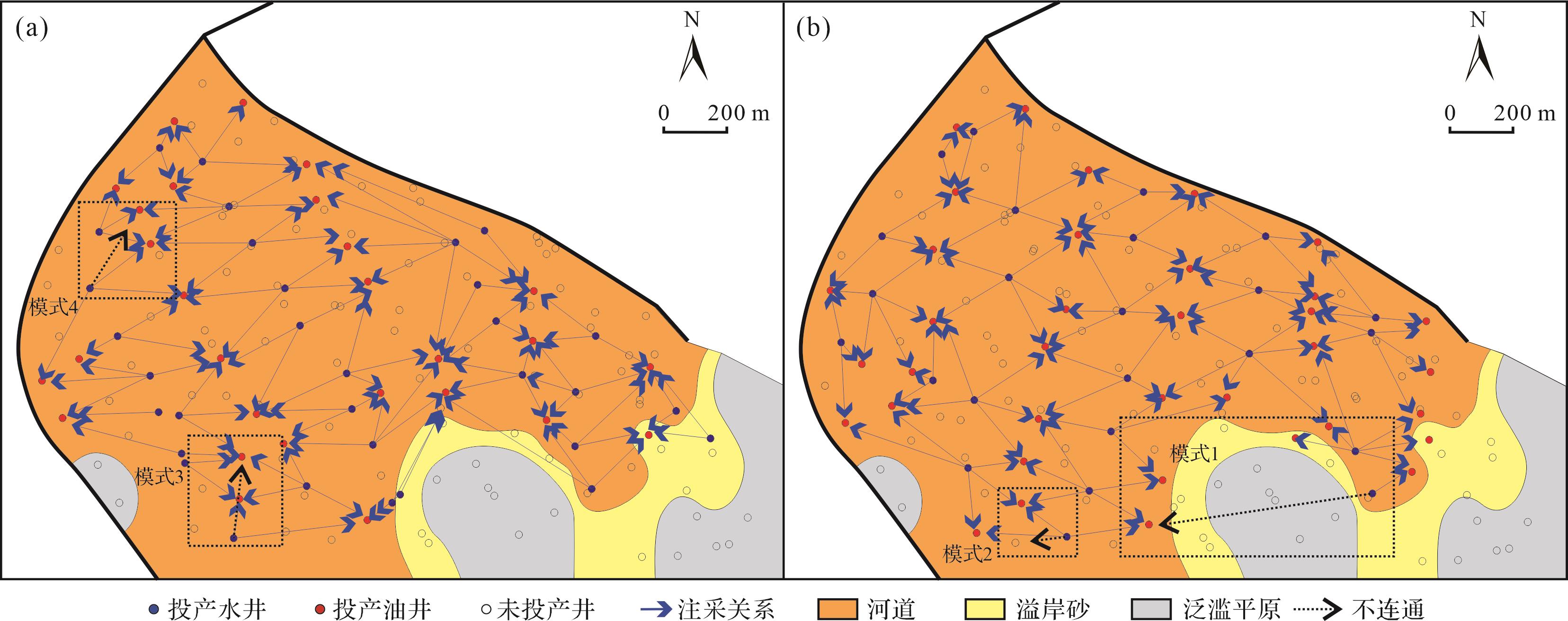
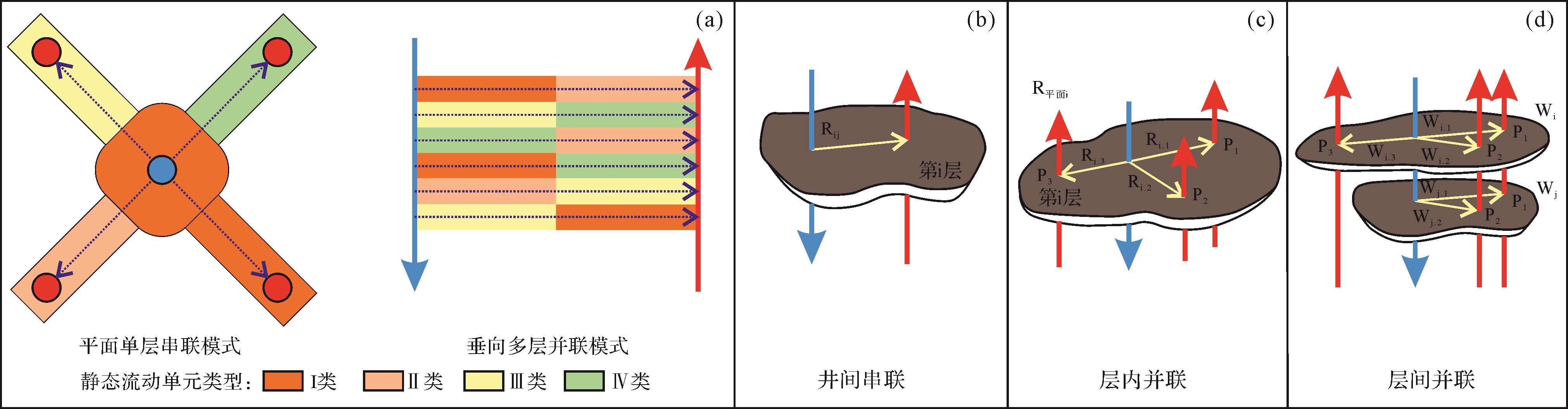
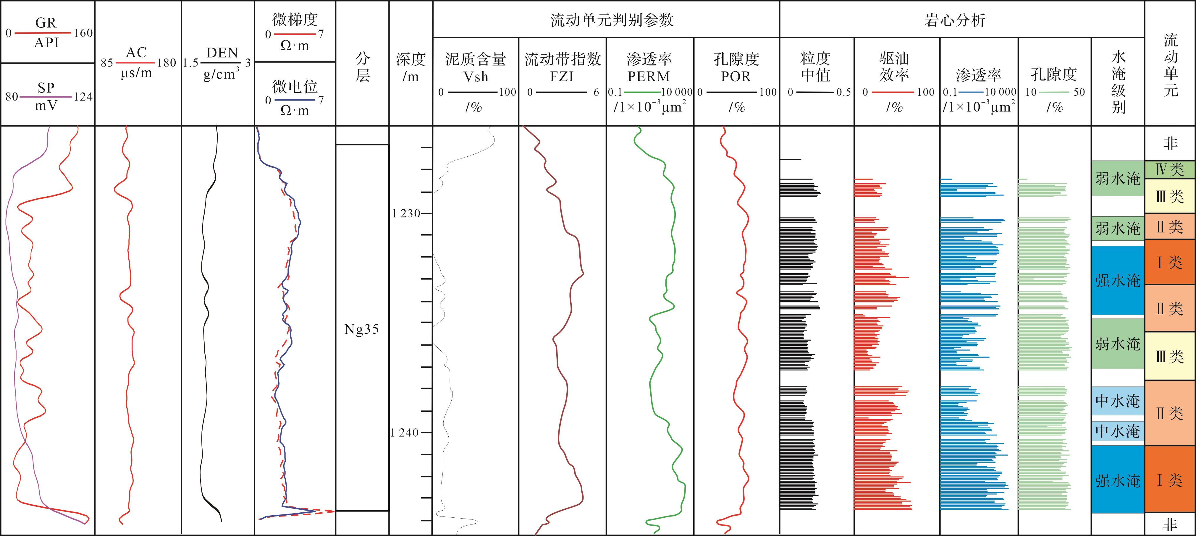
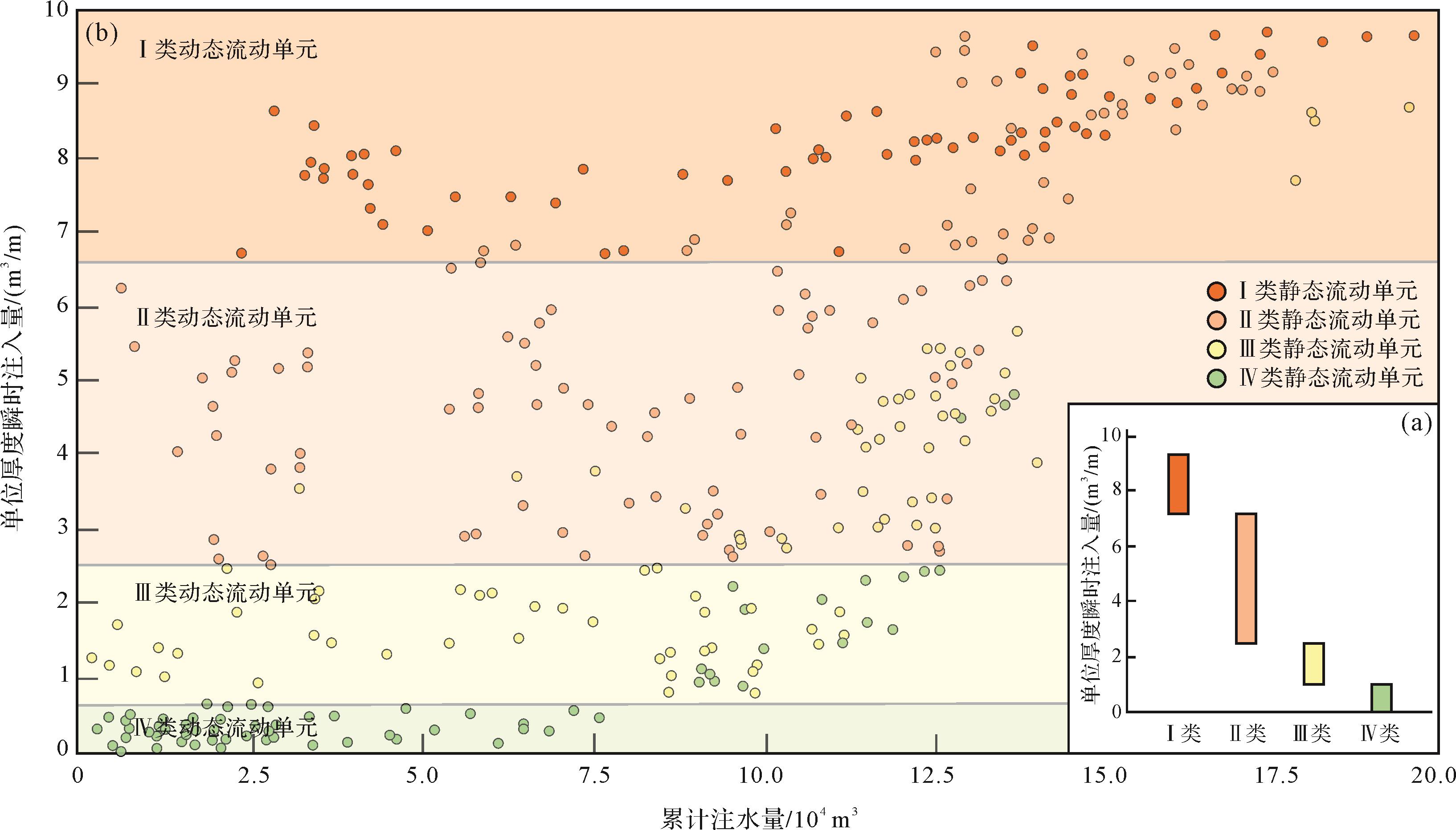
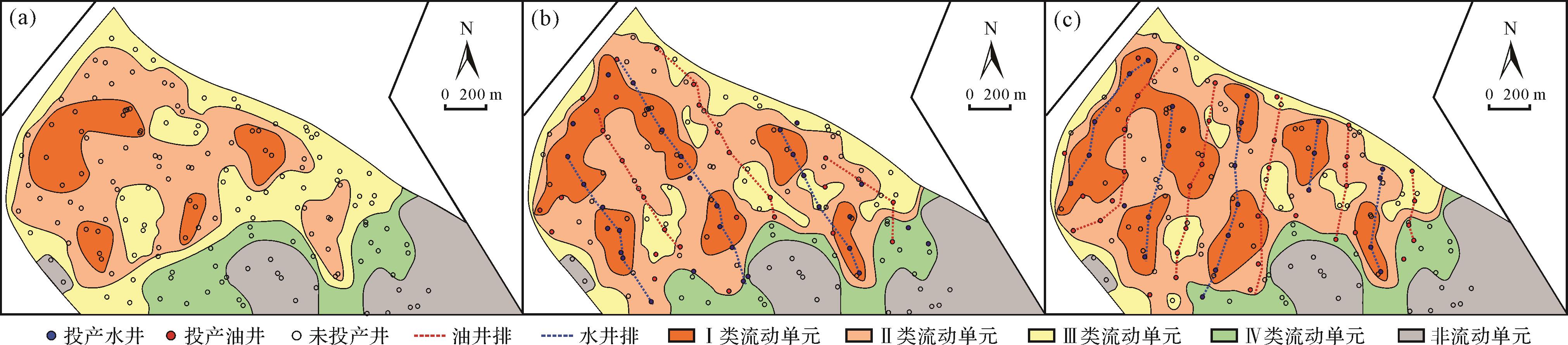
To improve the understanding of heterogeneous reservoirs, a study of the static and dynamic reservoir flow was conducted in block M of the Gudao oilfield (Neogene Guantao Formation). Static flow in the reservoirs were subdivided into four types: porosity, permeability, flow zone index and shale content. Water injection in each flow unit was assessed using a seepage resistance model. Dynamic flow was evaluated in terms of instantaneous injection of the flow per unit thickness. The difference between the static and dynamic methods was analyzed. It was found that the distribution of injection-production wells largely influences the high-level flow units. Increasing water injection increases oil flow to a certain extent. The difference between static and dynamic flow in individual layers depends largely on the unevenness of the water injection due to sand body rhythm. The reservoir was divided into five potential tapping levels by combining the distribution of the remaining oil and dynamic flow units: level I is the main potential tapping area of remaining oil; level II represents low oil potential and high water consumption.
To improve the understanding of heterogeneous reservoirs, a study of the static and dynamic reservoir flow was conducted in block M of the Gudao oilfield (Neogene Guantao Formation). Static flow in the reservoirs were subdivided into four types: porosity, permeability, flow zone index and shale content. Water injection in each flow unit was assessed using a seepage resistance model. Dynamic flow was evaluated in terms of instantaneous injection of the flow per unit thickness. The difference between the static and dynamic methods was analyzed. It was found that the distribution of injection-production wells largely influences the high-level flow units. Increasing water injection increases oil flow to a certain extent. The difference between static and dynamic flow in individual layers depends largely on the unevenness of the water injection due to sand body rhythm. The reservoir was divided into five potential tapping levels by combining the distribution of the remaining oil and dynamic flow units: level I is the main potential tapping area of remaining oil; level II represents low oil potential and high water consumption.
2023, 41(4): 1181-1191.
doi: 10.14027/j.issn.1000-0550.2022.056
Abstract:
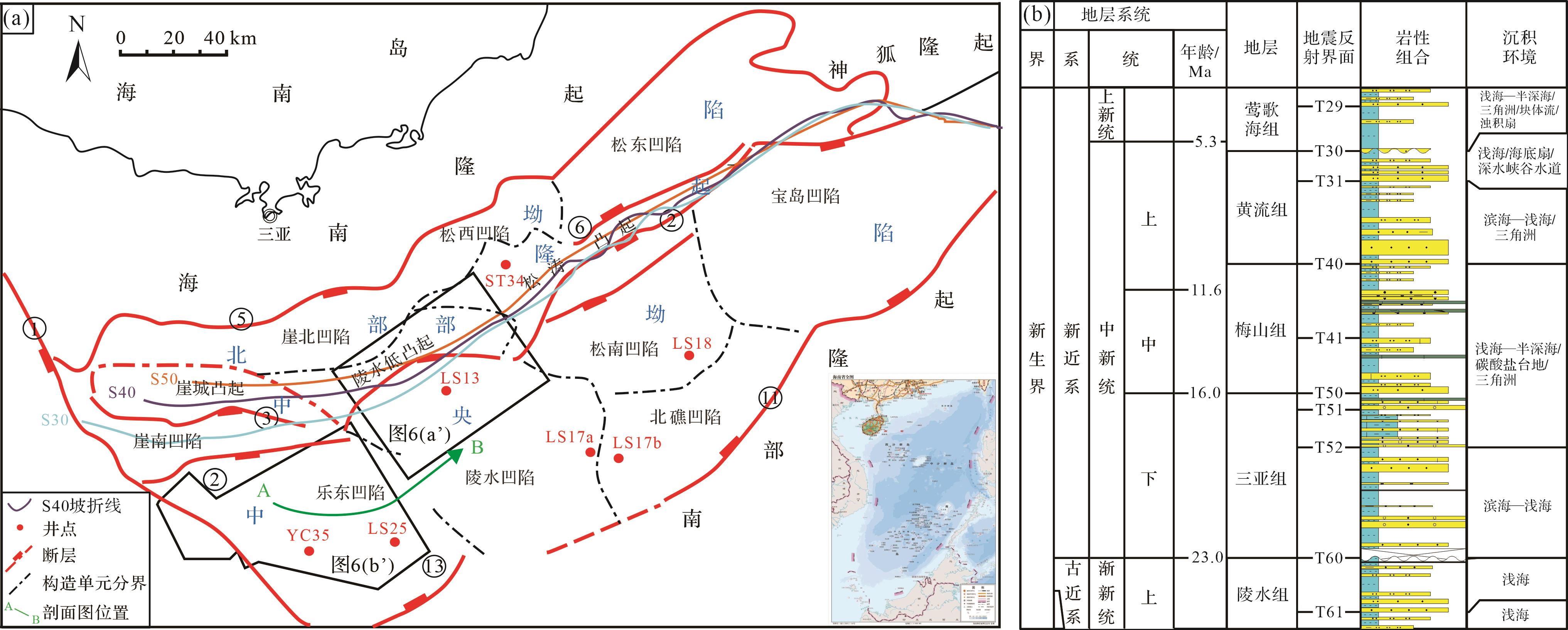
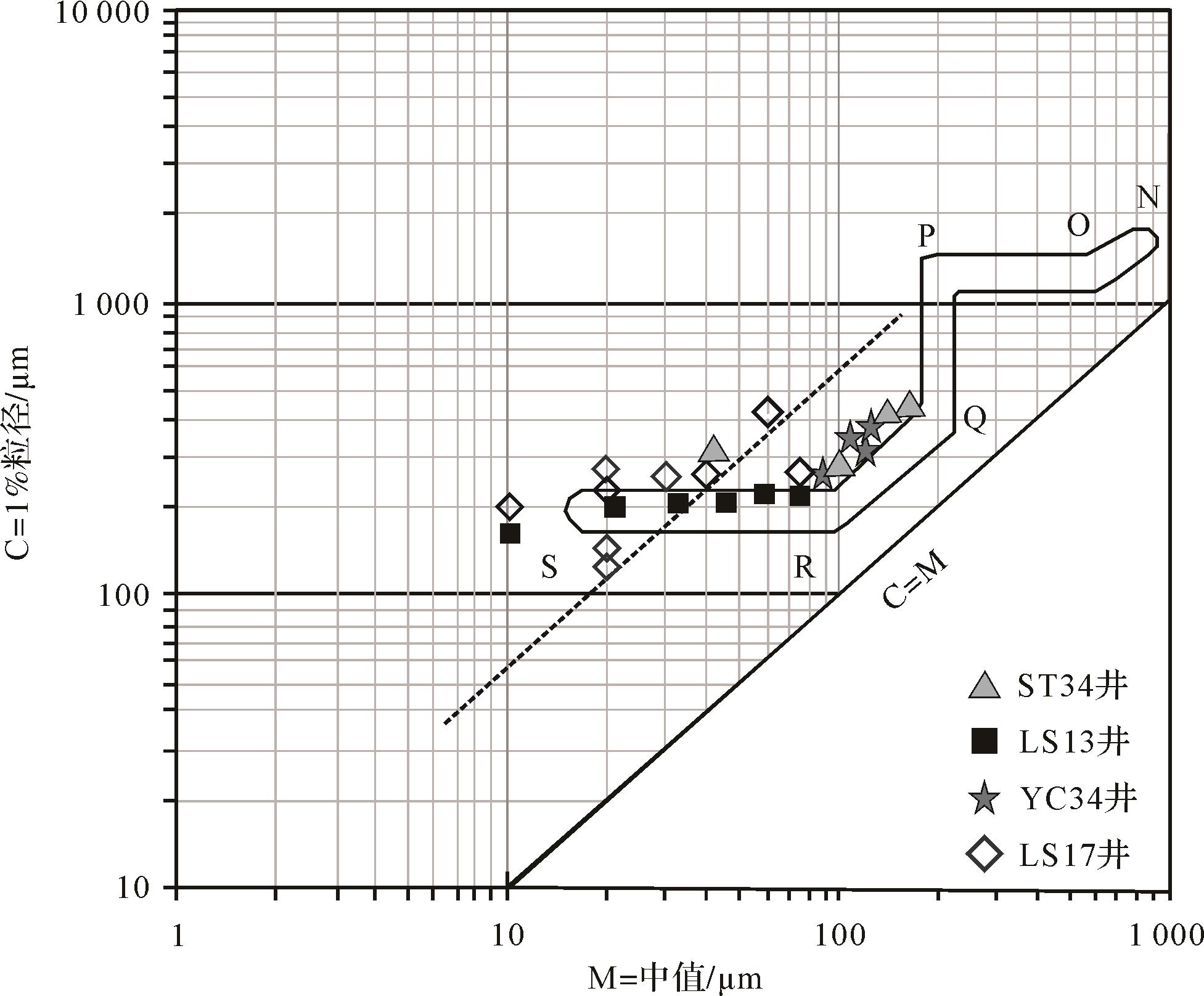
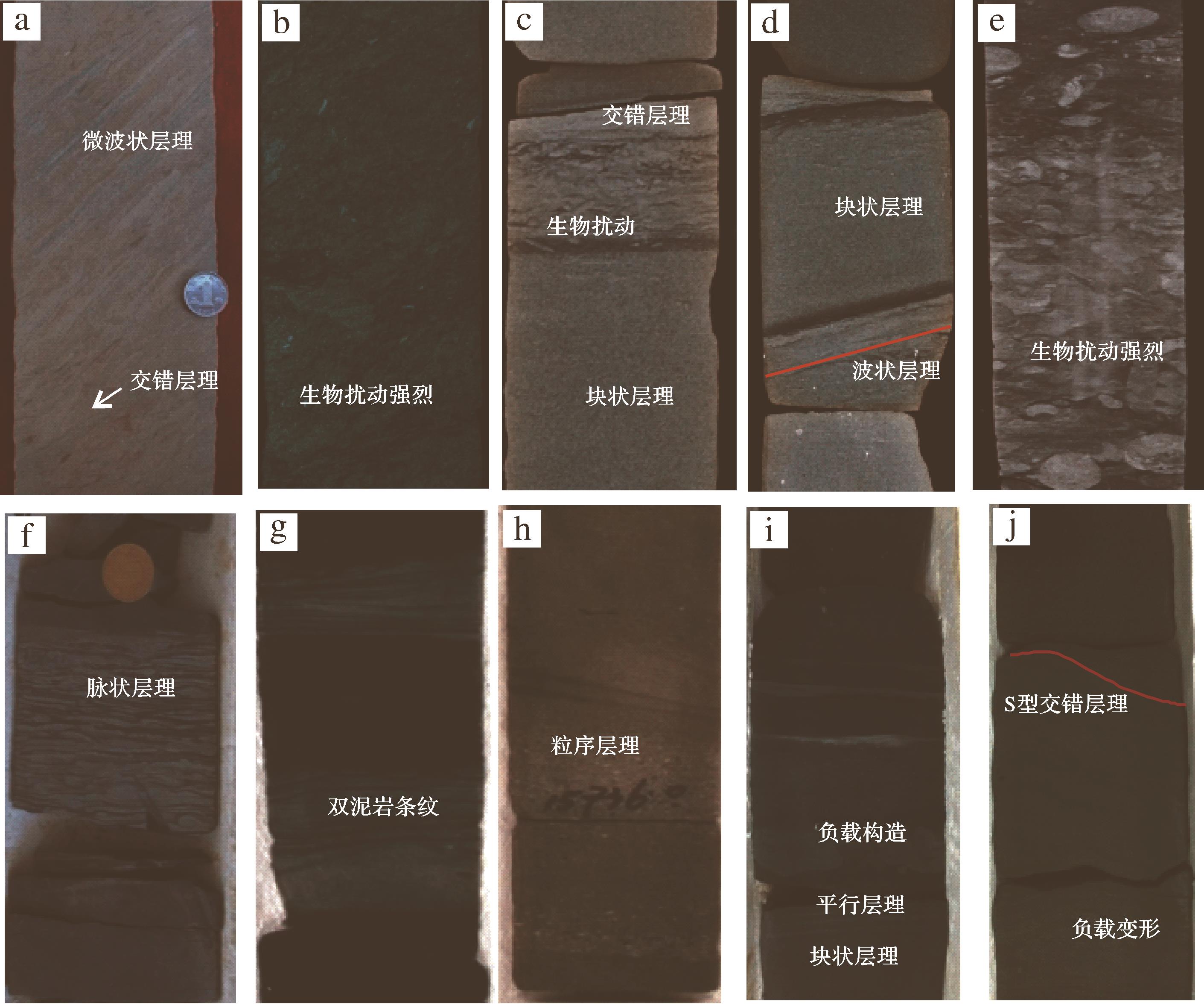
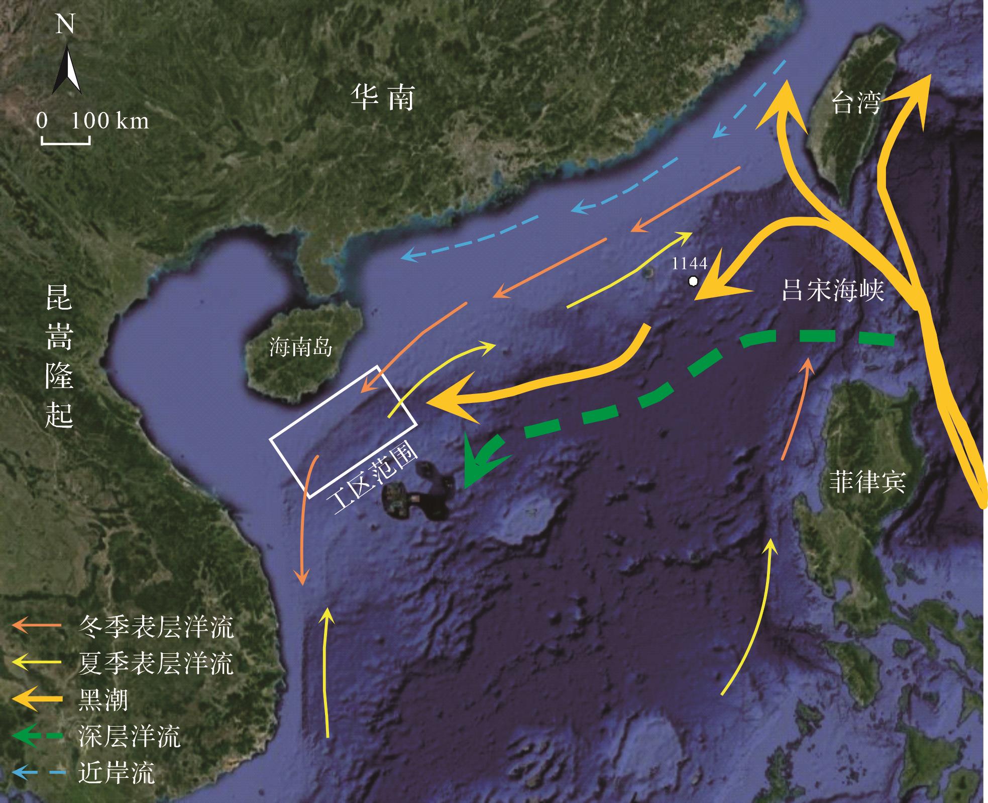
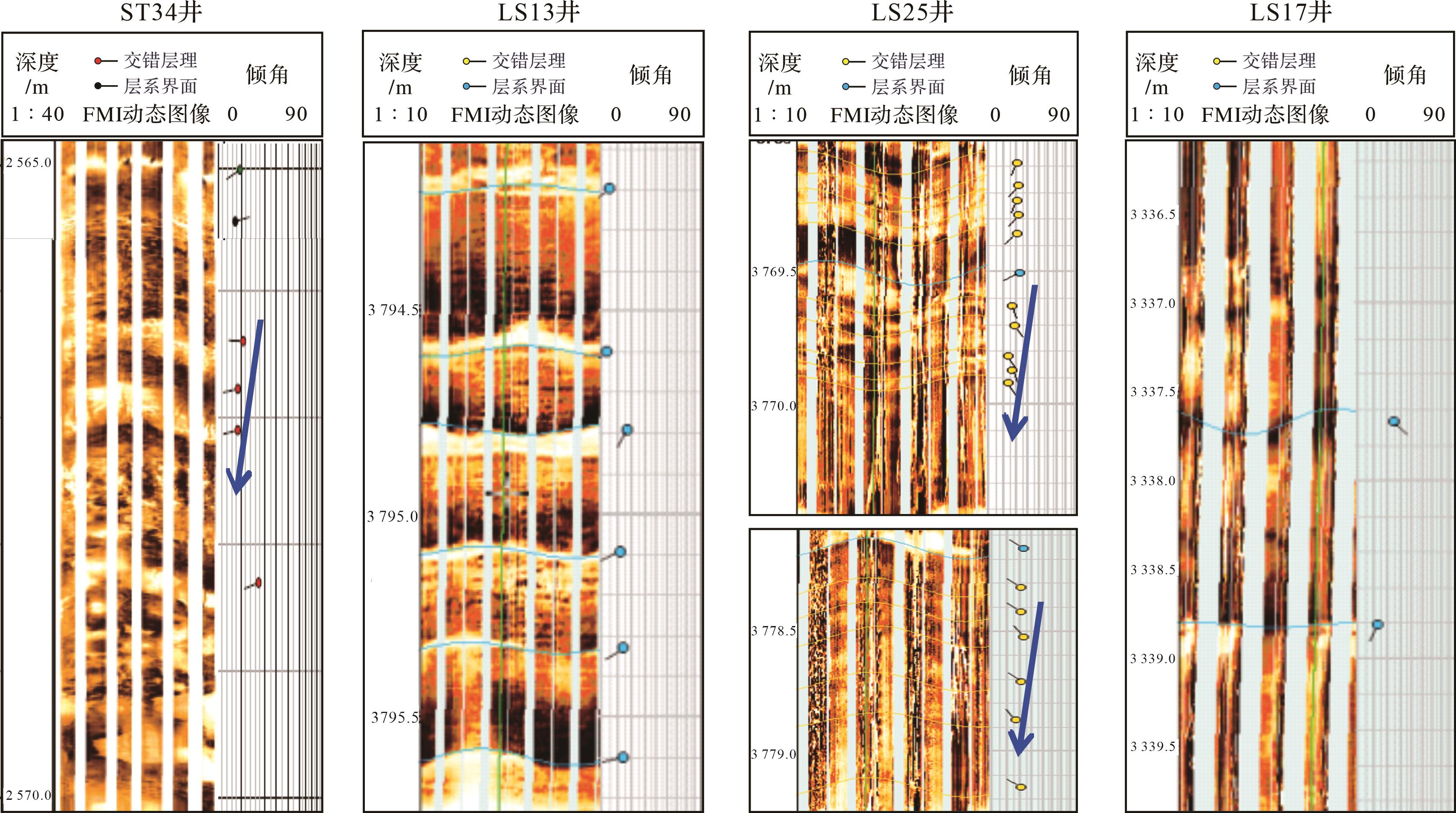
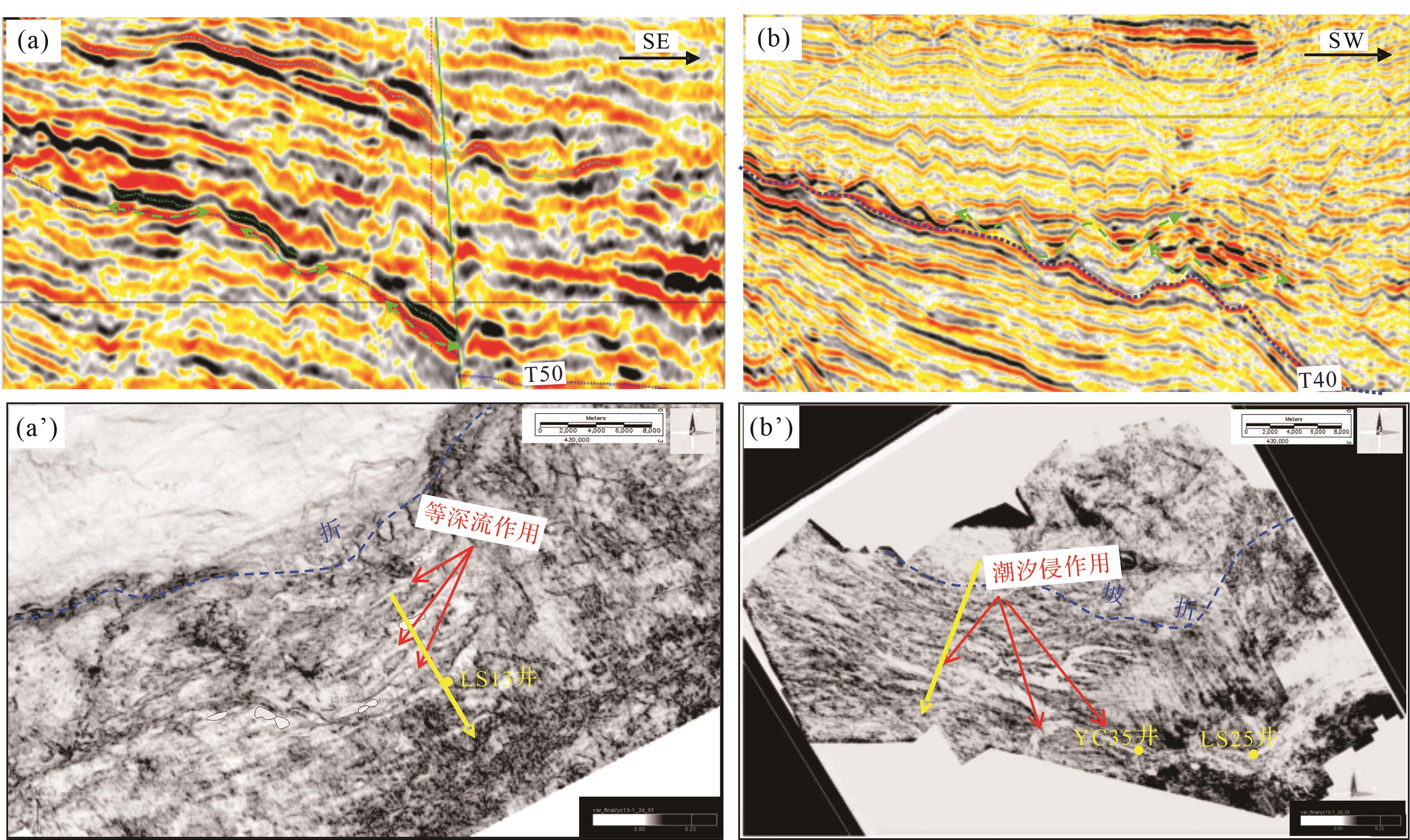
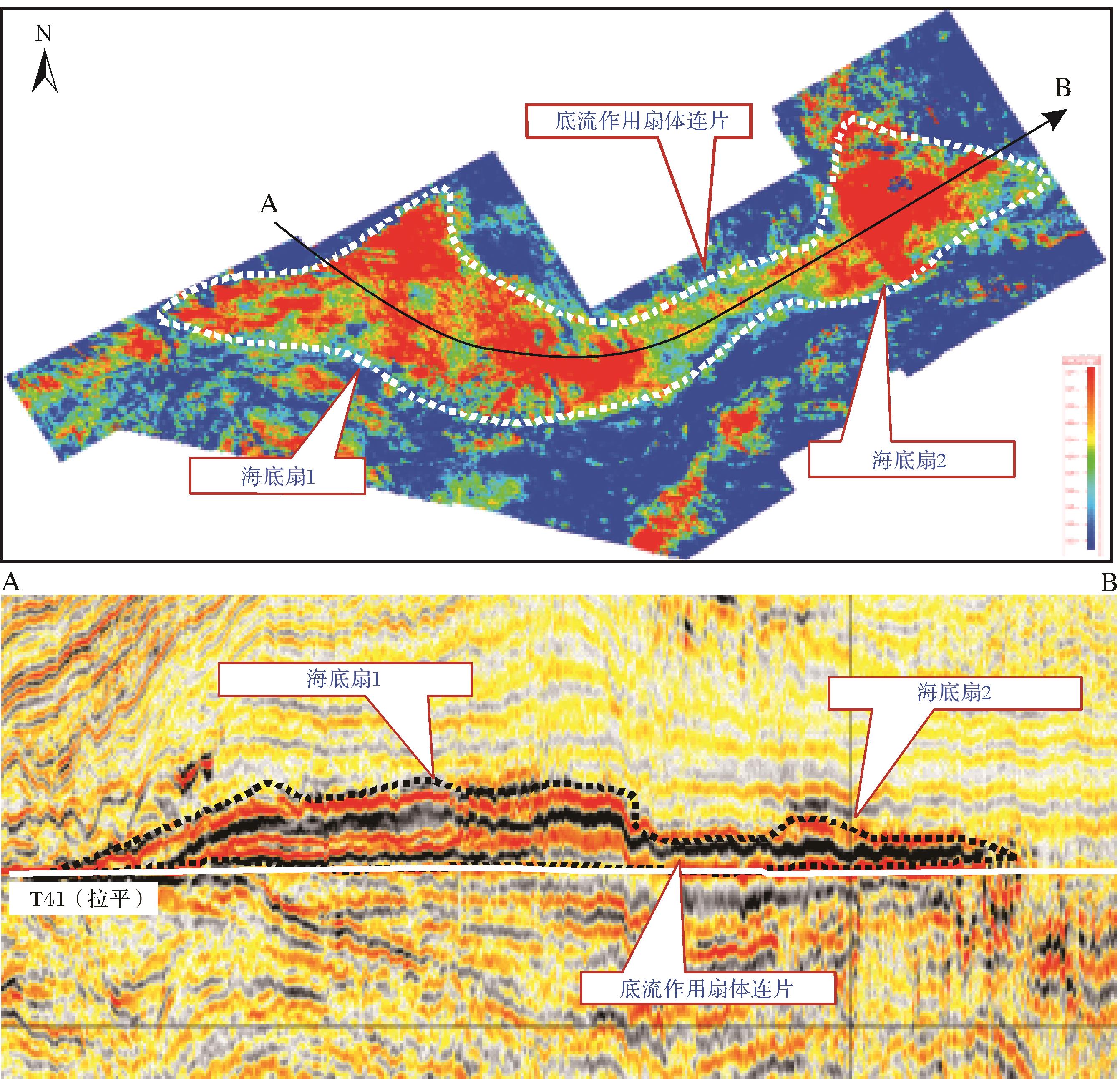
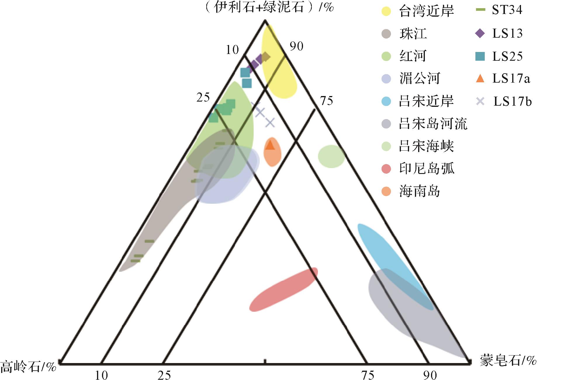
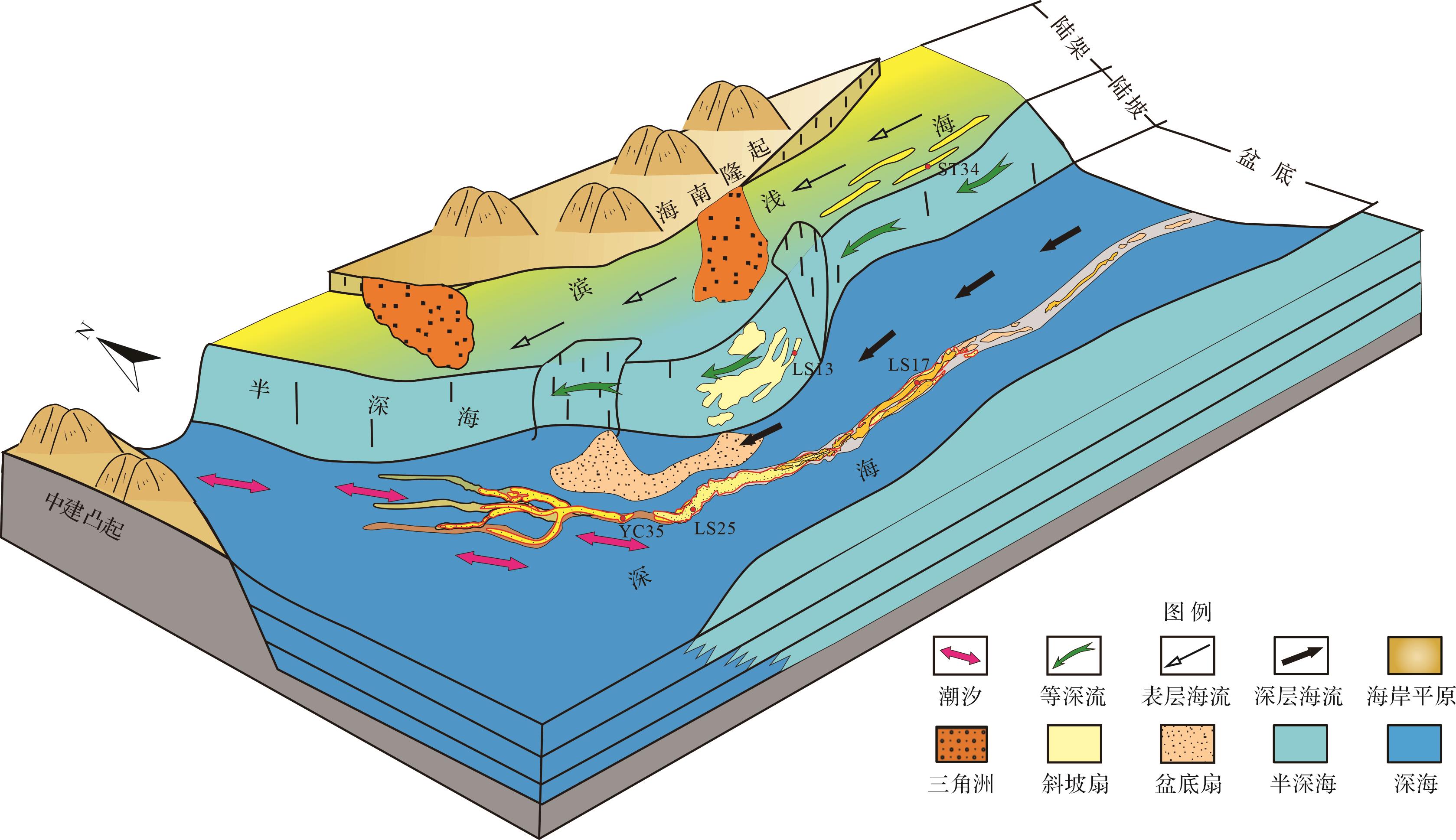
The Qiongdongnan Basin is an important petroliferous structure at the northern margin of the South China Sea, with reservoirs generally developed in Miocene marine sandstones. Because the basin is located at the boundary between the Indochina Plate and Pacific Plate, paleo-sea currents were significantly active during deposition of the Miocene reservoirs. However, the influence of the currents on reservoir development has been unclear. In this study, the sedimentational properties of typical core samples, stratum imaging logging and clay mineral compositions were analyzed to investigate the interactions between paleocurrents and sedimentation in the Qiongdongnan Basin. The results indicate four types of paleocurrent in different tectonic regions of the basin: NE⁃SE surface currents induced by the winter monsoon in the continental shelf region; NE⁃SE mesopelagic currents driven by a branch of the Kuroshio current in the slope region; NW⁃SE tides induced by the negative terrain between the Yacheng and Zhongjian uplifts in the western basin floor; and deep currents generated from the North Atlantic in the eastern basin floor. These currents enhanced water exchange between the Qiongdongnan Basin and surrounding open sea areas during the Miocene, affecting the development and distribution of reservoirs and also significantly reducing the mud content of sandstone reservoirs. This improved the physical properties of the reservoirs and influenced the formation of high-quality reservoirs. All of the present high-yield gas fields in deep-water areas of the Qiongdongnan Basin (LS25, LS17 and ST34) have recently proven to be transformed by paleocurrents, and this study has produced new geological evidence for future exploration relating to high-quality reservoirs in the basin.
The Qiongdongnan Basin is an important petroliferous structure at the northern margin of the South China Sea, with reservoirs generally developed in Miocene marine sandstones. Because the basin is located at the boundary between the Indochina Plate and Pacific Plate, paleo-sea currents were significantly active during deposition of the Miocene reservoirs. However, the influence of the currents on reservoir development has been unclear. In this study, the sedimentational properties of typical core samples, stratum imaging logging and clay mineral compositions were analyzed to investigate the interactions between paleocurrents and sedimentation in the Qiongdongnan Basin. The results indicate four types of paleocurrent in different tectonic regions of the basin: NE⁃SE surface currents induced by the winter monsoon in the continental shelf region; NE⁃SE mesopelagic currents driven by a branch of the Kuroshio current in the slope region; NW⁃SE tides induced by the negative terrain between the Yacheng and Zhongjian uplifts in the western basin floor; and deep currents generated from the North Atlantic in the eastern basin floor. These currents enhanced water exchange between the Qiongdongnan Basin and surrounding open sea areas during the Miocene, affecting the development and distribution of reservoirs and also significantly reducing the mud content of sandstone reservoirs. This improved the physical properties of the reservoirs and influenced the formation of high-quality reservoirs. All of the present high-yield gas fields in deep-water areas of the Qiongdongnan Basin (LS25, LS17 and ST34) have recently proven to be transformed by paleocurrents, and this study has produced new geological evidence for future exploration relating to high-quality reservoirs in the basin.
2023, 41(4): 1192-1201.
doi: 10.14027/j.issn.1000-0550.2022.012
Abstract:
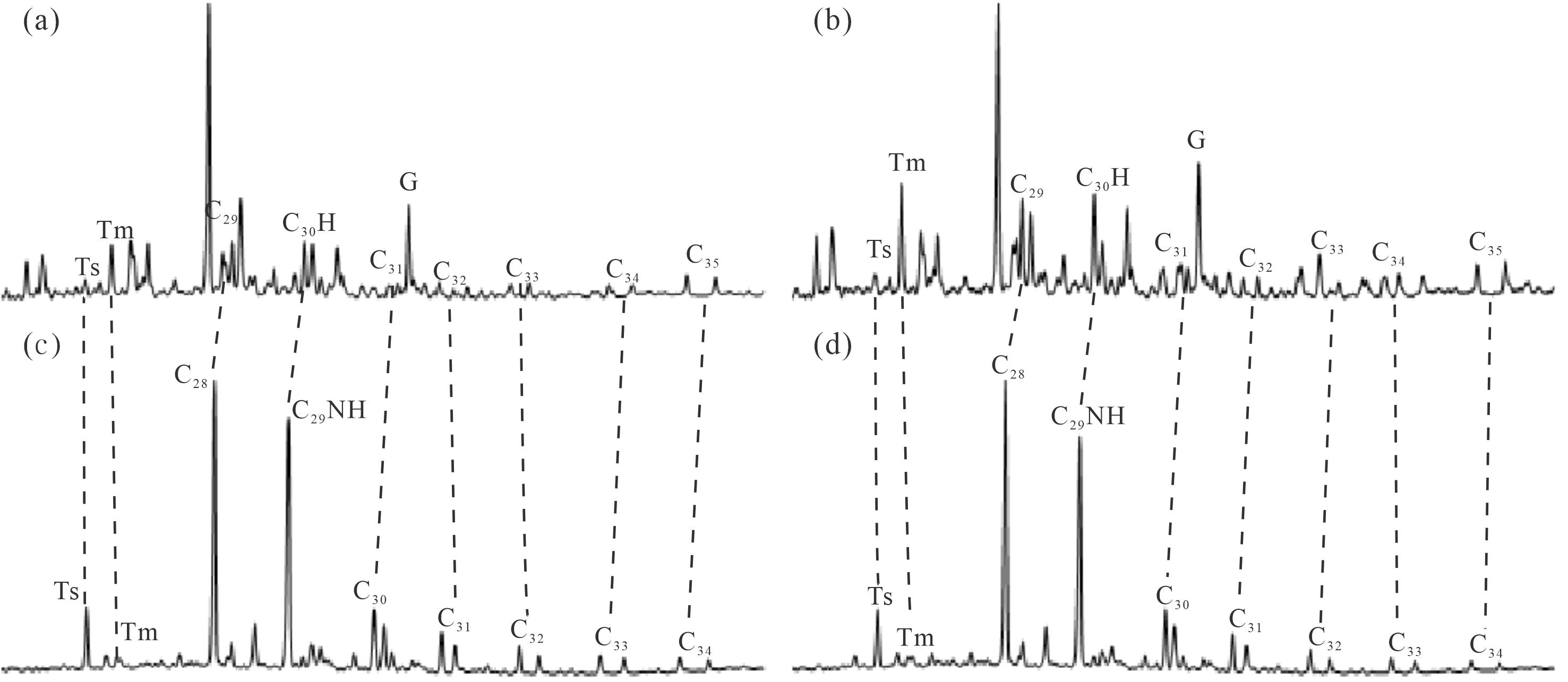
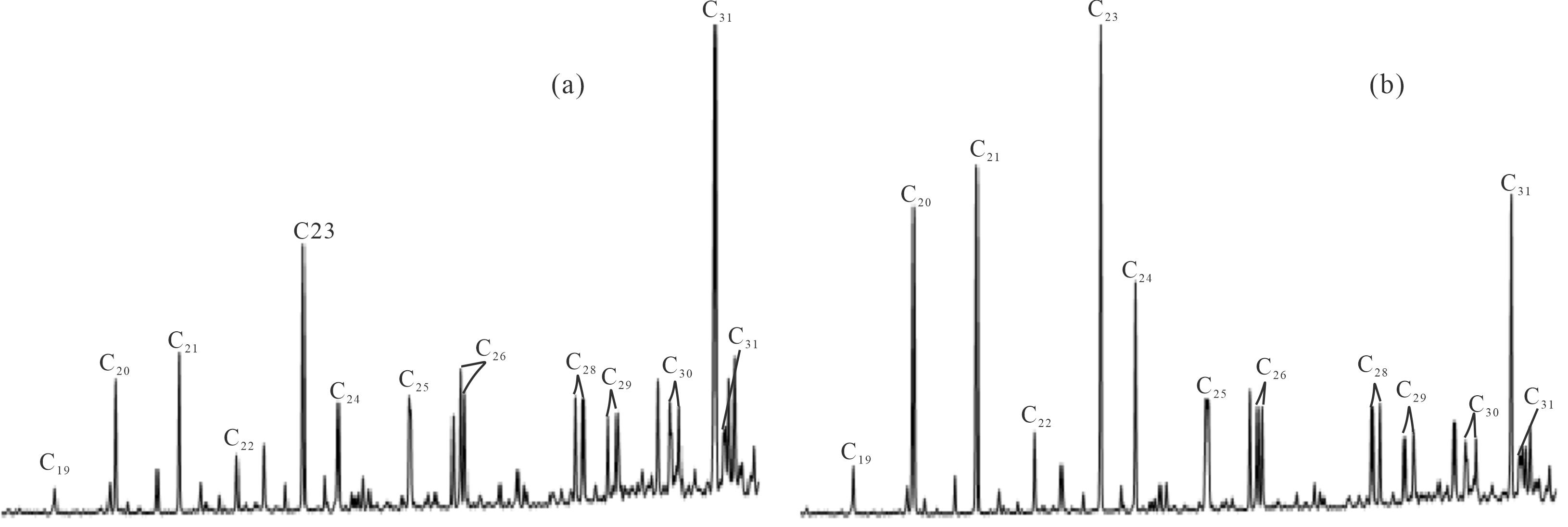
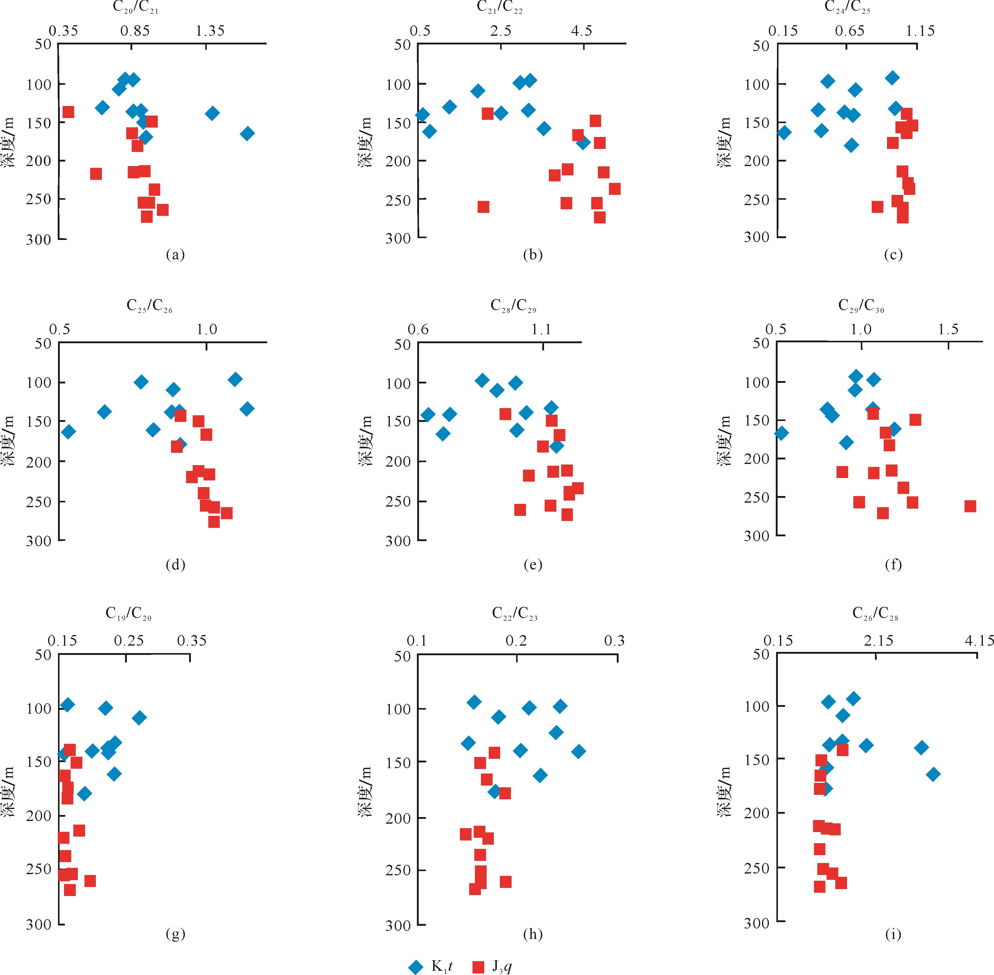
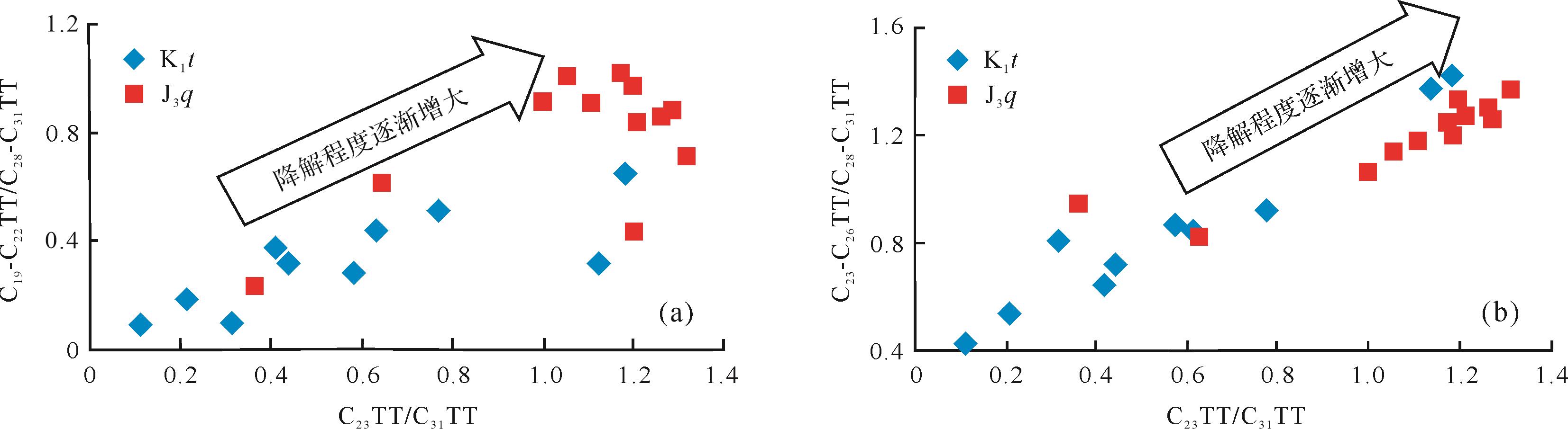
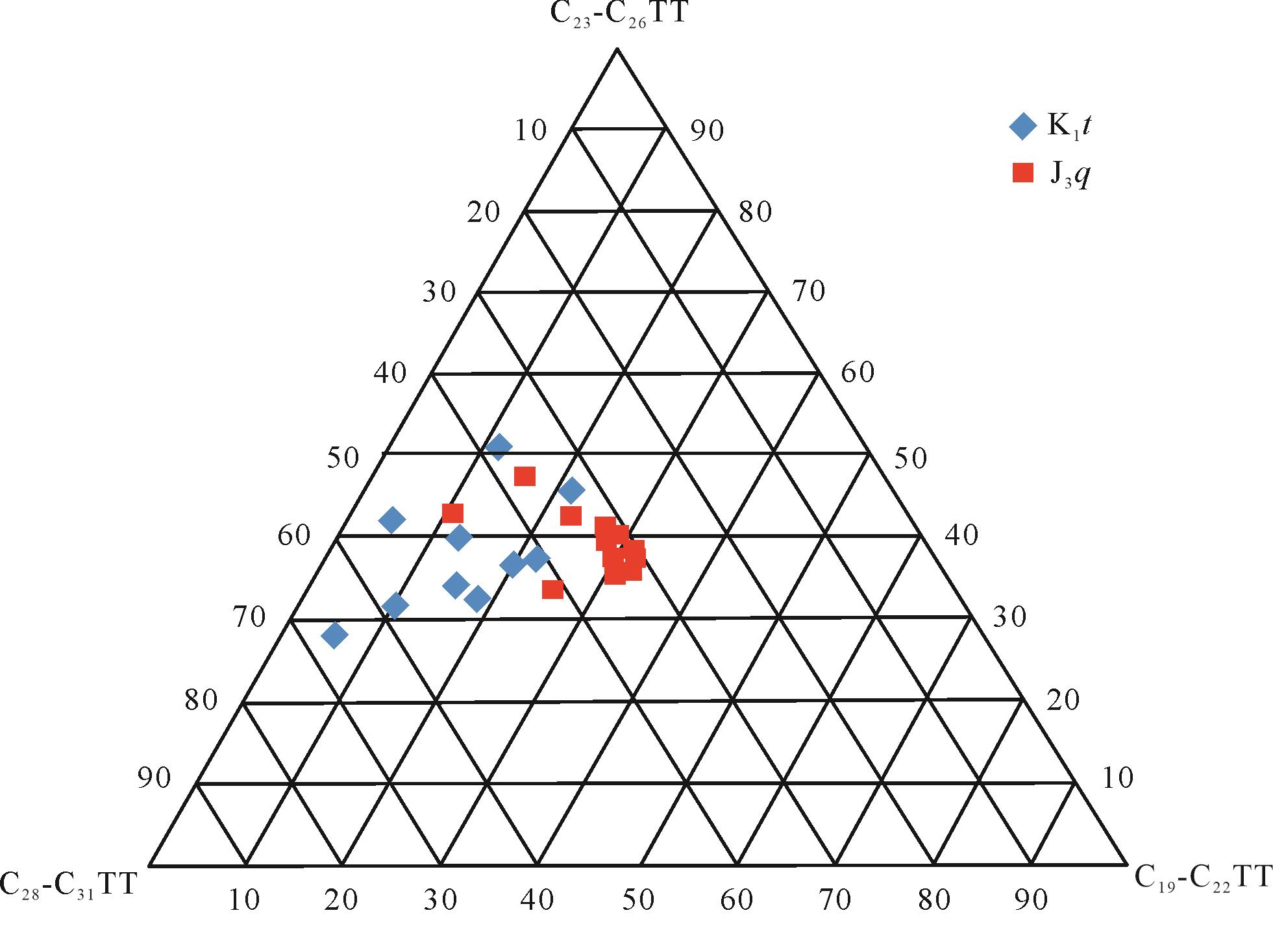
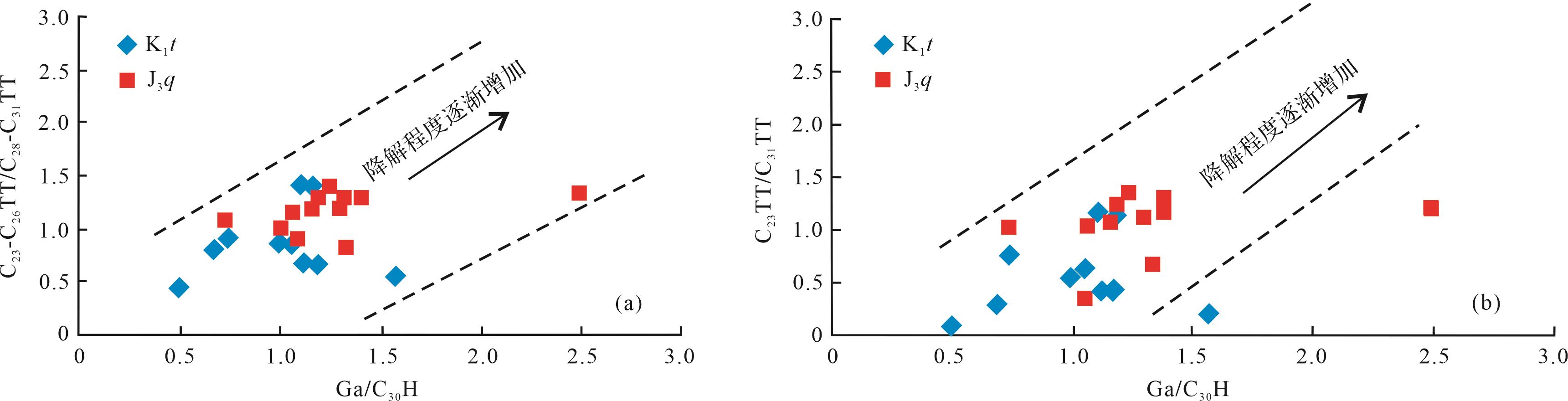
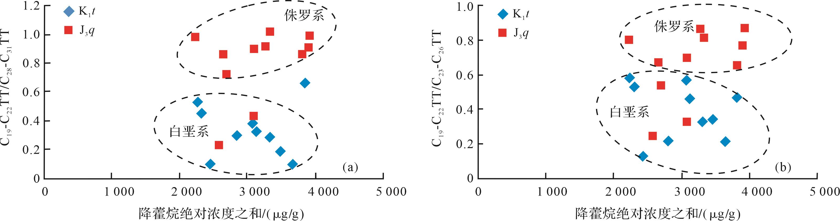
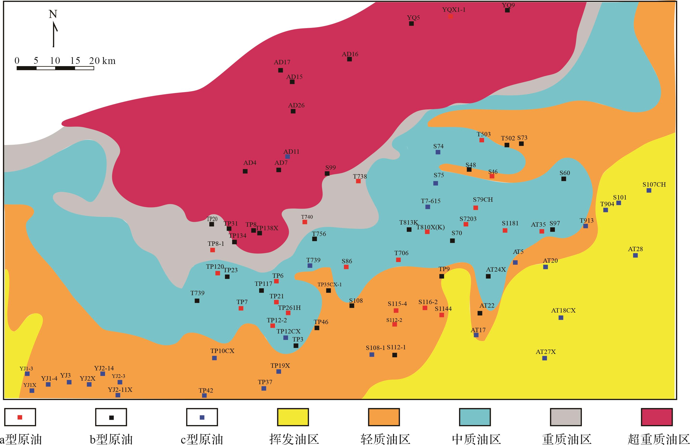
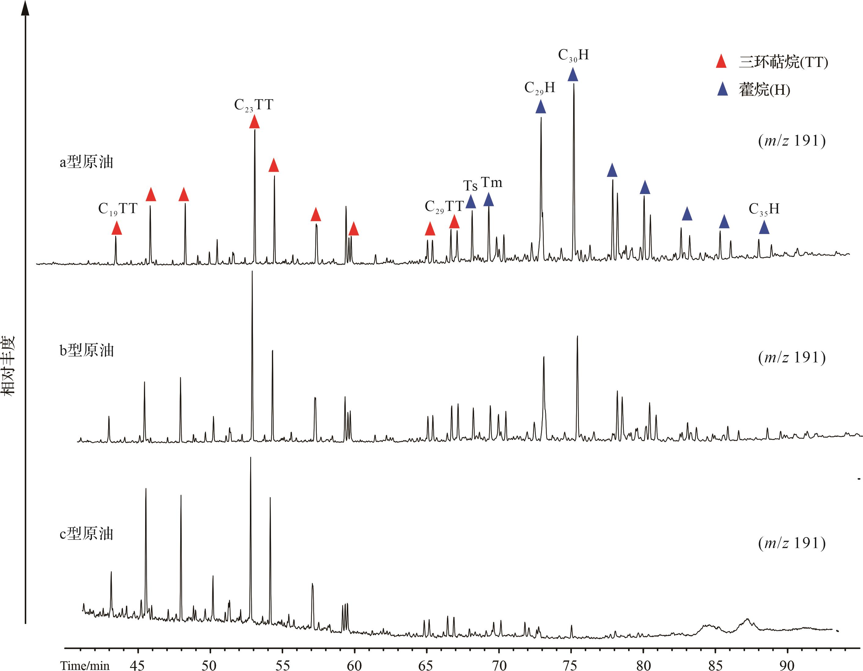
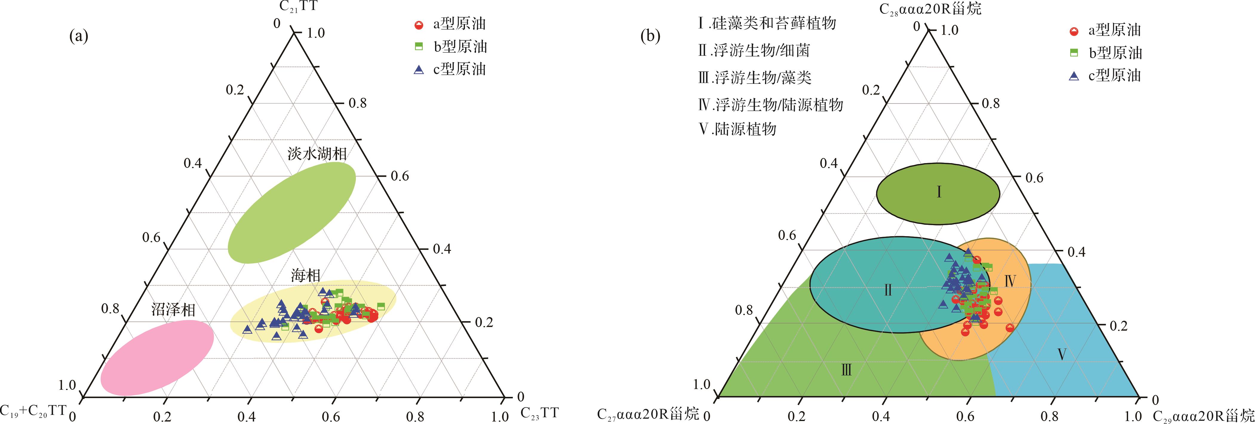
The Junggar Basin is rich in oil sand resources. The northwestern margin of the Fengcheng oil sand mining area is the most important oil sand distribution area in the Junggar Basin. In this paper, the gas chromatography- mass spectrometry GC-MS of saturated and aromatic hydrocarbons in the oil sand sample extracts, such as normal alkanes, regular steranes, mono-aromatic steranes, short-chain triaromatic steranes, and rearranged steranes, were undetectable; in addition, the abundance of hopanes, pregnane, and long-chain triaromatic steranes were rare. Severe biodegradation has occurred, and the degradation level can reach level 8 or higher. As far as the overall carbon number distribution of tricyclic terpanes is concerned, with the increase of biodegradation, the anti-degradation ability of tricyclic terpanes will decrease with the increase of carbon number, i.e., tricyclic terpanes (TT) are resistant to biodegradation. The distribution appeared to be the following: high carbon number(C28-C31TT) > medium carbon number(C23-C26TT) > low carbon number (C19-C22 TT). However, for a single tricyclic terpane compound, C19 and C20, C22 and C23, and C26 and C28 tricyclic terpanes tend to increase their resistance to degradation as the carbon number increases. Therefore, the use of the relative ratio of tricyclic terpane compounds, namely C19-C22 TT /C28-C31 TT、C23-C26 TT /C28-C31 TT、C19-C22 TT /C23-C26 TT、C23 TT /C31 TT, is proposed to describe the degree of severe biodegradation of crude oil and provide a geochemical basis for crude oil to undergo secondary alteration, especially biodegradation.
The Junggar Basin is rich in oil sand resources. The northwestern margin of the Fengcheng oil sand mining area is the most important oil sand distribution area in the Junggar Basin. In this paper, the gas chromatography- mass spectrometry GC-MS of saturated and aromatic hydrocarbons in the oil sand sample extracts, such as normal alkanes, regular steranes, mono-aromatic steranes, short-chain triaromatic steranes, and rearranged steranes, were undetectable; in addition, the abundance of hopanes, pregnane, and long-chain triaromatic steranes were rare. Severe biodegradation has occurred, and the degradation level can reach level 8 or higher. As far as the overall carbon number distribution of tricyclic terpanes is concerned, with the increase of biodegradation, the anti-degradation ability of tricyclic terpanes will decrease with the increase of carbon number, i.e., tricyclic terpanes (TT) are resistant to biodegradation. The distribution appeared to be the following: high carbon number(C28-C31TT) > medium carbon number(C23-C26TT) > low carbon number (C19-C22 TT). However, for a single tricyclic terpane compound, C19 and C20, C22 and C23, and C26 and C28 tricyclic terpanes tend to increase their resistance to degradation as the carbon number increases. Therefore, the use of the relative ratio of tricyclic terpane compounds, namely C19-C22 TT /C28-C31 TT、C23-C26 TT /C28-C31 TT、C19-C22 TT /C23-C26 TT、C23 TT /C31 TT, is proposed to describe the degree of severe biodegradation of crude oil and provide a geochemical basis for crude oil to undergo secondary alteration, especially biodegradation.
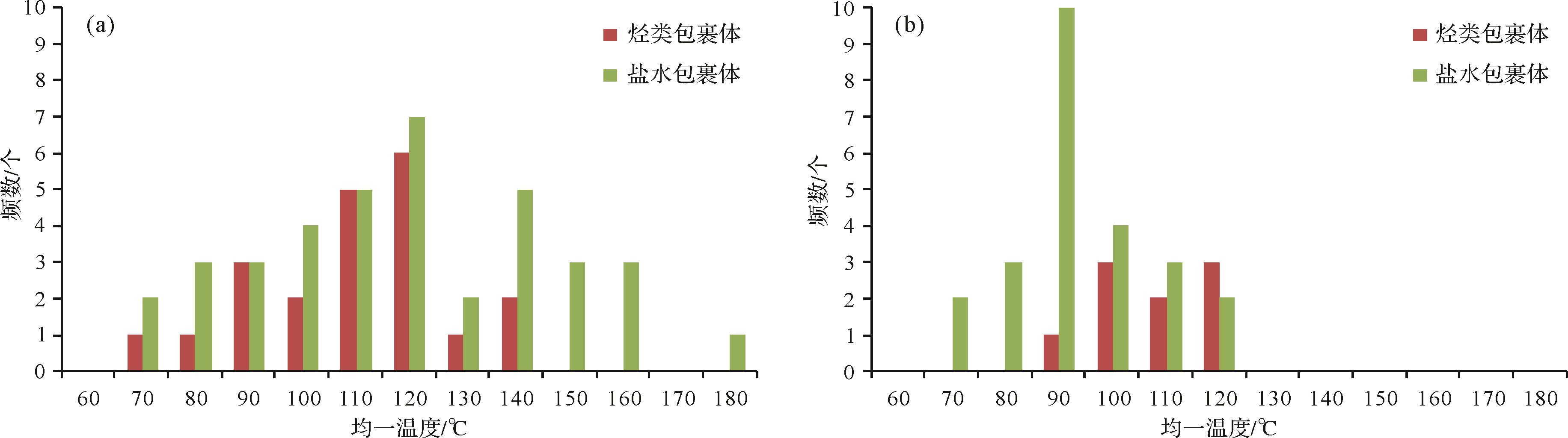
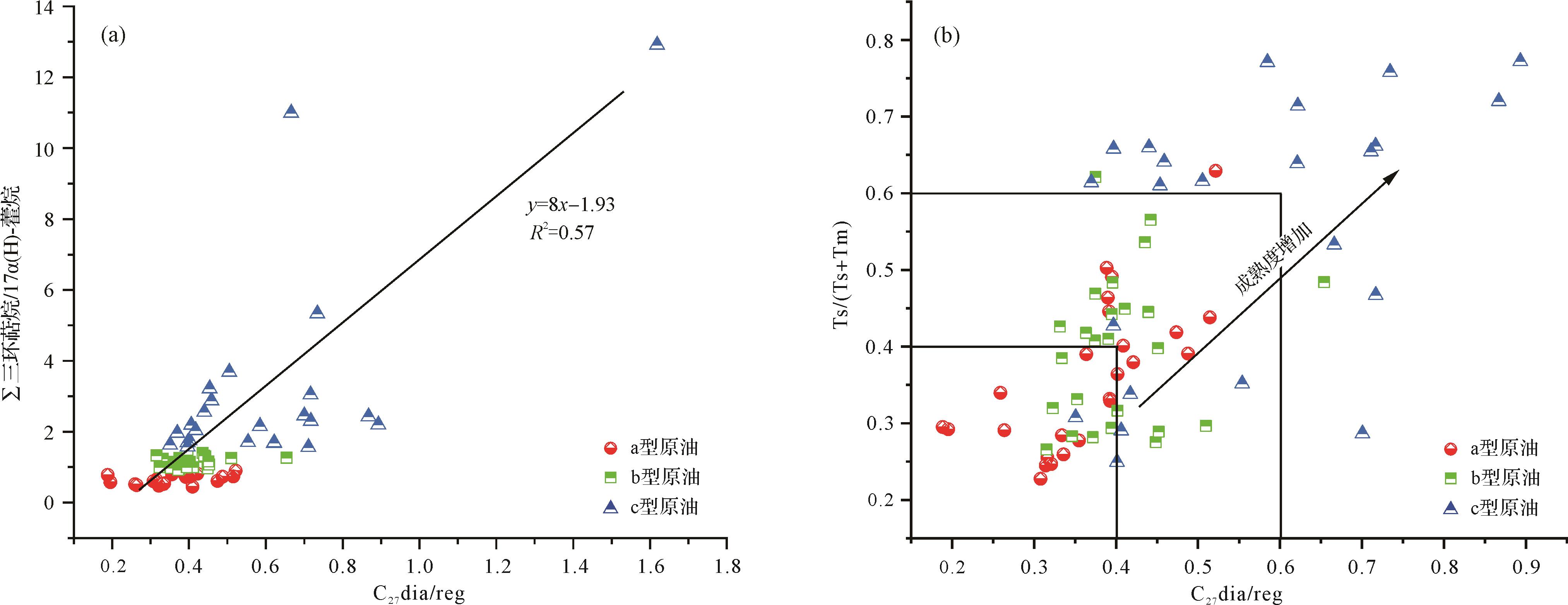
2023, 41(4): 1202-1211.
doi: 10.14027/j.issn.1000-0550.2021.153
Abstract:
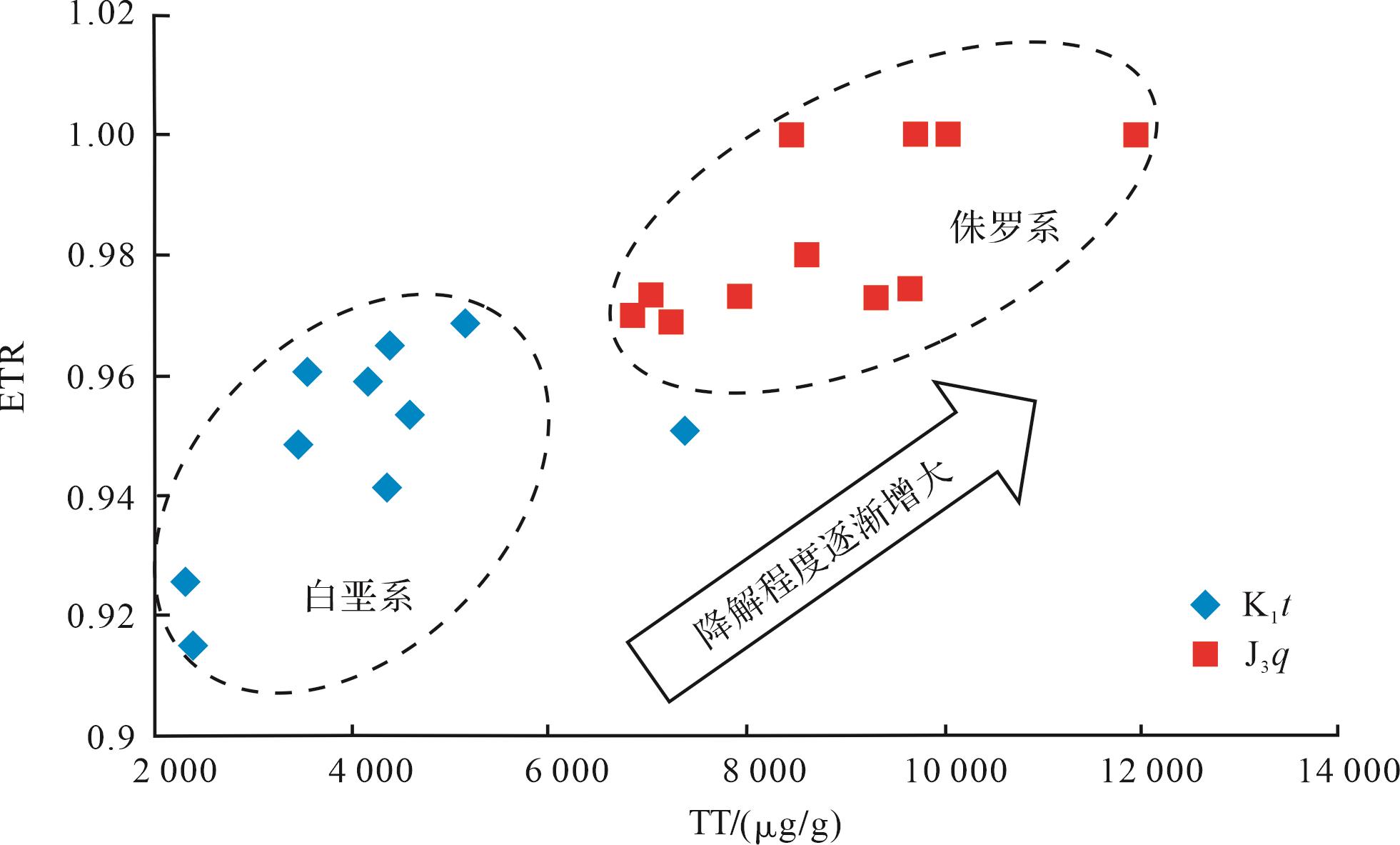
Tahe oilfield is the Paleozoic marine carbonate oil and gas field with the largest crude oil reserves in China. The content of tricyclic terpanes in Tahe crude oil is unusually rich and significantly higher than hopanes. The reason for this abnormal distribution is still unclear. In this study, gas chromatography and gas chromatography-mass spectrometry (GC-MS) data for crude oil samples from Tahe oilfield were analyzed. The abnormal distribution and genesis of tricyclic terpanes in Tahe crude oil are discussed, covering deposition environment, biodegradation and thermal maturity. The results show that for the deposition environment, the degree of oxidation-reduction and salinization during deposition of organic matter is not the main reason. However, the relative content of tricyclic terpanes increased with increasing bacterial input in organic matter and thermal maturity. Σtricyclic terpanes/Σ17α(H)-hopanes is positively correlated with thermal maturity, indicating that thermal evolution was the most significant driving force for the abnormal distribution of tricyclic terpanes in Tahe crude oils.
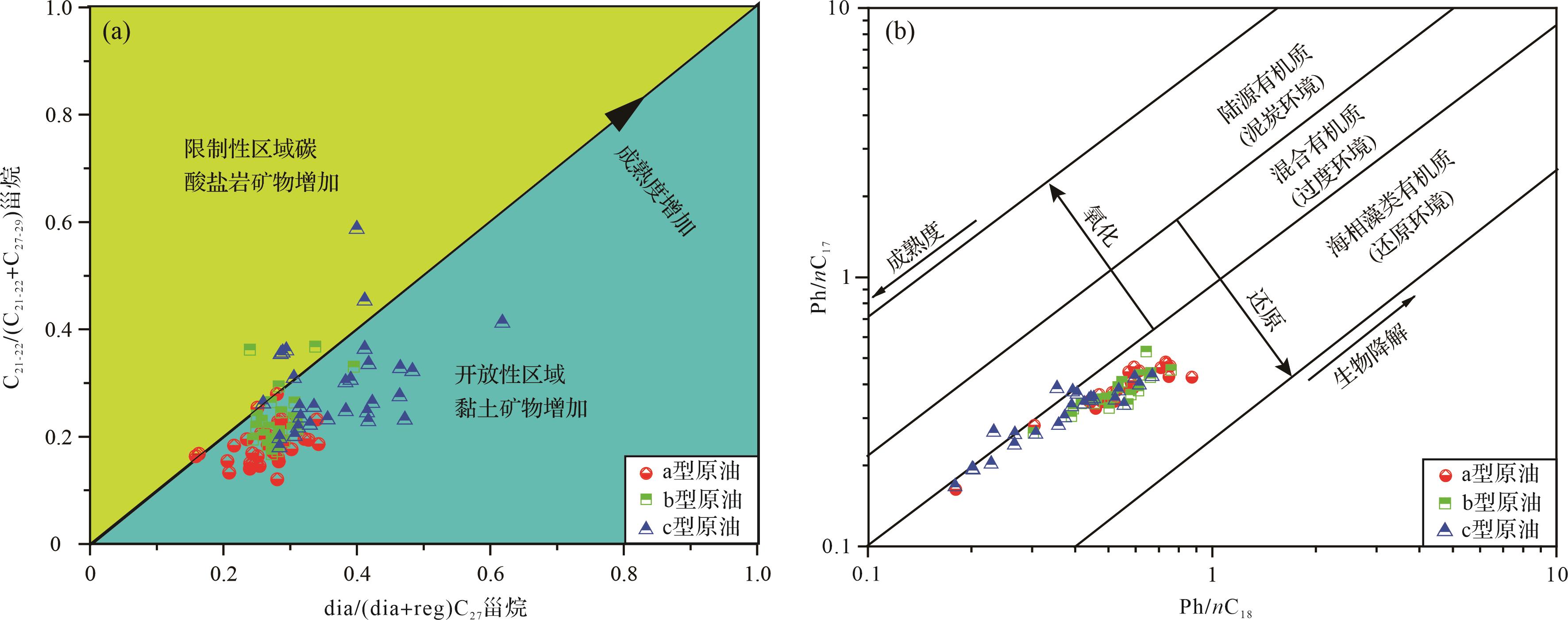
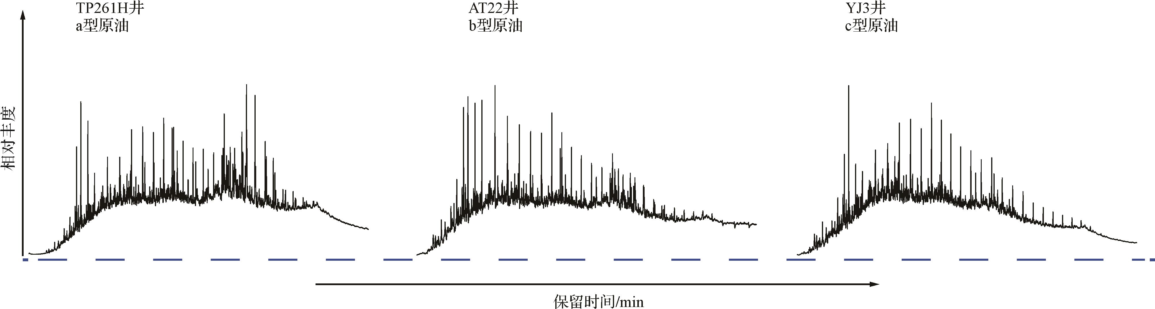
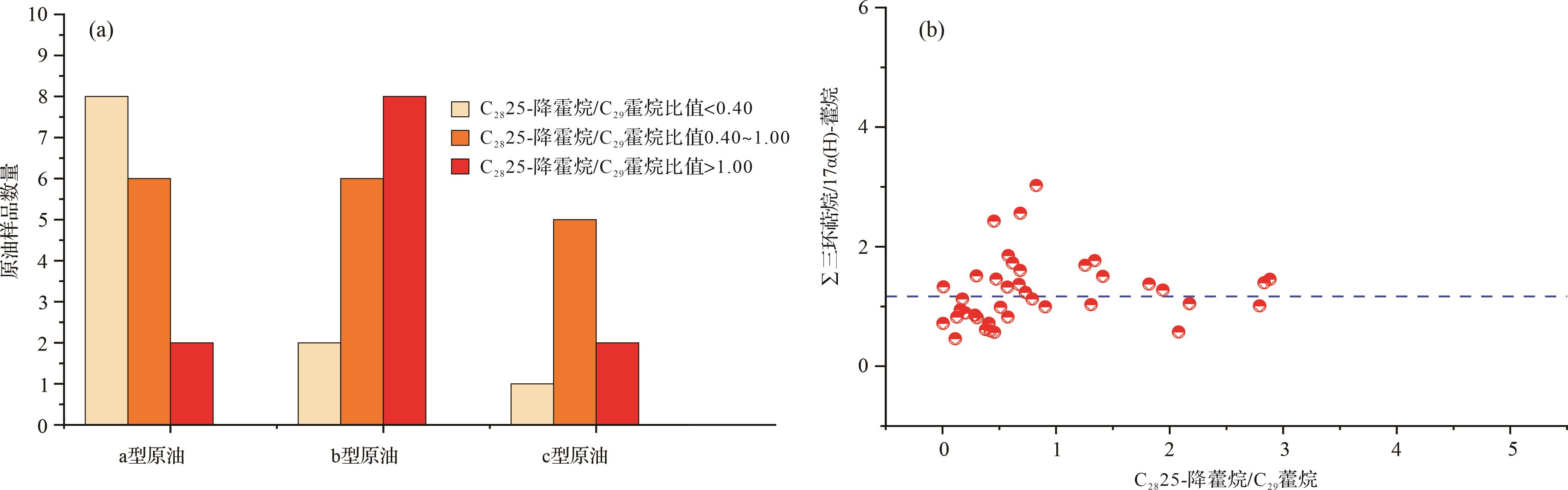
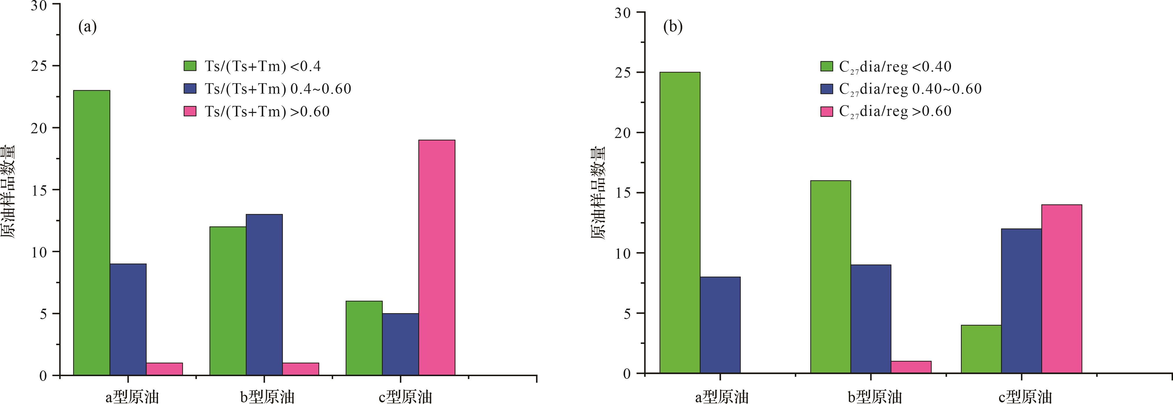
Tahe oilfield is the Paleozoic marine carbonate oil and gas field with the largest crude oil reserves in China. The content of tricyclic terpanes in Tahe crude oil is unusually rich and significantly higher than hopanes. The reason for this abnormal distribution is still unclear. In this study, gas chromatography and gas chromatography-mass spectrometry (GC-MS) data for crude oil samples from Tahe oilfield were analyzed. The abnormal distribution and genesis of tricyclic terpanes in Tahe crude oil are discussed, covering deposition environment, biodegradation and thermal maturity. The results show that for the deposition environment, the degree of oxidation-reduction and salinization during deposition of organic matter is not the main reason. However, the relative content of tricyclic terpanes increased with increasing bacterial input in organic matter and thermal maturity. Σtricyclic terpanes/Σ17α(H)-hopanes is positively correlated with thermal maturity, indicating that thermal evolution was the most significant driving force for the abnormal distribution of tricyclic terpanes in Tahe crude oils.
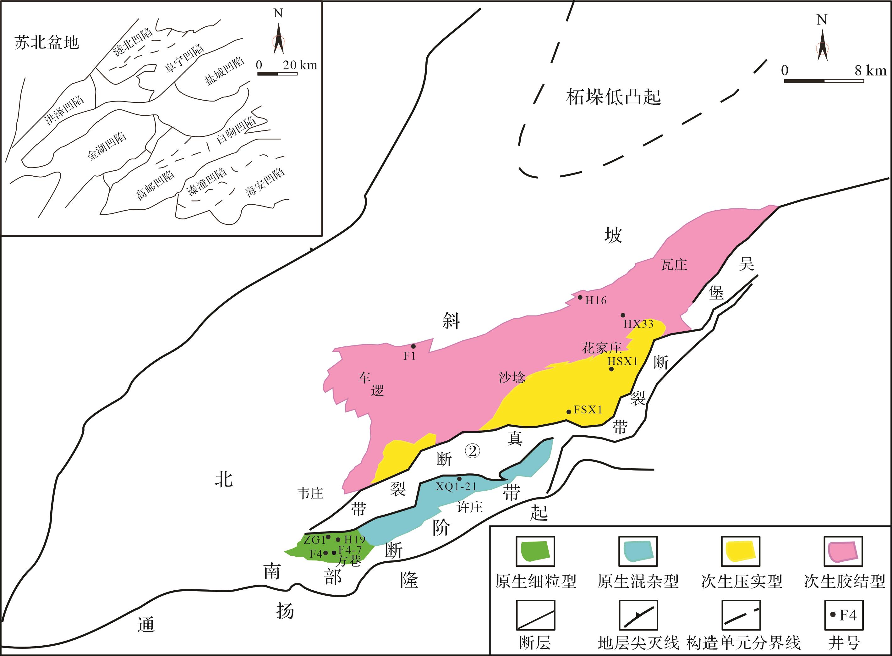
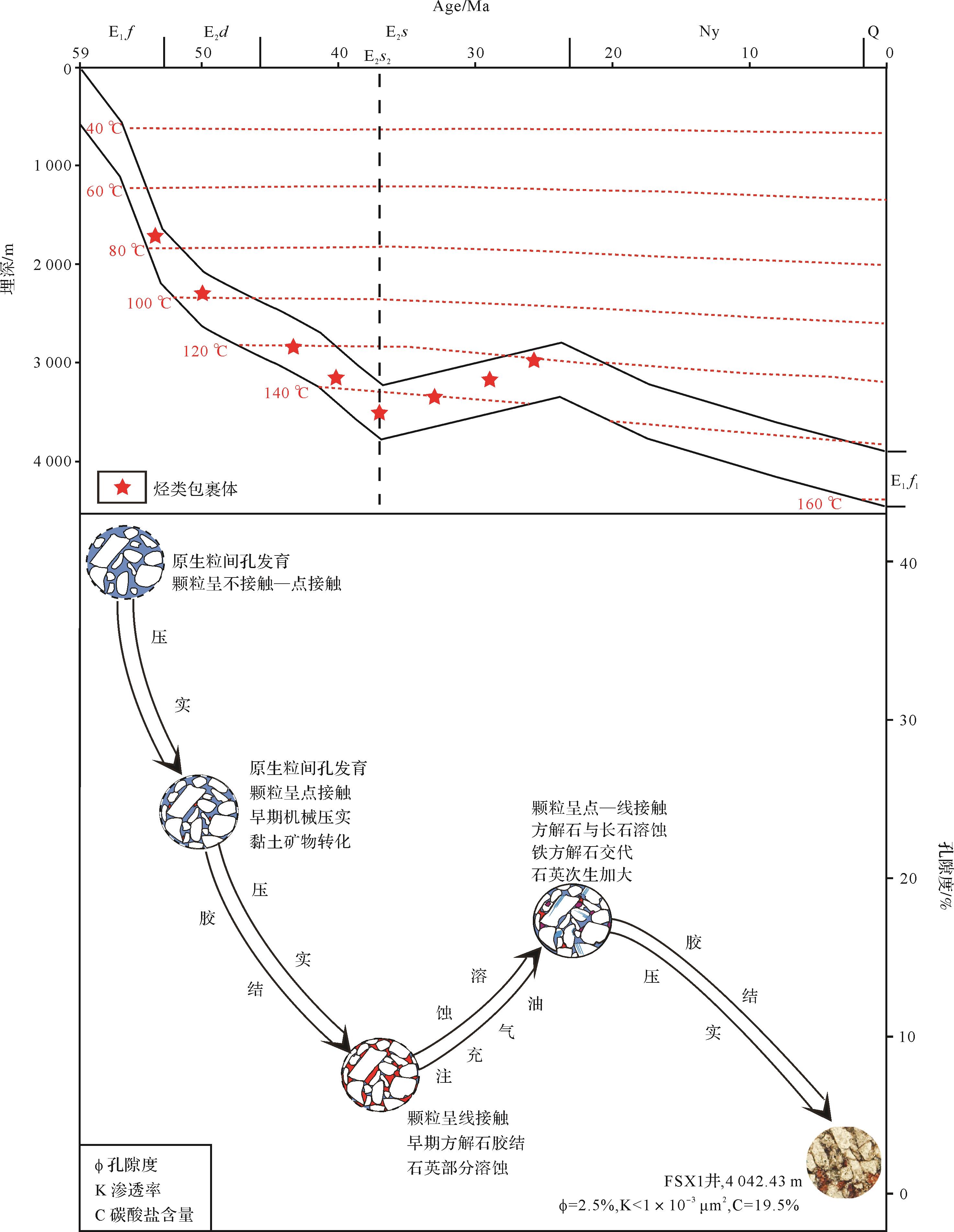
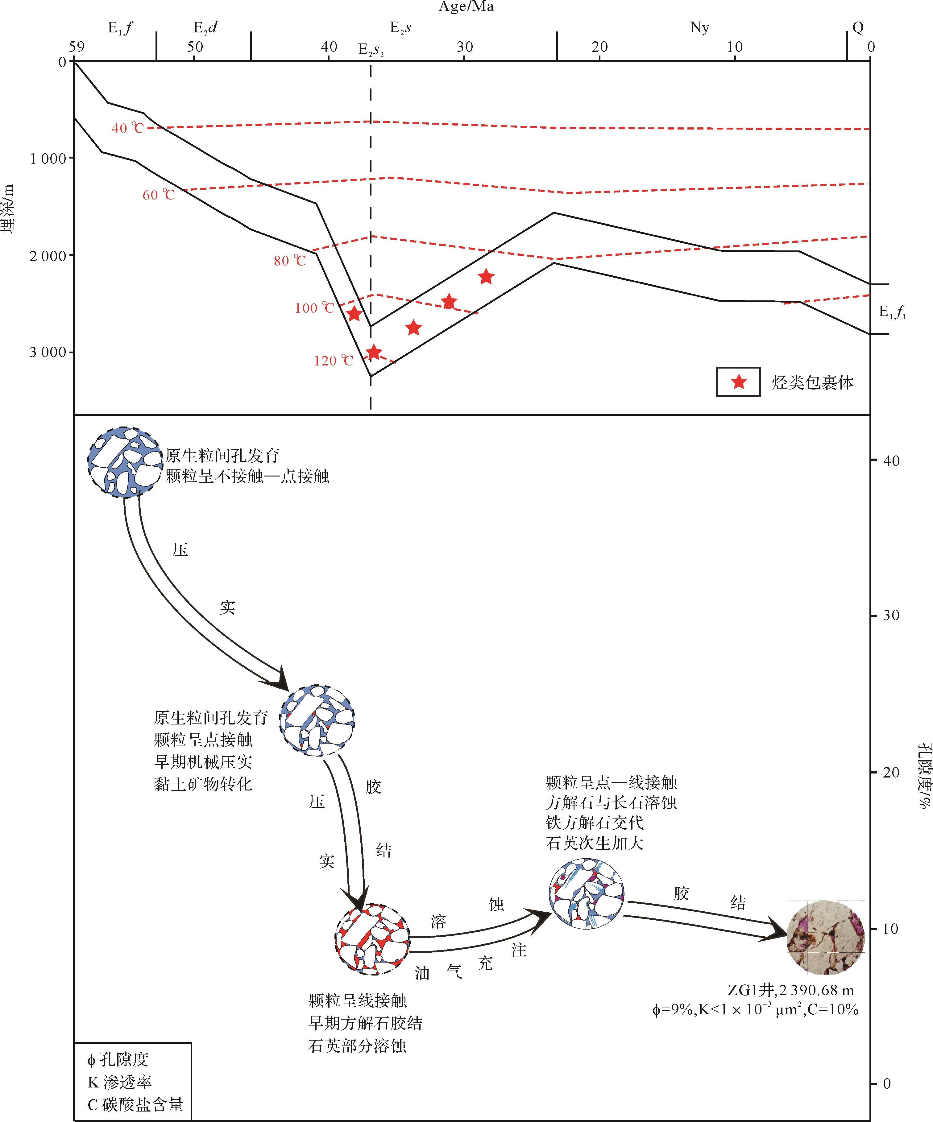
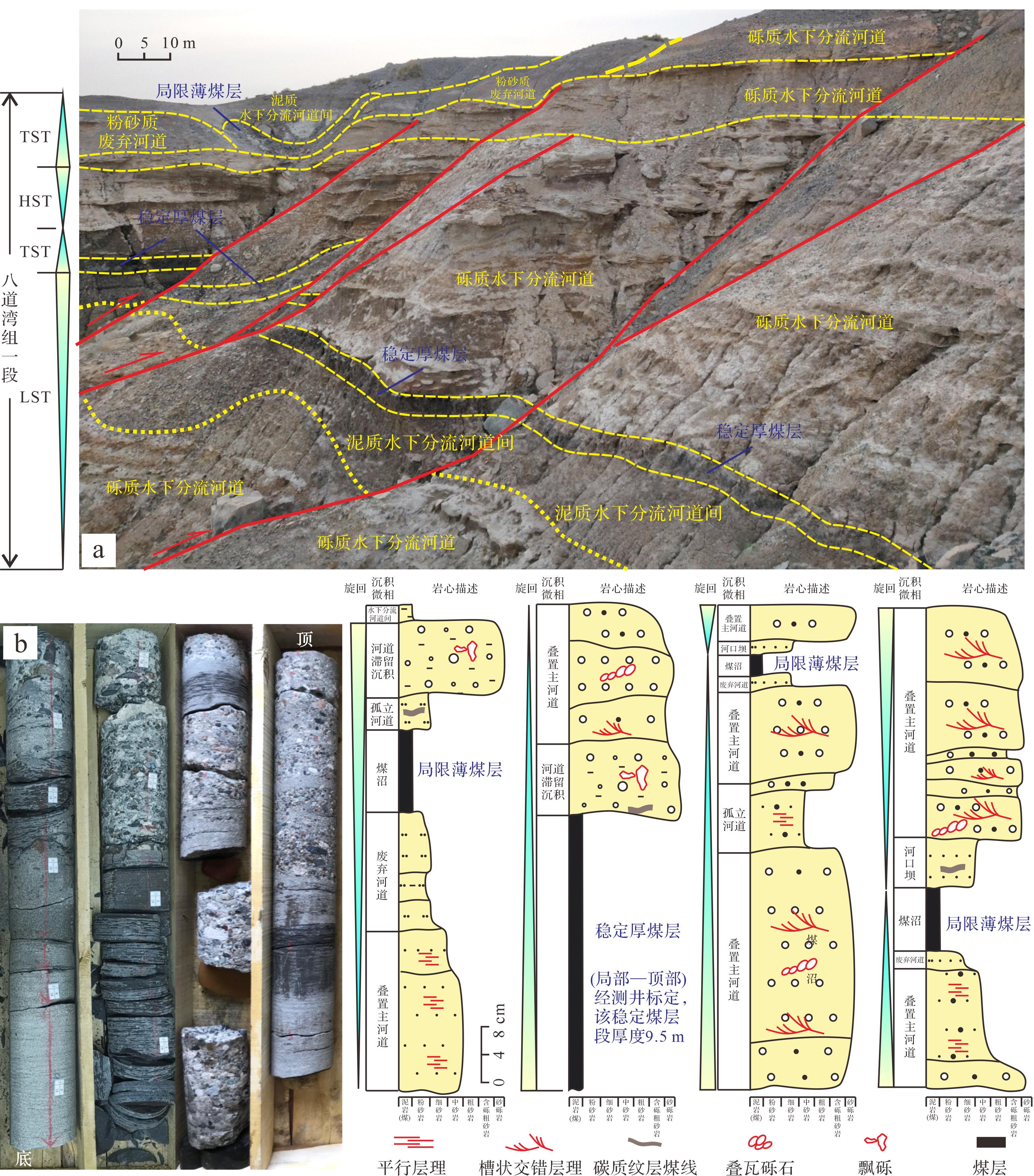
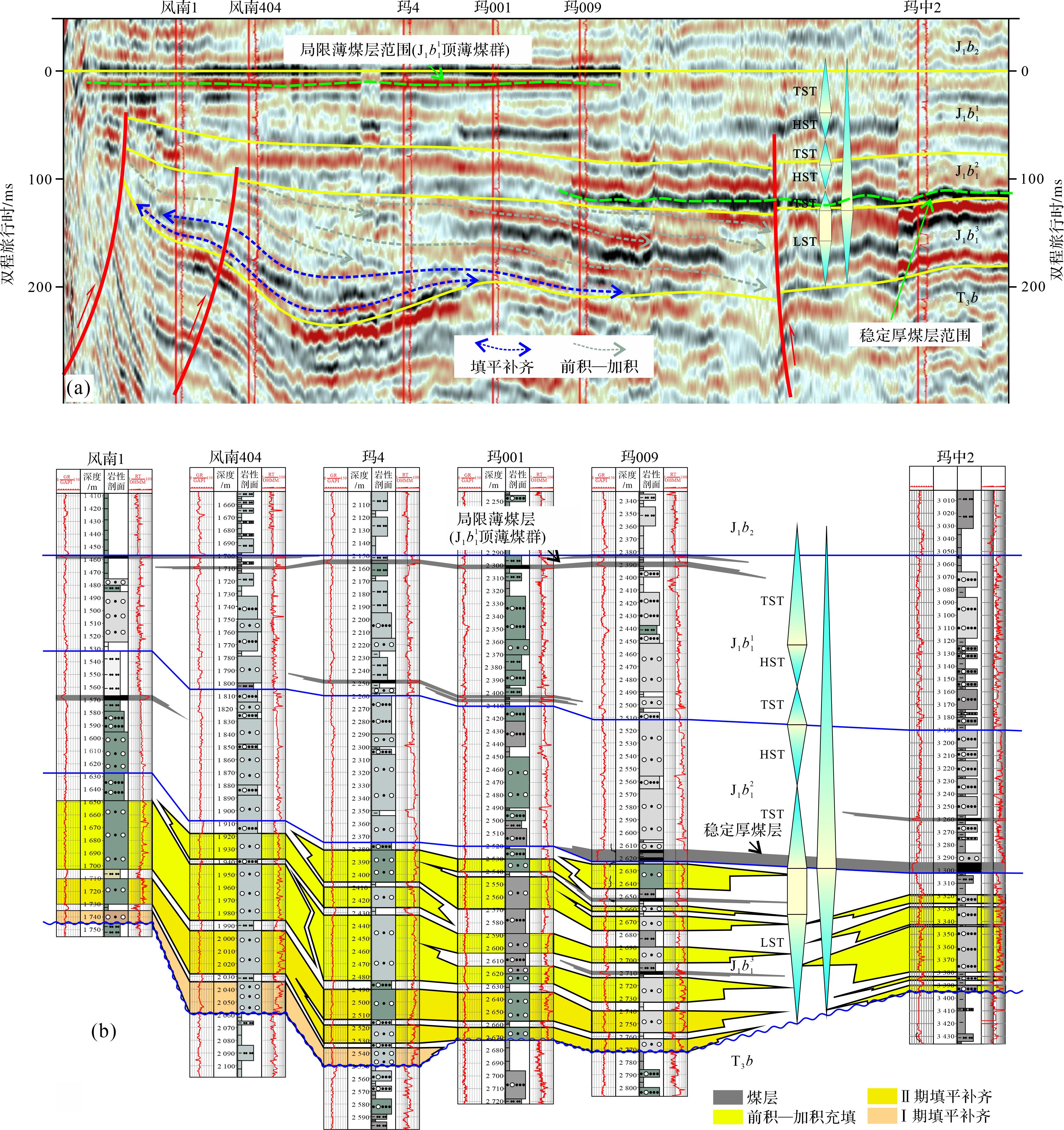
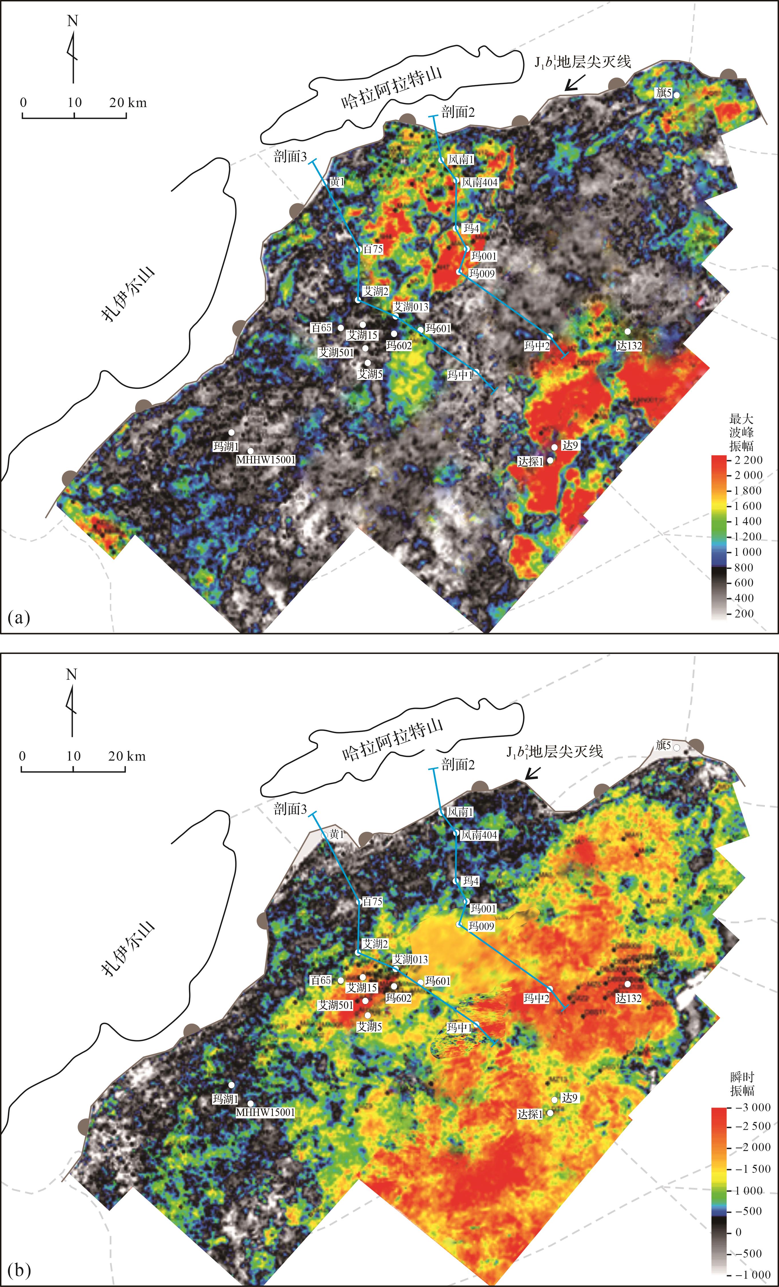
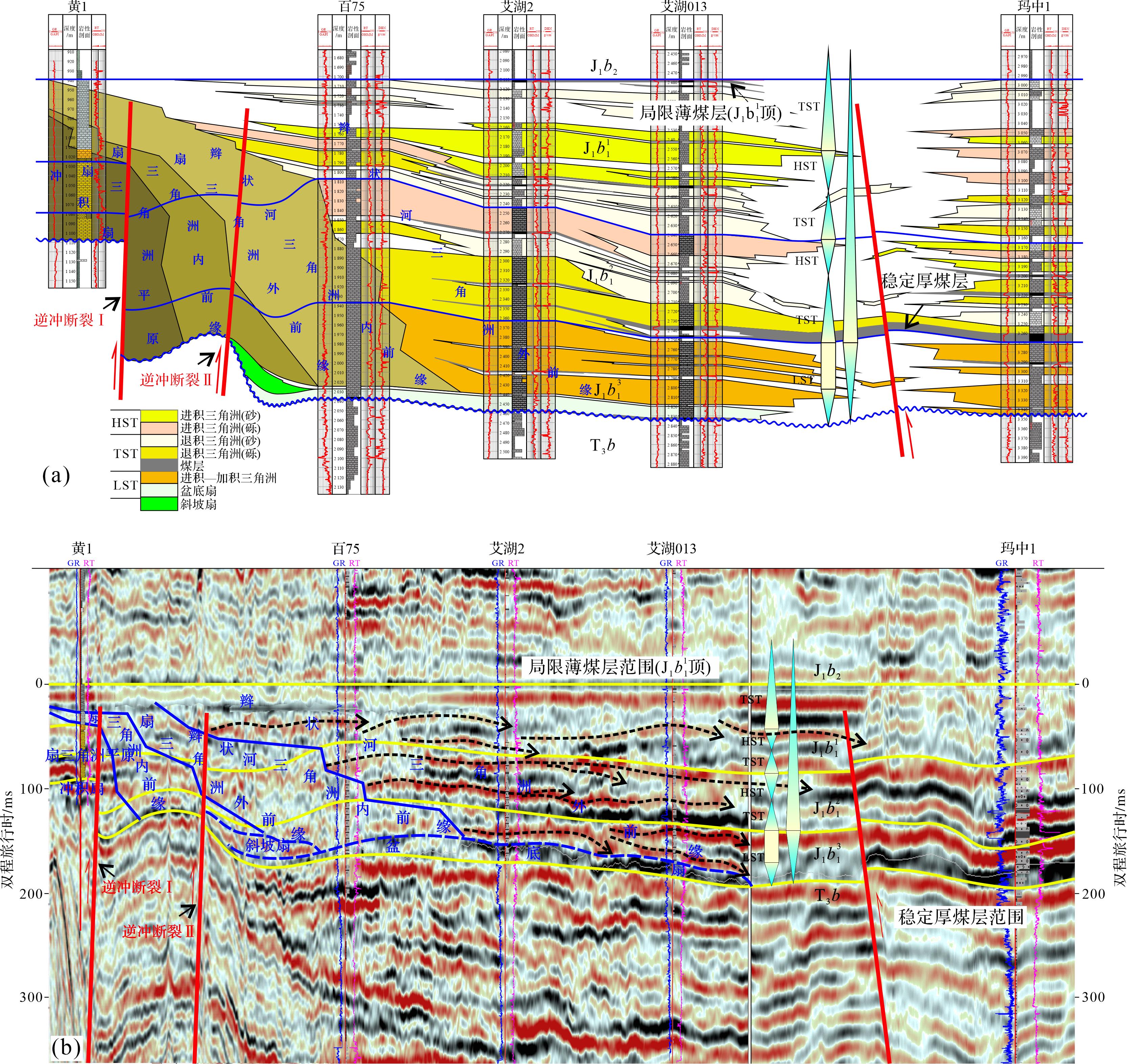
2023, 41(4): 1212-1226.
doi: 10.14027/j.issn.1000-0550.2022.033
Abstract:
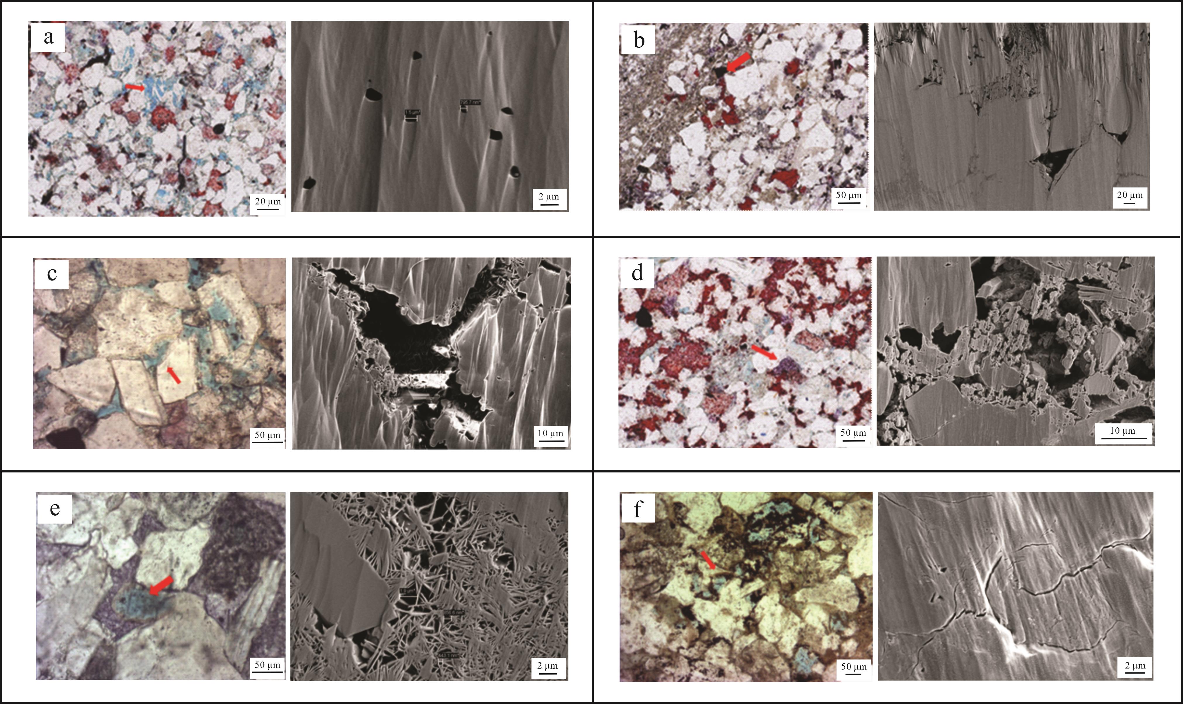
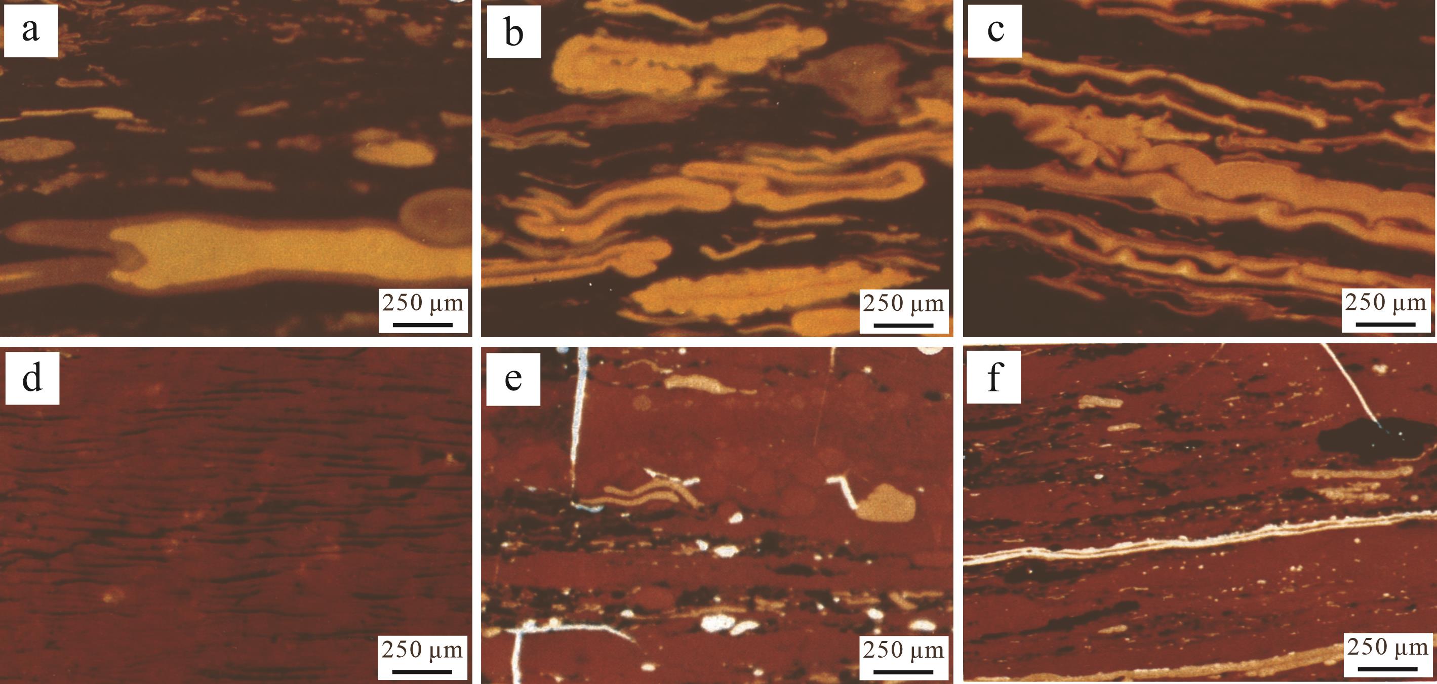
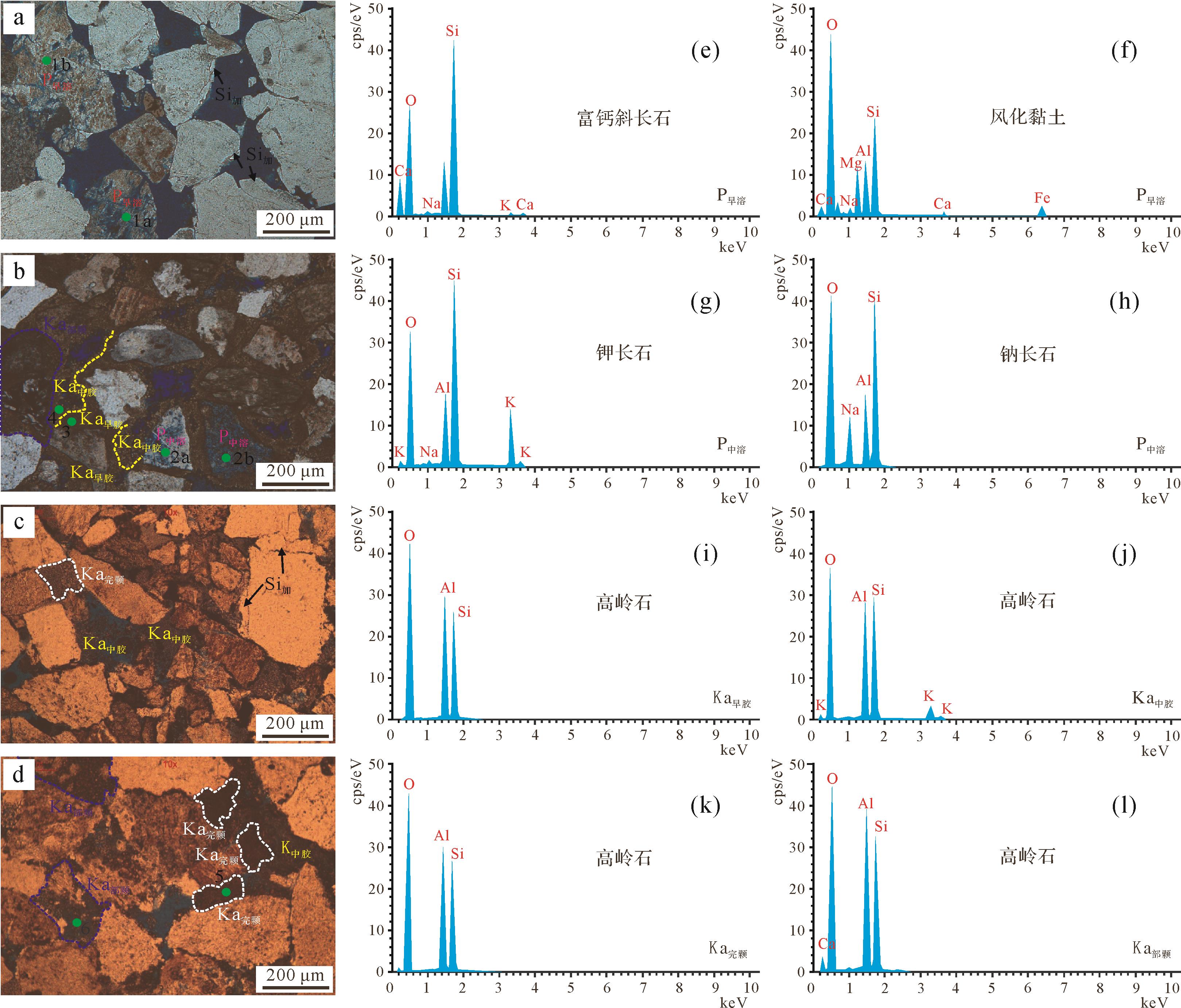
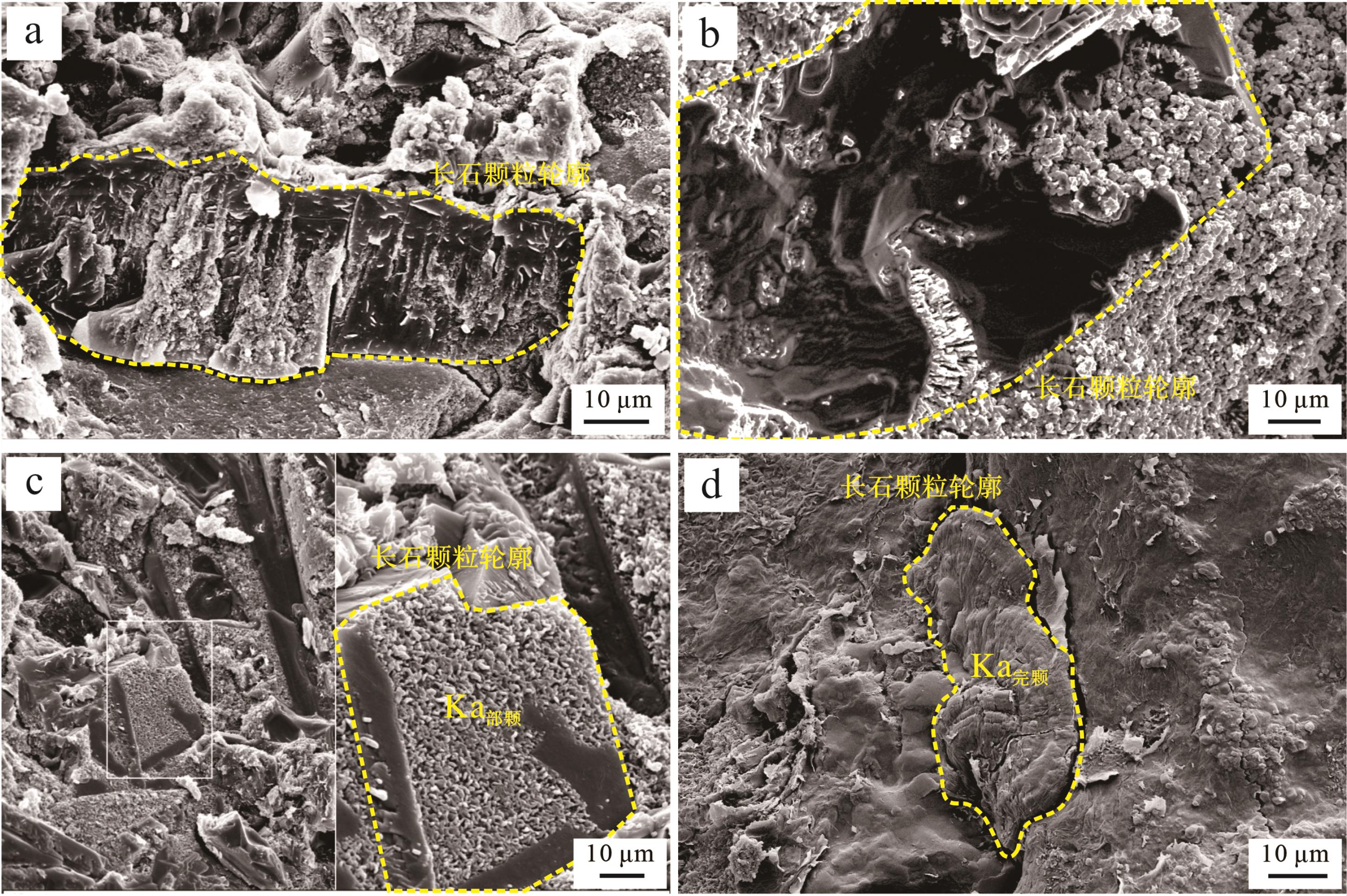
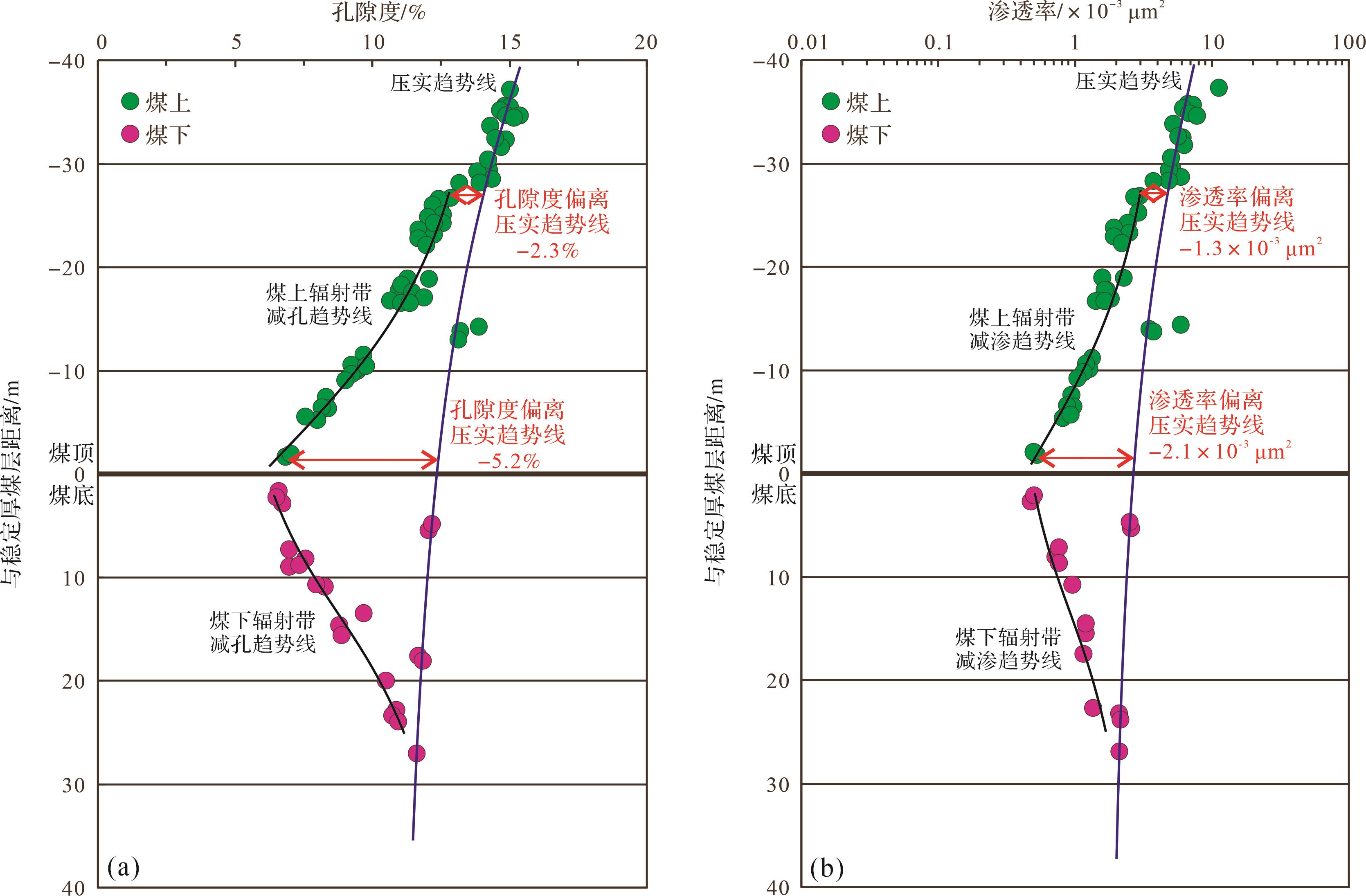
Research on coal-bearing rocks in the different sedimentary responses of multiple coal seams and the effect of adjacent glutenite diagenetic is not currently well developed. Through field observations, sporopollen combination, well-seismic profiles, core phase sequence, and logging responses, such as scanning electron microscope and electron probe energy spectrum data, a stable thick coal seam, and limited thin coal seam were analyzed in the study area for different sedimentary responses. The results showed that through the movement along thrust faults I and II of the basin edge, the oscillation behavior of the boundary faults and basin basement subsidence provides the study area with thick layers of peat accumulation, leading to wide slow-ancient slope cover lake invasion. This hinders the swamp drainage, preventing the oxidation of organic matter and reducing the river gradient. Weakening terrigenous clastic particles interfere with the favorable conditions. A large stable thick coal seam was formed near the first lake flood surface in the lacustrine basin, and the maceral indicates that the coal forming swamp has maintained a good hysteretic water reduction condition. The limited thin coal seams are scattered, have obvious phase-controlled characteristics, and are primarily distributed in the low energy facies zones, such as an interfan/interchannel with weak hydrodynamics. The maceral indicates that the coal forming swamp has a semi-oxidation stage with poor local hysteretic reduction conditions. In the penecongenic-early diagenetic stage, humic acid in coal measures formed dissolution pores in feldspar grains, and the dissolution particles were dominated by calcium-rich plagioclase. The occurrence of kaolinite cement products is found near the inner ring edge of the particles with high purity. Complete and partial kaolinite particles are formed by the dissolution of feldspar particles, kaolinite filling, and collapse polycondensation. The former is of high purity, and the latter is of low purity. In the middle diagenetic stage, organic carboxylic acid of the hydrocarbon source forms dissolution pores in feldspar grains; the dissolution components are primarily potassium feldspar, and the residual components are primarily albite. The occurrence of cemented kaolinite is located on the outer ring edge of the particles or filling intergranular pores with low purity. The influence of humic acid in coal measures on the quality of adjacent conglomerate reservoir is inhibition. Based on the limiting sedimentary facies zone and grain size, the vertical radiation thickness of the stable thick coal seam is 10⁃30 m, the porosity of conglomerate in the radiation zone decreases by 2.3%⁃5.2%, and the permeability decreases by (1.3⁃2.1)×10-3 μm2. The vertical radiation thickness of the limited thin coal seam is 3⁃8 m, the porosity of conglomerate in radiation zone decreases by 1.2%⁃3.5%, and the permeability decreases by (0.8⁃1.9)×10-3 μm2. The high content of rigid particles is a prerequisite for the effective preservation of the original intergranular pores, especially the humic acid solution pores in the penicsyngenetic and early diagenetic coal measures. The removal degree of dissolution products, such as kaolinite and silica, further restricts the effectiveness of the pores.
Research on coal-bearing rocks in the different sedimentary responses of multiple coal seams and the effect of adjacent glutenite diagenetic is not currently well developed. Through field observations, sporopollen combination, well-seismic profiles, core phase sequence, and logging responses, such as scanning electron microscope and electron probe energy spectrum data, a stable thick coal seam, and limited thin coal seam were analyzed in the study area for different sedimentary responses. The results showed that through the movement along thrust faults I and II of the basin edge, the oscillation behavior of the boundary faults and basin basement subsidence provides the study area with thick layers of peat accumulation, leading to wide slow-ancient slope cover lake invasion. This hinders the swamp drainage, preventing the oxidation of organic matter and reducing the river gradient. Weakening terrigenous clastic particles interfere with the favorable conditions. A large stable thick coal seam was formed near the first lake flood surface in the lacustrine basin, and the maceral indicates that the coal forming swamp has maintained a good hysteretic water reduction condition. The limited thin coal seams are scattered, have obvious phase-controlled characteristics, and are primarily distributed in the low energy facies zones, such as an interfan/interchannel with weak hydrodynamics. The maceral indicates that the coal forming swamp has a semi-oxidation stage with poor local hysteretic reduction conditions. In the penecongenic-early diagenetic stage, humic acid in coal measures formed dissolution pores in feldspar grains, and the dissolution particles were dominated by calcium-rich plagioclase. The occurrence of kaolinite cement products is found near the inner ring edge of the particles with high purity. Complete and partial kaolinite particles are formed by the dissolution of feldspar particles, kaolinite filling, and collapse polycondensation. The former is of high purity, and the latter is of low purity. In the middle diagenetic stage, organic carboxylic acid of the hydrocarbon source forms dissolution pores in feldspar grains; the dissolution components are primarily potassium feldspar, and the residual components are primarily albite. The occurrence of cemented kaolinite is located on the outer ring edge of the particles or filling intergranular pores with low purity. The influence of humic acid in coal measures on the quality of adjacent conglomerate reservoir is inhibition. Based on the limiting sedimentary facies zone and grain size, the vertical radiation thickness of the stable thick coal seam is 10⁃30 m, the porosity of conglomerate in the radiation zone decreases by 2.3%⁃5.2%, and the permeability decreases by (1.3⁃2.1)×10-3 μm2. The vertical radiation thickness of the limited thin coal seam is 3⁃8 m, the porosity of conglomerate in radiation zone decreases by 1.2%⁃3.5%, and the permeability decreases by (0.8⁃1.9)×10-3 μm2. The high content of rigid particles is a prerequisite for the effective preservation of the original intergranular pores, especially the humic acid solution pores in the penicsyngenetic and early diagenetic coal measures. The removal degree of dissolution products, such as kaolinite and silica, further restricts the effectiveness of the pores.
2023, 41(4): 1227-1239.
doi: 10.14027/j.issn.1000-0550.2022.041
Abstract:
To clarify the fine-grained sedimentary characteristics and depositional models of the Chang 7 oil member of the Triassic Yanchang Formation in the southern Ordos Basin, we take Yishi Village, Yaoqu, and other typical field sections as research objects. Based on field reconnaissance and survey, we analyze the lithofacies and lithofacies assemblage characteristics, discuss sedimentary facies characteristics, and establish different fine-grained sedimentary lithofacies evolution models. The results show that the outcrops in the middle and lower sections of the Yanchang Formation in the Tongchuan area primarily developed overlying and scouring positive-order silt-fine sandstone, massive bedding silt-fine sandstone, soft sedimentary deformed sand-shale mixed, and massive mudstone facies. There are 6 lithofacies types in the horizontal laminar shale facies and tuff facies. The typical characteristics of the lower 73 sub-oil member of the Yishicun section are sandy clastic flows and slump deposits with massive bedding. The deep-water in-situ deposits from different outcrop sections of the Chang 72 sub-oil member, whose lithology transitions from siltstone-silty mudstone to horizontal laminar mudstone to black shale with extremely developed shales, were examined. The Chang 71 sub-oil member of the Yaoqu section is rich in soft sedimentary deformation structures, such as liquefied sandstone veins, argillaceous bands, and flame-like structures in massive sandstones. The lithofacies assemblage types of the fine-grained sediments in the Chang 7 oil member from the Yanchang Formation in the Tongchuan area include background argillaceous deposits, vertical assemblages of tuff and gravity flow deposits, superposition of sliding landslides and background mudstones, gravity flow deposits of sandstones, and mudstones. The sedimentary period of the Chang 73 sub-oil member in Yishi Village was a relatively thick sliding slumping deposit formed by the re-transportation of the delta front sediment. The depositional period of the Chang 72 sub-oil member was composed of deep-water shale deposits, mixed with volcanic ash carried by wind and a small amount of low-density turbidity current deposits and thin siltstones. In the depositional period of the Chang 71 sub-oil member, the sandy debris flow deposits and low-density turbidity current deposits that were formed by the collapse and transport of deltas increased. As a whole, during the sedimentary period of Chang 7 oil member, the lake level was found to rise first and then decrease periodically. The fluctuation of lake level controls the transport mode and deposition mode of fine-grained sediments and has important guiding significance for the study of the transport mechanism and distribution of fine-grained sediments.
To clarify the fine-grained sedimentary characteristics and depositional models of the Chang 7 oil member of the Triassic Yanchang Formation in the southern Ordos Basin, we take Yishi Village, Yaoqu, and other typical field sections as research objects. Based on field reconnaissance and survey, we analyze the lithofacies and lithofacies assemblage characteristics, discuss sedimentary facies characteristics, and establish different fine-grained sedimentary lithofacies evolution models. The results show that the outcrops in the middle and lower sections of the Yanchang Formation in the Tongchuan area primarily developed overlying and scouring positive-order silt-fine sandstone, massive bedding silt-fine sandstone, soft sedimentary deformed sand-shale mixed, and massive mudstone facies. There are 6 lithofacies types in the horizontal laminar shale facies and tuff facies. The typical characteristics of the lower 73 sub-oil member of the Yishicun section are sandy clastic flows and slump deposits with massive bedding. The deep-water in-situ deposits from different outcrop sections of the Chang 72 sub-oil member, whose lithology transitions from siltstone-silty mudstone to horizontal laminar mudstone to black shale with extremely developed shales, were examined. The Chang 71 sub-oil member of the Yaoqu section is rich in soft sedimentary deformation structures, such as liquefied sandstone veins, argillaceous bands, and flame-like structures in massive sandstones. The lithofacies assemblage types of the fine-grained sediments in the Chang 7 oil member from the Yanchang Formation in the Tongchuan area include background argillaceous deposits, vertical assemblages of tuff and gravity flow deposits, superposition of sliding landslides and background mudstones, gravity flow deposits of sandstones, and mudstones. The sedimentary period of the Chang 73 sub-oil member in Yishi Village was a relatively thick sliding slumping deposit formed by the re-transportation of the delta front sediment. The depositional period of the Chang 72 sub-oil member was composed of deep-water shale deposits, mixed with volcanic ash carried by wind and a small amount of low-density turbidity current deposits and thin siltstones. In the depositional period of the Chang 71 sub-oil member, the sandy debris flow deposits and low-density turbidity current deposits that were formed by the collapse and transport of deltas increased. As a whole, during the sedimentary period of Chang 7 oil member, the lake level was found to rise first and then decrease periodically. The fluctuation of lake level controls the transport mode and deposition mode of fine-grained sediments and has important guiding significance for the study of the transport mechanism and distribution of fine-grained sediments.
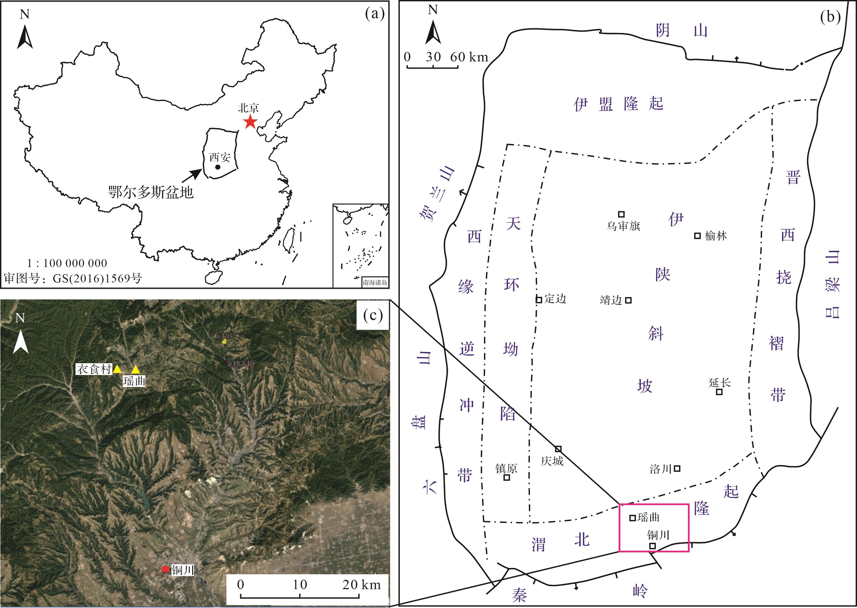
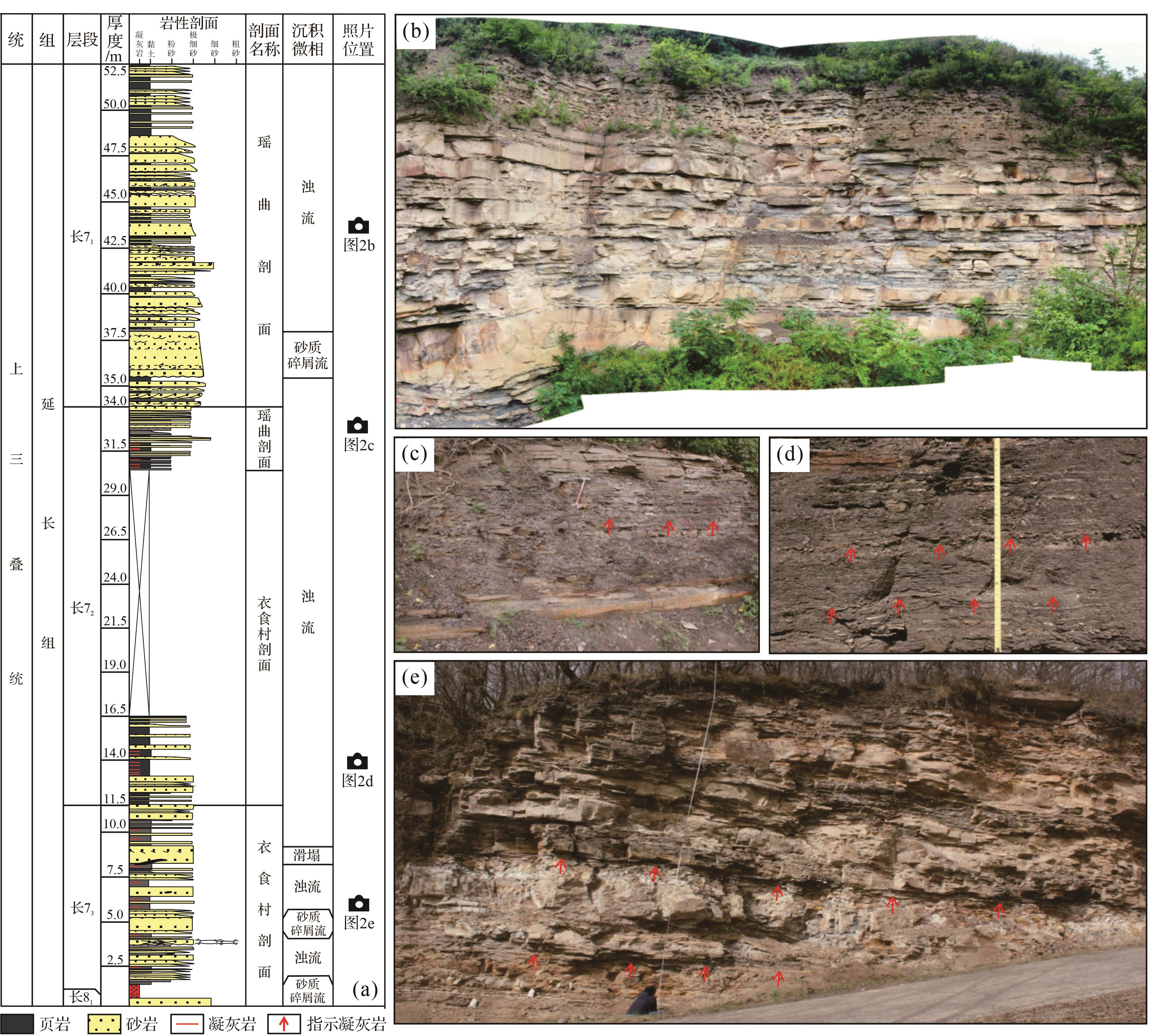
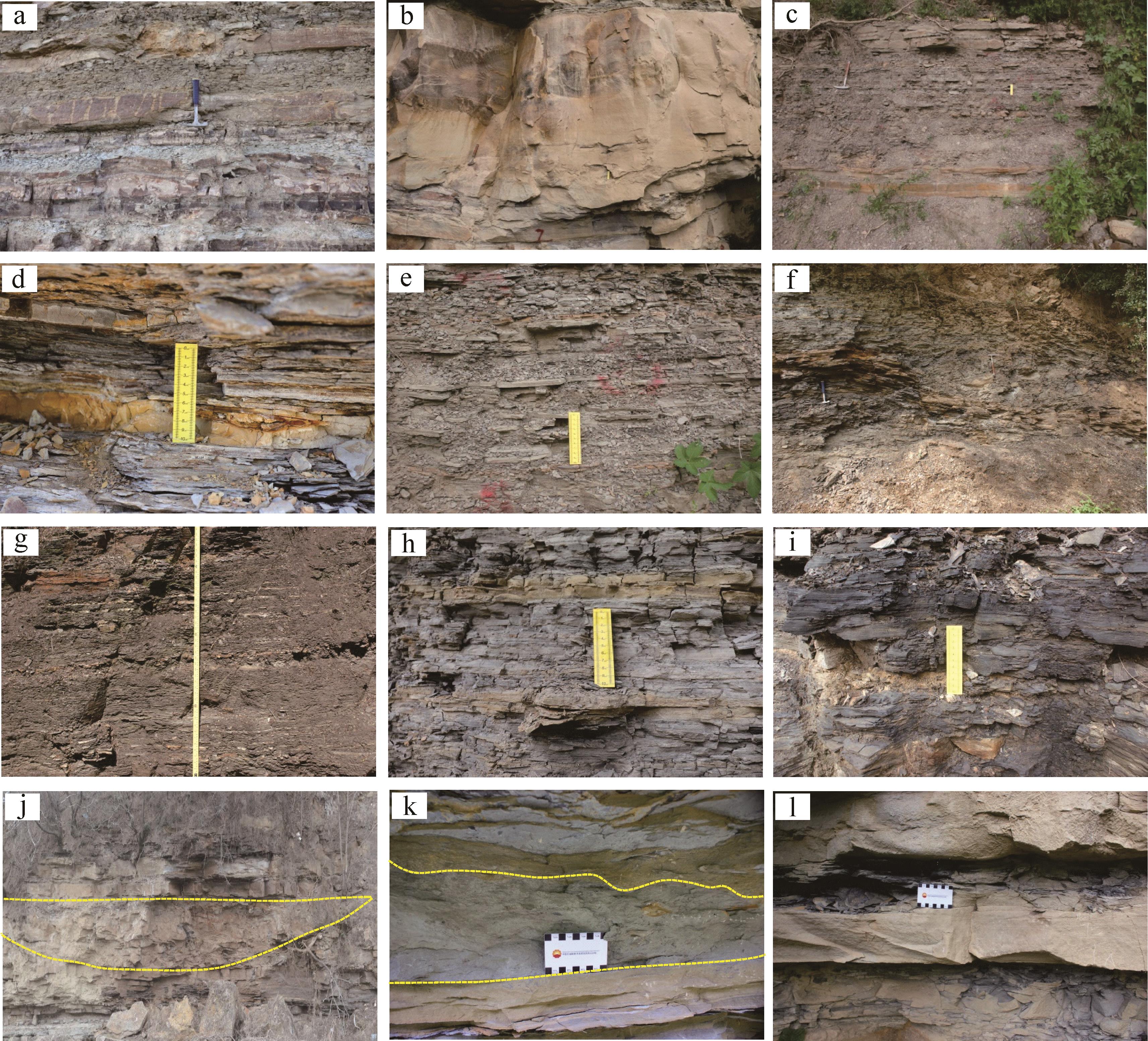
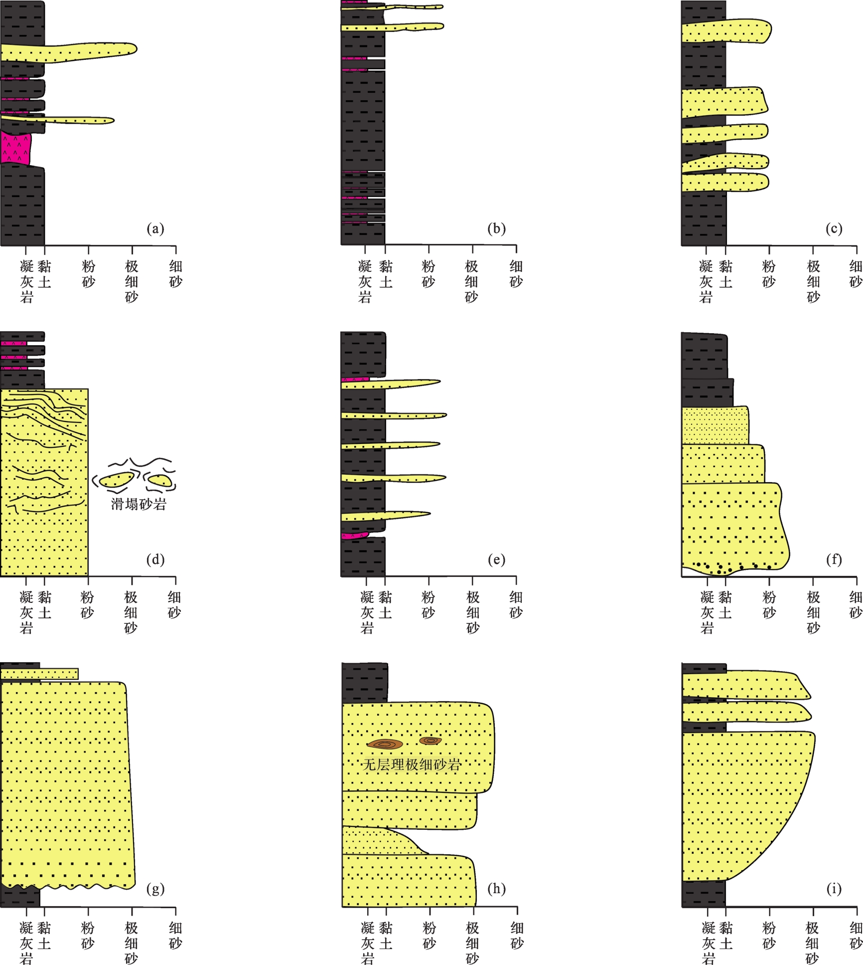
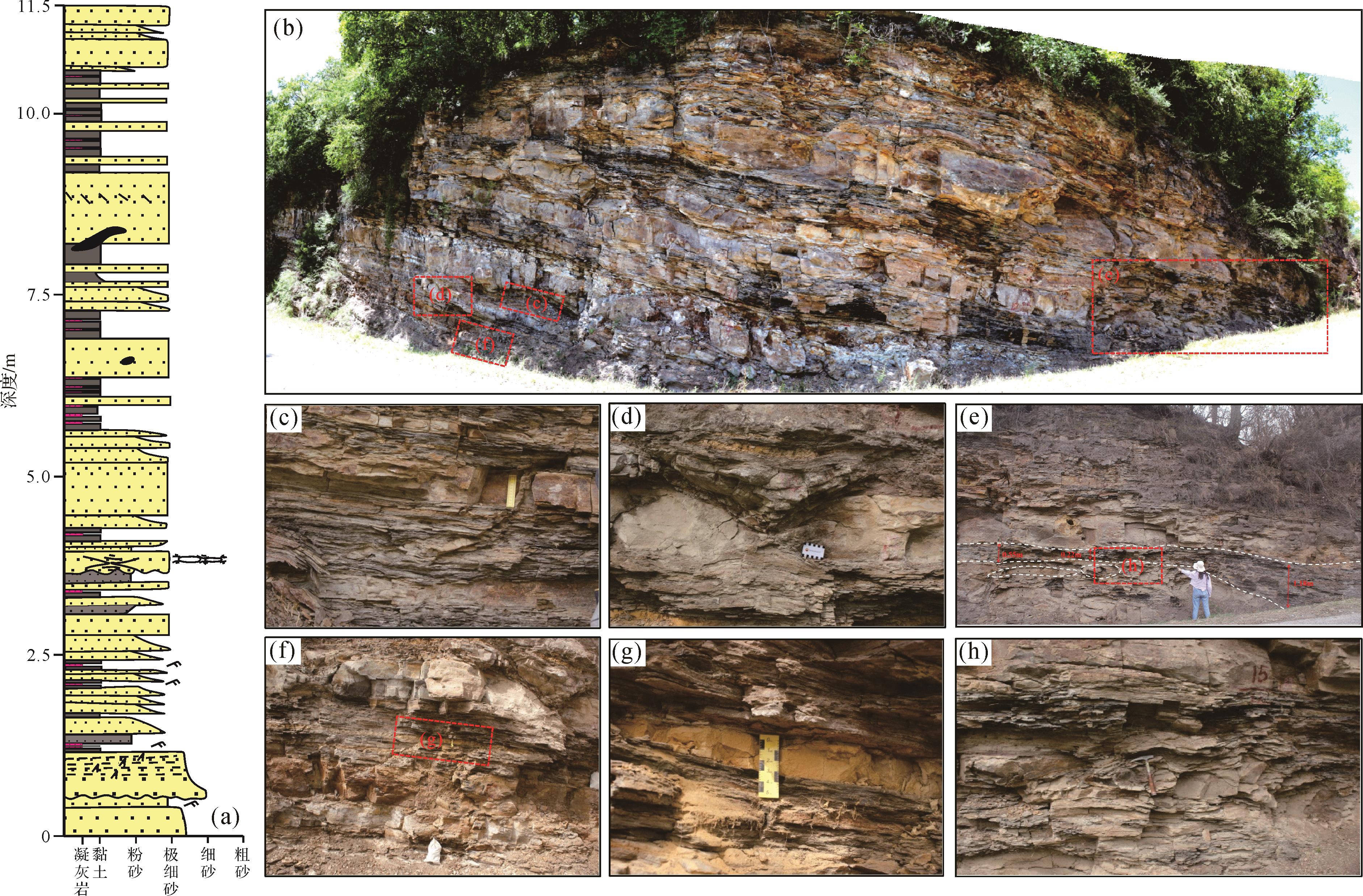
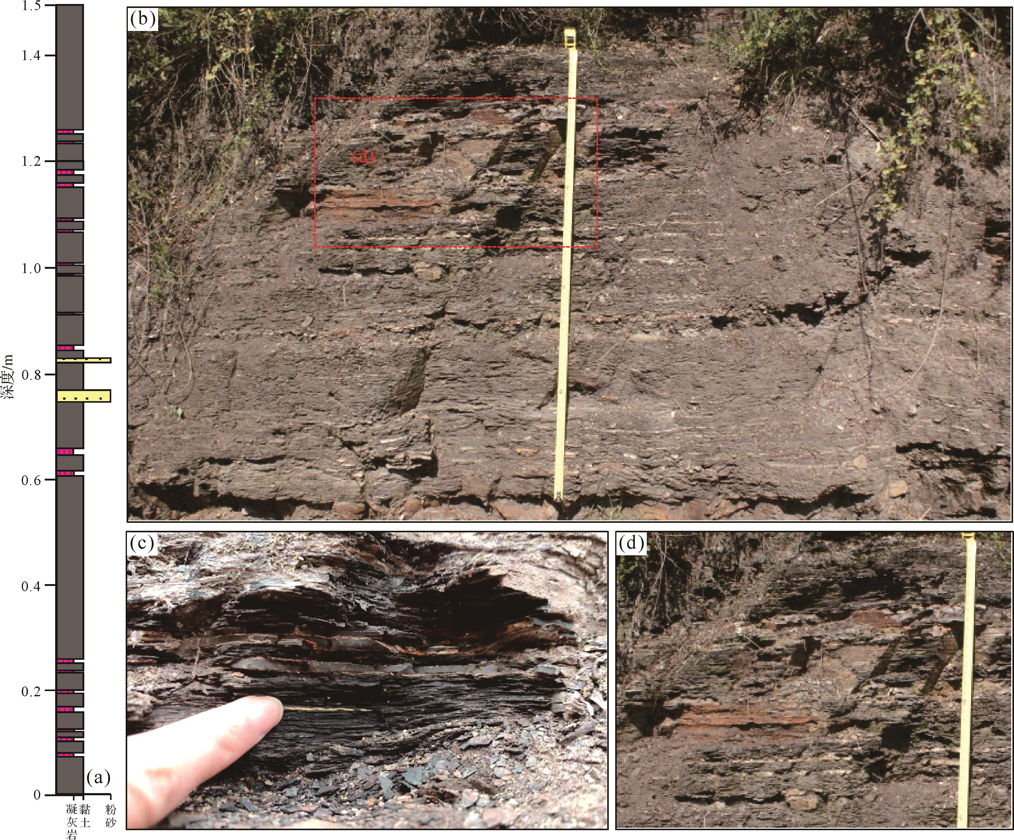
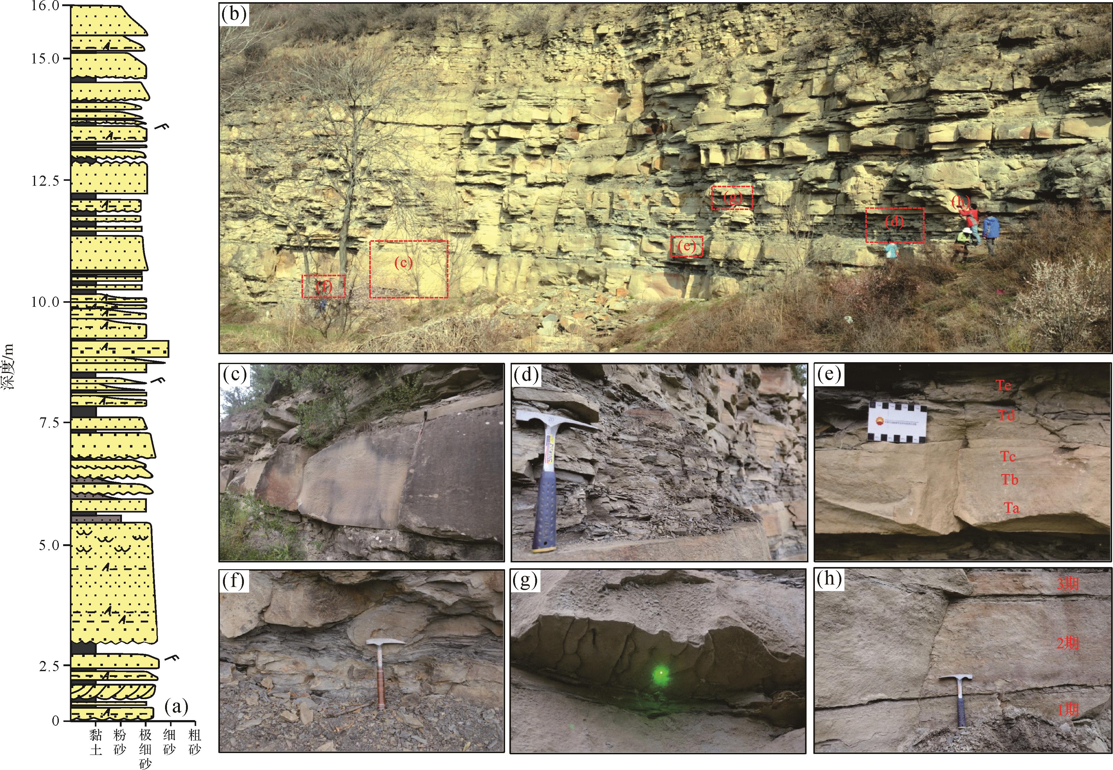
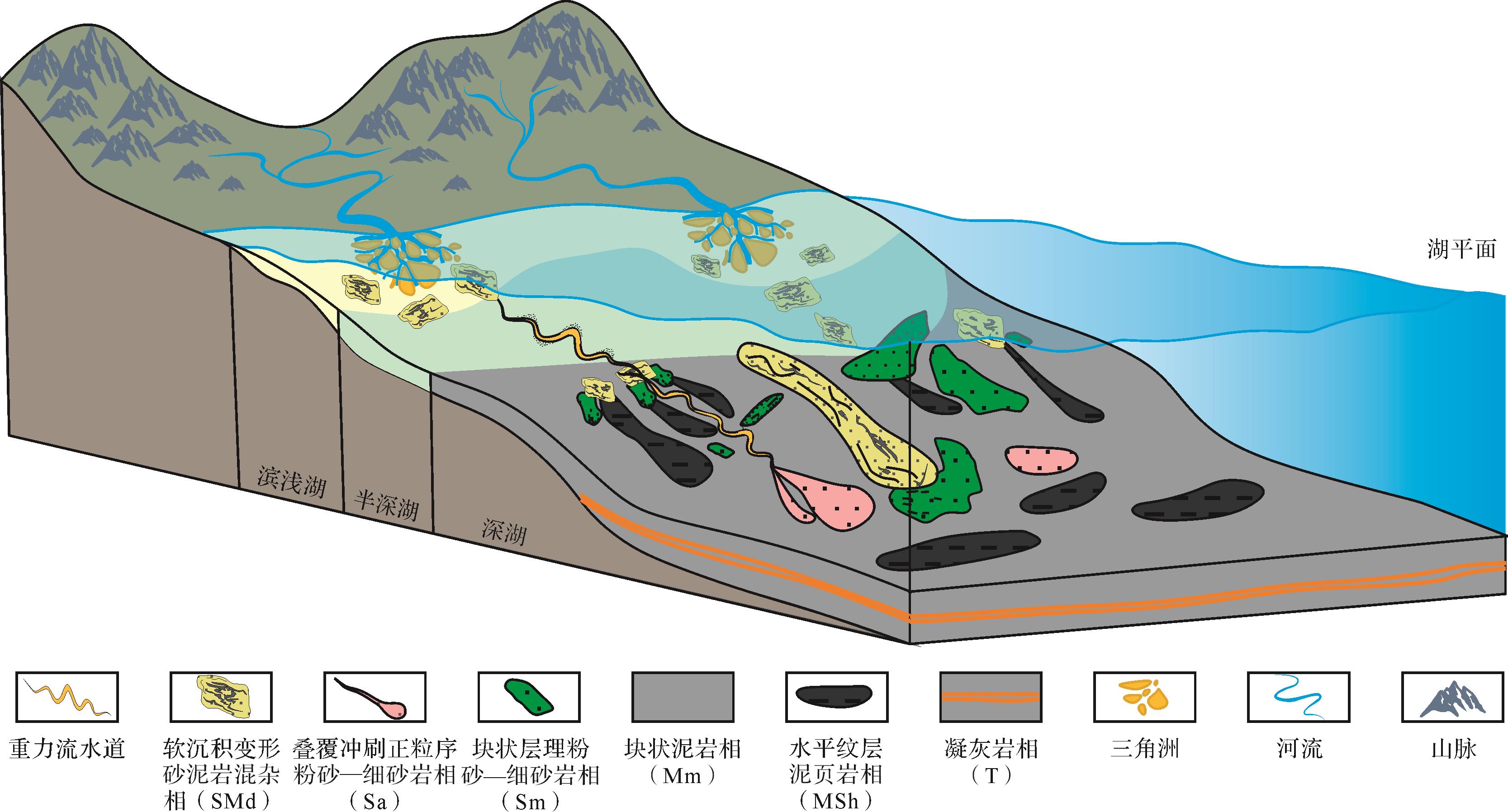
2023, 41(4): 1240-1256.
doi: 10.14027/j.issn.1000-0550.2021.159
Abstract:
Based on the geochemical analysis of the Lower Cambrian mudstone in the Kuluketage area, the paleoclimate, provenance, and formation of mudstone in the Early Cambrian are discussed. In the study area, the CIA value and SiO2-(Al2O3+K2O+Na2O) diagram show that the paleoclimate in the Early Cambrian was warmer than in the Ediacaran, and became cold and dry again in the Cambrian. The Ce/Ce* and (La/Ce)N values indicate that the Xishanbulake Formation was deposited in a submarine basin near a mid ocean ridge (MOR), and the overlying Xidashan and underlying Hangeerqiaoke Formations are deposited in a stable continental margin. The La-Th-Sc diagram shows that the tectonic setting of the formation in section QKMK-Ⅰwas a passive continental margin, while section QKMK-Ⅱ. Th-Sc and Th/Sc-La/Sc diagrams and discriminant functions indicate that the parent rock of section QKMK-Ⅰ is a neutral to intermediate-acid igneous rock, and its provenance may be intermediate-acid rock of the Precambrian in the central uplift zone. The parent rock of section QKMK-Ⅱis a mafic to intermediate-acidic igneous rock, and its mafic components obviously increased. Except for the central uplift zone provenance, it may be affected by the effusion of mafic hydrothermal fluids from the seabed.
Based on the geochemical analysis of the Lower Cambrian mudstone in the Kuluketage area, the paleoclimate, provenance, and formation of mudstone in the Early Cambrian are discussed. In the study area, the CIA value and SiO2-(Al2O3+K2O+Na2O) diagram show that the paleoclimate in the Early Cambrian was warmer than in the Ediacaran, and became cold and dry again in the Cambrian. The Ce/Ce* and (La/Ce)N values indicate that the Xishanbulake Formation was deposited in a submarine basin near a mid ocean ridge (MOR), and the overlying Xidashan and underlying Hangeerqiaoke Formations are deposited in a stable continental margin. The La-Th-Sc diagram shows that the tectonic setting of the formation in section QKMK-Ⅰwas a passive continental margin, while section QKMK-Ⅱ. Th-Sc and Th/Sc-La/Sc diagrams and discriminant functions indicate that the parent rock of section QKMK-Ⅰ is a neutral to intermediate-acid igneous rock, and its provenance may be intermediate-acid rock of the Precambrian in the central uplift zone. The parent rock of section QKMK-Ⅱis a mafic to intermediate-acidic igneous rock, and its mafic components obviously increased. Except for the central uplift zone provenance, it may be affected by the effusion of mafic hydrothermal fluids from the seabed.
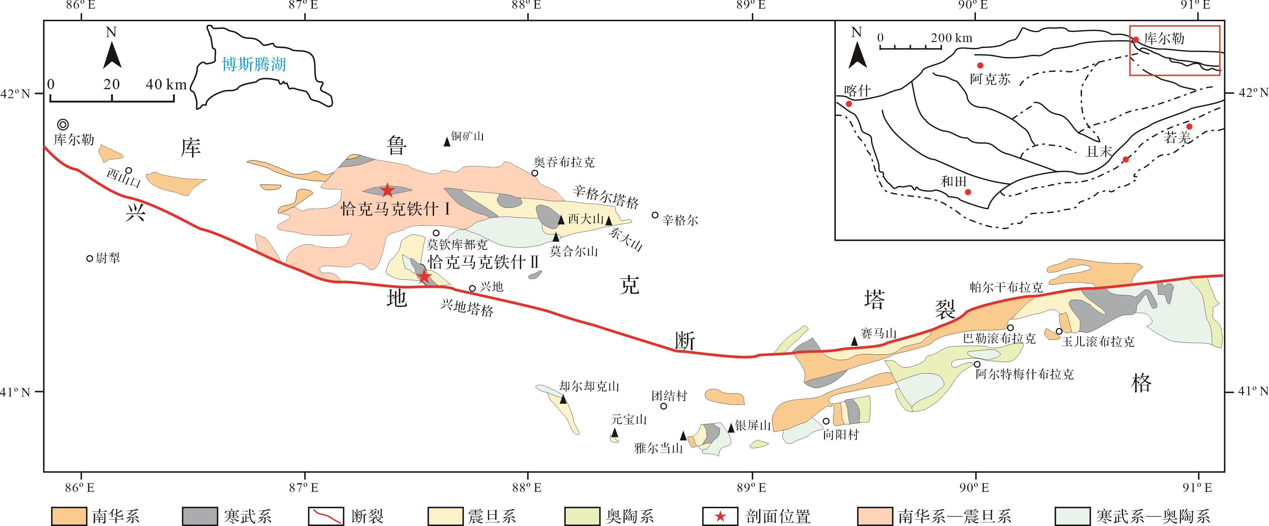
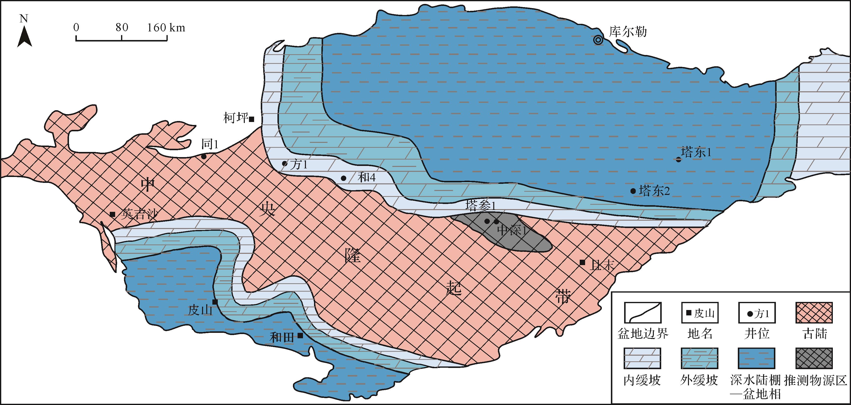
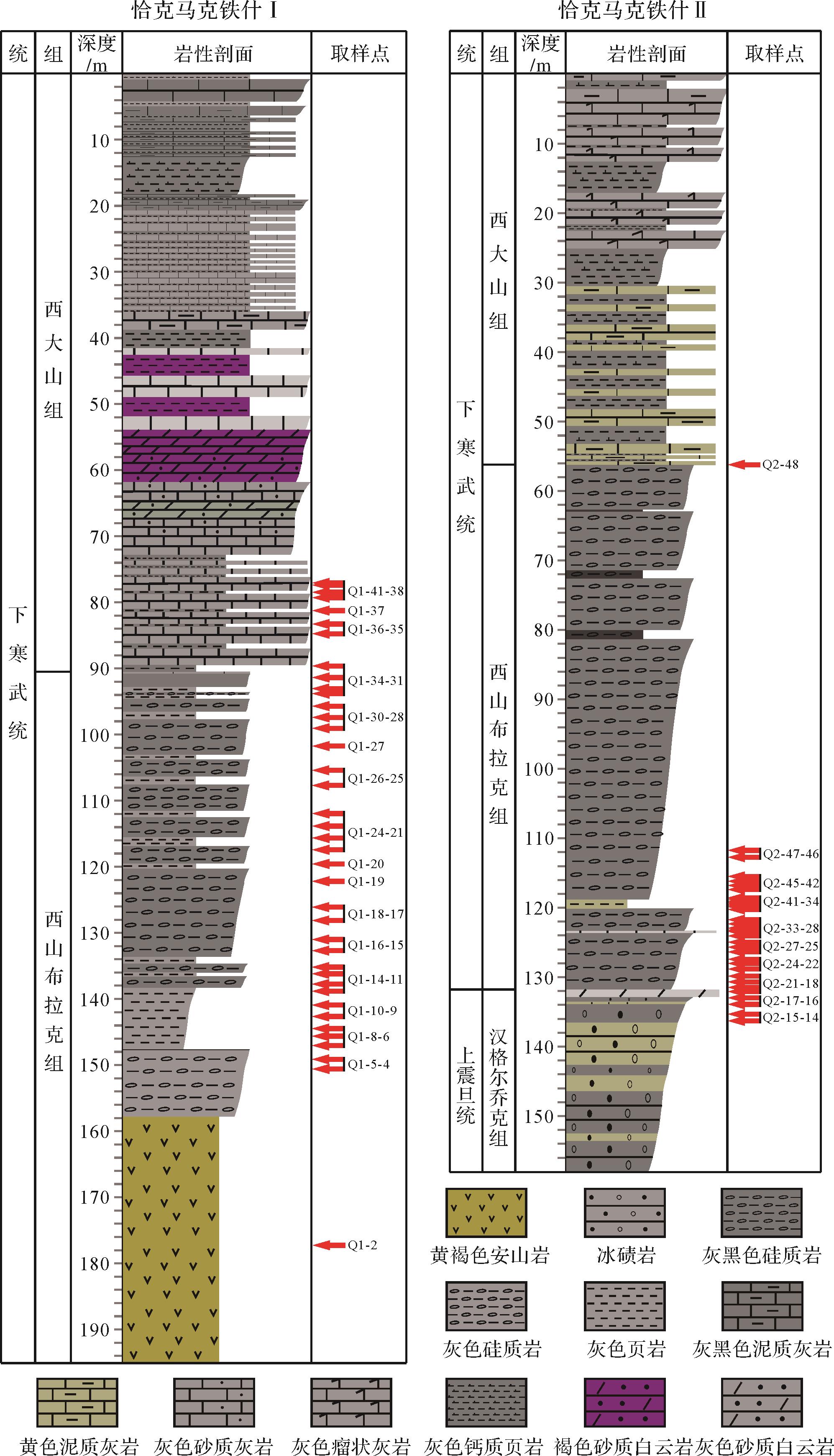
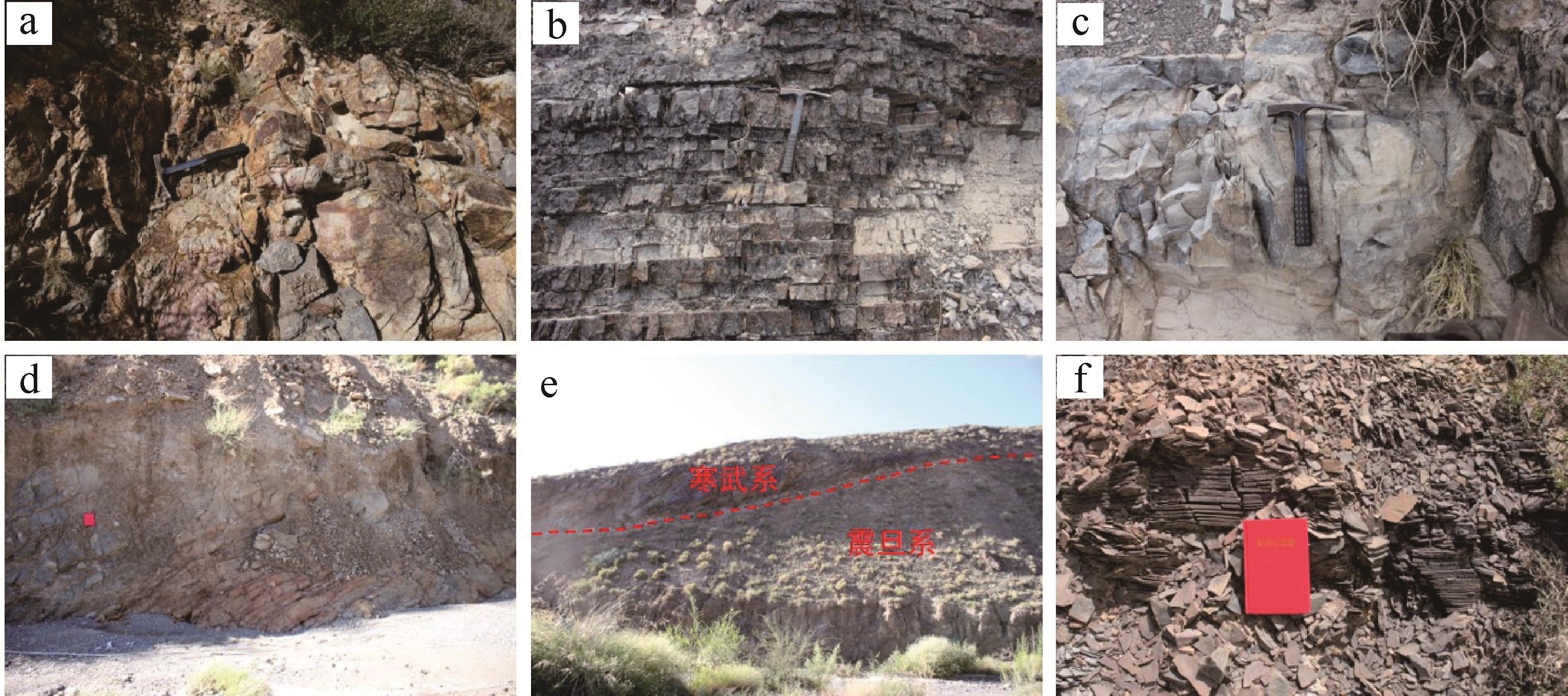
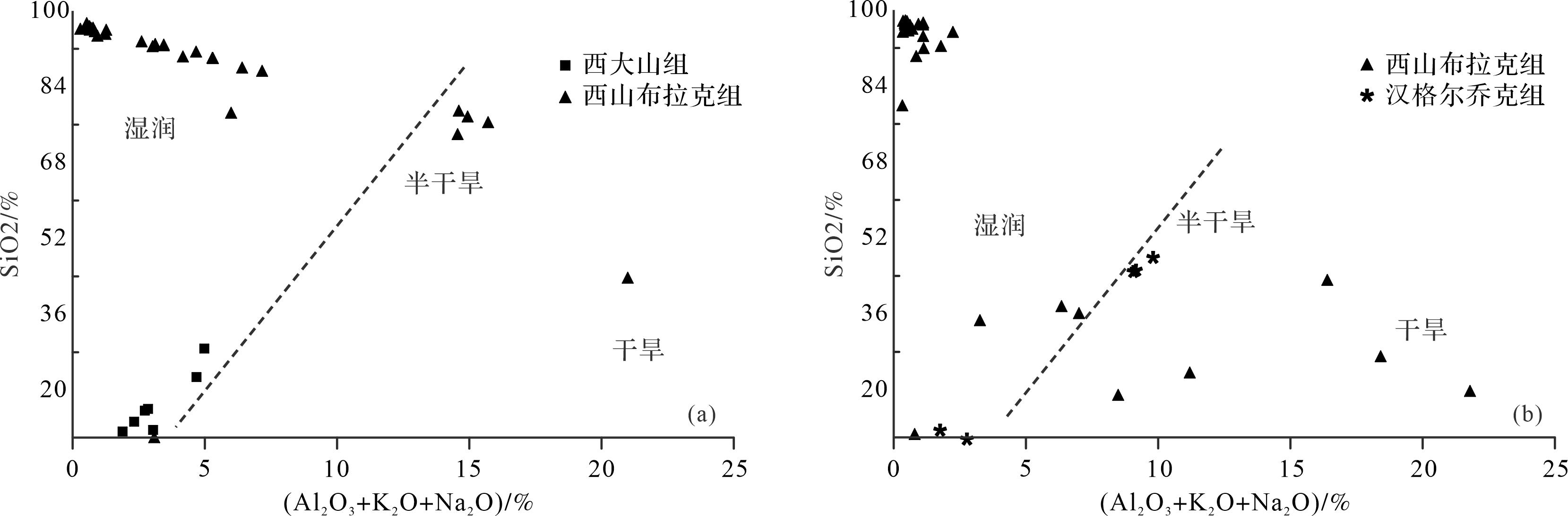
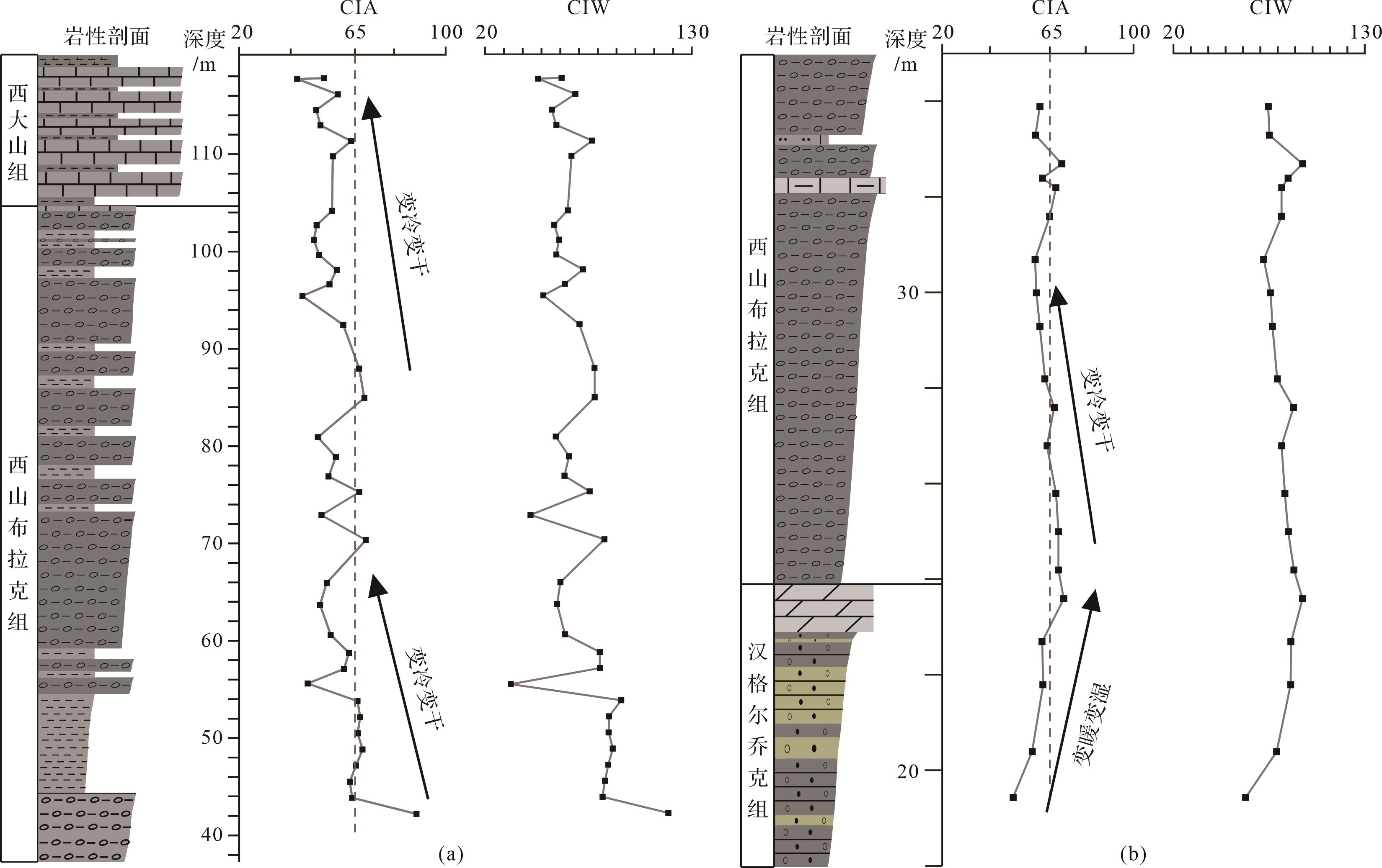
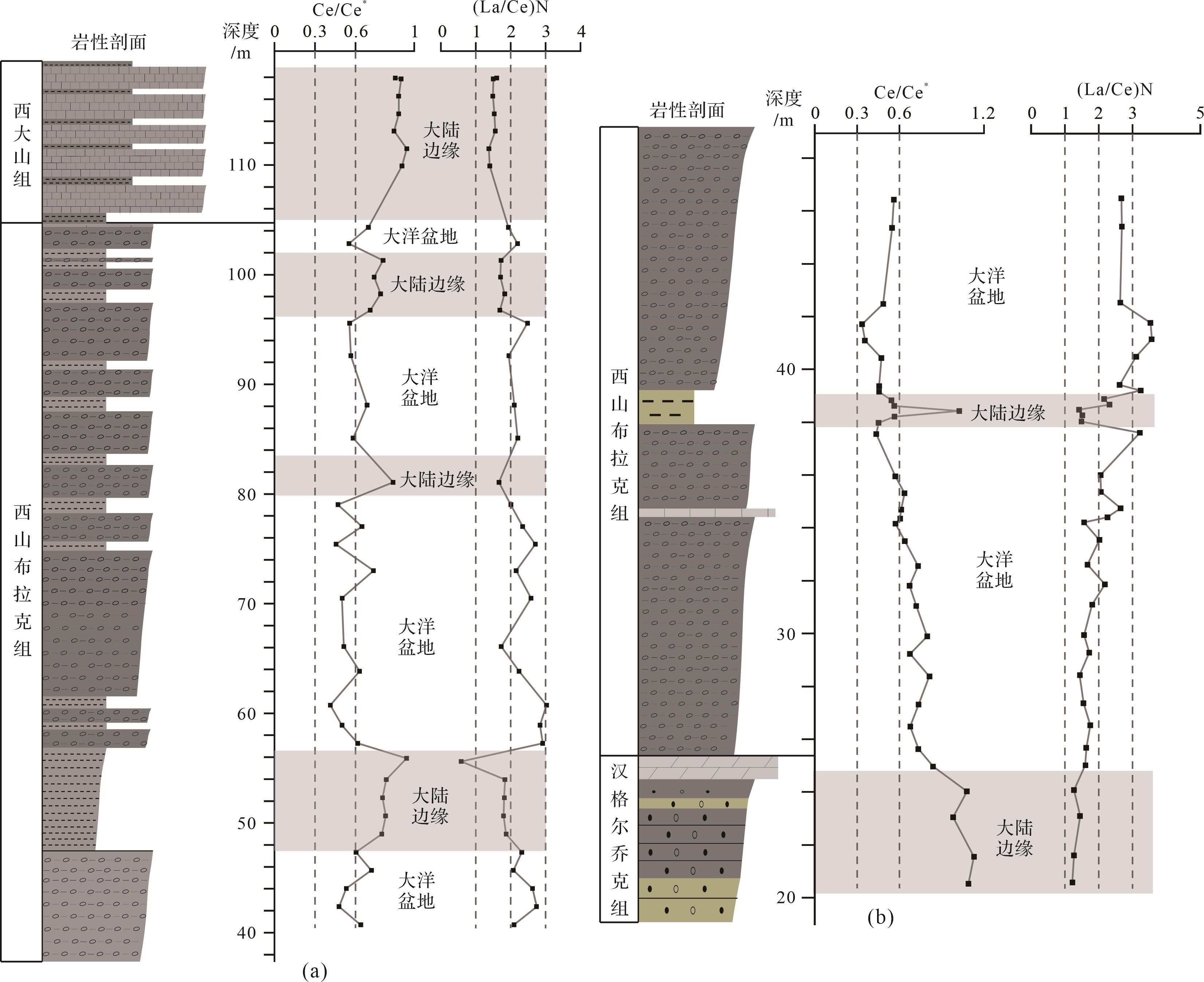
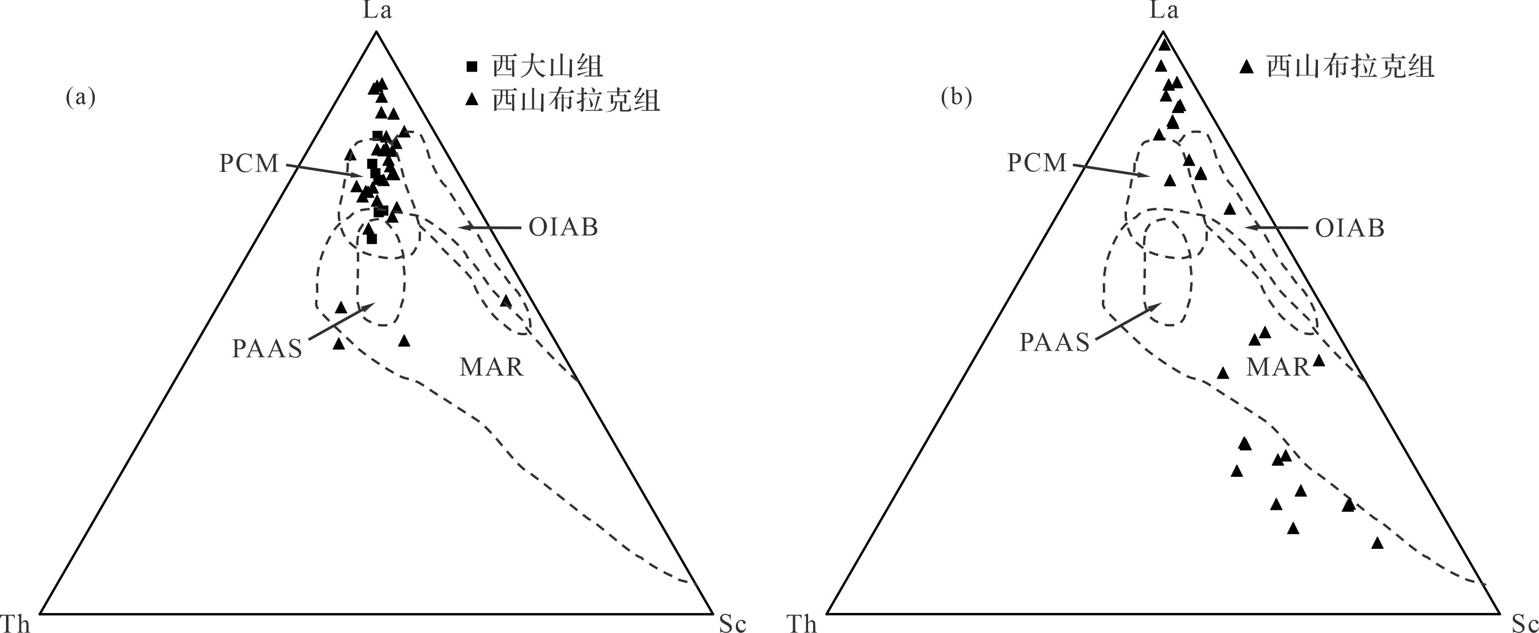
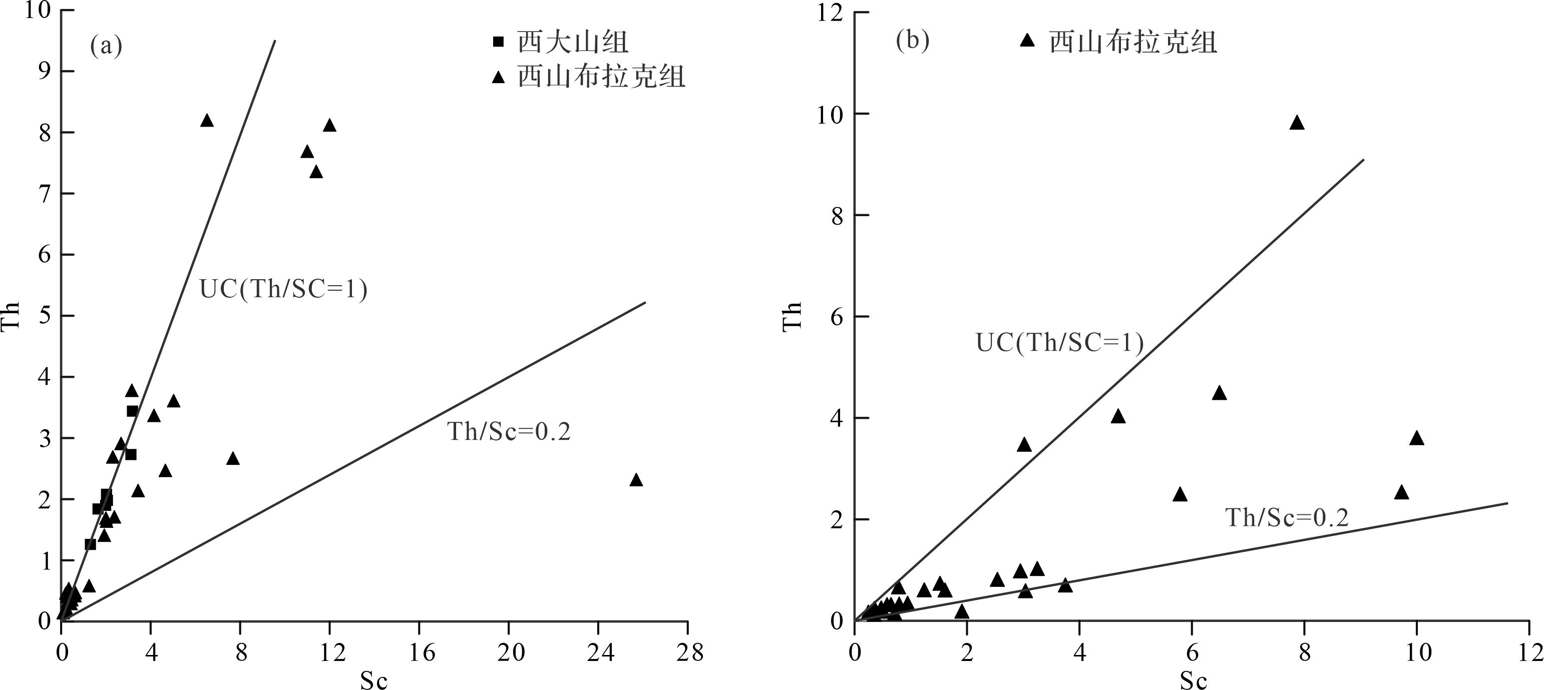
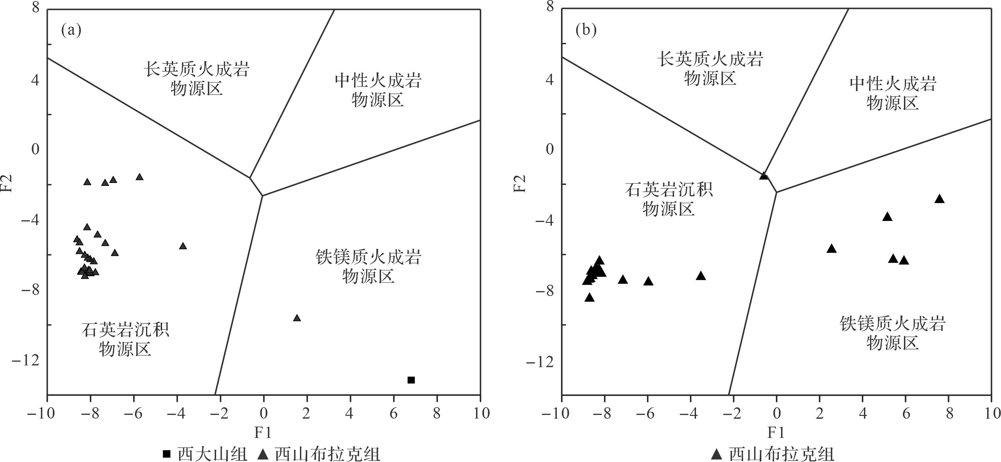
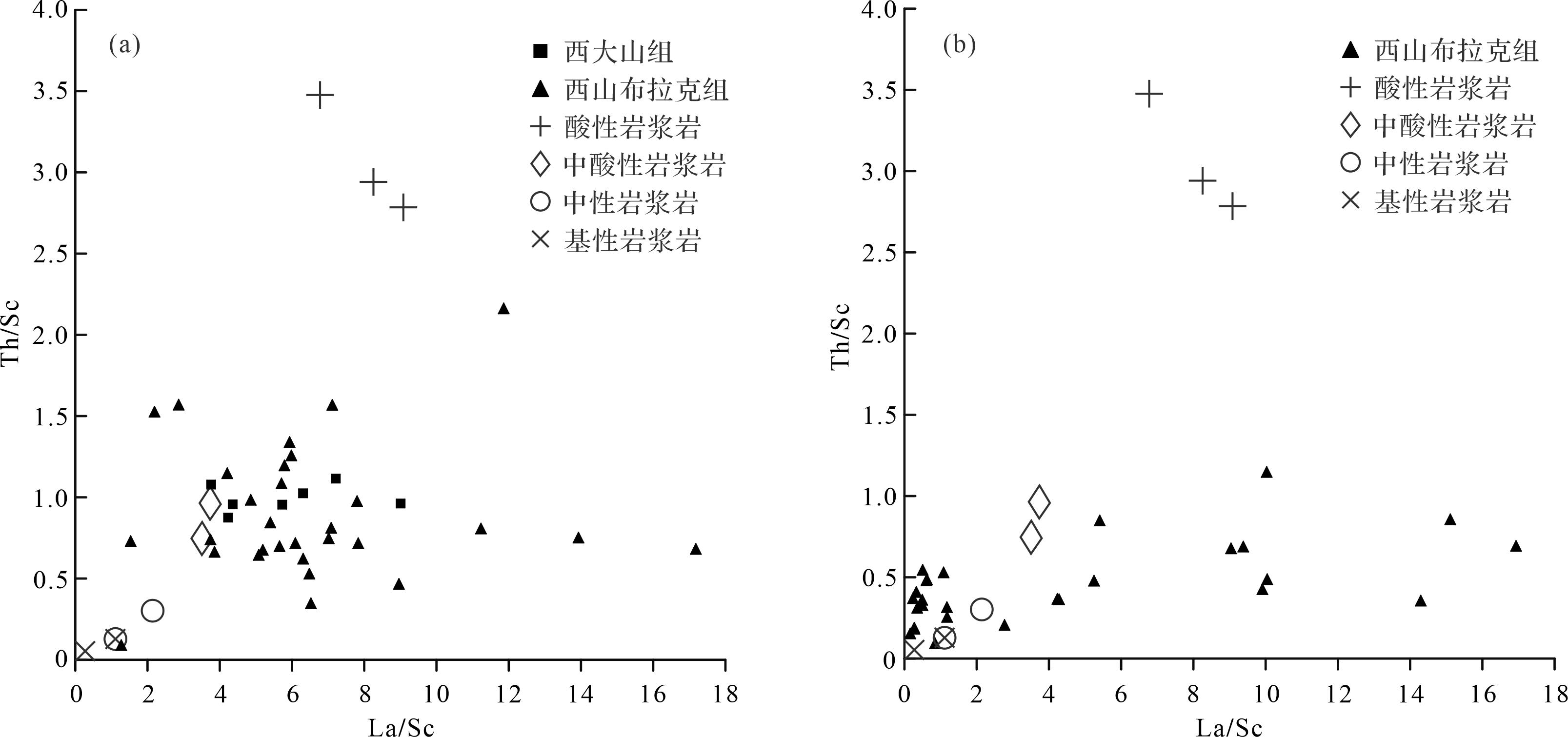
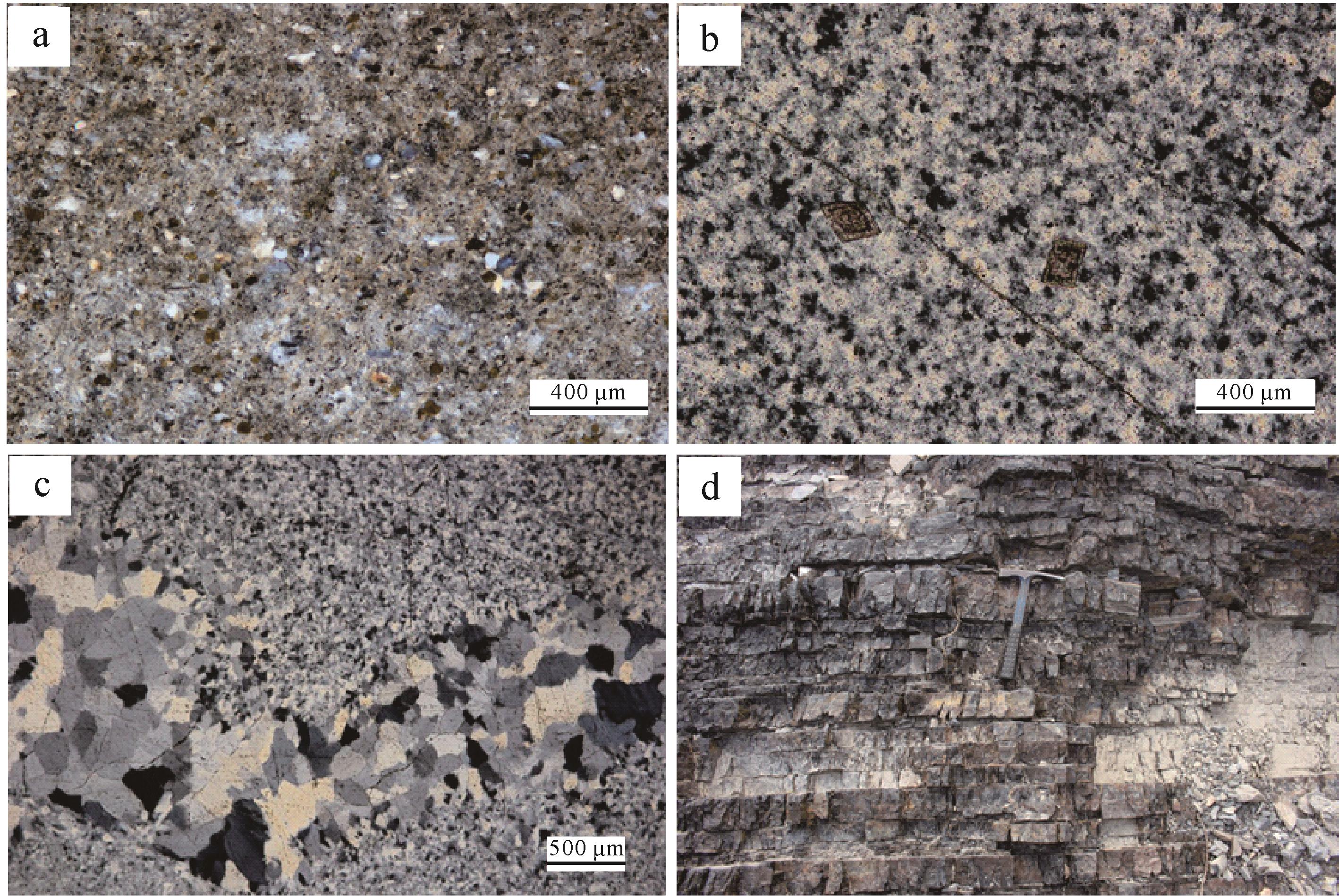
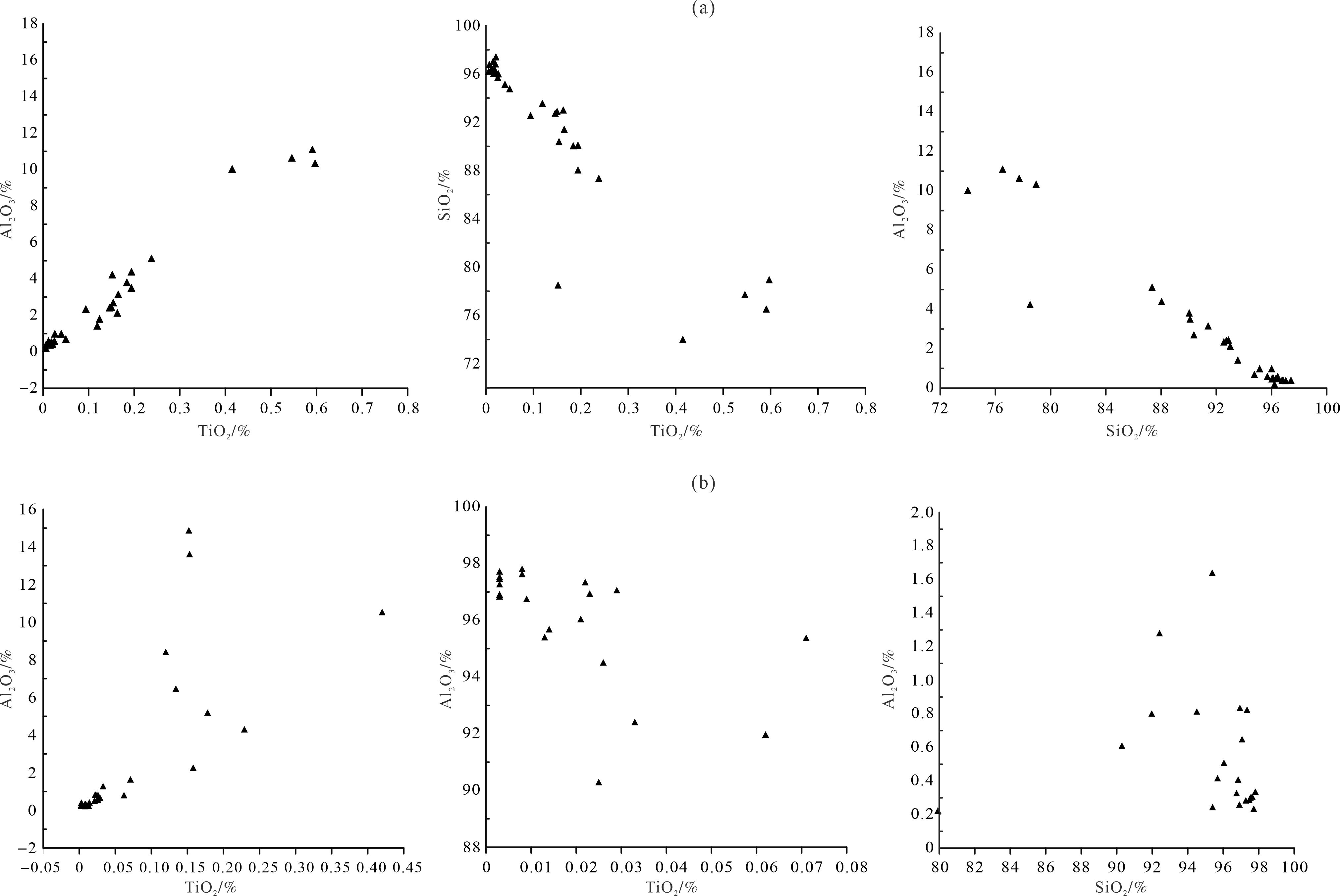
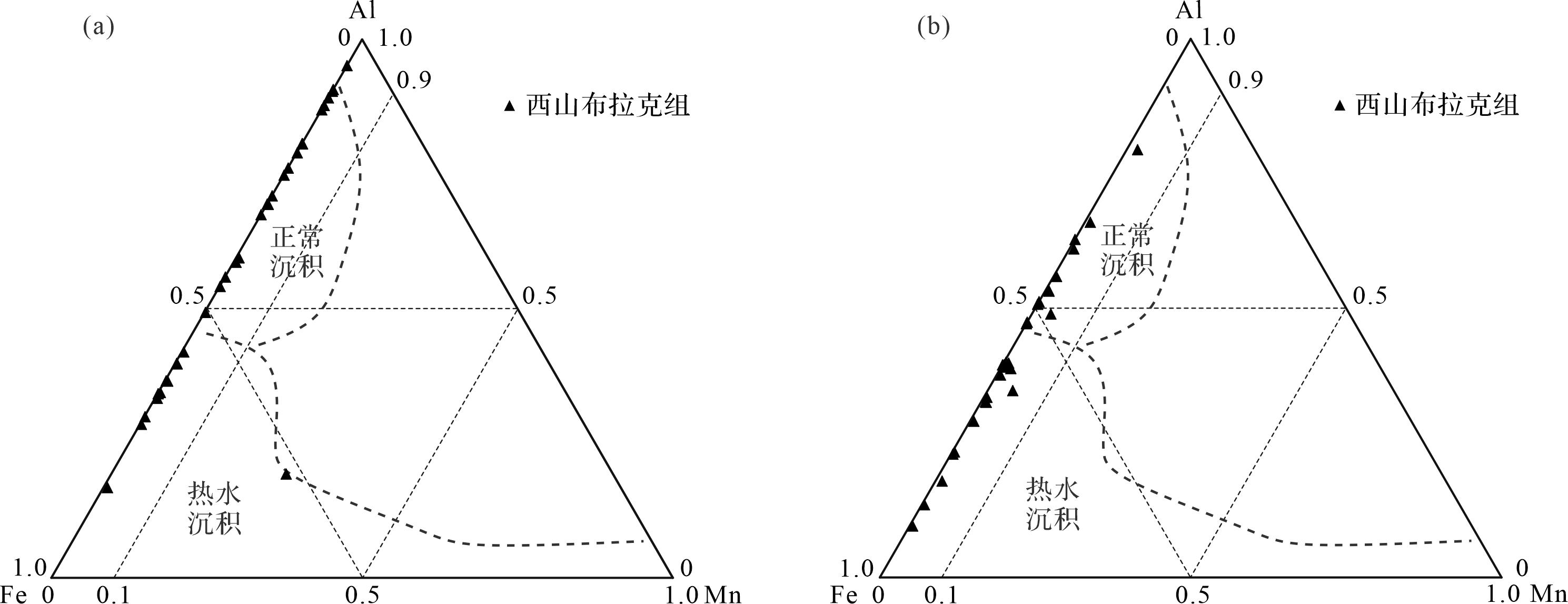
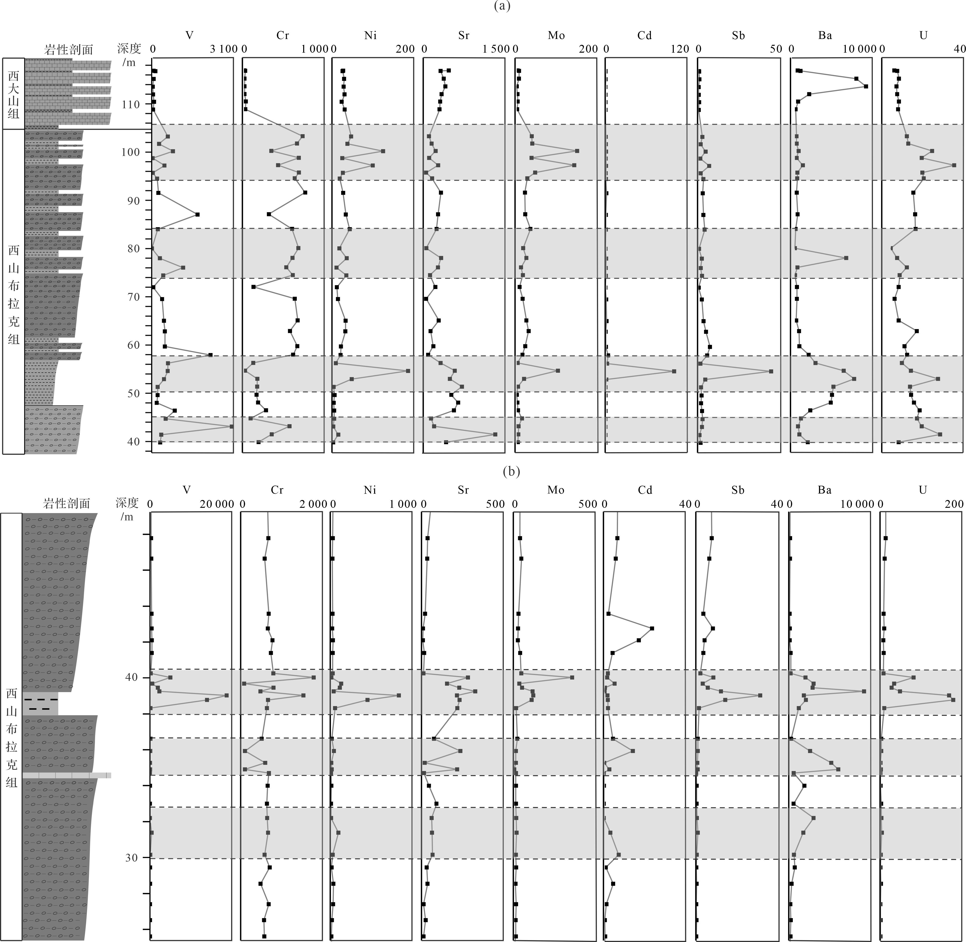
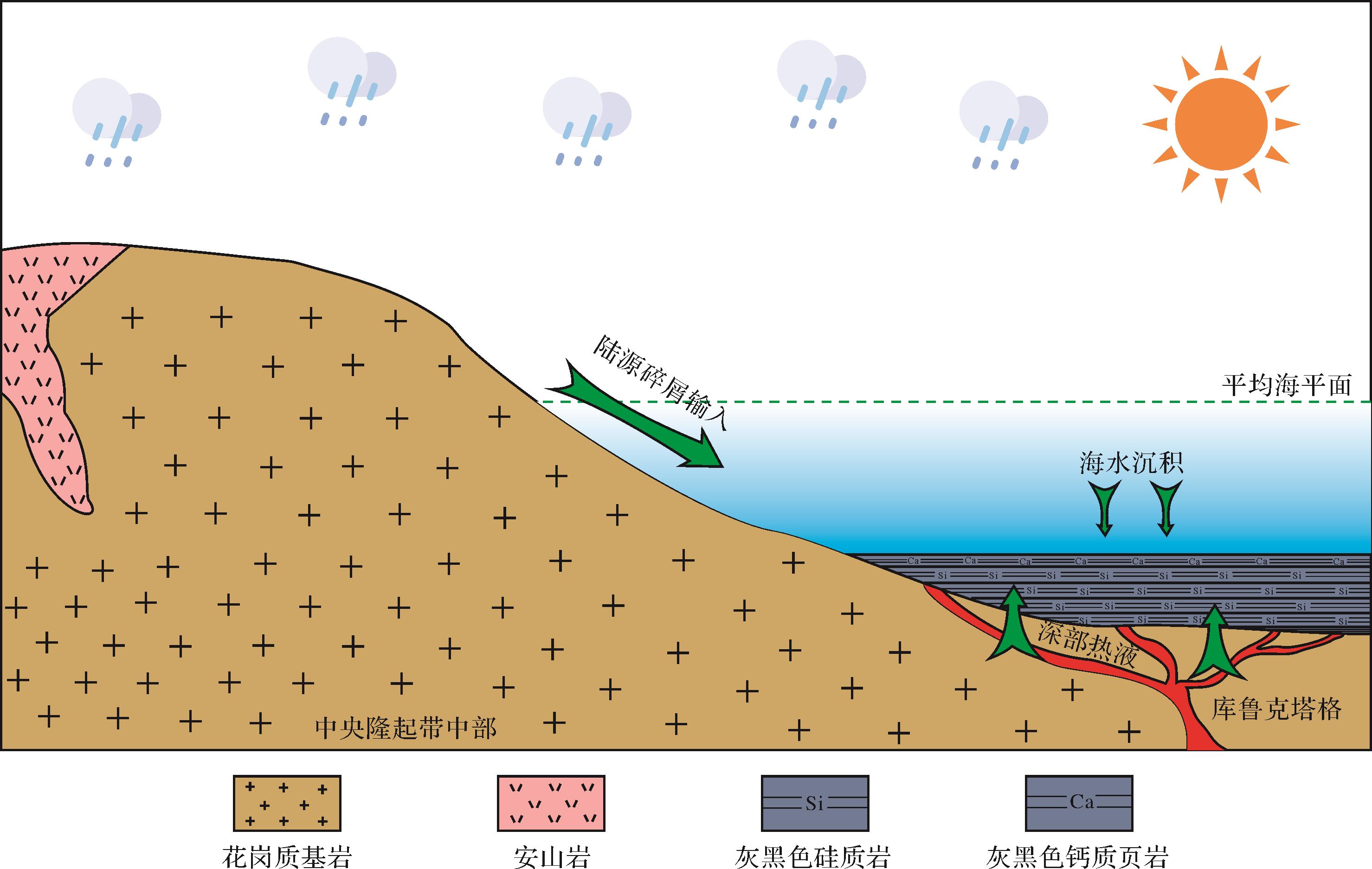
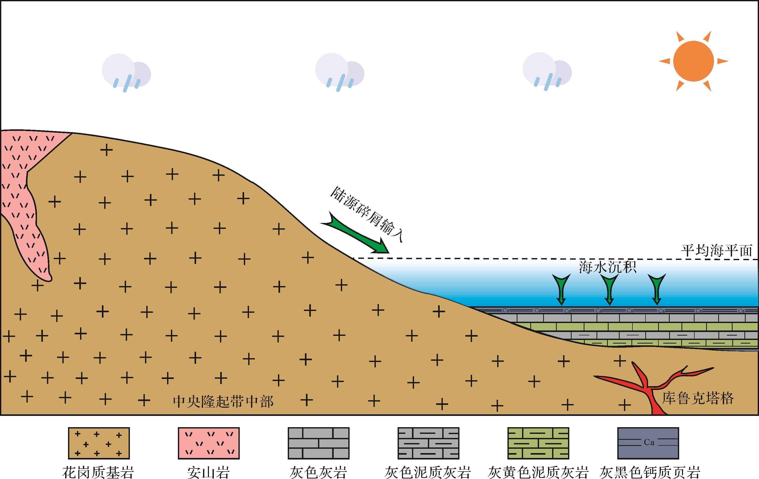
2023, 41(4): 1257-1270.
doi: 10.14027/j.issn.1000-0550.2022.005
Abstract:
The black shale deposited during the early Qiongzhusi Formation in the Dianqianbei Depression is an important hydrocarbon source rock. The evolution of the lithofacies paleogeography in the upper and lower members of the Qiongzhusi Formation was restored in a thorough study of the regional geology, field outcrops, cores, thin sections, scanning electron microscopy and drilling data. The strata are thin in the west, and thicker in the tension trough and in the east. The rock types deposited during the same sedimentary periods also display regional differences. In the lower sedimentary period, the western region consists mainly of sandstone, whereas the central and eastern regions consist mainly of shale, with shallow sea-shelf facies as the main facies type. The upper and lower sections indicate varying water depths and sedimentary facies comprising six microfacies. From west to east, the lowest stratum consists mainly of shallow-water sandy shelf microfacies and deep-water argillaceous shelf microfacies, and the upper stratum mainly comprises shallow-water sandy shelf microfacies, shallow-water argillaceous shelf microfacies and shallow-water sandy argillaceous shelf microfacies. The high-quality source rocks of the Qiongzhusi Formation are black shale and carbonaceous shale, with TOC (Total of Organic)content generally above 2%. The argillaceous deep-water shelf subfacies is the most favorable for the development of high-quality shale. Vertically, the high-quality shale mainly occurs at the base of the lowest section of the Qiongzhusi Formation. In plane, it is mainly found in the section along wells CL1, B1, Z101, JZ1 and FS1, controlled by the tension trough in the middle of the study area. In the east, the low-landform and deep-water deposition Jinsha-Zunyi area favors exploration for high-quality shale.
The black shale deposited during the early Qiongzhusi Formation in the Dianqianbei Depression is an important hydrocarbon source rock. The evolution of the lithofacies paleogeography in the upper and lower members of the Qiongzhusi Formation was restored in a thorough study of the regional geology, field outcrops, cores, thin sections, scanning electron microscopy and drilling data. The strata are thin in the west, and thicker in the tension trough and in the east. The rock types deposited during the same sedimentary periods also display regional differences. In the lower sedimentary period, the western region consists mainly of sandstone, whereas the central and eastern regions consist mainly of shale, with shallow sea-shelf facies as the main facies type. The upper and lower sections indicate varying water depths and sedimentary facies comprising six microfacies. From west to east, the lowest stratum consists mainly of shallow-water sandy shelf microfacies and deep-water argillaceous shelf microfacies, and the upper stratum mainly comprises shallow-water sandy shelf microfacies, shallow-water argillaceous shelf microfacies and shallow-water sandy argillaceous shelf microfacies. The high-quality source rocks of the Qiongzhusi Formation are black shale and carbonaceous shale, with TOC (Total of Organic)content generally above 2%. The argillaceous deep-water shelf subfacies is the most favorable for the development of high-quality shale. Vertically, the high-quality shale mainly occurs at the base of the lowest section of the Qiongzhusi Formation. In plane, it is mainly found in the section along wells CL1, B1, Z101, JZ1 and FS1, controlled by the tension trough in the middle of the study area. In the east, the low-landform and deep-water deposition Jinsha-Zunyi area favors exploration for high-quality shale.
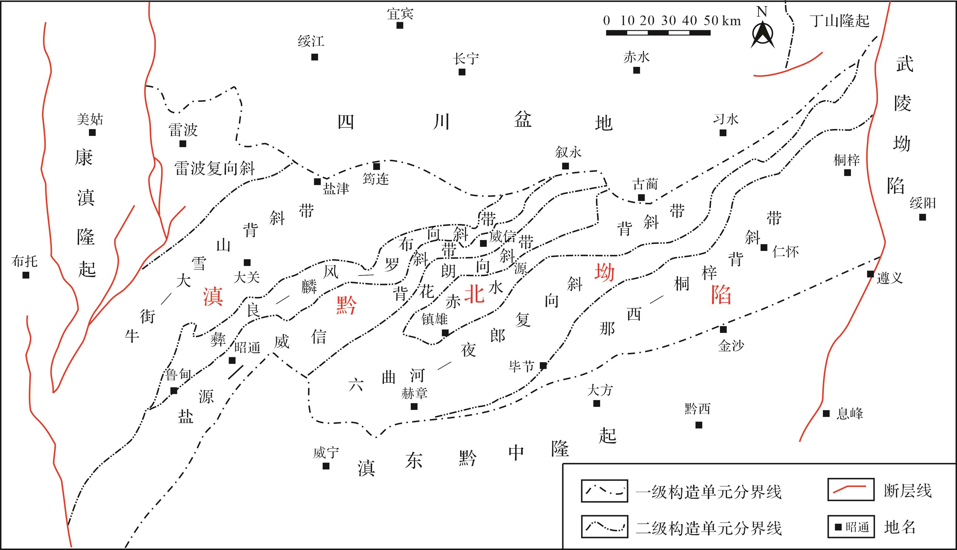
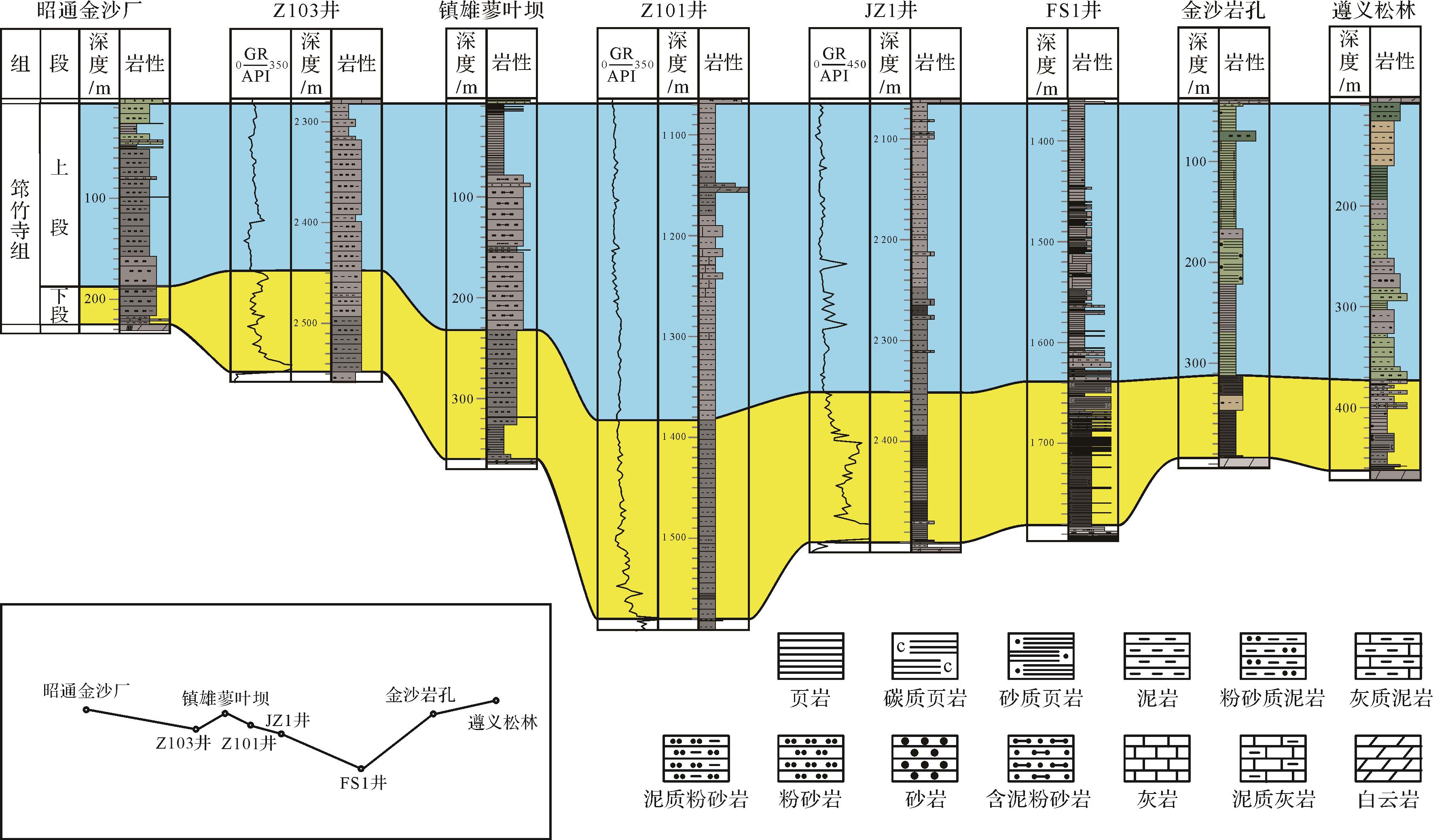
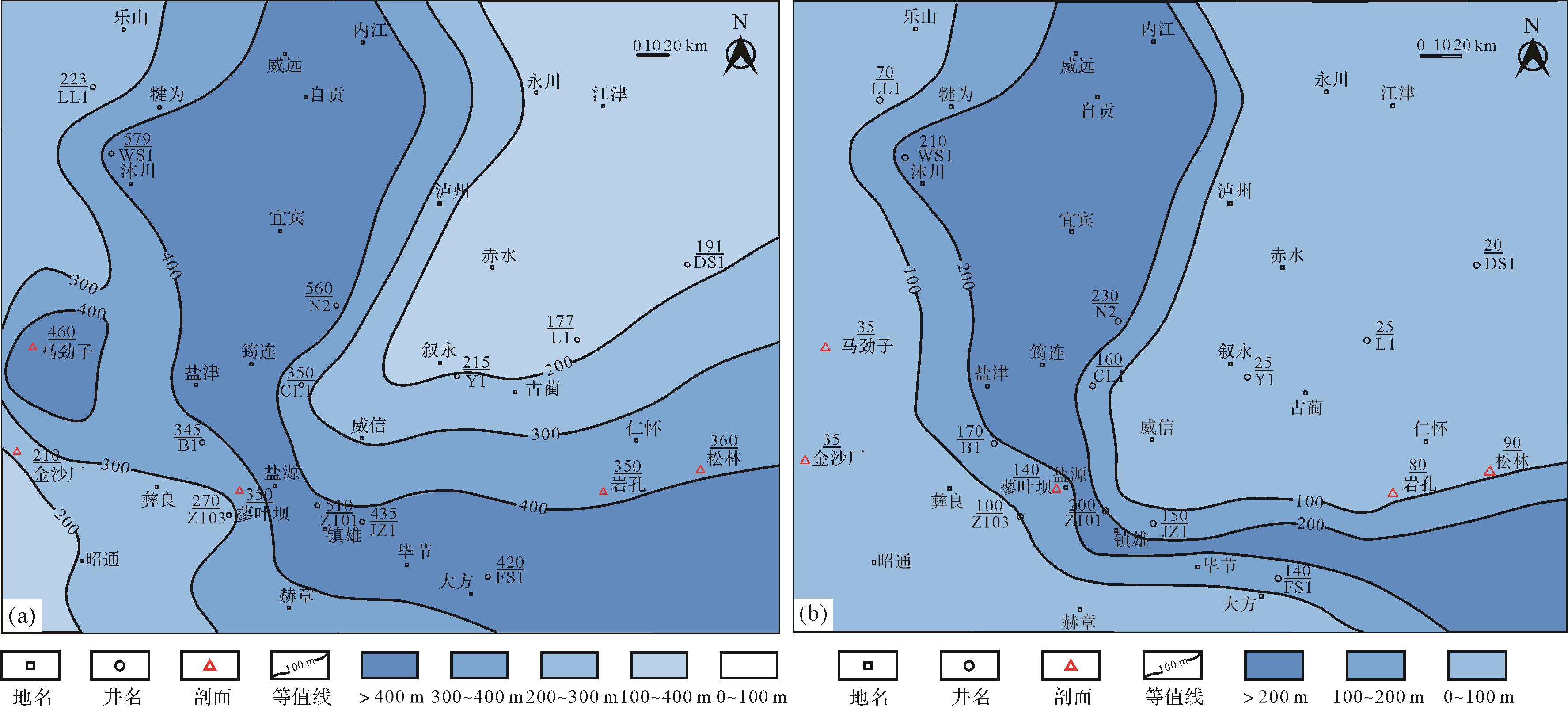
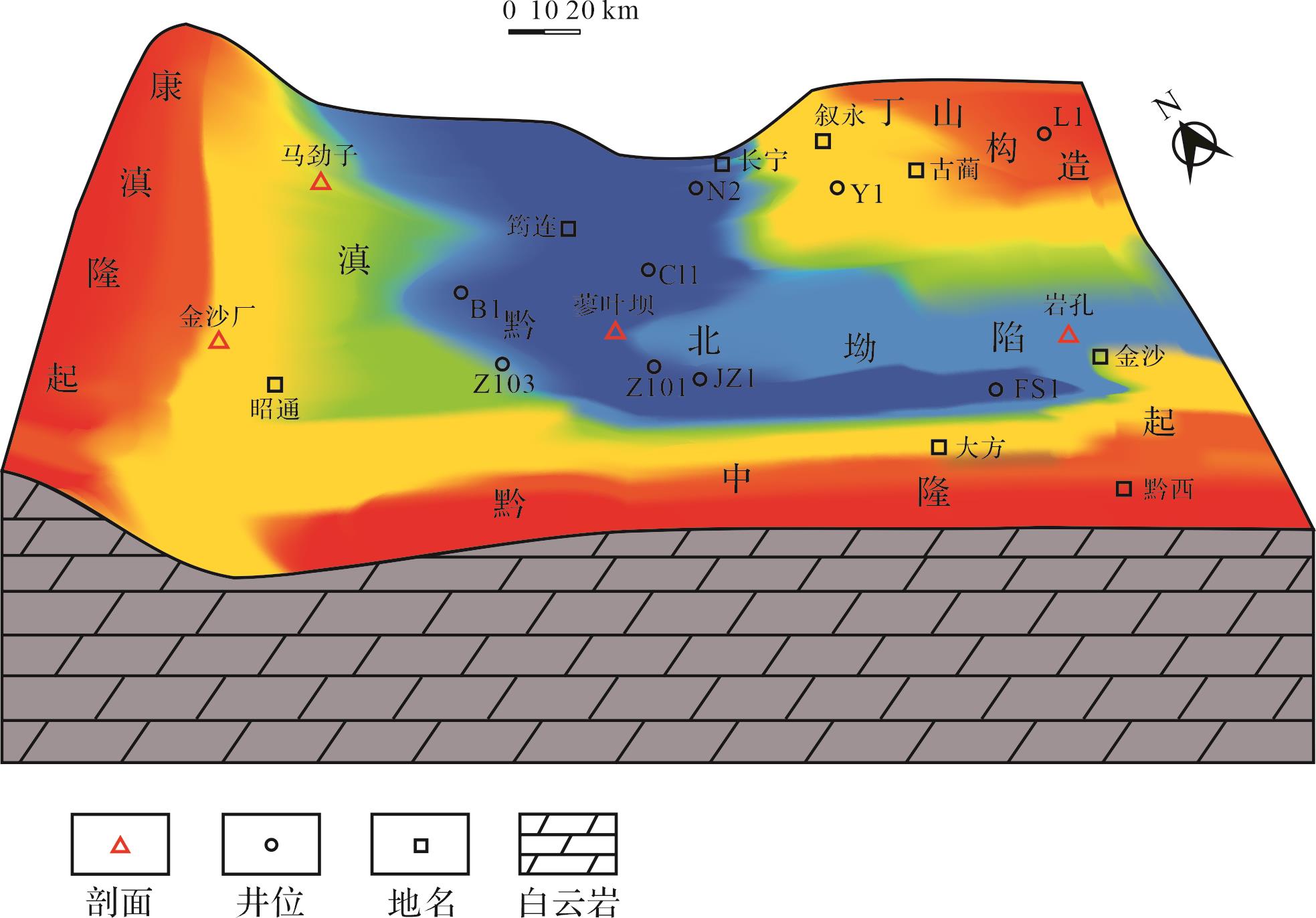
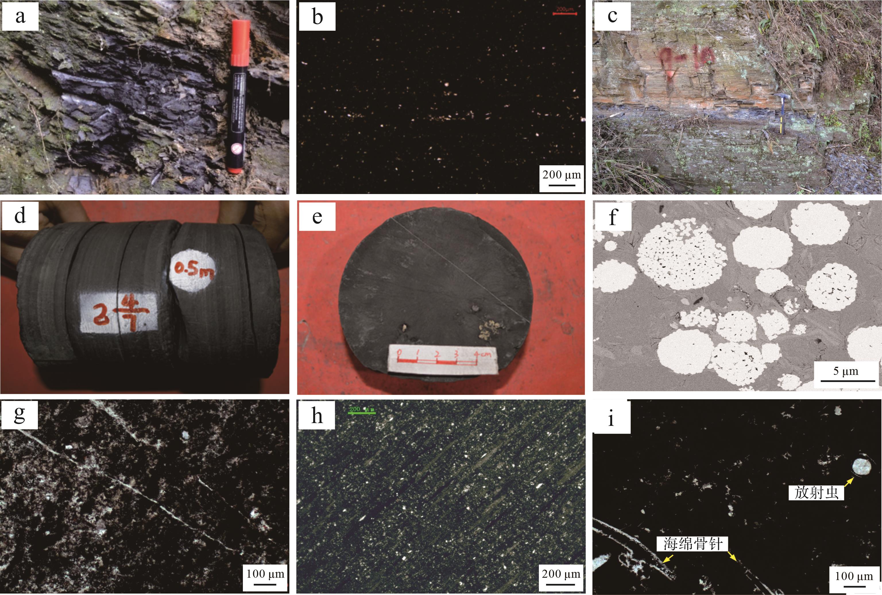
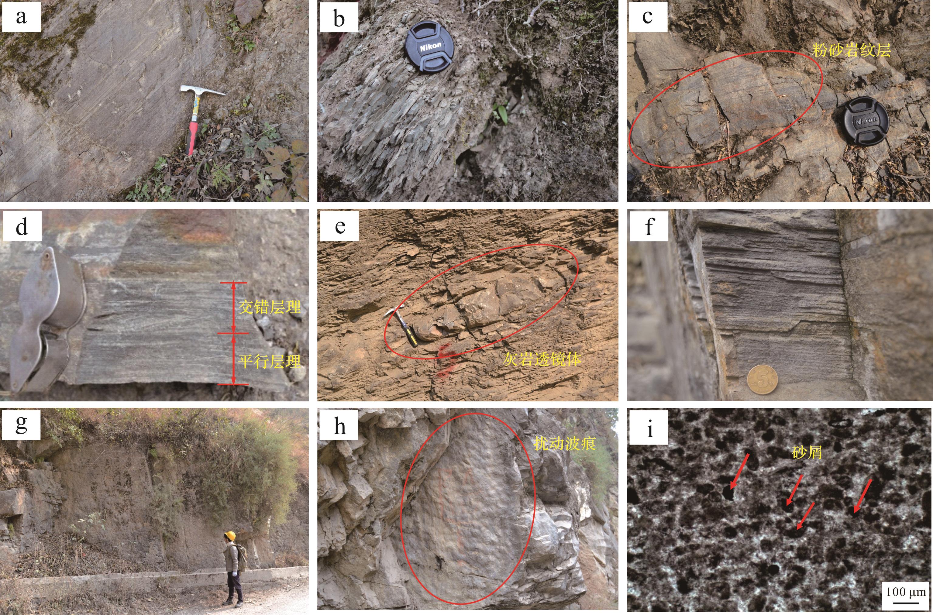
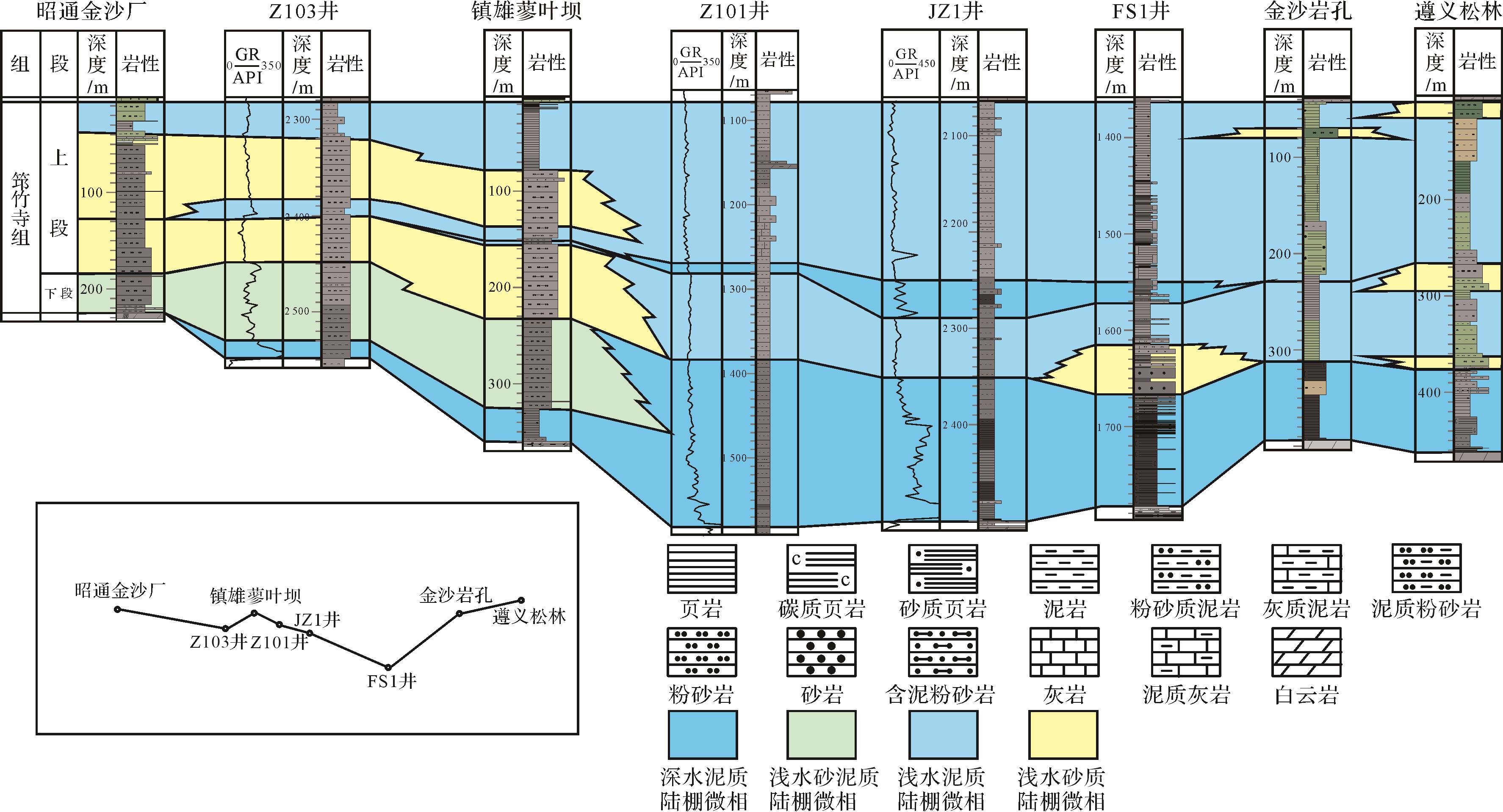
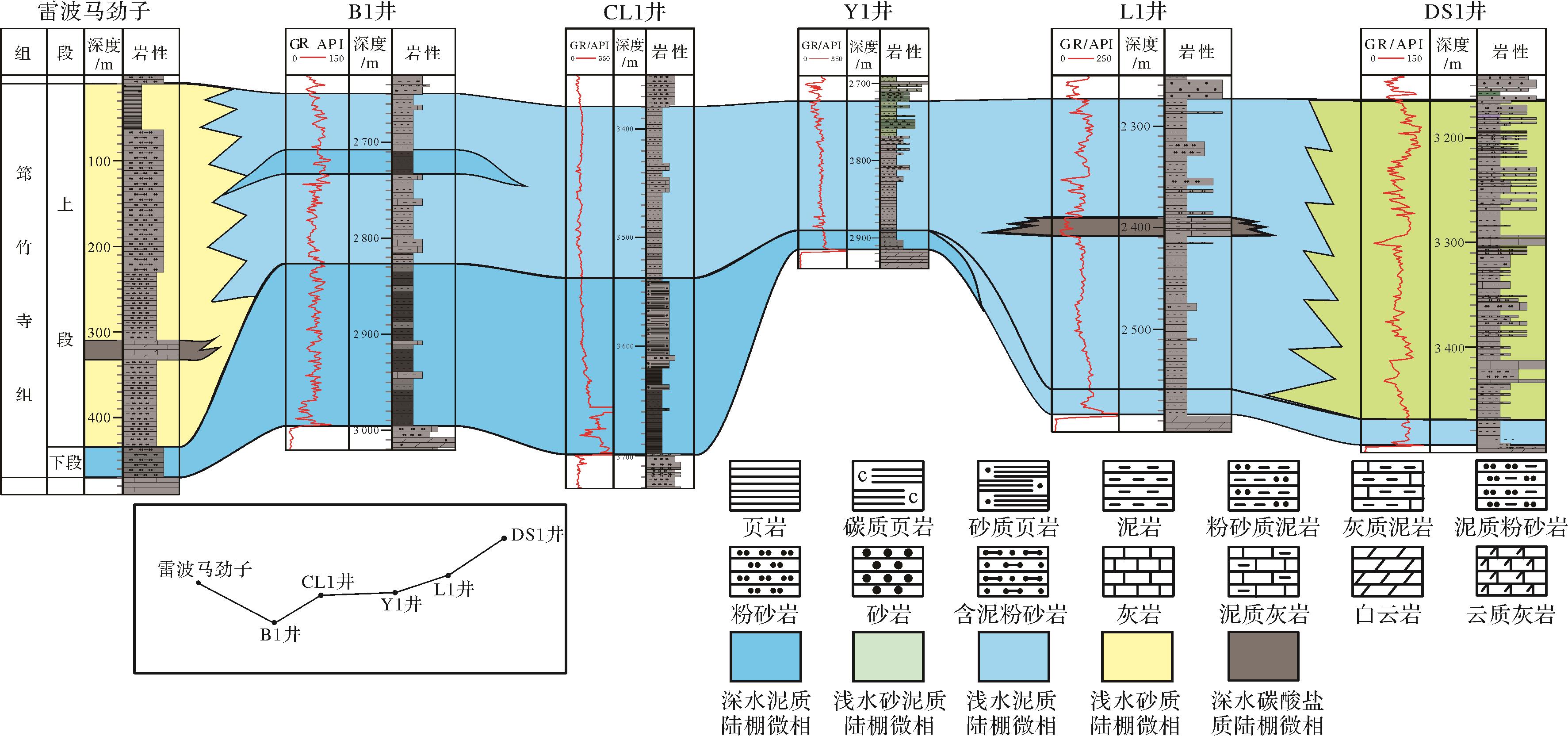
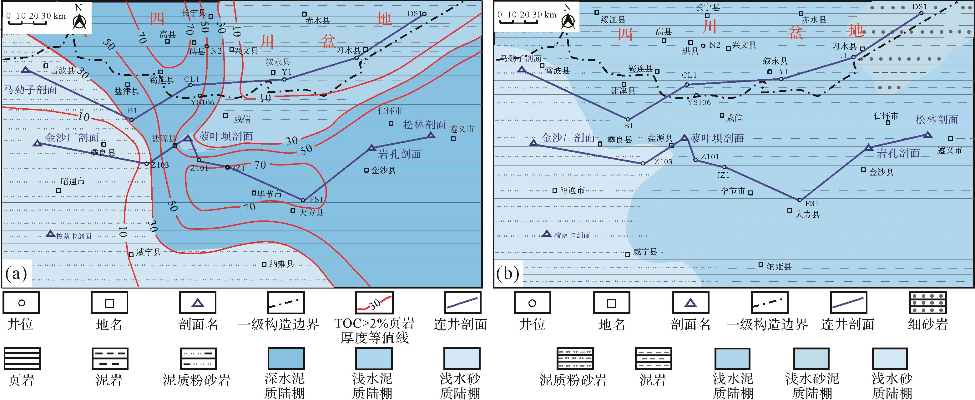
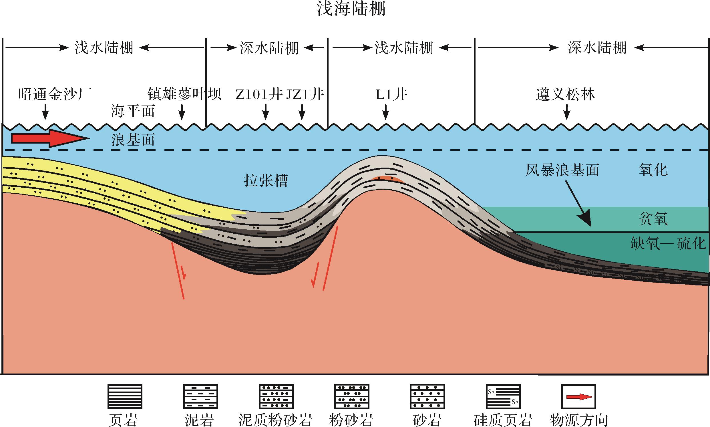
2023, 41(4): 1271-1280.
doi: 10.14027/j.issn.1000-0550.2021.158
Abstract:
The genetic types of tight sandstone reservoirs in the First member of the Funing Formation in the Gaoyou Sag were analyzed using micro thin-sections, CT scanning and fluidity analysis. Primary and secondary types of formation were evident. Due to the different burial processes and reservoir-forming conditions, two densification processes took place in different areas of the Gaoyou Depression. In the inner northern slope zone, reservoirs formed initially and were then compacted. The secondary type of reservoir mainly developed within these reservoirs. This is evident as densification in the Second member of the Sanduo Formation, where the densification was modified by strong dissolution caused by large-scale hydrocarbon expulsion. The influence of re-burial at the end of the Yancheng Formation led to re-densification of the reservoir after it had formed, resulting in relatively high reservoir porosity. The oil saturation is high, but the poor connectivity of the pore throats results in poor permeability. This type of reservoir needs large-scale reservoir reconstruction to improve productivity. In the southern fault zone, sediments were first compacted and then the primary type of reservoir developed. This was densified in the Second member of the Sanduo Formation, and dissolution was less evident in the later stage of reservoir formation. The oil saturation is therefore relatively low, but the weak later diagenesis produced good pore throat connectivity and fluid mobility. Stable and sustainable production capacity can be obtained after appropriate reservoir reconstruction.
The genetic types of tight sandstone reservoirs in the First member of the Funing Formation in the Gaoyou Sag were analyzed using micro thin-sections, CT scanning and fluidity analysis. Primary and secondary types of formation were evident. Due to the different burial processes and reservoir-forming conditions, two densification processes took place in different areas of the Gaoyou Depression. In the inner northern slope zone, reservoirs formed initially and were then compacted. The secondary type of reservoir mainly developed within these reservoirs. This is evident as densification in the Second member of the Sanduo Formation, where the densification was modified by strong dissolution caused by large-scale hydrocarbon expulsion. The influence of re-burial at the end of the Yancheng Formation led to re-densification of the reservoir after it had formed, resulting in relatively high reservoir porosity. The oil saturation is high, but the poor connectivity of the pore throats results in poor permeability. This type of reservoir needs large-scale reservoir reconstruction to improve productivity. In the southern fault zone, sediments were first compacted and then the primary type of reservoir developed. This was densified in the Second member of the Sanduo Formation, and dissolution was less evident in the later stage of reservoir formation. The oil saturation is therefore relatively low, but the weak later diagenesis produced good pore throat connectivity and fluid mobility. Stable and sustainable production capacity can be obtained after appropriate reservoir reconstruction.